| 0 | PI 704848 sos | R. parviflorus Nutt. OR110-1038 | Rubus parviflorus Nutt. | Oregon, United States | COR |  | | 2018 | | | | | | | Wild material | Rubus parviflorus | 1970512 | PI 704848 sos |
| 1 | PI 675280 | UT933-115 | Pseudoroegneria spicata (Pursh) Á. Löve | Utah, United States | W6 |  | | 2009 | | | | | | | Wild material | | 1827215 | PI 675280 |
| 2 | PI 675281 | UT933-116 | Pseudoroegneria spicata (Pursh) Á. Löve | Utah, United States | W6 |  | | 2009 | | | | | | | Wild material | | 1827216 | PI 675281 |
| 3 | PI 675192 | UT933-49 | Eriocoma nelsonii (Scribn.) Romasch. subsp. nelsonii | Utah, United States | W6 |  | | 2009 | | | | | | | Wild material | Height: 3.5 feet | 1808246 | PI 675192 |
| 4 | PI 675255 | UT933-50 | Eriocoma nelsonii (Scribn.) Romasch. subsp. nelsonii | Utah, United States | W6 |  | | 2009 | | | | | | | Wild material | Height: 3.5 feet. | 1808247 | PI 675255 |
| 5 | PI 635478 | Pecos #1 Female | Humulus lupulus L. var. neomexicanus A. Nelson & Cockerell | New Mexico, United States | COR |  | Out of Season | 2002 | COLLECTED | 09/19/2002 | North of Pecos, along State Highway 63 upstream past milepost 17 at 0.6 mile north of Indian Creek. | 35.71667000, -105.68000000 | 2328 | With Abies concolor, Pinus pondorosa and Salix sp. | Wild material | | 1642238 | PI 635478 |
| 6 | PI 635479 | Pecos #1 Male | Humulus lupulus L. var. neomexicanus A. Nelson & Cockerell | New Mexico, United States | COR |  | Out of Season | 2002 | COLLECTED | 09/19/2002 | North of Pecos, along State Highway 63 upstream past milepost 17 at 0.6 mile north of Indian Creek. | 35.71667000, -105.68000000 | 2328 | With Abies concolor, Pinus pondorosa and Salix sp. | Wild material | | 1642239 | PI 635479 |
| 7 | PI 635480 | Pecos #2 Female | Humulus lupulus L. var. neomexicanus A. Nelson & Cockerell | New Mexico, United States | COR |  | Out of Season | 2002 | COLLECTED | 09/19/2002 | North of Pecos, along State Highway 63 At Bert Clancy Recreation site in field between the river and road | 35.73667000, -105.67806000 | 2354 | With Abies concolor, Pinus pondorosa and Salix sp. | Wild material | | 1642240 | PI 635480 |
| 8 | PI 655803 | 2-94 | Trifolium kingii S. Watson var. productum (Greene) Jeps. | California, United States | W6 |  | | 1996 | COLLECTED | NEAR 07/20/1994 | Located approximately 64 km NW of Truckee, CA on State Highway 49. Sattley Quad Map (T20 N, R 13 E, NW 1/4 of NW 1/4 sec.11); Located just North of the Highway at the summit of Yuba Pass. | 39.61666667, -120.48333333 | 2042 | Collected from a mixed stand of T. longipes var. nevadenses and T. kingii , on the edge of meadow in stand of lodgepole pine (Pinus contorta). Not founds in areas shaded by white fir (Abies concolor) and red fir (Abies magnifica). | Wild material | Flower Color: corolla white, tending to light lavender with age; Relative abundance: frequent | 1515846 | PI 655803 |
| 9 | NA 89329 | Site 1A, Mt Hood | Calocedrus decurrens (Torr.) Florin | Oregon, United States | NA | | | 2026 | COLLECTED | 09/12/2025 | Mt Hood National Forest: north of White River. Approximately 1 mile south of NF-48 Bug Rd turnoff around intersection with NF-3530/ Old Barlow Rd. [Note: seeds collected from six trees within a relatively small area, each with its own data and precise coordinates;data has been aggregated for this bulked accession and coordinates for centermost tree 20250908-T4 were chosen for this record.] | 45.17427290, -121.42021920 | 914 | Flat ground with mixed forest. | Wild material | Seeds from six separate maternal lines collected in a single area; seeds from each individual kept separate with its own decimal accession record (or decimal suffix, in GRIN). Collections in this NA number include the following: 20250908-T1; 20250908-T2; 20250908-T3; 20250908-T4; 20250908-T5, and 20250908-T6. | 2197588 | NA 89329 |
| 10 | NA 89330 | Site 2, Ochoco NF | Calocedrus decurrens (Torr.) Florin | Oregon, United States | NA | | | 2026 | COLLECTED | 09/13/2025 | Ochoco National Forest: Dry Creek Watershed. 200 yards north-northwest of Giddy-Up Go Trailhead. [Note: seeds collected from three trees within a relatively small area, each with its own data and coordinates, although two trees had the same coordinates;;data has been aggregated for this bulked accession and coordinates for trees 20250909-T1/T3 were chosen for this record.] | 44.42422900, -120.67025900 | 1411 | Stony outcropping ridges and draws, mixed woodland. | Wild material | Seeds from three separate maternal lines collected in a single area; seeds from each individual kept separate with its own decimal accession record (or decimal suffix, in GRIN). Collections in this NA number include the following: 20250909-T1; 20250909-T2, and 20250909-T3. | 2197589 | NA 89330 |
| 11 | NA 89332 | Site 5, Tahoe NF | Calocedrus decurrens (Torr.) Florin | California, United States | NA | | | 2026 | COLLECTED | 09/28/2025 | Tahoe National Forest: approximately five miles southeast of Sierraville off of Highway 89. [Note: seeds collected from eight trees within a relatively small area, each with its own data and precise coordinates;data has been aggregated for this bulked accession and coordinates for tree 20250928-T2 were chosen for this record.] | 39.55455923, -120.33006155 | 2028 | Woodland. | Wild material | Seeds from eight separate maternal lines collected in a single area; seeds from each individual kept separate with its own decimal accession record (or decimal suffix, in GRIN). Collections in this NA number include the following: 20250928-T1; 20250928-T2; 20250928-T3; 20250928-T4; 20250928-T5; 20250928-T6; 20250928-T7, and 20250928-T8. | 2197591 | NA 89332 |
| 12 | NA 89333 | Site 3a, Modoc NF, Fort Bidwell | Calocedrus decurrens (Torr.) Florin | California, United States | NA | | | 2026 | COLLECTED | 10/06/2025 | Modoc National Forest: northwest of Fort Bidwell, CA: along Mill Creek Rd from approximately 2.5 to 10 miles beyond the intersection with County Road 224, up to 46N25AA (''Cottonwood Trail''). [Note: seeds collected from eight trees, each with its own data and precise coordinates;data has been aggregated for this bulked accession and coordinates for tree 20250927-T3 were chosen for this record.] | 41.91457600, -120.22775400 | 2155 | Woodland. | Wild material | Seeds from eight separate maternal lines collected in a single area; seeds from each individual kept separate with its own decimal accession record (or decimal suffix, in GRIN). Collections in this NA number include the following: 20250927-T1; 20250927-T2; 20250927-T3; 20250927-T4; 20250927-T5; 20250927-T6; 20250927-T7, and 20250927-T8. | 2197592 | NA 89333 |
| 13 | NA 89334 | Site 3, Modoc NF, Lake City | Calocedrus decurrens (Torr.) Florin | California, United States | NA | | | 2026 | COLLECTED | 10/06/2025 | Modoc National Forest: 3 to 4 miles west of Lake City, CA, off of Lake City Canyon Road (access from S. Water St.). [Note: seeds collected from four trees, each with its own data and precise coordinates;data has been aggregated for this bulked accession and coordinates for tree 20250927-T10 were chosen for this record.] | 41.65530660, -120.26791540 | 2126 | Woodland. | Wild material | Seeds from four separate maternal lines collected in a single area; seeds from each individual kept separate with its own decimal accession record (or decimal suffix, in GRIN). Collections in this NA number include the following: 20250927-T9; 20250927-T10; 20250927-T11, and 20250927-T12. | 2197593 | NA 89334 |
| 14 | NA 89335 | Site 6, Stanislaus NF, Sonora Pass | Calocedrus decurrens (Torr.) Florin | California, United States | NA | | | 2026 | COLLECTED | 10/06/2025 | Stanislaus National Forest: Sierra Mountains, Sonora Pass, Highway 108, just northeast and upslope of Kennedy Meadows about 3-5 miles. [Note: seeds collected from eight trees, each with its own data and precise coordinates;data has been aggregated for this bulked accession and coordinates for tree 20250928-S4 were chosen for this record.] | 38.32021364, -119.72703162 | 2696 | Forest on steep, high mountain slope. | Wild material | Seeds from eight separate maternal lines collected in a single area; seeds from each individual kept separate with its own decimal accession record (or decimal suffix, in GRIN). Collections in this NA number include the following: 20250928-S1; 20250928-S2; 20250928-S3; 20250928-S4; 20250928-S5; 20250928-S6; 20250928-S7, and 20250928-S8. | 2197594 | NA 89335 |
| 15 | Ames 35915 | White Mountains | Fraxinus velutina Torr. | New Mexico, United States | NC7 |  | | 2022 | COLLECTED | 09/08/2022 | White Mountains northwest of Alto. Rare along Eagle Creek and increasing in abundance heading upslope on Ski Run Road. Saplings fairly common in Nogal Canyon and mature specimens frequent on slopes below Nogal Peak in the White Mountain Wilderness of the Lincoln National Forest. T10S R12E S 1/4 Sec. 35. Coordinates listed refer to the last plant sampled (191-5); coordinates for each sample may be provided upon request. | 33.49551600, -105.79515500 | 2743 | Mountainsides and rarely creeks at canyon bottoms. | Wild material | This accession represents a high elevation population of velvet ash which occurs primarily on mountainsides rather than riparian habitats as is typical for the species. Although the velvet ash do occur in the canyon bottoms along creeks in this area, they are quite rare compared to their fairly common distribution on the slopes at higher elevations. Specimens at higher elevations were more shrub-like (multi-trunked and maximum of 20 feet in height) than tree-like while specimens in the canyon bottoms were always trees. All specimens noted at the time of seed collection had glabrous leaves. | 2139677 | Ames 35915 |
| 16 | WLP 2705 | Eagle Creek | Crataegus wootoniana Eggl. | New Mexico, United States | NA |  | | 2022 | COLLECTED | 09/08/2022 | Eagle Creek, along Upper Eagle Creek Road (past gate to cabins) approximately 1.5 miles northwest of intersection with Ski Run Road. T10S R12E N 1/2 S 1/4 Sec. 35. | 33.40777700, -105.73980900 | 2422 | Canyon bottom above creek. | Wild material | Shrubs to approximately 15 feet in height with a tight clump forming growth habit and arching stems. | 2139678 | WLP 2705 |
| 17 | W6 60605 | OR110-1088 | Deschampsia cespitosa (L.) P. Beauv. | Oregon, United States | W6 |  | | 2022 | | | | | | | Wild material | Growing in a perennial stream in an open meadow, open panicle | 2138543 | W6 60605 |
| 18 | W6 59920 | CP3-112 | Crepis acuminata Nutt. | Utah, United States | W6 |  | | 2021 | | | | | | | Wild material | | 2132499 | W6 59920 |
| 19 | W6 59921 | CP3-113 | Eriocoma thurberiana (Piper) Romasch. | Utah, United States | W6 |  | | 2021 | | | | | | | Wild material | green grass with gold heads. awns bend out at all angles. | 2132500 | W6 59921 |
| 20 | Ames 35231 | Va101 | Agastache parvifolia Eastw. | California, United States | NC7 |  | | 2019 | COLLECTED | 09/26/2019 | Area between Bogard Buttes and Caribou Wilderness approximately 20 miles west of Eagle Lake, on USGS Bogard Buttes 7.5-minute quad map T31N R7E including SW1/4 Sec. 11, NE1/4 Sec. 13, N1/2 Sec. 14 and NE1/4 NE1/4 Sec. 15, Lassen County | 40.55202800, -121.15888900 | 1980 | Margins and interiors of (+/-) dry, volcanic rock fields. Talus outcroppings, among boulders in fissures and on low ridges, across variable slopes (5-40 degrees) and aspects (east, west, south and northeast) with majority of sites in low-relief, except for irregular surfaces within lava fields. Elevations ranging from 1944 to 2023 (meters). Full sun or patchy shade. | Wild material | Perennial aromatic herb of mint family, basally branched with small, triangular crenate/serrate leaves and small pink-rose flowers in dense, elongate, terminal spikes. Plants in nature ranged from one to three feet high, few-branched up to ten or so branches. At time of collection (26 September 2019), plants were mostly late in phenology, though a few plants showed a flush of corolla color. | 2097767 | Ames 35231 |
| 21 | NA 88089 | NV040-347 | Prunus virginiana L. var. demissa (Nutt.) Torr. | Nevada, United States | NA |  | | 2019 | | | | | | | Wild material | | 2094598 | NA 88089 |
| 22 | W6 56791 | NV040-346 | Hackelia patens (Nutt.) I. M. Johnst. | Nevada, United States | W6 |  | | 2019 | | | | | | | Wild material | | 2094597 | W6 56791 |
| 23 | W6 55806 | OR110-1043 | Agastache urticifolia (Benth.) Kuntze | Oregon, United States | W6 |  | | 2018 | | | | | | | Wild material | Agastache urticifolia | 1970517 | W6 55806 |
| 24 | W6 55807 | OR110-1044 | Antennaria corymbosa E. E. Nelson | Oregon, United States | W6 |  | | 2018 | | | | | | | Wild material | | 1970518 | W6 55807 |
| 25 | W6 55824 | OR110-1065 | Spiraea douglasii Hook. | Oregon, United States | W6 |  | | 2018 | | | | | | | Wild material | Spiraea douglasii | 1970535 | W6 55824 |
| 26 | W6 55825 | OR110-1066 | Holodiscus discolor (Pursh) Maxim. | Oregon, United States | W6 |  | | 2018 | | | | | | | Wild material | Holodiscus discolor | 1970536 | W6 55825 |
| 27 | W6 55324 | CA360-154 | Barkworthia stillmanii (Bol.) Romasch. et al. | California, United States | W6 |  | | 2018 | | | | | | | Wild material | Achnatherum stillmanii | 1967876 | W6 55324 |
| 28 | OPGC 7793 | OR110-977 | Hieracium albiflorum Hook. | Oregon, United States | OPGC | | | 2018 | | | | | | | Wild material | Hieracium albiflorum | 1965025 | OPGC 7793 |
| 29 | W6 54283 | OR110-916 | Agastache urticifolia (Benth.) Kuntze | Oregon, United States | W6 | | | 2018 | | | | | | | Wild material | Agastache urticifolia | 1965000 | W6 54283 |
| 30 | W6 54300 | OR110-950 | Erigeron aliceae Howell | Oregon, United States | W6 | | | 2018 | | | | | | | Wild material | Erigeron aliceae | 1965017 | W6 54300 |
| 31 | W6 54301 | OR110-952 | Ligusticum californicum J. M. Coult. & Rose | Oregon, United States | W6 | | | 2018 | | | | | | | Wild material | Ligusticum californicum | 1965018 | W6 54301 |
| 32 | Ames 34723 | CA370-247 | Helianthus annuus L. | California, United States | NC7 | | | 2018 | | | | | | | Wild material | | 1964237 | Ames 34723 |
| 33 | OPGC 7214 | NV030-1230 | Navarretia divaricata Greene subsp. divaricata | California, United States | OPGC |  | | 2018 | | | | | | | Wild material | | 1964463 | OPGC 7214 |
| 34 | W6 53695 | OR110-1015 | Chamaenerion angustifolium (L.) Scop. subsp. angustifolium | Oregon, United States | W6 |  | | 2018 | | | | | | | Wild material | | 1964273 | W6 53695 |
| 35 | W6 53700 | OR110-1021 | Holodiscus discolor (Pursh) Maxim. | Oregon, United States | W6 |  | | 2018 | | | | | | | Wild material | | 1964278 | W6 53700 |
| 36 | W6 53886 | NV030-1231 | Arctostaphylos patula Greene | California, United States | W6 |  | | 2018 | | | | | | | Wild material | | 1964464 | W6 53886 |
| 37 | OPGC 7779 | UT933-449 | Packera multilobata (Torr. & A. Gray) W. A. Weber & Á. Löve | Utah, United States | OPGC |  | | 2018 | | | | | | | Wild material | | 1957644 | OPGC 7779 |
| 38 | W6 53297 | UT933-456 | Erigeron pumilus Nutt. | Utah, United States | W6 |  | | 2018 | | | | | | | Wild material | | 1957647 | W6 53297 |
| 39 | W6 50341 | NV040-229 | Wyethia amplexicaulis (Nutt.) Nutt. | Nevada, United States | W6 |  | | 2015 | | | | | | | Wild material | | 1927636 | W6 50341 |
| 40 | W6 40364 | CA320-85 | Eriocoma occidentalis (Thurb. ex S. Watson) Romasch. subsp. californica (Merr. & Burtt Davy) Romasch. | California, United States | W6 |  | | 2011 | | | | | | | Wild material | | 1861136 | W6 40364 |
| 41 | W6 37307 | UT933-135 | Eriocoma lettermanii (Vasey) Romasch. | Utah, United States | W6 | | | 2010 | | | | | | | Wild material | | 1833462 | W6 37307 |
| 42 | W6 37545 | UT933-114 | Pseudoroegneria spicata (Pursh) Á. Löve | Utah, United States | W6 |  | | 2010 | | | | | | | Wild material | | 1833671 | W6 37545 |
| 43 | Ames 31436 | 397487 | Potentilla nudicaulis D. F. K. Schltdl. | Utah, United States | NC7 | | | 2009 | COLLECTED | 07/30/2007 | Ecoregion 18-UT Plateau. Wasatch County. 15.45km northeast of Soldier Summit (on US Highway 6) on top of Twelve-hundred Dollar Ridge near Strawberry Peak (not named on some maps). | 40.04806000, -110.98417000 | 3131 | Windswept ridgetop. | Wild material | | 1826901 | Ames 31436 |
| 44 | WLP 2133 | 418331 | Juniperus occidentalis Hook. var. occidentalis | United States | NA |  | | 2009 | COLLECTED | 10/08/2007 | | | 1419 | Open woddland of White Fir, Insence Cedar & Western Juniper. Groundcover associates Calochortus, Crysothamnus, Abies concolor var. lauriana. | Wild material | | 1826949 | WLP 2133 |
| 45 | W6 36819 | UT933-146 | Eriocoma nelsonii (Scribn.) Romasch. subsp. nelsonii | Utah, United States | W6 |  | | 2009 | | | | | | | Wild material | | 1827134 | W6 36819 |
| 46 | W6 36837 | UT933-145 | Bromus anomalus Rupr. ex E. Fourn. | Utah, United States | W6 |  | | 2009 | | | | | | | Wild material | | 1827150 | W6 36837 |
| 47 | W6 36895 | UT933-101 | Poa fendleriana (Steud.) Vasey | Utah, United States | W6 |  | | 2009 | | | | | | | Wild material | | 1827203 | W6 36895 |
| 48 | W6 36896 | UT933-102 | Poa fendleriana (Steud.) Vasey | Utah, United States | W6 |  | | 2009 | | | | | | | Wild material | | 1827204 | W6 36896 |
| 49 | W6 35413 | UT933-41 | Koeleria macrantha (Ledeb.) Schult. | Utah, United States | W6 |  | | 2009 | | | | | | | Wild material | Height: 1.25 average | 1808238 | W6 35413 |
| 50 | W6 35420 | UT933-48 | Poa fendleriana (Steud.) Vasey | Utah, United States | W6 |  | | 2009 | | | | | | | Wild material | HEIGHT: 1.5 FEET | 1808245 | W6 35420 |
| 51 | W6 35423 | UT933-51 | Eriocoma nelsonii (Scribn.) Romasch. subsp. nelsonii | Utah, United States | W6 |  | | 2009 | | | | | | | Wild material | Height: 4.5 feet | 1808248 | W6 35423 |
| 52 | W6 35425 | UT933-53 | Eriocoma nelsonii (Scribn.) Romasch. subsp. nelsonii | Utah, United States | W6 |  | | 2009 | | | | | | | Wild material | Height: 3.25 feet | 1808250 | W6 35425 |
| 53 | W6 35287 | UT931-BEND73 | Juncus ensifolius Wikstr. | Utah, United States | W6 | 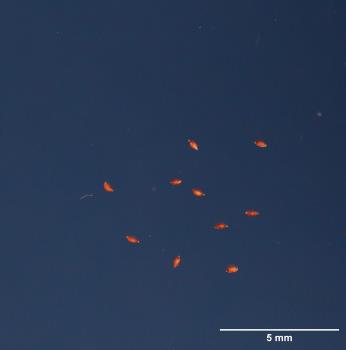 | | 2009 | | | | | | | Wild material | | 1802263 | W6 35287 |
| 54 | W6 32575 | AZ-93005-53 | Elymus glaucus Buckley | Oregon, United States | W6 |  | | 2007 | | | | | | | Wild material | | 1740324 | W6 32575 |
| 55 | WLP 1448 | 97-1 | Calocedrus decurrens (Torr.) Florin | California, United States | NA | | | 2005 | COLLECTED | 09/23/1997 | Siskiyou County; ; Mt. Shasta, 8 km northeast of Shasta City on Everitt Memorial Highway at McBride Campground. | 0.00000000, 0.00000000 | | On gravelly, sandy soil. | | Common. | 2109090 | WLP 1448 |
| 56 | Ames 29956 | 177504 | Thalictrum fendleri Engelm. ex A. Gray | Utah, United States | NC7 |  | | 2005 | COLLECTED | 09/16/2002 | Utah-Wyoming Rockies. Salt Lake County. Big Cottonwood Canyon, Cardiff Fork. | 40.63833000, -111.65250000 | 2544 | Riparian. | Wild material | Forb 0.6-0.9 meters tall. | 1674007 | Ames 29956 |
| 57 | W6 26971 | UT931-RBG-18 | Aconitum columbianum Nutt. | Utah, United States | W6 |  | Contact Site | 2005 | | | | | | | Wild material | Forb 0.9 meters tall. | 1674008 | W6 26971 |
| 58 | DLEG 910407 | DLEG 910407 | Lathyrus graminifolius (S. Watson) T. G. White | Arizona, United States | | 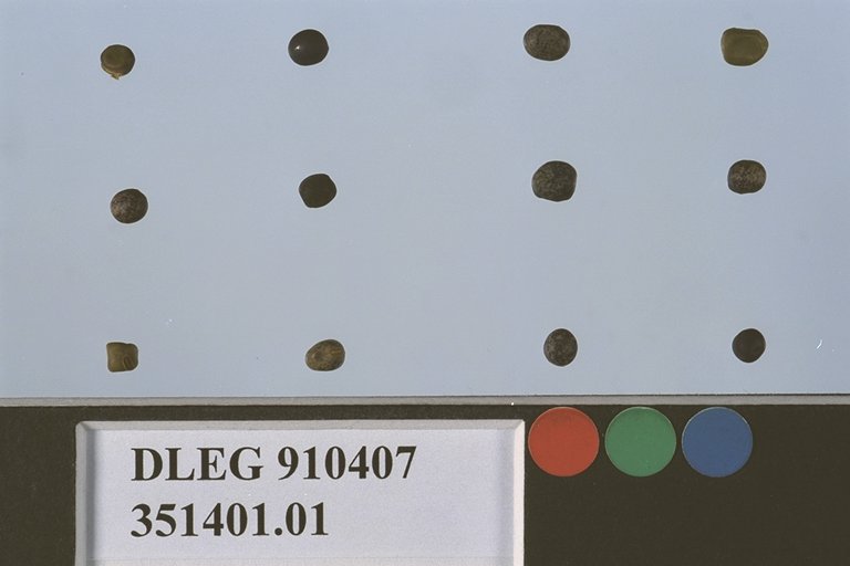 | Historic | 1991 | COLLECTED | 09/25/1991 | Pima Co., Along road by old ski area at Bear Wallow, 0.4 mi. from Mt. Lemmon Hwy., Santa Catalina Mts. Elevation 7900 ft. | | | Mixed conifer forest with Pinus ponderosa, P. strobiformis, Pseudotsuga menziesii, Abies concolor. | Wild material | Leaves and flower colorer extremely variable. Seeds from plants on a shady slope. | 1526329 | DLEG 910407 |
| 59 | DLEG 890343 | DLEG 890343 | Trifolium repens L. | Arizona, United States | | | Historic | 1989 | COLLECTED | 09/29/1989 | Pima Co., Along road and old ski slope, Bear Wallow, 0.4 mi. from Mt. Lemmon Hwy., Santa Catalina Mts. Elevation 7900 ft. | | | Mixed coniferous forest with Pinus ponderosa, P. strobiformis, Pseudotsuga menziesii, Abies concolor. | Wild material | Spreading herbaceous plants, rooting at the nodes; trifoliate leaves, heart-shaped leaflets. M. Johnson 89-138. | 1528111 | DLEG 890343 |
| 60 | DLEG 890346 | DLEG 890346 | Lathyrus graminifolius (S. Watson) T. G. White | Arizona, United States | | | Historic | 1989 | COLLECTED | 09/29/1989 | Pima Co., Along road by old ski area at Bear Wallow, 0.4 mi. from Mt. Lemmon Hwy., Santa Catalina Mts. Elevation 7900 ft. | | | Mixed conifer forest with Pinus ponderosa, P. strobiformis, Pseudotsuga menziesii, Abies concolor. | Wild material | Leaves are extremely variable. Seeds from plants growing in partial shade. All seeds gone. M. Johnson 89-135. | 1527523 | DLEG 890346 |
| 61 | DLEG 890347 | DLEG 890347 | Lathyrus graminifolius (S. Watson) T. G. White | Arizona, United States | | | Historic | 1989 | COLLECTED | 09/29/1989 | Pima Co., Along road by old ski area at Bear Wallow, 0.4 mi. from Mt. Lemmon Hwy., Santa Catalina Mts. Elevation 7900 ft. | | | Mixed conifer forest with Pinus ponderosa, P. strobiformis, Pseudotsuga menziesii, Abies concolor. | Wild material | Leaves and flower colorer extremely variable. Seeds from plants on a shady slope. All seeds gone. M. Johnson 89-136. | 1527524 | DLEG 890347 |
| 62 | DLEG 890359 | DLEG 890359 | Cologania angustifolia Kunth | Arizona, United States | | | Historic | 1989 | COLLECTED | 09/29/1989 | Pima Co., Along road by old ski area at Bear Wallow, 0.4 mi. from Mt. Lemmon Hwy., Santa Catalina Mts. Elevation 7900 ft. | | | Mixed conifer forest with Pinus ponderosa, P. strobiformis, Pseudotsuga menzesii, Abies concolor. | Wild material | Low, spreading herbaceous vining plants; trifoliate leaves w/ narrow, oblong leaflets. M. Johnson 89-134. | 1526428 | DLEG 890359 |