| 0 | WLP 2670 | RJL2022PA-016 | Acer negundo L. | Pennsylvania, United States | NA | | | 2022 | COLLECTED | 10/21/2022 | Plants growing in woodlands above a small unnamed creek that dumps into the Middle Branch White Clay Creek in Goddard Park, West Grove Pennsylvania, off of Wickerton Road, Chester County. Plants are found regularly but scattered in the understory of the woodlands. | 39.80426000, -75.82609300 | 105 | Plants growing in a mesic, well-drained habitat of deciduous woodlands along streams and above the riparian zone that drains toward a small unnamed creek that feeds into the Middle Branch White Clay Creek. Plants generally grow in part shade to full sun, but perform best and fruit more heavily in full sun where there is abundant access to moisture. The remnant woodlands exist mostly along the steep slopes, wetlands and seeps of seasonal and year-round creeks flowing into the Middle Branch White Clay Creek. The woodlands are bordered by numerous housing developments and land converted to meadows; hence there is significant first order edge that is heavily impacted by invasive plant intrusion. Despite this fact, Acer negundo is highly competitive and competes well.
Soils: The underlying geology of this area is the Glenarm Wissahickon Formation of lower Paleozoic origin and lithologically similar to oligoclase-mica schist of the Wissahickon Formation (PZw), but also includes lenticular amphibolite bodies having ocean-floor basalt chemistry.
Source: USGS Pennsylvania Geologic Map Data (https://mrdata.usgs.gov/geology/state/sgmc-unit.php?unit=PAPZgw%3B0)
The primary soil type in the area of this collection is classified as Glenelg silt loam, 3 to 8 percent slopes. This series consists of very deep, well drained soils formed in residuum weathered from micaceous schist on uplands of the Blue Ridge and the Northern Piedmont. Saturated hydraulic conductivity is moderately high in the subsoil and moderately high to high in the substratum. This upper horizon of this soil is undifferentiated, mostly poorly drained sandy bottomland soils intermingled with decomposing organic litter and eroded silts and clays due to erosion.
Source: NRCS Web Soil Survey (https://websoilsurvey.sc.egov.usda.gov/App/WebSoilSurvey.aspx) | Wild material | | 2139661 | WLP 2670 |
| 1 | WLP 2703 | White Mountains | Acer negundo L. | New Mexico, United States | NA |  | | 2022 | COLLECTED | 09/08/2022 | Common along Eagle Creek and Rio Bonito in the Lincoln National Forest, two to five miles west of Alto. Infrequent at the head of Carlton Canyon along Ski Run Road. T10S R11E SE 1/4 Sec. 3. Coordinates listed refer to the first plant sampled; coordinates for each sample may be provided upon request. | 33.46682200, -105.78389500 | 2333 | Riverbanks in canyon bottoms and head of canyon. | Wild material | | 2139679 | WLP 2703 |
| 2 | WLP 2267 | MARSB-0100 | Acer negundo L. | Virginia, United States | NA | 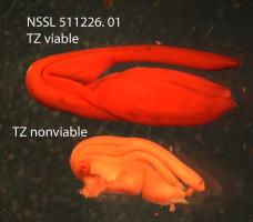 | | 2015 | COLLECTED | 10/09/2013 | | | 351 | | Wild material | | 1922826 | WLP 2267 |
| 3 | WLP 2268 | MARSB-083 | Acer negundo L. | New Jersey, United States | NA |  | | 2015 | COLLECTED | 09/18/2013 | | | 203 | | Wild material | | 1922827 | WLP 2268 |
| 4 | WLP 2170 | ACNE2-SOS-UT030-166-10 | Acer negundo L. | Utah, United States | NA | 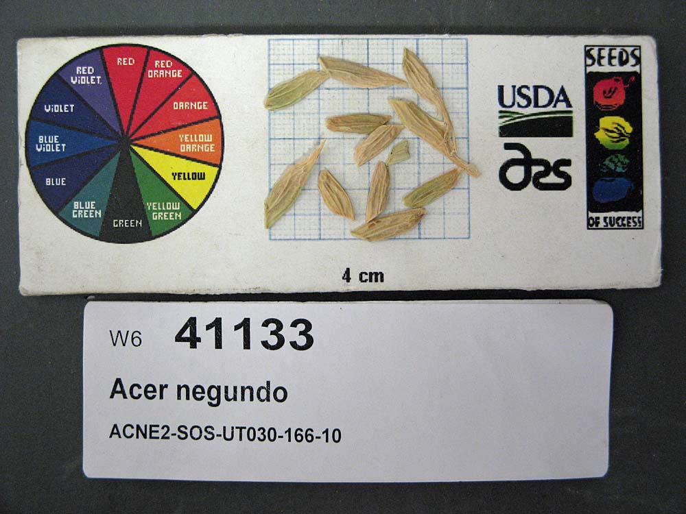 | | 2011 | COLLECTED | PRE 10/04/2010 | | | | | Wild material | | 1868665 | WLP 2170 |
| 5 | WLP 2147 | ACNEN-SOS-CO932-198-09 | Acer negundo L. subsp. negundo | Colorado, United States | NA |  | | 2010 | COLLECTED | NEAR 10/07/2009 | Lair o'the Bear Park (about 4 miles west of Morrison, CO); trees growing 0.5 miles east and west on Bear Creek Trail near the parking lot and along the creek. | 39.66686000, -108.26380000 | 1994 | Foothills riparian to plains riparian; land used for recreation. Soil texture is silt, sand; color 7.5 YR 3/1 Very Dark Gray. Slope 0 degrees. | Wild material | | 1842400 | WLP 2147 |
| 6 | WLP 2138 | 424909 | Acer negundo L. subsp. californicum (Torr. & A. Gray) Wesm. | California, United States | NA |  | | 2009 | COLLECTED | 10/19/2007 | | | 300 | Riparian on flood plain within 15m of river. | Wild material | | 1826947 | WLP 2138 |
| 7 | WLP 283 | DE.021-2006 | Acer negundo L. | Delaware, United States | NA | | | 2006 | COLLECTED | 10/18/2006 | Delaware, New Castle County, Brandywine Creek State Park | 39.81116000, -75.56602000 | | Flood plain of river, | Wild material | | 1777731 | WLP 283 |
| 8 | WLP 263 | NA 69978 | Acer negundo L. | Cherkasy, Ukraine | NA | | | 1999 | COLLECTED | 09/24/1999 | | | | | Uncertain improvement status | | 1585997 | WLP 263 |
| 9 | PI 700343 | DB 2019004 | Chenopodium album L. var. missouriense (Aellen) Bassett & Crompton | Oklahoma, United States | NC7 | 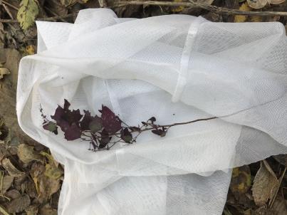 | | 2019 | COLLECTED | 11/09/2019 | Love County, OK, on the north, Oklahoma side, of the Red River, almost under the Interstate 35 highway bridge by an all terrain vehicle trail. | 33.72851500, -97.15851500 | 204 | In red alluvial soil. | Wild material | Collected as one unusual dark purple plant with purple stem, foliage, and infloresence. The seeds are 1.3 mm wide, glossy and black. The pericarp is adherent and yellow-brown. | 2097810 | PI 700343 |
| 10 | PI 691725 | BJP/CC/2014/003 | Cornus canadensis L. | Maine, United States | NA | | | 2014 | COLLECTED | 08/13/2014 | Edge of woods along west edge of Timber Cove Road, just northwest of intersection with Hwy. 189 and across the road from a cemetery. Approximately 13 km southwest of Lubec. | 44.80125000, -67.12708000 | | Edge of woods along west edge of road. | Wild material | | 1923675 | PI 691725 |
| 11 | PI 673983 | JDC/RL/2009/028/178 | Rudbeckia laciniata L. | Wisconsin, United States | OPGC |  | | 2009 | COLLECTED | 09/21/2009 | Along Blue River, near bridge on Bowers Road, Snow Bottoms State Natural Area, SW 1/4 of SW 1/4 of Section 35, T7N, R1W, Highland West Quad, Grant County. | 43.03166667, -90.46500000 | 262 | Riverbank. Associated with Acer negundo and Salix. | Wild material | | 1819751 | PI 673983 |
| 12 | PI 684839 | R. americanum HDF-2007-097 | Ribes americanum Mill. | Nebraska, United States | COR |  | | 2007 | COLLECTED | 07/10/2007 | Dawes County Chandron State Park Area Camp Norwesca Road | 42.70111111, -103.00611111 | 1298 | Riparian woods bordering Chadron Creek Associated plants: Rhus radicans, Prunus, Celtis, Apocynium, Acer negundo | Wild material | | 1733149 | PI 684839 |
| 13 | PI 653297 | R. argutus HD-2007-070 | Rubus argutus Link | Mississippi, United States | COR | | | 2007 | COLLECTED | 06/09/2007 | Marshall County, northwest of Potts Camp off route 178 onto George Mann Road onto Lake Shore Drive at a drainage ditch in the community of Lake Center. | 34.69310000, -89.36150000 | 120 | Open area in drainage ditch growing on the perimeter road of a lake. Associated Plants: Rhus typhina, Vitis rotundifolia, Pinus taeda, Salix sp., Lonicera japonica, Liquidambar styraciflua and Acer negundo. | Wild material | Kim Hummer, Michael Dossett collection from Mississippi.
| 1730104 | PI 653297 |
| 14 | PI 664877 | Ames 28312 | Prunella vulgaris L. | Iowa, United States | NC7 | | | 2006 | COLLECTED | 09/10/2006 | Near center of NW 1/4 of Section 21, T69N, R9W, Keosauqua, Van Buren County. | 40.76583333, -91.90388889 | 175 | Muddy, rocky bed of Rock Creek. Partial shade; nearly flat slope, open to the south. Alluvium soil mixed with rocks; very stony with good drainage. Rare population abundance. Floodplain forest. | Wild material | | 1707771 | PI 664877 |
| 15 | PI 649025 | VA1 | Actaea racemosa L. | Virginia, United States | NC7 | | | 2005 | | | | | | | Wild material | | 1698897 | PI 649025 |
| 16 | PI 635225 | H. lupulus var. neomexicanus OJ-2003-01 | Humulus lupulus L. var. neomexicanus A. Nelson & Cockerell | Arizona, United States | COR | | | 2003 | COLLECTED | | Coconio county, Oak Creek Canyon, Hwy 89a north of Cave Springs, along road | 35.02306000, -111.73611000 | 0 | Above creek, with Pinus ponderosa, Acer Negundo, Populus trichocarpa | Wild material | | 1648997 | PI 635225 |
| 17 | PI 635226 | H. lupulus var. neomexicanus OJ-2003-03 | Humulus lupulus L. var. neomexicanus A. Nelson & Cockerell | Arizona, United States | COR | | | 2003 | COLLECTED | | Coconino county, Mack's Crossing, East Clear Creek, 1 mile South of Hwy 87, Forest Service road 137 | 34.61861000, -111.09278000 | 1953 | Along creek , with Acer negundo, Rosa sp. | Wild material | | 1648999 | PI 635226 |
| 18 | PI 635275 | H. lupulus var. lupuloides Souris E2 #10 | Humulus lupulus L. var. lupuloides E. Small | Manitoba, Canada | COR | | | 2002 | COLLECTED | 10/13/2001 | | | | | Wild material | low seed count | 1642016 | PI 635275 |
| 19 | PI 635276 | H. lupulus var. lupuloides Souris E2 #11 | Humulus lupulus L. var. lupuloides E. Small | Manitoba, Canada | COR | | | 2002 | COLLECTED | 10/13/2001 | | | | | Wild material | low seed count | 1642017 | PI 635276 |
| 20 | PI 635279 | H. lupulus var. lupuloides Souris E2 #14 | Humulus lupulus L. var. lupuloides E. Small | Manitoba, Canada | COR | | | 2002 | COLLECTED | 10/13/2001 | | | | | Wild material | | 1642020 | PI 635279 |
| 21 | PI 635281 | H. lupulus var. lupuloides Souris E2 #17 | Humulus lupulus L. var. lupuloides E. Small | Manitoba, Canada | COR | | | 2002 | COLLECTED | 10/13/2001 | | | | | Wild material | low seed count | 1642023 | PI 635281 |
| 22 | PI 635282 | H. lupulus var. lupuloides Souris E2 #18 | Humulus lupulus L. var. lupuloides E. Small | Manitoba, Canada | COR | | | 2002 | COLLECTED | 10/14/2001 | One mile east of junction of highway 2 and 250 turn south on gravel road to refuse disposal site. Go past and to the left of it and a quarry site. On the south side of Quarry along this side of the river, up and down stream.. | 49.61306000, -100.23444000 | | Riparian zone of Souris river. Acer negundo, Cretaegus sp. | Wild material | low seed count | 1642024 | PI 635282 |
| 23 | PI 635284 | H. lupulus var. lupuloides Souris E2 #20 | Humulus lupulus L. var. lupuloides E. Small | Manitoba, Canada | COR | | | 2002 | COLLECTED | 10/14/2001 | | | | | Wild material | low seed count | 1642026 | PI 635284 |
| 24 | PI 635289 | H. lupulus var. lupuloides Indian Head-N #1 | Humulus lupulus L. var. lupuloides E. Small | Saskatchewan, Canada | COR | | | 2002 | COLLECTED | 10/10/2001 | | | | | Wild material | low seed count | 1642034 | PI 635289 |
| 25 | PI 635290 | H. lupulus var. lupuloides Indian Head-N #2 | Humulus lupulus L. var. lupuloides E. Small | Saskatchewan, Canada | COR | | | 2002 | COLLECTED | 10/10/2001 | | | | | Wild material | | 1642035 | PI 635290 |
| 26 | PI 635291 | H. lupulus var. lupuloides Indian Head-N #3 | Humulus lupulus L. var. lupuloides E. Small | Saskatchewan, Canada | COR | | | 2002 | COLLECTED | 10/10/2001 | | | | | Wild material | low seed count | 1642036 | PI 635291 |
| 27 | PI 635293 | H. lupulus var. lupuloides Indian Head-N #5 | Humulus lupulus L. var. lupuloides E. Small | Saskatchewan, Canada | COR | | | 2002 | COLLECTED | 10/10/2001 | | | | | Wild material | low seed count | 1642038 | PI 635293 |
| 28 | PI 635294 | H. lupulus var. lupuloides Indian Head-N2 #1 | Humulus lupulus L. var. lupuloides E. Small | Saskatchewan, Canada | COR | | | 2002 | COLLECTED | 10/10/2001 | | | | | Wild material | low seed count | 1642039 | PI 635294 |
| 29 | PI 635295 | H. lupulus var. lupuloides Indian Head-N2 #2 | Humulus lupulus L. var. lupuloides E. Small | Saskatchewan, Canada | COR | | | 2002 | COLLECTED | 10/10/2001 | | | | | Wild material | | 1642040 | PI 635295 |
| 30 | PI 637829 | H. lupulus var. lupuloides Souris E2 #5 | Humulus lupulus L. var. lupuloides E. Small | Manitoba, Canada | COR | | | 2002 | COLLECTED | 10/13/2001 | | | | | Wild material | low seed count | 1642011 | PI 637829 |
| 31 | PI 649696 | Ames 22166 | Parthenocissus inserta (A. Kern.) Fritsch | South Dakota, United States | NC7 | | | 1994 | COLLECTED | 09/17/1994 | Cascade Springs at J.H. Keith Memorial Picnic Area, SE 1/4 of SW 1/4 of Section 20, T8S, R5E, Fall River County. | 43.33333333, -103.55000000 | 1045 | Growing in trees along stream | Wild material | Attractive red fall color. Few fruits remaining. | 1479222 | PI 649696 |
| 32 | WLP 3658 | TRx250704-01NY | Lonicera morrowii A. Gray | New York, United States | NA | | | 2025 | COLLECTED | 07/04/2025 | | 43.31284000, -78.49509400 | | Edge of disturbed forest | Wild material | | 2191634 | WLP 3658 |
| 33 | Ames 36295 | Cherry Creek Campground | Alnus oblongifolia Torr. | New Mexico, United States | NC7 |  | | 2024 | COLLECTED | 11/15/2024 | Gila National Forest (Cherry Creek Campground) located north, northeast of Silver City approximately 8.35 miles, T16S R14W SW 1/4 Sec. 24 and T16S R13W SE 1/4 Sec. 18. | 32.91320000, -108.22540000 | 2060 | Creek edge and creek bed | Wild material | | 2170468 | Ames 36295 |
| 34 | Ames 36284 | Oak Creek Canyon | Alnus oblongifolia Torr. | Arizona, United States | NC7 |  | | 2024 | COLLECTED | 10/18/2024 | Oak Creek Canyon, approximately five miles north-northeast of Sedona in the Coconino National Forest, T18N R6E Sec. 8 and Sec. 21 and also T19N R6E Sec. 22 and Sec. 27. | 35.01694800, -111.73755900 | 1538 | Creek beds in canyon bottom. | Wild material | Plants sampled in nature had dark green, glossy leaves. Young bark is smooth and light grey, becoming dark and scaly with age. Approximately 50 feet in height. | 2169812 | Ames 36284 |
| 35 | Ames 36285 | Sycamore Canyon Wilderness | Amaranthus hybridus L. | Arizona, United States | NC7 |  | | 2024 | COLLECTED | 10/19/2024 | Sycamore Canyon Wilderness, Kaibab/Prescott National Forest. Approximately 18.6 miles southwest of Flagstaff. Bottom of canyon, approximately 0.25 miles downstream of where Kelsey Springs Trail reaches the creek. T20N R4E NW 1/4 NW 1/4 Sec. 35. | 35.07531800, -111.94921800 | 1561 | Creek bed at bottom of canyon. | Wild material | An extreme amount of phenotypic diversity was observed in this population during seed collection. Stem, infructescence and leaf colors varied from green to red (most had some red pigmentation). Plant height varied from approximately one to three feet. Degree of stem branching and angle of branching also varied substantially. | 2169813 | Ames 36285 |
| 36 | NA 89078 | 2024RJLPA-004 | Staphylea trifolia L. | Pennsylvania, United States | NA | | | 2024 | COLLECTED | 09/20/2024 | Along gated road about 0.33 kilometers southwest of the Lake Ontelaunee Trail parking lot. | 40.49850800, -75.89121300 | 94 | Plants are growing on well-drained steep slopes in shade to part shade of a deciduous forest. Slope: 35 to 50 percent. Aspect: East-southeast. Geology: The underlying geology of this area is of Ordovician origin and characterized as Shale and graywacke of Hamburg sequence. It is characterized by shale containing zones of conspicuous graywacke. (Source: USGS Pennsylvania Geologic Map Data). Soils: The primary soil type in the area of this collection is classified as Berks-Weikert Complex, 25 to 60% slopes (BkF). Dominantly sloping to very steep, moderately deep and shallow, well drained soils underlain by acid shale bedrock. (Source: UPenn State University Soil Info Website). EPA Ecoregion (Level III): Ridge and Valley (67). EPA Ecoregion (Level IV): Northern Shale Valleys (67b). | Wild material | | 2169042 | NA 89078 |
| 37 | NA 89079 | 2024RJLPA-005 | Viburnum prunifolium L. | Pennsylvania, United States | NA | | | 2024 | COLLECTED | 09/20/2024 | Along gated road about 0.33 kilometers southwest of the Lake Ontelaunee Trail parking lot. | 40.50062600, -75.89004900 | 94 | Plants are growing on moist, well-drained in part shade of a deciduous forest. Slope: 0 percent. Aspect: N/A. Geology: The underlying geology of this area is of Ordovician origin and characterized as Shale and graywacke of Hamburg sequence. It is characterized by shale containing zones of conspicuous graywacke. (Source: USGS Pennsylvania Geologic Map Data). Soils: The primary soil type in the area of this collection is classified as Holly Series Silt Loam (Ho). The Holly Series consists of very deep, very poorly and poorly drained soils formed in loamy alluvium on flood plains. Saturated hydraulic conductivity is moderately high through high in the mineral soil. Slope ranges from 0 through 3 percent. (Source: USDA-NRCS Official Soil Series Descriptions). EPA Ecoregion (Level III): Ridge and Valley (67). EPA Ecoregion (Level IV): Northern Shale Valleys (67b). | Wild material | | 2169043 | NA 89079 |
| 38 | Ames 36292 | Faith-Moccasin WMA | Salix petiolaris Sm. | Minnesota, United States | NC7 |  | | 2024 | COLLECTED | 09/07/2024 | Faith Wildlife Management Area and Moccassin State Wildlife Management Area east of Twin Valley approximately 8.25 miles. | 47.26010700, -96.09171700 | 351 | Wetland, shrub-carr complex. | Wild material | Slender-leaved willow, Salix petiolaris, is a somewhat dense suckering shrub that can reach up to 10' in height with slender stems that branch minimally, but typically maintains a height of 5-8'. Native to North America, the native range covers mostly the northeastern US stretching from Maine to western North Dakota and Canada south to central Iowa (Little, E. L. Jr. 1977). Salix petiolaris typically dominates wetland areas including sedge meadows, marshes, riverbanks, and lake shores. Despite favoring wet habitats, it can also be found in dry, upland areas, especially those with high-water tables. However, longevity is generally limited in upland habitats. S. petiolaris, similar to other willow species, responds well to fire, coppicing, or heavy browsing (highly favored by deer) by sprouting new stems close to the crown. In cultivation, plants after five years will encompass a 5' x 5' area due to stems that arch from the main base of the plant. Coppicing of plants to ground level is highly recommended either annually or once every 3-5 years to maintain vigorous growth and plant health. This species requires substantial to full sun exposure and is an excellent choice for streambank stabilizations and windbreaks to reduce soil erosion and drifting snow, respectively. This accession represents genetics from northwestern Minnesota. Plants sampled in nature averaging 6-8' in height. Clump-type growth habit with minimal branching, but dense suckering (e.g. 50+ ramets per genet - typically encompassing 5' x 5' area). Dormant, winter stem are rather uniform/consistent orange-brown/mahogany colors. | 2169827 | Ames 36292 |
| 39 | Ames 36251 | JDC/UT/2024/008/1130 | Ulmus thomasii Sarg. | Minnesota, United States | NC7 | 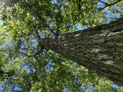 | | 2024 | COLLECTED | 06/05/2024 | Near southeast edge of Kasota Lake approximately 9.0 miles east, southeast of Willmar, T119N R34W SE 1/4 NE 1/4 Sec. 36 and also Robbins Island Park in Wilmar, T119N R35W Sec. 11. | 45.07399600, -94.88484100 | 352 | Deciduous woods | Wild material | Ulmus thomasii (Rock elm) is an underutilized tree species both in conservation and in the urban landscape. Described by Charles Sprague Sargent (first director for the Arnold Arborteum) as "heavy, hard, very strong and tough, closely grained, and susceptible of receiving a beautiful polish". Historically noted for a variety of uses in woodworking including furniture, heavy agricultural implements, timber frame buildings, pianos, hockey sticks, and hand tools. Ulmus thomasii is extremely drought tolerant, adaptable to very calcareous soils, and compared to U. americana or U. rubra has a very conservative growth rate requiring minimal attention in regards to pruning. Rock elm naturally tends to develop into a nice structural specimen in the landscape, unlike other fast growing cultivars in the nursery trade needing frequent attention. Rock elm has very fissured bark and is well known for maintaining a strong central leader resulting in a very attractive, pyramidal form. Despite many literature sources stating that "wings" on the stems are a key identifiying characteristic, this trait is not reliable and many genotypes may completely lack "wings" on the stems. While growth habit and morphology of dormant buds (very pointy) are good traits to help aid in identification, fruits are the best way to confirm identity. Fruits are densly pubescent, often described as "inflated" and generally reach maturity a couple weeks after Ulmus rubra and Ulmus americana. U. thomasii inflorescences are rather distinguishable from other Ulmus in being pendulous. Fruits are extremely prized treats for many birds, where fruits are often "robbed" prior to full maturity. Fruits are also highly prized by many other animals such as mice, squirrels, chipmunks, turkeys, etc. and are generally consumed within hours after fruit abscission. The native range of U. thomasii is concentrated in the northeastern United States and into Canada with disjunct populations documented in northwestern Missouri and northwestern Arkansas (Little, E. L. Jr. 1971). In the 1895 Silva of North America (vol. 7) it was stated that, “The value of the wood of the Rock Elm threatens its extinction and most of the large trees have already been cut.” Today, while rock elm is rather rare, especially in areas near the edges of its range, many states list the species as endangered or threatened warranting preservation efforts. Genetics of this accession would be representative of the species northwestern edge of its native range. Majority of specimens noted did not have characteristic "wings" on the stems and measured approximately 20" DBH or more with a few specimens nearing 30". Heights estimated between 70-90'. Rock elm in this area could be classified as locally abundant. | 2167953 | Ames 36251 |
| 40 | WLP 3492 | St. Francois State Park | Hydrangea arborescens L. | Missouri, United States | NA |  | | 2024 | COLLECTED | 01/19/2024 | St. Francois State Park, 8920 US Highway 67 North, approximately 3.2 miles north-northeast of Bonne Terre. | 37.96381000, -90.53403000 | 202 | Rocky outcrops above Big River and rocky areas on bank of Big River. | Wild material | | 2166135 | WLP 3492 |
| 41 | NA 88801 | TJK2023LA/TX-001 | Cocculus carolinus (L.) DC. | Louisiana, United States | NA | | | 2023 | COLLECTED | 11/21/2023 | Interstate 20, westbound, approximately 13 miles west of Mississippi River, 9 miles east of U.S. Highway 65. | 32.33740000, -91.06320000 | 24 | Damp low, wooded treeline. Slope: less than 2%. Aspect: Southwest. Elevation: 79 feet. | Wild material | | 2159184 | NA 88801 |
| 42 | NA 88802 | TJK2023LA/TX-002 | Ilex decidua Walter | Louisiana, United States | NA | | | 2023 | COLLECTED | 11/21/2023 | Interstate 20, westbound, approximately 6 miles west of U.S. Highway 65 and 7.5 miles east of Louisiana Highway 577. Tensas River watershed. | 32.41950000, -91.29670000 | 21 | Damp wooded treeline. Slope: 12%. Aspect: West-southwest. Elevation: 69 feet. | Wild material | | 2159185 | NA 88802 |
| 43 | NA 88803 | TJK2023LA/TX-003 | Crataegus viridis L. | Louisiana, United States | NA | | | 2023 | COLLECTED | 11/21/2023 | Interstate 20, westbound, approximately 7 miles west of Louisiana Highway 17 and 8.5 miles east of U.S. Highway 425. Tensas River watershed. | 32.41940000, -91.29670000 | 21 | Damp wooded treeline. Slope: 12%. Aspect: West-southwest. Elevation: 69 feet. | Wild material | | 2159186 | NA 88803 |
| 44 | NA 88804 | TJK2023LA/TX-004 | Crataegus viridis L. | Louisiana, United States | NA | | | 2023 | COLLECTED | 11/21/2023 | Walnut Bayou (Mississippi River bottom): Interstate 20, westbound, approximately 10 miles west of the Mississippi River and 8.25 miles east of U.S. Highway 65. | 32.34130000, -91.07170000 | 26 | Damp wooded treeline. Slope: 10%. Aspect: North-northeast. Elevation: 84 feet. | Wild material | | 2159187 | NA 88804 |
| 45 | NA 88805 | TJK2023LA/TX-005 | Carya aquatica (F. Michx.) Elliott | Louisiana, United States | NA | | | 2023 | COLLECTED | 11/21/2023 | Interstate 20, westbound, approximately 2 miles west of Louisiana Highway 609 and 0.75 miles east of Louisiana Highway 183. | 32.45620000, -91.61470000 | 23 | Damp gallery woods, edge of palmetto flat. Slope: 5%. Aspect: North. Elevation: 76 feet. | Wild material | | 2159188 | NA 88805 |
| 46 | NA 88676 | RJL2023PA-010 | Staphylea trifolia L. | Pennsylvania, United States | NA | | | 2023 | COLLECTED | 10/25/2023 | Seed collected along the Appalachian National Scenic Trail, accessed from the Duncannon Entrance. | 40.38132600, -77.02965700 | 103 | Well-drained and very rocky deciduous woodlands where soil has accumulated in part shade to full shade. Slope: 0-30%. Aspect: variable. The underlying geology of this area is of Devonian origin and characterized as the Duncannon Member of Catskill Formation. It is characterized by grayish-red sandstone, siltstone, and mudstone in fining-upward cycles; conglomerate occurs at base of some cycles. The sandstones which comprise the Duncannon Member are fine to very coarse grained and grayish red to grayish red-purple in color. The Duncannon Member is known to be crossbedded to planar bedded in beds anywhere from 3 to 9 meters thick. Conglomerates have been spotted at the base of the Duncannon Member. The Duncannon Member is poorly exposed in most areas except along the Lehigh River. The conglomerate portion of this member has been known to form ridges and ledges with thicknesses approaching 228 meters. (Source: USGS Pennsylvania Geologic Map Data). The primary soil type in the collection area is classified as Hazleton Series. The Hazleton series consists of deep and very deep, well drained soils formed in residuum of acid gray, brown or red sandstone on uplands. Slope ranges from 0 to 80 percent. Permeability is moderately rapid to rapid. Solum thickness ranges from 60 to 120 centimeters. Depth to lithic contact ranges from 1 to 2 meters. Rock fragments of angular sandstone, dominantly less than 25 cm in size, range from 5 to 70 percent in individual horizons. Boulders, stones, flags and channers cover about 5 to 60 percent of the surface of some pedons. Reaction ranges from strongly acid through extremely acid throughout. (Source: NRCS Web Soil Survey). | Wild material | | 2159067 | NA 88676 |
| 47 | Ames 36181 | Turtlehead Fen | Eutrochium maculatum (L.) E. E. Lamont | Iowa, United States | NC7 | | | 2023 | COLLECTED | 09/29/2023 | Turtlehead Fen (Chichaqua Bottoms Greenbelt) located 1.75 miles southeast of Farrar just north of highway 65, T81N R21W SW ¼ NW ¼ Sec. 31. | 41.78610000, -93.34730000 | 290 | Remnant fen with extremely wet, spongy soils and surface water visible at time of collection. | Wild material | Plants in nature ranged in height from three to eight feet. Variation was also noted for phenology with some plants mostly dispersed and some just ripening at the time of collection. | 2159013 | Ames 36181 |
| 48 | NA 88653 | KY23-057 | Aesculus glabra Willd. | Kentucky, United States | NA | | | 2023 | COLLECTED | 09/14/2023 | Floracliff Nature Sanctuary. | 37.89873000, -84.36481000 | 187 | Along rock cliff moving down slope. Elevation: 612 feet. Aspect: Northwest. | Wild material | | 2158746 | NA 88653 |
| 49 | WLP 3212 | KY23-105 | Hydrangea arborescens L. | Kentucky, United States | NA | | | 2023 | COLLECTED | 09/14/2023 | Above the banks of Marble Creek, property of Liz Hobson | 37.84865900, -84.45359000 | | Deciduous floodplain forest with limestone outcrops | Wild material | | 2158756 | WLP 3212 |
| 50 | NA 89008 | WLP 3120 | Morus rubra L. | Kentucky, United States | NA | | | 2023 | COLLECTED | 06/05/2023 | Swan Pond Bottom. Riparian buffer and historic floodplain of Cumberland River, approximately 4 river miles downstream of Wolf Creek Dam. | 36.90259500, -85.13557900 | | Riparian buffer and historic river floodplain. Slope: <5%. Aspect: North. | Wild material | | 2158092 | NA 89008 |
| 51 | Ames 36017 | AS/GD/2023/002/212 | Gymnocladus dioicus (L.) K. Koch | Wisconsin, United States | NC7 |  | | 2023 | | | | | | | Wild material | Kentucky coffeetree in Wisconsin is rather rare. The Wisconsin Natural Heritage Inventory Program currently (2023) lists this taxon in Wisconsin as a species of concern with a state rank of S2 (Imperiled in Wisconsin due to a restricted range, few populations or occurrences, steep declines, severe threats, or other factors.) This accession represents genetics from a localized population with a near equal porportion of male and female specimens. While there are other known locations along the Wisconsin River, this population is producing seeds. The other known locations represent single clones that are distant enough from other existing clones that prevent the transfer of pollen and thus lack the ability to produce seed or will rarely produce. | 2141550 | Ames 36017 |
| 52 | Ames 36028 | JDC/MP/2023/014/1046 | Maclura pomifera (Raf.) C. K. Schneid. | Iowa, United States | NC7 | _thumbnail.jpg "Click for 3 image(s) for this accession.") | | 2022 | COLLECTED | 11/02/2022 | Located 8.0 miles northeast of Boone where Montgomery Creek crosses V Avenue, T85N R25W NW 1/4 SW 1/4 Sec. 34 | 42.12911400, -93.75509100 | 295 | Previously grazed pasture. | Uncertain improvement status | The native range for Osage-orange is reported from eastern Texas, southeastern Oklahoma, southwestern Arkansas, and the northwestern corner of Louisiana (Little, 1971). Historically and presently known for its extreme value as bow-wood and fence posts, Osage-orange represents one of the most widely planted tree species in the lower 48 US states as a living fence starting in the mid-1800's, in the late 1900's as a landscape tree for difficult sites, and most recently its chemical properties. Detailed history of Osage-orange and it's economic uses are well documented (Smith and Perino, 1981 and J. T. Winberry 1979). Osage wood is highly-prized for its use as fence posts (both living and non-living) and durable wood for wood working. Osage is an extremely drought and heat tolerant tree and is recommended for use in USDA cold-hardiness zones 5b or warmer. Although the species is commonly known for its stout thorns and large, globular fruits, the species is dioecious and the degree of thorns on individual genotypes can be extremely variable. This accession represents genetics collected from a naturalized population in central Iowa (Boone County - Harrison Township). Majority of specimens sampled averaged approximately 40-45’ in height with multiple (e.g. 1-5) trunks. The collection site represents a recognized Iowa Century Farm awarded in 1976 that was originally settled by Andrew Nelson and then purchased on 24 October 1874 for the amount of '9.00 per acre by Lester S. Carlson. According to Samuel Keith Carlson (grandson to Lester S. Carlson), in the 1930's-1940's there was a fence line plus a few additional specimens of significant size that were possibly planted by Lester S. Carlson in the 1870's or the previous owner during "hedge mania" in the 1850's. In the 1950's the original trees at the Carlson farm were removed, but the progeny have persisted throughout the woods and adjacent pasture areas and continue to spread. A corner fence post of Osage that was set in 1874 by Lester S. Carlson shortly after purchasing the property still remains (see image). Majority of the specimens in this population are nearly thornless or with relatively few thorns. Fruit sizes range between 70-90 mm in diameter with seed lengths ranging from 6.99 mm (min) to 11.68 mm (max) with the average length of 50 seeds at 9.36 mm. At time of collection (2 November 2022) approximately 20% of specimens were at peak, yellow fall color, while remaining specimens were still green/greenish-yellow. | 2141741 | Ames 36028 |
| 53 | NA 89047 | RJL2022PA-015 | Cephalanthus occidentalis L. | Pennsylvania, United States | NA | | | 2022 | COLLECTED | 10/09/2022 | Plants growing in the floodplain of Octoraro Creek near 698 Lees Bridge Road, West Nottingham Township, Pennsylvania on the south side of the road. Plants are locally common and spread out in the floodplain area along the Octoraro Creek. | 39.73540700, -76.09226500 | 60 | Plants of this species are growing in full sun to part shade of a moist to seasonally mucky and wide flood plain area adjacent to Octoraro Creek. The area is dominated by deciduous herbaceous plants, scrambling vines, shrubs and occasional small trees. Much of this wet “meadow” is dominated by aggressive stands of grasses and members of the sedge family.
Soils: The underlying geology of this area is estimated to be of lower Paleozoic origin and comprised of Peters Creek Schist. This is comprised of chlorite-sericite schist containing interbedded quartzite. Interestingly, this area is very close to and may interface with the adjacent formation of Ultramafic Rocks that includes serpentine, steatite, and other products of alteration of peridotites and pyroxenites.
Source: USGS Pennsylvania Geologic Map Data (https://mrdata.usgs.gov/geology/state/sgmc-unit.php?unit=PAPZpc%3B0)
The primary soil types in the collection area are classified as Hatboro Silt Loam which consists of soils formed in alluvium derived from metamorphic and crystalline rock. They are on flood plains. Slopes range from 0 to 3 percent. Hatboro Silt Loam soils are poorly drained and have a high to very high surface runoff index. These soils are subject to periodic stream overflow, which usually occurs during the winter and spring months. The A and B horizons are moderately acidic to neutral, generally to a depth of 1-2 meters; the C horizon below ranges from a depth of 2-3 meters with uniformly acidic soils.
Source: NRCS Web Soil Survey (https://websoilsurvey.sc.egov.usda.gov/App/WebSoilSurvey.aspx) | Wild material | | 2139612 | NA 89047 |
| 54 | NA 89046 | RJL2022PA-014 | Alnus serrulata (Aiton) Willd. | Pennsylvania, United States | NA | | | 2022 | COLLECTED | 10/09/2022 | Plants growing in the floodplain of Octoraro Creek near 698 Lees Bridge Road, West Nottingham Township, Pennsylvania on the south side of the road. Plants are locally common and spread out in the floodplain area along the Octoraro Creek. | 39.73579900, -76.09238300 | 60 | Plants of this species are growing in full sun of a moist to seasonally mucky and wide flood plain area adjacent to Octoraro Creek. The area is dominated by deciduous herbaceous plants, scrambling vines, shrubs and occasional small trees. Much of this wet “meadow” is dominated by aggressive stands of grasses and members of the sedge family.
Soils: The underlying geology of this area is estimated to be of lower Paleozoic origin and comprised of Peters Creek Schist. This is comprised of chlorite-sericite schist containing interbedded quartzite. Interestingly, this area is very close to and may interface with the adjacent formation of Ultramafic Rocks that includes serpentine, steatite, and other products of alteration of peridotites and pyroxenites.
Source: USGS Pennsylvania Geologic Map Data (https://mrdata.usgs.gov/geology/state/sgmc-unit.php?unit=PAPZpc%3B0)
The primary soil types in the collection area are classified as Hatboro Silt Loam which consists of soils formed in alluvium derived from metamorphic and crystalline rock. They are on flood plains. Slopes range from 0 to 3 percent. Hatboro Silt Loam soils are poorly drained and have a high to very high surface runoff index. These soils are subject to periodic stream overflow, which usually occurs during the winter and spring months. The A and B horizons are moderately acidic to neutral, generally to a depth of 1-2 meters; the C horizon below ranges from a depth of 2-3 meters with uniformly acidic soils.
Source: NRCS Web Soil Survey (https://websoilsurvey.sc.egov.usda.gov/App/WebSoilSurvey.aspx) | Wild material | | 2139611 | NA 89046 |
| 55 | NA 89045 | RJL2022PA-013 | Tsuga canadensis (L.) Carrière | Pennsylvania, United States | NA | | | 2022 | COLLECTED | 10/07/2022 | Plants growing on the steep banks along Octoraro Creek accessed by canoe. Plants are locally common but generally infrequent along the Octoraro Creek. | 39.74442700, -76.08856400 | 66 | Plants are growing in part-shade to sun of mixed deciduous and evergreen forests on steep rocky habitats overlain by relatively deep soil over occasionally exposed geology along the Octoraro Creek.
Soils: The underlying geology of this area is estimated to be of lower Paleozoic origin and comprised of Peters Creek Schist. This is comprised of chlorite-sericite schist containing interbedded quartzite.
Source: USGS Pennsylvania Geologic Map Data (https://mrdata.usgs.gov/geology/state/sgmc-unit.php?unit=PAPZpc%3B0)
The primary soil types in the collection area are classified as Manor loam, 25 to 35 percent slopes, very stony. The soils in the collecting area originated as residuum, weathered from the micaceous schist exposed geology and are generally considered coarse-loamy, micaceous, mesic typic dystrudepts that are very acidic and well-drained. There is a variable depth of soil depending upon the steepness of slopes. Some areas contain significant exposed Peters Creek Schist overlain by a highly decomposed organic mat intermingled with a dense root mat of woody and herbaceous plants.
Source: NRCS Web Soil Survey (https://websoilsurvey.sc.egov.usda.gov/App/WebSoilSurvey.aspx) | Wild material | | 2139610 | NA 89045 |
| 56 | NA 89044 | RJL2022PA-012 | Rhododendron maximum L. | Pennsylvania, United States | NA | | | 2022 | COLLECTED | 10/07/2022 | Plants growing on the steep banks along Octoraro Creek accessed by canoe. Plants are locally common but generally uncommon along the Octoraro Creek. | 39.75272200, -76.08271500 | 63 | Plants are growing in part-shade to part-sun of mixed deciduous and evergreen forests on steep rocky habitats along the Octoraro Creek.
Soils: The underlying geology of this area is estimated to be of lower Paleozoic origin and comprised of Peters Creek Schist. This is comprised of chlorite-sericite schist containing interbedded quartzite.
Source: USGS Pennsylvania Geologic Map Data (https://mrdata.usgs.gov/geology/state/sgmc-unit.php?unit=PAPZpc%3B0)
The primary soil types in the collection area are classified as Manor loam, 25 to 60 percent slopes, very stony. The soils in the collecting area originated as residuum, weathered from the micaceous schist exposed geology and are generally considered coarse-loamy, micaceous, mesic typic dystrudepts that are very acidic and well-drained. There is a variable depth of soil depending upon the steepness of slopes. Some areas contain significant exposed Peters Creek Schist overlain by a highly decomposed organic mat intermingled with a dense root mat of woody and herbaceous plants.
Source: NRCS Web Soil Survey (https://websoilsurvey.sc.egov.usda.gov/App/WebSoilSurvey.aspx) | Wild material | | 2139609 | NA 89044 |
| 57 | Ames 35907 | Oak Creek Canyon | Fraxinus velutina Torr. | Arizona, United States | NC7 | 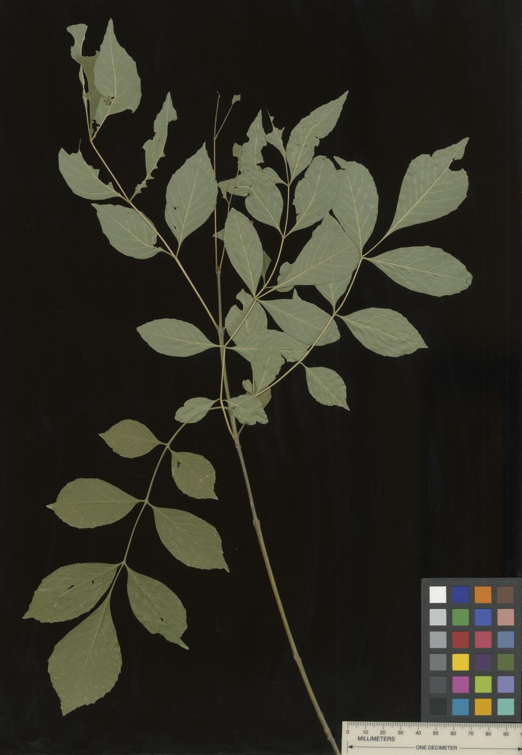 | | 2022 | COLLECTED | 09/02/2022 | Oak Creek Canyon, approximately five miles north-northeast of Sedona in the Coconino National Forest. T18N R6E NE 1/4 NW 1/4 Sec. 21 . | 34.93600300, -111.74436900 | 1464 | Floodplain and riverbanks, growing in gravely soil. | Wild material | Most of the velvet ash in this population are small trees (10-25 feet in height and approximately 5 inches DBH). Variation was noted for leaflet pubescence but with the petioles of all trees in the population being pubescent. | 2139669 | Ames 35907 |
| 58 | Ames 35909 | Prescott National Forest | Fraxinus velutina Torr. | Arizona, United States | NC7 |  | | 2022 | COLLECTED | 09/03/2022 | Collected from four areas in the Prescott National Forest with the greatest distance between samples being 13 miles. Along Wolf Creek near crossing of Groom Creek Loop trail (single plant sample, 185-1, T13N R2W N 1/2 SW 1/4 Sec. 35); along Miller Creek approximately 0.5 miles southwest of the Thumb Butte Picnic Area (single plant sample, 185-2, T14N R3W NE 1/4 SW 1/4 Sec. 36); along Garden Grove Trail (FS 392) approximately 0.2 miles south of Thumb Butte Road (single plant sample, 185-3, T14N R3W SE 1/4 SE 1/4 Sec. 35); along Mint Wash starting approximately 0.5 miles northeast of Granite Basin Lake (three plants sampled, 185-4, T14N R3W SW 1/4 NE 1/4 Sec. 2). Coordinates listed refer to Mint Wash (highest density of velvet ash observed), but coordinates of the other samples may be provided upon request. | 34.62345000, -112.54277700 | 1910 | Floodplain and along creeks. | Wild material | Variation was noted for leaf pubescence and leaflet shape (nearly rounded to lanceolate). | 2139671 | Ames 35909 |
| 59 | Ames 35912 | River Ranch | Fraxinus velutina Torr. | New Mexico, United States | NC7 |  | | 2022 | COLLECTED | 09/06/2022 | River Ranch Wildlife Management Area, approximately 24 miles southeast of Silver City (along Highway 61, 6.17 miles from intersection with Highway 180). T20S R10W W1/4 Sec. 7 and 18. | 32.57915200, -107.92347100 | 1525 | Banks of Mimbres River and previously grazed floodplain. | Wild material | This population includes the New Mexico state champion velvet ash (95 feet tall, 224 inches circumference and 77 feet average crown spread as of 2006). Variation was noted for leaf pubescence. | 2139674 | Ames 35912 |
| 60 | Ames 35915 | White Mountains | Fraxinus velutina Torr. | New Mexico, United States | NC7 |  | | 2022 | COLLECTED | 09/08/2022 | White Mountains northwest of Alto. Rare along Eagle Creek and increasing in abundance heading upslope on Ski Run Road. Saplings fairly common in Nogal Canyon and mature specimens frequent on slopes below Nogal Peak in the White Mountain Wilderness of the Lincoln National Forest. T10S R12E S 1/4 Sec. 35. Coordinates listed refer to the last plant sampled (191-5); coordinates for each sample may be provided upon request. | 33.49551600, -105.79515500 | 2743 | Mountainsides and rarely creeks at canyon bottoms. | Wild material | This accession represents a high elevation population of velvet ash which occurs primarily on mountainsides rather than riparian habitats as is typical for the species. Although the velvet ash do occur in the canyon bottoms along creeks in this area, they are quite rare compared to their fairly common distribution on the slopes at higher elevations. Specimens at higher elevations were more shrub-like (multi-trunked and maximum of 20 feet in height) than tree-like while specimens in the canyon bottoms were always trees. All specimens noted at the time of seed collection had glabrous leaves. | 2139677 | Ames 35915 |
| 61 | Ames 35949 | AS/ML/2022/018/149 | Monarda lindheimeri Engelm. & A. Gray | Texas, United States | NC7 |  | | 2022 | COLLECTED | 08/06/2022 | Located approximately 5.47 miles southeast of Navasota on County Road 314 just south of highway 105 (0.4-0.8 miles). | 30.35463000, -96.00678200 | 83 | Fenceline, grazed pasture and woodland edges. | Wild material | Plants in nature measuring up to approximately 32" in height with average height at 24". | 2140539 | Ames 35949 |
| 62 | NA 88292 | CA360-192 | Cercis occidentalis Torr. ex A. Gray | California, United States | NA | | | 2022 | | | | | | | Wild material | Green heart shaped leaves, dried seed pods, opposite branching | 2138500 | NA 88292 |
| 63 | Ames 35803 | Turtlehead Fen | Salix eriocephala Michx. | Iowa, United States | NC7 |  | | 2022 | COLLECTED | 04/21/2022 | Turtlehead Fen (Chichaqua Bottoms Greenbelt) located 1.75 miles southeast of Farrar just north of highway 65, T81N R21W SW ¼ NW ¼ Sec. 31. | 41.78612100, -93.34726000 | 290 | Extremely high-quality remnant fen. Extremely wet, spongy soils with surface water visible at time of collection. | Wild material | Plants in nature averaging 20' in height. Bright red buds on nearly all genotypes with stem colors ranging from yellow/bronze, brownish-green, brown and green at time of sampling (21 April 2022). Some specimens are rather open, wide spreading and some are rather upright. Salix eriocephala at this site is one of the more dominant species of willow. | 2137909 | Ames 35803 |
| 64 | NA 86885 | RJL2021PA-004 | Ilex verticillata (L.) A. Gray | Pennsylvania, United States | NA | | | 2021 | COLLECTED | 11/16/2021 | Plants growing in woodlands along a small unnamed creek corridor dumping into the Middle Branch White Clay Creek in Goddard Park, West Grove Pennsylvania, off of Wickerton Road, Chester County. | 39.81063861, -75.82750806 | 124 | Plants are growing in a range of habitats from mesic woodlands to saturated streamside settings of deciduous woodlands that drain toward the Middle Branch White Clay Creek. Plants grow in high understory shade with dappled to indirect sunlight. The only female (fruiting) plants were found in areas along the creek where soils are moist to saturated. Numerous male specimens were found in the areas described above. Soils: Soils found in the areas where this collection was made are comprised primarily of Baile silt loam (Ba), Hatboro silt loam (Ha), and Glenelg silt loam, 8 to 15 percent slopes (GgC). Baile silt loam consists of very deep, poorly drained, moderately low to moderately high saturated hydraulic conductivity, soils on upland depressions and footslopes that were formed in local alluvium over residuum from acid crystalline rocks, chiefly mica schist and granitized schist and gneiss; slope ranges from 0 to 8 percent. Hatboro silt loam consists of very deep and poorly drained soils formed in deposited alluvium derived from metamorphic and crystalline rock. They are on flood plains. Slopes range from 0 to 3 percent. Glenelg silt loam, 8 to 15 percent slopes consists of very deep, well drained soils formed in residuum weathered from micaceous schist on uplands of the Blue Ridge and the Northern Piedmont. This soil is undifferentiated, mostly poorly drained sandy bottomland soils intermingled with decomposing organic litter and eroded silts and clays due to erosion. Slope: 0 to 15% Aspect: Variable. | Wild material | | 2123125 | NA 86885 |
| 65 | WLP 1732 | RJL2021PA-002 | Viburnum prunifolium L. | Pennsylvania, United States | NA | | | 2021 | COLLECTED | 11/05/2021 | Plants growing in woodlands along a small unnamed creek corridor dumping into the Middle Branch White Clay Creek in Goddard Park, West Grove Pennsylvania, off of Wickerton Road, Chester County. | 39.80462083, -75.82888750 | 102 | Plants are growing in a range of habitats from drier upland woods to moist creekside settings of deciduous woodlands that drain toward the Middle Branch White Clay Creek. Plants grow in part shade to high understory shade with dappled to indirect direct sunlight. Plants achieve their largest size and fruiting potential in part sun of the riparian zone of the creek where woodland canopy is thinner. Soils: Soils found in the areas where this collection was made are comprised primarily of flood plain Hatboro silt loam (Ha) and well-drained, upland Glenelg silt loam, 8 to 15 percent slopes (GgC). Hatboro silt loam consists of very deep and poorly drained soils formed in deposited alluvium derived from metamorphic and crystalline rock. They are on flood plains. Slopes range from 0 to 3 percent. Glenelg silt loam, 8 to 15 percent slopes consists of very deep, well drained soils formed in residuum weathered from micaceous schist on uplands of the Blue Ridge and the Northern Piedmont. This soil is undifferentiated, mostly poorly drained sandy bottomland soils intermingled with decomposing organic litter and eroded silts and clays due to erosion. Slope: 0 to 15% Aspect: Variable. | Wild material | | 2123098 | WLP 1732 |
| 66 | WLP 1733 | RJL2021PA-003 | Viburnum dentatum L. | Pennsylvania, United States | NA | | | 2021 | COLLECTED | 11/05/2021 | Plants growing in woodlands along a small unnamed creek corridor dumping into the Middle Branch White Clay Creek in Goddard Park, West Grove Pennsylvania, off of Wickerton Road, Chester County. | 39.80522167, -75.82928139 | 107 | Plants are growing in a range of habitats from mesic woodland to moist creekside settings of deciduous woodlands that drain toward the Middle Branch White Clay Creek. Plants grow in high understory shade with dappled to indirect sunlight. Soils: Soils found in the areas where this collection was made are comprised primarily of flood plain Hatboro silt loam (Ha) and well-drained, upland Glenelg silt loam, 8 to 15 percent slopes (GgC). Hatboro silt loam consists of very deep and poorly drained soils formed in deposited alluvium derived from metamorphic and crystalline rock. They are on flood plains. Slopes range from 0 to 3 percent. Glenelg silt loam, 8 to 15 percent slopes consists of very deep, well drained soils formed in residuum weathered from micaceous schist on uplands of the Blue Ridge and the Northern Piedmont. This soil is undifferentiated, mostly poorly drained sandy bottomland soils intermingled with decomposing organic litter and eroded silts and clays due to erosion. Slope: 0 to 15% Aspect: Variable. | Wild material | | 2123124 | WLP 1733 |
| 67 | WLP 1747 | RJL2021PA-005 | Rosa palustris Marshall | Pennsylvania, United States | NA | | | 2021 | COLLECTED | 11/20/2021 | Plants growing in wetland seeps surrounded by mown hayfields just west of the Middle Branch White Clay Creek in Goddard Park, West Grove Pennsylvania, off of Wickerton Road, Chester County. | 39.80090528, -75.82383250 | 100 | Habitat Notes: Plants are growing in permanently saturated to moist soils in wetland habitats. Plants appear to be obligate wetland plants and are found only in permanent to nearly permanent wet habitats observed. Generally, the shrubs are found in part shade to full sun. Soils: Soils found in the areas where this collection was made are comprised primarily of Hatboro silt loam (Ha). Hatboro silt loam consists of very deep and poorly drained soils formed in deposited alluvium derived from metamorphic and crystalline rock. They are on flood plains. Slopes range from 0 to 3 percent. Slope: 0 to 3% Aspect: Variable. | Wild material | | 2123715 | WLP 1747 |
| 68 | Ames 35752 | #476-477 | Rhus glabra L. | Iowa, United States | NC7 | 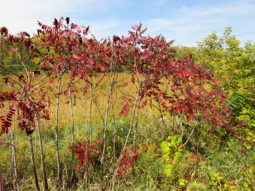 | | 2021 | COLLECTED | 09/29/2021 | Upper Iowa River area near Bluffton, T99N R9W NE1/4 Sec. 9 and S1/2 Sec. 10 | 43.40275000, -91.90494000 | 299 | High bluffs, roadside and stream banks | Wild material | Plants sampled in nature (29 September 2021) during peak fall color displaying bright reds to maroonish colors while measuring approximately 12-15 feet in height. One clonal patch noted was estimated to have 1,000+ ramets. | 2122093 | Ames 35752 |
| 69 | Ames 35749 | Ames 35749 | Agastache scrophulariifolia (Willd.) Kuntze | Iowa, United States | NC7 |  | | 2021 | COLLECTED | 09/22/2021 | Located approximately 3.18 miles south, southwest of Janesville, T90N R14W NE1/4 NE1/4 Sec. 22 on west side of Ford Road | 42.59820000, -92.47517000 | 276 | Partially shaded, wooded roadside. | Wild material | | 2122067 | Ames 35749 |
| 70 | OPGC 8359 | CBG-10615 | Symphyotrichum drummondii (Lindl.) G. L. Nesom | Illinois, United States | OPGC | | | 2021 | | | | | | | Wild material | Plant numbers sampled estimated. | 2120231 | OPGC 8359 |
| 71 | W6 59241 | CBG-10557 | Boehmeria cylindrica (L.) Sw. | Illinois, United States | W6 | | | 2021 | | | | | | | Wild material | | 2120153 | W6 59241 |
| 72 | W6 59274 | CBG-10598 | Scrophularia marilandica L. | Illinois, United States | W6 | | | 2021 | | | | | | | Wild material | Plant numbers sampled estimated. | 2120183 | W6 59274 |
| 73 | W6 58242 | UT080-259 | Sporobolus airoides (Torr.) Torr. | Utah, United States | W6 | | | 2020 | | | | | | | Wild material | 2-3 feet tall, yellowish brown to purple spikelets, narrow basal leaves, ligule glabrous, leaves sheathing. | 2107618 | W6 58242 |
| 74 | W6 57540 | NCBG-499 | Teucrium canadense L. | North Carolina, United States | W6 |  | | 2019 | | | | | | | Wild material | | 2098464 | W6 57540 |
| 75 | W6 57549 | NCBG-566 | Parthenocissus quinquefolia (L.) Planch. | Maryland, United States | W6 |  | | 2019 | | | | | | | Wild material | | 2098473 | W6 57549 |
| 76 | OPGC 7949 | NEWFS-307 | Eutrochium maculatum (L.) E. E. Lamont | Massachusetts, United States | OPGC |  | | 2019 | | | | | | | Wild material | | 2098191 | OPGC 7949 |
| 77 | W6 57393 | NEWFS-306 | Laportea canadensis (L.) Wedd. | Massachusetts, United States | W6 |  | | 2019 | | | | | | | Wild material | | 2098190 | W6 57393 |
| 78 | Ames 35242 | APS/EA/2019/046/375 | Euonymus atropurpureus Jacq. | Missouri, United States | NC7 |  | | 2019 | COLLECTED | 11/02/2019 | Mule Shoe Conservation Area along CR 66 approximately 7.5 miles east of Cross Timbers. | 38.01203000, -93.09312000 | 265 | Roadside, deciduous forest. | Wild material | | 2097787 | Ames 35242 |
| 79 | Ames 35237 | Ames 35237 | Monarda fistulosa L. | New Mexico, United States | NC7 |  | | 2019 | COLLECTED | 10/03/2019 | Railroad Canyon located approximately 6.38 miles west of Kingston just north of highway 152, T16S R10W Grant County | 32.91279900, -107.81640300 | 2173 | Sparsely wooded canyon with small creek. | Wild material | | 2097773 | Ames 35237 |
| 80 | Ames 35236 | SF_ID:24690/EO-ID:17843 | Agastache foeniculum (Pursh) Kuntze | Nebraska, United States | NC7 |  | | 2019 | | | | | | | Wild material | Plants measuring approximately 60 cm in height. Infructescences fully mature at time of collection (23 October 2019), likely past peak maturity by approximately 4 weeks. Population (EC-ID: 17843) was originally documented by Steven B. Rolfsmeier on 8 June 2015 (Nebraska Pine Ridge Plant Resurvey, 2015: Report submitted to the Nebraska Natural Heritage Program) noting “ Agastache foeniculum was located in a ravine bottom that burned in 2012. Estimated population size: 200-300 stems covering approximately 125 sq. meters”. A. foeniculum in Nebraska is currently tracked by the Nebraska Natural Heritage Program and is listed (6 November 2019) as a S1 (Critically Imperiled - at very high risk of extirpation in the state due to very restricted range, few populations or occurrences, steep declines, severe threats or other factors) and Tier 2 species (Tier 2 - species are typically those that are not at-risk from a global or national perspective but are rare or imperiled within Nebraska). | 2097772 | Ames 35236 |
| 81 | Ames 35232 | Ames 35232 | Ptelea trifoliata L. | Illinois, United States | NC7 |  | | 2019 | COLLECTED | 10/01/2019 | Rock Creek watershed located approximately 4.5 miles southwest of Athens, T17N R6W SE1/4 SW1/4 Sec. 8 | 39.93164600, -89.80193000 | 159 | Creek banks, floodplain, and fence rows (north and west facing slopes) | Wild material | | 2097768 | Ames 35232 |
| 82 | Ames 35216 | Potato Creek SP | Monarda sp. | Indiana, United States | NC7 |  | | 2019 | COLLECTED | 09/02/2019 | Potato Creek State Park located approximately 2.6 miles northeast of North Liberty, T36N R1E extreme eastern edge of NW 1/4 SW 1/4 Sec. 23. | 41.55439400, -86.38375900 | 222 | Degraded floodplain, along sides of elevated road bed. | Wild material | This taxa is currently undescribed and according to Campbell and Medley in The atlas of vascular plants in Kentucky (Accessed 06 September 2019) was provisionally named Monarda serotina by R.T. Simmers. Described as a broad-leaved form of M. fistulosa, generally intermediate between M. fistulosa and M. clinopodia, with probable hybrid origin. Typcial habitat is mesic woods and edges on lowlands. In contrast to M. fistulosa, this taxon has longer petioles (usually 2-3 cm versus 0.5-2.0 cm), lower leaf surfaces with scattered spreading hairs, and corollas are paler pink at tips to almost white with peak flowering occurring prior to M. fistulosa by approximately 1-2 weeks. Leaves are rather rugose, where upper leaf tissue between veins is visibly raised. This accession represents genetics from northern Indiana (Potato Creek State Park). Plants at the collection site in nature peaked flowering near 8 July 2019 where flower colors were more lavender in sun but pale in shade (Namestnik, S., personal communication, 15 July 2020). Peak fruiting occurs mid-August. Average height of plants sampled in nature estimated at 4.5' in height. | 2097752 | Ames 35216 |
| 83 | OPGC 7451 | CP4-32 | Heterotheca villosa (Pursh) Shinners | Utah, United States | OPGC |  | | 2019 | | | | | | | Wild material | | 2092029 | OPGC 7451 |
| 84 | OPGC 7311 | AZ930-363 | Aquilegia chrysantha A. Gray | Arizona, United States | OPGC | 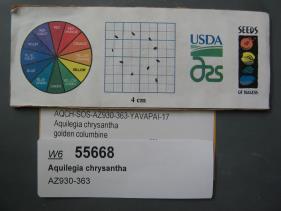 | | 2018 | | | | | | | Wild material | | 1970379 | OPGC 7311 |
| 85 | W6 55674 | AZ930-369 | Achillea millefolium L. | Arizona, United States | W6 |  | | 2018 | | | | | | | Wild material | Achillea millefolium | 1970385 | W6 55674 |
| 86 | W6 54008 | MARSB-151 | Carex lurida Wahlenb. | Delaware, United States | W6 |  | | 2018 | | | | | | | Wild material | Carex lurida | 1964724 | W6 54008 |
| 87 | WLP 1231 | APS/HA/2017/032/291 | Hydrangea arborescens L. | Tennessee, United States | NA | | | 2017 | COLLECTED | 11/05/2017 | South side of Cumberland River and the east end of Bluff Rd, South Carthage, Smith County | 36.24106000, -85.94595000 | 174 | Deciduous forest. Talus slope below limestone bluffs. | Wild material | | 1954438 | WLP 1231 |
| 88 | Ames 34037 | JDC/MF/2017/059/813 | Monarda fistulosa L. | Iowa, United States | NC7 |  | | 2017 | COLLECTED | 10/26/2017 | Private property located approximately 6.2 miles west, southwest of Grinnell, T80N R17W SE 1/4 NE 1/4 NW 1/4 Sec. 21, Jasper County | 41.72810000, -92.83508100 | 285 | Prairie remnant, never plowed. Small (e.g. less than 1 acre), localized area of mixed woody (tree/shrub), grass, and forbs. | Wild material | Population sampled at collection site consisted of approximately half of the specimens being void of foliage likely due to susceptibility to mildew, while the remaining half still had some green foliage at time of sampling (10/26/2017). Plants sampled varied in height, typically 3' in height, but a few specimens measuring 5' in height. | 1954326 | Ames 34037 |
| 89 | Ames 34052 | PB1701 | Betula papyrifera Marshall | Minnesota, United States | NC7 |  | | 2017 | COLLECTED | 09/16/2017 | Detroit Mountain area just east of Detroit Lakes approximately 2.9 miles, T139N R40W SW 1/4 NE 1/4 and NE 1/4 NE 1/4 NW 1/4 Sec. 21, Becker County | 46.81210900, -95.78208300 | 457 | Mixed deciduous woods. | Wild material | | 1954341 | Ames 34052 |
| 90 | Ames 33982 | JDC/FQ/2017/038/792 | Fraxinus quadrangulata Michx. | Kentucky, United States | NC7 | 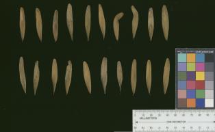 | | 2017 | COLLECTED | 07/10/2017 | Scattered hillside colllections throughout areas approximately 4.5 miles north, northwest of Frankfort, Franklin County | 38.21387700, -84.88886200 | 199 | Mixed wooded deciduous forest, generally steep (45 degree +) slopes and/or hillsides. | Wild material | | 1950065 | Ames 33982 |
| 91 | Ames 33991 | JDC/FQ/2017/047/801 | Fraxinus quadrangulata Michx. | Ohio, United States | NC7 | 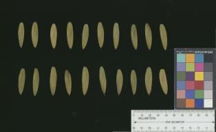 | | 2017 | COLLECTED | 07/15/2017 | Near Seymour Woods State Preserve along Olentangy River watershed approximately 4.7 miles south of Delaware, T4N R19W, Delaware County | 40.24709800, -83.05712000 | 252 | Deciduous woods, mostly found along steep (45-50 degree) slopes adjacent to watershed. | Wild material | | 1950074 | Ames 33991 |
| 92 | Ames 33918 | APS/GD/2017/008/267 | Gymnocladus dioicus (L.) K. Koch | Minnesota, United States | NC7 |  | | 2017 | COLLECTED | 03/16/2017 | Minnesota River watershed covering approximately 9.0 river miles between Redwood Falls and Vicksburg Park, Renville County | 44.61447700, -95.14878600 | 254 | Mixed habitats, both upland dry sites, wet sites, and rocky sites. | Wild material | | 1946985 | Ames 33918 |
| 93 | Ames 33921 | APS/GD/2016/001/236 | Gymnocladus dioicus (L.) K. Koch | Minnesota, United States | NC7 |  | | 2017 | COLLECTED | 03/17/2017 | Blue Earth River watershed covering approximately 9.0 river miles from Vernon Center south to the county line, Blue Earth and Faribault Counties | 43.87215300, -94.17375800 | 316 | Mixed habitats, both upland dry and wet sites. | Wild material | | 1946988 | Ames 33921 |
| 94 | WLP 1179 | NA 83874 | Frangula caroliniana (Walter) A. Gray | Kentucky, United States | NA | | | 2016 | COLLECTED | 09/26/2016 | Floracliff Nature Sanctuary & Trail's End. | 38.01100000, -84.51700000 | 255 | Dense woodland. | | | 1950543 | WLP 1179 |
| 95 | Ames 33736 | JDC/BA/2016/028/743 | Betula alleghaniensis Britton | Iowa, United States | NC7 |  | | 2016 | COLLECTED | 09/02/2016 | Fallen Rock State Preserve approximately 1.9 miles southwest of Steamboat Rock, T88N R19W NW ¼ Sec. 32. | 42.39459000, -93.09423600 | 310 | High-quality, native, mesic deciduous woods on loose, loamy sandstone amongst very large boulders. North-facing with variable 10-50 degree slopes. Majority of specimens located at base of bluff or near water’s edge (Iowa River). | Wild material | The native range of Betula alleghaniensis is concentrated in the northeastern U.S. with disjunct populations in Iowa (Little, 1971). This accession represents a collection of Betula alleghaniensis germplasm from the extreme western edge of the species native range. The next closest occurrence is in Mitchell County, Iowa (60 miles). As of 2025, two trees at Fallen Rock State Preserve currently represent the state of Iowa's 1st and 2nd largest yellow birch specimens measuring 22.76" DBH; 70.83' height; 40' average crow spread (151.83 points) and 17.18" DBH; 65.33' height; 33.75' average crow spread (127.76 points), respectively (Rouw, M., personal communication, 13 May 2018). | 1942689 | Ames 33736 |
| 96 | Ames 33357 | JDC/UT/2016/018/733 | Ulmus thomasii Sarg. | Iowa, United States | NC7 |  | | 2016 | COLLECTED | 06/03/2016 | Malanaphy Springs State Preserve just northwest of Decorah, T99N R8W SW ¼ NW ¼ SE ¼ Sec. 31 | 43.34713800, -91.83840000 | 302 | Deciduous woods. Rocky substrate. 20 degree northwest-facing slope | Wild material | Ulmus thomasii (Rock elm) is an underutilized tree species both in conservation and in the urban landscape. Charles Sprague Sargent (first director of the Arnold Arboretum of Harvard University, Boston, MA) described the wood of Rock Elm as "heavy, hard, very strong and tough, closely grained, and susceptible of receiving a beautiful polish". Historically noted for a variety of uses in woodworking including furniture, heavy agricultural implements, timber frame buildings, pianos, hockey sticks, and hand tools. U. thomasii is extremely drought tolerant, adaptable to very calcareous soils, and compared to U. americana or U. rubra has a very conservative growth rate requiring minimal attention in regards to pruning. Rock elm naturally tends to develop into a nice structural specimen in the landscape, unlike other fast growing U. americana cultivars in the nursery trade needing frequent attention. Rock elm has very fissured bark and is well known for maintaining a strong central leader resulting in a very attractive, pyramidal form. Despite many literature sources stating that "wings" on the stems are a key identifiying characteristic, this trait is not reliable and many genotypes may completely lack "wings" on the stems. While growth habit and morphology of dormant buds (very pointy) are good traits to help aid in identification, fruits are the best way to confirm identity. Fruits are densly pubescent, often described as "inflated" and generally reach maturity a couple weeks after U. rubra and U. americana. U. thomasii flowering in central Iowa typically occurs the last week in April into the first week in May and are rather distinguishable from other Ulmus in being pendulous. Fruits are extremely prized treats for many birds, where fruits are often "robbed" prior to full maturity. Fruits are also highly prized by many other animals such as mice, squirrels, chipmunks, turkeys, etc. and are generally consumed within hours after fruit abscission. The native range of U. thomasii is concentrated in the northeastern United States and into Canada with disjunct populations documented in northwestern Missouri and northwestern Arkansas (Little, E. L. Jr. 1971). In the 1895 Silva of North America (vol. 7) it was stated that, “The value of the wood of the Rock Elm threatens its extinction and most of the large trees have already been cut.” Today, since rock elm is rather rare, especially in areas near the edges of its range, many states list the species as endangered or threatened warranting preservation efforts. This accession represents genetics from northeast Iowa (Winneshiek County). In an assessment of some of the largest Ulmus thomasii (native and cultivated) across Iowa, four of the nine largest specimens in Iowa are present in Malanaphy Springs State Preserve where this accession was sampled. The second largest U. thomasii in the state located in Malanaphy Springs was measured on 22 May 2020 with a circumference of 6.42', height of 86.58', and an average crown spread of 68.00' (180 points) (Rouw, M., personal communication, 8 February 2021). | 1940580 | Ames 33357 |
| 97 | Ames 33288 | APS/GD/2016/009/244 | Gymnocladus dioicus (L.) K. Koch | Michigan, United States | NC7 |  | | 2016 | COLLECTED | 04/05/2016 | Ottawa County: T7N R13W SW 1/4 SW 1/4 NE 1/4 Sec. 32; T7N R13W NE 1/4 NE 1/4 SW 1/4 Sec. 29; and T7N R14W NW 1/4 NW 1/4 Sec. 10 along Grand River both north (approximately 2.87 miles) and east (approximately 3.84 miles) of Allendale. | 43.00148000, -85.91236400 | 184 | Floodplain. | Wild material | | 1940345 | Ames 33288 |
| 98 | Ames 33289 | APS/GD/2016/010/245 | Gymnocladus dioicus (L.) K. Koch | Michigan, United States | NC7 |  | | 2016 | COLLECTED | 04/05/2016 | Ionia County: T5N R5W SW 1/4 SW 1/4 SE 1/4 Sec. 21; T5N R5W NE 1/4 NW 1/4 NW 1/4 Sec. 20; and T5N R5W SW 1/4 SW 1/4 SE 1/4 Sec. 20 along Grand River approximately 4.80 miles south and slightly west of Portland. | 42.80296200, -84.91275400 | 231 | Floodplain. | Wild material | | 1940346 | Ames 33289 |
| 99 | W6 49526 | CBG-2466 | Carex shortiana Dewey | Illinois, United States | W6 |  | | 2015 | | | | | | | Wild material | | 1926159 | W6 49526 |
| 100 | W6 49533 | CBG-2474 | Osmorhiza longistylis (Torr.) DC. | Illinois, United States | W6 |  | | 2015 | | | | | | | Wild material | | 1926010 | W6 49533 |
| 101 | W6 49534 | CBG-2475 | Carex stipata Muhl. ex Willd. | Illinois, United States | W6 |  | | 2015 | | | | | | | Wild material | | 1926011 | W6 49534 |
| 102 | Ames 32892 | APS/GD/2015/014/196 | Gymnocladus dioicus (L.) K. Koch | Oklahoma, United States | NC7 |  | | 2015 | COLLECTED | 03/13/2015 | Wagoner County: Billy Creek watershed, T17N R17E NE 1/4 Sec. 22. McClellen-Kerr Wildlife Management Area (Billy Creek WDU) portion approximatley 4 miles west, southwest of Wagoner. | 35.94442000, -95.48112700 | 171 | Floodplain. | Wild material | | 1925358 | Ames 32892 |
| 103 | Ames 32893 | APS/GD/2015/016/198 | Gymnocladus dioicus (L.) K. Koch | Oklahoma, United States | NC7 |  | | 2015 | COLLECTED | 03/14/2015 | Creek County: West Fork Sandy Creek watershed and small tributaries. T14N R9E SW 1/4 SE 1/4 Sec. 21. Private property approximately 11 miles south of Bristow. | 35.66820200, -96.35882500 | 216 | Floodplain. | Wild material | | 1925359 | Ames 32893 |
| 104 | Ames 32902 | APS/GD/2015/030/212 | Gymnocladus dioicus (L.) K. Koch | Oklahoma, United States | NC7 |  | | 2015 | COLLECTED | 03/18/2015 | Logan County: T18N R2W N 1/2 Sec. 36. Private property approximately 1.5 miles east of the confluence of Skeleton Creek and Cimarron River approximately 5.25 miles south southeast of Mulhall. | 35.99593500, -97.36486800 | 288 | Transition zone between higher elevations and bottomlands. | Wild material | | 1925368 | Ames 32902 |
| 105 | Ames 32903 | APS/GD/2015/031/213 | Gymnocladus dioicus (L.) K. Koch | Oklahoma, United States | NC7 |  | | 2015 | COLLECTED | 03/19/2015 | Osage County: Arkansas River watershed area known as Souters Bend, T21N R7E. Keystone Wildlife Management Area (John Lowery Unit) approximatley 3 miles west of Cleveland. | 36.30185300, -96.53051000 | 222 | Floodplain, but one specimen sampled was located on dry, rocky (large boulders) bluff. | Wild material | | 1925369 | Ames 32903 |
| 106 | Ames 32886 | APS/GD/2015/002/184 | Gymnocladus dioicus (L.) K. Koch | Missouri, United States | NC7 |  | | 2015 | COLLECTED | 03/03/2015 | Douglas County: North Fork River watershed, T26N R12W Sec. 13. Private property approximately 5.3 miles east, southeast of Vanzant. | 36.93971400, -92.21469500 | 264 | Floodplain. Riverbank in pure sand. | Wild material | | 1924364 | Ames 32886 |
| 107 | Ames 32887 | APS/GD/2015/003/185 | Gymnocladus dioicus (L.) K. Koch | Arkansas, United States | NC7 |  | | 2015 | COLLECTED | 03/04/2015 | Stone and Izard Counties: White River watershed, Ozark National Forest, Sylamore State Wildlife Management Area near Allison. | 35.95017300, -92.11129600 | 126 | Floodplain, base of slopes. | Wild material | | 1924365 | Ames 32887 |
| 108 | NA 83061 | ZARKS-005 | Gymnocladus dioicus (L.) K. Koch | Arkansas, United States | NA | | | 2015 | COLLECTED | 10/02/2014 | Frog Valley (private property). West bank of North Fork of Saline River. | 34.76276000, -92.71386000 | 133 | Alluvial low floodplain, in sandy clay soil. Slope: 0 degrees. Elevation: 435 feet. | Wild material | | 1950627 | NA 83061 |
| 109 | NA 83062 | NA 83062 | Taxodium distichum (L.) Rich. | Arkansas, United States | NA | | | 2015 | COLLECTED | 10/02/2014 | Frog Valley (private property). Banks of North Fork of Saline River. | 34.76443000, -92.71338000 | 135 | Alluvial low floodplain, in gravel bank. | | | 1951432 | NA 83062 |
| 110 | NA 83063 | NA 83063 | Hamamelis vernalis Sarg. | Arkansas, United States | NA | | | 2015 | COLLECTED | 10/02/2014 | Frog Valley (private property). Gravel bar along North Fork of Saline River. | 34.76543000, -92.71353000 | 134 | Alluvial low floodplain; gravel bar. | | | 1950887 | NA 83063 |
| 111 | Ames 34696 | MARSB-074 | Cornus amomum Mill. | New Jersey, United States | NC7 |  | | 2015 | COLLECTED | 08/29/2013 | West Essex Park just southeast of Pine Brook. | 40.84291000, -74.31341000 | 51 | | Wild material | | 1922850 | Ames 34696 |
| 112 | Ames 32835 | GA14014001 | Fraxinus pennsylvanica Marshall | North Dakota, United States | NC7 |  | | 2014 | COLLECTED | 10/30/2014 | Bottineau County, Turtle Mountains. | 48.97000000, -100.45000000 | 737 | Mixed oak-aspen forest | Wild material | | 1921828 | Ames 32835 |
| 113 | WLP 1746 | Ames 32838 | Viburnum opulus L. var. americanum Aiton | North Dakota, United States | NA | | | 2014 | COLLECTED | 10/31/2014 | Turtle Mountains - Bottineau County. | 48.95000000, -100.43000000 | 692 | Wet, aspen forest. Growing in association with Sanicula marilandica, Fragaria virginiana, Trifolium repens, Rubus sp., Typha latifolia, Prunus pensylvanica, Prunus virginiana, Corylus sp., Crataegus sp., Viburnum lentago, Rosa sp., Cornus sericea, Amelanchier sp., Symphoricarpos sp., Salix sp., Betula papyrifera, Populus tremuloides, Ulmus americana, Acer negundo, Quercus macrocarpa, and Fraxinus pennsylvanica. | Wild material | | 1921831 | WLP 1746 |
| 114 | WLP 1967 | HBC1401 | Viburnum opulus L. var. americanum Aiton | North Dakota, United States | NA | | | 2014 | COLLECTED | 09/29/2014 | Jay Wessels Wildlife Management Area located in Pembina County. | 48.80000000, -97.83000000 | 312 | Diverse habitats including edge of swamp and also upland sandy soils. Growing in association Fraxinus pennsylvanica, Fraxinus nigra, Quercus macrocarpa, Acer negundo, Ulmus americana, Populus tremuloides, Populus balsamifera, Toxicodendron radicans, Cornus sericea, Rosa sp., Corylus sp., Prunus virginiana, Ribes sp., Equisetum sp., Rubus sp., IMpatiens capensis, Thalictrum dasycarpum, Fragaria virginiana, Asarum canadense, Calamagrostis canadensis, Sium suave, Solidago gigantea, Poa pratensis, and Bromus inermis. | Wild material | | 1921830 | WLP 1967 |
| 115 | WLP 1422 | JDC/NS/2014/068/570 | Nyssa sylvatica Marshall | Mississippi, United States | NA | | | 2014 | COLLECTED | 09/21/2014 | Mississippi: Lafayette County; Holly Springs National Forest along County Road 244. | 34.50982900, -89.35716800 | 95 | Floodplain. Wet woods. Growing in association with Liquidambar styraciflua, Acer negundo, Cetlis sp., Juniperus virginiana, Carya illinoinensis, Quercus nigra, and Quercus phellos. | Wild material | Fruits rather green. | 1922346 | WLP 1422 |
| 116 | WLP 697 | BJP/AS/2014/001 | Amelanchier spicata (Lam.) K. Koch | Maine, United States | NA | | | 2014 | COLLECTED | 07/03/2014 | East side of Chadbourne Road ca. 3 miles northeast of Standish, Cumberland County, ME. Plants growing under power lines. | 43.77094000, -70.50589000 | | Roadside under power line. | Wild material | | 1922788 | WLP 697 |
| 117 | Ames 32760 | JDC/AB/2014/040/542 | Abies balsamea (L.) Mill. | Iowa, United States | NC7 | | | 2014 | COLLECTED | 09/03/2014 | Bluffton Fir State Preserve, near Bluffton, Winneshiek County. | 43.40106767, -91.90659200 | 326 | High quality, native woods. Steep slope, northwest-facing, and relatively flat portion on top of bluff (powerline) | Wild material | | 1921308 | Ames 32760 |
| 118 | Ames 32756 | C-alt-02 | Cornus alternifolia L. f. | Maine, United States | NC7 | | | 2014 | COLLECTED | 08/08/2014 | End of Lower Lyndon Street (public boat landing), immediately south of Caribou, Aroostook County. | 46.84576900, -68.00155500 | 121 | Specimens sampled in woods on flat terrain on the west side of the Aroostook River. Collection site is several (2-3) meters higher in elevation than the river below near a steep incline (45 degrees) at the edge of the river. Growing in association with Populus tremuloides, Pinus strobus, Acer negundo, Cornus sericea, Amelanchier sanguinea, Cornus canadensis, and Sorbus aucuparia. | Wild material | | 1920149 | Ames 32756 |
| 119 | Ames 32386 | JDC/BN/2014/013/515 | Betula nigra L. | Iowa, United States | NC7 |  | | 2014 | COLLECTED | 06/05/2014 | Bearbower Sand Prairie, T87N R9W SW 1/4 of SW 1/4 Sec. 32. | 42.29814100, -91.92822800 | 289 | Sand prairie with likely high water table. | Wild material | | 1919307 | Ames 32386 |
| 120 | Ames 32388 | JDC/BN/2014/015/517 | Betula nigra L. | Iowa, United States | NC7 |  | | 2014 | COLLECTED | 06/05/2014 | Princeton Wildlife Management Area, T80N R5E NE 1/4 Sec. 35. | 41.69417800, -90.34158400 | 177 | Wet, heavy soil floodplain. | Wild material | | 1919309 | Ames 32388 |
| 121 | Ames 32389 | JDC/BN/2014/016/518 | Betula nigra L. | Iowa, United States | NC7 |  | | 2014 | COLLECTED | 06/06/2014 | Clemmons Creek Wildlife Management Area, T75N R8W NE 1/4 Sec. 14. | 41.30388300, -91.74342500 | 208 | Wet, floodplain. | Wild material | | 1919310 | Ames 32389 |
| 122 | Ames 32222 | APS/GD/2013/014/099 | Gymnocladus dioicus (L.) K. Koch | Illinois, United States | NC7 | | | 2014 | COLLECTED | 03/20/2014 | Timber Creek watershed, Section 19, T22N, R1E, and Section 24, T22N, R1W, just northeast of McLean, McLean County. | 40.34355000, -89.14919700 | 214 | Floodplain. | Wild material | | 1917826 | Ames 32222 |
| 123 | Ames 32127 | JDC/FN/2013/053/497 | Fraxinus nigra Marshall | Iowa, United States | NC7 | | | 2013 | COLLECTED | 12/17/2013 | Echo Valley Park, near West Union, Fayette County. | 42.94396000, -91.77611500 | 325 | Floodplain and at base of slopes | Wild material | A few specimens over 70 feet in height. | 1914771 | Ames 32127 |
| 124 | Ames 31992 | APS/GD/2013/017/102 | Gymnocladus dioicus (L.) K. Koch | Kentucky, United States | NC7 |  | | 2013 | COLLECTED | 03/04/2013 | Dinsmore Woods, Boone County. | 38.99959500, -84.81492800 | 189 | Base of south-facing bluff. | Wild material | | 1908270 | Ames 31992 |
| 125 | Ames 31678 | GA12003001 | Fraxinus pennsylvanica Marshall | Minnesota, United States | NC7 |  | | 2012 | COLLECTED | NEAR 09/26/2012 | Buffalo River State Park along the Buffalo River, east of Glyndon, Clay County. | 46.86481660, -96.46406660 | 302 | Floodplain. Transistion zone between prairie and forest | Wild material | | 1906589 | Ames 31678 |
| 126 | Ames 31679 | GA12011001 | Fraxinus pennsylvanica Marshall | North Dakota, United States | NC7 |  | | 2012 | COLLECTED | NEAR 09/27/2012 | Sheyenne National Grassland along the Sheyenne River just east of Lisbon near Richland and Ransom County line. | 46.53246660, -97.26656660 | 302 | Riverbank and transition area of tallgrass prairie and riparian forest. Sandy-silt soil with good drainage and ph of ~7 | Wild material | Population located close to windbreak planted with Fraxinus. | 1906590 | Ames 31679 |
| 127 | WLP 2423 | LBJWC-716 | Platanus occidentalis L. | Texas, United States | NA |  | | 2012 | COLLECTED | 01/16/2010 | Balance Shoals Greenbelt; Blanco River at I-35 [Interstate 35]. Texas Blackland Prairies phytoregion. | 29.90702000, -97.89536000 | 170 | Soil: white gravel (limestone geology) | Wild material | | 1902497 | WLP 2423 |
| 128 | Ames 31254 | JDZ/11/007/001 | Fraxinus pennsylvanica Marshall | North Dakota, United States | NC7 |  | | 2011 | COLLECTED | 10/26/2011 | North side of Devil's Lake, Gilbert C. Grafton State Military Reservation, Sections 20, 28, and 29, T153N, R64W, Camp Grafton Quad, Ramsey County. | 48.05360000, -98.90790000 | 450 | | Wild material | D.B.H. between 4 and 14 inches. | 1897492 | Ames 31254 |
| 129 | Ames 31255 | JDZ/11/008/001 | Fraxinus pennsylvanica Marshall | North Dakota, United States | NC7 |  | | 2011 | COLLECTED | 10/26/2011 | South side of Devil's Lake, Sully's Hill National Game Preserve, Section 15, T152N, R65W, Fort Totten Quad, Benson County. | 47.98560000, -98.96810000 | 475 | 10 degrees of slope with southern and southwestern aspects. | Wild material | D.B.H. between 4 and 14 inches. | 1897493 | Ames 31255 |
| 130 | Ames 31217 | GA15004001 | Fraxinus pennsylvanica Marshall | North Dakota, United States | NC7 |  | | 2011 | COLLECTED | 09/24/2011 | Along Forest Service Road 842, SW 1/4 of Section 2, T147N, R99W, Long X Divide Quad, Badlands, Little Missouri National Grasslands, McKenzie County. | 47.57730000, -103.26760000 | 674 | Clay substrate. | Wild material | Requests will be filled using inventory sample 11ncao02 (JDZ/2011/004/002) unless otherwise noted. | 1896696 | Ames 31217 |
| 131 | Ames 31218 | GA15005001 | Fraxinus pennsylvanica Marshall | North Dakota, United States | NC7 |  | | 2011 | COLLECTED | 09/24/2011 | Along East River and Tracy Mountain Roads, Burning Coal Vein Campground, T139N, R102W, Chimney Butte Quad, Badlands, Little Missouri National Grasslands, Billings and Slope County. Area following along Little Missouri River and including small tributaries from approximately 4.5 miles south of Medora, ND to approximately 2.5 miles south of Billings/Slope County line. Material sampled along an 18 mile stretch. | 46.81270000, -103.50900000 | 780 | Clay substrate. | Wild material | Requests will be filled using inventory sample 11ncao02 (JDZ/2011/005/002) unless otherwise noted. | 1896697 | Ames 31218 |
| 132 | NA 87911 | LBJWC-0636 | Taxodium distichum (L.) Rich. | Texas, United States | NA |  | | 2011 | | | | | | | Wild material | | 1895379 | NA 87911 |
| 133 | WLP 2480 | 210568 | Malvaviscus arboreus Cav. | Texas, United States | NA |  | | 2011 | COLLECTED | 09/30/2003 | | | | | Wild material | | 1895410 | WLP 2480 |
| 134 | Ames 30619 | JDZ/2011/003/001 | Fraxinus nigra Marshall | Minnesota, United States | NC7 |  | | 2011 | COLLECTED | 09/16/2011 | Buffalo River watershed, Buffalo River State Park, Section 11 and Section 12, T139N, R46W, Downer Quad, Clay County. | 46.86650000, -96.45250000 | 306 | Bottomland/floodplain forest. | Wild material | | 1849377 | Ames 30619 |
| 135 | Ames 31086 | 691 | Fraxinus pennsylvanica Marshall | New York, United States | NC7 |  | | 2011 | COLLECTED | 09/10/2011 | Winters Road, south of Main Street, Chemung County. | 42.13200000, -76.92800000 | 275 | Floodplain of Cuthrie Run | Wild material | | 1891472 | Ames 31086 |
| 136 | Ames 31087 | 692 | Fraxinus pennsylvanica Marshall | New York, United States | NC7 |  | | 2011 | COLLECTED | 09/11/2011 | McMaster at Jasper-North Cameron Road, Steuben County. | 42.20400000, -77.41500000 | 349 | Edge of Canisteo River, adjacent farmland. | Wild material | | 1891473 | Ames 31087 |
| 137 | Ames 31090 | 709 | Fraxinus pennsylvanica Marshall | Pennsylvania, United States | NC7 |  | | 2011 | COLLECTED | 09/17/2011 | Limerick Lane at Bear (or Bayer) Creek Road; Junction Cross Road at Bradshaw Road near Russel B. Walter Elementary School, Tioga County. | 41.92100000, -77.13400000 | 315 | Floodplain forest. | Wild material | | 1891476 | Ames 31090 |
| 138 | Ames 31091 | 713 | Fraxinus pennsylvanica Marshall | New York, United States | NC7 |  | | 2011 | COLLECTED | 09/17/2011 | Old River Road Trail and White Wagon Road, on north and south sides of Chemung River, respectively, Chemung County. | 42.00700000, -76.55900000 | 241 | Urban-distrurbed floodplain forest, north side of Chemung River; roadside edge and adjacent farm fields on south side of Chemung River. Steep, south-facing slope | Wild material | | 1891477 | Ames 31091 |
| 139 | Ames 30679 | JDC/FP/2010/064/334 | Fraxinus pennsylvanica Marshall | Wisconsin, United States | NC7 |  | | 2010 | COLLECTED | 09/27/2010 | Floodplain along railroad, adjacent to Perrot State Park, S 1/2 of Section 20, T18N R9W, Trempealeau Quad, just west of Trempealeau, Trempealeau County. | 44.01496000, -91.47822000 | 208 | | Wild material | | 1853837 | Ames 30679 |
| 140 | Ames 30680 | JDC/FP/2010/065/335 | Fraxinus pennsylvanica Marshall | Wisconsin, United States | NC7 |  | | 2010 | COLLECTED | 09/28/2010 | Boat ramp on south side of Little Falls Lake, Willow River State Park, NW 1/4 of SW 1/4 of Section 9, T29N R19W, Somerset South Quad, St. Croix County. | 45.02739000, -92.72092000 | 299 | Scattered throughout lakeshore forest | Uncertain improvement status | | 1853838 | Ames 30680 |
| 141 | Ames 30685 | JDC/FP/2010/075/345 | Fraxinus pennsylvanica Marshall | Wisconsin, United States | NC7 |  | | 2010 | COLLECTED | 09/30/2010 | Parking area for Richter Lane boat ramp, north side of Trauba Road, near northeast shore of Lake Poygan, SE 1/4 of NE 1/4 of Section 36, T20N R14E, Lake Poygan Quad, Winnebago County. | 44.16382000, -88.76668000 | 230 | | Wild material | | 1853843 | Ames 30685 |
| 142 | Ames 30620 | JDZ/2010/002/001 | Fraxinus nigra Marshall | Minnesota, United States | NC7 |  | | 2010 | COLLECTED | 09/11/2010 | Northeastern shore of Lake Ida east to eastern shore of Detroit Lake, Becker County. | 46.73107400, -95.94890000 | 413 | Along edge of roads and edge of mixed deciduous forests. Low spots, but not swampy. | Wild material | Unless otherwise noted, requests will be filled using a balanced sample. | 1849378 | Ames 30620 |
| 143 | NA 81605 | JDC/AG/2010/028/298 | Aesculus glabra Willd. | Iowa, United States | NA | | | 2010 | COLLECTED | 09/10/2010 | Along North Raccoon River and Sportsman Club Road, north of Adel, NW 1/4 of NW 1/4 of Section 18, T79N, R27W, Panther Quad, Dallas County. | 41.65600000, -94.04510000 | 322 | Floodplain. Associated with Acer negundo, A. saccharinum, Celtis occidentalis, Gleditsia triacanthos, and Gymnocladus dioicus. | Wild material | Very tall (55-60 feet in height) specimens. Largest specimen noted measured 62.23cm in d.b.h. | 1856466 | NA 81605 |
| 144 | Ames 30482 | APS/GD/2010/002/037 | Gymnocladus dioicus (L.) K. Koch | Missouri, United States | NC7 |  | | 2010 | COLLECTED | 02/17/2010 | Lake of the Ozarks, Grandglaize Creek Watershed, T39N R15W NW 1/4 Sec. 36 and NE 1/4 of SE 1/4 Sec. 35, Toronto Quad, Miller County. | 38.07386700, -92.52686700 | 207 | Mixed deciduous woods. | Wild material | | 1831341 | Ames 30482 |
| 145 | Ames 30484 | APS/GD/2010/004/039 | Gymnocladus dioicus (L.) K. Koch | Tennessee, United States | NC7 |  | | 2010 | COLLECTED | 02/18/2010 | Walnut Log, near Reelfoot National Wildlife Refuge. | 36.47498300, -89.30245000 | 93 | Northwest-facing and west-facing base of bluffs. Very weedy. | Wild material | #123 measured 17.5" d.b.h. and 100' and #124 measured 15" d.b.h. and 60'. | 1831343 | Ames 30484 |
| 146 | Ames 30488 | APS/GD/2010/009/044 | Gymnocladus dioicus (L.) K. Koch | Kentucky, United States | NC7 |  | | 2010 | COLLECTED | 02/21/2010 | Alum Hill and Big Slough Creek, near Hites Falls, Grayson County. | 37.53600000, -86.59630000 | 159 | Floodplain of Big Slough and base of bluffs on northeast-facing slope of Alum Hill. | Wild material | #140 measured 12" d.b.h. at 70', #141 measured 8.5" d.b.h. and 40', #142 measured 12" and 80', #143 measured 9.5" and 60', #144 measured 7.5" d.b.h. and 40', #145 measured 12" d.b.h. and 40', #146 measured 7.3" d.b.h. and 50', and #147 measured 14.25" d.b.h. and 75'. | 1831347 | Ames 30488 |
| 147 | Ames 30370 | JDC/EA/2009/113/263 | Euonymus atropurpureus Jacq. | Ohio, United States | NC7 |  | | 2009 | COLLECTED | 10/18/2009 | Along Suck Run Road, between Neel and Clayton, Decatur Quad, Adams County. | 38.75777778, -83.67444444 | 238 | Roadside. Sandy soils. | Wild material | | 1823922 | Ames 30370 |
| 148 | WLP 813 | JDC/CO/2009/084/234 | Cephalanthus occidentalis L. | Ohio, United States | NA | | | 2009 | COLLECTED | 10/15/2009 | Along Clear Creek, near Revenge, SE 1/4 of SE 1/4 of Section 13, T13N, R19W, Rockbridge Quad, Hocking County. | 39.59361111, -82.61944444 | 246 | Wet marsh. Associated with Acer negundo, Fraxinus nigra, F. pennsylvanica, Juglans nigra, Populus tremuloides, and Viburnum prunifolium. | Wild material | | 1823915 | WLP 813 |
| 149 | WLP 816 | JDC/CO/2009/101/251 | Cephalanthus occidentalis L. | Ohio, United States | NA | | | 2009 | COLLECTED | 10/16/2009 | Along Ohio Highway 93, SW 1/4 of NE 1/4 of Section 26, T5N, R18W, Gallia Quad, Jackson County. | 38.86805556, -82.59694444 | 212 | Standing water. Associated with Acer negundo, A. rubrum, Celastrus orbiculatus, Platanus occidentalis, and Salix. | Wild material | | 1823916 | WLP 816 |
| 150 | WLP 817 | JDC/CS/2009/102/252 | Celastrus scandens L. | Ohio, United States | NA | | | 2009 | COLLECTED | 10/16/2009 | Along Ohio Highway 93, SW 1/4 of NE 1/4 of Section 26, T5N, R18W, Gallia Quad, Jackson County. | 38.86805556, -82.59694444 | 212 | Standing water. Associated with Acer negundo, A. rubrum, Cephalanthus occidentalis, Platanus occidentalis, and Salix. | Wild material | | 1823914 | WLP 817 |
| 151 | Ames 30132 | JDC/CA/2009/041/191 | Cornus amomum Mill. subsp. obliqua (Raf.) J. S. Wilson | Wisconsin, United States | NC7 |  | | 2009 | COLLECTED | 09/22/2009 | Along Kent Road, near Poynette, NW 1/4 of NW 1/4 of Section 29, T11N, R9E, Poynette Quad, Columbia County. | 43.40638889, -89.45861111 | 243 | Hinkson Creek Watershed. | Wild material | | 1819713 | Ames 30132 |
| 152 | Ames 30133 | JDC/CD/2009/063/213 | Cornus drummondii C. A. Mey. | Illinois, United States | NC7 |  | | 2009 | COLLECTED | 09/25/2009 | Four Corners Road, north from Illinois Highway 84, NW 1/4 of SW 1/4 of Section 36, T26N, R2E, Blackhawk (IL-IA) Quad, Jo Daviess County. | 42.20027778, -90.22944444 | 194 | Roadside in fence row. | Wild material | | 1819714 | Ames 30133 |
| 153 | Ames 30141 | JDC/FN/2009/048/198 | Fraxinus nigra Marshall | Wisconsin, United States | NC7 |  | | 2009 | COLLECTED | 09/23/2009 | Pike Lake Unit, Kettle Moraine State Forest, SE 1/4 of SE 1/4 of Section 23, T10N, R18E, Hartford East Quad, Washington County. | 43.31222222, -88.32194444 | 305 | Wet woods next to lake. | Wild material | | 1819722 | Ames 30141 |
| 154 | Ames 30148 | JDC/FP/2009/045/195 | Fraxinus pennsylvanica Marshall | Wisconsin, United States | NC7 |  | | 2009 | COLLECTED | 09/23/2009 | South side of Chub Lake, SE 1/4 of NE 1/4 of Section 25, T9N, R13E, Waterloo Quad, Dodge County. | 43.21944444, -88.89388889 | 239 | Crawfish River watershed. Wet, open woodland. | Wild material | | 1819729 | Ames 30148 |
| 155 | Ames 30149 | JDC/FP/2009/049/199 | Fraxinus pennsylvanica Marshall | Wisconsin, United States | NC7 |  | | 2009 | COLLECTED | 09/23/2009 | Pike Lake Unit, Kettle Moraine State Forest, SE 1/4 of SE 1/4 of Section 23, T10N, R18E, Hartford East Quad, Washington County. | 43.31222222, -88.32194444 | 305 | Wet woods next to lake. | Wild material | | 1819730 | Ames 30149 |
| 156 | Ames 30152 | JDC/FP/2009/060/210 | Fraxinus pennsylvanica Marshall | Wisconsin, United States | NC7 |  | | 2009 | COLLECTED | 09/24/2009 | Along West Beloit Newark Road, Avon Bottoms State Wildlife Area, west of Newark, NE 1/4 of NE 1/4 of Section 19, T1N, R10E, Brodhead East Quad, Rock County. | 42.54250000, -89.34750000 | 235 | Sugar River floodplain/watershed | Wild material | | 1819733 | Ames 30152 |
| 157 | Ames 30153 | JDC/FP/2009/062/212 | Fraxinus pennsylvanica Marshall | Illinois, United States | NC7 |  | | 2009 | COLLECTED | 09/25/2009 | Four Corners Road, north from Illinois Highway 84, NW 1/4 of SW 1/4 of Section 36, T26N, R2E, Blackhawk (IL-IA) Quad, Jo Daviess County. | 42.20027778, -90.22944444 | 194 | Roadside in fence row. | Wild material | | 1819734 | Ames 30153 |
| 158 | Ames 30164 | LQ/PV/2009/004/004 | Prunella vulgaris L. | Wisconsin, United States | NC7 |  | | 2009 | COLLECTED | 09/23/2009 | South side of Chub Lake, SE 1/4 of NE 1/4 of Section 25, T9N, R13E, Waterloo Quad, Dodge County. | 43.21944444, -88.89388889 | 239 | Crawfish River watershed. Wet, open woodland. | Wild material | | 1819745 | Ames 30164 |
| 159 | NA 82193 | JDC/IV/2009/039/189 | Ilex verticillata (L.) A. Gray | Wisconsin, United States | NA | | | 2009 | COLLECTED | 09/22/2009 | Wisconsin: Columbia County; Along Kent Road, near Poynette, NW 1/4 of NW 1/4 of Section 29, T11N, R9E, Poynette Quad. Hinkson Creek watershed. | 43.40638889, -89.45861111 | 243 | Hinkson Creek Watershed. Associated with Acer negundo, Alnus incana subsp. rugosa, Amelanchier, Aronia melanocarpa, Carpinus caroliniana, Cornus amomum subsp. obliqua, Fraxinus nigra, Helianthus strumosus, Juglans nigra, Populus tremuloides, Prunus virginiana, and Viburnum lentago. | Wild material | | 1819738 | NA 82193 |
| 160 | WLP 854 | JDC/CC/2009/038/188 | Carpinus caroliniana Walter | Wisconsin, United States | NA | | | 2009 | COLLECTED | 09/22/2009 | Wisconsin: Columbia County; Along Kent Road, near Poynette, NW 1/4 of NW 1/4 of Section 29, T11N, R9E, Poynette Quad. Hinkson Creek watershed. | 43.40638889, -89.45861111 | 243 | Hinkson Creek Watershed. Associated with Acer negundo, Alnus incana subsp. rugosa, Amelanchier, Aronia melanocarpa, Cornus amomum subsp. obliqua, Fraxinus nigra, Helianthus strumosus, Ilex verticillata, Juglans nigra, Populus tremuloides, Prunus virginiana, and Viburnum lentago. | Wild material | | 1819709 | WLP 854 |
| 161 | Ames 30059 | JDC/AM/2009/013/163 | Aronia melanocarpa (Michx.) Elliott | Wisconsin, United States | NC7 |  | | 2009 | COLLECTED | 08/04/2009 | Hinkson Creek along Kent Road, NW 1/4 of NW 1/4 of Section 29, T11N, R9E, Poynette Quad, Poynette, Columbia County | 43.40638889, -89.45861111 | 243 | Watershed. | Wild material | | 1812362 | Ames 30059 |
| 162 | Ames 30042 | JDC/DL/2009/010/160 | Diervilla lonicera Mill. | Iowa, United States | NC7 |  | | 2009 | COLLECTED | 07/28/2009 | Dolliver State Park along Prairie Creek approximately 9.00 miles southeast of Fort Dodge, T88N R28W NE 1/4 SW 1/4 SE 1/4 Sec. 34 | 42.38611111, -94.09222222 | 308 | Large rocky limestone. North facing slope. | Wild material | | 1812305 | Ames 30042 |
| 163 | Ames 29981 | APS/GD/2009/019/028 | Gymnocladus dioicus (L.) K. Koch | Iowa, United States | NC7 |  | | 2009 | COLLECTED | 04/04/2009 | Near the confluence of the West Fork Cedar River and Shell Rock River, approximatley 2 miles east of Finchford, T90N R14W SE 1/4 SE 1/4 SE 1/4 and also SE 1/4 SW 1/4 Sec. 4 Shell Rock Quad., Black Hawk County. | 42.62888889, -92.49666667 | 272 | Gentle, east-facing slopes and also floodplain. | Wild material | Trees ranging from 13.5 to 18 inches DBH and 50 to 70 feet in height. | 1799101 | Ames 29981 |
| 164 | Ames 29650 | JDC/FP/2008/050/120 | Fraxinus pennsylvanica Marshall | Illinois, United States | NC7 |  | | 2008 | COLLECTED | 10/10/2008 | Along Illinois Highway 37, near Olmsted, NE 1/4 of NW 1/4 of Section 27, T15S, R1E, Olmsted Quad, Pulaski County. | 37.17972222, -89.09472222 | 102 | | Wild material | | 1788205 | Ames 29650 |
| 165 | Ames 29653 | JDC/FP/2008/062/132 | Fraxinus pennsylvanica Marshall | Illinois, United States | NC7 |  | | 2008 | COLLECTED | 10/13/2008 | Along 100N Road, near north fork of Kaskaskia River, NE 1/4 of NW 1/4 of Section 35, T4N, R1W, Wildcat Lake Quad, Fayette County. | 38.75250000, -89.16750000 | 140 | | Wild material | | 1788208 | Ames 29653 |
| 166 | Ames 29617 | JDC/FN/2008/020/090 | Fraxinus pennsylvanica Marshall | Iowa, United States | NC7 |  | | 2008 | COLLECTED | 10/02/2008 | Along Ioway Creek (formerly known as Squaw Creek), SE 1/4 of SE 1/4 of Section 33 and SW 1/4 of SW 1/4 of Section 34, T84N, R24W, Ames, Ames West Quad. | 42.03666667, -93.63861111 | 274 | Native specimens throughout floodplain forest on both sides of creek and on the Iowa State University Disc Golf Course (ISU land). | Wild material | | 1786596 | Ames 29617 |
| 167 | Ames 31383 | MOFI-SOSAZ-932-044-06 | Monarda fistulosa L. | Arizona, United States | NC7 |  | | 2007 | COLLECTED | 08/25/2006 | Located approximately 16.6 miles southwest of Flagstaff along WestFork Oak Creek. T19N R5E Sec. 15, Coconino County | 35.03388890, -111.85666670 | 2007 | Riparian habitat. | Wild material | | 1740366 | Ames 31383 |
| 168 | WLP 1332 | 9 | Lonicera reticulata Raf. | Iowa, United States | NA |  | | 2003 | COLLECTED | 09/14/2003 | Parking area for ford, South Bear Creek Wildlife Area, Highlandville, T100N R7W, NE 1/4 of NE 1/4, Section 35, Highlandville Quad, Winneshiek County. | 43.44083333, -91.64722222 | 274 | Edge of parking area, floodplain. Half sunny. No slope with an eastern aspect. Alluvial soil. Associated with Juglans nigra, Ulmus, Acer negundo, Xanthoxylum, and Rhus glabra. | Wild material | One large, very attractive vine ~14 feet tall, climbing up a Juglans nigra tree. | 1649461 | WLP 1332 |
| 169 | WLP 1931 | Ames 27284 | Viburnum lentago L. | Iowa, United States | NA |  | | 2003 | COLLECTED | 09/07/2003 | Along Wapsi Great Western Trail, Lake Hendricks County Park, T99N R14W, NE corner of SW 1/4 of SW 1/4, Section 19, Riceville Quad, Howard County. | 43.37694444, -92.55111111 | 378 | Associated with Acer negundo, Parthenocissus, Rhamnus cathartica, Cornus racemosa, and Solidago altissima. | Wild material | Small trees to 4 meters tall. | 1648680 | WLP 1931 |
| 170 | WLP 1061 | DC2001-7 | Crataegus sp. | Manitoba, Canada | NA | | | 2001 | COLLECTED | 10/12/2001 | One mile east of junction of highways 2 and 250. Turn south on gravel road to refuse disposal site. Go past and to the left of it and quarry site. To the south of quarry along this side of the Souris River. | 49.61306000, -100.23444000 | 0 | Raparian zone of river with Acer negundo, Humulus lupulus var. lupuloides, in partial shade | Wild material | | 1652133 | WLP 1061 |
| 171 | NA 70434 | MWPCC00-097 | Halesia carolina L. | North Carolina, United States | NA | | | 2000 | COLLECTED | 09/15/2000 | Henderson Co. NC. Located in the scrub located between a cornfield and the French Broad River, near intersection of Fanning Melds adn Fnning Bridge Roads. | 35.42388889, -82.54583333 | 665 | Associates: Prunsu serotina, Acer negundo, Privet, Smilax, Lonicera, Celastrus, Betula nigra, Rubus, Ambrosia. | Wild material | | 1608154 | NA 70434 |
| 172 | Ames 25513 | WSYUS 17 | Euonymus europaeus L. | Kiev, Ukraine | NC7 |  | | 1999 | COLLECTED | 09/09/1999 | Lake Edoraga, south on road next to botanical garden, south of the National Agricultural University campus, Kyiv. | 50.37666667, 30.50361111 | 130 | Low area near lake with standing water. Plants on dry area. Partial shade, 0-1% slope with a southern exposure. Sandy loam soil with good to fair drainage. | Wild material | Plants were frequently abundant. Upright large shrub to 8 feet. | 1586079 | Ames 25513 |
| 173 | WLP 1234 | BJG023 | Hydrangea bretschneideri Dippel | Beijing Shi, China | NA | | | 1994 | COLLECTED | 09/14/1994 | Yong Xiu Gou (Valley with Beautiful Clouds), Wuling Shan Preserve, Miyun County. | 40.60527778, 117.40083333 | 980 | Growing above stream bed in association with Acer mono, Ulmus lamellosa, Populus davidiana, Juglans mandshurica, Vitex negundo var. heterophylla, Actinidia arguta and Tilia mongolica. | Wild material | | 1511093 | WLP 1234 |
| 174 | DLEG 920268 | DLEG 920268 | Amorpha fruticosa L. | Virginia, United States | |  | Historic | 1992 | COLLECTED | 10/03/1992 | Gloucester Co., Along sea wall at Virginia Institute of Marine Science. Elevation 1 foot. | | | Sandy soil. Growing among young Acer negundo, Platanus occidentalis, Catalpa speciosa. | Wild material | Received from Joe Brown. | 1527709 | DLEG 920268 |