| 0 | NA 70047 | NA 70047 | Acer rubrum L. | District of Columbia, United States | NA | | | 2023 | COLLECTED | | U.S. National Arboretum: triangle meadow near Conifer Road. | 38.91370700, -76.95924100 | | | Wild material | Presumed native; large, old specimen. This accession was tested in 2009 under the identifier "NA 70047" and was found to have the common eastern U.S. cpDNA haplotype H-11 [see: Saeki et al, Comparative phylogeography of red maple (Acer rubrum L.) and silver maple (Acer saccharinum L.): impacts of habitat specialization, hybridization and glacial history in _Journal of Biogeography_ (2011) 38, 992-1005.] | 2148554 | NA 70047 |
| 1 | WLP 3096 | NCBG-435 | Acer rubrum L. | North Carolina, United States | NA | 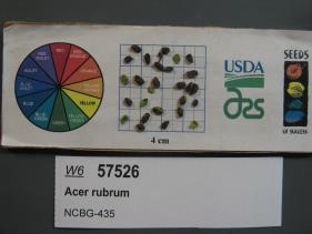 | | 2019 | | | | | | | Wild material | | 2098450 | WLP 3096 |
| 2 | WLP 2269 | MARSB-043 | Acer rubrum L. | New Jersey, United States | NA | 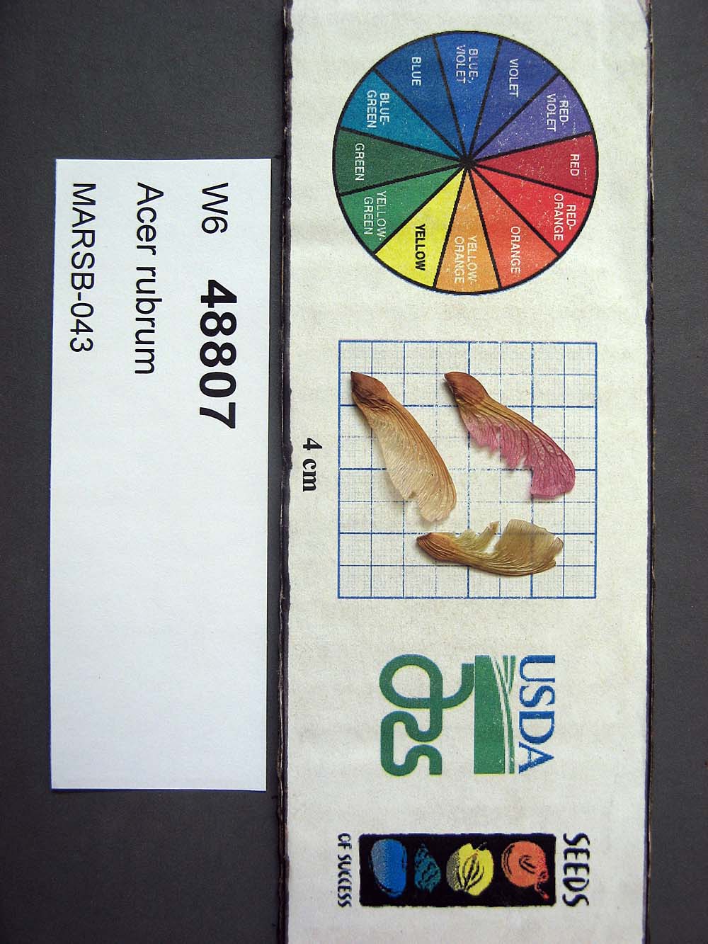 | | 2015 | COLLECTED | 05/22/2013 | | | 455 | | Wild material | | 1922905 | WLP 2269 |
| 3 | NA 88611 | KY23-013 | Acer pensylvanicum L. | Kentucky, United States | NA | | | 2023 | COLLECTED | 09/09/2023 | Black Mountain summit, along gas pipeline road. | 36.91742000, -82.90279000 | 1237 | Along gas line trail. Elevation: 4058 feet. Aspect: Southwest. | Wild material | | 2158703 | NA 88611 |
| 4 | NA 83187 | NA 83187 | Acer saccharinum L. | District of Columbia, United States | NA | | | 2023 | COLLECTED | | U.S. National Arboretum grounds: Fern Valley, along the north side of Crabtree Road, not far west of Hickey Run. | 38.90972500, -76.96213900 | | | Wild material | Old tree, presumed to be native, growing in a low, moist spot in bed FV-R8 along Crabtree Road in Fern Valley west of Beech Spring Pond. It was tested under the identifier "Crabtree2" and was found to have the common native A. saccharinum cpDNA haplotype H-14, along with "Crabtree1", a tree growing nearby on the other side of the road beyond the Arboretum grounds, just on the golf course side of the USNA fenceline [see: Saeki et al, Comparative phylogeography of red maple (Acer rubrum L.) and silver maple (Acer saccharinum L.): impacts of habitat specialization, hybridization and glacial history in _Journal of Biogeography_ (2011) 38, 992-1005.] | 1950207 | NA 83187 |
| 5 | WLP 2670 | RJL2022PA-016 | Acer negundo L. | Pennsylvania, United States | NA | | | 2022 | COLLECTED | 10/21/2022 | Plants growing in woodlands above a small unnamed creek that dumps into the Middle Branch White Clay Creek in Goddard Park, West Grove Pennsylvania, off of Wickerton Road, Chester County. Plants are found regularly but scattered in the understory of the woodlands. | 39.80426000, -75.82609300 | 105 | Plants growing in a mesic, well-drained habitat of deciduous woodlands along streams and above the riparian zone that drains toward a small unnamed creek that feeds into the Middle Branch White Clay Creek. Plants generally grow in part shade to full sun, but perform best and fruit more heavily in full sun where there is abundant access to moisture. The remnant woodlands exist mostly along the steep slopes, wetlands and seeps of seasonal and year-round creeks flowing into the Middle Branch White Clay Creek. The woodlands are bordered by numerous housing developments and land converted to meadows; hence there is significant first order edge that is heavily impacted by invasive plant intrusion. Despite this fact, Acer negundo is highly competitive and competes well.
Soils: The underlying geology of this area is the Glenarm Wissahickon Formation of lower Paleozoic origin and lithologically similar to oligoclase-mica schist of the Wissahickon Formation (PZw), but also includes lenticular amphibolite bodies having ocean-floor basalt chemistry.
Source: USGS Pennsylvania Geologic Map Data (https://mrdata.usgs.gov/geology/state/sgmc-unit.php?unit=PAPZgw%3B0)
The primary soil type in the area of this collection is classified as Glenelg silt loam, 3 to 8 percent slopes. This series consists of very deep, well drained soils formed in residuum weathered from micaceous schist on uplands of the Blue Ridge and the Northern Piedmont. Saturated hydraulic conductivity is moderately high in the subsoil and moderately high to high in the substratum. This upper horizon of this soil is undifferentiated, mostly poorly drained sandy bottomland soils intermingled with decomposing organic litter and eroded silts and clays due to erosion.
Source: NRCS Web Soil Survey (https://websoilsurvey.sc.egov.usda.gov/App/WebSoilSurvey.aspx) | Wild material | | 2139661 | WLP 2670 |
| 6 | WLP 310 | AF2018-007 | Acer saccharum Marshall subsp. floridanum (Chapm.) Desmarais | Virginia, United States | NA | | | 2018 | COLLECTED | 09/11/2018 | Brunswick County; ; Tabacco Heritage Trail, Evans Creek Trailhead. 200 ft east of the parking lot, 50 ft from the creek, on the bank of the trail. | 36.73562000, -77.95825000 | 68 | | | A few medium sized trees near the creek with many seedlings along the trail. Herbarium voucher collected (see barcode NA0103776). | 2108856 | WLP 310 |
| 7 | WLP 296 | RES005 | Acer spicatum Lam. | Michigan, United States | NA | | | 2008 | COLLECTED | 09/25/2006 | Michigan: Emmet County; West of the camp station, along north and south sides of Wilderness Park Road. | 45.74666667, -84.90777778 | 191 | Edge of the forest, along the road. A few trees, heavily fruited. Associated vegetation: Acer rubrum. | Wild material | | 1775509 | WLP 296 |
| 8 | PI 704869 sos | V. angustifolium NEWFS-267 | Vaccinium angustifolium Aiton | New Hampshire, United States | COR | | | 2021 | | | | | | | Wild material | PI assigned before phyical inventory of W6 shipment and is missing. Maintain COR as site in case seeds are recovered. Glabrous underside of leaf finely toothed leaf margins low creeping habit in dense clusters glabrous stem. Some had pubescent undressed of leaf believed to be a hybrid with Vaccinium myrtilloides. | 2137188 | PI 704869 sos |
| 9 | PI 704871 sos | V. angustifolium NEWFS-355 | Vaccinium angustifolium Aiton | New Hampshire, United States | COR | | | 2021 | | | | | | | Wild material | PI assigned before phyical inventory of W6 shipment and is missing. Maintain COR as site in case seeds are recovered. | 2137198 | PI 704871 sos |
| 10 | PI 702691 | MARSB-322 | Chasmanthium laxum (L.) H. O. Yates | New Jersey, United States | S9 |  | | 2019 | | | | | | | Wild material | | 2097574 | PI 702691 |
| 11 | PI 702692 | MARSB-332 | Chasmanthium laxum (L.) H. O. Yates | New Jersey, United States | S9 |  | | 2019 | | | | | | | Wild material | | 2097581 | PI 702692 |
| 12 | PI 702718 | MARSB-326 | Schizachyrium scoparium (Michx.) Nash | New Jersey, United States | S9 |  | | 2019 | | | | | | | Wild material | | 2097576 | PI 702718 |
| 13 | PI 699950 | L. caerulea BJP/LCV/2015/003 | Lonicera caerulea L. var. villosa (Michx.) Torr. & A. Gray | Maine, United States | COR | | | 2015 | COLLECTED | 06/15/2015 | At least a dozen plants growing in the understory of a wooded swamp, with the largest plants greater than a half meter in height. | 44.54543800, -69.55071500 | | Understory of red maple swamp adjacent to Pattee Pond in Winslow township, Kennebec County, ME. Site is a more-or-less flat area about a foot above the water level of Pattee Pond. Plants were growing under a canopy of Acer rubrum and Fraxinus pensylvanica with Spiraea alba and Sarracenia purpurea. | Wild material | | 1927327 | PI 699950 |
| 14 | PI 652978 | R. occidentalis HDF-2007-039 | Rubus occidentalis L. | Georgia, United States | COR | | | 2007 | COLLECTED | 06/05/2007 | Lumpkin County, Chattahoochee National Forest, Blue Ridge Mountain Road intesection with FS 42, Hightower Gap and Rock Creek Roads. | 34.66382000, -84.12987000 | 900 | Rich hardwood forest with some light decending. Grey loam soil. Associated Plants: Liriodendron tulipifera, Oxydendron arboreum, Kalmia latifolia and Acer rubrum. | Wild material | Kim Hummer, Michael Dossett collection from Georgia.
| 1730096 | PI 652978 |
| 15 | PI 653291 | R. argutus Lumberton | Rubus argutus Link | North Carolina, United States | COR |  | | 2007 | COLLECTED | 06/03/2007 | Robeson County, Lumberton, west of I-95 on SR 1536 (Carthage Road), east bank at crossing over Saddletree Swamp (Five Mile Branch of Lumber River). | 34.63527000, -79.02874000 | 18 | Dark organic sandy muck soil. Associated Plants: Quercus velutina, Campsus radicans, Pinus echinata, Acer rubrum, Vitis rotundifolia, Juglans nigra, Liquidamber and Juncus. | Wild material | Kim Hummer, Michael Dossett collection from North Carolina.
| 1730084 | PI 653291 |
| 16 | PI 653292 | R. occidentalis HDF-2007-030 | Rubus occidentalis L. | South Carolina, United States | COR | | | 2007 | COLLECTED | 06/04/2007 | Rich Mountain, Sumter National Forest, Oconee County, west of Walhalla. | 34.75472000, -83.15991000 | 538 | Red sandy loam with duff sloping eastward, behind guardrail on edge of road. Associated Plants: Clematus, Liriodendron tulipifera, Oxydendron arboreum, Kalmia latifolia, Acer rubrum, Campsis radicans and Rhus radicans. | Wild material | Kim Hummer, Michael Dossett collection from South Carolina.
| 1730090 | PI 653292 |
| 17 | PI 653295 | R. argutus Keener HDF-2007-058 | Rubus argutus Link | Alabama, United States | COR |  | | 2007 | COLLECTED | 06/08/2007 | Etowah County, about 1 mile east of US 11 on Keener Gap Road. Power line right-of-way down to the road. Just west of junction with Scenic Highway at Keener Gap. | 34.15687000, -85.93532000 | 250 | Growing on a southwest facing slope (25 degrees), duff on grey soil from limestone outcrops. Associated Plants: Acer rubrum, Liriodendron tulipifera, Liquidambar styraceflua and Quercus nigra. | Wild material | Kim Hummer, Michael Dossett collection from Alabama.
| 1730100 | PI 653295 |
| 18 | PI 657221 | V. corymbosum Zebulon | Vaccinium corymbosum L. | North Carolina, United States | COR | 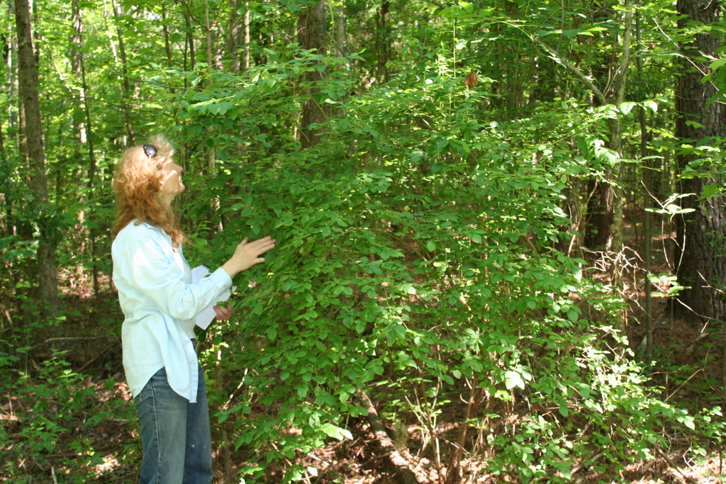 | | 2007 | COLLECTED | 06/01/2007 | Zebulon, Wake County. Near sewer right of way on North Worth Hinton Road (SR 2369). | 35.82683000, -78.33110000 | 90 | Organic duff over dark brown sandy soil. Associated with: Liquidambar styraciflua, Acer rubrum, Rhus typhina, Rubus argutus, Pinus palustris and Liriodentdron tulipfera. Near sewer right of way, at edge of dark hardwood forest. | Wild material | Kim Hummer, Michael Dossett collected from North Carolina.
| 1730106 | PI 657221 |
| 19 | PI 657223 | V. corymbosum HD-2007-016 | Vaccinium corymbosum L. | South Carolina, United States | COR | | | 2007 | COLLECTED | 06/03/2007 | Northwest of Little Rock, Dillon County. Intersection of SR-57 and McLaurin Lake Circle. Growing in a drainage ditch west side of road. | 34.50649000, -79.47892000 | 20 | Flat terrain. Associated with: Smilax, Acer rubrum, Liquidambar styraciflua, Quercus velutina, Sasafras albidum, Lonicera japonica, Pinus palustris and Campsus radicans. | Wild material | Kim Hummer, Michael Dossett collected from South Carolina. V. corymbosum diploid
| 1730114 | PI 657223 |
| 20 | PI 657224 | V. fuscatum Glassy Mt. HD-2007-021 | Vaccinium fuscatum Aiton | South Carolina, United States | COR |  | | 2007 | COLLECTED | 06/04/2007 | Glassy Mountain at home number 3786 Glassy Mountain Road, Greenville County. Edge of road. | 35.13435000, -82.36098000 | 675 | Sandy loam duff associated with: Acer rubrum, Vitis palmata, Erigeron annuus, Commelina virginiaca, Oxydendron arboreum, Platanus occidentalis, Phytolacca americana, Quercus nigra, Rubus argutus and R. trivialis. 45 degree southeast slope. | Wild material | Kim Hummer, Michael Dossett collected from South Carolina.
Jim Ballington reidentified this accession as V. fuscatum. Personal communication from 2 August 2021:
From the leaf shape, general yellow-green color of the leaves, and the distinctive size (relative to the size of the berries) and shape of the calyx, my conclusion is that this accession is probably not V. simulatum, but rather the blue-fruited Carolina foothills form of V. fuscatum. | 1730115 | PI 657224 |
| 21 | PI 657226 | V. pallidum Stumphouse HD-2007-025 | Vaccinium pallidum Aiton | South Carolina, United States | COR |  | | 2007 | COLLECTED | 06/04/2007 | Stumphouse Mountain, Oconee County. Northwest of Walhalla off SR-107, Ross Mountain Road, near Gramling Drive, edge of trail. | 34.82217000, -83.10895000 | 487 | Red sandy loam associated with: Liriodendron tulipifera, Oxydendron arboreum, Kalmia latifolia, Acer rubrum, Quercus nigra, Cornus florida and Prunus virginiana. | Wild material | Kim Hummer, Michael Dossett collected from South Carolina.
| 1730117 | PI 657226 |
| 22 | PI 657235 | V. pallidum Scenic HWY HD 2007-59 | Vaccinium pallidum Aiton | Alabama, United States | COR | 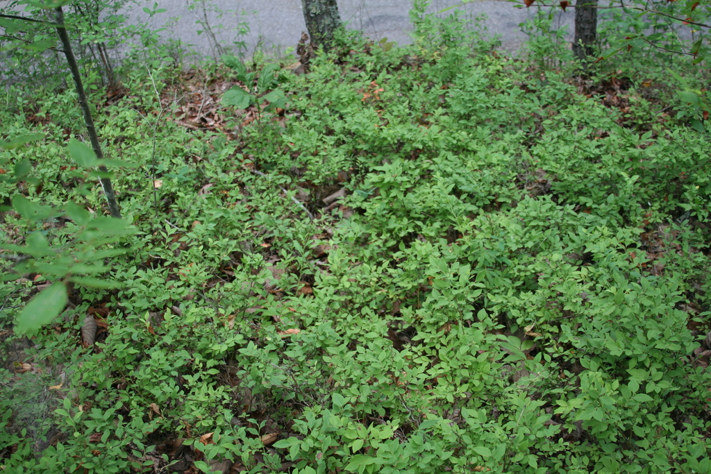 | | 2007 | COLLECTED | 06/08/2007 | East of Keener, Etwah County, Keener Gap. Woods at intersection of Keener Gap Road and Scenic Highway. On ridge above road. | 34.15484000, -85.93371000 | 300 | Soil sandy brown red limestone, with a layer of oak-hickory leaf duff on top. Associated with: Carya, Quercus nigra, Vaccinium stamineum, Liriodendron tulipifera, Liquidambar styraciflua and Acer rubrum. | Wild material | Kim Hummer, Michael Dossett collected from Alabama.
| 1730127 | PI 657235 |
| 23 | PI 657236 | V. corymbosum Mentone Seed | Vaccinium corymbosum L. | Alabama, United States | COR | 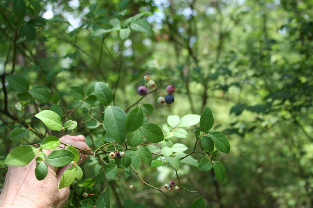 | | 2007 | COLLECTED | 06/08/2007 | Mentone, Dekalb County, off Linchpney Road. | 34.57729000, -85.59305000 | 523 | Open hickory-oak woods, oak leaf duff on top of red-brown clay. Associated with: Carya, Quercus nigra, Liriodendron tulipifera, Acer rubrum and Vaccinium stamineum (glabrous dark green leaf form). | Wild material | Kim Hummer, Michael Dossett collected from Alabama.
| 1730129 | PI 657236 |
| 24 | PI 657242 | V. simulatum Mentone HDF 2007-62B | Vaccinium simulatum Small | Alabama, United States | COR | | | 2007 | COLLECTED | | Mentone, Dekalb County, off Linchpney Road. | 34.57729000, -85.59305000 | 523 | Open hickory-oak woods, oak leaf duff on top of red-brown clay. Associated with: Carya, Quercus nigra, Liriodendron tulipifera, Acer rubrum and Vaccinium stamineum (glabrous dark green leaf form). | Wild material | Kim Hummer, Michael Dossett collected from Alabama.
| 1753281 | PI 657242 |
| 25 | PI 666679 | V. simulatum HD 2007-64 | Vaccinium simulatum Small | Alabama, United States | COR | 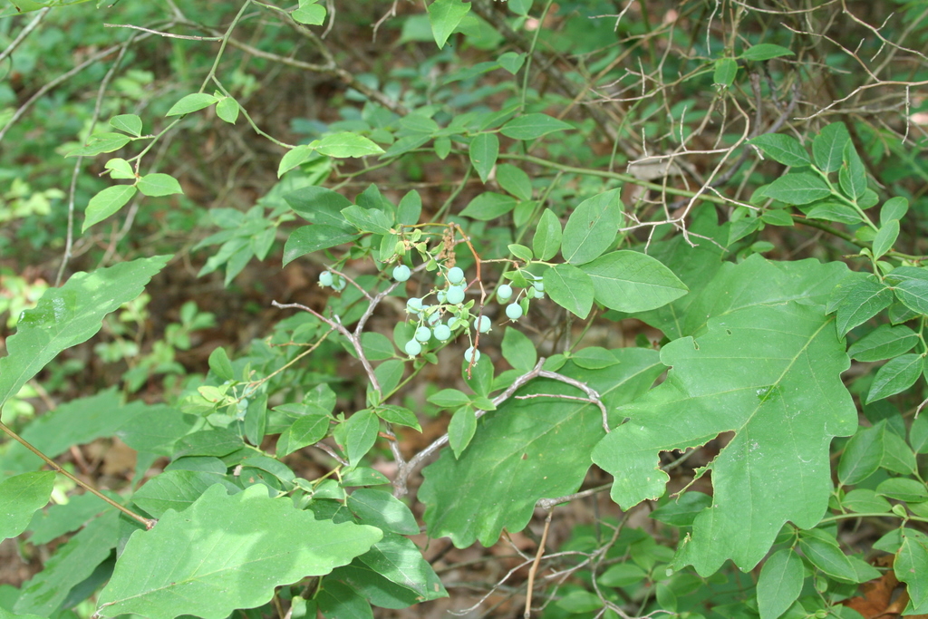 | | 2007 | COLLECTED | 06/08/2007 | Mentone, Dekalb County, off Linchpney Road. | 34.57729000, -85.59305000 | 523 | Open hickory-oak woods, oak leaf duff on top of red-brown clay. Associated with: Carya, Quercus nigra, Liriodendron tulipifera, Acer rubrum and Vaccinium corymbosum. | Wild material | Kim Hummer, Michael Dossett collected from Alabama.
| 1730130 | PI 666679 |
| 26 | PI 657178 | V. darrowii HL 2006-006 | Vaccinium darrowii Camp | Florida, United States | COR |  | | 2006 | COLLECTED | 05/23/2006 | Apalachicola National Forest, Fields Branch of Kennedy Creek. At road junction one mile east of Cotton Landing, Liberty county. | 30.05558000, -85.06014000 | 40 | Piney woods, sandy soil. Associated plants: long leafed pine, Pinus palustris, Slash pine, Gaylusacia frondosa, Gaylusacia moslierii, Ilex glabra, Cyrillia racemosa, Acer rubrum and Hypericum. | Wild material | Collected by Kim Hummer and Paul Lyrene
| 1702616 | PI 657178 |
| 27 | PI 657179 | V. darrowii HL-2006-008 | Vaccinium darrowii Camp | Florida, United States | COR | | | 2006 | COLLECTED | 05/23/2006 | Apalachicola National Forest, Fields Branch of Kennedy Creek. At road junction one mile east of Cotton Landing, Liberty county. | 30.05558000, -85.06014000 | 40 | Piney woods, sandy soil. Associated plants: long leafed pine, Pinus palustris, Slash pine, Gaylusacia frondosa, Gaylusacia moslierii, Ilex glabra, Cyrillia racemosa, Acer rubrum and Hypericum. | Wild material | Collected by Kim Hummer and Paul Lyrene
| 1702617 | PI 657179 |
| 28 | PI 664813 | KY1 | Actaea racemosa L. | Kentucky, United States | NC7 | | | 2005 | | | | | | | Wild material | | 1698887 | PI 664813 |
| 29 | PI 664820 | VA2 | Actaea racemosa L. | Virginia, United States | NC7 | | | 2005 | | | | | | | Wild material | | 1698898 | PI 664820 |
| 30 | PI 700070 | 'Little Cherub' | Viburnum nudum L. | North Carolina, United States | NA | | | 2000 | COLLECTED | 15/09/2000 | Buncombe County: Asheville: North Carolina Arboretum. | 35.49441000, -82.60726000 | 667 | Plants growing well as understory shrub in dappled shade, mesic cove environment; multiple plants adjacent to dirt road in sandy soil. | Clone | U.S. National Arboretum introduction. One seedling formerly accessioned under NA 70426 (individual 70426-008, growing at South Farm in the 200 Field, Row 11), showing a distinctly compact, dense habit. Following evaluation, released in 2022 as 'Little Cherub' (PI-700070). | 1950336 | PI 700070 |
| 31 | PI 597623 | Index Seminum 47 | Spiraea alba Du Roi var. latifolia (Aiton) Dippel | Pennsylvania, United States | NC7 | | | 1993 | COLLECTED | | Chester County. Serpentine Barrens, Piedmont Province. | 39.73333333, -76.03333333 | 130 | Near stream, shady and moist. Growing with Acer rubrum and Lindera benzoin. | Wild material | | 1086008 | PI 597623 |
| 32 | PI 649650 | Index Seminum 4 | Betula populifolia Marshall | Pennsylvania, United States | NC7 | | | 1993 | COLLECTED | | Kittatinny Ridge, Valley and Ridge Province, Northampton County. | 40.91666667, -75.20000000 | 500 | On top of ridgetop quartzite outcrop. | Wild material | | 1086000 | PI 649650 |
| 33 | PI 658649 | Index Seminum 42 | Rhus copallinum L. | Pennsylvania, United States | NC7 | | | 1993 | COLLECTED | | Chester County | 39.73710800, -75.93960900 | 120 | Edge of clearing, Chrome Serpentine Barrens, Piedmont Province. | Wild material | | 1086005 | PI 658649 |
| 34 | PI 658653 | Index Seminum 43 | Rhus typhina L. | Pennsylvania, United States | NC7 | | | 1993 | COLLECTED | | Chester County | 39.73333333, -75.93333333 | 120 | Edge of clearing, Chrome Serpentine Barrens, Piedmont Province. | Wild material | | 1086006 | PI 658653 |
| 35 | PI 664623 | Index Seminum 19 | Helianthus giganteus L. | Pennsylvania, United States | NC7 | | | 1993 | COLLECTED | | Serpentine Barrens, Piedmont Province, Chester County. | 39.73333333, -76.03333333 | 130 | Along trails with full to part sun.Growing with Quercus sp., Sassafras albidum, Acer rubrum, Smilas rotundifolia, and many herbaceous plants. | Wild material | | 1086003 | PI 664623 |
| 36 | PI 618015 | V. macrocarpon WV Allen 7 | Vaccinium macrocarpon Aiton | West Virginia, United States | COR | 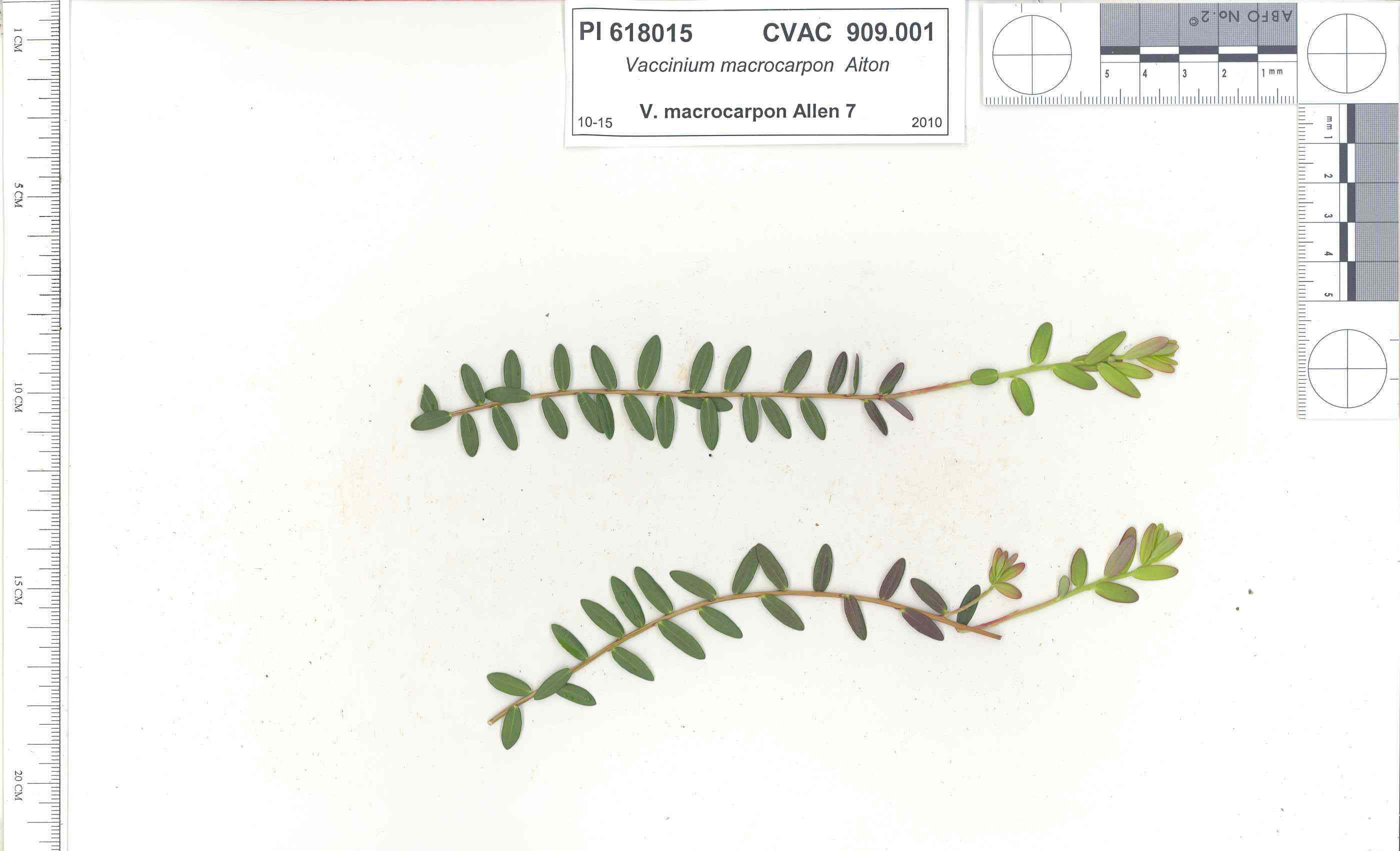 | | 1991 | COLLECTED | 10/29/1991 | Oligotrophic fen near WV/MD border in Preston county, WV, owned by the nature conservancy, WV, known as Cranesville Swamp | 39.51950000, -79.48233000 | 786 | 2 acres fen, bordered by Typha sp., Acer rubrum, Prunus serotina, Hemlock, Sotuhern most population of American Larch (Tamarack), also has Sphagnum spp., Rubus hispidus, Solidago uliginosa, Eripphorum virginicum, Pyrus melanocarpa | Wild material | Site holding moisture well in a regional drought, designated as a National Natural Landmark Additional plants are Hypericum densiflorum, Carex folliculata, Juncus effusus, J. canadensis, Bartonia virginica, Gaultheria procumbens | 1009919 | PI 618015 |
| 37 | NA 89171 | 2025RJLSEUS-04 | Rhododendron catawbiense Michx. | Alabama, United States | NA | | | 2026 | COLLECTED | 09/30/2025 | Scarham Creek: southeast of the Pea Ridge Road bridge, approximately 50-80 meters on the south side of the creek. | 34.32559600, -86.16054600 | 266 | Growing near the base of the slopes above the riparian zone, generally on the exposed geology under very well-drained conditions. The woodlands are primarily deciduous with a few evergreens infrequently mixed. Slope: 15 to 30 percent. Aspect: Northeast. Soil: The primary soil type in the area of this collection is classified as Rockland Series sandstone (Rc). The Rockland series consists of well drained soils formed in loamy colluvium from rotational landslides on slopes of stream valleys and dissections of ground moraines. Saturated hydraulic conductivity is moderate in the upper part of the profile and moderately slow in the lower part. Slopes range from 18 to 70 percent. Some pedons have buried leaves, twigs, and moss. Mass soil movement has left random remnants of soil structure from prior upslope soil development and has buried tree branches, leaves and moss. The upper 0-2 cm of soil contains slightly decomposed organic matter while lower soils layers to a depth of 58 cm are comprised of dark reddish-brown to brown silt loam and are moderately acidic. Below 58 cm the soils are generally dark reddish-brown silt loam and strongly to moderately alkaline. (Source:California Soil Resource Lab/NRCS Official Soil Series Descriptions). Geology: The underlying geology of this area is of Pennsylvanian origin and characterized as Pottsville Formation. It is characterized by light-gray thin to thick-bedded quartzose sandstone and conglomerate containing interbedded dark-gray shale, siltstone, and coal. Mapped on Lookout Mountain, Blount and Chandler Mountains, and Sand Mountain northeast of Blount County, and on the mountains of Jackson, Marshall, and Madison Counties north and west of the TN river. (Source: USGS Alabama Geologic Map Data). | Wild material | Received as R. catawbiense vsr. insularis | 2193305 | NA 89171 |
| 38 | NA 89155 | 2025RJLSEUS-02 | Ilex longipes Chapm. ex Trel. | Alabama, United States | NA | | | 2025 | COLLECTED | 09/30/2025 | Scarham Creek: southeast of the Pea Ridge Road bridge, approximately 50-80 meters on the south side of the creek. | 34.32520700, -86.15967000 | 261 | Plants are growing on relatively steep woodland slopes in shade. The woodlands are primarily deciduous with a few evergreens infrequently mixed. Slope: 15 to 30 percent. Aspect: Northeast. Soil: The primary soil type in the area of this collection is classified as Rockland Series sandstone (Rc). The Rockland series consists of well drained soils formed in loamy colluvium from rotational landslides on slopes of stream valleys and dissections of ground moraines. Saturated hydraulic conductivity is moderate in the upper part of the profile and moderately slow in the lower part. Slopes range from 18 to 70 percent. Some pedons have buried leaves, twigs, and moss. Mass soil movement has left random remnants of soil structure from prior upslope soil development and has buried tree branches, leaves and moss. The upper 0-2 cm of soil contains slightly decomposed organic matter while lower soils layers to a depth of 58 cm are comprised of dark reddish-brown to brown silt loam and are moderately acidic. Below 58 cm the soils are generally dark reddish-brown silt loam and strongly to moderately alkaline. (Source: California Soil Resource Lab/NRCS Official Soil Series Descriptions). Geology: The underlying geology of this area is of Pennsylvanian origin and characterized as Pottsville Formation. It is characterized by light-gray thin to thick-bedded quartzose sandstone and conglomerate containing interbedded dark-gray shale, siltstone, and coal. Mapped on Lookout Mountain, Blount and Chandler Mountains, and Sand Mountain northeast of Blount County, and on the mountains of Jackson, Marshall, and Madison Counties north and west of the TN river. (Source: USGS Alabama Geologic Map Data). | Wild material | | 2193001 | NA 89155 |
| 39 | NA 89156 | 2025RJLSEUS-03 | Euonymus americanus L. | Alabama, United States | NA | | | 2025 | COLLECTED | 09/30/2025 | Scarham Creek: southeast of the Pea Ridge Road bridge, approximately 50-80 meters on the south side of the creek. | 34.32577600, -86.16071000 | 260 | Plants are growing on relatively steep woodland slopes in shade. The woodlands are primarily deciduous with a few evergreens infrequently mixed. Slope: 15 to 30 percent. Aspect: Northeast. Soil: The primary soil type in the area of this collection is classified as Rockland Series sandstone (Rc). The Rockland series consists of well drained soils formed in loamy colluvium from rotational landslides on slopes of stream valleys and dissections of ground moraines. Saturated hydraulic conductivity is moderate in the upper part of the profile and moderately slow in the lower part. Slopes range from 18 to 70 percent. Some pedons have buried leaves, twigs, and moss. Mass soil movement has left random remnants of soil structure from prior upslope soil development and has buried tree branches, leaves and moss. The upper 0-2 cm of soil contains slightly decomposed organic matter while lower soils layers to a depth of 58 cm are comprised of dark reddish-brown to brown silt loam and are moderately acidic. Below 58 cm the soils are generally dark reddish-brown silt loam and strongly to moderately alkaline. (Source: California Soil Resource Lab/NRCS Official Soil Series Descriptions). Geology: The underlying geology of this area is of Pennsylvanian origin and characterized as Pottsville Formation. It is characterized by light-gray thin to thick-bedded quartzose sandstone and conglomerate containing interbedded dark-gray shale, siltstone, and coal. Mapped on Lookout Mountain, Blount and Chandler Mountains, and Sand Mountain northeast of Blount County, and on the mountains of Jackson, Marshall, and Madison Counties north and west of the TN river. (Source: USGS Alabama Geologic Map Data). | Wild material | | 2193002 | NA 89156 |
| 40 | NA 89158 | 2025RJLSEUS-06 | Cornus florida L. | Alabama, United States | NA | | | 2025 | COLLECTED | 10/01/2025 | Coosa Wildlife Management Area: along the edge of gated dirt road on the west side of Coosa County Road 29, 0.3 kilometers north of Hatchet Creek. | 32.86402200, -86.33871400 | 108 | Plants are growing in part sun to shade on dry-mesic slopes above the road cut on the gated dirt road; most likely a road for access for fire control/forest management. The forest is a combination of deciduous and evergreen with evergreens primarily comprised of Pinus taeda. The habitat was quite dry during this time of year. Slope: 5 to 20 percent. Aspect: North. Soils: The primary soil in the area of this collection is classified as Madison-Louisa Series complex, 15 to 30 percent slopes, moderately eroded (MdE2). The Madison Series soils are very deep, well drained soils with medium runoff found on Piedmont uplands in interstream divides, ridges and side slopes. They are comprised of residuum weathered from felsic or intermediate, high-grade metamorphic or igneous rocks high in content of mica. Slopes range from 2 to 60 percent and soil is typically strongly acidic. Louisa Series soils The Louisa Series soils consist of shallow, somewhat excessively drained soils which formed over mica gneiss and schist bedrock. They occur on Piedmont uplands. Slopes are 6 to 80 percent. This soil is moderately acid. (Source: California Soil Resource Lab/NRCS Official Soil Series Descriptions). Geology: The underlying geology of this area is of Precambrian to Paleozoic origin and characterized as Hatchet Creek Group; Pinchoulee Gneiss Formation. It is characterized by medium to fine-grained migmatitic, locally garnetiferous biotite-feldspar gneiss, commonly saturated with granitic pods. (Source: USGS Alabama Geologic Map Data). | Wild material | | 2193004 | NA 89158 |
| 41 | NA 89189 | WV25-11 | Viburnum lantanoides Michx. | West Virginia, United States | NA | | | 2025 | COLLECTED | 09/13/2025 | Monongahela National Forest. | 38.53027974, -79.93898451 | 1165 | Steep, eroded mountain drain. | Wild material | Herbarium voucher deposited USNA | 2192769 | NA 89189 |
| 42 | NA 89190 | WV25-12 | Ilex collina Alexander | West Virginia, United States | NA | | | 2025 | COLLECTED | 09/13/2025 | Monongahela National Forest. | 38.52413054, -79.93789223 | 1136 | Steep, southwest-facing slope above parking area. | Wild material | Herbarium voucher deposited USNA | 2192770 | NA 89190 |
| 43 | NA 89191 | WV25-14 | Ilex montana Torr. & A. Gray | West Virginia, United States | NA | | | 2025 | COLLECTED | 09/13/2025 | Monongahela National Forest: east side of Forest Road 233. | 38.57289483, -79.90066843 | 1109 | Growing on east side of road. | Wild material | Herbarium voucher deposited USNA | 2192772 | NA 89191 |
| 44 | NA 89129 | TRx250809-01PA | Ilex mucronata (L.) M. Powell et al. | Pennsylvania, United States | NA | | | 2025 | COLLECTED | 07/09/2025 | Hickory Run Boulder Field | 41.04973900, -75.64300700 | 555 | Gowing within ca 15 m of boulder field edge, most individuals occured on sun-exposed margin. | Wild material | | 2191815 | NA 89129 |
| 45 | W6 62520 | FWS0300-110 | Glyceria canadensis (Michx.) Trin. | Michigan, United States | W6 |  | | 2025 | | | | | | | Wild material | | 2192218 | W6 62520 |
| 46 | W6 62528 | FWS0300-131 | Symphyotrichum urophyllum (Lindl.) G. L. Nesom | Michigan, United States | W6 | 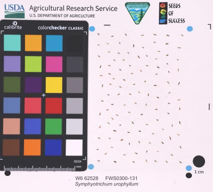 | | 2025 | | | | | | | Wild material | | 2192226 | W6 62528 |
| 47 | W6 62556 | FWS0502-52 | Carex lupulina Muhl. ex Willd. | Pennsylvania, United States | W6 |  | | 2025 | | | | | | | Wild material | Logged forested wetland | 2192254 | W6 62556 |
| 48 | W6 62558 | FWS0502-80 | Eutrochium fistulosum (Barratt) E. E. Lamont | Pennsylvania, United States | W6 |  | | 2025 | | | | | | | Wild material | SCOUTING ID CHANGE. Ripe plants mostly withered but whorled leaves still hanging on | 2192256 | W6 62558 |
| 49 | W6 62559 | FWS0502-94 | Epilobium ciliatum Raf. | Pennsylvania, United States | W6 |  | | 2025 | | | | | | | Wild material | Seeds mostly ripe in reddish pods, before they split | 2192257 | W6 62559 |
| 50 | NA 89115 | TLM25-04a | Hamamelis ovalis S. W. Leonard | Texas, United States | NA | | | 2025 | COLLECTED | 07/10/2025 | State Highway 87 approximately 3.25 kilometers north of the crossroad junction with Texas Recreational Road 255 (RE 255); plants were growing in the narrow buffer woods along the east side of the highway. | 31.12051300, -93.72628100 | 138 | The habitat is an upland mixed coniferous and deciduous woodlands in part to full shade and dry conditions, often under drought stress. Plants seem to always occur on the top of dry ridges or well-drained slopes. Slope: 0 to 1 percent. Aspect: N/A. Soils: The soils of this collection area are classified as Tehran-Letney Association, hilly (TLE) soils. The Tehran Series (55%) consists of deep, somewhat excessively drained, moderately rapidly permeable soils on uplands. They formed in thick loamy and sandy sediments on the Western Coastal Plain. These soils are on gently sloping to moderately steep uplands with slopes ranging from 1 to 20 percent. The Letney Series (30%) consists of deep, well drained, moderately rapidly permeable, upland soils. They formed in thick sandy and loamy sediments of the coastal plains. These soils are on gently sloping to moderately steep uplands with slopes ranging from 1 to 20 percent. Soil pH ranges from 4.5 to 6.0. The minor soil components include Doucette Series (10%) and Boykin Series (5%) soils. (Source: California Soil Resource Lab/NRCS Official Soil Series Descriptions). Geology: The underlying geology of this area is of Oligocene origin and characterized as Catahoula Formation. This formation is extensive and deep in Texas, up to 185 meters thick. In the area of the collection the Catahoula Formation is primarily mudstone and sand. The upper 90-150 meters is mudstone that is tuffaceous, and sandy; also, occasionally, with some bentonitic clay. (Source: USGS Texas Geologic Map Data). | Wild material | | 2191654 | NA 89115 |
| 51 | NA 89117 | TLM25-06 | Magnolia virginiana L. | Louisiana, United States | NA | | | 2025 | COLLECTED | 07/11/2025 | Natchitoches Parish Road 380, approximately 0.30 km south of the junction with Bayou Camp Forest Route 321 just past the sign for a natural water spring; the site is located on the west side of hte road. | 31.48284200, -93.07549400 | 88 | This habitat is comprised of a botanically rich full sun, hillside seepage area with masses of wetland plant species, dominated by Sarracenia alata. The seepage area, which is 40-60 meters wide, is ultimately funneled downslope, to create the headwaters for a small stream that flows into and through the high understory shade of a longleaf pine forest. This streamside habitat, created by erosion, forms a series of sloping terraces that are home to plant communities ranging from obligate upland species on the upper terraces to facultative wetland species found at the base of the terraces along the stream edge. The range of plant communities and niches created in just a short distance from upper hillside seepage area to the emergent stream, offers a remarkably array of plant diversity. Magnolia virginiana can be found throughout the habitat as well as along the more mesic edge of this site. Slope: 10 to 15 percent. Aspect: southwest. Soils: The primary soil type in the collection area is Kisatchie Series clay, 1 to 15 percent slopes, severely eroded (Kt). The Kisatchie Series soil consists of moderately deep, well drained, very slowly permeable soils that formed clayey sediments over siltstone or sandstone on Tertiary age uplands. These soils are on moderately sloping to steep coastal plains. They are not saturated with water. Water runs off the surface at a moderate to rapid rate. Slope ranges from 1 to 40 percent. The solum is 50 to 100 cm thick over siltstone or sandstone and ranges from moderately to extremely acidic. (Source: California Soil Resource Lab/NRCS Official Soil Series Descriptions). Geology: The underlying geology of this area is of Oligocene origin and characterized as Catahoula Formation. In the area of the collection the Catahoula Formation is primarily gray to white sandstones; loose quartz sand, tuffaceous sandstone, volcanic ash, and brown sandy clays; petrified wood locally. (Source: USGS Louisiana Geologic Map Data). | Wild material | | 2191656 | NA 89117 |
| 52 | NA 89051 | AFGN25-01 | Hydrangea barbara (L.) Bernd Schulz | Alabama, United States | NA | | | 2025 | COLLECTED | 05/31/2025 | Ebeneezer Swamp Ecological Preserve. | 33.16818000, -86.81243000 | 148 | Swamp forest with slow moving water. Dominant canopy consisted of Nyssa aquatica, Magnolia virginiana, and Acer rubrum. | Wild material | | 2191418 | NA 89051 |
| 53 | NA 89025 | 2025RJL-003 | Ximenia americana L. | Florida, United States | NA | | | 2025 | COLLECTED | 05/09/2025 | Hickory Lake Scrub Preserve, 1658 Scenic Highway Frostproof, FL 33843. | 27.69744200, -81.53888700 | 32 | Growing on sugar sand in full sun and extremely dry, xeric Lake Wales Ridge habitat comprised of a remarkably rich evergreen and deciduous plant community. The habitat is subjected to prescribed fire periodically (estimated to be 2-3 years ago). Interestingly, this species was also found on dry-mesic edges of the habitat only 10-15 meters from the last, mostly in full sun, but occasionally in light shade; plants were flowering and fruiting. Slope: N/A. Aspect: N/A Soil: The soil of this site is characterized as St. Lucie Series fine sand, 0 to 5 percent slopes; with other minor contributions from Archbold, Myakka, and Cassia not described here. The St. Lucie Series consists of very deep, excessively drained soils that formed in sandy marine and/or eolian deposits. St. Lucie soils are on dunes, ridges, and knolls on marine terraces. Slopes range from linear to convex and range from 0 to 20 percent. This soil is strongly to extremely acid in the upper 200 cm of the horizon but can have neutral to alkaline components as well. The genesis of the St. Lucie soils is not clearly understood. No subsurface diagnostic horizons are within depths of 2 meters, but the uncoated sand grains suggest an albic horizon. (Source: California Soil Resource Lab/NRCS Official Soil Series Descriptions). Geology: The underlying geology of this area is characterized as Reworked Cypresshead Sediments from the Pliocene/Pleistocene. This unit is the result of post depositional reworking of the Cypresshead siliciclastics. The sediments are fine to coarse quartz sands with scattered quartz gravel and varying percentages of clay matrix and undifferentiated. (Source: USGS Florida Geologic Map Data). | Wild material | | 2191360 | NA 89025 |
| 54 | NA 88933 | 24Flam40 | Agarista populifolia (Lam.) Judd | South Carolina, United States | NA | | | 2025 | COLLECTED | 09/12/2025 | Robertville, SC: Gillison Branch Road (plants on both sides of road). | 32.58673000, -81.19300000 | 31 | Shady swamp forest with road running between Agarista population. Agarista was the predominant plant throughout. Soggy but solid ground, especially on northern side of road. Growing in 3/4 shade. Slope: Generally flat. | Wild material | Note: Two field collections, 24Flam40 and 24Flam41, were combined together in this USNA accession, with the former identifier being used as the primary one. | 2172816 | NA 88933 |
| 55 | NA 89195 | DLSP-EB | Hamamelis virginiana L. | Wisconsin, United States | NA | | | 2025 | COLLECTED | 08/21/2024 | Devil's Lake State Park: East Bluff. | 43.41836810, -89.72111900 | 456 | Shade in organic layer on old boulder field. Slope: 40 degrees. Aspect: East-northeast. Red oak-hickory-linden-pine vegetative community. | Wild material | | 2171016 | NA 89195 |
| 56 | NA 88579 | 2024RJLFL-007 | Ilex myrtifolia Walter | Florida, United States | NA | | | 2024 | COLLECTED | 11/13/2024 | Wetlands accessed from Miller Bluff Road. | 30.62251200, -86.86030700 | 8 | Open, wet areas and woodland edge slightly above permanently wet habitat in part shade to full sun. Slope: 0 percent. Aspect: N/A. | Wild material | | 2169916 | NA 88579 |
| 57 | NA 88580 | 2024RJLFL-009 | Ilex myrtifolia Walter | Florida, United States | NA | | | 2024 | COLLECTED | 11/13/2024 | Woodlands on the north side of Fisher Old Mill Road about 0.10 kilometers west of intersection with DOF Y12. | 30.62693800, -86.83962200 | 6 | Mixed evergreen and deciduous moist to wet forest in part shade to full sun. From the associated taxa, this site can be quite wet during the growing season; however, it was dry during this collection time; likely due to extended drought. Slope: 0 percent. Aspect: South. | Wild material | | 2169917 | NA 88580 |
| 58 | NA 88590 | 2024RM-003 | Ilex verticillata (L.) A. Gray | Florida, United States | NA | | | 2024 | COLLECTED | 11/21/2024 | Along the west/north side of the Yellow River about 0.33 kilometers (as the crow flies) upstream from the channel that leads the Fisher Old Mill Road Boat Ramp. This site was accessed by boat. | 30.62868600, -86.80748000 | 4 | Plants are found growing primarily in permanently saturated to submersed conditions along the edge of the Yellow River in part shade. The riverine habitat is comprised of a wide array of deciduous and evergreen trees, shrubs, and perennial plant species. Most of the plants along the river are adapted to acidic conditions and, while the aquatic habitat is generally fresh water, there is occasionally tidal or hurricane-caused saltwater intrusions. Slope: 0 percent. Aspect: East-southeast. The underlying geology of this area is characterized as Alluvium from undifferentiated Quaternary Sediments. Much of Florida's surface is covered by a varying thickness of undifferentiated sediments consisting of siliciclastics, organics and freshwater carbonates. Where these sediments exceed 20 feet (6.1 meters) thick, they were mapped as discrete units. To subdivide the undifferentiated sediments, those sediments occurring in flood plains were mapped as alluvial and flood plain deposits (Qal). Sediments showing surficial expression of beach ridges and dunes were mapped separately (Qbd) as were the sediments composing Trail Ridge (Qtr). Terrace sands were not mapped (refer to Healy [1975] for a discussion of the terraces in Florida). The subdivisions of the Undifferentiated Quaternary Sediments (Qu) are not lithostratigraphic units but are utilized to facilitate a better understanding of the State's geology. The siliciclastics are light gray, tan, brown to black, unconsolidated to poorly consolidated, clean to clayey, silty, unfossiliferous, variably organic-bearing sands to blue green to olive green, poorly to moderately consolidated, sandy, silty clays. Gravel is occasionally present in the panhandle. Organics occur as plant debris, roots, disseminated organic matrix and beds of peat. Freshwater carbonates, often referred to as marls in the literature, are scattered over much of the State. In southern Florida, freshwater carbonates are nearly ubiquitous in the Everglades. These sediments are buff colored to tan, unconsolidated to poorly consolidated, fossiliferous carbonate muds. Sand, silt and clay may be present in limited quantities. These carbonates often contain organics. The dominant fossils in the freshwater carbonates are mollusks. (Source: USGS Florida Geologic Map Data). The soils of this are characterized as Bibb-Kinston Series association. The Bibb Series consists of very deep, poorly drained, moderately permeable soils on flood plains of streams in the Southern Coastal Plain (133A) Major Land Resource Area. They formed in stratified loamy and sandy alluvium that are commonly and frequently flooded and water runs off the surface very slowly. Slopes range from 0 to 2 percent. Reaction ranges from extremely acid to strongly acid throughout. Content of mica flakes ranges from none to common. Content of rounded gravel typically ranges from 0 to 10 percent throughout, but may range to 50 percent in thin strata below a depth of 1 meter. Buried soil horizons, present in many pedons have the same range in color and texture as the surface horizon which has iron and organic matter concentrations in shades of brown and yellow ranging from none to common. Texture is sand, loamy sand, loamy fine sand, fine sandy loam, sandy loam, loam or silt loam. The Kinston Series consists of very deep, poorly drained, moderately permeable soils found on flood plains. They were formed in alluvial depositions. Slopes range from 0 to 2 percent. Soil reaction ranges from strongly acid to very strongly acid. Typical texture across the pedons is loamy, gravelly loam, sandy loam, and clay loam with dark concretions often present. (Source: California Soil Resource Lab/NRCS Official Soil Series Descriptions). | Wild material | | 2169927 | NA 88590 |
| 59 | NA 88591 | 2024RM-004 | Ilex opaca Aiton | Florida, United States | NA | | | 2024 | COLLECTED | 11/21/2024 | Along the west/north side of the Yellow River about 5.5 kilometers upstream from the State Highway 87 boat ramp. This site was accessed by boat. | 30.59986000, -86.87936000 | 2 | Plants are found growing primarily in permanently saturated to submersed conditions along the edge of the Yellow River in part shade. The riverine habitat is comprised of a wide array of deciduous and evergreen trees, shrubs, and perennial plant species. Most of the plants along the river are adapted to acidic conditions and, while the aquatic habitat is generally fresh water, there is occasionally tidal or hurricane-caused saltwater intrusions. Slope: 0 percent. Aspect: East-southeast. The underlying geology of this area is characterized as Alluvium from undifferentiated Quaternary Sediments. Much of Florida's surface is covered by a varying thickness of undifferentiated sediments consisting of siliciclastics, organics and freshwater carbonates. Where these sediments exceed 20 feet (6.1 meters) thick, they were mapped as discrete units. To subdivide the undifferentiated sediments, those sediments occurring in flood plains were mapped as alluvial and flood plain deposits (Qal). Sediments showing surficial expression of beach ridges and dunes were mapped separately (Qbd) as were the sediments composing Trail Ridge (Qtr). Terrace sands were not mapped (refer to Healy [1975] for a discussion of the terraces in Florida). The subdivisions of the Undifferentiated Quaternary Sediments (Qu) are not lithostratigraphic units but are utilized to facilitate a better understanding of the State's geology. The siliciclastics are light gray, tan, brown to black, unconsolidated to poorly consolidated, clean to clayey, silty, unfossiliferous, variably organic-bearing sands to blue green to olive green, poorly to moderately consolidated, sandy, silty clays. Gravel is occasionally present in the panhandle. Organics occur as plant debris, roots, disseminated organic matrix and beds of peat. Freshwater carbonates, often referred to as marls in the literature, are scattered over much of the State. In southern Florida, freshwater carbonates are nearly ubiquitous in the Everglades. These sediments are buff colored to tan, unconsolidated to poorly consolidated, fossiliferous carbonate muds. Sand, silt and clay may be present in limited quantities. These carbonates often contain organics. The dominant fossils in the freshwater carbonates are mollusks. (Source: USGS Florida Geologic Map Data). The soils of this are characterized as Bibb-Kinston Series association. The Bibb Series consists of very deep, poorly drained, moderately permeable soils on flood plains of streams in the Southern Coastal Plain (133A) Major Land Resource Area. They formed in stratified loamy and sandy alluvium that are commonly and frequently flooded and water runs off the surface very slowly. Slopes range from 0 to 2 percent. Reaction ranges from extremely acid to strongly acid throughout. Content of mica flakes ranges from none to common. Content of rounded gravel typically ranges from 0 to 10 percent throughout, but may range to 50 percent in thin strata below a depth of 1 meter. Buried soil horizons, present in many pedons have the same range in color and texture as the surface horizon which has iron and organic matter concentrations in shades of brown and yellow ranging from none to common. Texture is sand, loamy sand, loamy fine sand, fine sandy loam, sandy loam, loam or silt loam. The Kinston Series consists of very deep, poorly drained, moderately permeable soils found on flood plains. They were formed in alluvial depositions. Slopes range from 0 to 2 percent. Soil reaction ranges from strongly acid to very strongly acid. Typical texture across the pedons is loamy, gravelly loam, sandy loam, and clay loam with dark concretions often present. (Source: California Soil Resource Lab/NRCS Official Soil Series Descriptions). | Wild material | | 2169928 | NA 88591 |
| 60 | NA 88592 | 2024RM-005 | Ilex sp. | Florida, United States | NA | | | 2024 | COLLECTED | 11/21/2024 | Along the west/north side of the Yellow River about 1.1 kilometers upstream from the State Highway 87 boat ramp. This site was accessed by boat. | 30.57956000, -86.91916400 | 1 | Plants are found growing primarily in permanently saturated to submersed conditions along the edge of the Yellow River in part shade. The riverine habitat is comprised of a wide array of deciduous and evergreen trees, shrubs, and perennial plant species. Most of the plants along the river are adapted to acidic conditions and, while the aquatic habitat is generally fresh water, there is occasionally tidal or hurricane-caused saltwater intrusions. Slope: 0 percent. Aspect: North. The underlying geology of this area is characterized as Alluvium from undifferentiated Quaternary Sediments. Much of Florida's surface is covered by a varying thickness of undifferentiated sediments consisting of siliciclastics, organics and freshwater carbonates. Where these sediments exceed 20 feet (6.1 meters) thick, they were mapped as discrete units. To subdivide the undifferentiated sediments, those sediments occurring in flood plains were mapped as alluvial and flood plain deposits (Qal). Sediments showing surficial expression of beach ridges and dunes were mapped separately (Qbd) as were the sediments composing Trail Ridge (Qtr). Terrace sands were not mapped (refer to Healy [1975] for a discussion of the terraces in Florida). The subdivisions of the Undifferentiated Quaternary Sediments (Qu) are not lithostratigraphic units but are utilized to facilitate a better understanding of the State's geology. The siliciclastics are light gray, tan, brown to black, unconsolidated to poorly consolidated, clean to clayey, silty, unfossiliferous, variably organic-bearing sands to blue green to olive green, poorly to moderately consolidated, sandy, silty clays. Gravel is occasionally present in the panhandle. Organics occur as plant debris, roots, disseminated organic matrix and beds of peat. Freshwater carbonates, often referred to as marls in the literature, are scattered over much of the State. In southern Florida, freshwater carbonates are nearly ubiquitous in the Everglades. These sediments are buff colored to tan, unconsolidated to poorly consolidated, fossiliferous carbonate muds. Sand, silt and clay may be present in limited quantities. These carbonates often contain organics. The dominant fossils in the freshwater carbonates are mollusks. (Source: USGS Florida Geologic Map Data). The soils of this are characterized as Bibb-Kinston Series association. The Bibb Series consists of very deep, poorly drained, moderately permeable soils on flood plains of streams in the Southern Coastal Plain (133A) Major Land Resource Area. They formed in stratified loamy and sandy alluvium that are commonly and frequently flooded and water runs off the surface very slowly. Slopes range from 0 to 2 percent. Reaction ranges from extremely acid to strongly acid throughout. Content of mica flakes ranges from none to common. Content of rounded gravel typically ranges from 0 to 10 percent throughout, but may range to 50 percent in thin strata below a depth of 1 meter. Buried soil horizons, present in many pedons have the same range in color and texture as the surface horizon which has iron and organic matter concentrations in shades of brown and yellow ranging from none to common. Texture is sand, loamy sand, loamy fine sand, fine sandy loam, sandy loam, loam or silt loam. The Kinston Series consists of very deep, poorly drained, moderately permeable soils found on flood plains. They were formed in alluvial depositions. Slopes range from 0 to 2 percent. Soil reaction ranges from strongly acid to very strongly acid. Typical texture across the pedons is loamy, gravelly loam, sandy loam, and clay loam with dark concretions often present. (Source: California Soil Resource Lab/NRCS Official Soil Series Descriptions). | Wild material | | 2169929 | NA 88592 |
| 61 | NA 88593 | 2024RJLNJ-001 | Ilex glabra (L.) A. Gray | New Jersey, United States | NA | | | 2024 | COLLECTED | 11/24/2024 | Mullica Township: Both sides of Duerer Street, approximately 0.37 kilometers southeast of 4th Avenue. | 39.55885000, -74.66442500 | 21 | Shade to almost full sun on compacted seasonally moist to temporarily wet areas of a mixed evergreen and deciduous woodland dominated by Pinus rigida. Vegetation of this area is very much defined by small changes in elevation that go from wet to very dry. Ilex glabra remains abundant throughout, though. Slope: N/A. Aspect: N/A. The underlying geology of this area is the Cohansey Formation of middle Miocene origin and comprised of sand, white to yellow with local gravel and clay. It is sometimes locally stained red or orange brown by iron oxides and (or) cemented into large blocks of ironstone. Unweathered clay is typically dark gray, but commonly weathers white where it is interbedded with thin beds of ironstone. Sand is typically medium grained and moderately sorted although it ranges from fine to very coarse grained and from poorly to well sorted. Sand consists of quartz and siliceous rock fragments. Some beds are locally micaceous. Maximum thickness in the map area is about 60 meters; however, thickness is difficult to determine because of the irregular basal contact and extensive post-depositional erosion. (Source: USGS New Jersey Geologic Map Data). The primary soil type in the area of this collection is classified as Mullica Series sandy loam, 0 to 2 percent slopes. These soils are typically coarse-loamy, siliceous, semiactive, and mesic typic humaquepts that are strongly to extremely acidic throughout the profile. The typical solum thickness ranges from 50-150+ cm. These soils are generally considered to be poorly drained. (Source: NRCS Web Soil Survey). | Wild material | | 2169930 | NA 88593 |
| 62 | NA 88731 | RonMiller2022-Old Land Place | Gordonia lasianthus (L.) J. Ellis | Florida, United States | NA | | | 2024 | COLLECTED | 04/2022 | Yellow River Marsh State Aquatic Preserve, "Old Land Place" along Weaver River, 1.47 miles south of the confluence with the Yellow River. | 30.55318000, -87.93656000 | 3 | Moist to wet areas in wetland adjacent to the river in association with a range of evergreen and deciduous forest elements. | Wild material | From open-pollinated, but presumed isolated, seeds of NA 87342-H, -J, and -L (three young plants flowering in containers in production during 2024). Seed was harvested over a period roughly from October through December 2024 as fruits matured. From the record of the parent accession, NA 87342: Exact date of collection unknown. | 2170992 | NA 88731 |
| 63 | NA 87842 | TRX241117-08SC | Ilex opaca Aiton | South Carolina, United States | NA | | | 2024 | COLLECTED | 11/17/2024 | Francis Marion National Forest. | 33.15167000, -79.60253000 | 31 | | Wild material | | 2169895 | NA 87842 |
| 64 | NA 88477 | TXWL2024-027 | Ilex ambigua Torr. | Texas, United States | NA | | | 2024 | COLLECTED | 11/12/2024 | Sabine River at I-10 at the Texas/Louisiana state line; south side of bridge. | 30.12654000, -93.70258000 | | Bottomland. | Wild material | | 2169862 | NA 88477 |
| 65 | NA 88475 | TXWL2024-025 | Ilex coriacea (Pursh) Chapm. | Texas, United States | NA | | | 2024 | COLLECTED | 10/16/2024 | Sabine National Forest C-142. | | | Baygall below longleaf [pine] forest. | Wild material | | 2169441 | NA 88475 |
| 66 | NA 89075 | 2024RJLPA-001 | Rhododendron maximum L. | Pennsylvania, United States | NA | | | 2024 | COLLECTED | 09/18/2024 | Fieldstone Farm Tank Creek Nature Preserve (a property of the Pocono Heritage Land Trust): Collected along Tank Creek. The property is accessed from a parking area located on Devil's Hole Road. | 41.13862300, -75.34562700 | 493 | Mostly found in mixed deciduous forest with occasional conifers and evergreen shrubs generally on steep slopes above Tank Creek in rocky well-drained soils in shade to part-shade. The slopes are abundant in decomposed organic matter and runoff soils. Slope: 5 to 30 percent. Aspect: various. Geology: The underlying geology of this area is of Devonian origin and characterized as the Long Run Member of Catskill Formation. It is comprised of gray and grayish-red sandstone and grayish-red siltstone and mudstone in fining-upward cycles. (Source: USGS Pennsylvania Geologic Map Data). Soils: The primary soil type found here is classified as Alluvial Land. In geology, alluvial land refers to areas of land that are formed by the deposition of sediments carried by rivers, or other surface water. EPA Ecoregion (Level III): North Central Appalachians (62). EPA Ecoregion (Level IV): Low Poconos (62b). | Wild material | | 2169039 | NA 89075 |
| 67 | NA 89076 | 2024RJLPA-002 | Kalmia latifolia L. | Pennsylvania, United States | NA | | | 2024 | COLLECTED | 09/18/2024 | Fieldstone Farm Tank Creek Nature Preserve (a property of the Pocono Heritage Land Trust): Collected along Tank Creek. The property is accessed from a parking area located on Devil's Hole Road. | 41.13862300, -75.34562700 | 493 | Mostly found in mixed deciduous forest with occasional conifers and evergreen shrubs generally on sloping sites as an understory shrub in rocky well-drained soils in shade to part-shade. Slope: 5 to 15 percent. Aspect: various. Geology: The underlying geology of this area is of Devonian origin and characterized as the Long Run Member of Catskill Formation. It is comprised of gray and grayish-red sandstone and grayish-red siltstone and mudstone in fining-upward cycles. (Source: USGS Pennsylvania Geologic Map Data). Soils: The primary soil type found here is classified as Alluvial Land. In geology, alluvial land refers to areas of land that are formed by the deposition of sediments carried by rivers, or other surface water. EPA Ecoregion (Level III): North Central Appalachians (62). EPA Ecoregion (Level IV): Low Poconos (62b). | Wild material | | 2169040 | NA 89076 |
| 68 | NA 89078 | 2024RJLPA-004 | Staphylea trifolia L. | Pennsylvania, United States | NA | | | 2024 | COLLECTED | 09/20/2024 | Along gated road about 0.33 kilometers southwest of the Lake Ontelaunee Trail parking lot. | 40.49850800, -75.89121300 | 94 | Plants are growing on well-drained steep slopes in shade to part shade of a deciduous forest. Slope: 35 to 50 percent. Aspect: East-southeast. Geology: The underlying geology of this area is of Ordovician origin and characterized as Shale and graywacke of Hamburg sequence. It is characterized by shale containing zones of conspicuous graywacke. (Source: USGS Pennsylvania Geologic Map Data). Soils: The primary soil type in the area of this collection is classified as Berks-Weikert Complex, 25 to 60% slopes (BkF). Dominantly sloping to very steep, moderately deep and shallow, well drained soils underlain by acid shale bedrock. (Source: UPenn State University Soil Info Website). EPA Ecoregion (Level III): Ridge and Valley (67). EPA Ecoregion (Level IV): Northern Shale Valleys (67b). | Wild material | | 2169042 | NA 89078 |
| 69 | NA 89080 | 2024RJLPA-006 | Ilex montana Torr. & A. Gray | Pennsylvania, United States | NA | | | 2024 | COLLECTED | 09/20/2024 | Berks and Schuylkill Counties: Hawk Mountain Sanctuary. | 40.64162200, -75.99122600 | 418 | Plants are growing from shade to full sun on a dry-mesic to very dry, well-drained upland/montane habitat characterized by an upland mixed deciduous and evergreen forest that is very rocky. All the plants found in this habitat go through periods of drought during the growing season due to the limited litter/soil layer in which moisture can be held. Elevation: 405 to 430 meters. Slope: 5 to 25 percent. Aspect: various. Geology: The underlying geology of this area is of Silurian origin and comprised of Shawangunk Formation. This formation is primarily light- to dark-gray, fine- to very coarse-grained sandstone and conglomerate containing thin shale interbeds. (Source: USGS Pennsylvania Geologic Map Data). Soils: The surface soil profile of this area is characterized as the Hazleton Series which consists of deep and very deep, well drained soils formed in residuum of acid gray, brown or red sandstone on uplands. The matrix includes a considerable accumulation of thin, flat, coarse fragments of sandstone, limestone, or schist with diameters up to 15 cm. Slope ranges from 0-80%. Permeability is moderately rapid to rapid. (Source: USDA-NRCS Official Soil Series Descriptions). EPA Ecoregion (Level III): Ridge and Valley (67). EPA Ecoregion (Level IV): Northern Sandstone Ridges (67c). | Wild material | | 2169044 | NA 89080 |
| 70 | NA 89081 | 2024RJLPA-009 | Rosa carolina L. | Pennsylvania, United States | NA | | | 2024 | COLLECTED | 09/22/2024 | Lancaster and York Counties: outcrops along the Susquehanna River, accessed from the Historic Lock 12 parking lot off of Pennsylvania Road 372. | 39.81483500, -76.32762200 | 34 | Plants are growing from part-sun to full sun in crevices of the outcrops and where organic debris has accumulated in between boulders along the Susquehanna River. The sites range from nearly xeric to dry mesic, at least on the surface. Plants are generally growing 4-10 m above the normal flow of the river; however, the Holtwood Dam is less than 1 kilometer upstream and debris found trapped in the boulders indicates that there is periodic flooding, at least, in the lower zone of 4+ meters or so above normal river flow. This habitat has a diverse assemblage of deciduous trees and shrubs as well as abundant herbaceous taxa. Slope: 0 to 60 percent. Aspect: Northeast (generally). Geology: The underlying geology of this area is probably of lower Paleozoic age and characterized as the Octoraro Formation. It includes albite-chlorite schist, phyllite, some hornblende gneiss, and granitized members. Soils: The area where this species occurs is right on the edge of two soil zones that transition from the river’s edge to mesic conditions upslope. The first is generally referred to as Rock Outcrop. This terrestrial matrix in which plants grow is largely exposed underlying rock geology with accumulated outwash, rock decomposition, and organic debris buildup. The second is Mt. Airy (80%) and Manor (20%) Series soils, 25 to 60 percent slopes, extremely stony (MRF). (Source: California Soil Resource Lab/NRCS Official Soil Series Descriptions). EPA Ecoregion (Level III): Northern Piedmont (64). EPA Ecoregion (Level IV): Piedmont Uplands (64c). | Wild material | | 2169045 | NA 89081 |
| 71 | NA 89082 | 2024RJLPA-010 | Amorpha fruticosa L. | Pennsylvania, United States | NA | | | 2024 | COLLECTED | 09/22/2024 | Outcrops along the Susquehanna River, accessed from the Historic Lock 12 parking lot off of Pennsylvania Road 372. | 39.81481500, -76.32757900 | 34 | Plants are growing from part-sun to full sun in crevices of the outcrops and where organic debris has accumulated in between boulders along the Susquehanna River. The sites range from nearly xeric to dry mesic, at least on the surface. Plants are generally growing 4-10 m above the normal flow of the river; however, the Holtwood Dam is less than 1 kilometer upstream and debris found trapped in the boulders indicates that there is periodic flooding, at least, in the lower zone of 4+ meters or so above normal river flow. This habitat has a diverse assemblage of deciduous trees and shrubs as well as abundant herbaceous taxa. Slope: 0 to 25 percent. Aspect: Northeast (generally). Geology: The underlying geology of this area is probably of lower Paleozoic age and characterized as the Octoraro Formation. It includes albite-chlorite schist, phyllite, some hornblende gneiss, and granitized members. Soils: The area where this species occurs is right on the edge of two soil zones that transition from the river’s edge to mesic conditions upslope. The first is generally referred to as Rock Outcrop. This terrestrial matrix in which plants grow is largely exposed underlying rock geology with accumulated outwash, rock decomposition, and organic debris buildup. The second is Mt. Airy (80%) and Manor (20%) Series soils, 25 to 60 percent slopes, extremely stony (MRF). (Source: California Soil Resource Lab/NRCS Official Soil Series Descriptions). EPA Ecoregion (Level III): Northern Piedmont (64). EPA Ecoregion (Level IV): Piedmont Uplands (64c). | Wild material | | 2169046 | NA 89082 |
| 72 | NA 89083 | 2024RJLPA-012 | Rhododendron periclymenoides (Michx.) Shinners | Pennsylvania, United States | NA | | | 2024 | COLLECTED | 09/22/2024 | Outcrops along the Susquehanna River, accessed from the Historic Lock 12 parking lot off of Pennsylvania Road 372. | 39.81477400, -76.32807300 | 35 | Plants are growing from shade to part-sun and occasionally full sun in crevices of the outcrops and where organic debris has accumulated in between boulders along the Susquehanna River. The sites range from nearly xeric to mesic, at least on the surface. Plants are generally growing 4-10 m above the normal flow of the river; however, the Holtwood Dam is less than 1 kilometer upstream and debris found trapped in the boulders indicates that there is periodic flooding, at least, in the lower zone of 4+ meters or so above normal river flow. This habitat has a diverse assemblage of deciduous trees and shrubs as well as abundant herbaceous taxa. Slope: 0 to 60 percent. Aspect: Northeast (generally). Geology: The underlying geology of this area is probably of lower Paleozoic age and characterized as the Octoraro Formation. It includes albite-chlorite schist, phyllite, some hornblende gneiss, and granitized members. Soils: The area where this species occurs is right on the edge of two soil zones that transition from the river’s edge to mesic conditions upslope. The first is generally referred to as Rock Outcrop. This terrestrial matrix in which plants grow is largely exposed underlying rock geology with accumulated outwash, rock decomposition, and organic debris buildup. The second is Mt. Airy (80%) and Manor (20%) Series soils, 25 to 60 percent slopes, extremely stony (MRF). (Source: California Soil Resource Lab/NRCS Official Soil Series Descriptions). EPA Ecoregion (Level III): Northern Piedmont (64). EPA Ecoregion (Level IV): Piedmont Uplands (64c). | Wild material | | 2169047 | NA 89083 |
| 73 | NA 89084 | 2024RJLPA-013 | Physocarpus opulifolius (L.) Maxim. | Pennsylvania, United States | NA | | | 2024 | COLLECTED | 09/22/2024 | Outcrops along the Susquehanna River, accessed from the Historic Lock 12 parking lot off of Pennsylvania Road 372. | 39.81466300, -76.32833900 | 36 | Plants are growing from shade to part-sun where organic debris has accumulated in between boulders as well as further upslope in deeper mesic soils along the Susquehanna River. This habitat has a diverse assemblage of deciduous trees and shrubs as well as abundant herbaceous taxa. Slope: 10 to 25 percent. Aspect: Northeast (generally). Geology: The underlying geology of this area is probably of lower Paleozoic age and characterized as the Octoraro Formation. It includes albite-chlorite schist, phyllite, some hornblende gneiss, and granitized members. Soils: The area where this species occurs is right on the edge of two soil zones that transition from the river’s edge to mesic conditions upslope. The first is generally referred to as Rock Outcrop. This terrestrial matrix in which plants grow is largely exposed underlying rock geology with accumulated outwash, rock decomposition, and organic debris buildup. The second is Mt. Airy (80%) and Manor (20%) Series soils, 25 to 60 percent slopes, extremely stony (MRF). (Source: California Soil Resource Lab/NRCS Official Soil Series Descriptions). EPA Ecoregion (Level III): Northern Piedmont (64). EPA Ecoregion (Level IV): Piedmont Uplands (64c). | Wild material | | 2169048 | NA 89084 |
| 74 | NA 89085 | 2024RJLPA-014 | Rhododendron arborescens (Pursh) Torr. | Pennsylvania, United States | NA | | | 2024 | COLLECTED | 09/22/2024 | Outcrops along the Susquehanna River, accessed from the Historic Lock 12 parking lot off of Pennsylvania Road 372. | 39.81618100, -76.33069800 | 38 | Plants are growing from shade to part-sun and occasionally full sun in crevices of the outcrops and where organic debris has accumulated in between boulders along the Susquehanna River. The sites range from nearly xeric to mesic, at least on the surface. Plants are generally growing 4-10 m above the normal flow of the river; however, the Holtwood Dam is less than 1 kilometer upstream and debris found trapped in the boulders indicates that there is periodic flooding, at least, in the lower zone of 4+ meters or so above normal river flow. This habitat has a diverse assemblage of deciduous trees and shrubs as well as abundant herbaceous taxa. Slope: 0 to 75 percent. Aspect: Northeast (generally). Geology: The underlying geology of this area is probably of lower Paleozoic age and characterized as the Octoraro Formation. It includes albite-chlorite schist, phyllite, some hornblende gneiss, and granitized members. Soils: The area where this species occurs is right on the edge of two soil zones that transition from the river’s edge to mesic conditions upslope. The first is generally referred to as Rock Outcrop. This terrestrial matrix in which plants grow is largely exposed underlying rock geology with accumulated outwash, rock decomposition, and organic debris buildup. The second is Mt. Airy (80%) and Manor (20%) Series soils, 25 to 60 percent slopes, extremely stony (MRF). (Source: California Soil Resource Lab/NRCS Official Soil Series Descriptions). EPA Ecoregion (Level III): Northern Piedmont (64). EPA Ecoregion (Level IV): Piedmont Uplands (64c). | Wild material | | 2169049 | NA 89085 |
| 75 | NA 89086 | 2024RJLPA-015 | Ilex verticillata (L.) A. Gray | Pennsylvania, United States | NA | | | 2024 | COLLECTED | 09/22/2024 | Outcrops along the Susquehanna River, accessed from the Historic Lock 12 parking lot off of Pennsylvania Road 372. | 39.81656600, -76.33136600 | 38 | Plants are growing from part-sun to full sun in crevices of the outcrops and where organic debris has accumulated in between boulders along the Susquehanna River. The sites range from nearly xeric to dry mesic, at least on the surface. Plants are generally growing 4-10 m above the normal flow of the river; however, the Holtwood Dam is less than 1 kilometer upstream and debris found trapped in the boulders indicates that there is periodic flooding, at least, in the lower zone of 4+ meters or so above normal river flow. This habitat has a diverse assemblage of deciduous trees and shrubs as well as abundant herbaceous taxa. Slope: 0 to 10 percent. Aspect: Northeast (generally). Geology: The underlying geology of this area is probably of lower Paleozoic age and characterized as the Octoraro Formation. It includes albite-chlorite schist, phyllite, some hornblende gneiss, and granitized members. Soils: The area where this species occurs is right on the edge of two soil zones that transition from the river’s edge to mesic conditions upslope. The first is generally referred to as Rock Outcrop. This terrestrial matrix in which plants grow is largely exposed underlying rock geology with accumulated outwash, rock decomposition, and organic debris buildup. The second is Mt. Airy (80%) and Manor (20%) Series soils, 25 to 60 percent slopes, extremely stony (MRF). (Source: California Soil Resource Lab/NRCS Official Soil Series Descriptions). EPA Ecoregion (Level III): Northern Piedmont (64). EPA Ecoregion (Level IV): Piedmont Uplands (64c). | Wild material | | 2169050 | NA 89086 |
| 76 | NA 89087 | 2024RJLPA-016 | Hydrangea arborescens L. | Pennsylvania, United States | NA | | | 2024 | COLLECTED | 09/22/2024 | Outcrops along the Susquehanna River, accessed from the Historic Lock 12 parking lot off of Pennsylvania Road 372. | 39.81489000, -76.32912200 | 43 | Plants are growing in deep shade of the deciduous woodlands on outcrops and the steep slopes where organic debris and detritus has accumulated. This habitat has a diverse assemblage of deciduous trees and shrubs as well as abundant herbaceous taxa. Slope: 30 to 90 percent. Aspect: Northeast (generally). Geology: The underlying geology of this area is probably of lower Paleozoic age and characterized as the Octoraro Formation. It includes albite-chlorite schist, phyllite, some hornblende gneiss, and granitized members. (Source: Source: USGS Pennsylvania Geologic Map Data). Soils: The area where this species occurs is right on the edge of two soil zones that transition from the river’s edge to mesic conditions upslope. The first is generally referred to as Rock Outcrop. This terrestrial matrix in which plants grow is largely exposed underlying rock geology with accumulated outwash, rock decomposition, and organic debris buildup. The second is Mt. Airy (80%) and Manor (20%) Series soils, 25 to 60 percent slopes, extremely stony (MRF). (Source: California Soil Resource Lab/NRCS Official Soil Series Descriptions). EPA Ecoregion (Level III): Northern Piedmont (64). EPA Ecoregion (Level IV): Piedmont Uplands (64c). | Wild material | | 2169051 | NA 89087 |
| 77 | NA 89089 | 2024RM-TK-002 | Viburnum acerifolium L. | Alabama, United States | NA | | | 2024 | COLLECTED | 09/19/2024 | Woodland slopes around and below the hilltop parking area leading down to the Silver Creek Lake Campground off of Silver Creek Lake Road. | 31.66612294, -87.57569860 | 49 | Plants are growing in shade of upland dry mesic, mature mixed deciduous and evergreen woodland. Generally, the overstory is thinner and there is less leaf litter cover, making the surface soil conditions drier. Slope: 5 to 10 percent. Aspect: Southeast. Geology: The underlying geology of this area is Claiborne Group, Tallahatta Formation, of Eocene origin, with white to very light-greenish-gray thin-bedded to massive siliceous claystone; interbedded with thin layers of fossiliferous clay, sandy clay, and glauconitic sand and sandstone. (Source: USGS Alabama Geologic Map Data). Soils: The primary soil types in the collection area are classified as Arundel-Cantuche Complex soils (15 to 35 percent slopes). The Arundel Series consists of moderately deep, well drained, very slowly permeable soils on dissected uplands of the Southern Coastal Plain. They formed in marine deposits consisting of acid clays underlain by horizontally bedded sandstone, buhrstone and siltstone. These soils are strongly acid. Slopes range from 2 to 60 percent. The Cantuche Series consists of shallow, well drained, moderately permeable soils that formed over horizontally bedded claystone. These soils are on narrow ridgetops and narrow benches on steep side-slopes of dissected landscapes in the Coastal Plain. They are strongly acid. Slopes range from 2 to 35 percent. (Source: California Soil Resource Lab/NRCS Official Soil Series Descriptions). EPA Ecoregion (Level III): Southeastern Plains (65). EPA Ecoregion (Level IV): Buhrstone/Lime Hills (65q). | Wild material | | 2169053 | NA 89089 |
| 78 | NA 89090 | 2024RM-TK-003 | Ilex longipes Chapm. ex Trel. | Alabama, United States | NA | | | 2024 | COLLECTED | 09/19/2024 | Woodland slopes around and below the hilltop parking area leading down to the Silver Creek Lake Campground off of Silver Creek Lake Road. | 31.66612294, -87.57569860 | 39 | Plants are growing in part-shade to shade of a moist mesic deciduous and evergreen woodland on dry, well-drained soil to an area 1-2 meters above a small seasonally spring-fed creek at 31.664428°, -87.574614°. Slope: 5 to 10 percent. Aspect: Southeast. Geology: The underlying geology of this area is Claiborne Group, Tallahatta Formation, of Eocene origin, with white to very light-greenish-gray thin-bedded to massive siliceous claystone; interbedded with thin layers of fossiliferous clay, sandy clay, and glauconitic sand and sandstone. (Source: USGS Alabama Geologic Map Data). Soils: The primary soil types in the collection area are classified as Arundel-Cantuche Complex soils (15 to 35 percent slopes). The Arundel Series consists of moderately deep, well drained, very slowly permeable soils on dissected uplands of the Southern Coastal Plain. They formed in marine deposits consisting of acid clays underlain by horizontally bedded sandstone, buhrstone and siltstone. These soils are strongly acid. Slopes range from 2 to 60 percent. The Cantuche Series consists of shallow, well drained, moderately permeable soils that formed over horizontally bedded claystone. These soils are on narrow ridgetops and narrow benches on steep side-slopes of dissected landscapes in the Coastal Plain. They are strongly acid. Slopes range from 2 to 35 percent. (Source: California Soil Resource Lab/NRCS Official Soil Series Descriptions). EPA Ecoregion (Level III): Southeastern Plains (65). EPA Ecoregion (Level IV): Buhrstone/Lime Hills (65q). | Wild material | | 2169054 | NA 89090 |
| 79 | NA 87823 | FL24-01 | Ilex cassine L. | Florida, United States | NA | | | 2024 | COLLECTED | 09/05/2024 | Matanzas State Forest. | 29.72143991, -81.28386478 | | Boggy blackwater ditches along edge of dirt road. EPA Ecoregion III: Southern Coastal Plain (75). EPA Ecoregion IV: Eastern Florida Flatwoods (75d). Geology: Beach Ridge and Dune. Soil: Immokalee Series Fine Sand. | Wild material | | 2168973 | NA 87823 |
| 80 | NA 87824 | FL24-02 | Ilex cassine L. | Florida, United States | NA | | | 2024 | COLLECTED | 09/05/2024 | Wickham Park. | 28.17068273, -80.66140942 | | A very open, sandy, and xeric forest that rapidly turns wet and boggy where P. palustris (and Ilex cassine) occurs. EPA Ecoregion III: Southern Coastal Plain (75). EPA Ecoregion IV: Eastern Florida Flatwoods (75d). Geology: Anastasia Formation. Soil: Myakka Series Sand, 0 to 2 percent slopes. | Wild material | | 2168974 | NA 87824 |
| 81 | Ames 36294 | Colton Point SP | Monarda clinopodia L. | Pennsylvania, United States | NC7 |  | | 2024 | COLLECTED | 08/16/2024 | Colton Point State Park (Turkey Path Trail) located 9.4 miles west, southwest of Wellsboro. | 41.69834000, -77.46497000 | 401 | Steep forested slope with southwest facing aspect with Monarda growing on slightly flatter areas. Sandstone bedrock with talus. | Wild material | Population in nature peaked flowering on 27 June 2024. Flowers white. | 2170467 | Ames 36294 |
| 82 | WLP 3434 | RM2023-003 | Hydrangea arborescens L. | Georgia, United States | NA | | | 2024 | COLLECTED | 10/21/2023 | Plants growing along Patterson Gap Road. | 34.97369800, -83.46276600 | 809 | Plants growing in part shade in a very dry and rocky, mostly deciduous habitat. Slope: 25 percent. Aspect: variable. The underlying geology of this area is Biotite Gneiss, primarily of Precambrian-Paleozoic origin. (Source: USGS North Carolina Geologic Map Data.) The primary soil type in the collection area is classified as Porters Series which is stony and steep. The Porters series consists of deep, well drained, moderately permeable soils on cool, north- to east-facing or shaded ridges and side slopes in the Southern Blue Ridge mountains. These soils formed in residuum, affected by soil creep in the upper part, that has weathered from felsic to mafic, high-grade metamorphic and igneous rocks such as granite, gneiss, hornblende gneiss, mica gneiss, and amphibolite. Slope ranges from 2 to 95 percent. The surface layer to 18cm deep is very dark grayish brown loam; moderate fine and medium granular structure; very friable; many fine roots; few fine mica flakes; slightly acid. From 18 to 90 cm soil range from brown loam with weak fine and medium subangular blocky structure, few mica flakes, and few medium gneiss and quartz fragments that is moderately acid to sandy loam with gneiss saprolite with quartz, weathered feldspar, hornblende, mica and other minerals that is slightly acid and grades into hard rock. (Source: NRCS Web Soil Survey.) | Wild material | | 2166143 | WLP 3434 |
| 83 | NA 88834 | RJL-RM2023FLAL-008 | Rhododendron canescens (Michx.) Sweet | Florida, United States | NA | | | 2023 | COLLECTED | 12/06/2023 | Blackwater State Forest: plants are growing in wetlands accessed by foot from Buddy Hardy Road. The collection site is approximately 0.14 kilometers west and downhill from the road. | 30.80736700, -86.95784700 | 53 | Growing in shade to part-shade of the well-drained moist mesic habitat about 1 m above the wetland which appears to be formed by a nearby hillside seepage area. In this zone there are numerous facultative wetland species as well as high competition from facultative upland plants. Slope: 5 to 10 percent. Aspect: Variable. The underlying geology of this area is the Citronelle Formation of Pliocene origin and consists of gray to orange, often mottled, unconsolidated to poorly consolidated, very fine to very coarse, poorly sorted, clean to clayey sands. It contains significant amounts of clay, silt and gravel which may occur as beds and lenses and may vary considerably over short distances. Limonite nodules and limonite-cemented beds are common. (Source: USGS Florida Geologic Map Data.) The Troup Series (5 to 8% slopes) consists of very deep, somewhat excessively drained soil formed in unconsolidated sandy and loamy marine sediments. Troup soils are on ridges and hillslopes. The upper 0-13 cm is comprised primarily of decomposing sphagnum peat with a significant amount of fibrous root content. From 15-112 cm the soil is comprised primarily of fine-grained yellowish-brown sand with varying amounts of root content; this zone is strongly acid. From 112-203 cm the soil is comprised of light-red to red sandy clay loam that is discontinuous, generally friable, and strongly acid. (Source: NRCS Web Soil Survey.) | Wild material | | 2165664 | NA 88834 |
| 84 | NA 88835 | RJL-RM2023FLAL-009 | Rhododendron viscosum (L.) Torr. | Florida, United States | NA | | | 2023 | COLLECTED | 12/06/2023 | Blackwater State Forest: plants are growing in wetlands accessed by foot from Buddy Hardy Road. The collection site is approximately 0.14 kilometers west and downhill from the road. | 30.80841000, -86.96283300 | 43 | Growing in part-shade of the well-drained moist-dry mesic habitat about 2-3 m above the wetland. In this zone there are numerous facultative wetland species as well as high competition from facultative upland plants. Slope: 5 to 10 percent. Aspect: Variable. The underlying geology of this area is the Citronelle Formation of Pliocene origin and consists of gray to orange, often mottled, unconsolidated to poorly consolidated, very fine to very coarse, poorly sorted, clean to clayey sands. It contains significant amounts of clay, silt and gravel which may occur as beds and lenses and may vary considerably over short distances. Limonite nodules and limonite-cemented beds are common. (Source: USGS Florida Geologic Map Data.) The Troup Series (5 to 8% slopes) consists of very deep, somewhat excessively drained soil formed in unconsolidated sandy and loamy marine sediments. Troup soils are on ridges and hillslopes. The upper 0-13 cm is comprised primarily of decomposing sphagnum peat with a significant amount of fibrous root content. From 15-112 cm the soil is comprised primarily of fine-grained yellowish-brown sand with varying amounts of root content; this zone is strongly acid. From 112-203 cm the soil is comprised of light-red to red sandy clay loam that is discontinuous, generally friable, and strongly acid. (Source: NRCS Web Soil Survey.) | Wild material | | 2165665 | NA 88835 |
| 85 | NA 88836 | RJL-RM2023FLAL-010 | Leucothoe axillaris (Lam.) D. Don | Florida, United States | NA | | | 2023 | COLLECTED | 12/08/2023 | Along Gin/Camp Road at the bridge over Thomas Creek on the east side of the road. | 30.75018700, -87.23492900 | 21 | Growing in shade of the moist to wet habitat along Thomas Creek. Plants receive regular moisture and are occasionally flooded in this habitat. Slope: N/A. Aspect: N/A. The underlying geology of this area is the Citronelle Formation of Pliocene origin and consists of gray to orange, often mottled, unconsolidated to poorly consolidated, very fine to very coarse, poorly sorted, clean to clayey sands. It contains significant amounts of clay, silt and gravel which may occur as beds and lenses and may vary considerably over short distances. Limonite nodules and limonite-cemented beds are common. (Source: USGS Florida Geologic Map Data.) The surface soil profile of this area is primarily Bibb-Kinston series association. Bibb series soils are coarse-loamy, sandy, acid soils that are poorly drained. They are soils of flood plains and streams subject to frequent flooding. These are found in association with Kinston series soils that are fine-loamy, sandy, acid soils of flood plains and stream subject to frequent flooding. The Bibb-Kinston association ranges from 1-1.5 meters thick and is strongly acid. (Source: NRCS Web Soil Survey.) | Wild material | | 2165666 | NA 88836 |
| 86 | NA 88838 | RJL-RM2023FLAL-012 | Ilex opaca Aiton | Florida, United States | NA | | | 2023 | COLLECTED | 12/08/2023 | North side of Sid Hayes Road approximately 65 m southeast of the junction with Watson Road. | 30.83277400, -87.24324500 | 32 | Growing in shade, part shade and light shade in dry mesic to moist, occasionally wet, habitats along the edge of the road and in the woodland interior. This species is remarkably adaptable. The only drawback to the range of habitats is that in deep shade, very few fruit can be found, presumably because there is far less flower production and/or fewer pollinators. Slope: 0 to 3 percent. Aspect: South. The underlying geology of this area is the Citronelle Formation of Pliocene origin and consists of gray to orange, often mottled, unconsolidated to poorly consolidated, very fine to very coarse, poorly sorted, clean to clayey sands. It contains significant amounts of clay, silt and gravel which may occur as beds and lenses and may vary considerably over short distances. Limonite nodules and limonite-cemented beds are common. (Source: USGS Florida Geologic Map Data.) The surface soil profile of this area is Dothan Series fine sandy loam soils (5 to 8 percent slopes). The Dothan Series consists of very deep, well drained soils that formed in thick beds of unconsolidated, medium to fine-textured marine sediments. Dothan soils are on interfluves. The surface 0-33 cm is characterized by sandy-loam, well-drained soils that are strongly acid. From 33-200 cm they are characterized by sandy clay loam soils that are more moisture retentive and strongly acid. (Source: NRCS Web Soil Survey.) | Wild material | | 2165668 | NA 88838 |
| 87 | NA 88839 | RJL-RM2023FLAL-013 | Rhododendron austrinum (Small) Rehder | Florida, United States | NA | | | 2023 | COLLECTED | 12/10/2023 | Along the Florida Trail, accessed from Miller Bluff Road. Plants were found infrequently but regularly along the trail over 1 kilometer or more. | 30.61991500, -86.86521000 | 4 | Plants are growing primarily in shade to dappled shade, above a small stream in moist mesic conditions along and below the Florida Trail. The mixed evergreen and deciduous forest is quite diverse with an excellent litter layer. Slope: 2 to 8 percent. Aspect: South. The underlying geology of this area is classified as Alluvium, of Pleistocene/Holocene origin and consists of undifferentiated Quaternary sediments of varying thickness including siliciclastics, organics and freshwater carbonates. The siliciclastics are light gray, tan, brown to black, unconsolidated to poorly consolidated, clean to clayey, silty, unfossiliferous, variably organic-bearing sands to blue green to olive green, poorly to moderately consolidated, sandy, silty clays. Organics occur as plant debris, roots, disseminated organic matrix and beds of peat. Freshwater carbonates, often referred to as marls in the literature, are scattered. (Source: USGS Florida Geologic Map Data.) The surface soil profile of this area is primarily Bibb-Kinston Series Association. Bibb Series soils are coarse-loamy, sandy, acid soils that are poorly drained. They are soils of flood plains and streams subject to frequent flooding. These are found in association with Kinston Series soils that are fine-loamy, sandy, acid soils of flood plains and stream subject to frequent flooding. The Bibb-Kinston association ranges from 1-1.5 meters thick and is strongly acid. (Source: NRCS Web Soil Survey.) | Wild material | | 2165669 | NA 88839 |
| 88 | NA 88689 | RJL2023NJ-002 | Kalmia latifolia L. | New Jersey, United States | NA | | | 2023 | COLLECTED | 11/10/2023 | Franklin Township: Piney Hollow Preservation Area (the site is owned by Franklin Township). Plants accessed by foot along trails throughout property. | 39.57400900, -74.93602400 | 32 | Plants growing in shade to part-shade of a mesic to mesic-dry woodland habitat that is mostly deciduous, but also includes pine overstory. Slope: N/A. Aspect: N/A. Soils: The underlying geology of this area is of Middle Miocene, Serravallian origin and characterized as an Cohansey Formation. It is comprised of sand, white to yellow with local gravel and clay. Locally stained red or orange brown by iron oxides and (or) cemented into large blocks of ironstone. Unweathered clay is typically dark gray, but commonly weathers white where interbedded with thin beds of ironstone. Unit is a complex of interfingering marine and nonmarine facies. Sand is typically medium grained and moderately sorted although it ranges from fine to very coarse grained and from poorly to well sorted. Sand consists of quartz and siliceous rock fragments. Some beds are locally micaceous. In general, the sand is crossbedded, although the style of crossbedding varies significantly with the paleoenvironment. Trough crossbedding predominates, especially in the nonmarine channel fill deposits, and the scale of the crossbeds varies from small to large. Maximum thickness in the map area is about 60 m; however, thickness is difficult to determine because of the irregular basal contact and extensive post-depositional erosion. There is as much as 18 m of relief along the basal contact. The basal contact is sharp, undulatory, and directly overlain by a thin gravel bed. The Cohansey Formation unconformably overlies the Kirkwood Formation and is found in channels cut down into the Kirkwood. Where the Kirkwood consists of sandy, light-colored sediments, the basal contact of the Cohansey is drawn below crossbedded sediments. Where the Kirkwood consists of dark-colored silty beds, the basal contact is drawn between light-colored Cohansey sediments and the underlying dark-colored sediments. The Cohansey was markedly thinned because of erosion prior to deposition of overlying units in the western and southern parts of the southern sheet. The unit has been extensively eroded and stripped from large areas of the New Jersey Coastal Plain, particularly in the central sheet where outliers are common. In spite of its widespread nature, the Cohansey is poorly exposed because of its loose sandy composition, which causes it to erode easily. (Source: USGS New Jersey Geologic Map Data.) The primary soil type in the location of this collection is classified as Downer loamy sand, 0 to 5 percent slopes, Northern Coastal Plain. Downer Series soils are very deep, well-drained soils that are coarse-loamy, siliceous, semiactive, mesic Typic Hapludults. The upper strata of Downer Series from 0 to 25 cm is dark grayish brown, brown loamy sand that is dry with weak fine granular structure. It is very friable and strongly acid. Lower strata from 25 to 76 cm are yellowish brown single grain, loose loamy sand with few extremely weakly cemented masses of oxidized iron in the lower part. This layer is very strongly acid. (Source: NRCS Web Soil Survey.) | Wild material | | 2159117 | NA 88689 |
| 89 | NA 88690 | RJL2023NJ-003 | Ilex verticillata (L.) A. Gray | New Jersey, United States | NA | | | 2023 | COLLECTED | 11/10/2023 | Franklin Township: Piney Hollow Preservation Area (the site is owned by Franklin Township). This species was found below the dam at the far end of McCarthys Lakes. Plants accessed by foot along trails throughout property. | 39.57407200, -74.92518600 | 28 | Plants growing in part-shade to sun of the moist to saturated areas below the McCarthys Lakes dam in the wetlands associated with the New Squankum Branch. The area appears to be inundated year-round with plants growing on low mounds surrounded by obligate wetland species. Slope: N/A. Aspect: N/A. The underlying geology of this area is of Middle Miocene, Serravallian origin and characterized as an Cohansey Formation. It is comprised of sand, white to yellow with local gravel and clay. Locally stained red or orange brown by iron oxides and (or) cemented into large blocks of ironstone. Unweathered clay is typically dark gray, but commonly weathers white where interbedded with thin beds of ironstone. Unit is a complex of interfingering marine and nonmarine facies. Sand is typically medium grained and moderately sorted although it ranges from fine to very coarse grained and from poorly to well sorted. Sand consists of quartz and siliceous rock fragments. Some beds are locally micaceous. In general, the sand is crossbedded, although the style of crossbedding varies significantly with the paleoenvironment. Trough crossbedding predominates, especially in the nonmarine channel fill deposits, and the scale of the crossbeds varies from small to large. Maximum thickness in the map area is about 60 m; however, thickness is difficult to determine because of the irregular basal contact and extensive post-depositional erosion. There is as much as 18 m of relief along the basal contact. The basal contact is sharp, undulatory, and directly overlain by a thin gravel bed. The Cohansey Formation unconformably overlies the Kirkwood Formation and is found in channels cut down into the Kirkwood. Where the Kirkwood consists of sandy, light-colored sediments, the basal contact of the Cohansey is drawn below crossbedded sediments. Where the Kirkwood consists of dark-colored silty beds, the basal contact is drawn between light-colored Cohansey sediments and the underlying dark-colored sediments. The Cohansey was markedly thinned because of erosion prior to deposition of overlying units in the western and southern parts of the southern sheet. The unit has been extensively eroded and stripped from large areas of the New Jersey Coastal Plain, particularly in the central sheet where outliers are common. In spite of its widespread nature, the Cohansey is poorly exposed because of its loose sandy composition, which causes it to erode easily. (Source: USGS New Jersey Geologic Map Data.) The primary soil type in the collection area is classified as Manahawkin Series muck, 0 to 2 percent slopes, frequently flooded, Northern Coastal Plain. Manahawkin Series soils are very deep, very poorly drained soils that are sandy or sandy-skeletal, siliceous, dysic, mesic Terric Haplosaprists high in organic deposits that are found in lake basins, back swamps, floodplains, and freshwater channels. The soils are classified in the dysic reaction class because pH in water dominantly ranges from 4.5 to 5.0. The zone from the soil surface to a depth of 200 cm is continuously saturated (endosaturation). The upper strata of Manahawkin Series from 0 to 76 cm is black broken face and rubbed muck; 10 percent fibers, less than 2 percent rubbed; moderate medium granular structure; mat of many fine roots; identifiable material is primarily herbaceous with a trace of woody fragments; 85-95 percent organic matter; extremely acid. Lower strata to 200 cm are gray sand, single grained and loose; strongly acid. (Source: NRCS Web Soil Survey.) | Wild material | | 2159118 | NA 88690 |
| 90 | NA 88691 | RJL2023NJ-004 | Ilex laevigata (Pursh) A. Gray | New Jersey, United States | NA | | | 2023 | COLLECTED | 11/10/2023 | Franklin Township: Piney Hollow Preservation Area (the site is owned by Franklin Township). This species was found below the dam at the far end of McCarthys Lakes. Plants accessed by foot along trails throughout property. | 39.57404200, -74.92523700 | 28 | Plants growing in part-shade to sun of the moist to saturated areas below the McCarthys Lakes dam in the wetlands associated with the New Squankum Branch. The area appears to be inundated year-round with plants growing on low mounds surrounded by obligate wetland species. Slope: N/A. Aspect: N/A. The underlying geology of this area is of Middle Miocene, Serravallian origin and characterized as an Cohansey Formation. It is comprised of sand, white to yellow with local gravel and clay. Locally stained red or orange brown by iron oxides and (or) cemented into large blocks of ironstone. Unweathered clay is typically dark gray, but commonly weathers white where interbedded with thin beds of ironstone. Unit is a complex of interfingering marine and nonmarine facies. Sand is typically medium grained and moderately sorted although it ranges from fine to very coarse grained and from poorly to well sorted. Sand consists of quartz and siliceous rock fragments. Some beds are locally micaceous. In general, the sand is crossbedded, although the style of crossbedding varies significantly with the paleoenvironment. Trough crossbedding predominates, especially in the nonmarine channel fill deposits, and the scale of the crossbeds varies from small to large. Maximum thickness in the map area is about 60 m; however, thickness is difficult to determine because of the irregular basal contact and extensive post-depositional erosion. There is as much as 18 m of relief along the basal contact. The basal contact is sharp, undulatory, and directly overlain by a thin gravel bed. The Cohansey Formation unconformably overlies the Kirkwood Formation and is found in channels cut down into the Kirkwood. Where the Kirkwood consists of sandy, light-colored sediments, the basal contact of the Cohansey is drawn below crossbedded sediments. Where the Kirkwood consists of dark-colored silty beds, the basal contact is drawn between light-colored Cohansey sediments and the underlying dark-colored sediments. The Cohansey was markedly thinned because of erosion prior to deposition of overlying units in the western and southern parts of the southern sheet. The unit has been extensively eroded and stripped from large areas of the New Jersey Coastal Plain, particularly in the central sheet where outliers are common. In spite of its widespread nature, the Cohansey is poorly exposed because of its loose sandy composition, which causes it to erode easily. (Source: USGS New Jersey Geologic Map Data.) The primary soil type in the collection area is classified as Manahawkin Series muck, 0 to 2 percent slopes, frequently flooded, Northern Coastal Plain. Manahawkin Series soils are very deep, very poorly drained soils that are sandy or sandy-skeletal, siliceous, dysic, mesic Terric Haplosaprists high in organic deposits that are found in lake basins, back swamps, floodplains, and freshwater channels. The soils are classified in the dysic reaction class because pH in water dominantly ranges from 4.5 to 5.0. The zone from the soil surface to a depth of 200 cm is continuously saturated (endosaturation). The upper strata of Manahawkin Series from 0 to 76 cm is black broken face and rubbed muck; 10 percent fibers, less than 2 percent rubbed; moderate medium granular structure; mat of many fine roots; identifiable material is primarily herbaceous with a trace of woody fragments; 85-95 percent organic matter; extremely acid. Lower strata to 200 cm are gray sand, single grained and loose; strongly acid. (Source: NRCS Web Soil Survey.) | Wild material | | 2159119 | NA 88691 |
| 91 | NA 88692 | RJL2023NJ-005 | Ilex opaca Aiton | New Jersey, United States | NA | | | 2023 | COLLECTED | 11/10/2023 | Franklin Township: Piney Hollow Preservation Area (the site is owned by Franklin Township). This species was found on as well as below the dam at the far end of McCarthys Lakes. Plants accessed by foot along trails throughout property. | 39.57423200, -74.92525600 | 29 | Plants growing in part-shade to sun of the moist to saturated areas below the McCarthys Lakes dam in the wetlands associated with the New Squankum Branch. Plants were also found growing on the slopes of the dam in well-drained mesic to dry-mesic conditions. This species is clearly adaptable to a variety of conditions. Slope: 0 to 15 percent. Aspect: East. Elevation: 28 to 30 meters. NOTE: In addition to the soil type described below, this species was also growing on the slopes of a constructed earthen dam of unknown soil origin. The underlying geology of this area is of Middle Miocene, Serravallian origin and characterized as an Cohansey Formation. It is comprised of sand, white to yellow with local gravel and clay. Locally stained red or orange brown by iron oxides and (or) cemented into large blocks of ironstone. Unweathered clay is typically dark gray, but commonly weathers white where interbedded with thin beds of ironstone. Unit is a complex of interfingering marine and nonmarine facies. Sand is typically medium grained and moderately sorted although it ranges from fine to very coarse grained and from poorly to well sorted. Sand consists of quartz and siliceous rock fragments. Some beds are locally micaceous. In general, the sand is crossbedded, although the style of crossbedding varies significantly with the paleoenvironment. Trough crossbedding predominates, especially in the nonmarine channel fill deposits, and the scale of the crossbeds varies from small to large. Maximum thickness in the map area is about 60 m; however, thickness is difficult to determine because of the irregular basal contact and extensive post-depositional erosion. There is as much as 18 m of relief along the basal contact. The basal contact is sharp, undulatory, and directly overlain by a thin gravel bed. The Cohansey Formation unconformably overlies the Kirkwood Formation and is found in channels cut down into the Kirkwood. Where the Kirkwood consists of sandy, light-colored sediments, the basal contact of the Cohansey is drawn below crossbedded sediments. Where the Kirkwood consists of dark-colored silty beds, the basal contact is drawn between light-colored Cohansey sediments and the underlying dark-colored sediments. The Cohansey was markedly thinned because of erosion prior to deposition of overlying units in the western and southern parts of the southern sheet. The unit has been extensively eroded and stripped from large areas of the New Jersey Coastal Plain, particularly in the central sheet where outliers are common. In spite of its widespread nature, the Cohansey is poorly exposed because of its loose sandy composition, which causes it to erode easily. (Source: USGS New Jersey Geologic Map Data.) The primary soil type in the collection area is classified as Manahawkin Series muck, 0 to 2 percent slopes, frequently flooded, Northern Coastal Plain. Manahawkin Series soils are very deep, very poorly drained soils that are sandy or sandy-skeletal, siliceous, dysic, mesic Terric Haplosaprists high in organic deposits that are found in lake basins, back swamps, floodplains, and freshwater channels. The soils are classified in the dysic reaction class because pH in water dominantly ranges from 4.5 to 5.0. The zone from the soil surface to a depth of 200 cm is continuously saturated (endosaturation). The upper strata of Manahawkin Series from 0 to 76 cm is black broken face and rubbed muck; 10 percent fibers, less than 2 percent rubbed; moderate medium granular structure; mat of many fine roots; identifiable material is primarily herbaceous with a trace of woody fragments; 85-95 percent organic matter; extremely acid. Lower strata to 200 cm are gray sand, single grained and loose; strongly acid. (Source: NRCS Web Soil Survey.) | Wild material | | 2159120 | NA 88692 |
| 92 | NA 88693 | RJL2023NJ-006 | Clethra alnifolia L. | New Jersey, United States | NA | | | 2023 | COLLECTED | 11/10/2023 | Franklin Township: Piney Hollow Preservation Area (the site is owned by Franklin Township). Plants accessed by foot along trails throughout property. | 39.57319800, -74.92908900 | 29 | Plants growing in shade to part-shade over a wide range of habitats from mesic to mesic-dry as well as moist to wetland habitats. The woodlands are mostly deciduous, but also include occasional pine overstory. Slope: N/A. Aspect: N/A. The underlying geology of this area is of Middle Miocene, Serravallian origin and characterized as an Cohansey Formation. It is comprised of sand, white to yellow with local gravel and clay. Locally stained red or orange brown by iron oxides and (or) cemented into large blocks of ironstone. Unweathered clay is typically dark gray, but commonly weathers white where interbedded with thin beds of ironstone. Unit is a complex of interfingering marine and nonmarine facies. Sand is typically medium grained and moderately sorted although it ranges from fine to very coarse grained and from poorly to well sorted. Sand consists of quartz and siliceous rock fragments. Some beds are locally micaceous. In general, the sand is crossbedded, although the style of crossbedding varies significantly with the paleoenvironment. Trough crossbedding predominates, especially in the nonmarine channel fill deposits, and the scale of the crossbeds varies from small to large. Maximum thickness in the map area is about 60 m; however, thickness is difficult to determine because of the irregular basal contact and extensive post-depositional erosion. There is as much as 18 m of relief along the basal contact. The basal contact is sharp, undulatory, and directly overlain by a thin gravel bed. The Cohansey Formation unconformably overlies the Kirkwood Formation and is found in channels cut down into the Kirkwood. Where the Kirkwood consists of sandy, light-colored sediments, the basal contact of the Cohansey is drawn below crossbedded sediments. Where the Kirkwood consists of dark-colored silty beds, the basal contact is drawn between light-colored Cohansey sediments and the underlying dark-colored sediments. The Cohansey was markedly thinned because of erosion prior to deposition of overlying units in the western and southern parts of the southern sheet. The unit has been extensively eroded and stripped from large areas of the New Jersey Coastal Plain, particularly in the central sheet where outliers are common. In spite of its widespread nature, the Cohansey is poorly exposed because of its loose sandy composition, which causes it to erode easily. (Source: USGS New Jersey Geologic Map Data.) The primary soil types in the area of this collection is classified as Atsion sand, 0 to 2 percent slopes, Northern Tidewater Area and Downer loamy sand, 0 to 5 percent slopes, Northern Coastal Plain. Atsion Series soils are very deep, poorly drained with moderate to rapid permeability above 70 cm and slower beneath. They are classified as sandy, siliceous, mesic Aeric Alaquods. The upper stratum from 0 to 25 cm is dark gray sand, dry, single grained and lose with many fine roots. It is extremely acid. Lower strata are light gray to dark brown with small percentages of rounded quartzose pebbles and are extremely acid. Downer Series soils are very deep, well-drained soils that are coarse-loamy, siliceous, semiactive, mesic Typic Hapludults. The upper stratum of Downer Series from 0 to 25 cm is dark grayish brown, brown loamy sand that is dry with weak fine granular structure. It is very friable and strongly acid. Lower strata from 25 to 76 cm are yellowish brown single grain, loose loamy sand with few extremely weakly cemented masses of oxidized iron in the lower part. This layer is very strongly acid. (Source: NRCS Web Soil Survey.) | Wild material | | 2159121 | NA 88693 |
| 93 | NA 88694 | RJL2023NJ-007 | Spiraea tomentosa L. | New Jersey, United States | NA | | | 2023 | COLLECTED | 11/10/2023 | Franklin Township: Piney Hollow Preservation Area (the site is owned by Franklin Township). Plants accessed by foot along trails throughout property. | 39.57318200, -74.92673700 | 28 | Plants growing in part-shade to sun along the edges of McCarthys Lakes in moist-mesic to wet areas dominated by herbaceous plants. Slope: N/A. Aspect: N/A. | Wild material | | 2159122 | NA 88694 |
| 94 | NA 88695 | RJL2023NJ-008 | Aronia arbutifolia (L.) Pers. | New Jersey, United States | NA | | | 2023 | COLLECTED | 11/10/2023 | Franklin Township: Piney Hollow Preservation Area (the site is owned by Franklin Township). Plants accessed by foot along trails throughout property. | 39.57262400, -74.92606900 | 28 | Plants growing in part-shade to sun along the edges of McCarthys Lakes and in the understory of a mixed deciduous and evergreen forest in moist-mesic to wet conditions. Slope: N/A. Aspect: N/A. | Wild material | | 2159123 | NA 88695 |
| 95 | NA 88696 | RJL2023NCSC-001 | Rhododendron catawbiense Michx. | North Carolina, United States | NA | | | 2023 | COLLECTED | 11/12/2023 | Duke Forest property along New Hope Creek. The collection site is accesses by foot along trails. | 35.98317700, -79.01856200 | 103 | Plants growing in shade to part-shade of an upland very dry woodland habitat that is mostly deciduous. The site is steeply sloped underlain by rocky outcrop. Slope: 15 to 25 percent. Aspect: Northwest. The underlying geology of this area is of Cambrian/Late Proterozoic origin and characterized as a Metamorphosed Granitic Rock. It is megacrystic and well foliated; locally contains hornblende. Chapel Hill, Chatham, Farrington, Meadow Flats, Mt. Moriah, Parks Crossroads plutons, and Roxboro and Vance County suites. (Source: USGS North Carolina Geologic Map Data.) The primary soil type in the collection area is classified as Wedowee sandy loam, 15 to 25 percent slopes. Wedowee Series consists of very deep, well drained, moderately permeable soils that formed in residuum weathered from felsic igneous and metamorphic rocks of the Piedmont uplands. These soils are on narrow ridges and on side slopes of uplands. Slopes are dominantly 6 to 25 percent but ranges from 0 to 60 percent. The strata range from dark brown and brownish yellow to strong brown. They are mostly sandy loam; moderate fine granular structure; very friable; strongly acid. (Source: NRCS Web Soil Survey.) | Wild material | | 2159124 | NA 88696 |
| 96 | NA 88697 | RJL2023NCSC-002 | Ilex amelanchier M. A. Curtis ex Chapm. | North Carolina, United States | NA | | | 2023 | COLLECTED | 11/12/2023 | Goose Pond Bay (Nature Conservancy-owned site): wetlands on the south side of McNeil Road approximately 0.64 kilometers west of junction with McIntosh Road. | 34.88254100, -79.09915700 | 60 | Plants are growing in part-shade to sun of a Carolina Bay habitat with seasonally moist to wet, acidic conditions. Slope: N/A. Aspect: N/A. The underlying geology of this area is of Cretaceous origin and characterized as Black Creek Formation. The formation is comprised of clay that is gray to black and lignitic. It contains thin beds and laminae of fine-grained micaceous sand and thick lenses of cross-bedded sand. This formation has glauconitic, fossiliferous clayey sand lenses in the upper part. (Source: USGS North Carolina Geologic Map Data.) The primary soil type in the collection area is classified as McColl loam soil. The McColl Series consists of poorly drained, slowly permeable soils that are shallow or moderately deep to a fragipan and very deep to bedrock. They formed in loamy sediments in oval depressions on the Coastal Plain. The soils are nearly level or concave. Runoff is frequently ponded. Slopes are less than 2 percent. These soils are strongly acid. (Source: NRCS Web Soil Survey.) | Wild material | | 2159125 | NA 88697 |
| 97 | NA 88698 | RJL2023NCSC-003 | Ilex laevigata (Pursh) A. Gray | North Carolina, United States | NA | | | 2023 | COLLECTED | 11/13/2023 | Sandhills Game Land: north side of Pulpwood Road approximately 0.11 km southwest of the junction with Tyner Road. | 34.95939500, -79.48676300 | 114 | Plants growing in shade to part-shade of a spring fed wetland that is a mixed evergreen and deciduous woodland habitat. Slope: 3 to 10 percent. Aspect: Northeast. The underlying geology of this area is of Tertiary origin and characterized as Pinehurst Formation. It is comprised of sand that is medium- to coarse-grained, cross-bedding and rhythmic bands of clayey sand common, unconsolidated. (Source: USGS North Carolina Geologic Map Data.) The primary soil type in the area of this collection is classified as Pelion loamy sand, 6 to 10 percent slopes. Pelion Series soils are very deep, moderately well-drained soils with moderately slow to slow permeability. The upper 30 cm of the strata is sandy loam to sandy clay loam ranging from grayish brown to reddish yellow. This stratum has a weak fine granular structure and is very friable. It contains many fine roots and is moderately acid. Deeper strata to 2 m range from yellow to yellowish red sandy clay, often with masses of oxidized iron and few fine prominent light gray iron depletions; they are strongly acid. (Source: NRCS Web Soil Survey.) | Wild material | | 2159126 | NA 88698 |
| 98 | NA 88699 | RJL2023NCSC-004 | Lyonia ligustrina (L.) DC. | North Carolina, United States | NA | | | 2023 | COLLECTED | 11/13/2023 | Sandhills Game Land: north side of Pulpwood Road approximately 0.11 km southwest of the junction with Tyner Road. | 34.95949000, -79.48665600 | 107 | Plants growing in part-shade to sun on the moist margins of a spring fed wetland that is a mixed evergreen and deciduous woodland habitat. The underlying soils are moist even during dry periods due to seepage from the wetland. Slope: 3 to 10 percent. Aspect: Northeast. The underlying geology of this area is of Tertiary origin and characterized as Pinehurst Formation. It is comprised of sand that is medium- to coarse-grained, cross-bedding and rhythmic bands of clayey sand common, unconsolidated. (Source: USGS North Carolina Geologic Map Data.) The primary soil type in the area of this collection is classified as Pelion loamy sand, 6 to 10 percent slopes. Pelion Series soils are very deep, moderately well-drained soils with moderately slow to slow permeability. The upper 30 cm of the strata is sandy loam to sandy clay loam ranging from grayish brown to reddish yellow. This stratum has a weak fine granular structure and is very friable. It contains many fine roots and is moderately acid. Deeper strata to 2 m range from yellow to yellowish red sandy clay, often with masses of oxidized iron and few fine prominent light gray iron depletions; they are strongly acid. (Source: NRCS Web Soil Survey.) | Wild material | | 2159127 | NA 88699 |
| 99 | NA 88700 | RJL2023NCSC-005 | Clethra alnifolia L. | North Carolina, United States | NA | | | 2023 | COLLECTED | 11/13/2023 | Sandhills Game Land: north side of Pulpwood Road approximately 0.11 km southwest of the junction with Tyner Road. | 34.96008500, -79.48751100 | 108 | Plants growing in shade to part-shade as well as sun (when moisture is abundant) of a spring fed wetland that is comprised of a mixed evergreen and deciduous woodland habitat. Slope: 3 to 10 percent. Aspect: Various. : The underlying geology of this area is of Cretaceous origin and characterized as Middendorf Formation. It is characterized by sand, sandstone, and mudstone, gray to pale gray with an orange cast, mottled; clay balls and iron-cemented concretions common, beds laterally discontinuous, cross-bedding common. (Source: USGS North Carolina Geologic Map Data.) The primary soil type in the area of this collection is classified as Pelion loamy sand, 6 to 10 percent slopes. Pelion Series soils are very deep, moderately well-drained soils with moderately slow to slow permeability. The upper 30 cm of the strata is sandy loam to sandy clay loam ranging from grayish brown to reddish yellow. This stratum has a weak fine granular structure and is very friable. It contains many fine roots and is moderately acid. Deeper strata to 2 m range from yellow to yellowish red sandy clay, often with masses of oxidized iron and few fine prominent light gray iron depletions; they are strongly acid. (Source: NRCS Web Soil Survey.) | Wild material | | 2159128 | NA 88700 |
| 100 | NA 88701 | RJL2023NCSC-006 | Zenobia pulverulenta (W. Bartram ex Willd.) Pollard | North Carolina, United States | NA | | | 2023 | COLLECTED | 11/13/2023 | Sandhills Game Land: north side of Pulpwood Road approximately 0.11 km southwest of the junction with Tyner Road. | 34.96066900, -79.48735300 | 111 | Plants growing in moist-mesic to seasonally saturated soils in part-shade of a spring fed wetland that is a mixed evergreen and deciduous woodland habitat. Slope: 0 to 5 percent. Aspect: Northeast. The underlying geology of this area is of Tertiary origin and characterized as Pinehurst Formation. It is comprised of sand that is medium- to coarse-grained, cross-bedding and rhythmic bands of clayey sand common, unconsolidated. (Source: USGS North Carolina Geologic Map Data.) The primary soil type in the area of this collection is classified as Pelion loamy sand, 6 to 10 percent slopes. Pelion Series soils are very deep, moderately well-drained soils with moderately slow to slow permeability. The upper 30 cm of the strata is sandy loam to sandy clay loam ranging from grayish brown to reddish yellow. This stratum has a weak fine granular structure and is very friable. It contains many fine roots and is moderately acid. Deeper strata to 2 m range from yellow to yellowish red sandy clay, often with masses of oxidized iron and few fine prominent light gray iron depletions; they are strongly acid. (Source: NRCS Web Soil Survey.) | Wild material | | 2159129 | NA 88701 |
| 101 | NA 88702 | RJL2023NCSC-007 | Rhododendron viscosum (L.) Torr. | North Carolina, United States | NA | | | 2023 | COLLECTED | 11/13/2023 | Sandhills Game Land: north side of Pulpwood Road approximately 0.11 km southwest of the junction with Tyner Road. | 34.96080300, -79.48730200 | 113 | Plants growing in moist-mesic to seasonally saturated soils in shade to part-shade of a spring fed wetland that is a mixed evergreen and deciduous woodland habitat. Prescribed fires have burned a portion of the wetland edge where plants are resprouting vigorously. Slope: 0 to 5 percent. Aspect: Norhteast. The underlying geology of this area is of Tertiary origin and characterized as Pinehurst Formation. It is comprised of sand that is medium- to coarse-grained, cross-bedding and rhythmic bands of clayey sand common, unconsolidated. (Source: USGS North Carolina Geologic Map Data.) The primary soil type in the area of this collection is classified as Pelion loamy sand, 6 to 10 percent slopes. Pelion Series soils are very deep, moderately well-drained soils with moderately slow to slow permeability. The upper 30 cm of the strata is sandy loam to sandy clay loam ranging from grayish brown to reddish yellow. This stratum has a weak fine granular structure and is very friable. It contains many fine roots and is moderately acid. Deeper strata to 2 m range from yellow to yellowish red sandy clay, often with masses of oxidized iron and few fine prominent light gray iron depletions; they are strongly acid. (Source: NRCS Web Soil Survey.) | Wild material | | 2159130 | NA 88702 |
| 102 | NA 88703 | RJL2023NCSC-008 | Lyonia lucida (Lam.) K. Koch | North Carolina, United States | NA | | | 2023 | COLLECTED | 11/13/2023 | Sandhills Game Land: north side of Pulpwood Road approximately 0.11 km southwest of the junction with Tyner Road. | 34.95848900, -79.48618700 | 101 | Plants growing in moist-mesic to seasonally saturated soils in shade to part-shade of a spring fed wetland that is a mixed evergreen and deciduous woodland habitat. Slope: 0 to 5 percent. Aspect: Various. The underlying geology of this area is of Tertiary origin and characterized as Pinehurst Formation. It is comprised of sand that is medium- to coarse-grained, cross-bedding and rhythmic bands of clayey sand common, unconsolidated. (Source: USGS North Carolina Geologic Map Data.) The primary soil type in the area of this collection is classified as Pelion loamy sand, 6 to 10 percent slopes. Pelion Series soils are very deep, moderately well-drained soils with moderately slow to slow permeability. The upper 30 cm of the strata is sandy loam to sandy clay loam ranging from grayish brown to reddish yellow. This stratum has a weak fine granular structure and is very friable. It contains many fine roots and is moderately acid. Deeper strata to 2 m range from yellow to yellowish red sandy clay, often with masses of oxidized iron and few fine prominent light gray iron depletions; they are strongly acid. (Source: NRCS Web Soil Survey.) | Wild material | | 2159131 | NA 88703 |
| 103 | NA 88704 | RJL2023NCSC-009 | Rhododendron viscosum (L.) Torr. | North Carolina, United States | NA | | | 2023 | COLLECTED | 11/13/2023 | Sandhills Game Land: wetlands and moist depressions along Hoffman Road, Scotland County Road 1328, | 34.95510000, -79.51769700 | 112 | Plants are growing in sun in an acidic wetland habitat rich in sphagnum and other wetland species. The habitat is moist to wet year-round and periodically has surface runoff occurring; even so, this habitat can become quite dry during seasonal periods without rainfall. Slope: 2 to 3 percent. Aspect: Northeast. The underlying geology of this area is of Tertiary origin and characterized as Pinehurst Formation. It is comprised of medium- to coarse-grained sand as well as cross-bedding and rhythmic bands of clayey sand that are unconsolidated. (Source: USGS North Carolina Geologic Map Data.) The primary soil type in the collection area is classified as Pelion Loamy Sand (2 to 6 percent slopes). The Pelion Loamy Sand series consists of very deep, moderately well-drained marine deposits, fluviomarine deposits, and sand sheets. Permeability is moderately slow or slow. Surface layers 0-25 cm deep are comprised of loamy sand with a weak fine granular structure and are very friable. Deeper horizons are comprised of sandy loam, sandy clay loam, or clay loam in the upper part and includes sandy clay or clay in the deepest part. Soils are extremely acid to strongly acid. (Source: NRCS Web Soil Survey.) | Wild material | | 2159132 | NA 88704 |
| 104 | NA 88705 | RJL2023NCSC-010 | Zenobia pulverulenta (W. Bartram ex Willd.) Pollard | North Carolina, United States | NA | | | 2023 | COLLECTED | 11/13/2023 | Sandhills Game Land: wetlands and moist depressions along Hoffman Road, Scotland County Road 1328, | 34.95510000, -79.51769700 | 112 | Plants are growing in part-shade to sun in an acidic wetland habitat rich in sphagnum and other obligate wetland species. The habitat is moist to wet year-round and periodically has surface runoff occurring; even so, this habitat can become quite dry during seasonal periods without rainfall. Slope: 2 to 3 percent. Aspect: Northeast. The underlying geology of this area is of Tertiary origin and characterized as Pinehurst Formation. It is comprised of medium- to coarse-grained sand as well as cross-bedding and rhythmic bands of clayey sand that are unconsolidated. (Source: USGS North Carolina Geologic Map Data.) The primary soil type in the collection area is classified as Pelion Loamy Sand (2 to 6 percent slopes). The Pelion Loamy Sand series consists of very deep, moderately well-drained marine deposits, fluviomarine deposits, and sand sheets. Permeability is moderately slow or slow. Surface layers 0-25 cm deep are comprised of loamy sand with a weak fine granular structure and are very friable. Deeper horizons are comprised of sandy loam, sandy clay loam, or clay loam in the upper part and includes sandy clay or clay in the deepest part. Soils are extremely acid to strongly acid. (Source: NRCS Web Soil Survey.) | Wild material | | 2159133 | NA 88705 |
| 105 | NA 88708 | RJL2023NCSC-013 | Zenobia pulverulenta (W. Bartram ex Willd.) Pollard | North Carolina, United States | NA | | | 2023 | COLLECTED | 11/13/2023 | Wetlands associated with Bones Fork and accessed from Nursery Lane onto unnamed road. From Derby Road (Scotland Co Road 1003), turn west onto Nursery Lane and go 3.11 kilometers to unnamed road and turn right. Travel north along Bones Fork on foot for 0.11 kilometers to the collecting site. | 35.05753000, -79.61873900 | 108 | Plants growing in shade to part-shade of a moist to wet woodland habitat that is mostly evergreen and deciduous acidic habitat. Slope: N/A. Aspect: N/A. The underlying geology of this area is of Cretaceous origin and characterized as Middendorf Formation. It is composed of sand, sandstone, and mudstone, gray to pale gray with an orange cast, mottled; clay balls and iron-cemented concretions common, beds laterally discontinuous, cross-bedding common. (Source: USGS North Carolina Geologic Map Data.) The primary soil type in the collection area is classified as Ailey Series loamy sand, 8 to 15 percent slopes. The Ailey Series consists of moderately deep or deep to fragic soil properties and deep or very deep to densic materials. This soil is well drained or somewhat excessively drained. The upper layer (0-12.5 cm) of this soil is dark grayish brown loamy sand that is frequently dry. It has a weak fine granular structure, is very friable, non-sticky, non-plastic, and is strongly acid. The lower strata soils (12.5-90 cm) are yellowish brown loamy sand, with weak fine granular structure, very friable, non-sticky, non-plastic, and moderately acid. Deeper depths (below 90 cm) are characterized by slightly greater clay content that is slightly more plastic and strongly acid. (Source: NRCS Web Soil Survey.) | Wild material | | 2159136 | NA 88708 |
| 106 | NA 88710 | RJL2023NCSC-015 | Cephalanthus occidentalis L. | South Carolina, United States | NA | | | 2023 | COLLECTED | 11/14/2023 | Francis Marion National Forest: plants growing in wetlands/swamps on US Forest Service Road 223 approximately 0.57 kilometers southeast from the junction with Halfway Creek Road. | 33.06771000, -79.67769700 | 20 | Plants are growing in part-shade to sun along the edges of the swamp in seasonally inundated acidic wetland habitat. Slope: N/A. Aspect: N/A. The underlying geology of this area is of Pleistocene origin and characterized as an Socastee Formation. This is a low coastal formation in the Carolinas like Penholoway but younger and lower in altitude. It is comprised primarily of unconsolidated, fine-detrital clay. It is described as variegated quartzose sands, argillaceous sands, and clays, 5 m thick at the type section near Socastee Swamp. (Source: USGS South Carolina Geologic Map Data.) The primary soil type in this collection area is classified as Rutlege Series loamy fine sand. Rutlege Series soils are very deep, very poorly drained soils that are sandy, siliceous, thermic Typic Humaquepts. Upper strata soils (0-38 cm) are black loamy sand with weak medium granular structure. They are loose and very strongly acid. Lower strata (38-175 cm) range from dark gray to dark brown sand that is single grained, loose, and very strongly acid. (Source: NRCS Web Soil Survey.) | Wild material | | 2159138 | NA 88710 |
| 107 | NA 88711 | RJL2023NCSC-016 | Ilex myrtifolia Walter | South Carolina, United States | NA | | | 2023 | COLLECTED | 11/14/2023 | Francis Marion National Forest: plants growing in wetlands/swamps on US Forest Service Road 223 approximately 0.57 kilometers southeast from the junction with Halfway Creek Road. | 33.06786200, -79.67761800 | 11 | Plants are growing in shade to part-shade in the swamp in seasonally inundated acidic wetland habitat. Slope: N/A. Aspect: N/A. The underlying geology of this area is of Pleistocene origin and characterized as an Socastee Formation. This is a low coastal formation in the Carolinas like Penholoway but younger and lower in altitude. It is comprised primarily of unconsolidated, fine-detrital clay. It is described as variegated quartzose sands, argillaceous sands, and clays, 5 m thick at the type section near Socastee Swamp. (Source: USGS South Carolina Geologic Map Data.) The primary soil type in this collection area is classified as Rutlege Series loamy fine sand. Rutlege Series soils are very deep, very poorly drained soils that are sandy, siliceous, thermic Typic Humaquepts. Upper strata soils (0-38 cm) are black loamy sand with weak medium granular structure. They are loose and very strongly acid. Lower strata (38-175 cm) range from dark gray to dark brown sand that is single grained, loose, and very strongly acid. (Source: NRCS Web Soil Survey.) | Wild material | | 2159139 | NA 88711 |
| 108 | NA 88712 | RJL2023NCSC-017 | Itea virginica L. | South Carolina, United States | NA | | | 2023 | COLLECTED | 11/14/2023 | Francis Marion National Forest: plants growing in wetlands/swamps on US Forest Service Road 223 approximately 0.57 kilometers southeast from the junction with Halfway Creek Road. | 33.06755600, -79.67789100 | 11 | Plants are growing in the understory of the acidic swamp that is seasonally inundated in shade. Slope: N/A. Aspect: N/A. The underlying geology of this area is of Pleistocene origin and characterized as an Socastee Formation. This is a low coastal formation in the Carolinas like Penholoway but younger and lower in altitude. It is comprised primarily of unconsolidated, fine-detrital clay. It is described as variegated quartzose sands, argillaceous sands, and clays, 5 m thick at the type section near Socastee Swamp. (Source: USGS South Carolina Geologic Map Data.) The primary soil type in this collection area is classified as Rutlege Series loamy fine sand. Rutlege Series soils are very deep, very poorly drained soils that are sandy, siliceous, thermic Typic Humaquepts. Upper strata soils (0-38 cm) are black loamy sand with weak medium granular structure. They are loose and very strongly acid. Lower strata (38-175 cm) range from dark gray to dark brown sand that is single grained, loose, and very strongly acid. (Source: NRCS Web Soil Survey.) | Wild material | | 2159140 | NA 88712 |
| 109 | NA 88713 | RJL2023NCSC-018 | Ilex opaca Aiton | South Carolina, United States | NA | | | 2023 | COLLECTED | 11/14/2023 | Francis Marion National Forest: plants growing in wetlands/swamps on US Forest Service Road 223 approximately 0.57 kilometers southeast from the junction with Halfway Creek Road. | 33.06783000, -79.67749100 | 11 | Plants are growing in part shade to shade of a swamp in seasonally inundated acidic wetland habitat. Slope: N/A. Aspect: N/A. The underlying geology of this area is of Pleistocene origin and characterized as an Socastee Formation. This is a low coastal formation in the Carolinas like Penholoway but younger and lower in altitude. It is comprised primarily of unconsolidated, fine-detrital clay. It is described as variegated quartzose sands, argillaceous sands, and clays, 5 m thick at the type section near Socastee Swamp. (Source: USGS South Carolina Geologic Map Data.) The primary soil type in this collection area is classified as Rutlege Series loamy fine sand. Rutlege Series soils are very deep, very poorly drained soils that are sandy, siliceous, thermic Typic Humaquepts. Upper strata soils (0-38 cm) are black loamy sand with weak medium granular structure. They are loose and very strongly acid. Lower strata (38-175 cm) range from dark gray to dark brown sand that is single grained, loose, and very strongly acid. (Source: NRCS Web Soil Survey.) | Wild material | | 2159141 | NA 88713 |
| 110 | NA 88714 | RJL2023NCSC-019 | Smilax walteri Pursh | South Carolina, United States | NA | | | 2023 | COLLECTED | 11/14/2023 | Francis Marion National Forest: plants growing in wetlands/swamps on US Forest Service Road 223 approximately 0.57 kilometers southeast from the junction with Halfway Creek Road. | 33.06757700, -79.67792800 | 11 | Plants are growing in shade, part-shade and sun in the acid soils of a swamp and along the edges of the swamp where the soils are seasonally inundated. Slope: N/A. Aspect: N/A. The underlying geology of this area is of Pleistocene origin and characterized as a Socastee Formation. This is a low coastal formation in the Carolinas like Penholoway but younger and lower in altitude. It is comprised primarily of unconsolidated, fine-detrital clay. It is described as variegated quartzose sands, argillaceous sands, and clays, 5 m thick at the type section near Socastee Swamp. (Source: USGS South Carolina Geologic Map Data.) The primary soil type in this collection area is classified as Rutlege Series loamy fine sand. Rutlege Series soils are very deep, very poorly drained soils that are sandy, siliceous, thermic Typic Humaquepts. Upper strata soils (0-38 cm) are black loamy sand with weak medium granular structure. They are loose and very strongly acid. Lower strata (38-175 cm) range from dark gray to dark brown sand that is single grained, loose, and very strongly acid. (Source: NRCS Web Soil Survey.) | Wild material | | 2159142 | NA 88714 |
| 111 | NA 88716 | RJL2023NCSC-021 | Ilex myrtifolia Walter | South Carolina, United States | NA | | | 2023 | COLLECTED | 11/14/2023 | Francis Marion National Forest: plants growing in a pond cypress-water tupelo swamp on the west side of Thompson Branch Road just south of the junction with Round Pond Road B. | 33.15167800, -79.60253700 | 31 | Plants are growing in part-shade to shade as understory trees among the pond cypress-water tupelo forest throughout the acid swamp which is seasonally inundated. The overstory is largely deciduous and comprised of pond cypress and water tupelo, while the understory is a mix of evergreen and deciduous broadleaved shrubs and understory trees. Slope: N/A. Aspect: N/A. The underlying geology of this area is of Pleistocene origin and characterized as a Socastee Formation. This is a low coastal formation in the Carolinas like Penholoway but younger and lower in altitude. It is comprised primarily of unconsolidated, fine-detrital clay. It is described as variegated quartzose sands, argillaceous sands, and clays, 5 m thick at the type section near Socastee Swamp. (Source: USGS South Carolina Geologic Map Data.) The primary soil type in this collection area is classified as Pickney Series loamy fine sand. The Pickney Series consists of very deep, very poorly drained, persistently wet, permeable soils that formed from marine or fluvial sediments. Slopes range from 0 to 2 percent. The upper strata soil, 0-75 cm, is black loamy fine sand that is very friable and extremely acid. The lower strata, 75-120 cm is dark gray fine sand with occasional white mottling, loose, and moderately acid. (Source: NRCS Web Soil Survey.) | Wild material | | 2159144 | NA 88716 |
| 112 | NA 88717 | RJL2023NCSC-022 | Ilex opaca Aiton | South Carolina, United States | NA | | | 2023 | COLLECTED | 11/14/2023 | Francis Marion National Forest: plants growing in a pond cypress-water tupelo swamp on the west side of Thompson Branch Road just south of the junction with Round Pond Road B. | 33.15161300, -79.60217900 | 22 | Plants are growing in part-shade to shade as understory trees among the pond cypress-water tupelo forest, mostly along the edges of the acid swamp which is seasonally inundated. The overstory is largely deciduous and comprised of pond cypress and water tupelo, while the understory is a mix of evergreen and deciduous broadleaved shrubs and understory trees. Slope: N/A. Aspect: N/A. The underlying geology of this area is of Pleistocene origin and characterized as a Socastee Formation. This is a low coastal formation in the Carolinas like Penholoway but younger and lower in altitude. It is comprised primarily of unconsolidated, fine-detrital clay. It is described as variegated quartzose sands, argillaceous sands, and clays, 5 m thick at the type section near Socastee Swamp. (Source: USGS South Carolina Geologic Map Data.) The primary soil type in this collection area is classified as Pickney Series loamy fine sand. The Pickney Series consists of very deep, very poorly drained, persistently wet, permeable soils that formed from marine or fluvial sediments. Slopes range from 0 to 2 percent. The upper strata soil, 0-75 cm, is black loamy fine sand that is very friable and extremely acid. The lower strata, 75-120 cm is dark gray fine sand with occasional white mottling, loose, and moderately acid. (Source: NRCS Web Soil Survey.) | Wild material | | 2159145 | NA 88717 |
| 113 | NA 88718 | RJL2023NCSC-023 | Ilex decidua Walter | South Carolina, United States | NA | | | 2023 | COLLECTED | 11/15/2023 | Waccamaw National Wildlife Refuge: U.S. Highway 701, Yauhannah Landing on the east side of the Great Pee Dee River. Plants growing in low woods on the north side of the landing. | 33.66208900, -79.15305000 | 2 | Plants growing in shade to part-shade of a moist to wet woodland habitat that is mostly deciduous and evergreen. Portions of the woodland have depressions with year-round standing water. Slope: N/A. Aspect: N/A. The underlying geology of this area is of Quaternary origin and characterized as Alluvial Valley Swamp. This formation is unconformable on all underlying units. It is composed of fluvial sand and gravel at base, grading upwards into fine sands and silts, and local occasional peat. May be overrun with recent sediments from forest cutting and agriculture. (Source: USGS South Carolina Geologic Map Data.) The primary soil type in this collection area is classified as Johnston Series loam. The Johnson Series consists of very deep, very poorly drained coarse-loamy, siliceous, active, acid, thermic Cumulic Humaquepts. The upper 0-75 cm is black, mucky loam that is friable and very strongly acid. The lower stratum to 1.75 m is dark gray, loamy fine sand, single grained, loose and very strongly acid. (Source: NRCS Web Soil Survey.) | Wild material | | 2159146 | NA 88718 |
| 114 | NA 88719 | RJL2023NCSC-024 | Ilex laevigata (Pursh) A. Gray | South Carolina, United States | NA | | | 2023 | COLLECTED | 11/15/2023 | Little Pee Dee Heritage Preserve/Wildlife Management Area (South Carolina Department of Natural Resources Public Lands, on South Carolina Highway 917). | 34.14123300, -79.19532100 | 13 | Plants growing in high understory shade to part-shade of a moist to relatively dry pine forest with occasional deciduous trees. The litter layer in the woodlands is very deep with longleaf pine needles, while the edges of the woodlands are much drier with exposed white sand and little to no litter layer. Slope: N/A. Aspect: N/A. The underlying geology of this area is of Pleistocene origin and characterized as Waccamaw Formation. This formation is another Carolina coastalized terrace that is deeply weathered. It is characterized by unconsolidated, coarse-detrital, soft sand limestones and loose gray to buff fine quartz sands in which occasional small quartz pebbles are present. It also includes sedimentary, carbonate, soft limestones. (Source: USGS South Carolina Geologic Map Data.) The primary soil type in this collection area is classified as Lynn Haven Series sand. The Lynn Haven Series consists of very deep, poorly and very poorly drained, moderate or moderately rapid, permeable soils in low areas and depressions in Atlantic Flatwoods and the Gulf. They formed in thick deposits of sandy marine sediments. Th Lynn Haven Series soil is approximately 2 m thick and ranges from black near the surface to yellow brown in the deepest strata. Most of the strata are comprised of fine sands that are friable with the deepest strata also including a small percentage of organic matter. Reaction ranges from extremely acid to strongly acid throughout the profile. The water table is at 0-15 cm for periods of 2 to 6 months annually and within a depth 1 m for more than 6 months during most years; during extended dry periods it is below 1 meter. Depressional areas are ponded for long duration in most years. (Source: NRCS Web Soil Survey.) | Wild material | | 2159147 | NA 88719 |
| 115 | NA 88720 | RJL2023NCSC-025 | Zenobia pulverulenta (W. Bartram ex Willd.) Pollard | South Carolina, United States | NA | | | 2023 | COLLECTED | 11/15/2023 | Little Pee Dee Heritage Preserve/Wildlife Management Area (South Carolina Department of Natural Resources Public Lands, on South Carolina Highway 917). | 34.13990000, -79.19691700 | 14 | Plants growing in high understory shade to part-shade of a moist to relatively dry pine forest with occasional deciduous trees. The litter layer in the woodlands is very deep with longleaf pine needles, while the edges of the woodland are much drier with exposed white sand and little to no litter layer. Slope: N/A. Aspect: N/A. The underlying geology of this area is of Pleistocene origin and characterized as Waccamaw Formation. This formation is another Carolina coastalized terrace that is deeply weathered. It is characterized by unconsolidated, coarse-detrital, soft sand limestones and loose gray to buff fine quartz sands in which occasional small quartz pebbles are present. It also includes sedimentary, carbonate, soft limestones. (Source: USGS South Carolina Geologic Map Data.) The primary soil type in this collection area is classified as Lynn Haven Series sand. The Lynn Haven Series consists of very deep, poorly and very poorly drained, moderate or moderately rapid, permeable soils in low areas and depressions in Atlantic Flatwoods and the Gulf. They formed in thick deposits of sandy marine sediments. Th Lynn Haven Series soil is approximately 2 m thick and ranges from black near the surface to yellow brown in the deepest strata. Most of the strata are comprised of fine sands that are friable with the deepest strata also including a small percentage of organic matter. Reaction ranges from extremely acid to strongly acid throughout the profile. The water table is at 0-15 cm for periods of 2 to 6 months annually and within a depth 1 m for more than 6 months during most years; during extended dry periods it is below 1 meter. Depressional areas are ponded for long duration in most years. (Source: NRCS Web Soil Survey.) | Wild material | | 2159148 | NA 88720 |
| 116 | NA 88721 | RJL2023NCSC-026 | Ilex opaca Aiton | South Carolina, United States | NA | | | 2023 | COLLECTED | 11/15/2023 | Little Pee Dee Heritage Preserve/Wildlife Management Area (South Carolina Department of Natural Resources Public Lands, on South Carolina Highway 917). | 34.14091500, -79.19555200 | 13 | Plants growing in high understory shade to part-shade of a moist to relatively dry pine forest with occasional deciduous trees. The litter layer in the woodlands is very deep with longleaf pine needles, while the edges of the woodlands are much drier with exposed white sand and little to no litter layer. Slope: N/A. Aspect: N/A. The underlying geology of this area is of Pleistocene origin and characterized as Waccamaw Formation. This formation is another Carolina coastalized terrace that is deeply weathered. It is characterized by unconsolidated, coarse-detrital, soft sand limestones and loose gray to buff fine quartz sands in which occasional small quartz pebbles are present. It also includes sedimentary, carbonate, soft limestones. (Source: USGS South Carolina Geologic Map Data.) The primary soil type in this collection area is classified as Lynn Haven Series sand. The Lynn Haven Series consists of very deep, poorly and very poorly drained, moderate or moderately rapid, permeable soils in low areas and depressions in Atlantic Flatwoods and the Gulf. They formed in thick deposits of sandy marine sediments. Th Lynn Haven Series soil is approximately 2 m thick and ranges from black near the surface to yellow brown in the deepest strata. Most of the strata are comprised of fine sands that are friable with the deepest strata also including a small percentage of organic matter. Reaction ranges from extremely acid to strongly acid throughout the profile. The water table is at 0-15 cm for periods of 2 to 6 months annually and within a depth 1 m for more than 6 months during most years; during extended dry periods it is below 1 meter. Depressional areas are ponded for long duration in most years. (Source: NRCS Web Soil Survey.) | Wild material | | 2159149 | NA 88721 |
| 117 | NA 88723 | RJL2023NCSC-028 | Ilex myrtifolia Walter | North Carolina, United States | NA | | | 2023 | COLLECTED | 11/15/2023 | Juniper Creek State Game Lands (along Brunswick County Road 1340): swamps/wetlands associated with Juniper Creek. | 34.12438700, -78.39310700 | 13 | Plants growing in shade to part-shade of a swamp habitat along Juniper Creek. At the time of collection, the swamp was relatively dry with water found only in deep depressions. Slope: N/A. Aspect: N/A. The underlying geology of this area is of Cretaceous origin and characterized as Peedee Formation - Black Creek Group, undivided. The Peedee Formation is primarily unconsolidated, coarse-detrital, sand that is dark-green or gray, finely micaceous, more or less glauconitic, and argillitic sand, many layers of which are calcareous (impure limestone). Irregular concretionary masses of impure calcium carbonate occur in places. Dark marine clays are interstratified with sand. The Black Creek Group consists of irregularly bedded, laminated, carbonaceous clays and thin laminae and lenses of sand; lignite and pyrite present; glauconitic in places; massive interbedded layers of glauconitic sand present toward top of unit. Light-colored clays and coarse arkosic sands also found. (Source: USGS North Carolina Geologic Map Data.) The primary soil type in this collection area is classified as Dorovan Series muck. The Dorovan Series consists of very deep, very poorly drained, moderately permeable soils on densely forested flood plains, hardwood swamps, and depressions in the Atlantic Coast Flatwoods, Eastern Gulf Coast Flatwoods, and Southern Coastal Plain Major Land Resource Areas. They formed in highly decomposed acid-organic materials and have slopes that are less than 1 percent. (Source: NRCS Web Soil Survey.) | Wild material | | 2159151 | NA 88723 |
| 118 | NA 88671 | RJL2023PA-005 | Rhododendron maximum L. | Pennsylvania, United States | NA | | | 2023 | COLLECTED | 10/16/2023 | Appalachian National Scenic Trail: Pulpit Rock and Pinnacle Loop. Rocky woodlands along Furnace Creek as well as steep rocky slopes above Pulpit Rock Reservoir associated with the Pulpit Rock and Pinnacle Loop Trail. | 40.59226100, -75.94588800 | 301 | Well-drained and very rocky dry deciduous woodlands in part shade to full shade. Slope: 0-30%. Aspect: variable. The underlying geology of this area is of Silurian origin and characterized as the Shawangunk Formation. It is characterized by light- to dark-gray, fine- to very coarse-grained sandstone and conglomerate containing thin shale interbeds. Includes four members, in descending order: Tammany--conglomerate and sandstone; Lizard Creek--sandstone and red or green shale; Minsi--sandstone and conglomerate; Weiders--conglomerate. Tammany and Lizard Creek Members together are approximately equivalent to Clinton Group to the west; Minsi and Weiders Members together are equivalent to Tuscarora Formation to the west. (Source: USGS Pennsylvania Geologic Map Data). The primary soil type in the collection area is classified as Hazleton Series. The Hazleton series consists of deep and very deep, well drained soils formed in residuum of acid gray, brown or red sandstone on uplands. Slope ranges from 0 to 80 percent. Permeability is moderately rapid to rapid. Solum thickness ranges from 60 to 120 centimeters. Depth to lithic contact ranges from 1 to 2 meters. Rock fragments of angular sandstone, dominantly less than 25 cm in size, range from 5 to 70 percent in individual horizons. Boulders, stones, flags and channers cover about 5 to 60 percent of the surface of some pedons. Reaction ranges from strongly acid through extremely acid throughout. (Source: NRCS Web Soil Survey). | Wild material | | 2159062 | NA 88671 |
| 119 | NA 88672 | RJL2023PA-006 | Rhododendron periclymenoides (Michx.) Shinners | Pennsylvania, United States | NA | | | 2023 | COLLECTED | 10/16/2023 | Appalachian National Scenic Trail: Pulpit Rock and Pinnacle Loop. Rocky woodland edges above Furnace Creek around Pulpit Rock and Pinnacle Loop Trail. | 40.58668200, -75.94269600 | 247 | Well-drained and very rocky dry deciduous woodlands in part shade to full shade. Slope: 10%. Aspect: East. The underlying geology of this area is of Silurian origin and characterized as the Shawangunk Formation. It is characterized by light- to dark-gray, fine- to very coarse-grained sandstone and conglomerate containing thin shale interbeds. Includes four members, in descending order: Tammany--conglomerate and sandstone; Lizard Creek--sandstone and red or green shale; Minsi--sandstone and conglomerate; Weiders--conglomerate. Tammany and Lizard Creek Members together are approximately equivalent to Clinton Group to the west; Minsi and Weiders Members together are equivalent to Tuscarora Formation to the west. (Source: USGS Pennsylvania Geologic Map Data). The primary soil type in the collection area is classified as Hazleton Series. The Hazleton series consists of deep and very deep, well drained soils formed in residuum of acid gray, brown or red sandstone on uplands. Slope ranges from 0 to 80 percent. Permeability is moderately rapid to rapid. Solum thickness ranges from 60 to 120 centimeters. Depth to lithic contact ranges from 1 to 2 meters. Rock fragments of angular sandstone, dominantly less than 25 cm in size, range from 5 to 70 percent in individual horizons. Boulders, stones, flags and channers cover about 5 to 60 percent of the surface of some pedons. Reaction ranges from strongly acid through extremely acid throughout. (Source: NRCS Web Soil Survey). | Wild material | | 2159063 | NA 88672 |
| 120 | NA 88673 | RJL2023PA-007 | Rhododendron pilosum (Michx.) Craven | Pennsylvania, United States | NA | | | 2023 | COLLECTED | 10/25/2023 | Ned Smith Center for Art and Nature. | 40.53367300, -76.92715700 | 147 | Well-drained and very rocky, dry slopes above 10-50 meters above Wiconisco Creek in mixed deciduous and evergreen woodlands in part shade to full shade. Slope: 10-40%. Aspect: North. The underlying geology of this area is of Mississippian origin and characterized as the Pocono Formation. It is comprised of light-gray to buff or light-olive-gray, medium-grained, crossbedded sandstone and minor siltstone; commonly conglomeratic at base and in middle; medial conglomerate, where present, is used to divide into Mount Carbon and Beckville Members; equivalent to Burgoon Sandstone of Allegheny Plateau. (Source: USGS Pennsylvania Geologic Map Data). The primary soil type in the collection area is classified as Laidig Series. The Laidig series consists of very deep, well drained soils formed in colluvium from sandstone, siltstone, and some shale. They are gently sloping to very steep soils on benches and foot slopes. Permeability is moderate or moderately rapid above the fragipan and moderately slow or slow in the fragipan. Slope ranges from 0 to 55 percent. Solum thickness ranges from 1.25 to 2.0 meters or more. Depth to the fragipan ranges from 0.75 to 1.25 meters. The particle-size control section averages less than 35 percent rock fragments. Rock fragments range from 5 to 50 percent in individual subhorizons of the A, E, BE, BA and Bt horizons; 15 to 70 percent in individual subhorizons of the Btx horizon; and 20 to 70 percent in the C horizon. Rock fragments are mostly sandstone but include siltstone and shale. Rock fragments include channers, cobbles, flagstones, and stones. Soils range from extremely acid through strongly acid throughout. (Source: NRCS Web Soil Survey). | Wild material | | 2159064 | NA 88673 |
| 121 | NA 88674 | RJL2023PA-008 | Kalmia latifolia L. | Pennsylvania, United States | NA | | | 2023 | COLLECTED | 10/25/2023 | Ned Smith Center for Art and Nature. | 40.53463500, -76.92616300 | 130 | Well-drained and very rocky, dry slopes above 10-50 meters above Wiconisco Creek in mixed deciduous and evergreen woodlands in part shade to full shade. Slope: 10-40%. Aspect: North. The underlying geology of this area is of Mississippian origin and characterized as the Pocono Formation. It is comprised of light-gray to buff or light-olive-gray, medium-grained, crossbedded sandstone and minor siltstone; commonly conglomeratic at base and in middle; medial conglomerate, where present, is used to divide into Mount Carbon and Beckville Members; equivalent to Burgoon Sandstone of Allegheny Plateau. (Source: USGS Pennsylvania Geologic Map Data). The primary soil type in the collection area is classified as Laidig Series. The Laidig series consists of very deep, well drained soils formed in colluvium from sandstone, siltstone, and some shale. They are gently sloping to very steep soils on benches and foot slopes. Permeability is moderate or moderately rapid above the fragipan and moderately slow or slow in the fragipan. Slope ranges from 0 to 55 percent. Solum thickness ranges from 1.25 to 2.0 meters or more. Depth to the fragipan ranges from 0.75 to 1.25 meters. The particle-size control section averages less than 35 percent rock fragments. Rock fragments range from 5 to 50 percent in individual subhorizons of the A, E, BE, BA and Bt horizons; 15 to 70 percent in individual subhorizons of the Btx horizon; and 20 to 70 percent in the C horizon. Rock fragments are mostly sandstone but include siltstone and shale. Rock fragments include channers, cobbles, flagstones, and stones. Soils range from extremely acid through strongly acid throughout. (Source: NRCS Web Soil Survey). | Wild material | | 2159065 | NA 88674 |
| 122 | NA 88675 | RJL2023PA-009 | Viburnum acerifolium L. | Pennsylvania, United States | NA | | | 2023 | COLLECTED | 10/25/2023 | Ned Smith Center for Art and Nature. | 40.53539200, -76.92313500 | 136 | Well-drained and very rocky dry deciduous woodlands in part shade to full shade. Slope: 10-30%. Aspect: North. The underlying geology of this area is of Mississippian origin and characterized as the Pocono Formation. It is comprised of light-gray to buff or light-olive-gray, medium-grained, crossbedded sandstone and minor siltstone; commonly conglomeratic at base and in middle; medial conglomerate, where present, is used to divide into Mount Carbon and Beckville Members; equivalent to Burgoon Sandstone of Allegheny Plateau. (Source: USGS Pennsylvania Geologic Map Data). The primary soil type in the collection area is classified as Laidig Series. The Laidig series consists of very deep, well drained soils formed in colluvium from sandstone, siltstone, and some shale. They are gently sloping to very steep soils on benches and foot slopes. Permeability is moderate or moderately rapid above the fragipan and moderately slow or slow in the fragipan. Slope ranges from 0 to 55 percent. Solum thickness ranges from 1.25 to 2.0 meters or more. Depth to the fragipan ranges from 0.75 to 1.25 meters. The particle-size control section averages less than 35 percent rock fragments. Rock fragments range from 5 to 50 percent in individual subhorizons of the A, E, BE, BA and Bt horizons; 15 to 70 percent in individual subhorizons of the Btx horizon; and 20 to 70 percent in the C horizon. Rock fragments are mostly sandstone but include siltstone and shale. Rock fragments include channers, cobbles, flagstones, and stones. Soils range from extremely acid through strongly acid throughout. (Source: NRCS Web Soil Survey). | Wild material | | 2159066 | NA 88675 |
| 123 | NA 88676 | RJL2023PA-010 | Staphylea trifolia L. | Pennsylvania, United States | NA | | | 2023 | COLLECTED | 10/25/2023 | Seed collected along the Appalachian National Scenic Trail, accessed from the Duncannon Entrance. | 40.38132600, -77.02965700 | 103 | Well-drained and very rocky deciduous woodlands where soil has accumulated in part shade to full shade. Slope: 0-30%. Aspect: variable. The underlying geology of this area is of Devonian origin and characterized as the Duncannon Member of Catskill Formation. It is characterized by grayish-red sandstone, siltstone, and mudstone in fining-upward cycles; conglomerate occurs at base of some cycles. The sandstones which comprise the Duncannon Member are fine to very coarse grained and grayish red to grayish red-purple in color. The Duncannon Member is known to be crossbedded to planar bedded in beds anywhere from 3 to 9 meters thick. Conglomerates have been spotted at the base of the Duncannon Member. The Duncannon Member is poorly exposed in most areas except along the Lehigh River. The conglomerate portion of this member has been known to form ridges and ledges with thicknesses approaching 228 meters. (Source: USGS Pennsylvania Geologic Map Data). The primary soil type in the collection area is classified as Hazleton Series. The Hazleton series consists of deep and very deep, well drained soils formed in residuum of acid gray, brown or red sandstone on uplands. Slope ranges from 0 to 80 percent. Permeability is moderately rapid to rapid. Solum thickness ranges from 60 to 120 centimeters. Depth to lithic contact ranges from 1 to 2 meters. Rock fragments of angular sandstone, dominantly less than 25 cm in size, range from 5 to 70 percent in individual horizons. Boulders, stones, flags and channers cover about 5 to 60 percent of the surface of some pedons. Reaction ranges from strongly acid through extremely acid throughout. (Source: NRCS Web Soil Survey). | Wild material | | 2159067 | NA 88676 |
| 124 | NA 88677 | RJL2023PA-011 | Hydrangea arborescens L. | Pennsylvania, United States | NA | | | 2023 | COLLECTED | 10/25/2023 | Seed collected along the Appalachian National Scenic Trail, accessed from the Duncannon Entrance. | 40.37735300, -77.03997300 | 239 | Well-drained and very rocky dry deciduous woodlands in part shade to full shade. Slope: 20-50%. Aspect: Northwest. The underlying geology of this area is of Devonian origin and characterized as the Duncannon Member of Catskill Formation. It is characterized by grayish-red sandstone, siltstone, and mudstone in fining-upward cycles; conglomerate occurs at base of some cycles. The sandstones which comprise the Duncannon Member are fine to very coarse grained and grayish red to grayish red-purple in color. The Duncannon Member is known to be crossbedded to planar bedded in beds anywhere from 3 to 9 meters thick. Conglomerates have been spotted at the base of the Duncannon Member. The Duncannon Member is poorly exposed in most areas except along the Lehigh River. The conglomerate portion of this member has been known to form ridges and ledges with thicknesses approaching 228 meters. (Source: USGS Pennsylvania Geologic Map Data). The primary soil type in the collection area is classified as Dystrochrepts, boulder soils. These soils are characterized by coarse-silty loess over residuum weathered from sedimentary rock and located on steep ridges along the upper third of the mountainflank. These soils are comprised of cobbles, stones or boulders (9%), well-drained, and approximately 1 meter or less to lithic bedrock. (Source: NRCS Web Soil Survey). | Wild material | | 2159068 | NA 88677 |
| 125 | NA 88678 | RJL2023PA-012 | Viburnum acerifolium L. | Pennsylvania, United States | NA | | | 2023 | COLLECTED | 10/27/2023 | Slopes on the east side of Creek Road above the North Branch of White Clay Creek. | 39.78552600, -75.80251900 | 90 | Well-drained mesic-dry to rocky dry deciduous woodlands in part shade to full shade. Slope: 15-35%. Aspect: West to northwest. The underlying geology of this area includes two formations. The first and primary formation is Lower Paleozoic Glenarm Wissahickon Formation, lithologically similar to oligoclase-mica schist of the Wissahickon Formation, but also includes lenticular amphibolite bodies having ocean-floor basalt chemistry. The second formation is Lower Paleozoic Mafic Gneiss Formation that is dark and medium grained. It includes rocks of probable sedimentary origin. (Sources: USGS Pennsylvania Geologic Map Data). The primary soil type in the collection area is classified as Manor Series. The Manor Series consists of well-drained residuum weathered from micaceous schist. Soils in the upper pedon (0-33 cm) are very dark grayish brown loam with strong fine granular structure; also, very friable with fine mica flakes and strongly acid. Lower pedon soils (34-56 cm) are strong brown, sandy loams. They have weak medium sub-angular blocky structure, are friable with many fine and a few medium mica flakes; this pedon is very strongly acid. (Source: NRCS Web Soil Survey). | Wild material | | 2159069 | NA 88678 |
| 126 | NA 88679 | RJL2023PA-013 | Rhododendron prinophyllum (Small) Millais | Pennsylvania, United States | NA | | | 2023 | COLLECTED | 10/30/2023 | Southwest side of Dutch Mountain Road north of Pine Marsh Creek in Pennsylvania State Game Lands Number 66. | 41.48201500, -76.27286000 | 602 | Moist, well-drained habitat with good organic matter in part shade on a wooded slope next to the road. Slope: 5-10%. Aspect: East. The underlying geology of this area is of Mississippian origin and characterized as the Burgoon Formation. It is comprised of buff, medium-grained, cross bedded sandstone that includes shale and coal. In some places, it contains conglomerate at base as well as occasionally contains plant fossils; equivalent to Pocono Formation of Ridge and Valley province. (Source: USGS Pennsylvania Geologic Map Data). The primary soil type in the collection area is classified as Wellsboro Series. The Wellsboro Series consists of very deep, moderately well- and somewhat poorly-drained soils formed in till derived from red sandstone, siltstone, and shale. Slope ranges from 0 to 50 percent. Saturated hydraulic conductivity is moderately high or high in the mineral surface layer, subsurface layer, and upper part of the subsoil; and low or moderately low in the lower part of the subsoil (fragipan) and the substratum. Solum thickness is greater than 102 cm. Depth to the fragipan ranges from 36 to 76 cm. Depth to bedrock is 152 cm or more. Rock fragments of subangular and rounded sandstone, siltstone or shale range from 5 to 40 percent in the A and B horizons, and from 15 to 50 percent in the Bx and C horizons. Typically, rock fragments average about 5 to 25 percent by volume above the fragipan and 15 to 40 percent by volume in and below the fragipan. Reaction commonly ranges from very strongly acid through moderately acid. (Source: NRCS Web Soil Survey). | Wild material | | 2159070 | NA 88679 |
| 127 | NA 88680 | RJL2023PA-014 | Kalmia latifolia L. | Pennsylvania, United States | NA | | | 2023 | COLLECTED | 10/30/2023 | West side of Pennsylvania Route 487 within the boundary of Ricketts Glen State Park. | 41.31733100, -76.30259500 | 699 | Growing in dense thickets in well-drained habitat in a mixed evergreen and deciduous woodland on shallow to moderate slopes. Slope: 3-8%. Aspect: various. The underlying geology of this area is of Mississippian and Devonian origin and characterized as the Huntley Mountain Formation. It is comprised of greenish-gray and light-olive-gray, flaggy, fine-grained sandstone, siltstone, and a few red shale interbeds; includes lower "Pocono" plus "Oswayo" of earlier workers. This formation forms a transition between Catskill Formation and Burgoon Sandstone. (Source: USGS Pennsylvania Geologic Map Data). The primary soil type in the collection area is classified as Oquaga and Lordstown Series. The Oquaga Series consists of moderately deep, somewhat excessively drained and well drained soils formed in a thin mantle of till over sandstone, siltstone, and shale bedrock on nearly level to very steep uplands. Slope ranges from 0 to 70 percent. Depth to bedrock ranges from 50 to 100 cm. Content of rock fragments ranges from 15 to 60 percent in surface horizons and from 25 to 70 percent in the subsoil, and 25 to 85 percent in the substratum. Soil reaction ranges from extremely acid to moderately acid. The Lordstown series consists of moderately deep, well drained soils formed in till and cryoturbated material derived from siltstone and sandstone on bedrock-controlled landforms of glaciated dissected plateaus. They are nearly level to very steep soils on hillsides and hilltops in glaciated bedrock-controlled uplands. Slope ranges from 0 to 90 percent. Thickness of solum and depth to bedrock ranges from 51 to 102 cm. Rock fragments are dominantly flat angular fragments and flagstones and occupy 10 to 35 percent of the volume in the Ap horizon and 20 to 60 percent in the B and C horizons. Reaction is very strongly acid through neutral in the surface layer, very strongly acid to moderately acid in the subsoil and strongly acid or moderately acid in the substratum. (Source: NRCS Web Soil Survey). | Wild material | | 2159071 | NA 88680 |
| 128 | NA 88681 | RJL2023PA-015 | Ilex verticillata (L.) A. Gray | Pennsylvania, United States | NA | | | 2023 | COLLECTED | 10/30/2023 | Wetlands near Phillips Creek: seed collected from plants on the north and south (further east) side of Pennsylvania Route 188 approximately 6.9 kilometers east of the junction with Pennsylvania Route 487. | 41.30353100, -76.22452800 | 381 | Boggy to moist habitats associated with wetlands of Phillips Creek in shade to full sun next to the road. Slope: 0%. Aspect: various. The underlying geology of this area is of Devonian origin and characterized as the Catskill Formation. It is comprised of grayish-red sandstone, siltstone, shale, and mudstone; units of gray sandstone occur in upper part; lithologies in upper part arranged in fining-upward cycles. In the Altoona area, the Catskill Formation is mapped as the Duncannon, Sherman Creek, and Irish Valley Members, which are described under "Central and Eastern Pennsylvania" provinces. (Source: USGS Pennsylvania Geologic Map Data). The primary soil type in the collection area is classified as Wellsboro Series. The Wellsboro Series consists of very deep, moderately well- and somewhat poorly-drained soils formed in till derived from red sandstone, siltstone, and shale. Slope ranges from 0 to 50 percent. Saturated hydraulic conductivity is moderately high or high in the mineral surface layer, subsurface layer, and upper part of the subsoil; and low or moderately low in the lower part of the subsoil (fragipan) and the substratum. Solum thickness is greater than 102 cm. Depth to the fragipan ranges from 36 to 76 cm. Depth to bedrock is 152 cm or more. Rock fragments of subangular and rounded sandstone, siltstone or shale range from 5 to 40 percent in the A and B horizons, and from 15 to 50 percent in the Bx and C horizons. Typically, rock fragments average about 5 to 25 percent by volume above the fragipan and 15 to 40 percent by volume in and below the fragipan. Reaction commonly ranges from very strongly acid through moderately acid. (Source: NRCS Web Soil Survey). | Wild material | | 2159072 | NA 88681 |
| 129 | Ames 36185 | APS/BP/2023/076/286 | Betula populifolia Marshall | Indiana, United States | NC7 |  | | 2023 | COLLECTED | 11/02/2023 | Indiana Dunes State Park just 3.40 miles northeast of Chesterton, T37N R5W NE 1/4 SE 1/4 SW 1/4 Sec. 18 | 41.65352700, -87.03831500 | 186 | Low depressions with some standing water. Woodland edge. | Wild material | Represents a disjunct population in northwest Indiana and the extreme western edge of the species native range. Trees sampled in nature averaging 30-45' in height with trunks ranging from 3" up to 8" DBH. Bark dull-white to grey. Typically multi-stemmed trunks. Leaves with acuminate tips and branches with typically one male catkin at terminal end of branches, but occassionally two male catkins. | 2159042 | Ames 36185 |
| 130 | NA 88667 | RJL2023PA-004 | Viburnum acerifolium L. | Pennsylvania, United States | NA | | | 2023 | | | | | | | Wild material | | 2158816 | NA 88667 |
| 131 | NA 88666 | RJL2023PA-003 | Hamamelis virginiana L. | Pennsylvania, United States | NA | | | 2023 | COLLECTED | 10/01/2023 | Collected primarily along the woodland edge along Northside Road on Pennsylvania State Gamelands No. 43 as well as a few on nearby roads. | 40.17974200, -75.76790700 | 176 | Plants were growing in mesic well-drained conditions on moderately sloping sites of a deciduous upland forest. This species grows well in shade to part-sun. Most abundant fruit development is found where plants are exposed to sunlight for a portion of the day. Slope: 15%. Aspect: North-northwest. The underlying geology of this area is of Precambrian origin and characterized as the Graphitic Felsic Gneiss. This includes Pickering Gneiss and small areas of marble; dominantly quartz and feldspar with varying amounts of graphite and various metamorphic minerals; medium grained, light to dark gray and greenish gray; sedimentary origin. (Source: USGS Pennsylvania Geologic Map Data.) The primary soil type in the area of this collection is classified as Gladstone Gravelly Loam Series (8 to 15 percent slopes). The Gladstone Series consists of very deep, well drained soils formed in residuum and colluvium from granitic gneiss. Saturated hydraulic conductivity is moderately high to high. Solum thickness ranges from 75 to 125 cm. Depth to granitic gneiss bedrock is 1.6 meters or more. The bedrock may be strongly weathered in the upper part. Gravel content ranges from 5 to 35 percent throughout the solum, and 10 to 40 percent in the C horizons. Fragments, larger than 3 inches in diameter, range from 0 to 20 percent by volume in the surface layer and 0 to 10 percent in the subsoil and substratum layers. Reaction is strongly or very strongly acid throughout the soil, unless limed. Areas that have been limed range to moderately acid in the upper part of the profile. (Source: NRCS Web Soil Survey.) | Wild material | | 2158815 | NA 88666 |
| 132 | NA 88665 | RJL2023PA-002 | Ilex verticillata (L.) A. Gray | Pennsylvania, United States | NA | | | 2023 | COLLECTED | 10/01/2023 | Woodlands along Pine Creek near the Harmonyville Road bridge. | 40.18764500, -75.76732200 | 141 | Moist to mucky, wet woodland conditions along Pine Creek. Much of the site is very wet due to recent rains; though, earlier in the year, the soils were only moist. Plants grow in both well-drained mesic conditions as well as seasonally wet conditions. They do not grow in standing water anywhere in this location. Plants in this population are found mostly in the shade and partial shade of deciduous trees; there are occasional gaps that offer higher light conditions as well. Slope: 0-2%. Aspect: N/A. The underlying geology of this area is of Precambrian origin and characterized as the Graphitic Felsic Gneiss. This includes Pickering Gneiss and small areas of marble; dominantly quartz and feldspar with varying amounts of graphite and various metamorphic minerals; medium grained, light to dark gray and greenish gray; sedimentary origin. (Source: USGS Pennsylvania Geologic Map Data). The primary soil type in the area of this collection is classified as Hatboro Silt Loam Series. The Hatboro Series consists of very deep and poorly drained soils formed in alluvium derived from metamorphic and crystalline rock. They are on flood plains. Slopes range from 0 to 3 percent. Saturated hydraulic conductivity is moderately high to high. Solum thickness ranges from 50 to 150 cm. Depth to bedrock ranges from 1.5 to 3 meters or more. Organic carbon decreases irregularly with depth or is greater than 0.2 percent directly above any strongly contrasting C horizon. The depth to strongly contrasting sand and gravel is more than 100 cm or the transition is greater than 12.5 cm. Content of gravel ranges from 0 to 10 percent in the solum and from 0 to 80 percent in the C horizon. Mica flakes are common in the solum, and the C horizon contains thin lenses of mica. Reaction ranges from very strongly acid through neutral to a depth of 75 cm and from moderately acid through slightly acid below 75 cm. (Source: NRCS Web Soil Survey.) | Wild material | | 2158814 | NA 88665 |
| 133 | NA 88664 | RJL2023PA-001 | Viburnum acerifolium L. | Pennsylvania, United States | NA | | | 2023 | COLLECTED | 10/01/2023 | Seed collected from plants growing along a two-mile stretch of Harmonyville Road on the woodland edge next to the road. [Note: latitude and longitude were collected at the location of the largest seed collection.] | 40.18482200, -75.78145100 | 158 | Plants were growing in well-drained and rocky mesic-dry woodlands from part shade along the road edge to full shade in the understory of the woodlands. Slope: 2-10%. Aspect: Variable. The underlying geology of this area is of Triassic origin and characterized as the Stockton Formation. It is characterized by light-gray to buff, coarse-grained, arkosic sandstone; includes reddish-brown to grayish-purple sandstone, siltstone, and mudstone. (Source: USGS Pennsylvania Geologic Map Data.) The primary soil type in the area of this collection is classified as Edgemont Channery Sandy Loam Series (8 to 25 percent slopes), extremely stony. The Edgemont Series consists of deep and very deep, well drained soils formed in the weathered residuum of quartzitic rocks. They have moderately high to high saturated hydraulic conductivity. Slopes range from 0 to 70 percent. Solum thickness ranges from 50 to 10 cm. Depth to bedrock ranges from about 1.5 to 2.2 meters. Kaolinite is the dominant mineral in the clay fraction with detectable amounts of illite, vermiculite, montmorillonite, chlorite and interstratified clays. Gravel, channers, and stone size fragments of quartzite and quartz are present throughout the profile. Rock fragments range from 5 to 40 percent in the horizons of the solum and from 10 to 90 percent in the C horizon. Reaction ranges from extremely acid to strongly acid throughout. (Source: NRCS Web Soil Survey.) | Wild material | | 2158813 | NA 88664 |
| 134 | WLP 3348 | AS/VO/2023/074/284 | Viburnum opulus L. var. americanum Aiton | Minnesota, United States | NA |  | | 2023 | COLLECTED | 09/23/2023 | Between Itasca State Park and White Earth State Forest, from 0.75 to 2.5 miles north of State Highway 113. Along McKenzie Road and Anchor Hill Road, T143N R37W Sections 22, 28, 30 and 31. | 47.16689300, -95.42134000 | 515 | Understory of mixed forest in wetland complex. Near southern edge of transition zone from temperate to boreal forest. | Wild material | Variation was noted for timing of fall color with some plants still green and others nearing peak display. | 2159012 | WLP 3348 |
| 135 | NA 88658 | TJK2023FL-012 | Ilex verticillata (L.) A. Gray | Florida, United States | NA | | | 2023 | COLLECTED | 09/10/2023 | Lower Yellow River. | 30.62868600, -86.80748000 | 3 | Beautiful riverine system. Elevation: 13 feet. Slope: 0 (none). Aspect: Northwest. | Wild material | | 2158792 | NA 88658 |
| 136 | NA 88659 | TJK2023FL-013 | Ilex sp. | Florida, United States | NA | | | 2023 | COLLECTED | 09/15/2023 | Lower Yellow River. | 30.58170000, -86.91770000 | 1 | Elevation: 3 feet. Slope: 0 percent. Aspect: North. | Wild material | | 2158793 | NA 88659 |
| 137 | NA 88663 | TJK2023FL-017 | Rhododendron austrinum (Small) Rehder | Florida, United States | NA | | | 2023 | COLLECTED | 09/17/2023 | Lower Yellow River, below the Old Land Place. | 30.55513000, -86.94659000 | 0 | An area with very nice Pink R. austrinum. Elevation: 0. Slope: 0 percent. Aspect: South-southwest. | Wild material | | 2158797 | NA 88663 |
| 138 | NA 88602 | KY23-003 | Oxydendrum arboreum (L.) DC. | Kentucky, United States | NA | | | 2023 | COLLECTED | 09/08/2023 | Warbler Ridge Preserve, Pine Mountain | 36.96943000, -83.08047000 | 791 | Rock outcrop on Pine Mountain (oak/pine barren). Elevation: 2594 feet. Aspect: Southeast. | Wild material | | 2158693 | NA 88602 |
| 139 | NA 88603 | KY23-005 | Aronia melanocarpa (Michx.) Elliott | Kentucky, United States | NA | | | 2023 | COLLECTED | 09/08/2023 | Warbler Ridge Preserve, Pine Mountain | 36.96937000, -83.08034000 | 787 | Rock outcrop on Pine Mountain. Elevation: 2581 feet. Aspect: Southeast. | Wild material | Initial identification: Aronia arbutifolia | 2158695 | NA 88603 |
| 140 | NA 88605 | KY23-007 | Viburnum acerifolium L. | Kentucky, United States | NA | | | 2023 | COLLECTED | 09/08/2023 | Little Shepherd Trail roadside (second location, collected on 9/10/2023 and bulked with the first: Kingdom Come State Park, Pine Mountain; lat/long 36.99024, -82.98409). | 36.98470000, -83.02026000 | 637 | Little Shepard's Trail, along roadside. Elevation: 2090 feet. Aspect: Northwest. (Second location, collected on 9/10/2023 and bulked with first: Elevation: 2293 feet. Aspect: West.) | Wild material | | 2158697 | NA 88605 |
| 141 | NA 88609 | KY23-011 | Hamamelis virginiana L. | Kentucky, United States | NA | | | 2023 | COLLECTED | 09/09/2023 | Black Mountain summit: along roadside on Black Mountain (Lynch property). (Second location, bulked with first: Black Mountain summit.) | 36.91584000, -82.89479000 | 1241 | Along roadside. Elevation: 4072 feet. Aspect: Northwest. (Second location, bulked with first: Elevation: 4120 feet. Aspect: North.) | Wild material | | 2158701 | NA 88609 |
| 142 | NA 88612 | KY23-015 | Smilax herbacea L. | Kentucky, United States | NA | | | 2023 | COLLECTED | 09/09/2023 | Black Mountain summit, along gas pipeline. | 36.91943000, -82.90633000 | 1220 | Along pipeline road. Elevation: 4003 feet. Aspect: Southwest. | Wild material | Received as Smilax glauca; reidentified by Tim Block, Morris Arboretum. | 2158704 | NA 88612 |
| 143 | NA 88613 | KY23-017 | Aruncus dioicus (Walter) Fernald | Kentucky, United States | NA | | | 2023 | COLLECTED | 09/09/2023 | Black Mountain summit. | 36.91574000, -82.89394000 | 1248 | Roadside. Elevation: 4094 feet. Aspect: North. | Wild material | | 2158705 | NA 88613 |
| 144 | NA 88618 | KY23-022 | Stewartia ovata (Cav.) Weath. | Kentucky, United States | NA | | | 2023 | COLLECTED | 09/10/2023 | The Gulf - Natural Arch Scenic Area Panoramic Trail. | 36.84052000, -84.53095000 | 391 | Near trailhead / parking lot. Elevation: 1283 feet. Aspect: South. | Wild material | | 2158710 | NA 88618 |
| 145 | NA 88620 | KY23-024 | Hamamelis virginiana L. | Kentucky, United States | NA | | | 2023 | COLLECTED | 09/10/2023 | The Gulf - Natural Arch Scenic Area Panoramic Trail. | 36.84624000, -84.52807000 | 380 | Ridgeline. Elevation: 1248 feet. Aspect: South. | Wild material | | 2158712 | NA 88620 |
| 146 | NA 88621 | KY23-025a | Ilex ambigua Torr. | Kentucky, United States | NA | | | 2023 | COLLECTED | 09/10/2023 | The Gulf - Natural Arch Scenic Area Panoramic Trail. | 36.84417000, -84.52833000 | 395 | Ridgeline. Elevation: 1295 feet. Aspect: South. | Wild material | | 2158713 | NA 88621 |
| 147 | NA 88622 | KY23-025b | Ilex ambigua Torr. | Kentucky, United States | NA | | | 2023 | COLLECTED | 09/10/2023 | The Gulf - Natural Arch Scenic Area Panoramic Trail. | 36.84417000, -84.52833000 | 395 | Ridgeline. Elevation: 1295 feet. Aspect: South. | Wild material | | 2158714 | NA 88622 |
| 148 | NA 88623 | KY23-026 | Clethra acuminata Michx. | Kentucky, United States | NA | | | 2023 | COLLECTED | 09/10/2023 | The Gulf - Natural Arch Scenic Area Panoramic Trail. | 36.84415000, -84.52840000 | 395 | Ridgeline. Elevation: 1295 feet. Aspect: South. | Wild material | | 2158715 | NA 88623 |
| 149 | NA 88624 | KY23-027 | Rhododendron prinophyllum (Small) Millais | Kentucky, United States | NA | | | 2023 | COLLECTED | 09/10/2023 | The Gulf - Natural Arch Scenic Area Panoramic Trail. | 36.84413000, -84.52844000 | 395 | Ridgeline, near trailhead / parking lot, Panoramic Trail at Natural Arch Scenic Area ('The Gulf'). Elevation: 1295 feet. Aspect: South. | Wild material | | 2158716 | NA 88624 |
| 150 | NA 88625 | KY23-028 | Vaccinium stamineum L. | Kentucky, United States | NA | | | 2023 | COLLECTED | 09/10/2023 | The Gulf - Natural Arch Scenic Area Panoramic Trail. | 36.84384000, -84.52836000 | 395 | Ridgeline, trailside, near trailhead / parking lot, Panoramic Trail at Natural Arch Scenic Area ('The Gulf'). Elevation: 1295 feet. Aspect: South. | Wild material | Initial identification: Vaccinium corymbosum aff.; in situ this collection was far hairier than typical V. stamineum, but still within the description for the species. | 2158717 | NA 88625 |
| 151 | NA 88644 | KY23-047 | Stewartia ovata (Cav.) Weath. | Kentucky, United States | NA | | | 2023 | COLLECTED | 09/12/2023 | Cumberland Falls Trail #2. | 36.83847000, -84.33115000 | 271 | Elevation: 889 feet. Aspect: South. | Wild material | | 2158736 | NA 88644 |
| 152 | NA 88647 | KY23-051 | Stewartia ovata (Cav.) Weath. | Kentucky, United States | NA | | | 2023 | COLLECTED | 09/12/2023 | Daniel Boone National Forest: Marsh Creek south of KY-478. | 36.71494000, -84.35537000 | 319 | Right off the road at bridge, along stream edge of Coddle branch of Marsh Creek, west side [is part of] Daniel Boone National Forest. Elevation: 1045 feet. Aspect: East. | Wild material | | 2158740 | NA 88647 |
| 153 | WLP 3345 | AS/SG/2023/025/235 | Styrax grandifolius Aiton | Arkansas, United States | NA |  | | 2023 | COLLECTED | 08/27/2023 | Ouachita National Forest - Winona Wildlife Management Area/South Fourche Botanical Area. Approximately 20 miles southwest of Danville, along County Road 362, east of Scenic Highway 7. T3N R20W Sec. 23. | 34.89619000, -93.10769400 | 275 | Uplands and on bluffs; understory of pine-hardwood forest. | Wild material | Plants in nature are large, clonally spreading colonies to 20 feet in height and similar width. Peak bloom occurred the last week of April (2023). | 2158786 | WLP 3345 |
| 154 | Ames 36138 | Muscatatuck NWR | Populus heterophylla L. | Indiana, United States | NC7 |  | | 2023 | COLLECTED | 05/30/2023 | Muscatatuck National Wildlife Refuge located 4.37 miles east, southeast of Seymour, T6N R6E SW 1/4 Sec. 24 | 38.94292000, -85.81076600 | 159 | Edge of stagnant swamp along road. Soils rather mucky/heavy clay. | Wild material | Native to North America, this deciduous tree has a native range that covers the Atlantic coastal plain concentrated in the Carolinas and also along the Mississippi and Ohio Rivers along with various, tiny disjunct populations widely scattered across the southeast U.S. (Little, 1971). As an obligate wetland plant, the soils that this species inhabits is typically heavy clay (ranging 24 to 65%) and slightly acidic (soil pH ranges from 4.6 to 5.9) (Johnson 1990). Typical habitat is bottomlands/floodplains that generally have standing, shallow water. Sites that are often too wet for P. deltoides are suitable for P. heterophylla. Swamp Cottonwood can reach 10-20 meters in height and generally has an upright, rounded form. Broadly ovate leaves are rather large reaching up to 25 cm in length and nearly 15 cm wide with abaxial surfaces usually pubescent to partially glabrate. As with many other species in Salicaceae, P. heterophylla is dioecious with staminate and pistillate catkins appearing in early spring and reaching up to 10 and 15 cm in length, respectively. Seeds are dispersed in spring through early summer. Swamp Cottonwood is distinguishable from other Populus largely due to the distinctly cordate leaf bases and distinctive orange-brown pith in young twigs (McMaster 2003). Ornamental characteristics include golden yellow fall color. This taxon is essentially non-existent in the nursery trade and extremely rare in botanical garden and arboretum collections. Due to this species ability to grow in anaerobic, soils heavy in clay, this species may perform well in the typical urban landscape. Its potential to withstand extreme, drought despite being an obligate wetland plant may be similar to that found in Taxodium distichum. Genetics of this accession were collected in southern Indiana. Specimens sampled in nature were approximately 40-50' in height and were clonally (vegetative) spreading by rhizomes. | 2158343 | Ames 36138 |
| 155 | NA 88599 | RJL2023NC-001 | Ilex decidua Walter | North Carolina, United States | NA | | | 2023 | COLLECTED | 02/18/2023 | Plants growing along a fenceline on a hillside about 10 meters from Interstate 85 (south bound) and approximately 0.65 kilometers south of the North Carolina-Virginia border. | 36.53904800, -78.18822500 | 86 | The plant was growing on the upper shoulder of a slope about 7 meters above the highway in part-shade to sun of an upland, well-drained, dry mesic somewhat disturbed site on the fenceline boundary of Interstate 85 (south bound). The area was originally cleared of all vegetation and now, many years later, native and non-native plant species have aggressively recolonized the area. This early successional habitat is dominated by Juniperus virginiana and Liquidambar styraciflua, as well as, non-native species such as Ligustrum sinense, Lonicera japonica, and Ailanthus altissima. The underlying geology of this area is of Permian/Pennsylvanian origin and characterized as the Granitic Rock Formation. It is characterized by megacrystic to equigranular components and includs Castalia and Wilton intrusives. | Wild material | | 2141480 | NA 88599 |
| 156 | WLP 2795 | RJL2023NJ-001 | Rhododendron atlanticum (Ashe) Rehder | New Jersey, United States | NA | | | 2023 | COLLECTED | 01/16/2023 | Plants growing in woodlands on the south side of a powerline right-of-way approximately 0.72 kilometers southwest of Indian Trail Road. The site was accessed by foot. Plants are infrequent at this site and considered rare in New Jersey. | 39.05653200, -74.87482500 | 5 | Plants growing in shade to part-shade of a dry woodland habitat that is mostly deciduous. Nearby, as the elevation changes slightly, there is more abundant soil moisture, becoming a bit more mesic. Soils: The underlying geology of this area is of Upper Pliocene origin and characterized as an Unnamed Formation at Cape May. It is comprised of interbedded gravel, sand, and clay, massive to thickly-bedded. This is an informal unit described from a core hole at the Cape May Airport. The lower 18.3 meters consists of interbedded gravel; medium- to very coarse grained, poorly sorted sand; and thin to thick beds of medium- to dark-gray, very woody clay. Gravel clasts are typically less than 0.64 mm in diameter. The upper 12.2 meters consists of a thick-bedded, medium-gray, extensively bioturbated clay-silt, which is overlain by an extensively burrowed, fine- to medium-grained glauconitic (about 5 percent) quartz sand. Quartz and siliceous rock fragments compose most sand grains. Feldspar is present in most samples but usually constitutes less than 10 percent of the sand fraction. No calcareous macrofossils were found in the burrowed intervals. This unit is known only to occur on the Cape May peninsula where it lies within a large channel. The unit is about 60 m in maximum thickness. The contact with the underlying Belleplain Member of the Kirkwood Formation is sharp and unconformable; a basal gravel bed as much as 1 m thick is present along the contact. The pollen assemblage in the lower part of the unit is dominated by pine and oak with somewhat lesser amounts of hickory and basswood. Spruce, hemlock, beech, alder, and black gum are minor constituents. Traces of fir, willow, birch, and sweet gum are present, as is exotic Engelhardia. The non-arboreal pollen are a Multisia-type composite of the present-day Andean provenance which indicate an exotic cool climate. The lower assemblage suggests a cool-temperate climatic regimen. The pollen assemblage in the upper beds is dominated by oak and hickory with minor amounts of basswood, sweet gum, pine, and Multisia-type composite. Traces of cedar, willow, birch, alder, grass, and Sphagnum spores also are present. This assemblage probably represents a temperate climatic regimen (Les Sirkin, Adelphi University, written commun., 1991). The low percentage of exotic species is characteristic of the late Pliocene, and therefore, the unnamed unit at Cape May could be equivalent to the Beaverdam Formation of the Delmarva Peninsula of Delaware, Maryland, and Virginia. Source: USGS New Jersey Geologic Map Data (https://mrdata.usgs.gov/geology/state/sgmc-unit.php?unit=NJTc%3B1) The primary soil type in the area of this collection is classified as Berryland and Mullica soils (0 to 2 percent slopes, occasionally flooded). Berryland Series soils are very deep, very poorly drained soils of the Coastal Plains formed by sandy eolian deposits and/or fluviomarine sediments. Th upper 30 cm of the strata is sandy, dry, very friable and extremely acid. The lower strata to 1.8 meters contains loamy sand coated with organic matter, weakly cemented organ nodules and additional layers of sand occasionally containing rounded quartzose pebbles. The Mullica Series soils are typically coarse-loamy, siliceous, semiactive, and mesic typic humaquepts that are strongly to extremely acidic throughout the profile. The typical solum thickness ranges from 50-150+ cm. These soils are generally considered to be poorly drained. Source: NRCS Web Soil Survey (https://websoilsurvey.sc.egov.usda.gov/App/WebSoilSurvey.aspx) | Wild material | | 2141140 | WLP 2795 |
| 157 | NA 88525 | RM-TK2022-013 | Macranthera flammea (W. Bartram) Pennell | Florida, United States | NA | | | 2023 | COLLECTED | 11/04/2022 | Growing in wetland in Blackwater River State Forest. | 30.80870000, -86.96270000 | 42 | Plants are typically found growing in part shade to sun in saturated streamside wetland/seep areas at the base of the slope in sphagnum moss. This appears to be year-round wetland habitat.
Soils: The underlying geology of this area is the Citronelle Formation of Pliocene origin and consists of gray to orange, often mottled, unconsolidated to poorly consolidated, very fine to very coarse, poorly sorted, clean to clayey sands. It contains significant amounts of clay, silt and gravel which may occur as beds and lenses and may vary considerably over short distances. Limonite nodules and limonite-cemented beds are common. Source: USGS Florida Geologic Map Data (https://mrdata.usgs.gov/geology/state/state.php?state=fl)
The surface soil profile found in this area is primarily Troup Series. These soils are sandy and loamy marine deposits. They are well drained and typically on the tops and sides of broad and narrow ridges on uplands typically with 0-12% slopes. These soils are very strongly acid with a depth of 2-3 meters. Pactolus Series soils comprise a minor, but important percentage of the lower slopes that are nearly level to gently sloping and account for the somewhat poorly drained, yet, sandy conditions. These soils are also strongly acid with very dark gray loamy sands.
Source: Soil Survey of Santa Rosa County and NRCS Web Soil Survey (https://www.nrcs.usda.gov/Internet/FSE_MANUSCRIPTS/florida/FL113/0/SantaRosa.pdf and https://websoilsurvey.sc.egov.usda.gov/App/WebSoilSurvey.aspx) | Wild material | | 2140806 | NA 88525 |
| 158 | NA 88530 | RJLSEUS2022-001 | Oxydendrum arboreum (L.) DC. | North Carolina, United States | NA | | | 2023 | COLLECTED | 12/06/2022 | Plants growing around a wetland on both sides of Scotland Lake Road, approximately 1.1 kilometers southwest of the junction with Hoffman Road (Scotland Co. Road 1328) in the Sandhills Game Lands. This plant is a common component along the mesic/moist boundary on the upper edge of the understory shrub in the moist woodland habitat not far from the wetland. | 34.98402000, -79.54267200 | 116 | Plants are growing in full sun to part-shade in the moist, well-drained, mesic conditions just above a wetland area occupied by obligate wetland species. The underlying geology of this area is of Tertiary origin and characterized as Pinehurst Formation. It is composed of medium- to coarse-grained sand as well as cross-bedding and rhythmic bands of clayey sand that are unconsolidated.
Source: USGS North Carolina Geologic Map Data (https://mrdata.usgs.gov/geology/state/sgmc-unit.php?unit=NCTp%3B11)
The primary soil type in the collection area is Pelion Loamy Sand soil (6 to 10 percent slopes). The Pelion Loamy Sand series consists of very deep, moderately well-drained marine deposits, fluviomarine deposits, and sand sheets. Permeability is moderately slow or slow. Surface layers 0-25 cm deep are comprised of loamy sand with a weak fine granular structure and are very friable. Deeper horizons are comprised of sandy loam, sandy clay loam, or clay loam in the upper part and include sandy clay or clay in the deepest strata. Soils are extremely acid to strongly acid.
Source: NRCS Web Soil Survey (https://websoilsurvey.sc.egov.usda.gov/App/WebSoilSurvey.aspx) | Wild material | | 2140759 | NA 88530 |
| 159 | NA 88531 | RJLSEUS2022-002 | Cyrilla racemiflora L. | North Carolina, United States | NA | | | 2023 | COLLECTED | 12/06/2022 | Plants growing around a wetland on both sides of Scotland Lake Road, approximately 1.1 kilometers southwest of the junction with Hoffman Road (Scotland Co. Road 1328) in the Sandhills Game Lands. This plant is a common component of moist to wet areas of the wetland habitats in this area. | 34.98418000, -79.54079800 | 120 | Plants are growing in part-shade to sun in a wetland habitat as well as nearby seasonally drier mesic habitat.
Soils: The underlying geology of this area is of Tertiary origin and characterized as Pinehurst Formation. It is comprised of medium- to coarse-grained sand as well as cross-bedding and rhythmic bands of clayey sand that are unconsolidated.
Source: USGS North Carolina Geologic Map Data (https://mrdata.usgs.gov/geology/state/sgmc-unit.php?unit=NCTp%3B11)
The primary soil type in the collection area is classified as Johnston Series soils (0 to 2 percent slopes, frequently flooded). The Johnston series consists of very deep, very poorly drained soils that are occasionally to frequently flooded for short to extended periods. Permeability is moderate to rapid. These nearly level soils are alluvial in origin and typical of floodplains and swamp. Slopes range from 0 to 2 percent. Johnston Series soils are comprised of mucky loam that is friable with siliceous elements in the upper 0-75 cm. Lower strata range in percentages of mucky loam and loamy fine sand.
Source: NRCS Web Soil Survey (https://websoilsurvey.sc.egov.usda.gov/App/WebSoilSurvey.aspx) | Wild material | | 2140760 | NA 88531 |
| 160 | NA 88532 | RJLSEUS2022-003 | Alnus serrulata (Aiton) Willd. | North Carolina, United States | NA | | | 2023 | COLLECTED | 12/06/2022 | Plants growing around a wetland on both sides of Scotland Lake Road, approximately 1.1 kilometers southwest of the junction with Hoffman Road (Scotland Co. Road 1328) in the Sandhills Game Lands. This plant is a common component of the moist to wet areas of the wetland habitats in this area. | 34.98413200, -79.54196300 | 118 | Plants are growing in part-shade to sun in a wet to inundated habitat that contains standing water and/or significant moisture year-round.
Soils: The underlying geology of this area is of Tertiary origin and characterized as Pinehurst Formation. It is comprised of medium- to coarse-grained sand as well as cross-bedding and rhythmic bands of clayey sand that are unconsolidated.
Source: USGS North Carolina Geologic Map Data (https://mrdata.usgs.gov/geology/state/sgmc-unit.php?unit=NCTp%3B11)
The primary soil type in the collection area is classified as Johnston Series soils (0 to 2 percent slopes, frequently flooded). The Johnston series consists of very deep, very poorly drained soils that are occasionally to frequently flooded for short to extended periods. Permeability is moderate to rapid. These nearly level soils are alluvial in origin and typical of floodplains and swamp. Slopes range from 0 to 2 percent. Johnston Series soils are comprised of mucky loam that is friable with siliceous elements in the upper 0-75 cm. Lower strata range in percentages of mucky loam and loamy fine sand.
Source: NRCS Web Soil Survey (https://websoilsurvey.sc.egov.usda.gov/App/WebSoilSurvey.aspx) | Wild material | | 2140761 | NA 88532 |
| 161 | NA 88533 | RJLSEUS2022-004 | Zenobia pulverulenta (W. Bartram ex Willd.) Pollard | North Carolina, United States | NA | | | 2023 | COLLECTED | 12/06/2022 | Plants growing in the wetlands and moist depressions along Scotland Co. Road 1328 in the Sandhills Game Lands. This plant is somewhat infrequent and sporadic, but abundant in places with moist to wet habitats in this area. | 34.95510000, -79.51769700 | 112 | Plants are growing in part-shade to sun in an acidic wetland habitat rich in sphagnum and other obligate wetland species. The habitat is moist to wet year-round and periodically has surface runoff occurring; even so, this habitat can become quite dry during seasonal periods without rainfall.
Soils: The underlying geology of this area is of Tertiary origin and characterized as Pinehurst Formation. It is comprised of medium- to coarse-grained sand as well as cross-bedding and rhythmic bands of clayey sand that are unconsolidated.
Source: USGS North Carolina Geologic Map Data (https://mrdata.usgs.gov/geology/state/sgmc-unit.php?unit=NCTp%3B11)
The primary soil type in the collection area is classified as Pelion Loamy Sand (2 to 6 percent slopes). The Pelion Loamy Sand series consists of very deep, moderately well-drained marine deposits, fluviomarine deposits, and sand sheets. Permeability is moderately slow or slow. Surface layers 0-25 cm deep are comprised of loamy sand with a weak fine granular structure and are very friable. Deeper horizons are comprised of sandy loam, sandy clay loam, or clay loam in the upper part and includes sandy clay or clay in the deepest part. Soils are extremely acid to strongly acid.
Source: NRCS Web Soil Survey (https://websoilsurvey.sc.egov.usda.gov/App/WebSoilSurvey.aspx) | Wild material | | 2140762 | NA 88533 |
| 162 | NA 88534 | RJLSEUS2022-005 | Leucothoe axillaris (Lam.) D. Don | North Carolina, United States | NA | | | 2023 | COLLECTED | 12/06/2022 | Plants growing in the wetlands and other moist depressions along Scotland Co. Road 1328 in the Sandhills Game Lands. Common at this site This plant is somewhat sporadic in its distribution, but abundant in places where it is found in moist to wet habitats of bottomlands in this area. | 34.88545200, -79.44597500 | 71 | Plants are growing in shade of acid bottomland wet woodlands along streams or adjoining wetlands with constant sub-surface moisture. It prefers areas above the permanently wet conditions and can go through periods of drought.
Soils: The underlying geology of this area is of Cretaceous origin and characterized as Mittendorf Formation. The formation is comprised of sand, sandstone, and mudstone, gray to pale gray with an orange cast, and mottled. Clay balls and iron-cemented concretions are common, beds are laterally discontinuous, and cross-bedding is common.
Source: USGS North Carolina Geologic Map Data (https://mrdata.usgs.gov/geology/state/sgmc-unit.php?unit=NCKm%3B11)
The primary soil type in the collection area is classified as Paxville loam soil (0 to 1 percent slopes, rarely flooded). The Paxville Series consists of very deep, very poorly drained soils. Permeability is moderate. These nearly level soils formed from marine deposits, fluviomarine deposits, and alluvium. They range from 0 to 2 percent slopes. The frequency of flooding is typically very rare to brief periods. The upper strata, 0-1.2 meters, is comprised of fine sandy loam that is friable, non-sticky and non-plastic; it does contain small amounts clean quartz grains and is strongly acid. Lower strata to a depth of 2.5 meters are similar with fine sandy loam in the upper portions and progressively more sandy loam to fine sand in the deepest strata.
Source: NRCS Web Soil Survey (https://websoilsurvey.sc.egov.usda.gov/App/WebSoilSurvey.aspx) | Wild material | | 2140763 | NA 88534 |
| 163 | NA 88536 | RJLSEUS2022-007 | Leucothoe axillaris (Lam.) D. Don | South Carolina, United States | NA | | | 2023 | COLLECTED | 12/07/2022 | Plants growing along the margin of Sandy Run and its associated wetland on the north side of Paradise Rd. (State Rd. S-15-403). Common at this site and throughout the drainage of Sandy Run and its associated wetland. | 32.83900000, -80.81014400 | 27 | Plants are growing in part-shade to shade of a moist mesic woodland habitat along a small wetland associated with Sandy Run. Plants are located in an area that occasionally floods, but is not permanently wet.
Soils: The underlying geology of this area is of Pliocene origin and characterized as Bear Bluff Formation. This formation is considered one of the older coastal terrace sequences in the Carolinas. Bear Bluff Formation consists of gray to cream, fossiliferous, coarse-grained calcareous sand, and sandy limestone. It is typically 3-40 meters thick.
Source: USGS South Carolina Geologic Map Data (https://mrdata.usgs.gov/geology/state/sgmc-unit.php?unit=SCTbb%3B1)
The primary soil type in the collection area is classified as Pickney Loamy Sand soils. The Pickney Series consists of very deep, very poorly drained soils. Permeability is rapid. These nearly level soils have negligible runoff and were formed by marine or fluvial sediments in the lower coastal plain on flats, depressions, stream terraces, and flood plains. Slopes range from 0 to 2 percent. The soils of this series are loamy fine sand that is very friable and extremely acid in the upper 0-25 cm. The lower strata are similar, while the lower strata from 0.8-2 meters are comprised of fine sand.
Source: NRCS Web Soil Survey (https://websoilsurvey.sc.egov.usda.gov/App/WebSoilSurvey.aspx) | Wild material | Leucothoe axillaris/fontanesiana | 2140764 | NA 88536 |
| 164 | NA 88537 | RJLSEUS2022-009 | Rhododendron canescens (Michx.) Sweet | South Carolina, United States | NA | | | 2023 | COLLECTED | 12/07/2022 | Plants growing along the upper margin of a small stream and associated wetland on the northwest side of Paradise Rd. (State Rd. S-15-403). Common at this site and throughout the drainage of the stream and associated wetland. | 32.83868100, -80.81099200 | 28 | Plants are growing in part-shade to shade of a moist mesic woodland habitat along a small wetland associated with a creek. Plants are located in an area that occasionally floods, but is not permanently wet.
Soils: The underlying geology of this area is of Pliocene origin and characterized as Bear Bluff Formation. This formation is considered one of the older coastal terrace sequences in the Carolinas. Bear Bluff Formation consists of gray to cream, fossiliferous, coarse-grained calcareous sand, and sandy limestone. It is typically 3-4 meters thick.
Source: USGS South Carolina Geologic Map Data (https://mrdata.usgs.gov/geology/state/sgmc-unit.php?unit=SCTbb%3B1)
The primary soil type in the collection area is classified as Pickney Loamy Sand soils. The Pickney Series consists of very deep, very poorly drained soils. Permeability is rapid. These nearly level soils have negligible runoff and were formed by marine or fluvial sediments in the lower coastal plain on flats, depressions, stream terraces, and flood plains. Slopes range from 0 to 2 percent. The soils of this series are loamy fine sand that is very friable and extremely acid in the upper 0-25 cm. The lower strata are similar, while the lower strata from 0.8-2 meters are comprised of fine sand.
Source: NRCS Web Soil Survey (https://websoilsurvey.sc.egov.usda.gov/App/WebSoilSurvey.aspx) | Wild material | | 2140765 | NA 88537 |
| 165 | NA 88538 | RJLSEUS2022-010 | Ilex glabra (L.) A. Gray | Georgia, United States | NA | | | 2023 | COLLECTED | 12/08/2022 | Junction of Old Whitley Rd & Irwinville Hwy (GA 125). | 31.64601300, -83.33625800 | 111 | Low woods, a remnant woodland/low moist habitat between agricultural fields. Growing in part shade to shade of a moist mesic (occasionally temporarily wet) mixed evergreen and deciduous woodland along the edge where light conditions are slightly higher. The underlying geology of this area is of Neogene origin and characterized as Neogene Undifferentiated. It includes poorly sorted clayey sand and gravel deposited in a fluvial environment in South Carolina but becoming more fluvio-marine in Georgia. This unit is characterized by in situ weathered feldspar and an abundance of quartzite gravel and cobbles. (Source: USGS Georgia Geologic Map Data). The primary soil types in the collection area are classified as Alapaha Loamy Sand soil (0 to 2 percent slopes, occasionally flooded). The Alapaha Series consists of very deep, poorly drained, moderately slow to slowly permeable soils in small drainageways, flats, seepage areas, and depressions. They formed in sandy and loamy marine deposits of the Southern Coastal Plain. Slopes range from 0 to 5 percent. This series consists of deep, somewhat poorly drained soils. Permeability is very slow. These nearly level to gently sloping soils formed in clayey alluvium on flood plains of streams that drain uplands of the Southern Coastal Plain. The water table ranges from 0-25 cm below the surface and the soils are strongly acid. (Source: NRCS Web Soil Survey). | Wild material | | 2140816 | NA 88538 |
| 166 | NA 88541 | RJLSEUS2022-013 | Rhododendron viscosum (L.) Torr. | Georgia, United States | NA | | | 2023 | COLLECTED | 12/09/2022 | Plants growing around a pond and associated wetland on the property of Monica Williams north of Albany, Georgia. Common along the edges of the pond and wetland area. | 31.63828300, -84.13827000 | 62 | Plants are growing in part-shade to sun of a wetland habitat on the edge of a large pond. The habitat is comprised of numerous hummocks where this species grows, slightly above the permanently wet, inundated edges of the pond. Some plants are growing in more shade under moist mesic conditions as well.
Soils: The underlying geology of this area is of Eocene origin and characterized as Ocala Limestone. The Ocala Limestone consists of almost pure limestones with occasional dolomites. It can be subdivided into both lower and upper facies with the lower facies composed of a whitish to cream-colored, fine to medium grained, poorly to moderately hard, fossil rich grainstone and packstone. The upper Ocala is white and somewhat weak and poorly sorted. It is extremely fossil rich grainstone, packstone and wackestone and some chert is common in the upper facies.
Source: USGS Georgia Geologic Map Data (https://mrdata.usgs.gov/geology/state/sgmc-unit.php?unit=GANu%3B1)
The primary soil types in the collection area are classified as Herod and Muckalee Series soils. The Herod Series consists of poorly drained moderately permeable soils formed in loamy alluvium. These soils are on flood plains of streams in the Coastal Plain. Slopes range from 0 to 2 percent. The Muckalee Series consists of poorly drained moderately permeable soils formed in loamy and sandy alluvium. These soils are on flood plains of streams in the Coastal Plain. Slopes range from 0 to 2 percent.
Source: NRCS Web Soil Survey (https://websoilsurvey.sc.egov.usda.gov/App/WebSoilSurvey.aspx) | Wild material | | 2140768 | NA 88541 |
| 167 | NA 88542 | RJLSEUS2022-014 | Rosa palustris Marshall | Georgia, United States | NA | | | 2023 | COLLECTED | 12/09/2022 | Plants growing around a pond and associated wetland on the property of Monica Williams north of Albany, Georgia. Common along the transitional edges from wet to dry. | 31.63723900, -84.13776200 | 60 | Plants are growing in full sun mostly in the transitional edges of the pond where conditions are generally moist mesic. Even so, this species appears quite adaptable and can be found in quite moist as well as drier soil conditions.
Soils: The underlying geology of this area is of Eocene origin and characterized as Ocala Limestone. The Ocala Limestone consists of almost pure limestones with occasional dolomites. It can be subdivided into both lower and upper facies with the lower facies composed of a whitish to cream-colored, fine to medium grained, poorly to moderately hard, fossil rich grainstone and packstone. The upper Ocala is white and somewhat weak and poorly sorted. It is extremely fossil rich grainstone, packstone and wackestone and some chert is common in the upper facies.
Source: USGS Georgia Geologic Map Data (https://mrdata.usgs.gov/geology/state/sgmc-unit.php?unit=GANu%3B1)
The primary soil types in the collection area are classified as Herod and Muckalee Series soils. The Herod Series consists of poorly drained moderately permeable soils formed in loamy alluvium. These soils are on flood plains of streams in the Coastal Plain. Slopes range from 0 to 2 percent. The Muckalee Series consists of poorly drained moderately permeable soils formed in loamy and sandy alluvium. These soils are on flood plains of streams in the Coastal Plain. Slopes range from 0 to 2 percent.
Source: NRCS Web Soil Survey (https://websoilsurvey.sc.egov.usda.gov/App/WebSoilSurvey.aspx) | Wild material | | 2140817 | NA 88542 |
| 168 | NA 88543 | RJLSEUS2022-015 | Rhododendron alabamense Rehder | Georgia, United States | NA | | | 2023 | COLLECTED | 12/09/2022 | Plants growing above a pond in drier upland conditions as well as along the banks of the Muckalee Creek on the property of Monica Williams north of Albany, Georgia. Infrequent, but occasionally seen in drier woods; more common along Muckalee Creek. | 31.63566400, -84.13379600 | 61 | Plants are growing in part-shade to shade of well-drained to drier understory conditions of a mixed evergreen and deciduous woodland, approximately 2 meters above Muckalee Creek, on sandy benches where occasional scouring has resulted in lower competition. Plants are occasionally impacted by flooding; however, they are not subjected to extended periods of high moisture on a regular basis.
Soils: The underlying geology of this area is of Eocene origin and characterized as Ocala Limestone. The Ocala Limestone consists of almost pure limestones with occasional dolomites. It can be subdivided into both lower and upper facies with the lower facies composed of a whitish to cream-colored, fine to medium grained, poorly to moderately hard, fossil rich grainstone and packstone. The upper Ocala is white and somewhat weak and poorly sorted. It is extremely fossil rich grainstone, packstone and wackestone and some chert is common in the upper facies.
Source: USGS Georgia Geologic Map Data (https://mrdata.usgs.gov/geology/state/sgmc-unit.php?unit=GANu%3B1)
The primary soil types in the collection area are classified as Herod and Muckalee Series soils. The Herod Series consists of poorly drained moderately permeable soils formed in loamy alluvium. These soils are on flood plains of streams in the Coastal Plain. Slopes range from 0 to 2 percent. The Muckalee Series consists of poorly drained moderately permeable soils formed in loamy and sandy alluvium. These soils are on flood plains of streams in the Coastal Plain. Slopes range from 0 to 2 percent.
Source: NRCS Web Soil Survey (https://websoilsurvey.sc.egov.usda.gov/App/WebSoilSurvey.aspx) | Wild material | | 2140769 | NA 88543 |
| 169 | NA 88544 | RJLSEUS2022-016 | Itea virginica L. | Georgia, United States | NA | | | 2023 | COLLECTED | 12/09/2022 | Plants growing around a pond and associated wetland on the property of Monica Williams north of Albany, Georgia as well as the edges of nearby Muckalee Creek. Common in the wetland habitat edges. | 31.63834700, -84.13835600 | 63 | Plants are growing in part-shade to sun in wet to inundated conditions along the edges of a pond as well as the edges of Muckalee Creek. This species is found in conditions of abundant, year-round moisture.
Soils: The underlying geology of this area is of Eocene origin and characterized as Ocala Limestone. The Ocala Limestone consists of almost pure limestones with occasional dolomites. It can be subdivided into both lower and upper facies with the lower facies composed of a whitish to cream-colored, fine to medium grained, poorly to moderately hard, fossil rich grainstone and packstone. The upper Ocala is white and somewhat weak and poorly sorted. It is extremely fossil rich grainstone, packstone and wackestone and some chert is common in the upper facies.
Source: USGS Georgia Geologic Map Data (https://mrdata.usgs.gov/geology/state/sgmc-unit.php?unit=GANu%3B1)
The primary soil types in the collection area are classified as Herod and Muckalee Series soils. The Herod Series consists of poorly drained moderately permeable soils formed in loamy alluvium. These soils are on flood plains of streams in the Coastal Plain. Slopes range from 0 to 2 percent. The Muckalee Series consists of poorly drained moderately permeable soils formed in loamy and sandy alluvium. These soils are on flood plains of streams in the Coastal Plain. Slopes range from 0 to 2 percent.
Source: NRCS Web Soil Survey (https://websoilsurvey.sc.egov.usda.gov/App/WebSoilSurvey.aspx) | Wild material | | 2140770 | NA 88544 |
| 170 | NA 88545 | RJLSEUS2022-017 | Cephalanthus occidentalis L. | Georgia, United States | NA | | | 2023 | COLLECTED | 12/09/2022 | Plants growing around a pond and associated wetland on the property of Monica Williams north of Albany, Georgia. Infrequent frequency. | 31.63802000, -84.13499000 | 59 | Plants are growing in part-shade to sun in the wetland associated with a large pond. This area is frequently wet during the growing season, but drier during the winter months.
Soils: The underlying geology of this area is of Eocene origin and characterized as Ocala Limestone. The Ocala Limestone consists of almost pure limestones with occasional dolomites. It can be subdivided into both lower and upper facies with the lower facies composed of a whitish to cream-colored, fine to medium grained, poorly to moderately hard, fossil rich grainstone and packstone. The upper Ocala is white and somewhat weak and poorly sorted. It is extremely fossil rich grainstone, packstone and wackestone and some chert is common in the upper facies.
Source: USGS Georgia Geologic Map Data (https://mrdata.usgs.gov/geology/state/sgmc-unit.php?unit=GANu%3B1)
The primary soil types in the collection area are classified as Herod and Muckalee Series soils. The Herod Series consists of poorly drained moderately permeable soils formed in loamy alluvium. These soils are on flood plains of streams in the Coastal Plain. Slopes range from 0 to 2 percent. The Muckalee Series consists of poorly drained moderately permeable soils formed in loamy and sandy alluvium. These soils are on flood plains of streams in the Coastal Plain. Slopes range from 0 to 2 percent.
Source: NRCS Web Soil Survey (https://websoilsurvey.sc.egov.usda.gov/App/WebSoilSurvey.aspx) | Wild material | | 2140771 | NA 88545 |
| 171 | NA 88549 | RJLSEUS2022-022 | Rhododendron minus Michx. var. minus | Georgia, United States | NA | | | 2023 | COLLECTED | 12/10/2022 | East side of Georgia State Hwy. 39, on the south side of Kolomoki Creek approximately 11 kilometers south of Fort Gaines, Georgia. Common on this site, but otherwise infrequent. This species is near the southernmost end of its natural range. | 31.52053400, -85.02351600 | 53 | Plants are growing in part-shade to shade of deciduous upland, dry, deciduous woodlands on steep slopes 10-15 meters above Kolomoki Creek.
Soils: The underlying geology of this area is of Paleocene origin and characterized as Tuscahoma Sand. As mapped this formation includes lower Eocene Bashi Marl Member of the Hatchetigbee Formation. This formation consists of light-gray to light-olive-gray laminated and thin-bedded carbonaceous silt and clay interbedded with fine sand; thin lignite beds occur locally. Lower part of the formation includes beds of fossiliferous, glauconitic fine quartz sand containing spheroidal sandstone concretions, gravel and clay pebbles.
Source: USGS Georgia Geologic Map Data (https://mrdata.usgs.gov/geology/state/sgmc-unit.php?unit=GANu%3B1)
The primary soil types in the collection area are classified as Ailey-Cowarts Complex Series soils (8 to 25 percent slopes). The Ailey Series consists of well drained or somewhat excessively drained soils formed by fluviomarine and marine deposits. These soils are found marine terraces and low hills of the upper coastal plain and sandhills; they are strongly acidic. The Cowarts Series consists of very deep, moderately well and well drained soils on ridge tops and side slopes on uplands of the Coastal Plain Major Land Resource Area. They formed in loamy marine sediments. Slopes range from 1 to 60 percent.
Source: NRCS Web Soil Survey (https://websoilsurvey.sc.egov.usda.gov/App/WebSoilSurvey.aspx) | Wild material | | 2140776 | NA 88549 |
| 172 | NA 88550 | RJLSEUS2022-023 | Kalmia latifolia L. | Georgia, United States | NA | | | 2023 | COLLECTED | 12/10/2022 | East side of Georgia State Hwy. 39, on the south side of Kolomoki Creek approximately 11 kilometers south of Fort Gaines, Georgia. Common on this site, but otherwise infrequent. This species is near the southernmost end of its natural range. | 31.52053400, -85.02351600 | 53 | Plants are growing in part-shade to shade of deciduous upland, dry, deciduous woodlands on steep slopes 10-15 meters above Kolomoki Creek.
Soils: The underlying geology of this area is of Paleocene origin and characterized as Tuscahoma Sand. As mapped this formation includes lower Eocene Bashi Marl Member of the Hatchetigbee Formation. This formation consists of light-gray to light-olive-gray laminated and thin-bedded carbonaceous silt and clay interbedded with fine sand; thin lignite beds occur locally. Lower part of the formation includes beds of fossiliferous, glauconitic fine quartz sand containing spheroidal sandstone concretions, gravel and clay pebbles.
Source: USGS Georgia Geologic Map Data (https://mrdata.usgs.gov/geology/state/sgmc-unit.php?unit=GANu%3B1)
The primary soil types in the collection area are classified as Ailey-Cowarts Complex Series soils (8 to 25 percent slopes). The Ailey Series consists of well drained or somewhat excessively drained soils formed by fluviomarine and marine deposits. These soils are found marine terraces and low hills of the upper coastal plain and sandhills; they are strongly acidic. The Cowarts Series consists of very deep, moderately well and well drained soils on ridge tops and side slopes on uplands of the Coastal Plain Major Land Resource Area. They formed in loamy marine sediments. Slopes range from 1 to 60 percent.
Source: NRCS Web Soil Survey (https://websoilsurvey.sc.egov.usda.gov/App/WebSoilSurvey.aspx) | Wild material | | 2140777 | NA 88550 |
| 173 | NA 88554 | RJLSEUS2022-027 | Rhododendron alabamense Rehder | Alabama, United States | NA | | | 2023 | COLLECTED | 12/12/2022 | Plants growing on woodland slopes around and below the hilltop parking area leading down to the Silver Creek Lake Campground off of Silver Creek Lake Road. Occasional in the upland woodlands. | 31.66613100, -87.57625700 | 49 | Plants are growing in shade of upland dry mesic mature mixed deciduous and evergreen woodland. Generally, the overstory is thinner and there is less leaf litter cover, making the surface soil conditions drier.
Soils: The underlying geology of this area is Claiborne Group, Tallahatta Formation, of Eocene origin, with white to very light-greenish-gray thin-bedded to massive siliceous claystone; interbedded with thin layers of fossiliferous clay, sandy clay, and glauconitic sand and sandstone.
Source: USGS Alabama Geological Map Data (https://mrdata.usgs.gov/geology/state/state.php?state=AL)
The primary soil types in the collection area are classified as Smithdale-Boykin Complex soils (2 to 5 percent slopes). The Smithdale Series consists of very deep, well drained, moderately permeable soils on ridge tops and hill slopes in dissected uplands of the Southern Coastal Plain and in the Western Coastal Plain. They formed in thick beds of loamy marine sediments and are strongly acid. Slopes range from 1 to 60 percent. The Boykin Series consists of deep, well drained, moderately permeable soils that formed in sandy and loamy coastal plain sediments of Pleistocene age. These soils are on gently sloping to moderately steep uplands. Slopes range from 1 to 20 percent.
Source: NRCS Web Soil Survey (https://websoilsurvey.sc.egov.usda.gov/App/WebSoilSurvey.aspx) | Wild material | | 2140781 | NA 88554 |
| 174 | NA 88555 | RJLSEUS2022-028 | Rhododendron canescens (Michx.) Sweet | Alabama, United States | NA | | | 2023 | COLLECTED | 12/12/2022 | Plants growing on woodland slopes below the hilltop parking area leading down to the Silver Creek Lake Campground off of Silver Creek Lake Road. Occasional in the woodlands. | 31.66549700, -87.57624500 | 45 | Plants are growing in shade of moist mesic deciduous and evergreen woodland, mid-slope between the upland dry mesic zone and the creekside habitat below.
Soils: The underlying geology of this area is Claiborne Group, Tallahatta Formation, of Eocene origin, with white to very light-greenish-gray thin-bedded to massive siliceous claystone; interbedded with thin layers of fossiliferous clay, sandy clay, and glauconitic sand and sandstone.
Source: USGS Alabama Geological Map Data (https://mrdata.usgs.gov/geology/state/state.php?state=AL)
The primary soil types in the collection area are classified as Luverne Sandy Loam soils (15 to 35 percent slopes). The Luverne Series consists of very deep, well drained, moderately slowly permeable soils on dissected uplands of the Southern Coastal Plain. They formed in stratified marine sediments and are strongly acid. The lower strata of this series are clay and clay loam. Slopes range from 1 to 45 percent.
Source: NRCS Web Soil Survey (https://websoilsurvey.sc.egov.usda.gov/App/WebSoilSurvey.aspx) | Wild material | | 2140782 | NA 88555 |
| 175 | NA 88556 | RJLSEUS2022-029 | Rhododendron colemanii R. F. Mill. | Alabama, United States | NA | | | 2023 | COLLECTED | 12/12/2022 | Plants growing on woodland slopes below the hilltop parking area leading down to the Silver Creek Lake Campground off of Silver Creek Lake Road. Occasional in the woodlands. | 31.66503300, -87.57468000 | 43 | Plants are growing in shade of moist mesic deciduous and evergreen woodland on rich slopes 1-3 meters above a small spring-fed creek.
Soils: The underlying geology of this area is Claiborne Group, Tallahatta Formation, of Eocene origin, with white to very light-greenish-gray thin-bedded to massive siliceous claystone; interbedded with thin layers of fossiliferous clay, sandy clay, and glauconitic sand and sandstone.
Source: USGS Alabama Geological Map Data (https://mrdata.usgs.gov/geology/state/state.php?state=AL)
The primary soil types in the collection area are classified as Smithdale-Boykin Complex soils (2 to 5 percent slopes). The Smithdale Series consists of very deep, well drained, moderately permeable soils on ridge tops and hill slopes in dissected uplands of the Southern Coastal Plain and in the Western Coastal Plain. They formed in thick beds of loamy marine sediments and are strongly acid. Slopes range from 1 to 60 percent. The Boykin Series consists of deep, well drained, moderately permeable soils that formed in sandy and loamy coastal plain sediments of Pleistocene age. These soils are on gently sloping to moderately steep uplands. Slopes range from 1 to 20 percent.
Source: NRCS Web Soil Survey (https://websoilsurvey.sc.egov.usda.gov/App/WebSoilSurvey.aspx) | Wild material | | 2140783 | NA 88556 |
| 176 | NA 88557 | RJLSEUS2022-030 | Ilex longipes Chapm. ex Trel. | Alabama, United States | NA | | | 2023 | COLLECTED | 12/12/2022 | Silver Creek Lake Campground off of Silver Creek Lake Road: woodland slopes below the hilltop parking lot leading down to the campground. | 31.66442800, -87.57461400 | 39 | Part shade of moist-mesic, mixed deciduous and evergreen woodland on dry, well-drained bank, 1-2 meters above a small spring-fed creek. The underlying geology of this area is Claiborne Group, Tallahatta Formation, of Eocene origin, with white to very light-greenish-gray thin-bedded to massive siliceous claystone; interbedded with thin layers of fossiliferous clay, sandy clay, and glauconitic sand and sandstone. (Source: USGS Alabama Geological Map Data). The primary soil types in the collection area are classified as Arundel-Cantuche Complex soils (15 to 35 percent slopes). The Arundel Series consists of moderately deep, well drained, very slowly permeable soils on dissected uplands of the Southern Coastal Plain. They formed in marine deposits consisting of acid clays underlain by horizontally bedded sandstone, buhrstone and siltstone. These soils are strongly acid. Slopes range from 2 to 60 percent. The Cantuche Series consists of shallow, well drained, moderately permeable soils that formed over horizontally bedded claystone. These soils are on narrow ridgetops and narrow benches on steep side-slopes of dissected landscapes in the Coastal Plain. They are strongly acid. Slopes range from 2 to 35 percent. (Source: NRCS Web Soil Survey). | Wild material | | 2140818 | NA 88557 |
| 177 | NA 88562 | RJLSEUS2022-035 | Kalmia latifolia L. | Alabama, United States | NA | | | 2023 | COLLECTED | 12/12/2022 | Plants growing on both sides of River Ridge Road accessed from Alabama State Hwy 41 via Tin Cup Alley Road. Common at this site | 31.73823700, -87.35821100 | 132 | Plants are growing in part-shade to full sun on top of a very exposed ridge top under dry conditions.
Soils: The underlying geology of this area is of Eocene origin and characterized as Claiborne Group; Gosport Sand and Lisbon Formation Undifferentiated in part. Greenish-gray calcareous, glauconitic, fossiliferous clayey sand; marl; carbonaceous sand; carbonaceous silty clay; and coarse glauconitic, fossiliferous, quartz sand.
Source: USGS Alabama Geological Map Data (https://mrdata.usgs.gov/geology/state/state.php?state=AL)
The primary soil types in the collection area are classified as Saffell Very Gravelly Sandy Loam soil (5 to 8 percent slopes). The Saffell Series consists of very deep, well drained, moderately permeable soils that formed in loamy and gravelly marine sediments of the Tertiary Age and have acid reaction. These soils are found on the upper portion of the bluffs along the Alabama River.
Source: NRCS Web Soil Survey (https://websoilsurvey.sc.egov.usda.gov/App/WebSoilSurvey.aspx) | Wild material | | 2140787 | NA 88562 |
| 178 | NA 88563 | RJLSEUS2022-036 | Ilex myrtifolia Walter | Florida, United States | NA | | | 2023 | COLLECTED | 12/14/2022 | Eglin Air Forece Base: growing along the east side of Eglin AFB Choctaw Nolf Road northwest of Choctaw Navy Outlying Field. This road goes west and takes a circuitous route to the north around the Field en route to Escribano Point Wildlife Management Area. | 30.52650500, -86.96471100 | 10 | Part shade to sun in permanently wet areas of mixed evergreen and deciduous woodlands, mostly along the edges where higher light conditions prevail. The underlying geology of this area is the Citronelle Formation, of Pliocene origin, and consists of gray to orange, often mottled, unconsolidated to poorly consolidated, very fine to very coarse, poorly sorted, clean to clayey sands. It contains significant amounts of clay, silt and gravel which may occur as beds and lenses and may vary considerably over short distances. Limonite nodules and limonite-cemented beds are common. (Source: USGS Florida Geologic Map Data). The primary soil types in the collection area are classified as Pactolus Loamy Sand soils (0 to 5 percent slopes). The Pactolus Series consists of very deep, moderately well to somewhat poorly drained soils. Permeability is rapid. These Coastal Plain soils, typically found with streams and marine terraces and were formed by loamy and sandy fluvial sediments and marine sediments. The strata is, generally, uniformly loamy sand that is very friable and strongly acid from the surface to a depth of 1.8 meters. (Source: NRCS Web Soil Survey). | Wild material | | 2140820 | NA 88563 |
| 179 | NA 88564 | RJLSEUS2022-037 | Aronia arbutifolia (L.) Pers. | Florida, United States | NA | | | 2023 | COLLECTED | 12/14/2022 | Plants growing along the west side of Eglin AFB Choctaw Nolf Road northwest of Choctaw Navy Outlying Field. This road goes west and takes circuitous route to the north around the Field enroute to Escribano Point Wildlife Management Area. Frequent in wet areas. | 30.52667900, -86.96485200 | 60 | Plants are growing in part-shade to full sun of moist to wet depressions in areas where wetland herbaceous plants dominate allowing for more light.
Soils: The underlying geology of this area is the Citronelle Formation, of Pliocene origin, and consists of gray to orange, often mottled, unconsolidated to poorly consolidated, very fine to very coarse, poorly sorted, clean to clayey sands. It contains significant amounts of clay, silt and gravel which may occur as beds and lenses and may vary considerably over short distances. Limonite nodules and limonite-cemented beds are common. Source: USGS Florida Geologic Map Data (https://mrdata.usgs.gov/geology/state/state.php?state=fl)
The surface soil profile of this area is primarily Dorovan-Pamlico Series Association. The Dorovan Series consists of very deep, very poorly drained, moderately permeable soils on densely forested flood plains, hardwood swamps and Southern Coastal Plain Major Land Resource Areas. They were formed in highly decomposed acid-organic materials. Slopes are less than 1 percent. The organic material ranges from 1.3-2.1 meters thick. Reaction is extremely acid to very strongly acid in the organic layers and very strongly acid or strongly acid in the mineral layers. The Pamlico Series consists of very poorly drained soils that formed in decomposed organic material underlain by dominantly sandy sediment. The soils are on nearly level flood plains, bays, and depressions of the Coastal Plain. Slopes are less than 1 percent. Pamlico soils have 0.4-1.3 meters of organic material over dominantly sandy sediments. Reaction is extremely in the organic layers and ranges from extremely acid to strongly acid in the underlying mineral layers.
Source: NRCS Web Soil Survey (https://websoilsurvey.sc.egov.usda.gov/App/WebSoilSurvey.aspx) | Wild material | | 2140821 | NA 88564 |
| 180 | NA 88569 | RJLSEUS2022-042 | Ilex hybr. | Florida, United States | NA | | | 2023 | COLLECTED | 12/15/2022 | Yellow River: this plant is growing on the edge of the Yellow River and accessed by boat. This collection located approximately 0.4 kilometers north of the Yellow River Boat Ramp on the east side of Florida State Hwy 87. | 30.57317600, -86.92367500 | 1 | This plant was found growing in full sun in permanently saturated to submersed conditions along the edge of the Yellow River, growing in an open river edge with no overstory. Like most of the plants along the river, this collection is adapted to acidic conditions and while the aquatic habitats are generally fresh water, there can occasionally be tidal or hurricane-caused saltwater intrusions. The underlying geology of this area is classified as Alluvium, of Pleistocene/Holocene origin and consists of undifferentiated Quaternary sediments of varying thickness including siliciclastics, organics and freshwater carbonates. The siliciclastics are light gray, tan, brown to black, unconsolidated to poorly consolidated, clean to clayey, silty, unfossiliferous, variably organic-bearing sands to blue green to olive green, poorly to moderately consolidated, sandy, silty clays. Organics occur as plant debris, roots, disseminated organic matrix and beds of peat. Freshwater carbonates, often referred to as marls in the literature, are scattered. (Source: USGS Florida Geologic Map Data). The surface soil profile of this area is primarily Bibb-Kinston Series Association. Bibb Series soils are coarse-loamy, sandy, acid soils that are poorly drained. They are soils of flood plains and streams subject to frequent flooding. These are found in association with Kinston Series soils that are fine-loamy, sandy, acid soils of flood plains and stream subject to frequent flooding. The Bibb-Kinston association ranges from 1-1.5 meters thick and is strongly acid. (Source: Soil Survey of Santa Rosa County and NRCS Web Soil Survey). | Wild material | Ilex putative natural hybrid (I. myrtifolia x I. opaca) | 2140823 | NA 88569 |
| 181 | NA 88570 | RJLSEUS2022-043 | Ilex myrtifolia Walter | Florida, United States | NA | | | 2023 | COLLECTED | 12/15/2022 | Yellow River: plants are growing along a several mile stretch of the Yellow River and accessed by boat via the Yellow River Boat Ramp on the east side of Florida State Hwy 87. | 30.58148800, -86.91121900 | 1 | Plants are typically found growing in full sun to part shade in permanently saturated to submersed conditions along the edge of the Yellow River, growing in association with a wide array of deciduous and evergreen trees, shrubs and perennial plant species. Most of the plants along the river are adapted to acidic conditions and, while the aquatic habitats are generally fresh water, there is occasionally tidal or hurricane-caused saltwater intrusions. The underlying geology of this area is classified as Alluvium, of Pleistocene/Holocene origin and consists of undifferentiated Quaternary sediments of varying thickness including siliciclastics, organics and freshwater carbonates. The siliciclastics are light gray, tan, brown to black, unconsolidated to poorly consolidated, clean to clayey, silty, unfossiliferous, variably organic-bearing sands to blue green to olive green, poorly to moderately consolidated, sandy, silty clays. Organics occur as plant debris, roots, disseminated organic matrix and beds of peat. Freshwater carbonates, often referred to as marls in the literature, are scattered. (Source: USGS Florida Geologic Map Data). The surface soil profile of this area is primarily Bibb-Kinston Series association. Bibb Series soils are coarse-loamy, sandy, acid soils that are poorly drained. They are soils of flood plains and streams subject to frequent flooding. These are found in association with Kinston Series soils that are fine-loamy, sandy, acid soils of flood plains and stream subject to frequent flooding. The Bibb-Kinston association ranges from 1-1.5 meters thick and is strongly acid. (Source: Soil Survey of Santa Rosa County and NRCS Web Soil Survey). | Wild material | | 2140824 | NA 88570 |
| 182 | NA 88571 | RJLSEUS2022-044 | Itea virginica L. | Florida, United States | NA | | | 2023 | COLLECTED | 12/15/2022 | Plants are growing along a several mile stretch of the Yellow River and accessed by boat via the Yellow River Boat Ramp on the east side of Florida State Hwy 87. The species is common along several miles of the Yellow River. | 30.55805600, -86.93544500 | 1 | Plants are typically found growing in part-shade to sun in permanently saturated to submersed conditions along the edge of the Yellow River, growing in association with a wide array of deciduous and evergreen trees, shrubs and perennial plant species. Most of the plants along the river are adapted to acidic conditions and, while the aquatic habitats are generally fresh water, there is occasionally tidal or hurricane-caused saltwater intrusions.
Soils: The underlying geology of this area is classified as Alluvium, of Pleistocene/Holocene origin and consists of undifferentiated Quaternary sediments of varying thickness including siliciclastics, organics and freshwater carbonates. The siliciclastics are light gray, tan, brown to black, unconsolidated to poorly consolidated, clean to clayey, silty, unfossiliferous, variably organic-bearing sands to blue green to olive green, poorly to moderately consolidated, sandy, silty clays. Organics occur as plant debris, roots, disseminated organic matrix and beds of peat. Freshwater carbonates, often referred to as marls in the literature, are scattered.
Source: USGS Florida Geologic Map Data (https://mrdata.usgs.gov/geology/state/state.php?state=fl)
The surface soil profile of this area is primarily Bibb-Kinston Series association. Bibb Series soils are coarse-loamy, sandy, acid soils that are poorly drained. They are soils of flood plains and streams subject to frequent flooding. These are found in association with Kinston Series soils that are fine-loamy, sandy, acid soils of flood plains and stream subject to frequent flooding. The Bibb-Kinston Association ranges from 1-1.5 meters thick and is strongly acid.
Source: Soil Survey of Santa Rosa County and NRCS Web Soil Survey (https://www.nrcs.usda.gov/Internet/FSE_MANUSCRIPTS/florida/FL113/0/SantaRosa.pdf and https://websoilsurvey.sc.egov.usda.gov/App/WebSoilSurvey.aspx) | Wild material | | 2140791 | NA 88571 |
| 183 | NA 88572 | RJLSEUS2022-045 | Ilex verticillata (L.) A. Gray | Florida, United States | NA | | | 2023 | COLLECTED | 12/15/2022 | Yellow River: plants are growing along a several mile stretch of the Yellow River and accessed by boat via the Yellow River Boat Ramp on the east side of Florida State Hwy 87. | 30.57947400, -86.91906100 | 1 | Plants are typically found growing in full sun to part shade in permanently saturated to submersed conditions along the edge of the Yellow River, growing in association with a wide array of deciduous and evergreen trees, shrubs and perennial plant species. Most of the plants along the river are adapted to acidic conditions and, while the aquatic habitats are generally fresh water, there is occasionally tidal or hurricane-caused saltwater intrusions. The underlying geology of this area is classified as Alluvium, of Pleistocene/Holocene origin and consists of undifferentiated Quaternary sediments of varying thickness including siliciclastics, organics and freshwater carbonates. The siliciclastics are light gray, tan, brown to black, unconsolidated to poorly consolidated, clean to clayey, silty, unfossiliferous, variably organic-bearing sands to blue green to olive green, poorly to moderately consolidated, sandy, silty clays. Organics occur as plant debris, roots, disseminated organic matrix and beds of peat. Freshwater carbonates, often referred to as marls in the literature, are scattered. (Source: USGS Florida Geologic Map Data). The surface soil profile of this area is primarily Bibb-Kinston Series association. Bibb Series soils are coarse-loamy, sandy, acid soils that are poorly drained. They are soils of flood plains and streams subject to frequent flooding. These are found in association with Kinston Series soils that are fine-loamy, sandy, acid soils of flood plains and stream subject to frequent flooding. The Bibb-Kinston association ranges from 1-1.5 meters thick and is strongly acid. (Source: Soil Survey of Santa Rosa County and NRCS Web Soil Survey). | Wild material | | 2140825 | NA 88572 |
| 184 | NA 88573 | RJLSEUS2022-046 | Ilex myrtifolia Walter | Florida, United States | NA | | | 2023 | COLLECTED | 12/15/2022 | Yellow River: this plant is growing on the edge of the Yellow River and accessed by boat. This collection is located approximately 3.2 kilometers by boat north and east of the Yellow River Boat Ramp on the east side of Florida State Hwy 87. | 30.58188200, -86.91220500 | 1 | This plant is growing in full sun in permanently saturated conditions along the edge of the Yellow River, growing in association with a wide array of deciduous and evergreen trees, shrubs and perennial plant species. Most of the plants along the river are adapted to acidic conditions and, while the aquatic habitats are generally fresh water, there is occasionally tidal or hurricane-caused saltwater intrusions. The underlying geology of this area is classified as Alluvium, of Pleistocene/Holocene origin and consists of undifferentiated Quaternary sediments of varying thickness including siliciclastics, organics and freshwater carbonates. The siliciclastics are light gray, tan, brown to black, unconsolidated to poorly consolidated, clean to clayey, silty, unfossiliferous, variably organic-bearing sands to blue green to olive green, poorly to moderately consolidated, sandy, silty clays. Organics occur as plant debris, roots, disseminated organic matrix and beds of peat. Freshwater carbonates, often referred to as marls in the literature, are scattered. (Source: USGS Florida Geologic Map Data). The surface soil profile of this area is primarily Bibb-Kinston Series Association. Bibb Series soils are coarse-loamy, sandy, acid soils that are poorly drained. They are soils of flood plains and streams subject to frequent flooding. These are found in association with Kinston Series soils that are fine-loamy, sandy, acid soils of flood plains and stream subject to frequent flooding. The Bibb-Kinston Association ranges from 1-1.5 meters thick and is strongly acid. (Source: Soil Survey of Santa Rosa County and NRCS Web Soil Survey). | Wild material | orange-fruited form | 2140826 | NA 88573 |
| 185 | NA 88574 | RJLSEUS2022-047 | Rhododendron austrinum (Small) Rehder | Florida, United States | NA | | | 2023 | COLLECTED | 12/15/2022 | Plants are growing along a several mile stretch of the Yellow River and accessed by boat via the Yellow River Boat Ramp on the east side of Florida State Hwy 87. The species is found frequently along several miles of the Yellow River. | 30.58133600, -86.89953900 | 2 | Plants are found growing in part-shade to shade along areas of the river where natural levies, 1-3 meters tall, have formed, depositing sand and organic matter. The plants grow well-above normal flow of the river in well-drained to dry conditions. Even so, they are periodically subjected to inundation from floodwaters.
Soils: The underlying geology of this area is classified as Alluvium, of Pleistocene/Holocene origin and consists of undifferentiated Quaternary sediments of varying thickness including siliciclastics, organics and freshwater carbonates. The siliciclastics are light gray, tan, brown to black, unconsolidated to poorly consolidated, clean to clayey, silty, unfossiliferous, variably organic-bearing sands to blue green to olive green, poorly to moderately consolidated, sandy, silty clays. Organics occur as plant debris, roots, disseminated organic matrix and beds of peat. Freshwater carbonates, often referred to as marls in the literature, are scattered.
Source: USGS Florida Geologic Map Data (https://mrdata.usgs.gov/geology/state/state.php?state=fl)
The surface soil profile of this area is primarily Bibb-Kinston Series Association. Bibb Series soils are coarse-loamy, sandy, acid soils that are poorly drained. They are soils of flood plains and streams subject to frequent flooding. These are found in association with Kinston Series soils that are fine-loamy, sandy, acid soils of flood plains and stream subject to frequent flooding. The Bibb-Kinston Association ranges from 1-1.5 meters thick and is strongly acid.
Source: Soil Survey of Santa Rosa County and NRCS Web Soil Survey (https://www.nrcs.usda.gov/Internet/FSE_MANUSCRIPTS/florida/FL113/0/SantaRosa.pdf and https://websoilsurvey.sc.egov.usda.gov/App/WebSoilSurvey.aspx) | Wild material | Yellow River Pink Austrinum | 2140792 | NA 88574 |
| 186 | NA 88576 | RJLSEUS2022-049 | Rhododendron atlanticum (Ashe) Rehder | South Carolina, United States | NA | | | 2023 | COLLECTED | 12/16/2022 | Plants growing in mixed evergreen and deciduous woods on the east side of Ip Canal Road approximately 0.33 kilometers south of Pleasant Hill Drive (Georgetown County Road 251). Frequent at this location. | 33.63226900, -79.25831700 | 8 | Plants are growing in part-shade to shade of a dry to periodically moist mesic woodland. Given some of the plant associates, there may be an impermeable subsurface soil layer to add moisture availability.
Soils: The underlying geology of this area is of Pleistocene origin and characterized as Socastee Formation. This is a low coastal formation in the Carolinas like Penholoway but younger and lower in altitude. The Socastee Formation lies seaward of the Penholoway and Canepatch Formations and is the next younger surficial unit. It is exposed in a belt approximately 25 km wide at elevations between 9 and 15 m above sea level. It is described as variegated quartzose sands, argillaceous sands, and clays, 5 m thick at the type section near Socastee Swamp. Unconformably overlies Canepatch Formation; unconformably underlies Waiter Island Formation and Ocean Forest Peat.
Source: USGS Texas Geologic Map Data (https://mrdata.usgs.gov/geology/state/sgmc-unit.php?unit=SCQso%3B1)
The primary soil type in the collection area is classified as Centenary Fine Sand. The Centenary Fine Sand Series consists of deep, well drained or somewhat excessively drained single-grained sand that is loose and moderately acid. The upper layer ranges from 7.5cm to 25cm thick. Deeper layers vary in percentage of single-grained sands and clay.
Source: NRCS Web Soil Survey (https://websoilsurvey.sc.egov.usda.gov/App/WebSoilSurvey.aspx) | Wild material | | 2140794 | NA 88576 |
| 187 | NA 88511 | RJL2022TX-006 | Persea palustris (Raf.) Sarg. | Texas, United States | NA | | | 2022 | COLLECTED | 11/01/2022 | Plants growing in a wetland on the north side of Clarktown Road approximately 1.5 kilometers west of Texas State Hwy 87 in Sabine National Forest. Plant is common in the moist-wet and mesic edges of the wetland habitat where it is best adapted. | 31.17114800, -93.75106200 | 71 | Plants are growing in part-shade in a depression wetland of a small upland valley stream area surrounded by upland Pinus palustris and Pinus taeda forests. While the region had a severe drought during 2022, this depression wetland remained mucky wet throughout. Higher light conditions that supported heavy fruit production on the Persea may have been due to nearby harvesting of forest sections adjacent to the wetland.
Soils: The underlying geology of this area is of Oligocene origin and characterized as Catahoula Formation. This formation is extensive and deep in Texas, up to 185 meters thick. In the area of the collection the Catahoula Formation is primarily mudstone and sand. The upper 90-150 meters is mudstone that is tuffaceous, and sandy; also, occasionally, with some bentonitic clay.
Source: USGS Texas Geologic Map Data (https://mrdata.usgs.gov/geology/state/sgmc-unit.php?unit=TXQbs%3B0
The primary soil types in the collection area are classified as Letney soils. These soils consist of deep, somewhat excessively drained, moderately rapidly permeable soils on uplands. They were formed in thick loamy and sandy sediments on the Western Coastal Plain. The Letney soils are on gently sloping uplands with slopes ranging from 1 to 5 percent. They are typically strongly acidic. It should be noted that the upper surface, to an unknown depth has a significant amount of decomposed and undecomposed organic litter, presumably from sphagnum, at least, in part.
Source: NRCS Web Soil Survey (https://websoilsurvey.sc.egov.usda.gov/App/WebSoilSurvey.aspx) | Wild material | | 2139818 | NA 88511 |
| 188 | NA 88512 | RJL2022TX-007 | Morella caroliniensis (Mill.) Small | Texas, United States | NA | | | 2022 | COLLECTED | 11/01/2022 | Plants growing in a wetland on the north side of Clarktown Road approximately 1.5 kilometers west of Texas State Hwy 87 in Sabine National Forest. Plant is relatively common in the moist-wet and mesic edges of the wetland habitat. | 31.17181200, -93.75118000 | 81 | Plants are growing in part-shade to part-sun in a depression wetland and slightly upslope of a small upland valley stream area surrounded by upland Pinus palustris and Pinus taeda forests. While the region had a severe drought during 2022, this depression wetland remained mucky wet throughout.
Soils: The underlying geology of this area is of Oligocene origin and characterized as Catahoula Formation. This formation is extensive and deep in Texas, up to 185 meters thick. In the area of the collection the Catahoula Formation is primarily mudstone and sand. The upper 90-150 meters is mudstone that is tuffaceous, and sandy; also, occasionally, with some bentonitic clay.
Source: USGS Texas Geologic Map Data (https://mrdata.usgs.gov/geology/state/sgmc-unit.php?unit=TXQbs%3B0
The primary soil types in the collection area are classified as Letney soils. These soils consist of deep, somewhat excessively drained, moderately rapidly permeable soils on uplands. They were formed in thick loamy and sandy sediments on the Western Coastal Plain. The Letney soils are on gently sloping uplands with slopes ranging from 1 to 5 percent. They are typically strongly acidic. It should be noted that the upper surface, to an unknown depth has a significant amount of decomposed and undecomposed organic litter, presumably from sphagnum, at least, in part.
Source: NRCS Web Soil Survey (https://websoilsurvey.sc.egov.usda.gov/App/WebSoilSurvey.aspx) | Wild material | | 2139819 | NA 88512 |
| 189 | NA 88513 | RJL2022TX-008 | Cephalanthus occidentalis L. | Texas, United States | NA | | | 2022 | COLLECTED | 11/01/2022 | Plants growing in moist sites on the north and south side of Clarktown Road approximately 0.5 kilometers west of Texas State Hwy 87 in Sabine National Forest. Plant is relatively common in the moist-wet and seasonally wet locations; absent elsewhere. | 31.17294500, -93.74133900 | 92 | Plants are growing in part-shade to part-sun in moist-wet areas with low competition. The area generally retains moisture throughout the growing season.
Soils: The underlying geology of this area is of Oligocene origin and characterized as Catahoula Formation. This formation is extensive and deep in Texas, up to 185 meters thick. In the area of the collection the Catahoula Formation is primarily mudstone and sand. The upper 90-150 meters is mudstone that is tuffaceous, and sandy; also, occasionally, with some bentonitic clay.
Source: USGS Texas Geologic Map Data (https://mrdata.usgs.gov/geology/state/sgmc-unit.php?unit=TXQbs%3B0
The primary soil types in the collection area are classified as Mattex-Iulus complex soils. The Mattex series consists of very deep, somewhat poorly drained, slowly permeable, acidic loamy soils. They formed in loamy and clayey alluvium. These are nearly level soils on flood plains. Slopes range from 0 to 1 percent. The Iulus series consists of very deep, moderately well drained, moderately permeable, soils on flood plains. These soils formed in recent alluvium derived from coastal plain sediments, often containing fine sandy elements and are extremely acidic. The slope ranges from 0 to 1 percent.
Source: NRCS Web Soil Survey (https://websoilsurvey.sc.egov.usda.gov/App/WebSoilSurvey.aspx) | Wild material | | 2139820 | NA 88513 |
| 190 | NA 88514 | RJL2022MD-019 | Kalmia latifolia L. | Maryland, United States | NA | | | 2022 | COLLECTED | 11/04/2022 | Plants are growing on both sides of a fire road on Maryland Heights along the edge with Harpers Ferry National Historic Park. This location was accessed from the east where Miller Avenue meets the fire road, approximately 2 kilometers away. There is no vehicular access to the collecting area. Becoming locally uncommon. This local population is likely to be extirpated in the next 20-30 years. This collector has hiked through this area for more than 35 years and seen dramatic changes in the population. When first observed, Kalmia latifolia was a dominant understory shrub on south- to west-facing slopes beneath a mature forest canopy. Over the years, at least one forest fire has significantly reduced the population, along with a continuing increase in deer populations, resulting in catastrophic browse damage. The absence of a mature forest canopy and periods of drought have almost certainly also resulted in decline of this population. While collecting seed from scattered mature plants well above deer browse levels, this collector also noted that there was virtually no recruitment taking place. | 39.32811200, -77.72242400 | 287 | Plants are growing in part-shade to shade of a deciduous upland, very rocky, and dry forest community. Plants are frequently found growing among boulders, rock outcrops, and steep-slope erosional areas, although, not exclusively.
Soils: The underlying geology of this area is of Late Cambrian to Cambrian origin and comprised of Chilhowee Group; Weverton Formation. This includes interbedded white to dark gray, thin-bedded, micaceous, ferruginous, and sericitic quartzites, phyllites, and white, thick-bedded, ledge-making quartzites; some gray to brown ferruginous quartz conglomerate and purple-banded phyllite.
Source: USGS Maryland Geologic Map Data https://mrdata.usgs.gov/geology/state/sgmc-unit.php?unit=MDKp%3B5
The primary soil types in the collection area are classified as Dekalb-Bagtown-Rock outcrop complex, 25 to 65 percent slopes. The Dekalb series consists of moderately deep, excessively drained soils formed in material weathered from gray and brown acid sandstone in places interbedded with shale and graywacke. Slope ranges from 0 to 80 percent. Permeability is rapid. Solum thickness and depth to bedrock range from 50 to 100 cm. Flat, subangular or angular, sandstone fragments, 2.5-25 cm across increase with depth and range from 10-60 percent in individual horizons of the solum and from 50-90 percent or more in the C horizon. The amount of rock fragments typically increases with depth. Cobbly, channery, and very stony phases are common. Reaction ranges from extremely through strongly acid.
Source: NRCS Web Soil Survey (https://websoilsurvey.sc.egov.usda.gov/App/WebSoilSurvey.aspx) | Wild material | | 2139821 | NA 88514 |
| 191 | WLP 2677 | RJL2022NJ-008 | Lyonia ligustrina (L.) DC. | New Jersey, United States | NA | | | 2022 | COLLECTED | 10/24/2022 | Plants growing along Burlington County Road 563, Green Bank Chatsworth Road, on the west side of the road, 16.22 kilometers south of the intersection with New Jersey Hwy 72. Plants are common at this location. | 39.73274000, -74.53449000 | 15 | Plants growing in a depression wetland habitat in full sun. This location seems somewhat historically disturbed by development of cranberry bogs surrounding the wet site.
Soils: The underlying geology of this area is the Cohansey Formation of middle Miocene origin and comprised of sand, white to yellow with local gravel and clay. It is sometimes locally stained red or orange brown by iron oxides and (or) cemented into large blocks of ironstone. Unweathered clay is typically dark gray, but commonly weathers white where it is interbedded with thin beds of ironstone. Sand is typically medium grained and moderately sorted although it ranges from fine to very coarse grained and from poorly to well sorted. Sand consists of quartz and siliceous rock fragments. Some beds are locally micaceous. Maximum thickness in the map area is about 60 meters; however, thickness is difficult to determine because of the irregular basal contact and extensive post-depositional erosion.
Source: USGS New Jersey Geologic Map Data (https://mrdata.usgs.gov/geology/state/sgmc-unit.php?unit=NJTch%3B1)
The primary soil type in the area of this collection is classified as Atsion sand, 0 to 2 percent slopes, Northern Tidewater Area. The area is close and probably overlapping with Lakehurst sand series soil. Atsion series soil is poor to slowly draining and comprised primarily of sandy marine sediments. Surface runoff is slow to very slow. This soil is strongly to extremely acid throughout the profile. This soil is generally 50-100 cm deep.
Source: NRCS Web Soil Survey (https://websoilsurvey.sc.egov.usda.gov/App/WebSoilSurvey.aspx) | Wild material | | 2139668 | WLP 2677 |
| 192 | WLP 2673 | RJL2022NJ-004 | Lyonia mariana (L.) D. Don | New Jersey, United States | NA | | | 2022 | COLLECTED | 10/24/2022 | Plants growing on both sides of Duerer Street approximately 0.37 kilometers southeast of 4th Avenue, Mullica Township, New Jersey. Plants are common but scattered on both sides of the road at this site. | 39.55730700, -74.66376100 | 22 | Plants grow from part shade to full sun throughout the habit from the upper edges of the ditches through the herbaceous grass dominant buffer and all the way to the part shade of the woodland edge. Plants transition through moist/wet conditions in full sun to quite dry conditions in part shade and seem equally adapted.
Soils: The underlying geology of this area is the Cohansey Formation of middle Miocene origin and comprised of sand, white to yellow with local gravel and clay. It is sometimes locally stained red or orange brown by iron oxides and (or) cemented into large blocks of ironstone. Unweathered clay is typically dark gray, but commonly weathers white where it is interbedded with thin beds of ironstone. Sand is typically medium grained and moderately sorted although it ranges from fine to very coarse grained and from poorly to well sorted. Sand consists of quartz and siliceous rock fragments. Some beds are locally micaceous. Maximum thickness in the map area is about 60 meters; however, thickness is difficult to determine because of the irregular basal contact and extensive post-depositional erosion.
Source: USGS New Jersey Geologic Map Data (https://mrdata.usgs.gov/geology/state/sgmc-unit.php?unit=NJTch%3B1)
The primary soil type in the area of this collection is classified as Mullica sandy loam, 0 to 2 percent slopes. These soils are typically coarse-loamy, siliceous, semiactive, and mesic typic humaquepts that are strongly to extremely acidic throughout the profile. The typical solum thickness ranges from 50-150+ cm. These soils are generally considered to be poorly drained.
Source: NRCS Web Soil Survey (https://websoilsurvey.sc.egov.usda.gov/App/WebSoilSurvey.aspx) | Wild material | | 2139664 | WLP 2673 |
| 193 | NA 88500 | RJL2022NJ-002 | Ilex glabra (L.) A. Gray | New Jersey, United States | NA | | | 2022 | COLLECTED | 10/24/2022 | Mullica Township: both sides of Duerer Street, approximately 0.37 kilometers southeast of 4th Avenue. | 39.55885000, -74.66442500 | 21 | Plants growing in shade to almost full sun on compacted seasonally moist to temporarily wet areas of a mixed evergreen and deciduous woodland dominated by Pinus rigida. Vegetation of this area is very much defined by small changes in elevation that go from wet to very dry. Ilex glabra remains abundant throughout, though. Plants are abundant on the edge of the woodlands as well as the understory of the woodlands. Soils: The underlying geology of this area is the Cohansey Formation of middle Miocene origin and comprised of sand, white to yellow with local gravel and clay. It is sometimes locally stained red or orange brown by iron oxides and (or) cemented into large blocks of ironstone. Unweathered clay is typically dark gray, but commonly weathers white where it is interbedded with thin beds of ironstone. Sand is typically medium grained and moderately sorted although it ranges from fine to very coarse grained and from poorly to well sorted. Sand consists of quartz and siliceous rock fragments. Some beds are locally micaceous. Maximum thickness in the map area is about 60 meters; however, thickness is difficult to determine because of the irregular basal contact and extensive post-depositional erosion. (Source: USGS New Jersey Geologic Map Data). The primary soil type in the area of this collection is classified as Mullica sandy loam, 0 to 2 percent slopes. These soils are typically coarse-loamy, siliceous, semiactive, and mesic typic humaquepts that are strongly to extremely acidic throughout the profile. The typical solum thickness ranges from 50-150+ cm. These soils are generally considered to be poorly drained. (Source: NRCS Web Soil Survey). | Wild material | | 2139663 | NA 88500 |
| 194 | NA 88499 | RJL2022MD-018 | Ilex opaca Aiton | Maryland, United States | NA | | | 2022 | COLLECTED | 10/22/2022 | Elk Neck State Park: woodlands along Maryland Hwy 272, Turkey Point Road. | 39.47706500, -75.98720900 | 35 | Plants growing in shade to full sun on well-drained slopes of a mixed evergreen and deciduous woodland. Soils: The underlying geology of this area is the characterized as Upland Deposits (Eastern Shore) of Quaternary origin. This formation is characterized by gravel, sand, silt, and clay. Mostly cross-bedded, poorly sorted, medium- to coarse-grained white to red sand and gravel; boulders near base; minor pink and yellow silts and clays. The thickness of this formation ranges from 0 to 90 feet, locally thicker in paleochannels. (Source: USGS Maryland Geologic Map Data). The primary soil type in the area of this collection is classified as Sassafras and Croom soils, 15 to 25 percent slopes. These soils are typically fine-loamy, siliceous, semiactive, mesic typic hapludults that are strongly to extremely acid. The typical solum thickness ranges from 60-130 cm. These soils are generally well-drained. (Source: NRCS Web Soil Survey). | Wild material | | 2139662 | NA 88499 |
| 195 | WLP 2669 | RJL2022NJ-001 | Rhododendron viscosum (L.) Torr. | New Jersey, United States | NA | | | 2022 | COLLECTED | 10/19/2022 | Plants growing near the confluence of Springers Brook and Mullica River in Wharton State Forest around wetlands and associated woodlands accessed off of an unnamed road from Stokes Road. Plants are common but scattered on the edges and in the understory of low-lying wet woodlands. | 39.72857100, -74.67798200 | 7 | Plants are growing in part-shade to shade of mixed deciduous and evergreen forests on moist slopes to occasionally wet low-lying areas fed by Springers Brook.
Soils: The underlying geology of this area is the Cohansey Formation of middle Miocene origin and comprised of sand, white to yellow with local gravel and clay. It is sometimes locally stained red or orange brown by iron oxides and (or) cemented into large blocks of ironstone. Unweathered clay is typically dark gray, but commonly weathers white, where interbedded with thin beds of ironstone. Sand is typically medium grained and moderately sorted although it ranges from fine to very coarse grained and from poorly to well sorted. Sand consists of quartz and siliceous rock fragments. Some beds are locally micaceous. Maximum thickness in the map area is about 60 meters; however, thickness is difficult to determine because of the irregular basal contact and extensive post-depositional erosion.
Source: USGS New Jersey Geologic Map Data (https://mrdata.usgs.gov/geology/state/sgmc-unit.php?unit=NJTch%3B1)
The primary soil type in the area of this collection is classified as Fluvaquents, sandy, 0 to 3 percent slopes, frequently flooded. This soil is primarily stratified, wet soils on flood plains and deltas of middle and low latitudes. The stratification reflects deposition of sediments under changing currents and in shifting channels. The depth of this soil is approximately 5 meters and are consider very poorly drained; they are considered wet to inundated year-round.
Source: NRCS Web Soil Survey (https://websoilsurvey.sc.egov.usda.gov/App/WebSoilSurvey.aspx) | Wild material | | 2139660 | WLP 2669 |
| 196 | WLP 2668 | RJL2022MD-014 | Aronia arbutifolia (L.) Pers. | Maryland, United States | NA | | | 2022 | COLLECTED | 10/05/2022 | Plant growing at Elkton State Forest along road in wet woodlands near the Elk Neck State Forest Shooting Range labelled as the address of 717 Irishtown Rd, North East, MD 21901. Plant is uncommon at this site. | 39.58716100, -75.91419000 | 55 | Plants are growing in part-shade to part sun of a deciduous forest on hummocks in a very moist to wet low-lying area along a seasonal or year-round flowing seep.
Soils: The underlying geology of this area is of Cretaceous origin and comprised of Potomac Group, including Raritan and Patapsco Formations, and Patuxent Formation. The Potomac Group includes: interbedded quartzose gravels; proto-quartzitic to orthoquartzitic argillaceous sands; and white, dark gray, and multicolored silts and clays. Included withing this zone are Raritan and Patapsco Formations comprised of gray, brown, and red variegated silts and clays; lenticular, cross-bedded, argillaceous, subrounded sands; minor gravels; thickness. The Patuxent Formation is also interbedded in this zone and comprised of white or light gray to orange-brown, moderately sorted, cross-bedded, argillaceous, angular sands and subrounded quartz gravels; silts and clays subordinate that are predominantly pale gray.
Source: USGS Maryland Geologic Map Data https://mrdata.usgs.gov/geology/state/sgmc-unit.php?unit=MDKp%3B5
The primary soil types in the collection area are classified as Russett-Christiana-Hambrook Complex and/or Sassafras and Croom Soils; though, others may intersect and overlay in specific areas. The soils in the collecting area are generally described as a complex series of fluviomarine deposits. The soils range from a thin loam layer at the surface to varying levels of loam to sandy loam and/or extremely gravelly sandy clay loam strata, depending upon geographical location (ie. Hillslope summits, slopes, footslopes, swales, etc.).
Source: NRCS Web Soil Survey (https://websoilsurvey.sc.egov.usda.gov/App/WebSoilSurvey.aspx) | Wild material | | 2139659 | WLP 2668 |
| 197 | NA 89047 | RJL2022PA-015 | Cephalanthus occidentalis L. | Pennsylvania, United States | NA | | | 2022 | COLLECTED | 10/09/2022 | Plants growing in the floodplain of Octoraro Creek near 698 Lees Bridge Road, West Nottingham Township, Pennsylvania on the south side of the road. Plants are locally common and spread out in the floodplain area along the Octoraro Creek. | 39.73540700, -76.09226500 | 60 | Plants of this species are growing in full sun to part shade of a moist to seasonally mucky and wide flood plain area adjacent to Octoraro Creek. The area is dominated by deciduous herbaceous plants, scrambling vines, shrubs and occasional small trees. Much of this wet “meadow” is dominated by aggressive stands of grasses and members of the sedge family.
Soils: The underlying geology of this area is estimated to be of lower Paleozoic origin and comprised of Peters Creek Schist. This is comprised of chlorite-sericite schist containing interbedded quartzite. Interestingly, this area is very close to and may interface with the adjacent formation of Ultramafic Rocks that includes serpentine, steatite, and other products of alteration of peridotites and pyroxenites.
Source: USGS Pennsylvania Geologic Map Data (https://mrdata.usgs.gov/geology/state/sgmc-unit.php?unit=PAPZpc%3B0)
The primary soil types in the collection area are classified as Hatboro Silt Loam which consists of soils formed in alluvium derived from metamorphic and crystalline rock. They are on flood plains. Slopes range from 0 to 3 percent. Hatboro Silt Loam soils are poorly drained and have a high to very high surface runoff index. These soils are subject to periodic stream overflow, which usually occurs during the winter and spring months. The A and B horizons are moderately acidic to neutral, generally to a depth of 1-2 meters; the C horizon below ranges from a depth of 2-3 meters with uniformly acidic soils.
Source: NRCS Web Soil Survey (https://websoilsurvey.sc.egov.usda.gov/App/WebSoilSurvey.aspx) | Wild material | | 2139612 | NA 89047 |
| 198 | NA 89046 | RJL2022PA-014 | Alnus serrulata (Aiton) Willd. | Pennsylvania, United States | NA | | | 2022 | COLLECTED | 10/09/2022 | Plants growing in the floodplain of Octoraro Creek near 698 Lees Bridge Road, West Nottingham Township, Pennsylvania on the south side of the road. Plants are locally common and spread out in the floodplain area along the Octoraro Creek. | 39.73579900, -76.09238300 | 60 | Plants of this species are growing in full sun of a moist to seasonally mucky and wide flood plain area adjacent to Octoraro Creek. The area is dominated by deciduous herbaceous plants, scrambling vines, shrubs and occasional small trees. Much of this wet “meadow” is dominated by aggressive stands of grasses and members of the sedge family.
Soils: The underlying geology of this area is estimated to be of lower Paleozoic origin and comprised of Peters Creek Schist. This is comprised of chlorite-sericite schist containing interbedded quartzite. Interestingly, this area is very close to and may interface with the adjacent formation of Ultramafic Rocks that includes serpentine, steatite, and other products of alteration of peridotites and pyroxenites.
Source: USGS Pennsylvania Geologic Map Data (https://mrdata.usgs.gov/geology/state/sgmc-unit.php?unit=PAPZpc%3B0)
The primary soil types in the collection area are classified as Hatboro Silt Loam which consists of soils formed in alluvium derived from metamorphic and crystalline rock. They are on flood plains. Slopes range from 0 to 3 percent. Hatboro Silt Loam soils are poorly drained and have a high to very high surface runoff index. These soils are subject to periodic stream overflow, which usually occurs during the winter and spring months. The A and B horizons are moderately acidic to neutral, generally to a depth of 1-2 meters; the C horizon below ranges from a depth of 2-3 meters with uniformly acidic soils.
Source: NRCS Web Soil Survey (https://websoilsurvey.sc.egov.usda.gov/App/WebSoilSurvey.aspx) | Wild material | | 2139611 | NA 89046 |
| 199 | NA 89045 | RJL2022PA-013 | Tsuga canadensis (L.) Carrière | Pennsylvania, United States | NA | | | 2022 | COLLECTED | 10/07/2022 | Plants growing on the steep banks along Octoraro Creek accessed by canoe. Plants are locally common but generally infrequent along the Octoraro Creek. | 39.74442700, -76.08856400 | 66 | Plants are growing in part-shade to sun of mixed deciduous and evergreen forests on steep rocky habitats overlain by relatively deep soil over occasionally exposed geology along the Octoraro Creek.
Soils: The underlying geology of this area is estimated to be of lower Paleozoic origin and comprised of Peters Creek Schist. This is comprised of chlorite-sericite schist containing interbedded quartzite.
Source: USGS Pennsylvania Geologic Map Data (https://mrdata.usgs.gov/geology/state/sgmc-unit.php?unit=PAPZpc%3B0)
The primary soil types in the collection area are classified as Manor loam, 25 to 35 percent slopes, very stony. The soils in the collecting area originated as residuum, weathered from the micaceous schist exposed geology and are generally considered coarse-loamy, micaceous, mesic typic dystrudepts that are very acidic and well-drained. There is a variable depth of soil depending upon the steepness of slopes. Some areas contain significant exposed Peters Creek Schist overlain by a highly decomposed organic mat intermingled with a dense root mat of woody and herbaceous plants.
Source: NRCS Web Soil Survey (https://websoilsurvey.sc.egov.usda.gov/App/WebSoilSurvey.aspx) | Wild material | | 2139610 | NA 89045 |
| 200 | NA 89044 | RJL2022PA-012 | Rhododendron maximum L. | Pennsylvania, United States | NA | | | 2022 | COLLECTED | 10/07/2022 | Plants growing on the steep banks along Octoraro Creek accessed by canoe. Plants are locally common but generally uncommon along the Octoraro Creek. | 39.75272200, -76.08271500 | 63 | Plants are growing in part-shade to part-sun of mixed deciduous and evergreen forests on steep rocky habitats along the Octoraro Creek.
Soils: The underlying geology of this area is estimated to be of lower Paleozoic origin and comprised of Peters Creek Schist. This is comprised of chlorite-sericite schist containing interbedded quartzite.
Source: USGS Pennsylvania Geologic Map Data (https://mrdata.usgs.gov/geology/state/sgmc-unit.php?unit=PAPZpc%3B0)
The primary soil types in the collection area are classified as Manor loam, 25 to 60 percent slopes, very stony. The soils in the collecting area originated as residuum, weathered from the micaceous schist exposed geology and are generally considered coarse-loamy, micaceous, mesic typic dystrudepts that are very acidic and well-drained. There is a variable depth of soil depending upon the steepness of slopes. Some areas contain significant exposed Peters Creek Schist overlain by a highly decomposed organic mat intermingled with a dense root mat of woody and herbaceous plants.
Source: NRCS Web Soil Survey (https://websoilsurvey.sc.egov.usda.gov/App/WebSoilSurvey.aspx) | Wild material | | 2139609 | NA 89044 |
| 201 | NA 89043 | RJL2022MD-017 | Cephalanthus occidentalis L. | Maryland, United States | NA | | | 2022 | COLLECTED | 10/05/2022 | Plants growing at Elkton State Forest along road and in wet woodlands near the Elk Neck State Forest Shooting Range labelled as the address of 717 Irishtown Rd, North East, MD 21901. Plants are locally common but restricted to the low-lying wet woodlands. | 39.58727700, -75.91403900 | 55 | Plants are growing in part-shade to part-sun of deciduous forests on hummocks in very moist to wet low-lying areas along seasonal or year-round flowing seeps.
Soils: The underlying geology of this area is of Cretaceous origin and comprised of Potomac Group, including Raritan and Patapsco Formations, and Patuxent Formation. The Potomac Group includes: interbedded quartzose gravels; proto-quartzitic to orthoquartzitic argillaceous sands; and white, dark gray, and multicolored silts and clays. Included withing this zone are Raritan and Patapsco Formations comprised of gray, brown, and red variegated silts and clays; lenticular, cross-bedded, argillaceous, subrounded sands; minor gravels; thickness. The Patuxent Formation is also interbedded in this zone and comprised of white or light gray to orange-brown, moderately sorted, cross-bedded, argillaceous, angular sands and subrounded quartz gravels; silts and clays subordinate that are predominantly pale gray.
Source: USGS Maryland Geologic Map Data https://mrdata.usgs.gov/geology/state/sgmc-unit.php?unit=MDKp%3B5
The primary soil types in the collection area are classified as Russett-Christiana-Hambrook Complex and/or Sassafras and Croom Soils; though, others may intersect and overlay in specific areas. The soils in the collecting area are generally described as a complex series of fluviomarine deposits. The soils range from a thin loam layer at the surface to varying levels of loam to sandy loam and/or extremely gravelly sandy clay loam strata, depending upon geographical location (ie. Hillslope summits, slopes, footslopes, swales, etc.).
Source: NRCS Web Soil Survey (https://websoilsurvey.sc.egov.usda.gov/App/WebSoilSurvey.aspx) | Wild material | | 2139608 | NA 89043 |
| 202 | NA 89042 | RJL2022MD-016 | Aronia ×prunifolia (Marshall) Rehder | Maryland, United States | NA | | | 2022 | COLLECTED | 10/05/2022 | Plants growing at Elkton State Forest along road and in wet woodlands near the Elk Neck State Forest Shooting Range labelled as the address of 717 Irishtown Rd, North East, MD 21901. Plants are infrequent and were found in this one area of low-lying wet woodlands. Perhaps others would have been found upon investigation of other similar habitats. | 39.58730200, -75.91415800 | 55 | Plants are growing in part-sun to part-shade of deciduous forests on moist slopes and on hummocks in very moist to wet low-lying areas along seasonal or year-round flowing seeps.
Soils: The underlying geology of this area is of Cretaceous origin and comprised of Potomac Group, including Raritan and Patapsco Formations, and Patuxent Formation. The Potomac Group includes: interbedded quartzose gravels; proto-quartzitic to orthoquartzitic argillaceous sands; and white, dark gray, and multicolored silts and clays. Included withing this zone are Raritan and Patapsco Formations comprised of gray, brown, and red variegated silts and clays; lenticular, cross-bedded, argillaceous, subrounded sands; minor gravels; thickness. The Patuxent Formation is also interbedded in this zone and comprised of white or light gray to orange-brown, moderately sorted, cross-bedded, argillaceous, angular sands and subrounded quartz gravels; silts and clays subordinate that are predominantly pale gray.
Source: USGS Maryland Geologic Map Data https://mrdata.usgs.gov/geology/state/sgmc-unit.php?unit=MDKp%3B5
The primary soil types in the collection area are classified as Russett-Christiana-Hambrook Complex and/or Sassafras and Croom Soils; though, others may intersect and overlay in specific areas. The soils in the collecting area are generally described as a complex series of fluviomarine deposits. The soils range from a thin loam layer at the surface to varying levels of loam to sandy loam and/or extremely gravelly sandy clay loam strata, depending upon geographical location (ie. Hillslope summits, slopes, footslopes, swales, etc.).
Source: NRCS Web Soil Survey (https://websoilsurvey.sc.egov.usda.gov/App/WebSoilSurvey.aspx) | Wild material | | 2139607 | NA 89042 |
| 203 | NA 89041 | RJL2022MD-015 | Lyonia ligustrina (L.) DC. | Maryland, United States | NA | | | 2022 | COLLECTED | 10/05/2022 | Plants growing at Elkton State Forest along road and in wet woodlands near the Elk Neck State Forest Shooting Range labelled as the address of 717 Irishtown Rd, North East, MD 21901. Plants are common but scattered on the edges and in the understory of low-lying wet woodlands. | 39.58716100, -75.91419000 | 55 | Plants are growing in part-shade to shade of deciduous forests on moist slopes and on hummocks in very moist to wet low-lying areas along seasonal or year-round flowing seeps.
Soils: The underlying geology of this area is of Cretaceous origin and comprised of Potomac Group, including Raritan and Patapsco Formations, and Patuxent Formation. The Potomac Group includes: interbedded quartzose gravels; proto-quartzitic to orthoquartzitic argillaceous sands; and white, dark gray, and multicolored silts and clays. Included withing this zone are Raritan and Patapsco Formations comprised of gray, brown, and red variegated silts and clays; lenticular, cross-bedded, argillaceous, subrounded sands; minor gravels; thickness. The Patuxent Formation is also interbedded in this zone and comprised of white or light gray to orange-brown, moderately sorted, cross-bedded, argillaceous, angular sands and subrounded quartz gravels; silts and clays subordinate that are predominantly pale gray.
Source: USGS Maryland Geologic Map Data https://mrdata.usgs.gov/geology/state/sgmc-unit.php?unit=MDKp%3B5
The primary soil types in the collection area are classified as Russett-Christiana-Hambrook Complex and/or Sassafras and Croom Soils; though, others may intersect and overlay in specific areas. The soils in the collecting area are generally described as a complex series of fluviomarine deposits. The soils range from a thin loam layer at the surface to varying levels of loam to sandy loam and/or extremely gravelly sandy clay loam strata, depending upon geographical location (ie. Hillslope summits, slopes, footslopes, swales, etc.).
Source: NRCS Web Soil Survey (https://websoilsurvey.sc.egov.usda.gov/App/WebSoilSurvey.aspx) | Wild material | | 2139606 | NA 89041 |
| 204 | NA 89040 | RJL2022MD-013 | Eubotrys racemosus (L.) Nutt. | Maryland, United States | NA | | | 2022 | COLLECTED | 10/05/2022 | Plants growing at Elkton State Forest along road and in wet woodlands over a distance of about 0.55 kilometers near the Elk Neck State Forest Shooting Range labelled as the address of 717 Irishtown Rd, North East, MD 21901. Plants are common but scattered on the edges and in the understory of low-lying wet woodlands. | 39.58227200, -75.91328800 | 57 | Plants are growing in part-shade to shade of deciduous forests on moist slopes and on hummocks in very moist to wet low-lying areas along seasonal or year-round flowing seeps.
Soils: The underlying geology of this area is of Cretaceous origin and comprised of Potomac Group, including Raritan and Patapsco Formations, and Patuxent Formation. The Potomac Group includes: interbedded quartzose gravels; proto-quartzitic to orthoquartzitic argillaceous sands; and white, dark gray, and multicolored silts and clays. Included withing this zone are Raritan and Patapsco Formations comprised of gray, brown, and red variegated silts and clays; lenticular, cross-bedded, argillaceous, subrounded sands; minor gravels; thickness. The Patuxent Formation is also interbedded in this zone and comprised of white or light gray to orange-brown, moderately sorted, cross-bedded, argillaceous, angular sands and subrounded quartz gravels; silts and clays subordinate that are predominantly pale gray.
Source: USGS Maryland Geologic Map Data https://mrdata.usgs.gov/geology/state/sgmc-unit.php?unit=MDKp%3B5
The primary soil types in the collection area are classified as Russett-Christiana-Hambrook Complex and/or Sassafras and Croom Soils; though, others may intersect and overlay in specific areas. The soils in the collecting area are generally described as a complex series of fluviomarine deposits. The soils range from a thin loam layer at the surface to varying levels of loam to sandy loam and/or extremely gravelly sandy clay loam strata, depending upon geographical location (ie. Hillslope summits, slopes, footslopes, swales, etc.).
Source: NRCS Web Soil Survey (https://websoilsurvey.sc.egov.usda.gov/App/WebSoilSurvey.aspx) | Wild material | | 2139605 | NA 89040 |
| 205 | NA 89033 | RJL2022MD-010 | Clethra alnifolia L. | Maryland, United States | NA | | | 2022 | COLLECTED | 09/15/2022 | Plants growing in low woodlands at the end of Greenway Avenue near a boat dock that leads to the Pocomoke River, adjacent to Winter Quarters Golf Course, Pocomoke City. Plants common throughout the wetland area as well as mesic edges of the woodlands. | 38.08305100, -75.56527800 | | Plants growing in the flood plain of the Pocomoke River in shade to part sun of a mixed deciduous and evergreen bottomland habitat about 10 meters from the edge of the golf course fairway. The habitat is a mucky swamp edge habitat next to the Pocomoke River, most of which seems wet year-round and grades slightly upslope to more mesic conditions.
The underlying geology of this area is comprised of Quaternary Deposits of Wisconsin to Holocene origin. The composition is primarily undifferentiated gray to buff sand and gravel, gray to brown lignitic silt and clay, occasional boulders, and rare shell beds. Surficial deposits occur as shell-bearing estuarine clays and silts.
Source: USGS Maryland Geologic Map Data https://mrdata.usgs.gov/geology/state/sgmc-unit.php?unit=MDQdu%3B5
The surface soil profile of this habitat is classified as Puckum Muck which is frequently flooded. These highly saturated soils are found in flats, depressions and swales. The soil reaction of Puckum Muck is extremely acid to strongly acid throughout the profile. The depth to bedrock is generally greater than 150 cm. Wood fragments comprise 0-25%, by volume of the Puckum Muck throughout the profile which includes mostly twigs, branches, logs, or stumps and are 1.5-30 cm in diameter. The composition of these highly saturated soils, are classified as muck (sapric soil material) or mucky peat (hemic soil material) throughout most of the upper 150 cm and may contain thin layers of mucky silt loam, silty clay loam, sandy loam and/or sand.
Source: NRCS Web Soil Survey (https://websoilsurvey.sc.egov.usda.gov/App/WebSoilSurvey.aspx) | Wild material | | 2139598 | NA 89033 |
| 206 | NA 89032 | RJL2022MD-009 | Rhododendron viscosum (L.) Torr. | Maryland, United States | NA | | | 2022 | COLLECTED | 09/15/2022 | Plants growing in low woodlands at the end of Greenway Avenue near a boat dock that leads to the Pocomoke River, adjacent to Winter Quarters Golf Course, Pocomoke City. Plants scattered throughout the wetland area. Infrequent, but regularly found. | 38.08235200, -75.56566500 | 1 | Plants growing in the flood plain of the Pocomoke River in part shade to shade of a mixed deciduous and evergreen bottomland habitat about 10 meters from the edge of the golf course fairway. The habitat is a mucky swamp edge habitat next to the Pocomoke River, most of which seems wet year-round.
The underlying geology of this area is comprised of Quaternary Deposits of Wisconsin to Holocene origin. The composition is primarily undifferentiated gray to buff sand and gravel, gray to brown lignitic silt and clay, occasional boulders, and rare shell beds. Surficial deposits occur as shell-bearing estuarine clays and silts.
Source: USGS Maryland Geologic Map Data https://mrdata.usgs.gov/geology/state/sgmc-unit.php?unit=MDQdu%3B5
The surface soil profile of this habitat is classified as Puckum Muck which is frequently flooded. These highly saturated soils are found in flats, depressions and swales. The soil reaction of Puckum Muck is extremely acid to strongly acid throughout the profile. The depth to bedrock is generally greater than 150 cm. Wood fragments comprise 0-25%, by volume of the Puckum Muck throughout the profile which includes mostly twigs, branches, logs, or stumps and are 1.5-30 cm in diameter. The composition of these highly saturated soils, are classified as muck (sapric soil material) or mucky peat (hemic soil material) throughout most of the upper 150 cm and may contain thin layers of mucky silt loam, silty clay loam, sandy loam and/or sand.
Source: NRCS Web Soil Survey (https://websoilsurvey.sc.egov.usda.gov/App/WebSoilSurvey.aspx) | Wild material | | 2139597 | NA 89032 |
| 207 | Ames 35920 | AS/FN/2022/069/200 | Fraxinus nigra Marshall | Wisconsin, United States | NC7 |  | | 2022 | COLLECTED | 09/28/2022 | Chippewa County Forest Area approximately 4.0 miles south-southeast of intersection of County Highway M and State Highway 40, T32N R8W SE 1/4 Sec. 32. | 45.21053100, -91.38084600 | 348 | Northern hardwood forest in moraine lakes ecosystem. | Wild material | | 2139683 | Ames 35920 |
| 208 | Ames 35921 | Bear Creek Hemlocks State Natural Area | Fraxinus nigra Marshall | Wisconsin, United States | NC7 |  | | 2022 | COLLECTED | 09/28/2022 | Chequamegon National Forest, approximately 14 miles west of Medford. Along Winter Sports Road, north from intersection with State Highway 64, T31N R2W East edge of Sec. 32. | 45.11911600, -90.64690200 | 403 | Edges of swamps; wet peat soil. | Wild material | | 2139684 | Ames 35921 |
| 209 | Ames 35922 | AS/BA/2022/071/202 | Betula alleghaniensis Britton | Wisconsin, United States | NC7 |  | | 2022 | COLLECTED | 09/29/2022 | Chequamegon National Forest, approximately nine miles southeast of Park Falls. Collected along North Gates Lake Road (one sample), Sailor Lake Road (two samples) and State Highway 70 (one sample), T38N R2E and T39N R1E. | 45.80979200, -90.27513800 | 486 | Northern hardwood forest. | Wild material | | 2139685 | Ames 35922 |
| 210 | Ames 35923 | AS/FN/2022/072/203 | Fraxinus nigra Marshall | Wisconsin, United States | NC7 |  | | 2022 | COLLECTED | 09/29/2022 | Chequamegon National Forest, approximately ten miles southeast of Park Falls. Collected along North Gates Lake Road, Sailor Lake Road and State Highway 70, T38N R2E and T39N R1E. | 45.81027500, -90.27504800 | 483 | Saturated soils in northern hardwood forest. | Wild material | Accession represents materials collected across a 15 x 15 square mile area sampled by Carstens, Sherwood, and Brandtner. Same area as where FSNS 5000 was collected. | 2139686 | Ames 35923 |
| 211 | Ames 35924 | AS/FN/2022/073/204 | Fraxinus nigra Marshall | Wisconsin, United States | NC7 |  | | 2022 | COLLECTED | 09/29/2022 | Chequamegon National Forest, approximately 4.5 miles south-southeast of Clam Lake along County Highway GG and adjacent Forest Service roads, T42N R4W Sec. 21. | 46.10020200, -90.87459600 | 431 | Wet to saturated soils in northern hardwood forest. | Wild material | | 2139687 | Ames 35924 |
| 212 | Ames 35925 | AS/FN/2022/075/206 | Fraxinus nigra Marshall | Wisconsin, United States | NC7 |  | | 2022 | COLLECTED | 09/30/2022 | Approximately 9.3 miles north-northwest of Hayward along State Road 27, Wozny Road, John Waggoner Road and State Road 77. Collected in both Washburn and Sawyer Counties. Coordinates listed refer to the first plant sampled; coordinates for each specimen may be provided upon request. T42N R9W SW 1/4 SW 1/4 Sec. 5. | 46.14354200, -91.52893600 | 384 | Bogs and saturated soils in northern hardwood forest. | Wild material | | 2139688 | Ames 35925 |
| 213 | Ames 35926 | AS/FN/2022/077/208 | Fraxinus nigra Marshall | Wisconsin, United States | NC7 |  | | 2022 | COLLECTED | 09/30/2022 | Approximately eight miles north-northeast of Cumberland at county line with Washburn County (collected on both sides of county line). Coordinates listed refer to the first plant sampled; coordinates for each specimen may be provided upon request. T36N R13W Sec. 3. | 45.63936700, -91.95952900 | 406 | Northern hardwood forest. | Wild material | | 2139689 | Ames 35926 |
| 214 | NA 88481 | RJL2022MD-002 | Kalmia latifolia L. | Maryland, United States | NA | | | 2022 | COLLECTED | 09/04/2022 | Plants growing at Elkton State Forest along roads and woodlands over a distance of approximately 5 kilometers labelled as the address of 717 Irishtown Rd, North East, MD 21901. Kalmia is very common along the unnamed gravel road as well as the understory of the upland woodlands. | 39.58852900, -75.90452900 | 60 | Plants are growing in a mesic to dry, well-drained habitat of mixed deciduous and evergreen woodlands comprised primarily of acid-loving plants. Plants are growing in shade to part shade along the unnamed road as well as the woodlands. The soils in the collection area are generally described as a complex series of fluviomarine deposits. The soils range from a thin loam layer at the surface to varying levels of loam to sandy loam and/or extremely gravelly sandy clay loam strata, depending upon geographical location (ie. Hillslope summits, slopes, footslopes, swales, etc.). The primary soil types in the collection area are classified as Russett-Christiana-Hambrook Complex and/or Sassafras and Croom Soils; though, others may intersect and overlay in specific areas. | Wild material | | 2139360 | NA 88481 |
| 215 | NA 88482 | RJL2022MD-003 | Rhododendron periclymenoides (Michx.) Shinners | Maryland, United States | NA | | | 2022 | COLLECTED | 09/04/2022 | Plants growing at Elkton State Forest along roads and woodlands over a distance of approximately 5 kilometers labelled as the address of 717 Irishtown Rd, North East, MD 21901. Plants are found infrequently and scattered along the unnamed gravel road | 39.58852900, -75.90452900 | 51 | Plants are growing in a mesic to dry, well-drained habitat of mixed deciduous and evergreen woodlands comprised primarily of acid-loving plants. Plants are growing in part shade. The soils in the collection area are generally described as a complex series of fluviomarine deposits. The soils range from a thin loam layer at the surface to varying levels of loam to sandy loam and/or extremely gravelly sandy clay loam strata, depending upon geographical location (ie. Hillslope summits, slopes, footslopes, swales, etc.). The primary soil types in the collection area are classified as Russett-Christiana-Hambrook Complex and/or Sassafras and Croom Soils; though, others may intersect and overlay in specific areas. | Wild material | | 2139361 | NA 88482 |
| 216 | NA 88483 | RJL2022MD-004 | Clethra alnifolia L. | Maryland, United States | NA | | | 2022 | COLLECTED | 09/04/2022 | Plants growing at Elkton State Forest along roads and woodlands over a distance of approximately 5 kilometers labelled as the address of 717 Irishtown Rd, North East, MD 21901. Plants are found regularly but scattered along the unnamed gravel road as well as in open understory of the upland woodlands. | 39.58531200, -75.89566100 | 47 | Plants are growing in a mesic to moist, well-drained habitat of mixed deciduous and evergreen woodlands comprised primarily of acid-loving plants. Plants are growing in part shade and open understory shade. The soils in the collection area are generally described as a complex series of fluviomarine deposits. The soils range from a thin loam layer at the surface to varying levels of loam to sandy loam and/or extremely gravelly sandy clay loam strata, depending upon geographical location (ie. Hillslope summits, slopes, footslopes, swales, etc.). The primary soil types in the collection area are classified as Russett-Christiana-Hambrook Complex and/or Sassafras and Croom Soils; though, others may intersect and overlay in specific areas. | Wild material | | 2139362 | NA 88483 |
| 217 | NA 88484 | RJL2022MD-005 | Aronia melanocarpa (Michx.) Elliott | Maryland, United States | NA | | | 2022 | COLLECTED | 09/04/2022 | Plants growing at Elkton State Forest on Elk Neck Trail #3 (Starkey Lane) labelled as the address of 717 Irishtown Rd, North East, MD 21901. This was the only plant observed during several visits to Elk Neck State Forest during early and mid-summer | 39.58531200, -75.89566100 | 55 | Plants are growing in a mesic to dry, well-drained habitat of mixed deciduous and evergreen woodlands comprised primarily of acid-loving plants. Plants are growing in part shade to part-sun. The soils in the collection area are generally described as a complex series of fluviomarine deposits. The soils range from a thin loam layer at the surface to varying levels of loam to sandy loam and/or extremely gravelly sandy clay loam strata, depending upon geographical location (ie. Hillslope summits, slopes, footslopes, swales, etc.). The primary soil types in the collection area are classified as Russett-Christiana-Hambrook Complex and/or Sassafras and Croom Soils; though, others may intersect and overlay in specific areas.
Source: NRCS Web Soil Survey (https://websoilsurvey.sc.egov.usda.gov/App/WebSoilSurvey.aspx) | Wild material | received as A. prunifolia, on further examination by collector it was determined to be A. melanocarpa | 2139363 | NA 88484 |
| 218 | NA 88485 | RJL2022MD-006 | Hamamelis virginiana L. | Maryland, United States | NA | | | 2022 | COLLECTED | 09/04/2022 | Plants growing at Elkton State Forest on Elk Neck Trail #3 (Starkey Lane) labelled as the address of 717 Irishtown Rd, North East, MD 21901. This species was infrequent throughout most of Elk Neck State Park, but relatively common. | 39.58790000, -75.88853100 | 54 | Plants are growing in a mesic to dry, well-drained habitat of mixed deciduous and evergreen woodlands comprised primarily of acid-loving plants. Plants are growing in part shade to shade. The soils in the collection area are generally described as a complex series of fluviomarine deposits. The soils range from a thin loam layer at the surface to varying levels of loam to sandy loam and/or extremely gravelly sandy clay loam strata, depending upon geographical location (ie. Hillslope summits, slopes, footslopes, swales, etc.). The primary soil types in the collection area are classified as Russett-Christiana-Hambrook Complex and/or Sassafras and Croom Soils; though, others may intersect and overlay in specific areas.
Source: NRCS Web Soil Survey (https://websoilsurvey.sc.egov.usda.gov/App/WebSoilSurvey.aspx) | Wild material | | 2139364 | NA 88485 |
| 219 | NA 88488 | RJL2022PA-004 | Viburnum acerifolium L. | Pennsylvania, United States | NA | | | 2022 | COLLECTED | 09/03/2022 | Plants growing in woodlands on the east side of Shed Road in French Creek State Park. Plants are common and found scattered along the edges of the road and into the woodlands. | 40.21969200, -75.77373600 | 238 | Plants are growing in a mesic to dry, well-drained habitat of upland deciduous forest which is very rocky. The understory layer is generally not as rich due to the rock-laden ground layer. Plants are growing in part shade to shade. The underlying geology of this area is comprised of Hammer Creek Conglomerate, characterized by cobble and pebble quartz conglomerate interbedded with red sandstone.
Source: USGS Pennsylvania Geologic Map Data (https://mrdata.usgs.gov/geology/state/sgmc-unit.php?unit=PATRhc%3B2) The surface soil profile of this area is Joanna Loam (JpD), 8 to 25 percent slopes which is extremely stony. It is represented by residuum weathered from sandstone and/or residuum weathered from conglomerate. Joanna Loam is moderately to well-drained and 1.8 meters to 2.5 meters to the lithic bedrock described above.
Source: NRCS Web Soil Survey (https://websoilsurvey.sc.egov.usda.gov/App/WebSoilSurvey.aspx) | Wild material | | 2139367 | NA 88488 |
| 220 | NA 88489 | RJL2022PA-005 | Kalmia latifolia L. | Pennsylvania, United States | NA | | | 2022 | COLLECTED | 09/10/2022 | Plants are growing on the lands of Hawk Mountain Sanctuary. This species is very common and abundant. It is one of the most dominant understory plants in woodlands. This species is a common understory shrub throughout the entire region in upland dry woodland habitats. | 40.63862000, -75.99071200 | 430 | Plants are growing primarily in shade to part-shade on a dry-mesic to very dry, well-drained upland/montane habitat characterized by upland mixed deciduous and evergreen forest that is very rocky. All of the plants found in this habitat go through periods of drought during the growing season due to the limited litter/soil layer in which moisture can be held. The underlying geology of this area is of Silurian origin and comprised of Shawangunk Formation. This formation is primarily light- to dark-gray, fine- to very coarse-grained sandstone and conglomerate containing thin shale interbeds.
Source: USGS Pennsylvania Geologic Map Data (https://mrdata.usgs.gov/geology/state/sgmc-unit.php?unit=PASs%3B14)
The surface soil profile of this area is the Hazleton series consists of deep and very deep, well drained soils formed in residuum of acid gray, brown or red sandstone on uplands. The matrix includes a considerable accumulation of thin, flat, coarse fragments of sandstone, limestone, or schist with diameters up to 15 cm. Slope ranges from 0-80%. Permeability is moderately rapid to rapid.
Source: NRCS Web Soil Survey (https://websoilsurvey.sc.egov.usda.gov/App/WebSoilSurvey.aspx) | Wild material | | 2139368 | NA 88489 |
| 221 | NA 88490 | RJL2022PA-006 | Ilex montana Torr. & A. Gray | Pennsylvania, United States | NA | | | 2022 | COLLECTED | 09/10/2022 | Hawk Mountain Sanctuary. | 40.64162200, -75.99122600 | 420 | Plants are growing from shade to full sun on a dry-mesic to very dry, well-drained upland/montane habitat characterized by an upland mixed deciduous and evergreen forest that is very rocky. All of the plants found in this habitat go through periods of drought during the growing season due to the limited litter/soil layer in which moisture can be held. The underlying geology of this area is of Silurian origin and comprised of Shawangunk Formation. This formation is primarily light- to dark-gray, fine- to very coarse-grained sandstone and conglomerate containing thin shale interbeds. (Source: USGS Pennsylvania Geologic Map Data). The surface soil profile of this area is the Hazleton series consists of deep and very deep, well drained soils formed in residuum of acid gray, brown or red sandstone on uplands. The matrix includes a considerable accumulation of thin, flat, coarse fragments of sandstone, limestone, or schist with diameters up to 15 cm. Slope ranges from 0-80%. Permeability is moderately rapid to rapid. (Source: NRCS Web Soil Survey). | Wild material | | 2139369 | NA 88490 |
| 222 | NA 88491 | RJL2022PA-007 | Rhododendron maximum L. | Pennsylvania, United States | NA | | | 2022 | COLLECTED | 09/10/2022 | Plants are growing on the lands of Hawk Mountain Sanctuary. This species was common, but generally restricted to steep rocky outcrops. | 40.63813900, -75.98835200 | 420 | Plants are growing from shade to full sun on a dry-mesic to very dry, well-drained upland/montane habitat characterized by an upland mixed deciduous and evergreen forest that is very rocky. Even so, most heavily fruited plants were growing in part shade to almost full sun. All of the plants found in this habitat go through periods of drought during the growing season due to the limited litter/soil layer in which moisture can be held. The underlying geology of this area is of Silurian origin and comprised of Shawangunk Formation. This formation is primarily light- to dark-gray, fine- to very coarse-grained sandstone and conglomerate containing thin shale interbeds.
Source: USGS Pennsylvania Geologic Map Data (https://mrdata.usgs.gov/geology/state/sgmc-unit.php?unit=PASs%3B14)
The surface soil profile of this area is the Hazleton series consists of deep and very deep, well drained soils formed in residuum of acid gray, brown or red sandstone on uplands. The matrix includes a considerable accumulation of thin, flat, coarse fragments of sandstone, limestone, or schist with diameters up to 15 cm. Slope ranges from 0-80%. Permeability is moderately rapid to rapid.
Source: NRCS Web Soil Survey (https://websoilsurvey.sc.egov.usda.gov/App/WebSoilSurvey.aspx) | Wild material | | 2139370 | NA 88491 |
| 223 | NA 88495 | RJL2022PA-011 | Sorbus americana Marshall | Pennsylvania, United States | NA | | | 2022 | COLLECTED | 09/10/2022 | Plants are growing on the lands of Hawk Mountain Sanctuary. This plant is frequent but scattered on the exposed north, northeast, and east-facing steep slopes and ridge areas. | 40.63793500, -75.98778000 | 430 | part sun to full sun on a dry-mesic to very dry, well-drained upland/montane habitat characterized by an upland mixed deciduous and evergreen forest that is very rocky. All of the plants found in this habitat go through periods of drought during the growing season due to the limited litter/soil layer in which moisture can be held.
The underlying geology of this area is of Silurian origin and comprised of Shawangunk Formation. This formation is primarily light- to dark-gray, fine- to very coarse-grained sandstone and conglomerate containing thin shale interbeds.
Source: USGS Pennsylvania Geologic Map Data (https://mrdata.usgs.gov/geology/state/sgmc-unit.php?unit=PASs%3B14)
The surface soil profile of this area is the Hazleton series consists of deep and very deep, well drained soils formed in residuum of acid gray, brown or red sandstone on uplands. The matrix includes a considerable accumulation of thin, flat, coarse fragments of sandstone, limestone, or schist with diameters up to 15 cm. Slope ranges from 0-80%. Permeability is moderately rapid to rapid.
Source: NRCS Web Soil Survey (https://websoilsurvey.sc.egov.usda.gov/App/WebSoilSurvey.aspx) | Wild material | | 2139374 | NA 88495 |
| 224 | WLP 2610 | 2022VA-01 | Stewartia malacodendron L. | Virginia, United States | NA | | | 2022 | COLLECTED | 09/12/2022 | Woodlands adjacent to and bounded by the interchange of Business Route 168 (N. Battlefield Avenue) and Route 168, next to a detention basin and shopping plaza on the west side of Battlefield Avenue. Accessed by parking in the cul-de-sac at the south end of Kingsborough Square Street. This plant is a very common and abundant component of this woodland with significant recruitment continuing | 36.73888200, -76.24327700 | 9 | Plants growing in rich mesic, moist but well-drained conditions in the high understory shade of a mixed deciduous and evergreen woodland, primarily comprised of deciduous trees in the over-story and a mixture of deciduous and evergreen species in the sub-canopy.
Soils: The underlying geology of this area is the Tabb Formation of Quaternary origin which is comprised of undifferentiated sand, silt, and peat and subdivided into three members. Within the Tabb Formation lies the Sedgefield Member, a pebbly to bouldery, clayey sand and fine to medium, shell-rich sand that grades upward into sandy and clayey silt; locally, channel fill at the base of unit includes as much as 15 meters of fine to coarse, cross-bedded sand and clayey silt and peat containing in-situ tree stumps. Sandy bay facies commonly contain numerous mollusks as well as coral. Thickness is 0 to 15.8 meters.
Source: USGS Virginia Geologic Map Data (https://mrdata.usgs.gov/geology/state/sgmc-unit.php?unit=VAQts%3B0)
The surface soil profile of this area is Tetotum fine sandy loam, 0 to 2 percent slopes. Forming primarily terraces, these soils are moderately well-drained and highly acidic. They are generally 100-150 cm thick, the upper 20 inches of the horizon averages more than 30 percent silt or more than 40 percent silt plus very fine sand.
Source: NRCS Web Soil Survey (https://websoilsurvey.sc.egov.usda.gov/App/WebSoilSurvey.aspx) | Wild material | | 2139348 | WLP 2610 |
| 225 | WLP 2611 | 2022VA-02 | Euonymus americanus L. | Virginia, United States | NA | | | 2022 | COLLECTED | 09/12/2022 | Woodlands adjacent to and bounded by the interchange of Business Route 168 (N. Battlefield Avenue) and Route 168, next to a detention basin and shopping plaza on the west side of Battlefield Avenue. Accessed by parking in the cul-de-sac at the south end of Kingsborough Square Street. This plant is uncommon at this location. | 36.73888200, -76.24327700 | 9 | Plant is growing in rich mesic, moist but well-drained conditions in the high understory shade of a mixed deciduous and evergreen woodland, primarily comprised of deciduous trees in the over-story and a mixture of deciduous and evergreen species in the sub-canopy.
Soils: The underlying geology of this area is the Tabb Formation of Quaternary origin which is comprised of undifferentiated sand, silt, and peat and subdivided into three members. Within the Tabb Formation lies the Sedgefield Member, a pebbly to bouldery, clayey sand and fine to medium, shell-rich sand that grades upward into sandy and clayey silt; locally, channel fill at the base of unit includes as much as 15 meters of fine to coarse, cross-bedded sand and clayey silt and peat containing in-situ tree stumps. Sandy bay facies commonly contain numerous mollusks as well as coral. Thickness is 0 to 15.8 meters.
Source: USGS Virginia Geologic Map Data (https://mrdata.usgs.gov/geology/state/sgmc-unit.php?unit=VAQts%3B0)
The surface soil profile of this area is Tetotum fine sandy loam, 0 to 2 percent slopes. Forming primarily terraces, these soils are moderately well-drained and highly acidic. They are generally 100-150 cm thick, the upper 20 inches of the horizon averages more than 30 percent silt or more than 40 percent silt plus very fine sand. | Wild material | | 2139349 | WLP 2611 |
| 226 | WLP 2612 | 2022VA-03 | Styrax grandifolius Aiton | Virginia, United States | NA | | | 2022 | COLLECTED | 09/12/2022 | Northwest River Park on the south side of Indian Springs Road behind the Equestrian Center along a bridle trail. This plant is a common in the mesic woodlands at this location. | 36.58361100, -76.16277800 | 21 | Plants growing in shade to part-shade of the mixed deciduous and evergreen mesic woodland about 1 to 2 meters above a nearby wetland area.
The underlying geology of this area is the Tabb Formation of Quaternary origin which is comprised of undifferentiated sand, silt, and peat and subdivided into three members. Within the Tabb Formation lies the Lynnhaven Member with pebbly and cobbly, fine to coarse gray sand grades upward into clayey and silty fine sand and sandy silt. Extensive low lands bounded on the landward side by river-, bay-, and ocean-facing scarps having toe altitudes of 5-6 meters. Thickness is 0 to 6.5 meters.
Source: USGS Virginia Geologic Map Data (https://mrdata.usgs.gov/geology/state/sgmc-unit.php?unit=VAQtl%3B0)
The surface soil profile of this area is Chapanoke-Yeopim complex, 0 to 3 percent slopes. These soil as somewhat poorly to moderately drained, acidic, and found on marine terraces and summits of low elevation coastal plain areas. They are comprised of silt loam, silty clay loam, sandy clay loam and loam in varying quantities across the profile; the depth to parent geology is approximately 200 cm.
Source: NRCS Web Soil Survey (https://websoilsurvey.sc.egov.usda.gov/App/WebSoilSurvey.aspx | Wild material | | 2139350 | WLP 2612 |
| 227 | WLP 2614 | 2022VA-05 | Euonymus americanus L. | Virginia, United States | NA | | | 2022 | COLLECTED | 09/12/2022 | In Colonial Williamsburg, park in the Providence Hall Directors Wing parking lot and enter the Bassett Trace Nature Trail; this species is found in the woodlands on either side of the trail and over a bridge until the it turns right. This plant is infrequent, but occasionally found in the mesic woodlands throughout this location. | 37.26681600, -76.69252800 | 21 | Plants growing in shade to part-shade of the mixed deciduous and evergreen mesic woodland. This species is generally growing in areas with an abundant organic, mature woodland that is relatively undisturbed.
The underlying geology of this area is Windsor Formation of Tertiary-Quaternary origin (lower Pleistocene or upper Pliocene). It is comprised of gray and yellowish- to reddish-brown sand, gravel, silt, and clay. It constitutes surficial deposits of extensive plain and fluvial-estuarine terraces above elevations of 10 meters. The thickness of the Windsor Formation is 0 to 12.5 meters.
Source: USGS Virginia Geologic Map Data (https://mrdata.usgs.gov/geology/state/sgmc-unit.php?unit=VAQTw%3B0)
The surface soil profile of this area is Emporia Complex, 15 to 25 percent slopes. This soil as moderately well-drained, acidic, and found on sloping and elevated terraces. They are comprised of fine sandy loam, loam, and sandy clay loam in varying quantities across the profile; the depth to parent geology is approximately 200 cm.
Source: NRCS Web Soil Survey (https://websoilsurvey.sc.egov.usda.gov/App/WebSoilSurvey.aspx) | Wild material | | 2139352 | WLP 2614 |
| 228 | Ames 36026 | RJL2022FLAL-007 | Fraxinus caroliniana Mill. | Florida, United States | NC7 |  | | 2022 | COLLECTED | 07/28/2022 | Growing along the Yellow River and reached by boat. | 30.58025000, -86.91052800 | 1 | Trees are typically found growing in full sun in permanently saturated to submersed conditions along the edge of the Yellow River, growing in association with a wide array of deciduous and evergreen trees, shrubs and perennial plant species. This species requires acidic conditions. While the aquatic habitats are generally fresh water, there is occasionally tidal or hurricane-caused saltwater intrusions. The underlying geology of this area is classified as Alluvium, of Pleistocene/Holocene origin and consists of undifferentiated Quaternary sediments of varying thickness including siliciclastics, organics and freshwater carbonates. The siliciclastics are light gray, tan, brown to black, unconsolidated to poorly consolidated, clean to clayey, silty, unfossiliferous, variably organic-bearing sands to blue green to olive green, poorly to moderately consolidated, sandy, silty clays. Organics occur as plant debris, roots, disseminated organic matrix and beds of peat. Freshwater carbonates, often referred to as marls in the literature, are scattered. | Wild material | | 2138696 | Ames 36026 |
| 229 | NA 87204 | RJL2022FLAL-019 | Ilex coriacea (Pursh) Chapm. | Florida, United States | NA | | | 2022 | COLLECTED | 08/02/2022 | Corner of San Jose Street and South 28th Avenue just east of Avalon Beach, FL. | 30.53172700, -87.09058900 | 3 | Growing in full sun to part shade in moist to wet areas, often with sphagnum moss along the edges, just above the water in ditches and waterways. Population is so dense that plants are crowding out other species. The underlying geology of this area is classified as Alluvium, of Pleistocene/Holocene origin and consists of undifferentiated Quaternary sediments of varying thickness including siliciclastics, organics and freshwater carbonates. The siliciclastics are light gray, tan, brown to black, unconsolidated to poorly consolidated, clean to clayey, silty, unfossiliferous, variably organic-bearing sands to blue green to olive green, poorly to moderately consolidated, sandy, silty clays. Organics occur as plant debris, roots, disseminated organic matrix and beds of peat. Freshwater carbonates, often referred to as marls in the literature, are scattered. | Wild material | | 2138707 | NA 87204 |
| 230 | WLP 2584 | RJL2022FLAL-005 | Styrax americanus Lam. | Florida, United States | NA | | | 2022 | COLLECTED | 07/28/2022 | Growing along the Yellow River and reached by boat. | 30.57944000, -86.91689800 | 1 | Plants are typically found growing in shade to full sun in permanently saturated to submersed conditions along the edge of the Yellow River, growing in association with a wide array of deciduous and evergreen trees, shrubs and perennial plant species. Most of the plants along the river are adapted to acidic conditions and while the aquatic habitats are generally fresh water, there is occasionally tidal or hurricane-caused saltwater intrusions. The underlying geology of this area is classified as Alluvium, of Pleistocene/Holocene origin and consists of undifferentiated Quaternary sediments of varying thickness including siliciclastics, organics and freshwater carbonates. The siliciclastics are light gray, tan, brown to black, unconsolidated to poorly consolidated, clean to clayey, silty, unfossiliferous, variably organic-bearing sands to blue green to olive green, poorly to moderately consolidated, sandy, silty clays. Organics occur as plant debris, roots, disseminated organic matrix and beds of peat. Freshwater carbonates, often referred to as marls in the literature, are scattered. | Wild material | | 2138694 | WLP 2584 |
| 231 | WLP 2585 | RJL2022FLAL-006 | Nyssa biflora Walter | Florida, United States | NA | | | 2022 | COLLECTED | 07/28/2022 | Growing along the Yellow River and reached by boat. | 30.58013800, -86.91556800 | 1 | Trees are typically found growing in full sun in permanently saturated to submersed conditions along the edge of the Yellow River, growing in association with a wide array of deciduous and evergreen trees, shrubs and perennial plant species. This species requires acidic conditions. While the aquatic habitats are generally fresh water, there is occasionally tidal or hurricane-caused saltwater intrusions. The underlying geology of this area is classified as Alluvium, of Pleistocene/Holocene origin and consists of undifferentiated Quaternary sediments of varying thickness including siliciclastics, organics and freshwater carbonates. The siliciclastics are light gray, tan, brown to black, unconsolidated to poorly consolidated, clean to clayey, silty, unfossiliferous, variably organic-bearing sands to blue green to olive green, poorly to moderately consolidated, sandy, silty clays. Organics occur as plant debris, roots, disseminated organic matrix and beds of peat. Freshwater carbonates, often referred to as marls in the literature, are scattered. | Wild material | | 2138695 | WLP 2585 |
| 232 | WLP 2587 | RJL2022FLAL-008 | Cliftonia monophylla (Lam.) Britton ex Sarg. | Florida, United States | NA | | | 2022 | COLLECTED | 07/28/2022 | Growing along Boiling Creek tributary of the Yellow River and reached by boat. | 30.57867600, -86.88701400 | 2 | Trees are typically found growing in part to full sun in permanently saturated to submersed conditions along the edge of the Boiling Creek, a slow-moving fresh water creek. Trees are growing in association with a wide array of deciduous and evergreen trees, shrubs and perennial plant species. This species requires acidic conditions. The underlying geology of this area is classified as Alluvium, of Pleistocene/Holocene origin and consists of undifferentiated Quaternary sediments of varying thickness including siliciclastics, organics and freshwater carbonates. The siliciclastics are light gray, tan, brown to black, unconsolidated to poorly consolidated, clean to clayey, silty, unfossiliferous, variably organic-bearing sands to blue green to olive green, poorly to moderately consolidated, sandy, silty clays. Organics occur as plant debris, roots, disseminated organic matrix and beds of peat. Freshwater carbonates, often referred to as marls in the literature, are scattered. | Wild material | | 2138697 | WLP 2587 |
| 233 | WLP 2596 | RJL2022FLAL-018 | Viburnum nitidum Aiton | Florida, United States | NA | | | 2022 | COLLECTED | 08/02/2022 | Along Gin/Camp Road at the bridge over Thomas Creek on the east side of the road. | 30.75027700, -87.23473700 | 21 | Growing in part shade on the sandy bench about a meter above the creek in mixed evergreen and deciduous riparian habitat. Plants have ample access to moisture, but are not obligate wetland plants. Fruiting is occurring where increased sunlight is available; however, most plants appear to be middle understory in this habitat. The underlying geology of this area is the Citronelle Formation, of Pliocene origin, and consists of gray to orange, often mottled, unconsolidated to poorly consolidated, very fine to very coarse, poorly sorted, clean to clayey sands. It contains significant amounts of clay, silt and gravel which may occur as beds and lenses and may vary considerably over short distances. Limonite nodules and limonite-cemented beds are common. | Wild material | | 2138706 | WLP 2596 |
| 234 | WLP 2576 | RJL2022-001 | Amelanchier arborea (F. Michx.) Fernald | Maryland, United States | NA | | | 2022 | COLLECTED | 05/25/2022 | Plants growing in open woodlands and part shade along unnamed Elkton State Forest gravel road over a distance of approximately 5 kilometers labelled as the address of 717 Irishtown Rd, North East, MD 21901. | 39.58089500, -75.91505900 | 73 | Plants are found regularly but scattered along the unnamed gravel road as well as in open understory of the upland woodlands. Plants growing in a mesic to dry, well-drained habitat of mixed deciduous and evergreen woodlands comprised primarily of acid-loving plants. Plants are growing in part shade and open understory shade. The soils in the collection area are generally described as a complex series of fluviomarine deposits. The soils range from a thin loam layer at the surface to varying levels of loam to sandy loam and/or extremely gravelly sandy clay loam strata, depending upon geographical location (ie. Hillslope summits, slopes, footslopes, swales, etc.). The primary soil types in the collection area are classified as Russett-Christiana-Hambrook Complex and/or Sassafras and Croom Soils; though, others may intersect and overlay in specific areas. | Wild material | | 2138095 | WLP 2576 |
| 235 | NA 88301 | NCBG-753 | Clethra alnifolia L. | North Carolina, United States | NA | | | 2021 | | | | | | | Wild material | | 2132950 | NA 88301 |
| 236 | OPGC 8496 | NCBG-262 | Typha latifolia L. | Virginia, United States | OPGC | | | 2021 | | | | | | | Wild material | Wide leaf blades. | 2132863 | OPGC 8496 |
| 237 | OPGC 8497 | NCBG-374 | Asclepias syriaca L. | Virginia, United States | OPGC | | | 2021 | | | | | | | Wild material | | 2132872 | OPGC 8497 |
| 238 | OPGC 8512 | NCBG-552 | Typha latifolia L. | North Carolina, United States | OPGC | | | 2021 | | | | | | | Wild material | | 2132917 | OPGC 8512 |
| 239 | OPGC 8515 | NCBG-595 | Iris versicolor L. | Virginia, United States | OPGC | | | 2021 | | | | | | | Wild material | | 2132931 | OPGC 8515 |
| 240 | OPGC 8518 | MARSB-405 | Euthamia caroliniana (L.) Greene ex Porter & Britton | New York, United States | OPGC | | | 2021 | | | | | | | Wild material | | 2137174 | OPGC 8518 |
| 241 | OPGC 8522 | NEWFS-366 | Hieracium paniculatum L. | Connecticut, United States | OPGC | | | 2021 | | | | | | | Wild material | Capitula with yellow ligules arranged in a panicle with delicate pedicles. Base of stem densely hairy. | 2137205 | OPGC 8522 |
| 242 | OPGC 8523 | NEWFS-412 | Erechtites hieraciifolius (L.) Raf. ex DC. | Massachusetts, United States | OPGC | | | 2021 | | | | | | | Wild material | Received as: Erechtites hieracifolia. | 2137209 | OPGC 8523 |
| 243 | W6 59996 | NCBG-391 | Sorghastrum nutans (L.) Nash | North Carolina, United States | W6 | | | 2021 | | | | | | | Wild material | | 2132878 | W6 59996 |
| 244 | W6 59997 | NCBG-392 | Alnus serrulata (Aiton) Willd. | Virginia, United States | W6 |  | | 2021 | | | | | | | Wild material | Underside of leaves pubescent leaves dull not shiny. | 2132879 | W6 59997 |
| 245 | W6 59998 | NCBG-395 | Eupatorium hyssopifolium L. | Maryland, United States | W6 | | | 2021 | | | | | | | Wild material | | 2132880 | W6 59998 |
| 246 | W6 60070 | NCBG-754 | Saccharum giganteum (Walter) Pers. | North Carolina, United States | W6 | | | 2021 | | | | | | | Wild material | | 2132951 | W6 60070 |
| 247 | W6 60106 | NEWFS-328 | Carex crinita Lam. | Massachusetts, United States | W6 | | | 2021 | | | | | | | Wild material | Drooping inflorescence with leaves that are sharp to the touch. | 2137191 | W6 60106 |
| 248 | W6 60139 | NEWFS-633 | Carex scoparia Schkuhr ex Willd. | New Hampshire, United States | W6 | | | 2021 | | | | | | | Wild material | Large subtending bract. Received as Carex scoparia var. scoparia | 2137224 | W6 60139 |
| 249 | WLP 3115 | NEWFS-607 | Smilax rotundifolia L. | Massachusetts, United States | NA | | | 2021 | | | | | | | Wild material | | 2137221 | WLP 3115 |
| 250 | NA 86885 | RJL2021PA-004 | Ilex verticillata (L.) A. Gray | Pennsylvania, United States | NA | | | 2021 | COLLECTED | 11/16/2021 | Plants growing in woodlands along a small unnamed creek corridor dumping into the Middle Branch White Clay Creek in Goddard Park, West Grove Pennsylvania, off of Wickerton Road, Chester County. | 39.81063861, -75.82750806 | 124 | Plants are growing in a range of habitats from mesic woodlands to saturated streamside settings of deciduous woodlands that drain toward the Middle Branch White Clay Creek. Plants grow in high understory shade with dappled to indirect sunlight. The only female (fruiting) plants were found in areas along the creek where soils are moist to saturated. Numerous male specimens were found in the areas described above. Soils: Soils found in the areas where this collection was made are comprised primarily of Baile silt loam (Ba), Hatboro silt loam (Ha), and Glenelg silt loam, 8 to 15 percent slopes (GgC). Baile silt loam consists of very deep, poorly drained, moderately low to moderately high saturated hydraulic conductivity, soils on upland depressions and footslopes that were formed in local alluvium over residuum from acid crystalline rocks, chiefly mica schist and granitized schist and gneiss; slope ranges from 0 to 8 percent. Hatboro silt loam consists of very deep and poorly drained soils formed in deposited alluvium derived from metamorphic and crystalline rock. They are on flood plains. Slopes range from 0 to 3 percent. Glenelg silt loam, 8 to 15 percent slopes consists of very deep, well drained soils formed in residuum weathered from micaceous schist on uplands of the Blue Ridge and the Northern Piedmont. This soil is undifferentiated, mostly poorly drained sandy bottomland soils intermingled with decomposing organic litter and eroded silts and clays due to erosion. Slope: 0 to 15% Aspect: Variable. | Wild material | | 2123125 | NA 86885 |
| 251 | WLP 1731 | RJL2021PA-001 | Viburnum acerifolium L. | Pennsylvania, United States | NA | | | 2021 | COLLECTED | 11/05/2021 | Plants growing in woodlands above a small unnamed creek that dumps into the Middle Branch White Clay Creek in Goddard Park, West Grove Pennsylvania, off of Wickerton Road, Chester County. | 39.80462083, -75.82888750 | 103 | Plants growing in a mesic, well-drained habitat of deciduous woodlands, for the most part, above the riparian zone that drains toward a small unnamed creek that feeds into the Middle Branch White Clay Creek. Plants are growing in high understory shade with very little direct sun during most of the day. The remnant woodlands exist mostly along the steep slopes, wetlands and seeps of seasonal and year-round creeks flowing into the Middle Branch White Clay Creek. The woodlands are bordered by numerous housing developments and land converted to meadows; hence there is significant first order edge that is heavily impacted by invasive plant intrusion. Soils: Soils are classified as Glenelg silt loam, 8 to 15% slopes (GgC); this series consists of very deep, well drained soils formed in residuum weathered from micaceous schist on uplands of the Blue Ridge and the Northern Piedmont. Saturated hydraulic conductivity is moderately high in the subsoil and moderately high to high in the substratum. This upper horizon of this soil is undifferentiated, mostly poorly drained sandy bottomland soils intermingled with decomposing organic litter and eroded silts and clays due to erosion. Slope: 8 to 15% Aspect: West. | Wild material | | 2123080 | WLP 1731 |
| 252 | WLP 1732 | RJL2021PA-002 | Viburnum prunifolium L. | Pennsylvania, United States | NA | | | 2021 | COLLECTED | 11/05/2021 | Plants growing in woodlands along a small unnamed creek corridor dumping into the Middle Branch White Clay Creek in Goddard Park, West Grove Pennsylvania, off of Wickerton Road, Chester County. | 39.80462083, -75.82888750 | 102 | Plants are growing in a range of habitats from drier upland woods to moist creekside settings of deciduous woodlands that drain toward the Middle Branch White Clay Creek. Plants grow in part shade to high understory shade with dappled to indirect direct sunlight. Plants achieve their largest size and fruiting potential in part sun of the riparian zone of the creek where woodland canopy is thinner. Soils: Soils found in the areas where this collection was made are comprised primarily of flood plain Hatboro silt loam (Ha) and well-drained, upland Glenelg silt loam, 8 to 15 percent slopes (GgC). Hatboro silt loam consists of very deep and poorly drained soils formed in deposited alluvium derived from metamorphic and crystalline rock. They are on flood plains. Slopes range from 0 to 3 percent. Glenelg silt loam, 8 to 15 percent slopes consists of very deep, well drained soils formed in residuum weathered from micaceous schist on uplands of the Blue Ridge and the Northern Piedmont. This soil is undifferentiated, mostly poorly drained sandy bottomland soils intermingled with decomposing organic litter and eroded silts and clays due to erosion. Slope: 0 to 15% Aspect: Variable. | Wild material | | 2123098 | WLP 1732 |
| 253 | WLP 1733 | RJL2021PA-003 | Viburnum dentatum L. | Pennsylvania, United States | NA | | | 2021 | COLLECTED | 11/05/2021 | Plants growing in woodlands along a small unnamed creek corridor dumping into the Middle Branch White Clay Creek in Goddard Park, West Grove Pennsylvania, off of Wickerton Road, Chester County. | 39.80522167, -75.82928139 | 107 | Plants are growing in a range of habitats from mesic woodland to moist creekside settings of deciduous woodlands that drain toward the Middle Branch White Clay Creek. Plants grow in high understory shade with dappled to indirect sunlight. Soils: Soils found in the areas where this collection was made are comprised primarily of flood plain Hatboro silt loam (Ha) and well-drained, upland Glenelg silt loam, 8 to 15 percent slopes (GgC). Hatboro silt loam consists of very deep and poorly drained soils formed in deposited alluvium derived from metamorphic and crystalline rock. They are on flood plains. Slopes range from 0 to 3 percent. Glenelg silt loam, 8 to 15 percent slopes consists of very deep, well drained soils formed in residuum weathered from micaceous schist on uplands of the Blue Ridge and the Northern Piedmont. This soil is undifferentiated, mostly poorly drained sandy bottomland soils intermingled with decomposing organic litter and eroded silts and clays due to erosion. Slope: 0 to 15% Aspect: Variable. | Wild material | | 2123124 | WLP 1733 |
| 254 | WLP 1747 | RJL2021PA-005 | Rosa palustris Marshall | Pennsylvania, United States | NA | | | 2021 | COLLECTED | 11/20/2021 | Plants growing in wetland seeps surrounded by mown hayfields just west of the Middle Branch White Clay Creek in Goddard Park, West Grove Pennsylvania, off of Wickerton Road, Chester County. | 39.80090528, -75.82383250 | 100 | Habitat Notes: Plants are growing in permanently saturated to moist soils in wetland habitats. Plants appear to be obligate wetland plants and are found only in permanent to nearly permanent wet habitats observed. Generally, the shrubs are found in part shade to full sun. Soils: Soils found in the areas where this collection was made are comprised primarily of Hatboro silt loam (Ha). Hatboro silt loam consists of very deep and poorly drained soils formed in deposited alluvium derived from metamorphic and crystalline rock. They are on flood plains. Slopes range from 0 to 3 percent. Slope: 0 to 3% Aspect: Variable. | Wild material | | 2123715 | WLP 1747 |
| 255 | NA 86933 | PCCKY16-024 | Viburnum deamii (Rehder) Bush | Ohio, United States | NA | | | 2021 | COLLECTED | 09/07/2019 | Lynx Township: Edge of Appalachia Preserve System: The E. Lucy Braun Lynx Prairie Preserve. | 38.76479000, -83.40996000 | 266 | Oak-hickory woodland over Devonian shale (Ohio shale). Slope: 0 degrees. Aspect: Northwest. | Wild material | Full name as recorded at U.S. National Arboretum: Viburnum dentatum var. deamii. See NA 86224 for original wild-collected seed received from the Arnold Arboretum in 2019. | 2155046 | NA 86933 |
| 256 | W6 58989 | NCBG-436 | Salix nigra Marshall | Maryland, United States | W6 | | | 2021 | | | | | | | Wild material | | 2116307 | W6 58989 |
| 257 | W6 58990 | NCBG-437 | Glyceria striata (Lam.) Hitchc. | North Carolina, United States | W6 | | | 2021 | | | | | | | Wild material | Drooping inflorescence; dark brown seeds | 2116308 | W6 58990 |
| 258 | W6 58997 | NCBG-445 | Glyceria striata (Lam.) Hitchc. | Maryland, United States | W6 | | | 2021 | | | | | | | Wild material | drooping inflorescence | 2116315 | W6 58997 |
| 259 | W6 58999 | NCBG-447 | Saururus cernuus L. | North Carolina, United States | W6 | | | 2021 | | | | | | | Wild material | | 2116317 | W6 58999 |
| 260 | W6 59000 | NCBG-448 | Schoenoplectus tabernaemontani (C. C. Gmel.) Palla | Virginia, United States | W6 | | | 2021 | | | | | | | Wild material | round culm | 2116318 | W6 59000 |
| 261 | W6 59016 | NCBG-472 | Schoenoplectus pungens (Vahl) Palla | North Carolina, United States | W6 | | | 2021 | | | | | | | Wild material | | 2116334 | W6 59016 |
| 262 | W6 59021 | NCBG-501 | Fimbristylis autumnalis (L.) Roem. & Schult. | North Carolina, United States | W6 | | | 2021 | | | | | | | Wild material | | 2116339 | W6 59021 |
| 263 | W6 58727 | NEWFS-476 | Spiraea tomentosa L. | Massachusetts, United States | W6 | | | 2021 | | | | | | | Wild material | Mature lead blades with white or red-brown tomentum abaxially, branches tomentose, especially about the nodes, flowers without nectar disk; sepals reflexed fruit, follicles pubescent. | 2115666 | W6 58727 |
| 264 | NA 88280 | MARSB-374 | Cephalanthus occidentalis L. | New Jersey, United States | NA | | | 2021 | | | | | | | Wild material | | 2113513 | NA 88280 |
| 265 | NA 88282 | MARSB-698 | Cephalanthus occidentalis L. | Delaware, United States | NA | | | 2021 | | | | | | | Wild material | Multi-stemmed shrub. Leaves in pairs or in threes, petiolate. Long, ovate narrow leaves with pointed tip and rounded to tapered at base. Small white flowers born in distinctive round clusters. | 2113592 | NA 88282 |
| 266 | W6 58587 | MARSB-407 | Anatherum glomeratum (Walter) Voronts. & E. A. Kellogg | New York, United States | W6 | | | 2021 | | | | | | | Wild material | | 2113517 | W6 58587 |
| 267 | W6 58592 | MARSB-450 | Danthonia spicata (L.) P. Beauv. ex Roem. & Schult. | New Jersey, United States | W6 | | | 2021 | | | | | | | Wild material | Dense tufts. Leaves born mostly near base, blades curly. lower sheaths often contain cleistogamous spikelets. inflorescence contracted, racemiform. | 2113522 | W6 58592 |
| 268 | W6 58594 | MARSB-452 | Carex atlantica L. H. Bailey | New Jersey, United States | W6 | | | 2021 | | | | | | | Wild material | Multiple stellate seed heads per stem. stems scabrous on the angles above. perigynia greeen, usually several-nerved ventrally. | 2113524 | W6 58594 |
| 269 | W6 58598 | MARSB-458 | Scirpus atrovirens Willd. | New Jersey, United States | W6 | | | 2021 | | | | | | | Wild material | 1.5 m from short tough rhizomes. main leaves to 18 mm wide, mostly on lower half of stem. spikelets ovoid or short-cylindric, 2-8 mm, densely crowded in subglobose heads. scales 1.4-2.1 mm, brownish or blackish with pale midvein. | 2113528 | W6 58598 |
| 270 | W6 58630 | MARSB-560 | Carex crinita Lam. | New York, United States | W6 | | | 2021 | | | | | | | Wild material | Triangular stem with long, many-seeded, drooping infloresences | 2113560 | W6 58630 |
| 271 | W6 58637 | MARSB-601 | Pluchea odorata (L.) Cass. | New York, United States | W6 | | | 2021 | | | | | | | Wild material | Simple alternate leaves. Fragrant, pink, discoid heads. | 2113567 | W6 58637 |
| 272 | W6 58665 | MARSB-713 | Cladium mariscoides (Muhl.) Torr. | New Jersey, United States | W6 | | | 2021 | | | | | | | Wild material | | 2113595 | W6 58665 |
| 273 | NA 87611 | ZARKS-030 | Rhododendron prinophyllum (Small) Millais | Arkansas, United States | NA | | | 2020 | COLLECTED | 10/05/2014 | King's River Falls Natural Area; King's River, downstream of junction of county roads 3415 and 3500 along trail leading from parking area and trail sign. | 35.90106000, -93.57456000 | 514 | Mesic, mixed deciduous forest; growing on ledge along river, in rocky soil. | Wild material | See NA 84645 for material received from the Arnold Arboretum in 2017. | 2115796 | NA 87611 |
| 274 | NA 88465 | F012 | Viburnum dentatum L. | Pennsylvania, United States | NA | | | 2020 | COLLECTED | 09/06/2020 | J. Edward Mack Boy Scout Camp near Brickerville, PA: located between old logging road and power lines. [Longitude was entered incorrectly and has been estimated; it needs to be confirmed with original data.] | 40.26002778, -76.32097200 | | | Wild material | | 2109476 | NA 88465 |
| 275 | NA 88466 | F013 | Viburnum dentatum L. | Pennsylvania, United States | NA | | | 2020 | COLLECTED | 09/09/2020 | Schaefferstown, PA: Middle Creek Wildlife Management Area, along the Middle Creek power lines on the southern side, starting near Laurel Drive and hiking east to Middle Creek. | 40.26400000, -76.25333000 | | | Wild material | | 2109477 | NA 88466 |
| 276 | NA 88467 | F014 | Viburnum prunifolium L. | Pennsylvania, United States | NA | | | 2020 | COLLECTED | 09/24/2020 | J. Edward Mack Boy Scout Camp near Brickerville, PA. | 40.25944000, -76.32416600 | | Near power lines, mostly on western slopes. | Wild material | | 2109478 | NA 88467 |
| 277 | NA 88468 | F015 | Ilex verticillata (L.) A. Gray | Pennsylvania, United States | NA | | | 2020 | COLLECTED | 10/04/2020 | J. Edward Mack Boy Scout Camp near Brickerville, PA. | 40.26000000, -76.31888000 | | On south side of hill top. | Wild material | | 2109479 | NA 88468 |
| 278 | NA 88469 | F016 | Cornus florida L. | Pennsylvania, United States | NA | | | 2020 | COLLECTED | 09/24/2020 | J. Edward Mack Boy Scout Camp near Brickerville, PA. | 40.26000000, -76.31888000 | | Near power lines. | Wild material | | 2109480 | NA 88469 |
| 279 | NA 88470 | F018 | Viburnum prunifolium L. | Pennsylvania, United States | NA | | | 2020 | COLLECTED | 09/29/2020 | Camp Rocky Creek (YMCA), Cornwall/Lebanon, PA. [originally listed as Camp Shand.] | 40.24719440, -76.39194440 | | | Wild material | | 2109482 | NA 88470 |
| 280 | NA 88471 | F019 | Cephalanthus occidentalis L. | Pennsylvania, United States | NA | | | 2020 | COLLECTED | 10/04/2020 | Camp Rocky Creek (YMCA), Cornwall/Lebanon, PA. [originally listed as Camp Shand.] | 40.24500000, -76.39750000 | | Marshy area. | Wild material | | 2109483 | NA 88471 |
| 281 | NA 88472 | F020 | Ilex verticillata (L.) A. Gray | Pennsylvania, United States | NA | | | 2020 | COLLECTED | 10/04/2020 | Camp Rocky Creek (YMCA), Cornwall/Lebanon, PA. [originally listed as Camp Shand.] | 40.24944400, -76.38666000 | | Marshy area along power line cut. | Wild material | | 2109484 | NA 88472 |
| 282 | Ames 35574 | Southeastern Westmoreland County | Monarda didyma L. | Pennsylvania, United States | NC7 |  | | 2020 | COLLECTED | 09/16/2020 | Rolling Rock and Linn Run Creek watersheds (roughly 1.75 miles apart) located approximately 3.0-4.0 miles southeast of Rector, Westmoreland County | 40.17100000, -79.19200000 | 493 | Wooded area | Wild material | | 2107737 | Ames 35574 |
| 283 | Ames 35552 | Ames 35552 | Monarda didyma L. | Pennsylvania, United States | NC7 | 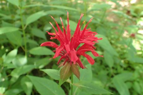 | | 2020 | COLLECTED | 09/05/2020 | Tioga State Forest Area including Stony Fork (Morris Twp), Pine Creek (Shippen Twp), and Cedar Run (Elk Twp) watersheds, southwest area of Tioga County | 41.66542100, -77.48979100 | | Localized around small creeks/tributaries, typically inhabiting wetter sites. | Wild material | Population in nature peaked flower on 6 July (2020). Flowers red. Based on historical observations (M. W. Simonis, pers. communication 8 July 2020), several previously known sites for M. didyma in Tioga County no longer exist largely due to road work and/or bridge replacements. | 2107715 | Ames 35552 |
| 284 | NA 87111 | NCTN70 | Magnolia fraseri Walter | Tennessee, United States | NA | | | 2020 | COLLECTED | 09/26/2019 | Oconee County | 34.99894000, -83.05389000 | | | Wild material | Seedlings received. | 2109473 | NA 87111 |
| 285 | NA 87370 | NCTN59 | Hydrangea barbara (L.) Bernd Schulz | Tennessee, United States | NA | | | 2020 | COLLECTED | 22/09/2019 | | 35.10423000, -84.61030000 | 256 | Mesic oak-pine forest edge, growing up trunks of trees on a steep, rocky slope. | Wild material | Three seedlings received along with NA 87106-87112, but not requested for accessioning at the same time. | 2141752 | NA 87370 |
| 286 | NA 86434 | Pulverulentus Group | Styrax americanus Lam. | Texas, United States | NA | | | 2020 | COLLECTED | 09/08/2018 | Near Gum Slough, on the edges of woodlands along the north side of road FM 2246. | 30.33332000, -93.94704000 | 15 | Plants are found along the edges and moist to wet areas of Gum Slough in part shade to full sun of a mixed deciduous and broadleaved evergreen woodlands. Soils are generally acidic with loamy to clayey sediments, but with some areas consisting of deep, nearly level loamy, poorly drained soil. | Wild material | Species occurrence is infrequent at this location. Collector's note on the name under which this material was gathered, Styrax americanus var. pulverulentus: "In general, the var. pulverulentus is considered "taxonomically inconsequential" by many botanists. Even so, this densely pubescent characteristic is highly uniform across every plant I observed in the sampled population. Weakley notes that "true" var. pulverulentus can be found as far west as East Texas and, in my humble opinion, the population sampled herein represents this "taxon". Regardless, for the purposes of drawing distinction between "typical" Styrax americanus and the densely pubescent form, I've chosen to use this varietal name. It will be interesting to observe whether the seedling progeny are uniformly similar to their parents when they germinate." [Actual altitude recorded was 14.8 m, but decimals can't be used in the database, so the number was rounded.] | 2109219 | NA 86434 |
| 287 | WLP 2019 | MARSB-978 | Viburnum dentatum L. | New York, United States | NA | | | 2019 | COLLECTED | 08/09/2019 | Richmond County; Staten Island; William T. Davis Wildlife Refuge. | 40.59320000, -74.16770000 | | Red maple/sweetgum swamp forest in partial shade; growing in moist, poorly drained sand/loam soil. | | Seed collected from 25 plants in a population of 40, found over a 500 m by 200 m area. Seed maturation: middle. | 2109168 | WLP 2019 |
| 288 | WLP 2021 | MARSB-980 | Viburnum dentatum L. | New York, United States | NA | | | 2019 | COLLECTED | 08/16/2019 | Richmond County; Staten Island; Blue Heron Park. | | | Red maple forest in full shade; growing in moist, poorly drained silt/sand soil. | | Seed collected from 3 plants in population of 25, over an area of 20 square meters; population shaded out, very little seed/flower. Deer browse also heavy throughout park. Seed maturation: middle. | 2109170 | WLP 2021 |
| 289 | WLP 2037 | MARSB-1004 | Viburnum dentatum L. | New York, United States | NA | | | 2019 | COLLECTED | 08/29/2019 | Sullivan County; ; Willowemoc; resdiential. [Willowemoc Rd.? Willowemoc Wild Forest? Locality not precisely specified. Appears likely to be Sullivan County, from maps. -SBL] | | 610 | Edge of pond, transition to red maple swamp, in full sun; growing in moist clay loam soil. | | Seeds collected from 20 individuals in a population of 20 plants occurring over an area 100 meters by 100 meters in size; rare. Seed maturation: late. | 2109186 | WLP 2037 |
| 290 | WLP 2045 | MARS-1014 | Viburnum lentago L. | New York, United States | NA | | | 2019 | COLLECTED | 09/13/2019 | Dutchess County; ; Rt. 199 right-of-way, Barrytown/Tivoli. | | 152 | Roadside right-of-way in full shade; growing in moist clay-loam soil. | | Seeds collected from 20 individuals in a population of 25+ plants, spread over an area 400 meters by 400 meters in size; scattered distribution. Seed maturation: middle. | 2109194 | WLP 2045 |
| 291 | NA 88139 | NCBG-271 | Morella cerifera (L.) Small | North Carolina, United States | NA |  | | 2019 | | | | | | | Wild material | | 2098383 | NA 88139 |
| 292 | NA 88149 | NCBG-313 | Liquidambar styraciflua L. | North Carolina, United States | NA | 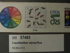 | | 2019 | | | | | | | Wild material | | 2098409 | NA 88149 |
| 293 | NA 88153 | NCBG-321 | Morella cerifera (L.) Small | North Carolina, United States | NA |  | | 2019 | | | | | | | Wild material | | 2098413 | NA 88153 |
| 294 | NA 88154 | NCBG-323 | Pinus taeda L. | North Carolina, United States | NA |  | | 2019 | | | | | | | Wild material | | 2098414 | NA 88154 |
| 295 | NA 88156 | NCBG-326 | Cephalanthus occidentalis L. | North Carolina, United States | NA |  | | 2019 | | | | | | | Wild material | | 2098416 | NA 88156 |
| 296 | NA 88161 | NCBG-354 | Ilex opaca Aiton | Virginia, United States | NA |  | | 2019 | COLLECTED | 10/14/2015 | Belle Isle State Park (Rappahanock River): from park entrance, continue on State Rte. 683/Belle Isle Rd. Turn right onto Creek Landing Road. Park at end of road, follow Mulberry Trail. Population along boardwalk as you walk toward the canoe launch. | 37.78222000, -76.60419000 | 2 | Riverside forest. | Wild material | | 2098425 | NA 88161 |
| 297 | NA 88162 | NCBG-407 | Cyrilla racemiflora L. | North Carolina, United States | NA |  | | 2019 | | | | | | | Wild material | | 2098433 | NA 88162 |
| 298 | NA 88166 | NCBG-558 | Chamaecyparis thyoides (L.) Britton et al. | North Carolina, United States | NA |  | | 2019 | | | | | | | Wild material | | 2098472 | NA 88166 |
| 299 | NA 88167 | NCBG-612 | Cephalanthus occidentalis L. | North Carolina, United States | NA |  | | 2019 | | | | | | | Wild material | | 2098487 | NA 88167 |
| 300 | NA 88169 | NCBG-665 | Kalmia latifolia L. | Virginia, United States | NA |  | | 2019 | | | | | | | Wild material | | 2098504 | NA 88169 |
| 301 | NA 88171 | NCBG-667 | Kalmia latifolia L. | Maryland, United States | NA |  | | 2019 | | | | | | | Wild material | | 2098506 | NA 88171 |
| 302 | W6 57451 | NCBG-227 | Mikania scandens (L.) Willd. | North Carolina, United States | W6 |  | | 2019 | | | | | | | Wild material | | 2098375 | W6 57451 |
| 303 | W6 57455 | NCBG-240 | Mikania scandens (L.) Willd. | North Carolina, United States | W6 |  | | 2019 | | | | | | | Wild material | | 2098379 | W6 57455 |
| 304 | W6 57468 | NCBG-285 | Parthenocissus quinquefolia (L.) Planch. | Virginia, United States | W6 |  | | 2019 | | | | | | | Wild material | | 2098392 | W6 57468 |
| 305 | W6 57518 | NCBG-419 | Decodon verticillatus (L.) Elliott | Virginia, United States | W6 |  | | 2019 | | | | | | | Wild material | | 2098442 | W6 57518 |
| 306 | W6 57547 | NCBG-557 | Cyperus haspan L. | North Carolina, United States | W6 |  | | 2019 | | | | | | | Wild material | | 2098471 | W6 57547 |
| 307 | OPGC 7951 | NEWFS-413 | Oenothera biennis L. | Massachusetts, United States | OPGC |  | | 2019 | | | | | | | Wild material | | 2098217 | OPGC 7951 |
| 308 | W6 57403 | NEWFS-334 | Carex crinita Lam. | New Hampshire, United States | W6 |  | | 2019 | | | | | | | Wild material | | 2098200 | W6 57403 |
| 309 | NA 88132 | NEWFS-320 | Lindera benzoin (L.) Blume | Massachusetts, United States | NA |  | | 2019 | | | | | | | Wild material | | 2098196 | NA 88132 |
| 310 | W6 57398 | NEWFS-313 | Sparganium americanum Nutt. | New Hampshire, United States | W6 |  | | 2019 | | | | | | | Wild material | | 2098195 | W6 57398 |
| 311 | W6 57396 | NEWFS-311 | Juncus canadensis J. Gay ex Laharpe | New Hampshire, United States | W6 |  | | 2019 | | | | | | | Wild material | | 2098193 | W6 57396 |
| 312 | W6 57395 | NEWFS-310 | Juncus effusus L. | New Hampshire, United States | W6 |  | | 2019 | | | | | | | Wild material | | 2098192 | W6 57395 |
| 313 | W6 57392 | NEWFS-303 | Carex lupulina Muhl. ex Willd. | Massachusetts, United States | W6 |  | | 2019 | | | | | | | Wild material | | 2098189 | W6 57392 |
| 314 | W6 57388 | NEWFS-288 | Carex crinita Lam. | Massachusetts, United States | W6 |  | | 2019 | | | | | | | Wild material | | 2098185 | W6 57388 |
| 315 | W6 57384 | NEWFS-276 | Juncus effusus L. | Massachusetts, United States | W6 |  | | 2019 | | | | | | | Wild material | | 2098181 | W6 57384 |
| 316 | W6 57383 | NEWFS-272 | Carex crinita Lam. | Massachusetts, United States | W6 |  | | 2019 | | | | | | | Wild material | | 2098180 | W6 57383 |
| 317 | W6 57381 | NEWFS-264 | Scirpus atrovirens Willd. | New Hampshire, United States | W6 |  | | 2019 | | | | | | | Wild material | | 2098178 | W6 57381 |
| 318 | W6 57380 | NEWFS-256 | Carex scoparia Schkuhr ex Willd. | Massachusetts, United States | W6 |  | | 2019 | | | | | | | Wild material | | 2098177 | W6 57380 |
| 319 | OPGC 7946 | NEWFS-246 | Lobelia cardinalis L. | Massachusetts, United States | OPGC |  | | 2019 | | | | | | | Wild material | | 2098174 | OPGC 7946 |
| 320 | NA 88131 | NEWFS-244 | Clethra alnifolia L. | Massachusetts, United States | NA |  | | 2019 | | | | | | | Wild material | | 2098172 | NA 88131 |
| 321 | W6 57376 | NEWFS-245 | Elymus virginicus L. | Massachusetts, United States | W6 |  | | 2019 | | | | | | | Wild material | | 2098173 | W6 57376 |
| 322 | W6 57374 | NEWFS-243 | Spiraea tomentosa L. | Massachusetts, United States | W6 |  | | 2019 | | | | | | | Wild material | | 2098171 | W6 57374 |
| 323 | W6 57371 | NEWFS-232 | Scirpus cyperinus (L.) Kunth | Massachusetts, United States | W6 |  | | 2019 | | | | | | | Wild material | | 2098168 | W6 57371 |
| 324 | OPGC 7944 | NEWFS-217 | Eurybia divaricata (L.) G. L. Nesom | Massachusetts, United States | OPGC |  | | 2019 | | | | | | | Wild material | | 2098163 | OPGC 7944 |
| 325 | NA 88130 | NEWFS-194 | Cephalanthus occidentalis L. | Massachusetts, United States | NA |  | | 2019 | | | | | | | Wild material | | 2098155 | NA 88130 |
| 326 | NA 88129 | NEWFS-193 | Picea rubens Sarg. | New Hampshire, United States | NA | 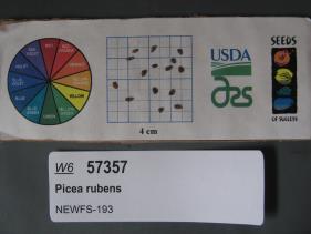 | | 2019 | | | | | | | Wild material | | 2098154 | NA 88129 |
| 327 | W6 57356 | NEWFS-192 | Betula populifolia Marshall | New Hampshire, United States | W6 |  | | 2019 | | | | | | | Wild material | | 2098153 | W6 57356 |
| 328 | W6 57342 | NEWFS-156 | Juncus canadensis J. Gay ex Laharpe | Massachusetts, United States | W6 |  | | 2019 | | | | | | | Wild material | | 2098139 | W6 57342 |
| 329 | W6 57320 | NEWFS-100 | Suaeda maritima (L.) Dumort. | Rhode Island, United States | W6 |  | | 2019 | | | | | | | Wild material | | 2098117 | W6 57320 |
| 330 | OPGC 7923 | NEWFS-81 | Maianthemum canadense Desf. | Massachusetts, United States | OPGC |  | | 2019 | | | | | | | Wild material | | 2098113 | OPGC 7923 |
| 331 | W6 57313 | NEWFS-75 | Echinochloa walteri (Pursh) A. Heller | Massachusetts, United States | W6 |  | | 2019 | | | | | | | Wild material | | 2098110 | W6 57313 |
| 332 | WLP 2512 | Kisatchie National Forest | Hydrangea quercifolia W. Bartram | Louisiana, United States | NA |  | | 2019 | COLLECTED | 10/12/2018 | Kisatchie National Forest, Rapides Parish. Approximately 4.2 miles west of Castor Plunge and 7.2 miles northeast of Hineston. Bluff above Long Branch approximately 10 meters north of the Wild Azalea Trail. | 31.21523300, -92.67101500 | | Shady river bank. | Wild material | Measurements of sampled specimens taken in nature: Height 69 and 133 in., width 45 and 104 in., for NA 86173.01 and 86173.02, respectively. | 2106222 | WLP 2512 |
| 333 | WLP 2513 | MaryAnn Brown Nature Preserve | Hydrangea quercifolia W. Bartram | Louisiana, United States | NA |  | | 2019 | COLLECTED | 10/15/2018 | MaryAnn Brown Nature Preserve (TNC Preserve), West Feliciana Parish. 7.3 miles east-northeast of St. Francisville and 12.3 miles south of Louisiana/Mississippi state line. | 30.82582900, -91.26548200 | | Small ravines and streambanks in shady understory. | Wild material | Measurements of sampled specimens taken in nature: Height 63 and 105 in., width 107 and 99 in., for NA 86174.01 and 86174.02, respectively. | 2106223 | WLP 2513 |
| 334 | WLP 2531 | Hugh's Spring | Hydrangea quercifolia W. Bartram | Alabama, United States | NA |  | | 2019 | COLLECTED | 12/15/2018 | Near Hugh's Spring, Morgan County. North side of Pine Ridge Road, approximately 8.5 miles west-northwest of Union Grove. | 34.41760600, -86.59334500 | | Shady roadsides, and adjacent ravine. | Wild material | Measurements of sampled specimens taken in nature: Height 36 to 101 in.; width 65 to 113 in. Measurements for each specimen sampled may be provided upon request. | 2106241 | WLP 2531 |
| 335 | WLP 2535 | Little River Canyon | Hydrangea quercifolia W. Bartram | Alabama, United States | NA |  | | 2019 | COLLECTED | 12/12/2018 | Little River Canyon National Park, DeKalb and Cherokee Counties. North end of population is 6.5 miles southeast of Fort Payne on the trail to the Little River Falls Overlook. Most of the sampled hydrangeas are along Cherokee County 275 and Little River Canyon Rim Parkway. | 34.39263100, -85.62385700 | | Shady rim of canyon. | Wild material | Measurements of sampled speciimen taken in nature: Height 48 to 119 in.; width 26 to 115 in. Measurements for each specimen sampled may be provided upon request. | 2106245 | WLP 2535 |
| 336 | WLP 2540 | Cheaha Mountain | Hydrangea quercifolia W. Bartram | Alabama, United States | NA |  | | 2019 | COLLECTED | 12/01/2018 | Cheaha Mountain (Cheaha State Park and Talladega National Forest), Cleburne County. Approximately 9 miles south of Oxford. Hydrangeas are along Cheaha Road, Highway 281 and Skyway Mountainway. | 33.52890000, -85.74647800 | | Rocky mountainside. | Wild material | Measurements of sampled specimens taken in nature: Height 55 to 106 in.; width 31 to 132 in. Measurements for each specimen sampled may be provided upon request. | 2106250 | WLP 2540 |
| 337 | WLP 2542 | Dugger Mountain | Hydrangea quercifolia W. Bartram | Alabama, United States | NA |  | | 2019 | COLLECTED | 12/02/2018 | Talladega National Forest, Shoal Creek District, edge of Dugger Mountain Wilderness. Along Kings Gap Mountain Road, approximately 6.5 miles northeast of Jacksonville. | 33.84288500, -85.65341900 | | Mountainside along road. | Wild material | Measurements of sampled specimens taken in nature: Height 58 to 104 in.; width 48 to 99 in. Measurements for each specimen sampled may be provided upon request. | 2106252 | WLP 2542 |
| 338 | WLP 2056 | Elbow Creek | Viburnum opulus L. var. americanum Aiton | Wisconsin, United States | NA |  | | 2019 | COLLECTED | 11/12/2019 | Elbow Creek watershed located approximately 3.5 miles south of Athelstane along County Highway A, T34N R19E extreme eastern edge Sec. 34 and western edge of Sec. 35, Marinette County | 45.37305600, -88.09972200 | 272 | Roadside, floodplain. Neutral ph fen (no ericaceous plants noted) | Wild material | Plants in nature measuring between 6 and 12 feet in height with bright red fruits. | 2097791 | WLP 2056 |
| 339 | NA 88105 | MARSB-406 | Clethra alnifolia L. | New York, United States | NA |  | | 2019 | | | | | | | Wild material | | 2097617 | NA 88105 |
| 340 | NA 88109 | MARSB-425 | Ilex opaca Aiton | New Jersey, United States | NA |  | | 2019 | COLLECTED | 11/03/2015 | Tuckahoe Wildlife Management Area: take exit 20 off Garden State Parkway, route 50 north. Turn right onto Tuckahoe Road, left on Woods Road, right onto Washington Ave, and follow to Tuckahoe Lake. | 39.27769000, -74.73111000 | 0 | Pitch pine lowland swamp forest. | Wild material | | 2097626 | NA 88109 |
| 341 | NA 88118 | MARSB-573 | Viburnum dentatum L. | New York, United States | NA |  | | 2019 | | | | | | | Wild material | | 2097660 | NA 88118 |
| 342 | NA 88121 | MARSB-734 | Ilex glabra (L.) A. Gray | New York, United States | NA |  | | 2019 | COLLECTED | 10/27/2016 | Peasys Pond: drive down NY-25E past Brookhaven State Park. To your right is a hunter's parking area (across from Panamoka Trail). Park here and hike south on trail. Population is along edges of dry riverbeds and dry pond beds. | 40.90238000, -72.84072000 | 15 | Pine barren, pond edge. | Wild material | | 2097693 | NA 88121 |
| 343 | NA 88122 | MARSB-736 | Kalmia latifolia L. | New York, United States | NA |  | | 2019 | | | | | | | Wild material | | 2097694 | NA 88122 |
| 344 | OPGC 7902 | MARSB-405 | Euthamia caroliniana (L.) Greene ex Porter & Britton | New York, United States | OPGC |  | | 2019 | | | | | | | Wild material | | 2097616 | OPGC 7902 |
| 345 | OPGC 7909 | MARSB-712 | Rhexia mariana L. | New Jersey, United States | OPGC |  | | 2019 | | | | | | | Wild material | | 2097687 | OPGC 7909 |
| 346 | W6 57163 | MARSB-377 | Eupatorium perfoliatum L. | New Jersey, United States | W6 | | | 2019 | | | | | | | Wild material | | 2097602 | W6 57163 |
| 347 | W6 57168 | MARSB-389 | Ageratina altissima (L.) R. M. King & H. Rob. | Delaware, United States | W6 |  | | 2019 | | | | | | | Wild material | | 2097607 | W6 57168 |
| 348 | W6 57290 | MARSB-844 | Elymus hystrix L. | New Jersey, United States | W6 |  | | 2019 | | | | | | | Wild material | | 2097729 | W6 57290 |
| 349 | NA 86076 | F010 | Ilex verticillata (L.) A. Gray | Pennsylvania, United States | NA | | | 2019 | COLLECTED | 09/30/2019 | Lancaster County; Poplar Grove (Elizabeth Township); Under powerlines east of Horseshoe Trail (hiking area). | | | Under powerlines. | | | 2109123 | NA 86076 |
| 350 | WLP 158 | NACPEC19-029 | Rhus glabra L. | Kentucky, United States | NA | | | 2019 | COLLECTED | 09/09/2019 | Madison County; Berea College Forest: Radio Tower Service Trail | 37.55289700, -84.28793400 | 379 | Xeric shade knob, limestone shale conglomerate material | Wild material | | 2110470 | WLP 158 |
| 351 | WLP 167 | NACPEC19-053 | Mitchella repens L. | Georgia, United States | NA | | | 2019 | COLLECTED | 09/14/2019 | Walker County; Lula Lake Land Trust: Middle Trail near top, also collected along Connector Trail to Middle Trail from parking lot. | 34.93141800, -85.36991400 | 469 | Mesic, sandy, rocky Oak-Hickory woodland slope - likely acidic | Wild material | | 2110479 | WLP 167 |
| 352 | WLP 168 | NACPEC19-054 | Viburnum acerifolium L. | Georgia, United States | NA | | | 2019 | COLLECTED | 09/14/2019 | Walker County; Lula Lake Land Trust: Middle Trail near top. | 34.93146200, -85.37018800 | 449 | Mesic, sandy, rocky Oak-Hickory woodland slope - likely acidic | Wild material | | 2110480 | WLP 168 |
| 353 | WLP 170 | NACPEC19-061 | Cephalanthus occidentalis L. | Georgia, United States | NA | | | 2019 | COLLECTED | 09/15/2019 | Walker County; Lula Lake Land Trust: Lula Lake Land Trust Falls: East Side of Falls | 34.93361200, -85.37187800 | 427 | Ravine, slope forest, stream margin at Lula Lake Falls | Wild material | | 2110482 | WLP 170 |
| 354 | WLP 171 | NACPEC19-063 | Itea virginica L. | Georgia, United States | NA | | | 2019 | COLLECTED | 09/15/2019 | Walker County; Lula Lake Land Trust: Lula Lake Land Trust Falls: West Side of Falls | 34.93319200, -85.37178900 | 477 | Stream bank, mesic wood forest | Wild material | | 2110485 | WLP 171 |
| 355 | WLP 173 | NACPEC19-075 | Euonymus americanus L. | Georgia, United States | NA | | | 2019 | COLLECTED | 09/17/2019 | Rabun County; Chattahoochee-Oconee National Forest: Chattooga River Trail approximately 1/4 mile down trail from parking lot (off of Highway 76). About 0.09 miles North of Long Creek Highway (2) as the crow flies; Township unicorporated | 34.81549600, -83.30747100 | 393 | Trail edge, steep slope, 400 feet up the slope on West bank (Georgia side): Mixed mesophytic Maple-Hickory-Oak woodland | Wild material | | 2110487 | WLP 173 |
| 356 | WLP 174 | NACPEC19-076 | Clethra acuminata Michx. | Georgia, United States | NA | | | 2019 | COLLECTED | 09/17/2019 | Rabun County; Chattahoochee-Oconee National Forest: Chattooga River Trail approximately 1/2 mile down trail from parking lot (off of Highway 76); Township unicorporated | 34.81757600, -83.30720600 | 423 | Trail edge, steep slope, 400 feet up the slope on West bank (Georgia side): Mixed mesophytic Maple-Hickory-Oak woodland | Wild material | | 2110488 | WLP 174 |
| 357 | WLP 175 | NACPEC19-084 | Crataegus sp. | North Carolina, United States | NA | | | 2019 | COLLECTED | 09/18/2019 | Clay County; Nantahala National Forest: Forest Road 6269: Buck Creek Serpentine Barrens: main trail | 35.08578100, -83.61498800 | 1036 | Pinus rigida-Quercus alba / Sporobulus heterolepis-Andropogon gerardii Woodland OR Southern Blue Ridge Ultramafic Outcrop Barren | Wild material | | 2110489 | WLP 175 |
| 358 | WLP 176 | NACPEC19-085 | Viburnum cassinoides L. | North Carolina, United States | NA | | | 2019 | COLLECTED | 09/18/2019 | Clay County; Nantahala National Forest: Forest Road 6269: Buck Creek Serpentine Barrens: main trail | 35.08593700, -83.61539800 | 1057 | Pinus rigida-Quercus alba / Sporobulus heterolepis-Andropogon gerardii Woodland OR Southern Blue Ridge Ultramafic Outcrop Barren | Wild material | | 2110490 | WLP 176 |
| 359 | WLP 2016 | F008 | Viburnum acerifolium L. | Pennsylvania, United States | NA | | | 2019 | COLLECTED | 09/30/2019 | Lancaster County; Poplar Grove (Elizabeth Township); Along Horshoe Trail (hiking area) east of US 322. | 40.24250000, -76.33466000 | | | | Large population, little seed. | 2109122 | WLP 2016 |
| 360 | Ames 35224 | JDC/AP/2019/034/913 | Aronia ×prunifolia (Marshall) Rehder | Wisconsin, United States | NC7 |  | | 2019 | COLLECTED | 09/17/2019 | Crex Meadows Wildlife Management Area located along Buggerts Lake Road approximately 7.0 miles north of Grantsburg, T39N R19W NW1/4 NE1/4 Sec. 12, Burnett County | 45.88743300, -92.65832600 | 284 | Wet, swampy areas. | Wild material | Plants in nature with some orange fall color and black fruits (a few fruits shriveled) at time of harvest (17 September). Average height approximately 3.5-4.0'. | 2097760 | Ames 35224 |
| 361 | NA 86438 | JDC/IV/2019/033/912 | Ilex verticillata (L.) A. Gray | Wisconsin, United States | NA |  | | 2019 | COLLECTED | 09/17/2019 | Crex Meadows Wildlife Management Area located approximately 7.0 miles north of Grantsburg, Burnett County | 45.86773900, -92.63055500 | 285 | Wet, swampy areas | Wild material | Average height noted of plants in nature was circa 8' in height. Fruits bright red and persistent at time of harvest (17 September). Foliage green, signs of chlorosis noted on most specimens. | 2097759 | NA 86438 |
| 362 | WLP 2003 | MARSB-968 | Viburnum dentatum L. | New York, United States | NA | | | 2019 | COLLECTED | 08/04/2019 | Ulster County; Gardiner; Private residence at 844 Route 208, Gardiner, New York 12525. | 41.65848000, -74.14236000 | 122 | Forest, marsh/pond shore in partial to full shade; poorly drained, clay loam soil, seasonally wet/moist. | | Seeds collected from plant. Many seeds had already dropped or been eaten; seeds collected from an approximately 1 acre (or 4000 square meters) area with Viburnum dentatum growing in several dense patches and sparsely between. Species common, scattered in area; 100-plus individuals estimated in approximately 4000 square meters. | 2109099 | WLP 2003 |
| 363 | WLP 2004 | MARSB-969 | Viburnum dentatum L. | New York, United States | NA | | | 2019 | COLLECTED | 07/31/2019 | Onondaga County; Liverpool; Hamlin Swamp (two sets of coordinates and data collected over two days at this site; the earlier data is noted first. The second set of coordinates given is 43.150864 deg. N, 76.175374 deg. W.) | 43.15140000, -76.17474000 | | Edge of wetland. Marsh/pond shore in full sun; moist to wet, clay loam to clay soil. | | Seeds collected directly from plants. Collected in two partial collections, one on 7/31/2019 and the second on 8/8/2019; Species common to scattered in area; 50+ individuals in population visited on 7/31/2019, and 30+ individuals in the population visited on 8/8/2019 (five individuals sampled from the second site; number of individuals sampled at first site not recorded.) Seed quality good. | 2109100 | WLP 2004 |
| 364 | WLP 2011 | MARSB-981 | Viburnum dentatum L. | New York, United States | NA | | | 2019 | COLLECTED | 08/08/2019 | Onondaga County; Phoenix; Three Rivers Wildlife Management Area. | 43.19781000, -76.33312000 | | Shrubland and meadow/grassland in moist to dry, well-drained, clay loam soil. | | Seeds collected directly from plants. Species common in area; 100+ individuals in population, 30+ individuals sampled. Seed quality good, 100 percent healthy seed. The first of two separate collections made in two areas of the WMA [see NA 86005, MARSB-982/MARSB_IL_007 for the second collection] since the area is very large. | 2109107 | WLP 2011 |
| 365 | WLP 2012 | MARSB-982 | Viburnum dentatum L. | New York, United States | NA | | | 2019 | COLLECTED | 08/08/2019 | Onondaga County; Phoenix; Three Rivers Wildlife Management Area. | 43.20187000, -76.33883000 | | Shrubland and meadow/grassland in moist to dry, well-drained, clay loam soil. | | Seeds collected directly from plants. Species common in area; 100+ individuals in population, 30+ individuals sampled. Seed quality good, 100 percent healthy seed. The second of two collections made in two areas of Three Rivers WMA [see NA 86004, MARSB-981/MARSB_IL_006 for the previous one] due to the large size of the area. | 2109108 | WLP 2012 |
| 366 | WLP 1135 | F007 | Cornus florida L. | Pennsylvania, United States | NA | | | 2019 | COLLECTED | 09/12/2019 | Lebanon County; Newmanstown [to Brickerville?]; J Eward Mack Scout Reservation [and beyond]; collected across a five-mile radius [Locality given as J Edward Mack, Brickerville; coordinates provided are at J Edward Mack Scout Reservation in Newmanstown, with Brickerville some distance to the southeast. -SBL] | 40.25705000, -76.31936000 | | | | Collected from several specimens in a five mile radius. | 2109114 | WLP 1135 |
| 367 | Ames 35220 | Ames 35220 | Aronia ×prunifolia (Marshall) Rehder | Wisconsin, United States | NC7 |  | | 2019 | COLLECTED | 09/04/2019 | Watershed area of Brule River. Collection site located approximately 3.75 miles southwest of Winneboujou, 0.30 miles west of intersection of Francis Willard Road and Forestry Road, T46N R10W SW1/4 SW1/4 Sec. 8, Douglas County | 46.47574000, -91.65172000 | 359 | Ecotone of Tamarack Swamp, Northern Sedge Meadow and Upland Northern Hardwood Forest | Wild material | Plants in nature ranging from 1.0-2.5 meters in height. Fruits measuring approximately 7-9mm in diameter and dark reddish-purple at time of collection (4 September 2019). | 2097756 | Ames 35220 |
| 368 | NA 88063 | NEWFS-247 | Clethra alnifolia L. | Massachusetts, United States | NA |  | | 2019 | | | | | | | Wild material | | 1976188 | NA 88063 |
| 369 | NA 88064 | NEWFS-251 | Clethra alnifolia L. | Massachusetts, United States | NA |  | | 2019 | | | | | | | Wild material | | 1976190 | NA 88064 |
| 370 | NA 88068 | NEWFS-460 | Ilex glabra (L.) A. Gray | Rhode Island, United States | NA |  | | 2019 | COLLECTED | 10/13/2016 | Great Swamp Management Area: from Boston take 93 S to 95 S. Left at fork for RI-4S. Exit 5B for RI-102N, then left on RI-2S. Left on RI-138E. Right on Watson Rd. left on Liberty Ln. Continue on Great Neck Rd. Far parking lot, marsh off of trail on left (Ref: NEWFS-458); follow trail to powerlines behind marsh. | 41.46666000, -71.57944000 | 29 | Powerline. | Wild material | | 1976268 | NA 88068 |
| 371 | NA 88071 | NEWFS-610 | Clethra alnifolia L. | Connecticut, United States | NA |  | | 2019 | | | | | | | Wild material | | 1976301 | NA 88071 |
| 372 | OPGC 7386 | NEWFS-197 | Euthamia graminifolia (L.) Nutt. | Massachusetts, United States | OPGC |  | | 2019 | | | | | | | Wild material | | 1976175 | OPGC 7386 |
| 373 | W6 56178 | NEWFS-302 | Carex comosa Boott | Connecticut, United States | W6 |  | | 2019 | | | | | | | Wild material | | 1976213 | W6 56178 |
| 374 | W6 56324 | NEWFS-841 | Rhus typhina L. | Massachusetts, United States | W6 |  | | 2019 | | | | | | | Wild material | | 1976359 | W6 56324 |
| 375 | Ames 34371 | TDASE18-042 | Diervilla sessilifolia Buckley | North Carolina, United States | NC7 |  | | 2018 | COLLECTED | 09/17/2018 | Nantahala National Forest, Mount Toxaway located approximately 2.7 miles east of Lake Toxaway along Tower Road, Transylvania County | 35.13095000, -82.98210000 | 1436 | Population mostly localized at/near summit of mountain | Wild material | | 1970179 | Ames 34371 |
| 376 | WLP 1988 | V18-05 | Viburnum acerifolium L. | New Hampshire, United States | NA | | | 2018 | COLLECTED | 10/03/2018 | Rockingham County; ; Pawtuckaway State Park, along Pawtuckaway Road, growing in patches around the park. | 43.08504000, -71.17385000 | 103 | Somewhat dry areas. | Wild material | | 2108867 | WLP 1988 |
| 377 | WLP 1989 | V18-06 | Viburnum acerifolium L. | New Hampshire, United States | NA | | | 2018 | COLLECTED | 10/03/2018 | Merrimack County; ; Bear Brook State Park, on the left side of Podunk Road near the entrance to the park near the top of a ridge. | 43.14488000, -71.35516000 | 103 | | | | 2108868 | WLP 1989 |
| 378 | Ames 34787 | NCBG-330 | Rhus copallinum L. | North Carolina, United States | NC7 |  | | 2018 | COLLECTED | 10/07/2015 | Dismal Swamp State Park areas of Laurel Hill Trail and Corapeake Road. | 36.54783000, -76.42763000 | 5 | Hardwood swamp roadside | Wild material | | 1965913 | Ames 34787 |
| 379 | NA 88028 | NCBG-358 | Pinus taeda L. | Virginia, United States | NA |  | | 2018 | | | | | | | Wild material | | 1965927 | NA 88028 |
| 380 | NA 88031 | NCBG-382 | Juniperus virginiana L. | Virginia, United States | NA |  | | 2018 | | | | | | | Wild material | | 1965940 | NA 88031 |
| 381 | NA 88035 | NCBG-622 | Ilex glabra (L.) A. Gray | North Carolina, United States | NA |  | | 2018 | COLLECTED | 10/27/2016 | From Roanoke Island, head SW on US-64 W, turn left onto US-264 W, population on left for approximately 12 miles. | 35.71316000, -75.76819000 | 1 | Pine-inkberry swamp. | Wild material | | 1965992 | NA 88035 |
| 382 | NA 88208 | NCBG-721 | Ceanothus americanus L. | North Carolina, United States | NA |  | | 2018 | | | | | | | Wild material | Ceanothus americanus | 1966030 | NA 88208 |
| 383 | OPGC 7228 | NCBG-241 | Typha angustifolia L. | North Carolina, United States | OPGC |  | | 2018 | | | | | | | Wild material | | 1965881 | OPGC 7228 |
| 384 | W6 54639 | NCBG-214 | Carex lurida Wahlenb. | North Carolina, United States | W6 | | | 2018 | | | | | | | Wild material | Carex lurida | 1965865 | W6 54639 |
| 385 | W6 54641 | NCBG-217 | Juncus effusus L. | North Carolina, United States | W6 | | | 2018 | | | | | | | Wild material | Juncus effusus | 1965867 | W6 54641 |
| 386 | W6 54692 | NCBG-340 | Fraxinus pennsylvanica Marshall | North Carolina, United States | W6 |  | | 2018 | | | | | | | Wild material | Fraxinus pennsylvanica | 1965918 | W6 54692 |
| 387 | NA 88004 | MARSB-737 | Clethra alnifolia L. | New York, United States | NA |  | | 2018 | | | | | | | Wild material | | 1964838 | NA 88004 |
| 388 | NA 88005 | MARSB-739 | Clethra alnifolia L. | New York, United States | NA |  | | 2018 | | | | | | | Wild material | | 1964839 | NA 88005 |
| 389 | NA 88006 | MARSB-740 | Clethra alnifolia L. | New York, United States | NA |  | | 2018 | | | | | | | Wild material | | 1964840 | NA 88006 |
| 390 | W6 54006 | MARSB-131 | Juncus effusus L. | Delaware, United States | W6 |  | | 2018 | | | | | | | Wild material | Juncus effusus | 1964722 | W6 54006 |
| 391 | W6 54008 | MARSB-151 | Carex lurida Wahlenb. | Delaware, United States | W6 |  | | 2018 | | | | | | | Wild material | Carex lurida | 1964724 | W6 54008 |
| 392 | W6 54009 | MARSB-152 | Carex crinita Lam. | Delaware, United States | W6 |  | | 2018 | | | | | | | Wild material | Carex crinita | 1964725 | W6 54009 |
| 393 | W6 54028 | MARSB-234 | Carex comosa Boott | New York, United States | W6 |  | | 2018 | | | | | | | Wild material | Carex comosa | 1964744 | W6 54028 |
| 394 | W6 54029 | MARSB-239 | Scirpus cyperinus (L.) Kunth | New York, United States | W6 |  | | 2018 | | | | | | | Wild material | Scirpus cyperinus | 1964745 | W6 54029 |
| 395 | W6 54032 | MARSB-287 | Carex crinita Lam. | New Jersey, United States | W6 |  | | 2018 | | | | | | | Wild material | Carex crinita | 1964748 | W6 54032 |
| 396 | W6 54033 | MARSB-288 | Carex lurida Wahlenb. | New Jersey, United States | W6 |  | | 2018 | | | | | | | Wild material | Carex lurida | 1964749 | W6 54033 |
| 397 | W6 54052 | MARSB-378 | Scirpus cyperinus (L.) Kunth | New Jersey, United States | W6 |  | | 2018 | | | | | | | Wild material | Scirpus cyperinus | 1964768 | W6 54052 |
| 398 | OPGC 5470 | JDC/BN/2018/056/869 | Baptisia nuttalliana Small | Arkansas, United States | OPGC |  | | 2018 | COLLECTED | 07/17/2018 | Located circa 2.60 miles northwest of Brightstar off Miller Road 159, Miller Road 74, Miller Road 75, Miller Road 154 and highway 237, Miller County | 33.14091000, -94.02229000 | 109 | Roadside. Edges of woods. | Wild material | Plants essentially all black with seeds past maturity by approximately 2-3 weeks, plants starting to break off at ground level and fruiting capsules starting to split at time of collection (17 July 2018). Seed quality rather poor at time of collection largely due to weevils. | 1964612 | OPGC 5470 |
| 399 | Ames 34204 | JDC/ML/2018/030/843 | Monarda luteola Singhurst & W. C. Holmes | Arkansas, United States | NC7 |  | | 2018 | COLLECTED | 05/22/2018 | Located 2.62 miles northwest of Brightstar off Miller Road 159 just 0.54 miles north of junction with state highway 160, Miller County | 33.14091000, -94.02229000 | 109 | Roadside. Open woods. | Wild material | Plants with lemon scent, pubescent stems and leaves with faint yellow flowers measuring circa 2.0' in height. Leaves longer than internodes. Plants likely reached peaked flower around 16 May 2018. Seeds likely reached full maturity around first week in July (2018). | 1963387 | Ames 34204 |
| 400 | Ames 34160 | Ames 34160 | Fraxinus americana L. | Pennsylvania, United States | NC7 |  | | 2017 | COLLECTED | 11/01/2017 | Urban loaction near the intersection of Pennsylvania ave. and Fort Washington Ave. Fort Washington, Montgomery County. | 40.13730600, -75.21111800 | 66 | Specimens located along a possible eixisting naural hedge row along the rightway of two existing parking lots. | Uncertain improvement status | | 1957726 | Ames 34160 |
| 401 | NA 87954 | MARSB-574 | Morella pensylvanica (Mirb.) Kartesz | New York, United States | NA |  | | 2017 | | | | | | | Wild material | | 1954652 | NA 87954 |
| 402 | NA 87956 | NEWFS-285 | Viburnum dentatum L. | Massachusetts, United States | NA |  | | 2017 | | | | | | | Wild material | | 1954734 | NA 87956 |
| 403 | NA 87957 | NEWFS-367 | Viburnum dentatum L. | Massachusetts, United States | NA |  | | 2017 | | | | | | | Wild material | | 1954735 | NA 87957 |
| 404 | NA 87961 | NEWFS-242 | Clethra alnifolia L. | Connecticut, United States | NA |  | | 2017 | | | | | | | Wild material | | 1954706 | NA 87961 |
| 405 | WLP 2057 | NEWFS-270 | Viburnum dentatum L. | Maine, United States | NA |  | | 2017 | COLLECTED | 08/11/2015 | Scarborough Marsh WMA just off Pine Point Road along trail across from Audubon Center, Cumberland County | 43.56536400, -70.37482700 | 1 | Saltmarsh | Wild material | | 1954666 | WLP 2057 |
| 406 | WLP 1983 | MARSB-806 | Viburnum dentatum L. | Delaware, United States | NA | | | 2017 | COLLECTED | 08/16/2017 | Sussex County; ; Bombay Hook National Wildlife Refuge: Marshtown Road. | 39.18963000, -75.44088000 | 3 | Mixed hardwood swamp; swales/terraces. Sand soil (Pineyneck series). Land used for conservation and recreation. | Wild material | Seeds collected from 60 plants; 100 plants found in an area of two acres. Two herbarium vouchers collected on 16 Aug. 2017; held at Smithsonian and MARSB. Material identified in field by Clara Holmes on 16 Nov. 2017. Ecoregion: 63E -- Middle Atlantic Coastal Plains (Omernik). | 2108827 | WLP 1983 |
| 407 | Ames 34032 | Ames 34032 | Monarda didyma L. | West Virginia, United States | NC7 |  | | 2017 | COLLECTED | 08/17/2017 | Fernow Forest approximately 3.6 miles east, southeast of Parsons along Road 701 adjacent to Elklick Run Creek, Tucker County. | 39.04350000, -79.67683300 | 703 | Allegheny Plateau. Mixed mesophytic forest, riparian area. | Wild material | | 1954321 | Ames 34032 |
| 408 | Ames 34033 | Ames 34033 | Monarda didyma L. | West Virginia, United States | NC7 |  | | 2017 | COLLECTED | 09/02/2017 | Monongahela National Forest along Road 1678 following Sutton Run Creek aproximately 4.3 miles east of Green Bank, Pocahontas County. | 38.40400000, -79.75550000 | 1001 | Wet/mesic forested, riparian area. | Wild material | | 1954322 | Ames 34033 |
| 409 | Ames 34015 | Ames 34015 | Cornus rugosa Lam. | Minnesota, United States | NC7 | | | 2017 | COLLECTED | 08/23/2017 | Smoky Hills State Forest between Snellman and Osage, T139N R37W Sec. 2, 9, 11, and 14 and also T140N R37W Sec. 26 and 34. | 46.89278300, -95.35163300 | 501 | Mixed pine and deciduous moist woods. | Wild material | | 1953929 | Ames 34015 |
| 410 | NA 84644 | SAPPE-030 | Quercus imbricaria Michx. | North Carolina, United States | NA | | | 2017 | COLLECTED | 09/27/2016 | Macon County; Franklin; Along Rt. 28 north of Franklin, NC; tree growing in narrow strip between highway and Little Tennessee River. | 35.26733000, -83.41985000 | 605 | Open, mixed forest and scrubby roadside vegetation. Growing in open to 1/4 shade. | | Population distribution patchy, but frequent. | 2108757 | NA 84644 |
| 411 | NA 84645 | ZARKS-030 | Rhododendron prinophyllum (Small) Millais | Arkansas, United States | NA | | | 2017 | COLLECTED | 10/05/2014 | King's River Falls Natural Area; King's River, downstream of junction of county roads 3415 and 3500 along trail leading from parking area and trail sign. | 35.90106000, -93.57456000 | 514 | Mesic, mixed deciduous forest; growing on ledge along river, in rocky soil. | Wild material | See NA 87611 for plants of the same collection received from Morris Arboretum in 2020. | 2108758 | NA 84645 |
| 412 | NA 84577 | RJL-RM001 | Halesia diptera J. Ellis | Texas, United States | NA | | | 2017 | COLLECTED | 07/22/2017 | Along either side of a clear creek on private property approximately 1.42 kilometers north of Texas Recreational Road 255 in northeastern Jasper County. | 31.07135000, -93.94985000 | 107 | Plants growing along the embankments of the clear creek just above normal flood stage in primarily deciduous woodlands with some broadleaved evergreens and conifers. Plants are growing in part shade; some direct sunlight occurs during mid-day hours for 1-2 hours. Soils sandy and topped with a generous undisturbed decomposed litter layer. Slope: 10 percent. Aspect: variable. | Wild material | | 1953812 | NA 84577 |
| 413 | NA 86658 | SE-2017-011 | Quercus durandii Buckley | Alabama, United States | NA | | | 2017 | COLLECTED | 07/01/2017 | Demopolis: Wooded area bordering trail off Sports-Plex Road [GPS coordinates indicate this is near French Creek adjacent to Shelton State Community College.] | 32.48741000, -87.78094000 | 51 | Mesic woods by rock ledge. | Wild material | U.S. National Arboretum - Southeastern US Quercus Expedtion 2017 (Scanlon) | 2137632 | NA 86658 |
| 414 | NA 84158 | P. Thompson 19 | Quercus oglethorpensis W. H. Duncan | Alabama, United States | NA | | | 2017 | COLLECTED | 10/15/2015 | On side of CR 14, ca 3.5 air miles west of Catherine, Alabama. | 32.17725000, -87.51492000 | | Growing on moist roadside between timber and hunting properties. | Wild material | | 2132959 | NA 84158 |
| 415 | Ames 34190 | Ames 34190 | Alnus serrulata (Aiton) Willd. | Kentucky, United States | NC7 | | | 2016 | COLLECTED | 09/28/2016 | | 36.83800000, -84.33100000 | 288 | River's edge below canopy. | | | 1952456 | Ames 34190 |
| 416 | NA 83904 | NA 83904 | Clethra acuminata Michx. | Kentucky, United States | NA | | | 2016 | COLLECTED | 09/27/2016 | Daniel Boone National Forest, Forest Service Road 828/Route 927, Panoramic View Trail #528. | 36.84200000, -84.52900000 | 390 | Ridgetop trail. | Wild material | | 1952034 | NA 83904 |
| 417 | WLP 1180 | NA 83893 | Euonymus americanus L. | Kentucky, United States | NA | | | 2016 | COLLECTED | 09/27/2016 | Cumberland Falls State Park, Trail #6 (Cumberland Falls Trail). Stairs above visitor center entrance at Trail #6 trailhead. | 36.83700000, -84.34300000 | 273 | | | | 1951485 | WLP 1180 |
| 418 | WLP 1181 | NA 83958 | Diospyros virginiana L. | Kentucky, United States | NA | | | 2016 | COLLECTED | 09/30/2016 | Daniel Boone National Forest, Natural Arch Scenic Area. | 36.84100000, -84.51200000 | 408 | Natural area park. | | | 1951334 | WLP 1181 |
| 419 | WLP 1228 | NA 83881 | Hydrangea arborescens L. | Kentucky, United States | NA | | | 2016 | COLLECTED | 09/26/2016 | Floracliff Nature Sanctuary & Trail's End. | 37.90200000, -84.36300000 | 210 | Rocky slope. | | | 1951139 | WLP 1228 |
| 420 | WLP 1375 | NA 83887 | Kalmia latifolia L. | Kentucky, United States | NA | | | 2016 | COLLECTED | 09/27/2016 | Cumberland Falls State Park, Trail #6 (Cumberland Falls Trail). | 36.83700000, -84.34000000 | 302 | Break in canopy along trail near telephone pole. | | | 1953494 | WLP 1375 |
| 421 | WLP 1432 | NA 83894 | Ostrya virginiana (Mill.) K. Koch | Kentucky, United States | NA | | | 2016 | COLLECTED | 09/27/2016 | Cumberland Falls State Park, Cumberland Falls Visitor Center. | 36.84000000, -84.34300000 | 258 | | | | 1952033 | WLP 1432 |
| 422 | WLP 1433 | NA 83908 | Oxydendrum arboreum (L.) DC. | Kentucky, United States | NA | | | 2016 | COLLECTED | 09/27/2016 | Daniel Boone National Forest, Forest Service Road 828/Route 927, Panoramic View Trail #528. | 36.84400000, -84.52700000 | 400 | Ridgetop trail. | | | 1951131 | WLP 1433 |
| 423 | WLP 1434 | NA 83915 | Nyssa sylvatica Marshall | Kentucky, United States | NA | | | 2016 | COLLECTED | 09/28/2016 | Cumberland Falls State Park; Cumberland Falls Visitor Center parking lot en route to Trail #2 trailhead. Overhanging road beyond water treatment plant and beyond shelter with fireplace, before circle of picnic tables. | 36.83800000, -84.33700000 | 276 | | | | 1952017 | WLP 1434 |
| 424 | WLP 1436 | NA 83951 | Oxydendrum arboreum (L.) DC. | Kentucky, United States | NA | | | 2016 | COLLECTED | 09/29/2016 | Kentenia State Forest, Pine Mountain, opening in canopy on Route 1679, south side. | 36.92000000, -83.24200000 | 795 | Roadside, opening in canopy. | | | 1951128 | WLP 1436 |
| 425 | WLP 1529 | NA 83963 | Philadelphus hirsutus Nutt. | Kentucky, United States | NA | | | 2016 | COLLECTED | 09/30/2016 | Limestone ridge/outcrop near Lake Cumberland. [GPS coordinates do not appear to be exact. -SBL] | 36.93100000, -84.58200000 | 238 | Limestone ridge/outcrop. | | | 1950300 | WLP 1529 |
| 426 | WLP 1700 | NA 83905 | Rhododendron cumberlandense E. L. Braun | Kentucky, United States | NA | | | 2016 | COLLECTED | 09/27/2016 | Daniel Boone National Forest, Forest Service Road 828/Route 927, Panoramic View Trail #528. | 36.84200000, -84.53000000 | 402 | Ridgetop trail, uphill side of hill. | | | 1950763 | WLP 1700 |
| 427 | WLP 1702 | NA 83914 | Rhus copallinum L. | Kentucky, United States | NA | | | 2016 | COLLECTED | 09/28/2016 | Cumberland Falls State Park; Cumberland Falls Visitor Center parking lot en route to Trail #2 trailhead. Left of roadside beyond water treatment plant and beyond shelter with fireplace, before circle of picnic tables. | 36.83700000, -84.33800000 | | | | | 1951563 | WLP 1702 |
| 428 | WLP 1704 | NA 83942 | Rhus glabra L. | Kentucky, United States | NA | | | 2016 | COLLECTED | 09/29/2016 | Kentenia State Forest, Pine Mountain, on Route 1679, south side. | 36.90500000, -83.29100000 | 771 | Roadside. | | | 1953164 | WLP 1704 |
| 429 | WLP 1705 | NA 83948 | Rhododendron maximum L. | Kentucky, United States | NA | | | 2016 | COLLECTED | 09/29/2016 | Kentenia State Forest, Pine Mountain, on Route 1679, north side. | 36.91400000, -83.25900000 | 758 | Roadside. | | | 1950864 | WLP 1705 |
| 430 | WLP 1972 | NA 83906 | Vaccinium sp. | Kentucky, United States | NA | | | 2016 | COLLECTED | 09/27/2016 | Daniel Boone National Forest, Forest Service Road 828/Route 927, Panoramic View Trail #528. | 36.84300000, -84.52800000 | 406 | Ridgetop trail. | Wild material | | 1950956 | WLP 1972 |
| 431 | WLP 719 | NA 83952 | Aristolochia macrophylla Lam. | Kentucky, United States | NA | | | 2016 | COLLECTED | 09/29/2016 | Kentenia State Forest, Pine Mountain, Route 1679, south side. | 36.92600000, -83.22000000 | 775 | Growing on Liriodendron tulipifera and Acer rubrum. | | | 1951065 | WLP 719 |
| 432 | WLP 872 | NA 83949 | Clethra acuminata Michx. | Kentucky, United States | NA | | | 2016 | COLLECTED | 09/29/2016 | Kentenia State Forest, Pine Mountain, on Route 1679, south side. | 36.91500000, -83.25900000 | 760 | Roadside. | | | 1951703 | WLP 872 |
| 433 | Ames 33766 | Ames 33766 | Spiraea alba Du Roi | Minnesota, United States | NC7 |  | | 2016 | COLLECTED | 10/21/2016 | Sherburne National Wildlife Refuge just north of Orrock on the southeast side of Big Mud Lake, T34N R27W NE 1/4 SE 1/4 Sec. 7, Sherburne County | 45.45028600, -93.73685400 | 296 | Low land area near shallow lake | Wild material | | 1943164 | Ames 33766 |
| 434 | Ames 33767 | Ames 33767 | Spiraea tomentosa L. | Minnesota, United States | NC7 | | | 2016 | COLLECTED | 10/15/2016 | Sherburne National Wildlife Refuge just north of Orrock on the southeast side of Big Mud Lake, T34N R27W NE 1/4 SE 1/4 Sec. 7 Sherburne County | 45.45028600, -93.73685400 | 296 | Low land area near shallow lake. Growing in association with Betula papyrifera, Acer rubrum, Carex spp., Spiraea alba, and Cornus sericea. | Wild material | | 1943165 | Ames 33767 |
| 435 | Ames 33745 | UC 108 | Aronia melanocarpa (Michx.) Elliott | Tennessee, United States | NC7 |  | | 2016 | COLLECTED | 10/01/2009 | Near Caryville, Campbell County | 36.35786670, -84.21851670 | 532 | Powerline cut and surrounding area of dry and wet woods. | Wild material | This accession is rather unique as it seems to morphologically/phenologically (NCRPIS field plots) represent the "southern form" of A. melanocarpa, a potentially a new Aronia species. This southern form was originally discovered by Brand et al. 2022 (Ploidy, genetic diversity and speciation of the genus Aronia) and is known for having glabrous stems and leaves and a distinct phyllotaxy than other Aronia species. However, this accession based on Brand et al. 2022 AFLP dendogram fits with diploid A. melanocarpa, but flow cytometry indicates it is tetraploid. Fruits tend to ripen the same time as diploid A. melanocarpa and three weeks ahead of tetraploid A. melanocarpa. | 1942831 | Ames 33745 |
| 436 | OPGC 7157 | CBG-5314 | Geum aleppicum Jacq. | Wisconsin, United States | OPGC | | | 2016 | | | | | | | Wild material | | 1942769 | OPGC 7157 |
| 437 | W6 51634 | CBG-5267 | Chamaenerion angustifolium (L.) Scop. subsp. circumvagum (Mosquin) Moldenke | Wisconsin, United States | W6 | | | 2016 | | | | | | | Wild material | | 1942764 | W6 51634 |
| 438 | W6 51638 | CBG-5283 | Carex gynandra Schwein. | Wisconsin, United States | W6 | | | 2016 | | | | | | | Wild material | | 1942768 | W6 51638 |
| 439 | WLP 728 | NA 83684 | Betula nigra L. | Maryland, United States | NA | | | 2016 | COLLECTED | 06/07/2016 | Pocomoke River State Forest. Within sight of the Pocomoke River. | 38.22168000, -75.36431000 | 15 | Forested flood plain with swamp areas. | | | 1952491 | WLP 728 |
| 440 | Ames 33220 | NA 82306 | Spiraea tomentosa L. | Maryland, United States | NC7 | | | 2015 | COLLECTED | 10/17/2012 | Along Powell Road, Chesapeake Forest Public Hunting Area, Wicomico State Forest, between Sixty Foot Road and Morris Road, Wicomico County. | 38.35340000, -75.41360000 | 12 | Roadside. Upland forest edge. | Wild material | | 1932218 | Ames 33220 |
| 441 | Ames 33078 | TDAAR15-050 | Aronia arbutifolia (L.) Pers. | Arkansas, United States | NC7 |  | | 2015 | COLLECTED | 09/24/2015 | Moro Big Pines Natural Area along Route 34, approximately 200 yards north of junction with Route 29 (five points area), T15S R13W Sec. 23, Calhoun County | 33.39953300, -92.41401700 | 34 | | Wild material | | 1932076 | Ames 33078 |
| 442 | Ames 33077 | Ames 33077 | Aronia melanocarpa (Michx.) Elliott | Missouri, United States | NC7 |  | | 2015 | COLLECTED | 11/16/2015 | Holly Ridge Conservation Area, N 1/2 of NW 1/4 of Section 6, T25N R11E, Dyersburg Quad, approximately 4.25 miles northeast of Dexter, Stoddard County. | 36.84371600, -89.90762000 | 124 | Flat area adjacent to acid seep. | Wild material | Plants approximately 5-7 feet in height with reddish-orange fall color with roughly 15% of leaves still persisting at time of collection (11/16/2015). This collection likely represents material from a single clonal, suckering patch. According to G. Yatskievych (prior Curator/Director Flora of Missouri Project, currently Botanist/Curator at Plant Resources Center, University of Texas at Austin), Aronia melanocarpa has only been found in Missouri in Stoddard County, specifically in the Crowley's Ridge area, where it occurs along the margins of acid seeps and spring branches. It is unclear why it has never been reported in other acidic wetlands in southeastern Missouri. This accession based on morphological/phenological observations at NCRPIS field plots seems to represent the "southern form" of A. melanocarpa, potentially a new Aronia species. This southern form was originally discovered by Brand et al. 2022 (Ploidy, genetic diversity and speciation of the genus Aronia) and is known for having glabrous stems and leaves and a distinct phyllotaxy than other Aronia species. In addition, plants tend to bloom approximately two weeks later than all other Aronia taxonomic groups and the inflorescences/infructescences are more spreading and extended due to longer peduncles and pedicels within the cyme. Fruit maturity tends to occur 2 to 4 weeks later than tetraploid A. melanocarpa and 4 to 6 weeks later than diploid A. melanocarpa. Phenolic levels are much higher in comparison to other A. melanocarpa accessions (Brand et al., 2017 - Anthocyanins, total phenolics, ORAC and moisture content of wild and cultivated dark-fruited Aronia species.) | 1932075 | Ames 33077 |
| 443 | Ames 35808 | Damariscotta Lake | Aronia melanocarpa (Michx.) Elliott | Maine, United States | NC7 |  | | 2015 | COLLECTED | PRE 07/2008 | Damariscotta Lake just north of Damariscotta | 44.14888900, -69.48166700 | 17 | Edge of lake. | Wild material | This accession represents genetics sampled from three areas of Damariscotta Lake originally collected as Ames 33071, Ames 33072, and Ames 29679. These three diploid clonal accessions were combined in order to execute a successful seed increase requiring cross pollination by other diploid genotypes. | 2138040 | Ames 35808 |
| 444 | WLP 1177 | NA 82779 | Gaylussacia baccata (Wangenh.) K. Koch | Maine, United States | NA | | | 2015 | COLLECTED | 08/23/2015 | Along north side of State Route 9, ca. 0.2 miles east of its crossing with Honeymoon Brook. | 44.93052000, -67.75095000 | 90 | Edge of woods in moist ditch along highway. | | | 1952128 | WLP 1177 |
| 445 | NA 82643 | NA 82643 | Lonicera sempervirens L. | Texas, United States | NA | | | 2015 | COLLECTED | 07/20/2014 | East side of Texas Route 87 approximately 0.52 miles south of Trout Creek, Texas. | 30.61156000, -93.80506000 | 21 | Southwest-facing edge of mature woodland in part to full sun; well-drained, seasonally moist soils that are sandy loam; surface has an excellent organic litter layer. | | | 1952603 | NA 82643 |
| 446 | NA 83066 | NA 83066 | Hamamelis vernalis Sarg. | Arkansas, United States | NA | | | 2015 | COLLECTED | 10/04/2014 | King's River Falls Natural Area; upstream of the junction of County Rds 3415 and 3500 and the bridge over Mink Creek branch of King's River; at the Dripping Springs Schoolhouse (1921). | 35.88946000, -93.58091000 | 528 | Mesic, mixed deciduous forest; north-northeast running stream valley; gravel bank along seasonal stream in sandy/gravelly soil. | Wild material | | 1953405 | NA 83066 |
| 447 | Ames 33731 | MARSB-070 | Rhus typhina L. | Pennsylvania, United States | NC7 | 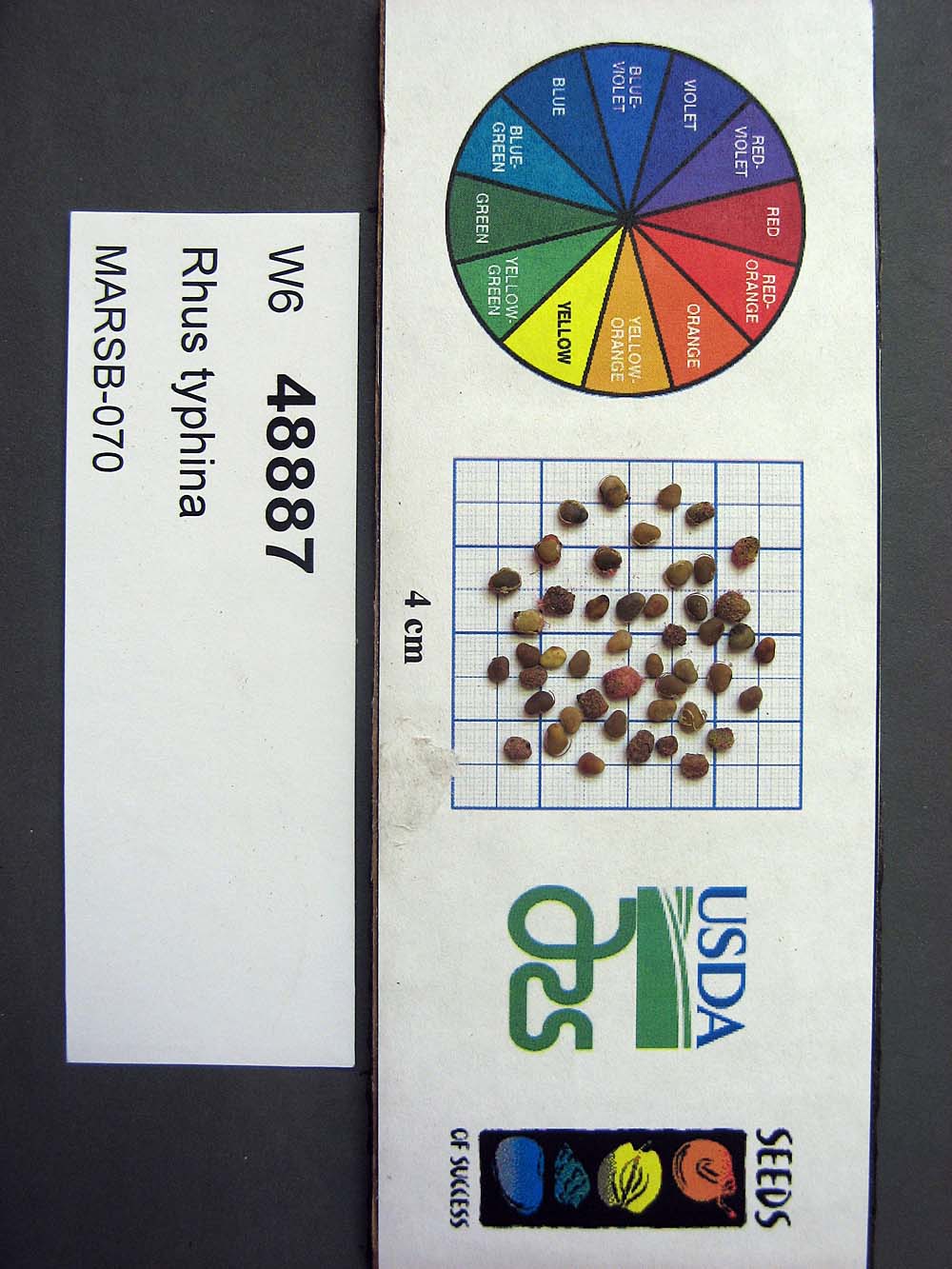 | | 2015 | COLLECTED | 08/22/2013 | Tioga State Forest near Arnot, Tioga County | 41.63745000, -77.21233000 | 1280 | | Wild material | | 1922876 | Ames 33731 |
| 448 | Ames 33732 | MARSB-078 | Rhus typhina L. | Pennsylvania, United States | NC7 |  | | 2015 | COLLECTED | 09/08/2013 | Allegheny National Forest between Warren and Bradford - Route 59, McKean County | 41.85943000, -78.91113000 | 2101 | | Wild material | | 1922877 | Ames 33732 |
| 449 | Ames 34696 | MARSB-074 | Cornus amomum Mill. | New Jersey, United States | NC7 |  | | 2015 | COLLECTED | 08/29/2013 | West Essex Park just southeast of Pine Brook. | 40.84291000, -74.31341000 | 51 | | Wild material | | 1922850 | Ames 34696 |
| 450 | Ames 34697 | MARSB-080 | Cornus amomum Mill. | Pennsylvania, United States | NC7 |  | | 2015 | COLLECTED | 09/11/2013 | Allegheny National Forest -Minister Creek watershed just south of Minister. | 41.61593000, -79.15109000 | 369 | | Wild material | | 1922851 | Ames 34697 |
| 451 | W6 48808 | MARSB-94 | Ageratina altissima (L.) R. M. King & H. Rob. | West Virginia, United States | W6 |  | | 2015 | | | | | | | Wild material | | 1922896 | W6 48808 |
| 452 | W6 48814 | MARSB-115 | Aristida purpurascens Poir. | New Jersey, United States | W6 |  | | 2015 | | | | | | | Wild material | | 1922907 | W6 48814 |
| 453 | W6 48819 | MARSB-101 | Boehmeria cylindrica (L.) Sw. | Maryland, United States | W6 |  | | 2015 | | | | | | | Wild material | | 1922836 | W6 48819 |
| 454 | W6 48822 | MARSB-46 | Carex atlantica L. H. Bailey | New Jersey, United States | W6 |  | | 2015 | | | | | | | Wild material | | 1922838 | W6 48822 |
| 455 | W6 48846 | MARSB-112 | Decodon verticillatus (L.) Elliott | New York, United States | W6 |  | | 2015 | | | | | | | Wild material | | 1922900 | W6 48846 |
| 456 | W6 48853 | MARSB-102 | Eragrostis spectabilis (Pursh) Steud. | Maryland, United States | W6 |  | | 2015 | | | | | | | Wild material | | 1922857 | W6 48853 |
| 457 | W6 48901 | MARSB-93 | Triadenum virginicum (L.) Raf. | West Virginia, United States | W6 |  | | 2015 | | | | | | | Wild material | | 1922888 | W6 48901 |
| 458 | W6 48903 | MARSB-116 | Tridens flavus (L.) Hitchc. | Delaware, United States | W6 |  | | 2015 | | | | | | | Wild material | | 1922889 | W6 48903 |
| 459 | OPGC 6119 | MARSB-088 | Lobelia cardinalis L. | New York, United States | OPGC |  | | 2015 | | | | | | | Wild material | | 1922920 | OPGC 6119 |
| 460 | OPGC 6121 | MARSB-089 | Mimulus ringens L. | New York, United States | OPGC |  | | 2015 | | | | | | | Wild material | | 1922922 | OPGC 6121 |
| 461 | OPGC 6122 | MARSB-097 | Mimulus ringens L. | Virginia, United States | OPGC |  | | 2015 | | | | | | | Wild material | | 1922923 | OPGC 6122 |
| 462 | W6 48820 | MARSB-96 | Boehmeria cylindrica (L.) Sw. | Virginia, United States | W6 |  | | 2015 | | | | | | | Wild material | | 1922908 | W6 48820 |
| 463 | W6 48843 | MARSB-60 | Danthonia compressa Austin | Pennsylvania, United States | W6 |  | | 2015 | | | | | | | Wild material | | 1922912 | W6 48843 |
| 464 | W6 48845 | MARSB-58 | Danthonia spicata (L.) P. Beauv. ex Roem. & Schult. | New York, United States | W6 |  | | 2015 | | | | | | | Wild material | | 1922913 | W6 48845 |
| 465 | W6 48848 | MARSB-057 | Avenella flexuosa (L.) Parl. | New York, United States | W6 |  | | 2015 | | | | | | | Wild material | | 1922914 | W6 48848 |
| 466 | W6 48850 | MARSB-085 | Hexasepalum teres (Walter) J. H. Kirkbr. | New Jersey, United States | W6 |  | | 2015 | | | | | | | Wild material | | 1922915 | W6 48850 |
| 467 | W6 48854 | MARSB-106 | Eragrostis spectabilis (Pursh) Steud. | New Jersey, United States | W6 |  | | 2015 | | | | | | | Wild material | | 1922916 | W6 48854 |
| 468 | W6 48902 | MARSB-114 | Tridens flavus (L.) Hitchc. | New Jersey, United States | W6 |  | | 2015 | | | | | | | Wild material | | 1922931 | W6 48902 |
| 469 | NA 82052 | JDC/MV/2014/078/580 | Magnolia virginiana L. | Mississippi, United States | NA | | | 2014 | COLLECTED | 09/22/2014 | Mississippi: Tishomingo County; Bottomlands of Foote Branch Creek off Highway 982. | 34.87692100, -88.28330100 | 150 | Deciduous woods. Growing in association with Quercus michauxii, Acer rubrum, Alnus sp., Liquidambar styraciflua, Toxicodendron radicans, Pinus sp., Nyssa sylvatica, and Vaccinum sp. | Wild material | Impressive specimens. Optimum timing of harvest. Largest specimen measuring 19" d.b.h. and approximately 80' in height. | 1922353 | NA 82052 |
| 470 | WLP 1253 | JDC/HQ/2014/090/592 | Hydrangea quercifolia W. Bartram | Alabama, United States | NA | 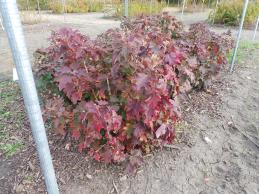 | | 2014 | COLLECTED | 09/23/2014 | Alabama: Lawrence County; Near Franklin and Lawrence County line off County Road 303. | 34.33701600, -87.52906200 | 332 | Growing in association with Quercus alba, Quercus montana, Cornus florida, Rhus glabra, Liriodendron tulipifera, Pinus virginiana, Pinus sp., Acer rubrum, and Frangula alnus. | Wild material | Some specimens with infructescences averaging 12" in length. | 1922364 | WLP 1253 |
| 471 | DPRU 3200 | JDC/PA/2014/082/584 | Prunus americana Marshall | Mississippi, United States | DAV | | | 2014 | COLLECTED | 09/22/2014 | Tishomingo County, Mississippi - Extreme northeast corner of Tishomingo County near J.P. Coleman S.P. | 34.98170000, -88.20449700 | 202 | Dry, pine-oak-hickory woods. Growing in association with Pinus sp., Liquidambar styraciflua, Fraxinus americana, Rhus typhina, Acer rubrum, Quercus stellata, and Carya sp. | Wild material | Fruits perfectly round, very ripe, and pinkish-red in color. Actively dropping at time of collection. The only specimens of this species noted during entire trip throughout northern Mississippi, parts of Arkansas, and northwest Alabama. There were two specimens a few feet from each other, but I suspect they were not genetically unique from each other due to the suckering nature of the species. Considering there was decent fruit production there must have been another Prunus sp. nearby. | 1921307 | DPRU 3200 |
| 472 | Ames 32783 | JDC/EA/2014/081/583 | Euonymus americanus L. | Mississippi, United States | NC7 | | | 2014 | COLLECTED | 09/22/2014 | Banks of Zippy Branch Creek, near J.P. Coleman State Park, NW 1/4 of NW 1/4 of NW 1/4 of Section 25, T1S, R10E, Tishomingo County. | 34.97017900, -88.20487000 | 191 | Mesic woods. | Wild material | | 1921794 | Ames 32783 |
| 473 | WLP 689 | BJP/AI/2014/001 | Amelanchier intermedia Spach | Maine, United States | NA | | | 2014 | COLLECTED | 07/17/2014 | Woods at the edge of a small cemetery on Pigeon Hill Road, just east of its intersection with Main Street (Hwy. 1), approximately .2.5 miles southwest of Milbridge. | 44.51051000, -67.91188000 | | Woods at the edge of a small cemetery. | Wild material | | 1922791 | WLP 689 |
| 474 | NA 81984 | Lactea Group | Callicarpa americana L. | Texas, United States | NA | | | 2014 | COLLECTED | 08/30/2013 | Woodlands above Boykin Spring Lake. | 31.06266000, -94.27565000 | 56 | Growing in partial shade of mixed deciduous and evergreen woodlands in well-drained to dry conditions. | | | 1951711 | NA 81984 |
| 475 | Ames 32197 | GA13009001 | Fraxinus pennsylvanica Marshall | Minnesota, United States | NC7 |  | | 2014 | COLLECTED | 09/23/2013 | Clearwater County. | 47.18397220, -95.47407220 | | Mixed upland deciduous forest. | Wild material | | 1917223 | Ames 32197 |
| 476 | NA 81935 | NA 81935 | Magnolia virginiana L. | South Carolina, United States | NA | | | 2013 | COLLECTED | 08/29/2009 | In or near Francis Marion National Forest, distributed along Highway 17 ca. 2 miles S of Awendaw. [GPS provided is incorrect; uncertain which is correct longitude; latitude missing. Longitude provided: 1) 79 deg. 38' 38.74" W or 2) 79 deg/ 38' 9.78" W -SBL] | | | Open, swampy areas. | | Received as M. virginiana var. pumila | 1951852 | NA 81935 |
| 477 | NA 81939 | NA 81939 | Magnolia virginiana L. | Tennessee, United States | NA | | | 2013 | COLLECTED | 08/18/2008 | On west side of Main Street directly across from the Bethel Springs City Hall. | 35.23170000, -88.60690000 | | Growing in a saturated slough originating from a nearby spring. | | | 1952583 | NA 81939 |
| 478 | NA 81566 | NA 81566 | Rhododendron austrinum (Small) Rehder | Florida, United States | NA | | | 2013 | COLLECTED | 03/31/2013 | White River approximately 0.92 miles north of the confluence with the Escambia River in the Escambia River State Wildlife Management Area. [Originally listed as: "Buzzard�s Lake River approximately 0.92 miles north of the confluence with the Escambia River..."; GPS coordinates are along the White River, and well south of the confluence with Buzzards Lake River. -SBL] | 30.58168000, -87.22233000 | 2 | Partial shade along the river on small sand berm above the stream in mixed deciduous and broadleaved evergreen maritime forest occasionally inundated by tidal salt water. | Wild material | | 1953003 | NA 81566 |
| 479 | NA 81571 | (clear light pink) | Rhododendron austrinum (Small) Rehder | Florida, United States | NA | | | 2013 | COLLECTED | 03/31/2013 | White River approximately 1.1 miles north of the confluence with Buzzard�s Lake River in the Escambia River State Wildlife Management Area. | 30.60490000, -87.22261000 | 2 | Part shade along the river on a small sandy berm above the stream in mixed deciduous and broadleaved evergreen maritime forest occasionally inundated by tidal salt water. | Wild material | | 1952627 | NA 81571 |
| 480 | NA 85242 | MA-2012-010 | Ilex verticillata (L.) A. Gray | Massachusetts, United States | NA | | | 2012 | COLLECTED | 08/25/2012 | Worcester County; Barre; Collected on the roadside of Sheldon Road, one mile south of the intersection with Old Dana Road. [Note: coordinates are just 600 feet south of that intersection.] | 42.43053000, -72.16093000 | 326 | Upland forest edge. | | Seed and herbarium specimen collected. | 2108859 | NA 85242 |
| 481 | WLP 877 | MA-2012-003 | Cephalanthus occidentalis L. | Massachusetts, United States | NA | | | 2012 | COLLECTED | 08/25/2012 | Essex County; ; Harold Parker State Park, 0.6 miles from Route 114 entrance. | 42.62503000, -71.07026000 | 40 | Lowland, wet area with seasonal flooding. | | Seed and herbarium specimen collected. | 2108858 | WLP 877 |
| 482 | Ames 31214 | Ames 31214 | Cornus rugosa Lam. | Wisconsin, United States | NC7 |  | | 2011 | COLLECTED | 2011 | Along east side of County Road C, base of McCaslin Mountain, NW 1/4 of Section 26, T34N, R17E, Roaring Rapids Quad, Marinette County. | 45.39916660, -88.34111110 | 371 | Hilly terrain. Sandy loam soil with a shallow humus layer, near surface of granite and scattered granite boulders. Soils must be near neutral due to abscence of Ericaceae plants. | Wild material | | 1894296 | Ames 31214 |
| 483 | Ames 31215 | Ames 31215 | Diervilla lonicera Mill. | Wisconsin, United States | NC7 |  | | 2011 | COLLECTED | 2011 | Site 1: Dells above Prairie River, Bloomville Quad. T32N R7E NE 1/4 SW 1/4 Sec. 13 and Site 2: Along east side of Highway 17, Pine Dells Quad. T32N R7E NW 1/4 NW 1/4 Sec. 26 | 45.24472220, -89.57486100 | 434 | Site 1: High spots between granite boulders strewn about a young woodland. Sandy soil with a few inches of humus layer. Site 2: Roadside. Disturbed ground on sandy soil with a slight humus layer. | Wild material | | 1894298 | Ames 31215 |
| 484 | Ames 31066 | 369 | Diervilla lonicera Mill. | New York, United States | NC7 |  | | 2011 | COLLECTED | 09/14/2011 | Just south of intersection of Sherman-Westfield Road and Mount Baldy Road | 42.28100000, -79.58200000 | 435 | Roadside. Mixed hardwood forest. Northwest-facing slope. | Wild material | | 1891452 | Ames 31066 |
| 485 | Ames 31074 | 697 | Fraxinus americana L. | New York, United States | NC7 |  | | 2011 | COLLECTED | 09/13/2011 | Two Mile Road, Allegany County. | 42.03800000, -78.46400000 | 524 | | Wild material | | 1891460 | Ames 31074 |
| 486 | Ames 31075 | 698 | Fraxinus americana L. | New York, United States | NC7 |  | | 2011 | COLLECTED | 09/13/2011 | 7238 Hungry Hollow Road, Cattaraugus County. | 42.23000000, -78.70800000 | 659 | Upland forest edges. | Wild material | | 1891461 | Ames 31075 |
| 487 | Ames 31076 | 701 | Fraxinus americana L. | New York, United States | NC7 |  | | 2011 | COLLECTED | 09/13/2011 | Bowen Road (Co. 8), Cattaraugus County. | 42.13900000, -79.00900000 | 500 | Mixed forest edge | Wild material | | 1891462 | Ames 31076 |
| 488 | Ames 31077 | 702 | Fraxinus americana L. | New York, United States | NC7 |  | | 2011 | COLLECTED | 09/14/2011 | Wilcox Road, Chautauqua County. | 42.04000000, -79.45900000 | 526 | Upland mixed forest. | Wild material | | 1891463 | Ames 31077 |
| 489 | Ames 31078 | 705 | Fraxinus americana L. | Pennsylvania, United States | NC7 |  | | 2011 | COLLECTED | 09/16/2011 | South of US Highway 6, McKean County. | 41.66300000, -78.78900000 | 636 | Along abandoned railroad tracks. | Wild material | | 1891464 | Ames 31078 |
| 490 | Ames 31079 | 707 | Fraxinus americana L. | Pennsylvania, United States | NC7 |  | | 2011 | COLLECTED | 09/16/2011 | PA 120, Cameron County. | 41.47000000, -78.39200000 | 430 | Rich woods. | Wild material | | 1891465 | Ames 31079 |
| 491 | Ames 31028 | MPW/MSD 703 | Cornus alternifolia L. f. | Pennsylvania, United States | NC7 |  | | 2011 | COLLECTED | 07/27/2011 | Along Martin Road, Warren County. | 41.98090000, -79.13630000 | 385 | Rich woods. | Wild material | | 1886743 | Ames 31028 |
| 492 | Ames 30541 | UC 105 | Aronia arbutifolia (L.) Pers. | North Carolina, United States | NC7 |  | | 2010 | COLLECTED | 10/21/2009 | Near West End, Moore County | 35.25260000, -79.49096700 | 149 | Powerline easement. Mixed hardwood woods. Sandy soil overlaying a moist seep. | Wild material | Received as plants grown from seed collected from native/wild population. Accession is extremely vigorous with an upright growth habit. Low fruit/seed production in cultivation in central Iowa. | 1843095 | Ames 30541 |
| 493 | Ames 30542 | UC 106 | Aronia arbutifolia (L.) Pers. | North Carolina, United States | NC7 |  | | 2010 | COLLECTED | 10/21/2009 | Near Hoffman Road, Jackson Springs | 35.21046700, -79.57120000 | 140 | Re-established longleaf pine ecosystem. Sandy soil overlaying moist seeps. | Wild material | Received as plants grown from seed collected from native/wild population. Accession is extremely vigorous and uniform displaying a very prostrate growth habit. Foliage is dense with leaves that are larger than the average A. arbutifolia. | 1843096 | Ames 30542 |
| 494 | Ames 30545 | UC 100 | Aronia melanocarpa (Michx.) Elliott | Pennsylvania, United States | NC7 |  | | 2010 | COLLECTED | NEAR 11/01/2009 | Black Moshannon State Park, Philipsburg, Centre County | 40.90017800, -78.05143600 | 568 | Bog. | Wild material | Received as plants grown from seed collected from native/wild population. Accession has exceptional vigor and leaf quality demonstrating a fairly upright growth habit and dense foliage with good/exceptional yield. Black fruits mature the middle/end of August (central Iowa). | 1843099 | Ames 30545 |
| 495 | Ames 32070 | UC 105 | Aronia arbutifolia (L.) Pers. | North Carolina, United States | NC7 |  | | 2010 | COLLECTED | 10/21/2009 | Near West End, Moore County | 35.25260000, -79.49096700 | 149 | Powerline easement. Mixed hardwood woods. Sandy soil overlaying a moist seep. | Wild material | Separated from Ames 30541 due to its extremely tight, upright growth habit. This new accession will be maintained as a uniform accession. | 1912823 | Ames 32070 |
| 496 | Ames 32072 | UC 106 | Aronia arbutifolia (L.) Pers. | North Carolina, United States | NC7 |  | | 2010 | COLLECTED | 10/21/2009 | Near Hoffman Road, Jackson Springs | 35.21046700, -79.57120000 | 140 | Re-established longleaf pine ecosystem. Sandy soil overlaying moist seeps. | Wild material | Separated from Ames 30542 due to open, spreading growth habit. This accession will be maintained as a uniform accession. | 1912825 | Ames 32072 |
| 497 | OPGC 3200 | TX-19 | Rudbeckia texana (Perdue) P. B. Cox & Urbatsch | Texas, United States | OPGC | | | 2010 | COLLECTED | 05/27/2010 | Upper West Gulf Coastal Plain. Jasper County. Roadside north of R255 between CR 61 and 60. | 31.04313900, -94.15833300 | 48 | Roadside ROW/forest edge(adjacent to U.S. National Forest). Land form: Flat. Land Use: Roadside ROW. Geology: Sandstone. Soil Texture: Sandy. Soil Color: Tan. | Wild material | Plants to 2 m tall, leathery leaves, rhizomatous; ray petals yellow. | 1897300 | OPGC 3200 |
| 498 | Ames 30392 | JDC/RT/2009/099/249 | Rhus typhina L. | Ohio, United States | NC7 |  | | 2009 | COLLECTED | 10/16/2009 | Deans State Forest, near Bartles, T3N R17W NE 1/4 of NE 1/4 of Sec. 27, Pedro Quad, Lawerence County | 38.70027778, -82.63333333 | 298 | High elevation. Underground seep present. | Wild material | | 1823944 | Ames 30392 |
| 499 | WLP 1219 | JDC/HA/2009/096/246 | Hydrangea arborescens L. | Ohio, United States | NA | | | 2009 | COLLECTED | 10/16/2009 | Near Five Forks, NE 1/4 of NE 1/4 of Section 29, T4N, R17W, Kitts Hill Quad, Lawerence County. | 38.62305556, -82.55638889 | 262 | Associated with Acer rubrum, Carya, Cercis canadensis, and Liriodendron tulipifera. | Wild material | | 1823927 | WLP 1219 |