| 0 | NA 88653 | KY23-057 | Aesculus glabra Willd. | Kentucky, United States | NA | | | 2023 | COLLECTED | 09/14/2023 | Floracliff Nature Sanctuary. | 37.89873000, -84.36481000 | 187 | Along rock cliff moving down slope. Elevation: 612 feet. Aspect: Northwest. | Wild material | | 2158746 | NA 88653 |
| 1 | NA 81605 | JDC/AG/2010/028/298 | Aesculus glabra Willd. | Iowa, United States | NA | | | 2010 | COLLECTED | 09/10/2010 | Along North Raccoon River and Sportsman Club Road, north of Adel, NW 1/4 of NW 1/4 of Section 18, T79N, R27W, Panther Quad, Dallas County. | 41.65600000, -94.04510000 | 322 | Floodplain. Associated with Acer negundo, A. saccharinum, Celtis occidentalis, Gleditsia triacanthos, and Gymnocladus dioicus. | Wild material | Very tall (55-60 feet in height) specimens. Largest specimen noted measured 62.23cm in d.b.h. | 1856466 | NA 81605 |
| 2 | NA 80421 | NA 80421 | Aesculus glabra Willd. var. arguta (Buckley) B. L. Rob. | Kansas, United States | NA | | | 2008 | COLLECTED | 09/04/2008 | | | | | Wild material | | 1914545 | NA 80421 |
| 3 | NA 82188 | 27 | Aesculus glabra Willd. | Iowa, United States | NA |  | | 2003 | COLLECTED | 09/22/2003 | Lacey-Keosauqua State Park, Keosauqua, SE corner of SE 1/4 of NE 1/4 and NE 1/4 of SE 1/4 of Section 3, T68N, R10W, Keosauqua Quad, Van Buren County | 40.71777770, -91.98972220 | 177 | Floodplain. Half shaded. Associated with Rhamnus lanceolata, Cercis, Ulmus rubra, Ostrya, and Celtis | Wild material | Medium sized. | 1923816 | NA 82188 |
| 4 | NA 70403 | MWPCC00-35 | Aesculus glabra Willd. | West Virginia, United States | NA | | | 2000 | COLLECTED | 09/12/2000 | Collected in Tyler Co. WVA. Seeds were collected for the expedition by Paul James, the group's local guide. No field data or herbarium specimens collected with the seed. | 39.44986700, -80.86675300 | | | Wild material | | 1607109 | NA 70403 |
| 5 | PI 495604 | 8 | Cornus drummondii C. A. Mey. | Iowa, United States | NC7 |  | | 1984 | COLLECTED | 09/21/1984 | Along south end of parking area, Lake of Three Fires State Park, extreme NW corner of Section 7, T68N, R33W, Bedford Quad, Taylor County. | 40.71194444, -94.68583333 | 360 | | Wild material | Perennial woody. Plants in wide thicket to 2 meters tall, heavy fruiting. Very clean foliage with nice white fruits. | 1390540 | PI 495604 |
| 6 | NA 89115 | TLM25-04a | Hamamelis ovalis S. W. Leonard | Texas, United States | NA | | | 2025 | COLLECTED | 07/10/2025 | State Highway 87 approximately 3.25 kilometers north of the crossroad junction with Texas Recreational Road 255 (RE 255); plants were growing in the narrow buffer woods along the east side of the highway. | 31.12051300, -93.72628100 | 138 | The habitat is an upland mixed coniferous and deciduous woodlands in part to full shade and dry conditions, often under drought stress. Plants seem to always occur on the top of dry ridges or well-drained slopes. Slope: 0 to 1 percent. Aspect: N/A. Soils: The soils of this collection area are classified as Tehran-Letney Association, hilly (TLE) soils. The Tehran Series (55%) consists of deep, somewhat excessively drained, moderately rapidly permeable soils on uplands. They formed in thick loamy and sandy sediments on the Western Coastal Plain. These soils are on gently sloping to moderately steep uplands with slopes ranging from 1 to 20 percent. The Letney Series (30%) consists of deep, well drained, moderately rapidly permeable, upland soils. They formed in thick sandy and loamy sediments of the coastal plains. These soils are on gently sloping to moderately steep uplands with slopes ranging from 1 to 20 percent. Soil pH ranges from 4.5 to 6.0. The minor soil components include Doucette Series (10%) and Boykin Series (5%) soils. (Source: California Soil Resource Lab/NRCS Official Soil Series Descriptions). Geology: The underlying geology of this area is of Oligocene origin and characterized as Catahoula Formation. This formation is extensive and deep in Texas, up to 185 meters thick. In the area of the collection the Catahoula Formation is primarily mudstone and sand. The upper 90-150 meters is mudstone that is tuffaceous, and sandy; also, occasionally, with some bentonitic clay. (Source: USGS Texas Geologic Map Data). | Wild material | | 2191654 | NA 89115 |
| 7 | NA 89070 | AFGN25-16 | Rubus odoratus L. | North Carolina, United States | NA | | | 2025 | COLLECTED | 06/03/2025 | Ball Creek Rd (83). | 35.03127000, -83.45786000 | 1334 | Mixed mesophytic Appalachian forest. | Wild material | | 2191433 | NA 89070 |
| 8 | NA 89089 | 2024RM-TK-002 | Viburnum acerifolium L. | Alabama, United States | NA | | | 2024 | COLLECTED | 09/19/2024 | Woodland slopes around and below the hilltop parking area leading down to the Silver Creek Lake Campground off of Silver Creek Lake Road. | 31.66612294, -87.57569860 | 49 | Plants are growing in shade of upland dry mesic, mature mixed deciduous and evergreen woodland. Generally, the overstory is thinner and there is less leaf litter cover, making the surface soil conditions drier. Slope: 5 to 10 percent. Aspect: Southeast. Geology: The underlying geology of this area is Claiborne Group, Tallahatta Formation, of Eocene origin, with white to very light-greenish-gray thin-bedded to massive siliceous claystone; interbedded with thin layers of fossiliferous clay, sandy clay, and glauconitic sand and sandstone. (Source: USGS Alabama Geologic Map Data). Soils: The primary soil types in the collection area are classified as Arundel-Cantuche Complex soils (15 to 35 percent slopes). The Arundel Series consists of moderately deep, well drained, very slowly permeable soils on dissected uplands of the Southern Coastal Plain. They formed in marine deposits consisting of acid clays underlain by horizontally bedded sandstone, buhrstone and siltstone. These soils are strongly acid. Slopes range from 2 to 60 percent. The Cantuche Series consists of shallow, well drained, moderately permeable soils that formed over horizontally bedded claystone. These soils are on narrow ridgetops and narrow benches on steep side-slopes of dissected landscapes in the Coastal Plain. They are strongly acid. Slopes range from 2 to 35 percent. (Source: California Soil Resource Lab/NRCS Official Soil Series Descriptions). EPA Ecoregion (Level III): Southeastern Plains (65). EPA Ecoregion (Level IV): Buhrstone/Lime Hills (65q). | Wild material | | 2169053 | NA 89089 |
| 9 | NA 89090 | 2024RM-TK-003 | Ilex longipes Chapm. ex Trel. | Alabama, United States | NA | | | 2024 | COLLECTED | 09/19/2024 | Woodland slopes around and below the hilltop parking area leading down to the Silver Creek Lake Campground off of Silver Creek Lake Road. | 31.66612294, -87.57569860 | 39 | Plants are growing in part-shade to shade of a moist mesic deciduous and evergreen woodland on dry, well-drained soil to an area 1-2 meters above a small seasonally spring-fed creek at 31.664428°, -87.574614°. Slope: 5 to 10 percent. Aspect: Southeast. Geology: The underlying geology of this area is Claiborne Group, Tallahatta Formation, of Eocene origin, with white to very light-greenish-gray thin-bedded to massive siliceous claystone; interbedded with thin layers of fossiliferous clay, sandy clay, and glauconitic sand and sandstone. (Source: USGS Alabama Geologic Map Data). Soils: The primary soil types in the collection area are classified as Arundel-Cantuche Complex soils (15 to 35 percent slopes). The Arundel Series consists of moderately deep, well drained, very slowly permeable soils on dissected uplands of the Southern Coastal Plain. They formed in marine deposits consisting of acid clays underlain by horizontally bedded sandstone, buhrstone and siltstone. These soils are strongly acid. Slopes range from 2 to 60 percent. The Cantuche Series consists of shallow, well drained, moderately permeable soils that formed over horizontally bedded claystone. These soils are on narrow ridgetops and narrow benches on steep side-slopes of dissected landscapes in the Coastal Plain. They are strongly acid. Slopes range from 2 to 35 percent. (Source: California Soil Resource Lab/NRCS Official Soil Series Descriptions). EPA Ecoregion (Level III): Southeastern Plains (65). EPA Ecoregion (Level IV): Buhrstone/Lime Hills (65q). | Wild material | | 2169054 | NA 89090 |
| 10 | WLP 3492 | St. Francois State Park | Hydrangea arborescens L. | Missouri, United States | NA |  | | 2024 | COLLECTED | 01/19/2024 | St. Francois State Park, 8920 US Highway 67 North, approximately 3.2 miles north-northeast of Bonne Terre. | 37.96381000, -90.53403000 | 202 | Rocky outcrops above Big River and rocky areas on bank of Big River. | Wild material | | 2166135 | WLP 3492 |
| 11 | NA 88820 | TJK2023AL-005 | Hydrangea arborescens L. | Alabama, United States | NA | | | 2023 | COLLECTED | 12/07/2023 | Between Monroe County Route 1 and Tom Hayles Road. | 31.40575900, -87.54924000 | 22 | In woodlands on limestone outcrop. While the upper area of slopes is covered by a thin soil layer, the exposed limestone rock outcrop on the northwestern edge of this area is a low competition niche for plants like the Hydrangea to gain a foothold. Slope: 60% (plus). Aspect: Northwest. Elevation: 72 feet. | Wild material | | 2165649 | NA 88820 |
| 12 | NA 88821 | TJK2023AL-006 | Hydrangea quercifolia W. Bartram | Alabama, United States | NA | | | 2023 | COLLECTED | 12/07/2023 | Between Monroe County Route 1 and Tom Hayles Road. | 31.40580000, -87.54890000 | 22 | In woodlands on limestone outcrop. While the upper area of slopes is covered by a thin soil layer, the exposed limestone rock outcrop on the northwestern edge of this area is a low competition niche for plants like the Hydrangea to gain a foothold. Slope: 60% (plus). Aspect: Northwest. Elevation: 72 feet. | Wild material | | 2165650 | NA 88821 |
| 13 | NA 89233 | UK Arb. 2023-0059-A | Cladrastis kentukea (Dum. Cours.) Rudd | Kentucky, United States | NA | | | 2023 | COLLECTED | 08/22/2023 | Blue Sportsmen's League (land owner): trees growing on both sides of eroded dirt road from campground to Kentucky River. | 37.78777000, -84.65356000 | | Calcareous rocky woods, mid-slope. Slope: 20-30%. Aspect: Southwest. | Wild material | | 2158476 | NA 89233 |
| 14 | NA 89235 | UK Arb. 2023-0061-A | Cladrastis kentukea (Dum. Cours.) Rudd | Kentucky, United States | NA | | | 2023 | COLLECTED | 08/22/2023 | Tom Dorman State Nature Preserve: trees growing adjacent to west side of loop trail going down towards Kentucky River. | 37.77180000, -84.63011000 | | Calcareous, rocky woods, mid-slope down towards river. | Wild material | | 2158478 | NA 89235 |
| 15 | Ames 36016 | Sugar Creek | Platanus occidentalis L. | Iowa, United States | NC7 |  | | 2023 | COLLECTED | 02/20/2023 | Scattered along Sugar Creek between 3.1 miles north and also 1.3 miles northeast of Franklin, T68N R6W Sections 2, 11, 12, 13 and 24. | 40.70277500, -91.51065900 | 185 | River banks and floodplains. | Wild material | This accession of American sycamore includes the sampling from several very large specimens found in the state of Iowa including specimen #211-12 currently (2023) ranking 13th largest measuring 14' 9" circumference; 106' 8" in height; and a calculated spread of 114' 8" totalling 312.346 points (measured 23 April 2023 by Mark Rouw); specimen #211-10 currently (2023) ranking as the 9th largest measuring 16' 2" circumference; 97' 5" in height; and a calculated spread of 134' 3" totalling 322.983 points (measured 21 April 2020 by Mark Rouw); and specimen #211-6 currently (2023) ranking 2nd largest measuring 20' 2.5" circumference; 109' 6" in height; and a calculated spread of 148' 9" totalling 389.188 points (measured 23 April 2023 by Mark Rouw). Numerous specimens noted in nature with extremely white, superior, ornamental bark characteristics, specifically specimen #211-13. | 2141476 | Ames 36016 |
| 16 | WLP 3092 | RJLSEUS2022-021 | Rhododendron prunifolium (Small) Millais | Alabama, United States | NA | | | 2023 | COLLECTED | 12/10/2023 | Slopes along Poke Springs Branch inlet accessed by boat from Walter F. George Reservoir. Generally uncommon, but frequent at this site. | 31.72318400, -85.12907800 | 69 | Plants are growing in part-shade to shade on the well-drained mostly deciduous woodland slopes approximately 3-6 meters above the inlet.
Soils: The underlying geology of this area is of Cretaceous origin and characterized as Selma Group; Providence Sand. The upper part of the profile consists of cross-bedded fine to coarse sand and white, dark-gray and pale-red-purple mottled clay containing lignite, sand, and kaolin. The lower part consists of dark-gray laminated to thin-bedded silty clay and abundantly micaceous, carbonaceous, fossiliferous very fine to fine sand.
Source: USGS Alabama Geologic Map Data (https://mrdata.usgs.gov/geology/state/sgmc-unit.php?unit=ALKp%3B1)
The primary soil types in the collection area are classified as Nankin-Lucy Complex soil (20 to 60 percent slopes). The Nankin Series consists of very deep, well drained, moderately slowly permeable soils on uplands of the Coastal Plain. They formed in stratified loamy and clayey marine sediments. Slopes range from 0 to 60 percent. Soils are comprised of sandy loam in the upper 25 cm to sandy clay loam and sandy clay in lower strata to about 1.7 meters deep; these soils are strongly acid. The Lucy Series consists of very deep, well drained, moderately permeable soils on uplands. They formed in sandy and loamy marine and fluvial sediments of the Southern Coastal Plain. Slopes vary from 0 to 45 percent. These soils are generally loamy to sandy loam in the upper 25 cm and sandy clay loam in the lower strata to 2 meters; these are strongly acid soils.
Source: NRCS Web Soil Survey (https://websoilsurvey.sc.egov.usda.gov/App/WebSoilSurvey.aspx) | Wild material | | 2141446 | WLP 3092 |
| 17 | NA 87814 | RM-TK2022-003 | Nyssa ogeche W. Bartram ex Marshall | Florida, United States | NA | | | 2023 | COLLECTED | 09/06/2022 | Hightower Landing on Holmes Creek, off of Hightower Road. This location is off of Florida State Hwy. 79. | 30.60539000, -85.76513400 | 5 | Trees growing on the edge of the water along Holmes Creek.
Soils: The underlying geology of this area is classified as Alluvium of Pleistocene/Holocene origin and consists of undifferentiated Quaternary sediments of varying thickness including siliciclastics, organics and freshwater carbonates. The siliciclastics are light gray, tan, brown to black, unconsolidated to poorly consolidated, clean to clayey, silty, unfossiliferous, variably organic-bearing sands to blue green to olive green, poorly to moderately consolidated, sandy, silty clays. Organics occur as plant debris, roots, disseminated organic matrix and beds of peat. Freshwater carbonates, often referred to as marls in the literature, are scattered.
Source: USGS Florida Geologic Map Data (https://mrdata.usgs.gov/geology/state/state.php?state=fl)
The primary soil types in the collection area are classified as Rutlege, Pickney and Pamlico soils, frequently flooded. The Rutlege series comprises very deep, very poorly drained persistently wet soils on flats, depressions and floodplains where shallow ponding is common. They are of marine or fluvial sediment origin. Thickness of these loamy sandy soils is greater than 1.5 meters and a reaction from extremely acid to strongly acid. The Pickney Series consists of very deep, very poorly drained soils. Permeability is rapid. These nearly level soils have negligible runoff and were formed by marine or fluvial sediments in the lower coastal plain on flats, depressions, stream terraces, and flood plains. Slopes range from 0 to 2 percent. The soils of this series are loamy fine sand that is very friable and extremely acid in the upper 0-25 cm. The lower strata are similar, while the lower strata from 0.8-2 meters are comprised of fine sand. The Pamlico series consists of very poorly drained soils that formed in decomposed organic material underlain by dominantly sandy sediment. The soils are on nearly level flood plains, bays, and depressions of the Coastal Plain. Slopes are less than 1 percent. Pamlico soils have 0.4-1.3 meters of organic material over dominantly sandy sediments. Reaction is extremely in the organic layers and ranges from extremely acid to strongly acid in the underlying mineral layers.
Source: NRCS Web Soil Survey (https://websoilsurvey.sc.egov.usda.gov/App/WebSoilSurvey.aspx) | Wild material | | 2140796 | NA 87814 |
| 18 | NA 88549 | RJLSEUS2022-022 | Rhododendron minus Michx. var. minus | Georgia, United States | NA | | | 2023 | COLLECTED | 12/10/2022 | East side of Georgia State Hwy. 39, on the south side of Kolomoki Creek approximately 11 kilometers south of Fort Gaines, Georgia. Common on this site, but otherwise infrequent. This species is near the southernmost end of its natural range. | 31.52053400, -85.02351600 | 53 | Plants are growing in part-shade to shade of deciduous upland, dry, deciduous woodlands on steep slopes 10-15 meters above Kolomoki Creek.
Soils: The underlying geology of this area is of Paleocene origin and characterized as Tuscahoma Sand. As mapped this formation includes lower Eocene Bashi Marl Member of the Hatchetigbee Formation. This formation consists of light-gray to light-olive-gray laminated and thin-bedded carbonaceous silt and clay interbedded with fine sand; thin lignite beds occur locally. Lower part of the formation includes beds of fossiliferous, glauconitic fine quartz sand containing spheroidal sandstone concretions, gravel and clay pebbles.
Source: USGS Georgia Geologic Map Data (https://mrdata.usgs.gov/geology/state/sgmc-unit.php?unit=GANu%3B1)
The primary soil types in the collection area are classified as Ailey-Cowarts Complex Series soils (8 to 25 percent slopes). The Ailey Series consists of well drained or somewhat excessively drained soils formed by fluviomarine and marine deposits. These soils are found marine terraces and low hills of the upper coastal plain and sandhills; they are strongly acidic. The Cowarts Series consists of very deep, moderately well and well drained soils on ridge tops and side slopes on uplands of the Coastal Plain Major Land Resource Area. They formed in loamy marine sediments. Slopes range from 1 to 60 percent.
Source: NRCS Web Soil Survey (https://websoilsurvey.sc.egov.usda.gov/App/WebSoilSurvey.aspx) | Wild material | | 2140776 | NA 88549 |
| 19 | NA 88550 | RJLSEUS2022-023 | Kalmia latifolia L. | Georgia, United States | NA | | | 2023 | COLLECTED | 12/10/2022 | East side of Georgia State Hwy. 39, on the south side of Kolomoki Creek approximately 11 kilometers south of Fort Gaines, Georgia. Common on this site, but otherwise infrequent. This species is near the southernmost end of its natural range. | 31.52053400, -85.02351600 | 53 | Plants are growing in part-shade to shade of deciduous upland, dry, deciduous woodlands on steep slopes 10-15 meters above Kolomoki Creek.
Soils: The underlying geology of this area is of Paleocene origin and characterized as Tuscahoma Sand. As mapped this formation includes lower Eocene Bashi Marl Member of the Hatchetigbee Formation. This formation consists of light-gray to light-olive-gray laminated and thin-bedded carbonaceous silt and clay interbedded with fine sand; thin lignite beds occur locally. Lower part of the formation includes beds of fossiliferous, glauconitic fine quartz sand containing spheroidal sandstone concretions, gravel and clay pebbles.
Source: USGS Georgia Geologic Map Data (https://mrdata.usgs.gov/geology/state/sgmc-unit.php?unit=GANu%3B1)
The primary soil types in the collection area are classified as Ailey-Cowarts Complex Series soils (8 to 25 percent slopes). The Ailey Series consists of well drained or somewhat excessively drained soils formed by fluviomarine and marine deposits. These soils are found marine terraces and low hills of the upper coastal plain and sandhills; they are strongly acidic. The Cowarts Series consists of very deep, moderately well and well drained soils on ridge tops and side slopes on uplands of the Coastal Plain Major Land Resource Area. They formed in loamy marine sediments. Slopes range from 1 to 60 percent.
Source: NRCS Web Soil Survey (https://websoilsurvey.sc.egov.usda.gov/App/WebSoilSurvey.aspx) | Wild material | | 2140777 | NA 88550 |
| 20 | NA 88554 | RJLSEUS2022-027 | Rhododendron alabamense Rehder | Alabama, United States | NA | | | 2023 | COLLECTED | 12/12/2022 | Plants growing on woodland slopes around and below the hilltop parking area leading down to the Silver Creek Lake Campground off of Silver Creek Lake Road. Occasional in the upland woodlands. | 31.66613100, -87.57625700 | 49 | Plants are growing in shade of upland dry mesic mature mixed deciduous and evergreen woodland. Generally, the overstory is thinner and there is less leaf litter cover, making the surface soil conditions drier.
Soils: The underlying geology of this area is Claiborne Group, Tallahatta Formation, of Eocene origin, with white to very light-greenish-gray thin-bedded to massive siliceous claystone; interbedded with thin layers of fossiliferous clay, sandy clay, and glauconitic sand and sandstone.
Source: USGS Alabama Geological Map Data (https://mrdata.usgs.gov/geology/state/state.php?state=AL)
The primary soil types in the collection area are classified as Smithdale-Boykin Complex soils (2 to 5 percent slopes). The Smithdale Series consists of very deep, well drained, moderately permeable soils on ridge tops and hill slopes in dissected uplands of the Southern Coastal Plain and in the Western Coastal Plain. They formed in thick beds of loamy marine sediments and are strongly acid. Slopes range from 1 to 60 percent. The Boykin Series consists of deep, well drained, moderately permeable soils that formed in sandy and loamy coastal plain sediments of Pleistocene age. These soils are on gently sloping to moderately steep uplands. Slopes range from 1 to 20 percent.
Source: NRCS Web Soil Survey (https://websoilsurvey.sc.egov.usda.gov/App/WebSoilSurvey.aspx) | Wild material | | 2140781 | NA 88554 |
| 21 | NA 88555 | RJLSEUS2022-028 | Rhododendron canescens (Michx.) Sweet | Alabama, United States | NA | | | 2023 | COLLECTED | 12/12/2022 | Plants growing on woodland slopes below the hilltop parking area leading down to the Silver Creek Lake Campground off of Silver Creek Lake Road. Occasional in the woodlands. | 31.66549700, -87.57624500 | 45 | Plants are growing in shade of moist mesic deciduous and evergreen woodland, mid-slope between the upland dry mesic zone and the creekside habitat below.
Soils: The underlying geology of this area is Claiborne Group, Tallahatta Formation, of Eocene origin, with white to very light-greenish-gray thin-bedded to massive siliceous claystone; interbedded with thin layers of fossiliferous clay, sandy clay, and glauconitic sand and sandstone.
Source: USGS Alabama Geological Map Data (https://mrdata.usgs.gov/geology/state/state.php?state=AL)
The primary soil types in the collection area are classified as Luverne Sandy Loam soils (15 to 35 percent slopes). The Luverne Series consists of very deep, well drained, moderately slowly permeable soils on dissected uplands of the Southern Coastal Plain. They formed in stratified marine sediments and are strongly acid. The lower strata of this series are clay and clay loam. Slopes range from 1 to 45 percent.
Source: NRCS Web Soil Survey (https://websoilsurvey.sc.egov.usda.gov/App/WebSoilSurvey.aspx) | Wild material | | 2140782 | NA 88555 |
| 22 | NA 88556 | RJLSEUS2022-029 | Rhododendron colemanii R. F. Mill. | Alabama, United States | NA | | | 2023 | COLLECTED | 12/12/2022 | Plants growing on woodland slopes below the hilltop parking area leading down to the Silver Creek Lake Campground off of Silver Creek Lake Road. Occasional in the woodlands. | 31.66503300, -87.57468000 | 43 | Plants are growing in shade of moist mesic deciduous and evergreen woodland on rich slopes 1-3 meters above a small spring-fed creek.
Soils: The underlying geology of this area is Claiborne Group, Tallahatta Formation, of Eocene origin, with white to very light-greenish-gray thin-bedded to massive siliceous claystone; interbedded with thin layers of fossiliferous clay, sandy clay, and glauconitic sand and sandstone.
Source: USGS Alabama Geological Map Data (https://mrdata.usgs.gov/geology/state/state.php?state=AL)
The primary soil types in the collection area are classified as Smithdale-Boykin Complex soils (2 to 5 percent slopes). The Smithdale Series consists of very deep, well drained, moderately permeable soils on ridge tops and hill slopes in dissected uplands of the Southern Coastal Plain and in the Western Coastal Plain. They formed in thick beds of loamy marine sediments and are strongly acid. Slopes range from 1 to 60 percent. The Boykin Series consists of deep, well drained, moderately permeable soils that formed in sandy and loamy coastal plain sediments of Pleistocene age. These soils are on gently sloping to moderately steep uplands. Slopes range from 1 to 20 percent.
Source: NRCS Web Soil Survey (https://websoilsurvey.sc.egov.usda.gov/App/WebSoilSurvey.aspx) | Wild material | | 2140783 | NA 88556 |
| 23 | NA 88557 | RJLSEUS2022-030 | Ilex longipes Chapm. ex Trel. | Alabama, United States | NA | | | 2023 | COLLECTED | 12/12/2022 | Silver Creek Lake Campground off of Silver Creek Lake Road: woodland slopes below the hilltop parking lot leading down to the campground. | 31.66442800, -87.57461400 | 39 | Part shade of moist-mesic, mixed deciduous and evergreen woodland on dry, well-drained bank, 1-2 meters above a small spring-fed creek. The underlying geology of this area is Claiborne Group, Tallahatta Formation, of Eocene origin, with white to very light-greenish-gray thin-bedded to massive siliceous claystone; interbedded with thin layers of fossiliferous clay, sandy clay, and glauconitic sand and sandstone. (Source: USGS Alabama Geological Map Data). The primary soil types in the collection area are classified as Arundel-Cantuche Complex soils (15 to 35 percent slopes). The Arundel Series consists of moderately deep, well drained, very slowly permeable soils on dissected uplands of the Southern Coastal Plain. They formed in marine deposits consisting of acid clays underlain by horizontally bedded sandstone, buhrstone and siltstone. These soils are strongly acid. Slopes range from 2 to 60 percent. The Cantuche Series consists of shallow, well drained, moderately permeable soils that formed over horizontally bedded claystone. These soils are on narrow ridgetops and narrow benches on steep side-slopes of dissected landscapes in the Coastal Plain. They are strongly acid. Slopes range from 2 to 35 percent. (Source: NRCS Web Soil Survey). | Wild material | | 2140818 | NA 88557 |
| 24 | NA 88561 | RJLSEUS2022-034 | Hydrangea quercifolia W. Bartram | Alabama, United States | NA | | | 2023 | COLLECTED | 12/12/2022 | Plants growing in the woodlands at Haines Island Park at the foot of Tallahatta cuesta, accessed by foot via Ferry Road. Common at this site. | 31.72178200, -87.46589600 | 66 | Plants are growing in part-shade to shade of a moist mesic, well-drained conditions on rocks and in the eroding matrix of the Tallahatta Questa.
Soils: The underlying geology of this area is Claiborne Group, Tallahatta Formation, of Eocene origin, with white to very light-greenish-gray thin-bedded to massive siliceous claystone; interbedded with thin layers of fossiliferous clay, sandy clay, and glauconitic sand and sandstone.
Source: USGS Alabama Geological Map Data (https://mrdata.usgs.gov/geology/state/state.php?state=AL)
The primary soil type in the collection area is classified as Arundel Loam soil (8 to 35 percent slopes). The Arundel Series consists of moderately deep, well drained, very slowly permeable soils on dissected uplands of the Southern Coastal Plain. They formed in marine deposits consisting of acid clays underlain by horizontally bedded sandstone, buhrstone and siltstone. These soils are strongly acid. Slopes range from 2 to 60 percent.
Source: NRCS Web Soil Survey (https://websoilsurvey.sc.egov.usda.gov/App/WebSoilSurvey.aspx) | Wild material | | 2140786 | NA 88561 |
| 25 | Ames 35750 | Ames 35750 | Blephilia ciliata (L.) Benth. | Iowa, United States | NC7 | 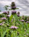 | | 2021 | COLLECTED | 09/27/2021 | Located approximately 3 miles south, southeast of Fairfield, T71N R9W SW1/4 Sec. 7 | 40.96338000, -91.94686900 | 223 | Woodland openings/edges, disturbed areas | Wild material | | 2122068 | Ames 35750 |
| 26 | Ames 35746 | Guye Woods | Acer saccharum Marshall subsp. nigrum (F. Michx.) Desmarais | Iowa, United States | NC7 |  | | 2021 | COLLECTED | 09/08/2021 | Guye Woods County Park located 6.0 miles northeast of Winterset, T76N R27W NE1/4 Sec. 4 | 41.41235000, -93.96373000 | 278 | Moist deciduous maple, oak, hickory forest, northwest facing slope above the North River. | Wild material | Multiple specimens in this population were observed to be 24" diameter at breast height (DBH) or larger with the largest specimen encountered at the time of collection measuring 36.5" DBH.
Morphological traits of leaves suggests sampled specimens are true to type of Acer saccharum subsp. nigrum including leaves with three distinct points, leathery/thick, and drooping in appearance. On September 25, 2020 (Schmitz, A., personal communication, 31 January 2022), peak fall color on Acer saccharum subsp. nigrum at Guye Woods was observed with specimens having a clean yellow fall color, also indicative of Acer saccharum subsp. nigrum.
| 2122010 | Ames 35746 |
| 27 | OPGC 8356 | CBG-10606 | Solidago ulmifolia Muhl. ex Willd. | Illinois, United States | OPGC | | | 2021 | | | | | | | Wild material | Plant numbers sampled estimated. | 2120227 | OPGC 8356 |
| 28 | Ames 35232 | Ames 35232 | Ptelea trifoliata L. | Illinois, United States | NC7 |  | | 2019 | COLLECTED | 10/01/2019 | Rock Creek watershed located approximately 4.5 miles southwest of Athens, T17N R6W SE1/4 SW1/4 Sec. 8 | 39.93164600, -89.80193000 | 159 | Creek banks, floodplain, and fence rows (north and west facing slopes) | Wild material | | 2097768 | Ames 35232 |
| 29 | NA 82746 | Site 3B/Hightower Road at Holmes Creek | Magnolia ashei Weath. | Florida, United States | NA | | | 2015 | COLLECTED | 07/31/2015 | Along Holmes Creek 0.2 miles west-southwest of Hard Castle Landing boat ramp at hte end of Hightower Road. | 30.60401000, -85.76883000 | 11 | Shade to partial shade of deciduous woodlands 10 to 15 feet above the creek, surrounded by low lying swampy area. | Wild material | Originally just called Site 3, but the "A/B" has been added to distinguish the Live Oak Landing (3A) and Hightower Road (3B) material. For previous collections of this population, see NA 81556 (2013); for later collection, see NA 82746.01 (2019). | 1950860 | NA 82746 |
| 30 | Ames 32849 | JDC/DL/2014/151/654 | Diervilla lonicera Mill. | Iowa, United States | NC7 | | | 2014 | COLLECTED | 11/23/2014 | Fern Cliff County Park located approximatley 3.75 miles west, southwest of Crawfordsville, T74N R7W southern edge of N 1/2 Sec. 24 | 41.19958700, -91.60874700 | 208 | Steep north-facing slopes on loose soils. | Wild material | | 1921870 | Ames 32849 |
| 31 | Ames 32389 | JDC/BN/2014/016/518 | Betula nigra L. | Iowa, United States | NC7 |  | | 2014 | COLLECTED | 06/06/2014 | Clemmons Creek Wildlife Management Area, T75N R8W NE 1/4 Sec. 14. | 41.30388300, -91.74342500 | 208 | Wet, floodplain. | Wild material | | 1919310 | Ames 32389 |
| 32 | Ames 32223 | APS/GD/2014/002/133 | Gymnocladus dioicus (L.) K. Koch | Illinois, United States | NC7 | | | 2014 | COLLECTED | 03/20/2014 | Vermilion River watershed, N 1/2 of Section 11, T21N, R13W, just southeast of Potomac, Vermilion County. | 40.29257800, -87.78582500 | 202 | Floodplain. | Wild material | | 1917827 | Ames 32223 |
| 33 | Ames 32225 | APS/GD/2014/008/139 | Gymnocladus dioicus (L.) K. Koch | Indiana, United States | NC7 | | | 2014 | COLLECTED | 03/21/2014 | Grindstone Creek watershed, Sections 19 and 20, T22N, R6W, and Section 26, T22N, R7W, just northeast of Attica, Fountain County. | 40.33906400, -87.12104600 | 173 | Floodplain. | Wild material | | 1917829 | Ames 32225 |
| 34 | Ames 32226 | APS/GD/2014/010/141 | Gymnocladus dioicus (L.) K. Koch | Indiana, United States | NC7 | | | 2014 | COLLECTED | 03/22/2014 | Cabin Creek watershed, Sections 6 and 36, T20N, R13E, and Sections 22 and 23, T20N, R12E, just southwest of Farmland, Randolph County. | 40.15779200, -85.14474100 | 304 | Moist woods. | Wild material | | 1917830 | Ames 32226 |
| 35 | Ames 32000 | APS/GD/2013/029/114 | Gymnocladus dioicus (L.) K. Koch | Illinois, United States | NC7 |  | | 2013 | COLLECTED | 03/08/2013 | Fox Ridge State Park: Embrass River watershed and small tributary in Sec. 13, Coles County. | 39.39640300, -88.15756800 | 178 | Transistion zone near base of slope/floodplain. | Wild material | | 1908278 | Ames 32000 |
| 36 | Ames 31989 | APS/GD/2009/001/010 | Gymnocladus dioicus (L.) K. Koch | Kansas, United States | NC7 |  | | 2013 | COLLECTED | 02/21/2013 | Clinton State Park, west of Lawrence, Section 12, T13S R18E, Douglas County. | 38.93730038, -95.36213950 | 282 | Fairly dry, upland site. Majority of specimens found on upland areas. | Wild material | | 1907542 | Ames 31989 |
| 37 | Ames 31990 | APS/GD/2013/013/098 | Gymnocladus dioicus (L.) K. Koch | Missouri, United States | NC7 |  | | 2013 | COLLECTED | 02/22/2013 | Peavine Creek, south of Concordia, SW 1/4 of SE 1/4 of Section 20, SW 1/4 of NW 1/4 of Section 21, and NE 1/4 of NW 1/4 of Section 28, T48N R24W, Lafayette and Johnson Counties. | 38.93429000, -93.57204500 | 205 | Floodplain. | Wild material | | 1907543 | Ames 31990 |
| 38 | Ames 31520 | JDC/FQ/2012/029/422 | Fraxinus quadrangulata Michx. | Illinois, United States | NC7 |  | | 2012 | COLLECTED | 07/21/2012 | Funks Grove Nature Preserve, Section 17, T22N, R1E, McLean Quad, just southwest of Bloomington | 40.35954400, -89.12965500 | 229 | Mature, moist woods. Very flat terrain. | Wild material | Quite large, averaging 3-4 feet d.b.h. and 100-130 feet in height. | 1903747 | Ames 31520 |
| 39 | Ames 31521 | JDC/FQ/2012/030/423 | Fraxinus quadrangulata Michx. | Illinois, United States | NC7 |  | | 2012 | COLLECTED | 07/21/2012 | Trelease and Brownfield Woods, SE 1/4 of Section 34, T20N, R9E, and SW 1/4 of Section 1, T19N, R9E, Thomasboro Quad, near Urbana, Champaign County. | 40.14687500, -88.16305800 | 229 | Mature, moist woods. Very flat terrain. | Wild material | Relatively large, averaging 1-2 feet d.b.h. and 80-100 feet in height. | 1903748 | Ames 31521 |
| 40 | Ames 31527 | JDC/FQ/2012/036/429 | Fraxinus quadrangulata Michx. | Indiana, United States | NC7 |  | | 2012 | COLLECTED | 07/24/2012 | Versailles State Park, S 1/2 of Section 7, T7N, R12E, Milan Quad, near Versailles, Ripley County. | 39.07495100, -85.23553200 | 280 | Mature forest near southwestern portion of park. Shallow soils. West-facing slope. | Wild material | Fairly large, averaging 3 feet d.b.h. and 100 feet in height. | 1903754 | Ames 31527 |
| 41 | Ames 31528 | JDC/FQ/2012/037/430 | Fraxinus quadrangulata Michx. | Indiana, United States | NC7 |  | | 2012 | COLLECTED | 07/24/2012 | Along Highway 52, N 1/2 of Section 19, T9N, R2W, Brookville Quad, approximately 0.5 to 1 mile west of Brookville, Franklin County. | 39.43205200, -85.02163400 | 209 | Roadside collection. South and southeast-facing slopes. | Wild material | | 1903755 | Ames 31528 |
| 42 | Ames 31529 | JDC/FQ/2012/038/431 | Fraxinus quadrangulata Michx. | Indiana, United States | NC7 |  | | 2012 | COLLECTED | 07/24/2012 | Lick Creek Summit Nature Preserve, NW 1/4 of Section 23, T13N, R2W, Richmond Quad, near Richmond, Wayne County. | 39.78453000, -84.95276400 | 267 | Dry woods. Bluffs. Shallow soils. | Wild material | | 1903756 | Ames 31529 |
| 43 | Ames 30589 | JDC/FQ/2010/025/295 | Fraxinus quadrangulata Michx. | Illinois, United States | NC7 |  | | 2010 | COLLECTED | 09/06/2010 | Along Burton Creek, middle of Section 27, Marblehead Quad, Adams County. | 39.86690000, -91.31220000 | 174 | Along very steep (90%) south facing slope. | Wild material | Approximately 8 inches d.b.h. | 1847246 | Ames 30589 |
| 44 | Ames 30518 | APS/GD/2009/020/029 | Gymnocladus dioicus (L.) K. Koch | Iowa, United States | NC7 |  | | 2010 | COLLECTED | 04/11/2010 | North Raccoon River Watershed, Section 6, Section 7, and NW 1/4 of NW 1/4 of Section 18, between Iowa Highway 44 (240th Street) and Adel, Dallas County. | 41.67297500, -94.03777500 | 320 | Bottomland/floodplain forest. | Wild material | Plants ranged from 60-75 feet tall and averaged 20 inches d.b.h. Seeds seemed very small and round. | 1836761 | Ames 30518 |
| 45 | Ames 30481 | APS/GD/2010/001/036 | Gymnocladus dioicus (L.) K. Koch | Missouri, United States | NC7 |  | | 2010 | COLLECTED | 02/17/2010 | Mark Twain Lake Project (Army Corp of Engineers), Mark Twain Lake, T54N R8W SE 1/4 of NW 1/4 of Section 2 and west 1/2 of Sec. 11, Florida Quad, Monroe County. | 39.49270000, -91.76510000 | 199 | Northwest-facing bluff; woods. | Wild material | #106 measured 14.5" d.b.h and 70-80'; #107 measured 9.5" and 70-80'; #108 measured 11" d.b.h. and 60-70'; #109 measured 9.5" d.b.h. and 40-50'; #110 measured 11" d.b.h. at 30-40'; and #111 measured 6" d.b.h. and 30'. | 1831340 | Ames 30481 |
| 46 | Ames 30482 | APS/GD/2010/002/037 | Gymnocladus dioicus (L.) K. Koch | Missouri, United States | NC7 |  | | 2010 | COLLECTED | 02/17/2010 | Lake of the Ozarks, Grandglaize Creek Watershed, T39N R15W NW 1/4 Sec. 36 and NE 1/4 of SE 1/4 Sec. 35, Toronto Quad, Miller County. | 38.07386700, -92.52686700 | 207 | Mixed deciduous woods. | Wild material | | 1831341 | Ames 30482 |
| 47 | Ames 30488 | APS/GD/2010/009/044 | Gymnocladus dioicus (L.) K. Koch | Kentucky, United States | NC7 |  | | 2010 | COLLECTED | 02/21/2010 | Alum Hill and Big Slough Creek, near Hites Falls, Grayson County. | 37.53600000, -86.59630000 | 159 | Floodplain of Big Slough and base of bluffs on northeast-facing slope of Alum Hill. | Wild material | #140 measured 12" d.b.h. at 70', #141 measured 8.5" d.b.h. and 40', #142 measured 12" and 80', #143 measured 9.5" and 60', #144 measured 7.5" d.b.h. and 40', #145 measured 12" d.b.h. and 40', #146 measured 7.3" d.b.h. and 50', and #147 measured 14.25" d.b.h. and 75'. | 1831347 | Ames 30488 |
| 48 | Ames 30489 | APS/GD/2010/010/045 | Gymnocladus dioicus (L.) K. Koch | Kentucky, United States | NC7 |  | | 2010 | COLLECTED | 02/22/2010 | Yellowbank Wildlife Management Area, near Lick Run Creek, on Ammons Church Road and slope on Jays Lane, north of Ammons, Breckinridge County. | 37.96060000, -86.49880000 | 130 | Northeast-facing slope. | Wild material | #148 measured 16.5" d.b.h. and 100', #149 measured 14.5" d.b.h. and 90', #150 measured 16" d.b.h. and 90', and #151 measured 18" d.b.h. and 80'. | 1831348 | Ames 30489 |
| 49 | Ames 29974 | JDC/GD/2009/003/153 | Gymnocladus dioicus (L.) K. Koch | Iowa, United States | NC7 |  | | 2009 | COLLECTED | 03/19/2009 | Stone State Park, just northwest of Sioux City, T89N R48W west 1/2 of Sec. 1 and east 1/2 of Sec. 2 Sioux City Quad., extreme northwest corner of Woodbury County. | 42.55805556, -96.46861111 | 390 | Variable-wet bottomland and dry slopes; a few small creeks with running water. Variable exposure. 0-45 degrees of slope with southern and eastern aspects. | Wild material | Plants between 40 and 65 feet in height and 6 to 17 inches DBH. | 1798766 | Ames 29974 |
| 50 | WLP 2487 | JDC-0112006 | Viburnum prunifolium L. | Iowa, United States | NA |  | | 2006 | COLLECTED | 09/12/2006 | Lake of Three Fires State Park, Bedford Quad.T68N R33W extreme NW corner of Sec. 7 | 40.71194444, -94.68583333 | 360 | Moderately shaded deciduous woods. | Wild material | Noted in nature as small understory trees, approximately 15-20 feet in height with clean foliage under moderate to heavy shade. In cultivation, fall color seems to vary from year to year ranging from dark purplish to bright red with peak fall color occurring around the later part of October (central Iowa). Flowers are white with peak flowering occurring in early-mid May. The range of this North American native is noted throughout the eastern and southeastern U.S. This accession represents genetics from the extreme northwestern corner of the species native range. Viburnum prunifolium in Iowa is rather rare and generally restricted and more commonly found in the extreme southeast corner of the state. This disjunct population in Taylor County (southwest Iowa) has been questioned as to whether it is a true native population or a naturalized escape. Additional V. prunifolium elsewhere in southwest Iowa has not been reported/documented. Immediately to the south of Taylor County, V. prunifolium is documented throughout most of Missouri and thus it is suspected that these genetics do represent a true native population. | 1708694 | WLP 2487 |
| 51 | Ames 2917 | JDC/GD/2013/001/445 | Gymnocladus dioicus (L.) K. Koch | Illinois, United States | NC7 |  | | 1984 | COLLECTED | 08/26/1982 | East bank of the Mazon River, SE 1/4 of SW 1/4 of Section 12, T33N R7E, Morris Quad, Grundy County. | 41.34600000, -88.37740000 | 159 | Mesic floodplain forest. | Wild material | Large tree. | 1022538 | Ames 2917 |