| 0 | Ames 38800 | Camp Mitigwa | Amelanchier arborea (F. Michx.) Fernald | Iowa, United States | NC7 |  | | 2026 | COLLECTED | 06/01/2026 | Mitigwa Scout Camp located on west side of Des Moines River watershed approximately 7.50 miles south, southwest of Boone, T82N R26W N 1/4 Sec. 5 and T83N R26W S 1/4 Sec. 32. | 41.94894500, -93.90537200 | 310 | High-quality white oak - ironwood, mature woods. | Wild material | The native range of Amelanchier arborea is concentrated in the eastern half of the U.S. (Little, 1977). This accession represents a collection of A. arborea germplasm from the western edge of the species native range, specifically central Iowa. Specimens sampled at the collection site in nature were small to medium understory or woodland edge single and/or multi-trunked trees with a few trees getting close to being deemed as canopy specimens. Bark smooth and light grey in color. Specimens sampled in nature ranging 15-50' in height. Peak flowering occurred on 8 April 2026 with white flowers appearing prior to leaf expansion. Fall colors ranging from orange to orange-red peaking typically at the end of September (central Iowa). Fruits, dark-pink to red, maturing in early June (peak in 2026 occurred on 2 June) averaging 8 mm in diameter, except for mother tree #6 that had rather large fruits at 11 mm in diameter. | 2197049 | Ames 38800 |
| 1 | Ames 36327 | Lick Creek Unit | Amelanchier arborea (F. Michx.) Fernald | Iowa, United States | NC7 |  | | 2025 | COLLECTED | 06/10/2025 | Shimek State Forest Lick Creek Unit just east of Farmington, T67N R7W NE ¼ Sec. 8 and Sec. 7 and also T68N R8W Sec. 25. | 40.62024500, -91.70427700 | 214 | Woodland edges. | Wild material | The native range of Amelanchier arborea is concentrated in the eastern half of the U.S. (Little, 1977). This accession represents a collection of A. arborea germplasm from the western region of the species native range, specifically the extreme southeastern corner of Iowa. Specimens sampled in nature ranging 15-35' in height. Typically smoothish bark, light grey in color. Peak flowering (white flowers) occuring usually in early April with orange, orange-red fall colors peaking typically end of September (southeastern Iowa). | 2191464 | Ames 36327 |
| 2 | WLP 3142 | WLP 3142 | Amelanchier arborea (F. Michx.) Fernald | Kentucky, United States | NA | | | 2023 | COLLECTED | 05/31/2023 | Berea College Forest on Indian Fort Lookout. | 37.56437000, -84.23348000 | | On sandstone cliffs. | Wild material | WLPGR contract collection. | 2158474 | WLP 3142 |
| 3 | WLP 2576 | RJL2022-001 | Amelanchier arborea (F. Michx.) Fernald | Maryland, United States | NA | | | 2022 | COLLECTED | 05/25/2022 | Plants growing in open woodlands and part shade along unnamed Elkton State Forest gravel road over a distance of approximately 5 kilometers labelled as the address of 717 Irishtown Rd, North East, MD 21901. | 39.58089500, -75.91505900 | 73 | Plants are found regularly but scattered along the unnamed gravel road as well as in open understory of the upland woodlands. Plants growing in a mesic to dry, well-drained habitat of mixed deciduous and evergreen woodlands comprised primarily of acid-loving plants. Plants are growing in part shade and open understory shade. The soils in the collection area are generally described as a complex series of fluviomarine deposits. The soils range from a thin loam layer at the surface to varying levels of loam to sandy loam and/or extremely gravelly sandy clay loam strata, depending upon geographical location (ie. Hillslope summits, slopes, footslopes, swales, etc.). The primary soil types in the collection area are classified as Russett-Christiana-Hambrook Complex and/or Sassafras and Croom Soils; though, others may intersect and overlay in specific areas. | Wild material | | 2138095 | WLP 2576 |
| 4 | WLP 94 | A | Amelanchier arborea (F. Michx.) Fernald | Kentucky, United States | NA | | | 2020 | COLLECTED | 05/01/2020 | Rockcastle County, N. Laurel Road | 37.23024000, -84.20590000 | | | Wild material | | 2110102 | WLP 94 |
| 5 | WLP 684 | NA 85860 | Amelanchier arborea (F. Michx.) Fernald | Kentucky, United States | NA | | | 2019 | COLLECTED | 06/15/2019 | Powell County; ; Red River Gorge (west), ridge west of Nada Tunnel Road, along about 200 m of sandstone cliffline. [GPS coordinates provided for four out of seven total separate collection sites, all within 200 m of one another; only the first represented in the primary record. The rest are provided later.] | 37.82341000, -83.66703000 | | Along sandstone cliffline; collections made from plants growing within 10 m of the edge of the cliff. | | Additional GPS coordinates provided for three other sites: 37.82342, -83.66722; 37.82331, -83.66708; 37.82303, -83.66656 [all sites within 200 m of one another.] | 2109076 | WLP 684 |
| 6 | WLP 685 | NA 85861 | Amelanchier arborea (F. Michx.) Fernald | Kentucky, United States | NA | | | 2019 | COLLECTED | 06/15/2019 | Powell County; ; Red River Gorge (south), southeast end of Gritter Ridge, near the edge of a dry sandstone cliff. [GPS coordinates provided for four out of seven total separate collection sites, all within 200 m of one another; only the first represented in the primary record. The rest are provided later.] | 37.76731000, -83.74755000 | | Located near the edge of a dry sandstone cliff. Growth location was exposed and in full sun for much of the day. | Wild material | The berries were harvested predominantly from one plant located near the edge of a dry sandstone cliff. | 2109077 | WLP 685 |
| 7 | WLP 686 | NA 85862 | Amelanchier arborea (F. Michx.) Fernald | Kentucky, United States | NA | | | 2019 | COLLECTED | 06/15/2019 | Madison County; ; South of Berea. | 37.55708000, -84.29542000 | | Growing on the side of a steep Devonian black shale embankment, partly shaded by the canopy above. | | There were other Amelanchier arborea trees in the immediate vicinity, however, these trees did not have any significant amount of viable berries. These berries were harvested from approximately 8 m high in the tree. | 2109078 | WLP 686 |
| 8 | WLP 683 | JDC/AA/2015/040/697 | Amelanchier arborea (F. Michx.) Fernald | Iowa, United States | NA |  | | 2015 | COLLECTED | 06/16/2015 | Elk Rock State Park approximately 6.25 miles north of Knoxville. Extreme northern point of park. T76N R19W SW 1/4 SW 1/4 Sec. 5 Marion County | 41.40879000, -93.07958000 | 219 | Relatively steep, north-facing slopes (55 degrees). Growing in association with Diervilla lonicera (rare), Tilia americana (large and abundant), Rosa multiflora, Lonicera maackia, Eleagnus umbellata, Quercus rubra, Viburnum rafinesqueanum, Sanguinaria canadensis, Staphylea trifolia, and Ostrya virginiana. | Wild material | Fruits harvested at peak maturity. Numerous fruits were soft and/or dropped when distrurbed. Fruit color ranged from dark red with tinge of blue/purple to light red. Fruit diameter averaged 10.28 mm (0.83 stdev), range min 9.00 mm to max 12.00 mm (random sample of 20 fruits). Stalk length (fruits) averaged 22.08 mm (5.28 stdev), range min 13.89 mm to max 35.00 mm (random sample of 20 fruits with intact stalks). | 1926845 | WLP 683 |
| 9 | Ames 29525 | JDC-0712008 | Amelanchier arborea (F. Michx.) Fernald | Iowa, United States | NC7 |  | | 2008 | COLLECTED | 07/13/2008 | Pine Lake State Park along east shoreline of Upper Lake, T87N R19W NE1/4 of SE 1/4 Sec. 4 | 42.37472222, -93.06277778 | 316 | Mature woods. | Wild material | Ovary summits glabrous; newly expanding leaves densely pubescent; pubescent sepals; and also pubescent peduncles. Petals white with a slight tinge of pink. | 1782748 | Ames 29525 |
| 10 | Ames 27962 | Quercus Wilderness Area | Amelanchier arborea (F. Michx.) Fernald | Iowa, United States | NC7 |  | | 2003 | COLLECTED | 05/26/2003 | Quercus Wilderness Area located 6.75 miles south, southwest of Oskaloosa, T74N R16W SE ¼ NE ¼ of Sec. 23. | 41.19888889, -92.66111111 | 244 | Mature woods on very sandy soils. Typically restricted to east, west or south facing slopes at either summits or mid-slopes. | Wild material | The native range of Amelanchier arborea is concentrated in the eastern half of the U.S. (Little, 1977). This accession represents a collection of A. arborea germplasm from the western edge of the species native range, specifically the southern portion of Iowa. As of 2025, the top ten largest specimens in the state of Iowa are located at Quercus Wilderness where this accession was collected. Iowa’s largest specimen of A. arborea specimen at Quercus Wilderness was measured at 14.17" DBH, 51.83’ in height, and 27.00’ average crown spread for a total of 102.955 points (Rouw, M., personal communication, 12 December 2023). Fall color (orange-red) tends to peak in the middle of September (Iowa) with peak fruiting occurring in early May. Bark smooth, grey. | 1700483 | Ames 27962 |
| 11 | PI 559445 | Princess Diana | Amelanchier lamarckii F. G. Schroed. | Oregon, United States | COR | | | 1990 | DEVELOPED | 1985 | | | | | Cultivar | Small tree to 20', spreading, purplish blue fruit, autumn foliage brilliant red, white flowers in clusters Description from US Plant Patent (PP6041) The present invention relates to a new and distinct variety of Amelanchier grandiflora which was found in a cultivated area. The distinct characteristics of the tree of the present invention are that white flowers unfold from yellow-tinged flower buds, the fall foliage is a brilliant red color, and the branches are very wide-spread. These characteristics are significantly different from other varieties of Amelanchier grandiflora. Asexual reproduction of the new variety was accomplished by tissue culture of new bud cells, and showed that the foregoing characteristics and distinctions come true to form and are established and transmitted through succeeding propagations. The accompanying drawing shows a typical tree specimen of the new variety, together with typical foliage and flower specimen on a larger scale. The following is a detailed description of the new variety, with color terminology in accordance with the Inter-Society Color Council -- National Bureau of Standards Circular 553 Color Chart, except where general color terms of ordinary dictionary significance are obvious. Parentage: Bud cells. Seed parents.--Parents unknown but plant believed to be a cross between Amelanchier laevis and Amelanchier arborea. The female parent was naturally pollinated. Propagation: Holds its distinguishing characteristics through succeeding propagations by tissue culture. Locality where discovered: Cultivated yard in Elm Grove, Wis. Locality where propagated and grown: Cambridge, Wis. Tree: Slender, upright, grows to an average of 20-25 feet tall. The specimen shown in the photograph was only three years old at the time of photograph. Mature trees are generally over twenty feet in height. Trunk: Slender; tree-like and 1 to 5 in number; smooth. Color.--Brown-Gray, Hue No. 64. Branches: Slender, smooth. Spreading habit.--color -- Gray Brown, Hue No. 61. Foliage: Leaves.--Thick. Quantity.--Moderate. Length.--Average 7 cm. Width.--Average 4 cm. Shape.--Oval-lanceolate. Color.--Upper surface -- medium olive green, Hue No. 125. Under surface -- deep yellow green, Hue No. 118. Fall coloration -- deep red orange, Hue No. 36. Margin.--Serrate; serrations about 2 mm deep and average 0.3 cm apart. Petiole.--Average 2 cm long. Unfolding new leaves are moderately pubescent underside and red-bronze in color close to Hue No. 55. Flower buds: Hardiness.---30.degree. F. Size.--Length average 1.0 cm. Width average 0.4 cm. Shape.--Globular. Color.--Pale Yellow; Hue No. 89. Flowers: Quantity.--Abundant average April 15, Zone 4. Size.--average 2 cm in diameter. Flowers grouped in horizontal clusters. Petalage.--5 petals. Shape -- round. Size: average 0.6 cm width; average 1.2 cm long. Color White; Hue No. 263. Fruits: Borne.--Average June 15, Zone 4. Abundant. Shape.--Globular. Size.--Length average 0.8 cm. Width average 0.9 cm. Color.--Bluish deep purple, Hue No. 225. Winter buds: Narrow, pointed, light brown, Hue No. 58. | 1454417 | PI 559445 |
| 12 | PI 559442 | Autumn Brilliance | Amelanchier lamarckii F. G. Schroed. | Illinois, United States | COR | | | 1990 | DEVELOPED | 02/16/1984 | | | | | Cultivar | This hybrid apple serviceberry cultivar is a deciduous, early-flowering large shrub or small tree which typically grows 15-25' tall. Features 5-petaled, showy, slightly fragrant, white flowers in drooping clusters (racemes) which appear before the leaves emerge in early spring. Finely toothed, obovate, bluish green leaves (2-5' long) change to brilliant orange-red in autumn (hence the cultivar name). Flowers give way to small, round green berries which turn red and finally mature to a dark purplish black in early summer. Edible berries are sweet, resembling blueberries in size and color, and are often used in jams, jellies and pies. Amelanchiers are also often commonly called Juneberries. Amelanchier x grandiflora is a cross between A arborea and A. laevis. It will reach 20 to 25 feet at maturit. white Flowers, edible fruits, clean summer foliage, persistent leaves and brilliant red fall color are notable attributes. Light gray bark, attractive in winter, grows faster and will produe a 6 to 8 foot high heavily branched plant from an 18 to 24 inch liner in 3 years. Hardy to -35F. In Georgia trials, this along with 'Ballerina' and 'Princess Diana', have proven the best of the parade. Fall color on all Amelanchiers is variable from year to year. Also the above mentioned cultivars are more leaf spot (Entomosporium) resistant. | 1454414 | PI 559442 |
| 13 | NA 89171 | 2025RJLSEUS-04 | Rhododendron catawbiense Michx. | Alabama, United States | NA | | | 2026 | COLLECTED | 09/30/2025 | Scarham Creek: southeast of the Pea Ridge Road bridge, approximately 50-80 meters on the south side of the creek. | 34.32559600, -86.16054600 | 266 | Growing near the base of the slopes above the riparian zone, generally on the exposed geology under very well-drained conditions. The woodlands are primarily deciduous with a few evergreens infrequently mixed. Slope: 15 to 30 percent. Aspect: Northeast. Soil: The primary soil type in the area of this collection is classified as Rockland Series sandstone (Rc). The Rockland series consists of well drained soils formed in loamy colluvium from rotational landslides on slopes of stream valleys and dissections of ground moraines. Saturated hydraulic conductivity is moderate in the upper part of the profile and moderately slow in the lower part. Slopes range from 18 to 70 percent. Some pedons have buried leaves, twigs, and moss. Mass soil movement has left random remnants of soil structure from prior upslope soil development and has buried tree branches, leaves and moss. The upper 0-2 cm of soil contains slightly decomposed organic matter while lower soils layers to a depth of 58 cm are comprised of dark reddish-brown to brown silt loam and are moderately acidic. Below 58 cm the soils are generally dark reddish-brown silt loam and strongly to moderately alkaline. (Source:California Soil Resource Lab/NRCS Official Soil Series Descriptions). Geology: The underlying geology of this area is of Pennsylvanian origin and characterized as Pottsville Formation. It is characterized by light-gray thin to thick-bedded quartzose sandstone and conglomerate containing interbedded dark-gray shale, siltstone, and coal. Mapped on Lookout Mountain, Blount and Chandler Mountains, and Sand Mountain northeast of Blount County, and on the mountains of Jackson, Marshall, and Madison Counties north and west of the TN river. (Source: USGS Alabama Geologic Map Data). | Wild material | Received as R. catawbiense vsr. insularis | 2193305 | NA 89171 |
| 14 | NA 89155 | 2025RJLSEUS-02 | Ilex longipes Chapm. ex Trel. | Alabama, United States | NA | | | 2025 | COLLECTED | 09/30/2025 | Scarham Creek: southeast of the Pea Ridge Road bridge, approximately 50-80 meters on the south side of the creek. | 34.32520700, -86.15967000 | 261 | Plants are growing on relatively steep woodland slopes in shade. The woodlands are primarily deciduous with a few evergreens infrequently mixed. Slope: 15 to 30 percent. Aspect: Northeast. Soil: The primary soil type in the area of this collection is classified as Rockland Series sandstone (Rc). The Rockland series consists of well drained soils formed in loamy colluvium from rotational landslides on slopes of stream valleys and dissections of ground moraines. Saturated hydraulic conductivity is moderate in the upper part of the profile and moderately slow in the lower part. Slopes range from 18 to 70 percent. Some pedons have buried leaves, twigs, and moss. Mass soil movement has left random remnants of soil structure from prior upslope soil development and has buried tree branches, leaves and moss. The upper 0-2 cm of soil contains slightly decomposed organic matter while lower soils layers to a depth of 58 cm are comprised of dark reddish-brown to brown silt loam and are moderately acidic. Below 58 cm the soils are generally dark reddish-brown silt loam and strongly to moderately alkaline. (Source: California Soil Resource Lab/NRCS Official Soil Series Descriptions). Geology: The underlying geology of this area is of Pennsylvanian origin and characterized as Pottsville Formation. It is characterized by light-gray thin to thick-bedded quartzose sandstone and conglomerate containing interbedded dark-gray shale, siltstone, and coal. Mapped on Lookout Mountain, Blount and Chandler Mountains, and Sand Mountain northeast of Blount County, and on the mountains of Jackson, Marshall, and Madison Counties north and west of the TN river. (Source: USGS Alabama Geologic Map Data). | Wild material | | 2193001 | NA 89155 |
| 15 | NA 89156 | 2025RJLSEUS-03 | Euonymus americanus L. | Alabama, United States | NA | | | 2025 | COLLECTED | 09/30/2025 | Scarham Creek: southeast of the Pea Ridge Road bridge, approximately 50-80 meters on the south side of the creek. | 34.32577600, -86.16071000 | 260 | Plants are growing on relatively steep woodland slopes in shade. The woodlands are primarily deciduous with a few evergreens infrequently mixed. Slope: 15 to 30 percent. Aspect: Northeast. Soil: The primary soil type in the area of this collection is classified as Rockland Series sandstone (Rc). The Rockland series consists of well drained soils formed in loamy colluvium from rotational landslides on slopes of stream valleys and dissections of ground moraines. Saturated hydraulic conductivity is moderate in the upper part of the profile and moderately slow in the lower part. Slopes range from 18 to 70 percent. Some pedons have buried leaves, twigs, and moss. Mass soil movement has left random remnants of soil structure from prior upslope soil development and has buried tree branches, leaves and moss. The upper 0-2 cm of soil contains slightly decomposed organic matter while lower soils layers to a depth of 58 cm are comprised of dark reddish-brown to brown silt loam and are moderately acidic. Below 58 cm the soils are generally dark reddish-brown silt loam and strongly to moderately alkaline. (Source: California Soil Resource Lab/NRCS Official Soil Series Descriptions). Geology: The underlying geology of this area is of Pennsylvanian origin and characterized as Pottsville Formation. It is characterized by light-gray thin to thick-bedded quartzose sandstone and conglomerate containing interbedded dark-gray shale, siltstone, and coal. Mapped on Lookout Mountain, Blount and Chandler Mountains, and Sand Mountain northeast of Blount County, and on the mountains of Jackson, Marshall, and Madison Counties north and west of the TN river. (Source: USGS Alabama Geologic Map Data). | Wild material | | 2193002 | NA 89156 |
| 16 | NA 89158 | 2025RJLSEUS-06 | Cornus florida L. | Alabama, United States | NA | | | 2025 | COLLECTED | 10/01/2025 | Coosa Wildlife Management Area: along the edge of gated dirt road on the west side of Coosa County Road 29, 0.3 kilometers north of Hatchet Creek. | 32.86402200, -86.33871400 | 108 | Plants are growing in part sun to shade on dry-mesic slopes above the road cut on the gated dirt road; most likely a road for access for fire control/forest management. The forest is a combination of deciduous and evergreen with evergreens primarily comprised of Pinus taeda. The habitat was quite dry during this time of year. Slope: 5 to 20 percent. Aspect: North. Soils: The primary soil in the area of this collection is classified as Madison-Louisa Series complex, 15 to 30 percent slopes, moderately eroded (MdE2). The Madison Series soils are very deep, well drained soils with medium runoff found on Piedmont uplands in interstream divides, ridges and side slopes. They are comprised of residuum weathered from felsic or intermediate, high-grade metamorphic or igneous rocks high in content of mica. Slopes range from 2 to 60 percent and soil is typically strongly acidic. Louisa Series soils The Louisa Series soils consist of shallow, somewhat excessively drained soils which formed over mica gneiss and schist bedrock. They occur on Piedmont uplands. Slopes are 6 to 80 percent. This soil is moderately acid. (Source: California Soil Resource Lab/NRCS Official Soil Series Descriptions). Geology: The underlying geology of this area is of Precambrian to Paleozoic origin and characterized as Hatchet Creek Group; Pinchoulee Gneiss Formation. It is characterized by medium to fine-grained migmatitic, locally garnetiferous biotite-feldspar gneiss, commonly saturated with granitic pods. (Source: USGS Alabama Geologic Map Data). | Wild material | | 2193004 | NA 89158 |
| 17 | NA 89129 | TRx250809-01PA | Ilex mucronata (L.) M. Powell et al. | Pennsylvania, United States | NA | | | 2025 | COLLECTED | 07/09/2025 | Hickory Run Boulder Field | 41.04973900, -75.64300700 | 555 | Gowing within ca 15 m of boulder field edge, most individuals occured on sun-exposed margin. | Wild material | | 2191815 | NA 89129 |
| 18 | Ames 36305 | Cook/St. Louis Counties | Salix pellita Andersson | Minnesota, United States | NC7 |  | | 2025 | | | | | | | Wild material | Satiny willow is a tall shrub that reaches its southern limits across the extreme northern and northeastern portions of the U.S. Plants can reach 4-5 meters in height and are identified by typically dense hairs on the lower surface of leaves that are straight and lie flat. Dormant twigs are noticeably yellowish. Leaf morphology is similar to that of S. candida and S. petiolaris. Satiny willow in nature tends to be restricted to wet habitats such as riverbanks and shorelines and its presence quickly disappates the greater the distance away from open/available surface water. This accession represents genetics from the northeastern portion of Minnesota. Satiny willow is tracked (listed Threatened in 2013) by the Minnesota Department of Natural Resources and has only been documented in three Minnesota counties in the extreme northeast corner of the state. After years of targeted surveys, only eight populations have been documented since 1996. | 2172670 | Ames 36305 |
| 19 | NA 88479 | TXWL2024-029 | Ilex longipes Chapm. ex Trel. | Texas, United States | NA | | | 2024 | COLLECTED | 11/20/2024 | Little Cow Creek. | 31.06221000, -93.79603000 | | Upland position above perennial creek. | Wild material | | 2169906 | NA 88479 |
| 20 | WLP 3433 | RM2023-002 | Clethra acuminata Michx. | Georgia, United States | NA | | | 2024 | COLLECTED | 10/21/2023 | Plants growing along Patterson Gap Road. | 34.97299200, -83.46003100 | 789 | Plants growing in part shade in a very dry and rocky, mostly deciduous habitat. The site is steeply sloped, underlain by rock, with rocky outcrops. Slope: 15 percent. Aspect: Variable. The underlying geology of this area is Biotite Gneiss, primarily of Precambrian-Paleozoic origin. (Source: USGS North Carolina Geologic Map Data.) The primary soil type in the collection area is classified as Tusquitee loam, 10 to 25 percent slopes. The Tusquitee series consists of very deep, well drained soils on gently sloping to very steep benches, foot slopes, toe slopes, and fans in coves in the Southern Blue Ridge mountains, MLRA 130B. These soils formed in colluvium derived from materials weathered from igneous and high-grade metamorphic crystalline rocks such as granite, mica gneiss, hornblende gneiss, and schist. Slope ranges from 2 to 95 percent. The surface layer to 5cm deep is comprised of moderately decomposed organic matter and leaves, twigs, and roots. Layers to 2m deep range from very dark grayish brown to brown sandy loam with weak medium and coarse granular structure that is friable. A few fine flakes of mica can be found and these soils are very strongly acid. (Source: NRCS Web Soil Survey.) | Wild material | | 2166142 | WLP 3433 |
| 21 | WLP 3434 | RM2023-003 | Hydrangea arborescens L. | Georgia, United States | NA | | | 2024 | COLLECTED | 10/21/2023 | Plants growing along Patterson Gap Road. | 34.97369800, -83.46276600 | 809 | Plants growing in part shade in a very dry and rocky, mostly deciduous habitat. Slope: 25 percent. Aspect: variable. The underlying geology of this area is Biotite Gneiss, primarily of Precambrian-Paleozoic origin. (Source: USGS North Carolina Geologic Map Data.) The primary soil type in the collection area is classified as Porters Series which is stony and steep. The Porters series consists of deep, well drained, moderately permeable soils on cool, north- to east-facing or shaded ridges and side slopes in the Southern Blue Ridge mountains. These soils formed in residuum, affected by soil creep in the upper part, that has weathered from felsic to mafic, high-grade metamorphic and igneous rocks such as granite, gneiss, hornblende gneiss, mica gneiss, and amphibolite. Slope ranges from 2 to 95 percent. The surface layer to 18cm deep is very dark grayish brown loam; moderate fine and medium granular structure; very friable; many fine roots; few fine mica flakes; slightly acid. From 18 to 90 cm soil range from brown loam with weak fine and medium subangular blocky structure, few mica flakes, and few medium gneiss and quartz fragments that is moderately acid to sandy loam with gneiss saprolite with quartz, weathered feldspar, hornblende, mica and other minerals that is slightly acid and grades into hard rock. (Source: NRCS Web Soil Survey.) | Wild material | | 2166143 | WLP 3434 |
| 22 | NA 88673 | RJL2023PA-007 | Rhododendron pilosum (Michx.) Craven | Pennsylvania, United States | NA | | | 2023 | COLLECTED | 10/25/2023 | Ned Smith Center for Art and Nature. | 40.53367300, -76.92715700 | 147 | Well-drained and very rocky, dry slopes above 10-50 meters above Wiconisco Creek in mixed deciduous and evergreen woodlands in part shade to full shade. Slope: 10-40%. Aspect: North. The underlying geology of this area is of Mississippian origin and characterized as the Pocono Formation. It is comprised of light-gray to buff or light-olive-gray, medium-grained, crossbedded sandstone and minor siltstone; commonly conglomeratic at base and in middle; medial conglomerate, where present, is used to divide into Mount Carbon and Beckville Members; equivalent to Burgoon Sandstone of Allegheny Plateau. (Source: USGS Pennsylvania Geologic Map Data). The primary soil type in the collection area is classified as Laidig Series. The Laidig series consists of very deep, well drained soils formed in colluvium from sandstone, siltstone, and some shale. They are gently sloping to very steep soils on benches and foot slopes. Permeability is moderate or moderately rapid above the fragipan and moderately slow or slow in the fragipan. Slope ranges from 0 to 55 percent. Solum thickness ranges from 1.25 to 2.0 meters or more. Depth to the fragipan ranges from 0.75 to 1.25 meters. The particle-size control section averages less than 35 percent rock fragments. Rock fragments range from 5 to 50 percent in individual subhorizons of the A, E, BE, BA and Bt horizons; 15 to 70 percent in individual subhorizons of the Btx horizon; and 20 to 70 percent in the C horizon. Rock fragments are mostly sandstone but include siltstone and shale. Rock fragments include channers, cobbles, flagstones, and stones. Soils range from extremely acid through strongly acid throughout. (Source: NRCS Web Soil Survey). | Wild material | | 2159064 | NA 88673 |
| 23 | NA 88674 | RJL2023PA-008 | Kalmia latifolia L. | Pennsylvania, United States | NA | | | 2023 | COLLECTED | 10/25/2023 | Ned Smith Center for Art and Nature. | 40.53463500, -76.92616300 | 130 | Well-drained and very rocky, dry slopes above 10-50 meters above Wiconisco Creek in mixed deciduous and evergreen woodlands in part shade to full shade. Slope: 10-40%. Aspect: North. The underlying geology of this area is of Mississippian origin and characterized as the Pocono Formation. It is comprised of light-gray to buff or light-olive-gray, medium-grained, crossbedded sandstone and minor siltstone; commonly conglomeratic at base and in middle; medial conglomerate, where present, is used to divide into Mount Carbon and Beckville Members; equivalent to Burgoon Sandstone of Allegheny Plateau. (Source: USGS Pennsylvania Geologic Map Data). The primary soil type in the collection area is classified as Laidig Series. The Laidig series consists of very deep, well drained soils formed in colluvium from sandstone, siltstone, and some shale. They are gently sloping to very steep soils on benches and foot slopes. Permeability is moderate or moderately rapid above the fragipan and moderately slow or slow in the fragipan. Slope ranges from 0 to 55 percent. Solum thickness ranges from 1.25 to 2.0 meters or more. Depth to the fragipan ranges from 0.75 to 1.25 meters. The particle-size control section averages less than 35 percent rock fragments. Rock fragments range from 5 to 50 percent in individual subhorizons of the A, E, BE, BA and Bt horizons; 15 to 70 percent in individual subhorizons of the Btx horizon; and 20 to 70 percent in the C horizon. Rock fragments are mostly sandstone but include siltstone and shale. Rock fragments include channers, cobbles, flagstones, and stones. Soils range from extremely acid through strongly acid throughout. (Source: NRCS Web Soil Survey). | Wild material | | 2159065 | NA 88674 |
| 24 | NA 88675 | RJL2023PA-009 | Viburnum acerifolium L. | Pennsylvania, United States | NA | | | 2023 | COLLECTED | 10/25/2023 | Ned Smith Center for Art and Nature. | 40.53539200, -76.92313500 | 136 | Well-drained and very rocky dry deciduous woodlands in part shade to full shade. Slope: 10-30%. Aspect: North. The underlying geology of this area is of Mississippian origin and characterized as the Pocono Formation. It is comprised of light-gray to buff or light-olive-gray, medium-grained, crossbedded sandstone and minor siltstone; commonly conglomeratic at base and in middle; medial conglomerate, where present, is used to divide into Mount Carbon and Beckville Members; equivalent to Burgoon Sandstone of Allegheny Plateau. (Source: USGS Pennsylvania Geologic Map Data). The primary soil type in the collection area is classified as Laidig Series. The Laidig series consists of very deep, well drained soils formed in colluvium from sandstone, siltstone, and some shale. They are gently sloping to very steep soils on benches and foot slopes. Permeability is moderate or moderately rapid above the fragipan and moderately slow or slow in the fragipan. Slope ranges from 0 to 55 percent. Solum thickness ranges from 1.25 to 2.0 meters or more. Depth to the fragipan ranges from 0.75 to 1.25 meters. The particle-size control section averages less than 35 percent rock fragments. Rock fragments range from 5 to 50 percent in individual subhorizons of the A, E, BE, BA and Bt horizons; 15 to 70 percent in individual subhorizons of the Btx horizon; and 20 to 70 percent in the C horizon. Rock fragments are mostly sandstone but include siltstone and shale. Rock fragments include channers, cobbles, flagstones, and stones. Soils range from extremely acid through strongly acid throughout. (Source: NRCS Web Soil Survey). | Wild material | | 2159066 | NA 88675 |
| 25 | NA 88679 | RJL2023PA-013 | Rhododendron prinophyllum (Small) Millais | Pennsylvania, United States | NA | | | 2023 | COLLECTED | 10/30/2023 | Southwest side of Dutch Mountain Road north of Pine Marsh Creek in Pennsylvania State Game Lands Number 66. | 41.48201500, -76.27286000 | 602 | Moist, well-drained habitat with good organic matter in part shade on a wooded slope next to the road. Slope: 5-10%. Aspect: East. The underlying geology of this area is of Mississippian origin and characterized as the Burgoon Formation. It is comprised of buff, medium-grained, cross bedded sandstone that includes shale and coal. In some places, it contains conglomerate at base as well as occasionally contains plant fossils; equivalent to Pocono Formation of Ridge and Valley province. (Source: USGS Pennsylvania Geologic Map Data). The primary soil type in the collection area is classified as Wellsboro Series. The Wellsboro Series consists of very deep, moderately well- and somewhat poorly-drained soils formed in till derived from red sandstone, siltstone, and shale. Slope ranges from 0 to 50 percent. Saturated hydraulic conductivity is moderately high or high in the mineral surface layer, subsurface layer, and upper part of the subsoil; and low or moderately low in the lower part of the subsoil (fragipan) and the substratum. Solum thickness is greater than 102 cm. Depth to the fragipan ranges from 36 to 76 cm. Depth to bedrock is 152 cm or more. Rock fragments of subangular and rounded sandstone, siltstone or shale range from 5 to 40 percent in the A and B horizons, and from 15 to 50 percent in the Bx and C horizons. Typically, rock fragments average about 5 to 25 percent by volume above the fragipan and 15 to 40 percent by volume in and below the fragipan. Reaction commonly ranges from very strongly acid through moderately acid. (Source: NRCS Web Soil Survey). | Wild material | | 2159070 | NA 88679 |
| 26 | Ames 36168 | Mount Magazine | Ptelea trifoliata L. | Arkansas, United States | NC7 |  | | 2023 | COLLECTED | 08/26/2023 | Mount Magazine State Park primarily localized to the northwest rim of the mountain along the trails heading west from Brown's Spring, T6N R25W Sec. 21. | 35.17130900, -93.65582200 | 786 | Top of sky-island mountain. Localized along the rims just above steep cliffs on north facing slopes. | Wild material | Plants in nature ranging from three to fifteen feet in height with peak bloom observed during the first week of May (2023). | 2158787 | Ames 36168 |
| 27 | Ames 36170 | Lake Catherine State Park | Ptelea trifoliata L. | Arkansas, United States | NC7 |  | | 2023 | COLLECTED | 08/27/2023 | Lake Catherine State Park approximately 10 miles southeast of Hot Springs. Localized to the ridge top of Dam Mountain on the south shore of the southeast arm of the reservior, starting approximately 0.25 miles southwest of the dam. T3S R18W Sec. 35. | 34.42452200, -92.90218400 | 199 | Dry ridge top. Predominantly on the north facing edge of ridge. | Wild material | A localized but very dense population. Ptelea is the dominant understory species in this location. | 2158789 | Ames 36170 |
| 28 | Ames 36153 | JDC/MM/2023/049/1081 | Monarda maxmedleyi J. J. N. Campb. & Floden | Kentucky, United States | NC7 |  | | 2023 | COLLECTED | 08/10/2023 | Lily Mountain Preserve located 6.92 miles west, southwest of South Irvine | 37.63661300, -84.09026400 | 432 | Open dry, woods. Localized at highest elevations of preserve. | Wild material | Plants measuring 12-18" in height. Spreading vegetatively via rhizomes. Majority of specimens with mostly white flowers. Peak flowering at collection site occurred near 26th of May (2023). | 2158358 | Ames 36153 |
| 29 | Ames 36159 | JDC/MM/2023/062/1094 | Monarda maxmedleyi J. J. N. Campb. & Floden | Kentucky, United States | NC7 |  | | 2023 | COLLECTED | 08/09/2023 | Daniel Boone National Forest on north and south sides along Zilpo Road with the highest abundance being across from intersection with Dogwood Lane. | 38.05551500, -83.53288600 | 354 | Edges of woods/roadsides. Localized to west and southeast facing slopes. | Wild material | Plants measuring 12-18" in height. Spreading vegetatively via rhizomes. Flower color varies within the population from white to pink. Peak flowering at collection site occurred near 27th of May (2023). | 2158364 | Ames 36159 |
| 30 | WLP 3092 | RJLSEUS2022-021 | Rhododendron prunifolium (Small) Millais | Alabama, United States | NA | | | 2023 | COLLECTED | 12/10/2023 | Slopes along Poke Springs Branch inlet accessed by boat from Walter F. George Reservoir. Generally uncommon, but frequent at this site. | 31.72318400, -85.12907800 | 69 | Plants are growing in part-shade to shade on the well-drained mostly deciduous woodland slopes approximately 3-6 meters above the inlet.
Soils: The underlying geology of this area is of Cretaceous origin and characterized as Selma Group; Providence Sand. The upper part of the profile consists of cross-bedded fine to coarse sand and white, dark-gray and pale-red-purple mottled clay containing lignite, sand, and kaolin. The lower part consists of dark-gray laminated to thin-bedded silty clay and abundantly micaceous, carbonaceous, fossiliferous very fine to fine sand.
Source: USGS Alabama Geologic Map Data (https://mrdata.usgs.gov/geology/state/sgmc-unit.php?unit=ALKp%3B1)
The primary soil types in the collection area are classified as Nankin-Lucy Complex soil (20 to 60 percent slopes). The Nankin Series consists of very deep, well drained, moderately slowly permeable soils on uplands of the Coastal Plain. They formed in stratified loamy and clayey marine sediments. Slopes range from 0 to 60 percent. Soils are comprised of sandy loam in the upper 25 cm to sandy clay loam and sandy clay in lower strata to about 1.7 meters deep; these soils are strongly acid. The Lucy Series consists of very deep, well drained, moderately permeable soils on uplands. They formed in sandy and loamy marine and fluvial sediments of the Southern Coastal Plain. Slopes vary from 0 to 45 percent. These soils are generally loamy to sandy loam in the upper 25 cm and sandy clay loam in the lower strata to 2 meters; these are strongly acid soils.
Source: NRCS Web Soil Survey (https://websoilsurvey.sc.egov.usda.gov/App/WebSoilSurvey.aspx) | Wild material | | 2141446 | WLP 3092 |
| 31 | NA 88540 | RJLSEUS2022-012 | Rhododendron austrinum (Small) Rehder | Georgia, United States | NA | | | 2023 | COLLECTED | 12/09/2022 | Plants growing along the edge of a moist woodland habitat on the property at the end of the Lavender Lane cul-de-sac adjoining that of Monica Williams, in Albany, Georgia. Infrequent on the woodland edge at this site. | 31.63812300, -84.14066500 | 64 | Plants are growing in part-shade of a moist mesic, mostly deciduous, woodland along the upper fringes of seasonally moist to wet drainage area leading to a large pond and wetland habitat further downstream.
Soils: The underlying geology of this area is of Eocene origin and characterized as Ocala Limestone. The Ocala Limestone consists of almost pure limestones with occasional dolomites. It can be subdivided into both lower and upper facies with the lower facies composed of a whitish to cream-colored, fine to medium grained, poorly to moderately hard, fossil rich grainstone and packstone. The upper Ocala is white and somewhat weak and poorly sorted. It is extremely fossil rich grainstone, packstone and wackestone and some chert is common in the upper facies.
Source: USGS Georgia Geologic Map Data (https://mrdata.usgs.gov/geology/state/sgmc-unit.php?unit=GANu%3B1)
The primary soil types in the collection area are classified as Herod and Muckalee Series soils. The Herod Series consists of poorly drained moderately permeable soils formed in loamy alluvium. These soils are on flood plains of streams in the Coastal Plain. Slopes range from 0 to 2 percent. The Muckalee Series consists of poorly drained moderately permeable soils formed in loamy and sandy alluvium. These soils are on flood plains of streams in the Coastal Plain. Slopes range from 0 to 2 percent.
Source: NRCS Web Soil Survey (https://websoilsurvey.sc.egov.usda.gov/App/WebSoilSurvey.aspx) | Wild material | | 2140767 | NA 88540 |
| 32 | WLP 2670 | RJL2022PA-016 | Acer negundo L. | Pennsylvania, United States | NA | | | 2022 | COLLECTED | 10/21/2022 | Plants growing in woodlands above a small unnamed creek that dumps into the Middle Branch White Clay Creek in Goddard Park, West Grove Pennsylvania, off of Wickerton Road, Chester County. Plants are found regularly but scattered in the understory of the woodlands. | 39.80426000, -75.82609300 | 105 | Plants growing in a mesic, well-drained habitat of deciduous woodlands along streams and above the riparian zone that drains toward a small unnamed creek that feeds into the Middle Branch White Clay Creek. Plants generally grow in part shade to full sun, but perform best and fruit more heavily in full sun where there is abundant access to moisture. The remnant woodlands exist mostly along the steep slopes, wetlands and seeps of seasonal and year-round creeks flowing into the Middle Branch White Clay Creek. The woodlands are bordered by numerous housing developments and land converted to meadows; hence there is significant first order edge that is heavily impacted by invasive plant intrusion. Despite this fact, Acer negundo is highly competitive and competes well.
Soils: The underlying geology of this area is the Glenarm Wissahickon Formation of lower Paleozoic origin and lithologically similar to oligoclase-mica schist of the Wissahickon Formation (PZw), but also includes lenticular amphibolite bodies having ocean-floor basalt chemistry.
Source: USGS Pennsylvania Geologic Map Data (https://mrdata.usgs.gov/geology/state/sgmc-unit.php?unit=PAPZgw%3B0)
The primary soil type in the area of this collection is classified as Glenelg silt loam, 3 to 8 percent slopes. This series consists of very deep, well drained soils formed in residuum weathered from micaceous schist on uplands of the Blue Ridge and the Northern Piedmont. Saturated hydraulic conductivity is moderately high in the subsoil and moderately high to high in the substratum. This upper horizon of this soil is undifferentiated, mostly poorly drained sandy bottomland soils intermingled with decomposing organic litter and eroded silts and clays due to erosion.
Source: NRCS Web Soil Survey (https://websoilsurvey.sc.egov.usda.gov/App/WebSoilSurvey.aspx) | Wild material | | 2139661 | WLP 2670 |
| 33 | NA 88481 | RJL2022MD-002 | Kalmia latifolia L. | Maryland, United States | NA | | | 2022 | COLLECTED | 09/04/2022 | Plants growing at Elkton State Forest along roads and woodlands over a distance of approximately 5 kilometers labelled as the address of 717 Irishtown Rd, North East, MD 21901. Kalmia is very common along the unnamed gravel road as well as the understory of the upland woodlands. | 39.58852900, -75.90452900 | 60 | Plants are growing in a mesic to dry, well-drained habitat of mixed deciduous and evergreen woodlands comprised primarily of acid-loving plants. Plants are growing in shade to part shade along the unnamed road as well as the woodlands. The soils in the collection area are generally described as a complex series of fluviomarine deposits. The soils range from a thin loam layer at the surface to varying levels of loam to sandy loam and/or extremely gravelly sandy clay loam strata, depending upon geographical location (ie. Hillslope summits, slopes, footslopes, swales, etc.). The primary soil types in the collection area are classified as Russett-Christiana-Hambrook Complex and/or Sassafras and Croom Soils; though, others may intersect and overlay in specific areas. | Wild material | | 2139360 | NA 88481 |
| 34 | NA 88482 | RJL2022MD-003 | Rhododendron periclymenoides (Michx.) Shinners | Maryland, United States | NA | | | 2022 | COLLECTED | 09/04/2022 | Plants growing at Elkton State Forest along roads and woodlands over a distance of approximately 5 kilometers labelled as the address of 717 Irishtown Rd, North East, MD 21901. Plants are found infrequently and scattered along the unnamed gravel road | 39.58852900, -75.90452900 | 51 | Plants are growing in a mesic to dry, well-drained habitat of mixed deciduous and evergreen woodlands comprised primarily of acid-loving plants. Plants are growing in part shade. The soils in the collection area are generally described as a complex series of fluviomarine deposits. The soils range from a thin loam layer at the surface to varying levels of loam to sandy loam and/or extremely gravelly sandy clay loam strata, depending upon geographical location (ie. Hillslope summits, slopes, footslopes, swales, etc.). The primary soil types in the collection area are classified as Russett-Christiana-Hambrook Complex and/or Sassafras and Croom Soils; though, others may intersect and overlay in specific areas. | Wild material | | 2139361 | NA 88482 |
| 35 | NA 88483 | RJL2022MD-004 | Clethra alnifolia L. | Maryland, United States | NA | | | 2022 | COLLECTED | 09/04/2022 | Plants growing at Elkton State Forest along roads and woodlands over a distance of approximately 5 kilometers labelled as the address of 717 Irishtown Rd, North East, MD 21901. Plants are found regularly but scattered along the unnamed gravel road as well as in open understory of the upland woodlands. | 39.58531200, -75.89566100 | 47 | Plants are growing in a mesic to moist, well-drained habitat of mixed deciduous and evergreen woodlands comprised primarily of acid-loving plants. Plants are growing in part shade and open understory shade. The soils in the collection area are generally described as a complex series of fluviomarine deposits. The soils range from a thin loam layer at the surface to varying levels of loam to sandy loam and/or extremely gravelly sandy clay loam strata, depending upon geographical location (ie. Hillslope summits, slopes, footslopes, swales, etc.). The primary soil types in the collection area are classified as Russett-Christiana-Hambrook Complex and/or Sassafras and Croom Soils; though, others may intersect and overlay in specific areas. | Wild material | | 2139362 | NA 88483 |
| 36 | NA 88484 | RJL2022MD-005 | Aronia melanocarpa (Michx.) Elliott | Maryland, United States | NA | | | 2022 | COLLECTED | 09/04/2022 | Plants growing at Elkton State Forest on Elk Neck Trail #3 (Starkey Lane) labelled as the address of 717 Irishtown Rd, North East, MD 21901. This was the only plant observed during several visits to Elk Neck State Forest during early and mid-summer | 39.58531200, -75.89566100 | 55 | Plants are growing in a mesic to dry, well-drained habitat of mixed deciduous and evergreen woodlands comprised primarily of acid-loving plants. Plants are growing in part shade to part-sun. The soils in the collection area are generally described as a complex series of fluviomarine deposits. The soils range from a thin loam layer at the surface to varying levels of loam to sandy loam and/or extremely gravelly sandy clay loam strata, depending upon geographical location (ie. Hillslope summits, slopes, footslopes, swales, etc.). The primary soil types in the collection area are classified as Russett-Christiana-Hambrook Complex and/or Sassafras and Croom Soils; though, others may intersect and overlay in specific areas.
Source: NRCS Web Soil Survey (https://websoilsurvey.sc.egov.usda.gov/App/WebSoilSurvey.aspx) | Wild material | received as A. prunifolia, on further examination by collector it was determined to be A. melanocarpa | 2139363 | NA 88484 |
| 37 | NA 88485 | RJL2022MD-006 | Hamamelis virginiana L. | Maryland, United States | NA | | | 2022 | COLLECTED | 09/04/2022 | Plants growing at Elkton State Forest on Elk Neck Trail #3 (Starkey Lane) labelled as the address of 717 Irishtown Rd, North East, MD 21901. This species was infrequent throughout most of Elk Neck State Park, but relatively common. | 39.58790000, -75.88853100 | 54 | Plants are growing in a mesic to dry, well-drained habitat of mixed deciduous and evergreen woodlands comprised primarily of acid-loving plants. Plants are growing in part shade to shade. The soils in the collection area are generally described as a complex series of fluviomarine deposits. The soils range from a thin loam layer at the surface to varying levels of loam to sandy loam and/or extremely gravelly sandy clay loam strata, depending upon geographical location (ie. Hillslope summits, slopes, footslopes, swales, etc.). The primary soil types in the collection area are classified as Russett-Christiana-Hambrook Complex and/or Sassafras and Croom Soils; though, others may intersect and overlay in specific areas.
Source: NRCS Web Soil Survey (https://websoilsurvey.sc.egov.usda.gov/App/WebSoilSurvey.aspx) | Wild material | | 2139364 | NA 88485 |
| 38 | WLP 2600 | RJL2022FLAL-029 | Stewartia malacodendron L. | Florida, United States | NA | | | 2022 | COLLECTED | 08/07/2022 | Eglin AFB, in woodlands along Weaver Creek accessed from unnamed dirt road, 0.82 kilometers west of junction with Eglin AFB 720; approximately 0.73 kilometers north of junction with Choctaw Nolf Airfield Road and Eglin AFB 720. | 30.51680000, -86.91469400 | 15 | Growing in moist, well-drained sandy soils above Weaver Creek in mixed broadleaved evergreen and deciduous woodland habitat in part shade to shade of west facing slopes several meters above the wetland zone. The Stewartia is growing in a high competition habitat. The underlying geology of this area is the Citronelle Formation, of Pliocene origin, and consists of gray to orange, often mottled, unconsolidated to poorly consolidated, very fine to very coarse, poorly sorted, clean to clayey sands. It contains significant amounts of clay, silt and gravel which may occur as beds and lenses and may vary considerably over short distances. Limonite nodules and limonite-cemented beds are common. | Wild material | | 2138710 | WLP 2600 |
| 39 | WLP 2594 | RJL2022FLAL-016 | Stewartia malacodendron L. | Florida, United States | NA | | | 2022 | COLLECTED | 08/01/2022 | Woodlands at the north end of the parking lot at Chumukla Springs Boat Ramp to the Escambia River. | 30.83077100, -87.29754900 | 9 | Growing as an understory element in high understory dappled shade under well-drained conditions in mixed deciduous and evergreen flatwoods, surrounded by drainage areas and nearby marshlands of the Escambia River. The underlying geology of this area is classified as Alluvium, of Pleistocene/Holocene origin and consists of undifferentiated Quaternary sediments of varying thickness including siliciclastics, organics and freshwater carbonates. The siliciclastics are light gray, tan, brown to black, unconsolidated to poorly consolidated, clean to clayey, silty, unfossiliferous, variably organic-bearing sands to blue green to olive green, poorly to moderately consolidated, sandy, silty clays. Organics occur as plant debris, roots, disseminated organic matrix and beds of peat. Freshwater carbonates, often referred to as marls in the literature, are scattered. | Wild material | | 2138704 | WLP 2594 |
| 40 | WLP 2595 | RJL2022FLAL-017 | Rhododendron austrinum (Small) Rehder | Florida, United States | NA | | | 2022 | COLLECTED | 08/01/2022 | Woodlands at the north end of the parking lot at Chumukla Springs Boat Ramp to the Escambia River. | 30.83079400, -87.29756200 | 9 | Growing as an understory element in high understory dappled shade under well-drained conditions in mixed deciduous and evergreen flatwoods, surrounded by drainage areas and nearby marshlands of the Escambia River. The underlying geology of this area is classified as Alluvium, of Pleistocene/Holocene origin and consists of undifferentiated Quaternary sediments of varying thickness including siliciclastics, organics and freshwater carbonates. The siliciclastics are light gray, tan, brown to black, unconsolidated to poorly consolidated, clean to clayey, silty, unfossiliferous, variably organic-bearing sands to blue green to olive green, poorly to moderately consolidated, sandy, silty clays. Organics occur as plant debris, roots, disseminated organic matrix and beds of peat. Freshwater carbonates, often referred to as marls in the literature, are scattered. | Wild material | | 2138705 | WLP 2595 |
| 41 | Ames 35804 | Kuehn Prairie | Salix humilis Marshall var. tristis (Aiton) Griggs | Iowa, United States | NC7 |  | | 2022 | COLLECTED | 05/12/2022 | Kuehn Conservation Area located 4.90 miles north of Earlham on east side of Houston Trail Road, T78N R29W SE ¼ SE ¼ Sec. 12. | 41.56328500, -94.12929100 | 313 | Xeric prairie remnant. Hilltop/knoll. | Wild material | Plants in nature measuring approximately 2.0-2.5' in height. Specimens noted during peak flowering and seed dispersal on 9 April and 1 May (2021), respectively. Normally for central Iowa peak flowering and fruiting occurs in late April and mid-May, respectively. | 2137910 | Ames 35804 |
| 42 | OPGC 8339 | CBG-10556 | Anemone virginiana L. | Illinois, United States | OPGC | | | 2021 | | | | | | | Wild material | GPS coordinates incomplete. | 2120152 | OPGC 8339 |
| 43 | OPGC 8344 | CBG-10576 | Gillenia stipulata (Muhl. ex Willd.) Nutt. | Illinois, United States | OPGC | | | 2021 | | | | | | | Wild material | plant numbers sampled estimated. | 2120167 | OPGC 8344 |
| 44 | OPGC 8348 | CBG-10581 | Hieracium scabrum Michx. | Illinois, United States | OPGC | | | 2021 | | | | | | | Wild material | Plant numbers sampled estimated. | 2120172 | OPGC 8348 |
| 45 | Ames 35666 | Starved Rock State Park | Aronia melanocarpa (Michx.) Elliott | Illinois, United States | NC7 |  | | 2021 | COLLECTED | 05/04/2021 | Two areas sampled between Ottawa and North Utica including Starved Rock State Park (Lover's Leap and also LaSalle/Tonti Canyon) in Deer Park Township (T33N R2E) and also along IL 71/Courtney Street on bluffs above Illinois River in South Ottawa Township (T33N R3E). | 41.33565600, -88.85903400 | 142 | Sandstone outcropping | Wild material | Genotypes in nature noted were averaging 3.0' in height with sparse suckering and relatively open branching. A small, widely scattered population localized to steep sandstone bluffs. | 2115975 | Ames 35666 |
| 46 | Ames 35649 | Backbone | Pinus strobus L. | Iowa, United States | NC7 |  | | 2021 | COLLECTED | 03/04/2021 | Backbone State Park located approximately 5.15 miles south, southwest of Strawberry Point, T90N R6W NW1/4 Sec. 16 | 42.61131500, -91.56098900 | 316 | Cliff edges and steep slopes above the Maquoketa River, including the ridge known as the "Backbone". | Wild material | The native range of Pinus strobus is concentrated in the northeastern United States extending south into the northern edge of Georgia and west to central Minnesota. In Iowa, there are scattered populations in a few northeastern counties and also a very small disjunct population in central Iowa (Hardin County, Ames 32758) and also one in southeastern Iowa (Muscatine County, Ames 35635). This accession represents genetics from "legacy" specimens from northeastern Iowa in Backbone State Park (Delaware County). Although a significant number of P. strobus were planted at this park in the 1920's a significant number of native specimens still exist throughout the park typically found on extreme topographical features such as steep slopes and rock outcroppings. Genetics from this site likely represents the extreme southwestern edge of the species native range. Genetics may likely be adapted/tolerant to drought and also late winter/early spring extreme temperature fluctuations. Accession was collected as scions in winter to capture genetics that are of known origin. | 2113351 | Ames 35649 |
| 47 | Ames 35650 | Bixby | Pinus strobus L. | Iowa, United States | NC7 |  | | 2021 | COLLECTED | 03/04/2021 | Bixby State Preserve on slopes above Bear Creek, located approximately 6.25 miles east of Strawberry Point, T91N R5W SE1/4 Sec. 22 | 42.67534800, -91.41301000 | 324 | Cliff edges and steep slopes. | Wild material | The native range of Pinus strobus is concentrated in the northeastern United States extending south into the northern edge of Georgia and west to central Minnesota. In Iowa, there are scattered populations in a few northeastern counties and also a very small disjunct population in central Iowa (Hardin County, Ames 32758) and also one in southeastern Iowa (Muscatine County, Ames 35635). This accession represents genetics from "legacy" specimens from northeastern Iowa in Bixby State Preserve (Clayton County). Genetics from this site likely represents the extreme southwestern edge of the species native range. Genetics may likely be adapted/tolerant to drought and also late winter/early spring extreme temperature fluctuations. Accession was collected as scions in winter to capture genetics that are of known origin. | 2113352 | Ames 35650 |
| 48 | Ames 35635 | Wildcat Den | Pinus strobus L. | Iowa, United States | NC7 |  | | 2021 | COLLECTED | 03/02/2021 | Wildcat Den State Preserve near Muscatine, T77N R1E SW1/4 SW1/4 Sec. 17 | 41.46735000, -90.88171000 | 185 | Canyon edges and valleys. | Wild material | The native range of Pinus strobus is concentrated in the northeastern United States extending south into the northern edge of Georgia and west to central Minnesota. In Iowa, there are scattered populations in a few northeastern counties and also a very small disjunct population in central Iowa (Hardin County, Ames 32758) and one in southeastern Iowa (Muscatine County). This accession represents genetics from five mother "legacy" trees located in Wildcat Den State Park (Muscatine County). Although a significant number of P. strobus were planted at this park in the early 1900's a significant number of native specimens still exist as a localized grouping within the central portion of the park in the deep valleys and also one specimen on an extreme rock outcropping. P. strobus from this site represents the extreme southwestern edge of the species native range. Genetics may likely be adapted/tolerant to drought and also late winter/early spring extreme temperature fluctuations. Specimen #1 sampled at this site is currently ranked as the 6th largest Pinus strobus in the state (M. Rouw, pers. comm. 28 February 2021) measuring 11'6" circumference; 127.5' height; and 45' crown spread (Total Points: 276.75). Accession was collected as scions in winter to capture genetics that are of known origin. | 2113335 | Ames 35635 |
| 49 | NA 87036 | Site 3A/Live Oak Landing/Holmes Creek Site | Magnolia ashei Weath. | Florida, United States | NA | | | 2020 | COLLECTED | 07/15/2020 | Along Holmes Creek at Live Oak Landing. | 30.59208000, -85.83750000 | 11 | Shade to partial shade of bluffs above the creek in well-drained mesic to dry deciduous woodlands with a few broadleaved and coniferous evergreens. | Wild material | Although these were collected without any field collection number, seeds from individual trees were separated with letter identifiers that will be maintained with the qualifier (seedling) records. The relationships are as follows: 1. Maternal letter G, NA 87036-J, L, P, and T; maternal letter H, NA 87036-V; maternal letter K, NA 87036-X, Z, and H1; maternal letter N, NA 87036-H2. In addition, three seedlings' maternal letters were lost, and these will be NA 87036-H3, H4, and H5. See the following accessions for earlier collections from this same site/population, listed in our records as "Site 3A/Live Oak Landing/Holmes Creek Site": NA 81555 (2013), NA 82745 (2015), and NA 82745.01 (2019). | 2109403 | NA 87036 |
| 50 | NA 88125 | MARSB-875 | Juniperus virginiana L. | New Jersey, United States | NA |  | | 2019 | | | | | | | Wild material | | 2097745 | NA 88125 |
| 51 | WLP 156 | NACPEC19-022 | Oxydendrum arboreum (L.) DC. | Kentucky, United States | NA | | | 2019 | COLLECTED | 09/09/2019 | Madison County; Berea College Forest: Around the corner from Upper Indian Fort Trail Junction, on top of the Davis Hollow "holler" | 37.56414400, -84.23341800 | 477 | Sandstone outcrop, incredibly thin, low pH <4. Very heavy foot traffic | Wild material | | 2110468 | WLP 156 |
| 52 | Ames 34608 | JDC/MB/2019/013/892 | Monarda brevis (Fosberg & Artz) Floden | West Virginia, United States | NC7 |  | | 2019 | | | | | | | Wild material | Majority of specimens noted at collection site in nature were approximately 5-7 days past peak flower on 11 June 2019 with seeds reaching maturity approximately 55 days later. Very healthy, dark-green leaves near peak flowering with some minor decline in leaf quality later in the season (observed mid-August 2019). Majority of specimens less than 10" in height. A few specimens with noteable hairs on stems, specifically near soil line. | 2092644 | Ames 34608 |
| 53 | Ames 34023 | Ames 34023 | Viburnum prunifolium L. | Iowa, United States | NC7 |  | | 2017 | COLLECTED | 09/27/2017 | Shimek State Forest, Donnellson Unit, approximately 6.0 miles west of Donnellson. | 40.64796000, -91.67764000 | 219 | Oak-hickory upland forest. | Wild material | Plants at collection site ranging between 10-15' tall. Fruits dark purple, leaves on some stems were turning red fall color at time of collection (09/27/2017). | 1953995 | Ames 34023 |
| 54 | NA 86648 | SE-2017-001 | Quercus boyntonii Beadle | Alabama, United States | NA | | | 2017 | COLLECTED | 10/12/2017 | Birmingham: Off parking lot of EBSCO Industries, Inc.; along loop trail from back of parking lot. | 33.37797000, -86.67400000 | 352 | Ridge of Appalachian forest. | Wild material | Full name as recorded at U.S. National Arboretum: Quercus boyntonii. | 2154816 | NA 86648 |
| 55 | Ames 33909 | APS/DL/2017/002/261 | Diervilla lonicera Mill. | Iowa, United States | NC7 |  | | 2017 | COLLECTED | 02/07/2017 | Cedar Bluffs State Preserve approximately 3 miles east southeast of Tracy, T75N R17W SE 1/4 NW 1/4 Sec. 33 | 41.25648000, -92.82437000 | 235 | Deciduous woods, north facing (70-80 degrees) slope above a deep moist ravine, sandstone ledges along ravine. | Wild material | | 1946805 | Ames 33909 |
| 56 | Ames 32959 | JDC/FN/2015/045/702 | Fraxinus nigra Marshall | Iowa, United States | NC7 | | | 2015 | COLLECTED | 09/11/2015 | Ruby Woodland, T88N R19W NW 1/4 Sec. 8 Hardin County. | 42.45105400, -93.09686700 | 318 | Mid portions of north-facing slope (45 degrees) in cool, moist deciduous woods. Growing in association with Betula papyrifera, Staphylea trifolia, Carpinus caroliniana, Quercus rubra, Fraxinus americana, Acer saccharum, Cornus alternifolia, Carya ovata, Urtica dioica, Amelanchier arborea, Ostrya virginiana, Hepatica sp., and Allium tricoccum. | Wild material | | 1927429 | Ames 32959 |
| 57 | Ames 32960 | JDC/BP/2015/046/703 | Betula papyrifera Marshall | Iowa, United States | NC7 | | | 2015 | COLLECTED | 09/11/2015 | Ruby Woodland, T88N R19W NW 1/4 Sec. 8 Hardin County. | 42.45099600, -93.09671200 | 328 | Mid portions of north-facing slope (45-60 degrees) in cool, moist deciduous woods. Growing in association with Fraxinus nigra, Staphylea trifolia, Carpinus caroliniana, Quercus rubra, Fraxinus americana, Acer saccharum, Cornus alternifolia, Carya ovata, Urtica dioica, Amelanchier arborea, Ostrya virginiana, Hepatica sp., Smilax rotudifolia, Prunus Virginiana, Betula papyrifera, Betula alleghaniensis, Populus deltoides, Tilia americana, and Allium tricoccum. | Wild material | | 1927430 | Ames 32960 |
| 58 | Ames 32965 | JDC/BA/2015/051/708 | Betula alleghaniensis Britton | Iowa, United States | NC7 | | | 2015 | COLLECTED | 09/15/2015 | Yellow River State Forest, T97N R4W northern edge of SW 1/4 NW 1/4 Sec. 36 | 43.17782100, -91.26584600 | 227 | North-facing algific talus slope (45-60 degrees) adjacent to Paint Creek. Moist deciduous woods. Growing in association with Fraxinus nigra, Staphylea trifolia, Carpinus caroliniana, Quercus rubra, Acer saccharum, Cornus alternifolia, Amelanchier arborea, Ostrya virginiana, Viburnum opulus var. americanum, Cornus rugosa, Cornus alternifolia, Zanthoxylum americanum, Viburnum rafinesqueanum, Cypripedium pubescens, Ribes sp.,Corylus sp., Juniperus virginiana, Dirca palustris, Ulmus thomasii, Prunella vulgaris, Diervilla lonicera, Quercus macrocarpa, Carya cordiformis, Taxus canadensis, Tilia americana, Adiantum pedatum, and Aconitum noveboracense. | Wild material | | 1927435 | Ames 32965 |
| 59 | W6 48833 | MARSB-55 | Carex swanii (Fernald) Mack. | New Jersey, United States | W6 | 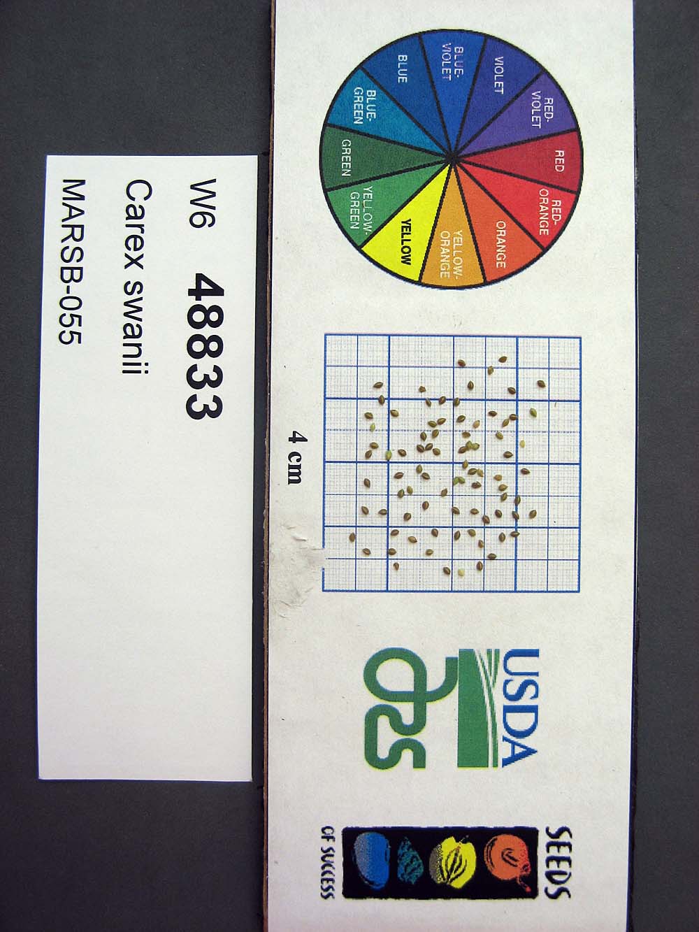 | | 2015 | | | | | | | Wild material | | 1922909 | W6 48833 |
| 60 | Ames 32826 | JDC/DL/2014/148/651 | Diervilla lonicera Mill. | Iowa, United States | NC7 |  | | 2014 | COLLECTED | 11/04/2014 | Elk Rock State Park (extreme northern point of park) approximately 6.25 miles north of Knoxville, T76N R19W SW 1/4 SW 1/4 Sec. 5 | 41.40879000, -93.07958000 | 219 | Extremely steep, north-facing slopes. | Wild material | | 1921786 | Ames 32826 |