| 0 | PI 372504 | | Amorpha canescens Pursh | Ontario, Canada | W6 | | | 1972 | DONATED | 03/03/1972 | | | | | Uncertain improvement status | | 1279243 | PI 372504 |
| 1 | PI 215180 | 53414 | Amorpha canescens Pursh | Nebraska, United States | W6 |  | | 1954 | COLLECTED | 1953 | Seven miles north of Stapleton. | | | | Wild material | | 1176274 | PI 215180 |
| 2 | PI 215181 | 53418 | Amorpha canescens Pursh | Nebraska, United States | W6 | | | 1954 | COLLECTED | 1953 | One mile east of Highway 83 on South Dakota state line. | | | | Wild material | | 1176275 | PI 215181 |
| 3 | PI 215183 | 53450 | Amorpha canescens Pursh | Nebraska, United States | W6 | | | 1954 | COLLECTED | 1953 | Ten miles northwest of Grand Island. | | | | Wild material | | 1176277 | PI 215183 |
| 4 | PI 215185 | 53452 | Amorpha canescens Pursh | Nebraska, United States | W6 | | | 1954 | COLLECTED | 1953 | Five miles east of Whitman. | | | | Wild material | | 1176279 | PI 215185 |
| 5 | PI 215186 | 53453 | Amorpha canescens Pursh | Nebraska, United States | W6 | | | 1954 | COLLECTED | 1953 | Four miles east of Eli. | | | | Wild material | | 1176280 | PI 215186 |
| 6 | PI 215188 | 53455 | Amorpha canescens Pursh | Nebraska, United States | W6 | | | 1954 | COLLECTED | 1953 | Seven miles west and 4 miles south of O'Neill. | | | | Wild material | | 1176282 | PI 215188 |
| 7 | W6 62098 | CBG-10927 | Amorpha canescens Pursh | | W6 | 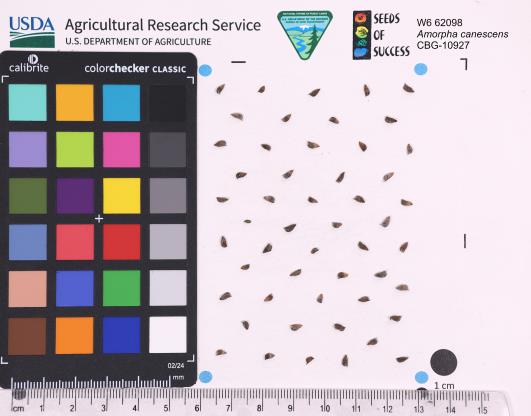 | | 2024 | | | | | | | | | 2168896 | W6 62098 |
| 8 | W6 63340 | Anderson Prairie | Amorpha canescens Pursh | Iowa, United States | W6 | | | 2023 | COLLECTED | 09/23/2022 | Anderson Prairie State Preserve located approximately 2.0 miles north of Estherville, T100N R34W NW 1/4 Sec. 36. | 43.43906800, -94.87472300 | 412 | Diverse remnant prairie with rolling hills and mesic soil. | Wild material | | 2141750 | W6 63340 |
| 9 | W6 56648 | CBG-9070 | Amorpha canescens Pursh | Wisconsin, United States | W6 |  | | 2019 | | | | | | | Wild material | | 2092747 | W6 56648 |
| 10 | W6 52992 | CBG-7307 | Amorpha canescens Pursh | Illinois, United States | W6 |  | | 2017 | | | | | | | Wild material | | 1954743 | W6 52992 |
| 11 | W6 52993 | CBG-7318 | Amorpha canescens Pursh | Wisconsin, United States | W6 |  | | 2017 | | | | | | | Wild material | | 1954744 | W6 52993 |
| 12 | W6 52994 | CBG-7338 | Amorpha canescens Pursh | Illinois, United States | W6 |  | | 2017 | | | | | | | Wild material | | 1954745 | W6 52994 |
| 13 | W6 51668 | CBG-5757 | Amorpha canescens Pursh | Iowa, United States | W6 | | | 2016 | | | | | | | Wild material | | 1942798 | W6 51668 |
| 14 | W6 50727 | CBG2014-3268 | Amorpha canescens Pursh | Nebraska, United States | W6 | | | 2015 | | | | | | | Wild material | | 1932015 | W6 50727 |
| 15 | W6 49552 | CBG-2502 | Amorpha canescens Pursh | Nebraska, United States | W6 |  | | 2015 | | | | | | | Wild material | | 1926025 | W6 49552 |
| 16 | W6 49622 | CBG-2635 | Amorpha canescens Pursh | Wisconsin, United States | W6 |  | | 2015 | | | | | | | Wild material | | 1926088 | W6 49622 |
| 17 | W6 45890 | CBG-1801 | Amorpha canescens Pursh | South Dakota, United States | W6 |  | | 2013 | | | | | | | Wild material | | 1908758 | W6 45890 |
| 18 | W6 45891 | CBG-1865 | Amorpha canescens Pursh | Illinois, United States | W6 |  | | 2013 | | | | | | | Wild material | | 1908759 | W6 45891 |
| 19 | DLEG 900272 | DLEG 900272 | Amorpha canescens Pursh | Oklahoma, United States | | 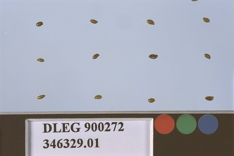 | Historic | 1990 | COLLECTED | 1986 | Cimarron Co. | | | | Wild material | Low shrubs; once-pinnate grayish pubescent leaves; purple flowers in racemes. Received from Jim Borland. | 1528598 | DLEG 900272 |
| 20 | DLEG 900273 | DLEG 900273 | Amorpha canescens Pursh | Colorado, United States | | 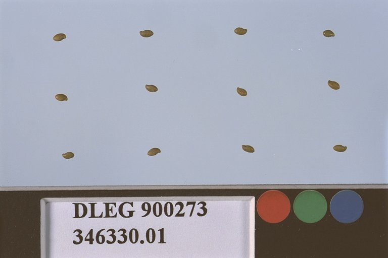 | Historic | 1990 | COLLECTED | | Denver Botanic Gardens. | | | | Cultivated material | Low shrubs; once-pinnate grayish pubescent leaves; purple flowers in racemes. Received from Jim Borland. | 1528599 | DLEG 900273 |
| 21 | PI 710736 | DALCAN N-21-17 | Dalea candida Willd. | Iowa, United States | NC7 |  | | 2021 | COLLECTED | 10/03/2003 | Adjacent to Union Pacific Railroad, TNSHP 94, RNGE 44, E/W W, SECT 15, Quarter Section NW4SE4 | 42.95624000, -96.02896300 | 389 | Slight south slope, nearby land falls sharply 30-50 feet to old gravel quarry pond and the Floyd River, heavy black soil, farmer hays 1-2x/yr. | Wild material | Seeds were collected for conservations by the Tallgrass Prairie Center, Plant Materials Program, at the University of Northern Iowa, and germinated there from original collector's seed in March 2021. On July 2, 2021, 25 live seedlings were delivered in Ames, Iowa by Laura Fischer Walter and later transplanted into a field at the North Central Regional Plant Introduction Station for seed production. | 2116595 | PI 710736 |
| 22 | PI 710734 | JDC/DP/2020/021/942 | Dalea purpurea Vent. | Iowa, United States | NC7 |  | | 2020 | COLLECTED | 09/17/2020 | Located approximately 0.75 miles east of Blairsburg, T89N, R24W NE 1/4 of Sec. 36, Hamilton County | 42.48218800, -93.63088000 | 376 | Roadside, remnant prairie. Canisteo and Nicollette clay loam soils (1-3 percent slopes) with depth to water table about 0-42 inches, slightly acidic and somewhat poorly drained. Very diverse flora present. | Wild material | | 2107727 | PI 710734 |
| 23 | PI 710730 | Kish-Ke-Kosh Prairie | Dalea purpurea Vent. | Iowa, United States | NC7 |  | | 2020 | COLLECTED | 08/14/2020 | Kish-Ke-Kosh Prairie State Preserve located 1.1 miles southeast of Reasnor, T78N R19W NW 1/4 NW 1/4 NE 1/4 Sec. 14, Jasper County | 41.56529900, -93.01530300 | 245 | Sandy prairie remnant. | Wild material | | 2106723 | PI 710730 |
| 24 | PI 710487 | CBG-7395 | Desmodium illinoense A. Gray | Illinois, United States | S9 |  | | 2017 | | | | | | | Wild material | | 1954802 | PI 710487 |
| 25 | PI 664828 | 38 | Echinacea pallida (Nutt.) Nutt. | Iowa, United States | NC7 | | | 2003 | COLLECTED | 09/24/2003 | Starr's Cave State Preserve located just northwest of Burlington, T70N R2W E edge of NW 1/4 of NW 1/4 of Sec. 19, West Burlington Quad, Des Moines County | 40.85222222, -91.13666667 | 186 | Small, thin soil hill prairie. Sunny. 20% slope with a southern aspect. Stony soil | Wild material | Perennial herb to 2.5 feet tall. | 1649670 | PI 664828 |
| 26 | PI 656820 | Ames 27186 | Physocarpus opulifolius (L.) Maxim. | Iowa, United States | NC7 |  | | 2003 | COLLECTED | 08/24/2003 | Along Old Indian Trail, overlooking Pease Creek, Ledges State Park, S 1/2 of SE 1/4 of SW 1/4 of Section 16, T83N, R26W, Madrid NW Quad, Boone County. | 41.99500000, -93.88583333 | 289 | Sandstone ridge. | Wild material | Shrubs to 2 meters tall. | 1648564 | PI 656820 |
| 27 | PI 649026 | Ames 26428 | Echinacea angustifolia DC. | Minnesota, United States | NC7 |  | | 2001 | COLLECTED | NEAR 09/2001 | West 1/2 of Section 6, Solem township, T127N, R40W, Douglas County. | 45.83333333, -95.75000000 | | Abandoned pasture. | Wild material | | 1624207 | PI 649026 |
| 28 | PI 631317 | 069 | Echinacea angustifolia DC. var. angustifolia | Kansas, United States | NC7 |  | | 1997 | COLLECTED | 08/26/1997 | Near Manhattan, Pottawatomie County. Please contact curator for specific site location. | 39.26666667, -96.58333333 | 385 | Native mixed prairie; not grazed or harvested (burned in the spring). Full exposure on nearly 0 to 20% slope with a western aspect. Clime-Sogn silty clay loam (calcareous), well drained with a limestone outcrop and stones on the surface. | Wild material | Plants were 3-5 dm tall, few branched, relatively abundant with about 1 flowering plant/square meter, and an overall population estimated at 2-3000. | 1549457 | PI 631317 |
| 29 | PI 631318 | 070 | Echinacea angustifolia DC. var. angustifolia | Kansas, United States | NC7 |  | | 1997 | COLLECTED | 08/27/1997 | Near Woodston, Rooks County. Please contact curator for specific site location. | 39.46666667, -99.13333333 | 585 | Native mixed prairie; grazed mid-summer to fall; harvested since the 1930's. Full exposure, 5-25% slope with southern and eastern aspects. Heizer-Brownell gravelly loam, well drained with moderate amounts of limestone gravel. | Wild material | Most plants were 3-4 (some up to 5) dm tall, branched, and frequent on the hilltop and abundant on the slopes in a large population with a moderate density of about 0.5 flowering plants/square meter. | 1549458 | PI 631318 |
| 30 | PI 631298 | CBG-3238 | Echinacea pallida (Nutt.) Nutt. | Kansas, United States | NC7 |  | | 1997 | COLLECTED | 08/23/1997 | Ivan Boyd Prairie Preserve just east of Baldwin City | 38.76741000, -95.12922000 | 321 | Native prairie remnant. Full exposure on a gentle slope. | Wild material | Plants were up to ~3 feet tall, abundant, stout, and seldom branched in a vigorous population with pale pink flowers. | 1548368 | PI 631298 |
| 31 | PI 649686 | 15 | Monarda fistulosa L. | Kansas, United States | NC7 |  | | 1985 | COLLECTED | 09/23/1985 | Chase County State Fishing Lake,T19S R8E W1/4 of SW 1/4 of Sec. 30, Cottonwood Falls Quad, Chase County | 38.36277600, -96.59551200 | 402 | Southeast facing slope on limestone. | Wild material | Lemon-scented plants noted in this population. | 1028672 | PI 649686 |
| 32 | PI 561065 | 3 | Monarda fistulosa L. | North Dakota, United States | NC7 | | | 1985 | COLLECTED | 09/08/1985 | Fort Ransom State Park, north of day use area, T135N R58W, Ft. Ransom Quad, Ransom County. | 46.55664900, -97.93389600 | 412 | On ridgetop. | Wild material | | 1456037 | PI 561065 |
| 33 | PI 633639 | 5 | Monarda fistulosa L. | North Dakota, United States | NC7 | | | 1985 | COLLECTED | 09/08/1985 | Clausen Springs Recreation Area, north side of lake, T137N R58W SE 1/4 of NE 1/4 of Sec.18, Hastings Quad, Barnes County. | 46.68361111, -98.04666667 | 411 | Northeast-facing slope. | Wild material | | 1028589 | PI 633639 |
| 34 | Ames 36698 | Smith Cemetery NP | Echinacea simulata McGregor | Indiana, United States | NC7 |  | | 2025 | COLLECTED | 08/25/2025 | Smith Cemetery Nature Preserve located approximately 2.0 miles southwest of Perrysville on the southwest corner of SR 63 and a private lane, T18N R9W NE 1/4 NE 1/4 NE 1/4 Sec. 8. | 40.02625000, -87.45092000 | 167 | Prairie remnant (cemetery). | Wild material | Specimens at collection site in nature with drooping, pink to rose colored rays measuring 3.0-5.2 mm in width and 30.00-41.00 mm in length with bright yellow pollen. Plants measuring approximately 30" (762 mm) in height. Note: seed heads during threshing were extremely difficult to work with in order to extract seeds. | 2192821 | Ames 36698 |
| 35 | Ames 36692 | Benton County RR | Echinacea simulata McGregor | Indiana, United States | NC7 |  | | 2025 | COLLECTED | 08/21/2025 | Located 2.65 miles northwest of Fowler just southeast of intersections of state highways 41 and 52, T25N R8W NE ¼ Sec. 6, SW ¼ Sec. 5, and NE ¼ Sec. 8. | 40.64885300, -87.36833100 | 248 | Railroad right-of-way. | Wild material | Specimens at collection site in nature with drooping, pink to rose colored rays measuring 6.0 mm in width and 35.00 mm in length with bright yellow pollen. Plants measuring approximately 20-36" in height. | 2192779 | Ames 36692 |
| 36 | OPGC 8855 | JDC/RM/2024/019/1141 | Rudbeckia missouriensis Engelm. ex C. L. Boynton & Beadle | Missouri, United States | OPGC |  | | 2024 | COLLECTED | 09/28/2024 | Danville Glade Conservation Area located 3.60 miles south, southeast of Danville, T47N R5W SW 1/4 SW 1/4 Sec. 5. | 38.86583400, -91.50779400 | 222 | Remnant glade. | Wild material | | 2169019 | OPGC 8855 |
| 37 | Ames 36256 | Plymouth County | Astragalus crassicarpus Nutt. | Iowa, United States | NC7 |  | | 2024 | COLLECTED | 07/10/2024 | Private property located approximately 4.95 miles southeast of Westfield along North Ridge Road T91N R48W SE 1/4 Sec. 8 (site #1) and also T91N R48W SW 1/4 NW 1/4 Sec 16 (site #2). | 42.70896900, -96.53007200 | 434 | Prairie remnant. | Wild material | | 2168687 | Ames 36256 |
| 38 | Ames 36255 | Kothenbeutel Prairie | Delphinium carolinianum Walter subsp. virescens (Nutt.) R. E. Brooks | Iowa, United States | NC7 | 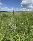 | | 2024 | COLLECTED | 07/08/2024 | Kothenbeutel Prairie Preserve located approximately 4.24 miles east, southeast of Sheffield just north of 240th Street, T93 R19W SW 1/4 SE 1/4 Sec. 7. | 42.87887400, -93.13261500 | 332 | Prairie remnant on south and southwestern aspects of 15-25 degree slopes. | Wild material | Plants in nature measuring approximately 30-38" in height. | 2168178 | Ames 36255 |
| 39 | OPGC 8804 | CBG- 10757 | Minuartia michauxii (Fenzl) Farw. | Illinois, United States | OPGC | | | 2023 | | | | | | | Wild material | | 2142227 | OPGC 8804 |
| 40 | OPGC 8809 | CBG- 10771 | Silene stellata W. T. Aiton | Illinois, United States | OPGC | | | 2023 | | | | | | | Wild material | | 2142239 | OPGC 8809 |
| 41 | OPGC 8827 | CBG- 10825 | Physostegia virginiana (L.) Benth. | Illinois, United States | OPGC | | | 2023 | | | | | | | Wild material | | 2142279 | OPGC 8827 |
| 42 | OPGC 8828 | CBG- 10831 | Senega sanguinea (L.) J. F. B. Pastore & J. R. Abbott | Illinois, United States | OPGC | | | 2023 | | | | | | | Wild material | | 2142281 | OPGC 8828 |
| 43 | OPGC 8846 | CBG- 10857 | Gentiana puberulenta J. S. Pringle | Illinois, United States | OPGC | | | 2023 | | | | | | | Wild material | | 2142304 | OPGC 8846 |
| 44 | W6 61364 | CBG- 10780 | Ceanothus americanus L. | Illinois, United States | W6 |  | | 2023 | | | | | | | Wild material | | 2142246 | W6 61364 |
| 45 | W6 61367 | CBG- 10785 | Elymus canadensis L. | Illinois, United States | W6 |  | | 2023 | | | | | | | Wild material | | 2142249 | W6 61367 |
| 46 | Ames 36031 | Brushy Creek (Root Cellar) | Baptisia bracteata Muhl. ex Elliott | Iowa, United States | NC7 |  | | 2023 | COLLECTED | 08/11/2022 | Brushy Creek State Recreation Area located approximately 9.8 miles southwest of Webster City, T88N R27W NE1/4 NE1/4 Sec. 28 | 42.41169000, -93.99375000 | 327 | High quality, biologically diverse prairie remnant with a slight northeast-facing slope. | Wild material | | 2141745 | Ames 36031 |
| 47 | Ames 36003 | NE0822 | Helianthus annuus L. | Nebraska, United States | NC7 | | | 2023 | COLLECTED | 10/04/2022 | Along 815th Rd, ~950 ft west of Hwy 11, northwest of Ord | 41.64027800, -98.96055600 | 634 | | Wild material | | 2141456 | Ames 36003 |
| 48 | Ames 35886 | Hook Larson Prairie | Heuchera richardsonii R. Br. | Illinois, United States | NC7 |  | | 2022 | COLLECTED | 06/22/2022 | Nachusa Grasslands (Hook Larson Prairie) located approximately 5.07 miles northwest of Franklin Grove just north of West Stone Barn Road, T22N R10E NE 1/4 SE 1/4 NE 1/4 Sec. 17. | 41.89738600, -89.36123100 | 236 | High-quality prairie remnant with thick vegetation managed with infrequent burning. Various small remnants within immediate area. | Wild material | | 2138219 | Ames 35886 |
| 49 | Ames 35881 | Reichelt Unit | Heuchera richardsonii R. Br. | Iowa, United States | NC7 |  | | 2022 | COLLECTED | 06/30/2022 | Reichelt Unit of Rock Creek State Park on south side of US highway 6 located 7.70 miles west, southwest of Grinnell, T80N R17W SE ¼ SE ¼ Sec. 30. | 41.70311300, -92.86569100 | 274 | Prairie remnant. Hilltop/knoll. | Wild material | Plants in nature measuring approximately six to eight inches in height with flowering stalks reaching up to three feet in height. | 2138180 | Ames 35881 |
| 50 | Ames 35806 | Reichelt Prairie | Salix humilis Marshall var. tristis (Aiton) Griggs | Iowa, United States | NC7 |  | | 2022 | COLLECTED | 05/16/2022 | Reichelt Unit of Rock Creek State Park on south side of US highway 6 approximately 7.70 miles west, southwest of Grinnell, T80N R17W SE ¼ SE ¼ Sec. 30. | 41.70311300, -92.86569100 | 274 | Xeric prairie remnant. Hilltop/knoll. | Wild material | Plants sampled in nature measuring 2.0-4.0 feet in height. Specimens noted during peak flowering and seed dispersal on 21 April and 17 May (2022), respectively. Some plants upright and some rather prostrate. Site was mowed in winter 2020/2021 winter resulting in significant flowering in 2022. In cultivation (central Iowa), plants are extremely short and compact where after two field seasons plants are rather uniform and topping out at a height of 2.5'. Dense suckering immediately surrounding clump/base of plant. Peak fall color (central Iowa) occurring in mid-November. | 2137912 | Ames 35806 |
| 51 | Ames 35752 | #476-477 | Rhus glabra L. | Iowa, United States | NC7 | 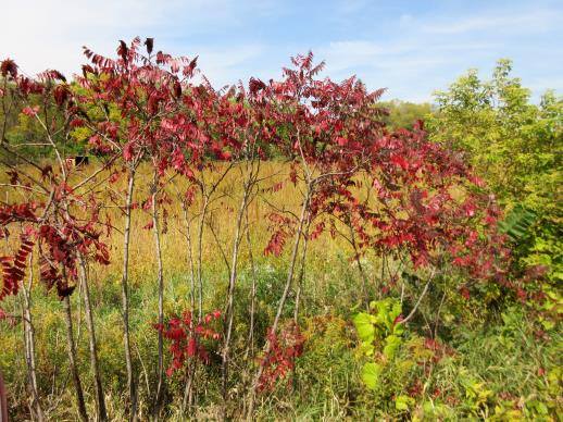 | | 2021 | COLLECTED | 09/29/2021 | Upper Iowa River area near Bluffton, T99N R9W NE1/4 Sec. 9 and S1/2 Sec. 10 | 43.40275000, -91.90494000 | 299 | High bluffs, roadside and stream banks | Wild material | Plants sampled in nature (29 September 2021) during peak fall color displaying bright reds to maroonish colors while measuring approximately 12-15 feet in height. One clonal patch noted was estimated to have 1,000+ ramets. | 2122093 | Ames 35752 |
| 52 | Ames 35735 | Steele Prairie State Preserve | Ceanothus americanus L. | Iowa, United States | NC7 |  | | 2021 | COLLECTED | 08/24/2021 | Steele Prairie State Preserve located approximately 8.75 miles north, northwest of Cherokee, T93N R40W NW1/4 Sec. 16 and also NW1/4 SW1/4 Sec. 15. | 42.87981600, -95.57948900 | 434 | Remnant sand prairie. | Wild material | Ceanothus americanus is abundant throughout the upland areas of Steele Prairie State Preserve. Plants sampled in nature were approximately 0.5 meters in height. At the time of sampling, variation was observed for plant growth habit, inflorescence size, and fruit maturity. Peak seed ripening in 2021 occurred on approximately 24 August. | 2120339 | Ames 35735 |
| 53 | W6 60356 | CBG-10736 | Houstonia longifolia Gaertn. | | W6 |  | | 2021 | | | | | | | Wild material | | 2137988 | W6 60356 |
| 54 | OPGC 8348 | CBG-10581 | Hieracium scabrum Michx. | Illinois, United States | OPGC | | | 2021 | | | | | | | Wild material | Plant numbers sampled estimated. | 2120172 | OPGC 8348 |
| 55 | W6 59082 | CBG-7510 | Eriogonum annuum Nutt. | Nebraska, United States | W6 | | | 2021 | | | | | | | Wild material | | 2120012 | W6 59082 |
| 56 | W6 59101 | CBG-9967 | Dalea candida Willd. | Illinois, United States | W6 | | | 2021 | | | | | | | Wild material | | 2120030 | W6 59101 |
| 57 | OPGC 8595 | CBG-10732 | Castilleja coccinea (L.) Spreng. | | OPGC |  | | 2021 | | | | | | | Wild material | Yellow flower form. | 2137984 | OPGC 8595 |
| 58 | W6 60350 | CBG-10730 | Dichanthelium leibergii (Vasey) Freckmann | | W6 |  | | 2021 | | | | | | | Wild material | | 2137982 | W6 60350 |
| 59 | Ames 35730 | Root Cellar Remnant | Heuchera richardsonii R. Br. | Iowa, United States | NC7 | _thumbnail.jpg "Click for 2 image(s) for this accession.") | | 2021 | COLLECTED | 07/07/2021 | Brushy Creek State Recreation Area located approximately 9.8 miles southwest of Webster City T88N R27W NE1/4 NE1/4 Sec. 28 | 42.41169000, -93.99375000 | 327 | High quality, biologically diverse prairie remnant with a slight northeast-facing slope | Wild material | | 2120334 | Ames 35730 |
| 60 | OPGC 5942 | CBG-1856 | Brickellia eupatorioides (L.) Shinners | Wisconsin, United States | OPGC |  | | 2021 | | | | | | | Wild material | | 1908796 | OPGC 5942 |
| 61 | OPGC 7555 | OPGC 7555 | Penstemon bradburyi Pursh | Nebraska, United States | OPGC |  | | 2020 | COLLECTED | 08/18/2020 | Located approximately 6.15 miles northeast of St Paul, T15N R9W NE1/4 NE1/4 Sec. 28, Howard County | 41.24796700, -98.34919400 | 557 | Native grassland used as pasture. | Wild material | | 2110279 | OPGC 7555 |
| 62 | Ames 35600 | Klossner Cemetery | Agastache foeniculum (Pursh) Kuntze | Minnesota, United States | NC7 | | | 2020 | COLLECTED | 09/04/2020 | Klossner Cemetery located just west of Klossner, T110N R30W NW 1/4 Sec. 3, Nicollet County | 44.36542200, -94.43090300 | 312 | Very diverse remnant prairie. | Wild material | Agastache foeniculum in Nicollet County has been minimally reported (Minnesota Biodiversity Atlas, accessed 21 October 2020). Only a single herbarium specimen at the University of Minnesota Bell Museum Herbarium (MIN) collected in 1892 (C. Ballard #B1054) is represented for Nicollet County. The species in the southern portion of Minnesota is rather rare while its abundance increases progressing north. Genetics of this accession would represent the southern central edge of the species native range. | 2107896 | Ames 35600 |
| 63 | Ames 35581 | Steele Prairie | Drymocallis arguta (Pursh) Rydb. | Iowa, United States | NC7 |  | | 2020 | COLLECTED | 10/02/2020 | T. H. Steele Prairie State Preserve located approximately 8.75 miles north-northwest of Cherokee, Cherokee County | 42.87654900, -95.58243700 | 429 | Remnant prairie. | Wild material | Plants sampled in nature were approximately 1.5 feet in height. | 2107744 | Ames 35581 |
| 64 | Ames 35559 | Ringgold Prairie | Echinacea pallida (Nutt.) Nutt. | Iowa, United States | NC7 |  | | 2020 | COLLECTED | 08/05/2020 | Ringgold Wildlife Management Area located approximately 13 miles east of Redding, Ringgold County | 40.60150000, -94.13390000 | 350 | Degraded, dry hill prairies. | Wild material | Plants sampled in nature measuring less than one meter in height. | 2107722 | Ames 35559 |
| 65 | OPGC 7547 | JDC/AT/2020/020/941 | Asclepias tuberosa L. | Iowa, United States | OPGC | | | 2020 | COLLECTED | 09/17/2020 | Located approximately 0.75 miles east of Blairsburg, T89N, R24W NE 1/4 of Sec. 36, Hamilton County | 42.48218800, -93.63088000 | 376 | Roadside, remnant prairie. Canisteo and Nicollette clay loam soils (1-3 percent slopes) with depth to water table about 0-42 inches, slightly acidic and somewhat poorly drained. Very diverse flora present. | Wild material | | 2107726 | OPGC 7547 |
| 66 | OPGC 7556 | JDC/PM/2020/006/927 | Phlox maculata L. | Iowa, United States | OPGC |  | | 2020 | COLLECTED | 07/18/2020 | Located approximately 3.0 miles southwest of Roland and just 330 yards west of 150h Street and 580th Avenue intersection, T85N R23W NE1/4 NE1/4 Sec. 32, Story County | 42.13724800, -93.54455800 | 305 | Roadside restoration. Locallized in wetter soils/drainage. | Wild material | Phlox maculata is rather rare in central Iowa, more common to northeastern parts of the state. This accession sampled in nature had purple-pink flowers on plants measuring circa 2-2.5’ in height with glabrous stems. Panicles measuring approximately 4-5” in length and 2” wide. Peak flowering and fruiting occurred 25 June and 18 July, respectively in central Iowa (2020). | 2106130 | OPGC 7556 |
| 67 | OPGC 7485 | CBG-9417 | Solidago missouriensis Nutt. | Iowa, United States | OPGC |  | | 2019 | | | | | | | Wild material | | 2092792 | OPGC 7485 |
| 68 | OPGC 7491 | CBG-9486 | Symphyotrichum ericoides (L.) G. L. Nesom | Wisconsin, United States | OPGC |  | | 2019 | | | | | | | Wild material | | 2092805 | OPGC 7491 |
| 69 | W6 56599 | CBG-8785 | Carex bicknellii Britton | South Dakota, United States | W6 |  | | 2019 | | | | | | | Wild material | | 2092698 | W6 56599 |
| 70 | W6 56633 | CBG-8950 | Heliopsis helianthoides (L.) Sweet | South Dakota, United States | W6 |  | | 2019 | | | | | | | Wild material | | 2092732 | W6 56633 |
| 71 | W6 56656 | CBG-9081 | Zizia aptera (A. Gray) Fernald | Wisconsin, United States | W6 |  | | 2019 | | | | | | | Wild material | | 2092755 | W6 56656 |
| 72 | Ames 34361 | Ames 34361 | Monarda punctata L. | Wisconsin, United States | NC7 |  | | 2018 | COLLECTED | 10/11/2018 | Fort McCoy Military Training Area located 5.0 miles northeast of Sparta, T17N R3W S edge of Sec. 3; NE 1/4 and NE 1/4 of NW1/4 of Sec. 10; NE 1/4 of Sec. 9; and SE 1/4 of Sec. 4, Monroe County. | 43.97153900, -90.72177200 | 282 | Oak and pine barren community dominated (80%) by sand on variable 0 to 45% slopes. | Wild material | | 1968260 | Ames 34361 |
| 73 | Ames 34346 | 3237 | Monarda fistulosa L. | Missouri, United States | NC7 |  | | 2018 | COLLECTED | 08/16/2018 | Linden’s Prairie located approximately 4.95 miles west of Mt. Vernon near intersection of 2120 and 1080 Roads, T28N R27W SE ¼ SW ¼ Sec. 29; Lawrence County | 37.10418700, -93.90805800 | 360 | In swale through dry-mesic, upland prairie remnant. | Wild material | | 1967548 | Ames 34346 |
| 74 | Ames 34347 | 3240 | Monarda fistulosa L. | Missouri, United States | NC7 |  | | 2018 | COLLECTED | 08/14/2018 | Schwartz Prairie located approximately 4.85 miles southwest of Roscoe near intersection of SW800 and SW 301 Road, T36N R27W SW ¼ SE ¼ Sec. 1 ; St. Clair County | 37.90902900, -93.85101800 | 276 | In dry-mesic, upland prairie remnant. | Wild material | | 1967549 | Ames 34347 |
| 75 | Ames 34341 | Sheeder Prairie | Drymocallis arguta (Pursh) Rydb. | Iowa, United States | NC7 |  | | 2018 | COLLECTED | 09/06/2018 | Sheeder Prairie State Preserve located approximately 4.45 miles west, northwest of Guthrie Center, T80N R32W SW 1/4 SW 1/4 Sec. 33, Guthrie County | 41.68949600, -94.58847900 | 366 | High-quality native prairie remnant. | Wild material | | 1967543 | Ames 34341 |
| 76 | Ames 34342 | Sheeder | Echinacea pallida (Nutt.) Nutt. | Iowa, United States | NC7 |  | | 2018 | COLLECTED | 09/06/2018 | Sheeder Prairie State Preserve located approximately 4.45 miles west, northwest of Guthrie Center, T80N R32W SW 1/4 SW 1/4 Sec. 33 | 41.68949600, -94.58847900 | 366 | High-quality native prairie remnant. | Wild material | | 1967544 | Ames 34342 |
| 77 | Ames 34343 | Sheeder | Monarda fistulosa L. | Iowa, United States | NC7 |  | | 2018 | COLLECTED | 09/06/2018 | Sheeder Prairie State Preserve located approximately 4.45 miles west, northwest of Guthrie Center, T80N R32W SW 1/4 SW 1/4 Sec. 33 | 41.68949600, -94.58847900 | 366 | High-quality native prairie remnant. | Wild material | | 1967545 | Ames 34343 |
| 78 | Ames 34307 | JDC/EP/2018/051/864 | Echinacea paradoxa (Norton) Britton | Missouri, United States | NC7 |  | | 2018 | COLLECTED | 07/16/2018 | Auxvasse Natural Area located 8.44 miles southeast of Fulton, T46N R8W S 1/4 Sec. 9, Callaway County | 38.76733000, -91.82958500 | 205 | Dolomite glade. Large (110 acres) and exceptionally diverse (220 plant species identified). According to local MDC biologists, this is one of the best glades north of the Missouri River in Missouri. Northern most, native population of Echinacea paradoxa in Missouri. | Wild material | Plants reached peak flower on 30 May 2018. Specimens ranged from 2.0-4.0' in height. | 1964614 | Ames 34307 |
| 79 | Ames 34310 | JDC/MB/2018/050/863 | Monarda bradburiana L. C. Beck | Missouri, United States | NC7 |  | | 2018 | COLLECTED | 07/16/2018 | Auxvasse Natural Area located 8.44 miles southeast of Fulton, T46N R8W S 1/4 Sec. 9, Callaway County | 38.76733000, -91.82958500 | 205 | Dolomite glade. Large (110 acres) and exceptionally diverse (220 plant species identified). According to local MDC biologists, this is one of the best glades north of the Missouri River in Missouri. | Wild material | Plants measuring circa 1.0' in height. Peak flowering occurred around 18 May 2018. Seeds likely reached full maturity around first week in July (2018). | 1964617 | Ames 34310 |
| 80 | NA 88204 | CBG-7297 | Ceanothus americanus L. | Wisconsin, United States | NA |  | | 2017 | | | | | | | Wild material | | 1954781 | NA 88204 |
| 81 | NA 88205 | CBG-7326 | Ceanothus americanus L. | Wisconsin, United States | NA |  | | 2017 | | | | | | | Wild material | | 1954782 | NA 88205 |
| 82 | OPGC 6374 | CBG-7306 | Anemone cylindrica A. Gray | Illinois, United States | OPGC |  | | 2017 | | | | | | | Wild material | | 1954751 | OPGC 6374 |
| 83 | OPGC 6375 | CBG-7319 | Anemone cylindrica A. Gray | Wisconsin, United States | OPGC |  | | 2017 | | | | | | | Wild material | | 1954752 | OPGC 6375 |
| 84 | OPGC 6383 | CBG-6891 | Campanula rotundifolia L. | Wisconsin, United States | OPGC |  | | 2017 | | | | | | | Wild material | | 1954771 | OPGC 6383 |
| 85 | OPGC 6386 | CBG-7321 | Coreopsis palmata Nutt. | Wisconsin, United States | OPGC |  | | 2017 | | | | | | | Wild material | | 1954788 | OPGC 6386 |
| 86 | OPGC 6396 | CBG-7327 | Oenothera clelandii W. Dietr. et al. | West Virginia, United States | OPGC |  | | 2017 | | | | | | | Wild material | | 1954834 | OPGC 6396 |
| 87 | W6 53018 | CBG-7563 | Sporobolus rigidus (Buckley) P. M. Peterson var. rigidus | Nebraska, United States | W6 |  | | 2017 | | | | | | | Wild material | | 1954769 | W6 53018 |
| 88 | W6 53042 | CBG-7320 | Dalea candida Willd. | Wisconsin, United States | W6 |  | | 2017 | | | | | | | Wild material | | 1954793 | W6 53042 |
| 89 | Ames 34154 | Ames 34154 | Monarda punctata L. | Wisconsin, United States | NC7 |  | | 2017 | COLLECTED | 12/15/2017 | Between Boscobel and Blue River along State Road 133 including T8N R3W Sec. 24, T8N R2W Sec. 17, and T8N R2W Sec. 11, Grant County. | 43.16997000, -90.63607800 | 205 | Roadside, sandy sparse vegetation. | Wild material | Average plant height at collection site in nature approximately 25-35 cm. | 1954954 | Ames 34154 |
| 90 | Ames 33972 | Ames 33972 | Polytaenia nuttallii DC. | Iowa, United States | NC7 |  | | 2017 | COLLECTED | 07/28/2017 | Sheeder Prairie State Preserve located approximately 4.45 miles west, northwest of Guthrie Center, T80N R32W SW 1/4 SW 1/4 Sec. 33 | 41.68949600, -94.58847900 | 366 | High-quality native prairie remnant. Dry, rocky habitat. | Wild material | A monocarpic perennial. | 1950055 | Ames 33972 |
| 91 | OPGC 5077 | OPGC 5077 | Phlox pilosa L. subsp. fulgida (Wherry) Wherry | Iowa, United States | OPGC | | | 2017 | COLLECTED | 06/28/2017 | Sheeder Prairie State Preserve located approximately 4.45 miles west, northwest of Guthrie Center, T80N R32W SW 1/4 SW 1/4 Sec. 33 | 41.68949600, -94.58847900 | 366 | High-quality native prairie remnant. Dry, rocky habitat. Growing in association with Ceanothus herbaceous, Asclepias tuberosa, Bromus inermis, Dalea purpurea, Dalea candida, Sporobolus heterolepis, Hesperostipa spartea, Zizia aurea, Amorpha canescens, Polytaenia nuttallii, sisyrinchium angustifolium, Tradescantia bracteata, Liatris squarrosa, Astragulus canadensis, Asclepias viridis, Schizachyrium scoparium, Andropogon gerardii, Comandra umbellata, Lespedeza capitata, Viola pedatifida, Anemone cylindrica, Euphorbia corollata, Oligoneruon rigidum, and Lilium philadelphicum. | Wild material | | 1950054 | OPGC 5077 |
| 92 | Ames 33866 | JDC/MP/2016/033/748 | Monarda punctata L. | Iowa, United States | NC7 |  | | 2016 | COLLECTED | 11/01/2016 | Shields Prairie located appproximately 5.85 miles northwest of Muscatine, T77N R2W SW1/4 SE 1/4 Sec. 7 Muscatine County. | 41.48253000, -91.12427000 | 217 | Native prairie remnant. | Wild material | | 1943208 | Ames 33866 |
| 93 | Ames 33867 | JDC/PT/2016/034/749 | Ptelea trifoliata L. | Iowa, United States | NC7 |  | | 2016 | COLLECTED | 11/01/2016 | Shields Prairie located approximately 5.85 miles northwest of Muscatine, T77N R2W SW1/4 SE1/4 Sec. 7 | 41.48239000, -91.12428000 | 222 | Native prairie remnant | Wild material | | 1943209 | Ames 33867 |
| 94 | Ames 33764 | Ames 33764 | Monarda punctata L. | Iowa, United States | NC7 |  | | 2016 | COLLECTED | 09/03/2016 | Hitaga Sand Ridge Preserve approximately 3.6 miles southeast of Troy Mills, T86N R7W NW 1/4 NW 1/4 Sec. 23 Linn County. | 42.25103700, -91.63300800 | 299 | Native prairie remnant, very dry and sandy. | Wild material | | 1943162 | Ames 33764 |
| 95 | Ames 34284 | CBG-4317 | Monarda pectinata Nutt. | Nebraska, United States | NC7 |  | | 2016 | COLLECTED | 07/23/2015 | Located approximately 7.5 miles southwest of Halsey, Thomas County. From I80 drive north approximately 150.5 miles on Hwy 83 to Thedford. Turn right (east) on Hwy 2 for 15.3 miles to Hwy 86B Spur before the town of Halsey. Drive 2.6 miles on 86B Spur which becomes Road 212 to 203 East Loop gravel road. | 41.87024361, -100.41048250 | 872 | Prairie. | Wild material | | 1942733 | Ames 34284 |
| 96 | NA 88207 | CBG-4389 | Ceanothus americanus L. | Kansas, United States | NA | | | 2016 | | | | | | | Wild material | | 1942744 | NA 88207 |
| 97 | W6 51595 | CBG-4180 | Oxytropis lambertii Pursh | Iowa, United States | W6 | | | 2016 | | | | | | | Wild material | | 1942725 | W6 51595 |
| 98 | Ames 33363 | JDC/MB/2016/022/737 | Monarda bradburiana L. C. Beck | Missouri, United States | NC7 | | | 2016 | COLLECTED | 06/28/2016 | Spring Creek Gap Conservation Area approximately 3.54 miles northwest of Vichy, T39N R8W Sec. 4, Maries County. | 38.14201800, -91.81278200 | 209 | Cedar glade remnant. | Wild material | | 1940865 | Ames 33363 |
| 99 | Ames 34702 | CBG-3313 | Drymocallis arguta (Pursh) Rydb. | Nebraska, United States | NC7 |  | | 2015 | COLLECTED | 10/15/2014 | Located approximately 7.5 miles southwest of Halsey along 212 and 203 Roads. | 41.86039000, -100.40280000 | 866 | Mixed grass prairie. | Wild material | | 1932038 | Ames 34702 |
| 100 | OPGC 4241 | JDC/PP/2015/058/715 | Phlox pilosa L. subsp. fulgida (Wherry) Wherry | Iowa, United States | OPGC |  | | 2015 | COLLECTED | 07/20/2015 | T88N, R27W Sec. 28. Brushy Creek State Recreation Area, Webster County. | 42.41169000, -93.99375000 | 327 | High quality, biologically diverse prairie remnant. Slight northeast-facing slope. Associated with Amorpha canescens, Artemisia ludoviciana, Asclepias tuberosa, Baptisia leucophea, Lithospermum canescens, Astragalus americanus, Corylus americana, Echinacea pallida, Eryngium yuccifolium, Liatris pycnostachya, Potentilla arguta, Liatris aspera, Malus ioensis, Ceanothus americanus, Pycnanthemum virginianum, Silene stellata, Salix, Schizachyrium scoparium, Silphium laciniatum, Dalea purpurea, Dalea candida, Solidago rigida, and Solidago speciosa. | Wild material | | 1927165 | OPGC 4241 |
| 101 | NA 88203 | CBG-2503 | Ceanothus americanus L. | Nebraska, United States | NA |  | | 2015 | | | | | | | Wild material | | 1926026 | NA 88203 |
| 102 | OPGC 6151 | CBG-2456 | Tradescantia ohiensis Raf. | Wisconsin, United States | OPGC |  | | 2015 | | | | | | | Wild material | | 1926001 | OPGC 6151 |
| 103 | W6 49554 | CBG-2504 | Dalea purpurea Vent. | Nebraska, United States | W6 |  | | 2015 | | | | | | | Wild material | | 1926027 | W6 49554 |
| 104 | W6 49555 | CBG-2505 | Dalea candida Michx. ex Willd. var. candida | Nebraska, United States | W6 |  | | 2015 | | | | | | | Wild material | | 1926028 | W6 49555 |
| 105 | W6 49600 | CBG-2596 | Artemisia dracunculus L. | South Dakota, United States | W6 |  | | 2015 | | | | | | | Wild material | | 1926069 | W6 49600 |
| 106 | Ames 32809 | JDC/EP/2014/129/632 | Echinacea pallida (Nutt.) Nutt. | Iowa, United States | NC7 | | | 2014 | COLLECTED | 10/21/2014 | Located approximately 0.75 miles east of Blairsburg, T89N, R24W NE 1/4 of Sec. 36, Hamilton County | 42.48238900, -93.63018100 | 376 | Roadside, remnant prairie. Very diverse flora present | Wild material | | 1921819 | Ames 32809 |
| 107 | Ames 32810 | JDC/SA/2014/128/631 | Spiraea alba Du Roi | Iowa, United States | NC7 |  | | 2014 | COLLECTED | 10/21/2014 | Located approximately 0.75 miles east of Blairsburg, T89N, R24W NE 1/4 of Sec. 36. | 42.48218800, -93.63088000 | 376 | Roadside, remnant prairie. Canisteo and Nicollette clay loam soils (1-3 percent slopes) with depth to water table about 0-42 inches, slightly acidic and somewhat poorly drained. Very diverse flora present. | Wild material | | 1921820 | Ames 32810 |
| 108 | Ames 32761 | JDC/BP/2014/034/536 | Betula pumila L. | Iowa, United States | NC7 |  | | 2014 | COLLECTED | 09/03/2014 | Crossman Prairie State Preserve, approximately 5 miles northeast of Riceville, Howard County. | 43.40777300, -92.47500720 | 413 | Remnant tallgrass prairie. | Wild material | | 1921309 | Ames 32761 |
| 109 | Ames 32767 | JDC/PV/2014/036/538 | Prunella vulgaris L. | Iowa, United States | NC7 |  | | 2014 | COLLECTED | 09/03/2014 | Crossman Prairie State Preserve, approximately 5 miles northeast of Riceville, Howard County. | 43.40777300, -92.47500720 | 413 | Remnant tallgrass prairie. | Wild material | | 1921315 | Ames 32767 |
| 110 | Ames 32769 | JDC/SA/2014/033/535 | Spiraea alba Du Roi | Iowa, United States | NC7 |  | | 2014 | COLLECTED | 09/03/2014 | Crossman Prairie State Preserve, approximately 5 miles northeast of Riceville. | 43.40777300, -92.47500720 | 413 | Remnant tallgrass prairie. Clyde-Floyd complex (1-4 percent slopes) depth to water table: 12-42 inches, 0-17 inches silty clay loam, somewhat poorly drained | Wild material | | 1921317 | Ames 32769 |
| 111 | OPGC 4196 | JDC/LP/2014/035/537 | Liatris pycnostachya Michx. | Iowa, United States | OPGC | | | 2014 | COLLECTED | 09/03/2014 | Crossman Prairie State Preserve, approximately 5 miles northeast of Riceville, Howard County. | 43.40777300, -92.47500720 | 413 | Remnant tallgrass prairie. Associated with Aesclepias, Amorpha canescens, Andropogon gerardi, Baptisia, Betula pumila, Cornus amomum, C. racemosa, Dalea purpurea, Eryngium yuccifolium, Gentiana andrewsii, Helianthus grosseserratus, Hypericum ascyron subsp. pyramidatum, Liatris pcynostachya, Monarda fistulosa, Populus tremuloides, Prunella vulgaris, Prunus americana, Salix, Silphium laciniatum, Solidago, and Spiraea alba. | Wild material | | 1921312 | OPGC 4196 |
| 112 | OPGC 4197 | JDC/PP/2014/029/531 | Phlox pilosa L. subsp. fulgida (Wherry) Wherry | Iowa, United States | OPGC | | | 2014 | COLLECTED | 07/22/2014 | NE 1/4 of Section 36, T89N, R24W, approximately 0.75 mile east of Blairsburg, Hamilton County. | 42.48260000, -93.62550000 | 372 | Prairie remnant along abandoned railroad. Very unique and biologically diverse area, both wetland and upland prairie species nearby. Nicollet Loam (1 to 3 percent slope) depth to water table: about 12-42 inches, 0-18 inches: slightly acid, loam, somewhat poorly drained and Canisteo silty clay loam (0 to 2 percent slope) depth to water table: 0-12 inches; 0-10 inches moderately alkaline, silty clay loam; poorly drained. Associated with Amorpha canescens, Artemisia ludoviciana, Asclepias tuberosa, Coreopsis lanceolata, Dalea purpurea, Desmodium canadense, Echinacea pallida, Europhorbia esula, Liatris pycnostachya, Melilotus officinalis, Pycnanthemum virginianum, Salix humilis, Schizachyrium scoparium, Silphium laciniatum, Solidago, Spiraea alba, and Zizia aurea. | Wild material | | 1919856 | OPGC 4197 |
| 113 | Ames 32389 | JDC/BN/2014/016/518 | Betula nigra L. | Iowa, United States | NC7 |  | | 2014 | COLLECTED | 06/06/2014 | Clemmons Creek Wildlife Management Area, T75N R8W NE 1/4 Sec. 14. | 41.30388300, -91.74342500 | 208 | Wet, floodplain. | Wild material | | 1919310 | Ames 32389 |
| 114 | Ames 32385 | Blairsburg RR ROW | Salix humilis Marshall | Iowa, United States | NC7 |  | | 2014 | COLLECTED | 03/11/2014 | Located approximately 0.75 miles east of Blairsburg, T89N, R24W NE ¼ of Sec. 36. | 42.48260000, -93.62550000 | 372 | Very unique and biologically diverse area. Nicollet loam soil (1 to 3% slope), slightly acid loam soil (somewhat poorly drained), Canisteo silty clay loam soil (0 to 2% slope), and moderately alkaline silty clay loam soil (poorly drained). Both wetland and upland prairie species nearby | Wild material | Plants sampled in nature averaged 2.0-4.0 feet in height. Tallest of four specimens was 5 feet in height. Progeny grown from original seed collected in nature (17 May 2019) when grown in cultivation (NCRPIS - Ames, Iowa) showed substantial variation in leaf morphology. Out of 50 seedlings, seven specimens are likely hybrids (Salix x conifera). Growth habit appears to be relatively uniform: small-medium sized plants (e.g. less than 6-8'), multi-branched, wide-spreading shrubs with near horizontal branching occurring near the base. | 1918672 | Ames 32385 |
| 115 | Ames 35549 | Separation from Ames 32385 | Salix ×conifera Wangenh. | Iowa, United States | NC7 |  | | 2014 | COLLECTED | 05/17/2019 | | 42.48260000, -93.62550000 | 372 | Very unique and biologically diverse area. Nicollet loam soil (1 to 3% slope), slightly acid loam soil (somewhat poorly drained), Canisteo silty clay loam soil (0 to 2% slope), and moderately alkaline silty clay loam soil (poorly drained). Both wetland and upland prairie species nearby | Wild material | Originally acquired in nature via intential sampling of Salix humilis (Ames 32385). Specimens sampled averaged 0.9 meters in height. Tallest of four specimens was 1.5 meters in height. Progeny grown from original seed collected in nature (17 May 2019) when grown in cultivation (NCRPIS - Ames, Iowa) showed substantial variation in leaf morphology. Out of 50 seedlings, seven specimens assumed to be hybrids (Salix x conifera) were selected to represent this accession. Growth habit appears to be relatively uniform: short plants (e.g. less than 6-8'), multi-branched shrubs with branching occurring near the base. Stems and petioles pubescent; adaxial and abaxial surfaces of leaves very sparsely pubescent but mid-veins relatively pubescent. Stipules present and persistent. Abaxial surfaces slightly whitish, while adaxial surfaces are slightly glossy and dark green in color. These hybrids are likely sterile; two attempts at controlled pollination failed to produce seed. | 2106732 | Ames 35549 |
| 116 | Ames 32772 | JDC/EA/2014/045/547 | Echinacea angustifolia DC. | Nebraska, United States | NC7 |  | | 2013 | COLLECTED | NEAR 11/2013 | Approximately 3.75 miles south of Randolph, Pierce County. | 42.32289000, -97.37772800 | | Roadside, near top of hill. | Wild material | | 1921693 | Ames 32772 |
| 117 | Ames 31986 | APS/GD/2013/010/095 | Gymnocladus dioicus (L.) K. Koch | Kansas, United States | NC7 |  | | 2013 | COLLECTED | 02/20/2013 | South Gypsum Creek Maxwell Wildlife Refuge, north of Canton, boundary line between Sections 21 and 22, T18S R1W, McPherson County. | 38.46916733, -97.42786767 | 430 | Dry floodplain. | Wild material | | 1907539 | Ames 31986 |
| 118 | Ames 30146 | JDC/FP/2009/033/183 | Fraxinus pennsylvanica Marshall | Wisconsin, United States | NC7 |  | | 2009 | COLLECTED | 09/22/2009 | Blackhawk Unit, Lower Wisconsin State Riverway, NW 1/4 of SE 1/4 of Section 23, T9N, R6E, Black Earth Quad, Dane County. | 43.24361111, -89.73972222 | 226 | Wisconsin River watershed/floodplain | Wild material | | 1819727 | Ames 30146 |
| 119 | Ames 30174 | JDC/SA/2009/034/184 | Spiraea alba Du Roi | Wisconsin, United States | NC7 |  | | 2009 | COLLECTED | 09/22/2009 | Blackhawk Unit, Lower Wisconsin State Riverway, T9N R6E SE 1/4 of NE 1/4 of Sec. 23, Black Earth Quad, Dane County | 43.24361111, -89.73972222 | 226 | Wisconsin River watershed/floodplain | Wild material | | 1819755 | Ames 30174 |