| 0 | PI 657270 | Illinoise Covey False Indigo | Amorpha fruticosa L. | Missouri, United States | W6 | | | 2005 | DONATED | 09/27/2005 | | | | | Cultivated material | | 1685667 | PI 657270 |
| 1 | PI 657268 | 9008041 | Amorpha fruticosa L. | Missouri, United States | W6 | | | 2005 | DONATED | 09/27/2005 | | | | | Cultivated material | | 1685663 | PI 657268 |
| 2 | PI 495596 | 27 | Amorpha fruticosa L. | Nebraska, United States | W6 | | | 1984 | COLLECTED | 09/23/1984 | Extreme NE corner of T1N R13E Sec 18, Kinters' Ford WMA, Ric hardson Co., NE | | 300 | | Wild material | Plant bushy to 2m tall, growing on dry mud flat with Populus, Cassia, Ambrosia, and grasses. | 1390532 | PI 495596 |
| 3 | PI 436707 | | Amorpha fruticosa L. | Texas, United States | W6 | | | 1979 | COLLECTED | 02/1976 | Tarrant Co., Texas | | | | Wild material | Collected by A. Davis. | 1331643 | PI 436707 |
| 4 | PI 436708 | | Amorpha fruticosa L. | Oklahoma, United States | W6 | | | 1979 | COLLECTED | 10/1977 | Stephens Co., Oklahoma | | 333 | | Wild material | Collected by W. Runnells. No grazing pressure on site. | 1331644 | PI 436708 |
| 5 | PI 436709 | | Amorpha fruticosa L. | Oklahoma, United States | W6 | | | 1979 | COLLECTED | 11/1977 | Custer Co., Oklahoma | | 487 | | Wild material | Collected by F. Perryman. Growing in seriously eroding gully. | 1331645 | PI 436709 |
| 6 | PI 436710 | | Amorpha fruticosa L. | Oklahoma, United States | W6 | | | 1979 | COLLECTED | 09/1977 | Caddo Co., Oklahoma | | 382 | | Wild material | Collected by G. Moreland. | 1331646 | PI 436710 |
| 7 | PI 436711 | | Amorpha fruticosa L. | Oklahoma, United States | W6 | | | 1979 | COLLECTED | 10/1977 | Kingfisher Co., Oklahoma | | 361 | | Wild material | | 1331647 | PI 436711 |
| 8 | PI 436712 | | Amorpha fruticosa L. | Oklahoma, United States | W6 | | | 1979 | COLLECTED | 09/1977 | Noble Co., Oklahoma | | 303 | | Wild material | Collected by B. Harney. | 1331648 | PI 436712 |
| 9 | PI 436715 | | Amorpha fruticosa L. | Oklahoma, United States | W6 | | | 1979 | COLLECTED | 08/1978 | Delaware Co., Oklahoma | | 349 | | Wild material | Collected by O. Bennett. | 1331651 | PI 436715 |
| 10 | PI 372505 | | Amorpha fruticosa L. | Ontario, Canada | W6 | | | 1972 | DONATED | 03/03/1972 | | | | | Uncertain improvement status | | 1279244 | PI 372505 |
| 11 | PI 314213 | 71 | Amorpha fruticosa L. | Former, Soviet Union | W6 | | | 1966 | COLLECTED | | Botanic Garden, Tashkent | | | | Wild material | Shrub to 8ft high with odd pinnate leaves, purplish-blue flowers 10 | 1234641 | PI 314213 |
| 12 | PI 303182 | V63-240 | Amorpha fruticosa L. | Idaho, United States | W6 | | | 1964 | COLLECTED | 1963 | Flood plain Payette River, Emett | | | | Wild material | In wild, typical to A. fruticosa 10 | 1227906 | PI 303182 |
| 13 | PI 207458 | | Amorpha fruticosa L. | Afghanistan | W6 | | | 1953 | COLLECTED | | From Paghman. | | | | Wild material | | 1173522 | PI 207458 |
| 14 | NA 89082 | 2024RJLPA-010 | Amorpha fruticosa L. | Pennsylvania, United States | NA | | | 2024 | COLLECTED | 09/22/2024 | Outcrops along the Susquehanna River, accessed from the Historic Lock 12 parking lot off of Pennsylvania Road 372. | 39.81481500, -76.32757900 | 34 | Plants are growing from part-sun to full sun in crevices of the outcrops and where organic debris has accumulated in between boulders along the Susquehanna River. The sites range from nearly xeric to dry mesic, at least on the surface. Plants are generally growing 4-10 m above the normal flow of the river; however, the Holtwood Dam is less than 1 kilometer upstream and debris found trapped in the boulders indicates that there is periodic flooding, at least, in the lower zone of 4+ meters or so above normal river flow. This habitat has a diverse assemblage of deciduous trees and shrubs as well as abundant herbaceous taxa. Slope: 0 to 25 percent. Aspect: Northeast (generally). Geology: The underlying geology of this area is probably of lower Paleozoic age and characterized as the Octoraro Formation. It includes albite-chlorite schist, phyllite, some hornblende gneiss, and granitized members. Soils: The area where this species occurs is right on the edge of two soil zones that transition from the river’s edge to mesic conditions upslope. The first is generally referred to as Rock Outcrop. This terrestrial matrix in which plants grow is largely exposed underlying rock geology with accumulated outwash, rock decomposition, and organic debris buildup. The second is Mt. Airy (80%) and Manor (20%) Series soils, 25 to 60 percent slopes, extremely stony (MRF). (Source: California Soil Resource Lab/NRCS Official Soil Series Descriptions). EPA Ecoregion (Level III): Northern Piedmont (64). EPA Ecoregion (Level IV): Piedmont Uplands (64c). | Wild material | | 2169046 | NA 89082 |
| 15 | W6 61426 | CBG- 10862 | Amorpha fruticosa L. | South Dakota, United States | W6 |  | | 2023 | | | | | | | Wild material | | 2142308 | W6 61426 |
| 16 | W6 56681 | CBG-9193 | Amorpha fruticosa L. | Nebraska, United States | W6 |  | | 2019 | | | | | | | Wild material | | 2092780 | W6 56681 |
| 17 | WLP 704 | NA 83896 | Amorpha fruticosa L. | Kentucky, United States | NA | | | 2016 | COLLECTED | 09/27/2016 | Cumberland Falls State Park, Cumberland Falls Visitor Center. Beach north of visitor center outlook trail, boulders north of large sycamore with exposed root flare and hole in trunk base. | 36.84200000, -84.34200000 | 245 | Beach, with boulders. | | | 1950955 | WLP 704 |
| 18 | W6 45893 | CBG-1885 | Amorpha fruticosa L. | Colorado, United States | W6 |  | | 2013 | | | | | | | Wild material | | 1908761 | W6 45893 |
| 19 | WLP 707 | RL 10048 | Amorpha fruticosa L. | Oklahoma, United States | NA | | | 2010 | COLLECTED | 09/28/2010 | Oklahoma: McCurtain County, Ouachita National Forest, along western bank of Buffalo River, near bridge of F.S. Rd. 28000. | | | River bank. | | | 1922729 | WLP 707 |
| 20 | WLP 706 | RL 07003 | Amorpha fruticosa L. | Georgia, United States | NA | | | 2007 | COLLECTED | | | | | | | | 1922661 | WLP 706 |
| 21 | WLP 709 | 223 | Amorpha fruticosa L. | Alabama, United States | NA | | | 2006 | COLLECTED | | Alabama: Sumter County: Epes, Chalk bluffs along Tombigbee River at site of Fort Tombecbee. | | | | | | 1922622 | WLP 709 |
| 22 | DLEG 940175 | DLEG 940175 | Amorpha fruticosa L. | New Mexico, United States | | | Historic | 1994 | COLLECTED | 10/1994 | | | | | Wild material | Received from David R. Dreesen, USDA Plant Materials Center, Las Lunas, NM. # 9066224. | 1527071 | DLEG 940175 |
| 23 | DLEG 940176 | DLEG 940176 | Amorpha fruticosa L. | New Mexico, United States | | | Historic | 1994 | COLLECTED | 10/1994 | | | | | Wild material | Received from David R. Dreesen, USDA Plant Materials Center, Las Lunas, NM. # 9066369. | 1527448 | DLEG 940176 |
| 24 | DLEG 920268 | DLEG 920268 | Amorpha fruticosa L. | Virginia, United States | |  | Historic | 1992 | COLLECTED | 10/03/1992 | Gloucester Co., Along sea wall at Virginia Institute of Marine Science. Elevation 1 foot. | | | Sandy soil. Growing among young Acer negundo, Platanus occidentalis, Catalpa speciosa. | Wild material | Received from Joe Brown. | 1527709 | DLEG 920268 |
| 25 | DLEG 910432 | DLEG 910432 | Amorpha fruticosa L. | Virginia, United States | | | Historic | 1991 | COLLECTED | | Gloucester Co. | | | | Wild material | Shubby plants 1-4 m tall; once-pinnate green leaves; purple flowers in racemes. Received from Joe Brown. | 1528600 | DLEG 910432 |
| 26 | DLEG 910517 | DLEG 910517 | Amorpha fruticosa L. | Arizona, United States | | 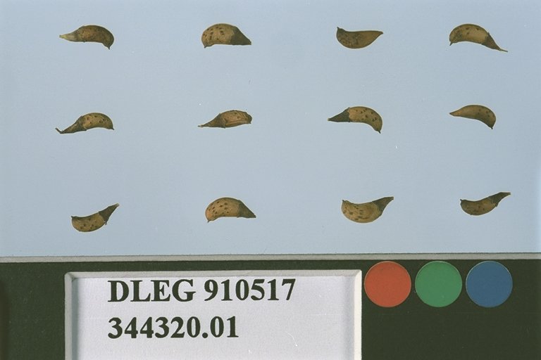 | Historic | 1991 | COLLECTED | 10/30/1991 | Cochise Co., Jct. of Paradise Rd. and Onion Saddle Rd., Chiricahua Mts. 31 54'31"N, 109 15'02"W. Elevation 2000 m. | | | Along stream in conifer forest with Pinus englemannii, P. ponderosa, Pseudotsuga menziesii. | Wild material | Shubby plants 1-4 m tall; once-pinnate green leaves; purple flowers in racemes. M. Johnson 91-103. | 1526825 | DLEG 910517 |
| 27 | DLEG 900274 | DLEG 900274 | Amorpha fruticosa L. | Colorado, United States | | 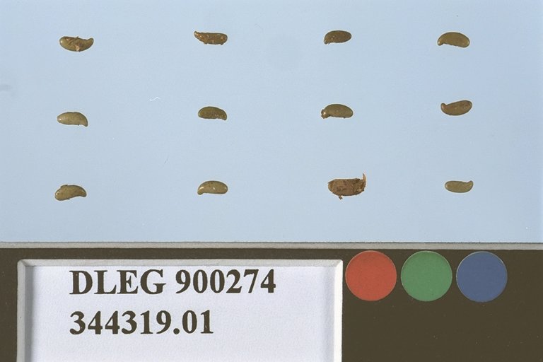 | Historic | 1990 | COLLECTED | | Denver Botanic Gardens. | | | | Cultivated material | Shubby plants 1-4 m tall; once-pinnate green leaves; purple flowers in racemes. Received from Jim Borland. | 1526982 | DLEG 900274 |
| 28 | NA 88590 | 2024RM-003 | Ilex verticillata (L.) A. Gray | Florida, United States | NA | | | 2024 | COLLECTED | 11/21/2024 | Along the west/north side of the Yellow River about 0.33 kilometers (as the crow flies) upstream from the channel that leads the Fisher Old Mill Road Boat Ramp. This site was accessed by boat. | 30.62868600, -86.80748000 | 4 | Plants are found growing primarily in permanently saturated to submersed conditions along the edge of the Yellow River in part shade. The riverine habitat is comprised of a wide array of deciduous and evergreen trees, shrubs, and perennial plant species. Most of the plants along the river are adapted to acidic conditions and, while the aquatic habitat is generally fresh water, there is occasionally tidal or hurricane-caused saltwater intrusions. Slope: 0 percent. Aspect: East-southeast. The underlying geology of this area is characterized as Alluvium from undifferentiated Quaternary Sediments. Much of Florida's surface is covered by a varying thickness of undifferentiated sediments consisting of siliciclastics, organics and freshwater carbonates. Where these sediments exceed 20 feet (6.1 meters) thick, they were mapped as discrete units. To subdivide the undifferentiated sediments, those sediments occurring in flood plains were mapped as alluvial and flood plain deposits (Qal). Sediments showing surficial expression of beach ridges and dunes were mapped separately (Qbd) as were the sediments composing Trail Ridge (Qtr). Terrace sands were not mapped (refer to Healy [1975] for a discussion of the terraces in Florida). The subdivisions of the Undifferentiated Quaternary Sediments (Qu) are not lithostratigraphic units but are utilized to facilitate a better understanding of the State's geology. The siliciclastics are light gray, tan, brown to black, unconsolidated to poorly consolidated, clean to clayey, silty, unfossiliferous, variably organic-bearing sands to blue green to olive green, poorly to moderately consolidated, sandy, silty clays. Gravel is occasionally present in the panhandle. Organics occur as plant debris, roots, disseminated organic matrix and beds of peat. Freshwater carbonates, often referred to as marls in the literature, are scattered over much of the State. In southern Florida, freshwater carbonates are nearly ubiquitous in the Everglades. These sediments are buff colored to tan, unconsolidated to poorly consolidated, fossiliferous carbonate muds. Sand, silt and clay may be present in limited quantities. These carbonates often contain organics. The dominant fossils in the freshwater carbonates are mollusks. (Source: USGS Florida Geologic Map Data). The soils of this are characterized as Bibb-Kinston Series association. The Bibb Series consists of very deep, poorly drained, moderately permeable soils on flood plains of streams in the Southern Coastal Plain (133A) Major Land Resource Area. They formed in stratified loamy and sandy alluvium that are commonly and frequently flooded and water runs off the surface very slowly. Slopes range from 0 to 2 percent. Reaction ranges from extremely acid to strongly acid throughout. Content of mica flakes ranges from none to common. Content of rounded gravel typically ranges from 0 to 10 percent throughout, but may range to 50 percent in thin strata below a depth of 1 meter. Buried soil horizons, present in many pedons have the same range in color and texture as the surface horizon which has iron and organic matter concentrations in shades of brown and yellow ranging from none to common. Texture is sand, loamy sand, loamy fine sand, fine sandy loam, sandy loam, loam or silt loam. The Kinston Series consists of very deep, poorly drained, moderately permeable soils found on flood plains. They were formed in alluvial depositions. Slopes range from 0 to 2 percent. Soil reaction ranges from strongly acid to very strongly acid. Typical texture across the pedons is loamy, gravelly loam, sandy loam, and clay loam with dark concretions often present. (Source: California Soil Resource Lab/NRCS Official Soil Series Descriptions). | Wild material | | 2169927 | NA 88590 |
| 29 | NA 88591 | 2024RM-004 | Ilex opaca Aiton | Florida, United States | NA | | | 2024 | COLLECTED | 11/21/2024 | Along the west/north side of the Yellow River about 5.5 kilometers upstream from the State Highway 87 boat ramp. This site was accessed by boat. | 30.59986000, -86.87936000 | 2 | Plants are found growing primarily in permanently saturated to submersed conditions along the edge of the Yellow River in part shade. The riverine habitat is comprised of a wide array of deciduous and evergreen trees, shrubs, and perennial plant species. Most of the plants along the river are adapted to acidic conditions and, while the aquatic habitat is generally fresh water, there is occasionally tidal or hurricane-caused saltwater intrusions. Slope: 0 percent. Aspect: East-southeast. The underlying geology of this area is characterized as Alluvium from undifferentiated Quaternary Sediments. Much of Florida's surface is covered by a varying thickness of undifferentiated sediments consisting of siliciclastics, organics and freshwater carbonates. Where these sediments exceed 20 feet (6.1 meters) thick, they were mapped as discrete units. To subdivide the undifferentiated sediments, those sediments occurring in flood plains were mapped as alluvial and flood plain deposits (Qal). Sediments showing surficial expression of beach ridges and dunes were mapped separately (Qbd) as were the sediments composing Trail Ridge (Qtr). Terrace sands were not mapped (refer to Healy [1975] for a discussion of the terraces in Florida). The subdivisions of the Undifferentiated Quaternary Sediments (Qu) are not lithostratigraphic units but are utilized to facilitate a better understanding of the State's geology. The siliciclastics are light gray, tan, brown to black, unconsolidated to poorly consolidated, clean to clayey, silty, unfossiliferous, variably organic-bearing sands to blue green to olive green, poorly to moderately consolidated, sandy, silty clays. Gravel is occasionally present in the panhandle. Organics occur as plant debris, roots, disseminated organic matrix and beds of peat. Freshwater carbonates, often referred to as marls in the literature, are scattered over much of the State. In southern Florida, freshwater carbonates are nearly ubiquitous in the Everglades. These sediments are buff colored to tan, unconsolidated to poorly consolidated, fossiliferous carbonate muds. Sand, silt and clay may be present in limited quantities. These carbonates often contain organics. The dominant fossils in the freshwater carbonates are mollusks. (Source: USGS Florida Geologic Map Data). The soils of this are characterized as Bibb-Kinston Series association. The Bibb Series consists of very deep, poorly drained, moderately permeable soils on flood plains of streams in the Southern Coastal Plain (133A) Major Land Resource Area. They formed in stratified loamy and sandy alluvium that are commonly and frequently flooded and water runs off the surface very slowly. Slopes range from 0 to 2 percent. Reaction ranges from extremely acid to strongly acid throughout. Content of mica flakes ranges from none to common. Content of rounded gravel typically ranges from 0 to 10 percent throughout, but may range to 50 percent in thin strata below a depth of 1 meter. Buried soil horizons, present in many pedons have the same range in color and texture as the surface horizon which has iron and organic matter concentrations in shades of brown and yellow ranging from none to common. Texture is sand, loamy sand, loamy fine sand, fine sandy loam, sandy loam, loam or silt loam. The Kinston Series consists of very deep, poorly drained, moderately permeable soils found on flood plains. They were formed in alluvial depositions. Slopes range from 0 to 2 percent. Soil reaction ranges from strongly acid to very strongly acid. Typical texture across the pedons is loamy, gravelly loam, sandy loam, and clay loam with dark concretions often present. (Source: California Soil Resource Lab/NRCS Official Soil Series Descriptions). | Wild material | | 2169928 | NA 88591 |
| 30 | NA 88592 | 2024RM-005 | Ilex sp. | Florida, United States | NA | | | 2024 | COLLECTED | 11/21/2024 | Along the west/north side of the Yellow River about 1.1 kilometers upstream from the State Highway 87 boat ramp. This site was accessed by boat. | 30.57956000, -86.91916400 | 1 | Plants are found growing primarily in permanently saturated to submersed conditions along the edge of the Yellow River in part shade. The riverine habitat is comprised of a wide array of deciduous and evergreen trees, shrubs, and perennial plant species. Most of the plants along the river are adapted to acidic conditions and, while the aquatic habitat is generally fresh water, there is occasionally tidal or hurricane-caused saltwater intrusions. Slope: 0 percent. Aspect: North. The underlying geology of this area is characterized as Alluvium from undifferentiated Quaternary Sediments. Much of Florida's surface is covered by a varying thickness of undifferentiated sediments consisting of siliciclastics, organics and freshwater carbonates. Where these sediments exceed 20 feet (6.1 meters) thick, they were mapped as discrete units. To subdivide the undifferentiated sediments, those sediments occurring in flood plains were mapped as alluvial and flood plain deposits (Qal). Sediments showing surficial expression of beach ridges and dunes were mapped separately (Qbd) as were the sediments composing Trail Ridge (Qtr). Terrace sands were not mapped (refer to Healy [1975] for a discussion of the terraces in Florida). The subdivisions of the Undifferentiated Quaternary Sediments (Qu) are not lithostratigraphic units but are utilized to facilitate a better understanding of the State's geology. The siliciclastics are light gray, tan, brown to black, unconsolidated to poorly consolidated, clean to clayey, silty, unfossiliferous, variably organic-bearing sands to blue green to olive green, poorly to moderately consolidated, sandy, silty clays. Gravel is occasionally present in the panhandle. Organics occur as plant debris, roots, disseminated organic matrix and beds of peat. Freshwater carbonates, often referred to as marls in the literature, are scattered over much of the State. In southern Florida, freshwater carbonates are nearly ubiquitous in the Everglades. These sediments are buff colored to tan, unconsolidated to poorly consolidated, fossiliferous carbonate muds. Sand, silt and clay may be present in limited quantities. These carbonates often contain organics. The dominant fossils in the freshwater carbonates are mollusks. (Source: USGS Florida Geologic Map Data). The soils of this are characterized as Bibb-Kinston Series association. The Bibb Series consists of very deep, poorly drained, moderately permeable soils on flood plains of streams in the Southern Coastal Plain (133A) Major Land Resource Area. They formed in stratified loamy and sandy alluvium that are commonly and frequently flooded and water runs off the surface very slowly. Slopes range from 0 to 2 percent. Reaction ranges from extremely acid to strongly acid throughout. Content of mica flakes ranges from none to common. Content of rounded gravel typically ranges from 0 to 10 percent throughout, but may range to 50 percent in thin strata below a depth of 1 meter. Buried soil horizons, present in many pedons have the same range in color and texture as the surface horizon which has iron and organic matter concentrations in shades of brown and yellow ranging from none to common. Texture is sand, loamy sand, loamy fine sand, fine sandy loam, sandy loam, loam or silt loam. The Kinston Series consists of very deep, poorly drained, moderately permeable soils found on flood plains. They were formed in alluvial depositions. Slopes range from 0 to 2 percent. Soil reaction ranges from strongly acid to very strongly acid. Typical texture across the pedons is loamy, gravelly loam, sandy loam, and clay loam with dark concretions often present. (Source: California Soil Resource Lab/NRCS Official Soil Series Descriptions). | Wild material | | 2169929 | NA 88592 |
| 31 | NA 89081 | 2024RJLPA-009 | Rosa carolina L. | Pennsylvania, United States | NA | | | 2024 | COLLECTED | 09/22/2024 | Lancaster and York Counties: outcrops along the Susquehanna River, accessed from the Historic Lock 12 parking lot off of Pennsylvania Road 372. | 39.81483500, -76.32762200 | 34 | Plants are growing from part-sun to full sun in crevices of the outcrops and where organic debris has accumulated in between boulders along the Susquehanna River. The sites range from nearly xeric to dry mesic, at least on the surface. Plants are generally growing 4-10 m above the normal flow of the river; however, the Holtwood Dam is less than 1 kilometer upstream and debris found trapped in the boulders indicates that there is periodic flooding, at least, in the lower zone of 4+ meters or so above normal river flow. This habitat has a diverse assemblage of deciduous trees and shrubs as well as abundant herbaceous taxa. Slope: 0 to 60 percent. Aspect: Northeast (generally). Geology: The underlying geology of this area is probably of lower Paleozoic age and characterized as the Octoraro Formation. It includes albite-chlorite schist, phyllite, some hornblende gneiss, and granitized members. Soils: The area where this species occurs is right on the edge of two soil zones that transition from the river’s edge to mesic conditions upslope. The first is generally referred to as Rock Outcrop. This terrestrial matrix in which plants grow is largely exposed underlying rock geology with accumulated outwash, rock decomposition, and organic debris buildup. The second is Mt. Airy (80%) and Manor (20%) Series soils, 25 to 60 percent slopes, extremely stony (MRF). (Source: California Soil Resource Lab/NRCS Official Soil Series Descriptions). EPA Ecoregion (Level III): Northern Piedmont (64). EPA Ecoregion (Level IV): Piedmont Uplands (64c). | Wild material | | 2169045 | NA 89081 |
| 32 | NA 89083 | 2024RJLPA-012 | Rhododendron periclymenoides (Michx.) Shinners | Pennsylvania, United States | NA | | | 2024 | COLLECTED | 09/22/2024 | Outcrops along the Susquehanna River, accessed from the Historic Lock 12 parking lot off of Pennsylvania Road 372. | 39.81477400, -76.32807300 | 35 | Plants are growing from shade to part-sun and occasionally full sun in crevices of the outcrops and where organic debris has accumulated in between boulders along the Susquehanna River. The sites range from nearly xeric to mesic, at least on the surface. Plants are generally growing 4-10 m above the normal flow of the river; however, the Holtwood Dam is less than 1 kilometer upstream and debris found trapped in the boulders indicates that there is periodic flooding, at least, in the lower zone of 4+ meters or so above normal river flow. This habitat has a diverse assemblage of deciduous trees and shrubs as well as abundant herbaceous taxa. Slope: 0 to 60 percent. Aspect: Northeast (generally). Geology: The underlying geology of this area is probably of lower Paleozoic age and characterized as the Octoraro Formation. It includes albite-chlorite schist, phyllite, some hornblende gneiss, and granitized members. Soils: The area where this species occurs is right on the edge of two soil zones that transition from the river’s edge to mesic conditions upslope. The first is generally referred to as Rock Outcrop. This terrestrial matrix in which plants grow is largely exposed underlying rock geology with accumulated outwash, rock decomposition, and organic debris buildup. The second is Mt. Airy (80%) and Manor (20%) Series soils, 25 to 60 percent slopes, extremely stony (MRF). (Source: California Soil Resource Lab/NRCS Official Soil Series Descriptions). EPA Ecoregion (Level III): Northern Piedmont (64). EPA Ecoregion (Level IV): Piedmont Uplands (64c). | Wild material | | 2169047 | NA 89083 |
| 33 | NA 89084 | 2024RJLPA-013 | Physocarpus opulifolius (L.) Maxim. | Pennsylvania, United States | NA | | | 2024 | COLLECTED | 09/22/2024 | Outcrops along the Susquehanna River, accessed from the Historic Lock 12 parking lot off of Pennsylvania Road 372. | 39.81466300, -76.32833900 | 36 | Plants are growing from shade to part-sun where organic debris has accumulated in between boulders as well as further upslope in deeper mesic soils along the Susquehanna River. This habitat has a diverse assemblage of deciduous trees and shrubs as well as abundant herbaceous taxa. Slope: 10 to 25 percent. Aspect: Northeast (generally). Geology: The underlying geology of this area is probably of lower Paleozoic age and characterized as the Octoraro Formation. It includes albite-chlorite schist, phyllite, some hornblende gneiss, and granitized members. Soils: The area where this species occurs is right on the edge of two soil zones that transition from the river’s edge to mesic conditions upslope. The first is generally referred to as Rock Outcrop. This terrestrial matrix in which plants grow is largely exposed underlying rock geology with accumulated outwash, rock decomposition, and organic debris buildup. The second is Mt. Airy (80%) and Manor (20%) Series soils, 25 to 60 percent slopes, extremely stony (MRF). (Source: California Soil Resource Lab/NRCS Official Soil Series Descriptions). EPA Ecoregion (Level III): Northern Piedmont (64). EPA Ecoregion (Level IV): Piedmont Uplands (64c). | Wild material | | 2169048 | NA 89084 |
| 34 | NA 89085 | 2024RJLPA-014 | Rhododendron arborescens (Pursh) Torr. | Pennsylvania, United States | NA | | | 2024 | COLLECTED | 09/22/2024 | Outcrops along the Susquehanna River, accessed from the Historic Lock 12 parking lot off of Pennsylvania Road 372. | 39.81618100, -76.33069800 | 38 | Plants are growing from shade to part-sun and occasionally full sun in crevices of the outcrops and where organic debris has accumulated in between boulders along the Susquehanna River. The sites range from nearly xeric to mesic, at least on the surface. Plants are generally growing 4-10 m above the normal flow of the river; however, the Holtwood Dam is less than 1 kilometer upstream and debris found trapped in the boulders indicates that there is periodic flooding, at least, in the lower zone of 4+ meters or so above normal river flow. This habitat has a diverse assemblage of deciduous trees and shrubs as well as abundant herbaceous taxa. Slope: 0 to 75 percent. Aspect: Northeast (generally). Geology: The underlying geology of this area is probably of lower Paleozoic age and characterized as the Octoraro Formation. It includes albite-chlorite schist, phyllite, some hornblende gneiss, and granitized members. Soils: The area where this species occurs is right on the edge of two soil zones that transition from the river’s edge to mesic conditions upslope. The first is generally referred to as Rock Outcrop. This terrestrial matrix in which plants grow is largely exposed underlying rock geology with accumulated outwash, rock decomposition, and organic debris buildup. The second is Mt. Airy (80%) and Manor (20%) Series soils, 25 to 60 percent slopes, extremely stony (MRF). (Source: California Soil Resource Lab/NRCS Official Soil Series Descriptions). EPA Ecoregion (Level III): Northern Piedmont (64). EPA Ecoregion (Level IV): Piedmont Uplands (64c). | Wild material | | 2169049 | NA 89085 |
| 35 | NA 88843 | RJL-RM2023FLAL-017 | Rhododendron austrinum (Small) Rehder | Florida, United States | NA | | | 2023 | COLLECTED | 12/11/2023 | Holmes Creek at Live Oak Landing: plants found on the low bluff along the south side of Holmes Creek accessed by foot from a parking lot on Live Oak Landing Road that dead ends into the creek. | 30.59043500, -85.83899800 | 7 | Plants are growing in part shade to shade on the top and slope of the low bluff overlooking Holmes Creek in a mixed deciduous and evergreen forest. The dry mesic habitat has relatively low competition and is quite acidic. Slope: 0 to 45 percent. Aspect: Northwest. The underlying geology of this area is classified as Alluvium, of Pleistocene/Holocene origin and consists of undifferentiated Quaternary sediments of varying thickness including siliciclastics, organics and freshwater carbonates. The siliciclastics are light gray, tan, brown to black, unconsolidated to poorly consolidated, clean to clayey, silty, unfossiliferous, variably organic-bearing sands to blue green to olive green, poorly to moderately consolidated, sandy, silty clays. Organics occur as plant debris, roots, disseminated organic matrix and beds of peat. Freshwater carbonates, often referred to as marls in the literature, are scattered. (Source: USGS Florida Geologic Map Data.) The surface soil profile of this area is primarily Nankin-Cowarts-Lakeland Complex. The Nankin Series consists of very deep, well drained, moderately slowly permeable soils on uplands of the Coastal Plain. They formed in stratified loamy and clayey marine sediments. Slopes range from 0 to 60 percent. Soils are comprised of sandy loam in the upper 25 cm to sandy clay loam and sandy clay in lower strata to about 1.7 meters deep; these soils are strongly acid. The Cowarts Series consists of very deep, moderately well and well drained soils on ridge tops and side slopes on uplands of the Coastal Plain Major Land Resource Area. They formed in loamy marine sediments. Slopes range from 1 to 60 percent. The Lakeland series consists of very deep, excessively drained, rapid to very rapidly permeable soils on uplands. They formed in thick beds of eolian or marine and/or fluvio-marine sands. Thickness of the sand exceeds 2 meters. Silt plus clay in the upper meter ranges from 5-10 percent. Reaction ranges from very strongly acid to moderately acid throughout. (Source: NRCS Web Soil Survey.) | Wild material | | 2165673 | NA 88843 |
| 36 | NA 88658 | TJK2023FL-012 | Ilex verticillata (L.) A. Gray | Florida, United States | NA | | | 2023 | COLLECTED | 09/10/2023 | Lower Yellow River. | 30.62868600, -86.80748000 | 3 | Beautiful riverine system. Elevation: 13 feet. Slope: 0 (none). Aspect: Northwest. | Wild material | | 2158792 | NA 88658 |
| 37 | NA 88659 | TJK2023FL-013 | Ilex sp. | Florida, United States | NA | | | 2023 | COLLECTED | 09/15/2023 | Lower Yellow River. | 30.58170000, -86.91770000 | 1 | Elevation: 3 feet. Slope: 0 percent. Aspect: North. | Wild material | | 2158793 | NA 88659 |
| 38 | NA 88558 | RJLSEUS2022-031 | Ilex decidua Walter | Alabama, United States | NA | | | 2023 | COLLECTED | 12/12/2022 | Silver Creek Lake Campground off of Silver Creek Lake Road: Silver Creek Lake, at the edge of the campground. | 31.66344600, -87.57108400 | 16 | Part shade to sun along the eroding banks of Silver Creek Lake in moist-mesic, mixed deciduous and evergreen woodland, 2-3 meters above the water. The underlying geology of this area is Claiborne Group, Tallahatta Formation, of Eocene origin, with white to very light-greenish-gray thin-bedded to massive siliceous claystone; interbedded with thin layers of fossiliferous clay, sandy clay, and glauconitic sand and sandstone. (Source: USGS Alabama Geological Map Data). The primary soil types in the collection area are classified as Riverview Fine Sandy Loam soils (0 to 2 percent slopes, occasionally flooded). The Riverview Series consists of very deep, well drained, moderately permeable soils that formed in loamy alluvium on flood plains. Slopes range from 0 to 5 percent. Riverview soils fare on high parts of flood plains of rivers and streams draining the Coastal Plain and Southern Piedmont. Runoff is slow. Permeability is moderate. These soils flood for short periods mostly in winter or early spring months. (Source: NRCS Web Soil Survey). | Wild material | | 2140819 | NA 88558 |
| 39 | NA 88569 | RJLSEUS2022-042 | Ilex hybr. | Florida, United States | NA | | | 2023 | COLLECTED | 12/15/2022 | Yellow River: this plant is growing on the edge of the Yellow River and accessed by boat. This collection located approximately 0.4 kilometers north of the Yellow River Boat Ramp on the east side of Florida State Hwy 87. | 30.57317600, -86.92367500 | 1 | This plant was found growing in full sun in permanently saturated to submersed conditions along the edge of the Yellow River, growing in an open river edge with no overstory. Like most of the plants along the river, this collection is adapted to acidic conditions and while the aquatic habitats are generally fresh water, there can occasionally be tidal or hurricane-caused saltwater intrusions. The underlying geology of this area is classified as Alluvium, of Pleistocene/Holocene origin and consists of undifferentiated Quaternary sediments of varying thickness including siliciclastics, organics and freshwater carbonates. The siliciclastics are light gray, tan, brown to black, unconsolidated to poorly consolidated, clean to clayey, silty, unfossiliferous, variably organic-bearing sands to blue green to olive green, poorly to moderately consolidated, sandy, silty clays. Organics occur as plant debris, roots, disseminated organic matrix and beds of peat. Freshwater carbonates, often referred to as marls in the literature, are scattered. (Source: USGS Florida Geologic Map Data). The surface soil profile of this area is primarily Bibb-Kinston Series Association. Bibb Series soils are coarse-loamy, sandy, acid soils that are poorly drained. They are soils of flood plains and streams subject to frequent flooding. These are found in association with Kinston Series soils that are fine-loamy, sandy, acid soils of flood plains and stream subject to frequent flooding. The Bibb-Kinston association ranges from 1-1.5 meters thick and is strongly acid. (Source: Soil Survey of Santa Rosa County and NRCS Web Soil Survey). | Wild material | Ilex putative natural hybrid (I. myrtifolia x I. opaca) | 2140823 | NA 88569 |
| 40 | NA 88570 | RJLSEUS2022-043 | Ilex myrtifolia Walter | Florida, United States | NA | | | 2023 | COLLECTED | 12/15/2022 | Yellow River: plants are growing along a several mile stretch of the Yellow River and accessed by boat via the Yellow River Boat Ramp on the east side of Florida State Hwy 87. | 30.58148800, -86.91121900 | 1 | Plants are typically found growing in full sun to part shade in permanently saturated to submersed conditions along the edge of the Yellow River, growing in association with a wide array of deciduous and evergreen trees, shrubs and perennial plant species. Most of the plants along the river are adapted to acidic conditions and, while the aquatic habitats are generally fresh water, there is occasionally tidal or hurricane-caused saltwater intrusions. The underlying geology of this area is classified as Alluvium, of Pleistocene/Holocene origin and consists of undifferentiated Quaternary sediments of varying thickness including siliciclastics, organics and freshwater carbonates. The siliciclastics are light gray, tan, brown to black, unconsolidated to poorly consolidated, clean to clayey, silty, unfossiliferous, variably organic-bearing sands to blue green to olive green, poorly to moderately consolidated, sandy, silty clays. Organics occur as plant debris, roots, disseminated organic matrix and beds of peat. Freshwater carbonates, often referred to as marls in the literature, are scattered. (Source: USGS Florida Geologic Map Data). The surface soil profile of this area is primarily Bibb-Kinston Series association. Bibb Series soils are coarse-loamy, sandy, acid soils that are poorly drained. They are soils of flood plains and streams subject to frequent flooding. These are found in association with Kinston Series soils that are fine-loamy, sandy, acid soils of flood plains and stream subject to frequent flooding. The Bibb-Kinston association ranges from 1-1.5 meters thick and is strongly acid. (Source: Soil Survey of Santa Rosa County and NRCS Web Soil Survey). | Wild material | | 2140824 | NA 88570 |
| 41 | NA 88571 | RJLSEUS2022-044 | Itea virginica L. | Florida, United States | NA | | | 2023 | COLLECTED | 12/15/2022 | Plants are growing along a several mile stretch of the Yellow River and accessed by boat via the Yellow River Boat Ramp on the east side of Florida State Hwy 87. The species is common along several miles of the Yellow River. | 30.55805600, -86.93544500 | 1 | Plants are typically found growing in part-shade to sun in permanently saturated to submersed conditions along the edge of the Yellow River, growing in association with a wide array of deciduous and evergreen trees, shrubs and perennial plant species. Most of the plants along the river are adapted to acidic conditions and, while the aquatic habitats are generally fresh water, there is occasionally tidal or hurricane-caused saltwater intrusions.
Soils: The underlying geology of this area is classified as Alluvium, of Pleistocene/Holocene origin and consists of undifferentiated Quaternary sediments of varying thickness including siliciclastics, organics and freshwater carbonates. The siliciclastics are light gray, tan, brown to black, unconsolidated to poorly consolidated, clean to clayey, silty, unfossiliferous, variably organic-bearing sands to blue green to olive green, poorly to moderately consolidated, sandy, silty clays. Organics occur as plant debris, roots, disseminated organic matrix and beds of peat. Freshwater carbonates, often referred to as marls in the literature, are scattered.
Source: USGS Florida Geologic Map Data (https://mrdata.usgs.gov/geology/state/state.php?state=fl)
The surface soil profile of this area is primarily Bibb-Kinston Series association. Bibb Series soils are coarse-loamy, sandy, acid soils that are poorly drained. They are soils of flood plains and streams subject to frequent flooding. These are found in association with Kinston Series soils that are fine-loamy, sandy, acid soils of flood plains and stream subject to frequent flooding. The Bibb-Kinston Association ranges from 1-1.5 meters thick and is strongly acid.
Source: Soil Survey of Santa Rosa County and NRCS Web Soil Survey (https://www.nrcs.usda.gov/Internet/FSE_MANUSCRIPTS/florida/FL113/0/SantaRosa.pdf and https://websoilsurvey.sc.egov.usda.gov/App/WebSoilSurvey.aspx) | Wild material | | 2140791 | NA 88571 |
| 42 | NA 88572 | RJLSEUS2022-045 | Ilex verticillata (L.) A. Gray | Florida, United States | NA | | | 2023 | COLLECTED | 12/15/2022 | Yellow River: plants are growing along a several mile stretch of the Yellow River and accessed by boat via the Yellow River Boat Ramp on the east side of Florida State Hwy 87. | 30.57947400, -86.91906100 | 1 | Plants are typically found growing in full sun to part shade in permanently saturated to submersed conditions along the edge of the Yellow River, growing in association with a wide array of deciduous and evergreen trees, shrubs and perennial plant species. Most of the plants along the river are adapted to acidic conditions and, while the aquatic habitats are generally fresh water, there is occasionally tidal or hurricane-caused saltwater intrusions. The underlying geology of this area is classified as Alluvium, of Pleistocene/Holocene origin and consists of undifferentiated Quaternary sediments of varying thickness including siliciclastics, organics and freshwater carbonates. The siliciclastics are light gray, tan, brown to black, unconsolidated to poorly consolidated, clean to clayey, silty, unfossiliferous, variably organic-bearing sands to blue green to olive green, poorly to moderately consolidated, sandy, silty clays. Organics occur as plant debris, roots, disseminated organic matrix and beds of peat. Freshwater carbonates, often referred to as marls in the literature, are scattered. (Source: USGS Florida Geologic Map Data). The surface soil profile of this area is primarily Bibb-Kinston Series association. Bibb Series soils are coarse-loamy, sandy, acid soils that are poorly drained. They are soils of flood plains and streams subject to frequent flooding. These are found in association with Kinston Series soils that are fine-loamy, sandy, acid soils of flood plains and stream subject to frequent flooding. The Bibb-Kinston association ranges from 1-1.5 meters thick and is strongly acid. (Source: Soil Survey of Santa Rosa County and NRCS Web Soil Survey). | Wild material | | 2140825 | NA 88572 |
| 43 | NA 88573 | RJLSEUS2022-046 | Ilex myrtifolia Walter | Florida, United States | NA | | | 2023 | COLLECTED | 12/15/2022 | Yellow River: this plant is growing on the edge of the Yellow River and accessed by boat. This collection is located approximately 3.2 kilometers by boat north and east of the Yellow River Boat Ramp on the east side of Florida State Hwy 87. | 30.58188200, -86.91220500 | 1 | This plant is growing in full sun in permanently saturated conditions along the edge of the Yellow River, growing in association with a wide array of deciduous and evergreen trees, shrubs and perennial plant species. Most of the plants along the river are adapted to acidic conditions and, while the aquatic habitats are generally fresh water, there is occasionally tidal or hurricane-caused saltwater intrusions. The underlying geology of this area is classified as Alluvium, of Pleistocene/Holocene origin and consists of undifferentiated Quaternary sediments of varying thickness including siliciclastics, organics and freshwater carbonates. The siliciclastics are light gray, tan, brown to black, unconsolidated to poorly consolidated, clean to clayey, silty, unfossiliferous, variably organic-bearing sands to blue green to olive green, poorly to moderately consolidated, sandy, silty clays. Organics occur as plant debris, roots, disseminated organic matrix and beds of peat. Freshwater carbonates, often referred to as marls in the literature, are scattered. (Source: USGS Florida Geologic Map Data). The surface soil profile of this area is primarily Bibb-Kinston Series Association. Bibb Series soils are coarse-loamy, sandy, acid soils that are poorly drained. They are soils of flood plains and streams subject to frequent flooding. These are found in association with Kinston Series soils that are fine-loamy, sandy, acid soils of flood plains and stream subject to frequent flooding. The Bibb-Kinston Association ranges from 1-1.5 meters thick and is strongly acid. (Source: Soil Survey of Santa Rosa County and NRCS Web Soil Survey). | Wild material | orange-fruited form | 2140826 | NA 88573 |
| 44 | Ames 36026 | RJL2022FLAL-007 | Fraxinus caroliniana Mill. | Florida, United States | NC7 |  | | 2022 | COLLECTED | 07/28/2022 | Growing along the Yellow River and reached by boat. | 30.58025000, -86.91052800 | 1 | Trees are typically found growing in full sun in permanently saturated to submersed conditions along the edge of the Yellow River, growing in association with a wide array of deciduous and evergreen trees, shrubs and perennial plant species. This species requires acidic conditions. While the aquatic habitats are generally fresh water, there is occasionally tidal or hurricane-caused saltwater intrusions. The underlying geology of this area is classified as Alluvium, of Pleistocene/Holocene origin and consists of undifferentiated Quaternary sediments of varying thickness including siliciclastics, organics and freshwater carbonates. The siliciclastics are light gray, tan, brown to black, unconsolidated to poorly consolidated, clean to clayey, silty, unfossiliferous, variably organic-bearing sands to blue green to olive green, poorly to moderately consolidated, sandy, silty clays. Organics occur as plant debris, roots, disseminated organic matrix and beds of peat. Freshwater carbonates, often referred to as marls in the literature, are scattered. | Wild material | | 2138696 | Ames 36026 |
| 45 | WLP 2584 | RJL2022FLAL-005 | Styrax americanus Lam. | Florida, United States | NA | | | 2022 | COLLECTED | 07/28/2022 | Growing along the Yellow River and reached by boat. | 30.57944000, -86.91689800 | 1 | Plants are typically found growing in shade to full sun in permanently saturated to submersed conditions along the edge of the Yellow River, growing in association with a wide array of deciduous and evergreen trees, shrubs and perennial plant species. Most of the plants along the river are adapted to acidic conditions and while the aquatic habitats are generally fresh water, there is occasionally tidal or hurricane-caused saltwater intrusions. The underlying geology of this area is classified as Alluvium, of Pleistocene/Holocene origin and consists of undifferentiated Quaternary sediments of varying thickness including siliciclastics, organics and freshwater carbonates. The siliciclastics are light gray, tan, brown to black, unconsolidated to poorly consolidated, clean to clayey, silty, unfossiliferous, variably organic-bearing sands to blue green to olive green, poorly to moderately consolidated, sandy, silty clays. Organics occur as plant debris, roots, disseminated organic matrix and beds of peat. Freshwater carbonates, often referred to as marls in the literature, are scattered. | Wild material | | 2138694 | WLP 2584 |
| 46 | WLP 2585 | RJL2022FLAL-006 | Nyssa biflora Walter | Florida, United States | NA | | | 2022 | COLLECTED | 07/28/2022 | Growing along the Yellow River and reached by boat. | 30.58013800, -86.91556800 | 1 | Trees are typically found growing in full sun in permanently saturated to submersed conditions along the edge of the Yellow River, growing in association with a wide array of deciduous and evergreen trees, shrubs and perennial plant species. This species requires acidic conditions. While the aquatic habitats are generally fresh water, there is occasionally tidal or hurricane-caused saltwater intrusions. The underlying geology of this area is classified as Alluvium, of Pleistocene/Holocene origin and consists of undifferentiated Quaternary sediments of varying thickness including siliciclastics, organics and freshwater carbonates. The siliciclastics are light gray, tan, brown to black, unconsolidated to poorly consolidated, clean to clayey, silty, unfossiliferous, variably organic-bearing sands to blue green to olive green, poorly to moderately consolidated, sandy, silty clays. Organics occur as plant debris, roots, disseminated organic matrix and beds of peat. Freshwater carbonates, often referred to as marls in the literature, are scattered. | Wild material | | 2138695 | WLP 2585 |
| 47 | OPGC 5948 | CBG-1911 | Lobelia cardinalis L. | Missouri, United States | OPGC |  | | 2021 | | | | | | | Wild material | | 1908895 | OPGC 5948 |
| 48 | OPGC 7311 | AZ930-363 | Aquilegia chrysantha A. Gray | Arizona, United States | OPGC |  | | 2018 | | | | | | | Wild material | | 1970379 | OPGC 7311 |
| 49 | NA 83897 | PCCKY16-024 | Xanthorhiza simplicissima Marshall | Kentucky, United States | NA | | | 2016 | COLLECTED | 09/27/2016 | Cumberland Falls State Park, Cumberland Falls Visitor Center. Beach north of visitor center outlook trail, boulders north of large sycamore with exposed root flare and hole in trunk base. | 36.84200000, -84.34200000 | 252 | Beach, with boulders. | Wild material | | 1952452 | NA 83897 |
| 50 | W6 49557 | CBG-2512 | Glycyrrhiza lepidota Pursh | South Dakota, United States | W6 |  | | 2015 | | | | | | | Wild material | | 1926030 | W6 49557 |
| 51 | Ames 32801 | JDC/SA/2014/046/548 | Spiraea alba Du Roi | Iowa, United States | NC7 | | | 2014 | COLLECTED | 09/19/2014 | Pike Run Wildlife Management Area located near intersection of Iron City Avenue and 170th Street, T77N R3W NW 1/4 of NW 1/4 of Sec. 9. | 41.49354000, -91.21225800 | 187 | Remanant, wet prairie. Aquolls (0-2 percent slopes) depth to water table: about 0-12 inches, 0-24 inches: variable soil types, very poorly drained; and Intermittent water | Wild material | | 1921812 | Ames 32801 |
| 52 | Ames 32494 | CBG-1973 | Helenium autumnale L. | Missouri, United States | NC7 |  | | 2013 | COLLECTED | 11/09/2011 | | | 145 | Ditch, along railroad. Associated with Amorpha fruticosa, Carex annectens, C. frankii, C. lupulina, Cicuta maculata var. maculata, and Iris virginica. | Wild material | | 1908870 | Ames 32494 |
| 53 | WLP 771 | NA 73814 | Cephalanthus occidentalis L. | Iowa, United States | NA |  | | 2003 | COLLECTED | 10/21/2003 | Chichaqua Wildlife Habitat Park bottoms, Elkhart, T81N R22W, NW 1/4 of NW 1/4, Section 32, Loring Quad, Polk County. | 41.79000000, -93.43972222 | 247 | Edge of oxbow ponds. Sunny. Flat. Alluvial soil. Associated with reed canary grass, Anemone canadensis, Quercus bicolor, Cornus drummondii, and Amorpha fruticosa. | Wild material | Large, well branched shrubs to 2.5 meters tall. | 1649920 | WLP 771 |
| 54 | DLEG 920240 | DLEG 920240 | Lysiloma watsonii Rose | Arizona, United States | | | Historic | 1992 | COLLECTED | 10/01/1992 | Pima Co., Chiminea Creek, ca. 1/8 mi. upstream from Madro o Ranger Station, Saguaro Natl. Monument East, Rincon Mts. | | | Among boulders and rock outcroppings along canyon with Prosopis velutina, Acacia greggii, A. millefolia, Eysenhardtia orthocarpa, Amorpha fruticosa, Celtis reticulata, Platanus wrightii. | Wild material | Locally common with many other legumes. Eysenhardtia to 5 m tall. M. Johnson 92-021. | 1527215 | DLEG 920240 |