| 0 | NA 89081 | 2024RJLPA-009 | Rosa carolina L. | Pennsylvania, United States | NA | | | 2024 | COLLECTED | 09/22/2024 | Lancaster and York Counties: outcrops along the Susquehanna River, accessed from the Historic Lock 12 parking lot off of Pennsylvania Road 372. | 39.81483500, -76.32762200 | 34 | Plants are growing from part-sun to full sun in crevices of the outcrops and where organic debris has accumulated in between boulders along the Susquehanna River. The sites range from nearly xeric to dry mesic, at least on the surface. Plants are generally growing 4-10 m above the normal flow of the river; however, the Holtwood Dam is less than 1 kilometer upstream and debris found trapped in the boulders indicates that there is periodic flooding, at least, in the lower zone of 4+ meters or so above normal river flow. This habitat has a diverse assemblage of deciduous trees and shrubs as well as abundant herbaceous taxa. Slope: 0 to 60 percent. Aspect: Northeast (generally). Geology: The underlying geology of this area is probably of lower Paleozoic age and characterized as the Octoraro Formation. It includes albite-chlorite schist, phyllite, some hornblende gneiss, and granitized members. Soils: The area where this species occurs is right on the edge of two soil zones that transition from the river’s edge to mesic conditions upslope. The first is generally referred to as Rock Outcrop. This terrestrial matrix in which plants grow is largely exposed underlying rock geology with accumulated outwash, rock decomposition, and organic debris buildup. The second is Mt. Airy (80%) and Manor (20%) Series soils, 25 to 60 percent slopes, extremely stony (MRF). (Source: California Soil Resource Lab/NRCS Official Soil Series Descriptions). EPA Ecoregion (Level III): Northern Piedmont (64). EPA Ecoregion (Level IV): Piedmont Uplands (64c). | Wild material | | 2169045 | NA 89081 |
| 1 | NA 89082 | 2024RJLPA-010 | Amorpha fruticosa L. | Pennsylvania, United States | NA | | | 2024 | COLLECTED | 09/22/2024 | Outcrops along the Susquehanna River, accessed from the Historic Lock 12 parking lot off of Pennsylvania Road 372. | 39.81481500, -76.32757900 | 34 | Plants are growing from part-sun to full sun in crevices of the outcrops and where organic debris has accumulated in between boulders along the Susquehanna River. The sites range from nearly xeric to dry mesic, at least on the surface. Plants are generally growing 4-10 m above the normal flow of the river; however, the Holtwood Dam is less than 1 kilometer upstream and debris found trapped in the boulders indicates that there is periodic flooding, at least, in the lower zone of 4+ meters or so above normal river flow. This habitat has a diverse assemblage of deciduous trees and shrubs as well as abundant herbaceous taxa. Slope: 0 to 25 percent. Aspect: Northeast (generally). Geology: The underlying geology of this area is probably of lower Paleozoic age and characterized as the Octoraro Formation. It includes albite-chlorite schist, phyllite, some hornblende gneiss, and granitized members. Soils: The area where this species occurs is right on the edge of two soil zones that transition from the river’s edge to mesic conditions upslope. The first is generally referred to as Rock Outcrop. This terrestrial matrix in which plants grow is largely exposed underlying rock geology with accumulated outwash, rock decomposition, and organic debris buildup. The second is Mt. Airy (80%) and Manor (20%) Series soils, 25 to 60 percent slopes, extremely stony (MRF). (Source: California Soil Resource Lab/NRCS Official Soil Series Descriptions). EPA Ecoregion (Level III): Northern Piedmont (64). EPA Ecoregion (Level IV): Piedmont Uplands (64c). | Wild material | | 2169046 | NA 89082 |
| 2 | NA 89083 | 2024RJLPA-012 | Rhododendron periclymenoides (Michx.) Shinners | Pennsylvania, United States | NA | | | 2024 | COLLECTED | 09/22/2024 | Outcrops along the Susquehanna River, accessed from the Historic Lock 12 parking lot off of Pennsylvania Road 372. | 39.81477400, -76.32807300 | 35 | Plants are growing from shade to part-sun and occasionally full sun in crevices of the outcrops and where organic debris has accumulated in between boulders along the Susquehanna River. The sites range from nearly xeric to mesic, at least on the surface. Plants are generally growing 4-10 m above the normal flow of the river; however, the Holtwood Dam is less than 1 kilometer upstream and debris found trapped in the boulders indicates that there is periodic flooding, at least, in the lower zone of 4+ meters or so above normal river flow. This habitat has a diverse assemblage of deciduous trees and shrubs as well as abundant herbaceous taxa. Slope: 0 to 60 percent. Aspect: Northeast (generally). Geology: The underlying geology of this area is probably of lower Paleozoic age and characterized as the Octoraro Formation. It includes albite-chlorite schist, phyllite, some hornblende gneiss, and granitized members. Soils: The area where this species occurs is right on the edge of two soil zones that transition from the river’s edge to mesic conditions upslope. The first is generally referred to as Rock Outcrop. This terrestrial matrix in which plants grow is largely exposed underlying rock geology with accumulated outwash, rock decomposition, and organic debris buildup. The second is Mt. Airy (80%) and Manor (20%) Series soils, 25 to 60 percent slopes, extremely stony (MRF). (Source: California Soil Resource Lab/NRCS Official Soil Series Descriptions). EPA Ecoregion (Level III): Northern Piedmont (64). EPA Ecoregion (Level IV): Piedmont Uplands (64c). | Wild material | | 2169047 | NA 89083 |
| 3 | NA 89084 | 2024RJLPA-013 | Physocarpus opulifolius (L.) Maxim. | Pennsylvania, United States | NA | | | 2024 | COLLECTED | 09/22/2024 | Outcrops along the Susquehanna River, accessed from the Historic Lock 12 parking lot off of Pennsylvania Road 372. | 39.81466300, -76.32833900 | 36 | Plants are growing from shade to part-sun where organic debris has accumulated in between boulders as well as further upslope in deeper mesic soils along the Susquehanna River. This habitat has a diverse assemblage of deciduous trees and shrubs as well as abundant herbaceous taxa. Slope: 10 to 25 percent. Aspect: Northeast (generally). Geology: The underlying geology of this area is probably of lower Paleozoic age and characterized as the Octoraro Formation. It includes albite-chlorite schist, phyllite, some hornblende gneiss, and granitized members. Soils: The area where this species occurs is right on the edge of two soil zones that transition from the river’s edge to mesic conditions upslope. The first is generally referred to as Rock Outcrop. This terrestrial matrix in which plants grow is largely exposed underlying rock geology with accumulated outwash, rock decomposition, and organic debris buildup. The second is Mt. Airy (80%) and Manor (20%) Series soils, 25 to 60 percent slopes, extremely stony (MRF). (Source: California Soil Resource Lab/NRCS Official Soil Series Descriptions). EPA Ecoregion (Level III): Northern Piedmont (64). EPA Ecoregion (Level IV): Piedmont Uplands (64c). | Wild material | | 2169048 | NA 89084 |
| 4 | NA 89085 | 2024RJLPA-014 | Rhododendron arborescens (Pursh) Torr. | Pennsylvania, United States | NA | | | 2024 | COLLECTED | 09/22/2024 | Outcrops along the Susquehanna River, accessed from the Historic Lock 12 parking lot off of Pennsylvania Road 372. | 39.81618100, -76.33069800 | 38 | Plants are growing from shade to part-sun and occasionally full sun in crevices of the outcrops and where organic debris has accumulated in between boulders along the Susquehanna River. The sites range from nearly xeric to mesic, at least on the surface. Plants are generally growing 4-10 m above the normal flow of the river; however, the Holtwood Dam is less than 1 kilometer upstream and debris found trapped in the boulders indicates that there is periodic flooding, at least, in the lower zone of 4+ meters or so above normal river flow. This habitat has a diverse assemblage of deciduous trees and shrubs as well as abundant herbaceous taxa. Slope: 0 to 75 percent. Aspect: Northeast (generally). Geology: The underlying geology of this area is probably of lower Paleozoic age and characterized as the Octoraro Formation. It includes albite-chlorite schist, phyllite, some hornblende gneiss, and granitized members. Soils: The area where this species occurs is right on the edge of two soil zones that transition from the river’s edge to mesic conditions upslope. The first is generally referred to as Rock Outcrop. This terrestrial matrix in which plants grow is largely exposed underlying rock geology with accumulated outwash, rock decomposition, and organic debris buildup. The second is Mt. Airy (80%) and Manor (20%) Series soils, 25 to 60 percent slopes, extremely stony (MRF). (Source: California Soil Resource Lab/NRCS Official Soil Series Descriptions). EPA Ecoregion (Level III): Northern Piedmont (64). EPA Ecoregion (Level IV): Piedmont Uplands (64c). | Wild material | | 2169049 | NA 89085 |
| 5 | OPGC 7572 | JDC/HX/2019/028/907 | Heuchera alba Rydb. | West Virginia, United States | OPGC |  | | 2019 | COLLECTED | 08/10/2019 | Smoke Hole Region: Powers Hollow. Located approximately 5.2 miles west of Petersburg on the east side of Powers Hollow Road, Grant County | 39.00339500, -79.22036500 | 455 | Exposed rock cliff edges. | Wild material | Heuchera alba is a narrow Appalachian endemic and globally imperiled (G2) taxon recorded only from West Virginia and Virginia that occurs in sympatry with H. pubescens and H. americana. According to Scheutte et al. 2018, the range for H. alba is restricted to high elevation acidic sandstone ridges and outcrops in the Ridge-and-Valley province of West Virginia and Virginia. In cultivation (central Iowa) the leaves emerge with subtle variegation that is lost by early summer. Flowers are creamy white to pale green. | 2096627 | OPGC 7572 |
| 6 | Ames 34606 | JDC/MB/2019/011/890 | Monarda brevis (Fosberg & Artz) Floden | West Virginia, United States | NC7 |  | | 2019 | | | | | | | Wild material | Variation in flower color present from near white, faint pink to faint "smoky" purple. Majority of specimens noted at collection site in nature were approximately 3-5 days past peak flower on 10 June 2019 with seeds reaching maturity approximately 55 days later. Majority of specimens observed were approximately 10" in height. Very healthy, dark-green leaves that maintained quality throughout the season (observed mid-August 2019). Some specimens consisting of 25-30 flowering stems encompassing a 1.5 sq. ft. area. | 2092642 | Ames 34606 |
| 7 | Ames 34608 | JDC/MB/2019/013/892 | Monarda brevis (Fosberg & Artz) Floden | West Virginia, United States | NC7 |  | | 2019 | | | | | | | Wild material | Majority of specimens noted at collection site in nature were approximately 5-7 days past peak flower on 11 June 2019 with seeds reaching maturity approximately 55 days later. Very healthy, dark-green leaves near peak flowering with some minor decline in leaf quality later in the season (observed mid-August 2019). Majority of specimens less than 10" in height. A few specimens with noteable hairs on stems, specifically near soil line. | 2092644 | Ames 34608 |
| 8 | Ames 34609 | JDC/MB/2019/014/893 | Monarda brevis (Fosberg & Artz) Floden | West Virginia, United States | NC7 |  | | 2019 | | | | | | | Wild material | Variation in flower color present from near white, faint pink to faint "smoky" purple. Majority of specimens noted at collection site in nature were approximately 3-5 days past peak flower on 10 June 2019 with seeds reaching maturity approximately 55 days later. Majority of specimens observed were approximately 10" in height. Very healthy, dark-green leaves that maintained quality throughout the season (observed mid-August 2019). | 2092645 | Ames 34609 |
| 9 | Ames 34610 | JDC/MB/2019/015/894 | Monarda brevis (Fosberg & Artz) Floden | West Virginia, United States | NC7 |  | | 2019 | | | | | | | Wild material | Many genets noted at collection site in nature consisted of 25-30 stems, but individual stems are widely spaced (e.g. 1-5") apart compared to other populations (four) noted (2019 reconnaisance) where stem spacing was typically observed at 0.25-0.5" apart. Very healthy, dark-green leaves noted in early/mid June, but leaf quality greatly declined when observed in mid-August in contrast to other populations observed in nature that seemed to maintain leaf quality throughout the season. Many plants at this site were defoliated likely due to disease (leaf spot) or tattered likely due to possible insect feeding. Specimens noted were circa 10-12 days from initiation of flowering on 12 June 2019 and during mid-August a few specimens were still observed flowering with about 10-20% of infructescences were still green. The overall phenology of this M. brevis population at this site is quite different in comparison to other populations (four) observed in 2019, with flowering being much later (e.g. 10-25 days); leaf quality lower; and synchronization of flowering extremely variable within genets of this population. | 2092646 | Ames 34610 |
| 10 | Ames 29866 | 203845 | Ageratina occidentalis (Hook.) R. M. King & H. Rob. | California, United States | NC7 | 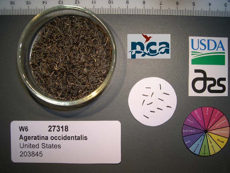 | | 2005 | COLLECTED | 09/11/2003 | | | 2805 | Woodland. Associated with Pinus ponderosa, Populus tremuloides, Artemisia sp., Penstemon rostriflorus, Aquilegia formosa/pubescens hybrid, Eriogonum nudum var. nudum and Monardella odoratissima. | Wild material | Forb 0.6 meters tall. | 1674349 | Ames 29866 |