| 0 | W6 62415 | DAK930-3 | Carex lenticularis Michx. | Alaska, United States | W6 | | | 2025 | | | | | | | Wild material | Likely var limnophila | 2172769 | W6 62415 |
| 1 | W6 62417 | DAK930-5 | Carex mertensii J. D. Prescott ex Bong. | Alaska, United States | W6 | | | 2025 | | | | | | | Wild material | NA | 2172771 | W6 62417 |
| 2 | W6 61268 | OR080-102 | Carex obnupta L. H. Bailey | Oregon, United States | W6 |  | | 2023 | | | | | | | Wild material | Sturdy gramminoid with large 2 inch spikes. Most often with 2 female spikes below 2-4 male spikes. Achenes are very round and firm. | 2142712 | W6 61268 |
| 3 | W6 61274 | OR080-107 | Carex lyngbyei Hornem. | Oregon, United States | W6 |  | | 2023 | | | | | | | Wild material | Graminoid with leaves forming long sheathes. Strong central mid-vein. Two male heads are subtended by three females. | 2142718 | W6 61274 |
| 4 | W6 61358 | CBG- 10772 | Carex cephalophora Muhl. ex Willd. | Wisconsin, United States | W6 |  | | 2023 | | | | | | | Wild material | | 2142240 | W6 61358 |
| 5 | W6 61381 | CBG- 10804 | Carex eburnea Boott | Wisconsin, United States | W6 |  | | 2023 | | | | | | | Wild material | | 2142263 | W6 61381 |
| 6 | W6 60178 | NEWFS-701 | Carex crinita Lam. | Massachusetts, United States | W6 | | | 2021 | | | | | | | Wild material | Sharp pointed perigynia that will prick upon contact in a spike about 24 long, dangling in groups of 15 from stem on long peduncle. | 2138804 | W6 60178 |
| 7 | W6 60180 | NEWFS-703 | Carex scoparia Schkuhr ex Willd. var. scoparia | Massachusetts, United States | W6 | | | 2021 | | | | | | | Wild material | Received as: Carex scoparia var. scoparia. 0.5 inch long small rounded spikelets alterte in a densely packed cluster on stem, sometimes drooping. | 2138806 | W6 60180 |
| 8 | W6 60109 | NEWFS-338 | Carex lurida Wahlenb. | Rhode Island, United States | W6 | | | 2021 | | | | | | | Wild material | | 2137194 | W6 60109 |
| 9 | W6 60155 | NEWFS-656 | Carex annectens (E. P. Bicknell) E. P. Bicknell | Rhode Island, United States | W6 | | | 2021 | | | | | | | Wild material | | 2137240 | W6 60155 |
| 10 | W6 60171 | NEWFS-693 | Carex lurida Wahlenb. | Rhode Island, United States | W6 | | | 2021 | | | | | | | Wild material | 12 spikes with inflated perigynia pointed straight outward 15 spikes per stem. | 2137256 | W6 60171 |
| 11 | W6 60172 | NEWFS-694 | Carex intumescens Rudge | Rhode Island, United States | W6 | | | 2021 | | | | | | | Wild material | 0 5 1â rounded spikes with inflated perigynia pointed straight outward in radial pattern very large prominent inflated perigynia | 2137257 | W6 60172 |
| 12 | W6 59935 | CBG-10658 | Carex bebbii (L. H. Bailey) Olney ex Fernald | Illinois, United States | W6 |  | | 2021 | | | | | | | Wild material | | 2132514 | W6 59935 |
| 13 | W6 59939 | CBG-10662 | Carex crus-corvi Shuttlew. | Illinois, United States | W6 |  | | 2021 | | | | | | | Wild material | | 2132518 | W6 59939 |
| 14 | W6 59088 | CBG-9705 | Carex haydenii Dewey | Illinois, United States | W6 | | | 2021 | | | | | | | Wild material | | 2120018 | W6 59088 |
| 15 | W6 59092 | CBG-9709 | Carex sterilis Willd. | Wisconsin, United States | W6 | | | 2021 | | | | | | | Wild material | plant habit - grass, grasslike | 2120021 | W6 59092 |
| 16 | W6 59098 | CBG-9772 | Carex swanii (Fernald) Mack. | Illinois, United States | W6 | | | 2021 | | | | | | | Wild material | | 2120027 | W6 59098 |
| 17 | W6 59226 | CBG-10533 | Carex bicknellii Britton | Illinois, United States | W6 | | | 2021 | | | | | | | Wild material | Plant numbers estimated. | 2120141 | W6 59226 |
| 18 | W6 59010 | NCBG-463 | Carex lurida Wahlenb. | Virginia, United States | W6 | | | 2021 | | | | | | | Wild material | | 2116328 | W6 59010 |
| 19 | W6 58824 | AK930-859 | Carex aquatilis Wahlenb. | Alaska, United States | W6 | | | 2021 | | | | | | | Wild material | | 2116007 | W6 58824 |
| 20 | W6 58857 | AK930-897 | Carex aquatilis Wahlenb. | Alaska, United States | W6 | | | 2021 | | | | | | | Wild material | | 2116039 | W6 58857 |
| 21 | W6 58593 | MARSB-451 | Carex atlantica L. H. Bailey | New Jersey, United States | W6 | | | 2021 | | | | | | | Wild material | Multiple stellate seed heads per stem. Stems scabrous on the angles above. Perigynia greeen, usually several-nerved ventrally. | 2113523 | W6 58593 |
| 22 | W6 58600 | MARSB-466 | Carex lupulina Muhl. ex Willd. | New Jersey, United States | W6 | | | 2021 | | | | | | | Wild material | stems 2-13 dm, smooth, solitary or few together from long, dark, scaly, sympodial rhizomes.basal sheaths reddish to brownish. terminal spike staminate. pistillate spikes 2-5, ascending, ovoid to cylindric. perigynia smooth and shiny, strongly 13-22-nerved. | 2113530 | W6 58600 |
| 23 | W6 58630 | MARSB-560 | Carex crinita Lam. | New York, United States | W6 | | | 2021 | | | | | | | Wild material | Triangular stem with long, many-seeded, drooping infloresences | 2113560 | W6 58630 |
| 24 | W6 58518 | NV030-1466 | Carex athrostachya Olney | California, United States | W6 | | | 2020 | | | | | | | Wild material | Long bracts around fruit, stem with ridges. | 2110412 | W6 58518 |
| 25 | W6 58123 | OR090A-339 | Carex obnupta L. H. Bailey | Oregon, United States | W6 | | | 2020 | | | | | | | Wild material | | 2107508 | W6 58123 |
| 26 | W6 57539 | NCBG-498 | Carex glaucescens Elliott | North Carolina, United States | W6 |  | | 2019 | | | | | | | Wild material | | 2098463 | W6 57539 |
| 27 | W6 57411 | NEWFS-370 | Carex crinita Lam. | Massachusetts, United States | W6 |  | | 2019 | | | | | | | Wild material | | 2098208 | W6 57411 |
| 28 | W6 57403 | NEWFS-334 | Carex crinita Lam. | New Hampshire, United States | W6 |  | | 2019 | | | | | | | Wild material | | 2098200 | W6 57403 |
| 29 | W6 57402 | NEWFS-330 | Carex annectens (E. P. Bicknell) E. P. Bicknell | Rhode Island, United States | W6 |  | | 2019 | | | | | | | Wild material | | 2098199 | W6 57402 |
| 30 | W6 57380 | NEWFS-256 | Carex scoparia Schkuhr ex Willd. | Massachusetts, United States | W6 |  | | 2019 | | | | | | | Wild material | | 2098177 | W6 57380 |
| 31 | W6 57084 | MARSB-216 | Carex annectens (E. P. Bicknell) E. P. Bicknell | New York, United States | W6 |  | | 2019 | | | | | | | Wild material | | 2097523 | W6 57084 |
| 32 | W6 57090 | MARSB-233 | Carex lurida Wahlenb. | New York, United States | W6 |  | | 2019 | | | | | | | Wild material | | 2097529 | W6 57090 |
| 33 | W6 56575 | CBG-8192 | Carex garberi Fernald | Illinois, United States | W6 |  | | 2019 | | | | | | | Wild material | | 2092674 | W6 56575 |
| 34 | W6 56584 | CBG-8203 | Carex brevior (Dewey) Mack. ex Lunell | Wisconsin, United States | W6 |  | | 2019 | | | | | | | Wild material | | 2092683 | W6 56584 |
| 35 | W6 56588 | CBG-8636 | Carex brevior (Dewey) Mack. ex Lunell | Illinois, United States | W6 |  | | 2019 | | | | | | | Wild material | | 2092687 | W6 56588 |
| 36 | W6 56646 | CBG-9068 | Carex hoodii Boott | Wyoming, United States | W6 |  | | 2019 | | | | | | | Wild material | | 2092745 | W6 56646 |
| 37 | W6 56173 | NEWFS-293 | Carex comosa Boott | Massachusetts, United States | W6 |  | | 2019 | | | | | | | Wild material | | 1976208 | W6 56173 |
| 38 | W6 56055 | AK930-644 | Carex atratiformis Britton | Alaska, United States | W6 |  | | 2019 | | | | | | | Wild material | | 1975853 | W6 56055 |
| 39 | W6 56106 | AK930-703 | Carex utriculata Boott | Alaska, United States | W6 |  | | 2019 | | | | | | | Wild material | | 1975847 | W6 56106 |
| 40 | W6 56090 | AK930-686 | Carex capillaris L. | Alaska, United States | W6 |  | | 2019 | | | | | | | Wild material | | 1975831 | W6 56090 |
| 41 | W6 56067 | AK930-659 | Carex saxatilis L. | Alaska, United States | W6 |  | | 2019 | | | | | | | Wild material | | 1975808 | W6 56067 |
| 42 | W6 55380 | OR050-263 | Carex douglasii Boott | Oregon, United States | W6 |  | | 2018 | | | | | | | Wild material | Carex douglasii | 1967932 | W6 55380 |
| 43 | W6 54509 | AK930-727 | Carex aquatilis Wahlenb. | Alaska, United States | W6 |  | | 2018 | | | | | | | Wild material | Carex aquatilis | 1965735 | W6 54509 |
| 44 | W6 54510 | AK930-728 | Carex membranacea Hook. | Alaska, United States | W6 |  | | 2018 | | | | | | | Wild material | Carex membranacea | 1965736 | W6 54510 |
| 45 | W6 54511 | AK930-729 | Carex media R. Br. | Alaska, United States | W6 |  | | 2018 | | | | | | | Wild material | Carex media | 1965737 | W6 54511 |
| 46 | W6 54521 | AK930-739 | Carex crawfordii Fernald | Alaska, United States | W6 |  | | 2018 | | | | | | | Wild material | Carex crawfordii | 1965747 | W6 54521 |
| 47 | W6 54524 | AK930-742 | Carex utriculata Boott | Alaska, United States | W6 |  | | 2018 | | | | | | | Wild material | Carex utriculata | 1965750 | W6 54524 |
| 48 | W6 54547 | AK930-765 | Carex aquatilis Wahlenb. | Alaska, United States | W6 |  | | 2018 | | | | | | | Wild material | Carex aquatilis | 1965773 | W6 54547 |
| 49 | W6 54548 | AK930-766 | Carex saxatilis L. | Alaska, United States | W6 |  | | 2018 | | | | | | | Wild material | Carex saxatilis | 1965774 | W6 54548 |
| 50 | W6 54549 | AK930-767 | Carex aquatilis Wahlenb. | Alaska, United States | W6 |  | | 2018 | | | | | | | Wild material | Carex aquatilis | 1965775 | W6 54549 |
| 51 | W6 54582 | AK930-800 | Carex membranacea Hook. | Alaska, United States | W6 |  | | 2018 | | | | | | | Wild material | Carex membranacea | 1965808 | W6 54582 |
| 52 | W6 54601 | AK930-819 | Carex membranacea Hook. | Alaska, United States | W6 |  | | 2018 | | | | | | | Wild material | Carex membranacea | 1965827 | W6 54601 |
| 53 | W6 54603 | AK930-821 | Carex saxatilis L. | Alaska, United States | W6 |  | | 2018 | | | | | | | Wild material | Carex saxatilis | 1965829 | W6 54603 |
| 54 | W6 54608 | AK930-826 | Carex aquatilis Wahlenb. | Alaska, United States | W6 |  | | 2018 | | | | | | | Wild material | Carex aquatilis | 1965834 | W6 54608 |
| 55 | W6 54629 | NCBG-203 | Carex lurida Wahlenb. | North Carolina, United States | W6 | | | 2018 | | | | | | | Wild material | Carex lurida | 1965855 | W6 54629 |
| 56 | W6 54631 | NCBG-206 | Carex vulpinoidea Michx. | North Carolina, United States | W6 | | | 2018 | | | | | | | Wild material | Carex vulpinoidea | 1965857 | W6 54631 |
| 57 | W6 54639 | NCBG-214 | Carex lurida Wahlenb. | North Carolina, United States | W6 | | | 2018 | | | | | | | Wild material | Carex lurida | 1965865 | W6 54639 |
| 58 | W6 54724 | NCBG-456 | Carex lurida Wahlenb. | Virginia, United States | W6 |  | | 2018 | | | | | | | Wild material | Carex lurida | 1965950 | W6 54724 |
| 59 | W6 54798 | NCBG-714 | Carex alata Torr. | Virginia, United States | W6 |  | | 2018 | | | | | | | Wild material | Carex alata | 1966024 | W6 54798 |
| 60 | W6 54008 | MARSB-151 | Carex lurida Wahlenb. | Delaware, United States | W6 |  | | 2018 | | | | | | | Wild material | Carex lurida | 1964724 | W6 54008 |
| 61 | W6 54028 | MARSB-234 | Carex comosa Boott | New York, United States | W6 |  | | 2018 | | | | | | | Wild material | Carex comosa | 1964744 | W6 54028 |
| 62 | W6 54032 | MARSB-287 | Carex crinita Lam. | New Jersey, United States | W6 |  | | 2018 | | | | | | | Wild material | Carex crinita | 1964748 | W6 54032 |
| 63 | W6 54033 | MARSB-288 | Carex lurida Wahlenb. | New Jersey, United States | W6 |  | | 2018 | | | | | | | Wild material | Carex lurida | 1964749 | W6 54033 |
| 64 | W6 54216 | OR010-302 | Carex pellita Muhl. ex Willd. | Oregon, United States | W6 | | | 2018 | | | | | | | Wild material | Carex pellita | 1964933 | W6 54216 |
| 65 | W6 54340 | WY050-142 | Carex nebrascensis Dewey | Wyoming, United States | W6 |  | | 2018 | | | | | | | Wild material | Carex nebrascensis | 1965057 | W6 54340 |
| 66 | W6 53275 | OR080-42 | Carex obnupta L. H. Bailey | Oregon, United States | W6 |  | | 2018 | | | | | | | Wild material | | 1957625 | W6 53275 |
| 67 | W6 53021 | CBG-6587 | Carex albicans Willd. ex Spreng. var. albicans | Illinois, United States | W6 |  | | 2017 | | | | | | | Wild material | Carex albicans var. albicans | 1954772 | W6 53021 |
| 68 | W6 53022 | CBG-6586 | Carex cephalophora Muhl. ex Willd. | Illinois, United States | W6 |  | | 2017 | | | | | | | Wild material | | 1954773 | W6 53022 |
| 69 | W6 52969 | NEWFS-368 | Carex crinita Lam. | Connecticut, United States | W6 |  | | 2017 | | | | | | | Wild material | | 1954712 | W6 52969 |
| 70 | W6 51599 | CBG-4310 | Carex blanda Dewey | Iowa, United States | W6 | | | 2016 | | | | | | | Wild material | | 1942729 | W6 51599 |
| 71 | W6 51600 | CBG-4311 | Carex brevior (Dewey) Mack. ex Lunell | Nebraska, United States | W6 | | | 2016 | | | | | | | Wild material | | 1942730 | W6 51600 |
| 72 | W6 51638 | CBG-5283 | Carex gynandra Schwein. | Wisconsin, United States | W6 | | | 2016 | | | | | | | Wild material | | 1942768 | W6 51638 |
| 73 | W6 49996 | NV030-1004 | Carex utriculata Boott | Nevada, United States | W6 |  | | 2015 | | | | | | | Wild material | | 1927019 | W6 49996 |
| 74 | W6 49997 | NV030-1007 | Carex leporinella Mack. | Nevada, United States | W6 |  | | 2015 | | | | | | | Wild material | | 1927020 | W6 49997 |
| 75 | W6 50027 | NV030-984 | Carex simulata Mack. | Nevada, United States | W6 | 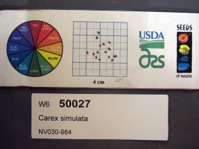 | | 2015 | | | | | | | Wild material | | 1927049 | W6 50027 |
| 76 | W6 50033 | NV030-990 | Carex simulata Mack. | Nevada, United States | W6 |  | | 2015 | | | | | | | Wild material | | 1927054 | W6 50033 |
| 77 | W6 49515 | CBG-2446 | Carex sprengelii Dewey ex Spreng. | Illinois, United States | W6 |  | | 2015 | | | | | | | Wild material | | 1925995 | W6 49515 |
| 78 | W6 49522 | CBG-2457 | Carex muehlenbergii Schkuhr ex Willd. | Illinois, United States | W6 |  | | 2015 | | | | | | | Wild material | | 1926154 | W6 49522 |
| 79 | W6 49535 | CBG-2476 | Carex muehlenbergii Schkuhr ex Willd. | Illinois, United States | W6 |  | | 2015 | | | | | | | Wild material | | 1926160 | W6 49535 |
| 80 | W6 49542 | CBG-2484 | Carex vulpinoidea Michx. | Illinois, United States | W6 |  | | 2015 | | | | | | | Wild material | | 1926016 | W6 49542 |
| 81 | W6 49581 | CBG-2566 | Carex vulpinoidea Michx. | Illinois, United States | W6 |  | | 2015 | | | | | | | Wild material | | 1926052 | W6 49581 |
| 82 | W6 49608 | CBG-2609 | Carex hystericina Muhl. ex Willd. | Colorado, United States | W6 |  | | 2015 | | | | | | | Wild material | | 1926076 | W6 49608 |
| 83 | W6 48945 | AK930-470 | Carex podocarpa R. Br. | Alaska, United States | W6 |  | | 2015 | | | | | | | Wild material | | 1923860 | W6 48945 |
| 84 | W6 48822 | MARSB-46 | Carex atlantica L. H. Bailey | New Jersey, United States | W6 | 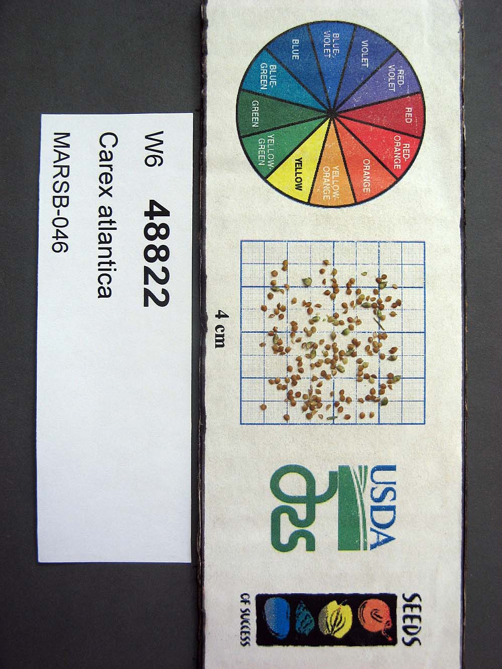 | | 2015 | | | | | | | Wild material | | 1922838 | W6 48822 |
| 85 | W6 48836 | MARSB-63 | Carex vulpinoidea Michx. | West Virginia, United States | W6 |  | | 2015 | | | | | | | Wild material | | 1922848 | W6 48836 |
| 86 | W6 36770 | UT931-99 | Carex simulata Mack. | Utah, United States | W6 |  | | 2009 | | | | | | | Wild material | | 1826924 | W6 36770 |
| 87 | W6 34204 | CABR2-SOSID-075-048-04 | Carex breweri Boott | United States | W6 |  | | 2009 | | | | | | | Wild material | | 1798478 | W6 34204 |
| 88 | W6 35191 | AZ930-206 | Carex senta Boott | Arizona, United States | W6 | 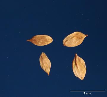 | | 2009 | | | | | | | Wild material | | 1802284 | W6 35191 |
| 89 | W6 26847 | GSENM-016 | Carex praegracilis W. Boott | Utah, United States | W6 |  | | 2005 | | | | | | | Wild material | Grasslike 0.3 meters tall. | 1673886 | W6 26847 |
| 90 | W6 26879 | GSENM-027 | Carex pellita Muhl. ex Willd. | Utah, United States | W6 |  | | 2005 | | | | | | | Wild material | Grasslike .3-.45 meters tall. | 1673918 | W6 26879 |
| 91 | W6 27132 | CA330-16 | Carex pansa L. H. Bailey | California, United States | W6 |  | | 2005 | | | | | | | Wild material | Grasslike 0.45 meters tall. | 1674167 | W6 27132 |
| 92 | W6 27133 | CA330-17 | Carex obnupta L. H. Bailey | California, United States | W6 |  | | 2005 | | | | | | | Wild material | Grasslike 0.45-1.2 meters tall. | 1674168 | W6 27133 |
| 93 | W6 27134 | CA330-18 | Carex cusickii Mack. ex Piper ex Beattie | California, United States | W6 |  | | 2005 | | | | | | | Wild material | Grasslike 0.45-1.2 meters tall. | 1674169 | W6 27134 |
| 94 | W6 27197 | CA330-27 | Carex obnupta L. H. Bailey | California, United States | W6 |  | | 2005 | | | | | | | Wild material | Grasslike 0.45-1 meters tall. | 1674232 | W6 27197 |
| 95 | W6 27254 | UT030-17 | Carex hystericina Muhl. ex Willd. | Utah, United States | W6 |  | | 2005 | | | | | | | Wild material | Grasslike 0.15-0.3 meters tall. | 1674288 | W6 27254 |
| 96 | PI 704863 sos | V. angustifolium CBG-9706 | Vaccinium angustifolium Aiton | Illinois, United States | COR | | | 2021 | | | | | | | Wild material | | 2120019 | PI 704863 sos |
| 97 | PI 704823 sos | V. corymbosum MARSB-141 | Vaccinium corymbosum L. | Delaware, United States | COR |  | | 2019 | | | | | | | Wild material | | 2097497 | PI 704823 sos |
| 98 | PI 704821 sos | F. virginiana CBG-8193 | Fragaria virginiana Mill. | Illinois, United States | COR |  | | 2019 | | | | | | | Wild material | | 2092675 | PI 704821 sos |
| 99 | PI 704817 sos | V. uliginosum AK930-843 | Vaccinium uliginosum L. | Alaska, United States | COR |  | | 2018 | | | | | | | Wild material | Vaccinium uliginosum | 1965851 | PI 704817 sos |
| 100 | PI 710516 | NCBG-715 | Eleocharis obtusa (Willd.) Schult. | Maryland, United States | S9 |  | | 2018 | | | | | | | Wild material | | 1966025 | PI 710516 |
| 101 | PI 704814 sos | V. ovatum OR080-53 | Vaccinium ovatum Pursh | Oregon, United States | COR |  | | 2018 | | | | | | | Wild material | | 1957636 | PI 704814 sos |
| 102 | PI 679702 | V. macrocarpon USFS-ONF-2015-1 | Vaccinium macrocarpon Aiton | Michigan, United States | COR | | | 2016 | COLLECTED | 08/31/2015 | Gogebic County, Ottawa National Forest, Watersmeet Ranger District, T44N R41 W, Section 9, next to Cisco Lake Road, north side. | 46.22302000, -89.43894000 | 512 | Small, floating bog, surrounded by moat of open water in an area of mixed hardwoods, lakes and developed lots. Some parts of bog have a dense tangle of cranberry vines and some have only a few. Associated plants Sphagnum spp., Chamaedaphne calyculata, Eriophorum sp., Triadenum fraseri, and Iris versicolor. On one end there are more plants of Typha sp., Carex sp., and Scirpus cyperinus, with no V. macrocarpon present. No V. oxycoccos observed anywhere in bog. | Wild material | | 1933068 | PI 679702 |
| 103 | PI 710515 | OR010-265 | Eleocharis macrostachya Britton | Oregon, United States | S9 |  | | 2015 | | | | | | | Wild material | | 1927502 | PI 710515 |
| 104 | PI 679661 | V. macrocarpon Sand Point Bog MI | Vaccinium macrocarpon Aiton | Michigan, United States | COR | | | 2014 | COLLECTED | 08/06/2014 | Sand Point Bog, Keweenaw Bay Indian Community, Baraga County, near US 41, North of Baraga | 46.79693690, -88.46948284 | 183 | Slope = 0; bog, 30 acres, associated plants: Sphagnum spp., V. oxycoccos, Carex lasiocarpa, Menyanthes trifoliata, Pogonia ophioglossoides, Plantanthera clavellata, Andromeda polifolia var. glaucophylla, Utricularia intermedia, small Lariz laricina, Xyris montana, Chamaedaphne calyculata, Drosera sp. | Wild material | Robust population. Fruit randomly sampled. | 1921319 | PI 679661 |
| 105 | PI 679662 | V. oxycoccos Sand Point Bog MI | Vaccinium oxycoccos L. | Michigan, United States | COR | | | 2014 | COLLECTED | 08/06/2014 | Sand Point Bog, Keweenaw Bay Indian Community, Baraga County, near US 41, North of Baraga | 46.79693690, -88.46948284 | 183 | Slope = 0; bog, 30 acres, associated plants: Sphagnum spp., V. macrocarpon, Carex lasiocarpa, Menyanthes trifoliata, Pogonia ophioglossoides, Plantanthera clavellata, Andromeda polifolia var. glaucophylla, Utricularia intermedia, small Lariz laricina, Xyris montana, Chamaedaphne calyculata, Drosera sp. | Wild material | More common at the south end of the bog. Fruit randomly sampled. | 1921320 | PI 679662 |
| 106 | PI 679627 | V. macrocarpon Big Run Bog FR 18 | Vaccinium macrocarpon Aiton | West Virginia, United States | COR | | | 2014 | COLLECTED | 04/22/2014 | Big Run Bog, Backbone Mountain, Monogahela National Forest, Tucker County. Next to Forest Road 18 | 39.11812000, -79.58452000 | 983 | Minerotrophic fen in a shallow basin. Many hummocks with standing water between. Fen dissected by many sloughs. A large area of open water within the fen has active beaver dams. Hummocks support small trees and shrubs | Wild material | Plants in fen include Spaghnum sp., Rubus hispidus, Solidago uliginosa, Eriphorum virginicum, Juncus sp., Carex spp., Scirpus sp. Gaultheria hispidula, Aronia melanocarpa, Sarracenia purpurea (introduced). Hummocks supported Picea rubens, Rhododendron maximum, Kalmia latifolia, and ferns including Osmundastrum cinnamomea. Vegetation on surrounding slopes includes Picea rubens, Tsuga canadensis, Amelanchier sp. and Pinus rigida.
Plant description: Reddish leaves. Prolific fruit production. Fruit shape, size and color typical for species. Voucher colleted. Type of propagule collected: seed
Collectors: Williams, KA; Garvey, E; Polgar, R. CRANBERRY IGRR PROJECT | 1919345 | PI 679627 |
| 107 | PI 679628 | V. oxycoccos Big Run Bog FR 18 | Vaccinium oxycoccos L. | West Virginia, United States | COR | | | 2014 | COLLECTED | 04/22/2014 | Big Run Bog, Backbone Mountain, Monogahela National Forest, Tucker County. Next to Forest Road 18 | 39.11812000, -79.58452000 | 983 | Minerotrophic fen in a shallow basin. Many hummocks with standing water between. Fen dissected by many sloughs. A large area of open water within the fen has active beaver dams. Hummocks support small trees and shrubs | Wild material | Plants in fen include Spaghnum sp., Rubus hispidus, Solidago uliginosa, Eriphorum virginicum, Juncus sp., Carex spp., Scirpus sp. Gaultheria hispidula, Aronia melanocarpa, Sarracenia purpurea (introduced). Hummocks supported Picea rubens, Rhododendron maximum, Kalmia latifolia, and ferns including Osmundastrum cinnamomea. Vegetation on surrounding slopes includes Picea rubens, Tsuga canadensis, Amelanchier sp. and Pinus rigida.
Plant description: Plant prostrate. Fruit shape, size and color typical for species. Voucher collected Type of propagule collected: seed
Collectors: Williams, KA; Garvey, E; Polgar, R. CRANBERRY IGRR PROJECT | 1919346 | PI 679628 |
| 108 | PI 679629 | V. oxycoccos Red Run Bog FR 13 | Vaccinium oxycoccos L. | West Virginia, United States | COR | | | 2014 | COLLECTED | 04/23/2014 | Red Run Bog, Monongahela National Forest. Tucker County. The bog is bisected by Canaan Loop Road (Forest Road 13) | 39.07228000, -79.47363000 | 1110 | Bog with two main areas (east and west) separated by forest which is interspersed with smaller boggy areas. Road runs through forested area. Gentle slope from 1115 m in the east to 1105 m in the west. The total area is approximately 100 acres. | Wild material | Plants in bog include Spaghnum sp., Lycopodium sp., Rubus hispidus, Solidago uliginosa, Eriphorum virginicum, Pteridium aquilinum, Juncus sp., Carex spp., Aronia melanocarpa, and Vaccinium macrocarpon . Vegetation on surrounding slopes includes Picea rubens, Tsuga canadensis, Rhododendron maximum, Kalmia latifolia, Ilex montana, Gaultheria sp., and Viburnum prunifolium. Abies balsamea occurs on the edge of the bog.
Plant description: Abundant fruit. Fruit shape, size and color typical for species. Voucher collected Type of propagule collected: seed
Collectors: Williams, KA; Garvey, E; Polgar, R. CRANBERRY IGRR PROJECT | 1919347 | PI 679629 |
| 109 | PI 679630 | V. macrocarpon Red Run Bog FR 13 | Vaccinium macrocarpon Aiton | West Virginia, United States | COR | | | 2014 | COLLECTED | 04/23/2014 | Red Run Bog, Monongahela National Forest. Tucker County. The bog is bisected by Canaan Loop Road (Forest Road 13) | 39.07228000, -79.47363000 | 1110 | Bog with two main areas (east and west) separated by forest which is interspersed with smaller boggy areas. Road runs through forested area. Gentle slope from 1115 m in the east to 1105 m in the west. The total area is approximately 100 acres. | Wild material | Plants in bog include Spaghnum sp., Lycopodium sp., Rubus hispidus, Solidago uliginosa, Eriphorum virginicum, Pteridium aquilinum, Juncus sp., Carex spp., Aronia melanocarpa, and Vaccinium oxycoccos . Vegetation on surrounding slopes includes Picea rubens, Tsuga canadensis, Rhododendron maximum, Kalmia latifolia, Ilex montana, Gaultheria sp., and Viburnum prunifolium. Abies balsamea occurs on the edge of the bog.
Plant description: Abundant fruit. Fruit shape, size and color typical for species. Voucher collected Type of propagule collected: seed
Collectors: Williams, KA; Garvey, E; Polgar, R. CRANBERRY IGRR PROJECT | 1919348 | PI 679630 |
| 110 | PI 679631 | V. oxycoccos Bear Rocks Bog FR 75 | Vaccinium oxycoccos L. | West Virginia, United States | COR | | | 2014 | COLLECTED | 04/23/2014 | Bear Rocks Bog, Dolly Sods Wilderness Area, Monongahela National Forest. Tucker County. Accessed from Forest Road 75. | 39.06700800, -79.30496600 | 1196 | Fen with spongy, saturated uneven survace and many hummocks. Water level | Wild material | Plants in bog include Spaghnum sp., and other mosses. Lycopodium sp., Rubus hispidus, Eriphorum virginicum, Juncus sp., Carex spp., Gaultheria sp., and Vaccinium macrocarpon . Vegetation on surrounding slopes includes Picea rubens, Rhododendron maximum, Kalmia latifolia, and Vaccinium spp.
Plant description: Plants occasionally upright but mostly prostrate. Fruit shape, size, and color typical for species. Heavy fruit production. Voucher collected Type of propagule collected: seed
Collectors: Williams, KA; Garvey, E; Polgar, R. CRANBERRY IGRR PROJECT | 1919349 | PI 679631 |
| 111 | PI 679632 | V. macrocarpon Bear Rocks Bog FR 75 | Vaccinium macrocarpon Aiton | West Virginia, United States | COR | | | 2014 | COLLECTED | 04/23/2014 | Bear Rocks Bog, Dolly Sods Wilderness Area, Monongahela National Forest. Tucker County. Accessed from Forest Road 75. | 39.06700800, -79.30496600 | 1196 | Fen with spongy, saturated uneven survace and many hummocks. Water level | Wild material | Plants in bog include Spaghnum sp., and other mosses. Lycopodium sp., Rubus hispidus, Eriphorum virginicum, Juncus sp., Carex spp., Gaultheria sp., and Vaccinium oxycoccos . Vegetation on surrounding slopes includes Picea rubens, Rhododendron maximum, Kalmia latifolia, and Vaccinium spp.
Plant description: Plants occasionally upright but mostly prostrate. Fruit shape, size, and color typical for species. Heavy fruit production. Voucher collected Type of propagule collected: seed
Collectors: Williams, KA; Garvey, E; Polgar, R. CRANBERRY IGRR PROJECT | 1919350 | PI 679632 |
| 112 | PI 678498 | RU2012-5021 | Festuca arundinacea Schreb. | Sakhalin, Russian Federation | W6 | | | 2013 | COLLECTED | 09/04/2012 | Dolinsky Region, 10 km W of Dolinsk, near Oktyabrskoye Village | 47.34190000, 142.71020000 | 7 | Former collective farm yard, meadow | Wild material | | 1909837 | PI 678498 |
| 113 | PI 678499 | RU2012-5022 | Poa pratensis L. | Sakhalin, Russian Federation | W6 | | | 2013 | COLLECTED | 09/04/2012 | Dolinsky Region, 10 km W of Dolinsk, near Oktyabrskoye Village | 47.34190000, 142.71020000 | 7 | Former collective farm yard, meadow | Wild material | | 1909818 | PI 678499 |
| 114 | PI 678501 | RU2012-5033 | Elymus sibiricus L. | Kabardino-Balkaria, Russian Federation | W6 | | | 2013 | COLLECTED | 09/12/2012 | Nanayiskii area, along highway from Khabarovsk to Komsomolsk-na -Amure | 49.70060000, 137.05800000 | 40 | Along highway | Wild material | | 1909827 | PI 678501 |
| 115 | PI 678900 | RU2012-5019 | Trifolium hybridum L. | Sakhalin, Russian Federation | W6 | | | 2013 | COLLECTED | 09/04/2012 | Dolinsky Region, 10 km W of Dolinsk, near Oktyabrskoye Village | 47.34190000, 142.71020000 | 7 | Former collective farm yard, meadow | Wild material | | 1909816 | PI 678900 |
| 116 | PI 675216 | R10-02-006 | Phleum phleoides (L.) H. Karst. | Stavropol, Russian Federation | W6 |  | | 2011 | COLLECTED | 07/17/2010 | 10 km NW of Stavropol | 45.11500000, 41.86900000 | 520 | Stony steppe surrounded by forest (Quercus robur, Q. calcarea, Fraxinus exelsior): moderate depth soils. Black A horizon, weathered limestone parent material: hay meadows: : seed collected from >100 plants | Wild material | | 1883108 | PI 675216 |
| 117 | PI 675304 | R10-01-005 | Bromus riparius Rehmann | Stavropol, Russian Federation | W6 | | | 2011 | COLLECTED | 07/17/2010 | 12 NW of Stavropol | 45.12900000, 41.85200000 | 436 | Stony steppe surrounded by forest (Quercus robur, Q. calcarea, Fraxinus exelsior): margin of gravel pit area: scraped shallow soils. Shallow sandy black A horizon, very stony, weathered limestone parent material and outcroppings: seed collected from >100 plants | Wild material | | 1883107 | PI 675304 |
| 118 | PI 675306 | R10-05-023 | Phleum phleoides (L.) H. Karst. | Stavropol, Russian Federation | W6 | | | 2011 | COLLECTED | 07/17/2010 | Slope of Nedzemahnaya (never sleeping) Mountain 22 km S of Stavropol | 44.85100000, 41.91200000 | 655 | Steppe. Shallow stony mollisol, weathered limestone: seed collected from >100 plants | Wild material | | 1883123 | PI 675306 |
| 119 | PI 675310 | R10-20-076 | Pseudoroegneria stipifolia (Czern. ex Nevski) Á. Löve | Stavropol, Russian Federation | W6 | | | 2011 | COLLECTED | 07/22/2010 | 9 km N of Kislovodsk; Borgustan Mountain Range | 43.98000000, 42.80000000 | 697 | Mesic steppe meadow. 30% slope SW exposure, surrounded by Quercus petria forest and Fraxinus excelsior, limestone parent material: stony or pebbly soil: seed collected from >100 plants | Wild material | | 1883170 | PI 675310 |
| 120 | PI 676154 | R10-02-007 | Brachypodium rupestre (Host) Roem. & Schult. | Stavropol, Russian Federation | W6 | | | 2011 | COLLECTED | 07/17/2010 | 10 km NW of Stavropol | 45.11500000, 41.86900000 | 520 | Stony steppe surrounded by forest (Quercus robur, Q. calcarea, Fraxinus exelsior): moderate depth soils. Black A horizon, weathered limestone parent material: hay meadows: : seed collected from >100 plants | Wild material | | 1883109 | PI 676154 |
| 121 | PI 676157 | R10-45-187 | Briza media L. subsp. elatior (Sm.) Rohlena | Karačaevo-Čerkesskaja Respublika, Russian Federation | W6 | | | 2011 | COLLECTED | 08/01/2010 | 20 km NW of Karachayevsk | 43.89200000, 41.87200000 | 802 | Mesic steppe. Foot slopes of mountain range, N exposure, 30% slope, sandstone: seed collected from >100 plants | Wild material | | 1883274 | PI 676157 |
| 122 | PI 676206 | R10-45-190 | Poa pratensis L. subsp. angustifolia (L.) Arcang. | Karačaevo-Čerkesskaja Respublika, Russian Federation | W6 | | | 2011 | COLLECTED | 08/01/2010 | 20 km NW of Karachayevsk | 43.89200000, 41.87200000 | 802 | Mesic steppe. Foot slopes of mountain range, N exposure, 30% slope, sandstone: seed collected from >100 plants | Wild material | | 1883277 | PI 676206 |
| 123 | PI 678468 | R10-01-004 | Lolium perenne L. | Stavropol, Russian Federation | W6 |  | | 2011 | COLLECTED | 07/17/2010 | 12 NW of Stavropol | 45.12900000, 41.85200000 | 436 | Stony steppe surrounded by forest (Quercus robur, Q. calcarea, Fraxinus exelsior): margin of gravel pit area: scraped shallow soils. Shallow sandy black A horizon, very stony, weathered limestone parent material and outcroppings: seed collected from >100 plants | Wild material | | 1883106 | PI 678468 |
| 124 | PI 678469 | R10-02-008 | Lolium perenne L. | Stavropol, Russian Federation | W6 |  | | 2011 | COLLECTED | 07/17/2010 | 10 km NW of Stavropol | 45.11500000, 41.86900000 | 520 | Stony steppe surrounded by forest (Quercus robur, Q. calcarea, Fraxinus exelsior): moderate depth soils. Black A horizon, weathered limestone parent material: hay meadows: : seed collected from >100 plants | Wild material | | 1883110 | PI 678469 |
| 125 | PI 678471 | R10-05-020 | Festuca valesiaca Schleich. ex Gaudin | Stavropol, Russian Federation | W6 | | | 2011 | COLLECTED | 07/17/2010 | Slope of Nedzemahnaya (never sleeping) Mountain 22 km S of Stavropol | 44.85100000, 41.91200000 | 655 | Steppe. Shallow stony mollisol, weathered limestone: seed collected from >100 plants | Wild material | | 1883120 | PI 678471 |
| 126 | PI 678484 | R10-20-077 | Bromus riparius Rehmann | Stavropol, Russian Federation | W6 | | | 2011 | COLLECTED | 07/22/2010 | 9 km N of Kislovodsk; Borgustan Mountain Range | 43.98000000, 42.80000000 | 697 | Mesic steppe meadow. 30% slope SW exposure, surrounded by Quercus petria forest and Fraxinus excelsior, limestone parent material: stony or pebbly soil: seed collected from >100 plants | Wild material | | 1883171 | PI 678484 |
| 127 | PI 678488 | R10-45-192 | Lolium perenne L. | Karačaevo-Čerkesskaja Respublika, Russian Federation | W6 |  | | 2011 | COLLECTED | 08/01/2010 | 20 km NW of Karachayevsk | 43.89200000, 41.87200000 | 802 | Mesic steppe. Foot slopes of mountain range, N exposure, 30% slope, sandstone: seed collected from >100 plants | Wild material | | 1883279 | PI 678488 |
| 128 | PI 685586 | R10-01-001 | Festuca rupicola Heuff. | Stavropol, Russian Federation | W6 | | | 2011 | COLLECTED | 07/17/2010 | 12 NW of Stavropol | 45.12900000, 41.85200000 | 436 | Stony steppe surrounded by forest (Quercus robur, Q. calcarea, Fraxinus exelsior): margin of gravel pit area: scraped shallow soils. Shallow sandy black A horizon, very stony, weathered limestone parent material and outcroppings: seed collected from >100 plants | Wild material | | 1883103 | PI 685586 |
| 129 | PI 693818 | R10-01-002 | Poa compressa L. | Stavropol, Russian Federation | W6 | | | 2011 | COLLECTED | 07/17/2010 | 12 NW of Stavropol | 45.12900000, 41.85200000 | 436 | Stony steppe surrounded by forest (Quercus robur, Q. calcarea, Fraxinus exelsior): margin of gravel pit area: scraped shallow soils. Shallow sandy black A horizon, very stony, weathered limestone parent material and outcroppings: seed collected from >100 plants | Wild material | | 1883104 | PI 693818 |
| 130 | PI 693819 | R10-01-003 | Poa pratensis L. subsp. angustifolia (L.) Arcang. | Stavropol, Russian Federation | W6 | | | 2011 | COLLECTED | 07/17/2010 | 12 NW of Stavropol | 45.12900000, 41.85200000 | 436 | Stony steppe surrounded by forest (Quercus robur, Q. calcarea, Fraxinus exelsior): margin of gravel pit area: scraped shallow soils. Shallow sandy black A horizon, very stony, weathered limestone parent material and outcroppings: seed collected from >100 plants | Wild material | | 1883105 | PI 693819 |
| 131 | PI 693821 | R10-05-019 | Poa badensis Haenke ex Willd. | Stavropol, Russian Federation | W6 | | | 2011 | COLLECTED | 07/17/2010 | Slope of Nedzemahnaya (never sleeping) Mountain 22 km S of Stavropol | 44.85100000, 41.91200000 | 655 | Steppe. Shallow stony mollisol, weathered limestone: seed collected from >100 plants | Wild material | | 1883119 | PI 693821 |
| 132 | PI 693822 | R10-05-022 | Koeleria pyramidata (Lam.) P. Beauv. | Stavropol, Russian Federation | W6 | | | 2011 | COLLECTED | 07/17/2010 | Slope of Nedzemahnaya (never sleeping) Mountain 22 km S of Stavropol | 44.85100000, 41.91200000 | 655 | Steppe. Shallow stony mollisol, weathered limestone: seed collected from >100 plants | Wild material | | 1883122 | PI 693822 |
| 133 | PI 660961 | V. oxycoccos Dinger Lake | Vaccinium oxycoccos L. | Oregon, United States | COR | | | 2009 | COLLECTED | 09/26/2009 | Clackamas County, Mount Hood National Forest, Dinger Lake. | 45.14563000, -121.84628000 | 1214 | Wet margins of lake (Seep) with Pinus contorta, Carex sp., Aulacomnium palustre and Vaccinium membranaceum. | Wild material | Douglas Cook collection in Oregon.
| 1824093 | PI 660961 |
| 134 | PI 676214 | OR090-21 | Agrostis exarata Trin. | Oregon, United States | W6 |  | | 2007 | | | | | | | Wild material | Grasslike, Height about: 1.06 m | 1727223 | PI 676214 |
| 135 | PI 664509 | 194952 | Angelica lucida L. | California, United States | NC7 | 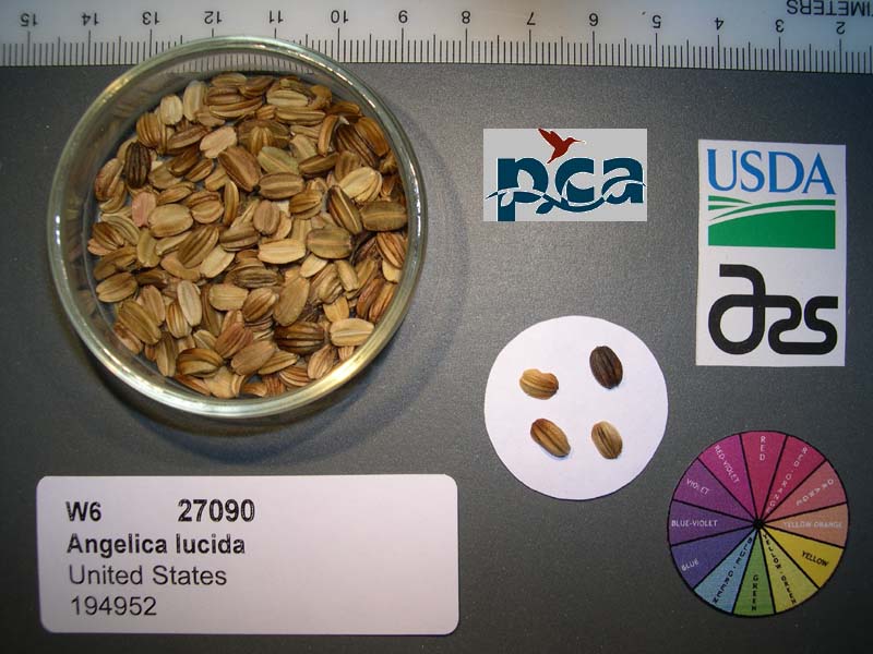 | | 2005 | COLLECTED | 06/12/2003 | | | 3 | Coastal strand. Associated with Schrophularia sp, Juncus sp, Lupinus arboreus, Briza major, Tanacetum camphoratum, Carex panda, Calystegia sp and Baccharis pilularis. | Wild material | Forb 1.5-2 meters tall. | 1674127 | PI 664509 |
| 136 | PI 699126 | F. vesca f. bracteata CA330-04 | Fragaria vesca L. | California, United States | COR | 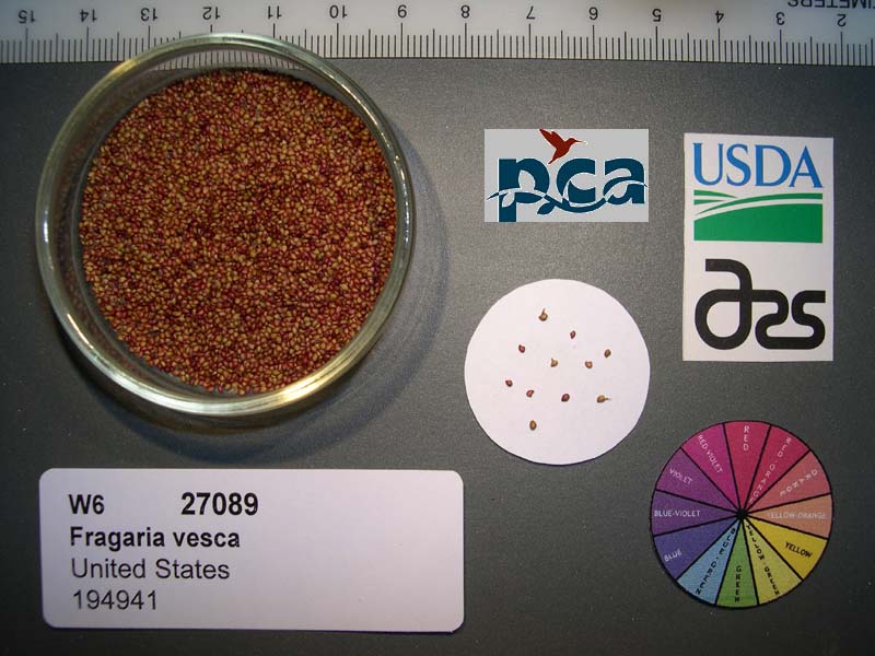 | | 2005 | COLLECTED | 06/10/2003 | | | 667 | Redwood-Douglas Fir. Associated with Rubus ursinus, Galium sp., Juncus sp., Carex sp., Rubus spectabilis and Rubus parviflorus. Slope: 0-5% SE. Soil: Clay. | Wild material | Seeds of Success (SOS) program germplasm. | 1674126 | PI 699126 |
| 137 | PI 685559 | KAZ04-11-023 | Agropyron cristatum (L.) Gaertn. | Kazakhstan | W6 |  | | 2005 | COLLECTED | 2004 | Like Zhamschi, 45 km from Bektauata | | 614 | Flat plain with clay and loamy soil, and no stones, somewhat poorly drained. | Wild material | Population is occasional and pure. | 1668910 | PI 685559 |
| 138 | PI 693749 | KAZ04-10-017 | Poa versicolor Besser subsp. stepposa (Krylov) Tzvelev | Kazakhstan | W6 |  | | 2005 | COLLECTED | 2004 | Bektayata mountainains | 47.44722222, 74.81388889 | 618 | Well-drained gray and light brown soil on 70-80 degree slope. | Wild material | Population is frequent and uniform. | 1668905 | PI 693749 |
| 139 | PI 693635 | Jitnak tarbagataiski | Agropyron cristatum (L.) Gaertn. subsp. tarbagataicum (N. Plotn.) Tzvelev | Kazakhstan | W6 | | | 2003 | COLLECTED | 08/08/2003 | East Kazakhstan, county Aygyz, 50 km from Ayagyz. | 47.59388889, 80.63750000 | 747 | Near lowhills; Agropyron steppe; good drainage. Stipa capilata, Agropyron tarbagataicum, Elytrigia repens, Carex physoides, Limonium gmelinii, Salvia steposa, Trula britanica, Centaureea sp. Artemisia scoparia, Festuca gulcata. | Wild material | Perennial; height 150 cm; rhizome shortly crouching; stem upright, naked, striated, under spikes short pubescent; leaf 5-8 cm long, 1.5-2 cm wide; spikelet sessile, 5-7 mm wide, spikelet glume with 3 veins, lanceolate, up to 5 mm long. | 1650190 | PI 693635 |
| 140 | PI 693636 | Pyrei polzuchii | Elymus repens (L.) Gould subsp. repens | Kazakhstan | W6 | | | 2003 | COLLECTED | 08/08/2003 | East Kazakhstan, county Aygyz, 50 km from Ayagyz. | 47.59388889, 80.63750000 | 747 | Near lowhills; Agropyron steppe; good drainage. Stipa capilata, Agropyron tarbagataicum, Elytrigia repens, Carex physoides, Limonium gmelinii, Salvia steposa, Trula britanica, Centaureea sp. Artemisia scoparia, Festuca gulcata. | Wild material | zprtrnnisl, up to 100 cm high; stem naked, leaf sheath naked; leaves plain or rolled, 5-10 mm wide, lilnear, smooth underneath, upper side is rough; spike erect, up 19 cm long, spiklets are a bit prominent. | 1650191 | PI 693636 |
| 141 | PI 636681 | TP00-37-127 | Elymus strictus (Keng) S. L. Chen | Xizang Zizhiqu, China | W6 | | | 2001 | COLLECTED | 09/02/2000 | 28 km NW of Luhuo, Sichuan Province | 31.54777778, 100.46555556 | 3210 | Sub-alpine meadow, Picea spp. planted SOIL:Gravelly clay loam SLOPE:3% ASPECT:NE | Wild material | | 1616541 | PI 636681 |
| 142 | PI 639856 | TP00-12-048 | Kengyilia melanthera (Keng) J. L. Yang et al. | Xizang Zizhiqu, China | W6 | | | 2001 | COLLECTED | 08/25/2000 | 4 km S of Maqu, Gansu Province | 33.95750000, 102.06333333 | 3280 | Sand dune area south of Yellow River, sand dunes stabilized SOIL:Sandy loam SLOPE:0-5% ASPECT:Various | Wild material | | 1616090 | PI 639856 |
| 143 | PI 639860 | TP00-26-089 | Elymus dahuricus Turcz. ex Griseb. subsp. excelsus (Turcz. ex Griseb.) Tzvelev | Xizang Zizhiqu, China | W6 | | | 2001 | COLLECTED | 08/30/2000 | 45 km SE of Longriba, Sichuan Province | 32.07861111, 102.57277778 | 3280 | Sub-alpine shrub, old logged forest SOIL:Gravelly loam SLOPE:30-40% ASPECT:SW | Wild material | | 1616072 | PI 639860 |
| 144 | PI 639861 | TP00-38-134 | Deschampsia cespitosa (L.) P. Beauv. | Xizang Zizhiqu, China | W6 | | | 2001 | COLLECTED | 09/03/2000 | 12 km E of Ganzi, Sichuan Province | 31.60305556, 100.15361111 | 3620 | Sub-alpine meadow, grass and shrub, ungrazed SOIL:Gravelly loam SLOPE:30-35% ASPECT:NW | Wild material | | 1616548 | PI 639861 |
| 145 | PI 655191 | TP00-11-040 | Elymus burchan-buddae (Nevski) Tzvelev | Xizang Zizhiqu, China | W6 | | | 2001 | COLLECTED | 08/25/2000 | 10 km NE of Maqu, Gansu Province | 34.07027778, 102.15944444 | 3660 | Sub-alpine meadow, upslope from road between Luqu and Maqu, not grazed SOIL:Silt loam SLOPE:40% ASPECT:S | Wild material | | 1616131 | PI 655191 |
| 146 | PI 655192 | TP00-11-045 | Elymus nutans Griseb. | Xizang Zizhiqu, China | W6 | | | 2001 | COLLECTED | 08/25/2000 | 10 km NE of Maqu, Gansu Province | 34.07027778, 102.15944444 | 3660 | Sub-alpine meadow, upslope from road between Luqu and Maqu, not grazed SOIL:Silt loam SLOPE:40% ASPECT:S | Wild material | | 1616088 | PI 655192 |
| 147 | PI 655193 | TP00-12-051 | Elymus nutans Griseb. | Xizang Zizhiqu, China | W6 | | | 2001 | COLLECTED | 08/25/2000 | 4 km S of Maqu, Gansu Province | 33.95750000, 102.06333333 | 3280 | Sand dune area south of Yellow River, sand dunes stabilized SOIL:Sandy loam SLOPE:0-5% ASPECT:Various | Wild material | | 1616091 | PI 655193 |
| 148 | PI 655194 | TP00-12-052 | Elymus burchan-buddae (Nevski) Tzvelev | Xizang Zizhiqu, China | W6 | | | 2001 | COLLECTED | 08/25/2000 | 4 km S of Maqu, Gansu Province | 33.95750000, 102.06333333 | 3280 | Sand dune area south of Yellow River, sand dunes stabilized SOIL:Sandy loam SLOPE:0-5% ASPECT:Various | Wild material | | 1616092 | PI 655194 |
| 149 | PI 655195 | TP00-14-056 | Elymus nutans Griseb. | Xizang Zizhiqu, China | W6 | | | 2001 | COLLECTED | 08/26/2000 | 55 km E of Maqu, Sichuan Province | 34.00805556, 102.75055556 | 3350 | Downslope from road to Zoige, winter grazing, sub-alpine meadow SOIL:Loam SLOPE:5% ASPECT:SW | Wild material | | 1616095 | PI 655195 |
| 150 | PI 655196 | TP00-15-057 | Poa pratensis L. | Xizang Zizhiqu, China | W6 | | | 2001 | COLLECTED | 08/26/2000 | 25 km N of Zoige, Sichuan Province | 33.80222222, 102.96000000 | 3300 | West side of road to Zoige, sub-alpine meadow SOIL:Loam SLOPE:3-5% ASPECT:W | Wild material | | 1616096 | PI 655196 |
| 151 | PI 655199 | TP00-26-090 | Elymus sibiricus L. | Xizang Zizhiqu, China | W6 | | | 2001 | COLLECTED | 08/30/2000 | 45 km SE of Longriba, Sichuan Province | 32.07861111, 102.57277778 | 3280 | Sub-alpine shrub, old logged forest SOIL:Gravelly loam SLOPE:30-40% ASPECT:SW | Wild material | | 1616073 | PI 655199 |
| 152 | PI 655202 | TP00-32-108 | Elymus burchan-buddae (Nevski) Tzvelev | Xizang Zizhiqu, China | W6 | | | 2001 | COLLECTED | 09/01/2000 | 64 km SE of Dafu, Sichuan Province | 30.54611111, 101.54055556 | 3550 | Sub-alpine meadow, oil saturated soils growing Carex. SOIL:Gravelly loam SLOPE:2-3% ASPECT:NE | Wild material | | 1616576 | PI 655202 |
| 153 | PI 655206 | TP00-37-126 | Festuca ovina L. | Xizang Zizhiqu, China | W6 | | | 2001 | COLLECTED | 09/02/2000 | 28 km NW of Luhuo, Sichuan Province | 31.54777778, 100.46555556 | 3210 | Sub-alpine meadow, Picea spp. planted SOIL:Gravelly clay loam SLOPE:60% ASPECT:N | Wild material | | 1616569 | PI 655206 |
| 154 | PI 655207 | TP00-38-132 | Elymus burchan-buddae (Nevski) Tzvelev | Xizang Zizhiqu, China | W6 | | | 2001 | COLLECTED | 09/03/2000 | 12 km E of Ganzi, Sichuan Province | 31.60305556, 100.15361111 | 3620 | Sub-alpine meadow, grass and shrub, ungrazed SOIL:Gravelly loam SLOPE:30-35% ASPECT:NW | Wild material | | 1616546 | PI 655207 |
| 155 | PI 655210 | TP00-44-162 | Elymus burchan-buddae (Nevski) Tzvelev | Xizang Zizhiqu, China | W6 | | | 2001 | COLLECTED | 09/07/2000 | 2 km SE of Horni Township, 45 km NE Litang, Sichuan Province | 30.22277778, 99.85611111 | 4000 | Fenced winter pasture, sub-alpine meadow SOIL:Loam SLOPE:0-5% ASPECT:S | Wild material | | 1616599 | PI 655210 |
| 156 | PI 662329 | TP00-12-049 | Poa psilolepis Keng | Xizang Zizhiqu, China | W6 | | | 2001 | COLLECTED | 08/25/2000 | 4 km S of Maqu, Gansu Province | 33.95750000, 102.06333333 | 3280 | Sand dune area south of Yellow River, sand dunes stabilized SOIL:Sandy loam SLOPE:0-5% ASPECT:Various | Wild material | | 1616175 | PI 662329 |
| 157 | PI 665516 | TP00-38-131 | Festuca rubra L. | Xizang Zizhiqu, China | W6 | | | 2001 | COLLECTED | 09/03/2000 | 12 km E of Ganzi, Sichuan Province | 31.60305556, 100.15361111 | 3620 | Sub-alpine meadow, grass and shrub, ungrazed SOIL:Gravelly loam SLOPE:30-35% ASPECT:NW | Wild material | | 1616545 | PI 665516 |
| 158 | PI 678460 | TP00-10-038 | Elymus nutans Griseb. | Xizang Zizhiqu, China | W6 | | | 2001 | COLLECTED | 08/24/2000 | 35 km NE of Maqu, Gansu Province | 34.24694444, 102.33638889 | 3330 | 5 km southwest of road junction to Maqu, sub-alpine meadow, winter pasture SOIL:Silt loam SLOPE:0-5% ASPECT:Flat-W | Wild material | | 1616129 | PI 678460 |
| 159 | PI 693582 | TP00-14-055 | Elymus burchan-buddae (Nevski) Tzvelev | Xizang Zizhiqu, China | W6 | | | 2001 | COLLECTED | 08/26/2000 | 55 km E of Maqu, Sichuan Province | 34.00805556, 102.75055556 | 3350 | Downslope from road to Zoige, winter grazing, sub-alpine meadow SOIL:Loam SLOPE:5% ASPECT:SW | Wild material | | 1616094 | PI 693582 |
| 160 | PI 693588 | TP00-38-133 | Festuca ovina L. | Xizang Zizhiqu, China | W6 | | | 2001 | COLLECTED | 09/03/2000 | 12 km E of Ganzi, Sichuan Province | 31.60305556, 100.15361111 | 3620 | Sub-alpine meadow, grass and shrub, ungrazed SOIL:Gravelly loam SLOPE:30-35% ASPECT:NW | Wild material | | 1616547 | PI 693588 |
| 161 | PI 634096 | 98HV-150 | Trifolium lupinaster L. | Mongolia | W6 |  | | 1999 | COLLECTED | 09/1998 | Eguur Sum, Hovsgol Aimag, 3 km NE of Erdenebulgan | 50.12305556, 101.60500000 | 1204 | Egiyn River bottom, small open meadows in stands of birch and willow, Carex-grass-forb type, meadow brown soil | Wild material | Associated vegetation:Galatella dahurica, Artemisia sp., Galium verum, Kobresia sibirica, Carex pediformis, Leymus chinensis, Schizonepeta multifida, Stipa sibirica, Heteropappus biennis | 1577917 | PI 634096 |
| 162 | PI 641550 | 98HV-151 | Medicago platycarpos (L.) Trautv. | Mongolia | W6 | | | 1999 | COLLECTED | 09/1998 | Eguur Sum, Hovsgol Aimag, 3 km NE of Erdenebulgan | 50.12305556, 101.60500000 | 1204 | Egiyn River bottom, small open meadows in stands of birch and willow, Carex-grass-forb type, meadow brown soil | Wild material | Associated vegetation:Galatella dahurica, Artemisia sp., Galium verum, Kobresia sibirica, Carex pediformis, Leymus chinensis, Schizonepeta multifida, Stipa sibirica, Heteropappus biennis | 1577918 | PI 641550 |
| 163 | PI 618768 | 96S-149 | Poa pratensis L. | Mongolia | W6 | | | 1997 | COLLECTED | 09/1996 | Zavhan Aimag, Tes Sum, about 80 km east of sum center. | 49.50527778, 96.63500000 | 1710 | 3% east slope. Rolling hills with rock outcrops along the hill crest. Soils are very gravelly brown sands and loamy soils. Conifers occur in protected areas. | Wild material | DOMINANT VEG: Elymus secalinus + Poa pratensis, Artemisia sp., Carex sp. | 1543047 | PI 618768 |
| 164 | PI 641511 | D49 | Lotus corniculatus L. | Chelyabinsk, Russian Federation | W6 |  | | 1996 | COLLECTED | 07/26/1995 | 5 km. south of Bekeshevskaya. | 44.07361111, 42.35666667 | 823 | Past logged, now grazed. Slope 11-40%, aspect E. Open. Soil loam, pH 7.8-8.0. Seasonally dry, mid slope, high terrace. Vegetation closed, seasonal tall and short grass. Surrounding vegetation open deciduous forest with closed lower layers. | Wild material | Dominant shrub species Carpinus c., Q. petraea. Dominant herb/grass species Carex sp., Bothriochloa i., Festuca sp., Koeleria sp. Extensive regional climate data available in spreadsheet format or image maps in raster format suitable for GIS analysis. Contact Dr. Stephanie L. Greene (sgreene@ars-grin.gov). | 1531091 | PI 641511 |
| 165 | PI 593339 | OR-43 | Trifolium cyathiferum Lindl. | Oregon, United States | S9 | | | 1995 | COLLECTED | 08/09/1994 | Douglas Co., Tiller. South on Elk Creek Hw 1 to 1610 to 300 1/8 mile. | | 990 | Small pond on east side of road at bottom of a slope. Assoc. with Madia gracilis, grasses, Menth sp, Carex sp. | Wild material | Collected late in season. Much seed has been dispersed. | 1512577 | PI 593339 |
| 166 | PI 598831 | MO17.CPG94 | Festuca arundinacea Schreb. | Morocco | W6 | | | 1994 | COLLECTED | 07/12/1994 | Near Taounate, 5 km northeast of Taounate, 1 km. east on road S304 from S302, Ketama-Taounate. | 34.57444444, -4.59277778 | 380 | Grazed. Slope 11-40%, aspect E. Open. Soil loam,heavy calcareous,on dolomite bedrock,stony on surface,pH 8.5-9.0.Rainfall 800 mm.Moist,ravine watercourse.Vegetation closed, seasonal tall grass.Surrounding veg. seasonal tall and short grass. | Wild material | Population distribution patchy, abundance occasional. Growth habit erect. | 1480208 | PI 598831 |
| 167 | PI 598879 | M118.CPG94 | Lolium perenne L. | Morocco | W6 |  | | 1994 | COLLECTED | 07/20/1994 | 2 km north of Ait-Oufella on P21, Azrou-Midelt; 52 km northwest of Midelt. | 33.95444444, -5.05388889 | 1880 | Grazed. Slope 6-10%, aspect SE. Area open. Soil loam-clay, hydromorphic on calcareous limestone type bedrock, pH 9.5-10.0. Rainfall 375 mm. Moist, ravine. Vegetation closed, evergreen tall grass. Surrounding veg. degraded evergreen forest. | Wild material | Population abundance frequent, distribution patchy. Growth habit semi-erect. | 1480307 | PI 598879 |
| 168 | PI 598907 | M236.CPG94 | Lolium perenne L. | Morocco | W6 |  | | 1994 | COLLECTED | 07/29/1994 | 1 km upstream southwest of Setti Fatma off road S513 to Marrakech. | 31.22527778, -7.68111111 | 1375 | Grazed, hay. Slope 0-5%, aspect E. Open. Soil sandy, hydromorphic from granite alluvium, pH 6.5. Rainfall 700 mm. Moist, stream terrace. Veg. closed evergreen broad-leafed herb. Surrounding veg. evergreen open forest with closed lower layer | Wild material | Population abundant, distribution uniform. Growth habit erect. | 1480432 | PI 598907 |
| 169 | PI 598934 | S048.CPG94 | Festuca arundinacea Schreb. | Sardegna, Italy | W6 | | | 1994 | COLLECTED | 07/06/1994 | Near Padru Mannu, 45 km south of Sassari and 2 km east of Hwy. 131, 1/2 km south of road to Bolotana. | 40.35500000, 8.79583333 | 650 | Grazed. Slope 0-5%, aspect E. Area open. Soil loam, pH 6.0. Rainfall 960 mm. Seasonally dry, stream terrace. Vegetation closed, seasonal tall grass. Surrounding veg. evergreen open forest with closed lower layers. | Wild material | Population abundance occasional, distribution patchy. Growth habit erect. | 1480137 | PI 598934 |
| 170 | PI 598937 | S057.CPG94 | Lolium perenne L. | Sardegna, Italy | W6 |  | | 1994 | COLLECTED | 07/06/1994 | 7 km west of Macomer to Bosa on road S121 bis. | 40.28805556, 8.70750000 | 610 | Grazed. Slope 0-5%, aspect E. Area open. Soil loam, pH 4.0-4.5. Rainfall 1014 mm. Seasonally inundated, floodplain. Vegetation closed, seasonal tall grass. Surrounding veg. evergreen open forest with closed lower layers. | Wild material | Population abundance frequent, distribution patchy. Growth habit semi-erect. | 1480146 | PI 598937 |
| 171 | PI 598938 | S058.CPG94 | Phalaris aquatica L. | Sardegna, Italy | W6 | | | 1994 | COLLECTED | 07/06/1994 | 7 km west of Macomer to Bosa on road S121 bis. | 40.28805556, 8.70750000 | 610 | Grazed. Slope 0-5%, aspect E. Area open. Soil loam, pH 4.0-4.5. Rainfall 1014 mm. Seasonally inundated, floodplain. Vegetation closed, seasonal tall grass. Surrounding veg. evergreen open forest wtih closed lower layers. | Wild material | Population abundance occasional, distribution patchy. Growth habit erect. | 1480147 | PI 598938 |
| 172 | PI 598939 | S059.CPG94 | Lolium multiflorum Lam. | Sardegna, Italy | W6 |  | | 1994 | COLLECTED | 07/06/1994 | 7 km west of Macomer to Bosa on road S121 bis. | 40.28805556, 8.70750000 | 610 | Grazed. Slope 0-5%, aspect E. Area open. Soil loam, pH 4.0-4.5. Rainfall 1014 mm. Seasonally inundated, floodplain. Vegetation closed, seasonal tall grass. Surrounding veg. evergreen open forest with closed lower layers. | Wild material | Population abundance occasional, distribution patchy. Growth habit erect. | 1480148 | PI 598939 |
| 173 | PI 598943 | S076.CPG94 | Festuca arundinacea Schreb. | Sardegna, Italy | W6 | | | 1994 | COLLECTED | 07/07/1994 | 11 km southeast of Fonni on road S38, Fonni-Lanusei. | 40.10361111, 9.31638889 | 1040 | Grazed. Slope 0-5%, aspect W. Area open. Soil loam, pH 6.0. Rainfall 1000 mm. Moist, stream terrace. Vegetation closed, seasonal tall grass. Surrounding veg. evergreen open forest with closed lower layers. | Wild material | Population abundance occasional, distribution patchy. Growth habit erect. | 1480165 | PI 598943 |
| 174 | PI 598947 | S089.CPG94 | Phalaris aquatica L. | Sardegna, Italy | W6 | | | 1994 | COLLECTED | 07/08/1994 | 2 km west of San Priamo, road SSN 125, San Priamo-Cagliari. | 39.35777778, 9.51972222 | 8 | Past grazed, now roadway. Slope 0-5%, aspect E. Area open. Soil loam, sandy, pH 7.0. Rainfall 660 mm. Seasonally inundated, ravine. Vegetation closed, seasonal short grass. Surrounding veg. open evergreen scrub with closed ground cover. | Wild material | Population abundance occasional, distribution patchy. Growth habit erect. | 1480178 | PI 598947 |
| 175 | PI 598948 | S091.CPG94 | Festuca arundinacea Schreb. | Sardegna, Italy | W6 | | | 1994 | COLLECTED | 07/08/1994 | 22 km west of San Priamo, road SSN 125, San Priamo-Cagliari. | 39.30888889, 9.39888889 | 345 | Past cultivated, now grazed. Slope 0-5%, aspect E. 1/2 shade. Soil loam, alluvial-granitic, pH 7.0. Rainfall 860 mm. Seasonally inundated, stream terrace. Vegetation closed, evergreen open forest with closed lower layers. | Cultivated material | Population abundance occasional, distribution patchy. Growth habit erect. | 1480180 | PI 598948 |
| 176 | PI 610906 | M119.CPG94 | Festuca arundinacea Schreb. | Morocco | W6 | | | 1994 | COLLECTED | 07/20/1994 | Near Ait-Oufeua, 2 k north of Ait-Oufeua on P21, Azrou-Midelt, 52 k northwest of Midelt. | 33.95444444, -5.05388889 | 1880 | Grazed. Slope 6-10%, aspect SE. Area open. Soil loam, clay, heavy hydromorphic on calcareous limestone type bedrock, pH 9.5-10.0. Moist, ravine. Vegetation closed, evergreen tall grass. Surrounding veg. degraded evergreen forest and scrub. | Wild material | Population abundance frequent, distribution patchy. Growth habit erect. | 1480308 | PI 610906 |
| 177 | PI 610928 | S078.CPG94 | Lolium perenne L. | Sardegna, Italy | W6 |  | | 1994 | COLLECTED | 07/07/1994 | 11 k southeast of Fonni on road S389, Fonni-Lanusei. | 40.10361111, 9.31638889 | 1040 | Grazed. Slope 11-40%, aspect W. 1/2 shade. Soil loam, granitic rock, pH 6.0. Rainfall 1000 mm. Seasonally dry, mid slope. Vegetation closed, seasonal tall grass. Surrounding veg. evergreen open forest with closed lower layers. | Wild material | Population abundance frequent, distribution patchy. Growth habit semi-erect. | 1480167 | PI 610928 |
| 178 | PI 632473 | S051.CPG94 | Lolium perenne L. | Sardegna, Italy | W6 |  | | 1994 | COLLECTED | 07/06/1994 | Padru Mannu, 45 k south of Sassari, 2 k east of Hw.131, 1/2 k south of road to Bolotana. | 40.35500000, 8.79583333 | 650 | Grazed. Slope 0-5%, aspect E. Area open. Soil loam, pH 6.0. Rainfall 960 mm. Seasonally dry, stream terrace, oak-grassland. Vegetation closed, seasonal tall grass. Surrounding veg. evergreen open forest with closed lower layers. | Wild material | Population abundance frequent, distribution patchy. Growth habit semi-erect. | 1480140 | PI 632473 |
| 179 | PI 632474 | S019.CPG94 | Lolium perenne L. | Sardegna, Italy | W6 |  | | 1994 | COLLECTED | 07/04/1994 | Near Ozieri, 6 k east of Ozieri on road SS128bis, Ozieri-Battada. | 40.56861111, 9.04833333 | 545 | Grazed. Slope 0-5%, aspect N. Area open. Soil clay, pH 7.0. Rainfall 670 mm. Moist, basin, swale zone. Vegetation closed, evergreen broad-leafed herb veg. Surrounding veg. dryland forage agri. | Wild material | Population abundance frequent, distribution patchy. Growth habit semi-erect. | 1480108 | PI 632474 |
| 180 | PI 632592 | M122.CPG94 | Dactylis glomerata L. | Morocco | W6 | | | 1994 | COLLECTED | 07/20/1994 | Near Ait-Oufeua, 2 k north of Ait-Oufeua on P21, Azrou-Midelt, 52 k northwest of Midelt. | 33.95444444, -5.05388889 | 1880 | Grazed. Slope 6-10%, aspect SE-SW. Open. Soil loam, heavy hydromorphic on calcareous limestone bedrock, pH 9.5-10.0. Seasonally dry, lower slope. Vegetation closed, evergreen tall grass. Surrounding veg. degraded evergreen forest and scrub. | Wild material | Population abundance frequent, distribution patchy. Growth habit erect. | 1480311 | PI 632592 |
| 181 | PI 636537 | S063.CPG94 | Festuca arundinacea Schreb. | Sardegna, Italy | W6 | | | 1994 | COLLECTED | 07/06/1994 | 16 k east of Macomer on road SS129 to Nuoro, 1 k south on dirt road. | 40.29083333, 8.94611111 | 255 | Grazed. Slope 0-5%, aspect S. Area open. Soil loam, pH 6.0-6.5. Rainfall 755 mm. Moist, stream terrace. Vegetation closed, seasonal tall grass. Surrounding veg. seasonal short grass. Dominant herb/grass sp. couch, bermuda, tall fescue. | Wild material | Population abundance frequent, distribution patchy. Growth habit erect. | 1480152 | PI 636537 |
| 182 | PI 636540 | S090.CPG94 | Festuca arundinacea Schreb. | Sardegna, Italy | W6 | | | 1994 | COLLECTED | 07/08/1994 | 2 k west of San Priamo, road SSN 125, San Priamo-Cagliari. | 39.35777778, 9.51972222 | 8 | Past grazed, now roadway. Slope 0-5%, aspect E. Open. Soil sandy loam, pH 7.0. Rainfall 660 mm. Seasonally flooded, ravine, alluvial plain. Veg. closed, seasonal short grass. Surrounding veg. open evergreen scrub with closed ground cover. | Wild material | Population abundance rare, distribution patchy. Growth habit erect. | 1480179 | PI 636540 |
| 183 | PI 641423 | M121.CPG94 | Lotus corniculatus L. | Morocco | W6 | | | 1994 | COLLECTED | 07/20/1994 | Near Ait-Oufeua, 2 k north of Ait-Oufeua on P21, Azrou-Midelt, 52 k northwest of Midelt. | 33.95444444, -5.05388889 | 1880 | Grazed. Slope 6-10%, aspect SE. Area open. Soil loam, clay, heavy hydromorphic on calcareous limestone type bedrock, pH 9.5-10.0. Moist, ravine. Vegetation closed, evergreen tall grass. Surrounding veg. degraded evergreen forest and scrub. | Wild material | Population abundance frequent, distribution patchy. Growth habit prostrate. Flower yellow. | 1480310 | PI 641423 |
| 184 | PI 641426 | S020.CPG94 | Trifolium pratense L. | Sardegna, Italy | W6 | | | 1994 | COLLECTED | 07/04/1994 | Near Ozieri, 6 k east of Ozieri on road SS128bis, Ozieri-Battada. | 40.56861111, 9.04833333 | 545 | Grazed. Slope 0-5%, aspect N. Area open. Soil clay, pH 7.0. Rainfall 670 mm. Moist, basin, swale zone. Vegetation closed, evergreen broad-leafed herb veg. Surrounding veg. dryland forage agri. | Wild material | Population abundance frequent, distribution patchy. Growth habit semi-erect. Flower purple/red. | 1480109 | PI 641426 |
| 185 | PI 655711 | MO10.CPG94 | Trifolium repens L. | Morocco | W6 | | | 1994 | COLLECTED | 07/12/1994 | Near Bab-Berred, 10 km. east of Bab-Berred on road P39, Chefchaouen to Al-Hoceima. | 34.99277778, -4.82277778 | 1330 | Grazed. Slope 0-5%, aspect N. Light open. Soil sandy loam on shale/schist bedrock, pH 5.0-5.5. Seasonally inundated, basin, spring bog. Assoc. spp. bracken ferns, Lotus palustris, tall fescue, Carex-Cyperns spp., perennial Poa sp. | Wild material | Population distribution patchy, abundance frequent. Growth habit prostrate. Flower white. | 1480201 | PI 655711 |
| 186 | PI 655734 | M120.CPG94 | Trifolium fragiferum L. | Morocco | W6 | | | 1994 | COLLECTED | 07/20/1994 | Near Ait-Oufeua, 2 k north of Ait-Oufeua on P21, Azrou-Midelt, 52 k northwest of Midelt. | 33.95444444, -5.05388889 | 1880 | Grazed. Slope 6-10%, aspect SE. Area open. Soil loam, clay, heavy hydromorphic on calcareous limestone type bedrock, pH 9.5-10.0. Moist, ravine. Vegetation closed, evergreen tall grass. Surrounding veg. degraded evergreen forest and scrub. | Wild material | Population abundance frequent, distribution patchy. Growth habit prostrate. Flower color rose. | 1480309 | PI 655734 |
| 187 | PI 655764 | M235.CPG94 | Trifolium repens L. | Morocco | W6 |  | | 1994 | COLLECTED | 07/29/1994 | Near Setti Fatma, 1 k upstream southwest of Setti Fatma off road S513 to Marrakech. | 31.22527778, -7.68111111 | 1375 | Grazed, hay. Slope 0-5%, aspect E. Area open. Soil hydromorphic, sandy from granite alluvium, pH 6.5. Rainfall 700 mm. Seasonally inundated, alluvial fan, flood plain. Vegetation closed, evergreen broad-leafed herb veg. | Wild material | Population abundance occasional, distribution patchy. Growth habit prostrate. Flower white. | 1480431 | PI 655764 |
| 188 | PI 613184 | V. macrocarpon MD Allen 11 | Vaccinium macrocarpon Aiton | Maryland, United States | COR |  | | 1991 | COLLECTED | 10/29/1991 | Six to Eight acres of Sedge/Shrub minerotophic acidic fen on Snaggy Mountain rd, Garrett county, MD, Murley Run Bog, Potomic-Garrett State Forest | 39.47833000, -79.46083000 | 813 | Associated vegatation, Carex Stricta, C. Folliculata, Gaultheria procumbens, Rubus hispicus, Arbutus spp., Calamogrostis canadensid, hypercum densiflorum, Sphagnum sp. Small streams flowing through out | Wild material | (This accession was part of the PL,SD 'breakout' - 1992) | 1009965 | PI 613184 |
| 189 | PI 613185 | V. macrocarpon MD Allen 12 | Vaccinium macrocarpon Aiton | Maryland, United States | COR |  | | 1991 | COLLECTED | 10/29/1991 | "The Glades" minerotrophic fen, near Grantsville, Garrett county, MD | 39.55767000, -79.27967000 | 817 | greater than 100 acres, sedge/grass dominated minerotrophic fen, bordered by scattered white pine and spruce, also with Sphagnum spp., Solidago uliginosa, Glyceria canadensis, Calamogrostis canadensis, Carex Rostrata, C. Folliculata, | Wild material | Associated with Rubus Hispidus, Polytrichum sp., Alnus Rugosa. (This accession was part of the PL,SD 'breakout' - 1992) | 1009975 | PI 613185 |
| 190 | PI 613186 | V. oxycoccos Allen 19 | Vaccinium oxycoccos L. | West Virginia, United States | COR | | | 1991 | COLLECTED | 10/30/1991 | Bear Rocks Bog, Dolly Sods, Monongahela National Forest, Tucker County, West Virginia | 39.06667000, -79.30433000 | 1158 | 50A area minerotrophic fen, Pyrus spp., the only shrubs, the rest of vegeation is low growing, including Sphagnum sp., Eriophorium virginicium, (abundant) Carex sp., Scleria sp., Juncus sp. | Wild material | V. oxycoccos abundant, plants dimunitive. 100 years ago, area was completely covered with spruce, then it was logged, then fire burned the area(This accession was part of the PL,SD 'breakout' - 1992) | 1010040 | PI 613186 |
| 191 | PI 618015 | V. macrocarpon WV Allen 7 | Vaccinium macrocarpon Aiton | West Virginia, United States | COR | 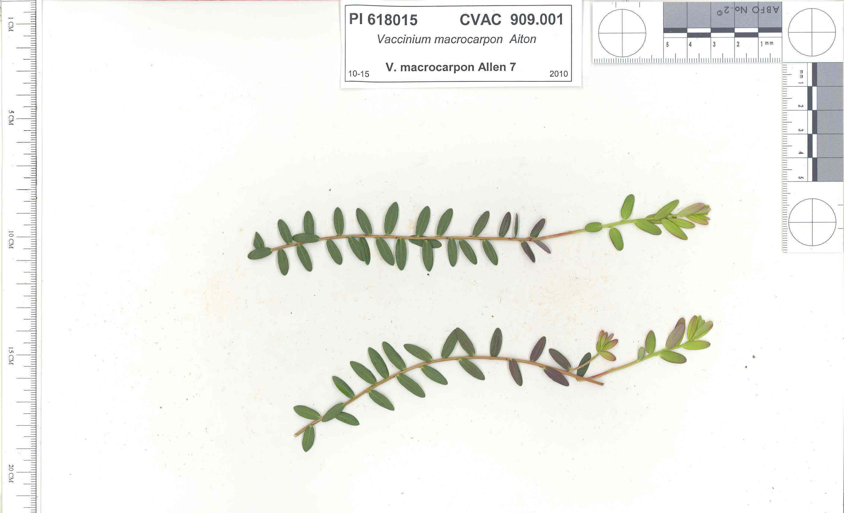 | | 1991 | COLLECTED | 10/29/1991 | Oligotrophic fen near WV/MD border in Preston county, WV, owned by the nature conservancy, WV, known as Cranesville Swamp | 39.51950000, -79.48233000 | 786 | 2 acres fen, bordered by Typha sp., Acer rubrum, Prunus serotina, Hemlock, Sotuhern most population of American Larch (Tamarack), also has Sphagnum spp., Rubus hispidus, Solidago uliginosa, Eripphorum virginicum, Pyrus melanocarpa | Wild material | Site holding moisture well in a regional drought, designated as a National Natural Landmark Additional plants are Hypericum densiflorum, Carex folliculata, Juncus effusus, J. canadensis, Bartonia virginica, Gaultheria procumbens | 1009919 | PI 618015 |
| 192 | PI 618017 | V. oxycoccos MD Allen 13 | Vaccinium oxycoccos L. | Maryland, United States | COR |  | | 1991 | COLLECTED | 10/30/1991 | "The Glades" minerotrophic fen, near Grantsville, Garrett county, MD | 39.55767000, -79.27967000 | 817 | greater than 100 acres, sedge/grass dominated minerotrophic fen, bordered by scattered white pine and spruce, also with Sphagnum spp., Solidago uliginosa, Glyceria canadensis, Calamogrostis canadensis, Carex Rostrata, C. Folliculata, | Wild material | Associated with Rubus Hispidus, Polytrichum sp., Alnus Rugosa. (This accession was part of the PL,SD 'breakout' - 1992) | 1009989 | PI 618017 |
| 193 | PI 618020 | V. macrocarpon WV Allen 16 | Vaccinium macrocarpon Aiton | West Virginia, United States | COR |  | | 1991 | COLLECTED | 10/30/1991 | Minerotrophic fen in large basin between 2 ridges, Tucker Co Big Run Bog (A.K.A. Olson Bog), Monongahela National Forest | 39.11750000, -79.58333000 | 0 | associated plants Sphagnum sp., Rubus hispidus, Eripphorium virginicum, Carex sp., Juncus sp., Sarracenia purpurea (introduced), Ilex verticillata | Wild material | Site proposed as a research natural area. (This accession was part of the PL,SD 'breakout' - 1992) | 1010011 | PI 618020 |
| 194 | PI 618021 | V. oxycoccos Allen 17 | Vaccinium oxycoccos L. | West Virginia, United States | COR | | | 1991 | COLLECTED | 10/30/1991 | Minerotrophic fen in large basin between 2 ridges, Tucker Co Big Run Bog (A.K.A. Olson Bog), Monongahela National Forest | 39.11750000, -79.58333000 | 0 | associated plants Sphagnum sp., Rubus hispidus, Eripphorium virginicum, Carex sp., Juncus sp., Sarracenia purpurea (introduced), Ilex verticillata | Wild material | Site proposed as a research natural area. (This accession was part of the PL,SD 'breakout' - 1992) | 1010027 | PI 618021 |
| 195 | PI 613182 | V. macrocarpon Site D Ogle 1 | Vaccinium macrocarpon Aiton | Tennessee, United States | COR | | | 1991 | COLLECTED | 10/19/1991 | Side of Holston mountains above Shady Valley, Johnson county , Tennessee. | 36.51667000, -81.96667000 | 1120 | Habitat saturated stream bank at lower edge of secondary seep. Edged by dry deciduous woods. Carex sp., Scirpus cyperinus, Pinus strobus, Lyonia ligustrina, Rosa sp., Dulichium arundinaceum, et al. | Wild material | D. W. Ogle collection
| 1009852 | PI 613182 |
| 196 | PI 638753 | V. macrocarpon Site D. Ogle 2 | Vaccinium macrocarpon Aiton | Tennessee, United States | COR | | | 1991 | COLLECTED | 10/19/1991 | Side of Holston mountains above Shady Valley, Johnson county , Tennessee. | 36.51667000, -81.96667000 | 1120 | Habitat saturated stream bank at lower edge of secondary seep. Edged by dry deciduous woods. Carex sp., Scirpus cyperinus, Pinus strobus, Lyonia ligustrina, Rosa sp., Dulichium arundinaceum, et al. | Wild material | D. W. Ogle collection
| 1009838 | PI 638753 |
| 197 | PI 618013 | V. macrocarpon Site II | Vaccinium macrocarpon Aiton | Virginia, United States | COR | | | 1991 | COLLECTED | 10/17/1991 | Nature area owend by the Nature Conservancy, near intersecti on of routes 785 and 613 across route 613 from stone quarry, 1/4 mile up dirt road, Big Spring Glade area | 36.66667000, -80.93333000 | 786 | Soil Wehadkee silt loam, flora more varied than a typical bog, Sphagnum subsecundum Nees ex Strum, Pinus sp., Quercus sp., Acer sp., Lyondia sp., Sorbus., Ilex sp., Viola sp., Delphinium sp., Xanthorhiza, Phalaris, Carex, Aletris | Wild material | 'Poor fen' as descirbed by Ogle in paper and by Sjors (1959) cited by Ogle (p 144) Cranberry crop at this site very poor in 1991, leaves smaller that usual. 'something had been in and tramping but probably not human.' (This accession was part of the PL,SD 'breakout' - 1992) | 1009869 | PI 618013 |
| 198 | PI 560086 | MPW-WWR 215 | Cuphea viscosissima Jacq. | Tennessee, United States | NC7 | | | 1989 | COLLECTED | 09/12/1989 | Gravel rd edge, plts cut over, on N side or road with Eupatorium coelestinum, Carex sp, Euphorbia maculata, and Cercis. 0.1 mi NW TN 149 on Hematite Rd, Palmyra quad. Palmyra city, in Montgomery Cty. | 36.45000000, -87.45000000 | 115 | | Wild material | Population of over 100 plants. | 1455058 | PI 560086 |
| 199 | Ames 38800 | Camp Mitigwa | Amelanchier arborea (F. Michx.) Fernald | Iowa, United States | NC7 |  | | 2026 | COLLECTED | 06/01/2026 | Mitigwa Scout Camp located on west side of Des Moines River watershed approximately 7.50 miles south, southwest of Boone, T82N R26W N 1/4 Sec. 5 and T83N R26W S 1/4 Sec. 32. | 41.94894500, -93.90537200 | 310 | High-quality white oak - ironwood, mature woods. | Wild material | The native range of Amelanchier arborea is concentrated in the eastern half of the U.S. (Little, 1977). This accession represents a collection of A. arborea germplasm from the western edge of the species native range, specifically central Iowa. Specimens sampled at the collection site in nature were small to medium understory or woodland edge single and/or multi-trunked trees with a few trees getting close to being deemed as canopy specimens. Bark smooth and light grey in color. Specimens sampled in nature ranging 15-50' in height. Peak flowering occurred on 8 April 2026 with white flowers appearing prior to leaf expansion. Fall colors ranging from orange to orange-red peaking typically at the end of September (central Iowa). Fruits, dark-pink to red, maturing in early June (peak in 2026 occurred on 2 June) averaging 8 mm in diameter, except for mother tree #6 that had rather large fruits at 11 mm in diameter. | 2197049 | Ames 38800 |
| 200 | NA 89173 | 2025RJLSEUS-14 | Chionanthus sp. | Florida, United States | NA | | | 2026 | COLLECTED | 10/03/2025 | Choctawhatchee National Forest: the collection site is reached by foot (~0.5 km) along a loose sand road/firebreak from Martin Luther King, Jr. Boulevard, just east of the boundary for Hurlburt Field in Hurlburt Field/Ft. Walton Beach, FL. Collected from 30 deg. 26.859', -86 deg. 39.577' to 30 deg. 27.137', -86 deg. 39.580'; latitude and longitude of record calculated at the midpoint of these coordinates. | 30.44996000, -86.65965000 | 10 | Dry to xeric conditions of well-drained, deep sandy soils on a relatively level area bordering a powerline in an open mixed mostly mixed evergreen and deciduous, somewhat disturbed habitat in sun to part shade. In areas “broadleaved scrub” vegetation is so dense, that it is almost impenetrable. Elevation: 9 to 11 meters. Slope: 0 to 3 percent. Aspect: Variable. Soil: The soils of this area are characterized as Foxworth Series (95 percent) sand, 0 to 5 percent slopes (8). Other soil series interbedded with the Foxworth Series, vary in percentages from 1-4 percent including Lakeland and Chipley. The Foxworth Series consists of very deep, moderately well to somewhat excessively drained, rapid to very rapid permeable soils on broad uplands and side slopes. They formed in sandy marine or eolian sediments in the Southern Coastal Plain (MLRA 133A), The Eastern Gulf Coast Flatwoods (MLRA 152A), The Atlantic Coast Flatwoods (153A) and the Tidewater Area (153B). Thickness of the grayish brown to light yellowish-brown sand exceeds 2 meters. Reaction ranges from very strongly acid to slightly acid throughout. (Source: California Soil Resource Lab/NRCS Official Soil Series Descriptions). Geology: The underlying geology of this area is characterized as undifferentiated Quaternary Sediments. Much of Florida's surface is covered by a varying thickness of undifferentiated sediments consisting of siliciclastics, organics and freshwater carbonates. Where these sediments exceed 6.1 meters thick, they were mapped as discrete units. To subdivide the undifferentiated sediments, those sediments occurring in flood plains were mapped as alluvial and flood plain deposits (Qal). Sediments showing surficial expression of beach ridges and dunes were mapped separately (Qbd) as were the sediments composing Trail Ridge (Qtr). Terrace sands were not mapped (refer to Healy [1975] for a discussion of the terraces in Florida). The subdivisions of the Undifferentiated Quaternary Sediments (Qu) are not lithostratigraphic units but are utilized to facilitate a better understanding of the State's geology. The siliciclastics are light gray, tan, brown to black, unconsolidated to poorly consolidated, clean to clayey, silty, unfossiliferous, variably organic-bearing sands to blue green to olive green, poorly to moderately consolidated, sandy, silty clays. Gravel is occasionally present in the panhandle. Organics occur as plant debris, roots, disseminated organic matrix and beds of peat. Freshwater carbonates, often referred to as marls in the literature, are scattered over much of the State. In southern Florida, freshwater carbonates are nearly ubiquitous in the Everglades. These sediments are buff colored to tan, unconsolidated to poorly consolidated, fossiliferous carbonate muds. Sand, silt and clay may be present in limited quantities. These carbonates often contain organics. The dominant fossils in the freshwater carbonates are mollusks. (Source: USGS Florida Geologic Map Data). | Wild material | Received as C. cf. henryae | 2193307 | NA 89173 |
| 201 | NA 89171 | 2025RJLSEUS-04 | Rhododendron catawbiense Michx. | Alabama, United States | NA | | | 2026 | COLLECTED | 09/30/2025 | Scarham Creek: southeast of the Pea Ridge Road bridge, approximately 50-80 meters on the south side of the creek. | 34.32559600, -86.16054600 | 266 | Growing near the base of the slopes above the riparian zone, generally on the exposed geology under very well-drained conditions. The woodlands are primarily deciduous with a few evergreens infrequently mixed. Slope: 15 to 30 percent. Aspect: Northeast. Soil: The primary soil type in the area of this collection is classified as Rockland Series sandstone (Rc). The Rockland series consists of well drained soils formed in loamy colluvium from rotational landslides on slopes of stream valleys and dissections of ground moraines. Saturated hydraulic conductivity is moderate in the upper part of the profile and moderately slow in the lower part. Slopes range from 18 to 70 percent. Some pedons have buried leaves, twigs, and moss. Mass soil movement has left random remnants of soil structure from prior upslope soil development and has buried tree branches, leaves and moss. The upper 0-2 cm of soil contains slightly decomposed organic matter while lower soils layers to a depth of 58 cm are comprised of dark reddish-brown to brown silt loam and are moderately acidic. Below 58 cm the soils are generally dark reddish-brown silt loam and strongly to moderately alkaline. (Source:California Soil Resource Lab/NRCS Official Soil Series Descriptions). Geology: The underlying geology of this area is of Pennsylvanian origin and characterized as Pottsville Formation. It is characterized by light-gray thin to thick-bedded quartzose sandstone and conglomerate containing interbedded dark-gray shale, siltstone, and coal. Mapped on Lookout Mountain, Blount and Chandler Mountains, and Sand Mountain northeast of Blount County, and on the mountains of Jackson, Marshall, and Madison Counties north and west of the TN river. (Source: USGS Alabama Geologic Map Data). | Wild material | Received as R. catawbiense vsr. insularis | 2193305 | NA 89171 |
| 202 | NA 89155 | 2025RJLSEUS-02 | Ilex longipes Chapm. ex Trel. | Alabama, United States | NA | | | 2025 | COLLECTED | 09/30/2025 | Scarham Creek: southeast of the Pea Ridge Road bridge, approximately 50-80 meters on the south side of the creek. | 34.32520700, -86.15967000 | 261 | Plants are growing on relatively steep woodland slopes in shade. The woodlands are primarily deciduous with a few evergreens infrequently mixed. Slope: 15 to 30 percent. Aspect: Northeast. Soil: The primary soil type in the area of this collection is classified as Rockland Series sandstone (Rc). The Rockland series consists of well drained soils formed in loamy colluvium from rotational landslides on slopes of stream valleys and dissections of ground moraines. Saturated hydraulic conductivity is moderate in the upper part of the profile and moderately slow in the lower part. Slopes range from 18 to 70 percent. Some pedons have buried leaves, twigs, and moss. Mass soil movement has left random remnants of soil structure from prior upslope soil development and has buried tree branches, leaves and moss. The upper 0-2 cm of soil contains slightly decomposed organic matter while lower soils layers to a depth of 58 cm are comprised of dark reddish-brown to brown silt loam and are moderately acidic. Below 58 cm the soils are generally dark reddish-brown silt loam and strongly to moderately alkaline. (Source: California Soil Resource Lab/NRCS Official Soil Series Descriptions). Geology: The underlying geology of this area is of Pennsylvanian origin and characterized as Pottsville Formation. It is characterized by light-gray thin to thick-bedded quartzose sandstone and conglomerate containing interbedded dark-gray shale, siltstone, and coal. Mapped on Lookout Mountain, Blount and Chandler Mountains, and Sand Mountain northeast of Blount County, and on the mountains of Jackson, Marshall, and Madison Counties north and west of the TN river. (Source: USGS Alabama Geologic Map Data). | Wild material | | 2193001 | NA 89155 |
| 203 | NA 89156 | 2025RJLSEUS-03 | Euonymus americanus L. | Alabama, United States | NA | | | 2025 | COLLECTED | 09/30/2025 | Scarham Creek: southeast of the Pea Ridge Road bridge, approximately 50-80 meters on the south side of the creek. | 34.32577600, -86.16071000 | 260 | Plants are growing on relatively steep woodland slopes in shade. The woodlands are primarily deciduous with a few evergreens infrequently mixed. Slope: 15 to 30 percent. Aspect: Northeast. Soil: The primary soil type in the area of this collection is classified as Rockland Series sandstone (Rc). The Rockland series consists of well drained soils formed in loamy colluvium from rotational landslides on slopes of stream valleys and dissections of ground moraines. Saturated hydraulic conductivity is moderate in the upper part of the profile and moderately slow in the lower part. Slopes range from 18 to 70 percent. Some pedons have buried leaves, twigs, and moss. Mass soil movement has left random remnants of soil structure from prior upslope soil development and has buried tree branches, leaves and moss. The upper 0-2 cm of soil contains slightly decomposed organic matter while lower soils layers to a depth of 58 cm are comprised of dark reddish-brown to brown silt loam and are moderately acidic. Below 58 cm the soils are generally dark reddish-brown silt loam and strongly to moderately alkaline. (Source: California Soil Resource Lab/NRCS Official Soil Series Descriptions). Geology: The underlying geology of this area is of Pennsylvanian origin and characterized as Pottsville Formation. It is characterized by light-gray thin to thick-bedded quartzose sandstone and conglomerate containing interbedded dark-gray shale, siltstone, and coal. Mapped on Lookout Mountain, Blount and Chandler Mountains, and Sand Mountain northeast of Blount County, and on the mountains of Jackson, Marshall, and Madison Counties north and west of the TN river. (Source: USGS Alabama Geologic Map Data). | Wild material | | 2193002 | NA 89156 |
| 204 | W6 62522 | FWS0300-112 | Eupatorium perfoliatum L. | Michigan, United States | W6 |  | | 2025 | | | | | | | Wild material | | 2192220 | W6 62522 |
| 205 | W6 62535 | FWS0300-145 | Verbena hastata L. | Michigan, United States | W6 |  | | 2025 | | | | | | | Wild material | | 2192233 | W6 62535 |
| 206 | W6 62539 | FWS0300-154 | Liatris cylindracea Michx. | Michigan, United States | W6 |  | | 2025 | | | | | | | Wild material | The vegetative part of the population is likely dormant, though it is not possible to discern dormant individuals. Consequently, the above population size may be an underestimate. | 2192237 | W6 62539 |
| 207 | W6 62544 | FWS0300-78 | Schoenoplectus tabernaemontani (C. C. Gmel.) Palla | Michigan, United States | W6 |  | | 2025 | | | | | | | Wild material | Plants have variable phenology with mature achenes and fresh flowers often on a single individual | 2192242 | W6 62544 |
| 208 | NA 89194 | DLSP-WB | Hamamelis virginiana L. | Wisconsin, United States | NA | | | 2025 | COLLECTED | 08/21/2024 | Devil's Lake State Park: West Bluff. | 43.41418510, -89.73993600 | 332 | Shade to part shade/sun to full sun in thin layer of clayey organic matter on boulder field. Slope: 60 degrees. Aspect: East. Red oak-sugar maple-linden vegetative community. | Wild material | | 2171015 | NA 89194 |
| 209 | NA 89196 | KVR | Hamamelis virginiana L. | Wisconsin, United States | NA | | | 2025 | COLLECTED | 08/22/2024 | Kickapoo Valley Reserve. | 43.62650770, -90.64627490 | 299 | Shade in thick, clayey, organic soil with sand. Slope: 45 degrees. Aspect: Northeast. Silver maple-boxelder-elm vegetative community. | Wild material | | 2171017 | NA 89196 |
| 210 | NA 88579 | 2024RJLFL-007 | Ilex myrtifolia Walter | Florida, United States | NA | | | 2024 | COLLECTED | 11/13/2024 | Wetlands accessed from Miller Bluff Road. | 30.62251200, -86.86030700 | 8 | Open, wet areas and woodland edge slightly above permanently wet habitat in part shade to full sun. Slope: 0 percent. Aspect: N/A. | Wild material | | 2169916 | NA 88579 |
| 211 | NA 88580 | 2024RJLFL-009 | Ilex myrtifolia Walter | Florida, United States | NA | | | 2024 | COLLECTED | 11/13/2024 | Woodlands on the north side of Fisher Old Mill Road about 0.10 kilometers west of intersection with DOF Y12. | 30.62693800, -86.83962200 | 6 | Mixed evergreen and deciduous moist to wet forest in part shade to full sun. From the associated taxa, this site can be quite wet during the growing season; however, it was dry during this collection time; likely due to extended drought. Slope: 0 percent. Aspect: South. | Wild material | | 2169917 | NA 88580 |
| 212 | NA 88583 | 2024RJLFL-014 | Ilex amelanchier M. A. Curtis ex Chapm. | Florida, United States | NA | | | 2024 | COLLECTED | 11/13/2024 | Yellow River Water Management Area: found in an area where an unnamed unpaved road dead ends near the Yellow River. This unpaved road is accessed from Old River Road to the east near the junction with Shockley Springs Road. Individual plants for this collection were accessed by foot along the edge of the river and associated wetland depressions to the east of the road. The sampling for this portion of the population extends from the GPS coordinates listed above to the northeast where sampling ended at coordinates 30.871238 deg. N, 86.590170 deg. W. | 30.86989400, -86.59218500 | 23 | Plants growing in seasonally inundated swamp habitats associated with the Yellow River and small tributaries. Plants are emergent during portions of the year, primarily during the growing season. During this time of collection, water had receded from the wetlands and the area was relatively dry. Slope: N/A. Aspect: N./A. The underlying geology of this area is the Alum Bluff Group of Miocene origin. It includes the Chipola Formation, Oak Grove Sand, Shoal River Formation, Choctawhatchee Formation and the Jackson Bluff Formation. The formations included in this group are generally defined based on their molluscan faunas and stratigraphic position. Puri (1953) described sediment facies as they relate to the formations of the Alum Bluff Group. These sediments are lithologically distinct as a group, not as individual units. The Alum Bluff Group crops out or is beneath a thin overburden in the western panhandle from river valleys in Okaloosa County eastward to western Jackson County. The Alum Bluff Group consists of clays, sands and shell beds which may vary from fossiliferous, sandy clays to unfossiliferous sands and clays and occasional carbonate beds. Mica is a common constituent and glauconite and phosphate occur sporadically. Induration varies from essentially nonindurated in sands to well indurated in carbonate lenses. Colors range from cream to olive gray with mottled reddish brown in weathered sections. Sand grain size varies from very fine to very coarse with sporadic occurrences of gravel. These sediments generally have low permeabilities and are part of the intermediate confining unit/aquifer system. (Source: USGS Florida Geologic Map Data). The surface soil profile of this area is primarily Kinston, Johnston, and Bibb soils, frequently flooded. Kinston Series soils are poorly drained, alluvial, fine-loamy, siliceous, and acid soils of flood plains. They are peaty to loamy friable, slightly sticky, and slightly plastic in the upper 0 to 7.5 cm of the strata with less sand and more silt-loam in progressively deeper strata. The Johnston Series consists of very deep, very poorly drained coarse-loamy, siliceous, active, acid, thermic Cumulic Humaquepts. The upper 0-75 cm is black, mucky loam that is friable and very strongly acid. The lower strata to 1.75 m are dark gray, loamy fine sand, single grained, loose and very strongly acid. (Source: NRCS Web Soil Survey). | Wild material | | 2169920 | NA 88583 |
| 213 | NA 88585 | 2024RJLFL-018 | Rhododendron canescens (Michx.) Sweet | Florida, United States | NA | | | 2024 | COLLECTED | 11/14/2024 | Woodlands in the riparian zone of a headwater spring and wetland leading to Panther Creek. The area is accessed from High Bridge Road by turning south on an unnamed dirt/sand road and driving about 0.27 kilometers to a pond. | 30.90865300, -86.69107200 | 49 | Mostly deciduous woodlands in the riparian zone of a headwater spring and wetland in shade to part shade. Slope: 5 to 8 percent. Aspect: N/A. The underlying geology of this area is characterized as Citronelle Formation of the Pliocene period. The Citronelle Formation is widespread in the Gulf Coastal Plain. The type section for the Citronelle Formation, named by Matson (1916), is near Citronelle, Alabama. The Citronelle Formation grades laterally, through a broad facies transition, into the Miccosukee Formation of the eastern Florida panhandle. Coe (1979) investigated the Citronelle Formation in portions of the western Florida panhandle. The Citronelle Formation is a siliciclastic, deltaic deposit that is lithologically similar to, and time equivalent with, the Cypresshead Formation and, at least in part, the Long Key Formation (Cunningham et al., 1998) of the peninsula. In the western panhandle, some of the sediments mapped as Citronelle Formation may be reworked Citronelle. The lithologies are the same and there are few fossils present to document a possible younger age. The Citronelle Formation consists of gray to orange, often mottled, unconsolidated to poorly consolidated, very fine to very coarse, poorly sorted, clean to clayey sands. It contains significant amounts of clay, silt and gravel which may occur as beds and lenses and may vary considerably over short distances. Limonite nodules and limonite-cemented beds are common. Marine fossils are rare but fossil pollen, plant remains and occasional vertebrates are found. Much of the Citronelle Formation is highly permeable. It forms the Sand and Gravel Aquifer of the surficial aquifer system contain organics. The dominant fossils in the freshwater carbonates are mollusks. (Source: USGS Florida Geologic Map Data). The surface soil profile is classified as Troup-Orangeburg-Cowarts complex, 5 to 12 percent slopes. The Troup series consists of very deep, somewhat excessively drained soils formed in unconsolidated sandy and loamy marine sediments. Troup soils are found on ridges and hillslopes. The Orangeburg series consists of very deep, well drained, moderately permeable soils on uplands of the Southern Coastal Plain. They formed in loamy and clayey marine sediments. The Cowarts series consists of very deep, moderately well and well drained soils on ridge tops and side slopes on uplands of the Coastal Plain Major Land Resource Area. They formed in loamy marine sediments. The reaction of all these soils ranges from very strongly acid to strongly acid. (Source: USDA-NRCS Official Soil Series Descriptions). | Wild material | | 2169922 | NA 88585 |
| 214 | NA 89075 | 2024RJLPA-001 | Rhododendron maximum L. | Pennsylvania, United States | NA | | | 2024 | COLLECTED | 09/18/2024 | Fieldstone Farm Tank Creek Nature Preserve (a property of the Pocono Heritage Land Trust): Collected along Tank Creek. The property is accessed from a parking area located on Devil's Hole Road. | 41.13862300, -75.34562700 | 493 | Mostly found in mixed deciduous forest with occasional conifers and evergreen shrubs generally on steep slopes above Tank Creek in rocky well-drained soils in shade to part-shade. The slopes are abundant in decomposed organic matter and runoff soils. Slope: 5 to 30 percent. Aspect: various. Geology: The underlying geology of this area is of Devonian origin and characterized as the Long Run Member of Catskill Formation. It is comprised of gray and grayish-red sandstone and grayish-red siltstone and mudstone in fining-upward cycles. (Source: USGS Pennsylvania Geologic Map Data). Soils: The primary soil type found here is classified as Alluvial Land. In geology, alluvial land refers to areas of land that are formed by the deposition of sediments carried by rivers, or other surface water. EPA Ecoregion (Level III): North Central Appalachians (62). EPA Ecoregion (Level IV): Low Poconos (62b). | Wild material | | 2169039 | NA 89075 |
| 215 | NA 89076 | 2024RJLPA-002 | Kalmia latifolia L. | Pennsylvania, United States | NA | | | 2024 | COLLECTED | 09/18/2024 | Fieldstone Farm Tank Creek Nature Preserve (a property of the Pocono Heritage Land Trust): Collected along Tank Creek. The property is accessed from a parking area located on Devil's Hole Road. | 41.13862300, -75.34562700 | 493 | Mostly found in mixed deciduous forest with occasional conifers and evergreen shrubs generally on sloping sites as an understory shrub in rocky well-drained soils in shade to part-shade. Slope: 5 to 15 percent. Aspect: various. Geology: The underlying geology of this area is of Devonian origin and characterized as the Long Run Member of Catskill Formation. It is comprised of gray and grayish-red sandstone and grayish-red siltstone and mudstone in fining-upward cycles. (Source: USGS Pennsylvania Geologic Map Data). Soils: The primary soil type found here is classified as Alluvial Land. In geology, alluvial land refers to areas of land that are formed by the deposition of sediments carried by rivers, or other surface water. EPA Ecoregion (Level III): North Central Appalachians (62). EPA Ecoregion (Level IV): Low Poconos (62b). | Wild material | | 2169040 | NA 89076 |
| 216 | NA 89077 | 2024RJLPA-003 | Viburnum acerifolium L. | Pennsylvania, United States | NA | | | 2024 | COLLECTED | 09/19/2024 | Birdell Road, near parking lot to trail where the road ends at Chambers Lake, which is part of Hibernia County Park. | 40.03559500, -75.85708600 | 187 | Plants are growing in deep shade of a dry deciduous forest dominated by Fagus grandifolia. Slope: 0 percent. Aspect: N/A. Geology: The underlying geology of this area is of Precambrian origin and characterized as Banded Mafic Gneiss. It is characterized as dark and fine to medium grained. This formation includes rocks of probable sedimentary origin; may be equivalent to "PZmgh." (Source: USGS Pennsylvania Geologic Map Data). Soils: The primary soil type in the area of this collection is classified as Neshaminy Series Silt Loam, very deep over mafic gneiss, 3 to 8 percent slopes (NvB). (Source: USDA-NRCS Official Soil Series Descriptions). EPA Ecoregion (Level III): Northern Piedmont (64). EPA Ecoregion (Level IV): Piedmont Uplands (64c). | Wild material | | 2169041 | NA 89077 |
| 217 | NA 89078 | 2024RJLPA-004 | Staphylea trifolia L. | Pennsylvania, United States | NA | | | 2024 | COLLECTED | 09/20/2024 | Along gated road about 0.33 kilometers southwest of the Lake Ontelaunee Trail parking lot. | 40.49850800, -75.89121300 | 94 | Plants are growing on well-drained steep slopes in shade to part shade of a deciduous forest. Slope: 35 to 50 percent. Aspect: East-southeast. Geology: The underlying geology of this area is of Ordovician origin and characterized as Shale and graywacke of Hamburg sequence. It is characterized by shale containing zones of conspicuous graywacke. (Source: USGS Pennsylvania Geologic Map Data). Soils: The primary soil type in the area of this collection is classified as Berks-Weikert Complex, 25 to 60% slopes (BkF). Dominantly sloping to very steep, moderately deep and shallow, well drained soils underlain by acid shale bedrock. (Source: UPenn State University Soil Info Website). EPA Ecoregion (Level III): Ridge and Valley (67). EPA Ecoregion (Level IV): Northern Shale Valleys (67b). | Wild material | | 2169042 | NA 89078 |
| 218 | NA 89080 | 2024RJLPA-006 | Ilex montana Torr. & A. Gray | Pennsylvania, United States | NA | | | 2024 | COLLECTED | 09/20/2024 | Berks and Schuylkill Counties: Hawk Mountain Sanctuary. | 40.64162200, -75.99122600 | 418 | Plants are growing from shade to full sun on a dry-mesic to very dry, well-drained upland/montane habitat characterized by an upland mixed deciduous and evergreen forest that is very rocky. All the plants found in this habitat go through periods of drought during the growing season due to the limited litter/soil layer in which moisture can be held. Elevation: 405 to 430 meters. Slope: 5 to 25 percent. Aspect: various. Geology: The underlying geology of this area is of Silurian origin and comprised of Shawangunk Formation. This formation is primarily light- to dark-gray, fine- to very coarse-grained sandstone and conglomerate containing thin shale interbeds. (Source: USGS Pennsylvania Geologic Map Data). Soils: The surface soil profile of this area is characterized as the Hazleton Series which consists of deep and very deep, well drained soils formed in residuum of acid gray, brown or red sandstone on uplands. The matrix includes a considerable accumulation of thin, flat, coarse fragments of sandstone, limestone, or schist with diameters up to 15 cm. Slope ranges from 0-80%. Permeability is moderately rapid to rapid. (Source: USDA-NRCS Official Soil Series Descriptions). EPA Ecoregion (Level III): Ridge and Valley (67). EPA Ecoregion (Level IV): Northern Sandstone Ridges (67c). | Wild material | | 2169044 | NA 89080 |
| 219 | NA 89088 | 2024RM-TK-001 | Viburnum acerifolium L. | Alabama, United States | NA | | | 2024 | COLLECTED | 09/19/2024 | Haines Island Park. Follow Ferry Road to the top of the hill entering the park where a picnic shelter is located. Plants are growing along trails to the north of the picnic shelter. | 31.72132026, -87.46408910 | 81 | Plants are growing from part-sun to full shade in the understory of a mixed deciduous and coniferous forest on very dry upland habitat. Slope: 10 to 20 percent. Aspect: North. Geology: The underlying geology of this area is probably of Eocene age and characterized as the Claiborne Group: Tallahatta Formation. It is comprised of white to very light-greenish-gray thin-bedded to massive siliceous claystone; interbedded with thin layers of fossiliferous clay, sandy clay, and glauconitic sand and sandstone. White to light-greenish-gray fine to coarse sand and fine gravel occur at the base of the formation in southwest Alabama (Meridian Sand Member). (Source: USGS Alabama Geologic Map Data). Soils: The area of this occurrence is characterized as Arundel Series Loam, 8 to 35 percent slopes (ArF). The Arundel series consists of moderately deep, well drained, very slowly permeable soils on dissected uplands of the Southern Coastal Plain Major Land Resource Area (MLRA 133A). They formed in marine deposits consisting of acid clays underlain by horizontally bedded sandstone, buhrstone and siltstone. Slopes range from 2 to 60 percent. (Source: California Soil Resource Lab/NRCS Official Soil Series Descriptions). EPA Ecoregion (Level III): Southeastern Plains (65). EPA Ecoregion (Level IV): Buhrstone/Lime Hills (65q). | Wild material | | 2169052 | NA 89088 |
| 220 | NA 89089 | 2024RM-TK-002 | Viburnum acerifolium L. | Alabama, United States | NA | | | 2024 | COLLECTED | 09/19/2024 | Woodland slopes around and below the hilltop parking area leading down to the Silver Creek Lake Campground off of Silver Creek Lake Road. | 31.66612294, -87.57569860 | 49 | Plants are growing in shade of upland dry mesic, mature mixed deciduous and evergreen woodland. Generally, the overstory is thinner and there is less leaf litter cover, making the surface soil conditions drier. Slope: 5 to 10 percent. Aspect: Southeast. Geology: The underlying geology of this area is Claiborne Group, Tallahatta Formation, of Eocene origin, with white to very light-greenish-gray thin-bedded to massive siliceous claystone; interbedded with thin layers of fossiliferous clay, sandy clay, and glauconitic sand and sandstone. (Source: USGS Alabama Geologic Map Data). Soils: The primary soil types in the collection area are classified as Arundel-Cantuche Complex soils (15 to 35 percent slopes). The Arundel Series consists of moderately deep, well drained, very slowly permeable soils on dissected uplands of the Southern Coastal Plain. They formed in marine deposits consisting of acid clays underlain by horizontally bedded sandstone, buhrstone and siltstone. These soils are strongly acid. Slopes range from 2 to 60 percent. The Cantuche Series consists of shallow, well drained, moderately permeable soils that formed over horizontally bedded claystone. These soils are on narrow ridgetops and narrow benches on steep side-slopes of dissected landscapes in the Coastal Plain. They are strongly acid. Slopes range from 2 to 35 percent. (Source: California Soil Resource Lab/NRCS Official Soil Series Descriptions). EPA Ecoregion (Level III): Southeastern Plains (65). EPA Ecoregion (Level IV): Buhrstone/Lime Hills (65q). | Wild material | | 2169053 | NA 89089 |
| 221 | NA 89090 | 2024RM-TK-003 | Ilex longipes Chapm. ex Trel. | Alabama, United States | NA | | | 2024 | COLLECTED | 09/19/2024 | Woodland slopes around and below the hilltop parking area leading down to the Silver Creek Lake Campground off of Silver Creek Lake Road. | 31.66612294, -87.57569860 | 39 | Plants are growing in part-shade to shade of a moist mesic deciduous and evergreen woodland on dry, well-drained soil to an area 1-2 meters above a small seasonally spring-fed creek at 31.664428°, -87.574614°. Slope: 5 to 10 percent. Aspect: Southeast. Geology: The underlying geology of this area is Claiborne Group, Tallahatta Formation, of Eocene origin, with white to very light-greenish-gray thin-bedded to massive siliceous claystone; interbedded with thin layers of fossiliferous clay, sandy clay, and glauconitic sand and sandstone. (Source: USGS Alabama Geologic Map Data). Soils: The primary soil types in the collection area are classified as Arundel-Cantuche Complex soils (15 to 35 percent slopes). The Arundel Series consists of moderately deep, well drained, very slowly permeable soils on dissected uplands of the Southern Coastal Plain. They formed in marine deposits consisting of acid clays underlain by horizontally bedded sandstone, buhrstone and siltstone. These soils are strongly acid. Slopes range from 2 to 60 percent. The Cantuche Series consists of shallow, well drained, moderately permeable soils that formed over horizontally bedded claystone. These soils are on narrow ridgetops and narrow benches on steep side-slopes of dissected landscapes in the Coastal Plain. They are strongly acid. Slopes range from 2 to 35 percent. (Source: California Soil Resource Lab/NRCS Official Soil Series Descriptions). EPA Ecoregion (Level III): Southeastern Plains (65). EPA Ecoregion (Level IV): Buhrstone/Lime Hills (65q). | Wild material | | 2169054 | NA 89090 |
| 222 | NA 89092 | 2024RM-TK-005 | Ilex amelanchier M. A. Curtis ex Chapm. | Florida, United States | NA | | | 2024 | COLLECTED | 09/29/2024 | Yellow River Water Management Area: found in an area where an unnamed, unpaved road dead ends near the Yellow River. This unpaved road is accessed from Old River Road to the east near the junction with Shockley Springs Road. Plants are accessed by foot along the edge of the river and associated wetland depressions to the west of the road. | 30.86946200, -86.59349000 | 23 | Plants growing in seasonally inundated swamp habitats associated with the Yellow River. Plants are emergent during portions of the year, primarily during the growing season. During this time of collection, water had receded from the wetlands but the area was still quite wet with many tiny stream rivulets still draining. Slope: 0 percent. Aspect: N/A. Geology: The underlying geology of this area is the Alum Bluff Group of Miocene origin. It includes the Chipola Formation, Oak Grove Sand, Shoal River Formation, Choctawhatchee Formation and the Jackson Bluff Formation. The formations included in this group are generally defined based on their molluscan faunas and stratigraphic position. Puri (1953) described sediment facies as they relate to the formations of the Alum Bluff Group. These sediments are lithologically distinct as a group, not as individual units. The Alum Bluff Group crops out or is beneath a thin overburden in the western panhandle from river valleys in Okaloosa County eastward to western Jackson County. The Alum Bluff Group consists of clays, sands and shell beds which may vary from fossiliferous, sandy clays to unfossiliferous sands and clays and occasional carbonate beds. Mica is a common constituent and glauconite and phosphate occur sporadically. Induration varies from essentially nonindurated in sands to well indurated in carbonate lenses. Colors range from cream to olive gray with mottled reddish brown in weathered sections. Sand grain size varies from very fine to very coarse with sporadic occurrences of gravel. These sediments generally have low permeabilities and are part of the intermediate confining unit/aquifer system. (Source: USGS Florida Geologic Map Data). Soils: The surface soil profile of this area is primarily Kinston, Johnston, and Bibb soils, frequently flooded. Kinston Series soils are poorly drained, alluvial, fine-loamy, siliceous, and acid soils of flood plains. They are peaty to loamy friable, slightly sticky and slightly plastic in the upper 0 to 7.5 cm of the strata with less sand and more silt-loam in progressively deeper strata. The Johnston Series consists of very deep, very poorly drained coarse-loamy, siliceous, active, acid, thermic Cumulic Humaquepts. The upper 0-75 cm is black, mucky loam that is friable and very strongly acid. The lower strata to 1.75 m are dark gray, loamy fine sand, single grained, loose and very strongly a).id. The Bibb Series soils consist of very deep, poorly drained, moderately permeable soils on flood plains of streams in the Southern Coastal Plain (133A) Major Land Resource Area. They formed in stratified loamy and sandy alluvium that are commonly and frequently flooded and water runs off the surface very slowly. Slopes range from 0 to 2 percent. (Source: California Soil Resource Lab/NRCS Official Soil Series Descriptions). EPA Ecoregion (Level III): Southeastern Plains (65). EPA Ecoregion (Level IV): Southeastern Floodplains and Low Terraces (65p). | Wild material | | 2169056 | NA 89092 |
| 223 | Ames 36292 | Faith-Moccasin WMA | Salix petiolaris Sm. | Minnesota, United States | NC7 |  | | 2024 | COLLECTED | 09/07/2024 | Faith Wildlife Management Area and Moccassin State Wildlife Management Area east of Twin Valley approximately 8.25 miles. | 47.26010700, -96.09171700 | 351 | Wetland, shrub-carr complex. | Wild material | Slender-leaved willow, Salix petiolaris, is a somewhat dense suckering shrub that can reach up to 10' in height with slender stems that branch minimally, but typically maintains a height of 5-8'. Native to North America, the native range covers mostly the northeastern US stretching from Maine to western North Dakota and Canada south to central Iowa (Little, E. L. Jr. 1977). Salix petiolaris typically dominates wetland areas including sedge meadows, marshes, riverbanks, and lake shores. Despite favoring wet habitats, it can also be found in dry, upland areas, especially those with high-water tables. However, longevity is generally limited in upland habitats. S. petiolaris, similar to other willow species, responds well to fire, coppicing, or heavy browsing (highly favored by deer) by sprouting new stems close to the crown. In cultivation, plants after five years will encompass a 5' x 5' area due to stems that arch from the main base of the plant. Coppicing of plants to ground level is highly recommended either annually or once every 3-5 years to maintain vigorous growth and plant health. This species requires substantial to full sun exposure and is an excellent choice for streambank stabilizations and windbreaks to reduce soil erosion and drifting snow, respectively. This accession represents genetics from northwestern Minnesota. Plants sampled in nature averaging 6-8' in height. Clump-type growth habit with minimal branching, but dense suckering (e.g. 50+ ramets per genet - typically encompassing 5' x 5' area). Dormant, winter stem are rather uniform/consistent orange-brown/mahogany colors. | 2169827 | Ames 36292 |
| 224 | Ames 36250 | Liverpool Nature Preserve | Salix myricoides Muhl. | Indiana, United States | NC7 |  | | 2024 | COLLECTED | 06/03/2024 | Liverpool Nature Preserve located just east of Liverpool, T36N R8W W 1/2 NW 1/4 SE 1/4 Sec. 24. | 41.55597400, -87.28701600 | 189 | Savanna and prairie remnant with high water-table on sandy soils. | Wild material | Bayberry willow is native to areas of the northeastern U.S. and north into Canada, localized around the Great Lakes region. Known to occur on shorelines/dunes but also in swamps, fens, and on talus (Haines 2004) with the potential to reach six meters in height (Dorn 1995). Ornamental characteristics include glaucous lower leaf blades that appear chalky white. Staminate flowering occurs before or during leaf expansion with purple-turning-yellow anthers (Haines 2004). This accession represents a large amount of phenotypic variability observed at the time of collection. This included variation in leaf size, shape, margins and presence of stipules. All plants sampled have very glaucus undersides of the leaves. Winter stem colors vary widely from yellowish-orange; greenish-grey; mahogany; and reddish-brown. | 2167952 | Ames 36250 |
| 225 | W6 61536 | CA190B-210 | Erythranthe guttata (DC.) G. L. Nesom | California, United States | W6 |  | | 2024 | | | | | | | | | 2167635 | W6 61536 |
| 226 | WLP 3432 | RM2023-001 | Rhododendron minus Michx. | Georgia, United States | NA | | | 2024 | COLLECTED | 10/21/2023 | Plants growing along Patterson Gap Road. | 34.96995500, -83.47722800 | 1005 | Plants growing in part shade to sun in an upland, very dry and rocky, mostly deciduous habitat. The site is steeply sloped, underlain by rock, with rocky outcrops. Slope: 15 to 65 percent. Aspect: Variable. The underlying geology of this area is Quartzite/Mica Schist, primarily of Precambrian-Paleozoic origin. (Source: USGS North Carolina Geologic Map Data.) The primary soil type in the collection area is classified as Ashe Series that is stony and very steep. The Ashe series consists of moderately deep, somewhat excessively drained soils on gently sloping to very steep ridges and side slopes of the Blue Ridge. They formed in residuum that is affected by soil creep in the upper part, and weathered from felsic or mafic igneous and high-grade metamorphic rocks such as granite, hornblende gneiss, granodiorite, biotite gneiss, and high-grade metagraywacke. Slope ranges from 2 to 95 percent. The surface layer to 5cm deep is comprised of moderately decomposed organic matter and leaves, twigs, and roots. Layers to 70cm deep range from very dark grayish brown to brown sandy loam with weak medium and coarse granular structure that is friable. A few fine flakes of mica can be found and these soils are very strongly acid. (Source: NRCS Web Soil Survey.) | Wild material | | 2166141 | WLP 3432 |
| 227 | Ames 36219 | Egyptian Tract | Salix sericea Marshall | Missouri, United States | NC7 |  | | 2024 | COLLECTED | 01/19/2024 | LAD Foundation Egyptian Tract Wet Hollow Seep/Fen Complex located 7.52 miles west, southwest of Annapolis just northwest of intersection of CR 338 and CR 334, T31N R2E SW 1/4 SE 1/4 SE 1/4 Sec. 21 (Lesterville SE Quad.). | 37.34429700, -90.83361600 | 217 | Perched wet fen/seep complex with standing water supporting both obligate calciphilic and obligate acidophilic plant species. | Wild material | The native range of Salix sericea is concentrated througout the northeastern and eastern central United States ranging from Maine south to South Carolina, west to Illinois with a relatively large disjunct area in southeastern Missouri (Little, E. L. Jr. 1977). This accession represents genetics from southeastern Missouri in Reynolds County. Shrubs noted at the collection site in nature ranging in height from 2-7 feet and typically twice as wide as tall. Multi-stemmed shrubs expanding vegetatively via layering. Dormant stem colors noted at collection site ranging from mostly greenish to occassionally brownish red and/or copper tones. Dormant buds rather red and often bright red in color. Salix sericea is native to areas of the northeastern U.S. and north into Canada, reaching its western extent in Missouri. Classified as an obligate wetland plant that typically occurs on wet seeps, sedge meadows, streambanks, fens, etc. that are usually slightly acidic. Known to have the potential to reach up to four meters in height, but always much wider than tall. Ornamental characteristics include dark green leaves that are hairless above with undersides that are densely minutely-hairy making them rather white in appearance. Flowering occurs before or during leaf expansion. This species is known to serve as a larval host plant for the Arcadian Hairstreak, Satyrium acadica. | 2165775 | Ames 36219 |
| 228 | NA 88839 | RJL-RM2023FLAL-013 | Rhododendron austrinum (Small) Rehder | Florida, United States | NA | | | 2023 | COLLECTED | 12/10/2023 | Along the Florida Trail, accessed from Miller Bluff Road. Plants were found infrequently but regularly along the trail over 1 kilometer or more. | 30.61991500, -86.86521000 | 4 | Plants are growing primarily in shade to dappled shade, above a small stream in moist mesic conditions along and below the Florida Trail. The mixed evergreen and deciduous forest is quite diverse with an excellent litter layer. Slope: 2 to 8 percent. Aspect: South. The underlying geology of this area is classified as Alluvium, of Pleistocene/Holocene origin and consists of undifferentiated Quaternary sediments of varying thickness including siliciclastics, organics and freshwater carbonates. The siliciclastics are light gray, tan, brown to black, unconsolidated to poorly consolidated, clean to clayey, silty, unfossiliferous, variably organic-bearing sands to blue green to olive green, poorly to moderately consolidated, sandy, silty clays. Organics occur as plant debris, roots, disseminated organic matrix and beds of peat. Freshwater carbonates, often referred to as marls in the literature, are scattered. (Source: USGS Florida Geologic Map Data.) The surface soil profile of this area is primarily Bibb-Kinston Series Association. Bibb Series soils are coarse-loamy, sandy, acid soils that are poorly drained. They are soils of flood plains and streams subject to frequent flooding. These are found in association with Kinston Series soils that are fine-loamy, sandy, acid soils of flood plains and stream subject to frequent flooding. The Bibb-Kinston association ranges from 1-1.5 meters thick and is strongly acid. (Source: NRCS Web Soil Survey.) | Wild material | | 2165669 | NA 88839 |
| 229 | NA 88841 | RJL-RM2023FLAL-015 | Pinckneya bracteata (W. Bartram) Raf. | Florida, United States | NA | | | 2023 | COLLECTED | 12/11/2023 | West side of Marville Drive on the edge of the woodlands just a few hundred feet south of Fairway Drive. | 30.60665300, -85.32572200 | 79 | Plants are growing on the edge of a wetland acid habitat in the transitional zone between the obligate and facultative zones. They are growing in part-shade to shade with lower woody competition due to the moist conditions. Slope: N/A. Aspect: N/A. The underlying geology of this area is the Citronelle Formation of Pliocene origin and consists of gray to orange, often mottled, unconsolidated to poorly consolidated, very fine to very coarse, poorly sorted, clean to clayey sands. It contains significant amounts of clay, silt and gravel which may occur as beds and lenses and may vary considerably over short distances. Limonite nodules and limonite-cemented beds are common. (Source: USGS Florida Geologic Map Data.) The surface soil profile of this area is primarily Pamlico-Pantego-Rutlege Association. The Pamlico series consists of very poorly drained soils that formed in decomposed organic material underlain by dominantly sandy sediment. The soils are on nearly level flood plains, bays, and depressions of the Coastal Plain. Slopes are less than 1 percent. Pamlico soils have 0.4-1.3 meters of organic material over dominantly sandy sediments. Reaction is extremely in the organic layers and ranges from extremely acid to strongly acid in the underlying mineral layers. The Pantego series consists of very deep, very poorly drained, moderately permeable soils that formed in thick loamy sediments on the Southern Coastal Plain and Atlantic Coast Flatwoods. Slopes are less than 2 percent. This soil is strongly acid. The Rutlege series comprises very deep, very poorly drained persistently wet soils on flats, depressions and floodplains where shallow ponding is common. They are of marine or fluvial sediment origin. Thickness of these loamy sandy soils is greater than 1.5 meters and a reaction from extremely acid to strongly acid. (Source: NRCS Web Soil Survey.) | Wild material | | 2165671 | NA 88841 |
| 230 | NA 88844 | RJL-RM2023FLAL-018 | Clethra alnifolia L. | Florida, United States | NA | | | 2023 | COLLECTED | 12/13/2023 | Yellow River Water Management Area, accessed off of Old River Road by vehicle on an unmaintained sand road for approximately 1.68 kilometers. Upon reaching the destination, plants are accessed by foot along unmaintained trail to the east. | 30.83495500, -86.62005400 | 27 | Plants are growing primarily in part shade as understory shrubs in mixed evergreen and deciduous, moist to wet, acidic woodlands. Plants form large colonies and appear to have been subjected to prescribed fire in recent years. Slope: 10 to 15 percent. Aspect: Northeast. The underlying geology of this area is the Citronelle Formation of Pliocene origin and consists of gray to orange, often mottled, unconsolidated to poorly consolidated, very fine to very coarse, poorly sorted, clean to clayey sands. It contains significant amounts of clay, silt and gravel which may occur as beds and lenses and may vary considerably over short distances. Limonite nodules and limonite-cemented beds are common. (Source: USGS Florida Geologic Map Data.) The soil profile for this area is classified as the Bonifay Soil Series. Bonifay soil consists of very deep, well drained, moderately slowly permeable soils on ridges and side slopes in the Southern Coastal Plain. They formed in thick beds of sandy and loamy marine sediments. Solum thickness ranges from 1.5-2.0 m. Soil reaction ranges from very strongly acid to moderately acid throughout, except where the surface has been limed. Ironstone pebbles, 2 to 15 mm in size, range from 0 to 5 percent, by volume. Depth to the plinthic horizon ranges from 1.1-1.7 m. Some horizons contain up to 25 percent plinthite by volume. (Source: NRCS Web Soil Survey.) | Wild material | | 2165674 | NA 88844 |
| 231 | NA 88845 | RJL-RM2023FLAL-019 | Ilex opaca Aiton | Florida, United States | NA | | | 2023 | COLLECTED | 12/13/2023 | Yellow River Water Management Area, found along an unnamed unpaved road leading down to the Yellow River. This unpaved road is accessed from Old River Road to the east near the junction with Shockley Springs Road. | 30.87382600, -86.60221300 | 35 | Plants are growing along the road on the woodland edge on a small bluff above a creek in well-drained to dry habitat in part shade. They are also found sporadically in areas along the Yellow River where occasional inundation occurs. Slope: N/A. Aspect: N/A. The underlying geology of this area is the Alum Bluff Group of Miocene origin. It includes the Chipola Formation, Oak Grove Sand, Shoal River Formation, Choctawhatchee Formation and the Jackson Bluff Formation. The formations included in this group are generally defined on the basis of their molluscan faunas and stratigraphic position. Puri (1953) described sediment facies as they relate to the formations of the Alum Bluff Group. These sediments are lithologically distinct as a group, not as individual units. The Alum Bluff Group crops out or is beneath a thin overburden in the western panhandle from river valleys in Okaloosa County eastward to western Jackson County. The Alum Bluff Group consists of clays, sands and shell beds which may vary from fossiliferous, sandy clays to unfossiliferous sands and clays and occasional carbonate beds. Mica is a common constituent and glauconite and phosphate occur sporadically. Induration varies from essentially nonindurated in sands to well indurated in carbonate lenses. Colors range from cream to olive gray with mottled reddish brown in weathered sections. Sand grain size varies from very fine to very coarse with sporadic occurrences of gravel. These sediments generally have low permeabilities and are part of the intermediate confining unit/aquifer system. (Source: USGS Florida Geologic Map Data.) The surface soil profile of this area is primarily Bonifay-Dothan-Angie complex (5 to 12 percent slopes). Bonifay soil consists of very deep, well drained, moderately slowly permeable soils on ridges and side slopes in the Southern Coastal Plain. They formed in thick beds of sandy and loamy marine sediments. Solum thickness ranges from 1.5-2.0 m. Soil reaction ranges from very strongly acid to moderately acid throughout, except where the surface has been limed. Ironstone pebbles, 2 to 15 mm in size, range from 0 to 5 percent, by volume. Depth to the plinthic horizon ranges from 1.1-1.7 m. Some horizons contain up to 25 percent plinthite by volume. The Dothan Series consists of very deep, well drained soils that formed in thick beds of unconsolidated, medium to fine-textured marine sediments. Dothan soils are on interfluves. The surface 0-33 cm is characterized by sandy-loam, well-drained soils that are strongly acid. From 33-200 cm they are characterized by sandy clay loam soils that are more moisture retentive and strongly acid. The Angie series consists of very deep, moderately well drained, slowly permeable soils that formed in loamy and clayey sediment on Tertiary-aged uplands. These soils are on broad, level to strongly sloping coastal plains. Slope is dominantly 1 to 5 percent, but the range is 0 to 12 percent. (Source: NRCS Web Soil Survey.) | Wild material | | 2165675 | NA 88845 |
| 232 | NA 88846 | RJL-RM2023FLAL-020 | Ilex decidua Walter | Florida, United States | NA | | | 2023 | COLLECTED | 12/13/2023 | Yellow River Water Management Area: found in an area where an unnamed unpaved road dead ends near the Yellow River. This unpaved road is accessed from Old River Road to the east near the junction with Shockley Springs Road. | 30.86973100, -86.59168700 | 23 | Plants are growing primarily in part-shade to part-sun in low-lying moist habitats associated with the Yellow River. They are in the flood zone, but not regularly inundated. Slope: N/A. Aspect: N/A. The underlying geology of this area is the Alum Bluff Group of Miocene origin. It includes the Chipola Formation, Oak Grove Sand, Shoal River Formation, Choctawhatchee Formation and the Jackson Bluff Formation. The formations included in this group are generally defined on the basis of their molluscan faunas and stratigraphic position. Puri (1953) described sediment facies as they relate to the formations of the Alum Bluff Group. These sediments are lithologically distinct as a group, not as individual units. The Alum Bluff Group crops out or is beneath a thin overburden in the western panhandle from river valleys in Okaloosa County eastward to western Jackson County. The Alum Bluff Group consists of clays, sands and shell beds which may vary from fossiliferous, sandy clays to unfossiliferous sands and clays and occasional carbonate beds. Mica is a common constituent and glauconite and phosphate occur sporadically. Induration varies from essentially nonindurated in sands to well indurated in carbonate lenses. Colors range from cream to olive gray with mottled reddish brown in weathered sections. Sand grain size varies from very fine to very coarse with sporadic occurrences of gravel. These sediments generally have low permeabilities and are part of the intermediate confining unit/aquifer system. (Source: USGS Florida Geologic Map Data.) The surface soil profile of this area is primarily Kinston, Johnston, and Bibb soils, frequently flooded. Kinston Series soils are poorly drained, alluvial, fine-loamy, siliceous, and acid soils of flood plains. They are peaty to loamy friable, slightly sticky and slightly plastic in the upper 0 to 7.5 cm of the strata with less sand and more silt-loam in progressively deeper strata. The Johnston Series consists of very deep, very poorly drained coarse-loamy, siliceous, active, acid, thermic Cumulic Humaquepts. The upper 0-75 cm is black, mucky loam that is friable and very strongly acid. The lower strata to 1.75 m is dark gray, loamy fine sand, single grained, loose and very strongly acid. The Bibb Series soils consists of very deep, poorly drained, moderately permeable soils on flood plains of streams in the Southern Coastal Plain (133A) Major Land Resource Area. They formed in stratified loamy and sandy alluvium that are commonly and frequently flooded and water runs off the surface very slowly. Slopes range from 0 to 2 percent. (Source: NRCS Web Soil Survey.) | Wild material | | 2165676 | NA 88846 |
| 233 | NA 88847 | RJL-RM2023FLAL-021 | Ilex amelanchier M. A. Curtis ex Chapm. | Florida, United States | NA | | | 2023 | COLLECTED | 12/13/2023 | Yellow River Water Management Area, found in an area where an unnamed unpaved road dead ends near the Yellow River. This unpaved road is accessed from Old River Road to the east near the junction with Shockley Springs Road. Individuals are accessed by foot along the edge of the river and associated wetland depressions to the west of the road. | 30.86980100, -86.59210500 | 23 | Plants growing in seasonally inundated swamp habitats associated with the Yellow River. Plants are emergent during portions of the year, primarily during the growing season. During this time of collection, water had receded from the wetlands but the area was still quite wet with many tiny stream rivulets still draining. Slope: N/A. Aspect: N/A. The underlying geology of this area is the Alum Bluff Group of Miocene origin. It includes the Chipola Formation, Oak Grove Sand, Shoal River Formation, Choctawhatchee Formation and the Jackson Bluff Formation. The formations included in this group are generally defined on the basis of their molluscan faunas and stratigraphic position. Puri (1953) described sediment facies as they relate to the formations of the Alum Bluff Group. These sediments are lithologically distinct as a group, not as individual units. The Alum Bluff Group crops out or is beneath a thin overburden in the western panhandle from river valleys in Okaloosa County eastward to western Jackson County. The Alum Bluff Group consists of clays, sands and shell beds which may vary from fossiliferous, sandy clays to unfossiliferous sands and clays and occasional carbonate beds. Mica is a common constituent and glauconite and phosphate occur sporadically. Induration varies from essentially nonindurated in sands to well indurated in carbonate lenses. Colors range from cream to olive gray with mottled reddish brown in weathered sections. Sand grain size varies from very fine to very coarse with sporadic occurrences of gravel. These sediments generally have low permeabilities and are part of the intermediate confining unit/aquifer system. (Source: USGS Florida Geologic Map Data.) The surface soil profile of this area is primarily Kinston, Johnston, and Bibb soils, frequently flooded. Kinston Series soils are poorly drained, alluvial, fine-loamy, siliceous, and acid soils of flood plains. They are peaty to loamy friable, slightly sticky and slightly plastic in the upper 0 to 7.5 cm of the strata with less sand and more silt-loam in progressively deeper strata. The Johnston Series consists of very deep, very poorly drained coarse-loamy, siliceous, active, acid, thermic Cumulic Humaquepts. The upper 0-75 cm is black, mucky loam that is friable and very strongly acid. The lower strata to 1.75 m is dark gray, loamy fine sand, single grained, loose and very strongly acid. The Bibb Series soils consists of very deep, poorly drained, moderately permeable soils on flood plains of streams in the Southern Coastal Plain (133A) Major Land Resource Area. They formed in stratified loamy and sandy alluvium that are commonly and frequently flooded and water runs off the surface very slowly. Slopes range from 0 to 2 percent. (Source: NRCS Web Soil Survey.) | Wild material | | 2165677 | NA 88847 |
| 234 | NA 88820 | TJK2023AL-005 | Hydrangea arborescens L. | Alabama, United States | NA | | | 2023 | COLLECTED | 12/07/2023 | Between Monroe County Route 1 and Tom Hayles Road. | 31.40575900, -87.54924000 | 22 | In woodlands on limestone outcrop. While the upper area of slopes is covered by a thin soil layer, the exposed limestone rock outcrop on the northwestern edge of this area is a low competition niche for plants like the Hydrangea to gain a foothold. Slope: 60% (plus). Aspect: Northwest. Elevation: 72 feet. | Wild material | | 2165649 | NA 88820 |
| 235 | NA 88821 | TJK2023AL-006 | Hydrangea quercifolia W. Bartram | Alabama, United States | NA | | | 2023 | COLLECTED | 12/07/2023 | Between Monroe County Route 1 and Tom Hayles Road. | 31.40580000, -87.54890000 | 22 | In woodlands on limestone outcrop. While the upper area of slopes is covered by a thin soil layer, the exposed limestone rock outcrop on the northwestern edge of this area is a low competition niche for plants like the Hydrangea to gain a foothold. Slope: 60% (plus). Aspect: Northwest. Elevation: 72 feet. | Wild material | | 2165650 | NA 88821 |
| 236 | NA 88801 | TJK2023LA/TX-001 | Cocculus carolinus (L.) DC. | Louisiana, United States | NA | | | 2023 | COLLECTED | 11/21/2023 | Interstate 20, westbound, approximately 13 miles west of Mississippi River, 9 miles east of U.S. Highway 65. | 32.33740000, -91.06320000 | 24 | Damp low, wooded treeline. Slope: less than 2%. Aspect: Southwest. Elevation: 79 feet. | Wild material | | 2159184 | NA 88801 |
| 237 | NA 88802 | TJK2023LA/TX-002 | Ilex decidua Walter | Louisiana, United States | NA | | | 2023 | COLLECTED | 11/21/2023 | Interstate 20, westbound, approximately 6 miles west of U.S. Highway 65 and 7.5 miles east of Louisiana Highway 577. Tensas River watershed. | 32.41950000, -91.29670000 | 21 | Damp wooded treeline. Slope: 12%. Aspect: West-southwest. Elevation: 69 feet. | Wild material | | 2159185 | NA 88802 |
| 238 | NA 88803 | TJK2023LA/TX-003 | Crataegus viridis L. | Louisiana, United States | NA | | | 2023 | COLLECTED | 11/21/2023 | Interstate 20, westbound, approximately 7 miles west of Louisiana Highway 17 and 8.5 miles east of U.S. Highway 425. Tensas River watershed. | 32.41940000, -91.29670000 | 21 | Damp wooded treeline. Slope: 12%. Aspect: West-southwest. Elevation: 69 feet. | Wild material | | 2159186 | NA 88803 |
| 239 | NA 88804 | TJK2023LA/TX-004 | Crataegus viridis L. | Louisiana, United States | NA | | | 2023 | COLLECTED | 11/21/2023 | Walnut Bayou (Mississippi River bottom): Interstate 20, westbound, approximately 10 miles west of the Mississippi River and 8.25 miles east of U.S. Highway 65. | 32.34130000, -91.07170000 | 26 | Damp wooded treeline. Slope: 10%. Aspect: North-northeast. Elevation: 84 feet. | Wild material | | 2159187 | NA 88804 |
| 240 | NA 88690 | RJL2023NJ-003 | Ilex verticillata (L.) A. Gray | New Jersey, United States | NA | | | 2023 | COLLECTED | 11/10/2023 | Franklin Township: Piney Hollow Preservation Area (the site is owned by Franklin Township). This species was found below the dam at the far end of McCarthys Lakes. Plants accessed by foot along trails throughout property. | 39.57407200, -74.92518600 | 28 | Plants growing in part-shade to sun of the moist to saturated areas below the McCarthys Lakes dam in the wetlands associated with the New Squankum Branch. The area appears to be inundated year-round with plants growing on low mounds surrounded by obligate wetland species. Slope: N/A. Aspect: N/A. The underlying geology of this area is of Middle Miocene, Serravallian origin and characterized as an Cohansey Formation. It is comprised of sand, white to yellow with local gravel and clay. Locally stained red or orange brown by iron oxides and (or) cemented into large blocks of ironstone. Unweathered clay is typically dark gray, but commonly weathers white where interbedded with thin beds of ironstone. Unit is a complex of interfingering marine and nonmarine facies. Sand is typically medium grained and moderately sorted although it ranges from fine to very coarse grained and from poorly to well sorted. Sand consists of quartz and siliceous rock fragments. Some beds are locally micaceous. In general, the sand is crossbedded, although the style of crossbedding varies significantly with the paleoenvironment. Trough crossbedding predominates, especially in the nonmarine channel fill deposits, and the scale of the crossbeds varies from small to large. Maximum thickness in the map area is about 60 m; however, thickness is difficult to determine because of the irregular basal contact and extensive post-depositional erosion. There is as much as 18 m of relief along the basal contact. The basal contact is sharp, undulatory, and directly overlain by a thin gravel bed. The Cohansey Formation unconformably overlies the Kirkwood Formation and is found in channels cut down into the Kirkwood. Where the Kirkwood consists of sandy, light-colored sediments, the basal contact of the Cohansey is drawn below crossbedded sediments. Where the Kirkwood consists of dark-colored silty beds, the basal contact is drawn between light-colored Cohansey sediments and the underlying dark-colored sediments. The Cohansey was markedly thinned because of erosion prior to deposition of overlying units in the western and southern parts of the southern sheet. The unit has been extensively eroded and stripped from large areas of the New Jersey Coastal Plain, particularly in the central sheet where outliers are common. In spite of its widespread nature, the Cohansey is poorly exposed because of its loose sandy composition, which causes it to erode easily. (Source: USGS New Jersey Geologic Map Data.) The primary soil type in the collection area is classified as Manahawkin Series muck, 0 to 2 percent slopes, frequently flooded, Northern Coastal Plain. Manahawkin Series soils are very deep, very poorly drained soils that are sandy or sandy-skeletal, siliceous, dysic, mesic Terric Haplosaprists high in organic deposits that are found in lake basins, back swamps, floodplains, and freshwater channels. The soils are classified in the dysic reaction class because pH in water dominantly ranges from 4.5 to 5.0. The zone from the soil surface to a depth of 200 cm is continuously saturated (endosaturation). The upper strata of Manahawkin Series from 0 to 76 cm is black broken face and rubbed muck; 10 percent fibers, less than 2 percent rubbed; moderate medium granular structure; mat of many fine roots; identifiable material is primarily herbaceous with a trace of woody fragments; 85-95 percent organic matter; extremely acid. Lower strata to 200 cm are gray sand, single grained and loose; strongly acid. (Source: NRCS Web Soil Survey.) | Wild material | | 2159118 | NA 88690 |
| 241 | NA 88691 | RJL2023NJ-004 | Ilex laevigata (Pursh) A. Gray | New Jersey, United States | NA | | | 2023 | COLLECTED | 11/10/2023 | Franklin Township: Piney Hollow Preservation Area (the site is owned by Franklin Township). This species was found below the dam at the far end of McCarthys Lakes. Plants accessed by foot along trails throughout property. | 39.57404200, -74.92523700 | 28 | Plants growing in part-shade to sun of the moist to saturated areas below the McCarthys Lakes dam in the wetlands associated with the New Squankum Branch. The area appears to be inundated year-round with plants growing on low mounds surrounded by obligate wetland species. Slope: N/A. Aspect: N/A. The underlying geology of this area is of Middle Miocene, Serravallian origin and characterized as an Cohansey Formation. It is comprised of sand, white to yellow with local gravel and clay. Locally stained red or orange brown by iron oxides and (or) cemented into large blocks of ironstone. Unweathered clay is typically dark gray, but commonly weathers white where interbedded with thin beds of ironstone. Unit is a complex of interfingering marine and nonmarine facies. Sand is typically medium grained and moderately sorted although it ranges from fine to very coarse grained and from poorly to well sorted. Sand consists of quartz and siliceous rock fragments. Some beds are locally micaceous. In general, the sand is crossbedded, although the style of crossbedding varies significantly with the paleoenvironment. Trough crossbedding predominates, especially in the nonmarine channel fill deposits, and the scale of the crossbeds varies from small to large. Maximum thickness in the map area is about 60 m; however, thickness is difficult to determine because of the irregular basal contact and extensive post-depositional erosion. There is as much as 18 m of relief along the basal contact. The basal contact is sharp, undulatory, and directly overlain by a thin gravel bed. The Cohansey Formation unconformably overlies the Kirkwood Formation and is found in channels cut down into the Kirkwood. Where the Kirkwood consists of sandy, light-colored sediments, the basal contact of the Cohansey is drawn below crossbedded sediments. Where the Kirkwood consists of dark-colored silty beds, the basal contact is drawn between light-colored Cohansey sediments and the underlying dark-colored sediments. The Cohansey was markedly thinned because of erosion prior to deposition of overlying units in the western and southern parts of the southern sheet. The unit has been extensively eroded and stripped from large areas of the New Jersey Coastal Plain, particularly in the central sheet where outliers are common. In spite of its widespread nature, the Cohansey is poorly exposed because of its loose sandy composition, which causes it to erode easily. (Source: USGS New Jersey Geologic Map Data.) The primary soil type in the collection area is classified as Manahawkin Series muck, 0 to 2 percent slopes, frequently flooded, Northern Coastal Plain. Manahawkin Series soils are very deep, very poorly drained soils that are sandy or sandy-skeletal, siliceous, dysic, mesic Terric Haplosaprists high in organic deposits that are found in lake basins, back swamps, floodplains, and freshwater channels. The soils are classified in the dysic reaction class because pH in water dominantly ranges from 4.5 to 5.0. The zone from the soil surface to a depth of 200 cm is continuously saturated (endosaturation). The upper strata of Manahawkin Series from 0 to 76 cm is black broken face and rubbed muck; 10 percent fibers, less than 2 percent rubbed; moderate medium granular structure; mat of many fine roots; identifiable material is primarily herbaceous with a trace of woody fragments; 85-95 percent organic matter; extremely acid. Lower strata to 200 cm are gray sand, single grained and loose; strongly acid. (Source: NRCS Web Soil Survey.) | Wild material | | 2159119 | NA 88691 |
| 242 | NA 88692 | RJL2023NJ-005 | Ilex opaca Aiton | New Jersey, United States | NA | | | 2023 | COLLECTED | 11/10/2023 | Franklin Township: Piney Hollow Preservation Area (the site is owned by Franklin Township). This species was found on as well as below the dam at the far end of McCarthys Lakes. Plants accessed by foot along trails throughout property. | 39.57423200, -74.92525600 | 29 | Plants growing in part-shade to sun of the moist to saturated areas below the McCarthys Lakes dam in the wetlands associated with the New Squankum Branch. Plants were also found growing on the slopes of the dam in well-drained mesic to dry-mesic conditions. This species is clearly adaptable to a variety of conditions. Slope: 0 to 15 percent. Aspect: East. Elevation: 28 to 30 meters. NOTE: In addition to the soil type described below, this species was also growing on the slopes of a constructed earthen dam of unknown soil origin. The underlying geology of this area is of Middle Miocene, Serravallian origin and characterized as an Cohansey Formation. It is comprised of sand, white to yellow with local gravel and clay. Locally stained red or orange brown by iron oxides and (or) cemented into large blocks of ironstone. Unweathered clay is typically dark gray, but commonly weathers white where interbedded with thin beds of ironstone. Unit is a complex of interfingering marine and nonmarine facies. Sand is typically medium grained and moderately sorted although it ranges from fine to very coarse grained and from poorly to well sorted. Sand consists of quartz and siliceous rock fragments. Some beds are locally micaceous. In general, the sand is crossbedded, although the style of crossbedding varies significantly with the paleoenvironment. Trough crossbedding predominates, especially in the nonmarine channel fill deposits, and the scale of the crossbeds varies from small to large. Maximum thickness in the map area is about 60 m; however, thickness is difficult to determine because of the irregular basal contact and extensive post-depositional erosion. There is as much as 18 m of relief along the basal contact. The basal contact is sharp, undulatory, and directly overlain by a thin gravel bed. The Cohansey Formation unconformably overlies the Kirkwood Formation and is found in channels cut down into the Kirkwood. Where the Kirkwood consists of sandy, light-colored sediments, the basal contact of the Cohansey is drawn below crossbedded sediments. Where the Kirkwood consists of dark-colored silty beds, the basal contact is drawn between light-colored Cohansey sediments and the underlying dark-colored sediments. The Cohansey was markedly thinned because of erosion prior to deposition of overlying units in the western and southern parts of the southern sheet. The unit has been extensively eroded and stripped from large areas of the New Jersey Coastal Plain, particularly in the central sheet where outliers are common. In spite of its widespread nature, the Cohansey is poorly exposed because of its loose sandy composition, which causes it to erode easily. (Source: USGS New Jersey Geologic Map Data.) The primary soil type in the collection area is classified as Manahawkin Series muck, 0 to 2 percent slopes, frequently flooded, Northern Coastal Plain. Manahawkin Series soils are very deep, very poorly drained soils that are sandy or sandy-skeletal, siliceous, dysic, mesic Terric Haplosaprists high in organic deposits that are found in lake basins, back swamps, floodplains, and freshwater channels. The soils are classified in the dysic reaction class because pH in water dominantly ranges from 4.5 to 5.0. The zone from the soil surface to a depth of 200 cm is continuously saturated (endosaturation). The upper strata of Manahawkin Series from 0 to 76 cm is black broken face and rubbed muck; 10 percent fibers, less than 2 percent rubbed; moderate medium granular structure; mat of many fine roots; identifiable material is primarily herbaceous with a trace of woody fragments; 85-95 percent organic matter; extremely acid. Lower strata to 200 cm are gray sand, single grained and loose; strongly acid. (Source: NRCS Web Soil Survey.) | Wild material | | 2159120 | NA 88692 |
| 243 | NA 88693 | RJL2023NJ-006 | Clethra alnifolia L. | New Jersey, United States | NA | | | 2023 | COLLECTED | 11/10/2023 | Franklin Township: Piney Hollow Preservation Area (the site is owned by Franklin Township). Plants accessed by foot along trails throughout property. | 39.57319800, -74.92908900 | 29 | Plants growing in shade to part-shade over a wide range of habitats from mesic to mesic-dry as well as moist to wetland habitats. The woodlands are mostly deciduous, but also include occasional pine overstory. Slope: N/A. Aspect: N/A. The underlying geology of this area is of Middle Miocene, Serravallian origin and characterized as an Cohansey Formation. It is comprised of sand, white to yellow with local gravel and clay. Locally stained red or orange brown by iron oxides and (or) cemented into large blocks of ironstone. Unweathered clay is typically dark gray, but commonly weathers white where interbedded with thin beds of ironstone. Unit is a complex of interfingering marine and nonmarine facies. Sand is typically medium grained and moderately sorted although it ranges from fine to very coarse grained and from poorly to well sorted. Sand consists of quartz and siliceous rock fragments. Some beds are locally micaceous. In general, the sand is crossbedded, although the style of crossbedding varies significantly with the paleoenvironment. Trough crossbedding predominates, especially in the nonmarine channel fill deposits, and the scale of the crossbeds varies from small to large. Maximum thickness in the map area is about 60 m; however, thickness is difficult to determine because of the irregular basal contact and extensive post-depositional erosion. There is as much as 18 m of relief along the basal contact. The basal contact is sharp, undulatory, and directly overlain by a thin gravel bed. The Cohansey Formation unconformably overlies the Kirkwood Formation and is found in channels cut down into the Kirkwood. Where the Kirkwood consists of sandy, light-colored sediments, the basal contact of the Cohansey is drawn below crossbedded sediments. Where the Kirkwood consists of dark-colored silty beds, the basal contact is drawn between light-colored Cohansey sediments and the underlying dark-colored sediments. The Cohansey was markedly thinned because of erosion prior to deposition of overlying units in the western and southern parts of the southern sheet. The unit has been extensively eroded and stripped from large areas of the New Jersey Coastal Plain, particularly in the central sheet where outliers are common. In spite of its widespread nature, the Cohansey is poorly exposed because of its loose sandy composition, which causes it to erode easily. (Source: USGS New Jersey Geologic Map Data.) The primary soil types in the area of this collection is classified as Atsion sand, 0 to 2 percent slopes, Northern Tidewater Area and Downer loamy sand, 0 to 5 percent slopes, Northern Coastal Plain. Atsion Series soils are very deep, poorly drained with moderate to rapid permeability above 70 cm and slower beneath. They are classified as sandy, siliceous, mesic Aeric Alaquods. The upper stratum from 0 to 25 cm is dark gray sand, dry, single grained and lose with many fine roots. It is extremely acid. Lower strata are light gray to dark brown with small percentages of rounded quartzose pebbles and are extremely acid. Downer Series soils are very deep, well-drained soils that are coarse-loamy, siliceous, semiactive, mesic Typic Hapludults. The upper stratum of Downer Series from 0 to 25 cm is dark grayish brown, brown loamy sand that is dry with weak fine granular structure. It is very friable and strongly acid. Lower strata from 25 to 76 cm are yellowish brown single grain, loose loamy sand with few extremely weakly cemented masses of oxidized iron in the lower part. This layer is very strongly acid. (Source: NRCS Web Soil Survey.) | Wild material | | 2159121 | NA 88693 |
| 244 | NA 88694 | RJL2023NJ-007 | Spiraea tomentosa L. | New Jersey, United States | NA | | | 2023 | COLLECTED | 11/10/2023 | Franklin Township: Piney Hollow Preservation Area (the site is owned by Franklin Township). Plants accessed by foot along trails throughout property. | 39.57318200, -74.92673700 | 28 | Plants growing in part-shade to sun along the edges of McCarthys Lakes in moist-mesic to wet areas dominated by herbaceous plants. Slope: N/A. Aspect: N/A. | Wild material | | 2159122 | NA 88694 |
| 245 | NA 88695 | RJL2023NJ-008 | Aronia arbutifolia (L.) Pers. | New Jersey, United States | NA | | | 2023 | COLLECTED | 11/10/2023 | Franklin Township: Piney Hollow Preservation Area (the site is owned by Franklin Township). Plants accessed by foot along trails throughout property. | 39.57262400, -74.92606900 | 28 | Plants growing in part-shade to sun along the edges of McCarthys Lakes and in the understory of a mixed deciduous and evergreen forest in moist-mesic to wet conditions. Slope: N/A. Aspect: N/A. | Wild material | | 2159123 | NA 88695 |
| 246 | NA 88708 | RJL2023NCSC-013 | Zenobia pulverulenta (W. Bartram ex Willd.) Pollard | North Carolina, United States | NA | | | 2023 | COLLECTED | 11/13/2023 | Wetlands associated with Bones Fork and accessed from Nursery Lane onto unnamed road. From Derby Road (Scotland Co Road 1003), turn west onto Nursery Lane and go 3.11 kilometers to unnamed road and turn right. Travel north along Bones Fork on foot for 0.11 kilometers to the collecting site. | 35.05753000, -79.61873900 | 108 | Plants growing in shade to part-shade of a moist to wet woodland habitat that is mostly evergreen and deciduous acidic habitat. Slope: N/A. Aspect: N/A. The underlying geology of this area is of Cretaceous origin and characterized as Middendorf Formation. It is composed of sand, sandstone, and mudstone, gray to pale gray with an orange cast, mottled; clay balls and iron-cemented concretions common, beds laterally discontinuous, cross-bedding common. (Source: USGS North Carolina Geologic Map Data.) The primary soil type in the collection area is classified as Ailey Series loamy sand, 8 to 15 percent slopes. The Ailey Series consists of moderately deep or deep to fragic soil properties and deep or very deep to densic materials. This soil is well drained or somewhat excessively drained. The upper layer (0-12.5 cm) of this soil is dark grayish brown loamy sand that is frequently dry. It has a weak fine granular structure, is very friable, non-sticky, non-plastic, and is strongly acid. The lower strata soils (12.5-90 cm) are yellowish brown loamy sand, with weak fine granular structure, very friable, non-sticky, non-plastic, and moderately acid. Deeper depths (below 90 cm) are characterized by slightly greater clay content that is slightly more plastic and strongly acid. (Source: NRCS Web Soil Survey.) | Wild material | | 2159136 | NA 88708 |
| 247 | NA 88710 | RJL2023NCSC-015 | Cephalanthus occidentalis L. | South Carolina, United States | NA | | | 2023 | COLLECTED | 11/14/2023 | Francis Marion National Forest: plants growing in wetlands/swamps on US Forest Service Road 223 approximately 0.57 kilometers southeast from the junction with Halfway Creek Road. | 33.06771000, -79.67769700 | 20 | Plants are growing in part-shade to sun along the edges of the swamp in seasonally inundated acidic wetland habitat. Slope: N/A. Aspect: N/A. The underlying geology of this area is of Pleistocene origin and characterized as an Socastee Formation. This is a low coastal formation in the Carolinas like Penholoway but younger and lower in altitude. It is comprised primarily of unconsolidated, fine-detrital clay. It is described as variegated quartzose sands, argillaceous sands, and clays, 5 m thick at the type section near Socastee Swamp. (Source: USGS South Carolina Geologic Map Data.) The primary soil type in this collection area is classified as Rutlege Series loamy fine sand. Rutlege Series soils are very deep, very poorly drained soils that are sandy, siliceous, thermic Typic Humaquepts. Upper strata soils (0-38 cm) are black loamy sand with weak medium granular structure. They are loose and very strongly acid. Lower strata (38-175 cm) range from dark gray to dark brown sand that is single grained, loose, and very strongly acid. (Source: NRCS Web Soil Survey.) | Wild material | | 2159138 | NA 88710 |
| 248 | NA 88711 | RJL2023NCSC-016 | Ilex myrtifolia Walter | South Carolina, United States | NA | | | 2023 | COLLECTED | 11/14/2023 | Francis Marion National Forest: plants growing in wetlands/swamps on US Forest Service Road 223 approximately 0.57 kilometers southeast from the junction with Halfway Creek Road. | 33.06786200, -79.67761800 | 11 | Plants are growing in shade to part-shade in the swamp in seasonally inundated acidic wetland habitat. Slope: N/A. Aspect: N/A. The underlying geology of this area is of Pleistocene origin and characterized as an Socastee Formation. This is a low coastal formation in the Carolinas like Penholoway but younger and lower in altitude. It is comprised primarily of unconsolidated, fine-detrital clay. It is described as variegated quartzose sands, argillaceous sands, and clays, 5 m thick at the type section near Socastee Swamp. (Source: USGS South Carolina Geologic Map Data.) The primary soil type in this collection area is classified as Rutlege Series loamy fine sand. Rutlege Series soils are very deep, very poorly drained soils that are sandy, siliceous, thermic Typic Humaquepts. Upper strata soils (0-38 cm) are black loamy sand with weak medium granular structure. They are loose and very strongly acid. Lower strata (38-175 cm) range from dark gray to dark brown sand that is single grained, loose, and very strongly acid. (Source: NRCS Web Soil Survey.) | Wild material | | 2159139 | NA 88711 |
| 249 | NA 88712 | RJL2023NCSC-017 | Itea virginica L. | South Carolina, United States | NA | | | 2023 | COLLECTED | 11/14/2023 | Francis Marion National Forest: plants growing in wetlands/swamps on US Forest Service Road 223 approximately 0.57 kilometers southeast from the junction with Halfway Creek Road. | 33.06755600, -79.67789100 | 11 | Plants are growing in the understory of the acidic swamp that is seasonally inundated in shade. Slope: N/A. Aspect: N/A. The underlying geology of this area is of Pleistocene origin and characterized as an Socastee Formation. This is a low coastal formation in the Carolinas like Penholoway but younger and lower in altitude. It is comprised primarily of unconsolidated, fine-detrital clay. It is described as variegated quartzose sands, argillaceous sands, and clays, 5 m thick at the type section near Socastee Swamp. (Source: USGS South Carolina Geologic Map Data.) The primary soil type in this collection area is classified as Rutlege Series loamy fine sand. Rutlege Series soils are very deep, very poorly drained soils that are sandy, siliceous, thermic Typic Humaquepts. Upper strata soils (0-38 cm) are black loamy sand with weak medium granular structure. They are loose and very strongly acid. Lower strata (38-175 cm) range from dark gray to dark brown sand that is single grained, loose, and very strongly acid. (Source: NRCS Web Soil Survey.) | Wild material | | 2159140 | NA 88712 |
| 250 | NA 88713 | RJL2023NCSC-018 | Ilex opaca Aiton | South Carolina, United States | NA | | | 2023 | COLLECTED | 11/14/2023 | Francis Marion National Forest: plants growing in wetlands/swamps on US Forest Service Road 223 approximately 0.57 kilometers southeast from the junction with Halfway Creek Road. | 33.06783000, -79.67749100 | 11 | Plants are growing in part shade to shade of a swamp in seasonally inundated acidic wetland habitat. Slope: N/A. Aspect: N/A. The underlying geology of this area is of Pleistocene origin and characterized as an Socastee Formation. This is a low coastal formation in the Carolinas like Penholoway but younger and lower in altitude. It is comprised primarily of unconsolidated, fine-detrital clay. It is described as variegated quartzose sands, argillaceous sands, and clays, 5 m thick at the type section near Socastee Swamp. (Source: USGS South Carolina Geologic Map Data.) The primary soil type in this collection area is classified as Rutlege Series loamy fine sand. Rutlege Series soils are very deep, very poorly drained soils that are sandy, siliceous, thermic Typic Humaquepts. Upper strata soils (0-38 cm) are black loamy sand with weak medium granular structure. They are loose and very strongly acid. Lower strata (38-175 cm) range from dark gray to dark brown sand that is single grained, loose, and very strongly acid. (Source: NRCS Web Soil Survey.) | Wild material | | 2159141 | NA 88713 |
| 251 | NA 88714 | RJL2023NCSC-019 | Smilax walteri Pursh | South Carolina, United States | NA | | | 2023 | COLLECTED | 11/14/2023 | Francis Marion National Forest: plants growing in wetlands/swamps on US Forest Service Road 223 approximately 0.57 kilometers southeast from the junction with Halfway Creek Road. | 33.06757700, -79.67792800 | 11 | Plants are growing in shade, part-shade and sun in the acid soils of a swamp and along the edges of the swamp where the soils are seasonally inundated. Slope: N/A. Aspect: N/A. The underlying geology of this area is of Pleistocene origin and characterized as a Socastee Formation. This is a low coastal formation in the Carolinas like Penholoway but younger and lower in altitude. It is comprised primarily of unconsolidated, fine-detrital clay. It is described as variegated quartzose sands, argillaceous sands, and clays, 5 m thick at the type section near Socastee Swamp. (Source: USGS South Carolina Geologic Map Data.) The primary soil type in this collection area is classified as Rutlege Series loamy fine sand. Rutlege Series soils are very deep, very poorly drained soils that are sandy, siliceous, thermic Typic Humaquepts. Upper strata soils (0-38 cm) are black loamy sand with weak medium granular structure. They are loose and very strongly acid. Lower strata (38-175 cm) range from dark gray to dark brown sand that is single grained, loose, and very strongly acid. (Source: NRCS Web Soil Survey.) | Wild material | | 2159142 | NA 88714 |
| 252 | NA 88718 | RJL2023NCSC-023 | Ilex decidua Walter | South Carolina, United States | NA | | | 2023 | COLLECTED | 11/15/2023 | Waccamaw National Wildlife Refuge: U.S. Highway 701, Yauhannah Landing on the east side of the Great Pee Dee River. Plants growing in low woods on the north side of the landing. | 33.66208900, -79.15305000 | 2 | Plants growing in shade to part-shade of a moist to wet woodland habitat that is mostly deciduous and evergreen. Portions of the woodland have depressions with year-round standing water. Slope: N/A. Aspect: N/A. The underlying geology of this area is of Quaternary origin and characterized as Alluvial Valley Swamp. This formation is unconformable on all underlying units. It is composed of fluvial sand and gravel at base, grading upwards into fine sands and silts, and local occasional peat. May be overrun with recent sediments from forest cutting and agriculture. (Source: USGS South Carolina Geologic Map Data.) The primary soil type in this collection area is classified as Johnston Series loam. The Johnson Series consists of very deep, very poorly drained coarse-loamy, siliceous, active, acid, thermic Cumulic Humaquepts. The upper 0-75 cm is black, mucky loam that is friable and very strongly acid. The lower stratum to 1.75 m is dark gray, loamy fine sand, single grained, loose and very strongly acid. (Source: NRCS Web Soil Survey.) | Wild material | | 2159146 | NA 88718 |
| 253 | NA 88723 | RJL2023NCSC-028 | Ilex myrtifolia Walter | North Carolina, United States | NA | | | 2023 | COLLECTED | 11/15/2023 | Juniper Creek State Game Lands (along Brunswick County Road 1340): swamps/wetlands associated with Juniper Creek. | 34.12438700, -78.39310700 | 13 | Plants growing in shade to part-shade of a swamp habitat along Juniper Creek. At the time of collection, the swamp was relatively dry with water found only in deep depressions. Slope: N/A. Aspect: N/A. The underlying geology of this area is of Cretaceous origin and characterized as Peedee Formation - Black Creek Group, undivided. The Peedee Formation is primarily unconsolidated, coarse-detrital, sand that is dark-green or gray, finely micaceous, more or less glauconitic, and argillitic sand, many layers of which are calcareous (impure limestone). Irregular concretionary masses of impure calcium carbonate occur in places. Dark marine clays are interstratified with sand. The Black Creek Group consists of irregularly bedded, laminated, carbonaceous clays and thin laminae and lenses of sand; lignite and pyrite present; glauconitic in places; massive interbedded layers of glauconitic sand present toward top of unit. Light-colored clays and coarse arkosic sands also found. (Source: USGS North Carolina Geologic Map Data.) The primary soil type in this collection area is classified as Dorovan Series muck. The Dorovan Series consists of very deep, very poorly drained, moderately permeable soils on densely forested flood plains, hardwood swamps, and depressions in the Atlantic Coast Flatwoods, Eastern Gulf Coast Flatwoods, and Southern Coastal Plain Major Land Resource Areas. They formed in highly decomposed acid-organic materials and have slopes that are less than 1 percent. (Source: NRCS Web Soil Survey.) | Wild material | | 2159151 | NA 88723 |
| 254 | NA 88671 | RJL2023PA-005 | Rhododendron maximum L. | Pennsylvania, United States | NA | | | 2023 | COLLECTED | 10/16/2023 | Appalachian National Scenic Trail: Pulpit Rock and Pinnacle Loop. Rocky woodlands along Furnace Creek as well as steep rocky slopes above Pulpit Rock Reservoir associated with the Pulpit Rock and Pinnacle Loop Trail. | 40.59226100, -75.94588800 | 301 | Well-drained and very rocky dry deciduous woodlands in part shade to full shade. Slope: 0-30%. Aspect: variable. The underlying geology of this area is of Silurian origin and characterized as the Shawangunk Formation. It is characterized by light- to dark-gray, fine- to very coarse-grained sandstone and conglomerate containing thin shale interbeds. Includes four members, in descending order: Tammany--conglomerate and sandstone; Lizard Creek--sandstone and red or green shale; Minsi--sandstone and conglomerate; Weiders--conglomerate. Tammany and Lizard Creek Members together are approximately equivalent to Clinton Group to the west; Minsi and Weiders Members together are equivalent to Tuscarora Formation to the west. (Source: USGS Pennsylvania Geologic Map Data). The primary soil type in the collection area is classified as Hazleton Series. The Hazleton series consists of deep and very deep, well drained soils formed in residuum of acid gray, brown or red sandstone on uplands. Slope ranges from 0 to 80 percent. Permeability is moderately rapid to rapid. Solum thickness ranges from 60 to 120 centimeters. Depth to lithic contact ranges from 1 to 2 meters. Rock fragments of angular sandstone, dominantly less than 25 cm in size, range from 5 to 70 percent in individual horizons. Boulders, stones, flags and channers cover about 5 to 60 percent of the surface of some pedons. Reaction ranges from strongly acid through extremely acid throughout. (Source: NRCS Web Soil Survey). | Wild material | | 2159062 | NA 88671 |
| 255 | NA 88672 | RJL2023PA-006 | Rhododendron periclymenoides (Michx.) Shinners | Pennsylvania, United States | NA | | | 2023 | COLLECTED | 10/16/2023 | Appalachian National Scenic Trail: Pulpit Rock and Pinnacle Loop. Rocky woodland edges above Furnace Creek around Pulpit Rock and Pinnacle Loop Trail. | 40.58668200, -75.94269600 | 247 | Well-drained and very rocky dry deciduous woodlands in part shade to full shade. Slope: 10%. Aspect: East. The underlying geology of this area is of Silurian origin and characterized as the Shawangunk Formation. It is characterized by light- to dark-gray, fine- to very coarse-grained sandstone and conglomerate containing thin shale interbeds. Includes four members, in descending order: Tammany--conglomerate and sandstone; Lizard Creek--sandstone and red or green shale; Minsi--sandstone and conglomerate; Weiders--conglomerate. Tammany and Lizard Creek Members together are approximately equivalent to Clinton Group to the west; Minsi and Weiders Members together are equivalent to Tuscarora Formation to the west. (Source: USGS Pennsylvania Geologic Map Data). The primary soil type in the collection area is classified as Hazleton Series. The Hazleton series consists of deep and very deep, well drained soils formed in residuum of acid gray, brown or red sandstone on uplands. Slope ranges from 0 to 80 percent. Permeability is moderately rapid to rapid. Solum thickness ranges from 60 to 120 centimeters. Depth to lithic contact ranges from 1 to 2 meters. Rock fragments of angular sandstone, dominantly less than 25 cm in size, range from 5 to 70 percent in individual horizons. Boulders, stones, flags and channers cover about 5 to 60 percent of the surface of some pedons. Reaction ranges from strongly acid through extremely acid throughout. (Source: NRCS Web Soil Survey). | Wild material | | 2159063 | NA 88672 |
| 256 | NA 88677 | RJL2023PA-011 | Hydrangea arborescens L. | Pennsylvania, United States | NA | | | 2023 | COLLECTED | 10/25/2023 | Seed collected along the Appalachian National Scenic Trail, accessed from the Duncannon Entrance. | 40.37735300, -77.03997300 | 239 | Well-drained and very rocky dry deciduous woodlands in part shade to full shade. Slope: 20-50%. Aspect: Northwest. The underlying geology of this area is of Devonian origin and characterized as the Duncannon Member of Catskill Formation. It is characterized by grayish-red sandstone, siltstone, and mudstone in fining-upward cycles; conglomerate occurs at base of some cycles. The sandstones which comprise the Duncannon Member are fine to very coarse grained and grayish red to grayish red-purple in color. The Duncannon Member is known to be crossbedded to planar bedded in beds anywhere from 3 to 9 meters thick. Conglomerates have been spotted at the base of the Duncannon Member. The Duncannon Member is poorly exposed in most areas except along the Lehigh River. The conglomerate portion of this member has been known to form ridges and ledges with thicknesses approaching 228 meters. (Source: USGS Pennsylvania Geologic Map Data). The primary soil type in the collection area is classified as Dystrochrepts, boulder soils. These soils are characterized by coarse-silty loess over residuum weathered from sedimentary rock and located on steep ridges along the upper third of the mountainflank. These soils are comprised of cobbles, stones or boulders (9%), well-drained, and approximately 1 meter or less to lithic bedrock. (Source: NRCS Web Soil Survey). | Wild material | | 2159068 | NA 88677 |
| 257 | NA 88678 | RJL2023PA-012 | Viburnum acerifolium L. | Pennsylvania, United States | NA | | | 2023 | COLLECTED | 10/27/2023 | Slopes on the east side of Creek Road above the North Branch of White Clay Creek. | 39.78552600, -75.80251900 | 90 | Well-drained mesic-dry to rocky dry deciduous woodlands in part shade to full shade. Slope: 15-35%. Aspect: West to northwest. The underlying geology of this area includes two formations. The first and primary formation is Lower Paleozoic Glenarm Wissahickon Formation, lithologically similar to oligoclase-mica schist of the Wissahickon Formation, but also includes lenticular amphibolite bodies having ocean-floor basalt chemistry. The second formation is Lower Paleozoic Mafic Gneiss Formation that is dark and medium grained. It includes rocks of probable sedimentary origin. (Sources: USGS Pennsylvania Geologic Map Data). The primary soil type in the collection area is classified as Manor Series. The Manor Series consists of well-drained residuum weathered from micaceous schist. Soils in the upper pedon (0-33 cm) are very dark grayish brown loam with strong fine granular structure; also, very friable with fine mica flakes and strongly acid. Lower pedon soils (34-56 cm) are strong brown, sandy loams. They have weak medium sub-angular blocky structure, are friable with many fine and a few medium mica flakes; this pedon is very strongly acid. (Source: NRCS Web Soil Survey). | Wild material | | 2159069 | NA 88678 |
| 258 | NA 88679 | RJL2023PA-013 | Rhododendron prinophyllum (Small) Millais | Pennsylvania, United States | NA | | | 2023 | COLLECTED | 10/30/2023 | Southwest side of Dutch Mountain Road north of Pine Marsh Creek in Pennsylvania State Game Lands Number 66. | 41.48201500, -76.27286000 | 602 | Moist, well-drained habitat with good organic matter in part shade on a wooded slope next to the road. Slope: 5-10%. Aspect: East. The underlying geology of this area is of Mississippian origin and characterized as the Burgoon Formation. It is comprised of buff, medium-grained, cross bedded sandstone that includes shale and coal. In some places, it contains conglomerate at base as well as occasionally contains plant fossils; equivalent to Pocono Formation of Ridge and Valley province. (Source: USGS Pennsylvania Geologic Map Data). The primary soil type in the collection area is classified as Wellsboro Series. The Wellsboro Series consists of very deep, moderately well- and somewhat poorly-drained soils formed in till derived from red sandstone, siltstone, and shale. Slope ranges from 0 to 50 percent. Saturated hydraulic conductivity is moderately high or high in the mineral surface layer, subsurface layer, and upper part of the subsoil; and low or moderately low in the lower part of the subsoil (fragipan) and the substratum. Solum thickness is greater than 102 cm. Depth to the fragipan ranges from 36 to 76 cm. Depth to bedrock is 152 cm or more. Rock fragments of subangular and rounded sandstone, siltstone or shale range from 5 to 40 percent in the A and B horizons, and from 15 to 50 percent in the Bx and C horizons. Typically, rock fragments average about 5 to 25 percent by volume above the fragipan and 15 to 40 percent by volume in and below the fragipan. Reaction commonly ranges from very strongly acid through moderately acid. (Source: NRCS Web Soil Survey). | Wild material | | 2159070 | NA 88679 |
| 259 | NA 88681 | RJL2023PA-015 | Ilex verticillata (L.) A. Gray | Pennsylvania, United States | NA | | | 2023 | COLLECTED | 10/30/2023 | Wetlands near Phillips Creek: seed collected from plants on the north and south (further east) side of Pennsylvania Route 188 approximately 6.9 kilometers east of the junction with Pennsylvania Route 487. | 41.30353100, -76.22452800 | 381 | Boggy to moist habitats associated with wetlands of Phillips Creek in shade to full sun next to the road. Slope: 0%. Aspect: various. The underlying geology of this area is of Devonian origin and characterized as the Catskill Formation. It is comprised of grayish-red sandstone, siltstone, shale, and mudstone; units of gray sandstone occur in upper part; lithologies in upper part arranged in fining-upward cycles. In the Altoona area, the Catskill Formation is mapped as the Duncannon, Sherman Creek, and Irish Valley Members, which are described under "Central and Eastern Pennsylvania" provinces. (Source: USGS Pennsylvania Geologic Map Data). The primary soil type in the collection area is classified as Wellsboro Series. The Wellsboro Series consists of very deep, moderately well- and somewhat poorly-drained soils formed in till derived from red sandstone, siltstone, and shale. Slope ranges from 0 to 50 percent. Saturated hydraulic conductivity is moderately high or high in the mineral surface layer, subsurface layer, and upper part of the subsoil; and low or moderately low in the lower part of the subsoil (fragipan) and the substratum. Solum thickness is greater than 102 cm. Depth to the fragipan ranges from 36 to 76 cm. Depth to bedrock is 152 cm or more. Rock fragments of subangular and rounded sandstone, siltstone or shale range from 5 to 40 percent in the A and B horizons, and from 15 to 50 percent in the Bx and C horizons. Typically, rock fragments average about 5 to 25 percent by volume above the fragipan and 15 to 40 percent by volume in and below the fragipan. Reaction commonly ranges from very strongly acid through moderately acid. (Source: NRCS Web Soil Survey). | Wild material | | 2159072 | NA 88681 |
| 260 | Ames 36209 | JDC/EM/2023/089/1121 | Eutrochium maculatum (L.) E. E. Lamont | Iowa, United States | NC7 | | | 2023 | COLLECTED | 10/19/2023 | Located approximately 3.15 miles west of Grinnell, T80N R17W SE 1/4 SE 1/4 NE 1/4 Sec. 14. | 41.73894000, -92.78670000 | 271 | Wet, remnant prairie. | Wild material | Plants in nature at collection site measuring approximately 3.5-5.0 feet in height. | 2165627 | Ames 36209 |
| 261 | NA 88667 | RJL2023PA-004 | Viburnum acerifolium L. | Pennsylvania, United States | NA | | | 2023 | | | | | | | Wild material | | 2158816 | NA 88667 |
| 262 | NA 88666 | RJL2023PA-003 | Hamamelis virginiana L. | Pennsylvania, United States | NA | | | 2023 | COLLECTED | 10/01/2023 | Collected primarily along the woodland edge along Northside Road on Pennsylvania State Gamelands No. 43 as well as a few on nearby roads. | 40.17974200, -75.76790700 | 176 | Plants were growing in mesic well-drained conditions on moderately sloping sites of a deciduous upland forest. This species grows well in shade to part-sun. Most abundant fruit development is found where plants are exposed to sunlight for a portion of the day. Slope: 15%. Aspect: North-northwest. The underlying geology of this area is of Precambrian origin and characterized as the Graphitic Felsic Gneiss. This includes Pickering Gneiss and small areas of marble; dominantly quartz and feldspar with varying amounts of graphite and various metamorphic minerals; medium grained, light to dark gray and greenish gray; sedimentary origin. (Source: USGS Pennsylvania Geologic Map Data.) The primary soil type in the area of this collection is classified as Gladstone Gravelly Loam Series (8 to 15 percent slopes). The Gladstone Series consists of very deep, well drained soils formed in residuum and colluvium from granitic gneiss. Saturated hydraulic conductivity is moderately high to high. Solum thickness ranges from 75 to 125 cm. Depth to granitic gneiss bedrock is 1.6 meters or more. The bedrock may be strongly weathered in the upper part. Gravel content ranges from 5 to 35 percent throughout the solum, and 10 to 40 percent in the C horizons. Fragments, larger than 3 inches in diameter, range from 0 to 20 percent by volume in the surface layer and 0 to 10 percent in the subsoil and substratum layers. Reaction is strongly or very strongly acid throughout the soil, unless limed. Areas that have been limed range to moderately acid in the upper part of the profile. (Source: NRCS Web Soil Survey.) | Wild material | | 2158815 | NA 88666 |
| 263 | NA 88665 | RJL2023PA-002 | Ilex verticillata (L.) A. Gray | Pennsylvania, United States | NA | | | 2023 | COLLECTED | 10/01/2023 | Woodlands along Pine Creek near the Harmonyville Road bridge. | 40.18764500, -75.76732200 | 141 | Moist to mucky, wet woodland conditions along Pine Creek. Much of the site is very wet due to recent rains; though, earlier in the year, the soils were only moist. Plants grow in both well-drained mesic conditions as well as seasonally wet conditions. They do not grow in standing water anywhere in this location. Plants in this population are found mostly in the shade and partial shade of deciduous trees; there are occasional gaps that offer higher light conditions as well. Slope: 0-2%. Aspect: N/A. The underlying geology of this area is of Precambrian origin and characterized as the Graphitic Felsic Gneiss. This includes Pickering Gneiss and small areas of marble; dominantly quartz and feldspar with varying amounts of graphite and various metamorphic minerals; medium grained, light to dark gray and greenish gray; sedimentary origin. (Source: USGS Pennsylvania Geologic Map Data). The primary soil type in the area of this collection is classified as Hatboro Silt Loam Series. The Hatboro Series consists of very deep and poorly drained soils formed in alluvium derived from metamorphic and crystalline rock. They are on flood plains. Slopes range from 0 to 3 percent. Saturated hydraulic conductivity is moderately high to high. Solum thickness ranges from 50 to 150 cm. Depth to bedrock ranges from 1.5 to 3 meters or more. Organic carbon decreases irregularly with depth or is greater than 0.2 percent directly above any strongly contrasting C horizon. The depth to strongly contrasting sand and gravel is more than 100 cm or the transition is greater than 12.5 cm. Content of gravel ranges from 0 to 10 percent in the solum and from 0 to 80 percent in the C horizon. Mica flakes are common in the solum, and the C horizon contains thin lenses of mica. Reaction ranges from very strongly acid through neutral to a depth of 75 cm and from moderately acid through slightly acid below 75 cm. (Source: NRCS Web Soil Survey.) | Wild material | | 2158814 | NA 88665 |
| 264 | NA 88664 | RJL2023PA-001 | Viburnum acerifolium L. | Pennsylvania, United States | NA | | | 2023 | COLLECTED | 10/01/2023 | Seed collected from plants growing along a two-mile stretch of Harmonyville Road on the woodland edge next to the road. [Note: latitude and longitude were collected at the location of the largest seed collection.] | 40.18482200, -75.78145100 | 158 | Plants were growing in well-drained and rocky mesic-dry woodlands from part shade along the road edge to full shade in the understory of the woodlands. Slope: 2-10%. Aspect: Variable. The underlying geology of this area is of Triassic origin and characterized as the Stockton Formation. It is characterized by light-gray to buff, coarse-grained, arkosic sandstone; includes reddish-brown to grayish-purple sandstone, siltstone, and mudstone. (Source: USGS Pennsylvania Geologic Map Data.) The primary soil type in the area of this collection is classified as Edgemont Channery Sandy Loam Series (8 to 25 percent slopes), extremely stony. The Edgemont Series consists of deep and very deep, well drained soils formed in the weathered residuum of quartzitic rocks. They have moderately high to high saturated hydraulic conductivity. Slopes range from 0 to 70 percent. Solum thickness ranges from 50 to 10 cm. Depth to bedrock ranges from about 1.5 to 2.2 meters. Kaolinite is the dominant mineral in the clay fraction with detectable amounts of illite, vermiculite, montmorillonite, chlorite and interstratified clays. Gravel, channers, and stone size fragments of quartzite and quartz are present throughout the profile. Rock fragments range from 5 to 40 percent in the horizons of the solum and from 10 to 90 percent in the C horizon. Reaction ranges from extremely acid to strongly acid throughout. (Source: NRCS Web Soil Survey.) | Wild material | | 2158813 | NA 88664 |
| 265 | Ames 36132 | Prairie Valley Preserve | Delphinium carolinianum Walter subsp. virescens (Nutt.) R. E. Brooks | Iowa, United States | NC7 |  | | 2023 | COLLECTED | 07/14/2023 | Prairie Valley Preserve located 2.5 miles west of Gilbert on the southeast corner of Y Avenue and 170th, T84N R24W NW ¼ NW ¼ Sec. 7. | 42.10528000, -93.69776000 | 288 | Prairie remnant. Historically grazed for estimated 75 years. Mid-upper slopes on slightly north, northwest-facing slopes. | Wild material | Plants in nature reaching (max) up to 75 cm in height. | 2158217 | Ames 36132 |
| 266 | Ames 36073 | JDC/UT/2022/028/1009 | Ulmus thomasii Sarg. | Iowa, United States | NC7 |  | | 2023 | COLLECTED | 06/05/2023 | Ledges State Park approximately 4.75 miles south of Boone, T83N R26W (Madrid NW Quad.) near center of SE ¼ Sec. 16 and also NW ¼ SW ¼ Sec. 21. | 41.99780200, -93.87967900 | 288 | Moist deciduous woods typically on mid-slopes to base of slopes and also well-drained floodplains. | Wild material | Ulmus thomasii (Rock elm) is an underutilized tree species both in conservation and in the urban landscape. Charles Sprague Sargent (first director of the Arnold Arboretum of Harvard University, Boston, MA) described the wood of Rock Elm as "heavy, hard, very strong and tough, closely grained, and susceptible of receiving a beautiful polish". Historically noted for a variety of uses in woodworking including furniture, heavy agricultural implements, timber frame buildings, pianos, hockey sticks, and hand tools. U. thomasii is extremely drought tolerant, adaptable to very calcareous soils, and compared to U. americana or U. rubra has a very conservative growth rate requiring minimal attention in regards to pruning. Rock elm naturally tends to develop into a nice structural specimen in the landscape, unlike other fast growing U. americana cultivars in the nursery trade needing frequent attention. Rock elm has very fissured bark and is well known for maintaining a strong central leader resulting in a very attractive, pyramidal form. Despite many literature sources stating that "wings" on the stems are a key identifiying characteristic, this trait is not reliable and many genotypes may completely lack "wings" on the stems. While growth habit and morphology of dormant buds (very pointy) are good traits to help aid in identification, fruits are the best way to confirm identity. Fruits are densly pubescent, often described as "inflated" and generally reach maturity a couple weeks after U. rubra and U. americana. U. thomasii flowering in central Iowa typically occurs the last week in April into the first week in May and are rather distinguishable from other Ulmus in being pendulous. Fruits are extremely prized treats for many birds, where fruits are often "robbed" prior to full maturity. Fruits are also highly prized by many other animals such as mice, squirrels, chipmunks, turkeys, etc. and are generally consumed within hours after fruit abscission. The native range of U. thomasii is concentrated in the northeastern United States and into Canada with disjunct populations documented in northwestern Missouri and northwestern Arkansas (Little, E. L. Jr. 1971). In the 1895 Silva of North America (vol. 7) it was stated that, “The value of the wood of the Rock Elm threatens its extinction and most of the large trees have already been cut.” Today, since rock elm is rather rare, especially in areas near the edges of its range, many states list the species as endangered or threatened warranting preservation efforts. Genetics of this accession would be representative of the species southwestern edge of its native range. At the collection site in nature (Ledges State Park), out of approximately 100 specimens noted only 1-2% of specimens had characteristic "wings" on the stems. Research was executed (Moore, P., 2024) involving the core sampling of U. thomasii and U. americana specimens in Ledges State Park to make growth ring widths and basal area increment comparisons. Results determined that the average age of cored trees U. thomasii (n=4) and U. americana (n=4) of both species was roughly 80 years, excluding the exceptional case of tree #007 (Ames 36073 23ncao02 SD). Tree #007 was aged at 300 years of age and currently (2025) ranks as the 14th largest U. thomasii in Iowa measuring 21" DBH with a height of 75' 5" and a spread of 43' 5" totalling 152.21 points (Rouw, M., personal communication, 4 May 2022). The computed mean density at 𝑀𝑀 = 12% for U. thomasii was 0.80 g/cm3, and for U. americana was 0.672 g/cm3. These values are both higher than the representative values inferred from the Woods Database which are 0.755 g/cm3 for U. thomasii and 0.56 g/cm3 for U. americana. To date, there is little to no information regarding U. thomasii resistance to Dutch Elm Disease. Collections of U. thomasii at the Arnold Arboretum have over-time succumbed to DED (Pruka, B., 2016). However, data recorded by Moore (2024) indicates that U. thomasii growing in central Iowa can surpass 300 years in age verifying it's long-term utilization in the landscape. | 2142915 | Ames 36073 |
| 267 | OPGC 8750 | ID120-25 | Symphyotrichum spathulatum (Lindl.) G. L. Nesom | Idaho, United States | OPGC | | | 2023 | | | | | | | Wild material | | 2142071 | OPGC 8750 |
| 268 | OPGC 8755 | ID130-47 | Symphyotrichum spathulatum (Lindl.) G. L. Nesom | Idaho, United States | OPGC | | | 2023 | | | | | | | Wild material | | 2142082 | OPGC 8755 |
| 269 | W6 60993 | CA340-23 | Wyethia angustifolia (DC.) Nutt. | California, United States | W6 | | | 2023 | | | | | | | Wild material | All along lost valley where shrubs are not present. Low to ground but distinct leaves . | 2142632 | W6 60993 |
| 270 | W6 61261 | OR010-453 | Schoenoplectus acutus (Muhl. ex Bigelow) Á. Löve & D. Löve | Oregon, United States | W6 | | | 2023 | | | | | | | Wild material | Tall round-stemmed wetland graminoid. Branching clusters of florets at top of stem. Floret scales pale grey-tan with distinct red-brown lines. Single bract that appears to be a continuation of the stem. | 2142216 | W6 61261 |
| 271 | W6 61267 | OR010-460 | Schoenoplectus acutus (Muhl. ex Bigelow) Á. Löve & D. Löve | Oregon, United States | W6 |  | | 2023 | | | | | | | Wild material | Tall round-stemmed wetland graminoid. Branching clusters of florets at top of stem. Floret scales pale grey-tan with distinct red-brown lines. Single bract that appears to be a continuation of the stem. | 2142222 | W6 61267 |
| 272 | OPGC 8803 | CBG- 10754 | Aquilegia canadensis L. | Illinois, United States | OPGC | | | 2023 | | | | | | | Wild material | | 2142225 | OPGC 8803 |
| 273 | OPGC 8810 | CBG- 10773 | Penstemon pallidus Small | Illinois, United States | OPGC | | | 2023 | | | | | | | Wild material | | 2142241 | OPGC 8810 |
| 274 | OPGC 8813 | CBG- 10781 | Hieracium scabrum Michx. | Illinois, United States | OPGC | | | 2023 | | | | | | | Wild material | | 2142247 | OPGC 8813 |
| 275 | OPGC 8815 | CBG- 10787 | Maianthemum racemosum (L.) Link subsp. racemosum | Wisconsin, United States | OPGC | | | 2023 | | | | | | | Wild material | | 2142251 | OPGC 8815 |
| 276 | OPGC 8818 | CBG- 10797 | Ludwigia alternifolia L. | Illinois, United States | OPGC | | | 2023 | | | | | | | Wild material | | 2142256 | OPGC 8818 |
| 277 | OPGC 8821 | CBG- 10803 | Rhexia virginica L. | Illinois, United States | OPGC | | | 2023 | | | | | | | Wild material | | 2142262 | OPGC 8821 |
| 278 | OPGC 8831 | CBG- 10837 | Solidago sciaphila E. Steele | Wisconsin, United States | OPGC | | | 2023 | | | | | | | Wild material | | 2142286 | OPGC 8831 |
| 279 | OPGC 8833 | CBG- 10839 | Verbena hastata L. | South Dakota, United States | OPGC | | | 2023 | | | | | | | Wild material | | 2142288 | OPGC 8833 |
| 280 | OPGC 8840 | CBG- 10848 | Symphyotrichum shortii (Lindl.) G. L. Nesom | Illinois, United States | OPGC | | | 2023 | | | | | | | Wild material | | 2142296 | OPGC 8840 |
| 281 | OPGC 8848 | CBG- 10860 | Solidago riddellii Frank | Illinois, United States | OPGC | | | 2023 | | | | | | | Wild material | | 2142306 | OPGC 8848 |
| 282 | OPGC 8849 | CBG- 10861 | Chelone glabra L. | Illinois, United States | OPGC | | | 2023 | | | | | | | Wild material | | 2142307 | OPGC 8849 |
| 283 | W6 61366 | CBG- 10782 | Paronychia canadensis (L.) Alph. Wood | Illinois, United States | W6 |  | | 2023 | | | | | | | Wild material | | 2142248 | W6 61366 |
| 284 | W6 61370 | CBG- 10788 | Drymocallis arguta (Pursh) Rydb. | Wisconsin, United States | W6 |  | | 2023 | | | | | | | Wild material | | 2142252 | W6 61370 |
| 285 | W6 61379 | CBG- 10802 | Triadenum fraseri (Spach) Gleason | Illinois, United States | W6 |  | | 2023 | | | | | | | Wild material | | 2142261 | W6 61379 |
| 286 | W6 61403 | CBG- 10836 | Triosteum aurantiacum E. P. Bicknell | Wisconsin, United States | W6 |  | | 2023 | | | | | | | Wild material | | 2142285 | W6 61403 |
| 287 | NA 88598 | RJL2023FL-002a | Agarista populifolia (Lam.) Judd | Florida, United States | NA | | | 2023 | COLLECTED | 02/14/2023 | Plants growing in woodlands of Wekiwa Springs State Park along trails accessed from the Sand Lake parking lot at the end of Palmetto Avenue. From the parking lot, take the main trail south for about 18 meters and immediately take a cut-through trail on the left to the location of this population. | 28.72398600, -81.47205400 | 10 | Plants were growing in shade to part-shade of moist mesic hammocks of lowland transitional woodlands eventually becoming wetland habitats that are comprised primarily of evergreen plants with fewer deciduous plants. The underlying geology of this area is of Pliocene origin and characterized as the Cypresshead Formation. The Cypresshead Formation named by Huddlestun (1988), is composed of siliciclastics and occurs only in the peninsula and eastern Georgia. It is at or near the surface from northern Nassau County southward to Highlands County forming the peninsular highlands. It appears that the Cypresshead Formation occurs in the subsurface southward from the outcrop region and similar sediments, the Long Key Formation, underlie the Florida Keys. The Cypresshead Formation is a shallow marine, near shore deposit equivalent to the Citronelle Formation deltaic sediments and the Miccosukee Formation prodeltaic sediments. The Cypresshead Formation consists of reddish brown to reddish orange, unconsolidated to poorly consolidated, fine to very coarse grained, clean to clayey sands. Cross bedded sands are common within the formation. Discoid quartzite pebbles and mica are often present. Clay beds are scattered and not areally extensive. In general, the Cypresshead Formation in exposure occurs above 100 feet (30 meters) above mean sea level (msl). Original fossil material is not present in the sediments although poorly preserved molds and casts of mollusks and burrow structures are occasionally present. The presence of these fossil "ghosts" and trace fossils documents marine influence on deposition of the Cypresshead sediments. The permeable sands of the Cypresshead Formation form part of the surficial aquifer system. | Wild material | | 2141479 | NA 88598 |
| 288 | WLP 3092 | RJLSEUS2022-021 | Rhododendron prunifolium (Small) Millais | Alabama, United States | NA | | | 2023 | COLLECTED | 12/10/2023 | Slopes along Poke Springs Branch inlet accessed by boat from Walter F. George Reservoir. Generally uncommon, but frequent at this site. | 31.72318400, -85.12907800 | 69 | Plants are growing in part-shade to shade on the well-drained mostly deciduous woodland slopes approximately 3-6 meters above the inlet.
Soils: The underlying geology of this area is of Cretaceous origin and characterized as Selma Group; Providence Sand. The upper part of the profile consists of cross-bedded fine to coarse sand and white, dark-gray and pale-red-purple mottled clay containing lignite, sand, and kaolin. The lower part consists of dark-gray laminated to thin-bedded silty clay and abundantly micaceous, carbonaceous, fossiliferous very fine to fine sand.
Source: USGS Alabama Geologic Map Data (https://mrdata.usgs.gov/geology/state/sgmc-unit.php?unit=ALKp%3B1)
The primary soil types in the collection area are classified as Nankin-Lucy Complex soil (20 to 60 percent slopes). The Nankin Series consists of very deep, well drained, moderately slowly permeable soils on uplands of the Coastal Plain. They formed in stratified loamy and clayey marine sediments. Slopes range from 0 to 60 percent. Soils are comprised of sandy loam in the upper 25 cm to sandy clay loam and sandy clay in lower strata to about 1.7 meters deep; these soils are strongly acid. The Lucy Series consists of very deep, well drained, moderately permeable soils on uplands. They formed in sandy and loamy marine and fluvial sediments of the Southern Coastal Plain. Slopes vary from 0 to 45 percent. These soils are generally loamy to sandy loam in the upper 25 cm and sandy clay loam in the lower strata to 2 meters; these are strongly acid soils.
Source: NRCS Web Soil Survey (https://websoilsurvey.sc.egov.usda.gov/App/WebSoilSurvey.aspx) | Wild material | | 2141446 | WLP 3092 |
| 289 | NA 88536 | RJLSEUS2022-007 | Leucothoe axillaris (Lam.) D. Don | South Carolina, United States | NA | | | 2023 | COLLECTED | 12/07/2022 | Plants growing along the margin of Sandy Run and its associated wetland on the north side of Paradise Rd. (State Rd. S-15-403). Common at this site and throughout the drainage of Sandy Run and its associated wetland. | 32.83900000, -80.81014400 | 27 | Plants are growing in part-shade to shade of a moist mesic woodland habitat along a small wetland associated with Sandy Run. Plants are located in an area that occasionally floods, but is not permanently wet.
Soils: The underlying geology of this area is of Pliocene origin and characterized as Bear Bluff Formation. This formation is considered one of the older coastal terrace sequences in the Carolinas. Bear Bluff Formation consists of gray to cream, fossiliferous, coarse-grained calcareous sand, and sandy limestone. It is typically 3-40 meters thick.
Source: USGS South Carolina Geologic Map Data (https://mrdata.usgs.gov/geology/state/sgmc-unit.php?unit=SCTbb%3B1)
The primary soil type in the collection area is classified as Pickney Loamy Sand soils. The Pickney Series consists of very deep, very poorly drained soils. Permeability is rapid. These nearly level soils have negligible runoff and were formed by marine or fluvial sediments in the lower coastal plain on flats, depressions, stream terraces, and flood plains. Slopes range from 0 to 2 percent. The soils of this series are loamy fine sand that is very friable and extremely acid in the upper 0-25 cm. The lower strata are similar, while the lower strata from 0.8-2 meters are comprised of fine sand.
Source: NRCS Web Soil Survey (https://websoilsurvey.sc.egov.usda.gov/App/WebSoilSurvey.aspx) | Wild material | Leucothoe axillaris/fontanesiana | 2140764 | NA 88536 |
| 290 | NA 88537 | RJLSEUS2022-009 | Rhododendron canescens (Michx.) Sweet | South Carolina, United States | NA | | | 2023 | COLLECTED | 12/07/2022 | Plants growing along the upper margin of a small stream and associated wetland on the northwest side of Paradise Rd. (State Rd. S-15-403). Common at this site and throughout the drainage of the stream and associated wetland. | 32.83868100, -80.81099200 | 28 | Plants are growing in part-shade to shade of a moist mesic woodland habitat along a small wetland associated with a creek. Plants are located in an area that occasionally floods, but is not permanently wet.
Soils: The underlying geology of this area is of Pliocene origin and characterized as Bear Bluff Formation. This formation is considered one of the older coastal terrace sequences in the Carolinas. Bear Bluff Formation consists of gray to cream, fossiliferous, coarse-grained calcareous sand, and sandy limestone. It is typically 3-4 meters thick.
Source: USGS South Carolina Geologic Map Data (https://mrdata.usgs.gov/geology/state/sgmc-unit.php?unit=SCTbb%3B1)
The primary soil type in the collection area is classified as Pickney Loamy Sand soils. The Pickney Series consists of very deep, very poorly drained soils. Permeability is rapid. These nearly level soils have negligible runoff and were formed by marine or fluvial sediments in the lower coastal plain on flats, depressions, stream terraces, and flood plains. Slopes range from 0 to 2 percent. The soils of this series are loamy fine sand that is very friable and extremely acid in the upper 0-25 cm. The lower strata are similar, while the lower strata from 0.8-2 meters are comprised of fine sand.
Source: NRCS Web Soil Survey (https://websoilsurvey.sc.egov.usda.gov/App/WebSoilSurvey.aspx) | Wild material | | 2140765 | NA 88537 |
| 291 | NA 88538 | RJLSEUS2022-010 | Ilex glabra (L.) A. Gray | Georgia, United States | NA | | | 2023 | COLLECTED | 12/08/2022 | Junction of Old Whitley Rd & Irwinville Hwy (GA 125). | 31.64601300, -83.33625800 | 111 | Low woods, a remnant woodland/low moist habitat between agricultural fields. Growing in part shade to shade of a moist mesic (occasionally temporarily wet) mixed evergreen and deciduous woodland along the edge where light conditions are slightly higher. The underlying geology of this area is of Neogene origin and characterized as Neogene Undifferentiated. It includes poorly sorted clayey sand and gravel deposited in a fluvial environment in South Carolina but becoming more fluvio-marine in Georgia. This unit is characterized by in situ weathered feldspar and an abundance of quartzite gravel and cobbles. (Source: USGS Georgia Geologic Map Data). The primary soil types in the collection area are classified as Alapaha Loamy Sand soil (0 to 2 percent slopes, occasionally flooded). The Alapaha Series consists of very deep, poorly drained, moderately slow to slowly permeable soils in small drainageways, flats, seepage areas, and depressions. They formed in sandy and loamy marine deposits of the Southern Coastal Plain. Slopes range from 0 to 5 percent. This series consists of deep, somewhat poorly drained soils. Permeability is very slow. These nearly level to gently sloping soils formed in clayey alluvium on flood plains of streams that drain uplands of the Southern Coastal Plain. The water table ranges from 0-25 cm below the surface and the soils are strongly acid. (Source: NRCS Web Soil Survey). | Wild material | | 2140816 | NA 88538 |
| 292 | NA 88541 | RJLSEUS2022-013 | Rhododendron viscosum (L.) Torr. | Georgia, United States | NA | | | 2023 | COLLECTED | 12/09/2022 | Plants growing around a pond and associated wetland on the property of Monica Williams north of Albany, Georgia. Common along the edges of the pond and wetland area. | 31.63828300, -84.13827000 | 62 | Plants are growing in part-shade to sun of a wetland habitat on the edge of a large pond. The habitat is comprised of numerous hummocks where this species grows, slightly above the permanently wet, inundated edges of the pond. Some plants are growing in more shade under moist mesic conditions as well.
Soils: The underlying geology of this area is of Eocene origin and characterized as Ocala Limestone. The Ocala Limestone consists of almost pure limestones with occasional dolomites. It can be subdivided into both lower and upper facies with the lower facies composed of a whitish to cream-colored, fine to medium grained, poorly to moderately hard, fossil rich grainstone and packstone. The upper Ocala is white and somewhat weak and poorly sorted. It is extremely fossil rich grainstone, packstone and wackestone and some chert is common in the upper facies.
Source: USGS Georgia Geologic Map Data (https://mrdata.usgs.gov/geology/state/sgmc-unit.php?unit=GANu%3B1)
The primary soil types in the collection area are classified as Herod and Muckalee Series soils. The Herod Series consists of poorly drained moderately permeable soils formed in loamy alluvium. These soils are on flood plains of streams in the Coastal Plain. Slopes range from 0 to 2 percent. The Muckalee Series consists of poorly drained moderately permeable soils formed in loamy and sandy alluvium. These soils are on flood plains of streams in the Coastal Plain. Slopes range from 0 to 2 percent.
Source: NRCS Web Soil Survey (https://websoilsurvey.sc.egov.usda.gov/App/WebSoilSurvey.aspx) | Wild material | | 2140768 | NA 88541 |
| 293 | NA 88544 | RJLSEUS2022-016 | Itea virginica L. | Georgia, United States | NA | | | 2023 | COLLECTED | 12/09/2022 | Plants growing around a pond and associated wetland on the property of Monica Williams north of Albany, Georgia as well as the edges of nearby Muckalee Creek. Common in the wetland habitat edges. | 31.63834700, -84.13835600 | 63 | Plants are growing in part-shade to sun in wet to inundated conditions along the edges of a pond as well as the edges of Muckalee Creek. This species is found in conditions of abundant, year-round moisture.
Soils: The underlying geology of this area is of Eocene origin and characterized as Ocala Limestone. The Ocala Limestone consists of almost pure limestones with occasional dolomites. It can be subdivided into both lower and upper facies with the lower facies composed of a whitish to cream-colored, fine to medium grained, poorly to moderately hard, fossil rich grainstone and packstone. The upper Ocala is white and somewhat weak and poorly sorted. It is extremely fossil rich grainstone, packstone and wackestone and some chert is common in the upper facies.
Source: USGS Georgia Geologic Map Data (https://mrdata.usgs.gov/geology/state/sgmc-unit.php?unit=GANu%3B1)
The primary soil types in the collection area are classified as Herod and Muckalee Series soils. The Herod Series consists of poorly drained moderately permeable soils formed in loamy alluvium. These soils are on flood plains of streams in the Coastal Plain. Slopes range from 0 to 2 percent. The Muckalee Series consists of poorly drained moderately permeable soils formed in loamy and sandy alluvium. These soils are on flood plains of streams in the Coastal Plain. Slopes range from 0 to 2 percent.
Source: NRCS Web Soil Survey (https://websoilsurvey.sc.egov.usda.gov/App/WebSoilSurvey.aspx) | Wild material | | 2140770 | NA 88544 |
| 294 | NA 88545 | RJLSEUS2022-017 | Cephalanthus occidentalis L. | Georgia, United States | NA | | | 2023 | COLLECTED | 12/09/2022 | Plants growing around a pond and associated wetland on the property of Monica Williams north of Albany, Georgia. Infrequent frequency. | 31.63802000, -84.13499000 | 59 | Plants are growing in part-shade to sun in the wetland associated with a large pond. This area is frequently wet during the growing season, but drier during the winter months.
Soils: The underlying geology of this area is of Eocene origin and characterized as Ocala Limestone. The Ocala Limestone consists of almost pure limestones with occasional dolomites. It can be subdivided into both lower and upper facies with the lower facies composed of a whitish to cream-colored, fine to medium grained, poorly to moderately hard, fossil rich grainstone and packstone. The upper Ocala is white and somewhat weak and poorly sorted. It is extremely fossil rich grainstone, packstone and wackestone and some chert is common in the upper facies.
Source: USGS Georgia Geologic Map Data (https://mrdata.usgs.gov/geology/state/sgmc-unit.php?unit=GANu%3B1)
The primary soil types in the collection area are classified as Herod and Muckalee Series soils. The Herod Series consists of poorly drained moderately permeable soils formed in loamy alluvium. These soils are on flood plains of streams in the Coastal Plain. Slopes range from 0 to 2 percent. The Muckalee Series consists of poorly drained moderately permeable soils formed in loamy and sandy alluvium. These soils are on flood plains of streams in the Coastal Plain. Slopes range from 0 to 2 percent.
Source: NRCS Web Soil Survey (https://websoilsurvey.sc.egov.usda.gov/App/WebSoilSurvey.aspx) | Wild material | | 2140771 | NA 88545 |
| 295 | NA 88547 | RJLSEUS2022-019 | Alnus serrulata (Aiton) Willd. | Alabama, United States | NA | | | 2023 | COLLECTED | 12/10/2022 | Poke Springs Branch inlet accessed by boat from Walter F. George Reservoir. Frequent plants. | 31.72236600, -85.12793700 | 63 | Plants are growing in full sun on the eroded bank of the lake. The plants have access to abundant moisture with root systems extended into the lake.
Soils: The underlying geology of this area is of Cretaceous origin and characterized as Selma Group; Providence Sand. The upper part of the profile consists of cross-bedded fine to coarse sand and white, dark-gray and pale-red-purple mottled clay containing lignite, sand, and kaolin. The lower part consists of dark-gray laminated to thin-bedded silty clay and abundantly micaceous, carbonaceous, fossiliferous very fine to fine sand.
Source: USGS Alabama Geologic Map Data (https://mrdata.usgs.gov/geology/state/sgmc-unit.php?unit=ALKp%3B1)
The primary soil types in the collection area are classified as Nankin-Lucy Complex soils (20 to 60 percent slopes). The Nankin Series consists of very deep, well drained, moderately slowly permeable soils on uplands of the Coastal Plain. They formed in stratified loamy and clayey marine sediments. Slopes range from 0 to 60 percent. Soils are comprised of sandy loam in the upper 25 cm to sandy clay loam and sandy clay in lower strata to about 1.7 meters deep; these soils are strongly acid. The Lucy Series consists of very deep, well drained, moderately permeable soils on uplands. They formed in sandy and loamy marine and fluvial sediments of the Southern Coastal Plain. Slopes vary from 0 to 45 percent. These soils are generally loamy to sandy loam in the upper 25 cm and sandy clay loam in the lower strata to 2 meters; these are strongly acid soils.
Source: NRCS Web Soil Survey (https://websoilsurvey.sc.egov.usda.gov/App/WebSoilSurvey.aspx) | Wild material | | 2140773 | NA 88547 |
| 296 | NA 88548 | RJLSEUS2022-020 | Morella cerifera (L.) Small | Alabama, United States | NA | | | 2023 | COLLECTED | 12/10/2022 | Poke Springs Branch inlet accessed by boat from Walter F. George Reservoir. Common frequency. | 31.72236600, -85.12793700 | 63 | Plants are growing in full sun on the eroded bank of the lake. The plants have access to abundant moisture with root systems extended into the lake.
Soils: The underlying geology of this area is of Cretaceous origin and characterized as Selma Group; Providence Sand. The upper part of the profile consists of cross-bedded fine to coarse sand and white, dark-gray and pale-red-purple mottled clay containing lignite, sand, and kaolin. The lower part consists of dark-gray laminated to thin-bedded silty clay and abundantly micaceous, carbonaceous, fossiliferous very fine to fine sand.
Source: USGS Alabama Geologic Map Data (https://mrdata.usgs.gov/geology/state/sgmc-unit.php?unit=ALKp%3B1)
The primary soil types in the collection area are classified as Nankin-Lucy Complex soils (20 to 60 percent slopes). The Nankin Series consists of very deep, well drained, moderately slowly permeable soils on uplands of the Coastal Plain. They formed in stratified loamy and clayey marine sediments. Slopes range from 0 to 60 percent. Soils are comprised of sandy loam in the upper 25 cm to sandy clay loam and sandy clay in lower strata to about 1.7 meters deep; these soils are strongly acid. The Lucy Series consists of very deep, well drained, moderately permeable soils on uplands. They formed in sandy and loamy marine and fluvial sediments of the Southern Coastal Plain. Slopes vary from 0 to 45 percent. These soils are generally loamy to sandy loam in the upper 25 cm and sandy clay loam in the lower strata to 2 meters; these are strongly acid soils.
Source: NRCS Web Soil Survey (https://websoilsurvey.sc.egov.usda.gov/App/WebSoilSurvey.aspx) | Wild material | | 2140774 | NA 88548 |
| 297 | NA 88554 | RJLSEUS2022-027 | Rhododendron alabamense Rehder | Alabama, United States | NA | | | 2023 | COLLECTED | 12/12/2022 | Plants growing on woodland slopes around and below the hilltop parking area leading down to the Silver Creek Lake Campground off of Silver Creek Lake Road. Occasional in the upland woodlands. | 31.66613100, -87.57625700 | 49 | Plants are growing in shade of upland dry mesic mature mixed deciduous and evergreen woodland. Generally, the overstory is thinner and there is less leaf litter cover, making the surface soil conditions drier.
Soils: The underlying geology of this area is Claiborne Group, Tallahatta Formation, of Eocene origin, with white to very light-greenish-gray thin-bedded to massive siliceous claystone; interbedded with thin layers of fossiliferous clay, sandy clay, and glauconitic sand and sandstone.
Source: USGS Alabama Geological Map Data (https://mrdata.usgs.gov/geology/state/state.php?state=AL)
The primary soil types in the collection area are classified as Smithdale-Boykin Complex soils (2 to 5 percent slopes). The Smithdale Series consists of very deep, well drained, moderately permeable soils on ridge tops and hill slopes in dissected uplands of the Southern Coastal Plain and in the Western Coastal Plain. They formed in thick beds of loamy marine sediments and are strongly acid. Slopes range from 1 to 60 percent. The Boykin Series consists of deep, well drained, moderately permeable soils that formed in sandy and loamy coastal plain sediments of Pleistocene age. These soils are on gently sloping to moderately steep uplands. Slopes range from 1 to 20 percent.
Source: NRCS Web Soil Survey (https://websoilsurvey.sc.egov.usda.gov/App/WebSoilSurvey.aspx) | Wild material | | 2140781 | NA 88554 |
| 298 | NA 88555 | RJLSEUS2022-028 | Rhododendron canescens (Michx.) Sweet | Alabama, United States | NA | | | 2023 | COLLECTED | 12/12/2022 | Plants growing on woodland slopes below the hilltop parking area leading down to the Silver Creek Lake Campground off of Silver Creek Lake Road. Occasional in the woodlands. | 31.66549700, -87.57624500 | 45 | Plants are growing in shade of moist mesic deciduous and evergreen woodland, mid-slope between the upland dry mesic zone and the creekside habitat below.
Soils: The underlying geology of this area is Claiborne Group, Tallahatta Formation, of Eocene origin, with white to very light-greenish-gray thin-bedded to massive siliceous claystone; interbedded with thin layers of fossiliferous clay, sandy clay, and glauconitic sand and sandstone.
Source: USGS Alabama Geological Map Data (https://mrdata.usgs.gov/geology/state/state.php?state=AL)
The primary soil types in the collection area are classified as Luverne Sandy Loam soils (15 to 35 percent slopes). The Luverne Series consists of very deep, well drained, moderately slowly permeable soils on dissected uplands of the Southern Coastal Plain. They formed in stratified marine sediments and are strongly acid. The lower strata of this series are clay and clay loam. Slopes range from 1 to 45 percent.
Source: NRCS Web Soil Survey (https://websoilsurvey.sc.egov.usda.gov/App/WebSoilSurvey.aspx) | Wild material | | 2140782 | NA 88555 |
| 299 | NA 88556 | RJLSEUS2022-029 | Rhododendron colemanii R. F. Mill. | Alabama, United States | NA | | | 2023 | COLLECTED | 12/12/2022 | Plants growing on woodland slopes below the hilltop parking area leading down to the Silver Creek Lake Campground off of Silver Creek Lake Road. Occasional in the woodlands. | 31.66503300, -87.57468000 | 43 | Plants are growing in shade of moist mesic deciduous and evergreen woodland on rich slopes 1-3 meters above a small spring-fed creek.
Soils: The underlying geology of this area is Claiborne Group, Tallahatta Formation, of Eocene origin, with white to very light-greenish-gray thin-bedded to massive siliceous claystone; interbedded with thin layers of fossiliferous clay, sandy clay, and glauconitic sand and sandstone.
Source: USGS Alabama Geological Map Data (https://mrdata.usgs.gov/geology/state/state.php?state=AL)
The primary soil types in the collection area are classified as Smithdale-Boykin Complex soils (2 to 5 percent slopes). The Smithdale Series consists of very deep, well drained, moderately permeable soils on ridge tops and hill slopes in dissected uplands of the Southern Coastal Plain and in the Western Coastal Plain. They formed in thick beds of loamy marine sediments and are strongly acid. Slopes range from 1 to 60 percent. The Boykin Series consists of deep, well drained, moderately permeable soils that formed in sandy and loamy coastal plain sediments of Pleistocene age. These soils are on gently sloping to moderately steep uplands. Slopes range from 1 to 20 percent.
Source: NRCS Web Soil Survey (https://websoilsurvey.sc.egov.usda.gov/App/WebSoilSurvey.aspx) | Wild material | | 2140783 | NA 88556 |
| 300 | NA 88557 | RJLSEUS2022-030 | Ilex longipes Chapm. ex Trel. | Alabama, United States | NA | | | 2023 | COLLECTED | 12/12/2022 | Silver Creek Lake Campground off of Silver Creek Lake Road: woodland slopes below the hilltop parking lot leading down to the campground. | 31.66442800, -87.57461400 | 39 | Part shade of moist-mesic, mixed deciduous and evergreen woodland on dry, well-drained bank, 1-2 meters above a small spring-fed creek. The underlying geology of this area is Claiborne Group, Tallahatta Formation, of Eocene origin, with white to very light-greenish-gray thin-bedded to massive siliceous claystone; interbedded with thin layers of fossiliferous clay, sandy clay, and glauconitic sand and sandstone. (Source: USGS Alabama Geological Map Data). The primary soil types in the collection area are classified as Arundel-Cantuche Complex soils (15 to 35 percent slopes). The Arundel Series consists of moderately deep, well drained, very slowly permeable soils on dissected uplands of the Southern Coastal Plain. They formed in marine deposits consisting of acid clays underlain by horizontally bedded sandstone, buhrstone and siltstone. These soils are strongly acid. Slopes range from 2 to 60 percent. The Cantuche Series consists of shallow, well drained, moderately permeable soils that formed over horizontally bedded claystone. These soils are on narrow ridgetops and narrow benches on steep side-slopes of dissected landscapes in the Coastal Plain. They are strongly acid. Slopes range from 2 to 35 percent. (Source: NRCS Web Soil Survey). | Wild material | | 2140818 | NA 88557 |
| 301 | NA 88559 | RJLSEUS2022-032 | Rhododendron colemanii R. F. Mill. | Alabama, United States | NA | | | 2023 | COLLECTED | 12/12/2022 | Plants growing in bottomland mostly deciduous woodlands on the south side of Lena Landegger Hwy (Monroe County Road 39) about 0.5 kilometers south of the entrance to the Alabama River Cellulose plant. Common at this site. | 31.56879700, -87.49589500 | 10 | Plants are growing in shade of a moist mesic (occasionally temporarily wet) deciduous woodland less than 1 meter above wetland habitats associated with the nearby Alabama River.
Soils: The underlying geology of this area is of Holocene origin and characterized as Alluvial, coastal and low terrace deposits. Varicolored fine to coarse quartz sand containing clay lenses and gravel in places.
Source: USGS Alabama Geologic Map Data (https://mrdata.usgs.gov/geology/state/sgmc-unit.php?unit=ALHalt%3B0)
The primary soil types in the collection area are classified as Chrysler Silt Loam soils (0 to 5 percent slopes, occasionally flooded). The Chrysler Series consists of deep, moderately well drained, slowly permeable soils that formed in clayey fluvial or alluvial sediments. These soils are on stream terraces of the Coastal Plain. They are strongly acid. The rate at which water runs off the surface is medium to rapid. Slopes range from 0 to 5 percent.
Source: NRCS Web Soil Survey (https://websoilsurvey.sc.egov.usda.gov/App/WebSoilSurvey.aspx) | Wild material | | 2140784 | NA 88559 |
| 302 | NA 88560 | RJLSEUS2022-033 | Hydrangea arborescens L. | Alabama, United States | NA | | | 2023 | COLLECTED | 12/12/2022 | Plants growing along the west side of Ferry Road at Haines Island Park leading down to the Alabama River. | 31.72299700, -87.46798200 | 46 | Plants are growing in part-shade in the scoured ditch and slope alongside Ferry Road; occasionally in moss where seed undoubtedly germinated.
Soils: The underlying geology of this area is Claiborne Group, Tallahatta Formation, of Eocene origin, with white to very light-greenish-gray thin-bedded to massive siliceous claystone; interbedded with thin layers of fossiliferous clay, sandy clay, and glauconitic sand and sandstone.
Source: USGS Alabama Geological Map Data (https://mrdata.usgs.gov/geology/state/state.php?state=AL)
The primary soil type in the collection area is classified as Arundel Loam soil (8 to 35 percent slopes). The Arundel Series consists of moderately deep, well drained, very slowly permeable soils on dissected uplands of the Southern Coastal Plain. They formed in marine deposits consisting of acid clays underlain by horizontally bedded sandstone, buhrstone and siltstone. These soils are strongly acid. Slopes range from 2 to 60 percent.
Source: NRCS Web Soil Survey (https://websoilsurvey.sc.egov.usda.gov/App/WebSoilSurvey.aspx) | Wild material | | 2140785 | NA 88560 |
| 303 | NA 88561 | RJLSEUS2022-034 | Hydrangea quercifolia W. Bartram | Alabama, United States | NA | | | 2023 | COLLECTED | 12/12/2022 | Plants growing in the woodlands at Haines Island Park at the foot of Tallahatta cuesta, accessed by foot via Ferry Road. Common at this site. | 31.72178200, -87.46589600 | 66 | Plants are growing in part-shade to shade of a moist mesic, well-drained conditions on rocks and in the eroding matrix of the Tallahatta Questa.
Soils: The underlying geology of this area is Claiborne Group, Tallahatta Formation, of Eocene origin, with white to very light-greenish-gray thin-bedded to massive siliceous claystone; interbedded with thin layers of fossiliferous clay, sandy clay, and glauconitic sand and sandstone.
Source: USGS Alabama Geological Map Data (https://mrdata.usgs.gov/geology/state/state.php?state=AL)
The primary soil type in the collection area is classified as Arundel Loam soil (8 to 35 percent slopes). The Arundel Series consists of moderately deep, well drained, very slowly permeable soils on dissected uplands of the Southern Coastal Plain. They formed in marine deposits consisting of acid clays underlain by horizontally bedded sandstone, buhrstone and siltstone. These soils are strongly acid. Slopes range from 2 to 60 percent.
Source: NRCS Web Soil Survey (https://websoilsurvey.sc.egov.usda.gov/App/WebSoilSurvey.aspx) | Wild material | | 2140786 | NA 88561 |
| 304 | NA 88506 | RJL2022TX-001 | Itea virginica L. | Texas, United States | NA | | | 2022 | COLLECTED | 10/31/2022 | Plants growing at Shangri La Botanical Gardens and Nature Center, Orange, TX along Adams Bayou, accessed via internal service roads. Plant is infrequent at this site. | 30.10322000, -93.76271700 | 1 | Plants are growing in shade to part-shade of a Taxodium distichum-Nyssa aquatica dominated forested swampland associated with Adams Bayou in a wet low-lying area that is frequently inundated.
Soils: The underlying geology of this area is of Quaternary to Late Pleistocene origin and comprised of the Beaumont Formation. This formation is yellowish- to brownish-gray, locally reddish orange with very fine to fine quartz sand, silt, and minor fine gravel, intermixed and interbedded. It also includes stream channel, point-bar, cravasse-splay, and natural levee ridge deposits, and clayey fill in abandoned channels. Channel fill is dark brown to brownish-gray with laminated clay and silt that is organic-rich. Includes marine delta-front sand, lagoonal clay, and near-shore marine sand beneath and landward of bays along the coast. Depth of this unconsolidated outwash ranges from 3-100 meters thick.
Source: USGS Texas Geologic Map Data (https://mrdata.usgs.gov/geology/state/sgmc-unit.php?unit=TXQbs%3B0)
The primary soil types in the collection area are classified as Cowmarsh series. The Cowmarsh series consists of very deep, very poorly drained soils that formed in mucky silty clayey alluvial deposits of Holocene age. These depressional soils are oxbows and relict channels of rivers where flooding and ponding is frequent. Slope ranges from 0 to 1 percent but mainly less than 1 percent. very poorly drained. Runoff is negligible. Frequently flooded for very long periods from February through May and surface remains saturated for very long periods once flood waters have receded.
Source: NRCS Web Soil Survey (https://websoilsurvey.sc.egov.usda.gov/App/WebSoilSurvey.aspx) | Wild material | | 2139813 | NA 88506 |
| 305 | NA 88507 | RJL2022TX-002 | Fraxinus caroliniana Mill. | Texas, United States | NA | | | 2022 | COLLECTED | 10/31/2022 | Plants growing at Shangri La Botanical Gardens and Nature Center, Orange, TX along Adams Bayou, accessed via internal service roads. Plant is relatively common along Adams Bayou but scattered. | 30.09989400, -93.75239700 | 1 | Plants are growing in part-shade to sun of a Taxodium distichum-Nyssa aquatica dominated forested swampland associated with Adams Bayou in a wet low-lying area that is frequently inundated. While found as an occasional understory element, it is more common on the edge of the swampland forest where there are high light conditions.
Soils: The underlying geology of this area is of Quaternary to Late Pleistocene origin and comprised of the Beaumont Formation. This formation is yellowish- to brownish-gray, locally reddish orange with very fine to fine quartz sand, silt, and minor fine gravel, intermixed and interbedded. It also includes stream channel, point-bar, cravasse-splay, and natural levee ridge deposits, and clayey fill in abandoned channels. Channel fill is dark brown to brownish-gray with laminated clay and silt that is organic-rich. Includes marine delta-front sand, lagoonal clay, and near-shore marine sand beneath and landward of bays along the coast. Depth of this unconsolidated outwash ranges from 3-100 meters thick.
Source: USGS Texas Geologic Map Data (https://mrdata.usgs.gov/geology/state/sgmc-unit.php?unit=TXQbs%3B0)
The primary soil types in the collection area are classified as Cowmarsh series. The Cowmarsh series consists of very deep, very poorly drained soils that formed in mucky silty clayey alluvial deposits of Holocene age. These depressional soils are oxbows and relict channels of rivers where flooding and ponding is frequent. Slope ranges from 0 to 1 percent but mainly less than 1 percent. very poorly drained. Runoff is negligible. Frequently flooded for very long periods from February through May and surface remains saturated for very long periods once flood waters have receded.
Source: NRCS Web Soil Survey (https://websoilsurvey.sc.egov.usda.gov/App/WebSoilSurvey.aspx) | Wild material | | 2139814 | NA 88507 |
| 306 | NA 88508 | RJL2022TX-003 | Morella cerifera (L.) Small | Texas, United States | NA | | | 2022 | COLLECTED | 10/31/2022 | Plants growing at Shangri La Botanical Gardens and Nature Center Orange, TX along Adams Bayou, accessed via internal service roads. Plant is relatively common along Adams Bayou but scattered in the understory. | 30.10035500, -93.75288700 | 1 | Plants are growing in part-shade to shade of a Taxodium distichum-Nyssa aquatica dominated forested swampland associated with Adams Bayou in a wet low-lying area that is frequently inundated.
Soils: The underlying geology of this area is of Quaternary to Late Pleistocene origin and comprised of the Beaumont Formation. This formation is yellowish- to brownish-gray, locally reddish orange with very fine to fine quartz sand, silt, and minor fine gravel, intermixed and interbedded. It also includes stream channel, point-bar, cravasse-splay, and natural levee ridge deposits, and clayey fill in abandoned channels. Channel fill is dark brown to brownish-gray with laminated clay and silt that is organic-rich. Includes marine delta-front sand, lagoonal clay, and near-shore marine sand beneath and landward of bays along the coast. Depth of this unconsolidated outwash ranges from 3-100 meters thick.
Source: USGS Texas Geologic Map Data (https://mrdata.usgs.gov/geology/state/sgmc-unit.php?unit=TXQbs%3B0)
The primary soil types in the collection area are classified as Cowmarsh series. The Cowmarsh series consists of very deep, very poorly drained soils that formed in mucky silty clayey alluvial deposits of Holocene age. These depressional soils are oxbows and relict channels of rivers where flooding and ponding is frequent. Slope ranges from 0 to 1 percent but mainly less than 1 percent. very poorly drained. Runoff is negligible. Frequently flooded for very long periods from February through May and surface remains saturated for very long periods once flood waters have receded.
Source: NRCS Web Soil Survey (https://websoilsurvey.sc.egov.usda.gov/App/WebSoilSurvey.aspx) | Wild material | | 2139815 | NA 88508 |
| 307 | NA 88509 | RJL2022TX-004 | Ilex decidua Walter | Texas, United States | NA | | | 2022 | COLLECTED | 11/01/2022 | Low woodlands along the north side of Texas State Hwy 190 between the highway and an unnamed paved service road that leads down to the Sabine River; the turn for the service road is approximately 0.62 kilometers west of the Sabine River. Near the bridge over the Sabine River. | 30.74730000, -93.61568900 | 20 | Plants are growing in part-shade to shade of a moist mesic (occasionally temporarily wet) woodland. Ilex decidua can be in the low woods most of the way down to the river. Plant is a common understory shrub in the moist woodland habitat not far from the Sabine River. Soils: The underlying geology of this area is of Holocene origin and characterized as Alluvium. The alluvium and low terrace deposits along streams include sand, silt, clay, and gravel. Thickness is variable. In this case alluvium is from the Sabine River. (Source: USGS Texas Geologic Map Data). The primary soil types in the collection area are classified as Urbo and Mantachie soils. The Urbo series consists of deep, somewhat poorly drained soils. Permeability is very slow. These nearly level to gently sloping soils formed in clayey alluvium on flood plains of streams that drain uplands of the Southern Coastal Plain. Slopes range from 0 to 3 percent. In wet seasons late in winter and early in spring, the water table is at a depth of 1 to 2 feet and most areas of Urbo soils are subject to either occasional or frequent flooding of brief to long duration. The Mantachie series consists of very deep, somewhat poorly drained, moderately permeable soils on flood plains of the Southern Coastal Plain. They formed in loamy alluvium and considered acidic. Mantachie soils are subject to rare to frequent flooding in the winter and early spring for brief to long duration, unless protected. The seasonal high water table ranges from 1.0 to 1.5 feet of the surface during periods of high rainfall. (Source: NRCS Web Soil Survey). | Wild material | | 2139816 | NA 88509 |
| 308 | NA 88511 | RJL2022TX-006 | Persea palustris (Raf.) Sarg. | Texas, United States | NA | | | 2022 | COLLECTED | 11/01/2022 | Plants growing in a wetland on the north side of Clarktown Road approximately 1.5 kilometers west of Texas State Hwy 87 in Sabine National Forest. Plant is common in the moist-wet and mesic edges of the wetland habitat where it is best adapted. | 31.17114800, -93.75106200 | 71 | Plants are growing in part-shade in a depression wetland of a small upland valley stream area surrounded by upland Pinus palustris and Pinus taeda forests. While the region had a severe drought during 2022, this depression wetland remained mucky wet throughout. Higher light conditions that supported heavy fruit production on the Persea may have been due to nearby harvesting of forest sections adjacent to the wetland.
Soils: The underlying geology of this area is of Oligocene origin and characterized as Catahoula Formation. This formation is extensive and deep in Texas, up to 185 meters thick. In the area of the collection the Catahoula Formation is primarily mudstone and sand. The upper 90-150 meters is mudstone that is tuffaceous, and sandy; also, occasionally, with some bentonitic clay.
Source: USGS Texas Geologic Map Data (https://mrdata.usgs.gov/geology/state/sgmc-unit.php?unit=TXQbs%3B0
The primary soil types in the collection area are classified as Letney soils. These soils consist of deep, somewhat excessively drained, moderately rapidly permeable soils on uplands. They were formed in thick loamy and sandy sediments on the Western Coastal Plain. The Letney soils are on gently sloping uplands with slopes ranging from 1 to 5 percent. They are typically strongly acidic. It should be noted that the upper surface, to an unknown depth has a significant amount of decomposed and undecomposed organic litter, presumably from sphagnum, at least, in part.
Source: NRCS Web Soil Survey (https://websoilsurvey.sc.egov.usda.gov/App/WebSoilSurvey.aspx) | Wild material | | 2139818 | NA 88511 |
| 309 | NA 88512 | RJL2022TX-007 | Morella caroliniensis (Mill.) Small | Texas, United States | NA | | | 2022 | COLLECTED | 11/01/2022 | Plants growing in a wetland on the north side of Clarktown Road approximately 1.5 kilometers west of Texas State Hwy 87 in Sabine National Forest. Plant is relatively common in the moist-wet and mesic edges of the wetland habitat. | 31.17181200, -93.75118000 | 81 | Plants are growing in part-shade to part-sun in a depression wetland and slightly upslope of a small upland valley stream area surrounded by upland Pinus palustris and Pinus taeda forests. While the region had a severe drought during 2022, this depression wetland remained mucky wet throughout.
Soils: The underlying geology of this area is of Oligocene origin and characterized as Catahoula Formation. This formation is extensive and deep in Texas, up to 185 meters thick. In the area of the collection the Catahoula Formation is primarily mudstone and sand. The upper 90-150 meters is mudstone that is tuffaceous, and sandy; also, occasionally, with some bentonitic clay.
Source: USGS Texas Geologic Map Data (https://mrdata.usgs.gov/geology/state/sgmc-unit.php?unit=TXQbs%3B0
The primary soil types in the collection area are classified as Letney soils. These soils consist of deep, somewhat excessively drained, moderately rapidly permeable soils on uplands. They were formed in thick loamy and sandy sediments on the Western Coastal Plain. The Letney soils are on gently sloping uplands with slopes ranging from 1 to 5 percent. They are typically strongly acidic. It should be noted that the upper surface, to an unknown depth has a significant amount of decomposed and undecomposed organic litter, presumably from sphagnum, at least, in part.
Source: NRCS Web Soil Survey (https://websoilsurvey.sc.egov.usda.gov/App/WebSoilSurvey.aspx) | Wild material | | 2139819 | NA 88512 |
| 310 | NA 88513 | RJL2022TX-008 | Cephalanthus occidentalis L. | Texas, United States | NA | | | 2022 | COLLECTED | 11/01/2022 | Plants growing in moist sites on the north and south side of Clarktown Road approximately 0.5 kilometers west of Texas State Hwy 87 in Sabine National Forest. Plant is relatively common in the moist-wet and seasonally wet locations; absent elsewhere. | 31.17294500, -93.74133900 | 92 | Plants are growing in part-shade to part-sun in moist-wet areas with low competition. The area generally retains moisture throughout the growing season.
Soils: The underlying geology of this area is of Oligocene origin and characterized as Catahoula Formation. This formation is extensive and deep in Texas, up to 185 meters thick. In the area of the collection the Catahoula Formation is primarily mudstone and sand. The upper 90-150 meters is mudstone that is tuffaceous, and sandy; also, occasionally, with some bentonitic clay.
Source: USGS Texas Geologic Map Data (https://mrdata.usgs.gov/geology/state/sgmc-unit.php?unit=TXQbs%3B0
The primary soil types in the collection area are classified as Mattex-Iulus complex soils. The Mattex series consists of very deep, somewhat poorly drained, slowly permeable, acidic loamy soils. They formed in loamy and clayey alluvium. These are nearly level soils on flood plains. Slopes range from 0 to 1 percent. The Iulus series consists of very deep, moderately well drained, moderately permeable, soils on flood plains. These soils formed in recent alluvium derived from coastal plain sediments, often containing fine sandy elements and are extremely acidic. The slope ranges from 0 to 1 percent.
Source: NRCS Web Soil Survey (https://websoilsurvey.sc.egov.usda.gov/App/WebSoilSurvey.aspx) | Wild material | | 2139820 | NA 88513 |
| 311 | NA 88514 | RJL2022MD-019 | Kalmia latifolia L. | Maryland, United States | NA | | | 2022 | COLLECTED | 11/04/2022 | Plants are growing on both sides of a fire road on Maryland Heights along the edge with Harpers Ferry National Historic Park. This location was accessed from the east where Miller Avenue meets the fire road, approximately 2 kilometers away. There is no vehicular access to the collecting area. Becoming locally uncommon. This local population is likely to be extirpated in the next 20-30 years. This collector has hiked through this area for more than 35 years and seen dramatic changes in the population. When first observed, Kalmia latifolia was a dominant understory shrub on south- to west-facing slopes beneath a mature forest canopy. Over the years, at least one forest fire has significantly reduced the population, along with a continuing increase in deer populations, resulting in catastrophic browse damage. The absence of a mature forest canopy and periods of drought have almost certainly also resulted in decline of this population. While collecting seed from scattered mature plants well above deer browse levels, this collector also noted that there was virtually no recruitment taking place. | 39.32811200, -77.72242400 | 287 | Plants are growing in part-shade to shade of a deciduous upland, very rocky, and dry forest community. Plants are frequently found growing among boulders, rock outcrops, and steep-slope erosional areas, although, not exclusively.
Soils: The underlying geology of this area is of Late Cambrian to Cambrian origin and comprised of Chilhowee Group; Weverton Formation. This includes interbedded white to dark gray, thin-bedded, micaceous, ferruginous, and sericitic quartzites, phyllites, and white, thick-bedded, ledge-making quartzites; some gray to brown ferruginous quartz conglomerate and purple-banded phyllite.
Source: USGS Maryland Geologic Map Data https://mrdata.usgs.gov/geology/state/sgmc-unit.php?unit=MDKp%3B5
The primary soil types in the collection area are classified as Dekalb-Bagtown-Rock outcrop complex, 25 to 65 percent slopes. The Dekalb series consists of moderately deep, excessively drained soils formed in material weathered from gray and brown acid sandstone in places interbedded with shale and graywacke. Slope ranges from 0 to 80 percent. Permeability is rapid. Solum thickness and depth to bedrock range from 50 to 100 cm. Flat, subangular or angular, sandstone fragments, 2.5-25 cm across increase with depth and range from 10-60 percent in individual horizons of the solum and from 50-90 percent or more in the C horizon. The amount of rock fragments typically increases with depth. Cobbly, channery, and very stony phases are common. Reaction ranges from extremely through strongly acid.
Source: NRCS Web Soil Survey (https://websoilsurvey.sc.egov.usda.gov/App/WebSoilSurvey.aspx) | Wild material | | 2139821 | NA 88514 |
| 312 | WLP 2676 | RJL2022NJ-007 | Kalmia latifolia L. | New Jersey, United States | NA | | | 2022 | COLLECTED | 10/24/2022 | Plants growing along Hawkins Bridge Road in Wharton State Forest. Plants are common and frequent throughout the woodlands at this location. | 39.70292400, -74.56106800 | 16 | Plants growing in a mixed Conifer-Broadleaved Evergreen-Deciduous dry to xeric forest habitat in part shade to shade.
Soils: The underlying geology of this area is the Cohansey Formation of middle Miocene origin and comprised of sand, white to yellow with local gravel and clay. It is sometimes locally stained red or orange brown by iron oxides and (or) cemented into large blocks of ironstone. Unweathered clay is typically dark gray, but commonly weathers white where it is interbedded with thin beds of ironstone. Sand is typically medium grained and moderately sorted although it ranges from fine to very coarse grained and from poorly to well sorted. Sand consists of quartz and siliceous rock fragments. Some beds are locally micaceous. Maximum thickness in the map area is about 60 meters; however, thickness is difficult to determine because of the irregular basal contact and extensive post-depositional erosion.
Source: USGS New Jersey Geologic Map Data (https://mrdata.usgs.gov/geology/state/sgmc-unit.php?unit=NJTch%3B1)
The primary soil type in the area of this collection is classified as Lakehurst sand, 0 to 5 percent slopes. Other related soils are found along the collection area; even so, this is the dominant soil in the collecting area of this species. This soil is primarily sandy coastal plain deposition that is moderately well-drained with limited organic matter in the upper horizon. This soil ranges in depth from 0.1-1.5 meters. It is very strongly acidic throughout. It is subject to periods of extreme drought.
Source: NRCS Web Soil Survey (https://websoilsurvey.sc.egov.usda.gov/App/WebSoilSurvey.aspx) | Wild material | | 2139667 | WLP 2676 |
| 313 | WLP 2675 | RJL2022NJ-006 | Kalmia angustifolia L. | New Jersey, United States | NA | | | 2022 | COLLECTED | 10/24/2022 | Plants growing along Hawkins Bridge Road in Wharton State Forest. Plants are common and frequent throughout the woodlands at this location. | 39.70231900, -74.56084200 | 16 | Plants growing in a mixed Conifer-Broadleaved Evergreen-Deciduous dry to xeric forest habitat in part shade to part sun.
Soils: The underlying geology of this area is the Cohansey Formation of middle Miocene origin and comprised of sand, white to yellow with local gravel and clay. It is sometimes locally stained red or orange brown by iron oxides and (or) cemented into large blocks of ironstone. Unweathered clay is typically dark gray, but commonly weathers white where it is interbedded with thin beds of ironstone. Sand is typically medium grained and moderately sorted although it ranges from fine to very coarse grained and from poorly to well sorted. Sand consists of quartz and siliceous rock fragments. Some beds are locally micaceous. Maximum thickness in the map area is about 60 meters; however, thickness is difficult to determine because of the irregular basal contact and extensive post-depositional erosion.
Source: USGS New Jersey Geologic Map Data (https://mrdata.usgs.gov/geology/state/sgmc-unit.php?unit=NJTch%3B1)
The primary soil type in the area of this collection is classified as Lakehurst sand, 0 to 5 percent slopes. Other related soils are found along the collection area; even so, this is the dominant soil in the collecting area of this species. This soil is primarily sandy coastal plain deposition that is moderately well-drained with limited organic matter in the upper horizon. This soil ranges in depth from 0.1-1.5 meters. It is very strongly acidic throughout. It is subject to periods of extreme drought.
Source: NRCS Web Soil Survey (https://websoilsurvey.sc.egov.usda.gov/App/WebSoilSurvey.aspx) | Wild material | | 2139666 | WLP 2675 |
| 314 | WLP 2674 | RJL2022NJ-005 | Alnus serrulata (Aiton) Willd. | New Jersey, United States | NA | | | 2022 | COLLECTED | 10/24/2022 | Plants growing on the east side of Atlantic County Road 543, Green Bank Road, in wetlands of the Mullica River, approximately 1.01 kilometers southwest of the intersection with River Road in Green Bank, New Jersey. Plants are common but scattered on the east side of the road at this location. | 39.60472300, -74.59378100 | 2 | Plants grow in full sun to light shade throughout this permanently wet to inundated habitat that is comprised mostly of emergent and obligate wetland herbaceous plants, deciduous shrubs, and Chamaecyparis thyoides, none reaching more than 5-10 meters tall. There are small elevation changes throughout this wetland, but the location is surrounded by water year-round.
Soils: The underlying geology of this area is the Cohansey Formation of middle Miocene origin and comprised of sand, white to yellow with local gravel and clay. It is sometimes locally stained red or orange brown by iron oxides and (or) cemented into large blocks of ironstone. Unweathered clay is typically dark gray, but commonly weathers white where it is interbedded with thin beds of ironstone. Sand is typically medium grained and moderately sorted although it ranges from fine to very coarse grained and from poorly to well sorted. Sand consists of quartz and siliceous rock fragments. Some beds are locally micaceous. Maximum thickness in the map area is about 60 meters; however, thickness is difficult to determine because of the irregular basal contact and extensive post-depositional erosion.
Source: USGS New Jersey Geologic Map Data (https://mrdata.usgs.gov/geology/state/sgmc-unit.php?unit=NJTch%3B1)
The primary soil type in the area of this collection is classified as Manahawkin muck, 0 to 2 percent slopes, frequently flooded. This soil is moderately high to high in the organic layers and high in the mineral layers comprised of sandy or sandy-skeletal, siliceous, dysic, mesic terric haplosaprists. This soil is considered extremely acid or very strongly acid in the surface tier and very strongly acid or strongly acid in the lower tiers and in the mineral substratum. The mineral content of organic layers ranges from 5 to 80 percent. Organic layers consist of mostly sapric material. Some pedons have subhorizons or a surface horizon of hemic material up to 25 cm. Woody fragments range from 0 to 50 percent, by volume, in the organic layers. These fragments are mostly twigs, branches, or logs ranging in size from 3 mm to 51 cm in diameter and completely break down when rubbed or crushed. The depth of this soil ranges from 0.2-2 meters. This soil is considered wet to inundated year-round.
Source: NRCS Web Soil Survey (https://websoilsurvey.sc.egov.usda.gov/App/WebSoilSurvey.aspx) | Wild material | | 2139665 | WLP 2674 |
| 315 | NA 88499 | RJL2022MD-018 | Ilex opaca Aiton | Maryland, United States | NA | | | 2022 | COLLECTED | 10/22/2022 | Elk Neck State Park: woodlands along Maryland Hwy 272, Turkey Point Road. | 39.47706500, -75.98720900 | 35 | Plants growing in shade to full sun on well-drained slopes of a mixed evergreen and deciduous woodland. Soils: The underlying geology of this area is the characterized as Upland Deposits (Eastern Shore) of Quaternary origin. This formation is characterized by gravel, sand, silt, and clay. Mostly cross-bedded, poorly sorted, medium- to coarse-grained white to red sand and gravel; boulders near base; minor pink and yellow silts and clays. The thickness of this formation ranges from 0 to 90 feet, locally thicker in paleochannels. (Source: USGS Maryland Geologic Map Data). The primary soil type in the area of this collection is classified as Sassafras and Croom soils, 15 to 25 percent slopes. These soils are typically fine-loamy, siliceous, semiactive, mesic typic hapludults that are strongly to extremely acid. The typical solum thickness ranges from 60-130 cm. These soils are generally well-drained. (Source: NRCS Web Soil Survey). | Wild material | | 2139662 | NA 88499 |
| 316 | WLP 2670 | RJL2022PA-016 | Acer negundo L. | Pennsylvania, United States | NA | | | 2022 | COLLECTED | 10/21/2022 | Plants growing in woodlands above a small unnamed creek that dumps into the Middle Branch White Clay Creek in Goddard Park, West Grove Pennsylvania, off of Wickerton Road, Chester County. Plants are found regularly but scattered in the understory of the woodlands. | 39.80426000, -75.82609300 | 105 | Plants growing in a mesic, well-drained habitat of deciduous woodlands along streams and above the riparian zone that drains toward a small unnamed creek that feeds into the Middle Branch White Clay Creek. Plants generally grow in part shade to full sun, but perform best and fruit more heavily in full sun where there is abundant access to moisture. The remnant woodlands exist mostly along the steep slopes, wetlands and seeps of seasonal and year-round creeks flowing into the Middle Branch White Clay Creek. The woodlands are bordered by numerous housing developments and land converted to meadows; hence there is significant first order edge that is heavily impacted by invasive plant intrusion. Despite this fact, Acer negundo is highly competitive and competes well.
Soils: The underlying geology of this area is the Glenarm Wissahickon Formation of lower Paleozoic origin and lithologically similar to oligoclase-mica schist of the Wissahickon Formation (PZw), but also includes lenticular amphibolite bodies having ocean-floor basalt chemistry.
Source: USGS Pennsylvania Geologic Map Data (https://mrdata.usgs.gov/geology/state/sgmc-unit.php?unit=PAPZgw%3B0)
The primary soil type in the area of this collection is classified as Glenelg silt loam, 3 to 8 percent slopes. This series consists of very deep, well drained soils formed in residuum weathered from micaceous schist on uplands of the Blue Ridge and the Northern Piedmont. Saturated hydraulic conductivity is moderately high in the subsoil and moderately high to high in the substratum. This upper horizon of this soil is undifferentiated, mostly poorly drained sandy bottomland soils intermingled with decomposing organic litter and eroded silts and clays due to erosion.
Source: NRCS Web Soil Survey (https://websoilsurvey.sc.egov.usda.gov/App/WebSoilSurvey.aspx) | Wild material | | 2139661 | WLP 2670 |
| 317 | WLP 2669 | RJL2022NJ-001 | Rhododendron viscosum (L.) Torr. | New Jersey, United States | NA | | | 2022 | COLLECTED | 10/19/2022 | Plants growing near the confluence of Springers Brook and Mullica River in Wharton State Forest around wetlands and associated woodlands accessed off of an unnamed road from Stokes Road. Plants are common but scattered on the edges and in the understory of low-lying wet woodlands. | 39.72857100, -74.67798200 | 7 | Plants are growing in part-shade to shade of mixed deciduous and evergreen forests on moist slopes to occasionally wet low-lying areas fed by Springers Brook.
Soils: The underlying geology of this area is the Cohansey Formation of middle Miocene origin and comprised of sand, white to yellow with local gravel and clay. It is sometimes locally stained red or orange brown by iron oxides and (or) cemented into large blocks of ironstone. Unweathered clay is typically dark gray, but commonly weathers white, where interbedded with thin beds of ironstone. Sand is typically medium grained and moderately sorted although it ranges from fine to very coarse grained and from poorly to well sorted. Sand consists of quartz and siliceous rock fragments. Some beds are locally micaceous. Maximum thickness in the map area is about 60 meters; however, thickness is difficult to determine because of the irregular basal contact and extensive post-depositional erosion.
Source: USGS New Jersey Geologic Map Data (https://mrdata.usgs.gov/geology/state/sgmc-unit.php?unit=NJTch%3B1)
The primary soil type in the area of this collection is classified as Fluvaquents, sandy, 0 to 3 percent slopes, frequently flooded. This soil is primarily stratified, wet soils on flood plains and deltas of middle and low latitudes. The stratification reflects deposition of sediments under changing currents and in shifting channels. The depth of this soil is approximately 5 meters and are consider very poorly drained; they are considered wet to inundated year-round.
Source: NRCS Web Soil Survey (https://websoilsurvey.sc.egov.usda.gov/App/WebSoilSurvey.aspx) | Wild material | | 2139660 | WLP 2669 |
| 318 | WLP 2668 | RJL2022MD-014 | Aronia arbutifolia (L.) Pers. | Maryland, United States | NA | | | 2022 | COLLECTED | 10/05/2022 | Plant growing at Elkton State Forest along road in wet woodlands near the Elk Neck State Forest Shooting Range labelled as the address of 717 Irishtown Rd, North East, MD 21901. Plant is uncommon at this site. | 39.58716100, -75.91419000 | 55 | Plants are growing in part-shade to part sun of a deciduous forest on hummocks in a very moist to wet low-lying area along a seasonal or year-round flowing seep.
Soils: The underlying geology of this area is of Cretaceous origin and comprised of Potomac Group, including Raritan and Patapsco Formations, and Patuxent Formation. The Potomac Group includes: interbedded quartzose gravels; proto-quartzitic to orthoquartzitic argillaceous sands; and white, dark gray, and multicolored silts and clays. Included withing this zone are Raritan and Patapsco Formations comprised of gray, brown, and red variegated silts and clays; lenticular, cross-bedded, argillaceous, subrounded sands; minor gravels; thickness. The Patuxent Formation is also interbedded in this zone and comprised of white or light gray to orange-brown, moderately sorted, cross-bedded, argillaceous, angular sands and subrounded quartz gravels; silts and clays subordinate that are predominantly pale gray.
Source: USGS Maryland Geologic Map Data https://mrdata.usgs.gov/geology/state/sgmc-unit.php?unit=MDKp%3B5
The primary soil types in the collection area are classified as Russett-Christiana-Hambrook Complex and/or Sassafras and Croom Soils; though, others may intersect and overlay in specific areas. The soils in the collecting area are generally described as a complex series of fluviomarine deposits. The soils range from a thin loam layer at the surface to varying levels of loam to sandy loam and/or extremely gravelly sandy clay loam strata, depending upon geographical location (ie. Hillslope summits, slopes, footslopes, swales, etc.).
Source: NRCS Web Soil Survey (https://websoilsurvey.sc.egov.usda.gov/App/WebSoilSurvey.aspx) | Wild material | | 2139659 | WLP 2668 |
| 319 | NA 89047 | RJL2022PA-015 | Cephalanthus occidentalis L. | Pennsylvania, United States | NA | | | 2022 | COLLECTED | 10/09/2022 | Plants growing in the floodplain of Octoraro Creek near 698 Lees Bridge Road, West Nottingham Township, Pennsylvania on the south side of the road. Plants are locally common and spread out in the floodplain area along the Octoraro Creek. | 39.73540700, -76.09226500 | 60 | Plants of this species are growing in full sun to part shade of a moist to seasonally mucky and wide flood plain area adjacent to Octoraro Creek. The area is dominated by deciduous herbaceous plants, scrambling vines, shrubs and occasional small trees. Much of this wet “meadow” is dominated by aggressive stands of grasses and members of the sedge family.
Soils: The underlying geology of this area is estimated to be of lower Paleozoic origin and comprised of Peters Creek Schist. This is comprised of chlorite-sericite schist containing interbedded quartzite. Interestingly, this area is very close to and may interface with the adjacent formation of Ultramafic Rocks that includes serpentine, steatite, and other products of alteration of peridotites and pyroxenites.
Source: USGS Pennsylvania Geologic Map Data (https://mrdata.usgs.gov/geology/state/sgmc-unit.php?unit=PAPZpc%3B0)
The primary soil types in the collection area are classified as Hatboro Silt Loam which consists of soils formed in alluvium derived from metamorphic and crystalline rock. They are on flood plains. Slopes range from 0 to 3 percent. Hatboro Silt Loam soils are poorly drained and have a high to very high surface runoff index. These soils are subject to periodic stream overflow, which usually occurs during the winter and spring months. The A and B horizons are moderately acidic to neutral, generally to a depth of 1-2 meters; the C horizon below ranges from a depth of 2-3 meters with uniformly acidic soils.
Source: NRCS Web Soil Survey (https://websoilsurvey.sc.egov.usda.gov/App/WebSoilSurvey.aspx) | Wild material | | 2139612 | NA 89047 |
| 320 | NA 89046 | RJL2022PA-014 | Alnus serrulata (Aiton) Willd. | Pennsylvania, United States | NA | | | 2022 | COLLECTED | 10/09/2022 | Plants growing in the floodplain of Octoraro Creek near 698 Lees Bridge Road, West Nottingham Township, Pennsylvania on the south side of the road. Plants are locally common and spread out in the floodplain area along the Octoraro Creek. | 39.73579900, -76.09238300 | 60 | Plants of this species are growing in full sun of a moist to seasonally mucky and wide flood plain area adjacent to Octoraro Creek. The area is dominated by deciduous herbaceous plants, scrambling vines, shrubs and occasional small trees. Much of this wet “meadow” is dominated by aggressive stands of grasses and members of the sedge family.
Soils: The underlying geology of this area is estimated to be of lower Paleozoic origin and comprised of Peters Creek Schist. This is comprised of chlorite-sericite schist containing interbedded quartzite. Interestingly, this area is very close to and may interface with the adjacent formation of Ultramafic Rocks that includes serpentine, steatite, and other products of alteration of peridotites and pyroxenites.
Source: USGS Pennsylvania Geologic Map Data (https://mrdata.usgs.gov/geology/state/sgmc-unit.php?unit=PAPZpc%3B0)
The primary soil types in the collection area are classified as Hatboro Silt Loam which consists of soils formed in alluvium derived from metamorphic and crystalline rock. They are on flood plains. Slopes range from 0 to 3 percent. Hatboro Silt Loam soils are poorly drained and have a high to very high surface runoff index. These soils are subject to periodic stream overflow, which usually occurs during the winter and spring months. The A and B horizons are moderately acidic to neutral, generally to a depth of 1-2 meters; the C horizon below ranges from a depth of 2-3 meters with uniformly acidic soils.
Source: NRCS Web Soil Survey (https://websoilsurvey.sc.egov.usda.gov/App/WebSoilSurvey.aspx) | Wild material | | 2139611 | NA 89046 |
| 321 | NA 89043 | RJL2022MD-017 | Cephalanthus occidentalis L. | Maryland, United States | NA | | | 2022 | COLLECTED | 10/05/2022 | Plants growing at Elkton State Forest along road and in wet woodlands near the Elk Neck State Forest Shooting Range labelled as the address of 717 Irishtown Rd, North East, MD 21901. Plants are locally common but restricted to the low-lying wet woodlands. | 39.58727700, -75.91403900 | 55 | Plants are growing in part-shade to part-sun of deciduous forests on hummocks in very moist to wet low-lying areas along seasonal or year-round flowing seeps.
Soils: The underlying geology of this area is of Cretaceous origin and comprised of Potomac Group, including Raritan and Patapsco Formations, and Patuxent Formation. The Potomac Group includes: interbedded quartzose gravels; proto-quartzitic to orthoquartzitic argillaceous sands; and white, dark gray, and multicolored silts and clays. Included withing this zone are Raritan and Patapsco Formations comprised of gray, brown, and red variegated silts and clays; lenticular, cross-bedded, argillaceous, subrounded sands; minor gravels; thickness. The Patuxent Formation is also interbedded in this zone and comprised of white or light gray to orange-brown, moderately sorted, cross-bedded, argillaceous, angular sands and subrounded quartz gravels; silts and clays subordinate that are predominantly pale gray.
Source: USGS Maryland Geologic Map Data https://mrdata.usgs.gov/geology/state/sgmc-unit.php?unit=MDKp%3B5
The primary soil types in the collection area are classified as Russett-Christiana-Hambrook Complex and/or Sassafras and Croom Soils; though, others may intersect and overlay in specific areas. The soils in the collecting area are generally described as a complex series of fluviomarine deposits. The soils range from a thin loam layer at the surface to varying levels of loam to sandy loam and/or extremely gravelly sandy clay loam strata, depending upon geographical location (ie. Hillslope summits, slopes, footslopes, swales, etc.).
Source: NRCS Web Soil Survey (https://websoilsurvey.sc.egov.usda.gov/App/WebSoilSurvey.aspx) | Wild material | | 2139608 | NA 89043 |
| 322 | NA 89042 | RJL2022MD-016 | Aronia ×prunifolia (Marshall) Rehder | Maryland, United States | NA | | | 2022 | COLLECTED | 10/05/2022 | Plants growing at Elkton State Forest along road and in wet woodlands near the Elk Neck State Forest Shooting Range labelled as the address of 717 Irishtown Rd, North East, MD 21901. Plants are infrequent and were found in this one area of low-lying wet woodlands. Perhaps others would have been found upon investigation of other similar habitats. | 39.58730200, -75.91415800 | 55 | Plants are growing in part-sun to part-shade of deciduous forests on moist slopes and on hummocks in very moist to wet low-lying areas along seasonal or year-round flowing seeps.
Soils: The underlying geology of this area is of Cretaceous origin and comprised of Potomac Group, including Raritan and Patapsco Formations, and Patuxent Formation. The Potomac Group includes: interbedded quartzose gravels; proto-quartzitic to orthoquartzitic argillaceous sands; and white, dark gray, and multicolored silts and clays. Included withing this zone are Raritan and Patapsco Formations comprised of gray, brown, and red variegated silts and clays; lenticular, cross-bedded, argillaceous, subrounded sands; minor gravels; thickness. The Patuxent Formation is also interbedded in this zone and comprised of white or light gray to orange-brown, moderately sorted, cross-bedded, argillaceous, angular sands and subrounded quartz gravels; silts and clays subordinate that are predominantly pale gray.
Source: USGS Maryland Geologic Map Data https://mrdata.usgs.gov/geology/state/sgmc-unit.php?unit=MDKp%3B5
The primary soil types in the collection area are classified as Russett-Christiana-Hambrook Complex and/or Sassafras and Croom Soils; though, others may intersect and overlay in specific areas. The soils in the collecting area are generally described as a complex series of fluviomarine deposits. The soils range from a thin loam layer at the surface to varying levels of loam to sandy loam and/or extremely gravelly sandy clay loam strata, depending upon geographical location (ie. Hillslope summits, slopes, footslopes, swales, etc.).
Source: NRCS Web Soil Survey (https://websoilsurvey.sc.egov.usda.gov/App/WebSoilSurvey.aspx) | Wild material | | 2139607 | NA 89042 |
| 323 | NA 89041 | RJL2022MD-015 | Lyonia ligustrina (L.) DC. | Maryland, United States | NA | | | 2022 | COLLECTED | 10/05/2022 | Plants growing at Elkton State Forest along road and in wet woodlands near the Elk Neck State Forest Shooting Range labelled as the address of 717 Irishtown Rd, North East, MD 21901. Plants are common but scattered on the edges and in the understory of low-lying wet woodlands. | 39.58716100, -75.91419000 | 55 | Plants are growing in part-shade to shade of deciduous forests on moist slopes and on hummocks in very moist to wet low-lying areas along seasonal or year-round flowing seeps.
Soils: The underlying geology of this area is of Cretaceous origin and comprised of Potomac Group, including Raritan and Patapsco Formations, and Patuxent Formation. The Potomac Group includes: interbedded quartzose gravels; proto-quartzitic to orthoquartzitic argillaceous sands; and white, dark gray, and multicolored silts and clays. Included withing this zone are Raritan and Patapsco Formations comprised of gray, brown, and red variegated silts and clays; lenticular, cross-bedded, argillaceous, subrounded sands; minor gravels; thickness. The Patuxent Formation is also interbedded in this zone and comprised of white or light gray to orange-brown, moderately sorted, cross-bedded, argillaceous, angular sands and subrounded quartz gravels; silts and clays subordinate that are predominantly pale gray.
Source: USGS Maryland Geologic Map Data https://mrdata.usgs.gov/geology/state/sgmc-unit.php?unit=MDKp%3B5
The primary soil types in the collection area are classified as Russett-Christiana-Hambrook Complex and/or Sassafras and Croom Soils; though, others may intersect and overlay in specific areas. The soils in the collecting area are generally described as a complex series of fluviomarine deposits. The soils range from a thin loam layer at the surface to varying levels of loam to sandy loam and/or extremely gravelly sandy clay loam strata, depending upon geographical location (ie. Hillslope summits, slopes, footslopes, swales, etc.).
Source: NRCS Web Soil Survey (https://websoilsurvey.sc.egov.usda.gov/App/WebSoilSurvey.aspx) | Wild material | | 2139606 | NA 89041 |
| 324 | NA 89040 | RJL2022MD-013 | Eubotrys racemosus (L.) Nutt. | Maryland, United States | NA | | | 2022 | COLLECTED | 10/05/2022 | Plants growing at Elkton State Forest along road and in wet woodlands over a distance of about 0.55 kilometers near the Elk Neck State Forest Shooting Range labelled as the address of 717 Irishtown Rd, North East, MD 21901. Plants are common but scattered on the edges and in the understory of low-lying wet woodlands. | 39.58227200, -75.91328800 | 57 | Plants are growing in part-shade to shade of deciduous forests on moist slopes and on hummocks in very moist to wet low-lying areas along seasonal or year-round flowing seeps.
Soils: The underlying geology of this area is of Cretaceous origin and comprised of Potomac Group, including Raritan and Patapsco Formations, and Patuxent Formation. The Potomac Group includes: interbedded quartzose gravels; proto-quartzitic to orthoquartzitic argillaceous sands; and white, dark gray, and multicolored silts and clays. Included withing this zone are Raritan and Patapsco Formations comprised of gray, brown, and red variegated silts and clays; lenticular, cross-bedded, argillaceous, subrounded sands; minor gravels; thickness. The Patuxent Formation is also interbedded in this zone and comprised of white or light gray to orange-brown, moderately sorted, cross-bedded, argillaceous, angular sands and subrounded quartz gravels; silts and clays subordinate that are predominantly pale gray.
Source: USGS Maryland Geologic Map Data https://mrdata.usgs.gov/geology/state/sgmc-unit.php?unit=MDKp%3B5
The primary soil types in the collection area are classified as Russett-Christiana-Hambrook Complex and/or Sassafras and Croom Soils; though, others may intersect and overlay in specific areas. The soils in the collecting area are generally described as a complex series of fluviomarine deposits. The soils range from a thin loam layer at the surface to varying levels of loam to sandy loam and/or extremely gravelly sandy clay loam strata, depending upon geographical location (ie. Hillslope summits, slopes, footslopes, swales, etc.).
Source: NRCS Web Soil Survey (https://websoilsurvey.sc.egov.usda.gov/App/WebSoilSurvey.aspx) | Wild material | | 2139605 | NA 89040 |
| 325 | NA 89033 | RJL2022MD-010 | Clethra alnifolia L. | Maryland, United States | NA | | | 2022 | COLLECTED | 09/15/2022 | Plants growing in low woodlands at the end of Greenway Avenue near a boat dock that leads to the Pocomoke River, adjacent to Winter Quarters Golf Course, Pocomoke City. Plants common throughout the wetland area as well as mesic edges of the woodlands. | 38.08305100, -75.56527800 | | Plants growing in the flood plain of the Pocomoke River in shade to part sun of a mixed deciduous and evergreen bottomland habitat about 10 meters from the edge of the golf course fairway. The habitat is a mucky swamp edge habitat next to the Pocomoke River, most of which seems wet year-round and grades slightly upslope to more mesic conditions.
The underlying geology of this area is comprised of Quaternary Deposits of Wisconsin to Holocene origin. The composition is primarily undifferentiated gray to buff sand and gravel, gray to brown lignitic silt and clay, occasional boulders, and rare shell beds. Surficial deposits occur as shell-bearing estuarine clays and silts.
Source: USGS Maryland Geologic Map Data https://mrdata.usgs.gov/geology/state/sgmc-unit.php?unit=MDQdu%3B5
The surface soil profile of this habitat is classified as Puckum Muck which is frequently flooded. These highly saturated soils are found in flats, depressions and swales. The soil reaction of Puckum Muck is extremely acid to strongly acid throughout the profile. The depth to bedrock is generally greater than 150 cm. Wood fragments comprise 0-25%, by volume of the Puckum Muck throughout the profile which includes mostly twigs, branches, logs, or stumps and are 1.5-30 cm in diameter. The composition of these highly saturated soils, are classified as muck (sapric soil material) or mucky peat (hemic soil material) throughout most of the upper 150 cm and may contain thin layers of mucky silt loam, silty clay loam, sandy loam and/or sand.
Source: NRCS Web Soil Survey (https://websoilsurvey.sc.egov.usda.gov/App/WebSoilSurvey.aspx) | Wild material | | 2139598 | NA 89033 |
| 326 | NA 89032 | RJL2022MD-009 | Rhododendron viscosum (L.) Torr. | Maryland, United States | NA | | | 2022 | COLLECTED | 09/15/2022 | Plants growing in low woodlands at the end of Greenway Avenue near a boat dock that leads to the Pocomoke River, adjacent to Winter Quarters Golf Course, Pocomoke City. Plants scattered throughout the wetland area. Infrequent, but regularly found. | 38.08235200, -75.56566500 | 1 | Plants growing in the flood plain of the Pocomoke River in part shade to shade of a mixed deciduous and evergreen bottomland habitat about 10 meters from the edge of the golf course fairway. The habitat is a mucky swamp edge habitat next to the Pocomoke River, most of which seems wet year-round.
The underlying geology of this area is comprised of Quaternary Deposits of Wisconsin to Holocene origin. The composition is primarily undifferentiated gray to buff sand and gravel, gray to brown lignitic silt and clay, occasional boulders, and rare shell beds. Surficial deposits occur as shell-bearing estuarine clays and silts.
Source: USGS Maryland Geologic Map Data https://mrdata.usgs.gov/geology/state/sgmc-unit.php?unit=MDQdu%3B5
The surface soil profile of this habitat is classified as Puckum Muck which is frequently flooded. These highly saturated soils are found in flats, depressions and swales. The soil reaction of Puckum Muck is extremely acid to strongly acid throughout the profile. The depth to bedrock is generally greater than 150 cm. Wood fragments comprise 0-25%, by volume of the Puckum Muck throughout the profile which includes mostly twigs, branches, logs, or stumps and are 1.5-30 cm in diameter. The composition of these highly saturated soils, are classified as muck (sapric soil material) or mucky peat (hemic soil material) throughout most of the upper 150 cm and may contain thin layers of mucky silt loam, silty clay loam, sandy loam and/or sand.
Source: NRCS Web Soil Survey (https://websoilsurvey.sc.egov.usda.gov/App/WebSoilSurvey.aspx) | Wild material | | 2139597 | NA 89032 |
| 327 | W6 60826 | W6 60826 | Microseris nutans (Hook.) Sch. Bip. | Idaho, United States | W6 | 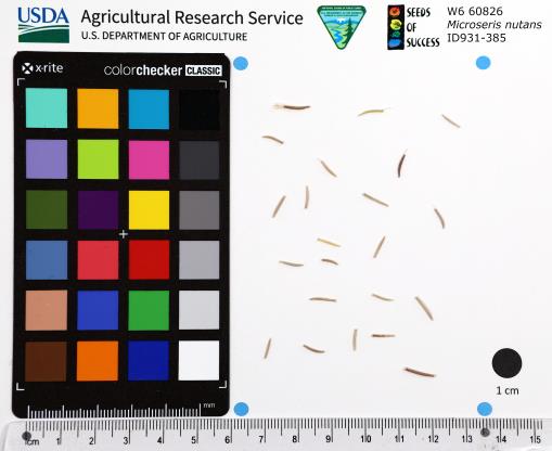 | | 2022 | | | | | | | Wild material | Petals yellow Young flower buds nodding | 2139401 | W6 60826 |
| 328 | NA 88481 | RJL2022MD-002 | Kalmia latifolia L. | Maryland, United States | NA | | | 2022 | COLLECTED | 09/04/2022 | Plants growing at Elkton State Forest along roads and woodlands over a distance of approximately 5 kilometers labelled as the address of 717 Irishtown Rd, North East, MD 21901. Kalmia is very common along the unnamed gravel road as well as the understory of the upland woodlands. | 39.58852900, -75.90452900 | 60 | Plants are growing in a mesic to dry, well-drained habitat of mixed deciduous and evergreen woodlands comprised primarily of acid-loving plants. Plants are growing in shade to part shade along the unnamed road as well as the woodlands. The soils in the collection area are generally described as a complex series of fluviomarine deposits. The soils range from a thin loam layer at the surface to varying levels of loam to sandy loam and/or extremely gravelly sandy clay loam strata, depending upon geographical location (ie. Hillslope summits, slopes, footslopes, swales, etc.). The primary soil types in the collection area are classified as Russett-Christiana-Hambrook Complex and/or Sassafras and Croom Soils; though, others may intersect and overlay in specific areas. | Wild material | | 2139360 | NA 88481 |
| 329 | NA 88482 | RJL2022MD-003 | Rhododendron periclymenoides (Michx.) Shinners | Maryland, United States | NA | | | 2022 | COLLECTED | 09/04/2022 | Plants growing at Elkton State Forest along roads and woodlands over a distance of approximately 5 kilometers labelled as the address of 717 Irishtown Rd, North East, MD 21901. Plants are found infrequently and scattered along the unnamed gravel road | 39.58852900, -75.90452900 | 51 | Plants are growing in a mesic to dry, well-drained habitat of mixed deciduous and evergreen woodlands comprised primarily of acid-loving plants. Plants are growing in part shade. The soils in the collection area are generally described as a complex series of fluviomarine deposits. The soils range from a thin loam layer at the surface to varying levels of loam to sandy loam and/or extremely gravelly sandy clay loam strata, depending upon geographical location (ie. Hillslope summits, slopes, footslopes, swales, etc.). The primary soil types in the collection area are classified as Russett-Christiana-Hambrook Complex and/or Sassafras and Croom Soils; though, others may intersect and overlay in specific areas. | Wild material | | 2139361 | NA 88482 |
| 330 | NA 88483 | RJL2022MD-004 | Clethra alnifolia L. | Maryland, United States | NA | | | 2022 | COLLECTED | 09/04/2022 | Plants growing at Elkton State Forest along roads and woodlands over a distance of approximately 5 kilometers labelled as the address of 717 Irishtown Rd, North East, MD 21901. Plants are found regularly but scattered along the unnamed gravel road as well as in open understory of the upland woodlands. | 39.58531200, -75.89566100 | 47 | Plants are growing in a mesic to moist, well-drained habitat of mixed deciduous and evergreen woodlands comprised primarily of acid-loving plants. Plants are growing in part shade and open understory shade. The soils in the collection area are generally described as a complex series of fluviomarine deposits. The soils range from a thin loam layer at the surface to varying levels of loam to sandy loam and/or extremely gravelly sandy clay loam strata, depending upon geographical location (ie. Hillslope summits, slopes, footslopes, swales, etc.). The primary soil types in the collection area are classified as Russett-Christiana-Hambrook Complex and/or Sassafras and Croom Soils; though, others may intersect and overlay in specific areas. | Wild material | | 2139362 | NA 88483 |
| 331 | NA 88484 | RJL2022MD-005 | Aronia melanocarpa (Michx.) Elliott | Maryland, United States | NA | | | 2022 | COLLECTED | 09/04/2022 | Plants growing at Elkton State Forest on Elk Neck Trail #3 (Starkey Lane) labelled as the address of 717 Irishtown Rd, North East, MD 21901. This was the only plant observed during several visits to Elk Neck State Forest during early and mid-summer | 39.58531200, -75.89566100 | 55 | Plants are growing in a mesic to dry, well-drained habitat of mixed deciduous and evergreen woodlands comprised primarily of acid-loving plants. Plants are growing in part shade to part-sun. The soils in the collection area are generally described as a complex series of fluviomarine deposits. The soils range from a thin loam layer at the surface to varying levels of loam to sandy loam and/or extremely gravelly sandy clay loam strata, depending upon geographical location (ie. Hillslope summits, slopes, footslopes, swales, etc.). The primary soil types in the collection area are classified as Russett-Christiana-Hambrook Complex and/or Sassafras and Croom Soils; though, others may intersect and overlay in specific areas.
Source: NRCS Web Soil Survey (https://websoilsurvey.sc.egov.usda.gov/App/WebSoilSurvey.aspx) | Wild material | received as A. prunifolia, on further examination by collector it was determined to be A. melanocarpa | 2139363 | NA 88484 |
| 332 | NA 88485 | RJL2022MD-006 | Hamamelis virginiana L. | Maryland, United States | NA | | | 2022 | COLLECTED | 09/04/2022 | Plants growing at Elkton State Forest on Elk Neck Trail #3 (Starkey Lane) labelled as the address of 717 Irishtown Rd, North East, MD 21901. This species was infrequent throughout most of Elk Neck State Park, but relatively common. | 39.58790000, -75.88853100 | 54 | Plants are growing in a mesic to dry, well-drained habitat of mixed deciduous and evergreen woodlands comprised primarily of acid-loving plants. Plants are growing in part shade to shade. The soils in the collection area are generally described as a complex series of fluviomarine deposits. The soils range from a thin loam layer at the surface to varying levels of loam to sandy loam and/or extremely gravelly sandy clay loam strata, depending upon geographical location (ie. Hillslope summits, slopes, footslopes, swales, etc.). The primary soil types in the collection area are classified as Russett-Christiana-Hambrook Complex and/or Sassafras and Croom Soils; though, others may intersect and overlay in specific areas.
Source: NRCS Web Soil Survey (https://websoilsurvey.sc.egov.usda.gov/App/WebSoilSurvey.aspx) | Wild material | | 2139364 | NA 88485 |
| 333 | NA 88488 | RJL2022PA-004 | Viburnum acerifolium L. | Pennsylvania, United States | NA | | | 2022 | COLLECTED | 09/03/2022 | Plants growing in woodlands on the east side of Shed Road in French Creek State Park. Plants are common and found scattered along the edges of the road and into the woodlands. | 40.21969200, -75.77373600 | 238 | Plants are growing in a mesic to dry, well-drained habitat of upland deciduous forest which is very rocky. The understory layer is generally not as rich due to the rock-laden ground layer. Plants are growing in part shade to shade. The underlying geology of this area is comprised of Hammer Creek Conglomerate, characterized by cobble and pebble quartz conglomerate interbedded with red sandstone.
Source: USGS Pennsylvania Geologic Map Data (https://mrdata.usgs.gov/geology/state/sgmc-unit.php?unit=PATRhc%3B2) The surface soil profile of this area is Joanna Loam (JpD), 8 to 25 percent slopes which is extremely stony. It is represented by residuum weathered from sandstone and/or residuum weathered from conglomerate. Joanna Loam is moderately to well-drained and 1.8 meters to 2.5 meters to the lithic bedrock described above.
Source: NRCS Web Soil Survey (https://websoilsurvey.sc.egov.usda.gov/App/WebSoilSurvey.aspx) | Wild material | | 2139367 | NA 88488 |
| 334 | NA 88489 | RJL2022PA-005 | Kalmia latifolia L. | Pennsylvania, United States | NA | | | 2022 | COLLECTED | 09/10/2022 | Plants are growing on the lands of Hawk Mountain Sanctuary. This species is very common and abundant. It is one of the most dominant understory plants in woodlands. This species is a common understory shrub throughout the entire region in upland dry woodland habitats. | 40.63862000, -75.99071200 | 430 | Plants are growing primarily in shade to part-shade on a dry-mesic to very dry, well-drained upland/montane habitat characterized by upland mixed deciduous and evergreen forest that is very rocky. All of the plants found in this habitat go through periods of drought during the growing season due to the limited litter/soil layer in which moisture can be held. The underlying geology of this area is of Silurian origin and comprised of Shawangunk Formation. This formation is primarily light- to dark-gray, fine- to very coarse-grained sandstone and conglomerate containing thin shale interbeds.
Source: USGS Pennsylvania Geologic Map Data (https://mrdata.usgs.gov/geology/state/sgmc-unit.php?unit=PASs%3B14)
The surface soil profile of this area is the Hazleton series consists of deep and very deep, well drained soils formed in residuum of acid gray, brown or red sandstone on uplands. The matrix includes a considerable accumulation of thin, flat, coarse fragments of sandstone, limestone, or schist with diameters up to 15 cm. Slope ranges from 0-80%. Permeability is moderately rapid to rapid.
Source: NRCS Web Soil Survey (https://websoilsurvey.sc.egov.usda.gov/App/WebSoilSurvey.aspx) | Wild material | | 2139368 | NA 88489 |
| 335 | NA 88490 | RJL2022PA-006 | Ilex montana Torr. & A. Gray | Pennsylvania, United States | NA | | | 2022 | COLLECTED | 09/10/2022 | Hawk Mountain Sanctuary. | 40.64162200, -75.99122600 | 420 | Plants are growing from shade to full sun on a dry-mesic to very dry, well-drained upland/montane habitat characterized by an upland mixed deciduous and evergreen forest that is very rocky. All of the plants found in this habitat go through periods of drought during the growing season due to the limited litter/soil layer in which moisture can be held. The underlying geology of this area is of Silurian origin and comprised of Shawangunk Formation. This formation is primarily light- to dark-gray, fine- to very coarse-grained sandstone and conglomerate containing thin shale interbeds. (Source: USGS Pennsylvania Geologic Map Data). The surface soil profile of this area is the Hazleton series consists of deep and very deep, well drained soils formed in residuum of acid gray, brown or red sandstone on uplands. The matrix includes a considerable accumulation of thin, flat, coarse fragments of sandstone, limestone, or schist with diameters up to 15 cm. Slope ranges from 0-80%. Permeability is moderately rapid to rapid. (Source: NRCS Web Soil Survey). | Wild material | | 2139369 | NA 88490 |
| 336 | NA 88491 | RJL2022PA-007 | Rhododendron maximum L. | Pennsylvania, United States | NA | | | 2022 | COLLECTED | 09/10/2022 | Plants are growing on the lands of Hawk Mountain Sanctuary. This species was common, but generally restricted to steep rocky outcrops. | 40.63813900, -75.98835200 | 420 | Plants are growing from shade to full sun on a dry-mesic to very dry, well-drained upland/montane habitat characterized by an upland mixed deciduous and evergreen forest that is very rocky. Even so, most heavily fruited plants were growing in part shade to almost full sun. All of the plants found in this habitat go through periods of drought during the growing season due to the limited litter/soil layer in which moisture can be held. The underlying geology of this area is of Silurian origin and comprised of Shawangunk Formation. This formation is primarily light- to dark-gray, fine- to very coarse-grained sandstone and conglomerate containing thin shale interbeds.
Source: USGS Pennsylvania Geologic Map Data (https://mrdata.usgs.gov/geology/state/sgmc-unit.php?unit=PASs%3B14)
The surface soil profile of this area is the Hazleton series consists of deep and very deep, well drained soils formed in residuum of acid gray, brown or red sandstone on uplands. The matrix includes a considerable accumulation of thin, flat, coarse fragments of sandstone, limestone, or schist with diameters up to 15 cm. Slope ranges from 0-80%. Permeability is moderately rapid to rapid.
Source: NRCS Web Soil Survey (https://websoilsurvey.sc.egov.usda.gov/App/WebSoilSurvey.aspx) | Wild material | | 2139370 | NA 88491 |
| 337 | Ames 35877 | Gallagher Fen | Salix myricoides Muhl. | Ohio, United States | NC7 |  | | 2022 | COLLECTED | 06/28/2022 | Gallagher Fen State Nature Preserve located just east, northeast of Springfield approximately 4.5 miles, T5E R9N NE 1/4 NE 1/4 Sec. 11 | 39.93209100, -83.72390500 | 307 | Remnant wetland occurring primarily where the marl meadow meets the stream and marl mud flats. | Wild material | Bayberry willow is native to areas of the northeastern U.S. and north into Canada, localized around the Great Lakes region. Known to occur on shorelines/dunes but also in swamps, fens, and on talus (Haines 2004) with the potential to reach six meters in height (Dorn 1995). Ornamental characteristics include glaucous lower leaf blades that appear chalky white. This disjunct population was sampled in southwestern Ohio (Gallagher Fen) where the species is currently (2022) designated as a potentially threatened species in the state. Specimens observed in nature were low, mounding shrubs measuruing 16-24" (40-60 cm) tall; stems were slender, red and glossy with prominent lenticles; bud scales red, darkening following opening; flowers on staminate individuals with dense whitish bracts opening to reveal stamens tipped with bright yellow anthers and pistillate flowers with pale green pistils tipped with paler stigmas. | 2138175 | Ames 35877 |
| 338 | WLP 2576 | RJL2022-001 | Amelanchier arborea (F. Michx.) Fernald | Maryland, United States | NA | | | 2022 | COLLECTED | 05/25/2022 | Plants growing in open woodlands and part shade along unnamed Elkton State Forest gravel road over a distance of approximately 5 kilometers labelled as the address of 717 Irishtown Rd, North East, MD 21901. | 39.58089500, -75.91505900 | 73 | Plants are found regularly but scattered along the unnamed gravel road as well as in open understory of the upland woodlands. Plants growing in a mesic to dry, well-drained habitat of mixed deciduous and evergreen woodlands comprised primarily of acid-loving plants. Plants are growing in part shade and open understory shade. The soils in the collection area are generally described as a complex series of fluviomarine deposits. The soils range from a thin loam layer at the surface to varying levels of loam to sandy loam and/or extremely gravelly sandy clay loam strata, depending upon geographical location (ie. Hillslope summits, slopes, footslopes, swales, etc.). The primary soil types in the collection area are classified as Russett-Christiana-Hambrook Complex and/or Sassafras and Croom Soils; though, others may intersect and overlay in specific areas. | Wild material | | 2138095 | WLP 2576 |
| 339 | OPGC 8607 | FS0417-18 | Arnica chamissonis Less. | Nevada, United States | OPGC |  | | 2022 | | | | | | | Wild material | Most plants in population done flowering (~90% done). Green, lightly fuzzy leaves and stems. Leaves opposite and alternate with a deep midvein. Usually 1-4 flowers per plant. | 2138336 | OPGC 8607 |
| 340 | W6 60651 | NV030-1548 | Poa palustris L. | California, United States | W6 |  | | 2022 | | | | | | | Wild material | Leaf blades are in-rolled, 1--2 mm wide when flat. Inflorescence are 2-10 cm, spikelet stalk scabrous, with lemma tip acute, margin near tip entire, lowest lemma 2 mm. | 2138770 | W6 60651 |
| 341 | W6 60652 | NV030-1549 | Poa compressa L. | California, United States | W6 |  | | 2022 | | | | | | | Wild material | Perennial grass, 1-2 ft. tall. Flattened stem, spikelets short stalked and oblong. Strongly keeled with lemma webbed at base. | 2138771 | W6 60652 |
| 342 | Ames 35805 | Rippey RR ROW | Salix humilis Marshall var. tristis (Aiton) Griggs | Iowa, United States | NC7 |  | | 2022 | COLLECTED | 05/12/2022 | Located 3.27 miles southeast of Rippey along east side of highway 144, T82N R28W NW ¼ SW ¼ Sec. 19. | 41.89609800, -94.16247600 | 284 | Xeric prairie remnant. Railroad right of way. | Wild material | Plants in nature measuring approximately 3.0-3.5' in height. Specimens noted during peak flowering and seed dispersal on 12 April and 3 May (2021), respectively. Normally for central Iowa peak flowering and fruiting occurs in late April and mid-May, respectively. | 2137911 | Ames 35805 |
| 343 | Ames 35803 | Turtlehead Fen | Salix eriocephala Michx. | Iowa, United States | NC7 |  | | 2022 | COLLECTED | 04/21/2022 | Turtlehead Fen (Chichaqua Bottoms Greenbelt) located 1.75 miles southeast of Farrar just north of highway 65, T81N R21W SW ¼ NW ¼ Sec. 31. | 41.78612100, -93.34726000 | 290 | Extremely high-quality remnant fen. Extremely wet, spongy soils with surface water visible at time of collection. | Wild material | Plants in nature averaging 20' in height. Bright red buds on nearly all genotypes with stem colors ranging from yellow/bronze, brownish-green, brown and green at time of sampling (21 April 2022). Some specimens are rather open, wide spreading and some are rather upright. Salix eriocephala at this site is one of the more dominant species of willow. | 2137909 | Ames 35803 |
| 344 | OPGC 8529 | NEWFS-728 | Persicaria sagittata (L.) H. Gross | New Hampshire, United States | OPGC | | | 2021 | | | | | | | Wild material | White, pink, globular inflorescences at termil end of stem. Arrow head shaped leaves, small sharp rows of spines on underside of stem. | 2138822 | OPGC 8529 |
| 345 | OPGC 8559 | NEWFS-891 | Verbena hastata L. | Massachusetts, United States | OPGC | | | 2021 | | | | | | | Wild material | Square stem. upright plant with long dense pencil shaped spikes, tubular flowers purple and characteristically blooming in a ring from bottom to top toothed lanceolate leaves. | 2138914 | OPGC 8559 |
| 346 | W6 60179 | NEWFS-702 | Juncus effusus L. | Massachusetts, United States | W6 | | | 2021 | | | | | | | Wild material | Rounded stem like bract rising above inflorescence of multiple peduncled capsules holding tiny achenes. | 2138805 | W6 60179 |
| 347 | W6 60193 | NEWFS-725 | Rhynchospora alba (L.) Vahl | New Hampshire, United States | W6 | | | 2021 | | | | | | | Wild material | Brown, termil inflorescence in spiky, rounded bulb. | 2138819 | W6 60193 |
| 348 | W6 60194 | NEWFS-726 | Triadenum virginicum (L.) Raf. | New Hampshire, United States | W6 | | | 2021 | | | | | | | Wild material | Red burgundy to brown seed capsule with three locules, each filled with numerous tiny brown seeds white when immature, leaves round opposite and sessile. | 2138820 | W6 60194 |
| 349 | W6 60195 | NEWFS-727 | Dulichium arundinaceum (L.) Britton | New Hampshire, United States | W6 | | | 2021 | | | | | | | Wild material | Received as: Dulichium arundiceum. 3 ranked leaves with the inflorescences fruits branching from the axil. | 2138821 | W6 60195 |
| 350 | W6 60197 | NEWFS-729 | Scirpus atrovirens Willd. | New Hampshire, United States | W6 | | | 2021 | | | | | | | Wild material | Tightly clumped termil inflorescences. | 2138823 | W6 60197 |
| 351 | W6 60290 | NEWFS-893 | Lycopus americanus Muhl. ex W. P. C. Barton | Massachusetts, United States | W6 | | | 2021 | | | | | | | Wild material | Distinctly and irregularly lobed opposite leaves, white tubular flowers clustered around the axil. | 2138916 | W6 60290 |
| 352 | W6 60173 | NEWFS-695 | Juncus effusus L. | Rhode Island, United States | W6 | | | 2021 | | | | | | | Wild material | Rounded stem like bract rising above inflorescence of multiple peduncled capsules holding tiny achenes | 2137258 | W6 60173 |
| 353 | OPGC 8496 | NCBG-262 | Typha latifolia L. | Virginia, United States | OPGC | | | 2021 | | | | | | | Wild material | Wide leaf blades. | 2132863 | OPGC 8496 |
| 354 | W6 60049 | NCBG-591 | Paspalum boscianum Flüggé | Maryland, United States | W6 | | | 2021 | | | | | | | Wild material | | 2132930 | W6 60049 |
| 355 | W6 60081 | MARSB-137 | Hudsonia tomentosa Nutt. | New York, United States | W6 | | | 2021 | | | | | | | Wild material | Flowers yellow remain folded into stem. Seed heads light brown. Leaves light bluish green, are also folded into stem. | 2137166 | W6 60081 |
| 356 | W6 60107 | NEWFS-336 | Scirpus atrovirens Willd. | Rhode Island, United States | W6 | | | 2021 | | | | | | | Wild material | | 2137192 | W6 60107 |
| 357 | W6 60108 | NEWFS-337 | Juncus effusus L. | Rhode Island, United States | W6 | | | 2021 | | | | | | | Wild material | | 2137193 | W6 60108 |
| 358 | W6 60129 | NEWFS-452 | Eriophorum virginicum L. | Maine, United States | W6 | | | 2021 | | | | | | | Wild material | | 2137214 | W6 60129 |
| 359 | WLP 1747 | RJL2021PA-005 | Rosa palustris Marshall | Pennsylvania, United States | NA | | | 2021 | COLLECTED | 11/20/2021 | Plants growing in wetland seeps surrounded by mown hayfields just west of the Middle Branch White Clay Creek in Goddard Park, West Grove Pennsylvania, off of Wickerton Road, Chester County. | 39.80090528, -75.82383250 | 100 | Habitat Notes: Plants are growing in permanently saturated to moist soils in wetland habitats. Plants appear to be obligate wetland plants and are found only in permanent to nearly permanent wet habitats observed. Generally, the shrubs are found in part shade to full sun. Soils: Soils found in the areas where this collection was made are comprised primarily of Hatboro silt loam (Ha). Hatboro silt loam consists of very deep and poorly drained soils formed in deposited alluvium derived from metamorphic and crystalline rock. They are on flood plains. Slopes range from 0 to 3 percent. Slope: 0 to 3% Aspect: Variable. | Wild material | | 2123715 | WLP 1747 |
| 360 | NA 88328 | CBG-10698 | Hypericum kalmianum L. | Illinois, United States | NA | | | 2021 | | | | | | | Wild material | | 2132546 | NA 88328 |
| 361 | OPGC 8486 | CBG-10697 | Lysimachia quadriflora Sims | Illinois, United States | OPGC | | | 2021 | | | | | | | Wild material | | 2132545 | OPGC 8486 |
| 362 | W6 59934 | CBG-10657 | Calamagrostis canadensis (Michx.) P. Beauv. | Illinois, United States | W6 | | | 2021 | | | | | | | Wild material | | 2132513 | W6 59934 |
| 363 | W6 59949 | CBG-10674 | Triglochin maritima L. | Illinois, United States | W6 |  | | 2021 | | | | | | | Wild material | | 2132527 | W6 59949 |
| 364 | W6 59951 | CBG-10677 | Juncus canadensis J. Gay ex Laharpe | Illinois, United States | W6 | | | 2021 | | | | | | | Wild material | | 2132529 | W6 59951 |
| 365 | W6 59962 | CBG-10692 | Juncus alpinoarticulatus Chaix | Illinois, United States | W6 | | | 2021 | | | | | | | Wild material | | 2132540 | W6 59962 |
| 366 | W6 59940 | CBG-10663 | Eleocharis elliptica Kunth | Illinois, United States | W6 |  | | 2021 | | | | | | | Wild material | | 2132813 | W6 59940 |
| 367 | OPGC 7576 | McFarland Park | Solidago flexicaulis L. | Iowa, United States | OPGC |  | | 2021 | COLLECTED | 09/26/2021 | McFarland Park just north, northeast of Ames, T84N R23W Sec. 7 | 42.09667500, -93.57083500 | 288 | Moist areas near streambanks and bottomlands in hardwood forest understory. | Wild material | Plants in nature ranged in height from approximately one to three feet, growing as spreading clumps. Peak flowering in 2021 occurred near 18 September. | 2132830 | OPGC 7576 |
| 368 | W6 59598 | CO932-406 | Elymus elymoides (Raf.) Swezey | Colorado, United States | W6 | | | 2021 | | | | | | | Wild material | inflorescence: purple at tips, green at base, culms erect to spreading; blades: flat to slightly rolled | 2120764 | W6 59598 |
| 369 | W6 59607 | CO932-415 | Elymus elymoides (Raf.) Swezey | Colorado, United States | W6 | | | 2021 | | | | | | | Wild material | Culms erect to spreading, sheaths open, glabrous to pubescent, purplish, blades flat to folded to in-rolled, ascending, inflorescence compact to open, entire rachis disarticulate, fading to straw | 2120773 | W6 59607 |
| 370 | W6 59649 | UT020-91 | Poa secunda J. Presl | Utah, United States | W6 | | | 2021 | | | | | | | Wild material | Perennial bunchgrass with narrow panicle inflorescence, growing in tufts with a reddish tint or golden hue to stems. Plants in this population were relatively tall for Sandberg Bluegrass in the West Desert of Utah, since they were growing in a wet mountain meadow. Poa secunda was the dominant grass in the small area where we collected. | 2120814 | W6 59649 |
| 371 | Ames 36061 | CBG-10739 | Linum medium (Planch.) Britton | Illinois, United States | NC7 |  | | 2021 | | | | | | | Wild material | | 2137990 | Ames 36061 |
| 372 | Ames 35736 | Horn Prairie Early Blooming | Monarda fistulosa L. | Illinois, United States | NC7 |  | | 2021 | COLLECTED | 08/27/2021 | Horn Prairie Grove located 3.91 miles east, southeast of Ramsey, T8N R1E SE ¼ SW ¼ Sec. 13 | 39.12960100, -89.03759800 | 166 | Very diverse remnant prairie. | Wild material | Accession represents an “early” flowering variant of Monarda fistulosa. Majority of specimens noted have pubescent stems and leaves; peaking flower on 6 June (2021); and measuring 34-36" in height. Generally found in more open, drier habitats in comparison to the “late” flowering more typical form of Monarda fistulosa. Majority of the “late” variants noted at the same locality (Ames 35737) have glabrous stems and leaves; measuring 4-4.5’ in height; peaking flower approximately five weeks later; and typically found in slightly wetter habitats. | 2120340 | Ames 35736 |
| 373 | Ames 35737 | Horn Prairie Late Blooming | Monarda fistulosa L. | Illinois, United States | NC7 |  | | 2021 | COLLECTED | 08/27/2021 | Horn Prairie Grove located 3.91 miles east, southeast of Ramsey, T8N R1E SE ¼ SW ¼ Sec. 13 | 39.12913900, -89.03924000 | 166 | Very diverse remnant prairie. | Wild material | Accession represents genetics from the typical form of M. fistulosa at the collection site. Majority of the specimens sampled display the typical morphological characters of the species including glabrous stems and leaves; measuring 4-4.5’ in height; peaking flower approximately 10 July (2021); and at the collection site typically, in slightly wetter habitats. Majority of the “early” variants noted at the same locality (Ames 35736) have pubescent stems and leaves; peaking flower on 6 June (2021); measuring 3’ in height or less; and are typically found in more open, drier habitats. | 2120341 | Ames 35737 |
| 374 | W6 60355 | CBG-10735 | Juncus nodosus L. | Illinois, United States | W6 |  | | 2021 | | | | | | | Wild material | | 2137987 | W6 60355 |
| 375 | Ames 36062 | CBG-10584 | Linum sulcatum Riddell | Illinois, United States | NC7 | | | 2021 | | | | | | | Wild material | Plant numbers sampled estimated. | 2120175 | Ames 36062 |
| 376 | NA 88287 | CBG-10561 | Cephalanthus occidentalis L. | Illinois, United States | NA | | | 2021 | | | | | | | Wild material | Plant numbers sampled estimated. | 2120156 | NA 88287 |
| 377 | NA 88326 | CBG-10490 | Hypericum gentianoides (L.) Britton et al. | Illinois, United States | NA | | | 2021 | | | | | | | Wild material | | 2120115 | NA 88326 |
| 378 | NA 88327 | CBG-10491 | Hypericum gentianoides (L.) Britton et al. | Illinois, United States | NA | | | 2021 | | | | | | | Wild material | | 2120116 | NA 88327 |
| 379 | NA 88330 | CBG-10583 | Hypericum mutilum L. | Illinois, United States | NA | | | 2021 | | | | | | | Wild material | Plant numbers sampled estimated. | 2120174 | NA 88330 |
| 380 | NA 88439 | CBG-10597 | Rosa setigera Michx. | Illinois, United States | NA | | | 2021 | | | | | | | Wild material | Plant numbers sampled estimated. | 2120182 | NA 88439 |
| 381 | OPGC 8277 | CBG-9703 | Pedicularis canadensis L. | Illinois, United States | OPGC | | | 2021 | | | | | | | Wild material | plant habit: forb | 2120016 | OPGC 8277 |
| 382 | OPGC 8281 | CBG-9970 | Mitella pentandra Hook. | Colorado, United States | OPGC | | | 2021 | | | | | | | Wild material | | 2120033 | OPGC 8281 |
| 383 | OPGC 8308 | CBG-10449 | Krigia biflora (Walter) S. F. Blake | Wisconsin, United States | OPGC | | | 2021 | | | | | | | Wild material | | 2120088 | OPGC 8308 |
| 384 | OPGC 8320 | CBG-10493 | Vernonia missurica Raf. | Illinois, United States | OPGC | | | 2021 | | | | | | | Wild material | | 2120118 | OPGC 8320 |
| 385 | OPGC 8321 | CBG-10498 | Euthamia gymnospermoides Greene | Illinois, United States | OPGC | | | 2021 | | | | | | | Wild material | | 2120121 | OPGC 8321 |
| 386 | OPGC 8324 | CBG-10510 | Agalinis gattingeri (Small) Small | Wisconsin, United States | OPGC | | | 2021 | | | | | | | Wild material | forb | 2120202 | OPGC 8324 |
| 387 | OPGC 8342 | CBG-10574 | Euthamia gymnospermoides Greene | Illinois, United States | OPGC | | | 2021 | | | | | | | Wild material | Plant numbers sampled estimated. | 2120165 | OPGC 8342 |
| 388 | OPGC 8343 | CBG-10575 | Euthamia graminifolia (L.) Nutt. | Illinois, United States | OPGC | | | 2021 | | | | | | | Wild material | Plant numbers sampled estimated. | 2120166 | OPGC 8343 |
| 389 | OPGC 8344 | CBG-10576 | Gillenia stipulata (Muhl. ex Willd.) Nutt. | Illinois, United States | OPGC | | | 2021 | | | | | | | Wild material | plant numbers sampled estimated. | 2120167 | OPGC 8344 |
| 390 | OPGC 8348 | CBG-10581 | Hieracium scabrum Michx. | Illinois, United States | OPGC | | | 2021 | | | | | | | Wild material | Plant numbers sampled estimated. | 2120172 | OPGC 8348 |
| 391 | OPGC 8352 | CBG-10600 | Scutellaria lateriflora L. | Illinois, United States | OPGC | | | 2021 | | | | | | | Wild material | Received as Scutellaria lateriflora var. lateriflora. | 2120185 | OPGC 8352 |
| 392 | OPGC 8355 | CBG-10605 | Solidago nemoralis Aiton | Illinois, United States | OPGC | | | 2021 | | | | | | | Wild material | Also collected elsewhere in SCCA. Plant numbers sampled estimated. | 2120226 | OPGC 8355 |
| 393 | OPGC 8356 | CBG-10606 | Solidago ulmifolia Muhl. ex Willd. | Illinois, United States | OPGC | | | 2021 | | | | | | | Wild material | Plant numbers sampled estimated. | 2120227 | OPGC 8356 |
| 394 | W6 59105 | CBG-9971 | Luzula parviflora (Ehrh.) Desv. | Colorado, United States | W6 | | | 2021 | | | | | | | Wild material | | 2120034 | W6 59105 |
| 395 | W6 59136 | CBG-10266 | Dasiphora fruticosa (L.) Rydb. | Wisconsin, United States | W6 | | | 2021 | | | | | | | Wild material | | 2120062 | W6 59136 |
| 396 | W6 59137 | CBG-10267 | Muhlenbergia glomerata (Willd.) Trin. | Wisconsin, United States | W6 | | | 2021 | | | | | | | Wild material | | 2120195 | W6 59137 |
| 397 | W6 59143 | CBG-10373 | Juncus interior Wiegand | Iowa, United States | W6 | | | 2021 | | | | | | | Wild material | | 2120068 | W6 59143 |
| 398 | W6 59164 | CBG-10445 | Lycopus virginicus L. | Kansas, United States | W6 | | | 2021 | | | | | | | Wild material | | 2120087 | W6 59164 |
| 399 | W6 59174 | CBG-10461 | Juncus bufonius L. | Illinois, United States | W6 | | | 2021 | | | | | | | Wild material | | 2120096 | W6 59174 |
| 400 | W6 59186 | CBG-10477 | Juncus greenei Oakes & Tuck. | Illinois, United States | W6 | | | 2021 | | | | | | | Wild material | | 2120105 | W6 59186 |
| 401 | W6 59200 | CBG-10494 | Cinna arundinacea L. | Illinois, United States | W6 | | | 2021 | | | | | | | Wild material | | 2120119 | W6 59200 |
| 402 | W6 59201 | CBG-10497 | Lespedeza hirta (L.) Hornem. | Illinois, United States | W6 | | | 2021 | | | | | | | Wild material | | 2120120 | W6 59201 |
| 403 | W6 59222 | CBG-10529 | Gratiola neglecta Torr. | Illinois, United States | W6 | | | 2021 | | | | | | | Wild material | Plant numbers estimated. | 2120137 | W6 59222 |
| 404 | W6 59234 | CBG-10548 | Dasistoma macrophyllum (Nutt.) Raf. | Illinois, United States | W6 | | | 2021 | | | | | | | Wild material | Received as Dasistoma macrophylla. Plant numbers estimated. Few this year; abundant other years in numerous locations. | 2120206 | W6 59234 |
| 405 | W6 59241 | CBG-10557 | Boehmeria cylindrica (L.) Sw. | Illinois, United States | W6 | | | 2021 | | | | | | | Wild material | | 2120153 | W6 59241 |
| 406 | W6 59243 | CBG-10560 | Cinna arundinacea L. | Illinois, United States | W6 | | | 2021 | | | | | | | Wild material | Plant numbers estimated. | 2120155 | W6 59243 |
| 407 | W6 59267 | CBG-10590 | Muhlenbergia glabrifloris Scribn. | Illinois, United States | W6 | | | 2021 | | | | | | | Wild material | Received as: Muhlenbergia glabriflora. Plant numbers sampled estimated. | 2120210 | W6 59267 |
| 408 | W6 59284 | CBG-10609 | Sporobolus compositus (Poir.) Merr. | Illinois, United States | W6 | | | 2021 | | | | | | | Wild material | Plant numbers sampled estimated. | 2120229 | W6 59284 |
| 409 | W6 58997 | NCBG-445 | Glyceria striata (Lam.) Hitchc. | Maryland, United States | W6 | | | 2021 | | | | | | | Wild material | drooping inflorescence | 2116315 | W6 58997 |
| 410 | W6 59009 | NCBG-462 | Eleocharis quadrangulata (Michx.) Roem. | Virginia, United States | W6 | | | 2021 | | | | | | | Wild material | | 2116327 | W6 59009 |
| 411 | Ames 35729 | Woodside Prairie | Ceanothus americanus L. | Iowa, United States | NC7 | | | 2021 | COLLECTED | 08/31/2020 | Woodside Praire located 8.0 miles south and 2.0 miles west of Fontanelle | 41.17130000, -94.60140000 | 380 | Remnant prairie. | Wild material | | 2120333 | Ames 35729 |
| 412 | Ames 35660 | Kiamichi Mountains | Ptelea trifoliata L. | Oklahoma, United States | NC7 | | | 2021 | COLLECTED | 07/19/2018 | Kiamichi Mountains of Ouachita National Forest along Road 6025 just west of State Highway 259, T2N R25E SW 1/4 NE 1/4 SW 1/4 Sec. 27 | 34.61314900, -94.67035700 | 651 | Open, dry ridgetop, rocky roadside. | Wild material | Specimens sampled measuring approximately 20-25' in height. | 2114985 | Ames 35660 |
| 413 | NA 88284 | NEWFS-557 | Cephalanthus occidentalis L. | Massachusetts, United States | NA | | | 2021 | | | | | | | Wild material | | 2115697 | NA 88284 |
| 414 | OPGC 8180 | NEWFS-473 | Solidago rugosa Mill. | Massachusetts, United States | OPGC | | | 2021 | | | | | | | Wild material | | 2115663 | OPGC 8180 |
| 415 | OPGC 8181 | NEWFS-474 | Solidago altissima L. | Massachusetts, United States | OPGC | | | 2021 | | | | | | | Wild material | Leaves primarily three-veined, toothing infrequent and not flared. Plants often tall. | 2115664 | OPGC 8181 |
| 416 | OPGC 8182 | NEWFS-475 | Solidago canadensis L. | Massachusetts, United States | OPGC | | | 2021 | | | | | | | Wild material | Three-veined leaves with frequent, flared teeth. | 2115665 | OPGC 8182 |
| 417 | OPGC 8207 | NEWFS-572 | Typha latifolia L. | New Hampshire, United States | OPGC | | | 2021 | | | | | | | Wild material | | 2115706 | OPGC 8207 |
| 418 | W6 58703 | NEWFS-371 | Scirpus atrovirens Willd. | Massachusetts, United States | W6 | | | 2021 | | | | | | | Wild material | | 2115642 | W6 58703 |
| 419 | W6 58757 | NEWFS-556 | Scirpus cyperinus (L.) Kunth | Massachusetts, United States | W6 | | | 2021 | | | | | | | Wild material | | 2115696 | W6 58757 |
| 420 | W6 58800 | NEWFS-830 | Juncus canadensis J. Gay ex Laharpe | Massachusetts, United States | W6 | | | 2021 | | | | | | | Wild material | Densely clustered spikelets on forking stem - superficially resembles Rhynchospora sp., miniscule seeds. | 2115739 | W6 58800 |
| 421 | W6 58801 | NEWFS-831 | Triadenum virginicum (L.) Raf. | Massachusetts, United States | W6 | | | 2021 | | | | | | | Wild material | Opposite leaves with pink bulbous fruits. | 2115740 | W6 58801 |
| 422 | Ames 35615 | Ames 35615 | Aronia arbutifolia (L.) Pers. | Michigan, United States | NC7 |  | | 2020 | COLLECTED | 11/03/2020 | Warren Townsend Park located just northeast of Cannonsburg southwest of Ramsdell Dr. and Six Mile Rd. intersection, T8N R10W NE ¼ NW ¼ Sec. 26, Cannon Twp., Kent County | 43.05606700, -85.46435100 | 239 | Shrubby edge of old stream (Bear Creek) oxbow, adjacent to wet meadow with groundwater upwelling. Muck soils. | Wild material | Plants in nature measuring approximately six meters in height; elongate shrubs mostly unbranched; bright-red fruits measuring between 4-7 mm in diameter; tomentose leaves underneath; scarlet fall color. This collection was discovered in 2011 and represents the first report of the species for the state of Michigan (Ryskamp and Warners 2012) and thus represents a widely disjunct population where the next nearest documented population is in southern Ohio (Clermont County). | 2110277 | Ames 35615 |
| 423 | NA 88297 | NV030-1484 | Clematis ligusticifolia Nutt. | Nevada, United States | NA | | | 2020 | | | | | | | Wild material | epiphytic vine, achene fr, achene attached to pubescent tail, compound lvs. | 2110425 | NA 88297 |
| 424 | NA 88449 | NV030-1465 | Rosa woodsii Lindl. | Nevada, United States | NA | | | 2020 | | | | | | | Wild material | Bright red rose hips, margins of lvs serrated, opposite lvs. | 2110411 | NA 88449 |
| 425 | OPGC 8123 | NV030-1451 | Asclepias speciosa Torr. | Nevada, United States | OPGC | | | 2020 | | | | | | | Wild material | Erect stems, whorled leaf arrangement, pointed leaf tips, hairy leaves. | 2110398 | OPGC 8123 |
| 426 | OPGC 8128 | NV030-1462 | Iris missouriensis Nutt. | Nevada, United States | OPGC | | | 2020 | | | | | | | Wild material | Linear lvs, elongated capsule - erect, lvs are basal. | 2110408 | OPGC 8128 |
| 427 | OPGC 8129 | NV030-1464 | Iris missouriensis Nutt. | Nevada, United States | OPGC | | | 2020 | | | | | | | Wild material | Linear lvs, lvs are basal, elongated erect capsule. | 2110410 | OPGC 8129 |
| 428 | OPGC 8130 | NV030-1467 | Navarretia divaricata Greene | California, United States | OPGC | | | 2020 | | | | | | | Wild material | Hairy+glandular, prickly fr, rounded fr head | 2110413 | OPGC 8130 |
| 429 | OPGC 8132 | NV030-1485 | Solidago spectabilis (D. C. Eaton) A. Gray | Nevada, United States | OPGC | | | 2020 | | | | | | | Wild material | Lance shaped lvs, aster inflor, basal rosette, erect/tall. | 2110426 | OPGC 8132 |
| 430 | W6 58501 | NV030-1446 | Leymus cinereus (Scribn. & Merr.) Á. Löve | California, United States | W6 | | | 2020 | | | | | | | Wild material | Bunchgrass, elongated lvs, large plant size. | 2110395 | W6 58501 |
| 431 | W6 58515 | NV030-1463 | Leymus cinereus (Scribn. & Merr.) Á. Löve | Nevada, United States | W6 | | | 2020 | | | | | | | Wild material | Bunchgrass, large pl size, elongated/linear lvs. | 2110409 | W6 58515 |
| 432 | W6 58520 | NV030-1468 | Juncus balticus Willd. subsp. littoralis (Engelm.) Snogerup | California, United States | W6 | | | 2020 | | | | | | | Wild material | Bracts subtend and extend beyond inflorescence, clusters of fr in a panicle not bunched, rhizomatous. | 2110414 | W6 58520 |
| 433 | OPGC 7553 | Williams Prairie | Liatris pycnostachya Michx. | Iowa, United States | OPGC |  | | 2020 | COLLECTED | 09/25/2020 | Williams Prairie State Preserve approximately 3 miles north of Oxford, T80N R8W SW1/4 NE1/4 Sec. 5, Johnson County | 41.76811400, -91.80062300 | 226 | Dry, upland portions of a remnant wet prairie. | Wild material | Plants sampled in nature were 1.5 to 3 feet in height. At time of collection (25 September 2020), approximately 20% of the seed had begun to disperse. Some plants still had green leaves, while most were entirely senesced. | 2107740 | OPGC 7553 |
| 434 | W6 58076 | ID230-42 | Erigeron pumilus Nutt. var. intermedius (Cronquist) S. L. Welsh | Idaho, United States | W6 | | | 2020 | | | | | | | Wild material | Pubescent forb with ray and disk flowers. Rays white and disks yellow. | 2107682 | W6 58076 |
| 435 | OPGC 8031 | MT050-21 | Penstemon procerus Douglas ex Graham | Montana, United States | OPGC | | | 2020 | | | | | | | Wild material | | 2106477 | OPGC 8031 |
| 436 | OPGC 8039 | WY050-117 | Chrysothamnus viscidiflorus (Hook.) Nutt. | Wyoming, United States | OPGC | | | 2020 | | | | | | | Wild material | | 2106502 | OPGC 8039 |
| 437 | OPGC 7556 | JDC/PM/2020/006/927 | Phlox maculata L. | Iowa, United States | OPGC |  | | 2020 | COLLECTED | 07/18/2020 | Located approximately 3.0 miles southwest of Roland and just 330 yards west of 150h Street and 580th Avenue intersection, T85N R23W NE1/4 NE1/4 Sec. 32, Story County | 42.13724800, -93.54455800 | 305 | Roadside restoration. Locallized in wetter soils/drainage. | Wild material | Phlox maculata is rather rare in central Iowa, more common to northeastern parts of the state. This accession sampled in nature had purple-pink flowers on plants measuring circa 2-2.5’ in height with glabrous stems. Panicles measuring approximately 4-5” in length and 2” wide. Peak flowering and fruiting occurred 25 June and 18 July, respectively in central Iowa (2020). | 2106130 | OPGC 7556 |
| 438 | Ames 35337 | JDC/SP/2020/002/923 | Salix pedicellaris Pursh | Iowa, United States | NC7 |  | | 2020 | COLLECTED | 06/05/2020 | Pilot Knob State Preserve (Floating Bog) located approximately 3.66 miles east, southeast of Forest City, area just west of Dead Mans Lake, T97N R23W NW1/4 NW1/4 SE1/4 Sec. 4, Hancock County | 43.24868300, -93.56644900 | 406 | Extremely high-quality remnant floating bog that has never been hydrologically altered. Very diverse habitat. | Wild material | Salix pedicellaris is extremely rare in Iowa only found in the northern tiers of counties. Currently listed as a state threatened plant species and thus tracked via the Iowa Natural Areas Inventory Program (Iowa Department of Natural Resources). Only 15 sites throughout Iowa representing 13 counties have documented S. pedicellaris. Since the year 2000, only two reports (observation/herbarium specimen) have documented the species presence in Iowa. Bog willow is a small shrub (<2 meters) typically with few, short stems often hidden amongst sedges. Spreads clonally via suckering and/or layering lending it to be found in stable fen habitats with ample supply of water that see little to no distrurbance. Spring flowering typically occurring in mid-May to early June with fruiting occurring in early June in Iowa. Little to no existance in cultivation. Leaves are rather waxy and repel water significantly. During a growout of original plant material (sampled as cuttings from collection site in nature) at NCRPIS, a total of 45 genets were determined to be female (14 count) and male (31 count) during peak flowering on 4 May 2022. | 2105808 | Ames 35337 |
| 439 | NA 88174 | CA180-204 | Cupressus macnabiana A. Murray bis | California, United States | NA | | | 2020 | | | | | | | Wild material | | 2104955 | NA 88174 |
| 440 | W6 57661 | CA180-208 | Prunella vulgaris L. | California, United States | W6 | | | 2020 | | | | | | | Wild material | SOS 92nd Shipment | 2104959 | W6 57661 |
| 441 | W6 57723 | ID210-11 | Eriogonum umbellatum Torr. | Idaho, United States | W6 | | | 2020 | | | | | | | Wild material | SOS 92nd Shipment | 2105021 | W6 57723 |
| 442 | W6 57434 | NEWFS-573 | Sparganium americanum Nutt. | New Hampshire, United States | W6 |  | | 2019 | | | | | | | Wild material | | 2098231 | W6 57434 |
| 443 | OPGC 7946 | NEWFS-246 | Lobelia cardinalis L. | Massachusetts, United States | OPGC |  | | 2019 | | | | | | | Wild material | | 2098174 | OPGC 7946 |
| 444 | W6 57374 | NEWFS-243 | Spiraea tomentosa L. | Massachusetts, United States | W6 |  | | 2019 | | | | | | | Wild material | | 2098171 | W6 57374 |
| 445 | W6 57371 | NEWFS-232 | Scirpus cyperinus (L.) Kunth | Massachusetts, United States | W6 |  | | 2019 | | | | | | | Wild material | | 2098168 | W6 57371 |
| 446 | W6 57347 | NEWFS-170 | Eriophorum virginicum L. | Massachusetts, United States | W6 |  | | 2019 | | | | | | | Wild material | | 2098144 | W6 57347 |
| 447 | W6 57630 | 958097 | Pisum sativum L. subsp. elatius (M. Bieb.) Asch. & Graebn. | Masallı, Azerbaijan | W6 | | | 2019 | COLLECTED | 06/16/2017 | Masalli, vill.Gizilaghaj. | 39.03788889, 48.79211111 | 16 | Meadow. Soil Texture: Silt-sand; Without drainage. Aspect: Flat. | Wild material | | 2098627 | W6 57630 |
| 448 | NA 88095 | MARSB-256 | Ilex verticillata (L.) A. Gray | New York, United States | NA |  | | 2019 | COLLECTED | 10/07/2015 | In Sag Harbor, NY, park in Mashashimuet Park. Walk along the Long Pond Greenbelt Trail. The population is along the edges of Long Pond and Crooked Pond, the first and third ponds on the left, respectively. | 40.96283000, -72.29366000 | 5 | Central shrub & herb depression pond. | Wild material | | 2097543 | NA 88095 |
| 449 | NA 88096 | MARSB-258 | Ilex glabra (L.) A. Gray | New York, United States | NA |  | | 2019 | COLLECTED | 10/08/2015 | In Sag Harbor, park in Mashashimuet Park. Enter the Long Pond Greenbelt and walk along it until you reach Crooked Pond, the third pond on the left. The population is along pond edges. | 40.96283000, -72.29366000 | 5 | Central shrub & herb depression pond. | Wild material | | 2097545 | NA 88096 |
| 450 | NA 88111 | MARSB-428 | Lyonia ligustrina (L.) DC. | New Jersey, United States | NA |  | | 2019 | | | | | | | Wild material | | 2097629 | NA 88111 |
| 451 | NA 88435 | MARSB-255 | Rosa palustris Marshall | New York, United States | NA |  | | 2019 | | | | | | | Wild material | | 2097542 | NA 88435 |
| 452 | OPGC 7884 | MARSB-259 | Rhexia virginica L. | New York, United States | OPGC |  | | 2019 | | | | | | | Wild material | | 2097546 | OPGC 7884 |
| 453 | W6 57189 | MARSB-427 | Alnus serrulata (Aiton) Willd. | New Jersey, United States | W6 |  | | 2019 | | | | | | | Wild material | | 2097628 | W6 57189 |
| 454 | Ames 35237 | Ames 35237 | Monarda fistulosa L. | New Mexico, United States | NC7 |  | | 2019 | COLLECTED | 10/03/2019 | Railroad Canyon located approximately 6.38 miles west of Kingston just north of highway 152, T16S R10W Grant County | 32.91279900, -107.81640300 | 2173 | Sparsely wooded canyon with small creek. | Wild material | | 2097773 | Ames 35237 |
| 455 | Ames 35236 | SF_ID:24690/EO-ID:17843 | Agastache foeniculum (Pursh) Kuntze | Nebraska, United States | NC7 |  | | 2019 | | | | | | | Wild material | Plants measuring approximately 60 cm in height. Infructescences fully mature at time of collection (23 October 2019), likely past peak maturity by approximately 4 weeks. Population (EC-ID: 17843) was originally documented by Steven B. Rolfsmeier on 8 June 2015 (Nebraska Pine Ridge Plant Resurvey, 2015: Report submitted to the Nebraska Natural Heritage Program) noting “ Agastache foeniculum was located in a ravine bottom that burned in 2012. Estimated population size: 200-300 stems covering approximately 125 sq. meters”. A. foeniculum in Nebraska is currently tracked by the Nebraska Natural Heritage Program and is listed (6 November 2019) as a S1 (Critically Imperiled - at very high risk of extirpation in the state due to very restricted range, few populations or occurrences, steep declines, severe threats or other factors) and Tier 2 species (Tier 2 - species are typically those that are not at-risk from a global or national perspective but are rare or imperiled within Nebraska). | 2097772 | Ames 35236 |
| 456 | Ames 35229 | JDC/AS/2019/020/899 | Agastache scrophulariifolia (Willd.) Kuntze | Iowa, United States | NC7 |  | | 2019 | COLLECTED | 10/01/2019 | Hertz Family Woods & Nature Preserve just 2.25 miles south of Nevada (T83N R22W NW1/4 NW1/4 Sec. 20) and Robison Wildlife Acres just 6.75 miles south of Nevada (T82N R22W NE1/4 SW1/4 Sec. 8), Story County | 41.99070000, -93.44186700 | 285 | Moist, semi-shaded, deciduous woods. | Wild material | Plants measuring approximately 6' in height with somewhat short (perhaps due to dense shade) 2-3" spikes rather white or extremely pale pink in color. Peak flowering occurred circa 26 August 2019 in nature. | 2097765 | Ames 35229 |
| 457 | OPGC 7546 | WY050-201 | Lysimachia maritima (L.) Galasso et al. | Wyoming, United States | OPGC |  | | 2019 | | | | | | | Wild material | | 2096999 | OPGC 7546 |
| 458 | Ames 35224 | JDC/AP/2019/034/913 | Aronia ×prunifolia (Marshall) Rehder | Wisconsin, United States | NC7 |  | | 2019 | COLLECTED | 09/17/2019 | Crex Meadows Wildlife Management Area located along Buggerts Lake Road approximately 7.0 miles north of Grantsburg, T39N R19W NW1/4 NE1/4 Sec. 12, Burnett County | 45.88743300, -92.65832600 | 284 | Wet, swampy areas. | Wild material | Plants in nature with some orange fall color and black fruits (a few fruits shriveled) at time of harvest (17 September). Average height approximately 3.5-4.0'. | 2097760 | Ames 35224 |
| 459 | Ames 35225 | JDC/MF/2019/035/914 | Monarda fistulosa L. | Minnesota, United States | NC7 |  | | 2019 | COLLECTED | 09/17/2019 | Iron Horse Prairie Scientific Natural Area located approximately 1.5 miles south of Hayfield, T105N R17W NW1/4 SE1/4 and NE1/4 SW1/4 Sec. 27, Dodge County | 43.86750030, -92.84861000 | 399 | High-quality prairie remnant with various habitats from dry, short-grass type vegetation to rather wet, thick vegetation. | Wild material | Plants in nature ranging from 2' to 4.5' in height. Variability in mildew resistance noted at time of harvest (17 September) ranging from plants with no leaves to plants with persistent leaves with minimal to substantial mildew. | 2097761 | Ames 35225 |
| 460 | Ames 35251 | TK2019-18 | Salix armenorossica A. K. Skvortsov | Samtskhe-Javakheti, Georgia | NC7 |  | | 2019 | COLLECTED | 06/12/2019 | Near village of Tsikhisjvari, Borjomi municipality. | 41.72661700, 43.45793300 | 1602 | Riparian, banks of Oshora River. | Wild material | Deciduous tree, 10-15 meters | 2097803 | Ames 35251 |
| 461 | NA 86438 | JDC/IV/2019/033/912 | Ilex verticillata (L.) A. Gray | Wisconsin, United States | NA |  | | 2019 | COLLECTED | 09/17/2019 | Crex Meadows Wildlife Management Area located approximately 7.0 miles north of Grantsburg, Burnett County | 45.86773900, -92.63055500 | 285 | Wet, swampy areas | Wild material | Average height noted of plants in nature was circa 8' in height. Fruits bright red and persistent at time of harvest (17 September). Foliage green, signs of chlorosis noted on most specimens. | 2097759 | NA 86438 |
| 462 | WLP 1553 | TK2019-02 | Populus ×canescens (Aiton) Sm. | Mtskheta-Mtianeti, Georgia | NA | | | 2019 | COLLECTED | 05/08/2019 | Mtskheta (municipality/district); ; Armazi gorge to the west of Dzegvi village. | 41.83866000, 44.68065000 | 466 | Fragmented riparian woodland. | | 3000+ seeds collected from 13 individuals. | 2109130 | WLP 1553 |
| 463 | Ames 35216 | Potato Creek SP | Monarda sp. | Indiana, United States | NC7 |  | | 2019 | COLLECTED | 09/02/2019 | Potato Creek State Park located approximately 2.6 miles northeast of North Liberty, T36N R1E extreme eastern edge of NW 1/4 SW 1/4 Sec. 23. | 41.55439400, -86.38375900 | 222 | Degraded floodplain, along sides of elevated road bed. | Wild material | This taxa is currently undescribed and according to Campbell and Medley in The atlas of vascular plants in Kentucky (Accessed 06 September 2019) was provisionally named Monarda serotina by R.T. Simmers. Described as a broad-leaved form of M. fistulosa, generally intermediate between M. fistulosa and M. clinopodia, with probable hybrid origin. Typcial habitat is mesic woods and edges on lowlands. In contrast to M. fistulosa, this taxon has longer petioles (usually 2-3 cm versus 0.5-2.0 cm), lower leaf surfaces with scattered spreading hairs, and corollas are paler pink at tips to almost white with peak flowering occurring prior to M. fistulosa by approximately 1-2 weeks. Leaves are rather rugose, where upper leaf tissue between veins is visibly raised. This accession represents genetics from northern Indiana (Potato Creek State Park). Plants at the collection site in nature peaked flowering near 8 July 2019 where flower colors were more lavender in sun but pale in shade (Namestnik, S., personal communication, 15 July 2020). Peak fruiting occurs mid-August. Average height of plants sampled in nature estimated at 4.5' in height. | 2097752 | Ames 35216 |
| 464 | NA 88443 | NV040-344 | Rosa woodsii Lindl. | Nevada, United States | NA |  | | 2019 | | | | | | | Wild material | | 2094595 | NA 88443 |
| 465 | W6 56735 | WY030-263 | Artemisia nova A. Nelson | Wyoming, United States | W6 |  | | 2019 | | | | | | | Wild material | | 2094541 | W6 56735 |
| 466 | W6 56772 | NV040-326 | Leymus cinereus (Scribn. & Merr.) Á. Löve | Nevada, United States | W6 |  | | 2019 | | | | | | | Wild material | | 2094578 | W6 56772 |
| 467 | W6 56782 | NV040-337 | Leymus cinereus (Scribn. & Merr.) Á. Löve | Nevada, United States | W6 |  | | 2019 | | | | | | | Wild material | | 2094588 | W6 56782 |
| 468 | W6 56787 | NV040-342 | Hymenoxys lemmonii (Greene) Cockerell | Nevada, United States | W6 |  | | 2019 | | | | | | | Wild material | | 2094593 | W6 56787 |
| 469 | OPGC 7472 | CBG-9061 | Verbena hastata L. | Nebraska, United States | OPGC |  | | 2019 | | | | | | | Wild material | | 2092740 | OPGC 7472 |
| 470 | W6 56635 | CBG-8953 | Sagittaria latifolia Willd. | Nebraska, United States | W6 |  | | 2019 | | | | | | | Wild material | | 2092734 | W6 56635 |
| 471 | W6 56639 | CBG-9059 | Schoenoplectus tabernaemontani (C. C. Gmel.) Palla | Nebraska, United States | W6 |  | | 2019 | | | | | | | Wild material | | 2092738 | W6 56639 |
| 472 | W6 56643 | CBG-9064 | Trisetum spicatum (L.) K. Richt. | Wyoming, United States | W6 |  | | 2019 | | | | | | | Wild material | | 2092742 | W6 56643 |
| 473 | OPGC 7845 | CBG-8187 | Polemonium reptans L. | Wisconsin, United States | OPGC |  | | 2019 | | | | | | | Wild material | SOS 7th transfer. | 2092671 | OPGC 7845 |
| 474 | Ames 34431 | JDC/SC/2019/001/880 | Salix candida Flüggé ex Willd. | Iowa, United States | NC7 |  | | 2019 | COLLECTED | 05/17/2019 | Private property approximately 2.2 miles southwest of Oelwein, T91N R9W SW 1/4 SE 1/4 Sec. 30. | 42.65929300, -91.94916200 | 311 | High-qulity fen, remnant. | Wild material | Plants at collection site in nature averaging 2.0-2.5' in height with minimal branching. Pubescent stems mostly near apical ends. Most plants estimated at 25 ramets per genet. Estimated number of ramets per genet is difficult to separate/distinguish. This petite, shrubby willow is essentially restricted to cold bogs/fen communities and is rare in Iowa (Nekola 1990). It is easily recognized by its narrowly and extremely pubescent leaves. Salix candida was considered extirpated from Iowa by Spence (1959) and Roosa and Eilers (1978). Since discovery of eastern Iowa fen communities in 1984 it has been observed extant at 26 sites (Nekola 1988) and is tracked as a species of special concern by the Iowa Department of Natural Resources Natural Areas Inventory (2021). | 2091747 | Ames 34431 |
| 475 | Ames 34432 | Kauten Fen | Salix candida Flüggé ex Willd. | Iowa, United States | NC7 |  | | 2019 | COLLECTED | 05/17/2019 | Kauten Fen located 12.4 miles south of West Union, T92N R8W NE 1/4 SW 1/4 NE 1/4 Sec.16. | 42.78232200, -91.78865600 | 351 | High-qulity fen, remnant. | Wild material | Plants at collection site in nature averaging 2.0' in height with little to no branching (e.g. estimated 1-3 ramets per genet which are difficult to separate/distinguish due to the clonal nature of the species). Suspected possible suckering via rhizomes. Very pubescent stems mostly near apical ends. This petite, shrubby willow is essentially restricted to cold bogs/fen communities and is rare in Iowa (Nekola 1990). It is easily recognized by its narrowly and extremely pubescent leaves. The undersides are extremely white in appearance resulting in a very attractive ornamental characteristic. Salix candida was considered extirpated from Iowa by Spence (1959) and Roosa and Eilers (1978). Since discovery of eastern Iowa fen communities in 1984 it has been observed extant at 26 sites (Nekola 1988) and is tracked as a species of special concern by the Iowa Department of Natural Resources Natural Areas Inventory (2021). Plants in cultivation reached heights to 4.0-4.5'. Variation in degree of pubescence on apical portions of stems noted across genotypes with majority being rather to extremely pubescent. | 2091748 | Ames 34432 |
| 476 | NA 88062 | NEWFS-233 | Clethra alnifolia L. | Massachusetts, United States | NA |  | | 2019 | | | | | | | Wild material | | 1976185 | NA 88062 |
| 477 | NA 88071 | NEWFS-610 | Clethra alnifolia L. | Connecticut, United States | NA |  | | 2019 | | | | | | | Wild material | | 1976301 | NA 88071 |
| 478 | NA 88074 | NEWFS-628 | Ilex verticillata (L.) A. Gray | Maine, United States | NA |  | | 2019 | COLLECTED | 11/16/2016 | Wells Reserve: from Boston, take 93N to 95N to ME-109S. Left on US-1N. Right on Laudholm Farm Rd. Left on Skinner Mill Rd. Park at the reserve paring lot, walk across field to trails and boardwalk through bog. (Ref: NEWFS-452) | 43.33672000, -70.55488000 | 9 | Bog, bog/woodland edge, and wet meadow. | Wild material | | 1976304 | NA 88074 |
| 479 | NA 88433 | NEWFS-237 | Rosa palustris Marshall | Connecticut, United States | NA |  | | 2019 | | | | | | | Wild material | | 1976186 | NA 88433 |
| 480 | OPGC 7398 | NEWFS-431 | Rhexia virginica L. | Massachusetts, United States | OPGC |  | | 2019 | | | | | | | Wild material | | 1976259 | OPGC 7398 |
| 481 | OPGC 7376 | AK930-682 | Saxifraga tricuspidata Rottb. | Alaska, United States | OPGC |  | | 2019 | | | | | | | Wild material | | 1975827 | OPGC 7376 |
| 482 | W6 56066 | AK930-658 | Calamagrostis canadensis (Michx.) P. Beauv. | Alaska, United States | W6 |  | | 2019 | | | | | | | Wild material | | 1975807 | W6 56066 |
| 483 | OPGC 7311 | AZ930-363 | Aquilegia chrysantha A. Gray | Arizona, United States | OPGC |  | | 2018 | | | | | | | Wild material | | 1970379 | OPGC 7311 |
| 484 | OPGC 7350 | NV030-1336 | Solidago spectabilis (D. C. Eaton) A. Gray | Nevada, United States | OPGC |  | | 2018 | | | | | | | Wild material | | 1970660 | OPGC 7350 |
| 485 | W6 55616 | WY050-154 | Astragalus purshii Douglas var. purshii | Wyoming, United States | W6 |  | | 2018 | | | | | | | Wild material | | 1970327 | W6 55616 |
| 486 | W6 55618 | WY050-156 | Townsendia incana Nutt. | Wyoming, United States | W6 |  | | 2018 | | | | | | | Wild material | | 1970329 | W6 55618 |
| 487 | W6 55622 | WY050-160 | Allium textile A. Nelson & J. F. Macbr. | Wyoming, United States | W6 |  | | 2018 | | | | | | | Wild material | | 1970333 | W6 55622 |
| 488 | W6 55627 | WY050-165 | Oxytropis besseyi (Rydb.) Blank. var. fallax Barneby | Wyoming, United States | W6 |  | | 2018 | | | | | | | Wild material | | 1970338 | W6 55627 |
| 489 | W6 55708 | CA190C-14 | Juncus patens E. Mey. | California, United States | W6 |  | | 2018 | | | | | | | Wild material | Juncus patens | 1970419 | W6 55708 |
| 490 | WLP 1545 | NACPEC18-090 | Photinia davidiana (Decne.) Cardot | Hubei Sheng, China | NA | | | 2018 | COLLECTED | 09/21/2018 | Shennongjia Forest District; Muyuping; Guanmenshan. | 31.44033000, 110.38573000 | 1311 | Near footpath/boardwalk in rich gallery forest along river, in heavy shade. Growing in moss-covered humus. | | Seeds and three herbarium specimens collected from two plants. Photographed. In addition to the listed associated taxa, found growing in association with numerous ferns. | 2108988 | WLP 1545 |
| 491 | NA 88454 | OR050-274 | Rosa woodsii Lindl. var. ultramontana (S. Watson) Jeps. | Oregon, United States | NA |  | | 2018 | | | | | | | Wild material | Rosa woodsii var. ultramontana | 1967943 | NA 88454 |
| 492 | OPGC 6742 | MT050-63 | Platanthera dilatata (Pursh) Lindl. ex L. C. Beck var. albiflora (Cham.) Ledeb. | Montana, United States | OPGC |  | Contact Site | 2018 | | | | | | | Wild material | Platanthera dilatata var. albiflora | 1967915 | OPGC 6742 |
| 493 | OPGC 7248 | OR050-271 | Epilobium brachycarpum C. Presl | Oregon, United States | OPGC |  | | 2018 | | | | | | | Wild material | | 1967940 | OPGC 7248 |
| 494 | W6 55304 | WY030-232 | Leymus cinereus (Scribn. & Merr.) Á. Löve | Wyoming, United States | W6 |  | | 2018 | | | | | | | Wild material | Leymus cinereus | 1967856 | W6 55304 |
| 495 | W6 55356 | MT050-56 | Wyethia helianthoides Nutt. | Montana, United States | W6 |  | | 2018 | | | | | | | Wild material | | 1967908 | W6 55356 |
| 496 | W6 55357 | MT050-57 | Stenotus lanuginosus (A. Gray) Greene | Montana, United States | W6 |  | | 2018 | | | | | | | Wild material | Stenotus lanuginosus | 1967909 | W6 55357 |
| 497 | W6 55392 | OR050-275 | Cornus sericea L. subsp. occidentalis (Torr. & A. Gray) Fosberg | Oregon, United States | W6 |  | | 2018 | | | | | | | Wild material | Cornus sericea ssp. occidentalis | 1967944 | W6 55392 |
| 498 | NA 86521 | NACPEC18-091 | Quercus engleriana Seemen | Hubei Sheng, China | NA | | | 2018 | COLLECTED | 09/21/2018 | Shennongjia Forest District; Muyuping; Guanmenshan. | 31.43976000, 110.38406000 | 1315 | Vertical cliff along road. Growing in humus over rocks. | Wild material | Seeds and four herbarium specimens collected from one plant. Photographed. In addition to the listed associated taxa, found growing in association with numerous ferns. | 2109230 | NA 86521 |
| 499 | OPGC 6656 | NM930-413 | Rudbeckia laciniata L. | New Mexico, United States | OPGC |  | | 2018 | | | | | | | Wild material | Rudbeckia laciniata | 1966142 | OPGC 6656 |