| 0 | WLP 876 | AF2018-004 | Celtis laevigata Willd. | Virginia, United States | NA | | | 2018 | COLLECTED | 09/10/2018 | Suffolk County; ; Lone Star Lakes Park, ca 1 mile from entrance on a gravel road near parking for a Crane Lake boat ramp. | 36.86919000, -76.57550000 | 4 | Roadside near lake. | | Herbarium voucher collected (see barcode NA0103773). | 2108853 | WLP 876 |
| 1 | NA 79090 | MANOS05-06 | Celtis laevigata Willd. | North Carolina, United States | NA | | | 2010 | COLLECTED | PRE 07/01/2010 | Penny's Bend State Nature Preserve, on the Eno River near Durham | | | | Wild material | | 1898065 | NA 79090 |
| 2 | WLP 775 | LA002-2006 | Celtis laevigata Willd. | Louisiana, United States | NA | | | 2006 | COLLECTED | 12/28/2006 | Louisiana: Terrebonne Parish, Shrimp Row south of Dulac along Grand Canal | 29.38176000, -90.71593000 | 5 | Coastal marsh, 0, Mixed shrub | Wild material | | 1913887 | WLP 775 |
| 3 | NA 75357 | RL 091 | Celtis laevigata Willd. | Georgia, United States | NA | | | 2006 | COLLECTED | 07/01/2004 | Georgia, Walker County, Pigeon Mountain Wildlife Management Area; Pocket Branch, east side of barn at old homesite. | | | | Wild material | | 1777635 | NA 75357 |
| 4 | DLEG 900440 | DLEG 900440 | Neltuma laevigata (Humb. & Bonpl. ex Willd.) Britton & Rose | San Luis Potosí, Mexico | | 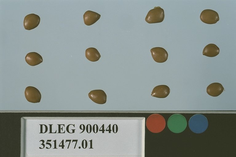 | Historic | 1990 | COLLECTED | 08/17/1990 | Hwy 57, 4.6 mi. W of Ciudad del Maiz. | | | Growing with Celtis pallida adjacent to fields. | Wild material | Spreading trees to 30 ft. tall. M. Johnson 90-194. | 1526455 | DLEG 900440 |
| 5 | PI 709491 | LBJWC-MM-794 | Setaria scheelei (Steud.) Hitchc. | Texas, United States | NC7 |  | | 2007 | COLLECTED | 11/19/2006 | Blanco Shoals Greenbelt, Interstate Highway 35 at the Blanco River. | 29.90241000, -97.89913000 | 180 | Moist or mesic. Soil Texture: Sandy loam, light gray. Population size 400. | Wild material | | 1726927 | PI 709491 |
| 6 | PI 664901 | JM20061003 | Teucrium canadense L. | Missouri, United States | NC7 | | | 2006 | COLLECTED | 09/25/2006 | Mile marker 222.1, Route 66 off of Interstate 44, southwest of Meramec State Park, West Sullivan, Crawford County. | 38.18194444, -91.20194444 | 301 | Roadside prairie remnant (between railroad and state road). Ambrosia artemisiifolia, Andropogon gerardii, Celtis laevigata, Elaeagnus angustifolia, Eryngium, Helianthus mollus, Rhus glabra, Schrankia nuttallianum, and Sorghastrum nutans. | Wild material | | 1715759 | PI 664901 |
| 7 | NA 89114 | TLM25-03 | Zanthoxylum clava-herculis L. | Texas, United States | NA | | | 2025 | COLLECTED | 07/09/2025 | Jackson County Road 113, Bergston Road, approximately 2.1 kilometers north of the junction with Jackson County Road 234; growing on the west side of the road along a fenceline running parallel to the road. | 29.00576600, -96.76298500 | 24 | Plants are growing in full sun to light shade along a fence line near where cattle graze and the dirt road. The area is disturbed, but somewhat overgrown since there is very little traffic on the road that is primarily used by farmers and ranchers to access their fields. Slope: 0 to 1 percent. Aspect: N/A. Soils: The soils of this area sampled are classified as Laewest clay, 0 to 1 percent slopes (LaA). The Laewest Series consists of very deep, moderately well drained soils that formed in clayey flood basin deposits on alluvial plains or deltas of the Beaumont Formation of Pleistocene Age. These nearly level to gently sloping soils are on broad flat coastal plains. Slope ranges from 0 to 8 percent. The solum thickness is more than 200 cm and ranges from slightly acidic on the surface to neutral in deeper pedons. This is a cyclic soil and undisturbed areas have gilgai microrelief with microhighs 15 to 30 cm higher than microlows. Distance from the center of the microhighs to the center of the microlows ranges from about 1.2 to 4.9 m. The microhigh makes up about 20 percent, the intermediate, or area between the knoll and depression about 50 percent, and the microlow about 30 percent. The amplitude of waviness between mollic colored materials in the upper part of the solum and the higher value colors in the lower part ranges from about 30 to 150 cm. When dry, the soil has cracks 1 to 5 cm wide at the surface and commonly 1 cm wide cracks extend to a depth of 1.2 m during the summer. The cracks remain open for less than 90 cumulative days in most years. Some pedons have an overwash of calcareous clay or silty clay 20 to 51 cm thick. (Source: California Soil Resource Lab/NRCS Official Soil Series Descriptions). Geology: The underlying geology of this area is Lizzie Formation of Quaternary, Middle Pleistocene age. It is comprised of sand, silt, clay, and minor amount of gravel. Iron oxide and iron-manganese nodules are common in zones of weathering; locally calcareous. Surface is fairly flat and featureless except for many shallow depressions and pimple mounds. Moore and Wermund (1993a) mapped three units--(1) alluvium undifferentiated as to texture and origin--includes meander belt, levee, crevasse splay, and distributary sand, and flood-basin mud deposits, about 60 m thick, (2) fine-grained channel facies (alluvial sand, silt, and clay) about 10-25 m thick, thicker seaward, and (3) fine-grained overbank facies (alluvial silt and clay) about 55-65 m thick, thicker seaward. Together, these deposits form a deltaic plain that parallels the Gulf Coast. Unit contains Pleistocene vertebrate fauna, dips seaward beneath the Beaumont Fm. and disconformably overlies deposits of the Pliocene and early Pleistocene Willis Formation. The deltaic plain is entrenched as much as 7 m by streams. In Hidalgo County (southernmost part of Texas) the unit underlies a semiarid plain, widely irrigated and cultivated. Unit is locally veneered with thin, discontinuous stabilized eolian sand. (Source: USGS Texas Geologic Map Data). | Wild material | | 2191653 | NA 89114 |
| 8 | NA 89115 | TLM25-04a | Hamamelis ovalis S. W. Leonard | Texas, United States | NA | | | 2025 | COLLECTED | 07/10/2025 | State Highway 87 approximately 3.25 kilometers north of the crossroad junction with Texas Recreational Road 255 (RE 255); plants were growing in the narrow buffer woods along the east side of the highway. | 31.12051300, -93.72628100 | 138 | The habitat is an upland mixed coniferous and deciduous woodlands in part to full shade and dry conditions, often under drought stress. Plants seem to always occur on the top of dry ridges or well-drained slopes. Slope: 0 to 1 percent. Aspect: N/A. Soils: The soils of this collection area are classified as Tehran-Letney Association, hilly (TLE) soils. The Tehran Series (55%) consists of deep, somewhat excessively drained, moderately rapidly permeable soils on uplands. They formed in thick loamy and sandy sediments on the Western Coastal Plain. These soils are on gently sloping to moderately steep uplands with slopes ranging from 1 to 20 percent. The Letney Series (30%) consists of deep, well drained, moderately rapidly permeable, upland soils. They formed in thick sandy and loamy sediments of the coastal plains. These soils are on gently sloping to moderately steep uplands with slopes ranging from 1 to 20 percent. Soil pH ranges from 4.5 to 6.0. The minor soil components include Doucette Series (10%) and Boykin Series (5%) soils. (Source: California Soil Resource Lab/NRCS Official Soil Series Descriptions). Geology: The underlying geology of this area is of Oligocene origin and characterized as Catahoula Formation. This formation is extensive and deep in Texas, up to 185 meters thick. In the area of the collection the Catahoula Formation is primarily mudstone and sand. The upper 90-150 meters is mudstone that is tuffaceous, and sandy; also, occasionally, with some bentonitic clay. (Source: USGS Texas Geologic Map Data). | Wild material | | 2191654 | NA 89115 |
| 9 | DPRU 3558 | CONS24-044 | Prunus minutiflora Engelm. ex A. Gray | Texas, United States | DAV | | | 2024 | COLLECTED | 06/17/2024 | | 30.72248000, -98.00497000 | 360 | Grassy scrub in railroad right-of way. Exposure open to 3/4 shade | Wild material | Only seed can be requested of this accession!!
This donation is approximately half of a collection of 896 seeds from 76 maternal lines. An additional 137 seeds were collected in bulk for germination testing and grow out for a total collection size of 1,033 seeds. The population of over 200 plants covered an area of approximately 150m x 3m on thin, clay soil over limestone.
Representative vegetation insluded Juniperus ashei, Celtis laevigata, Sideroxylon lanuginosum, Berberius trifoliolata, Rhus aromatica, Eriogonum longifolium, Krameria lanceolata, Gaillardia pulchella, Hedeoma acinoides, and Warnockia scutellarioides.
Plant type is locally abundant, but uncommon throughout range. | 2170978 | DPRU 3558 |
| 10 | NA 88801 | TJK2023LA/TX-001 | Cocculus carolinus (L.) DC. | Louisiana, United States | NA | | | 2023 | COLLECTED | 11/21/2023 | Interstate 20, westbound, approximately 13 miles west of Mississippi River, 9 miles east of U.S. Highway 65. | 32.33740000, -91.06320000 | 24 | Damp low, wooded treeline. Slope: less than 2%. Aspect: Southwest. Elevation: 79 feet. | Wild material | | 2159184 | NA 88801 |
| 11 | NA 88802 | TJK2023LA/TX-002 | Ilex decidua Walter | Louisiana, United States | NA | | | 2023 | COLLECTED | 11/21/2023 | Interstate 20, westbound, approximately 6 miles west of U.S. Highway 65 and 7.5 miles east of Louisiana Highway 577. Tensas River watershed. | 32.41950000, -91.29670000 | 21 | Damp wooded treeline. Slope: 12%. Aspect: West-southwest. Elevation: 69 feet. | Wild material | | 2159185 | NA 88802 |
| 12 | NA 88803 | TJK2023LA/TX-003 | Crataegus viridis L. | Louisiana, United States | NA | | | 2023 | COLLECTED | 11/21/2023 | Interstate 20, westbound, approximately 7 miles west of Louisiana Highway 17 and 8.5 miles east of U.S. Highway 425. Tensas River watershed. | 32.41940000, -91.29670000 | 21 | Damp wooded treeline. Slope: 12%. Aspect: West-southwest. Elevation: 69 feet. | Wild material | | 2159186 | NA 88803 |
| 13 | NA 88804 | TJK2023LA/TX-004 | Crataegus viridis L. | Louisiana, United States | NA | | | 2023 | COLLECTED | 11/21/2023 | Walnut Bayou (Mississippi River bottom): Interstate 20, westbound, approximately 10 miles west of the Mississippi River and 8.25 miles east of U.S. Highway 65. | 32.34130000, -91.07170000 | 26 | Damp wooded treeline. Slope: 10%. Aspect: North-northeast. Elevation: 84 feet. | Wild material | | 2159187 | NA 88804 |
| 14 | NA 88805 | TJK2023LA/TX-005 | Carya aquatica (F. Michx.) Elliott | Louisiana, United States | NA | | | 2023 | COLLECTED | 11/21/2023 | Interstate 20, westbound, approximately 2 miles west of Louisiana Highway 609 and 0.75 miles east of Louisiana Highway 183. | 32.45620000, -91.61470000 | 23 | Damp gallery woods, edge of palmetto flat. Slope: 5%. Aspect: North. Elevation: 76 feet. | Wild material | | 2159188 | NA 88805 |
| 15 | WLP 3217 | TJK2023TX-002 | Styphnolobium affine (Torr. & A. Gray) Walp. | Texas, United States | NA | | | 2023 | COLLECTED | 08/27/2023 | In the vicinity of Pilot Knob, an extinct cretaceous volcano situated about 8 miles south of Austin. Only exposed submarine volcano known in Texas. Onion Creek Watershed. Off Dee Gabriel Collins Rd/FM 812, approximately .38 of a mile east of McKinney Falls Pkwy and 1.5 miles west of Hwy 183. | 30.17484700, -97.71519000 | 188 | Roadside environment. Highly modified ROW; trees growing in pushed up soil, gravel, road aggregate, caliche. Well established trees growing in a large motte - 20’ x 50’ area. Elevation: 617 feet. Slope: 7%. Aspect: South. | Wild material | | 2158761 | WLP 3217 |
| 16 | NA 87354 | TJK2022TX-002 | Ptelea trifoliata L. | Texas, United States | NA | | | 2023 | COLLECTED | 11/29/2022 | Blanco County: Little Blanco Road, upper slope off Little Blanco River; 330 feet west of Highway 281. | 30.00140000, -98.40650000 | 390 | Shaded streamside slope between road and Little Blanco River. | Wild material | | 2141645 | NA 87354 |
| 17 | NA 88552 | RJLSEUS2022-025 | Hydrangea quercifolia W. Bartram | Alabama, United States | NA | | | 2023 | COLLECTED | 12/12/2022 | Claiborne Bluffs area along unnamed road to boat ramp on the east side of the Alabama River at the U.S. Highway 84 bridge over the river. Common at this location and along the nearby Alabama River. | 31.54879700, -87.51416400 | 40 | Plants are growing in part-shade to shade of mesic, well-drained, circum-neutral slopes and benches in mature mixed deciduous and evergreen woodlands with good litter layer. Soils: The underlying geology of this area is the Jackson Group Undifferentiated. The units of the Jackson Group are the Yazoo Clay and Crystal River and Moodys Branch Formations. Descriptions of the members of the Yazoo Clay follow in descending order. Shubuta Member - in western Alabama consists of light-greenish-gray to white plastic fossiliferous, calcareous clay containing irregular calcareous nodules. From the Tombigbee River eastward, the Shubuta becomes more calcareous and grades into massive clayey glauconitic limestone. Eastward from the Alabama River, equivalent beds grade into the Crystal River Formation. Pachuta Marl Member - light-greenish-grey glauconitic, fossiliferous clayey sand and sandy limestone traceable from western Alabama eastward to Covington County where it grades into the Crystal River Formation. Cocoa Sand Member - yellowish-gray firm calcareous, fossiliferous fine to medium sand or sandy limestone or greenish-grey micaceous, calcareous, very clayey sand. Calcareous and clayey sand equivalent to the Cocoa is traceable from western Alabama to the Conecuh River area. (Source: USGS Alabama Geological Map Data). The surface soil profile of this portion of the bluffs along the Alabama River are characterized as Saffell-Lucy (Flomaton) Series Complex soils. The Saffell Series consists of very deep, well drained, moderately permeable soils that formed in loamy and gravelly marine sediments of the Tertiary Age and have acid reaction. These soils are found on the upper portion of the bluffs along the Alabama River. The Lucy Series consists of very deep, well drained, moderately permeable soils on uplands. They formed in sandy and loamy marine and fluvial sediments of the Southern Coastal Plain Major Land Resource Area. Soil reaction runs from strongly to moderately acid. The Flomaton Series consists of very deep, excessively drained, rapidly permeable soils on uplands of the Southern Coastal Plain Major Land Resource Area. They formed in gravelly sandy marine sediments and also have an acid reaction. The remainder of soils are of miscellaneous origin. (Source: USDA-NRCS Official Soil Series Descriptions). | Wild material | | 2140779 | NA 88552 |
| 18 | NA 88553 | RJLSEUS2022-026 | Hydrangea arborescens L. | Alabama, United States | NA | | | 2023 | COLLECTED | 12/12/2022 | Claiborne Bluffs area along unnamed road to boat ramp on the east side of the Alabama River at the U.S. Highway 84 bridge over the river. Occasionally found in the woodlands. | 31.54940700, -87.51366200 | 25 | Plants are growing in part-shade to shade of mesic, well-drained, circum-neutral slopes mature mixed deciduous and evergreen woodlands where slopes are exposed and detritus does not build up.
Soils: The underlying geology of this area is the Jackson Group Undifferentiated. The units of the Jackson Group are the Yazoo Clay and Crystal River and Moodys Branch Formations. Descriptions of the members of the Yazoo Clay follow in descending order. Shubuta Member - in western Alabama consists of light-greenish-gray to white plastic fossiliferous, calcareous clay containing irregular calcareous nodules. From the Tombigbee River eastward, the Shubuta becomes more calcareous and grades into massive clayey glauconitic limestone. Eastward from the Alabama River, equivalent beds grade into the Crystal River Formation. Pachuta Marl Member - light-greenish-grey glauconitic, fossiliferous clayey sand and sandy limestone traceable from western Alabama eastward to Covington County where it grades into the Crystal River Formation. Cocoa Sand Member - yellowish-gray firm calcareous, fossiliferous fine to medium sand or sandy limestone or greenish-grey micaceous, calcareous, very clayey sand. Calcareous and clayey sand equivalent to the Cocoa is traceable from western Alabama to the Conecuh River area.
Source: USGS Alabama Geological Map Data (https://mrdata.usgs.gov/geology/state/state.php?state=AL)
The surface soil profile of this portion of the bluffs along the Alabama River are characterized by Saffell-Lucy (Flomaton) Series Complex soils. The Saffell Series consists of very deep, well drained, moderately permeable soils that formed in loamy and gravelly marine sediments of the Tertiary Age and have acid reaction. These soils are found on the upper portion of the bluffs along the Alabama River. The Lucy Series consists of very deep, well drained, moderately permeable soils on uplands. They formed in sandy and loamy marine and fluvial sediments of the Southern Coastal Plain Major Land Resource Area. Soil reaction runs from strongly to moderately acid. The Flomaton Series consists of very deep, excessively drained, rapidly permeable soils on uplands of the Southern Coastal Plain Major Land Resource Area. They formed in gravelly sandy marine sediments and also have an acid reaction. The remainder of soils are of miscellaneous origin.
Source: USDA-NRCS Official Soil Series Descriptions (https://soilseries.sc.egov.usda.gov/osdname.aspx) | Wild material | | 2140780 | NA 88553 |
| 19 | NA 88558 | RJLSEUS2022-031 | Ilex decidua Walter | Alabama, United States | NA | | | 2023 | COLLECTED | 12/12/2022 | Silver Creek Lake Campground off of Silver Creek Lake Road: Silver Creek Lake, at the edge of the campground. | 31.66344600, -87.57108400 | 16 | Part shade to sun along the eroding banks of Silver Creek Lake in moist-mesic, mixed deciduous and evergreen woodland, 2-3 meters above the water. The underlying geology of this area is Claiborne Group, Tallahatta Formation, of Eocene origin, with white to very light-greenish-gray thin-bedded to massive siliceous claystone; interbedded with thin layers of fossiliferous clay, sandy clay, and glauconitic sand and sandstone. (Source: USGS Alabama Geological Map Data). The primary soil types in the collection area are classified as Riverview Fine Sandy Loam soils (0 to 2 percent slopes, occasionally flooded). The Riverview Series consists of very deep, well drained, moderately permeable soils that formed in loamy alluvium on flood plains. Slopes range from 0 to 5 percent. Riverview soils fare on high parts of flood plains of rivers and streams draining the Coastal Plain and Southern Piedmont. Runoff is slow. Permeability is moderate. These soils flood for short periods mostly in winter or early spring months. (Source: NRCS Web Soil Survey). | Wild material | | 2140819 | NA 88558 |
| 20 | Ames 35951 | AS/ML/2022/020/151 | Monarda lindheimeri Engelm. & A. Gray | Texas, United States | NC7 |  | | 2022 | COLLECTED | 08/07/2022 | Located northwest of Navasota approximately 5.60 miles along Old Highway 6. | 30.44628200, -96.15333200 | 67 | Powerline cut. | Wild material | Accession consisting of both white flowering specimens and multi-colored (pinkish) flowering specimens. Inventory 01 represented as rather robust plants up to 40" tall that display a rather to somewhat clump type growth habit (possibly due to growing in more of a prairie habitat/full sun), but also includes adjacent specimens that are rhizomatous. Inventory 02 represents a more rhizomatous growth habit and shorter in height (e.g. less than 20" tall). Plants sampled ranging from 1.0-4.5' in height. | 2140541 | Ames 35951 |
| 21 | Ames 35953 | AS/ML/2022/022/153 | Monarda lindheimeri Engelm. & A. Gray | Texas, United States | NC7 |  | | 2022 | COLLECTED | 08/07/2022 | Located 4.98 miles west of Millican on the south side of FM 2154 Rd. | 30.50280100, -96.28483800 | 94 | Roadside, railroad right-of-way. | Wild material | Population extending just over 2.00 miles represented as very vigorous, rhizamatous specimens. In comparison to other M. lindheimeri noted in Texas in 2022, this population is one of the earliest flowering populations, nearly 2-3 weeks earlier typically peaking in mid-April. In 2022, population peaked flower on 18 April. | 2140543 | Ames 35953 |
| 22 | Ames 35956 | AS/ML/2022/025/156 | Monarda lindheimeri Engelm. & A. Gray | Texas, United States | NC7 |  | | 2022 | COLLECTED | 08/05/2022 | Located just south of Bedias approximately 4.34 miles on highway 90 N (east side). | 30.71054100, -95.96554500 | 98 | Roadside, woodland edge. | Wild material | | 2140546 | Ames 35956 |
| 23 | WLP 2568 | APS/HA/2022/028/490 | Hydrangea arborescens L. | Arkansas, United States | NA | 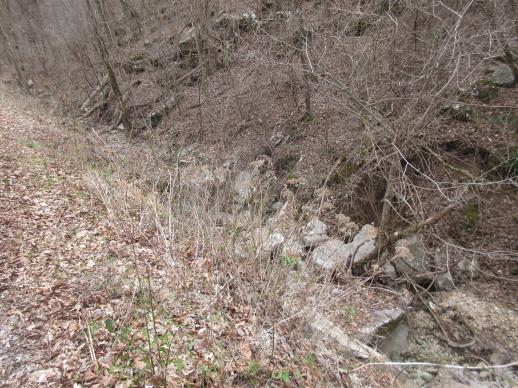 | | 2022 | COLLECTED | 03/15/2022 | Located approximately 3.75 miles east of Allison just off Round Bottom Road. | 35.93357000, -92.05110000 | 144 | Moist, low deciduous forest with scattered rock outcrops, growing along base of hill and bank of seasonal stream. | Wild material | | 2137430 | WLP 2568 |
| 24 | OPGC 8394 | NM080-272 | Ratibida columnifera (Nutt.) Wooton & Standl. | New Mexico, United States | OPGC | | | 2021 | | | | | | | Wild material | Inflorescence columniferous 1/2-1 inch, composite flower with yellow/maroon ray flowers | 2120648 | OPGC 8394 |
| 25 | WLP 1686 | APS/RS/2019/067/396 | Rosa setigera Michx. | Arkansas, United States | NA |  | | 2019 | COLLECTED | 11/07/2019 | Located near intersection of Smith Mountain Road and Newton County 8828 Road approximately 6.00 miles north of Deer, Newton County | 35.91212000, -93.21112000 | 636 | Roadside, upland with rocky soils | Wild material | | 2097789 | WLP 1686 |
| 26 | OPGC 7309 | AZ930-361 | Polanisia dodecandra (L.) DC. | Arizona, United States | OPGC |  | | 2018 | | | | | | | Wild material | | 1970377 | OPGC 7309 |
| 27 | W6 55556 | NM030-99 | Sporobolus contractus Hitchc. | New Mexico, United States | W6 |  | | 2018 | | | | | | | Wild material | | 1970267 | W6 55556 |
| 28 | W6 55665 | AZ930-360 | Neltuma velutina (Wooton) Britton & Rose | Arizona, United States | W6 |  | | 2018 | | | | | | | Wild material | Prosopis velutina | 1970376 | W6 55665 |
| 29 | NA 85021 | JDC/SS/2018/004/817 | Sapindus saponaria L. var. drummondii (Hook. & Arn.) L. D. Benson | Oklahoma, United States | NA |  | | 2018 | COLLECTED | 03/12/2018 | Private property approximately 4.8 miles southeast of Mulhall, north side of Cimarron River, T18N R2W, Logan County | 35.99972000, -97.39735900 | 210 | Transition zone between higher elevations and bottomlands. | Wild material | | 1957958 | NA 85021 |
| 30 | Ames 32891 | APS/GD/2015/010/192 | Gymnocladus dioicus (L.) K. Koch | Oklahoma, United States | NC7 |  | | 2015 | COLLECTED | 03/12/2015 | Nowata County: T25N R16E NW 1/4 NE 1/4 Sec. 3. Oologah Wildlife Management Area approximately 3 miles east of Nowata. | 36.68401000, -95.58207800 | 208 | Transition zone between higher elevations and bottomlands. | Wild material | | 1925357 | Ames 32891 |
| 31 | Ames 32892 | APS/GD/2015/014/196 | Gymnocladus dioicus (L.) K. Koch | Oklahoma, United States | NC7 |  | | 2015 | COLLECTED | 03/13/2015 | Wagoner County: Billy Creek watershed, T17N R17E NE 1/4 Sec. 22. McClellen-Kerr Wildlife Management Area (Billy Creek WDU) portion approximatley 4 miles west, southwest of Wagoner. | 35.94442000, -95.48112700 | 171 | Floodplain. | Wild material | | 1925358 | Ames 32892 |
| 32 | Ames 32894 | APS/GD/2015/017/199 | Gymnocladus dioicus (L.) K. Koch | Oklahoma, United States | NC7 |  | | 2015 | COLLECTED | 03/14/2015 | Cleveland County: T10N R5W SW 1/4 SW 1/4 Sec. 7. John Nichols Camp located on north side of Canadian River approxiamtely 4.25 miles south and southeast of Mustang. | 35.35029600, -97.66952200 | 395 | Higher elevations. Dry, relatively thin soils. | Wild material | | 1925360 | Ames 32894 |
| 33 | Ames 32887 | APS/GD/2015/003/185 | Gymnocladus dioicus (L.) K. Koch | Arkansas, United States | NC7 |  | | 2015 | COLLECTED | 03/04/2015 | Stone and Izard Counties: White River watershed, Ozark National Forest, Sylamore State Wildlife Management Area near Allison. | 35.95017300, -92.11129600 | 126 | Floodplain, base of slopes. | Wild material | | 1924365 | Ames 32887 |
| 34 | NA 88308 | MSB210535 | Cocculus carolinus (L.) DC. | Texas, United States | NA |  | | 2011 | | | | | | | Wild material | | 1895239 | NA 88308 |
| 35 | W6 42878 | MSB231372 | Phacelia congesta Hook. | Texas, United States | W6 |  | | 2011 | | | | | | | Wild material | | 1895336 | W6 42878 |
| 36 | W6 42885 | MSB210513 | Pluchea odorata (L.) Cass. | Texas, United States | W6 |  | | 2011 | | | | | | | Wild material | | 1895343 | W6 42885 |
| 37 | W6 42888 | MSB203018 | Polytaenia nuttallii DC. | Texas, United States | W6 |  | | 2011 | | | | | | | Wild material | | 1895346 | W6 42888 |
| 38 | W6 42008 | RMRS-1257 | Hesperostipa comata (Trin. & Rupr.) Barkworth | Oregon, United States | W6 |  | | 2011 | | | | | | | Wild material | | 1887321 | W6 42008 |
| 39 | WLP 2124 | NM930-034 | Fallugia paradoxa (D. Don) Endl. ex Torr. | New Mexico, United States | NA |  | | 2009 | COLLECTED | 07/01/2007 | Ice Canyon, half way up hiking trail to Dripping Springs. Arroyo at part of Oregon Mountains. | 32.32297000, -106.58258000 | 1800 | Arroyo. Land used as recreation natural area. Soil is very gravelly sand loam; color 10YR 4/3 brown. | Wild material | | 1802217 | WLP 2124 |
| 40 | Ames 29649 | JDC/FP/2008/049/119 | Fraxinus pennsylvanica Marshall | Illinois, United States | NC7 |  | | 2008 | COLLECTED | 10/10/2008 | Horseshoe Lake Conservation Area, SW 1/4 of NW 1/4 of Section 4, T16S, R2W, Tamms Quad, Alexander County. | 37.15333333, -89.34277778 | 100 | | Wild material | | 1788204 | Ames 29649 |
| 41 | Ames 29654 | JDC/FP/2008/038/108 | Fraxinus pennsylvanica Marshall | Missouri, United States | NC7 |  | | 2008 | COLLECTED | 10/08/2008 | Along White Sands Road, near Magnolia Hollow Conservation Area, T38N, R8E, Bloomsdale Quad, Ste. Genevieve County. | 38.01277778, -90.18888889 | 119 | Along bankside of creek. | Wild material | A couple of original specimens were very tall (80 feet). | 1788209 | Ames 29654 |
| 42 | WLP 1112 | LBJWC-1141 | Crataegus viridis L. | Texas, United States | NA | | | 2008 | COLLECTED | 11/16/2007 | Mann Tract, Trinity River National Wildlife Refuge, southwest of the City of Hardin. | 30.13738000, -94.77505000 | 0 | Fencerow/bottomland hardwood mixed forest, flat, clayey soil. | Wild material | | 1781868 | WLP 1112 |
| 43 | WLP 2304 | LBJWC-MM-755 | Zanthoxylum hirsutum Buckley | Texas, United States | NA | | | 2006 | COLLECTED | 07/19/2006 | Stevenson Nature Preserve. | 30.03711000, -97.82372000 | 245 | Arid; brown, sandy clay loam soil over Cretaceous limestone. | Wild material | | 1719704 | WLP 2304 |
| 44 | Ames 10332 | MPW207 | Torilis arvensis (Huds.) Link | Oklahoma, United States | NC7 | | | 1989 | COLLECTED | 07/31/1989 | Scrubby edge along road with Vitis, Celtis laevigata, and Ambrosia trifida. | 36.23333333, -95.86666667 | 179 | | Wild material | Collection site Mohawk Park, Tulsa, Tulsa Co., Oklahoma. | 1052355 | Ames 10332 |