| 0 | PI 476982 | 'Oahe' | Celtis occidentalis L. | South Dakota, United States | NC7 | 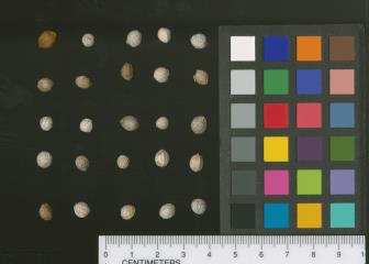 | | 1983 | COLLECTED | 1937 | Along the Missouri River near Gettysburg, Potter County | 45.01151400, -99.95456500 | 629 | | Wild material | Recommended for farmstead and field windbreaks, wildlife habitats, and natural area plantings. Selected for rate of growth, percent survival, and crown form for the Northern Great Plains. Adapted to areas with 14 to 26 inches of annual rainfall and average annual minimum temperatures that range from -30 to -20 degrees F. For additional information, view the 'Oahe' USDA-NRCS Brochure | 1371918 | PI 476982 |
| 1 | NA 79084 | NA 79084 | Celtis occidentalis L. | | NA | | | 2017 | | | | | | | | | 1951462 | NA 79084 |
| 2 | NA 66916 | Morton I.S.1992-25 | Celtis occidentalis L. | Illinois, United States | NA | | | 1992 | DONATED | 11/03/1992 | | | | | Wild material | According to Dr. Alan Whittemore, flow cytometry performed on two individuals of this accession (003 and 006) show them to be tetraploid; this makes them highly unusual for North American Celtis, which are normally either diploid or triploid. | 1493803 | NA 66916 |
| 3 | Ames 36016 | Sugar Creek | Platanus occidentalis L. | Iowa, United States | NC7 |  | | 2023 | COLLECTED | 02/20/2023 | Scattered along Sugar Creek between 3.1 miles north and also 1.3 miles northeast of Franklin, T68N R6W Sections 2, 11, 12, 13 and 24. | 40.70277500, -91.51065900 | 185 | River banks and floodplains. | Wild material | This accession of American sycamore includes the sampling from several very large specimens found in the state of Iowa including specimen #211-12 currently (2023) ranking 13th largest measuring 14' 9" circumference; 106' 8" in height; and a calculated spread of 114' 8" totalling 312.346 points (measured 23 April 2023 by Mark Rouw); specimen #211-10 currently (2023) ranking as the 9th largest measuring 16' 2" circumference; 97' 5" in height; and a calculated spread of 134' 3" totalling 322.983 points (measured 21 April 2020 by Mark Rouw); and specimen #211-6 currently (2023) ranking 2nd largest measuring 20' 2.5" circumference; 109' 6" in height; and a calculated spread of 148' 9" totalling 389.188 points (measured 23 April 2023 by Mark Rouw). Numerous specimens noted in nature with extremely white, superior, ornamental bark characteristics, specifically specimen #211-13. | 2141476 | Ames 36016 |
| 4 | Ames 33922 | JDC/PO/2017/012/766 | Platanus occidentalis L. | Iowa, United States | NC7 |  | | 2017 | COLLECTED | 03/20/2017 | Skunk River watershed of Chichaqua Bottoms Greenbelt approximately 5.75 miles east, southeast of Elkhart, Polk County | 41.77733500, -93.40833400 | 243 | Floodplain. | Wild material | | 1946989 | Ames 33922 |
| 5 | DLEG 890059 | DLEG 890059 | Senna occidentalis (L.) Link | Chihuahua, Mexico | | | Historic | 1989 | COLLECTED | 01/01/1989 | Rocky arroyo off of R o Urique, Urique, Barranca del Cobre. 3000 ft elevation. | | | Sinaloan Thornscrub with Celtis iguanea, Pisonia capitata, Randia echinocarpa, Caesalpinia platyloba, Pachycereus pecten-aboriginum. | Wild material | Multiple-stemmed shrub to 1.5 m tall. M. Johnson 89-003. Accession has been regenerated. | 1528001 | DLEG 890059 |
| 6 | PI 710524 | MARSB-091 | Phytolacca americana L. | New York, United States | S9 | 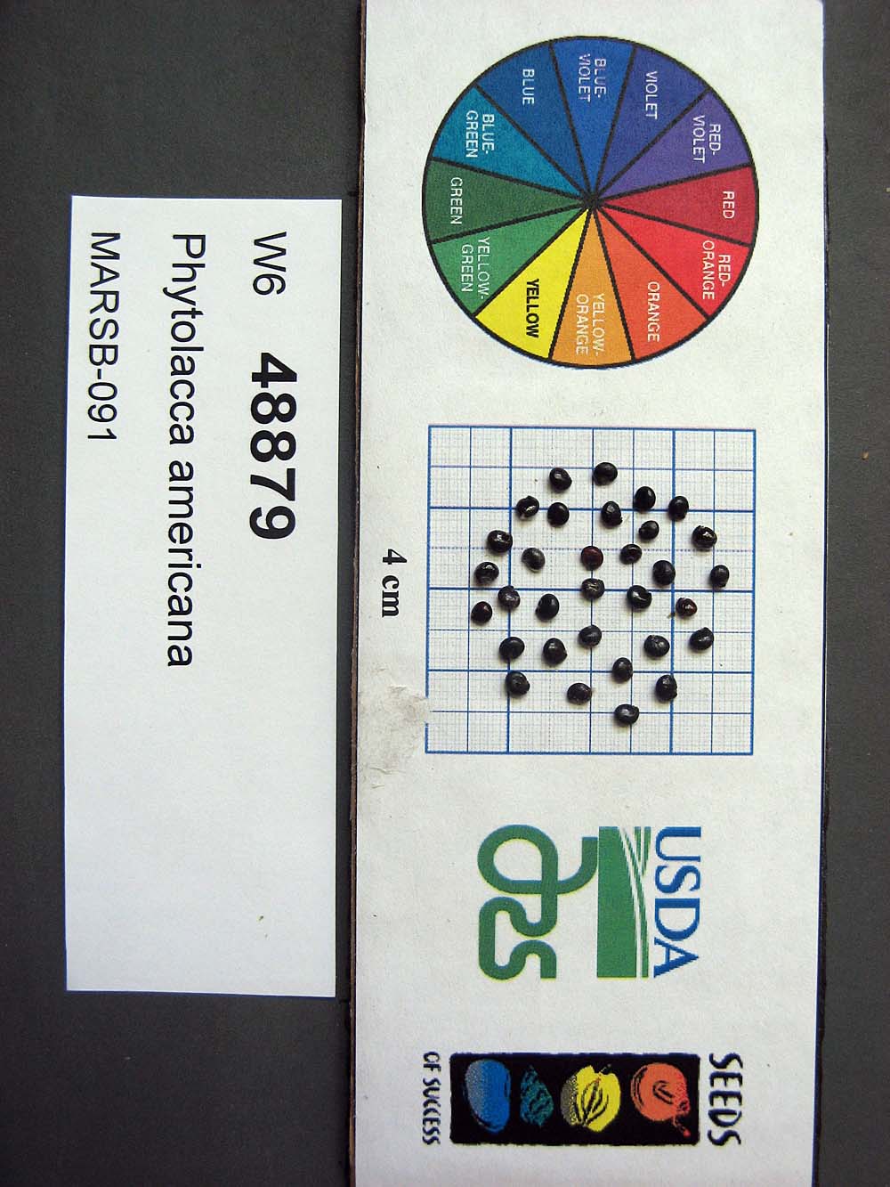 | | 2015 | | | | | | | Wild material | | 1922926 | PI 710524 |
| 7 | PI 495609 | APS/GD/2013/003/088 | Gymnocladus dioicus (L.) K. Koch | Missouri, United States | NC7 |  | | 1984 | COLLECTED | 09/22/1984 | Squaw Creek N.W.R., Section 30, T61N, R38W, Holt County. | 40.06555556, -95.22611111 | 303 | Intermediate elevation and bases of slopes. | Wild material | | 1390545 | PI 495609 |
| 8 | NA 89078 | 2024RJLPA-004 | Staphylea trifolia L. | Pennsylvania, United States | NA | | | 2024 | COLLECTED | 09/20/2024 | Along gated road about 0.33 kilometers southwest of the Lake Ontelaunee Trail parking lot. | 40.49850800, -75.89121300 | 94 | Plants are growing on well-drained steep slopes in shade to part shade of a deciduous forest. Slope: 35 to 50 percent. Aspect: East-southeast. Geology: The underlying geology of this area is of Ordovician origin and characterized as Shale and graywacke of Hamburg sequence. It is characterized by shale containing zones of conspicuous graywacke. (Source: USGS Pennsylvania Geologic Map Data). Soils: The primary soil type in the area of this collection is classified as Berks-Weikert Complex, 25 to 60% slopes (BkF). Dominantly sloping to very steep, moderately deep and shallow, well drained soils underlain by acid shale bedrock. (Source: UPenn State University Soil Info Website). EPA Ecoregion (Level III): Ridge and Valley (67). EPA Ecoregion (Level IV): Northern Shale Valleys (67b). | Wild material | | 2169042 | NA 89078 |
| 9 | NA 89079 | 2024RJLPA-005 | Viburnum prunifolium L. | Pennsylvania, United States | NA | | | 2024 | COLLECTED | 09/20/2024 | Along gated road about 0.33 kilometers southwest of the Lake Ontelaunee Trail parking lot. | 40.50062600, -75.89004900 | 94 | Plants are growing on moist, well-drained in part shade of a deciduous forest. Slope: 0 percent. Aspect: N/A. Geology: The underlying geology of this area is of Ordovician origin and characterized as Shale and graywacke of Hamburg sequence. It is characterized by shale containing zones of conspicuous graywacke. (Source: USGS Pennsylvania Geologic Map Data). Soils: The primary soil type in the area of this collection is classified as Holly Series Silt Loam (Ho). The Holly Series consists of very deep, very poorly and poorly drained soils formed in loamy alluvium on flood plains. Saturated hydraulic conductivity is moderately high through high in the mineral soil. Slope ranges from 0 through 3 percent. (Source: USDA-NRCS Official Soil Series Descriptions). EPA Ecoregion (Level III): Ridge and Valley (67). EPA Ecoregion (Level IV): Northern Shale Valleys (67b). | Wild material | | 2169043 | NA 89079 |
| 10 | Ames 36260 | Thomson Causeway Recreation Area | Cornus drummondii C. A. Mey. | Illinois, United States | NC7 |  | | 2024 | COLLECTED | 08/19/2024 | Thomson Causeway Recreation Area, approximately 1 mile southwest of Thomson. Scattered along Potter Road starting just east of the causeway heading west, and along the gravel service road to the south. T23N R3E SE 1/4 Sec. 26. | 41.94919700, -90.11822100 | 179 | Floodplain of wetland complex along east bank of Mississippi River. Soils are moist and seasonally inundated with high organic matter content. | Wild material | Shrubs in nature measuring approximately 10 feet in height (to 15 feet) with varying degrees of red pigmentation on the pedicles. Peak fruit ripening occurred in late August 2024. Minor foliar disease noted at the time of collection. Growing as individual shrubs in shadier locations and forming thickets in sunnier sites. | 2168984 | Ames 36260 |
| 11 | Ames 36251 | JDC/UT/2024/008/1130 | Ulmus thomasii Sarg. | Minnesota, United States | NC7 | 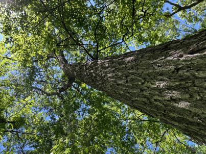 | | 2024 | COLLECTED | 06/05/2024 | Near southeast edge of Kasota Lake approximately 9.0 miles east, southeast of Willmar, T119N R34W SE 1/4 NE 1/4 Sec. 36 and also Robbins Island Park in Wilmar, T119N R35W Sec. 11. | 45.07399600, -94.88484100 | 352 | Deciduous woods | Wild material | Ulmus thomasii (Rock elm) is an underutilized tree species both in conservation and in the urban landscape. Described by Charles Sprague Sargent (first director for the Arnold Arborteum) as "heavy, hard, very strong and tough, closely grained, and susceptible of receiving a beautiful polish". Historically noted for a variety of uses in woodworking including furniture, heavy agricultural implements, timber frame buildings, pianos, hockey sticks, and hand tools. Ulmus thomasii is extremely drought tolerant, adaptable to very calcareous soils, and compared to U. americana or U. rubra has a very conservative growth rate requiring minimal attention in regards to pruning. Rock elm naturally tends to develop into a nice structural specimen in the landscape, unlike other fast growing cultivars in the nursery trade needing frequent attention. Rock elm has very fissured bark and is well known for maintaining a strong central leader resulting in a very attractive, pyramidal form. Despite many literature sources stating that "wings" on the stems are a key identifiying characteristic, this trait is not reliable and many genotypes may completely lack "wings" on the stems. While growth habit and morphology of dormant buds (very pointy) are good traits to help aid in identification, fruits are the best way to confirm identity. Fruits are densly pubescent, often described as "inflated" and generally reach maturity a couple weeks after Ulmus rubra and Ulmus americana. U. thomasii inflorescences are rather distinguishable from other Ulmus in being pendulous. Fruits are extremely prized treats for many birds, where fruits are often "robbed" prior to full maturity. Fruits are also highly prized by many other animals such as mice, squirrels, chipmunks, turkeys, etc. and are generally consumed within hours after fruit abscission. The native range of U. thomasii is concentrated in the northeastern United States and into Canada with disjunct populations documented in northwestern Missouri and northwestern Arkansas (Little, E. L. Jr. 1971). In the 1895 Silva of North America (vol. 7) it was stated that, “The value of the wood of the Rock Elm threatens its extinction and most of the large trees have already been cut.” Today, while rock elm is rather rare, especially in areas near the edges of its range, many states list the species as endangered or threatened warranting preservation efforts. Genetics of this accession would be representative of the species northwestern edge of its native range. Majority of specimens noted did not have characteristic "wings" on the stems and measured approximately 20" DBH or more with a few specimens nearing 30". Heights estimated between 70-90'. Rock elm in this area could be classified as locally abundant. | 2167953 | Ames 36251 |
| 12 | NA 88820 | TJK2023AL-005 | Hydrangea arborescens L. | Alabama, United States | NA | | | 2023 | COLLECTED | 12/07/2023 | Between Monroe County Route 1 and Tom Hayles Road. | 31.40575900, -87.54924000 | 22 | In woodlands on limestone outcrop. While the upper area of slopes is covered by a thin soil layer, the exposed limestone rock outcrop on the northwestern edge of this area is a low competition niche for plants like the Hydrangea to gain a foothold. Slope: 60% (plus). Aspect: Northwest. Elevation: 72 feet. | Wild material | | 2165649 | NA 88820 |
| 13 | NA 88821 | TJK2023AL-006 | Hydrangea quercifolia W. Bartram | Alabama, United States | NA | | | 2023 | COLLECTED | 12/07/2023 | Between Monroe County Route 1 and Tom Hayles Road. | 31.40580000, -87.54890000 | 22 | In woodlands on limestone outcrop. While the upper area of slopes is covered by a thin soil layer, the exposed limestone rock outcrop on the northwestern edge of this area is a low competition niche for plants like the Hydrangea to gain a foothold. Slope: 60% (plus). Aspect: Northwest. Elevation: 72 feet. | Wild material | | 2165650 | NA 88821 |
| 14 | NA 88671 | RJL2023PA-005 | Rhododendron maximum L. | Pennsylvania, United States | NA | | | 2023 | COLLECTED | 10/16/2023 | Appalachian National Scenic Trail: Pulpit Rock and Pinnacle Loop. Rocky woodlands along Furnace Creek as well as steep rocky slopes above Pulpit Rock Reservoir associated with the Pulpit Rock and Pinnacle Loop Trail. | 40.59226100, -75.94588800 | 301 | Well-drained and very rocky dry deciduous woodlands in part shade to full shade. Slope: 0-30%. Aspect: variable. The underlying geology of this area is of Silurian origin and characterized as the Shawangunk Formation. It is characterized by light- to dark-gray, fine- to very coarse-grained sandstone and conglomerate containing thin shale interbeds. Includes four members, in descending order: Tammany--conglomerate and sandstone; Lizard Creek--sandstone and red or green shale; Minsi--sandstone and conglomerate; Weiders--conglomerate. Tammany and Lizard Creek Members together are approximately equivalent to Clinton Group to the west; Minsi and Weiders Members together are equivalent to Tuscarora Formation to the west. (Source: USGS Pennsylvania Geologic Map Data). The primary soil type in the collection area is classified as Hazleton Series. The Hazleton series consists of deep and very deep, well drained soils formed in residuum of acid gray, brown or red sandstone on uplands. Slope ranges from 0 to 80 percent. Permeability is moderately rapid to rapid. Solum thickness ranges from 60 to 120 centimeters. Depth to lithic contact ranges from 1 to 2 meters. Rock fragments of angular sandstone, dominantly less than 25 cm in size, range from 5 to 70 percent in individual horizons. Boulders, stones, flags and channers cover about 5 to 60 percent of the surface of some pedons. Reaction ranges from strongly acid through extremely acid throughout. (Source: NRCS Web Soil Survey). | Wild material | | 2159062 | NA 88671 |
| 15 | NA 88672 | RJL2023PA-006 | Rhododendron periclymenoides (Michx.) Shinners | Pennsylvania, United States | NA | | | 2023 | COLLECTED | 10/16/2023 | Appalachian National Scenic Trail: Pulpit Rock and Pinnacle Loop. Rocky woodland edges above Furnace Creek around Pulpit Rock and Pinnacle Loop Trail. | 40.58668200, -75.94269600 | 247 | Well-drained and very rocky dry deciduous woodlands in part shade to full shade. Slope: 10%. Aspect: East. The underlying geology of this area is of Silurian origin and characterized as the Shawangunk Formation. It is characterized by light- to dark-gray, fine- to very coarse-grained sandstone and conglomerate containing thin shale interbeds. Includes four members, in descending order: Tammany--conglomerate and sandstone; Lizard Creek--sandstone and red or green shale; Minsi--sandstone and conglomerate; Weiders--conglomerate. Tammany and Lizard Creek Members together are approximately equivalent to Clinton Group to the west; Minsi and Weiders Members together are equivalent to Tuscarora Formation to the west. (Source: USGS Pennsylvania Geologic Map Data). The primary soil type in the collection area is classified as Hazleton Series. The Hazleton series consists of deep and very deep, well drained soils formed in residuum of acid gray, brown or red sandstone on uplands. Slope ranges from 0 to 80 percent. Permeability is moderately rapid to rapid. Solum thickness ranges from 60 to 120 centimeters. Depth to lithic contact ranges from 1 to 2 meters. Rock fragments of angular sandstone, dominantly less than 25 cm in size, range from 5 to 70 percent in individual horizons. Boulders, stones, flags and channers cover about 5 to 60 percent of the surface of some pedons. Reaction ranges from strongly acid through extremely acid throughout. (Source: NRCS Web Soil Survey). | Wild material | | 2159063 | NA 88672 |
| 16 | NA 88676 | RJL2023PA-010 | Staphylea trifolia L. | Pennsylvania, United States | NA | | | 2023 | COLLECTED | 10/25/2023 | Seed collected along the Appalachian National Scenic Trail, accessed from the Duncannon Entrance. | 40.38132600, -77.02965700 | 103 | Well-drained and very rocky deciduous woodlands where soil has accumulated in part shade to full shade. Slope: 0-30%. Aspect: variable. The underlying geology of this area is of Devonian origin and characterized as the Duncannon Member of Catskill Formation. It is characterized by grayish-red sandstone, siltstone, and mudstone in fining-upward cycles; conglomerate occurs at base of some cycles. The sandstones which comprise the Duncannon Member are fine to very coarse grained and grayish red to grayish red-purple in color. The Duncannon Member is known to be crossbedded to planar bedded in beds anywhere from 3 to 9 meters thick. Conglomerates have been spotted at the base of the Duncannon Member. The Duncannon Member is poorly exposed in most areas except along the Lehigh River. The conglomerate portion of this member has been known to form ridges and ledges with thicknesses approaching 228 meters. (Source: USGS Pennsylvania Geologic Map Data). The primary soil type in the collection area is classified as Hazleton Series. The Hazleton series consists of deep and very deep, well drained soils formed in residuum of acid gray, brown or red sandstone on uplands. Slope ranges from 0 to 80 percent. Permeability is moderately rapid to rapid. Solum thickness ranges from 60 to 120 centimeters. Depth to lithic contact ranges from 1 to 2 meters. Rock fragments of angular sandstone, dominantly less than 25 cm in size, range from 5 to 70 percent in individual horizons. Boulders, stones, flags and channers cover about 5 to 60 percent of the surface of some pedons. Reaction ranges from strongly acid through extremely acid throughout. (Source: NRCS Web Soil Survey). | Wild material | | 2159067 | NA 88676 |
| 17 | NA 88664 | RJL2023PA-001 | Viburnum acerifolium L. | Pennsylvania, United States | NA | | | 2023 | COLLECTED | 10/01/2023 | Seed collected from plants growing along a two-mile stretch of Harmonyville Road on the woodland edge next to the road. [Note: latitude and longitude were collected at the location of the largest seed collection.] | 40.18482200, -75.78145100 | 158 | Plants were growing in well-drained and rocky mesic-dry woodlands from part shade along the road edge to full shade in the understory of the woodlands. Slope: 2-10%. Aspect: Variable. The underlying geology of this area is of Triassic origin and characterized as the Stockton Formation. It is characterized by light-gray to buff, coarse-grained, arkosic sandstone; includes reddish-brown to grayish-purple sandstone, siltstone, and mudstone. (Source: USGS Pennsylvania Geologic Map Data.) The primary soil type in the area of this collection is classified as Edgemont Channery Sandy Loam Series (8 to 25 percent slopes), extremely stony. The Edgemont Series consists of deep and very deep, well drained soils formed in the weathered residuum of quartzitic rocks. They have moderately high to high saturated hydraulic conductivity. Slopes range from 0 to 70 percent. Solum thickness ranges from 50 to 10 cm. Depth to bedrock ranges from about 1.5 to 2.2 meters. Kaolinite is the dominant mineral in the clay fraction with detectable amounts of illite, vermiculite, montmorillonite, chlorite and interstratified clays. Gravel, channers, and stone size fragments of quartzite and quartz are present throughout the profile. Rock fragments range from 5 to 40 percent in the horizons of the solum and from 10 to 90 percent in the C horizon. Reaction ranges from extremely acid to strongly acid throughout. (Source: NRCS Web Soil Survey.) | Wild material | | 2158813 | NA 88664 |
| 18 | Ames 36073 | JDC/UT/2022/028/1009 | Ulmus thomasii Sarg. | Iowa, United States | NC7 |  | | 2023 | COLLECTED | 06/05/2023 | Ledges State Park approximately 4.75 miles south of Boone, T83N R26W (Madrid NW Quad.) near center of SE ¼ Sec. 16 and also NW ¼ SW ¼ Sec. 21. | 41.99780200, -93.87967900 | 288 | Moist deciduous woods typically on mid-slopes to base of slopes and also well-drained floodplains. | Wild material | Ulmus thomasii (Rock elm) is an underutilized tree species both in conservation and in the urban landscape. Charles Sprague Sargent (first director of the Arnold Arboretum of Harvard University, Boston, MA) described the wood of Rock Elm as "heavy, hard, very strong and tough, closely grained, and susceptible of receiving a beautiful polish". Historically noted for a variety of uses in woodworking including furniture, heavy agricultural implements, timber frame buildings, pianos, hockey sticks, and hand tools. U. thomasii is extremely drought tolerant, adaptable to very calcareous soils, and compared to U. americana or U. rubra has a very conservative growth rate requiring minimal attention in regards to pruning. Rock elm naturally tends to develop into a nice structural specimen in the landscape, unlike other fast growing U. americana cultivars in the nursery trade needing frequent attention. Rock elm has very fissured bark and is well known for maintaining a strong central leader resulting in a very attractive, pyramidal form. Despite many literature sources stating that "wings" on the stems are a key identifiying characteristic, this trait is not reliable and many genotypes may completely lack "wings" on the stems. While growth habit and morphology of dormant buds (very pointy) are good traits to help aid in identification, fruits are the best way to confirm identity. Fruits are densly pubescent, often described as "inflated" and generally reach maturity a couple weeks after U. rubra and U. americana. U. thomasii flowering in central Iowa typically occurs the last week in April into the first week in May and are rather distinguishable from other Ulmus in being pendulous. Fruits are extremely prized treats for many birds, where fruits are often "robbed" prior to full maturity. Fruits are also highly prized by many other animals such as mice, squirrels, chipmunks, turkeys, etc. and are generally consumed within hours after fruit abscission. The native range of U. thomasii is concentrated in the northeastern United States and into Canada with disjunct populations documented in northwestern Missouri and northwestern Arkansas (Little, E. L. Jr. 1971). In the 1895 Silva of North America (vol. 7) it was stated that, “The value of the wood of the Rock Elm threatens its extinction and most of the large trees have already been cut.” Today, since rock elm is rather rare, especially in areas near the edges of its range, many states list the species as endangered or threatened warranting preservation efforts. Genetics of this accession would be representative of the species southwestern edge of its native range. At the collection site in nature (Ledges State Park), out of approximately 100 specimens noted only 1-2% of specimens had characteristic "wings" on the stems. Research was executed (Moore, P., 2024) involving the core sampling of U. thomasii and U. americana specimens in Ledges State Park to make growth ring widths and basal area increment comparisons. Results determined that the average age of cored trees U. thomasii (n=4) and U. americana (n=4) of both species was roughly 80 years, excluding the exceptional case of tree #007 (Ames 36073 23ncao02 SD). Tree #007 was aged at 300 years of age and currently (2025) ranks as the 14th largest U. thomasii in Iowa measuring 21" DBH with a height of 75' 5" and a spread of 43' 5" totalling 152.21 points (Rouw, M., personal communication, 4 May 2022). The computed mean density at 𝑀𝑀 = 12% for U. thomasii was 0.80 g/cm3, and for U. americana was 0.672 g/cm3. These values are both higher than the representative values inferred from the Woods Database which are 0.755 g/cm3 for U. thomasii and 0.56 g/cm3 for U. americana. To date, there is little to no information regarding U. thomasii resistance to Dutch Elm Disease. Collections of U. thomasii at the Arnold Arboretum have over-time succumbed to DED (Pruka, B., 2016). However, data recorded by Moore (2024) indicates that U. thomasii growing in central Iowa can surpass 300 years in age verifying it's long-term utilization in the landscape. | 2142915 | Ames 36073 |
| 19 | Ames 36017 | AS/GD/2023/002/212 | Gymnocladus dioicus (L.) K. Koch | Wisconsin, United States | NC7 |  | | 2023 | | | | | | | Wild material | Kentucky coffeetree in Wisconsin is rather rare. The Wisconsin Natural Heritage Inventory Program currently (2023) lists this taxon in Wisconsin as a species of concern with a state rank of S2 (Imperiled in Wisconsin due to a restricted range, few populations or occurrences, steep declines, severe threats, or other factors.) This accession represents genetics from a localized population with a near equal porportion of male and female specimens. While there are other known locations along the Wisconsin River, this population is producing seeds. The other known locations represent single clones that are distant enough from other existing clones that prevent the transfer of pollen and thus lack the ability to produce seed or will rarely produce. | 2141550 | Ames 36017 |
| 20 | Ames 36024 | AS/FN/2023/011/221 | Fraxinus nigra Marshall | Wisconsin, United States | NC7 |  | | 2023 | COLLECTED | 02/26/2023 | Located just north of Leland approximately 0.70 miles along Hemlock Road, T10N R5E SW 1/4 NW 1/4 Sec. 18 | 43.34472800, -89.95099700 | 242 | Floodplain | Wild material | Single mother tree sample with signs of wood pecker damage on trunk. | 2141557 | Ames 36024 |
| 21 | NA 88552 | RJLSEUS2022-025 | Hydrangea quercifolia W. Bartram | Alabama, United States | NA | | | 2023 | COLLECTED | 12/12/2022 | Claiborne Bluffs area along unnamed road to boat ramp on the east side of the Alabama River at the U.S. Highway 84 bridge over the river. Common at this location and along the nearby Alabama River. | 31.54879700, -87.51416400 | 40 | Plants are growing in part-shade to shade of mesic, well-drained, circum-neutral slopes and benches in mature mixed deciduous and evergreen woodlands with good litter layer. Soils: The underlying geology of this area is the Jackson Group Undifferentiated. The units of the Jackson Group are the Yazoo Clay and Crystal River and Moodys Branch Formations. Descriptions of the members of the Yazoo Clay follow in descending order. Shubuta Member - in western Alabama consists of light-greenish-gray to white plastic fossiliferous, calcareous clay containing irregular calcareous nodules. From the Tombigbee River eastward, the Shubuta becomes more calcareous and grades into massive clayey glauconitic limestone. Eastward from the Alabama River, equivalent beds grade into the Crystal River Formation. Pachuta Marl Member - light-greenish-grey glauconitic, fossiliferous clayey sand and sandy limestone traceable from western Alabama eastward to Covington County where it grades into the Crystal River Formation. Cocoa Sand Member - yellowish-gray firm calcareous, fossiliferous fine to medium sand or sandy limestone or greenish-grey micaceous, calcareous, very clayey sand. Calcareous and clayey sand equivalent to the Cocoa is traceable from western Alabama to the Conecuh River area. (Source: USGS Alabama Geological Map Data). The surface soil profile of this portion of the bluffs along the Alabama River are characterized as Saffell-Lucy (Flomaton) Series Complex soils. The Saffell Series consists of very deep, well drained, moderately permeable soils that formed in loamy and gravelly marine sediments of the Tertiary Age and have acid reaction. These soils are found on the upper portion of the bluffs along the Alabama River. The Lucy Series consists of very deep, well drained, moderately permeable soils on uplands. They formed in sandy and loamy marine and fluvial sediments of the Southern Coastal Plain Major Land Resource Area. Soil reaction runs from strongly to moderately acid. The Flomaton Series consists of very deep, excessively drained, rapidly permeable soils on uplands of the Southern Coastal Plain Major Land Resource Area. They formed in gravelly sandy marine sediments and also have an acid reaction. The remainder of soils are of miscellaneous origin. (Source: USDA-NRCS Official Soil Series Descriptions). | Wild material | | 2140779 | NA 88552 |
| 22 | NA 88553 | RJLSEUS2022-026 | Hydrangea arborescens L. | Alabama, United States | NA | | | 2023 | COLLECTED | 12/12/2022 | Claiborne Bluffs area along unnamed road to boat ramp on the east side of the Alabama River at the U.S. Highway 84 bridge over the river. Occasionally found in the woodlands. | 31.54940700, -87.51366200 | 25 | Plants are growing in part-shade to shade of mesic, well-drained, circum-neutral slopes mature mixed deciduous and evergreen woodlands where slopes are exposed and detritus does not build up.
Soils: The underlying geology of this area is the Jackson Group Undifferentiated. The units of the Jackson Group are the Yazoo Clay and Crystal River and Moodys Branch Formations. Descriptions of the members of the Yazoo Clay follow in descending order. Shubuta Member - in western Alabama consists of light-greenish-gray to white plastic fossiliferous, calcareous clay containing irregular calcareous nodules. From the Tombigbee River eastward, the Shubuta becomes more calcareous and grades into massive clayey glauconitic limestone. Eastward from the Alabama River, equivalent beds grade into the Crystal River Formation. Pachuta Marl Member - light-greenish-grey glauconitic, fossiliferous clayey sand and sandy limestone traceable from western Alabama eastward to Covington County where it grades into the Crystal River Formation. Cocoa Sand Member - yellowish-gray firm calcareous, fossiliferous fine to medium sand or sandy limestone or greenish-grey micaceous, calcareous, very clayey sand. Calcareous and clayey sand equivalent to the Cocoa is traceable from western Alabama to the Conecuh River area.
Source: USGS Alabama Geological Map Data (https://mrdata.usgs.gov/geology/state/state.php?state=AL)
The surface soil profile of this portion of the bluffs along the Alabama River are characterized by Saffell-Lucy (Flomaton) Series Complex soils. The Saffell Series consists of very deep, well drained, moderately permeable soils that formed in loamy and gravelly marine sediments of the Tertiary Age and have acid reaction. These soils are found on the upper portion of the bluffs along the Alabama River. The Lucy Series consists of very deep, well drained, moderately permeable soils on uplands. They formed in sandy and loamy marine and fluvial sediments of the Southern Coastal Plain Major Land Resource Area. Soil reaction runs from strongly to moderately acid. The Flomaton Series consists of very deep, excessively drained, rapidly permeable soils on uplands of the Southern Coastal Plain Major Land Resource Area. They formed in gravelly sandy marine sediments and also have an acid reaction. The remainder of soils are of miscellaneous origin.
Source: USDA-NRCS Official Soil Series Descriptions (https://soilseries.sc.egov.usda.gov/osdname.aspx) | Wild material | | 2140780 | NA 88553 |
| 23 | NA 88558 | RJLSEUS2022-031 | Ilex decidua Walter | Alabama, United States | NA | | | 2023 | COLLECTED | 12/12/2022 | Silver Creek Lake Campground off of Silver Creek Lake Road: Silver Creek Lake, at the edge of the campground. | 31.66344600, -87.57108400 | 16 | Part shade to sun along the eroding banks of Silver Creek Lake in moist-mesic, mixed deciduous and evergreen woodland, 2-3 meters above the water. The underlying geology of this area is Claiborne Group, Tallahatta Formation, of Eocene origin, with white to very light-greenish-gray thin-bedded to massive siliceous claystone; interbedded with thin layers of fossiliferous clay, sandy clay, and glauconitic sand and sandstone. (Source: USGS Alabama Geological Map Data). The primary soil types in the collection area are classified as Riverview Fine Sandy Loam soils (0 to 2 percent slopes, occasionally flooded). The Riverview Series consists of very deep, well drained, moderately permeable soils that formed in loamy alluvium on flood plains. Slopes range from 0 to 5 percent. Riverview soils fare on high parts of flood plains of rivers and streams draining the Coastal Plain and Southern Piedmont. Runoff is slow. Permeability is moderate. These soils flood for short periods mostly in winter or early spring months. (Source: NRCS Web Soil Survey). | Wild material | | 2140819 | NA 88558 |
| 24 | NA 88506 | RJL2022TX-001 | Itea virginica L. | Texas, United States | NA | | | 2022 | COLLECTED | 10/31/2022 | Plants growing at Shangri La Botanical Gardens and Nature Center, Orange, TX along Adams Bayou, accessed via internal service roads. Plant is infrequent at this site. | 30.10322000, -93.76271700 | 1 | Plants are growing in shade to part-shade of a Taxodium distichum-Nyssa aquatica dominated forested swampland associated with Adams Bayou in a wet low-lying area that is frequently inundated.
Soils: The underlying geology of this area is of Quaternary to Late Pleistocene origin and comprised of the Beaumont Formation. This formation is yellowish- to brownish-gray, locally reddish orange with very fine to fine quartz sand, silt, and minor fine gravel, intermixed and interbedded. It also includes stream channel, point-bar, cravasse-splay, and natural levee ridge deposits, and clayey fill in abandoned channels. Channel fill is dark brown to brownish-gray with laminated clay and silt that is organic-rich. Includes marine delta-front sand, lagoonal clay, and near-shore marine sand beneath and landward of bays along the coast. Depth of this unconsolidated outwash ranges from 3-100 meters thick.
Source: USGS Texas Geologic Map Data (https://mrdata.usgs.gov/geology/state/sgmc-unit.php?unit=TXQbs%3B0)
The primary soil types in the collection area are classified as Cowmarsh series. The Cowmarsh series consists of very deep, very poorly drained soils that formed in mucky silty clayey alluvial deposits of Holocene age. These depressional soils are oxbows and relict channels of rivers where flooding and ponding is frequent. Slope ranges from 0 to 1 percent but mainly less than 1 percent. very poorly drained. Runoff is negligible. Frequently flooded for very long periods from February through May and surface remains saturated for very long periods once flood waters have receded.
Source: NRCS Web Soil Survey (https://websoilsurvey.sc.egov.usda.gov/App/WebSoilSurvey.aspx) | Wild material | | 2139813 | NA 88506 |
| 25 | NA 88507 | RJL2022TX-002 | Fraxinus caroliniana Mill. | Texas, United States | NA | | | 2022 | COLLECTED | 10/31/2022 | Plants growing at Shangri La Botanical Gardens and Nature Center, Orange, TX along Adams Bayou, accessed via internal service roads. Plant is relatively common along Adams Bayou but scattered. | 30.09989400, -93.75239700 | 1 | Plants are growing in part-shade to sun of a Taxodium distichum-Nyssa aquatica dominated forested swampland associated with Adams Bayou in a wet low-lying area that is frequently inundated. While found as an occasional understory element, it is more common on the edge of the swampland forest where there are high light conditions.
Soils: The underlying geology of this area is of Quaternary to Late Pleistocene origin and comprised of the Beaumont Formation. This formation is yellowish- to brownish-gray, locally reddish orange with very fine to fine quartz sand, silt, and minor fine gravel, intermixed and interbedded. It also includes stream channel, point-bar, cravasse-splay, and natural levee ridge deposits, and clayey fill in abandoned channels. Channel fill is dark brown to brownish-gray with laminated clay and silt that is organic-rich. Includes marine delta-front sand, lagoonal clay, and near-shore marine sand beneath and landward of bays along the coast. Depth of this unconsolidated outwash ranges from 3-100 meters thick.
Source: USGS Texas Geologic Map Data (https://mrdata.usgs.gov/geology/state/sgmc-unit.php?unit=TXQbs%3B0)
The primary soil types in the collection area are classified as Cowmarsh series. The Cowmarsh series consists of very deep, very poorly drained soils that formed in mucky silty clayey alluvial deposits of Holocene age. These depressional soils are oxbows and relict channels of rivers where flooding and ponding is frequent. Slope ranges from 0 to 1 percent but mainly less than 1 percent. very poorly drained. Runoff is negligible. Frequently flooded for very long periods from February through May and surface remains saturated for very long periods once flood waters have receded.
Source: NRCS Web Soil Survey (https://websoilsurvey.sc.egov.usda.gov/App/WebSoilSurvey.aspx) | Wild material | | 2139814 | NA 88507 |
| 26 | NA 88508 | RJL2022TX-003 | Morella cerifera (L.) Small | Texas, United States | NA | | | 2022 | COLLECTED | 10/31/2022 | Plants growing at Shangri La Botanical Gardens and Nature Center Orange, TX along Adams Bayou, accessed via internal service roads. Plant is relatively common along Adams Bayou but scattered in the understory. | 30.10035500, -93.75288700 | 1 | Plants are growing in part-shade to shade of a Taxodium distichum-Nyssa aquatica dominated forested swampland associated with Adams Bayou in a wet low-lying area that is frequently inundated.
Soils: The underlying geology of this area is of Quaternary to Late Pleistocene origin and comprised of the Beaumont Formation. This formation is yellowish- to brownish-gray, locally reddish orange with very fine to fine quartz sand, silt, and minor fine gravel, intermixed and interbedded. It also includes stream channel, point-bar, cravasse-splay, and natural levee ridge deposits, and clayey fill in abandoned channels. Channel fill is dark brown to brownish-gray with laminated clay and silt that is organic-rich. Includes marine delta-front sand, lagoonal clay, and near-shore marine sand beneath and landward of bays along the coast. Depth of this unconsolidated outwash ranges from 3-100 meters thick.
Source: USGS Texas Geologic Map Data (https://mrdata.usgs.gov/geology/state/sgmc-unit.php?unit=TXQbs%3B0)
The primary soil types in the collection area are classified as Cowmarsh series. The Cowmarsh series consists of very deep, very poorly drained soils that formed in mucky silty clayey alluvial deposits of Holocene age. These depressional soils are oxbows and relict channels of rivers where flooding and ponding is frequent. Slope ranges from 0 to 1 percent but mainly less than 1 percent. very poorly drained. Runoff is negligible. Frequently flooded for very long periods from February through May and surface remains saturated for very long periods once flood waters have receded.
Source: NRCS Web Soil Survey (https://websoilsurvey.sc.egov.usda.gov/App/WebSoilSurvey.aspx) | Wild material | | 2139815 | NA 88508 |
| 27 | NA 88509 | RJL2022TX-004 | Ilex decidua Walter | Texas, United States | NA | | | 2022 | COLLECTED | 11/01/2022 | Low woodlands along the north side of Texas State Hwy 190 between the highway and an unnamed paved service road that leads down to the Sabine River; the turn for the service road is approximately 0.62 kilometers west of the Sabine River. Near the bridge over the Sabine River. | 30.74730000, -93.61568900 | 20 | Plants are growing in part-shade to shade of a moist mesic (occasionally temporarily wet) woodland. Ilex decidua can be in the low woods most of the way down to the river. Plant is a common understory shrub in the moist woodland habitat not far from the Sabine River. Soils: The underlying geology of this area is of Holocene origin and characterized as Alluvium. The alluvium and low terrace deposits along streams include sand, silt, clay, and gravel. Thickness is variable. In this case alluvium is from the Sabine River. (Source: USGS Texas Geologic Map Data). The primary soil types in the collection area are classified as Urbo and Mantachie soils. The Urbo series consists of deep, somewhat poorly drained soils. Permeability is very slow. These nearly level to gently sloping soils formed in clayey alluvium on flood plains of streams that drain uplands of the Southern Coastal Plain. Slopes range from 0 to 3 percent. In wet seasons late in winter and early in spring, the water table is at a depth of 1 to 2 feet and most areas of Urbo soils are subject to either occasional or frequent flooding of brief to long duration. The Mantachie series consists of very deep, somewhat poorly drained, moderately permeable soils on flood plains of the Southern Coastal Plain. They formed in loamy alluvium and considered acidic. Mantachie soils are subject to rare to frequent flooding in the winter and early spring for brief to long duration, unless protected. The seasonal high water table ranges from 1.0 to 1.5 feet of the surface during periods of high rainfall. (Source: NRCS Web Soil Survey). | Wild material | | 2139816 | NA 88509 |
| 28 | NA 88514 | RJL2022MD-019 | Kalmia latifolia L. | Maryland, United States | NA | | | 2022 | COLLECTED | 11/04/2022 | Plants are growing on both sides of a fire road on Maryland Heights along the edge with Harpers Ferry National Historic Park. This location was accessed from the east where Miller Avenue meets the fire road, approximately 2 kilometers away. There is no vehicular access to the collecting area. Becoming locally uncommon. This local population is likely to be extirpated in the next 20-30 years. This collector has hiked through this area for more than 35 years and seen dramatic changes in the population. When first observed, Kalmia latifolia was a dominant understory shrub on south- to west-facing slopes beneath a mature forest canopy. Over the years, at least one forest fire has significantly reduced the population, along with a continuing increase in deer populations, resulting in catastrophic browse damage. The absence of a mature forest canopy and periods of drought have almost certainly also resulted in decline of this population. While collecting seed from scattered mature plants well above deer browse levels, this collector also noted that there was virtually no recruitment taking place. | 39.32811200, -77.72242400 | 287 | Plants are growing in part-shade to shade of a deciduous upland, very rocky, and dry forest community. Plants are frequently found growing among boulders, rock outcrops, and steep-slope erosional areas, although, not exclusively.
Soils: The underlying geology of this area is of Late Cambrian to Cambrian origin and comprised of Chilhowee Group; Weverton Formation. This includes interbedded white to dark gray, thin-bedded, micaceous, ferruginous, and sericitic quartzites, phyllites, and white, thick-bedded, ledge-making quartzites; some gray to brown ferruginous quartz conglomerate and purple-banded phyllite.
Source: USGS Maryland Geologic Map Data https://mrdata.usgs.gov/geology/state/sgmc-unit.php?unit=MDKp%3B5
The primary soil types in the collection area are classified as Dekalb-Bagtown-Rock outcrop complex, 25 to 65 percent slopes. The Dekalb series consists of moderately deep, excessively drained soils formed in material weathered from gray and brown acid sandstone in places interbedded with shale and graywacke. Slope ranges from 0 to 80 percent. Permeability is rapid. Solum thickness and depth to bedrock range from 50 to 100 cm. Flat, subangular or angular, sandstone fragments, 2.5-25 cm across increase with depth and range from 10-60 percent in individual horizons of the solum and from 50-90 percent or more in the C horizon. The amount of rock fragments typically increases with depth. Cobbly, channery, and very stony phases are common. Reaction ranges from extremely through strongly acid.
Source: NRCS Web Soil Survey (https://websoilsurvey.sc.egov.usda.gov/App/WebSoilSurvey.aspx) | Wild material | | 2139821 | NA 88514 |
| 29 | Ames 36028 | JDC/MP/2023/014/1046 | Maclura pomifera (Raf.) C. K. Schneid. | Iowa, United States | NC7 | _thumbnail.jpg "Click for 3 image(s) for this accession.") | | 2022 | COLLECTED | 11/02/2022 | Located 8.0 miles northeast of Boone where Montgomery Creek crosses V Avenue, T85N R25W NW 1/4 SW 1/4 Sec. 34 | 42.12911400, -93.75509100 | 295 | Previously grazed pasture. | Uncertain improvement status | The native range for Osage-orange is reported from eastern Texas, southeastern Oklahoma, southwestern Arkansas, and the northwestern corner of Louisiana (Little, 1971). Historically and presently known for its extreme value as bow-wood and fence posts, Osage-orange represents one of the most widely planted tree species in the lower 48 US states as a living fence starting in the mid-1800's, in the late 1900's as a landscape tree for difficult sites, and most recently its chemical properties. Detailed history of Osage-orange and it's economic uses are well documented (Smith and Perino, 1981 and J. T. Winberry 1979). Osage wood is highly-prized for its use as fence posts (both living and non-living) and durable wood for wood working. Osage is an extremely drought and heat tolerant tree and is recommended for use in USDA cold-hardiness zones 5b or warmer. Although the species is commonly known for its stout thorns and large, globular fruits, the species is dioecious and the degree of thorns on individual genotypes can be extremely variable. This accession represents genetics collected from a naturalized population in central Iowa (Boone County - Harrison Township). Majority of specimens sampled averaged approximately 40-45’ in height with multiple (e.g. 1-5) trunks. The collection site represents a recognized Iowa Century Farm awarded in 1976 that was originally settled by Andrew Nelson and then purchased on 24 October 1874 for the amount of '9.00 per acre by Lester S. Carlson. According to Samuel Keith Carlson (grandson to Lester S. Carlson), in the 1930's-1940's there was a fence line plus a few additional specimens of significant size that were possibly planted by Lester S. Carlson in the 1870's or the previous owner during "hedge mania" in the 1850's. In the 1950's the original trees at the Carlson farm were removed, but the progeny have persisted throughout the woods and adjacent pasture areas and continue to spread. A corner fence post of Osage that was set in 1874 by Lester S. Carlson shortly after purchasing the property still remains (see image). Majority of the specimens in this population are nearly thornless or with relatively few thorns. Fruit sizes range between 70-90 mm in diameter with seed lengths ranging from 6.99 mm (min) to 11.68 mm (max) with the average length of 50 seeds at 9.36 mm. At time of collection (2 November 2022) approximately 20% of specimens were at peak, yellow fall color, while remaining specimens were still green/greenish-yellow. | 2141741 | Ames 36028 |
| 30 | NA 89039 | RJL2022IL-001 | Ptelea trifoliata L. | Illinois, United States | NA | | | 2022 | COLLECTED | 09/28/2022 | Site of plant habitat is located at 823 E Co Rd 1220, Hamilton, IL 62341 which is the property where Jacob's Geode Shop and Mine is located. This species is scattered and relatively common throughout the woodlands on this site. | 40.37848400, -91.35390200 | 175 | Plants growing in shade to part-shade of deciduous woodlands above a small creek.
Soils: The underlying geology of this area is of Mississippian origin and comprised of Warsaw Formation and Salem Limestone. Major lithological components include limestone that can be shaly, oolitic, bioclastic, or cherty. Minor lithological components include siltstone that can contain geodes or drusy quartz and can be calcareous.
Source: USGS Illinois Geologic Map Data (https://mrdata.usgs.gov/geology/state/sgmc-unit.php?unit=ILMws%3B0)
The surface soil profile of this area is Coffeen silt loam, 0 to 2 percent slopes, that are frequently flooded. The Coffeen series consists of very deep, somewhat poorly drained, moderately permeable soils on flood plains, low terraces or benches, toe slopes, and alluvial fans. They formed in silty alluvium. Much of the alluvium is of local origin derived from the nearby loess-covered uplands.
Source: NRCS Web Soil Survey (https://websoilsurvey.sc.egov.usda.gov/App/WebSoilSurvey.aspx) | Wild material | | 2139604 | NA 89039 |
| 31 | NA 89037 | RJL2022KS-004 | Fraxinus pennsylvanica Marshall | Kansas, United States | NA |  for this accession.") | | 2022 | COLLECTED | 09/21/2022 | Coronado Heights Park, Smoky View, Kansas hillsides surrounding the historic WPA circa 1932 Coronado Heights Castle located about 91 meters above the surrounding land. This plant is scattered and infrequent on the slopes of this site. | 38.61065700, -97.70408300 | 448 | Plants growing in full sun, under extreme exposure, rocky, dry and thin soils of this short grass prairie habitat on the slopes surrounding the summit of Coronado Heights Park. Plants tend
Soils: The underlying geology of this area is of Upper Cretaceous origin and comprised of Kiowa Shale or FM- light -gray to black illitic shale with thin coquinoidal limestone beds at the base; sandstone lenses are common. Cheyenne Sandstone-massive to cross-bedded, light-gray to buff fine-grained sandstone with lenses to be found in runoff zones where moisture is temporarily more abundant.of gray sandy shale and conglomerate.
Source: USGS Kansas Geologic Map Data (https://mrdata.usgs.gov/geology/state/sgmc-unit.php?unit=KSKkc%3B0)
The surface soil profile of this area is Lancaster-Hedville complex, 3 to 20 percent slopes. The Lancaster series consists of moderately deep, well drained soils that formed in residuum from sandstone and sandy shales; it can be up to 200 cm deep. Slopes range from 1-20%. Hedville soils have bedrock within 50 centimeters of the surface and occur on similar hillslope positions.
Source: NRCS Web Soil Survey (https://websoilsurvey.sc.egov.usda.gov/App/WebSoilSurvey.aspx) | Wild material | | 2139602 | NA 89037 |
| 32 | NA 89036 | RJL2022KS-003 | Cornus drummondii C. A. Mey. | Kansas, United States | NA | | | 2022 | COLLECTED | 09/21/2022 | Coronado Heights Park, Smoky View, Kansas hillsides surrounding the historic WPA circa 1932 Coronado Heights Castle located about 91 meters above the surrounding land. This plant is common and abundant on the slopes of this site. | 38.61348400, -97.70343100 | 475 | Plants growing in part shade to full sun, under extreme exposure, rocky, dry and thin soils of this short grass prairie habitat on the slopes surrounding the summit of Coronado Heights Park. The underlying geology of this area is of Upper Cretaceous origin and comprised of Kiowa Shale or FM- light -gray to black illitic shale with thin coquinoidal limestone beds at the base; sandstone lenses are common. Cheyenne Sandstone-massive to cross-bedded, light-gray to buff fine-grained sandstone with lenses of gray sandy shale and conglomerate.
Source: USGS Kansas Geologic Map Data (https://mrdata.usgs.gov/geology/state/sgmc-unit.php?unit=KSKkc%3B0)
The surface soil profile of this area is Lancaster-Hedville complex, 3 to 20 percent slopes. The Lancaster series consists of moderately deep, well drained soils that formed in residuum from sandstone and sandy shales; it can be up to 200 cm deep. Slopes range from 1-20%. Hedville soils have bedrock within 50 centimeters of the surface and occur on similar hillslope positions.
Source: NRCS Web Soil Survey (https://websoilsurvey.sc.egov.usda.gov/App/WebSoilSurvey.aspx)
Slope: 5-20% Aspect: all | Wild material | | 2139601 | NA 89036 |
| 33 | NA 89033 | RJL2022MD-010 | Clethra alnifolia L. | Maryland, United States | NA | | | 2022 | COLLECTED | 09/15/2022 | Plants growing in low woodlands at the end of Greenway Avenue near a boat dock that leads to the Pocomoke River, adjacent to Winter Quarters Golf Course, Pocomoke City. Plants common throughout the wetland area as well as mesic edges of the woodlands. | 38.08305100, -75.56527800 | | Plants growing in the flood plain of the Pocomoke River in shade to part sun of a mixed deciduous and evergreen bottomland habitat about 10 meters from the edge of the golf course fairway. The habitat is a mucky swamp edge habitat next to the Pocomoke River, most of which seems wet year-round and grades slightly upslope to more mesic conditions.
The underlying geology of this area is comprised of Quaternary Deposits of Wisconsin to Holocene origin. The composition is primarily undifferentiated gray to buff sand and gravel, gray to brown lignitic silt and clay, occasional boulders, and rare shell beds. Surficial deposits occur as shell-bearing estuarine clays and silts.
Source: USGS Maryland Geologic Map Data https://mrdata.usgs.gov/geology/state/sgmc-unit.php?unit=MDQdu%3B5
The surface soil profile of this habitat is classified as Puckum Muck which is frequently flooded. These highly saturated soils are found in flats, depressions and swales. The soil reaction of Puckum Muck is extremely acid to strongly acid throughout the profile. The depth to bedrock is generally greater than 150 cm. Wood fragments comprise 0-25%, by volume of the Puckum Muck throughout the profile which includes mostly twigs, branches, logs, or stumps and are 1.5-30 cm in diameter. The composition of these highly saturated soils, are classified as muck (sapric soil material) or mucky peat (hemic soil material) throughout most of the upper 150 cm and may contain thin layers of mucky silt loam, silty clay loam, sandy loam and/or sand.
Source: NRCS Web Soil Survey (https://websoilsurvey.sc.egov.usda.gov/App/WebSoilSurvey.aspx) | Wild material | | 2139598 | NA 89033 |
| 34 | NA 89032 | RJL2022MD-009 | Rhododendron viscosum (L.) Torr. | Maryland, United States | NA | | | 2022 | COLLECTED | 09/15/2022 | Plants growing in low woodlands at the end of Greenway Avenue near a boat dock that leads to the Pocomoke River, adjacent to Winter Quarters Golf Course, Pocomoke City. Plants scattered throughout the wetland area. Infrequent, but regularly found. | 38.08235200, -75.56566500 | 1 | Plants growing in the flood plain of the Pocomoke River in part shade to shade of a mixed deciduous and evergreen bottomland habitat about 10 meters from the edge of the golf course fairway. The habitat is a mucky swamp edge habitat next to the Pocomoke River, most of which seems wet year-round.
The underlying geology of this area is comprised of Quaternary Deposits of Wisconsin to Holocene origin. The composition is primarily undifferentiated gray to buff sand and gravel, gray to brown lignitic silt and clay, occasional boulders, and rare shell beds. Surficial deposits occur as shell-bearing estuarine clays and silts.
Source: USGS Maryland Geologic Map Data https://mrdata.usgs.gov/geology/state/sgmc-unit.php?unit=MDQdu%3B5
The surface soil profile of this habitat is classified as Puckum Muck which is frequently flooded. These highly saturated soils are found in flats, depressions and swales. The soil reaction of Puckum Muck is extremely acid to strongly acid throughout the profile. The depth to bedrock is generally greater than 150 cm. Wood fragments comprise 0-25%, by volume of the Puckum Muck throughout the profile which includes mostly twigs, branches, logs, or stumps and are 1.5-30 cm in diameter. The composition of these highly saturated soils, are classified as muck (sapric soil material) or mucky peat (hemic soil material) throughout most of the upper 150 cm and may contain thin layers of mucky silt loam, silty clay loam, sandy loam and/or sand.
Source: NRCS Web Soil Survey (https://websoilsurvey.sc.egov.usda.gov/App/WebSoilSurvey.aspx) | Wild material | | 2139597 | NA 89032 |
| 35 | Ames 35887 | JDC/MR/2022/034/1014 | Morus rubra L. | Iowa, United States | NC7 |  | | 2022 | COLLECTED | 07/12/2022 | Waubonsie State Park located north, northwest of Hamburg, T68N R42W Sec. 29 and Sec. 32. | 40.67552500, -95.68690400 | 355 | Mid slope (ranging from 10-30 degrees) to base of slopes and along all drainages and valleys of deciduous woods. | Wild material | The native range for Red Mulberry is reported from the eastern margin of the Great Plains, extending north to southern Ontario, Canada, and distributed as far south as southern Florida (Little, 1971). Conservation assessments in North America indicate current (2026) and future concern for the species including Michigan (threatened); Massachusetts (endangered); Ontario Canada (endangered); with NatureServe's 2025 global G5 rank due to genetic swamping and habitat pressure. Red Mulberry seems to be extremely localized to moist, floodplain areas that are high-quality bottomland forests. This accession represents genetics collected from the northwestern edge of the species native range. Specimens sampled in nature displayed the following morphological characters: acuminate leaf tips, impressed veins, pubescent upper and lower leaves, flaky bark (often with tiny pin holes (insect emergence holes)), cordate leaf base, and umbrella-shaped growth habit. M. rubra specimens noted ranged in size from 1"-23" inches DBH with some of the tallest specimens reaching 70' in height. The largest specimen sampled (#172-13) measuring 23.25" DBH. Estimated hundreds, perhaps a thousand specimens of M. rubra noted within the park with very little representation of hybrids or Morus alba. Representation of M. rubra outside of park boundaries is near completely absent and the presence of hybrids and M. alba is extremely evident. Soluble solids content from fruits collected in the wild ranged from 19.0-32.9 degrees Brix. This range of Brix values is likely a result of genetic diversity and also variation in maturity of fruits. Fruits selected for Brix measurements were black in color. The specimen sampled with the highest Brix value was #172-9. All M. rubra specimens noted at time of sampling (12 July 2022) were exhibiting determinate growth compared to local hybrids and M. alba, which were still actively growing with newly emerging leaves. The first study (Adhikari et al. 2026) on the mitogenome of M. rubra utilized sample #172-13 (Ames 35887 Tree #13) reporting 359,221 base pairs (bp) long with 45.8% GC content, comprising 57 genes: 32 protein-coding, 21 transfer, and four ribosomal RNAs. | 2138220 | Ames 35887 |
| 36 | Ames 35884 | AS/MR/2022/003/133 | Morus rubra L. | Iowa, United States | NC7 |  | | 2022 | COLLECTED | 07/06/2022 | Chichaqua Bottoms Greenbelt located northeast of Bondurant, T81N R22W Sec. 33 and also T80N R22W Sec. 10. | 41.78917100, -93.41777300 | 247 | Floodplain. | Wild material | Specimens sampled in nature displayed the following morphological characters: elongated acuminate leaf tips, impressed veins, pubescent upper and lower leaves, flaky bark (often with tiny pin holes (insect emergence holes)), cordate leaf base, and umbrella-shaped growth habit. Majority of specimens were approximately 30-50' in height with the largest diameter specimen (133-6) measuring 19.5" DBH. All M. rubra specimens noted were exhibiting determinate growth compared to local hybrids and M. alba, which were still actively growing with newly emerging leaves. Soluble solids content for fruit samples collected in nature ranged from 12.8-22.8 degrees Brix. This range of Brix values is likely a result of genetic diversity and also variation in maturity of fruits. The highest Brix value was from specimen 133-4. | 2138217 | Ames 35884 |
| 37 | WLP 2568 | APS/HA/2022/028/490 | Hydrangea arborescens L. | Arkansas, United States | NA | 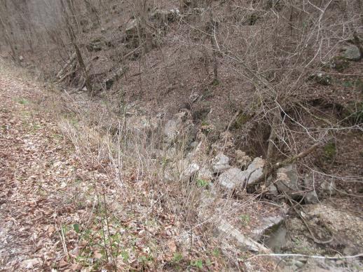 | | 2022 | COLLECTED | 03/15/2022 | Located approximately 3.75 miles east of Allison just off Round Bottom Road. | 35.93357000, -92.05110000 | 144 | Moist, low deciduous forest with scattered rock outcrops, growing along base of hill and bank of seasonal stream. | Wild material | | 2137430 | WLP 2568 |
| 38 | Ames 35752 | #476-477 | Rhus glabra L. | Iowa, United States | NC7 | 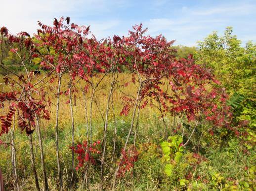 | | 2021 | COLLECTED | 09/29/2021 | Upper Iowa River area near Bluffton, T99N R9W NE1/4 Sec. 9 and S1/2 Sec. 10 | 43.40275000, -91.90494000 | 299 | High bluffs, roadside and stream banks | Wild material | Plants sampled in nature (29 September 2021) during peak fall color displaying bright reds to maroonish colors while measuring approximately 12-15 feet in height. One clonal patch noted was estimated to have 1,000+ ramets. | 2122093 | Ames 35752 |
| 39 | OPGC 7574 | Ledges State Park | Solidago ulmifolia Muhl. ex Willd. | Iowa, United States | OPGC |  | | 2021 | COLLECTED | 09/15/2021 | Ledges State Park, approximately 4.5 miles south of Boone, T83N R26W Sec. 20 | 41.98266200, -93.89314800 | 287 | Understory of hardwood forest. | Wild material | Plants in nature were generally two to three feet in height, growing in sparsely spreading colonies. This population has a large amount of diversity for flowering time with the first plants in the population beginning to flower on 22 July 2021 and the last plants to flower were still blooming at the end of September. Some plants in the population had a muted red fall foliage color at the end of October 2021. This accession represents genetics from near the northwest edge of the species range of occurence. | 2132828 | OPGC 7574 |
| 40 | OPGC 7575 | Ledges State Park | Solidago flexicaulis L. | Iowa, United States | OPGC |  | | 2021 | COLLECTED | 10/03/2021 | Ledges State Park, approximately 4.5 miles south of Boone, T83N R26W Sec. 21 | 41.98338100, -93.89052800 | 288 | Understory of hardwood forest. | Wild material | Plants in nature ranged in height from approximately one to three feet, growing in sparsely spreading colonies. Peak bloom in 2021 occurred near 15 September. Several specimens had branched inflorescences. | 2132829 | OPGC 7575 |
| 41 | OPGC 7576 | McFarland Park | Solidago flexicaulis L. | Iowa, United States | OPGC |  | | 2021 | COLLECTED | 09/26/2021 | McFarland Park just north, northeast of Ames, T84N R23W Sec. 7 | 42.09667500, -93.57083500 | 288 | Moist areas near streambanks and bottomlands in hardwood forest understory. | Wild material | Plants in nature ranged in height from approximately one to three feet, growing as spreading clumps. Peak flowering in 2021 occurred near 18 September. | 2132830 | OPGC 7576 |
| 42 | Ames 35750 | Ames 35750 | Blephilia ciliata (L.) Benth. | Iowa, United States | NC7 | 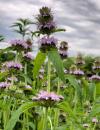 | | 2021 | COLLECTED | 09/27/2021 | Located approximately 3 miles south, southeast of Fairfield, T71N R9W SW1/4 Sec. 7 | 40.96338000, -91.94686900 | 223 | Woodland openings/edges, disturbed areas | Wild material | | 2122068 | Ames 35750 |
| 43 | Ames 35746 | Guye Woods | Acer saccharum Marshall subsp. nigrum (F. Michx.) Desmarais | Iowa, United States | NC7 |  | | 2021 | COLLECTED | 09/08/2021 | Guye Woods County Park located 6.0 miles northeast of Winterset, T76N R27W NE1/4 Sec. 4 | 41.41235000, -93.96373000 | 278 | Moist deciduous maple, oak, hickory forest, northwest facing slope above the North River. | Wild material | Multiple specimens in this population were observed to be 24" diameter at breast height (DBH) or larger with the largest specimen encountered at the time of collection measuring 36.5" DBH.
Morphological traits of leaves suggests sampled specimens are true to type of Acer saccharum subsp. nigrum including leaves with three distinct points, leathery/thick, and drooping in appearance. On September 25, 2020 (Schmitz, A., personal communication, 31 January 2022), peak fall color on Acer saccharum subsp. nigrum at Guye Woods was observed with specimens having a clean yellow fall color, also indicative of Acer saccharum subsp. nigrum.
| 2122010 | Ames 35746 |
| 44 | Ames 35612 | Ames 35612 | Agastache nepetoides (L.) Kuntze | Iowa, United States | NC7 |  | | 2020 | COLLECTED | 10/15/2020 | Private property located approximately 5.8 miles southeast of Westfield on both sides of N Ridge Road, T91N R48W SW 1/4 Sec. 16, Sioux Twp., Plymouth County | 42.69938500, -96.51933700 | 419 | Savanna (bur oak, walnut, hackberry). Loess hills and valleys. Distrurbed open forest. | Wild material | Plants sampled in nature measuring approximately 3-4 feet in height. | 2110274 | Ames 35612 |
| 45 | NA 86848 | ZARKS-025 | Acer saccharum Marshall subsp. leucoderme (Small) Desmarais | Arkansas, United States | NA | | | 2020 | COLLECTED | 10/09/2014 | Cedar Fourche Creek; Harper Grocery Rd. at Rock Springs Rd. | 34.66470800, -93.26778900 | 209 | Mesic, mixed deciduous forest; growing on the bank just above a small stream | Wild material | | 2115797 | NA 86848 |
| 46 | Ames 35288 | APS/MF/2020/003/406 | Monarda fistulosa L. | Kansas, United States | NC7 |  | | 2020 | COLLECTED | 02/05/2020 | Eisenhower State Park on north side of Melvern Lake approximately 5.25 miles west, northwest of Melvern, T18S R15E NE1/4 Sec. 3, Osage County | 38.51966000, -95.73352000 | 323 | Edge of woods with limestone substrate. | Wild material | | 2101394 | Ames 35288 |
| 47 | Ames 35242 | APS/EA/2019/046/375 | Euonymus atropurpureus Jacq. | Missouri, United States | NC7 |  | | 2019 | COLLECTED | 11/02/2019 | Mule Shoe Conservation Area along CR 66 approximately 7.5 miles east of Cross Timbers. | 38.01203000, -93.09312000 | 265 | Roadside, deciduous forest. | Wild material | | 2097787 | Ames 35242 |
| 48 | WLP 1686 | APS/RS/2019/067/396 | Rosa setigera Michx. | Arkansas, United States | NA |  | | 2019 | COLLECTED | 11/07/2019 | Located near intersection of Smith Mountain Road and Newton County 8828 Road approximately 6.00 miles north of Deer, Newton County | 35.91212000, -93.21112000 | 636 | Roadside, upland with rocky soils | Wild material | | 2097789 | WLP 1686 |
| 49 | Ames 35236 | SF_ID:24690/EO-ID:17843 | Agastache foeniculum (Pursh) Kuntze | Nebraska, United States | NC7 |  | | 2019 | | | | | | | Wild material | Plants measuring approximately 60 cm in height. Infructescences fully mature at time of collection (23 October 2019), likely past peak maturity by approximately 4 weeks. Population (EC-ID: 17843) was originally documented by Steven B. Rolfsmeier on 8 June 2015 (Nebraska Pine Ridge Plant Resurvey, 2015: Report submitted to the Nebraska Natural Heritage Program) noting “ Agastache foeniculum was located in a ravine bottom that burned in 2012. Estimated population size: 200-300 stems covering approximately 125 sq. meters”. A. foeniculum in Nebraska is currently tracked by the Nebraska Natural Heritage Program and is listed (6 November 2019) as a S1 (Critically Imperiled - at very high risk of extirpation in the state due to very restricted range, few populations or occurrences, steep declines, severe threats or other factors) and Tier 2 species (Tier 2 - species are typically those that are not at-risk from a global or national perspective but are rare or imperiled within Nebraska). | 2097772 | Ames 35236 |
| 50 | Ames 35234 | JDC/AS/2019/041/920 | Agastache scrophulariifolia (Willd.) Kuntze | Minnesota, United States | NC7 |  | | 2019 | COLLECTED | 10/24/2019 | Private property approximately 4.94 miles south, southwest of Cannon Falls, T111N R18W NW1/4 Sec. 13, Goodhue County | 44.42498900, -92.93729200 | 346 | Woodland edges, slightly disturbed. | Wild material | Plants measuring approximately 5-6' in height with 4-5" spikes pale pink in color. Stems and petioles tomentose. Peak flowering occurred circa 1 September 2019 and fruiting circa 1 October 2019 in nature. | 2097770 | Ames 35234 |
| 51 | WLP 158 | NACPEC19-029 | Rhus glabra L. | Kentucky, United States | NA | | | 2019 | COLLECTED | 09/09/2019 | Madison County; Berea College Forest: Radio Tower Service Trail | 37.55289700, -84.28793400 | 379 | Xeric shade knob, limestone shale conglomerate material | Wild material | | 2110470 | WLP 158 |
| 52 | Ames 35216 | Potato Creek SP | Monarda sp. | Indiana, United States | NC7 |  | | 2019 | COLLECTED | 09/02/2019 | Potato Creek State Park located approximately 2.6 miles northeast of North Liberty, T36N R1E extreme eastern edge of NW 1/4 SW 1/4 Sec. 23. | 41.55439400, -86.38375900 | 222 | Degraded floodplain, along sides of elevated road bed. | Wild material | This taxa is currently undescribed and according to Campbell and Medley in The atlas of vascular plants in Kentucky (Accessed 06 September 2019) was provisionally named Monarda serotina by R.T. Simmers. Described as a broad-leaved form of M. fistulosa, generally intermediate between M. fistulosa and M. clinopodia, with probable hybrid origin. Typcial habitat is mesic woods and edges on lowlands. In contrast to M. fistulosa, this taxon has longer petioles (usually 2-3 cm versus 0.5-2.0 cm), lower leaf surfaces with scattered spreading hairs, and corollas are paler pink at tips to almost white with peak flowering occurring prior to M. fistulosa by approximately 1-2 weeks. Leaves are rather rugose, where upper leaf tissue between veins is visibly raised. This accession represents genetics from northern Indiana (Potato Creek State Park). Plants at the collection site in nature peaked flowering near 8 July 2019 where flower colors were more lavender in sun but pale in shade (Namestnik, S., personal communication, 15 July 2020). Peak fruiting occurs mid-August. Average height of plants sampled in nature estimated at 4.5' in height. | 2097752 | Ames 35216 |
| 53 | OPGC 7495 | CBG-9545 | Symphyotrichum shortii (Lindl.) G. L. Nesom | Illinois, United States | OPGC |  | | 2019 | | | | | | | Wild material | | 2092813 | OPGC 7495 |
| 54 | OPGC 7496 | CBG-9546 | Solidago ulmifolia Muhl. ex Willd. | Illinois, United States | OPGC |  | | 2019 | | | | | | | Wild material | | 2092814 | OPGC 7496 |
| 55 | OPGC 7309 | AZ930-361 | Polanisia dodecandra (L.) DC. | Arizona, United States | OPGC |  | | 2018 | | | | | | | Wild material | | 1970377 | OPGC 7309 |
| 56 | W6 55665 | AZ930-360 | Neltuma velutina (Wooton) Britton & Rose | Arizona, United States | W6 |  | | 2018 | | | | | | | Wild material | Prosopis velutina | 1970376 | W6 55665 |
| 57 | NA 85007 | JDC/QB/2008/079/149 [related collection number] | Quercus bicolor Willd. | Iowa, United States | NA | | | 2018 | COLLECTED | 09/24/2015 | Chichaqua Wildlife Habitat Park bottoms, near Elkhart, NW 1/4 of NW 1/4 of Section 32, T81N, R22W, Loring Quad. | 41.79000000, -93.43972222 | 247 | | Wild material | Seedlings from seed collected at the same site as NA 81010, which was received in 2012 under collection number JDC/QB/2008/079/149, and also as Ames 29670. GRIN narrative: "A small proportion of seedlings during growout were noted to be Q. bicolor x Q. macrocarpa hybrids." Digital photographs of source trees available in GRIN under NA 85010/Ames 29670. | 2141805 | NA 85007 |
| 58 | NA 85020 | JDC/SS/2018/001/814 | Sapindus saponaria L. var. drummondii (Hook. & Arn.) L. D. Benson | Kansas, United States | NA |  | | 2018 | COLLECTED | 03/11/2018 | Between Winfield and Arkansas City within watershed of Walnut River and tributaries, T33S R4E and T34S R4E, Cowley County | 37.16470300, -96.94219900 | 350 | | Wild material | | 1957957 | NA 85020 |
| 59 | NA 85021 | JDC/SS/2018/004/817 | Sapindus saponaria L. var. drummondii (Hook. & Arn.) L. D. Benson | Oklahoma, United States | NA |  | | 2018 | COLLECTED | 03/12/2018 | Private property approximately 4.8 miles southeast of Mulhall, north side of Cimarron River, T18N R2W, Logan County | 35.99972000, -97.39735900 | 210 | Transition zone between higher elevations and bottomlands. | Wild material | | 1957958 | NA 85021 |
| 60 | NA 85022 | JDC/SS/2018/008/821 | Sapindus saponaria L. var. drummondii (Hook. & Arn.) L. D. Benson | Oklahoma, United States | NA |  | | 2018 | COLLECTED | 03/13/2018 | Thurmond Ranch approximately 3.80 miles southwest of Cheyenne, T13N R24W, Roger Mills County | 35.59226100, -99.69600600 | 554 | Bottomlands and immediate higher elevations of Sergeant Major Creek and surrounding tributaries. | Wild material | | 1957959 | NA 85022 |
| 61 | NA 85023 | JDC/SS/2018/014/827 | Sapindus saponaria L. var. drummondii (Hook. & Arn.) L. D. Benson | Oklahoma, United States | NA |  | | 2018 | COLLECTED | 03/14/2018 | Canton Wildlife Management Area approximately 17 miles west, southwest of Fairview, T20N R15W and T20N R14W, Major County | 36.16906400, -98.76062500 | 504 | | Wild material | | 1957960 | NA 85023 |
| 62 | OPGC 6411 | CBG-8084 | Solidago patula Muhl. ex Willd. | Illinois, United States | OPGC |  | | 2017 | | | | | | | Wild material | | 1954874 | OPGC 6411 |
| 63 | W6 53003 | CBG-7115 | Angelica atropurpurea L. | Illinois, United States | W6 |  | | 2017 | | | | | | | Wild material | | 1954754 | W6 53003 |
| 64 | WLP 1231 | APS/HA/2017/032/291 | Hydrangea arborescens L. | Tennessee, United States | NA | | | 2017 | COLLECTED | 11/05/2017 | South side of Cumberland River and the east end of Bluff Rd, South Carthage, Smith County | 36.24106000, -85.94595000 | 174 | Deciduous forest. Talus slope below limestone bluffs. | Wild material | | 1954438 | WLP 1231 |
| 65 | NA 84666 | PCC17-TNKY-017 | Aesculus flava Sol. | Kentucky, United States | NA | | | 2017 | COLLECTED | 10/01/2017 | Brigadoon State Nature Preserve. | 36.89931000, -85.98720000 | 198 | Mesic slope that drains into reservoir. | Wild material | | 2108768 | NA 84666 |
| 66 | NA 84689 | PCC17-TNKY-041 | Quercus lyrata Walter | Kentucky, United States | NA | | | 2017 | COLLECTED | 10/03/2017 | McCracken County; ; Metropolis Lake State Nature Preserve. | 37.14838000, -88.76861000 | 101 | 25 feet inland from edge of lake. | | One individual sampled. Seed set low, but acorns harvested from one quadrant of tree exposed to sun in canopy gap. | 2108786 | NA 84689 |
| 67 | Ames 34023 | Ames 34023 | Viburnum prunifolium L. | Iowa, United States | NC7 |  | | 2017 | COLLECTED | 09/27/2017 | Shimek State Forest, Donnellson Unit, approximately 6.0 miles west of Donnellson. | 40.64796000, -91.67764000 | 219 | Oak-hickory upland forest. | Wild material | Plants at collection site ranging between 10-15' tall. Fruits dark purple, leaves on some stems were turning red fall color at time of collection (09/27/2017). | 1953995 | Ames 34023 |
| 68 | Ames 33982 | JDC/FQ/2017/038/792 | Fraxinus quadrangulata Michx. | Kentucky, United States | NC7 | 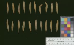 | | 2017 | COLLECTED | 07/10/2017 | Scattered hillside colllections throughout areas approximately 4.5 miles north, northwest of Frankfort, Franklin County | 38.21387700, -84.88886200 | 199 | Mixed wooded deciduous forest, generally steep (45 degree +) slopes and/or hillsides. | Wild material | | 1950065 | Ames 33982 |
| 69 | Ames 33983 | JDC/FQ/2017/039/793 | Fraxinus quadrangulata Michx. | Kentucky, United States | NC7 |  | | 2017 | COLLECTED | 07/11/2017 | Griffith Woods and surrounding area approximately 6.2 miles just southwest of Cynthiana, Harrison County | 38.32601000, -84.35295800 | 281 | Recognized as the best remnant of ancient Bluegrass woodland containing numerous mature, open-grown specimens. | Wild material | | 1950066 | Ames 33983 |
| 70 | Ames 33987 | JDC/FQ/2017/043/797 | Fraxinus quadrangulata Michx. | Ohio, United States | NC7 |  | | 2017 | COLLECTED | 07/12/2017 | Strait Creek Prairie Bluffs Preserve between Peebles and Sinking Spring along highway 41 (Crooked Creek, Strait Creek and Scioto Brush Creek watersheds), Adams and Highland County | 39.00561100, -83.37365400 | 235 | Mixed deciduous woods, generally on top of moist seep, but also on rocky gentle (30-45 degree) slopes. | Wild material | | 1950070 | Ames 33987 |
| 71 | Ames 33990 | JDC/FQ/2017/046/800 | Fraxinus quadrangulata Michx. | Ohio, United States | NC7 |  | | 2017 | COLLECTED | 07/15/2017 | Sharon Woods Metro Park within city limits of Columbus, T2N R18W, Franklin County | 40.12267100, -82.96668000 | 275 | Deciduous woods. | Wild material | | 1950073 | Ames 33990 |
| 72 | Ames 33918 | APS/GD/2017/008/267 | Gymnocladus dioicus (L.) K. Koch | Minnesota, United States | NC7 |  | | 2017 | COLLECTED | 03/16/2017 | Minnesota River watershed covering approximately 9.0 river miles between Redwood Falls and Vicksburg Park, Renville County | 44.61447700, -95.14878600 | 254 | Mixed habitats, both upland dry sites, wet sites, and rocky sites. | Wild material | | 1946985 | Ames 33918 |
| 73 | Ames 33919 | JDC/AX/2017/009/763 | Agastache nepetoides (L.) Kuntze | Minnesota, United States | NC7 |  | | 2017 | COLLECTED | 03/17/2017 | Minnesota River watershed approximately 6.0 miles north, northwest of Redwood Falls, T113N R36W NW 1/4 SW 1/4 SW 1/4 Sec. 2, Renville County | 44.61767000, -95.15602000 | 303 | Shallow soils. Growing on rocky outcropping. Growing in association with Gymnocladus dioicus, Quercus macrocarpa, and Celtis occidentalis | Wild material | Specimens sampled in nature measuring approximately 4' in height. Floral spikelet dense, 6-8" in length, greenish-white flowers. Stems stout, stongly four-angled and smooth. Seeds with minute hairs that are more pronounced on distal end (opposite of hilum). | 1946986 | Ames 33919 |
| 74 | Ames 33921 | APS/GD/2016/001/236 | Gymnocladus dioicus (L.) K. Koch | Minnesota, United States | NC7 |  | | 2017 | COLLECTED | 03/17/2017 | Blue Earth River watershed covering approximately 9.0 river miles from Vernon Center south to the county line, Blue Earth and Faribault Counties | 43.87215300, -94.17375800 | 316 | Mixed habitats, both upland dry and wet sites. | Wild material | | 1946988 | Ames 33921 |
| 75 | WLP 1117 | NA 83967 | Cornus foemina Mill. | Kentucky, United States | NA | | | 2016 | COLLECTED | 09/30/2016 | [Locality data unparseable; GPS coordinates appear near a road of uncertain name off Howard Munsey Rd. north of Betsey, Kentucky. Original location was listed as: "At Edam Road?"; no road by this name was found in the county. -SBL] | 36.92000000, -84.73900000 | 274 | Wet roadside couvee (ditch). | | | 1952406 | WLP 1117 |
| 76 | WLP 1209 | NA 83966 | Hibiscus moscheutos L. | Kentucky, United States | NA | | | 2016 | COLLECTED | 09/30/2016 | [Locality data unparseable; GPS coordinates appear near a road of uncertain name off Howard Munsey Rd. north of Betsey, Kentucky. Original location was listed as: "At Edam Road?"; no road by this name was found in the county. -SBL] | 36.91900000, -84.73800000 | 277 | Wet roadside couvee (ditch). | | | 1950957 | WLP 1209 |
| 77 | Ames 33752 | Ames 33752 | Maclura pomifera (Raf.) C. K. Schneid. | Iowa, United States | NC7 |  | | 2016 | COLLECTED | 10/05/2016 | Deer Creek watershed, T80N R23W E1/2 Sec. 18. | 41.73813000, -93.56296400 | 295 | Mixed deciduous woods, distrubed areas and also managed areas. Gentle slopes and wetlands | Uncertain improvement status | The native range for Osage-orange is reported from eastern Texas, southeastern Oklahoma, southwestern Arkansas, and the northwestern corner of Louisiana (Little, 1971). Historically and presently known for its extreme value as bow-wood and fence posts, Osage-orange represents one of the most widely planted tree species in the lower 48 US states as a living fence starting in the mid-1800's, in the late 1900's as a landscape tree for difficult sites, and most recently its chemical properties. Detailed history of Osage-orange and it's economic uses are well documented (Smith and Perino, 1981 and J. T. Winberry 1979). Osage wood is highly-prized for its use as fence posts (both living and non-living) and durable wood for wood working. Osage is an extremely drought and heat tolerant tree and is recommended for use in USDA cold-hardiness zones 5b or warmer. Although the species is commonly known for its stout thorns and large, globular fruits, the species is dioecious and the degree of thorns on individual genotypes can be extremely variable. This accession represents germplasm from a naturalizing, reproductive population collected in central Iowa (Polk County). Majority of specimens averaged approximately 40-50’ in height with multiple (e.g. 4-5) trunks. Specimens 03-1 and 03-2 were upright in form with tighter branch angles, while 03-10 was the widest spreading of all trees. Some yellow fall color (yellow) was apparent at time of fruit collection (10/05/2016). Size of fruits ranged from 9.00 to 10.75 inches circumference except for tree 03-5 with fruits averaging 7.33 inches circumference. | 1942949 | Ames 33752 |
| 78 | Ames 33357 | JDC/UT/2016/018/733 | Ulmus thomasii Sarg. | Iowa, United States | NC7 |  | | 2016 | COLLECTED | 06/03/2016 | Malanaphy Springs State Preserve just northwest of Decorah, T99N R8W SW ¼ NW ¼ SE ¼ Sec. 31 | 43.34713800, -91.83840000 | 302 | Deciduous woods. Rocky substrate. 20 degree northwest-facing slope | Wild material | Ulmus thomasii (Rock elm) is an underutilized tree species both in conservation and in the urban landscape. Charles Sprague Sargent (first director of the Arnold Arboretum of Harvard University, Boston, MA) described the wood of Rock Elm as "heavy, hard, very strong and tough, closely grained, and susceptible of receiving a beautiful polish". Historically noted for a variety of uses in woodworking including furniture, heavy agricultural implements, timber frame buildings, pianos, hockey sticks, and hand tools. U. thomasii is extremely drought tolerant, adaptable to very calcareous soils, and compared to U. americana or U. rubra has a very conservative growth rate requiring minimal attention in regards to pruning. Rock elm naturally tends to develop into a nice structural specimen in the landscape, unlike other fast growing U. americana cultivars in the nursery trade needing frequent attention. Rock elm has very fissured bark and is well known for maintaining a strong central leader resulting in a very attractive, pyramidal form. Despite many literature sources stating that "wings" on the stems are a key identifiying characteristic, this trait is not reliable and many genotypes may completely lack "wings" on the stems. While growth habit and morphology of dormant buds (very pointy) are good traits to help aid in identification, fruits are the best way to confirm identity. Fruits are densly pubescent, often described as "inflated" and generally reach maturity a couple weeks after U. rubra and U. americana. U. thomasii flowering in central Iowa typically occurs the last week in April into the first week in May and are rather distinguishable from other Ulmus in being pendulous. Fruits are extremely prized treats for many birds, where fruits are often "robbed" prior to full maturity. Fruits are also highly prized by many other animals such as mice, squirrels, chipmunks, turkeys, etc. and are generally consumed within hours after fruit abscission. The native range of U. thomasii is concentrated in the northeastern United States and into Canada with disjunct populations documented in northwestern Missouri and northwestern Arkansas (Little, E. L. Jr. 1971). In the 1895 Silva of North America (vol. 7) it was stated that, “The value of the wood of the Rock Elm threatens its extinction and most of the large trees have already been cut.” Today, since rock elm is rather rare, especially in areas near the edges of its range, many states list the species as endangered or threatened warranting preservation efforts. This accession represents genetics from northeast Iowa (Winneshiek County). In an assessment of some of the largest Ulmus thomasii (native and cultivated) across Iowa, four of the nine largest specimens in Iowa are present in Malanaphy Springs State Preserve where this accession was sampled. The second largest U. thomasii in the state located in Malanaphy Springs was measured on 22 May 2020 with a circumference of 6.42', height of 86.58', and an average crown spread of 68.00' (180 points) (Rouw, M., personal communication, 8 February 2021). | 1940580 | Ames 33357 |
| 79 | Ames 33288 | APS/GD/2016/009/244 | Gymnocladus dioicus (L.) K. Koch | Michigan, United States | NC7 |  | | 2016 | COLLECTED | 04/05/2016 | Ottawa County: T7N R13W SW 1/4 SW 1/4 NE 1/4 Sec. 32; T7N R13W NE 1/4 NE 1/4 SW 1/4 Sec. 29; and T7N R14W NW 1/4 NW 1/4 Sec. 10 along Grand River both north (approximately 2.87 miles) and east (approximately 3.84 miles) of Allendale. | 43.00148000, -85.91236400 | 184 | Floodplain. | Wild material | | 1940345 | Ames 33288 |
| 80 | Ames 33289 | APS/GD/2016/010/245 | Gymnocladus dioicus (L.) K. Koch | Michigan, United States | NC7 |  | | 2016 | COLLECTED | 04/05/2016 | Ionia County: T5N R5W SW 1/4 SW 1/4 SE 1/4 Sec. 21; T5N R5W NE 1/4 NW 1/4 NW 1/4 Sec. 20; and T5N R5W SW 1/4 SW 1/4 SE 1/4 Sec. 20 along Grand River approximately 4.80 miles south and slightly west of Portland. | 42.80296200, -84.91275400 | 231 | Floodplain. | Wild material | | 1940346 | Ames 33289 |
| 81 | Ames 33290 | APS/GD/2016/012/247 | Gymnocladus dioicus (L.) K. Koch | Michigan, United States | NC7 |  | | 2016 | COLLECTED | 04/06/2016 | Gratiot and Clinton Counties: T9N R3W SW 1/4 Sec. 35 (Gratiot County) and T8N R4W NW 1/4 NW 1/4 Sec. 14 (Clinton County) along Maple River both northeast (approximately 3.34 miles (Clinton County)) and southwest (approximately 3.00 miles (Gratiot County)) of Maple Rapids. | 43.10603700, -84.70504200 | 205 | Floodplain. | Wild material | | 1940347 | Ames 33290 |
| 82 | Ames 33229 | JDC/SO/2016/001/716 | Symphoricarpos orbiculatus Moench | Missouri, United States | NC7 | | | 2016 | COLLECTED | 01/13/2016 | Access road near Scobee Lake, NE 1/4 of NE 1/4 of Section 32, T64N R16W, approximately 10.5 miles northwest of Kirksville, Adair County. | 40.30655000, -92.71615200 | | | Wild material | Plants approximately 4 feet in height. Fruits red in color. Variation noted in fruits ranging from bright red to dark red in color. | 1936479 | Ames 33229 |
| 83 | Ames 32958 | APS/ST/2013/024/109 | Staphylea trifolia L. | Indiana, United States | NC7 | | | 2015 | COLLECTED | 03/06/2013 | Charlestown State Park, near Fourteen Mile Creek along trail going to Rose Island, Clark County | 38.42531000, -85.62371000 | 159 | Upland bluffs | Wild material | | 1927428 | Ames 32958 |
| 84 | Ames 32891 | APS/GD/2015/010/192 | Gymnocladus dioicus (L.) K. Koch | Oklahoma, United States | NC7 |  | | 2015 | COLLECTED | 03/12/2015 | Nowata County: T25N R16E NW 1/4 NE 1/4 Sec. 3. Oologah Wildlife Management Area approximately 3 miles east of Nowata. | 36.68401000, -95.58207800 | 208 | Transition zone between higher elevations and bottomlands. | Wild material | | 1925357 | Ames 32891 |
| 85 | Ames 32892 | APS/GD/2015/014/196 | Gymnocladus dioicus (L.) K. Koch | Oklahoma, United States | NC7 |  | | 2015 | COLLECTED | 03/13/2015 | Wagoner County: Billy Creek watershed, T17N R17E NE 1/4 Sec. 22. McClellen-Kerr Wildlife Management Area (Billy Creek WDU) portion approximatley 4 miles west, southwest of Wagoner. | 35.94442000, -95.48112700 | 171 | Floodplain. | Wild material | | 1925358 | Ames 32892 |
| 86 | Ames 32893 | APS/GD/2015/016/198 | Gymnocladus dioicus (L.) K. Koch | Oklahoma, United States | NC7 |  | | 2015 | COLLECTED | 03/14/2015 | Creek County: West Fork Sandy Creek watershed and small tributaries. T14N R9E SW 1/4 SE 1/4 Sec. 21. Private property approximately 11 miles south of Bristow. | 35.66820200, -96.35882500 | 216 | Floodplain. | Wild material | | 1925359 | Ames 32893 |
| 87 | Ames 32894 | APS/GD/2015/017/199 | Gymnocladus dioicus (L.) K. Koch | Oklahoma, United States | NC7 |  | | 2015 | COLLECTED | 03/14/2015 | Cleveland County: T10N R5W SW 1/4 SW 1/4 Sec. 7. John Nichols Camp located on north side of Canadian River approxiamtely 4.25 miles south and southeast of Mustang. | 35.35029600, -97.66952200 | 395 | Higher elevations. Dry, relatively thin soils. | Wild material | | 1925360 | Ames 32894 |
| 88 | Ames 32899 | APS/GD/2015/026/208 | Gymnocladus dioicus (L.) K. Koch | Oklahoma, United States | NC7 |  | | 2015 | COLLECTED | 03/17/2015 | Roger Mills County: Cottonwood Creek and Dugout Creek watersheds, T17N R25W NE 1/4 SE 1/4 Sec. 34. Antelope Hills area approximately 7 miles northeast of Durham. | 35.90486100, -99.84879100 | 664 | Lower elevations. | Wild material | | 1925365 | Ames 32899 |
| 89 | Ames 32901 | APS/GD/2015/029/211 | Gymnocladus dioicus (L.) K. Koch | Oklahoma, United States | NC7 |  | | 2015 | COLLECTED | 03/18/2015 | Major County: T20N R15W NE 1/4 Sec. 36. Canton Wildlife Management Area approxiamtely 9.5 miles east of Seiling. | 36.16760000, -98.74597300 | 503 | Transition zone between higher elevations and bottomlands. | Wild material | This collection represents genetics from the far western range of Kentucky coffeetree. Numerous large specimens were noted throughout this area and specimens 674-4 and 674-5 were collected in the vicinity of the current (2019) Oklahoma State Champion Gymnocladus dioicus which was nominated by Carstens and Schmitz in 2015. The state champion specimen (likely a male) was officially measured on 21 April 2015 by Riley Coy (Oklahoma Forestry Services): 100.5" circumference, 90' in height, 51.5' crown spread totalling 203 points. | 1925367 | Ames 32901 |
| 90 | Ames 32902 | APS/GD/2015/030/212 | Gymnocladus dioicus (L.) K. Koch | Oklahoma, United States | NC7 |  | | 2015 | COLLECTED | 03/18/2015 | Logan County: T18N R2W N 1/2 Sec. 36. Private property approximately 1.5 miles east of the confluence of Skeleton Creek and Cimarron River approximately 5.25 miles south southeast of Mulhall. | 35.99593500, -97.36486800 | 288 | Transition zone between higher elevations and bottomlands. | Wild material | | 1925368 | Ames 32902 |
| 91 | Ames 32903 | APS/GD/2015/031/213 | Gymnocladus dioicus (L.) K. Koch | Oklahoma, United States | NC7 |  | | 2015 | COLLECTED | 03/19/2015 | Osage County: Arkansas River watershed area known as Souters Bend, T21N R7E. Keystone Wildlife Management Area (John Lowery Unit) approximatley 3 miles west of Cleveland. | 36.30185300, -96.53051000 | 222 | Floodplain, but one specimen sampled was located on dry, rocky (large boulders) bluff. | Wild material | | 1925369 | Ames 32903 |
| 92 | Ames 32904 | APS/GD/2015/032/214 | Gymnocladus dioicus (L.) K. Koch | Oklahoma, United States | NC7 |  | | 2015 | COLLECTED | 03/19/2015 | Osage County: Sand Creek watershed area, T27N R8E SE 1/4 NW 1/4 Sec. 10. Tallgrass Prairie Preserve approximately 13 miles northwest of Pawhuska. | 36.83425300, -96.43091600 | 307 | Dry, rocky outcroppings and floodplain. | Wild material | | 1925370 | Ames 32904 |
| 93 | NA 82390 | JDC/CV/2015/009/665 | Ilex decidua Walter | Oklahoma, United States | NA |  | | 2015 | COLLECTED | 03/13/2015 | Wagoner County: T17N R17E NE 1/4 NE 1/4 NE 1/4 Sec. 36. Near intersection of N4250 Road and E0760 Road approximatley 3 miles southwest of Wagoner. | 35.91536900, -95.44111800 | 162 | Roadside. Growing in association with Juniperus virginiana, Celtis occidentalis, and Ulmus americana | Wild material | Attractive, red, persistent, juicy fruits approxiamtely 8mm in diameter. Trees approximately 10-15 feet in height with relatively green colored bark. | 1925373 | NA 82390 |
| 94 | Ames 32887 | APS/GD/2015/003/185 | Gymnocladus dioicus (L.) K. Koch | Arkansas, United States | NC7 |  | | 2015 | COLLECTED | 03/04/2015 | Stone and Izard Counties: White River watershed, Ozark National Forest, Sylamore State Wildlife Management Area near Allison. | 35.95017300, -92.11129600 | 126 | Floodplain, base of slopes. | Wild material | | 1924365 | Ames 32887 |
| 95 | Ames 32889 | APS/GD/2015/006/188 | Gymnocladus dioicus (L.) K. Koch | Missouri, United States | NC7 |  | | 2015 | COLLECTED | 03/05/2015 | St Charles County: T46N R2E Sec. 24. August Busch Conservation Area near Weldon Spring. | 38.72724100, -90.74923500 | 166 | Deciduous, mesic woods. | Wild material | | 1924367 | Ames 32889 |
| 96 | NA 83060 | NA 83060 | Prunus hortulana L. H. Bailey | | NA | | | 2015 | | | | | | | | | 1950570 | NA 83060 |
| 97 | Ames 34289 | MARSB-090 | Rhus copallinum L. | New York, United States | NC7 |  | | 2015 | COLLECTED | 09/26/2013 | Great Kills Park near Oakwood Beach. | 40.55428000, -74.10738000 | 3 | | Wild material | | 1922928 | Ames 34289 |
| 98 | Ames 32820 | APS/EA/2013/041/126 | Euonymus atropurpureus Jacq. | Iowa, United States | NC7 |  | | 2014 | COLLECTED | 10/10/2014 | Midland Trail Road near North Racoon River watershed. Dallas County T80N R27W SW 1/4 NW 1/4 Sec. 30 | 41.71142000, -94.04538000 | 299 | Wooded roadside. | Wild material | | 1921780 | Ames 32820 |
| 99 | Ames 32812 | Ames 32812 | Euonymus atropurpureus Jacq. | Iowa, United States | NC7 |  | | 2014 | COLLECTED | 10/22/2014 | Chichaqua Bottoms Greenbelt, Polk County. | 41.77483000, -93.43145600 | 250 | Bottomland/floodplain forest of Skunk River watershed. | Wild material | One specimen sampled in nature was approximately 20 feet in height. In cultivation at NCRPIS, plants display attractive fall foliage colors ranging from pale pink to deep red. Fruits are ornamentally significant, varying in color from pale to bright pink. | 1921817 | Ames 32812 |
| 100 | Ames 32389 | JDC/BN/2014/016/518 | Betula nigra L. | Iowa, United States | NC7 |  | | 2014 | COLLECTED | 06/06/2014 | Clemmons Creek Wildlife Management Area, T75N R8W NE 1/4 Sec. 14. | 41.30388300, -91.74342500 | 208 | Wet, floodplain. | Wild material | | 1919310 | Ames 32389 |
| 101 | Ames 32222 | APS/GD/2013/014/099 | Gymnocladus dioicus (L.) K. Koch | Illinois, United States | NC7 | | | 2014 | COLLECTED | 03/20/2014 | Timber Creek watershed, Section 19, T22N, R1E, and Section 24, T22N, R1W, just northeast of McLean, McLean County. | 40.34355000, -89.14919700 | 214 | Floodplain. | Wild material | | 1917826 | Ames 32222 |
| 102 | Ames 32223 | APS/GD/2014/002/133 | Gymnocladus dioicus (L.) K. Koch | Illinois, United States | NC7 | | | 2014 | COLLECTED | 03/20/2014 | Vermilion River watershed, N 1/2 of Section 11, T21N, R13W, just southeast of Potomac, Vermilion County. | 40.29257800, -87.78582500 | 202 | Floodplain. | Wild material | | 1917827 | Ames 32223 |
| 103 | Ames 32226 | APS/GD/2014/010/141 | Gymnocladus dioicus (L.) K. Koch | Indiana, United States | NC7 | | | 2014 | COLLECTED | 03/22/2014 | Cabin Creek watershed, Sections 6 and 36, T20N, R13E, and Sections 22 and 23, T20N, R12E, just southwest of Farmland, Randolph County. | 40.15779200, -85.14474100 | 304 | Moist woods. | Wild material | | 1917830 | Ames 32226 |
| 104 | Ames 32094 | Ames 32094 | Symphoricarpos orbiculatus Moench | Iowa, United States | NC7 |  | | 2013 | COLLECTED | PRE 10/25/2013 | Bluffs along Des Moines River, SE 1/4 of Section 9, T82N R26W, Madrid NW Quad, Boone County. | 41.92480000, -93.87550000 | 328 | Edge of dry woods. Western exposure. | Wild material | Plants donated were grown from original seed. | 1914038 | Ames 32094 |
| 105 | Ames 32080 | JDC/FQ/2013/039/483 | Fraxinus quadrangulata Michx. | Indiana, United States | NC7 |  | | 2013 | COLLECTED | 08/16/2013 | Bock Nature Preserve, Section 7, T30N, R5E, Akron Quad, near Akron, Kosciusko County. | 41.06352100, -86.01666100 | 274 | Mesic forest. | Wild material | | 1913266 | Ames 32080 |
| 106 | Ames 32082 | JDC/FQ/2013/041/485 | Fraxinus quadrangulata Michx. | Ohio, United States | NC7 |  | | 2013 | COLLECTED | 08/17/2013 | South Bass Island, Put-In-Bay Quad, Ottawa County. | 41.63639900, -82.83680200 | 197 | Shallow, rocky soils. | Wild material | | 1913268 | Ames 32082 |
| 107 | Ames 32083 | JDC/FQ/2013/042/486 | Fraxinus quadrangulata Michx. | Michigan, United States | NC7 |  | | 2013 | COLLECTED | 08/17/2013 | Bendor property, Section 21, T2S, R7E, Denton Quad, near Ypsilanti, Washtenaw County. | 42.29735200, -83.61355300 | 262 | Mesic forest. | Wild material | | 1913269 | Ames 32083 |
| 108 | Ames 32084 | JDC/FQ/2013/043/487 | Fraxinus quadrangulata Michx. | Illinois, United States | NC7 |  | | 2013 | COLLECTED | 08/18/2013 | Silver Springs State Park, Section 34, T37N, R6E, Plano Quad, near Plano, Kendall County. | 41.63202700, -88.52791100 | 186 | Mesic forest. | Wild material | | 1913270 | Ames 32084 |
| 109 | DPRU 3196 | DPRU 3196 | Prunus hortulana L. H. Bailey | Missouri, United States | DAV |  | | 2013 | COLLECTED | 08/14/2013 | Specimen 1 along South Rangeline Road, SW 1/4 of Section 30; Specimen 2 along State Road H (East Englewood Road), NW 1/4 of SE 1/4 of Section 30; Specimen 3 near State Road H (East Englewood Road), SE 1/4 of NE 1/4 of SE 1/4 of Section 30; Specimen 4 along South Rangeline Road, near airport, NW 1/4 of NW 1/4 of NW 1/4 of Section 30; Millersburg SW Quad, Boone County. | 38.82384400, -92.20357575 | 267 | Specimen 1 growing roadside, associated with Festuca and Solidago. Specinen 2 growing roadside, associated with Quercus bicolor, Toxicodendron radicans, and Ulmus. Specimen 3 growing in windbreak, associated with Celtis occidentalis, Juniperus virginiana, Lonicera maackia, Toxicodendron radicans, and Ulmus. Specimen 4 growing roadside associated with Celtis occidentalis, Diospyros virginiana, Euonymus atropurpueraus, Juniperus virginiana, Lonicera maackia, Salix, Toxicodendron radicans, Ulmus, and Vitis riparia. | Wild material | Specimen 1: fruit diameter ranged between 18 mm and 20 mm; fruits approximately 1 mm wider than long; approximately 10 feet in height and 6 feet in spread; leaves papery thin to the touch and glabrous; purple-copper colored bark with obvious lenticels. Specimen 2: fruit diameter ranged between 19 mm and 22 mm; approximately 15 feet in height and 10 feet in spread; leaves papery thin to the touch and glabrous; purple-copper colored bark on younger branches with exfoliating grayish bark on trunk. Specimen 3: fruit diameter ranged between 21 mm and 25 mm; approximately 20 feet in height and 10 feet in spread; leaves papery thin to the touch and glabrous; greyish, exfoliating bark. Specimen 4: fruit diameter ranged between 19 mm and 20 mm; approximately 20 feet in height and 10 feet in spread; leaves papery thin to the touch and glabrous; greyish, exfoliating bark. | 1912773 | DPRU 3196 |
| 110 | Ames 32018 | APS/GD/2013/032/117 | Gymnocladus dioicus (L.) K. Koch | Missouri, United States | NC7 |  | | 2013 | COLLECTED | 04/09/2013 | Poosey Conservation Area, Livingston County. | 39.94995200, -93.71471700 | 267 | Floodplain. | Wild material | A total of four areas containing Gymnocladus dioicus were noted throughout Poosey Conservation Area. Each area was represented by approximately 2-6 specimens. Specimens ranged between 14-22.5 inches d.b.h. and approximately 90-110 feet in height. Pod production during the 2012 growing season was minimal/below average. Samples 473-1 and 473-2 were very close together (approximately 10 feet apart) and samples 473-3 and 473-4 were also very close together (approximately 48 feet apart). Samples this close together may potentially represent material from a single clone due to the clonal suckering habit of Gymnocladus dioicus. | 1908307 | Ames 32018 |
| 111 | Ames 31992 | APS/GD/2013/017/102 | Gymnocladus dioicus (L.) K. Koch | Kentucky, United States | NC7 |  | | 2013 | COLLECTED | 03/04/2013 | Dinsmore Woods, Boone County. | 38.99959500, -84.81492800 | 189 | Base of south-facing bluff. | Wild material | | 1908270 | Ames 31992 |
| 112 | Ames 31993 | APS/GD/2013/019/104 | Gymnocladus dioicus (L.) K. Koch | Kentucky, United States | NC7 |  | | 2013 | COLLECTED | 03/04/2013 | Griffith Woods, Harrison County. | 38.33023200, -84.35127800 | 285 | Upland site. | Wild material | | 1908271 | Ames 31993 |
| 113 | Ames 31994 | APS/GD/2013/020/105 | Gymnocladus dioicus (L.) K. Koch | Kentucky, United States | NC7 |  | | 2013 | COLLECTED | 03/05/2013 | Fleming Wildlife Management Area, Fleming County. | 38.42060700, -83.61839800 | 368 | Upland site. Top of ridge, on both southeast and northwest-facing slopes. | Wild material | | 1908272 | Ames 31994 |
| 114 | Ames 31995 | APS/GD/2013/021/106 | Gymnocladus dioicus (L.) K. Koch | Kentucky, United States | NC7 |  | | 2013 | COLLECTED | 03/05/2013 | Blue Grass Sportsmen's League, Jessamine County. | 37.79418400, -84.66744000 | 276 | Upland site. Gentle rolling hills and ravines. | Wild material | | 1908273 | Ames 31995 |
| 115 | Ames 31996 | APS/GD/2013/022/107 | Gymnocladus dioicus (L.) K. Koch | Kentucky, United States | NC7 |  | | 2013 | COLLECTED | 03/06/2013 | Along Bluegrass Parkway (median), just west of Lexington, Nelson County. | 37.87488800, -85.27995500 | 228 | Dry, shallow soils. | Wild material | | 1908274 | Ames 31996 |
| 116 | Ames 31997 | APS/GD/2013/023/108 | Gymnocladus dioicus (L.) K. Koch | Indiana, United States | NC7 |  | | 2013 | COLLECTED | 03/06/2013 | Charlestown State Park, Clark County. | 38.43612400, -85.62875800 | 159 | Upland bluffs. | Wild material | | 1908275 | Ames 31997 |
| 117 | Ames 31999 | APS/GD/2013/028/113 | Gymnocladus dioicus (L.) K. Koch | Illinois, United States | NC7 |  | | 2013 | COLLECTED | 03/07/2013 | Robeson Hills Nature Preserve, Southern Upland Section of the Wabash Border Natural Division, Lawrence County. | 38.71393400, -87.53430000 | 154 | Remnant, mesic upland beech-maple forest. Dissected, deep loess deposits adjacent to Wabash River. | Wild material | Largest specimen found at time of collection measured 37 inches d.b.h. Also noted a number of small saplings 2-3 feet in height. | 1908277 | Ames 31999 |
| 118 | Ames 32000 | APS/GD/2013/029/114 | Gymnocladus dioicus (L.) K. Koch | Illinois, United States | NC7 |  | | 2013 | COLLECTED | 03/08/2013 | Fox Ridge State Park: Embrass River watershed and small tributary in Sec. 13, Coles County. | 39.39640300, -88.15756800 | 178 | Transistion zone near base of slope/floodplain. | Wild material | | 1908278 | Ames 32000 |
| 119 | Ames 31982 | APS/GD/2013/004/089 | Gymnocladus dioicus (L.) K. Koch | Kansas, United States | NC7 |  | | 2013 | COLLECTED | 02/18/2013 | Walnut Creek watershed, southwest of Marysville, Sections 5, 8, and 17, T3S R6E, Marshall County. | 39.79300943, -96.78506600 | 382 | Dry floodplain. | Wild material | | 1907535 | Ames 31982 |
| 120 | Ames 31983 | APS/GD/2013/006/091 | Gymnocladus dioicus (L.) K. Koch | Kansas, United States | NC7 |  | | 2013 | COLLECTED | 02/19/2013 | Beaver Creek, south of Scandia, Sections 7, 12, and extreme NW 1/4 of NW 1/4 of Section 8, T4S R5W, Republic County. | 39.72143025, -97.81205050 | 432 | Dry floodplain. | Wild material | | 1907536 | Ames 31983 |
| 121 | Ames 31984 | APS/GD/2013/007/092 | Gymnocladus dioicus (L.) K. Koch | Kansas, United States | NC7 |  | | 2013 | COLLECTED | 02/19/2013 | Salt Creek, west of Minneapolis, Sections 4 and 11, T11S R4W, Ottawa County. | 39.12575800, -97.75880300 | 384 | Floodplain. | Wild material | | 1907537 | Ames 31984 |
| 122 | Ames 31987 | APS/GD/2013/011/096 | Gymnocladus dioicus (L.) K. Koch | Kansas, United States | NC7 |  | | 2013 | COLLECTED | 02/20/2013 | Camp Wood, near Cottonwood River, south of Elmdale, NW 1/4 of Section 3, T20S R7E, Chase County. | 38.34698100, -96.65080500 | 377 | Samples obtained from both upland, rocky and floodplain habitat. | Wild material | | 1907540 | Ames 31987 |
| 123 | Ames 31988 | APS/GD/2013/012/097 | Gymnocladus dioicus (L.) K. Koch | Kansas, United States | NC7 |  | | 2013 | COLLECTED | 02/21/2013 | Canville Creek, west of Savonburg, SW 1/4 of Section 25, T26S R20E, Allen County. | 37.74857200, -95.17660125 | 304 | Dry floodplain. | Wild material | Largest Gymnocladus dioicus specimen was 29.5 inches d.b.h. | 1907541 | Ames 31988 |
| 124 | Ames 31989 | APS/GD/2009/001/010 | Gymnocladus dioicus (L.) K. Koch | Kansas, United States | NC7 |  | | 2013 | COLLECTED | 02/21/2013 | Clinton State Park, west of Lawrence, Section 12, T13S R18E, Douglas County. | 38.93730038, -95.36213950 | 282 | Fairly dry, upland site. Majority of specimens found on upland areas. | Wild material | | 1907542 | Ames 31989 |
| 125 | Ames 31679 | GA12011001 | Fraxinus pennsylvanica Marshall | North Dakota, United States | NC7 |  | | 2012 | COLLECTED | NEAR 09/27/2012 | Sheyenne National Grassland along the Sheyenne River just east of Lisbon near Richland and Ransom County line. | 46.53246660, -97.26656660 | 302 | Riverbank and transition area of tallgrass prairie and riparian forest. Sandy-silt soil with good drainage and ph of ~7 | Wild material | Population located close to windbreak planted with Fraxinus. | 1906590 | Ames 31679 |
| 126 | Ames 31521 | JDC/FQ/2012/030/423 | Fraxinus quadrangulata Michx. | Illinois, United States | NC7 |  | | 2012 | COLLECTED | 07/21/2012 | Trelease and Brownfield Woods, SE 1/4 of Section 34, T20N, R9E, and SW 1/4 of Section 1, T19N, R9E, Thomasboro Quad, near Urbana, Champaign County. | 40.14687500, -88.16305800 | 229 | Mature, moist woods. Very flat terrain. | Wild material | Relatively large, averaging 1-2 feet d.b.h. and 80-100 feet in height. | 1903748 | Ames 31521 |
| 127 | Ames 31532 | JDC/FQ/2012/042/435 | Fraxinus quadrangulata Michx. | Illinois, United States | NC7 |  | | 2012 | COLLECTED | 07/26/2012 | Trout Park Nature Preserve, Section 1, T41N, R83, Elgin Quad, near Elgin, Kane County. | 42.06258500, -88.27131500 | 240 | Variable habitats: dry, rocky slopes and also near small creek in gravelly soils. | Wild material | | 1903759 | Ames 31532 |
| 128 | Ames 31256 | APS/GD/2008/005/005 | Gymnocladus dioicus (L.) K. Koch | Iowa, United States | NC7 |  | | 2012 | COLLECTED | 01/10/2012 | Ledges State Park, SW 1/4 of SW 1/4 of Section 21, T83N, R26W, Madrid NW Quad, Boone County | 41.98110000, -93.89010000 | 328 | Upland woods. 30% slope with a western aspect. | Wild material | Largest specimen noted was 22" d.b.h. | 1897494 | Ames 31256 |
| 129 | W6 42888 | MSB203018 | Polytaenia nuttallii DC. | Texas, United States | W6 |  | | 2011 | | | | | | | Wild material | | 1895346 | W6 42888 |
| 130 | NA 80067 | NA 80067 | Cladrastis kentukea (Dum. Cours.) Rudd | Kentucky, United States | NA | | | 2011 | COLLECTED | 10/02/2001 | Palisades (a locally used term to describe the sheer cliffs along the Kentucky River); along the west side of Kentucky Route 27 just north of Hall, Kentucky. | 37.79288000, -84.60705000 | 300 | Growing on the thin soils of the sheer limestone cliffs just below the top of the cliffs. | | | 1953441 | NA 80067 |
| 131 | Ames 30603 | JDC/FP/2010/055/325 | Fraxinus pennsylvanica Marshall | Kansas, United States | NC7 |  | | 2010 | COLLECTED | 09/19/2010 | Along highway 160, Mouse Creek watershed, just east of Independence, Montgomery County. | 37.22496000, -95.66045000 | 233 | Shallow soils in bedrock with seeps. | Wild material | | 1848898 | Ames 30603 |
| 132 | NA 81605 | JDC/AG/2010/028/298 | Aesculus glabra Willd. | Iowa, United States | NA | | | 2010 | COLLECTED | 09/10/2010 | Along North Raccoon River and Sportsman Club Road, north of Adel, NW 1/4 of NW 1/4 of Section 18, T79N, R27W, Panther Quad, Dallas County. | 41.65600000, -94.04510000 | 322 | Floodplain. Associated with Acer negundo, A. saccharinum, Celtis occidentalis, Gleditsia triacanthos, and Gymnocladus dioicus. | Wild material | Very tall (55-60 feet in height) specimens. Largest specimen noted measured 62.23cm in d.b.h. | 1856466 | NA 81605 |
| 133 | Ames 30552 | Ames 30552 | Cornus alternifolia L. f. | Missouri, United States | NC7 |  | | 2010 | COLLECTED | 06/29/2010 | Along North River, Callaghan Mound Access Conservation Area, near Heather, SW 1/4 of Section 15, T58N, R8W, Emden Quad. | 39.82140000, -91.78680000 | 190 | Northeast facing slope. | Wild material | | 1843106 | Ames 30552 |
| 134 | Ames 30518 | APS/GD/2009/020/029 | Gymnocladus dioicus (L.) K. Koch | Iowa, United States | NC7 |  | | 2010 | COLLECTED | 04/11/2010 | North Raccoon River Watershed, Section 6, Section 7, and NW 1/4 of NW 1/4 of Section 18, between Iowa Highway 44 (240th Street) and Adel, Dallas County. | 41.67297500, -94.03777500 | 320 | Bottomland/floodplain forest. | Wild material | Plants ranged from 60-75 feet tall and averaged 20 inches d.b.h. Seeds seemed very small and round. | 1836761 | Ames 30518 |
| 135 | Ames 30511 | JDC/GD/2010/015/285 | Gymnocladus dioicus (L.) K. Koch | Iowa, United States | NC7 |  | | 2010 | COLLECTED | 03/21/2010 | Along 170th Street, east of Old Lincoln Highway, SE 1/4 of Section 24, NE1/4 of NW 1/4 of Section 11, SE 1/4 of NE 1/4 of Section 25, NW 1/4 of Section 25, NW 1/4 of SE 1/4 of Section 14, NW 1/4 of NE 1/4 of Section 14, T77N, R44W, Honey Creek Quad and SW 1/4 of SW 1/4 of SW 1/4 of Section 2, SE 1/4 of SE 1/4 of Section 3, T77N, R44W, Loveland Quad, south-southeast of Loveland, Pottawattamie County. | 41.46948600, -95.86295900 | 353 | Bluffs of Loess Hills. Slope generally 30-40%, variation in aspect. Elevation ranged between 323 and 379 meters. | Wild material | Average plant height was approximately 55 feet (range 40-70 feet). Average diameter at breast height was approximately 12 inches. (range 7-26 inches). Two specimens measured in the 23-26 inches d.b.h. range. | 1836389 | Ames 30511 |
| 136 | Ames 30481 | APS/GD/2010/001/036 | Gymnocladus dioicus (L.) K. Koch | Missouri, United States | NC7 |  | | 2010 | COLLECTED | 02/17/2010 | Mark Twain Lake Project (Army Corp of Engineers), Mark Twain Lake, T54N R8W SE 1/4 of NW 1/4 of Section 2 and west 1/2 of Sec. 11, Florida Quad, Monroe County. | 39.49270000, -91.76510000 | 199 | Northwest-facing bluff; woods. | Wild material | #106 measured 14.5" d.b.h and 70-80'; #107 measured 9.5" and 70-80'; #108 measured 11" d.b.h. and 60-70'; #109 measured 9.5" d.b.h. and 40-50'; #110 measured 11" d.b.h. at 30-40'; and #111 measured 6" d.b.h. and 30'. | 1831340 | Ames 30481 |
| 137 | Ames 30482 | APS/GD/2010/002/037 | Gymnocladus dioicus (L.) K. Koch | Missouri, United States | NC7 |  | | 2010 | COLLECTED | 02/17/2010 | Lake of the Ozarks, Grandglaize Creek Watershed, T39N R15W NW 1/4 Sec. 36 and NE 1/4 of SE 1/4 Sec. 35, Toronto Quad, Miller County. | 38.07386700, -92.52686700 | 207 | Mixed deciduous woods. | Wild material | | 1831341 | Ames 30482 |
| 138 | Ames 30483 | APS/GD/2010/003/038 | Gymnocladus dioicus (L.) K. Koch | Missouri, United States | NC7 |  | | 2010 | COLLECTED | 02/18/2010 | Wappapello Lake Project, St. Francis River Watershed, T29N R5E SW 1/4 SW 1/4 Sec. 15 and T28N R5E NE 1/4 Sec. 23 Greenville Quad., Wayne County. | 37.18220000, -90.49370000 | 127 | Floodplain and base of bluffs. | Wild material | #117 measured 23.75" d.b.h. and 13.5" d.b.h. (2 main truks) and 100'; #118 measured 16" d.b.h. and 70'; #119 measured 11.5" d.b.h. and 70'; and #121 measured 20" d.b.h. and 22"d.b.h. (2 main trunks) and 60'. | 1831342 | Ames 30483 |
| 139 | Ames 30486 | APS/GD/2010/005/040 | Gymnocladus dioicus (L.) K. Koch | Arkansas, United States | NC7 |  | | 2010 | COLLECTED | 02/19/2010 | Cow Shoals Riverfront Forest Natural Area, NE 1/4 of Section 15 and SE 1/4 of NW 1/4 of Section 11, Greers Ferry Dam Quad, Cleburne County. | 35.51350000, -91.92896700 | 87 | Floodplain. | Wild material | #126 measured 13" d.b.h. and 80-90', #127 measured 10" d.b.h and 60-70', and #128 measured 12" d.b.h. and 70-80', | 1831345 | Ames 30486 |
| 140 | Ames 30488 | APS/GD/2010/009/044 | Gymnocladus dioicus (L.) K. Koch | Kentucky, United States | NC7 |  | | 2010 | COLLECTED | 02/21/2010 | Alum Hill and Big Slough Creek, near Hites Falls, Grayson County. | 37.53600000, -86.59630000 | 159 | Floodplain of Big Slough and base of bluffs on northeast-facing slope of Alum Hill. | Wild material | #140 measured 12" d.b.h. at 70', #141 measured 8.5" d.b.h. and 40', #142 measured 12" and 80', #143 measured 9.5" and 60', #144 measured 7.5" d.b.h. and 40', #145 measured 12" d.b.h. and 40', #146 measured 7.3" d.b.h. and 50', and #147 measured 14.25" d.b.h. and 75'. | 1831347 | Ames 30488 |
| 141 | Ames 30491 | APS/GD/2010/013/048 | Gymnocladus dioicus (L.) K. Koch | Illinois, United States | NC7 |  | | 2010 | COLLECTED | 02/23/2010 | Near Deans Hills State Nature Preserve, approximately 7 miles east of Ramsey, T8N R2E Sec. 10 and NE 1/4 of Sec. 16, Fayette County. | 39.13970000, -88.97490000 | 172 | Gentle rolling hills of deciduous woods. | Wild material | #157 measured 9.5" and 50', #158 measured 11.5" d.b.h. and 50', #159 measured 16" and 60', #160 measured 15" and 80', and #161 measured 16.5" and 90'. | 1831350 | Ames 30491 |
| 142 | Ames 30493 | APS/GD/2010/015/050 | Gymnocladus dioicus (L.) K. Koch | Iowa, United States | NC7 |  | | 2010 | COLLECTED | 02/24/2010 | Iowa River Watershed, near Toolesboro T73N R2W NW 1/4 Sec. 1 and also SE 1/4 NW 1/4 Sec. 14. | 41.15416700, -91.04153300 | 170 | Floodplain/mouth of Iowa River and base of northeast-facing slope. | Wild material | Kentucky Coffeetree is native to North America centered throughout majority of the Midwest from central Ohio west to central Kansas and from southern Minnesota south to northern Arkansas (Gymnocladus dioicus Native Distribution from Elbert Little's "Atlas of United States Trees"). Kentucky coffeetree is a picturesque shade tree that is extremely tolerant to highly alkaline and also slightly acidic soils, tolerant to both extreme drought and flood events, and has no serious insect or disease problems. These traits make G. dioicus a promising candidate among diverse tree genera to replace ash (Fraxinus) trees affected by the emerald ash borer (Agrilus planipennis) or oaks (Quercus) being affected by oak wilt (caused by the fungus Ceratocystis fagacearum) (Schmitz & Carstens 2017). Specimens at the collection site in nature averaged (n=7) 14.50” DBH and 53’ in height (Individual Tree measurements (DBH/Height): #1 = 13"/40', #2 = 15"/50', #3 = 14"/40', #4 = 15"/50', #5 = 13"/30', #6 = 16"/90', and #7 = 15"/70'). Sampling in 2010 estimated more than one hundred genetically distinct trees – the most coffeetrees noted in any single area observed throughout the species native range (Schmitz & Carstens 2018). A return site visit in 2016, estimated that three-quarters of the coffeetrees were dead or in decline after becoming overgrown by hops (Humulus sp.), a result of major flooding events in 2013 and 2014 where floods in 2013 persisted for nearly three months. Flood stage for this population of coffeetrees in the NW ¼ of Sec. 1 resides at 538 MSL (Mean Sea Level) which can be compared against data from the Mississippi River Lock and Dam 17 (Flood Events 2009-2024), where water levels were recorded 14' above ground level where multiple trees of Ames 30493 were sampled. | 1831352 | Ames 30493 |
| 143 | Ames 30370 | JDC/EA/2009/113/263 | Euonymus atropurpureus Jacq. | Ohio, United States | NC7 |  | | 2009 | COLLECTED | 10/18/2009 | Along Suck Run Road, between Neel and Clayton, Decatur Quad, Adams County. | 38.75777778, -83.67444444 | 238 | Roadside. Sandy soils. | Wild material | | 1823922 | Ames 30370 |
| 144 | Ames 30371 | APS/GD/2013/030/115 | Gymnocladus dioicus (L.) K. Koch | Illinois, United States | NC7 |  | | 2009 | COLLECTED | 10/14/2009 | Old Gillett Farm, Elkhart Hill, SE 1/4 of NW 1/4 of Section 18, T18N, R3W, near Elkhart, Broadwell Quad, Logan County. | 40.01497600, -89.47119800 | 231 | Mature woodland. | Wild material | | 1823923 | Ames 30371 |
| 145 | WLP 1951 | JDC/VR/2009/110/260 | Viburnum rufidulum Raf. | Ohio, United States | NA | | | 2009 | COLLECTED | 10/18/2009 | Along Ohio County Highway 106 (Suck Run Road), just south of Neel, Decatur Quad, Brown County. | 39.00000000, -84.00000000 | 224 | 45% slope, southeast and east facing. Associated with Acer saccharum, Celtis occidentalis, Cercis canadensis, Cornus florida, Fraxinus quadrangulata, Quercus, Staphylea trifolia, Viburnum molle, and V. prunifolium. | Wild material | | 1823957 | WLP 1951 |
| 146 | Ames 30133 | JDC/CD/2009/063/213 | Cornus drummondii C. A. Mey. | Illinois, United States | NC7 |  | | 2009 | COLLECTED | 09/25/2009 | Four Corners Road, north from Illinois Highway 84, NW 1/4 of SW 1/4 of Section 36, T26N, R2E, Blackhawk (IL-IA) Quad, Jo Daviess County. | 42.20027778, -90.22944444 | 194 | Roadside in fence row. | Wild material | | 1819714 | Ames 30133 |
| 147 | Ames 30152 | JDC/FP/2009/060/210 | Fraxinus pennsylvanica Marshall | Wisconsin, United States | NC7 |  | | 2009 | COLLECTED | 09/24/2009 | Along West Beloit Newark Road, Avon Bottoms State Wildlife Area, west of Newark, NE 1/4 of NE 1/4 of Section 19, T1N, R10E, Brodhead East Quad, Rock County. | 42.54250000, -89.34750000 | 235 | Sugar River floodplain/watershed | Wild material | | 1819733 | Ames 30152 |
| 148 | Ames 30153 | JDC/FP/2009/062/212 | Fraxinus pennsylvanica Marshall | Illinois, United States | NC7 |  | | 2009 | COLLECTED | 09/25/2009 | Four Corners Road, north from Illinois Highway 84, NW 1/4 of SW 1/4 of Section 36, T26N, R2E, Blackhawk (IL-IA) Quad, Jo Daviess County. | 42.20027778, -90.22944444 | 194 | Roadside in fence row. | Wild material | | 1819734 | Ames 30153 |
| 149 | Ames 29981 | APS/GD/2009/019/028 | Gymnocladus dioicus (L.) K. Koch | Iowa, United States | NC7 |  | | 2009 | COLLECTED | 04/04/2009 | Near the confluence of the West Fork Cedar River and Shell Rock River, approximatley 2 miles east of Finchford, T90N R14W SE 1/4 SE 1/4 SE 1/4 and also SE 1/4 SW 1/4 Sec. 4 Shell Rock Quad., Black Hawk County. | 42.62888889, -92.49666667 | 272 | Gentle, east-facing slopes and also floodplain. | Wild material | Trees ranging from 13.5 to 18 inches DBH and 50 to 70 feet in height. | 1799101 | Ames 29981 |
| 150 | NA 78098 | J. Griffin S.N. | Celastrus scandens L. | Kansas, United States | NA | | | 2009 | COLLECTED | 03/26/2009 | Approx. 5 miles NE of Leon, KS along SE Price Rd. | 37.73861111, -96.71583333 | 1371 | Relatively natural/undisturbed, first grade above flood plain. Reasonably well protected, direct sunlight probably only a couple of hours per day. | Wild material | | 1800361 | NA 78098 |
| 151 | Ames 29974 | JDC/GD/2009/003/153 | Gymnocladus dioicus (L.) K. Koch | Iowa, United States | NC7 |  | | 2009 | COLLECTED | 03/19/2009 | Stone State Park, just northwest of Sioux City, T89N R48W west 1/2 of Sec. 1 and east 1/2 of Sec. 2 Sioux City Quad., extreme northwest corner of Woodbury County. | 42.55805556, -96.46861111 | 390 | Variable-wet bottomland and dry slopes; a few small creeks with running water. Variable exposure. 0-45 degrees of slope with southern and eastern aspects. | Wild material | Plants between 40 and 65 feet in height and 6 to 17 inches DBH. | 1798766 | Ames 29974 |
| 152 | Ames 29975 | JDC/GD/2009/004/154 | Gymnocladus dioicus (L.) K. Koch | Nebraska, United States | NC7 |  | | 2009 | COLLECTED | 03/20/2009 | Ponca State Park, approximately 2 miles north of Ponca, T30N R6E Sec. 3 Ponca Quad., Dixon County. | 42.60166667, -96.71444444 | 365 | Variable from mid-level elevation sloped area to bottomland type. Variable exposure. 0-60 degrees of slope with variable aspects. | Wild material | Plants between 40 and 75 feet in height and 8 to 26 inches DBH. | 1798767 | Ames 29975 |
| 153 | Ames 29976 | JDC/GD/2009/005/155 | Gymnocladus dioicus (L.) K. Koch | Nebraska, United States | NC7 |  | | 2009 | COLLECTED | 03/20/2009 | Wiseman Wildlife Management Area, approximately 3 miles northeast of Wynot, T32N R3E Sec. 8 and Sec. 9 Meckling Quad., Cedar County. | 42.76055556, -97.09472222 | 363 | Hillside. 100% filtered exposure. 40 degrees of slope with a northern aspect. | Wild material | Plants sampled measured between 30 and 45 feet in height and 8 to 16 inches DBH. | 1798768 | Ames 29976 |
| 154 | Ames 29861 | APS/GD/2009/002/011 | Gymnocladus dioicus (L.) K. Koch | Kansas, United States | NC7 |  | | 2009 | COLLECTED | 02/17/2009 | Trees 1-3: Woodson Cove Road, Holiday Hill area; Trees 4-5: Sandstone Campground; Tree 6: Campground 16, Toronto Point area; Tree 7: Lake Hills Road 400; Cross Timbers State Park, Toronto, extreme southwest corner of Woodson County. | 37.74277778, -95.91194444 | 290 | Trees 1-3: Wooded area. Flat; Trees 4-5: 20-30 yards from lake shore, east side of lake; Tree 6: Edge of wooded area, north side of Toronto Lake, Flat; Tree 7: Roadside ditch in a fence row. | Wild material | Trees 1-3: 5.5 to 7 inches d.b.h and 50 feet in height; Trees 4-5: 9 to 10.5 inches d.b.h. and 40 feet in height; Tree 6: 14 inches d.b.h. and 40 feet in height; Tree 7: 2 to 6 inches d.b.h. and 10 to 25 feet in height. | 1796426 | Ames 29861 |
| 155 | Ames 29863 | APS/GD/2009/006/015 | Gymnocladus dioicus (L.) K. Koch | Missouri, United States | NC7 |  | | 2009 | COLLECTED | 02/19/2009 | Along Highway 215 and road to beach, Stockton State Park, approximately 11 miles northwest of Dadeville, Cedar County. | 37.62388889, -93.75527778 | 287 | Tree 1: Upland. Top of west facing slope to lake; Trees 2-5: Open grassy area. 10% southwest slope. | Wild material | 4.5 to 14.5 inches d.b.h. and 70 feet in height. | 1796428 | Ames 29863 |
| 156 | Ames 29647 | JDC/FP/2008/077/147 | Fraxinus pennsylvanica Marshall | Illinois, United States | NC7 |  | | 2008 | COLLECTED | 10/14/2008 | Near Duck Creek, near Rice Lake Fish and Wildlife Refuge, NW 1/4 of NE 1/4 of Section 5, T5N, R8W, Duck Island Quad, Fulton County. | 40.45583333, -89.96111111 | 137 | | Uncertain improvement status | | 1788202 | Ames 29647 |
| 157 | Ames 29653 | JDC/FP/2008/062/132 | Fraxinus pennsylvanica Marshall | Illinois, United States | NC7 |  | | 2008 | COLLECTED | 10/13/2008 | Along 100N Road, near north fork of Kaskaskia River, NE 1/4 of NW 1/4 of Section 35, T4N, R1W, Wildcat Lake Quad, Fayette County. | 38.75250000, -89.16750000 | 140 | | Wild material | | 1788208 | Ames 29653 |
| 158 | NA 81010 | JDC/QB/2008/079/149 | Quercus bicolor Willd. | Iowa, United States | NA |  | | 2008 | COLLECTED | 10/21/2008 | Chichaqua Wildlife Habitat Park bottoms, near Elkhart, NW 1/4 of NW 1/4 of Section 32, T81N, R22W, Loring Quad, Polk County. | 41.79000000, -93.43972222 | 247 | | Wild material | A couple of specimens are approximately 300 years in age. Very large mature specimens, approximately 70-90 feet in height and 4-5 feet d.b.h. Largest specimen sampled was 54.5" d.b.h. A small proportion of seedlings during grow out were noted to be Q. bicolor x Q. macrocarpa hybrids. | 1788225 | NA 81010 |
| 159 | Ames 29615 | JDC/FN/2008/018/088 | Fraxinus nigra Marshall | Iowa, United States | NC7 |  | | 2008 | COLLECTED | 09/24/2008 | Adjacent to Des Moines River, along Dolliver Park Avenue between Prairie Creek and Bone Yard Hollow, Dolliver State Park, W 1/2 of Section 35, Webster County. | 42.39750000, -94.07583333 | 289 | Open picnic/campground/park areas, flood plain, mesic forest. | Wild material | Some of the largest specimens sampled in nature at collection site were approximately 2.0' DBH and 100+ feet in height. | 1786594 | Ames 29615 |
| 160 | Ames 29530 | JDC/FQ/2008/007/077 | Fraxinus quadrangulata Michx. | Illinois, United States | NC7 |  | | 2008 | COLLECTED | 08/01/2008 | Old Gillett Farm, Elkhart Hill, SE 1/4 of NW 1/4 of Section 18, T18N, R3W, near Elkhart, Broadwell Quad, Logan County. | 40.01333333, -89.47472222 | 213 | Farmstead; hill in middle of nowhere. Approximately 100-150 feet higher than surrounding area. | Wild material | | 1782753 | Ames 29530 |
| 161 | Ames 29523 | JDC/CA/2008/015/085 | Cornus alternifolia L. f. | Illinois, United States | NC7 |  | | 2008 | COLLECTED | 08/06/2008 | Along trail heading towards lake, Crosby Road to parking lot, Morrisson-Rockwood State Park, approximately 2 miles north of Morrisson, Whiteside County. | 41.84222222, -89.96888889 | 247 | Woodland area. 100% filtered shade. | Wild material | | 1782640 | Ames 29523 |
| 162 | Ames 29376 | APS/GD/2009/009/018 | Gymnocladus dioicus (L.) K. Koch | Iowa, United States | NC7 |  | | 2008 | COLLECTED | 02/03/2008 | Skunk River Watershed. T85N R23W W 1/2 of Sec. 19 Story City Quad; T84N R24W NW 1/4 of Sec. 7 and T84N R23W SE 1/4 of Sec. 12 Ames East Quad, Story County | 42.10222222, -93.57944444 | 280 | Floodplain/bottomland forest. | Wild material | In 2012, a total of 59 mature specimens (d.b.h. of approximately 12" or greater) of Gymnocladus dioicus were noted growing along a 5 mile linear stretch along the Skunk River with 37 specimens recorded as females and 22 recorded as non-fruiting. Considering that seed production was very poor in 2012, some specimens recorded as non-fruiting (potentially males) may actually be females. The SE 1/4 of Sec. 12 seemed to have a fair amount of G. dioicus regeneration with very small (6-24" tall) seedlings present along with an abundant number of Celtis occidentalis in the area of various sizes. Two very large (20-24" d.b.h. specimens of G. dioicus recently dropped to the ground, most likely the result of strong winds. This area also seems to represent two, distinctly different "clones" of males based on morphological branching structure. The SW 1/4 of Sec. 19 has an abundant population of Tilia americana that were significant in size (20-24" d.b.h. and approximately 70' in height). The largest specimen of G. dioicus found in this area is approximately 90' in height and 40' in width and 35.5" in diameter. | 1749824 | Ames 29376 |
| 163 | Ames 27341 | JDC/UT/2017/021/775 | Ulmus thomasii Sarg. | Nebraska, United States | NC7 | 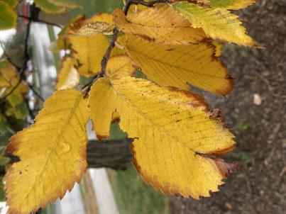 | | 2003 | COLLECTED | | Ponca State Park just north of Ponca approximately 2.75 miles T30N R6E N1/3 SE 1/4 Sec. 3 | 42.60173800, -96.71222100 | 383 | Eastern slopes and ridges of loess bluffs | Wild material | Ulmus thomasii (Rock elm) is an underutilized tree species both in conservation and in the urban landscape. Charles Sprague Sargent (first director of the Arnold Arboretum of Harvard University, Boston, MA) described the wood of Rock Elm as "heavy, hard, very strong and tough, closely grained, and susceptible of receiving a beautiful polish". Historically noted for a variety of uses in woodworking including furniture, heavy agricultural implements, timber frame buildings, pianos, hockey sticks, and hand tools. U. thomasii is extremely drought tolerant, adaptable to very calcareous soils, and compared to U. americana or U. rubra has a very conservative growth rate requiring minimal attention in regards to pruning. Rock elm naturally tends to develop into a nice structural specimen in the landscape, unlike other fast growing U. americana cultivars in the nursery trade needing frequent attention. Rock elm has very fissured bark and is well known for maintaining a strong central leader resulting in a very attractive, pyramidal form. Despite many literature sources stating that "wings" on the stems are a key identifiying characteristic, this trait is not reliable and many genotypes may completely lack "wings" on the stems. While growth habit and morphology of dormant buds (very pointy) are good traits to help aid in identification, fruits are the best way to confirm identity. Fruits are densly pubescent, often described as "inflated" and generally reach maturity a couple weeks after U. rubra and U. americana. U. thomasii inflorescences are rather distinguishable from other Ulmus in being pendulous. Fruits are extremely prized treats for many birds, where fruits are often "robbed" prior to full maturity. Fruits are also highly prized by many other animals such as mice, squirrels, chipmunks, turkeys, etc. and are generally consumed within hours after fruit abscission. The native range of U. thomasii is concentrated in the northeastern United States and into Canada with disjunct populations documented in northwestern Missouri and northwestern Arkansas (Little, E. L. Jr. 1971). In the 1895 Silva of North America (vol. 7) it was stated that, “The value of the wood of the Rock Elm threatens its extinction and most of the large trees have already been cut.” Today, since rock elm is rather rare, especially in areas near the edges of its range, many states list the species as endangered or threatened warranting preservation efforts. This accession was collected in northeast Nebraska (Dixon County) at Ponca State Park representing genetics from the extreme northwestern edge of the species native range and includes genetics (#775-6) from the current (2022) state champion. In an assessment of seedlings from all mother trees sampled (Carstens, J., personal communication, 12 April 2022), #775-4 produces the most vigorous seedlings which also consistently exhibited extremely corky/winged stems on new seedlings. Seedlings from other maternal lines show both winged and non-winged seedlings within the same maternal line and seedlings from some maternal lines have no wings. | 1649925 | Ames 27341 |
| 164 | Ames 27329 | 34 | Ptelea trifoliata L. | Iowa, United States | NC7 |  | | 2003 | COLLECTED | 09/24/2003 | Bluff Park, Keokuk, South of Park Street at G, T65N R5W, Section 35, Keokuk Quad. | 40.38861111, -91.40277778 | 194 | Bluff edge along Mississippi River. Sunny. 25% slope with a southern aspect. Soil well to good drainage. | Wild material | | 1649675 | Ames 27329 |
| 165 | Ames 27313 | 22 | Staphylea trifolia L. | Iowa, United States | NC7 |  | | 2003 | COLLECTED | 09/15/2003 | Backbone State Park Cave near Strawberry Point, T90N, R6W NE corner of NW 1/4 of SW 1/4 of Sec. 4, Delaware County | 42.63694444, -91.56194444 | 317 | Alluvium below limestone cave. Nearly full shade. Slight slope w/ SE aspect. Loam soil w/ some stoniness, good drainage | Wild material | Medium to large shrubs. Heavy fruit production. | 1649470 | Ames 27313 |
| 166 | Ames 2917 | JDC/GD/2013/001/445 | Gymnocladus dioicus (L.) K. Koch | Illinois, United States | NC7 |  | | 1984 | COLLECTED | 08/26/1982 | East bank of the Mazon River, SE 1/4 of SW 1/4 of Section 12, T33N R7E, Morris Quad, Grundy County. | 41.34600000, -88.37740000 | 159 | Mesic floodplain forest. | Wild material | Large tree. | 1022538 | Ames 2917 |