| 0 | PI 662014 | No. 23 | Cornus amomum Mill. subsp. obliqua (Raf.) J. S. Wilson | Illinois, United States | NC7 | | | 1993 | COLLECTED | | Will County. | | | | Wild material | | 1086114 | PI 662014 |
| 1 | PI 468117 | 'Indigo' | Cornus amomum Mill. | Michigan, United States | NC7 | | | 1982 | COLLECTED | 1961 | Rose Lake Wildlife Experiment Station. | 42.79700600, -84.41192600 | 254 | | Wild material | ‘Indigo’ is a spreading shrub that can grow up to 10 feet tall. The stems are red when young but turn reddish brown and gray as they mature. ‘Indigo’ has yellowish white flowers that bloom in mid June. It produces an abundant crop of fruit, which ripens in September. The fruit is pale to dark blue and about ¼ inch in diameter. Multiple use conservation shrub for windbreaks and wildlife food and cover. 'Indigo' has been evaluated in 20 states, particularly in the Great Lake States, where it has performed well in moist soils. It is moderately shade tolerant but is not drought tolerant. Released in 1982 by the USDA-Natural Resource Conservation Service, Rose Lake Plant Materials Center and the Michigan Department of Natural Resources. | 1363053 | PI 468117 |
| 2 | W6 62095 | CBG-10902 | Cornus amomum Mill. subsp. obliqua (Raf.) J. S. Wilson | | W6 |  | | 2024 | | | | | | | | | 2168893 | W6 62095 |
| 3 | W6 57413 | NEWFS-373 | Cornus amomum Mill. | Massachusetts, United States | W6 |  | | 2019 | | | | | | | Wild material | | 2098210 | W6 57413 |
| 4 | W6 54652 | NCBG-232 | Cornus amomum Mill. | Virginia, United States | W6 |  | | 2018 | | | | | | | Wild material | Cornus amomum | 1965878 | W6 54652 |
| 5 | Ames 34696 | MARSB-074 | Cornus amomum Mill. | New Jersey, United States | NC7 |  | | 2015 | COLLECTED | 08/29/2013 | West Essex Park just southeast of Pine Brook. | 40.84291000, -74.31341000 | 51 | | Wild material | | 1922850 | Ames 34696 |
| 6 | Ames 34697 | MARSB-080 | Cornus amomum Mill. | Pennsylvania, United States | NC7 |  | | 2015 | COLLECTED | 09/11/2013 | Allegheny National Forest -Minister Creek watershed just south of Minister. | 41.61593000, -79.15109000 | 369 | | Wild material | | 1922851 | Ames 34697 |
| 7 | Ames 32829 | NA 82181 | Cornus amomum Mill. | Maine, United States | NC7 | | | 2014 | COLLECTED | 09/13/2014 | Along small gravel road heading north along Birch Stream from the Stillwater River boat landing on Southgate Road, Old Town, Penobscot County, Maine | 44.98842400, -68.67561400 | 33 | Open, seasonally wet woods. Growing in association with Quercus rubra, Fraxinus pennsylvanica, Ilex verticillata, Viburnum nudum, Crataegus sp., Myrica gale, Rhodora canadense, Betula sp, and Acer saccharinum. | Wild material | | 1921789 | Ames 32829 |
| 8 | Ames 32830 | BJP/C.AM/2014/002 | Cornus amomum Mill. | Maine, United States | NC7 | | | 2014 | COLLECTED | 09/04/2014 | Field edge near Levant Elementary School, Levant, Penobscot County, Maine. | 44.86062400, -69.00069200 | 71 | Wetland. Growing in association with Salix spp., Alnus incana, and Betula populifolia | Wild material | | 1921790 | Ames 32830 |
| 9 | NA 80282 | RL 11004 | Cornus amomum Mill. | North Carolina, United States | NA | | | 2011 | COLLECTED | 08/14/2011 | | | | | Wild material | | 1914115 | NA 80282 |
| 10 | Ames 30496 | Ames 30496 | Cornus amomum Mill. | Pennsylvania, United States | NC7 |  | | 2010 | COLLECTED | | Brandywine Creek, Chadds Ford. | 39.86666600, -75.59333300 | 76 | Creek banks. | Cultivated material | | 1831698 | Ames 30496 |
| 11 | Ames 30366 | JDC/CA/2009/090/240 | Cornus amomum Mill. subsp. obliqua (Raf.) J. S. Wilson | Ohio, United States | NC7 |  | | 2009 | COLLECTED | 10/16/2009 | Along Dicks Creek, Wayne National Forest, just southeast of Kitchen, NW 1/4 of NE 1/4 of Section 5, T6N, R17W, Gallia Quad, Jackson County. | 38.86166667, -82.53805556 | 204 | Wet marsh. | Wild material | | 1823918 | Ames 30366 |
| 12 | Ames 30132 | JDC/CA/2009/041/191 | Cornus amomum Mill. subsp. obliqua (Raf.) J. S. Wilson | Wisconsin, United States | NC7 |  | | 2009 | COLLECTED | 09/22/2009 | Along Kent Road, near Poynette, NW 1/4 of NW 1/4 of Section 29, T11N, R9E, Poynette Quad, Columbia County. | 43.40638889, -89.45861111 | 243 | Hinkson Creek Watershed. | Wild material | | 1819713 | Ames 30132 |
| 13 | Ames 30087 | 3 | Cornus amomum Mill. | Maine, United States | NC7 |  | | 2009 | COLLECTED | NEAR 09/2009 | Damariscotta Lake, Nobleboro. | 44.14777778, -69.48000000 | 18 | Backwater area between dirt road and edge of water. | Wild material | | 1813034 | Ames 30087 |
| 14 | Ames 30088 | 5 | Cornus amomum Mill. | Connecticut, United States | NC7 |  | | 2009 | COLLECTED | NEAR 09/2009 | Eagleville Lake, Mansfield. | 41.78472220, -72.28055556 | 83 | Near the dam and spillway, growing in riprap stones places along the edge of the dam. Full sun. | Wild material | | 1813035 | Ames 30088 |
| 15 | NA 75365 | RL 249 | Cornus amomum Mill. | North Carolina, United States | NA | | | 2006 | COLLECTED | 07/01/2005 | North Carolina, Henderson County, McDowell Creek, near junction with Fanning Field Road. | | | | Wild material | | 1777642 | NA 75365 |
| 16 | Ames 27058 | Index Seminum 22 | Cornus amomum Mill. | Tennessee, United States | NC7 | | | 2003 | COLLECTED | 2002 | Morgan County. Lily Bridge Wild River Access to Clear Creek from Ridge Road, ca. 8.2km west-southwest of Wartburg. | 36.10288300, -84.71795000 | 360 | River bank. Growing in association with Rhododendron arborescens, Leucothoe recurva, Aronia arbutifolia, Hypericum prolificum, Vaccinium arboreum, Conradina verticillata, and Calycanthus | Wild material | | 1645452 | Ames 27058 |
| 17 | WLP 1117 | NA 83967 | Cornus foemina Mill. | Kentucky, United States | NA | | | 2016 | COLLECTED | 09/30/2016 | [Locality data unparseable; GPS coordinates appear near a road of uncertain name off Howard Munsey Rd. north of Betsey, Kentucky. Original location was listed as: "At Edam Road?"; no road by this name was found in the county. -SBL] | 36.92000000, -84.73900000 | 274 | Wet roadside couvee (ditch). | | | 1952406 | WLP 1117 |
| 18 | PI 691727 | WLP 1261 | Ilex verticillata (L.) A. Gray | New York, United States | NA |  | | 2011 | COLLECTED | 09/12/2011 | Hanging Bog Game Management Area, just west of Hanging Bog, Allegany County. | 42.30500000, -78.25600000 | 632 | Marsh. Associated with Aronia, Aster, Cornus amomum, Eutrochium, Salix, Solidago, Spiraea alba, Viburnum cassinoides, Viburnum dentatum, and Viburnum lentago. | Wild material | | 1891481 | PI 691727 |
| 19 | PI 673984 | JDC/RL/2009/067/217 | Rudbeckia laciniata L. | Illinois, United States | OPGC | | | 2009 | COLLECTED | 09/25/2009 | Along Rush Road, NW 1/4 of NW 1/4 of NE 1/4 of Section 36, T26N, R2E, Blackhawk (IL-IA) Quad, Jo Daviess County. | 42.21000000, -90.22472222 | 192 | Roadside. Associated with Clematis virginiana, Cornus amomum subsp. obliqua, C. drummondii, Juglans nigra, and Viburnum lentago. | Wild material | | 1819752 | PI 673984 |
| 20 | Ames 36705 | State Line Fen | Agastache scrophulariifolia (Willd.) Kuntze | Missouri, United States | NC7 |  | | 2025 | COLLECTED | 10/17/2025 | State Line Fen just east of the Chariton River approximately 2.75 miles west of Coatsville just south of the Missouri/Iowa border, T67N R16W SW 1/4 Sec. 22 | 40.58924000, -92.68834100 | 257 | Moist, mucky soils. Degraded fen near small creek. | Wild material | Purple Giant Hyssop is a tall (e.g. up to 6') perennial forb native to the northeastern US. Blooms extend for several weeks in the fall typically August through September and are visited by many pollinators. This accession was collected in northern Missouri and thus represents genetics from the southwestern edge of the species native range. At the collection site, most specimens had white blooms, while some showed light lavender coloration with plants averaging 4.5-5.5' in height. In Missouri, the Natural Heritage Program currently tracks this species ranked as an S1 (Critically imperiled in the state because of extreme rarity or because of some factor(s) such as very steep declines making it especially vulnerable to extirpation from the state.) and has been documented in only six Missouri counties including Adair, Atchison, Clark, Harrison, Schuyler, and Worth. | 2192996 | Ames 36705 |
| 21 | W6 62550 | FWS0502-102 | Eutrochium fistulosum (Barratt) E. E. Lamont | Pennsylvania, United States | W6 |  | | 2025 | | | | | | | Wild material | Stem hollow at base | 2192248 | W6 62550 |
| 22 | WLP 3658 | TRx250704-01NY | Lonicera morrowii A. Gray | New York, United States | NA | | | 2025 | COLLECTED | 07/04/2025 | | 43.31284000, -78.49509400 | | Edge of disturbed forest | Wild material | | 2191634 | WLP 3658 |
| 23 | NA 89081 | 2024RJLPA-009 | Rosa carolina L. | Pennsylvania, United States | NA | | | 2024 | COLLECTED | 09/22/2024 | Lancaster and York Counties: outcrops along the Susquehanna River, accessed from the Historic Lock 12 parking lot off of Pennsylvania Road 372. | 39.81483500, -76.32762200 | 34 | Plants are growing from part-sun to full sun in crevices of the outcrops and where organic debris has accumulated in between boulders along the Susquehanna River. The sites range from nearly xeric to dry mesic, at least on the surface. Plants are generally growing 4-10 m above the normal flow of the river; however, the Holtwood Dam is less than 1 kilometer upstream and debris found trapped in the boulders indicates that there is periodic flooding, at least, in the lower zone of 4+ meters or so above normal river flow. This habitat has a diverse assemblage of deciduous trees and shrubs as well as abundant herbaceous taxa. Slope: 0 to 60 percent. Aspect: Northeast (generally). Geology: The underlying geology of this area is probably of lower Paleozoic age and characterized as the Octoraro Formation. It includes albite-chlorite schist, phyllite, some hornblende gneiss, and granitized members. Soils: The area where this species occurs is right on the edge of two soil zones that transition from the river’s edge to mesic conditions upslope. The first is generally referred to as Rock Outcrop. This terrestrial matrix in which plants grow is largely exposed underlying rock geology with accumulated outwash, rock decomposition, and organic debris buildup. The second is Mt. Airy (80%) and Manor (20%) Series soils, 25 to 60 percent slopes, extremely stony (MRF). (Source: California Soil Resource Lab/NRCS Official Soil Series Descriptions). EPA Ecoregion (Level III): Northern Piedmont (64). EPA Ecoregion (Level IV): Piedmont Uplands (64c). | Wild material | | 2169045 | NA 89081 |
| 24 | NA 89083 | 2024RJLPA-012 | Rhododendron periclymenoides (Michx.) Shinners | Pennsylvania, United States | NA | | | 2024 | COLLECTED | 09/22/2024 | Outcrops along the Susquehanna River, accessed from the Historic Lock 12 parking lot off of Pennsylvania Road 372. | 39.81477400, -76.32807300 | 35 | Plants are growing from shade to part-sun and occasionally full sun in crevices of the outcrops and where organic debris has accumulated in between boulders along the Susquehanna River. The sites range from nearly xeric to mesic, at least on the surface. Plants are generally growing 4-10 m above the normal flow of the river; however, the Holtwood Dam is less than 1 kilometer upstream and debris found trapped in the boulders indicates that there is periodic flooding, at least, in the lower zone of 4+ meters or so above normal river flow. This habitat has a diverse assemblage of deciduous trees and shrubs as well as abundant herbaceous taxa. Slope: 0 to 60 percent. Aspect: Northeast (generally). Geology: The underlying geology of this area is probably of lower Paleozoic age and characterized as the Octoraro Formation. It includes albite-chlorite schist, phyllite, some hornblende gneiss, and granitized members. Soils: The area where this species occurs is right on the edge of two soil zones that transition from the river’s edge to mesic conditions upslope. The first is generally referred to as Rock Outcrop. This terrestrial matrix in which plants grow is largely exposed underlying rock geology with accumulated outwash, rock decomposition, and organic debris buildup. The second is Mt. Airy (80%) and Manor (20%) Series soils, 25 to 60 percent slopes, extremely stony (MRF). (Source: California Soil Resource Lab/NRCS Official Soil Series Descriptions). EPA Ecoregion (Level III): Northern Piedmont (64). EPA Ecoregion (Level IV): Piedmont Uplands (64c). | Wild material | | 2169047 | NA 89083 |
| 25 | NA 89084 | 2024RJLPA-013 | Physocarpus opulifolius (L.) Maxim. | Pennsylvania, United States | NA | | | 2024 | COLLECTED | 09/22/2024 | Outcrops along the Susquehanna River, accessed from the Historic Lock 12 parking lot off of Pennsylvania Road 372. | 39.81466300, -76.32833900 | 36 | Plants are growing from shade to part-sun where organic debris has accumulated in between boulders as well as further upslope in deeper mesic soils along the Susquehanna River. This habitat has a diverse assemblage of deciduous trees and shrubs as well as abundant herbaceous taxa. Slope: 10 to 25 percent. Aspect: Northeast (generally). Geology: The underlying geology of this area is probably of lower Paleozoic age and characterized as the Octoraro Formation. It includes albite-chlorite schist, phyllite, some hornblende gneiss, and granitized members. Soils: The area where this species occurs is right on the edge of two soil zones that transition from the river’s edge to mesic conditions upslope. The first is generally referred to as Rock Outcrop. This terrestrial matrix in which plants grow is largely exposed underlying rock geology with accumulated outwash, rock decomposition, and organic debris buildup. The second is Mt. Airy (80%) and Manor (20%) Series soils, 25 to 60 percent slopes, extremely stony (MRF). (Source: California Soil Resource Lab/NRCS Official Soil Series Descriptions). EPA Ecoregion (Level III): Northern Piedmont (64). EPA Ecoregion (Level IV): Piedmont Uplands (64c). | Wild material | | 2169048 | NA 89084 |
| 26 | NA 89085 | 2024RJLPA-014 | Rhododendron arborescens (Pursh) Torr. | Pennsylvania, United States | NA | | | 2024 | COLLECTED | 09/22/2024 | Outcrops along the Susquehanna River, accessed from the Historic Lock 12 parking lot off of Pennsylvania Road 372. | 39.81618100, -76.33069800 | 38 | Plants are growing from shade to part-sun and occasionally full sun in crevices of the outcrops and where organic debris has accumulated in between boulders along the Susquehanna River. The sites range from nearly xeric to mesic, at least on the surface. Plants are generally growing 4-10 m above the normal flow of the river; however, the Holtwood Dam is less than 1 kilometer upstream and debris found trapped in the boulders indicates that there is periodic flooding, at least, in the lower zone of 4+ meters or so above normal river flow. This habitat has a diverse assemblage of deciduous trees and shrubs as well as abundant herbaceous taxa. Slope: 0 to 75 percent. Aspect: Northeast (generally). Geology: The underlying geology of this area is probably of lower Paleozoic age and characterized as the Octoraro Formation. It includes albite-chlorite schist, phyllite, some hornblende gneiss, and granitized members. Soils: The area where this species occurs is right on the edge of two soil zones that transition from the river’s edge to mesic conditions upslope. The first is generally referred to as Rock Outcrop. This terrestrial matrix in which plants grow is largely exposed underlying rock geology with accumulated outwash, rock decomposition, and organic debris buildup. The second is Mt. Airy (80%) and Manor (20%) Series soils, 25 to 60 percent slopes, extremely stony (MRF). (Source: California Soil Resource Lab/NRCS Official Soil Series Descriptions). EPA Ecoregion (Level III): Northern Piedmont (64). EPA Ecoregion (Level IV): Piedmont Uplands (64c). | Wild material | | 2169049 | NA 89085 |
| 27 | NA 89086 | 2024RJLPA-015 | Ilex verticillata (L.) A. Gray | Pennsylvania, United States | NA | | | 2024 | COLLECTED | 09/22/2024 | Outcrops along the Susquehanna River, accessed from the Historic Lock 12 parking lot off of Pennsylvania Road 372. | 39.81656600, -76.33136600 | 38 | Plants are growing from part-sun to full sun in crevices of the outcrops and where organic debris has accumulated in between boulders along the Susquehanna River. The sites range from nearly xeric to dry mesic, at least on the surface. Plants are generally growing 4-10 m above the normal flow of the river; however, the Holtwood Dam is less than 1 kilometer upstream and debris found trapped in the boulders indicates that there is periodic flooding, at least, in the lower zone of 4+ meters or so above normal river flow. This habitat has a diverse assemblage of deciduous trees and shrubs as well as abundant herbaceous taxa. Slope: 0 to 10 percent. Aspect: Northeast (generally). Geology: The underlying geology of this area is probably of lower Paleozoic age and characterized as the Octoraro Formation. It includes albite-chlorite schist, phyllite, some hornblende gneiss, and granitized members. Soils: The area where this species occurs is right on the edge of two soil zones that transition from the river’s edge to mesic conditions upslope. The first is generally referred to as Rock Outcrop. This terrestrial matrix in which plants grow is largely exposed underlying rock geology with accumulated outwash, rock decomposition, and organic debris buildup. The second is Mt. Airy (80%) and Manor (20%) Series soils, 25 to 60 percent slopes, extremely stony (MRF). (Source: California Soil Resource Lab/NRCS Official Soil Series Descriptions). EPA Ecoregion (Level III): Northern Piedmont (64). EPA Ecoregion (Level IV): Piedmont Uplands (64c). | Wild material | | 2169050 | NA 89086 |
| 28 | Ames 36219 | Egyptian Tract | Salix sericea Marshall | Missouri, United States | NC7 |  | | 2024 | COLLECTED | 01/19/2024 | LAD Foundation Egyptian Tract Wet Hollow Seep/Fen Complex located 7.52 miles west, southwest of Annapolis just northwest of intersection of CR 338 and CR 334, T31N R2E SW 1/4 SE 1/4 SE 1/4 Sec. 21 (Lesterville SE Quad.). | 37.34429700, -90.83361600 | 217 | Perched wet fen/seep complex with standing water supporting both obligate calciphilic and obligate acidophilic plant species. | Wild material | The native range of Salix sericea is concentrated througout the northeastern and eastern central United States ranging from Maine south to South Carolina, west to Illinois with a relatively large disjunct area in southeastern Missouri (Little, E. L. Jr. 1977). This accession represents genetics from southeastern Missouri in Reynolds County. Shrubs noted at the collection site in nature ranging in height from 2-7 feet and typically twice as wide as tall. Multi-stemmed shrubs expanding vegetatively via layering. Dormant stem colors noted at collection site ranging from mostly greenish to occassionally brownish red and/or copper tones. Dormant buds rather red and often bright red in color. Salix sericea is native to areas of the northeastern U.S. and north into Canada, reaching its western extent in Missouri. Classified as an obligate wetland plant that typically occurs on wet seeps, sedge meadows, streambanks, fens, etc. that are usually slightly acidic. Known to have the potential to reach up to four meters in height, but always much wider than tall. Ornamental characteristics include dark green leaves that are hairless above with undersides that are densely minutely-hairy making them rather white in appearance. Flowering occurs before or during leaf expansion. This species is known to serve as a larval host plant for the Arcadian Hairstreak, Satyrium acadica. | 2165775 | Ames 36219 |
| 29 | NA 88671 | RJL2023PA-005 | Rhododendron maximum L. | Pennsylvania, United States | NA | | | 2023 | COLLECTED | 10/16/2023 | Appalachian National Scenic Trail: Pulpit Rock and Pinnacle Loop. Rocky woodlands along Furnace Creek as well as steep rocky slopes above Pulpit Rock Reservoir associated with the Pulpit Rock and Pinnacle Loop Trail. | 40.59226100, -75.94588800 | 301 | Well-drained and very rocky dry deciduous woodlands in part shade to full shade. Slope: 0-30%. Aspect: variable. The underlying geology of this area is of Silurian origin and characterized as the Shawangunk Formation. It is characterized by light- to dark-gray, fine- to very coarse-grained sandstone and conglomerate containing thin shale interbeds. Includes four members, in descending order: Tammany--conglomerate and sandstone; Lizard Creek--sandstone and red or green shale; Minsi--sandstone and conglomerate; Weiders--conglomerate. Tammany and Lizard Creek Members together are approximately equivalent to Clinton Group to the west; Minsi and Weiders Members together are equivalent to Tuscarora Formation to the west. (Source: USGS Pennsylvania Geologic Map Data). The primary soil type in the collection area is classified as Hazleton Series. The Hazleton series consists of deep and very deep, well drained soils formed in residuum of acid gray, brown or red sandstone on uplands. Slope ranges from 0 to 80 percent. Permeability is moderately rapid to rapid. Solum thickness ranges from 60 to 120 centimeters. Depth to lithic contact ranges from 1 to 2 meters. Rock fragments of angular sandstone, dominantly less than 25 cm in size, range from 5 to 70 percent in individual horizons. Boulders, stones, flags and channers cover about 5 to 60 percent of the surface of some pedons. Reaction ranges from strongly acid through extremely acid throughout. (Source: NRCS Web Soil Survey). | Wild material | | 2159062 | NA 88671 |
| 30 | Ames 36209 | JDC/EM/2023/089/1121 | Eutrochium maculatum (L.) E. E. Lamont | Iowa, United States | NC7 | | | 2023 | COLLECTED | 10/19/2023 | Located approximately 3.15 miles west of Grinnell, T80N R17W SE 1/4 SE 1/4 NE 1/4 Sec. 14. | 41.73894000, -92.78670000 | 271 | Wet, remnant prairie. | Wild material | Plants in nature at collection site measuring approximately 3.5-5.0 feet in height. | 2165627 | Ames 36209 |
| 31 | NA 88665 | RJL2023PA-002 | Ilex verticillata (L.) A. Gray | Pennsylvania, United States | NA | | | 2023 | COLLECTED | 10/01/2023 | Woodlands along Pine Creek near the Harmonyville Road bridge. | 40.18764500, -75.76732200 | 141 | Moist to mucky, wet woodland conditions along Pine Creek. Much of the site is very wet due to recent rains; though, earlier in the year, the soils were only moist. Plants grow in both well-drained mesic conditions as well as seasonally wet conditions. They do not grow in standing water anywhere in this location. Plants in this population are found mostly in the shade and partial shade of deciduous trees; there are occasional gaps that offer higher light conditions as well. Slope: 0-2%. Aspect: N/A. The underlying geology of this area is of Precambrian origin and characterized as the Graphitic Felsic Gneiss. This includes Pickering Gneiss and small areas of marble; dominantly quartz and feldspar with varying amounts of graphite and various metamorphic minerals; medium grained, light to dark gray and greenish gray; sedimentary origin. (Source: USGS Pennsylvania Geologic Map Data). The primary soil type in the area of this collection is classified as Hatboro Silt Loam Series. The Hatboro Series consists of very deep and poorly drained soils formed in alluvium derived from metamorphic and crystalline rock. They are on flood plains. Slopes range from 0 to 3 percent. Saturated hydraulic conductivity is moderately high to high. Solum thickness ranges from 50 to 150 cm. Depth to bedrock ranges from 1.5 to 3 meters or more. Organic carbon decreases irregularly with depth or is greater than 0.2 percent directly above any strongly contrasting C horizon. The depth to strongly contrasting sand and gravel is more than 100 cm or the transition is greater than 12.5 cm. Content of gravel ranges from 0 to 10 percent in the solum and from 0 to 80 percent in the C horizon. Mica flakes are common in the solum, and the C horizon contains thin lenses of mica. Reaction ranges from very strongly acid through neutral to a depth of 75 cm and from moderately acid through slightly acid below 75 cm. (Source: NRCS Web Soil Survey.) | Wild material | | 2158814 | NA 88665 |
| 32 | Ames 36024 | AS/FN/2023/011/221 | Fraxinus nigra Marshall | Wisconsin, United States | NC7 |  | | 2023 | COLLECTED | 02/26/2023 | Located just north of Leland approximately 0.70 miles along Hemlock Road, T10N R5E SW 1/4 NW 1/4 Sec. 18 | 43.34472800, -89.95099700 | 242 | Floodplain | Wild material | Single mother tree sample with signs of wood pecker damage on trunk. | 2141557 | Ames 36024 |
| 33 | Ames 35995 | Kauten Fen | Salix discolor Muhl. | Iowa, United States | NC7 |  | | 2023 | COLLECTED | 02/06/2023 | Kauten Fen, T92N R8W NE 1/4 of SW 1/4 of NE 1/4 Sec.16. | 42.78400000, -91.79050000 | 345 | Closely followed gradient of drainage creek, approximately 10 yards to the west of the small drainage creek. 1 to 4 percent slope. Clyde-Floyd complex (clay loam); poorly drained soils. Water table at approximately 12 inches. | Wild material | The native range of Salix discolor is concentrated in the northeastern United States and also throughout southern Canada (Little, E. L. Jr. 1977). Generally adapted/tolerant to wet soils this species is often found in meadows, fens, swamps, and streambanks. Attractive ornamental characteristics includes early spring, showy flowers and yellow foliage in the fall. Salix discolor provides a critical source of pollen at the beginning of the growing season for a plethora of pollinators and also serves as a larval host to many insect species. Salix discolor are commonly used in the cut flower industry for both their showy catkins and colorful, dormant winter stems. This germplasm was collected as dormant cuttings from a northeastern Iowa site, Kauten Fen, which is a site boasting with Salix diversity. One could likely find just about any hybrid combination possible and observe a wide-diversity of morphology across hybrids and within species. Acquisition specifically targeted characters that were most characterstic of Salix discolor. Field observations of this accession grown in cultivation has shown this accession to be extremely vigorous. Established specimens coppiced at grown level generates very thick shoots reaching 7-8' in height in a single growing season. | 2141279 | Ames 35995 |
| 34 | OPGC 8523 | NEWFS-412 | Erechtites hieraciifolius (L.) Raf. ex DC. | Massachusetts, United States | OPGC | | | 2021 | | | | | | | Wild material | Received as: Erechtites hieracifolia. | 2137209 | OPGC 8523 |
| 35 | W6 60025 | NCBG-532 | Decodon verticillatus (L.) Elliott | Maryland, United States | W6 | | | 2021 | | | | | | | Wild material | | 2132907 | W6 60025 |
| 36 | WLP 1747 | RJL2021PA-005 | Rosa palustris Marshall | Pennsylvania, United States | NA | | | 2021 | COLLECTED | 11/20/2021 | Plants growing in wetland seeps surrounded by mown hayfields just west of the Middle Branch White Clay Creek in Goddard Park, West Grove Pennsylvania, off of Wickerton Road, Chester County. | 39.80090528, -75.82383250 | 100 | Habitat Notes: Plants are growing in permanently saturated to moist soils in wetland habitats. Plants appear to be obligate wetland plants and are found only in permanent to nearly permanent wet habitats observed. Generally, the shrubs are found in part shade to full sun. Soils: Soils found in the areas where this collection was made are comprised primarily of Hatboro silt loam (Ha). Hatboro silt loam consists of very deep and poorly drained soils formed in deposited alluvium derived from metamorphic and crystalline rock. They are on flood plains. Slopes range from 0 to 3 percent. Slope: 0 to 3% Aspect: Variable. | Wild material | | 2123715 | WLP 1747 |
| 37 | NA 88283 | NEWFS-554 | Cephalanthus occidentalis L. | Massachusetts, United States | NA | | | 2021 | | | | | | | Wild material | Opposite branches, balls of white flowers, seeds in balls. | 2115694 | NA 88283 |
| 38 | NA 88438 | MARSB-202 | Rosa palustris Marshall | Delaware, United States | NA | | | 2020 | | | | | | | Wild material | Woody plant with stems covered in recurved thorns. Mature fruit a scarlet hip. | 2106461 | NA 88438 |
| 39 | WLP 2018 | MARSB-976 | Viburnum opulus L. var. americanum Aiton | New York, United States | NA | | | 2019 | COLLECTED | 08/01/2019 | Dutchess County; Tivoli; Bard College campus. | | 200 | Open marsh (tidal marsh), full sun, red maple swamp; growing in moist loamy sand. | | Seed collected from 20 plants; population scattered in distribution, found over a 1 mile by 1 mile area. Seed maturation early, middle. | 2109167 | WLP 2018 |
| 40 | WLP 2038 | MARSB-1005 | Viburnum lentago L. | New York, United States | NA | | | 2019 | COLLECTED | 09/19/2019 | Columbia County; Germantown; Rt. 6, Germantown. [This appears to be south of Germantown. -SBL] | | 183 | Marsh. | | Seeds collected from 20 individuals in a population of 25+ plants; scattered distribution. Seed maturation: middle. Birds, low fruit set noted. | 2109187 | WLP 2038 |
| 41 | NA 88165 | NCBG-450 | Viburnum dentatum L. | Virginia, United States | NA |  | | 2019 | | | | | | | Wild material | | 2098452 | NA 88165 |
| 42 | OPGC 7951 | NEWFS-413 | Oenothera biennis L. | Massachusetts, United States | OPGC |  | | 2019 | | | | | | | Wild material | | 2098217 | OPGC 7951 |
| 43 | W6 57390 | NEWFS-297 | Phytolacca americana L. | Massachusetts, United States | W6 |  | | 2019 | | | | | | | Wild material | | 2098187 | W6 57390 |
| 44 | W6 57383 | NEWFS-272 | Carex crinita Lam. | Massachusetts, United States | W6 |  | | 2019 | | | | | | | Wild material | | 2098180 | W6 57383 |
| 45 | W6 57376 | NEWFS-245 | Elymus virginicus L. | Massachusetts, United States | W6 |  | | 2019 | | | | | | | Wild material | | 2098173 | W6 57376 |
| 46 | WLP 2003 | MARSB-968 | Viburnum dentatum L. | New York, United States | NA | | | 2019 | COLLECTED | 08/04/2019 | Ulster County; Gardiner; Private residence at 844 Route 208, Gardiner, New York 12525. | 41.65848000, -74.14236000 | 122 | Forest, marsh/pond shore in partial to full shade; poorly drained, clay loam soil, seasonally wet/moist. | | Seeds collected from plant. Many seeds had already dropped or been eaten; seeds collected from an approximately 1 acre (or 4000 square meters) area with Viburnum dentatum growing in several dense patches and sparsely between. Species common, scattered in area; 100-plus individuals estimated in approximately 4000 square meters. | 2109099 | WLP 2003 |
| 47 | WLP 2009 | MARSB-975 | Viburnum dentatum L. | New York, United States | NA | | | 2019 | COLLECTED | 08/01/2019 | Columbia County; Germantown; Eastern Parkway, Germantown, New York; privately owned agricultural land. | 0.00000000, 0.00000000 | 183 | Field edge, shrubland, in full sun; moist, well-drained, loamy sand soil. | | Seeds collected directly from plants. Species common in area; 50+ individuals in population, 50 individuals sampled, with population area 1 mile (linear). | 2109105 | WLP 2009 |
| 48 | WLP 2010 | MARSB-977 | Viburnum dentatum L. | New York, United States | NA | | | 2019 | COLLECTED | 08/02/2019 | Greene County; Catskill; Scenic Hudson plot (land in conservation use) on Kukuk Rd in Catskill, New York [Note: location could not be found on maps, and no latitude and longitude were supplied; possibly Kukuk Lane in Kingston, New York, which is a bit south of Catskill. -SBL] | 0.00000000, 0.00000000 | 91 | Edge of oak-hickory woodland; growing in full sun in loamy sand soil. | | Seeds collected directly from plants. Sparse seed set noted. Species scattered in area; 30+ individuals in population, 32 individuals sampled, with population area 1 mile x 1 mile. | 2109106 | WLP 2010 |
| 49 | OPGC 7402 | NEWFS-486 | Euthamia graminifolia (L.) Nutt. | Massachusetts, United States | OPGC |  | | 2019 | | | | | | | Wild material | | 1976275 | OPGC 7402 |
| 50 | W6 56179 | NEWFS-305 | Rhus glabra L. | Massachusetts, United States | W6 |  | | 2019 | | | | | | | Wild material | | 1976214 | W6 56179 |
| 51 | Ames 34790 | NCBG-535 | Rhus copallinum L. | Virginia, United States | NC7 |  | | 2018 | COLLECTED | 09/21/2016 | Occoquan Bay National Wildlife Refuge just southeast of Woodbridge. | 38.64347000, -77.23675000 | 4 | Meadow | Wild material | | 1965972 | Ames 34790 |
| 52 | Ames 34199 | JDC/SD/2018/027/840 | Salix discolor Muhl. | Iowa, United States | NC7 |  | | 2018 | COLLECTED | 05/14/2018 | Located 3.00 miles east, southeast of Boone along RR right of way on north side of 210th Street, T84N R26W center of SE 1/4 Sec. 25. | 42.05274100, -93.82228600 | 284 | | Wild material | The native range of Salix discolor is concentrated in the northeastern United States and also throughout southern Canada (Little, E. L. Jr. 1977). Generally adapted/tolerant to wet soils this species is often found in meadows, fens, swamps, and streambanks. Attractive ornamental characteristics includes early spring, showy flowers and yellow foliage in the fall. Salix discolor provides a critical source of pollen at the beginning of the growing season for a plethora of pollinators and also serves as a larval host to many insect species. Salix discolor are commonly used in the cut flower industry for both their showy catkins and colorful, dormant winter stems. This accession represents genetics from central Iowa and the southwestern edge of the species native range. Specimens at the collection site in nature measuring approximately 4-5’ in height with 6’ spread with minimal to sparse branching. Pistillate flowers with yellowish stigmas and catkins at maturity (14 May 2018) measuring 4.5-5.5 cm. Pistillate flowering occurred prior to leaf emergence. Stems with some (minimal) pubescence, orangish-brown in color on previous year’s annual growth and tannish-yellow on older wood. Seeds dark green in color. During a growout via seed executed in 2018 at NCRPIS, a total of 35 genets generated 13 males and 22 females. | 1962796 | Ames 34199 |
| 53 | WLP 1983 | MARSB-806 | Viburnum dentatum L. | Delaware, United States | NA | | | 2017 | COLLECTED | 08/16/2017 | Sussex County; ; Bombay Hook National Wildlife Refuge: Marshtown Road. | 39.18963000, -75.44088000 | 3 | Mixed hardwood swamp; swales/terraces. Sand soil (Pineyneck series). Land used for conservation and recreation. | Wild material | Seeds collected from 60 plants; 100 plants found in an area of two acres. Two herbarium vouchers collected on 16 Aug. 2017; held at Smithsonian and MARSB. Material identified in field by Clara Holmes on 16 Nov. 2017. Ecoregion: 63E -- Middle Atlantic Coastal Plains (Omernik). | 2108827 | WLP 1983 |
| 54 | Ames 34037 | JDC/MF/2017/059/813 | Monarda fistulosa L. | Iowa, United States | NC7 |  | | 2017 | COLLECTED | 10/26/2017 | Private property located approximately 6.2 miles west, southwest of Grinnell, T80N R17W SE 1/4 NE 1/4 NW 1/4 Sec. 21, Jasper County | 41.72810000, -92.83508100 | 285 | Prairie remnant, never plowed. Small (e.g. less than 1 acre), localized area of mixed woody (tree/shrub), grass, and forbs. | Wild material | Population sampled at collection site consisted of approximately half of the specimens being void of foliage likely due to susceptibility to mildew, while the remaining half still had some green foliage at time of sampling (10/26/2017). Plants sampled varied in height, typically 3' in height, but a few specimens measuring 5' in height. | 1954326 | Ames 34037 |
| 55 | Ames 34012 | Ames 34012 | Monarda didyma L. | Ohio, United States | NC7 |  | | 2017 | COLLECTED | 09/12/2017 | Mantua Bog State Nature Preserve approximately 1.12 miles east of Mantua, Portage County. | 41.28247600, -81.20260500 | 337 | High-quality fen remnant (sedge/forb meadow). | Wild material | | 1953926 | Ames 34012 |
| 56 | Ames 34190 | Ames 34190 | Alnus serrulata (Aiton) Willd. | Kentucky, United States | NC7 | | | 2016 | COLLECTED | 09/28/2016 | | 36.83800000, -84.33100000 | 288 | River's edge below canopy. | | | 1952456 | Ames 34190 |
| 57 | NA 83897 | PCCKY16-024 | Xanthorhiza simplicissima Marshall | Kentucky, United States | NA | | | 2016 | COLLECTED | 09/27/2016 | Cumberland Falls State Park, Cumberland Falls Visitor Center. Beach north of visitor center outlook trail, boulders north of large sycamore with exposed root flare and hole in trunk base. | 36.84200000, -84.34200000 | 252 | Beach, with boulders. | Wild material | | 1952452 | NA 83897 |
| 58 | WLP 1209 | NA 83966 | Hibiscus moscheutos L. | Kentucky, United States | NA | | | 2016 | COLLECTED | 09/30/2016 | [Locality data unparseable; GPS coordinates appear near a road of uncertain name off Howard Munsey Rd. north of Betsey, Kentucky. Original location was listed as: "At Edam Road?"; no road by this name was found in the county. -SBL] | 36.91900000, -84.73800000 | 277 | Wet roadside couvee (ditch). | | | 1950957 | WLP 1209 |
| 59 | WLP 704 | NA 83896 | Amorpha fruticosa L. | Kentucky, United States | NA | | | 2016 | COLLECTED | 09/27/2016 | Cumberland Falls State Park, Cumberland Falls Visitor Center. Beach north of visitor center outlook trail, boulders north of large sycamore with exposed root flare and hole in trunk base. | 36.84200000, -84.34200000 | 245 | Beach, with boulders. | | | 1950955 | WLP 704 |
| 60 | Ames 33358 | 730-1 | Betula nigra L. | Illinois, United States | NC7 |  | | 2016 | COLLECTED | 06/07/2016 | Momence wetlands - Kankakee River watershed, Kankakee County | 41.16335000, -87.52944100 | | Floodplain | Wild material | | 1940581 | Ames 33358 |
| 61 | Ames 32891 | APS/GD/2015/010/192 | Gymnocladus dioicus (L.) K. Koch | Oklahoma, United States | NC7 |  | | 2015 | COLLECTED | 03/12/2015 | Nowata County: T25N R16E NW 1/4 NE 1/4 Sec. 3. Oologah Wildlife Management Area approximately 3 miles east of Nowata. | 36.68401000, -95.58207800 | 208 | Transition zone between higher elevations and bottomlands. | Wild material | | 1925357 | Ames 32891 |
| 62 | W6 48814 | MARSB-115 | Aristida purpurascens Poir. | New Jersey, United States | W6 |  | | 2015 | | | | | | | Wild material | | 1922907 | W6 48814 |
| 63 | OPGC 6119 | MARSB-088 | Lobelia cardinalis L. | New York, United States | OPGC | 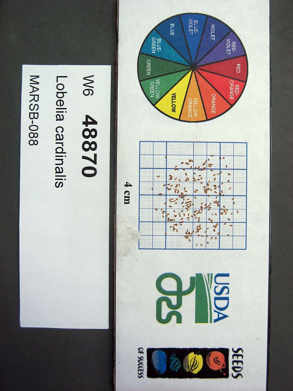 | | 2015 | | | | | | | Wild material | | 1922920 | OPGC 6119 |
| 64 | OPGC 6121 | MARSB-089 | Mimulus ringens L. | New York, United States | OPGC |  | | 2015 | | | | | | | Wild material | | 1922922 | OPGC 6121 |
| 65 | W6 48854 | MARSB-106 | Eragrostis spectabilis (Pursh) Steud. | New Jersey, United States | W6 |  | | 2015 | | | | | | | Wild material | | 1922916 | W6 48854 |
| 66 | W6 48902 | MARSB-114 | Tridens flavus (L.) Hitchc. | New Jersey, United States | W6 |  | | 2015 | | | | | | | Wild material | | 1922931 | W6 48902 |
| 67 | Ames 32812 | Ames 32812 | Euonymus atropurpureus Jacq. | Iowa, United States | NC7 |  | | 2014 | COLLECTED | 10/22/2014 | Chichaqua Bottoms Greenbelt, Polk County. | 41.77483000, -93.43145600 | 250 | Bottomland/floodplain forest of Skunk River watershed. | Wild material | One specimen sampled in nature was approximately 20 feet in height. In cultivation at NCRPIS, plants display attractive fall foliage colors ranging from pale pink to deep red. Fruits are ornamentally significant, varying in color from pale to bright pink. | 1921817 | Ames 32812 |
| 68 | WLP 858 | APS/CO/2014/034/165 | Cephalanthus occidentalis L. | Iowa, United States | NA | | | 2014 | COLLECTED | 10/07/2014 | Lake Rathbun Wildlife Management Area (SW Unit), NE 1/4 of Section 16, T69N, R20W, Wayne County. | 40.77822200, -93.15527400 | 306 | Bottomland/floodplaind overflow of South Fork Chariton River. Associated with Acer saccharinum, Carya cordiformis, C. laciniosa, Cornus amomum subsp. obliqua, and Tilia americana. | Wild material | | 1921815 | WLP 858 |
| 69 | Ames 32761 | JDC/BP/2014/034/536 | Betula pumila L. | Iowa, United States | NC7 |  | | 2014 | COLLECTED | 09/03/2014 | Crossman Prairie State Preserve, approximately 5 miles northeast of Riceville, Howard County. | 43.40777300, -92.47500720 | 413 | Remnant tallgrass prairie. | Wild material | | 1921309 | Ames 32761 |
| 70 | Ames 32762 | JDC/BP/2014/044/546 | Betula pumila L. | Iowa, United States | NC7 |  | | 2014 | COLLECTED | 09/03/2014 | Private property, located approximately 2 miles south of Sumner, Bremer County. | 42.80952700, -92.10866400 | 328 | Remnant wet prairie. | Wild material | | 1921310 | Ames 32762 |
| 71 | Ames 32767 | JDC/PV/2014/036/538 | Prunella vulgaris L. | Iowa, United States | NC7 |  | | 2014 | COLLECTED | 09/03/2014 | Crossman Prairie State Preserve, approximately 5 miles northeast of Riceville, Howard County. | 43.40777300, -92.47500720 | 413 | Remnant tallgrass prairie. | Wild material | | 1921315 | Ames 32767 |
| 72 | Ames 32769 | JDC/SA/2014/033/535 | Spiraea alba Du Roi | Iowa, United States | NC7 |  | | 2014 | COLLECTED | 09/03/2014 | Crossman Prairie State Preserve, approximately 5 miles northeast of Riceville. | 43.40777300, -92.47500720 | 413 | Remnant tallgrass prairie. Clyde-Floyd complex (1-4 percent slopes) depth to water table: 12-42 inches, 0-17 inches silty clay loam, somewhat poorly drained | Wild material | | 1921317 | Ames 32769 |
| 73 | Ames 32770 | JDC/SA/2014/043/545 | Spiraea alba Du Roi | Iowa, United States | NC7 |  | | 2014 | COLLECTED | 09/03/2014 | Brayton-Horsley Prairie located approximately 2 miles south of Sumner, T92N R11W NE 1/4 NW 1/4 SE 1/4 Sec. 2. | 42.80957200, -92.10705300 | 323 | Remnant wet prairie. Klossner muck (1-3 percent slopes) depth to water table: about 0 inches, 0-10 inches: muck, very poorly drained | Wild material | | 1921318 | Ames 32770 |
| 74 | OPGC 4196 | JDC/LP/2014/035/537 | Liatris pycnostachya Michx. | Iowa, United States | OPGC | | | 2014 | COLLECTED | 09/03/2014 | Crossman Prairie State Preserve, approximately 5 miles northeast of Riceville, Howard County. | 43.40777300, -92.47500720 | 413 | Remnant tallgrass prairie. Associated with Aesclepias, Amorpha canescens, Andropogon gerardi, Baptisia, Betula pumila, Cornus amomum, C. racemosa, Dalea purpurea, Eryngium yuccifolium, Gentiana andrewsii, Helianthus grosseserratus, Hypericum ascyron subsp. pyramidatum, Liatris pcynostachya, Monarda fistulosa, Populus tremuloides, Prunella vulgaris, Prunus americana, Salix, Silphium laciniatum, Solidago, and Spiraea alba. | Wild material | | 1921312 | OPGC 4196 |
| 75 | Ames 32386 | JDC/BN/2014/013/515 | Betula nigra L. | Iowa, United States | NC7 |  | | 2014 | COLLECTED | 06/05/2014 | Bearbower Sand Prairie, T87N R9W SW 1/4 of SW 1/4 Sec. 32. | 42.29814100, -91.92822800 | 289 | Sand prairie with likely high water table. | Wild material | | 1919307 | Ames 32386 |
| 76 | Ames 32387 | JDC/BN/2014/014/516 | Betula nigra L. | Iowa, United States | NC7 |  | | 2014 | COLLECTED | 06/05/2014 | Chia Fen, T81N R5W NW 1/4 of NW 1/4 Sec. 13. | 41.82947400, -91.38152400 | 226 | Sand prairie with likely high water table. | Wild material | | 1919308 | Ames 32387 |
| 77 | Ames 32388 | JDC/BN/2014/015/517 | Betula nigra L. | Iowa, United States | NC7 |  | | 2014 | COLLECTED | 06/05/2014 | Princeton Wildlife Management Area, T80N R5E NE 1/4 Sec. 35. | 41.69417800, -90.34158400 | 177 | Wet, heavy soil floodplain. | Wild material | | 1919309 | Ames 32388 |
| 78 | Ames 32226 | APS/GD/2014/010/141 | Gymnocladus dioicus (L.) K. Koch | Indiana, United States | NC7 | | | 2014 | COLLECTED | 03/22/2014 | Cabin Creek watershed, Sections 6 and 36, T20N, R13E, and Sections 22 and 23, T20N, R12E, just southwest of Farmland, Randolph County. | 40.15779200, -85.14474100 | 304 | Moist woods. | Wild material | | 1917830 | Ames 32226 |
| 79 | Ames 32215 | JDC/SE/2013/058/502 | Salix eriocephala Michx. | Iowa, United States | NC7 |  | | 2014 | COLLECTED | 12/17/2013 | Kauten Fen, T92N R8W NE 1/4 of SW 1/4 of NE 1/4 Sec.16. | 42.78400000, -91.79050000 | 345 | Closely followed gradient of drainage creek, approximately 10 yards to the west of the small drainage creek. 1 to 4 percent slope. Clyde-Floyd complex (clay loam); poorly drained soils. Water table at approximately 12 inches. | Wild material | Plants in nature averaging 13' in height. Most specimens with red or greenish buds on nearly all genotypes with stem colors ranging from yellow/bronze, brownish-green, brown, and green at time of sampling (6 February 2023). Some specimens are rather open, wide spreading and some are rather upright. Fruiting capsules are glabrous. | 1917819 | Ames 32215 |
| 80 | Ames 32216 | Kauten Fen | Salix petiolaris Sm. | Iowa, United States | NC7 |  | | 2014 | COLLECTED | 12/17/2013 | Kauten Fen, T92N R8W NE 1/4 of SW 1/4 of NE 1/4 Sec.16. | 42.78400000, -91.79050000 | 345 | Closely followed gradient of drainage creek, approximately 10 yards to the west of the small drainage creek. 1 to 4 percent slope. Clyde-Floyd complex (clay loam); poorly drained soils. Water table at approximately 12 inches. | Wild material | Slender-leaved willow, Salix petiolaris, is a somewhat dense suckering shrub that can reach up to 10' in height with slender stems that branch minimally, but typically maintains a height of 5-8'. Native to North America, the native range covers mostly the northeastern US stretching from Maine to western North Dakota and Canada south to central Iowa (Little, E. L. Jr. 1977). Salix petiolaris typically dominates wetland areas including sedge meadows, marshes, riverbanks, and lake shores. Despite favoring wet habitats, it can also be found in dry, upland areas, especially those with high-water tables. However, longevity is generally limited in upland habitats. S. petiolaris, similar to other willow species, responds well to fire, coppicing, or heavy browsing (highly favored by deer) by sprouting new stems close to the crown. In cultivation, plants after five years will encompass a 5' x 5' area due to stems that arch from the main base of the plant. Coppicing of plants to ground level is highly recommended either annually or once every 3-5 years to maintain vigorous growth and plant health. This species requires substantial to full sun exposure and is an excellent choice for streambank stabilizations and windbreaks to reduce soil erosion and drifting snow, respectively. This accession represents genetics collected from northeastern Iowa. Plants sampled in nature were noted as multi-stemmed, minimally branched specimens with attractive, stems variable in color from bright red to orange, to orange-red, to yellow-orange, but mostly red. Majority of plants noted were less than 4.5' in height. Fruiting capsules are minutely hairy to hairy. Petioles are minutely hairy. | 1917820 | Ames 32216 |
| 81 | Ames 32126 | JDC/SA/2013/052/496 | Spiraea alba Du Roi | Iowa, United States | NC7 | | | 2013 | COLLECTED | 12/17/2013 | Kauten Fen, T92N R8W NE 1/4 of SW 1/4 of NE 1/4 of Sec.16. | 42.78400000, -91.79050000 | 345 | Closely followed gradient of drainage creek, approximately 10 yards to the west of the small drainage creek. 1 to 4 percent slope. Palms muck; very poorly drained soils. Water table at approximately 0 inches | Wild material | | 1914770 | Ames 32126 |
| 82 | Ames 31053 | 380 | Betula alleghaniensis Britton | Pennsylvania, United States | NC7 |  | | 2011 | COLLECTED | 09/15/2011 | State Game Lands #282, floodplain of Conewango Creek Watershed, Warren County. | 41.98200000, -79.13500000 | 389 | Mixed hardwood forest and wetlands. | Wild material | | 1891439 | Ames 31053 |
| 83 | Ames 31073 | 695 | Fraxinus americana L. | New York, United States | NC7 |  | | 2011 | COLLECTED | 09/12/2011 | New Hudson Road, Allegany County. | 42.28600000, -78.24700000 | 574 | Roadside and field edges. | Wild material | | 1891459 | Ames 31073 |
| 84 | Ames 31085 | 699 | Fraxinus nigra Marshall | New York, United States | NC7 |  | | 2011 | COLLECTED | 09/13/2011 | Swamp Road, Cattaraugus County. | 42.18600000, -78.98600000 | 393 | Mucky swamp. | Wild material | | 1891471 | Ames 31085 |
| 85 | Ames 31086 | 691 | Fraxinus pennsylvanica Marshall | New York, United States | NC7 |  | | 2011 | COLLECTED | 09/10/2011 | Winters Road, south of Main Street, Chemung County. | 42.13200000, -76.92800000 | 275 | Floodplain of Cuthrie Run | Wild material | | 1891472 | Ames 31086 |
| 86 | Ames 31088 | 700 | Fraxinus pennsylvanica Marshall | New York, United States | NC7 |  | | 2011 | COLLECTED | 09/13/2011 | Swamp Road, Cattaraugus County. | 42.18500000, -78.98500000 | 392 | Slightly higher elvation than adjacent marsh. | Wild material | | 1891474 | Ames 31088 |
| 87 | Ames 31089 | 704 | Fraxinus pennsylvanica Marshall | Pennsylvania, United States | NC7 |  | | 2011 | COLLECTED | 09/15/2011 | Cemetery Road and Hyers Road, near Spring Creek, Warren County. | 41.86500000, -79.52100000 | 422 | Floodplain forest. | Wild material | | 1891475 | Ames 31089 |
| 88 | Ames 31100 | 365 | Spiraea alba Du Roi | New York, United States | NC7 |  | | 2011 | COLLECTED | 09/12/2011 | Hanging Bog Game Management Area just west of Hanging Bog, Allegany County | 42.30500000, -78.25600000 | 632 | Marsh | Wild material | | 1891486 | Ames 31100 |
| 89 | WLP 1956 | 378 | Viburnum lentago L. | Pennsylvania, United States | NA | | | 2011 | COLLECTED | 09/15/2011 | State Game Lands #282, floodplain of Conewango Creek Watershed, Warren County. | 41.98700000, -79.13100000 | 379 | Mixed hardwood forest and wetlands. Associated with Betula alleghaniensis, Carpinus caroliniana, Cornus amomum, Fraxinus, Magnolia acuminata, Spiraea alba, Tsuga canadensis, and Viburnum dentatum. | Wild material | | 1891494 | WLP 1956 |
| 90 | WLP 217 | 379 | Tsuga canadensis (L.) Carrière | Pennsylvania, United States | NA | | | 2011 | COLLECTED | 09/15/2011 | State Game Lands #282, floodplain of Conewango Creek Watershed, Warren County. | 41.98300000, -79.13400000 | 392 | Mixed hardwood forest and wetlands. Associated with Betula alleghaniensis, Carpinus caroliniana, Cornus amomum, Fraxinus, Magnolia acuminata, Spiraea alba, Viburnum dentatum, and Viburnum lentago. | Wild material | | 1891489 | WLP 217 |
| 91 | Ames 30147 | JDC/FP/2009/042/192 | Fraxinus pennsylvanica Marshall | Wisconsin, United States | NC7 |  | | 2009 | COLLECTED | 09/22/2009 | Along Levee Road, Pine Island State Wildlife Area, SW 1/4 of NW 1/4 of Section 11, T12N, R8E, Pine Island Quad, Columbia County. | 43.53250000, -89.51555556 | 242 | Wisconsin River watershed/floodplain. | Wild material | | 1819728 | Ames 30147 |
| 92 | Ames 30148 | JDC/FP/2009/045/195 | Fraxinus pennsylvanica Marshall | Wisconsin, United States | NC7 |  | | 2009 | COLLECTED | 09/23/2009 | South side of Chub Lake, SE 1/4 of NE 1/4 of Section 25, T9N, R13E, Waterloo Quad, Dodge County. | 43.21944444, -88.89388889 | 239 | Crawfish River watershed. Wet, open woodland. | Wild material | | 1819729 | Ames 30148 |
| 93 | Ames 30164 | LQ/PV/2009/004/004 | Prunella vulgaris L. | Wisconsin, United States | NC7 |  | | 2009 | COLLECTED | 09/23/2009 | South side of Chub Lake, SE 1/4 of NE 1/4 of Section 25, T9N, R13E, Waterloo Quad, Dodge County. | 43.21944444, -88.89388889 | 239 | Crawfish River watershed. Wet, open woodland. | Wild material | | 1819745 | Ames 30164 |
| 94 | NA 82193 | JDC/IV/2009/039/189 | Ilex verticillata (L.) A. Gray | Wisconsin, United States | NA | | | 2009 | COLLECTED | 09/22/2009 | Wisconsin: Columbia County; Along Kent Road, near Poynette, NW 1/4 of NW 1/4 of Section 29, T11N, R9E, Poynette Quad. Hinkson Creek watershed. | 43.40638889, -89.45861111 | 243 | Hinkson Creek Watershed. Associated with Acer negundo, Alnus incana subsp. rugosa, Amelanchier, Aronia melanocarpa, Carpinus caroliniana, Cornus amomum subsp. obliqua, Fraxinus nigra, Helianthus strumosus, Juglans nigra, Populus tremuloides, Prunus virginiana, and Viburnum lentago. | Wild material | | 1819738 | NA 82193 |
| 95 | WLP 2485 | JDC/VL/2009/066/216 | Viburnum lentago L. | Illinois, United States | NA |  | | 2009 | COLLECTED | 09/25/2009 | Along Airhart Road, Blackhawk (IL-IA) Quad. T26N R2E NE1/4 NE1/4 Sec. 36 | 42.20833333, -90.21500000 | 196 | Roadside | Wild material | | 1819762 | WLP 2485 |
| 96 | WLP 854 | JDC/CC/2009/038/188 | Carpinus caroliniana Walter | Wisconsin, United States | NA | | | 2009 | COLLECTED | 09/22/2009 | Wisconsin: Columbia County; Along Kent Road, near Poynette, NW 1/4 of NW 1/4 of Section 29, T11N, R9E, Poynette Quad. Hinkson Creek watershed. | 43.40638889, -89.45861111 | 243 | Hinkson Creek Watershed. Associated with Acer negundo, Alnus incana subsp. rugosa, Amelanchier, Aronia melanocarpa, Cornus amomum subsp. obliqua, Fraxinus nigra, Helianthus strumosus, Ilex verticillata, Juglans nigra, Populus tremuloides, Prunus virginiana, and Viburnum lentago. | Wild material | | 1819709 | WLP 854 |
| 97 | WLP 856 | JDC/CO/2009/043/193 | Cephalanthus occidentalis L. | Wisconsin, United States | NA | | | 2009 | COLLECTED | 09/22/2009 | Wisconsin: Columbia County; Pine Island State Wildlife Area, Wisconsin River flood plain along Levee Road, SW 1/4 of NW 1/4 of Section 11, T12N, R8E, Pine Island Quad, Columbia County. | 43.53250000, -89.51555556 | 242 | Wisconsin River watershed/floodplain. Associated with Acer saccharinum, Betula nigra, Cornus amomum subsp. obliqua, Fraxinus pennsylvanica, and Quercus bicolor. | Wild material | | 1819711 | WLP 856 |
| 98 | WLP 857 | JDC/CV/2009/068/218 | Clematis virginiana L. | Illinois, United States | NA | | | 2009 | COLLECTED | 09/25/2009 | Illinois: Jo Daviess County; Along Airhart Road, NE 1/4 of NE 1/4 of Section 36, T26N, R2E, Blackhawk (IL-IA) Quad. | 42.20833333, -90.21500000 | 196 | Roadside. Associated with Cornus amomum subsp. obliqua, C. drummondii, Juglans nigra, Rudbeckia laciniata, and Viburnum lentago. | Wild material | | 1819712 | WLP 857 |
| 99 | Ames 29648 | JDC/FP/2008/048/118 | Fraxinus pennsylvanica Marshall | Illinois, United States | NC7 |  | | 2008 | COLLECTED | 10/10/2008 | Union County Conservation Area, SW 1/4 of SW 1/4 of Section 19, T13S, R2W, McClure Quad, Union County. | 37.36500000, -89.37777778 | 104 | Growing in standing water. | Wild material | | 1788203 | Ames 29648 |
| 100 | Ames 29221 | JDC-0222007 | Fraxinus pennsylvanica Marshall | Maine, United States | NC7 |  | | 2007 | COLLECTED | 09/25/2007 | West side of Prairie Road, 1 mile north of Highway 139, Albion, Waldo County. | 44.62611111, -69.35972222 | 50 | Edge of field. Small stream flows through this area. | Wild material | | 1743325 | Ames 29221 |