| 0 | PI 662010 | JDC/CA/2008/013/083 | Cornus alternifolia L. f. | Iowa, United States | NC7 |  | | 2003 | COLLECTED | 09/15/2003 | West side of Fortune Road, just north of 38558 Fortune, near entrance to Bixby State Park, north of Edgewood, SW corner of SE 1/4 of NW 1/4 of Section 26, T91N, R5W, Edgewood Quad, Clayton County. | 42.66694444, -91.40333333 | 329 | Woodland. Steep bank along creek. 100% filtered shade. Soil consisted of organic matter and rock fill with many stones, well drained. | Wild material | Small tree. Very late fruiting. | 1649455 | PI 662010 |
| 1 | Ames 36260 | Thomson Causeway Recreation Area | Cornus drummondii C. A. Mey. | Illinois, United States | NC7 |  | | 2024 | COLLECTED | 08/19/2024 | Thomson Causeway Recreation Area, approximately 1 mile southwest of Thomson. Scattered along Potter Road starting just east of the causeway heading west, and along the gravel service road to the south. T23N R3E SE 1/4 Sec. 26. | 41.94919700, -90.11822100 | 179 | Floodplain of wetland complex along east bank of Mississippi River. Soils are moist and seasonally inundated with high organic matter content. | Wild material | Shrubs in nature measuring approximately 10 feet in height (to 15 feet) with varying degrees of red pigmentation on the pedicles. Peak fruit ripening occurred in late August 2024. Minor foliar disease noted at the time of collection. Growing as individual shrubs in shadier locations and forming thickets in sunnier sites. | 2168984 | Ames 36260 |
| 2 | NA 89036 | RJL2022KS-003 | Cornus drummondii C. A. Mey. | Kansas, United States | NA | | | 2022 | COLLECTED | 09/21/2022 | Coronado Heights Park, Smoky View, Kansas hillsides surrounding the historic WPA circa 1932 Coronado Heights Castle located about 91 meters above the surrounding land. This plant is common and abundant on the slopes of this site. | 38.61348400, -97.70343100 | 475 | Plants growing in part shade to full sun, under extreme exposure, rocky, dry and thin soils of this short grass prairie habitat on the slopes surrounding the summit of Coronado Heights Park. The underlying geology of this area is of Upper Cretaceous origin and comprised of Kiowa Shale or FM- light -gray to black illitic shale with thin coquinoidal limestone beds at the base; sandstone lenses are common. Cheyenne Sandstone-massive to cross-bedded, light-gray to buff fine-grained sandstone with lenses of gray sandy shale and conglomerate.
Source: USGS Kansas Geologic Map Data (https://mrdata.usgs.gov/geology/state/sgmc-unit.php?unit=KSKkc%3B0)
The surface soil profile of this area is Lancaster-Hedville complex, 3 to 20 percent slopes. The Lancaster series consists of moderately deep, well drained soils that formed in residuum from sandstone and sandy shales; it can be up to 200 cm deep. Slopes range from 1-20%. Hedville soils have bedrock within 50 centimeters of the surface and occur on similar hillslope positions.
Source: NRCS Web Soil Survey (https://websoilsurvey.sc.egov.usda.gov/App/WebSoilSurvey.aspx)
Slope: 5-20% Aspect: all | Wild material | | 2139601 | NA 89036 |
| 3 | W6 55946 | NV030-1333 | Cornus sericea L. subsp. occidentalis (Torr. & A. Gray) Fosberg | California, United States | W6 |  | | 2018 | | | | | | | Wild material | Cornus sericea subsp. occidentalis | 1970657 | W6 55946 |
| 4 | W6 55392 | OR050-275 | Cornus sericea L. subsp. occidentalis (Torr. & A. Gray) Fosberg | Oregon, United States | W6 |  | | 2018 | | | | | | | Wild material | Cornus sericea ssp. occidentalis | 1967944 | W6 55392 |
| 5 | WLP 1117 | NA 83967 | Cornus foemina Mill. | Kentucky, United States | NA | | | 2016 | COLLECTED | 09/30/2016 | [Locality data unparseable; GPS coordinates appear near a road of uncertain name off Howard Munsey Rd. north of Betsey, Kentucky. Original location was listed as: "At Edam Road?"; no road by this name was found in the county. -SBL] | 36.92000000, -84.73900000 | 274 | Wet roadside couvee (ditch). | | | 1952406 | WLP 1117 |
| 6 | Ames 30552 | Ames 30552 | Cornus alternifolia L. f. | Missouri, United States | NC7 |  | | 2010 | COLLECTED | 06/29/2010 | Along North River, Callaghan Mound Access Conservation Area, near Heather, SW 1/4 of Section 15, T58N, R8W, Emden Quad. | 39.82140000, -91.78680000 | 190 | Northeast facing slope. | Wild material | | 1843106 | Ames 30552 |
| 7 | Ames 30366 | JDC/CA/2009/090/240 | Cornus amomum Mill. subsp. obliqua (Raf.) J. S. Wilson | Ohio, United States | NC7 |  | | 2009 | COLLECTED | 10/16/2009 | Along Dicks Creek, Wayne National Forest, just southeast of Kitchen, NW 1/4 of NE 1/4 of Section 5, T6N, R17W, Gallia Quad, Jackson County. | 38.86166667, -82.53805556 | 204 | Wet marsh. | Wild material | | 1823918 | Ames 30366 |
| 8 | WLP 1046 | JDC/CF/2009/091/241 | Cornus florida L. | Ohio, United States | NA | | | 2009 | COLLECTED | 10/16/2009 | Wayne National Forest, near Dirtyface Creek, SE 1/4 of SW 1/4 of Section 21, T6N, R17W, Gallia Quad, Jackson County. | 38.80750000, -82.53000000 | 210 | Associated with Acer saccharum, Cephalanthus occidentalis, Eutrochium maculatum, Hypericum densiflorum, Liriodendron tulipifera, Monarda fistulosa, Penstemon digitalis, Pinus virginiana, Prunella vulgaris, Rhus copallinum, (continued below) | Wild material | | 1823920 | WLP 1046 |
| 9 | Ames 30133 | JDC/CD/2009/063/213 | Cornus drummondii C. A. Mey. | Illinois, United States | NC7 |  | | 2009 | COLLECTED | 09/25/2009 | Four Corners Road, north from Illinois Highway 84, NW 1/4 of SW 1/4 of Section 36, T26N, R2E, Blackhawk (IL-IA) Quad, Jo Daviess County. | 42.20027778, -90.22944444 | 194 | Roadside in fence row. | Wild material | | 1819714 | Ames 30133 |
| 10 | Ames 29523 | JDC/CA/2008/015/085 | Cornus alternifolia L. f. | Illinois, United States | NC7 |  | | 2008 | COLLECTED | 08/06/2008 | Along trail heading towards lake, Crosby Road to parking lot, Morrisson-Rockwood State Park, approximately 2 miles north of Morrisson, Whiteside County. | 41.84222222, -89.96888889 | 247 | Woodland area. 100% filtered shade. | Wild material | | 1782640 | Ames 29523 |
| 11 | NA 88710 | RJL2023NCSC-015 | Cephalanthus occidentalis L. | South Carolina, United States | NA | | | 2023 | COLLECTED | 11/14/2023 | Francis Marion National Forest: plants growing in wetlands/swamps on US Forest Service Road 223 approximately 0.57 kilometers southeast from the junction with Halfway Creek Road. | 33.06771000, -79.67769700 | 20 | Plants are growing in part-shade to sun along the edges of the swamp in seasonally inundated acidic wetland habitat. Slope: N/A. Aspect: N/A. The underlying geology of this area is of Pleistocene origin and characterized as an Socastee Formation. This is a low coastal formation in the Carolinas like Penholoway but younger and lower in altitude. It is comprised primarily of unconsolidated, fine-detrital clay. It is described as variegated quartzose sands, argillaceous sands, and clays, 5 m thick at the type section near Socastee Swamp. (Source: USGS South Carolina Geologic Map Data.) The primary soil type in this collection area is classified as Rutlege Series loamy fine sand. Rutlege Series soils are very deep, very poorly drained soils that are sandy, siliceous, thermic Typic Humaquepts. Upper strata soils (0-38 cm) are black loamy sand with weak medium granular structure. They are loose and very strongly acid. Lower strata (38-175 cm) range from dark gray to dark brown sand that is single grained, loose, and very strongly acid. (Source: NRCS Web Soil Survey.) | Wild material | | 2159138 | NA 88710 |
| 12 | NA 88283 | NEWFS-554 | Cephalanthus occidentalis L. | Massachusetts, United States | NA | | | 2021 | | | | | | | Wild material | Opposite branches, balls of white flowers, seeds in balls. | 2115694 | NA 88283 |
| 13 | WLP 170 | NACPEC19-061 | Cephalanthus occidentalis L. | Georgia, United States | NA | | | 2019 | COLLECTED | 09/15/2019 | Walker County; Lula Lake Land Trust: Lula Lake Land Trust Falls: East Side of Falls | 34.93361200, -85.37187800 | 427 | Ravine, slope forest, stream margin at Lula Lake Falls | Wild material | | 2110482 | WLP 170 |
| 14 | NA 87967 | CBG-8082 | Cephalanthus occidentalis L. | Illinois, United States | NA |  | | 2017 | | | | | | | Wild material | | 1954783 | NA 87967 |
| 15 | NA 87968 | CBG-7597 | Thuja occidentalis L. | Illinois, United States | NA |  | | 2017 | | | | | | | Wild material | | 1954885 | NA 87968 |
| 16 | WLP 858 | APS/CO/2014/034/165 | Cephalanthus occidentalis L. | Iowa, United States | NA | | | 2014 | COLLECTED | 10/07/2014 | Lake Rathbun Wildlife Management Area (SW Unit), NE 1/4 of Section 16, T69N, R20W, Wayne County. | 40.77822200, -93.15527400 | 306 | Bottomland/floodplaind overflow of South Fork Chariton River. Associated with Acer saccharinum, Carya cordiformis, C. laciniosa, Cornus amomum subsp. obliqua, and Tilia americana. | Wild material | | 1921815 | WLP 858 |
| 17 | WLP 856 | JDC/CO/2009/043/193 | Cephalanthus occidentalis L. | Wisconsin, United States | NA | | | 2009 | COLLECTED | 09/22/2009 | Wisconsin: Columbia County; Pine Island State Wildlife Area, Wisconsin River flood plain along Levee Road, SW 1/4 of NW 1/4 of Section 11, T12N, R8E, Pine Island Quad, Columbia County. | 43.53250000, -89.51555556 | 242 | Wisconsin River watershed/floodplain. Associated with Acer saccharinum, Betula nigra, Cornus amomum subsp. obliqua, Fraxinus pennsylvanica, and Quercus bicolor. | Wild material | | 1819711 | WLP 856 |
| 18 | WLP 837 | RES019 | Cephalanthus occidentalis L. | Michigan, United States | NA | | | 2008 | COLLECTED | 10/16/2002 | Michigan: Ingham County; East side of Lake Lansing Road, west side of Lake Lansing, south of Lake Lansing South Park. | 42.75222222, -84.40416667 | 259 | Marshy area along road. Associated vegetation: Cornus sericea. | Wild material | | 1775515 | WLP 837 |
| 19 | WLP 771 | NA 73814 | Cephalanthus occidentalis L. | Iowa, United States | NA |  | | 2003 | COLLECTED | 10/21/2003 | Chichaqua Wildlife Habitat Park bottoms, Elkhart, T81N R22W, NW 1/4 of NW 1/4, Section 32, Loring Quad, Polk County. | 41.79000000, -93.43972222 | 247 | Edge of oxbow ponds. Sunny. Flat. Alluvial soil. Associated with reed canary grass, Anemone canadensis, Quercus bicolor, Cornus drummondii, and Amorpha fruticosa. | Wild material | Large, well branched shrubs to 2.5 meters tall. | 1649920 | WLP 771 |
| 20 | PI 710486 | CBG-9082 | Desmodium canadense (L.) DC. | Wisconsin, United States | S9 |  | | 2019 | | | | | | | Wild material | | 2092756 | PI 710486 |
| 21 | PI 664899 | JDC/PV/2009/092/242 | Prunella vulgaris L. | Ohio, United States | NC7 |  | | 2009 | COLLECTED | 10/16/2009 | Wayne National Forest, near Dirtyface Creek, SE 1/4 of SW 1/4 of Section 21, T6N, R17W, Gallia Quad, Jackson County. | 38.80750000, -82.53000000 | 210 | Open prairie. Variable soil types present. | Wild material | | 1823940 | PI 664899 |
| 22 | PI 649745 | 44 | Symphoricarpos orbiculatus Moench | Iowa, United States | NC7 | | | 2003 | COLLECTED | 10/21/2003 | Chichaqua Wildlife Habitat Park bottoms, Elkhart, NW corner of SE 1/4 of SE 1/4 of Section 29, T81N, R22W, Loring Quad, Polk County. | 41.79472222, -93.42972222 | 250 | Alluvial soil. Understory of green ash, Cornus drummondii, Rubus occidentalis, and Smilax. | Wild material | Low, suckering shrubs to 1 meter tall. Good fruit and foliage quality. | 1649921 | PI 649745 |
| 23 | NA 88583 | 2024RJLFL-014 | Ilex amelanchier M. A. Curtis ex Chapm. | Florida, United States | NA | | | 2024 | COLLECTED | 11/13/2024 | Yellow River Water Management Area: found in an area where an unnamed unpaved road dead ends near the Yellow River. This unpaved road is accessed from Old River Road to the east near the junction with Shockley Springs Road. Individual plants for this collection were accessed by foot along the edge of the river and associated wetland depressions to the east of the road. The sampling for this portion of the population extends from the GPS coordinates listed above to the northeast where sampling ended at coordinates 30.871238 deg. N, 86.590170 deg. W. | 30.86989400, -86.59218500 | 23 | Plants growing in seasonally inundated swamp habitats associated with the Yellow River and small tributaries. Plants are emergent during portions of the year, primarily during the growing season. During this time of collection, water had receded from the wetlands and the area was relatively dry. Slope: N/A. Aspect: N./A. The underlying geology of this area is the Alum Bluff Group of Miocene origin. It includes the Chipola Formation, Oak Grove Sand, Shoal River Formation, Choctawhatchee Formation and the Jackson Bluff Formation. The formations included in this group are generally defined based on their molluscan faunas and stratigraphic position. Puri (1953) described sediment facies as they relate to the formations of the Alum Bluff Group. These sediments are lithologically distinct as a group, not as individual units. The Alum Bluff Group crops out or is beneath a thin overburden in the western panhandle from river valleys in Okaloosa County eastward to western Jackson County. The Alum Bluff Group consists of clays, sands and shell beds which may vary from fossiliferous, sandy clays to unfossiliferous sands and clays and occasional carbonate beds. Mica is a common constituent and glauconite and phosphate occur sporadically. Induration varies from essentially nonindurated in sands to well indurated in carbonate lenses. Colors range from cream to olive gray with mottled reddish brown in weathered sections. Sand grain size varies from very fine to very coarse with sporadic occurrences of gravel. These sediments generally have low permeabilities and are part of the intermediate confining unit/aquifer system. (Source: USGS Florida Geologic Map Data). The surface soil profile of this area is primarily Kinston, Johnston, and Bibb soils, frequently flooded. Kinston Series soils are poorly drained, alluvial, fine-loamy, siliceous, and acid soils of flood plains. They are peaty to loamy friable, slightly sticky, and slightly plastic in the upper 0 to 7.5 cm of the strata with less sand and more silt-loam in progressively deeper strata. The Johnston Series consists of very deep, very poorly drained coarse-loamy, siliceous, active, acid, thermic Cumulic Humaquepts. The upper 0-75 cm is black, mucky loam that is friable and very strongly acid. The lower strata to 1.75 m are dark gray, loamy fine sand, single grained, loose and very strongly acid. (Source: NRCS Web Soil Survey). | Wild material | | 2169920 | NA 88583 |
| 24 | NA 88590 | 2024RM-003 | Ilex verticillata (L.) A. Gray | Florida, United States | NA | | | 2024 | COLLECTED | 11/21/2024 | Along the west/north side of the Yellow River about 0.33 kilometers (as the crow flies) upstream from the channel that leads the Fisher Old Mill Road Boat Ramp. This site was accessed by boat. | 30.62868600, -86.80748000 | 4 | Plants are found growing primarily in permanently saturated to submersed conditions along the edge of the Yellow River in part shade. The riverine habitat is comprised of a wide array of deciduous and evergreen trees, shrubs, and perennial plant species. Most of the plants along the river are adapted to acidic conditions and, while the aquatic habitat is generally fresh water, there is occasionally tidal or hurricane-caused saltwater intrusions. Slope: 0 percent. Aspect: East-southeast. The underlying geology of this area is characterized as Alluvium from undifferentiated Quaternary Sediments. Much of Florida's surface is covered by a varying thickness of undifferentiated sediments consisting of siliciclastics, organics and freshwater carbonates. Where these sediments exceed 20 feet (6.1 meters) thick, they were mapped as discrete units. To subdivide the undifferentiated sediments, those sediments occurring in flood plains were mapped as alluvial and flood plain deposits (Qal). Sediments showing surficial expression of beach ridges and dunes were mapped separately (Qbd) as were the sediments composing Trail Ridge (Qtr). Terrace sands were not mapped (refer to Healy [1975] for a discussion of the terraces in Florida). The subdivisions of the Undifferentiated Quaternary Sediments (Qu) are not lithostratigraphic units but are utilized to facilitate a better understanding of the State's geology. The siliciclastics are light gray, tan, brown to black, unconsolidated to poorly consolidated, clean to clayey, silty, unfossiliferous, variably organic-bearing sands to blue green to olive green, poorly to moderately consolidated, sandy, silty clays. Gravel is occasionally present in the panhandle. Organics occur as plant debris, roots, disseminated organic matrix and beds of peat. Freshwater carbonates, often referred to as marls in the literature, are scattered over much of the State. In southern Florida, freshwater carbonates are nearly ubiquitous in the Everglades. These sediments are buff colored to tan, unconsolidated to poorly consolidated, fossiliferous carbonate muds. Sand, silt and clay may be present in limited quantities. These carbonates often contain organics. The dominant fossils in the freshwater carbonates are mollusks. (Source: USGS Florida Geologic Map Data). The soils of this are characterized as Bibb-Kinston Series association. The Bibb Series consists of very deep, poorly drained, moderately permeable soils on flood plains of streams in the Southern Coastal Plain (133A) Major Land Resource Area. They formed in stratified loamy and sandy alluvium that are commonly and frequently flooded and water runs off the surface very slowly. Slopes range from 0 to 2 percent. Reaction ranges from extremely acid to strongly acid throughout. Content of mica flakes ranges from none to common. Content of rounded gravel typically ranges from 0 to 10 percent throughout, but may range to 50 percent in thin strata below a depth of 1 meter. Buried soil horizons, present in many pedons have the same range in color and texture as the surface horizon which has iron and organic matter concentrations in shades of brown and yellow ranging from none to common. Texture is sand, loamy sand, loamy fine sand, fine sandy loam, sandy loam, loam or silt loam. The Kinston Series consists of very deep, poorly drained, moderately permeable soils found on flood plains. They were formed in alluvial depositions. Slopes range from 0 to 2 percent. Soil reaction ranges from strongly acid to very strongly acid. Typical texture across the pedons is loamy, gravelly loam, sandy loam, and clay loam with dark concretions often present. (Source: California Soil Resource Lab/NRCS Official Soil Series Descriptions). | Wild material | | 2169927 | NA 88590 |
| 25 | NA 88591 | 2024RM-004 | Ilex opaca Aiton | Florida, United States | NA | | | 2024 | COLLECTED | 11/21/2024 | Along the west/north side of the Yellow River about 5.5 kilometers upstream from the State Highway 87 boat ramp. This site was accessed by boat. | 30.59986000, -86.87936000 | 2 | Plants are found growing primarily in permanently saturated to submersed conditions along the edge of the Yellow River in part shade. The riverine habitat is comprised of a wide array of deciduous and evergreen trees, shrubs, and perennial plant species. Most of the plants along the river are adapted to acidic conditions and, while the aquatic habitat is generally fresh water, there is occasionally tidal or hurricane-caused saltwater intrusions. Slope: 0 percent. Aspect: East-southeast. The underlying geology of this area is characterized as Alluvium from undifferentiated Quaternary Sediments. Much of Florida's surface is covered by a varying thickness of undifferentiated sediments consisting of siliciclastics, organics and freshwater carbonates. Where these sediments exceed 20 feet (6.1 meters) thick, they were mapped as discrete units. To subdivide the undifferentiated sediments, those sediments occurring in flood plains were mapped as alluvial and flood plain deposits (Qal). Sediments showing surficial expression of beach ridges and dunes were mapped separately (Qbd) as were the sediments composing Trail Ridge (Qtr). Terrace sands were not mapped (refer to Healy [1975] for a discussion of the terraces in Florida). The subdivisions of the Undifferentiated Quaternary Sediments (Qu) are not lithostratigraphic units but are utilized to facilitate a better understanding of the State's geology. The siliciclastics are light gray, tan, brown to black, unconsolidated to poorly consolidated, clean to clayey, silty, unfossiliferous, variably organic-bearing sands to blue green to olive green, poorly to moderately consolidated, sandy, silty clays. Gravel is occasionally present in the panhandle. Organics occur as plant debris, roots, disseminated organic matrix and beds of peat. Freshwater carbonates, often referred to as marls in the literature, are scattered over much of the State. In southern Florida, freshwater carbonates are nearly ubiquitous in the Everglades. These sediments are buff colored to tan, unconsolidated to poorly consolidated, fossiliferous carbonate muds. Sand, silt and clay may be present in limited quantities. These carbonates often contain organics. The dominant fossils in the freshwater carbonates are mollusks. (Source: USGS Florida Geologic Map Data). The soils of this are characterized as Bibb-Kinston Series association. The Bibb Series consists of very deep, poorly drained, moderately permeable soils on flood plains of streams in the Southern Coastal Plain (133A) Major Land Resource Area. They formed in stratified loamy and sandy alluvium that are commonly and frequently flooded and water runs off the surface very slowly. Slopes range from 0 to 2 percent. Reaction ranges from extremely acid to strongly acid throughout. Content of mica flakes ranges from none to common. Content of rounded gravel typically ranges from 0 to 10 percent throughout, but may range to 50 percent in thin strata below a depth of 1 meter. Buried soil horizons, present in many pedons have the same range in color and texture as the surface horizon which has iron and organic matter concentrations in shades of brown and yellow ranging from none to common. Texture is sand, loamy sand, loamy fine sand, fine sandy loam, sandy loam, loam or silt loam. The Kinston Series consists of very deep, poorly drained, moderately permeable soils found on flood plains. They were formed in alluvial depositions. Slopes range from 0 to 2 percent. Soil reaction ranges from strongly acid to very strongly acid. Typical texture across the pedons is loamy, gravelly loam, sandy loam, and clay loam with dark concretions often present. (Source: California Soil Resource Lab/NRCS Official Soil Series Descriptions). | Wild material | | 2169928 | NA 88591 |
| 26 | NA 88592 | 2024RM-005 | Ilex sp. | Florida, United States | NA | | | 2024 | COLLECTED | 11/21/2024 | Along the west/north side of the Yellow River about 1.1 kilometers upstream from the State Highway 87 boat ramp. This site was accessed by boat. | 30.57956000, -86.91916400 | 1 | Plants are found growing primarily in permanently saturated to submersed conditions along the edge of the Yellow River in part shade. The riverine habitat is comprised of a wide array of deciduous and evergreen trees, shrubs, and perennial plant species. Most of the plants along the river are adapted to acidic conditions and, while the aquatic habitat is generally fresh water, there is occasionally tidal or hurricane-caused saltwater intrusions. Slope: 0 percent. Aspect: North. The underlying geology of this area is characterized as Alluvium from undifferentiated Quaternary Sediments. Much of Florida's surface is covered by a varying thickness of undifferentiated sediments consisting of siliciclastics, organics and freshwater carbonates. Where these sediments exceed 20 feet (6.1 meters) thick, they were mapped as discrete units. To subdivide the undifferentiated sediments, those sediments occurring in flood plains were mapped as alluvial and flood plain deposits (Qal). Sediments showing surficial expression of beach ridges and dunes were mapped separately (Qbd) as were the sediments composing Trail Ridge (Qtr). Terrace sands were not mapped (refer to Healy [1975] for a discussion of the terraces in Florida). The subdivisions of the Undifferentiated Quaternary Sediments (Qu) are not lithostratigraphic units but are utilized to facilitate a better understanding of the State's geology. The siliciclastics are light gray, tan, brown to black, unconsolidated to poorly consolidated, clean to clayey, silty, unfossiliferous, variably organic-bearing sands to blue green to olive green, poorly to moderately consolidated, sandy, silty clays. Gravel is occasionally present in the panhandle. Organics occur as plant debris, roots, disseminated organic matrix and beds of peat. Freshwater carbonates, often referred to as marls in the literature, are scattered over much of the State. In southern Florida, freshwater carbonates are nearly ubiquitous in the Everglades. These sediments are buff colored to tan, unconsolidated to poorly consolidated, fossiliferous carbonate muds. Sand, silt and clay may be present in limited quantities. These carbonates often contain organics. The dominant fossils in the freshwater carbonates are mollusks. (Source: USGS Florida Geologic Map Data). The soils of this are characterized as Bibb-Kinston Series association. The Bibb Series consists of very deep, poorly drained, moderately permeable soils on flood plains of streams in the Southern Coastal Plain (133A) Major Land Resource Area. They formed in stratified loamy and sandy alluvium that are commonly and frequently flooded and water runs off the surface very slowly. Slopes range from 0 to 2 percent. Reaction ranges from extremely acid to strongly acid throughout. Content of mica flakes ranges from none to common. Content of rounded gravel typically ranges from 0 to 10 percent throughout, but may range to 50 percent in thin strata below a depth of 1 meter. Buried soil horizons, present in many pedons have the same range in color and texture as the surface horizon which has iron and organic matter concentrations in shades of brown and yellow ranging from none to common. Texture is sand, loamy sand, loamy fine sand, fine sandy loam, sandy loam, loam or silt loam. The Kinston Series consists of very deep, poorly drained, moderately permeable soils found on flood plains. They were formed in alluvial depositions. Slopes range from 0 to 2 percent. Soil reaction ranges from strongly acid to very strongly acid. Typical texture across the pedons is loamy, gravelly loam, sandy loam, and clay loam with dark concretions often present. (Source: California Soil Resource Lab/NRCS Official Soil Series Descriptions). | Wild material | | 2169929 | NA 88592 |
| 27 | NA 89079 | 2024RJLPA-005 | Viburnum prunifolium L. | Pennsylvania, United States | NA | | | 2024 | COLLECTED | 09/20/2024 | Along gated road about 0.33 kilometers southwest of the Lake Ontelaunee Trail parking lot. | 40.50062600, -75.89004900 | 94 | Plants are growing on moist, well-drained in part shade of a deciduous forest. Slope: 0 percent. Aspect: N/A. Geology: The underlying geology of this area is of Ordovician origin and characterized as Shale and graywacke of Hamburg sequence. It is characterized by shale containing zones of conspicuous graywacke. (Source: USGS Pennsylvania Geologic Map Data). Soils: The primary soil type in the area of this collection is classified as Holly Series Silt Loam (Ho). The Holly Series consists of very deep, very poorly and poorly drained soils formed in loamy alluvium on flood plains. Saturated hydraulic conductivity is moderately high through high in the mineral soil. Slope ranges from 0 through 3 percent. (Source: USDA-NRCS Official Soil Series Descriptions). EPA Ecoregion (Level III): Ridge and Valley (67). EPA Ecoregion (Level IV): Northern Shale Valleys (67b). | Wild material | | 2169043 | NA 89079 |
| 28 | NA 89081 | 2024RJLPA-009 | Rosa carolina L. | Pennsylvania, United States | NA | | | 2024 | COLLECTED | 09/22/2024 | Lancaster and York Counties: outcrops along the Susquehanna River, accessed from the Historic Lock 12 parking lot off of Pennsylvania Road 372. | 39.81483500, -76.32762200 | 34 | Plants are growing from part-sun to full sun in crevices of the outcrops and where organic debris has accumulated in between boulders along the Susquehanna River. The sites range from nearly xeric to dry mesic, at least on the surface. Plants are generally growing 4-10 m above the normal flow of the river; however, the Holtwood Dam is less than 1 kilometer upstream and debris found trapped in the boulders indicates that there is periodic flooding, at least, in the lower zone of 4+ meters or so above normal river flow. This habitat has a diverse assemblage of deciduous trees and shrubs as well as abundant herbaceous taxa. Slope: 0 to 60 percent. Aspect: Northeast (generally). Geology: The underlying geology of this area is probably of lower Paleozoic age and characterized as the Octoraro Formation. It includes albite-chlorite schist, phyllite, some hornblende gneiss, and granitized members. Soils: The area where this species occurs is right on the edge of two soil zones that transition from the river’s edge to mesic conditions upslope. The first is generally referred to as Rock Outcrop. This terrestrial matrix in which plants grow is largely exposed underlying rock geology with accumulated outwash, rock decomposition, and organic debris buildup. The second is Mt. Airy (80%) and Manor (20%) Series soils, 25 to 60 percent slopes, extremely stony (MRF). (Source: California Soil Resource Lab/NRCS Official Soil Series Descriptions). EPA Ecoregion (Level III): Northern Piedmont (64). EPA Ecoregion (Level IV): Piedmont Uplands (64c). | Wild material | | 2169045 | NA 89081 |
| 29 | NA 89083 | 2024RJLPA-012 | Rhododendron periclymenoides (Michx.) Shinners | Pennsylvania, United States | NA | | | 2024 | COLLECTED | 09/22/2024 | Outcrops along the Susquehanna River, accessed from the Historic Lock 12 parking lot off of Pennsylvania Road 372. | 39.81477400, -76.32807300 | 35 | Plants are growing from shade to part-sun and occasionally full sun in crevices of the outcrops and where organic debris has accumulated in between boulders along the Susquehanna River. The sites range from nearly xeric to mesic, at least on the surface. Plants are generally growing 4-10 m above the normal flow of the river; however, the Holtwood Dam is less than 1 kilometer upstream and debris found trapped in the boulders indicates that there is periodic flooding, at least, in the lower zone of 4+ meters or so above normal river flow. This habitat has a diverse assemblage of deciduous trees and shrubs as well as abundant herbaceous taxa. Slope: 0 to 60 percent. Aspect: Northeast (generally). Geology: The underlying geology of this area is probably of lower Paleozoic age and characterized as the Octoraro Formation. It includes albite-chlorite schist, phyllite, some hornblende gneiss, and granitized members. Soils: The area where this species occurs is right on the edge of two soil zones that transition from the river’s edge to mesic conditions upslope. The first is generally referred to as Rock Outcrop. This terrestrial matrix in which plants grow is largely exposed underlying rock geology with accumulated outwash, rock decomposition, and organic debris buildup. The second is Mt. Airy (80%) and Manor (20%) Series soils, 25 to 60 percent slopes, extremely stony (MRF). (Source: California Soil Resource Lab/NRCS Official Soil Series Descriptions). EPA Ecoregion (Level III): Northern Piedmont (64). EPA Ecoregion (Level IV): Piedmont Uplands (64c). | Wild material | | 2169047 | NA 89083 |
| 30 | NA 89084 | 2024RJLPA-013 | Physocarpus opulifolius (L.) Maxim. | Pennsylvania, United States | NA | | | 2024 | COLLECTED | 09/22/2024 | Outcrops along the Susquehanna River, accessed from the Historic Lock 12 parking lot off of Pennsylvania Road 372. | 39.81466300, -76.32833900 | 36 | Plants are growing from shade to part-sun where organic debris has accumulated in between boulders as well as further upslope in deeper mesic soils along the Susquehanna River. This habitat has a diverse assemblage of deciduous trees and shrubs as well as abundant herbaceous taxa. Slope: 10 to 25 percent. Aspect: Northeast (generally). Geology: The underlying geology of this area is probably of lower Paleozoic age and characterized as the Octoraro Formation. It includes albite-chlorite schist, phyllite, some hornblende gneiss, and granitized members. Soils: The area where this species occurs is right on the edge of two soil zones that transition from the river’s edge to mesic conditions upslope. The first is generally referred to as Rock Outcrop. This terrestrial matrix in which plants grow is largely exposed underlying rock geology with accumulated outwash, rock decomposition, and organic debris buildup. The second is Mt. Airy (80%) and Manor (20%) Series soils, 25 to 60 percent slopes, extremely stony (MRF). (Source: California Soil Resource Lab/NRCS Official Soil Series Descriptions). EPA Ecoregion (Level III): Northern Piedmont (64). EPA Ecoregion (Level IV): Piedmont Uplands (64c). | Wild material | | 2169048 | NA 89084 |
| 31 | NA 89085 | 2024RJLPA-014 | Rhododendron arborescens (Pursh) Torr. | Pennsylvania, United States | NA | | | 2024 | COLLECTED | 09/22/2024 | Outcrops along the Susquehanna River, accessed from the Historic Lock 12 parking lot off of Pennsylvania Road 372. | 39.81618100, -76.33069800 | 38 | Plants are growing from shade to part-sun and occasionally full sun in crevices of the outcrops and where organic debris has accumulated in between boulders along the Susquehanna River. The sites range from nearly xeric to mesic, at least on the surface. Plants are generally growing 4-10 m above the normal flow of the river; however, the Holtwood Dam is less than 1 kilometer upstream and debris found trapped in the boulders indicates that there is periodic flooding, at least, in the lower zone of 4+ meters or so above normal river flow. This habitat has a diverse assemblage of deciduous trees and shrubs as well as abundant herbaceous taxa. Slope: 0 to 75 percent. Aspect: Northeast (generally). Geology: The underlying geology of this area is probably of lower Paleozoic age and characterized as the Octoraro Formation. It includes albite-chlorite schist, phyllite, some hornblende gneiss, and granitized members. Soils: The area where this species occurs is right on the edge of two soil zones that transition from the river’s edge to mesic conditions upslope. The first is generally referred to as Rock Outcrop. This terrestrial matrix in which plants grow is largely exposed underlying rock geology with accumulated outwash, rock decomposition, and organic debris buildup. The second is Mt. Airy (80%) and Manor (20%) Series soils, 25 to 60 percent slopes, extremely stony (MRF). (Source: California Soil Resource Lab/NRCS Official Soil Series Descriptions). EPA Ecoregion (Level III): Northern Piedmont (64). EPA Ecoregion (Level IV): Piedmont Uplands (64c). | Wild material | | 2169049 | NA 89085 |
| 32 | NA 89086 | 2024RJLPA-015 | Ilex verticillata (L.) A. Gray | Pennsylvania, United States | NA | | | 2024 | COLLECTED | 09/22/2024 | Outcrops along the Susquehanna River, accessed from the Historic Lock 12 parking lot off of Pennsylvania Road 372. | 39.81656600, -76.33136600 | 38 | Plants are growing from part-sun to full sun in crevices of the outcrops and where organic debris has accumulated in between boulders along the Susquehanna River. The sites range from nearly xeric to dry mesic, at least on the surface. Plants are generally growing 4-10 m above the normal flow of the river; however, the Holtwood Dam is less than 1 kilometer upstream and debris found trapped in the boulders indicates that there is periodic flooding, at least, in the lower zone of 4+ meters or so above normal river flow. This habitat has a diverse assemblage of deciduous trees and shrubs as well as abundant herbaceous taxa. Slope: 0 to 10 percent. Aspect: Northeast (generally). Geology: The underlying geology of this area is probably of lower Paleozoic age and characterized as the Octoraro Formation. It includes albite-chlorite schist, phyllite, some hornblende gneiss, and granitized members. Soils: The area where this species occurs is right on the edge of two soil zones that transition from the river’s edge to mesic conditions upslope. The first is generally referred to as Rock Outcrop. This terrestrial matrix in which plants grow is largely exposed underlying rock geology with accumulated outwash, rock decomposition, and organic debris buildup. The second is Mt. Airy (80%) and Manor (20%) Series soils, 25 to 60 percent slopes, extremely stony (MRF). (Source: California Soil Resource Lab/NRCS Official Soil Series Descriptions). EPA Ecoregion (Level III): Northern Piedmont (64). EPA Ecoregion (Level IV): Piedmont Uplands (64c). | Wild material | | 2169050 | NA 89086 |
| 33 | NA 89092 | 2024RM-TK-005 | Ilex amelanchier M. A. Curtis ex Chapm. | Florida, United States | NA | | | 2024 | COLLECTED | 09/29/2024 | Yellow River Water Management Area: found in an area where an unnamed, unpaved road dead ends near the Yellow River. This unpaved road is accessed from Old River Road to the east near the junction with Shockley Springs Road. Plants are accessed by foot along the edge of the river and associated wetland depressions to the west of the road. | 30.86946200, -86.59349000 | 23 | Plants growing in seasonally inundated swamp habitats associated with the Yellow River. Plants are emergent during portions of the year, primarily during the growing season. During this time of collection, water had receded from the wetlands but the area was still quite wet with many tiny stream rivulets still draining. Slope: 0 percent. Aspect: N/A. Geology: The underlying geology of this area is the Alum Bluff Group of Miocene origin. It includes the Chipola Formation, Oak Grove Sand, Shoal River Formation, Choctawhatchee Formation and the Jackson Bluff Formation. The formations included in this group are generally defined based on their molluscan faunas and stratigraphic position. Puri (1953) described sediment facies as they relate to the formations of the Alum Bluff Group. These sediments are lithologically distinct as a group, not as individual units. The Alum Bluff Group crops out or is beneath a thin overburden in the western panhandle from river valleys in Okaloosa County eastward to western Jackson County. The Alum Bluff Group consists of clays, sands and shell beds which may vary from fossiliferous, sandy clays to unfossiliferous sands and clays and occasional carbonate beds. Mica is a common constituent and glauconite and phosphate occur sporadically. Induration varies from essentially nonindurated in sands to well indurated in carbonate lenses. Colors range from cream to olive gray with mottled reddish brown in weathered sections. Sand grain size varies from very fine to very coarse with sporadic occurrences of gravel. These sediments generally have low permeabilities and are part of the intermediate confining unit/aquifer system. (Source: USGS Florida Geologic Map Data). Soils: The surface soil profile of this area is primarily Kinston, Johnston, and Bibb soils, frequently flooded. Kinston Series soils are poorly drained, alluvial, fine-loamy, siliceous, and acid soils of flood plains. They are peaty to loamy friable, slightly sticky and slightly plastic in the upper 0 to 7.5 cm of the strata with less sand and more silt-loam in progressively deeper strata. The Johnston Series consists of very deep, very poorly drained coarse-loamy, siliceous, active, acid, thermic Cumulic Humaquepts. The upper 0-75 cm is black, mucky loam that is friable and very strongly acid. The lower strata to 1.75 m are dark gray, loamy fine sand, single grained, loose and very strongly a).id. The Bibb Series soils consist of very deep, poorly drained, moderately permeable soils on flood plains of streams in the Southern Coastal Plain (133A) Major Land Resource Area. They formed in stratified loamy and sandy alluvium that are commonly and frequently flooded and water runs off the surface very slowly. Slopes range from 0 to 2 percent. (Source: California Soil Resource Lab/NRCS Official Soil Series Descriptions). EPA Ecoregion (Level III): Southeastern Plains (65). EPA Ecoregion (Level IV): Southeastern Floodplains and Low Terraces (65p). | Wild material | | 2169056 | NA 89092 |
| 34 | Ames 36219 | Egyptian Tract | Salix sericea Marshall | Missouri, United States | NC7 |  | | 2024 | COLLECTED | 01/19/2024 | LAD Foundation Egyptian Tract Wet Hollow Seep/Fen Complex located 7.52 miles west, southwest of Annapolis just northwest of intersection of CR 338 and CR 334, T31N R2E SW 1/4 SE 1/4 SE 1/4 Sec. 21 (Lesterville SE Quad.). | 37.34429700, -90.83361600 | 217 | Perched wet fen/seep complex with standing water supporting both obligate calciphilic and obligate acidophilic plant species. | Wild material | The native range of Salix sericea is concentrated througout the northeastern and eastern central United States ranging from Maine south to South Carolina, west to Illinois with a relatively large disjunct area in southeastern Missouri (Little, E. L. Jr. 1977). This accession represents genetics from southeastern Missouri in Reynolds County. Shrubs noted at the collection site in nature ranging in height from 2-7 feet and typically twice as wide as tall. Multi-stemmed shrubs expanding vegetatively via layering. Dormant stem colors noted at collection site ranging from mostly greenish to occassionally brownish red and/or copper tones. Dormant buds rather red and often bright red in color. Salix sericea is native to areas of the northeastern U.S. and north into Canada, reaching its western extent in Missouri. Classified as an obligate wetland plant that typically occurs on wet seeps, sedge meadows, streambanks, fens, etc. that are usually slightly acidic. Known to have the potential to reach up to four meters in height, but always much wider than tall. Ornamental characteristics include dark green leaves that are hairless above with undersides that are densely minutely-hairy making them rather white in appearance. Flowering occurs before or during leaf expansion. This species is known to serve as a larval host plant for the Arcadian Hairstreak, Satyrium acadica. | 2165775 | Ames 36219 |
| 35 | NA 88845 | RJL-RM2023FLAL-019 | Ilex opaca Aiton | Florida, United States | NA | | | 2023 | COLLECTED | 12/13/2023 | Yellow River Water Management Area, found along an unnamed unpaved road leading down to the Yellow River. This unpaved road is accessed from Old River Road to the east near the junction with Shockley Springs Road. | 30.87382600, -86.60221300 | 35 | Plants are growing along the road on the woodland edge on a small bluff above a creek in well-drained to dry habitat in part shade. They are also found sporadically in areas along the Yellow River where occasional inundation occurs. Slope: N/A. Aspect: N/A. The underlying geology of this area is the Alum Bluff Group of Miocene origin. It includes the Chipola Formation, Oak Grove Sand, Shoal River Formation, Choctawhatchee Formation and the Jackson Bluff Formation. The formations included in this group are generally defined on the basis of their molluscan faunas and stratigraphic position. Puri (1953) described sediment facies as they relate to the formations of the Alum Bluff Group. These sediments are lithologically distinct as a group, not as individual units. The Alum Bluff Group crops out or is beneath a thin overburden in the western panhandle from river valleys in Okaloosa County eastward to western Jackson County. The Alum Bluff Group consists of clays, sands and shell beds which may vary from fossiliferous, sandy clays to unfossiliferous sands and clays and occasional carbonate beds. Mica is a common constituent and glauconite and phosphate occur sporadically. Induration varies from essentially nonindurated in sands to well indurated in carbonate lenses. Colors range from cream to olive gray with mottled reddish brown in weathered sections. Sand grain size varies from very fine to very coarse with sporadic occurrences of gravel. These sediments generally have low permeabilities and are part of the intermediate confining unit/aquifer system. (Source: USGS Florida Geologic Map Data.) The surface soil profile of this area is primarily Bonifay-Dothan-Angie complex (5 to 12 percent slopes). Bonifay soil consists of very deep, well drained, moderately slowly permeable soils on ridges and side slopes in the Southern Coastal Plain. They formed in thick beds of sandy and loamy marine sediments. Solum thickness ranges from 1.5-2.0 m. Soil reaction ranges from very strongly acid to moderately acid throughout, except where the surface has been limed. Ironstone pebbles, 2 to 15 mm in size, range from 0 to 5 percent, by volume. Depth to the plinthic horizon ranges from 1.1-1.7 m. Some horizons contain up to 25 percent plinthite by volume. The Dothan Series consists of very deep, well drained soils that formed in thick beds of unconsolidated, medium to fine-textured marine sediments. Dothan soils are on interfluves. The surface 0-33 cm is characterized by sandy-loam, well-drained soils that are strongly acid. From 33-200 cm they are characterized by sandy clay loam soils that are more moisture retentive and strongly acid. The Angie series consists of very deep, moderately well drained, slowly permeable soils that formed in loamy and clayey sediment on Tertiary-aged uplands. These soils are on broad, level to strongly sloping coastal plains. Slope is dominantly 1 to 5 percent, but the range is 0 to 12 percent. (Source: NRCS Web Soil Survey.) | Wild material | | 2165675 | NA 88845 |
| 36 | NA 88846 | RJL-RM2023FLAL-020 | Ilex decidua Walter | Florida, United States | NA | | | 2023 | COLLECTED | 12/13/2023 | Yellow River Water Management Area: found in an area where an unnamed unpaved road dead ends near the Yellow River. This unpaved road is accessed from Old River Road to the east near the junction with Shockley Springs Road. | 30.86973100, -86.59168700 | 23 | Plants are growing primarily in part-shade to part-sun in low-lying moist habitats associated with the Yellow River. They are in the flood zone, but not regularly inundated. Slope: N/A. Aspect: N/A. The underlying geology of this area is the Alum Bluff Group of Miocene origin. It includes the Chipola Formation, Oak Grove Sand, Shoal River Formation, Choctawhatchee Formation and the Jackson Bluff Formation. The formations included in this group are generally defined on the basis of their molluscan faunas and stratigraphic position. Puri (1953) described sediment facies as they relate to the formations of the Alum Bluff Group. These sediments are lithologically distinct as a group, not as individual units. The Alum Bluff Group crops out or is beneath a thin overburden in the western panhandle from river valleys in Okaloosa County eastward to western Jackson County. The Alum Bluff Group consists of clays, sands and shell beds which may vary from fossiliferous, sandy clays to unfossiliferous sands and clays and occasional carbonate beds. Mica is a common constituent and glauconite and phosphate occur sporadically. Induration varies from essentially nonindurated in sands to well indurated in carbonate lenses. Colors range from cream to olive gray with mottled reddish brown in weathered sections. Sand grain size varies from very fine to very coarse with sporadic occurrences of gravel. These sediments generally have low permeabilities and are part of the intermediate confining unit/aquifer system. (Source: USGS Florida Geologic Map Data.) The surface soil profile of this area is primarily Kinston, Johnston, and Bibb soils, frequently flooded. Kinston Series soils are poorly drained, alluvial, fine-loamy, siliceous, and acid soils of flood plains. They are peaty to loamy friable, slightly sticky and slightly plastic in the upper 0 to 7.5 cm of the strata with less sand and more silt-loam in progressively deeper strata. The Johnston Series consists of very deep, very poorly drained coarse-loamy, siliceous, active, acid, thermic Cumulic Humaquepts. The upper 0-75 cm is black, mucky loam that is friable and very strongly acid. The lower strata to 1.75 m is dark gray, loamy fine sand, single grained, loose and very strongly acid. The Bibb Series soils consists of very deep, poorly drained, moderately permeable soils on flood plains of streams in the Southern Coastal Plain (133A) Major Land Resource Area. They formed in stratified loamy and sandy alluvium that are commonly and frequently flooded and water runs off the surface very slowly. Slopes range from 0 to 2 percent. (Source: NRCS Web Soil Survey.) | Wild material | | 2165676 | NA 88846 |
| 37 | NA 88847 | RJL-RM2023FLAL-021 | Ilex amelanchier M. A. Curtis ex Chapm. | Florida, United States | NA | | | 2023 | COLLECTED | 12/13/2023 | Yellow River Water Management Area, found in an area where an unnamed unpaved road dead ends near the Yellow River. This unpaved road is accessed from Old River Road to the east near the junction with Shockley Springs Road. Individuals are accessed by foot along the edge of the river and associated wetland depressions to the west of the road. | 30.86980100, -86.59210500 | 23 | Plants growing in seasonally inundated swamp habitats associated with the Yellow River. Plants are emergent during portions of the year, primarily during the growing season. During this time of collection, water had receded from the wetlands but the area was still quite wet with many tiny stream rivulets still draining. Slope: N/A. Aspect: N/A. The underlying geology of this area is the Alum Bluff Group of Miocene origin. It includes the Chipola Formation, Oak Grove Sand, Shoal River Formation, Choctawhatchee Formation and the Jackson Bluff Formation. The formations included in this group are generally defined on the basis of their molluscan faunas and stratigraphic position. Puri (1953) described sediment facies as they relate to the formations of the Alum Bluff Group. These sediments are lithologically distinct as a group, not as individual units. The Alum Bluff Group crops out or is beneath a thin overburden in the western panhandle from river valleys in Okaloosa County eastward to western Jackson County. The Alum Bluff Group consists of clays, sands and shell beds which may vary from fossiliferous, sandy clays to unfossiliferous sands and clays and occasional carbonate beds. Mica is a common constituent and glauconite and phosphate occur sporadically. Induration varies from essentially nonindurated in sands to well indurated in carbonate lenses. Colors range from cream to olive gray with mottled reddish brown in weathered sections. Sand grain size varies from very fine to very coarse with sporadic occurrences of gravel. These sediments generally have low permeabilities and are part of the intermediate confining unit/aquifer system. (Source: USGS Florida Geologic Map Data.) The surface soil profile of this area is primarily Kinston, Johnston, and Bibb soils, frequently flooded. Kinston Series soils are poorly drained, alluvial, fine-loamy, siliceous, and acid soils of flood plains. They are peaty to loamy friable, slightly sticky and slightly plastic in the upper 0 to 7.5 cm of the strata with less sand and more silt-loam in progressively deeper strata. The Johnston Series consists of very deep, very poorly drained coarse-loamy, siliceous, active, acid, thermic Cumulic Humaquepts. The upper 0-75 cm is black, mucky loam that is friable and very strongly acid. The lower strata to 1.75 m is dark gray, loamy fine sand, single grained, loose and very strongly acid. The Bibb Series soils consists of very deep, poorly drained, moderately permeable soils on flood plains of streams in the Southern Coastal Plain (133A) Major Land Resource Area. They formed in stratified loamy and sandy alluvium that are commonly and frequently flooded and water runs off the surface very slowly. Slopes range from 0 to 2 percent. (Source: NRCS Web Soil Survey.) | Wild material | | 2165677 | NA 88847 |
| 38 | NA 88711 | RJL2023NCSC-016 | Ilex myrtifolia Walter | South Carolina, United States | NA | | | 2023 | COLLECTED | 11/14/2023 | Francis Marion National Forest: plants growing in wetlands/swamps on US Forest Service Road 223 approximately 0.57 kilometers southeast from the junction with Halfway Creek Road. | 33.06786200, -79.67761800 | 11 | Plants are growing in shade to part-shade in the swamp in seasonally inundated acidic wetland habitat. Slope: N/A. Aspect: N/A. The underlying geology of this area is of Pleistocene origin and characterized as an Socastee Formation. This is a low coastal formation in the Carolinas like Penholoway but younger and lower in altitude. It is comprised primarily of unconsolidated, fine-detrital clay. It is described as variegated quartzose sands, argillaceous sands, and clays, 5 m thick at the type section near Socastee Swamp. (Source: USGS South Carolina Geologic Map Data.) The primary soil type in this collection area is classified as Rutlege Series loamy fine sand. Rutlege Series soils are very deep, very poorly drained soils that are sandy, siliceous, thermic Typic Humaquepts. Upper strata soils (0-38 cm) are black loamy sand with weak medium granular structure. They are loose and very strongly acid. Lower strata (38-175 cm) range from dark gray to dark brown sand that is single grained, loose, and very strongly acid. (Source: NRCS Web Soil Survey.) | Wild material | | 2159139 | NA 88711 |
| 39 | NA 88712 | RJL2023NCSC-017 | Itea virginica L. | South Carolina, United States | NA | | | 2023 | COLLECTED | 11/14/2023 | Francis Marion National Forest: plants growing in wetlands/swamps on US Forest Service Road 223 approximately 0.57 kilometers southeast from the junction with Halfway Creek Road. | 33.06755600, -79.67789100 | 11 | Plants are growing in the understory of the acidic swamp that is seasonally inundated in shade. Slope: N/A. Aspect: N/A. The underlying geology of this area is of Pleistocene origin and characterized as an Socastee Formation. This is a low coastal formation in the Carolinas like Penholoway but younger and lower in altitude. It is comprised primarily of unconsolidated, fine-detrital clay. It is described as variegated quartzose sands, argillaceous sands, and clays, 5 m thick at the type section near Socastee Swamp. (Source: USGS South Carolina Geologic Map Data.) The primary soil type in this collection area is classified as Rutlege Series loamy fine sand. Rutlege Series soils are very deep, very poorly drained soils that are sandy, siliceous, thermic Typic Humaquepts. Upper strata soils (0-38 cm) are black loamy sand with weak medium granular structure. They are loose and very strongly acid. Lower strata (38-175 cm) range from dark gray to dark brown sand that is single grained, loose, and very strongly acid. (Source: NRCS Web Soil Survey.) | Wild material | | 2159140 | NA 88712 |
| 40 | NA 88713 | RJL2023NCSC-018 | Ilex opaca Aiton | South Carolina, United States | NA | | | 2023 | COLLECTED | 11/14/2023 | Francis Marion National Forest: plants growing in wetlands/swamps on US Forest Service Road 223 approximately 0.57 kilometers southeast from the junction with Halfway Creek Road. | 33.06783000, -79.67749100 | 11 | Plants are growing in part shade to shade of a swamp in seasonally inundated acidic wetland habitat. Slope: N/A. Aspect: N/A. The underlying geology of this area is of Pleistocene origin and characterized as an Socastee Formation. This is a low coastal formation in the Carolinas like Penholoway but younger and lower in altitude. It is comprised primarily of unconsolidated, fine-detrital clay. It is described as variegated quartzose sands, argillaceous sands, and clays, 5 m thick at the type section near Socastee Swamp. (Source: USGS South Carolina Geologic Map Data.) The primary soil type in this collection area is classified as Rutlege Series loamy fine sand. Rutlege Series soils are very deep, very poorly drained soils that are sandy, siliceous, thermic Typic Humaquepts. Upper strata soils (0-38 cm) are black loamy sand with weak medium granular structure. They are loose and very strongly acid. Lower strata (38-175 cm) range from dark gray to dark brown sand that is single grained, loose, and very strongly acid. (Source: NRCS Web Soil Survey.) | Wild material | | 2159141 | NA 88713 |
| 41 | NA 88714 | RJL2023NCSC-019 | Smilax walteri Pursh | South Carolina, United States | NA | | | 2023 | COLLECTED | 11/14/2023 | Francis Marion National Forest: plants growing in wetlands/swamps on US Forest Service Road 223 approximately 0.57 kilometers southeast from the junction with Halfway Creek Road. | 33.06757700, -79.67792800 | 11 | Plants are growing in shade, part-shade and sun in the acid soils of a swamp and along the edges of the swamp where the soils are seasonally inundated. Slope: N/A. Aspect: N/A. The underlying geology of this area is of Pleistocene origin and characterized as a Socastee Formation. This is a low coastal formation in the Carolinas like Penholoway but younger and lower in altitude. It is comprised primarily of unconsolidated, fine-detrital clay. It is described as variegated quartzose sands, argillaceous sands, and clays, 5 m thick at the type section near Socastee Swamp. (Source: USGS South Carolina Geologic Map Data.) The primary soil type in this collection area is classified as Rutlege Series loamy fine sand. Rutlege Series soils are very deep, very poorly drained soils that are sandy, siliceous, thermic Typic Humaquepts. Upper strata soils (0-38 cm) are black loamy sand with weak medium granular structure. They are loose and very strongly acid. Lower strata (38-175 cm) range from dark gray to dark brown sand that is single grained, loose, and very strongly acid. (Source: NRCS Web Soil Survey.) | Wild material | | 2159142 | NA 88714 |
| 42 | NA 88671 | RJL2023PA-005 | Rhododendron maximum L. | Pennsylvania, United States | NA | | | 2023 | COLLECTED | 10/16/2023 | Appalachian National Scenic Trail: Pulpit Rock and Pinnacle Loop. Rocky woodlands along Furnace Creek as well as steep rocky slopes above Pulpit Rock Reservoir associated with the Pulpit Rock and Pinnacle Loop Trail. | 40.59226100, -75.94588800 | 301 | Well-drained and very rocky dry deciduous woodlands in part shade to full shade. Slope: 0-30%. Aspect: variable. The underlying geology of this area is of Silurian origin and characterized as the Shawangunk Formation. It is characterized by light- to dark-gray, fine- to very coarse-grained sandstone and conglomerate containing thin shale interbeds. Includes four members, in descending order: Tammany--conglomerate and sandstone; Lizard Creek--sandstone and red or green shale; Minsi--sandstone and conglomerate; Weiders--conglomerate. Tammany and Lizard Creek Members together are approximately equivalent to Clinton Group to the west; Minsi and Weiders Members together are equivalent to Tuscarora Formation to the west. (Source: USGS Pennsylvania Geologic Map Data). The primary soil type in the collection area is classified as Hazleton Series. The Hazleton series consists of deep and very deep, well drained soils formed in residuum of acid gray, brown or red sandstone on uplands. Slope ranges from 0 to 80 percent. Permeability is moderately rapid to rapid. Solum thickness ranges from 60 to 120 centimeters. Depth to lithic contact ranges from 1 to 2 meters. Rock fragments of angular sandstone, dominantly less than 25 cm in size, range from 5 to 70 percent in individual horizons. Boulders, stones, flags and channers cover about 5 to 60 percent of the surface of some pedons. Reaction ranges from strongly acid through extremely acid throughout. (Source: NRCS Web Soil Survey). | Wild material | | 2159062 | NA 88671 |
| 43 | NA 88672 | RJL2023PA-006 | Rhododendron periclymenoides (Michx.) Shinners | Pennsylvania, United States | NA | | | 2023 | COLLECTED | 10/16/2023 | Appalachian National Scenic Trail: Pulpit Rock and Pinnacle Loop. Rocky woodland edges above Furnace Creek around Pulpit Rock and Pinnacle Loop Trail. | 40.58668200, -75.94269600 | 247 | Well-drained and very rocky dry deciduous woodlands in part shade to full shade. Slope: 10%. Aspect: East. The underlying geology of this area is of Silurian origin and characterized as the Shawangunk Formation. It is characterized by light- to dark-gray, fine- to very coarse-grained sandstone and conglomerate containing thin shale interbeds. Includes four members, in descending order: Tammany--conglomerate and sandstone; Lizard Creek--sandstone and red or green shale; Minsi--sandstone and conglomerate; Weiders--conglomerate. Tammany and Lizard Creek Members together are approximately equivalent to Clinton Group to the west; Minsi and Weiders Members together are equivalent to Tuscarora Formation to the west. (Source: USGS Pennsylvania Geologic Map Data). The primary soil type in the collection area is classified as Hazleton Series. The Hazleton series consists of deep and very deep, well drained soils formed in residuum of acid gray, brown or red sandstone on uplands. Slope ranges from 0 to 80 percent. Permeability is moderately rapid to rapid. Solum thickness ranges from 60 to 120 centimeters. Depth to lithic contact ranges from 1 to 2 meters. Rock fragments of angular sandstone, dominantly less than 25 cm in size, range from 5 to 70 percent in individual horizons. Boulders, stones, flags and channers cover about 5 to 60 percent of the surface of some pedons. Reaction ranges from strongly acid through extremely acid throughout. (Source: NRCS Web Soil Survey). | Wild material | | 2159063 | NA 88672 |
| 44 | NA 88676 | RJL2023PA-010 | Staphylea trifolia L. | Pennsylvania, United States | NA | | | 2023 | COLLECTED | 10/25/2023 | Seed collected along the Appalachian National Scenic Trail, accessed from the Duncannon Entrance. | 40.38132600, -77.02965700 | 103 | Well-drained and very rocky deciduous woodlands where soil has accumulated in part shade to full shade. Slope: 0-30%. Aspect: variable. The underlying geology of this area is of Devonian origin and characterized as the Duncannon Member of Catskill Formation. It is characterized by grayish-red sandstone, siltstone, and mudstone in fining-upward cycles; conglomerate occurs at base of some cycles. The sandstones which comprise the Duncannon Member are fine to very coarse grained and grayish red to grayish red-purple in color. The Duncannon Member is known to be crossbedded to planar bedded in beds anywhere from 3 to 9 meters thick. Conglomerates have been spotted at the base of the Duncannon Member. The Duncannon Member is poorly exposed in most areas except along the Lehigh River. The conglomerate portion of this member has been known to form ridges and ledges with thicknesses approaching 228 meters. (Source: USGS Pennsylvania Geologic Map Data). The primary soil type in the collection area is classified as Hazleton Series. The Hazleton series consists of deep and very deep, well drained soils formed in residuum of acid gray, brown or red sandstone on uplands. Slope ranges from 0 to 80 percent. Permeability is moderately rapid to rapid. Solum thickness ranges from 60 to 120 centimeters. Depth to lithic contact ranges from 1 to 2 meters. Rock fragments of angular sandstone, dominantly less than 25 cm in size, range from 5 to 70 percent in individual horizons. Boulders, stones, flags and channers cover about 5 to 60 percent of the surface of some pedons. Reaction ranges from strongly acid through extremely acid throughout. (Source: NRCS Web Soil Survey). | Wild material | | 2159067 | NA 88676 |
| 45 | NA 88664 | RJL2023PA-001 | Viburnum acerifolium L. | Pennsylvania, United States | NA | | | 2023 | COLLECTED | 10/01/2023 | Seed collected from plants growing along a two-mile stretch of Harmonyville Road on the woodland edge next to the road. [Note: latitude and longitude were collected at the location of the largest seed collection.] | 40.18482200, -75.78145100 | 158 | Plants were growing in well-drained and rocky mesic-dry woodlands from part shade along the road edge to full shade in the understory of the woodlands. Slope: 2-10%. Aspect: Variable. The underlying geology of this area is of Triassic origin and characterized as the Stockton Formation. It is characterized by light-gray to buff, coarse-grained, arkosic sandstone; includes reddish-brown to grayish-purple sandstone, siltstone, and mudstone. (Source: USGS Pennsylvania Geologic Map Data.) The primary soil type in the area of this collection is classified as Edgemont Channery Sandy Loam Series (8 to 25 percent slopes), extremely stony. The Edgemont Series consists of deep and very deep, well drained soils formed in the weathered residuum of quartzitic rocks. They have moderately high to high saturated hydraulic conductivity. Slopes range from 0 to 70 percent. Solum thickness ranges from 50 to 10 cm. Depth to bedrock ranges from about 1.5 to 2.2 meters. Kaolinite is the dominant mineral in the clay fraction with detectable amounts of illite, vermiculite, montmorillonite, chlorite and interstratified clays. Gravel, channers, and stone size fragments of quartzite and quartz are present throughout the profile. Rock fragments range from 5 to 40 percent in the horizons of the solum and from 10 to 90 percent in the C horizon. Reaction ranges from extremely acid to strongly acid throughout. (Source: NRCS Web Soil Survey.) | Wild material | | 2158813 | NA 88664 |
| 46 | NA 88639 | KY23-042 | Lyonia ligustrina (L.) DC. | Kentucky, United States | NA | | | 2023 | COLLECTED | 09/11/2023 | Daniel Boone National Forest: Bee Rock Loop Trail along Rockcastle River. | 37.04179000, -84.31805000 | 233 | Riverscour grassland. Elevation: 765 feet. Aspect: East. | Wild material | | 2158731 | NA 88639 |
| 47 | NA 88640 | KY23-043 | Ilex verticillata (L.) A. Gray | Kentucky, United States | NA | | | 2023 | COLLECTED | 09/11/2023 | Daniel Boone National Forest: Bee Rock Loop Trail along Rockcastle River. | 37.04179000, -84.31805000 | 233 | Riverscour grassland. Elevation: 765 feet. Aspect: East. | Wild material | | 2158732 | NA 88640 |
| 48 | NA 88641 | KY23-044 | Physocarpus opulifolius (L.) Maxim. | Kentucky, United States | NA | | | 2023 | COLLECTED | 09/11/2023 | Daniel Boone National Forest: Bee Rock Loop Trail along Rockcastle River. | 37.04179000, -84.31805000 | 233 | Riverscour grassland. Elevation: 765 feet. Aspect: East. | Wild material | | 2158733 | NA 88641 |
| 49 | Ames 36138 | Muscatatuck NWR | Populus heterophylla L. | Indiana, United States | NC7 |  | | 2023 | COLLECTED | 05/30/2023 | Muscatatuck National Wildlife Refuge located 4.37 miles east, southeast of Seymour, T6N R6E SW 1/4 Sec. 24 | 38.94292000, -85.81076600 | 159 | Edge of stagnant swamp along road. Soils rather mucky/heavy clay. | Wild material | Native to North America, this deciduous tree has a native range that covers the Atlantic coastal plain concentrated in the Carolinas and also along the Mississippi and Ohio Rivers along with various, tiny disjunct populations widely scattered across the southeast U.S. (Little, 1971). As an obligate wetland plant, the soils that this species inhabits is typically heavy clay (ranging 24 to 65%) and slightly acidic (soil pH ranges from 4.6 to 5.9) (Johnson 1990). Typical habitat is bottomlands/floodplains that generally have standing, shallow water. Sites that are often too wet for P. deltoides are suitable for P. heterophylla. Swamp Cottonwood can reach 10-20 meters in height and generally has an upright, rounded form. Broadly ovate leaves are rather large reaching up to 25 cm in length and nearly 15 cm wide with abaxial surfaces usually pubescent to partially glabrate. As with many other species in Salicaceae, P. heterophylla is dioecious with staminate and pistillate catkins appearing in early spring and reaching up to 10 and 15 cm in length, respectively. Seeds are dispersed in spring through early summer. Swamp Cottonwood is distinguishable from other Populus largely due to the distinctly cordate leaf bases and distinctive orange-brown pith in young twigs (McMaster 2003). Ornamental characteristics include golden yellow fall color. This taxon is essentially non-existent in the nursery trade and extremely rare in botanical garden and arboretum collections. Due to this species ability to grow in anaerobic, soils heavy in clay, this species may perform well in the typical urban landscape. Its potential to withstand extreme, drought despite being an obligate wetland plant may be similar to that found in Taxodium distichum. Genetics of this accession were collected in southern Indiana. Specimens sampled in nature were approximately 40-50' in height and were clonally (vegetative) spreading by rhizomes. | 2158343 | Ames 36138 |
| 50 | W6 61417 | CBG- 10852 | Verbesina alternifolia (L.) Britton ex Kearney | Illinois, United States | W6 |  | | 2023 | | | | | | | Wild material | | 2142299 | W6 61417 |
| 51 | W6 61418 | CBG- 10853 | Agastache scrophulariifolia (Willd.) Kuntze | Illinois, United States | W6 |  | | 2023 | | | | | | | Wild material | | 2142300 | W6 61418 |
| 52 | Ames 36018 | AS/SL/2023/003/213 | Salix lucida Muhl. | Wisconsin, United States | NC7 |  | | 2023 | COLLECTED | 02/25/2023 | Located just west of Kempster approximately 4.65 miles along County Road J (floodplains of Sucker Creek and West Branch Eau Claire River), T33N R10E Sec. 32, 33, and 34 (extreme southern edges) | 45.29205000, -89.27304100 | 479 | Wetland | Wild material | Salix lucida (shining willow) is referenced as a tall shrub or small tree with multiple trunks with the potential to reach 6 meters in height. Shining willow frequents wetland habitats such as swampy lakes, wet meadows and along rivers. Noted for it's extremely shiny, long (e.g. 7-14 cm) leaves with very elongated, acumiate leaf tips and conspicuous, enlarged glands clustered at the end of the petiole. First year branches are very glabrous and bright yellow to bright orange in color. Flowering tends to occur later in spring in comparison to other shrubby willows e.g. Salix discolor, Salix humilis, Salix petiolaris, and Salix eriocephala. Shining willow can often be confused with Salix serissima, but the presence of glands at the base of the petiole, the colorful first year stems (most noticeable in winter) of Salix lucida can be used to separate them. The native distribution of Salix lucida is concentrated in the northeastern U.S. with scattered disjuncts as far west as North Dakota and as far south as the northern tier of counties in Illinois, Indiana, and Ohio (Little, E. L. Jr. 1977). This accession represents genetics from northeastern Wisconsin. Specimens sampled in nature measuring approximately 6' in height with bright orange-yellowish stem colors on most recent year's growth. | 2141551 | Ames 36018 |
| 53 | Ames 36019 | AS/SD/2023/004/214 | Salix discolor Muhl. | Wisconsin, United States | NC7 |  | | 2023 | COLLECTED | 02/25/2023 | Located along County Road J west of Kempster and County Road T/County Road H west of Summit Lake. | 45.29210300, -89.27334900 | 478 | Wetland | Wild material | The native range of Salix discolor is concentrated in the northeastern United States and also throughout southern Canada (Little, E. L. Jr. 1977). Generally adapted/tolerant to wet soils this species is often found in meadows, fens, swamps, and streambanks. Attractive ornamental characteristics includes early spring, showy flowers and yellow foliage in the fall. Salix discolor provides a critical source of pollen at the beginning of the growing season for a plethora of pollinators and also serves as a larval host to many insect species. Salix discolor are commonly used in the cut flower industry for both their showy catkins and colorful, dormant winter stems. This accession represents genetics from central Wisconsin. Plants in nature measuring approximately 8-10' in height occassionally up to 25' with brown to red-brown stem colors on most recent year's growth. Some genotypes with dense pubescence on stems while others are glabrous. | 2141552 | Ames 36019 |
| 54 | Ames 36021 | AS/SP/2023/006/216 | Salix petiolaris Sm. | Wisconsin, United States | NC7 |  | | 2023 | COLLECTED | 02/25/2023 | Located just west of Kempster approximately 5.25 miles along County Road J (floodplain between Sucker Creek and West Branch Eau Claire River), T33N R10E Sec. 32 and 33 (extreme southern edges). | 45.29239600, -89.27583700 | 478 | Wetland | Wild material | Slender-leaved willow, Salix petiolaris, is a somewhat dense suckering shrub that can reach up to 10' in height with slender stems that branch minimally, but typically maintains a height of 5-8'. Native to North America, the native range covers mostly the northeastern US stretching from Maine to western North Dakota and Canada south to central Iowa (Little, E. L. Jr. 1977). Salix petiolaris typically dominates wetland areas including sedge meadows, marshes, riverbanks, and lake shores. Despite favoring wet habitats, it can also be found in dry, upland areas, especially those with high-water tables. However, longevity is generally limited in upland habitats. S. petiolaris, similar to other willow species, responds well to fire, coppicing, or heavy browsing (highly favored by deer) by sprouting new stems close to the crown. In cultivation, plants after five years will encompass a 5' x 5' area due to stems that arch from the main base of the plant. Coppicing of plants to ground level is highly recommended either annually or once every 3-5 years to maintain vigorous growth and plant health. This species requires substantial to full sun exposure and is an excellent choice for streambank stabilizations and windbreaks to reduce soil erosion and drifting snow, respectively. This accession represents genetics from central Wisconsin. Plants noted in nature measuring up to 6' in height. Very densely suckering clumps occassionally reaching up to 10' in diameter. Stem colors on most recent year's growth varied from orange-yellow, red (predominate), to yellow. Petioles are minutely hairy. | 2141554 | Ames 36021 |
| 55 | Ames 36024 | AS/FN/2023/011/221 | Fraxinus nigra Marshall | Wisconsin, United States | NC7 |  | | 2023 | COLLECTED | 02/26/2023 | Located just north of Leland approximately 0.70 miles along Hemlock Road, T10N R5E SW 1/4 NW 1/4 Sec. 18 | 43.34472800, -89.95099700 | 242 | Floodplain | Wild material | Single mother tree sample with signs of wood pecker damage on trunk. | 2141557 | Ames 36024 |
| 56 | NA 88552 | RJLSEUS2022-025 | Hydrangea quercifolia W. Bartram | Alabama, United States | NA | | | 2023 | COLLECTED | 12/12/2022 | Claiborne Bluffs area along unnamed road to boat ramp on the east side of the Alabama River at the U.S. Highway 84 bridge over the river. Common at this location and along the nearby Alabama River. | 31.54879700, -87.51416400 | 40 | Plants are growing in part-shade to shade of mesic, well-drained, circum-neutral slopes and benches in mature mixed deciduous and evergreen woodlands with good litter layer. Soils: The underlying geology of this area is the Jackson Group Undifferentiated. The units of the Jackson Group are the Yazoo Clay and Crystal River and Moodys Branch Formations. Descriptions of the members of the Yazoo Clay follow in descending order. Shubuta Member - in western Alabama consists of light-greenish-gray to white plastic fossiliferous, calcareous clay containing irregular calcareous nodules. From the Tombigbee River eastward, the Shubuta becomes more calcareous and grades into massive clayey glauconitic limestone. Eastward from the Alabama River, equivalent beds grade into the Crystal River Formation. Pachuta Marl Member - light-greenish-grey glauconitic, fossiliferous clayey sand and sandy limestone traceable from western Alabama eastward to Covington County where it grades into the Crystal River Formation. Cocoa Sand Member - yellowish-gray firm calcareous, fossiliferous fine to medium sand or sandy limestone or greenish-grey micaceous, calcareous, very clayey sand. Calcareous and clayey sand equivalent to the Cocoa is traceable from western Alabama to the Conecuh River area. (Source: USGS Alabama Geological Map Data). The surface soil profile of this portion of the bluffs along the Alabama River are characterized as Saffell-Lucy (Flomaton) Series Complex soils. The Saffell Series consists of very deep, well drained, moderately permeable soils that formed in loamy and gravelly marine sediments of the Tertiary Age and have acid reaction. These soils are found on the upper portion of the bluffs along the Alabama River. The Lucy Series consists of very deep, well drained, moderately permeable soils on uplands. They formed in sandy and loamy marine and fluvial sediments of the Southern Coastal Plain Major Land Resource Area. Soil reaction runs from strongly to moderately acid. The Flomaton Series consists of very deep, excessively drained, rapidly permeable soils on uplands of the Southern Coastal Plain Major Land Resource Area. They formed in gravelly sandy marine sediments and also have an acid reaction. The remainder of soils are of miscellaneous origin. (Source: USDA-NRCS Official Soil Series Descriptions). | Wild material | | 2140779 | NA 88552 |
| 57 | NA 88569 | RJLSEUS2022-042 | Ilex hybr. | Florida, United States | NA | | | 2023 | COLLECTED | 12/15/2022 | Yellow River: this plant is growing on the edge of the Yellow River and accessed by boat. This collection located approximately 0.4 kilometers north of the Yellow River Boat Ramp on the east side of Florida State Hwy 87. | 30.57317600, -86.92367500 | 1 | This plant was found growing in full sun in permanently saturated to submersed conditions along the edge of the Yellow River, growing in an open river edge with no overstory. Like most of the plants along the river, this collection is adapted to acidic conditions and while the aquatic habitats are generally fresh water, there can occasionally be tidal or hurricane-caused saltwater intrusions. The underlying geology of this area is classified as Alluvium, of Pleistocene/Holocene origin and consists of undifferentiated Quaternary sediments of varying thickness including siliciclastics, organics and freshwater carbonates. The siliciclastics are light gray, tan, brown to black, unconsolidated to poorly consolidated, clean to clayey, silty, unfossiliferous, variably organic-bearing sands to blue green to olive green, poorly to moderately consolidated, sandy, silty clays. Organics occur as plant debris, roots, disseminated organic matrix and beds of peat. Freshwater carbonates, often referred to as marls in the literature, are scattered. (Source: USGS Florida Geologic Map Data). The surface soil profile of this area is primarily Bibb-Kinston Series Association. Bibb Series soils are coarse-loamy, sandy, acid soils that are poorly drained. They are soils of flood plains and streams subject to frequent flooding. These are found in association with Kinston Series soils that are fine-loamy, sandy, acid soils of flood plains and stream subject to frequent flooding. The Bibb-Kinston association ranges from 1-1.5 meters thick and is strongly acid. (Source: Soil Survey of Santa Rosa County and NRCS Web Soil Survey). | Wild material | Ilex putative natural hybrid (I. myrtifolia x I. opaca) | 2140823 | NA 88569 |
| 58 | NA 88570 | RJLSEUS2022-043 | Ilex myrtifolia Walter | Florida, United States | NA | | | 2023 | COLLECTED | 12/15/2022 | Yellow River: plants are growing along a several mile stretch of the Yellow River and accessed by boat via the Yellow River Boat Ramp on the east side of Florida State Hwy 87. | 30.58148800, -86.91121900 | 1 | Plants are typically found growing in full sun to part shade in permanently saturated to submersed conditions along the edge of the Yellow River, growing in association with a wide array of deciduous and evergreen trees, shrubs and perennial plant species. Most of the plants along the river are adapted to acidic conditions and, while the aquatic habitats are generally fresh water, there is occasionally tidal or hurricane-caused saltwater intrusions. The underlying geology of this area is classified as Alluvium, of Pleistocene/Holocene origin and consists of undifferentiated Quaternary sediments of varying thickness including siliciclastics, organics and freshwater carbonates. The siliciclastics are light gray, tan, brown to black, unconsolidated to poorly consolidated, clean to clayey, silty, unfossiliferous, variably organic-bearing sands to blue green to olive green, poorly to moderately consolidated, sandy, silty clays. Organics occur as plant debris, roots, disseminated organic matrix and beds of peat. Freshwater carbonates, often referred to as marls in the literature, are scattered. (Source: USGS Florida Geologic Map Data). The surface soil profile of this area is primarily Bibb-Kinston Series association. Bibb Series soils are coarse-loamy, sandy, acid soils that are poorly drained. They are soils of flood plains and streams subject to frequent flooding. These are found in association with Kinston Series soils that are fine-loamy, sandy, acid soils of flood plains and stream subject to frequent flooding. The Bibb-Kinston association ranges from 1-1.5 meters thick and is strongly acid. (Source: Soil Survey of Santa Rosa County and NRCS Web Soil Survey). | Wild material | | 2140824 | NA 88570 |
| 59 | NA 88572 | RJLSEUS2022-045 | Ilex verticillata (L.) A. Gray | Florida, United States | NA | | | 2023 | COLLECTED | 12/15/2022 | Yellow River: plants are growing along a several mile stretch of the Yellow River and accessed by boat via the Yellow River Boat Ramp on the east side of Florida State Hwy 87. | 30.57947400, -86.91906100 | 1 | Plants are typically found growing in full sun to part shade in permanently saturated to submersed conditions along the edge of the Yellow River, growing in association with a wide array of deciduous and evergreen trees, shrubs and perennial plant species. Most of the plants along the river are adapted to acidic conditions and, while the aquatic habitats are generally fresh water, there is occasionally tidal or hurricane-caused saltwater intrusions. The underlying geology of this area is classified as Alluvium, of Pleistocene/Holocene origin and consists of undifferentiated Quaternary sediments of varying thickness including siliciclastics, organics and freshwater carbonates. The siliciclastics are light gray, tan, brown to black, unconsolidated to poorly consolidated, clean to clayey, silty, unfossiliferous, variably organic-bearing sands to blue green to olive green, poorly to moderately consolidated, sandy, silty clays. Organics occur as plant debris, roots, disseminated organic matrix and beds of peat. Freshwater carbonates, often referred to as marls in the literature, are scattered. (Source: USGS Florida Geologic Map Data). The surface soil profile of this area is primarily Bibb-Kinston Series association. Bibb Series soils are coarse-loamy, sandy, acid soils that are poorly drained. They are soils of flood plains and streams subject to frequent flooding. These are found in association with Kinston Series soils that are fine-loamy, sandy, acid soils of flood plains and stream subject to frequent flooding. The Bibb-Kinston association ranges from 1-1.5 meters thick and is strongly acid. (Source: Soil Survey of Santa Rosa County and NRCS Web Soil Survey). | Wild material | | 2140825 | NA 88572 |
| 60 | NA 88573 | RJLSEUS2022-046 | Ilex myrtifolia Walter | Florida, United States | NA | | | 2023 | COLLECTED | 12/15/2022 | Yellow River: this plant is growing on the edge of the Yellow River and accessed by boat. This collection is located approximately 3.2 kilometers by boat north and east of the Yellow River Boat Ramp on the east side of Florida State Hwy 87. | 30.58188200, -86.91220500 | 1 | This plant is growing in full sun in permanently saturated conditions along the edge of the Yellow River, growing in association with a wide array of deciduous and evergreen trees, shrubs and perennial plant species. Most of the plants along the river are adapted to acidic conditions and, while the aquatic habitats are generally fresh water, there is occasionally tidal or hurricane-caused saltwater intrusions. The underlying geology of this area is classified as Alluvium, of Pleistocene/Holocene origin and consists of undifferentiated Quaternary sediments of varying thickness including siliciclastics, organics and freshwater carbonates. The siliciclastics are light gray, tan, brown to black, unconsolidated to poorly consolidated, clean to clayey, silty, unfossiliferous, variably organic-bearing sands to blue green to olive green, poorly to moderately consolidated, sandy, silty clays. Organics occur as plant debris, roots, disseminated organic matrix and beds of peat. Freshwater carbonates, often referred to as marls in the literature, are scattered. (Source: USGS Florida Geologic Map Data). The surface soil profile of this area is primarily Bibb-Kinston Series Association. Bibb Series soils are coarse-loamy, sandy, acid soils that are poorly drained. They are soils of flood plains and streams subject to frequent flooding. These are found in association with Kinston Series soils that are fine-loamy, sandy, acid soils of flood plains and stream subject to frequent flooding. The Bibb-Kinston Association ranges from 1-1.5 meters thick and is strongly acid. (Source: Soil Survey of Santa Rosa County and NRCS Web Soil Survey). | Wild material | orange-fruited form | 2140826 | NA 88573 |
| 61 | NA 88506 | RJL2022TX-001 | Itea virginica L. | Texas, United States | NA | | | 2022 | COLLECTED | 10/31/2022 | Plants growing at Shangri La Botanical Gardens and Nature Center, Orange, TX along Adams Bayou, accessed via internal service roads. Plant is infrequent at this site. | 30.10322000, -93.76271700 | 1 | Plants are growing in shade to part-shade of a Taxodium distichum-Nyssa aquatica dominated forested swampland associated with Adams Bayou in a wet low-lying area that is frequently inundated.
Soils: The underlying geology of this area is of Quaternary to Late Pleistocene origin and comprised of the Beaumont Formation. This formation is yellowish- to brownish-gray, locally reddish orange with very fine to fine quartz sand, silt, and minor fine gravel, intermixed and interbedded. It also includes stream channel, point-bar, cravasse-splay, and natural levee ridge deposits, and clayey fill in abandoned channels. Channel fill is dark brown to brownish-gray with laminated clay and silt that is organic-rich. Includes marine delta-front sand, lagoonal clay, and near-shore marine sand beneath and landward of bays along the coast. Depth of this unconsolidated outwash ranges from 3-100 meters thick.
Source: USGS Texas Geologic Map Data (https://mrdata.usgs.gov/geology/state/sgmc-unit.php?unit=TXQbs%3B0)
The primary soil types in the collection area are classified as Cowmarsh series. The Cowmarsh series consists of very deep, very poorly drained soils that formed in mucky silty clayey alluvial deposits of Holocene age. These depressional soils are oxbows and relict channels of rivers where flooding and ponding is frequent. Slope ranges from 0 to 1 percent but mainly less than 1 percent. very poorly drained. Runoff is negligible. Frequently flooded for very long periods from February through May and surface remains saturated for very long periods once flood waters have receded.
Source: NRCS Web Soil Survey (https://websoilsurvey.sc.egov.usda.gov/App/WebSoilSurvey.aspx) | Wild material | | 2139813 | NA 88506 |
| 62 | NA 88507 | RJL2022TX-002 | Fraxinus caroliniana Mill. | Texas, United States | NA | | | 2022 | COLLECTED | 10/31/2022 | Plants growing at Shangri La Botanical Gardens and Nature Center, Orange, TX along Adams Bayou, accessed via internal service roads. Plant is relatively common along Adams Bayou but scattered. | 30.09989400, -93.75239700 | 1 | Plants are growing in part-shade to sun of a Taxodium distichum-Nyssa aquatica dominated forested swampland associated with Adams Bayou in a wet low-lying area that is frequently inundated. While found as an occasional understory element, it is more common on the edge of the swampland forest where there are high light conditions.
Soils: The underlying geology of this area is of Quaternary to Late Pleistocene origin and comprised of the Beaumont Formation. This formation is yellowish- to brownish-gray, locally reddish orange with very fine to fine quartz sand, silt, and minor fine gravel, intermixed and interbedded. It also includes stream channel, point-bar, cravasse-splay, and natural levee ridge deposits, and clayey fill in abandoned channels. Channel fill is dark brown to brownish-gray with laminated clay and silt that is organic-rich. Includes marine delta-front sand, lagoonal clay, and near-shore marine sand beneath and landward of bays along the coast. Depth of this unconsolidated outwash ranges from 3-100 meters thick.
Source: USGS Texas Geologic Map Data (https://mrdata.usgs.gov/geology/state/sgmc-unit.php?unit=TXQbs%3B0)
The primary soil types in the collection area are classified as Cowmarsh series. The Cowmarsh series consists of very deep, very poorly drained soils that formed in mucky silty clayey alluvial deposits of Holocene age. These depressional soils are oxbows and relict channels of rivers where flooding and ponding is frequent. Slope ranges from 0 to 1 percent but mainly less than 1 percent. very poorly drained. Runoff is negligible. Frequently flooded for very long periods from February through May and surface remains saturated for very long periods once flood waters have receded.
Source: NRCS Web Soil Survey (https://websoilsurvey.sc.egov.usda.gov/App/WebSoilSurvey.aspx) | Wild material | | 2139814 | NA 88507 |
| 63 | NA 88508 | RJL2022TX-003 | Morella cerifera (L.) Small | Texas, United States | NA | | | 2022 | COLLECTED | 10/31/2022 | Plants growing at Shangri La Botanical Gardens and Nature Center Orange, TX along Adams Bayou, accessed via internal service roads. Plant is relatively common along Adams Bayou but scattered in the understory. | 30.10035500, -93.75288700 | 1 | Plants are growing in part-shade to shade of a Taxodium distichum-Nyssa aquatica dominated forested swampland associated with Adams Bayou in a wet low-lying area that is frequently inundated.
Soils: The underlying geology of this area is of Quaternary to Late Pleistocene origin and comprised of the Beaumont Formation. This formation is yellowish- to brownish-gray, locally reddish orange with very fine to fine quartz sand, silt, and minor fine gravel, intermixed and interbedded. It also includes stream channel, point-bar, cravasse-splay, and natural levee ridge deposits, and clayey fill in abandoned channels. Channel fill is dark brown to brownish-gray with laminated clay and silt that is organic-rich. Includes marine delta-front sand, lagoonal clay, and near-shore marine sand beneath and landward of bays along the coast. Depth of this unconsolidated outwash ranges from 3-100 meters thick.
Source: USGS Texas Geologic Map Data (https://mrdata.usgs.gov/geology/state/sgmc-unit.php?unit=TXQbs%3B0)
The primary soil types in the collection area are classified as Cowmarsh series. The Cowmarsh series consists of very deep, very poorly drained soils that formed in mucky silty clayey alluvial deposits of Holocene age. These depressional soils are oxbows and relict channels of rivers where flooding and ponding is frequent. Slope ranges from 0 to 1 percent but mainly less than 1 percent. very poorly drained. Runoff is negligible. Frequently flooded for very long periods from February through May and surface remains saturated for very long periods once flood waters have receded.
Source: NRCS Web Soil Survey (https://websoilsurvey.sc.egov.usda.gov/App/WebSoilSurvey.aspx) | Wild material | | 2139815 | NA 88508 |
| 64 | NA 88514 | RJL2022MD-019 | Kalmia latifolia L. | Maryland, United States | NA | | | 2022 | COLLECTED | 11/04/2022 | Plants are growing on both sides of a fire road on Maryland Heights along the edge with Harpers Ferry National Historic Park. This location was accessed from the east where Miller Avenue meets the fire road, approximately 2 kilometers away. There is no vehicular access to the collecting area. Becoming locally uncommon. This local population is likely to be extirpated in the next 20-30 years. This collector has hiked through this area for more than 35 years and seen dramatic changes in the population. When first observed, Kalmia latifolia was a dominant understory shrub on south- to west-facing slopes beneath a mature forest canopy. Over the years, at least one forest fire has significantly reduced the population, along with a continuing increase in deer populations, resulting in catastrophic browse damage. The absence of a mature forest canopy and periods of drought have almost certainly also resulted in decline of this population. While collecting seed from scattered mature plants well above deer browse levels, this collector also noted that there was virtually no recruitment taking place. | 39.32811200, -77.72242400 | 287 | Plants are growing in part-shade to shade of a deciduous upland, very rocky, and dry forest community. Plants are frequently found growing among boulders, rock outcrops, and steep-slope erosional areas, although, not exclusively.
Soils: The underlying geology of this area is of Late Cambrian to Cambrian origin and comprised of Chilhowee Group; Weverton Formation. This includes interbedded white to dark gray, thin-bedded, micaceous, ferruginous, and sericitic quartzites, phyllites, and white, thick-bedded, ledge-making quartzites; some gray to brown ferruginous quartz conglomerate and purple-banded phyllite.
Source: USGS Maryland Geologic Map Data https://mrdata.usgs.gov/geology/state/sgmc-unit.php?unit=MDKp%3B5
The primary soil types in the collection area are classified as Dekalb-Bagtown-Rock outcrop complex, 25 to 65 percent slopes. The Dekalb series consists of moderately deep, excessively drained soils formed in material weathered from gray and brown acid sandstone in places interbedded with shale and graywacke. Slope ranges from 0 to 80 percent. Permeability is rapid. Solum thickness and depth to bedrock range from 50 to 100 cm. Flat, subangular or angular, sandstone fragments, 2.5-25 cm across increase with depth and range from 10-60 percent in individual horizons of the solum and from 50-90 percent or more in the C horizon. The amount of rock fragments typically increases with depth. Cobbly, channery, and very stony phases are common. Reaction ranges from extremely through strongly acid.
Source: NRCS Web Soil Survey (https://websoilsurvey.sc.egov.usda.gov/App/WebSoilSurvey.aspx) | Wild material | | 2139821 | NA 88514 |
| 65 | Ames 35924 | AS/FN/2022/073/204 | Fraxinus nigra Marshall | Wisconsin, United States | NC7 |  | | 2022 | COLLECTED | 09/29/2022 | Chequamegon National Forest, approximately 4.5 miles south-southeast of Clam Lake along County Highway GG and adjacent Forest Service roads, T42N R4W Sec. 21. | 46.10020200, -90.87459600 | 431 | Wet to saturated soils in northern hardwood forest. | Wild material | | 2139687 | Ames 35924 |
| 66 | Ames 36026 | RJL2022FLAL-007 | Fraxinus caroliniana Mill. | Florida, United States | NC7 |  | | 2022 | COLLECTED | 07/28/2022 | Growing along the Yellow River and reached by boat. | 30.58025000, -86.91052800 | 1 | Trees are typically found growing in full sun in permanently saturated to submersed conditions along the edge of the Yellow River, growing in association with a wide array of deciduous and evergreen trees, shrubs and perennial plant species. This species requires acidic conditions. While the aquatic habitats are generally fresh water, there is occasionally tidal or hurricane-caused saltwater intrusions. The underlying geology of this area is classified as Alluvium, of Pleistocene/Holocene origin and consists of undifferentiated Quaternary sediments of varying thickness including siliciclastics, organics and freshwater carbonates. The siliciclastics are light gray, tan, brown to black, unconsolidated to poorly consolidated, clean to clayey, silty, unfossiliferous, variably organic-bearing sands to blue green to olive green, poorly to moderately consolidated, sandy, silty clays. Organics occur as plant debris, roots, disseminated organic matrix and beds of peat. Freshwater carbonates, often referred to as marls in the literature, are scattered. | Wild material | | 2138696 | Ames 36026 |
| 67 | WLP 2584 | RJL2022FLAL-005 | Styrax americanus Lam. | Florida, United States | NA | | | 2022 | COLLECTED | 07/28/2022 | Growing along the Yellow River and reached by boat. | 30.57944000, -86.91689800 | 1 | Plants are typically found growing in shade to full sun in permanently saturated to submersed conditions along the edge of the Yellow River, growing in association with a wide array of deciduous and evergreen trees, shrubs and perennial plant species. Most of the plants along the river are adapted to acidic conditions and while the aquatic habitats are generally fresh water, there is occasionally tidal or hurricane-caused saltwater intrusions. The underlying geology of this area is classified as Alluvium, of Pleistocene/Holocene origin and consists of undifferentiated Quaternary sediments of varying thickness including siliciclastics, organics and freshwater carbonates. The siliciclastics are light gray, tan, brown to black, unconsolidated to poorly consolidated, clean to clayey, silty, unfossiliferous, variably organic-bearing sands to blue green to olive green, poorly to moderately consolidated, sandy, silty clays. Organics occur as plant debris, roots, disseminated organic matrix and beds of peat. Freshwater carbonates, often referred to as marls in the literature, are scattered. | Wild material | | 2138694 | WLP 2584 |
| 68 | WLP 2585 | RJL2022FLAL-006 | Nyssa biflora Walter | Florida, United States | NA | | | 2022 | COLLECTED | 07/28/2022 | Growing along the Yellow River and reached by boat. | 30.58013800, -86.91556800 | 1 | Trees are typically found growing in full sun in permanently saturated to submersed conditions along the edge of the Yellow River, growing in association with a wide array of deciduous and evergreen trees, shrubs and perennial plant species. This species requires acidic conditions. While the aquatic habitats are generally fresh water, there is occasionally tidal or hurricane-caused saltwater intrusions. The underlying geology of this area is classified as Alluvium, of Pleistocene/Holocene origin and consists of undifferentiated Quaternary sediments of varying thickness including siliciclastics, organics and freshwater carbonates. The siliciclastics are light gray, tan, brown to black, unconsolidated to poorly consolidated, clean to clayey, silty, unfossiliferous, variably organic-bearing sands to blue green to olive green, poorly to moderately consolidated, sandy, silty clays. Organics occur as plant debris, roots, disseminated organic matrix and beds of peat. Freshwater carbonates, often referred to as marls in the literature, are scattered. | Wild material | | 2138695 | WLP 2585 |
| 69 | Ames 35792 | APS/ID/2022/027/489 | Ilex decidua Walter | Arkansas, United States | NC7 |  | | 2022 | COLLECTED | 03/15/2022 | Located approximately 3.75 miles east of Allison just off Round Bottom Road. | 35.93670000, -92.04891000 | 133 | Dry west facing slope in a pine, oak, and hickory forest. | Wild material | Plants sampled in nature with bright red fruits measuring 7-9 mm in diameter. | 2137431 | Ames 35792 |
| 70 | NA 86885 | RJL2021PA-004 | Ilex verticillata (L.) A. Gray | Pennsylvania, United States | NA | | | 2021 | COLLECTED | 11/16/2021 | Plants growing in woodlands along a small unnamed creek corridor dumping into the Middle Branch White Clay Creek in Goddard Park, West Grove Pennsylvania, off of Wickerton Road, Chester County. | 39.81063861, -75.82750806 | 124 | Plants are growing in a range of habitats from mesic woodlands to saturated streamside settings of deciduous woodlands that drain toward the Middle Branch White Clay Creek. Plants grow in high understory shade with dappled to indirect sunlight. The only female (fruiting) plants were found in areas along the creek where soils are moist to saturated. Numerous male specimens were found in the areas described above. Soils: Soils found in the areas where this collection was made are comprised primarily of Baile silt loam (Ba), Hatboro silt loam (Ha), and Glenelg silt loam, 8 to 15 percent slopes (GgC). Baile silt loam consists of very deep, poorly drained, moderately low to moderately high saturated hydraulic conductivity, soils on upland depressions and footslopes that were formed in local alluvium over residuum from acid crystalline rocks, chiefly mica schist and granitized schist and gneiss; slope ranges from 0 to 8 percent. Hatboro silt loam consists of very deep and poorly drained soils formed in deposited alluvium derived from metamorphic and crystalline rock. They are on flood plains. Slopes range from 0 to 3 percent. Glenelg silt loam, 8 to 15 percent slopes consists of very deep, well drained soils formed in residuum weathered from micaceous schist on uplands of the Blue Ridge and the Northern Piedmont. This soil is undifferentiated, mostly poorly drained sandy bottomland soils intermingled with decomposing organic litter and eroded silts and clays due to erosion. Slope: 0 to 15% Aspect: Variable. | Wild material | | 2123125 | NA 86885 |
| 71 | WLP 1732 | RJL2021PA-002 | Viburnum prunifolium L. | Pennsylvania, United States | NA | | | 2021 | COLLECTED | 11/05/2021 | Plants growing in woodlands along a small unnamed creek corridor dumping into the Middle Branch White Clay Creek in Goddard Park, West Grove Pennsylvania, off of Wickerton Road, Chester County. | 39.80462083, -75.82888750 | 102 | Plants are growing in a range of habitats from drier upland woods to moist creekside settings of deciduous woodlands that drain toward the Middle Branch White Clay Creek. Plants grow in part shade to high understory shade with dappled to indirect direct sunlight. Plants achieve their largest size and fruiting potential in part sun of the riparian zone of the creek where woodland canopy is thinner. Soils: Soils found in the areas where this collection was made are comprised primarily of flood plain Hatboro silt loam (Ha) and well-drained, upland Glenelg silt loam, 8 to 15 percent slopes (GgC). Hatboro silt loam consists of very deep and poorly drained soils formed in deposited alluvium derived from metamorphic and crystalline rock. They are on flood plains. Slopes range from 0 to 3 percent. Glenelg silt loam, 8 to 15 percent slopes consists of very deep, well drained soils formed in residuum weathered from micaceous schist on uplands of the Blue Ridge and the Northern Piedmont. This soil is undifferentiated, mostly poorly drained sandy bottomland soils intermingled with decomposing organic litter and eroded silts and clays due to erosion. Slope: 0 to 15% Aspect: Variable. | Wild material | | 2123098 | WLP 1732 |
| 72 | WLP 1733 | RJL2021PA-003 | Viburnum dentatum L. | Pennsylvania, United States | NA | | | 2021 | COLLECTED | 11/05/2021 | Plants growing in woodlands along a small unnamed creek corridor dumping into the Middle Branch White Clay Creek in Goddard Park, West Grove Pennsylvania, off of Wickerton Road, Chester County. | 39.80522167, -75.82928139 | 107 | Plants are growing in a range of habitats from mesic woodland to moist creekside settings of deciduous woodlands that drain toward the Middle Branch White Clay Creek. Plants grow in high understory shade with dappled to indirect sunlight. Soils: Soils found in the areas where this collection was made are comprised primarily of flood plain Hatboro silt loam (Ha) and well-drained, upland Glenelg silt loam, 8 to 15 percent slopes (GgC). Hatboro silt loam consists of very deep and poorly drained soils formed in deposited alluvium derived from metamorphic and crystalline rock. They are on flood plains. Slopes range from 0 to 3 percent. Glenelg silt loam, 8 to 15 percent slopes consists of very deep, well drained soils formed in residuum weathered from micaceous schist on uplands of the Blue Ridge and the Northern Piedmont. This soil is undifferentiated, mostly poorly drained sandy bottomland soils intermingled with decomposing organic litter and eroded silts and clays due to erosion. Slope: 0 to 15% Aspect: Variable. | Wild material | | 2123124 | WLP 1733 |
| 73 | WLP 1747 | RJL2021PA-005 | Rosa palustris Marshall | Pennsylvania, United States | NA | | | 2021 | COLLECTED | 11/20/2021 | Plants growing in wetland seeps surrounded by mown hayfields just west of the Middle Branch White Clay Creek in Goddard Park, West Grove Pennsylvania, off of Wickerton Road, Chester County. | 39.80090528, -75.82383250 | 100 | Habitat Notes: Plants are growing in permanently saturated to moist soils in wetland habitats. Plants appear to be obligate wetland plants and are found only in permanent to nearly permanent wet habitats observed. Generally, the shrubs are found in part shade to full sun. Soils: Soils found in the areas where this collection was made are comprised primarily of Hatboro silt loam (Ha). Hatboro silt loam consists of very deep and poorly drained soils formed in deposited alluvium derived from metamorphic and crystalline rock. They are on flood plains. Slopes range from 0 to 3 percent. Slope: 0 to 3% Aspect: Variable. | Wild material | | 2123715 | WLP 1747 |
| 74 | OPGC 7574 | Ledges State Park | Solidago ulmifolia Muhl. ex Willd. | Iowa, United States | OPGC |  | | 2021 | COLLECTED | 09/15/2021 | Ledges State Park, approximately 4.5 miles south of Boone, T83N R26W Sec. 20 | 41.98266200, -93.89314800 | 287 | Understory of hardwood forest. | Wild material | Plants in nature were generally two to three feet in height, growing in sparsely spreading colonies. This population has a large amount of diversity for flowering time with the first plants in the population beginning to flower on 22 July 2021 and the last plants to flower were still blooming at the end of September. Some plants in the population had a muted red fall foliage color at the end of October 2021. This accession represents genetics from near the northwest edge of the species range of occurence. | 2132828 | OPGC 7574 |
| 75 | OPGC 7575 | Ledges State Park | Solidago flexicaulis L. | Iowa, United States | OPGC |  | | 2021 | COLLECTED | 10/03/2021 | Ledges State Park, approximately 4.5 miles south of Boone, T83N R26W Sec. 21 | 41.98338100, -93.89052800 | 288 | Understory of hardwood forest. | Wild material | Plants in nature ranged in height from approximately one to three feet, growing in sparsely spreading colonies. Peak bloom in 2021 occurred near 15 September. Several specimens had branched inflorescences. | 2132829 | OPGC 7575 |
| 76 | Ames 35750 | Ames 35750 | Blephilia ciliata (L.) Benth. | Iowa, United States | NC7 | 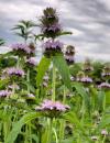 | | 2021 | COLLECTED | 09/27/2021 | Located approximately 3 miles south, southeast of Fairfield, T71N R9W SW1/4 Sec. 7 | 40.96338000, -91.94686900 | 223 | Woodland openings/edges, disturbed areas | Wild material | | 2122068 | Ames 35750 |
| 77 | Ames 35734 | Ledges State Park | Teucrium canadense L. | Iowa, United States | NC7 |  | | 2021 | COLLECTED | 08/23/2021 | Ledges State Park located approximately 4.75 miles south of Boone T83N R26W Sec. 16 & 21 | 41.99262400, -93.87724800 | 330 | Edges of woods | Wild material | | 2120338 | Ames 35734 |
| 78 | Ames 35667 | Kankakee Sands Preserve | Aronia ×prunifolia (Marshall) Rehder | Illinois, United States | NC7 |  | | 2021 | COLLECTED | 05/04/2021 | Kankakee Sands Preserve located approximately 2.3 miles southwest of Wilmington in Custer Township, T32N R9E NE 1/4 Sec. 11 | 41.27166000, -88.15701800 | 170 | Sand shrub prairie | Wild material | Genotypes noted in nature were averaging 5.0-6.0' in height, relatively upright in growth habit and extremely dense suckering. Numerous clones noted covering expansive areas (e.g. 30 yards by 20 yards, etc.). Variation in branching and glossiness of leaves noted across genotypes present in nature. | 2115976 | Ames 35667 |
| 79 | Ames 35615 | Ames 35615 | Aronia arbutifolia (L.) Pers. | Michigan, United States | NC7 |  | | 2020 | COLLECTED | 11/03/2020 | Warren Townsend Park located just northeast of Cannonsburg southwest of Ramsdell Dr. and Six Mile Rd. intersection, T8N R10W NE ¼ NW ¼ Sec. 26, Cannon Twp., Kent County | 43.05606700, -85.46435100 | 239 | Shrubby edge of old stream (Bear Creek) oxbow, adjacent to wet meadow with groundwater upwelling. Muck soils. | Wild material | Plants in nature measuring approximately six meters in height; elongate shrubs mostly unbranched; bright-red fruits measuring between 4-7 mm in diameter; tomentose leaves underneath; scarlet fall color. This collection was discovered in 2011 and represents the first report of the species for the state of Michigan (Ryskamp and Warners 2012) and thus represents a widely disjunct population where the next nearest documented population is in southern Ohio (Clermont County). | 2110277 | Ames 35615 |
| 80 | OPGC 8059 | ID310-42 | Asclepias speciosa Torr. | Idaho, United States | OPGC | | | 2020 | | | | | | | Wild material | Petiolate leaves, oblong-lanceolate leaves. | 2107488 | OPGC 8059 |
| 81 | NA 88438 | MARSB-202 | Rosa palustris Marshall | Delaware, United States | NA | | | 2020 | | | | | | | Wild material | Woody plant with stems covered in recurved thorns. Mature fruit a scarlet hip. | 2106461 | NA 88438 |
| 82 | NA 86434 | Pulverulentus Group | Styrax americanus Lam. | Texas, United States | NA | | | 2020 | COLLECTED | 09/08/2018 | Near Gum Slough, on the edges of woodlands along the north side of road FM 2246. | 30.33332000, -93.94704000 | 15 | Plants are found along the edges and moist to wet areas of Gum Slough in part shade to full sun of a mixed deciduous and broadleaved evergreen woodlands. Soils are generally acidic with loamy to clayey sediments, but with some areas consisting of deep, nearly level loamy, poorly drained soil. | Wild material | Species occurrence is infrequent at this location. Collector's note on the name under which this material was gathered, Styrax americanus var. pulverulentus: "In general, the var. pulverulentus is considered "taxonomically inconsequential" by many botanists. Even so, this densely pubescent characteristic is highly uniform across every plant I observed in the sampled population. Weakley notes that "true" var. pulverulentus can be found as far west as East Texas and, in my humble opinion, the population sampled herein represents this "taxon". Regardless, for the purposes of drawing distinction between "typical" Styrax americanus and the densely pubescent form, I've chosen to use this varietal name. It will be interesting to observe whether the seedling progeny are uniformly similar to their parents when they germinate." [Actual altitude recorded was 14.8 m, but decimals can't be used in the database, so the number was rounded.] | 2109219 | NA 86434 |
| 83 | Ames 35288 | APS/MF/2020/003/406 | Monarda fistulosa L. | Kansas, United States | NC7 |  | | 2020 | COLLECTED | 02/05/2020 | Eisenhower State Park on north side of Melvern Lake approximately 5.25 miles west, northwest of Melvern, T18S R15E NE1/4 Sec. 3, Osage County | 38.51966000, -95.73352000 | 323 | Edge of woods with limestone substrate. | Wild material | | 2101394 | Ames 35288 |
| 84 | WLP 2018 | MARSB-976 | Viburnum opulus L. var. americanum Aiton | New York, United States | NA | | | 2019 | COLLECTED | 08/01/2019 | Dutchess County; Tivoli; Bard College campus. | | 200 | Open marsh (tidal marsh), full sun, red maple swamp; growing in moist loamy sand. | | Seed collected from 20 plants; population scattered in distribution, found over a 1 mile by 1 mile area. Seed maturation early, middle. | 2109167 | WLP 2018 |
| 85 | WLP 2038 | MARSB-1005 | Viburnum lentago L. | New York, United States | NA | | | 2019 | COLLECTED | 09/19/2019 | Columbia County; Germantown; Rt. 6, Germantown. [This appears to be south of Germantown. -SBL] | | 183 | Marsh. | | Seeds collected from 20 individuals in a population of 25+ plants; scattered distribution. Seed maturation: middle. Birds, low fruit set noted. | 2109187 | WLP 2038 |
| 86 | Ames 35236 | SF_ID:24690/EO-ID:17843 | Agastache foeniculum (Pursh) Kuntze | Nebraska, United States | NC7 |  | | 2019 | | | | | | | Wild material | Plants measuring approximately 60 cm in height. Infructescences fully mature at time of collection (23 October 2019), likely past peak maturity by approximately 4 weeks. Population (EC-ID: 17843) was originally documented by Steven B. Rolfsmeier on 8 June 2015 (Nebraska Pine Ridge Plant Resurvey, 2015: Report submitted to the Nebraska Natural Heritage Program) noting “ Agastache foeniculum was located in a ravine bottom that burned in 2012. Estimated population size: 200-300 stems covering approximately 125 sq. meters”. A. foeniculum in Nebraska is currently tracked by the Nebraska Natural Heritage Program and is listed (6 November 2019) as a S1 (Critically Imperiled - at very high risk of extirpation in the state due to very restricted range, few populations or occurrences, steep declines, severe threats or other factors) and Tier 2 species (Tier 2 - species are typically those that are not at-risk from a global or national perspective but are rare or imperiled within Nebraska). | 2097772 | Ames 35236 |
| 87 | WLP 1685 | JDC/RS/2019/036/915 | Rosa setigera Michx. | Iowa, United States | NA |  | | 2019 | COLLECTED | 10/17/2019 | Ledges State Park located approximately 4.75 miles south of Boone, just south of the Oakwoods Shelter/Picnic area, T83N R26W NE1/4 NE1/4 and also NW1/4 NE1/4 Sec. 21, Boone County | 41.99262400, -93.87724800 | 330 | Edges of woods (adjacent to prairie) and also within 20-25 yards from woods in prairie. Noted in east, west, and south-facing edges of woods (no specimens noted on north-facing woodland edges) | Wild material | Woody shrub/vine stretching up to 12' in length. Alternate compound leaves usually consisting of five lealets. Leaf rachis and stipule margins glandular. Mature hypanthium and pedicel with stipitate glandular hairs. Mature hypanthium mostly bright to dark red in color with a few dark orange noted at time of harvest (17 October 2019). Leaves rather to somewhat glossy. This collection represents genetics from the northwestern edge of the species range, likely suggesting good cold-hardiness (USDA Zone 5a). | 2097769 | WLP 1685 |
| 88 | WLP 171 | NACPEC19-063 | Itea virginica L. | Georgia, United States | NA | | | 2019 | COLLECTED | 09/15/2019 | Walker County; Lula Lake Land Trust: Lula Lake Land Trust Falls: West Side of Falls | 34.93319200, -85.37178900 | 477 | Stream bank, mesic wood forest | Wild material | | 2110485 | WLP 171 |
| 89 | WLP 2010 | MARSB-977 | Viburnum dentatum L. | New York, United States | NA | | | 2019 | COLLECTED | 08/02/2019 | Greene County; Catskill; Scenic Hudson plot (land in conservation use) on Kukuk Rd in Catskill, New York [Note: location could not be found on maps, and no latitude and longitude were supplied; possibly Kukuk Lane in Kingston, New York, which is a bit south of Catskill. -SBL] | 0.00000000, 0.00000000 | 91 | Edge of oak-hickory woodland; growing in full sun in loamy sand soil. | | Seeds collected directly from plants. Sparse seed set noted. Species scattered in area; 30+ individuals in population, 32 individuals sampled, with population area 1 mile x 1 mile. | 2109106 | WLP 2010 |
| 90 | WLP 2014 | MARSB-985 | Viburnum dentatum L. | New York, United States | NA | | | 2019 | COLLECTED | 08/20/2019 | Oswego County; Williamstown; Private recreational land at 319 Stone Hill Rd. | 43.41583000, -75.96805000 | 186 | Edge of open pond with edge trail lined with shrubs and trees, dam; growing in full sun in wet sand loam soil. | | Seeds collected directly from plants. Species scattered in area; 30 individuals in population, 500 seeds collected [presumably all individuals sampled]. Seed quality good, 95 percent healthy seed. Beaver activity in pond. | 2109110 | WLP 2014 |
| 91 | NA 88454 | OR050-274 | Rosa woodsii Lindl. var. ultramontana (S. Watson) Jeps. | Oregon, United States | NA |  | | 2018 | | | | | | | Wild material | Rosa woodsii var. ultramontana | 1967943 | NA 88454 |
| 92 | NA 88031 | NCBG-382 | Juniperus virginiana L. | Virginia, United States | NA |  | | 2018 | | | | | | | Wild material | | 1965940 | NA 88031 |
| 93 | NA 85007 | JDC/QB/2008/079/149 [related collection number] | Quercus bicolor Willd. | Iowa, United States | NA | | | 2018 | COLLECTED | 09/24/2015 | Chichaqua Wildlife Habitat Park bottoms, near Elkhart, NW 1/4 of NW 1/4 of Section 32, T81N, R22W, Loring Quad. | 41.79000000, -93.43972222 | 247 | | Wild material | Seedlings from seed collected at the same site as NA 81010, which was received in 2012 under collection number JDC/QB/2008/079/149, and also as Ames 29670. GRIN narrative: "A small proportion of seedlings during growout were noted to be Q. bicolor x Q. macrocarpa hybrids." Digital photographs of source trees available in GRIN under NA 85010/Ames 29670. | 2141805 | NA 85007 |
| 94 | NA 85022 | JDC/SS/2018/008/821 | Sapindus saponaria L. var. drummondii (Hook. & Arn.) L. D. Benson | Oklahoma, United States | NA |  | | 2018 | COLLECTED | 03/13/2018 | Thurmond Ranch approximately 3.80 miles southwest of Cheyenne, T13N R24W, Roger Mills County | 35.59226100, -99.69600600 | 554 | Bottomlands and immediate higher elevations of Sergeant Major Creek and surrounding tributaries. | Wild material | | 1957959 | NA 85022 |
| 95 | OPGC 6411 | CBG-8084 | Solidago patula Muhl. ex Willd. | Illinois, United States | OPGC |  | | 2017 | | | | | | | Wild material | | 1954874 | OPGC 6411 |
| 96 | Ames 34023 | Ames 34023 | Viburnum prunifolium L. | Iowa, United States | NC7 |  | | 2017 | COLLECTED | 09/27/2017 | Shimek State Forest, Donnellson Unit, approximately 6.0 miles west of Donnellson. | 40.64796000, -91.67764000 | 219 | Oak-hickory upland forest. | Wild material | Plants at collection site ranging between 10-15' tall. Fruits dark purple, leaves on some stems were turning red fall color at time of collection (09/27/2017). | 1953995 | Ames 34023 |
| 97 | Ames 33985 | JDC/FQ/2017/041/795 | Fraxinus quadrangulata Michx. | Kentucky, United States | NC7 |  | | 2017 | COLLECTED | 07/12/2017 | Carter Caves State Resort Park near Smoky Valley Lake just 4.46 miles south of Carter, Carter County | 38.36772700, -83.12512200 | 230 | Deciduous woods. | Wild material | | 1950068 | Ames 33985 |
| 98 | NA 83897 | PCCKY16-024 | Xanthorhiza simplicissima Marshall | Kentucky, United States | NA | | | 2016 | COLLECTED | 09/27/2016 | Cumberland Falls State Park, Cumberland Falls Visitor Center. Beach north of visitor center outlook trail, boulders north of large sycamore with exposed root flare and hole in trunk base. | 36.84200000, -84.34200000 | 252 | Beach, with boulders. | Wild material | | 1952452 | NA 83897 |
| 99 | WLP 1209 | NA 83966 | Hibiscus moscheutos L. | Kentucky, United States | NA | | | 2016 | COLLECTED | 09/30/2016 | [Locality data unparseable; GPS coordinates appear near a road of uncertain name off Howard Munsey Rd. north of Betsey, Kentucky. Original location was listed as: "At Edam Road?"; no road by this name was found in the county. -SBL] | 36.91900000, -84.73800000 | 277 | Wet roadside couvee (ditch). | | | 1950957 | WLP 1209 |
| 100 | WLP 704 | NA 83896 | Amorpha fruticosa L. | Kentucky, United States | NA | | | 2016 | COLLECTED | 09/27/2016 | Cumberland Falls State Park, Cumberland Falls Visitor Center. Beach north of visitor center outlook trail, boulders north of large sycamore with exposed root flare and hole in trunk base. | 36.84200000, -84.34200000 | 245 | Beach, with boulders. | | | 1950955 | WLP 704 |
| 101 | Ames 33752 | Ames 33752 | Maclura pomifera (Raf.) C. K. Schneid. | Iowa, United States | NC7 |  | | 2016 | COLLECTED | 10/05/2016 | Deer Creek watershed, T80N R23W E1/2 Sec. 18. | 41.73813000, -93.56296400 | 295 | Mixed deciduous woods, distrubed areas and also managed areas. Gentle slopes and wetlands | Uncertain improvement status | The native range for Osage-orange is reported from eastern Texas, southeastern Oklahoma, southwestern Arkansas, and the northwestern corner of Louisiana (Little, 1971). Historically and presently known for its extreme value as bow-wood and fence posts, Osage-orange represents one of the most widely planted tree species in the lower 48 US states as a living fence starting in the mid-1800's, in the late 1900's as a landscape tree for difficult sites, and most recently its chemical properties. Detailed history of Osage-orange and it's economic uses are well documented (Smith and Perino, 1981 and J. T. Winberry 1979). Osage wood is highly-prized for its use as fence posts (both living and non-living) and durable wood for wood working. Osage is an extremely drought and heat tolerant tree and is recommended for use in USDA cold-hardiness zones 5b or warmer. Although the species is commonly known for its stout thorns and large, globular fruits, the species is dioecious and the degree of thorns on individual genotypes can be extremely variable. This accession represents germplasm from a naturalizing, reproductive population collected in central Iowa (Polk County). Majority of specimens averaged approximately 40-50’ in height with multiple (e.g. 4-5) trunks. Specimens 03-1 and 03-2 were upright in form with tighter branch angles, while 03-10 was the widest spreading of all trees. Some yellow fall color (yellow) was apparent at time of fruit collection (10/05/2016). Size of fruits ranged from 9.00 to 10.75 inches circumference except for tree 03-5 with fruits averaging 7.33 inches circumference. | 1942949 | Ames 33752 |
| 102 | OPGC 7157 | CBG-5314 | Geum aleppicum Jacq. | Wisconsin, United States | OPGC | | | 2016 | | | | | | | Wild material | | 1942769 | OPGC 7157 |
| 103 | W6 51634 | CBG-5267 | Chamaenerion angustifolium (L.) Scop. subsp. circumvagum (Mosquin) Moldenke | Wisconsin, United States | W6 | | | 2016 | | | | | | | Wild material | | 1942764 | W6 51634 |
| 104 | Ames 33289 | APS/GD/2016/010/245 | Gymnocladus dioicus (L.) K. Koch | Michigan, United States | NC7 |  | | 2016 | COLLECTED | 04/05/2016 | Ionia County: T5N R5W SW 1/4 SW 1/4 SE 1/4 Sec. 21; T5N R5W NE 1/4 NW 1/4 NW 1/4 Sec. 20; and T5N R5W SW 1/4 SW 1/4 SE 1/4 Sec. 20 along Grand River approximately 4.80 miles south and slightly west of Portland. | 42.80296200, -84.91275400 | 231 | Floodplain. | Wild material | | 1940346 | Ames 33289 |
| 105 | WLP 1101 | JDC/CO/2015/036/692 | Cotinus obovatus Raf. | Oklahoma, United States | NA |  | | 2015 | COLLECTED | 05/21/2015 | T16N R20E W 1/2 Sec. 18 Wagoner and Cherokee Counties. Fort Gibson Lake Dam. | 35.86228100, -95.22575600 | 170 | Growing on shallow, rocky soils in association with Carya illinoinensis, Quercus muehlenbergii, Cornus sp., Cercis canadensis, Fraxinus americana, Platanus occidentalis, Ulmus sp., Diospyros virginiana, Sapindus saponaria var. drummondii, Lonicera sempervirens, Smilax sp., Toxicodendron radicans, and Robinia pseudoacacia. | Wild material | | 1926263 | WLP 1101 |
| 106 | Ames 32891 | APS/GD/2015/010/192 | Gymnocladus dioicus (L.) K. Koch | Oklahoma, United States | NC7 |  | | 2015 | COLLECTED | 03/12/2015 | Nowata County: T25N R16E NW 1/4 NE 1/4 Sec. 3. Oologah Wildlife Management Area approximately 3 miles east of Nowata. | 36.68401000, -95.58207800 | 208 | Transition zone between higher elevations and bottomlands. | Wild material | | 1925357 | Ames 32891 |
| 107 | Ames 32903 | APS/GD/2015/031/213 | Gymnocladus dioicus (L.) K. Koch | Oklahoma, United States | NC7 |  | | 2015 | COLLECTED | 03/19/2015 | Osage County: Arkansas River watershed area known as Souters Bend, T21N R7E. Keystone Wildlife Management Area (John Lowery Unit) approximatley 3 miles west of Cleveland. | 36.30185300, -96.53051000 | 222 | Floodplain, but one specimen sampled was located on dry, rocky (large boulders) bluff. | Wild material | | 1925369 | Ames 32903 |
| 108 | NA 83061 | ZARKS-005 | Gymnocladus dioicus (L.) K. Koch | Arkansas, United States | NA | | | 2015 | COLLECTED | 10/02/2014 | Frog Valley (private property). West bank of North Fork of Saline River. | 34.76276000, -92.71386000 | 133 | Alluvial low floodplain, in sandy clay soil. Slope: 0 degrees. Elevation: 435 feet. | Wild material | | 1950627 | NA 83061 |
| 109 | NA 83062 | NA 83062 | Taxodium distichum (L.) Rich. | Arkansas, United States | NA | | | 2015 | COLLECTED | 10/02/2014 | Frog Valley (private property). Banks of North Fork of Saline River. | 34.76443000, -92.71338000 | 135 | Alluvial low floodplain, in gravel bank. | | | 1951432 | NA 83062 |
| 110 | NA 83063 | NA 83063 | Hamamelis vernalis Sarg. | Arkansas, United States | NA | | | 2015 | COLLECTED | 10/02/2014 | Frog Valley (private property). Gravel bar along North Fork of Saline River. | 34.76543000, -92.71353000 | 134 | Alluvial low floodplain; gravel bar. | | | 1950887 | NA 83063 |
| 111 | Ames 32820 | APS/EA/2013/041/126 | Euonymus atropurpureus Jacq. | Iowa, United States | NC7 |  | | 2014 | COLLECTED | 10/10/2014 | Midland Trail Road near North Racoon River watershed. Dallas County T80N R27W SW 1/4 NW 1/4 Sec. 30 | 41.71142000, -94.04538000 | 299 | Wooded roadside. | Wild material | | 1921780 | Ames 32820 |
| 112 | Ames 32812 | Ames 32812 | Euonymus atropurpureus Jacq. | Iowa, United States | NC7 |  | | 2014 | COLLECTED | 10/22/2014 | Chichaqua Bottoms Greenbelt, Polk County. | 41.77483000, -93.43145600 | 250 | Bottomland/floodplain forest of Skunk River watershed. | Wild material | One specimen sampled in nature was approximately 20 feet in height. In cultivation at NCRPIS, plants display attractive fall foliage colors ranging from pale pink to deep red. Fruits are ornamentally significant, varying in color from pale to bright pink. | 1921817 | Ames 32812 |
| 113 | WLP 218 | JDC/TC/2014/089/591A | Tsuga canadensis (L.) Carrière | Alabama, United States | NA | | | 2014 | COLLECTED | 09/23/2014 | Alabama: Franklin County; William B. Bankhead National Forest, north-facing banks of Bear Creek watershed. | 34.33924600, -87.54771500 | 285 | Growing in association with Quercus alba, Cornus florida, Pueraria montana var. lobata, Magnolia macrophylla, Platanus occidentalis, Liquidambar styraciflua, and Fagus grandifolia. | Wild material | Excellent cone production. Optimum timing for harvest. Species infrequent to locally abundant across a 12 mile linear stretch of the southeast corner of Franklin County to north-central Winston County. | 1922361 | WLP 218 |
| 114 | Ames 32388 | JDC/BN/2014/015/517 | Betula nigra L. | Iowa, United States | NC7 |  | | 2014 | COLLECTED | 06/05/2014 | Princeton Wildlife Management Area, T80N R5E NE 1/4 Sec. 35. | 41.69417800, -90.34158400 | 177 | Wet, heavy soil floodplain. | Wild material | | 1919309 | Ames 32388 |
| 115 | Ames 32226 | APS/GD/2014/010/141 | Gymnocladus dioicus (L.) K. Koch | Indiana, United States | NC7 | | | 2014 | COLLECTED | 03/22/2014 | Cabin Creek watershed, Sections 6 and 36, T20N, R13E, and Sections 22 and 23, T20N, R12E, just southwest of Farmland, Randolph County. | 40.15779200, -85.14474100 | 304 | Moist woods. | Wild material | | 1917830 | Ames 32226 |
| 116 | Ames 32082 | JDC/FQ/2013/041/485 | Fraxinus quadrangulata Michx. | Ohio, United States | NC7 |  | | 2013 | COLLECTED | 08/17/2013 | South Bass Island, Put-In-Bay Quad, Ottawa County. | 41.63639900, -82.83680200 | 197 | Shallow, rocky soils. | Wild material | | 1913268 | Ames 32082 |
| 117 | Ames 32069 | APS/PO/2013/034/119 | Physocarpus opulifolius (L.) Maxim. | Wisconsin, United States | NC7 | | | 2013 | COLLECTED | 06/17/2013 | Cana Island, Door County. | 45.08814100, -87.04772000 | | | Wild material | | 1912291 | Ames 32069 |
| 118 | Ames 31982 | APS/GD/2013/004/089 | Gymnocladus dioicus (L.) K. Koch | Kansas, United States | NC7 |  | | 2013 | COLLECTED | 02/18/2013 | Walnut Creek watershed, southwest of Marysville, Sections 5, 8, and 17, T3S R6E, Marshall County. | 39.79300943, -96.78506600 | 382 | Dry floodplain. | Wild material | | 1907535 | Ames 31982 |
| 119 | Ames 31983 | APS/GD/2013/006/091 | Gymnocladus dioicus (L.) K. Koch | Kansas, United States | NC7 |  | | 2013 | COLLECTED | 02/19/2013 | Beaver Creek, south of Scandia, Sections 7, 12, and extreme NW 1/4 of NW 1/4 of Section 8, T4S R5W, Republic County. | 39.72143025, -97.81205050 | 432 | Dry floodplain. | Wild material | | 1907536 | Ames 31983 |
| 120 | Ames 31987 | APS/GD/2013/011/096 | Gymnocladus dioicus (L.) K. Koch | Kansas, United States | NC7 |  | | 2013 | COLLECTED | 02/20/2013 | Camp Wood, near Cottonwood River, south of Elmdale, NW 1/4 of Section 3, T20S R7E, Chase County. | 38.34698100, -96.65080500 | 377 | Samples obtained from both upland, rocky and floodplain habitat. | Wild material | | 1907540 | Ames 31987 |
| 121 | Ames 31677 | GA12001001 | Fraxinus pennsylvanica Marshall | Minnesota, United States | NC7 |  | | 2012 | COLLECTED | 09/24/2012 | Southwest Becker County near Lake Cormorant and Lake Maud.. | 46.73903330, -95.97883330 | 415 | Edge of slough and forest. | Wild material | | 1906588 | Ames 31677 |
| 122 | Ames 31532 | JDC/FQ/2012/042/435 | Fraxinus quadrangulata Michx. | Illinois, United States | NC7 |  | | 2012 | COLLECTED | 07/26/2012 | Trout Park Nature Preserve, Section 1, T41N, R83, Elgin Quad, near Elgin, Kane County. | 42.06258500, -88.27131500 | 240 | Variable habitats: dry, rocky slopes and also near small creek in gravelly soils. | Wild material | | 1903759 | Ames 31532 |
| 123 | Ames 31086 | 691 | Fraxinus pennsylvanica Marshall | New York, United States | NC7 |  | | 2011 | COLLECTED | 09/10/2011 | Winters Road, south of Main Street, Chemung County. | 42.13200000, -76.92800000 | 275 | Floodplain of Cuthrie Run | Wild material | | 1891472 | Ames 31086 |
| 124 | Ames 30603 | JDC/FP/2010/055/325 | Fraxinus pennsylvanica Marshall | Kansas, United States | NC7 |  | | 2010 | COLLECTED | 09/19/2010 | Along highway 160, Mouse Creek watershed, just east of Independence, Montgomery County. | 37.22496000, -95.66045000 | 233 | Shallow soils in bedrock with seeps. | Wild material | | 1848898 | Ames 30603 |
| 125 | WLP 1949 | JDC/VM/2010/022/292 | Viburnum molle Michx. | Illinois, United States | NA |  | | 2010 | COLLECTED | 09/06/2010 | Along Senachwine Creek, SE 1/4 of Section 12, Rome Quad, Peoria County. | 40.94680000, -89.52970000 | 183 | Along steep (75%) west-northwest facing slope. Associated with Cornus, Fraxinus, Ostrya virginiana, Platanus occidentalis, Quercus rubra, Staphylea trifolia, Tilia americana, and Vitis riparia. | Wild material | Plants up to 15 feet in height. Reddish fall color on apical stems. Peeling bark on older stems. | 1847248 | WLP 1949 |
| 126 | Ames 30491 | APS/GD/2010/013/048 | Gymnocladus dioicus (L.) K. Koch | Illinois, United States | NC7 |  | | 2010 | COLLECTED | 02/23/2010 | Near Deans Hills State Nature Preserve, approximately 7 miles east of Ramsey, T8N R2E Sec. 10 and NE 1/4 of Sec. 16, Fayette County. | 39.13970000, -88.97490000 | 172 | Gentle rolling hills of deciduous woods. | Wild material | #157 measured 9.5" and 50', #158 measured 11.5" d.b.h. and 50', #159 measured 16" and 60', #160 measured 15" and 80', and #161 measured 16.5" and 90'. | 1831350 | Ames 30491 |
| 127 | Ames 30381 | JDC/MF/2009/093/243 | Monarda fistulosa L. | Ohio, United States | NC7 |  | | 2009 | COLLECTED | 10/16/2009 | Wayne National Forest, near Dirtyface Creek, SE 1/4 of SW 1/4 of Section 21, T6N, R17W, Gallia Quad, Jackson County. | 38.80750000, -82.53000000 | 210 | Open prairie. Variable soil types present. | Wild material | During an observation trial of 19 Monarda accessions at NCRPIS, this accession was found to be unique in having an extremely high number of inflorescences on each flowering stem. | 1823933 | Ames 30381 |
| 128 | WLP 1951 | JDC/VR/2009/110/260 | Viburnum rufidulum Raf. | Ohio, United States | NA | | | 2009 | COLLECTED | 10/18/2009 | Along Ohio County Highway 106 (Suck Run Road), just south of Neel, Decatur Quad, Brown County. | 39.00000000, -84.00000000 | 224 | 45% slope, southeast and east facing. Associated with Acer saccharum, Celtis occidentalis, Cercis canadensis, Cornus florida, Fraxinus quadrangulata, Quercus, Staphylea trifolia, Viburnum molle, and V. prunifolium. | Wild material | | 1823957 | WLP 1951 |
| 129 | WLP 814 | JDC/CC/2009/086/236 | Carpinus caroliniana Walter | Ohio, United States | NA | | | 2009 | COLLECTED | 10/15/2009 | Along Clear Creek, near Revenge, SE 1/4 of SE 1/4 of Section 13, T13N, R19W, Rockbridge Quad, Hocking County. | 39.59361111, -82.61944444 | 246 | Creekbed. Associated with Acer rubra, Asimina triloba, Carya, Cephalanthus occidentalis, Cornus florida, Hamamelis virginiana, Nyssa sylvatica, Oxydendrum arboreum, and Quercus. | Wild material | | 1823913 | WLP 814 |
| 130 | Ames 30147 | JDC/FP/2009/042/192 | Fraxinus pennsylvanica Marshall | Wisconsin, United States | NC7 |  | | 2009 | COLLECTED | 09/22/2009 | Along Levee Road, Pine Island State Wildlife Area, SW 1/4 of NW 1/4 of Section 11, T12N, R8E, Pine Island Quad, Columbia County. | 43.53250000, -89.51555556 | 242 | Wisconsin River watershed/floodplain. | Wild material | | 1819728 | Ames 30147 |
| 131 | Ames 30153 | JDC/FP/2009/062/212 | Fraxinus pennsylvanica Marshall | Illinois, United States | NC7 |  | | 2009 | COLLECTED | 09/25/2009 | Four Corners Road, north from Illinois Highway 84, NW 1/4 of SW 1/4 of Section 36, T26N, R2E, Blackhawk (IL-IA) Quad, Jo Daviess County. | 42.20027778, -90.22944444 | 194 | Roadside in fence row. | Wild material | | 1819734 | Ames 30153 |
| 132 | Ames 29981 | APS/GD/2009/019/028 | Gymnocladus dioicus (L.) K. Koch | Iowa, United States | NC7 |  | | 2009 | COLLECTED | 04/04/2009 | Near the confluence of the West Fork Cedar River and Shell Rock River, approximatley 2 miles east of Finchford, T90N R14W SE 1/4 SE 1/4 SE 1/4 and also SE 1/4 SW 1/4 Sec. 4 Shell Rock Quad., Black Hawk County. | 42.62888889, -92.49666667 | 272 | Gentle, east-facing slopes and also floodplain. | Wild material | Trees ranging from 13.5 to 18 inches DBH and 50 to 70 feet in height. | 1799101 | Ames 29981 |
| 133 | NA 78098 | J. Griffin S.N. | Celastrus scandens L. | Kansas, United States | NA | | | 2009 | COLLECTED | 03/26/2009 | Approx. 5 miles NE of Leon, KS along SE Price Rd. | 37.73861111, -96.71583333 | 1371 | Relatively natural/undisturbed, first grade above flood plain. Reasonably well protected, direct sunlight probably only a couple of hours per day. | Wild material | | 1800361 | NA 78098 |
| 134 | Ames 29974 | JDC/GD/2009/003/153 | Gymnocladus dioicus (L.) K. Koch | Iowa, United States | NC7 |  | | 2009 | COLLECTED | 03/19/2009 | Stone State Park, just northwest of Sioux City, T89N R48W west 1/2 of Sec. 1 and east 1/2 of Sec. 2 Sioux City Quad., extreme northwest corner of Woodbury County. | 42.55805556, -96.46861111 | 390 | Variable-wet bottomland and dry slopes; a few small creeks with running water. Variable exposure. 0-45 degrees of slope with southern and eastern aspects. | Wild material | Plants between 40 and 65 feet in height and 6 to 17 inches DBH. | 1798766 | Ames 29974 |
| 135 | Ames 29975 | JDC/GD/2009/004/154 | Gymnocladus dioicus (L.) K. Koch | Nebraska, United States | NC7 |  | | 2009 | COLLECTED | 03/20/2009 | Ponca State Park, approximately 2 miles north of Ponca, T30N R6E Sec. 3 Ponca Quad., Dixon County. | 42.60166667, -96.71444444 | 365 | Variable from mid-level elevation sloped area to bottomland type. Variable exposure. 0-60 degrees of slope with variable aspects. | Wild material | Plants between 40 and 75 feet in height and 8 to 26 inches DBH. | 1798767 | Ames 29975 |
| 136 | NA 81010 | JDC/QB/2008/079/149 | Quercus bicolor Willd. | Iowa, United States | NA |  | | 2008 | COLLECTED | 10/21/2008 | Chichaqua Wildlife Habitat Park bottoms, near Elkhart, NW 1/4 of NW 1/4 of Section 32, T81N, R22W, Loring Quad, Polk County. | 41.79000000, -93.43972222 | 247 | | Wild material | A couple of specimens are approximately 300 years in age. Very large mature specimens, approximately 70-90 feet in height and 4-5 feet d.b.h. Largest specimen sampled was 54.5" d.b.h. A small proportion of seedlings during grow out were noted to be Q. bicolor x Q. macrocarpa hybrids. | 1788225 | NA 81010 |
| 137 | Ames 27332 | 41 | Staphylea trifolia L. | Iowa, United States | NC7 |  | | 2003 | COLLECTED | 09/24/2003 | Stoney Hollow, halfway between Burlington and Kingston, T71N R2W NW corner of NE 1/4 of SW 1/4 of Sec. 35, Des Moines County | 40.90611111, -91.05972222 | 186 | Along creek. Shady. Steep banks with various aspects. Rocky, just above shale layer on limestone and alluvium | Wild material | Large shrubs to 4 meters tall. | 1649678 | Ames 27332 |
| 138 | WLP 767 | 19 | Carpinus caroliniana Walter | Iowa, United States | NA | | | 2003 | COLLECTED | 09/15/2003 | Bixby State Park, Edgewood, T91N R5W, SW corner of SE 1/4 of NW 1/4, Section 26, Edgewood Quad, Clayton County. | 42.66694444, -91.40333333 | 329 | Forest edge. Half shaded. 20% slope with a western aspect. Associated with Acer nigrum, Cornus alternifolia, Quercus rubra, and Rubus occidentalis. | Wild material | Small tree. | 1649453 | WLP 767 |