| 0 | PI 662019 | Ames 27282 | Cornus racemosa Lam. | Iowa, United States | NC7 | | | 2003 | COLLECTED | 09/07/2003 | Along Wapsi Great Western Trail, Lake Hendricks County Park, NE corner of SW 1/4 of SW 1/4 of Section 19, T99N, R14W, Riceville Quad, Howard County. | 43.37694444, -92.55111111 | 378 | | Wild material | Shrubs mostly 1.7 to 2 meters tall. Good leaf quality, some plants with striking red pedicels, heavy fruit production. | 1648678 | PI 662019 |
| 1 | PI 662018 | 02-001 | Cornus racemosa Lam. | Minnesota, United States | NC7 | | | 2003 | COLLECTED | 2002 | North of collector's house, Hennepin County. | 44.95483330, -93.70646660 | | Road bank. | Wild material | | 1644314 | PI 662018 |
| 2 | WLP 1125 | V18-03 | Cornus racemosa Lam. | Vermont, United States | NA | | | 2018 | COLLECTED | 10/02/2018 | Addison County; Middlebury; Otter View Park, in natural area near the parking lot. | 44.01924000, -73.18117000 | 114 | Growing in a wet depression. | | | 2108865 | WLP 1125 |
| 3 | Ames 26997 | 02-004 | Cornus racemosa Lam. | Minnesota, United States | NC7 | | | 2003 | COLLECTED | 2002 | One mile south of Backus, Cass County. | 46.81630000, -94.51701660 | | Trail. | Wild material | | 1644315 | Ames 26997 |
| 4 | Ames 22080 | Ames 22080 | Cornus racemosa Lam. | New Jersey, United States | NC7 |  | | 1994 | COLLECTED | | Blawenburg. | 40.40750000, -74.70305556 | 48 | | Wild material | | 1087560 | Ames 22080 |
| 5 | Ames 21980 | Ames 21980 | Cornus racemosa Lam. | Michigan, United States | NC7 | | | 1994 | COLLECTED | 1993 | East side of Bear Lake, Ingham County. | 42.70000000, -84.50000000 | | Open old field. | Wild material | | 1087401 | Ames 21980 |
| 6 | Ames 20183 | No. 9 | Cornus racemosa Lam. | New Jersey, United States | NC7 |  | | 1993 | COLLECTED | | Morris and Somerset Counties. | 40.78333333, -74.45000000 | | Plants growing in their native stations. | Wild material | | 1084375 | Ames 20183 |
| 7 | Ames 14897 | 18 | Cornus racemosa Lam. | Illinois, United States | NC7 | | | 1991 | COLLECTED | | Dupage County, Illinois. | 41.83024200, -88.05198800 | | | Wild material | Collected from natural populations, DuPage Co., Illinois. | 1069320 | Ames 14897 |
| 8 | NA 89036 | RJL2022KS-003 | Cornus drummondii C. A. Mey. | Kansas, United States | NA | | | 2022 | COLLECTED | 09/21/2022 | Coronado Heights Park, Smoky View, Kansas hillsides surrounding the historic WPA circa 1932 Coronado Heights Castle located about 91 meters above the surrounding land. This plant is common and abundant on the slopes of this site. | 38.61348400, -97.70343100 | 475 | Plants growing in part shade to full sun, under extreme exposure, rocky, dry and thin soils of this short grass prairie habitat on the slopes surrounding the summit of Coronado Heights Park. The underlying geology of this area is of Upper Cretaceous origin and comprised of Kiowa Shale or FM- light -gray to black illitic shale with thin coquinoidal limestone beds at the base; sandstone lenses are common. Cheyenne Sandstone-massive to cross-bedded, light-gray to buff fine-grained sandstone with lenses of gray sandy shale and conglomerate.
Source: USGS Kansas Geologic Map Data (https://mrdata.usgs.gov/geology/state/sgmc-unit.php?unit=KSKkc%3B0)
The surface soil profile of this area is Lancaster-Hedville complex, 3 to 20 percent slopes. The Lancaster series consists of moderately deep, well drained soils that formed in residuum from sandstone and sandy shales; it can be up to 200 cm deep. Slopes range from 1-20%. Hedville soils have bedrock within 50 centimeters of the surface and occur on similar hillslope positions.
Source: NRCS Web Soil Survey (https://websoilsurvey.sc.egov.usda.gov/App/WebSoilSurvey.aspx)
Slope: 5-20% Aspect: all | Wild material | | 2139601 | NA 89036 |
| 9 | Ames 34696 | MARSB-074 | Cornus amomum Mill. | New Jersey, United States | NC7 |  | | 2015 | COLLECTED | 08/29/2013 | West Essex Park just southeast of Pine Brook. | 40.84291000, -74.31341000 | 51 | | Wild material | | 1922850 | Ames 34696 |
| 10 | Ames 29506 | JDC-CA-2008-003 | Cornus alternifolia L. f. | Iowa, United States | NC7 |  | | 2008 | COLLECTED | 07/20/2008 | Tower Rock Park, N edge of SE 1/4 of SW 1/4 of Section 28, T88N, R19W, Steamboat Roak Quad, Steamboat Rock, Hardin County. | 42.40111111, -93.07166667 | 292 | Eroding (burnt orange) sandstone cliff, south side of Iowa River; mostly shaded; near base of slope with northern aspect; sand and organic matter above cliff; well drained. | Wild material | | 1782028 | Ames 29506 |
| 11 | PI 649023 | NY2 | Actaea racemosa L. | New York, United States | NC7 |  | | 2005 | | | | | | | Wild material | | 1698893 | PI 649023 |
| 12 | PI 664811 | DE2 | Actaea racemosa L. | Delaware, United States | NC7 | | | 2005 | | | | | | | Wild material | | 1698885 | PI 664811 |
| 13 | PI 664813 | KY1 | Actaea racemosa L. | Kentucky, United States | NC7 | | | 2005 | | | | | | | Wild material | | 1698887 | PI 664813 |
| 14 | PI 649021 | 46 | Actaea racemosa L. | Missouri, United States | NC7 | | | 2004 | | | | | | | Wild material | 1 meter tall. | 1668177 | PI 649021 |
| 15 | Ames 27648 | JM2004009 | Actaea racemosa L. | South Carolina, United States | NC7 | | | 2004 | | | | | | | Wild material | | 1667568 | Ames 27648 |
| 16 | PI 649703 | 14 | Physocarpus opulifolius (L.) Maxim. | Iowa, United States | NC7 |  | | 2003 | COLLECTED | 09/14/2003 | Fish Farm Mounds, New Albin, SW 1/4 of SW 1/4 of NW 1/4 of Section 26, T100N, R4W, New Albin Quad, Allamakee County. | 43.45111111, -91.28222222 | 280 | Sandstone ridge just above goat prairie. 1/2 sun. 30-50% slope w/ NW aspect. Sandy loam soil w/ some stoniness, well drained | Wild material | Medium sized shrubs. | 1649463 | PI 649703 |
| 17 | W6 62559 | FWS0502-94 | Epilobium ciliatum Raf. | Pennsylvania, United States | W6 |  | | 2025 | | | | | | | Wild material | Seeds mostly ripe in reddish pods, before they split | 2192257 | W6 62559 |
| 18 | NA 88588 | 2024RM-001 | Hydrangea radiata Walter | Georgia, United States | NA | | | 2024 | COLLECTED | 10/24/2024 | Chattahoochee National Forest: Warwoman Wildlife Management Area: north side of Overflow Creek Road just west of the bridge over the Chattooga River. | 34.94956600, -83.20652000 | 498 | Mixed evergreen and deciduous moist mesic forest in part shade. The underlying geology of this area is characterized as Metagraywacke/Mica Schist Formation of the Precambrian-Paleozoic period. (Source: USGS Georgia Geologic Map Data). The soils of this are characterized as Tusquitee Series Loam, 10 to 25 percent slopes. The Tusquitee Series consists of very deep, well drained soils on gently sloping to very steep benches, foot slopes, toe slopes, and fans in coves in the Southern Blue Ridge mountains, MLRA 130B. These soils formed in colluvium derived from materials weathered from igneous and high-grade metamorphic crystalline rocks such as granite, mica gneiss, hornblende gneiss, and schist. Slope ranges from 2 to 95 percent. Solum thickness ranges from 1 to 3+ meters. Reaction is very strongly acid to slightly acid, in the A horizon. The Bw and lower horizons are very strongly acid to moderately acid. In the upper 1 meter, content of rock fragments, dominantly of gravel to stone size, ranges up to 35 percent. Below 1 meter, rock fragment content may range up to 60 percent. Content of mica flakes ranges from few to common. (Source: California Soil Resource Lab/NRCS Official Soil Series Descriptions). | Wild material | | 2169925 | NA 88588 |
| 19 | NA 88590 | 2024RM-003 | Ilex verticillata (L.) A. Gray | Florida, United States | NA | | | 2024 | COLLECTED | 11/21/2024 | Along the west/north side of the Yellow River about 0.33 kilometers (as the crow flies) upstream from the channel that leads the Fisher Old Mill Road Boat Ramp. This site was accessed by boat. | 30.62868600, -86.80748000 | 4 | Plants are found growing primarily in permanently saturated to submersed conditions along the edge of the Yellow River in part shade. The riverine habitat is comprised of a wide array of deciduous and evergreen trees, shrubs, and perennial plant species. Most of the plants along the river are adapted to acidic conditions and, while the aquatic habitat is generally fresh water, there is occasionally tidal or hurricane-caused saltwater intrusions. Slope: 0 percent. Aspect: East-southeast. The underlying geology of this area is characterized as Alluvium from undifferentiated Quaternary Sediments. Much of Florida's surface is covered by a varying thickness of undifferentiated sediments consisting of siliciclastics, organics and freshwater carbonates. Where these sediments exceed 20 feet (6.1 meters) thick, they were mapped as discrete units. To subdivide the undifferentiated sediments, those sediments occurring in flood plains were mapped as alluvial and flood plain deposits (Qal). Sediments showing surficial expression of beach ridges and dunes were mapped separately (Qbd) as were the sediments composing Trail Ridge (Qtr). Terrace sands were not mapped (refer to Healy [1975] for a discussion of the terraces in Florida). The subdivisions of the Undifferentiated Quaternary Sediments (Qu) are not lithostratigraphic units but are utilized to facilitate a better understanding of the State's geology. The siliciclastics are light gray, tan, brown to black, unconsolidated to poorly consolidated, clean to clayey, silty, unfossiliferous, variably organic-bearing sands to blue green to olive green, poorly to moderately consolidated, sandy, silty clays. Gravel is occasionally present in the panhandle. Organics occur as plant debris, roots, disseminated organic matrix and beds of peat. Freshwater carbonates, often referred to as marls in the literature, are scattered over much of the State. In southern Florida, freshwater carbonates are nearly ubiquitous in the Everglades. These sediments are buff colored to tan, unconsolidated to poorly consolidated, fossiliferous carbonate muds. Sand, silt and clay may be present in limited quantities. These carbonates often contain organics. The dominant fossils in the freshwater carbonates are mollusks. (Source: USGS Florida Geologic Map Data). The soils of this are characterized as Bibb-Kinston Series association. The Bibb Series consists of very deep, poorly drained, moderately permeable soils on flood plains of streams in the Southern Coastal Plain (133A) Major Land Resource Area. They formed in stratified loamy and sandy alluvium that are commonly and frequently flooded and water runs off the surface very slowly. Slopes range from 0 to 2 percent. Reaction ranges from extremely acid to strongly acid throughout. Content of mica flakes ranges from none to common. Content of rounded gravel typically ranges from 0 to 10 percent throughout, but may range to 50 percent in thin strata below a depth of 1 meter. Buried soil horizons, present in many pedons have the same range in color and texture as the surface horizon which has iron and organic matter concentrations in shades of brown and yellow ranging from none to common. Texture is sand, loamy sand, loamy fine sand, fine sandy loam, sandy loam, loam or silt loam. The Kinston Series consists of very deep, poorly drained, moderately permeable soils found on flood plains. They were formed in alluvial depositions. Slopes range from 0 to 2 percent. Soil reaction ranges from strongly acid to very strongly acid. Typical texture across the pedons is loamy, gravelly loam, sandy loam, and clay loam with dark concretions often present. (Source: California Soil Resource Lab/NRCS Official Soil Series Descriptions). | Wild material | | 2169927 | NA 88590 |
| 20 | NA 88591 | 2024RM-004 | Ilex opaca Aiton | Florida, United States | NA | | | 2024 | COLLECTED | 11/21/2024 | Along the west/north side of the Yellow River about 5.5 kilometers upstream from the State Highway 87 boat ramp. This site was accessed by boat. | 30.59986000, -86.87936000 | 2 | Plants are found growing primarily in permanently saturated to submersed conditions along the edge of the Yellow River in part shade. The riverine habitat is comprised of a wide array of deciduous and evergreen trees, shrubs, and perennial plant species. Most of the plants along the river are adapted to acidic conditions and, while the aquatic habitat is generally fresh water, there is occasionally tidal or hurricane-caused saltwater intrusions. Slope: 0 percent. Aspect: East-southeast. The underlying geology of this area is characterized as Alluvium from undifferentiated Quaternary Sediments. Much of Florida's surface is covered by a varying thickness of undifferentiated sediments consisting of siliciclastics, organics and freshwater carbonates. Where these sediments exceed 20 feet (6.1 meters) thick, they were mapped as discrete units. To subdivide the undifferentiated sediments, those sediments occurring in flood plains were mapped as alluvial and flood plain deposits (Qal). Sediments showing surficial expression of beach ridges and dunes were mapped separately (Qbd) as were the sediments composing Trail Ridge (Qtr). Terrace sands were not mapped (refer to Healy [1975] for a discussion of the terraces in Florida). The subdivisions of the Undifferentiated Quaternary Sediments (Qu) are not lithostratigraphic units but are utilized to facilitate a better understanding of the State's geology. The siliciclastics are light gray, tan, brown to black, unconsolidated to poorly consolidated, clean to clayey, silty, unfossiliferous, variably organic-bearing sands to blue green to olive green, poorly to moderately consolidated, sandy, silty clays. Gravel is occasionally present in the panhandle. Organics occur as plant debris, roots, disseminated organic matrix and beds of peat. Freshwater carbonates, often referred to as marls in the literature, are scattered over much of the State. In southern Florida, freshwater carbonates are nearly ubiquitous in the Everglades. These sediments are buff colored to tan, unconsolidated to poorly consolidated, fossiliferous carbonate muds. Sand, silt and clay may be present in limited quantities. These carbonates often contain organics. The dominant fossils in the freshwater carbonates are mollusks. (Source: USGS Florida Geologic Map Data). The soils of this are characterized as Bibb-Kinston Series association. The Bibb Series consists of very deep, poorly drained, moderately permeable soils on flood plains of streams in the Southern Coastal Plain (133A) Major Land Resource Area. They formed in stratified loamy and sandy alluvium that are commonly and frequently flooded and water runs off the surface very slowly. Slopes range from 0 to 2 percent. Reaction ranges from extremely acid to strongly acid throughout. Content of mica flakes ranges from none to common. Content of rounded gravel typically ranges from 0 to 10 percent throughout, but may range to 50 percent in thin strata below a depth of 1 meter. Buried soil horizons, present in many pedons have the same range in color and texture as the surface horizon which has iron and organic matter concentrations in shades of brown and yellow ranging from none to common. Texture is sand, loamy sand, loamy fine sand, fine sandy loam, sandy loam, loam or silt loam. The Kinston Series consists of very deep, poorly drained, moderately permeable soils found on flood plains. They were formed in alluvial depositions. Slopes range from 0 to 2 percent. Soil reaction ranges from strongly acid to very strongly acid. Typical texture across the pedons is loamy, gravelly loam, sandy loam, and clay loam with dark concretions often present. (Source: California Soil Resource Lab/NRCS Official Soil Series Descriptions). | Wild material | | 2169928 | NA 88591 |
| 21 | NA 88592 | 2024RM-005 | Ilex sp. | Florida, United States | NA | | | 2024 | COLLECTED | 11/21/2024 | Along the west/north side of the Yellow River about 1.1 kilometers upstream from the State Highway 87 boat ramp. This site was accessed by boat. | 30.57956000, -86.91916400 | 1 | Plants are found growing primarily in permanently saturated to submersed conditions along the edge of the Yellow River in part shade. The riverine habitat is comprised of a wide array of deciduous and evergreen trees, shrubs, and perennial plant species. Most of the plants along the river are adapted to acidic conditions and, while the aquatic habitat is generally fresh water, there is occasionally tidal or hurricane-caused saltwater intrusions. Slope: 0 percent. Aspect: North. The underlying geology of this area is characterized as Alluvium from undifferentiated Quaternary Sediments. Much of Florida's surface is covered by a varying thickness of undifferentiated sediments consisting of siliciclastics, organics and freshwater carbonates. Where these sediments exceed 20 feet (6.1 meters) thick, they were mapped as discrete units. To subdivide the undifferentiated sediments, those sediments occurring in flood plains were mapped as alluvial and flood plain deposits (Qal). Sediments showing surficial expression of beach ridges and dunes were mapped separately (Qbd) as were the sediments composing Trail Ridge (Qtr). Terrace sands were not mapped (refer to Healy [1975] for a discussion of the terraces in Florida). The subdivisions of the Undifferentiated Quaternary Sediments (Qu) are not lithostratigraphic units but are utilized to facilitate a better understanding of the State's geology. The siliciclastics are light gray, tan, brown to black, unconsolidated to poorly consolidated, clean to clayey, silty, unfossiliferous, variably organic-bearing sands to blue green to olive green, poorly to moderately consolidated, sandy, silty clays. Gravel is occasionally present in the panhandle. Organics occur as plant debris, roots, disseminated organic matrix and beds of peat. Freshwater carbonates, often referred to as marls in the literature, are scattered over much of the State. In southern Florida, freshwater carbonates are nearly ubiquitous in the Everglades. These sediments are buff colored to tan, unconsolidated to poorly consolidated, fossiliferous carbonate muds. Sand, silt and clay may be present in limited quantities. These carbonates often contain organics. The dominant fossils in the freshwater carbonates are mollusks. (Source: USGS Florida Geologic Map Data). The soils of this are characterized as Bibb-Kinston Series association. The Bibb Series consists of very deep, poorly drained, moderately permeable soils on flood plains of streams in the Southern Coastal Plain (133A) Major Land Resource Area. They formed in stratified loamy and sandy alluvium that are commonly and frequently flooded and water runs off the surface very slowly. Slopes range from 0 to 2 percent. Reaction ranges from extremely acid to strongly acid throughout. Content of mica flakes ranges from none to common. Content of rounded gravel typically ranges from 0 to 10 percent throughout, but may range to 50 percent in thin strata below a depth of 1 meter. Buried soil horizons, present in many pedons have the same range in color and texture as the surface horizon which has iron and organic matter concentrations in shades of brown and yellow ranging from none to common. Texture is sand, loamy sand, loamy fine sand, fine sandy loam, sandy loam, loam or silt loam. The Kinston Series consists of very deep, poorly drained, moderately permeable soils found on flood plains. They were formed in alluvial depositions. Slopes range from 0 to 2 percent. Soil reaction ranges from strongly acid to very strongly acid. Typical texture across the pedons is loamy, gravelly loam, sandy loam, and clay loam with dark concretions often present. (Source: California Soil Resource Lab/NRCS Official Soil Series Descriptions). | Wild material | | 2169929 | NA 88592 |
| 22 | NA 89079 | 2024RJLPA-005 | Viburnum prunifolium L. | Pennsylvania, United States | NA | | | 2024 | COLLECTED | 09/20/2024 | Along gated road about 0.33 kilometers southwest of the Lake Ontelaunee Trail parking lot. | 40.50062600, -75.89004900 | 94 | Plants are growing on moist, well-drained in part shade of a deciduous forest. Slope: 0 percent. Aspect: N/A. Geology: The underlying geology of this area is of Ordovician origin and characterized as Shale and graywacke of Hamburg sequence. It is characterized by shale containing zones of conspicuous graywacke. (Source: USGS Pennsylvania Geologic Map Data). Soils: The primary soil type in the area of this collection is classified as Holly Series Silt Loam (Ho). The Holly Series consists of very deep, very poorly and poorly drained soils formed in loamy alluvium on flood plains. Saturated hydraulic conductivity is moderately high through high in the mineral soil. Slope ranges from 0 through 3 percent. (Source: USDA-NRCS Official Soil Series Descriptions). EPA Ecoregion (Level III): Ridge and Valley (67). EPA Ecoregion (Level IV): Northern Shale Valleys (67b). | Wild material | | 2169043 | NA 89079 |
| 23 | NA 89081 | 2024RJLPA-009 | Rosa carolina L. | Pennsylvania, United States | NA | | | 2024 | COLLECTED | 09/22/2024 | Lancaster and York Counties: outcrops along the Susquehanna River, accessed from the Historic Lock 12 parking lot off of Pennsylvania Road 372. | 39.81483500, -76.32762200 | 34 | Plants are growing from part-sun to full sun in crevices of the outcrops and where organic debris has accumulated in between boulders along the Susquehanna River. The sites range from nearly xeric to dry mesic, at least on the surface. Plants are generally growing 4-10 m above the normal flow of the river; however, the Holtwood Dam is less than 1 kilometer upstream and debris found trapped in the boulders indicates that there is periodic flooding, at least, in the lower zone of 4+ meters or so above normal river flow. This habitat has a diverse assemblage of deciduous trees and shrubs as well as abundant herbaceous taxa. Slope: 0 to 60 percent. Aspect: Northeast (generally). Geology: The underlying geology of this area is probably of lower Paleozoic age and characterized as the Octoraro Formation. It includes albite-chlorite schist, phyllite, some hornblende gneiss, and granitized members. Soils: The area where this species occurs is right on the edge of two soil zones that transition from the river’s edge to mesic conditions upslope. The first is generally referred to as Rock Outcrop. This terrestrial matrix in which plants grow is largely exposed underlying rock geology with accumulated outwash, rock decomposition, and organic debris buildup. The second is Mt. Airy (80%) and Manor (20%) Series soils, 25 to 60 percent slopes, extremely stony (MRF). (Source: California Soil Resource Lab/NRCS Official Soil Series Descriptions). EPA Ecoregion (Level III): Northern Piedmont (64). EPA Ecoregion (Level IV): Piedmont Uplands (64c). | Wild material | | 2169045 | NA 89081 |
| 24 | NA 89083 | 2024RJLPA-012 | Rhododendron periclymenoides (Michx.) Shinners | Pennsylvania, United States | NA | | | 2024 | COLLECTED | 09/22/2024 | Outcrops along the Susquehanna River, accessed from the Historic Lock 12 parking lot off of Pennsylvania Road 372. | 39.81477400, -76.32807300 | 35 | Plants are growing from shade to part-sun and occasionally full sun in crevices of the outcrops and where organic debris has accumulated in between boulders along the Susquehanna River. The sites range from nearly xeric to mesic, at least on the surface. Plants are generally growing 4-10 m above the normal flow of the river; however, the Holtwood Dam is less than 1 kilometer upstream and debris found trapped in the boulders indicates that there is periodic flooding, at least, in the lower zone of 4+ meters or so above normal river flow. This habitat has a diverse assemblage of deciduous trees and shrubs as well as abundant herbaceous taxa. Slope: 0 to 60 percent. Aspect: Northeast (generally). Geology: The underlying geology of this area is probably of lower Paleozoic age and characterized as the Octoraro Formation. It includes albite-chlorite schist, phyllite, some hornblende gneiss, and granitized members. Soils: The area where this species occurs is right on the edge of two soil zones that transition from the river’s edge to mesic conditions upslope. The first is generally referred to as Rock Outcrop. This terrestrial matrix in which plants grow is largely exposed underlying rock geology with accumulated outwash, rock decomposition, and organic debris buildup. The second is Mt. Airy (80%) and Manor (20%) Series soils, 25 to 60 percent slopes, extremely stony (MRF). (Source: California Soil Resource Lab/NRCS Official Soil Series Descriptions). EPA Ecoregion (Level III): Northern Piedmont (64). EPA Ecoregion (Level IV): Piedmont Uplands (64c). | Wild material | | 2169047 | NA 89083 |
| 25 | NA 89084 | 2024RJLPA-013 | Physocarpus opulifolius (L.) Maxim. | Pennsylvania, United States | NA | | | 2024 | COLLECTED | 09/22/2024 | Outcrops along the Susquehanna River, accessed from the Historic Lock 12 parking lot off of Pennsylvania Road 372. | 39.81466300, -76.32833900 | 36 | Plants are growing from shade to part-sun where organic debris has accumulated in between boulders as well as further upslope in deeper mesic soils along the Susquehanna River. This habitat has a diverse assemblage of deciduous trees and shrubs as well as abundant herbaceous taxa. Slope: 10 to 25 percent. Aspect: Northeast (generally). Geology: The underlying geology of this area is probably of lower Paleozoic age and characterized as the Octoraro Formation. It includes albite-chlorite schist, phyllite, some hornblende gneiss, and granitized members. Soils: The area where this species occurs is right on the edge of two soil zones that transition from the river’s edge to mesic conditions upslope. The first is generally referred to as Rock Outcrop. This terrestrial matrix in which plants grow is largely exposed underlying rock geology with accumulated outwash, rock decomposition, and organic debris buildup. The second is Mt. Airy (80%) and Manor (20%) Series soils, 25 to 60 percent slopes, extremely stony (MRF). (Source: California Soil Resource Lab/NRCS Official Soil Series Descriptions). EPA Ecoregion (Level III): Northern Piedmont (64). EPA Ecoregion (Level IV): Piedmont Uplands (64c). | Wild material | | 2169048 | NA 89084 |
| 26 | NA 89085 | 2024RJLPA-014 | Rhododendron arborescens (Pursh) Torr. | Pennsylvania, United States | NA | | | 2024 | COLLECTED | 09/22/2024 | Outcrops along the Susquehanna River, accessed from the Historic Lock 12 parking lot off of Pennsylvania Road 372. | 39.81618100, -76.33069800 | 38 | Plants are growing from shade to part-sun and occasionally full sun in crevices of the outcrops and where organic debris has accumulated in between boulders along the Susquehanna River. The sites range from nearly xeric to mesic, at least on the surface. Plants are generally growing 4-10 m above the normal flow of the river; however, the Holtwood Dam is less than 1 kilometer upstream and debris found trapped in the boulders indicates that there is periodic flooding, at least, in the lower zone of 4+ meters or so above normal river flow. This habitat has a diverse assemblage of deciduous trees and shrubs as well as abundant herbaceous taxa. Slope: 0 to 75 percent. Aspect: Northeast (generally). Geology: The underlying geology of this area is probably of lower Paleozoic age and characterized as the Octoraro Formation. It includes albite-chlorite schist, phyllite, some hornblende gneiss, and granitized members. Soils: The area where this species occurs is right on the edge of two soil zones that transition from the river’s edge to mesic conditions upslope. The first is generally referred to as Rock Outcrop. This terrestrial matrix in which plants grow is largely exposed underlying rock geology with accumulated outwash, rock decomposition, and organic debris buildup. The second is Mt. Airy (80%) and Manor (20%) Series soils, 25 to 60 percent slopes, extremely stony (MRF). (Source: California Soil Resource Lab/NRCS Official Soil Series Descriptions). EPA Ecoregion (Level III): Northern Piedmont (64). EPA Ecoregion (Level IV): Piedmont Uplands (64c). | Wild material | | 2169049 | NA 89085 |
| 27 | NA 89086 | 2024RJLPA-015 | Ilex verticillata (L.) A. Gray | Pennsylvania, United States | NA | | | 2024 | COLLECTED | 09/22/2024 | Outcrops along the Susquehanna River, accessed from the Historic Lock 12 parking lot off of Pennsylvania Road 372. | 39.81656600, -76.33136600 | 38 | Plants are growing from part-sun to full sun in crevices of the outcrops and where organic debris has accumulated in between boulders along the Susquehanna River. The sites range from nearly xeric to dry mesic, at least on the surface. Plants are generally growing 4-10 m above the normal flow of the river; however, the Holtwood Dam is less than 1 kilometer upstream and debris found trapped in the boulders indicates that there is periodic flooding, at least, in the lower zone of 4+ meters or so above normal river flow. This habitat has a diverse assemblage of deciduous trees and shrubs as well as abundant herbaceous taxa. Slope: 0 to 10 percent. Aspect: Northeast (generally). Geology: The underlying geology of this area is probably of lower Paleozoic age and characterized as the Octoraro Formation. It includes albite-chlorite schist, phyllite, some hornblende gneiss, and granitized members. Soils: The area where this species occurs is right on the edge of two soil zones that transition from the river’s edge to mesic conditions upslope. The first is generally referred to as Rock Outcrop. This terrestrial matrix in which plants grow is largely exposed underlying rock geology with accumulated outwash, rock decomposition, and organic debris buildup. The second is Mt. Airy (80%) and Manor (20%) Series soils, 25 to 60 percent slopes, extremely stony (MRF). (Source: California Soil Resource Lab/NRCS Official Soil Series Descriptions). EPA Ecoregion (Level III): Northern Piedmont (64). EPA Ecoregion (Level IV): Piedmont Uplands (64c). | Wild material | | 2169050 | NA 89086 |
| 28 | NA 88671 | RJL2023PA-005 | Rhododendron maximum L. | Pennsylvania, United States | NA | | | 2023 | COLLECTED | 10/16/2023 | Appalachian National Scenic Trail: Pulpit Rock and Pinnacle Loop. Rocky woodlands along Furnace Creek as well as steep rocky slopes above Pulpit Rock Reservoir associated with the Pulpit Rock and Pinnacle Loop Trail. | 40.59226100, -75.94588800 | 301 | Well-drained and very rocky dry deciduous woodlands in part shade to full shade. Slope: 0-30%. Aspect: variable. The underlying geology of this area is of Silurian origin and characterized as the Shawangunk Formation. It is characterized by light- to dark-gray, fine- to very coarse-grained sandstone and conglomerate containing thin shale interbeds. Includes four members, in descending order: Tammany--conglomerate and sandstone; Lizard Creek--sandstone and red or green shale; Minsi--sandstone and conglomerate; Weiders--conglomerate. Tammany and Lizard Creek Members together are approximately equivalent to Clinton Group to the west; Minsi and Weiders Members together are equivalent to Tuscarora Formation to the west. (Source: USGS Pennsylvania Geologic Map Data). The primary soil type in the collection area is classified as Hazleton Series. The Hazleton series consists of deep and very deep, well drained soils formed in residuum of acid gray, brown or red sandstone on uplands. Slope ranges from 0 to 80 percent. Permeability is moderately rapid to rapid. Solum thickness ranges from 60 to 120 centimeters. Depth to lithic contact ranges from 1 to 2 meters. Rock fragments of angular sandstone, dominantly less than 25 cm in size, range from 5 to 70 percent in individual horizons. Boulders, stones, flags and channers cover about 5 to 60 percent of the surface of some pedons. Reaction ranges from strongly acid through extremely acid throughout. (Source: NRCS Web Soil Survey). | Wild material | | 2159062 | NA 88671 |
| 29 | Ames 36185 | APS/BP/2023/076/286 | Betula populifolia Marshall | Indiana, United States | NC7 |  | | 2023 | COLLECTED | 11/02/2023 | Indiana Dunes State Park just 3.40 miles northeast of Chesterton, T37N R5W NE 1/4 SE 1/4 SW 1/4 Sec. 18 | 41.65352700, -87.03831500 | 186 | Low depressions with some standing water. Woodland edge. | Wild material | Represents a disjunct population in northwest Indiana and the extreme western edge of the species native range. Trees sampled in nature averaging 30-45' in height with trunks ranging from 3" up to 8" DBH. Bark dull-white to grey. Typically multi-stemmed trunks. Leaves with acuminate tips and branches with typically one male catkin at terminal end of branches, but occassionally two male catkins. | 2159042 | Ames 36185 |
| 30 | NA 88666 | RJL2023PA-003 | Hamamelis virginiana L. | Pennsylvania, United States | NA | | | 2023 | COLLECTED | 10/01/2023 | Collected primarily along the woodland edge along Northside Road on Pennsylvania State Gamelands No. 43 as well as a few on nearby roads. | 40.17974200, -75.76790700 | 176 | Plants were growing in mesic well-drained conditions on moderately sloping sites of a deciduous upland forest. This species grows well in shade to part-sun. Most abundant fruit development is found where plants are exposed to sunlight for a portion of the day. Slope: 15%. Aspect: North-northwest. The underlying geology of this area is of Precambrian origin and characterized as the Graphitic Felsic Gneiss. This includes Pickering Gneiss and small areas of marble; dominantly quartz and feldspar with varying amounts of graphite and various metamorphic minerals; medium grained, light to dark gray and greenish gray; sedimentary origin. (Source: USGS Pennsylvania Geologic Map Data.) The primary soil type in the area of this collection is classified as Gladstone Gravelly Loam Series (8 to 15 percent slopes). The Gladstone Series consists of very deep, well drained soils formed in residuum and colluvium from granitic gneiss. Saturated hydraulic conductivity is moderately high to high. Solum thickness ranges from 75 to 125 cm. Depth to granitic gneiss bedrock is 1.6 meters or more. The bedrock may be strongly weathered in the upper part. Gravel content ranges from 5 to 35 percent throughout the solum, and 10 to 40 percent in the C horizons. Fragments, larger than 3 inches in diameter, range from 0 to 20 percent by volume in the surface layer and 0 to 10 percent in the subsoil and substratum layers. Reaction is strongly or very strongly acid throughout the soil, unless limed. Areas that have been limed range to moderately acid in the upper part of the profile. (Source: NRCS Web Soil Survey.) | Wild material | | 2158815 | NA 88666 |
| 31 | NA 88664 | RJL2023PA-001 | Viburnum acerifolium L. | Pennsylvania, United States | NA | | | 2023 | COLLECTED | 10/01/2023 | Seed collected from plants growing along a two-mile stretch of Harmonyville Road on the woodland edge next to the road. [Note: latitude and longitude were collected at the location of the largest seed collection.] | 40.18482200, -75.78145100 | 158 | Plants were growing in well-drained and rocky mesic-dry woodlands from part shade along the road edge to full shade in the understory of the woodlands. Slope: 2-10%. Aspect: Variable. The underlying geology of this area is of Triassic origin and characterized as the Stockton Formation. It is characterized by light-gray to buff, coarse-grained, arkosic sandstone; includes reddish-brown to grayish-purple sandstone, siltstone, and mudstone. (Source: USGS Pennsylvania Geologic Map Data.) The primary soil type in the area of this collection is classified as Edgemont Channery Sandy Loam Series (8 to 25 percent slopes), extremely stony. The Edgemont Series consists of deep and very deep, well drained soils formed in the weathered residuum of quartzitic rocks. They have moderately high to high saturated hydraulic conductivity. Slopes range from 0 to 70 percent. Solum thickness ranges from 50 to 10 cm. Depth to bedrock ranges from about 1.5 to 2.2 meters. Kaolinite is the dominant mineral in the clay fraction with detectable amounts of illite, vermiculite, montmorillonite, chlorite and interstratified clays. Gravel, channers, and stone size fragments of quartzite and quartz are present throughout the profile. Rock fragments range from 5 to 40 percent in the horizons of the solum and from 10 to 90 percent in the C horizon. Reaction ranges from extremely acid to strongly acid throughout. (Source: NRCS Web Soil Survey.) | Wild material | | 2158813 | NA 88664 |
| 32 | OPGC 8815 | CBG- 10787 | Maianthemum racemosum (L.) Link subsp. racemosum | Wisconsin, United States | OPGC | | | 2023 | | | | | | | Wild material | | 2142251 | OPGC 8815 |
| 33 | W6 61417 | CBG- 10852 | Verbesina alternifolia (L.) Britton ex Kearney | Illinois, United States | W6 |  | | 2023 | | | | | | | Wild material | | 2142299 | W6 61417 |
| 34 | W6 61418 | CBG- 10853 | Agastache scrophulariifolia (Willd.) Kuntze | Illinois, United States | W6 |  | | 2023 | | | | | | | Wild material | | 2142300 | W6 61418 |
| 35 | WLP 2670 | RJL2022PA-016 | Acer negundo L. | Pennsylvania, United States | NA | | | 2022 | COLLECTED | 10/21/2022 | Plants growing in woodlands above a small unnamed creek that dumps into the Middle Branch White Clay Creek in Goddard Park, West Grove Pennsylvania, off of Wickerton Road, Chester County. Plants are found regularly but scattered in the understory of the woodlands. | 39.80426000, -75.82609300 | 105 | Plants growing in a mesic, well-drained habitat of deciduous woodlands along streams and above the riparian zone that drains toward a small unnamed creek that feeds into the Middle Branch White Clay Creek. Plants generally grow in part shade to full sun, but perform best and fruit more heavily in full sun where there is abundant access to moisture. The remnant woodlands exist mostly along the steep slopes, wetlands and seeps of seasonal and year-round creeks flowing into the Middle Branch White Clay Creek. The woodlands are bordered by numerous housing developments and land converted to meadows; hence there is significant first order edge that is heavily impacted by invasive plant intrusion. Despite this fact, Acer negundo is highly competitive and competes well.
Soils: The underlying geology of this area is the Glenarm Wissahickon Formation of lower Paleozoic origin and lithologically similar to oligoclase-mica schist of the Wissahickon Formation (PZw), but also includes lenticular amphibolite bodies having ocean-floor basalt chemistry.
Source: USGS Pennsylvania Geologic Map Data (https://mrdata.usgs.gov/geology/state/sgmc-unit.php?unit=PAPZgw%3B0)
The primary soil type in the area of this collection is classified as Glenelg silt loam, 3 to 8 percent slopes. This series consists of very deep, well drained soils formed in residuum weathered from micaceous schist on uplands of the Blue Ridge and the Northern Piedmont. Saturated hydraulic conductivity is moderately high in the subsoil and moderately high to high in the substratum. This upper horizon of this soil is undifferentiated, mostly poorly drained sandy bottomland soils intermingled with decomposing organic litter and eroded silts and clays due to erosion.
Source: NRCS Web Soil Survey (https://websoilsurvey.sc.egov.usda.gov/App/WebSoilSurvey.aspx) | Wild material | | 2139661 | WLP 2670 |
| 36 | NA 88483 | RJL2022MD-004 | Clethra alnifolia L. | Maryland, United States | NA | | | 2022 | COLLECTED | 09/04/2022 | Plants growing at Elkton State Forest along roads and woodlands over a distance of approximately 5 kilometers labelled as the address of 717 Irishtown Rd, North East, MD 21901. Plants are found regularly but scattered along the unnamed gravel road as well as in open understory of the upland woodlands. | 39.58531200, -75.89566100 | 47 | Plants are growing in a mesic to moist, well-drained habitat of mixed deciduous and evergreen woodlands comprised primarily of acid-loving plants. Plants are growing in part shade and open understory shade. The soils in the collection area are generally described as a complex series of fluviomarine deposits. The soils range from a thin loam layer at the surface to varying levels of loam to sandy loam and/or extremely gravelly sandy clay loam strata, depending upon geographical location (ie. Hillslope summits, slopes, footslopes, swales, etc.). The primary soil types in the collection area are classified as Russett-Christiana-Hambrook Complex and/or Sassafras and Croom Soils; though, others may intersect and overlay in specific areas. | Wild material | | 2139362 | NA 88483 |
| 37 | NA 88488 | RJL2022PA-004 | Viburnum acerifolium L. | Pennsylvania, United States | NA | | | 2022 | COLLECTED | 09/03/2022 | Plants growing in woodlands on the east side of Shed Road in French Creek State Park. Plants are common and found scattered along the edges of the road and into the woodlands. | 40.21969200, -75.77373600 | 238 | Plants are growing in a mesic to dry, well-drained habitat of upland deciduous forest which is very rocky. The understory layer is generally not as rich due to the rock-laden ground layer. Plants are growing in part shade to shade. The underlying geology of this area is comprised of Hammer Creek Conglomerate, characterized by cobble and pebble quartz conglomerate interbedded with red sandstone.
Source: USGS Pennsylvania Geologic Map Data (https://mrdata.usgs.gov/geology/state/sgmc-unit.php?unit=PATRhc%3B2) The surface soil profile of this area is Joanna Loam (JpD), 8 to 25 percent slopes which is extremely stony. It is represented by residuum weathered from sandstone and/or residuum weathered from conglomerate. Joanna Loam is moderately to well-drained and 1.8 meters to 2.5 meters to the lithic bedrock described above.
Source: NRCS Web Soil Survey (https://websoilsurvey.sc.egov.usda.gov/App/WebSoilSurvey.aspx) | Wild material | | 2139367 | NA 88488 |
| 38 | Ames 36026 | RJL2022FLAL-007 | Fraxinus caroliniana Mill. | Florida, United States | NC7 |  | | 2022 | COLLECTED | 07/28/2022 | Growing along the Yellow River and reached by boat. | 30.58025000, -86.91052800 | 1 | Trees are typically found growing in full sun in permanently saturated to submersed conditions along the edge of the Yellow River, growing in association with a wide array of deciduous and evergreen trees, shrubs and perennial plant species. This species requires acidic conditions. While the aquatic habitats are generally fresh water, there is occasionally tidal or hurricane-caused saltwater intrusions. The underlying geology of this area is classified as Alluvium, of Pleistocene/Holocene origin and consists of undifferentiated Quaternary sediments of varying thickness including siliciclastics, organics and freshwater carbonates. The siliciclastics are light gray, tan, brown to black, unconsolidated to poorly consolidated, clean to clayey, silty, unfossiliferous, variably organic-bearing sands to blue green to olive green, poorly to moderately consolidated, sandy, silty clays. Organics occur as plant debris, roots, disseminated organic matrix and beds of peat. Freshwater carbonates, often referred to as marls in the literature, are scattered. | Wild material | | 2138696 | Ames 36026 |
| 39 | WLP 2584 | RJL2022FLAL-005 | Styrax americanus Lam. | Florida, United States | NA | | | 2022 | COLLECTED | 07/28/2022 | Growing along the Yellow River and reached by boat. | 30.57944000, -86.91689800 | 1 | Plants are typically found growing in shade to full sun in permanently saturated to submersed conditions along the edge of the Yellow River, growing in association with a wide array of deciduous and evergreen trees, shrubs and perennial plant species. Most of the plants along the river are adapted to acidic conditions and while the aquatic habitats are generally fresh water, there is occasionally tidal or hurricane-caused saltwater intrusions. The underlying geology of this area is classified as Alluvium, of Pleistocene/Holocene origin and consists of undifferentiated Quaternary sediments of varying thickness including siliciclastics, organics and freshwater carbonates. The siliciclastics are light gray, tan, brown to black, unconsolidated to poorly consolidated, clean to clayey, silty, unfossiliferous, variably organic-bearing sands to blue green to olive green, poorly to moderately consolidated, sandy, silty clays. Organics occur as plant debris, roots, disseminated organic matrix and beds of peat. Freshwater carbonates, often referred to as marls in the literature, are scattered. | Wild material | | 2138694 | WLP 2584 |
| 40 | WLP 2585 | RJL2022FLAL-006 | Nyssa biflora Walter | Florida, United States | NA | | | 2022 | COLLECTED | 07/28/2022 | Growing along the Yellow River and reached by boat. | 30.58013800, -86.91556800 | 1 | Trees are typically found growing in full sun in permanently saturated to submersed conditions along the edge of the Yellow River, growing in association with a wide array of deciduous and evergreen trees, shrubs and perennial plant species. This species requires acidic conditions. While the aquatic habitats are generally fresh water, there is occasionally tidal or hurricane-caused saltwater intrusions. The underlying geology of this area is classified as Alluvium, of Pleistocene/Holocene origin and consists of undifferentiated Quaternary sediments of varying thickness including siliciclastics, organics and freshwater carbonates. The siliciclastics are light gray, tan, brown to black, unconsolidated to poorly consolidated, clean to clayey, silty, unfossiliferous, variably organic-bearing sands to blue green to olive green, poorly to moderately consolidated, sandy, silty clays. Organics occur as plant debris, roots, disseminated organic matrix and beds of peat. Freshwater carbonates, often referred to as marls in the literature, are scattered. | Wild material | | 2138695 | WLP 2585 |
| 41 | Ames 35881 | Reichelt Unit | Heuchera richardsonii R. Br. | Iowa, United States | NC7 |  | | 2022 | COLLECTED | 06/30/2022 | Reichelt Unit of Rock Creek State Park on south side of US highway 6 located 7.70 miles west, southwest of Grinnell, T80N R17W SE ¼ SE ¼ Sec. 30. | 41.70311300, -92.86569100 | 274 | Prairie remnant. Hilltop/knoll. | Wild material | Plants in nature measuring approximately six to eight inches in height with flowering stalks reaching up to three feet in height. | 2138180 | Ames 35881 |
| 42 | WLP 2576 | RJL2022-001 | Amelanchier arborea (F. Michx.) Fernald | Maryland, United States | NA | | | 2022 | COLLECTED | 05/25/2022 | Plants growing in open woodlands and part shade along unnamed Elkton State Forest gravel road over a distance of approximately 5 kilometers labelled as the address of 717 Irishtown Rd, North East, MD 21901. | 39.58089500, -75.91505900 | 73 | Plants are found regularly but scattered along the unnamed gravel road as well as in open understory of the upland woodlands. Plants growing in a mesic to dry, well-drained habitat of mixed deciduous and evergreen woodlands comprised primarily of acid-loving plants. Plants are growing in part shade and open understory shade. The soils in the collection area are generally described as a complex series of fluviomarine deposits. The soils range from a thin loam layer at the surface to varying levels of loam to sandy loam and/or extremely gravelly sandy clay loam strata, depending upon geographical location (ie. Hillslope summits, slopes, footslopes, swales, etc.). The primary soil types in the collection area are classified as Russett-Christiana-Hambrook Complex and/or Sassafras and Croom Soils; though, others may intersect and overlay in specific areas. | Wild material | | 2138095 | WLP 2576 |
| 43 | Ames 35807 | JDC/SD/2022/034/1014 | Salix discolor Muhl. | Minnesota, United States | NC7 |  | | 2022 | COLLECTED | 06/06/2022 | Mud Lake and Amity Creek Watershed located just north of Duluth approximately 6.25 miles, T51N R14W Sec. 22, 26, 27, and 28. | 46.87662300, -92.10040300 | 418 | Floodplain, wetlands, drainages. | Wild material | The native range of Salix discolor is concentrated in the northeastern United States and also throughout southern Canada (Little, E. L. Jr. 1977). Generally adapted/tolerant to wet soils this species is often found in meadows, fens, swamps, and streambanks. Attractive ornamental characteristics includes early spring, showy flowers and yellow foliage in the fall. Salix discolor provides a critical source of pollen at the beginning of the growing season for a plethora of pollinators and also serves as a larval host to many insect species. Salix discolor are commonly used in the cut flower industry for both their showy catkins and colorful, dormant winter stems. This accession represents genetics from northeastern Minnesota. Specimens sampled in nature ranging from 6-22' in height. | 2138039 | Ames 35807 |
| 44 | Ames 35806 | Reichelt Prairie | Salix humilis Marshall var. tristis (Aiton) Griggs | Iowa, United States | NC7 |  | | 2022 | COLLECTED | 05/16/2022 | Reichelt Unit of Rock Creek State Park on south side of US highway 6 approximately 7.70 miles west, southwest of Grinnell, T80N R17W SE ¼ SE ¼ Sec. 30. | 41.70311300, -92.86569100 | 274 | Xeric prairie remnant. Hilltop/knoll. | Wild material | Plants sampled in nature measuring 2.0-4.0 feet in height. Specimens noted during peak flowering and seed dispersal on 21 April and 17 May (2022), respectively. Some plants upright and some rather prostrate. Site was mowed in winter 2020/2021 winter resulting in significant flowering in 2022. In cultivation (central Iowa), plants are extremely short and compact where after two field seasons plants are rather uniform and topping out at a height of 2.5'. Dense suckering immediately surrounding clump/base of plant. Peak fall color (central Iowa) occurring in mid-November. | 2137912 | Ames 35806 |
| 45 | Ames 35805 | Rippey RR ROW | Salix humilis Marshall var. tristis (Aiton) Griggs | Iowa, United States | NC7 |  | | 2022 | COLLECTED | 05/12/2022 | Located 3.27 miles southeast of Rippey along east side of highway 144, T82N R28W NW ¼ SW ¼ Sec. 19. | 41.89609800, -94.16247600 | 284 | Xeric prairie remnant. Railroad right of way. | Wild material | Plants in nature measuring approximately 3.0-3.5' in height. Specimens noted during peak flowering and seed dispersal on 12 April and 3 May (2021), respectively. Normally for central Iowa peak flowering and fruiting occurs in late April and mid-May, respectively. | 2137911 | Ames 35805 |
| 46 | OPGC 7585 | Pleggenkuhle Prairie | Liatris pycnostachya Michx. | Iowa, United States | OPGC | | | 2022 | COLLECTED | 09/29/2021 | Pleggenkuhle Prairie located 2.11 miles northwest of Hawkeye, T94N R10W Sec. 14. | 42.95783800, -91.98405900 | 341 | Wet-mesic prairie remnant on Clyde Silty Clay Loam and Floyd Loam soils. | Wild material | | 2133094 | OPGC 7585 |
| 47 | NA 86885 | RJL2021PA-004 | Ilex verticillata (L.) A. Gray | Pennsylvania, United States | NA | | | 2021 | COLLECTED | 11/16/2021 | Plants growing in woodlands along a small unnamed creek corridor dumping into the Middle Branch White Clay Creek in Goddard Park, West Grove Pennsylvania, off of Wickerton Road, Chester County. | 39.81063861, -75.82750806 | 124 | Plants are growing in a range of habitats from mesic woodlands to saturated streamside settings of deciduous woodlands that drain toward the Middle Branch White Clay Creek. Plants grow in high understory shade with dappled to indirect sunlight. The only female (fruiting) plants were found in areas along the creek where soils are moist to saturated. Numerous male specimens were found in the areas described above. Soils: Soils found in the areas where this collection was made are comprised primarily of Baile silt loam (Ba), Hatboro silt loam (Ha), and Glenelg silt loam, 8 to 15 percent slopes (GgC). Baile silt loam consists of very deep, poorly drained, moderately low to moderately high saturated hydraulic conductivity, soils on upland depressions and footslopes that were formed in local alluvium over residuum from acid crystalline rocks, chiefly mica schist and granitized schist and gneiss; slope ranges from 0 to 8 percent. Hatboro silt loam consists of very deep and poorly drained soils formed in deposited alluvium derived from metamorphic and crystalline rock. They are on flood plains. Slopes range from 0 to 3 percent. Glenelg silt loam, 8 to 15 percent slopes consists of very deep, well drained soils formed in residuum weathered from micaceous schist on uplands of the Blue Ridge and the Northern Piedmont. This soil is undifferentiated, mostly poorly drained sandy bottomland soils intermingled with decomposing organic litter and eroded silts and clays due to erosion. Slope: 0 to 15% Aspect: Variable. | Wild material | | 2123125 | NA 86885 |
| 48 | WLP 1731 | RJL2021PA-001 | Viburnum acerifolium L. | Pennsylvania, United States | NA | | | 2021 | COLLECTED | 11/05/2021 | Plants growing in woodlands above a small unnamed creek that dumps into the Middle Branch White Clay Creek in Goddard Park, West Grove Pennsylvania, off of Wickerton Road, Chester County. | 39.80462083, -75.82888750 | 103 | Plants growing in a mesic, well-drained habitat of deciduous woodlands, for the most part, above the riparian zone that drains toward a small unnamed creek that feeds into the Middle Branch White Clay Creek. Plants are growing in high understory shade with very little direct sun during most of the day. The remnant woodlands exist mostly along the steep slopes, wetlands and seeps of seasonal and year-round creeks flowing into the Middle Branch White Clay Creek. The woodlands are bordered by numerous housing developments and land converted to meadows; hence there is significant first order edge that is heavily impacted by invasive plant intrusion. Soils: Soils are classified as Glenelg silt loam, 8 to 15% slopes (GgC); this series consists of very deep, well drained soils formed in residuum weathered from micaceous schist on uplands of the Blue Ridge and the Northern Piedmont. Saturated hydraulic conductivity is moderately high in the subsoil and moderately high to high in the substratum. This upper horizon of this soil is undifferentiated, mostly poorly drained sandy bottomland soils intermingled with decomposing organic litter and eroded silts and clays due to erosion. Slope: 8 to 15% Aspect: West. | Wild material | | 2123080 | WLP 1731 |
| 49 | WLP 1732 | RJL2021PA-002 | Viburnum prunifolium L. | Pennsylvania, United States | NA | | | 2021 | COLLECTED | 11/05/2021 | Plants growing in woodlands along a small unnamed creek corridor dumping into the Middle Branch White Clay Creek in Goddard Park, West Grove Pennsylvania, off of Wickerton Road, Chester County. | 39.80462083, -75.82888750 | 102 | Plants are growing in a range of habitats from drier upland woods to moist creekside settings of deciduous woodlands that drain toward the Middle Branch White Clay Creek. Plants grow in part shade to high understory shade with dappled to indirect direct sunlight. Plants achieve their largest size and fruiting potential in part sun of the riparian zone of the creek where woodland canopy is thinner. Soils: Soils found in the areas where this collection was made are comprised primarily of flood plain Hatboro silt loam (Ha) and well-drained, upland Glenelg silt loam, 8 to 15 percent slopes (GgC). Hatboro silt loam consists of very deep and poorly drained soils formed in deposited alluvium derived from metamorphic and crystalline rock. They are on flood plains. Slopes range from 0 to 3 percent. Glenelg silt loam, 8 to 15 percent slopes consists of very deep, well drained soils formed in residuum weathered from micaceous schist on uplands of the Blue Ridge and the Northern Piedmont. This soil is undifferentiated, mostly poorly drained sandy bottomland soils intermingled with decomposing organic litter and eroded silts and clays due to erosion. Slope: 0 to 15% Aspect: Variable. | Wild material | | 2123098 | WLP 1732 |
| 50 | WLP 1733 | RJL2021PA-003 | Viburnum dentatum L. | Pennsylvania, United States | NA | | | 2021 | COLLECTED | 11/05/2021 | Plants growing in woodlands along a small unnamed creek corridor dumping into the Middle Branch White Clay Creek in Goddard Park, West Grove Pennsylvania, off of Wickerton Road, Chester County. | 39.80522167, -75.82928139 | 107 | Plants are growing in a range of habitats from mesic woodland to moist creekside settings of deciduous woodlands that drain toward the Middle Branch White Clay Creek. Plants grow in high understory shade with dappled to indirect sunlight. Soils: Soils found in the areas where this collection was made are comprised primarily of flood plain Hatboro silt loam (Ha) and well-drained, upland Glenelg silt loam, 8 to 15 percent slopes (GgC). Hatboro silt loam consists of very deep and poorly drained soils formed in deposited alluvium derived from metamorphic and crystalline rock. They are on flood plains. Slopes range from 0 to 3 percent. Glenelg silt loam, 8 to 15 percent slopes consists of very deep, well drained soils formed in residuum weathered from micaceous schist on uplands of the Blue Ridge and the Northern Piedmont. This soil is undifferentiated, mostly poorly drained sandy bottomland soils intermingled with decomposing organic litter and eroded silts and clays due to erosion. Slope: 0 to 15% Aspect: Variable. | Wild material | | 2123124 | WLP 1733 |
| 51 | W6 59938 | CBG-10661 | Poa palustris L. | Illinois, United States | W6 |  | | 2021 | | | | | | | Wild material | | 2132517 | W6 59938 |
| 52 | Ames 35750 | Ames 35750 | Blephilia ciliata (L.) Benth. | Iowa, United States | NC7 | 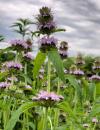 | | 2021 | COLLECTED | 09/27/2021 | Located approximately 3 miles south, southeast of Fairfield, T71N R9W SW1/4 Sec. 7 | 40.96338000, -91.94686900 | 223 | Woodland openings/edges, disturbed areas | Wild material | | 2122068 | Ames 35750 |
| 53 | W6 59182 | CBG-10473 | Echinacea pallida (Nutt.) Nutt. | Illinois, United States | W6 | | | 2021 | | | | | | | Wild material | | 2120103 | W6 59182 |
| 54 | Ames 35667 | Kankakee Sands Preserve | Aronia ×prunifolia (Marshall) Rehder | Illinois, United States | NC7 |  | | 2021 | COLLECTED | 05/04/2021 | Kankakee Sands Preserve located approximately 2.3 miles southwest of Wilmington in Custer Township, T32N R9E NE 1/4 Sec. 11 | 41.27166000, -88.15701800 | 170 | Sand shrub prairie | Wild material | Genotypes noted in nature were averaging 5.0-6.0' in height, relatively upright in growth habit and extremely dense suckering. Numerous clones noted covering expansive areas (e.g. 30 yards by 20 yards, etc.). Variation in branching and glossiness of leaves noted across genotypes present in nature. | 2115976 | Ames 35667 |
| 55 | OPGC 7553 | Williams Prairie | Liatris pycnostachya Michx. | Iowa, United States | OPGC |  | | 2020 | COLLECTED | 09/25/2020 | Williams Prairie State Preserve approximately 3 miles north of Oxford, T80N R8W SW1/4 NE1/4 Sec. 5, Johnson County | 41.76811400, -91.80062300 | 226 | Dry, upland portions of a remnant wet prairie. | Wild material | Plants sampled in nature were 1.5 to 3 feet in height. At time of collection (25 September 2020), approximately 20% of the seed had begun to disperse. Some plants still had green leaves, while most were entirely senesced. | 2107740 | OPGC 7553 |
| 56 | WLP 2018 | MARSB-976 | Viburnum opulus L. var. americanum Aiton | New York, United States | NA | | | 2019 | COLLECTED | 08/01/2019 | Dutchess County; Tivoli; Bard College campus. | | 200 | Open marsh (tidal marsh), full sun, red maple swamp; growing in moist loamy sand. | | Seed collected from 20 plants; population scattered in distribution, found over a 1 mile by 1 mile area. Seed maturation early, middle. | 2109167 | WLP 2018 |
| 57 | WLP 2036 | MARSB-1003 | Viburnum opulus L. var. americanum Aiton | New York, United States | NA | | | 2019 | COLLECTED | 08/30/2019 | Columbia County; Germantown; Rt. 9 (9G?)/Main St. right-of-way, Germantown. | | 183 | Roadside right-of-way in full sun; growing in moist loamy sand. | | Seeds collected from 40 individuals in a population of 50+ plants occurring over an area 300 meters by 500 meters in size; common. Seed maturation: middle. | 2109185 | WLP 2036 |
| 58 | WLP 2038 | MARSB-1005 | Viburnum lentago L. | New York, United States | NA | | | 2019 | COLLECTED | 09/19/2019 | Columbia County; Germantown; Rt. 6, Germantown. [This appears to be south of Germantown. -SBL] | | 183 | Marsh. | | Seeds collected from 20 individuals in a population of 25+ plants; scattered distribution. Seed maturation: middle. Birds, low fruit set noted. | 2109187 | WLP 2038 |
| 59 | WLP 2003 | MARSB-968 | Viburnum dentatum L. | New York, United States | NA | | | 2019 | COLLECTED | 08/04/2019 | Ulster County; Gardiner; Private residence at 844 Route 208, Gardiner, New York 12525. | 41.65848000, -74.14236000 | 122 | Forest, marsh/pond shore in partial to full shade; poorly drained, clay loam soil, seasonally wet/moist. | | Seeds collected from plant. Many seeds had already dropped or been eaten; seeds collected from an approximately 1 acre (or 4000 square meters) area with Viburnum dentatum growing in several dense patches and sparsely between. Species common, scattered in area; 100-plus individuals estimated in approximately 4000 square meters. | 2109099 | WLP 2003 |
| 60 | WLP 2004 | MARSB-969 | Viburnum dentatum L. | New York, United States | NA | | | 2019 | COLLECTED | 07/31/2019 | Onondaga County; Liverpool; Hamlin Swamp (two sets of coordinates and data collected over two days at this site; the earlier data is noted first. The second set of coordinates given is 43.150864 deg. N, 76.175374 deg. W.) | 43.15140000, -76.17474000 | | Edge of wetland. Marsh/pond shore in full sun; moist to wet, clay loam to clay soil. | | Seeds collected directly from plants. Collected in two partial collections, one on 7/31/2019 and the second on 8/8/2019; Species common to scattered in area; 50+ individuals in population visited on 7/31/2019, and 30+ individuals in the population visited on 8/8/2019 (five individuals sampled from the second site; number of individuals sampled at first site not recorded.) Seed quality good. | 2109100 | WLP 2004 |
| 61 | WLP 2008 | MARSB-974 | Viburnum dentatum L. | New York, United States | NA | | | 2019 | COLLECTED | 07/29/2019 | Columbia County; Clermont; Church Avenue, Clermont, New York; privately owned agricultural land. | 0.00000000, 0.00000000 | 183 | Edge of oak-hickory woodland in partial shade; growing in dry clay-loam soil. | | Seeds collected directly from plants. Species common in area; 50+ individuals in population, 50+ individuals sampled, with population area 1/4 mile (linear). | 2109104 | WLP 2008 |
| 62 | WLP 2009 | MARSB-975 | Viburnum dentatum L. | New York, United States | NA | | | 2019 | COLLECTED | 08/01/2019 | Columbia County; Germantown; Eastern Parkway, Germantown, New York; privately owned agricultural land. | 0.00000000, 0.00000000 | 183 | Field edge, shrubland, in full sun; moist, well-drained, loamy sand soil. | | Seeds collected directly from plants. Species common in area; 50+ individuals in population, 50 individuals sampled, with population area 1 mile (linear). | 2109105 | WLP 2009 |
| 63 | WLP 2010 | MARSB-977 | Viburnum dentatum L. | New York, United States | NA | | | 2019 | COLLECTED | 08/02/2019 | Greene County; Catskill; Scenic Hudson plot (land in conservation use) on Kukuk Rd in Catskill, New York [Note: location could not be found on maps, and no latitude and longitude were supplied; possibly Kukuk Lane in Kingston, New York, which is a bit south of Catskill. -SBL] | 0.00000000, 0.00000000 | 91 | Edge of oak-hickory woodland; growing in full sun in loamy sand soil. | | Seeds collected directly from plants. Sparse seed set noted. Species scattered in area; 30+ individuals in population, 32 individuals sampled, with population area 1 mile x 1 mile. | 2109106 | WLP 2010 |
| 64 | OPGC 7460 | CBG-8191 | Pedicularis canadensis L. | Wisconsin, United States | OPGC |  | | 2019 | | | | | | | Wild material | | 2092673 | OPGC 7460 |
| 65 | OPGC 7464 | CBG-8630 | Heuchera richardsonii R. Br. | Wisconsin, United States | OPGC |  | | 2019 | | | | | | | Wild material | | 2092685 | OPGC 7464 |
| 66 | W6 56648 | CBG-9070 | Amorpha canescens Pursh | Wisconsin, United States | W6 |  | | 2019 | | | | | | | Wild material | | 2092747 | W6 56648 |
| 67 | Ames 34337 | Doolittle Prairie | Drymocallis arguta (Pursh) Rydb. | Iowa, United States | NC7 |  | | 2018 | COLLECTED | 08/17/2018 | Doolittle Prairie State Preserve located approximately 2.5 miles south of Story City, T85N R24W NW 1/4 NE 1/4 Sec. 25, Story County | 42.15048400, -93.58989700 | 303 | Prairie remnant. | Wild material | | 1967539 | Ames 34337 |
| 68 | Ames 34200 | Ellsworth Clear LakeTownship Cemetery | Salix humilis Marshall var. tristis (Aiton) Griggs | Iowa, United States | NC7 |  | | 2018 | COLLECTED | 05/17/2018 | Ellsworth Clear Lake Township Cemetery located approximately 4.68 miles west, southwest of Randall just east of Olsen Ave., off 390th Street, T86N R24W NW ¼ SE ¼ SW ¼ Sec. 30. | 42.22720200, -93.69239400 | 325 | Dry ridge top. Remnant prairie | Wild material | Specimens at collection site in nature measuring approximately 2.5 feet in height with significant suckering and minimal branching. Stem color (variable) at time of collection (17 May 2018) with mostly dark yellow, greenish or brownish-orange. Female catkins measuring 1.25-2.00 cm. Pubescent leaves, rounded at tips. Plants with severe dieback (e.g. 1-2' on stems), but are respouting. Unknown if dieback at collection site is due to herbicide or environmental conditions. According to local botanist and author of the Vascular Flora of Hamilton County, Iowa (Thompson 2007), Thompson indicated this was the largest population observed (Thompson pers. comm., 16 May 2018) in Hamilton County. During a growout via seed executed in 2018 at NCRPIS, a total of 64 plants generated 19 males and 45 females. | 1963307 | Ames 34200 |
| 69 | Ames 34037 | JDC/MF/2017/059/813 | Monarda fistulosa L. | Iowa, United States | NC7 |  | | 2017 | COLLECTED | 10/26/2017 | Private property located approximately 6.2 miles west, southwest of Grinnell, T80N R17W SE 1/4 NE 1/4 NW 1/4 Sec. 21, Jasper County | 41.72810000, -92.83508100 | 285 | Prairie remnant, never plowed. Small (e.g. less than 1 acre), localized area of mixed woody (tree/shrub), grass, and forbs. | Wild material | Population sampled at collection site consisted of approximately half of the specimens being void of foliage likely due to susceptibility to mildew, while the remaining half still had some green foliage at time of sampling (10/26/2017). Plants sampled varied in height, typically 3' in height, but a few specimens measuring 5' in height. | 1954326 | Ames 34037 |
| 70 | Ames 34031 | JDC/MF/2017/058/812 | Monarda fistulosa L. | Iowa, United States | NC7 |  | | 2017 | COLLECTED | 10/12/2017 | Doolittle Prairie State Preserve located approximately 2.5 miles south of Story City, T85N R24W NW 1/4 NE 1/4 Sec. 25, Story County | 42.15048400, -93.58989700 | 303 | Prairie pothole wetland complex. | Wild material | Population sampled at collection site consisted of approximately half of the specimens being void of foliage likely due to susceptibility to mildew, while the remaining half still had some green foliage at time of sampling (10/12/2017). Plants sampled generally 3' in height. | 1954320 | Ames 34031 |
| 71 | Ames 34052 | PB1701 | Betula papyrifera Marshall | Minnesota, United States | NC7 |  | | 2017 | COLLECTED | 09/16/2017 | Detroit Mountain area just east of Detroit Lakes approximately 2.9 miles, T139N R40W SW 1/4 NE 1/4 and NE 1/4 NE 1/4 NW 1/4 Sec. 21, Becker County | 46.81210900, -95.78208300 | 457 | Mixed deciduous woods. | Wild material | | 1954341 | Ames 34052 |
| 72 | Ames 34023 | Ames 34023 | Viburnum prunifolium L. | Iowa, United States | NC7 |  | | 2017 | COLLECTED | 09/27/2017 | Shimek State Forest, Donnellson Unit, approximately 6.0 miles west of Donnellson. | 40.64796000, -91.67764000 | 219 | Oak-hickory upland forest. | Wild material | Plants at collection site ranging between 10-15' tall. Fruits dark purple, leaves on some stems were turning red fall color at time of collection (09/27/2017). | 1953995 | Ames 34023 |
| 73 | Ames 33866 | JDC/MP/2016/033/748 | Monarda punctata L. | Iowa, United States | NC7 |  | | 2016 | COLLECTED | 11/01/2016 | Shields Prairie located appproximately 5.85 miles northwest of Muscatine, T77N R2W SW1/4 SE 1/4 Sec. 7 Muscatine County. | 41.48253000, -91.12427000 | 217 | Native prairie remnant. | Wild material | | 1943208 | Ames 33866 |
| 74 | Ames 33867 | JDC/PT/2016/034/749 | Ptelea trifoliata L. | Iowa, United States | NC7 |  | | 2016 | COLLECTED | 11/01/2016 | Shields Prairie located approximately 5.85 miles northwest of Muscatine, T77N R2W SW1/4 SE1/4 Sec. 7 | 41.48239000, -91.12428000 | 222 | Native prairie remnant | Wild material | | 1943209 | Ames 33867 |
| 75 | Ames 32955 | JDC/BP/2015/042/699 | Betula pumila L. | Iowa, United States | NC7 |  | | 2015 | COLLECTED | 09/04/2015 | Private property approximately 7 miles northwest of Cedar Falls, T90N R14W SW 1/4 NW 1/4 SE 1/4 Sec. 18. | 42.60398800, -92.54284800 | 284 | High-quality remnant wetland/fen | Wild material | Specimens sampled averaged approximately 278 cm in height, ranging from 250 cm to 330 cm. Female catkins were both green and brown at time of harvest. Little to no fall color at time of seed collection (4 Sept. 2015) with approximately 75% of leaves already dropped. During growout in 2016, samples #699-3 and #699-5 resulted in seedlings that have petiolules (on small seedlings) that average 3-5 mm in length with the leaf apex being rather sharply acute, possibly indicating presence of hybrids. Other samples (#699-1, #699-2, #699-6, and #699-7) seem to exhibit characteristics of B. pumila with densely pubescent leaves and stems, with leaves having the apex usually broadly acute or obtuse to rounded, and essentially leaves being sessile or less than 1mm in length. | 1927397 | Ames 32955 |
| 76 | Ames 32957 | JDC/BP/2015/044/701 | Betula pumila L. | Iowa, United States | NC7 |  | | 2015 | COLLECTED | 09/04/2015 | Private property approximately 1.5 miles northwest of Lawler. T96N R11W SW 1/4 SW 1/4 Sec. 32 Chickasaw County. | 43.08335400, -92.17787800 | 349 | High-quality remnant wetland/fen. Growing in Plams muck soils in association with Salix spp., Cornus racemosa, Oncolea sensibilis, Spiraea alba, Gentiana spp., Carex spp., Populus tremuloides, and Ambrosia trifida. Noted four specimens likely B. x sandbergii that were approximately 30-35' in height. | Wild material | B. pumila could be considered a dominant species in portions of this site. Female catkins were both green and brown at time of harvest. Specimens average approximately 275 cm in height. Little to no fall color. Approximately 75% of leaves were already dropped. | 1927399 | Ames 32957 |
| 77 | Ames 32820 | APS/EA/2013/041/126 | Euonymus atropurpureus Jacq. | Iowa, United States | NC7 |  | | 2014 | COLLECTED | 10/10/2014 | Midland Trail Road near North Racoon River watershed. Dallas County T80N R27W SW 1/4 NW 1/4 Sec. 30 | 41.71142000, -94.04538000 | 299 | Wooded roadside. | Wild material | | 1921780 | Ames 32820 |
| 78 | Ames 32801 | JDC/SA/2014/046/548 | Spiraea alba Du Roi | Iowa, United States | NC7 | | | 2014 | COLLECTED | 09/19/2014 | Pike Run Wildlife Management Area located near intersection of Iron City Avenue and 170th Street, T77N R3W NW 1/4 of NW 1/4 of Sec. 9. | 41.49354000, -91.21225800 | 187 | Remanant, wet prairie. Aquolls (0-2 percent slopes) depth to water table: about 0-12 inches, 0-24 inches: variable soil types, very poorly drained; and Intermittent water | Wild material | | 1921812 | Ames 32801 |
| 79 | Ames 32761 | JDC/BP/2014/034/536 | Betula pumila L. | Iowa, United States | NC7 |  | | 2014 | COLLECTED | 09/03/2014 | Crossman Prairie State Preserve, approximately 5 miles northeast of Riceville, Howard County. | 43.40777300, -92.47500720 | 413 | Remnant tallgrass prairie. | Wild material | | 1921309 | Ames 32761 |
| 80 | Ames 32762 | JDC/BP/2014/044/546 | Betula pumila L. | Iowa, United States | NC7 |  | | 2014 | COLLECTED | 09/03/2014 | Private property, located approximately 2 miles south of Sumner, Bremer County. | 42.80952700, -92.10866400 | 328 | Remnant wet prairie. | Wild material | | 1921310 | Ames 32762 |
| 81 | Ames 32766 | JDC/MF/2014/042/544 | Monarda fistulosa L. | Iowa, United States | NC7 | | | 2014 | COLLECTED | 09/03/2014 | Private property, located approximately 2 miles south of Sumner, Bremer County. | 42.80924300, -92.10579900 | 324 | Remnant wet prairie. | Wild material | | 1921314 | Ames 32766 |
| 82 | Ames 32767 | JDC/PV/2014/036/538 | Prunella vulgaris L. | Iowa, United States | NC7 |  | | 2014 | COLLECTED | 09/03/2014 | Crossman Prairie State Preserve, approximately 5 miles northeast of Riceville, Howard County. | 43.40777300, -92.47500720 | 413 | Remnant tallgrass prairie. | Wild material | | 1921315 | Ames 32767 |
| 83 | Ames 32769 | JDC/SA/2014/033/535 | Spiraea alba Du Roi | Iowa, United States | NC7 |  | | 2014 | COLLECTED | 09/03/2014 | Crossman Prairie State Preserve, approximately 5 miles northeast of Riceville. | 43.40777300, -92.47500720 | 413 | Remnant tallgrass prairie. Clyde-Floyd complex (1-4 percent slopes) depth to water table: 12-42 inches, 0-17 inches silty clay loam, somewhat poorly drained | Wild material | | 1921317 | Ames 32769 |
| 84 | Ames 32770 | JDC/SA/2014/043/545 | Spiraea alba Du Roi | Iowa, United States | NC7 |  | | 2014 | COLLECTED | 09/03/2014 | Brayton-Horsley Prairie located approximately 2 miles south of Sumner, T92N R11W NE 1/4 NW 1/4 SE 1/4 Sec. 2. | 42.80957200, -92.10705300 | 323 | Remnant wet prairie. Klossner muck (1-3 percent slopes) depth to water table: about 0 inches, 0-10 inches: muck, very poorly drained | Wild material | | 1921318 | Ames 32770 |
| 85 | OPGC 4196 | JDC/LP/2014/035/537 | Liatris pycnostachya Michx. | Iowa, United States | OPGC | | | 2014 | COLLECTED | 09/03/2014 | Crossman Prairie State Preserve, approximately 5 miles northeast of Riceville, Howard County. | 43.40777300, -92.47500720 | 413 | Remnant tallgrass prairie. Associated with Aesclepias, Amorpha canescens, Andropogon gerardi, Baptisia, Betula pumila, Cornus amomum, C. racemosa, Dalea purpurea, Eryngium yuccifolium, Gentiana andrewsii, Helianthus grosseserratus, Hypericum ascyron subsp. pyramidatum, Liatris pcynostachya, Monarda fistulosa, Populus tremuloides, Prunella vulgaris, Prunus americana, Salix, Silphium laciniatum, Solidago, and Spiraea alba. | Wild material | | 1921312 | OPGC 4196 |
| 86 | Ames 32095 | JDC/SA/2013/049/493 | Spiraea alba Du Roi | Iowa, United States | NC7 | | | 2013 | COLLECTED | 11/01/2013 | Floodplain of South Skunk River near Bondurant, Chichaqua Bottoms Greenbelt, T80N R22W SW 1/4 of SW 1/4 of NW 1/4 of Sec.13, NW 1/4 of SE 1/4 of Sec. 10, and SW 1/4 of SW 1/4 of NE 1/4 of Sec. 24, Mitchellville Quad. | 41.73534400, -93.36737800 | 245 | Spillville loam (0-2 percent slope) depth to water table: 48-72 inches, 0-44 inches: loam, moderately well drained; and Coland clay-loam soil (0-2 percent slope) depth to water table: 0-12 inches, 0-8 inches: clay loam, poorly drained/occasionally flodded | Wild material | | 1914039 | Ames 32095 |
| 87 | Ames 31982 | APS/GD/2013/004/089 | Gymnocladus dioicus (L.) K. Koch | Kansas, United States | NC7 |  | | 2013 | COLLECTED | 02/18/2013 | Walnut Creek watershed, southwest of Marysville, Sections 5, 8, and 17, T3S R6E, Marshall County. | 39.79300943, -96.78506600 | 382 | Dry floodplain. | Wild material | | 1907535 | Ames 31982 |
| 88 | Ames 31983 | APS/GD/2013/006/091 | Gymnocladus dioicus (L.) K. Koch | Kansas, United States | NC7 |  | | 2013 | COLLECTED | 02/19/2013 | Beaver Creek, south of Scandia, Sections 7, 12, and extreme NW 1/4 of NW 1/4 of Section 8, T4S R5W, Republic County. | 39.72143025, -97.81205050 | 432 | Dry floodplain. | Wild material | | 1907536 | Ames 31983 |
| 89 | Ames 31987 | APS/GD/2013/011/096 | Gymnocladus dioicus (L.) K. Koch | Kansas, United States | NC7 |  | | 2013 | COLLECTED | 02/20/2013 | Camp Wood, near Cottonwood River, south of Elmdale, NW 1/4 of Section 3, T20S R7E, Chase County. | 38.34698100, -96.65080500 | 377 | Samples obtained from both upland, rocky and floodplain habitat. | Wild material | | 1907540 | Ames 31987 |
| 90 | Ames 31519 | JDC/FQ/2012/028/421 | Fraxinus quadrangulata Michx. | Iowa, United States | NC7 |  | | 2012 | COLLECTED | 07/20/2012 | Along Twin Rivers Drive, NE 1/4 of Section 34, T65N, R5W, Keokuk Quad, just southwest of Keokuk, Des Moines County. | 40.38649700, -91.42619300 | 182 | Dry woods. Steep south and southwest-facing slopes. | Wild material | | 1903746 | Ames 31519 |
| 91 | Ames 31528 | JDC/FQ/2012/037/430 | Fraxinus quadrangulata Michx. | Indiana, United States | NC7 |  | | 2012 | COLLECTED | 07/24/2012 | Along Highway 52, N 1/2 of Section 19, T9N, R2W, Brookville Quad, approximately 0.5 to 1 mile west of Brookville, Franklin County. | 39.43205200, -85.02163400 | 209 | Roadside collection. South and southeast-facing slopes. | Wild material | | 1903755 | Ames 31528 |
| 92 | Ames 31054 | 359 | Betula lenta L. | New York, United States | NC7 |  | | 2011 | COLLECTED | 09/11/2011 | Hurd Cross Road, Steuben County. | 42.04000000, -77.07900000 | 443 | Roadside. | Wild material | | 1891440 | Ames 31054 |
| 93 | Ames 31072 | 693 | Fraxinus americana L. | New York, United States | NC7 |  | | 2011 | COLLECTED | 09/12/2011 | 840 to 1150 Turnpike Road, Allegany County. | 42.30200000, -77.79000000 | 570 | Roadside and field edges. Southwest-facing slope (10-15 degrees). | Wild material | | 1891458 | Ames 31072 |
| 94 | Ames 31081 | 711 | Fraxinus americana L. | New York, United States | NC7 |  | | 2011 | COLLECTED | 09/11/2011 | Harrison Road, Steuben County. | 42.04500000, -77.06900000 | 461 | Roadside of dry woods. | Wild material | | 1891467 | Ames 31081 |
| 95 | Ames 31082 | 712 | Fraxinus americana L. | New York, United States | NC7 |  | | 2011 | COLLECTED | 09/11/2011 | Federal Road, south of Marsh Road (Co. 4), Chemung County. | 42.15600000, -76.65500000 | 466 | Roadside and woodland edges. | Wild material | | 1891468 | Ames 31082 |
| 96 | WLP 1955 | 360 | Viburnum lentago L. | New York, United States | NA |  | | 2011 | COLLECTED | 09/11/2011 | Hurd Cross Road, Steuben County. | 42.03600000, -77.07600000 | 470 | Upland roadside. Mixed forest. Slight slope with west facing aspect. Associated with Acer saccharum, Betula papyrifera, Cornus florida (few), Cornus racemosa, Fraxinus americana, and Vitis riparia. | Wild material | | 1891493 | WLP 1955 |
| 97 | WLP 830 | 381 | Carpinus caroliniana Walter | Pennsylvania, United States | NA | | | 2011 | COLLECTED | 09/15/2011 | Along Valentine Run Road, near small tributary to Rhine Run Creek, Warren County. | 41.92500000, -79.18800000 | 475 | Roadside. Mixed hardwood forest and open rangeland (Solidago). Associated with Acer, Carya ovata, Cornus racemosa, Fagus grandifolia, Hamamelis virginiana, Quercus, Rosa, Rubus, and Tsuga canadensis. | Wild material | | 1891442 | WLP 830 |
| 98 | Ames 30685 | JDC/FP/2010/075/345 | Fraxinus pennsylvanica Marshall | Wisconsin, United States | NC7 |  | | 2010 | COLLECTED | 09/30/2010 | Parking area for Richter Lane boat ramp, north side of Trauba Road, near northeast shore of Lake Poygan, SE 1/4 of NE 1/4 of Section 36, T20N R14E, Lake Poygan Quad, Winnebago County. | 44.16382000, -88.76668000 | 230 | | Wild material | | 1853843 | Ames 30685 |
| 99 | Ames 30148 | JDC/FP/2009/045/195 | Fraxinus pennsylvanica Marshall | Wisconsin, United States | NC7 |  | | 2009 | COLLECTED | 09/23/2009 | South side of Chub Lake, SE 1/4 of NE 1/4 of Section 25, T9N, R13E, Waterloo Quad, Dodge County. | 43.21944444, -88.89388889 | 239 | Crawfish River watershed. Wet, open woodland. | Wild material | | 1819729 | Ames 30148 |
| 100 | Ames 30164 | LQ/PV/2009/004/004 | Prunella vulgaris L. | Wisconsin, United States | NC7 |  | | 2009 | COLLECTED | 09/23/2009 | South side of Chub Lake, SE 1/4 of NE 1/4 of Section 25, T9N, R13E, Waterloo Quad, Dodge County. | 43.21944444, -88.89388889 | 239 | Crawfish River watershed. Wet, open woodland. | Wild material | | 1819745 | Ames 30164 |
| 101 | WLP 2486 | JDC/VL/2009/023/173 | Viburnum lentago L. | Wisconsin, United States | NA |  | | 2009 | COLLECTED | 09/21/2009 | Along Bowers Road west of Snow Bottoms State Natural Area, Highland West Quad. T7N R1W SW1/4 SW /4 SE1/4 Sec. 34 | 43.03200000, -90.47680000 | 267 | Roadside | Wild material | Variation in leaf thickness, fall color (mostly reddish tones) and degree of powdery mildew was noted across population sampled in nature. At time of collection (12 September) fruits were at various stages of maturity including green, red, blue/black. | 1819759 | WLP 2486 |
| 102 | Ames 27311 | 18 | Rhus typhina L. | Iowa, United States | NC7 | | | 2003 | COLLECTED | 09/15/2003 | Edge of road, north side of creek, Bixby State Park, Edgewood, T91N R5W SE 1/4 of SW 1/4 of Sec. 23, Edgewood Quad, Clayton County | 42.67527778, -91.40111111 | 303 | Road edge. Mostly sunny. Slight slope with a southern aspect. | Wild material | Tall shrubs to 5 meters tall. | 1649468 | Ames 27311 |
| 103 | WLP 1931 | Ames 27284 | Viburnum lentago L. | Iowa, United States | NA |  | | 2003 | COLLECTED | 09/07/2003 | Along Wapsi Great Western Trail, Lake Hendricks County Park, T99N R14W, NE corner of SW 1/4 of SW 1/4, Section 19, Riceville Quad, Howard County. | 43.37694444, -92.55111111 | 378 | Associated with Acer negundo, Parthenocissus, Rhamnus cathartica, Cornus racemosa, and Solidago altissima. | Wild material | Small trees to 4 meters tall. | 1648680 | WLP 1931 |