| 0 | MIA 27138 | 'Maher' | Diospyros nigra (J. F. Gmel.) Perr. | | MIA | | | 1981 | DONATED | 01/1981 | | | | | | WB1-RFC-19-07 (OPS: WB1-RFC-17-06); | 1094222 | MIA 27138 |
| 1 | MIA 27078 | 'Wooten' | Diospyros nigra (J. F. Gmel.) Perr. | | MIA | | | 1980 | DONATED | 10/1980 | | | | | | WB1-RFC-19-06 (OPS: WB1-RFC-17-05); | 1094094 | MIA 27078 |
| 2 | MIA 26016 | | Diospyros nigra (J. F. Gmel.) Perr. | Florida, United States | MIA | | | 1979 | COLLECTED | | | | | | | FROM SEEDLING POPULATION M 26009.DWARF POTENTIAL-VERY PRODUCTIVE | 1092243 | MIA 26016 |
| 3 | MIA 26009 | MIA 26009 | Diospyros nigra (J. F. Gmel.) Perr. | Florida, United States | MIA | | | 1959 | COLLECTED | | | | | | | WA3-25-03 THRU 25-58^; | 1092232 | MIA 26009 |
| 4 | TARS 10143 | Black Sapote | Diospyros nigra (J. F. Gmel.) Perr. | Florida, United States | MAY | 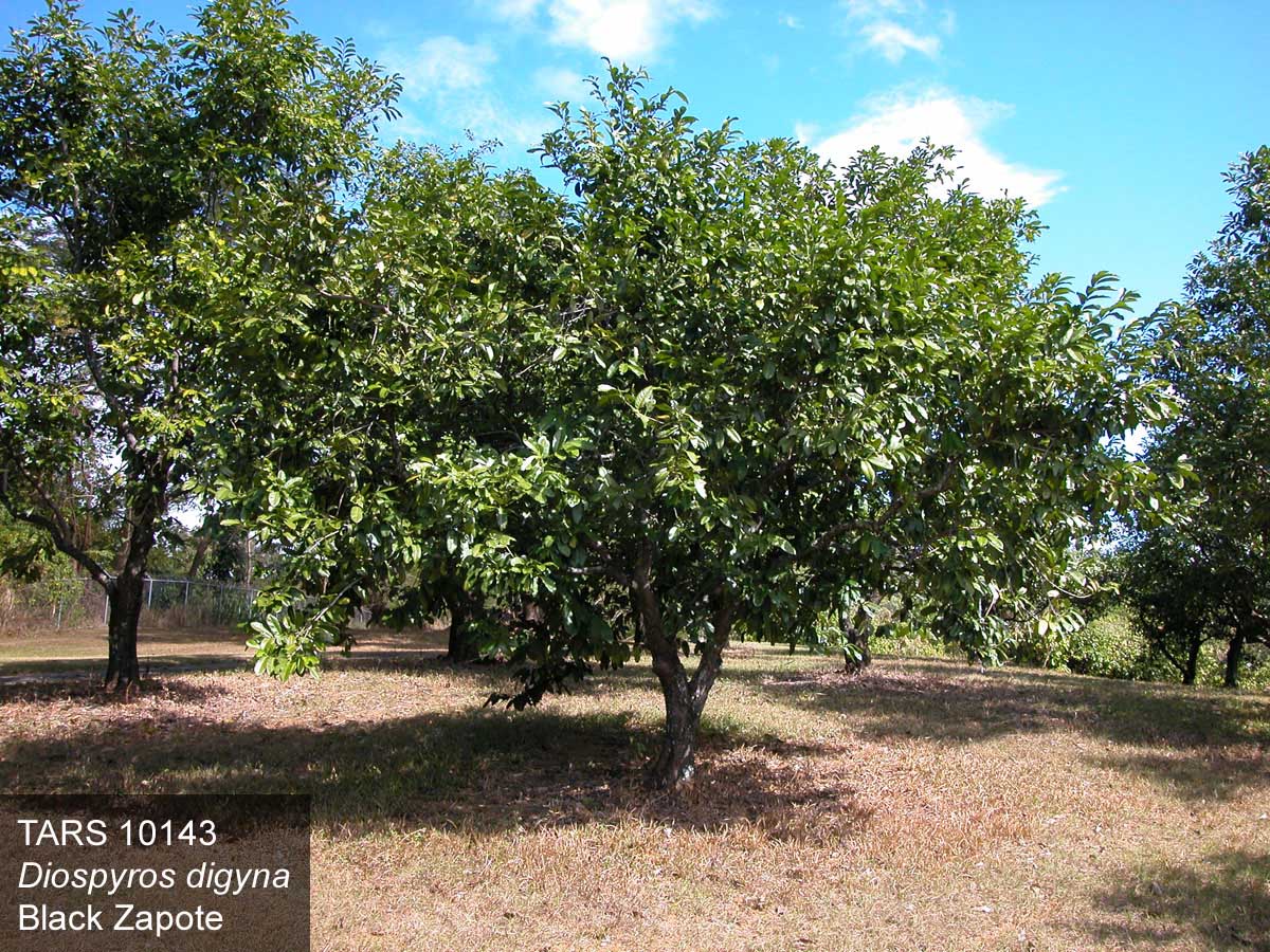 | | 1953 | DONATED | 04/02/1953 | | | | | | | 1654330 | TARS 10143 |
| 5 | WLP 1201 | AOK027 | Diospyros virginiana L. | Arkansas, United States | NA | | | 2019 | COLLECTED | 10/07/2018 | Franklin County; White Rock; Ozark National Forest: Shores Lake Recreation Area at the edge of Shores Lake and pavilion. | 35.63916000, -93.95958000 | 206 | In maintained area at forest edge; 25 percent shade. | | 50 seeds collected from many individuals [or rather, more than one; exact number not specified or estimated]. Species occasional, with patchy distribution. | 2109071 | WLP 1201 |
| 6 | PI 664805 | JDC/HX/2010/035/305 | Helianthus mollis Lam. | Kansas, United States | NC7 | | | 2010 | COLLECTED | 09/14/2010 | Roadside along Kansas Rd, west of Hwy 3 south of Uniontown, Bourbon County. | 37.81978000, -94.98685000 | 325 | Uplands. Associated with Andropogon gerardii, Bidens polylepis, Chamaechrista fasciculata, Cornus, Diospyros virginiana, Gleditsia triacanthos, Juglans nigra, Maclura pomifera, Monarda, Pycnanthemum virginianum, Quercus, Rhus glabra, and Sorghastrum nutans. | Wild material | | 1848907 | PI 664805 |
| 7 | PI 657195 | V. fuscatum HL-2006-041 | Vaccinium fuscatum Aiton | Florida, United States | COR |  | | 2006 | COLLECTED | 05/26/2006 | Among residential roads on eastern shore of Lake Marion, southeast of Haines City, Polk county. | 28.09643000, -81.50633000 | 30 | North florida swamp plants. Ecotome between wet bay head and sand scrub plants. Rhododendron viscosisimum cerulatum, Diospyros virginiana, Magnolia virginianum Nyssa biflorida, Persia pulustris and Quercus nigra. | Wild material | Eastern edge of Lake Wales Ridge region. Housing developments encroaching into natural areas. | 1702644 | PI 657195 |
| 8 | NA 89171 | 2025RJLSEUS-04 | Rhododendron catawbiense Michx. | Alabama, United States | NA | | | 2026 | COLLECTED | 09/30/2025 | Scarham Creek: southeast of the Pea Ridge Road bridge, approximately 50-80 meters on the south side of the creek. | 34.32559600, -86.16054600 | 266 | Growing near the base of the slopes above the riparian zone, generally on the exposed geology under very well-drained conditions. The woodlands are primarily deciduous with a few evergreens infrequently mixed. Slope: 15 to 30 percent. Aspect: Northeast. Soil: The primary soil type in the area of this collection is classified as Rockland Series sandstone (Rc). The Rockland series consists of well drained soils formed in loamy colluvium from rotational landslides on slopes of stream valleys and dissections of ground moraines. Saturated hydraulic conductivity is moderate in the upper part of the profile and moderately slow in the lower part. Slopes range from 18 to 70 percent. Some pedons have buried leaves, twigs, and moss. Mass soil movement has left random remnants of soil structure from prior upslope soil development and has buried tree branches, leaves and moss. The upper 0-2 cm of soil contains slightly decomposed organic matter while lower soils layers to a depth of 58 cm are comprised of dark reddish-brown to brown silt loam and are moderately acidic. Below 58 cm the soils are generally dark reddish-brown silt loam and strongly to moderately alkaline. (Source:California Soil Resource Lab/NRCS Official Soil Series Descriptions). Geology: The underlying geology of this area is of Pennsylvanian origin and characterized as Pottsville Formation. It is characterized by light-gray thin to thick-bedded quartzose sandstone and conglomerate containing interbedded dark-gray shale, siltstone, and coal. Mapped on Lookout Mountain, Blount and Chandler Mountains, and Sand Mountain northeast of Blount County, and on the mountains of Jackson, Marshall, and Madison Counties north and west of the TN river. (Source: USGS Alabama Geologic Map Data). | Wild material | Received as R. catawbiense vsr. insularis | 2193305 | NA 89171 |
| 9 | NA 89155 | 2025RJLSEUS-02 | Ilex longipes Chapm. ex Trel. | Alabama, United States | NA | | | 2025 | COLLECTED | 09/30/2025 | Scarham Creek: southeast of the Pea Ridge Road bridge, approximately 50-80 meters on the south side of the creek. | 34.32520700, -86.15967000 | 261 | Plants are growing on relatively steep woodland slopes in shade. The woodlands are primarily deciduous with a few evergreens infrequently mixed. Slope: 15 to 30 percent. Aspect: Northeast. Soil: The primary soil type in the area of this collection is classified as Rockland Series sandstone (Rc). The Rockland series consists of well drained soils formed in loamy colluvium from rotational landslides on slopes of stream valleys and dissections of ground moraines. Saturated hydraulic conductivity is moderate in the upper part of the profile and moderately slow in the lower part. Slopes range from 18 to 70 percent. Some pedons have buried leaves, twigs, and moss. Mass soil movement has left random remnants of soil structure from prior upslope soil development and has buried tree branches, leaves and moss. The upper 0-2 cm of soil contains slightly decomposed organic matter while lower soils layers to a depth of 58 cm are comprised of dark reddish-brown to brown silt loam and are moderately acidic. Below 58 cm the soils are generally dark reddish-brown silt loam and strongly to moderately alkaline. (Source: California Soil Resource Lab/NRCS Official Soil Series Descriptions). Geology: The underlying geology of this area is of Pennsylvanian origin and characterized as Pottsville Formation. It is characterized by light-gray thin to thick-bedded quartzose sandstone and conglomerate containing interbedded dark-gray shale, siltstone, and coal. Mapped on Lookout Mountain, Blount and Chandler Mountains, and Sand Mountain northeast of Blount County, and on the mountains of Jackson, Marshall, and Madison Counties north and west of the TN river. (Source: USGS Alabama Geologic Map Data). | Wild material | | 2193001 | NA 89155 |
| 10 | NA 89156 | 2025RJLSEUS-03 | Euonymus americanus L. | Alabama, United States | NA | | | 2025 | COLLECTED | 09/30/2025 | Scarham Creek: southeast of the Pea Ridge Road bridge, approximately 50-80 meters on the south side of the creek. | 34.32577600, -86.16071000 | 260 | Plants are growing on relatively steep woodland slopes in shade. The woodlands are primarily deciduous with a few evergreens infrequently mixed. Slope: 15 to 30 percent. Aspect: Northeast. Soil: The primary soil type in the area of this collection is classified as Rockland Series sandstone (Rc). The Rockland series consists of well drained soils formed in loamy colluvium from rotational landslides on slopes of stream valleys and dissections of ground moraines. Saturated hydraulic conductivity is moderate in the upper part of the profile and moderately slow in the lower part. Slopes range from 18 to 70 percent. Some pedons have buried leaves, twigs, and moss. Mass soil movement has left random remnants of soil structure from prior upslope soil development and has buried tree branches, leaves and moss. The upper 0-2 cm of soil contains slightly decomposed organic matter while lower soils layers to a depth of 58 cm are comprised of dark reddish-brown to brown silt loam and are moderately acidic. Below 58 cm the soils are generally dark reddish-brown silt loam and strongly to moderately alkaline. (Source: California Soil Resource Lab/NRCS Official Soil Series Descriptions). Geology: The underlying geology of this area is of Pennsylvanian origin and characterized as Pottsville Formation. It is characterized by light-gray thin to thick-bedded quartzose sandstone and conglomerate containing interbedded dark-gray shale, siltstone, and coal. Mapped on Lookout Mountain, Blount and Chandler Mountains, and Sand Mountain northeast of Blount County, and on the mountains of Jackson, Marshall, and Madison Counties north and west of the TN river. (Source: USGS Alabama Geologic Map Data). | Wild material | | 2193002 | NA 89156 |
| 11 | NA 89158 | 2025RJLSEUS-06 | Cornus florida L. | Alabama, United States | NA | | | 2025 | COLLECTED | 10/01/2025 | Coosa Wildlife Management Area: along the edge of gated dirt road on the west side of Coosa County Road 29, 0.3 kilometers north of Hatchet Creek. | 32.86402200, -86.33871400 | 108 | Plants are growing in part sun to shade on dry-mesic slopes above the road cut on the gated dirt road; most likely a road for access for fire control/forest management. The forest is a combination of deciduous and evergreen with evergreens primarily comprised of Pinus taeda. The habitat was quite dry during this time of year. Slope: 5 to 20 percent. Aspect: North. Soils: The primary soil in the area of this collection is classified as Madison-Louisa Series complex, 15 to 30 percent slopes, moderately eroded (MdE2). The Madison Series soils are very deep, well drained soils with medium runoff found on Piedmont uplands in interstream divides, ridges and side slopes. They are comprised of residuum weathered from felsic or intermediate, high-grade metamorphic or igneous rocks high in content of mica. Slopes range from 2 to 60 percent and soil is typically strongly acidic. Louisa Series soils The Louisa Series soils consist of shallow, somewhat excessively drained soils which formed over mica gneiss and schist bedrock. They occur on Piedmont uplands. Slopes are 6 to 80 percent. This soil is moderately acid. (Source: California Soil Resource Lab/NRCS Official Soil Series Descriptions). Geology: The underlying geology of this area is of Precambrian to Paleozoic origin and characterized as Hatchet Creek Group; Pinchoulee Gneiss Formation. It is characterized by medium to fine-grained migmatitic, locally garnetiferous biotite-feldspar gneiss, commonly saturated with granitic pods. (Source: USGS Alabama Geologic Map Data). | Wild material | | 2193004 | NA 89158 |
| 12 | NA 89081 | 2024RJLPA-009 | Rosa carolina L. | Pennsylvania, United States | NA | | | 2024 | COLLECTED | 09/22/2024 | Lancaster and York Counties: outcrops along the Susquehanna River, accessed from the Historic Lock 12 parking lot off of Pennsylvania Road 372. | 39.81483500, -76.32762200 | 34 | Plants are growing from part-sun to full sun in crevices of the outcrops and where organic debris has accumulated in between boulders along the Susquehanna River. The sites range from nearly xeric to dry mesic, at least on the surface. Plants are generally growing 4-10 m above the normal flow of the river; however, the Holtwood Dam is less than 1 kilometer upstream and debris found trapped in the boulders indicates that there is periodic flooding, at least, in the lower zone of 4+ meters or so above normal river flow. This habitat has a diverse assemblage of deciduous trees and shrubs as well as abundant herbaceous taxa. Slope: 0 to 60 percent. Aspect: Northeast (generally). Geology: The underlying geology of this area is probably of lower Paleozoic age and characterized as the Octoraro Formation. It includes albite-chlorite schist, phyllite, some hornblende gneiss, and granitized members. Soils: The area where this species occurs is right on the edge of two soil zones that transition from the river’s edge to mesic conditions upslope. The first is generally referred to as Rock Outcrop. This terrestrial matrix in which plants grow is largely exposed underlying rock geology with accumulated outwash, rock decomposition, and organic debris buildup. The second is Mt. Airy (80%) and Manor (20%) Series soils, 25 to 60 percent slopes, extremely stony (MRF). (Source: California Soil Resource Lab/NRCS Official Soil Series Descriptions). EPA Ecoregion (Level III): Northern Piedmont (64). EPA Ecoregion (Level IV): Piedmont Uplands (64c). | Wild material | | 2169045 | NA 89081 |
| 13 | NA 89082 | 2024RJLPA-010 | Amorpha fruticosa L. | Pennsylvania, United States | NA | | | 2024 | COLLECTED | 09/22/2024 | Outcrops along the Susquehanna River, accessed from the Historic Lock 12 parking lot off of Pennsylvania Road 372. | 39.81481500, -76.32757900 | 34 | Plants are growing from part-sun to full sun in crevices of the outcrops and where organic debris has accumulated in between boulders along the Susquehanna River. The sites range from nearly xeric to dry mesic, at least on the surface. Plants are generally growing 4-10 m above the normal flow of the river; however, the Holtwood Dam is less than 1 kilometer upstream and debris found trapped in the boulders indicates that there is periodic flooding, at least, in the lower zone of 4+ meters or so above normal river flow. This habitat has a diverse assemblage of deciduous trees and shrubs as well as abundant herbaceous taxa. Slope: 0 to 25 percent. Aspect: Northeast (generally). Geology: The underlying geology of this area is probably of lower Paleozoic age and characterized as the Octoraro Formation. It includes albite-chlorite schist, phyllite, some hornblende gneiss, and granitized members. Soils: The area where this species occurs is right on the edge of two soil zones that transition from the river’s edge to mesic conditions upslope. The first is generally referred to as Rock Outcrop. This terrestrial matrix in which plants grow is largely exposed underlying rock geology with accumulated outwash, rock decomposition, and organic debris buildup. The second is Mt. Airy (80%) and Manor (20%) Series soils, 25 to 60 percent slopes, extremely stony (MRF). (Source: California Soil Resource Lab/NRCS Official Soil Series Descriptions). EPA Ecoregion (Level III): Northern Piedmont (64). EPA Ecoregion (Level IV): Piedmont Uplands (64c). | Wild material | | 2169046 | NA 89082 |
| 14 | NA 89083 | 2024RJLPA-012 | Rhododendron periclymenoides (Michx.) Shinners | Pennsylvania, United States | NA | | | 2024 | COLLECTED | 09/22/2024 | Outcrops along the Susquehanna River, accessed from the Historic Lock 12 parking lot off of Pennsylvania Road 372. | 39.81477400, -76.32807300 | 35 | Plants are growing from shade to part-sun and occasionally full sun in crevices of the outcrops and where organic debris has accumulated in between boulders along the Susquehanna River. The sites range from nearly xeric to mesic, at least on the surface. Plants are generally growing 4-10 m above the normal flow of the river; however, the Holtwood Dam is less than 1 kilometer upstream and debris found trapped in the boulders indicates that there is periodic flooding, at least, in the lower zone of 4+ meters or so above normal river flow. This habitat has a diverse assemblage of deciduous trees and shrubs as well as abundant herbaceous taxa. Slope: 0 to 60 percent. Aspect: Northeast (generally). Geology: The underlying geology of this area is probably of lower Paleozoic age and characterized as the Octoraro Formation. It includes albite-chlorite schist, phyllite, some hornblende gneiss, and granitized members. Soils: The area where this species occurs is right on the edge of two soil zones that transition from the river’s edge to mesic conditions upslope. The first is generally referred to as Rock Outcrop. This terrestrial matrix in which plants grow is largely exposed underlying rock geology with accumulated outwash, rock decomposition, and organic debris buildup. The second is Mt. Airy (80%) and Manor (20%) Series soils, 25 to 60 percent slopes, extremely stony (MRF). (Source: California Soil Resource Lab/NRCS Official Soil Series Descriptions). EPA Ecoregion (Level III): Northern Piedmont (64). EPA Ecoregion (Level IV): Piedmont Uplands (64c). | Wild material | | 2169047 | NA 89083 |
| 15 | NA 89084 | 2024RJLPA-013 | Physocarpus opulifolius (L.) Maxim. | Pennsylvania, United States | NA | | | 2024 | COLLECTED | 09/22/2024 | Outcrops along the Susquehanna River, accessed from the Historic Lock 12 parking lot off of Pennsylvania Road 372. | 39.81466300, -76.32833900 | 36 | Plants are growing from shade to part-sun where organic debris has accumulated in between boulders as well as further upslope in deeper mesic soils along the Susquehanna River. This habitat has a diverse assemblage of deciduous trees and shrubs as well as abundant herbaceous taxa. Slope: 10 to 25 percent. Aspect: Northeast (generally). Geology: The underlying geology of this area is probably of lower Paleozoic age and characterized as the Octoraro Formation. It includes albite-chlorite schist, phyllite, some hornblende gneiss, and granitized members. Soils: The area where this species occurs is right on the edge of two soil zones that transition from the river’s edge to mesic conditions upslope. The first is generally referred to as Rock Outcrop. This terrestrial matrix in which plants grow is largely exposed underlying rock geology with accumulated outwash, rock decomposition, and organic debris buildup. The second is Mt. Airy (80%) and Manor (20%) Series soils, 25 to 60 percent slopes, extremely stony (MRF). (Source: California Soil Resource Lab/NRCS Official Soil Series Descriptions). EPA Ecoregion (Level III): Northern Piedmont (64). EPA Ecoregion (Level IV): Piedmont Uplands (64c). | Wild material | | 2169048 | NA 89084 |
| 16 | NA 89085 | 2024RJLPA-014 | Rhododendron arborescens (Pursh) Torr. | Pennsylvania, United States | NA | | | 2024 | COLLECTED | 09/22/2024 | Outcrops along the Susquehanna River, accessed from the Historic Lock 12 parking lot off of Pennsylvania Road 372. | 39.81618100, -76.33069800 | 38 | Plants are growing from shade to part-sun and occasionally full sun in crevices of the outcrops and where organic debris has accumulated in between boulders along the Susquehanna River. The sites range from nearly xeric to mesic, at least on the surface. Plants are generally growing 4-10 m above the normal flow of the river; however, the Holtwood Dam is less than 1 kilometer upstream and debris found trapped in the boulders indicates that there is periodic flooding, at least, in the lower zone of 4+ meters or so above normal river flow. This habitat has a diverse assemblage of deciduous trees and shrubs as well as abundant herbaceous taxa. Slope: 0 to 75 percent. Aspect: Northeast (generally). Geology: The underlying geology of this area is probably of lower Paleozoic age and characterized as the Octoraro Formation. It includes albite-chlorite schist, phyllite, some hornblende gneiss, and granitized members. Soils: The area where this species occurs is right on the edge of two soil zones that transition from the river’s edge to mesic conditions upslope. The first is generally referred to as Rock Outcrop. This terrestrial matrix in which plants grow is largely exposed underlying rock geology with accumulated outwash, rock decomposition, and organic debris buildup. The second is Mt. Airy (80%) and Manor (20%) Series soils, 25 to 60 percent slopes, extremely stony (MRF). (Source: California Soil Resource Lab/NRCS Official Soil Series Descriptions). EPA Ecoregion (Level III): Northern Piedmont (64). EPA Ecoregion (Level IV): Piedmont Uplands (64c). | Wild material | | 2169049 | NA 89085 |
| 17 | NA 89086 | 2024RJLPA-015 | Ilex verticillata (L.) A. Gray | Pennsylvania, United States | NA | | | 2024 | COLLECTED | 09/22/2024 | Outcrops along the Susquehanna River, accessed from the Historic Lock 12 parking lot off of Pennsylvania Road 372. | 39.81656600, -76.33136600 | 38 | Plants are growing from part-sun to full sun in crevices of the outcrops and where organic debris has accumulated in between boulders along the Susquehanna River. The sites range from nearly xeric to dry mesic, at least on the surface. Plants are generally growing 4-10 m above the normal flow of the river; however, the Holtwood Dam is less than 1 kilometer upstream and debris found trapped in the boulders indicates that there is periodic flooding, at least, in the lower zone of 4+ meters or so above normal river flow. This habitat has a diverse assemblage of deciduous trees and shrubs as well as abundant herbaceous taxa. Slope: 0 to 10 percent. Aspect: Northeast (generally). Geology: The underlying geology of this area is probably of lower Paleozoic age and characterized as the Octoraro Formation. It includes albite-chlorite schist, phyllite, some hornblende gneiss, and granitized members. Soils: The area where this species occurs is right on the edge of two soil zones that transition from the river’s edge to mesic conditions upslope. The first is generally referred to as Rock Outcrop. This terrestrial matrix in which plants grow is largely exposed underlying rock geology with accumulated outwash, rock decomposition, and organic debris buildup. The second is Mt. Airy (80%) and Manor (20%) Series soils, 25 to 60 percent slopes, extremely stony (MRF). (Source: California Soil Resource Lab/NRCS Official Soil Series Descriptions). EPA Ecoregion (Level III): Northern Piedmont (64). EPA Ecoregion (Level IV): Piedmont Uplands (64c). | Wild material | | 2169050 | NA 89086 |
| 18 | NA 88834 | RJL-RM2023FLAL-008 | Rhododendron canescens (Michx.) Sweet | Florida, United States | NA | | | 2023 | COLLECTED | 12/06/2023 | Blackwater State Forest: plants are growing in wetlands accessed by foot from Buddy Hardy Road. The collection site is approximately 0.14 kilometers west and downhill from the road. | 30.80736700, -86.95784700 | 53 | Growing in shade to part-shade of the well-drained moist mesic habitat about 1 m above the wetland which appears to be formed by a nearby hillside seepage area. In this zone there are numerous facultative wetland species as well as high competition from facultative upland plants. Slope: 5 to 10 percent. Aspect: Variable. The underlying geology of this area is the Citronelle Formation of Pliocene origin and consists of gray to orange, often mottled, unconsolidated to poorly consolidated, very fine to very coarse, poorly sorted, clean to clayey sands. It contains significant amounts of clay, silt and gravel which may occur as beds and lenses and may vary considerably over short distances. Limonite nodules and limonite-cemented beds are common. (Source: USGS Florida Geologic Map Data.) The Troup Series (5 to 8% slopes) consists of very deep, somewhat excessively drained soil formed in unconsolidated sandy and loamy marine sediments. Troup soils are on ridges and hillslopes. The upper 0-13 cm is comprised primarily of decomposing sphagnum peat with a significant amount of fibrous root content. From 15-112 cm the soil is comprised primarily of fine-grained yellowish-brown sand with varying amounts of root content; this zone is strongly acid. From 112-203 cm the soil is comprised of light-red to red sandy clay loam that is discontinuous, generally friable, and strongly acid. (Source: NRCS Web Soil Survey.) | Wild material | | 2165664 | NA 88834 |
| 19 | NA 88835 | RJL-RM2023FLAL-009 | Rhododendron viscosum (L.) Torr. | Florida, United States | NA | | | 2023 | COLLECTED | 12/06/2023 | Blackwater State Forest: plants are growing in wetlands accessed by foot from Buddy Hardy Road. The collection site is approximately 0.14 kilometers west and downhill from the road. | 30.80841000, -86.96283300 | 43 | Growing in part-shade of the well-drained moist-dry mesic habitat about 2-3 m above the wetland. In this zone there are numerous facultative wetland species as well as high competition from facultative upland plants. Slope: 5 to 10 percent. Aspect: Variable. The underlying geology of this area is the Citronelle Formation of Pliocene origin and consists of gray to orange, often mottled, unconsolidated to poorly consolidated, very fine to very coarse, poorly sorted, clean to clayey sands. It contains significant amounts of clay, silt and gravel which may occur as beds and lenses and may vary considerably over short distances. Limonite nodules and limonite-cemented beds are common. (Source: USGS Florida Geologic Map Data.) The Troup Series (5 to 8% slopes) consists of very deep, somewhat excessively drained soil formed in unconsolidated sandy and loamy marine sediments. Troup soils are on ridges and hillslopes. The upper 0-13 cm is comprised primarily of decomposing sphagnum peat with a significant amount of fibrous root content. From 15-112 cm the soil is comprised primarily of fine-grained yellowish-brown sand with varying amounts of root content; this zone is strongly acid. From 112-203 cm the soil is comprised of light-red to red sandy clay loam that is discontinuous, generally friable, and strongly acid. (Source: NRCS Web Soil Survey.) | Wild material | | 2165665 | NA 88835 |
| 20 | NA 89265 | TJK2023FL-003 | Ceanothus sp. | Florida, United States | NA | | | 2023 | COLLECTED | 05/19/2023 | Blackwater State Forest: Wolfe Creek. | 30.80650000, -86.95840000 | 49 | Beautiful xeric pine-oak upland community. Transitions to mesic slopes and then to seepage bottom, stringer wetland community adjacent to the Wolfe Creek. Slope: 20%. Aspect: Northwest. Elevation recorded as 162 feet. | Wild material | WLPGR contract collection. Received as Ceanothus microphyllus. | 2158248 | NA 89265 |
| 21 | NA 89266 | TJK2023FL-004 | Gaylussacia dumosa (Andrews) Torr. & A. Gray | Florida, United States | NA | | | 2023 | COLLECTED | 05/31/2023 | Blackwater State Forest: Wolfe Creek. | 30.80560000, -86.95890000 | 49 | Beautiful xeric pine-oak upland community. Transitions to mesic slopes and then to seepage bottom, stringer wetland community adjacent to the Wolfe Creek. Slope: 15%. Aspect: Northwest. Elevation recorded as 160 feet. | Wild material | WLPGR contract collection. | 2158249 | NA 89266 |
| 22 | NA 89267 | TJK2023FL-005 | Ceanothus americanus L. | Florida, United States | NA | | | 2023 | COLLECTED | 06/10/2023 | Blackwater State Forest: Wolfe Creek. | 30.80760000, -86.96250000 | 49 | Beautiful xeric pine-oak upland community. Transitions to mesic slopes and then to seepage bottom, stringer wetland community adjacent to the Wolfe Creek. Area is on a regular 2-4[-year] burn cycle. Slope: 5%. Aspect: Northwest. Elevation recorded as 161 feet. | Wild material | WLPGR contract collection. | 2158250 | NA 89267 |
| 23 | NA 89269 | TJK2023FL-007 | Vaccinium darrowii Camp | Florida, United States | NA | | | 2023 | COLLECTED | 06/10/2023 | Blackwater State Forest: Wolfe Creek. | 30.80560000, -86.95770000 | 60 | Beautiful xeric pine-oak upland community. Transitions to mesic slopes and then to seepage bottom, stringer wetland community adjacent to the Wolfe Creek. Area is on a regular 2-4[-year] burn cycle. Slope: 2%. Aspect: West-northwest. Elevation recorded as 197 feet. | Wild material | WLPGR contract collection. | 2158252 | NA 89269 |
| 24 | NA 88598 | RJL2023FL-002a | Agarista populifolia (Lam.) Judd | Florida, United States | NA | | | 2023 | COLLECTED | 02/14/2023 | Plants growing in woodlands of Wekiwa Springs State Park along trails accessed from the Sand Lake parking lot at the end of Palmetto Avenue. From the parking lot, take the main trail south for about 18 meters and immediately take a cut-through trail on the left to the location of this population. | 28.72398600, -81.47205400 | 10 | Plants were growing in shade to part-shade of moist mesic hammocks of lowland transitional woodlands eventually becoming wetland habitats that are comprised primarily of evergreen plants with fewer deciduous plants. The underlying geology of this area is of Pliocene origin and characterized as the Cypresshead Formation. The Cypresshead Formation named by Huddlestun (1988), is composed of siliciclastics and occurs only in the peninsula and eastern Georgia. It is at or near the surface from northern Nassau County southward to Highlands County forming the peninsular highlands. It appears that the Cypresshead Formation occurs in the subsurface southward from the outcrop region and similar sediments, the Long Key Formation, underlie the Florida Keys. The Cypresshead Formation is a shallow marine, near shore deposit equivalent to the Citronelle Formation deltaic sediments and the Miccosukee Formation prodeltaic sediments. The Cypresshead Formation consists of reddish brown to reddish orange, unconsolidated to poorly consolidated, fine to very coarse grained, clean to clayey sands. Cross bedded sands are common within the formation. Discoid quartzite pebbles and mica are often present. Clay beds are scattered and not areally extensive. In general, the Cypresshead Formation in exposure occurs above 100 feet (30 meters) above mean sea level (msl). Original fossil material is not present in the sediments although poorly preserved molds and casts of mollusks and burrow structures are occasionally present. The presence of these fossil "ghosts" and trace fossils documents marine influence on deposition of the Cypresshead sediments. The permeable sands of the Cypresshead Formation form part of the surficial aquifer system. | Wild material | | 2141479 | NA 88598 |
| 25 | WLP 3085 | RM2023-003 | Hibiscus laevis All. | Florida, United States | NA | | | 2023 | COLLECTED | 10/01/2022 | This species is growing along the Escambia River and accessed by boat. | 30.62930000, -87.25830000 | 1 | The plants were growing on stumps in full sun on the edge of a semi-alluvial area of the river.
Soils: The underlying geology of this area is classified as Alluvium, of Pleistocene/Holocene origin and consists of undifferentiated Quaternary sediments of varying thickness including siliciclastics, organics and freshwater carbonates. The siliciclastics are light gray, tan, brown to black, unconsolidated to poorly consolidated, clean to clayey, silty, unfossiliferous, variably organic-bearing sands to blue green to olive green, poorly to moderately consolidated, sandy, silty clays. Organics occur as plant debris, roots, disseminated organic matrix and beds of peat. Freshwater carbonates, often referred to as marls in the literature, are scattered.
Source: USGS Florida Geologic Map Data (https://mrdata.usgs.gov/geology/state/state.php?state=fl)
The surface soil profile of this area is primarily Chewacla-Wahee-Riverview Association. The Chewacla Series soils are dark yellowish brown silty clay loam soils, that are strongly acidic and somewhat poorly drained. They are soils of flood plains and streams subject to frequent flooding. The Wahee Series soils are dark gray clayey and loamy marine or fluviomarine sediments that are strongly acidic and somewhat poorly drained. The Riverview series consists of very deep, well drained, moderately permeable soils that formed in loamy alluvium on flood plains. Slopes range from 0 to 5 percent.
Source: NRCS Web Soil Survey (https://websoilsurvey.sc.egov.usda.gov/App/WebSoilSurvey.aspx) | Wild material | | 2141439 | WLP 3085 |
| 26 | NA 88549 | RJLSEUS2022-022 | Rhododendron minus Michx. var. minus | Georgia, United States | NA | | | 2023 | COLLECTED | 12/10/2022 | East side of Georgia State Hwy. 39, on the south side of Kolomoki Creek approximately 11 kilometers south of Fort Gaines, Georgia. Common on this site, but otherwise infrequent. This species is near the southernmost end of its natural range. | 31.52053400, -85.02351600 | 53 | Plants are growing in part-shade to shade of deciduous upland, dry, deciduous woodlands on steep slopes 10-15 meters above Kolomoki Creek.
Soils: The underlying geology of this area is of Paleocene origin and characterized as Tuscahoma Sand. As mapped this formation includes lower Eocene Bashi Marl Member of the Hatchetigbee Formation. This formation consists of light-gray to light-olive-gray laminated and thin-bedded carbonaceous silt and clay interbedded with fine sand; thin lignite beds occur locally. Lower part of the formation includes beds of fossiliferous, glauconitic fine quartz sand containing spheroidal sandstone concretions, gravel and clay pebbles.
Source: USGS Georgia Geologic Map Data (https://mrdata.usgs.gov/geology/state/sgmc-unit.php?unit=GANu%3B1)
The primary soil types in the collection area are classified as Ailey-Cowarts Complex Series soils (8 to 25 percent slopes). The Ailey Series consists of well drained or somewhat excessively drained soils formed by fluviomarine and marine deposits. These soils are found marine terraces and low hills of the upper coastal plain and sandhills; they are strongly acidic. The Cowarts Series consists of very deep, moderately well and well drained soils on ridge tops and side slopes on uplands of the Coastal Plain Major Land Resource Area. They formed in loamy marine sediments. Slopes range from 1 to 60 percent.
Source: NRCS Web Soil Survey (https://websoilsurvey.sc.egov.usda.gov/App/WebSoilSurvey.aspx) | Wild material | | 2140776 | NA 88549 |
| 27 | NA 88550 | RJLSEUS2022-023 | Kalmia latifolia L. | Georgia, United States | NA | | | 2023 | COLLECTED | 12/10/2022 | East side of Georgia State Hwy. 39, on the south side of Kolomoki Creek approximately 11 kilometers south of Fort Gaines, Georgia. Common on this site, but otherwise infrequent. This species is near the southernmost end of its natural range. | 31.52053400, -85.02351600 | 53 | Plants are growing in part-shade to shade of deciduous upland, dry, deciduous woodlands on steep slopes 10-15 meters above Kolomoki Creek.
Soils: The underlying geology of this area is of Paleocene origin and characterized as Tuscahoma Sand. As mapped this formation includes lower Eocene Bashi Marl Member of the Hatchetigbee Formation. This formation consists of light-gray to light-olive-gray laminated and thin-bedded carbonaceous silt and clay interbedded with fine sand; thin lignite beds occur locally. Lower part of the formation includes beds of fossiliferous, glauconitic fine quartz sand containing spheroidal sandstone concretions, gravel and clay pebbles.
Source: USGS Georgia Geologic Map Data (https://mrdata.usgs.gov/geology/state/sgmc-unit.php?unit=GANu%3B1)
The primary soil types in the collection area are classified as Ailey-Cowarts Complex Series soils (8 to 25 percent slopes). The Ailey Series consists of well drained or somewhat excessively drained soils formed by fluviomarine and marine deposits. These soils are found marine terraces and low hills of the upper coastal plain and sandhills; they are strongly acidic. The Cowarts Series consists of very deep, moderately well and well drained soils on ridge tops and side slopes on uplands of the Coastal Plain Major Land Resource Area. They formed in loamy marine sediments. Slopes range from 1 to 60 percent.
Source: NRCS Web Soil Survey (https://websoilsurvey.sc.egov.usda.gov/App/WebSoilSurvey.aspx) | Wild material | | 2140777 | NA 88550 |
| 28 | NA 88483 | RJL2022MD-004 | Clethra alnifolia L. | Maryland, United States | NA | | | 2022 | COLLECTED | 09/04/2022 | Plants growing at Elkton State Forest along roads and woodlands over a distance of approximately 5 kilometers labelled as the address of 717 Irishtown Rd, North East, MD 21901. Plants are found regularly but scattered along the unnamed gravel road as well as in open understory of the upland woodlands. | 39.58531200, -75.89566100 | 47 | Plants are growing in a mesic to moist, well-drained habitat of mixed deciduous and evergreen woodlands comprised primarily of acid-loving plants. Plants are growing in part shade and open understory shade. The soils in the collection area are generally described as a complex series of fluviomarine deposits. The soils range from a thin loam layer at the surface to varying levels of loam to sandy loam and/or extremely gravelly sandy clay loam strata, depending upon geographical location (ie. Hillslope summits, slopes, footslopes, swales, etc.). The primary soil types in the collection area are classified as Russett-Christiana-Hambrook Complex and/or Sassafras and Croom Soils; though, others may intersect and overlay in specific areas. | Wild material | | 2139362 | NA 88483 |
| 29 | WLP 2614 | 2022VA-05 | Euonymus americanus L. | Virginia, United States | NA | | | 2022 | COLLECTED | 09/12/2022 | In Colonial Williamsburg, park in the Providence Hall Directors Wing parking lot and enter the Bassett Trace Nature Trail; this species is found in the woodlands on either side of the trail and over a bridge until the it turns right. This plant is infrequent, but occasionally found in the mesic woodlands throughout this location. | 37.26681600, -76.69252800 | 21 | Plants growing in shade to part-shade of the mixed deciduous and evergreen mesic woodland. This species is generally growing in areas with an abundant organic, mature woodland that is relatively undisturbed.
The underlying geology of this area is Windsor Formation of Tertiary-Quaternary origin (lower Pleistocene or upper Pliocene). It is comprised of gray and yellowish- to reddish-brown sand, gravel, silt, and clay. It constitutes surficial deposits of extensive plain and fluvial-estuarine terraces above elevations of 10 meters. The thickness of the Windsor Formation is 0 to 12.5 meters.
Source: USGS Virginia Geologic Map Data (https://mrdata.usgs.gov/geology/state/sgmc-unit.php?unit=VAQTw%3B0)
The surface soil profile of this area is Emporia Complex, 15 to 25 percent slopes. This soil as moderately well-drained, acidic, and found on sloping and elevated terraces. They are comprised of fine sandy loam, loam, and sandy clay loam in varying quantities across the profile; the depth to parent geology is approximately 200 cm.
Source: NRCS Web Soil Survey (https://websoilsurvey.sc.egov.usda.gov/App/WebSoilSurvey.aspx) | Wild material | | 2139352 | WLP 2614 |
| 30 | Ames 35948 | AS/ML/2022/017/147 | Monarda lindheimeri Engelm. & A. Gray | Texas, United States | NC7 |  | | 2022 | COLLECTED | 08/06/2022 | Located near Grimes County line along highway 6 approximately 6.5 miles north of Hempstead. | 30.22891300, -96.05532600 | 68 | Woodland edge. | Wild material | Plants in nature measuring up to approximately 3.0-3.5' in height with very long internodes. Extreme variation noted on stem color from green, to purple to green with purple edges. | 2140538 | Ames 35948 |
| 31 | NA 86434 | Pulverulentus Group | Styrax americanus Lam. | Texas, United States | NA | | | 2020 | COLLECTED | 09/08/2018 | Near Gum Slough, on the edges of woodlands along the north side of road FM 2246. | 30.33332000, -93.94704000 | 15 | Plants are found along the edges and moist to wet areas of Gum Slough in part shade to full sun of a mixed deciduous and broadleaved evergreen woodlands. Soils are generally acidic with loamy to clayey sediments, but with some areas consisting of deep, nearly level loamy, poorly drained soil. | Wild material | Species occurrence is infrequent at this location. Collector's note on the name under which this material was gathered, Styrax americanus var. pulverulentus: "In general, the var. pulverulentus is considered "taxonomically inconsequential" by many botanists. Even so, this densely pubescent characteristic is highly uniform across every plant I observed in the sampled population. Weakley notes that "true" var. pulverulentus can be found as far west as East Texas and, in my humble opinion, the population sampled herein represents this "taxon". Regardless, for the purposes of drawing distinction between "typical" Styrax americanus and the densely pubescent form, I've chosen to use this varietal name. It will be interesting to observe whether the seedling progeny are uniformly similar to their parents when they germinate." [Actual altitude recorded was 14.8 m, but decimals can't be used in the database, so the number was rounded.] | 2109219 | NA 86434 |
| 32 | Ames 32891 | APS/GD/2015/010/192 | Gymnocladus dioicus (L.) K. Koch | Oklahoma, United States | NC7 |  | | 2015 | COLLECTED | 03/12/2015 | Nowata County: T25N R16E NW 1/4 NE 1/4 Sec. 3. Oologah Wildlife Management Area approximately 3 miles east of Nowata. | 36.68401000, -95.58207800 | 208 | Transition zone between higher elevations and bottomlands. | Wild material | | 1925357 | Ames 32891 |
| 33 | Ames 32904 | APS/GD/2015/032/214 | Gymnocladus dioicus (L.) K. Koch | Oklahoma, United States | NC7 |  | | 2015 | COLLECTED | 03/19/2015 | Osage County: Sand Creek watershed area, T27N R8E SE 1/4 NW 1/4 Sec. 10. Tallgrass Prairie Preserve approximately 13 miles northwest of Pawhuska. | 36.83425300, -96.43091600 | 307 | Dry, rocky outcroppings and floodplain. | Wild material | | 1925370 | Ames 32904 |
| 34 | Ames 32886 | APS/GD/2015/002/184 | Gymnocladus dioicus (L.) K. Koch | Missouri, United States | NC7 |  | | 2015 | COLLECTED | 03/03/2015 | Douglas County: North Fork River watershed, T26N R12W Sec. 13. Private property approximately 5.3 miles east, southeast of Vanzant. | 36.93971400, -92.21469500 | 264 | Floodplain. Riverbank in pure sand. | Wild material | | 1924364 | Ames 32886 |
| 35 | DPRU 3195 | DPRU 3195 | Prunus hortulana L. H. Bailey | Missouri, United States | DAV |  | | 2013 | COLLECTED | 08/13/2013 | Property of Prairie Garden Trust (Henry and Lorna Domke), New Bloomfield Quad, northeast of New Bloomfield, Callaway County. | 38.74118667, -92.03118433 | 235 | Numerous specimens scattered throughout property, but localized/common to small drainage ditches; associated with Diospyros virginiana, Juglans nigra, Juniperus virginiana, Prunus serotina, Quercus imbricaria, Toxicodendron radicans, Carya ovata, Cornus florida, and Robinia pseudoacacia. | Wild material | Specimen 1: fruit diameter ranged between 17 mm-20 mm; approximately 20 feet in height and 20 feet in spread; leaves papery thin to the touch and glabrous. Specimen 2: fruit diameter ranged between 15 mm and 17 mm; fruits mostly red. Specimen 3: fruit diameter ranged between 18 mm and 19 mm; fruits mostly red. Specimen 4: fruit diameter ranged between 18 mm and 19 mm; fruits mostly green (a few red). Specimen 5: fruit diameter ranged between 15 mm-17 mm, fruits slightly longer (1 mm) than wide; approximately 15 feet in height; leaves papery thin to the touch and glabrous. Specimen 6: fruit diameter ranged between 20 mm and 22 mm; fruits mostly red. | 1912772 | DPRU 3195 |