| 0 | PI 688312 | R. hispidus var. hispidus VA-2018-004 WVA | Rubus hispidus L. var. hispidus | West Virginia, United States | COR |  | | 2018 | COLLECTED | 08/23/2018 | Dolly Sods Bear Rocks Trail, FR 75, Monongahela National Forest, Tucker Co. WV | 39.06598300, -79.30151700 | 942 | open area, rocky gradual slope; low growing vegetation, Solidago, Daucus, Aronia melanocarpa, Gaylussacia baccata, Fragaria, Vaccinium angustifolia, Gaultheria procumbens, Amelanchier, Ribes, spruce, fir, Kalmia | Wild material | West Virginia 2018 | 1965256 | PI 688312 |
| 1 | PI 688318 | V. angustifolium VA-2018-007 Bear Rocks | Vaccinium angustifolium Aiton | West Virginia, United States | COR |  | | 2018 | COLLECTED | 08/23/2018 | Dolly Sods Bear Rocks Trail, FR 75, Monongahela National Forest, Tucker Co. WV | 39.06416700, -79.30511700 | 1197 | open area, rocky gradual slope; low growing vegetation, Solidago, Daucus, Aronia melanocarpa, Gaylussacia baccata, Fragaria, Vaccinium angustifolia, Gaultheria procumbens, Amelanchier, Ribes, spruce, fir, Kalmia | Wild material | West Virginia 2018 | 1965262 | PI 688318 |
| 2 | PI 688387 | V. corymbosum VA-2018-045 MLBS | Vaccinium corymbosum L. | Virginia, United States | COR |  | | 2018 | COLLECTED | 08/27/2018 | Mountain Lake Biological Research Station, Hedwig trail, Jefferson National Forest, Giles Co., VA | 37.37726700, -80.51816700 | 1154 | semi-open hardwood forest; maple, oak, birch, ferns, Vaccinium palllidum, V. angustifolium, dwarf V. stamineum, Gaultheria procumbens, Galax, herbs, ferns, mosses, lichens | Wild material | West Virginia 2018 | 1965662 | PI 688387 |
| 3 | PI 688388 | V. erythrocarpum VA-2018-046 MLBS | Vaccinium erythrocarpum Michx. subsp. erythrocarpum | Virginia, United States | COR | | | 2018 | COLLECTED | 08/27/2018 | Mountain Lake Biological Research Station, Hedwig trail between Crazy Rocks and intersection with Spruce Bog trail, Jefferson National Forest, Giles Co., VA | 37.37753300, -80.51725000 | 1154 | semi-open hardwood forest; maple, oak, birch, ferns, Vaccinium palllidum, V. angustifolium, dwarf V. stamineum, Gaultheria procumbens, Galax, herbs, ferns, mosses, lichens | Wild material | Virginia 2018 | 1965663 | PI 688388 |
| 4 | PI 613184 | V. macrocarpon MD Allen 11 | Vaccinium macrocarpon Aiton | Maryland, United States | COR |  | | 1991 | COLLECTED | 10/29/1991 | Six to Eight acres of Sedge/Shrub minerotophic acidic fen on Snaggy Mountain rd, Garrett county, MD, Murley Run Bog, Potomic-Garrett State Forest | 39.47833000, -79.46083000 | 813 | Associated vegatation, Carex Stricta, C. Folliculata, Gaultheria procumbens, Rubus hispicus, Arbutus spp., Calamogrostis canadensid, hypercum densiflorum, Sphagnum sp. Small streams flowing through out | Wild material | (This accession was part of the PL,SD 'breakout' - 1992) | 1009965 | PI 613184 |
| 5 | PI 618015 | V. macrocarpon WV Allen 7 | Vaccinium macrocarpon Aiton | West Virginia, United States | COR | 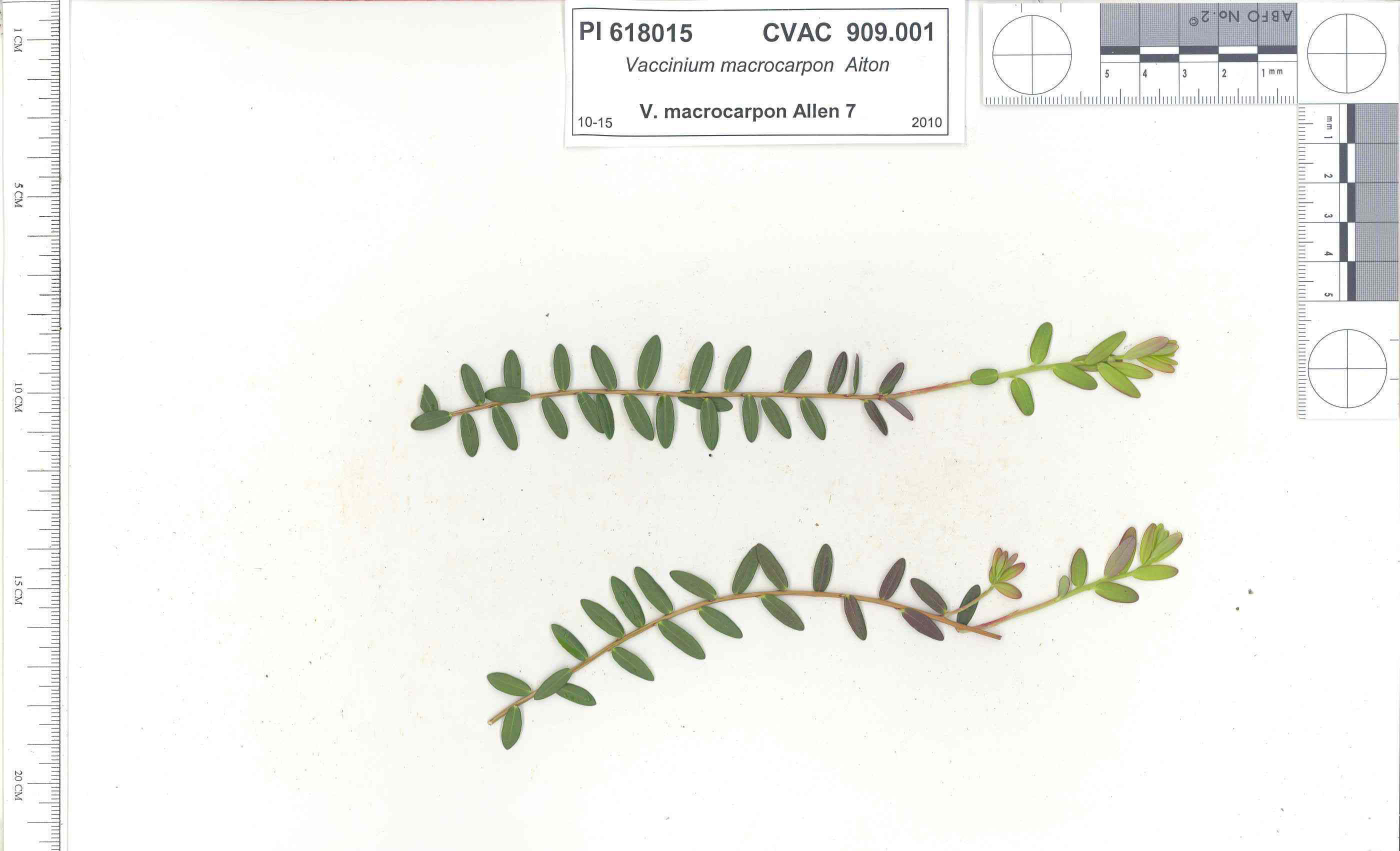 | | 1991 | COLLECTED | 10/29/1991 | Oligotrophic fen near WV/MD border in Preston county, WV, owned by the nature conservancy, WV, known as Cranesville Swamp | 39.51950000, -79.48233000 | 786 | 2 acres fen, bordered by Typha sp., Acer rubrum, Prunus serotina, Hemlock, Sotuhern most population of American Larch (Tamarack), also has Sphagnum spp., Rubus hispidus, Solidago uliginosa, Eripphorum virginicum, Pyrus melanocarpa | Wild material | Site holding moisture well in a regional drought, designated as a National Natural Landmark Additional plants are Hypericum densiflorum, Carex folliculata, Juncus effusus, J. canadensis, Bartonia virginica, Gaultheria procumbens | 1009919 | PI 618015 |
| 6 | PI 618018 | V. macrocarpon MD Allen 14 | Vaccinium macrocarpon Aiton | Maryland, United States | COR |  | | 1991 | COLLECTED | 10/30/1991 | "Anvil Bog" Oligotrophic fen on Glotflety property, McHenry, Garrett county, MD | 39.56700000, -79.30483000 | 817 | Approximately 50 acres oligotrophic fen, bordered by cattail , hemlock, red sprucem and red maple, plants associated with Lycopodium inundatum (rare in MD), Eriphorium virginicum, Rubus hispidus, Sphagnum spp., Solidage uliginosa, | Wild material | Very dry site, V. macrocarpon fruits few and scattered. additional associated plants Pyrus melanocarpa, Gaultheria procumbens, Rhodedron sp.(This accession was part of the PL,SD 'breakout' - 1992) | 1009995 | PI 618018 |
| 7 | PI 618019 | V. oxycoccos Allen 15 | Vaccinium oxycoccos L. | Maryland, United States | COR | | | 1991 | COLLECTED | 10/30/1991 | "Anvil Bog" Oligotrophic fen on Glotflety property, McHenry, Garrett county, MD | 39.56700000, -79.30483000 | 817 | Approximately 50 acres oligotrophic fen, bordered by cattail , hemlock, red sprucem and red maple, plants associated with Lycopodium inundatum (rare in MD), Eriphorium virginicum, Rubus hispidus, Sphagnum spp., Solidage uliginosa, | Wild material | Very dry site, V. macrocarpon fruits few and scattered. additional associated plants Pyrus melanocarpa, Gaultheria procumbens, Rhodedron sp.(This accession was part of the PL,SD 'breakout' - 1992) | 1010008 | PI 618019 |
| 8 | NA 89129 | TRx250809-01PA | Ilex mucronata (L.) M. Powell et al. | Pennsylvania, United States | NA | | | 2025 | COLLECTED | 07/09/2025 | Hickory Run Boulder Field | 41.04973900, -75.64300700 | 555 | Gowing within ca 15 m of boulder field edge, most individuals occured on sun-exposed margin. | Wild material | | 2191815 | NA 89129 |
| 9 | W6 62518 | FWS0300-108 | Anaphalis margaritacea (L.) Benth. & Hook. f. | Michigan, United States | W6 |  | | 2025 | | | | | | | Wild material | | 2192216 | W6 62518 |
| 10 | W6 62542 | FWS0300-66 | Danthonia spicata (L.) P. Beauv. ex Roem. & Schult. | Michigan, United States | W6 |  | | 2025 | | | | | | | Wild material | | 2192240 | W6 62542 |
| 11 | W6 62543 | FWS0300-67 | Avenella flexuosa (L.) Parl. | Michigan, United States | W6 |  | | 2025 | | | | | | | Wild material | | 2192241 | W6 62543 |
| 12 | NA 88593 | 2024RJLNJ-001 | Ilex glabra (L.) A. Gray | New Jersey, United States | NA | | | 2024 | COLLECTED | 11/24/2024 | Mullica Township: Both sides of Duerer Street, approximately 0.37 kilometers southeast of 4th Avenue. | 39.55885000, -74.66442500 | 21 | Shade to almost full sun on compacted seasonally moist to temporarily wet areas of a mixed evergreen and deciduous woodland dominated by Pinus rigida. Vegetation of this area is very much defined by small changes in elevation that go from wet to very dry. Ilex glabra remains abundant throughout, though. Slope: N/A. Aspect: N/A. The underlying geology of this area is the Cohansey Formation of middle Miocene origin and comprised of sand, white to yellow with local gravel and clay. It is sometimes locally stained red or orange brown by iron oxides and (or) cemented into large blocks of ironstone. Unweathered clay is typically dark gray, but commonly weathers white where it is interbedded with thin beds of ironstone. Sand is typically medium grained and moderately sorted although it ranges from fine to very coarse grained and from poorly to well sorted. Sand consists of quartz and siliceous rock fragments. Some beds are locally micaceous. Maximum thickness in the map area is about 60 meters; however, thickness is difficult to determine because of the irregular basal contact and extensive post-depositional erosion. (Source: USGS New Jersey Geologic Map Data). The primary soil type in the area of this collection is classified as Mullica Series sandy loam, 0 to 2 percent slopes. These soils are typically coarse-loamy, siliceous, semiactive, and mesic typic humaquepts that are strongly to extremely acidic throughout the profile. The typical solum thickness ranges from 50-150+ cm. These soils are generally considered to be poorly drained. (Source: NRCS Web Soil Survey). | Wild material | | 2169930 | NA 88593 |
| 13 | NA 88689 | RJL2023NJ-002 | Kalmia latifolia L. | New Jersey, United States | NA | | | 2023 | COLLECTED | 11/10/2023 | Franklin Township: Piney Hollow Preservation Area (the site is owned by Franklin Township). Plants accessed by foot along trails throughout property. | 39.57400900, -74.93602400 | 32 | Plants growing in shade to part-shade of a mesic to mesic-dry woodland habitat that is mostly deciduous, but also includes pine overstory. Slope: N/A. Aspect: N/A. Soils: The underlying geology of this area is of Middle Miocene, Serravallian origin and characterized as an Cohansey Formation. It is comprised of sand, white to yellow with local gravel and clay. Locally stained red or orange brown by iron oxides and (or) cemented into large blocks of ironstone. Unweathered clay is typically dark gray, but commonly weathers white where interbedded with thin beds of ironstone. Unit is a complex of interfingering marine and nonmarine facies. Sand is typically medium grained and moderately sorted although it ranges from fine to very coarse grained and from poorly to well sorted. Sand consists of quartz and siliceous rock fragments. Some beds are locally micaceous. In general, the sand is crossbedded, although the style of crossbedding varies significantly with the paleoenvironment. Trough crossbedding predominates, especially in the nonmarine channel fill deposits, and the scale of the crossbeds varies from small to large. Maximum thickness in the map area is about 60 m; however, thickness is difficult to determine because of the irregular basal contact and extensive post-depositional erosion. There is as much as 18 m of relief along the basal contact. The basal contact is sharp, undulatory, and directly overlain by a thin gravel bed. The Cohansey Formation unconformably overlies the Kirkwood Formation and is found in channels cut down into the Kirkwood. Where the Kirkwood consists of sandy, light-colored sediments, the basal contact of the Cohansey is drawn below crossbedded sediments. Where the Kirkwood consists of dark-colored silty beds, the basal contact is drawn between light-colored Cohansey sediments and the underlying dark-colored sediments. The Cohansey was markedly thinned because of erosion prior to deposition of overlying units in the western and southern parts of the southern sheet. The unit has been extensively eroded and stripped from large areas of the New Jersey Coastal Plain, particularly in the central sheet where outliers are common. In spite of its widespread nature, the Cohansey is poorly exposed because of its loose sandy composition, which causes it to erode easily. (Source: USGS New Jersey Geologic Map Data.) The primary soil type in the location of this collection is classified as Downer loamy sand, 0 to 5 percent slopes, Northern Coastal Plain. Downer Series soils are very deep, well-drained soils that are coarse-loamy, siliceous, semiactive, mesic Typic Hapludults. The upper strata of Downer Series from 0 to 25 cm is dark grayish brown, brown loamy sand that is dry with weak fine granular structure. It is very friable and strongly acid. Lower strata from 25 to 76 cm are yellowish brown single grain, loose loamy sand with few extremely weakly cemented masses of oxidized iron in the lower part. This layer is very strongly acid. (Source: NRCS Web Soil Survey.) | Wild material | | 2159117 | NA 88689 |
| 14 | NA 88693 | RJL2023NJ-006 | Clethra alnifolia L. | New Jersey, United States | NA | | | 2023 | COLLECTED | 11/10/2023 | Franklin Township: Piney Hollow Preservation Area (the site is owned by Franklin Township). Plants accessed by foot along trails throughout property. | 39.57319800, -74.92908900 | 29 | Plants growing in shade to part-shade over a wide range of habitats from mesic to mesic-dry as well as moist to wetland habitats. The woodlands are mostly deciduous, but also include occasional pine overstory. Slope: N/A. Aspect: N/A. The underlying geology of this area is of Middle Miocene, Serravallian origin and characterized as an Cohansey Formation. It is comprised of sand, white to yellow with local gravel and clay. Locally stained red or orange brown by iron oxides and (or) cemented into large blocks of ironstone. Unweathered clay is typically dark gray, but commonly weathers white where interbedded with thin beds of ironstone. Unit is a complex of interfingering marine and nonmarine facies. Sand is typically medium grained and moderately sorted although it ranges from fine to very coarse grained and from poorly to well sorted. Sand consists of quartz and siliceous rock fragments. Some beds are locally micaceous. In general, the sand is crossbedded, although the style of crossbedding varies significantly with the paleoenvironment. Trough crossbedding predominates, especially in the nonmarine channel fill deposits, and the scale of the crossbeds varies from small to large. Maximum thickness in the map area is about 60 m; however, thickness is difficult to determine because of the irregular basal contact and extensive post-depositional erosion. There is as much as 18 m of relief along the basal contact. The basal contact is sharp, undulatory, and directly overlain by a thin gravel bed. The Cohansey Formation unconformably overlies the Kirkwood Formation and is found in channels cut down into the Kirkwood. Where the Kirkwood consists of sandy, light-colored sediments, the basal contact of the Cohansey is drawn below crossbedded sediments. Where the Kirkwood consists of dark-colored silty beds, the basal contact is drawn between light-colored Cohansey sediments and the underlying dark-colored sediments. The Cohansey was markedly thinned because of erosion prior to deposition of overlying units in the western and southern parts of the southern sheet. The unit has been extensively eroded and stripped from large areas of the New Jersey Coastal Plain, particularly in the central sheet where outliers are common. In spite of its widespread nature, the Cohansey is poorly exposed because of its loose sandy composition, which causes it to erode easily. (Source: USGS New Jersey Geologic Map Data.) The primary soil types in the area of this collection is classified as Atsion sand, 0 to 2 percent slopes, Northern Tidewater Area and Downer loamy sand, 0 to 5 percent slopes, Northern Coastal Plain. Atsion Series soils are very deep, poorly drained with moderate to rapid permeability above 70 cm and slower beneath. They are classified as sandy, siliceous, mesic Aeric Alaquods. The upper stratum from 0 to 25 cm is dark gray sand, dry, single grained and lose with many fine roots. It is extremely acid. Lower strata are light gray to dark brown with small percentages of rounded quartzose pebbles and are extremely acid. Downer Series soils are very deep, well-drained soils that are coarse-loamy, siliceous, semiactive, mesic Typic Hapludults. The upper stratum of Downer Series from 0 to 25 cm is dark grayish brown, brown loamy sand that is dry with weak fine granular structure. It is very friable and strongly acid. Lower strata from 25 to 76 cm are yellowish brown single grain, loose loamy sand with few extremely weakly cemented masses of oxidized iron in the lower part. This layer is very strongly acid. (Source: NRCS Web Soil Survey.) | Wild material | | 2159121 | NA 88693 |
| 15 | NA 88673 | RJL2023PA-007 | Rhododendron pilosum (Michx.) Craven | Pennsylvania, United States | NA | | | 2023 | COLLECTED | 10/25/2023 | Ned Smith Center for Art and Nature. | 40.53367300, -76.92715700 | 147 | Well-drained and very rocky, dry slopes above 10-50 meters above Wiconisco Creek in mixed deciduous and evergreen woodlands in part shade to full shade. Slope: 10-40%. Aspect: North. The underlying geology of this area is of Mississippian origin and characterized as the Pocono Formation. It is comprised of light-gray to buff or light-olive-gray, medium-grained, crossbedded sandstone and minor siltstone; commonly conglomeratic at base and in middle; medial conglomerate, where present, is used to divide into Mount Carbon and Beckville Members; equivalent to Burgoon Sandstone of Allegheny Plateau. (Source: USGS Pennsylvania Geologic Map Data). The primary soil type in the collection area is classified as Laidig Series. The Laidig series consists of very deep, well drained soils formed in colluvium from sandstone, siltstone, and some shale. They are gently sloping to very steep soils on benches and foot slopes. Permeability is moderate or moderately rapid above the fragipan and moderately slow or slow in the fragipan. Slope ranges from 0 to 55 percent. Solum thickness ranges from 1.25 to 2.0 meters or more. Depth to the fragipan ranges from 0.75 to 1.25 meters. The particle-size control section averages less than 35 percent rock fragments. Rock fragments range from 5 to 50 percent in individual subhorizons of the A, E, BE, BA and Bt horizons; 15 to 70 percent in individual subhorizons of the Btx horizon; and 20 to 70 percent in the C horizon. Rock fragments are mostly sandstone but include siltstone and shale. Rock fragments include channers, cobbles, flagstones, and stones. Soils range from extremely acid through strongly acid throughout. (Source: NRCS Web Soil Survey). | Wild material | | 2159064 | NA 88673 |
| 16 | NA 88674 | RJL2023PA-008 | Kalmia latifolia L. | Pennsylvania, United States | NA | | | 2023 | COLLECTED | 10/25/2023 | Ned Smith Center for Art and Nature. | 40.53463500, -76.92616300 | 130 | Well-drained and very rocky, dry slopes above 10-50 meters above Wiconisco Creek in mixed deciduous and evergreen woodlands in part shade to full shade. Slope: 10-40%. Aspect: North. The underlying geology of this area is of Mississippian origin and characterized as the Pocono Formation. It is comprised of light-gray to buff or light-olive-gray, medium-grained, crossbedded sandstone and minor siltstone; commonly conglomeratic at base and in middle; medial conglomerate, where present, is used to divide into Mount Carbon and Beckville Members; equivalent to Burgoon Sandstone of Allegheny Plateau. (Source: USGS Pennsylvania Geologic Map Data). The primary soil type in the collection area is classified as Laidig Series. The Laidig series consists of very deep, well drained soils formed in colluvium from sandstone, siltstone, and some shale. They are gently sloping to very steep soils on benches and foot slopes. Permeability is moderate or moderately rapid above the fragipan and moderately slow or slow in the fragipan. Slope ranges from 0 to 55 percent. Solum thickness ranges from 1.25 to 2.0 meters or more. Depth to the fragipan ranges from 0.75 to 1.25 meters. The particle-size control section averages less than 35 percent rock fragments. Rock fragments range from 5 to 50 percent in individual subhorizons of the A, E, BE, BA and Bt horizons; 15 to 70 percent in individual subhorizons of the Btx horizon; and 20 to 70 percent in the C horizon. Rock fragments are mostly sandstone but include siltstone and shale. Rock fragments include channers, cobbles, flagstones, and stones. Soils range from extremely acid through strongly acid throughout. (Source: NRCS Web Soil Survey). | Wild material | | 2159065 | NA 88674 |
| 17 | NA 88675 | RJL2023PA-009 | Viburnum acerifolium L. | Pennsylvania, United States | NA | | | 2023 | COLLECTED | 10/25/2023 | Ned Smith Center for Art and Nature. | 40.53539200, -76.92313500 | 136 | Well-drained and very rocky dry deciduous woodlands in part shade to full shade. Slope: 10-30%. Aspect: North. The underlying geology of this area is of Mississippian origin and characterized as the Pocono Formation. It is comprised of light-gray to buff or light-olive-gray, medium-grained, crossbedded sandstone and minor siltstone; commonly conglomeratic at base and in middle; medial conglomerate, where present, is used to divide into Mount Carbon and Beckville Members; equivalent to Burgoon Sandstone of Allegheny Plateau. (Source: USGS Pennsylvania Geologic Map Data). The primary soil type in the collection area is classified as Laidig Series. The Laidig series consists of very deep, well drained soils formed in colluvium from sandstone, siltstone, and some shale. They are gently sloping to very steep soils on benches and foot slopes. Permeability is moderate or moderately rapid above the fragipan and moderately slow or slow in the fragipan. Slope ranges from 0 to 55 percent. Solum thickness ranges from 1.25 to 2.0 meters or more. Depth to the fragipan ranges from 0.75 to 1.25 meters. The particle-size control section averages less than 35 percent rock fragments. Rock fragments range from 5 to 50 percent in individual subhorizons of the A, E, BE, BA and Bt horizons; 15 to 70 percent in individual subhorizons of the Btx horizon; and 20 to 70 percent in the C horizon. Rock fragments are mostly sandstone but include siltstone and shale. Rock fragments include channers, cobbles, flagstones, and stones. Soils range from extremely acid through strongly acid throughout. (Source: NRCS Web Soil Survey). | Wild material | | 2159066 | NA 88675 |
| 18 | WLP 2676 | RJL2022NJ-007 | Kalmia latifolia L. | New Jersey, United States | NA | | | 2022 | COLLECTED | 10/24/2022 | Plants growing along Hawkins Bridge Road in Wharton State Forest. Plants are common and frequent throughout the woodlands at this location. | 39.70292400, -74.56106800 | 16 | Plants growing in a mixed Conifer-Broadleaved Evergreen-Deciduous dry to xeric forest habitat in part shade to shade.
Soils: The underlying geology of this area is the Cohansey Formation of middle Miocene origin and comprised of sand, white to yellow with local gravel and clay. It is sometimes locally stained red or orange brown by iron oxides and (or) cemented into large blocks of ironstone. Unweathered clay is typically dark gray, but commonly weathers white where it is interbedded with thin beds of ironstone. Sand is typically medium grained and moderately sorted although it ranges from fine to very coarse grained and from poorly to well sorted. Sand consists of quartz and siliceous rock fragments. Some beds are locally micaceous. Maximum thickness in the map area is about 60 meters; however, thickness is difficult to determine because of the irregular basal contact and extensive post-depositional erosion.
Source: USGS New Jersey Geologic Map Data (https://mrdata.usgs.gov/geology/state/sgmc-unit.php?unit=NJTch%3B1)
The primary soil type in the area of this collection is classified as Lakehurst sand, 0 to 5 percent slopes. Other related soils are found along the collection area; even so, this is the dominant soil in the collecting area of this species. This soil is primarily sandy coastal plain deposition that is moderately well-drained with limited organic matter in the upper horizon. This soil ranges in depth from 0.1-1.5 meters. It is very strongly acidic throughout. It is subject to periods of extreme drought.
Source: NRCS Web Soil Survey (https://websoilsurvey.sc.egov.usda.gov/App/WebSoilSurvey.aspx) | Wild material | | 2139667 | WLP 2676 |
| 19 | WLP 2675 | RJL2022NJ-006 | Kalmia angustifolia L. | New Jersey, United States | NA | | | 2022 | COLLECTED | 10/24/2022 | Plants growing along Hawkins Bridge Road in Wharton State Forest. Plants are common and frequent throughout the woodlands at this location. | 39.70231900, -74.56084200 | 16 | Plants growing in a mixed Conifer-Broadleaved Evergreen-Deciduous dry to xeric forest habitat in part shade to part sun.
Soils: The underlying geology of this area is the Cohansey Formation of middle Miocene origin and comprised of sand, white to yellow with local gravel and clay. It is sometimes locally stained red or orange brown by iron oxides and (or) cemented into large blocks of ironstone. Unweathered clay is typically dark gray, but commonly weathers white where it is interbedded with thin beds of ironstone. Sand is typically medium grained and moderately sorted although it ranges from fine to very coarse grained and from poorly to well sorted. Sand consists of quartz and siliceous rock fragments. Some beds are locally micaceous. Maximum thickness in the map area is about 60 meters; however, thickness is difficult to determine because of the irregular basal contact and extensive post-depositional erosion.
Source: USGS New Jersey Geologic Map Data (https://mrdata.usgs.gov/geology/state/sgmc-unit.php?unit=NJTch%3B1)
The primary soil type in the area of this collection is classified as Lakehurst sand, 0 to 5 percent slopes. Other related soils are found along the collection area; even so, this is the dominant soil in the collecting area of this species. This soil is primarily sandy coastal plain deposition that is moderately well-drained with limited organic matter in the upper horizon. This soil ranges in depth from 0.1-1.5 meters. It is very strongly acidic throughout. It is subject to periods of extreme drought.
Source: NRCS Web Soil Survey (https://websoilsurvey.sc.egov.usda.gov/App/WebSoilSurvey.aspx) | Wild material | | 2139666 | WLP 2675 |
| 20 | WLP 2673 | RJL2022NJ-004 | Lyonia mariana (L.) D. Don | New Jersey, United States | NA | | | 2022 | COLLECTED | 10/24/2022 | Plants growing on both sides of Duerer Street approximately 0.37 kilometers southeast of 4th Avenue, Mullica Township, New Jersey. Plants are common but scattered on both sides of the road at this site. | 39.55730700, -74.66376100 | 22 | Plants grow from part shade to full sun throughout the habit from the upper edges of the ditches through the herbaceous grass dominant buffer and all the way to the part shade of the woodland edge. Plants transition through moist/wet conditions in full sun to quite dry conditions in part shade and seem equally adapted.
Soils: The underlying geology of this area is the Cohansey Formation of middle Miocene origin and comprised of sand, white to yellow with local gravel and clay. It is sometimes locally stained red or orange brown by iron oxides and (or) cemented into large blocks of ironstone. Unweathered clay is typically dark gray, but commonly weathers white where it is interbedded with thin beds of ironstone. Sand is typically medium grained and moderately sorted although it ranges from fine to very coarse grained and from poorly to well sorted. Sand consists of quartz and siliceous rock fragments. Some beds are locally micaceous. Maximum thickness in the map area is about 60 meters; however, thickness is difficult to determine because of the irregular basal contact and extensive post-depositional erosion.
Source: USGS New Jersey Geologic Map Data (https://mrdata.usgs.gov/geology/state/sgmc-unit.php?unit=NJTch%3B1)
The primary soil type in the area of this collection is classified as Mullica sandy loam, 0 to 2 percent slopes. These soils are typically coarse-loamy, siliceous, semiactive, and mesic typic humaquepts that are strongly to extremely acidic throughout the profile. The typical solum thickness ranges from 50-150+ cm. These soils are generally considered to be poorly drained.
Source: NRCS Web Soil Survey (https://websoilsurvey.sc.egov.usda.gov/App/WebSoilSurvey.aspx) | Wild material | | 2139664 | WLP 2673 |
| 21 | NA 88500 | RJL2022NJ-002 | Ilex glabra (L.) A. Gray | New Jersey, United States | NA | | | 2022 | COLLECTED | 10/24/2022 | Mullica Township: both sides of Duerer Street, approximately 0.37 kilometers southeast of 4th Avenue. | 39.55885000, -74.66442500 | 21 | Plants growing in shade to almost full sun on compacted seasonally moist to temporarily wet areas of a mixed evergreen and deciduous woodland dominated by Pinus rigida. Vegetation of this area is very much defined by small changes in elevation that go from wet to very dry. Ilex glabra remains abundant throughout, though. Plants are abundant on the edge of the woodlands as well as the understory of the woodlands. Soils: The underlying geology of this area is the Cohansey Formation of middle Miocene origin and comprised of sand, white to yellow with local gravel and clay. It is sometimes locally stained red or orange brown by iron oxides and (or) cemented into large blocks of ironstone. Unweathered clay is typically dark gray, but commonly weathers white where it is interbedded with thin beds of ironstone. Sand is typically medium grained and moderately sorted although it ranges from fine to very coarse grained and from poorly to well sorted. Sand consists of quartz and siliceous rock fragments. Some beds are locally micaceous. Maximum thickness in the map area is about 60 meters; however, thickness is difficult to determine because of the irregular basal contact and extensive post-depositional erosion. (Source: USGS New Jersey Geologic Map Data). The primary soil type in the area of this collection is classified as Mullica sandy loam, 0 to 2 percent slopes. These soils are typically coarse-loamy, siliceous, semiactive, and mesic typic humaquepts that are strongly to extremely acidic throughout the profile. The typical solum thickness ranges from 50-150+ cm. These soils are generally considered to be poorly drained. (Source: NRCS Web Soil Survey). | Wild material | | 2139663 | NA 88500 |
| 22 | WLP 2669 | RJL2022NJ-001 | Rhododendron viscosum (L.) Torr. | New Jersey, United States | NA | | | 2022 | COLLECTED | 10/19/2022 | Plants growing near the confluence of Springers Brook and Mullica River in Wharton State Forest around wetlands and associated woodlands accessed off of an unnamed road from Stokes Road. Plants are common but scattered on the edges and in the understory of low-lying wet woodlands. | 39.72857100, -74.67798200 | 7 | Plants are growing in part-shade to shade of mixed deciduous and evergreen forests on moist slopes to occasionally wet low-lying areas fed by Springers Brook.
Soils: The underlying geology of this area is the Cohansey Formation of middle Miocene origin and comprised of sand, white to yellow with local gravel and clay. It is sometimes locally stained red or orange brown by iron oxides and (or) cemented into large blocks of ironstone. Unweathered clay is typically dark gray, but commonly weathers white, where interbedded with thin beds of ironstone. Sand is typically medium grained and moderately sorted although it ranges from fine to very coarse grained and from poorly to well sorted. Sand consists of quartz and siliceous rock fragments. Some beds are locally micaceous. Maximum thickness in the map area is about 60 meters; however, thickness is difficult to determine because of the irregular basal contact and extensive post-depositional erosion.
Source: USGS New Jersey Geologic Map Data (https://mrdata.usgs.gov/geology/state/sgmc-unit.php?unit=NJTch%3B1)
The primary soil type in the area of this collection is classified as Fluvaquents, sandy, 0 to 3 percent slopes, frequently flooded. This soil is primarily stratified, wet soils on flood plains and deltas of middle and low latitudes. The stratification reflects deposition of sediments under changing currents and in shifting channels. The depth of this soil is approximately 5 meters and are consider very poorly drained; they are considered wet to inundated year-round.
Source: NRCS Web Soil Survey (https://websoilsurvey.sc.egov.usda.gov/App/WebSoilSurvey.aspx) | Wild material | | 2139660 | WLP 2669 |
| 23 | NA 88407 | NEWFS-927 | Mitchella repens L. | Connecticut, United States | NA | | | 2021 | | | | | | | Wild material | A low lying creeping plant that covers large patches tiny round opposite leaves with red berry fruit. | 2138947 | NA 88407 |
| 24 | NA 88463 | NEWFS-867 | Tsuga canadensis (L.) Carrière | New Hampshire, United States | NA | | | 2021 | | | | | | | Wild material | Flat needled evergreen pale needle underside and visible midvein cones found dangling at the apical end of branches. | 2138901 | NA 88463 |
| 25 | W6 60268 | NEWFS-859 | Spiraea tomentosa L. | New Hampshire, United States | W6 | | | 2021 | | | | | | | Wild material | Solid conical inflorescence whorls upward like a screw | 2138894 | W6 60268 |
| 26 | W6 60269 | NEWFS-860 | Spiraea alba Du Roi | New Hampshire, United States | W6 | | | 2021 | | | | | | | Wild material | Seeds range from greenish to brown until fall out of hypanthium Hypanthiums arranged with one in the center and eight around it like a florally arranged carton of eggs | 2138895 | W6 60269 |
| 27 | W6 60274 | NEWFS-865 | Schizachyrium scoparium (Michx.) Nash | New Hampshire, United States | W6 | | | 2021 | | | | | | | Wild material | Soft-tufted seeds scrape, blow easily off inflorescence. | 2138900 | W6 60274 |
| 28 | NA 88414 | MARSB-446 | Pinus rigida Mill. | New Jersey, United States | NA | | | 2021 | | | | | | | Wild material | | 2137177 | NA 88414 |
| 29 | WLP 684 | NA 85860 | Amelanchier arborea (F. Michx.) Fernald | Kentucky, United States | NA | | | 2019 | COLLECTED | 06/15/2019 | Powell County; ; Red River Gorge (west), ridge west of Nada Tunnel Road, along about 200 m of sandstone cliffline. [GPS coordinates provided for four out of seven total separate collection sites, all within 200 m of one another; only the first represented in the primary record. The rest are provided later.] | 37.82341000, -83.66703000 | | Along sandstone cliffline; collections made from plants growing within 10 m of the edge of the cliff. | | Additional GPS coordinates provided for three other sites: 37.82342, -83.66722; 37.82331, -83.66708; 37.82303, -83.66656 [all sites within 200 m of one another.] | 2109076 | WLP 684 |
| 30 | WLP 1375 | NA 83887 | Kalmia latifolia L. | Kentucky, United States | NA | | | 2016 | COLLECTED | 09/27/2016 | Cumberland Falls State Park, Trail #6 (Cumberland Falls Trail). | 36.83700000, -84.34000000 | 302 | Break in canopy along trail near telephone pole. | | | 1953494 | WLP 1375 |
| 31 | WLP 1177 | NA 82779 | Gaylussacia baccata (Wangenh.) K. Koch | Maine, United States | NA | | | 2015 | COLLECTED | 08/23/2015 | Along north side of State Route 9, ca. 0.2 miles east of its crossing with Honeymoon Brook. | 44.93052000, -67.75095000 | 90 | Edge of woods in moist ditch along highway. | | | 1952128 | WLP 1177 |
| 32 | Ames 29854 | 569-2008 | Spiraea alba Du Roi var. latifolia (Aiton) Dippel | New York, United States | NC7 |  | | 2009 | COLLECTED | 10/07/2008 | Approximately 15 meters from edge of Black Pond, near Adirondack Park Visitor Interpretive Center, Paul Smiths, Franklin County. | 44.43250000, -74.29694444 | 496 | Roadside. Full sun. 10 degree slope; N aspect. Very sandy soil. | Wild material | 0.6 to 0.9 meter in height. Leaves glabrous. | 1795814 | Ames 29854 |