| 0 | NA 89087 | 2024RJLPA-016 | Hydrangea arborescens L. | Pennsylvania, United States | NA | | | 2024 | COLLECTED | 09/22/2024 | Outcrops along the Susquehanna River, accessed from the Historic Lock 12 parking lot off of Pennsylvania Road 372. | 39.81489000, -76.32912200 | 43 | Plants are growing in deep shade of the deciduous woodlands on outcrops and the steep slopes where organic debris and detritus has accumulated. This habitat has a diverse assemblage of deciduous trees and shrubs as well as abundant herbaceous taxa. Slope: 30 to 90 percent. Aspect: Northeast (generally). Geology: The underlying geology of this area is probably of lower Paleozoic age and characterized as the Octoraro Formation. It includes albite-chlorite schist, phyllite, some hornblende gneiss, and granitized members. (Source: Source: USGS Pennsylvania Geologic Map Data). Soils: The area where this species occurs is right on the edge of two soil zones that transition from the river’s edge to mesic conditions upslope. The first is generally referred to as Rock Outcrop. This terrestrial matrix in which plants grow is largely exposed underlying rock geology with accumulated outwash, rock decomposition, and organic debris buildup. The second is Mt. Airy (80%) and Manor (20%) Series soils, 25 to 60 percent slopes, extremely stony (MRF). (Source: California Soil Resource Lab/NRCS Official Soil Series Descriptions). EPA Ecoregion (Level III): Northern Piedmont (64). EPA Ecoregion (Level IV): Piedmont Uplands (64c). | Wild material | | 2169051 | NA 89087 |
| 1 | WLP 3434 | RM2023-003 | Hydrangea arborescens L. | Georgia, United States | NA | | | 2024 | COLLECTED | 10/21/2023 | Plants growing along Patterson Gap Road. | 34.97369800, -83.46276600 | 809 | Plants growing in part shade in a very dry and rocky, mostly deciduous habitat. Slope: 25 percent. Aspect: variable. The underlying geology of this area is Biotite Gneiss, primarily of Precambrian-Paleozoic origin. (Source: USGS North Carolina Geologic Map Data.) The primary soil type in the collection area is classified as Porters Series which is stony and steep. The Porters series consists of deep, well drained, moderately permeable soils on cool, north- to east-facing or shaded ridges and side slopes in the Southern Blue Ridge mountains. These soils formed in residuum, affected by soil creep in the upper part, that has weathered from felsic to mafic, high-grade metamorphic and igneous rocks such as granite, gneiss, hornblende gneiss, mica gneiss, and amphibolite. Slope ranges from 2 to 95 percent. The surface layer to 18cm deep is very dark grayish brown loam; moderate fine and medium granular structure; very friable; many fine roots; few fine mica flakes; slightly acid. From 18 to 90 cm soil range from brown loam with weak fine and medium subangular blocky structure, few mica flakes, and few medium gneiss and quartz fragments that is moderately acid to sandy loam with gneiss saprolite with quartz, weathered feldspar, hornblende, mica and other minerals that is slightly acid and grades into hard rock. (Source: NRCS Web Soil Survey.) | Wild material | | 2166143 | WLP 3434 |
| 2 | WLP 3492 | St. Francois State Park | Hydrangea arborescens L. | Missouri, United States | NA |  | | 2024 | COLLECTED | 01/19/2024 | St. Francois State Park, 8920 US Highway 67 North, approximately 3.2 miles north-northeast of Bonne Terre. | 37.96381000, -90.53403000 | 202 | Rocky outcrops above Big River and rocky areas on bank of Big River. | Wild material | | 2166135 | WLP 3492 |
| 3 | NA 88820 | TJK2023AL-005 | Hydrangea arborescens L. | Alabama, United States | NA | | | 2023 | COLLECTED | 12/07/2023 | Between Monroe County Route 1 and Tom Hayles Road. | 31.40575900, -87.54924000 | 22 | In woodlands on limestone outcrop. While the upper area of slopes is covered by a thin soil layer, the exposed limestone rock outcrop on the northwestern edge of this area is a low competition niche for plants like the Hydrangea to gain a foothold. Slope: 60% (plus). Aspect: Northwest. Elevation: 72 feet. | Wild material | | 2165649 | NA 88820 |
| 4 | NA 88677 | RJL2023PA-011 | Hydrangea arborescens L. | Pennsylvania, United States | NA | | | 2023 | COLLECTED | 10/25/2023 | Seed collected along the Appalachian National Scenic Trail, accessed from the Duncannon Entrance. | 40.37735300, -77.03997300 | 239 | Well-drained and very rocky dry deciduous woodlands in part shade to full shade. Slope: 20-50%. Aspect: Northwest. The underlying geology of this area is of Devonian origin and characterized as the Duncannon Member of Catskill Formation. It is characterized by grayish-red sandstone, siltstone, and mudstone in fining-upward cycles; conglomerate occurs at base of some cycles. The sandstones which comprise the Duncannon Member are fine to very coarse grained and grayish red to grayish red-purple in color. The Duncannon Member is known to be crossbedded to planar bedded in beds anywhere from 3 to 9 meters thick. Conglomerates have been spotted at the base of the Duncannon Member. The Duncannon Member is poorly exposed in most areas except along the Lehigh River. The conglomerate portion of this member has been known to form ridges and ledges with thicknesses approaching 228 meters. (Source: USGS Pennsylvania Geologic Map Data). The primary soil type in the collection area is classified as Dystrochrepts, boulder soils. These soils are characterized by coarse-silty loess over residuum weathered from sedimentary rock and located on steep ridges along the upper third of the mountainflank. These soils are comprised of cobbles, stones or boulders (9%), well-drained, and approximately 1 meter or less to lithic bedrock. (Source: NRCS Web Soil Survey). | Wild material | | 2159068 | NA 88677 |
| 5 | NA 88607 | KY23-009 | Hydrangea arborescens L. | Kentucky, United States | NA | | | 2023 | COLLECTED | 09/09/2023 | Black Mountain summit. | 36.91312000, -82.89516000 | 1257 | Moist woods. Elevation: 4124 feet. Aspect: South. | Wild material | | 2158699 | NA 88607 |
| 6 | WLP 3212 | KY23-105 | Hydrangea arborescens L. | Kentucky, United States | NA | | | 2023 | COLLECTED | 09/14/2023 | Above the banks of Marble Creek, property of Liz Hobson | 37.84865900, -84.45359000 | | Deciduous floodplain forest with limestone outcrops | Wild material | | 2158756 | WLP 3212 |
| 7 | NA 88553 | RJLSEUS2022-026 | Hydrangea arborescens L. | Alabama, United States | NA | | | 2023 | COLLECTED | 12/12/2022 | Claiborne Bluffs area along unnamed road to boat ramp on the east side of the Alabama River at the U.S. Highway 84 bridge over the river. Occasionally found in the woodlands. | 31.54940700, -87.51366200 | 25 | Plants are growing in part-shade to shade of mesic, well-drained, circum-neutral slopes mature mixed deciduous and evergreen woodlands where slopes are exposed and detritus does not build up.
Soils: The underlying geology of this area is the Jackson Group Undifferentiated. The units of the Jackson Group are the Yazoo Clay and Crystal River and Moodys Branch Formations. Descriptions of the members of the Yazoo Clay follow in descending order. Shubuta Member - in western Alabama consists of light-greenish-gray to white plastic fossiliferous, calcareous clay containing irregular calcareous nodules. From the Tombigbee River eastward, the Shubuta becomes more calcareous and grades into massive clayey glauconitic limestone. Eastward from the Alabama River, equivalent beds grade into the Crystal River Formation. Pachuta Marl Member - light-greenish-grey glauconitic, fossiliferous clayey sand and sandy limestone traceable from western Alabama eastward to Covington County where it grades into the Crystal River Formation. Cocoa Sand Member - yellowish-gray firm calcareous, fossiliferous fine to medium sand or sandy limestone or greenish-grey micaceous, calcareous, very clayey sand. Calcareous and clayey sand equivalent to the Cocoa is traceable from western Alabama to the Conecuh River area.
Source: USGS Alabama Geological Map Data (https://mrdata.usgs.gov/geology/state/state.php?state=AL)
The surface soil profile of this portion of the bluffs along the Alabama River are characterized by Saffell-Lucy (Flomaton) Series Complex soils. The Saffell Series consists of very deep, well drained, moderately permeable soils that formed in loamy and gravelly marine sediments of the Tertiary Age and have acid reaction. These soils are found on the upper portion of the bluffs along the Alabama River. The Lucy Series consists of very deep, well drained, moderately permeable soils on uplands. They formed in sandy and loamy marine and fluvial sediments of the Southern Coastal Plain Major Land Resource Area. Soil reaction runs from strongly to moderately acid. The Flomaton Series consists of very deep, excessively drained, rapidly permeable soils on uplands of the Southern Coastal Plain Major Land Resource Area. They formed in gravelly sandy marine sediments and also have an acid reaction. The remainder of soils are of miscellaneous origin.
Source: USDA-NRCS Official Soil Series Descriptions (https://soilseries.sc.egov.usda.gov/osdname.aspx) | Wild material | | 2140780 | NA 88553 |
| 8 | NA 88560 | RJLSEUS2022-033 | Hydrangea arborescens L. | Alabama, United States | NA | | | 2023 | COLLECTED | 12/12/2022 | Plants growing along the west side of Ferry Road at Haines Island Park leading down to the Alabama River. | 31.72299700, -87.46798200 | 46 | Plants are growing in part-shade in the scoured ditch and slope alongside Ferry Road; occasionally in moss where seed undoubtedly germinated.
Soils: The underlying geology of this area is Claiborne Group, Tallahatta Formation, of Eocene origin, with white to very light-greenish-gray thin-bedded to massive siliceous claystone; interbedded with thin layers of fossiliferous clay, sandy clay, and glauconitic sand and sandstone.
Source: USGS Alabama Geological Map Data (https://mrdata.usgs.gov/geology/state/state.php?state=AL)
The primary soil type in the collection area is classified as Arundel Loam soil (8 to 35 percent slopes). The Arundel Series consists of moderately deep, well drained, very slowly permeable soils on dissected uplands of the Southern Coastal Plain. They formed in marine deposits consisting of acid clays underlain by horizontally bedded sandstone, buhrstone and siltstone. These soils are strongly acid. Slopes range from 2 to 60 percent.
Source: NRCS Web Soil Survey (https://websoilsurvey.sc.egov.usda.gov/App/WebSoilSurvey.aspx) | Wild material | | 2140785 | NA 88560 |
| 9 | WLP 2568 | APS/HA/2022/028/490 | Hydrangea arborescens L. | Arkansas, United States | NA | 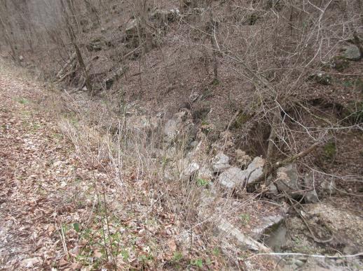 | | 2022 | COLLECTED | 03/15/2022 | Located approximately 3.75 miles east of Allison just off Round Bottom Road. | 35.93357000, -92.05110000 | 144 | Moist, low deciduous forest with scattered rock outcrops, growing along base of hill and bank of seasonal stream. | Wild material | | 2137430 | WLP 2568 |
| 10 | NA 88320 | CBG-10190 | Hydrangea arborescens L. | Illinois, United States | NA | | | 2021 | | | | | | | Wild material | | 2120058 | NA 88320 |
| 11 | NA 88321 | CBG-10546 | Hydrangea arborescens L. | Illinois, United States | NA | | | 2021 | | | | | | | Wild material | Plant numbers estimated. | 2120147 | NA 88321 |
| 12 | WLP 121 | 103 | Hydrangea arborescens L. | Kentucky, United States | NA | | | 2020 | COLLECTED | 10/14/2020 | Powell County; Natural Bridge State Park along Powell County; Natural Bridge State Park along the Whittleton Branch trail between Whittleton Branch Campground and KY 15 | 37.78466700, -83.66700000 | 257 | Along hiking trial growing in seeps along rock walls and rocky slopes | Wild material | | 2110297 | WLP 121 |
| 13 | WLP 1231 | APS/HA/2017/032/291 | Hydrangea arborescens L. | Tennessee, United States | NA | | | 2017 | COLLECTED | 11/05/2017 | South side of Cumberland River and the east end of Bluff Rd, South Carthage, Smith County | 36.24106000, -85.94595000 | 174 | Deciduous forest. Talus slope below limestone bluffs. | Wild material | | 1954438 | WLP 1231 |
| 14 | WLP 1230 | NA 84808 | Hydrangea arborescens L. | Maryland, United States | NA | | | 2017 | COLLECTED | 10/09/2017 | Garrett County; ; Along Westernport Road 2.5 miles south of intersection with Lower New Germany Road. | 39.61595000, -79.11066000 | | Partial shade along disturbed roadside; collected along edge of roadside creek. Steep slope on both sides of the road. Mowing occurs at least once a year. Moist, rocky, clay loam soils. | | Two plants sampled. | 2108823 | WLP 1230 |
| 15 | NA 83911 | PCCKY16-038 | Hydrangea arborescens L. | Kentucky, United States | NA | | | 2016 | COLLECTED | 09/27/2016 | Daniel Boone National Forest, Yahoo Falls Loop Trail at Forest Road #660. Steep north cliff along stairs. | 36.77300000, -84.52100000 | 278 | Steep north cliff along stairs. | Wild material | | 1951652 | NA 83911 |
| 16 | WLP 1228 | NA 83881 | Hydrangea arborescens L. | Kentucky, United States | NA | | | 2016 | COLLECTED | 09/26/2016 | Floracliff Nature Sanctuary & Trail's End. | 37.90200000, -84.36300000 | 210 | Rocky slope. | | | 1951139 | WLP 1228 |
| 17 | WLP 1224 | JDC/HA/2014/005/507 | Hydrangea arborescens L. | Indiana, United States | NA | | | 2014 | COLLECTED | 03/21/2014 | Indiana: Parke County; Along Sugar Creek just north of Marshall. T17N R7W, NW 1/4 of SW 1/4 of Section 27. | 39.88727600, -87.20403700 | 196 | Northwest facing rock slope. | Wild material | | 1917834 | WLP 1224 |
| 18 | WLP 1227 | JDC/HA/2013/026/470 | Hydrangea arborescens L. | Indiana, United States | NA | | | 2013 | COLLECTED | 03/07/2013 | Indiana: Lawrence County: Lawrenceport; Along East Fork White River, near public fishing site in Lawrenceport. | 38.75499400, -86.37829900 | 142 | East Fork White River Watershed. 45 degree north-northwest-facing slope. Associated with Acer saccharum, Fraxinus, Platanus occidentalis, and Quercus. | Wild material | | 1908279 | WLP 1227 |
| 19 | WLP 1221 | 353 | Hydrangea arborescens L. | Illinois, United States | NA | | | 2011 | COLLECTED | 09/09/2011 | Starved Rock State Park, La Salle County. | 41.31500000, -88.97800000 | 180 | Steep (70 degree) north-facing slope. | Wild material | | 1891478 | WLP 1221 |
| 20 | WLP 1222 | 384 | Hydrangea arborescens L. | Pennsylvania, United States | NA |  | | 2011 | COLLECTED | 09/16/2011 | Along Highway 219, Elk County. | 41.43800000, -78.72300000 | 422 | Mixed hardwood forest. Steep (60 degree) north-facing slope. Associated with Betula alleghaniensis, Diervilla lonicera, Fraxinus americana, Hypericum, Populus tremuloides, Rhododendron maximum, and Rhus typhina. | Wild material | | 1891479 | WLP 1222 |
| 21 | WLP 1226 | JDC/HA/2010/011/281 | Hydrangea arborescens L. | Illinois, United States | NA | | | 2010 | COLLECTED | 02/23/2010 | Illinois: Jackson County; Shawnee National Forest, Fountain Bluff. | 37.69160000, -89.47520000 | 129 | North-facing slope. | Wild material | | 1831696 | WLP 1226 |
| 22 | WLP 1218 | JDC/HA/2009/081/231 | Hydrangea arborescens L. | Ohio, United States | NA | | | 2009 | COLLECTED | 10/15/2009 | Near Wahkeena Nature Preserve, near Sugar Grove, SW 1/4 of NW 1/4 Section 4, T13N, R18W, Lancaster Quad, Fairfield County. | 39.62972222, -82.56750000 | 253 | Associated with Carpinus caroliniana, Fagus sylvatica, Ilex verticillata, Quercus, Rhododendron maximum, Tsuga canadensis, and Viburnum acerifolium. | Wild material | | 1823925 | WLP 1218 |
| 23 | WLP 1219 | JDC/HA/2009/096/246 | Hydrangea arborescens L. | Ohio, United States | NA | | | 2009 | COLLECTED | 10/16/2009 | Near Five Forks, NE 1/4 of NE 1/4 of Section 29, T4N, R17W, Kitts Hill Quad, Lawerence County. | 38.62305556, -82.55638889 | 262 | Associated with Acer rubrum, Carya, Cercis canadensis, and Liriodendron tulipifera. | Wild material | | 1823927 | WLP 1219 |
| 24 | WLP 1220 | JDC/HA/2009/108/258 | Hydrangea arborescens L. | Ohio, United States | NA | | | 2009 | COLLECTED | 10/18/2009 | Along Old US 68, just northeast of Levanna, Russellville Quad, Brown County. | 38.78250000, -83.85222222 | 265 | Steep, rocky north facing slope. Underground seep present. Associated with Aesculus flava, Fraxinus americana, Liriodendron tulipifera, and Quercus. | Wild material | | 1823928 | WLP 1220 |
| 25 | WLP 1216 | KY-2009-010 | Hydrangea arborescens L. | Kentucky, United States | NA | | | 2009 | COLLECTED | 10/20/2009 | Kentucky: Rowan County, Daniel Boone National Forest; Jones Ridge Road, slope along road. | 38.06835000, -83.35432000 | | Acidic deciduous woods - slope along road in loose rocks, (undefined slope) | | | 1922707 | WLP 1216 |
| 26 | WLP 1217 | KY-2009-038 | Hydrangea arborescens L. | Kentucky, United States | NA | | | 2009 | COLLECTED | 10/22/2009 | Kentucky, Daniel Boone National Forest; Hwy. 52 near Tipton Ridge Quarry entrance, near piped spring. | 37.70885000, 83.89345000 | | Base of limestone wall, north facing., north | Wild material | | 1913898 | WLP 1217 |
| 27 | WLP 1213 | RL 08298 | Hydrangea arborescens L. | | NA | | | 2008 | COLLECTED | PRE 12/15/2008 | North Carolina, Jackson County, Cullowhee Falls Trail, off NC Hwy 107 | | | | Wild material | | 1896199 | WLP 1213 |
| 28 | WLP 1223 | RL 08202 | Hydrangea arborescens L. | North Carolina, United States | NA | | | 2008 | COLLECTED | 11/15/2008 | North Carolina: Jackson County, Balsam Mountain Preserve | | 2954 | | Wild material | | 1914133 | WLP 1223 |
| 29 | NA 78025 | AL #34 | Hydrangea arborescens L. | Alabama, United States | NA | | | 2008 | COLLECTED | 09/17/2008 | Kathy Stiles Freeland Preserve. Nature Conservancy property. | | | Right along edge of creek, in part in creek. | Wild material | | 1913891 | NA 78025 |
| 30 | WLP 1215 | NA 78171 | Hydrangea arborescens L. | North Carolina, United States | NA |  | | 2004 | COLLECTED | 10/02/2004 | Highway 276 to East Fork Road, Pine Shore Lakes, Brevard, Transylvania County. | 35.12611111, -82.72944444 | 851 | Pine-oak forest. Lakeside on private land. 15 degrees of slope. Associated with Acer, Cornus florida, Magnolia, Pinus strobus, and Quercus. | Wild material | 1-4 meters tall. | 1667573 | WLP 1215 |
| 31 | WLP 1225 | JM2004017 | Hydrangea arborescens L. | North Carolina, United States | NA |  | | 2004 | COLLECTED | 10/08/2004 | North Carolina: Mitchell County; Pisgah National Forest, Roan Mountain, Highway NC-261 to Secondary Road 1348 to Forest Service Road 130. | 36.10055556, -82.11916667 | 1782 | Roadside, heath/bald spruce/fir community. 25 degrees of slope with a western aspect. Associated with Abies balsamea, Carex, Picea rubens, Rhododendron catawbiense, and Vaccinium. | Wild material | Up to 5 feet tall. | 1667574 | WLP 1225 |
| 32 | NA 88821 | TJK2023AL-006 | Hydrangea quercifolia W. Bartram | Alabama, United States | NA | | | 2023 | COLLECTED | 12/07/2023 | Between Monroe County Route 1 and Tom Hayles Road. | 31.40580000, -87.54890000 | 22 | In woodlands on limestone outcrop. While the upper area of slopes is covered by a thin soil layer, the exposed limestone rock outcrop on the northwestern edge of this area is a low competition niche for plants like the Hydrangea to gain a foothold. Slope: 60% (plus). Aspect: Northwest. Elevation: 72 feet. | Wild material | | 2165650 | NA 88821 |
| 33 | NA 88552 | RJLSEUS2022-025 | Hydrangea quercifolia W. Bartram | Alabama, United States | NA | | | 2023 | COLLECTED | 12/12/2022 | Claiborne Bluffs area along unnamed road to boat ramp on the east side of the Alabama River at the U.S. Highway 84 bridge over the river. Common at this location and along the nearby Alabama River. | 31.54879700, -87.51416400 | 40 | Plants are growing in part-shade to shade of mesic, well-drained, circum-neutral slopes and benches in mature mixed deciduous and evergreen woodlands with good litter layer. Soils: The underlying geology of this area is the Jackson Group Undifferentiated. The units of the Jackson Group are the Yazoo Clay and Crystal River and Moodys Branch Formations. Descriptions of the members of the Yazoo Clay follow in descending order. Shubuta Member - in western Alabama consists of light-greenish-gray to white plastic fossiliferous, calcareous clay containing irregular calcareous nodules. From the Tombigbee River eastward, the Shubuta becomes more calcareous and grades into massive clayey glauconitic limestone. Eastward from the Alabama River, equivalent beds grade into the Crystal River Formation. Pachuta Marl Member - light-greenish-grey glauconitic, fossiliferous clayey sand and sandy limestone traceable from western Alabama eastward to Covington County where it grades into the Crystal River Formation. Cocoa Sand Member - yellowish-gray firm calcareous, fossiliferous fine to medium sand or sandy limestone or greenish-grey micaceous, calcareous, very clayey sand. Calcareous and clayey sand equivalent to the Cocoa is traceable from western Alabama to the Conecuh River area. (Source: USGS Alabama Geological Map Data). The surface soil profile of this portion of the bluffs along the Alabama River are characterized as Saffell-Lucy (Flomaton) Series Complex soils. The Saffell Series consists of very deep, well drained, moderately permeable soils that formed in loamy and gravelly marine sediments of the Tertiary Age and have acid reaction. These soils are found on the upper portion of the bluffs along the Alabama River. The Lucy Series consists of very deep, well drained, moderately permeable soils on uplands. They formed in sandy and loamy marine and fluvial sediments of the Southern Coastal Plain Major Land Resource Area. Soil reaction runs from strongly to moderately acid. The Flomaton Series consists of very deep, excessively drained, rapidly permeable soils on uplands of the Southern Coastal Plain Major Land Resource Area. They formed in gravelly sandy marine sediments and also have an acid reaction. The remainder of soils are of miscellaneous origin. (Source: USDA-NRCS Official Soil Series Descriptions). | Wild material | | 2140779 | NA 88552 |
| 34 | NA 88561 | RJLSEUS2022-034 | Hydrangea quercifolia W. Bartram | Alabama, United States | NA | | | 2023 | COLLECTED | 12/12/2022 | Plants growing in the woodlands at Haines Island Park at the foot of Tallahatta cuesta, accessed by foot via Ferry Road. Common at this site. | 31.72178200, -87.46589600 | 66 | Plants are growing in part-shade to shade of a moist mesic, well-drained conditions on rocks and in the eroding matrix of the Tallahatta Questa.
Soils: The underlying geology of this area is Claiborne Group, Tallahatta Formation, of Eocene origin, with white to very light-greenish-gray thin-bedded to massive siliceous claystone; interbedded with thin layers of fossiliferous clay, sandy clay, and glauconitic sand and sandstone.
Source: USGS Alabama Geological Map Data (https://mrdata.usgs.gov/geology/state/state.php?state=AL)
The primary soil type in the collection area is classified as Arundel Loam soil (8 to 35 percent slopes). The Arundel Series consists of moderately deep, well drained, very slowly permeable soils on dissected uplands of the Southern Coastal Plain. They formed in marine deposits consisting of acid clays underlain by horizontally bedded sandstone, buhrstone and siltstone. These soils are strongly acid. Slopes range from 2 to 60 percent.
Source: NRCS Web Soil Survey (https://websoilsurvey.sc.egov.usda.gov/App/WebSoilSurvey.aspx) | Wild material | | 2140786 | NA 88561 |
| 35 | WLP 2506 | Cat's Cove Nature Preserve | Hydrangea quercifolia W. Bartram | Mississippi, United States | NA |  | | 2019 | COLLECTED | 12/17/2017 | Cat's Cove Nature Preserve, Smith County. Approximately 4 mi northwest of Bay Springs and 500 ft east of bridge where Highway 18 crosses Tallahala Creek. | 31.99742000, -89.35637200 | | Limestone cliff and steep bluff above creek. | Wild material | Flower profusion was variable in the wild population. The plants growing in sunnier locations had more flowers than those growing further into the forest. | 2106216 | WLP 2506 |
| 36 | WLP 2526 | Franklin D. Roosevelt State Park | Hydrangea quercifolia W. Bartram | Georgia, United States | NA |  | | 2019 | COLLECTED | 11/28/2018 | Franklin D. Roosevelt State Park, Harris County. Approximately 1.9 miles southeast of Pine Mountain along Mountain Creek. | 32.84099500, -84.83899300 | | Shady streambank. | Wild material | Measurements of sampled specimen taken in nature: Height 47 to 101 in.; width 27 to 99 in. | 2106236 | WLP 2526 |
| 37 | WLP 2531 | Hugh's Spring | Hydrangea quercifolia W. Bartram | Alabama, United States | NA |  | | 2019 | COLLECTED | 12/15/2018 | Near Hugh's Spring, Morgan County. North side of Pine Ridge Road, approximately 8.5 miles west-northwest of Union Grove. | 34.41760600, -86.59334500 | | Shady roadsides, and adjacent ravine. | Wild material | Measurements of sampled specimens taken in nature: Height 36 to 101 in.; width 65 to 113 in. Measurements for each specimen sampled may be provided upon request. | 2106241 | WLP 2531 |
| 38 | WLP 2538 | Cloudland Canyon State Park | Hydrangea quercifolia W. Bartram | Georgia, United States | NA |  | | 2019 | COLLECTED | 12/15/2018 | Cloudland Canyon State Park, along Sitton Gulch Trail. North end of population is 1.8 miles southeast of Trenton. Dade County. | 34.84961900, -85.47859400 | | Forested hillsides at bottom of canyon along stream. | Wild material | Measurements of sampled specimens taken in nature: Height 34 to 136 in.; width 50 to 145 in. Measurements for each specimen sampled may be provided upon request. | 2106248 | WLP 2538 |
| 39 | WLP 2541 | Skyway Mountain | Hydrangea quercifolia W. Bartram | Alabama, United States | NA |  | | 2019 | COLLECTED | 12/01/2018 | Talladega National Forest, Shoal Creek District, Skyway Mountain. Along Skyway Mountainway (Highway 500), Forest Service Road 531 and Joseph Spring Road (FR522). South end of population is approximately 12.25 miles northest of Oxford. | 33.70374800, -85.62800100 | | Mountainside along road. | Wild material | Measurements of sampled specimens taken in nature: Height 59 to 121 in.; width 28 to 188 in. Measurements for each specimen sampled may be provided upon request. Plants in this population are extremely dense with considerable clonal growth. | 2106251 | WLP 2541 |
| 40 | WLP 2542 | Dugger Mountain | Hydrangea quercifolia W. Bartram | Alabama, United States | NA |  | | 2019 | COLLECTED | 12/02/2018 | Talladega National Forest, Shoal Creek District, edge of Dugger Mountain Wilderness. Along Kings Gap Mountain Road, approximately 6.5 miles northeast of Jacksonville. | 33.84288500, -85.65341900 | | Mountainside along road. | Wild material | Measurements of sampled specimens taken in nature: Height 58 to 104 in.; width 48 to 99 in. Measurements for each specimen sampled may be provided upon request. | 2106252 | WLP 2542 |
| 41 | WLP 1252 | JDC/HQ/2014/084/586 | Hydrangea quercifolia W. Bartram | Mississippi, United States | NA | 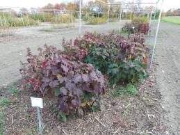 | | 2014 | COLLECTED | 09/22/2014 | Mississippi: Tishomingo County; Extreme northeast corner of Tishomingo County near J.P. Coleman State Park. | 34.98857300, -88.20347900 | 194 | Steep (60-70 degrees), north, northeast-facing slope. Growing in association with Quercus montana (abundant), Hamamelis sp., Quercus alba, Rhododendron arborescens, Amelanchier sp., Ostrya virginiana, Vaccinum sp., and Vitis sp. | Wild material | Numerous specimens. Some specimens approximately 6-7' in height. | 1922357 | WLP 1252 |
| 42 | PI 653293 | R. occidentalis HDF-2007-032 | Rubus occidentalis L. | Georgia, United States | COR | | | 2007 | COLLECTED | 06/05/2007 | Near were William Bartram Trail crosses Warwoman Road, Warwoman Dell, about 4 miles east of Clayton, Rabun County. On slope down to the creek (Becky Branch) below. | 34.88280000, -83.35170000 | 595 | East facing slope, Associated Plants: Smilax bona-nox, Rhus typhina, Potentilla, Liriodendron tulipifera, Hydrangea arborescens, Lonicera japonica, Rhododendron, Sambucus canadensis and Vitis rotundifolia. | Wild material | Kim Hummer, Michael Dossett collection from Georgia.
| 1730092 | PI 653293 |
| 43 | NA 89171 | 2025RJLSEUS-04 | Rhododendron catawbiense Michx. | Alabama, United States | NA | | | 2026 | COLLECTED | 09/30/2025 | Scarham Creek: southeast of the Pea Ridge Road bridge, approximately 50-80 meters on the south side of the creek. | 34.32559600, -86.16054600 | 266 | Growing near the base of the slopes above the riparian zone, generally on the exposed geology under very well-drained conditions. The woodlands are primarily deciduous with a few evergreens infrequently mixed. Slope: 15 to 30 percent. Aspect: Northeast. Soil: The primary soil type in the area of this collection is classified as Rockland Series sandstone (Rc). The Rockland series consists of well drained soils formed in loamy colluvium from rotational landslides on slopes of stream valleys and dissections of ground moraines. Saturated hydraulic conductivity is moderate in the upper part of the profile and moderately slow in the lower part. Slopes range from 18 to 70 percent. Some pedons have buried leaves, twigs, and moss. Mass soil movement has left random remnants of soil structure from prior upslope soil development and has buried tree branches, leaves and moss. The upper 0-2 cm of soil contains slightly decomposed organic matter while lower soils layers to a depth of 58 cm are comprised of dark reddish-brown to brown silt loam and are moderately acidic. Below 58 cm the soils are generally dark reddish-brown silt loam and strongly to moderately alkaline. (Source:California Soil Resource Lab/NRCS Official Soil Series Descriptions). Geology: The underlying geology of this area is of Pennsylvanian origin and characterized as Pottsville Formation. It is characterized by light-gray thin to thick-bedded quartzose sandstone and conglomerate containing interbedded dark-gray shale, siltstone, and coal. Mapped on Lookout Mountain, Blount and Chandler Mountains, and Sand Mountain northeast of Blount County, and on the mountains of Jackson, Marshall, and Madison Counties north and west of the TN river. (Source: USGS Alabama Geologic Map Data). | Wild material | Received as R. catawbiense vsr. insularis | 2193305 | NA 89171 |
| 44 | NA 89155 | 2025RJLSEUS-02 | Ilex longipes Chapm. ex Trel. | Alabama, United States | NA | | | 2025 | COLLECTED | 09/30/2025 | Scarham Creek: southeast of the Pea Ridge Road bridge, approximately 50-80 meters on the south side of the creek. | 34.32520700, -86.15967000 | 261 | Plants are growing on relatively steep woodland slopes in shade. The woodlands are primarily deciduous with a few evergreens infrequently mixed. Slope: 15 to 30 percent. Aspect: Northeast. Soil: The primary soil type in the area of this collection is classified as Rockland Series sandstone (Rc). The Rockland series consists of well drained soils formed in loamy colluvium from rotational landslides on slopes of stream valleys and dissections of ground moraines. Saturated hydraulic conductivity is moderate in the upper part of the profile and moderately slow in the lower part. Slopes range from 18 to 70 percent. Some pedons have buried leaves, twigs, and moss. Mass soil movement has left random remnants of soil structure from prior upslope soil development and has buried tree branches, leaves and moss. The upper 0-2 cm of soil contains slightly decomposed organic matter while lower soils layers to a depth of 58 cm are comprised of dark reddish-brown to brown silt loam and are moderately acidic. Below 58 cm the soils are generally dark reddish-brown silt loam and strongly to moderately alkaline. (Source: California Soil Resource Lab/NRCS Official Soil Series Descriptions). Geology: The underlying geology of this area is of Pennsylvanian origin and characterized as Pottsville Formation. It is characterized by light-gray thin to thick-bedded quartzose sandstone and conglomerate containing interbedded dark-gray shale, siltstone, and coal. Mapped on Lookout Mountain, Blount and Chandler Mountains, and Sand Mountain northeast of Blount County, and on the mountains of Jackson, Marshall, and Madison Counties north and west of the TN river. (Source: USGS Alabama Geologic Map Data). | Wild material | | 2193001 | NA 89155 |
| 45 | NA 89156 | 2025RJLSEUS-03 | Euonymus americanus L. | Alabama, United States | NA | | | 2025 | COLLECTED | 09/30/2025 | Scarham Creek: southeast of the Pea Ridge Road bridge, approximately 50-80 meters on the south side of the creek. | 34.32577600, -86.16071000 | 260 | Plants are growing on relatively steep woodland slopes in shade. The woodlands are primarily deciduous with a few evergreens infrequently mixed. Slope: 15 to 30 percent. Aspect: Northeast. Soil: The primary soil type in the area of this collection is classified as Rockland Series sandstone (Rc). The Rockland series consists of well drained soils formed in loamy colluvium from rotational landslides on slopes of stream valleys and dissections of ground moraines. Saturated hydraulic conductivity is moderate in the upper part of the profile and moderately slow in the lower part. Slopes range from 18 to 70 percent. Some pedons have buried leaves, twigs, and moss. Mass soil movement has left random remnants of soil structure from prior upslope soil development and has buried tree branches, leaves and moss. The upper 0-2 cm of soil contains slightly decomposed organic matter while lower soils layers to a depth of 58 cm are comprised of dark reddish-brown to brown silt loam and are moderately acidic. Below 58 cm the soils are generally dark reddish-brown silt loam and strongly to moderately alkaline. (Source: California Soil Resource Lab/NRCS Official Soil Series Descriptions). Geology: The underlying geology of this area is of Pennsylvanian origin and characterized as Pottsville Formation. It is characterized by light-gray thin to thick-bedded quartzose sandstone and conglomerate containing interbedded dark-gray shale, siltstone, and coal. Mapped on Lookout Mountain, Blount and Chandler Mountains, and Sand Mountain northeast of Blount County, and on the mountains of Jackson, Marshall, and Madison Counties north and west of the TN river. (Source: USGS Alabama Geologic Map Data). | Wild material | | 2193002 | NA 89156 |
| 46 | NA 89081 | 2024RJLPA-009 | Rosa carolina L. | Pennsylvania, United States | NA | | | 2024 | COLLECTED | 09/22/2024 | Lancaster and York Counties: outcrops along the Susquehanna River, accessed from the Historic Lock 12 parking lot off of Pennsylvania Road 372. | 39.81483500, -76.32762200 | 34 | Plants are growing from part-sun to full sun in crevices of the outcrops and where organic debris has accumulated in between boulders along the Susquehanna River. The sites range from nearly xeric to dry mesic, at least on the surface. Plants are generally growing 4-10 m above the normal flow of the river; however, the Holtwood Dam is less than 1 kilometer upstream and debris found trapped in the boulders indicates that there is periodic flooding, at least, in the lower zone of 4+ meters or so above normal river flow. This habitat has a diverse assemblage of deciduous trees and shrubs as well as abundant herbaceous taxa. Slope: 0 to 60 percent. Aspect: Northeast (generally). Geology: The underlying geology of this area is probably of lower Paleozoic age and characterized as the Octoraro Formation. It includes albite-chlorite schist, phyllite, some hornblende gneiss, and granitized members. Soils: The area where this species occurs is right on the edge of two soil zones that transition from the river’s edge to mesic conditions upslope. The first is generally referred to as Rock Outcrop. This terrestrial matrix in which plants grow is largely exposed underlying rock geology with accumulated outwash, rock decomposition, and organic debris buildup. The second is Mt. Airy (80%) and Manor (20%) Series soils, 25 to 60 percent slopes, extremely stony (MRF). (Source: California Soil Resource Lab/NRCS Official Soil Series Descriptions). EPA Ecoregion (Level III): Northern Piedmont (64). EPA Ecoregion (Level IV): Piedmont Uplands (64c). | Wild material | | 2169045 | NA 89081 |
| 47 | NA 89084 | 2024RJLPA-013 | Physocarpus opulifolius (L.) Maxim. | Pennsylvania, United States | NA | | | 2024 | COLLECTED | 09/22/2024 | Outcrops along the Susquehanna River, accessed from the Historic Lock 12 parking lot off of Pennsylvania Road 372. | 39.81466300, -76.32833900 | 36 | Plants are growing from shade to part-sun where organic debris has accumulated in between boulders as well as further upslope in deeper mesic soils along the Susquehanna River. This habitat has a diverse assemblage of deciduous trees and shrubs as well as abundant herbaceous taxa. Slope: 10 to 25 percent. Aspect: Northeast (generally). Geology: The underlying geology of this area is probably of lower Paleozoic age and characterized as the Octoraro Formation. It includes albite-chlorite schist, phyllite, some hornblende gneiss, and granitized members. Soils: The area where this species occurs is right on the edge of two soil zones that transition from the river’s edge to mesic conditions upslope. The first is generally referred to as Rock Outcrop. This terrestrial matrix in which plants grow is largely exposed underlying rock geology with accumulated outwash, rock decomposition, and organic debris buildup. The second is Mt. Airy (80%) and Manor (20%) Series soils, 25 to 60 percent slopes, extremely stony (MRF). (Source: California Soil Resource Lab/NRCS Official Soil Series Descriptions). EPA Ecoregion (Level III): Northern Piedmont (64). EPA Ecoregion (Level IV): Piedmont Uplands (64c). | Wild material | | 2169048 | NA 89084 |
| 48 | WLP 3433 | RM2023-002 | Clethra acuminata Michx. | Georgia, United States | NA | | | 2024 | COLLECTED | 10/21/2023 | Plants growing along Patterson Gap Road. | 34.97299200, -83.46003100 | 789 | Plants growing in part shade in a very dry and rocky, mostly deciduous habitat. The site is steeply sloped, underlain by rock, with rocky outcrops. Slope: 15 percent. Aspect: Variable. The underlying geology of this area is Biotite Gneiss, primarily of Precambrian-Paleozoic origin. (Source: USGS North Carolina Geologic Map Data.) The primary soil type in the collection area is classified as Tusquitee loam, 10 to 25 percent slopes. The Tusquitee series consists of very deep, well drained soils on gently sloping to very steep benches, foot slopes, toe slopes, and fans in coves in the Southern Blue Ridge mountains, MLRA 130B. These soils formed in colluvium derived from materials weathered from igneous and high-grade metamorphic crystalline rocks such as granite, mica gneiss, hornblende gneiss, and schist. Slope ranges from 2 to 95 percent. The surface layer to 5cm deep is comprised of moderately decomposed organic matter and leaves, twigs, and roots. Layers to 2m deep range from very dark grayish brown to brown sandy loam with weak medium and coarse granular structure that is friable. A few fine flakes of mica can be found and these soils are very strongly acid. (Source: NRCS Web Soil Survey.) | Wild material | | 2166142 | WLP 3433 |
| 49 | NA 88673 | RJL2023PA-007 | Rhododendron pilosum (Michx.) Craven | Pennsylvania, United States | NA | | | 2023 | COLLECTED | 10/25/2023 | Ned Smith Center for Art and Nature. | 40.53367300, -76.92715700 | 147 | Well-drained and very rocky, dry slopes above 10-50 meters above Wiconisco Creek in mixed deciduous and evergreen woodlands in part shade to full shade. Slope: 10-40%. Aspect: North. The underlying geology of this area is of Mississippian origin and characterized as the Pocono Formation. It is comprised of light-gray to buff or light-olive-gray, medium-grained, crossbedded sandstone and minor siltstone; commonly conglomeratic at base and in middle; medial conglomerate, where present, is used to divide into Mount Carbon and Beckville Members; equivalent to Burgoon Sandstone of Allegheny Plateau. (Source: USGS Pennsylvania Geologic Map Data). The primary soil type in the collection area is classified as Laidig Series. The Laidig series consists of very deep, well drained soils formed in colluvium from sandstone, siltstone, and some shale. They are gently sloping to very steep soils on benches and foot slopes. Permeability is moderate or moderately rapid above the fragipan and moderately slow or slow in the fragipan. Slope ranges from 0 to 55 percent. Solum thickness ranges from 1.25 to 2.0 meters or more. Depth to the fragipan ranges from 0.75 to 1.25 meters. The particle-size control section averages less than 35 percent rock fragments. Rock fragments range from 5 to 50 percent in individual subhorizons of the A, E, BE, BA and Bt horizons; 15 to 70 percent in individual subhorizons of the Btx horizon; and 20 to 70 percent in the C horizon. Rock fragments are mostly sandstone but include siltstone and shale. Rock fragments include channers, cobbles, flagstones, and stones. Soils range from extremely acid through strongly acid throughout. (Source: NRCS Web Soil Survey). | Wild material | | 2159064 | NA 88673 |
| 50 | NA 88674 | RJL2023PA-008 | Kalmia latifolia L. | Pennsylvania, United States | NA | | | 2023 | COLLECTED | 10/25/2023 | Ned Smith Center for Art and Nature. | 40.53463500, -76.92616300 | 130 | Well-drained and very rocky, dry slopes above 10-50 meters above Wiconisco Creek in mixed deciduous and evergreen woodlands in part shade to full shade. Slope: 10-40%. Aspect: North. The underlying geology of this area is of Mississippian origin and characterized as the Pocono Formation. It is comprised of light-gray to buff or light-olive-gray, medium-grained, crossbedded sandstone and minor siltstone; commonly conglomeratic at base and in middle; medial conglomerate, where present, is used to divide into Mount Carbon and Beckville Members; equivalent to Burgoon Sandstone of Allegheny Plateau. (Source: USGS Pennsylvania Geologic Map Data). The primary soil type in the collection area is classified as Laidig Series. The Laidig series consists of very deep, well drained soils formed in colluvium from sandstone, siltstone, and some shale. They are gently sloping to very steep soils on benches and foot slopes. Permeability is moderate or moderately rapid above the fragipan and moderately slow or slow in the fragipan. Slope ranges from 0 to 55 percent. Solum thickness ranges from 1.25 to 2.0 meters or more. Depth to the fragipan ranges from 0.75 to 1.25 meters. The particle-size control section averages less than 35 percent rock fragments. Rock fragments range from 5 to 50 percent in individual subhorizons of the A, E, BE, BA and Bt horizons; 15 to 70 percent in individual subhorizons of the Btx horizon; and 20 to 70 percent in the C horizon. Rock fragments are mostly sandstone but include siltstone and shale. Rock fragments include channers, cobbles, flagstones, and stones. Soils range from extremely acid through strongly acid throughout. (Source: NRCS Web Soil Survey). | Wild material | | 2159065 | NA 88674 |
| 51 | NA 88675 | RJL2023PA-009 | Viburnum acerifolium L. | Pennsylvania, United States | NA | | | 2023 | COLLECTED | 10/25/2023 | Ned Smith Center for Art and Nature. | 40.53539200, -76.92313500 | 136 | Well-drained and very rocky dry deciduous woodlands in part shade to full shade. Slope: 10-30%. Aspect: North. The underlying geology of this area is of Mississippian origin and characterized as the Pocono Formation. It is comprised of light-gray to buff or light-olive-gray, medium-grained, crossbedded sandstone and minor siltstone; commonly conglomeratic at base and in middle; medial conglomerate, where present, is used to divide into Mount Carbon and Beckville Members; equivalent to Burgoon Sandstone of Allegheny Plateau. (Source: USGS Pennsylvania Geologic Map Data). The primary soil type in the collection area is classified as Laidig Series. The Laidig series consists of very deep, well drained soils formed in colluvium from sandstone, siltstone, and some shale. They are gently sloping to very steep soils on benches and foot slopes. Permeability is moderate or moderately rapid above the fragipan and moderately slow or slow in the fragipan. Slope ranges from 0 to 55 percent. Solum thickness ranges from 1.25 to 2.0 meters or more. Depth to the fragipan ranges from 0.75 to 1.25 meters. The particle-size control section averages less than 35 percent rock fragments. Rock fragments range from 5 to 50 percent in individual subhorizons of the A, E, BE, BA and Bt horizons; 15 to 70 percent in individual subhorizons of the Btx horizon; and 20 to 70 percent in the C horizon. Rock fragments are mostly sandstone but include siltstone and shale. Rock fragments include channers, cobbles, flagstones, and stones. Soils range from extremely acid through strongly acid throughout. (Source: NRCS Web Soil Survey). | Wild material | | 2159066 | NA 88675 |
| 52 | NA 88605 | KY23-007 | Viburnum acerifolium L. | Kentucky, United States | NA | | | 2023 | COLLECTED | 09/08/2023 | Little Shepherd Trail roadside (second location, collected on 9/10/2023 and bulked with the first: Kingdom Come State Park, Pine Mountain; lat/long 36.99024, -82.98409). | 36.98470000, -83.02026000 | 637 | Little Shepard's Trail, along roadside. Elevation: 2090 feet. Aspect: Northwest. (Second location, collected on 9/10/2023 and bulked with first: Elevation: 2293 feet. Aspect: West.) | Wild material | | 2158697 | NA 88605 |
| 53 | WLP 3137 | TJK2023AL-001 | Cornus alternifolia L. f. | Alabama, United States | NA | | | 2023 | COLLECTED | 08/15/2023 | Claiborne Bluffs, above the Alabama River. | 31.54883000, -87.51417000 | 16 | Slope: 35%. Aspect: West-northwest. Elevation recorded as 52 feet. | Wild material | WLPGR contract collection. | 2158469 | WLP 3137 |
| 54 | NA 89008 | WLP 3120 | Morus rubra L. | Kentucky, United States | NA | | | 2023 | COLLECTED | 06/05/2023 | Swan Pond Bottom. Riparian buffer and historic floodplain of Cumberland River, approximately 4 river miles downstream of Wolf Creek Dam. | 36.90259500, -85.13557900 | | Riparian buffer and historic river floodplain. Slope: <5%. Aspect: North. | Wild material | | 2158092 | NA 89008 |
| 55 | WLP 92 | 101 | Euonymus americanus L. | Kentucky, United States | NA | | | 2020 | COLLECTED | 10/14/2020 | Powell County; Natural Bridge State Park along the Whittleton Branch trial between Whittleton Branch campground and KY15 | 37.78450000, -83.66805556 | 264 | Floodplain and streambank slopes | Wild material | 2 vouchers made | 2109486 | WLP 92 |
| 56 | WLP 160 | NACPEC19-038 | Callicarpa americana L. | Tennessee, United States | NA | | | 2019 | COLLECTED | 09/12/2019 | Marion County; Tennessee River Gorge Trust: Pot Point Nature Trail | 35.07981400, -85.38795600 | 256 | Mixed mesophytic forest: Oak-Hickory-Pine woodland; "Butterfly meadow": Goldenrod, Bluestem, Swamp Milkweed, Ironweed. | Wild material | | 2110472 | WLP 160 |
| 57 | WLP 1097 | JDC/CO/2015/026/682 | Cotinus obovatus Raf. | Missouri, United States | NA | | | 2015 | COLLECTED | 05/19/2015 | T22N R20W N1/2 Sec. 33 and SW 1/4 Sec. 27 Taney County. Gunnison Road, adjacent to Bee Creek, a tributary to Fox Creek and also surrounding area. | 36.52401500, -93.09755700 | 350 | Steep, west-facing slope on rocky, loose substrate. Growing in association with Fraxinus quadrangulata, Quercus muehlenbergii, Hydrangea arborescens, Physocarpus opulifolius, Viburnum rufidulum, Cornus florida, Carpinus caroliniana (abundant), Rhus aromatica, Lonicera sp. (vine), Cornus sp., Salix sp., Juniperus virginiana, Tilia americana, Hamamelis sp. (abundant) and Staphylea trifolia. | Wild material | | 1926259 | WLP 1097 |
| 58 | Ames 32887 | APS/GD/2015/003/185 | Gymnocladus dioicus (L.) K. Koch | Arkansas, United States | NC7 |  | | 2015 | COLLECTED | 03/04/2015 | Stone and Izard Counties: White River watershed, Ozark National Forest, Sylamore State Wildlife Management Area near Allison. | 35.95017300, -92.11129600 | 126 | Floodplain, base of slopes. | Wild material | | 1924365 | Ames 32887 |
| 59 | Ames 31522 | JDC/FQ/2012/031/424 | Fraxinus quadrangulata Michx. | Indiana, United States | NC7 |  | | 2012 | COLLECTED | 07/22/2012 | Turkey Run State Park, S 1/2 of Section 27, T17N, R7W, Wallace Quad, near Marshall, Vermillion County. | 39.88732800, -87.19895200 | 200 | Mature, moist woods. Rolling hills. | Wild material | | 1903749 | Ames 31522 |
| 60 | Ames 31067 | 383 | Diervilla lonicera Mill. | Pennsylvania, United States | NC7 |  | | 2011 | COLLECTED | 09/16/2011 | Along Highway 219 just north of Ridgway | 41.43800000, -78.72300000 | 446 | Mixed hardwood forest. Steep (60 degrees) north-facing slope. | Wild material | | 1891453 | Ames 31067 |
| 61 | WLP 1653 | 382 | Rhododendron maximum L. | Pennsylvania, United States | NA |  | | 2011 | COLLECTED | 09/16/2011 | Along Highway 219, Elk County. | 41.43800000, -78.72300000 | 422 | Mixed hardwood forest. Steep (60 degree) north-facing slope. Associated with Betula alleghaniensis, Diervilla lonicera, Fraxinus americana, Hydrangea arborescens, Hypericum, Populus tremuloides, and Rhus typhina. | Wild material | | 1891485 | WLP 1653 |
| 62 | Ames 30609 | JDC/FQ/2010/053/323 | Fraxinus quadrangulata Michx. | Missouri, United States | NC7 |  | | 2010 | COLLECTED | 09/17/2010 | Drury-Mincey Conservation Area, Taney County. | 36.57464000, -93.08651000 | 266 | Large population along steep (70%), southeast facing slope. | Wild material | | 1848904 | Ames 30609 |
| 63 | Ames 30614 | JDC/MX/2010/046/316 | Blephilia ciliata (L.) Benth. | Missouri, United States | NC7 |  | | 2010 | COLLECTED | 09/16/2010 | Norfork Lake Wildlife Area near Bridges Creek, Ozark County | 36.56451000, -92.25092000 | 227 | East facing slope (65%) with chert and limestone | Wild material | | 1848909 | Ames 30614 |
| 64 | WLP 1043 | JDC/CF/2010/044/314 | Cornus florida L. | Missouri, United States | NA |  | | 2010 | COLLECTED | 09/15/2010 | Odin Access Conservation Area, Wright County. | 37.26709000, -92.61271000 | 388 | South-southeast facing slope (50%). Associated with Hydrangea arborescens, Morus rubra, Quercus, Staphylea trifolia, and Viburnum prunifolium. | Wild material | Very large flowering dogwoods, approximately 5-6 inches d.b.h. and 25-30 feet tall. | 1848889 | WLP 1043 |
| 65 | WLP 1411 | JDC/OV/2010/049/319 | Ostrya virginiana (Mill.) K. Koch | Arkansas, United States | NA |  | | 2010 | COLLECTED | 09/16/2010 | Gamaliel Recreation Area, along Norfork Lake, Baxter County. | 36.42831000, -92.21806000 | 216 | Rock outcrop with underground seep. East facing slope (65%). Associated with Cotinus obovatus, Acer saccharum, Juniperus virginiana, Viburnum sp., Quercus muehlenbergii, Frangula caroliniana, Hydrangea arborescens, Cornus florida, Smilax sp., and Ulmus sp. (likely U. alata). | Wild material | | 1848910 | WLP 1411 |
| 66 | Ames 33863 | OPGC 2237 | Monarda didyma L. | North Carolina, United States | NC7 | _thumbnail.jpg "Click for 4 image(s) for this accession.") | | 2005 | COLLECTED | 09/20/2003 | Northeast side of a gravel fire road near top of Panther Creek between Tatham Gap and Teyahalee Bald, Graham County. | 35.25555556, -83.80555556 | 1230 | Full shade in mixed deciduous and evergreen woodland. Narrow band of moist to wet, but well drained, area along the Panther Creek and in seep areas. | Wild material | | 1690868 | Ames 33863 |
| 67 | NA 70422 | MWPCC00-078 | Magnolia acuminata (L.) L. | North Carolina, United States | NA | | | 2000 | COLLECTED | 09/14/2000 | Blue Ridge Parkway pullover, N of marker 417. | 35.32333333, -82.82694444 | 1353 | Just in from mowed roadside. Slope: 15 degrees, Aspect: East, 3/4 day sun, Soil Type: gritty loam, well-drained, moist bottom of slope. | Wild material | | 1608250 | NA 70422 |