| 0 | PI 710493 | CBG-9354 | Lespedeza capitata Michx. | Wisconsin, United States | S9 |  | | 2019 | | | | | | | Wild material | | 2092784 | PI 710493 |
| 1 | PI 710492 | NEWFS-553 | Lespedeza capitata Michx. | Rhode Island, United States | S9 |  | | 2019 | | | | | | | Wild material | | 1976290 | PI 710492 |
| 2 | PI 710489 | MARSB-254 | Lespedeza capitata Michx. | New York, United States | S9 |  | | 2018 | | | | | | | Wild material | | 1964746 | PI 710489 |
| 3 | PI 710490 | MARSB-345 | Lespedeza capitata Michx. | New Jersey, United States | S9 |  | | 2018 | | | | | | | Wild material | | 1964765 | PI 710490 |
| 4 | PI 710491 | MARSB-488 | Lespedeza capitata Michx. | New Jersey, United States | S9 |  | | 2018 | | | | | | | Wild material | | 1964782 | PI 710491 |
| 5 | PI 653750 | 'Northern Iowa Germplasm' | Lespedeza capitata Michx. | Iowa, United States | S9 | | | 2005 | DEVELOPED | 2000 | | | | | Cultivar | North, Central and Southern Iowa Germplasm Roundhead Lespedeza, Zones 1, 2 and 3 are tall native warm season perennial legumes that grows 3.5 to 4.0 feet high. The entire plant is covered with fine silvery hairs. The leaves occur alternately along the erect stems. They have three leaflets of medium to narrow elliptic shape. The flowers are creamy white and bloom August through September. The flower heads are found growing close to the erect stems and are mostly near the top of the stems. Roundhead lespedeza responds as a decreaser to grazing pressure or repeated, close defoliation. It is compatible with warm-season grasses when well established. There is moderate to strong tolerance to burning when dormant. This plant grows naturally in diverse habitats such as dry prairie, open woodland soils, well-drained or sandy praries in all bu the northern portions of the tallgrass region, becoming uncommon north of Iowa. Roundhead lespedeza is moderately drought tolerant and winter hardy with some tolerance to shade. It performs best in areas receiving at least 20 inches of precipitation but will survive in moisture accumulating sites in semiarid zones. The area of adaptation for the Iowa Germplasm Roundhead Lespedeza Zones 1, 2 and 3 includes all counties located in the state of Iowa and adjacent states. | 1775156 | PI 653750 |
| 6 | PI 653751 | 'Central Iowa Germplasm' | Lespedeza capitata Michx. | Iowa, United States | S9 | | | 2005 | DEVELOPED | 2000 | | | | | Cultivar | North, Central and Southern Iowa Germplasm Roundhead Lespedeza, Zones 1, 2 and 3 are tall native warm season perennial legumes that grows 3.5 to 4.0 feet high. The entire plant is covered with fine silvery hairs. The leaves occur alternately along the erect stems. They have three leaflets of medium to narrow elliptic shape. The flowers are creamy white and bloom August through September. The flower heads are found growing close to the erect stems and are mostly near the top of the stems. Roundhead lespedeza responds as a decreaser to grazing pressure or repeated, close defoliation. It is compatible with warm-season grasses when well established. There is moderate to strong tolerance to burning when dormant. This plant grows naturally in diverse habitats such as dry prairie, open woodland soils, well-drained or sandy praries in all bu the northern portions of the tallgrass region, becoming uncommon north of Iowa. Roundhead lespedeza is moderately drought tolerant and winter hardy with some tolerance to shade. It performs best in areas receiving at least 20 inches of precipitation but will survive in moisture accumulating sites in semiarid zones. The area of adaptation for the Iowa Germplasm Roundhead Lespedeza Zones 1, 2 and 3 includes all counties located in the state of Iowa and adjacent states. | 1775157 | PI 653751 |
| 7 | PI 639665 | 'Southern Iowa Germplasm' | Lespedeza capitata Michx. | Missouri, United States | S9 | | | 2005 | DEVELOPED | 1998 | | | | | Uncertain improvement status | Seed has not been altered or modified. For a complete plant description and characteristics refer to the USDA Plant Database. | 1677262 | PI 639665 |
| 8 | PI 675542 | 9062282 | Lespedeza capitata Michx. | Iowa, United States | S9 | | | 2004 | COLLECTED | PRE 2001 | | | | | Wild material | | 1694843 | PI 675542 |
| 9 | PI 675543 | 9062281 | Lespedeza capitata Michx. | Iowa, United States | S9 | | | 2004 | COLLECTED | PRE 2000 | | | | | Wild material | | 1694844 | PI 675543 |
| 10 | PI 468118 | 'Kanoka' | Lespedeza capitata Michx. | United States | S9 | | | 1982 | COLLECTED | | Composite of single accesions from Kansas and Oklahoma | | | | | Multiple use conservation plant for range, critical area stabilization, park area cover. Best of twenty accessions tested for use. Selected for advanced evaluation. | 1363054 | PI 468118 |
| 11 | PI 402588 | HOWARD COUNTY | Lespedeza capitata Michx. | Iowa, United States | S9 | | | 1975 | COLLECTED | 10/25/1968 | Located 1.0 mile east of Riceville on highway 9 and four corners (northeast corner). | 43.36416700, -92.52472200 | 386 | | Wild material | | 1303305 | PI 402588 |
| 12 | PI 402589 | CHICKASAW COUNTY | Lespedeza capitata Michx. | Iowa, United States | S9 | | | 1975 | COLLECTED | 11/08/1968 | Located 7.0 miles north of Nashua along railroad on curve. | 43.05815800, -92.49925700 | 316 | | Wild material | | 1303306 | PI 402589 |
| 13 | PI 402590 | STORY COUNTY | Lespedeza capitata Michx. | Iowa, United States | S9 | | | 1975 | COLLECTED | 11/08/1968 | Located 2.0 miles west of McCallsburg along railroad right-of-way, just east of intersection on south side of road. | 42.16597100, -93.42469000 | 329 | | Wild material | | 1303307 | PI 402590 |
| 14 | PI 402591 | STORY COUNTY | Lespedeza capitata Michx. | Iowa, United States | S9 | | | 1975 | DONATED | 03/13/1975 | | | | | | Plants medium-tall, single heads. Slight branching stem. Seed from few plants. | 1303308 | PI 402591 |
| 15 | PI 402592 | STORY COUNTY | Lespedeza capitata Michx. | Iowa, United States | S9 | | | 1975 | COLLECTED | 10/01/1968 | Ames High Prairie State Preserve located within city limits of Ames. | 42.03972200, -93.63666700 | 290 | | Wild material | | 1303309 | PI 402592 |
| 16 | PI 402593 | STORY COUNTY | Lespedeza capitata Michx. | Iowa, United States | S9 | | | 1975 | COLLECTED | 1969 | Collected 1.0 mile west of McCallsburg on along railroad south side on knoll east of culvert and drainage ditch. | 42.16638900, -93.41277800 | 326 | | Wild material | | 1303310 | PI 402593 |
| 17 | PI 402594 | JASPER COUNTY | Lespedeza capitata Michx. | Iowa, United States | S9 | | | 1975 | COLLECTED | 1970 | Located 2.0 miles north of Colfax on west side of road, south of east turn on highway 117 when traveling south from Mingo. | 41.70694400, -93.24638900 | 261 | | Wild material | | 1303311 | PI 402594 |
| 18 | PI 358326 | HOWARD COUNTY | Lespedeza capitata Michx. | Iowa, United States | S9 | | | 1971 | COLLECTED | 10/25/1968 | Located 1.0 mile east of Riceville on highway 9 and four corners (southeast corner). | 43.36361100, -92.52472200 | 384 | | Wild material | | 1267632 | PI 358326 |
| 19 | PI 358327 | JASPER COUNTY | Lespedeza capitata Michx. | Iowa, United States | S9 | | | 1971 | COLLECTED | 01/10/1969 | Near Mingo approximately 1.0 mile south of large curve on highway 117, east side of road on high bank. | 41.75944400, -93.25555600 | 247 | | Wild material | | 1267633 | PI 358327 |
| 20 | PI 358328 | MARSHALL COUNTY | Lespedeza capitata Michx. | Iowa, United States | S9 | | | 1971 | COLLECTED | 02/27/1969 | Near Marshalltown approximately 0.50 mile west of US highway 14 near 90 curve north side of road. | 42.03944400, -92.94222200 | 300 | | Wild material | | 1267634 | PI 358328 |
| 21 | PI 340792 | FRANKLIN COUNTY | Lespedeza capitata Michx. | Massachusetts, United States | S9 | | | 1969 | COLLECTED | 03/21/1965 | Near Gate #30 Quabbin Reservoir, New Salem Township. | 42.53472200, -72.30250000 | 166 | | Wild material | | 1254097 | PI 340792 |
| 22 | PI 340793 | HENNEPIN COUNTY | Lespedeza capitata Michx. | Minnesota, United States | S9 | | | 1969 | COLLECTED | 11/21/1964 | Located near Eden prairie in Sec. 28. | 44.81889000, -93.47192000 | 264 | | Wild material | | 1254098 | PI 340793 |
| 23 | PI 340794 | RAMSEY COUNTY | Lespedeza capitata Michx. | Minnesota, United States | S9 | | | 1969 | COLLECTED | 03/14/1965 | Near Gilfillan Lake, North Oaks. | 45.08098700, -93.07836200 | 349 | | Wild material | | 1254099 | PI 340794 |
| 24 | PI 340795 | STEELE COUNTY | Lespedeza capitata Michx. | Minnesota, United States | S9 | | | 1969 | COLLECTED | 11/18/1965 | Located along highway 14 between Owatonna Township and Havana Township. | 44.06055600, -93.16222200 | 368 | | Wild material | | 1254100 | PI 340795 |
| 25 | PI 340796 | ANAHA COUNTY | Lespedeza capitata Michx. | Minnesota, United States | S9 | | | 1969 | COLLECTED | 11/06/1964 | Cedar Creek Forest (University of Minnesota) in T34N R23W Sec. 34. (Bethel Township). | 45.39345600, -93.20063100 | 277 | | Wild material | | 1254101 | PI 340796 |
| 26 | PI 303844 | M1-5773 BUENA VISTA CO. | Lespedeza capitata Michx. | Iowa, United States | S9 | | | 1965 | DONATED | 01/25/1965 | | | | | | | 1228119 | PI 303844 |
| 27 | PI 303845 | M1-5798 BOONE COUNTY | Lespedeza capitata Michx. | Iowa, United States | S9 | | | 1965 | DONATED | 01/25/1965 | | | | | | | 1228120 | PI 303845 |
| 28 | PI 303846 | M1-5998 KANKAKEE COUNTY | Lespedeza capitata Michx. | Illinois, United States | S9 | | | 1965 | COLLECTED | 1962 | Kankakee. | 41.12166700, -87.85888900 | 199 | | Wild material | | 1228121 | PI 303846 |
| 29 | PI 303847 | M1-6048 WAUSHARA COUNTY | Lespedeza capitata Michx. | Wisconsin, United States | S9 | | | 1965 | COLLECTED | 1962 | Redgranite. | 44.04111100, -89.09972200 | 244 | | Wild material | | 1228122 | PI 303847 |
| 30 | PI 287114 | M2-10356 BOONE COUNTY | Lespedeza capitata Michx. | Iowa, United States | S9 | | | 1963 | DONATED | 03/11/1963 | | | | | | | 1216174 | PI 287114 |
| 31 | PI 287115 | M1-6372 CERRO GORDO CO. | Lespedeza capitata Michx. | Iowa, United States | S9 | | | 1963 | COLLECTED | 10/22/1962 | Located 1.0 mile west of Clear Lake on US highway 18 and railroad tracks. | 43.12694400, -93.49722200 | 382 | | | | 1216177 | PI 287115 |
| 32 | PI 287116 | M1-6376 PAGE COUNTY | Lespedeza capitata Michx. | Iowa, United States | S9 | | | 1963 | COLLECTED | 10/30/1962 | Pioneer Park approximately 10.0 miles west of Clarinda on highway 2. | 40.74500000, -95.22222200 | 335 | | | | 1216178 | PI 287116 |
| 33 | PI 287117 | M1-6378 CHICKASAW COUNTY | Lespedeza capitata Michx. | Iowa, United States | S9 | | | 1963 | COLLECTED | 10/23/1962 | Located on north side of US highway 63 east of Wapsipinicon River. | 42.90055600, -92.31777800 | 323 | | Wild material | | 1216181 | PI 287117 |
| 34 | PI 287118 | M1-6379 STORY COUNTY | Lespedeza capitata Michx. | Iowa, United States | S9 | | | 1963 | COLLECTED | 10/24/1962 | Ames High Prairie State Preserve located within city limits of Ames. | 42.03995400, -93.63666700 | 290 | | Wild material | | 1216182 | PI 287118 |
| 35 | PI 287119 | M1-6380 HOWARD COUNTY | Lespedeza capitata Michx. | Iowa, United States | S9 | | | 1963 | COLLECTED | 10/22/1962 | Located 4.0 miles east of Riceville on curve of highway 9. | 43.36805600, -92.47333300 | 385 | | Wild material | | 1216185 | PI 287119 |
| 36 | PI 287120 | M1-6381 PAGE COUNTY | Lespedeza capitata Michx. | Iowa, United States | S9 | | | 1963 | COLLECTED | 10/30/1962 | Located 1.5 miles northeast of Shenandoah on highway 48 and railroad tracks. | 40.79500000, -95.34694400 | 299 | | Wild material | | 1216186 | PI 287120 |
| 37 | PI 287121 | M1-6382 POTTAWATTAMIE CO. | Lespedeza capitata Michx. | Iowa, United States | S9 | | | 1963 | COLLECTED | 11/01/1962 | Located south of Manawa Lake near Council Bluffs. | 41.19027800, -95.86638900 | 296 | Sand. | Wild material | | 1216189 | PI 287121 |
| 38 | PI 287122 | M1-6383 RINGGOLD COUNTY | Lespedeza capitata Michx. | Iowa, United States | S9 | | | 1963 | COLLECTED | 10/30/1962 | Located 2.0 miles north of Mt. Ayr at city reservoir lake. | 40.74131300, -94.23782400 | 351 | | Wild material | | 1216190 | PI 287122 |
| 39 | PI 287123 | M1-6384 HOWARD COUNTY | Lespedeza capitata Michx. | Iowa, United States | S9 | | | 1963 | COLLECTED | 1962 | Located 5.0 miles north of Saratoga at Hayden Prairie State Preserve. | 43.43871800, -92.38421500 | 400 | | Wild material | | 1216193 | PI 287123 |
| 40 | PI 287124 | M1-6385 IOWA COUNTY | Lespedeza capitata Michx. | Iowa, United States | S9 | | | 1963 | COLLECTED | 10/25/1962 | Located 3.5 miles east of South Amana on US highway 6 and railroad. | 41.75702700, -91.83509700 | 238 | | Wild material | | 1216194 | PI 287124 |
| 41 | PI 287125 | M1-6386 IOWA COUNTY | Lespedeza capitata Michx. | Iowa, United States | S9 | | | 1963 | COLLECTED | 10/25/1962 | Located 1.0 mile southeast of Homestead. | 41.74750000, -91.85027800 | 257 | Blow sand. | Wild material | | 1216197 | PI 287125 |
| 42 | PI 287126 | M1-6393 TAMA COUNTY | Lespedeza capitata Michx. | Iowa, United States | S9 | | | 1963 | COLLECTED | 11/12/1962 | Along US highway 30 and 3.5 miles east of junction of US highway 30 and Iowa highway 212. | 41.96361100, -92.22916700 | 287 | Fayette silt loam subsoil. | Wild material | | 1216198 | PI 287126 |
| 43 | PI 287127 | M1-6394 MARSHALL COUNTY | Lespedeza capitata Michx. | Iowa, United States | S9 | | | 1963 | COLLECTED | 11/12/1962 | Along US highway 30 between 1.75 and 3.25 miles east of junction of US highway 30 and Iowa highway 14. | 42.00641400, -92.86678900 | 284 | Tama silt loam soil. | Wild material | | 1216201 | PI 287127 |
| 44 | PI 287129 | M1-6402 DICKINSON COUNTY | Lespedeza capitata Michx. | Iowa, United States | S9 | | | 1963 | DONATED | 03/11/1963 | | | | | | | 1216205 | PI 287129 |
| 45 | PI 287130 | M1-6392 ROCK ISLAND CO. | Lespedeza capitata Michx. | Illinois, United States | S9 | | | 1963 | COLLECTED | 11/12/1962 | North of Moline airport just west of junction of US highway 6 and 92. | 41.50722200, -90.50888900 | 178 | | Wild material | | 1216206 | PI 287130 |
| 46 | PI 287131 | M1-6471 ROSE LAKE STA.SCS | Lespedeza capitata Michx. | Michigan, United States | S9 | | | 1963 | COLLECTED | 10/24/1962 | Rose Lake Wildlife Station near East Lansing. | 42.80777800, -84.35888900 | 265 | Native spots. | Wild material | | 1216209 | PI 287131 |
| 47 | PI 215217 | No.53429 | Lespedeza capitata Michx. | Nebraska, United States | S9 | | | 1954 | COLLECTED | | Holt County | | | | | | 1176299 | PI 215217 |
| 48 | PI 215219 | No.53440 | Lespedeza capitata Michx. | Nebraska, United States | S9 | | | 1954 | DONATED | 04/07/1954 | | | | | | | 1176300 | PI 215219 |
| 49 | PI 215220 | No.53469 | Lespedeza capitata Michx. | Nebraska, United States | S9 | | | 1954 | DONATED | 04/07/1954 | | | | | | 1 to 2ft high | 1176301 | PI 215220 |
| 50 | PI 215221 | No.53512 | Lespedeza capitata Michx. | Nebraska, United States | S9 | | | 1954 | DONATED | 04/07/1954 | | | | | | | 1176302 | PI 215221 |
| 51 | PI 215223 | No.53514 | Lespedeza capitata Michx. | Nebraska, United States | S9 | | | 1954 | DONATED | 04/07/1954 | | | | | | | 1176303 | PI 215223 |
| 52 | PI 215224 | No.53519 | Lespedeza capitata Michx. | Nebraska, United States | S9 | | | 1954 | DONATED | 04/07/1954 | | | | | | | 1176304 | PI 215224 |
| 53 | PI 215225 | No.53520 | Lespedeza capitata Michx. | Nebraska, United States | S9 | | | 1954 | DONATED | 04/07/1954 | | | | | | | 1176305 | PI 215225 |
| 54 | W6 62537 | FWS0300-151 | Lespedeza capitata Michx. | Michigan, United States | W6 | 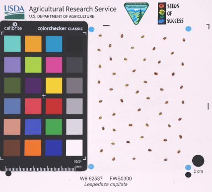 | | 2025 | | | | | | | Wild material | | 2192235 | W6 62537 |
| 55 | W6 61409 | CBG- 10843 | Lespedeza capitata Michx. | Illinois, United States | W6 |  | | 2023 | | | | | | | Wild material | | 2142291 | W6 61409 |
| 56 | W6 60214 | NEWFS-754 | Lespedeza capitata Michx. | Rhode Island, United States | W6 | | | 2021 | | | | | | | Wild material | Drooping because top heavy. | 2138840 | W6 60214 |
| 57 | W6 60252 | NEWFS-821 | Lespedeza capitata Michx. | New Hampshire, United States | W6 | | | 2021 | | | | | | | Wild material | Termil inflorescence brown tall stem with whorled leaves. | 2138878 | W6 60252 |
| 58 | W6 58586 | MARSB-386 | Lespedeza capitata Michx. | New Jersey, United States | W6 | | | 2021 | | | | | | | Wild material | | 2113516 | W6 58586 |
| 59 | DLEG 920278 | DLEG 920278 | Lespedeza capitata Michx. | Virginia, United States | | | Historic | 1992 | COLLECTED | 10/29/1992 | Gloucester Co., At end of Rt. 649, at Achilles. | | | On low sandhill near Severn River, growing with Baccharis, Borrichia. | Wild material | Received from Joe Brown. | 1527719 | DLEG 920278 |
| 60 | PI 710730 | Kish-Ke-Kosh Prairie | Dalea purpurea Vent. | Iowa, United States | NC7 |  | | 2020 | COLLECTED | 08/14/2020 | Kish-Ke-Kosh Prairie State Preserve located 1.1 miles southeast of Reasnor, T78N R19W NW 1/4 NW 1/4 NE 1/4 Sec. 14, Jasper County | 41.56529900, -93.01530300 | 245 | Sandy prairie remnant. | Wild material | | 2106723 | PI 710730 |
| 61 | PI 710487 | CBG-7395 | Desmodium illinoense A. Gray | Illinois, United States | S9 |  | | 2017 | | | | | | | Wild material | | 1954802 | PI 710487 |
| 62 | Ames 36692 | Benton County RR | Echinacea simulata McGregor | Indiana, United States | NC7 |  | | 2025 | COLLECTED | 08/21/2025 | Located 2.65 miles northwest of Fowler just southeast of intersections of state highways 41 and 52, T25N R8W NE ¼ Sec. 6, SW ¼ Sec. 5, and NE ¼ Sec. 8. | 40.64885300, -87.36833100 | 248 | Railroad right-of-way. | Wild material | Specimens at collection site in nature with drooping, pink to rose colored rays measuring 6.0 mm in width and 35.00 mm in length with bright yellow pollen. Plants measuring approximately 20-36" in height. | 2192779 | Ames 36692 |
| 63 | W6 62538 | FWS0300-153 | Monarda punctata L. | Michigan, United States | W6 |  | | 2025 | | | | | | | Wild material | | 2192236 | W6 62538 |
| 64 | Ames 36710 | Engeldinger Marsh | Euphorbia corollata L. | Iowa, United States | NC7 |  | | 2025 | COLLECTED | 09/04/2024 | Engeldinger Marsh located 2.22 miles south, southeast from Farrar, T80N R22W NW 1/4 NE 1/4 Sec. 1. | 41.77464800, -93.35548700 | 304 | Prairie remnant. High-knoll. | Wild material | | 2193318 | Ames 36710 |
| 65 | Ames 36297 | Dinesen Prairie | Euphorbia corollata L. | Iowa, United States | NC7 |  | | 2024 | COLLECTED | 09/06/2024 | Dinesen Prairie State Preserve located 4.5 miles northeast of Harlan, T80N R38W SW ¼ Sec. 28. | 41.70867300, -95.28054700 | 408 | Prairie remnant. | Wild material | | 2170470 | Ames 36297 |
| 66 | OPGC 8857 | Marietta Sand Prairie | Verbena stricta Vent. | Iowa, United States | OPGC | | | 2024 | COLLECTED | 09/04/2024 | Marietta Sand Prairie State Preserve located 7.5 miles northwest of Marshalltown on Knapp Avenue, T84N R19W SW ¼ Sec. 11. | 42.09711200, -93.03873400 | 297 | Remnant sand prairie. | Wild material | | 2170474 | OPGC 8857 |
| 67 | Ames 36256 | Plymouth County | Astragalus crassicarpus Nutt. | Iowa, United States | NC7 |  | | 2024 | COLLECTED | 07/10/2024 | Private property located approximately 4.95 miles southeast of Westfield along North Ridge Road T91N R48W SE 1/4 Sec. 8 (site #1) and also T91N R48W SW 1/4 NW 1/4 Sec 16 (site #2). | 42.70896900, -96.53007200 | 434 | Prairie remnant. | Wild material | | 2168687 | Ames 36256 |
| 68 | OPGC 8811 | CBG- 10775 | Penstemon pallidus Small | Illinois, United States | OPGC | | | 2023 | | | | | | | Wild material | | 2142242 | OPGC 8811 |
| 69 | OPGC 8827 | CBG- 10825 | Physostegia virginiana (L.) Benth. | Illinois, United States | OPGC | | | 2023 | | | | | | | Wild material | | 2142279 | OPGC 8827 |
| 70 | OPGC 8844 | CBG- 10855 | Symphyotrichum ericoides (L.) G. L. Nesom | Illinois, United States | OPGC | | | 2023 | | | | | | | Wild material | | 2142302 | OPGC 8844 |
| 71 | OPGC 8845 | CBG- 10856 | Symphyotrichum laeve (L.) Á. Löve & D. Löve | Illinois, United States | OPGC | | | 2023 | | | | | | | Wild material | | 2142303 | OPGC 8845 |
| 72 | OPGC 8846 | CBG- 10857 | Gentiana puberulenta J. S. Pringle | Illinois, United States | OPGC | | | 2023 | | | | | | | Wild material | | 2142304 | OPGC 8846 |
| 73 | W6 61361 | CBG- 10776 | Dalea candida Willd. | Illinois, United States | W6 |  | | 2023 | | | | | | | Wild material | | 2142243 | W6 61361 |
| 74 | W6 61393 | CBG- 10818 | Linum sulcatum Riddell | Illinois, United States | W6 |  | | 2023 | | | | | | | Wild material | | 2142275 | W6 61393 |
| 75 | W6 61398 | CBG- 10826 | Helianthus pauciflorus Nutt. | Illinois, United States | W6 |  | | 2023 | | | | | | | Wild material | | 2142280 | W6 61398 |
| 76 | Ames 36027 | Marietta Sand Prairie | Salix petiolaris Sm. | Iowa, United States | NC7 |  | | 2023 | COLLECTED | 03/15/2023 | Marietta Sand Prairie State Preserve approximately 7.5 miles northwest of Marshalltown on east side of Knapp Avenue, T84N R19W W 1/2 Sec. 11. | 42.09951000, -93.03668800 | 299 | Remnant sand prairie in areas with likely high water table. | Wild material | Slender-leaved willow, Salix petiolaris, is a somewhat dense suckering shrub that can reach up to 10' in height with slender stems that branch minimally, but typically maintains a height of 5-8'. Native to North America, the native range covers mostly the northeastern US stretching from Maine to western North Dakota and Canada south to central Iowa (Little, E. L. Jr. 1977). Salix petiolaris typically dominates wetland areas including sedge meadows, marshes, riverbanks, and lake shores. Despite favoring wet habitats, it can also be found in dry, upland areas, especially those with high-water tables. However, longevity is generally limited in upland habitats. S. petiolaris, similar to other willow species, responds well to fire, coppicing, or heavy browsing (highly favored by deer) by sprouting new stems close to the crown. In cultivation, plants after five years will encompass a 5' x 5' area due to stems that arch from the main base of the plant. Coppicing of plants to ground level is highly recommended either annually or once every 3-5 years to maintain vigorous growth and plant health. This species requires substantial to full sun exposure and is an excellent choice for streambank stabilizations and windbreaks to reduce soil erosion and drifting snow, respectively. This accession represents genetics from central Iowa and thus the southwestern edge of the species native range. Plants sampled in nature measuring at most 5' in height. Clump-type growth habit with minimal branching, but dense suckering (e.g. 50+ ramets per genet - typically encompassing 5' x 5' area) with winter stem colors ranging from red, orange-red, yellow, dark-green, green-brown, and yellow-green. Stems glabrous. Dormant buds occassionally black, but often reddish. | 2141651 | Ames 36027 |
| 77 | W6 63340 | Anderson Prairie | Amorpha canescens Pursh | Iowa, United States | W6 | | | 2023 | COLLECTED | 09/23/2022 | Anderson Prairie State Preserve located approximately 2.0 miles north of Estherville, T100N R34W NW 1/4 Sec. 36. | 43.43906800, -94.87472300 | 412 | Diverse remnant prairie with rolling hills and mesic soil. | Wild material | | 2141750 | W6 63340 |
| 78 | NA 89037 | RJL2022KS-004 | Fraxinus pennsylvanica Marshall | Kansas, United States | NA |  for this accession.") | | 2022 | COLLECTED | 09/21/2022 | Coronado Heights Park, Smoky View, Kansas hillsides surrounding the historic WPA circa 1932 Coronado Heights Castle located about 91 meters above the surrounding land. This plant is scattered and infrequent on the slopes of this site. | 38.61065700, -97.70408300 | 448 | Plants growing in full sun, under extreme exposure, rocky, dry and thin soils of this short grass prairie habitat on the slopes surrounding the summit of Coronado Heights Park. Plants tend
Soils: The underlying geology of this area is of Upper Cretaceous origin and comprised of Kiowa Shale or FM- light -gray to black illitic shale with thin coquinoidal limestone beds at the base; sandstone lenses are common. Cheyenne Sandstone-massive to cross-bedded, light-gray to buff fine-grained sandstone with lenses to be found in runoff zones where moisture is temporarily more abundant.of gray sandy shale and conglomerate.
Source: USGS Kansas Geologic Map Data (https://mrdata.usgs.gov/geology/state/sgmc-unit.php?unit=KSKkc%3B0)
The surface soil profile of this area is Lancaster-Hedville complex, 3 to 20 percent slopes. The Lancaster series consists of moderately deep, well drained soils that formed in residuum from sandstone and sandy shales; it can be up to 200 cm deep. Slopes range from 1-20%. Hedville soils have bedrock within 50 centimeters of the surface and occur on similar hillslope positions.
Source: NRCS Web Soil Survey (https://websoilsurvey.sc.egov.usda.gov/App/WebSoilSurvey.aspx) | Wild material | | 2139602 | NA 89037 |
| 79 | NA 89036 | RJL2022KS-003 | Cornus drummondii C. A. Mey. | Kansas, United States | NA | | | 2022 | COLLECTED | 09/21/2022 | Coronado Heights Park, Smoky View, Kansas hillsides surrounding the historic WPA circa 1932 Coronado Heights Castle located about 91 meters above the surrounding land. This plant is common and abundant on the slopes of this site. | 38.61348400, -97.70343100 | 475 | Plants growing in part shade to full sun, under extreme exposure, rocky, dry and thin soils of this short grass prairie habitat on the slopes surrounding the summit of Coronado Heights Park. The underlying geology of this area is of Upper Cretaceous origin and comprised of Kiowa Shale or FM- light -gray to black illitic shale with thin coquinoidal limestone beds at the base; sandstone lenses are common. Cheyenne Sandstone-massive to cross-bedded, light-gray to buff fine-grained sandstone with lenses of gray sandy shale and conglomerate.
Source: USGS Kansas Geologic Map Data (https://mrdata.usgs.gov/geology/state/sgmc-unit.php?unit=KSKkc%3B0)
The surface soil profile of this area is Lancaster-Hedville complex, 3 to 20 percent slopes. The Lancaster series consists of moderately deep, well drained soils that formed in residuum from sandstone and sandy shales; it can be up to 200 cm deep. Slopes range from 1-20%. Hedville soils have bedrock within 50 centimeters of the surface and occur on similar hillslope positions.
Source: NRCS Web Soil Survey (https://websoilsurvey.sc.egov.usda.gov/App/WebSoilSurvey.aspx)
Slope: 5-20% Aspect: all | Wild material | | 2139601 | NA 89036 |
| 80 | NA 89035 | RJL2022KS-002 | Rosa arkansana Porter | Kansas, United States | NA | | | 2022 | COLLECTED | 09/20/2022 | Coronado Heights Park, Smoky View, Kansas hillsides surrounding the historic WPA circa 1932 Coronado Heights Castle located about 91 meters above the surrounding land. This plant is quite abundant on the slopes of this site and highly competitive. | 38.61158800, -97.70427000 | 475 | Plants growing in part-sun to full sun, under extreme exposure, rocky, dry and thin soils of this short grass prairie habitat on the slopes surrounding the summit of Coronado Heights Park.
The underlying geology of this area is of Upper Cretaceous origin and comprised of Kiowa Shale or FM- light -gray to black illitic shale with thin coquinoidal limestone beds at the base; sandstone lenses are common. Cheyenne Sandstone-massive to cross-bedded, light-gray to buff fine-grained sandstone with lenses of gray sandy shale and conglomerate.
Source: USGS Kansas Geologic Map Data (https://mrdata.usgs.gov/geology/state/sgmc-unit.php?unit=KSKkc%3B0)
The surface soil profile of this area is Lancaster-Hedville complex, 3 to 20 percent slopes. The Lancaster series consists of moderately deep, well drained soils that formed in residuum from sandstone and sandy shales; it can be up to 200 cm deep. Slopes range from 1-20%. Hedville soils have bedrock within 50 centimeters of the surface and occur on similar hillslope positions.
Source: NRCS Web Soil Survey (https://websoilsurvey.sc.egov.usda.gov/App/WebSoilSurvey.aspx) | Wild material | | 2139600 | NA 89035 |
| 81 | NA 89034 | RJL2022KS-001 | Baptisia australis (L.) R. Br. var. minor (Lehm.) Fernald | Kansas, United States | NA | | | 2022 | COLLECTED | 09/20/2022 | Coronado Heights Park, Smoky View, Kansas hillsides surrounding the historic WPA circa 1932 Coronado Heights Castle located about 91 meters above the surrounding land. This plant is sporadic to common on the slopes of this site. | 38.61349700, -97.70303900 | 487 | This plant is sporadic to common on the slopes of this site.
Habitat Notes: Plants growing in full sun, under extreme exposure, rocky, dry and thin soils of this short grass prairie habitat on the slopes surrounding the summit of Coronado Heights Park.
The underlying geology of this area is of Upper Cretaceous origin and comprised of Kiowa Shale or FM- light -gray to black illitic shale with thin coquinoidal limestone beds at the base; sandstone lenses are common. Cheyenne Sandstone-massive to cross-bedded, light-gray to buff fine-grained sandstone with lenses of gray sandy shale and conglomerate.
Source: USGS Kansas Geologic Map Data (https://mrdata.usgs.gov/geology/state/sgmc-unit.php?unit=KSKkc%3B0)
The surface soil profile of this area is Lancaster-Hedville complex, 3 to 20 percent slopes. The Lancaster series consists of moderately deep, well drained soils that formed in residuum from sandstone and sandy shales; it can be up to 200 cm deep. Slopes range from 1-20%. Hedville soils have bedrock within 50 centimeters of the surface and occur on similar hillslope positions.
Source: NRCS Web Soil Survey (https://websoilsurvey.sc.egov.usda.gov/App/WebSoilSurvey.aspx) | Wild material | received as Baptisia minor | 2139599 | NA 89034 |
| 82 | Ames 35886 | Hook Larson Prairie | Heuchera richardsonii R. Br. | Illinois, United States | NC7 |  | | 2022 | COLLECTED | 06/22/2022 | Nachusa Grasslands (Hook Larson Prairie) located approximately 5.07 miles northwest of Franklin Grove just north of West Stone Barn Road, T22N R10E NE 1/4 SE 1/4 NE 1/4 Sec. 17. | 41.89738600, -89.36123100 | 236 | High-quality prairie remnant with thick vegetation managed with infrequent burning. Various small remnants within immediate area. | Wild material | | 2138219 | Ames 35886 |
| 83 | Ames 35883 | Waterworks Park Prairie | Heuchera richardsonii R. Br. | Iowa, United States | NC7 |  | | 2022 | COLLECTED | 07/05/2022 | Waterworks Park on west side of Bonnifield Lake located 1.00 mile north, northeast of Fairfield, T72N R10W SE ¼ Sec. 24. | 41.02135000, -91.95665000 | 227 | High-quality prairie remnant managed with infrequent burning. Various small remnants within immediate area. | Wild material | | 2138216 | Ames 35883 |
| 84 | OPGC 7587 | Marietta Sand Prairie | Packera plattensis (Nutt.) W. A. Weber & Á. Löve | Iowa, United States | OPGC |  | | 2022 | COLLECTED | 06/03/2022 | Marietta Sand Prairie State Preserve located 12.0 km northwest of Marshalltown and 10.0 km north of Highway 30 on Knapp Avenue, T84N R19W W ½ Sec. 11. | 42.09835700, -93.03457900 | 299 | Remnant sand prairie. | Wild material | Plants in nature are approximately one to two feet in height. Peak flower and fruiting in 2022 occurred on 26 May and 3 June, respectively. | 2138177 | OPGC 7587 |
| 85 | OPGC 7582 | Anderson Prairie | Liatris aspera Michx. | Iowa, United States | OPGC | | | 2022 | COLLECTED | 09/10/2021 | Anderson Prairie located approximately 2.0 miles north of Estherville, T100N R34W NW 1/4 Sec. 36. | 43.43906800, -94.87472300 | 412 | Diverse remnant prairie with rolling hills and mesic soil. | Wild material | | 2133091 | OPGC 7582 |
| 86 | OPGC 7585 | Pleggenkuhle Prairie | Liatris pycnostachya Michx. | Iowa, United States | OPGC | | | 2022 | COLLECTED | 09/29/2021 | Pleggenkuhle Prairie located 2.11 miles northwest of Hawkeye, T94N R10W Sec. 14. | 42.95783800, -91.98405900 | 341 | Wet-mesic prairie remnant on Clyde Silty Clay Loam and Floyd Loam soils. | Wild material | | 2133094 | OPGC 7585 |
| 87 | OPGC 8531 | NEWFS-756 | Eutrochium dubium (Willd. ex Poir.) E. E. Lamont | Rhode Island, United States | OPGC | | | 2021 | | | | | | | Wild material | Leaves in whorls of 3 4 up the stem. | 2138842 | OPGC 8531 |
| 88 | W6 60215 | NEWFS-755 | Schizachyrium scoparium (Michx.) Nash | Rhode Island, United States | W6 | | | 2021 | | | | | | | Wild material | Seeds attached to cottony hairs that line the grass leaf, evenly spaced. | 2138841 | W6 60215 |
| 89 | W6 60251 | NEWFS-820 | Schizachyrium scoparium (Michx.) Nash | New Hampshire, United States | W6 | | | 2021 | | | | | | | Wild material | Burgundy purple stemmed grass grows in dense clusters in open areas seed heads visible as little white fluffy tufts along stem. | 2138877 | W6 60251 |
| 90 | W6 60122 | NEWFS-378 | Eragrostis spectabilis (Pursh) Steud. | New Hampshire, United States | W6 | | | 2021 | | | | | | | Wild material | Pinkish purple seeds, multiple florets per spikelet. | 2137207 | W6 60122 |
| 91 | NA 88421 | CBG-10737 | Prunus americana Marshall | | NA |  | | 2021 | | | | | | | Wild material | Spatially discreet collection for a clonal species. Counts made approximately every 6 feet. Fruits collected from the plant and the ground. | 2137989 | NA 88421 |
| 92 | W6 60356 | CBG-10736 | Houstonia longifolia Gaertn. | | W6 |  | | 2021 | | | | | | | Wild material | | 2137988 | W6 60356 |
| 93 | OPGC 8278 | CBG-9870 | Lobelia spicata Lam. | Wisconsin, United States | OPGC | | | 2021 | | | | | | | Wild material | | 2120028 | OPGC 8278 |
| 94 | OPGC 8309 | CBG-10450 | Heuchera richardsonii R. Br. | Wisconsin, United States | OPGC | | | 2021 | | | | | | | Wild material | | 2120089 | OPGC 8309 |
| 95 | W6 59087 | CBG-9704 | Hymenopappus scabiosaeus LʼHér. | Illinois, United States | W6 | | | 2021 | | | | | | | Wild material | | 2120017 | W6 59087 |
| 96 | W6 59101 | CBG-9967 | Dalea candida Willd. | Illinois, United States | W6 | | | 2021 | | | | | | | Wild material | | 2120030 | W6 59101 |
| 97 | W6 59135 | CBG-10230 | Eupatorium perfoliatum L. | Illinois, United States | W6 | | | 2021 | | | | | | | Wild material | | 2120061 | W6 59135 |
| 98 | W6 59186 | CBG-10477 | Juncus greenei Oakes & Tuck. | Illinois, United States | W6 | | | 2021 | | | | | | | Wild material | | 2120105 | W6 59186 |
| 99 | OPGC 8145 | MARSB-385 | Euthamia caroliniana (L.) Greene ex Porter & Britton | New Jersey, United States | OPGC | | | 2021 | | | | | | | Wild material | | 2113515 | OPGC 8145 |
| 100 | W6 58575 | MARSB-215 | Juncus secundus P. Beauv. ex Poir. | New York, United States | W6 | | | 2021 | | | | | | | Wild material | Plants are in seed. The inflorescences are straw colored. The inflorescences are at the top of the stem, not spreading. It is taller than Juncus tenuis. | 2113505 | W6 58575 |
| 101 | Ames 35560 | Hawthorn Prairie | Echinacea pallida (Nutt.) Nutt. | Iowa, United States | NC7 |  | | 2020 | COLLECTED | 08/14/2020 | Hawthorn Lake Wildlife Management Area, located one mile south of Barnes City on the northeast side of Hawthorn Lake, Mahaska County | 41.48270000, -92.45230000 | 260 | Remnant prairie. | Wild material | Plants sampled in nature measuring approximately 2-3 feet in height. | 2107723 | Ames 35560 |
| 102 | Ames 35545 | Kish-Ke-Kosh Prairie | Drymocallis arguta (Pursh) Rydb. | Iowa, United States | NC7 |  | | 2020 | COLLECTED | 08/14/2020 | Kish-Ke-Kosh Prairie State Preserve located 1.1 miles southeast of Reasnor, T78N R19W NE 1/4 NW 1/4 NE 1/4 Sec. 14, Jasper County | 41.56461900, -93.01285900 | 259 | Sandy prairie remnant. | Wild material | | 2106724 | Ames 35545 |
| 103 | OPGC 7548 | Beat Prairie | Baptisia alba (L.) R. Br. | Iowa, United States | OPGC |  | | 2020 | COLLECTED | 08/14/2020 | Beat Prairie located approximately 3.25 miles northwest of Knoxville, T76N R20W SW 1/4 SW 1/4 NW 1/4 Sec. 26, Marion County | 41.35765500, -93.13777000 | 255 | Tallgrass prairie remnant. | Wild material | | 2106722 | OPGC 7548 |
| 104 | W6 57084 | MARSB-216 | Carex annectens (E. P. Bicknell) E. P. Bicknell | New York, United States | W6 |  | | 2019 | | | | | | | Wild material | | 2097523 | W6 57084 |
| 105 | W6 57143 | MARSB-333 | Eupatorium hyssopifolium L. | New Jersey, United States | W6 |  | | 2019 | | | | | | | Wild material | | 2097582 | W6 57143 |
| 106 | W6 57144 | MARSB-334 | Tridens flavus (L.) Hitchc. | New Jersey, United States | W6 |  | | 2019 | | | | | | | Wild material | | 2097583 | W6 57144 |
| 107 | NA 88206 | CBG-9427 | Ceanothus americanus L. | Illinois, United States | NA |  | | 2019 | | | | | | | Wild material | | 2092801 | NA 88206 |
| 108 | OPGC 7476 | CBG-9132 | Solidago juncea Aiton | Wisconsin, United States | OPGC |  | | 2019 | | | | | | | Wild material | | 2092771 | OPGC 7476 |
| 109 | W6 56595 | CBG-8677 | Juncus balticus Willd. subsp. littoralis (Engelm.) Snogerup | Nebraska, United States | W6 |  | | 2019 | | | | | | | Wild material | | 2092694 | W6 56595 |
| 110 | NA 88082 | NEWFS-752 | Ilex glabra (L.) A. Gray | Rhode Island, United States | NA |  | | 2019 | COLLECTED | 10/04/2017 | Great Swamp Management Area: from Boston: take 93S to 95S to RI-4S. Take exit 5B to RI-103N. Turn left onto RI-2S. Turn left onto RI-130E. Turn left onto Watson Rd. Turn left onto Liberty Ln. Park and walk down trail at end of Great Neck Rd. Population under power lines, over a km in. | 41.46677000, -71.58330000 | 29 | Wet meadow. | Wild material | | 1976346 | NA 88082 |
| 111 | W6 54781 | NCBG-675 | Eupatorium hyssopifolium L. | Virginia, United States | W6 |  | | 2018 | | | | | | | Wild material | Eupatorium hyssopifolium | 1966007 | W6 54781 |
| 112 | Ames 34341 | Sheeder Prairie | Drymocallis arguta (Pursh) Rydb. | Iowa, United States | NC7 |  | | 2018 | COLLECTED | 09/06/2018 | Sheeder Prairie State Preserve located approximately 4.45 miles west, northwest of Guthrie Center, T80N R32W SW 1/4 SW 1/4 Sec. 33, Guthrie County | 41.68949600, -94.58847900 | 366 | High-quality native prairie remnant. | Wild material | | 1967543 | Ames 34341 |
| 113 | Ames 34342 | Sheeder | Echinacea pallida (Nutt.) Nutt. | Iowa, United States | NC7 |  | | 2018 | COLLECTED | 09/06/2018 | Sheeder Prairie State Preserve located approximately 4.45 miles west, northwest of Guthrie Center, T80N R32W SW 1/4 SW 1/4 Sec. 33 | 41.68949600, -94.58847900 | 366 | High-quality native prairie remnant. | Wild material | | 1967544 | Ames 34342 |
| 114 | Ames 34343 | Sheeder | Monarda fistulosa L. | Iowa, United States | NC7 |  | | 2018 | COLLECTED | 09/06/2018 | Sheeder Prairie State Preserve located approximately 4.45 miles west, northwest of Guthrie Center, T80N R32W SW 1/4 SW 1/4 Sec. 33 | 41.68949600, -94.58847900 | 366 | High-quality native prairie remnant. | Wild material | | 1967545 | Ames 34343 |
| 115 | W6 52994 | CBG-7338 | Amorpha canescens Pursh | Illinois, United States | W6 |  | | 2017 | | | | | | | Wild material | | 1954745 | W6 52994 |
| 116 | W6 53110 | CBG-7097 | Schoenoplectus acutus (Muhl. ex Bigelow) Á. Löve & D. Löve | Nebraska, United States | W6 |  | | 2017 | | | | | | | Wild material | | 1954861 | W6 53110 |
| 117 | Ames 34038 | Ames 34038 | Monarda punctata L. | Illinois, United States | NC7 |  | | 2017 | COLLECTED | 10/29/2017 | Nachusa Grasslands located approximately 4.17 miles northwest of Franklin Grove just west of Lowden Road, T22N R10E NW 1/4 NW 1/4 SE 1/4 Sec. 16, Ogle County. | 41.89120000, -89.34490000 | 225 | Newly disturbed ground (fenceline installation 2015) consisting of almost level sandy soil with a very slight slope. | Wild material | Plants ranging between 16-22" in height, branched with numerous seed heads. | 1954327 | Ames 34038 |
| 118 | Ames 33972 | Ames 33972 | Polytaenia nuttallii DC. | Iowa, United States | NC7 |  | | 2017 | COLLECTED | 07/28/2017 | Sheeder Prairie State Preserve located approximately 4.45 miles west, northwest of Guthrie Center, T80N R32W SW 1/4 SW 1/4 Sec. 33 | 41.68949600, -94.58847900 | 366 | High-quality native prairie remnant. Dry, rocky habitat. | Wild material | A monocarpic perennial. | 1950055 | Ames 33972 |
| 119 | OPGC 5077 | OPGC 5077 | Phlox pilosa L. subsp. fulgida (Wherry) Wherry | Iowa, United States | OPGC | | | 2017 | COLLECTED | 06/28/2017 | Sheeder Prairie State Preserve located approximately 4.45 miles west, northwest of Guthrie Center, T80N R32W SW 1/4 SW 1/4 Sec. 33 | 41.68949600, -94.58847900 | 366 | High-quality native prairie remnant. Dry, rocky habitat. Growing in association with Ceanothus herbaceous, Asclepias tuberosa, Bromus inermis, Dalea purpurea, Dalea candida, Sporobolus heterolepis, Hesperostipa spartea, Zizia aurea, Amorpha canescens, Polytaenia nuttallii, sisyrinchium angustifolium, Tradescantia bracteata, Liatris squarrosa, Astragulus canadensis, Asclepias viridis, Schizachyrium scoparium, Andropogon gerardii, Comandra umbellata, Lespedeza capitata, Viola pedatifida, Anemone cylindrica, Euphorbia corollata, Oligoneruon rigidum, and Lilium philadelphicum. | Wild material | | 1950054 | OPGC 5077 |
| 120 | NA 88207 | CBG-4389 | Ceanothus americanus L. | Kansas, United States | NA | | | 2016 | | | | | | | Wild material | | 1942744 | NA 88207 |
| 121 | OPGC 6240 | CBG-4156 | Tradescantia ohiensis Raf. | Illinois, United States | OPGC | | | 2016 | | | | | | | Wild material | | 1942710 | OPGC 6240 |
| 122 | W6 51566 | CBG-4086 | Krigia virginica (L.) Willd. | Illinois, United States | W6 | | | 2016 | | | | | | | Wild material | | 1942696 | W6 51566 |
| 123 | W6 51579 | CBG2015-4155 | Koeleria macrantha (Ledeb.) Schult. | Illinois, United States | W6 | | | 2016 | | | | | | | Wild material | | 1942709 | W6 51579 |
| 124 | W6 49522 | CBG-2457 | Carex muehlenbergii Schkuhr ex Willd. | Illinois, United States | W6 |  | | 2015 | | | | | | | Wild material | | 1926154 | W6 49522 |
| 125 | Ames 28352 | 11 | Hypericum punctatum Lam. | Iowa, United States | NC7 |  | | 2006 | COLLECTED | 09/19/2006 | 150 yards west of boat ramp, west side of dam, Don Williams County Park, SW 1/4 of NE 1/4 of SW 1/4 of Section 5, T84N, R27W, Yell Township, Boone County. | 42.11194444, -94.02138889 | 313 | Open, grassy hilltop and hillside. Partial-full sun. Dry-moist soil. | Wild material | | 1712922 | Ames 28352 |
| 126 | WLP 769 | NA 73812 | Celastrus scandens L. | Iowa, United States | NA |  | | 2003 | COLLECTED | 09/14/2003 | Quandahl Road, Bear Creek Wildlife Area, Highlandville, T100N R7W, NE 1/4 of NW 1/4, Section 36, Dorchester Quad, Winneshiek County. | 43.44055556, -91.62388889 | 268 | Mostly sunny. Steep slope with a southeastern aspect. Thin soil over limestone with high stoniness, well drained. Associated with Juniperus communis, J. virginiana, Ulmus rubra, Lespedeza capitata, Monarda fistulosa, and Rhus glabra. | Wild material | Vine to 4 meters tall. | 1649454 | WLP 769 |