| 0 | PI 667435 | JDC-0192007 | Liatris punctata Hook. | Nebraska, United States | OPGC | | | 2007 | COLLECTED | 09/01/2007 | Approximately 0.5 mile south of the intersection of 561 Avenue and 835 1/2 Road, then 0.25 mile south, Wood Duck Wildlife Management Area, approximately 3 miles southwest of Stanton, Stanton County. | 41.93444444, -97.32361111 | 466 | Prairie knoll. Very dry, sandy soil. Associated with Penstemon grandiflorus, Quercus macrocarpa, and Yucca. | Wild material | | 1740667 | PI 667435 |
| 1 | OPGC 7489 | CBG-9424 | Liatris punctata Hook. | South Dakota, United States | OPGC |  | | 2019 | | | | | | | Wild material | | 2092798 | OPGC 7489 |
| 2 | W6 62524 | FWS0300-120 | Liatris aspera Michx. | Michigan, United States | W6 |  | | 2025 | | | | | | | Wild material | | 2192222 | W6 62524 |
| 3 | OPGC 7580 | Coopers Cove | Liatris aspera Michx. | Iowa, United States | OPGC | | | 2022 | COLLECTED | 09/20/2021 | Coopers Cove located approximately 7.0 miles east of Palmer on C56, T90N R31W extreme west edge of Sec. 12. | 42.62416400, -94.46270000 | 365 | Roadside remnant. | Wild material | | 2133089 | OPGC 7580 |
| 4 | W6 62538 | FWS0300-153 | Monarda punctata L. | Michigan, United States | W6 |  | | 2025 | | | | | | | Wild material | | 2192236 | W6 62538 |
| 5 | Ames 34361 | Ames 34361 | Monarda punctata L. | Wisconsin, United States | NC7 |  | | 2018 | COLLECTED | 10/11/2018 | Fort McCoy Military Training Area located 5.0 miles northeast of Sparta, T17N R3W S edge of Sec. 3; NE 1/4 and NE 1/4 of NW1/4 of Sec. 10; NE 1/4 of Sec. 9; and SE 1/4 of Sec. 4, Monroe County. | 43.97153900, -90.72177200 | 282 | Oak and pine barren community dominated (80%) by sand on variable 0 to 45% slopes. | Wild material | | 1968260 | Ames 34361 |
| 6 | PI 631318 | 070 | Echinacea angustifolia DC. var. angustifolia | Kansas, United States | NC7 |  | | 1997 | COLLECTED | 08/27/1997 | Near Woodston, Rooks County. Please contact curator for specific site location. | 39.46666667, -99.13333333 | 585 | Native mixed prairie; grazed mid-summer to fall; harvested since the 1930's. Full exposure, 5-25% slope with southern and eastern aspects. Heizer-Brownell gravelly loam, well drained with moderate amounts of limestone gravel. | Wild material | Most plants were 3-4 (some up to 5) dm tall, branched, and frequent on the hilltop and abundant on the slopes in a large population with a moderate density of about 0.5 flowering plants/square meter. | 1549458 | PI 631318 |
| 7 | PI 631319 | 071 | Echinacea angustifolia DC. var. angustifolia | Kansas, United States | NC7 |  | | 1997 | COLLECTED | 08/29/1997 | Near Quinter, Gove County. Please contact curator for specific site location. | 38.95000000, -100.21666667 | 840 | Native pasture of mixed and short grasses, somewhat weedy. Full exposure, ~25% slope with a north to northeast aspect. Manuel-Badland complex (calcareous; chalk breaks), well drained thin soil over chalk and limestone, gravelly to stony. | Wild material | Plants were short (mostly 2-3 dm), unbranched, and frequent (clustered on slopes, mostly on thin soil, not areas of bare chalk). | 1549459 | PI 631319 |
| 8 | NA 88808 | TJK2023LA/TX-008 | Yucca pallida McKelvey | Texas, United States | NA | | | 2023 | COLLECTED | 11/27/2023 | FM (farm-to-market road) 112, just west of Highway 281. | 31.85250000, -98.11150000 | 377 | Rich roadside strip between fence line and dirt road. Slope: 8%. Aspect: Southeast. Elevation: 1238 feet. | Wild material | | 2159191 | NA 88808 |
| 9 | NA 89037 | RJL2022KS-004 | Fraxinus pennsylvanica Marshall | Kansas, United States | NA |  for this accession.") | | 2022 | COLLECTED | 09/21/2022 | Coronado Heights Park, Smoky View, Kansas hillsides surrounding the historic WPA circa 1932 Coronado Heights Castle located about 91 meters above the surrounding land. This plant is scattered and infrequent on the slopes of this site. | 38.61065700, -97.70408300 | 448 | Plants growing in full sun, under extreme exposure, rocky, dry and thin soils of this short grass prairie habitat on the slopes surrounding the summit of Coronado Heights Park. Plants tend
Soils: The underlying geology of this area is of Upper Cretaceous origin and comprised of Kiowa Shale or FM- light -gray to black illitic shale with thin coquinoidal limestone beds at the base; sandstone lenses are common. Cheyenne Sandstone-massive to cross-bedded, light-gray to buff fine-grained sandstone with lenses to be found in runoff zones where moisture is temporarily more abundant.of gray sandy shale and conglomerate.
Source: USGS Kansas Geologic Map Data (https://mrdata.usgs.gov/geology/state/sgmc-unit.php?unit=KSKkc%3B0)
The surface soil profile of this area is Lancaster-Hedville complex, 3 to 20 percent slopes. The Lancaster series consists of moderately deep, well drained soils that formed in residuum from sandstone and sandy shales; it can be up to 200 cm deep. Slopes range from 1-20%. Hedville soils have bedrock within 50 centimeters of the surface and occur on similar hillslope positions.
Source: NRCS Web Soil Survey (https://websoilsurvey.sc.egov.usda.gov/App/WebSoilSurvey.aspx) | Wild material | | 2139602 | NA 89037 |
| 10 | NA 89036 | RJL2022KS-003 | Cornus drummondii C. A. Mey. | Kansas, United States | NA | | | 2022 | COLLECTED | 09/21/2022 | Coronado Heights Park, Smoky View, Kansas hillsides surrounding the historic WPA circa 1932 Coronado Heights Castle located about 91 meters above the surrounding land. This plant is common and abundant on the slopes of this site. | 38.61348400, -97.70343100 | 475 | Plants growing in part shade to full sun, under extreme exposure, rocky, dry and thin soils of this short grass prairie habitat on the slopes surrounding the summit of Coronado Heights Park. The underlying geology of this area is of Upper Cretaceous origin and comprised of Kiowa Shale or FM- light -gray to black illitic shale with thin coquinoidal limestone beds at the base; sandstone lenses are common. Cheyenne Sandstone-massive to cross-bedded, light-gray to buff fine-grained sandstone with lenses of gray sandy shale and conglomerate.
Source: USGS Kansas Geologic Map Data (https://mrdata.usgs.gov/geology/state/sgmc-unit.php?unit=KSKkc%3B0)
The surface soil profile of this area is Lancaster-Hedville complex, 3 to 20 percent slopes. The Lancaster series consists of moderately deep, well drained soils that formed in residuum from sandstone and sandy shales; it can be up to 200 cm deep. Slopes range from 1-20%. Hedville soils have bedrock within 50 centimeters of the surface and occur on similar hillslope positions.
Source: NRCS Web Soil Survey (https://websoilsurvey.sc.egov.usda.gov/App/WebSoilSurvey.aspx)
Slope: 5-20% Aspect: all | Wild material | | 2139601 | NA 89036 |
| 11 | NA 89035 | RJL2022KS-002 | Rosa arkansana Porter | Kansas, United States | NA | | | 2022 | COLLECTED | 09/20/2022 | Coronado Heights Park, Smoky View, Kansas hillsides surrounding the historic WPA circa 1932 Coronado Heights Castle located about 91 meters above the surrounding land. This plant is quite abundant on the slopes of this site and highly competitive. | 38.61158800, -97.70427000 | 475 | Plants growing in part-sun to full sun, under extreme exposure, rocky, dry and thin soils of this short grass prairie habitat on the slopes surrounding the summit of Coronado Heights Park.
The underlying geology of this area is of Upper Cretaceous origin and comprised of Kiowa Shale or FM- light -gray to black illitic shale with thin coquinoidal limestone beds at the base; sandstone lenses are common. Cheyenne Sandstone-massive to cross-bedded, light-gray to buff fine-grained sandstone with lenses of gray sandy shale and conglomerate.
Source: USGS Kansas Geologic Map Data (https://mrdata.usgs.gov/geology/state/sgmc-unit.php?unit=KSKkc%3B0)
The surface soil profile of this area is Lancaster-Hedville complex, 3 to 20 percent slopes. The Lancaster series consists of moderately deep, well drained soils that formed in residuum from sandstone and sandy shales; it can be up to 200 cm deep. Slopes range from 1-20%. Hedville soils have bedrock within 50 centimeters of the surface and occur on similar hillslope positions.
Source: NRCS Web Soil Survey (https://websoilsurvey.sc.egov.usda.gov/App/WebSoilSurvey.aspx) | Wild material | | 2139600 | NA 89035 |
| 12 | NA 89034 | RJL2022KS-001 | Baptisia australis (L.) R. Br. var. minor (Lehm.) Fernald | Kansas, United States | NA | | | 2022 | COLLECTED | 09/20/2022 | Coronado Heights Park, Smoky View, Kansas hillsides surrounding the historic WPA circa 1932 Coronado Heights Castle located about 91 meters above the surrounding land. This plant is sporadic to common on the slopes of this site. | 38.61349700, -97.70303900 | 487 | This plant is sporadic to common on the slopes of this site.
Habitat Notes: Plants growing in full sun, under extreme exposure, rocky, dry and thin soils of this short grass prairie habitat on the slopes surrounding the summit of Coronado Heights Park.
The underlying geology of this area is of Upper Cretaceous origin and comprised of Kiowa Shale or FM- light -gray to black illitic shale with thin coquinoidal limestone beds at the base; sandstone lenses are common. Cheyenne Sandstone-massive to cross-bedded, light-gray to buff fine-grained sandstone with lenses of gray sandy shale and conglomerate.
Source: USGS Kansas Geologic Map Data (https://mrdata.usgs.gov/geology/state/sgmc-unit.php?unit=KSKkc%3B0)
The surface soil profile of this area is Lancaster-Hedville complex, 3 to 20 percent slopes. The Lancaster series consists of moderately deep, well drained soils that formed in residuum from sandstone and sandy shales; it can be up to 200 cm deep. Slopes range from 1-20%. Hedville soils have bedrock within 50 centimeters of the surface and occur on similar hillslope positions.
Source: NRCS Web Soil Survey (https://websoilsurvey.sc.egov.usda.gov/App/WebSoilSurvey.aspx) | Wild material | received as Baptisia minor | 2139599 | NA 89034 |
| 13 | OPGC 8444 | WY070-96 | Ratibida columnifera (Nutt.) Wooton & Standl. | Wyoming, United States | OPGC | | | 2021 | | | | | | | Wild material | Clumping aster with drooping, wide, bright yellow (occasionally red and yellow) ray flowers around a cylindrical cone. Leaves deeply divided. | 2120868 | OPGC 8444 |
| 14 | W6 53018 | CBG-7563 | Sporobolus rigidus (Buckley) P. M. Peterson var. rigidus | Nebraska, United States | W6 |  | | 2017 | | | | | | | Wild material | | 1954769 | W6 53018 |
| 15 | OPGC 6267 | WY070-75 | Heterotheca villosa (Pursh) Shinners | Wyoming, United States | OPGC | | | 2017 | | | | | | | Wild material | | 1947163 | OPGC 6267 |
| 16 | W6 52029 | WY070-73 | Dalea candida Willd. | Wyoming, United States | W6 | | | 2017 | | | | | | | Wild material | | 1947162 | W6 52029 |
| 17 | W6 49523 | CBG-2460 | Nothocalais cuspidata (Pursh) Greene | Colorado, United States | W6 |  | | 2015 | | | | | | | Wild material | | 1926158 | W6 49523 |
| 18 | W6 49550 | CBG-2497 | Allium textile A. Nelson & J. F. Macbr. | Colorado, United States | W6 |  | | 2015 | | | | | | | Wild material | | 1926023 | W6 49550 |
| 19 | W6 49589 | CBG-2575 | Pediomelum tenuiflorum (Pursh) A. N. Egan | Colorado, United States | W6 |  | | 2015 | | | | | | | Wild material | | 1926060 | W6 49589 |
| 20 | W6 49600 | CBG-2596 | Artemisia dracunculus L. | South Dakota, United States | W6 |  | | 2015 | | | | | | | Wild material | | 1926069 | W6 49600 |
| 21 | Ames 32470 | ECAN2-SOS-WY080-12-CUSTER-12 | Echinacea angustifolia DC. | South Dakota, United States | NC7 |  | | 2013 | COLLECTED | 08/10/2012 | Located approximately 16.6 miles west of Custer along Forest Service Road 668 just north of highway 16, T3S R2E NW 1/4 Sec. 31, Custer County. | 43.74830000, -103.93117000 | 1600 | Valley composed of grazed and burned areas with eastern aspect. Growing in association with Ratibida columnifera, Pinus ponderosa, Liatris punctata, Grindelia squarrosa, Rosa sp., and Symphoricarpos occidentalis. | Wild material | | 1914390 | Ames 32470 |
| 22 | W6 45906 | CBG-1906 | Artemisia campestris L. subsp. caudata (Michx.) H. M. Hall & Clem. | Colorado, United States | W6 |  | | 2013 | | | | | | | Wild material | | 1908769 | W6 45906 |
| 23 | W6 45908 | CBG-1934 | Artemisia filifolia Torr. | Colorado, United States | W6 |  | | 2013 | | | | | | | Wild material | | 1908771 | W6 45908 |
| 24 | W6 45925 | CBG-1932 | Atriplex canescens (Pursh) Nutt. | Colorado, United States | W6 |  | | 2013 | | | | | | | Wild material | | 1908788 | W6 45925 |
| 25 | OPGC 2897 | 198422 | Delphinium geyeri Greene | Colorado, United States | OPGC | 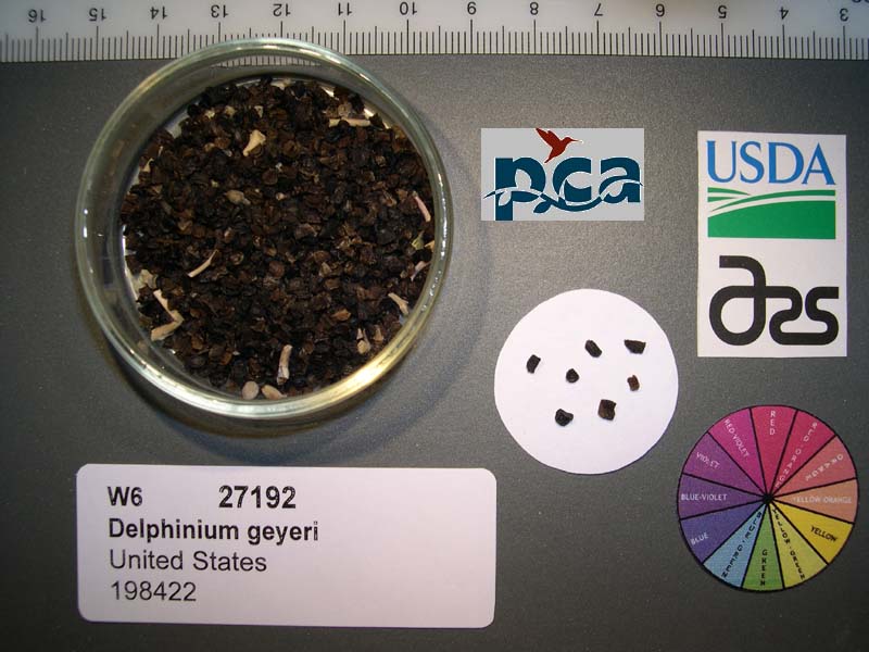 | | 2005 | COLLECTED | 07/28/2003 | | | 1934 | Associated with Artemisia sp, Hilianthus solidago, Rosa sp, Geranium caespitosum, Liatris punctata, Ribes sp and Symphoricarpos sp. | Wild material | Forb 0.6-1 meters tall. | 1674227 | OPGC 2897 |