| 0 | PI 667427 | Lot # PM312V | Liatris spicata (L.) Willd. | Wisconsin, United States | OPGC | | | 2006 | COLLECTED | 2004 | | | | | | | 1717146 | PI 667427 |
| 1 | W6 62532 | FWS0300-138 | Liatris spicata (L.) Willd. | Michigan, United States | W6 |  | | 2025 | | | | | | | Wild material | The above acreage is that of the large, dense patch near the road. The species occurs elsewhere in the sanctuary, but in low abundance. | 2192230 | W6 62532 |
| 2 | W6 62524 | FWS0300-120 | Liatris aspera Michx. | Michigan, United States | W6 |  | | 2025 | | | | | | | Wild material | | 2192222 | W6 62524 |
| 3 | W6 62539 | FWS0300-154 | Liatris cylindracea Michx. | Michigan, United States | W6 |  | | 2025 | | | | | | | Wild material | The vegetative part of the population is likely dormant, though it is not possible to discern dormant individuals. Consequently, the above population size may be an underestimate. | 2192237 | W6 62539 |
| 4 | OPGC 8278 | CBG-9870 | Lobelia spicata Lam. | Wisconsin, United States | OPGC | | | 2021 | | | | | | | Wild material | | 2120028 | OPGC 8278 |
| 5 | PI 658641 | JM2004016 | Aronia arbutifolia (L.) Pers. | South Carolina, United States | NC7 |  | | 2004 | COLLECTED | 10/06/2004 | Poe Creek outcrop, State Forest, Pickens County. | 34.92856600, -82.86763300 | 314 | Granite flatrock/glade community. Above seepage fen hummock on edge of rock outcrop. 10 degrees of slope. Fen/bog. | Wild material | Accession has good vigor with very open growth and minimal suckering. Specimens at original collection site in nature measured up to 10 feet tall. | 1667569 | PI 658641 |
| 6 | PI 664646 | CP39 | Helianthus occidentalis Riddell | Ohio, United States | NC7 |  | | 2004 | COLLECTED | 10/07/2004 | Chaparral Prairie State Nature Preserve, 3 miles northwest of West Union, Adams County. | 38.83583333, -83.57361111 | | Cedar barrens prairie. Sun. Slight slope. Site size 5 square meters; 67 acre total area. Associated with Baptisia australis, Coreopsis tripteris, Eryngium yuccafolium, Liatris spicata, Physostegia virginiana, Pycnanthemum tenuifolium, Ratibida pinnata, and Rudbeckia hirta. | Wild material | 2-5 feet tall | 1690634 | PI 664646 |
| 7 | W6 62534 | FWS0300-144 | Solidago riddellii Frank | Michigan, United States | W6 |  | | 2025 | | | | | | | Wild material | The vegetative part of the population is likely dormant, though it is not possible to discern dormant individuals. Consequently, the above population size may be an underestimate. | 2192232 | W6 62534 |
| 8 | W6 62536 | FWS0300-150 | Solidago ohioensis Riddell | Michigan, United States | W6 |  | | 2025 | | | | | | | Wild material | Poison sumac present | 2192234 | W6 62536 |
| 9 | W6 62540 | FWS0300-161 | Solidago riddellii Frank | Michigan, United States | W6 |  | | 2025 | | | | | | | Wild material | The vegetative part of the population is likely dormant, though it is not possible to discern dormant individuals. Consequently, the above population size may be an underestimate. | 2192238 | W6 62540 |
| 10 | Ames 36255 | Kothenbeutel Prairie | Delphinium carolinianum Walter subsp. virescens (Nutt.) R. E. Brooks | Iowa, United States | NC7 | 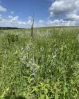 | | 2024 | COLLECTED | 07/08/2024 | Kothenbeutel Prairie Preserve located approximately 4.24 miles east, southeast of Sheffield just north of 240th Street, T93 R19W SW 1/4 SE 1/4 Sec. 7. | 42.87887400, -93.13261500 | 332 | Prairie remnant on south and southwestern aspects of 15-25 degree slopes. | Wild material | Plants in nature measuring approximately 30-38" in height. | 2168178 | Ames 36255 |
| 11 | NA 88834 | RJL-RM2023FLAL-008 | Rhododendron canescens (Michx.) Sweet | Florida, United States | NA | | | 2023 | COLLECTED | 12/06/2023 | Blackwater State Forest: plants are growing in wetlands accessed by foot from Buddy Hardy Road. The collection site is approximately 0.14 kilometers west and downhill from the road. | 30.80736700, -86.95784700 | 53 | Growing in shade to part-shade of the well-drained moist mesic habitat about 1 m above the wetland which appears to be formed by a nearby hillside seepage area. In this zone there are numerous facultative wetland species as well as high competition from facultative upland plants. Slope: 5 to 10 percent. Aspect: Variable. The underlying geology of this area is the Citronelle Formation of Pliocene origin and consists of gray to orange, often mottled, unconsolidated to poorly consolidated, very fine to very coarse, poorly sorted, clean to clayey sands. It contains significant amounts of clay, silt and gravel which may occur as beds and lenses and may vary considerably over short distances. Limonite nodules and limonite-cemented beds are common. (Source: USGS Florida Geologic Map Data.) The Troup Series (5 to 8% slopes) consists of very deep, somewhat excessively drained soil formed in unconsolidated sandy and loamy marine sediments. Troup soils are on ridges and hillslopes. The upper 0-13 cm is comprised primarily of decomposing sphagnum peat with a significant amount of fibrous root content. From 15-112 cm the soil is comprised primarily of fine-grained yellowish-brown sand with varying amounts of root content; this zone is strongly acid. From 112-203 cm the soil is comprised of light-red to red sandy clay loam that is discontinuous, generally friable, and strongly acid. (Source: NRCS Web Soil Survey.) | Wild material | | 2165664 | NA 88834 |
| 12 | NA 88835 | RJL-RM2023FLAL-009 | Rhododendron viscosum (L.) Torr. | Florida, United States | NA | | | 2023 | COLLECTED | 12/06/2023 | Blackwater State Forest: plants are growing in wetlands accessed by foot from Buddy Hardy Road. The collection site is approximately 0.14 kilometers west and downhill from the road. | 30.80841000, -86.96283300 | 43 | Growing in part-shade of the well-drained moist-dry mesic habitat about 2-3 m above the wetland. In this zone there are numerous facultative wetland species as well as high competition from facultative upland plants. Slope: 5 to 10 percent. Aspect: Variable. The underlying geology of this area is the Citronelle Formation of Pliocene origin and consists of gray to orange, often mottled, unconsolidated to poorly consolidated, very fine to very coarse, poorly sorted, clean to clayey sands. It contains significant amounts of clay, silt and gravel which may occur as beds and lenses and may vary considerably over short distances. Limonite nodules and limonite-cemented beds are common. (Source: USGS Florida Geologic Map Data.) The Troup Series (5 to 8% slopes) consists of very deep, somewhat excessively drained soil formed in unconsolidated sandy and loamy marine sediments. Troup soils are on ridges and hillslopes. The upper 0-13 cm is comprised primarily of decomposing sphagnum peat with a significant amount of fibrous root content. From 15-112 cm the soil is comprised primarily of fine-grained yellowish-brown sand with varying amounts of root content; this zone is strongly acid. From 112-203 cm the soil is comprised of light-red to red sandy clay loam that is discontinuous, generally friable, and strongly acid. (Source: NRCS Web Soil Survey.) | Wild material | | 2165665 | NA 88835 |
| 13 | OPGC 8810 | CBG- 10773 | Penstemon pallidus Small | Illinois, United States | OPGC | | | 2023 | | | | | | | Wild material | | 2142241 | OPGC 8810 |
| 14 | OPGC 8823 | CBG- 10813 | Physostegia virginiana (L.) Benth. | Illinois, United States | OPGC | | | 2023 | | | | | | | Wild material | | 2142270 | OPGC 8823 |
| 15 | OPGC 8830 | CBG- 10835 | Solidago riddellii Frank | Illinois, United States | OPGC | | | 2023 | | | | | | | Wild material | | 2142284 | OPGC 8830 |
| 16 | NA 88525 | RM-TK2022-013 | Macranthera flammea (W. Bartram) Pennell | Florida, United States | NA | | | 2023 | COLLECTED | 11/04/2022 | Growing in wetland in Blackwater River State Forest. | 30.80870000, -86.96270000 | 42 | Plants are typically found growing in part shade to sun in saturated streamside wetland/seep areas at the base of the slope in sphagnum moss. This appears to be year-round wetland habitat.
Soils: The underlying geology of this area is the Citronelle Formation of Pliocene origin and consists of gray to orange, often mottled, unconsolidated to poorly consolidated, very fine to very coarse, poorly sorted, clean to clayey sands. It contains significant amounts of clay, silt and gravel which may occur as beds and lenses and may vary considerably over short distances. Limonite nodules and limonite-cemented beds are common. Source: USGS Florida Geologic Map Data (https://mrdata.usgs.gov/geology/state/state.php?state=fl)
The surface soil profile found in this area is primarily Troup Series. These soils are sandy and loamy marine deposits. They are well drained and typically on the tops and sides of broad and narrow ridges on uplands typically with 0-12% slopes. These soils are very strongly acid with a depth of 2-3 meters. Pactolus Series soils comprise a minor, but important percentage of the lower slopes that are nearly level to gently sloping and account for the somewhat poorly drained, yet, sandy conditions. These soils are also strongly acid with very dark gray loamy sands.
Source: Soil Survey of Santa Rosa County and NRCS Web Soil Survey (https://www.nrcs.usda.gov/Internet/FSE_MANUSCRIPTS/florida/FL113/0/SantaRosa.pdf and https://websoilsurvey.sc.egov.usda.gov/App/WebSoilSurvey.aspx) | Wild material | | 2140806 | NA 88525 |
| 17 | NA 88530 | RJLSEUS2022-001 | Oxydendrum arboreum (L.) DC. | North Carolina, United States | NA | | | 2023 | COLLECTED | 12/06/2022 | Plants growing around a wetland on both sides of Scotland Lake Road, approximately 1.1 kilometers southwest of the junction with Hoffman Road (Scotland Co. Road 1328) in the Sandhills Game Lands. This plant is a common component along the mesic/moist boundary on the upper edge of the understory shrub in the moist woodland habitat not far from the wetland. | 34.98402000, -79.54267200 | 116 | Plants are growing in full sun to part-shade in the moist, well-drained, mesic conditions just above a wetland area occupied by obligate wetland species. The underlying geology of this area is of Tertiary origin and characterized as Pinehurst Formation. It is composed of medium- to coarse-grained sand as well as cross-bedding and rhythmic bands of clayey sand that are unconsolidated.
Source: USGS North Carolina Geologic Map Data (https://mrdata.usgs.gov/geology/state/sgmc-unit.php?unit=NCTp%3B11)
The primary soil type in the collection area is Pelion Loamy Sand soil (6 to 10 percent slopes). The Pelion Loamy Sand series consists of very deep, moderately well-drained marine deposits, fluviomarine deposits, and sand sheets. Permeability is moderately slow or slow. Surface layers 0-25 cm deep are comprised of loamy sand with a weak fine granular structure and are very friable. Deeper horizons are comprised of sandy loam, sandy clay loam, or clay loam in the upper part and include sandy clay or clay in the deepest strata. Soils are extremely acid to strongly acid.
Source: NRCS Web Soil Survey (https://websoilsurvey.sc.egov.usda.gov/App/WebSoilSurvey.aspx) | Wild material | | 2140759 | NA 88530 |
| 18 | NA 88531 | RJLSEUS2022-002 | Cyrilla racemiflora L. | North Carolina, United States | NA | | | 2023 | COLLECTED | 12/06/2022 | Plants growing around a wetland on both sides of Scotland Lake Road, approximately 1.1 kilometers southwest of the junction with Hoffman Road (Scotland Co. Road 1328) in the Sandhills Game Lands. This plant is a common component of moist to wet areas of the wetland habitats in this area. | 34.98418000, -79.54079800 | 120 | Plants are growing in part-shade to sun in a wetland habitat as well as nearby seasonally drier mesic habitat.
Soils: The underlying geology of this area is of Tertiary origin and characterized as Pinehurst Formation. It is comprised of medium- to coarse-grained sand as well as cross-bedding and rhythmic bands of clayey sand that are unconsolidated.
Source: USGS North Carolina Geologic Map Data (https://mrdata.usgs.gov/geology/state/sgmc-unit.php?unit=NCTp%3B11)
The primary soil type in the collection area is classified as Johnston Series soils (0 to 2 percent slopes, frequently flooded). The Johnston series consists of very deep, very poorly drained soils that are occasionally to frequently flooded for short to extended periods. Permeability is moderate to rapid. These nearly level soils are alluvial in origin and typical of floodplains and swamp. Slopes range from 0 to 2 percent. Johnston Series soils are comprised of mucky loam that is friable with siliceous elements in the upper 0-75 cm. Lower strata range in percentages of mucky loam and loamy fine sand.
Source: NRCS Web Soil Survey (https://websoilsurvey.sc.egov.usda.gov/App/WebSoilSurvey.aspx) | Wild material | | 2140760 | NA 88531 |
| 19 | NA 88532 | RJLSEUS2022-003 | Alnus serrulata (Aiton) Willd. | North Carolina, United States | NA | | | 2023 | COLLECTED | 12/06/2022 | Plants growing around a wetland on both sides of Scotland Lake Road, approximately 1.1 kilometers southwest of the junction with Hoffman Road (Scotland Co. Road 1328) in the Sandhills Game Lands. This plant is a common component of the moist to wet areas of the wetland habitats in this area. | 34.98413200, -79.54196300 | 118 | Plants are growing in part-shade to sun in a wet to inundated habitat that contains standing water and/or significant moisture year-round.
Soils: The underlying geology of this area is of Tertiary origin and characterized as Pinehurst Formation. It is comprised of medium- to coarse-grained sand as well as cross-bedding and rhythmic bands of clayey sand that are unconsolidated.
Source: USGS North Carolina Geologic Map Data (https://mrdata.usgs.gov/geology/state/sgmc-unit.php?unit=NCTp%3B11)
The primary soil type in the collection area is classified as Johnston Series soils (0 to 2 percent slopes, frequently flooded). The Johnston series consists of very deep, very poorly drained soils that are occasionally to frequently flooded for short to extended periods. Permeability is moderate to rapid. These nearly level soils are alluvial in origin and typical of floodplains and swamp. Slopes range from 0 to 2 percent. Johnston Series soils are comprised of mucky loam that is friable with siliceous elements in the upper 0-75 cm. Lower strata range in percentages of mucky loam and loamy fine sand.
Source: NRCS Web Soil Survey (https://websoilsurvey.sc.egov.usda.gov/App/WebSoilSurvey.aspx) | Wild material | | 2140761 | NA 88532 |
| 20 | NA 88533 | RJLSEUS2022-004 | Zenobia pulverulenta (W. Bartram ex Willd.) Pollard | North Carolina, United States | NA | | | 2023 | COLLECTED | 12/06/2022 | Plants growing in the wetlands and moist depressions along Scotland Co. Road 1328 in the Sandhills Game Lands. This plant is somewhat infrequent and sporadic, but abundant in places with moist to wet habitats in this area. | 34.95510000, -79.51769700 | 112 | Plants are growing in part-shade to sun in an acidic wetland habitat rich in sphagnum and other obligate wetland species. The habitat is moist to wet year-round and periodically has surface runoff occurring; even so, this habitat can become quite dry during seasonal periods without rainfall.
Soils: The underlying geology of this area is of Tertiary origin and characterized as Pinehurst Formation. It is comprised of medium- to coarse-grained sand as well as cross-bedding and rhythmic bands of clayey sand that are unconsolidated.
Source: USGS North Carolina Geologic Map Data (https://mrdata.usgs.gov/geology/state/sgmc-unit.php?unit=NCTp%3B11)
The primary soil type in the collection area is classified as Pelion Loamy Sand (2 to 6 percent slopes). The Pelion Loamy Sand series consists of very deep, moderately well-drained marine deposits, fluviomarine deposits, and sand sheets. Permeability is moderately slow or slow. Surface layers 0-25 cm deep are comprised of loamy sand with a weak fine granular structure and are very friable. Deeper horizons are comprised of sandy loam, sandy clay loam, or clay loam in the upper part and includes sandy clay or clay in the deepest part. Soils are extremely acid to strongly acid.
Source: NRCS Web Soil Survey (https://websoilsurvey.sc.egov.usda.gov/App/WebSoilSurvey.aspx) | Wild material | | 2140762 | NA 88533 |
| 21 | Ames 35906 | Turkey Mounds State Preserve | Heuchera richardsonii R. Br. | Iowa, United States | NC7 | | | 2022 | COLLECTED | 07/30/2022 | Turkey River Mounds State Preserve located 5.50 miles south, southeast of Guttenberg, T91N R2W SE ¼ NE ¼ Sec. 11. | 42.71399000, -91.03844000 | 228 | Narrow ridge with precipitous bluffs rising 250 feet above the Mississippi River floodplain | Wild material | | 2139635 | Ames 35906 |
| 22 | OPGC 8308 | CBG-10449 | Krigia biflora (Walter) S. F. Blake | Wisconsin, United States | OPGC | | | 2021 | | | | | | | Wild material | | 2120088 | OPGC 8308 |
| 23 | W6 59136 | CBG-10266 | Dasiphora fruticosa (L.) Rydb. | Wisconsin, United States | W6 | | | 2021 | | | | | | | Wild material | | 2120062 | W6 59136 |
| 24 | W6 59171 | CBG-10456 | Carex annectens (E. P. Bicknell) E. P. Bicknell | Illinois, United States | W6 | | | 2021 | | | | | | | Wild material | | 2120093 | W6 59171 |
| 25 | W6 59175 | CBG-10462 | Scirpus pendulus Muhl. | Illinois, United States | W6 | | | 2021 | | | | | | | Wild material | | 2120097 | W6 59175 |
| 26 | W6 59278 | CBG-10602 | Schizachyrium scoparium (Michx.) Nash | Illinois, United States | W6 | | | 2021 | | | | | | | Wild material | Plant numbers sampled estimated. | 2120187 | W6 59278 |
| 27 | OPGC 8595 | CBG-10732 | Castilleja coccinea (L.) Spreng. | | OPGC |  | | 2021 | | | | | | | Wild material | Yellow flower form. | 2137984 | OPGC 8595 |
| 28 | Ames 34014 | Ames 34014 | Aronia melanocarpa (Michx.) Elliott | Illinois, United States | NC7 |  | | 2017 | COLLECTED | 09/03/2017 | Nachusa Grasslands - locally known as Coyote Point approximately 3.80 miles northwest of Franklin Grove just 0.60 miles west of Lowden Road, T22N R10E NE 1/4 NE 1/4 SW 1/4 Sec. 21, Lee County | 41.87972200, -89.35305600 | 220 | St. Peter's sandstone cliff, specimens noted on ridgetop and on slopes. | Wild material | This accession based on morphological/phenological observations at NCRPIS field plots seems to represent the "southern form" of A. melanocarpa, potentially a new Aronia species. This southern form was originally discovered by Brand et al. 2022 (Ploidy, genetic diversity and speciation of the genus Aronia) and is known for having glabrous stems and leaves and a distinct phyllotaxy than other Aronia species. In addition, plants tend to bloom approximately two weeks later than all other Aronia taxonomic groups and the inflorescences/infructescences are more spreading and extended due to longer peduncles and pedicels within the cyme. Fruit maturity tends to occur 2 to 4 weeks later than tetraploid A. melanocarpa and 4 to 6 weeks later than diploid A. melanocarpa. Phenolic levels are much higher in comparison to other A. melanocarpa accessions (Brand et al., 2017 - Anthocyanins, total phenolics, ORAC and moisture content of wild and cultivated dark-fruited Aronia species.) | 1953928 | Ames 34014 |
| 29 | W6 52029 | WY070-73 | Dalea candida Willd. | Wyoming, United States | W6 | | | 2017 | | | | | | | Wild material | | 1947162 | W6 52029 |
| 30 | Ames 29940 | 196532 | Sphaeralcea coccinea (Nutt.) Rydb. | Colorado, United States | NC7 |  | | 2005 | COLLECTED | 07/22/2003 | Hayden Park (Ecoregion 20), West Alameda Parkway, park trailhead on the right. | 39.69333000, -105.15500000 | 1944 | Foothills. | Wild material | Forb 0.07 meters tall. | 1674186 | Ames 29940 |
| 31 | Ames 28230 | CP12 | Helenium autumnale L. | Ohio, United States | NC7 | | | 2004 | COLLECTED | 10/07/2004 | Chaparral Prairie State Nature Preserve, 3 miles northwest of West Union, Adams County. | 38.83583333, -83.57361111 | | Cedar barrens prairie; along pond edge. Site size 10 square meters; 67 acre total area. Associated with Baptisia australis, Coreopsis tripteris, Eryngium yuccafolium, Liatris spicata, Physostegia virginiana, Pycnanthemum tenuifolium, Ratibida pinnata, and Rudbeckia hirta. | Wild material | 2-3 feet in height. | 1690609 | Ames 28230 |