| 0 | NA 88149 | NCBG-313 | Liquidambar styraciflua L. | North Carolina, United States | NA | 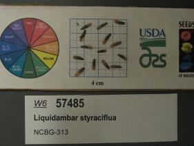 | | 2019 | | | | | | | Wild material | | 2098409 | NA 88149 |
| 1 | NA 88152 | NCBG-320 | Liquidambar styraciflua L. | North Carolina, United States | NA |  | | 2019 | | | | | | | Wild material | | 2098412 | NA 88152 |
| 2 | NA 88034 | NCBG-430 | Liquidambar styraciflua L. | North Carolina, United States | NA |  | | 2018 | | | | | | | Wild material | | 1965947 | NA 88034 |
| 3 | PI 702725 | NCBG-428 | Schizachyrium scoparium (Michx.) Nash | Maryland, United States | S9 |  | | 2019 | | | | | | | Wild material | | 2098447 | PI 702725 |
| 4 | PI 702690 | MARSB-175 | Chasmanthium laxum (L.) H. O. Yates | Delaware, United States | S9 |  | | 2019 | | | | | | | Wild material | | 2097507 | PI 702690 |
| 5 | PI 702691 | MARSB-322 | Chasmanthium laxum (L.) H. O. Yates | New Jersey, United States | S9 |  | | 2019 | | | | | | | Wild material | | 2097574 | PI 702691 |
| 6 | PI 702692 | MARSB-332 | Chasmanthium laxum (L.) H. O. Yates | New Jersey, United States | S9 |  | | 2019 | | | | | | | Wild material | | 2097581 | PI 702692 |
| 7 | PI 702695 | MARSB-502 | Chasmanthium laxum (L.) H. O. Yates | New Jersey, United States | S9 |  | | 2019 | | | | | | | Wild material | | 2097639 | PI 702695 |
| 8 | PI 702709 | MARSB-655 | Panicum virgatum L. | Delaware, United States | S9 |  | | 2019 | | | | | | | Wild material | | 2097673 | PI 702709 |
| 9 | PI 704826 sos | R. pensilvanicus MARSB-285 | Rubus pensilvanicus Poir. | New Jersey, United States | COR |  | | 2019 | | | | | | | Wild material | | 2097556 | PI 704826 sos |
| 10 | PI 704854 sos | R. cuneifolius MARSB-462 | Rubus cuneifolius Pursh | New Jersey, United States | COR |  | | 2019 | | | | | | | Wild material | | 2097633 | PI 704854 sos |
| 11 | PI 710478 | NCBG-750 | Chamaecrista fasciculata (Michx.) Greene | Virginia, United States | S9 |  | | 2018 | | | | | | | Wild material | | 1966043 | PI 710478 |
| 12 | PI 710480 | NCBG-700 | Chamaecrista nictitans (L.) Moench | North Carolina, United States | S9 |  | | 2018 | | | | | | | Wild material | | 1966014 | PI 710480 |
| 13 | PI 710499 | NCBG-752 | Sesbania exaltata (Raf.) Rydb. | North Carolina, United States | S9 |  | | 2018 | | | | | | | Wild material | | 1966044 | PI 710499 |
| 14 | PI 710490 | MARSB-345 | Lespedeza capitata Michx. | New Jersey, United States | S9 |  | | 2018 | | | | | | | Wild material | | 1964765 | PI 710490 |
| 15 | PI 673986 | TX-03 | Rudbeckia grandiflora (Sweet) C. C. Gmel. ex DC. | Texas, United States | OPGC | 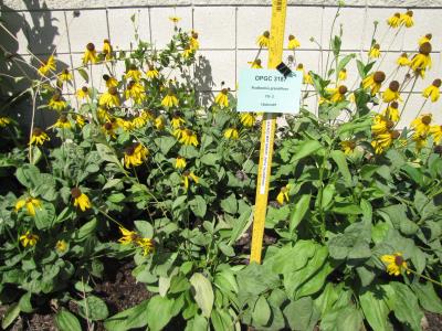 | | 2010 | COLLECTED | 05/26/2010 | Upper West Gulf Coastal Plain. Harrison County. South of Marshall Texas. East on 2625, cross 31, left onto CR 1111, Brad spann road veer right. | 32.47050000, -94.21594400 | 97 | Meadow(Maintained ROW under power lines). Land form: Rolling hills. Land Use: Roadside ROW. Geology: Sandstone. Soil Texture: Sandy. Soil Color: Brown. | Wild material | Erect, clumped, glabrous to 60 cm tall. Flowers numerous, yellow ray florets. | 1897287 | PI 673986 |
| 16 | PI 673989 | TX-11 | Rudbeckia grandiflora (Sweet) C. C. Gmel. ex DC. | Texas, United States | OPGC |  | | 2010 | COLLECTED | 05/26/2010 | Upper West Gulf Coastal Plain. Marion County. Smithland Cuttoff Road approx. 1 mile east of SH 43. | 32.76347200, -94.18152800 | 53 | Roadside ROW/forest edge(tree farm/harvesting area). Land form: Flat. Land Use: Roadside ROW. Geology: Sandstone. Soil Texture: Sandy. Soil Color: Tan. | Wild material | Erect, coarse perennial to 125 cm tall; leaves mostly basal; ray flowers yellow and drooping. | 1897293 | PI 673989 |
| 17 | PI 673992 | TX-30 | Coreopsis lanceolata L. | Texas, United States | OPGC | | | 2010 | COLLECTED | 05/27/2010 | Upper West Gulf Coastal Plain. Newton County. Roadside approx. 1.5 miles south of 1416 on SH 87. | 30.58986100, -93.79430600 | 27 | Roadside ROW/forest edge. Land form: Flat. Land Use: Roadside ROW. Geology: Sandstone. Soil Texture: Sandy to clay. Soil color: Greyish-brown. | Wild material | Erect, clumped, glabrous to 70 cm tall. Flowers with yellow ray florets, mostly gone to seed. | 1897309 | PI 673992 |
| 18 | PI 653297 | R. argutus HD-2007-070 | Rubus argutus Link | Mississippi, United States | COR | | | 2007 | COLLECTED | 06/09/2007 | Marshall County, northwest of Potts Camp off route 178 onto George Mann Road onto Lake Shore Drive at a drainage ditch in the community of Lake Center. | 34.69310000, -89.36150000 | 120 | Open area in drainage ditch growing on the perimeter road of a lake. Associated Plants: Rhus typhina, Vitis rotundifolia, Pinus taeda, Salix sp., Lonicera japonica, Liquidambar styraciflua and Acer negundo. | Wild material | Kim Hummer, Michael Dossett collection from Mississippi.
| 1730104 | PI 653297 |
| 19 | PI 657221 | V. corymbosum Zebulon | Vaccinium corymbosum L. | North Carolina, United States | COR | 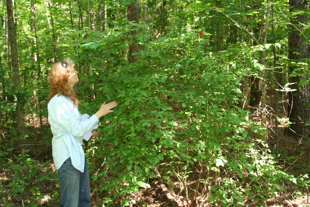 | | 2007 | COLLECTED | 06/01/2007 | Zebulon, Wake County. Near sewer right of way on North Worth Hinton Road (SR 2369). | 35.82683000, -78.33110000 | 90 | Organic duff over dark brown sandy soil. Associated with: Liquidambar styraciflua, Acer rubrum, Rhus typhina, Rubus argutus, Pinus palustris and Liriodentdron tulipfera. Near sewer right of way, at edge of dark hardwood forest. | Wild material | Kim Hummer, Michael Dossett collected from North Carolina.
| 1730106 | PI 657221 |
| 20 | PI 657223 | V. corymbosum HD-2007-016 | Vaccinium corymbosum L. | South Carolina, United States | COR | | | 2007 | COLLECTED | 06/03/2007 | Northwest of Little Rock, Dillon County. Intersection of SR-57 and McLaurin Lake Circle. Growing in a drainage ditch west side of road. | 34.50649000, -79.47892000 | 20 | Flat terrain. Associated with: Smilax, Acer rubrum, Liquidambar styraciflua, Quercus velutina, Sasafras albidum, Lonicera japonica, Pinus palustris and Campsus radicans. | Wild material | Kim Hummer, Michael Dossett collected from South Carolina. V. corymbosum diploid
| 1730114 | PI 657223 |
| 21 | PI 657235 | V. pallidum Scenic HWY HD 2007-59 | Vaccinium pallidum Aiton | Alabama, United States | COR | 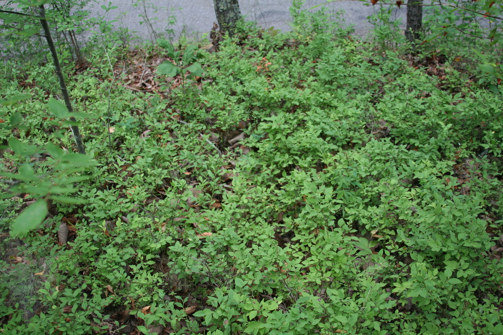 | | 2007 | COLLECTED | 06/08/2007 | East of Keener, Etwah County, Keener Gap. Woods at intersection of Keener Gap Road and Scenic Highway. On ridge above road. | 34.15484000, -85.93371000 | 300 | Soil sandy brown red limestone, with a layer of oak-hickory leaf duff on top. Associated with: Carya, Quercus nigra, Vaccinium stamineum, Liriodendron tulipifera, Liquidambar styraciflua and Acer rubrum. | Wild material | Kim Hummer, Michael Dossett collected from Alabama.
| 1730127 | PI 657235 |
| 22 | PI 664811 | DE2 | Actaea racemosa L. | Delaware, United States | NC7 | | | 2005 | | | | | | | Wild material | | 1698885 | PI 664811 |
| 23 | NA 89158 | 2025RJLSEUS-06 | Cornus florida L. | Alabama, United States | NA | | | 2025 | COLLECTED | 10/01/2025 | Coosa Wildlife Management Area: along the edge of gated dirt road on the west side of Coosa County Road 29, 0.3 kilometers north of Hatchet Creek. | 32.86402200, -86.33871400 | 108 | Plants are growing in part sun to shade on dry-mesic slopes above the road cut on the gated dirt road; most likely a road for access for fire control/forest management. The forest is a combination of deciduous and evergreen with evergreens primarily comprised of Pinus taeda. The habitat was quite dry during this time of year. Slope: 5 to 20 percent. Aspect: North. Soils: The primary soil in the area of this collection is classified as Madison-Louisa Series complex, 15 to 30 percent slopes, moderately eroded (MdE2). The Madison Series soils are very deep, well drained soils with medium runoff found on Piedmont uplands in interstream divides, ridges and side slopes. They are comprised of residuum weathered from felsic or intermediate, high-grade metamorphic or igneous rocks high in content of mica. Slopes range from 2 to 60 percent and soil is typically strongly acidic. Louisa Series soils The Louisa Series soils consist of shallow, somewhat excessively drained soils which formed over mica gneiss and schist bedrock. They occur on Piedmont uplands. Slopes are 6 to 80 percent. This soil is moderately acid. (Source: California Soil Resource Lab/NRCS Official Soil Series Descriptions). Geology: The underlying geology of this area is of Precambrian to Paleozoic origin and characterized as Hatchet Creek Group; Pinchoulee Gneiss Formation. It is characterized by medium to fine-grained migmatitic, locally garnetiferous biotite-feldspar gneiss, commonly saturated with granitic pods. (Source: USGS Alabama Geologic Map Data). | Wild material | | 2193004 | NA 89158 |
| 24 | NA 89115 | TLM25-04a | Hamamelis ovalis S. W. Leonard | Texas, United States | NA | | | 2025 | COLLECTED | 07/10/2025 | State Highway 87 approximately 3.25 kilometers north of the crossroad junction with Texas Recreational Road 255 (RE 255); plants were growing in the narrow buffer woods along the east side of the highway. | 31.12051300, -93.72628100 | 138 | The habitat is an upland mixed coniferous and deciduous woodlands in part to full shade and dry conditions, often under drought stress. Plants seem to always occur on the top of dry ridges or well-drained slopes. Slope: 0 to 1 percent. Aspect: N/A. Soils: The soils of this collection area are classified as Tehran-Letney Association, hilly (TLE) soils. The Tehran Series (55%) consists of deep, somewhat excessively drained, moderately rapidly permeable soils on uplands. They formed in thick loamy and sandy sediments on the Western Coastal Plain. These soils are on gently sloping to moderately steep uplands with slopes ranging from 1 to 20 percent. The Letney Series (30%) consists of deep, well drained, moderately rapidly permeable, upland soils. They formed in thick sandy and loamy sediments of the coastal plains. These soils are on gently sloping to moderately steep uplands with slopes ranging from 1 to 20 percent. Soil pH ranges from 4.5 to 6.0. The minor soil components include Doucette Series (10%) and Boykin Series (5%) soils. (Source: California Soil Resource Lab/NRCS Official Soil Series Descriptions). Geology: The underlying geology of this area is of Oligocene origin and characterized as Catahoula Formation. This formation is extensive and deep in Texas, up to 185 meters thick. In the area of the collection the Catahoula Formation is primarily mudstone and sand. The upper 90-150 meters is mudstone that is tuffaceous, and sandy; also, occasionally, with some bentonitic clay. (Source: USGS Texas Geologic Map Data). | Wild material | | 2191654 | NA 89115 |
| 25 | NA 88931 | 24Flam27 | Rhododendron flammeum (Michx.) Sarg. | Georgia, United States | NA | | | 2025 | COLLECTED | 09/10/2024 | DeKalb County: Stone Mountain: Stone Mountain Park along Evergreen Trail by resort, growing within 40 feet of Venable Lake. GPS coordinates a general locality for population and each seed lot for 24Flam27-30 was collected progressively further west). | 33.79769000, -84.13420000 | 291 | Dry, somewhat shady forest adjacent to lake, some plants hanging over edge. Primarily close to the water on flat ground, though some on slope. Growing in half shade. Slope: Flat to 30 degrees. Aspect: North. | Wild material | Note: Seeds from three different lots collected at the same spot were bulked together in this accession; the lowest field collection number (24Flam27) has been chosen as the primary for this record. | 2172814 | NA 88931 |
| 26 | NA 88933 | 24Flam40 | Agarista populifolia (Lam.) Judd | South Carolina, United States | NA | | | 2025 | COLLECTED | 09/12/2025 | Robertville, SC: Gillison Branch Road (plants on both sides of road). | 32.58673000, -81.19300000 | 31 | Shady swamp forest with road running between Agarista population. Agarista was the predominant plant throughout. Soggy but solid ground, especially on northern side of road. Growing in 3/4 shade. Slope: Generally flat. | Wild material | Note: Two field collections, 24Flam40 and 24Flam41, were combined together in this USNA accession, with the former identifier being used as the primary one. | 2172816 | NA 88933 |
| 27 | NA 88940 | 24Flam60 | Rhododendron flammeum (Michx.) Sarg. | South Carolina, United States | NA | | | 2025 | COLLECTED | 09/13/2025 | Savannah River Site, near Tinker Creek. GPS coordinates represent a general location for the population. | 33.36802000, -81.54971000 | 90 | Shady forest following Tinker Creek. Seed collected primarily on slopes and banks over the creek. Growing in half shade. Slope: Varying. | Wild material | Note: Two field collections, 24Flam60 and 24Flam65, were combined together in this USNA accession, with the former identifier being used as the primary one. The collectors note the possibility that this contains hybrids because the plants were not observed in flower. | 2172823 | NA 88940 |
| 28 | NA 88746 | TXWL2025-039 | Ilex verticillata (L.) A. Gray | Louisiana, United States | NA | | | 2025 | COLLECTED | 01/24/2025 | Kistachie National Forest: Compartment 49, Indian Creek. | 31.09110000, -93.53333000 | | Slough/baygall area with standing water below a longleaf pine stand. | Wild material | | 2171020 | NA 88746 |
| 29 | NA 88981 | TXWL2025-031 | Ilex opaca Aiton | Texas, United States | NA | | | 2025 | COLLECTED | 01/07/2025 | South of Jericho community. | 31.67015000, -94.25641000 | | Western sandy lands; small grove of Ilex opaca in upland position above a baygall. Bare ground cover with Ilex opaca regeneration. Adjacent to a loblolly pine plantation and a new longleaf pine plantation. | Wild material | | 2170965 | NA 88981 |
| 30 | NA 88982 | TXWL2025-032 | Ilex opaca Aiton | Texas, United States | NA | | | 2025 | COLLECTED | 01/07/2025 | South of Jericho community. | 31.66973000, -94.25613000 | | Western sandy lands; edge of small grove of Ilex opaca with sun exposure in upland position above a baygall. Bare ground cover with Ilex opaca regeneration. Adjacent to a new longleaf pine plantation located on fireline. | Wild material | | 2170966 | NA 88982 |
| 31 | NA 88983 | TXWL2025-033 | Ilex opaca Aiton | Texas, United States | NA | | | 2025 | COLLECTED | 01/12/2025 | Adjacent to Toledo Bend reservoir in Huxley Bay community, eastern Shelby County. | 31.77133000, -93.85094000 | | Low area with heavy duff near reservoir. | Wild material | | 2170967 | NA 88983 |
| 32 | NA 88579 | 2024RJLFL-007 | Ilex myrtifolia Walter | Florida, United States | NA | | | 2024 | COLLECTED | 11/13/2024 | Wetlands accessed from Miller Bluff Road. | 30.62251200, -86.86030700 | 8 | Open, wet areas and woodland edge slightly above permanently wet habitat in part shade to full sun. Slope: 0 percent. Aspect: N/A. | Wild material | | 2169916 | NA 88579 |
| 33 | NA 88583 | 2024RJLFL-014 | Ilex amelanchier M. A. Curtis ex Chapm. | Florida, United States | NA | | | 2024 | COLLECTED | 11/13/2024 | Yellow River Water Management Area: found in an area where an unnamed unpaved road dead ends near the Yellow River. This unpaved road is accessed from Old River Road to the east near the junction with Shockley Springs Road. Individual plants for this collection were accessed by foot along the edge of the river and associated wetland depressions to the east of the road. The sampling for this portion of the population extends from the GPS coordinates listed above to the northeast where sampling ended at coordinates 30.871238 deg. N, 86.590170 deg. W. | 30.86989400, -86.59218500 | 23 | Plants growing in seasonally inundated swamp habitats associated with the Yellow River and small tributaries. Plants are emergent during portions of the year, primarily during the growing season. During this time of collection, water had receded from the wetlands and the area was relatively dry. Slope: N/A. Aspect: N./A. The underlying geology of this area is the Alum Bluff Group of Miocene origin. It includes the Chipola Formation, Oak Grove Sand, Shoal River Formation, Choctawhatchee Formation and the Jackson Bluff Formation. The formations included in this group are generally defined based on their molluscan faunas and stratigraphic position. Puri (1953) described sediment facies as they relate to the formations of the Alum Bluff Group. These sediments are lithologically distinct as a group, not as individual units. The Alum Bluff Group crops out or is beneath a thin overburden in the western panhandle from river valleys in Okaloosa County eastward to western Jackson County. The Alum Bluff Group consists of clays, sands and shell beds which may vary from fossiliferous, sandy clays to unfossiliferous sands and clays and occasional carbonate beds. Mica is a common constituent and glauconite and phosphate occur sporadically. Induration varies from essentially nonindurated in sands to well indurated in carbonate lenses. Colors range from cream to olive gray with mottled reddish brown in weathered sections. Sand grain size varies from very fine to very coarse with sporadic occurrences of gravel. These sediments generally have low permeabilities and are part of the intermediate confining unit/aquifer system. (Source: USGS Florida Geologic Map Data). The surface soil profile of this area is primarily Kinston, Johnston, and Bibb soils, frequently flooded. Kinston Series soils are poorly drained, alluvial, fine-loamy, siliceous, and acid soils of flood plains. They are peaty to loamy friable, slightly sticky, and slightly plastic in the upper 0 to 7.5 cm of the strata with less sand and more silt-loam in progressively deeper strata. The Johnston Series consists of very deep, very poorly drained coarse-loamy, siliceous, active, acid, thermic Cumulic Humaquepts. The upper 0-75 cm is black, mucky loam that is friable and very strongly acid. The lower strata to 1.75 m are dark gray, loamy fine sand, single grained, loose and very strongly acid. (Source: NRCS Web Soil Survey). | Wild material | | 2169920 | NA 88583 |
| 34 | NA 88584 | 2024RJLFL-016 | Cornus florida L. | Florida, United States | NA | | | 2024 | COLLECTED | 11/14/2024 | Both sides of Kennedy Bridge Road approximately 0.27 kilometers west of the junction with Hurricane Lake South Entrance Road. | 30.93159700, -86.74928000 | 43 | Mesic to mesic-moist conditions in a mixed and deciduous evergreen forest in part shade. Slope: 5 to 10 percent. Aspect: Various. The underlying geology of this area is characterized as Citronelle Formation of the Pliocene period. The Citronelle Formation is widespread in the Gulf Coastal Plain. The type section for the Citronelle Formation, named by Matson (1916), is near Citronelle, Alabama. The Citronelle Formation grades laterally, through a broad facies transition, into the Miccosukee Formation of the eastern Florida panhandle. Coe (1979) investigated the Citronelle Formation in portions of the western Florida panhandle. The Citronelle Formation is a siliciclastic, deltaic deposit that is lithologically similar to, and time equivalent with, the Cypresshead Formation and, at least in part, the Long Key Formation (Cunningham et al., 1998) of the peninsula. In the western panhandle, some of the sediments mapped as Citronelle Formation may be reworked Citronelle. The lithologies are the same and there are few fossils present to document a possible younger age. The Citronelle Formation consists of gray to orange, often mottled, unconsolidated to poorly consolidated, very fine to very coarse, poorly sorted, clean to clayey sands. It contains significant amounts of clay, silt and gravel which may occur as beds and lenses and may vary considerably over short distances. Limonite nodules and limonite-cemented beds are common. Marine fossils are rare but fossil pollen, plant remains and occasional vertebrates are found. Much of the Citronelle Formation is highly permeable. It forms the Sand and Gravel Aquifer of the surficial aquifer system contain organics. The dominant fossils in the freshwater carbonates are mollusks. (Source: USGS Florida Geologic Map Data). The soils of this are characterized as Dothan Series loamy sand, 5 to 8 percent slopes. The Dothan Series consists of very deep, well drained soils that formed in thick beds of unconsolidated, medium to fine-textured marine sediments. Dothan soils are on interfluves. Slopes range from 0 to 15 percent. The surface 0-33 cm is characterized by sandy-loam, well-drained soils that are strongly acid. From 33-200 cm they are characterized by sandy clay loam soils that are more moisture retentive and strongly acid. (Source: California Soil Resource Lab/NRCS Official Soil Series Descriptions). | Wild material | | 2169921 | NA 88584 |
| 35 | NA 88590 | 2024RM-003 | Ilex verticillata (L.) A. Gray | Florida, United States | NA | | | 2024 | COLLECTED | 11/21/2024 | Along the west/north side of the Yellow River about 0.33 kilometers (as the crow flies) upstream from the channel that leads the Fisher Old Mill Road Boat Ramp. This site was accessed by boat. | 30.62868600, -86.80748000 | 4 | Plants are found growing primarily in permanently saturated to submersed conditions along the edge of the Yellow River in part shade. The riverine habitat is comprised of a wide array of deciduous and evergreen trees, shrubs, and perennial plant species. Most of the plants along the river are adapted to acidic conditions and, while the aquatic habitat is generally fresh water, there is occasionally tidal or hurricane-caused saltwater intrusions. Slope: 0 percent. Aspect: East-southeast. The underlying geology of this area is characterized as Alluvium from undifferentiated Quaternary Sediments. Much of Florida's surface is covered by a varying thickness of undifferentiated sediments consisting of siliciclastics, organics and freshwater carbonates. Where these sediments exceed 20 feet (6.1 meters) thick, they were mapped as discrete units. To subdivide the undifferentiated sediments, those sediments occurring in flood plains were mapped as alluvial and flood plain deposits (Qal). Sediments showing surficial expression of beach ridges and dunes were mapped separately (Qbd) as were the sediments composing Trail Ridge (Qtr). Terrace sands were not mapped (refer to Healy [1975] for a discussion of the terraces in Florida). The subdivisions of the Undifferentiated Quaternary Sediments (Qu) are not lithostratigraphic units but are utilized to facilitate a better understanding of the State's geology. The siliciclastics are light gray, tan, brown to black, unconsolidated to poorly consolidated, clean to clayey, silty, unfossiliferous, variably organic-bearing sands to blue green to olive green, poorly to moderately consolidated, sandy, silty clays. Gravel is occasionally present in the panhandle. Organics occur as plant debris, roots, disseminated organic matrix and beds of peat. Freshwater carbonates, often referred to as marls in the literature, are scattered over much of the State. In southern Florida, freshwater carbonates are nearly ubiquitous in the Everglades. These sediments are buff colored to tan, unconsolidated to poorly consolidated, fossiliferous carbonate muds. Sand, silt and clay may be present in limited quantities. These carbonates often contain organics. The dominant fossils in the freshwater carbonates are mollusks. (Source: USGS Florida Geologic Map Data). The soils of this are characterized as Bibb-Kinston Series association. The Bibb Series consists of very deep, poorly drained, moderately permeable soils on flood plains of streams in the Southern Coastal Plain (133A) Major Land Resource Area. They formed in stratified loamy and sandy alluvium that are commonly and frequently flooded and water runs off the surface very slowly. Slopes range from 0 to 2 percent. Reaction ranges from extremely acid to strongly acid throughout. Content of mica flakes ranges from none to common. Content of rounded gravel typically ranges from 0 to 10 percent throughout, but may range to 50 percent in thin strata below a depth of 1 meter. Buried soil horizons, present in many pedons have the same range in color and texture as the surface horizon which has iron and organic matter concentrations in shades of brown and yellow ranging from none to common. Texture is sand, loamy sand, loamy fine sand, fine sandy loam, sandy loam, loam or silt loam. The Kinston Series consists of very deep, poorly drained, moderately permeable soils found on flood plains. They were formed in alluvial depositions. Slopes range from 0 to 2 percent. Soil reaction ranges from strongly acid to very strongly acid. Typical texture across the pedons is loamy, gravelly loam, sandy loam, and clay loam with dark concretions often present. (Source: California Soil Resource Lab/NRCS Official Soil Series Descriptions). | Wild material | | 2169927 | NA 88590 |
| 36 | NA 88591 | 2024RM-004 | Ilex opaca Aiton | Florida, United States | NA | | | 2024 | COLLECTED | 11/21/2024 | Along the west/north side of the Yellow River about 5.5 kilometers upstream from the State Highway 87 boat ramp. This site was accessed by boat. | 30.59986000, -86.87936000 | 2 | Plants are found growing primarily in permanently saturated to submersed conditions along the edge of the Yellow River in part shade. The riverine habitat is comprised of a wide array of deciduous and evergreen trees, shrubs, and perennial plant species. Most of the plants along the river are adapted to acidic conditions and, while the aquatic habitat is generally fresh water, there is occasionally tidal or hurricane-caused saltwater intrusions. Slope: 0 percent. Aspect: East-southeast. The underlying geology of this area is characterized as Alluvium from undifferentiated Quaternary Sediments. Much of Florida's surface is covered by a varying thickness of undifferentiated sediments consisting of siliciclastics, organics and freshwater carbonates. Where these sediments exceed 20 feet (6.1 meters) thick, they were mapped as discrete units. To subdivide the undifferentiated sediments, those sediments occurring in flood plains were mapped as alluvial and flood plain deposits (Qal). Sediments showing surficial expression of beach ridges and dunes were mapped separately (Qbd) as were the sediments composing Trail Ridge (Qtr). Terrace sands were not mapped (refer to Healy [1975] for a discussion of the terraces in Florida). The subdivisions of the Undifferentiated Quaternary Sediments (Qu) are not lithostratigraphic units but are utilized to facilitate a better understanding of the State's geology. The siliciclastics are light gray, tan, brown to black, unconsolidated to poorly consolidated, clean to clayey, silty, unfossiliferous, variably organic-bearing sands to blue green to olive green, poorly to moderately consolidated, sandy, silty clays. Gravel is occasionally present in the panhandle. Organics occur as plant debris, roots, disseminated organic matrix and beds of peat. Freshwater carbonates, often referred to as marls in the literature, are scattered over much of the State. In southern Florida, freshwater carbonates are nearly ubiquitous in the Everglades. These sediments are buff colored to tan, unconsolidated to poorly consolidated, fossiliferous carbonate muds. Sand, silt and clay may be present in limited quantities. These carbonates often contain organics. The dominant fossils in the freshwater carbonates are mollusks. (Source: USGS Florida Geologic Map Data). The soils of this are characterized as Bibb-Kinston Series association. The Bibb Series consists of very deep, poorly drained, moderately permeable soils on flood plains of streams in the Southern Coastal Plain (133A) Major Land Resource Area. They formed in stratified loamy and sandy alluvium that are commonly and frequently flooded and water runs off the surface very slowly. Slopes range from 0 to 2 percent. Reaction ranges from extremely acid to strongly acid throughout. Content of mica flakes ranges from none to common. Content of rounded gravel typically ranges from 0 to 10 percent throughout, but may range to 50 percent in thin strata below a depth of 1 meter. Buried soil horizons, present in many pedons have the same range in color and texture as the surface horizon which has iron and organic matter concentrations in shades of brown and yellow ranging from none to common. Texture is sand, loamy sand, loamy fine sand, fine sandy loam, sandy loam, loam or silt loam. The Kinston Series consists of very deep, poorly drained, moderately permeable soils found on flood plains. They were formed in alluvial depositions. Slopes range from 0 to 2 percent. Soil reaction ranges from strongly acid to very strongly acid. Typical texture across the pedons is loamy, gravelly loam, sandy loam, and clay loam with dark concretions often present. (Source: California Soil Resource Lab/NRCS Official Soil Series Descriptions). | Wild material | | 2169928 | NA 88591 |
| 37 | NA 88592 | 2024RM-005 | Ilex sp. | Florida, United States | NA | | | 2024 | COLLECTED | 11/21/2024 | Along the west/north side of the Yellow River about 1.1 kilometers upstream from the State Highway 87 boat ramp. This site was accessed by boat. | 30.57956000, -86.91916400 | 1 | Plants are found growing primarily in permanently saturated to submersed conditions along the edge of the Yellow River in part shade. The riverine habitat is comprised of a wide array of deciduous and evergreen trees, shrubs, and perennial plant species. Most of the plants along the river are adapted to acidic conditions and, while the aquatic habitat is generally fresh water, there is occasionally tidal or hurricane-caused saltwater intrusions. Slope: 0 percent. Aspect: North. The underlying geology of this area is characterized as Alluvium from undifferentiated Quaternary Sediments. Much of Florida's surface is covered by a varying thickness of undifferentiated sediments consisting of siliciclastics, organics and freshwater carbonates. Where these sediments exceed 20 feet (6.1 meters) thick, they were mapped as discrete units. To subdivide the undifferentiated sediments, those sediments occurring in flood plains were mapped as alluvial and flood plain deposits (Qal). Sediments showing surficial expression of beach ridges and dunes were mapped separately (Qbd) as were the sediments composing Trail Ridge (Qtr). Terrace sands were not mapped (refer to Healy [1975] for a discussion of the terraces in Florida). The subdivisions of the Undifferentiated Quaternary Sediments (Qu) are not lithostratigraphic units but are utilized to facilitate a better understanding of the State's geology. The siliciclastics are light gray, tan, brown to black, unconsolidated to poorly consolidated, clean to clayey, silty, unfossiliferous, variably organic-bearing sands to blue green to olive green, poorly to moderately consolidated, sandy, silty clays. Gravel is occasionally present in the panhandle. Organics occur as plant debris, roots, disseminated organic matrix and beds of peat. Freshwater carbonates, often referred to as marls in the literature, are scattered over much of the State. In southern Florida, freshwater carbonates are nearly ubiquitous in the Everglades. These sediments are buff colored to tan, unconsolidated to poorly consolidated, fossiliferous carbonate muds. Sand, silt and clay may be present in limited quantities. These carbonates often contain organics. The dominant fossils in the freshwater carbonates are mollusks. (Source: USGS Florida Geologic Map Data). The soils of this are characterized as Bibb-Kinston Series association. The Bibb Series consists of very deep, poorly drained, moderately permeable soils on flood plains of streams in the Southern Coastal Plain (133A) Major Land Resource Area. They formed in stratified loamy and sandy alluvium that are commonly and frequently flooded and water runs off the surface very slowly. Slopes range from 0 to 2 percent. Reaction ranges from extremely acid to strongly acid throughout. Content of mica flakes ranges from none to common. Content of rounded gravel typically ranges from 0 to 10 percent throughout, but may range to 50 percent in thin strata below a depth of 1 meter. Buried soil horizons, present in many pedons have the same range in color and texture as the surface horizon which has iron and organic matter concentrations in shades of brown and yellow ranging from none to common. Texture is sand, loamy sand, loamy fine sand, fine sandy loam, sandy loam, loam or silt loam. The Kinston Series consists of very deep, poorly drained, moderately permeable soils found on flood plains. They were formed in alluvial depositions. Slopes range from 0 to 2 percent. Soil reaction ranges from strongly acid to very strongly acid. Typical texture across the pedons is loamy, gravelly loam, sandy loam, and clay loam with dark concretions often present. (Source: California Soil Resource Lab/NRCS Official Soil Series Descriptions). | Wild material | | 2169929 | NA 88592 |
| 38 | NA 88593 | 2024RJLNJ-001 | Ilex glabra (L.) A. Gray | New Jersey, United States | NA | | | 2024 | COLLECTED | 11/24/2024 | Mullica Township: Both sides of Duerer Street, approximately 0.37 kilometers southeast of 4th Avenue. | 39.55885000, -74.66442500 | 21 | Shade to almost full sun on compacted seasonally moist to temporarily wet areas of a mixed evergreen and deciduous woodland dominated by Pinus rigida. Vegetation of this area is very much defined by small changes in elevation that go from wet to very dry. Ilex glabra remains abundant throughout, though. Slope: N/A. Aspect: N/A. The underlying geology of this area is the Cohansey Formation of middle Miocene origin and comprised of sand, white to yellow with local gravel and clay. It is sometimes locally stained red or orange brown by iron oxides and (or) cemented into large blocks of ironstone. Unweathered clay is typically dark gray, but commonly weathers white where it is interbedded with thin beds of ironstone. Sand is typically medium grained and moderately sorted although it ranges from fine to very coarse grained and from poorly to well sorted. Sand consists of quartz and siliceous rock fragments. Some beds are locally micaceous. Maximum thickness in the map area is about 60 meters; however, thickness is difficult to determine because of the irregular basal contact and extensive post-depositional erosion. (Source: USGS New Jersey Geologic Map Data). The primary soil type in the area of this collection is classified as Mullica Series sandy loam, 0 to 2 percent slopes. These soils are typically coarse-loamy, siliceous, semiactive, and mesic typic humaquepts that are strongly to extremely acidic throughout the profile. The typical solum thickness ranges from 50-150+ cm. These soils are generally considered to be poorly drained. (Source: NRCS Web Soil Survey). | Wild material | | 2169930 | NA 88593 |
| 39 | NA 88479 | TXWL2024-029 | Ilex longipes Chapm. ex Trel. | Texas, United States | NA | | | 2024 | COLLECTED | 11/20/2024 | Little Cow Creek. | 31.06221000, -93.79603000 | | Upland position above perennial creek. | Wild material | | 2169906 | NA 88479 |
| 40 | NA 87842 | TRX241117-08SC | Ilex opaca Aiton | South Carolina, United States | NA | | | 2024 | COLLECTED | 11/17/2024 | Francis Marion National Forest. | 33.15167000, -79.60253000 | 31 | | Wild material | | 2169895 | NA 87842 |
| 41 | NA 89088 | 2024RM-TK-001 | Viburnum acerifolium L. | Alabama, United States | NA | | | 2024 | COLLECTED | 09/19/2024 | Haines Island Park. Follow Ferry Road to the top of the hill entering the park where a picnic shelter is located. Plants are growing along trails to the north of the picnic shelter. | 31.72132026, -87.46408910 | 81 | Plants are growing from part-sun to full shade in the understory of a mixed deciduous and coniferous forest on very dry upland habitat. Slope: 10 to 20 percent. Aspect: North. Geology: The underlying geology of this area is probably of Eocene age and characterized as the Claiborne Group: Tallahatta Formation. It is comprised of white to very light-greenish-gray thin-bedded to massive siliceous claystone; interbedded with thin layers of fossiliferous clay, sandy clay, and glauconitic sand and sandstone. White to light-greenish-gray fine to coarse sand and fine gravel occur at the base of the formation in southwest Alabama (Meridian Sand Member). (Source: USGS Alabama Geologic Map Data). Soils: The area of this occurrence is characterized as Arundel Series Loam, 8 to 35 percent slopes (ArF). The Arundel series consists of moderately deep, well drained, very slowly permeable soils on dissected uplands of the Southern Coastal Plain Major Land Resource Area (MLRA 133A). They formed in marine deposits consisting of acid clays underlain by horizontally bedded sandstone, buhrstone and siltstone. Slopes range from 2 to 60 percent. (Source: California Soil Resource Lab/NRCS Official Soil Series Descriptions). EPA Ecoregion (Level III): Southeastern Plains (65). EPA Ecoregion (Level IV): Buhrstone/Lime Hills (65q). | Wild material | | 2169052 | NA 89088 |
| 42 | NA 89089 | 2024RM-TK-002 | Viburnum acerifolium L. | Alabama, United States | NA | | | 2024 | COLLECTED | 09/19/2024 | Woodland slopes around and below the hilltop parking area leading down to the Silver Creek Lake Campground off of Silver Creek Lake Road. | 31.66612294, -87.57569860 | 49 | Plants are growing in shade of upland dry mesic, mature mixed deciduous and evergreen woodland. Generally, the overstory is thinner and there is less leaf litter cover, making the surface soil conditions drier. Slope: 5 to 10 percent. Aspect: Southeast. Geology: The underlying geology of this area is Claiborne Group, Tallahatta Formation, of Eocene origin, with white to very light-greenish-gray thin-bedded to massive siliceous claystone; interbedded with thin layers of fossiliferous clay, sandy clay, and glauconitic sand and sandstone. (Source: USGS Alabama Geologic Map Data). Soils: The primary soil types in the collection area are classified as Arundel-Cantuche Complex soils (15 to 35 percent slopes). The Arundel Series consists of moderately deep, well drained, very slowly permeable soils on dissected uplands of the Southern Coastal Plain. They formed in marine deposits consisting of acid clays underlain by horizontally bedded sandstone, buhrstone and siltstone. These soils are strongly acid. Slopes range from 2 to 60 percent. The Cantuche Series consists of shallow, well drained, moderately permeable soils that formed over horizontally bedded claystone. These soils are on narrow ridgetops and narrow benches on steep side-slopes of dissected landscapes in the Coastal Plain. They are strongly acid. Slopes range from 2 to 35 percent. (Source: California Soil Resource Lab/NRCS Official Soil Series Descriptions). EPA Ecoregion (Level III): Southeastern Plains (65). EPA Ecoregion (Level IV): Buhrstone/Lime Hills (65q). | Wild material | | 2169053 | NA 89089 |
| 43 | NA 89090 | 2024RM-TK-003 | Ilex longipes Chapm. ex Trel. | Alabama, United States | NA | | | 2024 | COLLECTED | 09/19/2024 | Woodland slopes around and below the hilltop parking area leading down to the Silver Creek Lake Campground off of Silver Creek Lake Road. | 31.66612294, -87.57569860 | 39 | Plants are growing in part-shade to shade of a moist mesic deciduous and evergreen woodland on dry, well-drained soil to an area 1-2 meters above a small seasonally spring-fed creek at 31.664428°, -87.574614°. Slope: 5 to 10 percent. Aspect: Southeast. Geology: The underlying geology of this area is Claiborne Group, Tallahatta Formation, of Eocene origin, with white to very light-greenish-gray thin-bedded to massive siliceous claystone; interbedded with thin layers of fossiliferous clay, sandy clay, and glauconitic sand and sandstone. (Source: USGS Alabama Geologic Map Data). Soils: The primary soil types in the collection area are classified as Arundel-Cantuche Complex soils (15 to 35 percent slopes). The Arundel Series consists of moderately deep, well drained, very slowly permeable soils on dissected uplands of the Southern Coastal Plain. They formed in marine deposits consisting of acid clays underlain by horizontally bedded sandstone, buhrstone and siltstone. These soils are strongly acid. Slopes range from 2 to 60 percent. The Cantuche Series consists of shallow, well drained, moderately permeable soils that formed over horizontally bedded claystone. These soils are on narrow ridgetops and narrow benches on steep side-slopes of dissected landscapes in the Coastal Plain. They are strongly acid. Slopes range from 2 to 35 percent. (Source: California Soil Resource Lab/NRCS Official Soil Series Descriptions). EPA Ecoregion (Level III): Southeastern Plains (65). EPA Ecoregion (Level IV): Buhrstone/Lime Hills (65q). | Wild material | | 2169054 | NA 89090 |
| 44 | NA 89092 | 2024RM-TK-005 | Ilex amelanchier M. A. Curtis ex Chapm. | Florida, United States | NA | | | 2024 | COLLECTED | 09/29/2024 | Yellow River Water Management Area: found in an area where an unnamed, unpaved road dead ends near the Yellow River. This unpaved road is accessed from Old River Road to the east near the junction with Shockley Springs Road. Plants are accessed by foot along the edge of the river and associated wetland depressions to the west of the road. | 30.86946200, -86.59349000 | 23 | Plants growing in seasonally inundated swamp habitats associated with the Yellow River. Plants are emergent during portions of the year, primarily during the growing season. During this time of collection, water had receded from the wetlands but the area was still quite wet with many tiny stream rivulets still draining. Slope: 0 percent. Aspect: N/A. Geology: The underlying geology of this area is the Alum Bluff Group of Miocene origin. It includes the Chipola Formation, Oak Grove Sand, Shoal River Formation, Choctawhatchee Formation and the Jackson Bluff Formation. The formations included in this group are generally defined based on their molluscan faunas and stratigraphic position. Puri (1953) described sediment facies as they relate to the formations of the Alum Bluff Group. These sediments are lithologically distinct as a group, not as individual units. The Alum Bluff Group crops out or is beneath a thin overburden in the western panhandle from river valleys in Okaloosa County eastward to western Jackson County. The Alum Bluff Group consists of clays, sands and shell beds which may vary from fossiliferous, sandy clays to unfossiliferous sands and clays and occasional carbonate beds. Mica is a common constituent and glauconite and phosphate occur sporadically. Induration varies from essentially nonindurated in sands to well indurated in carbonate lenses. Colors range from cream to olive gray with mottled reddish brown in weathered sections. Sand grain size varies from very fine to very coarse with sporadic occurrences of gravel. These sediments generally have low permeabilities and are part of the intermediate confining unit/aquifer system. (Source: USGS Florida Geologic Map Data). Soils: The surface soil profile of this area is primarily Kinston, Johnston, and Bibb soils, frequently flooded. Kinston Series soils are poorly drained, alluvial, fine-loamy, siliceous, and acid soils of flood plains. They are peaty to loamy friable, slightly sticky and slightly plastic in the upper 0 to 7.5 cm of the strata with less sand and more silt-loam in progressively deeper strata. The Johnston Series consists of very deep, very poorly drained coarse-loamy, siliceous, active, acid, thermic Cumulic Humaquepts. The upper 0-75 cm is black, mucky loam that is friable and very strongly acid. The lower strata to 1.75 m are dark gray, loamy fine sand, single grained, loose and very strongly a).id. The Bibb Series soils consist of very deep, poorly drained, moderately permeable soils on flood plains of streams in the Southern Coastal Plain (133A) Major Land Resource Area. They formed in stratified loamy and sandy alluvium that are commonly and frequently flooded and water runs off the surface very slowly. Slopes range from 0 to 2 percent. (Source: California Soil Resource Lab/NRCS Official Soil Series Descriptions). EPA Ecoregion (Level III): Southeastern Plains (65). EPA Ecoregion (Level IV): Southeastern Floodplains and Low Terraces (65p). | Wild material | | 2169056 | NA 89092 |
| 45 | NA 87823 | FL24-01 | Ilex cassine L. | Florida, United States | NA | | | 2024 | COLLECTED | 09/05/2024 | Matanzas State Forest. | 29.72143991, -81.28386478 | | Boggy blackwater ditches along edge of dirt road. EPA Ecoregion III: Southern Coastal Plain (75). EPA Ecoregion IV: Eastern Florida Flatwoods (75d). Geology: Beach Ridge and Dune. Soil: Immokalee Series Fine Sand. | Wild material | | 2168973 | NA 87823 |
| 46 | NA 88838 | RJL-RM2023FLAL-012 | Ilex opaca Aiton | Florida, United States | NA | | | 2023 | COLLECTED | 12/08/2023 | North side of Sid Hayes Road approximately 65 m southeast of the junction with Watson Road. | 30.83277400, -87.24324500 | 32 | Growing in shade, part shade and light shade in dry mesic to moist, occasionally wet, habitats along the edge of the road and in the woodland interior. This species is remarkably adaptable. The only drawback to the range of habitats is that in deep shade, very few fruit can be found, presumably because there is far less flower production and/or fewer pollinators. Slope: 0 to 3 percent. Aspect: South. The underlying geology of this area is the Citronelle Formation of Pliocene origin and consists of gray to orange, often mottled, unconsolidated to poorly consolidated, very fine to very coarse, poorly sorted, clean to clayey sands. It contains significant amounts of clay, silt and gravel which may occur as beds and lenses and may vary considerably over short distances. Limonite nodules and limonite-cemented beds are common. (Source: USGS Florida Geologic Map Data.) The surface soil profile of this area is Dothan Series fine sandy loam soils (5 to 8 percent slopes). The Dothan Series consists of very deep, well drained soils that formed in thick beds of unconsolidated, medium to fine-textured marine sediments. Dothan soils are on interfluves. The surface 0-33 cm is characterized by sandy-loam, well-drained soils that are strongly acid. From 33-200 cm they are characterized by sandy clay loam soils that are more moisture retentive and strongly acid. (Source: NRCS Web Soil Survey.) | Wild material | | 2165668 | NA 88838 |
| 47 | NA 88839 | RJL-RM2023FLAL-013 | Rhododendron austrinum (Small) Rehder | Florida, United States | NA | | | 2023 | COLLECTED | 12/10/2023 | Along the Florida Trail, accessed from Miller Bluff Road. Plants were found infrequently but regularly along the trail over 1 kilometer or more. | 30.61991500, -86.86521000 | 4 | Plants are growing primarily in shade to dappled shade, above a small stream in moist mesic conditions along and below the Florida Trail. The mixed evergreen and deciduous forest is quite diverse with an excellent litter layer. Slope: 2 to 8 percent. Aspect: South. The underlying geology of this area is classified as Alluvium, of Pleistocene/Holocene origin and consists of undifferentiated Quaternary sediments of varying thickness including siliciclastics, organics and freshwater carbonates. The siliciclastics are light gray, tan, brown to black, unconsolidated to poorly consolidated, clean to clayey, silty, unfossiliferous, variably organic-bearing sands to blue green to olive green, poorly to moderately consolidated, sandy, silty clays. Organics occur as plant debris, roots, disseminated organic matrix and beds of peat. Freshwater carbonates, often referred to as marls in the literature, are scattered. (Source: USGS Florida Geologic Map Data.) The surface soil profile of this area is primarily Bibb-Kinston Series Association. Bibb Series soils are coarse-loamy, sandy, acid soils that are poorly drained. They are soils of flood plains and streams subject to frequent flooding. These are found in association with Kinston Series soils that are fine-loamy, sandy, acid soils of flood plains and stream subject to frequent flooding. The Bibb-Kinston association ranges from 1-1.5 meters thick and is strongly acid. (Source: NRCS Web Soil Survey.) | Wild material | | 2165669 | NA 88839 |
| 48 | NA 88841 | RJL-RM2023FLAL-015 | Pinckneya bracteata (W. Bartram) Raf. | Florida, United States | NA | | | 2023 | COLLECTED | 12/11/2023 | West side of Marville Drive on the edge of the woodlands just a few hundred feet south of Fairway Drive. | 30.60665300, -85.32572200 | 79 | Plants are growing on the edge of a wetland acid habitat in the transitional zone between the obligate and facultative zones. They are growing in part-shade to shade with lower woody competition due to the moist conditions. Slope: N/A. Aspect: N/A. The underlying geology of this area is the Citronelle Formation of Pliocene origin and consists of gray to orange, often mottled, unconsolidated to poorly consolidated, very fine to very coarse, poorly sorted, clean to clayey sands. It contains significant amounts of clay, silt and gravel which may occur as beds and lenses and may vary considerably over short distances. Limonite nodules and limonite-cemented beds are common. (Source: USGS Florida Geologic Map Data.) The surface soil profile of this area is primarily Pamlico-Pantego-Rutlege Association. The Pamlico series consists of very poorly drained soils that formed in decomposed organic material underlain by dominantly sandy sediment. The soils are on nearly level flood plains, bays, and depressions of the Coastal Plain. Slopes are less than 1 percent. Pamlico soils have 0.4-1.3 meters of organic material over dominantly sandy sediments. Reaction is extremely in the organic layers and ranges from extremely acid to strongly acid in the underlying mineral layers. The Pantego series consists of very deep, very poorly drained, moderately permeable soils that formed in thick loamy sediments on the Southern Coastal Plain and Atlantic Coast Flatwoods. Slopes are less than 2 percent. This soil is strongly acid. The Rutlege series comprises very deep, very poorly drained persistently wet soils on flats, depressions and floodplains where shallow ponding is common. They are of marine or fluvial sediment origin. Thickness of these loamy sandy soils is greater than 1.5 meters and a reaction from extremely acid to strongly acid. (Source: NRCS Web Soil Survey.) | Wild material | | 2165671 | NA 88841 |
| 49 | NA 88845 | RJL-RM2023FLAL-019 | Ilex opaca Aiton | Florida, United States | NA | | | 2023 | COLLECTED | 12/13/2023 | Yellow River Water Management Area, found along an unnamed unpaved road leading down to the Yellow River. This unpaved road is accessed from Old River Road to the east near the junction with Shockley Springs Road. | 30.87382600, -86.60221300 | 35 | Plants are growing along the road on the woodland edge on a small bluff above a creek in well-drained to dry habitat in part shade. They are also found sporadically in areas along the Yellow River where occasional inundation occurs. Slope: N/A. Aspect: N/A. The underlying geology of this area is the Alum Bluff Group of Miocene origin. It includes the Chipola Formation, Oak Grove Sand, Shoal River Formation, Choctawhatchee Formation and the Jackson Bluff Formation. The formations included in this group are generally defined on the basis of their molluscan faunas and stratigraphic position. Puri (1953) described sediment facies as they relate to the formations of the Alum Bluff Group. These sediments are lithologically distinct as a group, not as individual units. The Alum Bluff Group crops out or is beneath a thin overburden in the western panhandle from river valleys in Okaloosa County eastward to western Jackson County. The Alum Bluff Group consists of clays, sands and shell beds which may vary from fossiliferous, sandy clays to unfossiliferous sands and clays and occasional carbonate beds. Mica is a common constituent and glauconite and phosphate occur sporadically. Induration varies from essentially nonindurated in sands to well indurated in carbonate lenses. Colors range from cream to olive gray with mottled reddish brown in weathered sections. Sand grain size varies from very fine to very coarse with sporadic occurrences of gravel. These sediments generally have low permeabilities and are part of the intermediate confining unit/aquifer system. (Source: USGS Florida Geologic Map Data.) The surface soil profile of this area is primarily Bonifay-Dothan-Angie complex (5 to 12 percent slopes). Bonifay soil consists of very deep, well drained, moderately slowly permeable soils on ridges and side slopes in the Southern Coastal Plain. They formed in thick beds of sandy and loamy marine sediments. Solum thickness ranges from 1.5-2.0 m. Soil reaction ranges from very strongly acid to moderately acid throughout, except where the surface has been limed. Ironstone pebbles, 2 to 15 mm in size, range from 0 to 5 percent, by volume. Depth to the plinthic horizon ranges from 1.1-1.7 m. Some horizons contain up to 25 percent plinthite by volume. The Dothan Series consists of very deep, well drained soils that formed in thick beds of unconsolidated, medium to fine-textured marine sediments. Dothan soils are on interfluves. The surface 0-33 cm is characterized by sandy-loam, well-drained soils that are strongly acid. From 33-200 cm they are characterized by sandy clay loam soils that are more moisture retentive and strongly acid. The Angie series consists of very deep, moderately well drained, slowly permeable soils that formed in loamy and clayey sediment on Tertiary-aged uplands. These soils are on broad, level to strongly sloping coastal plains. Slope is dominantly 1 to 5 percent, but the range is 0 to 12 percent. (Source: NRCS Web Soil Survey.) | Wild material | | 2165675 | NA 88845 |
| 50 | NA 88846 | RJL-RM2023FLAL-020 | Ilex decidua Walter | Florida, United States | NA | | | 2023 | COLLECTED | 12/13/2023 | Yellow River Water Management Area: found in an area where an unnamed unpaved road dead ends near the Yellow River. This unpaved road is accessed from Old River Road to the east near the junction with Shockley Springs Road. | 30.86973100, -86.59168700 | 23 | Plants are growing primarily in part-shade to part-sun in low-lying moist habitats associated with the Yellow River. They are in the flood zone, but not regularly inundated. Slope: N/A. Aspect: N/A. The underlying geology of this area is the Alum Bluff Group of Miocene origin. It includes the Chipola Formation, Oak Grove Sand, Shoal River Formation, Choctawhatchee Formation and the Jackson Bluff Formation. The formations included in this group are generally defined on the basis of their molluscan faunas and stratigraphic position. Puri (1953) described sediment facies as they relate to the formations of the Alum Bluff Group. These sediments are lithologically distinct as a group, not as individual units. The Alum Bluff Group crops out or is beneath a thin overburden in the western panhandle from river valleys in Okaloosa County eastward to western Jackson County. The Alum Bluff Group consists of clays, sands and shell beds which may vary from fossiliferous, sandy clays to unfossiliferous sands and clays and occasional carbonate beds. Mica is a common constituent and glauconite and phosphate occur sporadically. Induration varies from essentially nonindurated in sands to well indurated in carbonate lenses. Colors range from cream to olive gray with mottled reddish brown in weathered sections. Sand grain size varies from very fine to very coarse with sporadic occurrences of gravel. These sediments generally have low permeabilities and are part of the intermediate confining unit/aquifer system. (Source: USGS Florida Geologic Map Data.) The surface soil profile of this area is primarily Kinston, Johnston, and Bibb soils, frequently flooded. Kinston Series soils are poorly drained, alluvial, fine-loamy, siliceous, and acid soils of flood plains. They are peaty to loamy friable, slightly sticky and slightly plastic in the upper 0 to 7.5 cm of the strata with less sand and more silt-loam in progressively deeper strata. The Johnston Series consists of very deep, very poorly drained coarse-loamy, siliceous, active, acid, thermic Cumulic Humaquepts. The upper 0-75 cm is black, mucky loam that is friable and very strongly acid. The lower strata to 1.75 m is dark gray, loamy fine sand, single grained, loose and very strongly acid. The Bibb Series soils consists of very deep, poorly drained, moderately permeable soils on flood plains of streams in the Southern Coastal Plain (133A) Major Land Resource Area. They formed in stratified loamy and sandy alluvium that are commonly and frequently flooded and water runs off the surface very slowly. Slopes range from 0 to 2 percent. (Source: NRCS Web Soil Survey.) | Wild material | | 2165676 | NA 88846 |
| 51 | NA 88847 | RJL-RM2023FLAL-021 | Ilex amelanchier M. A. Curtis ex Chapm. | Florida, United States | NA | | | 2023 | COLLECTED | 12/13/2023 | Yellow River Water Management Area, found in an area where an unnamed unpaved road dead ends near the Yellow River. This unpaved road is accessed from Old River Road to the east near the junction with Shockley Springs Road. Individuals are accessed by foot along the edge of the river and associated wetland depressions to the west of the road. | 30.86980100, -86.59210500 | 23 | Plants growing in seasonally inundated swamp habitats associated with the Yellow River. Plants are emergent during portions of the year, primarily during the growing season. During this time of collection, water had receded from the wetlands but the area was still quite wet with many tiny stream rivulets still draining. Slope: N/A. Aspect: N/A. The underlying geology of this area is the Alum Bluff Group of Miocene origin. It includes the Chipola Formation, Oak Grove Sand, Shoal River Formation, Choctawhatchee Formation and the Jackson Bluff Formation. The formations included in this group are generally defined on the basis of their molluscan faunas and stratigraphic position. Puri (1953) described sediment facies as they relate to the formations of the Alum Bluff Group. These sediments are lithologically distinct as a group, not as individual units. The Alum Bluff Group crops out or is beneath a thin overburden in the western panhandle from river valleys in Okaloosa County eastward to western Jackson County. The Alum Bluff Group consists of clays, sands and shell beds which may vary from fossiliferous, sandy clays to unfossiliferous sands and clays and occasional carbonate beds. Mica is a common constituent and glauconite and phosphate occur sporadically. Induration varies from essentially nonindurated in sands to well indurated in carbonate lenses. Colors range from cream to olive gray with mottled reddish brown in weathered sections. Sand grain size varies from very fine to very coarse with sporadic occurrences of gravel. These sediments generally have low permeabilities and are part of the intermediate confining unit/aquifer system. (Source: USGS Florida Geologic Map Data.) The surface soil profile of this area is primarily Kinston, Johnston, and Bibb soils, frequently flooded. Kinston Series soils are poorly drained, alluvial, fine-loamy, siliceous, and acid soils of flood plains. They are peaty to loamy friable, slightly sticky and slightly plastic in the upper 0 to 7.5 cm of the strata with less sand and more silt-loam in progressively deeper strata. The Johnston Series consists of very deep, very poorly drained coarse-loamy, siliceous, active, acid, thermic Cumulic Humaquepts. The upper 0-75 cm is black, mucky loam that is friable and very strongly acid. The lower strata to 1.75 m is dark gray, loamy fine sand, single grained, loose and very strongly acid. The Bibb Series soils consists of very deep, poorly drained, moderately permeable soils on flood plains of streams in the Southern Coastal Plain (133A) Major Land Resource Area. They formed in stratified loamy and sandy alluvium that are commonly and frequently flooded and water runs off the surface very slowly. Slopes range from 0 to 2 percent. (Source: NRCS Web Soil Survey.) | Wild material | | 2165677 | NA 88847 |
| 52 | WLP 3377 | TXWL2023-024 | Viburnum dentatum L. | Texas, United States | NA | | | 2023 | COLLECTED | 12/13/2023 | Roadside between Big Cow Creek and Hardy Cemetery. | 31.03548900, -93.85086800 | | Roadside; mesic, mixed hardwood/pine forest. | Wild material | | 2165656 | WLP 3377 |
| 53 | NA 88820 | TJK2023AL-005 | Hydrangea arborescens L. | Alabama, United States | NA | | | 2023 | COLLECTED | 12/07/2023 | Between Monroe County Route 1 and Tom Hayles Road. | 31.40575900, -87.54924000 | 22 | In woodlands on limestone outcrop. While the upper area of slopes is covered by a thin soil layer, the exposed limestone rock outcrop on the northwestern edge of this area is a low competition niche for plants like the Hydrangea to gain a foothold. Slope: 60% (plus). Aspect: Northwest. Elevation: 72 feet. | Wild material | | 2165649 | NA 88820 |
| 54 | NA 88821 | TJK2023AL-006 | Hydrangea quercifolia W. Bartram | Alabama, United States | NA | | | 2023 | COLLECTED | 12/07/2023 | Between Monroe County Route 1 and Tom Hayles Road. | 31.40580000, -87.54890000 | 22 | In woodlands on limestone outcrop. While the upper area of slopes is covered by a thin soil layer, the exposed limestone rock outcrop on the northwestern edge of this area is a low competition niche for plants like the Hydrangea to gain a foothold. Slope: 60% (plus). Aspect: Northwest. Elevation: 72 feet. | Wild material | | 2165650 | NA 88821 |
| 55 | NA 88812 | TXWL2023-018 | Ilex ambigua Torr. | Texas, United States | NA | | | 2023 | COLLECTED | 12/05/2023 | Davy Crockett National Forest: Forest Service Road 526 roadside. | 31.49017400, -95.22343300 | | Roadside. Shortleaf mixed upland hardwood forest; dry-mesic. | Wild material | | 2165615 | NA 88812 |
| 56 | NA 88814 | TXWL2023-021 | Ilex ambigua Torr. | Texas, United States | NA | | | 2023 | COLLECTED | 12/09/2023 | Roadside between Big Cow Creek and Hardy Cemetery. | 31.03548900, -93.85086800 | | Roadside; mesic, mixed hardwood/pine forest. | Wild material | | 2165618 | NA 88814 |
| 57 | NA 88815 | TXWL2023-022 | Ilex opaca Aiton | Texas, United States | NA | | | 2023 | COLLECTED | 12/10/2023 | Angelina National Forest: Upland Island Wilderness Area: Neches River bottom. | 31.03919400, -94.37937900 | | Bottomland hardwood forest. | Wild material | | 2165619 | NA 88815 |
| 58 | NA 88816 | TXWL2023-023 | Ilex decidua Walter | Texas, United States | NA | | | 2023 | COLLECTED | 12/10/2023 | Angelina National Forest: Upland Island Wilderness Area: Neches River bottom. | 31.03478500, -94.38286600 | | Bottomland hardwood forest. | Wild material | | 2165620 | NA 88816 |
| 59 | NA 88800 | TXWL2023-015 | Ilex longipes Chapm. ex Trel. | Texas, United States | NA | | | 2023 | COLLECTED | 11/15/2023 | Sabine National Forest: Compartment 65 along County Road 131 near White Rock, Texas. | 31.55793500, -94.01980900 | | Upland; mixed hardwood and pine; sandy soil; rocky outcrops. | Wild material | | 2159157 | NA 88800 |
| 60 | NA 88690 | RJL2023NJ-003 | Ilex verticillata (L.) A. Gray | New Jersey, United States | NA | | | 2023 | COLLECTED | 11/10/2023 | Franklin Township: Piney Hollow Preservation Area (the site is owned by Franklin Township). This species was found below the dam at the far end of McCarthys Lakes. Plants accessed by foot along trails throughout property. | 39.57407200, -74.92518600 | 28 | Plants growing in part-shade to sun of the moist to saturated areas below the McCarthys Lakes dam in the wetlands associated with the New Squankum Branch. The area appears to be inundated year-round with plants growing on low mounds surrounded by obligate wetland species. Slope: N/A. Aspect: N/A. The underlying geology of this area is of Middle Miocene, Serravallian origin and characterized as an Cohansey Formation. It is comprised of sand, white to yellow with local gravel and clay. Locally stained red or orange brown by iron oxides and (or) cemented into large blocks of ironstone. Unweathered clay is typically dark gray, but commonly weathers white where interbedded with thin beds of ironstone. Unit is a complex of interfingering marine and nonmarine facies. Sand is typically medium grained and moderately sorted although it ranges from fine to very coarse grained and from poorly to well sorted. Sand consists of quartz and siliceous rock fragments. Some beds are locally micaceous. In general, the sand is crossbedded, although the style of crossbedding varies significantly with the paleoenvironment. Trough crossbedding predominates, especially in the nonmarine channel fill deposits, and the scale of the crossbeds varies from small to large. Maximum thickness in the map area is about 60 m; however, thickness is difficult to determine because of the irregular basal contact and extensive post-depositional erosion. There is as much as 18 m of relief along the basal contact. The basal contact is sharp, undulatory, and directly overlain by a thin gravel bed. The Cohansey Formation unconformably overlies the Kirkwood Formation and is found in channels cut down into the Kirkwood. Where the Kirkwood consists of sandy, light-colored sediments, the basal contact of the Cohansey is drawn below crossbedded sediments. Where the Kirkwood consists of dark-colored silty beds, the basal contact is drawn between light-colored Cohansey sediments and the underlying dark-colored sediments. The Cohansey was markedly thinned because of erosion prior to deposition of overlying units in the western and southern parts of the southern sheet. The unit has been extensively eroded and stripped from large areas of the New Jersey Coastal Plain, particularly in the central sheet where outliers are common. In spite of its widespread nature, the Cohansey is poorly exposed because of its loose sandy composition, which causes it to erode easily. (Source: USGS New Jersey Geologic Map Data.) The primary soil type in the collection area is classified as Manahawkin Series muck, 0 to 2 percent slopes, frequently flooded, Northern Coastal Plain. Manahawkin Series soils are very deep, very poorly drained soils that are sandy or sandy-skeletal, siliceous, dysic, mesic Terric Haplosaprists high in organic deposits that are found in lake basins, back swamps, floodplains, and freshwater channels. The soils are classified in the dysic reaction class because pH in water dominantly ranges from 4.5 to 5.0. The zone from the soil surface to a depth of 200 cm is continuously saturated (endosaturation). The upper strata of Manahawkin Series from 0 to 76 cm is black broken face and rubbed muck; 10 percent fibers, less than 2 percent rubbed; moderate medium granular structure; mat of many fine roots; identifiable material is primarily herbaceous with a trace of woody fragments; 85-95 percent organic matter; extremely acid. Lower strata to 200 cm are gray sand, single grained and loose; strongly acid. (Source: NRCS Web Soil Survey.) | Wild material | | 2159118 | NA 88690 |
| 61 | NA 88691 | RJL2023NJ-004 | Ilex laevigata (Pursh) A. Gray | New Jersey, United States | NA | | | 2023 | COLLECTED | 11/10/2023 | Franklin Township: Piney Hollow Preservation Area (the site is owned by Franklin Township). This species was found below the dam at the far end of McCarthys Lakes. Plants accessed by foot along trails throughout property. | 39.57404200, -74.92523700 | 28 | Plants growing in part-shade to sun of the moist to saturated areas below the McCarthys Lakes dam in the wetlands associated with the New Squankum Branch. The area appears to be inundated year-round with plants growing on low mounds surrounded by obligate wetland species. Slope: N/A. Aspect: N/A. The underlying geology of this area is of Middle Miocene, Serravallian origin and characterized as an Cohansey Formation. It is comprised of sand, white to yellow with local gravel and clay. Locally stained red or orange brown by iron oxides and (or) cemented into large blocks of ironstone. Unweathered clay is typically dark gray, but commonly weathers white where interbedded with thin beds of ironstone. Unit is a complex of interfingering marine and nonmarine facies. Sand is typically medium grained and moderately sorted although it ranges from fine to very coarse grained and from poorly to well sorted. Sand consists of quartz and siliceous rock fragments. Some beds are locally micaceous. In general, the sand is crossbedded, although the style of crossbedding varies significantly with the paleoenvironment. Trough crossbedding predominates, especially in the nonmarine channel fill deposits, and the scale of the crossbeds varies from small to large. Maximum thickness in the map area is about 60 m; however, thickness is difficult to determine because of the irregular basal contact and extensive post-depositional erosion. There is as much as 18 m of relief along the basal contact. The basal contact is sharp, undulatory, and directly overlain by a thin gravel bed. The Cohansey Formation unconformably overlies the Kirkwood Formation and is found in channels cut down into the Kirkwood. Where the Kirkwood consists of sandy, light-colored sediments, the basal contact of the Cohansey is drawn below crossbedded sediments. Where the Kirkwood consists of dark-colored silty beds, the basal contact is drawn between light-colored Cohansey sediments and the underlying dark-colored sediments. The Cohansey was markedly thinned because of erosion prior to deposition of overlying units in the western and southern parts of the southern sheet. The unit has been extensively eroded and stripped from large areas of the New Jersey Coastal Plain, particularly in the central sheet where outliers are common. In spite of its widespread nature, the Cohansey is poorly exposed because of its loose sandy composition, which causes it to erode easily. (Source: USGS New Jersey Geologic Map Data.) The primary soil type in the collection area is classified as Manahawkin Series muck, 0 to 2 percent slopes, frequently flooded, Northern Coastal Plain. Manahawkin Series soils are very deep, very poorly drained soils that are sandy or sandy-skeletal, siliceous, dysic, mesic Terric Haplosaprists high in organic deposits that are found in lake basins, back swamps, floodplains, and freshwater channels. The soils are classified in the dysic reaction class because pH in water dominantly ranges from 4.5 to 5.0. The zone from the soil surface to a depth of 200 cm is continuously saturated (endosaturation). The upper strata of Manahawkin Series from 0 to 76 cm is black broken face and rubbed muck; 10 percent fibers, less than 2 percent rubbed; moderate medium granular structure; mat of many fine roots; identifiable material is primarily herbaceous with a trace of woody fragments; 85-95 percent organic matter; extremely acid. Lower strata to 200 cm are gray sand, single grained and loose; strongly acid. (Source: NRCS Web Soil Survey.) | Wild material | | 2159119 | NA 88691 |
| 62 | NA 88692 | RJL2023NJ-005 | Ilex opaca Aiton | New Jersey, United States | NA | | | 2023 | COLLECTED | 11/10/2023 | Franklin Township: Piney Hollow Preservation Area (the site is owned by Franklin Township). This species was found on as well as below the dam at the far end of McCarthys Lakes. Plants accessed by foot along trails throughout property. | 39.57423200, -74.92525600 | 29 | Plants growing in part-shade to sun of the moist to saturated areas below the McCarthys Lakes dam in the wetlands associated with the New Squankum Branch. Plants were also found growing on the slopes of the dam in well-drained mesic to dry-mesic conditions. This species is clearly adaptable to a variety of conditions. Slope: 0 to 15 percent. Aspect: East. Elevation: 28 to 30 meters. NOTE: In addition to the soil type described below, this species was also growing on the slopes of a constructed earthen dam of unknown soil origin. The underlying geology of this area is of Middle Miocene, Serravallian origin and characterized as an Cohansey Formation. It is comprised of sand, white to yellow with local gravel and clay. Locally stained red or orange brown by iron oxides and (or) cemented into large blocks of ironstone. Unweathered clay is typically dark gray, but commonly weathers white where interbedded with thin beds of ironstone. Unit is a complex of interfingering marine and nonmarine facies. Sand is typically medium grained and moderately sorted although it ranges from fine to very coarse grained and from poorly to well sorted. Sand consists of quartz and siliceous rock fragments. Some beds are locally micaceous. In general, the sand is crossbedded, although the style of crossbedding varies significantly with the paleoenvironment. Trough crossbedding predominates, especially in the nonmarine channel fill deposits, and the scale of the crossbeds varies from small to large. Maximum thickness in the map area is about 60 m; however, thickness is difficult to determine because of the irregular basal contact and extensive post-depositional erosion. There is as much as 18 m of relief along the basal contact. The basal contact is sharp, undulatory, and directly overlain by a thin gravel bed. The Cohansey Formation unconformably overlies the Kirkwood Formation and is found in channels cut down into the Kirkwood. Where the Kirkwood consists of sandy, light-colored sediments, the basal contact of the Cohansey is drawn below crossbedded sediments. Where the Kirkwood consists of dark-colored silty beds, the basal contact is drawn between light-colored Cohansey sediments and the underlying dark-colored sediments. The Cohansey was markedly thinned because of erosion prior to deposition of overlying units in the western and southern parts of the southern sheet. The unit has been extensively eroded and stripped from large areas of the New Jersey Coastal Plain, particularly in the central sheet where outliers are common. In spite of its widespread nature, the Cohansey is poorly exposed because of its loose sandy composition, which causes it to erode easily. (Source: USGS New Jersey Geologic Map Data.) The primary soil type in the collection area is classified as Manahawkin Series muck, 0 to 2 percent slopes, frequently flooded, Northern Coastal Plain. Manahawkin Series soils are very deep, very poorly drained soils that are sandy or sandy-skeletal, siliceous, dysic, mesic Terric Haplosaprists high in organic deposits that are found in lake basins, back swamps, floodplains, and freshwater channels. The soils are classified in the dysic reaction class because pH in water dominantly ranges from 4.5 to 5.0. The zone from the soil surface to a depth of 200 cm is continuously saturated (endosaturation). The upper strata of Manahawkin Series from 0 to 76 cm is black broken face and rubbed muck; 10 percent fibers, less than 2 percent rubbed; moderate medium granular structure; mat of many fine roots; identifiable material is primarily herbaceous with a trace of woody fragments; 85-95 percent organic matter; extremely acid. Lower strata to 200 cm are gray sand, single grained and loose; strongly acid. (Source: NRCS Web Soil Survey.) | Wild material | | 2159120 | NA 88692 |
| 63 | NA 88693 | RJL2023NJ-006 | Clethra alnifolia L. | New Jersey, United States | NA | | | 2023 | COLLECTED | 11/10/2023 | Franklin Township: Piney Hollow Preservation Area (the site is owned by Franklin Township). Plants accessed by foot along trails throughout property. | 39.57319800, -74.92908900 | 29 | Plants growing in shade to part-shade over a wide range of habitats from mesic to mesic-dry as well as moist to wetland habitats. The woodlands are mostly deciduous, but also include occasional pine overstory. Slope: N/A. Aspect: N/A. The underlying geology of this area is of Middle Miocene, Serravallian origin and characterized as an Cohansey Formation. It is comprised of sand, white to yellow with local gravel and clay. Locally stained red or orange brown by iron oxides and (or) cemented into large blocks of ironstone. Unweathered clay is typically dark gray, but commonly weathers white where interbedded with thin beds of ironstone. Unit is a complex of interfingering marine and nonmarine facies. Sand is typically medium grained and moderately sorted although it ranges from fine to very coarse grained and from poorly to well sorted. Sand consists of quartz and siliceous rock fragments. Some beds are locally micaceous. In general, the sand is crossbedded, although the style of crossbedding varies significantly with the paleoenvironment. Trough crossbedding predominates, especially in the nonmarine channel fill deposits, and the scale of the crossbeds varies from small to large. Maximum thickness in the map area is about 60 m; however, thickness is difficult to determine because of the irregular basal contact and extensive post-depositional erosion. There is as much as 18 m of relief along the basal contact. The basal contact is sharp, undulatory, and directly overlain by a thin gravel bed. The Cohansey Formation unconformably overlies the Kirkwood Formation and is found in channels cut down into the Kirkwood. Where the Kirkwood consists of sandy, light-colored sediments, the basal contact of the Cohansey is drawn below crossbedded sediments. Where the Kirkwood consists of dark-colored silty beds, the basal contact is drawn between light-colored Cohansey sediments and the underlying dark-colored sediments. The Cohansey was markedly thinned because of erosion prior to deposition of overlying units in the western and southern parts of the southern sheet. The unit has been extensively eroded and stripped from large areas of the New Jersey Coastal Plain, particularly in the central sheet where outliers are common. In spite of its widespread nature, the Cohansey is poorly exposed because of its loose sandy composition, which causes it to erode easily. (Source: USGS New Jersey Geologic Map Data.) The primary soil types in the area of this collection is classified as Atsion sand, 0 to 2 percent slopes, Northern Tidewater Area and Downer loamy sand, 0 to 5 percent slopes, Northern Coastal Plain. Atsion Series soils are very deep, poorly drained with moderate to rapid permeability above 70 cm and slower beneath. They are classified as sandy, siliceous, mesic Aeric Alaquods. The upper stratum from 0 to 25 cm is dark gray sand, dry, single grained and lose with many fine roots. It is extremely acid. Lower strata are light gray to dark brown with small percentages of rounded quartzose pebbles and are extremely acid. Downer Series soils are very deep, well-drained soils that are coarse-loamy, siliceous, semiactive, mesic Typic Hapludults. The upper stratum of Downer Series from 0 to 25 cm is dark grayish brown, brown loamy sand that is dry with weak fine granular structure. It is very friable and strongly acid. Lower strata from 25 to 76 cm are yellowish brown single grain, loose loamy sand with few extremely weakly cemented masses of oxidized iron in the lower part. This layer is very strongly acid. (Source: NRCS Web Soil Survey.) | Wild material | | 2159121 | NA 88693 |
| 64 | NA 88694 | RJL2023NJ-007 | Spiraea tomentosa L. | New Jersey, United States | NA | | | 2023 | COLLECTED | 11/10/2023 | Franklin Township: Piney Hollow Preservation Area (the site is owned by Franklin Township). Plants accessed by foot along trails throughout property. | 39.57318200, -74.92673700 | 28 | Plants growing in part-shade to sun along the edges of McCarthys Lakes in moist-mesic to wet areas dominated by herbaceous plants. Slope: N/A. Aspect: N/A. | Wild material | | 2159122 | NA 88694 |
| 65 | NA 88695 | RJL2023NJ-008 | Aronia arbutifolia (L.) Pers. | New Jersey, United States | NA | | | 2023 | COLLECTED | 11/10/2023 | Franklin Township: Piney Hollow Preservation Area (the site is owned by Franklin Township). Plants accessed by foot along trails throughout property. | 39.57262400, -74.92606900 | 28 | Plants growing in part-shade to sun along the edges of McCarthys Lakes and in the understory of a mixed deciduous and evergreen forest in moist-mesic to wet conditions. Slope: N/A. Aspect: N/A. | Wild material | | 2159123 | NA 88695 |
| 66 | NA 88697 | RJL2023NCSC-002 | Ilex amelanchier M. A. Curtis ex Chapm. | North Carolina, United States | NA | | | 2023 | COLLECTED | 11/12/2023 | Goose Pond Bay (Nature Conservancy-owned site): wetlands on the south side of McNeil Road approximately 0.64 kilometers west of junction with McIntosh Road. | 34.88254100, -79.09915700 | 60 | Plants are growing in part-shade to sun of a Carolina Bay habitat with seasonally moist to wet, acidic conditions. Slope: N/A. Aspect: N/A. The underlying geology of this area is of Cretaceous origin and characterized as Black Creek Formation. The formation is comprised of clay that is gray to black and lignitic. It contains thin beds and laminae of fine-grained micaceous sand and thick lenses of cross-bedded sand. This formation has glauconitic, fossiliferous clayey sand lenses in the upper part. (Source: USGS North Carolina Geologic Map Data.) The primary soil type in the collection area is classified as McColl loam soil. The McColl Series consists of poorly drained, slowly permeable soils that are shallow or moderately deep to a fragipan and very deep to bedrock. They formed in loamy sediments in oval depressions on the Coastal Plain. The soils are nearly level or concave. Runoff is frequently ponded. Slopes are less than 2 percent. These soils are strongly acid. (Source: NRCS Web Soil Survey.) | Wild material | | 2159125 | NA 88697 |
| 67 | NA 88704 | RJL2023NCSC-009 | Rhododendron viscosum (L.) Torr. | North Carolina, United States | NA | | | 2023 | COLLECTED | 11/13/2023 | Sandhills Game Land: wetlands and moist depressions along Hoffman Road, Scotland County Road 1328, | 34.95510000, -79.51769700 | 112 | Plants are growing in sun in an acidic wetland habitat rich in sphagnum and other wetland species. The habitat is moist to wet year-round and periodically has surface runoff occurring; even so, this habitat can become quite dry during seasonal periods without rainfall. Slope: 2 to 3 percent. Aspect: Northeast. The underlying geology of this area is of Tertiary origin and characterized as Pinehurst Formation. It is comprised of medium- to coarse-grained sand as well as cross-bedding and rhythmic bands of clayey sand that are unconsolidated. (Source: USGS North Carolina Geologic Map Data.) The primary soil type in the collection area is classified as Pelion Loamy Sand (2 to 6 percent slopes). The Pelion Loamy Sand series consists of very deep, moderately well-drained marine deposits, fluviomarine deposits, and sand sheets. Permeability is moderately slow or slow. Surface layers 0-25 cm deep are comprised of loamy sand with a weak fine granular structure and are very friable. Deeper horizons are comprised of sandy loam, sandy clay loam, or clay loam in the upper part and includes sandy clay or clay in the deepest part. Soils are extremely acid to strongly acid. (Source: NRCS Web Soil Survey.) | Wild material | | 2159132 | NA 88704 |
| 68 | NA 88705 | RJL2023NCSC-010 | Zenobia pulverulenta (W. Bartram ex Willd.) Pollard | North Carolina, United States | NA | | | 2023 | COLLECTED | 11/13/2023 | Sandhills Game Land: wetlands and moist depressions along Hoffman Road, Scotland County Road 1328, | 34.95510000, -79.51769700 | 112 | Plants are growing in part-shade to sun in an acidic wetland habitat rich in sphagnum and other obligate wetland species. The habitat is moist to wet year-round and periodically has surface runoff occurring; even so, this habitat can become quite dry during seasonal periods without rainfall. Slope: 2 to 3 percent. Aspect: Northeast. The underlying geology of this area is of Tertiary origin and characterized as Pinehurst Formation. It is comprised of medium- to coarse-grained sand as well as cross-bedding and rhythmic bands of clayey sand that are unconsolidated. (Source: USGS North Carolina Geologic Map Data.) The primary soil type in the collection area is classified as Pelion Loamy Sand (2 to 6 percent slopes). The Pelion Loamy Sand series consists of very deep, moderately well-drained marine deposits, fluviomarine deposits, and sand sheets. Permeability is moderately slow or slow. Surface layers 0-25 cm deep are comprised of loamy sand with a weak fine granular structure and are very friable. Deeper horizons are comprised of sandy loam, sandy clay loam, or clay loam in the upper part and includes sandy clay or clay in the deepest part. Soils are extremely acid to strongly acid. (Source: NRCS Web Soil Survey.) | Wild material | | 2159133 | NA 88705 |
| 69 | NA 88710 | RJL2023NCSC-015 | Cephalanthus occidentalis L. | South Carolina, United States | NA | | | 2023 | COLLECTED | 11/14/2023 | Francis Marion National Forest: plants growing in wetlands/swamps on US Forest Service Road 223 approximately 0.57 kilometers southeast from the junction with Halfway Creek Road. | 33.06771000, -79.67769700 | 20 | Plants are growing in part-shade to sun along the edges of the swamp in seasonally inundated acidic wetland habitat. Slope: N/A. Aspect: N/A. The underlying geology of this area is of Pleistocene origin and characterized as an Socastee Formation. This is a low coastal formation in the Carolinas like Penholoway but younger and lower in altitude. It is comprised primarily of unconsolidated, fine-detrital clay. It is described as variegated quartzose sands, argillaceous sands, and clays, 5 m thick at the type section near Socastee Swamp. (Source: USGS South Carolina Geologic Map Data.) The primary soil type in this collection area is classified as Rutlege Series loamy fine sand. Rutlege Series soils are very deep, very poorly drained soils that are sandy, siliceous, thermic Typic Humaquepts. Upper strata soils (0-38 cm) are black loamy sand with weak medium granular structure. They are loose and very strongly acid. Lower strata (38-175 cm) range from dark gray to dark brown sand that is single grained, loose, and very strongly acid. (Source: NRCS Web Soil Survey.) | Wild material | | 2159138 | NA 88710 |
| 70 | NA 88711 | RJL2023NCSC-016 | Ilex myrtifolia Walter | South Carolina, United States | NA | | | 2023 | COLLECTED | 11/14/2023 | Francis Marion National Forest: plants growing in wetlands/swamps on US Forest Service Road 223 approximately 0.57 kilometers southeast from the junction with Halfway Creek Road. | 33.06786200, -79.67761800 | 11 | Plants are growing in shade to part-shade in the swamp in seasonally inundated acidic wetland habitat. Slope: N/A. Aspect: N/A. The underlying geology of this area is of Pleistocene origin and characterized as an Socastee Formation. This is a low coastal formation in the Carolinas like Penholoway but younger and lower in altitude. It is comprised primarily of unconsolidated, fine-detrital clay. It is described as variegated quartzose sands, argillaceous sands, and clays, 5 m thick at the type section near Socastee Swamp. (Source: USGS South Carolina Geologic Map Data.) The primary soil type in this collection area is classified as Rutlege Series loamy fine sand. Rutlege Series soils are very deep, very poorly drained soils that are sandy, siliceous, thermic Typic Humaquepts. Upper strata soils (0-38 cm) are black loamy sand with weak medium granular structure. They are loose and very strongly acid. Lower strata (38-175 cm) range from dark gray to dark brown sand that is single grained, loose, and very strongly acid. (Source: NRCS Web Soil Survey.) | Wild material | | 2159139 | NA 88711 |
| 71 | NA 88712 | RJL2023NCSC-017 | Itea virginica L. | South Carolina, United States | NA | | | 2023 | COLLECTED | 11/14/2023 | Francis Marion National Forest: plants growing in wetlands/swamps on US Forest Service Road 223 approximately 0.57 kilometers southeast from the junction with Halfway Creek Road. | 33.06755600, -79.67789100 | 11 | Plants are growing in the understory of the acidic swamp that is seasonally inundated in shade. Slope: N/A. Aspect: N/A. The underlying geology of this area is of Pleistocene origin and characterized as an Socastee Formation. This is a low coastal formation in the Carolinas like Penholoway but younger and lower in altitude. It is comprised primarily of unconsolidated, fine-detrital clay. It is described as variegated quartzose sands, argillaceous sands, and clays, 5 m thick at the type section near Socastee Swamp. (Source: USGS South Carolina Geologic Map Data.) The primary soil type in this collection area is classified as Rutlege Series loamy fine sand. Rutlege Series soils are very deep, very poorly drained soils that are sandy, siliceous, thermic Typic Humaquepts. Upper strata soils (0-38 cm) are black loamy sand with weak medium granular structure. They are loose and very strongly acid. Lower strata (38-175 cm) range from dark gray to dark brown sand that is single grained, loose, and very strongly acid. (Source: NRCS Web Soil Survey.) | Wild material | | 2159140 | NA 88712 |
| 72 | NA 88713 | RJL2023NCSC-018 | Ilex opaca Aiton | South Carolina, United States | NA | | | 2023 | COLLECTED | 11/14/2023 | Francis Marion National Forest: plants growing in wetlands/swamps on US Forest Service Road 223 approximately 0.57 kilometers southeast from the junction with Halfway Creek Road. | 33.06783000, -79.67749100 | 11 | Plants are growing in part shade to shade of a swamp in seasonally inundated acidic wetland habitat. Slope: N/A. Aspect: N/A. The underlying geology of this area is of Pleistocene origin and characterized as an Socastee Formation. This is a low coastal formation in the Carolinas like Penholoway but younger and lower in altitude. It is comprised primarily of unconsolidated, fine-detrital clay. It is described as variegated quartzose sands, argillaceous sands, and clays, 5 m thick at the type section near Socastee Swamp. (Source: USGS South Carolina Geologic Map Data.) The primary soil type in this collection area is classified as Rutlege Series loamy fine sand. Rutlege Series soils are very deep, very poorly drained soils that are sandy, siliceous, thermic Typic Humaquepts. Upper strata soils (0-38 cm) are black loamy sand with weak medium granular structure. They are loose and very strongly acid. Lower strata (38-175 cm) range from dark gray to dark brown sand that is single grained, loose, and very strongly acid. (Source: NRCS Web Soil Survey.) | Wild material | | 2159141 | NA 88713 |
| 73 | NA 88714 | RJL2023NCSC-019 | Smilax walteri Pursh | South Carolina, United States | NA | | | 2023 | COLLECTED | 11/14/2023 | Francis Marion National Forest: plants growing in wetlands/swamps on US Forest Service Road 223 approximately 0.57 kilometers southeast from the junction with Halfway Creek Road. | 33.06757700, -79.67792800 | 11 | Plants are growing in shade, part-shade and sun in the acid soils of a swamp and along the edges of the swamp where the soils are seasonally inundated. Slope: N/A. Aspect: N/A. The underlying geology of this area is of Pleistocene origin and characterized as a Socastee Formation. This is a low coastal formation in the Carolinas like Penholoway but younger and lower in altitude. It is comprised primarily of unconsolidated, fine-detrital clay. It is described as variegated quartzose sands, argillaceous sands, and clays, 5 m thick at the type section near Socastee Swamp. (Source: USGS South Carolina Geologic Map Data.) The primary soil type in this collection area is classified as Rutlege Series loamy fine sand. Rutlege Series soils are very deep, very poorly drained soils that are sandy, siliceous, thermic Typic Humaquepts. Upper strata soils (0-38 cm) are black loamy sand with weak medium granular structure. They are loose and very strongly acid. Lower strata (38-175 cm) range from dark gray to dark brown sand that is single grained, loose, and very strongly acid. (Source: NRCS Web Soil Survey.) | Wild material | | 2159142 | NA 88714 |
| 74 | NA 88716 | RJL2023NCSC-021 | Ilex myrtifolia Walter | South Carolina, United States | NA | | | 2023 | COLLECTED | 11/14/2023 | Francis Marion National Forest: plants growing in a pond cypress-water tupelo swamp on the west side of Thompson Branch Road just south of the junction with Round Pond Road B. | 33.15167800, -79.60253700 | 31 | Plants are growing in part-shade to shade as understory trees among the pond cypress-water tupelo forest throughout the acid swamp which is seasonally inundated. The overstory is largely deciduous and comprised of pond cypress and water tupelo, while the understory is a mix of evergreen and deciduous broadleaved shrubs and understory trees. Slope: N/A. Aspect: N/A. The underlying geology of this area is of Pleistocene origin and characterized as a Socastee Formation. This is a low coastal formation in the Carolinas like Penholoway but younger and lower in altitude. It is comprised primarily of unconsolidated, fine-detrital clay. It is described as variegated quartzose sands, argillaceous sands, and clays, 5 m thick at the type section near Socastee Swamp. (Source: USGS South Carolina Geologic Map Data.) The primary soil type in this collection area is classified as Pickney Series loamy fine sand. The Pickney Series consists of very deep, very poorly drained, persistently wet, permeable soils that formed from marine or fluvial sediments. Slopes range from 0 to 2 percent. The upper strata soil, 0-75 cm, is black loamy fine sand that is very friable and extremely acid. The lower strata, 75-120 cm is dark gray fine sand with occasional white mottling, loose, and moderately acid. (Source: NRCS Web Soil Survey.) | Wild material | | 2159144 | NA 88716 |
| 75 | NA 88717 | RJL2023NCSC-022 | Ilex opaca Aiton | South Carolina, United States | NA | | | 2023 | COLLECTED | 11/14/2023 | Francis Marion National Forest: plants growing in a pond cypress-water tupelo swamp on the west side of Thompson Branch Road just south of the junction with Round Pond Road B. | 33.15161300, -79.60217900 | 22 | Plants are growing in part-shade to shade as understory trees among the pond cypress-water tupelo forest, mostly along the edges of the acid swamp which is seasonally inundated. The overstory is largely deciduous and comprised of pond cypress and water tupelo, while the understory is a mix of evergreen and deciduous broadleaved shrubs and understory trees. Slope: N/A. Aspect: N/A. The underlying geology of this area is of Pleistocene origin and characterized as a Socastee Formation. This is a low coastal formation in the Carolinas like Penholoway but younger and lower in altitude. It is comprised primarily of unconsolidated, fine-detrital clay. It is described as variegated quartzose sands, argillaceous sands, and clays, 5 m thick at the type section near Socastee Swamp. (Source: USGS South Carolina Geologic Map Data.) The primary soil type in this collection area is classified as Pickney Series loamy fine sand. The Pickney Series consists of very deep, very poorly drained, persistently wet, permeable soils that formed from marine or fluvial sediments. Slopes range from 0 to 2 percent. The upper strata soil, 0-75 cm, is black loamy fine sand that is very friable and extremely acid. The lower strata, 75-120 cm is dark gray fine sand with occasional white mottling, loose, and moderately acid. (Source: NRCS Web Soil Survey.) | Wild material | | 2159145 | NA 88717 |
| 76 | NA 88718 | RJL2023NCSC-023 | Ilex decidua Walter | South Carolina, United States | NA | | | 2023 | COLLECTED | 11/15/2023 | Waccamaw National Wildlife Refuge: U.S. Highway 701, Yauhannah Landing on the east side of the Great Pee Dee River. Plants growing in low woods on the north side of the landing. | 33.66208900, -79.15305000 | 2 | Plants growing in shade to part-shade of a moist to wet woodland habitat that is mostly deciduous and evergreen. Portions of the woodland have depressions with year-round standing water. Slope: N/A. Aspect: N/A. The underlying geology of this area is of Quaternary origin and characterized as Alluvial Valley Swamp. This formation is unconformable on all underlying units. It is composed of fluvial sand and gravel at base, grading upwards into fine sands and silts, and local occasional peat. May be overrun with recent sediments from forest cutting and agriculture. (Source: USGS South Carolina Geologic Map Data.) The primary soil type in this collection area is classified as Johnston Series loam. The Johnson Series consists of very deep, very poorly drained coarse-loamy, siliceous, active, acid, thermic Cumulic Humaquepts. The upper 0-75 cm is black, mucky loam that is friable and very strongly acid. The lower stratum to 1.75 m is dark gray, loamy fine sand, single grained, loose and very strongly acid. (Source: NRCS Web Soil Survey.) | Wild material | | 2159146 | NA 88718 |
| 77 | NA 88668 | TXWL2023-011 | Amorpha paniculata Torr. & A. Gray | Texas, United States | NA | | | 2023 | COLLECTED | 10/02/2023 | Angelina National Forest: Forest Service Road 302A roadside [Note: GPS coordinates are west of FS Road 302A, closer to County Road 348B.] | 31.09190000, -94.29072400 | | Roadside. | Wild material | | 2159043 | NA 88668 |
| 78 | NA 88660 | TJK2023FL-014 | Rhododendron austrinum (Small) Rehder | Florida, United States | NA | | | 2023 | COLLECTED | 09/15/2023 | Lower Yellow River, Grimes Lake. | 30.61930000, -86.81490000 | 3 | Elevation: 13 feet. Slope: 0 percent. Aspect: West-southwest. | Wild material | | 2158794 | NA 88660 |
| 79 | NA 88663 | TJK2023FL-017 | Rhododendron austrinum (Small) Rehder | Florida, United States | NA | | | 2023 | COLLECTED | 09/17/2023 | Lower Yellow River, below the Old Land Place. | 30.55513000, -86.94659000 | 0 | An area with very nice Pink R. austrinum. Elevation: 0. Slope: 0 percent. Aspect: South-southwest. | Wild material | | 2158797 | NA 88663 |
| 80 | NA 88628 | KY23-031 | Rhododendron arborescens (Pursh) Torr. | Kentucky, United States | NA | | | 2023 | COLLECTED | 09/11/2023 | Daniel Boone National Forest: Bee Rock Loop Trail along Rockcastle River. | 37.03497974, -84.30580649 | 229 | Riverscour grassland, edge of river, river scour/boulder pile. Elevation: 750 feet. Aspect: Southeast. | Wild material | | 2158720 | NA 88628 |
| 81 | NA 88630 | KY23-033 | Rhododendron periclymenoides (Michx.) Shinners | Kentucky, United States | NA | | | 2023 | COLLECTED | 09/11/2023 | Daniel Boone National Forest: Bee Rock Loop Trail along Rockcastle River. | 37.03537000, -84.30551000 | 229 | Riverscour grassland, edge of river, river scour/boulder pile. Elevation: 750 feet. Aspect: Southeast. | Wild material | Initial identification: Rhododendron periclymenoides aff. | 2158722 | NA 88630 |
| 82 | NA 88639 | KY23-042 | Lyonia ligustrina (L.) DC. | Kentucky, United States | NA | | | 2023 | COLLECTED | 09/11/2023 | Daniel Boone National Forest: Bee Rock Loop Trail along Rockcastle River. | 37.04179000, -84.31805000 | 233 | Riverscour grassland. Elevation: 765 feet. Aspect: East. | Wild material | | 2158731 | NA 88639 |
| 83 | NA 88640 | KY23-043 | Ilex verticillata (L.) A. Gray | Kentucky, United States | NA | | | 2023 | COLLECTED | 09/11/2023 | Daniel Boone National Forest: Bee Rock Loop Trail along Rockcastle River. | 37.04179000, -84.31805000 | 233 | Riverscour grassland. Elevation: 765 feet. Aspect: East. | Wild material | | 2158732 | NA 88640 |
| 84 | NA 88641 | KY23-044 | Physocarpus opulifolius (L.) Maxim. | Kentucky, United States | NA | | | 2023 | COLLECTED | 09/11/2023 | Daniel Boone National Forest: Bee Rock Loop Trail along Rockcastle River. | 37.04179000, -84.31805000 | 233 | Riverscour grassland. Elevation: 765 feet. Aspect: East. | Wild material | | 2158733 | NA 88641 |
| 85 | NA 88644 | KY23-047 | Stewartia ovata (Cav.) Weath. | Kentucky, United States | NA | | | 2023 | COLLECTED | 09/12/2023 | Cumberland Falls Trail #2. | 36.83847000, -84.33115000 | 271 | Elevation: 889 feet. Aspect: South. | Wild material | | 2158736 | NA 88644 |
| 86 | WLP 3214 | TXWL2023-002 | Stewartia malacodendron L. | Texas, United States | NA | | | 2023 | COLLECTED | 08/27/2023 | Little Cow Creek. | 31.06090300, -93.79570300 | | Mesic mixed hardwood-pine forest adjacent to riparian area. Some blowdown evident. | Wild material | | 2158758 | WLP 3214 |
| 87 | WLP 3215 | TXWL2023-003 | Stewartia malacodendron L. | Texas, United States | NA | | | 2023 | COLLECTED | 08/27/2023 | Little Cow Creek. | 31.06228800, -93.79734300 | | Mesic mixed hardwood-pine forest adjacent to riparian area. Some blowdown evident. | Wild material | | 2158759 | WLP 3215 |
| 88 | WLP 3345 | AS/SG/2023/025/235 | Styrax grandifolius Aiton | Arkansas, United States | NA |  | | 2023 | COLLECTED | 08/27/2023 | Ouachita National Forest - Winona Wildlife Management Area/South Fourche Botanical Area. Approximately 20 miles southwest of Danville, along County Road 362, east of Scenic Highway 7. T3N R20W Sec. 23. | 34.89619000, -93.10769400 | 275 | Uplands and on bluffs; understory of pine-hardwood forest. | Wild material | Plants in nature are large, clonally spreading colonies to 20 feet in height and similar width. Peak bloom occurred the last week of April (2023). | 2158786 | WLP 3345 |
| 89 | WLP 3140 | TJK2023AL-004 | Viburnum acerifolium L. | Alabama, United States | NA | | | 2023 | COLLECTED | 08/15/2023 | Haines Island Park; overlooks the Alabama River. | 31.72057000, -87.46543000 | 86 | Beautiful Pine-Oak forest sits atop the Buhrstone Questa, an escarpment that rises over 350 feet. Southern Red Hills Region. Slope: 10%. Aspect: North. Elevation recorded as 281 feet. | Wild material | WLPGR contract collection. | 2158472 | WLP 3140 |
| 90 | WLP 3138 | TJK2023AL-002 | Hamamelis virginiana L. | Alabama, United States | NA | | | 2023 | COLLECTED | 08/15/2023 | Haines Island Park; overlooks the Alabama River. | 31.72074000, -87.46362000 | 94 | Beautiful Pine-Oak forest sits atop the Buhrstone Questa, an escarpment that rises over 350 feet. Southern Red Hills Region. Slope: 12%. Aspect: West. Elevation recorded as 308 feet. | Wild material | WLPGR contract collection. | 2158470 | WLP 3138 |
| 91 | WLP 3137 | TJK2023AL-001 | Cornus alternifolia L. f. | Alabama, United States | NA | | | 2023 | COLLECTED | 08/15/2023 | Claiborne Bluffs, above the Alabama River. | 31.54883000, -87.51417000 | 16 | Slope: 35%. Aspect: West-northwest. Elevation recorded as 52 feet. | Wild material | WLPGR contract collection. | 2158469 | WLP 3137 |
| 92 | NA 89008 | WLP 3120 | Morus rubra L. | Kentucky, United States | NA | | | 2023 | COLLECTED | 06/05/2023 | Swan Pond Bottom. Riparian buffer and historic floodplain of Cumberland River, approximately 4 river miles downstream of Wolf Creek Dam. | 36.90259500, -85.13557900 | | Riparian buffer and historic river floodplain. Slope: <5%. Aspect: North. | Wild material | | 2158092 | NA 89008 |
| 93 | NA 88599 | RJL2023NC-001 | Ilex decidua Walter | North Carolina, United States | NA | | | 2023 | COLLECTED | 02/18/2023 | Plants growing along a fenceline on a hillside about 10 meters from Interstate 85 (south bound) and approximately 0.65 kilometers south of the North Carolina-Virginia border. | 36.53904800, -78.18822500 | 86 | The plant was growing on the upper shoulder of a slope about 7 meters above the highway in part-shade to sun of an upland, well-drained, dry mesic somewhat disturbed site on the fenceline boundary of Interstate 85 (south bound). The area was originally cleared of all vegetation and now, many years later, native and non-native plant species have aggressively recolonized the area. This early successional habitat is dominated by Juniperus virginiana and Liquidambar styraciflua, as well as, non-native species such as Ligustrum sinense, Lonicera japonica, and Ailanthus altissima. The underlying geology of this area is of Permian/Pennsylvanian origin and characterized as the Granitic Rock Formation. It is characterized by megacrystic to equigranular components and includs Castalia and Wilton intrusives. | Wild material | | 2141480 | NA 88599 |
| 94 | WLP 3092 | RJLSEUS2022-021 | Rhododendron prunifolium (Small) Millais | Alabama, United States | NA | | | 2023 | COLLECTED | 12/10/2023 | Slopes along Poke Springs Branch inlet accessed by boat from Walter F. George Reservoir. Generally uncommon, but frequent at this site. | 31.72318400, -85.12907800 | 69 | Plants are growing in part-shade to shade on the well-drained mostly deciduous woodland slopes approximately 3-6 meters above the inlet.
Soils: The underlying geology of this area is of Cretaceous origin and characterized as Selma Group; Providence Sand. The upper part of the profile consists of cross-bedded fine to coarse sand and white, dark-gray and pale-red-purple mottled clay containing lignite, sand, and kaolin. The lower part consists of dark-gray laminated to thin-bedded silty clay and abundantly micaceous, carbonaceous, fossiliferous very fine to fine sand.
Source: USGS Alabama Geologic Map Data (https://mrdata.usgs.gov/geology/state/sgmc-unit.php?unit=ALKp%3B1)
The primary soil types in the collection area are classified as Nankin-Lucy Complex soil (20 to 60 percent slopes). The Nankin Series consists of very deep, well drained, moderately slowly permeable soils on uplands of the Coastal Plain. They formed in stratified loamy and clayey marine sediments. Slopes range from 0 to 60 percent. Soils are comprised of sandy loam in the upper 25 cm to sandy clay loam and sandy clay in lower strata to about 1.7 meters deep; these soils are strongly acid. The Lucy Series consists of very deep, well drained, moderately permeable soils on uplands. They formed in sandy and loamy marine and fluvial sediments of the Southern Coastal Plain. Slopes vary from 0 to 45 percent. These soils are generally loamy to sandy loam in the upper 25 cm and sandy clay loam in the lower strata to 2 meters; these are strongly acid soils.
Source: NRCS Web Soil Survey (https://websoilsurvey.sc.egov.usda.gov/App/WebSoilSurvey.aspx) | Wild material | | 2141446 | WLP 3092 |
| 95 | WLP 2795 | RJL2023NJ-001 | Rhododendron atlanticum (Ashe) Rehder | New Jersey, United States | NA | | | 2023 | COLLECTED | 01/16/2023 | Plants growing in woodlands on the south side of a powerline right-of-way approximately 0.72 kilometers southwest of Indian Trail Road. The site was accessed by foot. Plants are infrequent at this site and considered rare in New Jersey. | 39.05653200, -74.87482500 | 5 | Plants growing in shade to part-shade of a dry woodland habitat that is mostly deciduous. Nearby, as the elevation changes slightly, there is more abundant soil moisture, becoming a bit more mesic. Soils: The underlying geology of this area is of Upper Pliocene origin and characterized as an Unnamed Formation at Cape May. It is comprised of interbedded gravel, sand, and clay, massive to thickly-bedded. This is an informal unit described from a core hole at the Cape May Airport. The lower 18.3 meters consists of interbedded gravel; medium- to very coarse grained, poorly sorted sand; and thin to thick beds of medium- to dark-gray, very woody clay. Gravel clasts are typically less than 0.64 mm in diameter. The upper 12.2 meters consists of a thick-bedded, medium-gray, extensively bioturbated clay-silt, which is overlain by an extensively burrowed, fine- to medium-grained glauconitic (about 5 percent) quartz sand. Quartz and siliceous rock fragments compose most sand grains. Feldspar is present in most samples but usually constitutes less than 10 percent of the sand fraction. No calcareous macrofossils were found in the burrowed intervals. This unit is known only to occur on the Cape May peninsula where it lies within a large channel. The unit is about 60 m in maximum thickness. The contact with the underlying Belleplain Member of the Kirkwood Formation is sharp and unconformable; a basal gravel bed as much as 1 m thick is present along the contact. The pollen assemblage in the lower part of the unit is dominated by pine and oak with somewhat lesser amounts of hickory and basswood. Spruce, hemlock, beech, alder, and black gum are minor constituents. Traces of fir, willow, birch, and sweet gum are present, as is exotic Engelhardia. The non-arboreal pollen are a Multisia-type composite of the present-day Andean provenance which indicate an exotic cool climate. The lower assemblage suggests a cool-temperate climatic regimen. The pollen assemblage in the upper beds is dominated by oak and hickory with minor amounts of basswood, sweet gum, pine, and Multisia-type composite. Traces of cedar, willow, birch, alder, grass, and Sphagnum spores also are present. This assemblage probably represents a temperate climatic regimen (Les Sirkin, Adelphi University, written commun., 1991). The low percentage of exotic species is characteristic of the late Pliocene, and therefore, the unnamed unit at Cape May could be equivalent to the Beaverdam Formation of the Delmarva Peninsula of Delaware, Maryland, and Virginia. Source: USGS New Jersey Geologic Map Data (https://mrdata.usgs.gov/geology/state/sgmc-unit.php?unit=NJTc%3B1) The primary soil type in the area of this collection is classified as Berryland and Mullica soils (0 to 2 percent slopes, occasionally flooded). Berryland Series soils are very deep, very poorly drained soils of the Coastal Plains formed by sandy eolian deposits and/or fluviomarine sediments. Th upper 30 cm of the strata is sandy, dry, very friable and extremely acid. The lower strata to 1.8 meters contains loamy sand coated with organic matter, weakly cemented organ nodules and additional layers of sand occasionally containing rounded quartzose pebbles. The Mullica Series soils are typically coarse-loamy, siliceous, semiactive, and mesic typic humaquepts that are strongly to extremely acidic throughout the profile. The typical solum thickness ranges from 50-150+ cm. These soils are generally considered to be poorly drained. Source: NRCS Web Soil Survey (https://websoilsurvey.sc.egov.usda.gov/App/WebSoilSurvey.aspx) | Wild material | | 2141140 | WLP 2795 |
| 96 | NA 87814 | RM-TK2022-003 | Nyssa ogeche W. Bartram ex Marshall | Florida, United States | NA | | | 2023 | COLLECTED | 09/06/2022 | Hightower Landing on Holmes Creek, off of Hightower Road. This location is off of Florida State Hwy. 79. | 30.60539000, -85.76513400 | 5 | Trees growing on the edge of the water along Holmes Creek.
Soils: The underlying geology of this area is classified as Alluvium of Pleistocene/Holocene origin and consists of undifferentiated Quaternary sediments of varying thickness including siliciclastics, organics and freshwater carbonates. The siliciclastics are light gray, tan, brown to black, unconsolidated to poorly consolidated, clean to clayey, silty, unfossiliferous, variably organic-bearing sands to blue green to olive green, poorly to moderately consolidated, sandy, silty clays. Organics occur as plant debris, roots, disseminated organic matrix and beds of peat. Freshwater carbonates, often referred to as marls in the literature, are scattered.
Source: USGS Florida Geologic Map Data (https://mrdata.usgs.gov/geology/state/state.php?state=fl)
The primary soil types in the collection area are classified as Rutlege, Pickney and Pamlico soils, frequently flooded. The Rutlege series comprises very deep, very poorly drained persistently wet soils on flats, depressions and floodplains where shallow ponding is common. They are of marine or fluvial sediment origin. Thickness of these loamy sandy soils is greater than 1.5 meters and a reaction from extremely acid to strongly acid. The Pickney Series consists of very deep, very poorly drained soils. Permeability is rapid. These nearly level soils have negligible runoff and were formed by marine or fluvial sediments in the lower coastal plain on flats, depressions, stream terraces, and flood plains. Slopes range from 0 to 2 percent. The soils of this series are loamy fine sand that is very friable and extremely acid in the upper 0-25 cm. The lower strata are similar, while the lower strata from 0.8-2 meters are comprised of fine sand. The Pamlico series consists of very poorly drained soils that formed in decomposed organic material underlain by dominantly sandy sediment. The soils are on nearly level flood plains, bays, and depressions of the Coastal Plain. Slopes are less than 1 percent. Pamlico soils have 0.4-1.3 meters of organic material over dominantly sandy sediments. Reaction is extremely in the organic layers and ranges from extremely acid to strongly acid in the underlying mineral layers.
Source: NRCS Web Soil Survey (https://websoilsurvey.sc.egov.usda.gov/App/WebSoilSurvey.aspx) | Wild material | | 2140796 | NA 87814 |
| 97 | NA 88522 | RM-TK2022-010 | Viburnum dentatum L. var. scabrellum Torr. & A. Gray | Florida, United States | NA | | | 2023 | COLLECTED | 10/10/2022 | Plants growing in woodlands via an unnamed dirt road accessed from Old Ferry Road. | 30.91880000, -87.25990000 | 43 | Plants are growing in an upland habitat on the edge of south-facing woodland in part-shade.
Soils: The underlying geology of this area is classified as Alluvium of Pleistocene/Holocene origin and consists of undifferentiated Quaternary sediments of varying thickness including siliciclastics, organics and freshwater carbonates. The siliciclastics are light gray, tan, brown to black, unconsolidated to poorly consolidated, clean to clayey, silty, unfossiliferous, variably organic-bearing sands to blue green to olive green, poorly to moderately consolidated, sandy, silty clays. Organics occur as plant debris, roots, disseminated organic matrix and beds of peat. Freshwater carbonates, often referred to as marls in the literature, are scattered.
Source: USGS Florida Geologic Map Data (https://mrdata.usgs.gov/geology/state/sgmc-unit.php?unit=FLPSHal%3B0)
The primary soil type in the collection area is classified as Orangeburg sandy loam soil (2 to 5 percent slopes). The Orangeburg Series consists of very deep, well drained, moderately permeable soils on uplands of the Southern Coastal Plain. They formed in loamy and clayey marine sediments. The reaction of all this soil ranges from very strongly acid to strongly acid.
Source: NRCS Web Soil Survey (https://websoilsurvey.sc.egov.usda.gov/App/WebSoilSurvey.aspx) | Wild material | | 2140803 | NA 88522 |
| 98 | NA 88534 | RJLSEUS2022-005 | Leucothoe axillaris (Lam.) D. Don | North Carolina, United States | NA | | | 2023 | COLLECTED | 12/06/2022 | Plants growing in the wetlands and other moist depressions along Scotland Co. Road 1328 in the Sandhills Game Lands. Common at this site This plant is somewhat sporadic in its distribution, but abundant in places where it is found in moist to wet habitats of bottomlands in this area. | 34.88545200, -79.44597500 | 71 | Plants are growing in shade of acid bottomland wet woodlands along streams or adjoining wetlands with constant sub-surface moisture. It prefers areas above the permanently wet conditions and can go through periods of drought.
Soils: The underlying geology of this area is of Cretaceous origin and characterized as Mittendorf Formation. The formation is comprised of sand, sandstone, and mudstone, gray to pale gray with an orange cast, and mottled. Clay balls and iron-cemented concretions are common, beds are laterally discontinuous, and cross-bedding is common.
Source: USGS North Carolina Geologic Map Data (https://mrdata.usgs.gov/geology/state/sgmc-unit.php?unit=NCKm%3B11)
The primary soil type in the collection area is classified as Paxville loam soil (0 to 1 percent slopes, rarely flooded). The Paxville Series consists of very deep, very poorly drained soils. Permeability is moderate. These nearly level soils formed from marine deposits, fluviomarine deposits, and alluvium. They range from 0 to 2 percent slopes. The frequency of flooding is typically very rare to brief periods. The upper strata, 0-1.2 meters, is comprised of fine sandy loam that is friable, non-sticky and non-plastic; it does contain small amounts clean quartz grains and is strongly acid. Lower strata to a depth of 2.5 meters are similar with fine sandy loam in the upper portions and progressively more sandy loam to fine sand in the deepest strata.
Source: NRCS Web Soil Survey (https://websoilsurvey.sc.egov.usda.gov/App/WebSoilSurvey.aspx) | Wild material | | 2140763 | NA 88534 |
| 99 | NA 88536 | RJLSEUS2022-007 | Leucothoe axillaris (Lam.) D. Don | South Carolina, United States | NA | | | 2023 | COLLECTED | 12/07/2022 | Plants growing along the margin of Sandy Run and its associated wetland on the north side of Paradise Rd. (State Rd. S-15-403). Common at this site and throughout the drainage of Sandy Run and its associated wetland. | 32.83900000, -80.81014400 | 27 | Plants are growing in part-shade to shade of a moist mesic woodland habitat along a small wetland associated with Sandy Run. Plants are located in an area that occasionally floods, but is not permanently wet.
Soils: The underlying geology of this area is of Pliocene origin and characterized as Bear Bluff Formation. This formation is considered one of the older coastal terrace sequences in the Carolinas. Bear Bluff Formation consists of gray to cream, fossiliferous, coarse-grained calcareous sand, and sandy limestone. It is typically 3-40 meters thick.
Source: USGS South Carolina Geologic Map Data (https://mrdata.usgs.gov/geology/state/sgmc-unit.php?unit=SCTbb%3B1)
The primary soil type in the collection area is classified as Pickney Loamy Sand soils. The Pickney Series consists of very deep, very poorly drained soils. Permeability is rapid. These nearly level soils have negligible runoff and were formed by marine or fluvial sediments in the lower coastal plain on flats, depressions, stream terraces, and flood plains. Slopes range from 0 to 2 percent. The soils of this series are loamy fine sand that is very friable and extremely acid in the upper 0-25 cm. The lower strata are similar, while the lower strata from 0.8-2 meters are comprised of fine sand.
Source: NRCS Web Soil Survey (https://websoilsurvey.sc.egov.usda.gov/App/WebSoilSurvey.aspx) | Wild material | Leucothoe axillaris/fontanesiana | 2140764 | NA 88536 |
| 100 | NA 88537 | RJLSEUS2022-009 | Rhododendron canescens (Michx.) Sweet | South Carolina, United States | NA | | | 2023 | COLLECTED | 12/07/2022 | Plants growing along the upper margin of a small stream and associated wetland on the northwest side of Paradise Rd. (State Rd. S-15-403). Common at this site and throughout the drainage of the stream and associated wetland. | 32.83868100, -80.81099200 | 28 | Plants are growing in part-shade to shade of a moist mesic woodland habitat along a small wetland associated with a creek. Plants are located in an area that occasionally floods, but is not permanently wet.
Soils: The underlying geology of this area is of Pliocene origin and characterized as Bear Bluff Formation. This formation is considered one of the older coastal terrace sequences in the Carolinas. Bear Bluff Formation consists of gray to cream, fossiliferous, coarse-grained calcareous sand, and sandy limestone. It is typically 3-4 meters thick.
Source: USGS South Carolina Geologic Map Data (https://mrdata.usgs.gov/geology/state/sgmc-unit.php?unit=SCTbb%3B1)
The primary soil type in the collection area is classified as Pickney Loamy Sand soils. The Pickney Series consists of very deep, very poorly drained soils. Permeability is rapid. These nearly level soils have negligible runoff and were formed by marine or fluvial sediments in the lower coastal plain on flats, depressions, stream terraces, and flood plains. Slopes range from 0 to 2 percent. The soils of this series are loamy fine sand that is very friable and extremely acid in the upper 0-25 cm. The lower strata are similar, while the lower strata from 0.8-2 meters are comprised of fine sand.
Source: NRCS Web Soil Survey (https://websoilsurvey.sc.egov.usda.gov/App/WebSoilSurvey.aspx) | Wild material | | 2140765 | NA 88537 |
| 101 | NA 88540 | RJLSEUS2022-012 | Rhododendron austrinum (Small) Rehder | Georgia, United States | NA | | | 2023 | COLLECTED | 12/09/2022 | Plants growing along the edge of a moist woodland habitat on the property at the end of the Lavender Lane cul-de-sac adjoining that of Monica Williams, in Albany, Georgia. Infrequent on the woodland edge at this site. | 31.63812300, -84.14066500 | 64 | Plants are growing in part-shade of a moist mesic, mostly deciduous, woodland along the upper fringes of seasonally moist to wet drainage area leading to a large pond and wetland habitat further downstream.
Soils: The underlying geology of this area is of Eocene origin and characterized as Ocala Limestone. The Ocala Limestone consists of almost pure limestones with occasional dolomites. It can be subdivided into both lower and upper facies with the lower facies composed of a whitish to cream-colored, fine to medium grained, poorly to moderately hard, fossil rich grainstone and packstone. The upper Ocala is white and somewhat weak and poorly sorted. It is extremely fossil rich grainstone, packstone and wackestone and some chert is common in the upper facies.
Source: USGS Georgia Geologic Map Data (https://mrdata.usgs.gov/geology/state/sgmc-unit.php?unit=GANu%3B1)
The primary soil types in the collection area are classified as Herod and Muckalee Series soils. The Herod Series consists of poorly drained moderately permeable soils formed in loamy alluvium. These soils are on flood plains of streams in the Coastal Plain. Slopes range from 0 to 2 percent. The Muckalee Series consists of poorly drained moderately permeable soils formed in loamy and sandy alluvium. These soils are on flood plains of streams in the Coastal Plain. Slopes range from 0 to 2 percent.
Source: NRCS Web Soil Survey (https://websoilsurvey.sc.egov.usda.gov/App/WebSoilSurvey.aspx) | Wild material | | 2140767 | NA 88540 |
| 102 | NA 88541 | RJLSEUS2022-013 | Rhododendron viscosum (L.) Torr. | Georgia, United States | NA | | | 2023 | COLLECTED | 12/09/2022 | Plants growing around a pond and associated wetland on the property of Monica Williams north of Albany, Georgia. Common along the edges of the pond and wetland area. | 31.63828300, -84.13827000 | 62 | Plants are growing in part-shade to sun of a wetland habitat on the edge of a large pond. The habitat is comprised of numerous hummocks where this species grows, slightly above the permanently wet, inundated edges of the pond. Some plants are growing in more shade under moist mesic conditions as well.
Soils: The underlying geology of this area is of Eocene origin and characterized as Ocala Limestone. The Ocala Limestone consists of almost pure limestones with occasional dolomites. It can be subdivided into both lower and upper facies with the lower facies composed of a whitish to cream-colored, fine to medium grained, poorly to moderately hard, fossil rich grainstone and packstone. The upper Ocala is white and somewhat weak and poorly sorted. It is extremely fossil rich grainstone, packstone and wackestone and some chert is common in the upper facies.
Source: USGS Georgia Geologic Map Data (https://mrdata.usgs.gov/geology/state/sgmc-unit.php?unit=GANu%3B1)
The primary soil types in the collection area are classified as Herod and Muckalee Series soils. The Herod Series consists of poorly drained moderately permeable soils formed in loamy alluvium. These soils are on flood plains of streams in the Coastal Plain. Slopes range from 0 to 2 percent. The Muckalee Series consists of poorly drained moderately permeable soils formed in loamy and sandy alluvium. These soils are on flood plains of streams in the Coastal Plain. Slopes range from 0 to 2 percent.
Source: NRCS Web Soil Survey (https://websoilsurvey.sc.egov.usda.gov/App/WebSoilSurvey.aspx) | Wild material | | 2140768 | NA 88541 |
| 103 | NA 88542 | RJLSEUS2022-014 | Rosa palustris Marshall | Georgia, United States | NA | | | 2023 | COLLECTED | 12/09/2022 | Plants growing around a pond and associated wetland on the property of Monica Williams north of Albany, Georgia. Common along the transitional edges from wet to dry. | 31.63723900, -84.13776200 | 60 | Plants are growing in full sun mostly in the transitional edges of the pond where conditions are generally moist mesic. Even so, this species appears quite adaptable and can be found in quite moist as well as drier soil conditions.
Soils: The underlying geology of this area is of Eocene origin and characterized as Ocala Limestone. The Ocala Limestone consists of almost pure limestones with occasional dolomites. It can be subdivided into both lower and upper facies with the lower facies composed of a whitish to cream-colored, fine to medium grained, poorly to moderately hard, fossil rich grainstone and packstone. The upper Ocala is white and somewhat weak and poorly sorted. It is extremely fossil rich grainstone, packstone and wackestone and some chert is common in the upper facies.
Source: USGS Georgia Geologic Map Data (https://mrdata.usgs.gov/geology/state/sgmc-unit.php?unit=GANu%3B1)
The primary soil types in the collection area are classified as Herod and Muckalee Series soils. The Herod Series consists of poorly drained moderately permeable soils formed in loamy alluvium. These soils are on flood plains of streams in the Coastal Plain. Slopes range from 0 to 2 percent. The Muckalee Series consists of poorly drained moderately permeable soils formed in loamy and sandy alluvium. These soils are on flood plains of streams in the Coastal Plain. Slopes range from 0 to 2 percent.
Source: NRCS Web Soil Survey (https://websoilsurvey.sc.egov.usda.gov/App/WebSoilSurvey.aspx) | Wild material | | 2140817 | NA 88542 |
| 104 | NA 88544 | RJLSEUS2022-016 | Itea virginica L. | Georgia, United States | NA | | | 2023 | COLLECTED | 12/09/2022 | Plants growing around a pond and associated wetland on the property of Monica Williams north of Albany, Georgia as well as the edges of nearby Muckalee Creek. Common in the wetland habitat edges. | 31.63834700, -84.13835600 | 63 | Plants are growing in part-shade to sun in wet to inundated conditions along the edges of a pond as well as the edges of Muckalee Creek. This species is found in conditions of abundant, year-round moisture.
Soils: The underlying geology of this area is of Eocene origin and characterized as Ocala Limestone. The Ocala Limestone consists of almost pure limestones with occasional dolomites. It can be subdivided into both lower and upper facies with the lower facies composed of a whitish to cream-colored, fine to medium grained, poorly to moderately hard, fossil rich grainstone and packstone. The upper Ocala is white and somewhat weak and poorly sorted. It is extremely fossil rich grainstone, packstone and wackestone and some chert is common in the upper facies.
Source: USGS Georgia Geologic Map Data (https://mrdata.usgs.gov/geology/state/sgmc-unit.php?unit=GANu%3B1)
The primary soil types in the collection area are classified as Herod and Muckalee Series soils. The Herod Series consists of poorly drained moderately permeable soils formed in loamy alluvium. These soils are on flood plains of streams in the Coastal Plain. Slopes range from 0 to 2 percent. The Muckalee Series consists of poorly drained moderately permeable soils formed in loamy and sandy alluvium. These soils are on flood plains of streams in the Coastal Plain. Slopes range from 0 to 2 percent.
Source: NRCS Web Soil Survey (https://websoilsurvey.sc.egov.usda.gov/App/WebSoilSurvey.aspx) | Wild material | | 2140770 | NA 88544 |
| 105 | NA 88545 | RJLSEUS2022-017 | Cephalanthus occidentalis L. | Georgia, United States | NA | | | 2023 | COLLECTED | 12/09/2022 | Plants growing around a pond and associated wetland on the property of Monica Williams north of Albany, Georgia. Infrequent frequency. | 31.63802000, -84.13499000 | 59 | Plants are growing in part-shade to sun in the wetland associated with a large pond. This area is frequently wet during the growing season, but drier during the winter months.
Soils: The underlying geology of this area is of Eocene origin and characterized as Ocala Limestone. The Ocala Limestone consists of almost pure limestones with occasional dolomites. It can be subdivided into both lower and upper facies with the lower facies composed of a whitish to cream-colored, fine to medium grained, poorly to moderately hard, fossil rich grainstone and packstone. The upper Ocala is white and somewhat weak and poorly sorted. It is extremely fossil rich grainstone, packstone and wackestone and some chert is common in the upper facies.
Source: USGS Georgia Geologic Map Data (https://mrdata.usgs.gov/geology/state/sgmc-unit.php?unit=GANu%3B1)
The primary soil types in the collection area are classified as Herod and Muckalee Series soils. The Herod Series consists of poorly drained moderately permeable soils formed in loamy alluvium. These soils are on flood plains of streams in the Coastal Plain. Slopes range from 0 to 2 percent. The Muckalee Series consists of poorly drained moderately permeable soils formed in loamy and sandy alluvium. These soils are on flood plains of streams in the Coastal Plain. Slopes range from 0 to 2 percent.
Source: NRCS Web Soil Survey (https://websoilsurvey.sc.egov.usda.gov/App/WebSoilSurvey.aspx) | Wild material | | 2140771 | NA 88545 |
| 106 | NA 88547 | RJLSEUS2022-019 | Alnus serrulata (Aiton) Willd. | Alabama, United States | NA | | | 2023 | COLLECTED | 12/10/2022 | Poke Springs Branch inlet accessed by boat from Walter F. George Reservoir. Frequent plants. | 31.72236600, -85.12793700 | 63 | Plants are growing in full sun on the eroded bank of the lake. The plants have access to abundant moisture with root systems extended into the lake.
Soils: The underlying geology of this area is of Cretaceous origin and characterized as Selma Group; Providence Sand. The upper part of the profile consists of cross-bedded fine to coarse sand and white, dark-gray and pale-red-purple mottled clay containing lignite, sand, and kaolin. The lower part consists of dark-gray laminated to thin-bedded silty clay and abundantly micaceous, carbonaceous, fossiliferous very fine to fine sand.
Source: USGS Alabama Geologic Map Data (https://mrdata.usgs.gov/geology/state/sgmc-unit.php?unit=ALKp%3B1)
The primary soil types in the collection area are classified as Nankin-Lucy Complex soils (20 to 60 percent slopes). The Nankin Series consists of very deep, well drained, moderately slowly permeable soils on uplands of the Coastal Plain. They formed in stratified loamy and clayey marine sediments. Slopes range from 0 to 60 percent. Soils are comprised of sandy loam in the upper 25 cm to sandy clay loam and sandy clay in lower strata to about 1.7 meters deep; these soils are strongly acid. The Lucy Series consists of very deep, well drained, moderately permeable soils on uplands. They formed in sandy and loamy marine and fluvial sediments of the Southern Coastal Plain. Slopes vary from 0 to 45 percent. These soils are generally loamy to sandy loam in the upper 25 cm and sandy clay loam in the lower strata to 2 meters; these are strongly acid soils.
Source: NRCS Web Soil Survey (https://websoilsurvey.sc.egov.usda.gov/App/WebSoilSurvey.aspx) | Wild material | | 2140773 | NA 88547 |
| 107 | NA 88548 | RJLSEUS2022-020 | Morella cerifera (L.) Small | Alabama, United States | NA | | | 2023 | COLLECTED | 12/10/2022 | Poke Springs Branch inlet accessed by boat from Walter F. George Reservoir. Common frequency. | 31.72236600, -85.12793700 | 63 | Plants are growing in full sun on the eroded bank of the lake. The plants have access to abundant moisture with root systems extended into the lake.
Soils: The underlying geology of this area is of Cretaceous origin and characterized as Selma Group; Providence Sand. The upper part of the profile consists of cross-bedded fine to coarse sand and white, dark-gray and pale-red-purple mottled clay containing lignite, sand, and kaolin. The lower part consists of dark-gray laminated to thin-bedded silty clay and abundantly micaceous, carbonaceous, fossiliferous very fine to fine sand.
Source: USGS Alabama Geologic Map Data (https://mrdata.usgs.gov/geology/state/sgmc-unit.php?unit=ALKp%3B1)
The primary soil types in the collection area are classified as Nankin-Lucy Complex soils (20 to 60 percent slopes). The Nankin Series consists of very deep, well drained, moderately slowly permeable soils on uplands of the Coastal Plain. They formed in stratified loamy and clayey marine sediments. Slopes range from 0 to 60 percent. Soils are comprised of sandy loam in the upper 25 cm to sandy clay loam and sandy clay in lower strata to about 1.7 meters deep; these soils are strongly acid. The Lucy Series consists of very deep, well drained, moderately permeable soils on uplands. They formed in sandy and loamy marine and fluvial sediments of the Southern Coastal Plain. Slopes vary from 0 to 45 percent. These soils are generally loamy to sandy loam in the upper 25 cm and sandy clay loam in the lower strata to 2 meters; these are strongly acid soils.
Source: NRCS Web Soil Survey (https://websoilsurvey.sc.egov.usda.gov/App/WebSoilSurvey.aspx) | Wild material | | 2140774 | NA 88548 |
| 108 | NA 88549 | RJLSEUS2022-022 | Rhododendron minus Michx. var. minus | Georgia, United States | NA | | | 2023 | COLLECTED | 12/10/2022 | East side of Georgia State Hwy. 39, on the south side of Kolomoki Creek approximately 11 kilometers south of Fort Gaines, Georgia. Common on this site, but otherwise infrequent. This species is near the southernmost end of its natural range. | 31.52053400, -85.02351600 | 53 | Plants are growing in part-shade to shade of deciduous upland, dry, deciduous woodlands on steep slopes 10-15 meters above Kolomoki Creek.
Soils: The underlying geology of this area is of Paleocene origin and characterized as Tuscahoma Sand. As mapped this formation includes lower Eocene Bashi Marl Member of the Hatchetigbee Formation. This formation consists of light-gray to light-olive-gray laminated and thin-bedded carbonaceous silt and clay interbedded with fine sand; thin lignite beds occur locally. Lower part of the formation includes beds of fossiliferous, glauconitic fine quartz sand containing spheroidal sandstone concretions, gravel and clay pebbles.
Source: USGS Georgia Geologic Map Data (https://mrdata.usgs.gov/geology/state/sgmc-unit.php?unit=GANu%3B1)
The primary soil types in the collection area are classified as Ailey-Cowarts Complex Series soils (8 to 25 percent slopes). The Ailey Series consists of well drained or somewhat excessively drained soils formed by fluviomarine and marine deposits. These soils are found marine terraces and low hills of the upper coastal plain and sandhills; they are strongly acidic. The Cowarts Series consists of very deep, moderately well and well drained soils on ridge tops and side slopes on uplands of the Coastal Plain Major Land Resource Area. They formed in loamy marine sediments. Slopes range from 1 to 60 percent.
Source: NRCS Web Soil Survey (https://websoilsurvey.sc.egov.usda.gov/App/WebSoilSurvey.aspx) | Wild material | | 2140776 | NA 88549 |
| 109 | NA 88550 | RJLSEUS2022-023 | Kalmia latifolia L. | Georgia, United States | NA | | | 2023 | COLLECTED | 12/10/2022 | East side of Georgia State Hwy. 39, on the south side of Kolomoki Creek approximately 11 kilometers south of Fort Gaines, Georgia. Common on this site, but otherwise infrequent. This species is near the southernmost end of its natural range. | 31.52053400, -85.02351600 | 53 | Plants are growing in part-shade to shade of deciduous upland, dry, deciduous woodlands on steep slopes 10-15 meters above Kolomoki Creek.
Soils: The underlying geology of this area is of Paleocene origin and characterized as Tuscahoma Sand. As mapped this formation includes lower Eocene Bashi Marl Member of the Hatchetigbee Formation. This formation consists of light-gray to light-olive-gray laminated and thin-bedded carbonaceous silt and clay interbedded with fine sand; thin lignite beds occur locally. Lower part of the formation includes beds of fossiliferous, glauconitic fine quartz sand containing spheroidal sandstone concretions, gravel and clay pebbles.
Source: USGS Georgia Geologic Map Data (https://mrdata.usgs.gov/geology/state/sgmc-unit.php?unit=GANu%3B1)
The primary soil types in the collection area are classified as Ailey-Cowarts Complex Series soils (8 to 25 percent slopes). The Ailey Series consists of well drained or somewhat excessively drained soils formed by fluviomarine and marine deposits. These soils are found marine terraces and low hills of the upper coastal plain and sandhills; they are strongly acidic. The Cowarts Series consists of very deep, moderately well and well drained soils on ridge tops and side slopes on uplands of the Coastal Plain Major Land Resource Area. They formed in loamy marine sediments. Slopes range from 1 to 60 percent.
Source: NRCS Web Soil Survey (https://websoilsurvey.sc.egov.usda.gov/App/WebSoilSurvey.aspx) | Wild material | | 2140777 | NA 88550 |
| 110 | NA 88551 | RJLSEUS2022-024 | Rhododendron minus Michx. var. minus | Alabama, United States | NA | | | 2023 | COLLECTED | 12/10/2022 | Plants growing on the west side of George H. Grimsley Highway (Alabama State Hwy. 95) on the bluffs above the south side of Abbie Creek. Common on this site, but otherwise infrequent. This species is near the southernmost end of its natural range. | 31.47254800, -85.16304800 | 67 | Plants are growing in part-shade to shade of a mixed evergreen and deciduous woodland on the dry well-drained bluffs 4-5 meters above Abbie Creek.
Soils: The underlying geology of this area is of Holocene origin and characterized as Alluvial, coastal and low terrace deposits. Varicolored fine to coarse quartz sand containing clay lenses and gravel in places.
Source: USGS Alabama Geologic Map Data (https://mrdata.usgs.gov/geology/state/sgmc-unit.php?unit=ALHalt%3B0)
The primary soil types in the collection area are classified as Bonneau Loamy Fine Sand soil (0 to 2 percent slopes). The Bonneau Series consists of very deep, well drained, moderately permeable soils on the middle and upper coastal plain. They were formed by marine and fluviomarine deposits. Slopes range from 0 to 12 percent. Soils are comprised of very friable loamy sand that is strongly acid in the upper 0.7 meters. The lower strata to 2 meters are comprised of sandy clay loam that is friable, sometimes with oxidized iron, and strongly acid.
Source: NRCS Web Soil Survey (https://websoilsurvey.sc.egov.usda.gov/App/WebSoilSurvey.aspx) | Wild material | | 2140778 | NA 88551 |
| 111 | NA 88554 | RJLSEUS2022-027 | Rhododendron alabamense Rehder | Alabama, United States | NA | | | 2023 | COLLECTED | 12/12/2022 | Plants growing on woodland slopes around and below the hilltop parking area leading down to the Silver Creek Lake Campground off of Silver Creek Lake Road. Occasional in the upland woodlands. | 31.66613100, -87.57625700 | 49 | Plants are growing in shade of upland dry mesic mature mixed deciduous and evergreen woodland. Generally, the overstory is thinner and there is less leaf litter cover, making the surface soil conditions drier.
Soils: The underlying geology of this area is Claiborne Group, Tallahatta Formation, of Eocene origin, with white to very light-greenish-gray thin-bedded to massive siliceous claystone; interbedded with thin layers of fossiliferous clay, sandy clay, and glauconitic sand and sandstone.
Source: USGS Alabama Geological Map Data (https://mrdata.usgs.gov/geology/state/state.php?state=AL)
The primary soil types in the collection area are classified as Smithdale-Boykin Complex soils (2 to 5 percent slopes). The Smithdale Series consists of very deep, well drained, moderately permeable soils on ridge tops and hill slopes in dissected uplands of the Southern Coastal Plain and in the Western Coastal Plain. They formed in thick beds of loamy marine sediments and are strongly acid. Slopes range from 1 to 60 percent. The Boykin Series consists of deep, well drained, moderately permeable soils that formed in sandy and loamy coastal plain sediments of Pleistocene age. These soils are on gently sloping to moderately steep uplands. Slopes range from 1 to 20 percent.
Source: NRCS Web Soil Survey (https://websoilsurvey.sc.egov.usda.gov/App/WebSoilSurvey.aspx) | Wild material | | 2140781 | NA 88554 |
| 112 | NA 88555 | RJLSEUS2022-028 | Rhododendron canescens (Michx.) Sweet | Alabama, United States | NA | | | 2023 | COLLECTED | 12/12/2022 | Plants growing on woodland slopes below the hilltop parking area leading down to the Silver Creek Lake Campground off of Silver Creek Lake Road. Occasional in the woodlands. | 31.66549700, -87.57624500 | 45 | Plants are growing in shade of moist mesic deciduous and evergreen woodland, mid-slope between the upland dry mesic zone and the creekside habitat below.
Soils: The underlying geology of this area is Claiborne Group, Tallahatta Formation, of Eocene origin, with white to very light-greenish-gray thin-bedded to massive siliceous claystone; interbedded with thin layers of fossiliferous clay, sandy clay, and glauconitic sand and sandstone.
Source: USGS Alabama Geological Map Data (https://mrdata.usgs.gov/geology/state/state.php?state=AL)
The primary soil types in the collection area are classified as Luverne Sandy Loam soils (15 to 35 percent slopes). The Luverne Series consists of very deep, well drained, moderately slowly permeable soils on dissected uplands of the Southern Coastal Plain. They formed in stratified marine sediments and are strongly acid. The lower strata of this series are clay and clay loam. Slopes range from 1 to 45 percent.
Source: NRCS Web Soil Survey (https://websoilsurvey.sc.egov.usda.gov/App/WebSoilSurvey.aspx) | Wild material | | 2140782 | NA 88555 |
| 113 | NA 88556 | RJLSEUS2022-029 | Rhododendron colemanii R. F. Mill. | Alabama, United States | NA | | | 2023 | COLLECTED | 12/12/2022 | Plants growing on woodland slopes below the hilltop parking area leading down to the Silver Creek Lake Campground off of Silver Creek Lake Road. Occasional in the woodlands. | 31.66503300, -87.57468000 | 43 | Plants are growing in shade of moist mesic deciduous and evergreen woodland on rich slopes 1-3 meters above a small spring-fed creek.
Soils: The underlying geology of this area is Claiborne Group, Tallahatta Formation, of Eocene origin, with white to very light-greenish-gray thin-bedded to massive siliceous claystone; interbedded with thin layers of fossiliferous clay, sandy clay, and glauconitic sand and sandstone.
Source: USGS Alabama Geological Map Data (https://mrdata.usgs.gov/geology/state/state.php?state=AL)
The primary soil types in the collection area are classified as Smithdale-Boykin Complex soils (2 to 5 percent slopes). The Smithdale Series consists of very deep, well drained, moderately permeable soils on ridge tops and hill slopes in dissected uplands of the Southern Coastal Plain and in the Western Coastal Plain. They formed in thick beds of loamy marine sediments and are strongly acid. Slopes range from 1 to 60 percent. The Boykin Series consists of deep, well drained, moderately permeable soils that formed in sandy and loamy coastal plain sediments of Pleistocene age. These soils are on gently sloping to moderately steep uplands. Slopes range from 1 to 20 percent.
Source: NRCS Web Soil Survey (https://websoilsurvey.sc.egov.usda.gov/App/WebSoilSurvey.aspx) | Wild material | | 2140783 | NA 88556 |
| 114 | NA 88557 | RJLSEUS2022-030 | Ilex longipes Chapm. ex Trel. | Alabama, United States | NA | | | 2023 | COLLECTED | 12/12/2022 | Silver Creek Lake Campground off of Silver Creek Lake Road: woodland slopes below the hilltop parking lot leading down to the campground. | 31.66442800, -87.57461400 | 39 | Part shade of moist-mesic, mixed deciduous and evergreen woodland on dry, well-drained bank, 1-2 meters above a small spring-fed creek. The underlying geology of this area is Claiborne Group, Tallahatta Formation, of Eocene origin, with white to very light-greenish-gray thin-bedded to massive siliceous claystone; interbedded with thin layers of fossiliferous clay, sandy clay, and glauconitic sand and sandstone. (Source: USGS Alabama Geological Map Data). The primary soil types in the collection area are classified as Arundel-Cantuche Complex soils (15 to 35 percent slopes). The Arundel Series consists of moderately deep, well drained, very slowly permeable soils on dissected uplands of the Southern Coastal Plain. They formed in marine deposits consisting of acid clays underlain by horizontally bedded sandstone, buhrstone and siltstone. These soils are strongly acid. Slopes range from 2 to 60 percent. The Cantuche Series consists of shallow, well drained, moderately permeable soils that formed over horizontally bedded claystone. These soils are on narrow ridgetops and narrow benches on steep side-slopes of dissected landscapes in the Coastal Plain. They are strongly acid. Slopes range from 2 to 35 percent. (Source: NRCS Web Soil Survey). | Wild material | | 2140818 | NA 88557 |
| 115 | NA 88558 | RJLSEUS2022-031 | Ilex decidua Walter | Alabama, United States | NA | | | 2023 | COLLECTED | 12/12/2022 | Silver Creek Lake Campground off of Silver Creek Lake Road: Silver Creek Lake, at the edge of the campground. | 31.66344600, -87.57108400 | 16 | Part shade to sun along the eroding banks of Silver Creek Lake in moist-mesic, mixed deciduous and evergreen woodland, 2-3 meters above the water. The underlying geology of this area is Claiborne Group, Tallahatta Formation, of Eocene origin, with white to very light-greenish-gray thin-bedded to massive siliceous claystone; interbedded with thin layers of fossiliferous clay, sandy clay, and glauconitic sand and sandstone. (Source: USGS Alabama Geological Map Data). The primary soil types in the collection area are classified as Riverview Fine Sandy Loam soils (0 to 2 percent slopes, occasionally flooded). The Riverview Series consists of very deep, well drained, moderately permeable soils that formed in loamy alluvium on flood plains. Slopes range from 0 to 5 percent. Riverview soils fare on high parts of flood plains of rivers and streams draining the Coastal Plain and Southern Piedmont. Runoff is slow. Permeability is moderate. These soils flood for short periods mostly in winter or early spring months. (Source: NRCS Web Soil Survey). | Wild material | | 2140819 | NA 88558 |
| 116 | NA 88559 | RJLSEUS2022-032 | Rhododendron colemanii R. F. Mill. | Alabama, United States | NA | | | 2023 | COLLECTED | 12/12/2022 | Plants growing in bottomland mostly deciduous woodlands on the south side of Lena Landegger Hwy (Monroe County Road 39) about 0.5 kilometers south of the entrance to the Alabama River Cellulose plant. Common at this site. | 31.56879700, -87.49589500 | 10 | Plants are growing in shade of a moist mesic (occasionally temporarily wet) deciduous woodland less than 1 meter above wetland habitats associated with the nearby Alabama River.
Soils: The underlying geology of this area is of Holocene origin and characterized as Alluvial, coastal and low terrace deposits. Varicolored fine to coarse quartz sand containing clay lenses and gravel in places.
Source: USGS Alabama Geologic Map Data (https://mrdata.usgs.gov/geology/state/sgmc-unit.php?unit=ALHalt%3B0)
The primary soil types in the collection area are classified as Chrysler Silt Loam soils (0 to 5 percent slopes, occasionally flooded). The Chrysler Series consists of deep, moderately well drained, slowly permeable soils that formed in clayey fluvial or alluvial sediments. These soils are on stream terraces of the Coastal Plain. They are strongly acid. The rate at which water runs off the surface is medium to rapid. Slopes range from 0 to 5 percent.
Source: NRCS Web Soil Survey (https://websoilsurvey.sc.egov.usda.gov/App/WebSoilSurvey.aspx) | Wild material | | 2140784 | NA 88559 |
| 117 | NA 88560 | RJLSEUS2022-033 | Hydrangea arborescens L. | Alabama, United States | NA | | | 2023 | COLLECTED | 12/12/2022 | Plants growing along the west side of Ferry Road at Haines Island Park leading down to the Alabama River. | 31.72299700, -87.46798200 | 46 | Plants are growing in part-shade in the scoured ditch and slope alongside Ferry Road; occasionally in moss where seed undoubtedly germinated.
Soils: The underlying geology of this area is Claiborne Group, Tallahatta Formation, of Eocene origin, with white to very light-greenish-gray thin-bedded to massive siliceous claystone; interbedded with thin layers of fossiliferous clay, sandy clay, and glauconitic sand and sandstone.
Source: USGS Alabama Geological Map Data (https://mrdata.usgs.gov/geology/state/state.php?state=AL)
The primary soil type in the collection area is classified as Arundel Loam soil (8 to 35 percent slopes). The Arundel Series consists of moderately deep, well drained, very slowly permeable soils on dissected uplands of the Southern Coastal Plain. They formed in marine deposits consisting of acid clays underlain by horizontally bedded sandstone, buhrstone and siltstone. These soils are strongly acid. Slopes range from 2 to 60 percent.
Source: NRCS Web Soil Survey (https://websoilsurvey.sc.egov.usda.gov/App/WebSoilSurvey.aspx) | Wild material | | 2140785 | NA 88560 |
| 118 | NA 88561 | RJLSEUS2022-034 | Hydrangea quercifolia W. Bartram | Alabama, United States | NA | | | 2023 | COLLECTED | 12/12/2022 | Plants growing in the woodlands at Haines Island Park at the foot of Tallahatta cuesta, accessed by foot via Ferry Road. Common at this site. | 31.72178200, -87.46589600 | 66 | Plants are growing in part-shade to shade of a moist mesic, well-drained conditions on rocks and in the eroding matrix of the Tallahatta Questa.
Soils: The underlying geology of this area is Claiborne Group, Tallahatta Formation, of Eocene origin, with white to very light-greenish-gray thin-bedded to massive siliceous claystone; interbedded with thin layers of fossiliferous clay, sandy clay, and glauconitic sand and sandstone.
Source: USGS Alabama Geological Map Data (https://mrdata.usgs.gov/geology/state/state.php?state=AL)
The primary soil type in the collection area is classified as Arundel Loam soil (8 to 35 percent slopes). The Arundel Series consists of moderately deep, well drained, very slowly permeable soils on dissected uplands of the Southern Coastal Plain. They formed in marine deposits consisting of acid clays underlain by horizontally bedded sandstone, buhrstone and siltstone. These soils are strongly acid. Slopes range from 2 to 60 percent.
Source: NRCS Web Soil Survey (https://websoilsurvey.sc.egov.usda.gov/App/WebSoilSurvey.aspx) | Wild material | | 2140786 | NA 88561 |
| 119 | NA 88569 | RJLSEUS2022-042 | Ilex hybr. | Florida, United States | NA | | | 2023 | COLLECTED | 12/15/2022 | Yellow River: this plant is growing on the edge of the Yellow River and accessed by boat. This collection located approximately 0.4 kilometers north of the Yellow River Boat Ramp on the east side of Florida State Hwy 87. | 30.57317600, -86.92367500 | 1 | This plant was found growing in full sun in permanently saturated to submersed conditions along the edge of the Yellow River, growing in an open river edge with no overstory. Like most of the plants along the river, this collection is adapted to acidic conditions and while the aquatic habitats are generally fresh water, there can occasionally be tidal or hurricane-caused saltwater intrusions. The underlying geology of this area is classified as Alluvium, of Pleistocene/Holocene origin and consists of undifferentiated Quaternary sediments of varying thickness including siliciclastics, organics and freshwater carbonates. The siliciclastics are light gray, tan, brown to black, unconsolidated to poorly consolidated, clean to clayey, silty, unfossiliferous, variably organic-bearing sands to blue green to olive green, poorly to moderately consolidated, sandy, silty clays. Organics occur as plant debris, roots, disseminated organic matrix and beds of peat. Freshwater carbonates, often referred to as marls in the literature, are scattered. (Source: USGS Florida Geologic Map Data). The surface soil profile of this area is primarily Bibb-Kinston Series Association. Bibb Series soils are coarse-loamy, sandy, acid soils that are poorly drained. They are soils of flood plains and streams subject to frequent flooding. These are found in association with Kinston Series soils that are fine-loamy, sandy, acid soils of flood plains and stream subject to frequent flooding. The Bibb-Kinston association ranges from 1-1.5 meters thick and is strongly acid. (Source: Soil Survey of Santa Rosa County and NRCS Web Soil Survey). | Wild material | Ilex putative natural hybrid (I. myrtifolia x I. opaca) | 2140823 | NA 88569 |
| 120 | NA 88570 | RJLSEUS2022-043 | Ilex myrtifolia Walter | Florida, United States | NA | | | 2023 | COLLECTED | 12/15/2022 | Yellow River: plants are growing along a several mile stretch of the Yellow River and accessed by boat via the Yellow River Boat Ramp on the east side of Florida State Hwy 87. | 30.58148800, -86.91121900 | 1 | Plants are typically found growing in full sun to part shade in permanently saturated to submersed conditions along the edge of the Yellow River, growing in association with a wide array of deciduous and evergreen trees, shrubs and perennial plant species. Most of the plants along the river are adapted to acidic conditions and, while the aquatic habitats are generally fresh water, there is occasionally tidal or hurricane-caused saltwater intrusions. The underlying geology of this area is classified as Alluvium, of Pleistocene/Holocene origin and consists of undifferentiated Quaternary sediments of varying thickness including siliciclastics, organics and freshwater carbonates. The siliciclastics are light gray, tan, brown to black, unconsolidated to poorly consolidated, clean to clayey, silty, unfossiliferous, variably organic-bearing sands to blue green to olive green, poorly to moderately consolidated, sandy, silty clays. Organics occur as plant debris, roots, disseminated organic matrix and beds of peat. Freshwater carbonates, often referred to as marls in the literature, are scattered. (Source: USGS Florida Geologic Map Data). The surface soil profile of this area is primarily Bibb-Kinston Series association. Bibb Series soils are coarse-loamy, sandy, acid soils that are poorly drained. They are soils of flood plains and streams subject to frequent flooding. These are found in association with Kinston Series soils that are fine-loamy, sandy, acid soils of flood plains and stream subject to frequent flooding. The Bibb-Kinston association ranges from 1-1.5 meters thick and is strongly acid. (Source: Soil Survey of Santa Rosa County and NRCS Web Soil Survey). | Wild material | | 2140824 | NA 88570 |
| 121 | NA 88571 | RJLSEUS2022-044 | Itea virginica L. | Florida, United States | NA | | | 2023 | COLLECTED | 12/15/2022 | Plants are growing along a several mile stretch of the Yellow River and accessed by boat via the Yellow River Boat Ramp on the east side of Florida State Hwy 87. The species is common along several miles of the Yellow River. | 30.55805600, -86.93544500 | 1 | Plants are typically found growing in part-shade to sun in permanently saturated to submersed conditions along the edge of the Yellow River, growing in association with a wide array of deciduous and evergreen trees, shrubs and perennial plant species. Most of the plants along the river are adapted to acidic conditions and, while the aquatic habitats are generally fresh water, there is occasionally tidal or hurricane-caused saltwater intrusions.
Soils: The underlying geology of this area is classified as Alluvium, of Pleistocene/Holocene origin and consists of undifferentiated Quaternary sediments of varying thickness including siliciclastics, organics and freshwater carbonates. The siliciclastics are light gray, tan, brown to black, unconsolidated to poorly consolidated, clean to clayey, silty, unfossiliferous, variably organic-bearing sands to blue green to olive green, poorly to moderately consolidated, sandy, silty clays. Organics occur as plant debris, roots, disseminated organic matrix and beds of peat. Freshwater carbonates, often referred to as marls in the literature, are scattered.
Source: USGS Florida Geologic Map Data (https://mrdata.usgs.gov/geology/state/state.php?state=fl)
The surface soil profile of this area is primarily Bibb-Kinston Series association. Bibb Series soils are coarse-loamy, sandy, acid soils that are poorly drained. They are soils of flood plains and streams subject to frequent flooding. These are found in association with Kinston Series soils that are fine-loamy, sandy, acid soils of flood plains and stream subject to frequent flooding. The Bibb-Kinston Association ranges from 1-1.5 meters thick and is strongly acid.
Source: Soil Survey of Santa Rosa County and NRCS Web Soil Survey (https://www.nrcs.usda.gov/Internet/FSE_MANUSCRIPTS/florida/FL113/0/SantaRosa.pdf and https://websoilsurvey.sc.egov.usda.gov/App/WebSoilSurvey.aspx) | Wild material | | 2140791 | NA 88571 |
| 122 | NA 88572 | RJLSEUS2022-045 | Ilex verticillata (L.) A. Gray | Florida, United States | NA | | | 2023 | COLLECTED | 12/15/2022 | Yellow River: plants are growing along a several mile stretch of the Yellow River and accessed by boat via the Yellow River Boat Ramp on the east side of Florida State Hwy 87. | 30.57947400, -86.91906100 | 1 | Plants are typically found growing in full sun to part shade in permanently saturated to submersed conditions along the edge of the Yellow River, growing in association with a wide array of deciduous and evergreen trees, shrubs and perennial plant species. Most of the plants along the river are adapted to acidic conditions and, while the aquatic habitats are generally fresh water, there is occasionally tidal or hurricane-caused saltwater intrusions. The underlying geology of this area is classified as Alluvium, of Pleistocene/Holocene origin and consists of undifferentiated Quaternary sediments of varying thickness including siliciclastics, organics and freshwater carbonates. The siliciclastics are light gray, tan, brown to black, unconsolidated to poorly consolidated, clean to clayey, silty, unfossiliferous, variably organic-bearing sands to blue green to olive green, poorly to moderately consolidated, sandy, silty clays. Organics occur as plant debris, roots, disseminated organic matrix and beds of peat. Freshwater carbonates, often referred to as marls in the literature, are scattered. (Source: USGS Florida Geologic Map Data). The surface soil profile of this area is primarily Bibb-Kinston Series association. Bibb Series soils are coarse-loamy, sandy, acid soils that are poorly drained. They are soils of flood plains and streams subject to frequent flooding. These are found in association with Kinston Series soils that are fine-loamy, sandy, acid soils of flood plains and stream subject to frequent flooding. The Bibb-Kinston association ranges from 1-1.5 meters thick and is strongly acid. (Source: Soil Survey of Santa Rosa County and NRCS Web Soil Survey). | Wild material | | 2140825 | NA 88572 |
| 123 | NA 88573 | RJLSEUS2022-046 | Ilex myrtifolia Walter | Florida, United States | NA | | | 2023 | COLLECTED | 12/15/2022 | Yellow River: this plant is growing on the edge of the Yellow River and accessed by boat. This collection is located approximately 3.2 kilometers by boat north and east of the Yellow River Boat Ramp on the east side of Florida State Hwy 87. | 30.58188200, -86.91220500 | 1 | This plant is growing in full sun in permanently saturated conditions along the edge of the Yellow River, growing in association with a wide array of deciduous and evergreen trees, shrubs and perennial plant species. Most of the plants along the river are adapted to acidic conditions and, while the aquatic habitats are generally fresh water, there is occasionally tidal or hurricane-caused saltwater intrusions. The underlying geology of this area is classified as Alluvium, of Pleistocene/Holocene origin and consists of undifferentiated Quaternary sediments of varying thickness including siliciclastics, organics and freshwater carbonates. The siliciclastics are light gray, tan, brown to black, unconsolidated to poorly consolidated, clean to clayey, silty, unfossiliferous, variably organic-bearing sands to blue green to olive green, poorly to moderately consolidated, sandy, silty clays. Organics occur as plant debris, roots, disseminated organic matrix and beds of peat. Freshwater carbonates, often referred to as marls in the literature, are scattered. (Source: USGS Florida Geologic Map Data). The surface soil profile of this area is primarily Bibb-Kinston Series Association. Bibb Series soils are coarse-loamy, sandy, acid soils that are poorly drained. They are soils of flood plains and streams subject to frequent flooding. These are found in association with Kinston Series soils that are fine-loamy, sandy, acid soils of flood plains and stream subject to frequent flooding. The Bibb-Kinston Association ranges from 1-1.5 meters thick and is strongly acid. (Source: Soil Survey of Santa Rosa County and NRCS Web Soil Survey). | Wild material | orange-fruited form | 2140826 | NA 88573 |
| 124 | NA 88574 | RJLSEUS2022-047 | Rhododendron austrinum (Small) Rehder | Florida, United States | NA | | | 2023 | COLLECTED | 12/15/2022 | Plants are growing along a several mile stretch of the Yellow River and accessed by boat via the Yellow River Boat Ramp on the east side of Florida State Hwy 87. The species is found frequently along several miles of the Yellow River. | 30.58133600, -86.89953900 | 2 | Plants are found growing in part-shade to shade along areas of the river where natural levies, 1-3 meters tall, have formed, depositing sand and organic matter. The plants grow well-above normal flow of the river in well-drained to dry conditions. Even so, they are periodically subjected to inundation from floodwaters.
Soils: The underlying geology of this area is classified as Alluvium, of Pleistocene/Holocene origin and consists of undifferentiated Quaternary sediments of varying thickness including siliciclastics, organics and freshwater carbonates. The siliciclastics are light gray, tan, brown to black, unconsolidated to poorly consolidated, clean to clayey, silty, unfossiliferous, variably organic-bearing sands to blue green to olive green, poorly to moderately consolidated, sandy, silty clays. Organics occur as plant debris, roots, disseminated organic matrix and beds of peat. Freshwater carbonates, often referred to as marls in the literature, are scattered.
Source: USGS Florida Geologic Map Data (https://mrdata.usgs.gov/geology/state/state.php?state=fl)
The surface soil profile of this area is primarily Bibb-Kinston Series Association. Bibb Series soils are coarse-loamy, sandy, acid soils that are poorly drained. They are soils of flood plains and streams subject to frequent flooding. These are found in association with Kinston Series soils that are fine-loamy, sandy, acid soils of flood plains and stream subject to frequent flooding. The Bibb-Kinston Association ranges from 1-1.5 meters thick and is strongly acid.
Source: Soil Survey of Santa Rosa County and NRCS Web Soil Survey (https://www.nrcs.usda.gov/Internet/FSE_MANUSCRIPTS/florida/FL113/0/SantaRosa.pdf and https://websoilsurvey.sc.egov.usda.gov/App/WebSoilSurvey.aspx) | Wild material | Yellow River Pink Austrinum | 2140792 | NA 88574 |
| 125 | NA 88506 | RJL2022TX-001 | Itea virginica L. | Texas, United States | NA | | | 2022 | COLLECTED | 10/31/2022 | Plants growing at Shangri La Botanical Gardens and Nature Center, Orange, TX along Adams Bayou, accessed via internal service roads. Plant is infrequent at this site. | 30.10322000, -93.76271700 | 1 | Plants are growing in shade to part-shade of a Taxodium distichum-Nyssa aquatica dominated forested swampland associated with Adams Bayou in a wet low-lying area that is frequently inundated.
Soils: The underlying geology of this area is of Quaternary to Late Pleistocene origin and comprised of the Beaumont Formation. This formation is yellowish- to brownish-gray, locally reddish orange with very fine to fine quartz sand, silt, and minor fine gravel, intermixed and interbedded. It also includes stream channel, point-bar, cravasse-splay, and natural levee ridge deposits, and clayey fill in abandoned channels. Channel fill is dark brown to brownish-gray with laminated clay and silt that is organic-rich. Includes marine delta-front sand, lagoonal clay, and near-shore marine sand beneath and landward of bays along the coast. Depth of this unconsolidated outwash ranges from 3-100 meters thick.
Source: USGS Texas Geologic Map Data (https://mrdata.usgs.gov/geology/state/sgmc-unit.php?unit=TXQbs%3B0)
The primary soil types in the collection area are classified as Cowmarsh series. The Cowmarsh series consists of very deep, very poorly drained soils that formed in mucky silty clayey alluvial deposits of Holocene age. These depressional soils are oxbows and relict channels of rivers where flooding and ponding is frequent. Slope ranges from 0 to 1 percent but mainly less than 1 percent. very poorly drained. Runoff is negligible. Frequently flooded for very long periods from February through May and surface remains saturated for very long periods once flood waters have receded.
Source: NRCS Web Soil Survey (https://websoilsurvey.sc.egov.usda.gov/App/WebSoilSurvey.aspx) | Wild material | | 2139813 | NA 88506 |
| 126 | NA 88507 | RJL2022TX-002 | Fraxinus caroliniana Mill. | Texas, United States | NA | | | 2022 | COLLECTED | 10/31/2022 | Plants growing at Shangri La Botanical Gardens and Nature Center, Orange, TX along Adams Bayou, accessed via internal service roads. Plant is relatively common along Adams Bayou but scattered. | 30.09989400, -93.75239700 | 1 | Plants are growing in part-shade to sun of a Taxodium distichum-Nyssa aquatica dominated forested swampland associated with Adams Bayou in a wet low-lying area that is frequently inundated. While found as an occasional understory element, it is more common on the edge of the swampland forest where there are high light conditions.
Soils: The underlying geology of this area is of Quaternary to Late Pleistocene origin and comprised of the Beaumont Formation. This formation is yellowish- to brownish-gray, locally reddish orange with very fine to fine quartz sand, silt, and minor fine gravel, intermixed and interbedded. It also includes stream channel, point-bar, cravasse-splay, and natural levee ridge deposits, and clayey fill in abandoned channels. Channel fill is dark brown to brownish-gray with laminated clay and silt that is organic-rich. Includes marine delta-front sand, lagoonal clay, and near-shore marine sand beneath and landward of bays along the coast. Depth of this unconsolidated outwash ranges from 3-100 meters thick.
Source: USGS Texas Geologic Map Data (https://mrdata.usgs.gov/geology/state/sgmc-unit.php?unit=TXQbs%3B0)
The primary soil types in the collection area are classified as Cowmarsh series. The Cowmarsh series consists of very deep, very poorly drained soils that formed in mucky silty clayey alluvial deposits of Holocene age. These depressional soils are oxbows and relict channels of rivers where flooding and ponding is frequent. Slope ranges from 0 to 1 percent but mainly less than 1 percent. very poorly drained. Runoff is negligible. Frequently flooded for very long periods from February through May and surface remains saturated for very long periods once flood waters have receded.
Source: NRCS Web Soil Survey (https://websoilsurvey.sc.egov.usda.gov/App/WebSoilSurvey.aspx) | Wild material | | 2139814 | NA 88507 |
| 127 | NA 88508 | RJL2022TX-003 | Morella cerifera (L.) Small | Texas, United States | NA | | | 2022 | COLLECTED | 10/31/2022 | Plants growing at Shangri La Botanical Gardens and Nature Center Orange, TX along Adams Bayou, accessed via internal service roads. Plant is relatively common along Adams Bayou but scattered in the understory. | 30.10035500, -93.75288700 | 1 | Plants are growing in part-shade to shade of a Taxodium distichum-Nyssa aquatica dominated forested swampland associated with Adams Bayou in a wet low-lying area that is frequently inundated.
Soils: The underlying geology of this area is of Quaternary to Late Pleistocene origin and comprised of the Beaumont Formation. This formation is yellowish- to brownish-gray, locally reddish orange with very fine to fine quartz sand, silt, and minor fine gravel, intermixed and interbedded. It also includes stream channel, point-bar, cravasse-splay, and natural levee ridge deposits, and clayey fill in abandoned channels. Channel fill is dark brown to brownish-gray with laminated clay and silt that is organic-rich. Includes marine delta-front sand, lagoonal clay, and near-shore marine sand beneath and landward of bays along the coast. Depth of this unconsolidated outwash ranges from 3-100 meters thick.
Source: USGS Texas Geologic Map Data (https://mrdata.usgs.gov/geology/state/sgmc-unit.php?unit=TXQbs%3B0)
The primary soil types in the collection area are classified as Cowmarsh series. The Cowmarsh series consists of very deep, very poorly drained soils that formed in mucky silty clayey alluvial deposits of Holocene age. These depressional soils are oxbows and relict channels of rivers where flooding and ponding is frequent. Slope ranges from 0 to 1 percent but mainly less than 1 percent. very poorly drained. Runoff is negligible. Frequently flooded for very long periods from February through May and surface remains saturated for very long periods once flood waters have receded.
Source: NRCS Web Soil Survey (https://websoilsurvey.sc.egov.usda.gov/App/WebSoilSurvey.aspx) | Wild material | | 2139815 | NA 88508 |
| 128 | NA 88509 | RJL2022TX-004 | Ilex decidua Walter | Texas, United States | NA | | | 2022 | COLLECTED | 11/01/2022 | Low woodlands along the north side of Texas State Hwy 190 between the highway and an unnamed paved service road that leads down to the Sabine River; the turn for the service road is approximately 0.62 kilometers west of the Sabine River. Near the bridge over the Sabine River. | 30.74730000, -93.61568900 | 20 | Plants are growing in part-shade to shade of a moist mesic (occasionally temporarily wet) woodland. Ilex decidua can be in the low woods most of the way down to the river. Plant is a common understory shrub in the moist woodland habitat not far from the Sabine River. Soils: The underlying geology of this area is of Holocene origin and characterized as Alluvium. The alluvium and low terrace deposits along streams include sand, silt, clay, and gravel. Thickness is variable. In this case alluvium is from the Sabine River. (Source: USGS Texas Geologic Map Data). The primary soil types in the collection area are classified as Urbo and Mantachie soils. The Urbo series consists of deep, somewhat poorly drained soils. Permeability is very slow. These nearly level to gently sloping soils formed in clayey alluvium on flood plains of streams that drain uplands of the Southern Coastal Plain. Slopes range from 0 to 3 percent. In wet seasons late in winter and early in spring, the water table is at a depth of 1 to 2 feet and most areas of Urbo soils are subject to either occasional or frequent flooding of brief to long duration. The Mantachie series consists of very deep, somewhat poorly drained, moderately permeable soils on flood plains of the Southern Coastal Plain. They formed in loamy alluvium and considered acidic. Mantachie soils are subject to rare to frequent flooding in the winter and early spring for brief to long duration, unless protected. The seasonal high water table ranges from 1.0 to 1.5 feet of the surface during periods of high rainfall. (Source: NRCS Web Soil Survey). | Wild material | | 2139816 | NA 88509 |
| 129 | NA 88510 | RJL2022TX-005 | Crataegus marshallii Eggl. | Texas, United States | NA | | | 2022 | COLLECTED | 11/01/2022 | Plants growing along the west side of Texas State Hwy 87 on the edge of the woodlands. Plant is infrequently found, but a regular member of the woodlands as well as forest edge communities along the highway. | 31.15847300, -93.73852000 | 115 | Plants are growing in part-shade to sun on upland dry hills. In shade they survive, but in part-shade to sun they develop excellent flowering and fruiting.
Soils: The underlying geology of this area is of Oligocene origin and characterized as Catahoula Formation. This formation is extensive and deep in Texas, up to 185 meters thick. In the area of the collection the Catahoula Formation is primarily mudstone and sand. The upper 90-150 meters is mudstone that is tuffaceous, and sandy; also, occasionally, with some bentonitic clay.
Source: USGS Texas Geologic Map Data (https://mrdata.usgs.gov/geology/state/sgmc-unit.php?unit=TXQbs%3B0
The primary soil types in the collection area are classified as Letney-Tehran soils. These soils consist of deep, somewhat excessively drained, moderately rapidly permeable soils on uplands. They were formed in thick loamy and sandy sediments on the Western Coastal Plain. The Letney-Tehran soils are on gently sloping to moderately steep uplands with slopes ranging from 1 to 20 percent. They are typically strongly acidic.
Source: NRCS Web Soil Survey (https://websoilsurvey.sc.egov.usda.gov/App/WebSoilSurvey.aspx) | Wild material | | 2139817 | NA 88510 |
| 130 | NA 88511 | RJL2022TX-006 | Persea palustris (Raf.) Sarg. | Texas, United States | NA | | | 2022 | COLLECTED | 11/01/2022 | Plants growing in a wetland on the north side of Clarktown Road approximately 1.5 kilometers west of Texas State Hwy 87 in Sabine National Forest. Plant is common in the moist-wet and mesic edges of the wetland habitat where it is best adapted. | 31.17114800, -93.75106200 | 71 | Plants are growing in part-shade in a depression wetland of a small upland valley stream area surrounded by upland Pinus palustris and Pinus taeda forests. While the region had a severe drought during 2022, this depression wetland remained mucky wet throughout. Higher light conditions that supported heavy fruit production on the Persea may have been due to nearby harvesting of forest sections adjacent to the wetland.
Soils: The underlying geology of this area is of Oligocene origin and characterized as Catahoula Formation. This formation is extensive and deep in Texas, up to 185 meters thick. In the area of the collection the Catahoula Formation is primarily mudstone and sand. The upper 90-150 meters is mudstone that is tuffaceous, and sandy; also, occasionally, with some bentonitic clay.
Source: USGS Texas Geologic Map Data (https://mrdata.usgs.gov/geology/state/sgmc-unit.php?unit=TXQbs%3B0
The primary soil types in the collection area are classified as Letney soils. These soils consist of deep, somewhat excessively drained, moderately rapidly permeable soils on uplands. They were formed in thick loamy and sandy sediments on the Western Coastal Plain. The Letney soils are on gently sloping uplands with slopes ranging from 1 to 5 percent. They are typically strongly acidic. It should be noted that the upper surface, to an unknown depth has a significant amount of decomposed and undecomposed organic litter, presumably from sphagnum, at least, in part.
Source: NRCS Web Soil Survey (https://websoilsurvey.sc.egov.usda.gov/App/WebSoilSurvey.aspx) | Wild material | | 2139818 | NA 88511 |
| 131 | NA 88512 | RJL2022TX-007 | Morella caroliniensis (Mill.) Small | Texas, United States | NA | | | 2022 | COLLECTED | 11/01/2022 | Plants growing in a wetland on the north side of Clarktown Road approximately 1.5 kilometers west of Texas State Hwy 87 in Sabine National Forest. Plant is relatively common in the moist-wet and mesic edges of the wetland habitat. | 31.17181200, -93.75118000 | 81 | Plants are growing in part-shade to part-sun in a depression wetland and slightly upslope of a small upland valley stream area surrounded by upland Pinus palustris and Pinus taeda forests. While the region had a severe drought during 2022, this depression wetland remained mucky wet throughout.
Soils: The underlying geology of this area is of Oligocene origin and characterized as Catahoula Formation. This formation is extensive and deep in Texas, up to 185 meters thick. In the area of the collection the Catahoula Formation is primarily mudstone and sand. The upper 90-150 meters is mudstone that is tuffaceous, and sandy; also, occasionally, with some bentonitic clay.
Source: USGS Texas Geologic Map Data (https://mrdata.usgs.gov/geology/state/sgmc-unit.php?unit=TXQbs%3B0
The primary soil types in the collection area are classified as Letney soils. These soils consist of deep, somewhat excessively drained, moderately rapidly permeable soils on uplands. They were formed in thick loamy and sandy sediments on the Western Coastal Plain. The Letney soils are on gently sloping uplands with slopes ranging from 1 to 5 percent. They are typically strongly acidic. It should be noted that the upper surface, to an unknown depth has a significant amount of decomposed and undecomposed organic litter, presumably from sphagnum, at least, in part.
Source: NRCS Web Soil Survey (https://websoilsurvey.sc.egov.usda.gov/App/WebSoilSurvey.aspx) | Wild material | | 2139819 | NA 88512 |
| 132 | NA 88513 | RJL2022TX-008 | Cephalanthus occidentalis L. | Texas, United States | NA | | | 2022 | COLLECTED | 11/01/2022 | Plants growing in moist sites on the north and south side of Clarktown Road approximately 0.5 kilometers west of Texas State Hwy 87 in Sabine National Forest. Plant is relatively common in the moist-wet and seasonally wet locations; absent elsewhere. | 31.17294500, -93.74133900 | 92 | Plants are growing in part-shade to part-sun in moist-wet areas with low competition. The area generally retains moisture throughout the growing season.
Soils: The underlying geology of this area is of Oligocene origin and characterized as Catahoula Formation. This formation is extensive and deep in Texas, up to 185 meters thick. In the area of the collection the Catahoula Formation is primarily mudstone and sand. The upper 90-150 meters is mudstone that is tuffaceous, and sandy; also, occasionally, with some bentonitic clay.
Source: USGS Texas Geologic Map Data (https://mrdata.usgs.gov/geology/state/sgmc-unit.php?unit=TXQbs%3B0
The primary soil types in the collection area are classified as Mattex-Iulus complex soils. The Mattex series consists of very deep, somewhat poorly drained, slowly permeable, acidic loamy soils. They formed in loamy and clayey alluvium. These are nearly level soils on flood plains. Slopes range from 0 to 1 percent. The Iulus series consists of very deep, moderately well drained, moderately permeable, soils on flood plains. These soils formed in recent alluvium derived from coastal plain sediments, often containing fine sandy elements and are extremely acidic. The slope ranges from 0 to 1 percent.
Source: NRCS Web Soil Survey (https://websoilsurvey.sc.egov.usda.gov/App/WebSoilSurvey.aspx) | Wild material | | 2139820 | NA 88513 |
| 133 | WLP 2673 | RJL2022NJ-004 | Lyonia mariana (L.) D. Don | New Jersey, United States | NA | | | 2022 | COLLECTED | 10/24/2022 | Plants growing on both sides of Duerer Street approximately 0.37 kilometers southeast of 4th Avenue, Mullica Township, New Jersey. Plants are common but scattered on both sides of the road at this site. | 39.55730700, -74.66376100 | 22 | Plants grow from part shade to full sun throughout the habit from the upper edges of the ditches through the herbaceous grass dominant buffer and all the way to the part shade of the woodland edge. Plants transition through moist/wet conditions in full sun to quite dry conditions in part shade and seem equally adapted.
Soils: The underlying geology of this area is the Cohansey Formation of middle Miocene origin and comprised of sand, white to yellow with local gravel and clay. It is sometimes locally stained red or orange brown by iron oxides and (or) cemented into large blocks of ironstone. Unweathered clay is typically dark gray, but commonly weathers white where it is interbedded with thin beds of ironstone. Sand is typically medium grained and moderately sorted although it ranges from fine to very coarse grained and from poorly to well sorted. Sand consists of quartz and siliceous rock fragments. Some beds are locally micaceous. Maximum thickness in the map area is about 60 meters; however, thickness is difficult to determine because of the irregular basal contact and extensive post-depositional erosion.
Source: USGS New Jersey Geologic Map Data (https://mrdata.usgs.gov/geology/state/sgmc-unit.php?unit=NJTch%3B1)
The primary soil type in the area of this collection is classified as Mullica sandy loam, 0 to 2 percent slopes. These soils are typically coarse-loamy, siliceous, semiactive, and mesic typic humaquepts that are strongly to extremely acidic throughout the profile. The typical solum thickness ranges from 50-150+ cm. These soils are generally considered to be poorly drained.
Source: NRCS Web Soil Survey (https://websoilsurvey.sc.egov.usda.gov/App/WebSoilSurvey.aspx) | Wild material | | 2139664 | WLP 2673 |
| 134 | NA 88500 | RJL2022NJ-002 | Ilex glabra (L.) A. Gray | New Jersey, United States | NA | | | 2022 | COLLECTED | 10/24/2022 | Mullica Township: both sides of Duerer Street, approximately 0.37 kilometers southeast of 4th Avenue. | 39.55885000, -74.66442500 | 21 | Plants growing in shade to almost full sun on compacted seasonally moist to temporarily wet areas of a mixed evergreen and deciduous woodland dominated by Pinus rigida. Vegetation of this area is very much defined by small changes in elevation that go from wet to very dry. Ilex glabra remains abundant throughout, though. Plants are abundant on the edge of the woodlands as well as the understory of the woodlands. Soils: The underlying geology of this area is the Cohansey Formation of middle Miocene origin and comprised of sand, white to yellow with local gravel and clay. It is sometimes locally stained red or orange brown by iron oxides and (or) cemented into large blocks of ironstone. Unweathered clay is typically dark gray, but commonly weathers white where it is interbedded with thin beds of ironstone. Sand is typically medium grained and moderately sorted although it ranges from fine to very coarse grained and from poorly to well sorted. Sand consists of quartz and siliceous rock fragments. Some beds are locally micaceous. Maximum thickness in the map area is about 60 meters; however, thickness is difficult to determine because of the irregular basal contact and extensive post-depositional erosion. (Source: USGS New Jersey Geologic Map Data). The primary soil type in the area of this collection is classified as Mullica sandy loam, 0 to 2 percent slopes. These soils are typically coarse-loamy, siliceous, semiactive, and mesic typic humaquepts that are strongly to extremely acidic throughout the profile. The typical solum thickness ranges from 50-150+ cm. These soils are generally considered to be poorly drained. (Source: NRCS Web Soil Survey). | Wild material | | 2139663 | NA 88500 |
| 135 | NA 88499 | RJL2022MD-018 | Ilex opaca Aiton | Maryland, United States | NA | | | 2022 | COLLECTED | 10/22/2022 | Elk Neck State Park: woodlands along Maryland Hwy 272, Turkey Point Road. | 39.47706500, -75.98720900 | 35 | Plants growing in shade to full sun on well-drained slopes of a mixed evergreen and deciduous woodland. Soils: The underlying geology of this area is the characterized as Upland Deposits (Eastern Shore) of Quaternary origin. This formation is characterized by gravel, sand, silt, and clay. Mostly cross-bedded, poorly sorted, medium- to coarse-grained white to red sand and gravel; boulders near base; minor pink and yellow silts and clays. The thickness of this formation ranges from 0 to 90 feet, locally thicker in paleochannels. (Source: USGS Maryland Geologic Map Data). The primary soil type in the area of this collection is classified as Sassafras and Croom soils, 15 to 25 percent slopes. These soils are typically fine-loamy, siliceous, semiactive, mesic typic hapludults that are strongly to extremely acid. The typical solum thickness ranges from 60-130 cm. These soils are generally well-drained. (Source: NRCS Web Soil Survey). | Wild material | | 2139662 | NA 88499 |
| 136 | WLP 2668 | RJL2022MD-014 | Aronia arbutifolia (L.) Pers. | Maryland, United States | NA | | | 2022 | COLLECTED | 10/05/2022 | Plant growing at Elkton State Forest along road in wet woodlands near the Elk Neck State Forest Shooting Range labelled as the address of 717 Irishtown Rd, North East, MD 21901. Plant is uncommon at this site. | 39.58716100, -75.91419000 | 55 | Plants are growing in part-shade to part sun of a deciduous forest on hummocks in a very moist to wet low-lying area along a seasonal or year-round flowing seep.
Soils: The underlying geology of this area is of Cretaceous origin and comprised of Potomac Group, including Raritan and Patapsco Formations, and Patuxent Formation. The Potomac Group includes: interbedded quartzose gravels; proto-quartzitic to orthoquartzitic argillaceous sands; and white, dark gray, and multicolored silts and clays. Included withing this zone are Raritan and Patapsco Formations comprised of gray, brown, and red variegated silts and clays; lenticular, cross-bedded, argillaceous, subrounded sands; minor gravels; thickness. The Patuxent Formation is also interbedded in this zone and comprised of white or light gray to orange-brown, moderately sorted, cross-bedded, argillaceous, angular sands and subrounded quartz gravels; silts and clays subordinate that are predominantly pale gray.
Source: USGS Maryland Geologic Map Data https://mrdata.usgs.gov/geology/state/sgmc-unit.php?unit=MDKp%3B5
The primary soil types in the collection area are classified as Russett-Christiana-Hambrook Complex and/or Sassafras and Croom Soils; though, others may intersect and overlay in specific areas. The soils in the collecting area are generally described as a complex series of fluviomarine deposits. The soils range from a thin loam layer at the surface to varying levels of loam to sandy loam and/or extremely gravelly sandy clay loam strata, depending upon geographical location (ie. Hillslope summits, slopes, footslopes, swales, etc.).
Source: NRCS Web Soil Survey (https://websoilsurvey.sc.egov.usda.gov/App/WebSoilSurvey.aspx) | Wild material | | 2139659 | WLP 2668 |
| 137 | NA 89043 | RJL2022MD-017 | Cephalanthus occidentalis L. | Maryland, United States | NA | | | 2022 | COLLECTED | 10/05/2022 | Plants growing at Elkton State Forest along road and in wet woodlands near the Elk Neck State Forest Shooting Range labelled as the address of 717 Irishtown Rd, North East, MD 21901. Plants are locally common but restricted to the low-lying wet woodlands. | 39.58727700, -75.91403900 | 55 | Plants are growing in part-shade to part-sun of deciduous forests on hummocks in very moist to wet low-lying areas along seasonal or year-round flowing seeps.
Soils: The underlying geology of this area is of Cretaceous origin and comprised of Potomac Group, including Raritan and Patapsco Formations, and Patuxent Formation. The Potomac Group includes: interbedded quartzose gravels; proto-quartzitic to orthoquartzitic argillaceous sands; and white, dark gray, and multicolored silts and clays. Included withing this zone are Raritan and Patapsco Formations comprised of gray, brown, and red variegated silts and clays; lenticular, cross-bedded, argillaceous, subrounded sands; minor gravels; thickness. The Patuxent Formation is also interbedded in this zone and comprised of white or light gray to orange-brown, moderately sorted, cross-bedded, argillaceous, angular sands and subrounded quartz gravels; silts and clays subordinate that are predominantly pale gray.
Source: USGS Maryland Geologic Map Data https://mrdata.usgs.gov/geology/state/sgmc-unit.php?unit=MDKp%3B5
The primary soil types in the collection area are classified as Russett-Christiana-Hambrook Complex and/or Sassafras and Croom Soils; though, others may intersect and overlay in specific areas. The soils in the collecting area are generally described as a complex series of fluviomarine deposits. The soils range from a thin loam layer at the surface to varying levels of loam to sandy loam and/or extremely gravelly sandy clay loam strata, depending upon geographical location (ie. Hillslope summits, slopes, footslopes, swales, etc.).
Source: NRCS Web Soil Survey (https://websoilsurvey.sc.egov.usda.gov/App/WebSoilSurvey.aspx) | Wild material | | 2139608 | NA 89043 |
| 138 | NA 89042 | RJL2022MD-016 | Aronia ×prunifolia (Marshall) Rehder | Maryland, United States | NA | | | 2022 | COLLECTED | 10/05/2022 | Plants growing at Elkton State Forest along road and in wet woodlands near the Elk Neck State Forest Shooting Range labelled as the address of 717 Irishtown Rd, North East, MD 21901. Plants are infrequent and were found in this one area of low-lying wet woodlands. Perhaps others would have been found upon investigation of other similar habitats. | 39.58730200, -75.91415800 | 55 | Plants are growing in part-sun to part-shade of deciduous forests on moist slopes and on hummocks in very moist to wet low-lying areas along seasonal or year-round flowing seeps.
Soils: The underlying geology of this area is of Cretaceous origin and comprised of Potomac Group, including Raritan and Patapsco Formations, and Patuxent Formation. The Potomac Group includes: interbedded quartzose gravels; proto-quartzitic to orthoquartzitic argillaceous sands; and white, dark gray, and multicolored silts and clays. Included withing this zone are Raritan and Patapsco Formations comprised of gray, brown, and red variegated silts and clays; lenticular, cross-bedded, argillaceous, subrounded sands; minor gravels; thickness. The Patuxent Formation is also interbedded in this zone and comprised of white or light gray to orange-brown, moderately sorted, cross-bedded, argillaceous, angular sands and subrounded quartz gravels; silts and clays subordinate that are predominantly pale gray.
Source: USGS Maryland Geologic Map Data https://mrdata.usgs.gov/geology/state/sgmc-unit.php?unit=MDKp%3B5
The primary soil types in the collection area are classified as Russett-Christiana-Hambrook Complex and/or Sassafras and Croom Soils; though, others may intersect and overlay in specific areas. The soils in the collecting area are generally described as a complex series of fluviomarine deposits. The soils range from a thin loam layer at the surface to varying levels of loam to sandy loam and/or extremely gravelly sandy clay loam strata, depending upon geographical location (ie. Hillslope summits, slopes, footslopes, swales, etc.).
Source: NRCS Web Soil Survey (https://websoilsurvey.sc.egov.usda.gov/App/WebSoilSurvey.aspx) | Wild material | | 2139607 | NA 89042 |
| 139 | NA 89041 | RJL2022MD-015 | Lyonia ligustrina (L.) DC. | Maryland, United States | NA | | | 2022 | COLLECTED | 10/05/2022 | Plants growing at Elkton State Forest along road and in wet woodlands near the Elk Neck State Forest Shooting Range labelled as the address of 717 Irishtown Rd, North East, MD 21901. Plants are common but scattered on the edges and in the understory of low-lying wet woodlands. | 39.58716100, -75.91419000 | 55 | Plants are growing in part-shade to shade of deciduous forests on moist slopes and on hummocks in very moist to wet low-lying areas along seasonal or year-round flowing seeps.
Soils: The underlying geology of this area is of Cretaceous origin and comprised of Potomac Group, including Raritan and Patapsco Formations, and Patuxent Formation. The Potomac Group includes: interbedded quartzose gravels; proto-quartzitic to orthoquartzitic argillaceous sands; and white, dark gray, and multicolored silts and clays. Included withing this zone are Raritan and Patapsco Formations comprised of gray, brown, and red variegated silts and clays; lenticular, cross-bedded, argillaceous, subrounded sands; minor gravels; thickness. The Patuxent Formation is also interbedded in this zone and comprised of white or light gray to orange-brown, moderately sorted, cross-bedded, argillaceous, angular sands and subrounded quartz gravels; silts and clays subordinate that are predominantly pale gray.
Source: USGS Maryland Geologic Map Data https://mrdata.usgs.gov/geology/state/sgmc-unit.php?unit=MDKp%3B5
The primary soil types in the collection area are classified as Russett-Christiana-Hambrook Complex and/or Sassafras and Croom Soils; though, others may intersect and overlay in specific areas. The soils in the collecting area are generally described as a complex series of fluviomarine deposits. The soils range from a thin loam layer at the surface to varying levels of loam to sandy loam and/or extremely gravelly sandy clay loam strata, depending upon geographical location (ie. Hillslope summits, slopes, footslopes, swales, etc.).
Source: NRCS Web Soil Survey (https://websoilsurvey.sc.egov.usda.gov/App/WebSoilSurvey.aspx) | Wild material | | 2139606 | NA 89041 |
| 140 | NA 89040 | RJL2022MD-013 | Eubotrys racemosus (L.) Nutt. | Maryland, United States | NA | | | 2022 | COLLECTED | 10/05/2022 | Plants growing at Elkton State Forest along road and in wet woodlands over a distance of about 0.55 kilometers near the Elk Neck State Forest Shooting Range labelled as the address of 717 Irishtown Rd, North East, MD 21901. Plants are common but scattered on the edges and in the understory of low-lying wet woodlands. | 39.58227200, -75.91328800 | 57 | Plants are growing in part-shade to shade of deciduous forests on moist slopes and on hummocks in very moist to wet low-lying areas along seasonal or year-round flowing seeps.
Soils: The underlying geology of this area is of Cretaceous origin and comprised of Potomac Group, including Raritan and Patapsco Formations, and Patuxent Formation. The Potomac Group includes: interbedded quartzose gravels; proto-quartzitic to orthoquartzitic argillaceous sands; and white, dark gray, and multicolored silts and clays. Included withing this zone are Raritan and Patapsco Formations comprised of gray, brown, and red variegated silts and clays; lenticular, cross-bedded, argillaceous, subrounded sands; minor gravels; thickness. The Patuxent Formation is also interbedded in this zone and comprised of white or light gray to orange-brown, moderately sorted, cross-bedded, argillaceous, angular sands and subrounded quartz gravels; silts and clays subordinate that are predominantly pale gray.
Source: USGS Maryland Geologic Map Data https://mrdata.usgs.gov/geology/state/sgmc-unit.php?unit=MDKp%3B5
The primary soil types in the collection area are classified as Russett-Christiana-Hambrook Complex and/or Sassafras and Croom Soils; though, others may intersect and overlay in specific areas. The soils in the collecting area are generally described as a complex series of fluviomarine deposits. The soils range from a thin loam layer at the surface to varying levels of loam to sandy loam and/or extremely gravelly sandy clay loam strata, depending upon geographical location (ie. Hillslope summits, slopes, footslopes, swales, etc.).
Source: NRCS Web Soil Survey (https://websoilsurvey.sc.egov.usda.gov/App/WebSoilSurvey.aspx) | Wild material | | 2139605 | NA 89040 |
| 141 | NA 89033 | RJL2022MD-010 | Clethra alnifolia L. | Maryland, United States | NA | | | 2022 | COLLECTED | 09/15/2022 | Plants growing in low woodlands at the end of Greenway Avenue near a boat dock that leads to the Pocomoke River, adjacent to Winter Quarters Golf Course, Pocomoke City. Plants common throughout the wetland area as well as mesic edges of the woodlands. | 38.08305100, -75.56527800 | | Plants growing in the flood plain of the Pocomoke River in shade to part sun of a mixed deciduous and evergreen bottomland habitat about 10 meters from the edge of the golf course fairway. The habitat is a mucky swamp edge habitat next to the Pocomoke River, most of which seems wet year-round and grades slightly upslope to more mesic conditions.
The underlying geology of this area is comprised of Quaternary Deposits of Wisconsin to Holocene origin. The composition is primarily undifferentiated gray to buff sand and gravel, gray to brown lignitic silt and clay, occasional boulders, and rare shell beds. Surficial deposits occur as shell-bearing estuarine clays and silts.
Source: USGS Maryland Geologic Map Data https://mrdata.usgs.gov/geology/state/sgmc-unit.php?unit=MDQdu%3B5
The surface soil profile of this habitat is classified as Puckum Muck which is frequently flooded. These highly saturated soils are found in flats, depressions and swales. The soil reaction of Puckum Muck is extremely acid to strongly acid throughout the profile. The depth to bedrock is generally greater than 150 cm. Wood fragments comprise 0-25%, by volume of the Puckum Muck throughout the profile which includes mostly twigs, branches, logs, or stumps and are 1.5-30 cm in diameter. The composition of these highly saturated soils, are classified as muck (sapric soil material) or mucky peat (hemic soil material) throughout most of the upper 150 cm and may contain thin layers of mucky silt loam, silty clay loam, sandy loam and/or sand.
Source: NRCS Web Soil Survey (https://websoilsurvey.sc.egov.usda.gov/App/WebSoilSurvey.aspx) | Wild material | | 2139598 | NA 89033 |
| 142 | NA 89032 | RJL2022MD-009 | Rhododendron viscosum (L.) Torr. | Maryland, United States | NA | | | 2022 | COLLECTED | 09/15/2022 | Plants growing in low woodlands at the end of Greenway Avenue near a boat dock that leads to the Pocomoke River, adjacent to Winter Quarters Golf Course, Pocomoke City. Plants scattered throughout the wetland area. Infrequent, but regularly found. | 38.08235200, -75.56566500 | 1 | Plants growing in the flood plain of the Pocomoke River in part shade to shade of a mixed deciduous and evergreen bottomland habitat about 10 meters from the edge of the golf course fairway. The habitat is a mucky swamp edge habitat next to the Pocomoke River, most of which seems wet year-round.
The underlying geology of this area is comprised of Quaternary Deposits of Wisconsin to Holocene origin. The composition is primarily undifferentiated gray to buff sand and gravel, gray to brown lignitic silt and clay, occasional boulders, and rare shell beds. Surficial deposits occur as shell-bearing estuarine clays and silts.
Source: USGS Maryland Geologic Map Data https://mrdata.usgs.gov/geology/state/sgmc-unit.php?unit=MDQdu%3B5
The surface soil profile of this habitat is classified as Puckum Muck which is frequently flooded. These highly saturated soils are found in flats, depressions and swales. The soil reaction of Puckum Muck is extremely acid to strongly acid throughout the profile. The depth to bedrock is generally greater than 150 cm. Wood fragments comprise 0-25%, by volume of the Puckum Muck throughout the profile which includes mostly twigs, branches, logs, or stumps and are 1.5-30 cm in diameter. The composition of these highly saturated soils, are classified as muck (sapric soil material) or mucky peat (hemic soil material) throughout most of the upper 150 cm and may contain thin layers of mucky silt loam, silty clay loam, sandy loam and/or sand.
Source: NRCS Web Soil Survey (https://websoilsurvey.sc.egov.usda.gov/App/WebSoilSurvey.aspx) | Wild material | | 2139597 | NA 89032 |
| 143 | NA 88481 | RJL2022MD-002 | Kalmia latifolia L. | Maryland, United States | NA | | | 2022 | COLLECTED | 09/04/2022 | Plants growing at Elkton State Forest along roads and woodlands over a distance of approximately 5 kilometers labelled as the address of 717 Irishtown Rd, North East, MD 21901. Kalmia is very common along the unnamed gravel road as well as the understory of the upland woodlands. | 39.58852900, -75.90452900 | 60 | Plants are growing in a mesic to dry, well-drained habitat of mixed deciduous and evergreen woodlands comprised primarily of acid-loving plants. Plants are growing in shade to part shade along the unnamed road as well as the woodlands. The soils in the collection area are generally described as a complex series of fluviomarine deposits. The soils range from a thin loam layer at the surface to varying levels of loam to sandy loam and/or extremely gravelly sandy clay loam strata, depending upon geographical location (ie. Hillslope summits, slopes, footslopes, swales, etc.). The primary soil types in the collection area are classified as Russett-Christiana-Hambrook Complex and/or Sassafras and Croom Soils; though, others may intersect and overlay in specific areas. | Wild material | | 2139360 | NA 88481 |
| 144 | NA 88482 | RJL2022MD-003 | Rhododendron periclymenoides (Michx.) Shinners | Maryland, United States | NA | | | 2022 | COLLECTED | 09/04/2022 | Plants growing at Elkton State Forest along roads and woodlands over a distance of approximately 5 kilometers labelled as the address of 717 Irishtown Rd, North East, MD 21901. Plants are found infrequently and scattered along the unnamed gravel road | 39.58852900, -75.90452900 | 51 | Plants are growing in a mesic to dry, well-drained habitat of mixed deciduous and evergreen woodlands comprised primarily of acid-loving plants. Plants are growing in part shade. The soils in the collection area are generally described as a complex series of fluviomarine deposits. The soils range from a thin loam layer at the surface to varying levels of loam to sandy loam and/or extremely gravelly sandy clay loam strata, depending upon geographical location (ie. Hillslope summits, slopes, footslopes, swales, etc.). The primary soil types in the collection area are classified as Russett-Christiana-Hambrook Complex and/or Sassafras and Croom Soils; though, others may intersect and overlay in specific areas. | Wild material | | 2139361 | NA 88482 |
| 145 | NA 88483 | RJL2022MD-004 | Clethra alnifolia L. | Maryland, United States | NA | | | 2022 | COLLECTED | 09/04/2022 | Plants growing at Elkton State Forest along roads and woodlands over a distance of approximately 5 kilometers labelled as the address of 717 Irishtown Rd, North East, MD 21901. Plants are found regularly but scattered along the unnamed gravel road as well as in open understory of the upland woodlands. | 39.58531200, -75.89566100 | 47 | Plants are growing in a mesic to moist, well-drained habitat of mixed deciduous and evergreen woodlands comprised primarily of acid-loving plants. Plants are growing in part shade and open understory shade. The soils in the collection area are generally described as a complex series of fluviomarine deposits. The soils range from a thin loam layer at the surface to varying levels of loam to sandy loam and/or extremely gravelly sandy clay loam strata, depending upon geographical location (ie. Hillslope summits, slopes, footslopes, swales, etc.). The primary soil types in the collection area are classified as Russett-Christiana-Hambrook Complex and/or Sassafras and Croom Soils; though, others may intersect and overlay in specific areas. | Wild material | | 2139362 | NA 88483 |
| 146 | NA 88484 | RJL2022MD-005 | Aronia melanocarpa (Michx.) Elliott | Maryland, United States | NA | | | 2022 | COLLECTED | 09/04/2022 | Plants growing at Elkton State Forest on Elk Neck Trail #3 (Starkey Lane) labelled as the address of 717 Irishtown Rd, North East, MD 21901. This was the only plant observed during several visits to Elk Neck State Forest during early and mid-summer | 39.58531200, -75.89566100 | 55 | Plants are growing in a mesic to dry, well-drained habitat of mixed deciduous and evergreen woodlands comprised primarily of acid-loving plants. Plants are growing in part shade to part-sun. The soils in the collection area are generally described as a complex series of fluviomarine deposits. The soils range from a thin loam layer at the surface to varying levels of loam to sandy loam and/or extremely gravelly sandy clay loam strata, depending upon geographical location (ie. Hillslope summits, slopes, footslopes, swales, etc.). The primary soil types in the collection area are classified as Russett-Christiana-Hambrook Complex and/or Sassafras and Croom Soils; though, others may intersect and overlay in specific areas.
Source: NRCS Web Soil Survey (https://websoilsurvey.sc.egov.usda.gov/App/WebSoilSurvey.aspx) | Wild material | received as A. prunifolia, on further examination by collector it was determined to be A. melanocarpa | 2139363 | NA 88484 |
| 147 | NA 88485 | RJL2022MD-006 | Hamamelis virginiana L. | Maryland, United States | NA | | | 2022 | COLLECTED | 09/04/2022 | Plants growing at Elkton State Forest on Elk Neck Trail #3 (Starkey Lane) labelled as the address of 717 Irishtown Rd, North East, MD 21901. This species was infrequent throughout most of Elk Neck State Park, but relatively common. | 39.58790000, -75.88853100 | 54 | Plants are growing in a mesic to dry, well-drained habitat of mixed deciduous and evergreen woodlands comprised primarily of acid-loving plants. Plants are growing in part shade to shade. The soils in the collection area are generally described as a complex series of fluviomarine deposits. The soils range from a thin loam layer at the surface to varying levels of loam to sandy loam and/or extremely gravelly sandy clay loam strata, depending upon geographical location (ie. Hillslope summits, slopes, footslopes, swales, etc.). The primary soil types in the collection area are classified as Russett-Christiana-Hambrook Complex and/or Sassafras and Croom Soils; though, others may intersect and overlay in specific areas.
Source: NRCS Web Soil Survey (https://websoilsurvey.sc.egov.usda.gov/App/WebSoilSurvey.aspx) | Wild material | | 2139364 | NA 88485 |
| 148 | WLP 2610 | 2022VA-01 | Stewartia malacodendron L. | Virginia, United States | NA | | | 2022 | COLLECTED | 09/12/2022 | Woodlands adjacent to and bounded by the interchange of Business Route 168 (N. Battlefield Avenue) and Route 168, next to a detention basin and shopping plaza on the west side of Battlefield Avenue. Accessed by parking in the cul-de-sac at the south end of Kingsborough Square Street. This plant is a very common and abundant component of this woodland with significant recruitment continuing | 36.73888200, -76.24327700 | 9 | Plants growing in rich mesic, moist but well-drained conditions in the high understory shade of a mixed deciduous and evergreen woodland, primarily comprised of deciduous trees in the over-story and a mixture of deciduous and evergreen species in the sub-canopy.
Soils: The underlying geology of this area is the Tabb Formation of Quaternary origin which is comprised of undifferentiated sand, silt, and peat and subdivided into three members. Within the Tabb Formation lies the Sedgefield Member, a pebbly to bouldery, clayey sand and fine to medium, shell-rich sand that grades upward into sandy and clayey silt; locally, channel fill at the base of unit includes as much as 15 meters of fine to coarse, cross-bedded sand and clayey silt and peat containing in-situ tree stumps. Sandy bay facies commonly contain numerous mollusks as well as coral. Thickness is 0 to 15.8 meters.
Source: USGS Virginia Geologic Map Data (https://mrdata.usgs.gov/geology/state/sgmc-unit.php?unit=VAQts%3B0)
The surface soil profile of this area is Tetotum fine sandy loam, 0 to 2 percent slopes. Forming primarily terraces, these soils are moderately well-drained and highly acidic. They are generally 100-150 cm thick, the upper 20 inches of the horizon averages more than 30 percent silt or more than 40 percent silt plus very fine sand.
Source: NRCS Web Soil Survey (https://websoilsurvey.sc.egov.usda.gov/App/WebSoilSurvey.aspx) | Wild material | | 2139348 | WLP 2610 |
| 149 | WLP 2612 | 2022VA-03 | Styrax grandifolius Aiton | Virginia, United States | NA | | | 2022 | COLLECTED | 09/12/2022 | Northwest River Park on the south side of Indian Springs Road behind the Equestrian Center along a bridle trail. This plant is a common in the mesic woodlands at this location. | 36.58361100, -76.16277800 | 21 | Plants growing in shade to part-shade of the mixed deciduous and evergreen mesic woodland about 1 to 2 meters above a nearby wetland area.
The underlying geology of this area is the Tabb Formation of Quaternary origin which is comprised of undifferentiated sand, silt, and peat and subdivided into three members. Within the Tabb Formation lies the Lynnhaven Member with pebbly and cobbly, fine to coarse gray sand grades upward into clayey and silty fine sand and sandy silt. Extensive low lands bounded on the landward side by river-, bay-, and ocean-facing scarps having toe altitudes of 5-6 meters. Thickness is 0 to 6.5 meters.
Source: USGS Virginia Geologic Map Data (https://mrdata.usgs.gov/geology/state/sgmc-unit.php?unit=VAQtl%3B0)
The surface soil profile of this area is Chapanoke-Yeopim complex, 0 to 3 percent slopes. These soil as somewhat poorly to moderately drained, acidic, and found on marine terraces and summits of low elevation coastal plain areas. They are comprised of silt loam, silty clay loam, sandy clay loam and loam in varying quantities across the profile; the depth to parent geology is approximately 200 cm.
Source: NRCS Web Soil Survey (https://websoilsurvey.sc.egov.usda.gov/App/WebSoilSurvey.aspx | Wild material | | 2139350 | WLP 2612 |
| 150 | WLP 2614 | 2022VA-05 | Euonymus americanus L. | Virginia, United States | NA | | | 2022 | COLLECTED | 09/12/2022 | In Colonial Williamsburg, park in the Providence Hall Directors Wing parking lot and enter the Bassett Trace Nature Trail; this species is found in the woodlands on either side of the trail and over a bridge until the it turns right. This plant is infrequent, but occasionally found in the mesic woodlands throughout this location. | 37.26681600, -76.69252800 | 21 | Plants growing in shade to part-shade of the mixed deciduous and evergreen mesic woodland. This species is generally growing in areas with an abundant organic, mature woodland that is relatively undisturbed.
The underlying geology of this area is Windsor Formation of Tertiary-Quaternary origin (lower Pleistocene or upper Pliocene). It is comprised of gray and yellowish- to reddish-brown sand, gravel, silt, and clay. It constitutes surficial deposits of extensive plain and fluvial-estuarine terraces above elevations of 10 meters. The thickness of the Windsor Formation is 0 to 12.5 meters.
Source: USGS Virginia Geologic Map Data (https://mrdata.usgs.gov/geology/state/sgmc-unit.php?unit=VAQTw%3B0)
The surface soil profile of this area is Emporia Complex, 15 to 25 percent slopes. This soil as moderately well-drained, acidic, and found on sloping and elevated terraces. They are comprised of fine sandy loam, loam, and sandy clay loam in varying quantities across the profile; the depth to parent geology is approximately 200 cm.
Source: NRCS Web Soil Survey (https://websoilsurvey.sc.egov.usda.gov/App/WebSoilSurvey.aspx) | Wild material | | 2139352 | WLP 2614 |
| 151 | Ames 36026 | RJL2022FLAL-007 | Fraxinus caroliniana Mill. | Florida, United States | NC7 |  | | 2022 | COLLECTED | 07/28/2022 | Growing along the Yellow River and reached by boat. | 30.58025000, -86.91052800 | 1 | Trees are typically found growing in full sun in permanently saturated to submersed conditions along the edge of the Yellow River, growing in association with a wide array of deciduous and evergreen trees, shrubs and perennial plant species. This species requires acidic conditions. While the aquatic habitats are generally fresh water, there is occasionally tidal or hurricane-caused saltwater intrusions. The underlying geology of this area is classified as Alluvium, of Pleistocene/Holocene origin and consists of undifferentiated Quaternary sediments of varying thickness including siliciclastics, organics and freshwater carbonates. The siliciclastics are light gray, tan, brown to black, unconsolidated to poorly consolidated, clean to clayey, silty, unfossiliferous, variably organic-bearing sands to blue green to olive green, poorly to moderately consolidated, sandy, silty clays. Organics occur as plant debris, roots, disseminated organic matrix and beds of peat. Freshwater carbonates, often referred to as marls in the literature, are scattered. | Wild material | | 2138696 | Ames 36026 |
| 152 | NA 87204 | RJL2022FLAL-019 | Ilex coriacea (Pursh) Chapm. | Florida, United States | NA | | | 2022 | COLLECTED | 08/02/2022 | Corner of San Jose Street and South 28th Avenue just east of Avalon Beach, FL. | 30.53172700, -87.09058900 | 3 | Growing in full sun to part shade in moist to wet areas, often with sphagnum moss along the edges, just above the water in ditches and waterways. Population is so dense that plants are crowding out other species. The underlying geology of this area is classified as Alluvium, of Pleistocene/Holocene origin and consists of undifferentiated Quaternary sediments of varying thickness including siliciclastics, organics and freshwater carbonates. The siliciclastics are light gray, tan, brown to black, unconsolidated to poorly consolidated, clean to clayey, silty, unfossiliferous, variably organic-bearing sands to blue green to olive green, poorly to moderately consolidated, sandy, silty clays. Organics occur as plant debris, roots, disseminated organic matrix and beds of peat. Freshwater carbonates, often referred to as marls in the literature, are scattered. | Wild material | | 2138707 | NA 87204 |
| 153 | WLP 2584 | RJL2022FLAL-005 | Styrax americanus Lam. | Florida, United States | NA | | | 2022 | COLLECTED | 07/28/2022 | Growing along the Yellow River and reached by boat. | 30.57944000, -86.91689800 | 1 | Plants are typically found growing in shade to full sun in permanently saturated to submersed conditions along the edge of the Yellow River, growing in association with a wide array of deciduous and evergreen trees, shrubs and perennial plant species. Most of the plants along the river are adapted to acidic conditions and while the aquatic habitats are generally fresh water, there is occasionally tidal or hurricane-caused saltwater intrusions. The underlying geology of this area is classified as Alluvium, of Pleistocene/Holocene origin and consists of undifferentiated Quaternary sediments of varying thickness including siliciclastics, organics and freshwater carbonates. The siliciclastics are light gray, tan, brown to black, unconsolidated to poorly consolidated, clean to clayey, silty, unfossiliferous, variably organic-bearing sands to blue green to olive green, poorly to moderately consolidated, sandy, silty clays. Organics occur as plant debris, roots, disseminated organic matrix and beds of peat. Freshwater carbonates, often referred to as marls in the literature, are scattered. | Wild material | | 2138694 | WLP 2584 |
| 154 | WLP 2585 | RJL2022FLAL-006 | Nyssa biflora Walter | Florida, United States | NA | | | 2022 | COLLECTED | 07/28/2022 | Growing along the Yellow River and reached by boat. | 30.58013800, -86.91556800 | 1 | Trees are typically found growing in full sun in permanently saturated to submersed conditions along the edge of the Yellow River, growing in association with a wide array of deciduous and evergreen trees, shrubs and perennial plant species. This species requires acidic conditions. While the aquatic habitats are generally fresh water, there is occasionally tidal or hurricane-caused saltwater intrusions. The underlying geology of this area is classified as Alluvium, of Pleistocene/Holocene origin and consists of undifferentiated Quaternary sediments of varying thickness including siliciclastics, organics and freshwater carbonates. The siliciclastics are light gray, tan, brown to black, unconsolidated to poorly consolidated, clean to clayey, silty, unfossiliferous, variably organic-bearing sands to blue green to olive green, poorly to moderately consolidated, sandy, silty clays. Organics occur as plant debris, roots, disseminated organic matrix and beds of peat. Freshwater carbonates, often referred to as marls in the literature, are scattered. | Wild material | | 2138695 | WLP 2585 |
| 155 | WLP 2576 | RJL2022-001 | Amelanchier arborea (F. Michx.) Fernald | Maryland, United States | NA | | | 2022 | COLLECTED | 05/25/2022 | Plants growing in open woodlands and part shade along unnamed Elkton State Forest gravel road over a distance of approximately 5 kilometers labelled as the address of 717 Irishtown Rd, North East, MD 21901. | 39.58089500, -75.91505900 | 73 | Plants are found regularly but scattered along the unnamed gravel road as well as in open understory of the upland woodlands. Plants growing in a mesic to dry, well-drained habitat of mixed deciduous and evergreen woodlands comprised primarily of acid-loving plants. Plants are growing in part shade and open understory shade. The soils in the collection area are generally described as a complex series of fluviomarine deposits. The soils range from a thin loam layer at the surface to varying levels of loam to sandy loam and/or extremely gravelly sandy clay loam strata, depending upon geographical location (ie. Hillslope summits, slopes, footslopes, swales, etc.). The primary soil types in the collection area are classified as Russett-Christiana-Hambrook Complex and/or Sassafras and Croom Soils; though, others may intersect and overlay in specific areas. | Wild material | | 2138095 | WLP 2576 |
| 156 | Ames 35792 | APS/ID/2022/027/489 | Ilex decidua Walter | Arkansas, United States | NC7 |  | | 2022 | COLLECTED | 03/15/2022 | Located approximately 3.75 miles east of Allison just off Round Bottom Road. | 35.93670000, -92.04891000 | 133 | Dry west facing slope in a pine, oak, and hickory forest. | Wild material | Plants sampled in nature with bright red fruits measuring 7-9 mm in diameter. | 2137431 | Ames 35792 |
| 157 | NA 88189 | NCBG-384 | Baccharis halimifolia L. | Virginia, United States | NA | | | 2021 | | | | | | | Wild material | | 2132875 | NA 88189 |
| 158 | NA 88200 | NCBG-371 | Carpinus caroliniana Walter | Virginia, United States | NA | | | 2021 | | | | | | | Wild material | | 2132869 | NA 88200 |
| 159 | NA 88334 | NCBG-390 | Ilex opaca Aiton | Virginia, United States | NA | | | 2021 | COLLECTED | 10/22/2015 | Caledon State Park: Caledon Marsh Trail: from visitors center, follow Boyd's Hole Trail northwest, continue left at triangle field and follw the Caledon Marsh trail. Population located at the end of trail along Caledo marsh edge and hillslope to the north. | 38.34408000, -77.16830000 | 2 | Marsh edge and slope. | Wild material | | 2132877 | NA 88334 |
| 160 | NA 88337 | NCBG-565 | Ilex verticillata (L.) A. Gray | Maryland, United States | NA | | | 2021 | COLLECTED | 10/03/2016 | Gunpowder Falls State Park: wetland near Hammerman Beach beach house: from Chase, MD, turn left onto Harewood Rd, then right onto Ebenezer Rd. Continue onto Grace's Quarters Rd for 0.5 miles, turn left onto Park Dr. Follow loop to Hammerman Beach. Population in woods opposite beach house. | 39.36469000, -76.34216000 | 0 | Flooded. | Wild material | | 2132923 | NA 88337 |
| 161 | NA 88415 | NCBG-424 | Pinus serotina Michx. | North Carolina, United States | NA | | | 2021 | | | | | | | Wild material | | 2132885 | NA 88415 |
| 162 | NA 88464 | NCBG-372 | Viburnum nudum L. | Virginia, United States | NA | | | 2021 | | | | | | | Wild material | BRIGHT BLUE DRUPES | 2132870 | NA 88464 |
| 163 | OPGC 8492 | NCBG-237 | Typha latifolia L. | North Carolina, United States | OPGC | | | 2021 | | | | | | | Wild material | Wider leaves than T angustifolia. | 2132859 | OPGC 8492 |
| 164 | OPGC 8493 | NCBG-239 | Typha latifolia L. | North Carolina, United States | OPGC | | | 2021 | | | | | | | Wild material | | 2132860 | OPGC 8493 |
| 165 | OPGC 8506 | NCBG-526 | Xyris difformis Chapm. | Maryland, United States | OPGC | | | 2021 | | | | | | | Wild material | | 2132902 | OPGC 8506 |
| 166 | OPGC 8508 | NCBG-536 | Typha angustifolia L. | Virginia, United States | OPGC | | | 2021 | | | | | | | Wild material | | 2132909 | OPGC 8508 |
| 167 | W6 59984 | NCBG-315 | Eupatorium hyssopifolium L. | North Carolina, United States | W6 | | | 2021 | | | | | | | Wild material | | 2132866 | W6 59984 |
| 168 | W6 59989 | NCBG-373 | Diospyros virginiana L. | Virginia, United States | W6 | | | 2021 | | | | | | | Wild material | | 2132871 | W6 59989 |
| 169 | W6 59996 | NCBG-391 | Sorghastrum nutans (L.) Nash | North Carolina, United States | W6 | | | 2021 | | | | | | | Wild material | | 2132878 | W6 59996 |
| 170 | W6 59998 | NCBG-395 | Eupatorium hyssopifolium L. | Maryland, United States | W6 | | | 2021 | | | | | | | Wild material | | 2132880 | W6 59998 |
| 171 | W6 60001 | NCBG-399 | Sorghastrum nutans (L.) Nash | Virginia, United States | W6 | | | 2021 | | | | | | | Wild material | | 2132883 | W6 60001 |
| 172 | W6 60002 | NCBG-405 | Andropogon gerardi Vitman | Virginia, United States | W6 | | | 2021 | | | | | | | Wild material | Received as: Adropogon gerardii | 2132884 | W6 60002 |
| 173 | W6 60022 | NCBG-528 | Rhynchospora capitellata (Michx.) Vahl | Maryland, United States | W6 | | | 2021 | | | | | | | Wild material | | 2132904 | W6 60022 |
| 174 | W6 60042 | NCBG-568 | Tridens flavus (L.) Hitchc. | Maryland, United States | W6 | | | 2021 | | | | | | | Wild material | | 2132924 | W6 60042 |
| 175 | W6 60043 | NCBG-571 | Eleocharis quadrangulata (Michx.) Roem. | Maryland, United States | W6 | | | 2021 | | | | | | | Wild material | | 2132925 | W6 60043 |
| 176 | W6 60044 | NCBG-572 | Aristida purpurascens Poir. var. virgata (Trin.) Allred | Maryland, United States | W6 | | | 2021 | | | | | | | Wild material | | 2132952 | W6 60044 |
| 177 | W6 60048 | NCBG-580 | Schizachyrium scoparium (Michx.) Nash | Maryland, United States | W6 | | | 2021 | | | | | | | Wild material | | 2132929 | W6 60048 |
| 178 | W6 60054 | NCBG-703 | Piptochaetium avenaceum (L.) Parodi | North Carolina, United States | W6 | | | 2021 | | | | | | | Wild material | | 2132935 | W6 60054 |
| 179 | W6 60075 | NCBG-527 | Fimbristylis autumnalis (L.) Roem. & Schult. | Maryland, United States | W6 | | | 2021 | | | | | | | Wild material | | 2132903 | W6 60075 |
| 180 | W6 60085 | MARSB-375 | Eupatorium serotinum Michx. | New Jersey, United States | W6 | | | 2021 | | | | | | | Wild material | | 2137170 | W6 60085 |
| 181 | W6 60098 | MARSB-635 | Carex lurida Wahlenb. | Delaware, United States | W6 | | | 2021 | | | | | | | Wild material | Thick green test tubed cleaner shaped inflorescence with long bracts extending beyond inflorescence. | 2137183 | W6 60098 |
| 182 | W6 60099 | MARSB-636 | Dichanthelium scoparium (Lam.) Gould | Delaware, United States | W6 | | | 2021 | | | | | | | Wild material | Grass with fuzzy, velvet like stem, green clasping leaves tannish green terminal seed head. | 2137184 | W6 60099 |
| 183 | NA 88402 | NCBG-633 | Lyonia ligustrina (L.) DC. | Maryland, United States | NA | | | 2021 | | | | | | | Wild material | | 2116359 | NA 88402 |
| 184 | W6 58990 | NCBG-437 | Glyceria striata (Lam.) Hitchc. | North Carolina, United States | W6 | | | 2021 | | | | | | | Wild material | Drooping inflorescence; dark brown seeds | 2116308 | W6 58990 |
| 185 | W6 58997 | NCBG-445 | Glyceria striata (Lam.) Hitchc. | Maryland, United States | W6 | | | 2021 | | | | | | | Wild material | drooping inflorescence | 2116315 | W6 58997 |
| 186 | W6 59000 | NCBG-448 | Schoenoplectus tabernaemontani (C. C. Gmel.) Palla | Virginia, United States | W6 | | | 2021 | | | | | | | Wild material | round culm | 2116318 | W6 59000 |
| 187 | W6 59005 | NCBG-455 | Avenella flexuosa (L.) Parl. | Virginia, United States | W6 | | | 2021 | | | | | | | Wild material | inflorescence drooping/nodding | 2116323 | W6 59005 |
| 188 | W6 59017 | NCBG-480 | Teucrium canadense L. | North Carolina, United States | W6 | | | 2021 | | | | | | | Wild material | | 2116335 | W6 59017 |
| 189 | W6 59026 | NCBG-550 | Panicum virgatum L. | North Carolina, United States | W6 | | | 2021 | | | | | | | Wild material | | 2116343 | W6 59026 |
| 190 | W6 59035 | NCBG-589 | Sorghastrum nutans (L.) Nash | Virginia, United States | W6 | | | 2021 | | | | | | | Wild material | | 2116351 | W6 59035 |
| 191 | W6 59041 | NCBG-623 | Sorghastrum nutans (L.) Nash | North Carolina, United States | W6 | | | 2021 | | | | | | | Wild material | | 2116357 | W6 59041 |
| 192 | W6 59062 | NCBG-676 | Andropogon gerardi Vitman | Virginia, United States | W6 | | | 2021 | | | | | | | Wild material | | 2116376 | W6 59062 |
| 193 | NA 88281 | MARSB-497 | Cephalanthus occidentalis L. | New Jersey, United States | NA | | | 2021 | | | | | | | Wild material | Growth formûthe plant is a shrub (i.e., a woody plant with several stems growing from the base)ûLeaf typeûthe leaf blade is simple (i.e., lobed or unlobed but not separated into leaflets)ûLeaves per nodeûthere are three leaves per node along the stemûthere are two leaves per node along the stemûLeaf blade edgesûthe edge of the leaf blade has teethûLeaf durationûthe leaves drop off in winter (or they wither but persist on the plant)ûarmature on plantûthe plant does not have spines, prickles, or thornsûLeaf blade lengthû80–150 mmûLeaf blade widthû23–150 mmûLeaf stalkûthe leaves have leaf stalksûFruit type (general)ûthe fruit is dry but does not split open when ripeûBark textureûthe bark of an adult plant is ridged or platedûthe bark of an adult plant is thin and smoothûTwig winter colorûbrownûgrayûredûBud scale numberûthere are no scales on the winter buds | 2113542 | NA 88281 |
| 194 | OPGC 8148 | MARSB-496 | Typha latifolia L. | New Jersey, United States | OPGC | | | 2021 | | | | | | | Wild material | Stem shape in cross-sectionûthe stem is round or oval in cross-sectionûLeaf blade widthû5–29 mmûLeaf blade cross-sectionûthe leaf blade is flat or rolled in at the edgesûInflorescence positionûthe inflorescence is at the tip of the plantûInflorescence branchingûthe inflorescence is on one or more stems with no branchesûFruit type (general)ûthe fruit is like a seed, and surrounded by hairsûFruit lengthû10–15 mmûLeaf position on plantûsome leaf attachment points are above the midpoint of the stemûPerianth compositionûthere are long, thin hairs attached at the base of the acheneûthere are three bristles and three scales on narrow stalks, attached at the base of the acheneûFruit cross-sectionûthe fruit is triangular to terete (circular) in cross-section | 2113541 | OPGC 8148 |
| 195 | W6 58593 | MARSB-451 | Carex atlantica L. H. Bailey | New Jersey, United States | W6 | | | 2021 | | | | | | | Wild material | Multiple stellate seed heads per stem. Stems scabrous on the angles above. Perigynia greeen, usually several-nerved ventrally. | 2113523 | W6 58593 |
| 196 | W6 58613 | MARSB-498 | Scirpus cyperinus (L.) Kunth | New Jersey, United States | W6 | | | 2021 | | | | | | | Wild material | Stem shape in cross-sectionûthe stem is roughly triangular in cross-sectionûthe stem is round or oval in cross-sectionûLeaf blade widthû3–10 mmûLeaf blade cross-sectionûthe leaf blade is flat or rolled in at the edgesûInflorescence positionûthe inflorescence is at the tip of the plantûInflorescence branchingûthe inflorescence is branchedûFruit type (general)ûthe fruit is like a seed, and surrounded by hairsûthe fruit is like a seed, and surrounded by scalesûFruit lengthû0.6–0.9 mmûLeaf position on plantûsome leaf attachment points are above the midpoint of the stemûthe attachment points of all the leaves are at or near the base of the plantûPerianth compositionûthere are bristles attached at the base of the acheneûFruit cross-sectionûthe fruit is lenticular (lens-shaped) in cross-sectionûthe fruit is triangular to terete (circular) in cross-section | 2113543 | W6 58613 |
| 197 | W6 58617 | MARSB-523 | Anatherum glomeratum (Walter) Voronts. & E. A. Kellogg | New Jersey, United States | W6 | | | 2021 | | | | | | | Wild material | Leaf blade widthû2.9–9.5 mmûInflorescence branchesûthe flowers are attached to branches rather than to the main axis of the inflorescenceûSpikelet lengthû3–5 mmûGlume relative lengthûboth glumes are as long or longer than all of the floretsûAwn on glumeûthe glume has no awnûOne or more floretsûthere is one floret per spikeletûLemma awn lengthû6–19 mmûLeaf ligule lengthû0.6–2.2 mmûAnther lengthû0.5–1.5 mm | 2113547 | W6 58617 |
| 198 | W6 58644 | MARSB-632 | Juncus effusus L. | Delaware, United States | W6 | | | 2021 | | | | | | | Wild material | Round stemmed rush with flower head sticking out from the side of the stem. Circular seeds/ seed heads. | 2113574 | W6 58644 |
| 199 | W6 58646 | MARSB-641 | Scirpus atrovirens Willd. | Delaware, United States | W6 | | | 2021 | | | | | | | Wild material | Grass with branching, drooping, inflorescence. Brown inflorescence with white seeds. | 2113576 | W6 58646 |
| 200 | W6 58649 | MARSB-647 | Scirpus atrovirens Willd. | Delaware, United States | W6 | | | 2021 | | | | | | | Wild material | Green, glabrous culm. Up to 8 alternate leaves along culm, yellowish green to dark green. Inflorescence composed of 1-3 compound umbels of spiklets. 3 more more leafy bracts under inflorescence. Inflorescence, reddish brown. | 2113579 | W6 58649 |
| 201 | W6 58650 | MARSB-653 | Scirpus cyperinus (L.) Kunth | Delaware, United States | W6 | | | 2021 | | | | | | | Wild material | Perennial sedge with attractive, copper-colored, woolly inflorescences. It grows in dense tussocks and has white flowers. When seeds are ready, inflorescences turn dark and woolly, with small orange seeds. | 2113580 | W6 58650 |
| 202 | W6 58651 | MARSB-654 | Chasmanthium laxum (L.) H. O. Yates | Delaware, United States | W6 | | | 2021 | | | | | | | Wild material | Small grass that has triangle shaped seed heads lining the upper stem. | 2113581 | W6 58651 |
| 203 | W6 58652 | MARSB-664 | Coleataenia anceps (Michx.) Soreng subsp. anceps | Delaware, United States | W6 | | | 2021 | | | | | | | Wild material | Rhizomatous perennial grass, stems up to 4 feet tall, blades are erect, inflorescence is a panicle bearing pale green or yellowish spikelets. | 2113582 | W6 58652 |
| 204 | W6 58653 | MARSB-665 | Tridens flavus (L.) Hitchc. | Delaware, United States | W6 | | | 2021 | | | | | | | Wild material | Bunchgrass with purple/ reddish panicle inflorescence. | 2113583 | W6 58653 |
| 205 | NA 87611 | ZARKS-030 | Rhododendron prinophyllum (Small) Millais | Arkansas, United States | NA | | | 2020 | COLLECTED | 10/05/2014 | King's River Falls Natural Area; King's River, downstream of junction of county roads 3415 and 3500 along trail leading from parking area and trail sign. | 35.90106000, -93.57456000 | 514 | Mesic, mixed deciduous forest; growing on ledge along river, in rocky soil. | Wild material | See NA 84645 for material received from the Arnold Arboretum in 2017. | 2115796 | NA 87611 |
| 206 | W6 57966 | NCBG-306 | Rhus copallinum L. | Virginia, United States | W6 | | | 2020 | | | | | | | Wild material | | 2106478 | W6 57966 |
| 207 | NA 86848 | ZARKS-025 | Acer saccharum Marshall subsp. leucoderme (Small) Desmarais | Arkansas, United States | NA | | | 2020 | COLLECTED | 10/09/2014 | Cedar Fourche Creek; Harper Grocery Rd. at Rock Springs Rd. | 34.66470800, -93.26778900 | 209 | Mesic, mixed deciduous forest; growing on the bank just above a small stream | Wild material | | 2115797 | NA 86848 |
| 208 | NA 87036 | Site 3A/Live Oak Landing/Holmes Creek Site | Magnolia ashei Weath. | Florida, United States | NA | | | 2020 | COLLECTED | 07/15/2020 | Along Holmes Creek at Live Oak Landing. | 30.59208000, -85.83750000 | 11 | Shade to partial shade of bluffs above the creek in well-drained mesic to dry deciduous woodlands with a few broadleaved and coniferous evergreens. | Wild material | Although these were collected without any field collection number, seeds from individual trees were separated with letter identifiers that will be maintained with the qualifier (seedling) records. The relationships are as follows: 1. Maternal letter G, NA 87036-J, L, P, and T; maternal letter H, NA 87036-V; maternal letter K, NA 87036-X, Z, and H1; maternal letter N, NA 87036-H2. In addition, three seedlings' maternal letters were lost, and these will be NA 87036-H3, H4, and H5. See the following accessions for earlier collections from this same site/population, listed in our records as "Site 3A/Live Oak Landing/Holmes Creek Site": NA 81555 (2013), NA 82745 (2015), and NA 82745.01 (2019). | 2109403 | NA 87036 |
| 209 | NA 86434 | Pulverulentus Group | Styrax americanus Lam. | Texas, United States | NA | | | 2020 | COLLECTED | 09/08/2018 | Near Gum Slough, on the edges of woodlands along the north side of road FM 2246. | 30.33332000, -93.94704000 | 15 | Plants are found along the edges and moist to wet areas of Gum Slough in part shade to full sun of a mixed deciduous and broadleaved evergreen woodlands. Soils are generally acidic with loamy to clayey sediments, but with some areas consisting of deep, nearly level loamy, poorly drained soil. | Wild material | Species occurrence is infrequent at this location. Collector's note on the name under which this material was gathered, Styrax americanus var. pulverulentus: "In general, the var. pulverulentus is considered "taxonomically inconsequential" by many botanists. Even so, this densely pubescent characteristic is highly uniform across every plant I observed in the sampled population. Weakley notes that "true" var. pulverulentus can be found as far west as East Texas and, in my humble opinion, the population sampled herein represents this "taxon". Regardless, for the purposes of drawing distinction between "typical" Styrax americanus and the densely pubescent form, I've chosen to use this varietal name. It will be interesting to observe whether the seedling progeny are uniformly similar to their parents when they germinate." [Actual altitude recorded was 14.8 m, but decimals can't be used in the database, so the number was rounded.] | 2109219 | NA 86434 |
| 210 | NA 86519 | P, Thompson 18 | Quercus oglethorpensis W. H. Duncan | Alabama, United States | NA | | | 2020 | COLLECTED | 10/15/2015 | Between timber and hunting properties on a side of County Road 14, ca 3.5 air miles west of Catherine, Alabama. [The GPS coordinates provided, 32.177130 deg. N, 87.522820 deg. W, appear to be slightly east of the collecting site in neighboring Wilcox County. -SBL] | 32.17712000, -87.52281000 | | Mesic roadside. | Wild material | For more information about the project for which this material was collected, see M. Lobdell and P. Thompson, Ex-situ Conservation of _Quercus oglethorpensis_ in Living Collections of Arboreta and Botanical Gardens in _Proceedings of Workshop on Gene Conservation of Tree Species--Banking on the Future_. | 2109228 | NA 86519 |
| 211 | WLP 2019 | MARSB-978 | Viburnum dentatum L. | New York, United States | NA | | | 2019 | COLLECTED | 08/09/2019 | Richmond County; Staten Island; William T. Davis Wildlife Refuge. | 40.59320000, -74.16770000 | | Red maple/sweetgum swamp forest in partial shade; growing in moist, poorly drained sand/loam soil. | | Seed collected from 25 plants in a population of 40, found over a 500 m by 200 m area. Seed maturation: middle. | 2109168 | WLP 2019 |
| 212 | WLP 2021 | MARSB-980 | Viburnum dentatum L. | New York, United States | NA | | | 2019 | COLLECTED | 08/16/2019 | Richmond County; Staten Island; Blue Heron Park. | | | Red maple forest in full shade; growing in moist, poorly drained silt/sand soil. | | Seed collected from 3 plants in population of 25, over an area of 20 square meters; population shaded out, very little seed/flower. Deer browse also heavy throughout park. Seed maturation: middle. | 2109170 | WLP 2021 |
| 213 | Ames 35688 | NCBG-553 | Monarda punctata L. | North Carolina, United States | NC7 |  | | 2019 | | | | | | | Wild material | | 2098470 | Ames 35688 |
| 214 | NA 88140 | NCBG-280 | Aralia spinosa L. | North Carolina, United States | NA |  | | 2019 | | | | | | | Wild material | | 2098388 | NA 88140 |
| 215 | NA 88146 | NCBG-309 | Aralia spinosa L. | Virginia, United States | NA |  | | 2019 | | | | | | | Wild material | | 2098406 | NA 88146 |
| 216 | NA 88150 | NCBG-317 | Aralia spinosa L. | Virginia, United States | NA |  | | 2019 | | | | | | | Wild material | | 2098410 | NA 88150 |
| 217 | NA 88154 | NCBG-323 | Pinus taeda L. | North Carolina, United States | NA |  | | 2019 | | | | | | | Wild material | | 2098414 | NA 88154 |
| 218 | NA 88155 | NCBG-324 | Clethra alnifolia L. | North Carolina, United States | NA |  | | 2019 | | | | | | | Wild material | | 2098415 | NA 88155 |
| 219 | NA 88156 | NCBG-326 | Cephalanthus occidentalis L. | North Carolina, United States | NA |  | | 2019 | | | | | | | Wild material | | 2098416 | NA 88156 |
| 220 | NA 88161 | NCBG-354 | Ilex opaca Aiton | Virginia, United States | NA |  | | 2019 | COLLECTED | 10/14/2015 | Belle Isle State Park (Rappahanock River): from park entrance, continue on State Rte. 683/Belle Isle Rd. Turn right onto Creek Landing Road. Park at end of road, follow Mulberry Trail. Population along boardwalk as you walk toward the canoe launch. | 37.78222000, -76.60419000 | 2 | Riverside forest. | Wild material | | 2098425 | NA 88161 |
| 221 | NA 88165 | NCBG-450 | Viburnum dentatum L. | Virginia, United States | NA |  | | 2019 | | | | | | | Wild material | | 2098452 | NA 88165 |
| 222 | NA 88169 | NCBG-665 | Kalmia latifolia L. | Virginia, United States | NA |  | | 2019 | | | | | | | Wild material | | 2098504 | NA 88169 |
| 223 | NA 88171 | NCBG-667 | Kalmia latifolia L. | Maryland, United States | NA |  | | 2019 | | | | | | | Wild material | | 2098506 | NA 88171 |
| 224 | OPGC 7982 | NCBG-599 | Rhexia mariana L. | Maryland, United States | OPGC |  | | 2019 | | | | | | | Wild material | | 2098480 | OPGC 7982 |
| 225 | W6 57468 | NCBG-285 | Parthenocissus quinquefolia (L.) Planch. | Virginia, United States | W6 |  | | 2019 | | | | | | | Wild material | | 2098392 | W6 57468 |
| 226 | W6 57538 | NCBG-497 | Cyperus strigosus L. | North Carolina, United States | W6 |  | | 2019 | | | | | | | Wild material | | 2098462 | W6 57538 |
| 227 | W6 57549 | NCBG-566 | Parthenocissus quinquefolia (L.) Planch. | Maryland, United States | W6 |  | | 2019 | | | | | | | Wild material | | 2098473 | W6 57549 |
| 228 | W6 57562 | NCBG-611 | Alnus serrulata (Aiton) Willd. | Virginia, United States | W6 |  | | 2019 | | | | | | | Wild material | | 2098486 | W6 57562 |
| 229 | W6 57570 | NCBG-631 | Alnus serrulata (Aiton) Willd. | Maryland, United States | W6 |  | | 2019 | | | | | | | Wild material | | 2098494 | W6 57570 |
| 230 | W6 57572 | NCBG-635 | Alnus serrulata (Aiton) Willd. | Maryland, United States | W6 |  | | 2019 | | | | | | | Wild material | | 2098496 | W6 57572 |
| 231 | W6 57584 | NCBG-671 | Ageratina altissima (L.) R. M. King & H. Rob. var. altissima | Maryland, United States | W6 |  | | 2019 | | | | | | | Wild material | | 2098508 | W6 57584 |
| 232 | W6 57586 | NCBG-678 | Saccharum giganteum (Walter) Pers. | North Carolina, United States | W6 |  | | 2019 | | | | | | | Wild material | | 2098510 | W6 57586 |
| 233 | WLP 3096 | NCBG-435 | Acer rubrum L. | North Carolina, United States | NA | 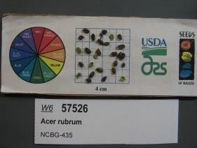 | | 2019 | | | | | | | Wild material | | 2098450 | WLP 3096 |
| 234 | WLP 2505 | Old U.S. 84 | Hydrangea quercifolia W. Bartram | Mississippi, United States | NA |  | | 2019 | COLLECTED | 12/17/2017 | Along Old U.S. 84, approximately 4 miles west of Mississippi/Alabama state border and 300 m west of the Chickasawhay River. | 31.74537000, -88.52251300 | | Limestone cliff along road. | Wild material | Specimens in nature represented as fairly small plants with abundant flowering (2017). | 2106215 | WLP 2505 |
| 235 | WLP 2506 | Cat's Cove Nature Preserve | Hydrangea quercifolia W. Bartram | Mississippi, United States | NA |  | | 2019 | COLLECTED | 12/17/2017 | Cat's Cove Nature Preserve, Smith County. Approximately 4 mi northwest of Bay Springs and 500 ft east of bridge where Highway 18 crosses Tallahala Creek. | 31.99742000, -89.35637200 | | Limestone cliff and steep bluff above creek. | Wild material | Flower profusion was variable in the wild population. The plants growing in sunnier locations had more flowers than those growing further into the forest. | 2106216 | WLP 2506 |
| 236 | WLP 2507 | LeFleur's Bluff State Park | Hydrangea quercifolia W. Bartram | Mississippi, United States | NA |  | | 2019 | COLLECTED | 12/18/2017 | LeFleur's Bluff State Park, Jackson, Hinds County, MS. Approximately 400 m north-northwest of the Pearl River and 150 m east of the Mississippi Museum of Natural Science. On bluff along trail near stairs and in ravine west of trail. | 32.32533000, -90.15570500 | | Bluff and ravine above cypress swamp. | Wild material | Majority of specimens noted in nature did not flower in 2017. Some of the individuals had persistent leaves on 18 December 2017. | 2106217 | WLP 2507 |
| 237 | WLP 2526 | Franklin D. Roosevelt State Park | Hydrangea quercifolia W. Bartram | Georgia, United States | NA |  | | 2019 | COLLECTED | 11/28/2018 | Franklin D. Roosevelt State Park, Harris County. Approximately 1.9 miles southeast of Pine Mountain along Mountain Creek. | 32.84099500, -84.83899300 | | Shady streambank. | Wild material | Measurements of sampled specimen taken in nature: Height 47 to 101 in.; width 27 to 99 in. | 2106236 | WLP 2526 |
| 238 | WLP 2535 | Little River Canyon | Hydrangea quercifolia W. Bartram | Alabama, United States | NA |  | | 2019 | COLLECTED | 12/12/2018 | Little River Canyon National Park, DeKalb and Cherokee Counties. North end of population is 6.5 miles southeast of Fort Payne on the trail to the Little River Falls Overlook. Most of the sampled hydrangeas are along Cherokee County 275 and Little River Canyon Rim Parkway. | 34.39263100, -85.62385700 | | Shady rim of canyon. | Wild material | Measurements of sampled speciimen taken in nature: Height 48 to 119 in.; width 26 to 115 in. Measurements for each specimen sampled may be provided upon request. | 2106245 | WLP 2535 |
| 239 | WLP 2540 | Cheaha Mountain | Hydrangea quercifolia W. Bartram | Alabama, United States | NA |  | | 2019 | COLLECTED | 12/01/2018 | Cheaha Mountain (Cheaha State Park and Talladega National Forest), Cleburne County. Approximately 9 miles south of Oxford. Hydrangeas are along Cheaha Road, Highway 281 and Skyway Mountainway. | 33.52890000, -85.74647800 | | Rocky mountainside. | Wild material | Measurements of sampled specimens taken in nature: Height 55 to 106 in.; width 31 to 132 in. Measurements for each specimen sampled may be provided upon request. | 2106250 | WLP 2540 |
| 240 | GPRU 167 | MARSB-281 | Prunus serotina Ehrh. | New Jersey, United States | GEN |  | | 2019 | | | | | | | Wild material | | 2097554 | GPRU 167 |
| 241 | NA 88109 | MARSB-425 | Ilex opaca Aiton | New Jersey, United States | NA |  | | 2019 | COLLECTED | 11/03/2015 | Tuckahoe Wildlife Management Area: take exit 20 off Garden State Parkway, route 50 north. Turn right onto Tuckahoe Road, left on Woods Road, right onto Washington Ave, and follow to Tuckahoe Lake. | 39.27769000, -74.73111000 | 0 | Pitch pine lowland swamp forest. | Wild material | | 2097626 | NA 88109 |
| 242 | NA 88111 | MARSB-428 | Lyonia ligustrina (L.) DC. | New Jersey, United States | NA |  | | 2019 | | | | | | | Wild material | | 2097629 | NA 88111 |
| 243 | NA 88114 | MARSB-533 | Ilex glabra (L.) A. Gray | New Jersey, United States | NA |  | | 2019 | COLLECTED | 10/28/2016 | Tuckahoe Wildlife Management Area: from Tuckahoe, take route 50 north to Mosquito Landing Rd. Drive down Mosq. Landing Rd. to Middle Town Rd. Make right onto Meadow Rd. Population is in power line cut. | 39.28080000, -74.73733000 | 3 | Seasonal fresh water meadow. | Wild material | | 2097648 | NA 88114 |
| 244 | NA 88119 | MARSB-650 | Viburnum dentatum L. | Delaware, United States | NA |  | | 2019 | | | | | | | Wild material | | 2097671 | NA 88119 |
| 245 | NA 88120 | MARSB-651 | Lindera benzoin (L.) Blume | Delaware, United States | NA | | | 2019 | | | | | | | Wild material | | 2097672 | NA 88120 |
| 246 | OPGC 7909 | MARSB-712 | Rhexia mariana L. | New Jersey, United States | OPGC |  | | 2019 | | | | | | | Wild material | | 2097687 | OPGC 7909 |
| 247 | W6 57085 | MARSB-218 | Scirpus atrovirens Willd. | New York, United States | W6 |  | | 2019 | | | | | | | Wild material | | 2097524 | W6 57085 |
| 248 | W6 57143 | MARSB-333 | Eupatorium hyssopifolium L. | New Jersey, United States | W6 |  | | 2019 | | | | | | | Wild material | | 2097582 | W6 57143 |
| 249 | W6 57144 | MARSB-334 | Tridens flavus (L.) Hitchc. | New Jersey, United States | W6 |  | | 2019 | | | | | | | Wild material | | 2097583 | W6 57144 |
| 250 | W6 57162 | MARSB-376 | Tridens flavus (L.) Hitchc. | New Jersey, United States | W6 |  | | 2019 | | | | | | | Wild material | | 2097601 | W6 57162 |
| 251 | W6 57189 | MARSB-427 | Alnus serrulata (Aiton) Willd. | New Jersey, United States | W6 |  | | 2019 | | | | | | | Wild material | | 2097628 | W6 57189 |
| 252 | W6 57237 | MARSB-669 | Scirpus cyperinus (L.) Kunth | Delaware, United States | W6 |  | | 2019 | | | | | | | Wild material | | 2097676 | W6 57237 |
| 253 | W6 57244 | MARSB-689 | Andropogon gerardi Vitman | Delaware, United States | W6 |  | | 2019 | | | | | | | Wild material | | 2097683 | W6 57244 |
| 254 | WLP 157 | NACPEC19-026 | Carpinus caroliniana Walter | Kentucky, United States | NA | | | 2019 | COLLECTED | 09/09/2019 | Madison County; Berea College Forest: Gabertown Road, near junction of Gabertown Road (KY 1617) + Scaffold Cane (KY595) | 37.54309800, -84.27086000 | 292 | Former Pinus taeda plantation | Wild material | | 2110469 | WLP 157 |
| 255 | WLP 163 | NACPEC19-046B | Hydrangea cinerea Small | Georgia, United States | NA | | | 2019 | COLLECTED | 09/14/2019 | Walker County; Lula Lake Land Trust: Bridge from parking lot to South Creek Trail | 34.92114500, -85.38035700 | 373 | Limestone bluffs surrounding dry creek bed in mixed mesophytic forest | Wild material | | 2110475 | WLP 163 |
| 256 | WLP 164 | NACPEC19-047 | Kalmia latifolia L. | Georgia, United States | NA | | | 2019 | COLLECTED | 09/14/2019 | Walker County; Lula Lake Land Trust: Off of South Creek trail on North side of bridge from parking lot | 34.92134100, -85.38051100 | 373 | Riparian zone, wet slope of creek, moist, sandy banks | Wild material | | 2110476 | WLP 164 |
| 257 | WLP 167 | NACPEC19-053 | Mitchella repens L. | Georgia, United States | NA | | | 2019 | COLLECTED | 09/14/2019 | Walker County; Lula Lake Land Trust: Middle Trail near top, also collected along Connector Trail to Middle Trail from parking lot. | 34.93141800, -85.36991400 | 469 | Mesic, sandy, rocky Oak-Hickory woodland slope - likely acidic | Wild material | | 2110479 | WLP 167 |
| 258 | WLP 168 | NACPEC19-054 | Viburnum acerifolium L. | Georgia, United States | NA | | | 2019 | COLLECTED | 09/14/2019 | Walker County; Lula Lake Land Trust: Middle Trail near top. | 34.93146200, -85.37018800 | 449 | Mesic, sandy, rocky Oak-Hickory woodland slope - likely acidic | Wild material | | 2110480 | WLP 168 |
| 259 | WLP 1201 | AOK027 | Diospyros virginiana L. | Arkansas, United States | NA | | | 2019 | COLLECTED | 10/07/2018 | Franklin County; White Rock; Ozark National Forest: Shores Lake Recreation Area at the edge of Shores Lake and pavilion. | 35.63916000, -93.95958000 | 206 | In maintained area at forest edge; 25 percent shade. | | 50 seeds collected from many individuals [or rather, more than one; exact number not specified or estimated]. Species occasional, with patchy distribution. | 2109071 | WLP 1201 |
| 260 | WLP 1552 | AOK018 | Platanus occidentalis L. | Arkansas, United States | NA | | | 2019 | COLLECTED | 10/06/2018 | Madison County; Venus; Kings River Falls Natural Area (Arkansas Natural Heritage Commission property). | 35.89573000, -93.58238000 | 521 | East side of hiking trail, near agricultural field; stream on opposite side of trail; open [full sun]. | | 600 seeds collected from one individual. Species occasional, with patchy distribution. | 2109070 | WLP 1552 |
| 261 | WLP 888 | AOK014 | Callicarpa americana L. | Arkansas, United States | NA | | | 2019 | COLLECTED | 10/05/2018 | Johnson County; Hagarville; Ozark National Forest: Little Sulphur Creek, along an unmarked trail off of Forest Service Road 1826. | 35.57135000, -93.28193000 | 207 | Mixed hardwood forest; 50 percent shade. | | This specimen appears to be the uncommon white-fruited form [=C. americana Lactea Group]. 300 seeds collected from one individual. Species frequent, with patchy distribution. | 2109069 | WLP 888 |
| 262 | WLP 307 | AF2018-001 | Acer saccharum Marshall subsp. floridanum (Chapm.) Desmarais | Virginia, United States | NA | | | 2018 | COLLECTED | 09/10/2018 | James City County; ; Near Grove Creek, near the roadside in front of the wastewater plant at the end of Log Cabin Beach Rd. | 37.21613000, -76.63348000 | 47 | Roadside near creek. | | Several large trees along roadside, fairly common. Herbarium voucher collected (see barcode NA0103770). | 2108850 | WLP 307 |
| 263 | NA 88024 | NCBG-316 | Lindera benzoin (L.) Blume | Virginia, United States | NA |  | | 2018 | | | | | | | Wild material | | 1965909 | NA 88024 |
| 264 | NA 88035 | NCBG-622 | Ilex glabra (L.) A. Gray | North Carolina, United States | NA |  | | 2018 | COLLECTED | 10/27/2016 | From Roanoke Island, head SW on US-64 W, turn left onto US-264 W, population on left for approximately 12 miles. | 35.71316000, -75.76819000 | 1 | Pine-inkberry swamp. | Wild material | | 1965992 | NA 88035 |
| 265 | NA 88036 | NCBG-632 | Clethra alnifolia L. | Maryland, United States | NA |  | | 2018 | | | | | | | Wild material | | 1965997 | NA 88036 |
| 266 | NA 88208 | NCBG-721 | Ceanothus americanus L. | North Carolina, United States | NA |  | | 2018 | | | | | | | Wild material | Ceanothus americanus | 1966030 | NA 88208 |
| 267 | OPGC 7227 | NCBG-236 | Typha angustifolia L. | North Carolina, United States | OPGC |  | | 2018 | | | | | | | Wild material | | 1965879 | OPGC 7227 |
| 268 | OPGC 7801 | NCBG-737 | Aletris farinosa L. | North Carolina, United States | OPGC |  | | 2018 | | | | | | | Wild material | Aletris farinosa | 1966038 | OPGC 7801 |
| 269 | W6 54628 | NCBG-202 | Juncus effusus L. | North Carolina, United States | W6 | | | 2018 | | | | | | | Wild material | Juncus effusus | 1965854 | W6 54628 |
| 270 | W6 54629 | NCBG-203 | Carex lurida Wahlenb. | North Carolina, United States | W6 | | | 2018 | | | | | | | Wild material | Carex lurida | 1965855 | W6 54629 |
| 271 | W6 54630 | NCBG-204 | Juncus effusus L. | Virginia, United States | W6 | | | 2018 | | | | | | | Wild material | Juncus effusus | 1965856 | W6 54630 |
| 272 | W6 54631 | NCBG-206 | Carex vulpinoidea Michx. | North Carolina, United States | W6 | | | 2018 | | | | | | | Wild material | Carex vulpinoidea | 1965857 | W6 54631 |
| 273 | W6 54724 | NCBG-456 | Carex lurida Wahlenb. | Virginia, United States | W6 |  | | 2018 | | | | | | | Wild material | Carex lurida | 1965950 | W6 54724 |
| 274 | W6 54775 | NCBG-652 | Pluchea odorata (L.) Cass. | Virginia, United States | W6 |  | | 2018 | | | | | | | Wild material | Pluchea odorata | 1966001 | W6 54775 |
| 275 | W6 54787 | NCBG-699 | Chrysopsis mariana (L.) Elliott | North Carolina, United States | W6 |  | | 2018 | | | | | | | Wild material | Chrysopsis mariana | 1966013 | W6 54787 |
| 276 | W6 54791 | NCBG-704 | Danthonia sericea Nutt. | North Carolina, United States | W6 |  | | 2018 | | | | | | | Wild material | Danthonia sericea | 1966017 | W6 54791 |
| 277 | W6 54793 | NCBG-708 | Marshallia obovata (Walter) Beadle & F. E. Boynton | North Carolina, United States | W6 |  | | 2018 | | | | | | | Wild material | Marshallia obovata | 1966019 | W6 54793 |
| 278 | W6 54800 | NCBG-716 | Juncus gerardi Loisel. | Maryland, United States | W6 |  | | 2018 | | | | | | | Wild material | Juncus gerardii var. gerardii | 1966026 | W6 54800 |
| 279 | Ames 34782 | MARSB-656 | Rhus copallinum L. | Delaware, United States | NC7 |  | | 2018 | COLLECTED | 09/25/2016 | Milford Neck Wildlife Area along Milford Neck Road just west of Thompsonville. | 38.99494000, -75.42338000 | 7 | Meadow | Wild material | | 1964819 | Ames 34782 |
| 280 | NA 88009 | MARSB-761 | Baccharis halimifolia L. | Delaware, United States | NA |  | | 2018 | | | | | | | Wild material | | 1964846 | NA 88009 |
| 281 | W6 54006 | MARSB-131 | Juncus effusus L. | Delaware, United States | W6 |  | | 2018 | | | | | | | Wild material | Juncus effusus | 1964722 | W6 54006 |
| 282 | W6 54009 | MARSB-152 | Carex crinita Lam. | Delaware, United States | W6 |  | | 2018 | | | | | | | Wild material | Carex crinita | 1964725 | W6 54009 |
| 283 | W6 54021 | MARSB-217 | Scirpus cyperinus (L.) Kunth | New York, United States | W6 |  | | 2018 | | | | | | | Wild material | Scirpus cyperinus | 1964737 | W6 54021 |
| 284 | W6 54032 | MARSB-287 | Carex crinita Lam. | New Jersey, United States | W6 |  | | 2018 | | | | | | | Wild material | Carex crinita | 1964748 | W6 54032 |
| 285 | W6 54033 | MARSB-288 | Carex lurida Wahlenb. | New Jersey, United States | W6 |  | | 2018 | | | | | | | Wild material | Carex lurida | 1964749 | W6 54033 |
| 286 | OPGC 5470 | JDC/BN/2018/056/869 | Baptisia nuttalliana Small | Arkansas, United States | OPGC |  | | 2018 | COLLECTED | 07/17/2018 | Located circa 2.60 miles northwest of Brightstar off Miller Road 159, Miller Road 74, Miller Road 75, Miller Road 154 and highway 237, Miller County | 33.14091000, -94.02229000 | 109 | Roadside. Edges of woods. | Wild material | Plants essentially all black with seeds past maturity by approximately 2-3 weeks, plants starting to break off at ground level and fruiting capsules starting to split at time of collection (17 July 2018). Seed quality rather poor at time of collection largely due to weevils. | 1964612 | OPGC 5470 |
| 287 | Ames 34204 | JDC/ML/2018/030/843 | Monarda luteola Singhurst & W. C. Holmes | Arkansas, United States | NC7 |  | | 2018 | COLLECTED | 05/22/2018 | Located 2.62 miles northwest of Brightstar off Miller Road 159 just 0.54 miles north of junction with state highway 160, Miller County | 33.14091000, -94.02229000 | 109 | Roadside. Open woods. | Wild material | Plants with lemon scent, pubescent stems and leaves with faint yellow flowers measuring circa 2.0' in height. Leaves longer than internodes. Plants likely reached peaked flower around 16 May 2018. Seeds likely reached full maturity around first week in July (2018). | 1963387 | Ames 34204 |
| 288 | WLP 1983 | MARSB-806 | Viburnum dentatum L. | Delaware, United States | NA | | | 2017 | COLLECTED | 08/16/2017 | Sussex County; ; Bombay Hook National Wildlife Refuge: Marshtown Road. | 39.18963000, -75.44088000 | 3 | Mixed hardwood swamp; swales/terraces. Sand soil (Pineyneck series). Land used for conservation and recreation. | Wild material | Seeds collected from 60 plants; 100 plants found in an area of two acres. Two herbarium vouchers collected on 16 Aug. 2017; held at Smithsonian and MARSB. Material identified in field by Clara Holmes on 16 Nov. 2017. Ecoregion: 63E -- Middle Atlantic Coastal Plains (Omernik). | 2108827 | WLP 1983 |
| 289 | NA 84645 | ZARKS-030 | Rhododendron prinophyllum (Small) Millais | Arkansas, United States | NA | | | 2017 | COLLECTED | 10/05/2014 | King's River Falls Natural Area; King's River, downstream of junction of county roads 3415 and 3500 along trail leading from parking area and trail sign. | 35.90106000, -93.57456000 | 514 | Mesic, mixed deciduous forest; growing on ledge along river, in rocky soil. | Wild material | See NA 87611 for plants of the same collection received from Morris Arboretum in 2020. | 2108758 | NA 84645 |
| 290 | NA 84577 | RJL-RM001 | Halesia diptera J. Ellis | Texas, United States | NA | | | 2017 | COLLECTED | 07/22/2017 | Along either side of a clear creek on private property approximately 1.42 kilometers north of Texas Recreational Road 255 in northeastern Jasper County. | 31.07135000, -93.94985000 | 107 | Plants growing along the embankments of the clear creek just above normal flood stage in primarily deciduous woodlands with some broadleaved evergreens and conifers. Plants are growing in part shade; some direct sunlight occurs during mid-day hours for 1-2 hours. Soils sandy and topped with a generous undisturbed decomposed litter layer. Slope: 10 percent. Aspect: variable. | Wild material | | 1953812 | NA 84577 |
| 291 | NA 84578 | RJL-RM002 | Magnolia pyramidata W. Bartram | Texas, United States | NA | | | 2017 | COLLECTED | 07/22/2017 | Newton County Road 425, about 2.8 miles south of Texas Recreational Road 255. | 30.85996000, -93.89596000 | 105 | Along roadsides and among young loblolly pines in forestry plantation. Plants growing in part shade to full sun in heavily regenerating roadside woodlands associated with loblolly pine plantations. Plants are growing in well drained, highly sandy soils. | Wild material | | 1953814 | NA 84578 |
| 292 | NA 84158 | P. Thompson 19 | Quercus oglethorpensis W. H. Duncan | Alabama, United States | NA | | | 2017 | COLLECTED | 10/15/2015 | On side of CR 14, ca 3.5 air miles west of Catherine, Alabama. | 32.17725000, -87.51492000 | | Growing on moist roadside between timber and hunting properties. | Wild material | | 2132959 | NA 84158 |
| 293 | NA 86662 | SE-2017-016 | Quercus shumardii Buckley | Georgia, United States | NA | | | 2017 | COLLECTED | 10/14/2017 | Oconee National Forest: Monticello Glades. | 33.25416000, -83.68386000 | 185 | Moist woods. | Wild material | On the original collection notes, this was assigned the field collection number SE-2017-017, but it was corrected to SE-2017-016 later. | 2141807 | NA 86662 |
| 294 | NA 83897 | PCCKY16-024 | Xanthorhiza simplicissima Marshall | Kentucky, United States | NA | | | 2016 | COLLECTED | 09/27/2016 | Cumberland Falls State Park, Cumberland Falls Visitor Center. Beach north of visitor center outlook trail, boulders north of large sycamore with exposed root flare and hole in trunk base. | 36.84200000, -84.34200000 | 252 | Beach, with boulders. | Wild material | | 1952452 | NA 83897 |
| 295 | WLP 1180 | NA 83893 | Euonymus americanus L. | Kentucky, United States | NA | | | 2016 | COLLECTED | 09/27/2016 | Cumberland Falls State Park, Trail #6 (Cumberland Falls Trail). Stairs above visitor center entrance at Trail #6 trailhead. | 36.83700000, -84.34300000 | 273 | | | | 1951485 | WLP 1180 |
| 296 | WLP 1375 | NA 83887 | Kalmia latifolia L. | Kentucky, United States | NA | | | 2016 | COLLECTED | 09/27/2016 | Cumberland Falls State Park, Trail #6 (Cumberland Falls Trail). | 36.83700000, -84.34000000 | 302 | Break in canopy along trail near telephone pole. | | | 1953494 | WLP 1375 |
| 297 | WLP 1432 | NA 83894 | Ostrya virginiana (Mill.) K. Koch | Kentucky, United States | NA | | | 2016 | COLLECTED | 09/27/2016 | Cumberland Falls State Park, Cumberland Falls Visitor Center. | 36.84000000, -84.34300000 | 258 | | | | 1952033 | WLP 1432 |
| 298 | WLP 1434 | NA 83915 | Nyssa sylvatica Marshall | Kentucky, United States | NA | | | 2016 | COLLECTED | 09/28/2016 | Cumberland Falls State Park; Cumberland Falls Visitor Center parking lot en route to Trail #2 trailhead. Overhanging road beyond water treatment plant and beyond shelter with fireplace, before circle of picnic tables. | 36.83800000, -84.33700000 | 276 | | | | 1952017 | WLP 1434 |
| 299 | WLP 147 | NA 83890 | Mitchella repens L. | Kentucky, United States | NA | | | 2016 | COLLECTED | 09/27/2016 | Whitley County; Cumberland Falls State Park, Trail #6 | 36.83700000, -84.34000000 | 301 | | Wild material | | 2110320 | WLP 147 |
| 300 | WLP 1702 | NA 83914 | Rhus copallinum L. | Kentucky, United States | NA | | | 2016 | COLLECTED | 09/28/2016 | Cumberland Falls State Park; Cumberland Falls Visitor Center parking lot en route to Trail #2 trailhead. Left of roadside beyond water treatment plant and beyond shelter with fireplace, before circle of picnic tables. | 36.83700000, -84.33800000 | | | | | 1951563 | WLP 1702 |
| 301 | WLP 1703 | NA 83921 | Rhododendron maximum L. | Kentucky, United States | NA | | | 2016 | COLLECTED | 09/28/2016 | Cumberland Falls State Park; Cumberland Falls Trail #2 (Cumberland River Trail) at river's edge. | 36.83800000, -84.33200000 | 302 | River's edge on uphill side. | | | 1952964 | WLP 1703 |
| 302 | WLP 704 | NA 83896 | Amorpha fruticosa L. | Kentucky, United States | NA | | | 2016 | COLLECTED | 09/27/2016 | Cumberland Falls State Park, Cumberland Falls Visitor Center. Beach north of visitor center outlook trail, boulders north of large sycamore with exposed root flare and hole in trunk base. | 36.84200000, -84.34200000 | 245 | Beach, with boulders. | | | 1950955 | WLP 704 |
| 303 | Ames 33745 | UC 108 | Aronia melanocarpa (Michx.) Elliott | Tennessee, United States | NC7 |  | | 2016 | COLLECTED | 10/01/2009 | Near Caryville, Campbell County | 36.35786670, -84.21851670 | 532 | Powerline cut and surrounding area of dry and wet woods. | Wild material | This accession is rather unique as it seems to morphologically/phenologically (NCRPIS field plots) represent the "southern form" of A. melanocarpa, a potentially a new Aronia species. This southern form was originally discovered by Brand et al. 2022 (Ploidy, genetic diversity and speciation of the genus Aronia) and is known for having glabrous stems and leaves and a distinct phyllotaxy than other Aronia species. However, this accession based on Brand et al. 2022 AFLP dendogram fits with diploid A. melanocarpa, but flow cytometry indicates it is tetraploid. Fruits tend to ripen the same time as diploid A. melanocarpa and three weeks ahead of tetraploid A. melanocarpa. | 1942831 | Ames 33745 |
| 304 | Ames 33746 | UC 110a | Aronia melanocarpa (Michx.) Elliott | Tennessee, United States | NC7 |  | | 2016 | COLLECTED | 10/01/2009 | Near Newcomb, Campbell County | 36.53751670, -84.15580000 | 541 | Very dry, exposed rock spine with primarily organic soil and plants growing in cracks and pockets. Growing in association with Pinus virginiana, Quercus, Vaccinium, Gaylussacia, Castanea, Amelanchier, Magnolia ashei, Magnolia tripetala, Oxydendrum, Nyssa, Liquidambar styraciflua. | Wild material | This accession has been confirmed to represent the "southern form" of A. melanocarpa, potentially a new Aronia species. This southern form was originally discovered by Brand et al. 2022 (Ploidy, genetic diversity and speciation of the genus Aronia) and is known for having glabrous stems and leaves and a distinct phyllotaxy than other Aronia species. In addition, plants tend to bloom approximately two weeks later than all other Aronia taxonomic groups and the inflorescences/infructescences are more spreading and extended due to longer peduncles and pedicels within the cyme. Fruit maturity tends to occur 2 to 4 weeks later than tetraploid A. melanocarpa and 4 to 6 weeks later than diploid A. melanocarpa. Phenolic levels are much higher in comparison to other A. melanocarpa accessions (Brand et al., 2017 - Anthocyanins, total phenolics, ORAC and moisture content of wild and cultivated dark-fruited Aronia species.) | 1942832 | Ames 33746 |
| 305 | NA 82746 | Site 3B/Hightower Road at Holmes Creek | Magnolia ashei Weath. | Florida, United States | NA | | | 2015 | COLLECTED | 07/31/2015 | Along Holmes Creek 0.2 miles west-southwest of Hard Castle Landing boat ramp at hte end of Hightower Road. | 30.60401000, -85.76883000 | 11 | Shade to partial shade of deciduous woodlands 10 to 15 feet above the creek, surrounded by low lying swampy area. | Wild material | Originally just called Site 3, but the "A/B" has been added to distinguish the Live Oak Landing (3A) and Hightower Road (3B) material. For previous collections of this population, see NA 81556 (2013); for later collection, see NA 82746.01 (2019). | 1950860 | NA 82746 |
| 306 | NA 82643 | NA 82643 | Lonicera sempervirens L. | Texas, United States | NA | | | 2015 | COLLECTED | 07/20/2014 | East side of Texas Route 87 approximately 0.52 miles south of Trout Creek, Texas. | 30.61156000, -93.80506000 | 21 | Southwest-facing edge of mature woodland in part to full sun; well-drained, seasonally moist soils that are sandy loam; surface has an excellent organic litter layer. | | | 1952603 | NA 82643 |
| 307 | NA 83066 | NA 83066 | Hamamelis vernalis Sarg. | Arkansas, United States | NA | | | 2015 | COLLECTED | 10/04/2014 | King's River Falls Natural Area; upstream of the junction of County Rds 3415 and 3500 and the bridge over Mink Creek branch of King's River; at the Dripping Springs Schoolhouse (1921). | 35.88946000, -93.58091000 | 528 | Mesic, mixed deciduous forest; north-northeast running stream valley; gravel bank along seasonal stream in sandy/gravelly soil. | Wild material | | 1953405 | NA 83066 |
| 308 | W6 48814 | MARSB-115 | Aristida purpurascens Poir. | New Jersey, United States | W6 |  | | 2015 | | | | | | | Wild material | | 1922907 | W6 48814 |
| 309 | W6 48819 | MARSB-101 | Boehmeria cylindrica (L.) Sw. | Maryland, United States | W6 |  | | 2015 | | | | | | | Wild material | | 1922836 | W6 48819 |
| 310 | W6 48822 | MARSB-46 | Carex atlantica L. H. Bailey | New Jersey, United States | W6 | 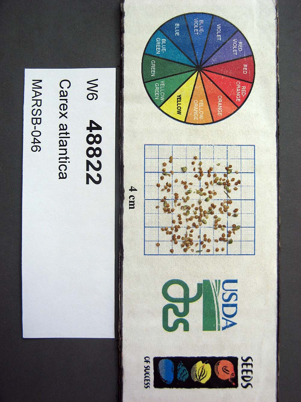 | | 2015 | | | | | | | Wild material | | 1922838 | W6 48822 |
| 311 | W6 48853 | MARSB-102 | Eragrostis spectabilis (Pursh) Steud. | Maryland, United States | W6 |  | | 2015 | | | | | | | Wild material | | 1922857 | W6 48853 |
| 312 | W6 48903 | MARSB-116 | Tridens flavus (L.) Hitchc. | Delaware, United States | W6 |  | | 2015 | | | | | | | Wild material | | 1922889 | W6 48903 |
| 313 | W6 48850 | MARSB-085 | Hexasepalum teres (Walter) J. H. Kirkbr. | New Jersey, United States | W6 |  | | 2015 | | | | | | | Wild material | | 1922915 | W6 48850 |
| 314 | W6 48854 | MARSB-106 | Eragrostis spectabilis (Pursh) Steud. | New Jersey, United States | W6 |  | | 2015 | | | | | | | Wild material | | 1922916 | W6 48854 |
| 315 | W6 48867 | MARSB-59 | Juncus tenuis Willd. | New York, United States | W6 |  | | 2015 | | | | | | | Wild material | | 1922918 | W6 48867 |
| 316 | W6 48902 | MARSB-114 | Tridens flavus (L.) Hitchc. | New Jersey, United States | W6 |  | | 2015 | | | | | | | Wild material | | 1922931 | W6 48902 |
| 317 | NA 82038 | JDC/QM/2014/052/554 | Quercus michauxii Nutt. | Missouri, United States | NA |  | | 2014 | COLLECTED | 09/19/2014 | Missouri: Mississippi County; Big Oak Tree State Park. | 36.64463600, -89.28721300 | 108 | Native, wet woods. Growing in association with Fraxinus sp., Liquidambar styraciflua, Carya laciniosa, Quercus macrocarpa, and Ulmus sp. | Wild material | Acorns rather green approximately 2-3 weeks away from peak maturity. Specimen sampled approximatley 100' in height. | 1922339 | NA 82038 |
| 318 | NA 82052 | JDC/MV/2014/078/580 | Magnolia virginiana L. | Mississippi, United States | NA | | | 2014 | COLLECTED | 09/22/2014 | Mississippi: Tishomingo County; Bottomlands of Foote Branch Creek off Highway 982. | 34.87692100, -88.28330100 | 150 | Deciduous woods. Growing in association with Quercus michauxii, Acer rubrum, Alnus sp., Liquidambar styraciflua, Toxicodendron radicans, Pinus sp., Nyssa sylvatica, and Vaccinum sp. | Wild material | Impressive specimens. Optimum timing of harvest. Largest specimen measuring 19" d.b.h. and approximately 80' in height. | 1922353 | NA 82052 |
| 319 | NA 82059 | JDC/MM/2014/088/590 | Magnolia macrophylla Michx. | Alabama, United States | NA | | | 2014 | COLLECTED | 09/23/2014 | Franklin County and Lawrence County; Small tributary to Little Bear Creek (Frankllin County) and also William B. Bankhead National Forest (Lawrence County). | 34.43544700, -87.58959100 | 293 | | Wild material | | 1922360 | NA 82059 |
| 320 | NA 82071 | JDC/QM/2014/103/605 | Quercus michauxii Nutt. | Mississippi, United States | NA | | | 2014 | COLLECTED | 09/25/2014 | Chinchahoma Creek watershed near Ennis Road. | 33.38574900, -88.92255600 | 98 | Wet, deciduous woods. | Wild material | Specimen sampled measured 26.75" d.b.h. and approximately 110' in height. Fruits still green. | 1922372 | NA 82071 |
| 321 | WLP 1251 | JDC/HQ/2014/067/569 | Hydrangea quercifolia W. Bartram | Mississippi, United States | NA | 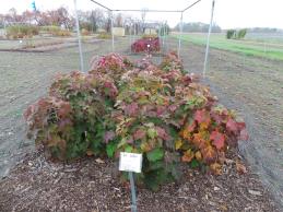 | | 2014 | COLLECTED | 09/21/2014 | Mississippi: Lafayette County; Holly Springs National Forest along County Road 244. | 34.51468900, -89.45669300 | 132 | Deciduous woods. Higher elevation than surrounding area. East, northeast-facing 45 degree slope. Growing in association with Cornus florida, Nyssa sylvatica, Quercus alba, Pinus sp., Liquidambar styraciflua, Juniperus virginiana, Carya tomentosa, and Rhus typhina. | Wild material | Numerous specimens. Attractive peeling bark and large (10" long) infructescences. | 1922345 | WLP 1251 |
| 322 | WLP 1422 | JDC/NS/2014/068/570 | Nyssa sylvatica Marshall | Mississippi, United States | NA | | | 2014 | COLLECTED | 09/21/2014 | Mississippi: Lafayette County; Holly Springs National Forest along County Road 244. | 34.50982900, -89.35716800 | 95 | Floodplain. Wet woods. Growing in association with Liquidambar styraciflua, Acer negundo, Cetlis sp., Juniperus virginiana, Carya illinoinensis, Quercus nigra, and Quercus phellos. | Wild material | Fruits rather green. | 1922346 | WLP 1422 |
| 323 | WLP 218 | JDC/TC/2014/089/591A | Tsuga canadensis (L.) Carrière | Alabama, United States | NA | | | 2014 | COLLECTED | 09/23/2014 | Alabama: Franklin County; William B. Bankhead National Forest, north-facing banks of Bear Creek watershed. | 34.33924600, -87.54771500 | 285 | Growing in association with Quercus alba, Cornus florida, Pueraria montana var. lobata, Magnolia macrophylla, Platanus occidentalis, Liquidambar styraciflua, and Fagus grandifolia. | Wild material | Excellent cone production. Optimum timing for harvest. Species infrequent to locally abundant across a 12 mile linear stretch of the southeast corner of Franklin County to north-central Winston County. | 1922361 | WLP 218 |
| 324 | DPRU 3200 | JDC/PA/2014/082/584 | Prunus americana Marshall | Mississippi, United States | DAV | | | 2014 | COLLECTED | 09/22/2014 | Tishomingo County, Mississippi - Extreme northeast corner of Tishomingo County near J.P. Coleman S.P. | 34.98170000, -88.20449700 | 202 | Dry, pine-oak-hickory woods. Growing in association with Pinus sp., Liquidambar styraciflua, Fraxinus americana, Rhus typhina, Acer rubrum, Quercus stellata, and Carya sp. | Wild material | Fruits perfectly round, very ripe, and pinkish-red in color. Actively dropping at time of collection. The only specimens of this species noted during entire trip throughout northern Mississippi, parts of Arkansas, and northwest Alabama. There were two specimens a few feet from each other, but I suspect they were not genetically unique from each other due to the suckering nature of the species. Considering there was decent fruit production there must have been another Prunus sp. nearby. | 1921307 | DPRU 3200 |
| 325 | Ames 32794 | JDC/FP/2014/106/608 | Fraxinus pennsylvanica Marshall | Mississippi, United States | NC7 |  | | 2014 | COLLECTED | 09/25/2014 | Along Sanders Road, Cypress Creek watershed, NW 1/4 of SW 1/4 of SW1/4 of Section 10, T17N, R13E, Oktibbeha County. | 33.34662400, -88.93148200 | 115 | | Wild material | | 1921805 | Ames 32794 |
| 326 | NA 81984 | Lactea Group | Callicarpa americana L. | Texas, United States | NA | | | 2014 | COLLECTED | 08/30/2013 | Woodlands above Boykin Spring Lake. | 31.06266000, -94.27565000 | 56 | Growing in partial shade of mixed deciduous and evergreen woodlands in well-drained to dry conditions. | | | 1951711 | NA 81984 |
| 327 | NA 81696 | SOIL-014 | Crataegus phaenopyrum (L. f.) Medik. | Illinois, United States | NA | | | 2014 | COLLECTED | 10/2013 | Horseshoe Lake Nature Preserve. Roadside edge of wildlife management area. | 37.13025000, -89.28953000 | 99 | Mesic forest, growing in 1/2 shade in highly organic soil. | Wild material | | 1953201 | NA 81696 |
| 328 | NA 81709 | CSF-13-22 | Cephalanthus occidentalis L. | Maryland, United States | NA | | | 2013 | COLLECTED | 11/04/2013 | Cedarville State Forest near Brandywine/Waldorf, MD, at power transmission line corridor along small stream. | 38.64824000, -76.83493000 | 61 | Growing along small stream that crossed the transmission line right-of-way. | Wild material | | 1951113 | NA 81709 |
| 329 | NA 81566 | NA 81566 | Rhododendron austrinum (Small) Rehder | Florida, United States | NA | | | 2013 | COLLECTED | 03/31/2013 | White River approximately 0.92 miles north of the confluence with the Escambia River in the Escambia River State Wildlife Management Area. [Originally listed as: "Buzzard�s Lake River approximately 0.92 miles north of the confluence with the Escambia River..."; GPS coordinates are along the White River, and well south of the confluence with Buzzards Lake River. -SBL] | 30.58168000, -87.22233000 | 2 | Partial shade along the river on small sand berm above the stream in mixed deciduous and broadleaved evergreen maritime forest occasionally inundated by tidal salt water. | Wild material | | 1953003 | NA 81566 |
| 330 | OPGC 3928 | PZSH2011-5 | Phlox carolina L. | Florida, United States | OPGC |  | | 2011 | COLLECTED | 04/03/2011 | Gadsden County, In forested areas along a single unnnamed tributary of the Apalachicola river, immediately south of Woodruff Dam Road, approx 0.30 miles W of Chattahoochee. | 30.42345000, -84.51269000 | 22 | In floodplain hardwood forest; Acer barbatum, Rapidophyllum hystrix, Parthenocissus quinquefolia, Bignonia capreolata, Liquidambar styraciflua, Phlox divaricata. | Wild material | Plants 15-20 cm tall; Leaves elliptical-lanceolate, lustrous, dark adaxially, light green abaxially. | 1907062 | OPGC 3928 |
| 331 | OPGC 3457 | PZ10-209 | Phlox paniculata L. | Ohio, United States | OPGC | | | 2010 | COLLECTED | 09/01/2010 | Scioto Co. Just S of juncture of Rocky Fork Rd. (Co. Rd. 40) and Tick Hill-Koenig Rd. On W side of road. | 38.49520000, -83.14058000 | 191 | Roadsie ditch; Impatiens pallida, Eupatorium purpureum, Aplectrum hyemale, Trillium grandiflorum, Polystichum acrostichoides, Magnolia tripetala, Liquidambar styraciflua | Wild material | Erect, slender perennial to 1 m tall; flowers magenta-pink; leaves ovate-lanceolate with areolate veins, glabrous | 1897773 | OPGC 3457 |
| 332 | Ames 30541 | UC 105 | Aronia arbutifolia (L.) Pers. | North Carolina, United States | NC7 |  | | 2010 | COLLECTED | 10/21/2009 | Near West End, Moore County | 35.25260000, -79.49096700 | 149 | Powerline easement. Mixed hardwood woods. Sandy soil overlaying a moist seep. | Wild material | Received as plants grown from seed collected from native/wild population. Accession is extremely vigorous with an upright growth habit. Low fruit/seed production in cultivation in central Iowa. | 1843095 | Ames 30541 |
| 333 | Ames 30542 | UC 106 | Aronia arbutifolia (L.) Pers. | North Carolina, United States | NC7 |  | | 2010 | COLLECTED | 10/21/2009 | Near Hoffman Road, Jackson Springs | 35.21046700, -79.57120000 | 140 | Re-established longleaf pine ecosystem. Sandy soil overlaying moist seeps. | Wild material | Received as plants grown from seed collected from native/wild population. Accession is extremely vigorous and uniform displaying a very prostrate growth habit. Foliage is dense with leaves that are larger than the average A. arbutifolia. | 1843096 | Ames 30542 |
| 334 | Ames 30543 | UC 109 | Aronia arbutifolia (L.) Pers. | Tennessee, United States | NC7 |  | | 2010 | COLLECTED | 10/22/2009 | Near Rock Quarry Road, Newcomb, Campbell County | 36.53751700, -84.15580000 | 541 | Very dry, exposed rock spine with primarily organic soil and plants growing in cracks and pockets. | Wild material | Received as plants grown from seed collected from native/wild population. Accession is extremely vigorous and dense, with a relatively upright growth habit that is broad. Leaves are larger than the average A. arbutifolia. | 1843097 | Ames 30543 |
| 335 | Ames 32070 | UC 105 | Aronia arbutifolia (L.) Pers. | North Carolina, United States | NC7 |  | | 2010 | COLLECTED | 10/21/2009 | Near West End, Moore County | 35.25260000, -79.49096700 | 149 | Powerline easement. Mixed hardwood woods. Sandy soil overlaying a moist seep. | Wild material | Separated from Ames 30541 due to its extremely tight, upright growth habit. This new accession will be maintained as a uniform accession. | 1912823 | Ames 32070 |
| 336 | Ames 32072 | UC 106 | Aronia arbutifolia (L.) Pers. | North Carolina, United States | NC7 |  | | 2010 | COLLECTED | 10/21/2009 | Near Hoffman Road, Jackson Springs | 35.21046700, -79.57120000 | 140 | Re-established longleaf pine ecosystem. Sandy soil overlaying moist seeps. | Wild material | Separated from Ames 30542 due to open, spreading growth habit. This accession will be maintained as a uniform accession. | 1912825 | Ames 32072 |
| 337 | OPGC 3200 | TX-19 | Rudbeckia texana (Perdue) P. B. Cox & Urbatsch | Texas, United States | OPGC | | | 2010 | COLLECTED | 05/27/2010 | Upper West Gulf Coastal Plain. Jasper County. Roadside north of R255 between CR 61 and 60. | 31.04313900, -94.15833300 | 48 | Roadside ROW/forest edge(adjacent to U.S. National Forest). Land form: Flat. Land Use: Roadside ROW. Geology: Sandstone. Soil Texture: Sandy. Soil Color: Tan. | Wild material | Plants to 2 m tall, leathery leaves, rhizomatous; ray petals yellow. | 1897300 | OPGC 3200 |
| 338 | Ames 30485 | APS/GD/2010/006/041 | Gymnocladus dioicus (L.) K. Koch | Arkansas, United States | NC7 |  | | 2010 | COLLECTED | 02/19/2010 | Alum Fork Saline River, 4.5 miles northeast of Lake Balboa, Saline County. | 34.68933400, -92.84397400 | 153 | Floodplain. Rich, high organic matter substrate. | Wild material | Specimen measured 12.5" d.b.h. and 80-90'. | 1831344 | Ames 30485 |
| 339 | NA 78035 | AL #44 | Philadelphus inodorus L. | Alabama, United States | NA | | | 2008 | COLLECTED | 09/17/2008 | Just above the Cahaba River, near end of road and Caffee Creek. | | | | Wild material | | 1913895 | NA 78035 |
| 340 | NA 78052 | NA 78052 | Ilex longipes Chapm. ex Trel. | Alabama, United States | NA | | | 2008 | COLLECTED | 09/19/2008 | Little River Canyon National Preserve, Little River Canyon, on trail near Lynn Overlook tributary. | | | Rocky woodland on trail near Lynn Overlook tributary. | | | 1950410 | NA 78052 |
| 341 | WLP 1112 | LBJWC-1141 | Crataegus viridis L. | Texas, United States | NA | | | 2008 | COLLECTED | 11/16/2007 | Mann Tract, Trinity River National Wildlife Refuge, southwest of the City of Hardin. | 30.13738000, -94.77505000 | 0 | Fencerow/bottomland hardwood mixed forest, flat, clayey soil. | Wild material | | 1781868 | WLP 1112 |
| 342 | WLP 2307 | LBJWC-MLE-036 | Ostrya virginiana (Mill.) K. Koch | Texas, United States | NA | | | 2008 | COLLECTED | 09/28/2006 | Approximately 7 miles south of Alto, Texas on 294. | 31.63803000, -95.21316000 | 94 | Mixed hardwood and pine/forest roadside; rolling hills. Reddish tan colored, sandy soil over sandstone. | Wild material | | 1781863 | WLP 2307 |
| 343 | NA 76035 | DE.001-2006 | Clethra alnifolia L. | Delaware, United States | NA | | | 2006 | COLLECTED | 10/18/2006 | Thompson's Island State Park. | 38.70111000, -75.08902000 | 5 | Woodland coastal. Elevation: 17 feet. | Wild material | | 1716201 | NA 76035 |
| 344 | DVIT 3151 | RJL VA2003-005 | Vitis rotundifolia Michx. | Virginia, United States | DAV | | | 2003 | COLLECTED | 09/05/2003 | Collected from Chesapeake, VA at the interchange of Business Route 168 (Battlefield Ave) and Route 168, next to a detention basin and shopping plaza on the west side of Battlefield Ave. | 36.73861111, -76.24250000 | 5 | Mixed deciduous and evergreen woodland, primarily comprised of deciduous trees in the over-story and a mixture of deciduous and evergreen species in the sub-canopy. Plants growing in part-shade to full sun where they produce abundant fruit. | Breeding material | Seed collected from many individuals and massed. Associated plants: Acer rubrum, Carpinus caroliniana, Clethra alnifolia, fagus grandifolia, gelsemium nudiflorum, Hamamelis virginiana, Ilex opaca, Leucothoe racemosa, liquidambar styraciflua, Liriodendron tulipfera, Nyssa sylvatica, Oxydendrum arboreum, Persea borbonia, Quercus falcata, Quercus michauxii, Smilax sp., Stewartia malacodendron, Symplocos tinctoria and Vaccinium sp. | 1651338 | DVIT 3151 |