| 0 | OPGC 5812 | 210638 | Lobelia cardinalis L. | Texas, United States | OPGC |  | | 2021 | | | | | | | Wild material | | 1895309 | OPGC 5812 |
| 1 | NA 89158 | 2025RJLSEUS-06 | Cornus florida L. | Alabama, United States | NA | | | 2025 | COLLECTED | 10/01/2025 | Coosa Wildlife Management Area: along the edge of gated dirt road on the west side of Coosa County Road 29, 0.3 kilometers north of Hatchet Creek. | 32.86402200, -86.33871400 | 108 | Plants are growing in part sun to shade on dry-mesic slopes above the road cut on the gated dirt road; most likely a road for access for fire control/forest management. The forest is a combination of deciduous and evergreen with evergreens primarily comprised of Pinus taeda. The habitat was quite dry during this time of year. Slope: 5 to 20 percent. Aspect: North. Soils: The primary soil in the area of this collection is classified as Madison-Louisa Series complex, 15 to 30 percent slopes, moderately eroded (MdE2). The Madison Series soils are very deep, well drained soils with medium runoff found on Piedmont uplands in interstream divides, ridges and side slopes. They are comprised of residuum weathered from felsic or intermediate, high-grade metamorphic or igneous rocks high in content of mica. Slopes range from 2 to 60 percent and soil is typically strongly acidic. Louisa Series soils The Louisa Series soils consist of shallow, somewhat excessively drained soils which formed over mica gneiss and schist bedrock. They occur on Piedmont uplands. Slopes are 6 to 80 percent. This soil is moderately acid. (Source: California Soil Resource Lab/NRCS Official Soil Series Descriptions). Geology: The underlying geology of this area is of Precambrian to Paleozoic origin and characterized as Hatchet Creek Group; Pinchoulee Gneiss Formation. It is characterized by medium to fine-grained migmatitic, locally garnetiferous biotite-feldspar gneiss, commonly saturated with granitic pods. (Source: USGS Alabama Geologic Map Data). | Wild material | | 2193004 | NA 89158 |
| 2 | NA 89092 | 2024RM-TK-005 | Ilex amelanchier M. A. Curtis ex Chapm. | Florida, United States | NA | | | 2024 | COLLECTED | 09/29/2024 | Yellow River Water Management Area: found in an area where an unnamed, unpaved road dead ends near the Yellow River. This unpaved road is accessed from Old River Road to the east near the junction with Shockley Springs Road. Plants are accessed by foot along the edge of the river and associated wetland depressions to the west of the road. | 30.86946200, -86.59349000 | 23 | Plants growing in seasonally inundated swamp habitats associated with the Yellow River. Plants are emergent during portions of the year, primarily during the growing season. During this time of collection, water had receded from the wetlands but the area was still quite wet with many tiny stream rivulets still draining. Slope: 0 percent. Aspect: N/A. Geology: The underlying geology of this area is the Alum Bluff Group of Miocene origin. It includes the Chipola Formation, Oak Grove Sand, Shoal River Formation, Choctawhatchee Formation and the Jackson Bluff Formation. The formations included in this group are generally defined based on their molluscan faunas and stratigraphic position. Puri (1953) described sediment facies as they relate to the formations of the Alum Bluff Group. These sediments are lithologically distinct as a group, not as individual units. The Alum Bluff Group crops out or is beneath a thin overburden in the western panhandle from river valleys in Okaloosa County eastward to western Jackson County. The Alum Bluff Group consists of clays, sands and shell beds which may vary from fossiliferous, sandy clays to unfossiliferous sands and clays and occasional carbonate beds. Mica is a common constituent and glauconite and phosphate occur sporadically. Induration varies from essentially nonindurated in sands to well indurated in carbonate lenses. Colors range from cream to olive gray with mottled reddish brown in weathered sections. Sand grain size varies from very fine to very coarse with sporadic occurrences of gravel. These sediments generally have low permeabilities and are part of the intermediate confining unit/aquifer system. (Source: USGS Florida Geologic Map Data). Soils: The surface soil profile of this area is primarily Kinston, Johnston, and Bibb soils, frequently flooded. Kinston Series soils are poorly drained, alluvial, fine-loamy, siliceous, and acid soils of flood plains. They are peaty to loamy friable, slightly sticky and slightly plastic in the upper 0 to 7.5 cm of the strata with less sand and more silt-loam in progressively deeper strata. The Johnston Series consists of very deep, very poorly drained coarse-loamy, siliceous, active, acid, thermic Cumulic Humaquepts. The upper 0-75 cm is black, mucky loam that is friable and very strongly acid. The lower strata to 1.75 m are dark gray, loamy fine sand, single grained, loose and very strongly a).id. The Bibb Series soils consist of very deep, poorly drained, moderately permeable soils on flood plains of streams in the Southern Coastal Plain (133A) Major Land Resource Area. They formed in stratified loamy and sandy alluvium that are commonly and frequently flooded and water runs off the surface very slowly. Slopes range from 0 to 2 percent. (Source: California Soil Resource Lab/NRCS Official Soil Series Descriptions). EPA Ecoregion (Level III): Southeastern Plains (65). EPA Ecoregion (Level IV): Southeastern Floodplains and Low Terraces (65p). | Wild material | | 2169056 | NA 89092 |
| 3 | Ames 36160 | JDC/MM/2023/063/1095 | Monarda maxmedleyi J. J. N. Campb. & Floden | Kentucky, United States | NC7 |  | | 2023 | COLLECTED | 08/09/2023 | Pottersville Road approximately 0.85 miles northeast of intersection with Hope Means Road | 37.99758300, -83.75498000 | 294 | Roadside prairie remnant. | Wild material | Plants measuring 12-18" in height. Spreading vegetatively via rhizomes. Population mostly represented as specimens with white flowers, but a few light pink specimens. Peak flowering at collection site occurred near 29th of May (2023). | 2158365 | Ames 36160 |
| 4 | OPGC 8498 | NCBG-398 | Helenium autumnale L. | Virginia, United States | OPGC | | | 2021 | | | | | | | Wild material | | 2132882 | OPGC 8498 |
| 5 | WLP 1747 | RJL2021PA-005 | Rosa palustris Marshall | Pennsylvania, United States | NA | | | 2021 | COLLECTED | 11/20/2021 | Plants growing in wetland seeps surrounded by mown hayfields just west of the Middle Branch White Clay Creek in Goddard Park, West Grove Pennsylvania, off of Wickerton Road, Chester County. | 39.80090528, -75.82383250 | 100 | Habitat Notes: Plants are growing in permanently saturated to moist soils in wetland habitats. Plants appear to be obligate wetland plants and are found only in permanent to nearly permanent wet habitats observed. Generally, the shrubs are found in part shade to full sun. Soils: Soils found in the areas where this collection was made are comprised primarily of Hatboro silt loam (Ha). Hatboro silt loam consists of very deep and poorly drained soils formed in deposited alluvium derived from metamorphic and crystalline rock. They are on flood plains. Slopes range from 0 to 3 percent. Slope: 0 to 3% Aspect: Variable. | Wild material | | 2123715 | WLP 1747 |
| 6 | Ames 35750 | Ames 35750 | Blephilia ciliata (L.) Benth. | Iowa, United States | NC7 | 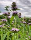 | | 2021 | COLLECTED | 09/27/2021 | Located approximately 3 miles south, southeast of Fairfield, T71N R9W SW1/4 Sec. 7 | 40.96338000, -91.94686900 | 223 | Woodland openings/edges, disturbed areas | Wild material | | 2122068 | Ames 35750 |
| 7 | W6 59156 | CBG-10437 | Ageratina altissima (L.) R. M. King & H. Rob. | Indiana, United States | W6 |  | | 2021 | | | | | | | Wild material | | 2120079 | W6 59156 |
| 8 | W6 59157 | CBG-10438 | Verbesina alternifolia (L.) Britton ex Kearney | Indiana, United States | W6 | | | 2021 | | | | | | | Wild material | | 2120080 | W6 59157 |
| 9 | WLP 171 | NACPEC19-063 | Itea virginica L. | Georgia, United States | NA | | | 2019 | COLLECTED | 09/15/2019 | Walker County; Lula Lake Land Trust: Lula Lake Land Trust Falls: West Side of Falls | 34.93319200, -85.37178900 | 477 | Stream bank, mesic wood forest | Wild material | | 2110485 | WLP 171 |
| 10 | Ames 32526 | 210742 | Helianthus maximiliani Schrad. | Texas, United States | NC7 |  | | 2011 | COLLECTED | 11/04/2003 | River Fern Court (generalizided locality information; more detail available upon request) | | | Creekside. Associated with Andropogon glomeratus, Eupatorium serotinum, Juniperus ashei, Lobelia cardinalis, Quercus buckleyi, Q. fusiformis, Smilax bona-nox, Sorghastrum nutans, and Toxicodendron radicans. | Wild material | | 1895289 | Ames 32526 |
| 11 | Ames 30145 | JDC/FP/2009/031/181 | Fraxinus pennsylvanica Marshall | Wisconsin, United States | NC7 |  | | 2009 | COLLECTED | 09/22/2009 | Tower Hill State Park and Lower Wisconsin State Riverway (Helena Unit), SW 1/4 of SE 1/4 of Section 20 and SW 1/4 of NE 1/4 of Section 17, T8N, R4E, Spring Green Quad, Iowa County. | 43.15055556, -90.04166667 | 237 | Wisconsin River watershed/floodplain | Wild material | | 1819726 | Ames 30145 |