| 0 | PI 696126 | MT 43-59 | Lonicera caerulea L. | Oregon, United States | COR | | | 2021 | DONATED | 02/2021 | | 44.39247000, -122.98766000 | 80 | | Cultivated material | OP seed from Shinji Kawai's Sunset Lane, Brownsville location 2019. Med, firm, bloom, tropical fruit flavor, dark red juice when ripe; bib 7 OP. | 2111350 | PI 696126 |
| 1 | PI 696128 | MT 57-95 | Lonicera caerulea L. | Oregon, United States | COR | | | 2021 | DONATED | 02/2021 | | 44.39247000, -122.98766000 | 80 | | Cultivated material | OP seed from Shinji Kawai's Sunset Lane, Brownsville location 2019. | 2111348 | PI 696128 |
| 2 | PI 696143 | MT 100-22 | Lonicera caerulea L. | Oregon, United States | COR | | | 2021 | DONATED | 02/2021 | | 44.39247000, -122.98766000 | 80 | | Cultivated material | | 2111333 | PI 696143 |
| 3 | PI 696144 | MT 108-81 | Lonicera caerulea L. | Oregon, United States | COR | | | 2021 | DONATED | 02/2021 | | 44.39247000, -122.98766000 | 80 | | Cultivated material | OP seed from Shinji Kawai's Sunset Lane, Brownsville location 2019. Less SWD damage, small, oval, sweet, bloom, firm. | 2111332 | PI 696144 |
| 4 | PI 696146 | MT 108-90 | Lonicera caerulea L. | Oregon, United States | COR | | | 2021 | DONATED | 02/2021 | | 44.39247000, -122.98766000 | 80 | | Cultivated material | OP seed from Shinji Kawai's Sunset Lane, Brownsville location 2019. Elongated, bloom, med-larg, (yellow elongated leaves) | 2111330 | PI 696146 |
| 5 | PI 696147 | MT 124-51 | Lonicera caerulea L. | Oregon, United States | COR | | | 2021 | DONATED | 02/2021 | | 44.39247000, -122.98766000 | 80 | | Cultivated material | OP seed from Shinji Kawai's Brownsville location 2019. Large teardrop, shape/size variable bloom. | 2111329 | PI 696147 |
| 6 | PI 696148 | MT 143-22 | Lonicera caerulea L. | Oregon, United States | COR | | | 2021 | DONATED | 02/2021 | | 44.39247000, -122.98766000 | 80 | | Cultivated material | OP seed from Shinji Kawai's Sunset Lane, Brownsville location 2019. Compact bush, teardrop, large bloom (Mike's Solo: 44-19 very likely selfed) first selection from Maxine's son Mike's home in Salem. | 2111328 | PI 696148 |
| 7 | PI 696152 | MT 141-06 | Lonicera caerulea L. | Oregon, United States | COR | | | 2021 | DONATED | 02/2021 | | 44.62342000, -123.28611000 | 70 | | Breeding material | OP seed from Maxine Thompson's home on Frazier Dr. in 2020. Very firm, tart, pointed, size variable. From old plot (15-04). | 2111360 | PI 696152 |
| 8 | PI 696153 | MT 127-21 | Lonicera caerulea L. | Oregon, United States | COR | | | 2021 | DONATED | 02/2021 | | 44.62342000, -123.29611000 | 70 | | Breeding material | OP seed from Maxine Thompson's home 2020. Pointed, large, bloom; 139-24 x 22-14. | 2111361 | PI 696153 |
| 9 | PI 696154 | 'Maxines Opus' | Lonicera caerulea L. | Oregon, United States | COR | | | 2021 | DONATED | 02/2021 | | 44.62342000, -123.28611000 | 70 | | Cultivar | | 2111363 | PI 696154 |
| 10 | PI 696156 | MT 133-05 | Lonicera caerulea L. | Oregon, United States | COR | | | 2021 | DONATED | 02/2021 | | 44.62342000, -123.28611000 | 70 | | Breeding material | OP seed from Maxine Thompson's home on Frazier Dr. in 2020. Small-med, teardrop, firm, upright, elongated nodes. | 2111365 | PI 696156 |
| 11 | PI 696157 | MT 122-26 | Lonicera caerulea L. | Oregon, United States | COR | | | 2021 | DONATED | 02/2021 | | 44.62342000, -123.28611000 | 70 | | Breeding material | OP seed from Maxine Thompson's home 2020. Large, size variable; 88-102 x 44-19 | 2111366 | PI 696157 |
| 12 | PI 696158 | MT 1064-12 | Lonicera caerulea L. | Oregon, United States | COR | | | 2021 | DONATED | 02/2021 | | 44.62342000, -123.28611000 | 70 | | Breeding material | OP seed from Maxine Thompson's home on Frazier Dr. in 2020. Berries large, pointed, tart, soft; plant upright with small leaves. New Plot (120-05). | 2111367 | PI 696158 |
| 13 | PI 696159 | MT 1605-24 | Lonicera caerulea L. | Oregon, United States | COR | | | 2021 | DONATED | 02/2021 | | 44.62342000, -123.28611000 | 70 | | Breeding material | OP seed from Maxine Thompson's home on Frazier Dr. in 2020. Med-large, bloom, very tart, weeping. Old Plot 8-23. | 2111368 | PI 696159 |
| 14 | PI 696160 | MT 1604-39 | Lonicera caerulea L. | Oregon, United States | COR | | | 2021 | DONATED | 02/2021 | | 44.62342000, -123.28611000 | 70 | | Breeding material | OP seed from Maxine Thompson's home on Frazier Dr. in 2020. Large fruit, small upright plant. | 2111369 | PI 696160 |
| 15 | PI 699575 | MT 3-08 | Lonicera caerulea L. | Oregon, United States | COR | | | 2021 | DEVELOPED | 2021 | | | | | Cultivated material | | 2125427 | PI 699575 |
| 16 | PI 699576 | MT 120-19 | Lonicera caerulea L. | Oregon, United States | COR | | | 2021 | DEVELOPED | 2021 | | | | | Cultivated material | | 2125428 | PI 699576 |
| 17 | PI 699577 | MT 131-09 | Lonicera caerulea L. | Oregon, United States | COR | | | 2021 | DEVELOPED | 2021 | | | | | Cultivated material | | 2125429 | PI 699577 |
| 18 | PI 699578 | MT 133-15 | Lonicera caerulea L. | Oregon, United States | COR | | | 2021 | DEVELOPED | 2021 | | | | | Cultivated material | | 2125430 | PI 699578 |
| 19 | PI 699579 | MT 123-27 | Lonicera caerulea L. | Oregon, United States | COR | | | 2021 | DEVELOPED | 2021 | | | | | Cultivated material | | 2125431 | PI 699579 |
| 20 | PI 699580 | MT 127-17 | Lonicera caerulea L. | Oregon, United States | COR | | | 2021 | DEVELOPED | 2021 | | | | | Cultivated material | | 2125432 | PI 699580 |
| 21 | PI 699581 | MT 135-01 | Lonicera caerulea L. | Oregon, United States | COR | | | 2021 | DEVELOPED | 2021 | | | | | Cultivated material | | 2125433 | PI 699581 |
| 22 | PI 699582 | MT 129-06 | Lonicera caerulea L. | Oregon, United States | COR | | | 2021 | DEVELOPED | 2021 | | | | | Cultivated material | | 2125434 | PI 699582 |
| 23 | PI 699584 | MT 5-01a | Lonicera caerulea L. | Oregon, United States | COR | | | 2021 | DEVELOPED | 2021 | | | | | Cultivated material | | 2125436 | PI 699584 |
| 24 | PI 699585 | MT 110-26 | Lonicera caerulea L. | Oregon, United States | COR | | | 2021 | DEVELOPED | 2021 | | | | | Cultivated material | | 2125437 | PI 699585 |
| 25 | PI 699586 | MT 125-03 | Lonicera caerulea L. | Oregon, United States | COR | | | 2021 | DEVELOPED | 2021 | | | | | Cultivated material | | 2125438 | PI 699586 |
| 26 | PI 699587 | MT 132-09 | Lonicera caerulea L. | Oregon, United States | COR | | | 2021 | DEVELOPED | 2021 | | | | | Cultivated material | | 2125439 | PI 699587 |
| 27 | PI 699588 | MT 135-03 | Lonicera caerulea L. | Oregon, United States | COR | | | 2021 | DEVELOPED | 2021 | | | | | Cultivated material | | 2125440 | PI 699588 |
| 28 | PI 699948 | L. caerulea BJP/LCV/2015/001 | Lonicera caerulea L. var. villosa (Michx.) Torr. & A. Gray | Maine, United States | COR | | | 2015 | COLLECTED | 07/13/2015 | Several hundred plants in ditch south and east of railroad track, most plants less than 15 cm in height (rarely exceeding 30 cm). To the southwest of the collection site, taller plants were found occasionally along the margin of the woods bordering the tracks, but were not fruiting. | 45.95442800, -68.36689000 | | Wet ditch and edge of woods along railroad tracks southwest of Crystal, Aroostook County, ME. Growing with Betula pumila and Lonicera oblongifolia, Larix laricina, Thuja occidentalis, Sarracenia purpurea, and Drosera. | Wild material | | 1927325 | PI 699948 |
| 29 | PI 699949 | L. caerulea BJP/LCV/2015/002 | Lonicera caerulea L. var. villosa (Michx.) Torr. & A. Gray | Maine, United States | COR | | | 2015 | COLLECTED | 07/14/2015 | Several dozen plants, ranging in height from less than 30 cm to nearly 2 meters, growing in ditch along south side of highway. | 44.80088600, -67.12677900 | | Edge of woods on south side of Hwy. 189, across the road from a cemetery at the intersection of 189 with Timber Cove Road in the Lubec township, Washington County, ME. Growing with Ilex mucronata. | Wild material | | 1927326 | PI 699949 |
| 30 | PI 699950 | L. caerulea BJP/LCV/2015/003 | Lonicera caerulea L. var. villosa (Michx.) Torr. & A. Gray | Maine, United States | COR | | | 2015 | COLLECTED | 06/15/2015 | At least a dozen plants growing in the understory of a wooded swamp, with the largest plants greater than a half meter in height. | 44.54543800, -69.55071500 | | Understory of red maple swamp adjacent to Pattee Pond in Winslow township, Kennebec County, ME. Site is a more-or-less flat area about a foot above the water level of Pattee Pond. Plants were growing under a canopy of Acer rubrum and Fraxinus pensylvanica with Spiraea alba and Sarracenia purpurea. | Wild material | | 1927327 | PI 699950 |
| 31 | PI 699952 | L. caerulea BJP/LCV/2015/005 | Lonicera caerulea L. var. villosa (Michx.) Torr. & A. Gray | Maine, United States | COR | | | 2015 | COLLECTED | 07/02/2015 | Dozens of plants adjacent to pedestrian boardwalk in bog, reaching approximately a half meter in height. No fruits observed, with fruit set likely completed by date of site visit. | 44.86789000, -68.72630100 | | Taxonomically rich site of the Orono Bog Boardwalk, Orono township, Penobscot County, ME. Growing with Larix laricina, Picea mariana, Ilex mucronata, Sarracenia, and Drosera. | Wild material | | 1927329 | PI 699952 |
| 32 | PI 667195 | 'Slavyanka' | Lonicera caerulea L. | Russian Federation | COR | | | 2009 | DEVELOPED | | | | | | Cultivar | | 1824135 | PI 667195 |
| 33 | PI 667196 | 'Omega' | Lonicera caerulea L. | Russian Federation | COR | | | 2009 | DEVELOPED | | | | | | Cultivar | | 1824136 | PI 667196 |
| 34 | PI 667197 | 'Lebedushka' | Lonicera caerulea L. | Russian Federation | COR | | | 2009 | DEVELOPED | | | | | | Cultivar | | 1824137 | PI 667197 |
| 35 | PI 667198 | 'Suvenir' | Lonicera caerulea L. | Russian Federation | COR | | | 2009 | DEVELOPED | | | | | | Cultivar | | 1824138 | PI 667198 |
| 36 | PI 667199 | 'Volkhova' | Lonicera caerulea L. | Russian Federation | COR | | | 2009 | DEVELOPED | | | | | | Cultivar | | 1824139 | PI 667199 |
| 37 | PI 667202 | L. caerulea JPN-2009-032 | Lonicera caerulea L. | Hokkaidô, Japan | COR | | | 2009 | COLLECTED | 07/21/2009 | Tomakomai City | 42.63370000, 141.77430000 | 0 | In marshy area. | Wild material | From September 7 to 25, 2009, U.S. scientists K. Hummer and J. Postman from the USDA Agricultural Research Service and Japanese scientists H. Iketani and H. Imanishi from the Japanese Ministry of Forestry and Fisheries/National Institute of Agrobiological Sciences, and Akita Agricultural University collaborated on an expedition to collect temperate fruit genera in Hokkaido and northern Honshu, Japan. An agreement between Japan and the USDA specified the terms of exchange, and materials collected were shared between scientists of both countries. | 1824143 | PI 667202 |
| 38 | PI 667203 | L. caerulea JPN-2009-033 | Lonicera caerulea L. | Hokkaidô, Japan | COR | | | 2009 | COLLECTED | 07/21/2009 | Tomakomai City | 42.63370000, 141.77430000 | 0 | In marshy area. | Wild material | From September 7 to 25, 2009, U.S. scientists K. Hummer and J. Postman from the USDA Agricultural Research Service and Japanese scientists H. Iketani and H. Imanishi from the Japanese Ministry of Forestry and Fisheries/National Institute of Agrobiological Sciences, and Akita Agricultural University collaborated on an expedition to collect temperate fruit genera in Hokkaido and northern Honshu, Japan. An agreement between Japan and the USDA specified the terms of exchange, and materials collected were shared between scientists of both countries. | 1824144 | PI 667203 |
| 39 | PI 667207 | L. caerulea JPN-2009-037 | Lonicera caerulea L. | Hokkaidô, Japan | COR | | | 2009 | COLLECTED | 07/21/2009 | Tomakomai City | 42.63370000, 141.77430000 | 0 | In marshy area. | Wild material | From September 7 to 25, 2009, U.S. scientists K. Hummer and J. Postman from the USDA Agricultural Research Service and Japanese scientists H. Iketani and H. Imanishi from the Japanese Ministry of Forestry and Fisheries/National Institute of Agrobiological Sciences, and Akita Agricultural University collaborated on an expedition to collect temperate fruit genera in Hokkaido and northern Honshu, Japan. An agreement between Japan and the USDA specified the terms of exchange, and materials collected were shared between scientists of both countries. | 1824148 | PI 667207 |
| 40 | PI 667209 | L. caerulea JPN-2009-039 | Lonicera caerulea L. | Hokkaidô, Japan | COR | | | 2009 | COLLECTED | 07/21/2009 | Tomakomai City | 42.63370000, 141.77430000 | 0 | In marshy area. | Wild material | From September 7 to 25, 2009, U.S. scientists K. Hummer and J. Postman from the USDA Agricultural Research Service and Japanese scientists H. Iketani and H. Imanishi from the Japanese Ministry of Forestry and Fisheries/National Institute of Agrobiological Sciences, and Akita Agricultural University collaborated on an expedition to collect temperate fruit genera in Hokkaido and northern Honshu, Japan. An agreement between Japan and the USDA specified the terms of exchange, and materials collected were shared between scientists of both countries. | 1824150 | PI 667209 |
| 41 | PI 667210 | L. caerulea v emphyllocalyx JPN-2009-040 | Lonicera caerulea L. var. emphyllocalyx (Maxim.) Nakai | Hokkaidô, Japan | COR | | | 2009 | COLLECTED | 07/21/2009 | Tomakomai City | 42.63370000, 141.77430000 | 0 | In marshy area. | Wild material | From September 7 to 25, 2009, U.S. scientists K. Hummer and J. Postman from the USDA Agricultural Research Service and Japanese scientists H. Iketani and H. Imanishi from the Japanese Ministry of Forestry and Fisheries/National Institute of Agrobiological Sciences, and Akita Agricultural University collaborated on an expedition to collect temperate fruit genera in Hokkaido and northern Honshu, Japan. An agreement between Japan and the USDA specified the terms of exchange, and materials collected were shared between scientists of both countries. | 1824151 | PI 667210 |
| 42 | PI 667212 | L. caerulea v emphyllocalyx JPN-2009-042 | Lonicera caerulea L. var. emphyllocalyx (Maxim.) Nakai | Hokkaidô, Japan | COR | | | 2009 | COLLECTED | 07/21/2009 | Tomakomai City | 42.63370000, 141.77430000 | 0 | In marshy area. | Wild material | From September 7 to 25, 2009, U.S. scientists K. Hummer and J. Postman from the USDA Agricultural Research Service and Japanese scientists H. Iketani and H. Imanishi from the Japanese Ministry of Forestry and Fisheries/National Institute of Agrobiological Sciences, and Akita Agricultural University collaborated on an expedition to collect temperate fruit genera in Hokkaido and northern Honshu, Japan. An agreement between Japan and the USDA specified the terms of exchange, and materials collected were shared between scientists of both countries. | 1824153 | PI 667212 |
| 43 | PI 667213 | L. caerulea v emphyllocalyx JPN-2009-043 | Lonicera caerulea L. var. emphyllocalyx (Maxim.) Nakai | Hokkaidô, Japan | COR | | | 2009 | COLLECTED | 07/21/2009 | Tomakomai City | 42.63370000, 141.77430000 | 0 | In marshy area. | Wild material | From September 7 to 25, 2009, U.S. scientists K. Hummer and J. Postman from the USDA Agricultural Research Service and Japanese scientists H. Iketani and H. Imanishi from the Japanese Ministry of Forestry and Fisheries/National Institute of Agrobiological Sciences, and Akita Agricultural University collaborated on an expedition to collect temperate fruit genera in Hokkaido and northern Honshu, Japan. An agreement between Japan and the USDA specified the terms of exchange, and materials collected were shared between scientists of both countries. | 1824154 | PI 667213 |
| 44 | PI 667215 | L. caerulea v emphyllocalyx JPN-2009-045 | Lonicera caerulea L. var. emphyllocalyx (Maxim.) Nakai | Hokkaidô, Japan | COR | | | 2009 | COLLECTED | 07/21/2009 | Tomakomai City | 42.63370000, 141.77430000 | 0 | In marshy area. | Wild material | From September 7 to 25, 2009, U.S. scientists K. Hummer and J. Postman from the USDA Agricultural Research Service and Japanese scientists H. Iketani and H. Imanishi from the Japanese Ministry of Forestry and Fisheries/National Institute of Agrobiological Sciences, and Akita Agricultural University collaborated on an expedition to collect temperate fruit genera in Hokkaido and northern Honshu, Japan. An agreement between Japan and the USDA specified the terms of exchange, and materials collected were shared between scientists of both countries. | 1824156 | PI 667215 |
| 45 | PI 667218 | L. caerulea v emphyllocalyx JPN-2009-048 | Lonicera caerulea L. var. emphyllocalyx (Maxim.) Nakai | Hokkaidô, Japan | COR | | | 2009 | COLLECTED | 07/21/2009 | Tomakomai City | 42.63370000, 141.77430000 | 0 | In marshy area. | Wild material | From September 7 to 25, 2009, U.S. scientists K. Hummer and J. Postman from the USDA Agricultural Research Service and Japanese scientists H. Iketani and H. Imanishi from the Japanese Ministry of Forestry and Fisheries/National Institute of Agrobiological Sciences, and Akita Agricultural University collaborated on an expedition to collect temperate fruit genera in Hokkaido and northern Honshu, Japan. An agreement between Japan and the USDA specified the terms of exchange, and materials collected were shared between scientists of both countries. | 1824159 | PI 667218 |
| 46 | PI 667219 | L. caerulea v emphyllocalyx JPN-2009-049 | Lonicera caerulea L. var. emphyllocalyx (Maxim.) Nakai | Hokkaidô, Japan | COR | | | 2009 | COLLECTED | 07/21/2009 | Tomakomai City | 42.63370000, 141.77430000 | 0 | In marshy area with Hydrangea. | Wild material | From September 7 to 25, 2009, U.S. scientists K. Hummer and J. Postman from the USDA Agricultural Research Service and Japanese scientists H. Iketani and H. Imanishi from the Japanese Ministry of Forestry and Fisheries/National Institute of Agrobiological Sciences, and Akita Agricultural University collaborated on an expedition to collect temperate fruit genera in Hokkaido and northern Honshu, Japan. An agreement between Japan and the USDA specified the terms of exchange, and materials collected were shared between scientists of both countries. | 1824160 | PI 667219 |
| 47 | PI 652505 | 'Teteryevskaya' | Lonicera caerulea L. | Russian Federation | COR | | | 2004 | DEVELOPED | | | | | | Cultivar | | 1668544 | PI 652505 |
| 48 | PI 652506 | 'Zarnitsa' | Lonicera caerulea L. var. edulis Turcz. ex Herder | Russian Federation | COR | | | 2004 | DEVELOPED | | | | | | Cultivar | | 1668545 | PI 652506 |
| 49 | PI 652507 | 'Berry Blue' | Lonicera caerulea L. var. kamtschatica Sevast. | Czech Republic | COR | | | 2004 | DEVELOPED | | | | | | Cultivar | | 1668546 | PI 652507 |
| 50 | PI 652508 | 'Ivooshka' | Lonicera caerulea L. var. edulis Turcz. ex Herder | Oregon, United States | COR | | | 2004 | DONATED | 11/05/2004 | | | | | Cultivar | | 1668547 | PI 652508 |
| 51 | PI 652509 | 'Zolooshka' | Lonicera caerulea L. var. kamtschatica Sevast. | Russian Federation | COR | | | 2004 | DEVELOPED | | | | | | Cultivar | | 1668548 | PI 652509 |
| 52 | PI 652510 | 'Nina #9' | Lonicera caerulea L. | Russian Federation | COR | | | 2004 | DEVELOPED | | | | | | Cultivar | | 1668549 | PI 652510 |
| 53 | PI 652511 | 'Kapel' | Lonicera caerulea L. var. edulis Turcz. ex Herder | Oregon, United States | COR | | | 2004 | DONATED | 11/05/2004 | | | | | Cultivar | | 1668550 | PI 652511 |
| 54 | PI 652512 | Blue Forest | Lonicera caerulea L. | Primorye, Russian Federation | COR | | | 2004 | DEVELOPED | 1968 | | | | | Cultivar | | 1668551 | PI 652512 |
| 55 | PI 652513 | 'Dessertnaya' | Lonicera caerulea L. var. kamtschatica Sevast. | Oregon, United States | COR | | | 2004 | DONATED | 11/05/2004 | | | | | Cultivar | | 1668552 | PI 652513 |
| 56 | PI 652515 | Blue Pacific | Lonicera caerulea L. var. edulis Turcz. ex Herder | Czech Republic | COR | | | 2004 | DEVELOPED | | | | | | Cultivar | | 1668554 | PI 652515 |
| 57 | PI 652517 | 'Blue Velvet' | Lonicera caerulea L. var. edulis Turcz. ex Herder | Oregon, United States | COR | | | 2004 | DONATED | 11/05/2004 | | | | | Cultivar | | 1668556 | PI 652517 |
| 58 | PI 652518 | 'Gerda' | Lonicera caerulea L. | Oregon, United States | COR | | | 2004 | DONATED | 11/05/2004 | | | | | Cultivar | | 1668557 | PI 652518 |
| 59 | PI 647035 | L. caerulea var. edulis J03 | Lonicera caerulea L. var. edulis Turcz. ex Herder | Hokkaidô, Japan | COR |  | | 2004 | COLLECTED | 07/09/2004 | In Bibai at the Hokkaido Forestry Research Institute. | 43.29019000, 141.85420000 | 107 | | Wild material | Hokkaido Forestry Research Institute and Greenery Research and Information Center is a state run facility by the Prefecture of Hokkaido. Native woody plants of Hokkaido are studied at this center. Dr. Takao Sato is a senior research scientist at this center and has written a book on 'Trees and Shrubs of Hokkaido' . Dr. Sato guided us through the collections at the HFRI. This accession was collected from cultivated plants of originally wild collected species growing in the experimental gardens. This accession was collected under the auspices of a bilateral agreement between the National Institute of Agrobiological Sciences, Ministry of Agriculture Fisheries and Foods, Japan, and the U. S. Department of Agriculture, Agricultural Reseach Service, USA, prepared in May 2004. | 1662035 | PI 647035 |
| 60 | PI 652503 | L. caerulea var. emphylocalyx J01 | Lonicera caerulea L. var. edulis Turcz. ex Herder | Hokkaidô, Japan | COR |  | | 2004 | COLLECTED | 07/09/2004 | In Bibai at the Hokkaido Forestry Research Institute. | 42.63330000, 141.72140000 | 107 | | Wild material | Hokkaido Forestry Research Institute and Greenery Research and Information Center is a state run facility by the Prefecture of Hokkaido. Native woody plants of Hokkaido are studied at this center. Dr. Takao Sato is a senior research scientist at this center and has written a book on 'Trees and Shrubs of Hokkaido' . Dr. Sato guided us through the collections at the HFRI. This accession was collected from cultivated plants of originally wild collected species growing in the experimental gardens. This accession was collected under the auspices of a bilateral agreement between the National Institute of Agrobiological Sciences, Ministry of Agriculture Fisheries and Foods, Japan, and the U. S. Department of Agriculture, Agricultural Reseach Service, USA, prepared in May 2004. | 1662033 | PI 652503 |
| 61 | PI 652504 | L. caerulea var. emphylocalyx J02 | Lonicera caerulea L. var. edulis Turcz. ex Herder | Hokkaidô, Japan | COR |  | | 2004 | COLLECTED | 07/09/2004 | In Bibai at the Hokkaido Forestry Research Institute. | 43.29019000, 141.85420000 | 107 | | Wild material | Hokkaido Forestry Research Institute and Greenery Research and Information Center is a state run facility by the Prefecture of Hokkaido. Native woody plants of Hokkaido are studied at this center. Dr. Takao Sato is a senior research scientist at this center and has written a book on 'Trees and Shrubs of Hokkaido' . Dr. Sato guided us through the collections at the HFRI. This accession was collected from cultivated plants of originally wild collected species growing in the experimental gardens. This accession was collected under the auspices of a bilateral agreement between the National Institute of Agrobiological Sciences, Ministry of Agriculture Fisheries and Foods, Japan, and the U. S. Department of Agriculture, Agricultural Reseach Service, USA, prepared in May 2004. | 1662034 | PI 652504 |
| 62 | PI 667194 | L. caerulea var. emphylocalyx J19 | Lonicera caerulea L. var. edulis Turcz. ex Herder | Hokkaidô, Japan | COR | | | 2004 | COLLECTED | 07/09/2004 | Yufutsu east of Tomakomai. In wet location about 0.5 miles away from road. | 42.63330000, 141.72140000 | 3 | In open boggy area, associated with Larix, Artemesia and Rubus parvifolius. | Wild material | This accession was collected under the auspices of a bilateral agreement between the National Institute of Agrobiological Sciences, Ministry of Agriculture Fisheries and Foods, Japan, and the U. S. Department of Agriculture, Agricultural Reseach Service, USA, prepared in May 2004. Dr. Takahashi collected this sample and extracted the fruit for us. He collected an open pollinated population from several plants. Fruit shape was elongated oval, up to 3 cm long and 0.5 cm wide. Fruits wer ripe blue. | 1662036 | PI 667194 |
| 63 | PI 652502 | L. caerulea AS-03-034 | Lonicera caerulea L. | Sakhalin, Russian Federation | COR | | | 2004 | COLLECTED | 08/06/2003 | Iturup Island, at the foot of Atsonupuri Volcano, north seaward bay. | 44.79667000, 147.19283000 | 10 | | Wild material | | 1652139 | PI 652502 |
| 64 | PI 667192 | L. caerulea AS-03-033 | Lonicera caerulea L. | Sakhalin, Russian Federation | COR | | | 2004 | COLLECTED | 08/01/2003 | Iturup Island, at the foot of Baranovskogo Volcano 16km from Kurilsk village | 45.11247000, 147.97993000 | 517 | | Wild material | | 1652138 | PI 667192 |
| 65 | PI 667193 | L. caerulea AS-03-035 | Lonicera caerulea L. | Sakhalin, Russian Federation | COR | | | 2004 | COLLECTED | 08/20/2003 | Sakhalin Island, Smirnykhovskiy Region, 5km from Pervomaisk village | 49.93168000, 143.29030000 | 186 | | Wild material | | 1652140 | PI 667193 |
| 66 | PI 652501 | L. caerulea var. villosa Quebec | Lonicera caerulea L. var. villosa (Michx.) Torr. & A. Gray | Québec, Canada | COR | | | 2003 | COLLECTED | 09/09/2003 | Goose pond near Blanc Sablon. | 51.52548000, -58.45058000 | 0 | | Uncertain improvement status | | 1652137 | PI 652501 |
| 67 | PI 667191 | L. caerulea var. altaica | Lonicera caerulea L. var. altaica Pall. | Hakasija, Respublika, Russian Federation | COR | | | 2002 | COLLECTED | 08/2002 | Abakan River | | 0 | | Uncertain improvement status | | 1648417 | PI 667191 |
| 68 | PI 652492 | 'Vasuganskaya' | Lonicera caerulea L. var. edulis Turcz. ex Herder | Leningradskaja oblast', Russian Federation | COR | | | 2002 | DONATED | 02/08/2002 | | | | | Cultivar | | 1632755 | PI 652492 |
| 69 | PI 652493 | 'Amfora' | Lonicera caerulea L. var. edulis Turcz. ex Herder | Leningradskaja oblast', Russian Federation | COR | | | 2002 | DONATED | 02/08/2002 | | | | | Cultivar | | 1632756 | PI 652493 |
| 70 | PI 652494 | 'Fialka' | Lonicera caerulea L. var. edulis Turcz. ex Herder | Leningradskaja oblast', Russian Federation | COR | | | 2002 | DONATED | 02/08/2002 | | | | | Cultivar | | 1632758 | PI 652494 |
| 71 | PI 652497 | 'Morena' | Lonicera caerulea L. var. edulis Turcz. ex Herder | Leningradskaja oblast', Russian Federation | COR | | | 2002 | DONATED | 02/08/2002 | | | | | Cultivar | | 1632762 | PI 652497 |
| 72 | PI 652498 | 'Nymfa' | Lonicera caerulea L. var. edulis Turcz. ex Herder | Leningradskaja oblast', Russian Federation | COR | | | 2002 | DONATED | 02/08/2002 | | | | | Cultivar | | 1632763 | PI 652498 |
| 73 | PI 652499 | 'Leningradski velikan' | Lonicera caerulea L. var. edulis Turcz. ex Herder | Leningradskaja oblast', Russian Federation | COR | | | 2002 | DONATED | 02/08/2002 | | | | | Cultivar | | 1632766 | PI 652499 |
| 74 | PI 647034 | L. caerulea sub. edulus HSVC-091 | Lonicera caerulea L. var. edulis Turcz. ex Herder | Habarovskij kraj, Russian Federation | COR | | | 2001 | COLLECTED | 08/18/2001 | Go westward from the coastal town of Vanino, Khabarovsk for about 65 km. On the ridge between the Huia river and Kholodnbu creek. | 49.04639000, 139.45889000 | 766 | Wooded area beside road. Poor drainage with Larix, White Birch, Walnut and Fireweed. | Wild material | | 1631311 | PI 647034 |
| 75 | PI 647033 | L. caerulea 96103 | Lonicera caerulea L. var. edulis Turcz. ex Herder | China | COR | | | 1996 | COLLECTED | | | | | | Wild material | | 1535526 | PI 647033 |
| 76 | PI 652490 | L. caerulea 96008 | Lonicera caerulea L. var. edulis Turcz. ex Herder | China | COR | | | 1996 | COLLECTED | | | | | | Wild material | | 1535527 | PI 652490 |
| 77 | PI 652491 | L. caerulea 96060 | Lonicera caerulea L. var. edulis Turcz. ex Herder | China | COR | | | 1996 | COLLECTED | | | | | | Wild material | | 1535528 | PI 652491 |
| 78 | PI 652485 | L. caerulea R-29954 | Lonicera caerulea L. var. edulis Turcz. ex Herder | Maryland, United States | COR | | | 1992 | DONATED | 01/23/1992 | | | | | Uncertain improvement status | Tetraploid | 1535520 | PI 652485 |
| 79 | PI 652486 | L. caerulea R-32402 | Lonicera caerulea L. var. edulis Turcz. ex Herder | Maryland, United States | COR | | | 1992 | DONATED | 01/23/1992 | | | | | Uncertain improvement status | Diploid | 1535521 | PI 652486 |
| 80 | PI 652487 | L. caerulea R-25780 | Lonicera caerulea L. var. edulis Turcz. ex Herder | Maryland, United States | COR | | | 1992 | DONATED | 01/23/1992 | | | | | Uncertain improvement status | Tetraploid | 1535522 | PI 652487 |
| 81 | PI 652488 | L. caerulea R-32351 | Lonicera caerulea L. var. dependens (Regel ex Dippel) Rehder | Maryland, United States | COR | | | 1992 | DONATED | 01/23/1992 | | | | | Uncertain improvement status | Tetraploid | 1535523 | PI 652488 |
| 82 | PI 667186 | L. caerulea R-29826 | Lonicera caerulea L. var. edulis Turcz. ex Herder | Maryland, United States | COR | | | 1992 | DONATED | 01/23/1992 | | | | | Uncertain improvement status | Tetraploid | 1535524 | PI 667186 |
| 83 | PI 652482 | 'Bluebird' | Lonicera caerulea L. | Former, Soviet Union | COR | | | 1990 | DEVELOPED | | | | | | Cultivar | One of the three first blue honeysuckle cultivars developed at St. Petersburg VIR station. This cultivar was released in 1980. At that time the breeding program was at its initial stages. The three cultivars that were named were the best F1 and F2 seedlings of native collected wild blue honeysuckle from the Kamchatka Peninsula. Geneticly uniform from a limited gene pool was available for the crosses that were made. M. N. Plekhanova. 2000. Blue honeysuckle (Lonicera caerulea L.) - A new commercial berry crop for temperate climate: genetic resources and breeding. Acta Hort. 538:159-164. Medium vigor plant, upright growing to 5 to 6' tal. large, long, dark blue sweet tasting berries. - One Green World Catalog 2005. | 1535516 | PI 652482 |
| 84 | PI 652483 | 'Tomichka' | Lonicera caerulea L. | Russian Federation | COR | | | 1990 | DEVELOPED | | | | | | Cultivar | Cultivar bore fruit 1 year from cutting at Pavlovsky A moderately vigorous bush with a spreading habit. Grows to 4 to 5 ' height by about the same in diameter. Bears a good crop of roundish, deep blue berries. - One Green World Catalog 2005. | 1535517 | PI 652483 |
| 85 | PI 652484 | Golooboy Verentino | Lonicera caerulea L. | Russian Federation | COR | | | 1990 | DEVELOPED | | | | | | Cultivar | | 1535518 | PI 652484 |
| 86 | PI 477998 | WLP 1321 | Lonicera maackii (Rupr.) Maxim. | Canada | NA | | | 1983 | COLLECTED | | | | | | Cultivated material | Collected by J. McDermand. Potential multiple use conservation plant: shelterbelt, wildlife habitat, ornamental. | 1372934 | PI 477998 |
| 87 | WLP 3658 | TRx250704-01NY | Lonicera morrowii A. Gray | New York, United States | NA | | | 2025 | COLLECTED | 07/04/2025 | | 43.31284000, -78.49509400 | | Edge of disturbed forest | Wild material | | 2191634 | WLP 3658 |
| 88 | NA 88401 | CA930E-16 | Lonicera involucrata (Richardson) Banks ex Spreng. | California, United States | NA | | | 2022 | | | | | | | Wild material | Fruits in pairs, dark purple subtended by large red bract. | 2138743 | NA 88401 |
| 89 | NA 87972 | OR080-27 | Lonicera involucrata (Richardson) Banks ex Spreng. | Oregon, United States | NA |  | | 2018 | | | | | | | Wild material | | 1957610 | NA 87972 |
| 90 | WLP 1370 | NA 83115 | Lonicera iberica M. Bieb. | Armenia | NA | | | 2016 | COLLECTED | 09/12/2015 | Between Halidzor village and "Devil's Bridge", Vorotan River gorge. | 39.39711000, 46.27936000 | 1350 | Oak forest. | | | 1952154 | WLP 1370 |
| 91 | WLP 1371 | NA 83119 | Lonicera iberica M. Bieb. | Armenia | NA | | | 2016 | COLLECTED | 09/13/2015 | Near Shikahogh State Reserve, near the intersection of the road leading to Nerkin Hand village. | 39.05243000, 46.49431000 | 1090 | "Shibliak" community (characterized by dominance of Paliurus spina-christi). | | | 1950634 | WLP 1371 |
| 92 | WLP 1372 | NA 83123 | Lonicera caucasica Pall. | Armenia | NA | | | 2016 | COLLECTED | 09/14/2015 | Near Bardzravan village, near Bgheno monastery. | 39.38821000, 46.36038000 | 1510 | Oak forest. | | | 1953536 | WLP 1372 |
| 93 | WLP 1373 | NA 83124 | Lonicera caucasica Pall. | Armenia | NA | | | 2016 | COLLECTED | 09/14/2015 | Near Bardzravan village, near Bgheno monastery. | 39.38821000, 46.36038000 | 1510 | Oak forest. | | | 1953047 | WLP 1373 |
| 94 | CLON 82 | L. caerulea BJP/LCV/2015/002 | Lonicera caerulea L. var. villosa (Michx.) Torr. & A. Gray | Maine, United States | COR | | | 2015 | COLLECTED | 08/12/2015 | Several dozen plants, ranging in height from less than 30 cm to nearly 2 meters, growing in ditch along south side of highway. | 44.80088600, -67.12677900 | | Edge of woods on south side of Hwy. 189, across the road from a cemetery at the intersection of 189 with Timber Cove Road in the Lubec township, Washington County, ME. Growing with Ilex mucronata. | Cultivated material | | 1927296 | CLON 82 |
| 95 | WLP 2279 | OR110-805 | Lonicera sp. | Oregon, United States | NA |  | | 2015 | COLLECTED | 08/12/2014 | | | 1824 | | Wild material | | 1926809 | WLP 2279 |
| 96 | NA 82643 | NA 82643 | Lonicera sempervirens L. | Texas, United States | NA | | | 2015 | COLLECTED | 07/20/2014 | East side of Texas Route 87 approximately 0.52 miles south of Trout Creek, Texas. | 30.61156000, -93.80506000 | 21 | Southwest-facing edge of mature woodland in part to full sun; well-drained, seasonally moist soils that are sandy loam; surface has an excellent organic litter layer. | | | 1952603 | NA 82643 |
| 97 | WLP 1377 | NA 84006 | Lonicera maackii (Rupr.) Maxim. | | NA | | | 2014 | | | | | | | Cultivated material | Open-pollinated seeds of NA 63010-001 (PI-477998, WLP 1321, Bismarck NRCS Plant Materials Center no. T 5993, originally collected in September 1954 in Canda by J. McDermand), growing at Glenn Dale, collected in 2014; because the species is abundant everywhere as an invasive species, it is not possible to rule out outcrossing with feral individuals. Seeds kept for future research, and to allow maintenance without keeping live plants in the collection. -SBL | 1966374 | WLP 1377 |
| 98 | NA 82953 | NA 82953 | Lonicera japonica Thunb. var. chinensis (P. Watson) Baker | | NA | | | 2014 | | | | | | | Uncertain improvement status | | 2115950 | NA 82953 |
| 99 | WLP 2245 | LOINI-SOS-CO932-331-LAKE-13 | Lonicera involucrata (Richardson) Banks ex Spreng. var. involucrata | Colorado, United States | NA |  | | 2014 | COLLECTED | 2010 | | | | | Wild material | | 1918390 | WLP 2245 |
| 100 | WLP 2216 | LOIN5-SOS-OR931-69-11 | Lonicera involucrata (Richardson) Banks ex Spreng. | Oregon, United States | NA |  | | 2012 | COLLECTED | 2011 | | | | | Wild material | | 1905078 | WLP 2216 |
| 101 | WLP 2160 | LOHI2-SOS-OR110-265-10 | Lonicera hispidula (Lindl.) Douglas ex Torr. & A. Gray | Oregon, United States | NA |  | | 2011 | COLLECTED | PRE 2011 | | | | . | Wild material | | 1861262 | WLP 2160 |
| 102 | WLP 2127 | OR930-RC53 | Lonicera ciliosa (Pursh) Poir. ex DC. | Washington, United States | NA |  | | 2009 | COLLECTED | 10/30/2008 | U.S. Forest Service land along both sides of Camas Creek Road (Forest Road 7200) starting about a mile southeast of the junction with US Highway 97, continuing for about 3 miles along the main road and its branch roads, more on the southerly aspects than the northerly. | 47.47402000, -120.61216000 | 610 | Sunny forest edges; mountain; land used for forestry, wildlife habitat and recreation; site is mowed; soil is medium brown. Slope 0 - 45 degrees. | Wild material | woody vine, red trumpet shaped flowers, orange berries. Height up to 12 feet. | 1808212 | WLP 2127 |
| 103 | WLP 2125 | RC40 | Lonicera ciliosa (Pursh) Poir. ex DC. | Washington, United States | NA |  | | 2009 | COLLECTED | 10/18/2007 | U.S. Forest Service land along both sides of Camas Creek Road (Forest Road 7200) starting about a mile southeast of the junction with US Highway 97, continuing for about 3 miles along the main road and its branch roads, more on the southerly aspects than the northerly. | 47.47402000, -120.61216000 | 640 | Sunny forest edges; roadside, ravine; land used for forestry, wildlife habitat and recreation; site is mowed; soil is medium brown. | Wild material | | 1802251 | WLP 2125 |
| 104 | WLP 1351 | AZB-2008-132 | Lonicera caucasica Pall. | | NA | | | 2008 | COLLECTED | PRE 10/15/2008 | Gabala District, Close to Turian-Chay Reservoir, next to road. | | | Dry, sparse scrub/small trees leading to river., 45 degrees slope | Wild material | | 1896298 | WLP 1351 |
| 105 | WLP 1343 | GE-2007-41 | Lonicera caucasica Pall. | Georgia | NA | | | 2008 | COLLECTED | PRE 08/15/2008 | Meskheti, Adigeni District, near resort Abastumani | 41.78847000, 42.84302000 | | | Wild material | | 1896174 | WLP 1343 |
| 106 | WLP 2122 | 348353 | Lonicera involucrata (Richardson) Banks ex Spreng. var. ledebourii (Eschsch.) Jeps. | Oregon, United States | NA |  | | 2008 | COLLECTED | 10/17/2006 | | | 0 | Slope: 0 Aspect: All Soil: Sand, Land form: Coastal shore. | Wild material | | 1780360 | WLP 2122 |
| 107 | WLP 1361 | GE-2004-173 | Lonicera caucasica Pall. | Georgia | NA | | | 2005 | COLLECTED | 11/25/2004 | | 41.66586000, 44.39811000 | 1020 | | | | 1922805 | WLP 1361 |
| 108 | WLP 2076 | 179069 | Lonicera hispidula (Lindl.) Douglas ex Torr. & A. Gray | Oregon, United States | NA | 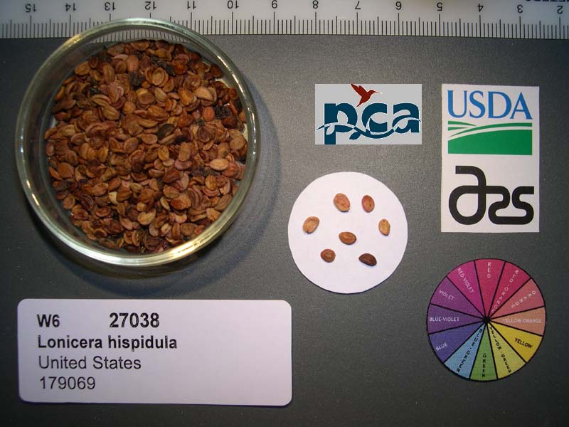 | | 2005 | COLLECTED | 10/21/2002 | | | 412 | Open canopy Pinus attenuata/Arbutus menziesii forest with Corylus cornuta understory. Associated with Pseudotsuga menziesii, Toxicodendron diversilobum, Arctostaphylos canescens, Holodiscus discolor, Mahonia aquifolium, Elym | Wild material | Forb 0.9-4.5 meters tall. | 1674075 | WLP 2076 |
| 109 | WLP 1332 | 9 | Lonicera reticulata Raf. | Iowa, United States | NA |  | | 2003 | COLLECTED | 09/14/2003 | Parking area for ford, South Bear Creek Wildlife Area, Highlandville, T100N R7W, NE 1/4 of NE 1/4, Section 35, Highlandville Quad, Winneshiek County. | 43.44083333, -91.64722222 | 274 | Edge of parking area, floodplain. Half sunny. No slope with an eastern aspect. Alluvial soil. Associated with Juglans nigra, Ulmus, Acer negundo, Xanthoxylum, and Rhus glabra. | Wild material | One large, very attractive vine ~14 feet tall, climbing up a Juglans nigra tree. | 1649461 | WLP 1332 |
| 110 | WLP 1326 | Morton 295-79 | Lonicera ferdinandi Franch. | Shanxi Sheng, China | NA | | | 2002 | COLLECTED | 01/28/2002 | Shanxi Province, Yanggetai Forest, Pangquangou Nature Preserve | | | among shrubs | Wild material | | 1777265 | WLP 1326 |
| 111 | NA 71313 | VV-139 | Lonicera ruprechtiana Regel | Russian Federation | NA | | | 2001 | COLLECTED | 09/01/2001 | Primorsky Krai, Oktyabrskaya District, Razdol'naya (= Suyfun) River near the village of Fadeyovka, just west of Novogeorgyevka. | 44.05333000, 131.39833000 | | Open Salix - Ulmus woods near the river. | Wild material | Shrub 3 m tall; berries orange-red. | 1636754 | NA 71313 |
| 112 | WLP 1325 | VV-39 | Lonicera ruprechtiana Regel | Russian Federation | NA | | | 2001 | COLLECTED | 09/01/2001 | Primorsky Krai, Shkotovsk District, Edges of Anisimovka (= Kangauz). | 43.16666000, 132.77000000 | | Edge of thicket. | Wild material | Shrub 3 m tall; fruit dark red. | 1636795 | WLP 1325 |
| 113 | WLP 1333 | 239-79sd | Lonicera reticulata Raf. | Illinois, United States | NA |  | | 1997 | COLLECTED | 1979 | Along the Fox River west of Milbrook. | 41.58215000, -88.58084000 | | River bank. | Wild material | Morton Arboretum field location: S-59/37-99. Cloned material received as a plant by NPGS (NCRPIS Ames). Seeds increased from that clone were distributed to USNA in 2004. Material was originally recorded at Morton Arboretum as Lonicera prolifera. | 1540080 | WLP 1333 |
| 114 | WLP 1323 | 96071 | Lonicera ruprechtiana Regel | China | NA | | | 1996 | COLLECTED | PRE 10/29/1996 | | | | | Wild material | | 1895752 | WLP 1323 |
| 115 | WLP 150 | NA 86403 | Lonicera trichosantha Bureau & Franch. var. deflexicalyx (Batalin) P. S. Hsu & H. J. Wang | | NA | | | 1994 | | | | | | | Uncertain improvement status | | 2110323 | WLP 150 |
| 116 | WLP 1322 | NA 63458 | Lonicera tatarica L. | Alma-Ata, Kazakhstan | NA | | | 1992 | COLLECTED | 07/24/1991 | Turgen Valley. | 43.39650000, 77.59467300 | | | Wild material | | 1499317 | WLP 1322 |
| 117 | WLP 1320 | Pruhonice I.S.1989-497 | Lonicera maackii (Rupr.) Maxim. | Phyeonganpukto, Korea, North | NA | | | 1990 | COLLECTED | PRE 1990 | North Pyongan Province. Myohyangsan Mountains, Environment of the Kumgangul Temple. | 40.00000000, 126.33333333 | 400 | | Wild material | | 1499314 | WLP 1320 |
| 118 | PI 658642 | Index Seminum 55 | Diervilla lonicera Mill. | Nova Scotia, Canada | NC7 | | | 2003 | COLLECTED | 2002 | Red River, Inverness County, Cape Breton. | 46.86666667, -60.63333333 | | | Wild material | | 1650290 | PI 658642 |
| 119 | PI 649661 | 23 | Diervilla lonicera Mill. | Iowa, United States | NC7 |  | | 2003 | COLLECTED | 09/15/2003 | Steamboat Rock County Park just southwest of Steamboat Rock, Steamboat Rock Quad. T88N R19W N edge of SE 1/4 SW 1/4 Sec. 28 | 42.40138889, -93.07305556 | 299 | Eroding sandstone cliff. Mostly shaded area with 50% slope with a northern aspect. Sand and organic matter just above sandstone rock cliff, well drained. | Wild material | | 1649456 | PI 649661 |
| 120 | PI 649660 | 03-04 | Diervilla lonicera Mill. | Minnesota, United States | NC7 | | | 2003 | COLLECTED | 2002 | Tettegouche State Park along trail west of Baptism River | 47.34694444, -91.21527778 | 301 | Woods | Wild material | | 1644318 | PI 649660 |
| 121 | PI 564830 | No. 167 | Diervilla lonicera Mill. | Québec, Canada | NC7 | | | 1990 | COLLECTED | 1989 | Harvested wild in the province of Quebec in 1989. Exact location unknown. | | | | Wild material | | 1459801 | PI 564830 |
| 122 | PI 603116 | Index Seminum 603 | Diervilla lonicera Mill. | Michigan, United States | NC7 | | | 1989 | COLLECTED | | Mackinac County. | 46.05992600, -84.94899200 | | Rocky bluff. | Wild material | Seed received from W.J. Beal Botanical Garden, M.S.U. | 1051820 | PI 603116 |
| 123 | Ames 33909 | APS/DL/2017/002/261 | Diervilla lonicera Mill. | Iowa, United States | NC7 |  | | 2017 | COLLECTED | 02/07/2017 | Cedar Bluffs State Preserve approximately 3 miles east southeast of Tracy, T75N R17W SE 1/4 NW 1/4 Sec. 33 | 41.25648000, -92.82437000 | 235 | Deciduous woods, north facing (70-80 degrees) slope above a deep moist ravine, sandstone ledges along ravine. | Wild material | | 1946805 | Ames 33909 |
| 124 | Ames 32847 | JDC/DL/2014/150/653 | Diervilla lonicera Mill. | Iowa, United States | NC7 |  | | 2014 | COLLECTED | 11/23/2014 | Wild Cat Den State Park located approximately 9.00 miles northeast of Muscatine, T77N R1E SW 1/4 SW 1/4 and also SE 1/4 SW 1/4Sec. 17 | 41.46820900, -90.87994300 | 215 | Mixed decidous woods. Northeast and east-facing, extremely steep slopes on loose soils. | Wild material | | 1921868 | Ames 32847 |
| 125 | Ames 32849 | JDC/DL/2014/151/654 | Diervilla lonicera Mill. | Iowa, United States | NC7 | | | 2014 | COLLECTED | 11/23/2014 | Fern Cliff County Park located approximatley 3.75 miles west, southwest of Crawfordsville, T74N R7W southern edge of N 1/2 Sec. 24 | 41.19958700, -91.60874700 | 208 | Steep north-facing slopes on loose soils. | Wild material | | 1921870 | Ames 32849 |
| 126 | Ames 32826 | JDC/DL/2014/148/651 | Diervilla lonicera Mill. | Iowa, United States | NC7 |  | | 2014 | COLLECTED | 11/04/2014 | Elk Rock State Park (extreme northern point of park) approximately 6.25 miles north of Knoxville, T76N R19W SW 1/4 SW 1/4 Sec. 5 | 41.40879000, -93.07958000 | 219 | Extremely steep, north-facing slopes. | Wild material | | 1921786 | Ames 32826 |
| 127 | Ames 32821 | JDC/DL/2014/138/641 | Diervilla lonicera Mill. | Iowa, United States | NC7 |  | | 2014 | COLLECTED | 10/28/2014 | Hickory Creek Road approximately 1.00 mile southwest of Volney, T96N R5W SW 1/4 NW 1/4 NW 1/4 Sec. 24 | 43.12122600, -91.38863400 | 250 | Steep north-facing slope. | Wild material | | 1921781 | Ames 32821 |
| 128 | Ames 32822 | JDC/DL/2014/139/642 | Diervilla lonicera Mill. | Iowa, United States | NC7 |  | | 2014 | COLLECTED | 10/28/2014 | Clayton Road (C17) approximately 0.25 mile west of Kestrel Road, 1.50 miles east of Garnavillo on a steep north-facing slope T93N R3W near center of NW 1/4 Sec. 16 and also at the end of 250th Street approximatley 2.25 miles east of Garnavillo on a steep north, northwest-facing slope of Buck Creek watershed T93N R3W SE 1/4 SE 1/4 SE 1/4 Sec. 16 | 42.87344100, -91.20649600 | 264 | | Wild material | | 1921782 | Ames 32822 |
| 129 | Ames 32824 | JDC/DL/2014/142/645 | Diervilla lonicera Mill. | Iowa, United States | NC7 |  | | 2014 | COLLECTED | 10/29/2014 | Backbone State Park located approximately 4.60 miles south southwest of Strawberry Point, T90N R6W NE 1/4 Sec. 16. | 42.61091600, -91.55377200 | 322 | Steep north-facing slope. | Wild material | | 1921784 | Ames 32824 |
| 130 | Ames 32825 | JDC/DL/2014/145/648 | Diervilla lonicera Mill. | Iowa, United States | NC7 |  | | 2014 | COLLECTED | 10/29/2014 | Bixby State Park located approximately 2.25 miles north of Edgewood, T91N R5W SE 1/4 SE 1/4 SW 1/4 Sec. 23 | 42.67442600, -91.39783400 | 323 | Moist woods, north-facing (45 degres) slope. | Wild material | | 1921785 | Ames 32825 |
| 131 | Ames 32763 | JDC/DL/2014/041/543 | Diervilla lonicera Mill. | Iowa, United States | NC7 |  | | 2014 | COLLECTED | 09/03/2014 | Bluffton Fir State Preserve near Bluffton, T99N R9W SW 1/4 SW 1/4 Sec. 10 | 43.40068700, -91.90760900 | 346 | High quality, native woods. Steep slope, northwest-facing. | Wild material | | 1921311 | Ames 32763 |
| 132 | Ames 31518 | JDC/DL/2012/018/411 | Diervilla lonicera Mill. | Iowa, United States | NC7 |  | | 2012 | COLLECTED | 07/14/2012 | Edge of Echo Valley State Park just southeast of West Union, T94N R8W NE 1/4 NE 1/4 SW 1/4 West Union Quad Sec. 22 | 42.94188100, -91.77707300 | 334 | Mixed hardwood forest. Very steep, northeast-facing slopes. | Wild material | | 1903745 | Ames 31518 |
| 133 | Ames 31215 | Ames 31215 | Diervilla lonicera Mill. | Wisconsin, United States | NC7 |  | | 2011 | COLLECTED | 2011 | Site 1: Dells above Prairie River, Bloomville Quad. T32N R7E NE 1/4 SW 1/4 Sec. 13 and Site 2: Along east side of Highway 17, Pine Dells Quad. T32N R7E NW 1/4 NW 1/4 Sec. 26 | 45.24472220, -89.57486100 | 434 | Site 1: High spots between granite boulders strewn about a young woodland. Sandy soil with a few inches of humus layer. Site 2: Roadside. Disturbed ground on sandy soil with a slight humus layer. | Wild material | | 1894298 | Ames 31215 |
| 134 | Ames 31065 | 354 | Diervilla lonicera Mill. | New York, United States | NC7 |  | | 2011 | COLLECTED | 09/10/2011 | Along Emery Hill Road | 42.07700000, -79.08400000 | 446 | Roadside. East-facing slope. Rocky substrate with very tiny spring creek at base of slope. | Wild material | | 1891451 | Ames 31065 |
| 135 | Ames 31066 | 369 | Diervilla lonicera Mill. | New York, United States | NC7 |  | | 2011 | COLLECTED | 09/14/2011 | Just south of intersection of Sherman-Westfield Road and Mount Baldy Road | 42.28100000, -79.58200000 | 435 | Roadside. Mixed hardwood forest. Northwest-facing slope. | Wild material | | 1891452 | Ames 31066 |
| 136 | Ames 31067 | 383 | Diervilla lonicera Mill. | Pennsylvania, United States | NC7 |  | | 2011 | COLLECTED | 09/16/2011 | Along Highway 219 just north of Ridgway | 41.43800000, -78.72300000 | 446 | Mixed hardwood forest. Steep (60 degrees) north-facing slope. | Wild material | | 1891453 | Ames 31067 |
| 137 | Ames 30136 | JDC/DL/2009/030/180 | Diervilla lonicera Mill. | Wisconsin, United States | NC7 |  | | 2009 | COLLECTED | 09/22/2009 | Tower Hill State Park, Spring Green Quad. T8N R4E SW 1/4 SE 1/4 Sec. 20 | 43.15066700, -90.04180000 | 244 | Steep (65 degrees) north facing slope. | Wild material | | 1819717 | Ames 30136 |
| 138 | Ames 30042 | JDC/DL/2009/010/160 | Diervilla lonicera Mill. | Iowa, United States | NC7 |  | | 2009 | COLLECTED | 07/28/2009 | Dolliver State Park along Prairie Creek approximately 9.00 miles southeast of Fort Dodge, T88N R28W NE 1/4 SW 1/4 SE 1/4 Sec. 34 | 42.38611111, -94.09222222 | 308 | Large rocky limestone. North facing slope. | Wild material | | 1812305 | Ames 30042 |
| 139 | Ames 29413 | RES003 | Diervilla lonicera Mill. | Michigan, United States | NC7 |  | | 2008 | COLLECTED | 09/25/2002 | Interstate 75 North rest area, mile marker 317 | 45.50277778, -84.61388889 | 221 | Under dense canopy, scattered throughout the understory, on slope going up to an overlook, sandy soils. Plants not heavily fruited. | Wild material | | 1775527 | Ames 29413 |
| 140 | Ames 29414 | RES007 | Diervilla lonicera Mill. | Michigan, United States | NC7 |  | | 2008 | COLLECTED | 09/26/2002 | Along Beckett Road, west of Gingell Road | 45.01555556, -84.48138889 | 384 | Along the road, grassy edges, full sun. | Wild material | | 1775528 | Ames 29414 |
| 141 | Ames 29415 | RES023 | Diervilla lonicera Mill. | Michigan, United States | NC7 |  | | 2008 | COLLECTED | 10/21/2002 | Interstate 75 South rest area, mile marker 262, north of Grayling | 44.75138889, -84.71083333 | 391 | Along a trail at the west edge of a rest area, sandy soils. | Wild material | | 1775529 | Ames 29415 |
| 142 | PI 704873 sos | R. spectabilis CA930E-15 | Rubus spectabilis Pursh | California, United States | COR |  | | 2022 | | | | | | | Wild material | Fruits prink to yellow. | 2138742 | PI 704873 sos |
| 143 | PI 702700 | MARSB-195 | Dichanthelium clandestinum (L.) Gould | Delaware, United States | S9 |  | | 2019 | | | | | | | Wild material | | 2097514 | PI 702700 |
| 144 | PI 704829 sos | R. pensilvanicus MARSB-633 | Rubus pensilvanicus Poir. | Delaware, United States | COR |  | | 2019 | | | | | | | Wild material | | 2097670 | PI 704829 sos |
| 145 | PI 710480 | NCBG-700 | Chamaecrista nictitans (L.) Moench | North Carolina, United States | S9 |  | | 2018 | | | | | | | Wild material | | 1966014 | PI 710480 |
| 146 | PI 704812 sos | F. chiloensis OR080-29 | Fragaria chiloensis (L.) Mill. | Oregon, United States | COR |  | | 2018 | | | | | | | Wild material | | 1957612 | PI 704812 sos |
| 147 | PI 710488 | CBG-7606 | Desmodium paniculatum (L.) DC. | Illinois, United States | S9 |  | | 2017 | | | | | | | Wild material | | 1954803 | PI 710488 |
| 148 | PI 691719 | WLP 1903 | Viburnum nudum L. | Maine, United States | NA | | | 2015 | COLLECTED | 08/23/2015 | Along west edge of Timber Cove Road, just northwest of intersection with Hwy. 189 and across the road from a cemetery. Approximately 13 km southwest of Lubec, Washington County, ME. | 44.80160000, -67.12705000 | 32 | Edge of woods; roadside. | | | 1950395 | PI 691719 |
| 149 | PI 667466 | JDC/RL/2009/071/221 | Rudbeckia laciniata L. | Illinois, United States | OPGC | 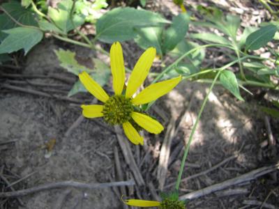 | | 2009 | COLLECTED | 09/25/2009 | Along Messmer Road, NE 1/4 of SW 1/4 of Section 30, T24N, R4E, Pleasant Valley Quad, Carroll County. | 42.12888889, -90.08444444 | 204 | Roadside. 45% slope; north and east facing. Associated with Fraxinus americana, Lonicera reticulata, and Physocarpus opulifolius. | Wild material | | 1819753 | PI 667466 |
| 150 | PI 653315 | R. occidentalis HDF-2007-110 | Rubus occidentalis L. | South Dakota, United States | COR |  | | 2007 | COLLECTED | 07/12/2007 | Clay County, Vermillion Area, Clay County Park Lakeside use area, deer pressure evident | 42.77360000, 97.00620000 | 383 | Cottonwood and willow forest with Rhus and Lonicera plants a edge of forest and mowed area, soil dary sandy forest duff | Wild material | Michael Dossett, Chad Finn collected from South Dakota.
| 1733177 | PI 653315 |
| 151 | PI 652983 | R. occidentalis Mentone late HDF-066 | Rubus occidentalis L. | Alabama, United States | COR |  | | 2007 | COLLECTED | 06/08/2007 | Dekalb County, Mentone (just east of Valley Head), between Linchpney Road and Route 117. Along edge of 117 for about 1.5 miles. | 34.57729000, -85.59305000 | 523 | Plants near or growing directly out of limestone cliff by roadside. Associated Plants: Ligustrum vulgare, Lonicera, Rhus typhina, Allium, Hermerocalis and Gleditsia. | Wild material | Kim Hummer, Michael Dossett collection from Alabama.
| 1730103 | PI 652983 |
| 152 | PI 653293 | R. occidentalis HDF-2007-032 | Rubus occidentalis L. | Georgia, United States | COR | | | 2007 | COLLECTED | 06/05/2007 | Near were William Bartram Trail crosses Warwoman Road, Warwoman Dell, about 4 miles east of Clayton, Rabun County. On slope down to the creek (Becky Branch) below. | 34.88280000, -83.35170000 | 595 | East facing slope, Associated Plants: Smilax bona-nox, Rhus typhina, Potentilla, Liriodendron tulipifera, Hydrangea arborescens, Lonicera japonica, Rhododendron, Sambucus canadensis and Vitis rotundifolia. | Wild material | Kim Hummer, Michael Dossett collection from Georgia.
| 1730092 | PI 653293 |
| 153 | PI 653294 | R. occidentalis HDF-2007-035 | Rubus occidentalis L. | Georgia, United States | COR |  | | 2007 | COLLECTED | 06/05/2007 | Two miles west of Clayton, Rabun County, along both sides of the road (US-76). Sandstone outcrop on other side of road. | 34.86683000, -83.48485000 | 595 | Steep slope, sandstone outcrop near by, growing in sandy red clay with a layer of organic duff. Associated Plants: Platinus lanceolata, Malus, Eupatorium, Rhus toxidendron, Robinia pseudoacasia, Rubus phoenicolasius and Lonicera. | Wild material | Kim Hummer, Michael Dossett collection from Georgia.
| 1730094 | PI 653294 |
| 154 | PI 653296 | R. occidentalis HDF-2007-063 | Rubus occidentalis L. | Alabama, United States | COR |  | | 2007 | COLLECTED | 06/08/2007 | Dekalb County, Mentone (just east of Valley Head), between Linchpney Road and Route 117. Along edge of 117 for about 1.5 miles. | 34.57729000, -85.59305000 | 523 | Plants near or growing directly out of limestone cliff by roadside. Associated Plants: Ligustrum vulgare, Lonicera, Rhus typhina, Allium, Hermerocalis and Gleditsia. | Wild material | Kim Hummer, Michael Dossett collection from Alabama.
| 1730102 | PI 653296 |
| 155 | PI 653297 | R. argutus HD-2007-070 | Rubus argutus Link | Mississippi, United States | COR | | | 2007 | COLLECTED | 06/09/2007 | Marshall County, northwest of Potts Camp off route 178 onto George Mann Road onto Lake Shore Drive at a drainage ditch in the community of Lake Center. | 34.69310000, -89.36150000 | 120 | Open area in drainage ditch growing on the perimeter road of a lake. Associated Plants: Rhus typhina, Vitis rotundifolia, Pinus taeda, Salix sp., Lonicera japonica, Liquidambar styraciflua and Acer negundo. | Wild material | Kim Hummer, Michael Dossett collection from Mississippi.
| 1730104 | PI 653297 |
| 156 | PI 657223 | V. corymbosum HD-2007-016 | Vaccinium corymbosum L. | South Carolina, United States | COR | | | 2007 | COLLECTED | 06/03/2007 | Northwest of Little Rock, Dillon County. Intersection of SR-57 and McLaurin Lake Circle. Growing in a drainage ditch west side of road. | 34.50649000, -79.47892000 | 20 | Flat terrain. Associated with: Smilax, Acer rubrum, Liquidambar styraciflua, Quercus velutina, Sasafras albidum, Lonicera japonica, Pinus palustris and Campsus radicans. | Wild material | Kim Hummer, Michael Dossett collected from South Carolina. V. corymbosum diploid
| 1730114 | PI 657223 |
| 157 | PI 659885 | KGZ-06-02-006 | Dactylis glomerata L. | Chüy, Kyrgyzstan | W6 | | | 2007 | COLLECTED | 08/06/2006 | Kemin Region. Zailiisky Alatau, Kechi-Kemin River, Ak-Tyuz Settlement, 35 km ENE of Bystrovka, below Ak-Tyuz Mine | 42.87166667, 76.10416667 | 1955 | Shrub steppe, 45% SW-facing slopes with serpentine substrate, gravelly loam | Wild material | | 1721500 | PI 659885 |
| 158 | PI 659886 | KGZ-06-02-008 | Poa urssulensis Trin. | Chüy, Kyrgyzstan | W6 | | | 2007 | COLLECTED | 08/06/2006 | Kemin Region. Zailiisky Alatau, Kechi-Kemin River, Ak-Tyuz Settlement, 35 km ENE of Bystrovka, below Ak-Tyuz Mine | 42.87166667, 76.10416667 | 1955 | Shrub steppe, 45% SW-facing slopes with serpentine substrate, gravelly loam | Wild material | | 1721502 | PI 659886 |
| 159 | PI 659887 | KGZ-06-02-009 | Agrostis gigantea Roth | Chüy, Kyrgyzstan | W6 | | | 2007 | COLLECTED | 08/06/2006 | Kemin Region. Zailiisky Alatau, Kechi-Kemin River, Ak-Tyuz Settlement, 35 km ENE of Bystrovka, below Ak-Tyuz Mine | 42.87166667, 76.10416667 | 1955 | Shrub steppe, disturbed ground, lower slopes of valley, S exposure gravelly loam. | Wild material | | 1721503 | PI 659887 |
| 160 | PI 659888 | KGZ-06-02-010 | Melica transsilvanica Schur | Chüy, Kyrgyzstan | W6 | | | 2007 | COLLECTED | 08/06/2006 | Kemin Region. Zailiisky Alatau, Kechi-Kemin River, Ak-Tyuz Settlement, 35 km ENE of Bystrovka, below Ak-Tyuz Mine | 42.87166667, 76.10416667 | 1955 | Shrub steppe, 45% SW-facing slopes with serpentine substrate, gravelly loam | Wild material | | 1721504 | PI 659888 |
| 161 | PI 659889 | KGZ-06-03-011 | Poa pratensis L. | Chüy, Kyrgyzstan | W6 | | | 2007 | COLLECTED | 08/06/2006 | Kemin Region. Zailiisky Alatau, Kechi-Kemin River, Ak-Tyuz Settlement, 34 km ENE of Bystrovka, below Ak-Tyuz Mine | 42.85083333, 76.07777778 | 1900 | Shrub steppe interface with Picea forest, meadow, steep lower slopes of valley, 40% N-facing slope, gravelly loam | Wild material | | 1721505 | PI 659889 |
| 162 | PI 659890 | KGZ-06-03-013 | Dactylis glomerata L. | Chüy, Kyrgyzstan | W6 |  | | 2007 | COLLECTED | 08/06/2006 | Kemin Region. Zailiisky Alatau, Kechi-Kemin River, Ak-Tyuz Settlement, 34 km ENE of Bystrovka, below Ak-Tyuz Mine | 42.87166667, 76.07777778 | 1900 | Shrub steppe interface with Picea forest, meadow, steep lower slopes of valley, 40% N-facing slope, gravelly loam | Wild material | | 1721507 | PI 659890 |
| 163 | PI 659891 | KGZ-06-03-016 | Phleum phleoides (L.) H. Karst. | Chüy, Kyrgyzstan | W6 | | | 2007 | COLLECTED | 08/06/2006 | Kemin Region. Zailiisky Alatau, Kechi-Kemin River, Ak-Tyuz Settlement, 34 km ENE of Bystrovka, below Ak-Tyuz Mine | 42.87166667, 76.07777778 | 1900 | Shrub steppe interface with Picea forest, meadow, steep lower slopes of valley, 40% N-facing slope, gravelly loam | Wild material | | 1721509 | PI 659891 |
| 164 | PI 659898 | KGZ-06-06-035 | Poa pratensis L. | Ysyk-Köl, Kyrgyzstan | W6 |  | | 2007 | COLLECTED | 08/08/2006 | Cholpon-Ata Region. Kungey Alatau, Kechi Ak-Suu Ecological Reserve, Kechi-Ak-Suu Canyon, 37 km NE of Cholpon-Ata, 7.5 km S of Kazakhstan border | 42.86777778, 77.46722222 | 2327 | S draining narrow valley bottom, along river and meadow openings in spruce forest, granite, loam | Wild material | | 1721525 | PI 659898 |
| 165 | PI 659899 | KGZ-06-06-036 | Festuca rubra L. | Ysyk-Köl, Kyrgyzstan | W6 | | | 2007 | COLLECTED | 08/08/2006 | Cholpon-Ata Region. Kungey Alatau, Kechi Ak-Suu Ecological Reserve, Kechi-Ak-Suu Canyon, 37 km NE of Cholpon-Ata, 7.5 km S of Kazakhstan border | 42.86777778, 77.46722222 | 2327 | S draining narrow valley bottom, along river and meadow openings in spruce forest, granite, loam | Wild material | | 1721526 | PI 659899 |
| 166 | PI 659900 | KGZ-06-06-037 | Poa urssulensis Trin. | Ysyk-Köl, Kyrgyzstan | W6 | | | 2007 | COLLECTED | 08/08/2006 | Cholpon-Ata Region. Kungey Alatau, Kechi Ak-Suu Ecological Reserve, Kechi-Ak-Suu Canyon, 37 km NE of Cholpon-Ata, 7.5 km S of Kazakhstan border | 42.86777778, 77.46722222 | 2327 | S draining narrow valley bottom, along river and meadow openings in spruce forest, granite, loam | Wild material | | 1721527 | PI 659900 |
| 167 | PI 659901 | KGZ-06-06-038 | Poa supina Schrad. | Ysyk-Köl, Kyrgyzstan | W6 | | | 2007 | COLLECTED | 08/08/2006 | Cholpon-Ata Region. Kungey Alatau, Kechi Ak-Suu Ecological Reserve, Kechi-Ak-Suu Canyon, 37 km NE of Cholpon-Ata, 7.5 km S of Kazakhstan border | 42.86777778, 77.46722222 | 2327 | S draining narrow valley bottom, along river and meadow openings in spruce forest, granite, loam | Wild material | | 1721528 | PI 659901 |
| 168 | PI 659916 | KGZ-06-14-073 | Elymus dahuricus Turcz. ex Griseb. | Ysyk-Köl, Kyrgyzstan | W6 | | | 2007 | COLLECTED | 08/11/2006 | Jeti Oguz Region. Terskey Alatau, Saruu Gorge, above Saruu Hot Springs, 47 km SW of Karakol (Przhevalsk), 17 km S of Pokrovka, 16 km S of highway | 42.18277778, 78.00777778 | 2273 | Steep valley slopes, draw on W exposure mountain steppe, colluvium and loam | Wild material | | 1721562 | PI 659916 |
| 169 | PI 659917 | KGZ-06-14-074 | Phleum phleoides (L.) H. Karst. | Ysyk-Köl, Kyrgyzstan | W6 | | | 2007 | COLLECTED | 08/11/2006 | Jeti Oguz Region. Terskey Alatau, Saruu Gorge, above Saruu Hot Springs, 47 km SW of Karakol (Przhevalsk), 17 km S of Pokrovka, 16 km S of highway | 42.18277778, 78.00777778 | 2273 | Steep valley slopes, draw on W exposure mountain steppe, colluvium and loam | Wild material | | 1721563 | PI 659917 |
| 170 | PI 659918 | KGZ-06-14-075 | Poa urssulensis Trin. | Ysyk-Köl, Kyrgyzstan | W6 | | | 2007 | COLLECTED | 08/11/2006 | Jeti Oguz Region. Terskey Alatau, Saruu Gorge, above Saruu Hot Springs, 47 km SW of Karakol (Przhevalsk), 17 km S of Pokrovka, 16 km S of highway | 42.18277778, 78.00777778 | 2273 | Steep valley slopes, draw on W exposure mountain steppe, colluvium and loam | Wild material | | 1721564 | PI 659918 |
| 171 | PI 659919 | KGZ-06-14-076 | Agrostis gigantea Roth | Ysyk-Köl, Kyrgyzstan | W6 | | | 2007 | COLLECTED | 08/11/2006 | Jeti Oguz Region. Terskey Alatau, Saruu Gorge, above Saruu Hot Springs, 47 km SW of Karakol (Przhevalsk), 17 km S of Pokrovka, 16 km S of highway | 42.18277778, 78.00777778 | 2273 | Steep valley slopes, draw on W exposure mountain steppe, colluvium and loam | Wild material | | 1721565 | PI 659919 |
| 172 | PI 659920 | KGZ-06-14-078 | Elymus schrenkianus (Fisch. & C. A. Mey.) Tzvelev | Ysyk-Köl, Kyrgyzstan | W6 | | | 2007 | COLLECTED | 08/11/2006 | Jeti Oguz Region. Terskey Alatau, Saruu Gorge, above Saruu Hot Springs, 47 km SW of Karakol (Przhevalsk), 17 km S of Pokrovka, 16 km S of highway | 42.18277778, 78.00777778 | 2273 | Steep valley slopes, draw on W exposure mountain steppe, colluvium and loam | Wild material | | 1721567 | PI 659920 |
| 173 | PI 659939 | KGZ-06-31-159 | Dactylis glomerata L. | Naryn, Kyrgyzstan | W6 | | | 2007 | COLLECTED | 08/16/2006 | At-Bashy Region. N slope of At-Bashy Range, foot hills before plain, 47 km ENE of At-Bashy, 33 km SE of Naryn, 19 km E Ak-Muz, 7 km W of Bosogo | 41.23750000, 76.35972222 | 2607 | Dry bluffs and boggy slopes at base of bluffs, native steppe at lower tree line, 50% slope, clay loam | Wild material | | 1721641 | PI 659939 |
| 174 | PI 659941 | KGZ-06-35-179 | Poa urssulensis Trin. | Naryn, Kyrgyzstan | W6 | | | 2007 | COLLECTED | 08/18/2006 | Kochkorka Region. Tien Shan, Son-Kel River, island at mouth of narrow canyon below falls, 12 km SE of E end of Son-Kel Lake, 41 km NW of Dzhan-Bulak, 61 km NW of Naryn | 41.73305556, 75.45055556 | 2627 | Flood plain island, granitic rocks, cobbly to stony sandy loam | Wild material | | 1721658 | PI 659941 |
| 175 | PI 659942 | KGZ-06-35-183 | Elymus sibiricus L. | Naryn, Kyrgyzstan | W6 | | | 2007 | COLLECTED | 08/18/2006 | Kochkorka Region. Tien Shan, Son-Kel River, island at mouth of narrow canyon below falls, 12 km SE of E end of Son-Kel Lake, 41 km NW of Dzhan-Bulak, 61 km NW of Naryn | 41.73305556, 75.45055556 | 2627 | Flood plain island, granitic rocks, cobbly to stony sandy loam. | Wild material | | 1721662 | PI 659942 |
| 176 | PI 659951 | KGZ-06-50-239 | Poa palustris L. | Chüy, Kyrgyzstan | W6 | | | 2007 | COLLECTED | 08/21/2006 | Panfilov (S) Region. Suusamyr Valley, S side of Suusamyr River, 34 km W Tunuk, 64 km NE Toktogul | 42.19500000, 73.56805556 | 2300 | Wet Carex meadows on bench 100 m S and in riparian strand along river bank, 0% slope, humus and muck, and sandy shore | Wild material | | 1721715 | PI 659951 |
| 177 | PI 659952 | KGZ-06-50-245 | Deschampsia cespitosa (L.) P. Beauv. | Chüy, Kyrgyzstan | W6 | | | 2007 | COLLECTED | 08/21/2006 | Panfilov (S) Region. Suusamyr Valley, S side of Suusamyr River, 34 km W Tunuk, 64 km NE Toktogul | 42.19500000, 73.56805556 | 2300 | Wet Carex meadows on bench 100 m S and in riparian strand along river bank, 0% slope, humus and muck, and sandy shore. | Wild material | | 1721745 | PI 659952 |
| 178 | PI 662342 | KGZ-06-14-079 | Melica transsilvanica Schur | Ysyk-Köl, Kyrgyzstan | W6 | | | 2007 | COLLECTED | 08/11/2006 | Jeti Oguz Region. Terskey Alatau, Saruu Gorge, above Saruu Hot Springs, 47 km SW of Karakol (Przhevalsk), 17 km S of Pokrovka, 16 km S of highway | 42.18277778, 78.00777778 | 2273 | Steep valley slopes, draw on W exposure mountain steppe, colluvium and loam | Wild material | | 1721568 | PI 662342 |
| 179 | PI 662353 | KGZ-06-31-158 | Phleum phleoides (L.) H. Karst. | Naryn, Kyrgyzstan | W6 | | | 2007 | COLLECTED | 08/16/2006 | At-Bashy Region. N slope of At-Bashy Range, foot hills before plain, 47 km ENE of At-Bashy, 33 km SE of Naryn, 19 km E Ak-Muz, 7 km W of Bosogo | 41.23750000, 76.35972222 | 2607 | Dry bluffs and boggy slopes at base of bluffs, native steppe at lower tree line, 50% slope, clay loam | Wild material | | 1721640 | PI 662353 |
| 180 | PI 662357 | KGZ-06-52-255 | Agrostis gigantea Roth | Chüy, Kyrgyzstan | W6 | | | 2007 | COLLECTED | 08/22/2006 | Dzhaiyl (S) Region. Suusamyr Valley, shallow valley at S base of Kyrgyz Alatau, 11 km NW Tunuk, 8 km SE of junction to Tuz-Ashuu Pass, E side of road | 42.23222222, 73.91472222 | 2194 | Mesic-subhydric valley bottom between plowed hay fields and unplowed areas dominated by Caragana, black clay loam | Wild material | | 1721730 | PI 662357 |
| 181 | PI 665559 | KGZ-06-02-005 | Puccinellia glauca (Regel) V. I. Krecz. | Chüy, Kyrgyzstan | W6 | | | 2007 | COLLECTED | 08/06/2006 | Kemin Region. Zailiisky Alatau, Kechi-Kemin River, Ak-Tyuz Settlement, 35 km ENE of Bystrovka, below Ak-Tyuz Mine | 42.87166667, 76.10416667 | 1955 | Shrub steppe, 45% SW-facing slopes with serpentine substrate, gravelly loam | Wild material | | 1721499 | PI 665559 |
| 182 | PI 665572 | KGZ-06-14-077 | Elymus dentatus (Hook. f.) Tzvelev | Ysyk-Köl, Kyrgyzstan | W6 | | | 2007 | COLLECTED | 08/11/2006 | Jeti Oguz Region. Terskey Alatau, Saruu Gorge, above Saruu Hot Springs, 47 km SW of Karakol (Przhevalsk), 17 km S of Pokrovka, 16 km S of highway | 42.18277778, 78.00777778 | 2273 | Steep valley slopes, draw on W exposure mountain steppe, colluvium and loam | Wild material | | 1721566 | PI 665572 |
| 183 | PI 665581 | KGZ-06-35-180 | Agrostis gigantea Roth | Naryn, Kyrgyzstan | W6 | | | 2007 | COLLECTED | 08/18/2006 | Kochkorka Region. Tien Shan, Son-Kel River, island at mouth of narrow canyon below falls, 12 km SE of E end of Son-Kel Lake, 41 km NW of Dzhan-Bulak, 61 km NW of Naryn | 41.73305556, 75.45055556 | 2627 | Flood plain island, granitic rocks, cobbly to stony sandy loam | Wild material | | 1721659 | PI 665581 |
| 184 | PI 665582 | KGZ-06-35-188 | Poa urssulensis Trin. | Naryn, Kyrgyzstan | W6 | | | 2007 | COLLECTED | 08/18/2006 | Kochkorka Region. Tien Shan, N -facing spruce slopes at base of winding road to Son-Kel River Pass above mouth of narrow canyon below falls, 12 km SE of E end of Son-Kel Lake, 41 km NW of Dzhan-Bulak, 61 km NW of Naryn | 41.73305556, 75.45055556 | 2700 | Steep N-facing spruce park, limestone substrate | Wild material | | 1721667 | PI 665582 |
| 185 | PI 670347 | KGZ-06-14-072 | Poa pratensis L. | Ysyk-Köl, Kyrgyzstan | W6 | | | 2007 | COLLECTED | 08/11/2006 | Jeti Oguz Region. Terskey Alatau, Saruu Gorge, above Saruu Hot Springs, 47 km SW of Karakol (Przhevalsk), 17 km S of Pokrovka, 16 km S of highway | 42.18277778, 78.00777778 | 2273 | Steep valley slopes, draw on W exposure mountain steppe, colluvium and loam | Wild material | | 1721561 | PI 670347 |
| 186 | PI 670354 | KGZ-06-31-157 | Agrostis gigantea Roth | Naryn, Kyrgyzstan | W6 | | | 2007 | COLLECTED | 08/16/2006 | At-Bashy Region. N slope of At-Bashy Range, foot hills before plain, 47 km ENE of At-Bashy, 33 km SE of Naryn, 19 km E Ak-Muz, 7 km W of Bosogo | 41.23750000, 76.35972222 | 2607 | Dry bluffs and boggy slopes at base of bluffs, native steppe at lower tree line, 3% slope, clay loam | Wild material | | 1721639 | PI 670354 |
| 187 | PI 670367 | KGZ-06-52-257 | Poa palustris L. | Chüy, Kyrgyzstan | W6 | | | 2007 | COLLECTED | 08/22/2006 | Dzhaiyl (S) Region. Suusamyr Valley, shallow valley at S base of Kyrgyz Alatau, 11 km NW Tunuk, 8 km SE of junction to Tuz-Ashuu Pass, E side of road | 42.23222222, 73.91472222 | 2194 | Mesic-subhydric valley bottom between plowed hay fields and unplowed areas dominated by Caragana, black clay loam | Wild material | | 1721732 | PI 670367 |
| 188 | PI 685574 | KGZ-06-31-156 | Poa pratensis L. | Naryn, Kyrgyzstan | W6 | | | 2007 | COLLECTED | 08/16/2006 | At-Bashy Region. N slope of At-Bashy Range, foot hills before plain, 47 km ENE of At-Bashy, 33 km SE of Naryn, 19 km E Ak-Muz, 7 km W of Bosogo | 41.23750000, 76.35972222 | 2607 | Dry bluffs and boggy slopes at base of bluffs, native steppe at lower tree line, 3% slope, clay loam | Wild material | | 1721638 | PI 685574 |
| 189 | PI 685575 | KGZ-06-35-178 | Poa pratensis L. | Naryn, Kyrgyzstan | W6 | | | 2007 | COLLECTED | 08/18/2006 | Kochkorka Region. Tien Shan, Son-Kel River, island at mouth of narrow canyon below falls, 12 km SE of E end of Son-Kel Lake, 41 km NW of Dzhan-Bulak, 61 km NW of Naryn | 41.73305556, 75.45055556 | 2627 | Flood plain island, granitic rocks, cobbly to stony sandy loam | Wild material | | 1721657 | PI 685575 |
| 190 | PI 685576 | KGZ-06-35-187 | Poa pratensis L. | Naryn, Kyrgyzstan | W6 | | | 2007 | COLLECTED | 08/18/2006 | Kochkorka Region. Tien Shan, N -facing spruce slopes at base of winding road to Son-Kel River Pass above mouth of narrow canyon below falls, 12 km SE of E end of Son-Kel Lake, 41 km NW of Dzhan-Bulak, 61 km NW of Naryn | 41.73305556, 75.45055556 | 2700 | Steep N-facing spruce park, limestone substrate | Wild material | | 1721666 | PI 685576 |
| 191 | PI 699294 | KGZ-06-52-256 | Poa pratensis L. | Chüy, Kyrgyzstan | W6 | | | 2007 | COLLECTED | 08/22/2006 | Dzhaiyl (S) Region. Suusamyr Valley, shallow valley at S base of Kyrgyz Alatau, 11 km NW Tunuk, 8 km SE of junction to Tuz-Ashuu Pass, E side of road | 42.23222222, 73.91472222 | 2194 | Mesic-subhydric valley bottom between plowed hay fields and unplowed areas dominated by Caragana, black clay loam | Wild material | | 1721731 | PI 699294 |
| 192 | PI 650946 | MN 85-21-20 | Malus hybr. | Kazakhstan | GEN | | | 2007 | COLLECTED | 09/21/1995 | Semipalitinsk Region (Tarbagatai Mountain Range). 20 km. North of Urdzhar. 7 km. Northeast of Alekseyevka. Landform mostly hillside. Collected in North end of West Valley, upstream 3 km. from site 05 (GMAL's 3604-3607, GMAL's 3760-3789). | 47.27000000, 81.57361111 | 990 | Silt to clay loam soil. Aspect: Mostly East. Dominant tree sp.: M. sieversii; Associated-Populus, Pyrus, Acer. Dominant shrub sp.: Rosa; Assoc.-Lonicera, Amygdalus, Rubus. Dominant herbaceous: Grasses; Assoc.-Potentilla, Fragaria. | Uncertain improvement status | Sampled 30 fruits from 1 tree. Selected for texture and flavor. Fruit is firm. Fruit size is larger than 50mm, scab detected. -- Domestic introgression intentified using 20K Illumina Infinium apple SNP array. Charlamoff is a grandparent | 1723377 | PI 650946 |
| 193 | PI 650948 | MN 85-21-47 | Malus sieversii (Ledeb.) M. Roem. | Kazakhstan | GEN | | | 2007 | COLLECTED | 09/21/1995 | Semipalitinsk Region (Tarbagatai Mountain Range). 20 km. North of Urdzhar, 6 km. East-Northeast of Alekseyevka, on separate jeep trail. East Valley collection site. Collected on north end on flat by East River. | 47.27805556, 81.59972222 | 1120 | Flat slope. Dominant tree sp.: M. sieversii. Dominant shrub sp.: Rosa; Associated-Lonicera, Rubus. Dominant herbaceous: Malva; Assoc.-Fragaria. | Wild material | Sampled 60 fruits from 1 tree. Fruit is hard with aromatic flesh flavor. Over color is 90% red. Fruit size is larger than 50mm, free of scab. Very heavy cropload. | 1723379 | PI 650948 |
| 194 | PI 650952 | MN 85-23-53 | Malus hybr. | Kazakhstan | GEN | | | 2007 | COLLECTED | 09/21/1995 | Semipalitinsk Region (Tarbagatai Mountain Range). 20 km. North of Urdzhar. 5 km. Northeast of Alekseyevka. Collected mainly on west slopes in center of West Valley. Equidistant between sites 05 & 06 (GMAL's 3604-3615, GMAL's 3760-3789). | 47.25555556, 81.57222222 | 920 | Silt to clay loam soil. Aspect: West. Landform mostly hillside. Dominant tree sp.: M. sieversii. Dominant shrub sp.: Rosa; Associated-Lonicera, Rubus. Dominant herbaceous: Malva; Assoc.-Fragaria. | Uncertain improvement status | Sampled 15 fruits from 1 tree. Fruit is firm with aromatic flesh flavor. Over color is 80% red. Fruit size is larger than 50mm. Small amount of scab detected. Very column-shaped tree. Scion also collected. -- Domestic introgression intentified using 20K Illumina Infinium apple SNP array. One parent has Kaiser_Alexander as an offspring, the other has domestic haplotypes, including significant haplotypes from Gragylling, which could be a grandparent or great-grandparent of the 2nd parent | 1723383 | PI 650952 |
| 195 | PI 650956 | MN 85-25-48 | Malus hybr. | Kazakhstan | GEN | | | 2007 | COLLECTED | 09/21/1995 | Semipalitinsk Region (Tarbagatai Mountain Range). 20 km. North of Urdzhar. 5 km. Northeast of Alekseyevka. Collected mainly on west slopes in center of West Valley. Equidistant between sites 05 & 06 (GMAL's 3604-3615, GMAL's 3760-3789). | 47.25555556, 81.57222222 | 920 | Silt to clay loam soil. Aspect: West. Landform mostly hillside. Dominant tree sp.: M. sieversii. Dominant shrub sp.: Rosa; Associated-Lonicera, Rubus. Dominant herbaceous: Malva; Assoc.-Fragaria. | Uncertain improvement status | Sampled 15 fruits from 1 tree. Flesh flavor is aromatic. Fruit size is larger than 50mm obtained from a small tree. -- Domestic introgression intentified using 20K Illumina Infinium apple SNP array. Charlamoff is a grandparent | 1723387 | PI 650956 |
| 196 | PI 650960 | MN 85-25-97 | Malus hybr. | Kazakhstan | GEN | | | 2007 | COLLECTED | 09/21/1995 | Semipalitinsk Region (Tarbagatai Mountain Range). 20 km. North of Urdzhar. 7 km. Northeast of Alekseyevka. Landform mostly hillside. Collected in North end of West Valley, upstream 3 km. from site 05 (GMAL's 3604-3607, GMAL's 3760-3789). | 47.27000000, 81.57361111 | 990 | Silt to clay loam soil. Aspect: Mostly East. Dominant tree sp.: M. sieversii; Associated-Populus, Pyrus, Acer. Dominant shrub sp.: Rosa; Assoc.-Lonicera, Amygdalus, Rubus. Dominant herbaceous: Grasses; Assoc.-Potentilla, Fragaria. | Uncertain improvement status | Sampled 30 fruits from 1 tree. Selected for texture and flavor. Fruit is firm. Fruit size is larger than 50mm, scab detected. -- Domestic introgression intentified using 20K Illumina Infinium apple SNP array. Charlamoff or Gold_Reinette is a grandparent | 1723391 | PI 650960 |
| 197 | PI 650964 | MN 85-26-18 | Malus hybr. | Kazakhstan | GEN |  | | 2007 | COLLECTED | 09/21/1995 | Semipalitinsk Region (Tarbagatai Mountain Range). 20 km. North of Urdzhar, 6 km. East-Northeast of Alekseyevka, on separate jeep trail. East Valley collection site. Collected on south end by East River. | 47.27777778, 81.59805556 | 1120 | Dominant tree sp.: M. sieversii. Dominant shrub sp.: Rosa; Associated-Lonicera, Rubus. Dominant herbaceous: Malva; Assoc.-Fragaria. | Uncertain improvement status | Sampled 30 fruits from 1 tree. Flesh flavor is aromatic. Fruit size is larger than 50mm, free of scab. Tree has wide angle branching, side branches long, central leader dominant. Heavy cropload. -- Domestic introgression intentified using 20K Illumina Infinium apple SNP array. Kaiser_Alexander is a grandparent | 1723395 | PI 650964 |
| 198 | PI 650969 | Mn 88-27-62 | Malus hybr. | Kazakhstan | GEN | | | 2007 | COLLECTED | 09/21/1995 | Semipalitinsk Region (Tarbagatai Mountain Range). 20 km. North of Urdzhar, 6 km. East-Northeast of Alekseyevka, on separate jeep trail. East Valley collection site. Collected on north end on flat by East River. | 47.27805556, 81.59972222 | 1120 | Slope incline 2 degrees. Aspect: East. Dominant tree sp.: M. sieversii. Dominant shrub sp.: Rosa; Associated-Lonicera, Rubus. Dominant herbaceous: Malva; Assoc.-Fragaria. | Uncertain improvement status | Sampled 30 fruits from 1 tree. Fruit is firm with aromatic flesh flavor. Over color is 70% red. Fruit size is larger than 50mm. Looks scab free. Winter type. Commercial size. -- Domestic introgression intentified using 20K Illumina Infinium apple SNP array. | 1723400 | PI 650969 |
| 199 | PI 650992 | MN 80-14-21 | Malus hybr. | Kazakhstan | GEN | | | 2007 | COLLECTED | 09/21/1995 | Ketmen Mts. Village-Kirghiz sai. Southwest of Bol'shoye Asku Village. Heavily grazed area, no undergrowth. Heavily grazed area, no undergrowth. | 43.33972222, 79.48166667 | 1640 | Soil: Gravely loam. Incline 10-20%, north, open grazed. N. ridge above stream; rainfall 600-650mm. Dominant tree sp: Apricot,Crataegus;Assoc-Populus & Betula above 1660m. Dominant shrub sp: Sorbus,Berberis; Assoc-Lonicera. | Uncertain improvement status | Sampled 50 fruits from 1 tree. Flesh flavor is subacid. Fruit size is over 50mm. Free of insects and disease. Interesting striped. Same as 01-01P-13, GMAL 4069. -- Domestic introgression intentified using 20K Illumina Infinium apple SNP array. Kaiser_Alexander is a grandparent | 1723423 | PI 650992 |
| 200 | PI 650994 | MN 80-15-11 | Malus hybr. | Kazakhstan | GEN | | | 2007 | COLLECTED | 09/19/1996 | 9 km southeast of Lepinsk, 2 km southeast of Lepsinsk Forestry Camp. Incline 20%. | 45.51722222, 80.72777778 | 1230 | Excellent drainage, mostly N-Ne, rainfall 700mm. Dominant Tree sp: Malus sieversii: Assoc-Populus tremula. Dominant shrub sp: Rubus caesius: Assoc-Lonicera. Dominant Herbaceous: Urtica; Assoc-Cirscium. | Uncertain improvement status | Sampled 50 fruits from 1 tree. Flesh flavor is aromatic. Over color is 50% red. Free of disease and insects. Scion collected also. -- Domestic introgression intentified using 20K Illumina Infinium apple SNP array. Second parent has Kaiser_Alexander as one grandparent | 1723425 | PI 650994 |
| 201 | PI 651006 | MN 80-15-30 | Malus hybr. | Kazakhstan | GEN | | | 2007 | COLLECTED | 09/19/1996 | 15km east of Topelevka-Djungarsky Range. 3 km southeast of Topelevka Forestry Camp. Collections made in radius around camp. Aspect flat. | 45.41527780, 80.40277778 | 1250 | Fertile. Dominant tree sp: Malus sierversii; Assoc.-Betula, Crataegus, Acer, Quercus, Tilia, Populus, Betula. Dom. Shrub Sp: Berberis, Lonicera: Assoc.-Cotoneaster, Rubus, Berberis, Ribes. Dom. herb.:Fragaria,Grasses,Humulus:Assoc.-Dianthus | Uncertain improvement status | Sampled 60 fruits from 1 tree. Flesh flavor is aromatic. Over color is 70% red. Fruit size is larger than 50mm. Free of disease and insects. Best apple so far, great. -- Domestic introgression intentified using 20K Illumina Infinium apple SNP array. Gold_Reinette is a grandparent | 1723437 | PI 651006 |
| 202 | PI 644197 | MN 85-24-53 | Malus hybr. | Kazakhstan | GEN | | | 2006 | COLLECTED | 08/29/1995 | Semipalitinsk Region (Tarbagatai Mountain Range). 20 km. North of Urdzhar. 5 km. Northeast of Alekseyevka. Collected mainly on west slopes in center of West Valley. Equidistant between sites 05 & 06 (GMAL's 3604-3615, GMAL's 3760-3789). | 47.25555556, 81.57222222 | 920 | Silt to clay loam soil. Aspect: West. Landform mostly hillside. Dominant tree sp.: M. sieversii. Dominant shrub sp.: Rosa; Associated-Lonicera, Rubus. Dominant herbaceous: Malva; Assoc.-Fragaria. | Uncertain improvement status | Sampled 40 fruits from 1 tree. Flesh flavor is aromatic. Over color is 90% red. Fruit size is larger than 50mm. Spur type tree. GMAL 4712 is an individual seedling selection from seedlot GMAL 3622. It was grown at the University of Minnesota. Comments from Minnesota: attractive. -- Domestic introgression intentified using 20K Illumina Infinium apple SNP array. Charlamoff is a grandparent | 1708180 | PI 644197 |
| 203 | PI 644198 | MN 85-22-99 | Malus sieversii (Ledeb.) M. Roem. | Kazakhstan | GEN |  | | 2006 | COLLECTED | 08/30/1995 | Semipalitinsk Region (Tarbagatai Mountain Range). 20 km. North of Urdzhar. 5 km. Northeast of Alekseyevka. Collected mainly on west slopes in center of West Valley. Equidistant between sites 05 & 06 (GMAL's 3604-3615, GMAL's 3760-3789). | 47.25555556, 81.57222222 | 920 | Silt to clay loam soil. Aspect: North. Landform mostly hillside. Dominant tree sp.: M. sieversii. Dominant shrub sp.: Rosa; Associated-Lonicera, Rubus. Dominant herbaceous: Malva; Assoc.-Fragaria. | Wild material | Sampled 30 fruits from 1 tree. Looks like a domesticated apple. Fruit is firm with aromatic flesh flavor, juicy. Fruit size is larger than 50mm. Winter keeper. Very heavy cropload. Scion also collected. GMAL 4713 is an individual seedling selection from seedlot GMAL 3623. It was grown at the University of Minnesota. Comments from Minnesota: scab resistant. | 1708286 | PI 644198 |
| 204 | PI 644199 | MN 85-26-21 | Malus hybr. | Kazakhstan | GEN |  | | 2006 | COLLECTED | 08/30/1995 | Semipalitinsk Region (Tarbagatai Mountain Range). 20 km. North of Urdzhar. 5 km. Northeast of Alekseyevka. Collected mainly on west slopes in center of West Valley. Equidistant between sites 05 & 06 (GMAL's 3604-3615, GMAL's 3760-3789). | 47.25555556, 81.57222222 | 920 | Silt to clay loam soil. Aspect: North. Landform mostly hillside. Dominant tree sp.: M. sieversii. Dominant shrub sp.: Rosa; Associated-Lonicera, Rubus. Dominant herbaceous: Malva; Assoc.-Fragaria. | Uncertain improvement status | Sampled 30 fruits from 1 tree. Looks like a domesticated apple. Fruit is firm with aromatic flesh flavor, juicy. Fruit size is larger than 50mm. Winter keeper. Very heavy cropload. Scion also collected. GMAL 4714 is an individual seedling selction from seedlot GMAL 3623. It was grown at the University of Minnesota. Comments from Minnesota: nice texture. -- One fully domesticated parent intentified using 20K Illumina Infinium apple SNP array. Grandparentage is Kulon_Kitaika and Gold_Reinette | 1708287 | PI 644199 |
| 205 | PI 644200 | MN 85-28-17 | Malus hybr. | Kazakhstan | GEN |  | | 2006 | COLLECTED | 08/30/1995 | Semipalitinsk Region (Tarbagatai Mountain Range). 20 km. North of Urdzhar. 5 km. Northeast of Alekseyevka. Collected mainly on west slopes in center of West Valley. Equidistant between sites 05 & 06 (GMAL's 3604-3615, GMAL's 3760-3789). | 47.25555556, 81.57222222 | 920 | Silt to clay loam soil. Aspect: North. Landform mostly hillside. Dominant tree sp.: M. sieversii. Dominant shrub sp.: Rosa; Associated-Lonicera, Rubus. Dominant herbaceous: Malva; Assoc.-Fragaria. | Uncertain improvement status | Sampled 30 fruits from 1 tree. Looks like a domesticated apple. Fruit is firm with aromatic flesh flavor, juicy. Fruit size is larger than 50mm. Winter keeper. Very heavy cropload. Scion also collected. GMAL 4715 is an individual seedling selection from seedlot GMAL 3623. It was grown at the University of Minnesota. Comments from Minnesota: late ripening. -- One fully domesticated parent intentified using 20K Illumina Infinium apple SNP array. Grandparentage is Kulon_Kitaika and Gold_Reinette | 1708288 | PI 644200 |
| 206 | PI 644201 | MN 85-28-25 | Malus hybr. | Kazakhstan | GEN | | | 2006 | COLLECTED | 08/30/1995 | Semipalitinsk Region (Tarbagatai Mountain Range). 20 km. North of Urdzhar. 5 km. Northeast of Alekseyevka. Collected mainly on west slopes in center of West Valley. Equidistant between sites 05 & 06 (GMAL's 3604-3615, GMAL's 3760-3789). | 47.25555556, 81.57222222 | 920 | Silt to clay loam soil. Aspect: North. Landform mostly hillside. Dominant tree sp.: M. sieversii. Dominant shrub sp.: Rosa; Associated-Lonicera, Rubus. Dominant herbaceous: Malva; Assoc.-Fragaria. | Uncertain improvement status | Sampled 30 fruits from 1 tree. Looks like a domesticated apple. Fruit is firm with aromatic flesh flavor, juicy. Fruit size is larger than 50mm. Winter keeper. Very heavy cropload. Scion also collected. GMAL 4716 is an individual seedling selection from seed lot GMAL 3623. It was grown at the University of Minnesota. Comments from Minnesota: late ripening. -- One fully domesticated parent intentified using 20K Illumina Infinium apple SNP array. Grandparentage is Kulon_Kitaika and Gold_Reinette | 1708310 | PI 644201 |
| 207 | PI 644202 | MN 88-27-40 | Malus hybr. | Kazakhstan | GEN | | | 2006 | COLLECTED | 08/31/1995 | Semipalitinsk Region (Tarbagatai Mountain Range). 20 km. North of Urdzhar, 6 km. East-Northeast of Alekseyevka, on separate jeep trail. East Valley collection site. Collected on north end on flat by East River. | 47.27805556, 81.59972222 | 1120 | Slope incline 2 degrees. Aspect: East. Dominant tree sp.: M. sieversii. Dominant shrub sp.: Rosa; Associated-Lonicera, Rubus. Dominant herbaceous: Malva; Assoc.-Fragaria. | Uncertain improvement status | Sampled 30 fruits from 1 tree. Fruit is firm with aromatic flesh flavor. Over color is 70% red. Fruit size is larger than 50mm. Looks scab free. Winter type. Commercial size. GMAL 4717 is an individual seedling selection from seed lot GMAL 3626. It was grown at the University of Minnesota. Comments from Minnesota: scab resistant. -- Domestic introgression intentified using 20K Illumina Infinium apple SNP array. Gold_Reinette is a grandparent | 1708316 | PI 644202 |
| 208 | PI 644203 | MN-88-27-43 | Malus hybr. | Kazakhstan | GEN | | | 2006 | COLLECTED | 08/31/1995 | Semipalitinsk Region (Tarbagatai Mountain Range). 20 km. North of Urdzhar, 6 km. East-Northeast of Alekseyevka, on separate jeep trail. East Valley collection site. Collected on north end on flat by East River. | 47.27805556, 81.59972222 | 1120 | Slope incline 2 degrees. Aspect: East. Dominant tree sp.: M. sieversii. Dominant shrub sp.: Rosa; Associated-Lonicera, Rubus. Dominant herbaceous: Malva; Assoc.-Fragaria. | Uncertain improvement status | Sampled 30 fruits from 1 tree. Fruit is firm with aromatic flesh flavor. Over color is 70% red. Fruit size is larger than 50mm. Looks scab free. Winter type. Commercial size. GMAL 4718 is an individual seedling selction from seed lot GMAL 3626. It was grown at the University of Minnesota. Comments from Minnesota: scab resistant. -- Domestic introgression intentified using 20K Illumina Infinium apple SNP array. Gold_Reinette is a grandparent | 1708318 | PI 644203 |
| 209 | PI 644213 | MN 80-14-20 | Malus hybr. | Kazakhstan | GEN | | | 2006 | COLLECTED | 08/28/1996 | Ketmen Mts. Village-Kirghiz sai. Southwest of Bol'shoye Asku Village. Heavily grazed area, no undergrowth. Heavily grazed area, no undergrowth. | 43.33972222, 79.48166667 | 1640 | Soil: Gravely loam. Incline 10-20%, north, open grazed. N. ridge above stream; rainfall 600-650mm. Dominant tree sp: Apricot,Crataegus;Assoc-Populus & Betula above 1660m. Dominant shrub sp: Sorbus,Berberis; Assoc-Lonicera. | Uncertain improvement status | Sampled 50 fruits from 1 tree. Flesh flavor is subacid. Fruit size is over 50mm. Free of insects and disease. Interesting striped. Same as 01-01P-13, GMAL 4069. GMAL 4728 is an individual seedling selection from seed lot GMAL 4010. It was grown at the University of Minnesota. Comments from Minnesota: nice fruit. -- Domestic introgression intentified using 20K Illumina Infinium apple SNP array. Gold_Reinette is a grandparent | 1708681 | PI 644213 |
| 210 | PI 644214 | MN 80-15-27 | Malus hybr. | Kazakhstan | GEN | | | 2006 | COLLECTED | 09/08/1996 | 15km east of Topelevka-Djungarsky Range. 3 km southeast of Topelevka Forestry Camp. Collections made in radius around camp. Aspect west. | 45.40333333, 80.40611111 | 1500 | Fertile. Dominant tree sp: Malus sierversii; Assoc.-Betula, Crataegus, Acer, Quercus, Tilia, Populus, Betula. Dom. Shrub Sp: Berberis, Lonicera: Assoc.-Cotoneaster, Rubus, Berberis, Ribes. Dom. herb.:Fragaria,Grasses,Humulus:Assoc.-Dianthus | Uncertain improvement status | Sampled 100 fruits from 1 tree. Flesh flavor is aromatic. Fruit size is larger than 50mm. Free of of disease and insects. Scion collected also. GMAL 4729 is an individual seedling selction from seed lot GMAL 4035. It was grown at the University of Minnesota. Comments from Minnesota: nice. -- Domestic introgression intentified using 20K Illumina Infinium apple SNP array. Spasovka_Kvasna is a grandparent | 1708682 | PI 644214 |
| 211 | PI 644217 | MN 80-16-26 | Malus hybr. | Kazakhstan | GEN |  | | 2006 | COLLECTED | 08/28/1996 | Ketmer Mts., Kirghiz sai. Southwest of Bol'shoye Aksa village. Heavily grazed area, no undergrowth. | 43.29166667, 79.51388889 | 1660 | Soil: Gravely loam. Incline 10-20%, north, open-grazed. Rainfall 600-650mm. Dominant tree sp: Apricot, Crataegus; Assoc-Populus & Betula above 1660m. Dominant shrub sp: Sorbus, Berberis; Assoc-Lonicera. Elevation 1600-1660 meters. | Uncertain improvement status | Sampled 8 fruits from 20 trees. Flesh flavor is acid. Moderate scab. Apricots in area are early blooming, very good quality. Late maturing types. GMAL 4732 is an individual seedling selection from seed lot 4059. It was grown at the University of Minnesota. Comments from Minnesota: late ripening. -- One fully domesticated parent intentified using 20K Illumina Infinium apple SNP array. Grandparentage is Kaiser_Alexander and Goldparmaene | 1708685 | PI 644217 |
| 212 | PI 656805 | 001 | Cornus alternifolia L. f. | Iowa, United States | NC7 |  | | 2005 | COLLECTED | 07/14/2005 | Ledges State Park, Boone County. | 41.99666667, -93.88166667 | 328 | Mostly shaded, exposed over rock cliffs, next to small creek. 55% slope with a northern aspect. Well drained soil, predominately rock substrate. | Wild material | Plants 6-10 feet in height, clean foliage, some canker. | 1685173 | PI 656805 |
| 213 | PI 656859 | V. ovatum 178176 | Vaccinium ovatum Pursh | California, United States | COR |  | | 2005 | COLLECTED | 09/24/2002 | | | 18 | Shore pine & sitka spruce forest. Associated with Lonicera, Goodyera oblongifolia, Solidago spatulata. | Wild material | Seeds of Success (SOS) program germplasm. | 1674032 | PI 656859 |
| 214 | PI 685562 | KAZ04-19-039 | Agropyron cristatum (L.) Gaertn. subsp. pectinatum (M. Bieb.) Tzvelev | Kazakhstan | W6 | | | 2005 | COLLECTED | 2004 | Ulytau mountainains | 48.57027778, 67.16000000 | 648 | Soil is light-brown, stony, well-drained. | Wild material | Population is abundant and irregular. | 1668924 | PI 685562 |
| 215 | PI 693179 | KAZ04-38-106 | Psathyrostachys lanuginosa (Trin.) Nevski | Kazakhstan | W6 | | | 2005 | COLLECTED | 2004 | East Kazakhstan province, Tarbagatai county, mountain Kyzyltas, gorge Akkoin, in 5 km from farm Mailysch | 47.77777778, 81.68333333 | 640 | Dark-brown soil, well-drained and not stony. | Wild material | Population is frequent and uniform. | 1669175 | PI 693179 |
| 216 | PI 659642 | Kostrets | Bromus inermis Leyss. subsp. inermis | Kazakhstan | W6 | | | 2004 | COLLECTED | 08/15/2003 | East Kazakhstan, county urdjar, ridge Western Tarbagatai, gorge Alet. | 47.25222222, 81.67777778 | 1026 | Mountains Tarbagatai, north slope, bushy belt. Chernozem soil; good drainage. Couchgrass mixture; Hypericum scabrum, Artemisia vulgaris, Dactylis glomerata, Lonicera tatarica, Berberis heteropoda, Amagdalus ledeubouriana, Rosa sp. | Wild material | Perennial, as high as up 120 cm, single stem, erect, naked, leaves; plain (flat), tassel 10-15 cm long; spikelets prolonged, linear, 1.5-3 cm long; greenish color. | 1650940 | PI 659642 |
| 217 | PI 659638 | Lomkokolosnik sitnikovidyi | Psathyrostachys juncea (Fisch.) Nevski | Kazakhstan | W6 | | | 2004 | COLLECTED | 08/11/2003 | East Kazakhstan, county Kurchum, village Bolshoi Naryn. | 48.99611111, 83.94555556 | 398 | Buchtarma water reservoir bank. Poor drainage. Bushy grass mixture steppe. Salvia stepposa, Stipa capillata, Achillea millefolium, Urtica dioica, Spirea crenata, Rose spinosissima, Lonicera tatarica. | Wild material | Perennial, height up to 80 cm; forms thick bushes or tussoks, without crouching underground sprouts; stem erect; under spike mor than 1 cm pubescent; or naked; spikelet glumes all the way are with acicular; rachis is weakly developed joints solid base. | 1650742 | PI 659638 |
| 218 | PI 667348 | LK30 | Rudbeckia hirta L. | Ohio, United States | OPGC | | | 2004 | COLLECTED | 11/21/2003 | Fayetteville in Brown County, Ohio. Near intersection of 50 and 68. | 39.18583333, -83.93888889 | 267 | Southeast side of edge of weeds on 45 degree slope going down to woods and Little Miami River; slope facing northwest. Growing with grasses, weeds, Lonicera, Solidago canadensis, dogwood. Well-drained soil. | Wild material | Very long, narrow leaves with long veins parallel to leaf margin. Very soft pubescence, basal rosettes present. One plant found and sampled. | 1658911 | PI 667348 |
| 219 | PI 667350 | LK32 | Rudbeckia hirta L. | Ohio, United States | OPGC | | | 2004 | COLLECTED | 11/22/2003 | Hamilton Township, Lawrence County, Ohio. 25 Feet off of 52 W, 1117 Patrick Street. | 38.56416667, -82.75305556 | 162 | Ditch along road with very sloped woodland on west side. Growing with Lonicera, grasses, Solidago canadensis; creeping into turf along road. | Wild material | Very soft pubescence, long ovate light green leaves, rosette growth. 15 plants found, 3 sampled. | 1658913 | PI 667350 |
| 220 | PI 649704 | 39 | Physocarpus opulifolius (L.) Maxim. | Iowa, United States | NC7 |  | | 2003 | COLLECTED | 09/24/2003 | Starr's Cave State Preserve located just northwest of Burlington, T70N, R2W NW 1/4 of NW 1/4 of Sec. 19, West Burlington Quad, Des Moines County | 40.85194444, -91.13722222 | 183 | Edge of limestone bluff. 1/2 to 3/4 sunny. Steep slope with a southern aspect. Thin, very rocky soil, well drained | Wild material | | 1649673 | PI 649704 |
| 221 | PI 656821 | Ames 27283 | Physocarpus opulifolius (L.) Maxim. | Iowa, United States | NC7 | | | 2003 | COLLECTED | 09/06/2003 | Above Cedar River, along River Road, southeast of Mitchell, extreme SE corner of Section 8 and NE corner of Section 17, T98N, R17W, Osage Quad, Mitchell County. | 43.31277778, -92.87166667 | 332 | Base of west-facing limestone bluff. | Wild material | Large, floriferous shrubs. | 1648679 | PI 656821 |
| 222 | PI 656827 | NA 72394 | Spiraea hirsuta (Hemsl.) C. K. Schneid. var. hirsuta | Shaanxi Sheng, China | NC7 | | | 2002 | COLLECTED | 09/14/2002 | Within a ten minute walk from the Panquangou Hotel, Heng Jian Zhen, Panquangou, Jiao Cheng. | 37.82722222, 111.49555560 | 1743 | Secondary scrub growth in grazed areas. Very open with scrub re-growth above seasonally moist rocky stream valley running roughly west-southwest. <30 degree slope with a southern aspect. Moist, somewhat rocky, rich soil. | Wild material | Multi-stemmed shrub. 1.5-2 meters in height. Older bark gray, younger brown. Green leaves, some with brown blotches. Small fruit, green, five part capsules. | 1641719 | PI 656827 |
| 223 | PI 637902 | C. fargesii 96-574-A Gansu | Corylus fargesii (Franch.) C. K. Schneid. | Gansu Sheng, China | COR |  | | 2002 | COLLECTED | | Gansu Province, Tian Shui City District, Xiao Long Shan Forest Bureau, Danh Chuan Forest Station, Mai Chao Gou. Two meters above a stream in an open woodland setting along a path in the zone where periodic flooding takes place. | 34.30417000, 106.20750000 | 1650 | Growing among rocks in silt loam soils deposited by stream; with Lonicera sp., Juglans sp., Salix sp., Carpinus sp., Quercus sp. and serveral herbaceous species. | Wild material | Single-stemmed, deciduous trees with pyramidal spreading habit; seed collected from more than 5 plants; 12-15 m tall; 15-25 cm DBH; papery copper exfoliating bark - exquisite! Beautiful tree that is threatened or rare according to the Chinese Red Data Book, but grows here in large numbers; the bark on young trees looks a lot like immature Betula nigra bark. 1996 Expedition to Shaanxi and Gansu Provinces (collected as QLG 231 on 4 October 1996.) | 1641999 | PI 637902 |
| 224 | PI 637903 | C. fargesii 96-574-F Gansu | Corylus fargesii (Franch.) C. K. Schneid. | Gansu Sheng, China | COR | | | 2002 | COLLECTED | | Gansu Province, Tian Shui City District, Xiao Long Shan Forest Bureau, Danh Chuan Forest Station, Mai Chao Gou. Two meters above a stream in an open woodland setting along a path in the zone where periodic flooding takes place. | 34.30417000, 106.20750000 | 1650 | Growing among rocks in silt loam soils deposited by stream; with Lonicera sp., Juglans sp., Salix sp., Carpinus sp., Quercus sp. and serveral herbaceous species. | Wild material | Single-stemmed, deciduous trees with pyramidal spreading habit; seed collected from more than 5 plants; 12-15 m tall; 15-25 cm DBH; papery copper exfoliating bark - exquisite! Beautiful tree that is threatened or rare according to the Chinese Red Data Book, but grows here in large numbers; the bark on young trees looks a lot like immature Betula nigra bark. 1996 Expedition to Shaanxi and Gansu Provinces (collected as QLG 231 on 4 October 1996.) | 1642000 | PI 637903 |
| 225 | PI 637904 | C. fargesii 96-574-G Gansu | Corylus fargesii (Franch.) C. K. Schneid. | Gansu Sheng, China | COR | | | 2002 | COLLECTED | | Gansu Province, Tian Shui City District, Xiao Long Shan Forest Bureau, Danh Chuan Forest Station, Mai Chao Gou. Two meters above a stream in an open woodland setting along a path in the zone where periodic flooding takes place. | 34.30417000, 106.20750000 | 1650 | Growing among rocks in silt loam soils deposited by stream; with Lonicera sp., Juglans sp., Salix sp., Carpinus sp., Quercus sp. and serveral herbaceous species. | Wild material | Single-stemmed, deciduous trees with pyramidal spreading habit; seed collected from more than 5 plants; 12-15 m tall; 15-25 cm DBH; papery copper exfoliating bark - exquisite! Beautiful tree that is threatened or rare according to the Chinese Red Data Book, but grows here in large numbers; the bark on young trees looks a lot like immature Betula nigra bark. 1996 Expedition to Shaanxi and Gansu Provinces (collected as QLG 231 on 4 October 1996.) | 1642001 | PI 637904 |
| 226 | PI 637905 | C. fargesii 96-574-H Gansu | Corylus fargesii (Franch.) C. K. Schneid. | Gansu Sheng, China | COR | | | 2002 | COLLECTED | | Gansu Province, Tian Shui City District, Xiao Long Shan Forest Bureau, Danh Chuan Forest Station, Mai Chao Gou. Two meters above a stream in an open woodland setting along a path in the zone where periodic flooding takes place. | 34.30417000, 106.20750000 | 1650 | Growing among rocks in silt loam soils deposited by stream; with Lonicera sp., Juglans sp., Salix sp., Carpinus sp., Quercus sp. and serveral herbaceous species. | Wild material | Single-stemmed, deciduous trees with pyramidal spreading habit; seed collected from more than 5 plants; 12-15 m tall; 15-25 cm DBH; papery copper exfoliating bark - exquisite! Beautiful tree that is threatened or rare according to the Chinese Red Data Book, but grows here in large numbers; the bark on young trees looks a lot like immature Betula nigra bark. 1996 Expedition to Shaanxi and Gansu Provinces (collected as QLG 231 on 4 October 1996.) | 1642002 | PI 637905 |
| 227 | PI 637906 | C. fargesii 96-574-I Gansu | Corylus fargesii (Franch.) C. K. Schneid. | Gansu Sheng, China | COR | | | 2002 | COLLECTED | | Gansu Province, Tian Shui City District, Xiao Long Shan Forest Bureau, Danh Chuan Forest Station, Mai Chao Gou. Two meters above a stream in an open woodland setting along a path in the zone where periodic flooding takes place. | 34.30417000, 106.20750000 | 1650 | Growing among rocks in silt loam soils deposited by stream; with Lonicera sp., Juglans sp., Salix sp., Carpinus sp., Quercus sp. and serveral herbaceous species. | Wild material | Single-stemmed, deciduous trees with pyramidal spreading habit; seed collected from more than 5 plants; 12-15 m tall; 15-25 cm DBH; papery copper exfoliating bark - exquisite! Beautiful tree that is threatened or rare according to the Chinese Red Data Book, but grows here in large numbers; the bark on young trees looks a lot like immature Betula nigra bark. 1996 Expedition to Shaanxi and Gansu Provinces (collected as QLG 231 on 4 October 1996.) | 1642003 | PI 637906 |
| 228 | PI 636676 | TP00-02-007 | Elymus sibiricus L. | Xizang Zizhiqu, China | W6 | | | 2001 | COLLECTED | 08/20/2000 | 10 km NE of Xiahe, Gansu Province | 35.19444444, 102.65277778 | 2720 | Road cut and fill SOIL:Silt SLOPE:0-80% ASPECT:S,SW | Wild material | | 1616106 | PI 636676 |
| 229 | PI 655198 | TP00-24-080 | Stipa capillacea Keng | Xizang Zizhiqu, China | W6 | | | 2001 | COLLECTED | 08/29/2000 | N of Hongyuan, Sichuan Province | 32.87194444, 102.58500000 | 3370 | Sub-alpine meadow, grass/shrub SOIL: SLOPE:10% ASPECT:SE | Wild material | | 1616168 | PI 655198 |
| 230 | PI 693585 | TP00-24-079 | Festuca rubra L. | Xizang Zizhiqu, China | W6 | | | 2001 | COLLECTED | 08/29/2000 | N of Hongyuan, Sichuan Province | 32.87194444, 102.58500000 | 3370 | Sub-alpine meadow, grass/shrub SOIL: SLOPE:10% ASPECT:SE | Wild material | | 1616067 | PI 693585 |
| 231 | PI 693586 | TP00-24-081 | Festuca ovina L. | Xizang Zizhiqu, China | W6 | | | 2001 | COLLECTED | 08/29/2000 | N of Hongyuan, Sichuan Province | 32.87194444, 102.58500000 | 3370 | Sub-alpine meadow, grass/shrub SOIL: SLOPE:10% ASPECT:SE | Wild material | | 1616068 | PI 693586 |
| 232 | PI 635978 | BJG096 | Micromeles alnifolia (Siebold & Zucc.) Koehne | Beijing Shi, China | NA | | | 1997 | COLLECTED | 09/20/1994 | Song Shan Forest Preserve, Da Xi Gou (Big West Valley). People's Republic of China. | 40.52472000, 115.75722000 | 1210 | South facing, very steep slope on eroding granite in full sun, very well drained and dry. In association with Spirea sp., Rhamnus sp., Deutzia sp., Lonicera sp. and grasses. | Wild material | | 1544553 | PI 635978 |
| 233 | PI 618415 | R. biflorus seedling #1 | Rubus biflorus Buch.-Ham. ex Sm. | Yunnan Sheng, China | COR |  | | 1997 | COLLECTED | 11/09/1996 | | 27.51667000, 99.50000000 | 3300 | | Wild material | The plant that I would like to be 'better known' is the ghost bramble, Rubus biflorus, to my mind the best of the white-stemmed brambles. Its strong-growing, apparently white-washed stems provide the garden with one of its most striking winter features.There are several, Rubus species grown for their bloomy stems of which R. cockburnianus, coreanus, koehneanus, lasiostylus and thibetanus are the most accessible and ornamental. The first is perhaps the best known, a strong growing species up to 1.8m (6ft) or more, its vigorous far-reaching underground stems throwing up thickets of dark, prickle-clad stems covered with a white bloom. It is a fine species, but needs a lot of room and, in my opinion, is less spectacular as a winter feature than R. biflorus. The same can be said of R. coreanus, while R. koehneanus is on a smaller scale, a bushier plant, its stems covered with a bloom more purplish than white.I first came to know R. biflorus at the University Botanic Garden Cambridge where it grew in the old Winter Garden. It shared a border with R. cockburnianus and there was never any doubt in the minds of my fellow students as to which was the most decorative. We sometimes went round the garden at night with flashlights, shining them on the bark and foliage of a whole range of plants among which the eerie white stems of R. biflorus were sensational. Today, this species occupies an important place in the new Winter Garden where its stems contrast effectively with red and yellow-twigged dogwoods and willows.In the wild, R. biflorus is found along the Himalaya from Kashmir in the west to Bhutan as well as in south-east Tibet and west China where it is represented by the variety quinqueflorus differing only in minor characters of inflorescence. xg Ernest Wilson introduced the variety from Above: Rubus bifforus - whiter than white stems stand out in the crowd. Below. Rubus; lasiostylus towering and very prickly Tachienlu (now Kangding) in west Sichuan in 1908 but the type was already in cultivation from a Himalayan source. According to Bean, it had first been introduced in 1818. It is usually found in thickets on hillsides and by streams where it readily copes with the crush of other plants, especially those of a woody nature such as Philadelphus, Deutzia, Buddleia and Lonicera. I first encountered it in just such a situation in east Nepal in 1971 during a seed collecting trip with the late Len Beer. We were working one of the side valleys of the Upper Arun river one day when we lost our way in a bamboo jungle. Our track entered on one side and when we emerged at the other we were way off course having lost some 152m (500ft) in altitude. On looking into the belly of the valley we saw several bamboo huts set in what appeared to be an area of rough grassland. It was getting late and knowing that a village would offer food and rest for the night we headed down-hill. Too late we realised that what had appeared as rough grass was in reality ground formerly cultivated and now covered with scrub of such tangled complexity that we spent the next hour fighting our way through in fading light to where the village beckoned. Being heavily laden and tired we were several times sent sprawling, tripped by trailing vines and at regular intervals we found ourselves blundering into the thorny ghostly embrace of - you've guessed it - Rubus biflorus.-Roy Lancaster | 1544518 | PI 618415 |
| 234 | PI 649853 | Ames 23238 | Helianthus annuus L. | Ohio, United States | NC7 | | | 1996 | COLLECTED | 10/13/1996 | Hamilton County, Ohio just north of the Saint Bernard Post Office on the south right-of-way of Interstate 75. | 39.17111111, -84.49972222 | 168 | | Wild material | Plants vigorous, well branched, most at least 2 m tall; achene color variable, including gray, white, and mottled. | 1532759 | PI 649853 |
| 235 | PI 613953 | KAZ 96 03-07 | Malus hybr. | Kazakhstan | GEN | | | 1996 | COLLECTED | 09/02/1996 | Semipalitinsk Region - Tarbagatai Mountain region. 4 km. NE of Alekseyevka, 20 km. north of Urdzhar. Collected middle of south valley (site 10, 1995) on south side, 50 ft. from field edge, may be same as one elite collected in 1995. | 47.26416667, 81.57916667 | 840 | Soil: silt, little rock, good drainage. Variable incline, open, ridges on valleys. Dominant tree sp: M. sieversii; Associated: Crataegus. Dominant shrub sp: Rosa; Assoc: Lonicera. Dominant herhaceous: Humulus; Assoc: Circium. Rainfall 400mm | Uncertain improvement status | Sampled 25 fruits from 1 tree. Flesh flavor is aromatic and sweet. Over color is 60% red. Fruit size is larger than 50mm. Free of disease and insects. May be same as elite collected in 1995. Scion collected also. ---Malus sieversii hybrid. Domestic introgression intentified using 20K Illumina Infinium apple SNP array--Noted by Philip Forsline that this was possibly the same tree sampled in 1995 - presumably he was correct as this was a duplicate of PI_613978. Grosse_de_Saint_Clement is a possible grandparent but likely further removed. | 1531521 | PI 613953 |
| 236 | PI 613954 | KAZ 96 03-11 | Malus hybr. | Kazakhstan | GEN | | | 1996 | COLLECTED | 09/02/1996 | Semipalitinsk Region - Tarbagatai Mountain region. 4 km. NE of Alekseyevka, 20 km north of Urdzhar. Collected near site 03-10. | 47.26777778, 81.58055556 | 880 | Soil: silt, little rock, good drainage. Variableincline, open, ridges on valleys. Dominant tree sp: M. sieversii; Associated: Crataegus. Dominant shrub sp: Rosa; Assoc: Lonicera. Dominant herbaceous: Humulus; Assoc: Circium. Rainfall 400 mm | Uncertain improvement status | Sampled 4 fruits from 1 tree. Flesh flavor is aromatic. Fruit size is over 50mm. Free of disease and insects. Very nice flavor. Only four fruits available. Scion collected also. -- One fully domesticated parent intentified using 20K Illumina Infinium apple SNP array. Parent is Charlamoff. | 1531524 | PI 613954 |
| 237 | PI 613955 | KAZ 96 03-12 | Malus hybr. | Kazakhstan | GEN | 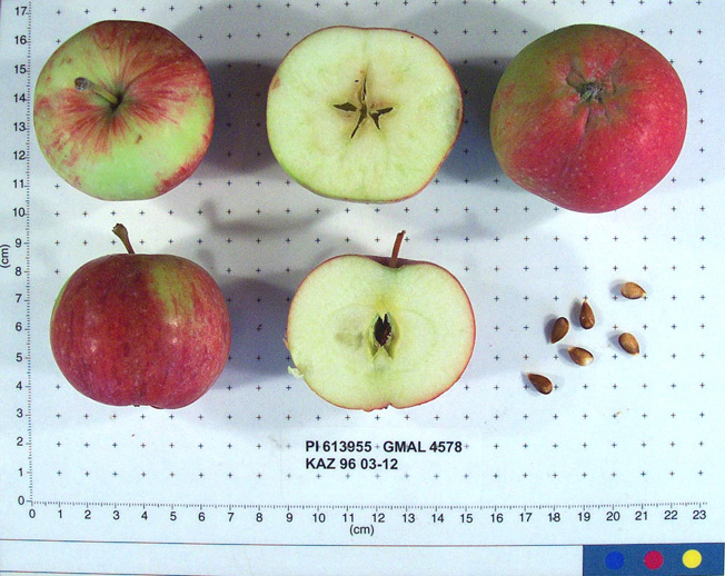 | | 1996 | COLLECTED | 09/02/1996 | Semipalitinsk Region - Tarbagatai Mountain region. 4 km NE of Alekseyevka, 20 km. north of Urdzhar. Collected near streams near site 05 (1995) on west end of site 10 (1995). | 47.26777778, 81.58250000 | | Soil: silt, little rock, good drainage. Variable incline, open, ridges on valleys. Dominant tree sp: M. sieversii; Assoc: Crataegus. Dominant shrub sp: Rosa; Assoc: Lonicera. Dominant herbaceous: Humulus; Assoc: Circium. Rainfall 400 mm. | Uncertain improvement status | Sampled 60 fruits from 1 tree. Flesh flavor is subacid. Over color is 60% red. Fruit size is larger than 50mm. Free of disease and insects. General health is great. Scion collected also. ---Malus sieversii hybrid. Domestic introgression intentified using 20K Illumina Infinium apple SNP array--Gragylling and Weisser_Tafelapfel are close ancestors, likely great-grandparents. | 1531525 | PI 613955 |
| 238 | PI 613956 | KAZ 96 03-13 | Malus hybr. | Kazakhstan | GEN |  | | 1996 | COLLECTED | 09/02/1996 | Semipalitinsk Region - Tarbagatai Mountain region. 4 km. NE of Alekseyevka, 20 km. north of Urdzhan. Collected on west facing slope in site 05 (1995) just up the incline from the road. | 47.25250000, 81.57055556 | 800 | Soil: silt, little rock, good drainage. Variable incline, open, ridges on valleys. Dominant tree sp: M sieversii; Assoc: Crataegus. Dominant shrub sp: Rosa; Assoc: Lonicera. Dominant herbaceous: Humulus; Assoc: Circium. Rainfall 400 mm. | Uncertain improvement status | Sampled 80 fruits from 1 tree. Flesh flavor is aromatic. Free of disease and insects. Scion collected also. -- One fully domesticated parent intentified using 20K Illumina Infinium apple SNP array. Parent is Gold_Reinette. | 1531526 | PI 613956 |
| 239 | PI 613957 | KAZ 96 03-14 | Malus sieversii (Ledeb.) M. Roem. | Kazakhstan | GEN | 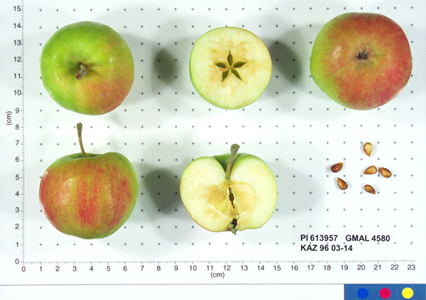 | | 1996 | COLLECTED | 09/03/1996 | Semipalitinsk Region - Tarbagatai Mountain region. 4 km. NE of Alekseyevka, 20 km. north of Urdzhar. Collected along road in center of site 09 (1995) may have been collected as an elite in 1995. | 47.26805556, 81.59277778 | 800 | Soil: silt, little rock, good drainage. Variable incline, open, ridges on valleys. Dominant tree sp: M. sieversii; Assoc: Crataegus. Dominant shrub sp: Rosa; Assoc: Lonicera. Dominant herbaceous: Humulus; Assoc: Circium. Rainfall 400mm. | Wild material | Sampled 100 fruits from 1 tree. Flesh flavor is aromatic. Over color is 70% red. Fruit size is larger than 50mm. Free of disease, some codling moth. May have been collected as an elite in 1995. Scion collected also. | 1531527 | PI 613957 |
| 240 | PI 613986 | KAZ 96 03-09 | Malus hybr. | Kazakhstan | GEN | 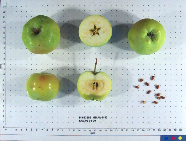 | | 1996 | COLLECTED | 09/02/1996 | Semipalitinsk Region-Tarbagatai Mt. region. 4 km NE of Alekseyevka, 20 km north of Urdzhar. Collected at east end of South valley (site 10 1995) just 10 ft. from field on west-facing slope. | 47.26777778, 81.58250000 | 900 | Soil: Silt, Little rock, good drainage. Variable incline, west, open, ridges on valleys. Dominant tree sp: M. sieversii; Assoc-Crataegus. Dominant shrub sp: Rosa; Assoc-Lonicera. Dominant herbaceous: Humulus; Assoc-Circium. Rainfall 400mm. | Uncertain improvement status | Elite scion material. Sampled 20 fruits from 1 tree. Flesh flavor is sweet. Free of disease and insects. Scion also collected. -- One fully domesticated parent intentified using 20K Illumina Infinium apple SNP array. Parent is Kaiser_Alexander. | 1531523 | PI 613986 |
| 241 | PI 613989 | KAZ 96 06-02 | Malus sieversii (Ledeb.) M. Roem. | Kazakhstan | GEN |  | | 1996 | COLLECTED | 09/06/1996 | 9 km southeast of Lepinsk, 2 km southeast of Lepsinsk Forestry Camp. Incline 20%. | 45.52222222, 80.72777778 | 1230 | Excellent drainage, mostly N-NE, rainfall 700mm. Dominant Tree sp: Malus sieversii: Assoc-Populus tremula. Dominant shrub sp: Rubus caesius: Assoc-Lonicera. Dominant Herbaceous: Urtica; Assoc-Cirscium. | Wild material | Sampled 50 fruits from 1 tree. Flesh flavor is aromatic. Over color is 50% red. Free of disease and insects. Scion collected also. | 1531531 | PI 613989 |
| 242 | PI 613990 | KAZ 96 06-03 | Malus hybr. | Kazakhstan | GEN |  | | 1996 | COLLECTED | 09/06/1996 | 9 km southeast of Lepinsk, 2 km southeast of Lepsinsk Forestry Camp. Incline 20%. | 45.51722222, 80.72777778 | 1230 | Excellent drainage, mostly N-Ne, rainfall 700mm. Dominant Tree sp: Malus sieversii: Assoc-Populus tremula. Dominant shrub sp: Rubus caesius: Assoc-Lonicera. Dominant Herbaceous: Urtica; Assoc-Cirscium. | Uncertain improvement status | Elite scion material. sampled 70 fruits from 1 tree. Free of disease and insects. Scion also collected. ---Malus sieversii hybrid. Domestic introgression intentified using 20K Illumina Infinium apple SNP array--Kaiser_Alexander is one grandparent | 1531532 | PI 613990 |
| 243 | PI 613991 | KAZ 96 07-03 | Malus sieversii (Ledeb.) M. Roem. | Kazakhstan | GEN | 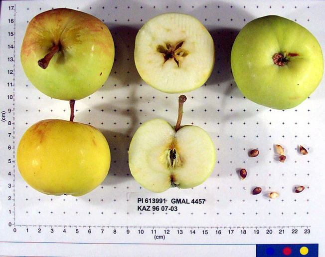 | | 1996 | COLLECTED | 09/08/1996 | 15km east of Topelevka-Djungarsky Range. 3 km southeast of Topelevka Forestry Camp. Collections made in radius around camp. Incline 10%, northwest. | 45.40722222, 80.43944444 | 1460 | Fertile. Dominant tree sp: Malus sierversii; Assoc.-Betula, Crataegus, Acer, Quercus, Tilia, Populus, Betula. Dom. Shrub Sp: Berberis, Lonicera: Assoc.-Cotoneaster, Rubus, Berberis, Ribes. Dom. herb.:Fragaria,Grasses,Humulus:Assoc.-Dianthus | Wild material | Elite scion material. sampled 80 fruits from 1 tree. Flesh is subacid. Fruit size is larger than 50mm. Free of disease and insects. Nice apple, 50 year old tree. Scion also collected. | 1531534 | PI 613991 |
| 244 | PI 613992 | KAZ 96 07-04 | Malus sieversii (Ledeb.) M. Roem. | Kazakhstan | GEN |  | | 1996 | COLLECTED | 09/08/1996 | 15 km southeast of Topelevka-Djungarski Range. 3km of Topelevka Forestry Camp. Collected further east of camp at higher elevations. | 45.40027778, 80.44083333 | 1540 | Dominant tree sp: M. sieversii; Assoc-Betula, Crataegus, Acer, Quercus, Tilia, Populus, Rhamnus. Dom. shrub sp: Berberis, Lonicera; Assoc-Cotoneaster, Rubus, Ribes. Dom. herb:Fragaria, Grasses, Humulus; Assoc-Dianthus, Fragaria, Chelidonium | Wild material | Sampled 8 fruits from 54 trees. Flesh flavor is subacid. scab is absent. Genetic Dwarf. Same as 07-04. | 1531535 | PI 613992 |
| 245 | PI 613993 | KAZ 96 07-05 | Malus sieversii (Ledeb.) M. Roem. | Kazakhstan | GEN |  | | 1996 | COLLECTED | 09/08/1996 | 15 km southeast of Topelevka-Djungarski Range. 3km of Topelevka Forestry Camp. Collected further east of camp at higher elevations. | 45.40027778, 80.44083333 | 1580 | Dominant tree sp: M. sieversii; Assoc-Betula, Crataegus, Acer, Quercus, Tilia, Populus, Rhamnus. Dom. shrub sp: Berberis, Lonicera; Assoc-Cotoneaster, Rubus, Ribes. Dom. herb:Fragaria, Grasses, Humulus; Assoc-Dianthus, Fragaria, Chelidonium | Wild material | Sampled 8 fruits from 54 trees. Flesh flavor is subacid. Scab is absent. Genetic Dwarfs. Same as 07-05. | 1531536 | PI 613993 |
| 246 | PI 599800 | KAZ 96 01-01P | Malus sieversii (Ledeb.) M. Roem. | Kazakhstan | GEN | | | 1996 | COLLECTED | 08/28/1996 | Ketmen Mts., Kirghiz sai. Southwest of Bol'shoye Aksu village. Heavily grazed area, no undergrowth. Elevation 1600-1660 meters. | 43.29166667, 79.51388889 | 1660 | Soil: Gravely loam. Incline 10-20%, north, open-grazed. Rainfall 600-650mm. Dominant tree sp: Apricot, Crataegus; Assoc-Populus & Betula above 1660m. Dominant shrub sp: Sorbus, Berberis; Assoc-Lonicera. | Wild material | | 1551097 | PI 599800 |
| 247 | PI 599805 | KAZ 96 06-01P | Malus sieversii (Ledeb.) M. Roem. | Kazakhstan | GEN | | | 1996 | COLLECTED | 09/06/1996 | 9km south east of Lepsinsk, 2km southeast of Lepsinsk Forestry Camp. Collected in site 14 area of 1995. | 43.51722222, 80.72777778 | 1220 | Excellent drainage, mostly N-NE. Rainfall 700mm. Dominant tree sp: Malus sieversii; Assoc-Populus, Padus. Dominant shrub sp: Rubus; Assoc-Lonicera. Dominant herbaceous: Urtica; Assoc-Cirscium, Geranium, Aster, Malva, Rumex. | Wild material | | 1551105 | PI 599805 |
| 248 | PI 599806 | KAZ 96 07-01P | Malus sieversii (Ledeb.) M. Roem. | Kazakhstan | GEN | | | 1996 | COLLECTED | 09/07/1996 | 15 km southeast of Topelevka-Djungarski Range. 3km of Topelevka Forestry Camp. Collected east of camp. | 45.40833333, 80.43000000 | 1250 | Dominant tree sp: M. sieversii; Assoc-Betula, Crataegus, Acer, Quercus, Tilia, Populus, Rhamnus. Dom. shrub sp: Berberis, Lonicera; Assoc-Cotoneaster, Rubus, Ribes. Dom. herb:Fragaria, Grasses, Humulus; Assoc-Dianthus, Fragaria, Chelidonium | Wild material | | 1551100 | PI 599806 |
| 249 | PI 600585 | KAZ 96 01-02 | Malus sieversii (Ledeb.) M. Roem. | Kazakhstan | GEN | | | 1996 | COLLECTED | 08/28/1996 | Ketmen Mts. Village-Kirghiz sai. Southwest of Bol'shoye Asku Village. Heavily grazed area, no undergrowth. Heavily grazed area, no undergrowth. | 43.33972222, 79.48166667 | 1640 | Soil: Gravely loam. Incline 10-20%, north, open grazed. N. ridge above stream; rainfall 600-650mm. Dominant tree sp: Apricot,Crataegus;Assoc-Populus & Betula above 1660m. Dominant shrub sp: Sorbus,Berberis; Assoc-Lonicera. | Wild material | | 1550512 | PI 600585 |
| 250 | PI 600588 | KAZ 96 03-02 | Malus sieversii (Ledeb.) M. Roem. | Kazakhstan | GEN | | | 1996 | COLLECTED | 09/01/1996 | Semipalitinsk Region-Tarbagatai Mt. region. 4 km northeast of Alekseyevka, 20 km north of Urdzhar. Collected on south side of site 10, 1995 (middle valley) near 03-02. | 47.27222222, 81.57527778 | 830 | Soil: Silt, Little rock, good drainage. Variable incline, open, ridges on valleys. Dominant tree sp: M. sieversii; Assoc-Crataegus. Dominant shrub sp: Rosa; Assoc-Lonicera. Dominant herbaceous: Humulus; Assoc-Circium. Rainfall 400mm. | Wild material | | 1550514 | PI 600588 |
| 251 | PI 600589 | KAZ 96 03-04 | Malus sieversii (Ledeb.) M. Roem. | Kazakhstan | GEN | | | 1996 | COLLECTED | 09/01/1996 | Semipalitinsk Region-Tarbagatai Mt. region. 4 km northeast of Alekseyevka, 20 km north of Urdzhar. Collected in site 07(1995). East end of valley on north side. | 47.27055556, 81.57916667 | 860 | Soil: Silt, Little rock, good drainage. Variable incline,south, open, ridges on valleys. Dominant tree sp: M. sieversii; Assoc-Crataegus. Dominant shrub sp: Rosa; Assoc-Lonicera. Dominant herbaceous: Humulus; Assoc-Circium. Rainfall 400mm. | Wild material | | 1550515 | PI 600589 |
| 252 | PI 600595 | KAZ 96 03-12 | Malus sieversii (Ledeb.) M. Roem. | Kazakhstan | GEN | | | 1996 | COLLECTED | 09/02/1996 | Semipalitinsk Region-Tarbagatai Mt. region. 4 km NE of Alekseyevka, 20 km north of Urdzhar. Collected near streams near site 05(1995) on west end of site 10(1995). | 47.26777778, 81.58250000 | 840 | Soil: Silt, Little rock, good drainage. Variable incline, open, ridges on valleys. Dominant tree sp: M. sieversii; Assoc-Crataegus. Dominant shrub sp: Rosa; Assoc-Lonicera. Dominant herbaceous: Humulus; Assoc-Circium. Rainfall 400mm. | Wild material | | 1550519 | PI 600595 |
| 253 | PI 600596 | KAZ 96 03-13 | Malus sieversii (Ledeb.) M. Roem. | Kazakhstan | GEN | | | 1996 | COLLECTED | 09/02/1996 | Semipalitinsk Region-Tarbagatai Mt. region. 4 km NE of Alekseyevka, 20 km north of Urdzhar. Collected on west facing slope in site 05(1995) just up the incline from the road. | 47.25250000, 81.57055556 | 800 | Soil: Silt, Little rock, good drainage. Variable incline, open, ridges on valleys. Dominant tree sp: M. sieversii; Assoc-Crataegus. Dominant shrub sp: Rosa; Assoc-Lonicera. Dominant herbaceous: Humulus; Assoc-Circium. Rainfall 400mm. | Wild material | | 1550548 | PI 600596 |
| 254 | PI 600597 | KAZ 96 03-14 | Malus sieversii (Ledeb.) M. Roem. | Kazakhstan | GEN | | | 1996 | COLLECTED | 09/03/1996 | Semipalitinsk Region-Tarbagatai Mt. region. 4 km NE of Alekseyevka, 20 km north of Urdzhar. Collected along road in center of site 09(1995) may have been collected as an elite in 1995. | 47.26805556, 81.59277778 | 800 | Soil: Silt, Little rock, good drainage. Variable incline, open, ridges on valleys. Dominant tree sp: M. sieversii; Assoc-Crataegus. Dominant shrub sp: Rosa; Assoc-Lonicera. Dominant herbaceous: Humulus; Assoc-Circium. Rainfall 400mm. | Wild material | | 1550520 | PI 600597 |
| 255 | PI 600598 | KAZ 96 03-15 | Malus sieversii (Ledeb.) M. Roem. | Kazakhstan | GEN | | | 1996 | COLLECTED | 09/03/1996 | Semipalitinsk Region-Tarbagatai Mt. region. 4 km northeast of Alekseyevka, 20 km north of Urdzhar. Near 03-14, 1/2km north of 03-14. | 47.26805556, 81.59166667 | 1030 | Soil: Silt, Little rock, good drainage. Variable incline, open, ridges on valleys. Dominant tree sp: M. sieversii; Assoc-Crataegus. Dominant shrub sp: Rosa; Assoc-Lonicera. Dominant herbaceous: Humulus; Assoc-Circium. Rainfall 400mm. | Wild material | | 1550521 | PI 600598 |
| 256 | PI 600603 | KAZ 96 06-02 | Malus sieversii (Ledeb.) M. Roem. | Kazakhstan | GEN | | | 1996 | COLLECTED | 09/06/1996 | 9 km southeast of Lepinsk, 2 km southeast of Lepsinsk Forestry Camp. Incline 20%. | 45.51722222, 80.72777778 | 1230 | Excellent drainage, mostly N-Ne, rainfall 700mm. Dominant Tree sp: Malus sieversii: Assoc-Populus tremula. Dominant shrub sp: Rubus caesius: Assoc-Lonicera. Dominant Herbaceous: Urtica; Assoc-Cirscium. | Wild material | | 1550524 | PI 600603 |
| 257 | PI 600604 | KAZ 96 06-03 | Malus sieversii (Ledeb.) M. Roem. | Kazakhstan | GEN | | | 1996 | COLLECTED | 09/06/1996 | 9 km southeast of Lepinsk, 2 km southeast of Lepsinsk Forestry Camp. Incline 20%. | 45.51722222, 80.72777778 | 1230 | Excellent drainage, mostly N-Ne, rainfall 700mm. Dominant Tree sp: Malus sieversii: Assoc-Populus tremula. Dominant shrub sp: Rubus caesius: Assoc-Lonicera. Dominant Herbaceous: Urtica; Assoc-Cirscium. | Wild material | | 1550525 | PI 600604 |
| 258 | PI 600605 | KAZ 96 07-02 | Malus sieversii (Ledeb.) M. Roem. | Kazakhstan | GEN | | | 1996 | COLLECTED | 09/07/1996 | 15km east of Topelevka-Djungarsky Range. 3 km southeast of Topelevka Forestry Camp. Collections made in radius around camp. Incline 10%, east. | 45.41222222, 80.41222222 | 1250 | Fertile. Dominant tree sp: Malus sierversii; Assoc.-Betula, Crataegus, Acer, Quercus, Tilia, Populus, Betula. Dom. Shrub Sp: Berberis, Lonicera: Assoc.-Cotoneaster, Rubus, Berberis, Ribes. Dom. herb.:Fragaria,Grasses,Humulus:Assoc.-Dianthus | Wild material | | 1550549 | PI 600605 |
| 259 | PI 600606 | KAZ 96 07-03 | Malus sieversii (Ledeb.) M. Roem. | Kazakhstan | GEN | | | 1996 | COLLECTED | 09/08/1996 | 15km east of Topelevka-Djungarsky Range. 3 km southeast of Topelevka Forestry Camp. Collections made in radius around camp. Incline 10%, northwest. | 45.40722222, 80.43944444 | 1460 | Fertile. Dominant tree sp: Malus sierversii; Assoc.-Betula, Crataegus, Acer, Quercus, Tilia, Populus, Betula. Dom. Shrub Sp: Berberis, Lonicera: Assoc.-Cotoneaster, Rubus, Berberis, Ribes. Dom. herb.:Fragaria,Grasses,Humulus:Assoc.-Dianthus | Wild material | | 1550526 | PI 600606 |
| 260 | PI 600607 | KAZ 96 07-06 | Malus sieversii (Ledeb.) M. Roem. | Kazakhstan | GEN | | | 1996 | COLLECTED | 09/08/1996 | 15km east of Topelevka-Djungarsky Range. 3 km southeast of Topelevka Forestry Camp. Collections made in radius around camp. Aspect west. | 45.40333333, 80.40611111 | 1500 | Fertile. Dominant tree sp: Malus sierversii; Assoc.-Betula, Crataegus, Acer, Quercus, Tilia, Populus, Betula. Dom. Shrub Sp: Berberis, Lonicera: Assoc.-Cotoneaster, Rubus, Berberis, Ribes. Dom. herb.:Fragaria,Grasses,Humulus:Assoc.-Dianthus | Wild material | | 1550527 | PI 600607 |
| 261 | PI 600608 | KAZ 96 07-08 | Malus sieversii (Ledeb.) M. Roem. | Kazakhstan | GEN | | | 1996 | COLLECTED | 09/09/1996 | 15km east of Topelevka-Djungarsky Range. 3 km southeast of Topelevka Forestry Camp. Collections made in radius around camp. | 45.40472222, 80.40694444 | 1220 | Fertile. Dominant tree sp: Malus sierversii; Assoc.-Betula, Crataegus, Acer, Quercus, Tilia, Populus, Betula. Dom. Shrub Sp: Berberis, Lonicera: Assoc.-Cotoneaster, Rubus, Berberis, Ribes. Dom. herb.:Fragaria,Grasses,Humulus:Assoc.-Dianthus | Wild material | | 1550545 | PI 600608 |
| 262 | PI 600609 | KAZ 96 07-09 | Malus sieversii (Ledeb.) M. Roem. | Kazakhstan | GEN | | | 1996 | COLLECTED | 09/09/1996 | 15km east of Topelevka-Djungarsky Range. 3 km southeast of Topelevka Forestry Camp. Collections made in radius around camp. Aspect southeast. | 45.41027778, 80.40527778 | 1240 | Fertile. Dominant tree sp: Malus sierversii; Assoc.-Betula, Crataegus, Acer, Quercus, Tilia, Populus, Betula. Dom. Shrub Sp: Berberis, Lonicera: Assoc.-Cotoneaster, Rubus, Berberis, Ribes. Dom. herb.:Fragaria,Grasses,Humulus:Assoc.-Dianthus | Wild material | | 1550528 | PI 600609 |
| 263 | PI 600610 | KAZ 96 07-10 | Malus sieversii (Ledeb.) M. Roem. | Kazakhstan | GEN | | | 1996 | COLLECTED | 09/09/1996 | 15km east of Topelevka-Djungarsky Range. 3 km southeast of Topelevka Forestry Camp. Collections made in radius around camp. Aspect flat. | 85.41527778, 80.40277778 | 1250 | Fertile. Dominant tree sp: Malus sierversii; Assoc.-Betula, Crataegus, Acer, Quercus, Tilia, Populus, Betula. Dom. Shrub Sp: Berberis, Lonicera: Assoc.-Cotoneaster, Rubus, Berberis, Ribes. Dom. herb.:Fragaria,Grasses,Humulus:Assoc.-Dianthus | Wild material | | 1550529 | PI 600610 |
| 264 | PI 600611 | KAZ 96 07-11 | Malus sieversii (Ledeb.) M. Roem. | Kazakhstan | GEN | | | 1996 | COLLECTED | 09/09/1996 | 15 miles east of the village of Topelevka. Djungarsky Mt. Range. Collections made in radius around camp. | 45.42000000, 80.39722222 | 1210 | NW, open. Dominant Tree sp: malus sieversii; Assoc.-Betula, Crataegus, Acer, Quercus, Tilia. Dom. shrub sp: Berberis, Lonicera; Assoc.-Cotoneaster, Rubus, Ribes. Dom. Herb.: Fragaria, Grasses, Humulus; Assoc.-Dianthus, Chelidonium, Urtica. | Wild material | | 1550541 | PI 600611 |
| 265 | PI 657086 | KAZ 96 03-11 | Malus hybr. | Kazakhstan | GEN | 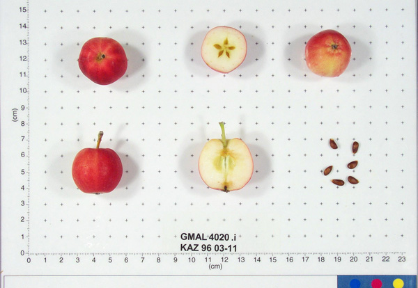 | | 1996 | COLLECTED | 09/02/1996 | Semipalitinsk Region-Tarbagatai Mt. region. 4 km northeast of Alekseyevka, 20 km north of Urdzhar. Collected near 03-10. | 47.26777778, 81.58250000 | 880 | Soil: Silt, Little rock, good drainage. Variable incline, open, ridges on valleys. Dominant tree sp: M. sieversii; Assoc-Crataegus. Dominant shrub sp: Rosa; Assoc-Lonicera. Dominant herbaceous: Humulus; Assoc-Circium. Rainfall 400mm. | Uncertain improvement status | Sampled 4 fruits from 1 tree. Flesh flavor is aromatic. Fruit size is over 50mm. Free of disease and insects. Very nice flavor. Only four fruits available. Scion collected also. ---Malus sieversii hybrid. Domestic introgression intentified using 20K Illumina Infinium apple SNP array-- | 1693310 | PI 657086 |
| 266 | PI 657087 | KAZ 96 03-15 | Malus hybr. | Kazakhstan | GEN | | | 1996 | COLLECTED | 09/03/1996 | Semipalitinsk Region-Tarbagatai Mt. region. 4 km northeast of Alekseyevka, 20 km north of Urdzhar. Near 03-14, 1/2km north of 03-14. | 47.26805556, 81.59166667 | 1030 | Soil: Silt, Little rock, good drainage. Variable incline, open, ridges on valleys. Dominant tree sp: M. sieversii; Assoc-Crataegus. Dominant shrub sp: Rosa; Assoc-Lonicera. Dominant herbaceous: Humulus; Assoc-Circium. Rainfall 400mm. | Uncertain improvement status | Sampled 100 fruits from 1 tree. Flesh flavor is aromatic. Fruit size is larger than 50mm. Free of disease and insects. Scion collected also. Same as 0301P59, GMAL 4155. ---Malus sieversii hybrid. Domestic introgression intentified using 20K Illumina Infinium apple SNP array-- | 1693332 | PI 657087 |
| 267 | PI 657089 | KAZ 96 07-03 | Malus hybr. | Kazakhstan | GEN | 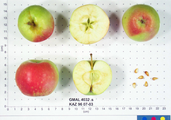 | | 1996 | COLLECTED | 09/08/1996 | 15km east of Topelevka-Djungarsky Range. 3 km southeast of Topelevka Forestry Camp. Collections made in radius around camp. Incline 10%, northwest. | 45.40722222, 80.43944444 | 1460 | Fertile. Dominant tree sp: Malus sierversii; Assoc.-Betula, Crataegus, Acer, Quercus, Tilia, Populus, Betula. Dom. Shrub Sp: Berberis, Lonicera: Assoc.-Cotoneaster, Rubus, Berberis, Ribes. Dom. herb.:Fragaria,Grasses,Humulus:Assoc.-Dianthus | Uncertain improvement status | Sampled 80 fruits from 1 tree. Flesh flavor is subacid. Fruit size is larger than 50mm. Free of disease and insects. Nice apple, 50 year old tree. Scion collected also. ---Malus sieversii hybrid. Domestic introgression intentified using 20K Illumina Infinium apple SNP array--Gold_Reinette is a likely grandparent | 1693368 | PI 657089 |
| 268 | PI 657091 | KAZ 96 07-08 | Malus sieversii (Ledeb.) M. Roem. | Kazakhstan | GEN | | | 1996 | COLLECTED | 09/09/1996 | 15km east of Topelevka-Djungarsky Range. 3 km southeast of Topelevka Forestry Camp. Collections made in radius around camp. | 45.40472222, 80.40694444 | 1220 | Fertile. Dominant tree sp: Malus sierversii; Assoc.-Betula, Crataegus, Acer, Quercus, Tilia, Populus, Betula. Dom. Shrub Sp: Berberis, Lonicera: Assoc.-Cotoneaster, Rubus, Berberis, Ribes. Dom. herb.:Fragaria,Grasses,Humulus:Assoc.-Dianthus | Wild material | Sampled 70 fruits from 1 tree. Flesh flavor is aromatic. Fruit size is larger than 50mm. Free of disease and insects. White transparent type. Heavy crop load. | 1693446 | PI 657091 |
| 269 | PI 657093 | KAZ 96 07-10 | Malus hybr. | Kazakhstan | GEN | 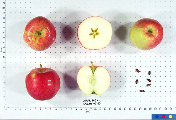 | | 1996 | COLLECTED | 09/09/1996 | 15km east of Topelevka-Djungarsky Range. 3 km southeast of Topelevka Forestry Camp. Collections made in radius around camp. Aspect flat. | 85.41527778, 80.40277778 | 1250 | Fertile. Dominant tree sp: Malus sierversii; Assoc.-Betula, Crataegus, Acer, Quercus, Tilia, Populus, Betula. Dom. Shrub Sp: Berberis, Lonicera: Assoc.-Cotoneaster, Rubus, Berberis, Ribes. Dom. herb.:Fragaria,Grasses,Humulus:Assoc.-Dianthus | Uncertain improvement status | Sampled 60 fruits from 1 tree. Flesh flavor is aromatic. Over color is 70% red. Fruit size is larger than 50mm. Free of disease and insects. Best apple so far, great. ---Malus sieversii hybrid. Domestic introgression intentified using 20K Illumina Infinium apple SNP array--Gold_Reinette is a grandparent | 1693493 | PI 657093 |
| 270 | PI 657104 | KAZ 96 01-01P-13 | Malus hybr. | Kazakhstan | GEN |  | | 1996 | COLLECTED | 08/28/1996 | Ketmen Mts., Kirghiz sai. Southwest of Bol'shoye Aksu village. Heavily grazed area, no undergrowth. Elevation 1600-1660 meters. | 43.29166667, 79.51388889 | 1660 | Soil: Gravely loam. Incline 10-20%, north, open-grazed. Rainfall 600-650mm. Dominant tree sp: Apricot, Crataegus; Assoc-Populus & Betula above 1660m. Dominant shrub sp: Sorbus, Berberis; Assoc-Lonicera. | Uncertain improvement status | Sampled 8 fruits from 20 trees. Flesh flavor is sweet, subacid. Over color is 50% red. Fruit size is larger than 50mm. Scab is very light, ribbed, striped. Apricots in area are early blooming, very good quality. Late maturing types. ---Malus sieversii hybrid. Domestic introgression intentified using 20K Illumina Infinium apple SNP array--Kaiser_Alexander is either a grandparent or great-grandparent | 1693674 | PI 657104 |
| 271 | PI 657105 | KAZ 96 01-01P-20 | Malus hybr. | Kazakhstan | GEN |  | | 1996 | COLLECTED | 08/28/1996 | Ketmen Mts., Kirghiz sai. Southwest of Bol'shoye Aksu village. Heavily grazed area, no undergrowth. Elevation 1600-1660 meters. | 43.29166667, 79.51388889 | 1660 | Soil: Gravely loam. Incline 10-20%, north, open-grazed. Rainfall 600-650mm. Dominant tree sp: Apricot, Crataegus; Assoc-Populus & Betula above 1660m. Dominant shrub sp: Sorbus, Berberis; Assoc-Lonicera. | Uncertain improvement status | Sampled 8 fruits from 20 trees. Flesh flavor is acid. Moderate scab, striped. Apricots in area are early blooming, very good quality. Late maturing types. ---Malus sieversii hybrid. Domestic introgression intentified using 20K Illumina Infinium apple SNP array--Gold_Reinette is a likely ancestor - great-grandparent or further | 1693679 | PI 657105 |
| 272 | PI 657111 | KAZ 96 07-01P-24 | Malus sieversii (Ledeb.) M. Roem. | Kazakhstan | GEN | | | 1996 | COLLECTED | 09/08/1996 | 15 km southeast of Topelevka-Djungarski Range. 3km of Topelevka Forestry Camp. Collected further east of camp at higher elevations. | 45.40027778, 80.44083333 | 1540 | Dominant tree sp: M. sieversii; Assoc-Betula, Crataegus, Acer, Quercus, Tilia, Populus, Rhamnus. Dom. shrub sp: Berberis, Lonicera; Assoc-Cotoneaster, Rubus, Ribes. Dom. herb:Fragaria, Grasses, Humulus; Assoc-Dianthus, Fragaria, Chelidonium | Wild material | Sampled 8 fruits from 54 trees. Flesh flavor is subacid. scab is absent. Genetic Dwarf. Same as 07-04. | 1694029 | PI 657111 |
| 273 | PI 657112 | KAZ 96 07-01P-24 | Malus sieversii (Ledeb.) M. Roem. | Kazakhstan | GEN | | | 1996 | COLLECTED | 09/08/1996 | 15 km southeast of Topelevka-Djungarski Range. 3km of Topelevka Forestry Camp. Collected further east of camp at higher elevations. | 45.40027778, 80.44083333 | 1540 | Dominant tree sp: M. sieversii; Assoc-Betula, Crataegus, Acer, Quercus, Tilia, Populus, Rhamnus. Dom. shrub sp: Berberis, Lonicera; Assoc-Cotoneaster, Rubus, Ribes. Dom. herb:Fragaria, Grasses, Humulus; Assoc-Dianthus, Fragaria, Chelidonium | Wild material | Sampled 8 fruits from 54 trees. Flesh flavor is subacid. scab is absent. Genetic Dwarf. Same as 07-04. | 1694032 | PI 657112 |
| 274 | PI 682766 | KAZ 96 03-11 | Malus sieversii (Ledeb.) M. Roem. | Kazakhstan | GEN | | | 1996 | COLLECTED | 09/02/1996 | Semipalitinsk Region-Tarbagatai Mt. region. 4 km northeast of Alekseyevka, 20 km north of Urdzhar. Collected near 03-10. | 47.26777778, 81.58250000 | 880 | Soil: Silt, Little rock, good drainage. Variable incline, open, ridges on valleys. Dominant tree sp: M. sieversii; Assoc-Crataegus. Dominant shrub sp: Rosa; Assoc-Lonicera. Dominant herbaceous: Humulus; Assoc-Circium. Rainfall 400mm. | Wild material | Sampled 4 fruits from 1 tree. Flesh flavor is aromatic. Fruit size is over 50mm. Free of disease and insects. Very nice flavor. Only four fruits available. Scion collected also. | 1693307 | PI 682766 |
| 275 | PI 682768 | KAZ 96 07-03 | Malus hybr. | Kazakhstan | GEN | | | 1996 | COLLECTED | 09/08/1996 | 15km east of Topelevka-Djungarsky Range. 3 km southeast of Topelevka Forestry Camp. Collections made in radius around camp. Incline 10%, northwest. | 45.40722222, 80.43944444 | 1460 | Fertile. Dominant tree sp: Malus sierversii; Assoc.-Betula, Crataegus, Acer, Quercus, Tilia, Populus, Betula. Dom. Shrub Sp: Berberis, Lonicera: Assoc.-Cotoneaster, Rubus, Berberis, Ribes. Dom. herb.:Fragaria,Grasses,Humulus:Assoc.-Dianthus | Uncertain improvement status | Sampled 80 fruits from 1 tree. Flesh flavor is subacid. Fruit size is larger than 50mm. Free of disease and insects. Nice apple, 50 year old tree. Scion collected also. ---Malus sieversii hybrid. Domestic introgression intentified using 20K Illumina Infinium apple SNP array--Gold_Reinette likely a grandparent | 1693381 | PI 682768 |
| 276 | PI 682769 | KAZ 96 07-03 | Malus sieversii (Ledeb.) M. Roem. | Kazakhstan | GEN |  | | 1996 | COLLECTED | 09/08/1996 | 15km east of Topelevka-Djungarsky Range. 3 km southeast of Topelevka Forestry Camp. Collections made in radius around camp. Incline 10%, northwest. | 45.40722222, 80.43944444 | 1460 | Fertile. Dominant tree sp: Malus sierversii; Assoc.-Betula, Crataegus, Acer, Quercus, Tilia, Populus, Betula. Dom. Shrub Sp: Berberis, Lonicera: Assoc.-Cotoneaster, Rubus, Berberis, Ribes. Dom. herb.:Fragaria,Grasses,Humulus:Assoc.-Dianthus | Wild material | Sampled 80 fruits from 1 tree. Flesh flavor is subacid. Fruit size is larger than 50mm. Free of disease and insects. Nice apple, 50 year old tree. Scion collected also. | 1693369 | PI 682769 |
| 277 | PI 682770 | KAZ 96 07-03 | Malus hybr. | Kazakhstan | GEN | 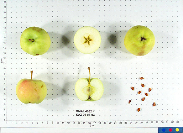 | | 1996 | COLLECTED | 09/08/1996 | 15km east of Topelevka-Djungarsky Range. 3 km southeast of Topelevka Forestry Camp. Collections made in radius around camp. Incline 10%, northwest. | 45.40722222, 80.43944444 | 1460 | Fertile. Dominant tree sp: Malus sierversii; Assoc.-Betula, Crataegus, Acer, Quercus, Tilia, Populus, Betula. Dom. Shrub Sp: Berberis, Lonicera: Assoc.-Cotoneaster, Rubus, Berberis, Ribes. Dom. herb.:Fragaria,Grasses,Humulus:Assoc.-Dianthus | Uncertain improvement status | Sampled 80 fruits from 1 tree. Flesh flavor is subacid. Fruit size is larger than 50mm. Free of disease and insects. Nice apple, 50 year old tree. Scion collected also. ---Malus sieversii hybrid. Domestic introgression intentified using 20K Illumina Infinium apple SNP array--Gold_Reinette likely a grandparent | 1693367 | PI 682770 |
| 278 | PI 682772 | KAZ 96 07-07 | Malus hybr. | Kazakhstan | | 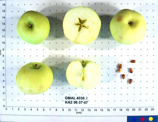 | Historic | 1996 | COLLECTED | 09/09/1996 | 15km east of Topelevka-Djungarsky Range. 3 km southeast of Topelevka Forestry Camp. Collections made in radius around camp. Collected near GMAL 4256. | 45.40472222, 80.40694444 | 1220 | Fertile. Dominant tree sp: Malus sierversii; Assoc.-Betula, Crataegus, Acer, Quercus, Tilia, Populus, Betula. Dom. Shrub Sp: Berberis, Lonicera: Assoc.-Cotoneaster, Rubus, Berberis, Ribes. Dom. herb.:Fragaria,Grasses,Humulus:Assoc.-Dianthus | Uncertain improvement status | Sampled 7 fruits form 1 tree. Flesh flavor is sweet. Fruit size is larger than 50mm. Free of disease and insects. Has water core. Strange hazelnutbananna flavor. Scion collected also. ---Malus sieversii hybrid. Domestic introgression intentified using 20K Illumina Infinium apple SNP array-- | 1693415 | PI 682772 |
| 279 | PI 682773 | KAZ 96 07-07 | Malus sieversii (Ledeb.) M. Roem. | Kazakhstan | GEN |  | | 1996 | COLLECTED | 09/09/1996 | 15km east of Topelevka-Djungarsky Range. 3 km southeast of Topelevka Forestry Camp. Collections made in radius around camp. Collected near GMAL 4256. | 45.40472222, 80.40694444 | 1220 | Fertile. Dominant tree sp: Malus sierversii; Assoc.-Betula, Crataegus, Acer, Quercus, Tilia, Populus, Betula. Dom. Shrub Sp: Berberis, Lonicera: Assoc.-Cotoneaster, Rubus, Berberis, Ribes. Dom. herb.:Fragaria,Grasses,Humulus:Assoc.-Dianthus | Wild material | Sampled 7 fruits form 1 tree. Flesh flavor is sweet. Fruit size is larger than 50mm. Free of disease and insects. Has water core. Strange hazelnut-bananna flavor. Scion collected also. | 1693414 | PI 682773 |
| 280 | PI 682774 | KAZ 96 07-09 | Malus sieversii (Ledeb.) M. Roem. | Kazakhstan | GEN | | | 1996 | COLLECTED | 09/09/1996 | 15km east of Topelevka-Djungarsky Range. 3 km southeast of Topelevka Forestry Camp. Collections made in radius around camp. Aspect southeast. | 45.41027778, 80.40527778 | 1240 | Fertile. Dominant tree sp: Malus sierversii; Assoc.-Betula, Crataegus, Acer, Quercus, Tilia, Populus, Betula. Dom. Shrub Sp: Berberis, Lonicera: Assoc.-Cotoneaster, Rubus, Berberis, Ribes. Dom. herb.:Fragaria,Grasses,Humulus:Assoc.-Dianthus | Wild material | Sampled 80 fruits from 1 tree. Flesh flavor is subacid. Over color is 50% red. Fruit size is larger than 50mm. Free of disease and insects. Crop load is heavy. Large apples with hugh green leaves that are clean, look like triploid. Apples could even be larger of smaller crop. Scion collected also. | 1693464 | PI 682774 |
| 281 | PI 682778 | KAZ 96 07-10 | Malus sieversii (Ledeb.) M. Roem. | Kazakhstan | GEN | 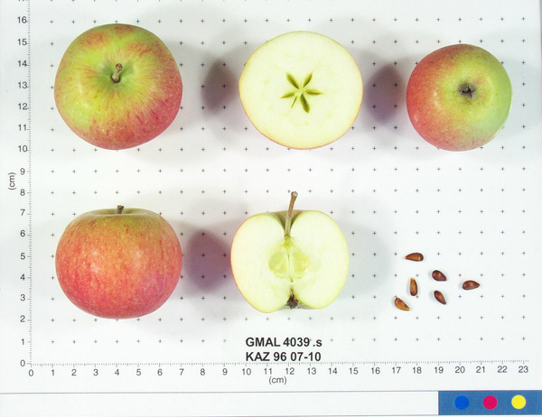 | | 1996 | COLLECTED | 09/09/1996 | 15km east of Topelevka-Djungarsky Range. 3 km southeast of Topelevka Forestry Camp. Collections made in radius around camp. Aspect flat. | 85.41527778, 80.40277778 | 1250 | Fertile. Dominant tree sp: Malus sierversii; Assoc.-Betula, Crataegus, Acer, Quercus, Tilia, Populus, Betula. Dom. Shrub Sp: Berberis, Lonicera: Assoc.-Cotoneaster, Rubus, Berberis, Ribes. Dom. herb.:Fragaria,Grasses,Humulus:Assoc.-Dianthus | Wild material | Sampled 60 fruits from 1 tree. Flesh flavor is aromatic. Over color is 70% red. Fruit size is larger than 50mm. Free of disease and insects. Best apple so far, great. | 1693476 | PI 682778 |
| 282 | PI 682779 | KAZ 96 07-10 | Malus hybr. | Kazakhstan | GEN | 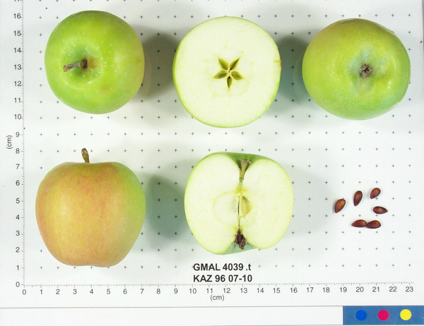 | | 1996 | COLLECTED | 09/09/1996 | 15km east of Topelevka-Djungarsky Range. 3 km southeast of Topelevka Forestry Camp. Collections made in radius around camp. Aspect flat. | 85.41527778, 80.40277778 | 1250 | Fertile. Dominant tree sp: Malus sierversii; Assoc.-Betula, Crataegus, Acer, Quercus, Tilia, Populus, Betula. Dom. Shrub Sp: Berberis, Lonicera: Assoc.-Cotoneaster, Rubus, Berberis, Ribes. Dom. herb.:Fragaria,Grasses,Humulus:Assoc.-Dianthus | Uncertain improvement status | Sampled 60 fruits from 1 tree. Flesh flavor is aromatic. Over color is 70% red. Fruit size is larger than 50mm. Free of disease and insects. Best apple so far, great. ---Malus sieversii hybrid. Domestic introgression intentified using 20K Illumina Infinium apple SNP array--Gold_Reinette is a grandparent | 1693477 | PI 682779 |
| 283 | PI 682780 | KAZ 96 07-10 | Malus sieversii (Ledeb.) M. Roem. | Kazakhstan | GEN | 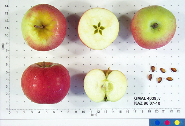 | | 1996 | COLLECTED | 09/09/1996 | 15km east of Topelevka-Djungarsky Range. 3 km southeast of Topelevka Forestry Camp. Collections made in radius around camp. Aspect flat. | 85.41527778, 80.40277778 | 1250 | Fertile. Dominant tree sp: Malus sierversii; Assoc.-Betula, Crataegus, Acer, Quercus, Tilia, Populus, Betula. Dom. Shrub Sp: Berberis, Lonicera: Assoc.-Cotoneaster, Rubus, Berberis, Ribes. Dom. herb.:Fragaria,Grasses,Humulus:Assoc.-Dianthus | Wild material | Sampled 60 fruits from 1 tree. Flesh flavor is aromatic. Over color is 70% red. Fruit size is larger than 50mm. Free of disease and insects. Best apple so far, great. | 1693479 | PI 682780 |
| 284 | PI 682781 | KAZ 96 07-10 | Malus hybr. | Kazakhstan | GEN | 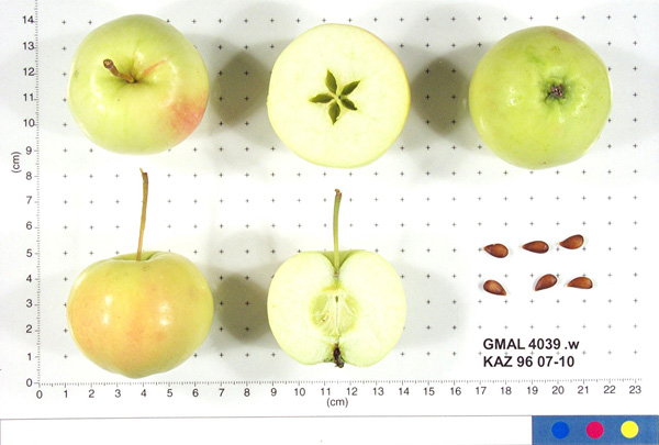 | | 1996 | COLLECTED | 09/09/1996 | 15km east of Topelevka-Djungarsky Range. 3 km southeast of Topelevka Forestry Camp. Collections made in radius around camp. Aspect flat. | 85.41527778, 80.40277778 | 1250 | Fertile. Dominant tree sp: Malus sierversii; Assoc.-Betula, Crataegus, Acer, Quercus, Tilia, Populus, Betula. Dom. Shrub Sp: Berberis, Lonicera: Assoc.-Cotoneaster, Rubus, Berberis, Ribes. Dom. herb.:Fragaria,Grasses,Humulus:Assoc.-Dianthus | Uncertain improvement status | Sampled 60 fruits from 1 tree. Flesh flavor is aromatic. Over color is 70% red. Fruit size is larger than 50mm. Free of disease and insects. Best apple so far, great. ---Malus sieversii hybrid. Domestic introgression intentified using 20K Illumina Infinium apple SNP array--Gold_Reinette is a grandparent | 1693492 | PI 682781 |
| 285 | PI 682789 | KAZ 96 01-01P-3 | Malus hybr. | Kazakhstan | GEN | | | 1996 | COLLECTED | 08/28/1996 | Ketmer Mts., Kirghiz sai. Southwest of Bol'shoye Aksa village. Heavily grazed area, no undergrowth. | 43.29166667, 79.51388889 | 1660 | Soil: Gravely loam. Incline 10-20%, north, open-grazed. Rainfall 600-650mm. Dominant tree sp: Apricot, Crataegus; Assoc-Populus & Betula above 1660m. Dominant shrub sp: Sorbus, Berberis; Assoc-Lonicera. Elevation 1600-1660 meters. | Uncertain improvement status | Sampled 8 fruits from 20 trees. Flesh flavor is acid. Moderate scab. Apricots in area are early blooming, very good quality. Late maturing types. ---Malus sieversii hybrid. Domestic introgression intentified using 20K Illumina Infinium apple SNP array--Gragylling is a close ancestor, maybe a great-grandparent but likely one generation further removed | 1693651 | PI 682789 |
| 286 | PI 682790 | KAZ 96 01-01P-12 | Malus sieversii (Ledeb.) M. Roem. | Kazakhstan | GEN |  | | 1996 | COLLECTED | 08/28/1996 | Ketmen Mts., Kirghiz sai. Southwest of Bol'shoye Aksu village. Heavily grazed area, no undergrowth. Elevation 1600-1660 meters. | 43.29166667, 79.51388889 | 1660 | Soil: Gravely loam. Incline 10-20%, north, open-grazed. Rainfall 600-650mm. Dominant tree sp:Apricot, Crataegus; Assoc-Populus & Betula above 1660m. Dominant shrub sp: Sorbus, Berberis; Assoc-Lonicera. | Wild material | Sampled 8 fruits from 20 trees. Flesh flavor is acid. Very light scab, ribbed. Apricots in area are early blooming, very good quality. Late maturing types. | 1693664 | PI 682790 |
| 287 | PI 682796 | KAZ 96 06-01P-15 | Malus sieversii (Ledeb.) M. Roem. | Kazakhstan | GEN | | | 1996 | COLLECTED | 09/06/1996 | 9km southeast of Lepsinsk, 2km southeast of Lepsinsk Forestry Camp. | 45.52444444, 80.73388889 | 1360 | Excellent drainage, mostly N-NE. Rainfall 700mm. Dominant tree sp: Malus sieversii; Assoc-Populus, Padus. Dominant shrub sp: Rubus; Assoc-Lonicera. Dominant herbaceous: Urtica; Assoc-Cirscium, Geranium, Aster, Malva, Rumex. | Wild material | Sampled 8 fruits from 30 trees. Flesh flavor is acid. Scab is light moderate. Same as site 14 in 1995. Excellent fruiting in 1996. | 1693995 | PI 682796 |
| 288 | PI 616691 | F. virginiana subsp. virginiana NC 95-11-1 | Fragaria virginiana Mill. subsp. virginiana | South Carolina, United States | COR |  | Out of Season | 1995 | COLLECTED | 06/16/1995 | South Carolina, Abbeville county, Sumter National Forest. FS Road 520 at White Creek Bridge. | 34.08972000, -82.41028000 | 0 | Modest colony of F. virginiana in shade in shallow ditch by road side (above creek). Good moisture and moisture holding capacity. Sig. comp. from grasses & lugumes + Lonicera hallii & tree sdlg. | Wild material | South Carolina was extremely frustrating, by the middle of the week we had only verified the existence of one location for Fragaria virginiana in the Coastal Plain, so we moved over into the southern piedmont. Three accessions were located in the Edgefield District of Sumter National Forest and four in Greenwood State Park. The one verified Coastal Plain location is in a garden near Lexington, SC. Twelve accessions of Vaccinium spp., four of Gaylussacia frondosa, and one of Rubus argutus were also collected. Southeastern Louisiana and Mississippi were more successful, but not abundant in these areas either. No accessions were found south of Starkville, MS. Specific previous sites were visited near Hattisburg and Laurel, MS, but F. virginiana was no longer present. A total 33 accessions of F. virginiana were collected from east central and northeastern MS, occurring in small outcroppings of prairie; characterized by a very thin layer of 'usually' sticky black soil over decaying limestone with scattered to dense overstory of Juniperus virginiana. Fragaria virginiana was often found growing directly under J. virginiana where little other vegetation occurred. Dr. Sidney McDaniel of Mississippi State University refers to these areas as 'cedar prairie woodlands'. In addition to F. virginiana, 14 accessions of Vaccinium spp. and two accessions Rubus flagellaris were also collected. These trips raise serious questions concerning the status of Fragaria virginiana in the southeastern US. Is it really as rare as it appears to be? In Greenwood State Park in South Carolina, the species was pioneering on bare ground two years after clearcutting. In Mississippi it was not found in such areas, although one herbarium specimen came from the edged of wildlife food plot. People in almost every area told us how abundant wild strawberries were on their property or in their region, but these almost always turned out to be either Duchesnea indica, or Potentilla canadensis. | 1507708 | PI 616691 |
| 289 | PI 599794 | Kaz 95 09-01P-1 | Malus sieversii (Ledeb.) M. Roem. | Kazakhstan | GEN | | | 1995 | COLLECTED | 08/31/1995 | Semipalitinsk Region (Tarbagatai Mountain Range). 20 km. North of Urdzhar, 6 km. East-Northeast of Alekseyevka, on separate jeep trail. East Valley collection site. Collected on north end on flat by East River. | 47.27805556, 81.59972222 | 1120 | Aspect: Mainly East. Landform: flat valley and East slope. Dominant tree sp.: M. sieversii. Dominant shrub sp.: Rosa; Associated-Lonicera, Rubus. Dominant herbaceous: Malva; Assoc.-Fragaria. | Wild material | Sampled 5 fruits from 1 tree. Fruit is firm with aromatic flesh flavor. | 1551089 | PI 599794 |
| 290 | PI 599796 | Kaz 95 12-01P-1 | Malus sieversii (Ledeb.) M. Roem. | Kazakhstan | GEN | | | 1995 | COLLECTED | 09/03/1995 | Topolevka village. 15 km. East of Topolevka - Djungarsky Mountain Range. 1.5 km. Southeast of Topolevka Forestry Camp. Elevation: 1220-1450 m. | 45.39611111, 80.40777778 | 1220 | Aspect: Northwest. Dominant tree sp.: M. sieversii; Associated-Acer, Quercus, Tilia, Populus, Rhamnus. Dominant shrub sp.: Lonicera; Assoc.-Berberis, Cotoneaster, Rubus. Dominant herbaceous: Grasses; Assoc.-Fragaria, Chelidonium, Urtica. | Wild material | Sampled 8 fruits from 1 tree. Collected at 1450 m. | 1551093 | PI 599796 |
| 291 | PI 599797 | Kaz 95 14-01P-1 | Malus sieversii (Ledeb.) M. Roem. | Kazakhstan | GEN | | | 1995 | COLLECTED | 09/05/1995 | Lepsinsk village. 9 km. Southeast of Lepsinsk. 2 km. Southeast of Lepsinsk Forestry Camp. Elevation: 1190-1360 m. | 45.52055556, 80.73194444 | 1190 | Excellent drainage. Aspect: Mostly N-NE. Temp: min -40c, max +45c. Rainfall: 700 mm. Dom. tree sp: M. sieversii; Assoc-Populus, Padus. Dom. shrub sp: Rubus; Assoc-Lonicera. Dom. herb: Urtica; Assoc-Cirscium, Geranium, Aster, Malva, Rumex. | Wild material | Sampled 5 fruits from 1 tree. Collected at 1360 m. | 1551091 | PI 599797 |
| 292 | PI 600486 | Kaz 95 01-03 | Malus sieversii (Ledeb.) M. Roem. | Kazakhstan | GEN | | | 1995 | COLLECTED | 08/26/1995 | Zielisky Alatau Province. Almaty village. 17 km South to Southwest of Almaty Center. Aksay river West side of Zielisky Apple Belt. Landform - valley near river. | 43.11611111, 76.79611111 | 1400 | Gravely loam soil, some stoniness. Good drainage. Slope incline flat. Dominant tree sp: M. sieversii; Assoc.-Apricot, Crataegus. Dom. shrub sp: Berberis, Hippophae; Assoc.-Rubus, Rosa. Dominant herbaceous: Hops; Assoc.-Geranium, Fragaria. | Wild material | Sampled 150 fruits from 1 tree. Fruit size is larger than 50mm, low scab. A bit immature - low seed set. Some codling moth damage. | 1550629 | PI 600486 |
| 293 | PI 600497 | Kaz 95 06-01 | Malus sieversii (Ledeb.) M. Roem. | Kazakhstan | GEN | | | 1995 | COLLECTED | 08/29/1995 | Semipalitinsk Region (Tarbagatai Mountain Range). 20 km. North of Urdzhar. 7 km. Northeast of Alekseyevka. Landform mostly hillside. Collected in North end of West Valley, upstream 3 km. from site 05 (GMAL's 3604-3607, GMAL's 3760-3789). | 47.27000000, 81.57361111 | 990 | Silt to clay loam soil. Aspect: Mostly East. Dominant tree sp.: M. sieversii; Associated-Populus, Pyrus, Acer. Dominant shrub sp.: Rosa; Assoc.-Lonicera, Amygdalus, Rubus. Dominant herbaceous: Grasses; Assoc.-Potentilla, Fragaria. | Wild material | Sampled 150 fruits from 1 tree. Flesh flavor is aromatic. Over color is 90% red. Fruit size is larger than 50mm, no scab. Spur type tree. Scion also collected. | 1550639 | PI 600497 |
| 294 | PI 600498 | Kaz 95 06-03 | Malus sieversii (Ledeb.) M. Roem. | Kazakhstan | GEN | | | 1995 | COLLECTED | 08/29/1995 | Semipalitinsk Region (Tarbagatai Mountain Range). 20 km. North of Urdzhar. 7 km. Northeast of Alekseyevka. Landform mostly hillside. Collected in North end of West Valley, upstream 3 km. from site 05 (GMAL's 3604-3607, GMAL's 3760-3789). | 47.27000000, 81.57361111 | 990 | Silt to clay loam soil. Slope incline: 5%. Aspect: West. Dominant tree sp: M. sieversii; Associated-Populus, Pyrus, Acer. Dominant shrub sp: Rosa; Assoc.-Lonicera, Amygdalus, Rubus. Dominant herbaceous: Grasses; Assoc.-Potentilla, Fragaria. | Wild material | Sampled 150 fruits from 1 tree. Scab detected. Very heavy cropload. Spur tpye tree. | 1550640 | PI 600498 |
| 295 | PI 600518 | Kaz 95 09-05F | Malus sieversii (Ledeb.) M. Roem. | Kazakhstan | GEN | | | 1995 | COLLECTED | 08/31/1995 | Semipalitinsk Region (Tarbagatai Mountain Range). 20 km. North of Urdzhar, 6 km. East-Northeast of Alekseyevka, on separate jeep trail. East Valley collection site. Collected on north end on flat by East River. | 47.27805556, 81.59972222 | 1120 | Flat slope. Dominant tree sp.: M. sieversii. Dominant shrub sp.: Rosa; Associated-Lonicera, Rubus. Dominant herbaceous: Malva; Assoc.-Fragaria. | Wild material | Sampled 30 fruits from 1 tree. Fruit is firm with aromatic flesh flavor. Fruit size is larger than 50mm. Very heavy cropload. Same as accession GMAL 3829. | 1550660 | PI 600518 |
| 296 | PI 600543 | Kaz 95 12-02 | Malus sieversii (Ledeb.) M. Roem. | Kazakhstan | GEN | | | 1995 | COLLECTED | 09/03/1995 | Topolevka village. 15 km. East of Topolevka - Djungarsky Range. 1.5 km. Southeast of Topolevka Forestry Camp. Elevation: 1220-1450 m. | 45.39611111, 80.40777778 | 1450 | Aspect: Northwest. Dominant tree sp.: M. sieversii; Assoc.-Acer, Quercus, Tilia, Populus, Rhamnus. Dominant shrub sp.: Lonicera; Assoc-Berberis, Cotoneaster, Rubus. Dominant herbaceous: Grasses; Assoc.-Fragaria, Chelidonium, Urtica. | Wild material | Sampled 150 frts from 1 tree. Fruit is firm, largest in Djangarsky. Some codling moth eggs visible in seed. Quite clean of scab. Tree sets fruit in clusters; has clonal offshoots. Scion also coll. Spur type tree. Same accession as GMAL 3890 | 1550572 | PI 600543 |
| 297 | PI 600544 | Kaz 95 12-03 | Malus sieversii (Ledeb.) M. Roem. | Kazakhstan | GEN | | | 1995 | COLLECTED | 09/03/1995 | Topolevka village. 15 km. East of Topolevka - Djungarsky Range. 1.5 km. Southeast of Topolevka Forestry Camp. Landform: Plateau. Elevation: 1220-1450 m. | 45.39611111, 80.40777778 | 1500 | Aspect: Northwest. Dominant tree sp.: M. sieversii; Assoc.-Acer, Quercus, Tilia, Populus, Rhamnus. Dominant shrub sp.: Lonicera; Assoc-Berberis, Cotoneaster, Rubus. Dominant herbaceous: Grasses; Assoc.-Fragaria, Chelidonium, Urtica. | Wild material | Sampled 150 fruits from 1 tree. Fruit is hard. Slight scab. 100 year old tree. | 1550573 | PI 600544 |
| 298 | PI 600545 | Kaz 95 12-04 | Malus sieversii (Ledeb.) M. Roem. | Kazakhstan | GEN | | | 1995 | COLLECTED | 09/03/1995 | Topolevka village. 15 km. East of Topolevka - Djungarsky Range. 1.5 km. Southeast of Topolevka Forestry Camp. Elevation: 1220-1450 m. | 45.39611111, 80.40777778 | 1500 | Aspect: East. Dominant tree sp.: M. sieversii; Assoc.-Acer, Quercus, Tilia, Populus, Rhamnus. Dominant shrub sp.: Lonicera; Assoc-Berberis, Cotoneaster, Rubus. Dominant herbaceous: Grasses; Assoc.-Fragaria, Chelidonium, Urtica. | Wild material | Sampled 100 fruits from 1 tree. Flesh flavor is aromatic. Scab present. Fruit contains insect eggs in seed area. Tree tall and thin. | 1550574 | PI 600545 |
| 299 | PI 600546 | Kaz 95 12-05 | Malus sieversii (Ledeb.) M. Roem. | Kazakhstan | GEN | | | 1995 | COLLECTED | 09/03/1995 | Topolevka village. 15 km. East of Topolevka - Djungarsky Range. 1.5 km. Southeast of Topolevka Forestry Camp. Elevation: 1220-1450 m. | 45.39611111, 80.40777778 | 1220 | Dominant tree sp.: M. sieversii; Assoc.-Acer, Quercus, Tilia, Populus, Rhamnus. Dominant shrub sp.: Lonicera; Assoc-Berberis, Cotoneaster, Rubus. Dominant herbaceous: Grasses; Assoc.-Fragaria, Chelidonium, Urtica. | Wild material | Sampled 150 fruits from 1 tree. Fruit is firm with aromatic flesh flavor. Fruit size is larger than 50mm, very little scab. Collected very close to GMAL 3554 in 1993. Maybe near M. x domestica source. | 1550575 | PI 600546 |
| 300 | PI 600547 | Kaz 95 13-01 | Malus sieversii (Ledeb.) M. Roem. | Kazakhstan | GEN | | | 1995 | COLLECTED | 09/03/1995 | Topolevka village. 15 km. East of Topolevka - Djungarsky Mountain Range. 3 km. East of Topolevka Forestry Camp. Landform: Edge of cliff. | 45.40694444, 80.41166667 | 1170 | Fertile soil. Slope incline: 80 degrees. Aspect: NW. Dominant tree sp.: M. sieversii; Associated-Populus, Crataegus, Acer, Betula, Franglua. Dom. shrub sp: Lonicera; Assoc-Ribes. Dom. herbaceous: Humulus; Assoc-Cirscium, Urtica, Thalictrum. | Wild material | Sampled 40 fruits from 1 tree. Fruit is firm; Shows some scab | 1550576 | PI 600547 |
| 301 | PI 600548 | Kaz 95 13-02 | Malus sieversii (Ledeb.) M. Roem. | Kazakhstan | GEN | | | 1995 | COLLECTED | 09/03/1995 | Topolevka village. 15 km. East of Topolevka - Djungarsky Mountain Range. 3 km. East of Topolevka Forestry Camp. Landform: Next to ridge trail. | 45.40694444, 80.41166667 | 1170 | Slope incline: 10 degrees. Aspect: Southwest. Dominant tree sp.: M. sieversii; Associated-Populus, Crataegus, Acer, Betula, Franglua. Dom. shrub sp.: Lonicera; Assoc-Ribes. Dominant herbaceous: Humulus; Assoc-Cirscium, Urtica, Thalictrum. | Wild material | Sampled 40 fruits from 1 tree. Fruit is firm and small, but selected for flavor, texture and flesh color. Some scab. | 1550577 | PI 600548 |
| 302 | PI 600549 | Kaz 95 13-03 | Malus sieversii (Ledeb.) M. Roem. | Kazakhstan | GEN | | | 1995 | COLLECTED | 09/03/1995 | Topolevka village. 15 km. East of Topolevka - Djungarsky Mountain Range. 3 km. East of Topolevka Forestry Camp. | 45.40694444, 80.41166667 | 1320 | Rich fertile soil. Drainage: Wet. Dominant tree sp.: M. sieversii; Associated-Populus, Crataegus, Acer, Betula, Franglua. Dom. shrub sp.: Lonicera; Assoc-Ribes. Dominant herbaceous: Humulus; Assoc-Cirscium, Urtica, Thalictrum. | Wild material | Sampled 40 fruits from 1 tree. Frost russet on fruit. 150 year old tree. Branches dead on lower part due to shading. Very large carpels (covers half of fruit, very rare). Very free of disease. | 1550578 | PI 600549 |
| 303 | PI 600550 | Kaz 95 13-04 | Malus sieversii (Ledeb.) M. Roem. | Kazakhstan | GEN | | | 1995 | COLLECTED | 09/03/1995 | Topolevka village. 15 km. East of Topolevka - Djungarsky Mountain Range. 3 km. East of Topolevka Forestry Camp. | 45.40694444, 80.41166667 | 1320 | Rich fertile soil. Drainage: Wet. Dominant tree sp.: M. sieversii; Associated-Populus, Crataegus, Acer, Betula, Franglua. Dom. shrub sp.: Lonicera; Assoc-Ribes. Dominant herbaceous: Humulus; Assoc-Cirscium, Urtica, Thalictrum. | Wild material | Sampled 40 fruits from 1 tree. Fruit is firm with aromatic flesh flavor. Very free of disease. | 1550579 | PI 600550 |
| 304 | PI 600551 | Kaz 95 13-05 | Malus sieversii (Ledeb.) M. Roem. | Kazakhstan | GEN | | | 1995 | COLLECTED | 09/03/1995 | Topolevka village. 15 km. East of Topolevka - Djungarsky Mountain Range. 3 km. East of Topolevka Forestry Camp. | 45.40694444, 80.41166667 | 1320 | Slope incline: Flat. Dominant tree sp.: M. sieversii; Associated-Populus, Crataegus, Acer, Betula, Franglua. Dominant shrub sp.: Lonicera; Assoc.-Ribes. Dominant herbaceous: Humulus; Assoc.-Cirscium, Urtica, Thalictrum. | Wild material | Sampled 40 fruits from 1 tree. Fruit is firm with aromatic flesh flavor. Frost russet on fruit. Relatively clean. | 1550580 | PI 600551 |
| 305 | PI 600552 | Kaz 95 13-06 | Malus sieversii (Ledeb.) M. Roem. | Kazakhstan | GEN | | | 1995 | COLLECTED | 09/03/1995 | Topolevka village. 15 km. East of Topolevka - Djungarsky Mountain Range. 3 km. East of Topolevka Forestry Camp. | 45.40694444, 80.41166667 | 1320 | Aspect: Southeast. Dominant tree sp.: M. sieversii; Associated-Populus, Crataegus, Acer, Betula, Franglua. Dominant shrub sp.: Lonicera; Assoc.-Ribes. Dominant herbaceous: Humulus; Assoc.-Cirscium, Urtica, Thalictrum. | Wild material | Sampled 40 fruits from 1 tree. Fruit is firm. | 1550581 | PI 600552 |
| 306 | PI 600553 | Kaz 95 14-02 | Malus sieversii (Ledeb.) M. Roem. | Kazakhstan | GEN | | | 1995 | COLLECTED | 09/05/1995 | Lepsinsk village. 9 km. Southeast of Lepsinsk. 2 km. Southeast of Lepsinsk Forestry Camp. Landform: Ridge. Elevation: 1190-1360 m. | 45.52055556, 80.73194444 | 1190 | Slope incline: 10 degrees. Aspect: Temp: max. +45, min. -40. West. Dominant tree sp: M. sieversii; Assoc-Populus, Padus. Dom. shrub sp: Rubus; Assoc-Lonicera. Dom. herb: Urtica; Assoc-Cirscium, Geranium, Aster, Malva, Rumex. | Wild material | Sampled 150 fruits from 1 tree. Flesh flavor is aromatic. Bruises very easily. Scab detected. Very heavy cropload. | 1550582 | PI 600553 |
| 307 | PI 600554 | Kaz 95 14-03 | Malus sieversii (Ledeb.) M. Roem. | Kazakhstan | GEN | | | 1995 | COLLECTED | 09/05/1995 | Lepsinsk village. 9 km. Southeast of Lepsinsk. 2 km. Southeast of Lepsinsk Forestry Camp. Elevation: 1190-1360 m. | 45.52055556, 80.73194444 | 1190 | Slope incline: 20 degrees. Aspect: North. Temp: max. +45, min. -40. Dominant tree sp: M. sieversii; Assoc-Populus, Padus. Dom. shrub sp: Rubus; Assoc-Lonicera. Dom. herb: Urtica; Assoc-Cirscium, Geranium, Aster, Malva, Rumex. | Wild material | Sampled 150 fruits from 1 tree. Fruit is firm, scab present. | 1550583 | PI 600554 |
| 308 | PI 600555 | Kaz 95 14-05 | Malus sieversii (Ledeb.) M. Roem. | Kazakhstan | GEN | | | 1995 | COLLECTED | 09/05/1995 | Lepsinsk village. 9 km. Southeast of Lepsinsk. 2 km. Southeast of Lepsinsk Forestry Camp. Elevation: 1190-1360 m. | 45.52055556, 80.73194444 | 1190 | Slope incline: 20 degrees. Aspect: Northeast. Temp: max. +45, min. -40. Dominant tree sp: M. sieversii; Assoc-Populus, Padus. Dom. shrub sp: Rubus; Assoc-Lonicera. Dom. herb: Urtica; Assoc-Cirscium, Geranium, Aster, Malva, Rumex. | Wild material | Fruit bruises easily, scab present. | 1550584 | PI 600555 |
| 309 | PI 600556 | Kaz 95 14-06 | Malus sieversii (Ledeb.) M. Roem. | Kazakhstan | GEN | | | 1995 | COLLECTED | 09/05/1995 | Lepsinsk village. 9 km. Southeast of Lepsinsk. 2 km. Southeast of Lepsinsk Forestry Camp. Elevation: 1190-1360 m. | 45.52194444, 80.71944444 | 1190 | Aspect: Northwest. Lowest elevation in this population. Temp: max. +45, min. -40. Dominant tree sp: M. sieversii; Assoc-Populus, Padus. Dom. shrub sp: Rubus; Assoc-Lonicera. Dom. herb: Urtica; Assoc-Cirscium, Geranium, Aster, Malva, Rumex. | Wild material | Sampled 150 fruits from 1 tree. One of few red fruited trees in area. Fruit is firm. Much collected apple in area. Same accession as GMAL 3929. | 1550585 | PI 600556 |
| 310 | PI 600579 | Kaz 95 19-01 | Malus sieversii (Ledeb.) M. Roem. | Kazakhstan | GEN | | | 1995 | COLLECTED | 09/10/1995 | Karatau Province. Boraldy River Forest area. 1.5 km. West of Boraldy Forest Camp which is 80 km. North of Chimkent. Landform: Stream bed. | 42.87472222, 69.88638889 | 600 | Slope incline: 5 degrees, North. Dominant tree sp: Salix; Associated-Crataegus, Rhamnus. Dominant shrub sp: Lonicera. Dominant herbaceous: Grasses. | Wild material | Sampled 70 fruits from 1 tree. Fruit is hard. | 1550505 | PI 600579 |
| 311 | PI 600580 | Kaz 95 19-02 | Malus sieversii (Ledeb.) M. Roem. | Kazakhstan | GEN | | | 1995 | COLLECTED | 09/10/1995 | Karatau Province. Boraldy River Forest area. 1.5 km. West of Boraldy Forest Camp which is 80 km. North of Chimkent. Landform: Stream bed. | 42.87472222, 69.88638889 | 600 | Slope incline: 5 degrees, North. Dominant tree sp: Salix; Associated-Crataegus, Rhamnus. Dominant shrub sp: Lonicera. Dominant herbaceous: Grasses. | Wild material | Sampled 70 fruits from 1 tree. Fruit is hard. | 1550506 | PI 600580 |
| 312 | PI 600581 | Kaz 95 19-03 | Malus sieversii (Ledeb.) M. Roem. | Kazakhstan | GEN | | | 1995 | COLLECTED | 09/10/1995 | Karatau Province. Boraldy River Forest area. 1.5 km. West of Boraldy Forest Camp which is 80 km. North of Chimkent. Landform: Stream bed. | 42.87472222, 69.88638889 | 600 | Slope incline: 5 degrees, North. Dominant tree sp: Salix; Associated-Crataegus, Rhamnus. Dominant shrub sp: Lonicera. Dominant herbaceous: Grasses. | Wild material | Sampled 70 fruits from 1 tree. Fruit is hard. Fruit collected well past ripe, but holds well. Very large leaves. Spur type tree. | 1550507 | PI 600581 |
| 313 | PI 600583 | Kaz 95 20-02 | Malus sieversii (Ledeb.) M. Roem. | Kazakhstan | GEN | | | 1995 | COLLECTED | 09/12/1995 | Zielisky Alatau Province. Almaty village. 30 km. East of Almaty in the Kuznetzov area. Landform: Slope. | 43.36194444, 77.67444444 | 1550 | Slope incline: 15 degrees, East. Dominant tree sp: M. sieversii; Associated-Crataegus, Sorbus. Dominant shrub sp: Rosa; Assoc-Lonicera. Associated herbaceous: Fragaria, Geranium, Thalictrum. | Wild material | Sampled 100 fruits from 1 tree. Fruit is hard. Very early leaf fall - yellow foilage. Very free of disease. | 1550509 | PI 600583 |
| 314 | PI 600584 | Kaz 95 20-03 | Malus sieversii (Ledeb.) M. Roem. | Kazakhstan | GEN | | | 1995 | COLLECTED | 09/12/1995 | Zielisky Alatau Province. Almaty village. 30 km. East of Almaty in the Kuznetzov area. Landform: Slope. | 43.36194444, 77.67444444 | 1550 | Slope incline: 15 degrees, East. Dominant tree sp: M. sieversii; Associated-Crataegus, Sorbus. Dominant shrub sp: Rosa; Assoc-Lonicera. Associated herbaceous: Fragaria, Geranium, Thalictrum. | Wild material | Sampled 100 fruits from 1 tree. Fruit is firm. Very free of disease. | 1550510 | PI 600584 |
| 315 | PI 613971 | KAZ 95 06-01 | Malus hybr. | Kazakhstan | GEN | | | 1995 | COLLECTED | 08/29/1995 | Semipalitinsk Region (Tarbagatai Mountain Range). 20 km. North of Urdzhar. 7 km. Northeast of Alekseyevka. Landform mostly hillside. Collected in North end of West Valley, upstream 3 km. from site 05 (GMAL's 3604-3607, GMAL's 3760-3789). | 47.27000000, 81.57361111 | 990 | Silt to clay loam soil. Aspect: Mostly East. Dominant tree sp.: M. sieversii; Associated-Populus, Pyrus, Acer. Dominant shrub sp.: Rosa; Assoc.-Lonicera, Amygdalus, Rubus. Dominant herbaceous: Grasses; Assoc.-Potentilla, Fragaria. | Uncertain improvement status | Wild. Additional habitat data: Nearest M. domestica 5 km. Collection tree height 3 meters. DBH 7 cm. multiple trunk. Habit type: I spar. sampled 150 fruits from 1 tree. Flesh flavor is aromatic. Over color is 90%. Fruit size is larger than 50mm, no scab. Spur type tree. Clone of tree from which GMAL 3608 seed were collected. -- One fully domesticated parent intentified using 20K Illumina Infinium apple SNP array. Parent is Charlamoff. | 1498666 | PI 613971 |
| 316 | PI 613972 | KAZ 95 06-08 | Malus hybr. | Kazakhstan | GEN |  | | 1995 | COLLECTED | 08/29/1995 | Semipalitinsk Region (Tarbagatai Mountain Range). 20 km. North of Urdzhar. 7 km. Northeast of Alekseyevka. Landform mostly hillside. Collected in North end of West Valley, upstream 3 km. from site 05 (GMAL's 3604-3607, GMAL's 3760-3789). | 47.27000000, 81.57361111 | 990 | Silt to clay loam soil. Aspect: West. Dominant tree sp.: M. sieversii; Associated-Populus, Pyrus, Acer. Dominant shrub sp.: Rosa; Assoc.-Lonicera, Amygdalus, Rubus. Dominant herbaceous: Grasses; Assoc.-Potentilla, Fragaria. | Uncertain improvement status | Wild. Additional habitat data: Habit type: II semispur. Leaves very clean from disease; nice shape tree. Sampled 30 fruits from 1 tree. Fruit collected from tree with nice shape. Fruit is firm with aromatic flesh flavor. Fruit size is larger than 50mm. Very clean and free of disease. Clone of tree from which GMAL 3614 seed were collected. -- One fully domesticated parent intentified using 20K Illumina Infinium apple SNP array. Parent is Charlamoff. | 1498667 | PI 613972 |
| 317 | PI 613980 | KAZ 95 12-02 | Malus sieversii (Ledeb.) M. Roem. | Kazakhstan | GEN |  | | 1995 | COLLECTED | 09/12/1995 | Topolevka village. 15 km. East of Topolevka - Djungarsky Range. 1.5 km. Southeast of Topolevka Forestry Camp. Elevation: 1220-1450 m. | 45.39611111, 80.40777778 | 1450 | Aspect: Northwest. Dominant tree sp.: M. sieversii; Assoc.-Acer, Quercus, Tilia, Populus, Rhamnus. Dominant shrub sp.: Lonicera; Assoc-Berberis, Cotoneaster, Rubus. Dominant herbaceous: Grasses; Assoc.-Fragaria, Chelidonium, Urtica. | Wild material | Elite scion material. Wild. Additional habitat data: Tree ht. 3.5 m, DBH 8 cm., habit type I spur-nice. Crop load very heavy. Leaves: very clean (from disease). Scab: quite clean. Insects: some codling moth, eggs visible in seed. General notes: Largest fruit in Djungarsky so far, sets fruit in clusters, has clonal offshoots. Same accession as GMAL 3890. | 1498677 | PI 613980 |
| 318 | PI 657002 | Kaz 95 06-01 | Malus hybr. | Kazakhstan | GEN |  | | 1995 | COLLECTED | 08/29/1995 | Semipalitinsk Region (Tarbagatai Mountain Range). 20 km. North of Urdzhar. 7 km. Northeast of Alekseyevka. Landform mostly hillside. Collected in North end of West Valley, upstream 3 km. from site 05 (GMAL's 3604-3607, GMAL's 3760-3789). | 47.27000000, 81.57361111 | 990 | Silt to clay loam soil. Aspect: Mostly East. Dominant tree sp.: M. sieversii; Associated-Populus, Pyrus, Acer. Dominant shrub sp.: Rosa; Assoc.-Lonicera, Amygdalus, Rubus. Dominant herbaceous: Grasses; Assoc.-Potentilla, Fragaria. | Uncertain improvement status | Sampled 150 fruits from 1 tree. Flesh flavor is aromatic. Over color is 90% red. Fruit size is larger than 50mm, no scab. Spur type tree. Scion also collected. ---Malus sieversii hybrid. Domestic introgression intentified using 20K Illumina Infinium apple SNP array-- | 1692586 | PI 657002 |
| 319 | PI 657004 | Kaz 95 06-04 | Malus hybr. | Kazakhstan | GEN |  | | 1995 | COLLECTED | 08/29/1995 | Semipalitinsk Region (Tarbagatai Mountain Range). 20 km. North of Urdzhar. 7 km. Northeast of Alekseyevka. Landform mostly hillside. Collected in North end of West Valley, upstream 3 km. from site 05 (GMAL's 3604-3607, GMAL's 3760-3789). | 47.27000000, 81.57361111 | 990 | Silt to clay loam soil. Slope incline: 5%. Aspect: West. Dominant tree sp: M. sieversii; Associated-Populus, Pyrus, Acer. Dominant shrub sp: Rosa; Assoc.-Lonicera, Amygdalus, Rubus. Dominant herbaceous: Grasses; Assoc.-Potentilla, Fragaria. | Uncertain improvement status | Sampled 30 fruits from 1 tree. Fruit is firm, bruises easily. Fruit size is larger than 50mm, free of scab. Spur type tree. ---Malus sieversii hybrid. Domestic introgression intentified using 20K Illumina Infinium apple SNP array--Charlamoff is a grandparent | 1692611 | PI 657004 |
| 320 | PI 657005 | Kaz 95 06-08 | Malus hybr. | Kazakhstan | GEN | | | 1995 | COLLECTED | 08/29/1995 | Semipalitinsk Region (Tarbagatai Mountain Range). 20 km. North of Urdzhar. 7 km. Northeast of Alekseyevka. Landform mostly hillside. Collected in North end of West Valley, upstream 3 km. from site 05 (GMAL's 3604-3607, GMAL's 3760-3789). | 47.27000000, 81.57361111 | 990 | Silt to clay loam soil. Aspect: West. Dominant tree sp.: M. sieversii; Associated-Populus, Pyrus, Acer. Dominant shrub sp.: Rosa; Assoc.-Lonicera, Amygdalus, Rubus. Dominant herbaceous: Grasses; Assoc.-Potentilla, Fragaria. | Uncertain improvement status | Sampled 30 fruits from 1 tree. Fruit collected from tree with nice shape. Fruit is firm with aromatic flesh flavor. Fruit size is larger than 50mm. Very clean and free of disease. Scion also collected. ---Malus sieversii hybrid. Domestic introgression intentified using 20K Illumina Infinium apple SNP array-- | 1692612 | PI 657005 |
| 321 | PI 657006 | Kaz 95 06-08 | Malus hybr. | Kazakhstan | GEN | | | 1995 | COLLECTED | 08/29/1995 | Semipalitinsk Region (Tarbagatai Mountain Range). 20 km. North of Urdzhar. 7 km. Northeast of Alekseyevka. Landform mostly hillside. Collected in North end of West Valley, upstream 3 km. from site 05 (GMAL's 3604-3607, GMAL's 3760-3789). | 47.27000000, 81.57361111 | 990 | Silt to clay loam soil. Aspect: West. Dominant tree sp.: M. sieversii; Associated-Populus, Pyrus, Acer. Dominant shrub sp.: Rosa; Assoc.-Lonicera, Amygdalus, Rubus. Dominant herbaceous: Grasses; Assoc.-Potentilla, Fragaria. | Uncertain improvement status | Sampled 30 fruits from 1 tree. Fruit collected from tree with nice shape. Fruit is firm with aromatic flesh flavor. Fruit size is larger than 50mm. Very clean and free of disease. Scion also collected. ---Malus sieversii hybrid. Domestic introgression intentified using 20K Illumina Infinium apple SNP array-- | 1692615 | PI 657006 |
| 322 | PI 657013 | Kaz 95 08-01 | Malus hybr. | Kazakhstan | GEN | | | 1995 | COLLECTED | 08/30/1995 | Semipalitinsk Region (Tarbagatai Mountain Range). 20 km. North of Urdzhar. 5 km. Northeast of Alekseyevka. Collected mainly on west slopes in center of West Valley. Equidistant between sites 05 & 06 (GMAL's 3604-3615, GMAL's 3760-3789). | 47.25555556, 81.57222222 | 920 | Silt to clay loam soil. Aspect: West. Landform mostly hillside. Dominant tree sp.: M. sieversii. Dominant shrub sp.: Rosa; Associated-Lonicera, Rubus. Dominant herbaceous: Malva; Assoc.-Fragaria. | Uncertain improvement status | Sampled 15 fruits from 1 tree. Flesh flavor is aromatic. Fruit size is larger than 50mm obtained from a small tree. ---Malus sieversii hybrid. Domestic introgression intentified using 20K Illumina Infinium apple SNP array--Charlamoff is a grandparent | 1692657 | PI 657013 |
| 323 | PI 657015 | Kaz 95 08-01 | Malus sieversii (Ledeb.) M. Roem. | Kazakhstan | GEN | | | 1995 | COLLECTED | 08/30/1995 | Semipalitinsk Region (Tarbagatai Mountain Range). 20 km. North of Urdzhar. 5 km. Northeast of Alekseyevka. Collected mainly on west slopes in center of West Valley. Equidistant between sites 05 & 06 (GMAL's 3604-3615, GMAL's 3760-3789). | 47.25555556, 81.57222222 | 920 | Silt to clay loam soil. Aspect: West. Landform mostly hillside. Dominant tree sp.: M. sieversii. Dominant shrub sp.: Rosa; Associated-Lonicera, Rubus. Dominant herbaceous: Malva; Assoc.-Fragaria. | Wild material | Sampled 15 fruits from 1 tree. Flesh flavor is aromatic. Fruit size is larger than 50mm obtained from a small tree. | 1692665 | PI 657015 |
| 324 | PI 657016 | Kaz 95 08-03 | Malus hybr. | Kazakhstan | GEN | | | 1995 | COLLECTED | 08/30/1995 | Semipalitinsk Region (Tarbagatai Mountain Range). 20 km. North of Urdzhar. 5 km. Northeast of Alekseyevka. Collected mainly on west slopes in center of West Valley. Equidistant between sites 05 & 06 (GMAL's 3604-3615, GMAL's 3760-3789). | 47.25555556, 81.57222222 | 920 | Silt to clay loam soil. Aspect: West. Landform mostly hillside. Dominant tree sp.: M. sieversii. Dominant shrub sp.: Rosa; Associated-Lonicera, Rubus. Dominant herbaceous: Malva; Assoc.-Fragaria. | Uncertain improvement status | Sampled 40 fruits from 1 tree. Flesh flavor is aromatic. Over color is 90% red. Fruit size is larger than 50mm. Spur type tree. ---Malus sieversii hybrid. Domestic introgression intentified using 20K Illumina Infinium apple SNP array--Charlamoff is a grandparent | 1692677 | PI 657016 |
| 325 | PI 657019 | Kaz 95 08-06 | Malus sieversii (Ledeb.) M. Roem. | Kazakhstan | GEN |  | | 1995 | COLLECTED | 08/30/1995 | Semipalitinsk Region (Tarbagatai Mountain Range). 20 km. North of Urdzhar. 5 km. Northeast of Alekseyevka. Collected mainly on west slopes in center of West Valley. Equidistant between sites 05 & 06 (GMAL's 3604-3615, GMAL's 3760-3789). | 47.25555556, 81.57222222 | 920 | Silt to clay loam soil. Aspect: West. Landform mostly hillside. Dominant tree sp.: M. sieversii. Dominant shrub sp.: Rosa; Associated-Lonicera, Rubus. Dominant herbaceous: Malva; Assoc.-Fragaria. | Wild material | Sampled 15 fruits from 1 tree. Fruit is firm with aromatic flesh flavor. Over color is 80% red. Fruit size is larger than 50mm. Small amount of scab detected. Very column-shaped tree. Scion also collected. | 1692694 | PI 657019 |
| 326 | PI 657020 | Kaz 95 09-03F | Malus sieversii (Ledeb.) M. Roem. | Kazakhstan | GEN | | | 1995 | COLLECTED | 08/31/1995 | Semipalitinsk Region (Tarbagatai Mountain Range). 20 km. North of Urdzhar, 6 km. East-Northeast of Alekseyevka, on separate jeep trail. East Valley collection site. Collected on north end on flat by East River. | 47.27805556, 81.59972222 | 1120 | Flat slope. Dominant tree sp.: M. sieversii. Dominant shrub sp.: Rosa; Associated-Lonicera, Rubus. Dominant herbaceous: Malva; Assoc.-Fragaria. | Wild material | Sampled 60 fruits from 1 tree. Fruit is hard with aromatic flesh flavor. Over color is 90% red. Fruit size is larger than 50mm, free of scab. Very heavy cropload. | 1692719 | PI 657020 |
| 327 | PI 657022 | Kaz 95 09-03F | Malus hybr. | Kazakhstan | GEN |  | | 1995 | COLLECTED | 08/31/1995 | Semipalitinsk Region (Tarbagatai Mountain Range). 20 km. North of Urdzhar, 6 km. East-Northeast of Alekseyevka, on separate jeep trail. East Valley collection site. Collected on north end on flat by East River. | 47.27805556, 81.59972222 | 1120 | Flat slope. Dominant tree sp.: M. sieversii. Dominant shrub sp.: Rosa; Associated-Lonicera, Rubus. Dominant herbaceous: Malva; Assoc.-Fragaria. | Uncertain improvement status | Sampled 60 fruits from 1 tree. Fruit is hard with aromatic flesh flavor. Over color is 90% red. Fruit size is larger than 50mm, free of scab. Very heavy cropload. ---Malus sieversii hybrid. Domestic introgression intentified using 20K Illumina Infinium apple SNP array--Shares extended haplotypes with 'Yellow Transparent' (possibly 3-4 generations removed) | 1692730 | PI 657022 |
| 328 | PI 657023 | Kaz 95 09-05F | Malus hybr. | Kazakhstan | GEN |  | | 1995 | COLLECTED | 08/31/1995 | Semipalitinsk Region (Tarbagatai Mountain Range). 20 km. North of Urdzhar, 6 km. East-Northeast of Alekseyevka, on separate jeep trail. East Valley collection site. Collected on north end on flat by East River. | 47.27805556, 81.59972222 | 1120 | Flat slope. Dominant tree sp.: M. sieversii. Dominant shrub sp.: Rosa; Associated-Lonicera, Rubus. Dominant herbaceous: Malva; Assoc.-Fragaria. | Uncertain improvement status | Sampled 30 fruits from 1 tree. Fruit is firm with aromatic flesh flavor. Fruit size is larger than 50mm. Very heavy cropload. Same as accession GMAL 3829. ---Malus sieversii hybrid. Domestic introgression intentified using 20K Illumina Infinium apple SNP array--Gold_Reinette is a grandparent | 1692735 | PI 657023 |
| 329 | PI 657024 | Kaz 95 09-05F | Malus hybr. | Kazakhstan | GEN | | | 1995 | COLLECTED | 08/31/1995 | Semipalitinsk Region (Tarbagatai Mountain Range). 20 km. North of Urdzhar, 6 km. East-Northeast of Alekseyevka, on separate jeep trail. East Valley collection site. Collected on north end on flat by East River. | 47.27805556, 81.59972222 | 1120 | Flat slope. Dominant tree sp.: M. sieversii. Dominant shrub sp.: Rosa; Associated-Lonicera, Rubus. Dominant herbaceous: Malva; Assoc.-Fragaria. | Uncertain improvement status | Sampled 30 fruits from 1 tree. Fruit is firm with aromatic flesh flavor. Fruit size is larger than 50mm. Very heavy cropload. Same as accession GMAL 3829. ---Malus sieversii hybrid. Domestic introgression intentified using 20K Illumina Infinium apple SNP array--Gold_Reinette is a grandparent | 1692745 | PI 657024 |
| 330 | PI 666150 | Kaz 95 09-05F | Malus hybr. | Kazakhstan | GEN | | | 1995 | COLLECTED | 08/31/1995 | Semipalitinsk Region (Tarbagatai Mountain Range). 20 km. North of Urdzhar, 6 km. East-Northeast of Alekseyevka, on separate jeep trail. East Valley collection site. Collected on north end on flat by East River. | 47.27805556, 81.59972222 | 1120 | Flat slope. Dominant tree sp.: M. sieversii. Dominant shrub sp.: Rosa; Associated-Lonicera, Rubus. Dominant herbaceous: Malva; Assoc.-Fragaria. | Uncertain improvement status | Sampled 30 fruits from 1 tree. Fruit is firm with aromatic flesh flavor. Fruit size is larger than 50mm. Very heavy cropload. Susceptible to P. expansum and C. acutatum. ---Malus sieversii hybrid. Domestic introgression intentified using 20K Illumina Infinium apple SNP array--Gold_Reinette is a grandparent | 1905424 | PI 666150 |
| 331 | PI 682749 | Kaz 95 06-01 | Malus sieversii (Ledeb.) M. Roem. | Kazakhstan | GEN |  | | 1995 | COLLECTED | 08/29/1995 | Semipalitinsk Region (Tarbagatai Mountain Range). 20 km. North of Urdzhar. 7 km. Northeast of Alekseyevka. Landform mostly hillside. Collected in North end of West Valley, upstream 3 km. from site 05 (GMAL's 3604-3607, GMAL's 3760-3789). | 47.27000000, 81.57361111 | 990 | Silt to clay loam soil. Aspect: Mostly East. Dominant tree sp.: M. sieversii; Associated-Populus, Pyrus, Acer. Dominant shrub sp.: Rosa; Assoc.-Lonicera, Amygdalus, Rubus. Dominant herbaceous: Grasses; Assoc.-Potentilla, Fragaria. | Wild material | Sampled 150 fruits from 1 tree. Flesh flavor is aromatic. Over color is 90% red. Fruit size is larger than 50mm, no scab. Spur type tree. Scion also collected. | 1692587 | PI 682749 |
| 332 | PI 682752 | Kaz 95 09-05F | Malus hybr. | Kazakhstan | GEN |  | | 1995 | COLLECTED | 08/31/1995 | Semipalitinsk Region (Tarbagatai Mountain Range). 20 km. North of Urdzhar, 6 km. East-Northeast of Alekseyevka, on separate jeep trail. East Valley collection site. Collected on north end on flat by East River. | 47.27805556, 81.59972222 | 1120 | Flat slope. Dominant tree sp.: M. sieversii. Dominant shrub sp.: Rosa; Associated-Lonicera, Rubus. Dominant herbaceous: Malva; Assoc.-Fragaria. | Uncertain improvement status | Sampled 30 fruits from 1 tree. Fruit is firm with aromatic flesh flavor. Fruit size is larger than 50mm. Very heavy cropload. Same as accession GMAL 3829. ---Malus sieversii hybrid. Domestic introgression intentified using 20K Illumina Infinium apple SNP array--Gold_Reinette is a grandparent | 1692740 | PI 682752 |
| 333 | PI 682753 | Kaz 95 09-03L | Malus sieversii (Ledeb.) M. Roem. | Kazakhstan | GEN |  | | 1995 | COLLECTED | 08/31/1995 | Semipalitinsk Region (Tarbagatai Mountain Range). 20 km. North of Urdzhar, 6 km. East-Northeast of Alekseyevka, on separate jeep trail. East Valley collection site. Collected on north end on flat by East River. | 47.27805556, 81.59972222 | 1120 | Slope incline 10 degrees. Aspect: East. Dominant tree sp.: M. sieversii. Dominant shrub sp.: Rosa; Associated-Lonicera, Rubus. Dominant herbaceous: Malva; Assoc.-Fragaria. | Wild material | Sampled 30 fruits from 1 tree. Fruit is firm with aromatic flesh flavor. Fruit size is larger than 50mm. Looks clean of scab. Hail damage detected. | 1692758 | PI 682753 |
| 334 | PI 600478 | KAZ 93-44-01 | Malus sieversii (Ledeb.) M. Roem. var. kirghisorum (Al. Fed. & Fed.) Ponomar. | Kyrgyzstan | GEN | | | 1993 | COLLECTED | 09/23/1993 | Near Dzhalal-abad, Koumhama Village, Ferganskiy Kherbet. Name of gorge means Crataegus, west of village. | 41.26666667, 72.86666667 | 1550 | Soil dry. Slope 10% S facing. 5 trees in cluster. Grazed site. Surrounding plants: mixed population of Acer turkestanica, Crataegus turkestanica, Cotoneaster, Juglans regel, Rosa, Lonicera. | Wild material | Fruit small, 3.5 x 2.5 cm; round, short pedicel, wide calyx cavity, red stripes. Flavor sweet, aromatic, somewhat bitter. Fruit disease scab. Leaf shape smallish. Leaf disease scab. Tree height 10-12 m, spreading habit. | 1550621 | PI 600478 |
| 335 | PI 600432 | KAZ 93-09-01 | Malus sieversii (Ledeb.) M. Roem. | Kazakhstan | GEN | | | 1993 | COLLECTED | 09/11/1993 | Kazakhstan, Sarkand, Village of Topolevka, Forestry Camp #16 Topolevka Forestry Area, Taldy-Kurgan region, Soldier's Gorge, Dzhungarksy Alatau. | 45.40000000, 80.41666667 | 1400 | Plateau before going over ridge, possibly good air drainage. Slope west facing. Rainfall 750-800 mm. Surrounding plants Padus racemosa, Crataegus altaica, Ribes meyeri, Lonicera altmoni, Berberis sphaerocarpa. | Wild material | Fruit 5.0 x 5.5 cm, red, strip, whitish yellow background, red veins; low density, high tannin. Disease: scab. Leaf shape elongated, normal. Tree height 9 m; spreading habit. Short production spur. | 1550691 | PI 600432 |
| 336 | PI 600434 | KAZ 93-09-03 | Malus sieversii (Ledeb.) M. Roem. | Kazakhstan | GEN | | | 1993 | COLLECTED | 09/11/1993 | Kazakhstan, Sarkand, Village of Topolevka, Forestry Camp #16 Topolevka Forestry Area, Taldy-Kurgan region, Soldier's Gorge, Dzhungarksy Alatau. | 45.40000000, 80.41666667 | 1400 | Plateau before going over ridge, possibly good air drainage. Slope west facing. Rainfall 750-800 mm. Surrounding plants Padus racemosa, Crataegus altaica, Ribes meyeri, Lonicera altmoni, Berberis sphaerocarpa. | Wild material | Fruit 4.3 x 3.4 cm; greemish yellow. Flavor bitter, somewhat aromatic, mealy; high phenol content. Fruit disease: scab++. Leaf shape elongated, long petiole. Leaf disease: scab++. Insect: none. Tree height 8 m; spreading habit; spur type. | 1550693 | PI 600434 |
| 337 | PI 600443 | KAZ 93-14-02 | Malus sieversii (Ledeb.) M. Roem. | Kazakhstan | GEN | | | 1993 | COLLECTED | 09/12/1993 | Kazakhstan, Sarkand, Village of Topolevka, Forestry Camp #16 Topolevka Forestry Area, Taldy-Kurgan region, Soldier's Gorge, Dzhungarksy Alatau; 150 m N of campsite. | 45.40000000, 80.40000000 | 1320 | Soil humus. Slope south facing. Rainfall 750-800 m. Surrounding plants Lonicera, Rhamnus. | Wild material | Fruit 4.0 x 3.7 cm, roundish, yellow green, oxidizes rapidly. Flavor acidic, somewhat aromatic. Fruit disease: scab++. Leaf disease: scab, red fungal leaf spot. Tree height 11 m. | 1550702 | PI 600443 |
| 338 | PI 600455 | KAZ 93-27-01 | Malus sieversii (Ledeb.) M. Roem. | Kazakhstan | GEN | | | 1993 | COLLECTED | 09/14/1993 | Kazakhstan, Lepsinsk, Black River Forestry Camp, Dodakalava Ridge ?, Dzhungarsky Alatau. | 45.50000000, 80.70000000 | 1300 | Grazed meadow. Soil humus. Slope 10%. Surrounding plantns Fragaria, Lonicera, grass. | Wild material | Fruit 3.5 x 3.2 cm, round, medium long pedicels, green, glossy. Flavor very acidic. Leaf disease: scab; reddish brown circular lesion; necrotic circle with green center. Tree widely spreading habit; brances long, thin, Golden Delicious type; not spur type; single tree in open area. | 1550714 | PI 600455 |
| 339 | PI 600466 | KAZ 93-36-02 | Malus sieversii (Ledeb.) M. Roem. | Kazakhstan | GEN | | | 1993 | COLLECTED | 09/19/1993 | Kazakhstan, near Alma Ata, Kotur Balak "Dirty Water", Delbalak "Clean Water", Kherbet Zailiysky Alatau, 30 m N of stream in gorge. | 43.18333333, 77.11666667 | 1685 | Soil moist humus, deep brown. Slope 45% N facing. Population 30-40. Surrounding plants cultivated apricot, Sorbus, Lonicera tartarica. | Wild material | Fruit medium, 4.5 x 4.5 cm, globose, elongated with long pedicel, ribbed fruit, yellow green with strip, some blush. Flavor aromatic, sweet, crisp, somewhat bitter, somewhat juicy. Tree height 10 m, spreading habit; spur type. | 1550609 | PI 600466 |
| 340 | PI 635956 | WLP 1764 | Sorbus aucuparia L. subsp. sibirica (Hedl.) Krylov | Kazakhstan | NA | | | 1993 | COLLECTED | 09/1993 | Sarkan, Village of Topolevka, Forestry camp #16 | 45.38222000, 80.42444000 | 2005 | shallow, exposed rock, 35% east facing slope, 750-800mm rainfall, with Lonicera, Picea transiberia, Pinus siberica, Pinus shirinkeranae, Juniperus, thistles | Uncertain improvement status | | 1004640 | PI 635956 |
| 341 | PI 619335 | R-W 37 | Pycnanthemum pilosum Nutt. | Illinois, United States | COR | | | 1992 | COLLECTED | 1991 | Growing in brushy vine patch along railroad right-of-way 2.3 miles NNE of center of Grayville, Grayville Quad, Edwards Co. T3S R14W NE1/4 of NE1/4 of Sec 9. Area dominated by Lonicera japonica, Campsis radicans & Rubus flagellaris. | 38.28333333, -87.98333333 | 125 | | Uncertain improvement status | | 1002603 | PI 619335 |
| 342 | PI 629300 | USSR-89-29-04 | Malus sieversii (Ledeb.) M. Roem. | Uzbekistan | GEN |  | | 1989 | COLLECTED | 09/07/1989 | Reached from Tashkent by skilift. | | 1590 | North slope and ravines dominated by Juniperus, Rosa, Acer siminovii, Malus spp., Amygdalus petunnikowii, Prunus divaricata and Lonicera. Grazed by cattle. | Wild material | Tree 4 m tall, 8 cm DBH. | 1637751 | PI 629300 |
| 343 | PI 560087 | MPW-WWR 217 | Cuphea viscosissima Jacq. | North Carolina, United States | NC7 | | | 1989 | COLLECTED | 09/13/1989 | In gravel rd. ditch, with Lonicera japonica, Solidago sp., Desmodium, and Fragaria 2.4 mi W int. Co. 1162 & 1164 on 1164, Penland School Rd, Micaville quad. Penland city, in Mitchell Cty. | 35.95000000, -82.13333333 | 824 | | Wild material | Population of 3 plants. | 1455059 | PI 560087 |
| 344 | PI 613895 | GMAL 2983.b1 | Malus fusca (Raf.) C. K. Schneid. | California, United States | GEN |  | | 1988 | COLLECTED | 07/11/1988 | Adjacent to Kellogg road to beach ca. 100 m from beach with Lonicera, Salix, marsh grass; ground dry but probably moist to wet much of the year. | | | | | | 1600314 | PI 613895 |
| 345 | PI 560322 | TU85-018-03 | Acer tataricum L. subsp. tataricum | Hakkâri, Turkey | NA | | | 1986 | COLLECTED | 07/16/1985 | On steep slopes of pure scree, 3km W on road to Doganci, 26km N of Hakkari, Hakkari Province. | 37.66666667, 43.86666667 | 1490 | | Wild material | Tree about 3m tall. Leaves not lobed. Samara peach colored. Associated plants: Celtis, Rhamnus, Prunus, Lonicera, Amygdalus, Pistacia, Quercus, Juniperus, and Acer monspessulanum. Sperling Herbarium Voucher no. 6771 | 1455294 | PI 560322 |
| 346 | NA 89345 | HOHO25-24 | Weigela coraeensis Thunb. | Honshu, Japan | NA | | | 2026 | COLLECTED | 09/26/2025 | Kanagawa Prefecture, Yokosuka City: Kamoi: Kannonzaki Park. | 35.25655415, 139.74562420 | 7 | Growing on tops of steep rocky cliffs and vegetation-covered cliff walls above the ocean. Slope: 90 percent. Aspect: North. | Wild material | | 2197564 | NA 89345 |
| 347 | Ames 38800 | Camp Mitigwa | Amelanchier arborea (F. Michx.) Fernald | Iowa, United States | NC7 |  | | 2026 | COLLECTED | 06/01/2026 | Mitigwa Scout Camp located on west side of Des Moines River watershed approximately 7.50 miles south, southwest of Boone, T82N R26W N 1/4 Sec. 5 and T83N R26W S 1/4 Sec. 32. | 41.94894500, -93.90537200 | 310 | High-quality white oak - ironwood, mature woods. | Wild material | The native range of Amelanchier arborea is concentrated in the eastern half of the U.S. (Little, 1977). This accession represents a collection of A. arborea germplasm from the western edge of the species native range, specifically central Iowa. Specimens sampled at the collection site in nature were small to medium understory or woodland edge single and/or multi-trunked trees with a few trees getting close to being deemed as canopy specimens. Bark smooth and light grey in color. Specimens sampled in nature ranging 15-50' in height. Peak flowering occurred on 8 April 2026 with white flowers appearing prior to leaf expansion. Fall colors ranging from orange to orange-red peaking typically at the end of September (central Iowa). Fruits, dark-pink to red, maturing in early June (peak in 2026 occurred on 2 June) averaging 8 mm in diameter, except for mother tree #6 that had rather large fruits at 11 mm in diameter. | 2197049 | Ames 38800 |
| 348 | W6 62528 | FWS0300-131 | Symphyotrichum urophyllum (Lindl.) G. L. Nesom | Michigan, United States | W6 |  | | 2025 | | | | | | | Wild material | | 2192226 | W6 62528 |
| 349 | W6 62598 | TYT-4 | Achillea millefolium L. | California, United States | W6 |  | | 2025 | | | | | | | Wild material | Yarrow abundant in collection area with relative ease to collect | 2192296 | W6 62598 |
| 350 | W6 62599 | TYT-5 | Eriophyllum lanatum (Pursh) J. Forbes | California, United States | W6 |  | | 2025 | | | | | | | Wild material | Loose gravel slopes make access difficult. | 2192297 | W6 62599 |
| 351 | W6 62703 | CA360-231 | Arctostaphylos viscida Parry | California, United States | W6 |  | | 2025 | | | | | | | Wild material | | 2192921 | W6 62703 |
| 352 | NA 89196 | KVR | Hamamelis virginiana L. | Wisconsin, United States | NA | | | 2025 | COLLECTED | 08/22/2024 | Kickapoo Valley Reserve. | 43.62650770, -90.64627490 | 299 | Shade in thick, clayey, organic soil with sand. Slope: 45 degrees. Aspect: Northeast. Silver maple-boxelder-elm vegetative community. | Wild material | | 2171017 | NA 89196 |
| 353 | NA 89079 | 2024RJLPA-005 | Viburnum prunifolium L. | Pennsylvania, United States | NA | | | 2024 | COLLECTED | 09/20/2024 | Along gated road about 0.33 kilometers southwest of the Lake Ontelaunee Trail parking lot. | 40.50062600, -75.89004900 | 94 | Plants are growing on moist, well-drained in part shade of a deciduous forest. Slope: 0 percent. Aspect: N/A. Geology: The underlying geology of this area is of Ordovician origin and characterized as Shale and graywacke of Hamburg sequence. It is characterized by shale containing zones of conspicuous graywacke. (Source: USGS Pennsylvania Geologic Map Data). Soils: The primary soil type in the area of this collection is classified as Holly Series Silt Loam (Ho). The Holly Series consists of very deep, very poorly and poorly drained soils formed in loamy alluvium on flood plains. Saturated hydraulic conductivity is moderately high through high in the mineral soil. Slope ranges from 0 through 3 percent. (Source: USDA-NRCS Official Soil Series Descriptions). EPA Ecoregion (Level III): Ridge and Valley (67). EPA Ecoregion (Level IV): Northern Shale Valleys (67b). | Wild material | | 2169043 | NA 89079 |
| 354 | NA 89081 | 2024RJLPA-009 | Rosa carolina L. | Pennsylvania, United States | NA | | | 2024 | COLLECTED | 09/22/2024 | Lancaster and York Counties: outcrops along the Susquehanna River, accessed from the Historic Lock 12 parking lot off of Pennsylvania Road 372. | 39.81483500, -76.32762200 | 34 | Plants are growing from part-sun to full sun in crevices of the outcrops and where organic debris has accumulated in between boulders along the Susquehanna River. The sites range from nearly xeric to dry mesic, at least on the surface. Plants are generally growing 4-10 m above the normal flow of the river; however, the Holtwood Dam is less than 1 kilometer upstream and debris found trapped in the boulders indicates that there is periodic flooding, at least, in the lower zone of 4+ meters or so above normal river flow. This habitat has a diverse assemblage of deciduous trees and shrubs as well as abundant herbaceous taxa. Slope: 0 to 60 percent. Aspect: Northeast (generally). Geology: The underlying geology of this area is probably of lower Paleozoic age and characterized as the Octoraro Formation. It includes albite-chlorite schist, phyllite, some hornblende gneiss, and granitized members. Soils: The area where this species occurs is right on the edge of two soil zones that transition from the river’s edge to mesic conditions upslope. The first is generally referred to as Rock Outcrop. This terrestrial matrix in which plants grow is largely exposed underlying rock geology with accumulated outwash, rock decomposition, and organic debris buildup. The second is Mt. Airy (80%) and Manor (20%) Series soils, 25 to 60 percent slopes, extremely stony (MRF). (Source: California Soil Resource Lab/NRCS Official Soil Series Descriptions). EPA Ecoregion (Level III): Northern Piedmont (64). EPA Ecoregion (Level IV): Piedmont Uplands (64c). | Wild material | | 2169045 | NA 89081 |
| 355 | NA 89082 | 2024RJLPA-010 | Amorpha fruticosa L. | Pennsylvania, United States | NA | | | 2024 | COLLECTED | 09/22/2024 | Outcrops along the Susquehanna River, accessed from the Historic Lock 12 parking lot off of Pennsylvania Road 372. | 39.81481500, -76.32757900 | 34 | Plants are growing from part-sun to full sun in crevices of the outcrops and where organic debris has accumulated in between boulders along the Susquehanna River. The sites range from nearly xeric to dry mesic, at least on the surface. Plants are generally growing 4-10 m above the normal flow of the river; however, the Holtwood Dam is less than 1 kilometer upstream and debris found trapped in the boulders indicates that there is periodic flooding, at least, in the lower zone of 4+ meters or so above normal river flow. This habitat has a diverse assemblage of deciduous trees and shrubs as well as abundant herbaceous taxa. Slope: 0 to 25 percent. Aspect: Northeast (generally). Geology: The underlying geology of this area is probably of lower Paleozoic age and characterized as the Octoraro Formation. It includes albite-chlorite schist, phyllite, some hornblende gneiss, and granitized members. Soils: The area where this species occurs is right on the edge of two soil zones that transition from the river’s edge to mesic conditions upslope. The first is generally referred to as Rock Outcrop. This terrestrial matrix in which plants grow is largely exposed underlying rock geology with accumulated outwash, rock decomposition, and organic debris buildup. The second is Mt. Airy (80%) and Manor (20%) Series soils, 25 to 60 percent slopes, extremely stony (MRF). (Source: California Soil Resource Lab/NRCS Official Soil Series Descriptions). EPA Ecoregion (Level III): Northern Piedmont (64). EPA Ecoregion (Level IV): Piedmont Uplands (64c). | Wild material | | 2169046 | NA 89082 |
| 356 | NA 89083 | 2024RJLPA-012 | Rhododendron periclymenoides (Michx.) Shinners | Pennsylvania, United States | NA | | | 2024 | COLLECTED | 09/22/2024 | Outcrops along the Susquehanna River, accessed from the Historic Lock 12 parking lot off of Pennsylvania Road 372. | 39.81477400, -76.32807300 | 35 | Plants are growing from shade to part-sun and occasionally full sun in crevices of the outcrops and where organic debris has accumulated in between boulders along the Susquehanna River. The sites range from nearly xeric to mesic, at least on the surface. Plants are generally growing 4-10 m above the normal flow of the river; however, the Holtwood Dam is less than 1 kilometer upstream and debris found trapped in the boulders indicates that there is periodic flooding, at least, in the lower zone of 4+ meters or so above normal river flow. This habitat has a diverse assemblage of deciduous trees and shrubs as well as abundant herbaceous taxa. Slope: 0 to 60 percent. Aspect: Northeast (generally). Geology: The underlying geology of this area is probably of lower Paleozoic age and characterized as the Octoraro Formation. It includes albite-chlorite schist, phyllite, some hornblende gneiss, and granitized members. Soils: The area where this species occurs is right on the edge of two soil zones that transition from the river’s edge to mesic conditions upslope. The first is generally referred to as Rock Outcrop. This terrestrial matrix in which plants grow is largely exposed underlying rock geology with accumulated outwash, rock decomposition, and organic debris buildup. The second is Mt. Airy (80%) and Manor (20%) Series soils, 25 to 60 percent slopes, extremely stony (MRF). (Source: California Soil Resource Lab/NRCS Official Soil Series Descriptions). EPA Ecoregion (Level III): Northern Piedmont (64). EPA Ecoregion (Level IV): Piedmont Uplands (64c). | Wild material | | 2169047 | NA 89083 |
| 357 | NA 89084 | 2024RJLPA-013 | Physocarpus opulifolius (L.) Maxim. | Pennsylvania, United States | NA | | | 2024 | COLLECTED | 09/22/2024 | Outcrops along the Susquehanna River, accessed from the Historic Lock 12 parking lot off of Pennsylvania Road 372. | 39.81466300, -76.32833900 | 36 | Plants are growing from shade to part-sun where organic debris has accumulated in between boulders as well as further upslope in deeper mesic soils along the Susquehanna River. This habitat has a diverse assemblage of deciduous trees and shrubs as well as abundant herbaceous taxa. Slope: 10 to 25 percent. Aspect: Northeast (generally). Geology: The underlying geology of this area is probably of lower Paleozoic age and characterized as the Octoraro Formation. It includes albite-chlorite schist, phyllite, some hornblende gneiss, and granitized members. Soils: The area where this species occurs is right on the edge of two soil zones that transition from the river’s edge to mesic conditions upslope. The first is generally referred to as Rock Outcrop. This terrestrial matrix in which plants grow is largely exposed underlying rock geology with accumulated outwash, rock decomposition, and organic debris buildup. The second is Mt. Airy (80%) and Manor (20%) Series soils, 25 to 60 percent slopes, extremely stony (MRF). (Source: California Soil Resource Lab/NRCS Official Soil Series Descriptions). EPA Ecoregion (Level III): Northern Piedmont (64). EPA Ecoregion (Level IV): Piedmont Uplands (64c). | Wild material | | 2169048 | NA 89084 |
| 358 | NA 89085 | 2024RJLPA-014 | Rhododendron arborescens (Pursh) Torr. | Pennsylvania, United States | NA | | | 2024 | COLLECTED | 09/22/2024 | Outcrops along the Susquehanna River, accessed from the Historic Lock 12 parking lot off of Pennsylvania Road 372. | 39.81618100, -76.33069800 | 38 | Plants are growing from shade to part-sun and occasionally full sun in crevices of the outcrops and where organic debris has accumulated in between boulders along the Susquehanna River. The sites range from nearly xeric to mesic, at least on the surface. Plants are generally growing 4-10 m above the normal flow of the river; however, the Holtwood Dam is less than 1 kilometer upstream and debris found trapped in the boulders indicates that there is periodic flooding, at least, in the lower zone of 4+ meters or so above normal river flow. This habitat has a diverse assemblage of deciduous trees and shrubs as well as abundant herbaceous taxa. Slope: 0 to 75 percent. Aspect: Northeast (generally). Geology: The underlying geology of this area is probably of lower Paleozoic age and characterized as the Octoraro Formation. It includes albite-chlorite schist, phyllite, some hornblende gneiss, and granitized members. Soils: The area where this species occurs is right on the edge of two soil zones that transition from the river’s edge to mesic conditions upslope. The first is generally referred to as Rock Outcrop. This terrestrial matrix in which plants grow is largely exposed underlying rock geology with accumulated outwash, rock decomposition, and organic debris buildup. The second is Mt. Airy (80%) and Manor (20%) Series soils, 25 to 60 percent slopes, extremely stony (MRF). (Source: California Soil Resource Lab/NRCS Official Soil Series Descriptions). EPA Ecoregion (Level III): Northern Piedmont (64). EPA Ecoregion (Level IV): Piedmont Uplands (64c). | Wild material | | 2169049 | NA 89085 |
| 359 | NA 89086 | 2024RJLPA-015 | Ilex verticillata (L.) A. Gray | Pennsylvania, United States | NA | | | 2024 | COLLECTED | 09/22/2024 | Outcrops along the Susquehanna River, accessed from the Historic Lock 12 parking lot off of Pennsylvania Road 372. | 39.81656600, -76.33136600 | 38 | Plants are growing from part-sun to full sun in crevices of the outcrops and where organic debris has accumulated in between boulders along the Susquehanna River. The sites range from nearly xeric to dry mesic, at least on the surface. Plants are generally growing 4-10 m above the normal flow of the river; however, the Holtwood Dam is less than 1 kilometer upstream and debris found trapped in the boulders indicates that there is periodic flooding, at least, in the lower zone of 4+ meters or so above normal river flow. This habitat has a diverse assemblage of deciduous trees and shrubs as well as abundant herbaceous taxa. Slope: 0 to 10 percent. Aspect: Northeast (generally). Geology: The underlying geology of this area is probably of lower Paleozoic age and characterized as the Octoraro Formation. It includes albite-chlorite schist, phyllite, some hornblende gneiss, and granitized members. Soils: The area where this species occurs is right on the edge of two soil zones that transition from the river’s edge to mesic conditions upslope. The first is generally referred to as Rock Outcrop. This terrestrial matrix in which plants grow is largely exposed underlying rock geology with accumulated outwash, rock decomposition, and organic debris buildup. The second is Mt. Airy (80%) and Manor (20%) Series soils, 25 to 60 percent slopes, extremely stony (MRF). (Source: California Soil Resource Lab/NRCS Official Soil Series Descriptions). EPA Ecoregion (Level III): Northern Piedmont (64). EPA Ecoregion (Level IV): Piedmont Uplands (64c). | Wild material | | 2169050 | NA 89086 |
| 360 | NA 89087 | 2024RJLPA-016 | Hydrangea arborescens L. | Pennsylvania, United States | NA | | | 2024 | COLLECTED | 09/22/2024 | Outcrops along the Susquehanna River, accessed from the Historic Lock 12 parking lot off of Pennsylvania Road 372. | 39.81489000, -76.32912200 | 43 | Plants are growing in deep shade of the deciduous woodlands on outcrops and the steep slopes where organic debris and detritus has accumulated. This habitat has a diverse assemblage of deciduous trees and shrubs as well as abundant herbaceous taxa. Slope: 30 to 90 percent. Aspect: Northeast (generally). Geology: The underlying geology of this area is probably of lower Paleozoic age and characterized as the Octoraro Formation. It includes albite-chlorite schist, phyllite, some hornblende gneiss, and granitized members. (Source: Source: USGS Pennsylvania Geologic Map Data). Soils: The area where this species occurs is right on the edge of two soil zones that transition from the river’s edge to mesic conditions upslope. The first is generally referred to as Rock Outcrop. This terrestrial matrix in which plants grow is largely exposed underlying rock geology with accumulated outwash, rock decomposition, and organic debris buildup. The second is Mt. Airy (80%) and Manor (20%) Series soils, 25 to 60 percent slopes, extremely stony (MRF). (Source: California Soil Resource Lab/NRCS Official Soil Series Descriptions). EPA Ecoregion (Level III): Northern Piedmont (64). EPA Ecoregion (Level IV): Piedmont Uplands (64c). | Wild material | | 2169051 | NA 89087 |
| 361 | Ames 36248 | Robert's Creek | Salix bebbiana Sarg. | Iowa, United States | NC7 |  | | 2024 | COLLECTED | 05/15/2024 | Robert’s Creek Preserve just north of Forest Road approximately 4.2 miles north, northeast of Elkader, T94N R5W near center of Sec. 36. | 42.91366500, -91.37990600 | 260 | Mixed hardwood forest. Very steep, moist, north-facing slope. | Wild material | Bebb's willow, Salix bebbiana, is a tight, clump forming, multi-stemmed shrub that can reach up to 25' in height that forms a rather distinct, mounded growth habit. Native to North America, the native range covers mostly Canada, but extending south into the northeastern US and also the Rocky Mountains range stretching as far south as New Mexico and Arizona (Little, E. L. Jr. 1977). In Iowa, this species seems to only be known from northeastern Iowa. Salix bebbiana can be found in a variety of habitats from pond margins/swamps to even moderately well-drained open fields. The female capsules are long (5-9 mm) with a very slender beak held on the longest stalk of any N. American Salix. This accession represents genetics from northeastern Iowa at the southern edge of its range in northeastern N. America. Specimens sampled were estimated at 30' in height. Some of the oldest, largest specimens sampled measuring approximately 8" DBH were showing signs of decline. Immature leaves are reddish or yellow green and rather rugose. | 2167645 | Ames 36248 |
| 362 | NA 88802 | TJK2023LA/TX-002 | Ilex decidua Walter | Louisiana, United States | NA | | | 2023 | COLLECTED | 11/21/2023 | Interstate 20, westbound, approximately 6 miles west of U.S. Highway 65 and 7.5 miles east of Louisiana Highway 577. Tensas River watershed. | 32.41950000, -91.29670000 | 21 | Damp wooded treeline. Slope: 12%. Aspect: West-southwest. Elevation: 69 feet. | Wild material | | 2159185 | NA 88802 |
| 363 | NA 88803 | TJK2023LA/TX-003 | Crataegus viridis L. | Louisiana, United States | NA | | | 2023 | COLLECTED | 11/21/2023 | Interstate 20, westbound, approximately 7 miles west of Louisiana Highway 17 and 8.5 miles east of U.S. Highway 425. Tensas River watershed. | 32.41940000, -91.29670000 | 21 | Damp wooded treeline. Slope: 12%. Aspect: West-southwest. Elevation: 69 feet. | Wild material | | 2159186 | NA 88803 |
| 364 | NA 88804 | TJK2023LA/TX-004 | Crataegus viridis L. | Louisiana, United States | NA | | | 2023 | COLLECTED | 11/21/2023 | Walnut Bayou (Mississippi River bottom): Interstate 20, westbound, approximately 10 miles west of the Mississippi River and 8.25 miles east of U.S. Highway 65. | 32.34130000, -91.07170000 | 26 | Damp wooded treeline. Slope: 10%. Aspect: North-northeast. Elevation: 84 feet. | Wild material | | 2159187 | NA 88804 |
| 365 | WLP 3348 | AS/VO/2023/074/284 | Viburnum opulus L. var. americanum Aiton | Minnesota, United States | NA |  | | 2023 | COLLECTED | 09/23/2023 | Between Itasca State Park and White Earth State Forest, from 0.75 to 2.5 miles north of State Highway 113. Along McKenzie Road and Anchor Hill Road, T143N R37W Sections 22, 28, 30 and 31. | 47.16689300, -95.42134000 | 515 | Understory of mixed forest in wetland complex. Near southern edge of transition zone from temperate to boreal forest. | Wild material | Variation was noted for timing of fall color with some plants still green and others nearing peak display. | 2159012 | WLP 3348 |
| 366 | NA 89233 | UK Arb. 2023-0059-A | Cladrastis kentukea (Dum. Cours.) Rudd | Kentucky, United States | NA | | | 2023 | COLLECTED | 08/22/2023 | Blue Sportsmen's League (land owner): trees growing on both sides of eroded dirt road from campground to Kentucky River. | 37.78777000, -84.65356000 | | Calcareous rocky woods, mid-slope. Slope: 20-30%. Aspect: Southwest. | Wild material | | 2158476 | NA 89233 |
| 367 | NA 89235 | UK Arb. 2023-0061-A | Cladrastis kentukea (Dum. Cours.) Rudd | Kentucky, United States | NA | | | 2023 | COLLECTED | 08/22/2023 | Tom Dorman State Nature Preserve: trees growing adjacent to west side of loop trail going down towards Kentucky River. | 37.77180000, -84.63011000 | | Calcareous, rocky woods, mid-slope down towards river. | Wild material | | 2158478 | NA 89235 |
| 368 | Ames 36155 | JDC/MM/2023/052/1084 | Monarda maxmedleyi J. J. N. Campb. & Floden | Kentucky, United States | NC7 |  | | 2023 | COLLECTED | 08/09/2023 | Star Gap Road between Red River and Campton Road located 3.0 miles north, northwest of Slade | 37.83158300, -83.72674500 | 265 | Edges of woods/roadsides. Localized to west and southeast facing slopes. | Wild material | Plants measuring 12-18" in height. Spreading vegetatively via rhizomes. Most specimens had pale pink flowers with some having white flowers. Peak flowering at collection site occurred near 29th of May (2023). | 2158360 | Ames 36155 |
| 369 | Ames 36160 | JDC/MM/2023/063/1095 | Monarda maxmedleyi J. J. N. Campb. & Floden | Kentucky, United States | NC7 |  | | 2023 | COLLECTED | 08/09/2023 | Pottersville Road approximately 0.85 miles northeast of intersection with Hope Means Road | 37.99758300, -83.75498000 | 294 | Roadside prairie remnant. | Wild material | Plants measuring 12-18" in height. Spreading vegetatively via rhizomes. Population mostly represented as specimens with white flowers, but a few light pink specimens. Peak flowering at collection site occurred near 29th of May (2023). | 2158365 | Ames 36160 |
| 370 | OPGC 8851 | AS/OF/2023/068/278 | Oenothera fruticosa L. subsp. glauca (Michx.) Straley | Kentucky, United States | OPGC |  | | 2023 | COLLECTED | 08/09/2023 | Star Gap Road between Red River and Campton Road located 3.0 miles north, northwest of Slade | 37.83158300, -83.72674500 | 260 | Edges of woods/roadsides. Localized to west and southeast facing slopes. | Wild material | Plants in nature measuring approximately 3.0' in height. Bright yellow flowers peaking in early June (central Kentucky) measuring approximately 1-2" across. | 2158361 | OPGC 8851 |
| 371 | OPGC 8786 | OR080-108 | Symphyotrichum subspicatum (Nees) G. L. Nesom | Oregon, United States | OPGC | | | 2023 | | | | | | | Wild material | Blue-purple compound flowers forming small clusters on 3-4 ft. stems. Leaves serrate, especially closer to petiole. | 2142719 | OPGC 8786 |
| 372 | OPGC 8793 | OR110-1114 | Anaphalis margaritacea (L.) Benth. & Hook. f. | Oregon, United States | OPGC | | | 2023 | | | | | | | Wild material | | 2142745 | OPGC 8793 |
| 373 | W6 61274 | OR080-107 | Carex lyngbyei Hornem. | Oregon, United States | W6 |  | | 2023 | | | | | | | Wild material | Graminoid with leaves forming long sheathes. Strong central mid-vein. Two male heads are subtended by three females. | 2142718 | W6 61274 |
| 374 | W6 61298 | OR110-1111 | Holodiscus discolor (Pursh) Maxim. | Oregon, United States | W6 |  | | 2023 | | | | | | | Wild material | | 2142742 | W6 61298 |
| 375 | OPGC 8803 | CBG- 10754 | Aquilegia canadensis L. | Illinois, United States | OPGC | | | 2023 | | | | | | | Wild material | | 2142225 | OPGC 8803 |
| 376 | W6 61375 | CBG- 10798 | Desmodium perplexum B. G. Schub. | Illinois, United States | W6 |  | | 2023 | | | | | | | Wild material | | 2142257 | W6 61375 |
| 377 | NA 88599 | RJL2023NC-001 | Ilex decidua Walter | North Carolina, United States | NA | | | 2023 | COLLECTED | 02/18/2023 | Plants growing along a fenceline on a hillside about 10 meters from Interstate 85 (south bound) and approximately 0.65 kilometers south of the North Carolina-Virginia border. | 36.53904800, -78.18822500 | 86 | The plant was growing on the upper shoulder of a slope about 7 meters above the highway in part-shade to sun of an upland, well-drained, dry mesic somewhat disturbed site on the fenceline boundary of Interstate 85 (south bound). The area was originally cleared of all vegetation and now, many years later, native and non-native plant species have aggressively recolonized the area. This early successional habitat is dominated by Juniperus virginiana and Liquidambar styraciflua, as well as, non-native species such as Ligustrum sinense, Lonicera japonica, and Ailanthus altissima. The underlying geology of this area is of Permian/Pennsylvanian origin and characterized as the Granitic Rock Formation. It is characterized by megacrystic to equigranular components and includs Castalia and Wilton intrusives. | Wild material | | 2141480 | NA 88599 |
| 378 | Ames 36028 | JDC/MP/2023/014/1046 | Maclura pomifera (Raf.) C. K. Schneid. | Iowa, United States | NC7 | _thumbnail.jpg "Click for 3 image(s) for this accession.") | | 2022 | COLLECTED | 11/02/2022 | Located 8.0 miles northeast of Boone where Montgomery Creek crosses V Avenue, T85N R25W NW 1/4 SW 1/4 Sec. 34 | 42.12911400, -93.75509100 | 295 | Previously grazed pasture. | Uncertain improvement status | The native range for Osage-orange is reported from eastern Texas, southeastern Oklahoma, southwestern Arkansas, and the northwestern corner of Louisiana (Little, 1971). Historically and presently known for its extreme value as bow-wood and fence posts, Osage-orange represents one of the most widely planted tree species in the lower 48 US states as a living fence starting in the mid-1800's, in the late 1900's as a landscape tree for difficult sites, and most recently its chemical properties. Detailed history of Osage-orange and it's economic uses are well documented (Smith and Perino, 1981 and J. T. Winberry 1979). Osage wood is highly-prized for its use as fence posts (both living and non-living) and durable wood for wood working. Osage is an extremely drought and heat tolerant tree and is recommended for use in USDA cold-hardiness zones 5b or warmer. Although the species is commonly known for its stout thorns and large, globular fruits, the species is dioecious and the degree of thorns on individual genotypes can be extremely variable. This accession represents genetics collected from a naturalized population in central Iowa (Boone County - Harrison Township). Majority of specimens sampled averaged approximately 40-45’ in height with multiple (e.g. 1-5) trunks. The collection site represents a recognized Iowa Century Farm awarded in 1976 that was originally settled by Andrew Nelson and then purchased on 24 October 1874 for the amount of '9.00 per acre by Lester S. Carlson. According to Samuel Keith Carlson (grandson to Lester S. Carlson), in the 1930's-1940's there was a fence line plus a few additional specimens of significant size that were possibly planted by Lester S. Carlson in the 1870's or the previous owner during "hedge mania" in the 1850's. In the 1950's the original trees at the Carlson farm were removed, but the progeny have persisted throughout the woods and adjacent pasture areas and continue to spread. A corner fence post of Osage that was set in 1874 by Lester S. Carlson shortly after purchasing the property still remains (see image). Majority of the specimens in this population are nearly thornless or with relatively few thorns. Fruit sizes range between 70-90 mm in diameter with seed lengths ranging from 6.99 mm (min) to 11.68 mm (max) with the average length of 50 seeds at 9.36 mm. At time of collection (2 November 2022) approximately 20% of specimens were at peak, yellow fall color, while remaining specimens were still green/greenish-yellow. | 2141741 | Ames 36028 |
| 379 | OPGC 8600 | OR080-91 | Typha latifolia L. | Oregon, United States | OPGC |  | | 2022 | | | | | | | Wild material | Huge, brown seed heads on top of grass-like leaves. Seed heads have a male terminus. | 2138308 | OPGC 8600 |
| 380 | W6 60371 | OR080-93 | Carex aquatilis Wahlenb. | Oregon, United States | W6 |  | | 2022 | | | | | | | Wild material | Grass-like leaves with triangular stems. Seed heads 3-5 cm long with prominent, acute scales. | 2138309 | W6 60371 |
| 381 | W6 60395 | OR080-82 | Hordeum brachyantherum Nevski | Oregon, United States | W6 |  | | 2022 | | | | | | | Wild material | Bunchgrass. Seed heads have the especially long awns indicative of barleys. | 2138333 | W6 60395 |
| 382 | W6 60456 | CA180-249 | Thysanocarpus curvipes Hook. | California, United States | W6 |  | | 2022 | | | | | | | Wild material | Small white to purple flowers born on a raceme; styles <.7mm. Leaves lanceolate, bases lobed, clasping. Stems fuzzy. Winged fruit pedicels in a continuous 1.5-12mm arc. Fruit, <6mm, entire, crenate or perforated. | 2138394 | W6 60456 |
| 383 | W6 60458 | CA180-248 | Thysanocarpus curvipes Hook. | California, United States | W6 |  | | 2022 | | | | | | | Wild material | Small white to purple flowers born on a raceme; style <.7mm. Leaves lanceolate, bases lobed, clasping. Stems fuzzy. Winged fruit pedicels in a continuous 1.5-12mm arc. Fruit, >6mm, entire, crenate to perforated. | 2138396 | W6 60458 |
| 384 | Ames 35792 | APS/ID/2022/027/489 | Ilex decidua Walter | Arkansas, United States | NC7 |  | | 2022 | COLLECTED | 03/15/2022 | Located approximately 3.75 miles east of Allison just off Round Bottom Road. | 35.93670000, -92.04891000 | 133 | Dry west facing slope in a pine, oak, and hickory forest. | Wild material | The native range of Ilex decidua is concentrated throughout the southeastern United States as far west as central Texas and as far east as Virginia and as far north as northern Missouri (Little, E. L. Jr. 1977). Ilex decidua in its northern range of Missouri and Illinois seems to be rather restricted to the Mississippi and Illinois watersheds (Azotea, C., personal communication, 10 April 2026). Possumhaw is typically a densely, multi-stemmed shrub that can be trained into a tree potentially reaching 20' in height. White flowers are extremely small, inconspicuous. The species is dioecious (requiring male representation for fruit set), but some plants have been reported with perfect flowers. This species is known to inhabit limestone glades and bluffs, upland areas frequently along fence-lines and powerline cuts, but also in bottomland areas including sloughs and swamps. Specimens in upland habitats tend to be smaller statured specimens and seem to have smaller fruit loads (Azotea, C., personal communication, 10 April 2026). Ilex decidua has great adaptability in the urban landscape, with no major pests and great winter interest (Azotea, C., personal communication, 10 April 2026). Fruits on some genotypes of this species have been known to be orangish or even pink, but majority are red and typically persist well into late-winter. Persistence of fruit seems to vary across genotypes, where fruits on some genotypes dry/shrivel early and therefore drop early in winter, while others persist well into spring (Azotea, C., personal communication, 10 April 2026). Fruit persistence can also be impacted by weather conditions and bird predation. This accession represents genetics from northern central Arkansas growing in an upland habitat with red fruits measuring 7-9 mm in diameter. | 2137431 | Ames 35792 |
| 385 | WLP 2568 | APS/HA/2022/028/490 | Hydrangea arborescens L. | Arkansas, United States | NA |  | | 2022 | COLLECTED | 03/15/2022 | Located approximately 3.75 miles east of Allison just off Round Bottom Road. | 35.93357000, -92.05110000 | 144 | Moist, low deciduous forest with scattered rock outcrops, growing along base of hill and bank of seasonal stream. | Wild material | | 2137430 | WLP 2568 |
| 386 | W6 59986 | NCBG-347 | Schizachyrium scoparium (Michx.) Nash | Virginia, United States | W6 | | | 2021 | | | | | | | Wild material | | 2132868 | W6 59986 |
| 387 | W6 60024 | NCBG-530 | Panicum virgatum L. | Maryland, United States | W6 | | | 2021 | | | | | | | Wild material | | 2132906 | W6 60024 |
| 388 | WLP 3114 | NEWFS-352 | Prunus serotina Ehrh. | Massachusetts, United States | NA | | | 2021 | | | | | | | Wild material | Terminal raceme of black drupes. | 2137197 | WLP 3114 |
| 389 | NA 86885 | RJL2021PA-004 | Ilex verticillata (L.) A. Gray | Pennsylvania, United States | NA | | | 2021 | COLLECTED | 11/16/2021 | Plants growing in woodlands along a small unnamed creek corridor dumping into the Middle Branch White Clay Creek in Goddard Park, West Grove Pennsylvania, off of Wickerton Road, Chester County. | 39.81063861, -75.82750806 | 124 | Plants are growing in a range of habitats from mesic woodlands to saturated streamside settings of deciduous woodlands that drain toward the Middle Branch White Clay Creek. Plants grow in high understory shade with dappled to indirect sunlight. The only female (fruiting) plants were found in areas along the creek where soils are moist to saturated. Numerous male specimens were found in the areas described above. Soils: Soils found in the areas where this collection was made are comprised primarily of Baile silt loam (Ba), Hatboro silt loam (Ha), and Glenelg silt loam, 8 to 15 percent slopes (GgC). Baile silt loam consists of very deep, poorly drained, moderately low to moderately high saturated hydraulic conductivity, soils on upland depressions and footslopes that were formed in local alluvium over residuum from acid crystalline rocks, chiefly mica schist and granitized schist and gneiss; slope ranges from 0 to 8 percent. Hatboro silt loam consists of very deep and poorly drained soils formed in deposited alluvium derived from metamorphic and crystalline rock. They are on flood plains. Slopes range from 0 to 3 percent. Glenelg silt loam, 8 to 15 percent slopes consists of very deep, well drained soils formed in residuum weathered from micaceous schist on uplands of the Blue Ridge and the Northern Piedmont. This soil is undifferentiated, mostly poorly drained sandy bottomland soils intermingled with decomposing organic litter and eroded silts and clays due to erosion. Slope: 0 to 15% Aspect: Variable. | Wild material | | 2123125 | NA 86885 |
| 390 | WLP 1731 | RJL2021PA-001 | Viburnum acerifolium L. | Pennsylvania, United States | NA | | | 2021 | COLLECTED | 11/05/2021 | Plants growing in woodlands above a small unnamed creek that dumps into the Middle Branch White Clay Creek in Goddard Park, West Grove Pennsylvania, off of Wickerton Road, Chester County. | 39.80462083, -75.82888750 | 103 | Plants growing in a mesic, well-drained habitat of deciduous woodlands, for the most part, above the riparian zone that drains toward a small unnamed creek that feeds into the Middle Branch White Clay Creek. Plants are growing in high understory shade with very little direct sun during most of the day. The remnant woodlands exist mostly along the steep slopes, wetlands and seeps of seasonal and year-round creeks flowing into the Middle Branch White Clay Creek. The woodlands are bordered by numerous housing developments and land converted to meadows; hence there is significant first order edge that is heavily impacted by invasive plant intrusion. Soils: Soils are classified as Glenelg silt loam, 8 to 15% slopes (GgC); this series consists of very deep, well drained soils formed in residuum weathered from micaceous schist on uplands of the Blue Ridge and the Northern Piedmont. Saturated hydraulic conductivity is moderately high in the subsoil and moderately high to high in the substratum. This upper horizon of this soil is undifferentiated, mostly poorly drained sandy bottomland soils intermingled with decomposing organic litter and eroded silts and clays due to erosion. Slope: 8 to 15% Aspect: West. | Wild material | | 2123080 | WLP 1731 |
| 391 | WLP 1732 | RJL2021PA-002 | Viburnum prunifolium L. | Pennsylvania, United States | NA | | | 2021 | COLLECTED | 11/05/2021 | Plants growing in woodlands along a small unnamed creek corridor dumping into the Middle Branch White Clay Creek in Goddard Park, West Grove Pennsylvania, off of Wickerton Road, Chester County. | 39.80462083, -75.82888750 | 102 | Plants are growing in a range of habitats from drier upland woods to moist creekside settings of deciduous woodlands that drain toward the Middle Branch White Clay Creek. Plants grow in part shade to high understory shade with dappled to indirect direct sunlight. Plants achieve their largest size and fruiting potential in part sun of the riparian zone of the creek where woodland canopy is thinner. Soils: Soils found in the areas where this collection was made are comprised primarily of flood plain Hatboro silt loam (Ha) and well-drained, upland Glenelg silt loam, 8 to 15 percent slopes (GgC). Hatboro silt loam consists of very deep and poorly drained soils formed in deposited alluvium derived from metamorphic and crystalline rock. They are on flood plains. Slopes range from 0 to 3 percent. Glenelg silt loam, 8 to 15 percent slopes consists of very deep, well drained soils formed in residuum weathered from micaceous schist on uplands of the Blue Ridge and the Northern Piedmont. This soil is undifferentiated, mostly poorly drained sandy bottomland soils intermingled with decomposing organic litter and eroded silts and clays due to erosion. Slope: 0 to 15% Aspect: Variable. | Wild material | | 2123098 | WLP 1732 |
| 392 | WLP 1733 | RJL2021PA-003 | Viburnum dentatum L. | Pennsylvania, United States | NA | | | 2021 | COLLECTED | 11/05/2021 | Plants growing in woodlands along a small unnamed creek corridor dumping into the Middle Branch White Clay Creek in Goddard Park, West Grove Pennsylvania, off of Wickerton Road, Chester County. | 39.80522167, -75.82928139 | 107 | Plants are growing in a range of habitats from mesic woodland to moist creekside settings of deciduous woodlands that drain toward the Middle Branch White Clay Creek. Plants grow in high understory shade with dappled to indirect sunlight. Soils: Soils found in the areas where this collection was made are comprised primarily of flood plain Hatboro silt loam (Ha) and well-drained, upland Glenelg silt loam, 8 to 15 percent slopes (GgC). Hatboro silt loam consists of very deep and poorly drained soils formed in deposited alluvium derived from metamorphic and crystalline rock. They are on flood plains. Slopes range from 0 to 3 percent. Glenelg silt loam, 8 to 15 percent slopes consists of very deep, well drained soils formed in residuum weathered from micaceous schist on uplands of the Blue Ridge and the Northern Piedmont. This soil is undifferentiated, mostly poorly drained sandy bottomland soils intermingled with decomposing organic litter and eroded silts and clays due to erosion. Slope: 0 to 15% Aspect: Variable. | Wild material | | 2123124 | WLP 1733 |
| 393 | WLP 1747 | RJL2021PA-005 | Rosa palustris Marshall | Pennsylvania, United States | NA | | | 2021 | COLLECTED | 11/20/2021 | Plants growing in wetland seeps surrounded by mown hayfields just west of the Middle Branch White Clay Creek in Goddard Park, West Grove Pennsylvania, off of Wickerton Road, Chester County. | 39.80090528, -75.82383250 | 100 | Habitat Notes: Plants are growing in permanently saturated to moist soils in wetland habitats. Plants appear to be obligate wetland plants and are found only in permanent to nearly permanent wet habitats observed. Generally, the shrubs are found in part shade to full sun. Soils: Soils found in the areas where this collection was made are comprised primarily of Hatboro silt loam (Ha). Hatboro silt loam consists of very deep and poorly drained soils formed in deposited alluvium derived from metamorphic and crystalline rock. They are on flood plains. Slopes range from 0 to 3 percent. Slope: 0 to 3% Aspect: Variable. | Wild material | | 2123715 | WLP 1747 |
| 394 | W6 59934 | CBG-10657 | Calamagrostis canadensis (Michx.) P. Beauv. | Illinois, United States | W6 | | | 2021 | | | | | | | Wild material | | 2132513 | W6 59934 |
| 395 | OPGC 8370 | CA180-220 | Clarkia purpurea (Curtis) A. Nelson & J. F. Macbr. subsp. quadrivulnera (Douglas ex Lindl.) F. H. Lewis & M. E. Lewis | California, United States | OPGC | | | 2021 | | | | | | | Wild material | Petals purple to wine red often with a contrasting purple spot in center or edge but highly variable. | 2120361 | OPGC 8370 |
| 396 | W6 59331 | CA330-201 | Achillea millefolium L. | California, United States | W6 | | | 2021 | | | | | | | Wild material | Dense white composite flowers with dissected leaves | 2120384 | W6 59331 |
| 397 | Ames 35738 | AS/PT/2021/016/116 | Ptelea trifoliata L. | Illinois, United States | NC7 |  | | 2021 | COLLECTED | 08/26/2021 | State Route 71 along Illinois River located approximately 1.30 miles southwest of Ottawa, T33N R3E NE1/4 Sec. 15 | 41.33370200, -88.86061200 | 148 | Roadside at top of limestone cliff above Illinois River. | Wild material | Trees measuring approximately 20-25' in height. Peak flowering and fruiting occurred 4 May and approximately 10 September 2021, respectively. | 2120342 | Ames 35738 |
| 398 | WLP 2484 | AS/TO/2021/017/117 | Thuja occidentalis L. | Illinois, United States | NA |  | | 2021 | COLLECTED | 08/26/2021 | State Route 71 along Illinois River located approximately 1.30 miles southwest of Ottawa, T33N R3E SW1/4 NE1/4 Sec. 15 | 41.33211800, -88.86347300 | 146 | Roadside at top of limestone cliff above Illinois River. | Wild material | Thuja occidentalis is a medium sized, evergreen tree that is native throughout northeastern North America stretching from Minnesota to Maine with scattered distributions in the Appalachian Mountains. In Illinois, Northern White Cedar was formerly listed as a state-threatened species, but delisted in 2004 (Mankowski 2012) and is localized to bluffs and cliffs of St. Peter sandstone and rocky outcroppings. Elsewhere, the species is abundant in sphagnum peat swamps, lake shorelines, and moist woods. This accession was collected on the southwest edge of the species native range and is one of the southern-most, known native localities in Illinois and thus may contain genetics for heat and drought tolerance. Genetics for this accessions were collected from two areas separated by approximately 6.50 miles. | 2120343 | WLP 2484 |
| 399 | NA 88421 | CBG-10737 | Prunus americana Marshall | | NA |  | | 2021 | | | | | | | Wild material | Spatially discreet collection for a clonal species. Counts made approximately every 6 feet. Fruits collected from the plant and the ground. | 2137989 | NA 88421 |
| 400 | Ames 35734 | Ledges State Park | Teucrium canadense L. | Iowa, United States | NC7 |  | | 2021 | COLLECTED | 08/23/2021 | Ledges State Park located approximately 4.75 miles south of Boone T83N R26W Sec. 16 & 21 | 41.99262400, -93.87724800 | 330 | Edges of woods | Wild material | | 2120338 | Ames 35734 |
| 401 | NA 88332 | CBG-10580 | Hypericum prolificum L. | Illinois, United States | NA | | | 2021 | | | | | | | Wild material | Plant numbers sampled estimated. | 2120171 | NA 88332 |
| 402 | W6 59234 | CBG-10548 | Dasistoma macrophyllum (Nutt.) Raf. | Illinois, United States | W6 | | | 2021 | | | | | | | Wild material | Received as Dasistoma macrophylla. Plant numbers estimated. Few this year; abundant other years in numerous locations. | 2120206 | W6 59234 |
| 403 | NA 86881 | ASA-009A | Ilex vomitoria Aiton | Virginia, United States | NA | | | 2021 | COLLECTED | 01/13/2020 | Virginia Beach: First Landing State Park. Collected in the park campground, near the location of VIRG-015. One plant at campsite #166, the other near site #73 | 36.91886900, -76.05188900 | 2 | 15 deg slope; SE-facing; sand. Dunes with live oaks | Wild material | | 2116470 | NA 86881 |
| 404 | Ames 35666 | Starved Rock State Park | Aronia melanocarpa (Michx.) Elliott | Illinois, United States | NC7 |  | | 2021 | COLLECTED | 05/04/2021 | Two areas sampled between Ottawa and North Utica including Starved Rock State Park (Lover's Leap and also LaSalle/Tonti Canyon) in Deer Park Township (T33N R2E) and also along IL 71/Courtney Street on bluffs above Illinois River in South Ottawa Township (T33N R3E). | 41.33565600, -88.85903400 | 142 | Sandstone outcropping | Wild material | Genotypes in nature noted were averaging 3.0' in height with sparse suckering and relatively open branching. A small, widely scattered population localized to steep sandstone bluffs. | 2115975 | Ames 35666 |
| 405 | Ames 35650 | Bixby | Pinus strobus L. | Iowa, United States | NC7 |  | | 2021 | COLLECTED | 03/04/2021 | Bixby State Preserve on slopes above Bear Creek, located approximately 6.25 miles east of Strawberry Point, T91N R5W SE1/4 Sec. 22 | 42.67534800, -91.41301000 | 324 | Cliff edges and steep slopes. | Wild material | The native range of Pinus strobus is concentrated in the northeastern United States extending south into the northern edge of Georgia and west to central Minnesota. In Iowa, there are scattered populations in a few northeastern counties and also a very small disjunct population in central Iowa (Hardin County, Ames 32758) and also one in southeastern Iowa (Muscatine County, Ames 35635). This accession represents genetics from "legacy" specimens from northeastern Iowa in Bixby State Preserve (Clayton County). Genetics from this site likely represents the extreme southwestern edge of the species native range. Genetics may likely be adapted/tolerant to drought and also late winter/early spring extreme temperature fluctuations. Accession was collected as scions in winter to capture genetics that are of known origin. | 2113352 | Ames 35650 |
| 406 | W6 58479 | CA190C-61 | Scrophularia californica Cham. & Schltdl. | California, United States | W6 | | | 2020 | | | | | | | Wild material | Small reddish purple flowers, plant glandular wet. | 2110373 | W6 58479 |
| 407 | NA 88468 | F015 | Ilex verticillata (L.) A. Gray | Pennsylvania, United States | NA | | | 2020 | COLLECTED | 10/04/2020 | J. Edward Mack Boy Scout Camp near Brickerville, PA. | 40.26000000, -76.31888000 | | On south side of hill top. | Wild material | | 2109479 | NA 88468 |
| 408 | NA 88469 | F016 | Cornus florida L. | Pennsylvania, United States | NA | | | 2020 | COLLECTED | 09/24/2020 | J. Edward Mack Boy Scout Camp near Brickerville, PA. | 40.26000000, -76.31888000 | | Near power lines. | Wild material | | 2109480 | NA 88469 |
| 409 | NA 88438 | MARSB-202 | Rosa palustris Marshall | Delaware, United States | NA | | | 2020 | | | | | | | Wild material | Woody plant with stems covered in recurved thorns. Mature fruit a scarlet hip. | 2106461 | NA 88438 |
| 410 | NA 87337 | QLG223 (seed parent) | Cephalotaxus sinensis (Rehder & E. H. Wilson) H. L. Li | Gansu Sheng, China | NA | | | 2020 | COLLECTED | 10/04/1996 | Tianshui City (Qinling Mountains): Xiaolongshan Forestry Experimental Bureau, Dang Chuan Forest Station, Mai Chao Gou. | 34.29819000, 106.19911000 | 1605 | Rocky slope in part shade along woodland edge, just above floodplain of stream; growing in large, almost impenetrable masses, untouched by grazing animals; in well-drained, rocky, generally silty-sandy soils deposited among rocks in floodplain. | Wild material | Full name as recorded at U.S. National Arboretum: Cephalotaxus sinensis. Open-pollinated seedlings found directly underneath NA 67854 qualifiers L and T (latter deceased), growing in close proximity and some distance from other Cephalotaxus accessions. Parent qualifier L is in poor condition and qualifier T likely died within the last one to three years; these were the last remaining individuals of this wild collection, so it is worth preserving the germplasm through their seedlings. The year of origin is only an estimate based on the apparent seedling age; seedlings appear to have germinated over a few years. There is likely to be no fundamental difference between the seedlings from the two NA 67854 qualifiers, but seedlings from 67854-L will initially be treated as 87337-H, and the (more numerous) seedlings from deceased 67854-T will be treated initially as 87337-J. -SBL | 2155330 | NA 87337 |
| 411 | WLP 2033 | MARSB-1000 | Viburnum opulus L. var. americanum Aiton | New York, United States | NA | | | 2019 | COLLECTED | 08/26/2019 | Dutchess County; Rhinebeck; Right-of-way/field edge along road 9G in Rhinebeck. | | 152 | Field edge/roadside right-of-way in full sun; growing in dry clay/loam soil. | | Seeds collected from 25 individuals in a population of 25 plants spread across a 250 meter by 250 meter area; scattered distribution. Seed maturation: middle. | 2109182 | WLP 2033 |
| 412 | WLP 2036 | MARSB-1003 | Viburnum opulus L. var. americanum Aiton | New York, United States | NA | | | 2019 | COLLECTED | 08/30/2019 | Columbia County; Germantown; Rt. 9 (9G?)/Main St. right-of-way, Germantown. | | 183 | Roadside right-of-way in full sun; growing in moist loamy sand. | | Seeds collected from 40 individuals in a population of 50+ plants occurring over an area 300 meters by 500 meters in size; common. Seed maturation: middle. | 2109185 | WLP 2036 |
| 413 | WLP 2039 | MARSB-1006 | Viburnum lentago L. | New York, United States | NA | | | 2019 | COLLECTED | 09/19/2019 | Dutchess County; Barrytown; Rokeby Rd. | | 122 | Edge of ditch along oak forest parcel in full sun; growing in moist clay-loam soil. | | Seeds collected from 20 individuals in a population of 50+ plants; common. Seed maturation: middle. | 2109188 | WLP 2039 |
| 414 | WLP 2043 | MARSB-1012 | Viburnum opulus L. var. americanum Aiton | New York, United States | NA | | | 2019 | COLLECTED | 08/30/2019 | Dutchess County; Rhinebeck; Rt. 9 right-of-way, on border of Red Hook and Rhinebeck. | | 183 | Roadside right-of-way in partial shade; growing in moist loamy sand. | | Seeds collected from 15 to 20 individuals in a population of 15 to 20 individuals, growing over an area 300 meters by 300 meters in size. Scattered distribution. Seed maturation: middle. | 2109192 | WLP 2043 |
| 415 | WLP 2045 | MARS-1014 | Viburnum lentago L. | New York, United States | NA | | | 2019 | COLLECTED | 09/13/2019 | Dutchess County; ; Rt. 199 right-of-way, Barrytown/Tivoli. | | 152 | Roadside right-of-way in full shade; growing in moist clay-loam soil. | | Seeds collected from 20 individuals in a population of 25+ plants, spread over an area 400 meters by 400 meters in size; scattered distribution. Seed maturation: middle. | 2109194 | WLP 2045 |
| 416 | NA 88151 | NCBG-319 | Callicarpa americana L. | North Carolina, United States | NA |  | | 2019 | | | | | | | Wild material | | 2098411 | NA 88151 |
| 417 | W6 57584 | NCBG-671 | Ageratina altissima (L.) R. M. King & H. Rob. var. altissima | Maryland, United States | W6 |  | | 2019 | | | | | | | Wild material | | 2098508 | W6 57584 |
| 418 | W6 57588 | NCBG-689 | Chasmanthium latifolium (Michx.) H. O. Yates | North Carolina, United States | W6 | | | 2019 | | | | | | | Wild material | | 2098512 | W6 57588 |
| 419 | WLP 2510 | Tunica Hills | Hydrangea quercifolia W. Bartram | Louisiana, United States | NA |  | | 2019 | COLLECTED | 10/14/2018 | Tunica Hills Wildlife Management Area, West Feliciana Parish. Approximately 4 miles south of Louisiana/Mississippi state line along Old Tunica Rd (Cr-268). | 30.93931900, -91.50825500 | | Shady roadside embankments and surrounding ravines. | Wild material | Measurements of sampled specimens taken in nature: Height 34 to 193 in.; width 66 to 129 in. Measurements for each specimen sampled may be provided upon request (NA 86171.01 through 86171.11). | 2106220 | WLP 2510 |
| 420 | WLP 2512 | Kisatchie National Forest | Hydrangea quercifolia W. Bartram | Louisiana, United States | NA |  | | 2019 | COLLECTED | 10/12/2018 | Kisatchie National Forest, Rapides Parish. Approximately 4.2 miles west of Castor Plunge and 7.2 miles northeast of Hineston. Bluff above Long Branch approximately 10 meters north of the Wild Azalea Trail. | 31.21523300, -92.67101500 | | Shady river bank. | Wild material | Measurements of sampled specimens taken in nature: Height 69 and 133 in., width 45 and 104 in., for NA 86173.01 and 86173.02, respectively. | 2106222 | WLP 2512 |
| 421 | WLP 2056 | Elbow Creek | Viburnum opulus L. var. americanum Aiton | Wisconsin, United States | NA |  | | 2019 | COLLECTED | 11/12/2019 | Elbow Creek watershed located approximately 3.5 miles south of Athelstane along County Highway A, T34N R19E extreme eastern edge Sec. 34 and western edge of Sec. 35, Marinette County | 45.37305600, -88.09972200 | 272 | Roadside, floodplain. Neutral ph fen (no ericaceous plants noted) | Wild material | Plants in nature measuring between 6 and 12 feet in height with bright red fruits. | 2097791 | WLP 2056 |
| 422 | W6 57070 | MARSB-181 | Tridens flavus (L.) Hitchc. | Delaware, United States | W6 |  | | 2019 | | | | | | | Wild material | | 2097509 | W6 57070 |
| 423 | W6 57073 | MARSB-191 | Eupatorium hyssopifolium L. | Delaware, United States | W6 |  | | 2019 | | | | | | | Wild material | | 2097512 | W6 57073 |
| 424 | WLP 1685 | JDC/RS/2019/036/915 | Rosa setigera Michx. | Iowa, United States | NA |  | | 2019 | COLLECTED | 10/17/2019 | Ledges State Park located approximately 4.75 miles south of Boone, just south of the Oakwoods Shelter/Picnic area, T83N R26W NE1/4 NE1/4 and also NW1/4 NE1/4 Sec. 21, Boone County | 41.99262400, -93.87724800 | 330 | Edges of woods (adjacent to prairie) and also within 20-25 yards from woods in prairie. Noted in east, west, and south-facing edges of woods (no specimens noted on north-facing woodland edges) | Wild material | Woody shrub/vine stretching up to 12' in length. Alternate compound leaves usually consisting of five lealets. Leaf rachis and stipule margins glandular. Mature hypanthium and pedicel with stipitate glandular hairs. Mature hypanthium mostly bright to dark red in color with a few dark orange noted at time of harvest (17 October 2019). Leaves rather to somewhat glossy. This collection represents genetics from the northwestern edge of the species range, likely suggesting good cold-hardiness (USDA Zone 5a). | 2097769 | WLP 1685 |
| 425 | Ames 35232 | Ames 35232 | Ptelea trifoliata L. | Illinois, United States | NC7 |  | | 2019 | COLLECTED | 10/01/2019 | Rock Creek watershed located approximately 4.5 miles southwest of Athens, T17N R6W SE1/4 SW1/4 Sec. 8 | 39.93164600, -89.80193000 | 159 | Creek banks, floodplain, and fence rows (north and west facing slopes) | Wild material | | 2097768 | Ames 35232 |
| 426 | WLP 157 | NACPEC19-026 | Carpinus caroliniana Walter | Kentucky, United States | NA | | | 2019 | COLLECTED | 09/09/2019 | Madison County; Berea College Forest: Gabertown Road, near junction of Gabertown Road (KY 1617) + Scaffold Cane (KY595) | 37.54309800, -84.27086000 | 292 | Former Pinus taeda plantation | Wild material | | 2110469 | WLP 157 |
| 427 | Ames 35226 | Ocoee Gorge | Monarda austroappalachiana Floden | Tennessee, United States | NC7 |  | | 2019 | COLLECTED | 09/12/2019 | Located just east of Lake Ocoee along highway 74 approximately 9.8 miles east, southeast of Ocoee, Polk County | 35.09659000, -84.54762000 | 269 | Steep (some vertical) rocky cliffs and bluffs, predominately shale. | Wild material | Described by Aaron Floden (2015) as an erect perennial (30-50 cm tall) with a strong Oregano (thymol) scent, minute retrorse to spreading trichomes at internodes and large, emaculate, white corollas. Typically flowers in late May into early June, which is earlier than both M. fistulosa and M. clinopodia where sympatric. Species is endemic to the Southern Appalachians (northern Georgia, southwest North Carolina, and southeast Tennessee) and limited to calcareous phyllite and limestone, glade-like/talus slope habitats. | 2097762 | Ames 35226 |
| 428 | Ames 35216 | Potato Creek SP | Monarda sp. | Indiana, United States | NC7 |  | | 2019 | COLLECTED | 09/02/2019 | Potato Creek State Park located approximately 2.6 miles northeast of North Liberty, T36N R1E extreme eastern edge of NW 1/4 SW 1/4 Sec. 23. | 41.55439400, -86.38375900 | 222 | Degraded floodplain, along sides of elevated road bed. | Wild material | This taxa is currently undescribed and according to Campbell and Medley in The atlas of vascular plants in Kentucky (Accessed 06 September 2019) was provisionally named Monarda serotina by R.T. Simmers. Described as a broad-leaved form of M. fistulosa, generally intermediate between M. fistulosa and M. clinopodia, with probable hybrid origin. Typcial habitat is mesic woods and edges on lowlands. In contrast to M. fistulosa, this taxon has longer petioles (usually 2-3 cm versus 0.5-2.0 cm), lower leaf surfaces with scattered spreading hairs, and corollas are paler pink at tips to almost white with peak flowering occurring prior to M. fistulosa by approximately 1-2 weeks. Leaves are rather rugose, where upper leaf tissue between veins is visibly raised. This accession represents genetics from northern Indiana (Potato Creek State Park). Plants at the collection site in nature peaked flowering near 8 July 2019 where flower colors were more lavender in sun but pale in shade (Namestnik, S., personal communication, 15 July 2020). Peak fruiting occurs mid-August. Average height of plants sampled in nature estimated at 4.5' in height. | 2097752 | Ames 35216 |
| 429 | OPGC 7466 | CBG-8640 | Anemone canadensis L. | Wisconsin, United States | OPGC |  | | 2019 | | | | | | | Wild material | | 2092691 | OPGC 7466 |
| 430 | OPGC 7476 | CBG-9132 | Solidago juncea Aiton | Wisconsin, United States | OPGC |  | | 2019 | | | | | | | Wild material | | 2092771 | OPGC 7476 |
| 431 | OPGC 7491 | CBG-9486 | Symphyotrichum ericoides (L.) G. L. Nesom | Wisconsin, United States | OPGC |  | | 2019 | | | | | | | Wild material | | 2092805 | OPGC 7491 |
| 432 | OPGC 7846 | CBG-8189 | Packera paupercula (Michx.) Á. Löve & D. Löve | Wisconsin, United States | OPGC |  | | 2019 | | | | | | | Wild material | | 2092672 | OPGC 7846 |
| 433 | W6 56584 | CBG-8203 | Carex brevior (Dewey) Mack. ex Lunell | Wisconsin, United States | W6 |  | | 2019 | | | | | | | Wild material | | 2092683 | W6 56584 |
| 434 | GPRU 161 | NEWFS-294 | Prunus maritima Marshall | Massachusetts, United States | GEN |  | | 2019 | | | | | | | Wild material | | 1976209 | GPRU 161 |
| 435 | NA 88065 | NEWFS-353 | Morella caroliniensis (Mill.) Small | Massachusetts, United States | NA |  | | 2019 | | | | | | | Wild material | | 1976231 | NA 88065 |
| 436 | OPGC 7402 | NEWFS-486 | Euthamia graminifolia (L.) Nutt. | Massachusetts, United States | OPGC |  | | 2019 | | | | | | | Wild material | | 1976275 | OPGC 7402 |
| 437 | NA 88055 | OR110-1061 | Chimaphila umbellata (L.) W. P. C. Barton | Oregon, United States | NA |  | | 2018 | | | | | | | Wild material | | 1970532 | NA 88055 |
| 438 | OPGC 7329 | OR110-1035 | Pedicularis densiflora Benth. | Oregon, United States | OPGC |  | | 2018 | | | | | | | Wild material | | 1970509 | OPGC 7329 |
| 439 | OPGC 7337 | OR110-1063 | Zeltnera muehlenbergii (Griseb.) G. Mans. | Oregon, United States | OPGC |  | | 2018 | | | | | | | Wild material | | 1970533 | OPGC 7337 |
| 440 | Ames 34788 | NCBG-385 | Rhus copallinum L. | Virginia, United States | NC7 |  | | 2018 | COLLECTED | 10/19/2015 | Eastern Shore National Wildlife Refuge (Cape Charles) along Hallet Circle and Fitchetts Road. | 37.13108000, -75.95869000 | 5 | Mesic Meadow | Wild material | | 1965941 | Ames 34788 |
| 441 | Ames 34790 | NCBG-535 | Rhus copallinum L. | Virginia, United States | NC7 |  | | 2018 | COLLECTED | 09/21/2016 | Occoquan Bay National Wildlife Refuge just southeast of Woodbridge. | 38.64347000, -77.23675000 | 4 | Meadow | Wild material | | 1965972 | Ames 34790 |
| 442 | NA 88029 | NCBG-369 | Juniperus virginiana L. | Maryland, United States | NA |  | | 2018 | | | | | | | Wild material | | 1965935 | NA 88029 |
| 443 | NA 88030 | NCBG-375 | Baccharis halimifolia L. | Maryland, United States | NA |  | | 2018 | | | | | | | Wild material | | 1965936 | NA 88030 |
| 444 | W6 54787 | NCBG-699 | Chrysopsis mariana (L.) Elliott | North Carolina, United States | W6 |  | | 2018 | | | | | | | Wild material | Chrysopsis mariana | 1966013 | W6 54787 |
| 445 | W6 54820 | NCBG-759 | Verbesina occidentalis (L.) Walter | Maryland, United States | W6 |  | | 2018 | | | | | | | Wild material | Verbesina occidentalis | 1966046 | W6 54820 |
| 446 | NA 87991 | MARSB-201 | Baccharis halimifolia L. | Delaware, United States | NA |  | | 2018 | | | | | | | Wild material | | 1964732 | NA 87991 |
| 447 | Ames 34309 | JDC/ES/2018/036/849 | Echinacea sanguinea Nutt. | Texas, United States | NC7 |  | | 2018 | COLLECTED | 07/18/2018 | Private property located 4.35 miles south, southwest of Daingerfield off County Road 2215. Locally known as "Kennedy Mountain", Morris County | 32.97217700, -94.74721600 | 152 | Open, dry, recently clear cut area. | Wild material | Plants in peak flower on 22 May 2018 and seeds likely reached peak maturity around 1 July 2018. Peduncles at time of collection (17 July 2018) were showing 6-18" of brown/dead tissue. Plants ranging from 2-4.0' in height. | 1964616 | Ames 34309 |
| 448 | W6 53710 | OR110-1032 | Elymus glaucus Buckley | Oregon, United States | W6 |  | | 2018 | | | | | | | Wild material | | 1964288 | W6 53710 |
| 449 | Ames 34201 | NAO/UR/2018/22/47 | Ulmus rubra Muhl. | Iowa, United States | NC7 |  | | 2018 | COLLECTED | 05/24/2018 | Private property located 5.0 miles west of Grinnell off N 39th Ave E., T80N R17W NW ¼ SW ¼ Sec. 15, Jasper County | 41.73626700, -92.82183600 | 325 | Dry ridge top. Old-growth remnant woods historically and currently utilized as cattle pasture. | Wild material | Mature 20-26" d.b.h. (inches) specimens with little to no signs of decline. | 1963308 | Ames 34201 |
| 450 | W6 53283 | OR080-50 | Erigeron glaucus Ker Gawl. | Oregon, United States | W6 |  | | 2018 | | | | | | | Wild material | | 1957633 | W6 53283 |
| 451 | W6 53022 | CBG-6586 | Carex cephalophora Muhl. ex Willd. | Illinois, United States | W6 |  | | 2017 | | | | | | | Wild material | | 1954773 | W6 53022 |
| 452 | W6 53063 | CBG-7313 | Houstonia purpurea L. | Illinois, United States | W6 |  | | 2017 | | | | | | | Wild material | | 1954814 | W6 53063 |
| 453 | Ames 34160 | Ames 34160 | Fraxinus americana L. | Pennsylvania, United States | NC7 |  | | 2017 | COLLECTED | 11/01/2017 | Urban loaction near the intersection of Pennsylvania ave. and Fort Washington Ave. Fort Washington, Montgomery County. | 40.13730600, -75.21111800 | 66 | Specimens located along a possible eixisting naural hedge row along the rightway of two existing parking lots. | Uncertain improvement status | | 1957726 | Ames 34160 |
| 454 | NA 87957 | NEWFS-367 | Viburnum dentatum L. | Massachusetts, United States | NA |  | | 2017 | | | | | | | Wild material | | 1954735 | NA 87957 |
| 455 | WLP 923 | NEWFS-280 | Viburnum dentatum L. | Connecticut, United States | NA |  | | 2017 | COLLECTED | 08/17/2015 | Bluff Point Park. I-95 S, take exit 88. take left onto SR117 S, Right onto Rt 1 S. Take left onto Depot Rd. Follow to end of road. Take right trail (counter clockwise). Walk 1.5 miles, look for restrooms. 150m after restrooms follow small trail on right to population. | 41.31352000, -72.03475000 | 8 | Collected from plants growing near the water's edge (coastal). | Wild material | | 1954667 | WLP 923 |
| 456 | NA 84771 | NACPEC17-036 | Pinus armandii Franch. | Sichuan Sheng, China | NA | | | 2017 | COLLECTED | 09/27/2017 | Songpan County; Huanglong Xiang; Dan Yun Xia. | 32.72685000, 104.04920000 | 1922 | Recently reclaimed scrubby woods near trailhead, grazed by horses and donkeys. Soil gravelly, with organic matter; likely had been field soil, somewhat mucky. | Wild material | Seed collected from one plant [notes state that three plants were collected, but the description suggests it was only one]. Three herbarium specimens collected; photographed. | 2108819 | NA 84771 |
| 457 | Ames 34037 | JDC/MF/2017/059/813 | Monarda fistulosa L. | Iowa, United States | NC7 |  | | 2017 | COLLECTED | 10/26/2017 | Private property located approximately 6.2 miles west, southwest of Grinnell, T80N R17W SE 1/4 NE 1/4 NW 1/4 Sec. 21, Jasper County | 41.72810000, -92.83508100 | 285 | Prairie remnant, never plowed. Small (e.g. less than 1 acre), localized area of mixed woody (tree/shrub), grass, and forbs. | Wild material | Population sampled at collection site consisted of approximately half of the specimens being void of foliage likely due to susceptibility to mildew, while the remaining half still had some green foliage at time of sampling (10/26/2017). Plants sampled varied in height, typically 3' in height, but a few specimens measuring 5' in height. | 1954326 | Ames 34037 |
| 458 | Ames 34052 | PB1701 | Betula papyrifera Marshall | Minnesota, United States | NC7 |  | | 2017 | COLLECTED | 09/16/2017 | Detroit Mountain area just east of Detroit Lakes approximately 2.9 miles, T139N R40W SW 1/4 NE 1/4 and NE 1/4 NE 1/4 NW 1/4 Sec. 21, Becker County | 46.81210900, -95.78208300 | 457 | Mixed deciduous woods. | Wild material | | 1954341 | Ames 34052 |
| 459 | NA 84577 | RJL-RM001 | Halesia diptera J. Ellis | Texas, United States | NA | | | 2017 | COLLECTED | 07/22/2017 | Along either side of a clear creek on private property approximately 1.42 kilometers north of Texas Recreational Road 255 in northeastern Jasper County. | 31.07135000, -93.94985000 | 107 | Plants growing along the embankments of the clear creek just above normal flood stage in primarily deciduous woodlands with some broadleaved evergreens and conifers. Plants are growing in part shade; some direct sunlight occurs during mid-day hours for 1-2 hours. Soils sandy and topped with a generous undisturbed decomposed litter layer. Slope: 10 percent. Aspect: variable. | Wild material | | 1953812 | NA 84577 |
| 460 | NA 84578 | RJL-RM002 | Magnolia pyramidata W. Bartram | Texas, United States | NA | | | 2017 | COLLECTED | 07/22/2017 | Newton County Road 425, about 2.8 miles south of Texas Recreational Road 255. | 30.85996000, -93.89596000 | 105 | Along roadsides and among young loblolly pines in forestry plantation. Plants growing in part shade to full sun in heavily regenerating roadside woodlands associated with loblolly pine plantations. Plants are growing in well drained, highly sandy soils. | Wild material | | 1953814 | NA 84578 |
| 461 | Ames 33980 | JDC/FQ/2017/035/789 | Fraxinus quadrangulata Michx. | Kentucky, United States | NC7 |  | | 2017 | COLLECTED | 07/09/2017 | North Rolling Rock watershed and nearby tributaries approximately 3.3 miles south of Mitchellsburg, Boyle County | 37.55385900, -84.96328900 | 267 | Mixed wooded deciduous forests, including dry, rocky areas with shallow substrate, steep (65 degree +) slopes, and base of slopes, generally with underground seeps. | Wild material | | 1950063 | Ames 33980 |
| 462 | Ames 33981 | JDC/FQ/2017/036/790 | Fraxinus quadrangulata Michx. | Kentucky, United States | NC7 |  | | 2017 | COLLECTED | 07/10/2017 | Two areas sampled just south and southwest of Wilmore, including Sally Brown Preserve/Bowmans Bend on south side of Kentucky River, Garrard County and along Corman Lane approximately 0.86 miles from junction with Route 1268 on north side of Kentucky River, Jessamine County | 37.80093600, -84.70302000 | 231 | Deciduous forest, rocky substrate. | Wild material | | 1950064 | Ames 33981 |
| 463 | Ames 33983 | JDC/FQ/2017/039/793 | Fraxinus quadrangulata Michx. | Kentucky, United States | NC7 |  | | 2017 | COLLECTED | 07/11/2017 | Griffith Woods and surrounding area approximately 6.2 miles just southwest of Cynthiana, Harrison County | 38.32601000, -84.35295800 | 281 | Recognized as the best remnant of ancient Bluegrass woodland containing numerous mature, open-grown specimens. | Wild material | | 1950066 | Ames 33983 |
| 464 | Ames 33965 | JDC/PG/2017/013/767 | Populus grandidentata Michx. | Iowa, United States | NC7 |  | | 2017 | COLLECTED | 05/07/2017 | Private property approximately 2.98 miles west of Luther, T83N R26W NE 1/4 SE 1/4 NE 1/4 Sec. 28., Boone County | 41.97486900, -93.87548500 | 328 | Woodland. Deciduous forest. | Wild material | The native range of Populus grandidentata is concentrated througout the northeastern United States with disjunct populations in far south as Kentucky and as far west as central Iowa (Little, E. L. Jr. 1971). Bigtooth aspens are known to be fast-growing trees, making for a quick source of shade in the landscape. As a pioneer species in nature, P. grandidentata is adaptable to a wide range of environments but is considered to be slightly less adaptable than quaking aspen. However, bigtooth aspen is more resistant to canker diseases than quaking aspen (Laidly 1990), potentially making it slightly longer-lived. Bark on big-tooth aspens is generally greyish to greyish-yellow or olive-green compared to quaking aspens where bark is typically white to greyish-white. Leaves and leaf serrations are larger, and the degree of suckering is lower in big-tooth aspens. Both species are well known for their leaves to quake or tremble as the lengthy petioles allow leaves to swivel in the slightest amount of wind. Populus use is well-documented throughout the world and encompasses a wide range of products including energy feedstock, wood chips for pulping fibers, veneer logs, agro-forestry, and phyto-remediation as well as several other environmental applications. Interspecific hybrids of P. grandidentata and P. canescens have superior performance in yield; Hypoxylon canker resistance; and rooting ability compared to pure, N. American aspen genetics. This accession represents genetics acquired from the Des Moines River Valley of central Iowa and considered a disjunct population. P. grandidentata is infrequent to somewhat common throughout parts of the Des Moines River Valley, but very localized. The next closest, native population would be found in Hardin County (Iowa) approximately 50 miles to the northeast near Eldora. In central Iowa, this accession has been noted to have excellent, yellow fall color that typically peaks in mid-October (e.g. 21 October 2015). Fruits usually mature in early May (e.g. 3 May 2017) coinciding with flower initiation on local genotypes of Prunus virginiana. Specimens sampled in nature measuring approximately 60' in height and 16-22" dbh. Due to this accession originating from the western and southern edge of the species native range, it is suspected that this accession would have excellent heat and drought tolerance compared to genetics from areas in the northeastern U.S. | 1949856 | Ames 33965 |
| 465 | WLP 1871 | NACPEC16-005 | Sorbus wilsoniana C. K. Schneid. | Sichuan Sheng, China | NA | | | 2016 | COLLECTED | 09/14/2016 | Huanglong Nature Reserve, Hong Miaozi. [GPS coordinates are in "Fourth Valley" (Sigou) north of Huanglong village. Unable to locate information regarding any site or feature named "Hong Miaozi" in this vicinity; possibly misspelled. -SBL] | 32.81799000, 103.91818000 | 2980 | Mixed coniferous-deciduous forest; heavily cut and grazed south-running valley. Soil rocky, organic. | | | 1953592 | WLP 1871 |
| 466 | WLP 1872 | NACPEC16-026 | Micromeles pallescens (Rehder) Mezhenskyj | Sichuan Sheng, China | NA | | | 2016 | COLLECTED | 09/16/2016 | Huanglong Nature Reserve, Longdishui, on north side of roaring river. | 32.72833000, 104.05416000 | 2201 | Disturbed wooded slope on north side of river. Clay soil. | | | 1952965 | WLP 1872 |
| 467 | WLP 1179 | NA 83874 | Frangula caroliniana (Walter) A. Gray | Kentucky, United States | NA | | | 2016 | COLLECTED | 09/26/2016 | Floracliff Nature Sanctuary & Trail's End. | 38.01100000, -84.51700000 | 255 | Dense woodland. | | | 1950543 | WLP 1179 |
| 468 | Ames 33752 | Ames 33752 | Maclura pomifera (Raf.) C. K. Schneid. | Iowa, United States | NC7 |  | | 2016 | COLLECTED | 10/05/2016 | Deer Creek watershed, T80N R23W E1/2 Sec. 18. | 41.73813000, -93.56296400 | 295 | Mixed deciduous woods, distrubed areas and also managed areas. Gentle slopes and wetlands | Uncertain improvement status | The native range for Osage-orange is reported from eastern Texas, southeastern Oklahoma, southwestern Arkansas, and the northwestern corner of Louisiana (Little, 1971). Historically and presently known for its extreme value as bow-wood and fence posts, Osage-orange represents one of the most widely planted tree species in the lower 48 US states as a living fence starting in the mid-1800's, in the late 1900's as a landscape tree for difficult sites, and most recently its chemical properties. Detailed history of Osage-orange and it's economic uses are well documented (Smith and Perino, 1981 and J. T. Winberry 1979). Osage wood is highly-prized for its use as fence posts (both living and non-living) and durable wood for wood working. Osage is an extremely drought and heat tolerant tree and is recommended for use in USDA cold-hardiness zones 5b or warmer. Although the species is commonly known for its stout thorns and large, globular fruits, the species is dioecious and the degree of thorns on individual genotypes can be extremely variable. This accession represents germplasm from a naturalizing, reproductive population collected in central Iowa (Polk County). Majority of specimens averaged approximately 40-50’ in height with multiple (e.g. 4-5) trunks. Specimens 03-1 and 03-2 were upright in form with tighter branch angles, while 03-10 was the widest spreading of all trees. Some yellow fall color (yellow) was apparent at time of fruit collection (10/05/2016). Size of fruits ranged from 9.00 to 10.75 inches circumference except for tree 03-5 with fruits averaging 7.33 inches circumference. | 1942949 | Ames 33752 |
| 469 | WLP 1118 | NA 84103 | Crataegus caucasica K. Koch | Georgia | NA | | | 2016 | COLLECTED | 10/02/2016 | West of the town of Tetritskaro. | 41.53806000, 44.42435000 | 1148 | Forest clearings and post-forest meadows. | | | 1952624 | WLP 1118 |
| 470 | Ames 33289 | APS/GD/2016/010/245 | Gymnocladus dioicus (L.) K. Koch | Michigan, United States | NC7 |  | | 2016 | COLLECTED | 04/05/2016 | Ionia County: T5N R5W SW 1/4 SW 1/4 SE 1/4 Sec. 21; T5N R5W NE 1/4 NW 1/4 NW 1/4 Sec. 20; and T5N R5W SW 1/4 SW 1/4 SE 1/4 Sec. 20 along Grand River approximately 4.80 miles south and slightly west of Portland. | 42.80296200, -84.91275400 | 231 | Floodplain. | Wild material | | 1940346 | Ames 33289 |
| 471 | Ames 33291 | APS/GD/2016/015/250 | Gymnocladus dioicus (L.) K. Koch | Michigan, United States | NC7 |  | | 2016 | COLLECTED | 04/07/2016 | Shiawassee County: T6N R4E SE 1/4 SE 1/4 SW 1/4 Sec. 30; T5N R4E SE 1/4 NW 1/4 Sec. 7; and T6N R3E SE 1/4 SE 1/4 NE 1/4 Sec. 25 along Shiawassee River both northeast (approximately 1.35 miles) and southeast (approximately 2.63 miles) of Bancroft. | 42.87985700, -84.03461800 | 244 | Floodplain. | Wild material | | 1940348 | Ames 33291 |
| 472 | Ames 32963 | JDC/BA/2015/049/706 | Betula alleghaniensis Britton | Iowa, United States | NC7 | | | 2015 | COLLECTED | 09/14/2015 | Bixby State Preserve, T91N R5W extreme southern edge of Sec. 23 basically restricted to W 1/2 of Sec. 23. | 42.67470300, -91.39917300 | 308 | North-facing algific talus slope (45-60 degrees) adjacent to Bear Creek. Moist deciduous woods. Growing in association with Diervilla lonicera, Hamamelis virginiana, Corylus sp., Viburnum opulus var. americanum, Cornus rugosa (few), Cornus alternifolia, Fraxinus nigra, Quercus rubra, Viburnum lentago, Ribes sp., Rubus idaeus subsp. strigosus, Rhamnus alnifolia (few), Rosa sp., Taxus canadensis, Prunus virginiana, Impatiens sp., Dirca palustris, and Pinus strobus (few). | Wild material | | 1927433 | Ames 32963 |
| 473 | Ames 32965 | JDC/BA/2015/051/708 | Betula alleghaniensis Britton | Iowa, United States | NC7 | | | 2015 | COLLECTED | 09/15/2015 | Yellow River State Forest, T97N R4W northern edge of SW 1/4 NW 1/4 Sec. 36 | 43.17782100, -91.26584600 | 227 | North-facing algific talus slope (45-60 degrees) adjacent to Paint Creek. Moist deciduous woods. Growing in association with Fraxinus nigra, Staphylea trifolia, Carpinus caroliniana, Quercus rubra, Acer saccharum, Cornus alternifolia, Amelanchier arborea, Ostrya virginiana, Viburnum opulus var. americanum, Cornus rugosa, Cornus alternifolia, Zanthoxylum americanum, Viburnum rafinesqueanum, Cypripedium pubescens, Ribes sp.,Corylus sp., Juniperus virginiana, Dirca palustris, Ulmus thomasii, Prunella vulgaris, Diervilla lonicera, Quercus macrocarpa, Carya cordiformis, Taxus canadensis, Tilia americana, Adiantum pedatum, and Aconitum noveboracense. | Wild material | | 1927435 | Ames 32965 |
| 474 | Ames 32966 | JDC/VA/2015/052/709 | Viburnum opulus L. var. americanum Aiton | Iowa, United States | NC7 |  | | 2015 | COLLECTED | 09/15/2015 | Yellow River State Forest, T97N R4W northern edge of SW ¼ NW ¼ Sec. 36. | 43.17778200, -91.26642800 | 239 | North-facing algific talus slope (45-60 degrees) adjacent to Paint Creek. Moist deciduous woods. | Wild material | Formerly known as Viburnum trilobum, American highbush cranberry (V. opulus var. americanum) is a North American native shrub that is utilized as an important ornamental and conservation plant that is also harvested as a minor fruit crop (jams/jellies). In nature, this variety is generally found in moist habitats typically along stream banks and swamps where ample moisture is readily available. The native range of V. opulus var. americana is concentrated in the northeastern United States and into Canada (Little, E. L. Jr. 1977). Attractive ornamental characteristics includes showy lacecap flowers in spring and bright red fruits and foliage in the fall. Fruits are tart with a hint of sweetness. The European highbush cranberry (V. opulus var. opulus) is nearly identical to American highbush cranberry other than small glands (<1 mm) on the petiole making the exact determination very challenging resulting in common misidentifications. A major difference between the American and European highbush cranberries is that the European variety produces unpalatable fruit. Recent research has shown that American and European highbush cranberries are genetically distinct and that plants of hybrid origin are uncommon (Tork et al. 2025). Vigorous early spring growth and good tolerance to late spring frosts. Genetic analysis from Tork et al. 2025 confirmed that genetics of this accession represents American highbush Cranberry (Viburnum opulus var. americanum). This accession represents genetics from northeast Iowa and thus the extreme western edge of the species native range. | 1927436 | Ames 32966 |
| 475 | WLP 692 | NA 82754 | Amelanchier nantucketensis E. P. Bicknell | Maine, United States | NA | | | 2015 | COLLECTED | 07/22/2015 | Between Penobscot Street and the railroad tracks on the west side of the Penobscot River in Orono. | 44.88938000, -68.65162000 | | Roadside near river; in disturbed soils next to the shoulder of the road on the top of a steep SE-facing slope above the railroad tracks. | | | 1951537 | WLP 692 |
| 476 | DDIO 266 | JDC/DV/2014/050/552 | Diospyros virginiana L. | Missouri, United States | DAV | | | 2015 | COLLECTED | 09/19/2014 | PIKE COUNTY: Buffalo Knob along MO highway WW. | 39.27421400, -91.04618000 | 270 | Dry woods, rocky south-facing steep slope. Growing in association with Quercus muehlenbergii, Fraxinus americana, Fraxinus quadrangulata, Juniperus virginiana, Ulmus sp., Cercis canadensis, and Lonicera maackia. | Wild material | | 1927163 | DDIO 266 |
| 477 | WLP 683 | JDC/AA/2015/040/697 | Amelanchier arborea (F. Michx.) Fernald | Iowa, United States | NA |  | | 2015 | COLLECTED | 06/16/2015 | Elk Rock State Park approximately 6.25 miles north of Knoxville. Extreme northern point of park. T76N R19W SW 1/4 SW 1/4 Sec. 5 Marion County | 41.40879000, -93.07958000 | 219 | Relatively steep, north-facing slopes (55 degrees). Growing in association with Diervilla lonicera (rare), Tilia americana (large and abundant), Rosa multiflora, Lonicera maackia, Eleagnus umbellata, Quercus rubra, Viburnum rafinesqueanum, Sanguinaria canadensis, Staphylea trifolia, and Ostrya virginiana. | Wild material | Fruits harvested at peak maturity. Numerous fruits were soft and/or dropped when distrurbed. Fruit color ranged from dark red with tinge of blue/purple to light red. Fruit diameter averaged 10.28 mm (0.83 stdev), range min 9.00 mm to max 12.00 mm (random sample of 20 fruits). Stalk length (fruits) averaged 22.08 mm (5.28 stdev), range min 13.89 mm to max 35.00 mm (random sample of 20 fruits with intact stalks). | 1926845 | WLP 683 |
| 478 | WLP 1097 | JDC/CO/2015/026/682 | Cotinus obovatus Raf. | Missouri, United States | NA | | | 2015 | COLLECTED | 05/19/2015 | T22N R20W N1/2 Sec. 33 and SW 1/4 Sec. 27 Taney County. Gunnison Road, adjacent to Bee Creek, a tributary to Fox Creek and also surrounding area. | 36.52401500, -93.09755700 | 350 | Steep, west-facing slope on rocky, loose substrate. Growing in association with Fraxinus quadrangulata, Quercus muehlenbergii, Hydrangea arborescens, Physocarpus opulifolius, Viburnum rufidulum, Cornus florida, Carpinus caroliniana (abundant), Rhus aromatica, Lonicera sp. (vine), Cornus sp., Salix sp., Juniperus virginiana, Tilia americana, Hamamelis sp. (abundant) and Staphylea trifolia. | Wild material | | 1926259 | WLP 1097 |
| 479 | WLP 1101 | JDC/CO/2015/036/692 | Cotinus obovatus Raf. | Oklahoma, United States | NA |  | | 2015 | COLLECTED | 05/21/2015 | T16N R20E W 1/2 Sec. 18 Wagoner and Cherokee Counties. Fort Gibson Lake Dam. | 35.86228100, -95.22575600 | 170 | Growing on shallow, rocky soils in association with Carya illinoinensis, Quercus muehlenbergii, Cornus sp., Cercis canadensis, Fraxinus americana, Platanus occidentalis, Ulmus sp., Diospyros virginiana, Sapindus saponaria var. drummondii, Lonicera sempervirens, Smilax sp., Toxicodendron radicans, and Robinia pseudoacacia. | Wild material | | 1926263 | WLP 1101 |
| 480 | OPGC 6167 | CBG-2811 | Ruellia humilis Nutt. | Illinois, United States | OPGC |  | | 2015 | | | | | | | Wild material | | 1926146 | OPGC 6167 |
| 481 | W6 49530 | CBG-2471 | Glyceria striata (Lam.) Hitchc. | Illinois, United States | W6 |  | | 2015 | | | | | | | Wild material | | 1926007 | W6 49530 |
| 482 | Ames 32903 | APS/GD/2015/031/213 | Gymnocladus dioicus (L.) K. Koch | Oklahoma, United States | NC7 |  | | 2015 | COLLECTED | 03/19/2015 | Osage County: Arkansas River watershed area known as Souters Bend, T21N R7E. Keystone Wildlife Management Area (John Lowery Unit) approximatley 3 miles west of Cleveland. | 36.30185300, -96.53051000 | 222 | Floodplain, but one specimen sampled was located on dry, rocky (large boulders) bluff. | Wild material | | 1925369 | Ames 32903 |
| 483 | Ames 32889 | APS/GD/2015/006/188 | Gymnocladus dioicus (L.) K. Koch | Missouri, United States | NC7 |  | | 2015 | COLLECTED | 03/05/2015 | St Charles County: T46N R2E Sec. 24. August Busch Conservation Area near Weldon Spring. | 38.72724100, -90.74923500 | 166 | Deciduous, mesic woods. | Wild material | | 1924367 | Ames 32889 |
| 484 | NA 82360 | (selection) | Acer stachyophyllum Hiern | Shaanxi Sheng, China | NA | | | 2015 | COLLECTED | 09/08/1996 | Foping Nature Preserve, en route to Liang Feng Ya. | 33.68908000, 107.86400000 | 2138 | Growing in full sun along road edge. | | | 1950381 | NA 82360 |
| 485 | NA 83060 | NA 83060 | Prunus hortulana L. H. Bailey | | NA | | | 2015 | | | | | | | | | 1950570 | NA 83060 |
| 486 | Ames 34280 | MARSB-073 | Monarda fistulosa L. | New Jersey, United States | NC7 |  | | 2015 | COLLECTED | 08/27/2013 | Sparta Mountain WMA near Ogdensburg, Sussex County | 41.06376000, -74.58098000 | 1261 | Utility powerline cut. | Wild material | | 1922924 | Ames 34280 |
| 487 | Ames 32758 | Fallen Rock | Pinus strobus L. | Iowa, United States | NC7 |  | | 2014 | COLLECTED | 08/21/2014 | Fallen Rock State Preserve and adjacent private property just north of Eldora, T88N R19W SW ¼ Sec. 28 and N ¼ Sec. 32 and also T87N R19W N ½ Sec. 5. | 42.39548900, -93.09165200 | 311 | Cool moist woods. Slopes averaging 60 degrees. Northern and eastern aspects. Localized to bluffs above Iowa River. | Wild material | The native range of Pinus strobus is concentrated in the northeastern United States extending south into the northern edge of Georgia and west to central Minnesota. In Iowa, scattered native populations exist in a few northeastern counties as well as small disjunct populations in central and southeastern counties (Little, 1971). This accession includes genetics from legacy mother trees located in Fallen Rock State Preserve and nearby private property to the south. This area is near Pine Lake State Park, which in 2009 was devastated by a severe hailstorm of "supersized softballs" resulting in significant cambial damage to many species of trees. Damage to the majority of P. strobus specimens throughout the area was so severe that losses occurred immediately. Additional losses in subsequent years continued to occur likely due to additional stress by drought and destruction by bark beetles. The loss of approximately 75% of the P. strobus specimens at Pine Lake State Park was attributed to the 2009 hailstorm prompted efforts to preserve genetics of the white pines here. In 2014, specimens in parts of Pine Lake State Park and also one specimen at Fallen Rock State Preserve were sampled (Carstens, J.) as seeds from specimens ranging in size from 9.25 inches to 31.75 inches d.b.h. However, in 2021, it was determined (Place, A. pers. comm. 24 February 2021 and Carstens, J. & Sherwood, A., pers. observations 1 March 2021) that likely most if not all of the specimens in Pine Lake State Park are planted specimens of unknown origin because P. strobus specimens located at the far east end of Lower Lake (south side) were noted (Carstens and Sherwood, pers. observations 1 March 2021) growing with uncharacteristic associated taxa including Acer saccharinum and Gymnocladus dioicus. Two documents that support these observations includes: 1. Letter signed by Louis H. Pammel (March 25, 1925) to G.B. McDonald of the Iowa State University Forestry Department asking for 200 white pine to be planted at Pine Lake. 2. "Trees to Be Set Out by CCC Workers" in the Eldora Herald (May 9, 1935) referencing the CCC (Civilian Conservation Corps) to plant “1,000 white pines at Pine Lake State Park". Therefore, if obtained, increment borer measurements of specimens that are 94 years of age at present (2014) or older would suggest those as being true, native remnants. Documents that supports the position of remnant specimens at Fallen Rock State Preserve includes: 1. "Picturesque Drives About Eldora", in the Eldora Herald (December 8, 1910) by Clara Estabrook stating "Miss Stoddard of the Iowa Falls school says these (only 11 trees left) are the only native pines (those restricted to the sandstone cliffs) found in Hardin County" and suggested a movement to have them preserved. 2. Forest Flora of Hardin County (1899) by L. H. Pammel stating that the Iowa valley serves as the western limits for white pine and also refers to David D. Owen's geological report from 1839 indicating the occurrences of white pines on the summits of the hills along the Iowa River. In addition, a photo of white pines growing at Steamboat Rock taken by L. H. Pammel was featured on the front page of the 1919 report of the State Board of Conservation titled "Iowa Parks: Conservation of Iowa Historic, Scenic and Scientific Areas." Due to the significant presence of planted specimens of unknown origin in Pine Lake State Park and surrounding private properties, samples collected in 2014 as seeds may likely contain genetics (pollen donors) from specimens of unknown origin. This resulted in the resampling of specimens in 2021 (USFS - IAHA#'s) and 2023 as dormant scions that are from locations known to be untouched by the CCC and thus represent true, remnant specimens. To date (2021), there are only eight legacy specimens left in this population (four specimens at Fallen Rock State Preserve and four specimens at the nearby private property). The largest specimen of P. strobus (Ames 32758) is #IAHA-08 located at (42.395489, -93.091652) measuring (13 May 2018) 35.65" DBH with a height of 78.33' and a spread of 26' totalling 197 points (Rouw, M., personal communication, 8 February 2023). This germplasm represents the southwestern most population of native P. strobus in Iowa and one of the western most populations in North America. Germplasm likely is adapted to Midwestern climatic extremes and potentially very drought tolerant in comparison to other provenances from the eastern or northeastern U.S. | 1921270 | Ames 32758 |
| 488 | Ames 32388 | JDC/BN/2014/015/517 | Betula nigra L. | Iowa, United States | NC7 |  | | 2014 | COLLECTED | 06/05/2014 | Princeton Wildlife Management Area, T80N R5E NE 1/4 Sec. 35. | 41.69417800, -90.34158400 | 177 | Wet, heavy soil floodplain. | Wild material | | 1919309 | Ames 32388 |
| 489 | Ames 32390 | JDC/BN/2014/017/519 | Betula nigra L. | Iowa, United States | NC7 |  | | 2014 | COLLECTED | 06/06/2014 | Chariton River Watershed, T68N R17W NE 1/4 Sec. 3. | 40.72516900, -92.79660900 | 262 | Diverse areas of floodplain type habitats. | Wild material | | 1919311 | Ames 32390 |
| 490 | NA 81939 | NA 81939 | Magnolia virginiana L. | Tennessee, United States | NA | | | 2013 | COLLECTED | 08/18/2008 | On west side of Main Street directly across from the Bethel Springs City Hall. | 35.23170000, -88.60690000 | | Growing in a saturated slough originating from a nearby spring. | | | 1952583 | NA 81939 |
| 491 | Ames 32082 | JDC/FQ/2013/041/485 | Fraxinus quadrangulata Michx. | Ohio, United States | NC7 |  | | 2013 | COLLECTED | 08/17/2013 | South Bass Island, Put-In-Bay Quad, Ottawa County. | 41.63639900, -82.83680200 | 197 | Shallow, rocky soils. | Wild material | | 1913268 | Ames 32082 |
| 492 | DPRU 3196 | DPRU 3196 | Prunus hortulana L. H. Bailey | Missouri, United States | DAV |  | | 2013 | COLLECTED | 08/14/2013 | Specimen 1 along South Rangeline Road, SW 1/4 of Section 30; Specimen 2 along State Road H (East Englewood Road), NW 1/4 of SE 1/4 of Section 30; Specimen 3 near State Road H (East Englewood Road), SE 1/4 of NE 1/4 of SE 1/4 of Section 30; Specimen 4 along South Rangeline Road, near airport, NW 1/4 of NW 1/4 of NW 1/4 of Section 30; Millersburg SW Quad, Boone County. | 38.82384400, -92.20357575 | 267 | Specimen 1 growing roadside, associated with Festuca and Solidago. Specinen 2 growing roadside, associated with Quercus bicolor, Toxicodendron radicans, and Ulmus. Specimen 3 growing in windbreak, associated with Celtis occidentalis, Juniperus virginiana, Lonicera maackia, Toxicodendron radicans, and Ulmus. Specimen 4 growing roadside associated with Celtis occidentalis, Diospyros virginiana, Euonymus atropurpueraus, Juniperus virginiana, Lonicera maackia, Salix, Toxicodendron radicans, Ulmus, and Vitis riparia. | Wild material | Specimen 1: fruit diameter ranged between 18 mm and 20 mm; fruits approximately 1 mm wider than long; approximately 10 feet in height and 6 feet in spread; leaves papery thin to the touch and glabrous; purple-copper colored bark with obvious lenticels. Specimen 2: fruit diameter ranged between 19 mm and 22 mm; approximately 15 feet in height and 10 feet in spread; leaves papery thin to the touch and glabrous; purple-copper colored bark on younger branches with exfoliating grayish bark on trunk. Specimen 3: fruit diameter ranged between 21 mm and 25 mm; approximately 20 feet in height and 10 feet in spread; leaves papery thin to the touch and glabrous; greyish, exfoliating bark. Specimen 4: fruit diameter ranged between 19 mm and 20 mm; approximately 20 feet in height and 10 feet in spread; leaves papery thin to the touch and glabrous; greyish, exfoliating bark. | 1912773 | DPRU 3196 |
| 493 | Ames 31993 | APS/GD/2013/019/104 | Gymnocladus dioicus (L.) K. Koch | Kentucky, United States | NC7 |  | | 2013 | COLLECTED | 03/04/2013 | Griffith Woods, Harrison County. | 38.33023200, -84.35127800 | 285 | Upland site. | Wild material | | 1908271 | Ames 31993 |
| 494 | Ames 31995 | APS/GD/2013/021/106 | Gymnocladus dioicus (L.) K. Koch | Kentucky, United States | NC7 |  | | 2013 | COLLECTED | 03/05/2013 | Blue Grass Sportsmen's League, Jessamine County. | 37.79418400, -84.66744000 | 276 | Upland site. Gentle rolling hills and ravines. | Wild material | | 1908273 | Ames 31995 |
| 495 | Ames 31996 | APS/GD/2013/022/107 | Gymnocladus dioicus (L.) K. Koch | Kentucky, United States | NC7 |  | | 2013 | COLLECTED | 03/06/2013 | Along Bluegrass Parkway (median), just west of Lexington, Nelson County. | 37.87488800, -85.27995500 | 228 | Dry, shallow soils. | Wild material | | 1908274 | Ames 31996 |
| 496 | Ames 31676 | GA12010001 | Fraxinus pennsylvanica Marshall | Minnesota, United States | NC7 |  | | 2012 | COLLECTED | NEAR 09/24/2012 | Near Mashaug Creek just north of Twin Valley, Norman County. | 47.28851660, -96.26865000 | 327 | Upland forest, dominated by Populus deltoides. | Wild material | | 1906587 | Ames 31676 |
| 497 | Ames 31679 | GA12011001 | Fraxinus pennsylvanica Marshall | North Dakota, United States | NC7 |  | | 2012 | COLLECTED | NEAR 09/27/2012 | Sheyenne National Grassland along the Sheyenne River just east of Lisbon near Richland and Ransom County line. | 46.53246660, -97.26656660 | 302 | Riverbank and transition area of tallgrass prairie and riparian forest. Sandy-silt soil with good drainage and ph of ~7 | Wild material | Population located close to windbreak planted with Fraxinus. | 1906590 | Ames 31679 |
| 498 | Ames 31516 | JDC/CR/2012/014/407 | Cornus rugosa Lam. | Iowa, United States | NC7 |  | | 2012 | COLLECTED | 07/13/2012 | Bluffton Fir State Preserve, SW 1/4 of Section 10, T99N, R9W, Bluffton Quad, near Bluffton, Winneshiek County. | 43.41080200, -91.93845200 | 343 | Mixed hardwood forest. Very steep, northwest-facing slope. | Wild material | | 1903743 | Ames 31516 |
| 499 | Ames 31519 | JDC/FQ/2012/028/421 | Fraxinus quadrangulata Michx. | Iowa, United States | NC7 |  | | 2012 | COLLECTED | 07/20/2012 | Along Twin Rivers Drive, NE 1/4 of Section 34, T65N, R5W, Keokuk Quad, just southwest of Keokuk, Des Moines County. | 40.38649700, -91.42619300 | 182 | Dry woods. Steep south and southwest-facing slopes. | Wild material | | 1903746 | Ames 31519 |