| 0 | OPGC 8803 | CBG- 10754 | Aquilegia canadensis L. | Illinois, United States | OPGC | | | 2023 | | | | | | | Wild material | | 2142225 | OPGC 8803 |
| 1 | W6 59934 | CBG-10657 | Calamagrostis canadensis (Michx.) P. Beauv. | Illinois, United States | W6 | | | 2021 | | | | | | | Wild material | | 2132513 | W6 59934 |
| 2 | OPGC 7466 | CBG-8640 | Anemone canadensis L. | Wisconsin, United States | OPGC |  | | 2019 | | | | | | | Wild material | | 2092691 | OPGC 7466 |
| 3 | Ames 32822 | JDC/DL/2014/139/642 | Diervilla lonicera Mill. | Iowa, United States | NC7 |  | | 2014 | COLLECTED | 10/28/2014 | Clayton Road (C17) approximately 0.25 mile west of Kestrel Road, 1.50 miles east of Garnavillo on a steep north-facing slope T93N R3W near center of NW 1/4 Sec. 16 and also at the end of 250th Street approximatley 2.25 miles east of Garnavillo on a steep north, northwest-facing slope of Buck Creek watershed T93N R3W SE 1/4 SE 1/4 SE 1/4 Sec. 16 | 42.87344100, -91.20649600 | 264 | | Wild material | | 1921782 | Ames 32822 |
| 4 | Ames 32824 | JDC/DL/2014/142/645 | Diervilla lonicera Mill. | Iowa, United States | NC7 |  | | 2014 | COLLECTED | 10/29/2014 | Backbone State Park located approximately 4.60 miles south southwest of Strawberry Point, T90N R6W NE 1/4 Sec. 16. | 42.61091600, -91.55377200 | 322 | Steep north-facing slope. | Wild material | | 1921784 | Ames 32824 |
| 5 | Ames 32825 | JDC/DL/2014/145/648 | Diervilla lonicera Mill. | Iowa, United States | NC7 |  | | 2014 | COLLECTED | 10/29/2014 | Bixby State Park located approximately 2.25 miles north of Edgewood, T91N R5W SE 1/4 SE 1/4 SW 1/4 Sec. 23 | 42.67442600, -91.39783400 | 323 | Moist woods, north-facing (45 degres) slope. | Wild material | | 1921785 | Ames 32825 |
| 6 | Ames 32763 | JDC/DL/2014/041/543 | Diervilla lonicera Mill. | Iowa, United States | NC7 |  | | 2014 | COLLECTED | 09/03/2014 | Bluffton Fir State Preserve near Bluffton, T99N R9W SW 1/4 SW 1/4 Sec. 10 | 43.40068700, -91.90760900 | 346 | High quality, native woods. Steep slope, northwest-facing. | Wild material | | 1921311 | Ames 32763 |
| 7 | Ames 31518 | JDC/DL/2012/018/411 | Diervilla lonicera Mill. | Iowa, United States | NC7 |  | | 2012 | COLLECTED | 07/14/2012 | Edge of Echo Valley State Park just southeast of West Union, T94N R8W NE 1/4 NE 1/4 SW 1/4 West Union Quad Sec. 22 | 42.94188100, -91.77707300 | 334 | Mixed hardwood forest. Very steep, northeast-facing slopes. | Wild material | | 1903745 | Ames 31518 |
| 8 | Ames 31215 | Ames 31215 | Diervilla lonicera Mill. | Wisconsin, United States | NC7 |  | | 2011 | COLLECTED | 2011 | Site 1: Dells above Prairie River, Bloomville Quad. T32N R7E NE 1/4 SW 1/4 Sec. 13 and Site 2: Along east side of Highway 17, Pine Dells Quad. T32N R7E NW 1/4 NW 1/4 Sec. 26 | 45.24472220, -89.57486100 | 434 | Site 1: High spots between granite boulders strewn about a young woodland. Sandy soil with a few inches of humus layer. Site 2: Roadside. Disturbed ground on sandy soil with a slight humus layer. | Wild material | | 1894298 | Ames 31215 |
| 9 | Ames 31065 | 354 | Diervilla lonicera Mill. | New York, United States | NC7 |  | | 2011 | COLLECTED | 09/10/2011 | Along Emery Hill Road | 42.07700000, -79.08400000 | 446 | Roadside. East-facing slope. Rocky substrate with very tiny spring creek at base of slope. | Wild material | | 1891451 | Ames 31065 |
| 10 | Ames 31066 | 369 | Diervilla lonicera Mill. | New York, United States | NC7 |  | | 2011 | COLLECTED | 09/14/2011 | Just south of intersection of Sherman-Westfield Road and Mount Baldy Road | 42.28100000, -79.58200000 | 435 | Roadside. Mixed hardwood forest. Northwest-facing slope. | Wild material | | 1891452 | Ames 31066 |
| 11 | WLP 229 | NA 80349 | Tsuga canadensis (L.) Carrière | New York, United States | NA | | | 2011 | COLLECTED | 09/10/2011 | Along Emery Hill Road. | 42.07700000, -79.08400000 | 433 | Roadside. East-facing slope. Rocky substrate with very tiny spring creek at base of slope. Associated with Acer saccharum, Asarum canadense, Diervilla lonicera, Fraxinus americana, Hamamelis virginiana, Impatiens capensis, Rubus, Solidago, and Tilia americana. | Wild material | | 1891488 | WLP 229 |
| 12 | WLP 920 | 35 | Cercis canadensis L. | Iowa, United States | NA |  | | 2003 | COLLECTED | 09/24/2003 | Bluff Park, Keokuk, South of Park Street at G, T65N R5W, Section 35, Keokuk Quad, Lee County. | 40.38861111, -91.40277778 | 194 | Bluff edge along Mississippi River. Sunny. 0-25% slope w/ S aspect. Soil well to good drainage. Assoc w/ Campsis radicans, Quercus muehlenbergii, Eupatorium (white snakeroot and tall boneset), Solidago, Lonicera maackii, and Catalpa. | Wild material | Small trees. Possibly wild, possibly originally cultivated, but Cercis very common in area, growing in city park. | 1649668 | WLP 920 |
| 13 | PI 691719 | WLP 1903 | Viburnum nudum L. | Maine, United States | NA | | | 2015 | COLLECTED | 08/23/2015 | Along west edge of Timber Cove Road, just northwest of intersection with Hwy. 189 and across the road from a cemetery. Approximately 13 km southwest of Lubec, Washington County, ME. | 44.80160000, -67.12705000 | 32 | Edge of woods; roadside. | | | 1950395 | PI 691719 |
| 14 | PI 653293 | R. occidentalis HDF-2007-032 | Rubus occidentalis L. | Georgia, United States | COR | | | 2007 | COLLECTED | 06/05/2007 | Near were William Bartram Trail crosses Warwoman Road, Warwoman Dell, about 4 miles east of Clayton, Rabun County. On slope down to the creek (Becky Branch) below. | 34.88280000, -83.35170000 | 595 | East facing slope, Associated Plants: Smilax bona-nox, Rhus typhina, Potentilla, Liriodendron tulipifera, Hydrangea arborescens, Lonicera japonica, Rhododendron, Sambucus canadensis and Vitis rotundifolia. | Wild material | Kim Hummer, Michael Dossett collection from Georgia.
| 1730092 | PI 653293 |
| 15 | PI 667348 | LK30 | Rudbeckia hirta L. | Ohio, United States | OPGC | | | 2004 | COLLECTED | 11/21/2003 | Fayetteville in Brown County, Ohio. Near intersection of 50 and 68. | 39.18583333, -83.93888889 | 267 | Southeast side of edge of weeds on 45 degree slope going down to woods and Little Miami River; slope facing northwest. Growing with grasses, weeds, Lonicera, Solidago canadensis, dogwood. Well-drained soil. | Wild material | Very long, narrow leaves with long veins parallel to leaf margin. Very soft pubescence, basal rosettes present. One plant found and sampled. | 1658911 | PI 667348 |
| 16 | PI 667350 | LK32 | Rudbeckia hirta L. | Ohio, United States | OPGC | | | 2004 | COLLECTED | 11/22/2003 | Hamilton Township, Lawrence County, Ohio. 25 Feet off of 52 W, 1117 Patrick Street. | 38.56416667, -82.75305556 | 162 | Ditch along road with very sloped woodland on west side. Growing with Lonicera, grasses, Solidago canadensis; creeping into turf along road. | Wild material | Very soft pubescence, long ovate light green leaves, rosette growth. 15 plants found, 3 sampled. | 1658913 | PI 667350 |
| 17 | PI 616691 | F. virginiana subsp. virginiana NC 95-11-1 | Fragaria virginiana Mill. subsp. virginiana | South Carolina, United States | COR |  | Out of Season | 1995 | COLLECTED | 06/16/1995 | South Carolina, Abbeville county, Sumter National Forest. FS Road 520 at White Creek Bridge. | 34.08972000, -82.41028000 | 0 | Modest colony of F. virginiana in shade in shallow ditch by road side (above creek). Good moisture and moisture holding capacity. Sig. comp. from grasses & lugumes + Lonicera hallii & tree sdlg. | Wild material | South Carolina was extremely frustrating, by the middle of the week we had only verified the existence of one location for Fragaria virginiana in the Coastal Plain, so we moved over into the southern piedmont. Three accessions were located in the Edgefield District of Sumter National Forest and four in Greenwood State Park. The one verified Coastal Plain location is in a garden near Lexington, SC. Twelve accessions of Vaccinium spp., four of Gaylussacia frondosa, and one of Rubus argutus were also collected. Southeastern Louisiana and Mississippi were more successful, but not abundant in these areas either. No accessions were found south of Starkville, MS. Specific previous sites were visited near Hattisburg and Laurel, MS, but F. virginiana was no longer present. A total 33 accessions of F. virginiana were collected from east central and northeastern MS, occurring in small outcroppings of prairie; characterized by a very thin layer of 'usually' sticky black soil over decaying limestone with scattered to dense overstory of Juniperus virginiana. Fragaria virginiana was often found growing directly under J. virginiana where little other vegetation occurred. Dr. Sidney McDaniel of Mississippi State University refers to these areas as 'cedar prairie woodlands'. In addition to F. virginiana, 14 accessions of Vaccinium spp. and two accessions Rubus flagellaris were also collected. These trips raise serious questions concerning the status of Fragaria virginiana in the southeastern US. Is it really as rare as it appears to be? In Greenwood State Park in South Carolina, the species was pioneering on bare ground two years after clearcutting. In Mississippi it was not found in such areas, although one herbarium specimen came from the edged of wildlife food plot. People in almost every area told us how abundant wild strawberries were on their property or in their region, but these almost always turned out to be either Duchesnea indica, or Potentilla canadensis. | 1507708 | PI 616691 |
| 18 | Ames 38800 | Camp Mitigwa | Amelanchier arborea (F. Michx.) Fernald | Iowa, United States | NC7 |  | | 2026 | COLLECTED | 06/01/2026 | Mitigwa Scout Camp located on west side of Des Moines River watershed approximately 7.50 miles south, southwest of Boone, T82N R26W N 1/4 Sec. 5 and T83N R26W S 1/4 Sec. 32. | 41.94894500, -93.90537200 | 310 | High-quality white oak - ironwood, mature woods. | Wild material | The native range of Amelanchier arborea is concentrated in the eastern half of the U.S. (Little, 1977). This accession represents a collection of A. arborea germplasm from the western edge of the species native range, specifically central Iowa. Specimens sampled at the collection site in nature were small to medium understory or woodland edge single and/or multi-trunked trees with a few trees getting close to being deemed as canopy specimens. Bark smooth and light grey in color. Specimens sampled in nature ranging 15-50' in height. Peak flowering occurred on 8 April 2026 with white flowers appearing prior to leaf expansion. Fall colors ranging from orange to orange-red peaking typically at the end of September (central Iowa). Fruits, dark-pink to red, maturing in early June (peak in 2026 occurred on 2 June) averaging 8 mm in diameter, except for mother tree #6 that had rather large fruits at 11 mm in diameter. | 2197049 | Ames 38800 |
| 19 | W6 62528 | FWS0300-131 | Symphyotrichum urophyllum (Lindl.) G. L. Nesom | Michigan, United States | W6 | 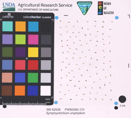 | | 2025 | | | | | | | Wild material | | 2192226 | W6 62528 |
| 20 | NA 89081 | 2024RJLPA-009 | Rosa carolina L. | Pennsylvania, United States | NA | | | 2024 | COLLECTED | 09/22/2024 | Lancaster and York Counties: outcrops along the Susquehanna River, accessed from the Historic Lock 12 parking lot off of Pennsylvania Road 372. | 39.81483500, -76.32762200 | 34 | Plants are growing from part-sun to full sun in crevices of the outcrops and where organic debris has accumulated in between boulders along the Susquehanna River. The sites range from nearly xeric to dry mesic, at least on the surface. Plants are generally growing 4-10 m above the normal flow of the river; however, the Holtwood Dam is less than 1 kilometer upstream and debris found trapped in the boulders indicates that there is periodic flooding, at least, in the lower zone of 4+ meters or so above normal river flow. This habitat has a diverse assemblage of deciduous trees and shrubs as well as abundant herbaceous taxa. Slope: 0 to 60 percent. Aspect: Northeast (generally). Geology: The underlying geology of this area is probably of lower Paleozoic age and characterized as the Octoraro Formation. It includes albite-chlorite schist, phyllite, some hornblende gneiss, and granitized members. Soils: The area where this species occurs is right on the edge of two soil zones that transition from the river’s edge to mesic conditions upslope. The first is generally referred to as Rock Outcrop. This terrestrial matrix in which plants grow is largely exposed underlying rock geology with accumulated outwash, rock decomposition, and organic debris buildup. The second is Mt. Airy (80%) and Manor (20%) Series soils, 25 to 60 percent slopes, extremely stony (MRF). (Source: California Soil Resource Lab/NRCS Official Soil Series Descriptions). EPA Ecoregion (Level III): Northern Piedmont (64). EPA Ecoregion (Level IV): Piedmont Uplands (64c). | Wild material | | 2169045 | NA 89081 |
| 21 | NA 89082 | 2024RJLPA-010 | Amorpha fruticosa L. | Pennsylvania, United States | NA | | | 2024 | COLLECTED | 09/22/2024 | Outcrops along the Susquehanna River, accessed from the Historic Lock 12 parking lot off of Pennsylvania Road 372. | 39.81481500, -76.32757900 | 34 | Plants are growing from part-sun to full sun in crevices of the outcrops and where organic debris has accumulated in between boulders along the Susquehanna River. The sites range from nearly xeric to dry mesic, at least on the surface. Plants are generally growing 4-10 m above the normal flow of the river; however, the Holtwood Dam is less than 1 kilometer upstream and debris found trapped in the boulders indicates that there is periodic flooding, at least, in the lower zone of 4+ meters or so above normal river flow. This habitat has a diverse assemblage of deciduous trees and shrubs as well as abundant herbaceous taxa. Slope: 0 to 25 percent. Aspect: Northeast (generally). Geology: The underlying geology of this area is probably of lower Paleozoic age and characterized as the Octoraro Formation. It includes albite-chlorite schist, phyllite, some hornblende gneiss, and granitized members. Soils: The area where this species occurs is right on the edge of two soil zones that transition from the river’s edge to mesic conditions upslope. The first is generally referred to as Rock Outcrop. This terrestrial matrix in which plants grow is largely exposed underlying rock geology with accumulated outwash, rock decomposition, and organic debris buildup. The second is Mt. Airy (80%) and Manor (20%) Series soils, 25 to 60 percent slopes, extremely stony (MRF). (Source: California Soil Resource Lab/NRCS Official Soil Series Descriptions). EPA Ecoregion (Level III): Northern Piedmont (64). EPA Ecoregion (Level IV): Piedmont Uplands (64c). | Wild material | | 2169046 | NA 89082 |
| 22 | NA 89083 | 2024RJLPA-012 | Rhododendron periclymenoides (Michx.) Shinners | Pennsylvania, United States | NA | | | 2024 | COLLECTED | 09/22/2024 | Outcrops along the Susquehanna River, accessed from the Historic Lock 12 parking lot off of Pennsylvania Road 372. | 39.81477400, -76.32807300 | 35 | Plants are growing from shade to part-sun and occasionally full sun in crevices of the outcrops and where organic debris has accumulated in between boulders along the Susquehanna River. The sites range from nearly xeric to mesic, at least on the surface. Plants are generally growing 4-10 m above the normal flow of the river; however, the Holtwood Dam is less than 1 kilometer upstream and debris found trapped in the boulders indicates that there is periodic flooding, at least, in the lower zone of 4+ meters or so above normal river flow. This habitat has a diverse assemblage of deciduous trees and shrubs as well as abundant herbaceous taxa. Slope: 0 to 60 percent. Aspect: Northeast (generally). Geology: The underlying geology of this area is probably of lower Paleozoic age and characterized as the Octoraro Formation. It includes albite-chlorite schist, phyllite, some hornblende gneiss, and granitized members. Soils: The area where this species occurs is right on the edge of two soil zones that transition from the river’s edge to mesic conditions upslope. The first is generally referred to as Rock Outcrop. This terrestrial matrix in which plants grow is largely exposed underlying rock geology with accumulated outwash, rock decomposition, and organic debris buildup. The second is Mt. Airy (80%) and Manor (20%) Series soils, 25 to 60 percent slopes, extremely stony (MRF). (Source: California Soil Resource Lab/NRCS Official Soil Series Descriptions). EPA Ecoregion (Level III): Northern Piedmont (64). EPA Ecoregion (Level IV): Piedmont Uplands (64c). | Wild material | | 2169047 | NA 89083 |
| 23 | NA 89084 | 2024RJLPA-013 | Physocarpus opulifolius (L.) Maxim. | Pennsylvania, United States | NA | | | 2024 | COLLECTED | 09/22/2024 | Outcrops along the Susquehanna River, accessed from the Historic Lock 12 parking lot off of Pennsylvania Road 372. | 39.81466300, -76.32833900 | 36 | Plants are growing from shade to part-sun where organic debris has accumulated in between boulders as well as further upslope in deeper mesic soils along the Susquehanna River. This habitat has a diverse assemblage of deciduous trees and shrubs as well as abundant herbaceous taxa. Slope: 10 to 25 percent. Aspect: Northeast (generally). Geology: The underlying geology of this area is probably of lower Paleozoic age and characterized as the Octoraro Formation. It includes albite-chlorite schist, phyllite, some hornblende gneiss, and granitized members. Soils: The area where this species occurs is right on the edge of two soil zones that transition from the river’s edge to mesic conditions upslope. The first is generally referred to as Rock Outcrop. This terrestrial matrix in which plants grow is largely exposed underlying rock geology with accumulated outwash, rock decomposition, and organic debris buildup. The second is Mt. Airy (80%) and Manor (20%) Series soils, 25 to 60 percent slopes, extremely stony (MRF). (Source: California Soil Resource Lab/NRCS Official Soil Series Descriptions). EPA Ecoregion (Level III): Northern Piedmont (64). EPA Ecoregion (Level IV): Piedmont Uplands (64c). | Wild material | | 2169048 | NA 89084 |
| 24 | NA 89085 | 2024RJLPA-014 | Rhododendron arborescens (Pursh) Torr. | Pennsylvania, United States | NA | | | 2024 | COLLECTED | 09/22/2024 | Outcrops along the Susquehanna River, accessed from the Historic Lock 12 parking lot off of Pennsylvania Road 372. | 39.81618100, -76.33069800 | 38 | Plants are growing from shade to part-sun and occasionally full sun in crevices of the outcrops and where organic debris has accumulated in between boulders along the Susquehanna River. The sites range from nearly xeric to mesic, at least on the surface. Plants are generally growing 4-10 m above the normal flow of the river; however, the Holtwood Dam is less than 1 kilometer upstream and debris found trapped in the boulders indicates that there is periodic flooding, at least, in the lower zone of 4+ meters or so above normal river flow. This habitat has a diverse assemblage of deciduous trees and shrubs as well as abundant herbaceous taxa. Slope: 0 to 75 percent. Aspect: Northeast (generally). Geology: The underlying geology of this area is probably of lower Paleozoic age and characterized as the Octoraro Formation. It includes albite-chlorite schist, phyllite, some hornblende gneiss, and granitized members. Soils: The area where this species occurs is right on the edge of two soil zones that transition from the river’s edge to mesic conditions upslope. The first is generally referred to as Rock Outcrop. This terrestrial matrix in which plants grow is largely exposed underlying rock geology with accumulated outwash, rock decomposition, and organic debris buildup. The second is Mt. Airy (80%) and Manor (20%) Series soils, 25 to 60 percent slopes, extremely stony (MRF). (Source: California Soil Resource Lab/NRCS Official Soil Series Descriptions). EPA Ecoregion (Level III): Northern Piedmont (64). EPA Ecoregion (Level IV): Piedmont Uplands (64c). | Wild material | | 2169049 | NA 89085 |
| 25 | NA 89086 | 2024RJLPA-015 | Ilex verticillata (L.) A. Gray | Pennsylvania, United States | NA | | | 2024 | COLLECTED | 09/22/2024 | Outcrops along the Susquehanna River, accessed from the Historic Lock 12 parking lot off of Pennsylvania Road 372. | 39.81656600, -76.33136600 | 38 | Plants are growing from part-sun to full sun in crevices of the outcrops and where organic debris has accumulated in between boulders along the Susquehanna River. The sites range from nearly xeric to dry mesic, at least on the surface. Plants are generally growing 4-10 m above the normal flow of the river; however, the Holtwood Dam is less than 1 kilometer upstream and debris found trapped in the boulders indicates that there is periodic flooding, at least, in the lower zone of 4+ meters or so above normal river flow. This habitat has a diverse assemblage of deciduous trees and shrubs as well as abundant herbaceous taxa. Slope: 0 to 10 percent. Aspect: Northeast (generally). Geology: The underlying geology of this area is probably of lower Paleozoic age and characterized as the Octoraro Formation. It includes albite-chlorite schist, phyllite, some hornblende gneiss, and granitized members. Soils: The area where this species occurs is right on the edge of two soil zones that transition from the river’s edge to mesic conditions upslope. The first is generally referred to as Rock Outcrop. This terrestrial matrix in which plants grow is largely exposed underlying rock geology with accumulated outwash, rock decomposition, and organic debris buildup. The second is Mt. Airy (80%) and Manor (20%) Series soils, 25 to 60 percent slopes, extremely stony (MRF). (Source: California Soil Resource Lab/NRCS Official Soil Series Descriptions). EPA Ecoregion (Level III): Northern Piedmont (64). EPA Ecoregion (Level IV): Piedmont Uplands (64c). | Wild material | | 2169050 | NA 89086 |
| 26 | NA 89087 | 2024RJLPA-016 | Hydrangea arborescens L. | Pennsylvania, United States | NA | | | 2024 | COLLECTED | 09/22/2024 | Outcrops along the Susquehanna River, accessed from the Historic Lock 12 parking lot off of Pennsylvania Road 372. | 39.81489000, -76.32912200 | 43 | Plants are growing in deep shade of the deciduous woodlands on outcrops and the steep slopes where organic debris and detritus has accumulated. This habitat has a diverse assemblage of deciduous trees and shrubs as well as abundant herbaceous taxa. Slope: 30 to 90 percent. Aspect: Northeast (generally). Geology: The underlying geology of this area is probably of lower Paleozoic age and characterized as the Octoraro Formation. It includes albite-chlorite schist, phyllite, some hornblende gneiss, and granitized members. (Source: Source: USGS Pennsylvania Geologic Map Data). Soils: The area where this species occurs is right on the edge of two soil zones that transition from the river’s edge to mesic conditions upslope. The first is generally referred to as Rock Outcrop. This terrestrial matrix in which plants grow is largely exposed underlying rock geology with accumulated outwash, rock decomposition, and organic debris buildup. The second is Mt. Airy (80%) and Manor (20%) Series soils, 25 to 60 percent slopes, extremely stony (MRF). (Source: California Soil Resource Lab/NRCS Official Soil Series Descriptions). EPA Ecoregion (Level III): Northern Piedmont (64). EPA Ecoregion (Level IV): Piedmont Uplands (64c). | Wild material | | 2169051 | NA 89087 |
| 27 | WLP 3348 | AS/VO/2023/074/284 | Viburnum opulus L. var. americanum Aiton | Minnesota, United States | NA |  | | 2023 | COLLECTED | 09/23/2023 | Between Itasca State Park and White Earth State Forest, from 0.75 to 2.5 miles north of State Highway 113. Along McKenzie Road and Anchor Hill Road, T143N R37W Sections 22, 28, 30 and 31. | 47.16689300, -95.42134000 | 515 | Understory of mixed forest in wetland complex. Near southern edge of transition zone from temperate to boreal forest. | Wild material | Variation was noted for timing of fall color with some plants still green and others nearing peak display. | 2159012 | WLP 3348 |
| 28 | NA 89233 | UK Arb. 2023-0059-A | Cladrastis kentukea (Dum. Cours.) Rudd | Kentucky, United States | NA | | | 2023 | COLLECTED | 08/22/2023 | Blue Sportsmen's League (land owner): trees growing on both sides of eroded dirt road from campground to Kentucky River. | 37.78777000, -84.65356000 | | Calcareous rocky woods, mid-slope. Slope: 20-30%. Aspect: Southwest. | Wild material | | 2158476 | NA 89233 |
| 29 | NA 89235 | UK Arb. 2023-0061-A | Cladrastis kentukea (Dum. Cours.) Rudd | Kentucky, United States | NA | | | 2023 | COLLECTED | 08/22/2023 | Tom Dorman State Nature Preserve: trees growing adjacent to west side of loop trail going down towards Kentucky River. | 37.77180000, -84.63011000 | | Calcareous, rocky woods, mid-slope down towards river. | Wild material | | 2158478 | NA 89235 |
| 30 | Ames 36155 | JDC/MM/2023/052/1084 | Monarda maxmedleyi J. J. N. Campb. & Floden | Kentucky, United States | NC7 |  | | 2023 | COLLECTED | 08/09/2023 | Star Gap Road between Red River and Campton Road located 3.0 miles north, northwest of Slade | 37.83158300, -83.72674500 | 265 | Edges of woods/roadsides. Localized to west and southeast facing slopes. | Wild material | Plants measuring 12-18" in height. Spreading vegetatively via rhizomes. Most specimens had pale pink flowers with some having white flowers. Peak flowering at collection site occurred near 29th of May (2023). | 2158360 | Ames 36155 |
| 31 | OPGC 8851 | AS/OF/2023/068/278 | Oenothera fruticosa L. subsp. glauca (Michx.) Straley | Kentucky, United States | OPGC |  | | 2023 | COLLECTED | 08/09/2023 | Star Gap Road between Red River and Campton Road located 3.0 miles north, northwest of Slade | 37.83158300, -83.72674500 | 260 | Edges of woods/roadsides. Localized to west and southeast facing slopes. | Wild material | Plants in nature measuring approximately 3.0' in height. Bright yellow flowers peaking in early June (central Kentucky) measuring approximately 1-2" across. | 2158361 | OPGC 8851 |
| 32 | NA 86885 | RJL2021PA-004 | Ilex verticillata (L.) A. Gray | Pennsylvania, United States | NA | | | 2021 | COLLECTED | 11/16/2021 | Plants growing in woodlands along a small unnamed creek corridor dumping into the Middle Branch White Clay Creek in Goddard Park, West Grove Pennsylvania, off of Wickerton Road, Chester County. | 39.81063861, -75.82750806 | 124 | Plants are growing in a range of habitats from mesic woodlands to saturated streamside settings of deciduous woodlands that drain toward the Middle Branch White Clay Creek. Plants grow in high understory shade with dappled to indirect sunlight. The only female (fruiting) plants were found in areas along the creek where soils are moist to saturated. Numerous male specimens were found in the areas described above. Soils: Soils found in the areas where this collection was made are comprised primarily of Baile silt loam (Ba), Hatboro silt loam (Ha), and Glenelg silt loam, 8 to 15 percent slopes (GgC). Baile silt loam consists of very deep, poorly drained, moderately low to moderately high saturated hydraulic conductivity, soils on upland depressions and footslopes that were formed in local alluvium over residuum from acid crystalline rocks, chiefly mica schist and granitized schist and gneiss; slope ranges from 0 to 8 percent. Hatboro silt loam consists of very deep and poorly drained soils formed in deposited alluvium derived from metamorphic and crystalline rock. They are on flood plains. Slopes range from 0 to 3 percent. Glenelg silt loam, 8 to 15 percent slopes consists of very deep, well drained soils formed in residuum weathered from micaceous schist on uplands of the Blue Ridge and the Northern Piedmont. This soil is undifferentiated, mostly poorly drained sandy bottomland soils intermingled with decomposing organic litter and eroded silts and clays due to erosion. Slope: 0 to 15% Aspect: Variable. | Wild material | | 2123125 | NA 86885 |
| 33 | WLP 1731 | RJL2021PA-001 | Viburnum acerifolium L. | Pennsylvania, United States | NA | | | 2021 | COLLECTED | 11/05/2021 | Plants growing in woodlands above a small unnamed creek that dumps into the Middle Branch White Clay Creek in Goddard Park, West Grove Pennsylvania, off of Wickerton Road, Chester County. | 39.80462083, -75.82888750 | 103 | Plants growing in a mesic, well-drained habitat of deciduous woodlands, for the most part, above the riparian zone that drains toward a small unnamed creek that feeds into the Middle Branch White Clay Creek. Plants are growing in high understory shade with very little direct sun during most of the day. The remnant woodlands exist mostly along the steep slopes, wetlands and seeps of seasonal and year-round creeks flowing into the Middle Branch White Clay Creek. The woodlands are bordered by numerous housing developments and land converted to meadows; hence there is significant first order edge that is heavily impacted by invasive plant intrusion. Soils: Soils are classified as Glenelg silt loam, 8 to 15% slopes (GgC); this series consists of very deep, well drained soils formed in residuum weathered from micaceous schist on uplands of the Blue Ridge and the Northern Piedmont. Saturated hydraulic conductivity is moderately high in the subsoil and moderately high to high in the substratum. This upper horizon of this soil is undifferentiated, mostly poorly drained sandy bottomland soils intermingled with decomposing organic litter and eroded silts and clays due to erosion. Slope: 8 to 15% Aspect: West. | Wild material | | 2123080 | WLP 1731 |
| 34 | WLP 1732 | RJL2021PA-002 | Viburnum prunifolium L. | Pennsylvania, United States | NA | | | 2021 | COLLECTED | 11/05/2021 | Plants growing in woodlands along a small unnamed creek corridor dumping into the Middle Branch White Clay Creek in Goddard Park, West Grove Pennsylvania, off of Wickerton Road, Chester County. | 39.80462083, -75.82888750 | 102 | Plants are growing in a range of habitats from drier upland woods to moist creekside settings of deciduous woodlands that drain toward the Middle Branch White Clay Creek. Plants grow in part shade to high understory shade with dappled to indirect direct sunlight. Plants achieve their largest size and fruiting potential in part sun of the riparian zone of the creek where woodland canopy is thinner. Soils: Soils found in the areas where this collection was made are comprised primarily of flood plain Hatboro silt loam (Ha) and well-drained, upland Glenelg silt loam, 8 to 15 percent slopes (GgC). Hatboro silt loam consists of very deep and poorly drained soils formed in deposited alluvium derived from metamorphic and crystalline rock. They are on flood plains. Slopes range from 0 to 3 percent. Glenelg silt loam, 8 to 15 percent slopes consists of very deep, well drained soils formed in residuum weathered from micaceous schist on uplands of the Blue Ridge and the Northern Piedmont. This soil is undifferentiated, mostly poorly drained sandy bottomland soils intermingled with decomposing organic litter and eroded silts and clays due to erosion. Slope: 0 to 15% Aspect: Variable. | Wild material | | 2123098 | WLP 1732 |
| 35 | WLP 1733 | RJL2021PA-003 | Viburnum dentatum L. | Pennsylvania, United States | NA | | | 2021 | COLLECTED | 11/05/2021 | Plants growing in woodlands along a small unnamed creek corridor dumping into the Middle Branch White Clay Creek in Goddard Park, West Grove Pennsylvania, off of Wickerton Road, Chester County. | 39.80522167, -75.82928139 | 107 | Plants are growing in a range of habitats from mesic woodland to moist creekside settings of deciduous woodlands that drain toward the Middle Branch White Clay Creek. Plants grow in high understory shade with dappled to indirect sunlight. Soils: Soils found in the areas where this collection was made are comprised primarily of flood plain Hatboro silt loam (Ha) and well-drained, upland Glenelg silt loam, 8 to 15 percent slopes (GgC). Hatboro silt loam consists of very deep and poorly drained soils formed in deposited alluvium derived from metamorphic and crystalline rock. They are on flood plains. Slopes range from 0 to 3 percent. Glenelg silt loam, 8 to 15 percent slopes consists of very deep, well drained soils formed in residuum weathered from micaceous schist on uplands of the Blue Ridge and the Northern Piedmont. This soil is undifferentiated, mostly poorly drained sandy bottomland soils intermingled with decomposing organic litter and eroded silts and clays due to erosion. Slope: 0 to 15% Aspect: Variable. | Wild material | | 2123124 | WLP 1733 |
| 36 | WLP 1747 | RJL2021PA-005 | Rosa palustris Marshall | Pennsylvania, United States | NA | | | 2021 | COLLECTED | 11/20/2021 | Plants growing in wetland seeps surrounded by mown hayfields just west of the Middle Branch White Clay Creek in Goddard Park, West Grove Pennsylvania, off of Wickerton Road, Chester County. | 39.80090528, -75.82383250 | 100 | Habitat Notes: Plants are growing in permanently saturated to moist soils in wetland habitats. Plants appear to be obligate wetland plants and are found only in permanent to nearly permanent wet habitats observed. Generally, the shrubs are found in part shade to full sun. Soils: Soils found in the areas where this collection was made are comprised primarily of Hatboro silt loam (Ha). Hatboro silt loam consists of very deep and poorly drained soils formed in deposited alluvium derived from metamorphic and crystalline rock. They are on flood plains. Slopes range from 0 to 3 percent. Slope: 0 to 3% Aspect: Variable. | Wild material | | 2123715 | WLP 1747 |
| 37 | Ames 35734 | Ledges State Park | Teucrium canadense L. | Iowa, United States | NC7 |  | | 2021 | COLLECTED | 08/23/2021 | Ledges State Park located approximately 4.75 miles south of Boone T83N R26W Sec. 16 & 21 | 41.99262400, -93.87724800 | 330 | Edges of woods | Wild material | | 2120338 | Ames 35734 |
| 38 | W6 59234 | CBG-10548 | Dasistoma macrophyllum (Nutt.) Raf. | Illinois, United States | W6 | | | 2021 | | | | | | | Wild material | Received as Dasistoma macrophylla. Plant numbers estimated. Few this year; abundant other years in numerous locations. | 2120206 | W6 59234 |
| 39 | Ames 35650 | Bixby | Pinus strobus L. | Iowa, United States | NC7 |  | | 2021 | COLLECTED | 03/04/2021 | Bixby State Preserve on slopes above Bear Creek, located approximately 6.25 miles east of Strawberry Point, T91N R5W SE1/4 Sec. 22 | 42.67534800, -91.41301000 | 324 | Cliff edges and steep slopes. | Wild material | The native range of Pinus strobus is concentrated in the northeastern United States extending south into the northern edge of Georgia and west to central Minnesota. In Iowa, there are scattered populations in a few northeastern counties and also a very small disjunct population in central Iowa (Hardin County, Ames 32758) and also one in southeastern Iowa (Muscatine County, Ames 35635). This accession represents genetics from "legacy" specimens from northeastern Iowa in Bixby State Preserve (Clayton County). Genetics from this site likely represents the extreme southwestern edge of the species native range. Genetics may likely be adapted/tolerant to drought and also late winter/early spring extreme temperature fluctuations. Accession was collected as scions in winter to capture genetics that are of known origin. | 2113352 | Ames 35650 |
| 40 | WLP 2045 | MARS-1014 | Viburnum lentago L. | New York, United States | NA | | | 2019 | COLLECTED | 09/13/2019 | Dutchess County; ; Rt. 199 right-of-way, Barrytown/Tivoli. | | 152 | Roadside right-of-way in full shade; growing in moist clay-loam soil. | | Seeds collected from 20 individuals in a population of 25+ plants, spread over an area 400 meters by 400 meters in size; scattered distribution. Seed maturation: middle. | 2109194 | WLP 2045 |
| 41 | WLP 1685 | JDC/RS/2019/036/915 | Rosa setigera Michx. | Iowa, United States | NA |  | | 2019 | COLLECTED | 10/17/2019 | Ledges State Park located approximately 4.75 miles south of Boone, just south of the Oakwoods Shelter/Picnic area, T83N R26W NE1/4 NE1/4 and also NW1/4 NE1/4 Sec. 21, Boone County | 41.99262400, -93.87724800 | 330 | Edges of woods (adjacent to prairie) and also within 20-25 yards from woods in prairie. Noted in east, west, and south-facing edges of woods (no specimens noted on north-facing woodland edges) | Wild material | Woody shrub/vine stretching up to 12' in length. Alternate compound leaves usually consisting of five lealets. Leaf rachis and stipule margins glandular. Mature hypanthium and pedicel with stipitate glandular hairs. Mature hypanthium mostly bright to dark red in color with a few dark orange noted at time of harvest (17 October 2019). Leaves rather to somewhat glossy. This collection represents genetics from the northwestern edge of the species range, likely suggesting good cold-hardiness (USDA Zone 5a). | 2097769 | WLP 1685 |
| 42 | Ames 35232 | Ames 35232 | Ptelea trifoliata L. | Illinois, United States | NC7 |  | | 2019 | COLLECTED | 10/01/2019 | Rock Creek watershed located approximately 4.5 miles southwest of Athens, T17N R6W SE1/4 SW1/4 Sec. 8 | 39.93164600, -89.80193000 | 159 | Creek banks, floodplain, and fence rows (north and west facing slopes) | Wild material | | 2097768 | Ames 35232 |
| 43 | Ames 35226 | Ocoee Gorge | Monarda austroappalachiana Floden | Tennessee, United States | NC7 |  | | 2019 | COLLECTED | 09/12/2019 | Located just east of Lake Ocoee along highway 74 approximately 9.8 miles east, southeast of Ocoee, Polk County | 35.09659000, -84.54762000 | 269 | Steep (some vertical) rocky cliffs and bluffs, predominately shale. | Wild material | Described by Aaron Floden (2015) as an erect perennial (30-50 cm tall) with a strong Oregano (thymol) scent, minute retrorse to spreading trichomes at internodes and large, emaculate, white corollas. Typically flowers in late May into early June, which is earlier than both M. fistulosa and M. clinopodia where sympatric. Species is endemic to the Southern Appalachians (northern Georgia, southwest North Carolina, and southeast Tennessee) and limited to calcareous phyllite and limestone, glade-like/talus slope habitats. | 2097762 | Ames 35226 |
| 44 | Ames 35216 | Potato Creek SP | Monarda sp. | Indiana, United States | NC7 |  | | 2019 | COLLECTED | 09/02/2019 | Potato Creek State Park located approximately 2.6 miles northeast of North Liberty, T36N R1E extreme eastern edge of NW 1/4 SW 1/4 Sec. 23. | 41.55439400, -86.38375900 | 222 | Degraded floodplain, along sides of elevated road bed. | Wild material | This taxa is currently undescribed and according to Campbell and Medley in The atlas of vascular plants in Kentucky (Accessed 06 September 2019) was provisionally named Monarda serotina by R.T. Simmers. Described as a broad-leaved form of M. fistulosa, generally intermediate between M. fistulosa and M. clinopodia, with probable hybrid origin. Typcial habitat is mesic woods and edges on lowlands. In contrast to M. fistulosa, this taxon has longer petioles (usually 2-3 cm versus 0.5-2.0 cm), lower leaf surfaces with scattered spreading hairs, and corollas are paler pink at tips to almost white with peak flowering occurring prior to M. fistulosa by approximately 1-2 weeks. Leaves are rather rugose, where upper leaf tissue between veins is visibly raised. This accession represents genetics from northern Indiana (Potato Creek State Park). Plants at the collection site in nature peaked flowering near 8 July 2019 where flower colors were more lavender in sun but pale in shade (Namestnik, S., personal communication, 15 July 2020). Peak fruiting occurs mid-August. Average height of plants sampled in nature estimated at 4.5' in height. | 2097752 | Ames 35216 |
| 45 | Ames 34309 | JDC/ES/2018/036/849 | Echinacea sanguinea Nutt. | Texas, United States | NC7 |  | | 2018 | COLLECTED | 07/18/2018 | Private property located 4.35 miles south, southwest of Daingerfield off County Road 2215. Locally known as "Kennedy Mountain", Morris County | 32.97217700, -94.74721600 | 152 | Open, dry, recently clear cut area. | Wild material | Plants in peak flower on 22 May 2018 and seeds likely reached peak maturity around 1 July 2018. Peduncles at time of collection (17 July 2018) were showing 6-18" of brown/dead tissue. Plants ranging from 2-4.0' in height. | 1964616 | Ames 34309 |
| 46 | NA 87957 | NEWFS-367 | Viburnum dentatum L. | Massachusetts, United States | NA |  | | 2017 | | | | | | | Wild material | | 1954735 | NA 87957 |
| 47 | Ames 34037 | JDC/MF/2017/059/813 | Monarda fistulosa L. | Iowa, United States | NC7 |  | | 2017 | COLLECTED | 10/26/2017 | Private property located approximately 6.2 miles west, southwest of Grinnell, T80N R17W SE 1/4 NE 1/4 NW 1/4 Sec. 21, Jasper County | 41.72810000, -92.83508100 | 285 | Prairie remnant, never plowed. Small (e.g. less than 1 acre), localized area of mixed woody (tree/shrub), grass, and forbs. | Wild material | Population sampled at collection site consisted of approximately half of the specimens being void of foliage likely due to susceptibility to mildew, while the remaining half still had some green foliage at time of sampling (10/26/2017). Plants sampled varied in height, typically 3' in height, but a few specimens measuring 5' in height. | 1954326 | Ames 34037 |
| 48 | Ames 33981 | JDC/FQ/2017/036/790 | Fraxinus quadrangulata Michx. | Kentucky, United States | NC7 |  | | 2017 | COLLECTED | 07/10/2017 | Two areas sampled just south and southwest of Wilmore, including Sally Brown Preserve/Bowmans Bend on south side of Kentucky River, Garrard County and along Corman Lane approximately 0.86 miles from junction with Route 1268 on north side of Kentucky River, Jessamine County | 37.80093600, -84.70302000 | 231 | Deciduous forest, rocky substrate. | Wild material | | 1950064 | Ames 33981 |
| 49 | WLP 1179 | NA 83874 | Frangula caroliniana (Walter) A. Gray | Kentucky, United States | NA | | | 2016 | COLLECTED | 09/26/2016 | Floracliff Nature Sanctuary & Trail's End. | 38.01100000, -84.51700000 | 255 | Dense woodland. | | | 1950543 | WLP 1179 |
| 50 | Ames 32963 | JDC/BA/2015/049/706 | Betula alleghaniensis Britton | Iowa, United States | NC7 | | | 2015 | COLLECTED | 09/14/2015 | Bixby State Preserve, T91N R5W extreme southern edge of Sec. 23 basically restricted to W 1/2 of Sec. 23. | 42.67470300, -91.39917300 | 308 | North-facing algific talus slope (45-60 degrees) adjacent to Bear Creek. Moist deciduous woods. Growing in association with Diervilla lonicera, Hamamelis virginiana, Corylus sp., Viburnum opulus var. americanum, Cornus rugosa (few), Cornus alternifolia, Fraxinus nigra, Quercus rubra, Viburnum lentago, Ribes sp., Rubus idaeus subsp. strigosus, Rhamnus alnifolia (few), Rosa sp., Taxus canadensis, Prunus virginiana, Impatiens sp., Dirca palustris, and Pinus strobus (few). | Wild material | | 1927433 | Ames 32963 |
| 51 | Ames 32965 | JDC/BA/2015/051/708 | Betula alleghaniensis Britton | Iowa, United States | NC7 | | | 2015 | COLLECTED | 09/15/2015 | Yellow River State Forest, T97N R4W northern edge of SW 1/4 NW 1/4 Sec. 36 | 43.17782100, -91.26584600 | 227 | North-facing algific talus slope (45-60 degrees) adjacent to Paint Creek. Moist deciduous woods. Growing in association with Fraxinus nigra, Staphylea trifolia, Carpinus caroliniana, Quercus rubra, Acer saccharum, Cornus alternifolia, Amelanchier arborea, Ostrya virginiana, Viburnum opulus var. americanum, Cornus rugosa, Cornus alternifolia, Zanthoxylum americanum, Viburnum rafinesqueanum, Cypripedium pubescens, Ribes sp.,Corylus sp., Juniperus virginiana, Dirca palustris, Ulmus thomasii, Prunella vulgaris, Diervilla lonicera, Quercus macrocarpa, Carya cordiformis, Taxus canadensis, Tilia americana, Adiantum pedatum, and Aconitum noveboracense. | Wild material | | 1927435 | Ames 32965 |
| 52 | Ames 32966 | JDC/VA/2015/052/709 | Viburnum opulus L. var. americanum Aiton | Iowa, United States | NC7 |  | | 2015 | COLLECTED | 09/15/2015 | Yellow River State Forest, T97N R4W northern edge of SW ¼ NW ¼ Sec. 36. | 43.17778200, -91.26642800 | 239 | North-facing algific talus slope (45-60 degrees) adjacent to Paint Creek. Moist deciduous woods. | Wild material | Formerly known as Viburnum trilobum, American highbush cranberry (V. opulus var. americanum) is a North American native shrub that is utilized as an important ornamental and conservation plant that is also harvested as a minor fruit crop (jams/jellies). In nature, this variety is generally found in moist habitats typically along stream banks and swamps where ample moisture is readily available. The native range of V. opulus var. americana is concentrated in the northeastern United States and into Canada (Little, E. L. Jr. 1977). Attractive ornamental characteristics includes showy lacecap flowers in spring and bright red fruits and foliage in the fall. Fruits are tart with a hint of sweetness. The European highbush cranberry (V. opulus var. opulus) is nearly identical to American highbush cranberry other than small glands (<1 mm) on the petiole making the exact determination very challenging resulting in common misidentifications. A major difference between the American and European highbush cranberries is that the European variety produces unpalatable fruit. Recent research has shown that American and European highbush cranberries are genetically distinct and that plants of hybrid origin are uncommon (Tork et al. 2025). Vigorous early spring growth and good tolerance to late spring frosts. Genetic analysis from Tork et al. 2025 confirmed that genetics of this accession represents American highbush Cranberry (Viburnum opulus var. americanum). This accession represents genetics from northeast Iowa and thus the extreme western edge of the species native range. | 1927436 | Ames 32966 |
| 53 | DDIO 266 | JDC/DV/2014/050/552 | Diospyros virginiana L. | Missouri, United States | DAV | | | 2015 | COLLECTED | 09/19/2014 | PIKE COUNTY: Buffalo Knob along MO highway WW. | 39.27421400, -91.04618000 | 270 | Dry woods, rocky south-facing steep slope. Growing in association with Quercus muehlenbergii, Fraxinus americana, Fraxinus quadrangulata, Juniperus virginiana, Ulmus sp., Cercis canadensis, and Lonicera maackia. | Wild material | | 1927163 | DDIO 266 |
| 54 | WLP 683 | JDC/AA/2015/040/697 | Amelanchier arborea (F. Michx.) Fernald | Iowa, United States | NA |  | | 2015 | COLLECTED | 06/16/2015 | Elk Rock State Park approximately 6.25 miles north of Knoxville. Extreme northern point of park. T76N R19W SW 1/4 SW 1/4 Sec. 5 Marion County | 41.40879000, -93.07958000 | 219 | Relatively steep, north-facing slopes (55 degrees). Growing in association with Diervilla lonicera (rare), Tilia americana (large and abundant), Rosa multiflora, Lonicera maackia, Eleagnus umbellata, Quercus rubra, Viburnum rafinesqueanum, Sanguinaria canadensis, Staphylea trifolia, and Ostrya virginiana. | Wild material | Fruits harvested at peak maturity. Numerous fruits were soft and/or dropped when distrurbed. Fruit color ranged from dark red with tinge of blue/purple to light red. Fruit diameter averaged 10.28 mm (0.83 stdev), range min 9.00 mm to max 12.00 mm (random sample of 20 fruits). Stalk length (fruits) averaged 22.08 mm (5.28 stdev), range min 13.89 mm to max 35.00 mm (random sample of 20 fruits with intact stalks). | 1926845 | WLP 683 |
| 55 | WLP 1101 | JDC/CO/2015/036/692 | Cotinus obovatus Raf. | Oklahoma, United States | NA |  | | 2015 | COLLECTED | 05/21/2015 | T16N R20E W 1/2 Sec. 18 Wagoner and Cherokee Counties. Fort Gibson Lake Dam. | 35.86228100, -95.22575600 | 170 | Growing on shallow, rocky soils in association with Carya illinoinensis, Quercus muehlenbergii, Cornus sp., Cercis canadensis, Fraxinus americana, Platanus occidentalis, Ulmus sp., Diospyros virginiana, Sapindus saponaria var. drummondii, Lonicera sempervirens, Smilax sp., Toxicodendron radicans, and Robinia pseudoacacia. | Wild material | | 1926263 | WLP 1101 |
| 56 | Ames 32903 | APS/GD/2015/031/213 | Gymnocladus dioicus (L.) K. Koch | Oklahoma, United States | NC7 |  | | 2015 | COLLECTED | 03/19/2015 | Osage County: Arkansas River watershed area known as Souters Bend, T21N R7E. Keystone Wildlife Management Area (John Lowery Unit) approximatley 3 miles west of Cleveland. | 36.30185300, -96.53051000 | 222 | Floodplain, but one specimen sampled was located on dry, rocky (large boulders) bluff. | Wild material | | 1925369 | Ames 32903 |
| 57 | Ames 34280 | MARSB-073 | Monarda fistulosa L. | New Jersey, United States | NC7 |  | | 2015 | COLLECTED | 08/27/2013 | Sparta Mountain WMA near Ogdensburg, Sussex County | 41.06376000, -74.58098000 | 1261 | Utility powerline cut. | Wild material | | 1922924 | Ames 34280 |
| 58 | Ames 31516 | JDC/CR/2012/014/407 | Cornus rugosa Lam. | Iowa, United States | NC7 |  | | 2012 | COLLECTED | 07/13/2012 | Bluffton Fir State Preserve, SW 1/4 of Section 10, T99N, R9W, Bluffton Quad, near Bluffton, Winneshiek County. | 43.41080200, -91.93845200 | 343 | Mixed hardwood forest. Very steep, northwest-facing slope. | Wild material | | 1903743 | Ames 31516 |
| 59 | Ames 31519 | JDC/FQ/2012/028/421 | Fraxinus quadrangulata Michx. | Iowa, United States | NC7 |  | | 2012 | COLLECTED | 07/20/2012 | Along Twin Rivers Drive, NE 1/4 of Section 34, T65N, R5W, Keokuk Quad, just southwest of Keokuk, Des Moines County. | 40.38649700, -91.42619300 | 182 | Dry woods. Steep south and southwest-facing slopes. | Wild material | | 1903746 | Ames 31519 |
| 60 | Ames 31526 | JDC/FQ/2012/035/428 | Fraxinus quadrangulata Michx. | Indiana, United States | NC7 |  | | 2012 | COLLECTED | 07/23/2012 | Along Trailhead #1, Charlestown State Park, near Charlestown, Clark County. | 38.44706000, -85.64315400 | 180 | Open grown specimens in glade, and also localized population amongst dense canopy forest on southeast-facing slope. Very shallow soils. | Wild material | | 1903753 | Ames 31526 |
| 61 | Ames 31528 | JDC/FQ/2012/037/430 | Fraxinus quadrangulata Michx. | Indiana, United States | NC7 |  | | 2012 | COLLECTED | 07/24/2012 | Along Highway 52, N 1/2 of Section 19, T9N, R2W, Brookville Quad, approximately 0.5 to 1 mile west of Brookville, Franklin County. | 39.43205200, -85.02163400 | 209 | Roadside collection. South and southeast-facing slopes. | Wild material | | 1903755 | Ames 31528 |
| 62 | Ames 31529 | JDC/FQ/2012/038/431 | Fraxinus quadrangulata Michx. | Indiana, United States | NC7 |  | | 2012 | COLLECTED | 07/24/2012 | Lick Creek Summit Nature Preserve, NW 1/4 of Section 23, T13N, R2W, Richmond Quad, near Richmond, Wayne County. | 39.78453000, -84.95276400 | 267 | Dry woods. Bluffs. Shallow soils. | Wild material | | 1903756 | Ames 31529 |
| 63 | Ames 29506 | JDC-CA-2008-003 | Cornus alternifolia L. f. | Iowa, United States | NC7 |  | | 2008 | COLLECTED | 07/20/2008 | Tower Rock Park, N edge of SE 1/4 of SW 1/4 of Section 28, T88N, R19W, Steamboat Roak Quad, Steamboat Rock, Hardin County. | 42.40111111, -93.07166667 | 292 | Eroding (burnt orange) sandstone cliff, south side of Iowa River; mostly shaded; near base of slope with northern aspect; sand and organic matter above cliff; well drained. | Wild material | | 1782028 | Ames 29506 |
| 64 | Ames 27329 | 34 | Ptelea trifoliata L. | Iowa, United States | NC7 |  | | 2003 | COLLECTED | 09/24/2003 | Bluff Park, Keokuk, South of Park Street at G, T65N R5W, Section 35, Keokuk Quad. | 40.38861111, -91.40277778 | 194 | Bluff edge along Mississippi River. Sunny. 25% slope with a southern aspect. Soil well to good drainage. | Wild material | | 1649675 | Ames 27329 |
| 65 | Ames 27962 | Quercus Wilderness Area | Amelanchier arborea (F. Michx.) Fernald | Iowa, United States | NC7 |  | | 2003 | COLLECTED | 05/26/2003 | Quercus Wilderness Area located 6.75 miles south, southwest of Oskaloosa, T74N R16W SE ¼ NE ¼ of Sec. 23. | 41.19888889, -92.66111111 | 244 | Mature woods on very sandy soils. Typically restricted to east, west or south facing slopes at either summits or mid-slopes. | Wild material | The native range of Amelanchier arborea is concentrated in the eastern half of the U.S. (Little, 1977). This accession represents a collection of A. arborea germplasm from the western edge of the species native range, specifically the southern portion of Iowa. As of 2025, the top ten largest specimens in the state of Iowa are located at Quercus Wilderness where this accession was collected. Iowa’s largest specimen of A. arborea specimen at Quercus Wilderness was measured at 14.17" DBH, 51.83’ in height, and 27.00’ average crown spread for a total of 102.955 points (Rouw, M., personal communication, 12 December 2023). Fall color (orange-red) tends to peak in the middle of September (Iowa) with peak fruiting occurring in early May. Bark smooth, grey. | 1700483 | Ames 27962 |