| 0 | NA 88406 | NV040-340 | Mahonia repens (Lindl.) G. Don | Nevada, United States | NA |  | | 2019 | | | | | | | Wild material | | 2094591 | NA 88406 |
| 1 | NA 88405 | NM018-33 | Mahonia repens (Lindl.) G. Don | New Mexico, United States | NA | | | 2017 | | | | | | | Wild material | | 1947005 | NA 88405 |
| 2 | NA 88404 | CA330-151 | Mahonia repens (Lindl.) G. Don | California, United States | NA | | | 2015 | | | | | | | Wild material | | 1930484 | NA 88404 |
| 3 | WLP 2298 | MARE11-SOS-CO932-264-11 | Mahonia repens (Lindl.) G. Don | Colorado, United States | NA |  | | 2012 | COLLECTED | 2011 | | | | | Wild material | | 1905085 | WLP 2298 |
| 4 | WLP 2295 | MARE11-SOS-UT931-432-10 | Mahonia repens (Lindl.) G. Don | Utah, United States | NA |  | | 2011 | COLLECTED | PRE 03/2011 | | | | | Wild material | | 1865270 | WLP 2295 |
| 5 | NA 80378 | NA 80378 | Mahonia repens (Lindl.) G. Don | Nebraska, United States | NA | | | 2010 | COLLECTED | 08/02/2010 | Oglala National Grassland, Upper Sandy Creek | 42.80085000, -103.59591000 | 1293 | Uphill from creek under Pinus ponderosa | | | 1952925 | NA 80378 |
| 6 | WLP 2292 | ID930-B20 | Mahonia repens (Lindl.) G. Don | Idaho, United States | NA |  | | 2009 | COLLECTED | 08/09/2007 | U.S. Forest Service land; about 11 miles north of Boise on Bogus Basin Road, then east on unmarked dirt road about 1 mile. | 43.73605000, -116.10083000 | 1693 | Open Pinus ponderosa/Pseudotsuga menziesii forest on mountain slope. Land generally used for recreation. Soil is light brown/tan sandy loam. | Wild material | | 1802200 | WLP 2292 |
| 7 | WLP 1392 | NA 63127 | Mahonia repens (Lindl.) G. Don | South Dakota, United States | NA | | | 1991 | COLLECTED | PRE 10/19/1990 | Black Hills National Forest. | | | | | | 1922937 | WLP 1392 |
| 8 | PI 660834 | R. missouriense HDF-2007-098B | Ribes missouriense Nutt. | Nebraska, United States | COR |  | | 2007 | COLLECTED | 07/10/2007 | Dawes County East Ash Canyon, Pine Ridge Trail | 42.61666667, -103.19388889 | 1433 | dry open, mixed deciduous coniferous creek canyon bottom associated plants: Celtis, Prunus, Pinus ponderosa, Apocynium, Mahonia repens | Wild material | | 1733150 | PI 660834 |
| 9 | W6 62806 | DCO00-M33 | Solidago simplex Kunth | Colorado, United States | W6 |  | | 2025 | | | | | | | Wild material | Combined DCO00-C16, DCO00-C20, DCO00-C31, DCO00-C32, DCO00-33, DCO00-C34, DCO00-C36 together under DCO00-M33. Data on this data sheet is only for the population at the original collection number DCO00-33, information for additional combined collections captured in SOS database. | 2193103 | W6 62806 |
| 10 | W6 62848 | DMT01-15 | Erigeron speciosus (Lindl.) DC. | Montana, United States | W6 |  | | 2025 | | | | | | | Wild material | | 2193145 | W6 62848 |
| 11 | W6 62849 | DMT01-16 | Monarda fistulosa L. | Montana, United States | W6 |  | | 2025 | | | | | | | Wild material | Strongest collection happen on south facing slopes, with open canopy and drainage. Large population also on ridge top | 2193146 | W6 62849 |
| 12 | W6 62858 | DMT01-5 | Monarda fistulosa L. | Montana, United States | W6 |  | | 2025 | | | | | | | Wild material | | 2193155 | W6 62858 |
| 13 | W6 61240 | NV060-10 | Poa secunda J. Presl | Nevada, United States | W6 | 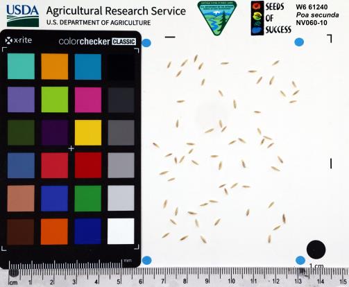 | | 2023 | | | | | | | Wild material | POSE was golden and nearing the end of reproduction when collection was made. Height varied from 4 inches to 1.4 ft. Sheep grazing onsite. | 2142195 | W6 61240 |
| 14 | W6 59647 | UT020-89 | Poa secunda J. Presl | Utah, United States | W6 | | | 2021 | | | | | | | Wild material | Perennial bunchgrass growing in tufts with a reddish tint or golden hue to stems. Specimens here were relatively tall and healthy, growing along a south-facing slope within the Raft River Mountains. Extremely dense population, dominating the landscape at the upper elevations of the slope. | 2120812 | W6 59647 |
| 15 | W6 59650 | UT020-92 | Leymus cinereus (Scribn. & Merr.) Á. Löve | Utah, United States | W6 | | | 2021 | | | | | | | Wild material | Perennial bunchgrass forming tall, sprawling clumps with numerous inflorescences. Plant height averaged 5 ft and plants here appeared healthy, but cattle grazing was particularly heavy in the area, so most of the plants had been trampled upon and chewed down. Population densest in the flat, open, wet bottom of the canyon, and sparser along the drier surrounding toe-slopes. | 2120815 | W6 59650 |
| 16 | W6 59734 | WY090-199 | Eriogonum umbellatum Torr. | Wyoming, United States | W6 | | | 2021 | | | | | | | Wild material | Umbel inflorescence with cream and pink flowers. Leaves green and sometimes reddish. Mat forming. | 2120899 | W6 59734 |
| 17 | W6 58377 | CO932-376 | Cercocarpus montanus Raf. | Colorado, United States | W6 | | | 2020 | | | | | | | Wild material | Achene with plumose style. Leaves green above, white-glaucous below, alternate and with a lobed margin. Bark is gray. | 2109940 | W6 58377 |
| 18 | OPGC 7509 | NV040-341 | Chrysothamnus viscidiflorus (Hook.) Nutt. subsp. viscidiflorus | Nevada, United States | OPGC |  | | 2019 | | | | | | | Wild material | | 2094592 | OPGC 7509 |
| 19 | OPGC 7865 | NV040-348 | Dieteria canescens (Pursh) Nutt. var. canescens | Nevada, United States | OPGC |  | | 2019 | | | | | | | Wild material | | 2094599 | OPGC 7865 |
| 20 | W6 56779 | NV040-333 | Cercocarpus ledifolius Nutt. ex Torr. & A. Gray | Nevada, United States | W6 |  | | 2019 | | | | | | | Wild material | | 2094585 | W6 56779 |
| 21 | W6 56791 | NV040-346 | Hackelia patens (Nutt.) I. M. Johnst. | Nevada, United States | W6 |  | | 2019 | | | | | | | Wild material | | 2094597 | W6 56791 |
| 22 | OPGC 7836 | SOS-NV930A-19 | Dieteria canescens (Pursh) Nutt. var. canescens | Nevada, United States | OPGC |  | | 2019 | | | | | | | Wild material | Machaeranthera canescens | 2091608 | OPGC 7836 |
| 23 | OPGC 7137 | UT080-158 | Apocynum androsaemifolium L. | Utah, United States | OPGC |  | | 2015 | | | | | | | Wild material | | 1926970 | OPGC 7137 |
| 24 | OPGC 6183 | MT060-37 | Sedum lanceolatum Torr. | Montana, United States | OPGC |  | | 2015 | | | | | | | Wild material | | 1926783 | OPGC 6183 |
| 25 | WLP 2207 | AMALA-SOS-WY040-108-11 | Amelanchier alnifolia (Nutt.) Nutt. ex M. Roem. var. alnifolia | Wyoming, United States | NA |  | | 2012 | COLLECTED | 08/23/2011 | Approximately 0.3 mi NE of Trout Creek, 1.5 mi NNE of Ramsey Peak. Travel west on I-80, south on 191S, east on CR-34, SE on 4402. Population sampled after taking left onto first 2-track as well as along slope extending from 4402. | 41.20555000, -109.28445000 | 2242 | Foothill slope, 15-40 degrees, south and west facing. Silty clay loam; 10YR 5/3, brown soil color. | Wild material | | 1901081 | WLP 2207 |
| 26 | WLP 2153 | AMAL2-SOS-WY030-105-10 | Amelanchier alnifolia (Nutt.) Nutt. ex M. Roem. | Wyoming, United States | NA |  | | 2011 | COLLECTED | 08/25/2010 | Along CR 401, on west side of road, on ridgeline and slope | 41.42727778, -107.21790280 | 2383 | Grazed hillside and ridge; east to south facing 30-45 degree slope. Soil type: silty loam, 2.5Y 2.5/1 black | Wild material | | 1861143 | WLP 2153 |
| 27 | Ames 32578 | MOFI-SOS-CO932-190-09 | Monarda fistulosa L. | Colorado, United States | NC7 |  | | 2010 | COLLECTED | 09/17/2009 | Lair O' The Bear Park just west of Idledale, Jefferson County | 39.66686110, -105.26380560 | 2028 | Meadow with silty sand soils on metamorphic basement rock - gneiss. | Wild material | Plants sampled at original collection measured approximately 2-3' in height. | 1842548 | Ames 32578 |
| 28 | W6 37309 | CO932-187 | Eriocoma robusta (Vasey) Romasch. | Colorado, United States | W6 |  | | 2010 | | | | | | | Wild material | | 1833464 | W6 37309 |
| 29 | W6 35432 | UT933-60 | Bromus anomalus Rupr. ex E. Fourn. | Utah, United States | W6 |  | | 2009 | | | | | | | Wild material | Height: 3 feet | 1808257 | W6 35432 |
| 30 | W6 35210 | ID931-52 | Achillea millefolium L. | Idaho, United States | W6 |  | | 2009 | | | | | | | Wild material | | 1802192 | W6 35210 |
| 31 | W6 35287 | UT931-BEND73 | Juncus ensifolius Wikstr. | Utah, United States | W6 | 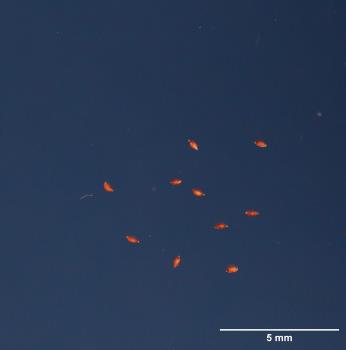 | | 2009 | | | | | | | Wild material | | 1802263 | W6 35287 |
| 32 | Ames 29887 | 204749 | Chenopodium fremontii S. Watson var. fremontii | Arizona, United States | NC7 |  | | 2005 | COLLECTED | 10/06/2003 | | | 2531 | Associated with Pinus ponderosa, Verbacum thapsis, Lupinus sp., Elymus elymoides, Solidago sp., Mahonia repens, Cirsium sp., Eriogonum racemosum, Arenaria sp. and Crypthantha sp. | Wild material | Forb 0.6 meters tall. | 1674381 | Ames 29887 |