| 0 | PI 687719 | 2016 AR 010 | Malus angustifolia (Aiton) Michx. | Arkansas, United States | GEN | 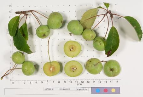 | | 2017 | COLLECTED | 08/2016 | | | | | | | 1953656 | PI 687719 |
| 1 | PI 687697 | 2016 AR 007 | Malus angustifolia (Aiton) Michx. | Arkansas, United States | GEN | _thumbnail.JPG "Click for 2 image(s) for this accession.") | | 2016 | COLLECTED | 08/2016 | | | | | | | 1953653 | PI 687697 |
| 2 | PI 687716 | GMAL 5106 | Malus angustifolia (Aiton) Michx. | Arkansas, United States | GEN | | | 2016 | COLLECTED | 08/2016 | | | | | | | 1953647 | PI 687716 |
| 3 | PI 687717 | 2016 AR 005 | Malus angustifolia (Aiton) Michx. | Arkansas, United States | GEN | | | 2016 | COLLECTED | 08/2016 | | | | | | | 1953651 | PI 687717 |
| 4 | PI 687718 | 2016 AR 006 | Malus angustifolia (Aiton) Michx. | Arkansas, United States | GEN | 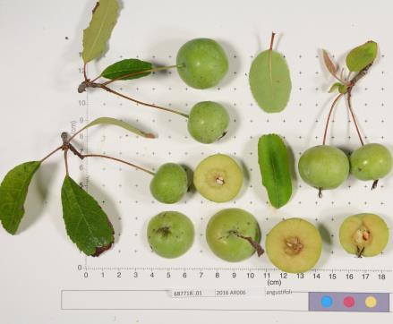 | | 2016 | COLLECTED | 08/2016 | | | | | | | 1953652 | PI 687718 |
| 5 | PI 687720 | 2016 AR 011 | Malus angustifolia (Aiton) Michx. | Arkansas, United States | GEN | _thumbnail.JPG "Click for 2 image(s) for this accession.") | | 2016 | COLLECTED | 08/2016 | | | | | | | 1953657 | PI 687720 |
| 6 | PI 687721 | 2016 AR 012 | Malus angustifolia (Aiton) Michx. | Arkansas, United States | GEN | _thumbnail.JPG "Click for 2 image(s) for this accession.") | | 2016 | COLLECTED | 08/2016 | | | | | | | 1953658 | PI 687721 |
| 7 | PI 687722 | 2016 LA 001 | Malus angustifolia (Aiton) Michx. | Louisiana, United States | GEN | 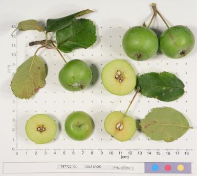 | | 2016 | COLLECTED | 08/2016 | | | | | | | 1953666 | PI 687722 |
| 8 | PI 687723 | 2016 LA 002 | Malus angustifolia (Aiton) Michx. | Louisiana, United States | GEN | | | 2016 | COLLECTED | 08/2016 | | | | | | | 1953667 | PI 687723 |
| 9 | PI 687724 | 2016 LA 004 | Malus angustifolia (Aiton) Michx. | Louisiana, United States | GEN | 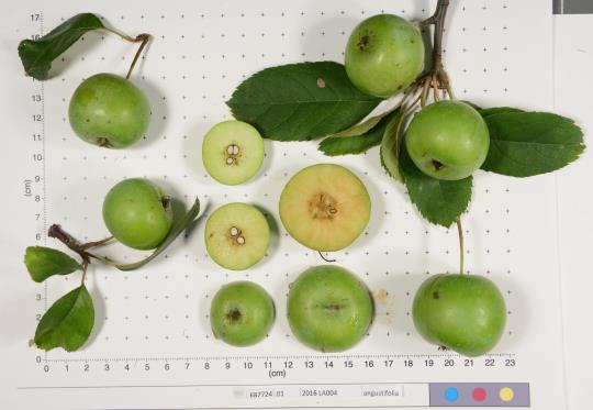 | | 2016 | COLLECTED | 08/2016 | | | | | | | 1953669 | PI 687724 |
| 10 | PI 687727 | 2016 MS 004 | Malus angustifolia (Aiton) Michx. | Mississippi, United States | GEN | | | 2016 | COLLECTED | 08/2016 | | | | | | | 1953694 | PI 687727 |
| 11 | PI 590175 | Prince George | Malus angustifolia (Aiton) Michx. | New York, United States | GEN |  | | 1992 | DONATED | 03/10/1992 | | | | | | | 1024907 | PI 590175 |
| 12 | PI 613879 | GMAL 2548.d1 | Malus angustifolia (Aiton) Michx. | North Carolina, United States | GEN |  | | 1987 | COLLECTED | 08/26/1987 | Madison Co., same as Dickson 583. | | | | | | 1600265 | PI 613879 |
| 13 | PI 613880 | GMAL 2550.e1 | Malus angustifolia (Aiton) Michx. | South Carolina, United States | GEN |  | | 1987 | COLLECTED | 08/27/1987 | Berkeley Co., near Holly Hill; 0.7 mi. SE of Berkeley-Orangeburg Co. line on Rt 176. West side of road. | 33.32250000, -80.41361111 | | | | | 1600266 | PI 613880 |
| 14 | PI 613881 | GMAL 2553.c1 | Malus angustifolia (Aiton) Michx. | North Carolina, United States | GEN | | | 1987 | COLLECTED | 08/21/1987 | Bladen Co., 3.5 mi. S. on Hwy 701 from junction with Hwy 87 at Elizabethtown W. of road, sandy soil. | 34.54416667, -78.64361111 | | | | | 1600267 | PI 613881 |
| 15 | PI 613882 | GMAL 2563.g1 | Malus angustifolia (Aiton) Michx. | North Carolina, United States | GEN |  | | 1987 | COLLECTED | 08/26/1987 | Madison Co. 0.8 mi. E. from Petersburg on Hwy 213, S. side of road. | 35.82222222, -82.61111111 | | | | | 1600268 | PI 613882 |
| 16 | PI 613884 | GMAL 2576.g1 | Malus angustifolia (Aiton) Michx. | Florida, United States | | | Historic | 1987 | COLLECTED | 08/23/1987 | Wakulla Co., same site as E. Dickson 547. | | | | | | 1600270 | PI 613884 |
| 17 | PI 589763 | GMAL 2349 | Malus angustifolia (Aiton) Michx. | North Carolina, United States | GEN |  | | 1987 | COLLECTED | 08/21/1987 | N. Carolina, Bladen Co., same general site as Dickson 527, but located between forest edge and dry depressed area (old pond). | | | | | Comments: Vigorous tree about 15 ft. tall; leaves very large and serrated on vigorous shoots. Population consists of approx 15 trees. | 1019845 | PI 589763 |
| 18 | PI 589764 | GMAL 2356 | Malus angustifolia (Aiton) Michx. | South Carolina, United States | GEN |  | | 1987 | COLLECTED | 08/22/1987 | S. Carolina, Berkeley Co., same site as 531. | | | | | Comments: Tree: 3 cm. diameter. | 1019887 | PI 589764 |
| 19 | PI 589765 | GMAL 2366 | Malus angustifolia (Aiton) Michx. | North Carolina, United States | GEN |  | | 1987 | COLLECTED | 08/26/1987 | N. Carolina, Macon Co. Old river terrace above stream near stream opposite to entrance to Van Hook Glade Campground (National Nantahalia Forest). | | | | | Comments: Many fruits, 25 ft. tall. 5 ft. from stream. Population of 8 trees, one very large and recently fallen (20 cm diam). Old cultivated apple 100 yds from site. | 1019963 | PI 589765 |
| 20 | PI 589766 | GMAL 2367 | Malus angustifolia (Aiton) Michx. | Virginia, United States | GEN | | | 1987 | COLLECTED | 08/27/1987 | Virginia, Shenandoah Co. 5.4 mi SE of junction US 11 and Co. 675 on Co. 675 at W. corner of unmarked dirt Rd to the W. | | | | | Comments: 20 ft. tall, 6 cm diameter. Population of 6 large trees and 20+ smaller trees. Ostoya Virginia, Cornus, Pinus virginiana, Carya, Ovata, Carya cordiformis, Quercus. | 1019975 | PI 589766 |
| 21 | PI 589767 | GMAL 2368 | Malus angustifolia (Aiton) Michx. | North Carolina, United States | GEN |  | | 1987 | COLLECTED | 08/26/1987 | N. Carolina, Madison Co., ca. 0.8 mi. E. from Petersburg on Hwy 213, S. side of Rd. | | | | | Comments: 25 ft. tall-broad. 22 cm diameter. Many fruit, very robust Large population scattered among cultivated apples. | 1019976 | PI 589767 |
| 22 | PI 589769 | GMAL 2370 | Malus angustifolia (Aiton) Michx. | North Carolina, United States | GEN |  | | 1987 | COLLECTED | 08/26/1987 | N. Carolina, Transylvania Co. in pasture 0.2 mi from Hwy 64 on Co. Rd. 1392 (Cherryville Rd.), Old Hwy 64. | | | | | Comments: 12 ft. tall, many fruit. Lower half of tree with climbing vines. 2 trees in pasture and about 25 in between pasture and Hwy 64. | 1019993 | PI 589769 |
| 23 | PI 589771 | GMAL 2373 | Malus angustifolia (Aiton) Michx. | North Carolina, United States | GEN |  | | 1987 | COLLECTED | 08/26/1987 | N. Carolina, Madison Co., same as Dickson 583. | | | | | Comments: 25 ft. tall, 18 cm. diam., many fruit. | 1020019 | PI 589771 |
| 24 | PI 589772 | GMAL 2374 | Malus angustifolia (Aiton) Michx. | North Carolina, United States | GEN |  | | 1987 | COLLECTED | 08/26/1987 | N. Carolina, Clay Co., 0.8 mi. S.E. from Hwy 64 on U.S. Forest Service Rd. 71. Soil brownish. | | | | | Comments: 40 ft. tall, branching at 10 ft. , 10 cm. diam. Single tree with few fruit. Red Oak, White Oak, Red Maple, Yellow Birch Magnolia frazierl, Beech, Sourwood, Witch Hazel, Ilex , Amelanchier, Rhododendron. | 1020024 | PI 589772 |
| 25 | PI 589773 | GMAL 2375 | Malus angustifolia (Aiton) Michx. | North Carolina, United States | GEN |  | | 1987 | COLLECTED | 08/26/1987 | N. Carolina, Macon Co., same site as Dickson 573. | | | | | Comments: 20 ft. tall, 4 cm. diam., very vigorous, although knocked over. Slightly reddish sandy soil with some clay. | 1020035 | PI 589773 |
| 26 | WLP 1398 | RL 07007 | Malus angustifolia (Aiton) Michx. | Georgia, United States | NA | | | 2007 | COLLECTED | | Georgia: Houston County, East of Kathleen, Oaky Woods Wildlife Management Area, along road to Green Violet Prairie, southeast of gate 2 and Thompson Mill Road. | | | | | | 1922663 | WLP 1398 |
| 27 | PI 693819 | R10-01-003 | Poa pratensis L. subsp. angustifolia (L.) Arcang. | Stavropol, Russian Federation | W6 | | | 2011 | COLLECTED | 07/17/2010 | 12 NW of Stavropol | 45.12900000, 41.85200000 | 436 | Stony steppe surrounded by forest (Quercus robur, Q. calcarea, Fraxinus exelsior): margin of gravel pit area: scraped shallow soils. Shallow sandy black A horizon, very stony, weathered limestone parent material and outcroppings: seed collected from >100 plants | Wild material | | 1883105 | PI 693819 |
| 28 | Ames 36295 | Cherry Creek Campground | Alnus oblongifolia Torr. | New Mexico, United States | NC7 |  | | 2024 | COLLECTED | 11/15/2024 | Gila National Forest (Cherry Creek Campground) located north, northeast of Silver City approximately 8.35 miles, T16S R14W SW 1/4 Sec. 24 and T16S R13W SE 1/4 Sec. 18. | 32.91320000, -108.22540000 | 2060 | Creek edge and creek bed | Wild material | | 2170468 | Ames 36295 |
| 29 | WLP 2670 | RJL2022PA-016 | Acer negundo L. | Pennsylvania, United States | NA | | | 2022 | COLLECTED | 10/21/2022 | Plants growing in woodlands above a small unnamed creek that dumps into the Middle Branch White Clay Creek in Goddard Park, West Grove Pennsylvania, off of Wickerton Road, Chester County. Plants are found regularly but scattered in the understory of the woodlands. | 39.80426000, -75.82609300 | 105 | Plants growing in a mesic, well-drained habitat of deciduous woodlands along streams and above the riparian zone that drains toward a small unnamed creek that feeds into the Middle Branch White Clay Creek. Plants generally grow in part shade to full sun, but perform best and fruit more heavily in full sun where there is abundant access to moisture. The remnant woodlands exist mostly along the steep slopes, wetlands and seeps of seasonal and year-round creeks flowing into the Middle Branch White Clay Creek. The woodlands are bordered by numerous housing developments and land converted to meadows; hence there is significant first order edge that is heavily impacted by invasive plant intrusion. Despite this fact, Acer negundo is highly competitive and competes well.
Soils: The underlying geology of this area is the Glenarm Wissahickon Formation of lower Paleozoic origin and lithologically similar to oligoclase-mica schist of the Wissahickon Formation (PZw), but also includes lenticular amphibolite bodies having ocean-floor basalt chemistry.
Source: USGS Pennsylvania Geologic Map Data (https://mrdata.usgs.gov/geology/state/sgmc-unit.php?unit=PAPZgw%3B0)
The primary soil type in the area of this collection is classified as Glenelg silt loam, 3 to 8 percent slopes. This series consists of very deep, well drained soils formed in residuum weathered from micaceous schist on uplands of the Blue Ridge and the Northern Piedmont. Saturated hydraulic conductivity is moderately high in the subsoil and moderately high to high in the substratum. This upper horizon of this soil is undifferentiated, mostly poorly drained sandy bottomland soils intermingled with decomposing organic litter and eroded silts and clays due to erosion.
Source: NRCS Web Soil Survey (https://websoilsurvey.sc.egov.usda.gov/App/WebSoilSurvey.aspx) | Wild material | | 2139661 | WLP 2670 |
| 30 | NA 86885 | RJL2021PA-004 | Ilex verticillata (L.) A. Gray | Pennsylvania, United States | NA | | | 2021 | COLLECTED | 11/16/2021 | Plants growing in woodlands along a small unnamed creek corridor dumping into the Middle Branch White Clay Creek in Goddard Park, West Grove Pennsylvania, off of Wickerton Road, Chester County. | 39.81063861, -75.82750806 | 124 | Plants are growing in a range of habitats from mesic woodlands to saturated streamside settings of deciduous woodlands that drain toward the Middle Branch White Clay Creek. Plants grow in high understory shade with dappled to indirect sunlight. The only female (fruiting) plants were found in areas along the creek where soils are moist to saturated. Numerous male specimens were found in the areas described above. Soils: Soils found in the areas where this collection was made are comprised primarily of Baile silt loam (Ba), Hatboro silt loam (Ha), and Glenelg silt loam, 8 to 15 percent slopes (GgC). Baile silt loam consists of very deep, poorly drained, moderately low to moderately high saturated hydraulic conductivity, soils on upland depressions and footslopes that were formed in local alluvium over residuum from acid crystalline rocks, chiefly mica schist and granitized schist and gneiss; slope ranges from 0 to 8 percent. Hatboro silt loam consists of very deep and poorly drained soils formed in deposited alluvium derived from metamorphic and crystalline rock. They are on flood plains. Slopes range from 0 to 3 percent. Glenelg silt loam, 8 to 15 percent slopes consists of very deep, well drained soils formed in residuum weathered from micaceous schist on uplands of the Blue Ridge and the Northern Piedmont. This soil is undifferentiated, mostly poorly drained sandy bottomland soils intermingled with decomposing organic litter and eroded silts and clays due to erosion. Slope: 0 to 15% Aspect: Variable. | Wild material | | 2123125 | NA 86885 |
| 31 | WLP 1731 | RJL2021PA-001 | Viburnum acerifolium L. | Pennsylvania, United States | NA | | | 2021 | COLLECTED | 11/05/2021 | Plants growing in woodlands above a small unnamed creek that dumps into the Middle Branch White Clay Creek in Goddard Park, West Grove Pennsylvania, off of Wickerton Road, Chester County. | 39.80462083, -75.82888750 | 103 | Plants growing in a mesic, well-drained habitat of deciduous woodlands, for the most part, above the riparian zone that drains toward a small unnamed creek that feeds into the Middle Branch White Clay Creek. Plants are growing in high understory shade with very little direct sun during most of the day. The remnant woodlands exist mostly along the steep slopes, wetlands and seeps of seasonal and year-round creeks flowing into the Middle Branch White Clay Creek. The woodlands are bordered by numerous housing developments and land converted to meadows; hence there is significant first order edge that is heavily impacted by invasive plant intrusion. Soils: Soils are classified as Glenelg silt loam, 8 to 15% slopes (GgC); this series consists of very deep, well drained soils formed in residuum weathered from micaceous schist on uplands of the Blue Ridge and the Northern Piedmont. Saturated hydraulic conductivity is moderately high in the subsoil and moderately high to high in the substratum. This upper horizon of this soil is undifferentiated, mostly poorly drained sandy bottomland soils intermingled with decomposing organic litter and eroded silts and clays due to erosion. Slope: 8 to 15% Aspect: West. | Wild material | | 2123080 | WLP 1731 |
| 32 | WLP 1732 | RJL2021PA-002 | Viburnum prunifolium L. | Pennsylvania, United States | NA | | | 2021 | COLLECTED | 11/05/2021 | Plants growing in woodlands along a small unnamed creek corridor dumping into the Middle Branch White Clay Creek in Goddard Park, West Grove Pennsylvania, off of Wickerton Road, Chester County. | 39.80462083, -75.82888750 | 102 | Plants are growing in a range of habitats from drier upland woods to moist creekside settings of deciduous woodlands that drain toward the Middle Branch White Clay Creek. Plants grow in part shade to high understory shade with dappled to indirect direct sunlight. Plants achieve their largest size and fruiting potential in part sun of the riparian zone of the creek where woodland canopy is thinner. Soils: Soils found in the areas where this collection was made are comprised primarily of flood plain Hatboro silt loam (Ha) and well-drained, upland Glenelg silt loam, 8 to 15 percent slopes (GgC). Hatboro silt loam consists of very deep and poorly drained soils formed in deposited alluvium derived from metamorphic and crystalline rock. They are on flood plains. Slopes range from 0 to 3 percent. Glenelg silt loam, 8 to 15 percent slopes consists of very deep, well drained soils formed in residuum weathered from micaceous schist on uplands of the Blue Ridge and the Northern Piedmont. This soil is undifferentiated, mostly poorly drained sandy bottomland soils intermingled with decomposing organic litter and eroded silts and clays due to erosion. Slope: 0 to 15% Aspect: Variable. | Wild material | | 2123098 | WLP 1732 |
| 33 | WLP 1733 | RJL2021PA-003 | Viburnum dentatum L. | Pennsylvania, United States | NA | | | 2021 | COLLECTED | 11/05/2021 | Plants growing in woodlands along a small unnamed creek corridor dumping into the Middle Branch White Clay Creek in Goddard Park, West Grove Pennsylvania, off of Wickerton Road, Chester County. | 39.80522167, -75.82928139 | 107 | Plants are growing in a range of habitats from mesic woodland to moist creekside settings of deciduous woodlands that drain toward the Middle Branch White Clay Creek. Plants grow in high understory shade with dappled to indirect sunlight. Soils: Soils found in the areas where this collection was made are comprised primarily of flood plain Hatboro silt loam (Ha) and well-drained, upland Glenelg silt loam, 8 to 15 percent slopes (GgC). Hatboro silt loam consists of very deep and poorly drained soils formed in deposited alluvium derived from metamorphic and crystalline rock. They are on flood plains. Slopes range from 0 to 3 percent. Glenelg silt loam, 8 to 15 percent slopes consists of very deep, well drained soils formed in residuum weathered from micaceous schist on uplands of the Blue Ridge and the Northern Piedmont. This soil is undifferentiated, mostly poorly drained sandy bottomland soils intermingled with decomposing organic litter and eroded silts and clays due to erosion. Slope: 0 to 15% Aspect: Variable. | Wild material | | 2123124 | WLP 1733 |
| 34 | WLP 1747 | RJL2021PA-005 | Rosa palustris Marshall | Pennsylvania, United States | NA | | | 2021 | COLLECTED | 11/20/2021 | Plants growing in wetland seeps surrounded by mown hayfields just west of the Middle Branch White Clay Creek in Goddard Park, West Grove Pennsylvania, off of Wickerton Road, Chester County. | 39.80090528, -75.82383250 | 100 | Habitat Notes: Plants are growing in permanently saturated to moist soils in wetland habitats. Plants appear to be obligate wetland plants and are found only in permanent to nearly permanent wet habitats observed. Generally, the shrubs are found in part shade to full sun. Soils: Soils found in the areas where this collection was made are comprised primarily of Hatboro silt loam (Ha). Hatboro silt loam consists of very deep and poorly drained soils formed in deposited alluvium derived from metamorphic and crystalline rock. They are on flood plains. Slopes range from 0 to 3 percent. Slope: 0 to 3% Aspect: Variable. | Wild material | | 2123715 | WLP 1747 |