| 0 | NA 88615 | KY23-019 | Mitchella repens L. | Kentucky, United States | NA | | | 2023 | COLLECTED | 09/09/2023 | Kingdom Come State Park, Pine Mountain: Along Laurel Cove Trail across from pond in Pine Mountain State Park. | 36.99160000, -82.98471000 | 712 | Along trail across from pond. Elevation: 2337 feet. Aspect: South. | Wild material | | 2158707 | NA 88615 |
| 1 | NA 88407 | NEWFS-927 | Mitchella repens L. | Connecticut, United States | NA | | | 2021 | | | | | | | Wild material | A low lying creeping plant that covers large patches tiny round opposite leaves with red berry fruit. | 2138947 | NA 88407 |
| 2 | WLP 167 | NACPEC19-053 | Mitchella repens L. | Georgia, United States | NA | | | 2019 | COLLECTED | 09/14/2019 | Walker County; Lula Lake Land Trust: Middle Trail near top, also collected along Connector Trail to Middle Trail from parking lot. | 34.93141800, -85.36991400 | 469 | Mesic, sandy, rocky Oak-Hickory woodland slope - likely acidic | Wild material | | 2110479 | WLP 167 |
| 3 | NA 88058 | NEWFS-80 | Mitchella repens L. | Massachusetts, United States | NA | | | 2019 | | | | | | | Wild material | | 1976147 | NA 88058 |
| 4 | WLP 147 | NA 83890 | Mitchella repens L. | Kentucky, United States | NA | | | 2016 | COLLECTED | 09/27/2016 | Whitley County; Cumberland Falls State Park, Trail #6 | 36.83700000, -84.34000000 | 301 | | Wild material | | 2110320 | WLP 147 |
| 5 | PI 704871 sos | V. angustifolium NEWFS-355 | Vaccinium angustifolium Aiton | New Hampshire, United States | COR | | | 2021 | | | | | | | Wild material | PI assigned before phyical inventory of W6 shipment and is missing. Maintain COR as site in case seeds are recovered. | 2137198 | PI 704871 sos |
| 6 | PI 702690 | MARSB-175 | Chasmanthium laxum (L.) H. O. Yates | Delaware, United States | S9 |  | | 2019 | | | | | | | Wild material | | 2097507 | PI 702690 |
| 7 | NA 89171 | 2025RJLSEUS-04 | Rhododendron catawbiense Michx. | Alabama, United States | NA | | | 2026 | COLLECTED | 09/30/2025 | Scarham Creek: southeast of the Pea Ridge Road bridge, approximately 50-80 meters on the south side of the creek. | 34.32559600, -86.16054600 | 266 | Growing near the base of the slopes above the riparian zone, generally on the exposed geology under very well-drained conditions. The woodlands are primarily deciduous with a few evergreens infrequently mixed. Slope: 15 to 30 percent. Aspect: Northeast. Soil: The primary soil type in the area of this collection is classified as Rockland Series sandstone (Rc). The Rockland series consists of well drained soils formed in loamy colluvium from rotational landslides on slopes of stream valleys and dissections of ground moraines. Saturated hydraulic conductivity is moderate in the upper part of the profile and moderately slow in the lower part. Slopes range from 18 to 70 percent. Some pedons have buried leaves, twigs, and moss. Mass soil movement has left random remnants of soil structure from prior upslope soil development and has buried tree branches, leaves and moss. The upper 0-2 cm of soil contains slightly decomposed organic matter while lower soils layers to a depth of 58 cm are comprised of dark reddish-brown to brown silt loam and are moderately acidic. Below 58 cm the soils are generally dark reddish-brown silt loam and strongly to moderately alkaline. (Source:California Soil Resource Lab/NRCS Official Soil Series Descriptions). Geology: The underlying geology of this area is of Pennsylvanian origin and characterized as Pottsville Formation. It is characterized by light-gray thin to thick-bedded quartzose sandstone and conglomerate containing interbedded dark-gray shale, siltstone, and coal. Mapped on Lookout Mountain, Blount and Chandler Mountains, and Sand Mountain northeast of Blount County, and on the mountains of Jackson, Marshall, and Madison Counties north and west of the TN river. (Source: USGS Alabama Geologic Map Data). | Wild material | Received as R. catawbiense vsr. insularis | 2193305 | NA 89171 |
| 8 | NA 89155 | 2025RJLSEUS-02 | Ilex longipes Chapm. ex Trel. | Alabama, United States | NA | | | 2025 | COLLECTED | 09/30/2025 | Scarham Creek: southeast of the Pea Ridge Road bridge, approximately 50-80 meters on the south side of the creek. | 34.32520700, -86.15967000 | 261 | Plants are growing on relatively steep woodland slopes in shade. The woodlands are primarily deciduous with a few evergreens infrequently mixed. Slope: 15 to 30 percent. Aspect: Northeast. Soil: The primary soil type in the area of this collection is classified as Rockland Series sandstone (Rc). The Rockland series consists of well drained soils formed in loamy colluvium from rotational landslides on slopes of stream valleys and dissections of ground moraines. Saturated hydraulic conductivity is moderate in the upper part of the profile and moderately slow in the lower part. Slopes range from 18 to 70 percent. Some pedons have buried leaves, twigs, and moss. Mass soil movement has left random remnants of soil structure from prior upslope soil development and has buried tree branches, leaves and moss. The upper 0-2 cm of soil contains slightly decomposed organic matter while lower soils layers to a depth of 58 cm are comprised of dark reddish-brown to brown silt loam and are moderately acidic. Below 58 cm the soils are generally dark reddish-brown silt loam and strongly to moderately alkaline. (Source: California Soil Resource Lab/NRCS Official Soil Series Descriptions). Geology: The underlying geology of this area is of Pennsylvanian origin and characterized as Pottsville Formation. It is characterized by light-gray thin to thick-bedded quartzose sandstone and conglomerate containing interbedded dark-gray shale, siltstone, and coal. Mapped on Lookout Mountain, Blount and Chandler Mountains, and Sand Mountain northeast of Blount County, and on the mountains of Jackson, Marshall, and Madison Counties north and west of the TN river. (Source: USGS Alabama Geologic Map Data). | Wild material | | 2193001 | NA 89155 |
| 9 | NA 89156 | 2025RJLSEUS-03 | Euonymus americanus L. | Alabama, United States | NA | | | 2025 | COLLECTED | 09/30/2025 | Scarham Creek: southeast of the Pea Ridge Road bridge, approximately 50-80 meters on the south side of the creek. | 34.32577600, -86.16071000 | 260 | Plants are growing on relatively steep woodland slopes in shade. The woodlands are primarily deciduous with a few evergreens infrequently mixed. Slope: 15 to 30 percent. Aspect: Northeast. Soil: The primary soil type in the area of this collection is classified as Rockland Series sandstone (Rc). The Rockland series consists of well drained soils formed in loamy colluvium from rotational landslides on slopes of stream valleys and dissections of ground moraines. Saturated hydraulic conductivity is moderate in the upper part of the profile and moderately slow in the lower part. Slopes range from 18 to 70 percent. Some pedons have buried leaves, twigs, and moss. Mass soil movement has left random remnants of soil structure from prior upslope soil development and has buried tree branches, leaves and moss. The upper 0-2 cm of soil contains slightly decomposed organic matter while lower soils layers to a depth of 58 cm are comprised of dark reddish-brown to brown silt loam and are moderately acidic. Below 58 cm the soils are generally dark reddish-brown silt loam and strongly to moderately alkaline. (Source: California Soil Resource Lab/NRCS Official Soil Series Descriptions). Geology: The underlying geology of this area is of Pennsylvanian origin and characterized as Pottsville Formation. It is characterized by light-gray thin to thick-bedded quartzose sandstone and conglomerate containing interbedded dark-gray shale, siltstone, and coal. Mapped on Lookout Mountain, Blount and Chandler Mountains, and Sand Mountain northeast of Blount County, and on the mountains of Jackson, Marshall, and Madison Counties north and west of the TN river. (Source: USGS Alabama Geologic Map Data). | Wild material | | 2193002 | NA 89156 |
| 10 | NA 89161 | 2025RJLSEUS-10 | Stewartia malacodendron L. | Florida, United States | NA | | | 2025 | COLLECTED | 10/02/2025 | Eglin Air Force Base: woodlands along Weaver Creek accessed from unnamed dirt road, 0.82 kilometers west of junction with Eglin AFB 720; approximately 0.73 kilometers north of junction with Choctaw Nolf Airfield Road and Eglin AFB 720. | 30.51708000, -86.91515000 | 11 | Moist, well-drained, sandy soils above Weaver Creek in a mixed broadleaved evergreen and deciduous woodland habitat in part shade to shade of west facing slopes several meters above the wetland zone. A high-competition, richly diverse environment. Elevation: 7 to 15 meters. Slope: 1 to 15 percent. Aspect: West. Soils: The soils of this area are characterized as Lakeland Series which consist of very deep, excessively drained, rapid to very rapidly permeable soils on uplands. They formed in thick beds of eolian or marine and/or fluvio-marine sands. Thickness of the sand exceeds 2 meters. Silt plus clay in the upper meter ranges from 5-10 percent. Reaction ranges from very strongly acid to moderately acid throughout. (Source: USDA-NRCS Official Soil Series Descriptions). Geology: The underlying geology of this area is the Citronelle Formation, of Pliocene origin, and consists of gray to orange, often mottled, unconsolidated to poorly consolidated, very fine to very coarse, poorly sorted, clean to clayey sands. It contains significant amounts of clay, silt and gravel which may occur as beds and lenses and may vary considerably over short distances. Limonite nodules and limonite-cemented beds are common. (Source: USGS Florida Geologic Map Data). | Wild material | | 2193007 | NA 89161 |
| 11 | NA 89117 | TLM25-06 | Magnolia virginiana L. | Louisiana, United States | NA | | | 2025 | COLLECTED | 07/11/2025 | Natchitoches Parish Road 380, approximately 0.30 km south of the junction with Bayou Camp Forest Route 321 just past the sign for a natural water spring; the site is located on the west side of hte road. | 31.48284200, -93.07549400 | 88 | This habitat is comprised of a botanically rich full sun, hillside seepage area with masses of wetland plant species, dominated by Sarracenia alata. The seepage area, which is 40-60 meters wide, is ultimately funneled downslope, to create the headwaters for a small stream that flows into and through the high understory shade of a longleaf pine forest. This streamside habitat, created by erosion, forms a series of sloping terraces that are home to plant communities ranging from obligate upland species on the upper terraces to facultative wetland species found at the base of the terraces along the stream edge. The range of plant communities and niches created in just a short distance from upper hillside seepage area to the emergent stream, offers a remarkably array of plant diversity. Magnolia virginiana can be found throughout the habitat as well as along the more mesic edge of this site. Slope: 10 to 15 percent. Aspect: southwest. Soils: The primary soil type in the collection area is Kisatchie Series clay, 1 to 15 percent slopes, severely eroded (Kt). The Kisatchie Series soil consists of moderately deep, well drained, very slowly permeable soils that formed clayey sediments over siltstone or sandstone on Tertiary age uplands. These soils are on moderately sloping to steep coastal plains. They are not saturated with water. Water runs off the surface at a moderate to rapid rate. Slope ranges from 1 to 40 percent. The solum is 50 to 100 cm thick over siltstone or sandstone and ranges from moderately to extremely acidic. (Source: California Soil Resource Lab/NRCS Official Soil Series Descriptions). Geology: The underlying geology of this area is of Oligocene origin and characterized as Catahoula Formation. In the area of the collection the Catahoula Formation is primarily gray to white sandstones; loose quartz sand, tuffaceous sandstone, volcanic ash, and brown sandy clays; petrified wood locally. (Source: USGS Louisiana Geologic Map Data). | Wild material | | 2191656 | NA 89117 |
| 12 | NA 88580 | 2024RJLFL-009 | Ilex myrtifolia Walter | Florida, United States | NA | | | 2024 | COLLECTED | 11/13/2024 | Woodlands on the north side of Fisher Old Mill Road about 0.10 kilometers west of intersection with DOF Y12. | 30.62693800, -86.83962200 | 6 | Mixed evergreen and deciduous moist to wet forest in part shade to full sun. From the associated taxa, this site can be quite wet during the growing season; however, it was dry during this collection time; likely due to extended drought. Slope: 0 percent. Aspect: South. | Wild material | | 2169917 | NA 88580 |
| 13 | NA 89075 | 2024RJLPA-001 | Rhododendron maximum L. | Pennsylvania, United States | NA | | | 2024 | COLLECTED | 09/18/2024 | Fieldstone Farm Tank Creek Nature Preserve (a property of the Pocono Heritage Land Trust): Collected along Tank Creek. The property is accessed from a parking area located on Devil's Hole Road. | 41.13862300, -75.34562700 | 493 | Mostly found in mixed deciduous forest with occasional conifers and evergreen shrubs generally on steep slopes above Tank Creek in rocky well-drained soils in shade to part-shade. The slopes are abundant in decomposed organic matter and runoff soils. Slope: 5 to 30 percent. Aspect: various. Geology: The underlying geology of this area is of Devonian origin and characterized as the Long Run Member of Catskill Formation. It is comprised of gray and grayish-red sandstone and grayish-red siltstone and mudstone in fining-upward cycles. (Source: USGS Pennsylvania Geologic Map Data). Soils: The primary soil type found here is classified as Alluvial Land. In geology, alluvial land refers to areas of land that are formed by the deposition of sediments carried by rivers, or other surface water. EPA Ecoregion (Level III): North Central Appalachians (62). EPA Ecoregion (Level IV): Low Poconos (62b). | Wild material | | 2169039 | NA 89075 |
| 14 | NA 89076 | 2024RJLPA-002 | Kalmia latifolia L. | Pennsylvania, United States | NA | | | 2024 | COLLECTED | 09/18/2024 | Fieldstone Farm Tank Creek Nature Preserve (a property of the Pocono Heritage Land Trust): Collected along Tank Creek. The property is accessed from a parking area located on Devil's Hole Road. | 41.13862300, -75.34562700 | 493 | Mostly found in mixed deciduous forest with occasional conifers and evergreen shrubs generally on sloping sites as an understory shrub in rocky well-drained soils in shade to part-shade. Slope: 5 to 15 percent. Aspect: various. Geology: The underlying geology of this area is of Devonian origin and characterized as the Long Run Member of Catskill Formation. It is comprised of gray and grayish-red sandstone and grayish-red siltstone and mudstone in fining-upward cycles. (Source: USGS Pennsylvania Geologic Map Data). Soils: The primary soil type found here is classified as Alluvial Land. In geology, alluvial land refers to areas of land that are formed by the deposition of sediments carried by rivers, or other surface water. EPA Ecoregion (Level III): North Central Appalachians (62). EPA Ecoregion (Level IV): Low Poconos (62b). | Wild material | | 2169040 | NA 89076 |
| 15 | NA 89088 | 2024RM-TK-001 | Viburnum acerifolium L. | Alabama, United States | NA | | | 2024 | COLLECTED | 09/19/2024 | Haines Island Park. Follow Ferry Road to the top of the hill entering the park where a picnic shelter is located. Plants are growing along trails to the north of the picnic shelter. | 31.72132026, -87.46408910 | 81 | Plants are growing from part-sun to full shade in the understory of a mixed deciduous and coniferous forest on very dry upland habitat. Slope: 10 to 20 percent. Aspect: North. Geology: The underlying geology of this area is probably of Eocene age and characterized as the Claiborne Group: Tallahatta Formation. It is comprised of white to very light-greenish-gray thin-bedded to massive siliceous claystone; interbedded with thin layers of fossiliferous clay, sandy clay, and glauconitic sand and sandstone. White to light-greenish-gray fine to coarse sand and fine gravel occur at the base of the formation in southwest Alabama (Meridian Sand Member). (Source: USGS Alabama Geologic Map Data). Soils: The area of this occurrence is characterized as Arundel Series Loam, 8 to 35 percent slopes (ArF). The Arundel series consists of moderately deep, well drained, very slowly permeable soils on dissected uplands of the Southern Coastal Plain Major Land Resource Area (MLRA 133A). They formed in marine deposits consisting of acid clays underlain by horizontally bedded sandstone, buhrstone and siltstone. Slopes range from 2 to 60 percent. (Source: California Soil Resource Lab/NRCS Official Soil Series Descriptions). EPA Ecoregion (Level III): Southeastern Plains (65). EPA Ecoregion (Level IV): Buhrstone/Lime Hills (65q). | Wild material | | 2169052 | NA 89088 |
| 16 | NA 89089 | 2024RM-TK-002 | Viburnum acerifolium L. | Alabama, United States | NA | | | 2024 | COLLECTED | 09/19/2024 | Woodland slopes around and below the hilltop parking area leading down to the Silver Creek Lake Campground off of Silver Creek Lake Road. | 31.66612294, -87.57569860 | 49 | Plants are growing in shade of upland dry mesic, mature mixed deciduous and evergreen woodland. Generally, the overstory is thinner and there is less leaf litter cover, making the surface soil conditions drier. Slope: 5 to 10 percent. Aspect: Southeast. Geology: The underlying geology of this area is Claiborne Group, Tallahatta Formation, of Eocene origin, with white to very light-greenish-gray thin-bedded to massive siliceous claystone; interbedded with thin layers of fossiliferous clay, sandy clay, and glauconitic sand and sandstone. (Source: USGS Alabama Geologic Map Data). Soils: The primary soil types in the collection area are classified as Arundel-Cantuche Complex soils (15 to 35 percent slopes). The Arundel Series consists of moderately deep, well drained, very slowly permeable soils on dissected uplands of the Southern Coastal Plain. They formed in marine deposits consisting of acid clays underlain by horizontally bedded sandstone, buhrstone and siltstone. These soils are strongly acid. Slopes range from 2 to 60 percent. The Cantuche Series consists of shallow, well drained, moderately permeable soils that formed over horizontally bedded claystone. These soils are on narrow ridgetops and narrow benches on steep side-slopes of dissected landscapes in the Coastal Plain. They are strongly acid. Slopes range from 2 to 35 percent. (Source: California Soil Resource Lab/NRCS Official Soil Series Descriptions). EPA Ecoregion (Level III): Southeastern Plains (65). EPA Ecoregion (Level IV): Buhrstone/Lime Hills (65q). | Wild material | | 2169053 | NA 89089 |
| 17 | NA 89090 | 2024RM-TK-003 | Ilex longipes Chapm. ex Trel. | Alabama, United States | NA | | | 2024 | COLLECTED | 09/19/2024 | Woodland slopes around and below the hilltop parking area leading down to the Silver Creek Lake Campground off of Silver Creek Lake Road. | 31.66612294, -87.57569860 | 39 | Plants are growing in part-shade to shade of a moist mesic deciduous and evergreen woodland on dry, well-drained soil to an area 1-2 meters above a small seasonally spring-fed creek at 31.664428°, -87.574614°. Slope: 5 to 10 percent. Aspect: Southeast. Geology: The underlying geology of this area is Claiborne Group, Tallahatta Formation, of Eocene origin, with white to very light-greenish-gray thin-bedded to massive siliceous claystone; interbedded with thin layers of fossiliferous clay, sandy clay, and glauconitic sand and sandstone. (Source: USGS Alabama Geologic Map Data). Soils: The primary soil types in the collection area are classified as Arundel-Cantuche Complex soils (15 to 35 percent slopes). The Arundel Series consists of moderately deep, well drained, very slowly permeable soils on dissected uplands of the Southern Coastal Plain. They formed in marine deposits consisting of acid clays underlain by horizontally bedded sandstone, buhrstone and siltstone. These soils are strongly acid. Slopes range from 2 to 60 percent. The Cantuche Series consists of shallow, well drained, moderately permeable soils that formed over horizontally bedded claystone. These soils are on narrow ridgetops and narrow benches on steep side-slopes of dissected landscapes in the Coastal Plain. They are strongly acid. Slopes range from 2 to 35 percent. (Source: California Soil Resource Lab/NRCS Official Soil Series Descriptions). EPA Ecoregion (Level III): Southeastern Plains (65). EPA Ecoregion (Level IV): Buhrstone/Lime Hills (65q). | Wild material | | 2169054 | NA 89090 |
| 18 | WLP 3435 | RM2023-004 | Aristolochia macrophylla Lam. | North Carolina, United States | NA | | | 2024 | COLLECTED | 10/20/2023 | Plants growing on slopes above Big Creek Road on a trail up from cabins toward the Appalachian Trail. | 35.00179600, -83.45508900 | 752 | Plants growing along a rocky stream in part shade. Slope: 25 percent. Aspect: Variable. The underlying geology of this area is Coweeta Group, primarily of Late Proterozoic origin. It is comprised of quartz dioritic gneiss, feldspar-quartz-biotite gneiss, metasandstone and quartzite, alumino-silicate schist, garnetiferous biotite gneiss, and minor amphibolite. Quartz dioritic gneiss is predominant. (Source: USGS North Carolina Geologic Map Data.) The primary soil type in the collection area is classified as Cullasaja-Tuckasegee complex, 15 to 30 percent slopes, stony. The Cullasaja series consists of very deep, well drained soils on benches, toe slopes, foot slopes, drainageways, and fans in coves in the Southern Blue Ridge mountains. They formed in colluvium derived from materials weathered from felsic to mafic high-grade metamorphic and igneous rocks such as granite, mica gneiss, hornblende gneiss, and schist. Slope ranges from 8 to 95 percent. The Tuckasegee series consists of very deep, well drained soils on gently sloping to very steep benches, foot slopes, toe slopes, drainageways, and fans in coves in the Southern Blue Ridge mountains. These soils formed in colluvium derived from materials weathered from igneous and high-grade metamorphic rocks such as granite, mica gneiss, hornblende gneiss, and schist. Slopes range from 2 to 95 percent. (Source: NRCS Web Soil Survey.) | Wild material | | 2166144 | WLP 3435 |
| 19 | NA 88840 | RJL-RM2023FLAL-014 | Rhododendron viscosum (L.) Torr. | Florida, United States | NA | | | 2023 | COLLECTED | 12/11/2023 | Property of Floyd Griffith off View Drive on the southwest side of McCormick Lake. | 30.63247000, -85.33718200 | 56 | Plants are growing primarily in part shade a few meters above the lake, generally in areas that appear dry, but clearly are associated with hillside seeps. While much of the area has been cultivated, the remnant native flora are largely broadleaved evergreen shrub and deciduous shrub and tree species. Slope: 10 to 15 percent. Aspect: Northeast. The underlying geology of this area is the Citronelle Formation of Pliocene origin and consists of gray to orange, often mottled, unconsolidated to poorly consolidated, very fine to very coarse, poorly sorted, clean to clayey sands. It contains significant amounts of clay, silt and gravel which may occur as beds and lenses and may vary considerably over short distances. Limonite nodules and limonite-cemented beds are common. (Source: USGS Florida Geologic Map Data.) The surface soil profile of this area is primarily Pamlico-Pantego-Rutlege Association. The Pamlico series consists of very poorly drained soils that formed in decomposed organic material underlain by dominantly sandy sediment. The soils are on nearly level flood plains, bays, and depressions of the Coastal Plain. Slopes are less than 1 percent. Pamlico soils have 0.4-1.3 meters of organic material over dominantly sandy sediments. Reaction is extremely in the organic layers and ranges from extremely acid to strongly acid in the underlying mineral layers. The Pantego series consists of very deep, very poorly drained, moderately permeable soils that formed in thick loamy sediments on the Southern Coastal Plain and Atlantic Coast Flatwoods. Slopes are less than 2 percent. This soil is strongly acid. The Rutlege series comprises very deep, very poorly drained persistently wet soils on flats, depressions and floodplains where shallow ponding is common. They are of marine or fluvial sediment origin. Thickness of these loamy sandy soils is greater than 1.5 meters and a reaction from extremely acid to strongly acid. (Source: NRCS Web Soil Survey.) | Wild material | | 2165670 | NA 88840 |
| 20 | NA 88843 | RJL-RM2023FLAL-017 | Rhododendron austrinum (Small) Rehder | Florida, United States | NA | | | 2023 | COLLECTED | 12/11/2023 | Holmes Creek at Live Oak Landing: plants found on the low bluff along the south side of Holmes Creek accessed by foot from a parking lot on Live Oak Landing Road that dead ends into the creek. | 30.59043500, -85.83899800 | 7 | Plants are growing in part shade to shade on the top and slope of the low bluff overlooking Holmes Creek in a mixed deciduous and evergreen forest. The dry mesic habitat has relatively low competition and is quite acidic. Slope: 0 to 45 percent. Aspect: Northwest. The underlying geology of this area is classified as Alluvium, of Pleistocene/Holocene origin and consists of undifferentiated Quaternary sediments of varying thickness including siliciclastics, organics and freshwater carbonates. The siliciclastics are light gray, tan, brown to black, unconsolidated to poorly consolidated, clean to clayey, silty, unfossiliferous, variably organic-bearing sands to blue green to olive green, poorly to moderately consolidated, sandy, silty clays. Organics occur as plant debris, roots, disseminated organic matrix and beds of peat. Freshwater carbonates, often referred to as marls in the literature, are scattered. (Source: USGS Florida Geologic Map Data.) The surface soil profile of this area is primarily Nankin-Cowarts-Lakeland Complex. The Nankin Series consists of very deep, well drained, moderately slowly permeable soils on uplands of the Coastal Plain. They formed in stratified loamy and clayey marine sediments. Slopes range from 0 to 60 percent. Soils are comprised of sandy loam in the upper 25 cm to sandy clay loam and sandy clay in lower strata to about 1.7 meters deep; these soils are strongly acid. The Cowarts Series consists of very deep, moderately well and well drained soils on ridge tops and side slopes on uplands of the Coastal Plain Major Land Resource Area. They formed in loamy marine sediments. Slopes range from 1 to 60 percent. The Lakeland series consists of very deep, excessively drained, rapid to very rapidly permeable soils on uplands. They formed in thick beds of eolian or marine and/or fluvio-marine sands. Thickness of the sand exceeds 2 meters. Silt plus clay in the upper meter ranges from 5-10 percent. Reaction ranges from very strongly acid to moderately acid throughout. (Source: NRCS Web Soil Survey.) | Wild material | | 2165673 | NA 88843 |
| 21 | NA 88678 | RJL2023PA-012 | Viburnum acerifolium L. | Pennsylvania, United States | NA | | | 2023 | COLLECTED | 10/27/2023 | Slopes on the east side of Creek Road above the North Branch of White Clay Creek. | 39.78552600, -75.80251900 | 90 | Well-drained mesic-dry to rocky dry deciduous woodlands in part shade to full shade. Slope: 15-35%. Aspect: West to northwest. The underlying geology of this area includes two formations. The first and primary formation is Lower Paleozoic Glenarm Wissahickon Formation, lithologically similar to oligoclase-mica schist of the Wissahickon Formation, but also includes lenticular amphibolite bodies having ocean-floor basalt chemistry. The second formation is Lower Paleozoic Mafic Gneiss Formation that is dark and medium grained. It includes rocks of probable sedimentary origin. (Sources: USGS Pennsylvania Geologic Map Data). The primary soil type in the collection area is classified as Manor Series. The Manor Series consists of well-drained residuum weathered from micaceous schist. Soils in the upper pedon (0-33 cm) are very dark grayish brown loam with strong fine granular structure; also, very friable with fine mica flakes and strongly acid. Lower pedon soils (34-56 cm) are strong brown, sandy loams. They have weak medium sub-angular blocky structure, are friable with many fine and a few medium mica flakes; this pedon is very strongly acid. (Source: NRCS Web Soil Survey). | Wild material | | 2159069 | NA 88678 |
| 22 | NA 88667 | RJL2023PA-004 | Viburnum acerifolium L. | Pennsylvania, United States | NA | | | 2023 | | | | | | | Wild material | | 2158816 | NA 88667 |
| 23 | NA 88666 | RJL2023PA-003 | Hamamelis virginiana L. | Pennsylvania, United States | NA | | | 2023 | COLLECTED | 10/01/2023 | Collected primarily along the woodland edge along Northside Road on Pennsylvania State Gamelands No. 43 as well as a few on nearby roads. | 40.17974200, -75.76790700 | 176 | Plants were growing in mesic well-drained conditions on moderately sloping sites of a deciduous upland forest. This species grows well in shade to part-sun. Most abundant fruit development is found where plants are exposed to sunlight for a portion of the day. Slope: 15%. Aspect: North-northwest. The underlying geology of this area is of Precambrian origin and characterized as the Graphitic Felsic Gneiss. This includes Pickering Gneiss and small areas of marble; dominantly quartz and feldspar with varying amounts of graphite and various metamorphic minerals; medium grained, light to dark gray and greenish gray; sedimentary origin. (Source: USGS Pennsylvania Geologic Map Data.) The primary soil type in the area of this collection is classified as Gladstone Gravelly Loam Series (8 to 15 percent slopes). The Gladstone Series consists of very deep, well drained soils formed in residuum and colluvium from granitic gneiss. Saturated hydraulic conductivity is moderately high to high. Solum thickness ranges from 75 to 125 cm. Depth to granitic gneiss bedrock is 1.6 meters or more. The bedrock may be strongly weathered in the upper part. Gravel content ranges from 5 to 35 percent throughout the solum, and 10 to 40 percent in the C horizons. Fragments, larger than 3 inches in diameter, range from 0 to 20 percent by volume in the surface layer and 0 to 10 percent in the subsoil and substratum layers. Reaction is strongly or very strongly acid throughout the soil, unless limed. Areas that have been limed range to moderately acid in the upper part of the profile. (Source: NRCS Web Soil Survey.) | Wild material | | 2158815 | NA 88666 |
| 24 | WLP 3218 | TJK2023FL-011 | Stewartia malacodendron L. | Florida, United States | NA | | | 2023 | COLLECTED | 08/26/2023 | Weaver Creek Bayhead, Eglin Air Force Base. Common in scattered patches along both sides of Weaver Creek. | 30.51679000, -86.91493400 | 81 | Rich, loamy moist mesic slopes; mixed deciduous-evergreen woodlands. Elevation: 268 feet. Slope: 15%. Aspect: West. | Wild material | | 2158791 | WLP 3218 |
| 25 | WLP 3087 | RM2023-005 | Rhododendron minus Michx. var. minus | Alabama, United States | NA | | | 2023 | COLLECTED | 12/29/2022 | This plant is growing along the edges of Gantt Lake, accessed by boat. Occasional in shaded areas around Gantt Lake. | 31.40780000, -86.46770000 | 68 | The plants were growing in open conditions on a steep north-facing bluff above Gantt Lake.
Soils: The underlying geology of this area is Claiborne Group, Tallahatta Formation, of Eocene origin, with white to very light-greenish-gray thin-bedded to massive siliceous claystone; interbedded with thin layers of fossiliferous clay, sandy clay, and glauconitic sand and sandstone.
Source: USGS Alabama Geological Map Data (https://mrdata.usgs.gov/geology/state/state.php?state=AL)
The surface soil profile of this area is primarily Eunola Series Loamy Fine Sand (0 to 2 percent slopes, rarely flooded). The Eunola series consists of very deep, moderately well drained, moderately permeable loamy soils that formed in fluvial or marine sediments. They are on low stream or marine terraces of the Southern Coastal Plain. They are strongly acid. Slopes are dominantly 0 to 3 percent but range up to 6 percent.
Source: NRCS Web Soil Survey (https://websoilsurvey.sc.egov.usda.gov/App/WebSoilSurvey.aspx) | Wild material | | 2141441 | WLP 3087 |
| 26 | WLP 3088 | RM2023-006 | Kalmia latifolia L. | Alabama, United States | NA | | | 2023 | COLLECTED | 12/29/2022 | This plant is growing along the edges of Gantt Lake, accessed by boat. Occasional in shaded areas around Gantt Lake. | 31.40780000, -86.46770000 | 68 | The plants were growing in open conditions on a steep north-facing bluff above Gantt Lake.
Soils: The underlying geology of this area is Claiborne Group, Tallahatta Formation, of Eocene origin, with white to very light-greenish-gray thin-bedded to massive siliceous claystone; interbedded with thin layers of fossiliferous clay, sandy clay, and glauconitic sand and sandstone.
Source: USGS Alabama Geological Map Data (https://mrdata.usgs.gov/geology/state/state.php?state=AL)
The surface soil profile of this area is primarily Eunola Series Loamy Fine Sand (0 to 2 percent slopes, rarely flooded). The Eunola series consists of very deep, moderately well drained, moderately permeable loamy soils that formed in fluvial or marine sediments. They are on low stream or marine terraces of the Southern Coastal Plain. They are strongly acid. Slopes are dominantly 0 to 3 percent but range up to 6 percent.
Source: NRCS Web Soil Survey (https://websoilsurvey.sc.egov.usda.gov/App/WebSoilSurvey.aspx) | Wild material | | 2141442 | WLP 3088 |
| 27 | WLP 3089 | RM2023-007 | Oxydendrum arboreum (L.) DC. | Alabama, United States | NA | | | 2023 | COLLECTED | 12/29/2022 | This plant is growing along the edges of Gantt Lake, accessed by boat. Occasional around Gantt Lake. | 31.41156000, -86.46920000 | 70 | The plants were growing in open sunny conditions on a steep east-facing bluff above Gantt Lake.
Soils: The underlying geology of this area is Claiborne Group, Tallahatta Formation, of Eocene origin, with white to very light-greenish-gray thin-bedded to massive siliceous claystone; interbedded with thin layers of fossiliferous clay, sandy clay, and glauconitic sand and sandstone.
Source: USGS Alabama Geological Map Data (https://mrdata.usgs.gov/geology/state/state.php?state=AL)
The surface soil profile of this area is primarily Eunola Series Loamy Fine Sand (0 to 2 percent slopes, rarely flooded). The Eunola series consists of very deep, moderately well drained, moderately permeable loamy soils that formed in fluvial or marine sediments. They are on low stream or marine terraces of the Southern Coastal Plain. They are strongly acid. Slopes are dominantly 0 to 3 percent but range up to 6 percent.
Source: NRCS Web Soil Survey (https://websoilsurvey.sc.egov.usda.gov/App/WebSoilSurvey.aspx) | Wild material | | 2141443 | WLP 3089 |
| 28 | WLP 3090 | RM2023-008 | Lyonia lucida (Lam.) K. Koch | Alabama, United States | NA | | | 2023 | COLLECTED | 12/29/2022 | This plant is growing along the steep edges of Gantt Lake, accessed by boat. Occasional in shaded areas around Gantt Lake. | 31.40780000, -86.46770000 | 68 | The plants were growing in open conditions on a steep north-facing bluff above Gantt Lake.
Soils: The underlying geology of this area is Claiborne Group, Tallahatta Formation, of Eocene origin, with white to very light-greenish-gray thin-bedded to massive siliceous claystone; interbedded with thin layers of fossiliferous clay, sandy clay, and glauconitic sand and sandstone.
Source: USGS Alabama Geological Map Data (https://mrdata.usgs.gov/geology/state/state.php?state=AL)
The surface soil profile of this area is primarily Bibb-Kinston Series Association. Bibb Series soils are coarse-loamy, sandy, acid soils that are poorly drained. They are soils of flood plains and streams subject to frequent flooding. These are found in association with Kinston Series soils that are fine-loamy, sandy, acid soils of flood plains and stream subject to frequent flooding. The Bibb-Kinston association ranges from 1-1.5 meters thick and is strongly acid.
Source: Soil Survey of Santa Rosa County and NRCS Web Soil Survey (https://www.nrcs.usda.gov/Internet/FSE_MANUSCRIPTS/florida/FL113/0/SantaRosa.pdf and https://websoilsurvey.sc.egov.usda.gov/App/WebSoilSurvey.aspx) | Wild material | | 2141444 | WLP 3090 |
| 29 | WLP 3092 | RJLSEUS2022-021 | Rhododendron prunifolium (Small) Millais | Alabama, United States | NA | | | 2023 | COLLECTED | 12/10/2023 | Slopes along Poke Springs Branch inlet accessed by boat from Walter F. George Reservoir. Generally uncommon, but frequent at this site. | 31.72318400, -85.12907800 | 69 | Plants are growing in part-shade to shade on the well-drained mostly deciduous woodland slopes approximately 3-6 meters above the inlet.
Soils: The underlying geology of this area is of Cretaceous origin and characterized as Selma Group; Providence Sand. The upper part of the profile consists of cross-bedded fine to coarse sand and white, dark-gray and pale-red-purple mottled clay containing lignite, sand, and kaolin. The lower part consists of dark-gray laminated to thin-bedded silty clay and abundantly micaceous, carbonaceous, fossiliferous very fine to fine sand.
Source: USGS Alabama Geologic Map Data (https://mrdata.usgs.gov/geology/state/sgmc-unit.php?unit=ALKp%3B1)
The primary soil types in the collection area are classified as Nankin-Lucy Complex soil (20 to 60 percent slopes). The Nankin Series consists of very deep, well drained, moderately slowly permeable soils on uplands of the Coastal Plain. They formed in stratified loamy and clayey marine sediments. Slopes range from 0 to 60 percent. Soils are comprised of sandy loam in the upper 25 cm to sandy clay loam and sandy clay in lower strata to about 1.7 meters deep; these soils are strongly acid. The Lucy Series consists of very deep, well drained, moderately permeable soils on uplands. They formed in sandy and loamy marine and fluvial sediments of the Southern Coastal Plain. Slopes vary from 0 to 45 percent. These soils are generally loamy to sandy loam in the upper 25 cm and sandy clay loam in the lower strata to 2 meters; these are strongly acid soils.
Source: NRCS Web Soil Survey (https://websoilsurvey.sc.egov.usda.gov/App/WebSoilSurvey.aspx) | Wild material | | 2141446 | WLP 3092 |
| 30 | NA 87814 | RM-TK2022-003 | Nyssa ogeche W. Bartram ex Marshall | Florida, United States | NA | | | 2023 | COLLECTED | 09/06/2022 | Hightower Landing on Holmes Creek, off of Hightower Road. This location is off of Florida State Hwy. 79. | 30.60539000, -85.76513400 | 5 | Trees growing on the edge of the water along Holmes Creek.
Soils: The underlying geology of this area is classified as Alluvium of Pleistocene/Holocene origin and consists of undifferentiated Quaternary sediments of varying thickness including siliciclastics, organics and freshwater carbonates. The siliciclastics are light gray, tan, brown to black, unconsolidated to poorly consolidated, clean to clayey, silty, unfossiliferous, variably organic-bearing sands to blue green to olive green, poorly to moderately consolidated, sandy, silty clays. Organics occur as plant debris, roots, disseminated organic matrix and beds of peat. Freshwater carbonates, often referred to as marls in the literature, are scattered.
Source: USGS Florida Geologic Map Data (https://mrdata.usgs.gov/geology/state/state.php?state=fl)
The primary soil types in the collection area are classified as Rutlege, Pickney and Pamlico soils, frequently flooded. The Rutlege series comprises very deep, very poorly drained persistently wet soils on flats, depressions and floodplains where shallow ponding is common. They are of marine or fluvial sediment origin. Thickness of these loamy sandy soils is greater than 1.5 meters and a reaction from extremely acid to strongly acid. The Pickney Series consists of very deep, very poorly drained soils. Permeability is rapid. These nearly level soils have negligible runoff and were formed by marine or fluvial sediments in the lower coastal plain on flats, depressions, stream terraces, and flood plains. Slopes range from 0 to 2 percent. The soils of this series are loamy fine sand that is very friable and extremely acid in the upper 0-25 cm. The lower strata are similar, while the lower strata from 0.8-2 meters are comprised of fine sand. The Pamlico series consists of very poorly drained soils that formed in decomposed organic material underlain by dominantly sandy sediment. The soils are on nearly level flood plains, bays, and depressions of the Coastal Plain. Slopes are less than 1 percent. Pamlico soils have 0.4-1.3 meters of organic material over dominantly sandy sediments. Reaction is extremely in the organic layers and ranges from extremely acid to strongly acid in the underlying mineral layers.
Source: NRCS Web Soil Survey (https://websoilsurvey.sc.egov.usda.gov/App/WebSoilSurvey.aspx) | Wild material | | 2140796 | NA 87814 |
| 31 | NA 88536 | RJLSEUS2022-007 | Leucothoe axillaris (Lam.) D. Don | South Carolina, United States | NA | | | 2023 | COLLECTED | 12/07/2022 | Plants growing along the margin of Sandy Run and its associated wetland on the north side of Paradise Rd. (State Rd. S-15-403). Common at this site and throughout the drainage of Sandy Run and its associated wetland. | 32.83900000, -80.81014400 | 27 | Plants are growing in part-shade to shade of a moist mesic woodland habitat along a small wetland associated with Sandy Run. Plants are located in an area that occasionally floods, but is not permanently wet.
Soils: The underlying geology of this area is of Pliocene origin and characterized as Bear Bluff Formation. This formation is considered one of the older coastal terrace sequences in the Carolinas. Bear Bluff Formation consists of gray to cream, fossiliferous, coarse-grained calcareous sand, and sandy limestone. It is typically 3-40 meters thick.
Source: USGS South Carolina Geologic Map Data (https://mrdata.usgs.gov/geology/state/sgmc-unit.php?unit=SCTbb%3B1)
The primary soil type in the collection area is classified as Pickney Loamy Sand soils. The Pickney Series consists of very deep, very poorly drained soils. Permeability is rapid. These nearly level soils have negligible runoff and were formed by marine or fluvial sediments in the lower coastal plain on flats, depressions, stream terraces, and flood plains. Slopes range from 0 to 2 percent. The soils of this series are loamy fine sand that is very friable and extremely acid in the upper 0-25 cm. The lower strata are similar, while the lower strata from 0.8-2 meters are comprised of fine sand.
Source: NRCS Web Soil Survey (https://websoilsurvey.sc.egov.usda.gov/App/WebSoilSurvey.aspx) | Wild material | Leucothoe axillaris/fontanesiana | 2140764 | NA 88536 |
| 32 | NA 88537 | RJLSEUS2022-009 | Rhododendron canescens (Michx.) Sweet | South Carolina, United States | NA | | | 2023 | COLLECTED | 12/07/2022 | Plants growing along the upper margin of a small stream and associated wetland on the northwest side of Paradise Rd. (State Rd. S-15-403). Common at this site and throughout the drainage of the stream and associated wetland. | 32.83868100, -80.81099200 | 28 | Plants are growing in part-shade to shade of a moist mesic woodland habitat along a small wetland associated with a creek. Plants are located in an area that occasionally floods, but is not permanently wet.
Soils: The underlying geology of this area is of Pliocene origin and characterized as Bear Bluff Formation. This formation is considered one of the older coastal terrace sequences in the Carolinas. Bear Bluff Formation consists of gray to cream, fossiliferous, coarse-grained calcareous sand, and sandy limestone. It is typically 3-4 meters thick.
Source: USGS South Carolina Geologic Map Data (https://mrdata.usgs.gov/geology/state/sgmc-unit.php?unit=SCTbb%3B1)
The primary soil type in the collection area is classified as Pickney Loamy Sand soils. The Pickney Series consists of very deep, very poorly drained soils. Permeability is rapid. These nearly level soils have negligible runoff and were formed by marine or fluvial sediments in the lower coastal plain on flats, depressions, stream terraces, and flood plains. Slopes range from 0 to 2 percent. The soils of this series are loamy fine sand that is very friable and extremely acid in the upper 0-25 cm. The lower strata are similar, while the lower strata from 0.8-2 meters are comprised of fine sand.
Source: NRCS Web Soil Survey (https://websoilsurvey.sc.egov.usda.gov/App/WebSoilSurvey.aspx) | Wild material | | 2140765 | NA 88537 |
| 33 | NA 88540 | RJLSEUS2022-012 | Rhododendron austrinum (Small) Rehder | Georgia, United States | NA | | | 2023 | COLLECTED | 12/09/2022 | Plants growing along the edge of a moist woodland habitat on the property at the end of the Lavender Lane cul-de-sac adjoining that of Monica Williams, in Albany, Georgia. Infrequent on the woodland edge at this site. | 31.63812300, -84.14066500 | 64 | Plants are growing in part-shade of a moist mesic, mostly deciduous, woodland along the upper fringes of seasonally moist to wet drainage area leading to a large pond and wetland habitat further downstream.
Soils: The underlying geology of this area is of Eocene origin and characterized as Ocala Limestone. The Ocala Limestone consists of almost pure limestones with occasional dolomites. It can be subdivided into both lower and upper facies with the lower facies composed of a whitish to cream-colored, fine to medium grained, poorly to moderately hard, fossil rich grainstone and packstone. The upper Ocala is white and somewhat weak and poorly sorted. It is extremely fossil rich grainstone, packstone and wackestone and some chert is common in the upper facies.
Source: USGS Georgia Geologic Map Data (https://mrdata.usgs.gov/geology/state/sgmc-unit.php?unit=GANu%3B1)
The primary soil types in the collection area are classified as Herod and Muckalee Series soils. The Herod Series consists of poorly drained moderately permeable soils formed in loamy alluvium. These soils are on flood plains of streams in the Coastal Plain. Slopes range from 0 to 2 percent. The Muckalee Series consists of poorly drained moderately permeable soils formed in loamy and sandy alluvium. These soils are on flood plains of streams in the Coastal Plain. Slopes range from 0 to 2 percent.
Source: NRCS Web Soil Survey (https://websoilsurvey.sc.egov.usda.gov/App/WebSoilSurvey.aspx) | Wild material | | 2140767 | NA 88540 |
| 34 | NA 88549 | RJLSEUS2022-022 | Rhododendron minus Michx. var. minus | Georgia, United States | NA | | | 2023 | COLLECTED | 12/10/2022 | East side of Georgia State Hwy. 39, on the south side of Kolomoki Creek approximately 11 kilometers south of Fort Gaines, Georgia. Common on this site, but otherwise infrequent. This species is near the southernmost end of its natural range. | 31.52053400, -85.02351600 | 53 | Plants are growing in part-shade to shade of deciduous upland, dry, deciduous woodlands on steep slopes 10-15 meters above Kolomoki Creek.
Soils: The underlying geology of this area is of Paleocene origin and characterized as Tuscahoma Sand. As mapped this formation includes lower Eocene Bashi Marl Member of the Hatchetigbee Formation. This formation consists of light-gray to light-olive-gray laminated and thin-bedded carbonaceous silt and clay interbedded with fine sand; thin lignite beds occur locally. Lower part of the formation includes beds of fossiliferous, glauconitic fine quartz sand containing spheroidal sandstone concretions, gravel and clay pebbles.
Source: USGS Georgia Geologic Map Data (https://mrdata.usgs.gov/geology/state/sgmc-unit.php?unit=GANu%3B1)
The primary soil types in the collection area are classified as Ailey-Cowarts Complex Series soils (8 to 25 percent slopes). The Ailey Series consists of well drained or somewhat excessively drained soils formed by fluviomarine and marine deposits. These soils are found marine terraces and low hills of the upper coastal plain and sandhills; they are strongly acidic. The Cowarts Series consists of very deep, moderately well and well drained soils on ridge tops and side slopes on uplands of the Coastal Plain Major Land Resource Area. They formed in loamy marine sediments. Slopes range from 1 to 60 percent.
Source: NRCS Web Soil Survey (https://websoilsurvey.sc.egov.usda.gov/App/WebSoilSurvey.aspx) | Wild material | | 2140776 | NA 88549 |
| 35 | NA 88550 | RJLSEUS2022-023 | Kalmia latifolia L. | Georgia, United States | NA | | | 2023 | COLLECTED | 12/10/2022 | East side of Georgia State Hwy. 39, on the south side of Kolomoki Creek approximately 11 kilometers south of Fort Gaines, Georgia. Common on this site, but otherwise infrequent. This species is near the southernmost end of its natural range. | 31.52053400, -85.02351600 | 53 | Plants are growing in part-shade to shade of deciduous upland, dry, deciduous woodlands on steep slopes 10-15 meters above Kolomoki Creek.
Soils: The underlying geology of this area is of Paleocene origin and characterized as Tuscahoma Sand. As mapped this formation includes lower Eocene Bashi Marl Member of the Hatchetigbee Formation. This formation consists of light-gray to light-olive-gray laminated and thin-bedded carbonaceous silt and clay interbedded with fine sand; thin lignite beds occur locally. Lower part of the formation includes beds of fossiliferous, glauconitic fine quartz sand containing spheroidal sandstone concretions, gravel and clay pebbles.
Source: USGS Georgia Geologic Map Data (https://mrdata.usgs.gov/geology/state/sgmc-unit.php?unit=GANu%3B1)
The primary soil types in the collection area are classified as Ailey-Cowarts Complex Series soils (8 to 25 percent slopes). The Ailey Series consists of well drained or somewhat excessively drained soils formed by fluviomarine and marine deposits. These soils are found marine terraces and low hills of the upper coastal plain and sandhills; they are strongly acidic. The Cowarts Series consists of very deep, moderately well and well drained soils on ridge tops and side slopes on uplands of the Coastal Plain Major Land Resource Area. They formed in loamy marine sediments. Slopes range from 1 to 60 percent.
Source: NRCS Web Soil Survey (https://websoilsurvey.sc.egov.usda.gov/App/WebSoilSurvey.aspx) | Wild material | | 2140777 | NA 88550 |
| 36 | NA 88551 | RJLSEUS2022-024 | Rhododendron minus Michx. var. minus | Alabama, United States | NA | | | 2023 | COLLECTED | 12/10/2022 | Plants growing on the west side of George H. Grimsley Highway (Alabama State Hwy. 95) on the bluffs above the south side of Abbie Creek. Common on this site, but otherwise infrequent. This species is near the southernmost end of its natural range. | 31.47254800, -85.16304800 | 67 | Plants are growing in part-shade to shade of a mixed evergreen and deciduous woodland on the dry well-drained bluffs 4-5 meters above Abbie Creek.
Soils: The underlying geology of this area is of Holocene origin and characterized as Alluvial, coastal and low terrace deposits. Varicolored fine to coarse quartz sand containing clay lenses and gravel in places.
Source: USGS Alabama Geologic Map Data (https://mrdata.usgs.gov/geology/state/sgmc-unit.php?unit=ALHalt%3B0)
The primary soil types in the collection area are classified as Bonneau Loamy Fine Sand soil (0 to 2 percent slopes). The Bonneau Series consists of very deep, well drained, moderately permeable soils on the middle and upper coastal plain. They were formed by marine and fluviomarine deposits. Slopes range from 0 to 12 percent. Soils are comprised of very friable loamy sand that is strongly acid in the upper 0.7 meters. The lower strata to 2 meters are comprised of sandy clay loam that is friable, sometimes with oxidized iron, and strongly acid.
Source: NRCS Web Soil Survey (https://websoilsurvey.sc.egov.usda.gov/App/WebSoilSurvey.aspx) | Wild material | | 2140778 | NA 88551 |
| 37 | NA 88554 | RJLSEUS2022-027 | Rhododendron alabamense Rehder | Alabama, United States | NA | | | 2023 | COLLECTED | 12/12/2022 | Plants growing on woodland slopes around and below the hilltop parking area leading down to the Silver Creek Lake Campground off of Silver Creek Lake Road. Occasional in the upland woodlands. | 31.66613100, -87.57625700 | 49 | Plants are growing in shade of upland dry mesic mature mixed deciduous and evergreen woodland. Generally, the overstory is thinner and there is less leaf litter cover, making the surface soil conditions drier.
Soils: The underlying geology of this area is Claiborne Group, Tallahatta Formation, of Eocene origin, with white to very light-greenish-gray thin-bedded to massive siliceous claystone; interbedded with thin layers of fossiliferous clay, sandy clay, and glauconitic sand and sandstone.
Source: USGS Alabama Geological Map Data (https://mrdata.usgs.gov/geology/state/state.php?state=AL)
The primary soil types in the collection area are classified as Smithdale-Boykin Complex soils (2 to 5 percent slopes). The Smithdale Series consists of very deep, well drained, moderately permeable soils on ridge tops and hill slopes in dissected uplands of the Southern Coastal Plain and in the Western Coastal Plain. They formed in thick beds of loamy marine sediments and are strongly acid. Slopes range from 1 to 60 percent. The Boykin Series consists of deep, well drained, moderately permeable soils that formed in sandy and loamy coastal plain sediments of Pleistocene age. These soils are on gently sloping to moderately steep uplands. Slopes range from 1 to 20 percent.
Source: NRCS Web Soil Survey (https://websoilsurvey.sc.egov.usda.gov/App/WebSoilSurvey.aspx) | Wild material | | 2140781 | NA 88554 |
| 38 | NA 88555 | RJLSEUS2022-028 | Rhododendron canescens (Michx.) Sweet | Alabama, United States | NA | | | 2023 | COLLECTED | 12/12/2022 | Plants growing on woodland slopes below the hilltop parking area leading down to the Silver Creek Lake Campground off of Silver Creek Lake Road. Occasional in the woodlands. | 31.66549700, -87.57624500 | 45 | Plants are growing in shade of moist mesic deciduous and evergreen woodland, mid-slope between the upland dry mesic zone and the creekside habitat below.
Soils: The underlying geology of this area is Claiborne Group, Tallahatta Formation, of Eocene origin, with white to very light-greenish-gray thin-bedded to massive siliceous claystone; interbedded with thin layers of fossiliferous clay, sandy clay, and glauconitic sand and sandstone.
Source: USGS Alabama Geological Map Data (https://mrdata.usgs.gov/geology/state/state.php?state=AL)
The primary soil types in the collection area are classified as Luverne Sandy Loam soils (15 to 35 percent slopes). The Luverne Series consists of very deep, well drained, moderately slowly permeable soils on dissected uplands of the Southern Coastal Plain. They formed in stratified marine sediments and are strongly acid. The lower strata of this series are clay and clay loam. Slopes range from 1 to 45 percent.
Source: NRCS Web Soil Survey (https://websoilsurvey.sc.egov.usda.gov/App/WebSoilSurvey.aspx) | Wild material | | 2140782 | NA 88555 |
| 39 | NA 88556 | RJLSEUS2022-029 | Rhododendron colemanii R. F. Mill. | Alabama, United States | NA | | | 2023 | COLLECTED | 12/12/2022 | Plants growing on woodland slopes below the hilltop parking area leading down to the Silver Creek Lake Campground off of Silver Creek Lake Road. Occasional in the woodlands. | 31.66503300, -87.57468000 | 43 | Plants are growing in shade of moist mesic deciduous and evergreen woodland on rich slopes 1-3 meters above a small spring-fed creek.
Soils: The underlying geology of this area is Claiborne Group, Tallahatta Formation, of Eocene origin, with white to very light-greenish-gray thin-bedded to massive siliceous claystone; interbedded with thin layers of fossiliferous clay, sandy clay, and glauconitic sand and sandstone.
Source: USGS Alabama Geological Map Data (https://mrdata.usgs.gov/geology/state/state.php?state=AL)
The primary soil types in the collection area are classified as Smithdale-Boykin Complex soils (2 to 5 percent slopes). The Smithdale Series consists of very deep, well drained, moderately permeable soils on ridge tops and hill slopes in dissected uplands of the Southern Coastal Plain and in the Western Coastal Plain. They formed in thick beds of loamy marine sediments and are strongly acid. Slopes range from 1 to 60 percent. The Boykin Series consists of deep, well drained, moderately permeable soils that formed in sandy and loamy coastal plain sediments of Pleistocene age. These soils are on gently sloping to moderately steep uplands. Slopes range from 1 to 20 percent.
Source: NRCS Web Soil Survey (https://websoilsurvey.sc.egov.usda.gov/App/WebSoilSurvey.aspx) | Wild material | | 2140783 | NA 88556 |
| 40 | NA 88557 | RJLSEUS2022-030 | Ilex longipes Chapm. ex Trel. | Alabama, United States | NA | | | 2023 | COLLECTED | 12/12/2022 | Silver Creek Lake Campground off of Silver Creek Lake Road: woodland slopes below the hilltop parking lot leading down to the campground. | 31.66442800, -87.57461400 | 39 | Part shade of moist-mesic, mixed deciduous and evergreen woodland on dry, well-drained bank, 1-2 meters above a small spring-fed creek. The underlying geology of this area is Claiborne Group, Tallahatta Formation, of Eocene origin, with white to very light-greenish-gray thin-bedded to massive siliceous claystone; interbedded with thin layers of fossiliferous clay, sandy clay, and glauconitic sand and sandstone. (Source: USGS Alabama Geological Map Data). The primary soil types in the collection area are classified as Arundel-Cantuche Complex soils (15 to 35 percent slopes). The Arundel Series consists of moderately deep, well drained, very slowly permeable soils on dissected uplands of the Southern Coastal Plain. They formed in marine deposits consisting of acid clays underlain by horizontally bedded sandstone, buhrstone and siltstone. These soils are strongly acid. Slopes range from 2 to 60 percent. The Cantuche Series consists of shallow, well drained, moderately permeable soils that formed over horizontally bedded claystone. These soils are on narrow ridgetops and narrow benches on steep side-slopes of dissected landscapes in the Coastal Plain. They are strongly acid. Slopes range from 2 to 35 percent. (Source: NRCS Web Soil Survey). | Wild material | | 2140818 | NA 88557 |
| 41 | NA 88560 | RJLSEUS2022-033 | Hydrangea arborescens L. | Alabama, United States | NA | | | 2023 | COLLECTED | 12/12/2022 | Plants growing along the west side of Ferry Road at Haines Island Park leading down to the Alabama River. | 31.72299700, -87.46798200 | 46 | Plants are growing in part-shade in the scoured ditch and slope alongside Ferry Road; occasionally in moss where seed undoubtedly germinated.
Soils: The underlying geology of this area is Claiborne Group, Tallahatta Formation, of Eocene origin, with white to very light-greenish-gray thin-bedded to massive siliceous claystone; interbedded with thin layers of fossiliferous clay, sandy clay, and glauconitic sand and sandstone.
Source: USGS Alabama Geological Map Data (https://mrdata.usgs.gov/geology/state/state.php?state=AL)
The primary soil type in the collection area is classified as Arundel Loam soil (8 to 35 percent slopes). The Arundel Series consists of moderately deep, well drained, very slowly permeable soils on dissected uplands of the Southern Coastal Plain. They formed in marine deposits consisting of acid clays underlain by horizontally bedded sandstone, buhrstone and siltstone. These soils are strongly acid. Slopes range from 2 to 60 percent.
Source: NRCS Web Soil Survey (https://websoilsurvey.sc.egov.usda.gov/App/WebSoilSurvey.aspx) | Wild material | | 2140785 | NA 88560 |
| 42 | NA 89033 | RJL2022MD-010 | Clethra alnifolia L. | Maryland, United States | NA | | | 2022 | COLLECTED | 09/15/2022 | Plants growing in low woodlands at the end of Greenway Avenue near a boat dock that leads to the Pocomoke River, adjacent to Winter Quarters Golf Course, Pocomoke City. Plants common throughout the wetland area as well as mesic edges of the woodlands. | 38.08305100, -75.56527800 | | Plants growing in the flood plain of the Pocomoke River in shade to part sun of a mixed deciduous and evergreen bottomland habitat about 10 meters from the edge of the golf course fairway. The habitat is a mucky swamp edge habitat next to the Pocomoke River, most of which seems wet year-round and grades slightly upslope to more mesic conditions.
The underlying geology of this area is comprised of Quaternary Deposits of Wisconsin to Holocene origin. The composition is primarily undifferentiated gray to buff sand and gravel, gray to brown lignitic silt and clay, occasional boulders, and rare shell beds. Surficial deposits occur as shell-bearing estuarine clays and silts.
Source: USGS Maryland Geologic Map Data https://mrdata.usgs.gov/geology/state/sgmc-unit.php?unit=MDQdu%3B5
The surface soil profile of this habitat is classified as Puckum Muck which is frequently flooded. These highly saturated soils are found in flats, depressions and swales. The soil reaction of Puckum Muck is extremely acid to strongly acid throughout the profile. The depth to bedrock is generally greater than 150 cm. Wood fragments comprise 0-25%, by volume of the Puckum Muck throughout the profile which includes mostly twigs, branches, logs, or stumps and are 1.5-30 cm in diameter. The composition of these highly saturated soils, are classified as muck (sapric soil material) or mucky peat (hemic soil material) throughout most of the upper 150 cm and may contain thin layers of mucky silt loam, silty clay loam, sandy loam and/or sand.
Source: NRCS Web Soil Survey (https://websoilsurvey.sc.egov.usda.gov/App/WebSoilSurvey.aspx) | Wild material | | 2139598 | NA 89033 |
| 43 | NA 89032 | RJL2022MD-009 | Rhododendron viscosum (L.) Torr. | Maryland, United States | NA | | | 2022 | COLLECTED | 09/15/2022 | Plants growing in low woodlands at the end of Greenway Avenue near a boat dock that leads to the Pocomoke River, adjacent to Winter Quarters Golf Course, Pocomoke City. Plants scattered throughout the wetland area. Infrequent, but regularly found. | 38.08235200, -75.56566500 | 1 | Plants growing in the flood plain of the Pocomoke River in part shade to shade of a mixed deciduous and evergreen bottomland habitat about 10 meters from the edge of the golf course fairway. The habitat is a mucky swamp edge habitat next to the Pocomoke River, most of which seems wet year-round.
The underlying geology of this area is comprised of Quaternary Deposits of Wisconsin to Holocene origin. The composition is primarily undifferentiated gray to buff sand and gravel, gray to brown lignitic silt and clay, occasional boulders, and rare shell beds. Surficial deposits occur as shell-bearing estuarine clays and silts.
Source: USGS Maryland Geologic Map Data https://mrdata.usgs.gov/geology/state/sgmc-unit.php?unit=MDQdu%3B5
The surface soil profile of this habitat is classified as Puckum Muck which is frequently flooded. These highly saturated soils are found in flats, depressions and swales. The soil reaction of Puckum Muck is extremely acid to strongly acid throughout the profile. The depth to bedrock is generally greater than 150 cm. Wood fragments comprise 0-25%, by volume of the Puckum Muck throughout the profile which includes mostly twigs, branches, logs, or stumps and are 1.5-30 cm in diameter. The composition of these highly saturated soils, are classified as muck (sapric soil material) or mucky peat (hemic soil material) throughout most of the upper 150 cm and may contain thin layers of mucky silt loam, silty clay loam, sandy loam and/or sand.
Source: NRCS Web Soil Survey (https://websoilsurvey.sc.egov.usda.gov/App/WebSoilSurvey.aspx) | Wild material | | 2139597 | NA 89032 |
| 44 | NA 88481 | RJL2022MD-002 | Kalmia latifolia L. | Maryland, United States | NA | | | 2022 | COLLECTED | 09/04/2022 | Plants growing at Elkton State Forest along roads and woodlands over a distance of approximately 5 kilometers labelled as the address of 717 Irishtown Rd, North East, MD 21901. Kalmia is very common along the unnamed gravel road as well as the understory of the upland woodlands. | 39.58852900, -75.90452900 | 60 | Plants are growing in a mesic to dry, well-drained habitat of mixed deciduous and evergreen woodlands comprised primarily of acid-loving plants. Plants are growing in shade to part shade along the unnamed road as well as the woodlands. The soils in the collection area are generally described as a complex series of fluviomarine deposits. The soils range from a thin loam layer at the surface to varying levels of loam to sandy loam and/or extremely gravelly sandy clay loam strata, depending upon geographical location (ie. Hillslope summits, slopes, footslopes, swales, etc.). The primary soil types in the collection area are classified as Russett-Christiana-Hambrook Complex and/or Sassafras and Croom Soils; though, others may intersect and overlay in specific areas. | Wild material | | 2139360 | NA 88481 |
| 45 | NA 88482 | RJL2022MD-003 | Rhododendron periclymenoides (Michx.) Shinners | Maryland, United States | NA | | | 2022 | COLLECTED | 09/04/2022 | Plants growing at Elkton State Forest along roads and woodlands over a distance of approximately 5 kilometers labelled as the address of 717 Irishtown Rd, North East, MD 21901. Plants are found infrequently and scattered along the unnamed gravel road | 39.58852900, -75.90452900 | 51 | Plants are growing in a mesic to dry, well-drained habitat of mixed deciduous and evergreen woodlands comprised primarily of acid-loving plants. Plants are growing in part shade. The soils in the collection area are generally described as a complex series of fluviomarine deposits. The soils range from a thin loam layer at the surface to varying levels of loam to sandy loam and/or extremely gravelly sandy clay loam strata, depending upon geographical location (ie. Hillslope summits, slopes, footslopes, swales, etc.). The primary soil types in the collection area are classified as Russett-Christiana-Hambrook Complex and/or Sassafras and Croom Soils; though, others may intersect and overlay in specific areas. | Wild material | | 2139361 | NA 88482 |
| 46 | NA 88488 | RJL2022PA-004 | Viburnum acerifolium L. | Pennsylvania, United States | NA | | | 2022 | COLLECTED | 09/03/2022 | Plants growing in woodlands on the east side of Shed Road in French Creek State Park. Plants are common and found scattered along the edges of the road and into the woodlands. | 40.21969200, -75.77373600 | 238 | Plants are growing in a mesic to dry, well-drained habitat of upland deciduous forest which is very rocky. The understory layer is generally not as rich due to the rock-laden ground layer. Plants are growing in part shade to shade. The underlying geology of this area is comprised of Hammer Creek Conglomerate, characterized by cobble and pebble quartz conglomerate interbedded with red sandstone.
Source: USGS Pennsylvania Geologic Map Data (https://mrdata.usgs.gov/geology/state/sgmc-unit.php?unit=PATRhc%3B2) The surface soil profile of this area is Joanna Loam (JpD), 8 to 25 percent slopes which is extremely stony. It is represented by residuum weathered from sandstone and/or residuum weathered from conglomerate. Joanna Loam is moderately to well-drained and 1.8 meters to 2.5 meters to the lithic bedrock described above.
Source: NRCS Web Soil Survey (https://websoilsurvey.sc.egov.usda.gov/App/WebSoilSurvey.aspx) | Wild material | | 2139367 | NA 88488 |
| 47 | WLP 2610 | 2022VA-01 | Stewartia malacodendron L. | Virginia, United States | NA | | | 2022 | COLLECTED | 09/12/2022 | Woodlands adjacent to and bounded by the interchange of Business Route 168 (N. Battlefield Avenue) and Route 168, next to a detention basin and shopping plaza on the west side of Battlefield Avenue. Accessed by parking in the cul-de-sac at the south end of Kingsborough Square Street. This plant is a very common and abundant component of this woodland with significant recruitment continuing | 36.73888200, -76.24327700 | 9 | Plants growing in rich mesic, moist but well-drained conditions in the high understory shade of a mixed deciduous and evergreen woodland, primarily comprised of deciduous trees in the over-story and a mixture of deciduous and evergreen species in the sub-canopy.
Soils: The underlying geology of this area is the Tabb Formation of Quaternary origin which is comprised of undifferentiated sand, silt, and peat and subdivided into three members. Within the Tabb Formation lies the Sedgefield Member, a pebbly to bouldery, clayey sand and fine to medium, shell-rich sand that grades upward into sandy and clayey silt; locally, channel fill at the base of unit includes as much as 15 meters of fine to coarse, cross-bedded sand and clayey silt and peat containing in-situ tree stumps. Sandy bay facies commonly contain numerous mollusks as well as coral. Thickness is 0 to 15.8 meters.
Source: USGS Virginia Geologic Map Data (https://mrdata.usgs.gov/geology/state/sgmc-unit.php?unit=VAQts%3B0)
The surface soil profile of this area is Tetotum fine sandy loam, 0 to 2 percent slopes. Forming primarily terraces, these soils are moderately well-drained and highly acidic. They are generally 100-150 cm thick, the upper 20 inches of the horizon averages more than 30 percent silt or more than 40 percent silt plus very fine sand.
Source: NRCS Web Soil Survey (https://websoilsurvey.sc.egov.usda.gov/App/WebSoilSurvey.aspx) | Wild material | | 2139348 | WLP 2610 |
| 48 | WLP 2611 | 2022VA-02 | Euonymus americanus L. | Virginia, United States | NA | | | 2022 | COLLECTED | 09/12/2022 | Woodlands adjacent to and bounded by the interchange of Business Route 168 (N. Battlefield Avenue) and Route 168, next to a detention basin and shopping plaza on the west side of Battlefield Avenue. Accessed by parking in the cul-de-sac at the south end of Kingsborough Square Street. This plant is uncommon at this location. | 36.73888200, -76.24327700 | 9 | Plant is growing in rich mesic, moist but well-drained conditions in the high understory shade of a mixed deciduous and evergreen woodland, primarily comprised of deciduous trees in the over-story and a mixture of deciduous and evergreen species in the sub-canopy.
Soils: The underlying geology of this area is the Tabb Formation of Quaternary origin which is comprised of undifferentiated sand, silt, and peat and subdivided into three members. Within the Tabb Formation lies the Sedgefield Member, a pebbly to bouldery, clayey sand and fine to medium, shell-rich sand that grades upward into sandy and clayey silt; locally, channel fill at the base of unit includes as much as 15 meters of fine to coarse, cross-bedded sand and clayey silt and peat containing in-situ tree stumps. Sandy bay facies commonly contain numerous mollusks as well as coral. Thickness is 0 to 15.8 meters.
Source: USGS Virginia Geologic Map Data (https://mrdata.usgs.gov/geology/state/sgmc-unit.php?unit=VAQts%3B0)
The surface soil profile of this area is Tetotum fine sandy loam, 0 to 2 percent slopes. Forming primarily terraces, these soils are moderately well-drained and highly acidic. They are generally 100-150 cm thick, the upper 20 inches of the horizon averages more than 30 percent silt or more than 40 percent silt plus very fine sand. | Wild material | | 2139349 | WLP 2611 |
| 49 | WLP 2614 | 2022VA-05 | Euonymus americanus L. | Virginia, United States | NA | | | 2022 | COLLECTED | 09/12/2022 | In Colonial Williamsburg, park in the Providence Hall Directors Wing parking lot and enter the Bassett Trace Nature Trail; this species is found in the woodlands on either side of the trail and over a bridge until the it turns right. This plant is infrequent, but occasionally found in the mesic woodlands throughout this location. | 37.26681600, -76.69252800 | 21 | Plants growing in shade to part-shade of the mixed deciduous and evergreen mesic woodland. This species is generally growing in areas with an abundant organic, mature woodland that is relatively undisturbed.
The underlying geology of this area is Windsor Formation of Tertiary-Quaternary origin (lower Pleistocene or upper Pliocene). It is comprised of gray and yellowish- to reddish-brown sand, gravel, silt, and clay. It constitutes surficial deposits of extensive plain and fluvial-estuarine terraces above elevations of 10 meters. The thickness of the Windsor Formation is 0 to 12.5 meters.
Source: USGS Virginia Geologic Map Data (https://mrdata.usgs.gov/geology/state/sgmc-unit.php?unit=VAQTw%3B0)
The surface soil profile of this area is Emporia Complex, 15 to 25 percent slopes. This soil as moderately well-drained, acidic, and found on sloping and elevated terraces. They are comprised of fine sandy loam, loam, and sandy clay loam in varying quantities across the profile; the depth to parent geology is approximately 200 cm.
Source: NRCS Web Soil Survey (https://websoilsurvey.sc.egov.usda.gov/App/WebSoilSurvey.aspx) | Wild material | | 2139352 | WLP 2614 |
| 50 | WLP 2599 | RJL2022FLAL-028 | Viburnum nitidum Aiton | Florida, United States | NA | | | 2022 | COLLECTED | 08/07/2022 | Eglin AFB, in woodlands along Weaver Creek accessed from unnamed dirt road, 0.82 kilometers west of junction with Eglin AFB 720; approximately 0.73 kilometers north of junction with Choctaw Nolf Airfield Road and Eglin AFB 720. | 30.51753300, -86.91490000 | 13 | Plants are found growing in part shade to nearly full sun of a mixed deciduous and broadleaved evergreen woodland along Weaver Creek where there is a wider stream edge with low to flat slopes above the normal creek flow. The underlying geology of this area is the Citronelle Formation, of Pliocene origin, and consists of gray to orange, often mottled, unconsolidated to poorly consolidated, very fine to very coarse, poorly sorted, clean to clayey sands. It contains significant amounts of clay, silt and gravel which may occur as beds and lenses and may vary considerably over short distances. Limonite nodules and limonite-cemented beds are common. | Wild material | | 2138709 | WLP 2599 |
| 51 | WLP 2600 | RJL2022FLAL-029 | Stewartia malacodendron L. | Florida, United States | NA | | | 2022 | COLLECTED | 08/07/2022 | Eglin AFB, in woodlands along Weaver Creek accessed from unnamed dirt road, 0.82 kilometers west of junction with Eglin AFB 720; approximately 0.73 kilometers north of junction with Choctaw Nolf Airfield Road and Eglin AFB 720. | 30.51680000, -86.91469400 | 15 | Growing in moist, well-drained sandy soils above Weaver Creek in mixed broadleaved evergreen and deciduous woodland habitat in part shade to shade of west facing slopes several meters above the wetland zone. The Stewartia is growing in a high competition habitat. The underlying geology of this area is the Citronelle Formation, of Pliocene origin, and consists of gray to orange, often mottled, unconsolidated to poorly consolidated, very fine to very coarse, poorly sorted, clean to clayey sands. It contains significant amounts of clay, silt and gravel which may occur as beds and lenses and may vary considerably over short distances. Limonite nodules and limonite-cemented beds are common. | Wild material | | 2138710 | WLP 2600 |
| 52 | WLP 2576 | RJL2022-001 | Amelanchier arborea (F. Michx.) Fernald | Maryland, United States | NA | | | 2022 | COLLECTED | 05/25/2022 | Plants growing in open woodlands and part shade along unnamed Elkton State Forest gravel road over a distance of approximately 5 kilometers labelled as the address of 717 Irishtown Rd, North East, MD 21901. | 39.58089500, -75.91505900 | 73 | Plants are found regularly but scattered along the unnamed gravel road as well as in open understory of the upland woodlands. Plants growing in a mesic to dry, well-drained habitat of mixed deciduous and evergreen woodlands comprised primarily of acid-loving plants. Plants are growing in part shade and open understory shade. The soils in the collection area are generally described as a complex series of fluviomarine deposits. The soils range from a thin loam layer at the surface to varying levels of loam to sandy loam and/or extremely gravelly sandy clay loam strata, depending upon geographical location (ie. Hillslope summits, slopes, footslopes, swales, etc.). The primary soil types in the collection area are classified as Russett-Christiana-Hambrook Complex and/or Sassafras and Croom Soils; though, others may intersect and overlay in specific areas. | Wild material | | 2138095 | WLP 2576 |
| 53 | NA 88394 | NEWFS-858 | Kalmia angustifolia L. | New Hampshire, United States | NA | | | 2021 | | | | | | | Wild material | Fruits arch downward in a whorl like an umbrella under the termil leaves. | 2138893 | NA 88394 |
| 54 | NA 87036 | Site 3A/Live Oak Landing/Holmes Creek Site | Magnolia ashei Weath. | Florida, United States | NA | | | 2020 | COLLECTED | 07/15/2020 | Along Holmes Creek at Live Oak Landing. | 30.59208000, -85.83750000 | 11 | Shade to partial shade of bluffs above the creek in well-drained mesic to dry deciduous woodlands with a few broadleaved and coniferous evergreens. | Wild material | Although these were collected without any field collection number, seeds from individual trees were separated with letter identifiers that will be maintained with the qualifier (seedling) records. The relationships are as follows: 1. Maternal letter G, NA 87036-J, L, P, and T; maternal letter H, NA 87036-V; maternal letter K, NA 87036-X, Z, and H1; maternal letter N, NA 87036-H2. In addition, three seedlings' maternal letters were lost, and these will be NA 87036-H3, H4, and H5. See the following accessions for earlier collections from this same site/population, listed in our records as "Site 3A/Live Oak Landing/Holmes Creek Site": NA 81555 (2013), NA 82745 (2015), and NA 82745.01 (2019). | 2109403 | NA 87036 |
| 55 | NA 88169 | NCBG-665 | Kalmia latifolia L. | Virginia, United States | NA |  | | 2019 | | | | | | | Wild material | | 2098504 | NA 88169 |
| 56 | OPGC 7923 | NEWFS-81 | Maianthemum canadense Desf. | Massachusetts, United States | OPGC | 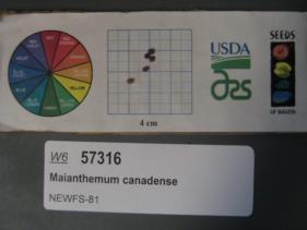 | | 2019 | | | | | | | Wild material | | 2098113 | OPGC 7923 |
| 57 | WLP 173 | NACPEC19-075 | Euonymus americanus L. | Georgia, United States | NA | | | 2019 | COLLECTED | 09/17/2019 | Rabun County; Chattahoochee-Oconee National Forest: Chattooga River Trail approximately 1/4 mile down trail from parking lot (off of Highway 76). About 0.09 miles North of Long Creek Highway (2) as the crow flies; Township unicorporated | 34.81549600, -83.30747100 | 393 | Trail edge, steep slope, 400 feet up the slope on West bank (Georgia side): Mixed mesophytic Maple-Hickory-Oak woodland | Wild material | | 2110487 | WLP 173 |
| 58 | WLP 174 | NACPEC19-076 | Clethra acuminata Michx. | Georgia, United States | NA | | | 2019 | COLLECTED | 09/17/2019 | Rabun County; Chattahoochee-Oconee National Forest: Chattooga River Trail approximately 1/2 mile down trail from parking lot (off of Highway 76); Township unicorporated | 34.81757600, -83.30720600 | 423 | Trail edge, steep slope, 400 feet up the slope on West bank (Georgia side): Mixed mesophytic Maple-Hickory-Oak woodland | Wild material | | 2110488 | WLP 174 |
| 59 | NA 84577 | RJL-RM001 | Halesia diptera J. Ellis | Texas, United States | NA | | | 2017 | COLLECTED | 07/22/2017 | Along either side of a clear creek on private property approximately 1.42 kilometers north of Texas Recreational Road 255 in northeastern Jasper County. | 31.07135000, -93.94985000 | 107 | Plants growing along the embankments of the clear creek just above normal flood stage in primarily deciduous woodlands with some broadleaved evergreens and conifers. Plants are growing in part shade; some direct sunlight occurs during mid-day hours for 1-2 hours. Soils sandy and topped with a generous undisturbed decomposed litter layer. Slope: 10 percent. Aspect: variable. | Wild material | | 1953812 | NA 84577 |
| 60 | WLP 1375 | NA 83887 | Kalmia latifolia L. | Kentucky, United States | NA | | | 2016 | COLLECTED | 09/27/2016 | Cumberland Falls State Park, Trail #6 (Cumberland Falls Trail). | 36.83700000, -84.34000000 | 302 | Break in canopy along trail near telephone pole. | | | 1953494 | WLP 1375 |
| 61 | WLP 1973 | NA 83918 | Vaccinium arboreum Marshall | Kentucky, United States | NA | | | 2016 | COLLECTED | 09/28/2016 | Cumberland Falls State Park; Cumberland Falls Trail #2 (Cumberland River Trail) at river's edge. | 36.83800000, -84.33200000 | 272 | River's edge below Juniperus virginiana and above rock. | Wild material | | 1952084 | WLP 1973 |
| 62 | NA 82746 | Site 3B/Hightower Road at Holmes Creek | Magnolia ashei Weath. | Florida, United States | NA | | | 2015 | COLLECTED | 07/31/2015 | Along Holmes Creek 0.2 miles west-southwest of Hard Castle Landing boat ramp at hte end of Hightower Road. | 30.60401000, -85.76883000 | 11 | Shade to partial shade of deciduous woodlands 10 to 15 feet above the creek, surrounded by low lying swampy area. | Wild material | Originally just called Site 3, but the "A/B" has been added to distinguish the Live Oak Landing (3A) and Hightower Road (3B) material. For previous collections of this population, see NA 81556 (2013); for later collection, see NA 82746.01 (2019). | 1950860 | NA 82746 |
| 63 | NA 82643 | NA 82643 | Lonicera sempervirens L. | Texas, United States | NA | | | 2015 | COLLECTED | 07/20/2014 | East side of Texas Route 87 approximately 0.52 miles south of Trout Creek, Texas. | 30.61156000, -93.80506000 | 21 | Southwest-facing edge of mature woodland in part to full sun; well-drained, seasonally moist soils that are sandy loam; surface has an excellent organic litter layer. | | | 1952603 | NA 82643 |