| 0 | WLP 1434 | NA 83915 | Nyssa sylvatica Marshall | Kentucky, United States | NA | | | 2016 | COLLECTED | 09/28/2016 | Cumberland Falls State Park; Cumberland Falls Visitor Center parking lot en route to Trail #2 trailhead. Overhanging road beyond water treatment plant and beyond shelter with fireplace, before circle of picnic tables. | 36.83800000, -84.33700000 | 276 | | | | 1952017 | WLP 1434 |
| 1 | WLP 1422 | JDC/NS/2014/068/570 | Nyssa sylvatica Marshall | Mississippi, United States | NA | | | 2014 | COLLECTED | 09/21/2014 | Mississippi: Lafayette County; Holly Springs National Forest along County Road 244. | 34.50982900, -89.35716800 | 95 | Floodplain. Wet woods. Growing in association with Liquidambar styraciflua, Acer negundo, Cetlis sp., Juniperus virginiana, Carya illinoinensis, Quercus nigra, and Quercus phellos. | Wild material | Fruits rather green. | 1922346 | WLP 1422 |
| 2 | NA 76678 | NA 76678 | Nyssa sylvatica Marshall | North Carolina, United States | NA | | | 2006 | COLLECTED | 10/2002 | Chimney Rock Park, woodlands near the Horticulture Complex. | | | On slope near ravine draining south. | Wild material | | 1895865 | NA 76678 |
| 3 | NA 75397 | RL 313 | Nyssa sylvatica Marshall | Alabama, United States | NA | | | 2006 | COLLECTED | 07/01/2005 | Alabama, Etowah County, Gadsden, North of Hinds Road, on sandstone outcrop. | | | | Wild material | | 1777664 | NA 75397 |
| 4 | NA 70394 | MWPCC 00-004 | Nyssa sylvatica Marshall | Virginia, United States | NA | | | 2000 | COLLECTED | 09/12/2000 | Roanoke County, Jefferson Nat'l Forest | 37.38333333, -80.15527778 | 521 | Soil: clay with shale fragments and rocks, eroded minimal organic layer. | Wild material | Single stemmed tree, 45 degree slope, South facing, but fairly shaded, 45'tall with DBH 8". | 1606343 | NA 70394 |
| 5 | NA 70425 | MWPCC00-081 | Nyssa sylvatica Marshall | North Carolina, United States | NA | | | 2000 | COLLECTED | 09/15/2000 | Buncombe Co. Asheville NC. North Carolina Arboretum | 35.49611111, -82.60972222 | 713 | near the top of a slope, native vegetation, adfacent to a service road and mowed roadside; associates; Oxydendrum, Rhus radicans, Kalmia latifolia, Acer rubrum, Quercus prinus, Quercus marilandica, Pteridium. | Wild material | Dry site for species, defoliation from stress? Ron Lance mentioned plants like this one from drier sites tend to have larger leaves. | 1608271 | NA 70425 |
| 6 | NA 61289 | GU 129 | Nyssa sylvatica Marshall | Virginia, United States | NA | | | 1989 | COLLECTED | 09/28/1989 | George Washington National Forest, Blue Ridge Parkway, Forest Road 92, along Milk Run. | 38.87916600, -78.68329600 | 701 | Moist hillside. Elevation: 2300 feet. | Wild material | | 1112035 | NA 61289 |
| 7 | NA 61278 | GU 117 | Nyssa sylvatica Marshall | United States | NA | | | 1989 | COLLECTED | 09/27/1989 | Elkhorn Lake area, flood plain, George Washington National Forest, Blue Ridge Parkway, Virginia | 38.33012800, -79.22475400 | 600 | | Wild material | | 1112030 | NA 61278 |
| 8 | NA 82646 | NA 82646 | Nyssa ogeche W. Bartram ex Marshall | Florida, United States | NA | | | 2015 | COLLECTED | 07/20/2014 | Along Holmes Creek approximately 0.7 miles east of the Hightower Road boat camp. | 30.60636000, -85.75341000 | 6 | On Holmes Creek on a muddy flat along spring-fed stream. | | | 1952137 | NA 82646 |
| 9 | PI 650012 | Ames 10808 | Helianthus microcephalus Torr. & A. Gray | Indiana, United States | NC7 | | | 1989 | COLLECTED | 09/21/1989 | 1 mile NNE of I64 and Indiana 135 interchange. Corydon, Harrison Co., Indiana. | 38.25000000, -86.13333333 | 206 | Growing on edge of black oak forest in acidic forest loam with Cornus florida, Nyssa sylvatica and Toxicodendron radicans. | Wild material | 5 plants in the population, sample size was 18 seed, okay maturity, and no disease or insect damage. | 1053651 | PI 650012 |
| 10 | NA 89171 | 2025RJLSEUS-04 | Rhododendron catawbiense Michx. | Alabama, United States | NA | | | 2026 | COLLECTED | 09/30/2025 | Scarham Creek: southeast of the Pea Ridge Road bridge, approximately 50-80 meters on the south side of the creek. | 34.32559600, -86.16054600 | 266 | Growing near the base of the slopes above the riparian zone, generally on the exposed geology under very well-drained conditions. The woodlands are primarily deciduous with a few evergreens infrequently mixed. Slope: 15 to 30 percent. Aspect: Northeast. Soil: The primary soil type in the area of this collection is classified as Rockland Series sandstone (Rc). The Rockland series consists of well drained soils formed in loamy colluvium from rotational landslides on slopes of stream valleys and dissections of ground moraines. Saturated hydraulic conductivity is moderate in the upper part of the profile and moderately slow in the lower part. Slopes range from 18 to 70 percent. Some pedons have buried leaves, twigs, and moss. Mass soil movement has left random remnants of soil structure from prior upslope soil development and has buried tree branches, leaves and moss. The upper 0-2 cm of soil contains slightly decomposed organic matter while lower soils layers to a depth of 58 cm are comprised of dark reddish-brown to brown silt loam and are moderately acidic. Below 58 cm the soils are generally dark reddish-brown silt loam and strongly to moderately alkaline. (Source:California Soil Resource Lab/NRCS Official Soil Series Descriptions). Geology: The underlying geology of this area is of Pennsylvanian origin and characterized as Pottsville Formation. It is characterized by light-gray thin to thick-bedded quartzose sandstone and conglomerate containing interbedded dark-gray shale, siltstone, and coal. Mapped on Lookout Mountain, Blount and Chandler Mountains, and Sand Mountain northeast of Blount County, and on the mountains of Jackson, Marshall, and Madison Counties north and west of the TN river. (Source: USGS Alabama Geologic Map Data). | Wild material | Received as R. catawbiense vsr. insularis | 2193305 | NA 89171 |
| 11 | NA 89155 | 2025RJLSEUS-02 | Ilex longipes Chapm. ex Trel. | Alabama, United States | NA | | | 2025 | COLLECTED | 09/30/2025 | Scarham Creek: southeast of the Pea Ridge Road bridge, approximately 50-80 meters on the south side of the creek. | 34.32520700, -86.15967000 | 261 | Plants are growing on relatively steep woodland slopes in shade. The woodlands are primarily deciduous with a few evergreens infrequently mixed. Slope: 15 to 30 percent. Aspect: Northeast. Soil: The primary soil type in the area of this collection is classified as Rockland Series sandstone (Rc). The Rockland series consists of well drained soils formed in loamy colluvium from rotational landslides on slopes of stream valleys and dissections of ground moraines. Saturated hydraulic conductivity is moderate in the upper part of the profile and moderately slow in the lower part. Slopes range from 18 to 70 percent. Some pedons have buried leaves, twigs, and moss. Mass soil movement has left random remnants of soil structure from prior upslope soil development and has buried tree branches, leaves and moss. The upper 0-2 cm of soil contains slightly decomposed organic matter while lower soils layers to a depth of 58 cm are comprised of dark reddish-brown to brown silt loam and are moderately acidic. Below 58 cm the soils are generally dark reddish-brown silt loam and strongly to moderately alkaline. (Source: California Soil Resource Lab/NRCS Official Soil Series Descriptions). Geology: The underlying geology of this area is of Pennsylvanian origin and characterized as Pottsville Formation. It is characterized by light-gray thin to thick-bedded quartzose sandstone and conglomerate containing interbedded dark-gray shale, siltstone, and coal. Mapped on Lookout Mountain, Blount and Chandler Mountains, and Sand Mountain northeast of Blount County, and on the mountains of Jackson, Marshall, and Madison Counties north and west of the TN river. (Source: USGS Alabama Geologic Map Data). | Wild material | | 2193001 | NA 89155 |
| 12 | NA 89156 | 2025RJLSEUS-03 | Euonymus americanus L. | Alabama, United States | NA | | | 2025 | COLLECTED | 09/30/2025 | Scarham Creek: southeast of the Pea Ridge Road bridge, approximately 50-80 meters on the south side of the creek. | 34.32577600, -86.16071000 | 260 | Plants are growing on relatively steep woodland slopes in shade. The woodlands are primarily deciduous with a few evergreens infrequently mixed. Slope: 15 to 30 percent. Aspect: Northeast. Soil: The primary soil type in the area of this collection is classified as Rockland Series sandstone (Rc). The Rockland series consists of well drained soils formed in loamy colluvium from rotational landslides on slopes of stream valleys and dissections of ground moraines. Saturated hydraulic conductivity is moderate in the upper part of the profile and moderately slow in the lower part. Slopes range from 18 to 70 percent. Some pedons have buried leaves, twigs, and moss. Mass soil movement has left random remnants of soil structure from prior upslope soil development and has buried tree branches, leaves and moss. The upper 0-2 cm of soil contains slightly decomposed organic matter while lower soils layers to a depth of 58 cm are comprised of dark reddish-brown to brown silt loam and are moderately acidic. Below 58 cm the soils are generally dark reddish-brown silt loam and strongly to moderately alkaline. (Source: California Soil Resource Lab/NRCS Official Soil Series Descriptions). Geology: The underlying geology of this area is of Pennsylvanian origin and characterized as Pottsville Formation. It is characterized by light-gray thin to thick-bedded quartzose sandstone and conglomerate containing interbedded dark-gray shale, siltstone, and coal. Mapped on Lookout Mountain, Blount and Chandler Mountains, and Sand Mountain northeast of Blount County, and on the mountains of Jackson, Marshall, and Madison Counties north and west of the TN river. (Source: USGS Alabama Geologic Map Data). | Wild material | | 2193002 | NA 89156 |
| 13 | NA 89158 | 2025RJLSEUS-06 | Cornus florida L. | Alabama, United States | NA | | | 2025 | COLLECTED | 10/01/2025 | Coosa Wildlife Management Area: along the edge of gated dirt road on the west side of Coosa County Road 29, 0.3 kilometers north of Hatchet Creek. | 32.86402200, -86.33871400 | 108 | Plants are growing in part sun to shade on dry-mesic slopes above the road cut on the gated dirt road; most likely a road for access for fire control/forest management. The forest is a combination of deciduous and evergreen with evergreens primarily comprised of Pinus taeda. The habitat was quite dry during this time of year. Slope: 5 to 20 percent. Aspect: North. Soils: The primary soil in the area of this collection is classified as Madison-Louisa Series complex, 15 to 30 percent slopes, moderately eroded (MdE2). The Madison Series soils are very deep, well drained soils with medium runoff found on Piedmont uplands in interstream divides, ridges and side slopes. They are comprised of residuum weathered from felsic or intermediate, high-grade metamorphic or igneous rocks high in content of mica. Slopes range from 2 to 60 percent and soil is typically strongly acidic. Louisa Series soils The Louisa Series soils consist of shallow, somewhat excessively drained soils which formed over mica gneiss and schist bedrock. They occur on Piedmont uplands. Slopes are 6 to 80 percent. This soil is moderately acid. (Source: California Soil Resource Lab/NRCS Official Soil Series Descriptions). Geology: The underlying geology of this area is of Precambrian to Paleozoic origin and characterized as Hatchet Creek Group; Pinchoulee Gneiss Formation. It is characterized by medium to fine-grained migmatitic, locally garnetiferous biotite-feldspar gneiss, commonly saturated with granitic pods. (Source: USGS Alabama Geologic Map Data). | Wild material | | 2193004 | NA 89158 |
| 14 | NA 89115 | TLM25-04a | Hamamelis ovalis S. W. Leonard | Texas, United States | NA | | | 2025 | COLLECTED | 07/10/2025 | State Highway 87 approximately 3.25 kilometers north of the crossroad junction with Texas Recreational Road 255 (RE 255); plants were growing in the narrow buffer woods along the east side of the highway. | 31.12051300, -93.72628100 | 138 | The habitat is an upland mixed coniferous and deciduous woodlands in part to full shade and dry conditions, often under drought stress. Plants seem to always occur on the top of dry ridges or well-drained slopes. Slope: 0 to 1 percent. Aspect: N/A. Soils: The soils of this collection area are classified as Tehran-Letney Association, hilly (TLE) soils. The Tehran Series (55%) consists of deep, somewhat excessively drained, moderately rapidly permeable soils on uplands. They formed in thick loamy and sandy sediments on the Western Coastal Plain. These soils are on gently sloping to moderately steep uplands with slopes ranging from 1 to 20 percent. The Letney Series (30%) consists of deep, well drained, moderately rapidly permeable, upland soils. They formed in thick sandy and loamy sediments of the coastal plains. These soils are on gently sloping to moderately steep uplands with slopes ranging from 1 to 20 percent. Soil pH ranges from 4.5 to 6.0. The minor soil components include Doucette Series (10%) and Boykin Series (5%) soils. (Source: California Soil Resource Lab/NRCS Official Soil Series Descriptions). Geology: The underlying geology of this area is of Oligocene origin and characterized as Catahoula Formation. This formation is extensive and deep in Texas, up to 185 meters thick. In the area of the collection the Catahoula Formation is primarily mudstone and sand. The upper 90-150 meters is mudstone that is tuffaceous, and sandy; also, occasionally, with some bentonitic clay. (Source: USGS Texas Geologic Map Data). | Wild material | | 2191654 | NA 89115 |
| 15 | NA 88936 | 24Flam54 | Kalmia latifolia L. | Georgia, United States | NA | | | 2025 | COLLECTED | 09/12/2025 | Clyo, GA: Metzger Farm, on a shelf above Savannah River. GPS points are a general location for the population, not individual plants [note: collections were combined into this USNA accession.] | 32.49317000, -81.22832000 | 50 | Wet woods on a steep, steep shelf above Savannah River. Growing in 3/4 shade. Slope: 45 to 60 degrees. Aspect: Northeast. | Wild material | | 2172819 | NA 88936 |
| 16 | NA 88746 | TXWL2025-039 | Ilex verticillata (L.) A. Gray | Louisiana, United States | NA | | | 2025 | COLLECTED | 01/24/2025 | Kistachie National Forest: Compartment 49, Indian Creek. | 31.09110000, -93.53333000 | | Slough/baygall area with standing water below a longleaf pine stand. | Wild material | | 2171020 | NA 88746 |
| 17 | NA 88984 | TXWL2025-034 | Ilex opaca Aiton | Texas, United States | NA | | | 2025 | COLLECTED | 01/13/2025 | Fairmount Township: Sabine National Forest C-139: Foxhunters Hill. | 31.18153000, -93.72368000 | | Baygall below a longleaf pine stand. Same system as 035 [NA 88985]. | Wild material | | 2170968 | NA 88984 |
| 18 | NA 88987 | TXWL2025-037 | Ilex opaca Aiton | Texas, United States | NA | | | 2025 | COLLECTED | 01/13/2025 | Fairmount Township: Sabine National Forest C-139: Foxhunters Hill. | 31.18365000, -93.72211000 | | Baygall below a longleaf pine stand. | Wild material | | 2170971 | NA 88987 |
| 19 | NA 88580 | 2024RJLFL-009 | Ilex myrtifolia Walter | Florida, United States | NA | | | 2024 | COLLECTED | 11/13/2024 | Woodlands on the north side of Fisher Old Mill Road about 0.10 kilometers west of intersection with DOF Y12. | 30.62693800, -86.83962200 | 6 | Mixed evergreen and deciduous moist to wet forest in part shade to full sun. From the associated taxa, this site can be quite wet during the growing season; however, it was dry during this collection time; likely due to extended drought. Slope: 0 percent. Aspect: South. | Wild material | | 2169917 | NA 88580 |
| 20 | NA 88585 | 2024RJLFL-018 | Rhododendron canescens (Michx.) Sweet | Florida, United States | NA | | | 2024 | COLLECTED | 11/14/2024 | Woodlands in the riparian zone of a headwater spring and wetland leading to Panther Creek. The area is accessed from High Bridge Road by turning south on an unnamed dirt/sand road and driving about 0.27 kilometers to a pond. | 30.90865300, -86.69107200 | 49 | Mostly deciduous woodlands in the riparian zone of a headwater spring and wetland in shade to part shade. Slope: 5 to 8 percent. Aspect: N/A. The underlying geology of this area is characterized as Citronelle Formation of the Pliocene period. The Citronelle Formation is widespread in the Gulf Coastal Plain. The type section for the Citronelle Formation, named by Matson (1916), is near Citronelle, Alabama. The Citronelle Formation grades laterally, through a broad facies transition, into the Miccosukee Formation of the eastern Florida panhandle. Coe (1979) investigated the Citronelle Formation in portions of the western Florida panhandle. The Citronelle Formation is a siliciclastic, deltaic deposit that is lithologically similar to, and time equivalent with, the Cypresshead Formation and, at least in part, the Long Key Formation (Cunningham et al., 1998) of the peninsula. In the western panhandle, some of the sediments mapped as Citronelle Formation may be reworked Citronelle. The lithologies are the same and there are few fossils present to document a possible younger age. The Citronelle Formation consists of gray to orange, often mottled, unconsolidated to poorly consolidated, very fine to very coarse, poorly sorted, clean to clayey sands. It contains significant amounts of clay, silt and gravel which may occur as beds and lenses and may vary considerably over short distances. Limonite nodules and limonite-cemented beds are common. Marine fossils are rare but fossil pollen, plant remains and occasional vertebrates are found. Much of the Citronelle Formation is highly permeable. It forms the Sand and Gravel Aquifer of the surficial aquifer system contain organics. The dominant fossils in the freshwater carbonates are mollusks. (Source: USGS Florida Geologic Map Data). The surface soil profile is classified as Troup-Orangeburg-Cowarts complex, 5 to 12 percent slopes. The Troup series consists of very deep, somewhat excessively drained soils formed in unconsolidated sandy and loamy marine sediments. Troup soils are found on ridges and hillslopes. The Orangeburg series consists of very deep, well drained, moderately permeable soils on uplands of the Southern Coastal Plain. They formed in loamy and clayey marine sediments. The Cowarts series consists of very deep, moderately well and well drained soils on ridge tops and side slopes on uplands of the Coastal Plain Major Land Resource Area. They formed in loamy marine sediments. The reaction of all these soils ranges from very strongly acid to strongly acid. (Source: USDA-NRCS Official Soil Series Descriptions). | Wild material | | 2169922 | NA 88585 |
| 21 | NA 88593 | 2024RJLNJ-001 | Ilex glabra (L.) A. Gray | New Jersey, United States | NA | | | 2024 | COLLECTED | 11/24/2024 | Mullica Township: Both sides of Duerer Street, approximately 0.37 kilometers southeast of 4th Avenue. | 39.55885000, -74.66442500 | 21 | Shade to almost full sun on compacted seasonally moist to temporarily wet areas of a mixed evergreen and deciduous woodland dominated by Pinus rigida. Vegetation of this area is very much defined by small changes in elevation that go from wet to very dry. Ilex glabra remains abundant throughout, though. Slope: N/A. Aspect: N/A. The underlying geology of this area is the Cohansey Formation of middle Miocene origin and comprised of sand, white to yellow with local gravel and clay. It is sometimes locally stained red or orange brown by iron oxides and (or) cemented into large blocks of ironstone. Unweathered clay is typically dark gray, but commonly weathers white where it is interbedded with thin beds of ironstone. Sand is typically medium grained and moderately sorted although it ranges from fine to very coarse grained and from poorly to well sorted. Sand consists of quartz and siliceous rock fragments. Some beds are locally micaceous. Maximum thickness in the map area is about 60 meters; however, thickness is difficult to determine because of the irregular basal contact and extensive post-depositional erosion. (Source: USGS New Jersey Geologic Map Data). The primary soil type in the area of this collection is classified as Mullica Series sandy loam, 0 to 2 percent slopes. These soils are typically coarse-loamy, siliceous, semiactive, and mesic typic humaquepts that are strongly to extremely acidic throughout the profile. The typical solum thickness ranges from 50-150+ cm. These soils are generally considered to be poorly drained. (Source: NRCS Web Soil Survey). | Wild material | | 2169930 | NA 88593 |
| 22 | NA 89077 | 2024RJLPA-003 | Viburnum acerifolium L. | Pennsylvania, United States | NA | | | 2024 | COLLECTED | 09/19/2024 | Birdell Road, near parking lot to trail where the road ends at Chambers Lake, which is part of Hibernia County Park. | 40.03559500, -75.85708600 | 187 | Plants are growing in deep shade of a dry deciduous forest dominated by Fagus grandifolia. Slope: 0 percent. Aspect: N/A. Geology: The underlying geology of this area is of Precambrian origin and characterized as Banded Mafic Gneiss. It is characterized as dark and fine to medium grained. This formation includes rocks of probable sedimentary origin; may be equivalent to "PZmgh." (Source: USGS Pennsylvania Geologic Map Data). Soils: The primary soil type in the area of this collection is classified as Neshaminy Series Silt Loam, very deep over mafic gneiss, 3 to 8 percent slopes (NvB). (Source: USDA-NRCS Official Soil Series Descriptions). EPA Ecoregion (Level III): Northern Piedmont (64). EPA Ecoregion (Level IV): Piedmont Uplands (64c). | Wild material | | 2169041 | NA 89077 |
| 23 | NA 89080 | 2024RJLPA-006 | Ilex montana Torr. & A. Gray | Pennsylvania, United States | NA | | | 2024 | COLLECTED | 09/20/2024 | Berks and Schuylkill Counties: Hawk Mountain Sanctuary. | 40.64162200, -75.99122600 | 418 | Plants are growing from shade to full sun on a dry-mesic to very dry, well-drained upland/montane habitat characterized by an upland mixed deciduous and evergreen forest that is very rocky. All the plants found in this habitat go through periods of drought during the growing season due to the limited litter/soil layer in which moisture can be held. Elevation: 405 to 430 meters. Slope: 5 to 25 percent. Aspect: various. Geology: The underlying geology of this area is of Silurian origin and comprised of Shawangunk Formation. This formation is primarily light- to dark-gray, fine- to very coarse-grained sandstone and conglomerate containing thin shale interbeds. (Source: USGS Pennsylvania Geologic Map Data). Soils: The surface soil profile of this area is characterized as the Hazleton Series which consists of deep and very deep, well drained soils formed in residuum of acid gray, brown or red sandstone on uplands. The matrix includes a considerable accumulation of thin, flat, coarse fragments of sandstone, limestone, or schist with diameters up to 15 cm. Slope ranges from 0-80%. Permeability is moderately rapid to rapid. (Source: USDA-NRCS Official Soil Series Descriptions). EPA Ecoregion (Level III): Ridge and Valley (67). EPA Ecoregion (Level IV): Northern Sandstone Ridges (67c). | Wild material | | 2169044 | NA 89080 |
| 24 | NA 89081 | 2024RJLPA-009 | Rosa carolina L. | Pennsylvania, United States | NA | | | 2024 | COLLECTED | 09/22/2024 | Lancaster and York Counties: outcrops along the Susquehanna River, accessed from the Historic Lock 12 parking lot off of Pennsylvania Road 372. | 39.81483500, -76.32762200 | 34 | Plants are growing from part-sun to full sun in crevices of the outcrops and where organic debris has accumulated in between boulders along the Susquehanna River. The sites range from nearly xeric to dry mesic, at least on the surface. Plants are generally growing 4-10 m above the normal flow of the river; however, the Holtwood Dam is less than 1 kilometer upstream and debris found trapped in the boulders indicates that there is periodic flooding, at least, in the lower zone of 4+ meters or so above normal river flow. This habitat has a diverse assemblage of deciduous trees and shrubs as well as abundant herbaceous taxa. Slope: 0 to 60 percent. Aspect: Northeast (generally). Geology: The underlying geology of this area is probably of lower Paleozoic age and characterized as the Octoraro Formation. It includes albite-chlorite schist, phyllite, some hornblende gneiss, and granitized members. Soils: The area where this species occurs is right on the edge of two soil zones that transition from the river’s edge to mesic conditions upslope. The first is generally referred to as Rock Outcrop. This terrestrial matrix in which plants grow is largely exposed underlying rock geology with accumulated outwash, rock decomposition, and organic debris buildup. The second is Mt. Airy (80%) and Manor (20%) Series soils, 25 to 60 percent slopes, extremely stony (MRF). (Source: California Soil Resource Lab/NRCS Official Soil Series Descriptions). EPA Ecoregion (Level III): Northern Piedmont (64). EPA Ecoregion (Level IV): Piedmont Uplands (64c). | Wild material | | 2169045 | NA 89081 |
| 25 | NA 89082 | 2024RJLPA-010 | Amorpha fruticosa L. | Pennsylvania, United States | NA | | | 2024 | COLLECTED | 09/22/2024 | Outcrops along the Susquehanna River, accessed from the Historic Lock 12 parking lot off of Pennsylvania Road 372. | 39.81481500, -76.32757900 | 34 | Plants are growing from part-sun to full sun in crevices of the outcrops and where organic debris has accumulated in between boulders along the Susquehanna River. The sites range from nearly xeric to dry mesic, at least on the surface. Plants are generally growing 4-10 m above the normal flow of the river; however, the Holtwood Dam is less than 1 kilometer upstream and debris found trapped in the boulders indicates that there is periodic flooding, at least, in the lower zone of 4+ meters or so above normal river flow. This habitat has a diverse assemblage of deciduous trees and shrubs as well as abundant herbaceous taxa. Slope: 0 to 25 percent. Aspect: Northeast (generally). Geology: The underlying geology of this area is probably of lower Paleozoic age and characterized as the Octoraro Formation. It includes albite-chlorite schist, phyllite, some hornblende gneiss, and granitized members. Soils: The area where this species occurs is right on the edge of two soil zones that transition from the river’s edge to mesic conditions upslope. The first is generally referred to as Rock Outcrop. This terrestrial matrix in which plants grow is largely exposed underlying rock geology with accumulated outwash, rock decomposition, and organic debris buildup. The second is Mt. Airy (80%) and Manor (20%) Series soils, 25 to 60 percent slopes, extremely stony (MRF). (Source: California Soil Resource Lab/NRCS Official Soil Series Descriptions). EPA Ecoregion (Level III): Northern Piedmont (64). EPA Ecoregion (Level IV): Piedmont Uplands (64c). | Wild material | | 2169046 | NA 89082 |
| 26 | NA 89083 | 2024RJLPA-012 | Rhododendron periclymenoides (Michx.) Shinners | Pennsylvania, United States | NA | | | 2024 | COLLECTED | 09/22/2024 | Outcrops along the Susquehanna River, accessed from the Historic Lock 12 parking lot off of Pennsylvania Road 372. | 39.81477400, -76.32807300 | 35 | Plants are growing from shade to part-sun and occasionally full sun in crevices of the outcrops and where organic debris has accumulated in between boulders along the Susquehanna River. The sites range from nearly xeric to mesic, at least on the surface. Plants are generally growing 4-10 m above the normal flow of the river; however, the Holtwood Dam is less than 1 kilometer upstream and debris found trapped in the boulders indicates that there is periodic flooding, at least, in the lower zone of 4+ meters or so above normal river flow. This habitat has a diverse assemblage of deciduous trees and shrubs as well as abundant herbaceous taxa. Slope: 0 to 60 percent. Aspect: Northeast (generally). Geology: The underlying geology of this area is probably of lower Paleozoic age and characterized as the Octoraro Formation. It includes albite-chlorite schist, phyllite, some hornblende gneiss, and granitized members. Soils: The area where this species occurs is right on the edge of two soil zones that transition from the river’s edge to mesic conditions upslope. The first is generally referred to as Rock Outcrop. This terrestrial matrix in which plants grow is largely exposed underlying rock geology with accumulated outwash, rock decomposition, and organic debris buildup. The second is Mt. Airy (80%) and Manor (20%) Series soils, 25 to 60 percent slopes, extremely stony (MRF). (Source: California Soil Resource Lab/NRCS Official Soil Series Descriptions). EPA Ecoregion (Level III): Northern Piedmont (64). EPA Ecoregion (Level IV): Piedmont Uplands (64c). | Wild material | | 2169047 | NA 89083 |
| 27 | NA 89084 | 2024RJLPA-013 | Physocarpus opulifolius (L.) Maxim. | Pennsylvania, United States | NA | | | 2024 | COLLECTED | 09/22/2024 | Outcrops along the Susquehanna River, accessed from the Historic Lock 12 parking lot off of Pennsylvania Road 372. | 39.81466300, -76.32833900 | 36 | Plants are growing from shade to part-sun where organic debris has accumulated in between boulders as well as further upslope in deeper mesic soils along the Susquehanna River. This habitat has a diverse assemblage of deciduous trees and shrubs as well as abundant herbaceous taxa. Slope: 10 to 25 percent. Aspect: Northeast (generally). Geology: The underlying geology of this area is probably of lower Paleozoic age and characterized as the Octoraro Formation. It includes albite-chlorite schist, phyllite, some hornblende gneiss, and granitized members. Soils: The area where this species occurs is right on the edge of two soil zones that transition from the river’s edge to mesic conditions upslope. The first is generally referred to as Rock Outcrop. This terrestrial matrix in which plants grow is largely exposed underlying rock geology with accumulated outwash, rock decomposition, and organic debris buildup. The second is Mt. Airy (80%) and Manor (20%) Series soils, 25 to 60 percent slopes, extremely stony (MRF). (Source: California Soil Resource Lab/NRCS Official Soil Series Descriptions). EPA Ecoregion (Level III): Northern Piedmont (64). EPA Ecoregion (Level IV): Piedmont Uplands (64c). | Wild material | | 2169048 | NA 89084 |
| 28 | NA 89085 | 2024RJLPA-014 | Rhododendron arborescens (Pursh) Torr. | Pennsylvania, United States | NA | | | 2024 | COLLECTED | 09/22/2024 | Outcrops along the Susquehanna River, accessed from the Historic Lock 12 parking lot off of Pennsylvania Road 372. | 39.81618100, -76.33069800 | 38 | Plants are growing from shade to part-sun and occasionally full sun in crevices of the outcrops and where organic debris has accumulated in between boulders along the Susquehanna River. The sites range from nearly xeric to mesic, at least on the surface. Plants are generally growing 4-10 m above the normal flow of the river; however, the Holtwood Dam is less than 1 kilometer upstream and debris found trapped in the boulders indicates that there is periodic flooding, at least, in the lower zone of 4+ meters or so above normal river flow. This habitat has a diverse assemblage of deciduous trees and shrubs as well as abundant herbaceous taxa. Slope: 0 to 75 percent. Aspect: Northeast (generally). Geology: The underlying geology of this area is probably of lower Paleozoic age and characterized as the Octoraro Formation. It includes albite-chlorite schist, phyllite, some hornblende gneiss, and granitized members. Soils: The area where this species occurs is right on the edge of two soil zones that transition from the river’s edge to mesic conditions upslope. The first is generally referred to as Rock Outcrop. This terrestrial matrix in which plants grow is largely exposed underlying rock geology with accumulated outwash, rock decomposition, and organic debris buildup. The second is Mt. Airy (80%) and Manor (20%) Series soils, 25 to 60 percent slopes, extremely stony (MRF). (Source: California Soil Resource Lab/NRCS Official Soil Series Descriptions). EPA Ecoregion (Level III): Northern Piedmont (64). EPA Ecoregion (Level IV): Piedmont Uplands (64c). | Wild material | | 2169049 | NA 89085 |
| 29 | NA 89086 | 2024RJLPA-015 | Ilex verticillata (L.) A. Gray | Pennsylvania, United States | NA | | | 2024 | COLLECTED | 09/22/2024 | Outcrops along the Susquehanna River, accessed from the Historic Lock 12 parking lot off of Pennsylvania Road 372. | 39.81656600, -76.33136600 | 38 | Plants are growing from part-sun to full sun in crevices of the outcrops and where organic debris has accumulated in between boulders along the Susquehanna River. The sites range from nearly xeric to dry mesic, at least on the surface. Plants are generally growing 4-10 m above the normal flow of the river; however, the Holtwood Dam is less than 1 kilometer upstream and debris found trapped in the boulders indicates that there is periodic flooding, at least, in the lower zone of 4+ meters or so above normal river flow. This habitat has a diverse assemblage of deciduous trees and shrubs as well as abundant herbaceous taxa. Slope: 0 to 10 percent. Aspect: Northeast (generally). Geology: The underlying geology of this area is probably of lower Paleozoic age and characterized as the Octoraro Formation. It includes albite-chlorite schist, phyllite, some hornblende gneiss, and granitized members. Soils: The area where this species occurs is right on the edge of two soil zones that transition from the river’s edge to mesic conditions upslope. The first is generally referred to as Rock Outcrop. This terrestrial matrix in which plants grow is largely exposed underlying rock geology with accumulated outwash, rock decomposition, and organic debris buildup. The second is Mt. Airy (80%) and Manor (20%) Series soils, 25 to 60 percent slopes, extremely stony (MRF). (Source: California Soil Resource Lab/NRCS Official Soil Series Descriptions). EPA Ecoregion (Level III): Northern Piedmont (64). EPA Ecoregion (Level IV): Piedmont Uplands (64c). | Wild material | | 2169050 | NA 89086 |
| 30 | NA 89087 | 2024RJLPA-016 | Hydrangea arborescens L. | Pennsylvania, United States | NA | | | 2024 | COLLECTED | 09/22/2024 | Outcrops along the Susquehanna River, accessed from the Historic Lock 12 parking lot off of Pennsylvania Road 372. | 39.81489000, -76.32912200 | 43 | Plants are growing in deep shade of the deciduous woodlands on outcrops and the steep slopes where organic debris and detritus has accumulated. This habitat has a diverse assemblage of deciduous trees and shrubs as well as abundant herbaceous taxa. Slope: 30 to 90 percent. Aspect: Northeast (generally). Geology: The underlying geology of this area is probably of lower Paleozoic age and characterized as the Octoraro Formation. It includes albite-chlorite schist, phyllite, some hornblende gneiss, and granitized members. (Source: Source: USGS Pennsylvania Geologic Map Data). Soils: The area where this species occurs is right on the edge of two soil zones that transition from the river’s edge to mesic conditions upslope. The first is generally referred to as Rock Outcrop. This terrestrial matrix in which plants grow is largely exposed underlying rock geology with accumulated outwash, rock decomposition, and organic debris buildup. The second is Mt. Airy (80%) and Manor (20%) Series soils, 25 to 60 percent slopes, extremely stony (MRF). (Source: California Soil Resource Lab/NRCS Official Soil Series Descriptions). EPA Ecoregion (Level III): Northern Piedmont (64). EPA Ecoregion (Level IV): Piedmont Uplands (64c). | Wild material | | 2169051 | NA 89087 |
| 31 | NA 89088 | 2024RM-TK-001 | Viburnum acerifolium L. | Alabama, United States | NA | | | 2024 | COLLECTED | 09/19/2024 | Haines Island Park. Follow Ferry Road to the top of the hill entering the park where a picnic shelter is located. Plants are growing along trails to the north of the picnic shelter. | 31.72132026, -87.46408910 | 81 | Plants are growing from part-sun to full shade in the understory of a mixed deciduous and coniferous forest on very dry upland habitat. Slope: 10 to 20 percent. Aspect: North. Geology: The underlying geology of this area is probably of Eocene age and characterized as the Claiborne Group: Tallahatta Formation. It is comprised of white to very light-greenish-gray thin-bedded to massive siliceous claystone; interbedded with thin layers of fossiliferous clay, sandy clay, and glauconitic sand and sandstone. White to light-greenish-gray fine to coarse sand and fine gravel occur at the base of the formation in southwest Alabama (Meridian Sand Member). (Source: USGS Alabama Geologic Map Data). Soils: The area of this occurrence is characterized as Arundel Series Loam, 8 to 35 percent slopes (ArF). The Arundel series consists of moderately deep, well drained, very slowly permeable soils on dissected uplands of the Southern Coastal Plain Major Land Resource Area (MLRA 133A). They formed in marine deposits consisting of acid clays underlain by horizontally bedded sandstone, buhrstone and siltstone. Slopes range from 2 to 60 percent. (Source: California Soil Resource Lab/NRCS Official Soil Series Descriptions). EPA Ecoregion (Level III): Southeastern Plains (65). EPA Ecoregion (Level IV): Buhrstone/Lime Hills (65q). | Wild material | | 2169052 | NA 89088 |
| 32 | NA 89089 | 2024RM-TK-002 | Viburnum acerifolium L. | Alabama, United States | NA | | | 2024 | COLLECTED | 09/19/2024 | Woodland slopes around and below the hilltop parking area leading down to the Silver Creek Lake Campground off of Silver Creek Lake Road. | 31.66612294, -87.57569860 | 49 | Plants are growing in shade of upland dry mesic, mature mixed deciduous and evergreen woodland. Generally, the overstory is thinner and there is less leaf litter cover, making the surface soil conditions drier. Slope: 5 to 10 percent. Aspect: Southeast. Geology: The underlying geology of this area is Claiborne Group, Tallahatta Formation, of Eocene origin, with white to very light-greenish-gray thin-bedded to massive siliceous claystone; interbedded with thin layers of fossiliferous clay, sandy clay, and glauconitic sand and sandstone. (Source: USGS Alabama Geologic Map Data). Soils: The primary soil types in the collection area are classified as Arundel-Cantuche Complex soils (15 to 35 percent slopes). The Arundel Series consists of moderately deep, well drained, very slowly permeable soils on dissected uplands of the Southern Coastal Plain. They formed in marine deposits consisting of acid clays underlain by horizontally bedded sandstone, buhrstone and siltstone. These soils are strongly acid. Slopes range from 2 to 60 percent. The Cantuche Series consists of shallow, well drained, moderately permeable soils that formed over horizontally bedded claystone. These soils are on narrow ridgetops and narrow benches on steep side-slopes of dissected landscapes in the Coastal Plain. They are strongly acid. Slopes range from 2 to 35 percent. (Source: California Soil Resource Lab/NRCS Official Soil Series Descriptions). EPA Ecoregion (Level III): Southeastern Plains (65). EPA Ecoregion (Level IV): Buhrstone/Lime Hills (65q). | Wild material | | 2169053 | NA 89089 |
| 33 | NA 89090 | 2024RM-TK-003 | Ilex longipes Chapm. ex Trel. | Alabama, United States | NA | | | 2024 | COLLECTED | 09/19/2024 | Woodland slopes around and below the hilltop parking area leading down to the Silver Creek Lake Campground off of Silver Creek Lake Road. | 31.66612294, -87.57569860 | 39 | Plants are growing in part-shade to shade of a moist mesic deciduous and evergreen woodland on dry, well-drained soil to an area 1-2 meters above a small seasonally spring-fed creek at 31.664428°, -87.574614°. Slope: 5 to 10 percent. Aspect: Southeast. Geology: The underlying geology of this area is Claiborne Group, Tallahatta Formation, of Eocene origin, with white to very light-greenish-gray thin-bedded to massive siliceous claystone; interbedded with thin layers of fossiliferous clay, sandy clay, and glauconitic sand and sandstone. (Source: USGS Alabama Geologic Map Data). Soils: The primary soil types in the collection area are classified as Arundel-Cantuche Complex soils (15 to 35 percent slopes). The Arundel Series consists of moderately deep, well drained, very slowly permeable soils on dissected uplands of the Southern Coastal Plain. They formed in marine deposits consisting of acid clays underlain by horizontally bedded sandstone, buhrstone and siltstone. These soils are strongly acid. Slopes range from 2 to 60 percent. The Cantuche Series consists of shallow, well drained, moderately permeable soils that formed over horizontally bedded claystone. These soils are on narrow ridgetops and narrow benches on steep side-slopes of dissected landscapes in the Coastal Plain. They are strongly acid. Slopes range from 2 to 35 percent. (Source: California Soil Resource Lab/NRCS Official Soil Series Descriptions). EPA Ecoregion (Level III): Southeastern Plains (65). EPA Ecoregion (Level IV): Buhrstone/Lime Hills (65q). | Wild material | | 2169054 | NA 89090 |
| 34 | WLP 3432 | RM2023-001 | Rhododendron minus Michx. | Georgia, United States | NA | | | 2024 | COLLECTED | 10/21/2023 | Plants growing along Patterson Gap Road. | 34.96995500, -83.47722800 | 1005 | Plants growing in part shade to sun in an upland, very dry and rocky, mostly deciduous habitat. The site is steeply sloped, underlain by rock, with rocky outcrops. Slope: 15 to 65 percent. Aspect: Variable. The underlying geology of this area is Quartzite/Mica Schist, primarily of Precambrian-Paleozoic origin. (Source: USGS North Carolina Geologic Map Data.) The primary soil type in the collection area is classified as Ashe Series that is stony and very steep. The Ashe series consists of moderately deep, somewhat excessively drained soils on gently sloping to very steep ridges and side slopes of the Blue Ridge. They formed in residuum that is affected by soil creep in the upper part, and weathered from felsic or mafic igneous and high-grade metamorphic rocks such as granite, hornblende gneiss, granodiorite, biotite gneiss, and high-grade metagraywacke. Slope ranges from 2 to 95 percent. The surface layer to 5cm deep is comprised of moderately decomposed organic matter and leaves, twigs, and roots. Layers to 70cm deep range from very dark grayish brown to brown sandy loam with weak medium and coarse granular structure that is friable. A few fine flakes of mica can be found and these soils are very strongly acid. (Source: NRCS Web Soil Survey.) | Wild material | | 2166141 | WLP 3432 |
| 35 | NA 88689 | RJL2023NJ-002 | Kalmia latifolia L. | New Jersey, United States | NA | | | 2023 | COLLECTED | 11/10/2023 | Franklin Township: Piney Hollow Preservation Area (the site is owned by Franklin Township). Plants accessed by foot along trails throughout property. | 39.57400900, -74.93602400 | 32 | Plants growing in shade to part-shade of a mesic to mesic-dry woodland habitat that is mostly deciduous, but also includes pine overstory. Slope: N/A. Aspect: N/A. Soils: The underlying geology of this area is of Middle Miocene, Serravallian origin and characterized as an Cohansey Formation. It is comprised of sand, white to yellow with local gravel and clay. Locally stained red or orange brown by iron oxides and (or) cemented into large blocks of ironstone. Unweathered clay is typically dark gray, but commonly weathers white where interbedded with thin beds of ironstone. Unit is a complex of interfingering marine and nonmarine facies. Sand is typically medium grained and moderately sorted although it ranges from fine to very coarse grained and from poorly to well sorted. Sand consists of quartz and siliceous rock fragments. Some beds are locally micaceous. In general, the sand is crossbedded, although the style of crossbedding varies significantly with the paleoenvironment. Trough crossbedding predominates, especially in the nonmarine channel fill deposits, and the scale of the crossbeds varies from small to large. Maximum thickness in the map area is about 60 m; however, thickness is difficult to determine because of the irregular basal contact and extensive post-depositional erosion. There is as much as 18 m of relief along the basal contact. The basal contact is sharp, undulatory, and directly overlain by a thin gravel bed. The Cohansey Formation unconformably overlies the Kirkwood Formation and is found in channels cut down into the Kirkwood. Where the Kirkwood consists of sandy, light-colored sediments, the basal contact of the Cohansey is drawn below crossbedded sediments. Where the Kirkwood consists of dark-colored silty beds, the basal contact is drawn between light-colored Cohansey sediments and the underlying dark-colored sediments. The Cohansey was markedly thinned because of erosion prior to deposition of overlying units in the western and southern parts of the southern sheet. The unit has been extensively eroded and stripped from large areas of the New Jersey Coastal Plain, particularly in the central sheet where outliers are common. In spite of its widespread nature, the Cohansey is poorly exposed because of its loose sandy composition, which causes it to erode easily. (Source: USGS New Jersey Geologic Map Data.) The primary soil type in the location of this collection is classified as Downer loamy sand, 0 to 5 percent slopes, Northern Coastal Plain. Downer Series soils are very deep, well-drained soils that are coarse-loamy, siliceous, semiactive, mesic Typic Hapludults. The upper strata of Downer Series from 0 to 25 cm is dark grayish brown, brown loamy sand that is dry with weak fine granular structure. It is very friable and strongly acid. Lower strata from 25 to 76 cm are yellowish brown single grain, loose loamy sand with few extremely weakly cemented masses of oxidized iron in the lower part. This layer is very strongly acid. (Source: NRCS Web Soil Survey.) | Wild material | | 2159117 | NA 88689 |
| 36 | NA 88690 | RJL2023NJ-003 | Ilex verticillata (L.) A. Gray | New Jersey, United States | NA | | | 2023 | COLLECTED | 11/10/2023 | Franklin Township: Piney Hollow Preservation Area (the site is owned by Franklin Township). This species was found below the dam at the far end of McCarthys Lakes. Plants accessed by foot along trails throughout property. | 39.57407200, -74.92518600 | 28 | Plants growing in part-shade to sun of the moist to saturated areas below the McCarthys Lakes dam in the wetlands associated with the New Squankum Branch. The area appears to be inundated year-round with plants growing on low mounds surrounded by obligate wetland species. Slope: N/A. Aspect: N/A. The underlying geology of this area is of Middle Miocene, Serravallian origin and characterized as an Cohansey Formation. It is comprised of sand, white to yellow with local gravel and clay. Locally stained red or orange brown by iron oxides and (or) cemented into large blocks of ironstone. Unweathered clay is typically dark gray, but commonly weathers white where interbedded with thin beds of ironstone. Unit is a complex of interfingering marine and nonmarine facies. Sand is typically medium grained and moderately sorted although it ranges from fine to very coarse grained and from poorly to well sorted. Sand consists of quartz and siliceous rock fragments. Some beds are locally micaceous. In general, the sand is crossbedded, although the style of crossbedding varies significantly with the paleoenvironment. Trough crossbedding predominates, especially in the nonmarine channel fill deposits, and the scale of the crossbeds varies from small to large. Maximum thickness in the map area is about 60 m; however, thickness is difficult to determine because of the irregular basal contact and extensive post-depositional erosion. There is as much as 18 m of relief along the basal contact. The basal contact is sharp, undulatory, and directly overlain by a thin gravel bed. The Cohansey Formation unconformably overlies the Kirkwood Formation and is found in channels cut down into the Kirkwood. Where the Kirkwood consists of sandy, light-colored sediments, the basal contact of the Cohansey is drawn below crossbedded sediments. Where the Kirkwood consists of dark-colored silty beds, the basal contact is drawn between light-colored Cohansey sediments and the underlying dark-colored sediments. The Cohansey was markedly thinned because of erosion prior to deposition of overlying units in the western and southern parts of the southern sheet. The unit has been extensively eroded and stripped from large areas of the New Jersey Coastal Plain, particularly in the central sheet where outliers are common. In spite of its widespread nature, the Cohansey is poorly exposed because of its loose sandy composition, which causes it to erode easily. (Source: USGS New Jersey Geologic Map Data.) The primary soil type in the collection area is classified as Manahawkin Series muck, 0 to 2 percent slopes, frequently flooded, Northern Coastal Plain. Manahawkin Series soils are very deep, very poorly drained soils that are sandy or sandy-skeletal, siliceous, dysic, mesic Terric Haplosaprists high in organic deposits that are found in lake basins, back swamps, floodplains, and freshwater channels. The soils are classified in the dysic reaction class because pH in water dominantly ranges from 4.5 to 5.0. The zone from the soil surface to a depth of 200 cm is continuously saturated (endosaturation). The upper strata of Manahawkin Series from 0 to 76 cm is black broken face and rubbed muck; 10 percent fibers, less than 2 percent rubbed; moderate medium granular structure; mat of many fine roots; identifiable material is primarily herbaceous with a trace of woody fragments; 85-95 percent organic matter; extremely acid. Lower strata to 200 cm are gray sand, single grained and loose; strongly acid. (Source: NRCS Web Soil Survey.) | Wild material | | 2159118 | NA 88690 |
| 37 | NA 88691 | RJL2023NJ-004 | Ilex laevigata (Pursh) A. Gray | New Jersey, United States | NA | | | 2023 | COLLECTED | 11/10/2023 | Franklin Township: Piney Hollow Preservation Area (the site is owned by Franklin Township). This species was found below the dam at the far end of McCarthys Lakes. Plants accessed by foot along trails throughout property. | 39.57404200, -74.92523700 | 28 | Plants growing in part-shade to sun of the moist to saturated areas below the McCarthys Lakes dam in the wetlands associated with the New Squankum Branch. The area appears to be inundated year-round with plants growing on low mounds surrounded by obligate wetland species. Slope: N/A. Aspect: N/A. The underlying geology of this area is of Middle Miocene, Serravallian origin and characterized as an Cohansey Formation. It is comprised of sand, white to yellow with local gravel and clay. Locally stained red or orange brown by iron oxides and (or) cemented into large blocks of ironstone. Unweathered clay is typically dark gray, but commonly weathers white where interbedded with thin beds of ironstone. Unit is a complex of interfingering marine and nonmarine facies. Sand is typically medium grained and moderately sorted although it ranges from fine to very coarse grained and from poorly to well sorted. Sand consists of quartz and siliceous rock fragments. Some beds are locally micaceous. In general, the sand is crossbedded, although the style of crossbedding varies significantly with the paleoenvironment. Trough crossbedding predominates, especially in the nonmarine channel fill deposits, and the scale of the crossbeds varies from small to large. Maximum thickness in the map area is about 60 m; however, thickness is difficult to determine because of the irregular basal contact and extensive post-depositional erosion. There is as much as 18 m of relief along the basal contact. The basal contact is sharp, undulatory, and directly overlain by a thin gravel bed. The Cohansey Formation unconformably overlies the Kirkwood Formation and is found in channels cut down into the Kirkwood. Where the Kirkwood consists of sandy, light-colored sediments, the basal contact of the Cohansey is drawn below crossbedded sediments. Where the Kirkwood consists of dark-colored silty beds, the basal contact is drawn between light-colored Cohansey sediments and the underlying dark-colored sediments. The Cohansey was markedly thinned because of erosion prior to deposition of overlying units in the western and southern parts of the southern sheet. The unit has been extensively eroded and stripped from large areas of the New Jersey Coastal Plain, particularly in the central sheet where outliers are common. In spite of its widespread nature, the Cohansey is poorly exposed because of its loose sandy composition, which causes it to erode easily. (Source: USGS New Jersey Geologic Map Data.) The primary soil type in the collection area is classified as Manahawkin Series muck, 0 to 2 percent slopes, frequently flooded, Northern Coastal Plain. Manahawkin Series soils are very deep, very poorly drained soils that are sandy or sandy-skeletal, siliceous, dysic, mesic Terric Haplosaprists high in organic deposits that are found in lake basins, back swamps, floodplains, and freshwater channels. The soils are classified in the dysic reaction class because pH in water dominantly ranges from 4.5 to 5.0. The zone from the soil surface to a depth of 200 cm is continuously saturated (endosaturation). The upper strata of Manahawkin Series from 0 to 76 cm is black broken face and rubbed muck; 10 percent fibers, less than 2 percent rubbed; moderate medium granular structure; mat of many fine roots; identifiable material is primarily herbaceous with a trace of woody fragments; 85-95 percent organic matter; extremely acid. Lower strata to 200 cm are gray sand, single grained and loose; strongly acid. (Source: NRCS Web Soil Survey.) | Wild material | | 2159119 | NA 88691 |
| 38 | NA 88692 | RJL2023NJ-005 | Ilex opaca Aiton | New Jersey, United States | NA | | | 2023 | COLLECTED | 11/10/2023 | Franklin Township: Piney Hollow Preservation Area (the site is owned by Franklin Township). This species was found on as well as below the dam at the far end of McCarthys Lakes. Plants accessed by foot along trails throughout property. | 39.57423200, -74.92525600 | 29 | Plants growing in part-shade to sun of the moist to saturated areas below the McCarthys Lakes dam in the wetlands associated with the New Squankum Branch. Plants were also found growing on the slopes of the dam in well-drained mesic to dry-mesic conditions. This species is clearly adaptable to a variety of conditions. Slope: 0 to 15 percent. Aspect: East. Elevation: 28 to 30 meters. NOTE: In addition to the soil type described below, this species was also growing on the slopes of a constructed earthen dam of unknown soil origin. The underlying geology of this area is of Middle Miocene, Serravallian origin and characterized as an Cohansey Formation. It is comprised of sand, white to yellow with local gravel and clay. Locally stained red or orange brown by iron oxides and (or) cemented into large blocks of ironstone. Unweathered clay is typically dark gray, but commonly weathers white where interbedded with thin beds of ironstone. Unit is a complex of interfingering marine and nonmarine facies. Sand is typically medium grained and moderately sorted although it ranges from fine to very coarse grained and from poorly to well sorted. Sand consists of quartz and siliceous rock fragments. Some beds are locally micaceous. In general, the sand is crossbedded, although the style of crossbedding varies significantly with the paleoenvironment. Trough crossbedding predominates, especially in the nonmarine channel fill deposits, and the scale of the crossbeds varies from small to large. Maximum thickness in the map area is about 60 m; however, thickness is difficult to determine because of the irregular basal contact and extensive post-depositional erosion. There is as much as 18 m of relief along the basal contact. The basal contact is sharp, undulatory, and directly overlain by a thin gravel bed. The Cohansey Formation unconformably overlies the Kirkwood Formation and is found in channels cut down into the Kirkwood. Where the Kirkwood consists of sandy, light-colored sediments, the basal contact of the Cohansey is drawn below crossbedded sediments. Where the Kirkwood consists of dark-colored silty beds, the basal contact is drawn between light-colored Cohansey sediments and the underlying dark-colored sediments. The Cohansey was markedly thinned because of erosion prior to deposition of overlying units in the western and southern parts of the southern sheet. The unit has been extensively eroded and stripped from large areas of the New Jersey Coastal Plain, particularly in the central sheet where outliers are common. In spite of its widespread nature, the Cohansey is poorly exposed because of its loose sandy composition, which causes it to erode easily. (Source: USGS New Jersey Geologic Map Data.) The primary soil type in the collection area is classified as Manahawkin Series muck, 0 to 2 percent slopes, frequently flooded, Northern Coastal Plain. Manahawkin Series soils are very deep, very poorly drained soils that are sandy or sandy-skeletal, siliceous, dysic, mesic Terric Haplosaprists high in organic deposits that are found in lake basins, back swamps, floodplains, and freshwater channels. The soils are classified in the dysic reaction class because pH in water dominantly ranges from 4.5 to 5.0. The zone from the soil surface to a depth of 200 cm is continuously saturated (endosaturation). The upper strata of Manahawkin Series from 0 to 76 cm is black broken face and rubbed muck; 10 percent fibers, less than 2 percent rubbed; moderate medium granular structure; mat of many fine roots; identifiable material is primarily herbaceous with a trace of woody fragments; 85-95 percent organic matter; extremely acid. Lower strata to 200 cm are gray sand, single grained and loose; strongly acid. (Source: NRCS Web Soil Survey.) | Wild material | | 2159120 | NA 88692 |
| 39 | NA 88693 | RJL2023NJ-006 | Clethra alnifolia L. | New Jersey, United States | NA | | | 2023 | COLLECTED | 11/10/2023 | Franklin Township: Piney Hollow Preservation Area (the site is owned by Franklin Township). Plants accessed by foot along trails throughout property. | 39.57319800, -74.92908900 | 29 | Plants growing in shade to part-shade over a wide range of habitats from mesic to mesic-dry as well as moist to wetland habitats. The woodlands are mostly deciduous, but also include occasional pine overstory. Slope: N/A. Aspect: N/A. The underlying geology of this area is of Middle Miocene, Serravallian origin and characterized as an Cohansey Formation. It is comprised of sand, white to yellow with local gravel and clay. Locally stained red or orange brown by iron oxides and (or) cemented into large blocks of ironstone. Unweathered clay is typically dark gray, but commonly weathers white where interbedded with thin beds of ironstone. Unit is a complex of interfingering marine and nonmarine facies. Sand is typically medium grained and moderately sorted although it ranges from fine to very coarse grained and from poorly to well sorted. Sand consists of quartz and siliceous rock fragments. Some beds are locally micaceous. In general, the sand is crossbedded, although the style of crossbedding varies significantly with the paleoenvironment. Trough crossbedding predominates, especially in the nonmarine channel fill deposits, and the scale of the crossbeds varies from small to large. Maximum thickness in the map area is about 60 m; however, thickness is difficult to determine because of the irregular basal contact and extensive post-depositional erosion. There is as much as 18 m of relief along the basal contact. The basal contact is sharp, undulatory, and directly overlain by a thin gravel bed. The Cohansey Formation unconformably overlies the Kirkwood Formation and is found in channels cut down into the Kirkwood. Where the Kirkwood consists of sandy, light-colored sediments, the basal contact of the Cohansey is drawn below crossbedded sediments. Where the Kirkwood consists of dark-colored silty beds, the basal contact is drawn between light-colored Cohansey sediments and the underlying dark-colored sediments. The Cohansey was markedly thinned because of erosion prior to deposition of overlying units in the western and southern parts of the southern sheet. The unit has been extensively eroded and stripped from large areas of the New Jersey Coastal Plain, particularly in the central sheet where outliers are common. In spite of its widespread nature, the Cohansey is poorly exposed because of its loose sandy composition, which causes it to erode easily. (Source: USGS New Jersey Geologic Map Data.) The primary soil types in the area of this collection is classified as Atsion sand, 0 to 2 percent slopes, Northern Tidewater Area and Downer loamy sand, 0 to 5 percent slopes, Northern Coastal Plain. Atsion Series soils are very deep, poorly drained with moderate to rapid permeability above 70 cm and slower beneath. They are classified as sandy, siliceous, mesic Aeric Alaquods. The upper stratum from 0 to 25 cm is dark gray sand, dry, single grained and lose with many fine roots. It is extremely acid. Lower strata are light gray to dark brown with small percentages of rounded quartzose pebbles and are extremely acid. Downer Series soils are very deep, well-drained soils that are coarse-loamy, siliceous, semiactive, mesic Typic Hapludults. The upper stratum of Downer Series from 0 to 25 cm is dark grayish brown, brown loamy sand that is dry with weak fine granular structure. It is very friable and strongly acid. Lower strata from 25 to 76 cm are yellowish brown single grain, loose loamy sand with few extremely weakly cemented masses of oxidized iron in the lower part. This layer is very strongly acid. (Source: NRCS Web Soil Survey.) | Wild material | | 2159121 | NA 88693 |
| 40 | NA 88694 | RJL2023NJ-007 | Spiraea tomentosa L. | New Jersey, United States | NA | | | 2023 | COLLECTED | 11/10/2023 | Franklin Township: Piney Hollow Preservation Area (the site is owned by Franklin Township). Plants accessed by foot along trails throughout property. | 39.57318200, -74.92673700 | 28 | Plants growing in part-shade to sun along the edges of McCarthys Lakes in moist-mesic to wet areas dominated by herbaceous plants. Slope: N/A. Aspect: N/A. | Wild material | | 2159122 | NA 88694 |
| 41 | NA 88695 | RJL2023NJ-008 | Aronia arbutifolia (L.) Pers. | New Jersey, United States | NA | | | 2023 | COLLECTED | 11/10/2023 | Franklin Township: Piney Hollow Preservation Area (the site is owned by Franklin Township). Plants accessed by foot along trails throughout property. | 39.57262400, -74.92606900 | 28 | Plants growing in part-shade to sun along the edges of McCarthys Lakes and in the understory of a mixed deciduous and evergreen forest in moist-mesic to wet conditions. Slope: N/A. Aspect: N/A. | Wild material | | 2159123 | NA 88695 |
| 42 | NA 88704 | RJL2023NCSC-009 | Rhododendron viscosum (L.) Torr. | North Carolina, United States | NA | | | 2023 | COLLECTED | 11/13/2023 | Sandhills Game Land: wetlands and moist depressions along Hoffman Road, Scotland County Road 1328, | 34.95510000, -79.51769700 | 112 | Plants are growing in sun in an acidic wetland habitat rich in sphagnum and other wetland species. The habitat is moist to wet year-round and periodically has surface runoff occurring; even so, this habitat can become quite dry during seasonal periods without rainfall. Slope: 2 to 3 percent. Aspect: Northeast. The underlying geology of this area is of Tertiary origin and characterized as Pinehurst Formation. It is comprised of medium- to coarse-grained sand as well as cross-bedding and rhythmic bands of clayey sand that are unconsolidated. (Source: USGS North Carolina Geologic Map Data.) The primary soil type in the collection area is classified as Pelion Loamy Sand (2 to 6 percent slopes). The Pelion Loamy Sand series consists of very deep, moderately well-drained marine deposits, fluviomarine deposits, and sand sheets. Permeability is moderately slow or slow. Surface layers 0-25 cm deep are comprised of loamy sand with a weak fine granular structure and are very friable. Deeper horizons are comprised of sandy loam, sandy clay loam, or clay loam in the upper part and includes sandy clay or clay in the deepest part. Soils are extremely acid to strongly acid. (Source: NRCS Web Soil Survey.) | Wild material | | 2159132 | NA 88704 |
| 43 | NA 88705 | RJL2023NCSC-010 | Zenobia pulverulenta (W. Bartram ex Willd.) Pollard | North Carolina, United States | NA | | | 2023 | COLLECTED | 11/13/2023 | Sandhills Game Land: wetlands and moist depressions along Hoffman Road, Scotland County Road 1328, | 34.95510000, -79.51769700 | 112 | Plants are growing in part-shade to sun in an acidic wetland habitat rich in sphagnum and other obligate wetland species. The habitat is moist to wet year-round and periodically has surface runoff occurring; even so, this habitat can become quite dry during seasonal periods without rainfall. Slope: 2 to 3 percent. Aspect: Northeast. The underlying geology of this area is of Tertiary origin and characterized as Pinehurst Formation. It is comprised of medium- to coarse-grained sand as well as cross-bedding and rhythmic bands of clayey sand that are unconsolidated. (Source: USGS North Carolina Geologic Map Data.) The primary soil type in the collection area is classified as Pelion Loamy Sand (2 to 6 percent slopes). The Pelion Loamy Sand series consists of very deep, moderately well-drained marine deposits, fluviomarine deposits, and sand sheets. Permeability is moderately slow or slow. Surface layers 0-25 cm deep are comprised of loamy sand with a weak fine granular structure and are very friable. Deeper horizons are comprised of sandy loam, sandy clay loam, or clay loam in the upper part and includes sandy clay or clay in the deepest part. Soils are extremely acid to strongly acid. (Source: NRCS Web Soil Survey.) | Wild material | | 2159133 | NA 88705 |
| 44 | NA 88719 | RJL2023NCSC-024 | Ilex laevigata (Pursh) A. Gray | South Carolina, United States | NA | | | 2023 | COLLECTED | 11/15/2023 | Little Pee Dee Heritage Preserve/Wildlife Management Area (South Carolina Department of Natural Resources Public Lands, on South Carolina Highway 917). | 34.14123300, -79.19532100 | 13 | Plants growing in high understory shade to part-shade of a moist to relatively dry pine forest with occasional deciduous trees. The litter layer in the woodlands is very deep with longleaf pine needles, while the edges of the woodlands are much drier with exposed white sand and little to no litter layer. Slope: N/A. Aspect: N/A. The underlying geology of this area is of Pleistocene origin and characterized as Waccamaw Formation. This formation is another Carolina coastalized terrace that is deeply weathered. It is characterized by unconsolidated, coarse-detrital, soft sand limestones and loose gray to buff fine quartz sands in which occasional small quartz pebbles are present. It also includes sedimentary, carbonate, soft limestones. (Source: USGS South Carolina Geologic Map Data.) The primary soil type in this collection area is classified as Lynn Haven Series sand. The Lynn Haven Series consists of very deep, poorly and very poorly drained, moderate or moderately rapid, permeable soils in low areas and depressions in Atlantic Flatwoods and the Gulf. They formed in thick deposits of sandy marine sediments. Th Lynn Haven Series soil is approximately 2 m thick and ranges from black near the surface to yellow brown in the deepest strata. Most of the strata are comprised of fine sands that are friable with the deepest strata also including a small percentage of organic matter. Reaction ranges from extremely acid to strongly acid throughout the profile. The water table is at 0-15 cm for periods of 2 to 6 months annually and within a depth 1 m for more than 6 months during most years; during extended dry periods it is below 1 meter. Depressional areas are ponded for long duration in most years. (Source: NRCS Web Soil Survey.) | Wild material | | 2159147 | NA 88719 |
| 45 | NA 88720 | RJL2023NCSC-025 | Zenobia pulverulenta (W. Bartram ex Willd.) Pollard | South Carolina, United States | NA | | | 2023 | COLLECTED | 11/15/2023 | Little Pee Dee Heritage Preserve/Wildlife Management Area (South Carolina Department of Natural Resources Public Lands, on South Carolina Highway 917). | 34.13990000, -79.19691700 | 14 | Plants growing in high understory shade to part-shade of a moist to relatively dry pine forest with occasional deciduous trees. The litter layer in the woodlands is very deep with longleaf pine needles, while the edges of the woodland are much drier with exposed white sand and little to no litter layer. Slope: N/A. Aspect: N/A. The underlying geology of this area is of Pleistocene origin and characterized as Waccamaw Formation. This formation is another Carolina coastalized terrace that is deeply weathered. It is characterized by unconsolidated, coarse-detrital, soft sand limestones and loose gray to buff fine quartz sands in which occasional small quartz pebbles are present. It also includes sedimentary, carbonate, soft limestones. (Source: USGS South Carolina Geologic Map Data.) The primary soil type in this collection area is classified as Lynn Haven Series sand. The Lynn Haven Series consists of very deep, poorly and very poorly drained, moderate or moderately rapid, permeable soils in low areas and depressions in Atlantic Flatwoods and the Gulf. They formed in thick deposits of sandy marine sediments. Th Lynn Haven Series soil is approximately 2 m thick and ranges from black near the surface to yellow brown in the deepest strata. Most of the strata are comprised of fine sands that are friable with the deepest strata also including a small percentage of organic matter. Reaction ranges from extremely acid to strongly acid throughout the profile. The water table is at 0-15 cm for periods of 2 to 6 months annually and within a depth 1 m for more than 6 months during most years; during extended dry periods it is below 1 meter. Depressional areas are ponded for long duration in most years. (Source: NRCS Web Soil Survey.) | Wild material | | 2159148 | NA 88720 |
| 46 | NA 88721 | RJL2023NCSC-026 | Ilex opaca Aiton | South Carolina, United States | NA | | | 2023 | COLLECTED | 11/15/2023 | Little Pee Dee Heritage Preserve/Wildlife Management Area (South Carolina Department of Natural Resources Public Lands, on South Carolina Highway 917). | 34.14091500, -79.19555200 | 13 | Plants growing in high understory shade to part-shade of a moist to relatively dry pine forest with occasional deciduous trees. The litter layer in the woodlands is very deep with longleaf pine needles, while the edges of the woodlands are much drier with exposed white sand and little to no litter layer. Slope: N/A. Aspect: N/A. The underlying geology of this area is of Pleistocene origin and characterized as Waccamaw Formation. This formation is another Carolina coastalized terrace that is deeply weathered. It is characterized by unconsolidated, coarse-detrital, soft sand limestones and loose gray to buff fine quartz sands in which occasional small quartz pebbles are present. It also includes sedimentary, carbonate, soft limestones. (Source: USGS South Carolina Geologic Map Data.) The primary soil type in this collection area is classified as Lynn Haven Series sand. The Lynn Haven Series consists of very deep, poorly and very poorly drained, moderate or moderately rapid, permeable soils in low areas and depressions in Atlantic Flatwoods and the Gulf. They formed in thick deposits of sandy marine sediments. Th Lynn Haven Series soil is approximately 2 m thick and ranges from black near the surface to yellow brown in the deepest strata. Most of the strata are comprised of fine sands that are friable with the deepest strata also including a small percentage of organic matter. Reaction ranges from extremely acid to strongly acid throughout the profile. The water table is at 0-15 cm for periods of 2 to 6 months annually and within a depth 1 m for more than 6 months during most years; during extended dry periods it is below 1 meter. Depressional areas are ponded for long duration in most years. (Source: NRCS Web Soil Survey.) | Wild material | | 2159149 | NA 88721 |
| 47 | NA 88724 | RJL2023NCSC-029 | Kalmia buxifolia (P. J. Bergius) Gift & Kron | North Carolina, United States | NA | | | 2023 | COLLECTED | 11/15/2023 | Boiling Spring Lakes, NC: Plants growing along unused road of potential new development on Baden Street, between Camden Street and Midwood Street. The site is accessed from North Carolina Highway 87 (George II Highway SE) by turning west onto Brunswick Road and right onto Baden Street at the first intersection. | 34.01935700, -78.06110500 | 16 | Plants growing in part-shade to full sun along the road, edges of ditches and managed edges of longleaf pine forest in well-drained, but seasonally moist habitat with very little organic litter layer. It seems that low competition and exposed sandy conditions allows this plant to thrive. Slope: N/A. Aspect: N/A. The underlying geology of this area is of Pleistocene origin and characterized as Waccamaw Formation. This formation is another Carolina coastalized terrace that is deeply weathered. It is characterized by unconsolidated, coarse-detrital, soft sand limestones and loose gray to buff fine quartz sands in which occasional small quartz pebbles are present. It also includes sedimentary, carbonate, soft limestones. (Source: USGS North Carolina Geologic Map Data.) The primary soil type in this collection area is classified as Leon Series fine sand. The Leon series consists of very deep, very poorly and poorly drained, moderately rapid to moderately slowly permeable soils on upland flats, depressions, stream terraces and tidal areas. They formed in sandy marine sediments of the Eastern Gulf Coast Flatwoods, the Atlantic Coast Flatwoods and to a lesser extent in the Southern Coastal Plain. The upper horizon (0-75 cm) is comprised of a high percent of blac and lower percentage of light gray sand that is very friable and very strongly acid. The lower horizon (75-270 cm) has a range of gray, dark brown and yellowish-brown sands that range from fine to coarse and are also very strongly acid. (Source: NRCS Web Soil Survey.) | Wild material | | 2159152 | NA 88724 |
| 48 | NA 88725 | RJL2023NCSC-030 | Ilex myrtifolia Walter | North Carolina, United States | NA | | | 2023 | COLLECTED | 11/15/2023 | Boiling Spring Lakes, NC: Plants growing along unused road of potential new development on Baden Street, between Camden Street and Midwood Street. The site is accessed from North Carolina Highway 87 (George II Highway SE) by turning west onto Brunswick Road and right onto Baden Street at the first intersection. | 34.01935700, -78.06110500 | 16 | Plants growing in part-shade along the road, edges of ditches and managed edges of longleaf pine forest in well-drained, but seasonally moist habitat with very little organic litter layer. It seems that low competition and exposed sandy conditions allows this plant to thrive. Slope: N/A. Aspect: N/A. The underlying geology of this area is of Pleistocene origin and characterized as Waccamaw Formation. This formation is another Carolina coastalized terrace that is deeply weathered. It is characterized by unconsolidated, coarse-detrital, soft sand limestones and loose gray to buff fine quartz sands in which occasional small quartz pebbles are present. It also includes sedimentary, carbonate, soft limestones. (Source: USGS North Carolina Geologic Map Data.) The primary soil type in this collection area is classified as Leon Series fine sand. The Leon series consists of very deep, very poorly and poorly drained, moderately rapid to moderately slowly permeable soils on upland flats, depressions, stream terraces and tidal areas. They formed in sandy marine sediments of the Eastern Gulf Coast Flatwoods, the Atlantic Coast Flatwoods and to a lesser extent in the Southern Coastal Plain. The upper horizon (0-75 cm) is comprised of a high percent of blac and lower percentage of light gray sand that is very friable and very strongly acid. The lower horizon (75-270 cm) has a range of gray, dark brown and yellowish-brown sands that range from fine to coarse and are also very strongly acid. (Source: NRCS Web Soil Survey.) | Wild material | | 2159153 | NA 88725 |
| 49 | NA 88726 | RJL2023NCSC-031 | Gordonia lasianthus (L.) J. Ellis | North Carolina, United States | NA | | | 2023 | COLLECTED | 11/15/2023 | Boiling Spring Lakes, NC: Plants growing along unused road of potential new development on Baden Street, between Camden Street and Midwood Street. The site is accessed from North Carolina Highway 87 (George II Highway SE) by turning west onto Brunswick Road and right onto Baden Street at the first intersection. Seeds were collected from plants growing along Baden Street. | 34.01909500, -78.06087300 | 15 | Plants growing in part-shade to sun along the road, edges of ditches and managed edges of longleaf pine forest in well-drained, but seasonally moist habitat with very little organic litter layer. In addition, large specimens are found in undisturbed lowland acid woodlands nearby. Slope: N/A. Aspect: N/A. The underlying geology of this area is of Pleistocene origin and characterized as Waccamaw Formation. This formation is another Carolina coastalized terrace that is deeply weathered. It is characterized by unconsolidated, coarse-detrital, soft sand limestones and loose gray to buff fine quartz sands in which occasional small quartz pebbles are present. It also includes sedimentary, carbonate, soft limestones. (Source: USGS North Carolina Geologic Map Data.) The primary soil type in this collection area is classified as Leon Series fine sand. The Leon series consists of very deep, very poorly and poorly drained, moderately rapid to moderately slowly permeable soils on upland flats, depressions, stream terraces and tidal areas. They formed in sandy marine sediments of the Eastern Gulf Coast Flatwoods, the Atlantic Coast Flatwoods and to a lesser extent in the Southern Coastal Plain. The upper horizon (0-75 cm) is comprised of a high percent of blac and lower percentage of light gray sand that is very friable and very strongly acid. The lower horizon (75-270 cm) has a range of gray, dark brown and yellowish-brown sands that range from fine to coarse and are also very strongly acid. (Source: NRCS Web Soil Survey.) | Wild material | | 2159154 | NA 88726 |
| 50 | NA 88671 | RJL2023PA-005 | Rhododendron maximum L. | Pennsylvania, United States | NA | | | 2023 | COLLECTED | 10/16/2023 | Appalachian National Scenic Trail: Pulpit Rock and Pinnacle Loop. Rocky woodlands along Furnace Creek as well as steep rocky slopes above Pulpit Rock Reservoir associated with the Pulpit Rock and Pinnacle Loop Trail. | 40.59226100, -75.94588800 | 301 | Well-drained and very rocky dry deciduous woodlands in part shade to full shade. Slope: 0-30%. Aspect: variable. The underlying geology of this area is of Silurian origin and characterized as the Shawangunk Formation. It is characterized by light- to dark-gray, fine- to very coarse-grained sandstone and conglomerate containing thin shale interbeds. Includes four members, in descending order: Tammany--conglomerate and sandstone; Lizard Creek--sandstone and red or green shale; Minsi--sandstone and conglomerate; Weiders--conglomerate. Tammany and Lizard Creek Members together are approximately equivalent to Clinton Group to the west; Minsi and Weiders Members together are equivalent to Tuscarora Formation to the west. (Source: USGS Pennsylvania Geologic Map Data). The primary soil type in the collection area is classified as Hazleton Series. The Hazleton series consists of deep and very deep, well drained soils formed in residuum of acid gray, brown or red sandstone on uplands. Slope ranges from 0 to 80 percent. Permeability is moderately rapid to rapid. Solum thickness ranges from 60 to 120 centimeters. Depth to lithic contact ranges from 1 to 2 meters. Rock fragments of angular sandstone, dominantly less than 25 cm in size, range from 5 to 70 percent in individual horizons. Boulders, stones, flags and channers cover about 5 to 60 percent of the surface of some pedons. Reaction ranges from strongly acid through extremely acid throughout. (Source: NRCS Web Soil Survey). | Wild material | | 2159062 | NA 88671 |
| 51 | NA 88672 | RJL2023PA-006 | Rhododendron periclymenoides (Michx.) Shinners | Pennsylvania, United States | NA | | | 2023 | COLLECTED | 10/16/2023 | Appalachian National Scenic Trail: Pulpit Rock and Pinnacle Loop. Rocky woodland edges above Furnace Creek around Pulpit Rock and Pinnacle Loop Trail. | 40.58668200, -75.94269600 | 247 | Well-drained and very rocky dry deciduous woodlands in part shade to full shade. Slope: 10%. Aspect: East. The underlying geology of this area is of Silurian origin and characterized as the Shawangunk Formation. It is characterized by light- to dark-gray, fine- to very coarse-grained sandstone and conglomerate containing thin shale interbeds. Includes four members, in descending order: Tammany--conglomerate and sandstone; Lizard Creek--sandstone and red or green shale; Minsi--sandstone and conglomerate; Weiders--conglomerate. Tammany and Lizard Creek Members together are approximately equivalent to Clinton Group to the west; Minsi and Weiders Members together are equivalent to Tuscarora Formation to the west. (Source: USGS Pennsylvania Geologic Map Data). The primary soil type in the collection area is classified as Hazleton Series. The Hazleton series consists of deep and very deep, well drained soils formed in residuum of acid gray, brown or red sandstone on uplands. Slope ranges from 0 to 80 percent. Permeability is moderately rapid to rapid. Solum thickness ranges from 60 to 120 centimeters. Depth to lithic contact ranges from 1 to 2 meters. Rock fragments of angular sandstone, dominantly less than 25 cm in size, range from 5 to 70 percent in individual horizons. Boulders, stones, flags and channers cover about 5 to 60 percent of the surface of some pedons. Reaction ranges from strongly acid through extremely acid throughout. (Source: NRCS Web Soil Survey). | Wild material | | 2159063 | NA 88672 |
| 52 | NA 88673 | RJL2023PA-007 | Rhododendron pilosum (Michx.) Craven | Pennsylvania, United States | NA | | | 2023 | COLLECTED | 10/25/2023 | Ned Smith Center for Art and Nature. | 40.53367300, -76.92715700 | 147 | Well-drained and very rocky, dry slopes above 10-50 meters above Wiconisco Creek in mixed deciduous and evergreen woodlands in part shade to full shade. Slope: 10-40%. Aspect: North. The underlying geology of this area is of Mississippian origin and characterized as the Pocono Formation. It is comprised of light-gray to buff or light-olive-gray, medium-grained, crossbedded sandstone and minor siltstone; commonly conglomeratic at base and in middle; medial conglomerate, where present, is used to divide into Mount Carbon and Beckville Members; equivalent to Burgoon Sandstone of Allegheny Plateau. (Source: USGS Pennsylvania Geologic Map Data). The primary soil type in the collection area is classified as Laidig Series. The Laidig series consists of very deep, well drained soils formed in colluvium from sandstone, siltstone, and some shale. They are gently sloping to very steep soils on benches and foot slopes. Permeability is moderate or moderately rapid above the fragipan and moderately slow or slow in the fragipan. Slope ranges from 0 to 55 percent. Solum thickness ranges from 1.25 to 2.0 meters or more. Depth to the fragipan ranges from 0.75 to 1.25 meters. The particle-size control section averages less than 35 percent rock fragments. Rock fragments range from 5 to 50 percent in individual subhorizons of the A, E, BE, BA and Bt horizons; 15 to 70 percent in individual subhorizons of the Btx horizon; and 20 to 70 percent in the C horizon. Rock fragments are mostly sandstone but include siltstone and shale. Rock fragments include channers, cobbles, flagstones, and stones. Soils range from extremely acid through strongly acid throughout. (Source: NRCS Web Soil Survey). | Wild material | | 2159064 | NA 88673 |
| 53 | NA 88674 | RJL2023PA-008 | Kalmia latifolia L. | Pennsylvania, United States | NA | | | 2023 | COLLECTED | 10/25/2023 | Ned Smith Center for Art and Nature. | 40.53463500, -76.92616300 | 130 | Well-drained and very rocky, dry slopes above 10-50 meters above Wiconisco Creek in mixed deciduous and evergreen woodlands in part shade to full shade. Slope: 10-40%. Aspect: North. The underlying geology of this area is of Mississippian origin and characterized as the Pocono Formation. It is comprised of light-gray to buff or light-olive-gray, medium-grained, crossbedded sandstone and minor siltstone; commonly conglomeratic at base and in middle; medial conglomerate, where present, is used to divide into Mount Carbon and Beckville Members; equivalent to Burgoon Sandstone of Allegheny Plateau. (Source: USGS Pennsylvania Geologic Map Data). The primary soil type in the collection area is classified as Laidig Series. The Laidig series consists of very deep, well drained soils formed in colluvium from sandstone, siltstone, and some shale. They are gently sloping to very steep soils on benches and foot slopes. Permeability is moderate or moderately rapid above the fragipan and moderately slow or slow in the fragipan. Slope ranges from 0 to 55 percent. Solum thickness ranges from 1.25 to 2.0 meters or more. Depth to the fragipan ranges from 0.75 to 1.25 meters. The particle-size control section averages less than 35 percent rock fragments. Rock fragments range from 5 to 50 percent in individual subhorizons of the A, E, BE, BA and Bt horizons; 15 to 70 percent in individual subhorizons of the Btx horizon; and 20 to 70 percent in the C horizon. Rock fragments are mostly sandstone but include siltstone and shale. Rock fragments include channers, cobbles, flagstones, and stones. Soils range from extremely acid through strongly acid throughout. (Source: NRCS Web Soil Survey). | Wild material | | 2159065 | NA 88674 |
| 54 | NA 88675 | RJL2023PA-009 | Viburnum acerifolium L. | Pennsylvania, United States | NA | | | 2023 | COLLECTED | 10/25/2023 | Ned Smith Center for Art and Nature. | 40.53539200, -76.92313500 | 136 | Well-drained and very rocky dry deciduous woodlands in part shade to full shade. Slope: 10-30%. Aspect: North. The underlying geology of this area is of Mississippian origin and characterized as the Pocono Formation. It is comprised of light-gray to buff or light-olive-gray, medium-grained, crossbedded sandstone and minor siltstone; commonly conglomeratic at base and in middle; medial conglomerate, where present, is used to divide into Mount Carbon and Beckville Members; equivalent to Burgoon Sandstone of Allegheny Plateau. (Source: USGS Pennsylvania Geologic Map Data). The primary soil type in the collection area is classified as Laidig Series. The Laidig series consists of very deep, well drained soils formed in colluvium from sandstone, siltstone, and some shale. They are gently sloping to very steep soils on benches and foot slopes. Permeability is moderate or moderately rapid above the fragipan and moderately slow or slow in the fragipan. Slope ranges from 0 to 55 percent. Solum thickness ranges from 1.25 to 2.0 meters or more. Depth to the fragipan ranges from 0.75 to 1.25 meters. The particle-size control section averages less than 35 percent rock fragments. Rock fragments range from 5 to 50 percent in individual subhorizons of the A, E, BE, BA and Bt horizons; 15 to 70 percent in individual subhorizons of the Btx horizon; and 20 to 70 percent in the C horizon. Rock fragments are mostly sandstone but include siltstone and shale. Rock fragments include channers, cobbles, flagstones, and stones. Soils range from extremely acid through strongly acid throughout. (Source: NRCS Web Soil Survey). | Wild material | | 2159066 | NA 88675 |
| 55 | NA 88668 | TXWL2023-011 | Amorpha paniculata Torr. & A. Gray | Texas, United States | NA | | | 2023 | COLLECTED | 10/02/2023 | Angelina National Forest: Forest Service Road 302A roadside [Note: GPS coordinates are west of FS Road 302A, closer to County Road 348B.] | 31.09190000, -94.29072400 | | Roadside. | Wild material | | 2159043 | NA 88668 |
| 56 | Ames 36185 | APS/BP/2023/076/286 | Betula populifolia Marshall | Indiana, United States | NC7 |  | | 2023 | COLLECTED | 11/02/2023 | Indiana Dunes State Park just 3.40 miles northeast of Chesterton, T37N R5W NE 1/4 SE 1/4 SW 1/4 Sec. 18 | 41.65352700, -87.03831500 | 186 | Low depressions with some standing water. Woodland edge. | Wild material | Represents a disjunct population in northwest Indiana and the extreme western edge of the species native range. Trees sampled in nature averaging 30-45' in height with trunks ranging from 3" up to 8" DBH. Bark dull-white to grey. Typically multi-stemmed trunks. Leaves with acuminate tips and branches with typically one male catkin at terminal end of branches, but occassionally two male catkins. | 2159042 | Ames 36185 |
| 57 | NA 88667 | RJL2023PA-004 | Viburnum acerifolium L. | Pennsylvania, United States | NA | | | 2023 | | | | | | | Wild material | | 2158816 | NA 88667 |
| 58 | NA 88666 | RJL2023PA-003 | Hamamelis virginiana L. | Pennsylvania, United States | NA | | | 2023 | COLLECTED | 10/01/2023 | Collected primarily along the woodland edge along Northside Road on Pennsylvania State Gamelands No. 43 as well as a few on nearby roads. | 40.17974200, -75.76790700 | 176 | Plants were growing in mesic well-drained conditions on moderately sloping sites of a deciduous upland forest. This species grows well in shade to part-sun. Most abundant fruit development is found where plants are exposed to sunlight for a portion of the day. Slope: 15%. Aspect: North-northwest. The underlying geology of this area is of Precambrian origin and characterized as the Graphitic Felsic Gneiss. This includes Pickering Gneiss and small areas of marble; dominantly quartz and feldspar with varying amounts of graphite and various metamorphic minerals; medium grained, light to dark gray and greenish gray; sedimentary origin. (Source: USGS Pennsylvania Geologic Map Data.) The primary soil type in the area of this collection is classified as Gladstone Gravelly Loam Series (8 to 15 percent slopes). The Gladstone Series consists of very deep, well drained soils formed in residuum and colluvium from granitic gneiss. Saturated hydraulic conductivity is moderately high to high. Solum thickness ranges from 75 to 125 cm. Depth to granitic gneiss bedrock is 1.6 meters or more. The bedrock may be strongly weathered in the upper part. Gravel content ranges from 5 to 35 percent throughout the solum, and 10 to 40 percent in the C horizons. Fragments, larger than 3 inches in diameter, range from 0 to 20 percent by volume in the surface layer and 0 to 10 percent in the subsoil and substratum layers. Reaction is strongly or very strongly acid throughout the soil, unless limed. Areas that have been limed range to moderately acid in the upper part of the profile. (Source: NRCS Web Soil Survey.) | Wild material | | 2158815 | NA 88666 |
| 59 | NA 88665 | RJL2023PA-002 | Ilex verticillata (L.) A. Gray | Pennsylvania, United States | NA | | | 2023 | COLLECTED | 10/01/2023 | Woodlands along Pine Creek near the Harmonyville Road bridge. | 40.18764500, -75.76732200 | 141 | Moist to mucky, wet woodland conditions along Pine Creek. Much of the site is very wet due to recent rains; though, earlier in the year, the soils were only moist. Plants grow in both well-drained mesic conditions as well as seasonally wet conditions. They do not grow in standing water anywhere in this location. Plants in this population are found mostly in the shade and partial shade of deciduous trees; there are occasional gaps that offer higher light conditions as well. Slope: 0-2%. Aspect: N/A. The underlying geology of this area is of Precambrian origin and characterized as the Graphitic Felsic Gneiss. This includes Pickering Gneiss and small areas of marble; dominantly quartz and feldspar with varying amounts of graphite and various metamorphic minerals; medium grained, light to dark gray and greenish gray; sedimentary origin. (Source: USGS Pennsylvania Geologic Map Data). The primary soil type in the area of this collection is classified as Hatboro Silt Loam Series. The Hatboro Series consists of very deep and poorly drained soils formed in alluvium derived from metamorphic and crystalline rock. They are on flood plains. Slopes range from 0 to 3 percent. Saturated hydraulic conductivity is moderately high to high. Solum thickness ranges from 50 to 150 cm. Depth to bedrock ranges from 1.5 to 3 meters or more. Organic carbon decreases irregularly with depth or is greater than 0.2 percent directly above any strongly contrasting C horizon. The depth to strongly contrasting sand and gravel is more than 100 cm or the transition is greater than 12.5 cm. Content of gravel ranges from 0 to 10 percent in the solum and from 0 to 80 percent in the C horizon. Mica flakes are common in the solum, and the C horizon contains thin lenses of mica. Reaction ranges from very strongly acid through neutral to a depth of 75 cm and from moderately acid through slightly acid below 75 cm. (Source: NRCS Web Soil Survey.) | Wild material | | 2158814 | NA 88665 |
| 60 | NA 88664 | RJL2023PA-001 | Viburnum acerifolium L. | Pennsylvania, United States | NA | | | 2023 | COLLECTED | 10/01/2023 | Seed collected from plants growing along a two-mile stretch of Harmonyville Road on the woodland edge next to the road. [Note: latitude and longitude were collected at the location of the largest seed collection.] | 40.18482200, -75.78145100 | 158 | Plants were growing in well-drained and rocky mesic-dry woodlands from part shade along the road edge to full shade in the understory of the woodlands. Slope: 2-10%. Aspect: Variable. The underlying geology of this area is of Triassic origin and characterized as the Stockton Formation. It is characterized by light-gray to buff, coarse-grained, arkosic sandstone; includes reddish-brown to grayish-purple sandstone, siltstone, and mudstone. (Source: USGS Pennsylvania Geologic Map Data.) The primary soil type in the area of this collection is classified as Edgemont Channery Sandy Loam Series (8 to 25 percent slopes), extremely stony. The Edgemont Series consists of deep and very deep, well drained soils formed in the weathered residuum of quartzitic rocks. They have moderately high to high saturated hydraulic conductivity. Slopes range from 0 to 70 percent. Solum thickness ranges from 50 to 10 cm. Depth to bedrock ranges from about 1.5 to 2.2 meters. Kaolinite is the dominant mineral in the clay fraction with detectable amounts of illite, vermiculite, montmorillonite, chlorite and interstratified clays. Gravel, channers, and stone size fragments of quartzite and quartz are present throughout the profile. Rock fragments range from 5 to 40 percent in the horizons of the solum and from 10 to 90 percent in the C horizon. Reaction ranges from extremely acid to strongly acid throughout. (Source: NRCS Web Soil Survey.) | Wild material | | 2158813 | NA 88664 |
| 61 | NA 88602 | KY23-003 | Oxydendrum arboreum (L.) DC. | Kentucky, United States | NA | | | 2023 | COLLECTED | 09/08/2023 | Warbler Ridge Preserve, Pine Mountain | 36.96943000, -83.08047000 | 791 | Rock outcrop on Pine Mountain (oak/pine barren). Elevation: 2594 feet. Aspect: Southeast. | Wild material | | 2158693 | NA 88602 |
| 62 | NA 88603 | KY23-005 | Aronia melanocarpa (Michx.) Elliott | Kentucky, United States | NA | | | 2023 | COLLECTED | 09/08/2023 | Warbler Ridge Preserve, Pine Mountain | 36.96937000, -83.08034000 | 787 | Rock outcrop on Pine Mountain. Elevation: 2581 feet. Aspect: Southeast. | Wild material | Initial identification: Aronia arbutifolia | 2158695 | NA 88603 |
| 63 | NA 88605 | KY23-007 | Viburnum acerifolium L. | Kentucky, United States | NA | | | 2023 | COLLECTED | 09/08/2023 | Little Shepherd Trail roadside (second location, collected on 9/10/2023 and bulked with the first: Kingdom Come State Park, Pine Mountain; lat/long 36.99024, -82.98409). | 36.98470000, -83.02026000 | 637 | Little Shepard's Trail, along roadside. Elevation: 2090 feet. Aspect: Northwest. (Second location, collected on 9/10/2023 and bulked with first: Elevation: 2293 feet. Aspect: West.) | Wild material | | 2158697 | NA 88605 |
| 64 | NA 88628 | KY23-031 | Rhododendron arborescens (Pursh) Torr. | Kentucky, United States | NA | | | 2023 | COLLECTED | 09/11/2023 | Daniel Boone National Forest: Bee Rock Loop Trail along Rockcastle River. | 37.03497974, -84.30580649 | 229 | Riverscour grassland, edge of river, river scour/boulder pile. Elevation: 750 feet. Aspect: Southeast. | Wild material | | 2158720 | NA 88628 |
| 65 | NA 88630 | KY23-033 | Rhododendron periclymenoides (Michx.) Shinners | Kentucky, United States | NA | | | 2023 | COLLECTED | 09/11/2023 | Daniel Boone National Forest: Bee Rock Loop Trail along Rockcastle River. | 37.03537000, -84.30551000 | 229 | Riverscour grassland, edge of river, river scour/boulder pile. Elevation: 750 feet. Aspect: Southeast. | Wild material | Initial identification: Rhododendron periclymenoides aff. | 2158722 | NA 88630 |
| 66 | NA 88639 | KY23-042 | Lyonia ligustrina (L.) DC. | Kentucky, United States | NA | | | 2023 | COLLECTED | 09/11/2023 | Daniel Boone National Forest: Bee Rock Loop Trail along Rockcastle River. | 37.04179000, -84.31805000 | 233 | Riverscour grassland. Elevation: 765 feet. Aspect: East. | Wild material | | 2158731 | NA 88639 |
| 67 | NA 88640 | KY23-043 | Ilex verticillata (L.) A. Gray | Kentucky, United States | NA | | | 2023 | COLLECTED | 09/11/2023 | Daniel Boone National Forest: Bee Rock Loop Trail along Rockcastle River. | 37.04179000, -84.31805000 | 233 | Riverscour grassland. Elevation: 765 feet. Aspect: East. | Wild material | | 2158732 | NA 88640 |
| 68 | NA 88641 | KY23-044 | Physocarpus opulifolius (L.) Maxim. | Kentucky, United States | NA | | | 2023 | COLLECTED | 09/11/2023 | Daniel Boone National Forest: Bee Rock Loop Trail along Rockcastle River. | 37.04179000, -84.31805000 | 233 | Riverscour grassland. Elevation: 765 feet. Aspect: East. | Wild material | | 2158733 | NA 88641 |
| 69 | WLP 3084 | RM2023-002 | Rhododendron viscosum (L.) Torr. | Florida, United States | NA | | | 2023 | COLLECTED | 09/15/2022 | This species is growing in the Blackwater River State Forest approximately 0.24 kilometers north of Wof W20 and approximately 0.93 kilometers west of the junction of 3 Notch Trail/Road. | 30.84510000, -86.94940000 | 38 | The plants were growing in part shade of a moist mesic transition slope between a dry upland habitat and a bog.
Soils: The underlying geology of this area is the Citronelle Formation, of Pliocene origin, and consists of gray to orange, often mottled, unconsolidated to poorly consolidated, very fine to very coarse, poorly sorted, clean to clayey sands. It contains significant amounts of clay, silt and gravel which may occur as beds and lenses and may vary considerably over short distances. Limonite nodules and limonite-cemented beds are common. Source: USGS Florida Geologic Map Data (https://mrdata.usgs.gov/geology/state/state.php?state=fl)
The surface soil profile found in this area is primarily Troup Series. These soils are sandy and loamy marine deposits. They are well drained and typically on the tops and sides of broad and narrow ridges on uplands typically with 0-12% slopes. These soils are very strongly acid with a depth of 2-3 meters. Pactolus Series soils comprise a minor, but important percentage of the lower slopes that are nearly level to gently sloping and account for the somewhat poorly drained, yet, sandy conditions. These soils are also strongly acid with very dark gray loamy sands.
Source: Soil Survey of Santa Rosa County and NRCS Web Soil Survey (https://www.nrcs.usda.gov/Internet/FSE_MANUSCRIPTS/florida/FL113/0/SantaRosa.pdf and https://websoilsurvey.sc.egov.usda.gov/App/WebSoilSurvey.aspx) | Wild material | | 2141438 | WLP 3084 |
| 70 | WLP 3087 | RM2023-005 | Rhododendron minus Michx. var. minus | Alabama, United States | NA | | | 2023 | COLLECTED | 12/29/2022 | This plant is growing along the edges of Gantt Lake, accessed by boat. Occasional in shaded areas around Gantt Lake. | 31.40780000, -86.46770000 | 68 | The plants were growing in open conditions on a steep north-facing bluff above Gantt Lake.
Soils: The underlying geology of this area is Claiborne Group, Tallahatta Formation, of Eocene origin, with white to very light-greenish-gray thin-bedded to massive siliceous claystone; interbedded with thin layers of fossiliferous clay, sandy clay, and glauconitic sand and sandstone.
Source: USGS Alabama Geological Map Data (https://mrdata.usgs.gov/geology/state/state.php?state=AL)
The surface soil profile of this area is primarily Eunola Series Loamy Fine Sand (0 to 2 percent slopes, rarely flooded). The Eunola series consists of very deep, moderately well drained, moderately permeable loamy soils that formed in fluvial or marine sediments. They are on low stream or marine terraces of the Southern Coastal Plain. They are strongly acid. Slopes are dominantly 0 to 3 percent but range up to 6 percent.
Source: NRCS Web Soil Survey (https://websoilsurvey.sc.egov.usda.gov/App/WebSoilSurvey.aspx) | Wild material | | 2141441 | WLP 3087 |
| 71 | WLP 3088 | RM2023-006 | Kalmia latifolia L. | Alabama, United States | NA | | | 2023 | COLLECTED | 12/29/2022 | This plant is growing along the edges of Gantt Lake, accessed by boat. Occasional in shaded areas around Gantt Lake. | 31.40780000, -86.46770000 | 68 | The plants were growing in open conditions on a steep north-facing bluff above Gantt Lake.
Soils: The underlying geology of this area is Claiborne Group, Tallahatta Formation, of Eocene origin, with white to very light-greenish-gray thin-bedded to massive siliceous claystone; interbedded with thin layers of fossiliferous clay, sandy clay, and glauconitic sand and sandstone.
Source: USGS Alabama Geological Map Data (https://mrdata.usgs.gov/geology/state/state.php?state=AL)
The surface soil profile of this area is primarily Eunola Series Loamy Fine Sand (0 to 2 percent slopes, rarely flooded). The Eunola series consists of very deep, moderately well drained, moderately permeable loamy soils that formed in fluvial or marine sediments. They are on low stream or marine terraces of the Southern Coastal Plain. They are strongly acid. Slopes are dominantly 0 to 3 percent but range up to 6 percent.
Source: NRCS Web Soil Survey (https://websoilsurvey.sc.egov.usda.gov/App/WebSoilSurvey.aspx) | Wild material | | 2141442 | WLP 3088 |
| 72 | WLP 3089 | RM2023-007 | Oxydendrum arboreum (L.) DC. | Alabama, United States | NA | | | 2023 | COLLECTED | 12/29/2022 | This plant is growing along the edges of Gantt Lake, accessed by boat. Occasional around Gantt Lake. | 31.41156000, -86.46920000 | 70 | The plants were growing in open sunny conditions on a steep east-facing bluff above Gantt Lake.
Soils: The underlying geology of this area is Claiborne Group, Tallahatta Formation, of Eocene origin, with white to very light-greenish-gray thin-bedded to massive siliceous claystone; interbedded with thin layers of fossiliferous clay, sandy clay, and glauconitic sand and sandstone.
Source: USGS Alabama Geological Map Data (https://mrdata.usgs.gov/geology/state/state.php?state=AL)
The surface soil profile of this area is primarily Eunola Series Loamy Fine Sand (0 to 2 percent slopes, rarely flooded). The Eunola series consists of very deep, moderately well drained, moderately permeable loamy soils that formed in fluvial or marine sediments. They are on low stream or marine terraces of the Southern Coastal Plain. They are strongly acid. Slopes are dominantly 0 to 3 percent but range up to 6 percent.
Source: NRCS Web Soil Survey (https://websoilsurvey.sc.egov.usda.gov/App/WebSoilSurvey.aspx) | Wild material | | 2141443 | WLP 3089 |
| 73 | WLP 3090 | RM2023-008 | Lyonia lucida (Lam.) K. Koch | Alabama, United States | NA | | | 2023 | COLLECTED | 12/29/2022 | This plant is growing along the steep edges of Gantt Lake, accessed by boat. Occasional in shaded areas around Gantt Lake. | 31.40780000, -86.46770000 | 68 | The plants were growing in open conditions on a steep north-facing bluff above Gantt Lake.
Soils: The underlying geology of this area is Claiborne Group, Tallahatta Formation, of Eocene origin, with white to very light-greenish-gray thin-bedded to massive siliceous claystone; interbedded with thin layers of fossiliferous clay, sandy clay, and glauconitic sand and sandstone.
Source: USGS Alabama Geological Map Data (https://mrdata.usgs.gov/geology/state/state.php?state=AL)
The surface soil profile of this area is primarily Bibb-Kinston Series Association. Bibb Series soils are coarse-loamy, sandy, acid soils that are poorly drained. They are soils of flood plains and streams subject to frequent flooding. These are found in association with Kinston Series soils that are fine-loamy, sandy, acid soils of flood plains and stream subject to frequent flooding. The Bibb-Kinston association ranges from 1-1.5 meters thick and is strongly acid.
Source: Soil Survey of Santa Rosa County and NRCS Web Soil Survey (https://www.nrcs.usda.gov/Internet/FSE_MANUSCRIPTS/florida/FL113/0/SantaRosa.pdf and https://websoilsurvey.sc.egov.usda.gov/App/WebSoilSurvey.aspx) | Wild material | | 2141444 | WLP 3090 |
| 74 | WLP 3092 | RJLSEUS2022-021 | Rhododendron prunifolium (Small) Millais | Alabama, United States | NA | | | 2023 | COLLECTED | 12/10/2023 | Slopes along Poke Springs Branch inlet accessed by boat from Walter F. George Reservoir. Generally uncommon, but frequent at this site. | 31.72318400, -85.12907800 | 69 | Plants are growing in part-shade to shade on the well-drained mostly deciduous woodland slopes approximately 3-6 meters above the inlet.
Soils: The underlying geology of this area is of Cretaceous origin and characterized as Selma Group; Providence Sand. The upper part of the profile consists of cross-bedded fine to coarse sand and white, dark-gray and pale-red-purple mottled clay containing lignite, sand, and kaolin. The lower part consists of dark-gray laminated to thin-bedded silty clay and abundantly micaceous, carbonaceous, fossiliferous very fine to fine sand.
Source: USGS Alabama Geologic Map Data (https://mrdata.usgs.gov/geology/state/sgmc-unit.php?unit=ALKp%3B1)
The primary soil types in the collection area are classified as Nankin-Lucy Complex soil (20 to 60 percent slopes). The Nankin Series consists of very deep, well drained, moderately slowly permeable soils on uplands of the Coastal Plain. They formed in stratified loamy and clayey marine sediments. Slopes range from 0 to 60 percent. Soils are comprised of sandy loam in the upper 25 cm to sandy clay loam and sandy clay in lower strata to about 1.7 meters deep; these soils are strongly acid. The Lucy Series consists of very deep, well drained, moderately permeable soils on uplands. They formed in sandy and loamy marine and fluvial sediments of the Southern Coastal Plain. Slopes vary from 0 to 45 percent. These soils are generally loamy to sandy loam in the upper 25 cm and sandy clay loam in the lower strata to 2 meters; these are strongly acid soils.
Source: NRCS Web Soil Survey (https://websoilsurvey.sc.egov.usda.gov/App/WebSoilSurvey.aspx) | Wild material | | 2141446 | WLP 3092 |
| 75 | NA 88534 | RJLSEUS2022-005 | Leucothoe axillaris (Lam.) D. Don | North Carolina, United States | NA | | | 2023 | COLLECTED | 12/06/2022 | Plants growing in the wetlands and other moist depressions along Scotland Co. Road 1328 in the Sandhills Game Lands. Common at this site This plant is somewhat sporadic in its distribution, but abundant in places where it is found in moist to wet habitats of bottomlands in this area. | 34.88545200, -79.44597500 | 71 | Plants are growing in shade of acid bottomland wet woodlands along streams or adjoining wetlands with constant sub-surface moisture. It prefers areas above the permanently wet conditions and can go through periods of drought.
Soils: The underlying geology of this area is of Cretaceous origin and characterized as Mittendorf Formation. The formation is comprised of sand, sandstone, and mudstone, gray to pale gray with an orange cast, and mottled. Clay balls and iron-cemented concretions are common, beds are laterally discontinuous, and cross-bedding is common.
Source: USGS North Carolina Geologic Map Data (https://mrdata.usgs.gov/geology/state/sgmc-unit.php?unit=NCKm%3B11)
The primary soil type in the collection area is classified as Paxville loam soil (0 to 1 percent slopes, rarely flooded). The Paxville Series consists of very deep, very poorly drained soils. Permeability is moderate. These nearly level soils formed from marine deposits, fluviomarine deposits, and alluvium. They range from 0 to 2 percent slopes. The frequency of flooding is typically very rare to brief periods. The upper strata, 0-1.2 meters, is comprised of fine sandy loam that is friable, non-sticky and non-plastic; it does contain small amounts clean quartz grains and is strongly acid. Lower strata to a depth of 2.5 meters are similar with fine sandy loam in the upper portions and progressively more sandy loam to fine sand in the deepest strata.
Source: NRCS Web Soil Survey (https://websoilsurvey.sc.egov.usda.gov/App/WebSoilSurvey.aspx) | Wild material | | 2140763 | NA 88534 |
| 76 | NA 88539 | RJLSEUS2022-011 | Clethra tomentosa Lam. | Georgia, United States | NA | | | 2023 | COLLECTED | 12/08/2022 | Plants growing in the upper edges of a wetland in Longleaf pine forest on the north side of Old GA State Route 33, approximately 2.11 kilometers southwest of the junction with GA Hwy 33. Common at this site on the margins of the wetland community. | 31.42763000, -83.85190700 | 108 | Plants are growing in part-shade of a Longleaf pine forest along the upper edges of a wetland community. Soils range seasonally from moist to mucky with occasional standing water in depressions.
Soils: The underlying geology of this area is of Neogene origin and characterized as Neogene Undifferentiated. It includes poorly sorted clayey sand and gravel deposited in a fluvial environment in South Carolina but becoming more fluvio-marine in Georgia. Unit is characterized by in situ weathered feldspar and an abundance of quartzite gravel and cobbles.
Source: USGS Georgia Geologic Map Data (https://mrdata.usgs.gov/geology/state/sgmc-unit.php?unit=GANu%3B1)
The primary soil types in the collection area are classified as Pelham Loamy Sand soil (0 to 2 percent slopes). The Pelham Series consists of very deep, poorly drained, moderately permeable soils that formed in unconsolidated Coastal Plain sediments. These soils are on nearly level broad flats, toe slopes, depressions and drainageways. Slopes range from 0 to 5 percent. These soils are comprised of loamy sands that are friable to a depth of approximately 1 meter and sandy clay loam to a depth in the lower strata to about 2 meters. They are also strongly acid.
Source: NRCS Web Soil Survey (https://websoilsurvey.sc.egov.usda.gov/App/WebSoilSurvey.aspx) | Wild material | | 2140766 | NA 88539 |
| 77 | NA 88540 | RJLSEUS2022-012 | Rhododendron austrinum (Small) Rehder | Georgia, United States | NA | | | 2023 | COLLECTED | 12/09/2022 | Plants growing along the edge of a moist woodland habitat on the property at the end of the Lavender Lane cul-de-sac adjoining that of Monica Williams, in Albany, Georgia. Infrequent on the woodland edge at this site. | 31.63812300, -84.14066500 | 64 | Plants are growing in part-shade of a moist mesic, mostly deciduous, woodland along the upper fringes of seasonally moist to wet drainage area leading to a large pond and wetland habitat further downstream.
Soils: The underlying geology of this area is of Eocene origin and characterized as Ocala Limestone. The Ocala Limestone consists of almost pure limestones with occasional dolomites. It can be subdivided into both lower and upper facies with the lower facies composed of a whitish to cream-colored, fine to medium grained, poorly to moderately hard, fossil rich grainstone and packstone. The upper Ocala is white and somewhat weak and poorly sorted. It is extremely fossil rich grainstone, packstone and wackestone and some chert is common in the upper facies.
Source: USGS Georgia Geologic Map Data (https://mrdata.usgs.gov/geology/state/sgmc-unit.php?unit=GANu%3B1)
The primary soil types in the collection area are classified as Herod and Muckalee Series soils. The Herod Series consists of poorly drained moderately permeable soils formed in loamy alluvium. These soils are on flood plains of streams in the Coastal Plain. Slopes range from 0 to 2 percent. The Muckalee Series consists of poorly drained moderately permeable soils formed in loamy and sandy alluvium. These soils are on flood plains of streams in the Coastal Plain. Slopes range from 0 to 2 percent.
Source: NRCS Web Soil Survey (https://websoilsurvey.sc.egov.usda.gov/App/WebSoilSurvey.aspx) | Wild material | | 2140767 | NA 88540 |
| 78 | NA 88549 | RJLSEUS2022-022 | Rhododendron minus Michx. var. minus | Georgia, United States | NA | | | 2023 | COLLECTED | 12/10/2022 | East side of Georgia State Hwy. 39, on the south side of Kolomoki Creek approximately 11 kilometers south of Fort Gaines, Georgia. Common on this site, but otherwise infrequent. This species is near the southernmost end of its natural range. | 31.52053400, -85.02351600 | 53 | Plants are growing in part-shade to shade of deciduous upland, dry, deciduous woodlands on steep slopes 10-15 meters above Kolomoki Creek.
Soils: The underlying geology of this area is of Paleocene origin and characterized as Tuscahoma Sand. As mapped this formation includes lower Eocene Bashi Marl Member of the Hatchetigbee Formation. This formation consists of light-gray to light-olive-gray laminated and thin-bedded carbonaceous silt and clay interbedded with fine sand; thin lignite beds occur locally. Lower part of the formation includes beds of fossiliferous, glauconitic fine quartz sand containing spheroidal sandstone concretions, gravel and clay pebbles.
Source: USGS Georgia Geologic Map Data (https://mrdata.usgs.gov/geology/state/sgmc-unit.php?unit=GANu%3B1)
The primary soil types in the collection area are classified as Ailey-Cowarts Complex Series soils (8 to 25 percent slopes). The Ailey Series consists of well drained or somewhat excessively drained soils formed by fluviomarine and marine deposits. These soils are found marine terraces and low hills of the upper coastal plain and sandhills; they are strongly acidic. The Cowarts Series consists of very deep, moderately well and well drained soils on ridge tops and side slopes on uplands of the Coastal Plain Major Land Resource Area. They formed in loamy marine sediments. Slopes range from 1 to 60 percent.
Source: NRCS Web Soil Survey (https://websoilsurvey.sc.egov.usda.gov/App/WebSoilSurvey.aspx) | Wild material | | 2140776 | NA 88549 |
| 79 | NA 88550 | RJLSEUS2022-023 | Kalmia latifolia L. | Georgia, United States | NA | | | 2023 | COLLECTED | 12/10/2022 | East side of Georgia State Hwy. 39, on the south side of Kolomoki Creek approximately 11 kilometers south of Fort Gaines, Georgia. Common on this site, but otherwise infrequent. This species is near the southernmost end of its natural range. | 31.52053400, -85.02351600 | 53 | Plants are growing in part-shade to shade of deciduous upland, dry, deciduous woodlands on steep slopes 10-15 meters above Kolomoki Creek.
Soils: The underlying geology of this area is of Paleocene origin and characterized as Tuscahoma Sand. As mapped this formation includes lower Eocene Bashi Marl Member of the Hatchetigbee Formation. This formation consists of light-gray to light-olive-gray laminated and thin-bedded carbonaceous silt and clay interbedded with fine sand; thin lignite beds occur locally. Lower part of the formation includes beds of fossiliferous, glauconitic fine quartz sand containing spheroidal sandstone concretions, gravel and clay pebbles.
Source: USGS Georgia Geologic Map Data (https://mrdata.usgs.gov/geology/state/sgmc-unit.php?unit=GANu%3B1)
The primary soil types in the collection area are classified as Ailey-Cowarts Complex Series soils (8 to 25 percent slopes). The Ailey Series consists of well drained or somewhat excessively drained soils formed by fluviomarine and marine deposits. These soils are found marine terraces and low hills of the upper coastal plain and sandhills; they are strongly acidic. The Cowarts Series consists of very deep, moderately well and well drained soils on ridge tops and side slopes on uplands of the Coastal Plain Major Land Resource Area. They formed in loamy marine sediments. Slopes range from 1 to 60 percent.
Source: NRCS Web Soil Survey (https://websoilsurvey.sc.egov.usda.gov/App/WebSoilSurvey.aspx) | Wild material | | 2140777 | NA 88550 |
| 80 | NA 88551 | RJLSEUS2022-024 | Rhododendron minus Michx. var. minus | Alabama, United States | NA | | | 2023 | COLLECTED | 12/10/2022 | Plants growing on the west side of George H. Grimsley Highway (Alabama State Hwy. 95) on the bluffs above the south side of Abbie Creek. Common on this site, but otherwise infrequent. This species is near the southernmost end of its natural range. | 31.47254800, -85.16304800 | 67 | Plants are growing in part-shade to shade of a mixed evergreen and deciduous woodland on the dry well-drained bluffs 4-5 meters above Abbie Creek.
Soils: The underlying geology of this area is of Holocene origin and characterized as Alluvial, coastal and low terrace deposits. Varicolored fine to coarse quartz sand containing clay lenses and gravel in places.
Source: USGS Alabama Geologic Map Data (https://mrdata.usgs.gov/geology/state/sgmc-unit.php?unit=ALHalt%3B0)
The primary soil types in the collection area are classified as Bonneau Loamy Fine Sand soil (0 to 2 percent slopes). The Bonneau Series consists of very deep, well drained, moderately permeable soils on the middle and upper coastal plain. They were formed by marine and fluviomarine deposits. Slopes range from 0 to 12 percent. Soils are comprised of very friable loamy sand that is strongly acid in the upper 0.7 meters. The lower strata to 2 meters are comprised of sandy clay loam that is friable, sometimes with oxidized iron, and strongly acid.
Source: NRCS Web Soil Survey (https://websoilsurvey.sc.egov.usda.gov/App/WebSoilSurvey.aspx) | Wild material | | 2140778 | NA 88551 |
| 81 | NA 88554 | RJLSEUS2022-027 | Rhododendron alabamense Rehder | Alabama, United States | NA | | | 2023 | COLLECTED | 12/12/2022 | Plants growing on woodland slopes around and below the hilltop parking area leading down to the Silver Creek Lake Campground off of Silver Creek Lake Road. Occasional in the upland woodlands. | 31.66613100, -87.57625700 | 49 | Plants are growing in shade of upland dry mesic mature mixed deciduous and evergreen woodland. Generally, the overstory is thinner and there is less leaf litter cover, making the surface soil conditions drier.
Soils: The underlying geology of this area is Claiborne Group, Tallahatta Formation, of Eocene origin, with white to very light-greenish-gray thin-bedded to massive siliceous claystone; interbedded with thin layers of fossiliferous clay, sandy clay, and glauconitic sand and sandstone.
Source: USGS Alabama Geological Map Data (https://mrdata.usgs.gov/geology/state/state.php?state=AL)
The primary soil types in the collection area are classified as Smithdale-Boykin Complex soils (2 to 5 percent slopes). The Smithdale Series consists of very deep, well drained, moderately permeable soils on ridge tops and hill slopes in dissected uplands of the Southern Coastal Plain and in the Western Coastal Plain. They formed in thick beds of loamy marine sediments and are strongly acid. Slopes range from 1 to 60 percent. The Boykin Series consists of deep, well drained, moderately permeable soils that formed in sandy and loamy coastal plain sediments of Pleistocene age. These soils are on gently sloping to moderately steep uplands. Slopes range from 1 to 20 percent.
Source: NRCS Web Soil Survey (https://websoilsurvey.sc.egov.usda.gov/App/WebSoilSurvey.aspx) | Wild material | | 2140781 | NA 88554 |
| 82 | NA 88555 | RJLSEUS2022-028 | Rhododendron canescens (Michx.) Sweet | Alabama, United States | NA | | | 2023 | COLLECTED | 12/12/2022 | Plants growing on woodland slopes below the hilltop parking area leading down to the Silver Creek Lake Campground off of Silver Creek Lake Road. Occasional in the woodlands. | 31.66549700, -87.57624500 | 45 | Plants are growing in shade of moist mesic deciduous and evergreen woodland, mid-slope between the upland dry mesic zone and the creekside habitat below.
Soils: The underlying geology of this area is Claiborne Group, Tallahatta Formation, of Eocene origin, with white to very light-greenish-gray thin-bedded to massive siliceous claystone; interbedded with thin layers of fossiliferous clay, sandy clay, and glauconitic sand and sandstone.
Source: USGS Alabama Geological Map Data (https://mrdata.usgs.gov/geology/state/state.php?state=AL)
The primary soil types in the collection area are classified as Luverne Sandy Loam soils (15 to 35 percent slopes). The Luverne Series consists of very deep, well drained, moderately slowly permeable soils on dissected uplands of the Southern Coastal Plain. They formed in stratified marine sediments and are strongly acid. The lower strata of this series are clay and clay loam. Slopes range from 1 to 45 percent.
Source: NRCS Web Soil Survey (https://websoilsurvey.sc.egov.usda.gov/App/WebSoilSurvey.aspx) | Wild material | | 2140782 | NA 88555 |
| 83 | NA 88556 | RJLSEUS2022-029 | Rhododendron colemanii R. F. Mill. | Alabama, United States | NA | | | 2023 | COLLECTED | 12/12/2022 | Plants growing on woodland slopes below the hilltop parking area leading down to the Silver Creek Lake Campground off of Silver Creek Lake Road. Occasional in the woodlands. | 31.66503300, -87.57468000 | 43 | Plants are growing in shade of moist mesic deciduous and evergreen woodland on rich slopes 1-3 meters above a small spring-fed creek.
Soils: The underlying geology of this area is Claiborne Group, Tallahatta Formation, of Eocene origin, with white to very light-greenish-gray thin-bedded to massive siliceous claystone; interbedded with thin layers of fossiliferous clay, sandy clay, and glauconitic sand and sandstone.
Source: USGS Alabama Geological Map Data (https://mrdata.usgs.gov/geology/state/state.php?state=AL)
The primary soil types in the collection area are classified as Smithdale-Boykin Complex soils (2 to 5 percent slopes). The Smithdale Series consists of very deep, well drained, moderately permeable soils on ridge tops and hill slopes in dissected uplands of the Southern Coastal Plain and in the Western Coastal Plain. They formed in thick beds of loamy marine sediments and are strongly acid. Slopes range from 1 to 60 percent. The Boykin Series consists of deep, well drained, moderately permeable soils that formed in sandy and loamy coastal plain sediments of Pleistocene age. These soils are on gently sloping to moderately steep uplands. Slopes range from 1 to 20 percent.
Source: NRCS Web Soil Survey (https://websoilsurvey.sc.egov.usda.gov/App/WebSoilSurvey.aspx) | Wild material | | 2140783 | NA 88556 |
| 84 | NA 88557 | RJLSEUS2022-030 | Ilex longipes Chapm. ex Trel. | Alabama, United States | NA | | | 2023 | COLLECTED | 12/12/2022 | Silver Creek Lake Campground off of Silver Creek Lake Road: woodland slopes below the hilltop parking lot leading down to the campground. | 31.66442800, -87.57461400 | 39 | Part shade of moist-mesic, mixed deciduous and evergreen woodland on dry, well-drained bank, 1-2 meters above a small spring-fed creek. The underlying geology of this area is Claiborne Group, Tallahatta Formation, of Eocene origin, with white to very light-greenish-gray thin-bedded to massive siliceous claystone; interbedded with thin layers of fossiliferous clay, sandy clay, and glauconitic sand and sandstone. (Source: USGS Alabama Geological Map Data). The primary soil types in the collection area are classified as Arundel-Cantuche Complex soils (15 to 35 percent slopes). The Arundel Series consists of moderately deep, well drained, very slowly permeable soils on dissected uplands of the Southern Coastal Plain. They formed in marine deposits consisting of acid clays underlain by horizontally bedded sandstone, buhrstone and siltstone. These soils are strongly acid. Slopes range from 2 to 60 percent. The Cantuche Series consists of shallow, well drained, moderately permeable soils that formed over horizontally bedded claystone. These soils are on narrow ridgetops and narrow benches on steep side-slopes of dissected landscapes in the Coastal Plain. They are strongly acid. Slopes range from 2 to 35 percent. (Source: NRCS Web Soil Survey). | Wild material | | 2140818 | NA 88557 |
| 85 | NA 88559 | RJLSEUS2022-032 | Rhododendron colemanii R. F. Mill. | Alabama, United States | NA | | | 2023 | COLLECTED | 12/12/2022 | Plants growing in bottomland mostly deciduous woodlands on the south side of Lena Landegger Hwy (Monroe County Road 39) about 0.5 kilometers south of the entrance to the Alabama River Cellulose plant. Common at this site. | 31.56879700, -87.49589500 | 10 | Plants are growing in shade of a moist mesic (occasionally temporarily wet) deciduous woodland less than 1 meter above wetland habitats associated with the nearby Alabama River.
Soils: The underlying geology of this area is of Holocene origin and characterized as Alluvial, coastal and low terrace deposits. Varicolored fine to coarse quartz sand containing clay lenses and gravel in places.
Source: USGS Alabama Geologic Map Data (https://mrdata.usgs.gov/geology/state/sgmc-unit.php?unit=ALHalt%3B0)
The primary soil types in the collection area are classified as Chrysler Silt Loam soils (0 to 5 percent slopes, occasionally flooded). The Chrysler Series consists of deep, moderately well drained, slowly permeable soils that formed in clayey fluvial or alluvial sediments. These soils are on stream terraces of the Coastal Plain. They are strongly acid. The rate at which water runs off the surface is medium to rapid. Slopes range from 0 to 5 percent.
Source: NRCS Web Soil Survey (https://websoilsurvey.sc.egov.usda.gov/App/WebSoilSurvey.aspx) | Wild material | | 2140784 | NA 88559 |
| 86 | NA 88562 | RJLSEUS2022-035 | Kalmia latifolia L. | Alabama, United States | NA | | | 2023 | COLLECTED | 12/12/2022 | Plants growing on both sides of River Ridge Road accessed from Alabama State Hwy 41 via Tin Cup Alley Road. Common at this site | 31.73823700, -87.35821100 | 132 | Plants are growing in part-shade to full sun on top of a very exposed ridge top under dry conditions.
Soils: The underlying geology of this area is of Eocene origin and characterized as Claiborne Group; Gosport Sand and Lisbon Formation Undifferentiated in part. Greenish-gray calcareous, glauconitic, fossiliferous clayey sand; marl; carbonaceous sand; carbonaceous silty clay; and coarse glauconitic, fossiliferous, quartz sand.
Source: USGS Alabama Geological Map Data (https://mrdata.usgs.gov/geology/state/state.php?state=AL)
The primary soil types in the collection area are classified as Saffell Very Gravelly Sandy Loam soil (5 to 8 percent slopes). The Saffell Series consists of very deep, well drained, moderately permeable soils that formed in loamy and gravelly marine sediments of the Tertiary Age and have acid reaction. These soils are found on the upper portion of the bluffs along the Alabama River.
Source: NRCS Web Soil Survey (https://websoilsurvey.sc.egov.usda.gov/App/WebSoilSurvey.aspx) | Wild material | | 2140787 | NA 88562 |
| 87 | NA 88513 | RJL2022TX-008 | Cephalanthus occidentalis L. | Texas, United States | NA | | | 2022 | COLLECTED | 11/01/2022 | Plants growing in moist sites on the north and south side of Clarktown Road approximately 0.5 kilometers west of Texas State Hwy 87 in Sabine National Forest. Plant is relatively common in the moist-wet and seasonally wet locations; absent elsewhere. | 31.17294500, -93.74133900 | 92 | Plants are growing in part-shade to part-sun in moist-wet areas with low competition. The area generally retains moisture throughout the growing season.
Soils: The underlying geology of this area is of Oligocene origin and characterized as Catahoula Formation. This formation is extensive and deep in Texas, up to 185 meters thick. In the area of the collection the Catahoula Formation is primarily mudstone and sand. The upper 90-150 meters is mudstone that is tuffaceous, and sandy; also, occasionally, with some bentonitic clay.
Source: USGS Texas Geologic Map Data (https://mrdata.usgs.gov/geology/state/sgmc-unit.php?unit=TXQbs%3B0
The primary soil types in the collection area are classified as Mattex-Iulus complex soils. The Mattex series consists of very deep, somewhat poorly drained, slowly permeable, acidic loamy soils. They formed in loamy and clayey alluvium. These are nearly level soils on flood plains. Slopes range from 0 to 1 percent. The Iulus series consists of very deep, moderately well drained, moderately permeable, soils on flood plains. These soils formed in recent alluvium derived from coastal plain sediments, often containing fine sandy elements and are extremely acidic. The slope ranges from 0 to 1 percent.
Source: NRCS Web Soil Survey (https://websoilsurvey.sc.egov.usda.gov/App/WebSoilSurvey.aspx) | Wild material | | 2139820 | NA 88513 |
| 88 | NA 88514 | RJL2022MD-019 | Kalmia latifolia L. | Maryland, United States | NA | | | 2022 | COLLECTED | 11/04/2022 | Plants are growing on both sides of a fire road on Maryland Heights along the edge with Harpers Ferry National Historic Park. This location was accessed from the east where Miller Avenue meets the fire road, approximately 2 kilometers away. There is no vehicular access to the collecting area. Becoming locally uncommon. This local population is likely to be extirpated in the next 20-30 years. This collector has hiked through this area for more than 35 years and seen dramatic changes in the population. When first observed, Kalmia latifolia was a dominant understory shrub on south- to west-facing slopes beneath a mature forest canopy. Over the years, at least one forest fire has significantly reduced the population, along with a continuing increase in deer populations, resulting in catastrophic browse damage. The absence of a mature forest canopy and periods of drought have almost certainly also resulted in decline of this population. While collecting seed from scattered mature plants well above deer browse levels, this collector also noted that there was virtually no recruitment taking place. | 39.32811200, -77.72242400 | 287 | Plants are growing in part-shade to shade of a deciduous upland, very rocky, and dry forest community. Plants are frequently found growing among boulders, rock outcrops, and steep-slope erosional areas, although, not exclusively.
Soils: The underlying geology of this area is of Late Cambrian to Cambrian origin and comprised of Chilhowee Group; Weverton Formation. This includes interbedded white to dark gray, thin-bedded, micaceous, ferruginous, and sericitic quartzites, phyllites, and white, thick-bedded, ledge-making quartzites; some gray to brown ferruginous quartz conglomerate and purple-banded phyllite.
Source: USGS Maryland Geologic Map Data https://mrdata.usgs.gov/geology/state/sgmc-unit.php?unit=MDKp%3B5
The primary soil types in the collection area are classified as Dekalb-Bagtown-Rock outcrop complex, 25 to 65 percent slopes. The Dekalb series consists of moderately deep, excessively drained soils formed in material weathered from gray and brown acid sandstone in places interbedded with shale and graywacke. Slope ranges from 0 to 80 percent. Permeability is rapid. Solum thickness and depth to bedrock range from 50 to 100 cm. Flat, subangular or angular, sandstone fragments, 2.5-25 cm across increase with depth and range from 10-60 percent in individual horizons of the solum and from 50-90 percent or more in the C horizon. The amount of rock fragments typically increases with depth. Cobbly, channery, and very stony phases are common. Reaction ranges from extremely through strongly acid.
Source: NRCS Web Soil Survey (https://websoilsurvey.sc.egov.usda.gov/App/WebSoilSurvey.aspx) | Wild material | | 2139821 | NA 88514 |
| 89 | WLP 2673 | RJL2022NJ-004 | Lyonia mariana (L.) D. Don | New Jersey, United States | NA | | | 2022 | COLLECTED | 10/24/2022 | Plants growing on both sides of Duerer Street approximately 0.37 kilometers southeast of 4th Avenue, Mullica Township, New Jersey. Plants are common but scattered on both sides of the road at this site. | 39.55730700, -74.66376100 | 22 | Plants grow from part shade to full sun throughout the habit from the upper edges of the ditches through the herbaceous grass dominant buffer and all the way to the part shade of the woodland edge. Plants transition through moist/wet conditions in full sun to quite dry conditions in part shade and seem equally adapted.
Soils: The underlying geology of this area is the Cohansey Formation of middle Miocene origin and comprised of sand, white to yellow with local gravel and clay. It is sometimes locally stained red or orange brown by iron oxides and (or) cemented into large blocks of ironstone. Unweathered clay is typically dark gray, but commonly weathers white where it is interbedded with thin beds of ironstone. Sand is typically medium grained and moderately sorted although it ranges from fine to very coarse grained and from poorly to well sorted. Sand consists of quartz and siliceous rock fragments. Some beds are locally micaceous. Maximum thickness in the map area is about 60 meters; however, thickness is difficult to determine because of the irregular basal contact and extensive post-depositional erosion.
Source: USGS New Jersey Geologic Map Data (https://mrdata.usgs.gov/geology/state/sgmc-unit.php?unit=NJTch%3B1)
The primary soil type in the area of this collection is classified as Mullica sandy loam, 0 to 2 percent slopes. These soils are typically coarse-loamy, siliceous, semiactive, and mesic typic humaquepts that are strongly to extremely acidic throughout the profile. The typical solum thickness ranges from 50-150+ cm. These soils are generally considered to be poorly drained.
Source: NRCS Web Soil Survey (https://websoilsurvey.sc.egov.usda.gov/App/WebSoilSurvey.aspx) | Wild material | | 2139664 | WLP 2673 |
| 90 | NA 88500 | RJL2022NJ-002 | Ilex glabra (L.) A. Gray | New Jersey, United States | NA | | | 2022 | COLLECTED | 10/24/2022 | Mullica Township: both sides of Duerer Street, approximately 0.37 kilometers southeast of 4th Avenue. | 39.55885000, -74.66442500 | 21 | Plants growing in shade to almost full sun on compacted seasonally moist to temporarily wet areas of a mixed evergreen and deciduous woodland dominated by Pinus rigida. Vegetation of this area is very much defined by small changes in elevation that go from wet to very dry. Ilex glabra remains abundant throughout, though. Plants are abundant on the edge of the woodlands as well as the understory of the woodlands. Soils: The underlying geology of this area is the Cohansey Formation of middle Miocene origin and comprised of sand, white to yellow with local gravel and clay. It is sometimes locally stained red or orange brown by iron oxides and (or) cemented into large blocks of ironstone. Unweathered clay is typically dark gray, but commonly weathers white where it is interbedded with thin beds of ironstone. Sand is typically medium grained and moderately sorted although it ranges from fine to very coarse grained and from poorly to well sorted. Sand consists of quartz and siliceous rock fragments. Some beds are locally micaceous. Maximum thickness in the map area is about 60 meters; however, thickness is difficult to determine because of the irregular basal contact and extensive post-depositional erosion. (Source: USGS New Jersey Geologic Map Data). The primary soil type in the area of this collection is classified as Mullica sandy loam, 0 to 2 percent slopes. These soils are typically coarse-loamy, siliceous, semiactive, and mesic typic humaquepts that are strongly to extremely acidic throughout the profile. The typical solum thickness ranges from 50-150+ cm. These soils are generally considered to be poorly drained. (Source: NRCS Web Soil Survey). | Wild material | | 2139663 | NA 88500 |
| 91 | NA 88499 | RJL2022MD-018 | Ilex opaca Aiton | Maryland, United States | NA | | | 2022 | COLLECTED | 10/22/2022 | Elk Neck State Park: woodlands along Maryland Hwy 272, Turkey Point Road. | 39.47706500, -75.98720900 | 35 | Plants growing in shade to full sun on well-drained slopes of a mixed evergreen and deciduous woodland. Soils: The underlying geology of this area is the characterized as Upland Deposits (Eastern Shore) of Quaternary origin. This formation is characterized by gravel, sand, silt, and clay. Mostly cross-bedded, poorly sorted, medium- to coarse-grained white to red sand and gravel; boulders near base; minor pink and yellow silts and clays. The thickness of this formation ranges from 0 to 90 feet, locally thicker in paleochannels. (Source: USGS Maryland Geologic Map Data). The primary soil type in the area of this collection is classified as Sassafras and Croom soils, 15 to 25 percent slopes. These soils are typically fine-loamy, siliceous, semiactive, mesic typic hapludults that are strongly to extremely acid. The typical solum thickness ranges from 60-130 cm. These soils are generally well-drained. (Source: NRCS Web Soil Survey). | Wild material | | 2139662 | NA 88499 |
| 92 | WLP 2670 | RJL2022PA-016 | Acer negundo L. | Pennsylvania, United States | NA | | | 2022 | COLLECTED | 10/21/2022 | Plants growing in woodlands above a small unnamed creek that dumps into the Middle Branch White Clay Creek in Goddard Park, West Grove Pennsylvania, off of Wickerton Road, Chester County. Plants are found regularly but scattered in the understory of the woodlands. | 39.80426000, -75.82609300 | 105 | Plants growing in a mesic, well-drained habitat of deciduous woodlands along streams and above the riparian zone that drains toward a small unnamed creek that feeds into the Middle Branch White Clay Creek. Plants generally grow in part shade to full sun, but perform best and fruit more heavily in full sun where there is abundant access to moisture. The remnant woodlands exist mostly along the steep slopes, wetlands and seeps of seasonal and year-round creeks flowing into the Middle Branch White Clay Creek. The woodlands are bordered by numerous housing developments and land converted to meadows; hence there is significant first order edge that is heavily impacted by invasive plant intrusion. Despite this fact, Acer negundo is highly competitive and competes well.
Soils: The underlying geology of this area is the Glenarm Wissahickon Formation of lower Paleozoic origin and lithologically similar to oligoclase-mica schist of the Wissahickon Formation (PZw), but also includes lenticular amphibolite bodies having ocean-floor basalt chemistry.
Source: USGS Pennsylvania Geologic Map Data (https://mrdata.usgs.gov/geology/state/sgmc-unit.php?unit=PAPZgw%3B0)
The primary soil type in the area of this collection is classified as Glenelg silt loam, 3 to 8 percent slopes. This series consists of very deep, well drained soils formed in residuum weathered from micaceous schist on uplands of the Blue Ridge and the Northern Piedmont. Saturated hydraulic conductivity is moderately high in the subsoil and moderately high to high in the substratum. This upper horizon of this soil is undifferentiated, mostly poorly drained sandy bottomland soils intermingled with decomposing organic litter and eroded silts and clays due to erosion.
Source: NRCS Web Soil Survey (https://websoilsurvey.sc.egov.usda.gov/App/WebSoilSurvey.aspx) | Wild material | | 2139661 | WLP 2670 |
| 93 | WLP 2668 | RJL2022MD-014 | Aronia arbutifolia (L.) Pers. | Maryland, United States | NA | | | 2022 | COLLECTED | 10/05/2022 | Plant growing at Elkton State Forest along road in wet woodlands near the Elk Neck State Forest Shooting Range labelled as the address of 717 Irishtown Rd, North East, MD 21901. Plant is uncommon at this site. | 39.58716100, -75.91419000 | 55 | Plants are growing in part-shade to part sun of a deciduous forest on hummocks in a very moist to wet low-lying area along a seasonal or year-round flowing seep.
Soils: The underlying geology of this area is of Cretaceous origin and comprised of Potomac Group, including Raritan and Patapsco Formations, and Patuxent Formation. The Potomac Group includes: interbedded quartzose gravels; proto-quartzitic to orthoquartzitic argillaceous sands; and white, dark gray, and multicolored silts and clays. Included withing this zone are Raritan and Patapsco Formations comprised of gray, brown, and red variegated silts and clays; lenticular, cross-bedded, argillaceous, subrounded sands; minor gravels; thickness. The Patuxent Formation is also interbedded in this zone and comprised of white or light gray to orange-brown, moderately sorted, cross-bedded, argillaceous, angular sands and subrounded quartz gravels; silts and clays subordinate that are predominantly pale gray.
Source: USGS Maryland Geologic Map Data https://mrdata.usgs.gov/geology/state/sgmc-unit.php?unit=MDKp%3B5
The primary soil types in the collection area are classified as Russett-Christiana-Hambrook Complex and/or Sassafras and Croom Soils; though, others may intersect and overlay in specific areas. The soils in the collecting area are generally described as a complex series of fluviomarine deposits. The soils range from a thin loam layer at the surface to varying levels of loam to sandy loam and/or extremely gravelly sandy clay loam strata, depending upon geographical location (ie. Hillslope summits, slopes, footslopes, swales, etc.).
Source: NRCS Web Soil Survey (https://websoilsurvey.sc.egov.usda.gov/App/WebSoilSurvey.aspx) | Wild material | | 2139659 | WLP 2668 |
| 94 | NA 89044 | RJL2022PA-012 | Rhododendron maximum L. | Pennsylvania, United States | NA | | | 2022 | COLLECTED | 10/07/2022 | Plants growing on the steep banks along Octoraro Creek accessed by canoe. Plants are locally common but generally uncommon along the Octoraro Creek. | 39.75272200, -76.08271500 | 63 | Plants are growing in part-shade to part-sun of mixed deciduous and evergreen forests on steep rocky habitats along the Octoraro Creek.
Soils: The underlying geology of this area is estimated to be of lower Paleozoic origin and comprised of Peters Creek Schist. This is comprised of chlorite-sericite schist containing interbedded quartzite.
Source: USGS Pennsylvania Geologic Map Data (https://mrdata.usgs.gov/geology/state/sgmc-unit.php?unit=PAPZpc%3B0)
The primary soil types in the collection area are classified as Manor loam, 25 to 60 percent slopes, very stony. The soils in the collecting area originated as residuum, weathered from the micaceous schist exposed geology and are generally considered coarse-loamy, micaceous, mesic typic dystrudepts that are very acidic and well-drained. There is a variable depth of soil depending upon the steepness of slopes. Some areas contain significant exposed Peters Creek Schist overlain by a highly decomposed organic mat intermingled with a dense root mat of woody and herbaceous plants.
Source: NRCS Web Soil Survey (https://websoilsurvey.sc.egov.usda.gov/App/WebSoilSurvey.aspx) | Wild material | | 2139609 | NA 89044 |
| 95 | NA 89043 | RJL2022MD-017 | Cephalanthus occidentalis L. | Maryland, United States | NA | | | 2022 | COLLECTED | 10/05/2022 | Plants growing at Elkton State Forest along road and in wet woodlands near the Elk Neck State Forest Shooting Range labelled as the address of 717 Irishtown Rd, North East, MD 21901. Plants are locally common but restricted to the low-lying wet woodlands. | 39.58727700, -75.91403900 | 55 | Plants are growing in part-shade to part-sun of deciduous forests on hummocks in very moist to wet low-lying areas along seasonal or year-round flowing seeps.
Soils: The underlying geology of this area is of Cretaceous origin and comprised of Potomac Group, including Raritan and Patapsco Formations, and Patuxent Formation. The Potomac Group includes: interbedded quartzose gravels; proto-quartzitic to orthoquartzitic argillaceous sands; and white, dark gray, and multicolored silts and clays. Included withing this zone are Raritan and Patapsco Formations comprised of gray, brown, and red variegated silts and clays; lenticular, cross-bedded, argillaceous, subrounded sands; minor gravels; thickness. The Patuxent Formation is also interbedded in this zone and comprised of white or light gray to orange-brown, moderately sorted, cross-bedded, argillaceous, angular sands and subrounded quartz gravels; silts and clays subordinate that are predominantly pale gray.
Source: USGS Maryland Geologic Map Data https://mrdata.usgs.gov/geology/state/sgmc-unit.php?unit=MDKp%3B5
The primary soil types in the collection area are classified as Russett-Christiana-Hambrook Complex and/or Sassafras and Croom Soils; though, others may intersect and overlay in specific areas. The soils in the collecting area are generally described as a complex series of fluviomarine deposits. The soils range from a thin loam layer at the surface to varying levels of loam to sandy loam and/or extremely gravelly sandy clay loam strata, depending upon geographical location (ie. Hillslope summits, slopes, footslopes, swales, etc.).
Source: NRCS Web Soil Survey (https://websoilsurvey.sc.egov.usda.gov/App/WebSoilSurvey.aspx) | Wild material | | 2139608 | NA 89043 |
| 96 | NA 89042 | RJL2022MD-016 | Aronia ×prunifolia (Marshall) Rehder | Maryland, United States | NA | | | 2022 | COLLECTED | 10/05/2022 | Plants growing at Elkton State Forest along road and in wet woodlands near the Elk Neck State Forest Shooting Range labelled as the address of 717 Irishtown Rd, North East, MD 21901. Plants are infrequent and were found in this one area of low-lying wet woodlands. Perhaps others would have been found upon investigation of other similar habitats. | 39.58730200, -75.91415800 | 55 | Plants are growing in part-sun to part-shade of deciduous forests on moist slopes and on hummocks in very moist to wet low-lying areas along seasonal or year-round flowing seeps.
Soils: The underlying geology of this area is of Cretaceous origin and comprised of Potomac Group, including Raritan and Patapsco Formations, and Patuxent Formation. The Potomac Group includes: interbedded quartzose gravels; proto-quartzitic to orthoquartzitic argillaceous sands; and white, dark gray, and multicolored silts and clays. Included withing this zone are Raritan and Patapsco Formations comprised of gray, brown, and red variegated silts and clays; lenticular, cross-bedded, argillaceous, subrounded sands; minor gravels; thickness. The Patuxent Formation is also interbedded in this zone and comprised of white or light gray to orange-brown, moderately sorted, cross-bedded, argillaceous, angular sands and subrounded quartz gravels; silts and clays subordinate that are predominantly pale gray.
Source: USGS Maryland Geologic Map Data https://mrdata.usgs.gov/geology/state/sgmc-unit.php?unit=MDKp%3B5
The primary soil types in the collection area are classified as Russett-Christiana-Hambrook Complex and/or Sassafras and Croom Soils; though, others may intersect and overlay in specific areas. The soils in the collecting area are generally described as a complex series of fluviomarine deposits. The soils range from a thin loam layer at the surface to varying levels of loam to sandy loam and/or extremely gravelly sandy clay loam strata, depending upon geographical location (ie. Hillslope summits, slopes, footslopes, swales, etc.).
Source: NRCS Web Soil Survey (https://websoilsurvey.sc.egov.usda.gov/App/WebSoilSurvey.aspx) | Wild material | | 2139607 | NA 89042 |
| 97 | NA 89041 | RJL2022MD-015 | Lyonia ligustrina (L.) DC. | Maryland, United States | NA | | | 2022 | COLLECTED | 10/05/2022 | Plants growing at Elkton State Forest along road and in wet woodlands near the Elk Neck State Forest Shooting Range labelled as the address of 717 Irishtown Rd, North East, MD 21901. Plants are common but scattered on the edges and in the understory of low-lying wet woodlands. | 39.58716100, -75.91419000 | 55 | Plants are growing in part-shade to shade of deciduous forests on moist slopes and on hummocks in very moist to wet low-lying areas along seasonal or year-round flowing seeps.
Soils: The underlying geology of this area is of Cretaceous origin and comprised of Potomac Group, including Raritan and Patapsco Formations, and Patuxent Formation. The Potomac Group includes: interbedded quartzose gravels; proto-quartzitic to orthoquartzitic argillaceous sands; and white, dark gray, and multicolored silts and clays. Included withing this zone are Raritan and Patapsco Formations comprised of gray, brown, and red variegated silts and clays; lenticular, cross-bedded, argillaceous, subrounded sands; minor gravels; thickness. The Patuxent Formation is also interbedded in this zone and comprised of white or light gray to orange-brown, moderately sorted, cross-bedded, argillaceous, angular sands and subrounded quartz gravels; silts and clays subordinate that are predominantly pale gray.
Source: USGS Maryland Geologic Map Data https://mrdata.usgs.gov/geology/state/sgmc-unit.php?unit=MDKp%3B5
The primary soil types in the collection area are classified as Russett-Christiana-Hambrook Complex and/or Sassafras and Croom Soils; though, others may intersect and overlay in specific areas. The soils in the collecting area are generally described as a complex series of fluviomarine deposits. The soils range from a thin loam layer at the surface to varying levels of loam to sandy loam and/or extremely gravelly sandy clay loam strata, depending upon geographical location (ie. Hillslope summits, slopes, footslopes, swales, etc.).
Source: NRCS Web Soil Survey (https://websoilsurvey.sc.egov.usda.gov/App/WebSoilSurvey.aspx) | Wild material | | 2139606 | NA 89041 |
| 98 | NA 89040 | RJL2022MD-013 | Eubotrys racemosus (L.) Nutt. | Maryland, United States | NA | | | 2022 | COLLECTED | 10/05/2022 | Plants growing at Elkton State Forest along road and in wet woodlands over a distance of about 0.55 kilometers near the Elk Neck State Forest Shooting Range labelled as the address of 717 Irishtown Rd, North East, MD 21901. Plants are common but scattered on the edges and in the understory of low-lying wet woodlands. | 39.58227200, -75.91328800 | 57 | Plants are growing in part-shade to shade of deciduous forests on moist slopes and on hummocks in very moist to wet low-lying areas along seasonal or year-round flowing seeps.
Soils: The underlying geology of this area is of Cretaceous origin and comprised of Potomac Group, including Raritan and Patapsco Formations, and Patuxent Formation. The Potomac Group includes: interbedded quartzose gravels; proto-quartzitic to orthoquartzitic argillaceous sands; and white, dark gray, and multicolored silts and clays. Included withing this zone are Raritan and Patapsco Formations comprised of gray, brown, and red variegated silts and clays; lenticular, cross-bedded, argillaceous, subrounded sands; minor gravels; thickness. The Patuxent Formation is also interbedded in this zone and comprised of white or light gray to orange-brown, moderately sorted, cross-bedded, argillaceous, angular sands and subrounded quartz gravels; silts and clays subordinate that are predominantly pale gray.
Source: USGS Maryland Geologic Map Data https://mrdata.usgs.gov/geology/state/sgmc-unit.php?unit=MDKp%3B5
The primary soil types in the collection area are classified as Russett-Christiana-Hambrook Complex and/or Sassafras and Croom Soils; though, others may intersect and overlay in specific areas. The soils in the collecting area are generally described as a complex series of fluviomarine deposits. The soils range from a thin loam layer at the surface to varying levels of loam to sandy loam and/or extremely gravelly sandy clay loam strata, depending upon geographical location (ie. Hillslope summits, slopes, footslopes, swales, etc.).
Source: NRCS Web Soil Survey (https://websoilsurvey.sc.egov.usda.gov/App/WebSoilSurvey.aspx) | Wild material | | 2139605 | NA 89040 |
| 99 | NA 88481 | RJL2022MD-002 | Kalmia latifolia L. | Maryland, United States | NA | | | 2022 | COLLECTED | 09/04/2022 | Plants growing at Elkton State Forest along roads and woodlands over a distance of approximately 5 kilometers labelled as the address of 717 Irishtown Rd, North East, MD 21901. Kalmia is very common along the unnamed gravel road as well as the understory of the upland woodlands. | 39.58852900, -75.90452900 | 60 | Plants are growing in a mesic to dry, well-drained habitat of mixed deciduous and evergreen woodlands comprised primarily of acid-loving plants. Plants are growing in shade to part shade along the unnamed road as well as the woodlands. The soils in the collection area are generally described as a complex series of fluviomarine deposits. The soils range from a thin loam layer at the surface to varying levels of loam to sandy loam and/or extremely gravelly sandy clay loam strata, depending upon geographical location (ie. Hillslope summits, slopes, footslopes, swales, etc.). The primary soil types in the collection area are classified as Russett-Christiana-Hambrook Complex and/or Sassafras and Croom Soils; though, others may intersect and overlay in specific areas. | Wild material | | 2139360 | NA 88481 |
| 100 | NA 88482 | RJL2022MD-003 | Rhododendron periclymenoides (Michx.) Shinners | Maryland, United States | NA | | | 2022 | COLLECTED | 09/04/2022 | Plants growing at Elkton State Forest along roads and woodlands over a distance of approximately 5 kilometers labelled as the address of 717 Irishtown Rd, North East, MD 21901. Plants are found infrequently and scattered along the unnamed gravel road | 39.58852900, -75.90452900 | 51 | Plants are growing in a mesic to dry, well-drained habitat of mixed deciduous and evergreen woodlands comprised primarily of acid-loving plants. Plants are growing in part shade. The soils in the collection area are generally described as a complex series of fluviomarine deposits. The soils range from a thin loam layer at the surface to varying levels of loam to sandy loam and/or extremely gravelly sandy clay loam strata, depending upon geographical location (ie. Hillslope summits, slopes, footslopes, swales, etc.). The primary soil types in the collection area are classified as Russett-Christiana-Hambrook Complex and/or Sassafras and Croom Soils; though, others may intersect and overlay in specific areas. | Wild material | | 2139361 | NA 88482 |
| 101 | NA 88483 | RJL2022MD-004 | Clethra alnifolia L. | Maryland, United States | NA | | | 2022 | COLLECTED | 09/04/2022 | Plants growing at Elkton State Forest along roads and woodlands over a distance of approximately 5 kilometers labelled as the address of 717 Irishtown Rd, North East, MD 21901. Plants are found regularly but scattered along the unnamed gravel road as well as in open understory of the upland woodlands. | 39.58531200, -75.89566100 | 47 | Plants are growing in a mesic to moist, well-drained habitat of mixed deciduous and evergreen woodlands comprised primarily of acid-loving plants. Plants are growing in part shade and open understory shade. The soils in the collection area are generally described as a complex series of fluviomarine deposits. The soils range from a thin loam layer at the surface to varying levels of loam to sandy loam and/or extremely gravelly sandy clay loam strata, depending upon geographical location (ie. Hillslope summits, slopes, footslopes, swales, etc.). The primary soil types in the collection area are classified as Russett-Christiana-Hambrook Complex and/or Sassafras and Croom Soils; though, others may intersect and overlay in specific areas. | Wild material | | 2139362 | NA 88483 |
| 102 | NA 88484 | RJL2022MD-005 | Aronia melanocarpa (Michx.) Elliott | Maryland, United States | NA | | | 2022 | COLLECTED | 09/04/2022 | Plants growing at Elkton State Forest on Elk Neck Trail #3 (Starkey Lane) labelled as the address of 717 Irishtown Rd, North East, MD 21901. This was the only plant observed during several visits to Elk Neck State Forest during early and mid-summer | 39.58531200, -75.89566100 | 55 | Plants are growing in a mesic to dry, well-drained habitat of mixed deciduous and evergreen woodlands comprised primarily of acid-loving plants. Plants are growing in part shade to part-sun. The soils in the collection area are generally described as a complex series of fluviomarine deposits. The soils range from a thin loam layer at the surface to varying levels of loam to sandy loam and/or extremely gravelly sandy clay loam strata, depending upon geographical location (ie. Hillslope summits, slopes, footslopes, swales, etc.). The primary soil types in the collection area are classified as Russett-Christiana-Hambrook Complex and/or Sassafras and Croom Soils; though, others may intersect and overlay in specific areas.
Source: NRCS Web Soil Survey (https://websoilsurvey.sc.egov.usda.gov/App/WebSoilSurvey.aspx) | Wild material | received as A. prunifolia, on further examination by collector it was determined to be A. melanocarpa | 2139363 | NA 88484 |
| 103 | NA 88485 | RJL2022MD-006 | Hamamelis virginiana L. | Maryland, United States | NA | | | 2022 | COLLECTED | 09/04/2022 | Plants growing at Elkton State Forest on Elk Neck Trail #3 (Starkey Lane) labelled as the address of 717 Irishtown Rd, North East, MD 21901. This species was infrequent throughout most of Elk Neck State Park, but relatively common. | 39.58790000, -75.88853100 | 54 | Plants are growing in a mesic to dry, well-drained habitat of mixed deciduous and evergreen woodlands comprised primarily of acid-loving plants. Plants are growing in part shade to shade. The soils in the collection area are generally described as a complex series of fluviomarine deposits. The soils range from a thin loam layer at the surface to varying levels of loam to sandy loam and/or extremely gravelly sandy clay loam strata, depending upon geographical location (ie. Hillslope summits, slopes, footslopes, swales, etc.). The primary soil types in the collection area are classified as Russett-Christiana-Hambrook Complex and/or Sassafras and Croom Soils; though, others may intersect and overlay in specific areas.
Source: NRCS Web Soil Survey (https://websoilsurvey.sc.egov.usda.gov/App/WebSoilSurvey.aspx) | Wild material | | 2139364 | NA 88485 |
| 104 | NA 88488 | RJL2022PA-004 | Viburnum acerifolium L. | Pennsylvania, United States | NA | | | 2022 | COLLECTED | 09/03/2022 | Plants growing in woodlands on the east side of Shed Road in French Creek State Park. Plants are common and found scattered along the edges of the road and into the woodlands. | 40.21969200, -75.77373600 | 238 | Plants are growing in a mesic to dry, well-drained habitat of upland deciduous forest which is very rocky. The understory layer is generally not as rich due to the rock-laden ground layer. Plants are growing in part shade to shade. The underlying geology of this area is comprised of Hammer Creek Conglomerate, characterized by cobble and pebble quartz conglomerate interbedded with red sandstone.
Source: USGS Pennsylvania Geologic Map Data (https://mrdata.usgs.gov/geology/state/sgmc-unit.php?unit=PATRhc%3B2) The surface soil profile of this area is Joanna Loam (JpD), 8 to 25 percent slopes which is extremely stony. It is represented by residuum weathered from sandstone and/or residuum weathered from conglomerate. Joanna Loam is moderately to well-drained and 1.8 meters to 2.5 meters to the lithic bedrock described above.
Source: NRCS Web Soil Survey (https://websoilsurvey.sc.egov.usda.gov/App/WebSoilSurvey.aspx) | Wild material | | 2139367 | NA 88488 |
| 105 | NA 88489 | RJL2022PA-005 | Kalmia latifolia L. | Pennsylvania, United States | NA | | | 2022 | COLLECTED | 09/10/2022 | Plants are growing on the lands of Hawk Mountain Sanctuary. This species is very common and abundant. It is one of the most dominant understory plants in woodlands. This species is a common understory shrub throughout the entire region in upland dry woodland habitats. | 40.63862000, -75.99071200 | 430 | Plants are growing primarily in shade to part-shade on a dry-mesic to very dry, well-drained upland/montane habitat characterized by upland mixed deciduous and evergreen forest that is very rocky. All of the plants found in this habitat go through periods of drought during the growing season due to the limited litter/soil layer in which moisture can be held. The underlying geology of this area is of Silurian origin and comprised of Shawangunk Formation. This formation is primarily light- to dark-gray, fine- to very coarse-grained sandstone and conglomerate containing thin shale interbeds.
Source: USGS Pennsylvania Geologic Map Data (https://mrdata.usgs.gov/geology/state/sgmc-unit.php?unit=PASs%3B14)
The surface soil profile of this area is the Hazleton series consists of deep and very deep, well drained soils formed in residuum of acid gray, brown or red sandstone on uplands. The matrix includes a considerable accumulation of thin, flat, coarse fragments of sandstone, limestone, or schist with diameters up to 15 cm. Slope ranges from 0-80%. Permeability is moderately rapid to rapid.
Source: NRCS Web Soil Survey (https://websoilsurvey.sc.egov.usda.gov/App/WebSoilSurvey.aspx) | Wild material | | 2139368 | NA 88489 |
| 106 | NA 88490 | RJL2022PA-006 | Ilex montana Torr. & A. Gray | Pennsylvania, United States | NA | | | 2022 | COLLECTED | 09/10/2022 | Hawk Mountain Sanctuary. | 40.64162200, -75.99122600 | 420 | Plants are growing from shade to full sun on a dry-mesic to very dry, well-drained upland/montane habitat characterized by an upland mixed deciduous and evergreen forest that is very rocky. All of the plants found in this habitat go through periods of drought during the growing season due to the limited litter/soil layer in which moisture can be held. The underlying geology of this area is of Silurian origin and comprised of Shawangunk Formation. This formation is primarily light- to dark-gray, fine- to very coarse-grained sandstone and conglomerate containing thin shale interbeds. (Source: USGS Pennsylvania Geologic Map Data). The surface soil profile of this area is the Hazleton series consists of deep and very deep, well drained soils formed in residuum of acid gray, brown or red sandstone on uplands. The matrix includes a considerable accumulation of thin, flat, coarse fragments of sandstone, limestone, or schist with diameters up to 15 cm. Slope ranges from 0-80%. Permeability is moderately rapid to rapid. (Source: NRCS Web Soil Survey). | Wild material | | 2139369 | NA 88490 |
| 107 | NA 88491 | RJL2022PA-007 | Rhododendron maximum L. | Pennsylvania, United States | NA | | | 2022 | COLLECTED | 09/10/2022 | Plants are growing on the lands of Hawk Mountain Sanctuary. This species was common, but generally restricted to steep rocky outcrops. | 40.63813900, -75.98835200 | 420 | Plants are growing from shade to full sun on a dry-mesic to very dry, well-drained upland/montane habitat characterized by an upland mixed deciduous and evergreen forest that is very rocky. Even so, most heavily fruited plants were growing in part shade to almost full sun. All of the plants found in this habitat go through periods of drought during the growing season due to the limited litter/soil layer in which moisture can be held. The underlying geology of this area is of Silurian origin and comprised of Shawangunk Formation. This formation is primarily light- to dark-gray, fine- to very coarse-grained sandstone and conglomerate containing thin shale interbeds.
Source: USGS Pennsylvania Geologic Map Data (https://mrdata.usgs.gov/geology/state/sgmc-unit.php?unit=PASs%3B14)
The surface soil profile of this area is the Hazleton series consists of deep and very deep, well drained soils formed in residuum of acid gray, brown or red sandstone on uplands. The matrix includes a considerable accumulation of thin, flat, coarse fragments of sandstone, limestone, or schist with diameters up to 15 cm. Slope ranges from 0-80%. Permeability is moderately rapid to rapid.
Source: NRCS Web Soil Survey (https://websoilsurvey.sc.egov.usda.gov/App/WebSoilSurvey.aspx) | Wild material | | 2139370 | NA 88491 |
| 108 | NA 88495 | RJL2022PA-011 | Sorbus americana Marshall | Pennsylvania, United States | NA | | | 2022 | COLLECTED | 09/10/2022 | Plants are growing on the lands of Hawk Mountain Sanctuary. This plant is frequent but scattered on the exposed north, northeast, and east-facing steep slopes and ridge areas. | 40.63793500, -75.98778000 | 430 | part sun to full sun on a dry-mesic to very dry, well-drained upland/montane habitat characterized by an upland mixed deciduous and evergreen forest that is very rocky. All of the plants found in this habitat go through periods of drought during the growing season due to the limited litter/soil layer in which moisture can be held.
The underlying geology of this area is of Silurian origin and comprised of Shawangunk Formation. This formation is primarily light- to dark-gray, fine- to very coarse-grained sandstone and conglomerate containing thin shale interbeds.
Source: USGS Pennsylvania Geologic Map Data (https://mrdata.usgs.gov/geology/state/sgmc-unit.php?unit=PASs%3B14)
The surface soil profile of this area is the Hazleton series consists of deep and very deep, well drained soils formed in residuum of acid gray, brown or red sandstone on uplands. The matrix includes a considerable accumulation of thin, flat, coarse fragments of sandstone, limestone, or schist with diameters up to 15 cm. Slope ranges from 0-80%. Permeability is moderately rapid to rapid.
Source: NRCS Web Soil Survey (https://websoilsurvey.sc.egov.usda.gov/App/WebSoilSurvey.aspx) | Wild material | | 2139374 | NA 88495 |
| 109 | WLP 2610 | 2022VA-01 | Stewartia malacodendron L. | Virginia, United States | NA | | | 2022 | COLLECTED | 09/12/2022 | Woodlands adjacent to and bounded by the interchange of Business Route 168 (N. Battlefield Avenue) and Route 168, next to a detention basin and shopping plaza on the west side of Battlefield Avenue. Accessed by parking in the cul-de-sac at the south end of Kingsborough Square Street. This plant is a very common and abundant component of this woodland with significant recruitment continuing | 36.73888200, -76.24327700 | 9 | Plants growing in rich mesic, moist but well-drained conditions in the high understory shade of a mixed deciduous and evergreen woodland, primarily comprised of deciduous trees in the over-story and a mixture of deciduous and evergreen species in the sub-canopy.
Soils: The underlying geology of this area is the Tabb Formation of Quaternary origin which is comprised of undifferentiated sand, silt, and peat and subdivided into three members. Within the Tabb Formation lies the Sedgefield Member, a pebbly to bouldery, clayey sand and fine to medium, shell-rich sand that grades upward into sandy and clayey silt; locally, channel fill at the base of unit includes as much as 15 meters of fine to coarse, cross-bedded sand and clayey silt and peat containing in-situ tree stumps. Sandy bay facies commonly contain numerous mollusks as well as coral. Thickness is 0 to 15.8 meters.
Source: USGS Virginia Geologic Map Data (https://mrdata.usgs.gov/geology/state/sgmc-unit.php?unit=VAQts%3B0)
The surface soil profile of this area is Tetotum fine sandy loam, 0 to 2 percent slopes. Forming primarily terraces, these soils are moderately well-drained and highly acidic. They are generally 100-150 cm thick, the upper 20 inches of the horizon averages more than 30 percent silt or more than 40 percent silt plus very fine sand.
Source: NRCS Web Soil Survey (https://websoilsurvey.sc.egov.usda.gov/App/WebSoilSurvey.aspx) | Wild material | | 2139348 | WLP 2610 |
| 110 | WLP 2612 | 2022VA-03 | Styrax grandifolius Aiton | Virginia, United States | NA | | | 2022 | COLLECTED | 09/12/2022 | Northwest River Park on the south side of Indian Springs Road behind the Equestrian Center along a bridle trail. This plant is a common in the mesic woodlands at this location. | 36.58361100, -76.16277800 | 21 | Plants growing in shade to part-shade of the mixed deciduous and evergreen mesic woodland about 1 to 2 meters above a nearby wetland area.
The underlying geology of this area is the Tabb Formation of Quaternary origin which is comprised of undifferentiated sand, silt, and peat and subdivided into three members. Within the Tabb Formation lies the Lynnhaven Member with pebbly and cobbly, fine to coarse gray sand grades upward into clayey and silty fine sand and sandy silt. Extensive low lands bounded on the landward side by river-, bay-, and ocean-facing scarps having toe altitudes of 5-6 meters. Thickness is 0 to 6.5 meters.
Source: USGS Virginia Geologic Map Data (https://mrdata.usgs.gov/geology/state/sgmc-unit.php?unit=VAQtl%3B0)
The surface soil profile of this area is Chapanoke-Yeopim complex, 0 to 3 percent slopes. These soil as somewhat poorly to moderately drained, acidic, and found on marine terraces and summits of low elevation coastal plain areas. They are comprised of silt loam, silty clay loam, sandy clay loam and loam in varying quantities across the profile; the depth to parent geology is approximately 200 cm.
Source: NRCS Web Soil Survey (https://websoilsurvey.sc.egov.usda.gov/App/WebSoilSurvey.aspx | Wild material | | 2139350 | WLP 2612 |
| 111 | WLP 2576 | RJL2022-001 | Amelanchier arborea (F. Michx.) Fernald | Maryland, United States | NA | | | 2022 | COLLECTED | 05/25/2022 | Plants growing in open woodlands and part shade along unnamed Elkton State Forest gravel road over a distance of approximately 5 kilometers labelled as the address of 717 Irishtown Rd, North East, MD 21901. | 39.58089500, -75.91505900 | 73 | Plants are found regularly but scattered along the unnamed gravel road as well as in open understory of the upland woodlands. Plants growing in a mesic to dry, well-drained habitat of mixed deciduous and evergreen woodlands comprised primarily of acid-loving plants. Plants are growing in part shade and open understory shade. The soils in the collection area are generally described as a complex series of fluviomarine deposits. The soils range from a thin loam layer at the surface to varying levels of loam to sandy loam and/or extremely gravelly sandy clay loam strata, depending upon geographical location (ie. Hillslope summits, slopes, footslopes, swales, etc.). The primary soil types in the collection area are classified as Russett-Christiana-Hambrook Complex and/or Sassafras and Croom Soils; though, others may intersect and overlay in specific areas. | Wild material | | 2138095 | WLP 2576 |
| 112 | NA 86885 | RJL2021PA-004 | Ilex verticillata (L.) A. Gray | Pennsylvania, United States | NA | | | 2021 | COLLECTED | 11/16/2021 | Plants growing in woodlands along a small unnamed creek corridor dumping into the Middle Branch White Clay Creek in Goddard Park, West Grove Pennsylvania, off of Wickerton Road, Chester County. | 39.81063861, -75.82750806 | 124 | Plants are growing in a range of habitats from mesic woodlands to saturated streamside settings of deciduous woodlands that drain toward the Middle Branch White Clay Creek. Plants grow in high understory shade with dappled to indirect sunlight. The only female (fruiting) plants were found in areas along the creek where soils are moist to saturated. Numerous male specimens were found in the areas described above. Soils: Soils found in the areas where this collection was made are comprised primarily of Baile silt loam (Ba), Hatboro silt loam (Ha), and Glenelg silt loam, 8 to 15 percent slopes (GgC). Baile silt loam consists of very deep, poorly drained, moderately low to moderately high saturated hydraulic conductivity, soils on upland depressions and footslopes that were formed in local alluvium over residuum from acid crystalline rocks, chiefly mica schist and granitized schist and gneiss; slope ranges from 0 to 8 percent. Hatboro silt loam consists of very deep and poorly drained soils formed in deposited alluvium derived from metamorphic and crystalline rock. They are on flood plains. Slopes range from 0 to 3 percent. Glenelg silt loam, 8 to 15 percent slopes consists of very deep, well drained soils formed in residuum weathered from micaceous schist on uplands of the Blue Ridge and the Northern Piedmont. This soil is undifferentiated, mostly poorly drained sandy bottomland soils intermingled with decomposing organic litter and eroded silts and clays due to erosion. Slope: 0 to 15% Aspect: Variable. | Wild material | | 2123125 | NA 86885 |
| 113 | WLP 1731 | RJL2021PA-001 | Viburnum acerifolium L. | Pennsylvania, United States | NA | | | 2021 | COLLECTED | 11/05/2021 | Plants growing in woodlands above a small unnamed creek that dumps into the Middle Branch White Clay Creek in Goddard Park, West Grove Pennsylvania, off of Wickerton Road, Chester County. | 39.80462083, -75.82888750 | 103 | Plants growing in a mesic, well-drained habitat of deciduous woodlands, for the most part, above the riparian zone that drains toward a small unnamed creek that feeds into the Middle Branch White Clay Creek. Plants are growing in high understory shade with very little direct sun during most of the day. The remnant woodlands exist mostly along the steep slopes, wetlands and seeps of seasonal and year-round creeks flowing into the Middle Branch White Clay Creek. The woodlands are bordered by numerous housing developments and land converted to meadows; hence there is significant first order edge that is heavily impacted by invasive plant intrusion. Soils: Soils are classified as Glenelg silt loam, 8 to 15% slopes (GgC); this series consists of very deep, well drained soils formed in residuum weathered from micaceous schist on uplands of the Blue Ridge and the Northern Piedmont. Saturated hydraulic conductivity is moderately high in the subsoil and moderately high to high in the substratum. This upper horizon of this soil is undifferentiated, mostly poorly drained sandy bottomland soils intermingled with decomposing organic litter and eroded silts and clays due to erosion. Slope: 8 to 15% Aspect: West. | Wild material | | 2123080 | WLP 1731 |
| 114 | WLP 1732 | RJL2021PA-002 | Viburnum prunifolium L. | Pennsylvania, United States | NA | | | 2021 | COLLECTED | 11/05/2021 | Plants growing in woodlands along a small unnamed creek corridor dumping into the Middle Branch White Clay Creek in Goddard Park, West Grove Pennsylvania, off of Wickerton Road, Chester County. | 39.80462083, -75.82888750 | 102 | Plants are growing in a range of habitats from drier upland woods to moist creekside settings of deciduous woodlands that drain toward the Middle Branch White Clay Creek. Plants grow in part shade to high understory shade with dappled to indirect direct sunlight. Plants achieve their largest size and fruiting potential in part sun of the riparian zone of the creek where woodland canopy is thinner. Soils: Soils found in the areas where this collection was made are comprised primarily of flood plain Hatboro silt loam (Ha) and well-drained, upland Glenelg silt loam, 8 to 15 percent slopes (GgC). Hatboro silt loam consists of very deep and poorly drained soils formed in deposited alluvium derived from metamorphic and crystalline rock. They are on flood plains. Slopes range from 0 to 3 percent. Glenelg silt loam, 8 to 15 percent slopes consists of very deep, well drained soils formed in residuum weathered from micaceous schist on uplands of the Blue Ridge and the Northern Piedmont. This soil is undifferentiated, mostly poorly drained sandy bottomland soils intermingled with decomposing organic litter and eroded silts and clays due to erosion. Slope: 0 to 15% Aspect: Variable. | Wild material | | 2123098 | WLP 1732 |
| 115 | WLP 1733 | RJL2021PA-003 | Viburnum dentatum L. | Pennsylvania, United States | NA | | | 2021 | COLLECTED | 11/05/2021 | Plants growing in woodlands along a small unnamed creek corridor dumping into the Middle Branch White Clay Creek in Goddard Park, West Grove Pennsylvania, off of Wickerton Road, Chester County. | 39.80522167, -75.82928139 | 107 | Plants are growing in a range of habitats from mesic woodland to moist creekside settings of deciduous woodlands that drain toward the Middle Branch White Clay Creek. Plants grow in high understory shade with dappled to indirect sunlight. Soils: Soils found in the areas where this collection was made are comprised primarily of flood plain Hatboro silt loam (Ha) and well-drained, upland Glenelg silt loam, 8 to 15 percent slopes (GgC). Hatboro silt loam consists of very deep and poorly drained soils formed in deposited alluvium derived from metamorphic and crystalline rock. They are on flood plains. Slopes range from 0 to 3 percent. Glenelg silt loam, 8 to 15 percent slopes consists of very deep, well drained soils formed in residuum weathered from micaceous schist on uplands of the Blue Ridge and the Northern Piedmont. This soil is undifferentiated, mostly poorly drained sandy bottomland soils intermingled with decomposing organic litter and eroded silts and clays due to erosion. Slope: 0 to 15% Aspect: Variable. | Wild material | | 2123124 | WLP 1733 |
| 116 | WLP 1747 | RJL2021PA-005 | Rosa palustris Marshall | Pennsylvania, United States | NA | | | 2021 | COLLECTED | 11/20/2021 | Plants growing in wetland seeps surrounded by mown hayfields just west of the Middle Branch White Clay Creek in Goddard Park, West Grove Pennsylvania, off of Wickerton Road, Chester County. | 39.80090528, -75.82383250 | 100 | Habitat Notes: Plants are growing in permanently saturated to moist soils in wetland habitats. Plants appear to be obligate wetland plants and are found only in permanent to nearly permanent wet habitats observed. Generally, the shrubs are found in part shade to full sun. Soils: Soils found in the areas where this collection was made are comprised primarily of Hatboro silt loam (Ha). Hatboro silt loam consists of very deep and poorly drained soils formed in deposited alluvium derived from metamorphic and crystalline rock. They are on flood plains. Slopes range from 0 to 3 percent. Slope: 0 to 3% Aspect: Variable. | Wild material | | 2123715 | WLP 1747 |
| 117 | W6 58576 | MARSB-240 | Pityopsis falcata (Pursh) Nutt. | New York, United States | W6 | | | 2021 | | | | | | | Wild material | Yellow flowers, thin sickle-shaped leaves | 2113506 | W6 58576 |
| 118 | W6 58592 | MARSB-450 | Danthonia spicata (L.) P. Beauv. ex Roem. & Schult. | New Jersey, United States | W6 | | | 2021 | | | | | | | Wild material | Dense tufts. Leaves born mostly near base, blades curly. lower sheaths often contain cleistogamous spikelets. inflorescence contracted, racemiform. | 2113522 | W6 58592 |
| 119 | W6 58633 | MARSB-585 | Teucrium canadense L. | New York, United States | W6 | | | 2021 | | | | | | | Wild material | Square stem, opposite toothed leaves, light purple/pink zygomorphic flowers | 2113563 | W6 58633 |
| 120 | W6 58637 | MARSB-601 | Pluchea odorata (L.) Cass. | New York, United States | W6 | | | 2021 | | | | | | | Wild material | Simple alternate leaves. Fragrant, pink, discoid heads. | 2113567 | W6 58637 |
| 121 | NA 87611 | ZARKS-030 | Rhododendron prinophyllum (Small) Millais | Arkansas, United States | NA | | | 2020 | COLLECTED | 10/05/2014 | King's River Falls Natural Area; King's River, downstream of junction of county roads 3415 and 3500 along trail leading from parking area and trail sign. | 35.90106000, -93.57456000 | 514 | Mesic, mixed deciduous forest; growing on ledge along river, in rocky soil. | Wild material | See NA 84645 for material received from the Arnold Arboretum in 2017. | 2115796 | NA 87611 |
| 122 | NA 86434 | Pulverulentus Group | Styrax americanus Lam. | Texas, United States | NA | | | 2020 | COLLECTED | 09/08/2018 | Near Gum Slough, on the edges of woodlands along the north side of road FM 2246. | 30.33332000, -93.94704000 | 15 | Plants are found along the edges and moist to wet areas of Gum Slough in part shade to full sun of a mixed deciduous and broadleaved evergreen woodlands. Soils are generally acidic with loamy to clayey sediments, but with some areas consisting of deep, nearly level loamy, poorly drained soil. | Wild material | Species occurrence is infrequent at this location. Collector's note on the name under which this material was gathered, Styrax americanus var. pulverulentus: "In general, the var. pulverulentus is considered "taxonomically inconsequential" by many botanists. Even so, this densely pubescent characteristic is highly uniform across every plant I observed in the sampled population. Weakley notes that "true" var. pulverulentus can be found as far west as East Texas and, in my humble opinion, the population sampled herein represents this "taxon". Regardless, for the purposes of drawing distinction between "typical" Styrax americanus and the densely pubescent form, I've chosen to use this varietal name. It will be interesting to observe whether the seedling progeny are uniformly similar to their parents when they germinate." [Actual altitude recorded was 14.8 m, but decimals can't be used in the database, so the number was rounded.] | 2109219 | NA 86434 |
| 123 | NA 88166 | NCBG-558 | Chamaecyparis thyoides (L.) Britton et al. | North Carolina, United States | NA |  | | 2019 | | | | | | | Wild material | | 2098472 | NA 88166 |
| 124 | NA 88132 | NEWFS-320 | Lindera benzoin (L.) Blume | Massachusetts, United States | NA |  | | 2019 | | | | | | | Wild material | | 2098196 | NA 88132 |
| 125 | NA 88092 | MARSB-164 | Lindera benzoin (L.) Blume | Delaware, United States | NA |  | | 2019 | | | | | | | Wild material | | 2097504 | NA 88092 |
| 126 | NA 88093 | MARSB-165 | Carpinus caroliniana Walter | Delaware, United States | NA |  | | 2019 | | | | | | | Wild material | | 2097505 | NA 88093 |
| 127 | NA 88094 | MARSB-241 | Lyonia mariana (L.) D. Don | New York, United States | NA |  | | 2019 | | | | | | | Wild material | | 2097533 | NA 88094 |
| 128 | NA 88095 | MARSB-256 | Ilex verticillata (L.) A. Gray | New York, United States | NA |  | | 2019 | COLLECTED | 10/07/2015 | In Sag Harbor, NY, park in Mashashimuet Park. Walk along the Long Pond Greenbelt Trail. The population is along the edges of Long Pond and Crooked Pond, the first and third ponds on the left, respectively. | 40.96283000, -72.29366000 | 5 | Central shrub & herb depression pond. | Wild material | | 2097543 | NA 88095 |
| 129 | NA 88096 | MARSB-258 | Ilex glabra (L.) A. Gray | New York, United States | NA |  | | 2019 | COLLECTED | 10/08/2015 | In Sag Harbor, park in Mashashimuet Park. Enter the Long Pond Greenbelt and walk along it until you reach Crooked Pond, the third pond on the left. The population is along pond edges. | 40.96283000, -72.29366000 | 5 | Central shrub & herb depression pond. | Wild material | | 2097545 | NA 88096 |
| 130 | NA 88109 | MARSB-425 | Ilex opaca Aiton | New Jersey, United States | NA |  | | 2019 | COLLECTED | 11/03/2015 | Tuckahoe Wildlife Management Area: take exit 20 off Garden State Parkway, route 50 north. Turn right onto Tuckahoe Road, left on Woods Road, right onto Washington Ave, and follow to Tuckahoe Lake. | 39.27769000, -74.73111000 | 0 | Pitch pine lowland swamp forest. | Wild material | | 2097626 | NA 88109 |
| 131 | NA 88435 | MARSB-255 | Rosa palustris Marshall | New York, United States | NA |  | | 2019 | | | | | | | Wild material | | 2097542 | NA 88435 |
| 132 | OPGC 7884 | MARSB-259 | Rhexia virginica L. | New York, United States | OPGC |  | | 2019 | | | | | | | Wild material | | 2097546 | OPGC 7884 |
| 133 | W6 57085 | MARSB-218 | Scirpus atrovirens Willd. | New York, United States | W6 |  | | 2019 | | | | | | | Wild material | | 2097524 | W6 57085 |
| 134 | WLP 156 | NACPEC19-022 | Oxydendrum arboreum (L.) DC. | Kentucky, United States | NA | | | 2019 | COLLECTED | 09/09/2019 | Madison County; Berea College Forest: Around the corner from Upper Indian Fort Trail Junction, on top of the Davis Hollow "holler" | 37.56414400, -84.23341800 | 477 | Sandstone outcrop, incredibly thin, low pH <4. Very heavy foot traffic | Wild material | | 2110468 | WLP 156 |
| 135 | WLP 163 | NACPEC19-046B | Hydrangea cinerea Small | Georgia, United States | NA | | | 2019 | COLLECTED | 09/14/2019 | Walker County; Lula Lake Land Trust: Bridge from parking lot to South Creek Trail | 34.92114500, -85.38035700 | 373 | Limestone bluffs surrounding dry creek bed in mixed mesophytic forest | Wild material | | 2110475 | WLP 163 |
| 136 | WLP 164 | NACPEC19-047 | Kalmia latifolia L. | Georgia, United States | NA | | | 2019 | COLLECTED | 09/14/2019 | Walker County; Lula Lake Land Trust: Off of South Creek trail on North side of bridge from parking lot | 34.92134100, -85.38051100 | 373 | Riparian zone, wet slope of creek, moist, sandy banks | Wild material | | 2110476 | WLP 164 |
| 137 | Ames 35226 | Ocoee Gorge | Monarda austroappalachiana Floden | Tennessee, United States | NC7 |  | | 2019 | COLLECTED | 09/12/2019 | Located just east of Lake Ocoee along highway 74 approximately 9.8 miles east, southeast of Ocoee, Polk County | 35.09659000, -84.54762000 | 269 | Steep (some vertical) rocky cliffs and bluffs, predominately shale. | Wild material | Described by Aaron Floden (2015) as an erect perennial (30-50 cm tall) with a strong Oregano (thymol) scent, minute retrorse to spreading trichomes at internodes and large, emaculate, white corollas. Typically flowers in late May into early June, which is earlier than both M. fistulosa and M. clinopodia where sympatric. Species is endemic to the Southern Appalachians (northern Georgia, southwest North Carolina, and southeast Tennessee) and limited to calcareous phyllite and limestone, glade-like/talus slope habitats. | 2097762 | Ames 35226 |
| 138 | WLP 685 | NA 85861 | Amelanchier arborea (F. Michx.) Fernald | Kentucky, United States | NA | | | 2019 | COLLECTED | 06/15/2019 | Powell County; ; Red River Gorge (south), southeast end of Gritter Ridge, near the edge of a dry sandstone cliff. [GPS coordinates provided for four out of seven total separate collection sites, all within 200 m of one another; only the first represented in the primary record. The rest are provided later.] | 37.76731000, -83.74755000 | | Located near the edge of a dry sandstone cliff. Growth location was exposed and in full sun for much of the day. | Wild material | The berries were harvested predominantly from one plant located near the edge of a dry sandstone cliff. | 2109077 | WLP 685 |
| 139 | NA 88004 | MARSB-737 | Clethra alnifolia L. | New York, United States | NA |  | | 2018 | | | | | | | Wild material | | 1964838 | NA 88004 |
| 140 | NA 88006 | MARSB-740 | Clethra alnifolia L. | New York, United States | NA |  | | 2018 | | | | | | | Wild material | | 1964840 | NA 88006 |
| 141 | W6 54006 | MARSB-131 | Juncus effusus L. | Delaware, United States | W6 |  | | 2018 | | | | | | | Wild material | Juncus effusus | 1964722 | W6 54006 |
| 142 | W6 54009 | MARSB-152 | Carex crinita Lam. | Delaware, United States | W6 |  | | 2018 | | | | | | | Wild material | Carex crinita | 1964725 | W6 54009 |
| 143 | W6 54011 | MARSB-163 | Schoenoplectus pungens (Vahl) Palla | Delaware, United States | W6 |  | | 2018 | | | | | | | Wild material | Schoenoplectus pungens | 1964727 | W6 54011 |
| 144 | W6 54021 | MARSB-217 | Scirpus cyperinus (L.) Kunth | New York, United States | W6 |  | | 2018 | | | | | | | Wild material | Scirpus cyperinus | 1964737 | W6 54021 |
| 145 | W6 54029 | MARSB-239 | Scirpus cyperinus (L.) Kunth | New York, United States | W6 |  | | 2018 | | | | | | | Wild material | Scirpus cyperinus | 1964745 | W6 54029 |
| 146 | WLP 1982 | MARSB-787 | Viburnum dentatum L. | New York, United States | NA | | | 2017 | COLLECTED | 08/07/2017 | Suffolk County; ; Bayard Cutting Arboretum: Paradise Island. Population is along northern paths. | 40.74363000, -73.15444000 | 1 | Atlantic coastal forest; bogs. Sand soil (Swansea series). Land used for historic preservation. | Wild material | Seeds collected from 50 plants; 50 plants found in an area of three acres. Two herbarium vouchers collected on 7 Aug. 2017; held at Smithsonian and MARSB. Material identified by Clara Holmes from pressed specimen on 16 Nov. 2017. Ecoregion: 84E -- Atlantic Coastal Pine Barrens (Omernik). | 2108826 | WLP 1982 |
| 147 | NA 84645 | ZARKS-030 | Rhododendron prinophyllum (Small) Millais | Arkansas, United States | NA | | | 2017 | COLLECTED | 10/05/2014 | King's River Falls Natural Area; King's River, downstream of junction of county roads 3415 and 3500 along trail leading from parking area and trail sign. | 35.90106000, -93.57456000 | 514 | Mesic, mixed deciduous forest; growing on ledge along river, in rocky soil. | Wild material | See NA 87611 for plants of the same collection received from Morris Arboretum in 2020. | 2108758 | NA 84645 |
| 148 | NA 83904 | NA 83904 | Clethra acuminata Michx. | Kentucky, United States | NA | | | 2016 | COLLECTED | 09/27/2016 | Daniel Boone National Forest, Forest Service Road 828/Route 927, Panoramic View Trail #528. | 36.84200000, -84.52900000 | 390 | Ridgetop trail. | Wild material | | 1952034 | NA 83904 |
| 149 | WLP 1181 | NA 83958 | Diospyros virginiana L. | Kentucky, United States | NA | | | 2016 | COLLECTED | 09/30/2016 | Daniel Boone National Forest, Natural Arch Scenic Area. | 36.84100000, -84.51200000 | 408 | Natural area park. | | | 1951334 | WLP 1181 |
| 150 | WLP 1375 | NA 83887 | Kalmia latifolia L. | Kentucky, United States | NA | | | 2016 | COLLECTED | 09/27/2016 | Cumberland Falls State Park, Trail #6 (Cumberland Falls Trail). | 36.83700000, -84.34000000 | 302 | Break in canopy along trail near telephone pole. | | | 1953494 | WLP 1375 |
| 151 | WLP 1432 | NA 83894 | Ostrya virginiana (Mill.) K. Koch | Kentucky, United States | NA | | | 2016 | COLLECTED | 09/27/2016 | Cumberland Falls State Park, Cumberland Falls Visitor Center. | 36.84000000, -84.34300000 | 258 | | | | 1952033 | WLP 1432 |
| 152 | WLP 1433 | NA 83908 | Oxydendrum arboreum (L.) DC. | Kentucky, United States | NA | | | 2016 | COLLECTED | 09/27/2016 | Daniel Boone National Forest, Forest Service Road 828/Route 927, Panoramic View Trail #528. | 36.84400000, -84.52700000 | 400 | Ridgetop trail. | | | 1951131 | WLP 1433 |
| 153 | WLP 1700 | NA 83905 | Rhododendron cumberlandense E. L. Braun | Kentucky, United States | NA | | | 2016 | COLLECTED | 09/27/2016 | Daniel Boone National Forest, Forest Service Road 828/Route 927, Panoramic View Trail #528. | 36.84200000, -84.53000000 | 402 | Ridgetop trail, uphill side of hill. | | | 1950763 | WLP 1700 |
| 154 | WLP 1702 | NA 83914 | Rhus copallinum L. | Kentucky, United States | NA | | | 2016 | COLLECTED | 09/28/2016 | Cumberland Falls State Park; Cumberland Falls Visitor Center parking lot en route to Trail #2 trailhead. Left of roadside beyond water treatment plant and beyond shelter with fireplace, before circle of picnic tables. | 36.83700000, -84.33800000 | | | | | 1951563 | WLP 1702 |
| 155 | WLP 1703 | NA 83921 | Rhododendron maximum L. | Kentucky, United States | NA | | | 2016 | COLLECTED | 09/28/2016 | Cumberland Falls State Park; Cumberland Falls Trail #2 (Cumberland River Trail) at river's edge. | 36.83800000, -84.33200000 | 302 | River's edge on uphill side. | | | 1952964 | WLP 1703 |
| 156 | WLP 1706 | NA 83955 | Rhododendron sp. | Kentucky, United States | NA | | | 2016 | COLLECTED | 09/30/2016 | Near powerline right-of-way. [Based on proximity to preceding and following collections. -SBL] | 36.84000000, -84.26300000 | 378 | | | | 1953017 | WLP 1706 |
| 157 | WLP 1972 | NA 83906 | Vaccinium sp. | Kentucky, United States | NA | | | 2016 | COLLECTED | 09/27/2016 | Daniel Boone National Forest, Forest Service Road 828/Route 927, Panoramic View Trail #528. | 36.84300000, -84.52800000 | 406 | Ridgetop trail. | Wild material | | 1950956 | WLP 1972 |
| 158 | NA 83681 | Ron Miller 08302014 | Viburnum obovatum Walter | Florida, United States | NA | | | 2016 | COLLECTED | 08/30/2014 | Along Holmes Creek not far from the boat ramp on Hightowers Road. | 30.60560000, -85.76490000 | 5 | Boggy edge of creek in mixed deciduous and evergreen bottomland woodlands that are periodically inundated for extended periods. | Wild material | | 1951230 | NA 83681 |
| 159 | WLP 1100 | JDC/CO/2015/034/690 | Cotinus obovatus Raf. | Arkansas, United States | NA | | | 2015 | COLLECTED | 05/21/2015 | T10N R20W SE 1/4 NW 1/4 Sec. 6 Pope County. Long Pool Recreation Area between Big Piney Creek and Newton Hill. | 35.54962900, -93.15052600 | 229 | Rocky, likely somewhat acidic substrate on north-facing slopes. Growing in association with Acer saccharum, Juniperus virginiana, Vaccinum sp., Quercus stellata, Rhododendron spp, Viburnum rufidulum, Castanea ozarkensis, Amelanchier sp., Ostrya virginiana, Nyssa sylvatica, Quercus alba, and Pinus sp.. | Wild material | | 1926262 | WLP 1100 |
| 160 | NA 82643 | NA 82643 | Lonicera sempervirens L. | Texas, United States | NA | | | 2015 | COLLECTED | 07/20/2014 | East side of Texas Route 87 approximately 0.52 miles south of Trout Creek, Texas. | 30.61156000, -93.80506000 | 21 | Southwest-facing edge of mature woodland in part to full sun; well-drained, seasonally moist soils that are sandy loam; surface has an excellent organic litter layer. | | | 1952603 | NA 82643 |
| 161 | NA 82648 | NA 82648 | Viburnum acerifolium L. | Texas, United States | NA | | | 2015 | COLLECTED | 08/31/2013 | West side of the road along Texas Route 87 north of Burkeville, Texas. | 31.11950000, -93.72656000 | 141 | Dry, acidic woodlands in full shade beneath trees; soils sandy loam and are very loose and drought prone. | Wild material | | 1953129 | NA 82648 |
| 162 | NA 83066 | NA 83066 | Hamamelis vernalis Sarg. | Arkansas, United States | NA | | | 2015 | COLLECTED | 10/04/2014 | King's River Falls Natural Area; upstream of the junction of County Rds 3415 and 3500 and the bridge over Mink Creek branch of King's River; at the Dripping Springs Schoolhouse (1921). | 35.88946000, -93.58091000 | 528 | Mesic, mixed deciduous forest; north-northeast running stream valley; gravel bank along seasonal stream in sandy/gravelly soil. | Wild material | | 1953405 | NA 83066 |
| 163 | NA 82052 | JDC/MV/2014/078/580 | Magnolia virginiana L. | Mississippi, United States | NA | | | 2014 | COLLECTED | 09/22/2014 | Mississippi: Tishomingo County; Bottomlands of Foote Branch Creek off Highway 982. | 34.87692100, -88.28330100 | 150 | Deciduous woods. Growing in association with Quercus michauxii, Acer rubrum, Alnus sp., Liquidambar styraciflua, Toxicodendron radicans, Pinus sp., Nyssa sylvatica, and Vaccinum sp. | Wild material | Impressive specimens. Optimum timing of harvest. Largest specimen measuring 19" d.b.h. and approximately 80' in height. | 1922353 | NA 82052 |
| 164 | WLP 1251 | JDC/HQ/2014/067/569 | Hydrangea quercifolia W. Bartram | Mississippi, United States | NA | 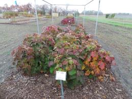 | | 2014 | COLLECTED | 09/21/2014 | Mississippi: Lafayette County; Holly Springs National Forest along County Road 244. | 34.51468900, -89.45669300 | 132 | Deciduous woods. Higher elevation than surrounding area. East, northeast-facing 45 degree slope. Growing in association with Cornus florida, Nyssa sylvatica, Quercus alba, Pinus sp., Liquidambar styraciflua, Juniperus virginiana, Carya tomentosa, and Rhus typhina. | Wild material | Numerous specimens. Attractive peeling bark and large (10" long) infructescences. | 1922345 | WLP 1251 |
| 165 | NA 81984 | Lactea Group | Callicarpa americana L. | Texas, United States | NA | | | 2014 | COLLECTED | 08/30/2013 | Woodlands above Boykin Spring Lake. | 31.06266000, -94.27565000 | 56 | Growing in partial shade of mixed deciduous and evergreen woodlands in well-drained to dry conditions. | | | 1951711 | NA 81984 |
| 166 | NA 81935 | NA 81935 | Magnolia virginiana L. | South Carolina, United States | NA | | | 2013 | COLLECTED | 08/29/2009 | In or near Francis Marion National Forest, distributed along Highway 17 ca. 2 miles S of Awendaw. [GPS provided is incorrect; uncertain which is correct longitude; latitude missing. Longitude provided: 1) 79 deg. 38' 38.74" W or 2) 79 deg/ 38' 9.78" W -SBL] | | | Open, swampy areas. | | Received as M. virginiana var. pumila | 1951852 | NA 81935 |
| 167 | NA 81936 | NA 81936 | Magnolia virginiana L. | Texas, United States | NA | | | 2013 | COLLECTED | 04/11/2011 | On S side of County Road 59 ca. 1000 ft. W of it's juncture with Private Road 335 and ca. 0.25 miles N of Highway 255. | 31.05566000, -94.15485000 | | Growing in seepage areas of otherwise dry Pinus palustris forest. | | | 1951206 | NA 81936 |
| 168 | NA 81603 | (seedling of pink form) | Rhododendron austrinum (Small) Rehder | Florida, United States | NA | | | 2013 | COLLECTED | 2013 | On the Escambia river near the mouth of the Yellow River. [GPS coordinates are actually at the confluence of the White River, the Little Simpson River, and the Buzzard Lake River (and gas line canal). -SBL] | 30.59699000, -87.22295000 | | Plants were collected along along the sandy berms along river delta. | | | 1950972 | NA 81603 |
| 169 | NA 81416 | Serrulatum Group | Rhododendron viscosum (L.) Torr. | Florida, United States | NA | | | 2013 | COLLECTED | 11/16/2012 | Blackwater State Forest, near an abandoned bridge. | 30.79862000, -86.79650000 | | On the edge of an acidic stream in pinewoods. | Wild material | Rooted cutting; received as Rhododendron viscosum var. serrulatum. | 1940403 | NA 81416 |
| 170 | WLP 1642 | NA 81413 | Leucothoe axillaris (Lam.) D. Don | Florida, United States | NA | | | 2013 | COLLECTED | | Blackwater State Forest | 30.84513000, -86.95438000 | | Along a small stream. | | | 1952344 | WLP 1642 |
| 171 | WLP 1413 | JDC/OA/2009/087/237 | Oxydendrum arboreum (L.) DC. | Ohio, United States | NA | | | 2009 | COLLECTED | 10/15/2009 | Near Lake Katherine, SW 1/4 of NW 1/4 of Section 13, T7N, R19W, Jackson Quad, Jackson County. | 39.08444444, -82.67833333 | 225 | Lake edge. Associated with with Acer saccharum, Cornus florida, Lindera benzoin, Magnolia tripetela, Nyssa sylvatica, Sassafras albidum, and Tsuga canadensis. | Wild material | | 1823935 | WLP 1413 |
| 172 | WLP 1415 | JDC/OA/2009/103/253 | Oxydendrum arboreum (L.) DC. | Ohio, United States | NA | | | 2009 | COLLECTED | 10/17/2009 | Snake Hollow, Shawnee State Forest, Otway Quad, Scioto County. | 38.80722222, -83.15555556 | 239 | Cool moist woods. Associated with with Carpinus caroliniana, Carya, Corylus americana, Fagus sylvatica, Lindera benzoin, Nyssa sylvatica, Picea abies, Platanus occidentalis, Sassafras albidum, Tsuga canadensis, and Viburnum dentatum. | Wild material | | 1823938 | WLP 1415 |
| 173 | WLP 814 | JDC/CC/2009/086/236 | Carpinus caroliniana Walter | Ohio, United States | NA | | | 2009 | COLLECTED | 10/15/2009 | Along Clear Creek, near Revenge, SE 1/4 of SE 1/4 of Section 13, T13N, R19W, Rockbridge Quad, Hocking County. | 39.59361111, -82.61944444 | 246 | Creekbed. Associated with Acer rubra, Asimina triloba, Carya, Cephalanthus occidentalis, Cornus florida, Hamamelis virginiana, Nyssa sylvatica, Oxydendrum arboreum, and Quercus. | Wild material | | 1823913 | WLP 814 |
| 174 | WLP 2307 | LBJWC-MLE-036 | Ostrya virginiana (Mill.) K. Koch | Texas, United States | NA | | | 2008 | COLLECTED | 09/28/2006 | Approximately 7 miles south of Alto, Texas on 294. | 31.63803000, -95.21316000 | 94 | Mixed hardwood and pine/forest roadside; rolling hills. Reddish tan colored, sandy soil over sandstone. | Wild material | | 1781863 | WLP 2307 |
| 175 | DVIT 3151 | RJL VA2003-005 | Vitis rotundifolia Michx. | Virginia, United States | DAV | | | 2003 | COLLECTED | 09/05/2003 | Collected from Chesapeake, VA at the interchange of Business Route 168 (Battlefield Ave) and Route 168, next to a detention basin and shopping plaza on the west side of Battlefield Ave. | 36.73861111, -76.24250000 | 5 | Mixed deciduous and evergreen woodland, primarily comprised of deciduous trees in the over-story and a mixture of deciduous and evergreen species in the sub-canopy. Plants growing in part-shade to full sun where they produce abundant fruit. | Breeding material | Seed collected from many individuals and massed. Associated plants: Acer rubrum, Carpinus caroliniana, Clethra alnifolia, fagus grandifolia, gelsemium nudiflorum, Hamamelis virginiana, Ilex opaca, Leucothoe racemosa, liquidambar styraciflua, Liriodendron tulipfera, Nyssa sylvatica, Oxydendrum arboreum, Persea borbonia, Quercus falcata, Quercus michauxii, Smilax sp., Stewartia malacodendron, Symplocos tinctoria and Vaccinium sp. | 1651338 | DVIT 3151 |