| 0 | W6 62557 | FWS0502-66 | Solidago patula Muhl. ex Willd. | Pennsylvania, United States | W6 |  | | 2025 | | | | | | | Wild material | Many plants senesced when ripe | 2192255 | W6 62557 |
| 1 | NA 89081 | 2024RJLPA-009 | Rosa carolina L. | Pennsylvania, United States | NA | | | 2024 | COLLECTED | 09/22/2024 | Lancaster and York Counties: outcrops along the Susquehanna River, accessed from the Historic Lock 12 parking lot off of Pennsylvania Road 372. | 39.81483500, -76.32762200 | 34 | Plants are growing from part-sun to full sun in crevices of the outcrops and where organic debris has accumulated in between boulders along the Susquehanna River. The sites range from nearly xeric to dry mesic, at least on the surface. Plants are generally growing 4-10 m above the normal flow of the river; however, the Holtwood Dam is less than 1 kilometer upstream and debris found trapped in the boulders indicates that there is periodic flooding, at least, in the lower zone of 4+ meters or so above normal river flow. This habitat has a diverse assemblage of deciduous trees and shrubs as well as abundant herbaceous taxa. Slope: 0 to 60 percent. Aspect: Northeast (generally). Geology: The underlying geology of this area is probably of lower Paleozoic age and characterized as the Octoraro Formation. It includes albite-chlorite schist, phyllite, some hornblende gneiss, and granitized members. Soils: The area where this species occurs is right on the edge of two soil zones that transition from the river’s edge to mesic conditions upslope. The first is generally referred to as Rock Outcrop. This terrestrial matrix in which plants grow is largely exposed underlying rock geology with accumulated outwash, rock decomposition, and organic debris buildup. The second is Mt. Airy (80%) and Manor (20%) Series soils, 25 to 60 percent slopes, extremely stony (MRF). (Source: California Soil Resource Lab/NRCS Official Soil Series Descriptions). EPA Ecoregion (Level III): Northern Piedmont (64). EPA Ecoregion (Level IV): Piedmont Uplands (64c). | Wild material | | 2169045 | NA 89081 |
| 2 | NA 89083 | 2024RJLPA-012 | Rhododendron periclymenoides (Michx.) Shinners | Pennsylvania, United States | NA | | | 2024 | COLLECTED | 09/22/2024 | Outcrops along the Susquehanna River, accessed from the Historic Lock 12 parking lot off of Pennsylvania Road 372. | 39.81477400, -76.32807300 | 35 | Plants are growing from shade to part-sun and occasionally full sun in crevices of the outcrops and where organic debris has accumulated in between boulders along the Susquehanna River. The sites range from nearly xeric to mesic, at least on the surface. Plants are generally growing 4-10 m above the normal flow of the river; however, the Holtwood Dam is less than 1 kilometer upstream and debris found trapped in the boulders indicates that there is periodic flooding, at least, in the lower zone of 4+ meters or so above normal river flow. This habitat has a diverse assemblage of deciduous trees and shrubs as well as abundant herbaceous taxa. Slope: 0 to 60 percent. Aspect: Northeast (generally). Geology: The underlying geology of this area is probably of lower Paleozoic age and characterized as the Octoraro Formation. It includes albite-chlorite schist, phyllite, some hornblende gneiss, and granitized members. Soils: The area where this species occurs is right on the edge of two soil zones that transition from the river’s edge to mesic conditions upslope. The first is generally referred to as Rock Outcrop. This terrestrial matrix in which plants grow is largely exposed underlying rock geology with accumulated outwash, rock decomposition, and organic debris buildup. The second is Mt. Airy (80%) and Manor (20%) Series soils, 25 to 60 percent slopes, extremely stony (MRF). (Source: California Soil Resource Lab/NRCS Official Soil Series Descriptions). EPA Ecoregion (Level III): Northern Piedmont (64). EPA Ecoregion (Level IV): Piedmont Uplands (64c). | Wild material | | 2169047 | NA 89083 |
| 3 | NA 89084 | 2024RJLPA-013 | Physocarpus opulifolius (L.) Maxim. | Pennsylvania, United States | NA | | | 2024 | COLLECTED | 09/22/2024 | Outcrops along the Susquehanna River, accessed from the Historic Lock 12 parking lot off of Pennsylvania Road 372. | 39.81466300, -76.32833900 | 36 | Plants are growing from shade to part-sun where organic debris has accumulated in between boulders as well as further upslope in deeper mesic soils along the Susquehanna River. This habitat has a diverse assemblage of deciduous trees and shrubs as well as abundant herbaceous taxa. Slope: 10 to 25 percent. Aspect: Northeast (generally). Geology: The underlying geology of this area is probably of lower Paleozoic age and characterized as the Octoraro Formation. It includes albite-chlorite schist, phyllite, some hornblende gneiss, and granitized members. Soils: The area where this species occurs is right on the edge of two soil zones that transition from the river’s edge to mesic conditions upslope. The first is generally referred to as Rock Outcrop. This terrestrial matrix in which plants grow is largely exposed underlying rock geology with accumulated outwash, rock decomposition, and organic debris buildup. The second is Mt. Airy (80%) and Manor (20%) Series soils, 25 to 60 percent slopes, extremely stony (MRF). (Source: California Soil Resource Lab/NRCS Official Soil Series Descriptions). EPA Ecoregion (Level III): Northern Piedmont (64). EPA Ecoregion (Level IV): Piedmont Uplands (64c). | Wild material | | 2169048 | NA 89084 |
| 4 | NA 89085 | 2024RJLPA-014 | Rhododendron arborescens (Pursh) Torr. | Pennsylvania, United States | NA | | | 2024 | COLLECTED | 09/22/2024 | Outcrops along the Susquehanna River, accessed from the Historic Lock 12 parking lot off of Pennsylvania Road 372. | 39.81618100, -76.33069800 | 38 | Plants are growing from shade to part-sun and occasionally full sun in crevices of the outcrops and where organic debris has accumulated in between boulders along the Susquehanna River. The sites range from nearly xeric to mesic, at least on the surface. Plants are generally growing 4-10 m above the normal flow of the river; however, the Holtwood Dam is less than 1 kilometer upstream and debris found trapped in the boulders indicates that there is periodic flooding, at least, in the lower zone of 4+ meters or so above normal river flow. This habitat has a diverse assemblage of deciduous trees and shrubs as well as abundant herbaceous taxa. Slope: 0 to 75 percent. Aspect: Northeast (generally). Geology: The underlying geology of this area is probably of lower Paleozoic age and characterized as the Octoraro Formation. It includes albite-chlorite schist, phyllite, some hornblende gneiss, and granitized members. Soils: The area where this species occurs is right on the edge of two soil zones that transition from the river’s edge to mesic conditions upslope. The first is generally referred to as Rock Outcrop. This terrestrial matrix in which plants grow is largely exposed underlying rock geology with accumulated outwash, rock decomposition, and organic debris buildup. The second is Mt. Airy (80%) and Manor (20%) Series soils, 25 to 60 percent slopes, extremely stony (MRF). (Source: California Soil Resource Lab/NRCS Official Soil Series Descriptions). EPA Ecoregion (Level III): Northern Piedmont (64). EPA Ecoregion (Level IV): Piedmont Uplands (64c). | Wild material | | 2169049 | NA 89085 |
| 5 | NA 88665 | RJL2023PA-002 | Ilex verticillata (L.) A. Gray | Pennsylvania, United States | NA | | | 2023 | COLLECTED | 10/01/2023 | Woodlands along Pine Creek near the Harmonyville Road bridge. | 40.18764500, -75.76732200 | 141 | Moist to mucky, wet woodland conditions along Pine Creek. Much of the site is very wet due to recent rains; though, earlier in the year, the soils were only moist. Plants grow in both well-drained mesic conditions as well as seasonally wet conditions. They do not grow in standing water anywhere in this location. Plants in this population are found mostly in the shade and partial shade of deciduous trees; there are occasional gaps that offer higher light conditions as well. Slope: 0-2%. Aspect: N/A. The underlying geology of this area is of Precambrian origin and characterized as the Graphitic Felsic Gneiss. This includes Pickering Gneiss and small areas of marble; dominantly quartz and feldspar with varying amounts of graphite and various metamorphic minerals; medium grained, light to dark gray and greenish gray; sedimentary origin. (Source: USGS Pennsylvania Geologic Map Data). The primary soil type in the area of this collection is classified as Hatboro Silt Loam Series. The Hatboro Series consists of very deep and poorly drained soils formed in alluvium derived from metamorphic and crystalline rock. They are on flood plains. Slopes range from 0 to 3 percent. Saturated hydraulic conductivity is moderately high to high. Solum thickness ranges from 50 to 150 cm. Depth to bedrock ranges from 1.5 to 3 meters or more. Organic carbon decreases irregularly with depth or is greater than 0.2 percent directly above any strongly contrasting C horizon. The depth to strongly contrasting sand and gravel is more than 100 cm or the transition is greater than 12.5 cm. Content of gravel ranges from 0 to 10 percent in the solum and from 0 to 80 percent in the C horizon. Mica flakes are common in the solum, and the C horizon contains thin lenses of mica. Reaction ranges from very strongly acid through neutral to a depth of 75 cm and from moderately acid through slightly acid below 75 cm. (Source: NRCS Web Soil Survey.) | Wild material | | 2158814 | NA 88665 |
| 6 | OPGC 8821 | CBG- 10803 | Rhexia virginica L. | Illinois, United States | OPGC | | | 2023 | | | | | | | Wild material | | 2142262 | OPGC 8821 |
| 7 | OPGC 8848 | CBG- 10860 | Solidago riddellii Frank | Illinois, United States | OPGC | | | 2023 | | | | | | | Wild material | | 2142306 | OPGC 8848 |
| 8 | OPGC 8849 | CBG- 10861 | Chelone glabra L. | Illinois, United States | OPGC | | | 2023 | | | | | | | Wild material | | 2142307 | OPGC 8849 |
| 9 | NA 88598 | RJL2023FL-002a | Agarista populifolia (Lam.) Judd | Florida, United States | NA | | | 2023 | COLLECTED | 02/14/2023 | Plants growing in woodlands of Wekiwa Springs State Park along trails accessed from the Sand Lake parking lot at the end of Palmetto Avenue. From the parking lot, take the main trail south for about 18 meters and immediately take a cut-through trail on the left to the location of this population. | 28.72398600, -81.47205400 | 10 | Plants were growing in shade to part-shade of moist mesic hammocks of lowland transitional woodlands eventually becoming wetland habitats that are comprised primarily of evergreen plants with fewer deciduous plants. The underlying geology of this area is of Pliocene origin and characterized as the Cypresshead Formation. The Cypresshead Formation named by Huddlestun (1988), is composed of siliciclastics and occurs only in the peninsula and eastern Georgia. It is at or near the surface from northern Nassau County southward to Highlands County forming the peninsular highlands. It appears that the Cypresshead Formation occurs in the subsurface southward from the outcrop region and similar sediments, the Long Key Formation, underlie the Florida Keys. The Cypresshead Formation is a shallow marine, near shore deposit equivalent to the Citronelle Formation deltaic sediments and the Miccosukee Formation prodeltaic sediments. The Cypresshead Formation consists of reddish brown to reddish orange, unconsolidated to poorly consolidated, fine to very coarse grained, clean to clayey sands. Cross bedded sands are common within the formation. Discoid quartzite pebbles and mica are often present. Clay beds are scattered and not areally extensive. In general, the Cypresshead Formation in exposure occurs above 100 feet (30 meters) above mean sea level (msl). Original fossil material is not present in the sediments although poorly preserved molds and casts of mollusks and burrow structures are occasionally present. The presence of these fossil "ghosts" and trace fossils documents marine influence on deposition of the Cypresshead sediments. The permeable sands of the Cypresshead Formation form part of the surficial aquifer system. | Wild material | | 2141479 | NA 88598 |
| 10 | NA 88544 | RJLSEUS2022-016 | Itea virginica L. | Georgia, United States | NA | | | 2023 | COLLECTED | 12/09/2022 | Plants growing around a pond and associated wetland on the property of Monica Williams north of Albany, Georgia as well as the edges of nearby Muckalee Creek. Common in the wetland habitat edges. | 31.63834700, -84.13835600 | 63 | Plants are growing in part-shade to sun in wet to inundated conditions along the edges of a pond as well as the edges of Muckalee Creek. This species is found in conditions of abundant, year-round moisture.
Soils: The underlying geology of this area is of Eocene origin and characterized as Ocala Limestone. The Ocala Limestone consists of almost pure limestones with occasional dolomites. It can be subdivided into both lower and upper facies with the lower facies composed of a whitish to cream-colored, fine to medium grained, poorly to moderately hard, fossil rich grainstone and packstone. The upper Ocala is white and somewhat weak and poorly sorted. It is extremely fossil rich grainstone, packstone and wackestone and some chert is common in the upper facies.
Source: USGS Georgia Geologic Map Data (https://mrdata.usgs.gov/geology/state/sgmc-unit.php?unit=GANu%3B1)
The primary soil types in the collection area are classified as Herod and Muckalee Series soils. The Herod Series consists of poorly drained moderately permeable soils formed in loamy alluvium. These soils are on flood plains of streams in the Coastal Plain. Slopes range from 0 to 2 percent. The Muckalee Series consists of poorly drained moderately permeable soils formed in loamy and sandy alluvium. These soils are on flood plains of streams in the Coastal Plain. Slopes range from 0 to 2 percent.
Source: NRCS Web Soil Survey (https://websoilsurvey.sc.egov.usda.gov/App/WebSoilSurvey.aspx) | Wild material | | 2140770 | NA 88544 |
| 11 | NA 89047 | RJL2022PA-015 | Cephalanthus occidentalis L. | Pennsylvania, United States | NA | | | 2022 | COLLECTED | 10/09/2022 | Plants growing in the floodplain of Octoraro Creek near 698 Lees Bridge Road, West Nottingham Township, Pennsylvania on the south side of the road. Plants are locally common and spread out in the floodplain area along the Octoraro Creek. | 39.73540700, -76.09226500 | 60 | Plants of this species are growing in full sun to part shade of a moist to seasonally mucky and wide flood plain area adjacent to Octoraro Creek. The area is dominated by deciduous herbaceous plants, scrambling vines, shrubs and occasional small trees. Much of this wet “meadow” is dominated by aggressive stands of grasses and members of the sedge family.
Soils: The underlying geology of this area is estimated to be of lower Paleozoic origin and comprised of Peters Creek Schist. This is comprised of chlorite-sericite schist containing interbedded quartzite. Interestingly, this area is very close to and may interface with the adjacent formation of Ultramafic Rocks that includes serpentine, steatite, and other products of alteration of peridotites and pyroxenites.
Source: USGS Pennsylvania Geologic Map Data (https://mrdata.usgs.gov/geology/state/sgmc-unit.php?unit=PAPZpc%3B0)
The primary soil types in the collection area are classified as Hatboro Silt Loam which consists of soils formed in alluvium derived from metamorphic and crystalline rock. They are on flood plains. Slopes range from 0 to 3 percent. Hatboro Silt Loam soils are poorly drained and have a high to very high surface runoff index. These soils are subject to periodic stream overflow, which usually occurs during the winter and spring months. The A and B horizons are moderately acidic to neutral, generally to a depth of 1-2 meters; the C horizon below ranges from a depth of 2-3 meters with uniformly acidic soils.
Source: NRCS Web Soil Survey (https://websoilsurvey.sc.egov.usda.gov/App/WebSoilSurvey.aspx) | Wild material | | 2139612 | NA 89047 |
| 12 | NA 89046 | RJL2022PA-014 | Alnus serrulata (Aiton) Willd. | Pennsylvania, United States | NA | | | 2022 | COLLECTED | 10/09/2022 | Plants growing in the floodplain of Octoraro Creek near 698 Lees Bridge Road, West Nottingham Township, Pennsylvania on the south side of the road. Plants are locally common and spread out in the floodplain area along the Octoraro Creek. | 39.73579900, -76.09238300 | 60 | Plants of this species are growing in full sun of a moist to seasonally mucky and wide flood plain area adjacent to Octoraro Creek. The area is dominated by deciduous herbaceous plants, scrambling vines, shrubs and occasional small trees. Much of this wet “meadow” is dominated by aggressive stands of grasses and members of the sedge family.
Soils: The underlying geology of this area is estimated to be of lower Paleozoic origin and comprised of Peters Creek Schist. This is comprised of chlorite-sericite schist containing interbedded quartzite. Interestingly, this area is very close to and may interface with the adjacent formation of Ultramafic Rocks that includes serpentine, steatite, and other products of alteration of peridotites and pyroxenites.
Source: USGS Pennsylvania Geologic Map Data (https://mrdata.usgs.gov/geology/state/sgmc-unit.php?unit=PAPZpc%3B0)
The primary soil types in the collection area are classified as Hatboro Silt Loam which consists of soils formed in alluvium derived from metamorphic and crystalline rock. They are on flood plains. Slopes range from 0 to 3 percent. Hatboro Silt Loam soils are poorly drained and have a high to very high surface runoff index. These soils are subject to periodic stream overflow, which usually occurs during the winter and spring months. The A and B horizons are moderately acidic to neutral, generally to a depth of 1-2 meters; the C horizon below ranges from a depth of 2-3 meters with uniformly acidic soils.
Source: NRCS Web Soil Survey (https://websoilsurvey.sc.egov.usda.gov/App/WebSoilSurvey.aspx) | Wild material | | 2139611 | NA 89046 |
| 13 | Ames 35807 | JDC/SD/2022/034/1014 | Salix discolor Muhl. | Minnesota, United States | NC7 |  | | 2022 | COLLECTED | 06/06/2022 | Mud Lake and Amity Creek Watershed located just north of Duluth approximately 6.25 miles, T51N R14W Sec. 22, 26, 27, and 28. | 46.87662300, -92.10040300 | 418 | Floodplain, wetlands, drainages. | Wild material | The native range of Salix discolor is concentrated in the northeastern United States and also throughout southern Canada (Little, E. L. Jr. 1977). Generally adapted/tolerant to wet soils this species is often found in meadows, fens, swamps, and streambanks. Attractive ornamental characteristics includes early spring, showy flowers and yellow foliage in the fall. Salix discolor provides a critical source of pollen at the beginning of the growing season for a plethora of pollinators and also serves as a larval host to many insect species. Salix discolor are commonly used in the cut flower industry for both their showy catkins and colorful, dormant winter stems. This accession represents genetics from northeastern Minnesota. Specimens sampled in nature ranging from 6-22' in height. | 2138039 | Ames 35807 |
| 14 | W6 60101 | NEWFS-165 | Rhus typhina L. | Massachusetts, United States | W6 | | | 2021 | | | | | | | Wild material | Hairy fruit and stems. Received as: Rhus hirta. | 2137186 | W6 60101 |
| 15 | W6 60108 | NEWFS-337 | Juncus effusus L. | Rhode Island, United States | W6 | | | 2021 | | | | | | | Wild material | | 2137193 | W6 60108 |
| 16 | NA 86885 | RJL2021PA-004 | Ilex verticillata (L.) A. Gray | Pennsylvania, United States | NA | | | 2021 | COLLECTED | 11/16/2021 | Plants growing in woodlands along a small unnamed creek corridor dumping into the Middle Branch White Clay Creek in Goddard Park, West Grove Pennsylvania, off of Wickerton Road, Chester County. | 39.81063861, -75.82750806 | 124 | Plants are growing in a range of habitats from mesic woodlands to saturated streamside settings of deciduous woodlands that drain toward the Middle Branch White Clay Creek. Plants grow in high understory shade with dappled to indirect sunlight. The only female (fruiting) plants were found in areas along the creek where soils are moist to saturated. Numerous male specimens were found in the areas described above. Soils: Soils found in the areas where this collection was made are comprised primarily of Baile silt loam (Ba), Hatboro silt loam (Ha), and Glenelg silt loam, 8 to 15 percent slopes (GgC). Baile silt loam consists of very deep, poorly drained, moderately low to moderately high saturated hydraulic conductivity, soils on upland depressions and footslopes that were formed in local alluvium over residuum from acid crystalline rocks, chiefly mica schist and granitized schist and gneiss; slope ranges from 0 to 8 percent. Hatboro silt loam consists of very deep and poorly drained soils formed in deposited alluvium derived from metamorphic and crystalline rock. They are on flood plains. Slopes range from 0 to 3 percent. Glenelg silt loam, 8 to 15 percent slopes consists of very deep, well drained soils formed in residuum weathered from micaceous schist on uplands of the Blue Ridge and the Northern Piedmont. This soil is undifferentiated, mostly poorly drained sandy bottomland soils intermingled with decomposing organic litter and eroded silts and clays due to erosion. Slope: 0 to 15% Aspect: Variable. | Wild material | | 2123125 | NA 86885 |
| 17 | WLP 1732 | RJL2021PA-002 | Viburnum prunifolium L. | Pennsylvania, United States | NA | | | 2021 | COLLECTED | 11/05/2021 | Plants growing in woodlands along a small unnamed creek corridor dumping into the Middle Branch White Clay Creek in Goddard Park, West Grove Pennsylvania, off of Wickerton Road, Chester County. | 39.80462083, -75.82888750 | 102 | Plants are growing in a range of habitats from drier upland woods to moist creekside settings of deciduous woodlands that drain toward the Middle Branch White Clay Creek. Plants grow in part shade to high understory shade with dappled to indirect direct sunlight. Plants achieve their largest size and fruiting potential in part sun of the riparian zone of the creek where woodland canopy is thinner. Soils: Soils found in the areas where this collection was made are comprised primarily of flood plain Hatboro silt loam (Ha) and well-drained, upland Glenelg silt loam, 8 to 15 percent slopes (GgC). Hatboro silt loam consists of very deep and poorly drained soils formed in deposited alluvium derived from metamorphic and crystalline rock. They are on flood plains. Slopes range from 0 to 3 percent. Glenelg silt loam, 8 to 15 percent slopes consists of very deep, well drained soils formed in residuum weathered from micaceous schist on uplands of the Blue Ridge and the Northern Piedmont. This soil is undifferentiated, mostly poorly drained sandy bottomland soils intermingled with decomposing organic litter and eroded silts and clays due to erosion. Slope: 0 to 15% Aspect: Variable. | Wild material | | 2123098 | WLP 1732 |
| 18 | WLP 1733 | RJL2021PA-003 | Viburnum dentatum L. | Pennsylvania, United States | NA | | | 2021 | COLLECTED | 11/05/2021 | Plants growing in woodlands along a small unnamed creek corridor dumping into the Middle Branch White Clay Creek in Goddard Park, West Grove Pennsylvania, off of Wickerton Road, Chester County. | 39.80522167, -75.82928139 | 107 | Plants are growing in a range of habitats from mesic woodland to moist creekside settings of deciduous woodlands that drain toward the Middle Branch White Clay Creek. Plants grow in high understory shade with dappled to indirect sunlight. Soils: Soils found in the areas where this collection was made are comprised primarily of flood plain Hatboro silt loam (Ha) and well-drained, upland Glenelg silt loam, 8 to 15 percent slopes (GgC). Hatboro silt loam consists of very deep and poorly drained soils formed in deposited alluvium derived from metamorphic and crystalline rock. They are on flood plains. Slopes range from 0 to 3 percent. Glenelg silt loam, 8 to 15 percent slopes consists of very deep, well drained soils formed in residuum weathered from micaceous schist on uplands of the Blue Ridge and the Northern Piedmont. This soil is undifferentiated, mostly poorly drained sandy bottomland soils intermingled with decomposing organic litter and eroded silts and clays due to erosion. Slope: 0 to 15% Aspect: Variable. | Wild material | | 2123124 | WLP 1733 |
| 19 | WLP 1747 | RJL2021PA-005 | Rosa palustris Marshall | Pennsylvania, United States | NA | | | 2021 | COLLECTED | 11/20/2021 | Plants growing in wetland seeps surrounded by mown hayfields just west of the Middle Branch White Clay Creek in Goddard Park, West Grove Pennsylvania, off of Wickerton Road, Chester County. | 39.80090528, -75.82383250 | 100 | Habitat Notes: Plants are growing in permanently saturated to moist soils in wetland habitats. Plants appear to be obligate wetland plants and are found only in permanent to nearly permanent wet habitats observed. Generally, the shrubs are found in part shade to full sun. Soils: Soils found in the areas where this collection was made are comprised primarily of Hatboro silt loam (Ha). Hatboro silt loam consists of very deep and poorly drained soils formed in deposited alluvium derived from metamorphic and crystalline rock. They are on flood plains. Slopes range from 0 to 3 percent. Slope: 0 to 3% Aspect: Variable. | Wild material | | 2123715 | WLP 1747 |
| 20 | NA 88322 | CBG-10488 | Hypericum adpressum W. P. C. Barton | Illinois, United States | NA | | | 2021 | | | | | | | Wild material | | 2120113 | NA 88322 |
| 21 | OPGC 8277 | CBG-9703 | Pedicularis canadensis L. | Illinois, United States | OPGC | | | 2021 | | | | | | | Wild material | plant habit: forb | 2120016 | OPGC 8277 |
| 22 | OPGC 8317 | CBG-10487 | Ludwigia alternifolia L. | Illinois, United States | OPGC | | | 2021 | | | | | | | Wild material | | 2120112 | OPGC 8317 |
| 23 | W6 59192 | CBG-10486 | Coleataenia rigidula (Bosc ex Nees) LeBlond | Illinois, United States | W6 | | | 2021 | | | | | | | Wild material | | 2120111 | W6 59192 |
| 24 | W6 58703 | NEWFS-371 | Scirpus atrovirens Willd. | Massachusetts, United States | W6 | | | 2021 | | | | | | | Wild material | | 2115642 | W6 58703 |
| 25 | Ames 35615 | Ames 35615 | Aronia arbutifolia (L.) Pers. | Michigan, United States | NC7 |  | | 2020 | COLLECTED | 11/03/2020 | Warren Townsend Park located just northeast of Cannonsburg southwest of Ramsdell Dr. and Six Mile Rd. intersection, T8N R10W NE ¼ NW ¼ Sec. 26, Cannon Twp., Kent County | 43.05606700, -85.46435100 | 239 | Shrubby edge of old stream (Bear Creek) oxbow, adjacent to wet meadow with groundwater upwelling. Muck soils. | Wild material | Plants in nature measuring approximately six meters in height; elongate shrubs mostly unbranched; bright-red fruits measuring between 4-7 mm in diameter; tomentose leaves underneath; scarlet fall color. This collection was discovered in 2011 and represents the first report of the species for the state of Michigan (Ryskamp and Warners 2012) and thus represents a widely disjunct population where the next nearest documented population is in southern Ohio (Clermont County). | 2110277 | Ames 35615 |
| 26 | Ames 35584 | Susquehannock State Forest | Monarda didyma L. | Pennsylvania, United States | NC7 |  | | 2020 | COLLECTED | 09/25/2020 | Sunken Branch Creek watershed in Susquehannock State Forest located approximately 10.15 miles southeast of Coudersport, Potter County | 41.71121000, -77.84621000 | 656 | Moist woodland. Roadside/creek bank. | Wild material | | 2107747 | Ames 35584 |
| 27 | WLP 2043 | MARSB-1012 | Viburnum opulus L. var. americanum Aiton | New York, United States | NA | | | 2019 | COLLECTED | 08/30/2019 | Dutchess County; Rhinebeck; Rt. 9 right-of-way, on border of Red Hook and Rhinebeck. | | 183 | Roadside right-of-way in partial shade; growing in moist loamy sand. | | Seeds collected from 15 to 20 individuals in a population of 15 to 20 individuals, growing over an area 300 meters by 300 meters in size. Scattered distribution. Seed maturation: middle. | 2109192 | WLP 2043 |
| 28 | W6 57411 | NEWFS-370 | Carex crinita Lam. | Massachusetts, United States | W6 |  | | 2019 | | | | | | | Wild material | | 2098208 | W6 57411 |
| 29 | WLP 2011 | MARSB-981 | Viburnum dentatum L. | New York, United States | NA | | | 2019 | COLLECTED | 08/08/2019 | Onondaga County; Phoenix; Three Rivers Wildlife Management Area. | 43.19781000, -76.33312000 | | Shrubland and meadow/grassland in moist to dry, well-drained, clay loam soil. | | Seeds collected directly from plants. Species common in area; 100+ individuals in population, 30+ individuals sampled. Seed quality good, 100 percent healthy seed. The first of two separate collections made in two areas of the WMA [see NA 86005, MARSB-982/MARSB_IL_007 for the second collection] since the area is very large. | 2109107 | WLP 2011 |
| 30 | Ames 34431 | JDC/SC/2019/001/880 | Salix candida Flüggé ex Willd. | Iowa, United States | NC7 |  | | 2019 | COLLECTED | 05/17/2019 | Private property approximately 2.2 miles southwest of Oelwein, T91N R9W SW 1/4 SE 1/4 Sec. 30. | 42.65929300, -91.94916200 | 311 | High-qulity fen, remnant. | Wild material | Plants at collection site in nature averaging 2.0-2.5' in height with minimal branching. Pubescent stems mostly near apical ends. Most plants estimated at 25 ramets per genet. Estimated number of ramets per genet is difficult to separate/distinguish. This petite, shrubby willow is essentially restricted to cold bogs/fen communities and is rare in Iowa (Nekola 1990). It is easily recognized by its narrowly and extremely pubescent leaves. Salix candida was considered extirpated from Iowa by Spence (1959) and Roosa and Eilers (1978). Since discovery of eastern Iowa fen communities in 1984 it has been observed extant at 26 sites (Nekola 1988) and is tracked as a species of special concern by the Iowa Department of Natural Resources Natural Areas Inventory (2021). | 2091747 | Ames 34431 |
| 31 | Ames 34432 | Kauten Fen | Salix candida Flüggé ex Willd. | Iowa, United States | NC7 |  | | 2019 | COLLECTED | 05/17/2019 | Kauten Fen located 12.4 miles south of West Union, T92N R8W NE 1/4 SW 1/4 NE 1/4 Sec.16. | 42.78232200, -91.78865600 | 351 | High-qulity fen, remnant. | Wild material | Plants at collection site in nature averaging 2.0' in height with little to no branching (e.g. estimated 1-3 ramets per genet which are difficult to separate/distinguish due to the clonal nature of the species). Suspected possible suckering via rhizomes. Very pubescent stems mostly near apical ends. This petite, shrubby willow is essentially restricted to cold bogs/fen communities and is rare in Iowa (Nekola 1990). It is easily recognized by its narrowly and extremely pubescent leaves. The undersides are extremely white in appearance resulting in a very attractive ornamental characteristic. Salix candida was considered extirpated from Iowa by Spence (1959) and Roosa and Eilers (1978). Since discovery of eastern Iowa fen communities in 1984 it has been observed extant at 26 sites (Nekola 1988) and is tracked as a species of special concern by the Iowa Department of Natural Resources Natural Areas Inventory (2021). Plants in cultivation reached heights to 4.0-4.5'. Variation in degree of pubescence on apical portions of stems noted across genotypes with majority being rather to extremely pubescent. | 2091748 | Ames 34432 |
| 32 | NA 88064 | NEWFS-251 | Clethra alnifolia L. | Massachusetts, United States | NA |  | | 2019 | | | | | | | Wild material | | 1976190 | NA 88064 |
| 33 | NA 88428 | NEWFS-140 | Rosa palustris Marshall | Massachusetts, United States | NA | 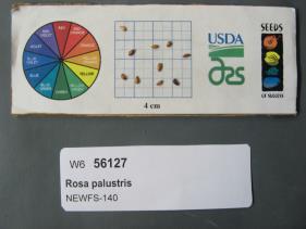 | | 2019 | | | | | | | Wild material | | 1976162 | NA 88428 |
| 34 | W6 56135 | NEWFS-165 | Rhus typhina L. | Massachusetts, United States | W6 |  | | 2019 | | | | | | | Wild material | | 1976170 | W6 56135 |
| 35 | OPGC 6391 | CBG-7403 | Lobelia cardinalis L. | Washington, United States | OPGC |  | | 2017 | | | | | | | Wild material | | 1954824 | OPGC 6391 |
| 36 | OPGC 7775 | CBG-7498 | Helenium autumnale L. | Wisconsin, United States | OPGC |  | | 2017 | | | | | | | Wild material | | 1954812 | OPGC 7775 |
| 37 | W6 52966 | NEWFS-337 | Juncus effusus L. | Rhode Island, United States | W6 |  | | 2017 | | | | | | | Wild material | | 1954709 | W6 52966 |
| 38 | Ames 34150 | MARSB-710 | Spiraea alba Du Roi | New York, United States | NC7 |  | | 2017 | COLLECTED | 11/17/2017 | Private property located approximately 0.25 miles southwest of Hunter Road and Parksville Road intersection, Sullivan County | 41.91374700, -74.66922300 | 610 | Wet meadow, mountianous (dessicated plateau), slope 5-10 degrees. | Wild material | Flower color, pale pink. | 1954951 | Ames 34150 |
| 39 | Ames 34012 | Ames 34012 | Monarda didyma L. | Ohio, United States | NC7 |  | | 2017 | COLLECTED | 09/12/2017 | Mantua Bog State Nature Preserve approximately 1.12 miles east of Mantua, Portage County. | 41.28247600, -81.20260500 | 337 | High-quality fen remnant (sedge/forb meadow). | Wild material | | 1953926 | Ames 34012 |
| 40 | Ames 32955 | JDC/BP/2015/042/699 | Betula pumila L. | Iowa, United States | NC7 |  | | 2015 | COLLECTED | 09/04/2015 | Private property approximately 7 miles northwest of Cedar Falls, T90N R14W SW 1/4 NW 1/4 SE 1/4 Sec. 18. | 42.60398800, -92.54284800 | 284 | High-quality remnant wetland/fen | Wild material | Specimens sampled averaged approximately 278 cm in height, ranging from 250 cm to 330 cm. Female catkins were both green and brown at time of harvest. Little to no fall color at time of seed collection (4 Sept. 2015) with approximately 75% of leaves already dropped. During growout in 2016, samples #699-3 and #699-5 resulted in seedlings that have petiolules (on small seedlings) that average 3-5 mm in length with the leaf apex being rather sharply acute, possibly indicating presence of hybrids. Other samples (#699-1, #699-2, #699-6, and #699-7) seem to exhibit characteristics of B. pumila with densely pubescent leaves and stems, with leaves having the apex usually broadly acute or obtuse to rounded, and essentially leaves being sessile or less than 1mm in length. | 1927397 | Ames 32955 |
| 41 | OPGC 6156 | CBG-2639 | Doellingeria umbellata (Mill.) Nees | Illinois, United States | OPGC |  | | 2015 | | | | | | | Wild material | | 1926091 | OPGC 6156 |
| 42 | W6 48822 | MARSB-46 | Carex atlantica L. H. Bailey | New Jersey, United States | W6 | 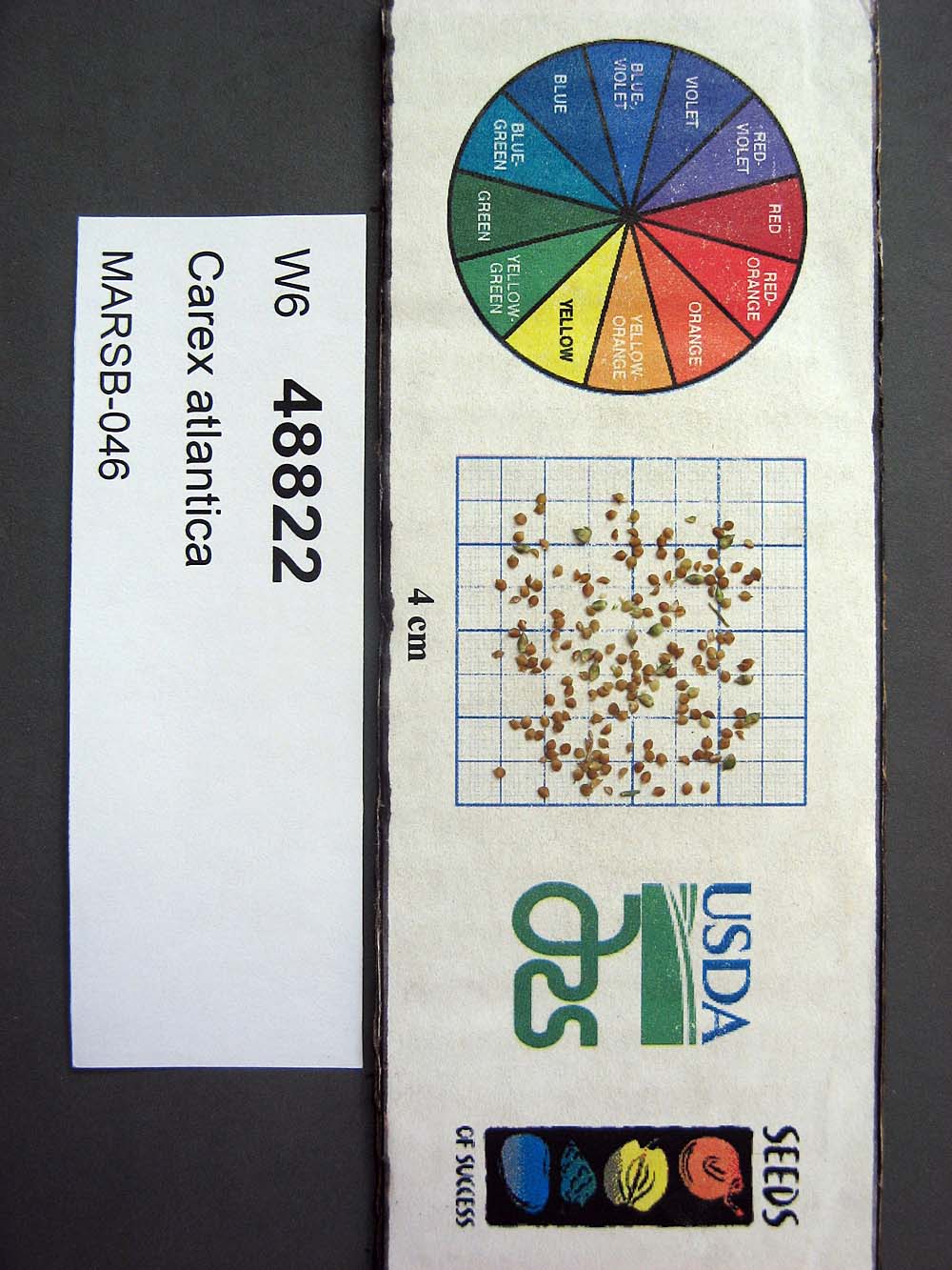 | | 2015 | | | | | | | Wild material | | 1922838 | W6 48822 |
| 43 | OPGC 6119 | MARSB-088 | Lobelia cardinalis L. | New York, United States | OPGC | 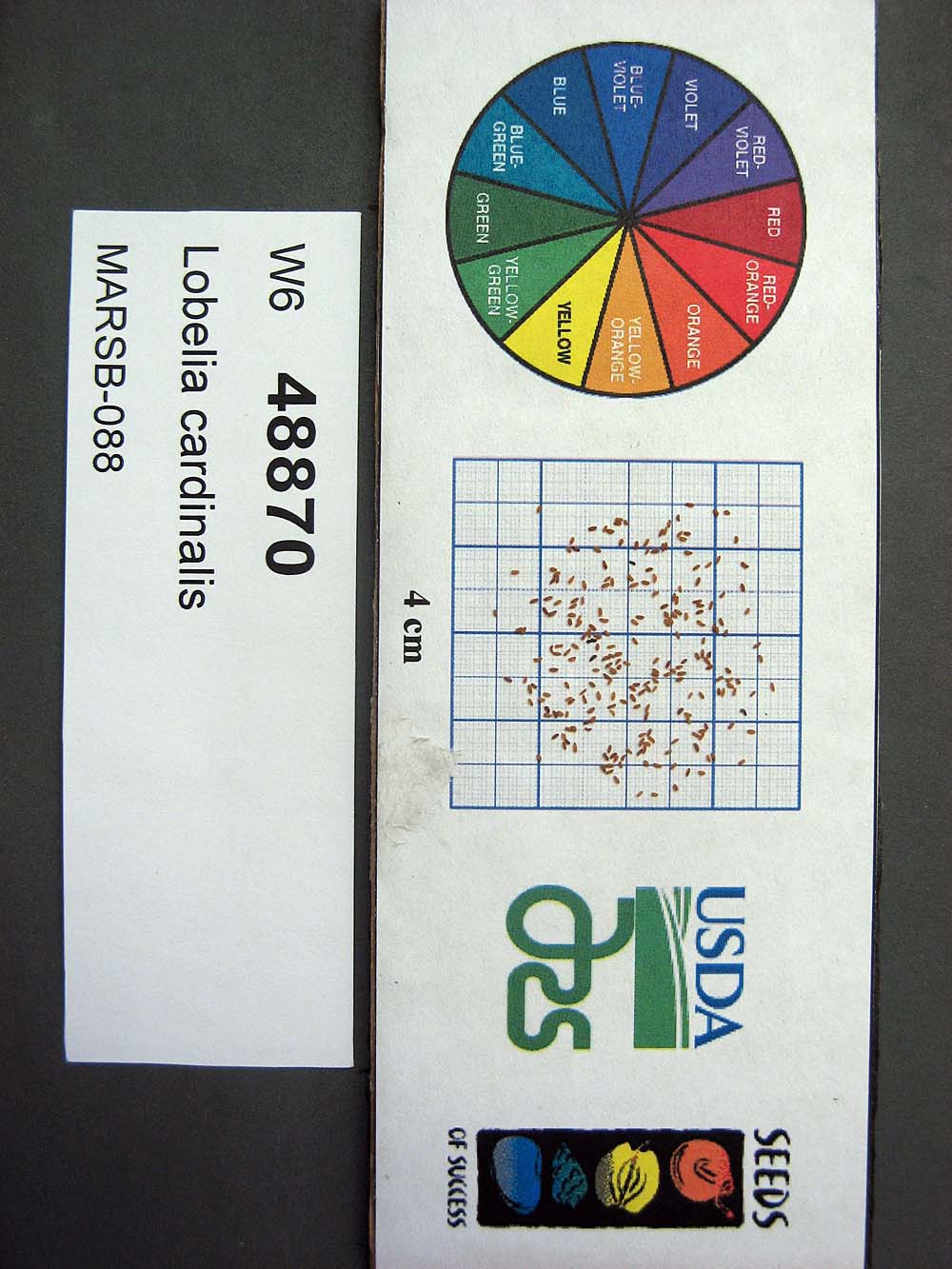 | | 2015 | | | | | | | Wild material | | 1922920 | OPGC 6119 |
| 44 | OPGC 6121 | MARSB-089 | Mimulus ringens L. | New York, United States | OPGC |  | | 2015 | | | | | | | Wild material | | 1922922 | OPGC 6121 |
| 45 | Ames 32848 | Williams Prairie | Salix petiolaris Sm. | Iowa, United States | NC7 |  | | 2014 | COLLECTED | 11/23/2014 | Williams Prairie State Preserve approximately 3 miles north of Oxford, T80N R8W SW1/4 NE1/4 Sec. 5. | 41.76753000, -91.80115800 | 222 | Wet remnant prairie. Very floristically diverse, high-quality site. | Wild material | Slender-leaved willow, Salix petiolaris, is a somewhat dense suckering shrub that can reach up to 10' in height with slender stems that branch minimally, but typically maintains a height of 5-8'. Native to North America, the native range covers mostly the northeastern US stretching from Maine to western North Dakota and Canada south to central Iowa (Little, E. L. Jr. 1977). Salix petiolaris typically dominates wetland areas including sedge meadows, marshes, riverbanks, and lake shores. Despite favoring wet habitats, it can also be found in dry, upland areas, especially those with high-water tables. However, longevity is generally limited in upland habitats. S. petiolaris, similar to other willow species, responds well to fire, coppicing, or heavy browsing (highly favored by deer) by sprouting new stems close to the crown. In cultivation, plants after five years will encompass a 5' x 5' area due to stems that arch from the main base of the plant. Coppicing of plants to ground level is highly recommended either annually or once every 3-5 years to maintain vigorous growth and plant health. This species requires substantial to full sun exposure and is an excellent choice for streambank stabilizations and windbreaks to reduce soil erosion and drifting snow, respectively. This accession represents genetics from eastern, central Iowa from the south, southwestern edge of the species native range. Plants sampled in nature were multi-stemmed (e.g. avg. 20-75 ramets per genet) shrubs averaging 4.5' in height. Each genet typically encompassed a 5' x 5' area with branches very flexible at base; stems glabrous; buds brown; stems attractive, variable from red to orange to yellow, but mostly red; two stamens per staminate flower, no hairs; filaments separated (not fused); anthers with yellow pollen; flowering branchlet on staminate and pistillate catkins measuring 3 mm and hairy; ovary approximately 2 mm at receptivity, hairy; both pistillate and staminate bracts hairy, not toothed; and flowers appearing shortly before leaf emergence. Peak flowering and fall color generally occur in mid-April and early October, respectively in central Iowa. | 1921869 | Ames 32848 |
| 46 | Ames 32102 | Cedar Hills Sand Prairie | Spiraea alba Du Roi | Iowa, United States | NC7 | | | 2013 | COLLECTED | 10/28/2013 | Cedar Hills Sand Prairie State Preserve, T90N R14W NW 1/4 Sec. 19. | 42.59373800, -92.54974500 | 280 | East portion of prairie remnant. Marshan clay loam (0-2 percent slope) depth to water table: about 0-12 inches; 0-8 inches: clay loam, poorly drained and Sparta loamy fine sand (2-5 percent slope and 5-9 percent slopes) depth to water table: more than 80 inches, 0-8 inches: loamy fine sand, excessively drained. Exceptionally diverse prairie from swale/slough bottoms to upland slope areas | Wild material | | 1914717 | Ames 32102 |
| 47 | OPGC 3946 | PZSH2011-23 | Phlox pilosa L. subsp. pilosa | Mississippi, United States | OPGC |  | | 2011 | COLLECTED | 04/08/2011 | Forrest County; Roadside W of State Route 49, approx 8 miles S of Hattiesburg, abundant in many places along road. | 31.16848000, -89.24427000 | 70 | Roadside right of way, mowed area; Gnaphalium spp., Helianthemum canadense, Onoclea sensibilis, Glandularia spp., Penstemon spp. | Wild material | Erect plants 25-30 cm tall; flowers light pink with red striae, leaves narrow, lanceolate. | 1907080 | OPGC 3946 |