| 0 | WLP 1400 | RL 08078 | Opuntia humifusa (Raf.) Raf. | | NA | | Contact Site | 2008 | | | | | | | Wild material | | 1896004 | WLP 1400 |
| 1 | W6 62514 | FWS0300-104 | Spiraea alba Du Roi | Michigan, United States | W6 |  | | 2025 | | | | | | | Wild material | | 2192212 | W6 62514 |
| 2 | W6 62515 | FWS0300-105 | Helianthus occidentalis Riddell | Michigan, United States | W6 |  | | 2025 | | | | | | | Wild material | Northeast subpopulation not producing viable seeds, but the rest of the subpopulations are | 2192213 | W6 62515 |
| 3 | Ames 36163 | AS/RA/2023/069/279 | Rhus aromatica Aiton | Illinois, United States | NC7 | 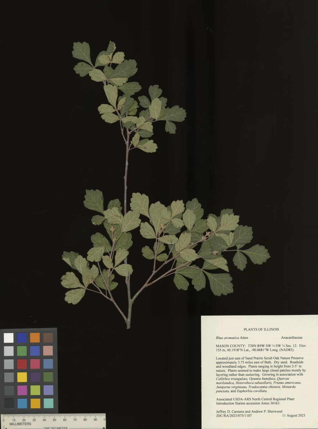 | | 2023 | COLLECTED | 08/11/2023 | Located just east of Sand Prairie Scrub Oak Nature Preserve approximately 3.75 miles east of Bath, T20N R9W SW 1/4 SW 1/4 Sec. 12. | 40.19175000, -90.06813000 | 155 | Dry sand. Roadside and woodland edges. | Wild material | Plants ranging in height from 2-5' in nature. Plants seemed to make large clonal patches mostly by layering rather than suckering. | 2158368 | Ames 36163 |
| 4 | OPGC 8490 | CBG-10706 | Symphyotrichum sericeum (Vent.) G. L. Nesom | Illinois, United States | OPGC | | | 2021 | | | | | | | Wild material | | 2132552 | OPGC 8490 |
| 5 | W6 59966 | CBG-10696 | Dalea purpurea Vent. | Illinois, United States | W6 | | | 2021 | | | | | | | Wild material | | 2132544 | W6 59966 |
| 6 | Ames 35738 | AS/PT/2021/016/116 | Ptelea trifoliata L. | Illinois, United States | NC7 |  | | 2021 | COLLECTED | 08/26/2021 | State Route 71 along Illinois River located approximately 1.30 miles southwest of Ottawa, T33N R3E NE1/4 Sec. 15 | 41.33370200, -88.86061200 | 148 | Roadside at top of limestone cliff above Illinois River. | Wild material | Trees measuring approximately 20-25' in height. Peak flowering and fruiting occurred 4 May and approximately 10 September 2021, respectively. | 2120342 | Ames 35738 |
| 7 | WLP 2484 | AS/TO/2021/017/117 | Thuja occidentalis L. | Illinois, United States | NA |  | | 2021 | COLLECTED | 08/26/2021 | State Route 71 along Illinois River located approximately 1.30 miles southwest of Ottawa, T33N R3E SW1/4 NE1/4 Sec. 15 | 41.33211800, -88.86347300 | 146 | Roadside at top of limestone cliff above Illinois River. | Wild material | Thuja occidentalis is a medium sized, evergreen tree that is native throughout northeastern North America stretching from Minnesota to Maine with scattered distributions in the Appalachian Mountains. In Illinois, Northern White Cedar was formerly listed as a state-threatened species, but delisted in 2004 (Mankowski 2012) and is localized to bluffs and cliffs of St. Peter sandstone and rocky outcroppings. Elsewhere, the species is abundant in sphagnum peat swamps, lake shorelines, and moist woods. This accession was collected on the southwest edge of the species native range and is one of the southern-most, known native localities in Illinois and thus may contain genetics for heat and drought tolerance. Genetics for this accessions were collected from two areas separated by approximately 6.50 miles. | 2120343 | WLP 2484 |
| 8 | W6 59087 | CBG-9704 | Hymenopappus scabiosaeus LʼHér. | Illinois, United States | W6 | | | 2021 | | | | | | | Wild material | | 2120017 | W6 59087 |
| 9 | Ames 35666 | Starved Rock State Park | Aronia melanocarpa (Michx.) Elliott | Illinois, United States | NC7 |  | | 2021 | COLLECTED | 05/04/2021 | Two areas sampled between Ottawa and North Utica including Starved Rock State Park (Lover's Leap and also LaSalle/Tonti Canyon) in Deer Park Township (T33N R2E) and also along IL 71/Courtney Street on bluffs above Illinois River in South Ottawa Township (T33N R3E). | 41.33565600, -88.85903400 | 142 | Sandstone outcropping | Wild material | Genotypes in nature noted were averaging 3.0' in height with sparse suckering and relatively open branching. A small, widely scattered population localized to steep sandstone bluffs. | 2115975 | Ames 35666 |
| 10 | W6 58577 | MARSB-275 | Schizachyrium scoparium (Michx.) Nash subsp. littorale (Nash) Gandhi & Smeins | New York, United States | W6 | | | 2021 | | | | | | | Wild material | | 2113507 | W6 58577 |
| 11 | NA 88103 | MARSB-390 | Ilex opaca Aiton | Delaware, United States | NA |  | | 2019 | COLLECTED | 11/03/2015 | Prime Hook National Wildlife Refuge: follow Broadkill Road towards Broadkill Beach. Almost immediately after the first bridge take the gated gravel road before a sharp right turn. Follow the gravel road until a right towards tree stand 9 (there is a sign). The population extends along the road. | 38.81797000, -75.20372000 | 7 | North Atlantic maritime scrub forest. | Wild material | | 2097608 | NA 88103 |
| 12 | W6 57259 | MARSB-759 | Schizachyrium scoparium (Michx.) Nash subsp. littorale (Nash) Gandhi & Smeins | Delaware, United States | W6 |  | | 2019 | | | | | | | Wild material | | 2097698 | W6 57259 |
| 13 | W6 57287 | MARSB-840 | Schizachyrium scoparium (Michx.) Nash subsp. littorale (Nash) Gandhi & Smeins | New York, United States | W6 |  | | 2019 | | | | | | | Wild material | | 2097726 | W6 57287 |
| 14 | Ames 34606 | JDC/MB/2019/011/890 | Monarda brevis (Fosberg & Artz) Floden | West Virginia, United States | NC7 |  | | 2019 | | | | | | | Wild material | Variation in flower color present from near white, faint pink to faint "smoky" purple. Majority of specimens noted at collection site in nature were approximately 3-5 days past peak flower on 10 June 2019 with seeds reaching maturity approximately 55 days later. Majority of specimens observed were approximately 10" in height. Very healthy, dark-green leaves that maintained quality throughout the season (observed mid-August 2019). Some specimens consisting of 25-30 flowering stems encompassing a 1.5 sq. ft. area. | 2092642 | Ames 34606 |
| 15 | NA 87992 | MARSB-205 | Juniperus virginiana L. | Delaware, United States | NA |  | | 2018 | | | | | | | Wild material | | 1964733 | NA 87992 |
| 16 | NA 87993 | MARSB-206 | Morella cerifera (L.) Small | Delaware, United States | NA |  | | 2018 | | | | | | | Wild material | | 1964734 | NA 87993 |
| 17 | W6 52908 | MARSB-596 | Parthenocissus quinquefolia (L.) Planch. | New York, United States | W6 |  | | 2017 | | | | | | | Wild material | | 1954656 | W6 52908 |
| 18 | Ames 34014 | Ames 34014 | Aronia melanocarpa (Michx.) Elliott | Illinois, United States | NC7 |  | | 2017 | COLLECTED | 09/03/2017 | Nachusa Grasslands - locally known as Coyote Point approximately 3.80 miles northwest of Franklin Grove just 0.60 miles west of Lowden Road, T22N R10E NE 1/4 NE 1/4 SW 1/4 Sec. 21, Lee County | 41.87972200, -89.35305600 | 220 | St. Peter's sandstone cliff, specimens noted on ridgetop and on slopes. | Wild material | This accession based on morphological/phenological observations at NCRPIS field plots seems to represent the "southern form" of A. melanocarpa, potentially a new Aronia species. This southern form was originally discovered by Brand et al. 2022 (Ploidy, genetic diversity and speciation of the genus Aronia) and is known for having glabrous stems and leaves and a distinct phyllotaxy than other Aronia species. In addition, plants tend to bloom approximately two weeks later than all other Aronia taxonomic groups and the inflorescences/infructescences are more spreading and extended due to longer peduncles and pedicels within the cyme. Fruit maturity tends to occur 2 to 4 weeks later than tetraploid A. melanocarpa and 4 to 6 weeks later than diploid A. melanocarpa. Phenolic levels are much higher in comparison to other A. melanocarpa accessions (Brand et al., 2017 - Anthocyanins, total phenolics, ORAC and moisture content of wild and cultivated dark-fruited Aronia species.) | 1953928 | Ames 34014 |
| 19 | Ames 33759 | Ames 33759 | Monarda punctata L. | Missouri, United States | NC7 | _thumbnail.JPG "Click for 5 image(s) for this accession.") | | 2016 | COLLECTED | 09/26/2016 | Near Missouri County Highway AA approximately 6.0 miles southwest of Bertrand, T26N R14E SE 1/4 SW 1/4 Sec. 34. New Madrid County. | 36.84930000, -89.53180000 | 92 | Degraded remnant sand prairie/savanna, open grassland. Deep, loamy sand. | Wild material | | 1943157 | Ames 33759 |
| 20 | WLP 1950 | JDC/VR/2010/057/327 | Viburnum rufidulum Raf. | Kansas, United States | NA |  | | 2010 | COLLECTED | 09/19/2010 | Elk City Lake State Park, Montgomery County. | 37.27016000, -95.81703000 | 278 | Hilldside on north-northwest side of lake. Associated with Celtis, Eryngium leavenworthii, Juniperus virginiana, Liatris, Opuntia humifusa, and Quercus muhlenbergii. | Wild material | | 1848913 | WLP 1950 |
| 21 | Ames 30161 | JDC/MP/2009/072/222 | Monarda punctata L. | Illinois, United States | NC7 |  | | 2009 | COLLECTED | 09/25/2009 | Savanna Army Depot, SW 1/4 of SE 1/4 of Section 3, T25N, R2E, Green Island Quad, Carroll County. | 42.18277778, -90.26055556 | 196 | Roadside. Very dry, sandy soil. | Wild material | | 1819742 | Ames 30161 |