| 0 | PI 702707 | NCBG-357 | Panicum amarum Elliott | Virginia, United States | S9 |  | | 2019 | | | | | | | Wild material | | 2098426 | PI 702707 |
| 1 | PI 702710 | MARSB-752 | Panicum virgatum L. | Delaware, United States | S9 |  | | 2019 | | | | | | | Wild material | | 2097696 | PI 702710 |
| 2 | W6 60051 | NCBG-596 | Panicum virgatum L. | Virginia, United States | W6 | | | 2021 | | | | | | | Wild material | | 2132932 | W6 60051 |
| 3 | W6 59026 | NCBG-550 | Panicum virgatum L. | North Carolina, United States | W6 | | | 2021 | | | | | | | Wild material | | 2116343 | W6 59026 |
| 4 | PI 702728 | MARSB-630 | Sorghastrum nutans (L.) Nash | New York, United States | S9 | | | 2020 | | | | | | | Wild material | Round stem, flower branches arranged vertically in a straight, narrow infloresence where branches hug stem. Flowers have small twisted awn. | 2106463 | PI 702728 |
| 5 | PI 702727 | NCBG-638 | Sorghastrum nutans (L.) Nash | Virginia, United States | S9 |  | | 2019 | | | | | | | Wild material | | 2098497 | PI 702727 |
| 6 | PI 702693 | MARSB-338 | Chasmanthium laxum (L.) H. O. Yates | New Jersey, United States | S9 |  | | 2019 | | | | | | | Wild material | | 2097586 | PI 702693 |
| 7 | PI 702694 | MARSB-383 | Chasmanthium laxum (L.) H. O. Yates | New Jersey, United States | S9 |  | | 2019 | | | | | | | Wild material | | 2097606 | PI 702694 |
| 8 | PI 702719 | MARSB-336 | Schizachyrium scoparium (Michx.) Nash | New Jersey, United States | S9 |  | | 2019 | | | | | | | Wild material | | 2097584 | PI 702719 |
| 9 | PI 702726 | MARSB-613 | Sorghastrum nutans (L.) Nash | New York, United States | S9 |  | | 2019 | | | | | | | Wild material | | 2097664 | PI 702726 |
| 10 | PI 704823 sos | V. corymbosum MARSB-141 | Vaccinium corymbosum L. | Delaware, United States | COR |  | | 2019 | | | | | | | Wild material | | 2097497 | PI 704823 sos |
| 11 | PI 710492 | NEWFS-553 | Lespedeza capitata Michx. | Rhode Island, United States | S9 |  | | 2019 | | | | | | | Wild material | | 1976290 | PI 710492 |
| 12 | PI 710499 | NCBG-752 | Sesbania exaltata (Raf.) Rydb. | North Carolina, United States | S9 |  | | 2018 | | | | | | | Wild material | | 1966044 | PI 710499 |
| 13 | PI 710490 | MARSB-345 | Lespedeza capitata Michx. | New Jersey, United States | S9 |  | | 2018 | | | | | | | Wild material | | 1964765 | PI 710490 |
| 14 | W6 62565 | NM080-407 | Verbesina encelioides (Cav.) Benth. & Hook. f. ex A. Gray | New Mexico, United States | W6 |  | | 2025 | | | | | | | Wild material | Annual sunflower-like forb, 20-100 cm tall and branched throughout when well developed. Flowers are showy, yellow (rays and center), and on peduncles up to 10 cm long; involucres hemispheric to nearly flat with bracts (phyllaries) 12-18 in 2-3 series, narrow, and outer phyllary rows longer than inner rows. Leaves can be basally opposite, but alternate along the stem. Leaves are a distinct gray-green, with the underside being more hairy than the upper. | 2192263 | W6 62565 |
| 15 | W6 62575 | NM080-459 | Zinnia grandiflora Nutt. | New Mexico, United States | W6 |  | | 2025 | | | | | | | Wild material | Perennial subshrub, with a slightly woody base. Leaves are sessile, opposite, linear, and loosely twisted. Leaf surfaces are covered in short, stiff hairs. Flowers are showy and radiate, with 3 to 6 yellow ray florets and 18 to 24 reddish orange disk florets. Seeds form from both disk and ray florets, but mostly occurred at ray florets. | 2192273 | W6 62575 |
| 16 | NA 89113 | TLM25-01 | Zanthoxylum clava-herculis L. | Texas, United States | NA | | | 2025 | COLLECTED | 07/08/2025 | Packery Channel Oak Motte Sanctuary on Padre Island. Plants were growing on the dune edge of the Sanctuary at the intersection of Villa Maria Isabel Avenue and Sand Dollar Avenue. | 27.62564900, -97.21972000 | 3 | Plants are growing in part shade to full sun, deep sandy, and dry conditions. Plants are sheltered from direct impact of winds and surf by the dunes where they reside. The dunes appear relatively stable with a dense "motte" of Quercus fusiformis and other plants species, all of which appear to quite mature. Soils: The soils of this site are classified as Galveston and Mustang fine sands, occasionally flooded (Gm). The Galveston Series (~50%) consists of very deep, somewhat excessively drained, high saturated hydraulic conductivity (rapidly permeable soils) that formed in sandy eolian deposits derived from igneous, metamorphic and sedimentary rock. These nearly level to strongly sloping soils occur on back-barrier flats on barrier islands. Slope ranges from 0 to 3 percent. The soils are occasionally flooded with salt water during severe storms. The Mustang Series (~30%) consists of very deep, poorly drained, very slowly permeable soils that formed in sandy eolian and storm washover sediments. These nearly level soils are on planar to concave barrier island flats. These soils are subject to occasional flooding by high storm surge from strong tropical storms and are ponded after periods of heavy rainfall. Slope ranges from 0 to 1 percent. Galveston and Mustang fine sands range from slightly alkaline to moderately alkaline. (Source: California Soil Resource Lab/NRCS Official Soil Series Descriptions). Geology: The underlying geology of this area is characterized as Barrier Ridge and Barrier Flat Deposits of Quaternary, Holocene origin. It is comprised of sand, silt, and clay; mostly sand, well sorted, and fine grained with abundant shells and shell fragments. Interfingers have silt and clay in landward direction; includes beach ridge, spit, tidal channel, tidal flats, washover fian, and sand dune deposits. (Source: USGS Texas Geologic Map Data). Slope: 1 to 5 percent. Aspect: west to northwest. | Wild material | | 2191652 | NA 89113 |
| 17 | NA 88593 | 2024RJLNJ-001 | Ilex glabra (L.) A. Gray | New Jersey, United States | NA | | | 2024 | COLLECTED | 11/24/2024 | Mullica Township: Both sides of Duerer Street, approximately 0.37 kilometers southeast of 4th Avenue. | 39.55885000, -74.66442500 | 21 | Shade to almost full sun on compacted seasonally moist to temporarily wet areas of a mixed evergreen and deciduous woodland dominated by Pinus rigida. Vegetation of this area is very much defined by small changes in elevation that go from wet to very dry. Ilex glabra remains abundant throughout, though. Slope: N/A. Aspect: N/A. The underlying geology of this area is the Cohansey Formation of middle Miocene origin and comprised of sand, white to yellow with local gravel and clay. It is sometimes locally stained red or orange brown by iron oxides and (or) cemented into large blocks of ironstone. Unweathered clay is typically dark gray, but commonly weathers white where it is interbedded with thin beds of ironstone. Sand is typically medium grained and moderately sorted although it ranges from fine to very coarse grained and from poorly to well sorted. Sand consists of quartz and siliceous rock fragments. Some beds are locally micaceous. Maximum thickness in the map area is about 60 meters; however, thickness is difficult to determine because of the irregular basal contact and extensive post-depositional erosion. (Source: USGS New Jersey Geologic Map Data). The primary soil type in the area of this collection is classified as Mullica Series sandy loam, 0 to 2 percent slopes. These soils are typically coarse-loamy, siliceous, semiactive, and mesic typic humaquepts that are strongly to extremely acidic throughout the profile. The typical solum thickness ranges from 50-150+ cm. These soils are generally considered to be poorly drained. (Source: NRCS Web Soil Survey). | Wild material | | 2169930 | NA 88593 |
| 18 | WLP 3276 | TJK2023FL-024 | Crataegus lacrimata Small | Florida, United States | NA | | | 2023 | COLLECTED | 10/20/2023 | Santa Rosa Island: White Sands Blvd, Navarre Beach at Santa Rosa Sound, soundside. | 30.37843000, -86.89778000 | 5 | Base of the first dunes off the sound. Slope: 15%. Aspect: North. Elevation: 15 feet. | Wild material | | 2159056 | WLP 3276 |
| 19 | OPGC 8833 | CBG- 10839 | Verbena hastata L. | South Dakota, United States | OPGC | | | 2023 | | | | | | | Wild material | | 2142288 | OPGC 8833 |
| 20 | OPGC 8839 | CBG- 10847 | Solidago rigida L. | Illinois, United States | OPGC | | | 2023 | | | | | | | Wild material | | 2142295 | OPGC 8839 |
| 21 | W6 61387 | CBG- 10812 | Chamaecrista fasciculata (Michx.) Greene | Illinois, United States | W6 |  | | 2023 | | | | | | | Wild material | | 2142269 | W6 61387 |
| 22 | W6 61409 | CBG- 10843 | Lespedeza capitata Michx. | Illinois, United States | W6 |  | | 2023 | | | | | | | Wild material | | 2142291 | W6 61409 |
| 23 | NA 88574 | RJLSEUS2022-047 | Rhododendron austrinum (Small) Rehder | Florida, United States | NA | | | 2023 | COLLECTED | 12/15/2022 | Plants are growing along a several mile stretch of the Yellow River and accessed by boat via the Yellow River Boat Ramp on the east side of Florida State Hwy 87. The species is found frequently along several miles of the Yellow River. | 30.58133600, -86.89953900 | 2 | Plants are found growing in part-shade to shade along areas of the river where natural levies, 1-3 meters tall, have formed, depositing sand and organic matter. The plants grow well-above normal flow of the river in well-drained to dry conditions. Even so, they are periodically subjected to inundation from floodwaters.
Soils: The underlying geology of this area is classified as Alluvium, of Pleistocene/Holocene origin and consists of undifferentiated Quaternary sediments of varying thickness including siliciclastics, organics and freshwater carbonates. The siliciclastics are light gray, tan, brown to black, unconsolidated to poorly consolidated, clean to clayey, silty, unfossiliferous, variably organic-bearing sands to blue green to olive green, poorly to moderately consolidated, sandy, silty clays. Organics occur as plant debris, roots, disseminated organic matrix and beds of peat. Freshwater carbonates, often referred to as marls in the literature, are scattered.
Source: USGS Florida Geologic Map Data (https://mrdata.usgs.gov/geology/state/state.php?state=fl)
The surface soil profile of this area is primarily Bibb-Kinston Series Association. Bibb Series soils are coarse-loamy, sandy, acid soils that are poorly drained. They are soils of flood plains and streams subject to frequent flooding. These are found in association with Kinston Series soils that are fine-loamy, sandy, acid soils of flood plains and stream subject to frequent flooding. The Bibb-Kinston Association ranges from 1-1.5 meters thick and is strongly acid.
Source: Soil Survey of Santa Rosa County and NRCS Web Soil Survey (https://www.nrcs.usda.gov/Internet/FSE_MANUSCRIPTS/florida/FL113/0/SantaRosa.pdf and https://websoilsurvey.sc.egov.usda.gov/App/WebSoilSurvey.aspx) | Wild material | Yellow River Pink Austrinum | 2140792 | NA 88574 |
| 24 | WLP 2673 | RJL2022NJ-004 | Lyonia mariana (L.) D. Don | New Jersey, United States | NA | | | 2022 | COLLECTED | 10/24/2022 | Plants growing on both sides of Duerer Street approximately 0.37 kilometers southeast of 4th Avenue, Mullica Township, New Jersey. Plants are common but scattered on both sides of the road at this site. | 39.55730700, -74.66376100 | 22 | Plants grow from part shade to full sun throughout the habit from the upper edges of the ditches through the herbaceous grass dominant buffer and all the way to the part shade of the woodland edge. Plants transition through moist/wet conditions in full sun to quite dry conditions in part shade and seem equally adapted.
Soils: The underlying geology of this area is the Cohansey Formation of middle Miocene origin and comprised of sand, white to yellow with local gravel and clay. It is sometimes locally stained red or orange brown by iron oxides and (or) cemented into large blocks of ironstone. Unweathered clay is typically dark gray, but commonly weathers white where it is interbedded with thin beds of ironstone. Sand is typically medium grained and moderately sorted although it ranges from fine to very coarse grained and from poorly to well sorted. Sand consists of quartz and siliceous rock fragments. Some beds are locally micaceous. Maximum thickness in the map area is about 60 meters; however, thickness is difficult to determine because of the irregular basal contact and extensive post-depositional erosion.
Source: USGS New Jersey Geologic Map Data (https://mrdata.usgs.gov/geology/state/sgmc-unit.php?unit=NJTch%3B1)
The primary soil type in the area of this collection is classified as Mullica sandy loam, 0 to 2 percent slopes. These soils are typically coarse-loamy, siliceous, semiactive, and mesic typic humaquepts that are strongly to extremely acidic throughout the profile. The typical solum thickness ranges from 50-150+ cm. These soils are generally considered to be poorly drained.
Source: NRCS Web Soil Survey (https://websoilsurvey.sc.egov.usda.gov/App/WebSoilSurvey.aspx) | Wild material | | 2139664 | WLP 2673 |
| 25 | NA 88500 | RJL2022NJ-002 | Ilex glabra (L.) A. Gray | New Jersey, United States | NA | | | 2022 | COLLECTED | 10/24/2022 | Mullica Township: both sides of Duerer Street, approximately 0.37 kilometers southeast of 4th Avenue. | 39.55885000, -74.66442500 | 21 | Plants growing in shade to almost full sun on compacted seasonally moist to temporarily wet areas of a mixed evergreen and deciduous woodland dominated by Pinus rigida. Vegetation of this area is very much defined by small changes in elevation that go from wet to very dry. Ilex glabra remains abundant throughout, though. Plants are abundant on the edge of the woodlands as well as the understory of the woodlands. Soils: The underlying geology of this area is the Cohansey Formation of middle Miocene origin and comprised of sand, white to yellow with local gravel and clay. It is sometimes locally stained red or orange brown by iron oxides and (or) cemented into large blocks of ironstone. Unweathered clay is typically dark gray, but commonly weathers white where it is interbedded with thin beds of ironstone. Sand is typically medium grained and moderately sorted although it ranges from fine to very coarse grained and from poorly to well sorted. Sand consists of quartz and siliceous rock fragments. Some beds are locally micaceous. Maximum thickness in the map area is about 60 meters; however, thickness is difficult to determine because of the irregular basal contact and extensive post-depositional erosion. (Source: USGS New Jersey Geologic Map Data). The primary soil type in the area of this collection is classified as Mullica sandy loam, 0 to 2 percent slopes. These soils are typically coarse-loamy, siliceous, semiactive, and mesic typic humaquepts that are strongly to extremely acidic throughout the profile. The typical solum thickness ranges from 50-150+ cm. These soils are generally considered to be poorly drained. (Source: NRCS Web Soil Survey). | Wild material | | 2139663 | NA 88500 |
| 26 | NA 89037 | RJL2022KS-004 | Fraxinus pennsylvanica Marshall | Kansas, United States | NA |  for this accession.") | | 2022 | COLLECTED | 09/21/2022 | Coronado Heights Park, Smoky View, Kansas hillsides surrounding the historic WPA circa 1932 Coronado Heights Castle located about 91 meters above the surrounding land. This plant is scattered and infrequent on the slopes of this site. | 38.61065700, -97.70408300 | 448 | Plants growing in full sun, under extreme exposure, rocky, dry and thin soils of this short grass prairie habitat on the slopes surrounding the summit of Coronado Heights Park. Plants tend
Soils: The underlying geology of this area is of Upper Cretaceous origin and comprised of Kiowa Shale or FM- light -gray to black illitic shale with thin coquinoidal limestone beds at the base; sandstone lenses are common. Cheyenne Sandstone-massive to cross-bedded, light-gray to buff fine-grained sandstone with lenses to be found in runoff zones where moisture is temporarily more abundant.of gray sandy shale and conglomerate.
Source: USGS Kansas Geologic Map Data (https://mrdata.usgs.gov/geology/state/sgmc-unit.php?unit=KSKkc%3B0)
The surface soil profile of this area is Lancaster-Hedville complex, 3 to 20 percent slopes. The Lancaster series consists of moderately deep, well drained soils that formed in residuum from sandstone and sandy shales; it can be up to 200 cm deep. Slopes range from 1-20%. Hedville soils have bedrock within 50 centimeters of the surface and occur on similar hillslope positions.
Source: NRCS Web Soil Survey (https://websoilsurvey.sc.egov.usda.gov/App/WebSoilSurvey.aspx) | Wild material | | 2139602 | NA 89037 |
| 27 | NA 89036 | RJL2022KS-003 | Cornus drummondii C. A. Mey. | Kansas, United States | NA | | | 2022 | COLLECTED | 09/21/2022 | Coronado Heights Park, Smoky View, Kansas hillsides surrounding the historic WPA circa 1932 Coronado Heights Castle located about 91 meters above the surrounding land. This plant is common and abundant on the slopes of this site. | 38.61348400, -97.70343100 | 475 | Plants growing in part shade to full sun, under extreme exposure, rocky, dry and thin soils of this short grass prairie habitat on the slopes surrounding the summit of Coronado Heights Park. The underlying geology of this area is of Upper Cretaceous origin and comprised of Kiowa Shale or FM- light -gray to black illitic shale with thin coquinoidal limestone beds at the base; sandstone lenses are common. Cheyenne Sandstone-massive to cross-bedded, light-gray to buff fine-grained sandstone with lenses of gray sandy shale and conglomerate.
Source: USGS Kansas Geologic Map Data (https://mrdata.usgs.gov/geology/state/sgmc-unit.php?unit=KSKkc%3B0)
The surface soil profile of this area is Lancaster-Hedville complex, 3 to 20 percent slopes. The Lancaster series consists of moderately deep, well drained soils that formed in residuum from sandstone and sandy shales; it can be up to 200 cm deep. Slopes range from 1-20%. Hedville soils have bedrock within 50 centimeters of the surface and occur on similar hillslope positions.
Source: NRCS Web Soil Survey (https://websoilsurvey.sc.egov.usda.gov/App/WebSoilSurvey.aspx)
Slope: 5-20% Aspect: all | Wild material | | 2139601 | NA 89036 |
| 28 | NA 89035 | RJL2022KS-002 | Rosa arkansana Porter | Kansas, United States | NA | | | 2022 | COLLECTED | 09/20/2022 | Coronado Heights Park, Smoky View, Kansas hillsides surrounding the historic WPA circa 1932 Coronado Heights Castle located about 91 meters above the surrounding land. This plant is quite abundant on the slopes of this site and highly competitive. | 38.61158800, -97.70427000 | 475 | Plants growing in part-sun to full sun, under extreme exposure, rocky, dry and thin soils of this short grass prairie habitat on the slopes surrounding the summit of Coronado Heights Park.
The underlying geology of this area is of Upper Cretaceous origin and comprised of Kiowa Shale or FM- light -gray to black illitic shale with thin coquinoidal limestone beds at the base; sandstone lenses are common. Cheyenne Sandstone-massive to cross-bedded, light-gray to buff fine-grained sandstone with lenses of gray sandy shale and conglomerate.
Source: USGS Kansas Geologic Map Data (https://mrdata.usgs.gov/geology/state/sgmc-unit.php?unit=KSKkc%3B0)
The surface soil profile of this area is Lancaster-Hedville complex, 3 to 20 percent slopes. The Lancaster series consists of moderately deep, well drained soils that formed in residuum from sandstone and sandy shales; it can be up to 200 cm deep. Slopes range from 1-20%. Hedville soils have bedrock within 50 centimeters of the surface and occur on similar hillslope positions.
Source: NRCS Web Soil Survey (https://websoilsurvey.sc.egov.usda.gov/App/WebSoilSurvey.aspx) | Wild material | | 2139600 | NA 89035 |
| 29 | NA 89034 | RJL2022KS-001 | Baptisia australis (L.) R. Br. var. minor (Lehm.) Fernald | Kansas, United States | NA | | | 2022 | COLLECTED | 09/20/2022 | Coronado Heights Park, Smoky View, Kansas hillsides surrounding the historic WPA circa 1932 Coronado Heights Castle located about 91 meters above the surrounding land. This plant is sporadic to common on the slopes of this site. | 38.61349700, -97.70303900 | 487 | This plant is sporadic to common on the slopes of this site.
Habitat Notes: Plants growing in full sun, under extreme exposure, rocky, dry and thin soils of this short grass prairie habitat on the slopes surrounding the summit of Coronado Heights Park.
The underlying geology of this area is of Upper Cretaceous origin and comprised of Kiowa Shale or FM- light -gray to black illitic shale with thin coquinoidal limestone beds at the base; sandstone lenses are common. Cheyenne Sandstone-massive to cross-bedded, light-gray to buff fine-grained sandstone with lenses of gray sandy shale and conglomerate.
Source: USGS Kansas Geologic Map Data (https://mrdata.usgs.gov/geology/state/sgmc-unit.php?unit=KSKkc%3B0)
The surface soil profile of this area is Lancaster-Hedville complex, 3 to 20 percent slopes. The Lancaster series consists of moderately deep, well drained soils that formed in residuum from sandstone and sandy shales; it can be up to 200 cm deep. Slopes range from 1-20%. Hedville soils have bedrock within 50 centimeters of the surface and occur on similar hillslope positions.
Source: NRCS Web Soil Survey (https://websoilsurvey.sc.egov.usda.gov/App/WebSoilSurvey.aspx) | Wild material | received as Baptisia minor | 2139599 | NA 89034 |
| 30 | NA 88481 | RJL2022MD-002 | Kalmia latifolia L. | Maryland, United States | NA | | | 2022 | COLLECTED | 09/04/2022 | Plants growing at Elkton State Forest along roads and woodlands over a distance of approximately 5 kilometers labelled as the address of 717 Irishtown Rd, North East, MD 21901. Kalmia is very common along the unnamed gravel road as well as the understory of the upland woodlands. | 39.58852900, -75.90452900 | 60 | Plants are growing in a mesic to dry, well-drained habitat of mixed deciduous and evergreen woodlands comprised primarily of acid-loving plants. Plants are growing in shade to part shade along the unnamed road as well as the woodlands. The soils in the collection area are generally described as a complex series of fluviomarine deposits. The soils range from a thin loam layer at the surface to varying levels of loam to sandy loam and/or extremely gravelly sandy clay loam strata, depending upon geographical location (ie. Hillslope summits, slopes, footslopes, swales, etc.). The primary soil types in the collection area are classified as Russett-Christiana-Hambrook Complex and/or Sassafras and Croom Soils; though, others may intersect and overlay in specific areas. | Wild material | | 2139360 | NA 88481 |
| 31 | NA 88482 | RJL2022MD-003 | Rhododendron periclymenoides (Michx.) Shinners | Maryland, United States | NA | | | 2022 | COLLECTED | 09/04/2022 | Plants growing at Elkton State Forest along roads and woodlands over a distance of approximately 5 kilometers labelled as the address of 717 Irishtown Rd, North East, MD 21901. Plants are found infrequently and scattered along the unnamed gravel road | 39.58852900, -75.90452900 | 51 | Plants are growing in a mesic to dry, well-drained habitat of mixed deciduous and evergreen woodlands comprised primarily of acid-loving plants. Plants are growing in part shade. The soils in the collection area are generally described as a complex series of fluviomarine deposits. The soils range from a thin loam layer at the surface to varying levels of loam to sandy loam and/or extremely gravelly sandy clay loam strata, depending upon geographical location (ie. Hillslope summits, slopes, footslopes, swales, etc.). The primary soil types in the collection area are classified as Russett-Christiana-Hambrook Complex and/or Sassafras and Croom Soils; though, others may intersect and overlay in specific areas. | Wild material | | 2139361 | NA 88482 |
| 32 | NA 88483 | RJL2022MD-004 | Clethra alnifolia L. | Maryland, United States | NA | | | 2022 | COLLECTED | 09/04/2022 | Plants growing at Elkton State Forest along roads and woodlands over a distance of approximately 5 kilometers labelled as the address of 717 Irishtown Rd, North East, MD 21901. Plants are found regularly but scattered along the unnamed gravel road as well as in open understory of the upland woodlands. | 39.58531200, -75.89566100 | 47 | Plants are growing in a mesic to moist, well-drained habitat of mixed deciduous and evergreen woodlands comprised primarily of acid-loving plants. Plants are growing in part shade and open understory shade. The soils in the collection area are generally described as a complex series of fluviomarine deposits. The soils range from a thin loam layer at the surface to varying levels of loam to sandy loam and/or extremely gravelly sandy clay loam strata, depending upon geographical location (ie. Hillslope summits, slopes, footslopes, swales, etc.). The primary soil types in the collection area are classified as Russett-Christiana-Hambrook Complex and/or Sassafras and Croom Soils; though, others may intersect and overlay in specific areas. | Wild material | | 2139362 | NA 88483 |
| 33 | NA 88484 | RJL2022MD-005 | Aronia melanocarpa (Michx.) Elliott | Maryland, United States | NA | | | 2022 | COLLECTED | 09/04/2022 | Plants growing at Elkton State Forest on Elk Neck Trail #3 (Starkey Lane) labelled as the address of 717 Irishtown Rd, North East, MD 21901. This was the only plant observed during several visits to Elk Neck State Forest during early and mid-summer | 39.58531200, -75.89566100 | 55 | Plants are growing in a mesic to dry, well-drained habitat of mixed deciduous and evergreen woodlands comprised primarily of acid-loving plants. Plants are growing in part shade to part-sun. The soils in the collection area are generally described as a complex series of fluviomarine deposits. The soils range from a thin loam layer at the surface to varying levels of loam to sandy loam and/or extremely gravelly sandy clay loam strata, depending upon geographical location (ie. Hillslope summits, slopes, footslopes, swales, etc.). The primary soil types in the collection area are classified as Russett-Christiana-Hambrook Complex and/or Sassafras and Croom Soils; though, others may intersect and overlay in specific areas.
Source: NRCS Web Soil Survey (https://websoilsurvey.sc.egov.usda.gov/App/WebSoilSurvey.aspx) | Wild material | received as A. prunifolia, on further examination by collector it was determined to be A. melanocarpa | 2139363 | NA 88484 |
| 34 | NA 88485 | RJL2022MD-006 | Hamamelis virginiana L. | Maryland, United States | NA | | | 2022 | COLLECTED | 09/04/2022 | Plants growing at Elkton State Forest on Elk Neck Trail #3 (Starkey Lane) labelled as the address of 717 Irishtown Rd, North East, MD 21901. This species was infrequent throughout most of Elk Neck State Park, but relatively common. | 39.58790000, -75.88853100 | 54 | Plants are growing in a mesic to dry, well-drained habitat of mixed deciduous and evergreen woodlands comprised primarily of acid-loving plants. Plants are growing in part shade to shade. The soils in the collection area are generally described as a complex series of fluviomarine deposits. The soils range from a thin loam layer at the surface to varying levels of loam to sandy loam and/or extremely gravelly sandy clay loam strata, depending upon geographical location (ie. Hillslope summits, slopes, footslopes, swales, etc.). The primary soil types in the collection area are classified as Russett-Christiana-Hambrook Complex and/or Sassafras and Croom Soils; though, others may intersect and overlay in specific areas.
Source: NRCS Web Soil Survey (https://websoilsurvey.sc.egov.usda.gov/App/WebSoilSurvey.aspx) | Wild material | | 2139364 | NA 88485 |
| 35 | WLP 2576 | RJL2022-001 | Amelanchier arborea (F. Michx.) Fernald | Maryland, United States | NA | | | 2022 | COLLECTED | 05/25/2022 | Plants growing in open woodlands and part shade along unnamed Elkton State Forest gravel road over a distance of approximately 5 kilometers labelled as the address of 717 Irishtown Rd, North East, MD 21901. | 39.58089500, -75.91505900 | 73 | Plants are found regularly but scattered along the unnamed gravel road as well as in open understory of the upland woodlands. Plants growing in a mesic to dry, well-drained habitat of mixed deciduous and evergreen woodlands comprised primarily of acid-loving plants. Plants are growing in part shade and open understory shade. The soils in the collection area are generally described as a complex series of fluviomarine deposits. The soils range from a thin loam layer at the surface to varying levels of loam to sandy loam and/or extremely gravelly sandy clay loam strata, depending upon geographical location (ie. Hillslope summits, slopes, footslopes, swales, etc.). The primary soil types in the collection area are classified as Russett-Christiana-Hambrook Complex and/or Sassafras and Croom Soils; though, others may intersect and overlay in specific areas. | Wild material | | 2138095 | WLP 2576 |
| 36 | W6 60399 | NM080-293 | Verbesina encelioides (Cav.) Benth. & Hook. f. ex A. Gray | New Mexico, United States | W6 |  | | 2022 | | | | | | | Wild material | Annual herb, stems branched, grayish with short hairs. leaves mostly alternate, heads with ray and disk flowers occuring singly on stalks, yellow ray and disk flowers | 2138337 | W6 60399 |
| 37 | W6 60265 | NEWFS-856 | Betula populifolia Marshall | Rhode Island, United States | W6 | | | 2021 | | | | | | | Wild material | Glossy, green triangular leaves that resemble the leaves of Populus sp., but with the white, chevroned bark characteristic of Betula sp. Fruit a catkin. | 2138891 | W6 60265 |
| 38 | OPGC 8497 | NCBG-374 | Asclepias syriaca L. | Virginia, United States | OPGC | | | 2021 | | | | | | | Wild material | | 2132872 | OPGC 8497 |
| 39 | OPGC 8499 | NCBG-489 | Hibiscus moscheutos L. | Maryland, United States | OPGC | | | 2021 | | | | | | | Wild material | | 2132887 | OPGC 8499 |
| 40 | OPGC 8510 | NCBG-547 | Typha angustifolia L. | Virginia, United States | OPGC | | | 2021 | | | | | | | Wild material | | 2132914 | OPGC 8510 |
| 41 | W6 60017 | NCBG-520 | Fimbristylis castanea (Michx.) Vahl | Virginia, United States | W6 | | | 2021 | | | | | | | Wild material | | 2132899 | W6 60017 |
| 42 | W6 60028 | NCBG-537 | Phytolacca americana L. | Virginia, United States | W6 | | | 2021 | | | | | | | Wild material | | 2132910 | W6 60028 |
| 43 | W6 60033 | NCBG-548 | Fimbristylis castanea (Michx.) Vahl | Virginia, United States | W6 | | | 2021 | | | | | | | Wild material | | 2132915 | W6 60033 |
| 44 | W6 60042 | NCBG-568 | Tridens flavus (L.) Hitchc. | Maryland, United States | W6 | | | 2021 | | | | | | | Wild material | | 2132924 | W6 60042 |
| 45 | W6 60048 | NCBG-580 | Schizachyrium scoparium (Michx.) Nash | Maryland, United States | W6 | | | 2021 | | | | | | | Wild material | | 2132929 | W6 60048 |
| 46 | W6 60052 | NCBG-597 | Schizachyrium scoparium (Michx.) Nash | Virginia, United States | W6 | | | 2021 | | | | | | | Wild material | | 2132933 | W6 60052 |
| 47 | W6 60079 | MARSB-133 | Hudsonia tomentosa Nutt. | Delaware, United States | W6 | | | 2021 | | | | | | | Wild material | Blue green gray tomentose leaves folded tightly to stem. Seed heads a light brown. | 2137164 | W6 60079 |
| 48 | W6 60090 | MARSB-410 | Tridens flavus (L.) Hitchc. | New York, United States | W6 | | | 2021 | | | | | | | Wild material | | 2137175 | W6 60090 |
| 49 | NA 88328 | CBG-10698 | Hypericum kalmianum L. | Illinois, United States | NA | | | 2021 | | | | | | | Wild material | | 2132546 | NA 88328 |
| 50 | OPGC 8484 | CBG-10688 | Solidago ohioensis Riddell | Illinois, United States | OPGC | | | 2021 | | | | | | | Wild material | | 2132537 | OPGC 8484 |
| 51 | W6 59951 | CBG-10677 | Juncus canadensis J. Gay ex Laharpe | Illinois, United States | W6 | | | 2021 | | | | | | | Wild material | | 2132529 | W6 59951 |
| 52 | Ames 36061 | CBG-10739 | Linum medium (Planch.) Britton | Illinois, United States | NC7 |  | | 2021 | | | | | | | Wild material | | 2137990 | Ames 36061 |
| 53 | W6 60355 | CBG-10735 | Juncus nodosus L. | Illinois, United States | W6 |  | | 2021 | | | | | | | Wild material | | 2137987 | W6 60355 |
| 54 | NA 88331 | CBG-9973 | Hypericum mutilum L. | Illinois, United States | NA | | | 2021 | | | | | | | Wild material | | 2120035 | NA 88331 |
| 55 | W6 59135 | CBG-10230 | Eupatorium perfoliatum L. | Illinois, United States | W6 | | | 2021 | | | | | | | Wild material | | 2120061 | W6 59135 |
| 56 | W6 58982 | NCBG-387 | Mikania scandens (L.) Willd. | Maryland, United States | W6 | | | 2021 | | | | | | | Wild material | | 2116302 | W6 58982 |
| 57 | W6 58996 | NCBG-444 | Juncus roemerianus Scheele | Maryland, United States | W6 | | | 2021 | | | | | | | Wild material | culm ends in a sharp point | 2116314 | W6 58996 |
| 58 | W6 59065 | NCBG-684 | Coleataenia rigidula (Bosc ex Nees) LeBlond | Virginia, United States | W6 | | | 2021 | | | | | | | Wild material | | 2116426 | W6 59065 |
| 59 | W6 58754 | NEWFS-550 | Eupatorium hyssopifolium L. | Rhode Island, United States | W6 | | | 2021 | | | | | | | Wild material | | 2115693 | W6 58754 |
| 60 | NA 88188 | MARSB-745 | Baccharis halimifolia L. | New York, United States | NA | | | 2021 | | | | | | | Wild material | Simple, alternate, toothed leaves. White flowers that become conspicuously fluffy when ripe. | 2113601 | NA 88188 |
| 61 | NA 88190 | MARSB-749 | Baccharis halimifolia L. | New York, United States | NA | | | 2021 | | | | | | | Wild material | Simple, alternate, toothed leaves. White flowers that become conscpicuously fluffy when ripe. | 2113604 | NA 88190 |
| 62 | NA 88280 | MARSB-374 | Cephalanthus occidentalis L. | New Jersey, United States | NA | | | 2021 | | | | | | | Wild material | | 2113513 | NA 88280 |
| 63 | OPGC 8157 | MARSB-746 | Euthamia graminifolia (L.) Nutt. | New York, United States | OPGC | | | 2021 | | | | | | | Wild material | Simple, entire, alternate, linear leaves, 3-12 mm wide. Radiate yelow flower heads.û | 2113602 | OPGC 8157 |
| 64 | W6 58575 | MARSB-215 | Juncus secundus P. Beauv. ex Poir. | New York, United States | W6 | | | 2021 | | | | | | | Wild material | Plants are in seed. The inflorescences are straw colored. The inflorescences are at the top of the stem, not spreading. It is taller than Juncus tenuis. | 2113505 | W6 58575 |
| 65 | W6 58578 | MARSB-339 | Scirpus cyperinus (L.) Kunth | New Jersey, United States | W6 | | | 2021 | | | | | | | Wild material | | 2113508 | W6 58578 |
| 66 | W6 58589 | MARSB-420 | Anatherum glomeratum (Walter) Voronts. & E. A. Kellogg | New Jersey, United States | W6 | | | 2021 | | | | | | | Wild material | | 2113519 | W6 58589 |
| 67 | W6 58632 | MARSB-583 | Teucrium canadense L. | New York, United States | W6 | | | 2021 | | | | | | | Wild material | Square stem, opposite toothed leaves, light purple/pink zygomorphic flowers | 2113562 | W6 58632 |
| 68 | W6 58633 | MARSB-585 | Teucrium canadense L. | New York, United States | W6 | | | 2021 | | | | | | | Wild material | Square stem, opposite toothed leaves, light purple/pink zygomorphic flowers | 2113563 | W6 58633 |
| 69 | W6 58653 | MARSB-665 | Tridens flavus (L.) Hitchc. | Delaware, United States | W6 | | | 2021 | | | | | | | Wild material | Bunchgrass with purple/ reddish panicle inflorescence. | 2113583 | W6 58653 |
| 70 | W6 58659 | MARSB-693 | Tridens flavus (L.) Hitchc. | Delaware, United States | W6 | | | 2021 | | | | | | | Wild material | Large grass with dark purple seeds. The seeds are also oily and droop. Branching is opposite. | 2113589 | W6 58659 |
| 71 | W6 58665 | MARSB-713 | Cladium mariscoides (Muhl.) Torr. | New Jersey, United States | W6 | | | 2021 | | | | | | | Wild material | | 2113595 | W6 58665 |
| 72 | OPGC 7548 | Beat Prairie | Baptisia alba (L.) R. Br. | Iowa, United States | OPGC |  | | 2020 | COLLECTED | 08/14/2020 | Beat Prairie located approximately 3.25 miles northwest of Knoxville, T76N R20W SW 1/4 SW 1/4 NW 1/4 Sec. 26, Marion County | 41.35765500, -93.13777000 | 255 | Tallgrass prairie remnant. | Wild material | | 2106722 | OPGC 7548 |
| 73 | OPGC 8009 | NM080-226 | Ratibida columnifera (Nutt.) Wooton & Standl. | New Mexico, United States | OPGC | 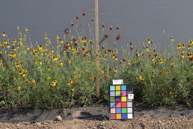 | | 2020 | | | | | | | Wild material | SOS 92nd Shipment | 2104993 | OPGC 8009 |
| 74 | OPGC 8010 | NM080-228 | Ratibida tagetes (E. James) Barnhart | New Mexico, United States | OPGC | | | 2020 | | | | | | | Wild material | SOS 92nd Shipment | 2104995 | OPGC 8010 |
| 75 | OPGC 8011 | NM080-231 | Ratibida columnifera (Nutt.) Wooton & Standl. | New Mexico, United States | OPGC | | | 2020 | | | | | | | Wild material | SOS 92nd Shipment | 2104997 | OPGC 8011 |
| 76 | OPGC 8012 | NM080-238 | Thelesperma megapotamicum (Spreng.) Kuntze | New Mexico, United States | OPGC | | | 2020 | | | | | | | Wild material | SOS 92nd Shipment | 2105002 | OPGC 8012 |
| 77 | W6 57702 | NM080-235 | Setaria leucopila (Scribn. & Merr.) K. Schum. | New Mexico, United States | W6 | | | 2020 | | | | | | | Wild material | SOS 92nd Shipment | 2105000 | W6 57702 |
| 78 | NA 88143 | NCBG-286 | Morella cerifera (L.) Small | Virginia, United States | NA |  | | 2019 | | | | | | | Wild material | | 2098393 | NA 88143 |
| 79 | NA 88172 | NCBG-668 | Kalmia latifolia L. | Maryland, United States | NA |  | | 2019 | | | | | | | Wild material | | 2098507 | NA 88172 |
| 80 | NA 88381 | NCBG-327 | Iva frutescens L. | Virginia, United States | NA |  | | 2019 | | | | | | | Wild material | | 2098417 | NA 88381 |
| 81 | OPGC 7982 | NCBG-599 | Rhexia mariana L. | Maryland, United States | OPGC |  | | 2019 | | | | | | | Wild material | | 2098480 | OPGC 7982 |
| 82 | W6 57519 | NCBG-421 | Eupatorium hyssopifolium L. | Virginia, United States | W6 |  | | 2019 | | | | | | | Wild material | | 2098443 | W6 57519 |
| 83 | W6 57555 | NCBG-598 | Andropogon gerardi Vitman | Virginia, United States | W6 |  | | 2019 | | | | | | | Wild material | | 2098479 | W6 57555 |
| 84 | W6 57562 | NCBG-611 | Alnus serrulata (Aiton) Willd. | Virginia, United States | W6 |  | | 2019 | | | | | | | Wild material | | 2098486 | W6 57562 |
| 85 | GPRU 168 | MARSB-577 | Prunus serotina Ehrh. | New York, United States | GEN |  | | 2019 | | | | | | | Wild material | | 2097661 | GPRU 168 |
| 86 | NA 88100 | MARSB-303 | Lyonia mariana (L.) D. Don | New Jersey, United States | NA |  | | 2019 | | | | | | | Wild material | | 2097564 | NA 88100 |
| 87 | NA 88103 | MARSB-390 | Ilex opaca Aiton | Delaware, United States | NA |  | | 2019 | COLLECTED | 11/03/2015 | Prime Hook National Wildlife Refuge: follow Broadkill Road towards Broadkill Beach. Almost immediately after the first bridge take the gated gravel road before a sharp right turn. Follow the gravel road until a right towards tree stand 9 (there is a sign). The population extends along the road. | 38.81797000, -75.20372000 | 7 | North Atlantic maritime scrub forest. | Wild material | | 2097608 | NA 88103 |
| 88 | OPGC 7903 | MARSB-411 | Asclepias tuberosa L. | New York, United States | OPGC |  | | 2019 | | | | | | | Wild material | | 2097619 | OPGC 7903 |
| 89 | OPGC 7909 | MARSB-712 | Rhexia mariana L. | New Jersey, United States | OPGC |  | | 2019 | | | | | | | Wild material | | 2097687 | OPGC 7909 |
| 90 | W6 57055 | MARSB-130 | Danthonia spicata (L.) P. Beauv. ex Roem. & Schult. | New Jersey, United States | W6 |  | | 2019 | | | | | | | Wild material | | 2097494 | W6 57055 |
| 91 | W6 57073 | MARSB-191 | Eupatorium hyssopifolium L. | Delaware, United States | W6 |  | | 2019 | | | | | | | Wild material | | 2097512 | W6 57073 |
| 92 | W6 57084 | MARSB-216 | Carex annectens (E. P. Bicknell) E. P. Bicknell | New York, United States | W6 |  | | 2019 | | | | | | | Wild material | | 2097523 | W6 57084 |
| 93 | W6 57143 | MARSB-333 | Eupatorium hyssopifolium L. | New Jersey, United States | W6 |  | | 2019 | | | | | | | Wild material | | 2097582 | W6 57143 |
| 94 | W6 57144 | MARSB-334 | Tridens flavus (L.) Hitchc. | New Jersey, United States | W6 |  | | 2019 | | | | | | | Wild material | | 2097583 | W6 57144 |
| 95 | W6 57146 | MARSB-337 | Tridens flavus (L.) Hitchc. | New Jersey, United States | W6 |  | | 2019 | | | | | | | Wild material | | 2097585 | W6 57146 |
| 96 | W6 57179 | MARSB-409 | Eupatorium hyssopifolium L. | New York, United States | W6 |  | | 2019 | | | | | | | Wild material | | 2097618 | W6 57179 |
| 97 | W6 57230 | MARSB-629 | Pseudognaphalium obtusifolium (L.) Hilliard & B. L. Burtt | New York, United States | W6 |  | | 2019 | | | | | | | Wild material | | 2097669 | W6 57230 |
| 98 | W6 57238 | MARSB-671 | Hexasepalum teres (Walter) J. H. Kirkbr. | Delaware, United States | W6 |  | | 2019 | | | | | | | Wild material | | 2097677 | W6 57238 |
| 99 | W6 57241 | MARSB-675 | Hexasepalum teres (Walter) J. H. Kirkbr. | Delaware, United States | W6 |  | | 2019 | | | | | | | Wild material | | 2097680 | W6 57241 |
| 100 | W6 57259 | MARSB-759 | Schizachyrium scoparium (Michx.) Nash subsp. littorale (Nash) Gandhi & Smeins | Delaware, United States | W6 |  | | 2019 | | | | | | | Wild material | | 2097698 | W6 57259 |
| 101 | W6 57303 | MARSB-871 | Aristida oligantha Michx. | New York, United States | W6 |  | | 2019 | | | | | | | Wild material | | 2097742 | W6 57303 |
| 102 | W6 56847 | NM030-122 | Sporobolus cryptandrus (Torr.) A. Gray | New Mexico, United States | W6 |  | | 2019 | | | | | | | Wild material | | 2094653 | W6 56847 |
| 103 | W6 56848 | NM030-123 | Sporobolus cryptandrus (Torr.) A. Gray | New Mexico, United States | W6 |  | | 2019 | | | | | | | Wild material | | 2094654 | W6 56848 |
| 104 | OPGC 7472 | CBG-9061 | Verbena hastata L. | Nebraska, United States | OPGC |  | | 2019 | | | | | | | Wild material | | 2092740 | OPGC 7472 |
| 105 | OPGC 7480 | CBG-9191 | Verbena stricta Vent. | Nebraska, United States | OPGC |  | | 2019 | | | | | | | Wild material | | 2092778 | OPGC 7480 |
| 106 | OPGC 7484 | CBG-9413 | Verbena hastata L. | Nebraska, United States | OPGC |  | | 2019 | | | | | | | Wild material | | 2092789 | OPGC 7484 |
| 107 | W6 56588 | CBG-8636 | Carex brevior (Dewey) Mack. ex Lunell | Illinois, United States | W6 |  | | 2019 | | | | | | | Wild material | | 2092687 | W6 56588 |
| 108 | NA 88060 | NEWFS-203 | Juniperus virginiana L. | Connecticut, United States | NA |  | | 2019 | | | | | | | Wild material | | 1976177 | NA 88060 |
| 109 | NA 88432 | NEWFS-228 | Rosa palustris Marshall | Rhode Island, United States | NA |  | | 2019 | | | | | | | Wild material | | 1976184 | NA 88432 |
| 110 | OPGC 7309 | AZ930-361 | Polanisia dodecandra (L.) DC. | Arizona, United States | OPGC |  | | 2018 | | | | | | | Wild material | | 1970377 | OPGC 7309 |
| 111 | OPGC 7311 | AZ930-363 | Aquilegia chrysantha A. Gray | Arizona, United States | OPGC | 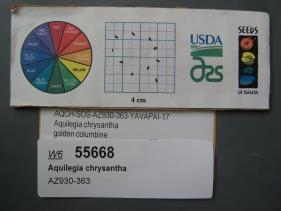 | | 2018 | | | | | | | Wild material | | 1970379 | OPGC 7311 |
| 112 | W6 55543 | NM030-86 | Plantago patagonica Jacq. | New Mexico, United States | W6 |  | | 2018 | | | | | | | Wild material | | 1970254 | W6 55543 |
| 113 | NA 88019 | NCBG-249 | Morella pensylvanica (Mirb.) Kartesz | North Carolina, United States | NA |  | | 2018 | | | | | | | Wild material | | 1965886 | NA 88019 |
| 114 | NA 88022 | NCBG-261 | Morella cerifera (L.) Small | Virginia, United States | NA |  | | 2018 | | | | | | | Wild material | | 1965895 | NA 88022 |
| 115 | NA 88033 | NCBG-403 | Morella pensylvanica (Mirb.) Kartesz | Virginia, United States | NA |  | | 2018 | | | | | | | Wild material | | 1965944 | NA 88033 |
| 116 | OPGC 6611 | NCBG-500 | Hibiscus moscheutos L. | North Carolina, United States | OPGC |  | | 2018 | | | | | | | Wild material | Hibiscus moscheutos | 1965965 | OPGC 6611 |
| 117 | W6 54776 | NCBG-654 | Tridens flavus (L.) Hitchc. | Virginia, United States | W6 |  | | 2018 | | | | | | | Wild material | Tridens flavus | 1966002 | W6 54776 |
| 118 | NA 87992 | MARSB-205 | Juniperus virginiana L. | Delaware, United States | NA |  | | 2018 | | | | | | | Wild material | | 1964733 | NA 87992 |
| 119 | NA 87993 | MARSB-206 | Morella cerifera (L.) Small | Delaware, United States | NA |  | | 2018 | | | | | | | Wild material | | 1964734 | NA 87993 |
| 120 | NA 88002 | MARSB-637 | Morella cerifera (L.) Small | Delaware, United States | NA |  | | 2018 | | | | | | | Wild material | | 1964812 | NA 88002 |
| 121 | NA 88009 | MARSB-761 | Baccharis halimifolia L. | Delaware, United States | NA |  | | 2018 | | | | | | | Wild material | | 1964846 | NA 88009 |
| 122 | OPGC 6544 | MARSB-592 | Hibiscus moscheutos L. | New York, United States | OPGC |  | | 2018 | | | | | | | Wild material | Hibiscus moscheutos | 1964803 | OPGC 6544 |
| 123 | Ames 34308 | JDC/ES/2018/031/844 | Echinacea sanguinea Nutt. | Arkansas, United States | NC7 |  | | 2018 | COLLECTED | 07/17/2018 | Near state line off Miller Road 154 approximately 4.40 miles northwest of Brightstar, Miller County | 33.16569700, -94.03712900 | 109 | Roadside. | Wild material | Variation in leaf petiole length noted (some sessile), all leaves and stems observed hairy. Plants in peak flower on 22 May 2018 and seeds likely reached peak maturity around 1 July 2018. Peduncles at time of collection (17 July 2018) were showing 12-18" of brown/dead tissue. Plants ranging from 2-3.5' in height. Pollen yellow. | 1964615 | Ames 34308 |
| 124 | W6 53449 | NM030-47 | Descurainia pinnata (Walter) Britton subsp. ochroleuca (Wooton) Detling | New Mexico, United States | W6 | | | 2018 | | | | | | | Wild material | | 1958184 | W6 53449 |
| 125 | NA 85023 | JDC/SS/2018/014/827 | Sapindus saponaria L. var. drummondii (Hook. & Arn.) L. D. Benson | Oklahoma, United States | NA |  | | 2018 | COLLECTED | 03/14/2018 | Canton Wildlife Management Area approximately 17 miles west, southwest of Fairview, T20N R15W and T20N R14W, Major County | 36.16906400, -98.76062500 | 504 | | Wild material | | 1957960 | NA 85023 |
| 126 | Ames 34779 | MARSB-317 | Rhus copallinum L. | New Jersey, United States | NC7 |  | | 2017 | COLLECTED | 09/21/2015 | Edward G Bevan State Wildlife Management Area along powerline cut off Ackley Road. | 39.33627000, -75.07775000 | 19 | Pitch Pine Barrens | Wild material | | 1954641 | Ames 34779 |
| 127 | NA 87959 | NEWFS-229 | Viburnum dentatum L. | Rhode Island, United States | NA |  | | 2017 | | | | | | | Wild material | | 1954701 | NA 87959 |
| 128 | NA 87966 | NEWFS-549 | Morella caroliniensis (Mill.) Small | Rhode Island, United States | NA |  | | 2017 | | | | | | | Wild material | | 1954728 | NA 87966 |
| 129 | W6 52984 | NEWFS-548 | Betula populifolia Marshall | Rhode Island, United States | W6 |  | | 2017 | | | | | | | Wild material | | 1954727 | W6 52984 |
| 130 | Ames 34151 | MARSB-813 | Monarda fistulosa L. | New York, United States | NC7 |  | | 2017 | COLLECTED | 09/20/2017 | Beaver Dam Sanctuary located just southeast of Katonah. Area sampled known as Sheep Dip Meadow just north of parking area, Westchester County | 41.24605600, -73.67036100 | 85 | Early successional, undulating meadow. Paxton fine sandy loam. | Wild material | 3-4' tall forbe, light purple flowers. | 1954952 | Ames 34151 |
| 131 | OPGC 6276 | NM080-26 | Dieteria asteroides Torr. | New Mexico, United States | OPGC | | | 2017 | | | | | | | Wild material | | 1947295 | OPGC 6276 |
| 132 | W6 52151 | NM080-12 | Nassella tenuissima (Trin.) Barkworth | New Mexico, United States | W6 | | | 2017 | | | | | | | Wild material | | 1947286 | W6 52151 |
| 133 | Ames 33865 | JDC/MP/2016/032/747 | Monarda punctata L. | Iowa, United States | NC7 |  | | 2016 | COLLECTED | 11/01/2016 | Near 283rd Avenue and US higway 67 intersection approximatley 5.5 miles south of Low Moor, T80N R5E SE 1/4 NE 1/4 Sec. 22 Scott County. | 41.72287000, -90.35919000 | 175 | Roadside/pasture. | Wild material | | 1943207 | Ames 33865 |
| 134 | W6 51600 | CBG-4311 | Carex brevior (Dewey) Mack. ex Lunell | Nebraska, United States | W6 | | | 2016 | | | | | | | Wild material | | 1942730 | W6 51600 |
| 135 | W6 51601 | CBG-4312 | Juncus interior Wiegand | Nebraska, United States | W6 | | | 2016 | | | | | | | Wild material | | 1942731 | W6 51601 |
| 136 | OPGC 6153 | CBG-2469 | Aquilegia canadensis L. | Illinois, United States | OPGC |  | | 2015 | | | | | | | Wild material | | 1926006 | OPGC 6153 |
| 137 | WLP 2423 | LBJWC-716 | Platanus occidentalis L. | Texas, United States | NA |  | | 2012 | COLLECTED | 01/16/2010 | Balance Shoals Greenbelt; Blanco River at I-35 [Interstate 35]. Texas Blackland Prairies phytoregion. | 29.90702000, -97.89536000 | 170 | Soil: white gravel (limestone geology) | Wild material | | 1902497 | WLP 2423 |