| 0 | W6 61297 | OR110-1110 | Holodiscus discolor (Pursh) Maxim. | Oregon, United States | W6 |  | | 2023 | | | | | | | Wild material | | 2142741 | W6 61297 |
| 1 | W6 61298 | OR110-1111 | Holodiscus discolor (Pursh) Maxim. | Oregon, United States | W6 |  | | 2023 | | | | | | | Wild material | | 2142742 | W6 61298 |
| 2 | WLP 1211 | OWE-003 | Holodiscus discolor (Pursh) Maxim. | Oregon, United States | NA | | | 2019 | COLLECTED | 08/31/2018 | Josephine County; ; Rogue River-Siskiyou National Forest: Page Mountain, north of National Forest Service Road 015. | 42.00620000, -123.55248000 | 1405 | Dry, open coniferous forest; open [full sun] to 1/4 shade. | | Approximately 500 seeds collected from two individuals. Species occasional, with patchy distribution. | 2109040 | WLP 1211 |
| 3 | W6 55825 | OR110-1066 | Holodiscus discolor (Pursh) Maxim. | Oregon, United States | W6 |  | | 2018 | | | | | | | Wild material | Holodiscus discolor | 1970536 | W6 55825 |
| 4 | NA 88696 | RJL2023NCSC-001 | Rhododendron catawbiense Michx. | North Carolina, United States | NA | | | 2023 | COLLECTED | 11/12/2023 | Duke Forest property along New Hope Creek. The collection site is accesses by foot along trails. | 35.98317700, -79.01856200 | 103 | Plants growing in shade to part-shade of an upland very dry woodland habitat that is mostly deciduous. The site is steeply sloped underlain by rocky outcrop. Slope: 15 to 25 percent. Aspect: Northwest. The underlying geology of this area is of Cambrian/Late Proterozoic origin and characterized as a Metamorphosed Granitic Rock. It is megacrystic and well foliated; locally contains hornblende. Chapel Hill, Chatham, Farrington, Meadow Flats, Mt. Moriah, Parks Crossroads plutons, and Roxboro and Vance County suites. (Source: USGS North Carolina Geologic Map Data.) The primary soil type in the collection area is classified as Wedowee sandy loam, 15 to 25 percent slopes. Wedowee Series consists of very deep, well drained, moderately permeable soils that formed in residuum weathered from felsic igneous and metamorphic rocks of the Piedmont uplands. These soils are on narrow ridges and on side slopes of uplands. Slopes are dominantly 6 to 25 percent but ranges from 0 to 60 percent. The strata range from dark brown and brownish yellow to strong brown. They are mostly sandy loam; moderate fine granular structure; very friable; strongly acid. (Source: NRCS Web Soil Survey.) | Wild material | | 2159124 | NA 88696 |
| 5 | OPGC 8793 | OR110-1114 | Anaphalis margaritacea (L.) Benth. & Hook. f. | Oregon, United States | OPGC | | | 2023 | | | | | | | Wild material | | 2142745 | OPGC 8793 |
| 6 | WLP 3092 | RJLSEUS2022-021 | Rhododendron prunifolium (Small) Millais | Alabama, United States | NA | | | 2023 | COLLECTED | 12/10/2023 | Slopes along Poke Springs Branch inlet accessed by boat from Walter F. George Reservoir. Generally uncommon, but frequent at this site. | 31.72318400, -85.12907800 | 69 | Plants are growing in part-shade to shade on the well-drained mostly deciduous woodland slopes approximately 3-6 meters above the inlet.
Soils: The underlying geology of this area is of Cretaceous origin and characterized as Selma Group; Providence Sand. The upper part of the profile consists of cross-bedded fine to coarse sand and white, dark-gray and pale-red-purple mottled clay containing lignite, sand, and kaolin. The lower part consists of dark-gray laminated to thin-bedded silty clay and abundantly micaceous, carbonaceous, fossiliferous very fine to fine sand.
Source: USGS Alabama Geologic Map Data (https://mrdata.usgs.gov/geology/state/sgmc-unit.php?unit=ALKp%3B1)
The primary soil types in the collection area are classified as Nankin-Lucy Complex soil (20 to 60 percent slopes). The Nankin Series consists of very deep, well drained, moderately slowly permeable soils on uplands of the Coastal Plain. They formed in stratified loamy and clayey marine sediments. Slopes range from 0 to 60 percent. Soils are comprised of sandy loam in the upper 25 cm to sandy clay loam and sandy clay in lower strata to about 1.7 meters deep; these soils are strongly acid. The Lucy Series consists of very deep, well drained, moderately permeable soils on uplands. They formed in sandy and loamy marine and fluvial sediments of the Southern Coastal Plain. Slopes vary from 0 to 45 percent. These soils are generally loamy to sandy loam in the upper 25 cm and sandy clay loam in the lower strata to 2 meters; these are strongly acid soils.
Source: NRCS Web Soil Survey (https://websoilsurvey.sc.egov.usda.gov/App/WebSoilSurvey.aspx) | Wild material | | 2141446 | WLP 3092 |
| 7 | NA 88552 | RJLSEUS2022-025 | Hydrangea quercifolia W. Bartram | Alabama, United States | NA | | | 2023 | COLLECTED | 12/12/2022 | Claiborne Bluffs area along unnamed road to boat ramp on the east side of the Alabama River at the U.S. Highway 84 bridge over the river. Common at this location and along the nearby Alabama River. | 31.54879700, -87.51416400 | 40 | Plants are growing in part-shade to shade of mesic, well-drained, circum-neutral slopes and benches in mature mixed deciduous and evergreen woodlands with good litter layer. Soils: The underlying geology of this area is the Jackson Group Undifferentiated. The units of the Jackson Group are the Yazoo Clay and Crystal River and Moodys Branch Formations. Descriptions of the members of the Yazoo Clay follow in descending order. Shubuta Member - in western Alabama consists of light-greenish-gray to white plastic fossiliferous, calcareous clay containing irregular calcareous nodules. From the Tombigbee River eastward, the Shubuta becomes more calcareous and grades into massive clayey glauconitic limestone. Eastward from the Alabama River, equivalent beds grade into the Crystal River Formation. Pachuta Marl Member - light-greenish-grey glauconitic, fossiliferous clayey sand and sandy limestone traceable from western Alabama eastward to Covington County where it grades into the Crystal River Formation. Cocoa Sand Member - yellowish-gray firm calcareous, fossiliferous fine to medium sand or sandy limestone or greenish-grey micaceous, calcareous, very clayey sand. Calcareous and clayey sand equivalent to the Cocoa is traceable from western Alabama to the Conecuh River area. (Source: USGS Alabama Geological Map Data). The surface soil profile of this portion of the bluffs along the Alabama River are characterized as Saffell-Lucy (Flomaton) Series Complex soils. The Saffell Series consists of very deep, well drained, moderately permeable soils that formed in loamy and gravelly marine sediments of the Tertiary Age and have acid reaction. These soils are found on the upper portion of the bluffs along the Alabama River. The Lucy Series consists of very deep, well drained, moderately permeable soils on uplands. They formed in sandy and loamy marine and fluvial sediments of the Southern Coastal Plain Major Land Resource Area. Soil reaction runs from strongly to moderately acid. The Flomaton Series consists of very deep, excessively drained, rapidly permeable soils on uplands of the Southern Coastal Plain Major Land Resource Area. They formed in gravelly sandy marine sediments and also have an acid reaction. The remainder of soils are of miscellaneous origin. (Source: USDA-NRCS Official Soil Series Descriptions). | Wild material | | 2140779 | NA 88552 |
| 8 | NA 88553 | RJLSEUS2022-026 | Hydrangea arborescens L. | Alabama, United States | NA | | | 2023 | COLLECTED | 12/12/2022 | Claiborne Bluffs area along unnamed road to boat ramp on the east side of the Alabama River at the U.S. Highway 84 bridge over the river. Occasionally found in the woodlands. | 31.54940700, -87.51366200 | 25 | Plants are growing in part-shade to shade of mesic, well-drained, circum-neutral slopes mature mixed deciduous and evergreen woodlands where slopes are exposed and detritus does not build up.
Soils: The underlying geology of this area is the Jackson Group Undifferentiated. The units of the Jackson Group are the Yazoo Clay and Crystal River and Moodys Branch Formations. Descriptions of the members of the Yazoo Clay follow in descending order. Shubuta Member - in western Alabama consists of light-greenish-gray to white plastic fossiliferous, calcareous clay containing irregular calcareous nodules. From the Tombigbee River eastward, the Shubuta becomes more calcareous and grades into massive clayey glauconitic limestone. Eastward from the Alabama River, equivalent beds grade into the Crystal River Formation. Pachuta Marl Member - light-greenish-grey glauconitic, fossiliferous clayey sand and sandy limestone traceable from western Alabama eastward to Covington County where it grades into the Crystal River Formation. Cocoa Sand Member - yellowish-gray firm calcareous, fossiliferous fine to medium sand or sandy limestone or greenish-grey micaceous, calcareous, very clayey sand. Calcareous and clayey sand equivalent to the Cocoa is traceable from western Alabama to the Conecuh River area.
Source: USGS Alabama Geological Map Data (https://mrdata.usgs.gov/geology/state/state.php?state=AL)
The surface soil profile of this portion of the bluffs along the Alabama River are characterized by Saffell-Lucy (Flomaton) Series Complex soils. The Saffell Series consists of very deep, well drained, moderately permeable soils that formed in loamy and gravelly marine sediments of the Tertiary Age and have acid reaction. These soils are found on the upper portion of the bluffs along the Alabama River. The Lucy Series consists of very deep, well drained, moderately permeable soils on uplands. They formed in sandy and loamy marine and fluvial sediments of the Southern Coastal Plain Major Land Resource Area. Soil reaction runs from strongly to moderately acid. The Flomaton Series consists of very deep, excessively drained, rapidly permeable soils on uplands of the Southern Coastal Plain Major Land Resource Area. They formed in gravelly sandy marine sediments and also have an acid reaction. The remainder of soils are of miscellaneous origin.
Source: USDA-NRCS Official Soil Series Descriptions (https://soilseries.sc.egov.usda.gov/osdname.aspx) | Wild material | | 2140780 | NA 88553 |
| 9 | WLP 2612 | 2022VA-03 | Styrax grandifolius Aiton | Virginia, United States | NA | | | 2022 | COLLECTED | 09/12/2022 | Northwest River Park on the south side of Indian Springs Road behind the Equestrian Center along a bridle trail. This plant is a common in the mesic woodlands at this location. | 36.58361100, -76.16277800 | 21 | Plants growing in shade to part-shade of the mixed deciduous and evergreen mesic woodland about 1 to 2 meters above a nearby wetland area.
The underlying geology of this area is the Tabb Formation of Quaternary origin which is comprised of undifferentiated sand, silt, and peat and subdivided into three members. Within the Tabb Formation lies the Lynnhaven Member with pebbly and cobbly, fine to coarse gray sand grades upward into clayey and silty fine sand and sandy silt. Extensive low lands bounded on the landward side by river-, bay-, and ocean-facing scarps having toe altitudes of 5-6 meters. Thickness is 0 to 6.5 meters.
Source: USGS Virginia Geologic Map Data (https://mrdata.usgs.gov/geology/state/sgmc-unit.php?unit=VAQtl%3B0)
The surface soil profile of this area is Chapanoke-Yeopim complex, 0 to 3 percent slopes. These soil as somewhat poorly to moderately drained, acidic, and found on marine terraces and summits of low elevation coastal plain areas. They are comprised of silt loam, silty clay loam, sandy clay loam and loam in varying quantities across the profile; the depth to parent geology is approximately 200 cm.
Source: NRCS Web Soil Survey (https://websoilsurvey.sc.egov.usda.gov/App/WebSoilSurvey.aspx | Wild material | | 2139350 | WLP 2612 |
| 10 | W6 59328 | CA330-198 | Elymus elymoides (Raf.) Swezey | California, United States | W6 | | | 2021 | | | | | | | Wild material | Perennial bunchgrass, low growing, no ligule present, awns twisting into bottle brush shape | 2120381 | W6 59328 |
| 11 | Ames 35235 | JDC/AF/2019/017/896 | Agastache foeniculum (Pursh) Kuntze | Wisconsin, United States | NC7 |  | | 2019 | COLLECTED | 09/25/2019 | Brule River watershed located along E. Jersett Road appproximately 4.92 miles northeast of Solon Springs,T45N R11W: NE ¼ NW ¼ Sec. 13; NW ¼ NW ¼ Sec. 14; and NW ¼ Sec. 15. | 46.38906900, -91.68919500 | 357 | Roadside, sandy soils | Wild material | Plants measuring approximately 3-4' in height with attractive pale lavender to lilac colored flowers. Spikes measuring circa 5" in length. Leaves with undersides whitish in color. Peak flowering occurred 5 August 2019 in nature. Species rather rare in immediate area and county. | 2097771 | Ames 35235 |
| 12 | Ames 35231 | Va101 | Agastache parvifolia Eastw. | California, United States | NC7 |  | | 2019 | COLLECTED | 09/26/2019 | Area between Bogard Buttes and Caribou Wilderness approximately 20 miles west of Eagle Lake, on USGS Bogard Buttes 7.5-minute quad map T31N R7E including SW1/4 Sec. 11, NE1/4 Sec. 13, N1/2 Sec. 14 and NE1/4 NE1/4 Sec. 15, Lassen County | 40.55202800, -121.15888900 | 1980 | Margins and interiors of (+/-) dry, volcanic rock fields. Talus outcroppings, among boulders in fissures and on low ridges, across variable slopes (5-40 degrees) and aspects (east, west, south and northeast) with majority of sites in low-relief, except for irregular surfaces within lava fields. Elevations ranging from 1944 to 2023 (meters). Full sun or patchy shade. | Wild material | Perennial aromatic herb of mint family, basally branched with small, triangular crenate/serrate leaves and small pink-rose flowers in dense, elongate, terminal spikes. Plants in nature ranged from one to three feet high, few-branched up to ten or so branches. At time of collection (26 September 2019), plants were mostly late in phenology, though a few plants showed a flush of corolla color. | 2097767 | Ames 35231 |
| 13 | NA 85617 | OWE-001 | Calocedrus decurrens (Torr.) Florin | Oregon, United States | NA | | | 2019 | COLLECTED | 08/31/2018 | Josephine County; ; Rogue River-Siskiyou National Forest: Page Mountain, north of National Forest Service Road 015. | 42.00661000, -123.55115000 | 1352 | Dry, open coniferous forest; open [full sun]. | | 200 seeds collected from one individual. Species common, with uniform distribution. | 2109039 | NA 85617 |
| 14 | NA 88053 | OR110-1046 | Whipplea modesta Torr. | Oregon, United States | NA |  | | 2018 | | | | | | | Wild material | | 1970519 | NA 88053 |
| 15 | OPGC 7812 | OR110-1067 | Anaphalis margaritacea (L.) Benth. & Hook. f. | Oregon, United States | OPGC | 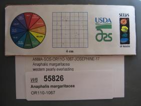 | | 2018 | | | | | | | Wild material | Anaphalis margaritacea. SOS 7th transfer. | 1970537 | OPGC 7812 |
| 16 | W6 53710 | OR110-1032 | Elymus glaucus Buckley | Oregon, United States | W6 |  | | 2018 | | | | | | | Wild material | | 1964288 | W6 53710 |
| 17 | Ames 29945 | 178279 | Spiraea douglasii Hook. | Oregon, United States | NC7 |  | | 2005 | COLLECTED | 09/25/2002 | Ecoregion 5. Douglas County. Along Cow Creek parallel to county road 164. | 42.92028000, -123.47056000 | 185 | Moderate to light canopy cover of sparse. | Wild material | Shrub 0.9-2.1 meters tall. | 1674042 | Ames 29945 |
| 18 | WLP 2069 | 170848 | Amelanchier alnifolia (Nutt.) Nutt. ex M. Roem. | Idaho, United States | NA | 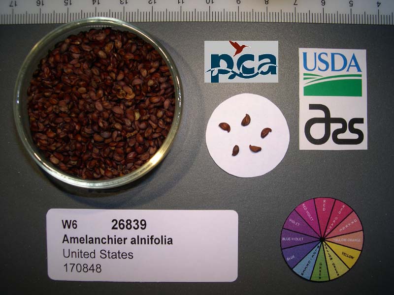 | | 2005 | COLLECTED | 07/18/2002 | Columbia Basin. Nez Perce County. Thain Ave. south of Lewiston, right at the prominent 'Y' toward Waha. South on Zaza Rd., right on Madden Corrals Rd. Travel 4km past Green Powder River Gate, shrubs on roadside. T31N R4W Sec 6 | 46.05833000, -116.87500000 | 914 | Riparian valley bottom; roadside. Basalt geology with 0-30% SE slope. Silt/Loam - dark brown soil. | Wild material | Shrub 1.5-4.5 meters tall. | 1673878 | WLP 2069 |
| 19 | WLP 2076 | 179069 | Lonicera hispidula (Lindl.) Douglas ex Torr. & A. Gray | Oregon, United States | NA | 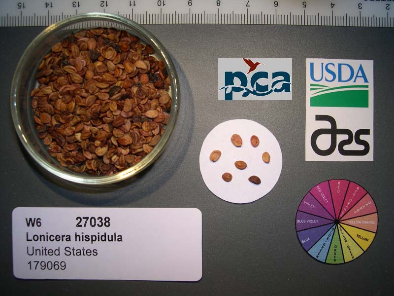 | | 2005 | COLLECTED | 10/21/2002 | | | 412 | Open canopy Pinus attenuata/Arbutus menziesii forest with Corylus cornuta understory. Associated with Pseudotsuga menziesii, Toxicodendron diversilobum, Arctostaphylos canescens, Holodiscus discolor, Mahonia aquifolium, Elym | Wild material | Forb 0.9-4.5 meters tall. | 1674075 | WLP 2076 |
| 20 | WLP 2314 | 229986 | Prunus emarginata (Douglas) Eaton | California, United States | NA |  | | 2005 | COLLECTED | 08/11/2004 | | | 914 | Mixed conifer forest/open grassland; clay soil. | Wild material | Shrub 0.6-3.6 meters tall. | 1674395 | WLP 2314 |
| 21 | NA 72429 | NACPEC02041 | Acer truncatum Bunge | Shanxi Sheng, China | NA | | | 2002 | COLLECTED | 09/20/2002 | Shanxi Province, Qin Yuan County, Ling Kong Shan Zhen, Pinus tabuliformis national nature preserve. | 36.59450000, 112.08416000 | | Oak-pine mixed deciduous forest, mesic woods; growing at top of steep gorge., slope 80 degrees, aspect Various, Growing in association with Pinus tabuliformis, Sorbus discolor, Quercus liaotungensis, Carpinus, Acer davidii, Cornus bretschneideri, Syringa, Acer ginnala, Viburnum, Euonymus., Thin, rocky | Wild material | | 1777426 | NA 72429 |
| 22 | WLP 1925 | NACPEC02036 | Viburnum betulifolium Batalin | Shaanxi Sheng, China | NA | | | 2002 | COLLECTED | | Shanxi: Qin Yuan: Ling Kong Shan Zhen, | 36.59450000, 112.08416000 | 5098 | oak pine mixed deciduous forest, mesic woods; growing along trail at top of steep gorge in association with Pinus tabuliformis, Sorbus discolor, Quercus liaotungensis, Carpinus, Euoynmus, Acer davidii, Acer truncatum, Cornus bretschneideri, Syringa, Acer ginnala, various, 15-60, various, thin rocky, | Wild material | | 1899318 | WLP 1925 |
| 23 | DLEG 990130 | DLEG 990130 | Cologania angustifolia Kunth | Arizona, United States | |  | Historic | 2000 | COLLECTED | 09/24/1999 | Cochise Co. Sunnyside Canyon, Huachuca Mts., ca. 2.2 mi from jct. Hwy 83. 31? 26' 210" N, 110? 24' 108" W | | 5200 | SE facing slope of low ridge above road. Rocky soil in oak woodland. Plants abundant along a 100 m stretch of road. | Wild material | Setting: Quercus arizonicus, Q. emory, Juniperus deppeana, Pinus discolor, Arctostaphylos pungens, Agave parryi var. huachucensis, grasses. Collected by M. Johnson, K. Coppola, B. Bearly, S. Posey | 1730351 | DLEG 990130 |