| 0 | Ames 36289 | AS1024 | Pinus monophylla Torr. & Frém. | Nevada, United States | NC7 |  | | 2024 | COLLECTED | 10/21/2024 | Bureau of Land Management controlled land near Ely. | 39.25657900, -114.87561400 | | | Wild material | | 2169817 | Ames 36289 |
| 1 | WLP 1131 | GF2018-10 | Cliftonia monophylla (Lam.) Britton ex Sarg. | Florida, United States | NA | | | 2018 | COLLECTED | 11/08/2018 | Liberty County; ; Apalachicola National Forest, 500 feet north of National Forest Rd 112, 0.2 miles west of Hwy 65. | 30.21891000, -84.89691000 | 28 | Swampy area. | | | 2108892 | WLP 1131 |
| 2 | PI 675295 | UT931-261 | Poa secunda J. Presl | Utah, United States | W6 |  | | 2011 | | | | | | | Wild material | | 1861315 | PI 675295 |
| 3 | W6 62497 | CA170-302 | Elymus elymoides (Raf.) Swezey | California, United States | W6 |  | | 2025 | | | | | | | Wild material | | 2192195 | W6 62497 |
| 4 | W6 62498 | CA170-303 | Leymus cinereus (Scribn. & Merr.) Á. Löve | California, United States | W6 |  | | 2025 | | | | | | | Wild material | | 2192196 | W6 62498 |
| 5 | W6 62607 | AZ010-59 | Purshia tridentata (Pursh) DC. | Arizona, United States | W6 |  | | 2025 | | | | | | | Wild material | Shrubs had dropped seed so did cut tests determining if collecting off the ground was an option. Viability very good so made the collection | 2192826 | W6 62607 |
| 6 | W6 62608 | AZ010-60 | Purshia mexicana (D. Don) S. L. Welsh var. stansburyana (Torr.) S. L. Welsh | Arizona, United States | W6 |  | | 2025 | | | | | | | Wild material | Received as Purshia Stansburyana. Many plants along the rd up to Black Rock Mountain. plants were variable in size, from 2 ft to over 7 ft tall. Mostly collected along rd but some went a ways back into the landscape. Lots and lots of crab spiders in the collection from 7/3. | 2192827 | W6 62608 |
| 7 | W6 62610 | AZ010-62 | Heliomeris multiflora Nutt. | Arizona, United States | W6 |  | | 2025 | | | | | | | Wild material | On roadsides and cliffs along rd | 2192829 | W6 62610 |
| 8 | W6 62612 | AZ010-64 | Purshia mexicana (D. Don) S. L. Welsh var. stansburyana (Torr.) S. L. Welsh | Arizona, United States | W6 |  | | 2025 | | | | | | | Wild material | Received as Purshia Stansburyana. Large population a little past prime collecting time but still good, | 2192831 | W6 62612 |
| 9 | W6 62819 | DFWS0801-15 | Poa secunda J. Presl | Nevada, United States | W6 |  | | 2025 | | | | | | | Wild material | With NCC, pinyon juniper forest, possible 2 varieties of POSE, could be combined with pose-16 | 2193116 | W6 62819 |
| 10 | W6 62829 | DFWS0801-4 | Poa secunda J. Presl | Nevada, United States | W6 |  | | 2025 | | | | | | | Wild material | | 2193126 | W6 62829 |
| 11 | W6 62834 | DFWS0801-9 | Poa secunda J. Presl | Nevada, United States | W6 |  | | 2025 | | | | | | | Wild material | | 2193131 | W6 62834 |
| 12 | W6 62869 | DNPNV00-3 | Pseudoroegneria spicata (Pursh) Á. Löve | Nevada, United States | W6 |  | | 2025 | | | | | | | Wild material | Plants mixed up with a great deal of ELEL5 and ACHY. | 2196045 | W6 62869 |
| 13 | W6 62876 | DNV010-2 | Hesperostipa comata (Trin. & Rupr.) Barkworth | Nevada, United States | W6 |  | | 2025 | | | | | | | Wild material | Population has released a large number of seed already but there is enough population for a collection. | 2196052 | W6 62876 |
| 14 | W6 62877 | DNV010-3 | Elymus elymoides (Raf.) Swezey | Nevada, United States | W6 |  | | 2025 | | | | | | | Wild material | Population is spread out in clusters and is concentrated near the road. | 2196053 | W6 62877 |
| 15 | W6 62880 | DNV010-6 | Pseudoroegneria spicata (Pursh) Á. Löve | Nevada, United States | W6 |  | | 2025 | | | | | | | Wild material | Area is heavy with cheat grass but has good populations of target species. This population is just reaching seed maturity. | 2196056 | W6 62880 |
| 16 | NA 88580 | 2024RJLFL-009 | Ilex myrtifolia Walter | Florida, United States | NA | | | 2024 | COLLECTED | 11/13/2024 | Woodlands on the north side of Fisher Old Mill Road about 0.10 kilometers west of intersection with DOF Y12. | 30.62693800, -86.83962200 | 6 | Mixed evergreen and deciduous moist to wet forest in part shade to full sun. From the associated taxa, this site can be quite wet during the growing season; however, it was dry during this collection time; likely due to extended drought. Slope: 0 percent. Aspect: South. | Wild material | | 2169917 | NA 88580 |
| 17 | NA 88586 | 2024RJLFL-020 | Vaccinium arboreum Marshall | Florida, United States | NA | | | 2024 | COLLECTED | 11/14/2024 | Woodland edge off of Ralf Laurant Road, above the wetland/headwaters of Danley Branch along the edge of a young longleaf pine plantation. | 30.90104300, -86.78878100 | 61 | Edge of a mixed evergreen and deciduous forest in part shade to full sun on a mesic to mesic-dry slope, adjacent to a young longleaf pine plantation. Slope: 3 to 8 percent. Aspect: West. The underlying geology of this area is characterized as Citronelle Formation of the Pliocene period. The Citronelle Formation is widespread in the Gulf Coastal Plain. The type section for the Citronelle Formation, named by Matson (1916), is near Citronelle, Alabama. The Citronelle Formation grades laterally, through a broad facies transition, into the Miccosukee Formation of the eastern Florida panhandle. Coe (1979) investigated the Citronelle Formation in portions of the western Florida panhandle. The Citronelle Formation is a siliciclastic, deltaic deposit that is lithologically similar to, and time equivalent with, the Cypresshead Formation and, at least in part, the Long Key Formation (Cunningham et al., 1998) of the peninsula. In the western panhandle, some of the sediments mapped as Citronelle Formation may be reworked Citronelle. The lithologies are the same and there are few fossils present to document a possible younger age. The Citronelle Formation consists of gray to orange, often mottled, unconsolidated to poorly consolidated, very fine to very coarse, poorly sorted, clean to clayey sands. It contains significant amounts of clay, silt and gravel which may occur as beds and lenses and may vary considerably over short distances. Limonite nodules and limonite-cemented beds are common. Marine fossils are rare but fossil pollen, plant remains and occasional vertebrates are found. Much of the Citronelle Formation is highly permeable. It forms the Sand and Gravel Aquifer of the surficial aquifer system. The dominant fossils in the freshwater carbonates are mollusks. (Source: USGS Florida Geologic Map Data). The surface soil profile is classified as Troup Series loamy sand, 5 to 8 percent slopes. The Troup series consists of very deep, somewhat excessively drained soils formed in unconsolidated sandy and loamy marine sediments. Troup soils are found on ridges and hillslopes. These soils are very strongly acid to strongly acid. (Source: California Soil Resource Lab/NRCS Official Soil Series Descriptions). | Wild material | | 2169923 | NA 88586 |
| 18 | NA 88589 | 2024RM-002 | Lyonia ferruginea (Walter) Nutt. | Florida, United States | NA | | | 2024 | COLLECTED | 11/21/2024 | Eglin Air Force Base: collected along an unnamed sand road that leads to the former Flowers Boat Landing (now permanently closed) along the Yellow River. Accessed by boat. | 30.60823600, -86.83595500 | 6 | Mixed evergreen and deciduous open habitat in part shade to full sun. Slope: 0 to 1 percent. Aspect: N/A. The underlying geology of this area is characterized as Alluvium from undifferentiated Quaternary Sediments. Much of Florida's surface is covered by a varying thickness of undifferentiated sediments consisting of siliciclastics, organics and freshwater carbonates. Where these sediments exceed 20 feet (6.1 meters) thick, they were mapped as discrete units. To subdivide the undifferentiated sediments, those sediments occurring in flood plains were mapped as alluvial and flood plain deposits (Qal). Sediments showing surficial expression of beach ridges and dunes were mapped separately (Qbd) as were the sediments composing Trail Ridge (Qtr). Terrace sands were not mapped (refer to Healy [1975] for a discussion of the terraces in Florida). The subdivisions of the Undifferentiated Quaternary Sediments (Qu) are not lithostratigraphic units but are utilized to facilitate a better understanding of the State's geology. The siliciclastics are light gray, tan, brown to black, unconsolidated to poorly consolidated, clean to clayey, silty, unfossiliferous, variably organic-bearing sands to blue green to olive green, poorly to moderately consolidated, sandy, silty clays. Gravel is occasionally present in the panhandle. Organics occur as plant debris, roots, disseminated organic matrix and beds of peat. Freshwater carbonates, often referred to as marls in the literature, are scattered over much of the State. In southern Florida, freshwater carbonates are nearly ubiquitous in the Everglades. These sediments are buff colored to tan, unconsolidated to poorly consolidated, fossiliferous carbonate muds. Sand, silt and clay may be present in limited quantities. These carbonates often contain organics. The dominant fossils in the freshwater carbonates are mollusks. (Source: USGS Florida Geologic Map Data). The soils of this are characterized as Dorovan-Pamlico Series association. The Dorovan Series consists of very deep, very poorly drained, moderately permeable soils on densely forested flood plains, hardwood swamps, and depressions in the Atlantic Coast Flatwoods (153A), Eastern Gulf Coast Flatwoods (152A), and Southern Coastal Plain Major (133A) Land Resource Areas. They formed in highly decomposed acid-organic materials. Slopes are less than 1 percent. The organic material ranges from 1.3 to 2 meters or more thick. Reaction is extremely acid to very strongly acid in the organic layers and very strongly acid or strongly acid in the mineral layers. The Pamlico Series consists of very poorly drained soils that formed in decomposed organic material underlain by dominantly sandy sediment. The soils are on nearly level flood plains, bays, and depressions of the Coastal Plain. Slopes are less than 1 percent. Pamlico soils have 0.4 to 1.3 meters of organic material over dominantly sandy sediments. Reaction is extremely acid (less than 4.5 in 0.01 M calcium chloride) in the organic layers, and ranges from extremely acid to strongly acid in the underlying mineral layers. | Wild material | | 2169926 | NA 88589 |
| 19 | NA 88590 | 2024RM-003 | Ilex verticillata (L.) A. Gray | Florida, United States | NA | | | 2024 | COLLECTED | 11/21/2024 | Along the west/north side of the Yellow River about 0.33 kilometers (as the crow flies) upstream from the channel that leads the Fisher Old Mill Road Boat Ramp. This site was accessed by boat. | 30.62868600, -86.80748000 | 4 | Plants are found growing primarily in permanently saturated to submersed conditions along the edge of the Yellow River in part shade. The riverine habitat is comprised of a wide array of deciduous and evergreen trees, shrubs, and perennial plant species. Most of the plants along the river are adapted to acidic conditions and, while the aquatic habitat is generally fresh water, there is occasionally tidal or hurricane-caused saltwater intrusions. Slope: 0 percent. Aspect: East-southeast. The underlying geology of this area is characterized as Alluvium from undifferentiated Quaternary Sediments. Much of Florida's surface is covered by a varying thickness of undifferentiated sediments consisting of siliciclastics, organics and freshwater carbonates. Where these sediments exceed 20 feet (6.1 meters) thick, they were mapped as discrete units. To subdivide the undifferentiated sediments, those sediments occurring in flood plains were mapped as alluvial and flood plain deposits (Qal). Sediments showing surficial expression of beach ridges and dunes were mapped separately (Qbd) as were the sediments composing Trail Ridge (Qtr). Terrace sands were not mapped (refer to Healy [1975] for a discussion of the terraces in Florida). The subdivisions of the Undifferentiated Quaternary Sediments (Qu) are not lithostratigraphic units but are utilized to facilitate a better understanding of the State's geology. The siliciclastics are light gray, tan, brown to black, unconsolidated to poorly consolidated, clean to clayey, silty, unfossiliferous, variably organic-bearing sands to blue green to olive green, poorly to moderately consolidated, sandy, silty clays. Gravel is occasionally present in the panhandle. Organics occur as plant debris, roots, disseminated organic matrix and beds of peat. Freshwater carbonates, often referred to as marls in the literature, are scattered over much of the State. In southern Florida, freshwater carbonates are nearly ubiquitous in the Everglades. These sediments are buff colored to tan, unconsolidated to poorly consolidated, fossiliferous carbonate muds. Sand, silt and clay may be present in limited quantities. These carbonates often contain organics. The dominant fossils in the freshwater carbonates are mollusks. (Source: USGS Florida Geologic Map Data). The soils of this are characterized as Bibb-Kinston Series association. The Bibb Series consists of very deep, poorly drained, moderately permeable soils on flood plains of streams in the Southern Coastal Plain (133A) Major Land Resource Area. They formed in stratified loamy and sandy alluvium that are commonly and frequently flooded and water runs off the surface very slowly. Slopes range from 0 to 2 percent. Reaction ranges from extremely acid to strongly acid throughout. Content of mica flakes ranges from none to common. Content of rounded gravel typically ranges from 0 to 10 percent throughout, but may range to 50 percent in thin strata below a depth of 1 meter. Buried soil horizons, present in many pedons have the same range in color and texture as the surface horizon which has iron and organic matter concentrations in shades of brown and yellow ranging from none to common. Texture is sand, loamy sand, loamy fine sand, fine sandy loam, sandy loam, loam or silt loam. The Kinston Series consists of very deep, poorly drained, moderately permeable soils found on flood plains. They were formed in alluvial depositions. Slopes range from 0 to 2 percent. Soil reaction ranges from strongly acid to very strongly acid. Typical texture across the pedons is loamy, gravelly loam, sandy loam, and clay loam with dark concretions often present. (Source: California Soil Resource Lab/NRCS Official Soil Series Descriptions). | Wild material | | 2169927 | NA 88590 |
| 20 | NA 88591 | 2024RM-004 | Ilex opaca Aiton | Florida, United States | NA | | | 2024 | COLLECTED | 11/21/2024 | Along the west/north side of the Yellow River about 5.5 kilometers upstream from the State Highway 87 boat ramp. This site was accessed by boat. | 30.59986000, -86.87936000 | 2 | Plants are found growing primarily in permanently saturated to submersed conditions along the edge of the Yellow River in part shade. The riverine habitat is comprised of a wide array of deciduous and evergreen trees, shrubs, and perennial plant species. Most of the plants along the river are adapted to acidic conditions and, while the aquatic habitat is generally fresh water, there is occasionally tidal or hurricane-caused saltwater intrusions. Slope: 0 percent. Aspect: East-southeast. The underlying geology of this area is characterized as Alluvium from undifferentiated Quaternary Sediments. Much of Florida's surface is covered by a varying thickness of undifferentiated sediments consisting of siliciclastics, organics and freshwater carbonates. Where these sediments exceed 20 feet (6.1 meters) thick, they were mapped as discrete units. To subdivide the undifferentiated sediments, those sediments occurring in flood plains were mapped as alluvial and flood plain deposits (Qal). Sediments showing surficial expression of beach ridges and dunes were mapped separately (Qbd) as were the sediments composing Trail Ridge (Qtr). Terrace sands were not mapped (refer to Healy [1975] for a discussion of the terraces in Florida). The subdivisions of the Undifferentiated Quaternary Sediments (Qu) are not lithostratigraphic units but are utilized to facilitate a better understanding of the State's geology. The siliciclastics are light gray, tan, brown to black, unconsolidated to poorly consolidated, clean to clayey, silty, unfossiliferous, variably organic-bearing sands to blue green to olive green, poorly to moderately consolidated, sandy, silty clays. Gravel is occasionally present in the panhandle. Organics occur as plant debris, roots, disseminated organic matrix and beds of peat. Freshwater carbonates, often referred to as marls in the literature, are scattered over much of the State. In southern Florida, freshwater carbonates are nearly ubiquitous in the Everglades. These sediments are buff colored to tan, unconsolidated to poorly consolidated, fossiliferous carbonate muds. Sand, silt and clay may be present in limited quantities. These carbonates often contain organics. The dominant fossils in the freshwater carbonates are mollusks. (Source: USGS Florida Geologic Map Data). The soils of this are characterized as Bibb-Kinston Series association. The Bibb Series consists of very deep, poorly drained, moderately permeable soils on flood plains of streams in the Southern Coastal Plain (133A) Major Land Resource Area. They formed in stratified loamy and sandy alluvium that are commonly and frequently flooded and water runs off the surface very slowly. Slopes range from 0 to 2 percent. Reaction ranges from extremely acid to strongly acid throughout. Content of mica flakes ranges from none to common. Content of rounded gravel typically ranges from 0 to 10 percent throughout, but may range to 50 percent in thin strata below a depth of 1 meter. Buried soil horizons, present in many pedons have the same range in color and texture as the surface horizon which has iron and organic matter concentrations in shades of brown and yellow ranging from none to common. Texture is sand, loamy sand, loamy fine sand, fine sandy loam, sandy loam, loam or silt loam. The Kinston Series consists of very deep, poorly drained, moderately permeable soils found on flood plains. They were formed in alluvial depositions. Slopes range from 0 to 2 percent. Soil reaction ranges from strongly acid to very strongly acid. Typical texture across the pedons is loamy, gravelly loam, sandy loam, and clay loam with dark concretions often present. (Source: California Soil Resource Lab/NRCS Official Soil Series Descriptions). | Wild material | | 2169928 | NA 88591 |
| 21 | NA 88592 | 2024RM-005 | Ilex sp. | Florida, United States | NA | | | 2024 | COLLECTED | 11/21/2024 | Along the west/north side of the Yellow River about 1.1 kilometers upstream from the State Highway 87 boat ramp. This site was accessed by boat. | 30.57956000, -86.91916400 | 1 | Plants are found growing primarily in permanently saturated to submersed conditions along the edge of the Yellow River in part shade. The riverine habitat is comprised of a wide array of deciduous and evergreen trees, shrubs, and perennial plant species. Most of the plants along the river are adapted to acidic conditions and, while the aquatic habitat is generally fresh water, there is occasionally tidal or hurricane-caused saltwater intrusions. Slope: 0 percent. Aspect: North. The underlying geology of this area is characterized as Alluvium from undifferentiated Quaternary Sediments. Much of Florida's surface is covered by a varying thickness of undifferentiated sediments consisting of siliciclastics, organics and freshwater carbonates. Where these sediments exceed 20 feet (6.1 meters) thick, they were mapped as discrete units. To subdivide the undifferentiated sediments, those sediments occurring in flood plains were mapped as alluvial and flood plain deposits (Qal). Sediments showing surficial expression of beach ridges and dunes were mapped separately (Qbd) as were the sediments composing Trail Ridge (Qtr). Terrace sands were not mapped (refer to Healy [1975] for a discussion of the terraces in Florida). The subdivisions of the Undifferentiated Quaternary Sediments (Qu) are not lithostratigraphic units but are utilized to facilitate a better understanding of the State's geology. The siliciclastics are light gray, tan, brown to black, unconsolidated to poorly consolidated, clean to clayey, silty, unfossiliferous, variably organic-bearing sands to blue green to olive green, poorly to moderately consolidated, sandy, silty clays. Gravel is occasionally present in the panhandle. Organics occur as plant debris, roots, disseminated organic matrix and beds of peat. Freshwater carbonates, often referred to as marls in the literature, are scattered over much of the State. In southern Florida, freshwater carbonates are nearly ubiquitous in the Everglades. These sediments are buff colored to tan, unconsolidated to poorly consolidated, fossiliferous carbonate muds. Sand, silt and clay may be present in limited quantities. These carbonates often contain organics. The dominant fossils in the freshwater carbonates are mollusks. (Source: USGS Florida Geologic Map Data). The soils of this are characterized as Bibb-Kinston Series association. The Bibb Series consists of very deep, poorly drained, moderately permeable soils on flood plains of streams in the Southern Coastal Plain (133A) Major Land Resource Area. They formed in stratified loamy and sandy alluvium that are commonly and frequently flooded and water runs off the surface very slowly. Slopes range from 0 to 2 percent. Reaction ranges from extremely acid to strongly acid throughout. Content of mica flakes ranges from none to common. Content of rounded gravel typically ranges from 0 to 10 percent throughout, but may range to 50 percent in thin strata below a depth of 1 meter. Buried soil horizons, present in many pedons have the same range in color and texture as the surface horizon which has iron and organic matter concentrations in shades of brown and yellow ranging from none to common. Texture is sand, loamy sand, loamy fine sand, fine sandy loam, sandy loam, loam or silt loam. The Kinston Series consists of very deep, poorly drained, moderately permeable soils found on flood plains. They were formed in alluvial depositions. Slopes range from 0 to 2 percent. Soil reaction ranges from strongly acid to very strongly acid. Typical texture across the pedons is loamy, gravelly loam, sandy loam, and clay loam with dark concretions often present. (Source: California Soil Resource Lab/NRCS Official Soil Series Descriptions). | Wild material | | 2169929 | NA 88592 |
| 22 | W6 61491 | CA170-276 | Leymus cinereus (Scribn. & Merr.) Á. Löve | California, United States | W6 |  | | 2024 | | | | | | | | | 2167590 | W6 61491 |
| 23 | W6 61635 | CA930A-1043 | Phacelia crenulata Torr. var. crenulata | California, United States | W6 |  | | 2024 | | | | | | | Wild material | | 2168076 | W6 61635 |
| 24 | W6 61820 | NV040-370 | Pseudoroegneria spicata (Pursh) Á. Löve | Nevada, United States | W6 |  | | 2024 | | | | | | | Wild material | NA | 2168267 | W6 61820 |
| 25 | W6 61821 | NV040-371 | Eriocoma hymenoides (Roem. & Schult.) Rydb. | Nevada, United States | W6 |  | | 2024 | | | | | | | Wild material | NA | 2168268 | W6 61821 |
| 26 | W6 61983 | UT040-27 | Poa secunda J. Presl | Utah, United States | W6 |  | | 2024 | | | | | | | Wild material | Bugs present need to treat | 2168382 | W6 61983 |
| 27 | W6 62004 | UT070-19 | Eriogonum alatum Torr. | Utah, United States | W6 |  | | 2024 | | | | | | | Wild material | Expansive pop Continues N toward PASM point and is on both sides of road BRTE is the invasive sp present | 2168403 | W6 62004 |
| 28 | NA 88829 | RJL-RM2023FLAL-003 | Oxydendrum arboreum (L.) DC. | Florida, United States | NA | | | 2023 | COLLECTED | 12/05/2023 | Yellow River Wildlife Management Area, along DOF [Department of Forestry] Y15 dirt road 0.06 kilometers north of Fisher Old Mill Road. | 30.62728600, -86.83824600 | 7 | Growing in part shade to sun in moist to wet flat woods of the longleaf pine forest. The woodland is comprised mostly of open habitat of longleaf pine and an understory tree and shrub layer of evergreen and deciduous species. There is also a wealth of herbaceous species in moist to wet conditions of the habitat where there is rich organic matter in the surface layer. Slope: 0 percent. Aspect: N/A. The underlying geology of this area is classified as Alluvium, of Pleistocene/Holocene origin and consists of undifferentiated Quaternary sediments of varying thickness including siliciclastics, organics and freshwater carbonates. The siliciclastics are light gray, tan, brown to black, unconsolidated to poorly consolidated, clean to clayey, silty, unfossiliferous, variably organic-bearing sands to blue green to olive green, poorly to moderately consolidated, sandy, silty clays. Organics occur as plant debris, roots, disseminated organic matrix and beds of peat. Freshwater carbonates, often referred to as marls in the literature, are scattered. (Source: USGS Florida Geologic Map Data.) The primary soil types in the collection area are classified as Pactolus Loamy Sand soils (0 to 5 percent slopes). The Pactolus Series consists of very deep, moderately well to somewhat poorly drained soils. Permeability is rapid. These Coastal Plain soils, typically found with streams and marine terraces and were formed by loamy and sandy fluvial sediments and marine sediments. The strata is, generally, uniformly loamy sand that is very friable and strongly acid from the surface to a depth of 1.8 meters. (Source: NRCS Web Soil Survey.) | Wild material | | 2165659 | NA 88829 |
| 29 | NA 88834 | RJL-RM2023FLAL-008 | Rhododendron canescens (Michx.) Sweet | Florida, United States | NA | | | 2023 | COLLECTED | 12/06/2023 | Blackwater State Forest: plants are growing in wetlands accessed by foot from Buddy Hardy Road. The collection site is approximately 0.14 kilometers west and downhill from the road. | 30.80736700, -86.95784700 | 53 | Growing in shade to part-shade of the well-drained moist mesic habitat about 1 m above the wetland which appears to be formed by a nearby hillside seepage area. In this zone there are numerous facultative wetland species as well as high competition from facultative upland plants. Slope: 5 to 10 percent. Aspect: Variable. The underlying geology of this area is the Citronelle Formation of Pliocene origin and consists of gray to orange, often mottled, unconsolidated to poorly consolidated, very fine to very coarse, poorly sorted, clean to clayey sands. It contains significant amounts of clay, silt and gravel which may occur as beds and lenses and may vary considerably over short distances. Limonite nodules and limonite-cemented beds are common. (Source: USGS Florida Geologic Map Data.) The Troup Series (5 to 8% slopes) consists of very deep, somewhat excessively drained soil formed in unconsolidated sandy and loamy marine sediments. Troup soils are on ridges and hillslopes. The upper 0-13 cm is comprised primarily of decomposing sphagnum peat with a significant amount of fibrous root content. From 15-112 cm the soil is comprised primarily of fine-grained yellowish-brown sand with varying amounts of root content; this zone is strongly acid. From 112-203 cm the soil is comprised of light-red to red sandy clay loam that is discontinuous, generally friable, and strongly acid. (Source: NRCS Web Soil Survey.) | Wild material | | 2165664 | NA 88834 |
| 30 | NA 88835 | RJL-RM2023FLAL-009 | Rhododendron viscosum (L.) Torr. | Florida, United States | NA | | | 2023 | COLLECTED | 12/06/2023 | Blackwater State Forest: plants are growing in wetlands accessed by foot from Buddy Hardy Road. The collection site is approximately 0.14 kilometers west and downhill from the road. | 30.80841000, -86.96283300 | 43 | Growing in part-shade of the well-drained moist-dry mesic habitat about 2-3 m above the wetland. In this zone there are numerous facultative wetland species as well as high competition from facultative upland plants. Slope: 5 to 10 percent. Aspect: Variable. The underlying geology of this area is the Citronelle Formation of Pliocene origin and consists of gray to orange, often mottled, unconsolidated to poorly consolidated, very fine to very coarse, poorly sorted, clean to clayey sands. It contains significant amounts of clay, silt and gravel which may occur as beds and lenses and may vary considerably over short distances. Limonite nodules and limonite-cemented beds are common. (Source: USGS Florida Geologic Map Data.) The Troup Series (5 to 8% slopes) consists of very deep, somewhat excessively drained soil formed in unconsolidated sandy and loamy marine sediments. Troup soils are on ridges and hillslopes. The upper 0-13 cm is comprised primarily of decomposing sphagnum peat with a significant amount of fibrous root content. From 15-112 cm the soil is comprised primarily of fine-grained yellowish-brown sand with varying amounts of root content; this zone is strongly acid. From 112-203 cm the soil is comprised of light-red to red sandy clay loam that is discontinuous, generally friable, and strongly acid. (Source: NRCS Web Soil Survey.) | Wild material | | 2165665 | NA 88835 |
| 31 | NA 88842 | RJL-RM2023FLAL-016 | Pinckneya bracteata (W. Bartram) Raf. | Florida, United States | NA | | | 2023 | COLLECTED | 12/11/2023 | West side of Scott Road in woodlands approximately 0.13 kilometers north of where the road crosses Ecofina Creek. As of 2023, this road appears permanently closed from previous hurricane damage. | 30.55633300, -85.43520000 | 38 | Plants are growing in the understory of a mixed evergreen and deciduous bottomland forest associated with the Ecofina Creek. Plans are growing mostly on hummocks in a very wet, acidic wetland habitat. Slope: N/A. Aspect: N/A. The underlying geology of this area is the Alum Bluff Group of Miocene origin. It includes the Chipola Formation, Oak Grove Sand, Shoal River Formation, Choctawhatchee Formation and the Jackson Bluff Formation. The formations included in this group are generally defined on the basis of their molluscan faunas and stratigraphic position. Puri (1953) described sediment facies as they relate to the formations of the Alum Bluff Group. These sediments are lithologically distinct as a group, not as individual units. The Alum Bluff Group crops out or is beneath a thin overburden in the western panhandle from river valleys in Okaloosa County eastward to western Jackson County. The Alum Bluff Group consists of clays, sands and shell beds which may vary from fossiliferous, sandy clays to unfossiliferous sands and clays and occasional carbonate beds. Mica is a common constituent and glauconite and phosphate occur sporadically. Induration varies from essentially nonindurated in sands to well indurated in carbonate lenses. Colors range from cream to olive gray with mottled reddish brown in weathered sections. Sand grain size varies from very fine to very coarse with sporadic occurrences of gravel. These sediments generally have low permeabilities and are part of the intermediate confining unit/aquifer system. (Source: USGS Florida Geologic Map Data.) The surface soil profile of this area is primarily Pamlico-Pantego-Rutlege Association. The Pamlico series consists of very poorly drained soils that formed in decomposed organic material underlain by dominantly sandy sediment. The soils are on nearly level flood plains, bays, and depressions of the Coastal Plain. Slopes are less than 1 percent. Pamlico soils have 0.4-1.3 meters of organic material over dominantly sandy sediments. Reaction is extremely in the organic layers and ranges from extremely acid to strongly acid in the underlying mineral layers. The Pantego series consists of very deep, very poorly drained, moderately permeable soils that formed in thick loamy sediments on the Southern Coastal Plain and Atlantic Coast Flatwoods. Slopes are less than 2 percent. This soil is strongly acid. The Rutlege series comprises very deep, very poorly drained persistently wet soils on flats, depressions and floodplains where shallow ponding is common. They are of marine or fluvial sediment origin. Thickness of these loamy sandy soils is greater than 1.5 meters and a reaction from extremely acid to strongly acid. (Source: NRCS Web Soil Survey.) | Wild material | | 2165672 | NA 88842 |
| 32 | NA 88844 | RJL-RM2023FLAL-018 | Clethra alnifolia L. | Florida, United States | NA | | | 2023 | COLLECTED | 12/13/2023 | Yellow River Water Management Area, accessed off of Old River Road by vehicle on an unmaintained sand road for approximately 1.68 kilometers. Upon reaching the destination, plants are accessed by foot along unmaintained trail to the east. | 30.83495500, -86.62005400 | 27 | Plants are growing primarily in part shade as understory shrubs in mixed evergreen and deciduous, moist to wet, acidic woodlands. Plants form large colonies and appear to have been subjected to prescribed fire in recent years. Slope: 10 to 15 percent. Aspect: Northeast. The underlying geology of this area is the Citronelle Formation of Pliocene origin and consists of gray to orange, often mottled, unconsolidated to poorly consolidated, very fine to very coarse, poorly sorted, clean to clayey sands. It contains significant amounts of clay, silt and gravel which may occur as beds and lenses and may vary considerably over short distances. Limonite nodules and limonite-cemented beds are common. (Source: USGS Florida Geologic Map Data.) The soil profile for this area is classified as the Bonifay Soil Series. Bonifay soil consists of very deep, well drained, moderately slowly permeable soils on ridges and side slopes in the Southern Coastal Plain. They formed in thick beds of sandy and loamy marine sediments. Solum thickness ranges from 1.5-2.0 m. Soil reaction ranges from very strongly acid to moderately acid throughout, except where the surface has been limed. Ironstone pebbles, 2 to 15 mm in size, range from 0 to 5 percent, by volume. Depth to the plinthic horizon ranges from 1.1-1.7 m. Some horizons contain up to 25 percent plinthite by volume. (Source: NRCS Web Soil Survey.) | Wild material | | 2165674 | NA 88844 |
| 33 | NA 88684 | TJK2023FL-031 | Smilax smallii Morong | Florida, United States | NA | | | 2023 | COLLECTED | 11/18/2023 | T. Kiphart residence, Navarre, Florida. | 30.40680000, -86.93090000 | 12 | Moist, urban woods. Slope: 3%. Aspect: South. Elevation: 39 feet. | Wild material | | 2159096 | NA 88684 |
| 34 | NA 88686 | TJK2023FL-033 | Ilex glabra (L.) A. Gray | Florida, United States | NA | | | 2023 | COLLECTED | 11/18/2023 | Navarre, Florida: Adams St. cul-de-sac, on nine-acre private property. Infrastructure development began and was terminated due to the lack of any engineering or environmental site planning (designated wetland status). It has remained idle for a number of years. | 30.40970000, -86.92980000 | 11 | Wet pine flatwood transitioning to a shrub bog habitat under fire suppression. Slope: 3.5%. Aspect: West. Elevation: 36 feet. | Wild material | | 2159098 | NA 88686 |
| 35 | NA 88687 | TJK2023FL-034 | Clethra alnifolia L. | Florida, United States | NA | | | 2023 | COLLECTED | 11/18/2023 | Navarre, Florida: Adams St. cul-de-sac, on nine-acre private property. Infrastructure development began and was terminated due to the lack of any engineering or environmental site planning (designated wetland status). It has remained idle for a number of years. | 30.41000000, -86.92890000 | 11 | Wet Pine Flatwood transitioning to a shrub bog habitat under fire suppression. Slope: less than 2%. Aspect: North. Elevation: 36 feet. | Wild material | | 2159099 | NA 88687 |
| 36 | WLP 3277 | TJK2023FL-025 | Oxydendrum arboreum (L.) DC. | Florida, United States | NA | | | 2023 | COLLECTED | 11/01/2023 | Blackwater River State Forest. Forest road Y15, north of Fischer Old Mill Rd. | 30.62731000, -86.83844000 | 7 | Wet Pine Flatwood. Slope: 2%. Aspect: East-southeast. Elevation: 23 feet. | Wild material | | 2159057 | WLP 3277 |
| 37 | WLP 3278 | TJK2023FL-026 | Aronia arbutifolia (L.) Pers. | Florida, United States | NA | | | 2023 | COLLECTED | 11/01/2023 | Blackwater River State Forest. Forest road Y15, north of Fischer Old Mill Rd. Within the Yellow River drainage. | 30.62806000, -86.83870000 | 6 | Wet Pine Flatwood. Slope: 2%. Aspect: Southwest. Elevation: 20 feet. | Wild material | | 2159058 | WLP 3278 |
| 38 | WLP 3279 | Serrulatum Group | Rhododendron viscosum (L.) Torr. | Florida, United States | NA | | | 2023 | COLLECTED | 11/01/2023 | Blackwater River State Forest. Forest road Y15, north of Fischer Old Mill Rd. Within the Yellow River drainage. | 30.62832000, -86.83976000 | 6 | Wet Pine Flatwood. Slope: 5%. Aspect: West. Elevation: 20 feet. | Wild material | Full name: Rhododendron viscosum Serrulatum Group. Received as Rhododendron serrulatum. | 2159059 | WLP 3279 |
| 39 | WLP 3280 | TJK2023FL-028 | Kalmia hirsuta Walter | Florida, United States | NA | | | 2023 | COLLECTED | 11/02/2023 | Navarre, Florida: Adams St. cul-de-sac, on nine-acre private property. Infrastructure development began and was terminated due to the lack of any engineering or environmental site planning (designated wetland status). It has remained idle for a number of years. | 30.41080000, -86.92840000 | 11 | Wet Pine Flatwood transitioning to a shrub bog habitat under fire suppression. Slope: flat. Aspect: East Elevation: 36 feet. | Wild material | | 2159060 | WLP 3280 |
| 40 | NA 89011 | TJK2023FL-019 | Kalmia hirsuta Walter | Florida, United States | NA | | | 2023 | COLLECTED | 10/10/2023 | Blackwater State Forest, a few hundred yards from Juniper Creek. | 30.80110600, -86.89107500 | 15 | Elevation: 52 feet. Slope: 0%. Aspect: Southeast. | Wild material | | 2158904 | NA 89011 |
| 41 | NA 89012 | TJK2023FL-020 | Morella caroliniensis (Mill.) Small | Florida, United States | NA | | | 2023 | COLLECTED | 10/10/2023 | Blackwater River State Park. | 30.89870000, -86.73480000 | 43 | Sarracenia flava seepage slope. Elevation: 143 feet. Slope: 10%. Aspect: Southeast. | Wild material | | 2158905 | NA 89012 |
| 42 | W6 60873 | AZ010-48 | Descurainia pinnata (Walter) Britton | Arizona, United States | W6 |  | | 2023 | | | | | | | Wild material | Annual for with branching erect inflorescence. Alternate carline pinnately lobed leaves. Upper stems terminate in raceme of flowers. | 2142511 | W6 60873 |
| 43 | W6 60874 | AZ010-49 | Descurainia pinnata (Walter) Britton | Arizona, United States | W6 |  | | 2023 | | | | | | | Wild material | Annual forb with erect inflorescence terminating in a raceme of fruits. | 2142512 | W6 60874 |
| 44 | W6 61050 | CA930-1010 | Bouteloua barbata Lag. var. barbata | California, United States | W6 |  | | 2023 | | | | | | | Wild material | | 2142689 | W6 61050 |
| 45 | W6 61227 | NV052-978 | Ceanothus greggii A. Gray var. vestitus (Greene) McMinn | Nevada, United States | W6 |  | | 2023 | | | | | | | Wild material | White flowers with reddish center; thick leaves, margins entire to toothed | 2142182 | W6 61227 |
| 46 | W6 61228 | NV052-979 | Psorothamnus fremontii (Torr. ex A. Gray) Barneby var. fremontii | Nevada, United States | W6 |  | | 2023 | | | | | | | Wild material | Dark Purple Corolla, fruits glandular throughout | 2142183 | W6 61228 |
| 47 | W6 61316 | UT040-25 | Eriogonum cernuum Nutt. | Utah, United States | W6 |  | | 2023 | | | | | | | Wild material | | 2142760 | W6 61316 |
| 48 | W6 61317 | UT040-26 | Bouteloua gracilis (Kunth) Lag. ex Griffiths | Utah, United States | W6 |  | | 2023 | | | | | | | Wild material | | 2142761 | W6 61317 |
| 49 | WLP 3087 | RM2023-005 | Rhododendron minus Michx. var. minus | Alabama, United States | NA | | | 2023 | COLLECTED | 12/29/2022 | This plant is growing along the edges of Gantt Lake, accessed by boat. Occasional in shaded areas around Gantt Lake. | 31.40780000, -86.46770000 | 68 | The plants were growing in open conditions on a steep north-facing bluff above Gantt Lake.
Soils: The underlying geology of this area is Claiborne Group, Tallahatta Formation, of Eocene origin, with white to very light-greenish-gray thin-bedded to massive siliceous claystone; interbedded with thin layers of fossiliferous clay, sandy clay, and glauconitic sand and sandstone.
Source: USGS Alabama Geological Map Data (https://mrdata.usgs.gov/geology/state/state.php?state=AL)
The surface soil profile of this area is primarily Eunola Series Loamy Fine Sand (0 to 2 percent slopes, rarely flooded). The Eunola series consists of very deep, moderately well drained, moderately permeable loamy soils that formed in fluvial or marine sediments. They are on low stream or marine terraces of the Southern Coastal Plain. They are strongly acid. Slopes are dominantly 0 to 3 percent but range up to 6 percent.
Source: NRCS Web Soil Survey (https://websoilsurvey.sc.egov.usda.gov/App/WebSoilSurvey.aspx) | Wild material | | 2141441 | WLP 3087 |
| 50 | WLP 3088 | RM2023-006 | Kalmia latifolia L. | Alabama, United States | NA | | | 2023 | COLLECTED | 12/29/2022 | This plant is growing along the edges of Gantt Lake, accessed by boat. Occasional in shaded areas around Gantt Lake. | 31.40780000, -86.46770000 | 68 | The plants were growing in open conditions on a steep north-facing bluff above Gantt Lake.
Soils: The underlying geology of this area is Claiborne Group, Tallahatta Formation, of Eocene origin, with white to very light-greenish-gray thin-bedded to massive siliceous claystone; interbedded with thin layers of fossiliferous clay, sandy clay, and glauconitic sand and sandstone.
Source: USGS Alabama Geological Map Data (https://mrdata.usgs.gov/geology/state/state.php?state=AL)
The surface soil profile of this area is primarily Eunola Series Loamy Fine Sand (0 to 2 percent slopes, rarely flooded). The Eunola series consists of very deep, moderately well drained, moderately permeable loamy soils that formed in fluvial or marine sediments. They are on low stream or marine terraces of the Southern Coastal Plain. They are strongly acid. Slopes are dominantly 0 to 3 percent but range up to 6 percent.
Source: NRCS Web Soil Survey (https://websoilsurvey.sc.egov.usda.gov/App/WebSoilSurvey.aspx) | Wild material | | 2141442 | WLP 3088 |
| 51 | WLP 3089 | RM2023-007 | Oxydendrum arboreum (L.) DC. | Alabama, United States | NA | | | 2023 | COLLECTED | 12/29/2022 | This plant is growing along the edges of Gantt Lake, accessed by boat. Occasional around Gantt Lake. | 31.41156000, -86.46920000 | 70 | The plants were growing in open sunny conditions on a steep east-facing bluff above Gantt Lake.
Soils: The underlying geology of this area is Claiborne Group, Tallahatta Formation, of Eocene origin, with white to very light-greenish-gray thin-bedded to massive siliceous claystone; interbedded with thin layers of fossiliferous clay, sandy clay, and glauconitic sand and sandstone.
Source: USGS Alabama Geological Map Data (https://mrdata.usgs.gov/geology/state/state.php?state=AL)
The surface soil profile of this area is primarily Eunola Series Loamy Fine Sand (0 to 2 percent slopes, rarely flooded). The Eunola series consists of very deep, moderately well drained, moderately permeable loamy soils that formed in fluvial or marine sediments. They are on low stream or marine terraces of the Southern Coastal Plain. They are strongly acid. Slopes are dominantly 0 to 3 percent but range up to 6 percent.
Source: NRCS Web Soil Survey (https://websoilsurvey.sc.egov.usda.gov/App/WebSoilSurvey.aspx) | Wild material | | 2141443 | WLP 3089 |
| 52 | WLP 3090 | RM2023-008 | Lyonia lucida (Lam.) K. Koch | Alabama, United States | NA | | | 2023 | COLLECTED | 12/29/2022 | This plant is growing along the steep edges of Gantt Lake, accessed by boat. Occasional in shaded areas around Gantt Lake. | 31.40780000, -86.46770000 | 68 | The plants were growing in open conditions on a steep north-facing bluff above Gantt Lake.
Soils: The underlying geology of this area is Claiborne Group, Tallahatta Formation, of Eocene origin, with white to very light-greenish-gray thin-bedded to massive siliceous claystone; interbedded with thin layers of fossiliferous clay, sandy clay, and glauconitic sand and sandstone.
Source: USGS Alabama Geological Map Data (https://mrdata.usgs.gov/geology/state/state.php?state=AL)
The surface soil profile of this area is primarily Bibb-Kinston Series Association. Bibb Series soils are coarse-loamy, sandy, acid soils that are poorly drained. They are soils of flood plains and streams subject to frequent flooding. These are found in association with Kinston Series soils that are fine-loamy, sandy, acid soils of flood plains and stream subject to frequent flooding. The Bibb-Kinston association ranges from 1-1.5 meters thick and is strongly acid.
Source: Soil Survey of Santa Rosa County and NRCS Web Soil Survey (https://www.nrcs.usda.gov/Internet/FSE_MANUSCRIPTS/florida/FL113/0/SantaRosa.pdf and https://websoilsurvey.sc.egov.usda.gov/App/WebSoilSurvey.aspx) | Wild material | | 2141444 | WLP 3090 |
| 53 | NA 87351 | TJK2022FL-006 | Aronia arbutifolia (L.) Pers. | Florida, United States | NA | | | 2023 | COLLECTED | 12/31/2022 | Santa Rosa County: Midway: Pensacola State College, South Santa Rosa Center (Santa Rosa County School District), 1/4 mile south of Highway 98. | 30.39570000, -87.01300000 | 0 | Very interesting site. Interior flooded wetland dominated by Ilex cassine and Ilex myrtifolia. Xeric ridges in wetland have both Cladonia cristella and Cladonia perforata, xeric edges dominated by Pinus clausa. Cyrilla, in seed, consistently dwarfed 16 inches to 6 feet tall, probably due to hydrological and edaphic factors. | Wild material | | 2141642 | NA 87351 |
| 54 | NA 87352 | (open-pollinated seed of Lowei Group) | Ilex myrtifolia Walter | Florida, United States | NA | | | 2023 | COLLECTED | 12/31/2022 | Santa Rosa County: Midway: Pensacola State College, South Santa Rosa Center (Santa Rosa County School District), 1/4 mile south of Highway 98. Coordinates for two plants given; second plant's coordinates are 30.3959 deg. N, 87.0097 deg. W. | 30.39570000, -87.01290000 | 0 | Very interesting site. Interior flooded wetland dominated by Ilex cassine and Ilex myrtifolia. Xeric ridges in wetland have both Cladonia cristella and Cladonia perforata, xeric edges dominated by Pinus clausa. Cyrilla, in seed, consistently dwarfed 16 inches to 6 feet tall, probably due to hydrological and edaphic factors. | Wild material | Received as Ilex myrtifolia (yellow fruit); accessioned at USNA as Ilex myrtifolia (open-pollinated seed of Lowei Group). Note: while these seeds were collected from yellow-fruited individuals, the parent plants were open-pollinated. The yellow fruit trait is likely to be recessive, so some seedlings may be only heterogeneous for yellow fruit. -SBL [As of late November 2025, all three female seedlings at USNA that have borne fruit are red-fruited; one might be a lighter, more orange-red tone than the other two.] | 2141643 | NA 87352 |
| 55 | NA 88563 | RJLSEUS2022-036 | Ilex myrtifolia Walter | Florida, United States | NA | | | 2023 | COLLECTED | 12/14/2022 | Eglin Air Forece Base: growing along the east side of Eglin AFB Choctaw Nolf Road northwest of Choctaw Navy Outlying Field. This road goes west and takes a circuitous route to the north around the Field en route to Escribano Point Wildlife Management Area. | 30.52650500, -86.96471100 | 10 | Part shade to sun in permanently wet areas of mixed evergreen and deciduous woodlands, mostly along the edges where higher light conditions prevail. The underlying geology of this area is the Citronelle Formation, of Pliocene origin, and consists of gray to orange, often mottled, unconsolidated to poorly consolidated, very fine to very coarse, poorly sorted, clean to clayey sands. It contains significant amounts of clay, silt and gravel which may occur as beds and lenses and may vary considerably over short distances. Limonite nodules and limonite-cemented beds are common. (Source: USGS Florida Geologic Map Data). The primary soil types in the collection area are classified as Pactolus Loamy Sand soils (0 to 5 percent slopes). The Pactolus Series consists of very deep, moderately well to somewhat poorly drained soils. Permeability is rapid. These Coastal Plain soils, typically found with streams and marine terraces and were formed by loamy and sandy fluvial sediments and marine sediments. The strata is, generally, uniformly loamy sand that is very friable and strongly acid from the surface to a depth of 1.8 meters. (Source: NRCS Web Soil Survey). | Wild material | | 2140820 | NA 88563 |
| 56 | NA 88564 | RJLSEUS2022-037 | Aronia arbutifolia (L.) Pers. | Florida, United States | NA | | | 2023 | COLLECTED | 12/14/2022 | Plants growing along the west side of Eglin AFB Choctaw Nolf Road northwest of Choctaw Navy Outlying Field. This road goes west and takes circuitous route to the north around the Field enroute to Escribano Point Wildlife Management Area. Frequent in wet areas. | 30.52667900, -86.96485200 | 60 | Plants are growing in part-shade to full sun of moist to wet depressions in areas where wetland herbaceous plants dominate allowing for more light.
Soils: The underlying geology of this area is the Citronelle Formation, of Pliocene origin, and consists of gray to orange, often mottled, unconsolidated to poorly consolidated, very fine to very coarse, poorly sorted, clean to clayey sands. It contains significant amounts of clay, silt and gravel which may occur as beds and lenses and may vary considerably over short distances. Limonite nodules and limonite-cemented beds are common. Source: USGS Florida Geologic Map Data (https://mrdata.usgs.gov/geology/state/state.php?state=fl)
The surface soil profile of this area is primarily Dorovan-Pamlico Series Association. The Dorovan Series consists of very deep, very poorly drained, moderately permeable soils on densely forested flood plains, hardwood swamps and Southern Coastal Plain Major Land Resource Areas. They were formed in highly decomposed acid-organic materials. Slopes are less than 1 percent. The organic material ranges from 1.3-2.1 meters thick. Reaction is extremely acid to very strongly acid in the organic layers and very strongly acid or strongly acid in the mineral layers. The Pamlico Series consists of very poorly drained soils that formed in decomposed organic material underlain by dominantly sandy sediment. The soils are on nearly level flood plains, bays, and depressions of the Coastal Plain. Slopes are less than 1 percent. Pamlico soils have 0.4-1.3 meters of organic material over dominantly sandy sediments. Reaction is extremely in the organic layers and ranges from extremely acid to strongly acid in the underlying mineral layers.
Source: NRCS Web Soil Survey (https://websoilsurvey.sc.egov.usda.gov/App/WebSoilSurvey.aspx) | Wild material | | 2140821 | NA 88564 |
| 57 | NA 88566 | RJLSEUS2022-039 | Rhododendron viscosum (L.) Torr. | Florida, United States | NA | | | 2023 | COLLECTED | 12/14/2022 | Plants growing in woodlands at Escribano Point Bayou Campground not far from the parking lot. Occasional. | 30.50990400, -87.00414900 | 1 | Plants are growing in shade to part-shade of dense mesic vegetation only a few meters from the edge of mixed evergreen and deciduous woodland associated with the Yellow River Marsh Aquatic Preserve. While this habitat is typical mesic and well-drained, it is clearly subject to periods of inundation from high tides or storms as it is a meter or less above the marsh habitat. Additionally, it seems likely that there is plentiful moisture further down in the soil profile based on some of the plant associates.
Soils: The underlying geology of this area is classified as Alluvium, of Pleistocene/Holocene origin and consists of undifferentiated Quaternary sediments of varying thickness including siliciclastics, organics and freshwater carbonates. The siliciclastics are light gray, tan, brown to black, unconsolidated to poorly consolidated, clean to clayey, silty, unfossiliferous, variably organic-bearing sands to blue green to olive green, poorly to moderately consolidated, sandy, silty clays. Organics occur as plant debris, roots, disseminated organic matrix and beds of peat. Freshwater carbonates, often referred to as marls in the literature, are scattered.
Source: USGS FL Map Data (https://mrdata.usgs.gov/geology/state/state.php?state=fl)
The primary soil types in the collection area are classified as Ortega Sand soils (0 to 5 percent slopes). The Ortega Series consists of very deep, moderately well drained soils that formed in a sandy deposit on marine terraces. These soils are on nearly level to strongly sloping upland landscapes. Slopes range from 0 to 12 percent. They are extremely acid to slightly acid throughout. They are fine sand or sand to depths of more than 2 meters. Silt plus clay totals less than 5 percent between 25 cm and 1 meter depth.
Source: NRCS Web Soil Survey (https://websoilsurvey.sc.egov.usda.gov/App/WebSoilSurvey.aspx) | Wild material | | 2140788 | NA 88566 |
| 58 | NA 88567 | RJLSEUS2022-040 | Chamaecyparis thyoides (L.) Britton et al. | Florida, United States | NA | | | 2023 | COLLECTED | 12/14/2022 | Plants growing in woodlands at Escribano Point Bayou Campground not far from the parking lot. Occasional. | 30.51018200, -87.00448800 | 1 | Plants are growing in part-shade of dense mesic vegetation only a few meters from the edge of mixed evergreen and deciduous woodland associated with the Yellow River Marsh Aquatic Preserve. While this habitat surface is typical mesic and well-drained, it is clearly subject to periods of inundation from high tides or storms as it is a meter or less above the marsh habitat. Additionally, it seems likely that there is plentiful moisture further down in the soil profile based on some of the plant associates.
Soils: The underlying geology of this area is classified as Alluvium, of Pleistocene/Holocene origin and consists of undifferentiated Quaternary sediments of varying thickness including siliciclastics, organics and freshwater carbonates. The siliciclastics are light gray, tan, brown to black, unconsolidated to poorly consolidated, clean to clayey, silty, unfossiliferous, variably organic-bearing sands to blue green to olive green, poorly to moderately consolidated, sandy, silty clays. Organics occur as plant debris, roots, disseminated organic matrix and beds of peat. Freshwater carbonates, often referred to as marls in the literature, are scattered.
Source: USGS FL Map Data (https://mrdata.usgs.gov/geology/state/state.php?state=fl)
The primary soil types in the collection area are classified as Ortega Sand soils (0 to 5 percent slopes). The Ortega Series consists of very deep, moderately well drained soils that formed in a sandy deposit on marine terraces. These soils are on nearly level to strongly sloping upland landscapes. Slopes range from 0 to 12 percent. They are extremely acid to slightly acid throughout. They are fine sand or sand to depths of more than 2 meters. Silt plus clay totals less than 5 percent between 25 cm and 1 meter depth.
Source: NRCS Web Soil Survey (https://websoilsurvey.sc.egov.usda.gov/App/WebSoilSurvey.aspx) | Wild material | | 2140789 | NA 88567 |
| 59 | WLP 2600 | RJL2022FLAL-029 | Stewartia malacodendron L. | Florida, United States | NA | | | 2022 | COLLECTED | 08/07/2022 | Eglin AFB, in woodlands along Weaver Creek accessed from unnamed dirt road, 0.82 kilometers west of junction with Eglin AFB 720; approximately 0.73 kilometers north of junction with Choctaw Nolf Airfield Road and Eglin AFB 720. | 30.51680000, -86.91469400 | 15 | Growing in moist, well-drained sandy soils above Weaver Creek in mixed broadleaved evergreen and deciduous woodland habitat in part shade to shade of west facing slopes several meters above the wetland zone. The Stewartia is growing in a high competition habitat. The underlying geology of this area is the Citronelle Formation, of Pliocene origin, and consists of gray to orange, often mottled, unconsolidated to poorly consolidated, very fine to very coarse, poorly sorted, clean to clayey sands. It contains significant amounts of clay, silt and gravel which may occur as beds and lenses and may vary considerably over short distances. Limonite nodules and limonite-cemented beds are common. | Wild material | | 2138710 | WLP 2600 |
| 60 | NA 87204 | RJL2022FLAL-019 | Ilex coriacea (Pursh) Chapm. | Florida, United States | NA | | | 2022 | COLLECTED | 08/02/2022 | Corner of San Jose Street and South 28th Avenue just east of Avalon Beach, FL. | 30.53172700, -87.09058900 | 3 | Growing in full sun to part shade in moist to wet areas, often with sphagnum moss along the edges, just above the water in ditches and waterways. Population is so dense that plants are crowding out other species. The underlying geology of this area is classified as Alluvium, of Pleistocene/Holocene origin and consists of undifferentiated Quaternary sediments of varying thickness including siliciclastics, organics and freshwater carbonates. The siliciclastics are light gray, tan, brown to black, unconsolidated to poorly consolidated, clean to clayey, silty, unfossiliferous, variably organic-bearing sands to blue green to olive green, poorly to moderately consolidated, sandy, silty clays. Organics occur as plant debris, roots, disseminated organic matrix and beds of peat. Freshwater carbonates, often referred to as marls in the literature, are scattered. | Wild material | | 2138707 | NA 87204 |
| 61 | NA 88182 | NV030-1563 | Arctostaphylos patula Greene | California, United States | NA | | | 2022 | | | | | | | Wild material | Large spreading shrub with many branches and several stems shooting up from the base. It has smooth, bright red-brown, inner bark that is revealed as the outer darker bark shreds off. The leaves are smooth, bright green and oval to round in shape. The inflorescences are pinkish-white and urn shaped, occurring in clusters at the terminal end of the branch. The fruits are dark brown drupes with 4-10 seeds. | 2138785 | NA 88182 |
| 62 | NA 88452 | NV030-1559 | Rosa woodsii Lindl. | Nevada, United States | NA | | | 2022 | | | | | | | Wild material | Prefers riparian areas along Edwards Creek. Opposite leaves, Prickles are many along stem. | 2138781 | NA 88452 |
| 63 | W6 60384 | CA170-267 | Argemone munita Durand & Hilg. | California, United States | W6 |  | | 2022 | | | | | | | Wild material | with showy white flowers with large delicate petals and many stamens; Stems leaves and fruits covered in long rigid spines; leaves lobed and spiny on all faces. | 2138322 | W6 60384 |
| 64 | W6 60646 | NV030-1543 | Phacelia bicolor Torr. | California, United States | W6 |  | | 2022 | | | | | | | Wild material | Decumbent to erect stem with very short hairs and branched at base. Leaves are compound with toothed to irregular lobes. Flowers have short fine hairs and are funnel to bell shaped with a yellow tube and lavender to purple lobes. Scales fused to a filmant base. Seeds are 1-1.5mm with 7-11 cross furrows. | 2138765 | W6 60646 |
| 65 | W6 60654 | NV030-1551 | Tetradymia tetrameres (S. F. Blake) Strother | California, United States | W6 |  | | 2022 | | | | | | | Wild material | A bushy shrub with erect spineless branches. Woolly leaves are narrow and threadlike (4 cm long) with shorter leaves in clusters around the primary leaves. The inflorescence bears 4 to 6 flower heads which are surrounded by four or five woolly phyllaries. Each head contains up to four or five light yellow flowers (1 cm long). The fruit is a hairy achene with a pappus of long bristles. | 2138773 | W6 60654 |
| 66 | W6 60675 | NV030-1572 | Ericameria nauseosa (Pall. ex Pursh) G. L. Nesom & G. I. Baird subsp. nauseosa var. speciosa (Nutt.) G. L. Nesom & G. I. Baird | California, United States | W6 |  | | 2022 | | | | | | | Wild material | Received as: Ericameria nauseosa subsp. nauseosa var. speciosa. Perennial shrub, with thread-like leaves, and narrow yellow inflorescence with spiral phyllaries. No ray flowers, just disc florets. Yellow corolla and lobes with style appendages larger than stigma. Fruit is cypsela. | 2138794 | W6 60675 |
| 67 | W6 60677 | NV030-1574 | Ericameria nauseosa (Pall. ex Pursh) G. L. Nesom & G. I. Baird subsp. consimilis (Greene) G. L. Nesom & G. I. Baird var. oreophila (A. Nelson) G. L. Nesom & G. I. Baird | California, United States | W6 |  | | 2022 | | | | | | | Wild material | Received as: Ericameria nauseosa subsp. consimilis var. oreophila. Perennial shrub, with thread-like leaves, and narrow yellow inflorescence with spiral phyllaries. No ray flowers, just disc florets. Yellow corolla and lobes with style appendages shorter than stigma. Fruit is cypsela. | 2138796 | W6 60677 |
| 68 | W6 59900 | CP3-72 | Poa secunda J. Presl | Utah, United States | W6 | 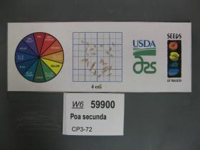 | | 2021 | | | | | | | Wild material | Green leaves and grass with seed heads that are more gold with purple parts. | 2132479 | W6 59900 |
| 69 | W6 59901 | CP3-73 | Poa secunda J. Presl | Utah, United States | W6 |  | | 2021 | | | | | | | Wild material | Tan seed heads with purplish stems. | 2132480 | W6 59901 |
| 70 | W6 59912 | CP3-93 | Elymus elymoides (Raf.) Swezey | Utah, United States | W6 |  | | 2021 | | | | | | | Wild material | Reddish awns on a green seed head and stalks. | 2132491 | W6 59912 |
| 71 | W6 59814 | NV052-871 | Achnatherum speciosum (Trin. & Rupr.) Barkworth | Nevada, United States | W6 | | | 2021 | | | | | | | Wild material | Plant in tufts, ascending; leaves filiform; inflorescence terminal, in panicles; lemma pubescent, awns sharply bent with lower segment twisted. | 2132396 | W6 59814 |
| 72 | W6 59881 | NV052-944 | Anemopsis californica (Nutt.) Hook. & Arn. | Nevada, United States | W6 | | | 2021 | | | | | | | Wild material | | 2132460 | W6 59881 |
| 73 | W6 59896 | NV052-959 | Petrophytum caespitosum (Nutt.) Rydb. subsp. caespitosum | Nevada, United States | W6 | | | 2021 | | | | | | | Wild material | mat-forming subshrub; flowers white/light pink; found growing exclusively on bare rock outcrops | 2132475 | W6 59896 |
| 74 | W6 59644 | UT020-86 | Poa secunda J. Presl | Utah, United States | W6 | | | 2021 | | | | | | | Wild material | Grows in tufts with 1- 10 inflorescences per plant. Some stems still had reddish tint at the time of seed collection. Individuals located along dry stream beds seemed to have the greatest amount of seed production. | 2120809 | W6 59644 |
| 75 | W6 59654 | UT020-96 | Leymus cinereus (Scribn. & Merr.) Á. Löve | Utah, United States | W6 | | | 2021 | | | | | | | Wild material | Perennial bunchgrass forming tall, sprawling clumps with numerous inflorescences. Plant height averaged 4.58 ft, with plants scattered alongside Clear Creek Rd in relatively flat, open sites. The effects of grazing here were minimal this season, so most plants were neither chewed down nor trampled upon. Rather than forming dense clusters, most of the plants here were scattered far from one another amidst other tall grasses, shrubs, and forbs. Since the riparian zone here is heavily forested, most Leymus cinereus individuals were relatively far from the creek, compared with other sites where we've collected. | 2120819 | W6 59654 |
| 76 | W6 59450 | MD1-10 | Achnatherum speciosum (Trin. & Rupr.) Barkworth | Arizona, United States | W6 | | | 2021 | | | | | | | Wild material | | 2120617 | W6 59450 |
| 77 | W6 59452 | MD1-12 | Hilaria rigida (Thurb.) Benth. ex Scribn. | Arizona, United States | W6 | | | 2021 | | | | | | | Wild material | | 2120619 | W6 59452 |
| 78 | W6 59506 | NV040-364 | Leymus cinereus (Scribn. & Merr.) Á. Löve | Nevada, United States | W6 | | | 2021 | | | | | | | Wild material | Perennial bunchgrass growing up to 8 ft tall. Inflorescences as large spikes | 2120673 | W6 59506 |
| 79 | W6 59514 | NV930A-32 | Poa secunda J. Presl | Nevada, United States | W6 | | | 2021 | | | | | | | Wild material | | 2120681 | W6 59514 |
| 80 | W6 59420 | CP3-139 | Elymus elymoides (Raf.) Swezey | Utah, United States | W6 | | | 2021 | | | | | | | Wild material | Fibrous roots, thin leaves long thin fibers on seedhead some leaves pale purple red lots root hairs | 2120471 | W6 59420 |
| 81 | W6 58497 | NV030-1442 | Leymus cinereus (Scribn. & Merr.) Á. Löve | Nevada, United States | W6 | | | 2020 | | | | | | | Wild material | Bunchgrass, long leaf blades, large plant size, rye inflorescence. | 2110391 | W6 58497 |
| 82 | OPGC 8106 | NV052-779 | Penstemon palmeri A. Gray var. palmeri | Nevada, United States | OPGC | | | 2020 | | | | | | | Wild material | flowers light pink with dark pink streaks on inside of lower lip, stamens/anther yellow and fuzzy | 2109982 | OPGC 8106 |
| 83 | W6 58356 | CA930A-916 | Achnatherum speciosum (Trin. & Rupr.) Barkworth | California, United States | W6 | | | 2020 | | | | | | | Wild material | | 2109919 | W6 58356 |
| 84 | W6 58357 | CA930A-917 | Ericameria linearifolia (DC.) Urbatsch & Wussow | California, United States | W6 | | | 2020 | | | | | | | Wild material | Associated species: Delete Lotus sp. | 2109920 | W6 58357 |
| 85 | W6 58358 | CA930A-918 | Eriogonum fasciculatum Benth. var. foliolosum (Nutt.) S. Stokes ex Abrams | California, United States | W6 | | | 2020 | | | | | | | Wild material | Associated species: Eriastrum sapphirinum is E. s. subsp. brevibracteatum (subsp. not in PLANTS; has been called E. s. subsp. ambiguum [ERSAA], misapplied) | 2109921 | W6 58358 |
| 86 | W6 58360 | CA930A-920 | Eriogonum fasciculatum Benth. var. polifolium (Benth.) Torr. & A. Gray | California, United States | W6 | | | 2020 | | | | | | | Wild material | Associated species: Ziziphus parryi is Z. p. var. parryi (name not in PLANTS) | 2109923 | W6 58360 |
| 87 | W6 58406 | NV052-764 | Achnatherum speciosum (Trin. & Rupr.) Barkworth | Nevada, United States | W6 | | | 2020 | | | | | | | Wild material | awns hairy with 1 bend, perennial grass | 2109969 | W6 58406 |
| 88 | W6 58407 | NV052-765 | Salvia dorrii (Kellogg) Abrams var. pilosa (A. Gray) Strachan & Reveal | Nevada, United States | W6 | | | 2020 | | | | | | | Wild material | blue/purple flowers, slightly hairy bracts | 2109970 | W6 58407 |
| 89 | W6 58411 | NV052-770 | Achnatherum speciosum (Trin. & Rupr.) Barkworth | Nevada, United States | W6 | | | 2020 | | | | | | | Wild material | awns hairy with one bend, perennial grass | 2109974 | W6 58411 |
| 90 | W6 58056 | CA660-24 | Chaenactis fremontii A. Gray | California, United States | W6 | | | 2020 | | | | | | | Wild material | Inflorescences of 1 to 5 radiate heads per peduncle with white to pink corollas. Plants are 4-12 inches in height. Leaves are dissected. | 2107460 | W6 58056 |
| 91 | OPGC 8024 | CA930A-779 | Eriastrum signatum D. Gowen | California, United States | OPGC | | | 2020 | | | | | | | Wild material | | 2106518 | OPGC 8024 |
| 92 | W6 57972 | NV030-1137 | Argemone munita Durand & Hilg. | Nevada, United States | W6 | | | 2020 | | | | | | | Wild material | Height 2-4 feet. | 2106484 | W6 57972 |
| 93 | W6 57975 | NV030-1422 | Artemisia tridentata Nutt. subsp. wyomingensis Beetle & A. L. Young | Nevada, United States | W6 | | | 2020 | | | | | | | Wild material | Leaf morphology, shrub shape. | 2106508 | W6 57975 |
| 94 | W6 57976 | NV030-1423 | Artemisia tridentata Nutt. subsp. wyomingensis Beetle & A. L. Young | Nevada, United States | W6 | | | 2020 | | | | | | | Wild material | Leaf morphology, shrub shape. | 2106509 | W6 57976 |
| 95 | W6 57743 | CA170-249 | Crepis acuminata Nutt. | California, United States | W6 | | | 2020 | | | | | | | Wild material | SOS 92nd Shipment | 2105041 | W6 57743 |
| 96 | W6 57745 | CA170-251 | Elymus elymoides (Raf.) Swezey | California, United States | W6 | | | 2020 | | | | | | | Wild material | SOS 92nd Shipment | 2105043 | W6 57745 |
| 97 | W6 57746 | CA170-252 | Leymus cinereus (Scribn. & Merr.) Á. Löve | California, United States | W6 | | | 2020 | | | | | | | Wild material | SOS 92nd Shipment | 2105044 | W6 57746 |
| 98 | NA 88088 | NV040-343 | Juniperus osteosperma (Torr.) Little | Nevada, United States | NA |  | | 2019 | | | | | | | Wild material | | 2094594 | NA 88088 |
| 99 | NA 88443 | NV040-344 | Rosa woodsii Lindl. | Nevada, United States | NA |  | | 2019 | | | | | | | Wild material | | 2094595 | NA 88443 |
| 100 | OPGC 7504 | NV040-328 | Penstemon pachyphyllus A. Gray ex Rydb. var. congestus (M. E. Jones) N. H. Holmgren | Nevada, United States | OPGC |  | | 2019 | | | | | | | Wild material | | 2094580 | OPGC 7504 |
| 101 | OPGC 7505 | NV040-330 | Penstemon pachyphyllus A. Gray ex Rydb. var. congestus (M. E. Jones) N. H. Holmgren | Nevada, United States | OPGC |  | | 2019 | | | | | | | Wild material | | 2094582 | OPGC 7505 |
| 102 | OPGC 7506 | NV040-331 | Penstemon pachyphyllus A. Gray ex Rydb. var. congestus (M. E. Jones) N. H. Holmgren | Nevada, United States | OPGC | 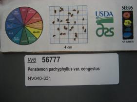 | | 2019 | | | | | | | Wild material | | 2094583 | OPGC 7506 |
| 103 | OPGC 7507 | NV040-332 | Penstemon pachyphyllus A. Gray ex Rydb. var. congestus (M. E. Jones) N. H. Holmgren | Nevada, United States | OPGC |  | | 2019 | | | | | | | Wild material | | 2094584 | OPGC 7507 |
| 104 | OPGC 7508 | NV040-338 | Penstemon pachyphyllus A. Gray ex Rydb. var. congestus (M. E. Jones) N. H. Holmgren | Nevada, United States | OPGC |  | | 2019 | | | | | | | Wild material | | 2094589 | OPGC 7508 |
| 105 | OPGC 7511 | NV030-1403 | Penstemon deustus Douglas ex Lindl. | Nevada, United States | OPGC |  | | 2019 | | | | | | | Wild material | | 2094614 | OPGC 7511 |
| 106 | OPGC 7512 | NV030-1404 | Penstemon deustus Douglas ex Lindl. | Nevada, United States | OPGC |  | | 2019 | | | | | | | Wild material | | 2094615 | OPGC 7512 |
| 107 | OPGC 7515 | NV030-1413 | Penstemon deustus Douglas ex Lindl. | Nevada, United States | OPGC |  | | 2019 | | | | | | | Wild material | | 2094623 | OPGC 7515 |
| 108 | OPGC 7519 | NV030-1419 | Cordylanthus ramosus Nutt. ex Benth. | Nevada, United States | OPGC |  | | 2019 | | | | | | | Wild material | | 2094629 | OPGC 7519 |
| 109 | OPGC 7863 | NV040-322 | Packera multilobata (Torr. & A. Gray) W. A. Weber & Á. Löve | Nevada, United States | OPGC |  | | 2019 | | | | | | | Wild material | | 2094574 | OPGC 7863 |
| 110 | W6 56769 | NV040-323 | Stenotus acaulis (Nutt.) Nutt. | Nevada, United States | W6 |  | | 2019 | | | | | | | Wild material | | 2094575 | W6 56769 |
| 111 | W6 56770 | NV040-324 | Poa secunda J. Presl | Nevada, United States | W6 |  | | 2019 | | | | | | | Wild material | | 2094576 | W6 56770 |
| 112 | W6 56772 | NV040-326 | Leymus cinereus (Scribn. & Merr.) Á. Löve | Nevada, United States | W6 |  | | 2019 | | | | | | | Wild material | | 2094578 | W6 56772 |
| 113 | W6 56779 | NV040-333 | Cercocarpus ledifolius Nutt. ex Torr. & A. Gray | Nevada, United States | W6 |  | | 2019 | | | | | | | Wild material | | 2094585 | W6 56779 |
| 114 | W6 56791 | NV040-346 | Hackelia patens (Nutt.) I. M. Johnst. | Nevada, United States | W6 |  | | 2019 | | | | | | | Wild material | | 2094597 | W6 56791 |
| 115 | OPGC 7448 | CA930A-781 | Ehrendorferia chrysantha (Hook. & Arn.) Rylander | California, United States | OPGC | 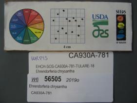 | | 2019 | | | | | | | Wild material | | 2092008 | OPGC 7448 |
| 116 | W6 56507 | CA930A-784 | Purshia glandulosa Curran | California, United States | W6 |  | | 2019 | | | | | | | Wild material | | 2092010 | W6 56507 |
| 117 | W6 56508 | CA930A-785 | Nicotiana attenuata Torr. ex S. Watson | California, United States | W6 |  | | 2019 | | | | | | | Wild material | | 2092011 | W6 56508 |
| 118 | W6 56534 | NV930-20 | Poa secunda J. Presl | Nevada, United States | W6 |  | | 2019 | | | | | | | Wild material | | 2092037 | W6 56534 |
| 119 | W6 56539 | NV930-25 | Leymus cinereus (Scribn. & Merr.) Á. Löve | Nevada, United States | W6 |  | | 2019 | | | | | | | Wild material | | 2092042 | W6 56539 |
| 120 | OPGC 7831 | SOS-CA170-234 | Dieteria canescens (Pursh) Nutt. var. canescens | California, United States | OPGC |  | | 2019 | | | | | | | Wild material | Machaeranthera canescens | 2091529 | OPGC 7831 |
| 121 | W6 56335 | CA170-219 | Poa secunda J. Presl | California, United States | W6 |  | | 2019 | | | | | | | Wild material | Poa secunda | 2091520 | W6 56335 |
| 122 | W6 56336 | CA170-220 | Elymus elymoides (Raf.) Swezey | California, United States | W6 |  | | 2019 | | | | | | | Wild material | Elymus elymoides | 2091521 | W6 56336 |
| 123 | W6 56345 | SOS-CA170-235 | Artemisia tridentata Nutt. subsp. vaseyana (Rydb.) Beetle | California, United States | W6 |  | | 2019 | | | | | | | Wild material | Artemisia tridentata ssp. vaseyana | 2091530 | W6 56345 |
| 124 | NA 88445 | NV030-1309 | Rosa woodsii Lindl. | Nevada, United States | NA |  | | 2018 | | | | | | | Wild material | Rosa woodsii | 1970634 | NA 88445 |
| 125 | NA 88447 | NV030-1335 | Rosa woodsii Lindl. | Nevada, United States | NA |  | | 2018 | | | | | | | Wild material | Rosa woodsii | 1970659 | NA 88447 |
| 126 | OPGC 7345 | NV030-1306 | Iris missouriensis Nutt. | Nevada, United States | OPGC |  | | 2018 | | | | | | | Wild material | | 1970631 | OPGC 7345 |
| 127 | W6 55900 | NV030-1280 | Purshia tridentata (Pursh) DC. | California, United States | W6 |  | | 2018 | | | | | | | Wild material | Purshia tridentata | 1970611 | W6 55900 |
| 128 | W6 55907 | NV030-1287 | Cercocarpus ledifolius Nutt. ex Torr. & A. Gray | California, United States | W6 |  | | 2018 | | | | | | | Wild material | Cercocarpus ledifolius | 1970618 | W6 55907 |
| 129 | W6 55912 | NV030-1297 | Cercocarpus ledifolius Nutt. ex Torr. & A. Gray | California, United States | W6 |  | | 2018 | | | | | | | Wild material | Cercocarpus ledifolius | 1970623 | W6 55912 |
| 130 | W6 55924 | NV030-1310 | Symphoricarpos oreophilus A. Gray | Nevada, United States | W6 |  | | 2018 | | | | | | | Wild material | Symphoricarpos oreophilus | 1970635 | W6 55924 |
| 131 | W6 55935 | NV030-1321 | Monardella linoides A. Gray | Nevada, United States | W6 |  | | 2018 | | | | | | | Wild material | Monardella linoides | 1970646 | W6 55935 |
| 132 | W6 55969 | NV030-1356 | Atriplex canescens (Pursh) Nutt. | Nevada, United States | W6 |  | | 2018 | | | | | | | Wild material | Atriplex canescens | 1970680 | W6 55969 |
| 133 | W6 55235 | NV930-9 | Elymus elymoides (Raf.) Swezey | Nevada, United States | W6 |  | | 2018 | | | | | | | Wild material | Elymus elymoides | 1967787 | W6 55235 |
| 134 | W6 55236 | NV930-10 | Leymus cinereus (Scribn. & Merr.) Á. Löve | Nevada, United States | W6 |  | | 2018 | | | | | | | Wild material | Leymus cinereus | 1967788 | W6 55236 |
| 135 | W6 55240 | NV930A-2 | Eriocoma hymenoides (Roem. & Schult.) Rydb. | Nevada, United States | W6 |  | | 2018 | | | | | | | Wild material | Achnatherum hymenoides | 1967792 | W6 55240 |
| 136 | W6 55242 | NV930A-4 | Chaenactis douglasii (Hook.) Hook. & Arn. | Nevada, United States | W6 |  | | 2018 | | | | | | | Wild material | Chaenactis douglasii | 1967794 | W6 55242 |
| 137 | W6 55421 | UT020-21 | Leymus cinereus (Scribn. & Merr.) Á. Löve | Utah, United States | W6 |  | | 2018 | | | | | | | Wild material | Leymus cinereus | 1967973 | W6 55421 |
| 138 | W6 55432 | UT020-32 | Argemone munita Durand & Hilg. | Utah, United States | W6 |  | | 2018 | | | | | | | Wild material | Argemone munita. SOS 7th transfer. | 1967984 | W6 55432 |
| 139 | WLP 1130 | GF2018-09 | Cyrilla racemiflora L. | Florida, United States | NA | | | 2018 | COLLECTED | 11/08/2018 | Liberty County; ; Apalachicola National Forest, 500 feet north of National Forest Rd 112, 0.2 miles west of Hwy 65. | 30.21855000, -84.89692000 | 18 | Swampy area. | | | 2108891 | WLP 1130 |
| 140 | W6 55010 | NV052-706 | Purshia mexicana (D. Don) S. L. Welsh var. stansburyana (Torr.) S. L. Welsh | Nevada, United States | W6 |  | | 2018 | | | | | | | Wild material | Purshia stansburiana | 1966237 | W6 55010 |
| 141 | W6 55053 | CA170-213 | Elymus elymoides (Raf.) Swezey | California, United States | W6 |  | | 2018 | | | | | | | Wild material | Elymus elymoides | 1966280 | W6 55053 |
| 142 | W6 55055 | CA170-215 | Grayia spinosa (Hook.) Moq. | California, United States | W6 |  | | 2018 | | | | | | | Wild material | Grayia spinosa | 1966282 | W6 55055 |
| 143 | W6 54150 | NM018-74 | Atriplex canescens (Pursh) Nutt. | New Mexico, United States | W6 |  | | 2018 | | | | | | | Wild material | Atriplex canescens | 1964867 | W6 54150 |
| 144 | Ames 34738 | NV040-285 | Lepidium lasiocarpum Nutt. | Nevada, United States | NC7 |  | | 2018 | | | | | | | Wild material | | 1964527 | Ames 34738 |
| 145 | OPGC 7214 | NV030-1230 | Navarretia divaricata Greene subsp. divaricata | California, United States | OPGC |  | | 2018 | | | | | | | Wild material | | 1964463 | OPGC 7214 |
| 146 | OPGC 7789 | NV030-1204 | Keckiella breviflora (Lindl.) Straw subsp. glabrisepala (D. D. Keck) Straw | California, United States | OPGC |  | | 2018 | | | | | | | Wild material | | 1964445 | OPGC 7789 |
| 147 | W6 53603 | CA170-185 | Purshia tridentata (Pursh) DC. | California, United States | W6 | | | 2018 | | | | | | | Wild material | | 1964181 | W6 53603 |
| 148 | W6 53826 | UT030-260 | Dalea searlsiae (A. Gray) Barneby | Utah, United States | W6 |  | | 2018 | | | | | | | Wild material | | 1964404 | W6 53826 |
| 149 | W6 53883 | NV030-1228 | Arctostaphylos patula Greene | California, United States | W6 |  | | 2018 | | | | | | | Wild material | | 1964461 | W6 53883 |
| 150 | W6 53886 | NV030-1231 | Arctostaphylos patula Greene | California, United States | W6 |  | | 2018 | | | | | | | Wild material | | 1964464 | W6 53886 |
| 151 | W6 53891 | NV030-1237 | Cercocarpus ledifolius Nutt. ex Torr. & A. Gray nothovar. intercedens C. K. Schneid. | California, United States | W6 |  | | 2018 | | | | | | | Wild material | | 1964469 | W6 53891 |
| 152 | W6 53920 | NV030-1269 | Ericameria nauseosa (Pall. ex Pursh) G. L. Nesom & G. I. Baird subsp. consimilis (Greene) G. L. Nesom & G. I. Baird var. oreophila (A. Nelson) G. L. Nesom & G. I. Baird | Nevada, United States | W6 |  | | 2018 | | | | | | | Wild material | | 1964498 | W6 53920 |
| 153 | W6 53964 | NV040-303 | Hesperostipa comata (Trin. & Rupr.) Barkworth | Nevada, United States | W6 |  | | 2018 | | | | | | | Wild material | | 1964542 | W6 53964 |
| 154 | W6 53965 | NV040-304 | Sphaeralcea ambigua A. Gray | Nevada, United States | W6 |  | | 2018 | | | | | | | Wild material | | 1964543 | W6 53965 |
| 155 | W6 53966 | NV040-305 | Phacelia fremontii Torr. | Nevada, United States | W6 |  | | 2018 | | | | | | | Wild material | | 1964544 | W6 53966 |
| 156 | W6 53967 | NV040-306 | Draba cuneifolia Nutt. ex Torr. & A. Gray | Nevada, United States | W6 |  | | 2018 | | | | | | | Wild material | | 1964545 | W6 53967 |
| 157 | W6 53977 | NV040-317 | Symphoricarpos oreophilus A. Gray | Nevada, United States | W6 |  | | 2018 | | | | | | | Wild material | | 1964555 | W6 53977 |
| 158 | W6 53333 | CA650-114 | Chaenactis xantiana A. Gray | California, United States | W6 | | | 2018 | | | | | | | Wild material | | 1958068 | W6 53333 |
| 159 | W6 53346 | CA930A-596 | Descurainia pinnata (Walter) Britton subsp. glabra (Wooton & Standl.) Detling | California, United States | W6 | | | 2018 | | | | | | | Wild material | | 1958081 | W6 53346 |
| 160 | W6 53368 | CA930A-619 | Achnatherum speciosum (Trin. & Rupr.) Barkworth | California, United States | W6 | | | 2018 | | | | | | | Wild material | | 1958103 | W6 53368 |
| 161 | W6 53369 | CA930A-620 | Ericameria linearifolia (DC.) Urbatsch & Wussow | California, United States | W6 | | | 2018 | | | | | | | Wild material | | 1958104 | W6 53369 |
| 162 | W6 53370 | CA930A-621 | Eriocoma hymenoides (Roem. & Schult.) Rydb. | California, United States | W6 | | | 2018 | | | | | | | Wild material | | 1958105 | W6 53370 |
| 163 | W6 53378 | CA930A-629 | Encelia actoni Elmer | California, United States | W6 | | | 2018 | | | | | | | Wild material | | 1958113 | W6 53378 |
| 164 | W6 53379 | CA930A-630 | Acamptopappus sphaerocephalus (Harv. & A. Gray) A. Gray var. sphaerocephalus | California, United States | W6 |  | | 2018 | | | | | | | Wild material | | 1958114 | W6 53379 |
| 165 | W6 53380 | CA930A-631 | Acmispon rigidus (Benth.) Brouillet | California, United States | W6 | | | 2018 | | | | | | | Wild material | SOS 7th transfer. | 1958115 | W6 53380 |
| 166 | W6 53382 | CA930A-633 | Sphaeralcea ambigua A. Gray var. ambigua | California, United States | W6 | | | 2018 | | | | | | | Wild material | | 1958117 | W6 53382 |
| 167 | W6 51880 | NV030-1101 | Arctostaphylos patula Greene | California, United States | W6 | | | 2017 | | | | | | | Wild material | | 1947013 | W6 51880 |
| 168 | W6 50196 | NV040-223 | Elymus elymoides (Raf.) Swezey | Nevada, United States | W6 | 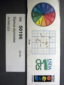 | | 2015 | | | | | | | Wild material | | 1927505 | W6 50196 |
| 169 | W6 50231 | NV040-222 | Heliomeris multiflora Nutt. | Nevada, United States | W6 |  | | 2015 | | | | | | | Wild material | | 1927535 | W6 50231 |
| 170 | W6 50233 | NV040-221 | Hulsea heterochroma A. Gray | Nevada, United States | W6 | 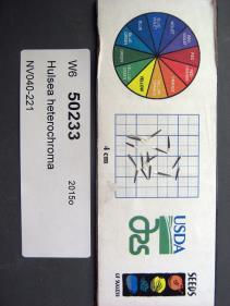 | | 2015 | | | | | | | Wild material | | 1927537 | W6 50233 |
| 171 | W6 50276 | NV040-235 | Nicotiana attenuata Torr. ex S. Watson | Nevada, United States | W6 |  | | 2015 | | | | | | | Wild material | | 1927577 | W6 50276 |
| 172 | W6 50306 | NV040-225 | Purshia tridentata (Pursh) DC. | Nevada, United States | W6 |  | | 2015 | | | | | | | Wild material | | 1927606 | W6 50306 |
| 173 | OPGC 6187 | NV030-962 | Mentzelia albicaulis (Douglas) Douglas ex Torr. & A. Gray | Nevada, United States | OPGC |  | | 2015 | | | | | | | Wild material | | 1927037 | OPGC 6187 |
| 174 | W6 50000 | NV030-1018 | Ericameria nauseosa (Pall. ex Pursh) G. L. Nesom & G. I. Baird subsp. consimilis (Greene) G. L. Nesom & G. I. Baird | Nevada, United States | W6 |  | | 2015 | | | | | | | Wild material | | 1927023 | W6 50000 |
| 175 | W6 50002 | NV030-1024 | Ericameria nauseosa (Pall. ex Pursh) G. L. Nesom & G. I. Baird subsp. nauseosa | California, United States | W6 |  | | 2015 | | | | | | | Wild material | | 1927025 | W6 50002 |
| 176 | W6 50003 | NV030-1025 | Ericameria nauseosa (Pall. ex Pursh) G. L. Nesom & G. I. Baird subsp. nauseosa | California, United States | W6 |  | | 2015 | | | | | | | Wild material | | 1927026 | W6 50003 |
| 177 | W6 50004 | NV030-1026 | Artemisia tridentata Nutt. subsp. vaseyana (Rydb.) Beetle | California, United States | W6 |  | | 2015 | | | | | | | Wild material | | 1927027 | W6 50004 |
| 178 | W6 50020 | NV030-974 | Elymus elymoides (Raf.) Swezey | California, United States | W6 |  | | 2015 | | | | | | | Wild material | | 1927042 | W6 50020 |
| 179 | W6 49759 | NV030-1023 | Chamaebatiaria millefolium (Torr.) Maxim. | California, United States | W6 | 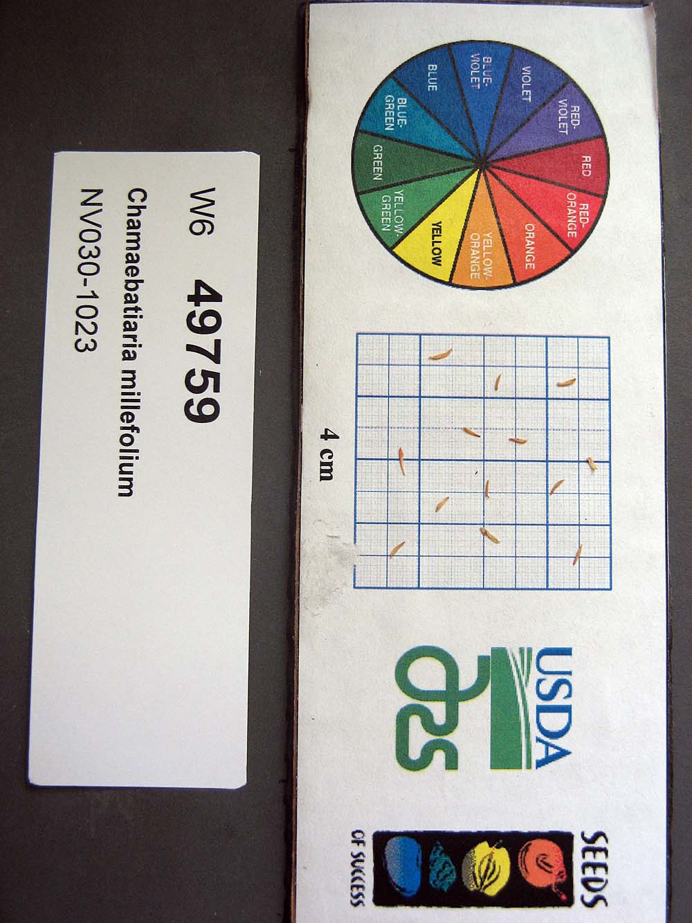 | | 2015 | | | | | | | Wild material | | 1926693 | W6 49759 |
| 180 | W6 49774 | NV030-1033 | Ericameria nauseosa (Pall. ex Pursh) G. L. Nesom & G. I. Baird subsp. nauseosa | Nevada, United States | W6 |  | | 2015 | | | | | | | Wild material | | 1926707 | W6 49774 |
| 181 | W6 49853 | CA930A-379 | Salvia columbariae Benth. | California, United States | W6 |  | | 2015 | | | | | | | Wild material | | 1926781 | W6 49853 |
| 182 | W6 49868 | CA930A-387 | Tetradymia axillaris A. Nelson var. longispina (M. E. Jones) Strother | California, United States | W6 |  | | 2015 | | | | | | | Wild material | | 1926796 | W6 49868 |
| 183 | WLP 2273 | NV040-171 | Amelanchier utahensis Koehne | United States | NA | 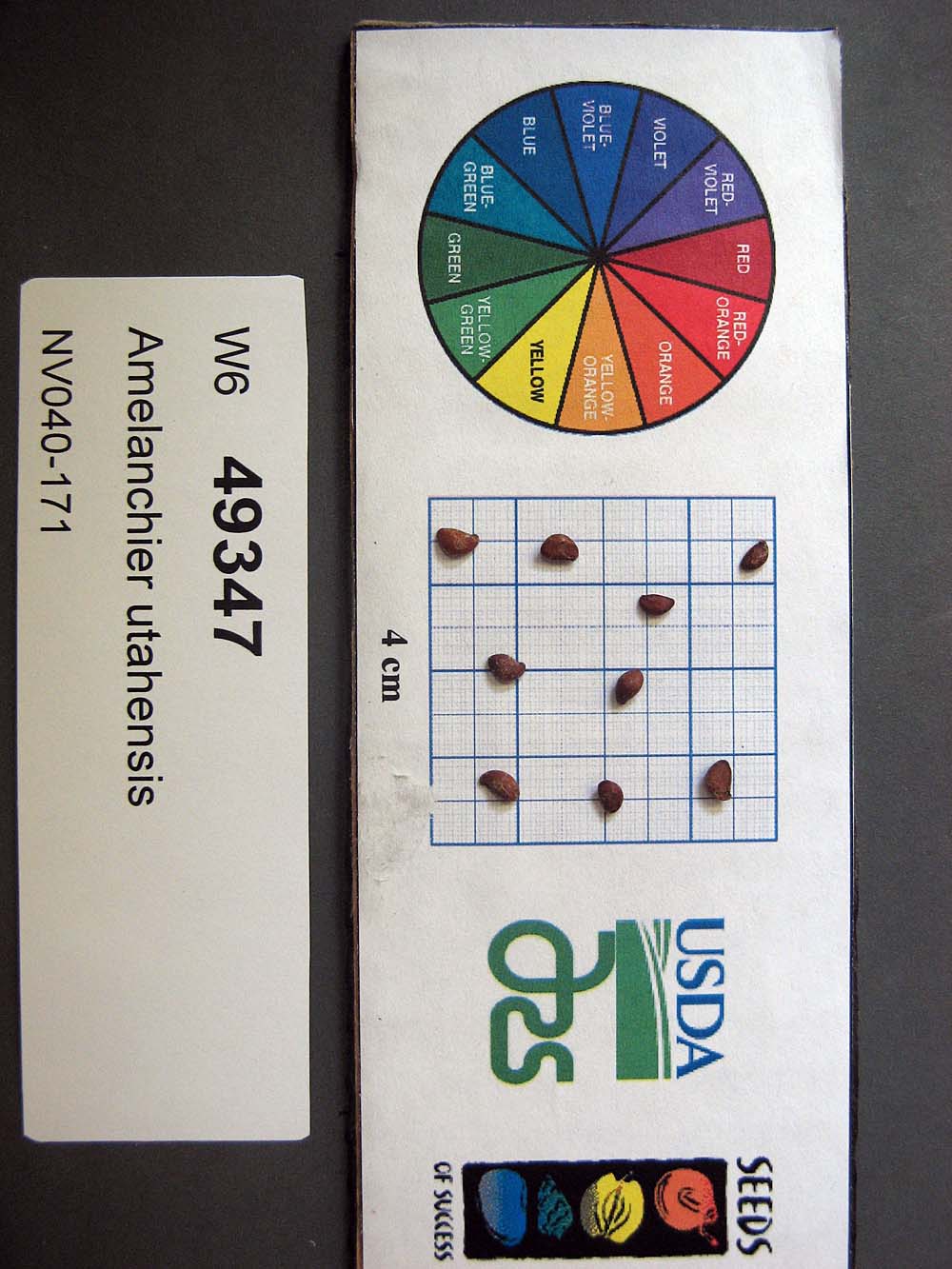 | | 2015 | COLLECTED | 07/29/2013 | Schell Creek Range. Horse and Cattle Camp Loop, ~0.9mi by air west of Summit Spring. | 38.87238000, -114.69070000 | 2366 | Grazed hills, 12 degree southeast slope. Igneous derived soil, silty/sandy texture, 10YR very dark brown color. | Wild material | | 1925467 | WLP 2273 |
| 184 | W6 43328 | UT931-308 | Leymus cinereus (Scribn. & Merr.) Á. Löve | Utah, United States | W6 |  | | 2012 | | | | | | | Wild material | | 1898392 | W6 43328 |
| 185 | W6 40488 | NV030-405 | Leymus cinereus (Scribn. & Merr.) Á. Löve | Nevada, United States | W6 |  | | 2011 | | | | | | | Wild material | | 1861248 | W6 40488 |
| 186 | WLP 2154 | AMUT-SOS-NV040-104-10 | Amelanchier utahensis Koehne | Nevada, United States | NA |  | | 2011 | COLLECTED | 08/12/2010 | Wilson Creek Range. Mount Wilson Scenic Byway. 1.68 miles by air South of Tunnel Spring. | 38.26750000, -114.35463890 | 2448 | Mountain woodland, 12 degree southeast slope. Welded tuff geology with Silt/Sand/Organic organic soil; 10YR 2/2 Very dark brown. | Wild material | | 1861152 | WLP 2154 |
| 187 | W6 39058 | GBPMC-4 | Elymus elymoides (Raf.) Swezey | California, United States | W6 |  | | 2010 | | | | | | | Wild material | | 1842490 | W6 39058 |
| 188 | W6 39096 | GBPMC-12 | Leymus cinereus (Scribn. & Merr.) Á. Löve | Nevada, United States | W6 |  | | 2010 | | | | | | | Wild material | | 1842523 | W6 39096 |
| 189 | W6 36846 | NV030-245 | Elymus elymoides (Raf.) Swezey | California, United States | W6 |  | | 2009 | | | | | | | Wild material | | 1827158 | W6 36846 |
| 190 | W6 35376 | NV052-178-R | Coleogyne ramosissima Torr. | Nevada, United States | W6 |  | | 2009 | | | | | | | Wild material | Height: 2' | 1808204 | W6 35376 |
| 191 | W6 35266 | NV030-210 | Ericameria nauseosa (Pall. ex Pursh) G. L. Nesom & G. I. Baird subsp. consimilis (Greene) G. L. Nesom & G. I. Baird var. oreophila (A. Nelson) G. L. Nesom & G. I. Baird | Nevada, United States | W6 |  | | 2009 | | | | | | | Wild material | | 1802242 | W6 35266 |
| 192 | OPGC 3682 | 202538 | Keckiella breviflora (Lindl.) Straw subsp. glabrisepala (D. D. Keck) Straw | United States | OPGC | 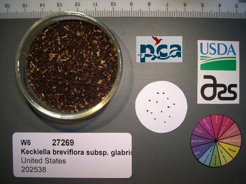 | | 2005 | COLLECTED | 08/12/2003 | | | 1524 | Pinyon woodland/Sagebrush scrub. Associated with Pinus monophylla, Artemisia tridentata, Purshia tridentata, Prunus andersonii, Nicotiana attenuata, Bromus tectorum and Ephedra viridis. | Wild material | Shrub 0.6 meters tall. | 1674301 | OPGC 3682 |
| 193 | W6 27294 | CA170-31 | Nama rothrockii A. Gray | California, United States | W6 | 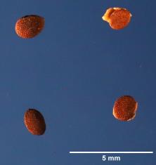 | | 2005 | | | | | | | Wild material | Forb 0.15 meters tall. | 1674325 | W6 27294 |
| 194 | DLEG 950063 | DLEG 950063 | Astragalus minthorniae (Rydb.) Jeps. var. villosus Barneby | California, United States | | | Historic | 1995 | COLLECTED | 06/20/1995 | San Bernardino Co., Molycorp Picnic Area, Clark Mts. Elevation 5,500 ft. | | | Pinyon-juniper woodland with Pinus monophylla, Juniperus osteosperma, Prunus fasciculata, Purshia stansburiana var. mexicana, Atriplex canescens, Ephedra viridis, Penstemon palmeri, Salvia dorrii, Yucca baccata, Echinocereus engelmannii. | Wild material | Received from Dr. Alan Romspert, California Desert Studies Consortium, California State University, Fullerton. | 1527376 | DLEG 950063 |
| 195 | DLEG 950064 | DLEG 950064 | Astragalus newberryi A. Gray | California, United States | | | Historic | 1995 | COLLECTED | 06/25/1995 | Inyo Co., E side of Kingston Range on road to Excelsor Mine. Elevation 4,000 ft. | | | Ecotonal area with Pinus monophylla, Juniperus osteosperma, Yucca schidigera, Nolina parryi, Buddleya utahensis, Salazaria mexicana, Larrea tridentata, Salvia dorrii, Sphaeralcea ambigua, Artemesia nova, Gutierrezia microcephala, Mentzelia | Wild material | Received from Dr. Alan Romspert, California Desert Studies Consortium, California State University, Fullerton. | 1527741 | DLEG 950064 |