| 0 | WLP 1534 | NA 84573 | Pinus pungens Lamb. | Virginia, United States | NA | | | 2017 | COLLECTED | 05/27/2017 | Patrick County; Meadows of Dan; Growing as a remnant along old Highway 58. | 36.73702000, -80.39437000 | | Roadside, growing as a remnant surrounded by grasses. | | Seeds collected from one plant. The species persists in the area in farm fields and some natural areas. | 2108755 | WLP 1534 |
| 1 | WLP 1502 | RL 08037 | Pinus pungens Lamb. | Georgia, United States | NA | | | 2008 | COLLECTED | 09/03/2008 | Ridge top along Chattahoochee National Forest Road 155. | 35.92960000, -83.29146000 | | | Wild material | | 1896051 | WLP 1502 |
| 2 | WLP 1495 | NA 75400 | Pinus pungens Lamb. | North Carolina, United States | NA | | | 2006 | COLLECTED | 07/01/2003 | North Carolina, Rutherford County, Chimney Rock Park, near summit of Chimney Rock Mountain. | | | | Wild material | | 1777667 | WLP 1495 |
| 3 | W6 59016 | NCBG-472 | Schoenoplectus pungens (Vahl) Palla | North Carolina, United States | W6 | | | 2021 | | | | | | | Wild material | | 2116334 | W6 59016 |
| 4 | W6 54635 | NCBG-210 | Schoenoplectus pungens (Vahl) Palla | North Carolina, United States | W6 | | | 2018 | | | | | | | Wild material | Schoenoplectus pungens | 1965861 | W6 54635 |
| 5 | W6 54730 | NCBG-476 | Schoenoplectus pungens (Vahl) Palla | North Carolina, United States | W6 |  | | 2018 | | | | | | | Wild material | Schoenoplectus pungens | 1965956 | W6 54730 |
| 6 | PI 251062 | HAW 1230 | Solanum stoloniferum Schltdl. | Chihuahua, Mexico | NR6 | | | 1958 | COLLECTED | 08/14/1958 | Majalca, 40 miles NW of Chihuahua, near the village. | 29.13333333, -106.08333333 | 2100 | Under Pinus ponderosa, shaded by rocks, rich leaf mould. Assoc. ssp: Juniperus deppeana, Arctostaphylos pungens, Quercus. | Wild material | | 1193983 | PI 251062 |
| 7 | W6 62513 | FWS0300-102 | Sorghastrum nutans (L.) Nash | Michigan, United States | W6 |  | | 2025 | | | | | | | Wild material | Near active artillery range | 2192211 | W6 62513 |
| 8 | W6 60873 | AZ010-48 | Descurainia pinnata (Walter) Britton | Arizona, United States | W6 |  | | 2023 | | | | | | | Wild material | Annual for with branching erect inflorescence. Alternate carline pinnately lobed leaves. Upper stems terminate in raceme of flowers. | 2142511 | W6 60873 |
| 9 | W6 60874 | AZ010-49 | Descurainia pinnata (Walter) Britton | Arizona, United States | W6 |  | | 2023 | | | | | | | Wild material | Annual forb with erect inflorescence terminating in a raceme of fruits. | 2142512 | W6 60874 |
| 10 | W6 61227 | NV052-978 | Ceanothus greggii A. Gray var. vestitus (Greene) McMinn | Nevada, United States | W6 |  | | 2023 | | | | | | | Wild material | White flowers with reddish center; thick leaves, margins entire to toothed | 2142182 | W6 61227 |
| 11 | W6 61228 | NV052-979 | Psorothamnus fremontii (Torr. ex A. Gray) Barneby var. fremontii | Nevada, United States | W6 |  | | 2023 | | | | | | | Wild material | Dark Purple Corolla, fruits glandular throughout | 2142183 | W6 61228 |
| 12 | Ames 35915 | White Mountains | Fraxinus velutina Torr. | New Mexico, United States | NC7 |  | | 2022 | COLLECTED | 09/08/2022 | White Mountains northwest of Alto. Rare along Eagle Creek and increasing in abundance heading upslope on Ski Run Road. Saplings fairly common in Nogal Canyon and mature specimens frequent on slopes below Nogal Peak in the White Mountain Wilderness of the Lincoln National Forest. T10S R12E S 1/4 Sec. 35. Coordinates listed refer to the last plant sampled (191-5); coordinates for each sample may be provided upon request. | 33.49551600, -105.79515500 | 2743 | Mountainsides and rarely creeks at canyon bottoms. | Wild material | This accession represents a high elevation population of velvet ash which occurs primarily on mountainsides rather than riparian habitats as is typical for the species. Although the velvet ash do occur in the canyon bottoms along creeks in this area, they are quite rare compared to their fairly common distribution on the slopes at higher elevations. Specimens at higher elevations were more shrub-like (multi-trunked and maximum of 20 feet in height) than tree-like while specimens in the canyon bottoms were always trees. All specimens noted at the time of seed collection had glabrous leaves. | 2139677 | Ames 35915 |
| 13 | W6 58984 | NCBG-394 | Sagittaria lancifolia L. subsp. media (Micheli) Bogin | North Carolina, United States | W6 | | | 2021 | | | | | | | Wild material | Received as: Sagittaria lancifolia ssp. media | 2116419 | W6 58984 |
| 14 | W6 57458 | NCBG-269 | Mikania scandens (L.) Willd. | Virginia, United States | W6 |  | | 2019 | | | | | | | Wild material | | 2098382 | W6 57458 |
| 15 | NA 88121 | MARSB-734 | Ilex glabra (L.) A. Gray | New York, United States | NA |  | | 2019 | COLLECTED | 10/27/2016 | Peasys Pond: drive down NY-25E past Brookhaven State Park. To your right is a hunter's parking area (across from Panamoka Trail). Park here and hike south on trail. Population is along edges of dry riverbeds and dry pond beds. | 40.90238000, -72.84072000 | 15 | Pine barren, pond edge. | Wild material | | 2097693 | NA 88121 |
| 16 | W6 56345 | SOS-CA170-235 | Artemisia tridentata Nutt. subsp. vaseyana (Rydb.) Beetle | California, United States | W6 |  | | 2019 | | | | | | | Wild material | Artemisia tridentata ssp. vaseyana | 2091530 | W6 56345 |
| 17 | OPGC 7310 | AZ930-362 | Penstemon barbatus (Cav.) Roth | Arizona, United States | OPGC |  | | 2018 | | | | | | | Wild material | | 1970378 | OPGC 7310 |
| 18 | W6 55915 | NV030-1301 | Cercocarpus ledifolius Nutt. ex Torr. & A. Gray | Nevada, United States | W6 |  | | 2018 | | | | | | | Wild material | Cercocarpus ledifolius | 1970626 | W6 55915 |
| 19 | W6 55197 | CP5-11 | Cercocarpus montanus Raf. | Arizona, United States | W6 |  | | 2018 | | | | | | | Wild material | Cercocarpus montanus | 1967749 | W6 55197 |
| 20 | OPGC 7226 | NCBG-225 | Typha angustifolia L. | North Carolina, United States | OPGC |  | | 2018 | | | | | | | Wild material | | 1965873 | OPGC 7226 |
| 21 | W6 51644 | CBG-5428 | Chamaenerion angustifolium (L.) Scop. subsp. angustifolium | Colorado, United States | W6 | | | 2016 | | | | | | | Wild material | | 1942774 | W6 51644 |
| 22 | W6 45687 | NV030-586 | Elymus elymoides (Raf.) Swezey | California, United States | W6 |  | | 2013 | | | | | | | Wild material | | 1907652 | W6 45687 |
| 23 | Ames 31428 | PHMO4-SOS-CO932-193-09 | Physocarpus monogynus (Torr.) J. M. Coult. | Colorado, United States | NC7 |  | | 2010 | COLLECTED | 09/29/2009 | Lair o' the Bear park- From 6th Avenue and Simms, travel west on US-6 for 2.7 mi. Merge onto I-70 west and travel .9 miles. Merge onto C-470 E and travel 4.4 mi. Merge onto W Morrison Rd/CO-8 travel through town of Morrison and continue W on HWY74 for approx. 4 miles, turn left into Lair o' the Bear Park. Hike west on Bear Creek Trail for approximately .25 iles and cross bridge heading south on Bruin Bluff trail for approx. .75 mi. Plants are N and S of trail. Jefferson County, CO. | 39.66572222, -105.26072220 | 2064 | Open edges of forest | Wild material | | 1842579 | Ames 31428 |
| 24 | Ames 32578 | MOFI-SOS-CO932-190-09 | Monarda fistulosa L. | Colorado, United States | NC7 |  | | 2010 | COLLECTED | 09/17/2009 | Lair O' The Bear Park just west of Idledale, Jefferson County | 39.66686110, -105.26380560 | 2028 | Meadow with silty sand soils on metamorphic basement rock - gneiss. | Wild material | Plants sampled at original collection measured approximately 2-3' in height. | 1842548 | Ames 32578 |
| 25 | W6 37309 | CO932-187 | Eriocoma robusta (Vasey) Romasch. | Colorado, United States | W6 |  | | 2010 | | | | | | | Wild material | | 1833464 | W6 37309 |
| 26 | W6 37494 | CO932-177 | Nassella viridula (Trin.) Barkworth | Colorado, United States | W6 |  | | 2010 | | | | | | | Wild material | | 1833625 | W6 37494 |
| 27 | W6 36721 | 218 | Astragalus sesquiflorus S. Watson | Arizona, United States | W6 |  | | 2009 | | | | | | | Wild material | | 1826895 | W6 36721 |
| 28 | W6 35339 | CO932-169 | Juncus balticus Willd. subsp. littoralis (Engelm.) Snogerup | Colorado, United States | W6 |  | | 2009 | | | | | | | Wild material | Herbs, 2-10dm. Leaves: blade absent. Infloresences appearing lateral, 6-many-flowered, loose to congested; primary bract usually several times longer than inflorescence. Flowers: tepals blackish to light brown, occasionally paler, (2.5-)3.5-5.5(-6)mm; filaments 0.2-0.5mm, anthers 1.2-2.2mm. Reference: http://www.efloras.org/florataxon.aspx?flora_id=1andtaxon_id=222000094 | 1808282 | W6 35339 |
| 29 | WLP 2126 | AZ930-271 | Frangula californica (Eschsch.) A. Gray subsp. californica | Arizona, United States | NA | 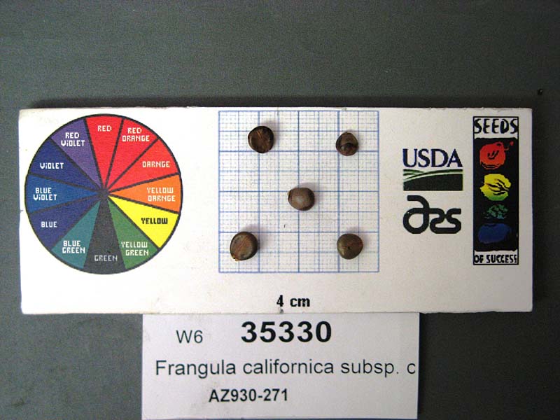 | | 2009 | COLLECTED | 10/07/2008 | Tonto National Forest, north of Payson. Forest Service Trail 290, 1 mile north of junction with Forest Service Road 32. | 34.44138000, -111.26141000 | 1935 | Riparian land form in Petran Montane Conifer Forest biome; land used for recreation; soil color 5YR 6/6. Slope 0 - 30 degrees. | Wild material | Height: 4 feet | 1808280 | WLP 2126 |
| 30 | WLP 2096 | 273406 | Juniperus deppeana Steud. | Arizona, United States | NA | 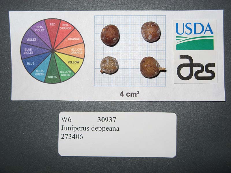 | | 2007 | COLLECTED | 09/21/2005 | | | 1736 | Slope: 5-30 degrees. Reddish-brown soil. Hillside; Petran Montane Conifer Forest biome. Site is used for multiple purposes. | Wild material | Tree, Height about: 6.1 m | 1727184 | WLP 2096 |
| 31 | Ames 28427 | JM20061017 | Hypericum gentianoides (L.) Britton et al. | South Carolina, United States | NC7 |  | | 2006 | COLLECTED | 09/28/2006 | Intersection of Highway 11 and Highway 133, Poe Creek State Forest, Pickens, Pickens County. | 34.93166667, -82.87722222 | 248 | Pine-oak heath, roadside of dirt road. | Wild material | | 1715748 | Ames 28427 |
| 32 | Ames 28428 | JM20061016 | Hypericum hypericoides (L.) Crantz | South Carolina, United States | NC7 |  | | 2006 | COLLECTED | 09/28/2006 | Intersection of Highway 11 and Highway 133, Poe Creek State Forest, Pickens, Pickens County. | 34.93166667, -82.87722222 | 248 | Pine-oak heath. | Wild material | | 1715749 | Ames 28428 |
| 33 | Ames 28429 | JM20061018 | Hypericum hypericoides (L.) Crantz subsp. multicaule (Michx. ex Willd.) N. Robson | South Carolina, United States | NC7 |  | | 2006 | COLLECTED | 09/28/2006 | Intersection of Highway 11 and Highway 133, Poe Creek State Forest, Pickens, Pickens County. | 34.93166667, -82.87722222 | 248 | Pine-oak heath, roadside of dirt road. | Wild material | | 1715750 | Ames 28429 |
| 34 | Ames 28434 | JM20061019 | Hypericum crux-andreae (L.) Crantz | South Carolina, United States | NC7 |  | | 2006 | COLLECTED | 09/28/2006 | Intersection of Highway 11 and Highway 133, Poe Creek State Forest, Pickens, Pickens County. | 34.93166667, -82.87722222 | 248 | Pine-oak heath, roadside of dirt road. | Wild material | | 1715755 | Ames 28434 |
| 35 | OPGC 2890 | 202756 | Campanula rotundifolia L. | Colorado, United States | OPGC |  | | 2005 | COLLECTED | 08/20/2003 | | | 2414 | Associated with Linaria sp., Populus tremuloides, Picea pungens, Pinus ponderosa, Caryophyllaceae sp., Rosa sp. and Verbascum blattaria. | Wild material | Forb 0.3-0.6 meters tall. | 1674313 | OPGC 2890 |
| 36 | Ames 27660 | JM2004013 | Hypericum hypericoides (L.) Crantz | South Carolina, United States | NC7 |  | | 2004 | COLLECTED | 10/06/2004 | Poe Creek outcrop, state forest, Pickens County. | 34.93055556, -82.86805556 | 241 | Granite flatrock/glade community. Roadside. 10 degrees of slope. Calcareous soil. | Wild material | 0.5-1 meter tall. | 1667580 | Ames 27660 |
| 37 | DLEG 990130 | DLEG 990130 | Cologania angustifolia Kunth | Arizona, United States | |  | Historic | 2000 | COLLECTED | 09/24/1999 | Cochise Co. Sunnyside Canyon, Huachuca Mts., ca. 2.2 mi from jct. Hwy 83. 31? 26' 210" N, 110? 24' 108" W | | 5200 | SE facing slope of low ridge above road. Rocky soil in oak woodland. Plants abundant along a 100 m stretch of road. | Wild material | Setting: Quercus arizonicus, Q. emory, Juniperus deppeana, Pinus discolor, Arctostaphylos pungens, Agave parryi var. huachucensis, grasses. Collected by M. Johnson, K. Coppola, B. Bearly, S. Posey | 1730351 | DLEG 990130 |
| 38 | DLEG 910109 | DLEG 910109 | Astragalus sp. | Arizona, United States | | | Historic | 1991 | COLLECTED | 05/14/1991 | Gila/Pinal Co., Gila/Pinal Co. line, S of Hwy, W side of the community of Top of the World, Arizona. | | | Gravelly granitic soil with large granitic outcrops. Interior chaparral with Quercus turbinella, Q. emoryi, Pinus edulis, Acrtostaphylos pungens, A. pringlei, Garrya wrightii, Nolina microcarpa. | Wild material | Low, spreading, suffrutescent plants to 3 dm across; flowers purple. Locally common. M. Johnson 91-013. | 1528623 | DLEG 910109 |