| 0 | NA 88414 | MARSB-446 | Pinus rigida Mill. | New Jersey, United States | NA | | | 2021 | | | | | | | Wild material | | 2137177 | NA 88414 |
| 1 | WLP 2468 | MARSB-0119 | Pinus rigida Mill. | New York, United States | NA |  | | 2015 | COLLECTED | 11/12/2013 | | | 237 | | Wild material | | 1922871 | WLP 2468 |
| 2 | W6 59452 | MD1-12 | Hilaria rigida (Thurb.) Benth. ex Scribn. | Arizona, United States | W6 | | | 2021 | | | | | | | Wild material | | 2120619 | W6 59452 |
| 3 | PI 702693 | MARSB-338 | Chasmanthium laxum (L.) H. O. Yates | New Jersey, United States | S9 |  | | 2019 | | | | | | | Wild material | | 2097586 | PI 702693 |
| 4 | PI 702694 | MARSB-383 | Chasmanthium laxum (L.) H. O. Yates | New Jersey, United States | S9 |  | | 2019 | | | | | | | Wild material | | 2097606 | PI 702694 |
| 5 | PI 702695 | MARSB-502 | Chasmanthium laxum (L.) H. O. Yates | New Jersey, United States | S9 |  | | 2019 | | | | | | | Wild material | | 2097639 | PI 702695 |
| 6 | PI 702718 | MARSB-326 | Schizachyrium scoparium (Michx.) Nash | New Jersey, United States | S9 |  | | 2019 | | | | | | | Wild material | | 2097576 | PI 702718 |
| 7 | PI 702719 | MARSB-336 | Schizachyrium scoparium (Michx.) Nash | New Jersey, United States | S9 |  | | 2019 | | | | | | | Wild material | | 2097584 | PI 702719 |
| 8 | PI 702720 | MARSB-360 | Schizachyrium scoparium (Michx.) Nash | New Jersey, United States | S9 |  | | 2019 | | | | | | | Wild material | | 2097597 | PI 702720 |
| 9 | PI 702723 | MARSB-503 | Schizachyrium scoparium (Michx.) Nash | New Jersey, United States | S9 |  | | 2019 | | | | | | | Wild material | | 2097640 | PI 702723 |
| 10 | PI 702726 | MARSB-613 | Sorghastrum nutans (L.) Nash | New York, United States | S9 |  | | 2019 | | | | | | | Wild material | | 2097664 | PI 702726 |
| 11 | PI 704823 sos | V. corymbosum MARSB-141 | Vaccinium corymbosum L. | Delaware, United States | COR |  | | 2019 | | | | | | | Wild material | | 2097497 | PI 704823 sos |
| 12 | PI 704856 sos | V. corymbosum MARSB-569 | Vaccinium corymbosum L. | New York, United States | COR |  | | 2019 | | | | | | | Wild material | PI assigned before phyical inventory of W6 shipment and is missing. Maintain COR as site in case seeds are recovered. | 2097658 | PI 704856 sos |
| 13 | PI 710490 | MARSB-345 | Lespedeza capitata Michx. | New Jersey, United States | S9 |  | | 2018 | | | | | | | Wild material | | 1964765 | PI 710490 |
| 14 | PI 679627 | V. macrocarpon Big Run Bog FR 18 | Vaccinium macrocarpon Aiton | West Virginia, United States | COR | | | 2014 | COLLECTED | 04/22/2014 | Big Run Bog, Backbone Mountain, Monogahela National Forest, Tucker County. Next to Forest Road 18 | 39.11812000, -79.58452000 | 983 | Minerotrophic fen in a shallow basin. Many hummocks with standing water between. Fen dissected by many sloughs. A large area of open water within the fen has active beaver dams. Hummocks support small trees and shrubs | Wild material | Plants in fen include Spaghnum sp., Rubus hispidus, Solidago uliginosa, Eriphorum virginicum, Juncus sp., Carex spp., Scirpus sp. Gaultheria hispidula, Aronia melanocarpa, Sarracenia purpurea (introduced). Hummocks supported Picea rubens, Rhododendron maximum, Kalmia latifolia, and ferns including Osmundastrum cinnamomea. Vegetation on surrounding slopes includes Picea rubens, Tsuga canadensis, Amelanchier sp. and Pinus rigida.
Plant description: Reddish leaves. Prolific fruit production. Fruit shape, size and color typical for species. Voucher colleted. Type of propagule collected: seed
Collectors: Williams, KA; Garvey, E; Polgar, R. CRANBERRY IGRR PROJECT | 1919345 | PI 679627 |
| 15 | PI 679628 | V. oxycoccos Big Run Bog FR 18 | Vaccinium oxycoccos L. | West Virginia, United States | COR | | | 2014 | COLLECTED | 04/22/2014 | Big Run Bog, Backbone Mountain, Monogahela National Forest, Tucker County. Next to Forest Road 18 | 39.11812000, -79.58452000 | 983 | Minerotrophic fen in a shallow basin. Many hummocks with standing water between. Fen dissected by many sloughs. A large area of open water within the fen has active beaver dams. Hummocks support small trees and shrubs | Wild material | Plants in fen include Spaghnum sp., Rubus hispidus, Solidago uliginosa, Eriphorum virginicum, Juncus sp., Carex spp., Scirpus sp. Gaultheria hispidula, Aronia melanocarpa, Sarracenia purpurea (introduced). Hummocks supported Picea rubens, Rhododendron maximum, Kalmia latifolia, and ferns including Osmundastrum cinnamomea. Vegetation on surrounding slopes includes Picea rubens, Tsuga canadensis, Amelanchier sp. and Pinus rigida.
Plant description: Plant prostrate. Fruit shape, size and color typical for species. Voucher collected Type of propagule collected: seed
Collectors: Williams, KA; Garvey, E; Polgar, R. CRANBERRY IGRR PROJECT | 1919346 | PI 679628 |
| 16 | PI 658649 | Index Seminum 42 | Rhus copallinum L. | Pennsylvania, United States | NC7 | | | 1993 | COLLECTED | | Chester County | 39.73710800, -75.93960900 | 120 | Edge of clearing, Chrome Serpentine Barrens, Piedmont Province. | Wild material | | 1086005 | PI 658649 |
| 17 | PI 658653 | Index Seminum 43 | Rhus typhina L. | Pennsylvania, United States | NC7 | | | 1993 | COLLECTED | | Chester County | 39.73333333, -75.93333333 | 120 | Edge of clearing, Chrome Serpentine Barrens, Piedmont Province. | Wild material | | 1086006 | PI 658653 |
| 18 | NA 88593 | 2024RJLNJ-001 | Ilex glabra (L.) A. Gray | New Jersey, United States | NA | | | 2024 | COLLECTED | 11/24/2024 | Mullica Township: Both sides of Duerer Street, approximately 0.37 kilometers southeast of 4th Avenue. | 39.55885000, -74.66442500 | 21 | Shade to almost full sun on compacted seasonally moist to temporarily wet areas of a mixed evergreen and deciduous woodland dominated by Pinus rigida. Vegetation of this area is very much defined by small changes in elevation that go from wet to very dry. Ilex glabra remains abundant throughout, though. Slope: N/A. Aspect: N/A. The underlying geology of this area is the Cohansey Formation of middle Miocene origin and comprised of sand, white to yellow with local gravel and clay. It is sometimes locally stained red or orange brown by iron oxides and (or) cemented into large blocks of ironstone. Unweathered clay is typically dark gray, but commonly weathers white where it is interbedded with thin beds of ironstone. Sand is typically medium grained and moderately sorted although it ranges from fine to very coarse grained and from poorly to well sorted. Sand consists of quartz and siliceous rock fragments. Some beds are locally micaceous. Maximum thickness in the map area is about 60 meters; however, thickness is difficult to determine because of the irregular basal contact and extensive post-depositional erosion. (Source: USGS New Jersey Geologic Map Data). The primary soil type in the area of this collection is classified as Mullica Series sandy loam, 0 to 2 percent slopes. These soils are typically coarse-loamy, siliceous, semiactive, and mesic typic humaquepts that are strongly to extremely acidic throughout the profile. The typical solum thickness ranges from 50-150+ cm. These soils are generally considered to be poorly drained. (Source: NRCS Web Soil Survey). | Wild material | | 2169930 | NA 88593 |
| 19 | NA 88689 | RJL2023NJ-002 | Kalmia latifolia L. | New Jersey, United States | NA | | | 2023 | COLLECTED | 11/10/2023 | Franklin Township: Piney Hollow Preservation Area (the site is owned by Franklin Township). Plants accessed by foot along trails throughout property. | 39.57400900, -74.93602400 | 32 | Plants growing in shade to part-shade of a mesic to mesic-dry woodland habitat that is mostly deciduous, but also includes pine overstory. Slope: N/A. Aspect: N/A. Soils: The underlying geology of this area is of Middle Miocene, Serravallian origin and characterized as an Cohansey Formation. It is comprised of sand, white to yellow with local gravel and clay. Locally stained red or orange brown by iron oxides and (or) cemented into large blocks of ironstone. Unweathered clay is typically dark gray, but commonly weathers white where interbedded with thin beds of ironstone. Unit is a complex of interfingering marine and nonmarine facies. Sand is typically medium grained and moderately sorted although it ranges from fine to very coarse grained and from poorly to well sorted. Sand consists of quartz and siliceous rock fragments. Some beds are locally micaceous. In general, the sand is crossbedded, although the style of crossbedding varies significantly with the paleoenvironment. Trough crossbedding predominates, especially in the nonmarine channel fill deposits, and the scale of the crossbeds varies from small to large. Maximum thickness in the map area is about 60 m; however, thickness is difficult to determine because of the irregular basal contact and extensive post-depositional erosion. There is as much as 18 m of relief along the basal contact. The basal contact is sharp, undulatory, and directly overlain by a thin gravel bed. The Cohansey Formation unconformably overlies the Kirkwood Formation and is found in channels cut down into the Kirkwood. Where the Kirkwood consists of sandy, light-colored sediments, the basal contact of the Cohansey is drawn below crossbedded sediments. Where the Kirkwood consists of dark-colored silty beds, the basal contact is drawn between light-colored Cohansey sediments and the underlying dark-colored sediments. The Cohansey was markedly thinned because of erosion prior to deposition of overlying units in the western and southern parts of the southern sheet. The unit has been extensively eroded and stripped from large areas of the New Jersey Coastal Plain, particularly in the central sheet where outliers are common. In spite of its widespread nature, the Cohansey is poorly exposed because of its loose sandy composition, which causes it to erode easily. (Source: USGS New Jersey Geologic Map Data.) The primary soil type in the location of this collection is classified as Downer loamy sand, 0 to 5 percent slopes, Northern Coastal Plain. Downer Series soils are very deep, well-drained soils that are coarse-loamy, siliceous, semiactive, mesic Typic Hapludults. The upper strata of Downer Series from 0 to 25 cm is dark grayish brown, brown loamy sand that is dry with weak fine granular structure. It is very friable and strongly acid. Lower strata from 25 to 76 cm are yellowish brown single grain, loose loamy sand with few extremely weakly cemented masses of oxidized iron in the lower part. This layer is very strongly acid. (Source: NRCS Web Soil Survey.) | Wild material | | 2159117 | NA 88689 |
| 20 | NA 88693 | RJL2023NJ-006 | Clethra alnifolia L. | New Jersey, United States | NA | | | 2023 | COLLECTED | 11/10/2023 | Franklin Township: Piney Hollow Preservation Area (the site is owned by Franklin Township). Plants accessed by foot along trails throughout property. | 39.57319800, -74.92908900 | 29 | Plants growing in shade to part-shade over a wide range of habitats from mesic to mesic-dry as well as moist to wetland habitats. The woodlands are mostly deciduous, but also include occasional pine overstory. Slope: N/A. Aspect: N/A. The underlying geology of this area is of Middle Miocene, Serravallian origin and characterized as an Cohansey Formation. It is comprised of sand, white to yellow with local gravel and clay. Locally stained red or orange brown by iron oxides and (or) cemented into large blocks of ironstone. Unweathered clay is typically dark gray, but commonly weathers white where interbedded with thin beds of ironstone. Unit is a complex of interfingering marine and nonmarine facies. Sand is typically medium grained and moderately sorted although it ranges from fine to very coarse grained and from poorly to well sorted. Sand consists of quartz and siliceous rock fragments. Some beds are locally micaceous. In general, the sand is crossbedded, although the style of crossbedding varies significantly with the paleoenvironment. Trough crossbedding predominates, especially in the nonmarine channel fill deposits, and the scale of the crossbeds varies from small to large. Maximum thickness in the map area is about 60 m; however, thickness is difficult to determine because of the irregular basal contact and extensive post-depositional erosion. There is as much as 18 m of relief along the basal contact. The basal contact is sharp, undulatory, and directly overlain by a thin gravel bed. The Cohansey Formation unconformably overlies the Kirkwood Formation and is found in channels cut down into the Kirkwood. Where the Kirkwood consists of sandy, light-colored sediments, the basal contact of the Cohansey is drawn below crossbedded sediments. Where the Kirkwood consists of dark-colored silty beds, the basal contact is drawn between light-colored Cohansey sediments and the underlying dark-colored sediments. The Cohansey was markedly thinned because of erosion prior to deposition of overlying units in the western and southern parts of the southern sheet. The unit has been extensively eroded and stripped from large areas of the New Jersey Coastal Plain, particularly in the central sheet where outliers are common. In spite of its widespread nature, the Cohansey is poorly exposed because of its loose sandy composition, which causes it to erode easily. (Source: USGS New Jersey Geologic Map Data.) The primary soil types in the area of this collection is classified as Atsion sand, 0 to 2 percent slopes, Northern Tidewater Area and Downer loamy sand, 0 to 5 percent slopes, Northern Coastal Plain. Atsion Series soils are very deep, poorly drained with moderate to rapid permeability above 70 cm and slower beneath. They are classified as sandy, siliceous, mesic Aeric Alaquods. The upper stratum from 0 to 25 cm is dark gray sand, dry, single grained and lose with many fine roots. It is extremely acid. Lower strata are light gray to dark brown with small percentages of rounded quartzose pebbles and are extremely acid. Downer Series soils are very deep, well-drained soils that are coarse-loamy, siliceous, semiactive, mesic Typic Hapludults. The upper stratum of Downer Series from 0 to 25 cm is dark grayish brown, brown loamy sand that is dry with weak fine granular structure. It is very friable and strongly acid. Lower strata from 25 to 76 cm are yellowish brown single grain, loose loamy sand with few extremely weakly cemented masses of oxidized iron in the lower part. This layer is very strongly acid. (Source: NRCS Web Soil Survey.) | Wild material | | 2159121 | NA 88693 |
| 21 | NA 88694 | RJL2023NJ-007 | Spiraea tomentosa L. | New Jersey, United States | NA | | | 2023 | COLLECTED | 11/10/2023 | Franklin Township: Piney Hollow Preservation Area (the site is owned by Franklin Township). Plants accessed by foot along trails throughout property. | 39.57318200, -74.92673700 | 28 | Plants growing in part-shade to sun along the edges of McCarthys Lakes in moist-mesic to wet areas dominated by herbaceous plants. Slope: N/A. Aspect: N/A. | Wild material | | 2159122 | NA 88694 |
| 22 | NA 88695 | RJL2023NJ-008 | Aronia arbutifolia (L.) Pers. | New Jersey, United States | NA | | | 2023 | COLLECTED | 11/10/2023 | Franklin Township: Piney Hollow Preservation Area (the site is owned by Franklin Township). Plants accessed by foot along trails throughout property. | 39.57262400, -74.92606900 | 28 | Plants growing in part-shade to sun along the edges of McCarthys Lakes and in the understory of a mixed deciduous and evergreen forest in moist-mesic to wet conditions. Slope: N/A. Aspect: N/A. | Wild material | | 2159123 | NA 88695 |
| 23 | NA 88602 | KY23-003 | Oxydendrum arboreum (L.) DC. | Kentucky, United States | NA | | | 2023 | COLLECTED | 09/08/2023 | Warbler Ridge Preserve, Pine Mountain | 36.96943000, -83.08047000 | 791 | Rock outcrop on Pine Mountain (oak/pine barren). Elevation: 2594 feet. Aspect: Southeast. | Wild material | | 2158693 | NA 88602 |
| 24 | NA 88603 | KY23-005 | Aronia melanocarpa (Michx.) Elliott | Kentucky, United States | NA | | | 2023 | COLLECTED | 09/08/2023 | Warbler Ridge Preserve, Pine Mountain | 36.96937000, -83.08034000 | 787 | Rock outcrop on Pine Mountain. Elevation: 2581 feet. Aspect: Southeast. | Wild material | Initial identification: Aronia arbutifolia | 2158695 | NA 88603 |
| 25 | WLP 2676 | RJL2022NJ-007 | Kalmia latifolia L. | New Jersey, United States | NA | | | 2022 | COLLECTED | 10/24/2022 | Plants growing along Hawkins Bridge Road in Wharton State Forest. Plants are common and frequent throughout the woodlands at this location. | 39.70292400, -74.56106800 | 16 | Plants growing in a mixed Conifer-Broadleaved Evergreen-Deciduous dry to xeric forest habitat in part shade to shade.
Soils: The underlying geology of this area is the Cohansey Formation of middle Miocene origin and comprised of sand, white to yellow with local gravel and clay. It is sometimes locally stained red or orange brown by iron oxides and (or) cemented into large blocks of ironstone. Unweathered clay is typically dark gray, but commonly weathers white where it is interbedded with thin beds of ironstone. Sand is typically medium grained and moderately sorted although it ranges from fine to very coarse grained and from poorly to well sorted. Sand consists of quartz and siliceous rock fragments. Some beds are locally micaceous. Maximum thickness in the map area is about 60 meters; however, thickness is difficult to determine because of the irregular basal contact and extensive post-depositional erosion.
Source: USGS New Jersey Geologic Map Data (https://mrdata.usgs.gov/geology/state/sgmc-unit.php?unit=NJTch%3B1)
The primary soil type in the area of this collection is classified as Lakehurst sand, 0 to 5 percent slopes. Other related soils are found along the collection area; even so, this is the dominant soil in the collecting area of this species. This soil is primarily sandy coastal plain deposition that is moderately well-drained with limited organic matter in the upper horizon. This soil ranges in depth from 0.1-1.5 meters. It is very strongly acidic throughout. It is subject to periods of extreme drought.
Source: NRCS Web Soil Survey (https://websoilsurvey.sc.egov.usda.gov/App/WebSoilSurvey.aspx) | Wild material | | 2139667 | WLP 2676 |
| 26 | WLP 2675 | RJL2022NJ-006 | Kalmia angustifolia L. | New Jersey, United States | NA | | | 2022 | COLLECTED | 10/24/2022 | Plants growing along Hawkins Bridge Road in Wharton State Forest. Plants are common and frequent throughout the woodlands at this location. | 39.70231900, -74.56084200 | 16 | Plants growing in a mixed Conifer-Broadleaved Evergreen-Deciduous dry to xeric forest habitat in part shade to part sun.
Soils: The underlying geology of this area is the Cohansey Formation of middle Miocene origin and comprised of sand, white to yellow with local gravel and clay. It is sometimes locally stained red or orange brown by iron oxides and (or) cemented into large blocks of ironstone. Unweathered clay is typically dark gray, but commonly weathers white where it is interbedded with thin beds of ironstone. Sand is typically medium grained and moderately sorted although it ranges from fine to very coarse grained and from poorly to well sorted. Sand consists of quartz and siliceous rock fragments. Some beds are locally micaceous. Maximum thickness in the map area is about 60 meters; however, thickness is difficult to determine because of the irregular basal contact and extensive post-depositional erosion.
Source: USGS New Jersey Geologic Map Data (https://mrdata.usgs.gov/geology/state/sgmc-unit.php?unit=NJTch%3B1)
The primary soil type in the area of this collection is classified as Lakehurst sand, 0 to 5 percent slopes. Other related soils are found along the collection area; even so, this is the dominant soil in the collecting area of this species. This soil is primarily sandy coastal plain deposition that is moderately well-drained with limited organic matter in the upper horizon. This soil ranges in depth from 0.1-1.5 meters. It is very strongly acidic throughout. It is subject to periods of extreme drought.
Source: NRCS Web Soil Survey (https://websoilsurvey.sc.egov.usda.gov/App/WebSoilSurvey.aspx) | Wild material | | 2139666 | WLP 2675 |
| 27 | WLP 2673 | RJL2022NJ-004 | Lyonia mariana (L.) D. Don | New Jersey, United States | NA | | | 2022 | COLLECTED | 10/24/2022 | Plants growing on both sides of Duerer Street approximately 0.37 kilometers southeast of 4th Avenue, Mullica Township, New Jersey. Plants are common but scattered on both sides of the road at this site. | 39.55730700, -74.66376100 | 22 | Plants grow from part shade to full sun throughout the habit from the upper edges of the ditches through the herbaceous grass dominant buffer and all the way to the part shade of the woodland edge. Plants transition through moist/wet conditions in full sun to quite dry conditions in part shade and seem equally adapted.
Soils: The underlying geology of this area is the Cohansey Formation of middle Miocene origin and comprised of sand, white to yellow with local gravel and clay. It is sometimes locally stained red or orange brown by iron oxides and (or) cemented into large blocks of ironstone. Unweathered clay is typically dark gray, but commonly weathers white where it is interbedded with thin beds of ironstone. Sand is typically medium grained and moderately sorted although it ranges from fine to very coarse grained and from poorly to well sorted. Sand consists of quartz and siliceous rock fragments. Some beds are locally micaceous. Maximum thickness in the map area is about 60 meters; however, thickness is difficult to determine because of the irregular basal contact and extensive post-depositional erosion.
Source: USGS New Jersey Geologic Map Data (https://mrdata.usgs.gov/geology/state/sgmc-unit.php?unit=NJTch%3B1)
The primary soil type in the area of this collection is classified as Mullica sandy loam, 0 to 2 percent slopes. These soils are typically coarse-loamy, siliceous, semiactive, and mesic typic humaquepts that are strongly to extremely acidic throughout the profile. The typical solum thickness ranges from 50-150+ cm. These soils are generally considered to be poorly drained.
Source: NRCS Web Soil Survey (https://websoilsurvey.sc.egov.usda.gov/App/WebSoilSurvey.aspx) | Wild material | | 2139664 | WLP 2673 |
| 28 | NA 88500 | RJL2022NJ-002 | Ilex glabra (L.) A. Gray | New Jersey, United States | NA | | | 2022 | COLLECTED | 10/24/2022 | Mullica Township: both sides of Duerer Street, approximately 0.37 kilometers southeast of 4th Avenue. | 39.55885000, -74.66442500 | 21 | Plants growing in shade to almost full sun on compacted seasonally moist to temporarily wet areas of a mixed evergreen and deciduous woodland dominated by Pinus rigida. Vegetation of this area is very much defined by small changes in elevation that go from wet to very dry. Ilex glabra remains abundant throughout, though. Plants are abundant on the edge of the woodlands as well as the understory of the woodlands. Soils: The underlying geology of this area is the Cohansey Formation of middle Miocene origin and comprised of sand, white to yellow with local gravel and clay. It is sometimes locally stained red or orange brown by iron oxides and (or) cemented into large blocks of ironstone. Unweathered clay is typically dark gray, but commonly weathers white where it is interbedded with thin beds of ironstone. Sand is typically medium grained and moderately sorted although it ranges from fine to very coarse grained and from poorly to well sorted. Sand consists of quartz and siliceous rock fragments. Some beds are locally micaceous. Maximum thickness in the map area is about 60 meters; however, thickness is difficult to determine because of the irregular basal contact and extensive post-depositional erosion. (Source: USGS New Jersey Geologic Map Data). The primary soil type in the area of this collection is classified as Mullica sandy loam, 0 to 2 percent slopes. These soils are typically coarse-loamy, siliceous, semiactive, and mesic typic humaquepts that are strongly to extremely acidic throughout the profile. The typical solum thickness ranges from 50-150+ cm. These soils are generally considered to be poorly drained. (Source: NRCS Web Soil Survey). | Wild material | | 2139663 | NA 88500 |
| 29 | WLP 2669 | RJL2022NJ-001 | Rhododendron viscosum (L.) Torr. | New Jersey, United States | NA | | | 2022 | COLLECTED | 10/19/2022 | Plants growing near the confluence of Springers Brook and Mullica River in Wharton State Forest around wetlands and associated woodlands accessed off of an unnamed road from Stokes Road. Plants are common but scattered on the edges and in the understory of low-lying wet woodlands. | 39.72857100, -74.67798200 | 7 | Plants are growing in part-shade to shade of mixed deciduous and evergreen forests on moist slopes to occasionally wet low-lying areas fed by Springers Brook.
Soils: The underlying geology of this area is the Cohansey Formation of middle Miocene origin and comprised of sand, white to yellow with local gravel and clay. It is sometimes locally stained red or orange brown by iron oxides and (or) cemented into large blocks of ironstone. Unweathered clay is typically dark gray, but commonly weathers white, where interbedded with thin beds of ironstone. Sand is typically medium grained and moderately sorted although it ranges from fine to very coarse grained and from poorly to well sorted. Sand consists of quartz and siliceous rock fragments. Some beds are locally micaceous. Maximum thickness in the map area is about 60 meters; however, thickness is difficult to determine because of the irregular basal contact and extensive post-depositional erosion.
Source: USGS New Jersey Geologic Map Data (https://mrdata.usgs.gov/geology/state/sgmc-unit.php?unit=NJTch%3B1)
The primary soil type in the area of this collection is classified as Fluvaquents, sandy, 0 to 3 percent slopes, frequently flooded. This soil is primarily stratified, wet soils on flood plains and deltas of middle and low latitudes. The stratification reflects deposition of sediments under changing currents and in shifting channels. The depth of this soil is approximately 5 meters and are consider very poorly drained; they are considered wet to inundated year-round.
Source: NRCS Web Soil Survey (https://websoilsurvey.sc.egov.usda.gov/App/WebSoilSurvey.aspx) | Wild material | | 2139660 | WLP 2669 |
| 30 | NA 88389 | NEWFS-739 | Juniperus virginiana L. var. virginiana | Massachusetts, United States | NA | | | 2021 | | | | | | | Wild material | Small conical shrub with waxy blue green fruits and tight scale like leaves. | 2138832 | NA 88389 |
| 31 | OPGC 8518 | MARSB-405 | Euthamia caroliniana (L.) Greene ex Porter & Britton | New York, United States | OPGC | | | 2021 | | | | | | | Wild material | | 2137174 | OPGC 8518 |
| 32 | W6 60080 | MARSB-134 | Hudsonia ericoides L. | New Jersey, United States | W6 | | | 2021 | | | | | | | Wild material | | 2137165 | W6 60080 |
| 33 | NA 88309 | MARSB-540 | Eubotrys racemosus (L.) Nutt. | New Jersey, United States | NA | | | 2021 | | | | | | | Wild material | Growth formûthe plant is a shrub (i.e., a woody plant with several stems growing from the base)ûLeaf typeûthe leaf blade is simple (i.e., lobed or unlobed but not separated into leaflets)ûLeaves per nodeûthere is one leaf per node along the stemûLeaf blade edgesûthe edge of the leaf blade has teethûLeaf durationûthe leaves drop off in winter (or they wither but persist on the plant)ûarmature on plantûthe plant does not have spines, prickles, or thornsûLeaf blade lengthû20–80 mmûLeaf blade widthû10–40 mmûLeaf stalkûthe leaves have leaf stalksûFruit type (general)ûthe fruit is dry and splits open when ripeûBark textureûthe bark of an adult plant is thin and smoothûTwig winter colorûgreenûredûBud scale numberûthere are three or more scales on the winter bud, and they overlap like shingles, with one edge covered and the other edge exposed | 2113553 | NA 88309 |
| 34 | NA 88390 | MARSB-371 | Kalmia angustifolia L. | New Jersey, United States | NA | | | 2021 | | | | | | | Wild material | | 2113512 | NA 88390 |
| 35 | NA 88391 | MARSB-534 | Kalmia angustifolia L. | New Jersey, United States | NA | | | 2021 | | | | | | | Wild material | Growth formûthe plant is a shrub (i.e., a woody plant with several stems growing from the base)ûLeaf typeûthe leaf blade is simple (i.e., lobed or unlobed but not separated into leaflets)ûLeaves per nodeûthere are three leaves per node along the stemûthere are two leaves per node along the stemûLeaf blade edgesûthe edge of the leaf blade has no teeth or lobesûLeaf durationûthe leaves remain green all winterûarmature on plantûthe plant does not have spines, prickles, or thornsûLeaf blade lengthû30ââú¬â€œ50 mmûLeaf blade widthû7ââú¬â€œ25 mmûLeaf stalkûthe leaves have leaf stalksûFruit type (general)ûthe fruit is dry and splits open when ripeûBark textureûthe bark of an adult plant is thin and smoothûTwig winter colorûbrownûBud scale numberûthere are two scales on the winter bud, and their edges meet | 2113549 | NA 88391 |
| 36 | NA 88403 | MARSB-542 | Lyonia mariana (L.) D. Don | New Jersey, United States | NA | | | 2021 | | | | | | | Wild material | Growth formûthe plant is a shrub (i.e., a woody plant with several stems growing from the base)ûLeaf typeûthe leaf blade is simple (i.e., lobed or unlobed but not separated into leaflets)ûLeaves per nodeûthere is one leaf per node along the stemûLeaf blade edgesûthe edge of the leaf blade has no teeth or lobesûLeaf durationûthe leaves drop off in winter (or they wither but persist on the plant)ûarmature on plantûthe plant does not have spines, prickles, or thornsûLeaf blade lengthû25–105 mmûLeaf blade widthû10–50 mmûLeaf stalkûthe leaves have leaf stalksûFruit type (general)ûthe fruit is dry and splits open when ripeûBark textureûthe bark of an adult plant is thin and smoothûthe bark of an adult plant peels off easily or hangs offûTwig winter colorûgrayûBud scale numberûthere are two scales on the winter bud, and their edges meet | 2113554 | NA 88403 |
| 37 | W6 58574 | MARSB-176 | Cyperus grayi Torr. | Delaware, United States | W6 | | | 2021 | | | | | | | Wild material | Inflorescence looks like fireworks, bulbous root growths. Grows in clumps. | 2113504 | W6 58574 |
| 38 | W6 58578 | MARSB-339 | Scirpus cyperinus (L.) Kunth | New Jersey, United States | W6 | | | 2021 | | | | | | | Wild material | | 2113508 | W6 58578 |
| 39 | W6 58579 | MARSB-349 | Eupatorium hyssopifolium L. | New Jersey, United States | W6 | | | 2021 | | | | | | | Wild material | | 2113509 | W6 58579 |
| 40 | W6 58581 | MARSB-368 | Sorghastrum nutans (L.) Nash | New Jersey, United States | W6 | | | 2021 | | | | | | | Wild material | | 2113511 | W6 58581 |
| 41 | W6 58587 | MARSB-407 | Anatherum glomeratum (Walter) Voronts. & E. A. Kellogg | New York, United States | W6 | | | 2021 | | | | | | | Wild material | | 2113517 | W6 58587 |
| 42 | W6 58595 | MARSB-454 | Hudsonia ericoides L. | New Jersey, United States | W6 | | | 2021 | | | | | | | Wild material | Small, low, shrub. Forms dense mat. needle-like leaves only a few mm long. Pale orange- tan fruit. | 2113525 | W6 58595 |
| 43 | W6 58599 | MARSB-465 | Cyperus grayi Torr. | New Jersey, United States | W6 | | | 2021 | | | | | | | Wild material | slender perennial with corm. leaves folded. loose spikelets radiating in all directions. achenes trigonous with flat sides. scales ovate. | 2113529 | W6 58599 |
| 44 | W6 58628 | MARSB-553 | Avenella flexuosa (L.) Parl. | New York, United States | W6 | | | 2021 | | | | | | | Wild material | Round stem, inflorescence with thin wiry branches and tan seed. Large tufts of straight, wiry basal leaves. | 2113558 | W6 58628 |
| 45 | W6 58629 | MARSB-554 | Danthonia spicata (L.) P. Beauv. ex Roem. & Schult. | New York, United States | W6 | | | 2021 | | | | | | | Wild material | Round stem, narrow inflorescence with tan seed, inflorescence branches point upwards and hug the stem. Tufts of curly basal leaves. | 2113559 | W6 58629 |
| 46 | W6 58663 | MARSB-702 | Hudsonia ericoides L. | New York, United States | W6 | | | 2021 | | | | | | | Wild material | | 2113593 | W6 58663 |
| 47 | NA 88098 | MARSB-294 | Lyonia mariana (L.) D. Don | New Jersey, United States | NA |  | | 2019 | | | | | | | Wild material | | 2097561 | NA 88098 |
| 48 | NA 88099 | MARSB-295 | Lyonia mariana (L.) D. Don | New Jersey, United States | NA |  | | 2019 | | | | | | | Wild material | | 2097562 | NA 88099 |
| 49 | NA 88100 | MARSB-303 | Lyonia mariana (L.) D. Don | New Jersey, United States | NA |  | | 2019 | | | | | | | Wild material | | 2097564 | NA 88100 |
| 50 | NA 88104 | MARSB-398 | Lyonia mariana (L.) D. Don | New York, United States | NA |  | | 2019 | | | | | | | Wild material | | 2097612 | NA 88104 |
| 51 | NA 88105 | MARSB-406 | Clethra alnifolia L. | New York, United States | NA |  | | 2019 | | | | | | | Wild material | | 2097617 | NA 88105 |
| 52 | NA 88107 | MARSB-421 | Chamaecyparis thyoides (L.) Britton et al. | New Jersey, United States | NA |  | | 2019 | | | | | | | Wild material | | 2097624 | NA 88107 |
| 53 | NA 88108 | MARSB-422 | Clethra alnifolia L. | New Jersey, United States | NA |  | | 2019 | | | | | | | Wild material | | 2097625 | NA 88108 |
| 54 | NA 88109 | MARSB-425 | Ilex opaca Aiton | New Jersey, United States | NA |  | | 2019 | COLLECTED | 11/03/2015 | Tuckahoe Wildlife Management Area: take exit 20 off Garden State Parkway, route 50 north. Turn right onto Tuckahoe Road, left on Woods Road, right onto Washington Ave, and follow to Tuckahoe Lake. | 39.27769000, -74.73111000 | 0 | Pitch pine lowland swamp forest. | Wild material | | 2097626 | NA 88109 |
| 55 | NA 88110 | MARSB-426 | Ilex glabra (L.) A. Gray | New Jersey, United States | NA |  | | 2019 | COLLECTED | 11/04/2015 | Bass River State Forest: take Garden State Pkwy to E Greenbush Rd in Bass River. Take exit 52 from Garden State Pkwy toward New Gretna. Turn right onto Stage Rd and left onto Dump Rd. | 39.62786000, -74.43636000 | 5 | Pitch pine barrens. | Wild material | | 2097627 | NA 88110 |
| 56 | NA 88115 | MARSB-539 | Chamaedaphne calyculata (L.) Moench | New Jersey, United States | NA |  | | 2019 | | | | | | | Wild material | | 2097650 | NA 88115 |
| 57 | NA 88116 | MARSB-541 | Kalmia angustifolia L. | New Jersey, United States | NA |  | | 2019 | | | | | | | Wild material | | 2097651 | NA 88116 |
| 58 | NA 88117 | MARSB-545 | Chamaecyparis thyoides (L.) Britton et al. | New Jersey, United States | NA |  | | 2019 | | | | | | | Wild material | | 2097652 | NA 88117 |
| 59 | NA 88121 | MARSB-734 | Ilex glabra (L.) A. Gray | New York, United States | NA |  | | 2019 | COLLECTED | 10/27/2016 | Peasys Pond: drive down NY-25E past Brookhaven State Park. To your right is a hunter's parking area (across from Panamoka Trail). Park here and hike south on trail. Population is along edges of dry riverbeds and dry pond beds. | 40.90238000, -72.84072000 | 15 | Pine barren, pond edge. | Wild material | | 2097693 | NA 88121 |
| 60 | NA 88122 | MARSB-736 | Kalmia latifolia L. | New York, United States | NA |  | | 2019 | | | | | | | Wild material | | 2097694 | NA 88122 |
| 61 | NA 88126 | MARSB-879 | Chamaecyparis thyoides (L.) Britton et al. | New Jersey, United States | NA |  | | 2019 | | | | | | | Wild material | | 2097747 | NA 88126 |
| 62 | OPGC 7895 | MARSB-370 | Euthamia caroliniana (L.) Greene ex Porter & Britton | New Jersey, United States | OPGC |  | | 2019 | | | | | | | Wild material | | 2097600 | OPGC 7895 |
| 63 | OPGC 7902 | MARSB-405 | Euthamia caroliniana (L.) Greene ex Porter & Britton | New York, United States | OPGC |  | | 2019 | | | | | | | Wild material | | 2097616 | OPGC 7902 |
| 64 | W6 57055 | MARSB-130 | Danthonia spicata (L.) P. Beauv. ex Roem. & Schult. | New Jersey, United States | W6 |  | | 2019 | | | | | | | Wild material | | 2097494 | W6 57055 |
| 65 | W6 57143 | MARSB-333 | Eupatorium hyssopifolium L. | New Jersey, United States | W6 |  | | 2019 | | | | | | | Wild material | | 2097582 | W6 57143 |
| 66 | W6 57144 | MARSB-334 | Tridens flavus (L.) Hitchc. | New Jersey, United States | W6 |  | | 2019 | | | | | | | Wild material | | 2097583 | W6 57144 |
| 67 | W6 57146 | MARSB-337 | Tridens flavus (L.) Hitchc. | New Jersey, United States | W6 |  | | 2019 | | | | | | | Wild material | | 2097585 | W6 57146 |
| 68 | W6 57160 | MARSB-367 | Tridens flavus (L.) Hitchc. | New Jersey, United States | W6 |  | | 2019 | | | | | | | Wild material | | 2097599 | W6 57160 |
| 69 | W6 57172 | MARSB-397 | Crocanthemum canadense (L.) Britton | New York, United States | W6 |  | | 2019 | | | | | | | Wild material | | 2097611 | W6 57172 |
| 70 | W6 57226 | MARSB-614 | Andropogon gerardi Vitman | New York, United States | W6 |  | | 2019 | | | | | | | Wild material | | 2097665 | W6 57226 |
| 71 | WLP 175 | NACPEC19-084 | Crataegus sp. | North Carolina, United States | NA | | | 2019 | COLLECTED | 09/18/2019 | Clay County; Nantahala National Forest: Forest Road 6269: Buck Creek Serpentine Barrens: main trail | 35.08578100, -83.61498800 | 1036 | Pinus rigida-Quercus alba / Sporobulus heterolepis-Andropogon gerardii Woodland OR Southern Blue Ridge Ultramafic Outcrop Barren | Wild material | | 2110489 | WLP 175 |
| 72 | WLP 176 | NACPEC19-085 | Viburnum cassinoides L. | North Carolina, United States | NA | | | 2019 | COLLECTED | 09/18/2019 | Clay County; Nantahala National Forest: Forest Road 6269: Buck Creek Serpentine Barrens: main trail | 35.08593700, -83.61539800 | 1057 | Pinus rigida-Quercus alba / Sporobulus heterolepis-Andropogon gerardii Woodland OR Southern Blue Ridge Ultramafic Outcrop Barren | Wild material | | 2110490 | WLP 176 |
| 73 | WLP 685 | NA 85861 | Amelanchier arborea (F. Michx.) Fernald | Kentucky, United States | NA | | | 2019 | COLLECTED | 06/15/2019 | Powell County; ; Red River Gorge (south), southeast end of Gritter Ridge, near the edge of a dry sandstone cliff. [GPS coordinates provided for four out of seven total separate collection sites, all within 200 m of one another; only the first represented in the primary record. The rest are provided later.] | 37.76731000, -83.74755000 | | Located near the edge of a dry sandstone cliff. Growth location was exposed and in full sun for much of the day. | Wild material | The berries were harvested predominantly from one plant located near the edge of a dry sandstone cliff. | 2109077 | WLP 685 |
| 74 | NA 88081 | NEWFS-739 | Juniperus virginiana L. var. virginiana | Massachusetts, United States | NA |  | | 2019 | | | | | | | Wild material | | 1976341 | NA 88081 |
| 75 | W6 54077 | MARSB-556 | Juncus effusus L. | New York, United States | W6 |  | | 2018 | | | | | | | Wild material | Juncus effusus | 1964793 | W6 54077 |
| 76 | W6 53346 | CA930A-596 | Descurainia pinnata (Walter) Britton subsp. glabra (Wooton & Standl.) Detling | California, United States | W6 | | | 2018 | | | | | | | Wild material | | 1958081 | W6 53346 |
| 77 | W6 53368 | CA930A-619 | Achnatherum speciosum (Trin. & Rupr.) Barkworth | California, United States | W6 | | | 2018 | | | | | | | Wild material | | 1958103 | W6 53368 |
| 78 | W6 53369 | CA930A-620 | Ericameria linearifolia (DC.) Urbatsch & Wussow | California, United States | W6 | | | 2018 | | | | | | | Wild material | | 1958104 | W6 53369 |
| 79 | W6 53370 | CA930A-621 | Eriocoma hymenoides (Roem. & Schult.) Rydb. | California, United States | W6 | | | 2018 | | | | | | | Wild material | | 1958105 | W6 53370 |
| 80 | W6 53378 | CA930A-629 | Encelia actoni Elmer | California, United States | W6 | | | 2018 | | | | | | | Wild material | | 1958113 | W6 53378 |
| 81 | W6 53379 | CA930A-630 | Acamptopappus sphaerocephalus (Harv. & A. Gray) A. Gray var. sphaerocephalus | California, United States | W6 |  | | 2018 | | | | | | | Wild material | | 1958114 | W6 53379 |
| 82 | W6 53380 | CA930A-631 | Acmispon rigidus (Benth.) Brouillet | California, United States | W6 | | | 2018 | | | | | | | Wild material | SOS 7th transfer. | 1958115 | W6 53380 |
| 83 | W6 53382 | CA930A-633 | Sphaeralcea ambigua A. Gray var. ambigua | California, United States | W6 | | | 2018 | | | | | | | Wild material | | 1958117 | W6 53382 |
| 84 | Ames 34779 | MARSB-317 | Rhus copallinum L. | New Jersey, United States | NC7 |  | | 2017 | COLLECTED | 09/21/2015 | Edward G Bevan State Wildlife Management Area along powerline cut off Ackley Road. | 39.33627000, -75.07775000 | 19 | Pitch Pine Barrens | Wild material | | 1954641 | Ames 34779 |
| 85 | W6 48814 | MARSB-115 | Aristida purpurascens Poir. | New Jersey, United States | W6 |  | | 2015 | | | | | | | Wild material | | 1922907 | W6 48814 |
| 86 | W6 48845 | MARSB-58 | Danthonia spicata (L.) P. Beauv. ex Roem. & Schult. | New York, United States | W6 |  | | 2015 | | | | | | | Wild material | | 1922913 | W6 48845 |
| 87 | W6 48848 | MARSB-057 | Avenella flexuosa (L.) Parl. | New York, United States | W6 | 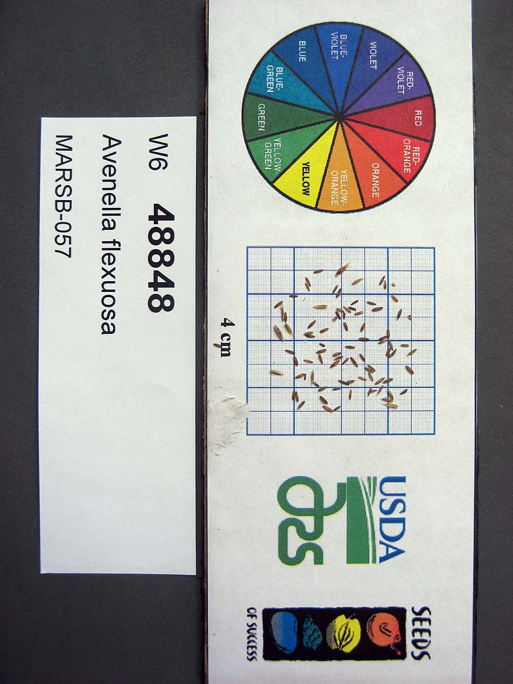 | | 2015 | | | | | | | Wild material | | 1922914 | W6 48848 |
| 88 | W6 48850 | MARSB-085 | Hexasepalum teres (Walter) J. H. Kirkbr. | New Jersey, United States | W6 |  | | 2015 | | | | | | | Wild material | | 1922915 | W6 48850 |
| 89 | W6 48854 | MARSB-106 | Eragrostis spectabilis (Pursh) Steud. | New Jersey, United States | W6 |  | | 2015 | | | | | | | Wild material | | 1922916 | W6 48854 |
| 90 | W6 48902 | MARSB-114 | Tridens flavus (L.) Hitchc. | New Jersey, United States | W6 |  | | 2015 | | | | | | | Wild material | | 1922931 | W6 48902 |
| 91 | OPGC 4286 | 195373 | Olsynium douglasii (A. Dietr.) E. P. Bicknell var. inflatum (Suksd.) Cholewa & Douglass M. Hend. | Oregon, United States | OPGC |  | | 2005 | COLLECTED | 06/30/2003 | | | 1362 | Light cover of Juniperus occidentalis near a small stand of Pinus ponderosa. Associated with Artemisia rigida, Pseudoroegneria spicata, Balsamorhiza serrata, Lomatium cous and Epilobium minutum. | Wild material | Forb 0.3-0.6 meters tall. | 1674156 | OPGC 4286 |