| 0 | Ames 36016 | Sugar Creek | Platanus occidentalis L. | Iowa, United States | NC7 |  | | 2023 | COLLECTED | 02/20/2023 | Scattered along Sugar Creek between 3.1 miles north and also 1.3 miles northeast of Franklin, T68N R6W Sections 2, 11, 12, 13 and 24. | 40.70277500, -91.51065900 | 185 | River banks and floodplains. | Wild material | This accession of American sycamore includes the sampling from several very large specimens found in the state of Iowa including specimen #211-12 currently (2023) ranking 13th largest measuring 14' 9" circumference; 106' 8" in height; and a calculated spread of 114' 8" totalling 312.346 points (measured 23 April 2023 by Mark Rouw); specimen #211-10 currently (2023) ranking as the 9th largest measuring 16' 2" circumference; 97' 5" in height; and a calculated spread of 134' 3" totalling 322.983 points (measured 21 April 2020 by Mark Rouw); and specimen #211-6 currently (2023) ranking 2nd largest measuring 20' 2.5" circumference; 109' 6" in height; and a calculated spread of 148' 9" totalling 389.188 points (measured 23 April 2023 by Mark Rouw). Numerous specimens noted in nature with extremely white, superior, ornamental bark characteristics, specifically specimen #211-13. | 2141476 | Ames 36016 |
| 1 | WLP 155 | NACPEC19-014 | Platanus occidentalis L. | Kentucky, United States | NA | | | 2019 | COLLECTED | 09/08/2019 | Wolfe County; ; Daniel Boone National Forest: Red River Gorge Area: 1/2 mile west of where Sheltowee Trace crosses Red River, on south bank of Red River. | 37.82370000, -83.62590000 | 254 | Mixed mesophytic forest on south bank of river, edge of river bed; growing in alluvial, sandy soil. | | Seeds collected from one plant. Four herbarium specimens collected; photographed. DNA sample collection number: DENG8217. | 2109143 | WLP 155 |
| 2 | WLP 1552 | AOK018 | Platanus occidentalis L. | Arkansas, United States | NA | | | 2019 | COLLECTED | 10/06/2018 | Madison County; Venus; Kings River Falls Natural Area (Arkansas Natural Heritage Commission property). | 35.89573000, -93.58238000 | 521 | East side of hiking trail, near agricultural field; stream on opposite side of trail; open [full sun]. | | 600 seeds collected from one individual. Species occasional, with patchy distribution. | 2109070 | WLP 1552 |
| 3 | Ames 33922 | JDC/PO/2017/012/766 | Platanus occidentalis L. | Iowa, United States | NC7 |  | | 2017 | COLLECTED | 03/20/2017 | Skunk River watershed of Chichaqua Bottoms Greenbelt approximately 5.75 miles east, southeast of Elkhart, Polk County | 41.77733500, -93.40833400 | 243 | Floodplain. | Wild material | | 1946989 | Ames 33922 |
| 4 | WLP 2423 | LBJWC-716 | Platanus occidentalis L. | Texas, United States | NA |  | | 2012 | COLLECTED | 01/16/2010 | Balance Shoals Greenbelt; Blanco River at I-35 [Interstate 35]. Texas Blackland Prairies phytoregion. | 29.90702000, -97.89536000 | 170 | Soil: white gravel (limestone geology) | Wild material | | 1902497 | WLP 2423 |
| 5 | Ames 29977 | Ames 29977 | Platanus occidentalis L. var. glabrata (Fernald) Sarg. | Texas, United States | NC7 |  | | 2009 | COLLECTED | | Near Ingram, Kerr County. | 30.06555556, -99.22111111 | 510 | Native population along the Guadalupe River, Edwards Plateau. | Wild material | | 1800372 | Ames 29977 |
| 6 | PI 479708 NA 36537 | 'Liberty' | Platanus ×hispanica Mill. ex Münchh. | District of Columbia, United States | NA |  | | 1974 | DONATED | 08/1983 | | | | | Cultivar | Developed in 1968 and 1970 by Frank S. Santamour, Jr. (US National Arboretum), by crossing a P. orientalis of Turkish origin with P. occidentalis. Evaluated for 12 years for growth and landscape attributes in field and street plantings. 'Liberty', released in August 1984, is a vigorous, single-stemmed tree to 20m tall displaying a pyramidal shape when young. Leaves remotely 5-lobed. Fruit balls generally 1 or 2 per stalk, sessile with short distance between balls. Resistant to sycamore anthracnose disease and to trunk decay caused by wounds. Adaptable and tolerant of most soil and moisture conditions, including compacted or high pH soils. | 1374644 | PI 479708 NA 36537 |
| 7 | NA 89047 | RJL2022PA-015 | Cephalanthus occidentalis L. | Pennsylvania, United States | NA | | | 2022 | COLLECTED | 10/09/2022 | Plants growing in the floodplain of Octoraro Creek near 698 Lees Bridge Road, West Nottingham Township, Pennsylvania on the south side of the road. Plants are locally common and spread out in the floodplain area along the Octoraro Creek. | 39.73540700, -76.09226500 | 60 | Plants of this species are growing in full sun to part shade of a moist to seasonally mucky and wide flood plain area adjacent to Octoraro Creek. The area is dominated by deciduous herbaceous plants, scrambling vines, shrubs and occasional small trees. Much of this wet “meadow” is dominated by aggressive stands of grasses and members of the sedge family.
Soils: The underlying geology of this area is estimated to be of lower Paleozoic origin and comprised of Peters Creek Schist. This is comprised of chlorite-sericite schist containing interbedded quartzite. Interestingly, this area is very close to and may interface with the adjacent formation of Ultramafic Rocks that includes serpentine, steatite, and other products of alteration of peridotites and pyroxenites.
Source: USGS Pennsylvania Geologic Map Data (https://mrdata.usgs.gov/geology/state/sgmc-unit.php?unit=PAPZpc%3B0)
The primary soil types in the collection area are classified as Hatboro Silt Loam which consists of soils formed in alluvium derived from metamorphic and crystalline rock. They are on flood plains. Slopes range from 0 to 3 percent. Hatboro Silt Loam soils are poorly drained and have a high to very high surface runoff index. These soils are subject to periodic stream overflow, which usually occurs during the winter and spring months. The A and B horizons are moderately acidic to neutral, generally to a depth of 1-2 meters; the C horizon below ranges from a depth of 2-3 meters with uniformly acidic soils.
Source: NRCS Web Soil Survey (https://websoilsurvey.sc.egov.usda.gov/App/WebSoilSurvey.aspx) | Wild material | | 2139612 | NA 89047 |
| 8 | WLP 816 | JDC/CO/2009/101/251 | Cephalanthus occidentalis L. | Ohio, United States | NA | | | 2009 | COLLECTED | 10/16/2009 | Along Ohio Highway 93, SW 1/4 of NE 1/4 of Section 26, T5N, R18W, Gallia Quad, Jackson County. | 38.86805556, -82.59694444 | 212 | Standing water. Associated with Acer negundo, A. rubrum, Celastrus orbiculatus, Platanus occidentalis, and Salix. | Wild material | | 1823916 | WLP 816 |
| 9 | PI 664897 | JDC/PV/2008/061/131 | Prunella vulgaris L. | Illinois, United States | NC7 |  | | 2008 | COLLECTED | 10/12/2008 | Along 2150 North Road, east of Irvington, SW 1/4 of NE 1/4 of Section 15, T1S, R1E, Walnut Hill Quad, Jefferson County. | 38.43833333, -89.07833333 | 161 | Only on south side of road; northern exposure; mostly shaded due to woody vegetation. | Wild material | | 1788218 | PI 664897 |
| 10 | PI 657224 | V. fuscatum Glassy Mt. HD-2007-021 | Vaccinium fuscatum Aiton | South Carolina, United States | COR |  | | 2007 | COLLECTED | 06/04/2007 | Glassy Mountain at home number 3786 Glassy Mountain Road, Greenville County. Edge of road. | 35.13435000, -82.36098000 | 675 | Sandy loam duff associated with: Acer rubrum, Vitis palmata, Erigeron annuus, Commelina virginiaca, Oxydendron arboreum, Platanus occidentalis, Phytolacca americana, Quercus nigra, Rubus argutus and R. trivialis. 45 degree southeast slope. | Wild material | Kim Hummer, Michael Dossett collected from South Carolina.
Jim Ballington reidentified this accession as V. fuscatum. Personal communication from 2 August 2021:
From the leaf shape, general yellow-green color of the leaves, and the distinctive size (relative to the size of the berries) and shape of the calyx, my conclusion is that this accession is probably not V. simulatum, but rather the blue-fruited Carolina foothills form of V. fuscatum. | 1730115 | PI 657224 |
| 11 | NA 89079 | 2024RJLPA-005 | Viburnum prunifolium L. | Pennsylvania, United States | NA | | | 2024 | COLLECTED | 09/20/2024 | Along gated road about 0.33 kilometers southwest of the Lake Ontelaunee Trail parking lot. | 40.50062600, -75.89004900 | 94 | Plants are growing on moist, well-drained in part shade of a deciduous forest. Slope: 0 percent. Aspect: N/A. Geology: The underlying geology of this area is of Ordovician origin and characterized as Shale and graywacke of Hamburg sequence. It is characterized by shale containing zones of conspicuous graywacke. (Source: USGS Pennsylvania Geologic Map Data). Soils: The primary soil type in the area of this collection is classified as Holly Series Silt Loam (Ho). The Holly Series consists of very deep, very poorly and poorly drained soils formed in loamy alluvium on flood plains. Saturated hydraulic conductivity is moderately high through high in the mineral soil. Slope ranges from 0 through 3 percent. (Source: USDA-NRCS Official Soil Series Descriptions). EPA Ecoregion (Level III): Ridge and Valley (67). EPA Ecoregion (Level IV): Northern Shale Valleys (67b). | Wild material | | 2169043 | NA 89079 |
| 12 | NA 89081 | 2024RJLPA-009 | Rosa carolina L. | Pennsylvania, United States | NA | | | 2024 | COLLECTED | 09/22/2024 | Lancaster and York Counties: outcrops along the Susquehanna River, accessed from the Historic Lock 12 parking lot off of Pennsylvania Road 372. | 39.81483500, -76.32762200 | 34 | Plants are growing from part-sun to full sun in crevices of the outcrops and where organic debris has accumulated in between boulders along the Susquehanna River. The sites range from nearly xeric to dry mesic, at least on the surface. Plants are generally growing 4-10 m above the normal flow of the river; however, the Holtwood Dam is less than 1 kilometer upstream and debris found trapped in the boulders indicates that there is periodic flooding, at least, in the lower zone of 4+ meters or so above normal river flow. This habitat has a diverse assemblage of deciduous trees and shrubs as well as abundant herbaceous taxa. Slope: 0 to 60 percent. Aspect: Northeast (generally). Geology: The underlying geology of this area is probably of lower Paleozoic age and characterized as the Octoraro Formation. It includes albite-chlorite schist, phyllite, some hornblende gneiss, and granitized members. Soils: The area where this species occurs is right on the edge of two soil zones that transition from the river’s edge to mesic conditions upslope. The first is generally referred to as Rock Outcrop. This terrestrial matrix in which plants grow is largely exposed underlying rock geology with accumulated outwash, rock decomposition, and organic debris buildup. The second is Mt. Airy (80%) and Manor (20%) Series soils, 25 to 60 percent slopes, extremely stony (MRF). (Source: California Soil Resource Lab/NRCS Official Soil Series Descriptions). EPA Ecoregion (Level III): Northern Piedmont (64). EPA Ecoregion (Level IV): Piedmont Uplands (64c). | Wild material | | 2169045 | NA 89081 |
| 13 | NA 89082 | 2024RJLPA-010 | Amorpha fruticosa L. | Pennsylvania, United States | NA | | | 2024 | COLLECTED | 09/22/2024 | Outcrops along the Susquehanna River, accessed from the Historic Lock 12 parking lot off of Pennsylvania Road 372. | 39.81481500, -76.32757900 | 34 | Plants are growing from part-sun to full sun in crevices of the outcrops and where organic debris has accumulated in between boulders along the Susquehanna River. The sites range from nearly xeric to dry mesic, at least on the surface. Plants are generally growing 4-10 m above the normal flow of the river; however, the Holtwood Dam is less than 1 kilometer upstream and debris found trapped in the boulders indicates that there is periodic flooding, at least, in the lower zone of 4+ meters or so above normal river flow. This habitat has a diverse assemblage of deciduous trees and shrubs as well as abundant herbaceous taxa. Slope: 0 to 25 percent. Aspect: Northeast (generally). Geology: The underlying geology of this area is probably of lower Paleozoic age and characterized as the Octoraro Formation. It includes albite-chlorite schist, phyllite, some hornblende gneiss, and granitized members. Soils: The area where this species occurs is right on the edge of two soil zones that transition from the river’s edge to mesic conditions upslope. The first is generally referred to as Rock Outcrop. This terrestrial matrix in which plants grow is largely exposed underlying rock geology with accumulated outwash, rock decomposition, and organic debris buildup. The second is Mt. Airy (80%) and Manor (20%) Series soils, 25 to 60 percent slopes, extremely stony (MRF). (Source: California Soil Resource Lab/NRCS Official Soil Series Descriptions). EPA Ecoregion (Level III): Northern Piedmont (64). EPA Ecoregion (Level IV): Piedmont Uplands (64c). | Wild material | | 2169046 | NA 89082 |
| 14 | NA 89083 | 2024RJLPA-012 | Rhododendron periclymenoides (Michx.) Shinners | Pennsylvania, United States | NA | | | 2024 | COLLECTED | 09/22/2024 | Outcrops along the Susquehanna River, accessed from the Historic Lock 12 parking lot off of Pennsylvania Road 372. | 39.81477400, -76.32807300 | 35 | Plants are growing from shade to part-sun and occasionally full sun in crevices of the outcrops and where organic debris has accumulated in between boulders along the Susquehanna River. The sites range from nearly xeric to mesic, at least on the surface. Plants are generally growing 4-10 m above the normal flow of the river; however, the Holtwood Dam is less than 1 kilometer upstream and debris found trapped in the boulders indicates that there is periodic flooding, at least, in the lower zone of 4+ meters or so above normal river flow. This habitat has a diverse assemblage of deciduous trees and shrubs as well as abundant herbaceous taxa. Slope: 0 to 60 percent. Aspect: Northeast (generally). Geology: The underlying geology of this area is probably of lower Paleozoic age and characterized as the Octoraro Formation. It includes albite-chlorite schist, phyllite, some hornblende gneiss, and granitized members. Soils: The area where this species occurs is right on the edge of two soil zones that transition from the river’s edge to mesic conditions upslope. The first is generally referred to as Rock Outcrop. This terrestrial matrix in which plants grow is largely exposed underlying rock geology with accumulated outwash, rock decomposition, and organic debris buildup. The second is Mt. Airy (80%) and Manor (20%) Series soils, 25 to 60 percent slopes, extremely stony (MRF). (Source: California Soil Resource Lab/NRCS Official Soil Series Descriptions). EPA Ecoregion (Level III): Northern Piedmont (64). EPA Ecoregion (Level IV): Piedmont Uplands (64c). | Wild material | | 2169047 | NA 89083 |
| 15 | NA 89084 | 2024RJLPA-013 | Physocarpus opulifolius (L.) Maxim. | Pennsylvania, United States | NA | | | 2024 | COLLECTED | 09/22/2024 | Outcrops along the Susquehanna River, accessed from the Historic Lock 12 parking lot off of Pennsylvania Road 372. | 39.81466300, -76.32833900 | 36 | Plants are growing from shade to part-sun where organic debris has accumulated in between boulders as well as further upslope in deeper mesic soils along the Susquehanna River. This habitat has a diverse assemblage of deciduous trees and shrubs as well as abundant herbaceous taxa. Slope: 10 to 25 percent. Aspect: Northeast (generally). Geology: The underlying geology of this area is probably of lower Paleozoic age and characterized as the Octoraro Formation. It includes albite-chlorite schist, phyllite, some hornblende gneiss, and granitized members. Soils: The area where this species occurs is right on the edge of two soil zones that transition from the river’s edge to mesic conditions upslope. The first is generally referred to as Rock Outcrop. This terrestrial matrix in which plants grow is largely exposed underlying rock geology with accumulated outwash, rock decomposition, and organic debris buildup. The second is Mt. Airy (80%) and Manor (20%) Series soils, 25 to 60 percent slopes, extremely stony (MRF). (Source: California Soil Resource Lab/NRCS Official Soil Series Descriptions). EPA Ecoregion (Level III): Northern Piedmont (64). EPA Ecoregion (Level IV): Piedmont Uplands (64c). | Wild material | | 2169048 | NA 89084 |
| 16 | NA 89085 | 2024RJLPA-014 | Rhododendron arborescens (Pursh) Torr. | Pennsylvania, United States | NA | | | 2024 | COLLECTED | 09/22/2024 | Outcrops along the Susquehanna River, accessed from the Historic Lock 12 parking lot off of Pennsylvania Road 372. | 39.81618100, -76.33069800 | 38 | Plants are growing from shade to part-sun and occasionally full sun in crevices of the outcrops and where organic debris has accumulated in between boulders along the Susquehanna River. The sites range from nearly xeric to mesic, at least on the surface. Plants are generally growing 4-10 m above the normal flow of the river; however, the Holtwood Dam is less than 1 kilometer upstream and debris found trapped in the boulders indicates that there is periodic flooding, at least, in the lower zone of 4+ meters or so above normal river flow. This habitat has a diverse assemblage of deciduous trees and shrubs as well as abundant herbaceous taxa. Slope: 0 to 75 percent. Aspect: Northeast (generally). Geology: The underlying geology of this area is probably of lower Paleozoic age and characterized as the Octoraro Formation. It includes albite-chlorite schist, phyllite, some hornblende gneiss, and granitized members. Soils: The area where this species occurs is right on the edge of two soil zones that transition from the river’s edge to mesic conditions upslope. The first is generally referred to as Rock Outcrop. This terrestrial matrix in which plants grow is largely exposed underlying rock geology with accumulated outwash, rock decomposition, and organic debris buildup. The second is Mt. Airy (80%) and Manor (20%) Series soils, 25 to 60 percent slopes, extremely stony (MRF). (Source: California Soil Resource Lab/NRCS Official Soil Series Descriptions). EPA Ecoregion (Level III): Northern Piedmont (64). EPA Ecoregion (Level IV): Piedmont Uplands (64c). | Wild material | | 2169049 | NA 89085 |
| 17 | NA 89086 | 2024RJLPA-015 | Ilex verticillata (L.) A. Gray | Pennsylvania, United States | NA | | | 2024 | COLLECTED | 09/22/2024 | Outcrops along the Susquehanna River, accessed from the Historic Lock 12 parking lot off of Pennsylvania Road 372. | 39.81656600, -76.33136600 | 38 | Plants are growing from part-sun to full sun in crevices of the outcrops and where organic debris has accumulated in between boulders along the Susquehanna River. The sites range from nearly xeric to dry mesic, at least on the surface. Plants are generally growing 4-10 m above the normal flow of the river; however, the Holtwood Dam is less than 1 kilometer upstream and debris found trapped in the boulders indicates that there is periodic flooding, at least, in the lower zone of 4+ meters or so above normal river flow. This habitat has a diverse assemblage of deciduous trees and shrubs as well as abundant herbaceous taxa. Slope: 0 to 10 percent. Aspect: Northeast (generally). Geology: The underlying geology of this area is probably of lower Paleozoic age and characterized as the Octoraro Formation. It includes albite-chlorite schist, phyllite, some hornblende gneiss, and granitized members. Soils: The area where this species occurs is right on the edge of two soil zones that transition from the river’s edge to mesic conditions upslope. The first is generally referred to as Rock Outcrop. This terrestrial matrix in which plants grow is largely exposed underlying rock geology with accumulated outwash, rock decomposition, and organic debris buildup. The second is Mt. Airy (80%) and Manor (20%) Series soils, 25 to 60 percent slopes, extremely stony (MRF). (Source: California Soil Resource Lab/NRCS Official Soil Series Descriptions). EPA Ecoregion (Level III): Northern Piedmont (64). EPA Ecoregion (Level IV): Piedmont Uplands (64c). | Wild material | | 2169050 | NA 89086 |
| 18 | NA 89087 | 2024RJLPA-016 | Hydrangea arborescens L. | Pennsylvania, United States | NA | | | 2024 | COLLECTED | 09/22/2024 | Outcrops along the Susquehanna River, accessed from the Historic Lock 12 parking lot off of Pennsylvania Road 372. | 39.81489000, -76.32912200 | 43 | Plants are growing in deep shade of the deciduous woodlands on outcrops and the steep slopes where organic debris and detritus has accumulated. This habitat has a diverse assemblage of deciduous trees and shrubs as well as abundant herbaceous taxa. Slope: 30 to 90 percent. Aspect: Northeast (generally). Geology: The underlying geology of this area is probably of lower Paleozoic age and characterized as the Octoraro Formation. It includes albite-chlorite schist, phyllite, some hornblende gneiss, and granitized members. (Source: Source: USGS Pennsylvania Geologic Map Data). Soils: The area where this species occurs is right on the edge of two soil zones that transition from the river’s edge to mesic conditions upslope. The first is generally referred to as Rock Outcrop. This terrestrial matrix in which plants grow is largely exposed underlying rock geology with accumulated outwash, rock decomposition, and organic debris buildup. The second is Mt. Airy (80%) and Manor (20%) Series soils, 25 to 60 percent slopes, extremely stony (MRF). (Source: California Soil Resource Lab/NRCS Official Soil Series Descriptions). EPA Ecoregion (Level III): Northern Piedmont (64). EPA Ecoregion (Level IV): Piedmont Uplands (64c). | Wild material | | 2169051 | NA 89087 |
| 19 | WLP 3492 | St. Francois State Park | Hydrangea arborescens L. | Missouri, United States | NA |  | | 2024 | COLLECTED | 01/19/2024 | St. Francois State Park, 8920 US Highway 67 North, approximately 3.2 miles north-northeast of Bonne Terre. | 37.96381000, -90.53403000 | 202 | Rocky outcrops above Big River and rocky areas on bank of Big River. | Wild material | | 2166135 | WLP 3492 |
| 20 | Ames 36219 | Egyptian Tract | Salix sericea Marshall | Missouri, United States | NC7 |  | | 2024 | COLLECTED | 01/19/2024 | LAD Foundation Egyptian Tract Wet Hollow Seep/Fen Complex located 7.52 miles west, southwest of Annapolis just northwest of intersection of CR 338 and CR 334, T31N R2E SW 1/4 SE 1/4 SE 1/4 Sec. 21 (Lesterville SE Quad.). | 37.34429700, -90.83361600 | 217 | Perched wet fen/seep complex with standing water supporting both obligate calciphilic and obligate acidophilic plant species. | Wild material | The native range of Salix sericea is concentrated througout the northeastern and eastern central United States ranging from Maine south to South Carolina, west to Illinois with a relatively large disjunct area in southeastern Missouri (Little, E. L. Jr. 1977). This accession represents genetics from southeastern Missouri in Reynolds County. Shrubs noted at the collection site in nature ranging in height from 2-7 feet and typically twice as wide as tall. Multi-stemmed shrubs expanding vegetatively via layering. Dormant stem colors noted at collection site ranging from mostly greenish to occassionally brownish red and/or copper tones. Dormant buds rather red and often bright red in color. Salix sericea is native to areas of the northeastern U.S. and north into Canada, reaching its western extent in Missouri. Classified as an obligate wetland plant that typically occurs on wet seeps, sedge meadows, streambanks, fens, etc. that are usually slightly acidic. Known to have the potential to reach up to four meters in height, but always much wider than tall. Ornamental characteristics include dark green leaves that are hairless above with undersides that are densely minutely-hairy making them rather white in appearance. Flowering occurs before or during leaf expansion. This species is known to serve as a larval host plant for the Arcadian Hairstreak, Satyrium acadica. | 2165775 | Ames 36219 |
| 21 | NA 88820 | TJK2023AL-005 | Hydrangea arborescens L. | Alabama, United States | NA | | | 2023 | COLLECTED | 12/07/2023 | Between Monroe County Route 1 and Tom Hayles Road. | 31.40575900, -87.54924000 | 22 | In woodlands on limestone outcrop. While the upper area of slopes is covered by a thin soil layer, the exposed limestone rock outcrop on the northwestern edge of this area is a low competition niche for plants like the Hydrangea to gain a foothold. Slope: 60% (plus). Aspect: Northwest. Elevation: 72 feet. | Wild material | | 2165649 | NA 88820 |
| 22 | NA 88821 | TJK2023AL-006 | Hydrangea quercifolia W. Bartram | Alabama, United States | NA | | | 2023 | COLLECTED | 12/07/2023 | Between Monroe County Route 1 and Tom Hayles Road. | 31.40580000, -87.54890000 | 22 | In woodlands on limestone outcrop. While the upper area of slopes is covered by a thin soil layer, the exposed limestone rock outcrop on the northwestern edge of this area is a low competition niche for plants like the Hydrangea to gain a foothold. Slope: 60% (plus). Aspect: Northwest. Elevation: 72 feet. | Wild material | | 2165650 | NA 88821 |
| 23 | NA 88718 | RJL2023NCSC-023 | Ilex decidua Walter | South Carolina, United States | NA | | | 2023 | COLLECTED | 11/15/2023 | Waccamaw National Wildlife Refuge: U.S. Highway 701, Yauhannah Landing on the east side of the Great Pee Dee River. Plants growing in low woods on the north side of the landing. | 33.66208900, -79.15305000 | 2 | Plants growing in shade to part-shade of a moist to wet woodland habitat that is mostly deciduous and evergreen. Portions of the woodland have depressions with year-round standing water. Slope: N/A. Aspect: N/A. The underlying geology of this area is of Quaternary origin and characterized as Alluvial Valley Swamp. This formation is unconformable on all underlying units. It is composed of fluvial sand and gravel at base, grading upwards into fine sands and silts, and local occasional peat. May be overrun with recent sediments from forest cutting and agriculture. (Source: USGS South Carolina Geologic Map Data.) The primary soil type in this collection area is classified as Johnston Series loam. The Johnson Series consists of very deep, very poorly drained coarse-loamy, siliceous, active, acid, thermic Cumulic Humaquepts. The upper 0-75 cm is black, mucky loam that is friable and very strongly acid. The lower stratum to 1.75 m is dark gray, loamy fine sand, single grained, loose and very strongly acid. (Source: NRCS Web Soil Survey.) | Wild material | | 2159146 | NA 88718 |
| 24 | NA 88633 | KY23-036 | Itea virginica L. | Kentucky, United States | NA | | | 2023 | COLLECTED | 09/11/2023 | Daniel Boone National Forest: Bee Rock Loop Trail along Rockcastle River. | 37.03581000, -84.30524000 | 234 | Riverscour grassland, sandy wash, forest margin along river. Elevation: 767 feet. Aspect: East. | Wild material | | 2158725 | NA 88633 |
| 25 | NA 88639 | KY23-042 | Lyonia ligustrina (L.) DC. | Kentucky, United States | NA | | | 2023 | COLLECTED | 09/11/2023 | Daniel Boone National Forest: Bee Rock Loop Trail along Rockcastle River. | 37.04179000, -84.31805000 | 233 | Riverscour grassland. Elevation: 765 feet. Aspect: East. | Wild material | | 2158731 | NA 88639 |
| 26 | NA 88640 | KY23-043 | Ilex verticillata (L.) A. Gray | Kentucky, United States | NA | | | 2023 | COLLECTED | 09/11/2023 | Daniel Boone National Forest: Bee Rock Loop Trail along Rockcastle River. | 37.04179000, -84.31805000 | 233 | Riverscour grassland. Elevation: 765 feet. Aspect: East. | Wild material | | 2158732 | NA 88640 |
| 27 | NA 88641 | KY23-044 | Physocarpus opulifolius (L.) Maxim. | Kentucky, United States | NA | | | 2023 | COLLECTED | 09/11/2023 | Daniel Boone National Forest: Bee Rock Loop Trail along Rockcastle River. | 37.04179000, -84.31805000 | 233 | Riverscour grassland. Elevation: 765 feet. Aspect: East. | Wild material | | 2158733 | NA 88641 |
| 28 | WLP 3212 | KY23-105 | Hydrangea arborescens L. | Kentucky, United States | NA | | | 2023 | COLLECTED | 09/14/2023 | Above the banks of Marble Creek, property of Liz Hobson | 37.84865900, -84.45359000 | | Deciduous floodplain forest with limestone outcrops | Wild material | | 2158756 | WLP 3212 |
| 29 | NA 88599 | RJL2023NC-001 | Ilex decidua Walter | North Carolina, United States | NA | | | 2023 | COLLECTED | 02/18/2023 | Plants growing along a fenceline on a hillside about 10 meters from Interstate 85 (south bound) and approximately 0.65 kilometers south of the North Carolina-Virginia border. | 36.53904800, -78.18822500 | 86 | The plant was growing on the upper shoulder of a slope about 7 meters above the highway in part-shade to sun of an upland, well-drained, dry mesic somewhat disturbed site on the fenceline boundary of Interstate 85 (south bound). The area was originally cleared of all vegetation and now, many years later, native and non-native plant species have aggressively recolonized the area. This early successional habitat is dominated by Juniperus virginiana and Liquidambar styraciflua, as well as, non-native species such as Ligustrum sinense, Lonicera japonica, and Ailanthus altissima. The underlying geology of this area is of Permian/Pennsylvanian origin and characterized as the Granitic Rock Formation. It is characterized by megacrystic to equigranular components and includs Castalia and Wilton intrusives. | Wild material | | 2141480 | NA 88599 |
| 30 | NA 88534 | RJLSEUS2022-005 | Leucothoe axillaris (Lam.) D. Don | North Carolina, United States | NA | | | 2023 | COLLECTED | 12/06/2022 | Plants growing in the wetlands and other moist depressions along Scotland Co. Road 1328 in the Sandhills Game Lands. Common at this site This plant is somewhat sporadic in its distribution, but abundant in places where it is found in moist to wet habitats of bottomlands in this area. | 34.88545200, -79.44597500 | 71 | Plants are growing in shade of acid bottomland wet woodlands along streams or adjoining wetlands with constant sub-surface moisture. It prefers areas above the permanently wet conditions and can go through periods of drought.
Soils: The underlying geology of this area is of Cretaceous origin and characterized as Mittendorf Formation. The formation is comprised of sand, sandstone, and mudstone, gray to pale gray with an orange cast, and mottled. Clay balls and iron-cemented concretions are common, beds are laterally discontinuous, and cross-bedding is common.
Source: USGS North Carolina Geologic Map Data (https://mrdata.usgs.gov/geology/state/sgmc-unit.php?unit=NCKm%3B11)
The primary soil type in the collection area is classified as Paxville loam soil (0 to 1 percent slopes, rarely flooded). The Paxville Series consists of very deep, very poorly drained soils. Permeability is moderate. These nearly level soils formed from marine deposits, fluviomarine deposits, and alluvium. They range from 0 to 2 percent slopes. The frequency of flooding is typically very rare to brief periods. The upper strata, 0-1.2 meters, is comprised of fine sandy loam that is friable, non-sticky and non-plastic; it does contain small amounts clean quartz grains and is strongly acid. Lower strata to a depth of 2.5 meters are similar with fine sandy loam in the upper portions and progressively more sandy loam to fine sand in the deepest strata.
Source: NRCS Web Soil Survey (https://websoilsurvey.sc.egov.usda.gov/App/WebSoilSurvey.aspx) | Wild material | | 2140763 | NA 88534 |
| 31 | NA 88558 | RJLSEUS2022-031 | Ilex decidua Walter | Alabama, United States | NA | | | 2023 | COLLECTED | 12/12/2022 | Silver Creek Lake Campground off of Silver Creek Lake Road: Silver Creek Lake, at the edge of the campground. | 31.66344600, -87.57108400 | 16 | Part shade to sun along the eroding banks of Silver Creek Lake in moist-mesic, mixed deciduous and evergreen woodland, 2-3 meters above the water. The underlying geology of this area is Claiborne Group, Tallahatta Formation, of Eocene origin, with white to very light-greenish-gray thin-bedded to massive siliceous claystone; interbedded with thin layers of fossiliferous clay, sandy clay, and glauconitic sand and sandstone. (Source: USGS Alabama Geological Map Data). The primary soil types in the collection area are classified as Riverview Fine Sandy Loam soils (0 to 2 percent slopes, occasionally flooded). The Riverview Series consists of very deep, well drained, moderately permeable soils that formed in loamy alluvium on flood plains. Slopes range from 0 to 5 percent. Riverview soils fare on high parts of flood plains of rivers and streams draining the Coastal Plain and Southern Piedmont. Runoff is slow. Permeability is moderate. These soils flood for short periods mostly in winter or early spring months. (Source: NRCS Web Soil Survey). | Wild material | | 2140819 | NA 88558 |
| 32 | NA 88560 | RJLSEUS2022-033 | Hydrangea arborescens L. | Alabama, United States | NA | | | 2023 | COLLECTED | 12/12/2022 | Plants growing along the west side of Ferry Road at Haines Island Park leading down to the Alabama River. | 31.72299700, -87.46798200 | 46 | Plants are growing in part-shade in the scoured ditch and slope alongside Ferry Road; occasionally in moss where seed undoubtedly germinated.
Soils: The underlying geology of this area is Claiborne Group, Tallahatta Formation, of Eocene origin, with white to very light-greenish-gray thin-bedded to massive siliceous claystone; interbedded with thin layers of fossiliferous clay, sandy clay, and glauconitic sand and sandstone.
Source: USGS Alabama Geological Map Data (https://mrdata.usgs.gov/geology/state/state.php?state=AL)
The primary soil type in the collection area is classified as Arundel Loam soil (8 to 35 percent slopes). The Arundel Series consists of moderately deep, well drained, very slowly permeable soils on dissected uplands of the Southern Coastal Plain. They formed in marine deposits consisting of acid clays underlain by horizontally bedded sandstone, buhrstone and siltstone. These soils are strongly acid. Slopes range from 2 to 60 percent.
Source: NRCS Web Soil Survey (https://websoilsurvey.sc.egov.usda.gov/App/WebSoilSurvey.aspx) | Wild material | | 2140785 | NA 88560 |
| 33 | NA 88561 | RJLSEUS2022-034 | Hydrangea quercifolia W. Bartram | Alabama, United States | NA | | | 2023 | COLLECTED | 12/12/2022 | Plants growing in the woodlands at Haines Island Park at the foot of Tallahatta cuesta, accessed by foot via Ferry Road. Common at this site. | 31.72178200, -87.46589600 | 66 | Plants are growing in part-shade to shade of a moist mesic, well-drained conditions on rocks and in the eroding matrix of the Tallahatta Questa.
Soils: The underlying geology of this area is Claiborne Group, Tallahatta Formation, of Eocene origin, with white to very light-greenish-gray thin-bedded to massive siliceous claystone; interbedded with thin layers of fossiliferous clay, sandy clay, and glauconitic sand and sandstone.
Source: USGS Alabama Geological Map Data (https://mrdata.usgs.gov/geology/state/state.php?state=AL)
The primary soil type in the collection area is classified as Arundel Loam soil (8 to 35 percent slopes). The Arundel Series consists of moderately deep, well drained, very slowly permeable soils on dissected uplands of the Southern Coastal Plain. They formed in marine deposits consisting of acid clays underlain by horizontally bedded sandstone, buhrstone and siltstone. These soils are strongly acid. Slopes range from 2 to 60 percent.
Source: NRCS Web Soil Survey (https://websoilsurvey.sc.egov.usda.gov/App/WebSoilSurvey.aspx) | Wild material | | 2140786 | NA 88561 |
| 34 | NA 88509 | RJL2022TX-004 | Ilex decidua Walter | Texas, United States | NA | | | 2022 | COLLECTED | 11/01/2022 | Low woodlands along the north side of Texas State Hwy 190 between the highway and an unnamed paved service road that leads down to the Sabine River; the turn for the service road is approximately 0.62 kilometers west of the Sabine River. Near the bridge over the Sabine River. | 30.74730000, -93.61568900 | 20 | Plants are growing in part-shade to shade of a moist mesic (occasionally temporarily wet) woodland. Ilex decidua can be in the low woods most of the way down to the river. Plant is a common understory shrub in the moist woodland habitat not far from the Sabine River. Soils: The underlying geology of this area is of Holocene origin and characterized as Alluvium. The alluvium and low terrace deposits along streams include sand, silt, clay, and gravel. Thickness is variable. In this case alluvium is from the Sabine River. (Source: USGS Texas Geologic Map Data). The primary soil types in the collection area are classified as Urbo and Mantachie soils. The Urbo series consists of deep, somewhat poorly drained soils. Permeability is very slow. These nearly level to gently sloping soils formed in clayey alluvium on flood plains of streams that drain uplands of the Southern Coastal Plain. Slopes range from 0 to 3 percent. In wet seasons late in winter and early in spring, the water table is at a depth of 1 to 2 feet and most areas of Urbo soils are subject to either occasional or frequent flooding of brief to long duration. The Mantachie series consists of very deep, somewhat poorly drained, moderately permeable soils on flood plains of the Southern Coastal Plain. They formed in loamy alluvium and considered acidic. Mantachie soils are subject to rare to frequent flooding in the winter and early spring for brief to long duration, unless protected. The seasonal high water table ranges from 1.0 to 1.5 feet of the surface during periods of high rainfall. (Source: NRCS Web Soil Survey). | Wild material | | 2139816 | NA 88509 |
| 35 | NA 89046 | RJL2022PA-014 | Alnus serrulata (Aiton) Willd. | Pennsylvania, United States | NA | | | 2022 | COLLECTED | 10/09/2022 | Plants growing in the floodplain of Octoraro Creek near 698 Lees Bridge Road, West Nottingham Township, Pennsylvania on the south side of the road. Plants are locally common and spread out in the floodplain area along the Octoraro Creek. | 39.73579900, -76.09238300 | 60 | Plants of this species are growing in full sun of a moist to seasonally mucky and wide flood plain area adjacent to Octoraro Creek. The area is dominated by deciduous herbaceous plants, scrambling vines, shrubs and occasional small trees. Much of this wet “meadow” is dominated by aggressive stands of grasses and members of the sedge family.
Soils: The underlying geology of this area is estimated to be of lower Paleozoic origin and comprised of Peters Creek Schist. This is comprised of chlorite-sericite schist containing interbedded quartzite. Interestingly, this area is very close to and may interface with the adjacent formation of Ultramafic Rocks that includes serpentine, steatite, and other products of alteration of peridotites and pyroxenites.
Source: USGS Pennsylvania Geologic Map Data (https://mrdata.usgs.gov/geology/state/sgmc-unit.php?unit=PAPZpc%3B0)
The primary soil types in the collection area are classified as Hatboro Silt Loam which consists of soils formed in alluvium derived from metamorphic and crystalline rock. They are on flood plains. Slopes range from 0 to 3 percent. Hatboro Silt Loam soils are poorly drained and have a high to very high surface runoff index. These soils are subject to periodic stream overflow, which usually occurs during the winter and spring months. The A and B horizons are moderately acidic to neutral, generally to a depth of 1-2 meters; the C horizon below ranges from a depth of 2-3 meters with uniformly acidic soils.
Source: NRCS Web Soil Survey (https://websoilsurvey.sc.egov.usda.gov/App/WebSoilSurvey.aspx) | Wild material | | 2139611 | NA 89046 |
| 36 | Ames 35792 | APS/ID/2022/027/489 | Ilex decidua Walter | Arkansas, United States | NC7 |  | | 2022 | COLLECTED | 03/15/2022 | Located approximately 3.75 miles east of Allison just off Round Bottom Road. | 35.93670000, -92.04891000 | 133 | Dry west facing slope in a pine, oak, and hickory forest. | Wild material | Plants sampled in nature with bright red fruits measuring 7-9 mm in diameter. | 2137431 | Ames 35792 |
| 37 | WLP 2568 | APS/HA/2022/028/490 | Hydrangea arborescens L. | Arkansas, United States | NA | 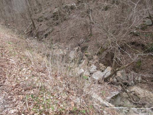 | | 2022 | COLLECTED | 03/15/2022 | Located approximately 3.75 miles east of Allison just off Round Bottom Road. | 35.93357000, -92.05110000 | 144 | Moist, low deciduous forest with scattered rock outcrops, growing along base of hill and bank of seasonal stream. | Wild material | | 2137430 | WLP 2568 |
| 38 | OPGC 5812 | 210638 | Lobelia cardinalis L. | Texas, United States | OPGC |  | | 2021 | | | | | | | Wild material | | 1895309 | OPGC 5812 |
| 39 | NA 88458 | NCBG-334 | Smilax laurifolia L. | Virginia, United States | NA | | | 2021 | | | | | | | Wild material | PROMINENT MIDRIB ABAXIALLY FEW LARGE PRICKLES ON PRIMARY STEMS | 2132867 | NA 88458 |
| 40 | W6 59989 | NCBG-373 | Diospyros virginiana L. | Virginia, United States | W6 | | | 2021 | | | | | | | Wild material | | 2132871 | W6 59989 |
| 41 | W6 60043 | NCBG-571 | Eleocharis quadrangulata (Michx.) Roem. | Maryland, United States | W6 | | | 2021 | | | | | | | Wild material | | 2132925 | W6 60043 |
| 42 | W6 60044 | NCBG-572 | Aristida purpurascens Poir. var. virgata (Trin.) Allred | Maryland, United States | W6 | | | 2021 | | | | | | | Wild material | | 2132952 | W6 60044 |
| 43 | NA 86885 | RJL2021PA-004 | Ilex verticillata (L.) A. Gray | Pennsylvania, United States | NA | | | 2021 | COLLECTED | 11/16/2021 | Plants growing in woodlands along a small unnamed creek corridor dumping into the Middle Branch White Clay Creek in Goddard Park, West Grove Pennsylvania, off of Wickerton Road, Chester County. | 39.81063861, -75.82750806 | 124 | Plants are growing in a range of habitats from mesic woodlands to saturated streamside settings of deciduous woodlands that drain toward the Middle Branch White Clay Creek. Plants grow in high understory shade with dappled to indirect sunlight. The only female (fruiting) plants were found in areas along the creek where soils are moist to saturated. Numerous male specimens were found in the areas described above. Soils: Soils found in the areas where this collection was made are comprised primarily of Baile silt loam (Ba), Hatboro silt loam (Ha), and Glenelg silt loam, 8 to 15 percent slopes (GgC). Baile silt loam consists of very deep, poorly drained, moderately low to moderately high saturated hydraulic conductivity, soils on upland depressions and footslopes that were formed in local alluvium over residuum from acid crystalline rocks, chiefly mica schist and granitized schist and gneiss; slope ranges from 0 to 8 percent. Hatboro silt loam consists of very deep and poorly drained soils formed in deposited alluvium derived from metamorphic and crystalline rock. They are on flood plains. Slopes range from 0 to 3 percent. Glenelg silt loam, 8 to 15 percent slopes consists of very deep, well drained soils formed in residuum weathered from micaceous schist on uplands of the Blue Ridge and the Northern Piedmont. This soil is undifferentiated, mostly poorly drained sandy bottomland soils intermingled with decomposing organic litter and eroded silts and clays due to erosion. Slope: 0 to 15% Aspect: Variable. | Wild material | | 2123125 | NA 86885 |
| 44 | WLP 1732 | RJL2021PA-002 | Viburnum prunifolium L. | Pennsylvania, United States | NA | | | 2021 | COLLECTED | 11/05/2021 | Plants growing in woodlands along a small unnamed creek corridor dumping into the Middle Branch White Clay Creek in Goddard Park, West Grove Pennsylvania, off of Wickerton Road, Chester County. | 39.80462083, -75.82888750 | 102 | Plants are growing in a range of habitats from drier upland woods to moist creekside settings of deciduous woodlands that drain toward the Middle Branch White Clay Creek. Plants grow in part shade to high understory shade with dappled to indirect direct sunlight. Plants achieve their largest size and fruiting potential in part sun of the riparian zone of the creek where woodland canopy is thinner. Soils: Soils found in the areas where this collection was made are comprised primarily of flood plain Hatboro silt loam (Ha) and well-drained, upland Glenelg silt loam, 8 to 15 percent slopes (GgC). Hatboro silt loam consists of very deep and poorly drained soils formed in deposited alluvium derived from metamorphic and crystalline rock. They are on flood plains. Slopes range from 0 to 3 percent. Glenelg silt loam, 8 to 15 percent slopes consists of very deep, well drained soils formed in residuum weathered from micaceous schist on uplands of the Blue Ridge and the Northern Piedmont. This soil is undifferentiated, mostly poorly drained sandy bottomland soils intermingled with decomposing organic litter and eroded silts and clays due to erosion. Slope: 0 to 15% Aspect: Variable. | Wild material | | 2123098 | WLP 1732 |
| 45 | WLP 1733 | RJL2021PA-003 | Viburnum dentatum L. | Pennsylvania, United States | NA | | | 2021 | COLLECTED | 11/05/2021 | Plants growing in woodlands along a small unnamed creek corridor dumping into the Middle Branch White Clay Creek in Goddard Park, West Grove Pennsylvania, off of Wickerton Road, Chester County. | 39.80522167, -75.82928139 | 107 | Plants are growing in a range of habitats from mesic woodland to moist creekside settings of deciduous woodlands that drain toward the Middle Branch White Clay Creek. Plants grow in high understory shade with dappled to indirect sunlight. Soils: Soils found in the areas where this collection was made are comprised primarily of flood plain Hatboro silt loam (Ha) and well-drained, upland Glenelg silt loam, 8 to 15 percent slopes (GgC). Hatboro silt loam consists of very deep and poorly drained soils formed in deposited alluvium derived from metamorphic and crystalline rock. They are on flood plains. Slopes range from 0 to 3 percent. Glenelg silt loam, 8 to 15 percent slopes consists of very deep, well drained soils formed in residuum weathered from micaceous schist on uplands of the Blue Ridge and the Northern Piedmont. This soil is undifferentiated, mostly poorly drained sandy bottomland soils intermingled with decomposing organic litter and eroded silts and clays due to erosion. Slope: 0 to 15% Aspect: Variable. | Wild material | | 2123124 | WLP 1733 |
| 46 | WLP 1747 | RJL2021PA-005 | Rosa palustris Marshall | Pennsylvania, United States | NA | | | 2021 | COLLECTED | 11/20/2021 | Plants growing in wetland seeps surrounded by mown hayfields just west of the Middle Branch White Clay Creek in Goddard Park, West Grove Pennsylvania, off of Wickerton Road, Chester County. | 39.80090528, -75.82383250 | 100 | Habitat Notes: Plants are growing in permanently saturated to moist soils in wetland habitats. Plants appear to be obligate wetland plants and are found only in permanent to nearly permanent wet habitats observed. Generally, the shrubs are found in part shade to full sun. Soils: Soils found in the areas where this collection was made are comprised primarily of Hatboro silt loam (Ha). Hatboro silt loam consists of very deep and poorly drained soils formed in deposited alluvium derived from metamorphic and crystalline rock. They are on flood plains. Slopes range from 0 to 3 percent. Slope: 0 to 3% Aspect: Variable. | Wild material | | 2123715 | WLP 1747 |
| 47 | Ames 36047 | CBG-10076 | Helianthus divaricatus L. | Oklahoma, United States | NC7 | | | 2021 | | | | | | | Wild material | | 2120050 | Ames 36047 |
| 48 | NA 88199 | CBG-10062 | Callicarpa americana L. | Oklahoma, United States | NA | | | 2021 | | | | | | | Wild material | | 2120043 | NA 88199 |
| 49 | NA 88320 | CBG-10190 | Hydrangea arborescens L. | Illinois, United States | NA | | | 2021 | | | | | | | Wild material | | 2120058 | NA 88320 |
| 50 | OPGC 8289 | CBG-10186 | Verbena hastata L. | Oklahoma, United States | OPGC | | | 2021 | | | | | | | Wild material | | 2120055 | OPGC 8289 |
| 51 | W6 58999 | NCBG-447 | Saururus cernuus L. | North Carolina, United States | W6 | | | 2021 | | | | | | | Wild material | | 2116317 | W6 58999 |
| 52 | NA 86848 | ZARKS-025 | Acer saccharum Marshall subsp. leucoderme (Small) Desmarais | Arkansas, United States | NA | | | 2020 | COLLECTED | 10/09/2014 | Cedar Fourche Creek; Harper Grocery Rd. at Rock Springs Rd. | 34.66470800, -93.26778900 | 209 | Mesic, mixed deciduous forest; growing on the bank just above a small stream | Wild material | | 2115797 | NA 86848 |
| 53 | NA 88151 | NCBG-319 | Callicarpa americana L. | North Carolina, United States | NA |  | | 2019 | | | | | | | Wild material | | 2098411 | NA 88151 |
| 54 | NA 88158 | NCBG-331 | Callicarpa americana L. | North Carolina, United States | NA | 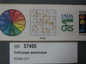 | | 2019 | | | | | | | Wild material | | 2098419 | NA 88158 |
| 55 | NA 88159 | NCBG-332 | Itea virginica L. | Virginia, United States | NA |  | | 2019 | | | | | | | Wild material | | 2098420 | NA 88159 |
| 56 | NA 88172 | NCBG-668 | Kalmia latifolia L. | Maryland, United States | NA |  | | 2019 | | | | | | | Wild material | | 2098507 | NA 88172 |
| 57 | OPGC 7987 | NCBG-625 | Ludwigia alternifolia L. | Maryland, United States | OPGC |  | | 2019 | | | | | | | Wild material | | 2098493 | OPGC 7987 |
| 58 | W6 57549 | NCBG-566 | Parthenocissus quinquefolia (L.) Planch. | Maryland, United States | W6 |  | | 2019 | | | | | | | Wild material | | 2098473 | W6 57549 |
| 59 | W6 57551 | NCBG-578 | Saururus cernuus L. | Maryland, United States | W6 |  | | 2019 | | | | | | | Wild material | | 2098475 | W6 57551 |
| 60 | W6 57570 | NCBG-631 | Alnus serrulata (Aiton) Willd. | Maryland, United States | W6 |  | | 2019 | | | | | | | Wild material | | 2098494 | W6 57570 |
| 61 | W6 57588 | NCBG-689 | Chasmanthium latifolium (Michx.) H. O. Yates | North Carolina, United States | W6 | | | 2019 | | | | | | | Wild material | | 2098512 | W6 57588 |
| 62 | WLP 2506 | Cat's Cove Nature Preserve | Hydrangea quercifolia W. Bartram | Mississippi, United States | NA |  | | 2019 | COLLECTED | 12/17/2017 | Cat's Cove Nature Preserve, Smith County. Approximately 4 mi northwest of Bay Springs and 500 ft east of bridge where Highway 18 crosses Tallahala Creek. | 31.99742000, -89.35637200 | | Limestone cliff and steep bluff above creek. | Wild material | Flower profusion was variable in the wild population. The plants growing in sunnier locations had more flowers than those growing further into the forest. | 2106216 | WLP 2506 |
| 63 | Ames 35232 | Ames 35232 | Ptelea trifoliata L. | Illinois, United States | NC7 |  | | 2019 | COLLECTED | 10/01/2019 | Rock Creek watershed located approximately 4.5 miles southwest of Athens, T17N R6W SE1/4 SW1/4 Sec. 8 | 39.93164600, -89.80193000 | 159 | Creek banks, floodplain, and fence rows (north and west facing slopes) | Wild material | | 2097768 | Ames 35232 |
| 64 | WLP 157 | NACPEC19-026 | Carpinus caroliniana Walter | Kentucky, United States | NA | | | 2019 | COLLECTED | 09/09/2019 | Madison County; Berea College Forest: Gabertown Road, near junction of Gabertown Road (KY 1617) + Scaffold Cane (KY595) | 37.54309800, -84.27086000 | 292 | Former Pinus taeda plantation | Wild material | | 2110469 | WLP 157 |
| 65 | WLP 160 | NACPEC19-038 | Callicarpa americana L. | Tennessee, United States | NA | | | 2019 | COLLECTED | 09/12/2019 | Marion County; Tennessee River Gorge Trust: Pot Point Nature Trail | 35.07981400, -85.38795600 | 256 | Mixed mesophytic forest: Oak-Hickory-Pine woodland; "Butterfly meadow": Goldenrod, Bluestem, Swamp Milkweed, Ironweed. | Wild material | | 2110472 | WLP 160 |
| 66 | OPGC 7494 | CBG-9541 | Rudbeckia laciniata L. | Kansas, United States | OPGC |  | | 2019 | | | | | | | Wild material | | 2092810 | OPGC 7494 |
| 67 | OPGC 7309 | AZ930-361 | Polanisia dodecandra (L.) DC. | Arizona, United States | OPGC |  | | 2018 | | | | | | | Wild material | | 1970377 | OPGC 7309 |
| 68 | W6 55665 | AZ930-360 | Neltuma velutina (Wooton) Britton & Rose | Arizona, United States | W6 |  | | 2018 | | | | | | | Wild material | Prosopis velutina | 1970376 | W6 55665 |
| 69 | NA 88025 | NCBG-333 | Clethra alnifolia L. | Virginia, United States | NA |  | | 2018 | | | | | | | Wild material | | 1965914 | NA 88025 |
| 70 | NA 88031 | NCBG-382 | Juniperus virginiana L. | Virginia, United States | NA |  | | 2018 | | | | | | | Wild material | | 1965940 | NA 88031 |
| 71 | W6 54008 | MARSB-151 | Carex lurida Wahlenb. | Delaware, United States | W6 |  | | 2018 | | | | | | | Wild material | Carex lurida | 1964724 | W6 54008 |
| 72 | WLP 1231 | APS/HA/2017/032/291 | Hydrangea arborescens L. | Tennessee, United States | NA | | | 2017 | COLLECTED | 11/05/2017 | South side of Cumberland River and the east end of Bluff Rd, South Carthage, Smith County | 36.24106000, -85.94595000 | 174 | Deciduous forest. Talus slope below limestone bluffs. | Wild material | | 1954438 | WLP 1231 |
| 73 | Ames 33985 | JDC/FQ/2017/041/795 | Fraxinus quadrangulata Michx. | Kentucky, United States | NC7 |  | | 2017 | COLLECTED | 07/12/2017 | Carter Caves State Resort Park near Smoky Valley Lake just 4.46 miles south of Carter, Carter County | 38.36772700, -83.12512200 | 230 | Deciduous woods. | Wild material | | 1950068 | Ames 33985 |
| 74 | NA 83897 | PCCKY16-024 | Xanthorhiza simplicissima Marshall | Kentucky, United States | NA | | | 2016 | COLLECTED | 09/27/2016 | Cumberland Falls State Park, Cumberland Falls Visitor Center. Beach north of visitor center outlook trail, boulders north of large sycamore with exposed root flare and hole in trunk base. | 36.84200000, -84.34200000 | 252 | Beach, with boulders. | Wild material | | 1952452 | NA 83897 |
| 75 | WLP 1228 | NA 83881 | Hydrangea arborescens L. | Kentucky, United States | NA | | | 2016 | COLLECTED | 09/26/2016 | Floracliff Nature Sanctuary & Trail's End. | 37.90200000, -84.36300000 | 210 | Rocky slope. | | | 1951139 | WLP 1228 |
| 76 | WLP 1434 | NA 83915 | Nyssa sylvatica Marshall | Kentucky, United States | NA | | | 2016 | COLLECTED | 09/28/2016 | Cumberland Falls State Park; Cumberland Falls Visitor Center parking lot en route to Trail #2 trailhead. Overhanging road beyond water treatment plant and beyond shelter with fireplace, before circle of picnic tables. | 36.83800000, -84.33700000 | 276 | | | | 1952017 | WLP 1434 |
| 77 | WLP 1702 | NA 83914 | Rhus copallinum L. | Kentucky, United States | NA | | | 2016 | COLLECTED | 09/28/2016 | Cumberland Falls State Park; Cumberland Falls Visitor Center parking lot en route to Trail #2 trailhead. Left of roadside beyond water treatment plant and beyond shelter with fireplace, before circle of picnic tables. | 36.83700000, -84.33800000 | | | | | 1951563 | WLP 1702 |
| 78 | WLP 704 | NA 83896 | Amorpha fruticosa L. | Kentucky, United States | NA | | | 2016 | COLLECTED | 09/27/2016 | Cumberland Falls State Park, Cumberland Falls Visitor Center. Beach north of visitor center outlook trail, boulders north of large sycamore with exposed root flare and hole in trunk base. | 36.84200000, -84.34200000 | 245 | Beach, with boulders. | | | 1950955 | WLP 704 |
| 79 | Ames 33288 | APS/GD/2016/009/244 | Gymnocladus dioicus (L.) K. Koch | Michigan, United States | NC7 |  | | 2016 | COLLECTED | 04/05/2016 | Ottawa County: T7N R13W SW 1/4 SW 1/4 NE 1/4 Sec. 32; T7N R13W NE 1/4 NE 1/4 SW 1/4 Sec. 29; and T7N R14W NW 1/4 NW 1/4 Sec. 10 along Grand River both north (approximately 2.87 miles) and east (approximately 3.84 miles) of Allendale. | 43.00148000, -85.91236400 | 184 | Floodplain. | Wild material | | 1940345 | Ames 33288 |
| 80 | Ames 33289 | APS/GD/2016/010/245 | Gymnocladus dioicus (L.) K. Koch | Michigan, United States | NC7 |  | | 2016 | COLLECTED | 04/05/2016 | Ionia County: T5N R5W SW 1/4 SW 1/4 SE 1/4 Sec. 21; T5N R5W NE 1/4 NW 1/4 NW 1/4 Sec. 20; and T5N R5W SW 1/4 SW 1/4 SE 1/4 Sec. 20 along Grand River approximately 4.80 miles south and slightly west of Portland. | 42.80296200, -84.91275400 | 231 | Floodplain. | Wild material | | 1940346 | Ames 33289 |
| 81 | WLP 1101 | JDC/CO/2015/036/692 | Cotinus obovatus Raf. | Oklahoma, United States | NA |  | | 2015 | COLLECTED | 05/21/2015 | T16N R20E W 1/2 Sec. 18 Wagoner and Cherokee Counties. Fort Gibson Lake Dam. | 35.86228100, -95.22575600 | 170 | Growing on shallow, rocky soils in association with Carya illinoinensis, Quercus muehlenbergii, Cornus sp., Cercis canadensis, Fraxinus americana, Platanus occidentalis, Ulmus sp., Diospyros virginiana, Sapindus saponaria var. drummondii, Lonicera sempervirens, Smilax sp., Toxicodendron radicans, and Robinia pseudoacacia. | Wild material | | 1926263 | WLP 1101 |
| 82 | Ames 32893 | APS/GD/2015/016/198 | Gymnocladus dioicus (L.) K. Koch | Oklahoma, United States | NC7 |  | | 2015 | COLLECTED | 03/14/2015 | Creek County: West Fork Sandy Creek watershed and small tributaries. T14N R9E SW 1/4 SE 1/4 Sec. 21. Private property approximately 11 miles south of Bristow. | 35.66820200, -96.35882500 | 216 | Floodplain. | Wild material | | 1925359 | Ames 32893 |
| 83 | Ames 32904 | APS/GD/2015/032/214 | Gymnocladus dioicus (L.) K. Koch | Oklahoma, United States | NC7 |  | | 2015 | COLLECTED | 03/19/2015 | Osage County: Sand Creek watershed area, T27N R8E SE 1/4 NW 1/4 Sec. 10. Tallgrass Prairie Preserve approximately 13 miles northwest of Pawhuska. | 36.83425300, -96.43091600 | 307 | Dry, rocky outcroppings and floodplain. | Wild material | | 1925370 | Ames 32904 |
| 84 | Ames 32886 | APS/GD/2015/002/184 | Gymnocladus dioicus (L.) K. Koch | Missouri, United States | NC7 |  | | 2015 | COLLECTED | 03/03/2015 | Douglas County: North Fork River watershed, T26N R12W Sec. 13. Private property approximately 5.3 miles east, southeast of Vanzant. | 36.93971400, -92.21469500 | 264 | Floodplain. Riverbank in pure sand. | Wild material | | 1924364 | Ames 32886 |
| 85 | Ames 32887 | APS/GD/2015/003/185 | Gymnocladus dioicus (L.) K. Koch | Arkansas, United States | NC7 |  | | 2015 | COLLECTED | 03/04/2015 | Stone and Izard Counties: White River watershed, Ozark National Forest, Sylamore State Wildlife Management Area near Allison. | 35.95017300, -92.11129600 | 126 | Floodplain, base of slopes. | Wild material | | 1924365 | Ames 32887 |
| 86 | NA 83061 | ZARKS-005 | Gymnocladus dioicus (L.) K. Koch | Arkansas, United States | NA | | | 2015 | COLLECTED | 10/02/2014 | Frog Valley (private property). West bank of North Fork of Saline River. | 34.76276000, -92.71386000 | 133 | Alluvial low floodplain, in sandy clay soil. Slope: 0 degrees. Elevation: 435 feet. | Wild material | | 1950627 | NA 83061 |
| 87 | NA 83062 | NA 83062 | Taxodium distichum (L.) Rich. | Arkansas, United States | NA | | | 2015 | COLLECTED | 10/02/2014 | Frog Valley (private property). Banks of North Fork of Saline River. | 34.76443000, -92.71338000 | 135 | Alluvial low floodplain, in gravel bank. | | | 1951432 | NA 83062 |
| 88 | NA 83063 | NA 83063 | Hamamelis vernalis Sarg. | Arkansas, United States | NA | | | 2015 | COLLECTED | 10/02/2014 | Frog Valley (private property). Gravel bar along North Fork of Saline River. | 34.76543000, -92.71353000 | 134 | Alluvial low floodplain; gravel bar. | | | 1950887 | NA 83063 |
| 89 | OPGC 6122 | MARSB-097 | Mimulus ringens L. | Virginia, United States | OPGC |  | | 2015 | | | | | | | Wild material | | 1922923 | OPGC 6122 |
| 90 | W6 48820 | MARSB-96 | Boehmeria cylindrica (L.) Sw. | Virginia, United States | W6 |  | | 2015 | | | | | | | Wild material | | 1922908 | W6 48820 |
| 91 | WLP 218 | JDC/TC/2014/089/591A | Tsuga canadensis (L.) Carrière | Alabama, United States | NA | | | 2014 | COLLECTED | 09/23/2014 | Alabama: Franklin County; William B. Bankhead National Forest, north-facing banks of Bear Creek watershed. | 34.33924600, -87.54771500 | 285 | Growing in association with Quercus alba, Cornus florida, Pueraria montana var. lobata, Magnolia macrophylla, Platanus occidentalis, Liquidambar styraciflua, and Fagus grandifolia. | Wild material | Excellent cone production. Optimum timing for harvest. Species infrequent to locally abundant across a 12 mile linear stretch of the southeast corner of Franklin County to north-central Winston County. | 1922361 | WLP 218 |
| 92 | Ames 32222 | APS/GD/2013/014/099 | Gymnocladus dioicus (L.) K. Koch | Illinois, United States | NC7 | | | 2014 | COLLECTED | 03/20/2014 | Timber Creek watershed, Section 19, T22N, R1E, and Section 24, T22N, R1W, just northeast of McLean, McLean County. | 40.34355000, -89.14919700 | 214 | Floodplain. | Wild material | | 1917826 | Ames 32222 |
| 93 | Ames 32224 | JDC/GD/2014/004/506 | Gymnocladus dioicus (L.) K. Koch | Indiana, United States | NC7 | | | 2014 | COLLECTED | 03/21/2014 | Scattered throughout Sugar Creek and Sugar Mill Creek, Sections 26 and 29, T17N, R7W, just north of Marshall, Parke County. | 39.88893500, -87.23024400 | 170 | Bluffs, slopes, and floodplain. | Wild material | | 1917828 | Ames 32224 |
| 94 | Ames 32225 | APS/GD/2014/008/139 | Gymnocladus dioicus (L.) K. Koch | Indiana, United States | NC7 | | | 2014 | COLLECTED | 03/21/2014 | Grindstone Creek watershed, Sections 19 and 20, T22N, R6W, and Section 26, T22N, R7W, just northeast of Attica, Fountain County. | 40.33906400, -87.12104600 | 173 | Floodplain. | Wild material | | 1917829 | Ames 32225 |
| 95 | Ames 32226 | APS/GD/2014/010/141 | Gymnocladus dioicus (L.) K. Koch | Indiana, United States | NC7 | | | 2014 | COLLECTED | 03/22/2014 | Cabin Creek watershed, Sections 6 and 36, T20N, R13E, and Sections 22 and 23, T20N, R12E, just southwest of Farmland, Randolph County. | 40.15779200, -85.14474100 | 304 | Moist woods. | Wild material | | 1917830 | Ames 32226 |
| 96 | Ames 32228 | APS/GD/2014/013/144 | Gymnocladus dioicus (L.) K. Koch | Indiana, United States | NC7 | | | 2014 | COLLECTED | 03/23/2014 | Olin Lake Nature Preserve, along southwest side of Olin Lake, SE 1/4 of Section 20, T36N, R10E, just northwest of Wolcottville, LaGrange County. | 41.55917300, -85.39413400 | 285 | Hardwood mesic forest. | Wild material | | 1917832 | Ames 32228 |
| 97 | Ames 32229 | APS/GD/2014/014/145 | Gymnocladus dioicus (L.) K. Koch | Indiana, United States | NC7 | | | 2014 | COLLECTED | 03/23/2014 | Tippecanoe River watershed, Section 19, T31N, R1W, just north of Winamac, Pulaski County. | 41.12152000, -86.57319400 | 216 | Floodplain. | Wild material | | 1917833 | Ames 32229 |
| 98 | Ames 32018 | APS/GD/2013/032/117 | Gymnocladus dioicus (L.) K. Koch | Missouri, United States | NC7 |  | | 2013 | COLLECTED | 04/09/2013 | Poosey Conservation Area, Livingston County. | 39.94995200, -93.71471700 | 267 | Floodplain. | Wild material | A total of four areas containing Gymnocladus dioicus were noted throughout Poosey Conservation Area. Each area was represented by approximately 2-6 specimens. Specimens ranged between 14-22.5 inches d.b.h. and approximately 90-110 feet in height. Pod production during the 2012 growing season was minimal/below average. Samples 473-1 and 473-2 were very close together (approximately 10 feet apart) and samples 473-3 and 473-4 were also very close together (approximately 48 feet apart). Samples this close together may potentially represent material from a single clone due to the clonal suckering habit of Gymnocladus dioicus. | 1908307 | Ames 32018 |
| 99 | Ames 31992 | APS/GD/2013/017/102 | Gymnocladus dioicus (L.) K. Koch | Kentucky, United States | NC7 |  | | 2013 | COLLECTED | 03/04/2013 | Dinsmore Woods, Boone County. | 38.99959500, -84.81492800 | 189 | Base of south-facing bluff. | Wild material | | 1908270 | Ames 31992 |
| 100 | Ames 32000 | APS/GD/2013/029/114 | Gymnocladus dioicus (L.) K. Koch | Illinois, United States | NC7 |  | | 2013 | COLLECTED | 03/08/2013 | Fox Ridge State Park: Embrass River watershed and small tributary in Sec. 13, Coles County. | 39.39640300, -88.15756800 | 178 | Transistion zone near base of slope/floodplain. | Wild material | | 1908278 | Ames 32000 |
| 101 | WLP 1227 | JDC/HA/2013/026/470 | Hydrangea arborescens L. | Indiana, United States | NA | | | 2013 | COLLECTED | 03/07/2013 | Indiana: Lawrence County: Lawrenceport; Along East Fork White River, near public fishing site in Lawrenceport. | 38.75499400, -86.37829900 | 142 | East Fork White River Watershed. 45 degree north-northwest-facing slope. Associated with Acer saccharum, Fraxinus, Platanus occidentalis, and Quercus. | Wild material | | 1908279 | WLP 1227 |
| 102 | Ames 31982 | APS/GD/2013/004/089 | Gymnocladus dioicus (L.) K. Koch | Kansas, United States | NC7 |  | | 2013 | COLLECTED | 02/18/2013 | Walnut Creek watershed, southwest of Marysville, Sections 5, 8, and 17, T3S R6E, Marshall County. | 39.79300943, -96.78506600 | 382 | Dry floodplain. | Wild material | | 1907535 | Ames 31982 |
| 103 | Ames 31987 | APS/GD/2013/011/096 | Gymnocladus dioicus (L.) K. Koch | Kansas, United States | NC7 |  | | 2013 | COLLECTED | 02/20/2013 | Camp Wood, near Cottonwood River, south of Elmdale, NW 1/4 of Section 3, T20S R7E, Chase County. | 38.34698100, -96.65080500 | 377 | Samples obtained from both upland, rocky and floodplain habitat. | Wild material | | 1907540 | Ames 31987 |
| 104 | Ames 31990 | APS/GD/2013/013/098 | Gymnocladus dioicus (L.) K. Koch | Missouri, United States | NC7 |  | | 2013 | COLLECTED | 02/22/2013 | Peavine Creek, south of Concordia, SW 1/4 of SE 1/4 of Section 20, SW 1/4 of NW 1/4 of Section 21, and NE 1/4 of NW 1/4 of Section 28, T48N R24W, Lafayette and Johnson Counties. | 38.93429000, -93.57204500 | 205 | Floodplain. | Wild material | | 1907543 | Ames 31990 |
| 105 | NA 87906 | LBJWC-0630A | Ageratina havanensis (Kunth) R. M. King & H. Rob. | Texas, United States | NA |  | | 2011 | | | | | | | Wild material | | 1895194 | NA 87906 |
| 106 | NA 87909 | LBJWC-0660 | Garrya ovata Benth. | Texas, United States | NA |  | | 2011 | | | | | | | Wild material | | 1895274 | NA 87909 |
| 107 | W6 42778 | MSB245717 | Daucosma laciniata Engelm. & A. Gray | Texas, United States | W6 |  | | 2011 | | | | | | | Wild material | | 1895419 | W6 42778 |
| 108 | W6 42805 | MSB245692 | Fuirena simplex Vahl | Texas, United States | W6 |  | | 2011 | | | | | | | Wild material | | 1895269 | W6 42805 |
| 109 | W6 42898 | MSB283278 | Rhynchospora nivea Boeck. | West Virginia, United States | W6 |  | | 2011 | | | | | | | Wild material | | 1895356 | W6 42898 |
| 110 | WLP 2183 | 210524 | Callicarpa americana L. | Texas, United States | NA |  | | 2011 | COLLECTED | 09/15/2003 | Edwards Plateau: Travis County, River Fern Court. | 30.58501000, -97.99076000 | 308 | Shaded woodland, creekside, growing in brown silt soil over limestone. | Wild material | | 1895217 | WLP 2183 |
| 111 | WLP 2186 | 245566 | Clematis texensis Buckley | Texas, United States | NA |  | | 2011 | COLLECTED | 07/20/2004 | Edwards Plateau: Travis County, River Fern Court. | 30.58380000, -97.99076000 | 303 | Growing in tan silt-sand-gravel mix over limestone. | Wild material | | 1895238 | WLP 2186 |
| 112 | WLP 2187 | 210591 | Frangula caroliniana (Walter) A. Gray | Texas, United States | NA |  | | 2011 | COLLECTED | 10/16/2003 | Edwards Plateau: Travis County, River Fern Court. | 30.58501000, -97.99075000 | 311 | Limestone geology with brown silt soil. | Wild material | | 1895268 | WLP 2187 |
| 113 | Ames 31087 | 692 | Fraxinus pennsylvanica Marshall | New York, United States | NC7 |  | | 2011 | COLLECTED | 09/11/2011 | McMaster at Jasper-North Cameron Road, Steuben County. | 42.20400000, -77.41500000 | 349 | Edge of Canisteo River, adjacent farmland. | Wild material | | 1891473 | Ames 31087 |
| 114 | Ames 31090 | 709 | Fraxinus pennsylvanica Marshall | Pennsylvania, United States | NC7 |  | | 2011 | COLLECTED | 09/17/2011 | Limerick Lane at Bear (or Bayer) Creek Road; Junction Cross Road at Bradshaw Road near Russel B. Walter Elementary School, Tioga County. | 41.92100000, -77.13400000 | 315 | Floodplain forest. | Wild material | | 1891476 | Ames 31090 |
| 115 | OPGC 3930 | PZSH2011-7 | Phlox divaricata L. subsp. laphamii (Alph. Wood) Wherry | Florida, United States | OPGC |  | | 2011 | COLLECTED | 04/03/2011 | Gadsden County, On N facing river bluff at the western terminus of County Road 270; W side of the road to the S of boat launch. | 30.62468000, -84.90279000 | 20 | Mixed mesophytic hardwood forest; Adiantum capillus-veneris, Aquilegia canadensis, Erigeron sp., Hepatica nobilis var. americana, Hydrangea quercifolia, Platanus occidentalis, Trillium underwoodii. | Wild material | Plants 25-35 cm tall; lavender-purple to lavender with a prominent reddish-purple eye; leaves ellpitical-lanceolate, pubescent. | 1907064 | OPGC 3930 |
| 116 | Ames 30603 | JDC/FP/2010/055/325 | Fraxinus pennsylvanica Marshall | Kansas, United States | NC7 |  | | 2010 | COLLECTED | 09/19/2010 | Along highway 160, Mouse Creek watershed, just east of Independence, Montgomery County. | 37.22496000, -95.66045000 | 233 | Shallow soils in bedrock with seeps. | Wild material | | 1848898 | Ames 30603 |
| 117 | WLP 1949 | JDC/VM/2010/022/292 | Viburnum molle Michx. | Illinois, United States | NA |  | | 2010 | COLLECTED | 09/06/2010 | Along Senachwine Creek, SE 1/4 of Section 12, Rome Quad, Peoria County. | 40.94680000, -89.52970000 | 183 | Along steep (75%) west-northwest facing slope. Associated with Cornus, Fraxinus, Ostrya virginiana, Platanus occidentalis, Quercus rubra, Staphylea trifolia, Tilia americana, and Vitis riparia. | Wild material | Plants up to 15 feet in height. Reddish fall color on apical stems. Peeling bark on older stems. | 1847248 | WLP 1949 |
| 118 | OPGC 3451 | PZ10-211 | Phlox paniculata L. | Ohio, United States | OPGC |  | | 2010 | COLLECTED | 09/01/2010 | Adams Co. Coffee Hollow Road, 0.1 miles N of juncture with State Route 73, on both sides of the road | 38.57077000, -83.18333000 | 195 | Roadside; Platanus occidentalis, Asimina triloba, Solidago spp., Rudbeckia triloba, Cacalia muehlenbergii, Lonicera japonica | Wild material | Erect, slender perennial to 1 m tall; flowers magenta-pink; leaves ovate-lanceolate with areolate veins, glabrous | 1897767 | OPGC 3451 |
| 119 | Ames 30482 | APS/GD/2010/002/037 | Gymnocladus dioicus (L.) K. Koch | Missouri, United States | NC7 |  | | 2010 | COLLECTED | 02/17/2010 | Lake of the Ozarks, Grandglaize Creek Watershed, T39N R15W NW 1/4 Sec. 36 and NE 1/4 of SE 1/4 Sec. 35, Toronto Quad, Miller County. | 38.07386700, -92.52686700 | 207 | Mixed deciduous woods. | Wild material | | 1831341 | Ames 30482 |
| 120 | Ames 30483 | APS/GD/2010/003/038 | Gymnocladus dioicus (L.) K. Koch | Missouri, United States | NC7 |  | | 2010 | COLLECTED | 02/18/2010 | Wappapello Lake Project, St. Francis River Watershed, T29N R5E SW 1/4 SW 1/4 Sec. 15 and T28N R5E NE 1/4 Sec. 23 Greenville Quad., Wayne County. | 37.18220000, -90.49370000 | 127 | Floodplain and base of bluffs. | Wild material | #117 measured 23.75" d.b.h. and 13.5" d.b.h. (2 main truks) and 100'; #118 measured 16" d.b.h. and 70'; #119 measured 11.5" d.b.h. and 70'; and #121 measured 20" d.b.h. and 22"d.b.h. (2 main trunks) and 60'. | 1831342 | Ames 30483 |
| 121 | Ames 30484 | APS/GD/2010/004/039 | Gymnocladus dioicus (L.) K. Koch | Tennessee, United States | NC7 |  | | 2010 | COLLECTED | 02/18/2010 | Walnut Log, near Reelfoot National Wildlife Refuge. | 36.47498300, -89.30245000 | 93 | Northwest-facing and west-facing base of bluffs. Very weedy. | Wild material | #123 measured 17.5" d.b.h. and 100' and #124 measured 15" d.b.h. and 60'. | 1831343 | Ames 30484 |
| 122 | Ames 30486 | APS/GD/2010/005/040 | Gymnocladus dioicus (L.) K. Koch | Arkansas, United States | NC7 |  | | 2010 | COLLECTED | 02/19/2010 | Cow Shoals Riverfront Forest Natural Area, NE 1/4 of Section 15 and SE 1/4 of NW 1/4 of Section 11, Greers Ferry Dam Quad, Cleburne County. | 35.51350000, -91.92896700 | 87 | Floodplain. | Wild material | #126 measured 13" d.b.h. and 80-90', #127 measured 10" d.b.h and 60-70', and #128 measured 12" d.b.h. and 70-80', | 1831345 | Ames 30486 |
| 123 | Ames 30488 | APS/GD/2010/009/044 | Gymnocladus dioicus (L.) K. Koch | Kentucky, United States | NC7 |  | | 2010 | COLLECTED | 02/21/2010 | Alum Hill and Big Slough Creek, near Hites Falls, Grayson County. | 37.53600000, -86.59630000 | 159 | Floodplain of Big Slough and base of bluffs on northeast-facing slope of Alum Hill. | Wild material | #140 measured 12" d.b.h. at 70', #141 measured 8.5" d.b.h. and 40', #142 measured 12" and 80', #143 measured 9.5" and 60', #144 measured 7.5" d.b.h. and 40', #145 measured 12" d.b.h. and 40', #146 measured 7.3" d.b.h. and 50', and #147 measured 14.25" d.b.h. and 75'. | 1831347 | Ames 30488 |
| 124 | Ames 30489 | APS/GD/2010/010/045 | Gymnocladus dioicus (L.) K. Koch | Kentucky, United States | NC7 |  | | 2010 | COLLECTED | 02/22/2010 | Yellowbank Wildlife Management Area, near Lick Run Creek, on Ammons Church Road and slope on Jays Lane, north of Ammons, Breckinridge County. | 37.96060000, -86.49880000 | 130 | Northeast-facing slope. | Wild material | #148 measured 16.5" d.b.h. and 100', #149 measured 14.5" d.b.h. and 90', #150 measured 16" d.b.h. and 90', and #151 measured 18" d.b.h. and 80'. | 1831348 | Ames 30489 |
| 125 | Ames 30491 | APS/GD/2010/013/048 | Gymnocladus dioicus (L.) K. Koch | Illinois, United States | NC7 |  | | 2010 | COLLECTED | 02/23/2010 | Near Deans Hills State Nature Preserve, approximately 7 miles east of Ramsey, T8N R2E Sec. 10 and NE 1/4 of Sec. 16, Fayette County. | 39.13970000, -88.97490000 | 172 | Gentle rolling hills of deciduous woods. | Wild material | #157 measured 9.5" and 50', #158 measured 11.5" d.b.h. and 50', #159 measured 16" and 60', #160 measured 15" and 80', and #161 measured 16.5" and 90'. | 1831350 | Ames 30491 |
| 126 | Ames 30360 | JDC/BL/2009/105/255 | Betula lenta L. | Ohio, United States | NC7 |  | | 2009 | COLLECTED | 10/17/2009 | Along Pond Run Road, Shawnee State Forest, Pond Run Quad, Scioto County. | 38.67805556, -83.20611111 | 271 | Floodplain. | Wild material | | 1823912 | Ames 30360 |
| 127 | Ames 30366 | JDC/CA/2009/090/240 | Cornus amomum Mill. subsp. obliqua (Raf.) J. S. Wilson | Ohio, United States | NC7 |  | | 2009 | COLLECTED | 10/16/2009 | Along Dicks Creek, Wayne National Forest, just southeast of Kitchen, NW 1/4 of NE 1/4 of Section 5, T6N, R17W, Gallia Quad, Jackson County. | 38.86166667, -82.53805556 | 204 | Wet marsh. | Wild material | | 1823918 | Ames 30366 |
| 128 | Ames 30387 | JDC/PO/2009/104/254 | Physocarpus opulifolius (L.) Maxim. | Ohio, United States | NC7 |  | | 2009 | COLLECTED | 10/17/2009 | Near Snake Hollow, Shawnee State Forest, Otway Quad, Scioto County. | 38.80166667, -83.15666667 | 241 | Edges of rocky creek. | Wild material | | 1823939 | Ames 30387 |
| 129 | WLP 1414 | JDC/OA/2009/100/250 | Oxydendrum arboreum (L.) DC. | Ohio, United States | NA | | | 2009 | COLLECTED | 10/16/2009 | Just east of Blackfork, NW 1/4 of SW 1/4 of Section 1, T4N, R18W, Gallia Quad, Lawerence County. | 38.83805556, -82.59444444 | 221 | Associated with Acer rubrum, Platanus occidentalis, Quercus, and Sassafras albidum. | Wild material | | 1823937 | WLP 1414 |
| 130 | WLP 1415 | JDC/OA/2009/103/253 | Oxydendrum arboreum (L.) DC. | Ohio, United States | NA | | | 2009 | COLLECTED | 10/17/2009 | Snake Hollow, Shawnee State Forest, Otway Quad, Scioto County. | 38.80722222, -83.15555556 | 239 | Cool moist woods. Associated with with Carpinus caroliniana, Carya, Corylus americana, Fagus sylvatica, Lindera benzoin, Nyssa sylvatica, Picea abies, Platanus occidentalis, Sassafras albidum, Tsuga canadensis, and Viburnum dentatum. | Wild material | | 1823938 | WLP 1415 |
| 131 | WLP 817 | JDC/CS/2009/102/252 | Celastrus scandens L. | Ohio, United States | NA | | | 2009 | COLLECTED | 10/16/2009 | Along Ohio Highway 93, SW 1/4 of NE 1/4 of Section 26, T5N, R18W, Gallia Quad, Jackson County. | 38.86805556, -82.59694444 | 212 | Standing water. Associated with Acer negundo, A. rubrum, Cephalanthus occidentalis, Platanus occidentalis, and Salix. | Wild material | | 1823914 | WLP 817 |
| 132 | Ames 29639 | JDC/FA/2008/060/130 | Fraxinus americana L. | Illinois, United States | NC7 |  | | 2008 | COLLECTED | 10/12/2008 | Along 2150 North Road, east of Irvington, NE 1/4 of SW 1/4 of Section 15, T1S, R1E, Walnut Hill Quad, Jefferson County. | 38.43833333, -89.07833333 | 161 | | Wild material | | 1788194 | Ames 29639 |
| 133 | Ames 29647 | JDC/FP/2008/077/147 | Fraxinus pennsylvanica Marshall | Illinois, United States | NC7 |  | | 2008 | COLLECTED | 10/14/2008 | Near Duck Creek, near Rice Lake Fish and Wildlife Refuge, NW 1/4 of NE 1/4 of Section 5, T5N, R8W, Duck Island Quad, Fulton County. | 40.45583333, -89.96111111 | 137 | | Uncertain improvement status | | 1788202 | Ames 29647 |
| 134 | Ames 29652 | JDC/FP/2008/058/128 | Fraxinus pennsylvanica Marshall | Illinois, United States | NC7 |  | | 2008 | COLLECTED | 10/12/2008 | Along E. Herrin Road, west of Interstate 57 exit, N edge of NW 1/4 of NE 1/4 of Section 23, T8S, R2E, Johnston City Quad, Williamson County. | 37.81694444, -88.94972222 | 120 | | Wild material | | 1788207 | Ames 29652 |
| 135 | Ames 27768 | 139 | Salix eriocephala Michx. | Missouri, United States | NC7 |  | | 2005 | COLLECTED | 10/29/2004 | North side of the intersection of Highways 21 & 47 approximately 4.80 miles north of Old Mines, Washington County. | 38.07570000, -90.73820000 | 195 | Fen. 0-3% slope with a northwestern aspect. Heavy clay. | Wild material | Male clone with two stamens per staminate flower; smooth grey bark with rather brittle branches; glabrous (adaxial) remotely shallowly serrulate leaves measuring 9-10 cm long and 1.5 cm wide; slightly pubescent petiole (adaxial) measuring 12-20 mm long; dormant buds rather red in color with matted pubescence; stipules measuring 3-6 mm (up to 10 mm) long and 2-3 mm wide with noticeable, widely-spaced nob-like serrations; stipules somewhat to rather persistent; rounded, multi-stemmed shrub reaching 3.5 m tall and 6.0 m wide after 10 years of growth. Very attractive growth habit, including winter interest. Best adapted to central and southern Midwest and cold-hardy to USDA Cold Hardiness Zone 5a, but likely hardy to Zone 4a. | 1683020 | Ames 27768 |
| 136 | Ames 27332 | 41 | Staphylea trifolia L. | Iowa, United States | NC7 |  | | 2003 | COLLECTED | 09/24/2003 | Stoney Hollow, halfway between Burlington and Kingston, T71N R2W NW corner of NE 1/4 of SW 1/4 of Sec. 35, Des Moines County | 40.90611111, -91.05972222 | 186 | Along creek. Shady. Steep banks with various aspects. Rocky, just above shale layer on limestone and alluvium | Wild material | Large shrubs to 4 meters tall. | 1649678 | Ames 27332 |
| 137 | DLEG 920268 | DLEG 920268 | Amorpha fruticosa L. | Virginia, United States | |  | Historic | 1992 | COLLECTED | 10/03/1992 | Gloucester Co., Along sea wall at Virginia Institute of Marine Science. Elevation 1 foot. | | | Sandy soil. Growing among young Acer negundo, Platanus occidentalis, Catalpa speciosa. | Wild material | Received from Joe Brown. | 1527709 | DLEG 920268 |
| 138 | Ames 2917 | JDC/GD/2013/001/445 | Gymnocladus dioicus (L.) K. Koch | Illinois, United States | NC7 |  | | 1984 | COLLECTED | 08/26/1982 | East bank of the Mazon River, SE 1/4 of SW 1/4 of Section 12, T33N R7E, Morris Quad, Grundy County. | 41.34600000, -88.37740000 | 159 | Mesic floodplain forest. | Wild material | Large tree. | 1022538 | Ames 2917 |