| 0 | PI 343437 | NA 77129 | Populus alba L. | Kyonggi, Korea, South | NA | | | 1969 | DONATED | 04/01/1969 | | | | | Uncertain improvement status | | 1667755 | PI 343437 |
| 1 | WLP 1553 | TK2019-02 | Populus ×canescens (Aiton) Sm. | Mtskheta-Mtianeti, Georgia | NA | | | 2019 | COLLECTED | 05/08/2019 | Mtskheta (municipality/district); ; Armazi gorge to the west of Dzegvi village. | 41.83866000, 44.68065000 | 466 | Fragmented riparian woodland. | | 3000+ seeds collected from 13 individuals. | 2109130 | WLP 1553 |
| 2 | WLP 1554 | TK2019-07 | Populus nigra L. | Mtskheta-Mtianeti, Georgia | NA | | | 2019 | COLLECTED | 05/19/2019 | Mtskheta (municipality/district); ; Near the Mtkvari River north-northwest of Tbilisi. [Locality given erroneously as "Environs village Rkoni", which was evidently copied by mistake from the previous collection.] | 41.83606000, 44.72288000 | 461 | Deciduous woodland. | | 1800+ seeds collected from 10 individuals. | 2109131 | WLP 1554 |
| 3 | Ames 36022 | AS/SA/2023/007/217 | Spiraea alba Du Roi | Wisconsin, United States | NC7 |  | | 2023 | COLLECTED | 02/25/2023 | Located on the northeastern edge of Monico (Monico Creek floodplain) on east side of State Highway 45, T36N R11E NW 1/4 Sec. 29 | 45.57830700, -89.14922800 | 491 | Wetland | Wild material | Plants in nature measuring up to 6' in height with a clump forming habit. | 2141555 | Ames 36022 |
| 4 | Ames 33900 | JDC/SA/2017/001/755 | Spiraea alba Du Roi | Minnesota, United States | NC7 |  | | 2017 | COLLECTED | 02/17/2017 | Located approximately 5.88 miles east of Bethel along Fawn Lake Drive just east of Fish Lake, T34N R23W SE 1/4 NE 1/4 and also NE 1/4 SE 1/4 Sec. 25, Anoka County | 45.40641500, -93.14546800 | 275 | Wetland | Wild material | | 1946796 | Ames 33900 |
| 5 | Ames 32827 | JDC/SA/2014/147/650 | Spiraea alba Du Roi | Iowa, United States | NC7 |  | | 2014 | COLLECTED | 11/04/2014 | Marietta Sand Prairie State Preserve located approximately 7.5 miles northwest of Marshalltown, T84N R19W NW 1/4 SE 1/4 NW 1/4 SW 1/4 Sec. 11. | 42.09710000, -93.03720000 | 308 | Virgin, remnant diverse prairie. Both extremely sandy and wet habitats. Colo-Ely complex (0-5 percent slopes) depth to water table: 0-12 inches, 0-11 inches: silty clay loam, poorly drained; and Sparta loamy fine sand (5-9 percent slopes) depth to water table: more than 80 inches, 0-8 inches: loamy fine sand, excessively drained | Wild material | | 1921787 | Ames 32827 |
| 6 | Ames 32769 | JDC/SA/2014/033/535 | Spiraea alba Du Roi | Iowa, United States | NC7 |  | | 2014 | COLLECTED | 09/03/2014 | Crossman Prairie State Preserve, approximately 5 miles northeast of Riceville. | 43.40777300, -92.47500720 | 413 | Remnant tallgrass prairie. Clyde-Floyd complex (1-4 percent slopes) depth to water table: 12-42 inches, 0-17 inches silty clay loam, somewhat poorly drained | Wild material | | 1921317 | Ames 32769 |
| 7 | Ames 32770 | JDC/SA/2014/043/545 | Spiraea alba Du Roi | Iowa, United States | NC7 |  | | 2014 | COLLECTED | 09/03/2014 | Brayton-Horsley Prairie located approximately 2 miles south of Sumner, T92N R11W NE 1/4 NW 1/4 SE 1/4 Sec. 2. | 42.80957200, -92.10705300 | 323 | Remnant wet prairie. Klossner muck (1-3 percent slopes) depth to water table: about 0 inches, 0-10 inches: muck, very poorly drained | Wild material | | 1921318 | Ames 32770 |
| 8 | Ames 32125 | JDC/SA/2013/051/495 | Spiraea alba Du Roi | Iowa, United States | NC7 | | | 2013 | COLLECTED | 12/17/2013 | Bearbower Sand Prairie, T87N R9W SW 1/4 of SW 1/4 of SW 1/4 of Sec. 32. | 42.29854000, -91.92799000 | 289 | Low, wet area near large specimens of Betula nigra and Populus deltoides. 1 to 4 percent slope. Clyde-Floyd complex (silty clay loam); poorly drained soils. Water table at approximately 12 inches | Wild material | | 1914769 | Ames 32125 |
| 9 | Ames 31101 | 373 | Spiraea alba Du Roi | New York, United States | NC7 |  | | 2011 | COLLECTED | 09/14/2011 | Beaver Meadow Brook Watershed, along Route 426, Chautauqua County | 42.03600000, -79.69900000 | 418 | Marsh | Wild material | | 1891487 | Ames 31101 |
| 10 | PI 664861 | JM200708013 | Hypericum perforatum L. | South Ossetia, Georgia | NC7 |  | | 2007 | COLLECTED | 08/29/2007 | Tana River Gorge, on road from Gori to Tana, Kartli Region. | 41.90000000, 44.05944444 | 799 | Along Tana River. | Wild material | | 1744173 | PI 664861 |
| 11 | PI 664889 | JM200708014 | Prunella vulgaris L. | South Ossetia, Georgia | NC7 | | | 2007 | COLLECTED | 08/29/2007 | Tana River Gorge, on road from Gori to Tana, Kartli Region. | 41.90000000, 44.05944444 | 799 | Along Tana River. | Wild material | | 1744192 | PI 664889 |
| 12 | PI 664877 | Ames 28312 | Prunella vulgaris L. | Iowa, United States | NC7 | | | 2006 | COLLECTED | 09/10/2006 | Near center of NW 1/4 of Section 21, T69N, R9W, Keosauqua, Van Buren County. | 40.76583333, -91.90388889 | 175 | Muddy, rocky bed of Rock Creek. Partial shade; nearly flat slope, open to the south. Alluvium soil mixed with rocks; very stony with good drainage. Rare population abundance. Floodplain forest. | Wild material | | 1707771 | PI 664877 |
| 13 | W6 62541 | FWS0300-65 | Coreopsis lanceolata L. | Michigan, United States | W6 |  | | 2025 | | | | | | | Wild material | Only scouted the part of the population on USFWS property | 2192239 | W6 62541 |
| 14 | NA 88679 | RJL2023PA-013 | Rhododendron prinophyllum (Small) Millais | Pennsylvania, United States | NA | | | 2023 | COLLECTED | 10/30/2023 | Southwest side of Dutch Mountain Road north of Pine Marsh Creek in Pennsylvania State Game Lands Number 66. | 41.48201500, -76.27286000 | 602 | Moist, well-drained habitat with good organic matter in part shade on a wooded slope next to the road. Slope: 5-10%. Aspect: East. The underlying geology of this area is of Mississippian origin and characterized as the Burgoon Formation. It is comprised of buff, medium-grained, cross bedded sandstone that includes shale and coal. In some places, it contains conglomerate at base as well as occasionally contains plant fossils; equivalent to Pocono Formation of Ridge and Valley province. (Source: USGS Pennsylvania Geologic Map Data). The primary soil type in the collection area is classified as Wellsboro Series. The Wellsboro Series consists of very deep, moderately well- and somewhat poorly-drained soils formed in till derived from red sandstone, siltstone, and shale. Slope ranges from 0 to 50 percent. Saturated hydraulic conductivity is moderately high or high in the mineral surface layer, subsurface layer, and upper part of the subsoil; and low or moderately low in the lower part of the subsoil (fragipan) and the substratum. Solum thickness is greater than 102 cm. Depth to the fragipan ranges from 36 to 76 cm. Depth to bedrock is 152 cm or more. Rock fragments of subangular and rounded sandstone, siltstone or shale range from 5 to 40 percent in the A and B horizons, and from 15 to 50 percent in the Bx and C horizons. Typically, rock fragments average about 5 to 25 percent by volume above the fragipan and 15 to 40 percent by volume in and below the fragipan. Reaction commonly ranges from very strongly acid through moderately acid. (Source: NRCS Web Soil Survey). | Wild material | | 2159070 | NA 88679 |
| 15 | OPGC 8822 | CBG- 10810 | Baptisia lactea (Raf.) Thieret var. lactea | Illinois, United States | OPGC | | | 2023 | | | | | | | Wild material | | 2142267 | OPGC 8822 |
| 16 | Ames 36018 | AS/SL/2023/003/213 | Salix lucida Muhl. | Wisconsin, United States | NC7 |  | | 2023 | COLLECTED | 02/25/2023 | Located just west of Kempster approximately 4.65 miles along County Road J (floodplains of Sucker Creek and West Branch Eau Claire River), T33N R10E Sec. 32, 33, and 34 (extreme southern edges) | 45.29205000, -89.27304100 | 479 | Wetland | Wild material | Salix lucida (shining willow) is referenced as a tall shrub or small tree with multiple trunks with the potential to reach 6 meters in height. Shining willow frequents wetland habitats such as swampy lakes, wet meadows and along rivers. Noted for it's extremely shiny, long (e.g. 7-14 cm) leaves with very elongated, acumiate leaf tips and conspicuous, enlarged glands clustered at the end of the petiole. First year branches are very glabrous and bright yellow to bright orange in color. Flowering tends to occur later in spring in comparison to other shrubby willows e.g. Salix discolor, Salix humilis, Salix petiolaris, and Salix eriocephala. Shining willow can often be confused with Salix serissima, but the presence of glands at the base of the petiole, the colorful first year stems (most noticeable in winter) of Salix lucida can be used to separate them. The native distribution of Salix lucida is concentrated in the northeastern U.S. with scattered disjuncts as far west as North Dakota and as far south as the northern tier of counties in Illinois, Indiana, and Ohio (Little, E. L. Jr. 1977). This accession represents genetics from northeastern Wisconsin. Specimens sampled in nature measuring approximately 6' in height with bright orange-yellowish stem colors on most recent year's growth. | 2141551 | Ames 36018 |
| 17 | Ames 36019 | AS/SD/2023/004/214 | Salix discolor Muhl. | Wisconsin, United States | NC7 |  | | 2023 | COLLECTED | 02/25/2023 | Located along County Road J west of Kempster and County Road T/County Road H west of Summit Lake. | 45.29210300, -89.27334900 | 478 | Wetland | Wild material | The native range of Salix discolor is concentrated in the northeastern United States and also throughout southern Canada (Little, E. L. Jr. 1977). Generally adapted/tolerant to wet soils this species is often found in meadows, fens, swamps, and streambanks. Attractive ornamental characteristics includes early spring, showy flowers and yellow foliage in the fall. Salix discolor provides a critical source of pollen at the beginning of the growing season for a plethora of pollinators and also serves as a larval host to many insect species. Salix discolor are commonly used in the cut flower industry for both their showy catkins and colorful, dormant winter stems. This accession represents genetics from central Wisconsin. Plants in nature measuring approximately 8-10' in height occassionally up to 25' with brown to red-brown stem colors on most recent year's growth. Some genotypes with dense pubescence on stems while others are glabrous. | 2141552 | Ames 36019 |
| 18 | Ames 36021 | AS/SP/2023/006/216 | Salix petiolaris Sm. | Wisconsin, United States | NC7 |  | | 2023 | COLLECTED | 02/25/2023 | Located just west of Kempster approximately 5.25 miles along County Road J (floodplain between Sucker Creek and West Branch Eau Claire River), T33N R10E Sec. 32 and 33 (extreme southern edges). | 45.29239600, -89.27583700 | 478 | Wetland | Wild material | Slender-leaved willow, Salix petiolaris, is a somewhat dense suckering shrub that can reach up to 10' in height with slender stems that branch minimally, but typically maintains a height of 5-8'. Native to North America, the native range covers mostly the northeastern US stretching from Maine to western North Dakota and Canada south to central Iowa (Little, E. L. Jr. 1977). Salix petiolaris typically dominates wetland areas including sedge meadows, marshes, riverbanks, and lake shores. Despite favoring wet habitats, it can also be found in dry, upland areas, especially those with high-water tables. However, longevity is generally limited in upland habitats. S. petiolaris, similar to other willow species, responds well to fire, coppicing, or heavy browsing (highly favored by deer) by sprouting new stems close to the crown. In cultivation, plants after five years will encompass a 5' x 5' area due to stems that arch from the main base of the plant. Coppicing of plants to ground level is highly recommended either annually or once every 3-5 years to maintain vigorous growth and plant health. This species requires substantial to full sun exposure and is an excellent choice for streambank stabilizations and windbreaks to reduce soil erosion and drifting snow, respectively. This accession represents genetics from central Wisconsin. Plants noted in nature measuring up to 6' in height. Very densely suckering clumps occassionally reaching up to 10' in diameter. Stem colors on most recent year's growth varied from orange-yellow, red (predominate), to yellow. Petioles are minutely hairy. | 2141554 | Ames 36021 |
| 19 | Ames 36023 | AS/VO/2023/008/218 | Viburnum opulus L. var. americanum Aiton | Wisconsin, United States | NC7 |  | | 2023 | COLLECTED | 02/25/2023 | Two areas sampled including (#1) located just northeast of Pelican Lake on east side of State Highway 45, T35N R11E NW ¼ NE ¼ Sec. 18 and (#2) located on the northeastern edge of Monico (Monico Creek floodplain) on east side of State Highway 45, T36N R11E NW ¼ Sec. 29. | 45.52491900, -89.16179900 | 488 | Wetland | Wild material | Formerly known as Viburnum trilobum, American highbush cranberry (V. opulus var. americanum) is a North American native shrub that is utilized as an important ornamental and conservation plant that is also harvested as a minor fruit crop (jams/jellies). In nature, this variety is generally found in moist habitats typically along stream banks and swamps where ample moisture is readily available. The native range of V. opulus var. americana is concentrated in the northeastern United States and into Canada (Little, E. L. Jr. 1977). Attractive ornamental characteristics includes showy lacecap flowers in spring and bright red fruits and foliage in the fall. Fruits are tart with a hint of sweetness. The European highbush cranberry (V. opulus var. opulus) is nearly identical to American highbush cranberry other than small glands (<1 mm) on the petiole making the exact determination very challenging resulting in common misidentifications. A major difference between the American and European highbush cranberries is that the European variety produces unpalatable fruit. Recent research has shown that American and European highbush cranberries are genetically distinct and that plants of hybrid origin are uncommon (Tork et al. 2025). This accession represents genetics from northeastern Wisconsin. Specimens sampled in nature noted as having bright red fruits with slight sweet taste. Based on fruit taste, this accession is currently (2026) being listed as V. opulus var. americanum. | 2141556 | Ames 36023 |
| 20 | NA 88514 | RJL2022MD-019 | Kalmia latifolia L. | Maryland, United States | NA | | | 2022 | COLLECTED | 11/04/2022 | Plants are growing on both sides of a fire road on Maryland Heights along the edge with Harpers Ferry National Historic Park. This location was accessed from the east where Miller Avenue meets the fire road, approximately 2 kilometers away. There is no vehicular access to the collecting area. Becoming locally uncommon. This local population is likely to be extirpated in the next 20-30 years. This collector has hiked through this area for more than 35 years and seen dramatic changes in the population. When first observed, Kalmia latifolia was a dominant understory shrub on south- to west-facing slopes beneath a mature forest canopy. Over the years, at least one forest fire has significantly reduced the population, along with a continuing increase in deer populations, resulting in catastrophic browse damage. The absence of a mature forest canopy and periods of drought have almost certainly also resulted in decline of this population. While collecting seed from scattered mature plants well above deer browse levels, this collector also noted that there was virtually no recruitment taking place. | 39.32811200, -77.72242400 | 287 | Plants are growing in part-shade to shade of a deciduous upland, very rocky, and dry forest community. Plants are frequently found growing among boulders, rock outcrops, and steep-slope erosional areas, although, not exclusively.
Soils: The underlying geology of this area is of Late Cambrian to Cambrian origin and comprised of Chilhowee Group; Weverton Formation. This includes interbedded white to dark gray, thin-bedded, micaceous, ferruginous, and sericitic quartzites, phyllites, and white, thick-bedded, ledge-making quartzites; some gray to brown ferruginous quartz conglomerate and purple-banded phyllite.
Source: USGS Maryland Geologic Map Data https://mrdata.usgs.gov/geology/state/sgmc-unit.php?unit=MDKp%3B5
The primary soil types in the collection area are classified as Dekalb-Bagtown-Rock outcrop complex, 25 to 65 percent slopes. The Dekalb series consists of moderately deep, excessively drained soils formed in material weathered from gray and brown acid sandstone in places interbedded with shale and graywacke. Slope ranges from 0 to 80 percent. Permeability is rapid. Solum thickness and depth to bedrock range from 50 to 100 cm. Flat, subangular or angular, sandstone fragments, 2.5-25 cm across increase with depth and range from 10-60 percent in individual horizons of the solum and from 50-90 percent or more in the C horizon. The amount of rock fragments typically increases with depth. Cobbly, channery, and very stony phases are common. Reaction ranges from extremely through strongly acid.
Source: NRCS Web Soil Survey (https://websoilsurvey.sc.egov.usda.gov/App/WebSoilSurvey.aspx) | Wild material | | 2139821 | NA 88514 |
| 21 | Ames 35923 | AS/FN/2022/072/203 | Fraxinus nigra Marshall | Wisconsin, United States | NC7 |  | | 2022 | COLLECTED | 09/29/2022 | Chequamegon National Forest, approximately ten miles southeast of Park Falls. Collected along North Gates Lake Road, Sailor Lake Road and State Highway 70, T38N R2E and T39N R1E. | 45.81027500, -90.27504800 | 483 | Saturated soils in northern hardwood forest. | Wild material | Accession represents materials collected across a 15 x 15 square mile area sampled by Carstens, Sherwood, and Brandtner. Same area as where FSNS 5000 was collected. | 2139686 | Ames 35923 |
| 22 | Ames 35925 | AS/FN/2022/075/206 | Fraxinus nigra Marshall | Wisconsin, United States | NC7 |  | | 2022 | COLLECTED | 09/30/2022 | Approximately 9.3 miles north-northwest of Hayward along State Road 27, Wozny Road, John Waggoner Road and State Road 77. Collected in both Washburn and Sawyer Counties. Coordinates listed refer to the first plant sampled; coordinates for each specimen may be provided upon request. T42N R9W SW 1/4 SW 1/4 Sec. 5. | 46.14354200, -91.52893600 | 384 | Bogs and saturated soils in northern hardwood forest. | Wild material | | 2139688 | Ames 35925 |
| 23 | NA 88481 | RJL2022MD-002 | Kalmia latifolia L. | Maryland, United States | NA | | | 2022 | COLLECTED | 09/04/2022 | Plants growing at Elkton State Forest along roads and woodlands over a distance of approximately 5 kilometers labelled as the address of 717 Irishtown Rd, North East, MD 21901. Kalmia is very common along the unnamed gravel road as well as the understory of the upland woodlands. | 39.58852900, -75.90452900 | 60 | Plants are growing in a mesic to dry, well-drained habitat of mixed deciduous and evergreen woodlands comprised primarily of acid-loving plants. Plants are growing in shade to part shade along the unnamed road as well as the woodlands. The soils in the collection area are generally described as a complex series of fluviomarine deposits. The soils range from a thin loam layer at the surface to varying levels of loam to sandy loam and/or extremely gravelly sandy clay loam strata, depending upon geographical location (ie. Hillslope summits, slopes, footslopes, swales, etc.). The primary soil types in the collection area are classified as Russett-Christiana-Hambrook Complex and/or Sassafras and Croom Soils; though, others may intersect and overlay in specific areas. | Wild material | | 2139360 | NA 88481 |
| 24 | Ames 35906 | Turkey Mounds State Preserve | Heuchera richardsonii R. Br. | Iowa, United States | NC7 | | | 2022 | COLLECTED | 07/30/2022 | Turkey River Mounds State Preserve located 5.50 miles south, southeast of Guttenberg, T91N R2W SE ¼ NE ¼ Sec. 11. | 42.71399000, -91.03844000 | 228 | Narrow ridge with precipitous bluffs rising 250 feet above the Mississippi River floodplain | Wild material | | 2139635 | Ames 35906 |
| 25 | WLP 2576 | RJL2022-001 | Amelanchier arborea (F. Michx.) Fernald | Maryland, United States | NA | | | 2022 | COLLECTED | 05/25/2022 | Plants growing in open woodlands and part shade along unnamed Elkton State Forest gravel road over a distance of approximately 5 kilometers labelled as the address of 717 Irishtown Rd, North East, MD 21901. | 39.58089500, -75.91505900 | 73 | Plants are found regularly but scattered along the unnamed gravel road as well as in open understory of the upland woodlands. Plants growing in a mesic to dry, well-drained habitat of mixed deciduous and evergreen woodlands comprised primarily of acid-loving plants. Plants are growing in part shade and open understory shade. The soils in the collection area are generally described as a complex series of fluviomarine deposits. The soils range from a thin loam layer at the surface to varying levels of loam to sandy loam and/or extremely gravelly sandy clay loam strata, depending upon geographical location (ie. Hillslope summits, slopes, footslopes, swales, etc.). The primary soil types in the collection area are classified as Russett-Christiana-Hambrook Complex and/or Sassafras and Croom Soils; though, others may intersect and overlay in specific areas. | Wild material | | 2138095 | WLP 2576 |
| 26 | Ames 35752 | #476-477 | Rhus glabra L. | Iowa, United States | NC7 | 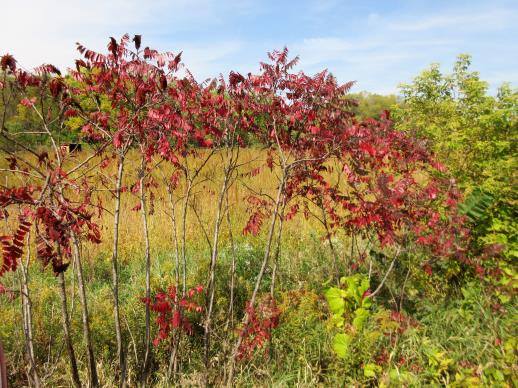 | | 2021 | COLLECTED | 09/29/2021 | Upper Iowa River area near Bluffton, T99N R9W NE1/4 Sec. 9 and S1/2 Sec. 10 | 43.40275000, -91.90494000 | 299 | High bluffs, roadside and stream banks | Wild material | Plants sampled in nature (29 September 2021) during peak fall color displaying bright reds to maroonish colors while measuring approximately 12-15 feet in height. One clonal patch noted was estimated to have 1,000+ ramets. | 2122093 | Ames 35752 |
| 27 | Ames 35734 | Ledges State Park | Teucrium canadense L. | Iowa, United States | NC7 |  | | 2021 | COLLECTED | 08/23/2021 | Ledges State Park located approximately 4.75 miles south of Boone T83N R26W Sec. 16 & 21 | 41.99262400, -93.87724800 | 330 | Edges of woods | Wild material | | 2120338 | Ames 35734 |
| 28 | NA 88287 | CBG-10561 | Cephalanthus occidentalis L. | Illinois, United States | NA | | | 2021 | | | | | | | Wild material | Plant numbers sampled estimated. | 2120156 | NA 88287 |
| 29 | W6 58962 | AK930-1009 | Achillea millefolium L. | Alaska, United States | W6 | | | 2021 | | | | | | | Wild material | | 2116142 | W6 58962 |
| 30 | W6 58575 | MARSB-215 | Juncus secundus P. Beauv. ex Poir. | New York, United States | W6 | | | 2021 | | | | | | | Wild material | Plants are in seed. The inflorescences are straw colored. The inflorescences are at the top of the stem, not spreading. It is taller than Juncus tenuis. | 2113505 | W6 58575 |
| 31 | WLP 2056 | Elbow Creek | Viburnum opulus L. var. americanum Aiton | Wisconsin, United States | NA |  | | 2019 | COLLECTED | 11/12/2019 | Elbow Creek watershed located approximately 3.5 miles south of Athelstane along County Highway A, T34N R19E extreme eastern edge Sec. 34 and western edge of Sec. 35, Marinette County | 45.37305600, -88.09972200 | 272 | Roadside, floodplain. Neutral ph fen (no ericaceous plants noted) | Wild material | Plants in nature measuring between 6 and 12 feet in height with bright red fruits. | 2097791 | WLP 2056 |
| 32 | W6 57084 | MARSB-216 | Carex annectens (E. P. Bicknell) E. P. Bicknell | New York, United States | W6 |  | | 2019 | | | | | | | Wild material | | 2097523 | W6 57084 |
| 33 | WLP 1685 | JDC/RS/2019/036/915 | Rosa setigera Michx. | Iowa, United States | NA |  | | 2019 | COLLECTED | 10/17/2019 | Ledges State Park located approximately 4.75 miles south of Boone, just south of the Oakwoods Shelter/Picnic area, T83N R26W NE1/4 NE1/4 and also NW1/4 NE1/4 Sec. 21, Boone County | 41.99262400, -93.87724800 | 330 | Edges of woods (adjacent to prairie) and also within 20-25 yards from woods in prairie. Noted in east, west, and south-facing edges of woods (no specimens noted on north-facing woodland edges) | Wild material | Woody shrub/vine stretching up to 12' in length. Alternate compound leaves usually consisting of five lealets. Leaf rachis and stipule margins glandular. Mature hypanthium and pedicel with stipitate glandular hairs. Mature hypanthium mostly bright to dark red in color with a few dark orange noted at time of harvest (17 October 2019). Leaves rather to somewhat glossy. This collection represents genetics from the northwestern edge of the species range, likely suggesting good cold-hardiness (USDA Zone 5a). | 2097769 | WLP 1685 |
| 34 | Ames 35216 | Potato Creek SP | Monarda sp. | Indiana, United States | NC7 |  | | 2019 | COLLECTED | 09/02/2019 | Potato Creek State Park located approximately 2.6 miles northeast of North Liberty, T36N R1E extreme eastern edge of NW 1/4 SW 1/4 Sec. 23. | 41.55439400, -86.38375900 | 222 | Degraded floodplain, along sides of elevated road bed. | Wild material | This taxa is currently undescribed and according to Campbell and Medley in The atlas of vascular plants in Kentucky (Accessed 06 September 2019) was provisionally named Monarda serotina by R.T. Simmers. Described as a broad-leaved form of M. fistulosa, generally intermediate between M. fistulosa and M. clinopodia, with probable hybrid origin. Typcial habitat is mesic woods and edges on lowlands. In contrast to M. fistulosa, this taxon has longer petioles (usually 2-3 cm versus 0.5-2.0 cm), lower leaf surfaces with scattered spreading hairs, and corollas are paler pink at tips to almost white with peak flowering occurring prior to M. fistulosa by approximately 1-2 weeks. Leaves are rather rugose, where upper leaf tissue between veins is visibly raised. This accession represents genetics from northern Indiana (Potato Creek State Park). Plants at the collection site in nature peaked flowering near 8 July 2019 where flower colors were more lavender in sun but pale in shade (Namestnik, S., personal communication, 15 July 2020). Peak fruiting occurs mid-August. Average height of plants sampled in nature estimated at 4.5' in height. | 2097752 | Ames 35216 |
| 35 | NA 88067 | NEWFS-394 | Morella caroliniensis (Mill.) Small | Maine, United States | NA | 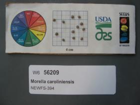 | | 2019 | | | | | | | Wild material | | 1976244 | NA 88067 |
| 36 | W6 56117 | NEWFS-92 | Urtica dioica L. | Rhode Island, United States | W6 |  | | 2019 | | | | | | | Wild material | | 1976152 | W6 56117 |
| 37 | Ames 34360 | Ames 34360 | Salix serissima (L. H. Bailey) Fernald | Minnesota, United States | NC7 |  | | 2018 | COLLECTED | 11/12/2018 | Kunkel State Wildlife Management Area located just west of Princeton approximately 4.75 miles off 160th St. NW along south side of a tributary that runs northeast into Battle Brook Creek, T36N R27W SE 1/4 SE 1/4 Sec. 34. | 45.56065600, -93.67933500 | 301 | Marsh | Wild material | Salix serissima (autumn willow) is a boreal willow and an obligate wetland species whose distribution is concentrated in the northeastern United States and in Canada from Newfoundland to British Columbia. A deciduous shrub that grows from 1 to 5 m tall. Bark color ranges from olive-brown or gray in older branches to yellowish-brown in younger branches, and the youngest twigs are glossy red-brown. The leaves of mature branches are dark green and shining on the top surface with a broad whitish midrib, and paler on the bottom surface. Leaves are elliptic or lanceolate with minutely toothed margins and the distinguishing presence of glands on the petiole near the base of the leaf blade. S. serissima flowers from May to July, and fruits mature from June to September (Decker 2006). Staminate flowers are rather showy and stout measuring approximately 45-55 mm in length and 15 mm in width that peak well after leaves have emerged; anthers yellow and dense. Pistillate catkins are rather loosely flowered and slightly shorter (e.g. 25-30 mm in length) in comparison to staminate flowers; green and inconspicuous. | 1968259 | Ames 34360 |
| 38 | NA 87983 | AZ930-330 | Baccharis salicifolia (Ruiz & Pav.) Pers. | Arizona, United States | NA |  | | 2018 | | | | | | | Wild material | | 1964298 | NA 87983 |
| 39 | W6 53003 | CBG-7115 | Angelica atropurpurea L. | Illinois, United States | W6 |  | | 2017 | | | | | | | Wild material | | 1954754 | W6 53003 |
| 40 | NA 82794 | JDC/QE/2014/132/635 | Quercus ellipsoidalis E. J. Hill | Iowa, United States | NA | | | 2015 | COLLECTED | 10/21/2014 | Pilot Knob State Park just east of Forest City. T97N R23W Ellington Township SW 1/4 SW 1/4 NE 1/4 Sec. 4 Hancock County. | 43.24931400, -93.56681800 | 399 | Near floating bog, transition area from edge of floating bog and incline to upland habitat. Growing in association with Cephalanthus occidentalis, Salix sp., Asclepias incarnata, Typha latifolia, Spiraea alba, Populus tremuloides, Quercus rubra, Rhamnus cathartica, Carex lacustris, Carex lupulina, and Carex spp. | Wild material | Acorns harvested from forest floor. Attractive, red fall color noted (peak - October 21, 2014). | 1928362 | NA 82794 |
| 41 | Ames 32957 | JDC/BP/2015/044/701 | Betula pumila L. | Iowa, United States | NC7 |  | | 2015 | COLLECTED | 09/04/2015 | Private property approximately 1.5 miles northwest of Lawler. T96N R11W SW 1/4 SW 1/4 Sec. 32 Chickasaw County. | 43.08335400, -92.17787800 | 349 | High-quality remnant wetland/fen. Growing in Plams muck soils in association with Salix spp., Cornus racemosa, Oncolea sensibilis, Spiraea alba, Gentiana spp., Carex spp., Populus tremuloides, and Ambrosia trifida. Noted four specimens likely B. x sandbergii that were approximately 30-35' in height. | Wild material | B. pumila could be considered a dominant species in portions of this site. Female catkins were both green and brown at time of harvest. Specimens average approximately 275 cm in height. Little to no fall color. Approximately 75% of leaves were already dropped. | 1927399 | Ames 32957 |
| 42 | W6 49947 | UT080-160 | Schoenoplectus acutus (Muhl. ex Bigelow) Á. Löve & D. Löve var. occidentalis (S. Watson) S. G. Sm. | Utah, United States | W6 |  | | 2015 | | | | | | | Wild material | | 1926971 | W6 49947 |
| 43 | W6 48867 | MARSB-59 | Juncus tenuis Willd. | New York, United States | W6 |  | | 2015 | | | | | | | Wild material | | 1922918 | W6 48867 |
| 44 | Ames 32761 | JDC/BP/2014/034/536 | Betula pumila L. | Iowa, United States | NC7 |  | | 2014 | COLLECTED | 09/03/2014 | Crossman Prairie State Preserve, approximately 5 miles northeast of Riceville, Howard County. | 43.40777300, -92.47500720 | 413 | Remnant tallgrass prairie. | Wild material | | 1921309 | Ames 32761 |
| 45 | Ames 32762 | JDC/BP/2014/044/546 | Betula pumila L. | Iowa, United States | NC7 |  | | 2014 | COLLECTED | 09/03/2014 | Private property, located approximately 2 miles south of Sumner, Bremer County. | 42.80952700, -92.10866400 | 328 | Remnant wet prairie. | Wild material | | 1921310 | Ames 32762 |
| 46 | Ames 32767 | JDC/PV/2014/036/538 | Prunella vulgaris L. | Iowa, United States | NC7 |  | | 2014 | COLLECTED | 09/03/2014 | Crossman Prairie State Preserve, approximately 5 miles northeast of Riceville, Howard County. | 43.40777300, -92.47500720 | 413 | Remnant tallgrass prairie. | Wild material | | 1921315 | Ames 32767 |
| 47 | OPGC 4196 | JDC/LP/2014/035/537 | Liatris pycnostachya Michx. | Iowa, United States | OPGC | | | 2014 | COLLECTED | 09/03/2014 | Crossman Prairie State Preserve, approximately 5 miles northeast of Riceville, Howard County. | 43.40777300, -92.47500720 | 413 | Remnant tallgrass prairie. Associated with Aesclepias, Amorpha canescens, Andropogon gerardi, Baptisia, Betula pumila, Cornus amomum, C. racemosa, Dalea purpurea, Eryngium yuccifolium, Gentiana andrewsii, Helianthus grosseserratus, Hypericum ascyron subsp. pyramidatum, Liatris pcynostachya, Monarda fistulosa, Populus tremuloides, Prunella vulgaris, Prunus americana, Salix, Silphium laciniatum, Solidago, and Spiraea alba. | Wild material | | 1921312 | OPGC 4196 |
| 48 | Ames 32386 | JDC/BN/2014/013/515 | Betula nigra L. | Iowa, United States | NC7 |  | | 2014 | COLLECTED | 06/05/2014 | Bearbower Sand Prairie, T87N R9W SW 1/4 of SW 1/4 Sec. 32. | 42.29814100, -91.92822800 | 289 | Sand prairie with likely high water table. | Wild material | | 1919307 | Ames 32386 |
| 49 | Ames 32388 | JDC/BN/2014/015/517 | Betula nigra L. | Iowa, United States | NC7 |  | | 2014 | COLLECTED | 06/05/2014 | Princeton Wildlife Management Area, T80N R5E NE 1/4 Sec. 35. | 41.69417800, -90.34158400 | 177 | Wet, heavy soil floodplain. | Wild material | | 1919309 | Ames 32388 |
| 50 | Ames 31082 | 712 | Fraxinus americana L. | New York, United States | NC7 |  | | 2011 | COLLECTED | 09/11/2011 | Federal Road, south of Marsh Road (Co. 4), Chemung County. | 42.15600000, -76.65500000 | 466 | Roadside and woodland edges. | Wild material | | 1891468 | Ames 31082 |
| 51 | WLP 1054 | 362 | Cornus florida L. | New York, United States | NA |  | | 2011 | COLLECTED | 09/11/2011 | Cameron-North Jasper Road, Steuben County. | 42.20100000, -77.43300000 | 384 | Mixed, upland, hardwood forest. Associated with Carpinus caroliniana, Pinus strobus, Populus tremuloides, Prunus serotina, Rhus typhina, Quercus alba, Quercus velutina, Tilia americana, and Ulmus. | Wild material | | 1891448 | WLP 1054 |