| 0 | NA 88420 | NV030-703 | Populus fremontii S. Watson | Nevada, United States | NA | | | 2020 | | | | | | | Wild material | Tree growing to approximately 90 feet tall. | 2106487 | NA 88420 |
| 1 | W6 61154 RE | NM080-299 | Sphaeralcea angustifolia (Cav.) G. Don | New Mexico, United States | W6 |  | | 2023 | | | | | | | Wild material | Large perennial herb with many stems, up to a meter or more. Leaf shape varying from ovate-oblong to hastate, with dentate margins; at least four times longer than wide. Three or more flowers per node, petals grenadine-pink to copper orange. "Cheese wheel" mericarps, 2-or-3 seeded. Recollection of NM080-63
| 2142109 | W6 61154 RE |
| 2 | W6 53810 | NM080-63 | Sphaeralcea angustifolia (Cav.) G. Don | New Mexico, United States | W6 |  | | 2018 | | | | | | | Wild material | | 1964388 | W6 53810 |
| 3 | OPGC 6983 | GSENM-002 | Typha angustifolia L. | Utah, United States | OPGC | 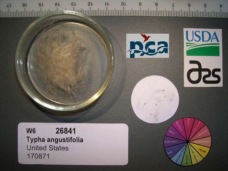 | | 2005 | | | | | | | Wild material | | 1673880 | OPGC 6983 |
| 4 | PI 676204 | R10-07-026 | Poa pratensis L. subsp. angustifolia (L.) Arcang. | Stavropol, Russian Federation | W6 | | | 2011 | COLLECTED | 07/18/2010 | Slope of Kutzay Mountain 2.7 km SW of Svetlograd | 45.31900000, 42.83500000 | 247 | Mesic steppe. Toe slope, sandy soil, forest and thicket margin: seed collected from >100 plants | Wild material | | 1883126 | PI 676204 |
| 5 | PI 693186 | R10-51-217 | Poa pratensis L. subsp. angustifolia (L.) Arcang. | Adygeja, Russian Federation | W6 | | | 2011 | COLLECTED | 08/02/2010 | 10 km N of Kuzhorskaya | 44.75000000, 40.30500000 | 210 | Mesic steppe. Artifical mound on steppe near shelter belt: seed collected from >100 plants | Wild material | | 1883303 | PI 693186 |
| 6 | PI 693187 | R10-55-226 | Poa pratensis L. subsp. angustifolia (L.) Arcang. | Adygeja, Russian Federation | W6 | | | 2011 | COLLECTED | 08/03/2010 | Belaya River Bridge, 2 km SW of Dakhovskya | 44.36200000, 40.19400000 | 360 | Mesic steppe bench above river. Mollisol, disturbed site: seed collected from >100 plants | Wild material | | 1883311 | PI 693187 |
| 7 | PI 619563 | X97-058 | Poa pratensis L. subsp. angustifolia (L.) Arcang. | Xinjiang Uygur Zizhiqu, China | W6 | | | 1997 | COLLECTED | 08/1997 | 1 km north of Farm No. 77, 38 km west of Zhaosu County, Xinjiang. | 43.02388889, 80.94083333 | 1590 | In Populus tree rows ( 10-12 m tall ) along main road going through Farm No. 77. Disturbed silt loam/clay loam soil with some stones; irrigated. No slope. | Wild material | | 1551249 | PI 619563 |
| 8 | Ames 36295 | Cherry Creek Campground | Alnus oblongifolia Torr. | New Mexico, United States | NC7 |  | | 2024 | COLLECTED | 11/15/2024 | Gila National Forest (Cherry Creek Campground) located north, northeast of Silver City approximately 8.35 miles, T16S R14W SW 1/4 Sec. 24 and T16S R13W SE 1/4 Sec. 18. | 32.91320000, -108.22540000 | 2060 | Creek edge and creek bed | Wild material | | 2170468 | Ames 36295 |
| 9 | W6 61529 | CA180-299 | Cephalanthus occidentalis L. | California, United States | W6 |  | | 2024 | | | | | | | | | 2167628 | W6 61529 |
| 10 | OPGC 8769 | NM930-523 | Asclepias speciosa Torr. | New Mexico, United States | OPGC | | | 2023 | | | | | | | Wild material | Plants are 1+ meter tall, showy pink/purple flower clusters (distinct star shape), oblong opposite leaves, seeds in large pods with soft spines, seeds attached to fuzzy white hairs to assist with dispersal. Pods split open when mature. Growing along Rio Chama below dam, high flow control. | 2142148 | OPGC 8769 |
| 11 | W6 61158 RE | NM080-303 | Setaria leucopila (Scribn. & Merr.) K. Schum. | New Mexico, United States | W6 | 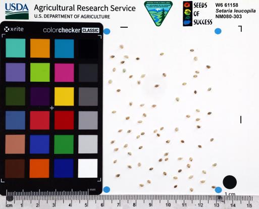 | | 2023 | | | | | | | Wild material | Tufted perennial grass, 20-100 cm, with erect stems. Dense, spikelike inflorescences are pale green and columnar (tan at maturity). Bristles give the inflorescences the characteristic appearance of "hairy millet". Recollection of NM080-183
| 2142113 | W6 61158 RE |
| 12 | W6 61208 | NM930-538 | Sporobolus airoides (Torr.) Torr. | New Mexico, United States | W6 |  | | 2023 | | | | | | | Wild material | Perennial grass with wide spreading panicles. Panicles have spikelets coming off of branchlets coming off of branches. | 2142163 | W6 61208 |
| 13 | W6 61209 | NM930-539 | Schizachyrium scoparium (Michx.) Nash | New Mexico, United States | W6 | 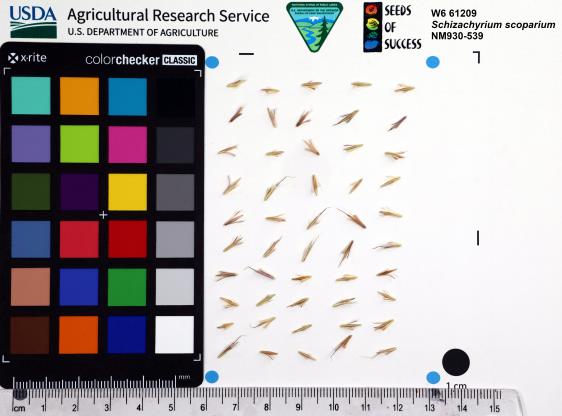 | | 2023 | | | | | | | Wild material | Tall perennial grass with red-orange stems. Hairy tufts on either side of seed. Have swollen dark red joints on stems. | 2142164 | W6 61209 |
| 14 | NA 89037 | RJL2022KS-004 | Fraxinus pennsylvanica Marshall | Kansas, United States | NA |  for this accession.") | | 2022 | COLLECTED | 09/21/2022 | Coronado Heights Park, Smoky View, Kansas hillsides surrounding the historic WPA circa 1932 Coronado Heights Castle located about 91 meters above the surrounding land. This plant is scattered and infrequent on the slopes of this site. | 38.61065700, -97.70408300 | 448 | Plants growing in full sun, under extreme exposure, rocky, dry and thin soils of this short grass prairie habitat on the slopes surrounding the summit of Coronado Heights Park. Plants tend
Soils: The underlying geology of this area is of Upper Cretaceous origin and comprised of Kiowa Shale or FM- light -gray to black illitic shale with thin coquinoidal limestone beds at the base; sandstone lenses are common. Cheyenne Sandstone-massive to cross-bedded, light-gray to buff fine-grained sandstone with lenses to be found in runoff zones where moisture is temporarily more abundant.of gray sandy shale and conglomerate.
Source: USGS Kansas Geologic Map Data (https://mrdata.usgs.gov/geology/state/sgmc-unit.php?unit=KSKkc%3B0)
The surface soil profile of this area is Lancaster-Hedville complex, 3 to 20 percent slopes. The Lancaster series consists of moderately deep, well drained soils that formed in residuum from sandstone and sandy shales; it can be up to 200 cm deep. Slopes range from 1-20%. Hedville soils have bedrock within 50 centimeters of the surface and occur on similar hillslope positions.
Source: NRCS Web Soil Survey (https://websoilsurvey.sc.egov.usda.gov/App/WebSoilSurvey.aspx) | Wild material | | 2139602 | NA 89037 |
| 15 | NA 89036 | RJL2022KS-003 | Cornus drummondii C. A. Mey. | Kansas, United States | NA | | | 2022 | COLLECTED | 09/21/2022 | Coronado Heights Park, Smoky View, Kansas hillsides surrounding the historic WPA circa 1932 Coronado Heights Castle located about 91 meters above the surrounding land. This plant is common and abundant on the slopes of this site. | 38.61348400, -97.70343100 | 475 | Plants growing in part shade to full sun, under extreme exposure, rocky, dry and thin soils of this short grass prairie habitat on the slopes surrounding the summit of Coronado Heights Park. The underlying geology of this area is of Upper Cretaceous origin and comprised of Kiowa Shale or FM- light -gray to black illitic shale with thin coquinoidal limestone beds at the base; sandstone lenses are common. Cheyenne Sandstone-massive to cross-bedded, light-gray to buff fine-grained sandstone with lenses of gray sandy shale and conglomerate.
Source: USGS Kansas Geologic Map Data (https://mrdata.usgs.gov/geology/state/sgmc-unit.php?unit=KSKkc%3B0)
The surface soil profile of this area is Lancaster-Hedville complex, 3 to 20 percent slopes. The Lancaster series consists of moderately deep, well drained soils that formed in residuum from sandstone and sandy shales; it can be up to 200 cm deep. Slopes range from 1-20%. Hedville soils have bedrock within 50 centimeters of the surface and occur on similar hillslope positions.
Source: NRCS Web Soil Survey (https://websoilsurvey.sc.egov.usda.gov/App/WebSoilSurvey.aspx)
Slope: 5-20% Aspect: all | Wild material | | 2139601 | NA 89036 |
| 16 | NA 89035 | RJL2022KS-002 | Rosa arkansana Porter | Kansas, United States | NA | | | 2022 | COLLECTED | 09/20/2022 | Coronado Heights Park, Smoky View, Kansas hillsides surrounding the historic WPA circa 1932 Coronado Heights Castle located about 91 meters above the surrounding land. This plant is quite abundant on the slopes of this site and highly competitive. | 38.61158800, -97.70427000 | 475 | Plants growing in part-sun to full sun, under extreme exposure, rocky, dry and thin soils of this short grass prairie habitat on the slopes surrounding the summit of Coronado Heights Park.
The underlying geology of this area is of Upper Cretaceous origin and comprised of Kiowa Shale or FM- light -gray to black illitic shale with thin coquinoidal limestone beds at the base; sandstone lenses are common. Cheyenne Sandstone-massive to cross-bedded, light-gray to buff fine-grained sandstone with lenses of gray sandy shale and conglomerate.
Source: USGS Kansas Geologic Map Data (https://mrdata.usgs.gov/geology/state/sgmc-unit.php?unit=KSKkc%3B0)
The surface soil profile of this area is Lancaster-Hedville complex, 3 to 20 percent slopes. The Lancaster series consists of moderately deep, well drained soils that formed in residuum from sandstone and sandy shales; it can be up to 200 cm deep. Slopes range from 1-20%. Hedville soils have bedrock within 50 centimeters of the surface and occur on similar hillslope positions.
Source: NRCS Web Soil Survey (https://websoilsurvey.sc.egov.usda.gov/App/WebSoilSurvey.aspx) | Wild material | | 2139600 | NA 89035 |
| 17 | OPGC 8057 | ID310-40 | Asclepias speciosa Torr. | Idaho, United States | OPGC | | | 2020 | | | | | | | Wild material | Leaves petiolate, oblong-lanceolate. | 2107486 | OPGC 8057 |
| 18 | Ames 35237 | Ames 35237 | Monarda fistulosa L. | New Mexico, United States | NC7 |  | | 2019 | COLLECTED | 10/03/2019 | Railroad Canyon located approximately 6.38 miles west of Kingston just north of highway 152, T16S R10W Grant County | 32.91279900, -107.81640300 | 2173 | Sparsely wooded canyon with small creek. | Wild material | | 2097773 | Ames 35237 |
| 19 | OPGC 7450 | CP4-30 | Asclepias speciosa Torr. | Colorado, United States | OPGC |  | | 2019 | | | | | | | Wild material | | 2092027 | OPGC 7450 |
| 20 | W6 55516 | CO932A-23 | Artemisia tridentata Nutt. subsp. vaseyana (Rydb.) Beetle | Colorado, United States | W6 |  | | 2018 | | | | | | | Wild material | | 1970227 | W6 55516 |
| 21 | W6 55877 | CP4-14 | Sphaeralcea parvifolia A. Nelson | Colorado, United States | W6 |  | | 2018 | | | | | | | Wild material | Sphaeralcea parvifolia | 1970588 | W6 55877 |
| 22 | W6 55883 | CP4-2 | Descurainia pinnata (Walter) Britton | Utah, United States | W6 |  | | 2018 | | | | | | | Wild material | Descurainia pinnata | 1970594 | W6 55883 |
| 23 | W6 55893 | CP4-4 | Eriocoma hymenoides (Roem. & Schult.) Rydb. | Utah, United States | W6 |  | | 2018 | | | | | | | Wild material | Achnatherum hymenoides | 1970604 | W6 55893 |
| 24 | W6 55459 | UT080-244 | Sporobolus cryptandrus (Torr.) A. Gray | Utah, United States | W6 |  | | 2018 | | | | | | | Wild material | Sporobolus cryptandrus | 1968011 | W6 55459 |
| 25 | W6 54946 | NM930-444 | Sporobolus airoides (Torr.) Torr. | New Mexico, United States | W6 |  | | 2018 | | | | | | | Wild material | Sporobolus airoides | 1966173 | W6 54946 |
| 26 | NA 88194 | NM080-38 | Baccharis salicina Torr. & A. Gray | New Mexico, United States | NA |  | | 2018 | | | | | | | Wild material | | 1964364 | NA 88194 |
| 27 | W6 53254 | NM930-308 | Hordeum jubatum L. | New Mexico, United States | W6 |  | | 2018 | | | | | | | Wild material | | 1957604 | W6 53254 |
| 28 | Ames 34007 | JDC/PP/2017/052/806 | Pinus ponderosa P. Lawson & C. Lawson | Nebraska, United States | NC7 |  | | 2017 | COLLECTED | 08/29/2017 | Areas on both north and south sides of the Niobrara River between Long Pine and Springview, T32N R21W; T32N R20W; and T31N R21W in Brown and Keya Paha Counties. | 42.75716800, -99.74657300 | 685 | Dry, rocky ridgetops. | Wild material | Genetics represent the extreme eastern edgeo of the species native range. | 1953921 | Ames 34007 |
| 29 | W6 52062 | CA350-49 | Lotus corniculatus L. | Nevada, United States | W6 | | | 2017 | | | | | | | Wild material | | 1947197 | W6 52062 |
| 30 | W6 49947 | UT080-160 | Schoenoplectus acutus (Muhl. ex Bigelow) Á. Löve & D. Löve var. occidentalis (S. Watson) S. G. Sm. | Utah, United States | W6 |  | | 2015 | | | | | | | Wild material | | 1926971 | W6 49947 |
| 31 | Ames 32585 | CBG-1842 | Monarda fistulosa L. var. fistulosa | Wyoming, United States | NC7 |  | | 2013 | COLLECTED | 09/07/2011 | Moiser Gulch Recreational picnic area, located approximately 5.5 miles west of Buffalo on highway 16 (Cloud Peak Scenic Byway) in northern Wyoming | 44.33220000, -106.81660000 | 1727 | Stream gulch with wetter soils within Western Rocky Mountain foothills. | Wild material | | 1909018 | Ames 32585 |
| 32 | WLP 2435 | CBG-1797 | Prunus virginiana L. | Wyoming, United States | NA |  | | 2013 | COLLECTED | 09/06/2011 | | | 1727 | Stream gulch with wetter soils within Western Rocky Mountain foothills. | Wild material | | 1908924 | WLP 2435 |
| 33 | W6 35439 | UT933-67 | Leymus cinereus (Scribn. & Merr.) Á. Löve | Utah, United States | W6 |  | | 2009 | | | | | | | Wild material | Height: 5-8 feet | 1808264 | W6 35439 |