| 0 | Ames 33965 | JDC/PG/2017/013/767 | Populus grandidentata Michx. | Iowa, United States | NC7 |  | | 2017 | COLLECTED | 05/07/2017 | Private property approximately 2.98 miles west of Luther, T83N R26W NE 1/4 SE 1/4 NE 1/4 Sec. 28., Boone County | 41.97486900, -93.87548500 | 328 | Woodland. Deciduous forest. | Wild material | The native range of Populus grandidentata is concentrated througout the northeastern United States with disjunct populations in far south as Kentucky and as far west as central Iowa (Little, E. L. Jr. 1971). Bigtooth aspens are known to be fast-growing trees, making for a quick source of shade in the landscape. As a pioneer species in nature, P. grandidentata is adaptable to a wide range of environments but is considered to be slightly less adaptable than quaking aspen. However, bigtooth aspen is more resistant to canker diseases than quaking aspen (Laidly 1990), potentially making it slightly longer-lived. Bark on big-tooth aspens is generally greyish to greyish-yellow or olive-green compared to quaking aspens where bark is typically white to greyish-white. Leaves and leaf serrations are larger, and the degree of suckering is lower in big-tooth aspens. Both species are well known for their leaves to quake or tremble as the lengthy petioles allow leaves to swivel in the slightest amount of wind. Populus use is well-documented throughout the world and encompasses a wide range of products including energy feedstock, wood chips for pulping fibers, veneer logs, agro-forestry, and phyto-remediation as well as several other environmental applications. Interspecific hybrids of P. grandidentata and P. canescens have superior performance in yield; Hypoxylon canker resistance; and rooting ability compared to pure, N. American aspen genetics. This accession represents genetics acquired from the Des Moines River Valley of central Iowa and considered a disjunct population. P. grandidentata is infrequent to somewhat common throughout parts of the Des Moines River Valley, but very localized. The next closest, native population would be found in Hardin County (Iowa) approximately 50 miles to the northeast near Eldora. In central Iowa, this accession has been noted to have excellent, yellow fall color that typically peaks in mid-October (e.g. 21 October 2015). Fruits usually mature in early May (e.g. 3 May 2017) coinciding with flower initiation on local genotypes of Prunus virginiana. Specimens sampled in nature measuring approximately 60' in height and 16-22" dbh. Due to this accession originating from the western and southern edge of the species native range, it is suspected that this accession would have excellent heat and drought tolerance compared to genetics from areas in the northeastern U.S. | 1949856 | Ames 33965 |
| 1 | PI 704817 sos | V. uliginosum AK930-843 | Vaccinium uliginosum L. | Alaska, United States | COR |  | | 2018 | | | | | | | Wild material | Vaccinium uliginosum | 1965851 | PI 704817 sos |
| 2 | PI 691725 | BJP/CC/2014/003 | Cornus canadensis L. | Maine, United States | NA | | | 2014 | COLLECTED | 08/13/2014 | Edge of woods along west edge of Timber Cove Road, just northwest of intersection with Hwy. 189 and across the road from a cemetery. Approximately 13 km southwest of Lubec. | 44.80125000, -67.12708000 | | Edge of woods along west edge of road. | Wild material | | 1923675 | PI 691725 |
| 3 | PI 666824 | DBPH 36 | Vaccinium uliginosum L. | Alaska, United States | COR |  | | 2011 | COLLECTED | 07/29/2011 | | 64.80380000, -147.95570000 | 130 | | Wild material | We visited a site owned by Lisa Behr off of Chena Pump Avenue near Chena Pump Road. The low-lying site was mostly grassy meadow and bog with a few higher spots. Small stands of Betula and Populus tremuloides were scattered on the higher spots. Vaccinium uliginosum was scattered across the site and abundant under one small stand of trees (ca 150 m2). The berries were large and abundant, with some of the largest numbers of berries per plant that we found on the trip. We collected a fruit sample, DBPH 36. | 1892083 | PI 666824 |
| 4 | PI 675280 | UT933-115 | Pseudoroegneria spicata (Pursh) Á. Löve | Utah, United States | W6 |  | | 2009 | | | | | | | Wild material | | 1827215 | PI 675280 |
| 5 | PI 675281 | UT933-116 | Pseudoroegneria spicata (Pursh) Á. Löve | Utah, United States | W6 |  | | 2009 | | | | | | | Wild material | | 1827216 | PI 675281 |
| 6 | PI 676245 | UT933-126 | Poa fendleriana (Steud.) Vasey | Utah, United States | W6 |  | | 2009 | | | | | | | Wild material | | 1827208 | PI 676245 |
| 7 | PI 675192 | UT933-49 | Eriocoma nelsonii (Scribn.) Romasch. subsp. nelsonii | Utah, United States | W6 |  | | 2009 | | | | | | | Wild material | Height: 3.5 feet | 1808246 | PI 675192 |
| 8 | PI 675255 | UT933-50 | Eriocoma nelsonii (Scribn.) Romasch. subsp. nelsonii | Utah, United States | W6 |  | | 2009 | | | | | | | Wild material | Height: 3.5 feet. | 1808247 | PI 675255 |
| 9 | PI 656854 | R. viscosissimum 201542 | Ribes viscosissimum Pursh | Idaho, United States | COR |  | | 2005 | COLLECTED | 08/21/2003 | | | 2279 | Growing in the 18-20" precipitation zone, in a Pseudotsuga menziesii forest. Associated with Rosa nutkana, Populus tremuloides, Rudbeckia occidentalis, Symphoricarpus oreophilus, Veronica adunca, Osmorhiza berteroi and Collom | Wild material | Shrub 0.9 meters tall. Seeds of Success (SOS) program germplasm. | 1674251 | PI 656854 |
| 10 | PI 635476 | H. lupulus var. neomexicanus OCJ-53 | Humulus lupulus L. var. neomexicanus A. Nelson & Cockerell | Colorado, United States | COR | | | 2002 | COLLECTED | 09/18/2002 | West of Durango on U.S.-160, between milepost 78 and Cherry Gulch Road. On east side of road, along stream fed by Sheep Spring Gulch. | 37.27417000, -107.96000000 | 2164 | Small stream drainage with Salix sp., Populus sp. and Populus tremuloides. | Wild material | | 1642235 | PI 635476 |
| 11 | PI 612499 | F. virginiana subsp. virginiana RH 30 Mi | Fragaria virginiana Mill. subsp. virginiana | Minnesota, United States | COR |  | Out of Season | 1999 | COLLECTED | 06/21/1986 | Cut Face Creek (Good Harbor Creek), Cook county, Minnesota | 47.73028000, -90.44000000 | 0 | Populus tremuloides, Cornus sp. and Picea mariana | Wild material | Partial hermaphrodite; cyclic flowering; resistant to black root rot, scorch and spot; representative of subsp. virginiana from the upper midwest (Minnesota). | 1588167 | PI 612499 |
| 12 | PI 600450 | KAZ 93-23-01 | Malus sieversii (Ledeb.) M. Roem. | Kazakhstan | GEN | | | 1993 | COLLECTED | 09/13/1993 | Kazakhstan, Sarkand, Village of Topolevka, Forestry Camp #16 Topolevka Forestry Area, Taldy-Kurgan region, Soldier's Gorge, Dzhungarksy Alatau, less than 1 km S of campsite, W side of road. | | 1380 | Soil moist humus. Slope 45% NW facing. Rainfall 750-800 mm. Surrounding plants Crataegus, Berberis, Populus tremuloides, Fragaria. | Wild material | Fruit Round, flat, short pedicle, red block with strip, bright carmine. Flavor acidic, aromatic, astringent, mealy, not bad flavor; early maturing, most fruit had dropped. Fruit disease: scab. | 1550709 | PI 600450 |
| 13 | PI 555108 | V. myrtillus Colorado | Vaccinium myrtillus L. | Colorado, United States | COR | | | 1987 | COLLECTED | 08/09/1987 | Filtered sun and open spots under Populus tremuloides | 39.13333000, -106.75000000 | 2600 | Filtered sun and open spots under Populus tremuloides | Wild material | Fruits borne singly in leaf axils on new growth, dark purple | 1450080 | PI 555108 |
| 14 | NA 89333 | Site 3a, Modoc NF, Fort Bidwell | Calocedrus decurrens (Torr.) Florin | California, United States | NA | | | 2026 | COLLECTED | 10/06/2025 | Modoc National Forest: northwest of Fort Bidwell, CA: along Mill Creek Rd from approximately 2.5 to 10 miles beyond the intersection with County Road 224, up to 46N25AA (''Cottonwood Trail''). [Note: seeds collected from eight trees, each with its own data and precise coordinates;data has been aggregated for this bulked accession and coordinates for tree 20250927-T3 were chosen for this record.] | 41.91457600, -120.22775400 | 2155 | Woodland. | Wild material | Seeds from eight separate maternal lines collected in a single area; seeds from each individual kept separate with its own decimal accession record (or decimal suffix, in GRIN). Collections in this NA number include the following: 20250927-T1; 20250927-T2; 20250927-T3; 20250927-T4; 20250927-T5; 20250927-T6; 20250927-T7, and 20250927-T8. | 2197592 | NA 89333 |
| 15 | NA 89334 | Site 3, Modoc NF, Lake City | Calocedrus decurrens (Torr.) Florin | California, United States | NA | | | 2026 | COLLECTED | 10/06/2025 | Modoc National Forest: 3 to 4 miles west of Lake City, CA, off of Lake City Canyon Road (access from S. Water St.). [Note: seeds collected from four trees, each with its own data and precise coordinates;data has been aggregated for this bulked accession and coordinates for tree 20250927-T10 were chosen for this record.] | 41.65530660, -120.26791540 | 2126 | Woodland. | Wild material | Seeds from four separate maternal lines collected in a single area; seeds from each individual kept separate with its own decimal accession record (or decimal suffix, in GRIN). Collections in this NA number include the following: 20250927-T9; 20250927-T10; 20250927-T11, and 20250927-T12. | 2197593 | NA 89334 |
| 16 | W6 62528 | FWS0300-131 | Symphyotrichum urophyllum (Lindl.) G. L. Nesom | Michigan, United States | W6 | 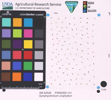 | | 2025 | | | | | | | Wild material | | 2192226 | W6 62528 |
| 17 | W6 62541 | FWS0300-65 | Coreopsis lanceolata L. | Michigan, United States | W6 |  | | 2025 | | | | | | | Wild material | Only scouted the part of the population on USFWS property | 2192239 | W6 62541 |
| 18 | W6 62341 | AK930-1165 | Festuca brachyphylla Schult. & Schult. f. | Alaska, United States | W6 | | | 2025 | | | | | | | Wild material | NA | 2172695 | W6 62341 |
| 19 | W6 62342 | AK930-1166 | Elymus trachycaulus (Link) Gould subsp. trachycaulus | Alaska, United States | W6 | | | 2025 | | | | | | | Wild material | NA | 2172696 | W6 62342 |
| 20 | W6 62343 | AK930-1167 | Achillea millefolium L. | Alaska, United States | W6 | | | 2025 | | | | | | | Wild material | deeply divided leaves | 2172697 | W6 62343 |
| 21 | W6 62344 | AK930-1168 | Chamaenerion angustifolium (L.) Scop. subsp. angustifolium | Alaska, United States | W6 | | | 2025 | | | | | | | Wild material | NA | 2172698 | W6 62344 |
| 22 | W6 62396 | AK930A-10 | Arnica griscomii Fernald subsp. frigida (C. A. Mey. ex Iljin) S. J. Wolf | Alaska, United States | W6 | | | 2025 | | | | | | | Wild material | Most plants have lost petals but seeds holding on | 2172750 | W6 62396 |
| 23 | W6 62407 | AK930A-22 | Lupinus arcticus S. Watson | Alaska, United States | W6 | | | 2025 | | | | | | | Wild material | Collected by putting socks over pods to catch ripe seed | 2172761 | W6 62407 |
| 24 | W6 62409 | AK930A-24 | Galium boreale L. | Alaska, United States | W6 | | | 2025 | | | | | | | Wild material | Very dense patches growing throughout the meadow Plants may be challenging to identify when plant is in senescence | 2172763 | W6 62409 |
| 25 | Ames 36290 | Victory Basin WMA | Fraxinus nigra Marshall | Vermont, United States | NC7 |  | | 2024 | COLLECTED | 09/04/2024 | Victory Basin Wildlife Management Area. Approximately 0.75 miles east of Damon Crossing along River Road. | 44.53032200, -71.80365900 | 347 | Northern mixed hardwood-conifer forest. | Wild material | | 2169818 | Ames 36290 |
| 26 | Ames 36282 | Coconino National Forest | Monarda fistulosa L. | Arizona, United States | NC7 |  | | 2024 | COLLECTED | 10/18/2024 | Coconino National Forest approximately five miles north of Flagstaff along Schultz Pass Road. T22N R7E SE 1/4 Sec. 15, NW 1/4 Sec. 22 and NW 1/4 Sec. 28. | 35.28050100, -111.64193200 | 2401 | Creek beds and drainages; understory of mixed conifer forest. | Wild material | Plants sampled in nature were approximately two to three feet in height. | 2169810 | Ames 36282 |
| 27 | Ames 36283 | Kachina Peaks Wilderness | Agastache pallidiflora (A. Heller) Rydb. | Arizona, United States | NC7 |  | | 2024 | COLLECTED | 10/18/2024 | Kachina Peaks Wilderness, Coconino National Forest, approximately 8.6 miles north of Flagstaff. Widely scattered along Kachina trail. T22N R6E SE 1/4 NW 1/4, NW 1/4 SE 1/4, NE 1/4 SE 1/4 and SE 1/4 SE 1/4 Sec. 1. | 35.31819500, -111.70772000 | 2841 | Understory of mixed conifer forest with highest abundance in open aspen meadows. | Wild material | Plants sampled in nature were approximately two to three feet in height. | 2169811 | Ames 36283 |
| 28 | Ames 36263 | Chippewa National Forest (Itasca) | Viburnum opulus L. var. americanum Aiton | Minnesota, United States | NC7 |  | | 2024 | COLLECTED | 09/15/2024 | Chippewa National Forest between Alder and Suomi including Bowstring River, Turtle River, and Potato Creek watersheds. | 47.56968000, -93.68815400 | 407 | Roadside edges with most samples near open water (creek/rivers). | Wild material | Formerly known as Viburnum trilobum, American highbush cranberry (V. opulus var. americanum) is a North American native shrub that is utilized as an important ornamental and conservation plant that is also harvested as a minor fruit crop (jams/jellies). In nature, this variety is generally found in moist habitats typically along stream banks and swamps where ample moisture is readily available. The native range of V. opulus var. americana is concentrated in the northeastern United States and into Canada (Little, E. L. Jr. 1977). Attractive ornamental characteristics includes showy lacecap flowers in spring and bright red fruits and foliage in the fall. Fruits are tart with a hint of sweetness. The European highbush cranberry (V. opulus var. opulus) is nearly identical to American highbush cranberry other than small glands (<1 mm) on the petiole making the exact determination very challenging resulting in common misidentifications. A major difference between the American and European highbush cranberries is that the European variety produces unpalatable fruit. Recent research has shown that American and European highbush cranberries are genetically distinct and that plants of hybrid origin are uncommon (Tork et. al 2025). Genetics of this accession represents a very broad collection area stretching nearly 7.0 miles near Alder in central Itasca County of north central Minnesota. In August of 2022, a total of 23 leaf samples from this same area were sampled (OB001-OB012 and OB0015-OB025) and all samples were genetically confirmed as American highbush cranberry, V. opulus var. americanum (Tork et. al 2025). | 2168987 | Ames 36263 |
| 29 | W6 61803 | NV010-13 | Ceanothus velutinus Douglas | Nevada, United States | W6 |  | | 2024 | | | | | | | Wild material | NA | 2168250 | W6 61803 |
| 30 | W6 61804 | NV010-14 | Chrysothamnus viscidiflorus (Hook.) Nutt. | Nevada, United States | W6 |  | | 2024 | | | | | | | Wild material | NA | 2168251 | W6 61804 |
| 31 | W6 62038 | AK930-1122 | Dryas drummondii Richardson ex Hook. | Alaska, United States | W6 |  | | 2024 | | | | | | | Wild material | Recollection no voucher taken | 2168800 | W6 62038 |
| 32 | W6 62039 | AK930-1123 | Chamaenerion latifolium (L.) Sweet | Alaska, United States | W6 |  | | 2024 | | | | | | | Wild material | | 2168801 | W6 62039 |
| 33 | W6 62040 | AK930-1124 | Antennaria pulcherrima (Hook.) Greene | Alaska, United States | W6 |  | | 2024 | | | | | | | Wild material | | 2168802 | W6 62040 |
| 34 | W6 62041 | AK930-1126 | Hedysarum boreale Nutt. subsp. mackenziei (Richardson) S. L. Welsh | Alaska, United States | W6 |  | | 2024 | | | | | | | Wild material | | 2168803 | W6 62041 |
| 35 | W6 62078 | AK930A-3 | Solidago simplex Kunth var. simplex | Alaska, United States | W6 |  | | 2024 | | | | | | | Wild material | The area may experience heavy traffic. [Received as Solidago simplex subsp. simplex var. simplex] | 2168840 | W6 62078 |
| 36 | W6 62083 | AK930A-8 | Astragalus alpinus L. | Alaska, United States | W6 |  | | 2024 | | | | | | | Wild material | Senescing | 2168845 | W6 62083 |
| 37 | Ames 36195 | Mills Riverside Park | Betula populifolia Marshall | Vermont, United States | NC7 |  | | 2023 | COLLECTED | 09/19/2023 | Mills Riverside Park (Browns River Watershed) located approximately 3.0 miles northeast of Jericho | 44.51736800, -72.93852200 | 210 | Floodplain forest that transistions to an open field of forbs. | Wild material | | 2159167 | Ames 36195 |
| 38 | NA 88679 | RJL2023PA-013 | Rhododendron prinophyllum (Small) Millais | Pennsylvania, United States | NA | | | 2023 | COLLECTED | 10/30/2023 | Southwest side of Dutch Mountain Road north of Pine Marsh Creek in Pennsylvania State Game Lands Number 66. | 41.48201500, -76.27286000 | 602 | Moist, well-drained habitat with good organic matter in part shade on a wooded slope next to the road. Slope: 5-10%. Aspect: East. The underlying geology of this area is of Mississippian origin and characterized as the Burgoon Formation. It is comprised of buff, medium-grained, cross bedded sandstone that includes shale and coal. In some places, it contains conglomerate at base as well as occasionally contains plant fossils; equivalent to Pocono Formation of Ridge and Valley province. (Source: USGS Pennsylvania Geologic Map Data). The primary soil type in the collection area is classified as Wellsboro Series. The Wellsboro Series consists of very deep, moderately well- and somewhat poorly-drained soils formed in till derived from red sandstone, siltstone, and shale. Slope ranges from 0 to 50 percent. Saturated hydraulic conductivity is moderately high or high in the mineral surface layer, subsurface layer, and upper part of the subsoil; and low or moderately low in the lower part of the subsoil (fragipan) and the substratum. Solum thickness is greater than 102 cm. Depth to the fragipan ranges from 36 to 76 cm. Depth to bedrock is 152 cm or more. Rock fragments of subangular and rounded sandstone, siltstone or shale range from 5 to 40 percent in the A and B horizons, and from 15 to 50 percent in the Bx and C horizons. Typically, rock fragments average about 5 to 25 percent by volume above the fragipan and 15 to 40 percent by volume in and below the fragipan. Reaction commonly ranges from very strongly acid through moderately acid. (Source: NRCS Web Soil Survey). | Wild material | | 2159070 | NA 88679 |
| 39 | WLP 3348 | AS/VO/2023/074/284 | Viburnum opulus L. var. americanum Aiton | Minnesota, United States | NA |  | | 2023 | COLLECTED | 09/23/2023 | Between Itasca State Park and White Earth State Forest, from 0.75 to 2.5 miles north of State Highway 113. Along McKenzie Road and Anchor Hill Road, T143N R37W Sections 22, 28, 30 and 31. | 47.16689300, -95.42134000 | 515 | Understory of mixed forest in wetland complex. Near southern edge of transition zone from temperate to boreal forest. | Wild material | Variation was noted for timing of fall color with some plants still green and others nearing peak display. | 2159012 | WLP 3348 |
| 40 | WLP 3347 | Lake Co. MN | Viburnum opulus L. var. americanum Aiton | Minnesota, United States | NA |  | | 2023 | COLLECTED | 09/21/2023 | Located near Finland at both Cranberry Road near Sawmill Creek and Cramer Road adjacent to East Branch Baptism River, T57N R7W Secs. 9, 16, 27, and 34. | 47.39975700, -91.19305300 | 385 | Forest (aspen/conifer) understory, forest clearings, transition zone between forest and fens and fen bordering river. | Wild material | Genetics of this accession represents a very broad collection area (multiple miles) near Finland, which is in the extreme northeast corner of Minnesota. Plants in nature noted as erect to partially upright to wide-spreading, multi-stemmed shrubs with mature specimens exhibiting arching branches that layer resulting in the formation of small clonal patches with the greatest clonal patch noted measuring 20' x 20'. Plants sampled ranging in height from 4' to 20' and one of the largest shrubs sampled with an 8" diameter base at soil level. Fruits from all plants sampled were assessed for taste and all could be described as having a pleasant taste, which is one of the more distinguishing characters that separates V. opulus var. opulus from V. opulus var. americanum. A few specimens (e.g. FIN-4) exhibited distal leaves lacking characteristic lobing or possess only a single small lobe which is a seldom seen and rarely reported. At time of sampling (21 September 2023), fruits were very red and soft and plants were peaking fall color (red). | 2159010 | WLP 3347 |
| 41 | Ames 36018 | AS/SL/2023/003/213 | Salix lucida Muhl. | Wisconsin, United States | NC7 |  | | 2023 | COLLECTED | 02/25/2023 | Located just west of Kempster approximately 4.65 miles along County Road J (floodplains of Sucker Creek and West Branch Eau Claire River), T33N R10E Sec. 32, 33, and 34 (extreme southern edges) | 45.29205000, -89.27304100 | 479 | Wetland | Wild material | Salix lucida (shining willow) is referenced as a tall shrub or small tree with multiple trunks with the potential to reach 6 meters in height. Shining willow frequents wetland habitats such as swampy lakes, wet meadows and along rivers. Noted for it's extremely shiny, long (e.g. 7-14 cm) leaves with very elongated, acumiate leaf tips and conspicuous, enlarged glands clustered at the end of the petiole. First year branches are very glabrous and bright yellow to bright orange in color. Flowering tends to occur later in spring in comparison to other shrubby willows e.g. Salix discolor, Salix humilis, Salix petiolaris, and Salix eriocephala. Shining willow can often be confused with Salix serissima, but the presence of glands at the base of the petiole, the colorful first year stems (most noticeable in winter) of Salix lucida can be used to separate them. The native distribution of Salix lucida is concentrated in the northeastern U.S. with scattered disjuncts as far west as North Dakota and as far south as the northern tier of counties in Illinois, Indiana, and Ohio (Little, E. L. Jr. 1977). This accession represents genetics from northeastern Wisconsin. Specimens sampled in nature measuring approximately 6' in height with bright orange-yellowish stem colors on most recent year's growth. | 2141551 | Ames 36018 |
| 42 | Ames 36019 | AS/SD/2023/004/214 | Salix discolor Muhl. | Wisconsin, United States | NC7 |  | | 2023 | COLLECTED | 02/25/2023 | Located along County Road J west of Kempster and County Road T/County Road H west of Summit Lake. | 45.29210300, -89.27334900 | 478 | Wetland | Wild material | The native range of Salix discolor is concentrated in the northeastern United States and also throughout southern Canada (Little, E. L. Jr. 1977). Generally adapted/tolerant to wet soils this species is often found in meadows, fens, swamps, and streambanks. Attractive ornamental characteristics includes early spring, showy flowers and yellow foliage in the fall. Salix discolor provides a critical source of pollen at the beginning of the growing season for a plethora of pollinators and also serves as a larval host to many insect species. Salix discolor are commonly used in the cut flower industry for both their showy catkins and colorful, dormant winter stems. This accession represents genetics from central Wisconsin. Plants in nature measuring approximately 8-10' in height occassionally up to 25' with brown to red-brown stem colors on most recent year's growth. Some genotypes with dense pubescence on stems while others are glabrous. | 2141552 | Ames 36019 |
| 43 | Ames 36021 | AS/SP/2023/006/216 | Salix petiolaris Sm. | Wisconsin, United States | NC7 |  | | 2023 | COLLECTED | 02/25/2023 | Located just west of Kempster approximately 5.25 miles along County Road J (floodplain between Sucker Creek and West Branch Eau Claire River), T33N R10E Sec. 32 and 33 (extreme southern edges). | 45.29239600, -89.27583700 | 478 | Wetland | Wild material | Slender-leaved willow, Salix petiolaris, is a somewhat dense suckering shrub that can reach up to 10' in height with slender stems that branch minimally, but typically maintains a height of 5-8'. Native to North America, the native range covers mostly the northeastern US stretching from Maine to western North Dakota and Canada south to central Iowa (Little, E. L. Jr. 1977). Salix petiolaris typically dominates wetland areas including sedge meadows, marshes, riverbanks, and lake shores. Despite favoring wet habitats, it can also be found in dry, upland areas, especially those with high-water tables. However, longevity is generally limited in upland habitats. S. petiolaris, similar to other willow species, responds well to fire, coppicing, or heavy browsing (highly favored by deer) by sprouting new stems close to the crown. In cultivation, plants after five years will encompass a 5' x 5' area due to stems that arch from the main base of the plant. Coppicing of plants to ground level is highly recommended either annually or once every 3-5 years to maintain vigorous growth and plant health. This species requires substantial to full sun exposure and is an excellent choice for streambank stabilizations and windbreaks to reduce soil erosion and drifting snow, respectively. This accession represents genetics from central Wisconsin. Plants noted in nature measuring up to 6' in height. Very densely suckering clumps occassionally reaching up to 10' in diameter. Stem colors on most recent year's growth varied from orange-yellow, red (predominate), to yellow. Petioles are minutely hairy. | 2141554 | Ames 36021 |
| 44 | Ames 36022 | AS/SA/2023/007/217 | Spiraea alba Du Roi | Wisconsin, United States | NC7 |  | | 2023 | COLLECTED | 02/25/2023 | Located on the northeastern edge of Monico (Monico Creek floodplain) on east side of State Highway 45, T36N R11E NW 1/4 Sec. 29 | 45.57830700, -89.14922800 | 491 | Wetland | Wild material | Plants in nature measuring up to 6' in height with a clump forming habit. | 2141555 | Ames 36022 |
| 45 | Ames 36023 | AS/VO/2023/008/218 | Viburnum opulus L. var. americanum Aiton | Wisconsin, United States | NC7 |  | | 2023 | COLLECTED | 02/25/2023 | Two areas sampled including (#1) located just northeast of Pelican Lake on east side of State Highway 45, T35N R11E NW ¼ NE ¼ Sec. 18 and (#2) located on the northeastern edge of Monico (Monico Creek floodplain) on east side of State Highway 45, T36N R11E NW ¼ Sec. 29. | 45.52491900, -89.16179900 | 488 | Wetland | Wild material | Formerly known as Viburnum trilobum, American highbush cranberry (V. opulus var. americanum) is a North American native shrub that is utilized as an important ornamental and conservation plant that is also harvested as a minor fruit crop (jams/jellies). In nature, this variety is generally found in moist habitats typically along stream banks and swamps where ample moisture is readily available. The native range of V. opulus var. americana is concentrated in the northeastern United States and into Canada (Little, E. L. Jr. 1977). Attractive ornamental characteristics includes showy lacecap flowers in spring and bright red fruits and foliage in the fall. Fruits are tart with a hint of sweetness. The European highbush cranberry (V. opulus var. opulus) is nearly identical to American highbush cranberry other than small glands (<1 mm) on the petiole making the exact determination very challenging resulting in common misidentifications. A major difference between the American and European highbush cranberries is that the European variety produces unpalatable fruit. Recent research has shown that American and European highbush cranberries are genetically distinct and that plants of hybrid origin are uncommon (Tork et al. 2025). This accession represents genetics from northeastern Wisconsin. Specimens sampled in nature noted as having bright red fruits with slight sweet taste. Based on fruit taste, this accession is currently (2026) being listed as V. opulus var. americanum. | 2141556 | Ames 36023 |
| 46 | Ames 36024 | AS/FN/2023/011/221 | Fraxinus nigra Marshall | Wisconsin, United States | NC7 |  | | 2023 | COLLECTED | 02/26/2023 | Located just north of Leland approximately 0.70 miles along Hemlock Road, T10N R5E SW 1/4 NW 1/4 Sec. 18 | 43.34472800, -89.95099700 | 242 | Floodplain | Wild material | Single mother tree sample with signs of wood pecker damage on trunk. | 2141557 | Ames 36024 |
| 47 | Ames 35995 | Kauten Fen | Salix discolor Muhl. | Iowa, United States | NC7 |  | | 2023 | COLLECTED | 02/06/2023 | Kauten Fen, T92N R8W NE 1/4 of SW 1/4 of NE 1/4 Sec.16. | 42.78400000, -91.79050000 | 345 | Closely followed gradient of drainage creek, approximately 10 yards to the west of the small drainage creek. 1 to 4 percent slope. Clyde-Floyd complex (clay loam); poorly drained soils. Water table at approximately 12 inches. | Wild material | The native range of Salix discolor is concentrated in the northeastern United States and also throughout southern Canada (Little, E. L. Jr. 1977). Generally adapted/tolerant to wet soils this species is often found in meadows, fens, swamps, and streambanks. Attractive ornamental characteristics includes early spring, showy flowers and yellow foliage in the fall. Salix discolor provides a critical source of pollen at the beginning of the growing season for a plethora of pollinators and also serves as a larval host to many insect species. Salix discolor are commonly used in the cut flower industry for both their showy catkins and colorful, dormant winter stems. This germplasm was collected as dormant cuttings from a northeastern Iowa site, Kauten Fen, which is a site boasting with Salix diversity. One could likely find just about any hybrid combination possible and observe a wide-diversity of morphology across hybrids and within species. Acquisition specifically targeted characters that were most characterstic of Salix discolor. Field observations of this accession grown in cultivation has shown this accession to be extremely vigorous. Established specimens coppiced at grown level generates very thick shoots reaching 7-8' in height in a single growing season. | 2141279 | Ames 35995 |
| 48 | Ames 35922 | AS/BA/2022/071/202 | Betula alleghaniensis Britton | Wisconsin, United States | NC7 |  | | 2022 | COLLECTED | 09/29/2022 | Chequamegon National Forest, approximately nine miles southeast of Park Falls. Collected along North Gates Lake Road (one sample), Sailor Lake Road (two samples) and State Highway 70 (one sample), T38N R2E and T39N R1E. | 45.80979200, -90.27513800 | 486 | Northern hardwood forest. | Wild material | | 2139685 | Ames 35922 |
| 49 | Ames 35923 | AS/FN/2022/072/203 | Fraxinus nigra Marshall | Wisconsin, United States | NC7 |  | | 2022 | COLLECTED | 09/29/2022 | Chequamegon National Forest, approximately ten miles southeast of Park Falls. Collected along North Gates Lake Road, Sailor Lake Road and State Highway 70, T38N R2E and T39N R1E. | 45.81027500, -90.27504800 | 483 | Saturated soils in northern hardwood forest. | Wild material | Accession represents materials collected across a 15 x 15 square mile area sampled by Carstens, Sherwood, and Brandtner. Same area as where FSNS 5000 was collected. | 2139686 | Ames 35923 |
| 50 | Ames 35924 | AS/FN/2022/073/204 | Fraxinus nigra Marshall | Wisconsin, United States | NC7 |  | | 2022 | COLLECTED | 09/29/2022 | Chequamegon National Forest, approximately 4.5 miles south-southeast of Clam Lake along County Highway GG and adjacent Forest Service roads, T42N R4W Sec. 21. | 46.10020200, -90.87459600 | 431 | Wet to saturated soils in northern hardwood forest. | Wild material | | 2139687 | Ames 35924 |
| 51 | Ames 35925 | AS/FN/2022/075/206 | Fraxinus nigra Marshall | Wisconsin, United States | NC7 |  | | 2022 | COLLECTED | 09/30/2022 | Approximately 9.3 miles north-northwest of Hayward along State Road 27, Wozny Road, John Waggoner Road and State Road 77. Collected in both Washburn and Sawyer Counties. Coordinates listed refer to the first plant sampled; coordinates for each specimen may be provided upon request. T42N R9W SW 1/4 SW 1/4 Sec. 5. | 46.14354200, -91.52893600 | 384 | Bogs and saturated soils in northern hardwood forest. | Wild material | | 2139688 | Ames 35925 |
| 52 | Ames 35926 | AS/FN/2022/077/208 | Fraxinus nigra Marshall | Wisconsin, United States | NC7 |  | | 2022 | COLLECTED | 09/30/2022 | Approximately eight miles north-northeast of Cumberland at county line with Washburn County (collected on both sides of county line). Coordinates listed refer to the first plant sampled; coordinates for each specimen may be provided upon request. T36N R13W Sec. 3. | 45.63936700, -91.95952900 | 406 | Northern hardwood forest. | Wild material | | 2139689 | Ames 35926 |
| 53 | Ames 35919 | AS/VO/2022/066/197 | Viburnum opulus L. var. americanum Aiton | Iowa, United States | NC7 |  | | 2022 | COLLECTED | 09/22/2022 | Collected from two locations (13.5 miles apart): North Bear Creek Wildlife Management Area located 1.80 miles east of Highlandville along South Bear Creek (one plant sampled) and Bluffton Fir Stand State Preserve located 9.00 miles northwest of Decorah along Upper Iowa River (two plants sampled), T100N R7W NW ¼ Sec. 35 and T99N R9W SW ¼ Sec. 10, respectively. | 43.43762000, -91.63512800 | 266 | Steep, rocky slopes and cliffs above river. | Wild material | Formerly known as Viburnum trilobum, American highbush cranberry (V. opulus var. americanum) is a North American native shrub that is utilized as an important ornamental and conservation plant that is also harvested as a minor fruit crop (jams/jellies). In nature, this variety is generally found in moist habitats typically along stream banks and swamps where ample moisture is readily available. The native range of V. opulus var. americanum is concentrated in the northeastern United States and into Canada (Little, E. L. Jr. 1977). Attractive ornamental characteristics includes showy lacecap flowers in spring and bright red fruits and foliage in the fall. Fruits are tart with a hint of sweetness. The European highbush cranberry (V. opulus var. opulus) is nearly identical to American highbush cranberry other than small glands (<1 mm) on the petiole making the exact determination very challenging resulting in common misidentifications. A major difference between the American and European highbush cranberries is that the European variety produces unpalatable fruit. Recent research has shown that American and European highbush cranberries are genetically distinct and that plants of hybrid origin are uncommon (Tork et al. 2025). Vigorous early spring growth and good tolerance to late spring frosts. Genetic analysis from Tork et al. 2025 confirmed that genetics of this accession represents American highbush Cranberry (Viburnum opulus var. americanum). This accession represents genetics from northeast Iowa and thus the extreme western edge of the species native range. | 2139681 | Ames 35919 |
| 54 | Ames 35909 | Prescott National Forest | Fraxinus velutina Torr. | Arizona, United States | NC7 |  | | 2022 | COLLECTED | 09/03/2022 | Collected from four areas in the Prescott National Forest with the greatest distance between samples being 13 miles. Along Wolf Creek near crossing of Groom Creek Loop trail (single plant sample, 185-1, T13N R2W N 1/2 SW 1/4 Sec. 35); along Miller Creek approximately 0.5 miles southwest of the Thumb Butte Picnic Area (single plant sample, 185-2, T14N R3W NE 1/4 SW 1/4 Sec. 36); along Garden Grove Trail (FS 392) approximately 0.2 miles south of Thumb Butte Road (single plant sample, 185-3, T14N R3W SE 1/4 SE 1/4 Sec. 35); along Mint Wash starting approximately 0.5 miles northeast of Granite Basin Lake (three plants sampled, 185-4, T14N R3W SW 1/4 NE 1/4 Sec. 2). Coordinates listed refer to Mint Wash (highest density of velvet ash observed), but coordinates of the other samples may be provided upon request. | 34.62345000, -112.54277700 | 1910 | Floodplain and along creeks. | Wild material | Variation was noted for leaf pubescence and leaflet shape (nearly rounded to lanceolate). | 2139671 | Ames 35909 |
| 55 | OPGC 8693 | UT080-298 | Asclepias speciosa Torr. | Utah, United States | OPGC | | | 2022 | | | | | | | Wild material | red/purple flowers, rhizomatous, opposite grey/green leaves. milky sap. seed pods pointing up. | 2139108 | OPGC 8693 |
| 56 | Ames 35906 | Turkey Mounds State Preserve | Heuchera richardsonii R. Br. | Iowa, United States | NC7 | | | 2022 | COLLECTED | 07/30/2022 | Turkey River Mounds State Preserve located 5.50 miles south, southeast of Guttenberg, T91N R2W SE ¼ NE ¼ Sec. 11. | 42.71399000, -91.03844000 | 228 | Narrow ridge with precipitous bluffs rising 250 feet above the Mississippi River floodplain | Wild material | | 2139635 | Ames 35906 |
| 57 | NA 88452 | NV030-1559 | Rosa woodsii Lindl. | Nevada, United States | NA | | | 2022 | | | | | | | Wild material | Prefers riparian areas along Edwards Creek. Opposite leaves, Prickles are many along stem. | 2138781 | NA 88452 |
| 58 | OPGC 8672 | NV030-1546 | Oenothera elata Kunth | California, United States | OPGC |  | | 2022 | | | | | | | Wild material | The stout, usually reddish stem has many long, narrow leaves, above a basal rosette. At its top is a large, open cluster of 2- to 4-inch wide yellow flowers with 4 large petals and protruding yellow stamens and 4-branched pistil, often covered in sticky pollen. The fragrant flowers open at dusk and wilt the next morning, turning orange or red. | 2138768 | OPGC 8672 |
| 59 | W6 60495 | UT020-114 | Balsamorhiza sagittata (Pursh) Nutt. | Utah, United States | W6 |  | | 2022 | | | | | | | Wild material | Composite heads with yellow ray flowers borne singly on stalks. Large sagittate, basal leaves. | 2138433 | W6 60495 |
| 60 | W6 60566 | FWS0800-37 | Wyethia amplexicaulis (Nutt.) Nutt. | Nevada, United States | W6 |  | | 2022 | | | | | | | Wild material | Plants are green and yellowing, nothing is still flowering but most heads still have seeds. Leaves are about 1 foot long and ovular, stems are firm. | 2138504 | W6 60566 |
| 61 | W6 60656 | NV030-1553 | Tiquilia nuttallii (Hook.) A. T. Richardson | California, United States | W6 |  | | 2022 | | | | | | | Wild material | Short, low-growing plant with 5-lobed light pink to white flowers. Leaves clustered, ovate to round with small ridges, covered with fine hairs. Fruits come in 1-4 per flower, deeply lobed, seeds are oblong to ovoid, gray, smooth and shiny. | 2138775 | W6 60656 |
| 62 | W6 60657 | NV030-1554 | Argemone munita Durand & Hilg. | California, United States | W6 |  | | 2022 | | | | | | | Wild material | A short-lived, densely prickly plant with basal lobed leaves. Inflorescence has a horns terete sepal with foliaceous bracts, with white petals and yellow filaments. Fruits are in ovoid capsules with prickles and many black seeds inside. | 2138776 | W6 60657 |
| 63 | W6 60658 | NV030-1555 | Nicotiana attenuata Torr. ex S. Watson | California, United States | W6 |  | | 2022 | | | | | | | Wild material | Annual forb with distinct basal rosette, reduced cauline leaves. Glandular bracts and stem, salveform white flower. Seeds in capsules. | 2138777 | W6 60658 |
| 64 | W6 60672 | NV030-1569 | Leymus cinereus (Scribn. & Merr.) Á. Löve | California, United States | W6 | 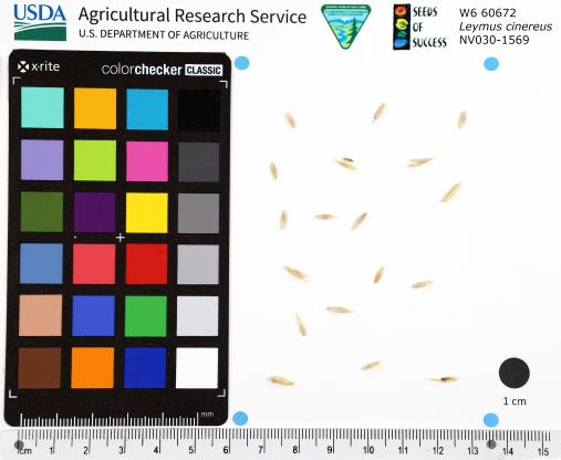 | | 2022 | | | | | | | Wild material | Bunchgrass forming large clumps up to 2 metres tall. It has a large, fibrous root system and sometimes small rhizomes. The inflorescence is an unbranched, cylindrical spike divided into up to 35 nodes with several flower spikelets per node. | 2138791 | W6 60672 |
| 65 | W6 60178 | NEWFS-701 | Carex crinita Lam. | Massachusetts, United States | W6 | | | 2021 | | | | | | | Wild material | Sharp pointed perigynia that will prick upon contact in a spike about 24 long, dangling in groups of 15 from stem on long peduncle. | 2138804 | W6 60178 |
| 66 | W6 60179 | NEWFS-702 | Juncus effusus L. | Massachusetts, United States | W6 | | | 2021 | | | | | | | Wild material | Rounded stem like bract rising above inflorescence of multiple peduncled capsules holding tiny achenes. | 2138805 | W6 60179 |
| 67 | W6 60180 | NEWFS-703 | Carex scoparia Schkuhr ex Willd. var. scoparia | Massachusetts, United States | W6 | | | 2021 | | | | | | | Wild material | Received as: Carex scoparia var. scoparia. 0.5 inch long small rounded spikelets alterte in a densely packed cluster on stem, sometimes drooping. | 2138806 | W6 60180 |
| 68 | Ames 35752 | #476-477 | Rhus glabra L. | Iowa, United States | NC7 | 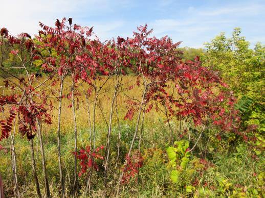 | | 2021 | COLLECTED | 09/29/2021 | Upper Iowa River area near Bluffton, T99N R9W NE1/4 Sec. 9 and S1/2 Sec. 10 | 43.40275000, -91.90494000 | 299 | High bluffs, roadside and stream banks | Wild material | Plants sampled in nature (29 September 2021) during peak fall color displaying bright reds to maroonish colors while measuring approximately 12-15 feet in height. One clonal patch noted was estimated to have 1,000+ ramets. | 2122093 | Ames 35752 |
| 69 | NA 88451 | NV030-1524 | Rosa woodsii Lindl. | Nevada, United States | NA | | | 2021 | | | | | | | Wild material | | 2120797 | NA 88451 |
| 70 | OPGC 8421 | CO932-412 | Orthocarpus luteus Nutt. | Colorado, United States | OPGC | | | 2021 | | | | | | | Wild material | flowers: yellow, partly covered by calyx; leaves: sessile, lanceolate, purple to reddish, green toward top of stem, pubescent; stem: red to purple, pubescent; seed pods: brown and dry if mature, green when immature | 2120770 | OPGC 8421 |
| 71 | OPGC 8453 | WY090-184 | Penstemon procerus Douglas ex Graham | Wyoming, United States | OPGC | | | 2021 | | | | | | | Wild material | Found growing among aspen forests. Average height of collected specimens was 29.5cm. Infloresence is blue/purple with the innter throat being white. | 2120885 | OPGC 8453 |
| 72 | OPGC 8458 | WY090-198 | Penstemon procerus Douglas ex Graham | Wyoming, United States | OPGC | | | 2021 | | | | | | | Wild material | In fruit. Growing on E slopes. When in flower the color is blue/purple with white inner throat. Flowers grow in clusters along upper part of the stem. | 2120898 | OPGC 8458 |
| 73 | W6 59593 | CO932-401 | Purshia tridentata (Pursh) DC. | Colorado, United States | W6 | | | 2021 | | | | | | | Wild material | petals: 5, white to light yellow; sepals: 5, light green; leaves: green tometose on adaxial surface, witish tometose on abaxial surface, alternate, simple, 3 lobed at apex; fruit: ovoid achene, papery brown outer, with reddish purple seed inside | 2120759 | W6 59593 |
| 74 | W6 59594 | CO932-402 | Pascopyrum smithii (Rydb.) Barkworth & D. R. Dewey | Colorado, United States | W6 | | | 2021 | | | | | | | Wild material | Culms erect, sheaths open, blades flat to in-rolled, rigid upper surface striate, inflorescence erect terminal spike, spikelet tightly overlapped | 2120760 | W6 59594 |
| 75 | W6 59595 | CO932-403 | Erigeron speciosus (Lindl.) DC. | Colorado, United States | W6 | | | 2021 | | | | | | | Wild material | Erect stems, cauline leaves oblanceolate to ovate, glabrous, involucre glandular, flowers in terminal groups, blue violet rays, yellow disks | 2120761 | W6 59595 |
| 76 | W6 59596 | CO932-404 | Eriogonum umbellatum Torr. | Colorado, United States | W6 | | | 2021 | | | | | | | Wild material | Stems glabrous to hairy, leaves basal, oblong ovate, gray-green, umbellate inflorescence, subtended by a whorl of leaf-like bracts, involucre cone to bell shaped, tepals yellow | 2120762 | W6 59596 |
| 77 | W6 59597 | CO932-405 | Erigeron speciosus (Lindl.) DC. | Colorado, United States | W6 | | | 2021 | | | | | | | Wild material | Erect stems, cauline leaves oblanceolate to ovate, glabrous, involucre glandular, flowers in terminal groups, blue violet rays, yellow disks | 2120763 | W6 59597 |
| 78 | W6 59599 | CO932-407 | Erigeron speciosus (Lindl.) DC. | Colorado, United States | W6 | | | 2021 | | | | | | | Wild material | flowers: light purple ray, yellow disc; leaves: alternate, slightly toothed, sessile, lanceolate, pubescent; stems: green, pubescent | 2120765 | W6 59599 |
| 79 | W6 59600 | CO932-408 | Hymenoxys hoopesii (A. Gray) Bierner | Colorado, United States | W6 | | | 2021 | | | | | | | Wild material | flowers: dark yellow to orange ray and disc flowers, ray flowers drooping and 2 lobed at apex; inflorescence: branching with solitary heads; leaves: dense basal rosette, leaves up stem alternate, pubescent; stem: pubescent, red at base becoming green at top | 2120766 | W6 59600 |
| 80 | W6 59601 | CO932-409 | Heliomeris multiflora Nutt. | Colorado, United States | W6 | | | 2021 | | | | | | | Wild material | Stems branching, leaves linear to ovate, short hairy, singular flower heads, yellow ray flowers, yellow disk flowers | 2120767 | W6 59601 |
| 81 | W6 59602 | CO932-410 | Erigeron speciosus (Lindl.) DC. | Colorado, United States | W6 | | | 2021 | | | | | | | Wild material | Erect stems, cauline leaves oblanceolate to ovate, glabrous, involucre glandular, flowers in terminal groups, blue violet rays, yellow disks | 2120768 | W6 59602 |
| 82 | W6 59603 | CO932-411 | Erigeron speciosus (Lindl.) DC. | Colorado, United States | W6 | | | 2021 | | | | | | | Wild material | flowers: light purple ray, yellow disc; leaves: alternate, slightly toothed, sessile, oblanceolate, pubescent; stems: green, pubescent | 2120769 | W6 59603 |
| 83 | W6 59607 | CO932-415 | Elymus elymoides (Raf.) Swezey | Colorado, United States | W6 | | | 2021 | | | | | | | Wild material | Culms erect to spreading, sheaths open, glabrous to pubescent, purplish, blades flat to folded to in-rolled, ascending, inflorescence compact to open, entire rachis disarticulate, fading to straw | 2120773 | W6 59607 |
| 84 | W6 59616 | CO932-428 | Artemisia tridentata Nutt. subsp. vaseyana (Rydb.) Beetle | Colorado, United States | W6 | | | 2021 | | | | | | | Wild material | Silky tomentose throughout vegetative parts, leaves 3-lobed at tip, wedge shaped at base, floral erect, dense narrow panicles, rays lacking, disks yellow | 2120782 | W6 59616 |
| 85 | W6 59622 | NV030-1511 | Grindelia squarrosa (Pursh) Dunal | Nevada, United States | W6 | | | 2021 | | | | | | | Wild material | | 2120788 | W6 59622 |
| 86 | W6 59632 | NV030-1525 | Ericameria nauseosa (Pall. ex Pursh) G. L. Nesom & G. I. Baird subsp. consimilis (Greene) G. L. Nesom & G. I. Baird var. oreophila (A. Nelson) G. L. Nesom & G. I. Baird | Nevada, United States | W6 | | | 2021 | | | | | | | Wild material | | 2120962 | W6 59632 |
| 87 | W6 59647 | UT020-89 | Poa secunda J. Presl | Utah, United States | W6 | | | 2021 | | | | | | | Wild material | Perennial bunchgrass growing in tufts with a reddish tint or golden hue to stems. Specimens here were relatively tall and healthy, growing along a south-facing slope within the Raft River Mountains. Extremely dense population, dominating the landscape at the upper elevations of the slope. | 2120812 | W6 59647 |
| 88 | W6 59653 | UT020-95 | Leymus cinereus (Scribn. & Merr.) Á. Löve | Utah, United States | W6 | | | 2021 | | | | | | | Wild material | Perennial bunchgrass forming tall, sprawling clumps with numerous inflorescences. Plant height averaged 4.67 ft in this area, with most individuals found in dense clusters at the bottom of the canyon. This area had been heavily grazed and trampled upon by cattle before our collection, but most of the plants retained all of their inflorescences. Seeds of plants at higher elevations along the creek and in shadier sites beneath Populus tremuloides trees were still not quite mature at the time of our collection on 08/12/2020, so our collection was primarily limited to lower-elevation, open sites. | 2120818 | W6 59653 |
| 89 | W6 59654 | UT020-96 | Leymus cinereus (Scribn. & Merr.) Á. Löve | Utah, United States | W6 | | | 2021 | | | | | | | Wild material | Perennial bunchgrass forming tall, sprawling clumps with numerous inflorescences. Plant height averaged 4.58 ft, with plants scattered alongside Clear Creek Rd in relatively flat, open sites. The effects of grazing here were minimal this season, so most plants were neither chewed down nor trampled upon. Rather than forming dense clusters, most of the plants here were scattered far from one another amidst other tall grasses, shrubs, and forbs. Since the riparian zone here is heavily forested, most Leymus cinereus individuals were relatively far from the creek, compared with other sites where we've collected. | 2120819 | W6 59654 |
| 90 | W6 59732 | WY090-197 | Achillea millefolium L. | Wyoming, United States | W6 | | | 2021 | | | | | | | Wild material | Mostly in fruit though a few in flower. Leaves typically basal, smaller ones can be further up the stem. Infloresence is an umbel cluster of white/cream colored flowers each with 5 petals. | 2120897 | W6 59732 |
| 91 | W6 59135 | CBG-10230 | Eupatorium perfoliatum L. | Illinois, United States | W6 | | | 2021 | | | | | | | Wild material | | 2120061 | W6 59135 |
| 92 | NA 88185 | AK930-993 | Arctostaphylos uva-ursi (L.) Spreng. | Alaska, United States | NA | | | 2021 | | | | | | | Wild material | | 2116126 | NA 88185 |
| 93 | OPGC 8228 | AK930-847 | Castilleja caudata (Pennell) Rebrist. | Alaska, United States | OPGC | | | 2021 | | | | | | | Wild material | | 2115997 | OPGC 8228 |
| 94 | OPGC 8244 | AK930-948 | Castilleja caudata (Pennell) Rebrist. | Alaska, United States | OPGC | | | 2021 | | | | | | | Wild material | | 2116086 | OPGC 8244 |
| 95 | W6 58812 | AK930-846 | Festuca rubra L. | Alaska, United States | W6 | | | 2021 | | | | | | | Wild material | | 2115996 | W6 58812 |
| 96 | W6 58907 | AK930-950 | Chamaenerion angustifolium (L.) Scop. subsp. angustifolium | Alaska, United States | W6 | | | 2021 | | | | | | | Wild material | | 2116088 | W6 58907 |
| 97 | W6 58961 | AK930-1008 | Dryas drummondii Richardson ex Hook. | Alaska, United States | W6 | | | 2021 | | | | | | | Wild material | | 2116141 | W6 58961 |
| 98 | W6 58964 | AK930-1011 | Calamagrostis canadensis (Michx.) P. Beauv. | Alaska, United States | W6 | | | 2021 | | | | | | | Wild material | | 2116144 | W6 58964 |
| 99 | OPGC 8168 | NEWFS-410 | Euthamia graminifolia (L.) Nutt. | Maine, United States | OPGC | | | 2021 | | | | | | | Wild material | Leaf blades with few or inconspicuous resin glands, usually 3-12mm wide, plants varying from glabrous to conspicuously pubescent on stem/abaxial leaf surfaces, axillary fasicles if present, usually poorly developed and sparse. | 2115650 | OPGC 8168 |
| 100 | W6 58499 | NV030-1444 | Eriogonum umbellatum Torr. | California, United States | W6 | | | 2020 | | | | | | | Wild material | Umbel-inflorescence, loose mat of lvs, fruit on erected stems rising above leaf mat. | 2110393 | W6 58499 |
| 101 | W6 58500 | NV030-1445 | Leymus cinereus (Scribn. & Merr.) Á. Löve | California, United States | W6 | | | 2020 | | | | | | | Wild material | Bunchgrass, elongated leaves, large plant size. | 2110394 | W6 58500 |
| 102 | Ames 35595 | Railroad Canyon | Agastache micrantha (A. Gray) Wooton & Standl. | New Mexico, United States | NC7 |  | | 2020 | COLLECTED | 10/09/2020 | Gila National Forest (Black Range) along trail through Railroad Canyon located approximately 6.38 miles west of Kingston just north of highway 152, T16S R10W, Grant County | 32.91407900, -107.81592300 | 2174 | Narrow floodplain of an open woodland with pine, fir, and mixed hardwood canopy. Noted on drier parts of floodplain, well above usual water level. | Wild material | Plants extremely minty (aromatic) with white flowers. Flowering in nature (southwestern New Mexico) occurs mid/late August through mid-October, but largely influenced by rainfall events. In nature, plants measured approximately 60-80 cm in height and densely branched. | 2107771 | Ames 35595 |
| 103 | W6 58251 | UT080-279 | Heliomeris multiflora Nutt. var. multiflora | Utah, United States | W6 | | | 2020 | | | | | | | Wild material | Leaves opposite, at least the lower leaves. Rays and disc flowers yellow, branched stems. Lanceolate/linear lanceolate leaves. Many heads per plant. | 2107627 | W6 58251 |
| 104 | W6 58257 | UT080-301 | Heliomeris multiflora Nutt. var. multiflora | Utah, United States | W6 | | | 2020 | | | | | | | Wild material | Opposite leaves, yellow disc and ray flowers, lacking papus, linear lanceolate/lanceolate leaves. | 2107633 | W6 58257 |
| 105 | W6 57969 | NM930N-137 | Wyethia hybr. | Colorado, United States | W6 | | | 2020 | | | | | | | Wild material | Received as Wyethia x magna. Height 2.5' | 2106481 | W6 57969 |
| 106 | WLP 2056 | Elbow Creek | Viburnum opulus L. var. americanum Aiton | Wisconsin, United States | NA |  | | 2019 | COLLECTED | 11/12/2019 | Elbow Creek watershed located approximately 3.5 miles south of Athelstane along County Highway A, T34N R19E extreme eastern edge Sec. 34 and western edge of Sec. 35, Marinette County | 45.37305600, -88.09972200 | 272 | Roadside, floodplain. Neutral ph fen (no ericaceous plants noted) | Wild material | Plants in nature measuring between 6 and 12 feet in height with bright red fruits. | 2097791 | WLP 2056 |
| 107 | Ames 35231 | Va101 | Agastache parvifolia Eastw. | California, United States | NC7 |  | | 2019 | COLLECTED | 09/26/2019 | Area between Bogard Buttes and Caribou Wilderness approximately 20 miles west of Eagle Lake, on USGS Bogard Buttes 7.5-minute quad map T31N R7E including SW1/4 Sec. 11, NE1/4 Sec. 13, N1/2 Sec. 14 and NE1/4 NE1/4 Sec. 15, Lassen County | 40.55202800, -121.15888900 | 1980 | Margins and interiors of (+/-) dry, volcanic rock fields. Talus outcroppings, among boulders in fissures and on low ridges, across variable slopes (5-40 degrees) and aspects (east, west, south and northeast) with majority of sites in low-relief, except for irregular surfaces within lava fields. Elevations ranging from 1944 to 2023 (meters). Full sun or patchy shade. | Wild material | Perennial aromatic herb of mint family, basally branched with small, triangular crenate/serrate leaves and small pink-rose flowers in dense, elongate, terminal spikes. Plants in nature ranged from one to three feet high, few-branched up to ten or so branches. At time of collection (26 September 2019), plants were mostly late in phenology, though a few plants showed a flush of corolla color. | 2097767 | Ames 35231 |
| 108 | Ames 35230 | Gabel #7103 | Agastache foeniculum (Pursh) Kuntze | South Dakota, United States | NC7 |  | | 2019 | COLLECTED | 09/22/2019 | Black Hills National Forest known as Ranger Draw located approximately 10.3 miles west, southwest of Lead on south side of Roughlock Falls Road, T4N R1E SE1/4 NE1/4 NE1/4 Sec. 10 and T4N R1E NW1/4 NW1/4 Sec. 11 (circa 3.9 miles from Wyoming border), Lawrence County | 44.32706700, -103.97398300 | 1703 | Mixed spruce/pine forest. | Wild material | Plants ranging in height from 0.5 to 1 m tall. Flower color mostly lavender, with some specimens having very dark, vibrant purple (e.g. samples 45, 45, 49 and 53) and some rather blue in color (samples 41 and 46). Terminal flower spikes averaged 6 cm in length (average 60 specimens) ranging from 0.6 to 13.3 cm. | 2097766 | Ames 35230 |
| 109 | OPGC 7542 | WY050-187 | Silene menziesii Hook. | Wyoming, United States | OPGC |  | | 2019 | | | | | | | Wild material | | 2096987 | OPGC 7542 |
| 110 | OPGC 7544 | WY050-195 | Symphyotrichum spathulatum (Lindl.) G. L. Nesom | Wyoming, United States | OPGC |  | | 2019 | | | | | | | Wild material | | 2096993 | OPGC 7544 |
| 111 | W6 57043 | WY050-192 | Achillea millefolium L. | Wyoming, United States | W6 |  | | 2019 | | | | | | | Wild material | | 2096990 | W6 57043 |
| 112 | W6 57044 | WY050-193 | Perideridia gairdneri (Hook. & Arn.) Mathias subsp. borealis T. I. Chuang & Constance | Wyoming, United States | W6 |  | | 2019 | | | | | | | Wild material | | 2096991 | W6 57044 |
| 113 | Ames 35221 | JDC/AF/2019/019/898 | Agastache foeniculum (Pursh) Kuntze | Wisconsin, United States | NC7 |  | | 2019 | COLLECTED | 09/17/2019 | Crex Meadows Wildlife Management Area located along N. Refuge Road approximately 7.0 miles north of Grantsburg (sampled within T39N R19W SW 1/4 Sec. 12; T39N R18W NE1/4 Sec. 8; T39N R18W NW1/4 Sec. 9; and T39N R18W SE1/4 Sec. 5), Burnett County | 45.88440500, -92.61196900 | 290 | Prairie remnant with sandy soils | Wild material | Plants measuring approximately 3-4' in height with attractive blue flowers circa 5-6" spikes and leaves with undersides whitish in color. Peak flowering occurred 5 August 2019 in nature. Species locally abundant in area. | 2097757 | Ames 35221 |
| 114 | Ames 35222 | JDC/MF/2019/032/911 | Monarda fistulosa L. | Wisconsin, United States | NC7 |  | | 2019 | COLLECTED | 09/17/2019 | Crex Meadows Wildlife Management Area located along N. Refuge Road approximately 7.0 miles north of Grantsburg (sampled within T39N R19W SW 1/4 Sec. 12; T39N R18W NE1/4 Sec. 8; T39N R18W NW1/4 Sec. 9; and T39N R18W SE1/4 Sec. 5), Burnett County | 45.88440500, -92.61196900 | 290 | Prairie remnant with sandy soils. | Wild material | Plants measuring approximately 2-3' in height with attractive pink flowers. Peak flowering occurred circa 28 July 2019 in nature. Species locally abundant to infrequent in area. | 2097758 | Ames 35222 |
| 115 | Ames 35224 | JDC/AP/2019/034/913 | Aronia ×prunifolia (Marshall) Rehder | Wisconsin, United States | NC7 |  | | 2019 | COLLECTED | 09/17/2019 | Crex Meadows Wildlife Management Area located along Buggerts Lake Road approximately 7.0 miles north of Grantsburg, T39N R19W NW1/4 NE1/4 Sec. 12, Burnett County | 45.88743300, -92.65832600 | 284 | Wet, swampy areas. | Wild material | Plants in nature with some orange fall color and black fruits (a few fruits shriveled) at time of harvest (17 September). Average height approximately 3.5-4.0'. | 2097760 | Ames 35224 |
| 116 | NA 86438 | JDC/IV/2019/033/912 | Ilex verticillata (L.) A. Gray | Wisconsin, United States | NA |  | | 2019 | COLLECTED | 09/17/2019 | Crex Meadows Wildlife Management Area located approximately 7.0 miles north of Grantsburg, Burnett County | 45.86773900, -92.63055500 | 285 | Wet, swampy areas | Wild material | Average height noted of plants in nature was circa 8' in height. Fruits bright red and persistent at time of harvest (17 September). Foliage green, signs of chlorosis noted on most specimens. | 2097759 | NA 86438 |
| 117 | OPGC 7517 | NV030-1416 | Iris missouriensis Nutt. | Nevada, United States | OPGC |  | | 2019 | | | | | | | Wild material | | 2094626 | OPGC 7517 |
| 118 | OPGC 7518 | NV030-1418 | Chrysothamnus viscidiflorus (Hook.) Nutt. | Nevada, United States | OPGC |  | | 2019 | | | | | | | Wild material | | 2094628 | OPGC 7518 |
| 119 | W6 56819 | NV030-1415 | Juncus arcticus Willd. | Nevada, United States | W6 |  | | 2019 | | | | | | | Wild material | | 2094625 | W6 56819 |
| 120 | W6 56821 | NV030-1417 | Carex nebrascensis Dewey | Nevada, United States | W6 |  | | 2019 | | | | | | | Wild material | | 2094627 | W6 56821 |
| 121 | OPGC 7845 | CBG-8187 | Polemonium reptans L. | Wisconsin, United States | OPGC |  | | 2019 | | | | | | | Wild material | SOS 7th transfer. | 2092671 | OPGC 7845 |
| 122 | OPGC 7841 | UT020-59 | Dieteria canescens (Pursh) Nutt. var. canescens | Utah, United States | OPGC |  | | 2019 | | | | | | | Wild material | | 2092063 | OPGC 7841 |
| 123 | W6 56562 | UT020-62 | Heliomeris multiflora Nutt. | Utah, United States | W6 | 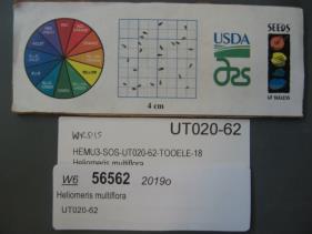 | | 2019 | | | | | | | Wild material | | 2092065 | W6 56562 |
| 124 | Ames 34433 | Bryantsburg Prairie | Salix humilis Marshall | Iowa, United States | NC7 |  | | 2019 | COLLECTED | 05/17/2019 | Bryantsburg Prairie located 2.75 miles south of Hazelton, T90N R9W SE ¼ SE ¼ NE ¼ Sec. 28. | 42.57794200, -91.90508100 | 298 | Native prairie remnant. | Wild material | Plants averaging 4.0-4.5 feet in height with extremely vigorous and densly flowered stems (no branching), perhaps a response due to management (e.g. burning and/or mowing). Estimated 25 ramets per genet. Some with pinkish/red fruiting capsules. | 2091749 | Ames 34433 |
| 125 | OPGC 7836 | SOS-NV930A-19 | Dieteria canescens (Pursh) Nutt. var. canescens | Nevada, United States | OPGC |  | | 2019 | | | | | | | Wild material | Machaeranthera canescens | 2091608 | OPGC 7836 |
| 126 | NA 88067 | NEWFS-394 | Morella caroliniensis (Mill.) Small | Maine, United States | NA | 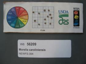 | | 2019 | | | | | | | Wild material | | 1976244 | NA 88067 |
| 127 | W6 56088 | AK930-684 | Calamagrostis purpurascens R. Br. | Alaska, United States | W6 |  | | 2019 | | | | | | | Wild material | | 1975829 | W6 56088 |
| 128 | OPGC 7375 | AK930-671 | Castilleja caudata (Pennell) Rebrist. | Alaska, United States | OPGC |  | | 2019 | | | | | | | Wild material | | 1975816 | OPGC 7375 |
| 129 | W6 56074 | AK930-669 | Oxytropis campestris (L.) DC. var. spicata Hook. | Alaska, United States | W6 |  | | 2019 | | | | | | | Wild material | | 1975815 | W6 56074 |
| 130 | W6 56073 | AK930-667 | Parnassia palustris L. | Alaska, United States | W6 |  | | 2019 | | | | | | | Wild material | | 1975814 | W6 56073 |
| 131 | W6 56070 | AK930-663 | Oxytropis campestris (L.) DC. var. spicata Hook. | Alaska, United States | W6 |  | | 2019 | | | | | | | Wild material | | 1975811 | W6 56070 |
| 132 | W6 56065 | AK930-657 | Chamaenerion angustifolium (L.) Scop. subsp. angustifolium | Alaska, United States | W6 |  | | 2019 | | | | | | | Wild material | | 1975806 | W6 56065 |
| 133 | W6 56064 | AK930-656 | Elymus trachycaulus (Link) Gould subsp. trachycaulus | Alaska, United States | W6 |  | | 2019 | | | | | | | Wild material | | 1975805 | W6 56064 |
| 134 | W6 56063 | AK930-655 | Antennaria rosea Greene subsp. confinis (Greene) R. J. Bayer | Alaska, United States | W6 |  | | 2019 | | | | | | | Wild material | | 1975804 | W6 56063 |
| 135 | W6 56062 | AK930-654 | Trisetum spicatum (L.) K. Richt. | Alaska, United States | W6 |  | | 2019 | | | | | | | Wild material | | 1975803 | W6 56062 |
| 136 | OPGC 7374 | AK930-652 | Castilleja yukonis Pennell | Alaska, United States | OPGC |  | | 2019 | | | | | | | Wild material | | 1975802 | OPGC 7374 |
| 137 | Ames 35684 | AK930-650 | Linum lewisii Pursh | Alaska, United States | NC7 |  | | 2019 | | | | | | | Wild material | | 1975801 | Ames 35684 |
| 138 | W6 56059 | AK930-648 | Calamagrostis purpurascens R. Br. | Alaska, United States | W6 |  | | 2019 | | | | | | | Wild material | | 1975800 | W6 56059 |
| 139 | W6 56051 | OR134-56 | Phacelia ramosissima Douglas ex Lehm. | Washington, United States | W6 |  | | 2019 | | | | | | | Wild material | Phacelia ramosissima | 1971297 | W6 56051 |
| 140 | GPRU 170 | NV030-1334 | Prunus virginiana L. | California, United States | GEN |  | | 2018 | COLLECTED | 09/25/2017 | From US-395N from Reno, turn L onto CA-70W to Chilcoot. Turn R onto CA-284N towards Frenchman Lake, and continue 7 miles until Cornus patch. | 39.87549000, -120.18370000 | 1623 | | Wild material | | 1970658 | GPRU 170 |
| 141 | NA 88441 | NV030-1307 | Rosa woodsii Lindl. | Nevada, United States | NA |  | | 2018 | | | | | | | Wild material | Rosa woodsii | 1970632 | NA 88441 |
| 142 | W6 55506 | CO932-356 | Erigeron speciosus (Lindl.) DC. | Colorado, United States | W6 |  | | 2018 | | | | | | | Wild material | | 1970217 | W6 55506 |
| 143 | W6 55946 | NV030-1333 | Cornus sericea L. subsp. occidentalis (Torr. & A. Gray) Fosberg | California, United States | W6 |  | | 2018 | | | | | | | Wild material | Cornus sericea subsp. occidentalis | 1970657 | W6 55946 |
| 144 | Ames 34360 | Ames 34360 | Salix serissima (L. H. Bailey) Fernald | Minnesota, United States | NC7 |  | | 2018 | COLLECTED | 11/12/2018 | Kunkel State Wildlife Management Area located just west of Princeton approximately 4.75 miles off 160th St. NW along south side of a tributary that runs northeast into Battle Brook Creek, T36N R27W SE 1/4 SE 1/4 Sec. 34. | 45.56065600, -93.67933500 | 301 | Marsh | Wild material | Salix serissima (autumn willow) is a boreal willow and an obligate wetland species whose distribution is concentrated in the northeastern United States and in Canada from Newfoundland to British Columbia. A deciduous shrub that grows from 1 to 5 m tall. Bark color ranges from olive-brown or gray in older branches to yellowish-brown in younger branches, and the youngest twigs are glossy red-brown. The leaves of mature branches are dark green and shining on the top surface with a broad whitish midrib, and paler on the bottom surface. Leaves are elliptic or lanceolate with minutely toothed margins and the distinguishing presence of glands on the petiole near the base of the leaf blade. S. serissima flowers from May to July, and fruits mature from June to September (Decker 2006). Staminate flowers are rather showy and stout measuring approximately 45-55 mm in length and 15 mm in width that peak well after leaves have emerged; anthers yellow and dense. Pistillate catkins are rather loosely flowered and slightly shorter (e.g. 25-30 mm in length) in comparison to staminate flowers; green and inconspicuous. | 1968259 | Ames 34360 |
| 145 | GPRU 159 | OR010-370 | Prunus emarginata (Douglas) Eaton | Oregon, United States | GEN |  | | 2018 | | | | | | | Wild material | | 1967823 | GPRU 159 |
| 146 | W6 55250 | NV930A-12 | Leymus cinereus (Scribn. & Merr.) Á. Löve | Nevada, United States | W6 |  | | 2018 | | | | | | | Wild material | Leymus cinereus | 1967802 | W6 55250 |
| 147 | OPGC 6655 | NM930-412 | Rudbeckia laciniata L. | New Mexico, United States | OPGC |  | | 2018 | | | | | | | Wild material | Rudbeckia laciniata | 1966141 | OPGC 6655 |
| 148 | OPGC 6657 | NM930-416 | Rudbeckia laciniata L. | New Mexico, United States | OPGC |  | | 2018 | | | | | | | Wild material | Rudbeckia laciniata | 1966145 | OPGC 6657 |
| 149 | OPGC 6658 | NM930-417 | Rudbeckia laciniata L. | New Mexico, United States | OPGC |  | | 2018 | | | | | | | Wild material | Rudbeckia laciniata | 1966146 | OPGC 6658 |
| 150 | W6 54494 | AK930-712 | Carex crawfordii Fernald | Alaska, United States | W6 |  | | 2018 | | | | | | | Wild material | Carex crawfordii | 1965720 | W6 54494 |
| 151 | W6 54495 | AK930-713 | Calamagrostis canadensis (Michx.) P. Beauv. | Alaska, United States | W6 |  | | 2018 | | | | | | | Wild material | Calamagrostis canadensis | 1965721 | W6 54495 |
| 152 | W6 54496 | AK930-714 | Agrostis scabra Willd. | Alaska, United States | W6 |  | | 2018 | | | | | | | Wild material | Agrostis scabra | 1965722 | W6 54496 |
| 153 | W6 54502 | AK930-720 | Chamaenerion latifolium (L.) Sweet | Alaska, United States | W6 |  | | 2018 | | | | | | | Wild material | Chamerion latifolium | 1965728 | W6 54502 |
| 154 | W6 54617 | AK930-835 | Calamagrostis purpurascens R. Br. | Alaska, United States | W6 |  | | 2018 | | | | | | | Wild material | Calamagrostis purpurascens | 1965843 | W6 54617 |
| 155 | W6 54620 | AK930-838 | Elymus trachycaulus (Link) Gould subsp. trachycaulus | Alaska, United States | W6 |  | | 2018 | | | | | | | Wild material | Elymus trachycaulus ssp. trachycaulus | 1965846 | W6 54620 |
| 156 | W6 54623 | AK930-841 | Achillea alpina L. | Alaska, United States | W6 |  | | 2018 | | | | | | | Wild material | Achillea sibirica | 1965849 | W6 54623 |
| 157 | W6 54624 | AK930-842 | Elymus trachycaulus (Link) Gould subsp. trachycaulus | Alaska, United States | W6 |  | | 2018 | | | | | | | Wild material | Elymus trachycaulus ssp. trachycaulus | 1965850 | W6 54624 |
| 158 | W6 55120 | CA370-258 | Juncus balticus Willd. subsp. littoralis (Engelm.) Snogerup | Nevada, United States | W6 |  | | 2018 | | | | | | | Wild material | Juncus arcticus ssp. littoralis | 1966347 | W6 55120 |
| 159 | W6 55121 | CA370-259 | Carex leporinella Mack. | Nevada, United States | W6 |  | | 2018 | | | | | | | Wild material | Carex leporinella | 1966348 | W6 55121 |
| 160 | W6 55122 | CA370-260 | Leymus cinereus (Scribn. & Merr.) Á. Löve | Nevada, United States | W6 |  | | 2018 | | | | | | | Wild material | Leymus cinereus | 1966349 | W6 55122 |
| 161 | NA 88011 | NM018-106 | Dasiphora fruticosa (L.) Rydb. | New Mexico, United States | NA |  | | 2018 | | | | | | | Wild material | | 1964896 | NA 88011 |
| 162 | W6 54177 | NM018-104 | Erigeron versicolor (Greenm.) G. L. Nesom | New Mexico, United States | W6 |  | | 2018 | | | | | | | Wild material | Erigeron versicolor | 1964894 | W6 54177 |
| 163 | W6 54178 | NM018-105 | Thermopsis montana Nutt. var. montana | New Mexico, United States | W6 |  | | 2018 | | | | | | | Wild material | Thermopsis montana var. montana | 1964895 | W6 54178 |
| 164 | W6 54336 | WY050-138 | Eremogone congesta (Nutt.) Ikonn. var. congesta | Wyoming, United States | W6 |  | | 2018 | | | | | | | Wild material | Arenaria congesta var. congesta | 1965053 | W6 54336 |
| 165 | W6 54338 | WY050-140 | Eriogonum umbellatum Torr. var. majus Hook. | Wyoming, United States | W6 |  | | 2018 | | | | | | | Wild material | Eriogonum umbellatum var. majus | 1965055 | W6 54338 |
| 166 | W6 53658 | CA370-246 | Achillea millefolium L. | Nevada, United States | W6 | | | 2018 | | | | | | | Wild material | | 1964236 | W6 53658 |
| 167 | W6 53887 | NV030-1232 | Leymus cinereus (Scribn. & Merr.) Á. Löve | California, United States | W6 |  | | 2018 | | | | | | | Wild material | | 1964465 | W6 53887 |
| 168 | W6 53890 | NV030-1236 | Scirpus microcarpus J. Presl & C. Presl | California, United States | W6 |  | | 2018 | | | | | | | Wild material | | 1964468 | W6 53890 |
| 169 | W6 53896 | NV030-1242 | Scirpus microcarpus J. Presl & C. Presl | California, United States | W6 |  | | 2018 | | | | | | | Wild material | | 1964474 | W6 53896 |
| 170 | W6 53897 | NV030-1243 | Elymus glaucus Buckley subsp. glaucus | California, United States | W6 |  | | 2018 | | | | | | | Wild material | | 1964475 | W6 53897 |
| 171 | W6 53898 | NV030-1245 | Glyceria striata (Lam.) Hitchc. | California, United States | W6 |  | | 2018 | | | | | | | Wild material | | 1964476 | W6 53898 |
| 172 | OPGC 6457 | MT050-43 | Rudbeckia occidentalis Nutt. | Montana, United States | OPGC | | | 2018 | | | | | | | Wild material | | 1958178 | OPGC 6457 |
| 173 | W6 53465 | NM030-63 | Elymus arizonicus (Scribn. & J. G. Sm.) Gould | New Mexico, United States | W6 | | | 2018 | | | | | | | Wild material | | 1958200 | W6 53465 |
| 174 | W6 53466 | NM030-64 | Chamaenerion angustifolium (L.) Scop. subsp. angustifolium | New Mexico, United States | W6 | | | 2018 | | | | | | | Wild material | | 1958201 | W6 53466 |
| 175 | OPGC 6423 | NM930-226 | Rudbeckia hirta L. | New Mexico, United States | OPGC |  | | 2018 | | | | | | | Wild material | | 1957524 | OPGC 6423 |
| 176 | OPGC 7779 | UT933-449 | Packera multilobata (Torr. & A. Gray) W. A. Weber & Á. Löve | Utah, United States | OPGC |  | | 2018 | | | | | | | Wild material | | 1957644 | OPGC 7779 |
| 177 | OPGC 7781 | UT933-455 | Packera multilobata (Torr. & A. Gray) W. A. Weber & Á. Löve | Utah, United States | OPGC |  | | 2018 | | | | | | | Wild material | | 1957646 | OPGC 7781 |
| 178 | W6 53171 | NM930-223 | Erigeron formosissimus Greene | New Mexico, United States | W6 |  | | 2018 | | | | | | | Wild material | | 1957521 | W6 53171 |
| 179 | W6 53173 | NM930-225 | Chamaenerion angustifolium (L.) Scop. subsp. angustifolium | New Mexico, United States | W6 |  | | 2018 | | | | | | | Wild material | | 1957523 | W6 53173 |
| 180 | W6 53259 | NM930-313 | Thermopsis montana Nutt. | New Mexico, United States | W6 |  | | 2018 | | | | | | | Wild material | | 1957609 | W6 53259 |
| 181 | WLP 2057 | NEWFS-270 | Viburnum dentatum L. | Maine, United States | NA |  | | 2017 | COLLECTED | 08/11/2015 | Scarborough Marsh WMA just off Pine Point Road along trail across from Audubon Center, Cumberland County | 43.56536400, -70.37482700 | 1 | Saltmarsh | Wild material | | 1954666 | WLP 2057 |
| 182 | Ames 34015 | Ames 34015 | Cornus rugosa Lam. | Minnesota, United States | NC7 | | | 2017 | COLLECTED | 08/23/2017 | Smoky Hills State Forest between Snellman and Osage, T139N R37W Sec. 2, 9, 11, and 14 and also T140N R37W Sec. 26 and 34. | 46.89278300, -95.35163300 | 501 | Mixed pine and deciduous moist woods. | Wild material | | 1953929 | Ames 34015 |
| 183 | OPGC 6295 | OR931-223 | Chrysothamnus viscidiflorus (Hook.) Nutt. subsp. viscidiflorus | Oregon, United States | OPGC |  | | 2017 | | | | | | | Wild material | | 1947373 | OPGC 6295 |
| 184 | OPGC 7170 | OR931-192 | Collinsia parviflora Lindl. | Oregon, United States | OPGC | | | 2017 | | | | | | | Wild material | | 1947345 | OPGC 7170 |
| 185 | W6 52217 | OR931-199 | Phleum alpinum L. | Oregon, United States | W6 | | | 2017 | | | | | | | Wild material | | 1947352 | W6 52217 |
| 186 | W6 52221 | OR931-204 | Perideridia gairdneri (Hook. & Arn.) Mathias subsp. borealis T. I. Chuang & Constance | Oregon, United States | W6 | | | 2017 | | | | | | | Wild material | | 1947356 | W6 52221 |
| 187 | W6 52227 | OR931-211 | Ligusticum grayi J. M. Coult. & Rose | Oregon, United States | W6 |  | | 2017 | | | | | | | Wild material | | 1947362 | W6 52227 |
| 188 | W6 52231 | OR931-215 | Erigeron speciosus (Lindl.) DC. | Oregon, United States | W6 |  | | 2017 | | | | | | | Wild material | | 1947366 | W6 52231 |
| 189 | OPGC 7749 | NM018-31 | Actaea rubra (Aiton) Willd. | New Mexico, United States | OPGC | | | 2017 | | | | | | | Wild material | | 1947004 | OPGC 7749 |
| 190 | Ames 33900 | JDC/SA/2017/001/755 | Spiraea alba Du Roi | Minnesota, United States | NC7 |  | | 2017 | COLLECTED | 02/17/2017 | Located approximately 5.88 miles east of Bethel along Fawn Lake Drive just east of Fish Lake, T34N R23W SE 1/4 NE 1/4 and also NE 1/4 SE 1/4 Sec. 25, Anoka County | 45.40641500, -93.14546800 | 275 | Wetland | Wild material | | 1946796 | Ames 33900 |
| 191 | Ames 33874 | Ames 33874 | Spiraea tomentosa L. | Indiana, United States | NC7 | | | 2016 | COLLECTED | 11/18/2016 | Just west of Ogden Dunes, Porter County. | 41.61000400, -87.29251700 | 186 | Grassy, dry-marsh. Growing in association with Salix eriocephala and Populus tremuloides. | Wild material | S. tomentosa is quite abundant(>1,000) at this site with plants ranging in 60-120 cm in height. Inflorescences (average of 10 randomly selected stems) measured 13.9 cm (stdev 0.95) in length and 3.4 cm (stdev 0.27) in width. | 1943451 | Ames 33874 |
| 192 | W6 51634 | CBG-5267 | Chamaenerion angustifolium (L.) Scop. subsp. circumvagum (Mosquin) Moldenke | Wisconsin, United States | W6 | | | 2016 | | | | | | | Wild material | | 1942764 | W6 51634 |
| 193 | W6 51644 | CBG-5428 | Chamaenerion angustifolium (L.) Scop. subsp. angustifolium | Colorado, United States | W6 | | | 2016 | | | | | | | Wild material | | 1942774 | W6 51644 |
| 194 | Ames 33735 | PB16014001 | Betula papyrifera Marshall | North Dakota, United States | NC7 |  | | 2016 | COLLECTED | 08/18/2016 | Bottineau County, North Dakota: Turtle Mountains located approximately 11 miles north, northeast of Bottineau. T163N R74W N1/2 Sec. 16 and T163N R75W NW 1/4 NW 1/4 and also NW 1/4 NE 1/4 Sec. 5. | 48.96006100, -100.31819400 | 700 | Mixed upland forest and wetlands. Growing in association with Quercus macrocarpa, Populus balsamifera, Populus tremuloides, Fraxinus pennsylvanica, Amelanchier sp., Symphoricarpos albus, Corylus sp., Prunus virginiana, Rubus sp., Viburnum opulus var. americanum, and Cirsium arvense. | Wild material | | 1942686 | Ames 33735 |
| 195 | NA 82794 | JDC/QE/2014/132/635 | Quercus ellipsoidalis E. J. Hill | Iowa, United States | NA | | | 2015 | COLLECTED | 10/21/2014 | Pilot Knob State Park just east of Forest City. T97N R23W Ellington Township SW 1/4 SW 1/4 NE 1/4 Sec. 4 Hancock County. | 43.24931400, -93.56681800 | 399 | Near floating bog, transition area from edge of floating bog and incline to upland habitat. Growing in association with Cephalanthus occidentalis, Salix sp., Asclepias incarnata, Typha latifolia, Spiraea alba, Populus tremuloides, Quercus rubra, Rhamnus cathartica, Carex lacustris, Carex lupulina, and Carex spp. | Wild material | Acorns harvested from forest floor. Attractive, red fall color noted (peak - October 21, 2014). | 1928362 | NA 82794 |
| 196 | W6 50127 | NV040-232 | Eriocoma nelsonii (Scribn.) Romasch. subsp. nelsonii | Nevada, United States | W6 |  | | 2015 | | | | | | | Wild material | | 1927439 | W6 50127 |
| 197 | W6 50314 | OR010-259 | Schoenoplectus americanus (Pers.) Volkart ex Schinz & R. Keller | Oregon, United States | W6 |  | | 2015 | | | | | | | Wild material | | 1927612 | W6 50314 |
| 198 | Ames 32957 | JDC/BP/2015/044/701 | Betula pumila L. | Iowa, United States | NC7 |  | | 2015 | COLLECTED | 09/04/2015 | Private property approximately 1.5 miles northwest of Lawler. T96N R11W SW 1/4 SW 1/4 Sec. 32 Chickasaw County. | 43.08335400, -92.17787800 | 349 | High-quality remnant wetland/fen. Growing in Plams muck soils in association with Salix spp., Cornus racemosa, Oncolea sensibilis, Spiraea alba, Gentiana spp., Carex spp., Populus tremuloides, and Ambrosia trifida. Noted four specimens likely B. x sandbergii that were approximately 30-35' in height. | Wild material | B. pumila could be considered a dominant species in portions of this site. Female catkins were both green and brown at time of harvest. Specimens average approximately 275 cm in height. Little to no fall color. Approximately 75% of leaves were already dropped. | 1927399 | Ames 32957 |
| 199 | OPGC 7137 | UT080-158 | Apocynum androsaemifolium L. | Utah, United States | OPGC |  | | 2015 | | | | | | | Wild material | | 1926970 | OPGC 7137 |
| 200 | W6 49971 | WY050-95 | Eriogonum umbellatum Torr. | Wyoming, United States | W6 | 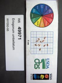 | | 2015 | | | | | | | Wild material | | 1926995 | W6 49971 |
| 201 | W6 50081 | OR931-141 | Eriocoma nelsonii (Scribn.) Romasch. subsp. dorei (Barkworth & J. Maze) Romasch. | Oregon, United States | W6 |  | | 2015 | | | | | | | Wild material | | 1927100 | W6 50081 |
| 202 | W6 50084 | OR931-144 | Festuca idahoensis Elmer | Oregon, United States | W6 |  | | 2015 | | | | | | | Wild material | | 1927102 | W6 50084 |
| 203 | W6 50085 | OR931-145 | Crepis acuminata Nutt. | Oregon, United States | W6 |  | | 2015 | | | | | | | Wild material | | 1927103 | W6 50085 |
| 204 | W6 50088 | OR931-148 | Eriogonum heracleoides Nutt. | Oregon, United States | W6 |  | | 2015 | | | | | | | Wild material | | 1927106 | W6 50088 |
| 205 | W6 50089 | OR931-149 | Hymenoxys hoopesii (A. Gray) Bierner | Oregon, United States | W6 |  | | 2015 | | | | | | | Wild material | | 1927107 | W6 50089 |
| 206 | W6 49773 | NV030-1048 | Ericameria nauseosa (Pall. ex Pursh) G. L. Nesom & G. I. Baird | Nevada, United States | W6 |  | | 2015 | | | | | | | Wild material | | 1926706 | W6 49773 |
| 207 | W6 49587 | CBG-2573 | Elymus trachycaulus (Link) Gould subsp. trachycaulus | Colorado, United States | W6 |  | | 2015 | | | | | | | Wild material | | 1926058 | W6 49587 |
| 208 | Ames 34773 | AK930-483 | Potentilla norvegica L. | Alaska, United States | NC7 |  | | 2015 | COLLECTED | 09/11/2012 | Elliot Highway just south of Highway 2 and 11 intersection (Mile marker 78.5, pulloff). | 65.44436000, -148.78236000 | 268 | Disturbed margin of road at edge of mixed broadleaf/white spruce forest | Wild material | | 1923870 | Ames 34773 |
| 209 | W6 48964 | AK930-493 | Arctagrostis latifolia (R. Br.) Griseb. | Alaska, United States | W6 |  | | 2015 | | | | | | | Wild material | | 1923878 | W6 48964 |
| 210 | W6 48965 | AK930-494 | Chamaenerion angustifolium (L.) Scop. subsp. angustifolium | Alaska, United States | W6 | 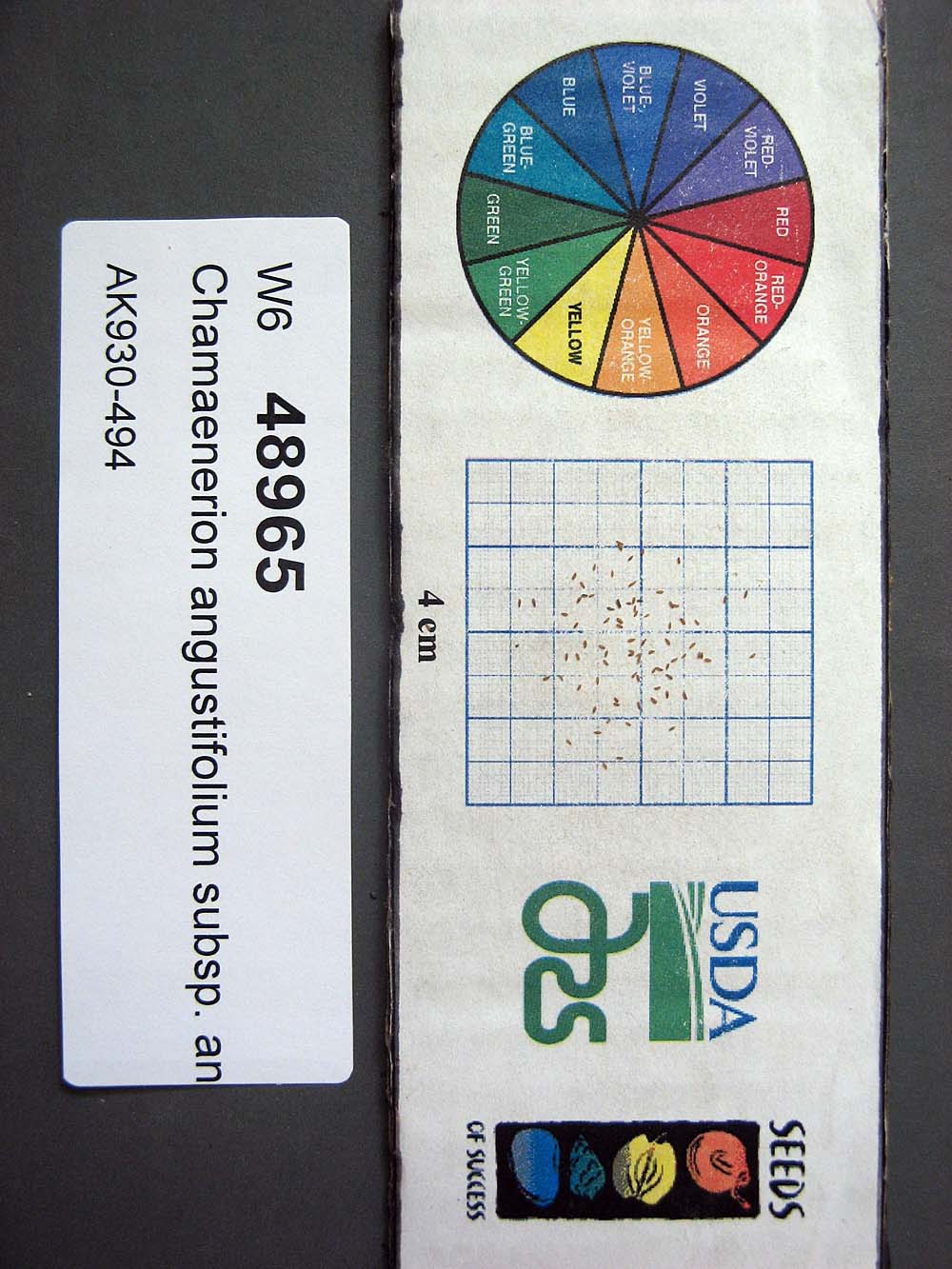 | | 2015 | | | | | | | Wild material | | 1923879 | W6 48965 |
| 211 | Ames 32831 | RLD1401 | Cornus rugosa Lam. | Minnesota, United States | NC7 | | | 2014 | COLLECTED | 09/03/2014 | Becker County near Pine Island Lake. | 47.14710000, -95.43608330 | 503 | Upland roadside near steep dropoff with lake below. Mixed deciduous and conifer forest. Growing in association with Fraxinus pennsylvanica, Quercus macrocarpa, Populus tremuloides, Betula papyrifera, Picea glauca, Pinus strobus, Sambucus sp., Acer spicatum, Rosa sp., Rubus sp., and Sanicula marilandica. | Wild material | | 1921824 | Ames 32831 |
| 212 | Ames 32835 | GA14014001 | Fraxinus pennsylvanica Marshall | North Dakota, United States | NC7 |  | | 2014 | COLLECTED | 10/30/2014 | Bottineau County, Turtle Mountains. | 48.97000000, -100.45000000 | 737 | Mixed oak-aspen forest | Wild material | | 1921828 | Ames 32835 |
| 213 | WLP 1746 | Ames 32838 | Viburnum opulus L. var. americanum Aiton | North Dakota, United States | NA | | | 2014 | COLLECTED | 10/31/2014 | Turtle Mountains - Bottineau County. | 48.95000000, -100.43000000 | 692 | Wet, aspen forest. Growing in association with Sanicula marilandica, Fragaria virginiana, Trifolium repens, Rubus sp., Typha latifolia, Prunus pensylvanica, Prunus virginiana, Corylus sp., Crataegus sp., Viburnum lentago, Rosa sp., Cornus sericea, Amelanchier sp., Symphoricarpos sp., Salix sp., Betula papyrifera, Populus tremuloides, Ulmus americana, Acer negundo, Quercus macrocarpa, and Fraxinus pennsylvanica. | Wild material | | 1921831 | WLP 1746 |
| 214 | WLP 1967 | HBC1401 | Viburnum opulus L. var. americanum Aiton | North Dakota, United States | NA | | | 2014 | COLLECTED | 09/29/2014 | Jay Wessels Wildlife Management Area located in Pembina County. | 48.80000000, -97.83000000 | 312 | Diverse habitats including edge of swamp and also upland sandy soils. Growing in association Fraxinus pennsylvanica, Fraxinus nigra, Quercus macrocarpa, Acer negundo, Ulmus americana, Populus tremuloides, Populus balsamifera, Toxicodendron radicans, Cornus sericea, Rosa sp., Corylus sp., Prunus virginiana, Ribes sp., Equisetum sp., Rubus sp., IMpatiens capensis, Thalictrum dasycarpum, Fragaria virginiana, Asarum canadense, Calamagrostis canadensis, Sium suave, Solidago gigantea, Poa pratensis, and Bromus inermis. | Wild material | | 1921830 | WLP 1967 |
| 215 | Ames 32827 | JDC/SA/2014/147/650 | Spiraea alba Du Roi | Iowa, United States | NC7 |  | | 2014 | COLLECTED | 11/04/2014 | Marietta Sand Prairie State Preserve located approximately 7.5 miles northwest of Marshalltown, T84N R19W NW 1/4 SE 1/4 NW 1/4 SW 1/4 Sec. 11. | 42.09710000, -93.03720000 | 308 | Virgin, remnant diverse prairie. Both extremely sandy and wet habitats. Colo-Ely complex (0-5 percent slopes) depth to water table: 0-12 inches, 0-11 inches: silty clay loam, poorly drained; and Sparta loamy fine sand (5-9 percent slopes) depth to water table: more than 80 inches, 0-8 inches: loamy fine sand, excessively drained | Wild material | | 1921787 | Ames 32827 |
| 216 | WLP 697 | BJP/AS/2014/001 | Amelanchier spicata (Lam.) K. Koch | Maine, United States | NA | | | 2014 | COLLECTED | 07/03/2014 | East side of Chadbourne Road ca. 3 miles northeast of Standish, Cumberland County, ME. Plants growing under power lines. | 43.77094000, -70.50589000 | | Roadside under power line. | Wild material | | 1922788 | WLP 697 |
| 217 | Ames 32761 | JDC/BP/2014/034/536 | Betula pumila L. | Iowa, United States | NC7 |  | | 2014 | COLLECTED | 09/03/2014 | Crossman Prairie State Preserve, approximately 5 miles northeast of Riceville, Howard County. | 43.40777300, -92.47500720 | 413 | Remnant tallgrass prairie. | Wild material | | 1921309 | Ames 32761 |
| 218 | Ames 32762 | JDC/BP/2014/044/546 | Betula pumila L. | Iowa, United States | NC7 |  | | 2014 | COLLECTED | 09/03/2014 | Private property, located approximately 2 miles south of Sumner, Bremer County. | 42.80952700, -92.10866400 | 328 | Remnant wet prairie. | Wild material | | 1921310 | Ames 32762 |
| 219 | Ames 32766 | JDC/MF/2014/042/544 | Monarda fistulosa L. | Iowa, United States | NC7 | | | 2014 | COLLECTED | 09/03/2014 | Private property, located approximately 2 miles south of Sumner, Bremer County. | 42.80924300, -92.10579900 | 324 | Remnant wet prairie. | Wild material | | 1921314 | Ames 32766 |
| 220 | Ames 32767 | JDC/PV/2014/036/538 | Prunella vulgaris L. | Iowa, United States | NC7 |  | | 2014 | COLLECTED | 09/03/2014 | Crossman Prairie State Preserve, approximately 5 miles northeast of Riceville, Howard County. | 43.40777300, -92.47500720 | 413 | Remnant tallgrass prairie. | Wild material | | 1921315 | Ames 32767 |
| 221 | Ames 32769 | JDC/SA/2014/033/535 | Spiraea alba Du Roi | Iowa, United States | NC7 |  | | 2014 | COLLECTED | 09/03/2014 | Crossman Prairie State Preserve, approximately 5 miles northeast of Riceville. | 43.40777300, -92.47500720 | 413 | Remnant tallgrass prairie. Clyde-Floyd complex (1-4 percent slopes) depth to water table: 12-42 inches, 0-17 inches silty clay loam, somewhat poorly drained | Wild material | | 1921317 | Ames 32769 |
| 222 | Ames 32770 | JDC/SA/2014/043/545 | Spiraea alba Du Roi | Iowa, United States | NC7 |  | | 2014 | COLLECTED | 09/03/2014 | Brayton-Horsley Prairie located approximately 2 miles south of Sumner, T92N R11W NE 1/4 NW 1/4 SE 1/4 Sec. 2. | 42.80957200, -92.10705300 | 323 | Remnant wet prairie. Klossner muck (1-3 percent slopes) depth to water table: about 0 inches, 0-10 inches: muck, very poorly drained | Wild material | | 1921318 | Ames 32770 |
| 223 | OPGC 4196 | JDC/LP/2014/035/537 | Liatris pycnostachya Michx. | Iowa, United States | OPGC | | | 2014 | COLLECTED | 09/03/2014 | Crossman Prairie State Preserve, approximately 5 miles northeast of Riceville, Howard County. | 43.40777300, -92.47500720 | 413 | Remnant tallgrass prairie. Associated with Aesclepias, Amorpha canescens, Andropogon gerardi, Baptisia, Betula pumila, Cornus amomum, C. racemosa, Dalea purpurea, Eryngium yuccifolium, Gentiana andrewsii, Helianthus grosseserratus, Hypericum ascyron subsp. pyramidatum, Liatris pcynostachya, Monarda fistulosa, Populus tremuloides, Prunella vulgaris, Prunus americana, Salix, Silphium laciniatum, Solidago, and Spiraea alba. | Wild material | | 1921312 | OPGC 4196 |
| 224 | Ames 32756 | C-alt-02 | Cornus alternifolia L. f. | Maine, United States | NC7 | | | 2014 | COLLECTED | 08/08/2014 | End of Lower Lyndon Street (public boat landing), immediately south of Caribou, Aroostook County. | 46.84576900, -68.00155500 | 121 | Specimens sampled in woods on flat terrain on the west side of the Aroostook River. Collection site is several (2-3) meters higher in elevation than the river below near a steep incline (45 degrees) at the edge of the river. Growing in association with Populus tremuloides, Pinus strobus, Acer negundo, Cornus sericea, Amelanchier sanguinea, Cornus canadensis, and Sorbus aucuparia. | Wild material | | 1920149 | Ames 32756 |
| 225 | Ames 32386 | JDC/BN/2014/013/515 | Betula nigra L. | Iowa, United States | NC7 |  | | 2014 | COLLECTED | 06/05/2014 | Bearbower Sand Prairie, T87N R9W SW 1/4 of SW 1/4 Sec. 32. | 42.29814100, -91.92822800 | 289 | Sand prairie with likely high water table. | Wild material | | 1919307 | Ames 32386 |
| 226 | Ames 32215 | JDC/SE/2013/058/502 | Salix eriocephala Michx. | Iowa, United States | NC7 |  | | 2014 | COLLECTED | 12/17/2013 | Kauten Fen, T92N R8W NE 1/4 of SW 1/4 of NE 1/4 Sec.16. | 42.78400000, -91.79050000 | 345 | Closely followed gradient of drainage creek, approximately 10 yards to the west of the small drainage creek. 1 to 4 percent slope. Clyde-Floyd complex (clay loam); poorly drained soils. Water table at approximately 12 inches. | Wild material | Plants in nature averaging 13' in height. Most specimens with red or greenish buds on nearly all genotypes with stem colors ranging from yellow/bronze, brownish-green, brown, and green at time of sampling (6 February 2023). Some specimens are rather open, wide spreading and some are rather upright. Fruiting capsules are glabrous. | 1917819 | Ames 32215 |
| 227 | Ames 32216 | Kauten Fen | Salix petiolaris Sm. | Iowa, United States | NC7 |  | | 2014 | COLLECTED | 12/17/2013 | Kauten Fen, T92N R8W NE 1/4 of SW 1/4 of NE 1/4 Sec.16. | 42.78400000, -91.79050000 | 345 | Closely followed gradient of drainage creek, approximately 10 yards to the west of the small drainage creek. 1 to 4 percent slope. Clyde-Floyd complex (clay loam); poorly drained soils. Water table at approximately 12 inches. | Wild material | Slender-leaved willow, Salix petiolaris, is a somewhat dense suckering shrub that can reach up to 10' in height with slender stems that branch minimally, but typically maintains a height of 5-8'. Native to North America, the native range covers mostly the northeastern US stretching from Maine to western North Dakota and Canada south to central Iowa (Little, E. L. Jr. 1977). Salix petiolaris typically dominates wetland areas including sedge meadows, marshes, riverbanks, and lake shores. Despite favoring wet habitats, it can also be found in dry, upland areas, especially those with high-water tables. However, longevity is generally limited in upland habitats. S. petiolaris, similar to other willow species, responds well to fire, coppicing, or heavy browsing (highly favored by deer) by sprouting new stems close to the crown. In cultivation, plants after five years will encompass a 5' x 5' area due to stems that arch from the main base of the plant. Coppicing of plants to ground level is highly recommended either annually or once every 3-5 years to maintain vigorous growth and plant health. This species requires substantial to full sun exposure and is an excellent choice for streambank stabilizations and windbreaks to reduce soil erosion and drifting snow, respectively. This accession represents genetics collected from northeastern Iowa. Plants sampled in nature were noted as multi-stemmed, minimally branched specimens with attractive, stems variable in color from bright red to orange, to orange-red, to yellow-orange, but mostly red. Majority of plants noted were less than 4.5' in height. Fruiting capsules are minutely hairy to hairy. Petioles are minutely hairy. | 1917820 | Ames 32216 |
| 228 | Ames 32197 | GA13009001 | Fraxinus pennsylvanica Marshall | Minnesota, United States | NC7 |  | | 2014 | COLLECTED | 09/23/2013 | Clearwater County. | 47.18397220, -95.47407220 | | Mixed upland deciduous forest. | Wild material | | 1917223 | Ames 32197 |
| 229 | Ames 32096 | BA13009001 | Fraxinus nigra Marshall | Minnesota, United States | NC7 |  | | 2013 | COLLECTED | 09/23/2013 | T144N R38W, Clearwater County. | 47.25711000, -95.49000667 | 543 | Edges of lakes and forest edges. Growing in association with Fraxinus pennsylvanica, Quercus macrocarpa, Ulmus americana, Populus tremuloides, Populus balsamifera, Acer saccharum, Betula papyrifera, Salix sp., Larix laricina, Quercus rubra, Abies balsamea, Picea glauca, Sambucus canadensis, Cornus rugosa, Acer spicatum, Rosa sp., Viburnum opulus var. americanum, Viburnum dentatum, Alnus sp., Cornus canadensis, Corylus sp., Prunus virginiana, Ribes sp., Prunus pensylvanica, Rhamnus alnifolia, Equisetum sp., Carex sp., Rubus sp., Impatiens capensis, Bromus sp., and Thalictrum dasycarpum. | Wild material | D.B.H. ranged between 3 and 6 inches. | 1914713 | Ames 32096 |
| 230 | W6 46514 | CP1-164-COCONINO | Bromus richardsonii Link | Arizona, United States | W6 | | | 2013 | | | | | | | Wild material | | 1913620 | W6 46514 |
| 231 | Ames 32069 | APS/PO/2013/034/119 | Physocarpus opulifolius (L.) Maxim. | Wisconsin, United States | NC7 | | | 2013 | COLLECTED | 06/17/2013 | Cana Island, Door County. | 45.08814100, -87.04772000 | | | Wild material | | 1912291 | Ames 32069 |
| 232 | W6 45883 | CBG-1843 | Aconitum columbianum Nutt. | Colorado, United States | W6 |  | Contact Site | 2013 | | | | | | | Wild material | | 1908751 | W6 45883 |
| 233 | Ames 31677 | GA12001001 | Fraxinus pennsylvanica Marshall | Minnesota, United States | NC7 |  | | 2012 | COLLECTED | 09/24/2012 | Southwest Becker County near Lake Cormorant and Lake Maud.. | 46.73903330, -95.97883330 | 415 | Edge of slough and forest. | Wild material | | 1906588 | Ames 31677 |
| 234 | Ames 31678 | GA12003001 | Fraxinus pennsylvanica Marshall | Minnesota, United States | NC7 |  | | 2012 | COLLECTED | NEAR 09/26/2012 | Buffalo River State Park along the Buffalo River, east of Glyndon, Clay County. | 46.86481660, -96.46406660 | 302 | Floodplain. Transistion zone between prairie and forest | Wild material | | 1906589 | Ames 31678 |
| 235 | Ames 31679 | GA12011001 | Fraxinus pennsylvanica Marshall | North Dakota, United States | NC7 |  | | 2012 | COLLECTED | NEAR 09/27/2012 | Sheyenne National Grassland along the Sheyenne River just east of Lisbon near Richland and Ransom County line. | 46.53246660, -97.26656660 | 302 | Riverbank and transition area of tallgrass prairie and riparian forest. Sandy-silt soil with good drainage and ph of ~7 | Wild material | Population located close to windbreak planted with Fraxinus. | 1906590 | Ames 31679 |
| 236 | Ames 31516 | JDC/CR/2012/014/407 | Cornus rugosa Lam. | Iowa, United States | NC7 |  | | 2012 | COLLECTED | 07/13/2012 | Bluffton Fir State Preserve, SW 1/4 of Section 10, T99N, R9W, Bluffton Quad, near Bluffton, Winneshiek County. | 43.41080200, -91.93845200 | 343 | Mixed hardwood forest. Very steep, northwest-facing slope. | Wild material | | 1903743 | Ames 31516 |
| 237 | DPRU 3138 | DPRU 3138 | Prunus serotina Ehrh. | Iowa, United States | DAV | | | 2012 | COLLECTED | 07/15/2012 | Clemmons Creek Wildlife Management Area, NE 1/4 of SW 1/4 of Section 11, T75N, R8W, West Chester Quad, near Washington, Washington County. | 41.31474800, -91.75097600 | 236 | Mixed hardwood forest. Associated with Carya ovata, Cornus, Corylus americana, Populus tremuloides, Quercus imbricaria, and Q. macrocarpa. | Wild material | | 1903760 | DPRU 3138 |
| 238 | Ames 32618 | AK930-131 | Potentilla bimundorum Soják | Alaska, United States | NC7 |  | | 2012 | COLLECTED | 08/17/2010 | Glenn Highway Mile 149, both sides of the road, Nelchina. | 62.02825000, -146.63390000 | 763 | Sandy, gravelly soil (2.5Y 3/3). | Wild material | | 1900710 | Ames 32618 |
| 239 | Ames 32630 | AK930-178 | Potentilla pensylvanica L. | Alaska, United States | NC7 |  | | 2012 | COLLECTED | 08/21/2010 | | 61.98275000, -145.35290000 | 386 | Gravelly and sandy soil (2.5Y 3/4). | Wild material | | 1900713 | Ames 32630 |
| 240 | Ames 32569 | AK930-176 | Linum lewisii Pursh var. lewisii | Alaska, United States | NC7 | 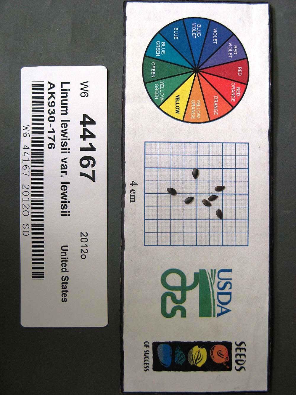 | | 2012 | COLLECTED | 08/21/2010 | | | 386 | Steep gravel slope by roadside. Gravelly and sandy soil (2.5Y 3/2). Associated with Achillea millefolium, Androsace septentrionalis, Anemone multifida, Arabis holboellii, A. x divaricarpa, Arctostaphylos, Artemisia frigida, Astragalus, Calamagrostis purpurascens, Carex, Elymus agropyroides, Eurybia sibirica, Galium boreale, Linum lewisii, Poa glauca, Polemonium pulcherrimum, Populus tremuloides, Potentilla hookeriana, P. pensylvanica, Pulsatilla, Rosa acicularis, Shepherdia canadensis, and Solidago multiradiata. | Wild material | | 1900586 | Ames 32569 |
| 241 | Ames 32627 | AK930-269 | Potentilla norvegica L. | Alaska, United States | NC7 |  | | 2012 | COLLECTED | 09/09/2010 | West end of Circle Hot Springs Air Strip. | 65.48548000, -144.62135000 | 271 | Parking area margins. Silty loam soil (2.5Y 3/6). | Wild material | | 1900616 | Ames 32627 |
| 242 | WLP 2206 | AK930-128 | Amelanchier alnifolia (Nutt.) Nutt. ex M. Roem. | Alaska, United States | NA |  | | 2012 | COLLECTED | 08/10/2010 | Off the Seward Highway, Windy Trailhead, mile marker 106. Chugach State Park. | 61.24780000, -149.32671000 | 9 | vegetated rocky mountainside Soil type: sand, loam, rocks - 2.5/1 2.5Y. South facing slope, 10 degrees. | Wild material | | 1900462 | WLP 2206 |
| 243 | Ames 32631 | AK930-288 | Potentilla pensylvanica L. | Alaska, United States | NC7 |  | | 2012 | COLLECTED | 09/11/2010 | Bluffs east of Birch Creek crossing, Steese Highway. | 65.71155000, -144.31697000 | 239 | Silt, sand, and pebbles soil (2.5Y 4/4). | Wild material | | 1901064 | Ames 32631 |
| 244 | Ames 31255 | JDZ/11/008/001 | Fraxinus pennsylvanica Marshall | North Dakota, United States | NC7 |  | | 2011 | COLLECTED | 10/26/2011 | South side of Devil's Lake, Sully's Hill National Game Preserve, Section 15, T152N, R65W, Fort Totten Quad, Benson County. | 47.98560000, -98.96810000 | 475 | 10 degrees of slope with southern and southwestern aspects. | Wild material | D.B.H. between 4 and 14 inches. | 1897493 | Ames 31255 |
| 245 | Ames 31214 | Ames 31214 | Cornus rugosa Lam. | Wisconsin, United States | NC7 |  | | 2011 | COLLECTED | 2011 | Along east side of County Road C, base of McCaslin Mountain, NW 1/4 of Section 26, T34N, R17E, Roaring Rapids Quad, Marinette County. | 45.39916660, -88.34111110 | 371 | Hilly terrain. Sandy loam soil with a shallow humus layer, near surface of granite and scattered granite boulders. Soils must be near neutral due to abscence of Ericaceae plants. | Wild material | | 1894296 | Ames 31214 |
| 246 | Ames 31215 | Ames 31215 | Diervilla lonicera Mill. | Wisconsin, United States | NC7 |  | | 2011 | COLLECTED | 2011 | Site 1: Dells above Prairie River, Bloomville Quad. T32N R7E NE 1/4 SW 1/4 Sec. 13 and Site 2: Along east side of Highway 17, Pine Dells Quad. T32N R7E NW 1/4 NW 1/4 Sec. 26 | 45.24472220, -89.57486100 | 434 | Site 1: High spots between granite boulders strewn about a young woodland. Sandy soil with a few inches of humus layer. Site 2: Roadside. Disturbed ground on sandy soil with a slight humus layer. | Wild material | | 1894298 | Ames 31215 |
| 247 | Ames 32580 | MOFI-SOS-CO932-244-10 | Monarda fistulosa L. | Colorado, United States | NC7 |  | | 2011 | COLLECTED | PRE 11/30/2011 | White Ranch Park off Belcher Hill Road located approximately 6.00 miles northwest of Golden, Jefferson County | 39.82233000, -105.29337000 | 2256 | Pine forest and meadow. Variable sloped areas (5-20 degrees) with north or northeast aspects. Silty clay loam soils. | Wild material | | 1893503 | Ames 32580 |
| 248 | W6 42582 | NV030-467 | Leymus cinereus (Scribn. & Merr.) Á. Löve | California, United States | W6 |  | | 2011 | | | | | | | Wild material | | 1893486 | W6 42582 |
| 249 | Ames 31213 | JDZ/2011/002/001 | Fraxinus nigra Marshall | North Dakota, United States | NC7 |  | | 2011 | COLLECTED | 09/09/2011 | Jay V. Wessels Wildlife Management Area, Pembina County. T162N R55W NW 1/4 Sec. 31, SE 1/4 SE 1/4 Sec. 25, and Sec. 20 Hallson Quad. | 48.82030000, -97.82040000 | 308 | Wetland. Sandy soils. | Wild material | Requests will be filled using inventory sample 11ncao05 (JDZ/2011/002/005) unless otherwise noted. | 1893359 | Ames 31213 |
| 250 | Ames 31067 | 383 | Diervilla lonicera Mill. | Pennsylvania, United States | NC7 |  | | 2011 | COLLECTED | 09/16/2011 | Along Highway 219 just north of Ridgway | 41.43800000, -78.72300000 | 446 | Mixed hardwood forest. Steep (60 degrees) north-facing slope. | Wild material | | 1891453 | Ames 31067 |
| 251 | Ames 31074 | 697 | Fraxinus americana L. | New York, United States | NC7 |  | | 2011 | COLLECTED | 09/13/2011 | Two Mile Road, Allegany County. | 42.03800000, -78.46400000 | 524 | | Wild material | | 1891460 | Ames 31074 |
| 252 | Ames 31077 | 702 | Fraxinus americana L. | New York, United States | NC7 |  | | 2011 | COLLECTED | 09/14/2011 | Wilcox Road, Chautauqua County. | 42.04000000, -79.45900000 | 526 | Upland mixed forest. | Wild material | | 1891463 | Ames 31077 |
| 253 | Ames 31078 | 705 | Fraxinus americana L. | Pennsylvania, United States | NC7 |  | | 2011 | COLLECTED | 09/16/2011 | South of US Highway 6, McKean County. | 41.66300000, -78.78900000 | 636 | Along abandoned railroad tracks. | Wild material | | 1891464 | Ames 31078 |
| 254 | Ames 31081 | 711 | Fraxinus americana L. | New York, United States | NC7 |  | | 2011 | COLLECTED | 09/11/2011 | Harrison Road, Steuben County. | 42.04500000, -77.06900000 | 461 | Roadside of dry woods. | Wild material | | 1891467 | Ames 31081 |
| 255 | Ames 31082 | 712 | Fraxinus americana L. | New York, United States | NC7 |  | | 2011 | COLLECTED | 09/11/2011 | Federal Road, south of Marsh Road (Co. 4), Chemung County. | 42.15600000, -76.65500000 | 466 | Roadside and woodland edges. | Wild material | | 1891468 | Ames 31082 |
| 256 | Ames 31085 | 699 | Fraxinus nigra Marshall | New York, United States | NC7 |  | | 2011 | COLLECTED | 09/13/2011 | Swamp Road, Cattaraugus County. | 42.18600000, -78.98600000 | 393 | Mucky swamp. | Wild material | | 1891471 | Ames 31085 |
| 257 | Ames 31088 | 700 | Fraxinus pennsylvanica Marshall | New York, United States | NC7 |  | | 2011 | COLLECTED | 09/13/2011 | Swamp Road, Cattaraugus County. | 42.18500000, -78.98500000 | 392 | Slightly higher elvation than adjacent marsh. | Wild material | | 1891474 | Ames 31088 |
| 258 | Ames 31101 | 373 | Spiraea alba Du Roi | New York, United States | NC7 |  | | 2011 | COLLECTED | 09/14/2011 | Beaver Meadow Brook Watershed, along Route 426, Chautauqua County | 42.03600000, -79.69900000 | 418 | Marsh | Wild material | | 1891487 | Ames 31101 |
| 259 | WLP 1054 | 362 | Cornus florida L. | New York, United States | NA |  | | 2011 | COLLECTED | 09/11/2011 | Cameron-North Jasper Road, Steuben County. | 42.20100000, -77.43300000 | 384 | Mixed, upland, hardwood forest. Associated with Carpinus caroliniana, Pinus strobus, Populus tremuloides, Prunus serotina, Rhus typhina, Quercus alba, Quercus velutina, Tilia americana, and Ulmus. | Wild material | | 1891448 | WLP 1054 |
| 260 | WLP 1222 | 384 | Hydrangea arborescens L. | Pennsylvania, United States | NA |  | | 2011 | COLLECTED | 09/16/2011 | Along Highway 219, Elk County. | 41.43800000, -78.72300000 | 422 | Mixed hardwood forest. Steep (60 degree) north-facing slope. Associated with Betula alleghaniensis, Diervilla lonicera, Fraxinus americana, Hypericum, Populus tremuloides, Rhododendron maximum, and Rhus typhina. | Wild material | | 1891479 | WLP 1222 |
| 261 | WLP 1653 | 382 | Rhododendron maximum L. | Pennsylvania, United States | NA |  | | 2011 | COLLECTED | 09/16/2011 | Along Highway 219, Elk County. | 41.43800000, -78.72300000 | 422 | Mixed hardwood forest. Steep (60 degree) north-facing slope. Associated with Betula alleghaniensis, Diervilla lonicera, Fraxinus americana, Hydrangea arborescens, Hypericum, Populus tremuloides, and Rhus typhina. | Wild material | | 1891485 | WLP 1653 |
| 262 | WLP 829 | 358 | Carpinus caroliniana Walter | New York, United States | NA | | | 2011 | COLLECTED | 09/11/2011 | Bixby Road, Chemung County. | 42.15900000, -76.65900000 | 440 | Roadside. Mixed, hardwood forest. Associated with Acer saccharum, Amelanchier, Fraxinus americana, Hamamelis virginiana, feral Malus, Parthenocissus quinquefolia, Populus tremuloides, and Rhus typhina. | Wild material | | 1891441 | WLP 829 |
| 263 | W6 41374 | NV030-424 | Pseudoroegneria spicata (Pursh) Á. Löve | California, United States | W6 |  | | 2011 | | | | | | | Wild material | | 1868886 | W6 41374 |
| 264 | W6 40780 | CP1-013 | Hesperostipa comata (Trin. & Rupr.) Barkworth subsp. intermedia (Scribn. & Tweedy) Barkworth | Arizona, United States | W6 |  | | 2011 | | | | | | | Wild material | | 1865234 | W6 40780 |
| 265 | W6 40496 | WY030-103 | Leymus cinereus (Scribn. & Merr.) Á. Löve | Wyoming, United States | W6 |  | | 2011 | | | | | | | Wild material | | 1861256 | W6 40496 |
| 266 | WLP 2153 | AMAL2-SOS-WY030-105-10 | Amelanchier alnifolia (Nutt.) Nutt. ex M. Roem. | Wyoming, United States | NA |  | | 2011 | COLLECTED | 08/25/2010 | Along CR 401, on west side of road, on ridgeline and slope | 41.42727778, -107.21790280 | 2383 | Grazed hillside and ridge; east to south facing 30-45 degree slope. Soil type: silty loam, 2.5Y 2.5/1 black | Wild material | | 1861143 | WLP 2153 |
| 267 | Ames 30620 | JDZ/2010/002/001 | Fraxinus nigra Marshall | Minnesota, United States | NC7 |  | | 2010 | COLLECTED | 09/11/2010 | Northeastern shore of Lake Ida east to eastern shore of Detroit Lake, Becker County. | 46.73107400, -95.94890000 | 413 | Along edge of roads and edge of mixed deciduous forests. Low spots, but not swampy. | Wild material | Unless otherwise noted, requests will be filled using a balanced sample. | 1849378 | Ames 30620 |
| 268 | NA 80378 | NA 80378 | Mahonia repens (Lindl.) G. Don | Nebraska, United States | NA | | | 2010 | COLLECTED | 08/02/2010 | Oglala National Grassland, Upper Sandy Creek | 42.80085000, -103.59591000 | 1293 | Uphill from creek under Pinus ponderosa | | | 1952925 | NA 80378 |
| 269 | Ames 31428 | PHMO4-SOS-CO932-193-09 | Physocarpus monogynus (Torr.) J. M. Coult. | Colorado, United States | NC7 |  | | 2010 | COLLECTED | 09/29/2009 | Lair o' the Bear park- From 6th Avenue and Simms, travel west on US-6 for 2.7 mi. Merge onto I-70 west and travel .9 miles. Merge onto C-470 E and travel 4.4 mi. Merge onto W Morrison Rd/CO-8 travel through town of Morrison and continue W on HWY74 for approx. 4 miles, turn left into Lair o' the Bear Park. Hike west on Bear Creek Trail for approximately .25 iles and cross bridge heading south on Bruin Bluff trail for approx. .75 mi. Plants are N and S of trail. Jefferson County, CO. | 39.66572222, -105.26072220 | 2064 | Open edges of forest | Wild material | | 1842579 | Ames 31428 |
| 270 | W6 37307 | UT933-135 | Eriocoma lettermanii (Vasey) Romasch. | Utah, United States | W6 | | | 2010 | | | | | | | Wild material | | 1833462 | W6 37307 |
| 271 | W6 37369 | UT933-160 | Bromus anomalus Rupr. ex E. Fourn. | Utah, United States | W6 |  | | 2010 | | | | | | | Wild material | | 1833514 | W6 37369 |
| 272 | W6 37370 | UT933-162 | Bromus anomalus Rupr. ex E. Fourn. | Utah, United States | W6 |  | | 2010 | | | | | | | Wild material | | 1833515 | W6 37370 |
| 273 | W6 37432 | UT933-161 | Festuca thurberi Vasey | Utah, United States | W6 |  | | 2010 | | | | | | | Wild material | | 1833568 | W6 37432 |
| 274 | W6 37545 | UT933-114 | Pseudoroegneria spicata (Pursh) Á. Löve | Utah, United States | W6 |  | | 2010 | | | | | | | Wild material | | 1833671 | W6 37545 |
| 275 | W6 36770 | UT931-99 | Carex simulata Mack. | Utah, United States | W6 |  | | 2009 | | | | | | | Wild material | | 1826924 | W6 36770 |
| 276 | WLP 813 | JDC/CO/2009/084/234 | Cephalanthus occidentalis L. | Ohio, United States | NA | | | 2009 | COLLECTED | 10/15/2009 | Along Clear Creek, near Revenge, SE 1/4 of SE 1/4 of Section 13, T13N, R19W, Rockbridge Quad, Hocking County. | 39.59361111, -82.61944444 | 246 | Wet marsh. Associated with Acer negundo, Fraxinus nigra, F. pennsylvanica, Juglans nigra, Populus tremuloides, and Viburnum prunifolium. | Wild material | | 1823915 | WLP 813 |
| 277 | W6 36819 | UT933-146 | Eriocoma nelsonii (Scribn.) Romasch. subsp. nelsonii | Utah, United States | W6 |  | | 2009 | | | | | | | Wild material | | 1827134 | W6 36819 |
| 278 | W6 36837 | UT933-145 | Bromus anomalus Rupr. ex E. Fourn. | Utah, United States | W6 |  | | 2009 | | | | | | | Wild material | | 1827150 | W6 36837 |
| 279 | W6 36898 | UT933-124 | Poa fendleriana (Steud.) Vasey | Utah, United States | W6 |  | | 2009 | | | | | | | Wild material | | 1827206 | W6 36898 |
| 280 | W6 36901 | UT933-132 | Poa fendleriana (Steud.) Vasey | Utah, United States | W6 |  | | 2009 | | | | | | | Wild material | | 1827209 | W6 36901 |
| 281 | W6 36902 | UT933-153 | Poa fendleriana (Steud.) Vasey | Utah, United States | W6 |  | | 2009 | | | | | | | Wild material | | 1827210 | W6 36902 |
| 282 | Ames 30132 | JDC/CA/2009/041/191 | Cornus amomum Mill. subsp. obliqua (Raf.) J. S. Wilson | Wisconsin, United States | NC7 |  | | 2009 | COLLECTED | 09/22/2009 | Along Kent Road, near Poynette, NW 1/4 of NW 1/4 of Section 29, T11N, R9E, Poynette Quad, Columbia County. | 43.40638889, -89.45861111 | 243 | Hinkson Creek Watershed. | Wild material | | 1819713 | Ames 30132 |
| 283 | NA 82193 | JDC/IV/2009/039/189 | Ilex verticillata (L.) A. Gray | Wisconsin, United States | NA | | | 2009 | COLLECTED | 09/22/2009 | Wisconsin: Columbia County; Along Kent Road, near Poynette, NW 1/4 of NW 1/4 of Section 29, T11N, R9E, Poynette Quad. Hinkson Creek watershed. | 43.40638889, -89.45861111 | 243 | Hinkson Creek Watershed. Associated with Acer negundo, Alnus incana subsp. rugosa, Amelanchier, Aronia melanocarpa, Carpinus caroliniana, Cornus amomum subsp. obliqua, Fraxinus nigra, Helianthus strumosus, Juglans nigra, Populus tremuloides, Prunus virginiana, and Viburnum lentago. | Wild material | | 1819738 | NA 82193 |
| 284 | WLP 854 | JDC/CC/2009/038/188 | Carpinus caroliniana Walter | Wisconsin, United States | NA | | | 2009 | COLLECTED | 09/22/2009 | Wisconsin: Columbia County; Along Kent Road, near Poynette, NW 1/4 of NW 1/4 of Section 29, T11N, R9E, Poynette Quad. Hinkson Creek watershed. | 43.40638889, -89.45861111 | 243 | Hinkson Creek Watershed. Associated with Acer negundo, Alnus incana subsp. rugosa, Amelanchier, Aronia melanocarpa, Cornus amomum subsp. obliqua, Fraxinus nigra, Helianthus strumosus, Ilex verticillata, Juglans nigra, Populus tremuloides, Prunus virginiana, and Viburnum lentago. | Wild material | | 1819709 | WLP 854 |
| 285 | Ames 30059 | JDC/AM/2009/013/163 | Aronia melanocarpa (Michx.) Elliott | Wisconsin, United States | NC7 |  | | 2009 | COLLECTED | 08/04/2009 | Hinkson Creek along Kent Road, NW 1/4 of NW 1/4 of Section 29, T11N, R9E, Poynette Quad, Poynette, Columbia County | 43.40638889, -89.45861111 | 243 | Watershed. | Wild material | | 1812362 | Ames 30059 |
| 286 | Ames 30042 | JDC/DL/2009/010/160 | Diervilla lonicera Mill. | Iowa, United States | NC7 |  | | 2009 | COLLECTED | 07/28/2009 | Dolliver State Park along Prairie Creek approximately 9.00 miles southeast of Fort Dodge, T88N R28W NE 1/4 SW 1/4 SE 1/4 Sec. 34 | 42.38611111, -94.09222222 | 308 | Large rocky limestone. North facing slope. | Wild material | | 1812305 | Ames 30042 |
| 287 | Ames 31315 | CO932-165 | Dasiphora fruticosa (L.) Rydb. subsp. floribunda (Pursh) Kartesz | Colorado, United States | NC7 |  | | 2009 | COLLECTED | 10/01/2008 | From HW285 take left at pass onto dirt road leading to parking lot. Continue past USFS campground entrance through aspen stand to open meadow. Collection on left side of road at far end of meadow. | 39.41861000, -105.75722000 | | Subalpine meadow | Wild material | Woody shrub; Leaves pinnately compound, but crowded; Flowers yellow; 5 petals; Stamens numerous. | 1808168 | Ames 31315 |
| 288 | W6 35335 | CO932-154 | Danthonia intermedia Vasey | Colorado, United States | W6 |  | | 2009 | | | | | | | Wild material | Lemmas pilose on or near margins, glaberous on back; Culms erect, 1-5dm tall | 1808166 | W6 35335 |
| 289 | W6 35336 | CO932-156 | Carex siccata Dewey | Colorado, United States | W6 |  | | 2009 | | | | | | | Wild material | Plants with long rhizomes; Leaves 1-4mm wide; Spikes 2-20, upper and lower spikes superficially the same, lowest spike sessile and separated from next lowest spike, spikes uniformly medium color; Perigynium margins serrulate and winged, perigynium faves nerved, ribbed, or striate dorsally. Perigynium length 3.0-5.5mm. | 1808281 | W6 35336 |
| 290 | W6 35339 | CO932-169 | Juncus balticus Willd. subsp. littoralis (Engelm.) Snogerup | Colorado, United States | W6 |  | | 2009 | | | | | | | Wild material | Herbs, 2-10dm. Leaves: blade absent. Infloresences appearing lateral, 6-many-flowered, loose to congested; primary bract usually several times longer than inflorescence. Flowers: tepals blackish to light brown, occasionally paler, (2.5-)3.5-5.5(-6)mm; filaments 0.2-0.5mm, anthers 1.2-2.2mm. Reference: http://www.efloras.org/florataxon.aspx?flora_id=1andtaxon_id=222000094 | 1808282 | W6 35339 |
| 291 | W6 35413 | UT933-41 | Koeleria macrantha (Ledeb.) Schult. | Utah, United States | W6 |  | | 2009 | | | | | | | Wild material | Height: 1.25 average | 1808238 | W6 35413 |
| 292 | W6 35423 | UT933-51 | Eriocoma nelsonii (Scribn.) Romasch. subsp. nelsonii | Utah, United States | W6 |  | | 2009 | | | | | | | Wild material | Height: 4.5 feet | 1808248 | W6 35423 |
| 293 | W6 35424 | UT933-52 | Eriocoma nelsonii (Scribn.) Romasch. subsp. nelsonii | Utah, United States | W6 |  | | 2009 | | | | | | | Wild material | Height: 3.0 feet | 1808249 | W6 35424 |
| 294 | W6 35425 | UT933-53 | Eriocoma nelsonii (Scribn.) Romasch. subsp. nelsonii | Utah, United States | W6 |  | | 2009 | | | | | | | Wild material | Height: 3.25 feet | 1808250 | W6 35425 |
| 295 | W6 35426 | UT933-54 | Eriocoma nelsonii (Scribn.) Romasch. subsp. nelsonii | Utah, United States | W6 |  | | 2009 | | | | | | | Wild material | Height: 3.25 feet | 1808251 | W6 35426 |
| 296 | W6 35428 | UT933-56 | Eriocoma nelsonii (Scribn.) Romasch. subsp. nelsonii | Utah, United States | W6 |  | | 2009 | | | | | | | Wild material | Height: 4 feet | 1808253 | W6 35428 |
| 297 | W6 35429 | UT933-57 | Balsamorhiza sagittata (Pursh) Nutt. | United States | W6 |  | | 2009 | | | | | | | Wild material | Height: 2 feet | 1808254 | W6 35429 |
| 298 | W6 35430 | UT933-58 | Balsamorhiza sagittata (Pursh) Nutt. | United States | W6 |  | | 2009 | | | | | | | Wild material | Height: 2 feet | 1808255 | W6 35430 |
| 299 | W6 35431 | UT933-59 | Bromus anomalus Rupr. ex E. Fourn. | Utah, United States | W6 |  | | 2009 | | | | | | | Wild material | Height: 2.5 feet | 1808256 | W6 35431 |
| 300 | W6 35432 | UT933-60 | Bromus anomalus Rupr. ex E. Fourn. | Utah, United States | W6 |  | | 2009 | | | | | | | Wild material | Height: 3 feet | 1808257 | W6 35432 |
| 301 | W6 35443 | UT933-71 | Bromus anomalus Rupr. ex E. Fourn. | Utah, United States | W6 |  | | 2009 | | | | | | | Wild material | | 1808268 | W6 35443 |
| 302 | Ames 32700 | UT931-122 | Sphaeralcea munroana (Douglas ex Lindl.) Spach | Utah, United States | NC7 |  | | 2009 | COLLECTED | 08/15/2008 | Indian Creek, turn off on SW side of Strawberry Reservoir on W side of Indian Ck, Wasatch County | 40.11800000, -111.17595000 | 2332 | Habitat: Sage community into Alpine riparian. Soil Texture: Sand | Wild material | Height: 2.5' | 1802259 | Ames 32700 |
| 303 | W6 35266 | NV030-210 | Ericameria nauseosa (Pall. ex Pursh) G. L. Nesom & G. I. Baird subsp. consimilis (Greene) G. L. Nesom & G. I. Baird var. oreophila (A. Nelson) G. L. Nesom & G. I. Baird | Nevada, United States | W6 |  | | 2009 | | | | | | | Wild material | | 1802242 | W6 35266 |
| 304 | W6 35287 | UT931-BEND73 | Juncus ensifolius Wikstr. | Utah, United States | W6 |  | | 2009 | | | | | | | Wild material | | 1802263 | W6 35287 |
| 305 | WLP 2329 | 338097 | Pinus contorta Douglas ex Loudon | Wyoming, United States | NA |  | | 2008 | COLLECTED | 09/11/2006 | | | 2600 | Slope: 0-5 Aspect: E Soil: Loam, Land form: Mountain slope. Thinned & burned about 20 years ago. | Wild material | | 1780203 | WLP 2329 |
| 306 | WLP 2331 | 338042 | Pinus flexilis E. James | Wyoming, United States | NA |  | | 2008 | COLLECTED | 08/24/2006 | Jack Ranch Access Road, north off of State Highway 28E; southeast of the Wind River Mountain Range; Township 29N, Range 101W. | 42.46915000, -108.89899000 | 2500 | Slope: 5-15 Aspect: SW Mixed conifer/sage steppe; mountain; area near glacial till, used for recreation. Soil color 10YR 3/2; sand texture. | Wild material | | 1780205 | WLP 2331 |
| 307 | Ames 29219 | JDC-0392007 | Fraxinus americana L. | New Hampshire, United States | NC7 |  | | 2007 | COLLECTED | 09/28/2007 | Along King Hill Road (starting at intersection with Castle Lane and heading east), near Exit 11 off Interstate 89, Merrimack County. | 43.39194444, -72.00416667 | 387 | | Wild material | | 1743323 | Ames 29219 |
| 308 | Ames 29866 | 203845 | Ageratina occidentalis (Hook.) R. M. King & H. Rob. | California, United States | NC7 | 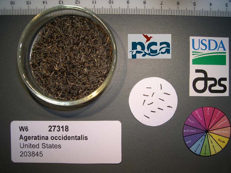 | | 2005 | COLLECTED | 09/11/2003 | | | 2805 | Woodland. Associated with Pinus ponderosa, Populus tremuloides, Artemisia sp., Penstemon rostriflorus, Aquilegia formosa/pubescens hybrid, Eriogonum nudum var. nudum and Monardella odoratissima. | Wild material | Forb 0.6 meters tall. | 1674349 | Ames 29866 |
| 309 | Ames 29917 | 203856 | Madia glomerata Hook. | Colorado, United States | NC7 |  | | 2005 | COLLECTED | 09/15/2003 | | | 2791 | Associated with Populus tremuloides, Machaeranthera tanacetifolia, Festuca thurberi, Artemisia tridentata and Gutierezzia sarothrae. | Wild material | Forb 0.15-0.6 meters tall. | 1674350 | Ames 29917 |
| 310 | Ames 29933 | 203144 | Potentilla pulcherrima Lehm. | Colorado, United States | NC7 |  | | 2005 | COLLECTED | 08/26/2003 | Ecoregion 20, Grand County. I-70 west to Silverton exit. Take Highway 9 north to Kremmling, turn right on to 40. Continue to County Road 2 (left turn). | 40.13528000, -106.22583000 | 2946 | | Wild material | Forb 0.07-0.15 meters tall. | 1674320 | Ames 29933 |
| 311 | Ames 29956 | 177504 | Thalictrum fendleri Engelm. ex A. Gray | Utah, United States | NC7 |  | | 2005 | COLLECTED | 09/16/2002 | Utah-Wyoming Rockies. Salt Lake County. Big Cottonwood Canyon, Cardiff Fork. | 40.63833000, -111.65250000 | 2544 | Riparian. | Wild material | Forb 0.6-0.9 meters tall. | 1674007 | Ames 29956 |
| 312 | OPGC 2890 | 202756 | Campanula rotundifolia L. | Colorado, United States | OPGC |  | | 2005 | COLLECTED | 08/20/2003 | | | 2414 | Associated with Linaria sp., Populus tremuloides, Picea pungens, Pinus ponderosa, Caryophyllaceae sp., Rosa sp. and Verbascum blattaria. | Wild material | Forb 0.3-0.6 meters tall. | 1674313 | OPGC 2890 |
| 313 | W6 26884 | ALT-032 | Achillea millefolium L. | California, United States | W6 |  | | 2005 | | | | | | | Wild material | Forb 0.3-0.6 meters tall. | 1673923 | W6 26884 |
| 314 | W6 26971 | UT931-RBG-18 | Aconitum columbianum Nutt. | Utah, United States | W6 |  | Contact Site | 2005 | | | | | | | Wild material | Forb 0.9 meters tall. | 1674008 | W6 26971 |
| 315 | W6 27320 | CO932-47 | Erigeron subtrinervis Rydb. ex Porter & Britton | Colorado, United States | W6 | 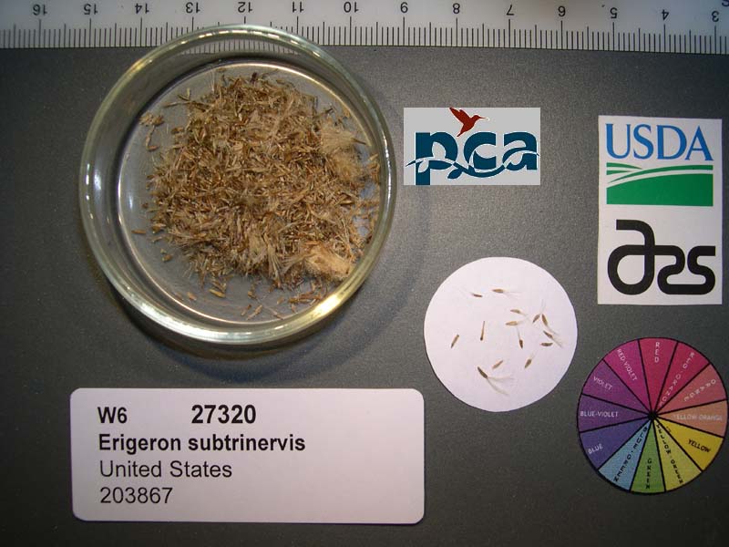 | | 2005 | | | | | | | Wild material | Forb 0.15-0.6 meters tall. | 1674351 | W6 27320 |
| 316 | WLP 2073 | 177375 | Clematis ligusticifolia Nutt. | Colorado, United States | NA | 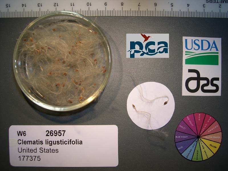 | | 2005 | COLLECTED | 09/12/2002 | | | 2409 | Pinyon-juniper woodland. Associated with Salix, Rosa woodsii, Populus tremuloides, Rhus aromatica, Yucca glauca, Cercocarpus montanus, Chrysothamnus spp. | Wild material | Forb 1.8 meters tall. | 1673995 | WLP 2073 |