| 0 | PI 690295 | 'ZAOSHUNUANGGAN (SP?)' | Prunus persica (L.) Batsch | China | DAV | | | 1999 | DONATED | 02/1999 | | | | | Cultivar | | 1580595 | PI 690295 |
| 1 | PI 692592 | SP 11-10 | Prunus brigantina Vill. | California, United States | DAV | | | 1988 | DONATED | NEAR 02/13/1988 | | | | | Wild material | Type = Apricot. Per Ali Almehdi: Dwarf, fruit 3-4 cm round. | 1010188 | PI 692592 |
| 2 | NA 89091 | 2024RM-TK-004 | Prunus sp. | Florida, United States | NA | | | 2024 | COLLECTED | 09/05/2024 | Blackwater River Wildlife Management Area: on the south side of Boundary Line Road about 0.32 kilometers west of Deaton Bridge Road along an area edged by a barbed wire fence. | 30.68579800, -86.87964300 | 45 | Plants are growing from part-sun to full sun. Plants are growing in an area that is frequently burned with a lot of [Prunus sp. (orig. listed as Prunus alabamensis)] scattered throughout. This habitat is a longleaf pine-wiregrass community with scattered turkey (Quercus laevis) and blackjack oaks (Quercus incana). There is a slight slope downward. The line of [Prunus sp.] goes along a semi-ditch on the side of a dirt road. The plants probably get a bit more water than the plants out in the open forest. The [Prunus sp.] are most often without any other close woody companions. Slope: 0 percent. Aspect: North. Geology: The underlying geology of this area is probably of lower Pliocene age and characterized as the Citronelle Formation. The Citronelle Formation is widespread in the Gulf Coastal Plain. The type section for the Citronelle Formation, named by Matson (1916), is near Citronelle, Alabama. The Citronelle Formation grades laterally, through a broad facies transition, into the Miccosukee Formation of the eastern Florida panhandle. Coe (1979) investigated the Citronelle Formation in portions of the western Florida panhandle. The Citronelle Formation is a siliciclastic, deltaic deposit that is lithologically similar to, and time equivalent with, the Cypresshead Formation and, at least in part, the Long Key Formation (Cunningham et al., 1998) of the peninsula. In the western panhandle, some of the sediments mapped as Citronelle Formation may be reworked Citronelle. The lithologies are the same and there are few fossils present to document a possible younger age. The Citronelle Formation consists of gray to orange, often mottled, unconsolidated to poorly consolidated, very fine to very coarse, poorly sorted, clean to clayey sands. It contains significant amounts of clay, silt and gravel which may occur as beds and lenses and may vary considerably over short distances. Limonite nodules and limonite-cemented beds are common. Marine fossils are rare but fossil pollen, plant remains and occasional vertebrates are found. Much of the Citronelle Formation is highly permeable. It forms the Sand and Gravel Aquifer of the surficial aquifer system. (Source: USGS Florida Geologic Map Data). Soils: The soil of this area is characterized as Lakeland Series Sand, 0 to 5 percent slopes (21). The Lakeland Series consists of very deep, excessively drained, rapid to very rapidly permeable soils on uplands. They formed in thick beds of eolian or marine and/or fluvio-marine sands in the Southern Coastal Plain MLRA (133A), the Carolina and Georgia Sandhills (MLRA 137), the Eastern Gulf Coast Flatwoods (MLRA 152A) and the Atlantic Coast Flatwoods (MLRA 153A). (Source: California Soil Resource Lab/NRCS Official Soil Series Descriptions). EPA Ecoregion (Level III): Southeastern Plains (65). EPA Ecoregion (Level IV): Southern Pine Plains and Hills (65f). | Wild material | Received as Prunus alabamensis; other collections of this material have proven not to be Prunus serotina var. alabamensis, but actually a species of plum; this will likewise be treated as unidentified material until its species can be ascertained. Collectors' notes refer to the plant by the name under which it was collected. | 2169055 | NA 89091 |
| 3 | NA 88421 | CBG-10737 | Prunus americana Marshall | | NA |  | | 2021 | | | | | | | Wild material | Spatially discreet collection for a clonal species. Counts made approximately every 6 feet. Fruits collected from the plant and the ground. | 2137989 | NA 88421 |
| 4 | GPRU 167 | MARSB-281 | Prunus serotina Ehrh. | New Jersey, United States | GEN |  | | 2019 | | | | | | | Wild material | | 2097554 | GPRU 167 |
| 5 | GPRU 168 | MARSB-577 | Prunus serotina Ehrh. | New York, United States | GEN |  | | 2019 | | | | | | | Wild material | | 2097661 | GPRU 168 |
| 6 | NA 88089 | NV040-347 | Prunus virginiana L. var. demissa (Nutt.) Torr. | Nevada, United States | NA |  | | 2019 | | | | | | | Wild material | | 2094598 | NA 88089 |
| 7 | GPRU 170 | NV030-1334 | Prunus virginiana L. | California, United States | GEN |  | | 2018 | COLLECTED | 09/25/2017 | From US-395N from Reno, turn L onto CA-70W to Chilcoot. Turn R onto CA-284N towards Frenchman Lake, and continue 7 miles until Cornus patch. | 39.87549000, -120.18370000 | 1623 | | Wild material | | 1970658 | GPRU 170 |
| 8 | GPRU 159 | OR010-370 | Prunus emarginata (Douglas) Eaton | Oregon, United States | GEN |  | | 2018 | | | | | | | Wild material | | 1967823 | GPRU 159 |
| 9 | GPRU 169 | OR010-371 | Prunus virginiana L. | Oregon, United States | GEN |  | | 2018 | | | | | | | Wild material | | 1967824 | GPRU 169 |
| 10 | GPRU 165 | NCBG-218 | Prunus serotina Ehrh. | North Carolina, United States | GEN | | | 2018 | | | | | | | Wild material | | 1965868 | GPRU 165 |
| 11 | GPRU 160 | MARSB-576 | Prunus maritima Marshall | New York, United States | GEN |  | | 2018 | | | | | | | Wild material | | 1964799 | GPRU 160 |
| 12 | GPRU 157 | CA350-56 | Prunus emarginata (Douglas) Eaton | California, United States | GEN | | | 2017 | | | | | | | Wild material | | 1946998 | GPRU 157 |
| 13 | NA 83060 | NA 83060 | Prunus hortulana L. H. Bailey | | NA | | | 2015 | | | | | | | | | 1950570 | NA 83060 |
| 14 | DPRU 3200 | JDC/PA/2014/082/584 | Prunus americana Marshall | Mississippi, United States | DAV | | | 2014 | COLLECTED | 09/22/2014 | Tishomingo County, Mississippi - Extreme northeast corner of Tishomingo County near J.P. Coleman S.P. | 34.98170000, -88.20449700 | 202 | Dry, pine-oak-hickory woods. Growing in association with Pinus sp., Liquidambar styraciflua, Fraxinus americana, Rhus typhina, Acer rubrum, Quercus stellata, and Carya sp. | Wild material | Fruits perfectly round, very ripe, and pinkish-red in color. Actively dropping at time of collection. The only specimens of this species noted during entire trip throughout northern Mississippi, parts of Arkansas, and northwest Alabama. There were two specimens a few feet from each other, but I suspect they were not genetically unique from each other due to the suckering nature of the species. Considering there was decent fruit production there must have been another Prunus sp. nearby. | 1921307 | DPRU 3200 |
| 15 | WLP 2346 | NV030-220 | Prunus virginiana L. | California, United States | NA | 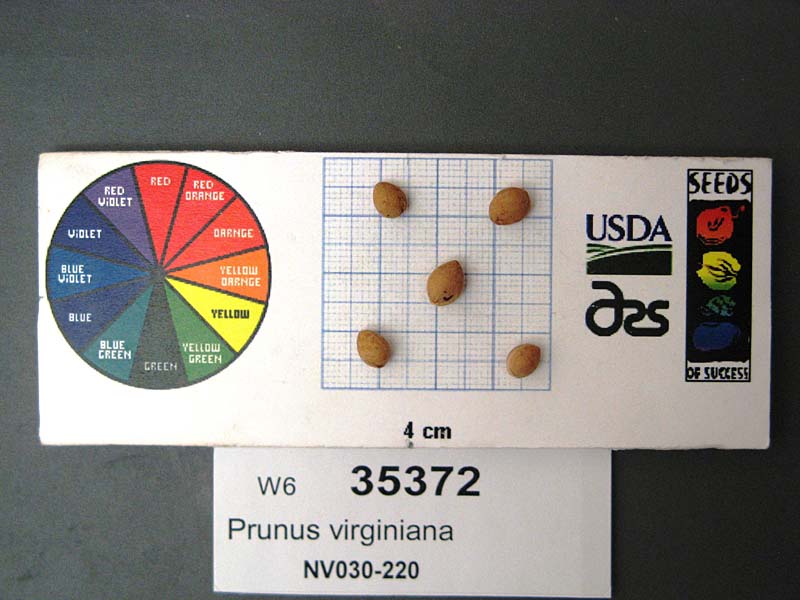 | | 2009 | COLLECTED | 10/15/2008 | Bank of the Truckee River, from Floriston exit off 80W coming from Reno, Nevada. | | | Riparian community along river; site is used for recreation; soil consists of rocks, gravel, and sand | Wild material | No thorns present. Ht: 1-3 meters. | 1808200 | WLP 2346 |
| 16 | WLP 2343 | UT931-119 | Prunus virginiana L. | Utah, United States | NA |  | | 2009 | COLLECTED | 10/15/2008 | U.S. Forest Service land; three-mile-long stretch along White River bottom and side of White River turn off (Reservation Ridge Road, FR81), after right hand fork. | 39.95836000, -111.01903000 | 2337 | Riparian/mountain brush community in mountain river bottom; land used for rangeland, recreation; soil color is white, texture clay. | Wild material | | 1802258 | WLP 2343 |
| 17 | WLP 2309 | 171591 | Prunus virginiana L. | Idaho, United States | NA | 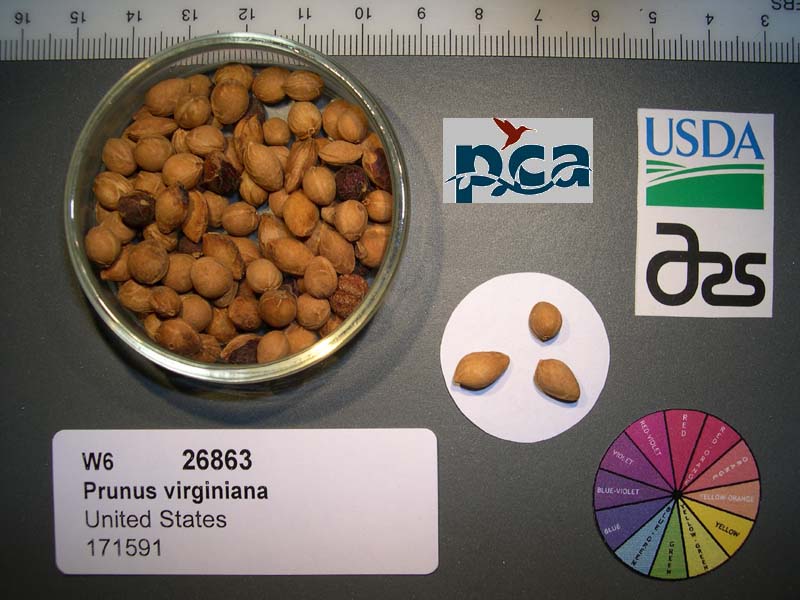 | | 2005 | COLLECTED | 07/31/2002 | [GPS coordinates and locality data withheld by NPGS; further data are not available to us at the time of accessioning.] | | 975 | Creek banks in sagebrush steppe. Soil dark brown silt-clay. Sagebrush steppe. Associated with Crataegus douglasii, Amelanchier alnifolia, Salix sp., Populus trichocarpa, Artemisia tridentata, Crataegus columbiana. | Wild material | Shrub 0.6-4.5 meters tall. | 1673902 | WLP 2309 |
| 18 | NA 68773 | NACPEC97014 | Prunus maackii Rupr. | Jilin Sheng, China | NA | | | 1997 | COLLECTED | 10/01/1997 | Changbai County | 41.53166667, 128.13861111 | 900 | Rocky edge of road along stream with Ulmus sp., Chosenia arbutifolia and Acer tegmentosum; 45% slope. | Wild material | 10 m; tree; fruit black | 1579190 | NA 68773 |
| 19 | NA 67792 | QLG162 | Prunus padus L. | Shaanxi Sheng, China | NA | | | 1996 | COLLECTED | 10/18/1996 | Ningxi Preserve, Pu He Forest Station, enroute to mountaintop | 33.65027778, 106.75027778 | 1880 | Full sun in rocks; <3% W slope; sandy loam soil; w/ Populus sp., Equisetum sp., Lespedeza sp., Sorbaria sp., Philadelphus sp., Rubus sp., and numerous herbaceous plants. | Wild material | single and multi-stemmed shrub or small tree; height of 2-4m; d.b.h. of 5-10cm; gray and shallowly fissured bark; black fruit, borne on a peduncle 1.5in. | 1532665 | NA 67792 |
| 20 | NA 67714 | NA 67714 | Prunus salicina Lindl. | Shaanxi Sheng, China | NA | | | 1996 | COLLECTED | 09/11/1996 | Foping Nature Preserve, Yue Ba Forest Station, Da Cheng Hao. | 33.57886000, 107.83691000 | 1150 | An open, sunny site five meters above the stream, on the west side of the stream. | Wild material | | 1953081 | NA 67714 |
| 21 | DPRU 1956 | 'Scoldus #1' | Prunus sp. | Former Serbia and Montenegro | DAV | | | 1996 | COLLECTED | | | | | | Cultivated material | Type = plum. Originally cited in GRIN as armeniaca and latter changed to sp | 1565543 | DPRU 1956 |
| 22 | DPRU 2305 | 7 | Prunus sp. | Turkmenistan | DAV | | | 1995 | COLLECTED | | | | | | Wild material | Package label on receipt reads "Prunus sp. Wild Plum". Fruit Type: cherry | 1498647 | DPRU 2305 |
| 23 | DPRU 2306 | 39 | Prunus sp. | Turkmenistan | DAV | | | 1995 | COLLECTED | | | | | | Wild material | Package label reads 'A. sp. 9/5/95 Prunus'. Site note: 'A' here probably stands for Amygdalus. | 1498652 | DPRU 2306 |
| 24 | DPRU 551 | SP 13-9 | Prunus sp. | California, United States | DAV | | | 1988 | DONATED | 02/13/1988 | | | | | Wild material | Fruit type = Plum. | 1007079 | DPRU 551 |
| 25 | DPRU 921 | 'St. Julien' | Prunus domestica L. subsp. insititia (L.) C. K. Schneid. | California, United States | DAV | | | 1988 | DONATED | NEAR 02/13/1988 | | | | | Cultivar | Type = Plum. Per Ali Almehdi: Fruit pendulous, round to ovoid, blue-black. Per "Plums and Plum Culture," p. 122: "St. Julien.-- A somewhat striking but inferior type, partaking partly of the character of the Myroblan and partly of the character of the Damson. Used for stocks." From "Revue Horticole," by Carriere, 1892, as quoted in "The Plums of New York" (see citation): "Tree vigorous, with branches spreading-straggling, relatively short, branched at the extremity. Leaves numerous, slightly roughened by the prominence of the numerous nerves on the lower surface, short, oblong, usually rounded at the apex, attenuated at the base, where are found a few very small glands; petiole about two centimeters long, yellowish, lengthening out into a prominent midrib; buds short, oval, pointed, deep reddish-bown; dark green above, pale green below, bordered regularly with very close, short, slightly inclined teeth. Fruits very abundant, pedunculate, spherical or oblong, peduncle a little bent, rather strong, nearly three centimeters long, inserted in a very small cavity, regularly rounded. Skin strongly attached to the flesh, even, glossy, purplish-black, more or less glaucous, flesh free from the seed, pulpy, very juicy, soft, greenish, sweet, leaving a taste a little strong, but not disagreeable; seed short oval, elliptical, flattened, ten millimeters in width, nearly fifteen to sixteen millimeters in length, with grayish-red surface roughened by small, regular projections. Matures from July to September." | 1010042 | DPRU 921 |
| 26 | DPRU 545 | 'Simon' | Prunus simonii Carrière | China | DAV |  | | 1986 | COLLECTED | | | | | | Cultivar | Per The American Fruit Culturist by Thomas (see citation): "Simon or Prunus Simoni. Tree a very strict, upright grower, often unproductive in the East; fruit large, flattened, apple-shape; skin deep red, sprinkled with small yellow dots; stem short, the fruit sticking closely to the branches; flesh yellow, cling, poor. Early. In the interior regions of California it is said to be of good quality and is largely grown for market. Prunus Simoni is distinct from the Japanese plums, prunus triflora, and is generally considered to be a good species." Per Ali Almehdi: "Narrow topped tree. Leaves rather thick,very veiny. Flower white, 3/4 inch diameter. Fruit 5-7 cm diameter, fair." | 1007041 | DPRU 545 |
| 27 | DPRU 579 | Myrobalan | Prunus cerasifera Ehrh. | California, United States | DAV |  | | 1986 | DONATED | 02/04/1986 | | | | | Cultivar | Per Thomas (see citation): "Myrobolan. Small (one inch in diameter), round, remotely heart-shaped; bright red, bloom faint; stalk short and slender; cavity narrow; flesh juicy, slightly fibrous, soft, melting, sub-acid, not rich, adhereing to the oval, pointed stone. Ripens very early or about midsummer, its only value. Distinguished by its smooth, slender shoots, small bushy head, and narrow leaves. There are many varieties. This plum is considered to be a variety of the Prunus cerasifera. It has long been a favorite stock for other plums, and immense numbers have been imported into this country. As it dwarfs the scion, however, it is not so much used as formerly." Per Manual of Fruits, p. 62: "Myobalan-- Virginia Cherry. Young wood smooth; fruit medium, cordate, red, with the appearance of a Cherry, hence its name; flesh greenish, melting, very juicy, and pleasant. Beginning of August." | 1007304 | DPRU 579 |
| 28 | PI 702705 | NV052-745 | Hilaria rigida (Thurb.) Benth. ex Scribn. | Nevada, United States | S9 | | | 2020 | | | | | | | Wild material | | 2106490 | PI 702705 |
| 29 | PI 702700 | MARSB-195 | Dichanthelium clandestinum (L.) Gould | Delaware, United States | S9 |  | | 2019 | | | | | | | Wild material | | 2097514 | PI 702700 |
| 30 | PI 702701 | MARSB-249 | Dichanthelium clandestinum (L.) Gould | New York, United States | S9 |  | | 2019 | | | | | | | Wild material | | 2097541 | PI 702701 |
| 31 | PI 710481 | NCBG-748 | Chamaecrista nictitans (L.) Moench | Virginia, United States | S9 |  | | 2018 | | | | | | | Wild material | | 1966042 | PI 710481 |
| 32 | PI 710516 | NCBG-715 | Eleocharis obtusa (Willd.) Schult. | Maryland, United States | S9 |  | | 2018 | | | | | | | Wild material | | 1966025 | PI 710516 |
| 33 | PI 675223 | NV030-382 | Pseudoroegneria spicata (Pursh) Á. Löve | Nevada, United States | W6 | 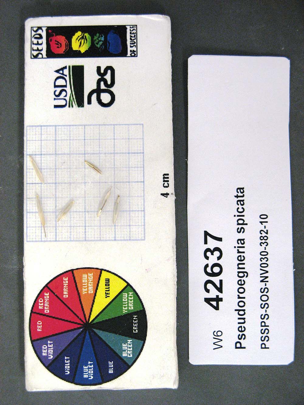 | | 2011 | | | | | | | Wild material | | 1893540 | PI 675223 |
| 34 | PI 675216 | R10-02-006 | Phleum phleoides (L.) H. Karst. | Stavropol, Russian Federation | W6 |  | | 2011 | COLLECTED | 07/17/2010 | 10 km NW of Stavropol | 45.11500000, 41.86900000 | 520 | Stony steppe surrounded by forest (Quercus robur, Q. calcarea, Fraxinus exelsior): moderate depth soils. Black A horizon, weathered limestone parent material: hay meadows: : seed collected from >100 plants | Wild material | | 1883108 | PI 675216 |
| 35 | PI 676154 | R10-02-007 | Brachypodium rupestre (Host) Roem. & Schult. | Stavropol, Russian Federation | W6 | | | 2011 | COLLECTED | 07/17/2010 | 10 km NW of Stavropol | 45.11500000, 41.86900000 | 520 | Stony steppe surrounded by forest (Quercus robur, Q. calcarea, Fraxinus exelsior): moderate depth soils. Black A horizon, weathered limestone parent material: hay meadows: : seed collected from >100 plants | Wild material | | 1883109 | PI 676154 |
| 36 | PI 678469 | R10-02-008 | Lolium perenne L. | Stavropol, Russian Federation | W6 |  | | 2011 | COLLECTED | 07/17/2010 | 10 km NW of Stavropol | 45.11500000, 41.86900000 | 520 | Stony steppe surrounded by forest (Quercus robur, Q. calcarea, Fraxinus exelsior): moderate depth soils. Black A horizon, weathered limestone parent material: hay meadows: : seed collected from >100 plants | Wild material | | 1883110 | PI 678469 |
| 37 | PI 635445 | H. lupulus var. neomexicanus OCJ-19 | Humulus lupulus L. var. neomexicanus A. Nelson & Cockerell | Colorado, United States | COR | | | 2002 | COLLECTED | 09/13/2002 | County Road 57 (Forest Road 215) on the east fork of Miller Creek. South of County Road 8, east of Meeker. Within the White River National Forest. | 39.88222000, -107.76778000 | 2192 | Raparian; Salix sp. and Prunus virginiana. | Wild material | | 1642204 | PI 635445 |
| 38 | PI 635448 | Deer Gulch, CO #1A Female | Humulus lupulus L. var. neomexicanus A. Nelson & Cockerell | Colorado, United States | COR | | Out of Season | 2002 | COLLECTED | 09/14/2002 | West of State Highway 13 at Rio Blanco on County Road 5 to Davis Gulch. Up Davis Gulch and one half mile up Deer Gulch along stream bed (dry due to drought). | 39.77028000, -108.00306000 | 2170 | Prunus virginiana, Symphoricarpus sp., Ribes aureum and Chrysothamnus nauseosus. | Wild material | | 1642207 | PI 635448 |
| 39 | PI 635449 | Deer Gulch #1B Female | Humulus lupulus L. var. neomexicanus A. Nelson & Cockerell | Colorado, United States | COR |  | Out of Season | 2002 | COLLECTED | 09/14/2002 | West of State Highway 13 at Rio Blanco on County Road 5 to Davis Gulch. Up Davis Gulch and one half mile up Deer Gulch along stream bed (dry due to drought). | 39.77028000, -108.00306000 | 2170 | Prunus virginiana, Symphoricarpus sp., Ribes aureum and Chrysothamnus nauseosus. | Wild material | | 1642208 | PI 635449 |
| 40 | PI 635450 | Deer Gulch #1 Male | Humulus lupulus L. var. neomexicanus A. Nelson & Cockerell | Colorado, United States | COR |  | Out of Season | 2002 | COLLECTED | 09/14/2002 | West of State Highway 13 at Rio Blanco on County Road 5 to Davis Gulch. Up Davis Gulch and one half mile up Deer Gulch along stream bed (dry due to drought). | 39.77028000, -108.00306000 | 2179 | Prunus virginiana, Symphoricarpus sp., Ribes aureum and Chrysothamnus nauseosus. | Wild material | | 1642209 | PI 635450 |
| 41 | PI 635454 | H. lupulus var. neomexicanus OCJ-29 | Humulus lupulus L. var. neomexicanus A. Nelson & Cockerell | Colorado, United States | COR | | | 2002 | COLLECTED | 09/14/2002 | North from Interstate 70 on Colorado River Road, take County Road 150 to Sweetwater Lake. About one half mile past upper end of lake along road side. | 39.81028000, -107.18222000 | 2366 | Raparian; Alnus tenuifolia, Prunus virginiana, Salix sp. and Ribes sp. | Wild material | | 1642213 | PI 635454 |
| 42 | PI 635455 | H. lupulus var. neomexicanus OCJ-30 | Humulus lupulus L. var. neomexicanus A. Nelson & Cockerell | Colorado, United States | COR | | | 2002 | COLLECTED | 09/14/2002 | North from Interstate 70 on Colorado River Road, take County Road 150 to Sweetwater Lake. Just past the upper end of lake along road. | 39.81028000, -107.17111000 | 2363 | Raparian; Alnus tenuifolia, Prunus virginiana and Salix sp. | Wild material | | 1642214 | PI 635455 |
| 43 | PI 635465 | H. lupulus var. neomexicanus OCJ-42 | Humulus lupulus L. var. neomexicanus A. Nelson & Cockerell | Colorado, United States | COR | | | 2002 | COLLECTED | 09/16/2002 | North of Poncha Springs along the Arkansas River on U.S.-285 Two miles north of Nathrop turn north on County Road 301 (C-301). Upstream from C-301 bridge, between C-301A and river. | 38.76778000, -106.09722000 | 2348 | Raparian; Salix sp., Prunus virginiana, Ribes aureum and Rosa sp. | Wild material | | 1642224 | PI 635465 |
| 44 | PI 635466 | H. lupulus var. neomexicanus OCJ-43 | Humulus lupulus L. var. neomexicanus A. Nelson & Cockerell | Colorado, United States | COR | | | 2002 | COLLECTED | 09/16/2002 | South of Poncha Springs on U.S.-285 up Poncha Creek at milepost 122 on west side of road. | 38.45472000, -106.10056000 | 2532 | Raparian; Prunus virginiana, Ribes aureum, Salix sp. and Chrysothamnus nauseosus. | Wild material | | 1642225 | PI 635466 |
| 45 | PI 635486 | H. lupulus var. neomexicanus OCJ-65 | Humulus lupulus L. var. neomexicanus A. Nelson & Cockerell | Colorado, United States | COR | | | 2002 | COLLECTED | 09/19/2002 | West of Trinidad on State Highway 12 to one mile east of Cordova Plaza (2 miles east of Weston), along roadside. | 37.13417000, -104.81472000 | 2070 | On a fencerow above the Purgatoire River and railroad tracks with Salix sp., Prunus virginiana and Clematis sp. | Wild material | | 1642246 | PI 635486 |
| 46 | PI 635491 | H. lupulus var. neomexicanus OCJ-75 | Humulus lupulus L. var. neomexicanus A. Nelson & Cockerell | Colorado, United States | COR | | | 2002 | COLLECTED | 09/20/2002 | From Sedalia go 0.75 mile south of junction with U.S.-85 on State Highway 67 to the west side of West Plum Creek. Both sides of road. | 39.42917000, -104.96861000 | 1779 | Prunus sp. and Populus sp. | Wild material | | 1642256 | PI 635491 |
| 47 | PI 635399 | H. lupulus var. lupuloides Oxbow-S #6 | Humulus lupulus L. var. lupuloides E. Small | Saskatchewan, Canada | COR | | | 2002 | COLLECTED | 10/09/2001 | | | | | Wild material | low seed count | 1642156 | PI 635399 |
| 48 | PI 635401 | H. lupulus var. lupuloides Oxbow-S #8 | Humulus lupulus L. var. lupuloides E. Small | Saskatchewan, Canada | COR | | | 2002 | COLLECTED | 10/09/2001 | | | | | Wild material | | 1642158 | PI 635401 |
| 49 | PI 635402 | H. lupulus var. lupuloides Oxbow-S #9 | Humulus lupulus L. var. lupuloides E. Small | Saskatchewan, Canada | COR | | | 2002 | COLLECTED | 10/09/2001 | | | | | Wild material | | 1642159 | PI 635402 |
| 50 | PI 635404 | H. lupulus var. lupuloides Oxbow-S #11 | Humulus lupulus L. var. lupuloides E. Small | Saskatchewan, Canada | COR | | | 2002 | COLLECTED | 10/09/2001 | | | | | Wild material | low seed count | 1642161 | PI 635404 |
| 51 | PI 635406 | H. lupulus var. lupuloides Oxbow-S #13 | Humulus lupulus L. var. lupuloides E. Small | Saskatchewan, Canada | COR | | | 2002 | COLLECTED | 10/09/2001 | | | | | Wild material | low seed count | 1642163 | PI 635406 |
| 52 | PI 635408 | H. lupulus var. lupuloides Oxbow-S #15 | Humulus lupulus L. var. lupuloides E. Small | Saskatchewan, Canada | COR | | | 2002 | COLLECTED | 10/09/2001 | | | | | Wild material | | 1642165 | PI 635408 |
| 53 | PI 635411 | H. lupulus var. lupuloides Oxbow-S #18 | Humulus lupulus L. var. lupuloides E. Small | Saskatchewan, Canada | COR | | | 2002 | COLLECTED | 10/09/2001 | | | | | Wild material | low seed count | 1642168 | PI 635411 |
| 54 | PI 635412 | H. lupulus var. lupuloides Oxbow-S #19 | Humulus lupulus L. var. lupuloides E. Small | Saskatchewan, Canada | COR | | | 2002 | COLLECTED | 10/09/2001 | | | | | Wild material | | 1642169 | PI 635412 |
| 55 | PI 635413 | H. lupulus var. lupuloides Oxbow-S #20 | Humulus lupulus L. var. lupuloides E. Small | Saskatchewan, Canada | COR | | | 2002 | COLLECTED | 10/09/2001 | | | | | Wild material | | 1642170 | PI 635413 |
| 56 | PI 635414 | H. lupulus var. lupuloides Oxbow-S #21 | Humulus lupulus L. var. lupuloides E. Small | Saskatchewan, Canada | COR | | | 2002 | COLLECTED | 10/09/2001 | | | | | Wild material | low seed count | 1642171 | PI 635414 |
| 57 | PI 633814 | CH97 05-06 | Malus toringo (Siebold) de Vriese | Sichuan Sheng, China | GEN |  | | 1997 | COLLECTED | 09/23/1997 | Town of Mao xian ping, 6km. northeast of Maoxian. | 31.72055556, 103.91611111 | 1800 | Loam, dark brown soil. Slope 15-20% incline. Aspect-South, partial canopy. Landform: mountain, higher in this area. Dominent tree sp: Oak; Assoc: Juglans, Prunus. Assoc shrub: Rosa, Corylus, Vitis, Actinidin, Viburnum. | Wild material | Additional Habitat Notes: Collection tree located on south side of slope, 20% incline. Sampled 30-50 fruits each from 7 trees. Partial leaf lobing. In B9 orchard 2007, note from P. Forsline looks like hupehensis. | 1652465 | PI 633814 |
| 58 | PI 633815 | CH97 05-08 | Malus toringo (Siebold) de Vriese | Sichuan Sheng, China | GEN |  | | 1997 | COLLECTED | 09/23/1997 | Town of Mao xian ping, 6km. northeast of Maoxian. | 31.72055556, 103.91611111 | 1800 | Loam, dark brown soil. Slope 15-20% incline. Aspect-South, partial canopy. Landform: mountain, higher in this area. Dominent tree sp: Oak; Assoc: Juglans, Prunus. Assoc shrub: Rosa, Corylus, Vitis, Actinidin, Viburnum. | Wild material | Additional Habitat Notes: Collection tree located on south side of slope, 20% incline. Sampled 30-50 fruits each from 7 trees. Partial leaf lobing. In B9 orchard 2007, noted by P. Forsline looks like hupehensis. | 1652466 | PI 633815 |
| 59 | PI 703119 | CH97 05-02 | Malus toringo (Siebold) de Vriese | Sichuan Sheng, China | GEN | | | 1997 | COLLECTED | 09/23/1997 | Town of Mao xian ping, 6km. northeast of Maoxian. | 31.72055556, 103.91611111 | 1800 | Loam, dark brown soil. Slope 15-20% incline. Aspect-South, partial canopy. Landform: mountain, higher in this area. Dominent tree sp: Oak; Assoc: Juglans, Prunus. Assoc shrub: Rosa, Corylus, Vitis, Actinidin, Viburnum. | Wild material | Additional Habitat Notes: Collection tree 6m. in height, 10cm. diameter; above undergrowth; located on south side of slope, 15% incline. Sampled 30-50 fruits each from 7 trees. | 1695656 | PI 703119 |
| 60 | PI 703120 | CH97 05-03 | Malus prattii (Hemsl.) C. K. Schneid. | Sichuan Sheng, China | | | Historic | 1997 | COLLECTED | 09/23/1997 | Town of Mao xian ping, 6km. northeast of Maoxian. | 31.72055556, 103.91611111 | 1800 | Loam, dark brown soil. Slope 15-20% incline. Aspect-South, partial canopy. Landform: mountain, higher in this area. Dominent tree sp: Oak; Assoc: Juglans, Prunus. Assoc shrub: Rosa, Corylus, Vitis, Actinidin, Viburnum. | Wild material | Additional Habitat Notes: Collection tree located on south side of slope, 10% incline. Sampled 30-50 fruits each from 7 trees. Some spotting on leaves, no leaf lobing. | 1695662 | PI 703120 |
| 61 | PI 703121 | CH97 05-03 | Malus prattii (Hemsl.) C. K. Schneid. | Sichuan Sheng, China | | | Historic | 1997 | COLLECTED | 09/23/1997 | Town of Mao xian ping, 6km. northeast of Maoxian. | 31.72055556, 103.91611111 | 1800 | Loam, dark brown soil. Slope 15-20% incline. Aspect-South, partial canopy. Landform: mountain, higher in this area. Dominent tree sp: Oak; Assoc: Juglans, Prunus. Assoc shrub: Rosa, Corylus, Vitis, Actinidin, Viburnum. | Wild material | Additional Habitat Notes: Collection tree located on south side of slope, 10% incline. Sampled 30-50 fruits each from 7 trees. Some spotting on leaves, no leaf lobing. | 1695664 | PI 703121 |
| 62 | PI 703122 | CH97 05-03 | Malus prattii (Hemsl.) C. K. Schneid. | Sichuan Sheng, China | | | Historic | 1997 | COLLECTED | 09/23/1997 | Town of Mao xian ping, 6km. northeast of Maoxian. | 31.72055556, 103.91611111 | 1800 | Loam, dark brown soil. Slope 15-20% incline. Aspect-South, partial canopy. Landform: mountain, higher in this area. Dominent tree sp: Oak; Assoc: Juglans, Prunus. Assoc shrub: Rosa, Corylus, Vitis, Actinidin, Viburnum. | Wild material | Additional Habitat Notes: Collection tree located on south side of slope, 10% incline. Sampled 30-50 fruits each from 7 trees. Some spotting on leaves, no leaf lobing. | 1695665 | PI 703122 |
| 63 | PI 703123 | CH97 05-06 | Malus toringo (Siebold) de Vriese | Sichuan Sheng, China | | | Historic | 1997 | COLLECTED | 09/23/1997 | Town of Mao xian ping, 6km. northeast of Maoxian. | 31.72055556, 103.91611111 | 1800 | Loam, dark brown soil. Slope 15-20% incline. Aspect-South, partial canopy. Landform: mountain, higher in this area. Dominent tree sp: Oak; Assoc: Juglans, Prunus. Assoc shrub: Rosa, Corylus, Vitis, Actinidin, Viburnum. | Wild material | Additional Habitat Notes: Collection tree located on south side of slope, 20% incline. Sampled 30-50 fruits each from 7 trees. Partial leaf lobing. | 1695703 | PI 703123 |
| 64 | PI 703124 | CH97 05-06 | Malus toringo (Siebold) de Vriese | Sichuan Sheng, China | | | Historic | 1997 | COLLECTED | 09/23/1997 | Town of Mao xian ping, 6km. northeast of Maoxian. | 31.72055556, 103.91611111 | 1800 | Loam, dark brown soil. Slope 15-20% incline. Aspect-South, partial canopy. Landform: mountain, higher in this area. Dominent tree sp: Oak; Assoc: Juglans, Prunus. Assoc shrub: Rosa, Corylus, Vitis, Actinidin, Viburnum. | Wild material | Additional Habitat Notes: Collection tree located on south side of slope, 20% incline. Sampled 30-50 fruits each from 7 trees. Partial leaf lobing. | 1695698 | PI 703124 |
| 65 | PI 703125 | CH97 05-06 | Malus toringo (Siebold) de Vriese | Sichuan Sheng, China | | | Historic | 1997 | COLLECTED | 09/23/1997 | Town of Mao xian ping, 6km. northeast of Maoxian. | 31.72055556, 103.91611111 | 1800 | Loam, dark brown soil. Slope 15-20% incline. Aspect-South, partial canopy. Landform: mountain, higher in this area. Dominent tree sp: Oak; Assoc: Juglans, Prunus. Assoc shrub: Rosa, Corylus, Vitis, Actinidin, Viburnum. | Wild material | Additional Habitat Notes: Collection tree located on south side of slope, 20% incline. Sampled 30-50 fruits each from 7 trees. Partial leaf lobing. | 1695701 | PI 703125 |
| 66 | PI 703126 | CH97 05-08 | Malus toringo (Siebold) de Vriese | Sichuan Sheng, China | | | Historic | 1997 | COLLECTED | 09/23/1997 | Town of Mao xian ping, 6km. northeast of Maoxian. | 31.72055556, 103.91611111 | 1800 | Loam, dark brown soil. Slope 15-20% incline. Aspect-South, partial canopy. Landform: mountain, higher in this area. Dominent tree sp: Oak; Assoc: Juglans, Prunus. Assoc shrub: Rosa, Corylus, Vitis, Actinidin, Viburnum. | Wild material | Additional Habitat Notes: Collection tree located on south side of slope, 20% incline. Sampled 30-50 fruits each from 7 trees. Partial leaf lobing. | 1695709 | PI 703126 |
| 67 | PI 703127 | CH97 05-08 | Malus toringo (Siebold) de Vriese | Sichuan Sheng, China | | | Historic | 1997 | COLLECTED | 09/23/1997 | Town of Mao xian ping, 6km. northeast of Maoxian. | 31.72055556, 103.91611111 | 1800 | Loam, dark brown soil. Slope 15-20% incline. Aspect-South, partial canopy. Landform: mountain, higher in this area. Dominent tree sp: Oak; Assoc: Juglans, Prunus. Assoc shrub: Rosa, Corylus, Vitis, Actinidin, Viburnum. | Wild material | Additional Habitat Notes: Collection tree located on south side of slope, 20% incline. Sampled 30-50 fruits each from 7 trees. Partial leaf lobing. | 1695714 | PI 703127 |
| 68 | PI 703128 | CH97 05-08 | Malus toringo (Siebold) de Vriese | Sichuan Sheng, China | | | Historic | 1997 | COLLECTED | 09/23/1997 | Town of Mao xian ping, 6km. northeast of Maoxian. | 31.72055556, 103.91611111 | 1800 | Loam, dark brown soil. Slope 15-20% incline. Aspect-South, partial canopy. Landform: mountain, higher in this area. Dominent tree sp: Oak; Assoc: Juglans, Prunus. Assoc shrub: Rosa, Corylus, Vitis, Actinidin, Viburnum. | Wild material | Additional Habitat Notes: Collection tree located on south side of slope, 20% incline. Sampled 30-50 fruits each from 7 trees. Partial leaf lobing. | 1695715 | PI 703128 |
| 69 | PI 703129 | CH97 05-09 | Malus toringo (Siebold) de Vriese | Sichuan Sheng, China | | | Historic | 1997 | COLLECTED | 09/23/1997 | Town of Mao xian ping, 6km. northeast of Maoxian. | 31.72055556, 103.91611111 | 1800 | Loam, dark brown soil. Slope 15-20% incline. Aspect-South, partial canopy. Landform: mountain, higher in this area. Dominent tree sp: Oak; Assoc: Juglans, Prunus. Assoc shrub: Rosa, Corylus, Vitis, Actinidin, Viburnum. | Wild material | Additional Habitat Notes: Collection tree 7m. in height, 10cm. diameter; located on southwest side of slope, 20% incline, in an open area. Sampled 30-50 fruits each from 7 trees. | 1695719 | PI 703129 |
| 70 | PI 703130 | CH97 05-10 | Malus toringo (Siebold) de Vriese | Sichuan Sheng, China | | | Historic | 1997 | COLLECTED | 09/23/1997 | Town of Mao xian ping, 6km. northeast of Maoxian. | 31.72055556, 103.91611111 | 1800 | Loam, dark brown soil. Slope 15-20% incline. Aspect-South, partial canopy. Landform: mountain, higher in this area. Dominent tree sp: Oak; Assoc: Juglans, Prunus. Assoc shrub: Rosa, Corylus, Vitis, Actinidin, Viburnum. | Wild material | Additional Habitat Notes: Collection tree located on southwest side of slope, 20% incline, in an open area. Sampled 30-50 fruits each from 7 trees. Partially lobed leaves. | 1695732 | PI 703130 |
| 71 | PI 703131 | CH97 05-10 | Malus toringo (Siebold) de Vriese | Sichuan Sheng, China | | | Historic | 1997 | COLLECTED | 09/23/1997 | Town of Mao xian ping, 6km. northeast of Maoxian. | 31.72055556, 103.91611111 | 1800 | Loam, dark brown soil. Slope 15-20% incline. Aspect-South, partial canopy. Landform: mountain, higher in this area. Dominent tree sp: Oak; Assoc: Juglans, Prunus. Assoc shrub: Rosa, Corylus, Vitis, Actinidin, Viburnum. | Wild material | Additional Habitat Notes: Collection tree located on southwest side of slope, 20% incline, in an open area. Sampled 30-50 fruits each from 7 trees. Partially lobed leaves. | 1695733 | PI 703131 |
| 72 | PI 703132 | CH97 05-10 | Malus toringo (Siebold) de Vriese | Sichuan Sheng, China | | | Historic | 1997 | COLLECTED | 09/23/1997 | Town of Mao xian ping, 6km. northeast of Maoxian. | 31.72055556, 103.91611111 | 1800 | Loam, dark brown soil. Slope 15-20% incline. Aspect-South, partial canopy. Landform: mountain, higher in this area. Dominent tree sp: Oak; Assoc: Juglans, Prunus. Assoc shrub: Rosa, Corylus, Vitis, Actinidin, Viburnum. | Wild material | Additional Habitat Notes: Collection tree located on southwest side of slope, 20% incline, in an open area. Sampled 30-50 fruits each from 7 trees. Partially lobed leaves. | 1695728 | PI 703132 |
| 73 | PI 703133 | CH97 05-11 | Malus prattii (Hemsl.) C. K. Schneid. | Sichuan Sheng, China | | | Historic | 1997 | COLLECTED | 09/23/1997 | Town of Mao xian ping, 6km. northeast of Maoxian. | 31.72055556, 103.91611111 | 1800 | Loam, dark brown soil. Slope 15-20% incline. Aspect-South, partial canopy. Landform: mountain, higher in this area. Dominent tree sp: Oak; Assoc: Juglans, Prunus. Assoc shrub: Rosa, Corylus, Vitis, Actinidin, Viburnum. | Wild material | Additional Habitat Notes: Collection tree located on southwest side of slope, 20% incline, in an open area. Sampled 30-50 fruits each from 7 trees. No leaf lobing. Some leaf spotting, some bronzing. | 1695740 | PI 703133 |
| 74 | PI 703134 | CH97 05-11 | Malus prattii (Hemsl.) C. K. Schneid. | Sichuan Sheng, China | | | Historic | 1997 | COLLECTED | 09/23/1997 | Town of Mao xian ping, 6km. northeast of Maoxian. | 31.72055556, 103.91611111 | 1800 | Loam, dark brown soil. Slope 15-20% incline. Aspect-South, partial canopy. Landform: mountain, higher in this area. Dominent tree sp: Oak; Assoc: Juglans, Prunus. Assoc shrub: Rosa, Corylus, Vitis, Actinidin, Viburnum. | Wild material | Additional Habitat Notes: Collection tree located on southwest side of slope, 20% incline, in an open area. Sampled 30-50 fruits each from 7 trees. No leaf lobing. Some leaf spotting, some bronzing. | 1695742 | PI 703134 |
| 75 | PI 703135 | CH97 05-11 | Malus prattii (Hemsl.) C. K. Schneid. | Sichuan Sheng, China | | | Historic | 1997 | COLLECTED | 09/23/1997 | Town of Mao xian ping, 6km. northeast of Maoxian. | 31.72055556, 103.91611111 | 1800 | Loam, dark brown soil. Slope 15-20% incline. Aspect-South, partial canopy. Landform: mountain, higher in this area. Dominent tree sp: Oak; Assoc: Juglans, Prunus. Assoc shrub: Rosa, Corylus, Vitis, Actinidin, Viburnum. | Wild material | Additional Habitat Notes: Collection tree located on southwest side of slope, 20% incline, in an open area. Sampled 30-50 fruits each from 7 trees. No leaf lobing. Some leaf spotting, some bronzing. | 1695760 | PI 703135 |
| 76 | PI 657118 | KAZ 96 09-01P-2 | Malus hybr. | Kazakhstan | GEN |  | | 1996 | COLLECTED | 09/15/1996 | Talasky Alatau. Located in "Reserve" Aksu Jabagli. Collected on north slope of deep canyon, near river bed. | 42.31638889, 70.37388889 | 1010 | Soil: fine, stoney. Incline 5%, north, open. Rainfall 320mm. Dominant tree sp: Malus; Assoc.-Prunus mahaleb. | Uncertain improvement status | Sampled 8-14 fruits from 10 trees. Flesh flavor is subacid. Scab is absent, leaf miner. Insect damage. -- One fully domesticated parent intentified using 20K Illumina Infinium apple SNP array. Parent is Reinette_Simirenko. | 1694096 | PI 657118 |
| 77 | PI 657119 | KAZ 96 09-01P-2 | Malus domestica (Suckow) Borkh. | Kazakhstan | GEN |  | | 1996 | COLLECTED | 09/15/1996 | Talasky Alatau. Located in "Reserve" Aksu Jabagli. Collected on north slope of deep canyon, near river bed. | 42.31638889, 70.37388889 | 1010 | Soil: fine, stoney. Incline 5%, north, open. Rainfall 320mm. Dominant tree sp: Malus; Assoc.-Prunus mahaleb. | Uncertain improvement status | Sampled 8-14 fruits from 10 trees. Flesh flavor is subacid. Scab is absent, leaf miner. Insect damage. -- Identified as fully domestic using 20K Illumina Infinium apple SNP array. Parentage is Reinette_de_Hollande and Reinette_Simirenko | 1694097 | PI 657119 |
| 78 | PI 657120 | KAZ 96 09-01P-4 | Malus sieversii (Ledeb.) M. Roem. | Kazakhstan | GEN | | | 1996 | COLLECTED | 09/15/1996 | Talasky Alatau. Located in "Reserve" Aksu Jabagli. Collected on north slope of deep canyon, near river bed. | 42.32833333, 70.36888889 | 1010 | Soil: fine, stoney. Incline 5%, north, open. Rainfall 320mm. Dominant tree sp: Malus; Assoc.-Prunus mahaleb. | Wild material | Sampled 8-14 fruits from 10 trees. Flesh flavor is acid. Over color is 65% red. Scab is absent, egg shaped. | 1694101 | PI 657120 |
| 79 | PI 604709 | 062 | Trifolium pratense L. | Russian Federation | W6 | | | 1996 | COLLECTED | 07/30/1995 | Province Armavir/Maykop, 1 km north of Chamlykskaya, valley of Chemlink. | 44.73611111, 40.84444444 | 244 | Past logged, now roadway. Slope 0-5%, aspect SW. Light open. Soil sand with gravel, pH 7.5. Seasonally dry, roadside. Vegetation closed, evergreen tall grass. Surrounding vegetation open deciduous forest with closed lower layers. | Wild material | Dominant tree species Quercus sp., Q. robur. Dominant shrub species Carpinus sp., Prunus sp. Population distribution patchy, abundance occasional. Growth habit erect. Flower red. Extensive regional climate data available in spreadsheet format or image maps in raster format suitable for GIS analysis. Contact Dr. Stephanie L. Greene (sgreene@ars-grin.gov). | 1530848 | PI 604709 |
| 80 | PI 604733 | 083 | Trifolium medium L. | Krasnodar, Russian Federation | W6 | | | 1996 | COLLECTED | 08/10/1995 | Province Krasnodar, southwest of Krasnodar, village Azovskaya. | 44.79361111, 38.55777778 | 210 | Past cultivated, now grazed. Slope 0-5%, aspect W. Light open. Soil loam, clay, pH 5.0-5.6. Seasonally dry, mid slope. Vegetation closed, seasonal broad-leafed herb vegetation. Surrounding veg. open deciduous forest with closed lower layers | Wild material | Dominant tree species Fagus sp. and Quercus sp. Dominant shrub species Ribes sp., Prunus sp., Caprinus sp., Crataegus sp. Population distribution patchy, abundance occasional. Growth habit prostrate. Extensive regional climate data available in spreadsheet format or image maps in raster format suitable for GIS analysis. Contact Dr. Stephanie L. Greene (sgreene@ars-grin.gov). | 1530863 | PI 604733 |
| 81 | PI 604734 | 080 | Trifolium pratense L. | Krasnodar, Russian Federation | W6 | | | 1996 | COLLECTED | 08/16/1995 | Province Krasnodar, southwest of Krasnodar, village Azovskaya. | 44.79361111, 38.55777778 | 210 | Past cultivated, now grazed. Slope 0-5%, aspect W. Light open. Soil loam, clay, pH 4.8. Seasonally dry, mid slope. Vegetation closed, seasonal broad-leafed herb vegetation. Surrounding veg. open deciduous forest with closed lower layers. | Wild material | Dominant tree species Fagus sp. and Quercus sp. Dominant shrub species Ribes sp., Prunus sp., Caprinus sp., Crataegus sp. Population distribution patchy, abundance occasional. Growth habit erect. Flower purple/red. Extensive regional climate data available in spreadsheet format or image maps in raster format suitable for GIS analysis. Contact Dr. Stephanie L. Greene (sgreene@ars-grin.gov). | 1530861 | PI 604734 |
| 82 | PI 604739 | D2 | Trifolium pratense L. | Krasnodar, Russian Federation | W6 | | | 1996 | COLLECTED | | Province Krasnodar, 5 km south of Il'skaya, southwest of Krasnodar. | 44.78333333, 38.56666667 | 190 | Grazed, Slope 0-10%, aspect NE. Light open. Soil sand, loam, pH 4.6-5.3. Seasonally dry, upper slope. Vegetation closed, seasonal broad-leafed herb vegetation. Surrounding vegetation open deciduous forest with closed lower layers. | Wild material | Dominant tree species Quercus sp. Dominant shrub species Ribes sp., Prunus sp., Caprinus sp., Crataegus sp. Dominant herb/grass species Daucus carota, Potentilla sp., Festuca pratensis, Medicago falcata, Lotus c., Dorycnium intermedium, Dorycnium graceum. Extensive regional climate data available in spreadsheet format or image maps in raster format suitable for GIS analysis. Contact Dr. Stephanie L. Greene (sgreene@ars-grin.gov). | 1531080 | PI 604739 |
| 83 | PI 604745 | D144 | Trifolium repens L. | Russian Federation | W6 | | | 1996 | COLLECTED | 09/04/1995 | 1 km. east of Yeroslavskaya, 30+ km. east of Maykop. | 44.61861111, 40.49000000 | 340 | Area grazed. Slope 11-40%, aspect S. Light open. Soil clay, pH basic. Seasonally dry, lower slope. Vegetation closed, seasonal tall grass. Surrounding vegetation open deciduous forest with closed lower layers. | Wild material | Dominant tree species Crataegus sp., Quercus sp., Monogyna, Pentagyna. Dominant shrub species Rosa sp., Prunus sp. Dominant herb/grass species Achellea sp., Daucus c., thistle, bindweed, chichory, Bothriochloa i., Cynodon d. Population distribution patchy, abundance rare. Growth habit prostrate. Flower white. Extensive regional climate data available in spreadsheet format or image maps in raster format suitable for GIS analysis. Contact Dr. Stephanie L. Greene (sgreene@ars-grin.gov). | 1531071 | PI 604745 |
| 84 | PI 604749 | D145 | Trifolium ambiguum M. Bieb. | Russian Federation | W6 | | | 1996 | COLLECTED | 09/04/1995 | Province Maykop/Labinsk, 5 km south of Vladimirskaya. | 44.48027778, 40.81472222 | 360 | Grazed, cut hay. Slope 11-40%, aspect SW. Light open. Soil clay, pH 7.7. Moist, lower slope, landslide, unstable site,springs,boggy zones.Vegetation closed, seasonal tall grass.Surrounding veg. open deciduous forest with closed lower layers | Wild material | Dominant tree species Crataegus sp., Quercus sp., Hornbeam-Oak. Dominant shrub species Sambucus sp., Rosa sp., Prunus sp. Dominant herb/grass species Achillea sp., Daucus c., Medicago f., Bothriochloa i., Erytregia sp. Population distribution patchy, abundance rare. Growth habit prostrate. Flower white. Extensive regional climate data available in spreadsheet format or image maps in raster format suitable for GIS analysis. Contact Dr. Stephanie L. Greene (sgreene@ars-grin.gov). | 1531072 | PI 604749 |
| 85 | PI 604771 | 218 | Trifolium pratense L. | Russian Federation | W6 | | | 1996 | COLLECTED | 09/04/1995 | 1 km. east of Yeroslavskaya, 30+ km. east of Maykop. | 44.61861111, 40.49000000 | 340 | Area grazed. Slope 11-40%, aspect S. Light open. Soil clay, pH basic. Seasonally dry, lower slope. Vegetation closed, seasonal tall grass. Surrounding vegetation open deciduous forest with closed lower layers. | Wild material | Dominant tree species Crataegus sp., Quercus sp., Monogyna, Pentagyna. Dominant shrub species Rosa sp., Prunus sp. Dominant herb/grass species Achellea sp., Daucus c., thistle, bindweed, chicory, Bothriochloa i., Cynodon d. Population distribution patchy, abundance occasional. Growth habit erect. Flower red. Extensive regional climate data available in spreadsheet format or image maps in raster format suitable for GIS analysis. Contact Dr. Stephanie L. Greene (sgreene@ars-grin.gov). | 1530960 | PI 604771 |
| 86 | PI 611653 | 082 | Trifolium caucasicum Tausch | Krasnodar, Russian Federation | W6 |  | | 1996 | COLLECTED | 08/10/1995 | Province Krasnodar, southwest of Krasnodar, village Azovskaya. | 44.79361111, 38.55777778 | 210 | Past cultivated, now grazed. Slope 0-5%, aspect W. Light open. Soil loam, clay, pH 5.0-5.5. Seasonally dry, mid slope. Vegetation closed, seasonal broad-leafed herb vegetation. Surrounding veg. open deciduous forest with closed lower layers | Wild material | Dominant tree species Faus sp. and Quercus sp. Dominant shrub species Ribes sp., Prunus sp., Caprinus sp., Crataegus sp. Population distribution patchy, abundance occasional. Growth habit erect. Extensive regional climate data available in spreadsheet format or image maps in raster format suitable for GIS analysis. Contact Dr. Stephanie L. Greene (sgreene@ars-grin.gov). | 1530862 | PI 611653 |
| 87 | PI 618784 | 0060 | Phleum pratense L. | Russian Federation | W6 | | | 1996 | COLLECTED | 09/04/1995 | 1 km. east of Yeroslavskaya, and 30+ km. east of Maykop. | 44.61861111, 40.49000000 | 350 | Area grazed. Slope 11-40%, aspect S. Light open. Soil clay, cracking, pH 6.3-6.8, large rocks in profile. Seasonally dry, lower slope. Vegetation closed, seasonal tall grass. Surrounding veg. open deciduous forest with closed lower layers. | Wild material | Dominant tree species Crataegus sp., Quercus sp., Monogyna, Pentagyna. Dominant shrub species Rosa sp., Prunus sp. Dominant herb/grass species Achellea sp., Daucus c., thistle, bindweed, chicory, Bothriochloa i., Cynodon d. Population distribution patchy, abundance frequent. Growth habit erect. Extensive regional climate data available in spreadsheet format or image maps in raster format suitable for GIS analysis. Contact Dr. Stephanie L. Greene (sgreene@ars-grin.gov). | 1518092 | PI 618784 |
| 88 | PI 631669 | D113 | Medicago sativa L. subsp. falcata (L.) Arcang. | Krasnodar, Russian Federation | W6 | | | 1996 | COLLECTED | 08/16/1995 | Province Krasnodar, 8 km south of site 61, village Kaluzhskaya. | 44.69388889, 38.95388889 | 260 | Logged/cleared. Slope 0-5%, aspect SE. Light 1/4 shade. Soil loam to clay, limestones in profile, pH 7.0. Seasonally dry, lower slope, pasture/meadow. Vegetation closed, seasonal broad-leafed herb vegetation. | Wild material | Surrounding vegetation open deciduous forest with closed lower layers. Dominant shrub species Prunus, Ribes. Dominant herb/grass species broadleaves, Elytrigia sp., Rubus sp., Lycopus sp., some grasses, poor in legumes, some Lathyrus sp., T. hybridum, T. medium, T. pratense, Artemisia sp. Population distribution patchy, abundance occasional. Growth habit erect. Flower yellow. Extensive regional climate data available in spreadsheet format or image maps in raster format suitable for GIS analysis. Contact Dr. Stephanie L. Greene (sgreene@ars-grin.gov). | 1531062 | PI 631669 |
| 89 | PI 634052 | 219 | Trifolium fragiferum L. | Russian Federation | W6 |  | | 1996 | COLLECTED | 09/04/1995 | 1 km. east of Yeroslavskaya, 30+ km. east of Maykop. | 44.61861111, 40.49000000 | 340 | Area grazed. Slope 11-40%, aspect S. Light open. Soil clay, pH 6.3-7.0. Seasonally dry, lower slope. Vegetation closed, seasonal tall grass. Surrounding vegetation open deciduous forest with closed lower layers. | Wild material | Dominant tree species Crataegus sp., Quercus sp., Monogyna, Pentagyna. Dominant shrub species Rosa sp., Prunus sp. Dominant herb/grass species Achellea sp., Daucus c., thistle, bindweed, chicory, Bothriochloa i., Cynodon d. Population distribution uniform, abundance frequent. Growth habit prostrate. Flower pink-rose. Extensive regional climate data available in spreadsheet format or image maps in raster format suitable for GIS analysis. Contact Dr. Stephanie L. Greene (sgreene@ars-grin.gov). | 1530961 | PI 634052 |
| 90 | PI 634068 | D116 | Trifolium fragiferum L. | Krasnodar, Russian Federation | W6 | | | 1996 | COLLECTED | | Province Krasnodar, southwest of Krasnodar, village Azovskaya. | 44.79361111, 38.55777778 | 210 | Past cultivated, now grazed. Slope 0-5%, aspect W. Light open. Soil loam, clay, pH 4.8-6.2, 0-15 cm. Seasonally dry, mid slope. Vegetation closed, seasonal broad-leafed herb vegetation. | Wild material | Surrounding vegetation open deciduous forest with closed lower layers. Dominant tree species Fagus sp., Quercus sp. Dominant shrub species Ribes sp., Prunus sp., Carpinus sp., Crataegus sp. Extensive regional climate data available in spreadsheet format or image maps in raster format suitable for GIS analysis. Contact Dr. Stephanie L. Greene (sgreene@ars-grin.gov). | 1531063 | PI 634068 |
| 91 | PI 634256 | 0069 | Dactylis glomerata L. | Russian Federation | W6 | | | 1996 | COLLECTED | 09/04/1995 | Province Maykop/Labinsk, 5 km. south of Vladimirskaya. | 44.48027778, 40.81472222 | 380 | Area grazed, cut hay. Slope 11-40%, aspect SW. Light open. Soil clay, pH 7.7. Moist, lower slope. Vegetation closed, seasonal tall grass. Surrounding vegetation open deciduous forest with closed lower layers. | Wild material | Dominant tree species Crataegus sp., Quercus sp., Hornbeam-Oak. Dominant shrub species Sambucus sp., Rosa sp., Prunus sp. Dominant herb/grass species Achellia sp., Daucus c., Medicago f., Bothriochloa i., Erytregia sp. Population distribution patchy, abundance occasional. Growth habit erect. Extensive regional climate data available in spreadsheet format or image maps in raster format suitable for GIS analysis. Contact Dr. Stephanie L. Greene (sgreene@ars-grin.gov). | 1518094 | PI 634256 |
| 92 | PI 641439 | 061 | Lotus corniculatus L. | Russian Federation | W6 |  | | 1996 | COLLECTED | 07/30/1995 | Province/subdivision Maykop/Armavir, 5 km south of Armavir, valley of Ouropriva. | 44.91944444, 41.14055556 | 152 | Past logged, now grazed. Slope 0-5%, aspect E. Light 1/4 shade. Soil clay with gravel, pH 7.4. Seasonally dry, stream terrace, bottom of quarry. Vegetation open, evergreen dwarf shrub steppe savanna. Surrounding vegetation evergreen steppe. | Wild material | Dominant tree species Quercus sp., Q. robur. Dominant shrub species Prunus sp. Dominant herb/grass species Amygadus sp., Festuca sp. Population distribution patchy, abundance frequent. Growth habit semi-erect. Flower yellow. Extensive regional climate data available in spreadsheet format or image maps in raster format suitable for GIS analysis. Contact Dr. Stephanie L. Greene (sgreene@ars-grin.gov). | 1530847 | PI 641439 |
| 93 | PI 641462 | 220 | Lotus corniculatus L. | Russian Federation | W6 |  | | 1996 | COLLECTED | 09/04/1995 | 1 km. east of Yeroslavskaya, 30+ km. east of Maykop. | 44.61861111, 40.49000000 | 340 | Area grazed. Slope 11-40%, aspect S. Light open. Soil clay, pH basic. Seasonally dry, lower slope. Vegetation closed, seasonal tall grass. Surrounding vegetation open deciduous forest with closed lower layers. | Wild material | Dominant tree species Crataegus sp., Quercus sp., Monogyna, Pentagyna. Dominant shrub species Rosa sp., Prunus sp. Dominant herb/grass species Achellea sp., Daucus c., thistle, bindweed, chicory, Bothriochloa i., Cynodon d. Population distribution patchy, abundance frequent. Growth habit semi-erect. Flower yellow. Extensive regional climate data available in spreadsheet format or image maps in raster format suitable for GIS analysis. Contact Dr. Stephanie L. Greene (sgreene@ars-grin.gov). | 1530962 | PI 641462 |
| 94 | PI 641463 | 223 | Medicago sativa L. subsp. falcata (L.) Arcang. | Russian Federation | W6 | | | 1996 | COLLECTED | 09/04/1995 | Province Maykop/Labinsk, 5 km south of Vladimirskaya. | 44.48027778, 40.81472222 | 360 | Past and current grazing, cut hay. Slope 11-40%, aspect SW. Light open. Soil clay, pH basic-7.7. Moist, lower slope. Unstable site. Vegetation closed, seasonal tall grass. Surrounding veg. open deciduous forest with closed lower layers. | Wild material | Dominant tree species Crataegus sp., Quercus sp., Hornbeam-Oak. Dominant shrub species Sambucus sp., Rosa sp., Prunus sp. Dominant herb/grass species Achillea sp., Daucus c., Medicago f., Bothriochloa i., Erytregia sp. Population distribution uniform, abundant. Growth habit erect. Flower yellow. Extensive regional climate data available in spreadsheet format or image maps in raster format suitable for GIS analysis. Contact Dr. Stephanie L. Greene (sgreene@ars-grin.gov). | 1530963 | PI 641463 |
| 95 | PI 641464 | 225 | Lotus corniculatus L. | Russian Federation | W6 |  | | 1996 | COLLECTED | 09/04/1995 | Province Maykop/Labinsk, 5 km south of Vladimirskaya. | 44.48027778, 40.81472222 | 360 | Past and current grazing, cut hay. Slope 11-40%, aspect SW. Light open. Soil clay, pH basic-7.7. Moist, lower slope. Unstable site. Vegetation closed, seasonal tall grass. Surruounding veg. open deciduous forest with closed lower layers. | Wild material | Dominant tree species Crataegus sp., Quercus sp., Hornbeam-Oak. Dominant shrub species Sambucus sp., Rosa sp., Prunus sp. Dominant herb/grass species Achillea sp., Daucus c., Medicago f., Bothriochloa i., Erytregia sp. Population distribution patchy, abundance frequent to occasional. Growth habit semi-erect. Flower yellow. Extensive regional climate data available in spreadsheet format or image maps in raster format suitable for GIS analysis. Contact Dr. Stephanie L. Greene (sgreene@ars-grin.gov). | 1530964 | PI 641464 |
| 96 | PI 641500 | D117 | Lotus corniculatus L. | Krasnodar, Russian Federation | W6 |  | | 1996 | COLLECTED | 08/17/1995 | Province Krasnodar, southwest of Krasnodar, village Azovskaya. | 44.79361111, 38.55777778 | 210 | Past cultivated, now grazed. Slope 0-5%, aspect W. Light open. Soil loam, clay, glacial deposits, variable soils, pH 4.8-6.2, 0-15cm. Seasonally dry, mid slope. Vegetation closed, seasonal broad-leafed herb vegetation. | Wild material | Surrounding vegetation open deciduous forest with closed lower layers. Dominant tree species Fagus sp., Quercus sp. Dominant shrub species Ribes sp., Prunus sp., Caprinus sp., Crataegus sp. Population distribution patchy, abundance occasional. Growth habit semi-prostrate. Flower yellow. Extensive regional climate data available in spreadsheet format or image maps in raster format suitable for GIS analysis. Contact Dr. Stephanie L. Greene (sgreene@ars-grin.gov). | 1531064 | PI 641500 |
| 97 | PI 641727 | D3 | Trifolium striatum L. | Krasnodar, Russian Federation | S9 | | | 1996 | COLLECTED | | Province Krasnodar, 5 km south of Il'skaya, southwest of Krasnodar. | 44.78333333, 38.56666667 | 190 | Grazed. Slope 0-10%, aspect NE. Light open. Soil sand, loam, pH 4.6-5.3. Seasonally dry, upper slope. Vegetation closed, seasonal broad-leafed herb vegetation. Surrounding vegetation open deciduous forest with closed lower layers. | Wild material | Dominant tree species Quercus sp. Dominant shrub species Ribes sp., Prunus sp., Caprinus sp., Crataegus sp. Dominant herb/grass species Daucus carota, Potentilla sp., Festuca pratensis, Medicago falcata, Lotus c., Dorycnium intermedium, Dorycnium graceum. Extensive regional climate data available in spreadsheet format or image maps in raster format suitable for GIS analysis. Contact Dr. Stephanie L. Greene (sgreene@ars-grin.gov). | 1531085 | PI 641727 |
| 98 | PI 655805 | 001 | Trifolium repens L. | Krasnodar, Russian Federation | W6 |  | | 1996 | COLLECTED | 08/07/1995 | South of Il'skaya (Azovskaya), 5 km southwest of Krasnodar. | 44.78333333, 38.56666667 | 190 | Past and current grazing.Slope 1-10%, aspect NE.Open light.Sandy loam, pH 4.6-5.3. Seasonally dry, upper slope.Vegetation closed, seasonal broad-leafed herb.Surrounding veg.open deciduous forest with closed lower layers, agri. disturbance. | Wild material | Dominant tree species Quercus sp. Dominant shrub species Ribes sp., Prunus sp., Caprinus sp., Crataegus sp. Dominant herb/grass species Daucus carota, Potentilla sp., Festuca pratensis, Medicago falcata, Lotus cauc., Dorycnium intermedium, Dorycnium graceum. Population distibution patchy, abundance frequent. Growth habit prostrate. Flower white. Extensive regional climate data available in spreadsheet format or image maps in raster format suitable for GIS analysis. Contact Dr. Stephanie L. Greene (sgreene@ars-grin.gov). | 1530806 | PI 655805 |
| 99 | PI 655810 | 084 | Trifolium hybridum L. | Krasnodar, Russian Federation | W6 |  | | 1996 | COLLECTED | 08/10/1995 | Province Krasnodar, southwest of Krasnodar, village Azovskaya. | 44.79361111, 38.55777778 | 210 | Past cultivated, now grazed. Slope 0-5%, aspect W. Light open. Soil loam, clay, pH 5.0-5.5. Seasonally dry, mid slope. Vegetation closed, seasonal broad-leafed herb vegetation. Surrounding veg. open deciduous forest with closed lower layers | Wild material | Dominant tree species Fagus sp. and Quercus sp. Dominant shrub species Ribes sp., Prunus sp., Caprinus sp., Crataegus sp. Population distribution uniform, abundance frequent. Growth habit erect. Flower rose/pink. Extensive regional climate data available in spreadsheet format or image maps in raster format suitable for GIS analysis. Contact Dr. Stephanie L. Greene (sgreene@ars-grin.gov). | 1530864 | PI 655810 |
| 100 | PI 678913 | VIR D68 | Onobrychis vassilczenkoi Grossh. | Russian Federation | W6 |  | | 1996 | COLLECTED | 07/30/1995 | Province Maykop/Armavir, 5 km. south of Armavir. | 44.91916667, 41.14055556 | 150 | Past logged, now grazed. Slope 0-5%, aspect E. Light 1/4 shade. Soil clay with gravel, pH 7.4. Seasonally dry, stream terrace, quarry. Vegetation open, evergreen dwarf shrub steppe savanna. Surrounding vegetation evergreen steppe. | Wild material | Dominant tree species Quercus robur, Quercus sp. Dominant shrub species Prunus sp. Dominant herb/grass species Amygadus sp., Festuca sp. Population distribution patchy, abundance frequent. Growth habit semi-erect. Extensive regional climate data available in spreadsheet format or image maps in raster format suitable for GIS analysis. Contact Dr. Stephanie L. Greene (sgreene@ars-grin.gov). | 1518068 | PI 678913 |
| 101 | PI 599798 | Kaz 95 17-02P-1 | Malus sieversii (Ledeb.) M. Roem. | Kazakhstan | GEN | | | 1995 | COLLECTED | 09/09/1995 | Karatau Province. Boraldy River Forest area. 2 km. South of Boraldy Forest Camp which is 80 km. North of Chimkent. Stream bed area. | 42.87416667, 69.89027778 | 620 | Rocky soil, dry. Slope incline: Flat. Dominant tree sp: Crataegus; Associated-M. sieversii, Prunus, Morus, Rhamnus. Dominant shrub sp: Clematis; Assoc-Rubus. Dominant herbaceous: Grasses. | Wild material | Sampled 8 fruits from 1 tree. Flesh flavor is aromatic. | 1551092 | PI 599798 |
| 102 | PI 600561 | Kaz 95 17-01 | Malus sieversii (Ledeb.) M. Roem. | Kazakhstan | GEN | | | 1995 | COLLECTED | 09/09/1995 | Karatau Province. Boraldy River Forest area. 2 km. South of Boraldy Forest Camp which is 80 km. North of Chimkent. Stream bed area. | 42.87416667, 69.89027778 | 620 | Rocky soil, dry. Slope incline: flat. Dominant tree sp: Crataegus; Associated-M. sieversii, Prunus, Morus, Rhamnus. Dominant shrub sp: Clematis; Assoc-Rubus. Dominant herbaceous: Grasses. | Wild material | Sampled 60 fruits from 1 tree. Fruit is firm. Early season. Shows drought stress. | 1550590 | PI 600561 |
| 103 | PI 600562 | Kaz 95 17-03 | Malus sieversii (Ledeb.) M. Roem. | Kazakhstan | GEN | | | 1995 | COLLECTED | 09/09/1995 | Karatau Province. Boraldy River Forest area. 2 km. South of Boraldy Forest Camp which is 80 km. North of Chimkent. Stream bed area. | 42.87416667, 69.89027778 | 620 | Rocky soil, dry. Slope incline: flat. Dominant tree sp: Crataegus; Associated-M. sieversii, Prunus, Morus, Rhamnus. Dominant shrub sp: Clematis; Assoc-Rubus. Dominant herbaceous: Grasses. | Wild material | Sampled 60 fruits from 1 tree. Same accession as GMAL 3951. | 1550591 | PI 600562 |
| 104 | PI 600563 | Kaz 95 17-04 | Malus sieversii (Ledeb.) M. Roem. | Kazakhstan | GEN | | | 1995 | COLLECTED | 09/09/1995 | Karatau Province. Boraldy River Forest area. 2 km. South of Boraldy Forest Camp which is 80 km. North of Chimkent. Stream bed area. | 42.87416667, 69.89027778 | 620 | Rocky soil, dry. Slope incline: 20%. Aspect: North. Dominant tree sp: Crataegus; Associated-M. sieversii, Prunus, Morus, Rhamnus. Dominant shrub sp: Clematis; Assoc-Rubus. Dominant herbaceous: Grasses. | Wild material | Sampled 60 fruits from 1 tree. Flesh flavor is aromatic. Over color is 90% red. Clean of scab. | 1550592 | PI 600563 |
| 105 | PI 600564 | Kaz 95 17-05 | Malus sieversii (Ledeb.) M. Roem. | Kazakhstan | GEN | | | 1995 | COLLECTED | 09/09/1995 | Karatau Province. Boraldy River Forest area. 2 km. South of Boraldy Forest Camp which is 80 km. North of Chimkent. Stream bed area. | 42.87416667, 69.89027778 | 620 | Rocky soil, dry. Slope incline: flat. Dominant tree sp: Crataegus; Associated-M. sieversii, Prunus, Morus, Rhamnus. Dominant shrub sp: Clematis; Assoc-Rubus. Dominant herbaceous: Grasses. | Wild material | Sampled 60 fruits from 1 tree. Fruit is hard. | 1550593 | PI 600564 |
| 106 | PI 600566 | Kaz 95 17-10 | Malus sieversii (Ledeb.) M. Roem. | Kazakhstan | GEN | | | 1995 | COLLECTED | 09/09/1995 | Karatau Province. Boraldy River Forest area. 2 km. South of Boraldy Forest Camp which is 80 km. North of Chimkent. Stream bed area. | 42.87416667, 69.89027778 | 620 | Rocky soil, dry. Slope incline: 10 degrees. Aspect: North. Dominant tree sp: Crataegus; Associated-M. sieversii, Prunus, Morus, Rhamnus. Dominant shrub sp: Clematis; Assoc-Rubus. Dominant herbaceous: Grasses. | Wild material | Sampled 150 fruits from 1 tree. Fruit is firm with aromatic flesh flavor. Very clean. | 1550595 | PI 600566 |
| 107 | PI 568093 | CTM 91 | Medicago ruthenica (L.) Trautv. | Nei Mongol Zizhiqu, China | W6 | | | 1992 | COLLECTED | 09/07/1991 | Rt. 307, 36km S of Xilinhot, Nei Monggol, China. | | 1127 | 40% ground cover. Rolling grassland surrounded by mountains. Sand soil, some stones, good drainage, pH 6.6. Full sun, 0-50 deg. slope, Bottom and N face of 9m sand dune. Moderate vegetation. Near farm road. (PI 202) | Wild material | Plants quite vigorous, healthy but procumbent. Estimated 1200 kg/ha biomass. (PI 202) | 1463064 | PI 568093 |
| 108 | PI 568095 | CTM 93 | Medicago ruthenica (L.) Trautv. | Nei Mongol Zizhiqu, China | W6 | | | 1992 | COLLECTED | 09/07/1991 | Rt. 307, 36km S of Xilinhot, Nei Monggol, China. | | 1158 | Rolling grassland surrounded by mountains. Sand soil, some stones, good drainage, pH 6.8. Full sun, 360 deg. aspect. Sparse vegetation. 35% ground cover. (PI 202) | Wild material | Many plants procumbent, some vigorous. Estimated 300 kg/ha biomass. 1 M. ruthenica | 1463066 | PI 568095 |
| 109 | PI 618015 | V. macrocarpon WV Allen 7 | Vaccinium macrocarpon Aiton | West Virginia, United States | COR | 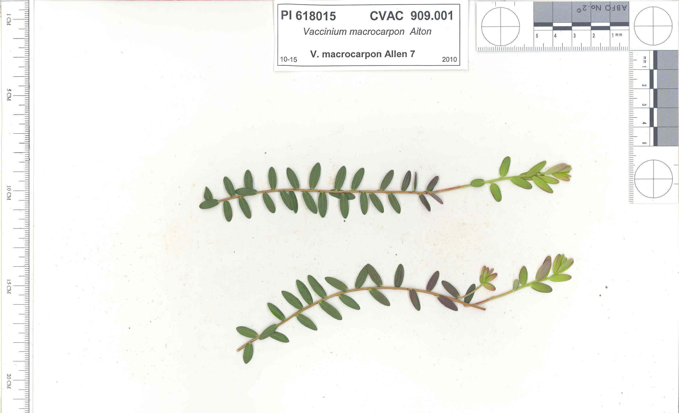 | | 1991 | COLLECTED | 10/29/1991 | Oligotrophic fen near WV/MD border in Preston county, WV, owned by the nature conservancy, WV, known as Cranesville Swamp | 39.51950000, -79.48233000 | 786 | 2 acres fen, bordered by Typha sp., Acer rubrum, Prunus serotina, Hemlock, Sotuhern most population of American Larch (Tamarack), also has Sphagnum spp., Rubus hispidus, Solidago uliginosa, Eripphorum virginicum, Pyrus melanocarpa | Wild material | Site holding moisture well in a regional drought, designated as a National Natural Landmark Additional plants are Hypericum densiflorum, Carex folliculata, Juncus effusus, J. canadensis, Bartonia virginica, Gaultheria procumbens | 1009919 | PI 618015 |
| 110 | PI 628285 | 8209 | Vicia sativa L. subsp. nigra (L.) Ehrh. | Tajikistan | W6 | | | 1991 | COLLECTED | 06/11/1991 | Northern aspect, rocky slope of shrub-covered hillside adjacent to roadside 52km east of Penzikent near Erun. Associated with Amygdalus sp. and Prunus prostrata | 39.46666667, 67.73333333 | 1270 | | Wild material | | 1043268 | PI 628285 |
| 111 | PI 641714 | 010689-0205 | Trifolium campestre Schreb. | Elazığ, Turkey | S9 | | | 1989 | COLLECTED | 06/01/1989 | Soil clay red, rocky. NE facing slope, scattered oak scrub, grazed. Associated with Crateagus, Prunus sp. NW side of Hazar Lake, near cemetery, approximately 3km S of Firat Univ. Res. Sta. On road Elazig to Diyarbakir. | 38.50000000, 39.36666667 | 1270 | | Cultivated material | Annual. Erect to 8cm tall. | 1017356 | PI 641714 |
| 112 | PI 691230 | 'Shoghori 1' | Pyrus pyrifolia (Burm. f.) Nakai | Pakistan | COR | | | 1988 | COLLECTED | | Gilgit district, Gulmit (Hunza) village/town, On farm of Abdullah in Dar Ghulam section of Gulmit | 36.40000000, 74.86667000 | 2523 | drained, assocated vegetation Malus sp., Solanum tuberosum, drained, assocated vegetation Malus sp., Solanum tuberosum, Prunus Armeniaca | Cultivar | Pyrus sp. 'Shoghori I'. The name refers to its origin in the village of Shoghor in Chitral. Scions collected from cultivated tree by M. Thompson and D. Brenner on 4 November, 1988 in Pakistan (Northern Areas, Gilgit District) on the farm of Abdullah in Dar Ghulam section of Gulmit. Farm is in a river valley at 2523 m elevation; Latitude 36 24' N, Longitude 74 52' E. Collectors note 'This is the best pear in Pakistan! Leaves and fruit are typical Pyrus pyrifolia. Fruit is pyriform, medium-large size, firm, crisp, sweet and juicy; very long storage (several months). May be good enough for direct use (in U.S.), stone cells fairly prominent, but overall quality may compensate for this weakness. May be same as Shorhori II.' - Collection notebook, 1988. | 1094814 | PI 691230 |
| 113 | Ames 38800 | Camp Mitigwa | Amelanchier arborea (F. Michx.) Fernald | Iowa, United States | NC7 |  | | 2026 | COLLECTED | 06/01/2026 | Mitigwa Scout Camp located on west side of Des Moines River watershed approximately 7.50 miles south, southwest of Boone, T82N R26W N 1/4 Sec. 5 and T83N R26W S 1/4 Sec. 32. | 41.94894500, -93.90537200 | 310 | High-quality white oak - ironwood, mature woods. | Wild material | The native range of Amelanchier arborea is concentrated in the eastern half of the U.S. (Little, 1977). This accession represents a collection of A. arborea germplasm from the western edge of the species native range, specifically central Iowa. Specimens sampled at the collection site in nature were small to medium understory or woodland edge single and/or multi-trunked trees with a few trees getting close to being deemed as canopy specimens. Bark smooth and light grey in color. Specimens sampled in nature ranging 15-50' in height. Peak flowering occurred on 8 April 2026 with white flowers appearing prior to leaf expansion. Fall colors ranging from orange to orange-red peaking typically at the end of September (central Iowa). Fruits, dark-pink to red, maturing in early June (peak in 2026 occurred on 2 June) averaging 8 mm in diameter, except for mother tree #6 that had rather large fruits at 11 mm in diameter. | 2197049 | Ames 38800 |
| 114 | NA 89173 | 2025RJLSEUS-14 | Chionanthus sp. | Florida, United States | NA | | | 2026 | COLLECTED | 10/03/2025 | Choctawhatchee National Forest: the collection site is reached by foot (~0.5 km) along a loose sand road/firebreak from Martin Luther King, Jr. Boulevard, just east of the boundary for Hurlburt Field in Hurlburt Field/Ft. Walton Beach, FL. Collected from 30 deg. 26.859', -86 deg. 39.577' to 30 deg. 27.137', -86 deg. 39.580'; latitude and longitude of record calculated at the midpoint of these coordinates. | 30.44996000, -86.65965000 | 10 | Dry to xeric conditions of well-drained, deep sandy soils on a relatively level area bordering a powerline in an open mixed mostly mixed evergreen and deciduous, somewhat disturbed habitat in sun to part shade. In areas “broadleaved scrub” vegetation is so dense, that it is almost impenetrable. Elevation: 9 to 11 meters. Slope: 0 to 3 percent. Aspect: Variable. Soil: The soils of this area are characterized as Foxworth Series (95 percent) sand, 0 to 5 percent slopes (8). Other soil series interbedded with the Foxworth Series, vary in percentages from 1-4 percent including Lakeland and Chipley. The Foxworth Series consists of very deep, moderately well to somewhat excessively drained, rapid to very rapid permeable soils on broad uplands and side slopes. They formed in sandy marine or eolian sediments in the Southern Coastal Plain (MLRA 133A), The Eastern Gulf Coast Flatwoods (MLRA 152A), The Atlantic Coast Flatwoods (153A) and the Tidewater Area (153B). Thickness of the grayish brown to light yellowish-brown sand exceeds 2 meters. Reaction ranges from very strongly acid to slightly acid throughout. (Source: California Soil Resource Lab/NRCS Official Soil Series Descriptions). Geology: The underlying geology of this area is characterized as undifferentiated Quaternary Sediments. Much of Florida's surface is covered by a varying thickness of undifferentiated sediments consisting of siliciclastics, organics and freshwater carbonates. Where these sediments exceed 6.1 meters thick, they were mapped as discrete units. To subdivide the undifferentiated sediments, those sediments occurring in flood plains were mapped as alluvial and flood plain deposits (Qal). Sediments showing surficial expression of beach ridges and dunes were mapped separately (Qbd) as were the sediments composing Trail Ridge (Qtr). Terrace sands were not mapped (refer to Healy [1975] for a discussion of the terraces in Florida). The subdivisions of the Undifferentiated Quaternary Sediments (Qu) are not lithostratigraphic units but are utilized to facilitate a better understanding of the State's geology. The siliciclastics are light gray, tan, brown to black, unconsolidated to poorly consolidated, clean to clayey, silty, unfossiliferous, variably organic-bearing sands to blue green to olive green, poorly to moderately consolidated, sandy, silty clays. Gravel is occasionally present in the panhandle. Organics occur as plant debris, roots, disseminated organic matrix and beds of peat. Freshwater carbonates, often referred to as marls in the literature, are scattered over much of the State. In southern Florida, freshwater carbonates are nearly ubiquitous in the Everglades. These sediments are buff colored to tan, unconsolidated to poorly consolidated, fossiliferous carbonate muds. Sand, silt and clay may be present in limited quantities. These carbonates often contain organics. The dominant fossils in the freshwater carbonates are mollusks. (Source: USGS Florida Geologic Map Data). | Wild material | Received as C. cf. henryae | 2193307 | NA 89173 |
| 115 | W6 62528 | FWS0300-131 | Symphyotrichum urophyllum (Lindl.) G. L. Nesom | Michigan, United States | W6 | 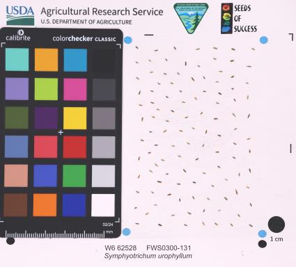 | | 2025 | | | | | | | Wild material | | 2192226 | W6 62528 |
| 116 | NA 89114 | TLM25-03 | Zanthoxylum clava-herculis L. | Texas, United States | NA | | | 2025 | COLLECTED | 07/09/2025 | Jackson County Road 113, Bergston Road, approximately 2.1 kilometers north of the junction with Jackson County Road 234; growing on the west side of the road along a fenceline running parallel to the road. | 29.00576600, -96.76298500 | 24 | Plants are growing in full sun to light shade along a fence line near where cattle graze and the dirt road. The area is disturbed, but somewhat overgrown since there is very little traffic on the road that is primarily used by farmers and ranchers to access their fields. Slope: 0 to 1 percent. Aspect: N/A. Soils: The soils of this area sampled are classified as Laewest clay, 0 to 1 percent slopes (LaA). The Laewest Series consists of very deep, moderately well drained soils that formed in clayey flood basin deposits on alluvial plains or deltas of the Beaumont Formation of Pleistocene Age. These nearly level to gently sloping soils are on broad flat coastal plains. Slope ranges from 0 to 8 percent. The solum thickness is more than 200 cm and ranges from slightly acidic on the surface to neutral in deeper pedons. This is a cyclic soil and undisturbed areas have gilgai microrelief with microhighs 15 to 30 cm higher than microlows. Distance from the center of the microhighs to the center of the microlows ranges from about 1.2 to 4.9 m. The microhigh makes up about 20 percent, the intermediate, or area between the knoll and depression about 50 percent, and the microlow about 30 percent. The amplitude of waviness between mollic colored materials in the upper part of the solum and the higher value colors in the lower part ranges from about 30 to 150 cm. When dry, the soil has cracks 1 to 5 cm wide at the surface and commonly 1 cm wide cracks extend to a depth of 1.2 m during the summer. The cracks remain open for less than 90 cumulative days in most years. Some pedons have an overwash of calcareous clay or silty clay 20 to 51 cm thick. (Source: California Soil Resource Lab/NRCS Official Soil Series Descriptions). Geology: The underlying geology of this area is Lizzie Formation of Quaternary, Middle Pleistocene age. It is comprised of sand, silt, clay, and minor amount of gravel. Iron oxide and iron-manganese nodules are common in zones of weathering; locally calcareous. Surface is fairly flat and featureless except for many shallow depressions and pimple mounds. Moore and Wermund (1993a) mapped three units--(1) alluvium undifferentiated as to texture and origin--includes meander belt, levee, crevasse splay, and distributary sand, and flood-basin mud deposits, about 60 m thick, (2) fine-grained channel facies (alluvial sand, silt, and clay) about 10-25 m thick, thicker seaward, and (3) fine-grained overbank facies (alluvial silt and clay) about 55-65 m thick, thicker seaward. Together, these deposits form a deltaic plain that parallels the Gulf Coast. Unit contains Pleistocene vertebrate fauna, dips seaward beneath the Beaumont Fm. and disconformably overlies deposits of the Pliocene and early Pleistocene Willis Formation. The deltaic plain is entrenched as much as 7 m by streams. In Hidalgo County (southernmost part of Texas) the unit underlies a semiarid plain, widely irrigated and cultivated. Unit is locally veneered with thin, discontinuous stabilized eolian sand. (Source: USGS Texas Geologic Map Data). | Wild material | | 2191653 | NA 89114 |
| 117 | NA 89115 | TLM25-04a | Hamamelis ovalis S. W. Leonard | Texas, United States | NA | | | 2025 | COLLECTED | 07/10/2025 | State Highway 87 approximately 3.25 kilometers north of the crossroad junction with Texas Recreational Road 255 (RE 255); plants were growing in the narrow buffer woods along the east side of the highway. | 31.12051300, -93.72628100 | 138 | The habitat is an upland mixed coniferous and deciduous woodlands in part to full shade and dry conditions, often under drought stress. Plants seem to always occur on the top of dry ridges or well-drained slopes. Slope: 0 to 1 percent. Aspect: N/A. Soils: The soils of this collection area are classified as Tehran-Letney Association, hilly (TLE) soils. The Tehran Series (55%) consists of deep, somewhat excessively drained, moderately rapidly permeable soils on uplands. They formed in thick loamy and sandy sediments on the Western Coastal Plain. These soils are on gently sloping to moderately steep uplands with slopes ranging from 1 to 20 percent. The Letney Series (30%) consists of deep, well drained, moderately rapidly permeable, upland soils. They formed in thick sandy and loamy sediments of the coastal plains. These soils are on gently sloping to moderately steep uplands with slopes ranging from 1 to 20 percent. Soil pH ranges from 4.5 to 6.0. The minor soil components include Doucette Series (10%) and Boykin Series (5%) soils. (Source: California Soil Resource Lab/NRCS Official Soil Series Descriptions). Geology: The underlying geology of this area is of Oligocene origin and characterized as Catahoula Formation. This formation is extensive and deep in Texas, up to 185 meters thick. In the area of the collection the Catahoula Formation is primarily mudstone and sand. The upper 90-150 meters is mudstone that is tuffaceous, and sandy; also, occasionally, with some bentonitic clay. (Source: USGS Texas Geologic Map Data). | Wild material | | 2191654 | NA 89115 |
| 118 | NA 88585 | 2024RJLFL-018 | Rhododendron canescens (Michx.) Sweet | Florida, United States | NA | | | 2024 | COLLECTED | 11/14/2024 | Woodlands in the riparian zone of a headwater spring and wetland leading to Panther Creek. The area is accessed from High Bridge Road by turning south on an unnamed dirt/sand road and driving about 0.27 kilometers to a pond. | 30.90865300, -86.69107200 | 49 | Mostly deciduous woodlands in the riparian zone of a headwater spring and wetland in shade to part shade. Slope: 5 to 8 percent. Aspect: N/A. The underlying geology of this area is characterized as Citronelle Formation of the Pliocene period. The Citronelle Formation is widespread in the Gulf Coastal Plain. The type section for the Citronelle Formation, named by Matson (1916), is near Citronelle, Alabama. The Citronelle Formation grades laterally, through a broad facies transition, into the Miccosukee Formation of the eastern Florida panhandle. Coe (1979) investigated the Citronelle Formation in portions of the western Florida panhandle. The Citronelle Formation is a siliciclastic, deltaic deposit that is lithologically similar to, and time equivalent with, the Cypresshead Formation and, at least in part, the Long Key Formation (Cunningham et al., 1998) of the peninsula. In the western panhandle, some of the sediments mapped as Citronelle Formation may be reworked Citronelle. The lithologies are the same and there are few fossils present to document a possible younger age. The Citronelle Formation consists of gray to orange, often mottled, unconsolidated to poorly consolidated, very fine to very coarse, poorly sorted, clean to clayey sands. It contains significant amounts of clay, silt and gravel which may occur as beds and lenses and may vary considerably over short distances. Limonite nodules and limonite-cemented beds are common. Marine fossils are rare but fossil pollen, plant remains and occasional vertebrates are found. Much of the Citronelle Formation is highly permeable. It forms the Sand and Gravel Aquifer of the surficial aquifer system contain organics. The dominant fossils in the freshwater carbonates are mollusks. (Source: USGS Florida Geologic Map Data). The surface soil profile is classified as Troup-Orangeburg-Cowarts complex, 5 to 12 percent slopes. The Troup series consists of very deep, somewhat excessively drained soils formed in unconsolidated sandy and loamy marine sediments. Troup soils are found on ridges and hillslopes. The Orangeburg series consists of very deep, well drained, moderately permeable soils on uplands of the Southern Coastal Plain. They formed in loamy and clayey marine sediments. The Cowarts series consists of very deep, moderately well and well drained soils on ridge tops and side slopes on uplands of the Coastal Plain Major Land Resource Area. They formed in loamy marine sediments. The reaction of all these soils ranges from very strongly acid to strongly acid. (Source: USDA-NRCS Official Soil Series Descriptions). | Wild material | | 2169922 | NA 88585 |
| 119 | NA 88593 | 2024RJLNJ-001 | Ilex glabra (L.) A. Gray | New Jersey, United States | NA | | | 2024 | COLLECTED | 11/24/2024 | Mullica Township: Both sides of Duerer Street, approximately 0.37 kilometers southeast of 4th Avenue. | 39.55885000, -74.66442500 | 21 | Shade to almost full sun on compacted seasonally moist to temporarily wet areas of a mixed evergreen and deciduous woodland dominated by Pinus rigida. Vegetation of this area is very much defined by small changes in elevation that go from wet to very dry. Ilex glabra remains abundant throughout, though. Slope: N/A. Aspect: N/A. The underlying geology of this area is the Cohansey Formation of middle Miocene origin and comprised of sand, white to yellow with local gravel and clay. It is sometimes locally stained red or orange brown by iron oxides and (or) cemented into large blocks of ironstone. Unweathered clay is typically dark gray, but commonly weathers white where it is interbedded with thin beds of ironstone. Sand is typically medium grained and moderately sorted although it ranges from fine to very coarse grained and from poorly to well sorted. Sand consists of quartz and siliceous rock fragments. Some beds are locally micaceous. Maximum thickness in the map area is about 60 meters; however, thickness is difficult to determine because of the irregular basal contact and extensive post-depositional erosion. (Source: USGS New Jersey Geologic Map Data). The primary soil type in the area of this collection is classified as Mullica Series sandy loam, 0 to 2 percent slopes. These soils are typically coarse-loamy, siliceous, semiactive, and mesic typic humaquepts that are strongly to extremely acidic throughout the profile. The typical solum thickness ranges from 50-150+ cm. These soils are generally considered to be poorly drained. (Source: NRCS Web Soil Survey). | Wild material | | 2169930 | NA 88593 |
| 120 | NA 89075 | 2024RJLPA-001 | Rhododendron maximum L. | Pennsylvania, United States | NA | | | 2024 | COLLECTED | 09/18/2024 | Fieldstone Farm Tank Creek Nature Preserve (a property of the Pocono Heritage Land Trust): Collected along Tank Creek. The property is accessed from a parking area located on Devil's Hole Road. | 41.13862300, -75.34562700 | 493 | Mostly found in mixed deciduous forest with occasional conifers and evergreen shrubs generally on steep slopes above Tank Creek in rocky well-drained soils in shade to part-shade. The slopes are abundant in decomposed organic matter and runoff soils. Slope: 5 to 30 percent. Aspect: various. Geology: The underlying geology of this area is of Devonian origin and characterized as the Long Run Member of Catskill Formation. It is comprised of gray and grayish-red sandstone and grayish-red siltstone and mudstone in fining-upward cycles. (Source: USGS Pennsylvania Geologic Map Data). Soils: The primary soil type found here is classified as Alluvial Land. In geology, alluvial land refers to areas of land that are formed by the deposition of sediments carried by rivers, or other surface water. EPA Ecoregion (Level III): North Central Appalachians (62). EPA Ecoregion (Level IV): Low Poconos (62b). | Wild material | | 2169039 | NA 89075 |
| 121 | NA 89076 | 2024RJLPA-002 | Kalmia latifolia L. | Pennsylvania, United States | NA | | | 2024 | COLLECTED | 09/18/2024 | Fieldstone Farm Tank Creek Nature Preserve (a property of the Pocono Heritage Land Trust): Collected along Tank Creek. The property is accessed from a parking area located on Devil's Hole Road. | 41.13862300, -75.34562700 | 493 | Mostly found in mixed deciduous forest with occasional conifers and evergreen shrubs generally on sloping sites as an understory shrub in rocky well-drained soils in shade to part-shade. Slope: 5 to 15 percent. Aspect: various. Geology: The underlying geology of this area is of Devonian origin and characterized as the Long Run Member of Catskill Formation. It is comprised of gray and grayish-red sandstone and grayish-red siltstone and mudstone in fining-upward cycles. (Source: USGS Pennsylvania Geologic Map Data). Soils: The primary soil type found here is classified as Alluvial Land. In geology, alluvial land refers to areas of land that are formed by the deposition of sediments carried by rivers, or other surface water. EPA Ecoregion (Level III): North Central Appalachians (62). EPA Ecoregion (Level IV): Low Poconos (62b). | Wild material | | 2169040 | NA 89076 |
| 122 | NA 89077 | 2024RJLPA-003 | Viburnum acerifolium L. | Pennsylvania, United States | NA | | | 2024 | COLLECTED | 09/19/2024 | Birdell Road, near parking lot to trail where the road ends at Chambers Lake, which is part of Hibernia County Park. | 40.03559500, -75.85708600 | 187 | Plants are growing in deep shade of a dry deciduous forest dominated by Fagus grandifolia. Slope: 0 percent. Aspect: N/A. Geology: The underlying geology of this area is of Precambrian origin and characterized as Banded Mafic Gneiss. It is characterized as dark and fine to medium grained. This formation includes rocks of probable sedimentary origin; may be equivalent to "PZmgh." (Source: USGS Pennsylvania Geologic Map Data). Soils: The primary soil type in the area of this collection is classified as Neshaminy Series Silt Loam, very deep over mafic gneiss, 3 to 8 percent slopes (NvB). (Source: USDA-NRCS Official Soil Series Descriptions). EPA Ecoregion (Level III): Northern Piedmont (64). EPA Ecoregion (Level IV): Piedmont Uplands (64c). | Wild material | | 2169041 | NA 89077 |
| 123 | NA 89078 | 2024RJLPA-004 | Staphylea trifolia L. | Pennsylvania, United States | NA | | | 2024 | COLLECTED | 09/20/2024 | Along gated road about 0.33 kilometers southwest of the Lake Ontelaunee Trail parking lot. | 40.49850800, -75.89121300 | 94 | Plants are growing on well-drained steep slopes in shade to part shade of a deciduous forest. Slope: 35 to 50 percent. Aspect: East-southeast. Geology: The underlying geology of this area is of Ordovician origin and characterized as Shale and graywacke of Hamburg sequence. It is characterized by shale containing zones of conspicuous graywacke. (Source: USGS Pennsylvania Geologic Map Data). Soils: The primary soil type in the area of this collection is classified as Berks-Weikert Complex, 25 to 60% slopes (BkF). Dominantly sloping to very steep, moderately deep and shallow, well drained soils underlain by acid shale bedrock. (Source: UPenn State University Soil Info Website). EPA Ecoregion (Level III): Ridge and Valley (67). EPA Ecoregion (Level IV): Northern Shale Valleys (67b). | Wild material | | 2169042 | NA 89078 |
| 124 | NA 89080 | 2024RJLPA-006 | Ilex montana Torr. & A. Gray | Pennsylvania, United States | NA | | | 2024 | COLLECTED | 09/20/2024 | Berks and Schuylkill Counties: Hawk Mountain Sanctuary. | 40.64162200, -75.99122600 | 418 | Plants are growing from shade to full sun on a dry-mesic to very dry, well-drained upland/montane habitat characterized by an upland mixed deciduous and evergreen forest that is very rocky. All the plants found in this habitat go through periods of drought during the growing season due to the limited litter/soil layer in which moisture can be held. Elevation: 405 to 430 meters. Slope: 5 to 25 percent. Aspect: various. Geology: The underlying geology of this area is of Silurian origin and comprised of Shawangunk Formation. This formation is primarily light- to dark-gray, fine- to very coarse-grained sandstone and conglomerate containing thin shale interbeds. (Source: USGS Pennsylvania Geologic Map Data). Soils: The surface soil profile of this area is characterized as the Hazleton Series which consists of deep and very deep, well drained soils formed in residuum of acid gray, brown or red sandstone on uplands. The matrix includes a considerable accumulation of thin, flat, coarse fragments of sandstone, limestone, or schist with diameters up to 15 cm. Slope ranges from 0-80%. Permeability is moderately rapid to rapid. (Source: USDA-NRCS Official Soil Series Descriptions). EPA Ecoregion (Level III): Ridge and Valley (67). EPA Ecoregion (Level IV): Northern Sandstone Ridges (67c). | Wild material | | 2169044 | NA 89080 |
| 125 | NA 89081 | 2024RJLPA-009 | Rosa carolina L. | Pennsylvania, United States | NA | | | 2024 | COLLECTED | 09/22/2024 | Lancaster and York Counties: outcrops along the Susquehanna River, accessed from the Historic Lock 12 parking lot off of Pennsylvania Road 372. | 39.81483500, -76.32762200 | 34 | Plants are growing from part-sun to full sun in crevices of the outcrops and where organic debris has accumulated in between boulders along the Susquehanna River. The sites range from nearly xeric to dry mesic, at least on the surface. Plants are generally growing 4-10 m above the normal flow of the river; however, the Holtwood Dam is less than 1 kilometer upstream and debris found trapped in the boulders indicates that there is periodic flooding, at least, in the lower zone of 4+ meters or so above normal river flow. This habitat has a diverse assemblage of deciduous trees and shrubs as well as abundant herbaceous taxa. Slope: 0 to 60 percent. Aspect: Northeast (generally). Geology: The underlying geology of this area is probably of lower Paleozoic age and characterized as the Octoraro Formation. It includes albite-chlorite schist, phyllite, some hornblende gneiss, and granitized members. Soils: The area where this species occurs is right on the edge of two soil zones that transition from the river’s edge to mesic conditions upslope. The first is generally referred to as Rock Outcrop. This terrestrial matrix in which plants grow is largely exposed underlying rock geology with accumulated outwash, rock decomposition, and organic debris buildup. The second is Mt. Airy (80%) and Manor (20%) Series soils, 25 to 60 percent slopes, extremely stony (MRF). (Source: California Soil Resource Lab/NRCS Official Soil Series Descriptions). EPA Ecoregion (Level III): Northern Piedmont (64). EPA Ecoregion (Level IV): Piedmont Uplands (64c). | Wild material | | 2169045 | NA 89081 |
| 126 | NA 89082 | 2024RJLPA-010 | Amorpha fruticosa L. | Pennsylvania, United States | NA | | | 2024 | COLLECTED | 09/22/2024 | Outcrops along the Susquehanna River, accessed from the Historic Lock 12 parking lot off of Pennsylvania Road 372. | 39.81481500, -76.32757900 | 34 | Plants are growing from part-sun to full sun in crevices of the outcrops and where organic debris has accumulated in between boulders along the Susquehanna River. The sites range from nearly xeric to dry mesic, at least on the surface. Plants are generally growing 4-10 m above the normal flow of the river; however, the Holtwood Dam is less than 1 kilometer upstream and debris found trapped in the boulders indicates that there is periodic flooding, at least, in the lower zone of 4+ meters or so above normal river flow. This habitat has a diverse assemblage of deciduous trees and shrubs as well as abundant herbaceous taxa. Slope: 0 to 25 percent. Aspect: Northeast (generally). Geology: The underlying geology of this area is probably of lower Paleozoic age and characterized as the Octoraro Formation. It includes albite-chlorite schist, phyllite, some hornblende gneiss, and granitized members. Soils: The area where this species occurs is right on the edge of two soil zones that transition from the river’s edge to mesic conditions upslope. The first is generally referred to as Rock Outcrop. This terrestrial matrix in which plants grow is largely exposed underlying rock geology with accumulated outwash, rock decomposition, and organic debris buildup. The second is Mt. Airy (80%) and Manor (20%) Series soils, 25 to 60 percent slopes, extremely stony (MRF). (Source: California Soil Resource Lab/NRCS Official Soil Series Descriptions). EPA Ecoregion (Level III): Northern Piedmont (64). EPA Ecoregion (Level IV): Piedmont Uplands (64c). | Wild material | | 2169046 | NA 89082 |
| 127 | NA 89083 | 2024RJLPA-012 | Rhododendron periclymenoides (Michx.) Shinners | Pennsylvania, United States | NA | | | 2024 | COLLECTED | 09/22/2024 | Outcrops along the Susquehanna River, accessed from the Historic Lock 12 parking lot off of Pennsylvania Road 372. | 39.81477400, -76.32807300 | 35 | Plants are growing from shade to part-sun and occasionally full sun in crevices of the outcrops and where organic debris has accumulated in between boulders along the Susquehanna River. The sites range from nearly xeric to mesic, at least on the surface. Plants are generally growing 4-10 m above the normal flow of the river; however, the Holtwood Dam is less than 1 kilometer upstream and debris found trapped in the boulders indicates that there is periodic flooding, at least, in the lower zone of 4+ meters or so above normal river flow. This habitat has a diverse assemblage of deciduous trees and shrubs as well as abundant herbaceous taxa. Slope: 0 to 60 percent. Aspect: Northeast (generally). Geology: The underlying geology of this area is probably of lower Paleozoic age and characterized as the Octoraro Formation. It includes albite-chlorite schist, phyllite, some hornblende gneiss, and granitized members. Soils: The area where this species occurs is right on the edge of two soil zones that transition from the river’s edge to mesic conditions upslope. The first is generally referred to as Rock Outcrop. This terrestrial matrix in which plants grow is largely exposed underlying rock geology with accumulated outwash, rock decomposition, and organic debris buildup. The second is Mt. Airy (80%) and Manor (20%) Series soils, 25 to 60 percent slopes, extremely stony (MRF). (Source: California Soil Resource Lab/NRCS Official Soil Series Descriptions). EPA Ecoregion (Level III): Northern Piedmont (64). EPA Ecoregion (Level IV): Piedmont Uplands (64c). | Wild material | | 2169047 | NA 89083 |
| 128 | NA 89084 | 2024RJLPA-013 | Physocarpus opulifolius (L.) Maxim. | Pennsylvania, United States | NA | | | 2024 | COLLECTED | 09/22/2024 | Outcrops along the Susquehanna River, accessed from the Historic Lock 12 parking lot off of Pennsylvania Road 372. | 39.81466300, -76.32833900 | 36 | Plants are growing from shade to part-sun where organic debris has accumulated in between boulders as well as further upslope in deeper mesic soils along the Susquehanna River. This habitat has a diverse assemblage of deciduous trees and shrubs as well as abundant herbaceous taxa. Slope: 10 to 25 percent. Aspect: Northeast (generally). Geology: The underlying geology of this area is probably of lower Paleozoic age and characterized as the Octoraro Formation. It includes albite-chlorite schist, phyllite, some hornblende gneiss, and granitized members. Soils: The area where this species occurs is right on the edge of two soil zones that transition from the river’s edge to mesic conditions upslope. The first is generally referred to as Rock Outcrop. This terrestrial matrix in which plants grow is largely exposed underlying rock geology with accumulated outwash, rock decomposition, and organic debris buildup. The second is Mt. Airy (80%) and Manor (20%) Series soils, 25 to 60 percent slopes, extremely stony (MRF). (Source: California Soil Resource Lab/NRCS Official Soil Series Descriptions). EPA Ecoregion (Level III): Northern Piedmont (64). EPA Ecoregion (Level IV): Piedmont Uplands (64c). | Wild material | | 2169048 | NA 89084 |
| 129 | NA 89085 | 2024RJLPA-014 | Rhododendron arborescens (Pursh) Torr. | Pennsylvania, United States | NA | | | 2024 | COLLECTED | 09/22/2024 | Outcrops along the Susquehanna River, accessed from the Historic Lock 12 parking lot off of Pennsylvania Road 372. | 39.81618100, -76.33069800 | 38 | Plants are growing from shade to part-sun and occasionally full sun in crevices of the outcrops and where organic debris has accumulated in between boulders along the Susquehanna River. The sites range from nearly xeric to mesic, at least on the surface. Plants are generally growing 4-10 m above the normal flow of the river; however, the Holtwood Dam is less than 1 kilometer upstream and debris found trapped in the boulders indicates that there is periodic flooding, at least, in the lower zone of 4+ meters or so above normal river flow. This habitat has a diverse assemblage of deciduous trees and shrubs as well as abundant herbaceous taxa. Slope: 0 to 75 percent. Aspect: Northeast (generally). Geology: The underlying geology of this area is probably of lower Paleozoic age and characterized as the Octoraro Formation. It includes albite-chlorite schist, phyllite, some hornblende gneiss, and granitized members. Soils: The area where this species occurs is right on the edge of two soil zones that transition from the river’s edge to mesic conditions upslope. The first is generally referred to as Rock Outcrop. This terrestrial matrix in which plants grow is largely exposed underlying rock geology with accumulated outwash, rock decomposition, and organic debris buildup. The second is Mt. Airy (80%) and Manor (20%) Series soils, 25 to 60 percent slopes, extremely stony (MRF). (Source: California Soil Resource Lab/NRCS Official Soil Series Descriptions). EPA Ecoregion (Level III): Northern Piedmont (64). EPA Ecoregion (Level IV): Piedmont Uplands (64c). | Wild material | | 2169049 | NA 89085 |
| 130 | NA 89086 | 2024RJLPA-015 | Ilex verticillata (L.) A. Gray | Pennsylvania, United States | NA | | | 2024 | COLLECTED | 09/22/2024 | Outcrops along the Susquehanna River, accessed from the Historic Lock 12 parking lot off of Pennsylvania Road 372. | 39.81656600, -76.33136600 | 38 | Plants are growing from part-sun to full sun in crevices of the outcrops and where organic debris has accumulated in between boulders along the Susquehanna River. The sites range from nearly xeric to dry mesic, at least on the surface. Plants are generally growing 4-10 m above the normal flow of the river; however, the Holtwood Dam is less than 1 kilometer upstream and debris found trapped in the boulders indicates that there is periodic flooding, at least, in the lower zone of 4+ meters or so above normal river flow. This habitat has a diverse assemblage of deciduous trees and shrubs as well as abundant herbaceous taxa. Slope: 0 to 10 percent. Aspect: Northeast (generally). Geology: The underlying geology of this area is probably of lower Paleozoic age and characterized as the Octoraro Formation. It includes albite-chlorite schist, phyllite, some hornblende gneiss, and granitized members. Soils: The area where this species occurs is right on the edge of two soil zones that transition from the river’s edge to mesic conditions upslope. The first is generally referred to as Rock Outcrop. This terrestrial matrix in which plants grow is largely exposed underlying rock geology with accumulated outwash, rock decomposition, and organic debris buildup. The second is Mt. Airy (80%) and Manor (20%) Series soils, 25 to 60 percent slopes, extremely stony (MRF). (Source: California Soil Resource Lab/NRCS Official Soil Series Descriptions). EPA Ecoregion (Level III): Northern Piedmont (64). EPA Ecoregion (Level IV): Piedmont Uplands (64c). | Wild material | | 2169050 | NA 89086 |
| 131 | NA 89087 | 2024RJLPA-016 | Hydrangea arborescens L. | Pennsylvania, United States | NA | | | 2024 | COLLECTED | 09/22/2024 | Outcrops along the Susquehanna River, accessed from the Historic Lock 12 parking lot off of Pennsylvania Road 372. | 39.81489000, -76.32912200 | 43 | Plants are growing in deep shade of the deciduous woodlands on outcrops and the steep slopes where organic debris and detritus has accumulated. This habitat has a diverse assemblage of deciduous trees and shrubs as well as abundant herbaceous taxa. Slope: 30 to 90 percent. Aspect: Northeast (generally). Geology: The underlying geology of this area is probably of lower Paleozoic age and characterized as the Octoraro Formation. It includes albite-chlorite schist, phyllite, some hornblende gneiss, and granitized members. (Source: Source: USGS Pennsylvania Geologic Map Data). Soils: The area where this species occurs is right on the edge of two soil zones that transition from the river’s edge to mesic conditions upslope. The first is generally referred to as Rock Outcrop. This terrestrial matrix in which plants grow is largely exposed underlying rock geology with accumulated outwash, rock decomposition, and organic debris buildup. The second is Mt. Airy (80%) and Manor (20%) Series soils, 25 to 60 percent slopes, extremely stony (MRF). (Source: California Soil Resource Lab/NRCS Official Soil Series Descriptions). EPA Ecoregion (Level III): Northern Piedmont (64). EPA Ecoregion (Level IV): Piedmont Uplands (64c). | Wild material | | 2169051 | NA 89087 |
| 132 | NA 89088 | 2024RM-TK-001 | Viburnum acerifolium L. | Alabama, United States | NA | | | 2024 | COLLECTED | 09/19/2024 | Haines Island Park. Follow Ferry Road to the top of the hill entering the park where a picnic shelter is located. Plants are growing along trails to the north of the picnic shelter. | 31.72132026, -87.46408910 | 81 | Plants are growing from part-sun to full shade in the understory of a mixed deciduous and coniferous forest on very dry upland habitat. Slope: 10 to 20 percent. Aspect: North. Geology: The underlying geology of this area is probably of Eocene age and characterized as the Claiborne Group: Tallahatta Formation. It is comprised of white to very light-greenish-gray thin-bedded to massive siliceous claystone; interbedded with thin layers of fossiliferous clay, sandy clay, and glauconitic sand and sandstone. White to light-greenish-gray fine to coarse sand and fine gravel occur at the base of the formation in southwest Alabama (Meridian Sand Member). (Source: USGS Alabama Geologic Map Data). Soils: The area of this occurrence is characterized as Arundel Series Loam, 8 to 35 percent slopes (ArF). The Arundel series consists of moderately deep, well drained, very slowly permeable soils on dissected uplands of the Southern Coastal Plain Major Land Resource Area (MLRA 133A). They formed in marine deposits consisting of acid clays underlain by horizontally bedded sandstone, buhrstone and siltstone. Slopes range from 2 to 60 percent. (Source: California Soil Resource Lab/NRCS Official Soil Series Descriptions). EPA Ecoregion (Level III): Southeastern Plains (65). EPA Ecoregion (Level IV): Buhrstone/Lime Hills (65q). | Wild material | | 2169052 | NA 89088 |
| 133 | NA 89089 | 2024RM-TK-002 | Viburnum acerifolium L. | Alabama, United States | NA | | | 2024 | COLLECTED | 09/19/2024 | Woodland slopes around and below the hilltop parking area leading down to the Silver Creek Lake Campground off of Silver Creek Lake Road. | 31.66612294, -87.57569860 | 49 | Plants are growing in shade of upland dry mesic, mature mixed deciduous and evergreen woodland. Generally, the overstory is thinner and there is less leaf litter cover, making the surface soil conditions drier. Slope: 5 to 10 percent. Aspect: Southeast. Geology: The underlying geology of this area is Claiborne Group, Tallahatta Formation, of Eocene origin, with white to very light-greenish-gray thin-bedded to massive siliceous claystone; interbedded with thin layers of fossiliferous clay, sandy clay, and glauconitic sand and sandstone. (Source: USGS Alabama Geologic Map Data). Soils: The primary soil types in the collection area are classified as Arundel-Cantuche Complex soils (15 to 35 percent slopes). The Arundel Series consists of moderately deep, well drained, very slowly permeable soils on dissected uplands of the Southern Coastal Plain. They formed in marine deposits consisting of acid clays underlain by horizontally bedded sandstone, buhrstone and siltstone. These soils are strongly acid. Slopes range from 2 to 60 percent. The Cantuche Series consists of shallow, well drained, moderately permeable soils that formed over horizontally bedded claystone. These soils are on narrow ridgetops and narrow benches on steep side-slopes of dissected landscapes in the Coastal Plain. They are strongly acid. Slopes range from 2 to 35 percent. (Source: California Soil Resource Lab/NRCS Official Soil Series Descriptions). EPA Ecoregion (Level III): Southeastern Plains (65). EPA Ecoregion (Level IV): Buhrstone/Lime Hills (65q). | Wild material | | 2169053 | NA 89089 |
| 134 | NA 89090 | 2024RM-TK-003 | Ilex longipes Chapm. ex Trel. | Alabama, United States | NA | | | 2024 | COLLECTED | 09/19/2024 | Woodland slopes around and below the hilltop parking area leading down to the Silver Creek Lake Campground off of Silver Creek Lake Road. | 31.66612294, -87.57569860 | 39 | Plants are growing in part-shade to shade of a moist mesic deciduous and evergreen woodland on dry, well-drained soil to an area 1-2 meters above a small seasonally spring-fed creek at 31.664428°, -87.574614°. Slope: 5 to 10 percent. Aspect: Southeast. Geology: The underlying geology of this area is Claiborne Group, Tallahatta Formation, of Eocene origin, with white to very light-greenish-gray thin-bedded to massive siliceous claystone; interbedded with thin layers of fossiliferous clay, sandy clay, and glauconitic sand and sandstone. (Source: USGS Alabama Geologic Map Data). Soils: The primary soil types in the collection area are classified as Arundel-Cantuche Complex soils (15 to 35 percent slopes). The Arundel Series consists of moderately deep, well drained, very slowly permeable soils on dissected uplands of the Southern Coastal Plain. They formed in marine deposits consisting of acid clays underlain by horizontally bedded sandstone, buhrstone and siltstone. These soils are strongly acid. Slopes range from 2 to 60 percent. The Cantuche Series consists of shallow, well drained, moderately permeable soils that formed over horizontally bedded claystone. These soils are on narrow ridgetops and narrow benches on steep side-slopes of dissected landscapes in the Coastal Plain. They are strongly acid. Slopes range from 2 to 35 percent. (Source: California Soil Resource Lab/NRCS Official Soil Series Descriptions). EPA Ecoregion (Level III): Southeastern Plains (65). EPA Ecoregion (Level IV): Buhrstone/Lime Hills (65q). | Wild material | | 2169054 | NA 89090 |
| 135 | Ames 36263 | Chippewa National Forest (Itasca) | Viburnum opulus L. var. americanum Aiton | Minnesota, United States | NC7 |  | | 2024 | COLLECTED | 09/15/2024 | Chippewa National Forest between Alder and Suomi including Bowstring River, Turtle River, and Potato Creek watersheds. | 47.56968000, -93.68815400 | 407 | Roadside edges with most samples near open water (creek/rivers). | Wild material | Formerly known as Viburnum trilobum, American highbush cranberry (V. opulus var. americanum) is a North American native shrub that is utilized as an important ornamental and conservation plant that is also harvested as a minor fruit crop (jams/jellies). In nature, this variety is generally found in moist habitats typically along stream banks and swamps where ample moisture is readily available. The native range of V. opulus var. americana is concentrated in the northeastern United States and into Canada (Little, E. L. Jr. 1977). Attractive ornamental characteristics includes showy lacecap flowers in spring and bright red fruits and foliage in the fall. Fruits are tart with a hint of sweetness. The European highbush cranberry (V. opulus var. opulus) is nearly identical to American highbush cranberry other than small glands (<1 mm) on the petiole making the exact determination very challenging resulting in common misidentifications. A major difference between the American and European highbush cranberries is that the European variety produces unpalatable fruit. Recent research has shown that American and European highbush cranberries are genetically distinct and that plants of hybrid origin are uncommon (Tork et. al 2025). Genetics of this accession represents a very broad collection area stretching nearly 7.0 miles near Alder in central Itasca County of north central Minnesota. In August of 2022, a total of 23 leaf samples from this same area were sampled (OB001-OB012 and OB0015-OB025) and all samples were genetically confirmed as American highbush cranberry, V. opulus var. americanum (Tork et. al 2025). | 2168987 | Ames 36263 |
| 136 | Ames 36251 | JDC/UT/2024/008/1130 | Ulmus thomasii Sarg. | Minnesota, United States | NC7 |  | | 2024 | COLLECTED | 06/05/2024 | Near southeast edge of Kasota Lake approximately 9.0 miles east, southeast of Willmar, T119N R34W SE 1/4 NE 1/4 Sec. 36 and also Robbins Island Park in Wilmar, T119N R35W Sec. 11. | 45.07399600, -94.88484100 | 352 | Deciduous woods | Wild material | Ulmus thomasii (Rock elm) is an underutilized tree species both in conservation and in the urban landscape. Described by Charles Sprague Sargent (first director for the Arnold Arborteum) as "heavy, hard, very strong and tough, closely grained, and susceptible of receiving a beautiful polish". Historically noted for a variety of uses in woodworking including furniture, heavy agricultural implements, timber frame buildings, pianos, hockey sticks, and hand tools. Ulmus thomasii is extremely drought tolerant, adaptable to very calcareous soils, and compared to U. americana or U. rubra has a very conservative growth rate requiring minimal attention in regards to pruning. Rock elm naturally tends to develop into a nice structural specimen in the landscape, unlike other fast growing cultivars in the nursery trade needing frequent attention. Rock elm has very fissured bark and is well known for maintaining a strong central leader resulting in a very attractive, pyramidal form. Despite many literature sources stating that "wings" on the stems are a key identifiying characteristic, this trait is not reliable and many genotypes may completely lack "wings" on the stems. While growth habit and morphology of dormant buds (very pointy) are good traits to help aid in identification, fruits are the best way to confirm identity. Fruits are densly pubescent, often described as "inflated" and generally reach maturity a couple weeks after Ulmus rubra and Ulmus americana. U. thomasii inflorescences are rather distinguishable from other Ulmus in being pendulous. Fruits are extremely prized treats for many birds, where fruits are often "robbed" prior to full maturity. Fruits are also highly prized by many other animals such as mice, squirrels, chipmunks, turkeys, etc. and are generally consumed within hours after fruit abscission. The native range of U. thomasii is concentrated in the northeastern United States and into Canada with disjunct populations documented in northwestern Missouri and northwestern Arkansas (Little, E. L. Jr. 1971). In the 1895 Silva of North America (vol. 7) it was stated that, “The value of the wood of the Rock Elm threatens its extinction and most of the large trees have already been cut.” Today, while rock elm is rather rare, especially in areas near the edges of its range, many states list the species as endangered or threatened warranting preservation efforts. Genetics of this accession would be representative of the species northwestern edge of its native range. Majority of specimens noted did not have characteristic "wings" on the stems and measured approximately 20" DBH or more with a few specimens nearing 30". Heights estimated between 70-90'. Rock elm in this area could be classified as locally abundant. | 2167953 | Ames 36251 |
| 137 | W6 61833 RE | NV052-1006 | Encelia virginensis A. Nelson | Nevada, United States | W6 | | | 2024 | | | | | | | Wild material | Yellow ray and disk flowers erect hairy stems leaves with strigose hairs (Recollection of NV052-1006, W6 61225) | 2168284 | W6 61833 RE |
| 138 | W6 61835 RE | NV052-1008 | Fallugia paradoxa (D. Don) Endl. ex Torr. | Nevada, United States | W6 |  | | 2024 | | | | | | | Wild material | White five petaled flowers dark green leaves white to pink fluffy seed heads (Recollection of NV052-1008, WLP 2265) | 2168276 | W6 61835 RE |
| 139 | NA 88827 | RJL-RM2023FLAL-001 | Ilex ambigua Torr. | Florida, United States | NA | | | 2023 | COLLECTED | 12/05/2023 | Yellow River Wildlife Management Area, along DOF [Department of Forestry] Y9 dirt road 0.08 kilometers east of Miller Bluff Road. | 30.65289100, -86.87602800 | 44 | Growing in part shade to sun in very dry, highly competitive site still recovering from the logging of pines in the past decade. This young woodland is comprised of a combination of evergreen and deciduous species competing for available resources and light before the young sand pines begin to dominate the upper canopy. Slope: 0 percent. Aspect: N/A. The underlying geology of this area is the Citronelle Formation, of Pliocene origin, and consists of gray to orange, often mottled, unconsolidated to poorly consolidated, very fine to very coarse, poorly sorted, clean to clayey sands. It contains significant amounts of clay, silt and gravel which may occur as beds and lenses and may vary considerably over short distances. Limonite nodules and limonite-cemented beds are common. (Source: USGS Florida Geologic Map Data.) The primary soil type in the collection area is classified as Lakeland Sand soils (0 to 5 percent slopes). The surface soil profile of this area is primarily the Lakeland series which consists of very deep, excessively drained, rapid to very rapidly permeable soils on uplands. They formed in thick beds of eolian or marine and/or fluvio-marine sands. Thickness of the sand exceeds 2 meters. Silt plus clay in the upper meter ranges from 5-10 percent. Reaction ranges from very strongly acid to moderately acid throughout. (Source: NRCS Web Soil Survey.) | Wild material | | 2165657 | NA 88827 |
| 140 | NA 88828 | RJL-RM2023FLAL-002 | Vaccinium arboreum Marshall | Florida, United States | NA | | | 2023 | COLLECTED | 12/05/2023 | Yellow River Wildlife Management Area, along DOF [Department of Forestry] Y9 dirt road 0.08 kilometers east of Miller Bluff Road. | 30.65289100, -86.87608500 | 44 | Growing in part shade to sun in very dry, highly competitive site still recovering from the logging of pines in the past decade. This young woodland is comprised of a combination of evergreen and deciduous species competing for available resources and light before the young sand pines begin to dominate the upper canopy. Slope: 0 percent. Aspect: N/A. The underlying geology of this area is the Citronelle Formation, of Pliocene origin, and consists of gray to orange, often mottled, unconsolidated to poorly consolidated, very fine to very coarse, poorly sorted, clean to clayey sands. It contains significant amounts of clay, silt and gravel which may occur as beds and lenses and may vary considerably over short distances. Limonite nodules and limonite-cemented beds are common. (Source: USGS Florida Geologic Map Data.) The primary soil type in the collection area is classified as Lakeland Sand soils (0 to 5 percent slopes). The surface soil profile of this area is primarily the Lakeland series which consists of very deep, excessively drained, rapid to very rapidly permeable soils on uplands. They formed in thick beds of eolian or marine and/or fluvio-marine sands. Thickness of the sand exceeds 2 meters. Silt plus clay in the upper meter ranges from 5-10 percent. Reaction ranges from very strongly acid to moderately acid throughout. (Source: NRCS Web Soil Survey.) | Wild material | | 2165658 | NA 88828 |
| 141 | NA 88838 | RJL-RM2023FLAL-012 | Ilex opaca Aiton | Florida, United States | NA | | | 2023 | COLLECTED | 12/08/2023 | North side of Sid Hayes Road approximately 65 m southeast of the junction with Watson Road. | 30.83277400, -87.24324500 | 32 | Growing in shade, part shade and light shade in dry mesic to moist, occasionally wet, habitats along the edge of the road and in the woodland interior. This species is remarkably adaptable. The only drawback to the range of habitats is that in deep shade, very few fruit can be found, presumably because there is far less flower production and/or fewer pollinators. Slope: 0 to 3 percent. Aspect: South. The underlying geology of this area is the Citronelle Formation of Pliocene origin and consists of gray to orange, often mottled, unconsolidated to poorly consolidated, very fine to very coarse, poorly sorted, clean to clayey sands. It contains significant amounts of clay, silt and gravel which may occur as beds and lenses and may vary considerably over short distances. Limonite nodules and limonite-cemented beds are common. (Source: USGS Florida Geologic Map Data.) The surface soil profile of this area is Dothan Series fine sandy loam soils (5 to 8 percent slopes). The Dothan Series consists of very deep, well drained soils that formed in thick beds of unconsolidated, medium to fine-textured marine sediments. Dothan soils are on interfluves. The surface 0-33 cm is characterized by sandy-loam, well-drained soils that are strongly acid. From 33-200 cm they are characterized by sandy clay loam soils that are more moisture retentive and strongly acid. (Source: NRCS Web Soil Survey.) | Wild material | | 2165668 | NA 88838 |
| 142 | NA 88840 | RJL-RM2023FLAL-014 | Rhododendron viscosum (L.) Torr. | Florida, United States | NA | | | 2023 | COLLECTED | 12/11/2023 | Property of Floyd Griffith off View Drive on the southwest side of McCormick Lake. | 30.63247000, -85.33718200 | 56 | Plants are growing primarily in part shade a few meters above the lake, generally in areas that appear dry, but clearly are associated with hillside seeps. While much of the area has been cultivated, the remnant native flora are largely broadleaved evergreen shrub and deciduous shrub and tree species. Slope: 10 to 15 percent. Aspect: Northeast. The underlying geology of this area is the Citronelle Formation of Pliocene origin and consists of gray to orange, often mottled, unconsolidated to poorly consolidated, very fine to very coarse, poorly sorted, clean to clayey sands. It contains significant amounts of clay, silt and gravel which may occur as beds and lenses and may vary considerably over short distances. Limonite nodules and limonite-cemented beds are common. (Source: USGS Florida Geologic Map Data.) The surface soil profile of this area is primarily Pamlico-Pantego-Rutlege Association. The Pamlico series consists of very poorly drained soils that formed in decomposed organic material underlain by dominantly sandy sediment. The soils are on nearly level flood plains, bays, and depressions of the Coastal Plain. Slopes are less than 1 percent. Pamlico soils have 0.4-1.3 meters of organic material over dominantly sandy sediments. Reaction is extremely in the organic layers and ranges from extremely acid to strongly acid in the underlying mineral layers. The Pantego series consists of very deep, very poorly drained, moderately permeable soils that formed in thick loamy sediments on the Southern Coastal Plain and Atlantic Coast Flatwoods. Slopes are less than 2 percent. This soil is strongly acid. The Rutlege series comprises very deep, very poorly drained persistently wet soils on flats, depressions and floodplains where shallow ponding is common. They are of marine or fluvial sediment origin. Thickness of these loamy sandy soils is greater than 1.5 meters and a reaction from extremely acid to strongly acid. (Source: NRCS Web Soil Survey.) | Wild material | | 2165670 | NA 88840 |
| 143 | NA 88800 | TXWL2023-015 | Ilex longipes Chapm. ex Trel. | Texas, United States | NA | | | 2023 | COLLECTED | 11/15/2023 | Sabine National Forest: Compartment 65 along County Road 131 near White Rock, Texas. | 31.55793500, -94.01980900 | | Upland; mixed hardwood and pine; sandy soil; rocky outcrops. | Wild material | | 2159157 | NA 88800 |
| 144 | NA 88689 | RJL2023NJ-002 | Kalmia latifolia L. | New Jersey, United States | NA | | | 2023 | COLLECTED | 11/10/2023 | Franklin Township: Piney Hollow Preservation Area (the site is owned by Franklin Township). Plants accessed by foot along trails throughout property. | 39.57400900, -74.93602400 | 32 | Plants growing in shade to part-shade of a mesic to mesic-dry woodland habitat that is mostly deciduous, but also includes pine overstory. Slope: N/A. Aspect: N/A. Soils: The underlying geology of this area is of Middle Miocene, Serravallian origin and characterized as an Cohansey Formation. It is comprised of sand, white to yellow with local gravel and clay. Locally stained red or orange brown by iron oxides and (or) cemented into large blocks of ironstone. Unweathered clay is typically dark gray, but commonly weathers white where interbedded with thin beds of ironstone. Unit is a complex of interfingering marine and nonmarine facies. Sand is typically medium grained and moderately sorted although it ranges from fine to very coarse grained and from poorly to well sorted. Sand consists of quartz and siliceous rock fragments. Some beds are locally micaceous. In general, the sand is crossbedded, although the style of crossbedding varies significantly with the paleoenvironment. Trough crossbedding predominates, especially in the nonmarine channel fill deposits, and the scale of the crossbeds varies from small to large. Maximum thickness in the map area is about 60 m; however, thickness is difficult to determine because of the irregular basal contact and extensive post-depositional erosion. There is as much as 18 m of relief along the basal contact. The basal contact is sharp, undulatory, and directly overlain by a thin gravel bed. The Cohansey Formation unconformably overlies the Kirkwood Formation and is found in channels cut down into the Kirkwood. Where the Kirkwood consists of sandy, light-colored sediments, the basal contact of the Cohansey is drawn below crossbedded sediments. Where the Kirkwood consists of dark-colored silty beds, the basal contact is drawn between light-colored Cohansey sediments and the underlying dark-colored sediments. The Cohansey was markedly thinned because of erosion prior to deposition of overlying units in the western and southern parts of the southern sheet. The unit has been extensively eroded and stripped from large areas of the New Jersey Coastal Plain, particularly in the central sheet where outliers are common. In spite of its widespread nature, the Cohansey is poorly exposed because of its loose sandy composition, which causes it to erode easily. (Source: USGS New Jersey Geologic Map Data.) The primary soil type in the location of this collection is classified as Downer loamy sand, 0 to 5 percent slopes, Northern Coastal Plain. Downer Series soils are very deep, well-drained soils that are coarse-loamy, siliceous, semiactive, mesic Typic Hapludults. The upper strata of Downer Series from 0 to 25 cm is dark grayish brown, brown loamy sand that is dry with weak fine granular structure. It is very friable and strongly acid. Lower strata from 25 to 76 cm are yellowish brown single grain, loose loamy sand with few extremely weakly cemented masses of oxidized iron in the lower part. This layer is very strongly acid. (Source: NRCS Web Soil Survey.) | Wild material | | 2159117 | NA 88689 |
| 145 | NA 88693 | RJL2023NJ-006 | Clethra alnifolia L. | New Jersey, United States | NA | | | 2023 | COLLECTED | 11/10/2023 | Franklin Township: Piney Hollow Preservation Area (the site is owned by Franklin Township). Plants accessed by foot along trails throughout property. | 39.57319800, -74.92908900 | 29 | Plants growing in shade to part-shade over a wide range of habitats from mesic to mesic-dry as well as moist to wetland habitats. The woodlands are mostly deciduous, but also include occasional pine overstory. Slope: N/A. Aspect: N/A. The underlying geology of this area is of Middle Miocene, Serravallian origin and characterized as an Cohansey Formation. It is comprised of sand, white to yellow with local gravel and clay. Locally stained red or orange brown by iron oxides and (or) cemented into large blocks of ironstone. Unweathered clay is typically dark gray, but commonly weathers white where interbedded with thin beds of ironstone. Unit is a complex of interfingering marine and nonmarine facies. Sand is typically medium grained and moderately sorted although it ranges from fine to very coarse grained and from poorly to well sorted. Sand consists of quartz and siliceous rock fragments. Some beds are locally micaceous. In general, the sand is crossbedded, although the style of crossbedding varies significantly with the paleoenvironment. Trough crossbedding predominates, especially in the nonmarine channel fill deposits, and the scale of the crossbeds varies from small to large. Maximum thickness in the map area is about 60 m; however, thickness is difficult to determine because of the irregular basal contact and extensive post-depositional erosion. There is as much as 18 m of relief along the basal contact. The basal contact is sharp, undulatory, and directly overlain by a thin gravel bed. The Cohansey Formation unconformably overlies the Kirkwood Formation and is found in channels cut down into the Kirkwood. Where the Kirkwood consists of sandy, light-colored sediments, the basal contact of the Cohansey is drawn below crossbedded sediments. Where the Kirkwood consists of dark-colored silty beds, the basal contact is drawn between light-colored Cohansey sediments and the underlying dark-colored sediments. The Cohansey was markedly thinned because of erosion prior to deposition of overlying units in the western and southern parts of the southern sheet. The unit has been extensively eroded and stripped from large areas of the New Jersey Coastal Plain, particularly in the central sheet where outliers are common. In spite of its widespread nature, the Cohansey is poorly exposed because of its loose sandy composition, which causes it to erode easily. (Source: USGS New Jersey Geologic Map Data.) The primary soil types in the area of this collection is classified as Atsion sand, 0 to 2 percent slopes, Northern Tidewater Area and Downer loamy sand, 0 to 5 percent slopes, Northern Coastal Plain. Atsion Series soils are very deep, poorly drained with moderate to rapid permeability above 70 cm and slower beneath. They are classified as sandy, siliceous, mesic Aeric Alaquods. The upper stratum from 0 to 25 cm is dark gray sand, dry, single grained and lose with many fine roots. It is extremely acid. Lower strata are light gray to dark brown with small percentages of rounded quartzose pebbles and are extremely acid. Downer Series soils are very deep, well-drained soils that are coarse-loamy, siliceous, semiactive, mesic Typic Hapludults. The upper stratum of Downer Series from 0 to 25 cm is dark grayish brown, brown loamy sand that is dry with weak fine granular structure. It is very friable and strongly acid. Lower strata from 25 to 76 cm are yellowish brown single grain, loose loamy sand with few extremely weakly cemented masses of oxidized iron in the lower part. This layer is very strongly acid. (Source: NRCS Web Soil Survey.) | Wild material | | 2159121 | NA 88693 |
| 146 | NA 88706 | RJL2023NCSC-011 | Smilax laurifolia L. | North Carolina, United States | NA | | | 2023 | COLLECTED | 11/13/2023 | Sandhills Game Land: wetland associated with the West Prong of Juniper Creek on the north side of Whisky Still Road approximately 0.63 kilometers northeast of Hoffman Road, Scotland County Road 1328. | 34.95683200, -79.51146200 | 103 | Plants are growing in part-shade to sun in an acidic wetland habitat rich in sphagnum and other wetland species. The habitat is moist to wet year-round and periodically has surface runoff occurring; even so, this habitat can become quite dry during seasonal periods without rainfall. Slope: N/A. Aspect: N/A. The underlying geology of this area is of Tertiary origin and characterized as Pinehurst Formation. It is comprised of medium- to coarse-grained sand as well as cross-bedding and rhythmic bands of clayey sand that are unconsolidated. (Source: USGS North Carolina Geologic Map Data.) The primary soil type in the collection area is classified as Johnston Series soils, 0 to 2 percent slopes, frequently flooded. The Johnson Series consists of very deep, very poorly drained coarse-loamy, siliceous, active, acid, thermic Cumulic Humaquepts. The upper 0-75 cm is black, mucky loam that is friable and very strongly acid. The lower strata to 1.75 m is dark gray, loamy fine sand, single grained, loose and very strongly acid. (Source: NRCS Web Soil Survey.) | Wild material | | 2159134 | NA 88706 |
| 147 | NA 88707 | RJL2023NCSC-012 | Rhododendron viscosum (L.) Torr. | North Carolina, United States | NA | | | 2023 | COLLECTED | 11/13/2023 | Sandhills Game Land: wetland associated with the West Prong of Juniper Creek on the north side of Whisky Still Road approximately 0.63 kilometers northeast of Hoffman Road, Scotland County Road 1328. | 34.95683200, -79.51146200 | 103 | Plants are growing in part-shade to sun in an acidic wetland habitat rich in sphagnum and other wetland species. The habitat is moist to wet year-round and periodically has surface runoff occurring; even so, this habitat can become quite dry during seasonal periods without rainfall. Slope: N/A. Aspect: N/A. The underlying geology of this area is of Tertiary origin and characterized as Pinehurst Formation. It is comprised of medium- to coarse-grained sand as well as cross-bedding and rhythmic bands of clayey sand that are unconsolidated. (Source: USGS North Carolina Geologic Map Data.) The primary soil type in the collection area is classified as Johnston Series soils, 0 to 2 percent slopes, frequently flooded. The Johnson Series consists of very deep, very poorly drained coarse-loamy, siliceous, active, acid, thermic Cumulic Humaquepts. The upper 0-75 cm is black, mucky loam that is friable and very strongly acid. The lower strata to 1.75 m is dark gray, loamy fine sand, single grained, loose and very strongly acid. (Source: NRCS Web Soil Survey.) | Wild material | | 2159135 | NA 88707 |
| 148 | NA 88709 | RJL2023NCSC-014 | Rhododendron minus Michx. | South Carolina, United States | NA | | | 2023 | COLLECTED | 11/13/2023 | Northwest side of the junction of Wire Road and Prichard Horse Road. | 34.49925200, -80.27470600 | 146 | Plants growing in shade to part-shade of dry steep slope woodland habitat that is primarily composed of Pinus palustris. Slope: 2 to 20 percent. Aspect: North. The underlying geology of this area is of Cretaceous origin and characterized as Peedee Formation - Black Creek Group, undivided. The Peedee Formation is primarily unconsolidated, coarse-detrital, sand that is dark-green or gray, finely micaceous, more or less glauconitic and argillitic sand, many layers of which are calcareous (impure limestone). Irregular concretionary masses of impure calcium carbonate occur in places. Dark marine clays are interstratified with sand. The Black Creek Group consists of irregularly bedded, laminated, carbonaceous clays and thin laminae and lenses of sand; lignite and pyrite present; glauconitic in places; massive interbedded layers of glauconitic sand present toward top of unit. Light-colored clays and coarse arkosic sands also found. (Source: USGS South Carolina Geologic Map Data.) The primary soil type in the collection area is classified as Ailey Series sand, moderately wet, 2 to 6 percent slopes. The Ailey Series consists of moderately deep or deep to fragic soil properties and deep or very deep to densic materials. This soil is well drained or somewhat excessively drained. The upper layer (0-12.5 cm) of this soil is dark grayish brown loamy sand that is frequently dry. It has a weak fine granular structure, is very friable, non-sticky, non-plastic, and is strongly acid. The lower strata soils (12.5-90 cm) are yellowish brown loamy sand, with weak fine granular structure, very friable, non-sticky, non-plastic, and moderately acid. Deeper depths (below 90 cm) are characterized by slightly greater clay content that is slightly more plastic and strongly acid. (Source: NRCS Web Soil Survey.) | Wild material | | 2159137 | NA 88709 |
| 149 | NA 88724 | RJL2023NCSC-029 | Kalmia buxifolia (P. J. Bergius) Gift & Kron | North Carolina, United States | NA | | | 2023 | COLLECTED | 11/15/2023 | Boiling Spring Lakes, NC: Plants growing along unused road of potential new development on Baden Street, between Camden Street and Midwood Street. The site is accessed from North Carolina Highway 87 (George II Highway SE) by turning west onto Brunswick Road and right onto Baden Street at the first intersection. | 34.01935700, -78.06110500 | 16 | Plants growing in part-shade to full sun along the road, edges of ditches and managed edges of longleaf pine forest in well-drained, but seasonally moist habitat with very little organic litter layer. It seems that low competition and exposed sandy conditions allows this plant to thrive. Slope: N/A. Aspect: N/A. The underlying geology of this area is of Pleistocene origin and characterized as Waccamaw Formation. This formation is another Carolina coastalized terrace that is deeply weathered. It is characterized by unconsolidated, coarse-detrital, soft sand limestones and loose gray to buff fine quartz sands in which occasional small quartz pebbles are present. It also includes sedimentary, carbonate, soft limestones. (Source: USGS North Carolina Geologic Map Data.) The primary soil type in this collection area is classified as Leon Series fine sand. The Leon series consists of very deep, very poorly and poorly drained, moderately rapid to moderately slowly permeable soils on upland flats, depressions, stream terraces and tidal areas. They formed in sandy marine sediments of the Eastern Gulf Coast Flatwoods, the Atlantic Coast Flatwoods and to a lesser extent in the Southern Coastal Plain. The upper horizon (0-75 cm) is comprised of a high percent of blac and lower percentage of light gray sand that is very friable and very strongly acid. The lower horizon (75-270 cm) has a range of gray, dark brown and yellowish-brown sands that range from fine to coarse and are also very strongly acid. (Source: NRCS Web Soil Survey.) | Wild material | | 2159152 | NA 88724 |
| 150 | NA 88725 | RJL2023NCSC-030 | Ilex myrtifolia Walter | North Carolina, United States | NA | | | 2023 | COLLECTED | 11/15/2023 | Boiling Spring Lakes, NC: Plants growing along unused road of potential new development on Baden Street, between Camden Street and Midwood Street. The site is accessed from North Carolina Highway 87 (George II Highway SE) by turning west onto Brunswick Road and right onto Baden Street at the first intersection. | 34.01935700, -78.06110500 | 16 | Plants growing in part-shade along the road, edges of ditches and managed edges of longleaf pine forest in well-drained, but seasonally moist habitat with very little organic litter layer. It seems that low competition and exposed sandy conditions allows this plant to thrive. Slope: N/A. Aspect: N/A. The underlying geology of this area is of Pleistocene origin and characterized as Waccamaw Formation. This formation is another Carolina coastalized terrace that is deeply weathered. It is characterized by unconsolidated, coarse-detrital, soft sand limestones and loose gray to buff fine quartz sands in which occasional small quartz pebbles are present. It also includes sedimentary, carbonate, soft limestones. (Source: USGS North Carolina Geologic Map Data.) The primary soil type in this collection area is classified as Leon Series fine sand. The Leon series consists of very deep, very poorly and poorly drained, moderately rapid to moderately slowly permeable soils on upland flats, depressions, stream terraces and tidal areas. They formed in sandy marine sediments of the Eastern Gulf Coast Flatwoods, the Atlantic Coast Flatwoods and to a lesser extent in the Southern Coastal Plain. The upper horizon (0-75 cm) is comprised of a high percent of blac and lower percentage of light gray sand that is very friable and very strongly acid. The lower horizon (75-270 cm) has a range of gray, dark brown and yellowish-brown sands that range from fine to coarse and are also very strongly acid. (Source: NRCS Web Soil Survey.) | Wild material | | 2159153 | NA 88725 |
| 151 | NA 88726 | RJL2023NCSC-031 | Gordonia lasianthus (L.) J. Ellis | North Carolina, United States | NA | | | 2023 | COLLECTED | 11/15/2023 | Boiling Spring Lakes, NC: Plants growing along unused road of potential new development on Baden Street, between Camden Street and Midwood Street. The site is accessed from North Carolina Highway 87 (George II Highway SE) by turning west onto Brunswick Road and right onto Baden Street at the first intersection. Seeds were collected from plants growing along Baden Street. | 34.01909500, -78.06087300 | 15 | Plants growing in part-shade to sun along the road, edges of ditches and managed edges of longleaf pine forest in well-drained, but seasonally moist habitat with very little organic litter layer. In addition, large specimens are found in undisturbed lowland acid woodlands nearby. Slope: N/A. Aspect: N/A. The underlying geology of this area is of Pleistocene origin and characterized as Waccamaw Formation. This formation is another Carolina coastalized terrace that is deeply weathered. It is characterized by unconsolidated, coarse-detrital, soft sand limestones and loose gray to buff fine quartz sands in which occasional small quartz pebbles are present. It also includes sedimentary, carbonate, soft limestones. (Source: USGS North Carolina Geologic Map Data.) The primary soil type in this collection area is classified as Leon Series fine sand. The Leon series consists of very deep, very poorly and poorly drained, moderately rapid to moderately slowly permeable soils on upland flats, depressions, stream terraces and tidal areas. They formed in sandy marine sediments of the Eastern Gulf Coast Flatwoods, the Atlantic Coast Flatwoods and to a lesser extent in the Southern Coastal Plain. The upper horizon (0-75 cm) is comprised of a high percent of blac and lower percentage of light gray sand that is very friable and very strongly acid. The lower horizon (75-270 cm) has a range of gray, dark brown and yellowish-brown sands that range from fine to coarse and are also very strongly acid. (Source: NRCS Web Soil Survey.) | Wild material | | 2159154 | NA 88726 |
| 152 | NA 88671 | RJL2023PA-005 | Rhododendron maximum L. | Pennsylvania, United States | NA | | | 2023 | COLLECTED | 10/16/2023 | Appalachian National Scenic Trail: Pulpit Rock and Pinnacle Loop. Rocky woodlands along Furnace Creek as well as steep rocky slopes above Pulpit Rock Reservoir associated with the Pulpit Rock and Pinnacle Loop Trail. | 40.59226100, -75.94588800 | 301 | Well-drained and very rocky dry deciduous woodlands in part shade to full shade. Slope: 0-30%. Aspect: variable. The underlying geology of this area is of Silurian origin and characterized as the Shawangunk Formation. It is characterized by light- to dark-gray, fine- to very coarse-grained sandstone and conglomerate containing thin shale interbeds. Includes four members, in descending order: Tammany--conglomerate and sandstone; Lizard Creek--sandstone and red or green shale; Minsi--sandstone and conglomerate; Weiders--conglomerate. Tammany and Lizard Creek Members together are approximately equivalent to Clinton Group to the west; Minsi and Weiders Members together are equivalent to Tuscarora Formation to the west. (Source: USGS Pennsylvania Geologic Map Data). The primary soil type in the collection area is classified as Hazleton Series. The Hazleton series consists of deep and very deep, well drained soils formed in residuum of acid gray, brown or red sandstone on uplands. Slope ranges from 0 to 80 percent. Permeability is moderately rapid to rapid. Solum thickness ranges from 60 to 120 centimeters. Depth to lithic contact ranges from 1 to 2 meters. Rock fragments of angular sandstone, dominantly less than 25 cm in size, range from 5 to 70 percent in individual horizons. Boulders, stones, flags and channers cover about 5 to 60 percent of the surface of some pedons. Reaction ranges from strongly acid through extremely acid throughout. (Source: NRCS Web Soil Survey). | Wild material | | 2159062 | NA 88671 |
| 153 | NA 88672 | RJL2023PA-006 | Rhododendron periclymenoides (Michx.) Shinners | Pennsylvania, United States | NA | | | 2023 | COLLECTED | 10/16/2023 | Appalachian National Scenic Trail: Pulpit Rock and Pinnacle Loop. Rocky woodland edges above Furnace Creek around Pulpit Rock and Pinnacle Loop Trail. | 40.58668200, -75.94269600 | 247 | Well-drained and very rocky dry deciduous woodlands in part shade to full shade. Slope: 10%. Aspect: East. The underlying geology of this area is of Silurian origin and characterized as the Shawangunk Formation. It is characterized by light- to dark-gray, fine- to very coarse-grained sandstone and conglomerate containing thin shale interbeds. Includes four members, in descending order: Tammany--conglomerate and sandstone; Lizard Creek--sandstone and red or green shale; Minsi--sandstone and conglomerate; Weiders--conglomerate. Tammany and Lizard Creek Members together are approximately equivalent to Clinton Group to the west; Minsi and Weiders Members together are equivalent to Tuscarora Formation to the west. (Source: USGS Pennsylvania Geologic Map Data). The primary soil type in the collection area is classified as Hazleton Series. The Hazleton series consists of deep and very deep, well drained soils formed in residuum of acid gray, brown or red sandstone on uplands. Slope ranges from 0 to 80 percent. Permeability is moderately rapid to rapid. Solum thickness ranges from 60 to 120 centimeters. Depth to lithic contact ranges from 1 to 2 meters. Rock fragments of angular sandstone, dominantly less than 25 cm in size, range from 5 to 70 percent in individual horizons. Boulders, stones, flags and channers cover about 5 to 60 percent of the surface of some pedons. Reaction ranges from strongly acid through extremely acid throughout. (Source: NRCS Web Soil Survey). | Wild material | | 2159063 | NA 88672 |
| 154 | NA 88673 | RJL2023PA-007 | Rhododendron pilosum (Michx.) Craven | Pennsylvania, United States | NA | | | 2023 | COLLECTED | 10/25/2023 | Ned Smith Center for Art and Nature. | 40.53367300, -76.92715700 | 147 | Well-drained and very rocky, dry slopes above 10-50 meters above Wiconisco Creek in mixed deciduous and evergreen woodlands in part shade to full shade. Slope: 10-40%. Aspect: North. The underlying geology of this area is of Mississippian origin and characterized as the Pocono Formation. It is comprised of light-gray to buff or light-olive-gray, medium-grained, crossbedded sandstone and minor siltstone; commonly conglomeratic at base and in middle; medial conglomerate, where present, is used to divide into Mount Carbon and Beckville Members; equivalent to Burgoon Sandstone of Allegheny Plateau. (Source: USGS Pennsylvania Geologic Map Data). The primary soil type in the collection area is classified as Laidig Series. The Laidig series consists of very deep, well drained soils formed in colluvium from sandstone, siltstone, and some shale. They are gently sloping to very steep soils on benches and foot slopes. Permeability is moderate or moderately rapid above the fragipan and moderately slow or slow in the fragipan. Slope ranges from 0 to 55 percent. Solum thickness ranges from 1.25 to 2.0 meters or more. Depth to the fragipan ranges from 0.75 to 1.25 meters. The particle-size control section averages less than 35 percent rock fragments. Rock fragments range from 5 to 50 percent in individual subhorizons of the A, E, BE, BA and Bt horizons; 15 to 70 percent in individual subhorizons of the Btx horizon; and 20 to 70 percent in the C horizon. Rock fragments are mostly sandstone but include siltstone and shale. Rock fragments include channers, cobbles, flagstones, and stones. Soils range from extremely acid through strongly acid throughout. (Source: NRCS Web Soil Survey). | Wild material | | 2159064 | NA 88673 |
| 155 | NA 88674 | RJL2023PA-008 | Kalmia latifolia L. | Pennsylvania, United States | NA | | | 2023 | COLLECTED | 10/25/2023 | Ned Smith Center for Art and Nature. | 40.53463500, -76.92616300 | 130 | Well-drained and very rocky, dry slopes above 10-50 meters above Wiconisco Creek in mixed deciduous and evergreen woodlands in part shade to full shade. Slope: 10-40%. Aspect: North. The underlying geology of this area is of Mississippian origin and characterized as the Pocono Formation. It is comprised of light-gray to buff or light-olive-gray, medium-grained, crossbedded sandstone and minor siltstone; commonly conglomeratic at base and in middle; medial conglomerate, where present, is used to divide into Mount Carbon and Beckville Members; equivalent to Burgoon Sandstone of Allegheny Plateau. (Source: USGS Pennsylvania Geologic Map Data). The primary soil type in the collection area is classified as Laidig Series. The Laidig series consists of very deep, well drained soils formed in colluvium from sandstone, siltstone, and some shale. They are gently sloping to very steep soils on benches and foot slopes. Permeability is moderate or moderately rapid above the fragipan and moderately slow or slow in the fragipan. Slope ranges from 0 to 55 percent. Solum thickness ranges from 1.25 to 2.0 meters or more. Depth to the fragipan ranges from 0.75 to 1.25 meters. The particle-size control section averages less than 35 percent rock fragments. Rock fragments range from 5 to 50 percent in individual subhorizons of the A, E, BE, BA and Bt horizons; 15 to 70 percent in individual subhorizons of the Btx horizon; and 20 to 70 percent in the C horizon. Rock fragments are mostly sandstone but include siltstone and shale. Rock fragments include channers, cobbles, flagstones, and stones. Soils range from extremely acid through strongly acid throughout. (Source: NRCS Web Soil Survey). | Wild material | | 2159065 | NA 88674 |
| 156 | NA 88675 | RJL2023PA-009 | Viburnum acerifolium L. | Pennsylvania, United States | NA | | | 2023 | COLLECTED | 10/25/2023 | Ned Smith Center for Art and Nature. | 40.53539200, -76.92313500 | 136 | Well-drained and very rocky dry deciduous woodlands in part shade to full shade. Slope: 10-30%. Aspect: North. The underlying geology of this area is of Mississippian origin and characterized as the Pocono Formation. It is comprised of light-gray to buff or light-olive-gray, medium-grained, crossbedded sandstone and minor siltstone; commonly conglomeratic at base and in middle; medial conglomerate, where present, is used to divide into Mount Carbon and Beckville Members; equivalent to Burgoon Sandstone of Allegheny Plateau. (Source: USGS Pennsylvania Geologic Map Data). The primary soil type in the collection area is classified as Laidig Series. The Laidig series consists of very deep, well drained soils formed in colluvium from sandstone, siltstone, and some shale. They are gently sloping to very steep soils on benches and foot slopes. Permeability is moderate or moderately rapid above the fragipan and moderately slow or slow in the fragipan. Slope ranges from 0 to 55 percent. Solum thickness ranges from 1.25 to 2.0 meters or more. Depth to the fragipan ranges from 0.75 to 1.25 meters. The particle-size control section averages less than 35 percent rock fragments. Rock fragments range from 5 to 50 percent in individual subhorizons of the A, E, BE, BA and Bt horizons; 15 to 70 percent in individual subhorizons of the Btx horizon; and 20 to 70 percent in the C horizon. Rock fragments are mostly sandstone but include siltstone and shale. Rock fragments include channers, cobbles, flagstones, and stones. Soils range from extremely acid through strongly acid throughout. (Source: NRCS Web Soil Survey). | Wild material | | 2159066 | NA 88675 |
| 157 | Ames 36184 | Ames 36184 | Quercus durandii Buckley var. breviloba (Torr.) E. J. Palmer | Oklahoma, United States | NC7 |  | | 2023 | COLLECTED | 2022 | Private property located 11.0 miles west of Clinton just northeast of intersection of Highway 73 and N2140 Road, T12N R19W NE 1/4 SW 1/4 SW 1/4 Sec. 13 | 35.51213100, -99.16652700 | 518 | Rocky knolls consisting of red Permian sandstone scree and red shale outcroppings with a high pH (estimated 8.0-8.5 pH). | Wild material | Accession represents genetics of a disjunct population that is approximately 150 miles northwest of the nearest population of this taxon. Estimated to reach a mature height at 18-20’ and spread at 12-15’. Leaves are rather persistent (strong marcescence) throughout winter. Specimens are shrubby, multi-stemmed and low-branching. Often referred to as Bigelow oak and typically found throughout most of central Texas and parts of southern Oklahoma. According to Lance (2022), “Bigelow oak is mostly allopatric from typical Durand Oak in its range. East of this range, errors in herbarium annotations of juvenile Durand Oak material, where leaf shapes may mimic Bigelow oak, have caused confusion and inaccurate range extensions.” | 2159016 | Ames 36184 |
| 158 | NA 88667 | RJL2023PA-004 | Viburnum acerifolium L. | Pennsylvania, United States | NA | | | 2023 | | | | | | | Wild material | | 2158816 | NA 88667 |
| 159 | NA 88666 | RJL2023PA-003 | Hamamelis virginiana L. | Pennsylvania, United States | NA | | | 2023 | COLLECTED | 10/01/2023 | Collected primarily along the woodland edge along Northside Road on Pennsylvania State Gamelands No. 43 as well as a few on nearby roads. | 40.17974200, -75.76790700 | 176 | Plants were growing in mesic well-drained conditions on moderately sloping sites of a deciduous upland forest. This species grows well in shade to part-sun. Most abundant fruit development is found where plants are exposed to sunlight for a portion of the day. Slope: 15%. Aspect: North-northwest. The underlying geology of this area is of Precambrian origin and characterized as the Graphitic Felsic Gneiss. This includes Pickering Gneiss and small areas of marble; dominantly quartz and feldspar with varying amounts of graphite and various metamorphic minerals; medium grained, light to dark gray and greenish gray; sedimentary origin. (Source: USGS Pennsylvania Geologic Map Data.) The primary soil type in the area of this collection is classified as Gladstone Gravelly Loam Series (8 to 15 percent slopes). The Gladstone Series consists of very deep, well drained soils formed in residuum and colluvium from granitic gneiss. Saturated hydraulic conductivity is moderately high to high. Solum thickness ranges from 75 to 125 cm. Depth to granitic gneiss bedrock is 1.6 meters or more. The bedrock may be strongly weathered in the upper part. Gravel content ranges from 5 to 35 percent throughout the solum, and 10 to 40 percent in the C horizons. Fragments, larger than 3 inches in diameter, range from 0 to 20 percent by volume in the surface layer and 0 to 10 percent in the subsoil and substratum layers. Reaction is strongly or very strongly acid throughout the soil, unless limed. Areas that have been limed range to moderately acid in the upper part of the profile. (Source: NRCS Web Soil Survey.) | Wild material | | 2158815 | NA 88666 |
| 160 | NA 88664 | RJL2023PA-001 | Viburnum acerifolium L. | Pennsylvania, United States | NA | | | 2023 | COLLECTED | 10/01/2023 | Seed collected from plants growing along a two-mile stretch of Harmonyville Road on the woodland edge next to the road. [Note: latitude and longitude were collected at the location of the largest seed collection.] | 40.18482200, -75.78145100 | 158 | Plants were growing in well-drained and rocky mesic-dry woodlands from part shade along the road edge to full shade in the understory of the woodlands. Slope: 2-10%. Aspect: Variable. The underlying geology of this area is of Triassic origin and characterized as the Stockton Formation. It is characterized by light-gray to buff, coarse-grained, arkosic sandstone; includes reddish-brown to grayish-purple sandstone, siltstone, and mudstone. (Source: USGS Pennsylvania Geologic Map Data.) The primary soil type in the area of this collection is classified as Edgemont Channery Sandy Loam Series (8 to 25 percent slopes), extremely stony. The Edgemont Series consists of deep and very deep, well drained soils formed in the weathered residuum of quartzitic rocks. They have moderately high to high saturated hydraulic conductivity. Slopes range from 0 to 70 percent. Solum thickness ranges from 50 to 10 cm. Depth to bedrock ranges from about 1.5 to 2.2 meters. Kaolinite is the dominant mineral in the clay fraction with detectable amounts of illite, vermiculite, montmorillonite, chlorite and interstratified clays. Gravel, channers, and stone size fragments of quartzite and quartz are present throughout the profile. Rock fragments range from 5 to 40 percent in the horizons of the solum and from 10 to 90 percent in the C horizon. Reaction ranges from extremely acid to strongly acid throughout. (Source: NRCS Web Soil Survey.) | Wild material | | 2158813 | NA 88664 |
| 161 | Ames 36181 | Turtlehead Fen | Eutrochium maculatum (L.) E. E. Lamont | Iowa, United States | NC7 | | | 2023 | COLLECTED | 09/29/2023 | Turtlehead Fen (Chichaqua Bottoms Greenbelt) located 1.75 miles southeast of Farrar just north of highway 65, T81N R21W SW ¼ NW ¼ Sec. 31. | 41.78610000, -93.34730000 | 290 | Remnant fen with extremely wet, spongy soils and surface water visible at time of collection. | Wild material | Plants in nature ranged in height from three to eight feet. Variation was also noted for phenology with some plants mostly dispersed and some just ripening at the time of collection. | 2159013 | Ames 36181 |
| 162 | W6 61221 | NV052-972 | Ericameria linearifolia (DC.) Urbatsch & Wussow | Nevada, United States | W6 |  | | 2023 | | | | | | | Wild material | Yellow ray and disk flowers; resinous; strongly scented | 2142176 | W6 61221 |
| 163 | W6 61225 | NV052-976 | Encelia virginensis A. Nelson | Nevada, United States | W6 | 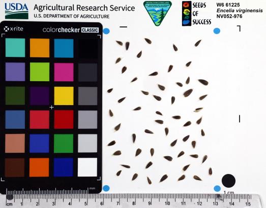 | | 2023 | | | | | | | Wild material | Yellow ray and disk flowers; leaves with strigose hairs | 2142180 | W6 61225 |
| 164 | W6 61233 | NV052-984 | Pectis papposa Harv. & A. Gray | Nevada, United States | W6 |  | | 2023 | | | | | | | Wild material | Low growing forb with bright yellow flowers, linear leaves that are gland-dotted, and heavily scented (reminiscent of spice). | 2142188 | W6 61233 |
| 165 | OPGC 8803 | CBG- 10754 | Aquilegia canadensis L. | Illinois, United States | OPGC | | | 2023 | | | | | | | Wild material | | 2142225 | OPGC 8803 |
| 166 | OPGC 8813 | CBG- 10781 | Hieracium scabrum Michx. | Illinois, United States | OPGC | | | 2023 | | | | | | | Wild material | | 2142247 | OPGC 8813 |
| 167 | W6 61358 | CBG- 10772 | Carex cephalophora Muhl. ex Willd. | Wisconsin, United States | W6 |  | | 2023 | | | | | | | Wild material | | 2142240 | W6 61358 |
| 168 | W6 61366 | CBG- 10782 | Paronychia canadensis (L.) Alph. Wood | Illinois, United States | W6 |  | | 2023 | | | | | | | Wild material | | 2142248 | W6 61366 |
| 169 | W6 61375 | CBG- 10798 | Desmodium perplexum B. G. Schub. | Illinois, United States | W6 |  | | 2023 | | | | | | | Wild material | | 2142257 | W6 61375 |
| 170 | W6 61381 | CBG- 10804 | Carex eburnea Boott | Wisconsin, United States | W6 |  | | 2023 | | | | | | | Wild material | | 2142263 | W6 61381 |
| 171 | Ames 36027 | Marietta Sand Prairie | Salix petiolaris Sm. | Iowa, United States | NC7 |  | | 2023 | COLLECTED | 03/15/2023 | Marietta Sand Prairie State Preserve approximately 7.5 miles northwest of Marshalltown on east side of Knapp Avenue, T84N R19W W 1/2 Sec. 11. | 42.09951000, -93.03668800 | 299 | Remnant sand prairie in areas with likely high water table. | Wild material | Slender-leaved willow, Salix petiolaris, is a somewhat dense suckering shrub that can reach up to 10' in height with slender stems that branch minimally, but typically maintains a height of 5-8'. Native to North America, the native range covers mostly the northeastern US stretching from Maine to western North Dakota and Canada south to central Iowa (Little, E. L. Jr. 1977). Salix petiolaris typically dominates wetland areas including sedge meadows, marshes, riverbanks, and lake shores. Despite favoring wet habitats, it can also be found in dry, upland areas, especially those with high-water tables. However, longevity is generally limited in upland habitats. S. petiolaris, similar to other willow species, responds well to fire, coppicing, or heavy browsing (highly favored by deer) by sprouting new stems close to the crown. In cultivation, plants after five years will encompass a 5' x 5' area due to stems that arch from the main base of the plant. Coppicing of plants to ground level is highly recommended either annually or once every 3-5 years to maintain vigorous growth and plant health. This species requires substantial to full sun exposure and is an excellent choice for streambank stabilizations and windbreaks to reduce soil erosion and drifting snow, respectively. This accession represents genetics from central Iowa and thus the southwestern edge of the species native range. Plants sampled in nature measuring at most 5' in height. Clump-type growth habit with minimal branching, but dense suckering (e.g. 50+ ramets per genet - typically encompassing 5' x 5' area) with winter stem colors ranging from red, orange-red, yellow, dark-green, green-brown, and yellow-green. Stems glabrous. Dormant buds occassionally black, but often reddish. | 2141651 | Ames 36027 |
| 172 | Ames 36017 | AS/GD/2023/002/212 | Gymnocladus dioicus (L.) K. Koch | Wisconsin, United States | NC7 |  | | 2023 | | | | | | | Wild material | Kentucky coffeetree in Wisconsin is rather rare. The Wisconsin Natural Heritage Inventory Program currently (2023) lists this taxon in Wisconsin as a species of concern with a state rank of S2 (Imperiled in Wisconsin due to a restricted range, few populations or occurrences, steep declines, severe threats, or other factors.) This accession represents genetics from a localized population with a near equal porportion of male and female specimens. While there are other known locations along the Wisconsin River, this population is producing seeds. The other known locations represent single clones that are distant enough from other existing clones that prevent the transfer of pollen and thus lack the ability to produce seed or will rarely produce. | 2141550 | Ames 36017 |
| 173 | NA 88599 | RJL2023NC-001 | Ilex decidua Walter | North Carolina, United States | NA | | | 2023 | COLLECTED | 02/18/2023 | Plants growing along a fenceline on a hillside about 10 meters from Interstate 85 (south bound) and approximately 0.65 kilometers south of the North Carolina-Virginia border. | 36.53904800, -78.18822500 | 86 | The plant was growing on the upper shoulder of a slope about 7 meters above the highway in part-shade to sun of an upland, well-drained, dry mesic somewhat disturbed site on the fenceline boundary of Interstate 85 (south bound). The area was originally cleared of all vegetation and now, many years later, native and non-native plant species have aggressively recolonized the area. This early successional habitat is dominated by Juniperus virginiana and Liquidambar styraciflua, as well as, non-native species such as Ligustrum sinense, Lonicera japonica, and Ailanthus altissima. The underlying geology of this area is of Permian/Pennsylvanian origin and characterized as the Granitic Rock Formation. It is characterized by megacrystic to equigranular components and includs Castalia and Wilton intrusives. | Wild material | | 2141480 | NA 88599 |
| 174 | WLP 3092 | RJLSEUS2022-021 | Rhododendron prunifolium (Small) Millais | Alabama, United States | NA | | | 2023 | COLLECTED | 12/10/2023 | Slopes along Poke Springs Branch inlet accessed by boat from Walter F. George Reservoir. Generally uncommon, but frequent at this site. | 31.72318400, -85.12907800 | 69 | Plants are growing in part-shade to shade on the well-drained mostly deciduous woodland slopes approximately 3-6 meters above the inlet.
Soils: The underlying geology of this area is of Cretaceous origin and characterized as Selma Group; Providence Sand. The upper part of the profile consists of cross-bedded fine to coarse sand and white, dark-gray and pale-red-purple mottled clay containing lignite, sand, and kaolin. The lower part consists of dark-gray laminated to thin-bedded silty clay and abundantly micaceous, carbonaceous, fossiliferous very fine to fine sand.
Source: USGS Alabama Geologic Map Data (https://mrdata.usgs.gov/geology/state/sgmc-unit.php?unit=ALKp%3B1)
The primary soil types in the collection area are classified as Nankin-Lucy Complex soil (20 to 60 percent slopes). The Nankin Series consists of very deep, well drained, moderately slowly permeable soils on uplands of the Coastal Plain. They formed in stratified loamy and clayey marine sediments. Slopes range from 0 to 60 percent. Soils are comprised of sandy loam in the upper 25 cm to sandy clay loam and sandy clay in lower strata to about 1.7 meters deep; these soils are strongly acid. The Lucy Series consists of very deep, well drained, moderately permeable soils on uplands. They formed in sandy and loamy marine and fluvial sediments of the Southern Coastal Plain. Slopes vary from 0 to 45 percent. These soils are generally loamy to sandy loam in the upper 25 cm and sandy clay loam in the lower strata to 2 meters; these are strongly acid soils.
Source: NRCS Web Soil Survey (https://websoilsurvey.sc.egov.usda.gov/App/WebSoilSurvey.aspx) | Wild material | | 2141446 | WLP 3092 |
| 175 | NA 88540 | RJLSEUS2022-012 | Rhododendron austrinum (Small) Rehder | Georgia, United States | NA | | | 2023 | COLLECTED | 12/09/2022 | Plants growing along the edge of a moist woodland habitat on the property at the end of the Lavender Lane cul-de-sac adjoining that of Monica Williams, in Albany, Georgia. Infrequent on the woodland edge at this site. | 31.63812300, -84.14066500 | 64 | Plants are growing in part-shade of a moist mesic, mostly deciduous, woodland along the upper fringes of seasonally moist to wet drainage area leading to a large pond and wetland habitat further downstream.
Soils: The underlying geology of this area is of Eocene origin and characterized as Ocala Limestone. The Ocala Limestone consists of almost pure limestones with occasional dolomites. It can be subdivided into both lower and upper facies with the lower facies composed of a whitish to cream-colored, fine to medium grained, poorly to moderately hard, fossil rich grainstone and packstone. The upper Ocala is white and somewhat weak and poorly sorted. It is extremely fossil rich grainstone, packstone and wackestone and some chert is common in the upper facies.
Source: USGS Georgia Geologic Map Data (https://mrdata.usgs.gov/geology/state/sgmc-unit.php?unit=GANu%3B1)
The primary soil types in the collection area are classified as Herod and Muckalee Series soils. The Herod Series consists of poorly drained moderately permeable soils formed in loamy alluvium. These soils are on flood plains of streams in the Coastal Plain. Slopes range from 0 to 2 percent. The Muckalee Series consists of poorly drained moderately permeable soils formed in loamy and sandy alluvium. These soils are on flood plains of streams in the Coastal Plain. Slopes range from 0 to 2 percent.
Source: NRCS Web Soil Survey (https://websoilsurvey.sc.egov.usda.gov/App/WebSoilSurvey.aspx) | Wild material | | 2140767 | NA 88540 |
| 176 | NA 88543 | RJLSEUS2022-015 | Rhododendron alabamense Rehder | Georgia, United States | NA | | | 2023 | COLLECTED | 12/09/2022 | Plants growing above a pond in drier upland conditions as well as along the banks of the Muckalee Creek on the property of Monica Williams north of Albany, Georgia. Infrequent, but occasionally seen in drier woods; more common along Muckalee Creek. | 31.63566400, -84.13379600 | 61 | Plants are growing in part-shade to shade of well-drained to drier understory conditions of a mixed evergreen and deciduous woodland, approximately 2 meters above Muckalee Creek, on sandy benches where occasional scouring has resulted in lower competition. Plants are occasionally impacted by flooding; however, they are not subjected to extended periods of high moisture on a regular basis.
Soils: The underlying geology of this area is of Eocene origin and characterized as Ocala Limestone. The Ocala Limestone consists of almost pure limestones with occasional dolomites. It can be subdivided into both lower and upper facies with the lower facies composed of a whitish to cream-colored, fine to medium grained, poorly to moderately hard, fossil rich grainstone and packstone. The upper Ocala is white and somewhat weak and poorly sorted. It is extremely fossil rich grainstone, packstone and wackestone and some chert is common in the upper facies.
Source: USGS Georgia Geologic Map Data (https://mrdata.usgs.gov/geology/state/sgmc-unit.php?unit=GANu%3B1)
The primary soil types in the collection area are classified as Herod and Muckalee Series soils. The Herod Series consists of poorly drained moderately permeable soils formed in loamy alluvium. These soils are on flood plains of streams in the Coastal Plain. Slopes range from 0 to 2 percent. The Muckalee Series consists of poorly drained moderately permeable soils formed in loamy and sandy alluvium. These soils are on flood plains of streams in the Coastal Plain. Slopes range from 0 to 2 percent.
Source: NRCS Web Soil Survey (https://websoilsurvey.sc.egov.usda.gov/App/WebSoilSurvey.aspx) | Wild material | | 2140769 | NA 88543 |
| 177 | NA 88552 | RJLSEUS2022-025 | Hydrangea quercifolia W. Bartram | Alabama, United States | NA | | | 2023 | COLLECTED | 12/12/2022 | Claiborne Bluffs area along unnamed road to boat ramp on the east side of the Alabama River at the U.S. Highway 84 bridge over the river. Common at this location and along the nearby Alabama River. | 31.54879700, -87.51416400 | 40 | Plants are growing in part-shade to shade of mesic, well-drained, circum-neutral slopes and benches in mature mixed deciduous and evergreen woodlands with good litter layer. Soils: The underlying geology of this area is the Jackson Group Undifferentiated. The units of the Jackson Group are the Yazoo Clay and Crystal River and Moodys Branch Formations. Descriptions of the members of the Yazoo Clay follow in descending order. Shubuta Member - in western Alabama consists of light-greenish-gray to white plastic fossiliferous, calcareous clay containing irregular calcareous nodules. From the Tombigbee River eastward, the Shubuta becomes more calcareous and grades into massive clayey glauconitic limestone. Eastward from the Alabama River, equivalent beds grade into the Crystal River Formation. Pachuta Marl Member - light-greenish-grey glauconitic, fossiliferous clayey sand and sandy limestone traceable from western Alabama eastward to Covington County where it grades into the Crystal River Formation. Cocoa Sand Member - yellowish-gray firm calcareous, fossiliferous fine to medium sand or sandy limestone or greenish-grey micaceous, calcareous, very clayey sand. Calcareous and clayey sand equivalent to the Cocoa is traceable from western Alabama to the Conecuh River area. (Source: USGS Alabama Geological Map Data). The surface soil profile of this portion of the bluffs along the Alabama River are characterized as Saffell-Lucy (Flomaton) Series Complex soils. The Saffell Series consists of very deep, well drained, moderately permeable soils that formed in loamy and gravelly marine sediments of the Tertiary Age and have acid reaction. These soils are found on the upper portion of the bluffs along the Alabama River. The Lucy Series consists of very deep, well drained, moderately permeable soils on uplands. They formed in sandy and loamy marine and fluvial sediments of the Southern Coastal Plain Major Land Resource Area. Soil reaction runs from strongly to moderately acid. The Flomaton Series consists of very deep, excessively drained, rapidly permeable soils on uplands of the Southern Coastal Plain Major Land Resource Area. They formed in gravelly sandy marine sediments and also have an acid reaction. The remainder of soils are of miscellaneous origin. (Source: USDA-NRCS Official Soil Series Descriptions). | Wild material | | 2140779 | NA 88552 |
| 178 | NA 88553 | RJLSEUS2022-026 | Hydrangea arborescens L. | Alabama, United States | NA | | | 2023 | COLLECTED | 12/12/2022 | Claiborne Bluffs area along unnamed road to boat ramp on the east side of the Alabama River at the U.S. Highway 84 bridge over the river. Occasionally found in the woodlands. | 31.54940700, -87.51366200 | 25 | Plants are growing in part-shade to shade of mesic, well-drained, circum-neutral slopes mature mixed deciduous and evergreen woodlands where slopes are exposed and detritus does not build up.
Soils: The underlying geology of this area is the Jackson Group Undifferentiated. The units of the Jackson Group are the Yazoo Clay and Crystal River and Moodys Branch Formations. Descriptions of the members of the Yazoo Clay follow in descending order. Shubuta Member - in western Alabama consists of light-greenish-gray to white plastic fossiliferous, calcareous clay containing irregular calcareous nodules. From the Tombigbee River eastward, the Shubuta becomes more calcareous and grades into massive clayey glauconitic limestone. Eastward from the Alabama River, equivalent beds grade into the Crystal River Formation. Pachuta Marl Member - light-greenish-grey glauconitic, fossiliferous clayey sand and sandy limestone traceable from western Alabama eastward to Covington County where it grades into the Crystal River Formation. Cocoa Sand Member - yellowish-gray firm calcareous, fossiliferous fine to medium sand or sandy limestone or greenish-grey micaceous, calcareous, very clayey sand. Calcareous and clayey sand equivalent to the Cocoa is traceable from western Alabama to the Conecuh River area.
Source: USGS Alabama Geological Map Data (https://mrdata.usgs.gov/geology/state/state.php?state=AL)
The surface soil profile of this portion of the bluffs along the Alabama River are characterized by Saffell-Lucy (Flomaton) Series Complex soils. The Saffell Series consists of very deep, well drained, moderately permeable soils that formed in loamy and gravelly marine sediments of the Tertiary Age and have acid reaction. These soils are found on the upper portion of the bluffs along the Alabama River. The Lucy Series consists of very deep, well drained, moderately permeable soils on uplands. They formed in sandy and loamy marine and fluvial sediments of the Southern Coastal Plain Major Land Resource Area. Soil reaction runs from strongly to moderately acid. The Flomaton Series consists of very deep, excessively drained, rapidly permeable soils on uplands of the Southern Coastal Plain Major Land Resource Area. They formed in gravelly sandy marine sediments and also have an acid reaction. The remainder of soils are of miscellaneous origin.
Source: USDA-NRCS Official Soil Series Descriptions (https://soilseries.sc.egov.usda.gov/osdname.aspx) | Wild material | | 2140780 | NA 88553 |
| 179 | NA 88554 | RJLSEUS2022-027 | Rhododendron alabamense Rehder | Alabama, United States | NA | | | 2023 | COLLECTED | 12/12/2022 | Plants growing on woodland slopes around and below the hilltop parking area leading down to the Silver Creek Lake Campground off of Silver Creek Lake Road. Occasional in the upland woodlands. | 31.66613100, -87.57625700 | 49 | Plants are growing in shade of upland dry mesic mature mixed deciduous and evergreen woodland. Generally, the overstory is thinner and there is less leaf litter cover, making the surface soil conditions drier.
Soils: The underlying geology of this area is Claiborne Group, Tallahatta Formation, of Eocene origin, with white to very light-greenish-gray thin-bedded to massive siliceous claystone; interbedded with thin layers of fossiliferous clay, sandy clay, and glauconitic sand and sandstone.
Source: USGS Alabama Geological Map Data (https://mrdata.usgs.gov/geology/state/state.php?state=AL)
The primary soil types in the collection area are classified as Smithdale-Boykin Complex soils (2 to 5 percent slopes). The Smithdale Series consists of very deep, well drained, moderately permeable soils on ridge tops and hill slopes in dissected uplands of the Southern Coastal Plain and in the Western Coastal Plain. They formed in thick beds of loamy marine sediments and are strongly acid. Slopes range from 1 to 60 percent. The Boykin Series consists of deep, well drained, moderately permeable soils that formed in sandy and loamy coastal plain sediments of Pleistocene age. These soils are on gently sloping to moderately steep uplands. Slopes range from 1 to 20 percent.
Source: NRCS Web Soil Survey (https://websoilsurvey.sc.egov.usda.gov/App/WebSoilSurvey.aspx) | Wild material | | 2140781 | NA 88554 |
| 180 | NA 88555 | RJLSEUS2022-028 | Rhododendron canescens (Michx.) Sweet | Alabama, United States | NA | | | 2023 | COLLECTED | 12/12/2022 | Plants growing on woodland slopes below the hilltop parking area leading down to the Silver Creek Lake Campground off of Silver Creek Lake Road. Occasional in the woodlands. | 31.66549700, -87.57624500 | 45 | Plants are growing in shade of moist mesic deciduous and evergreen woodland, mid-slope between the upland dry mesic zone and the creekside habitat below.
Soils: The underlying geology of this area is Claiborne Group, Tallahatta Formation, of Eocene origin, with white to very light-greenish-gray thin-bedded to massive siliceous claystone; interbedded with thin layers of fossiliferous clay, sandy clay, and glauconitic sand and sandstone.
Source: USGS Alabama Geological Map Data (https://mrdata.usgs.gov/geology/state/state.php?state=AL)
The primary soil types in the collection area are classified as Luverne Sandy Loam soils (15 to 35 percent slopes). The Luverne Series consists of very deep, well drained, moderately slowly permeable soils on dissected uplands of the Southern Coastal Plain. They formed in stratified marine sediments and are strongly acid. The lower strata of this series are clay and clay loam. Slopes range from 1 to 45 percent.
Source: NRCS Web Soil Survey (https://websoilsurvey.sc.egov.usda.gov/App/WebSoilSurvey.aspx) | Wild material | | 2140782 | NA 88555 |
| 181 | NA 88556 | RJLSEUS2022-029 | Rhododendron colemanii R. F. Mill. | Alabama, United States | NA | | | 2023 | COLLECTED | 12/12/2022 | Plants growing on woodland slopes below the hilltop parking area leading down to the Silver Creek Lake Campground off of Silver Creek Lake Road. Occasional in the woodlands. | 31.66503300, -87.57468000 | 43 | Plants are growing in shade of moist mesic deciduous and evergreen woodland on rich slopes 1-3 meters above a small spring-fed creek.
Soils: The underlying geology of this area is Claiborne Group, Tallahatta Formation, of Eocene origin, with white to very light-greenish-gray thin-bedded to massive siliceous claystone; interbedded with thin layers of fossiliferous clay, sandy clay, and glauconitic sand and sandstone.
Source: USGS Alabama Geological Map Data (https://mrdata.usgs.gov/geology/state/state.php?state=AL)
The primary soil types in the collection area are classified as Smithdale-Boykin Complex soils (2 to 5 percent slopes). The Smithdale Series consists of very deep, well drained, moderately permeable soils on ridge tops and hill slopes in dissected uplands of the Southern Coastal Plain and in the Western Coastal Plain. They formed in thick beds of loamy marine sediments and are strongly acid. Slopes range from 1 to 60 percent. The Boykin Series consists of deep, well drained, moderately permeable soils that formed in sandy and loamy coastal plain sediments of Pleistocene age. These soils are on gently sloping to moderately steep uplands. Slopes range from 1 to 20 percent.
Source: NRCS Web Soil Survey (https://websoilsurvey.sc.egov.usda.gov/App/WebSoilSurvey.aspx) | Wild material | | 2140783 | NA 88556 |
| 182 | NA 88557 | RJLSEUS2022-030 | Ilex longipes Chapm. ex Trel. | Alabama, United States | NA | | | 2023 | COLLECTED | 12/12/2022 | Silver Creek Lake Campground off of Silver Creek Lake Road: woodland slopes below the hilltop parking lot leading down to the campground. | 31.66442800, -87.57461400 | 39 | Part shade of moist-mesic, mixed deciduous and evergreen woodland on dry, well-drained bank, 1-2 meters above a small spring-fed creek. The underlying geology of this area is Claiborne Group, Tallahatta Formation, of Eocene origin, with white to very light-greenish-gray thin-bedded to massive siliceous claystone; interbedded with thin layers of fossiliferous clay, sandy clay, and glauconitic sand and sandstone. (Source: USGS Alabama Geological Map Data). The primary soil types in the collection area are classified as Arundel-Cantuche Complex soils (15 to 35 percent slopes). The Arundel Series consists of moderately deep, well drained, very slowly permeable soils on dissected uplands of the Southern Coastal Plain. They formed in marine deposits consisting of acid clays underlain by horizontally bedded sandstone, buhrstone and siltstone. These soils are strongly acid. Slopes range from 2 to 60 percent. The Cantuche Series consists of shallow, well drained, moderately permeable soils that formed over horizontally bedded claystone. These soils are on narrow ridgetops and narrow benches on steep side-slopes of dissected landscapes in the Coastal Plain. They are strongly acid. Slopes range from 2 to 35 percent. (Source: NRCS Web Soil Survey). | Wild material | | 2140818 | NA 88557 |
| 183 | NA 88559 | RJLSEUS2022-032 | Rhododendron colemanii R. F. Mill. | Alabama, United States | NA | | | 2023 | COLLECTED | 12/12/2022 | Plants growing in bottomland mostly deciduous woodlands on the south side of Lena Landegger Hwy (Monroe County Road 39) about 0.5 kilometers south of the entrance to the Alabama River Cellulose plant. Common at this site. | 31.56879700, -87.49589500 | 10 | Plants are growing in shade of a moist mesic (occasionally temporarily wet) deciduous woodland less than 1 meter above wetland habitats associated with the nearby Alabama River.
Soils: The underlying geology of this area is of Holocene origin and characterized as Alluvial, coastal and low terrace deposits. Varicolored fine to coarse quartz sand containing clay lenses and gravel in places.
Source: USGS Alabama Geologic Map Data (https://mrdata.usgs.gov/geology/state/sgmc-unit.php?unit=ALHalt%3B0)
The primary soil types in the collection area are classified as Chrysler Silt Loam soils (0 to 5 percent slopes, occasionally flooded). The Chrysler Series consists of deep, moderately well drained, slowly permeable soils that formed in clayey fluvial or alluvial sediments. These soils are on stream terraces of the Coastal Plain. They are strongly acid. The rate at which water runs off the surface is medium to rapid. Slopes range from 0 to 5 percent.
Source: NRCS Web Soil Survey (https://websoilsurvey.sc.egov.usda.gov/App/WebSoilSurvey.aspx) | Wild material | | 2140784 | NA 88559 |
| 184 | NA 88565 | RJLSEUS2022-038 | Ilex ambigua Torr. | Florida, United States | NA | | | 2023 | COLLECTED | 12/14/2022 | Eglin Air Force Base: growing along the east side of Eglin AFB Choctaw Nolf Road northwest of Choctaw Navy Outlying Field. This road goes west and takes circuitous route to the north around the Field en route to Escribano Point Wildlife Management Area. | 30.51507900, -86.96767100 | 14 | Full sun on the top of the roadside slope in well-drained to dry conditions, 1-2 meters above surrounding lower, moist area. The underlying geology of this area is the Citronelle Formation, of Pliocene origin, and consists of gray to orange, often mottled, unconsolidated to poorly consolidated, very fine to very coarse, poorly sorted, clean to clayey sands. It contains significant amounts of clay, silt and gravel which may occur as beds and lenses and may vary considerably over short distances. Limonite nodules and limonite-cemented beds are common. (Source: USGS Florida Geologic Map Data). The primary soil type in the collection area is classified as Lakeland Sand soils (5 to 12 percent slopes). The surface soil profile of this area is primarily the Lakeland series which consists of very deep, excessively drained, rapid to very rapidly permeable soils on uplands. They formed in thick beds of eolian or marine and/or fluvio-marine sands. Thickness of the sand exceeds 2 meters. Silt plus clay in the upper meter ranges from 5-10 percent. Reaction ranges from very strongly acid to moderately acid throughout. (Source: NRCS Web Soil Survey). | Wild material | | 2140822 | NA 88565 |
| 185 | NA 88510 | RJL2022TX-005 | Crataegus marshallii Eggl. | Texas, United States | NA | | | 2022 | COLLECTED | 11/01/2022 | Plants growing along the west side of Texas State Hwy 87 on the edge of the woodlands. Plant is infrequently found, but a regular member of the woodlands as well as forest edge communities along the highway. | 31.15847300, -93.73852000 | 115 | Plants are growing in part-shade to sun on upland dry hills. In shade they survive, but in part-shade to sun they develop excellent flowering and fruiting.
Soils: The underlying geology of this area is of Oligocene origin and characterized as Catahoula Formation. This formation is extensive and deep in Texas, up to 185 meters thick. In the area of the collection the Catahoula Formation is primarily mudstone and sand. The upper 90-150 meters is mudstone that is tuffaceous, and sandy; also, occasionally, with some bentonitic clay.
Source: USGS Texas Geologic Map Data (https://mrdata.usgs.gov/geology/state/sgmc-unit.php?unit=TXQbs%3B0
The primary soil types in the collection area are classified as Letney-Tehran soils. These soils consist of deep, somewhat excessively drained, moderately rapidly permeable soils on uplands. They were formed in thick loamy and sandy sediments on the Western Coastal Plain. The Letney-Tehran soils are on gently sloping to moderately steep uplands with slopes ranging from 1 to 20 percent. They are typically strongly acidic.
Source: NRCS Web Soil Survey (https://websoilsurvey.sc.egov.usda.gov/App/WebSoilSurvey.aspx) | Wild material | | 2139817 | NA 88510 |
| 186 | NA 88514 | RJL2022MD-019 | Kalmia latifolia L. | Maryland, United States | NA | | | 2022 | COLLECTED | 11/04/2022 | Plants are growing on both sides of a fire road on Maryland Heights along the edge with Harpers Ferry National Historic Park. This location was accessed from the east where Miller Avenue meets the fire road, approximately 2 kilometers away. There is no vehicular access to the collecting area. Becoming locally uncommon. This local population is likely to be extirpated in the next 20-30 years. This collector has hiked through this area for more than 35 years and seen dramatic changes in the population. When first observed, Kalmia latifolia was a dominant understory shrub on south- to west-facing slopes beneath a mature forest canopy. Over the years, at least one forest fire has significantly reduced the population, along with a continuing increase in deer populations, resulting in catastrophic browse damage. The absence of a mature forest canopy and periods of drought have almost certainly also resulted in decline of this population. While collecting seed from scattered mature plants well above deer browse levels, this collector also noted that there was virtually no recruitment taking place. | 39.32811200, -77.72242400 | 287 | Plants are growing in part-shade to shade of a deciduous upland, very rocky, and dry forest community. Plants are frequently found growing among boulders, rock outcrops, and steep-slope erosional areas, although, not exclusively.
Soils: The underlying geology of this area is of Late Cambrian to Cambrian origin and comprised of Chilhowee Group; Weverton Formation. This includes interbedded white to dark gray, thin-bedded, micaceous, ferruginous, and sericitic quartzites, phyllites, and white, thick-bedded, ledge-making quartzites; some gray to brown ferruginous quartz conglomerate and purple-banded phyllite.
Source: USGS Maryland Geologic Map Data https://mrdata.usgs.gov/geology/state/sgmc-unit.php?unit=MDKp%3B5
The primary soil types in the collection area are classified as Dekalb-Bagtown-Rock outcrop complex, 25 to 65 percent slopes. The Dekalb series consists of moderately deep, excessively drained soils formed in material weathered from gray and brown acid sandstone in places interbedded with shale and graywacke. Slope ranges from 0 to 80 percent. Permeability is rapid. Solum thickness and depth to bedrock range from 50 to 100 cm. Flat, subangular or angular, sandstone fragments, 2.5-25 cm across increase with depth and range from 10-60 percent in individual horizons of the solum and from 50-90 percent or more in the C horizon. The amount of rock fragments typically increases with depth. Cobbly, channery, and very stony phases are common. Reaction ranges from extremely through strongly acid.
Source: NRCS Web Soil Survey (https://websoilsurvey.sc.egov.usda.gov/App/WebSoilSurvey.aspx) | Wild material | | 2139821 | NA 88514 |
| 187 | WLP 2673 | RJL2022NJ-004 | Lyonia mariana (L.) D. Don | New Jersey, United States | NA | | | 2022 | COLLECTED | 10/24/2022 | Plants growing on both sides of Duerer Street approximately 0.37 kilometers southeast of 4th Avenue, Mullica Township, New Jersey. Plants are common but scattered on both sides of the road at this site. | 39.55730700, -74.66376100 | 22 | Plants grow from part shade to full sun throughout the habit from the upper edges of the ditches through the herbaceous grass dominant buffer and all the way to the part shade of the woodland edge. Plants transition through moist/wet conditions in full sun to quite dry conditions in part shade and seem equally adapted.
Soils: The underlying geology of this area is the Cohansey Formation of middle Miocene origin and comprised of sand, white to yellow with local gravel and clay. It is sometimes locally stained red or orange brown by iron oxides and (or) cemented into large blocks of ironstone. Unweathered clay is typically dark gray, but commonly weathers white where it is interbedded with thin beds of ironstone. Sand is typically medium grained and moderately sorted although it ranges from fine to very coarse grained and from poorly to well sorted. Sand consists of quartz and siliceous rock fragments. Some beds are locally micaceous. Maximum thickness in the map area is about 60 meters; however, thickness is difficult to determine because of the irregular basal contact and extensive post-depositional erosion.
Source: USGS New Jersey Geologic Map Data (https://mrdata.usgs.gov/geology/state/sgmc-unit.php?unit=NJTch%3B1)
The primary soil type in the area of this collection is classified as Mullica sandy loam, 0 to 2 percent slopes. These soils are typically coarse-loamy, siliceous, semiactive, and mesic typic humaquepts that are strongly to extremely acidic throughout the profile. The typical solum thickness ranges from 50-150+ cm. These soils are generally considered to be poorly drained.
Source: NRCS Web Soil Survey (https://websoilsurvey.sc.egov.usda.gov/App/WebSoilSurvey.aspx) | Wild material | | 2139664 | WLP 2673 |
| 188 | NA 88500 | RJL2022NJ-002 | Ilex glabra (L.) A. Gray | New Jersey, United States | NA | | | 2022 | COLLECTED | 10/24/2022 | Mullica Township: both sides of Duerer Street, approximately 0.37 kilometers southeast of 4th Avenue. | 39.55885000, -74.66442500 | 21 | Plants growing in shade to almost full sun on compacted seasonally moist to temporarily wet areas of a mixed evergreen and deciduous woodland dominated by Pinus rigida. Vegetation of this area is very much defined by small changes in elevation that go from wet to very dry. Ilex glabra remains abundant throughout, though. Plants are abundant on the edge of the woodlands as well as the understory of the woodlands. Soils: The underlying geology of this area is the Cohansey Formation of middle Miocene origin and comprised of sand, white to yellow with local gravel and clay. It is sometimes locally stained red or orange brown by iron oxides and (or) cemented into large blocks of ironstone. Unweathered clay is typically dark gray, but commonly weathers white where it is interbedded with thin beds of ironstone. Sand is typically medium grained and moderately sorted although it ranges from fine to very coarse grained and from poorly to well sorted. Sand consists of quartz and siliceous rock fragments. Some beds are locally micaceous. Maximum thickness in the map area is about 60 meters; however, thickness is difficult to determine because of the irregular basal contact and extensive post-depositional erosion. (Source: USGS New Jersey Geologic Map Data). The primary soil type in the area of this collection is classified as Mullica sandy loam, 0 to 2 percent slopes. These soils are typically coarse-loamy, siliceous, semiactive, and mesic typic humaquepts that are strongly to extremely acidic throughout the profile. The typical solum thickness ranges from 50-150+ cm. These soils are generally considered to be poorly drained. (Source: NRCS Web Soil Survey). | Wild material | | 2139663 | NA 88500 |
| 189 | NA 89037 | RJL2022KS-004 | Fraxinus pennsylvanica Marshall | Kansas, United States | NA |  for this accession.") | | 2022 | COLLECTED | 09/21/2022 | Coronado Heights Park, Smoky View, Kansas hillsides surrounding the historic WPA circa 1932 Coronado Heights Castle located about 91 meters above the surrounding land. This plant is scattered and infrequent on the slopes of this site. | 38.61065700, -97.70408300 | 448 | Plants growing in full sun, under extreme exposure, rocky, dry and thin soils of this short grass prairie habitat on the slopes surrounding the summit of Coronado Heights Park. Plants tend
Soils: The underlying geology of this area is of Upper Cretaceous origin and comprised of Kiowa Shale or FM- light -gray to black illitic shale with thin coquinoidal limestone beds at the base; sandstone lenses are common. Cheyenne Sandstone-massive to cross-bedded, light-gray to buff fine-grained sandstone with lenses to be found in runoff zones where moisture is temporarily more abundant.of gray sandy shale and conglomerate.
Source: USGS Kansas Geologic Map Data (https://mrdata.usgs.gov/geology/state/sgmc-unit.php?unit=KSKkc%3B0)
The surface soil profile of this area is Lancaster-Hedville complex, 3 to 20 percent slopes. The Lancaster series consists of moderately deep, well drained soils that formed in residuum from sandstone and sandy shales; it can be up to 200 cm deep. Slopes range from 1-20%. Hedville soils have bedrock within 50 centimeters of the surface and occur on similar hillslope positions.
Source: NRCS Web Soil Survey (https://websoilsurvey.sc.egov.usda.gov/App/WebSoilSurvey.aspx) | Wild material | | 2139602 | NA 89037 |
| 190 | NA 89036 | RJL2022KS-003 | Cornus drummondii C. A. Mey. | Kansas, United States | NA | | | 2022 | COLLECTED | 09/21/2022 | Coronado Heights Park, Smoky View, Kansas hillsides surrounding the historic WPA circa 1932 Coronado Heights Castle located about 91 meters above the surrounding land. This plant is common and abundant on the slopes of this site. | 38.61348400, -97.70343100 | 475 | Plants growing in part shade to full sun, under extreme exposure, rocky, dry and thin soils of this short grass prairie habitat on the slopes surrounding the summit of Coronado Heights Park. The underlying geology of this area is of Upper Cretaceous origin and comprised of Kiowa Shale or FM- light -gray to black illitic shale with thin coquinoidal limestone beds at the base; sandstone lenses are common. Cheyenne Sandstone-massive to cross-bedded, light-gray to buff fine-grained sandstone with lenses of gray sandy shale and conglomerate.
Source: USGS Kansas Geologic Map Data (https://mrdata.usgs.gov/geology/state/sgmc-unit.php?unit=KSKkc%3B0)
The surface soil profile of this area is Lancaster-Hedville complex, 3 to 20 percent slopes. The Lancaster series consists of moderately deep, well drained soils that formed in residuum from sandstone and sandy shales; it can be up to 200 cm deep. Slopes range from 1-20%. Hedville soils have bedrock within 50 centimeters of the surface and occur on similar hillslope positions.
Source: NRCS Web Soil Survey (https://websoilsurvey.sc.egov.usda.gov/App/WebSoilSurvey.aspx)
Slope: 5-20% Aspect: all | Wild material | | 2139601 | NA 89036 |
| 191 | NA 89035 | RJL2022KS-002 | Rosa arkansana Porter | Kansas, United States | NA | | | 2022 | COLLECTED | 09/20/2022 | Coronado Heights Park, Smoky View, Kansas hillsides surrounding the historic WPA circa 1932 Coronado Heights Castle located about 91 meters above the surrounding land. This plant is quite abundant on the slopes of this site and highly competitive. | 38.61158800, -97.70427000 | 475 | Plants growing in part-sun to full sun, under extreme exposure, rocky, dry and thin soils of this short grass prairie habitat on the slopes surrounding the summit of Coronado Heights Park.
The underlying geology of this area is of Upper Cretaceous origin and comprised of Kiowa Shale or FM- light -gray to black illitic shale with thin coquinoidal limestone beds at the base; sandstone lenses are common. Cheyenne Sandstone-massive to cross-bedded, light-gray to buff fine-grained sandstone with lenses of gray sandy shale and conglomerate.
Source: USGS Kansas Geologic Map Data (https://mrdata.usgs.gov/geology/state/sgmc-unit.php?unit=KSKkc%3B0)
The surface soil profile of this area is Lancaster-Hedville complex, 3 to 20 percent slopes. The Lancaster series consists of moderately deep, well drained soils that formed in residuum from sandstone and sandy shales; it can be up to 200 cm deep. Slopes range from 1-20%. Hedville soils have bedrock within 50 centimeters of the surface and occur on similar hillslope positions.
Source: NRCS Web Soil Survey (https://websoilsurvey.sc.egov.usda.gov/App/WebSoilSurvey.aspx) | Wild material | | 2139600 | NA 89035 |
| 192 | NA 89034 | RJL2022KS-001 | Baptisia australis (L.) R. Br. var. minor (Lehm.) Fernald | Kansas, United States | NA | | | 2022 | COLLECTED | 09/20/2022 | Coronado Heights Park, Smoky View, Kansas hillsides surrounding the historic WPA circa 1932 Coronado Heights Castle located about 91 meters above the surrounding land. This plant is sporadic to common on the slopes of this site. | 38.61349700, -97.70303900 | 487 | This plant is sporadic to common on the slopes of this site.
Habitat Notes: Plants growing in full sun, under extreme exposure, rocky, dry and thin soils of this short grass prairie habitat on the slopes surrounding the summit of Coronado Heights Park.
The underlying geology of this area is of Upper Cretaceous origin and comprised of Kiowa Shale or FM- light -gray to black illitic shale with thin coquinoidal limestone beds at the base; sandstone lenses are common. Cheyenne Sandstone-massive to cross-bedded, light-gray to buff fine-grained sandstone with lenses of gray sandy shale and conglomerate.
Source: USGS Kansas Geologic Map Data (https://mrdata.usgs.gov/geology/state/sgmc-unit.php?unit=KSKkc%3B0)
The surface soil profile of this area is Lancaster-Hedville complex, 3 to 20 percent slopes. The Lancaster series consists of moderately deep, well drained soils that formed in residuum from sandstone and sandy shales; it can be up to 200 cm deep. Slopes range from 1-20%. Hedville soils have bedrock within 50 centimeters of the surface and occur on similar hillslope positions.
Source: NRCS Web Soil Survey (https://websoilsurvey.sc.egov.usda.gov/App/WebSoilSurvey.aspx) | Wild material | received as Baptisia minor | 2139599 | NA 89034 |
| 193 | NA 89033 | RJL2022MD-010 | Clethra alnifolia L. | Maryland, United States | NA | | | 2022 | COLLECTED | 09/15/2022 | Plants growing in low woodlands at the end of Greenway Avenue near a boat dock that leads to the Pocomoke River, adjacent to Winter Quarters Golf Course, Pocomoke City. Plants common throughout the wetland area as well as mesic edges of the woodlands. | 38.08305100, -75.56527800 | | Plants growing in the flood plain of the Pocomoke River in shade to part sun of a mixed deciduous and evergreen bottomland habitat about 10 meters from the edge of the golf course fairway. The habitat is a mucky swamp edge habitat next to the Pocomoke River, most of which seems wet year-round and grades slightly upslope to more mesic conditions.
The underlying geology of this area is comprised of Quaternary Deposits of Wisconsin to Holocene origin. The composition is primarily undifferentiated gray to buff sand and gravel, gray to brown lignitic silt and clay, occasional boulders, and rare shell beds. Surficial deposits occur as shell-bearing estuarine clays and silts.
Source: USGS Maryland Geologic Map Data https://mrdata.usgs.gov/geology/state/sgmc-unit.php?unit=MDQdu%3B5
The surface soil profile of this habitat is classified as Puckum Muck which is frequently flooded. These highly saturated soils are found in flats, depressions and swales. The soil reaction of Puckum Muck is extremely acid to strongly acid throughout the profile. The depth to bedrock is generally greater than 150 cm. Wood fragments comprise 0-25%, by volume of the Puckum Muck throughout the profile which includes mostly twigs, branches, logs, or stumps and are 1.5-30 cm in diameter. The composition of these highly saturated soils, are classified as muck (sapric soil material) or mucky peat (hemic soil material) throughout most of the upper 150 cm and may contain thin layers of mucky silt loam, silty clay loam, sandy loam and/or sand.
Source: NRCS Web Soil Survey (https://websoilsurvey.sc.egov.usda.gov/App/WebSoilSurvey.aspx) | Wild material | | 2139598 | NA 89033 |
| 194 | NA 89032 | RJL2022MD-009 | Rhododendron viscosum (L.) Torr. | Maryland, United States | NA | | | 2022 | COLLECTED | 09/15/2022 | Plants growing in low woodlands at the end of Greenway Avenue near a boat dock that leads to the Pocomoke River, adjacent to Winter Quarters Golf Course, Pocomoke City. Plants scattered throughout the wetland area. Infrequent, but regularly found. | 38.08235200, -75.56566500 | 1 | Plants growing in the flood plain of the Pocomoke River in part shade to shade of a mixed deciduous and evergreen bottomland habitat about 10 meters from the edge of the golf course fairway. The habitat is a mucky swamp edge habitat next to the Pocomoke River, most of which seems wet year-round.
The underlying geology of this area is comprised of Quaternary Deposits of Wisconsin to Holocene origin. The composition is primarily undifferentiated gray to buff sand and gravel, gray to brown lignitic silt and clay, occasional boulders, and rare shell beds. Surficial deposits occur as shell-bearing estuarine clays and silts.
Source: USGS Maryland Geologic Map Data https://mrdata.usgs.gov/geology/state/sgmc-unit.php?unit=MDQdu%3B5
The surface soil profile of this habitat is classified as Puckum Muck which is frequently flooded. These highly saturated soils are found in flats, depressions and swales. The soil reaction of Puckum Muck is extremely acid to strongly acid throughout the profile. The depth to bedrock is generally greater than 150 cm. Wood fragments comprise 0-25%, by volume of the Puckum Muck throughout the profile which includes mostly twigs, branches, logs, or stumps and are 1.5-30 cm in diameter. The composition of these highly saturated soils, are classified as muck (sapric soil material) or mucky peat (hemic soil material) throughout most of the upper 150 cm and may contain thin layers of mucky silt loam, silty clay loam, sandy loam and/or sand.
Source: NRCS Web Soil Survey (https://websoilsurvey.sc.egov.usda.gov/App/WebSoilSurvey.aspx) | Wild material | | 2139597 | NA 89032 |
| 195 | Ames 35923 | AS/FN/2022/072/203 | Fraxinus nigra Marshall | Wisconsin, United States | NC7 |  | | 2022 | COLLECTED | 09/29/2022 | Chequamegon National Forest, approximately ten miles southeast of Park Falls. Collected along North Gates Lake Road, Sailor Lake Road and State Highway 70, T38N R2E and T39N R1E. | 45.81027500, -90.27504800 | 483 | Saturated soils in northern hardwood forest. | Wild material | Accession represents materials collected across a 15 x 15 square mile area sampled by Carstens, Sherwood, and Brandtner. Same area as where FSNS 5000 was collected. | 2139686 | Ames 35923 |
| 196 | NA 88481 | RJL2022MD-002 | Kalmia latifolia L. | Maryland, United States | NA | | | 2022 | COLLECTED | 09/04/2022 | Plants growing at Elkton State Forest along roads and woodlands over a distance of approximately 5 kilometers labelled as the address of 717 Irishtown Rd, North East, MD 21901. Kalmia is very common along the unnamed gravel road as well as the understory of the upland woodlands. | 39.58852900, -75.90452900 | 60 | Plants are growing in a mesic to dry, well-drained habitat of mixed deciduous and evergreen woodlands comprised primarily of acid-loving plants. Plants are growing in shade to part shade along the unnamed road as well as the woodlands. The soils in the collection area are generally described as a complex series of fluviomarine deposits. The soils range from a thin loam layer at the surface to varying levels of loam to sandy loam and/or extremely gravelly sandy clay loam strata, depending upon geographical location (ie. Hillslope summits, slopes, footslopes, swales, etc.). The primary soil types in the collection area are classified as Russett-Christiana-Hambrook Complex and/or Sassafras and Croom Soils; though, others may intersect and overlay in specific areas. | Wild material | | 2139360 | NA 88481 |
| 197 | NA 88482 | RJL2022MD-003 | Rhododendron periclymenoides (Michx.) Shinners | Maryland, United States | NA | | | 2022 | COLLECTED | 09/04/2022 | Plants growing at Elkton State Forest along roads and woodlands over a distance of approximately 5 kilometers labelled as the address of 717 Irishtown Rd, North East, MD 21901. Plants are found infrequently and scattered along the unnamed gravel road | 39.58852900, -75.90452900 | 51 | Plants are growing in a mesic to dry, well-drained habitat of mixed deciduous and evergreen woodlands comprised primarily of acid-loving plants. Plants are growing in part shade. The soils in the collection area are generally described as a complex series of fluviomarine deposits. The soils range from a thin loam layer at the surface to varying levels of loam to sandy loam and/or extremely gravelly sandy clay loam strata, depending upon geographical location (ie. Hillslope summits, slopes, footslopes, swales, etc.). The primary soil types in the collection area are classified as Russett-Christiana-Hambrook Complex and/or Sassafras and Croom Soils; though, others may intersect and overlay in specific areas. | Wild material | | 2139361 | NA 88482 |
| 198 | NA 88483 | RJL2022MD-004 | Clethra alnifolia L. | Maryland, United States | NA | | | 2022 | COLLECTED | 09/04/2022 | Plants growing at Elkton State Forest along roads and woodlands over a distance of approximately 5 kilometers labelled as the address of 717 Irishtown Rd, North East, MD 21901. Plants are found regularly but scattered along the unnamed gravel road as well as in open understory of the upland woodlands. | 39.58531200, -75.89566100 | 47 | Plants are growing in a mesic to moist, well-drained habitat of mixed deciduous and evergreen woodlands comprised primarily of acid-loving plants. Plants are growing in part shade and open understory shade. The soils in the collection area are generally described as a complex series of fluviomarine deposits. The soils range from a thin loam layer at the surface to varying levels of loam to sandy loam and/or extremely gravelly sandy clay loam strata, depending upon geographical location (ie. Hillslope summits, slopes, footslopes, swales, etc.). The primary soil types in the collection area are classified as Russett-Christiana-Hambrook Complex and/or Sassafras and Croom Soils; though, others may intersect and overlay in specific areas. | Wild material | | 2139362 | NA 88483 |
| 199 | NA 88484 | RJL2022MD-005 | Aronia melanocarpa (Michx.) Elliott | Maryland, United States | NA | | | 2022 | COLLECTED | 09/04/2022 | Plants growing at Elkton State Forest on Elk Neck Trail #3 (Starkey Lane) labelled as the address of 717 Irishtown Rd, North East, MD 21901. This was the only plant observed during several visits to Elk Neck State Forest during early and mid-summer | 39.58531200, -75.89566100 | 55 | Plants are growing in a mesic to dry, well-drained habitat of mixed deciduous and evergreen woodlands comprised primarily of acid-loving plants. Plants are growing in part shade to part-sun. The soils in the collection area are generally described as a complex series of fluviomarine deposits. The soils range from a thin loam layer at the surface to varying levels of loam to sandy loam and/or extremely gravelly sandy clay loam strata, depending upon geographical location (ie. Hillslope summits, slopes, footslopes, swales, etc.). The primary soil types in the collection area are classified as Russett-Christiana-Hambrook Complex and/or Sassafras and Croom Soils; though, others may intersect and overlay in specific areas.
Source: NRCS Web Soil Survey (https://websoilsurvey.sc.egov.usda.gov/App/WebSoilSurvey.aspx) | Wild material | received as A. prunifolia, on further examination by collector it was determined to be A. melanocarpa | 2139363 | NA 88484 |
| 200 | NA 88485 | RJL2022MD-006 | Hamamelis virginiana L. | Maryland, United States | NA | | | 2022 | COLLECTED | 09/04/2022 | Plants growing at Elkton State Forest on Elk Neck Trail #3 (Starkey Lane) labelled as the address of 717 Irishtown Rd, North East, MD 21901. This species was infrequent throughout most of Elk Neck State Park, but relatively common. | 39.58790000, -75.88853100 | 54 | Plants are growing in a mesic to dry, well-drained habitat of mixed deciduous and evergreen woodlands comprised primarily of acid-loving plants. Plants are growing in part shade to shade. The soils in the collection area are generally described as a complex series of fluviomarine deposits. The soils range from a thin loam layer at the surface to varying levels of loam to sandy loam and/or extremely gravelly sandy clay loam strata, depending upon geographical location (ie. Hillslope summits, slopes, footslopes, swales, etc.). The primary soil types in the collection area are classified as Russett-Christiana-Hambrook Complex and/or Sassafras and Croom Soils; though, others may intersect and overlay in specific areas.
Source: NRCS Web Soil Survey (https://websoilsurvey.sc.egov.usda.gov/App/WebSoilSurvey.aspx) | Wild material | | 2139364 | NA 88485 |
| 201 | NA 88489 | RJL2022PA-005 | Kalmia latifolia L. | Pennsylvania, United States | NA | | | 2022 | COLLECTED | 09/10/2022 | Plants are growing on the lands of Hawk Mountain Sanctuary. This species is very common and abundant. It is one of the most dominant understory plants in woodlands. This species is a common understory shrub throughout the entire region in upland dry woodland habitats. | 40.63862000, -75.99071200 | 430 | Plants are growing primarily in shade to part-shade on a dry-mesic to very dry, well-drained upland/montane habitat characterized by upland mixed deciduous and evergreen forest that is very rocky. All of the plants found in this habitat go through periods of drought during the growing season due to the limited litter/soil layer in which moisture can be held. The underlying geology of this area is of Silurian origin and comprised of Shawangunk Formation. This formation is primarily light- to dark-gray, fine- to very coarse-grained sandstone and conglomerate containing thin shale interbeds.
Source: USGS Pennsylvania Geologic Map Data (https://mrdata.usgs.gov/geology/state/sgmc-unit.php?unit=PASs%3B14)
The surface soil profile of this area is the Hazleton series consists of deep and very deep, well drained soils formed in residuum of acid gray, brown or red sandstone on uplands. The matrix includes a considerable accumulation of thin, flat, coarse fragments of sandstone, limestone, or schist with diameters up to 15 cm. Slope ranges from 0-80%. Permeability is moderately rapid to rapid.
Source: NRCS Web Soil Survey (https://websoilsurvey.sc.egov.usda.gov/App/WebSoilSurvey.aspx) | Wild material | | 2139368 | NA 88489 |
| 202 | NA 88490 | RJL2022PA-006 | Ilex montana Torr. & A. Gray | Pennsylvania, United States | NA | | | 2022 | COLLECTED | 09/10/2022 | Hawk Mountain Sanctuary. | 40.64162200, -75.99122600 | 420 | Plants are growing from shade to full sun on a dry-mesic to very dry, well-drained upland/montane habitat characterized by an upland mixed deciduous and evergreen forest that is very rocky. All of the plants found in this habitat go through periods of drought during the growing season due to the limited litter/soil layer in which moisture can be held. The underlying geology of this area is of Silurian origin and comprised of Shawangunk Formation. This formation is primarily light- to dark-gray, fine- to very coarse-grained sandstone and conglomerate containing thin shale interbeds. (Source: USGS Pennsylvania Geologic Map Data). The surface soil profile of this area is the Hazleton series consists of deep and very deep, well drained soils formed in residuum of acid gray, brown or red sandstone on uplands. The matrix includes a considerable accumulation of thin, flat, coarse fragments of sandstone, limestone, or schist with diameters up to 15 cm. Slope ranges from 0-80%. Permeability is moderately rapid to rapid. (Source: NRCS Web Soil Survey). | Wild material | | 2139369 | NA 88490 |
| 203 | NA 88491 | RJL2022PA-007 | Rhododendron maximum L. | Pennsylvania, United States | NA | | | 2022 | COLLECTED | 09/10/2022 | Plants are growing on the lands of Hawk Mountain Sanctuary. This species was common, but generally restricted to steep rocky outcrops. | 40.63813900, -75.98835200 | 420 | Plants are growing from shade to full sun on a dry-mesic to very dry, well-drained upland/montane habitat characterized by an upland mixed deciduous and evergreen forest that is very rocky. Even so, most heavily fruited plants were growing in part shade to almost full sun. All of the plants found in this habitat go through periods of drought during the growing season due to the limited litter/soil layer in which moisture can be held. The underlying geology of this area is of Silurian origin and comprised of Shawangunk Formation. This formation is primarily light- to dark-gray, fine- to very coarse-grained sandstone and conglomerate containing thin shale interbeds.
Source: USGS Pennsylvania Geologic Map Data (https://mrdata.usgs.gov/geology/state/sgmc-unit.php?unit=PASs%3B14)
The surface soil profile of this area is the Hazleton series consists of deep and very deep, well drained soils formed in residuum of acid gray, brown or red sandstone on uplands. The matrix includes a considerable accumulation of thin, flat, coarse fragments of sandstone, limestone, or schist with diameters up to 15 cm. Slope ranges from 0-80%. Permeability is moderately rapid to rapid.
Source: NRCS Web Soil Survey (https://websoilsurvey.sc.egov.usda.gov/App/WebSoilSurvey.aspx) | Wild material | | 2139370 | NA 88491 |
| 204 | NA 88495 | RJL2022PA-011 | Sorbus americana Marshall | Pennsylvania, United States | NA | | | 2022 | COLLECTED | 09/10/2022 | Plants are growing on the lands of Hawk Mountain Sanctuary. This plant is frequent but scattered on the exposed north, northeast, and east-facing steep slopes and ridge areas. | 40.63793500, -75.98778000 | 430 | part sun to full sun on a dry-mesic to very dry, well-drained upland/montane habitat characterized by an upland mixed deciduous and evergreen forest that is very rocky. All of the plants found in this habitat go through periods of drought during the growing season due to the limited litter/soil layer in which moisture can be held.
The underlying geology of this area is of Silurian origin and comprised of Shawangunk Formation. This formation is primarily light- to dark-gray, fine- to very coarse-grained sandstone and conglomerate containing thin shale interbeds.
Source: USGS Pennsylvania Geologic Map Data (https://mrdata.usgs.gov/geology/state/sgmc-unit.php?unit=PASs%3B14)
The surface soil profile of this area is the Hazleton series consists of deep and very deep, well drained soils formed in residuum of acid gray, brown or red sandstone on uplands. The matrix includes a considerable accumulation of thin, flat, coarse fragments of sandstone, limestone, or schist with diameters up to 15 cm. Slope ranges from 0-80%. Permeability is moderately rapid to rapid.
Source: NRCS Web Soil Survey (https://websoilsurvey.sc.egov.usda.gov/App/WebSoilSurvey.aspx) | Wild material | | 2139374 | NA 88495 |
| 205 | WLP 2600 | RJL2022FLAL-029 | Stewartia malacodendron L. | Florida, United States | NA | | | 2022 | COLLECTED | 08/07/2022 | Eglin AFB, in woodlands along Weaver Creek accessed from unnamed dirt road, 0.82 kilometers west of junction with Eglin AFB 720; approximately 0.73 kilometers north of junction with Choctaw Nolf Airfield Road and Eglin AFB 720. | 30.51680000, -86.91469400 | 15 | Growing in moist, well-drained sandy soils above Weaver Creek in mixed broadleaved evergreen and deciduous woodland habitat in part shade to shade of west facing slopes several meters above the wetland zone. The Stewartia is growing in a high competition habitat. The underlying geology of this area is the Citronelle Formation, of Pliocene origin, and consists of gray to orange, often mottled, unconsolidated to poorly consolidated, very fine to very coarse, poorly sorted, clean to clayey sands. It contains significant amounts of clay, silt and gravel which may occur as beds and lenses and may vary considerably over short distances. Limonite nodules and limonite-cemented beds are common. | Wild material | | 2138710 | WLP 2600 |
| 206 | Ames 35881 | Reichelt Unit | Heuchera richardsonii R. Br. | Iowa, United States | NC7 |  | | 2022 | COLLECTED | 06/30/2022 | Reichelt Unit of Rock Creek State Park on south side of US highway 6 located 7.70 miles west, southwest of Grinnell, T80N R17W SE ¼ SE ¼ Sec. 30. | 41.70311300, -92.86569100 | 274 | Prairie remnant. Hilltop/knoll. | Wild material | Plants in nature measuring approximately six to eight inches in height with flowering stalks reaching up to three feet in height. | 2138180 | Ames 35881 |
| 207 | WLP 2576 | RJL2022-001 | Amelanchier arborea (F. Michx.) Fernald | Maryland, United States | NA | | | 2022 | COLLECTED | 05/25/2022 | Plants growing in open woodlands and part shade along unnamed Elkton State Forest gravel road over a distance of approximately 5 kilometers labelled as the address of 717 Irishtown Rd, North East, MD 21901. | 39.58089500, -75.91505900 | 73 | Plants are found regularly but scattered along the unnamed gravel road as well as in open understory of the upland woodlands. Plants growing in a mesic to dry, well-drained habitat of mixed deciduous and evergreen woodlands comprised primarily of acid-loving plants. Plants are growing in part shade and open understory shade. The soils in the collection area are generally described as a complex series of fluviomarine deposits. The soils range from a thin loam layer at the surface to varying levels of loam to sandy loam and/or extremely gravelly sandy clay loam strata, depending upon geographical location (ie. Hillslope summits, slopes, footslopes, swales, etc.). The primary soil types in the collection area are classified as Russett-Christiana-Hambrook Complex and/or Sassafras and Croom Soils; though, others may intersect and overlay in specific areas. | Wild material | | 2138095 | WLP 2576 |
| 208 | OPGC 7587 | Marietta Sand Prairie | Packera plattensis (Nutt.) W. A. Weber & Á. Löve | Iowa, United States | OPGC |  | | 2022 | COLLECTED | 06/03/2022 | Marietta Sand Prairie State Preserve located 12.0 km northwest of Marshalltown and 10.0 km north of Highway 30 on Knapp Avenue, T84N R19W W ½ Sec. 11. | 42.09835700, -93.03457900 | 299 | Remnant sand prairie. | Wild material | Plants in nature are approximately one to two feet in height. Peak flower and fruiting in 2022 occurred on 26 May and 3 June, respectively. | 2138177 | OPGC 7587 |
| 209 | W6 60671 | NV030-1568 | Ericameria nauseosa (Pall. ex Pursh) G. L. Nesom & G. I. Baird subsp. consimilis (Greene) G. L. Nesom & G. I. Baird var. oreophila (A. Nelson) G. L. Nesom & G. I. Baird | California, United States | W6 |  | | 2022 | | | | | | | Wild material | Received as: Ericameria nauseosa subsp. consimilis var. oreophila. Perennial shrub, with thread-like leaves, and narrow yellow inflorescence with spiral phyllaries. No ray flowers, just disc florets. Yellow corolla and lobes with style appendages shorter than stigma. Fruit is cypsela. | 2138790 | W6 60671 |
| 210 | Ames 35806 | Reichelt Prairie | Salix humilis Marshall var. tristis (Aiton) Griggs | Iowa, United States | NC7 |  | | 2022 | COLLECTED | 05/16/2022 | Reichelt Unit of Rock Creek State Park on south side of US highway 6 approximately 7.70 miles west, southwest of Grinnell, T80N R17W SE ¼ SE ¼ Sec. 30. | 41.70311300, -92.86569100 | 274 | Xeric prairie remnant. Hilltop/knoll. | Wild material | Plants sampled in nature measuring 2.0-4.0 feet in height. Specimens noted during peak flowering and seed dispersal on 21 April and 17 May (2022), respectively. Some plants upright and some rather prostrate. Site was mowed in winter 2020/2021 winter resulting in significant flowering in 2022. In cultivation (central Iowa), plants are extremely short and compact where after two field seasons plants are rather uniform and topping out at a height of 2.5'. Dense suckering immediately surrounding clump/base of plant. Peak fall color (central Iowa) occurring in mid-November. | 2137912 | Ames 35806 |
| 211 | Ames 35803 | Turtlehead Fen | Salix eriocephala Michx. | Iowa, United States | NC7 |  | | 2022 | COLLECTED | 04/21/2022 | Turtlehead Fen (Chichaqua Bottoms Greenbelt) located 1.75 miles southeast of Farrar just north of highway 65, T81N R21W SW ¼ NW ¼ Sec. 31. | 41.78612100, -93.34726000 | 290 | Extremely high-quality remnant fen. Extremely wet, spongy soils with surface water visible at time of collection. | Wild material | Plants in nature averaging 20' in height. Bright red buds on nearly all genotypes with stem colors ranging from yellow/bronze, brownish-green, brown and green at time of sampling (21 April 2022). Some specimens are rather open, wide spreading and some are rather upright. Salix eriocephala at this site is one of the more dominant species of willow. | 2137909 | Ames 35803 |
| 212 | Ames 35792 | APS/ID/2022/027/489 | Ilex decidua Walter | Arkansas, United States | NC7 |  | | 2022 | COLLECTED | 03/15/2022 | Located approximately 3.75 miles east of Allison just off Round Bottom Road. | 35.93670000, -92.04891000 | 133 | Dry west facing slope in a pine, oak, and hickory forest. | Wild material | Plants sampled in nature with bright red fruits measuring 7-9 mm in diameter. | 2137431 | Ames 35792 |
| 213 | W6 60028 | NCBG-537 | Phytolacca americana L. | Virginia, United States | W6 | | | 2021 | | | | | | | Wild material | | 2132910 | W6 60028 |
| 214 | W6 60079 | MARSB-133 | Hudsonia tomentosa Nutt. | Delaware, United States | W6 | | | 2021 | | | | | | | Wild material | Blue green gray tomentose leaves folded tightly to stem. Seed heads a light brown. | 2137164 | W6 60079 |
| 215 | Ames 35752 | #476-477 | Rhus glabra L. | Iowa, United States | NC7 |  | | 2021 | COLLECTED | 09/29/2021 | Upper Iowa River area near Bluffton, T99N R9W NE1/4 Sec. 9 and S1/2 Sec. 10 | 43.40275000, -91.90494000 | 299 | High bluffs, roadside and stream banks | Wild material | Plants sampled in nature (29 September 2021) during peak fall color displaying bright reds to maroonish colors while measuring approximately 12-15 feet in height. One clonal patch noted was estimated to have 1,000+ ramets. | 2122093 | Ames 35752 |
| 216 | NA 88318 | NV052-898 | Fallugia paradoxa (D. Don) Endl. ex Torr. | Nevada, United States | NA | | | 2021 | | | | | | | Wild material | | 2132421 | NA 88318 |
| 217 | W6 59830 | NV052-887 | Ambrosia eriocentra (A. Gray) W. W. Payne | Nevada, United States | W6 |  | | 2021 | | | | | | | Wild material | Wash species; fruit a bur | 2132412 | W6 59830 |
| 218 | W6 59837 | NV052-895 | Encelia virginensis A. Nelson | Nevada, United States | W6 | | | 2021 | | | | | | | Wild material | Yellow ray and disk flowers; found growing in and around washes | 2132419 | W6 59837 |
| 219 | OPGC 7574 | Ledges State Park | Solidago ulmifolia Muhl. ex Willd. | Iowa, United States | OPGC |  | | 2021 | COLLECTED | 09/15/2021 | Ledges State Park, approximately 4.5 miles south of Boone, T83N R26W Sec. 20 | 41.98266200, -93.89314800 | 287 | Understory of hardwood forest. | Wild material | Plants in nature were generally two to three feet in height, growing in sparsely spreading colonies. This population has a large amount of diversity for flowering time with the first plants in the population beginning to flower on 22 July 2021 and the last plants to flower were still blooming at the end of September. Some plants in the population had a muted red fall foliage color at the end of October 2021. This accession represents genetics from near the northwest edge of the species range of occurence. | 2132828 | OPGC 7574 |
| 220 | OPGC 7575 | Ledges State Park | Solidago flexicaulis L. | Iowa, United States | OPGC |  | | 2021 | COLLECTED | 10/03/2021 | Ledges State Park, approximately 4.5 miles south of Boone, T83N R26W Sec. 21 | 41.98338100, -93.89052800 | 288 | Understory of hardwood forest. | Wild material | Plants in nature ranged in height from approximately one to three feet, growing in sparsely spreading colonies. Peak bloom in 2021 occurred near 15 September. Several specimens had branched inflorescences. | 2132829 | OPGC 7575 |
| 221 | Ames 35750 | Ames 35750 | Blephilia ciliata (L.) Benth. | Iowa, United States | NC7 |  | | 2021 | COLLECTED | 09/27/2021 | Located approximately 3 miles south, southeast of Fairfield, T71N R9W SW1/4 Sec. 7 | 40.96338000, -91.94686900 | 223 | Woodland openings/edges, disturbed areas | Wild material | | 2122068 | Ames 35750 |
| 222 | W6 59403 | CA930A-974 | Eriogonum fasciculatum Benth. var. polifolium (Benth.) Torr. & A. Gray | California, United States | W6 | | | 2021 | | | | | | | Wild material | | 2120455 | W6 59403 |
| 223 | W6 59411 | CA930A-984 | Ericameria paniculata (A. Gray) Rydb. | California, United States | W6 | | | 2021 | | | | | | | Wild material | | 2120462 | W6 59411 |
| 224 | W6 59414 | CA930A-987 | Artemisia tridentata Nutt. subsp. tridentata | California, United States | W6 | | | 2021 | | | | | | | Wild material | | 2120465 | W6 59414 |
| 225 | Ames 35738 | AS/PT/2021/016/116 | Ptelea trifoliata L. | Illinois, United States | NC7 |  | | 2021 | COLLECTED | 08/26/2021 | State Route 71 along Illinois River located approximately 1.30 miles southwest of Ottawa, T33N R3E NE1/4 Sec. 15 | 41.33370200, -88.86061200 | 148 | Roadside at top of limestone cliff above Illinois River. | Wild material | Trees measuring approximately 20-25' in height. Peak flowering and fruiting occurred 4 May and approximately 10 September 2021, respectively. | 2120342 | Ames 35738 |
| 226 | Ames 35734 | Ledges State Park | Teucrium canadense L. | Iowa, United States | NC7 |  | | 2021 | COLLECTED | 08/23/2021 | Ledges State Park located approximately 4.75 miles south of Boone T83N R26W Sec. 16 & 21 | 41.99262400, -93.87724800 | 330 | Edges of woods | Wild material | | 2120338 | Ames 35734 |
| 227 | NA 86850 | NACPEC15-005 | Cephalotaxus fortunei Hook. | Sichuan Sheng, China | NA | | | 2021 | COLLECTED | 09/06/2015 | Nanjiang Xian: Guangwushan. Huaishu (village): Guangwushan, in south-running stream valley. | 32.66038800, 106.74026900 | 968 | South-running stream valley; warm temperate deciduous-broadleaved evergreen forest, in silty clay soil. Slope: 30 degrees. Aspect: East. | Wild material | Plants picked up by USNA staff on 6/23/2021. [Records from the Morris Arboretum indicate that material of this same background was distributed to Kevin Conrad on November 4, 2020; unsure if the date given to this accession was incorrect, or if material was actually distributed twice. A fourth plant with the same number is present, so it may have arrived at a slightly different time from the rest but will be treated under this NA number.] | 2116464 | NA 86850 |
| 228 | Ames 35668 | Iroquois County Conservation Area | Aronia ×prunifolia (Marshall) Rehder | Illinois, United States | NC7 |  | | 2021 | COLLECTED | 05/05/2021 | Iroquois County Conservation Area located approximately 4.5 miles northeast of Beaverville in Beaverville Township, T29N R11W NE1/4 Sec. 22 | 40.99154700, -87.58073200 | 198 | Woodland edge of wet sand prairie | Wild material | Wide variety of genotypes noted in nature averaging 3.5-7' in height. Some growing in shade of oak forest were sparse suckering and open branching compared to open grown specimens that were extremely dense with suckers. | 2115977 | Ames 35668 |
| 229 | W6 58628 | MARSB-553 | Avenella flexuosa (L.) Parl. | New York, United States | W6 | | | 2021 | | | | | | | Wild material | Round stem, inflorescence with thin wiry branches and tan seed. Large tufts of straight, wiry basal leaves. | 2113558 | W6 58628 |
| 230 | NA 88449 | NV030-1465 | Rosa woodsii Lindl. | Nevada, United States | NA | | | 2020 | | | | | | | Wild material | Bright red rose hips, margins of lvs serrated, opposite lvs. | 2110411 | NA 88449 |
| 231 | OPGC 8129 | NV030-1464 | Iris missouriensis Nutt. | Nevada, United States | OPGC | | | 2020 | | | | | | | Wild material | Linear lvs, lvs are basal, elongated erect capsule. | 2110410 | OPGC 8129 |
| 232 | W6 58485 | NV030-1428 | Chaenactis douglasii (Hook.) Hook. & Arn. | Nevada, United States | W6 | | | 2020 | | | | | | | Wild material | Hairy/ divided leaves, stems hairy, aster inflorescence. | 2110379 | W6 58485 |
| 233 | W6 58515 | NV030-1463 | Leymus cinereus (Scribn. & Merr.) Á. Löve | Nevada, United States | W6 | | | 2020 | | | | | | | Wild material | Bunchgrass, large pl size, elongated/linear lvs. | 2110409 | W6 58515 |
| 234 | NA 88313 | NV052-771 | Fallugia paradoxa (D. Don) Endl. ex Torr. | Nevada, United States | NA | | | 2020 | | | | | | | Wild material | 5 white petals, shrub, seeding inflorescence has many (>20) seeds with a pink/purple plume | 2109975 | NA 88313 |
| 235 | W6 58358 | CA930A-918 | Eriogonum fasciculatum Benth. var. foliolosum (Nutt.) S. Stokes ex Abrams | California, United States | W6 | | | 2020 | | | | | | | Wild material | Associated species: Eriastrum sapphirinum is E. s. subsp. brevibracteatum (subsp. not in PLANTS; has been called E. s. subsp. ambiguum [ERSAA], misapplied) | 2109921 | W6 58358 |
| 236 | Ames 35288 | APS/MF/2020/003/406 | Monarda fistulosa L. | Kansas, United States | NC7 |  | | 2020 | COLLECTED | 02/05/2020 | Eisenhower State Park on north side of Melvern Lake approximately 5.25 miles west, northwest of Melvern, T18S R15E NE1/4 Sec. 3, Osage County | 38.51966000, -95.73352000 | 323 | Edge of woods with limestone substrate. | Wild material | | 2101394 | Ames 35288 |
| 237 | WLP 2037 | MARSB-1004 | Viburnum dentatum L. | New York, United States | NA | | | 2019 | COLLECTED | 08/29/2019 | Sullivan County; ; Willowemoc; resdiential. [Willowemoc Rd.? Willowemoc Wild Forest? Locality not precisely specified. Appears likely to be Sullivan County, from maps. -SBL] | | 610 | Edge of pond, transition to red maple swamp, in full sun; growing in moist clay loam soil. | | Seeds collected from 20 individuals in a population of 20 plants occurring over an area 100 meters by 100 meters in size; rare. Seed maturation: late. | 2109186 | WLP 2037 |
| 238 | WLP 2040 | MARSB-1009 | Viburnum nudum L. | New York, United States | NA | | | 2019 | COLLECTED | 09/24/2019 | Oswego County; Williamstown; 319 Stone Hill Rd on private property. | 43.41868000, -75.96826000 | 201 | Edge of old wild apple orchard in full sun; growing in well-drained sand-loam soil. | | 600+ seeds collected from population of 15 individuals; scattered distribution. 90 percent healthy seed. Seed maturation: late. | 2109189 | WLP 2040 |
| 239 | WLP 2041 | MARSB-1010 | Viburnum lentago L. | New York, United States | NA | | | 2019 | COLLECTED | 09/24/2019 | Oswego County; Williamstown; 319 Stone Hill Rd on private property. | 43.41857000, -75.96767000 | 213 | Edge of old wild apple orchard in full sun; growing in well-drained sand-loam soil. | | 400+ seeds collected from population of 10 individuals; scattered distribution. 90 percent healthy seed. Seed maturation: middle. | 2109190 | WLP 2041 |
| 240 | NA 88153 | NCBG-321 | Morella cerifera (L.) Small | North Carolina, United States | NA |  | | 2019 | | | | | | | Wild material | | 2098413 | NA 88153 |
| 241 | NA 88158 | NCBG-331 | Callicarpa americana L. | North Carolina, United States | NA |  | | 2019 | | | | | | | Wild material | | 2098419 | NA 88158 |
| 242 | W6 57415 | NEWFS-381 | Eragrostis spectabilis (Pursh) Steud. | Massachusetts, United States | W6 |  | | 2019 | | | | | | | Wild material | | 2098212 | W6 57415 |
| 243 | OPGC 7941 | NEWFS-198 | Solidago juncea Aiton | Massachusetts, United States | OPGC |  | | 2019 | | | | | | | Wild material | | 2098157 | OPGC 7941 |
| 244 | W6 57327 | NEWFS-117 | Rhus typhina L. | Massachusetts, United States | W6 |  | | 2019 | | | | | | | Wild material | | 2098124 | W6 57327 |
| 245 | W6 57612 | 860376 | Pisum sativum L. | Pafos, Cyprus | W6 | | | 2019 | COLLECTED | 05/06/2014 | Agios Dimitrianos. Agios Dimitrianos | 34.90181111, 32.54271944 | 551 | Agricultural crop, roadside. Soil Texture: Clay-loam. Aspect: NW. | Wild material | | 2098609 | W6 57612 |
| 246 | NA 88103 | MARSB-390 | Ilex opaca Aiton | Delaware, United States | NA |  | | 2019 | COLLECTED | 11/03/2015 | Prime Hook National Wildlife Refuge: follow Broadkill Road towards Broadkill Beach. Almost immediately after the first bridge take the gated gravel road before a sharp right turn. Follow the gravel road until a right towards tree stand 9 (there is a sign). The population extends along the road. | 38.81797000, -75.20372000 | 7 | North Atlantic maritime scrub forest. | Wild material | | 2097608 | NA 88103 |
| 247 | NA 88440 | MARSB-419 | Rosa virginiana Mill. | New York, United States | NA |  | | 2019 | | | | | | | Wild material | | 2097623 | NA 88440 |
| 248 | W6 57086 | MARSB-223 | Cyperus grayi Torr. | New York, United States | W6 |  | | 2019 | | | | | | | Wild material | | 2097525 | W6 57086 |
| 249 | W6 57090 | MARSB-233 | Carex lurida Wahlenb. | New York, United States | W6 |  | | 2019 | | | | | | | Wild material | | 2097529 | W6 57090 |
| 250 | W6 57099 | MARSB-246 | Tridens flavus (L.) Hitchc. | New York, United States | W6 |  | | 2019 | | | | | | | Wild material | | 2097538 | W6 57099 |
| 251 | W6 57182 | MARSB-416 | Parthenocissus quinquefolia (L.) Planch. | New York, United States | W6 |  | | 2019 | | | | | | | Wild material | | 2097621 | W6 57182 |
| 252 | W6 57183 | MARSB-418 | Pseudognaphalium obtusifolium (L.) Hilliard & B. L. Burtt | New York, United States | W6 |  | | 2019 | | | | | | | Wild material | | 2097622 | W6 57183 |
| 253 | W6 57303 | MARSB-871 | Aristida oligantha Michx. | New York, United States | W6 |  | | 2019 | | | | | | | Wild material | | 2097742 | W6 57303 |
| 254 | WLP 1686 | APS/RS/2019/067/396 | Rosa setigera Michx. | Arkansas, United States | NA |  | | 2019 | COLLECTED | 11/07/2019 | Located near intersection of Smith Mountain Road and Newton County 8828 Road approximately 6.00 miles north of Deer, Newton County | 35.91212000, -93.21112000 | 636 | Roadside, upland with rocky soils | Wild material | | 2097789 | WLP 1686 |
| 255 | Ames 35236 | SF_ID:24690/EO-ID:17843 | Agastache foeniculum (Pursh) Kuntze | Nebraska, United States | NC7 |  | | 2019 | | | | | | | Wild material | Plants measuring approximately 60 cm in height. Infructescences fully mature at time of collection (23 October 2019), likely past peak maturity by approximately 4 weeks. Population (EC-ID: 17843) was originally documented by Steven B. Rolfsmeier on 8 June 2015 (Nebraska Pine Ridge Plant Resurvey, 2015: Report submitted to the Nebraska Natural Heritage Program) noting “ Agastache foeniculum was located in a ravine bottom that burned in 2012. Estimated population size: 200-300 stems covering approximately 125 sq. meters”. A. foeniculum in Nebraska is currently tracked by the Nebraska Natural Heritage Program and is listed (6 November 2019) as a S1 (Critically Imperiled - at very high risk of extirpation in the state due to very restricted range, few populations or occurrences, steep declines, severe threats or other factors) and Tier 2 species (Tier 2 - species are typically those that are not at-risk from a global or national perspective but are rare or imperiled within Nebraska). | 2097772 | Ames 35236 |
| 256 | WLP 1685 | JDC/RS/2019/036/915 | Rosa setigera Michx. | Iowa, United States | NA |  | | 2019 | COLLECTED | 10/17/2019 | Ledges State Park located approximately 4.75 miles south of Boone, just south of the Oakwoods Shelter/Picnic area, T83N R26W NE1/4 NE1/4 and also NW1/4 NE1/4 Sec. 21, Boone County | 41.99262400, -93.87724800 | 330 | Edges of woods (adjacent to prairie) and also within 20-25 yards from woods in prairie. Noted in east, west, and south-facing edges of woods (no specimens noted on north-facing woodland edges) | Wild material | Woody shrub/vine stretching up to 12' in length. Alternate compound leaves usually consisting of five lealets. Leaf rachis and stipule margins glandular. Mature hypanthium and pedicel with stipitate glandular hairs. Mature hypanthium mostly bright to dark red in color with a few dark orange noted at time of harvest (17 October 2019). Leaves rather to somewhat glossy. This collection represents genetics from the northwestern edge of the species range, likely suggesting good cold-hardiness (USDA Zone 5a). | 2097769 | WLP 1685 |
| 257 | WLP 2014 | MARSB-985 | Viburnum dentatum L. | New York, United States | NA | | | 2019 | COLLECTED | 08/20/2019 | Oswego County; Williamstown; Private recreational land at 319 Stone Hill Rd. | 43.41583000, -75.96805000 | 186 | Edge of open pond with edge trail lined with shrubs and trees, dam; growing in full sun in wet sand loam soil. | | Seeds collected directly from plants. Species scattered in area; 30 individuals in population, 500 seeds collected [presumably all individuals sampled]. Seed quality good, 95 percent healthy seed. Beaver activity in pond. | 2109110 | WLP 2014 |
| 258 | NA 88443 | NV040-344 | Rosa woodsii Lindl. | Nevada, United States | NA |  | | 2019 | | | | | | | Wild material | | 2094595 | NA 88443 |
| 259 | OPGC 7865 | NV040-348 | Dieteria canescens (Pursh) Nutt. var. canescens | Nevada, United States | OPGC |  | | 2019 | | | | | | | Wild material | | 2094599 | OPGC 7865 |
| 260 | W6 56767 | NV040-321 | Heliomeris multiflora Nutt. var. nevadensis (A. Nelson) W. F. Yates | Nevada, United States | W6 |  | | 2019 | | | | | | | Wild material | | 2094573 | W6 56767 |
| 261 | W6 56771 | NV040-325 | Leymus cinereus (Scribn. & Merr.) Á. Löve | Nevada, United States | W6 |  | | 2019 | | | | | | | Wild material | | 2094577 | W6 56771 |
| 262 | W6 56775 | NV040-329 | Chaenactis douglasii (Hook.) Hook. & Arn. | Nevada, United States | W6 |  | | 2019 | | | | | | | Wild material | | 2094581 | W6 56775 |
| 263 | W6 56791 | NV040-346 | Hackelia patens (Nutt.) I. M. Johnst. | Nevada, United States | W6 |  | | 2019 | | | | | | | Wild material | | 2094597 | W6 56791 |
| 264 | Ames 34610 | JDC/MB/2019/015/894 | Monarda brevis (Fosberg & Artz) Floden | West Virginia, United States | NC7 |  | | 2019 | | | | | | | Wild material | Many genets noted at collection site in nature consisted of 25-30 stems, but individual stems are widely spaced (e.g. 1-5") apart compared to other populations (four) noted (2019 reconnaisance) where stem spacing was typically observed at 0.25-0.5" apart. Very healthy, dark-green leaves noted in early/mid June, but leaf quality greatly declined when observed in mid-August in contrast to other populations observed in nature that seemed to maintain leaf quality throughout the season. Many plants at this site were defoliated likely due to disease (leaf spot) or tattered likely due to possible insect feeding. Specimens noted were circa 10-12 days from initiation of flowering on 12 June 2019 and during mid-August a few specimens were still observed flowering with about 10-20% of infructescences were still green. The overall phenology of this M. brevis population at this site is quite different in comparison to other populations (four) observed in 2019, with flowering being much later (e.g. 10-25 days); leaf quality lower; and synchronization of flowering extremely variable within genets of this population. | 2092646 | Ames 34610 |
| 265 | W6 56511 | CA930A-788 | Amaranthus fimbriatus (Torr.) Benth. ex S. Watson | California, United States | W6 |  | | 2019 | | | | | | | Wild material | | 2092014 | W6 56511 |
| 266 | NA 88073 | NEWFS-626 | Ilex verticillata (L.) A. Gray | Massachusetts, United States | NA |  | | 2019 | COLLECTED | 11/15/2016 | Parker River National Wildlife Refuge: follow 95N to exit 56. Right Scotland Road. Right Parker Road. At traffic circle take 3rd exit and turn right on State street. Right on 1A. Left Rolfels Lane. Right Plum Island Turnpike. Right on Sunset Drive. Follow into refuge. | 42.78911000, -70.81016000 | 9 | Roadside. | Wild material | | 1976303 | NA 88073 |
| 267 | OPGC 7386 | NEWFS-197 | Euthamia graminifolia (L.) Nutt. | Massachusetts, United States | OPGC |  | | 2019 | | | | | | | Wild material | | 1976175 | OPGC 7386 |
| 268 | W6 55795 | CA930A-745 | Ericameria paniculata (A. Gray) Rydb. | California, United States | W6 |  | | 2018 | | | | | | | Wild material | Ericameria paniculata | 1970506 | W6 55795 |
| 269 | W6 55825 | OR110-1066 | Holodiscus discolor (Pursh) Maxim. | Oregon, United States | W6 |  | | 2018 | | | | | | | Wild material | Holodiscus discolor | 1970536 | W6 55825 |
| 270 | WLP 1540 | PCC18-HON-040 | Pieris japonica (Thunb.) D. Don ex G. Don | Honshu, Japan | NA | | | 2018 | COLLECTED | 09/18/2018 | Saitama Prefecture, Chichibu City; ; Otaki; University of Tokyo Forestry Department Research Station. | 35.93978000, 138.82176000 | 881 | Mesic mixed deciduous-coniferous forest; roadside edge; broad northeast-running valley. Soil rich, organic. | | Seed collected from three plants; three herbarium vouchers with flowers [buds?] and fruits collected; photographed. | 2108933 | WLP 1540 |
| 271 | WLP 308 | AF2018-002 | Acer saccharum Marshall subsp. floridanum (Chapm.) Desmarais | Virginia, United States | NA | | | 2018 | COLLECTED | 09/10/2018 | Suffolk County; ; Lone Star Lakes Park, ca 1 mile from entrance on a gravel road near parking for a Crane Lake boat ramp. | 36.86919000, -76.57551000 | 4 | Roadside near lake. | | Herbarium voucher collected (see barcode NA0103771). | 2108851 | WLP 308 |
| 272 | NA 88033 | NCBG-403 | Morella pensylvanica (Mirb.) Kartesz | Virginia, United States | NA |  | | 2018 | | | | | | | Wild material | | 1965944 | NA 88033 |
| 273 | NA 88043 | NV052-729 | Chilopsis linearis (Cav.) Sweet | Nevada, United States | NA |  | | 2018 | | | | | | | Wild material | | 1966252 | NA 88043 |
| 274 | W6 54995 | NV052-690 | Salvia dorrii (Kellogg) Abrams | Nevada, United States | W6 |  | | 2018 | | | | | | | Wild material | | 1966222 | W6 54995 |
| 275 | W6 54999 | NV052-694 | Ambrosia eriocentra (A. Gray) W. W. Payne | Nevada, United States | W6 |  | | 2018 | | | | | | | Wild material | Ambrosia eriocentra | 1966226 | W6 54999 |
| 276 | W6 55010 | NV052-706 | Purshia mexicana (D. Don) S. L. Welsh var. stansburyana (Torr.) S. L. Welsh | Nevada, United States | W6 |  | | 2018 | | | | | | | Wild material | Purshia stansburiana | 1966237 | W6 55010 |
| 277 | W6 55012 | NV052-713 | Stanleya pinnata (Pursh) Britton | Nevada, United States | W6 |  | | 2018 | | | | | | | Wild material | Stanleya pinnata | 1966239 | W6 55012 |
| 278 | W6 55021 | NV052-724 | Dasyochloa pulchella (Kunth) Willd. ex Rydb. | Nevada, United States | W6 |  | | 2018 | | | | | | | Wild material | Dasyochloa pulchella | 1966248 | W6 55021 |
| 279 | W6 55026 | NV052-730 | Gutierrezia microcephala (DC.) A. Gray | Nevada, United States | W6 |  | | 2018 | | | | | | | Wild material | Gutierrezia microcephala | 1966253 | W6 55026 |
| 280 | W6 55027 | NV052-731 | Eriogonum palmerianum Reveal | Nevada, United States | W6 |  | | 2018 | | | | | | | Wild material | Eriogonum palmerianum | 1966254 | W6 55027 |
| 281 | Ames 34781 | MARSB-594 | Rhus copallinum L. | New York, United States | NC7 |  | | 2018 | COLLECTED | 09/20/2016 | Brooklyn Marine Park just off Gerritsen Avenue. | 40.59222000, -73.91822000 | 2 | Maritime successional forest | Wild material | | 1964804 | Ames 34781 |
| 282 | NA 87990 | MARSB-150 | Morella pensylvanica (Mirb.) Kartesz | Delaware, United States | NA |  | | 2018 | | | | | | | Wild material | | 1964723 | NA 87990 |
| 283 | NA 87994 | MARSB-219 | Juniperus virginiana L. | New York, United States | NA |  | | 2018 | | | | | | | Wild material | | 1964738 | NA 87994 |
| 284 | NA 87995 | MARSB-224 | Morella pensylvanica (Mirb.) Kartesz | New York, United States | NA |  | | 2018 | | | | | | | Wild material | | 1964741 | NA 87995 |
| 285 | NA 87998 | MARSB-417 | Baccharis halimifolia L. | New York, United States | NA |  | | 2018 | | | | | | | Wild material | | 1964771 | NA 87998 |
| 286 | NA 88000 | MARSB-579 | Morella pensylvanica (Mirb.) Kartesz | New York, United States | NA |  | | 2018 | | | | | | | Wild material | | 1964800 | NA 88000 |
| 287 | NA 88002 | MARSB-637 | Morella cerifera (L.) Small | Delaware, United States | NA |  | | 2018 | | | | | | | Wild material | | 1964812 | NA 88002 |
| 288 | OPGC 6539 | MARSB-445 | Solidago sempervirens L. | New Jersey, United States | OPGC |  | | 2018 | | | | | | | Wild material | Solidago sempervirens | 1964772 | OPGC 6539 |
| 289 | W6 54027 | MARSB-232 | Schoenoplectus pungens (Vahl) Palla | New York, United States | W6 |  | | 2018 | | | | | | | Wild material | Schoenoplectus pungens | 1964743 | W6 54027 |
| 290 | W6 54211 | NV052-592 | Lepidospartum latisquamum S. Watson | Nevada, United States | W6 |  | | 2018 | | | | | | | Wild material | Lepidospartum latisquamum | 1964928 | W6 54211 |
| 291 | W6 54431 | NV052-618 | Plantago ovata Forssk. | Nevada, United States | W6 | | | 2018 | | | | | | | Wild material | Plantago ovata | 1965148 | W6 54431 |
| 292 | W6 54438 | NV052-625 | Salvia columbariae Benth. var. columbariae | Nevada, United States | W6 | | | 2018 | | | | | | | Wild material | | 1965155 | W6 54438 |
| 293 | W6 54440 | NV052-627 | Acmispon rigidus (Benth.) Brouillet | Nevada, United States | W6 | | | 2018 | | | | | | | Wild material | Lotus rigidus. SOS 7th transfer. | 1965157 | W6 54440 |
| 294 | W6 54460 | NV052-658 | Nicotiana obtusifolia M. Martens & Galeotti | Nevada, United States | W6 | | | 2018 | | | | | | | Wild material | Nicotiana obtusifolia | 1965177 | W6 54460 |
| 295 | Ames 34312 | JDC/ML/2018/029/842-B | Monarda luteola Singhurst & W. C. Holmes | Arkansas, United States | NC7 |  | | 2018 | COLLECTED | 07/17/2018 | Washburn Mountain Range located 5.30 miles south of Charleston on Fort Chaffee Military Base on ridge near Rattlesnake Creek on the west side of S Rattlesnake Road, T6N R29W NE 1/4 SW 1/4 Sec. 1, Franklin County | 35.22206500, -94.03779700 | 229 | Open, dry woods. | Wild material | Plants with lemon scent, pubescent stems and leaves with faint yellow flowers measuring circa 1.5-2.0' in height. Plants likely reached peak flower on 18 May 2018. Seeds likely reached full maturity around first week in July (2018). | 1964619 | Ames 34312 |
| 296 | NA 87988 | NV040-301 | Fallugia paradoxa (D. Don) Endl. ex Torr. | Nevada, United States | NA |  | | 2018 | | | | | | | Wild material | | 1964540 | NA 87988 |
| 297 | W6 53944 | NV040-279 | Achnatherum speciosum (Trin. & Rupr.) Barkworth | Nevada, United States | W6 | _thumbnail.jpg "Click for 2 image(s) for this accession.") | | 2018 | | | | | | | Wild material | | 1964522 | W6 53944 |
| 298 | Ames 34200 | Ellsworth Clear LakeTownship Cemetery | Salix humilis Marshall var. tristis (Aiton) Griggs | Iowa, United States | NC7 |  | | 2018 | COLLECTED | 05/17/2018 | Ellsworth Clear Lake Township Cemetery located approximately 4.68 miles west, southwest of Randall just east of Olsen Ave., off 390th Street, T86N R24W NW ¼ SE ¼ SW ¼ Sec. 30. | 42.22720200, -93.69239400 | 325 | Dry ridge top. Remnant prairie | Wild material | Specimens at collection site in nature measuring approximately 2.5 feet in height with significant suckering and minimal branching. Stem color (variable) at time of collection (17 May 2018) with mostly dark yellow, greenish or brownish-orange. Female catkins measuring 1.25-2.00 cm. Pubescent leaves, rounded at tips. Plants with severe dieback (e.g. 1-2' on stems), but are respouting. Unknown if dieback at collection site is due to herbicide or environmental conditions. According to local botanist and author of the Vascular Flora of Hamilton County, Iowa (Thompson 2007), Thompson indicated this was the largest population observed (Thompson pers. comm., 16 May 2018) in Hamilton County. During a growout via seed executed in 2018 at NCRPIS, a total of 64 plants generated 19 males and 45 females. | 1963307 | Ames 34200 |
| 299 | NA 87978 | CA930A-656 | Fallugia paradoxa (D. Don) Endl. ex Torr. | California, United States | NA | | | 2018 | | | | | | | Wild material | | 1958140 | NA 87978 |
| 300 | NA 87979 | CA930A-658 | Chilopsis linearis (Cav.) Sweet subsp. arcuata (Fosberg) Henrickson | California, United States | NA | | | 2018 | | | | | | | Wild material | | 1958142 | NA 87979 |
| 301 | NA 88197 | CA930A-662 | Baccharis sergiloides A. Gray | California, United States | NA | | | 2018 | | | | | | | Wild material | | 1958146 | NA 88197 |
| 302 | OPGC 6447 | CA930A-665 | Brickellia desertorum Coville | California, United States | OPGC | | | 2018 | | | | | | | Wild material | | 1958149 | OPGC 6447 |
| 303 | OPGC 7782 | CA930A-634 | Keckiella antirrhinoides (Benth. ex A. DC.) Straw subsp. antirrhinoides | California, United States | OPGC | | | 2018 | | | | | | | Wild material | | 1958118 | OPGC 7782 |
| 304 | W6 53364 | CA930A-615 | Phacelia crenulata Torr. var. crenulata | California, United States | W6 | | | 2018 | | | | | | | Wild material | | 1958099 | W6 53364 |
| 305 | W6 53365 | CA930A-616 | Chylismia walkeri A. Nelson subsp. tortilis (Jeps.) W. L. Wagner & Hoch | California, United States | W6 | | | 2018 | | | | | | | Wild material | | 1958100 | W6 53365 |
| 306 | W6 53374 | CA930A-625 | Encelia virginensis A. Nelson | California, United States | W6 | | | 2018 | | | | | | | Wild material | | 1958109 | W6 53374 |
| 307 | W6 53375 | CA930A-626 | Bebbia juncea (Benth.) Greene var. aspera Greene | California, United States | W6 | | | 2018 | | | | | | | Wild material | | 1958110 | W6 53375 |
| 308 | W6 53392 | CA930A-643 | Sporobolus contractus Hitchc. | California, United States | W6 | | | 2018 | | | | | | | Wild material | | 1958127 | W6 53392 |
| 309 | W6 53393 | CA930A-644 | Dasyochloa pulchella (Kunth) Willd. ex Rydb. | California, United States | W6 | | | 2018 | | | | | | | Wild material | | 1958128 | W6 53393 |
| 310 | W6 53394 | CA930A-645 | Amaranthus fimbriatus (Torr.) Benth. ex S. Watson | California, United States | W6 | | | 2018 | | | | | | | Wild material | | 1958129 | W6 53394 |
| 311 | W6 53395 | CA930A-646 | Sporobolus flexuosus (Thurb. ex Vasey) Rydb. | California, United States | W6 | | | 2018 | | | | | | | Wild material | | 1958130 | W6 53395 |
| 312 | W6 53400 | CA930A-651 | Gutierrezia microcephala (DC.) A. Gray | California, United States | W6 | | | 2018 | | | | | | | Wild material | | 1958135 | W6 53400 |
| 313 | W6 53401 | CA930A-652 | Ericameria paniculata (A. Gray) Rydb. | California, United States | W6 | | | 2018 | | | | | | | Wild material | | 1958136 | W6 53401 |
| 314 | W6 53410 | CA930A-661 | Gutierrezia sarothrae (Pursh) Britton & Rusby | California, United States | W6 | | | 2018 | | | | | | | Wild material | | 1958145 | W6 53410 |
| 315 | W6 53412 | CA930A-663 | Artemisia ludoviciana Nutt. subsp. albula (Wooton) D. D. Keck | California, United States | W6 | | | 2018 | | | | | | | Wild material | | 1958147 | W6 53412 |
| 316 | NA 85023 | JDC/SS/2018/014/827 | Sapindus saponaria L. var. drummondii (Hook. & Arn.) L. D. Benson | Oklahoma, United States | NA |  | | 2018 | COLLECTED | 03/14/2018 | Canton Wildlife Management Area approximately 17 miles west, southwest of Fairview, T20N R15W and T20N R14W, Major County | 36.16906400, -98.76062500 | 504 | | Wild material | | 1957960 | NA 85023 |
| 317 | Ames 34780 | MARSB-396 | Rhus copallinum L. | New York, United States | NC7 |  | | 2017 | COLLECTED | 11/03/2015 | Jones Beach State Park (Field 6). | 40.61213000, -73.42044000 | 3 | Atlantic coastal beach, north Atlantic coastal shrub and grass dune | Wild material | | 1954643 | Ames 34780 |
| 318 | WLP 1984 | MARSB-809 | Viburnum dentatum L. | New York, United States | NA | | | 2017 | COLLECTED | 08/24/2017 | Suffolk County; ; Hither Hills State Park: Cemetery Road & Old Montauk Highway. | 41.00577000, -72.02097000 | | Mid-succession scrubland; roadside. Sand soil (Dune Land, Montauk Loam). Land used for conservation and recreation. | Wild material | Seeds collected from 80 plants; 100 plants found in an area of three acres. Two herbarium vouchers collected on 24 Aug. 2017; held at Smithsonian and MARSB. Material identified in field by Clara Holmes on 24 Nov. 2017. Ecoregion: 84E -- Atlantic Coastal Pine Barrens (Omernik). | 2108828 | WLP 1984 |
| 319 | Ames 34023 | Ames 34023 | Viburnum prunifolium L. | Iowa, United States | NC7 |  | | 2017 | COLLECTED | 09/27/2017 | Shimek State Forest, Donnellson Unit, approximately 6.0 miles west of Donnellson. | 40.64796000, -91.67764000 | 219 | Oak-hickory upland forest. | Wild material | Plants at collection site ranging between 10-15' tall. Fruits dark purple, leaves on some stems were turning red fall color at time of collection (09/27/2017). | 1953995 | Ames 34023 |
| 320 | Ames 34007 | JDC/PP/2017/052/806 | Pinus ponderosa P. Lawson & C. Lawson | Nebraska, United States | NC7 |  | | 2017 | COLLECTED | 08/29/2017 | Areas on both north and south sides of the Niobrara River between Long Pine and Springview, T32N R21W; T32N R20W; and T31N R21W in Brown and Keya Paha Counties. | 42.75716800, -99.74657300 | 685 | Dry, rocky ridgetops. | Wild material | Genetics represent the extreme eastern edgeo of the species native range. | 1953921 | Ames 34007 |
| 321 | NA 84577 | RJL-RM001 | Halesia diptera J. Ellis | Texas, United States | NA | | | 2017 | COLLECTED | 07/22/2017 | Along either side of a clear creek on private property approximately 1.42 kilometers north of Texas Recreational Road 255 in northeastern Jasper County. | 31.07135000, -93.94985000 | 107 | Plants growing along the embankments of the clear creek just above normal flood stage in primarily deciduous woodlands with some broadleaved evergreens and conifers. Plants are growing in part shade; some direct sunlight occurs during mid-day hours for 1-2 hours. Soils sandy and topped with a generous undisturbed decomposed litter layer. Slope: 10 percent. Aspect: variable. | Wild material | | 1953812 | NA 84577 |
| 322 | NA 84578 | RJL-RM002 | Magnolia pyramidata W. Bartram | Texas, United States | NA | | | 2017 | COLLECTED | 07/22/2017 | Newton County Road 425, about 2.8 miles south of Texas Recreational Road 255. | 30.85996000, -93.89596000 | 105 | Along roadsides and among young loblolly pines in forestry plantation. Plants growing in part shade to full sun in heavily regenerating roadside woodlands associated with loblolly pine plantations. Plants are growing in well drained, highly sandy soils. | Wild material | | 1953814 | NA 84578 |
| 323 | Ames 33979 | JDC/FQ/2017/031/785 | Fraxinus quadrangulata Michx. | Tennessee, United States | NC7 |  | | 2017 | COLLECTED | 07/08/2017 | Along highway 52 approximately 2.30 miles northwest of Celina, Clay County | 36.57174000, -85.53638800 | 190 | Dry, rocky soils. | Wild material | | 1950062 | Ames 33979 |
| 324 | W6 52172 | NV052-571 | Yucca brevifolia Engelm. | Nevada, United States | W6 | | | 2017 | | | | | | | Wild material | | 1947307 | W6 52172 |
| 325 | W6 51889 | NV052-549 | Plantago ovata Forssk. | Utah, United States | W6 | | | 2017 | | | | | | | Wild material | | 1947022 | W6 51889 |
| 326 | W6 51895 | NV052-556 | Ambrosia salsola (Torr. & A. Gray) Strother & B. G. Baldwin var. salsola | Nevada, United States | W6 | | | 2017 | | | | | | | Wild material | | 1947028 | W6 51895 |
| 327 | W6 51896 | NV052-557 | Ambrosia salsola (Torr. & A. Gray) Strother & B. G. Baldwin var. salsola | Nevada, United States | W6 | | | 2017 | | | | | | | Wild material | | 1947029 | W6 51896 |
| 328 | W6 51900 | NV052-567 | Eriocoma hymenoides (Roem. & Schult.) Rydb. | Nevada, United States | W6 | | | 2017 | | | | | | | Wild material | | 1947033 | W6 51900 |
| 329 | Ames 33921 | APS/GD/2016/001/236 | Gymnocladus dioicus (L.) K. Koch | Minnesota, United States | NC7 |  | | 2017 | COLLECTED | 03/17/2017 | Blue Earth River watershed covering approximately 9.0 river miles from Vernon Center south to the county line, Blue Earth and Faribault Counties | 43.87215300, -94.17375800 | 316 | Mixed habitats, both upland dry and wet sites. | Wild material | | 1946988 | Ames 33921 |
| 330 | Ames 33922 | JDC/PO/2017/012/766 | Platanus occidentalis L. | Iowa, United States | NC7 |  | | 2017 | COLLECTED | 03/20/2017 | Skunk River watershed of Chichaqua Bottoms Greenbelt approximately 5.75 miles east, southeast of Elkhart, Polk County | 41.77733500, -93.40833400 | 243 | Floodplain. | Wild material | | 1946989 | Ames 33922 |
| 331 | Ames 33909 | APS/DL/2017/002/261 | Diervilla lonicera Mill. | Iowa, United States | NC7 |  | | 2017 | COLLECTED | 02/07/2017 | Cedar Bluffs State Preserve approximately 3 miles east southeast of Tracy, T75N R17W SE 1/4 NW 1/4 Sec. 33 | 41.25648000, -92.82437000 | 235 | Deciduous woods, north facing (70-80 degrees) slope above a deep moist ravine, sandstone ledges along ravine. | Wild material | | 1946805 | Ames 33909 |
| 332 | WLP 1375 | NA 83887 | Kalmia latifolia L. | Kentucky, United States | NA | | | 2016 | COLLECTED | 09/27/2016 | Cumberland Falls State Park, Trail #6 (Cumberland Falls Trail). | 36.83700000, -84.34000000 | 302 | Break in canopy along trail near telephone pole. | | | 1953494 | WLP 1375 |
| 333 | Ames 33752 | Ames 33752 | Maclura pomifera (Raf.) C. K. Schneid. | Iowa, United States | NC7 |  | | 2016 | COLLECTED | 10/05/2016 | Deer Creek watershed, T80N R23W E1/2 Sec. 18. | 41.73813000, -93.56296400 | 295 | Mixed deciduous woods, distrubed areas and also managed areas. Gentle slopes and wetlands | Uncertain improvement status | The native range for Osage-orange is reported from eastern Texas, southeastern Oklahoma, southwestern Arkansas, and the northwestern corner of Louisiana (Little, 1971). Historically and presently known for its extreme value as bow-wood and fence posts, Osage-orange represents one of the most widely planted tree species in the lower 48 US states as a living fence starting in the mid-1800's, in the late 1900's as a landscape tree for difficult sites, and most recently its chemical properties. Detailed history of Osage-orange and it's economic uses are well documented (Smith and Perino, 1981 and J. T. Winberry 1979). Osage wood is highly-prized for its use as fence posts (both living and non-living) and durable wood for wood working. Osage is an extremely drought and heat tolerant tree and is recommended for use in USDA cold-hardiness zones 5b or warmer. Although the species is commonly known for its stout thorns and large, globular fruits, the species is dioecious and the degree of thorns on individual genotypes can be extremely variable. This accession represents germplasm from a naturalizing, reproductive population collected in central Iowa (Polk County). Majority of specimens averaged approximately 40-50’ in height with multiple (e.g. 4-5) trunks. Specimens 03-1 and 03-2 were upright in form with tighter branch angles, while 03-10 was the widest spreading of all trees. Some yellow fall color (yellow) was apparent at time of fruit collection (10/05/2016). Size of fruits ranged from 9.00 to 10.75 inches circumference except for tree 03-5 with fruits averaging 7.33 inches circumference. | 1942949 | Ames 33752 |
| 334 | W6 51638 | CBG-5283 | Carex gynandra Schwein. | Wisconsin, United States | W6 | | | 2016 | | | | | | | Wild material | | 1942768 | W6 51638 |
| 335 | Ames 33736 | JDC/BA/2016/028/743 | Betula alleghaniensis Britton | Iowa, United States | NC7 |  | | 2016 | COLLECTED | 09/02/2016 | Fallen Rock State Preserve approximately 1.9 miles southwest of Steamboat Rock, T88N R19W NW ¼ Sec. 32. | 42.39459000, -93.09423600 | 310 | High-quality, native, mesic deciduous woods on loose, loamy sandstone amongst very large boulders. North-facing with variable 10-50 degree slopes. Majority of specimens located at base of bluff or near water’s edge (Iowa River). | Wild material | The native range of Betula alleghaniensis is concentrated in the northeastern U.S. with disjunct populations in Iowa (Little, 1971). This accession represents a collection of Betula alleghaniensis germplasm from the extreme western edge of the species native range. The next closest occurrence is in Mitchell County, Iowa (60 miles). As of 2025, two trees at Fallen Rock State Preserve currently represent the state of Iowa's 1st and 2nd largest yellow birch specimens measuring 22.76" DBH; 70.83' height; 40' average crow spread (151.83 points) and 17.18" DBH; 65.33' height; 33.75' average crow spread (127.76 points), respectively (Rouw, M., personal communication, 13 May 2018). | 1942689 | Ames 33736 |
| 336 | Ames 33735 | PB16014001 | Betula papyrifera Marshall | North Dakota, United States | NC7 |  | | 2016 | COLLECTED | 08/18/2016 | Bottineau County, North Dakota: Turtle Mountains located approximately 11 miles north, northeast of Bottineau. T163N R74W N1/2 Sec. 16 and T163N R75W NW 1/4 NW 1/4 and also NW 1/4 NE 1/4 Sec. 5. | 48.96006100, -100.31819400 | 700 | Mixed upland forest and wetlands. Growing in association with Quercus macrocarpa, Populus balsamifera, Populus tremuloides, Fraxinus pennsylvanica, Amelanchier sp., Symphoricarpos albus, Corylus sp., Prunus virginiana, Rubus sp., Viburnum opulus var. americanum, and Cirsium arvense. | Wild material | | 1942686 | Ames 33735 |
| 337 | Ames 33358 | 730-1 | Betula nigra L. | Illinois, United States | NC7 |  | | 2016 | COLLECTED | 06/07/2016 | Momence wetlands - Kankakee River watershed, Kankakee County | 41.16335000, -87.52944100 | | Floodplain | Wild material | | 1940581 | Ames 33358 |
| 338 | Ames 33289 | APS/GD/2016/010/245 | Gymnocladus dioicus (L.) K. Koch | Michigan, United States | NC7 |  | | 2016 | COLLECTED | 04/05/2016 | Ionia County: T5N R5W SW 1/4 SW 1/4 SE 1/4 Sec. 21; T5N R5W NE 1/4 NW 1/4 NW 1/4 Sec. 20; and T5N R5W SW 1/4 SW 1/4 SE 1/4 Sec. 20 along Grand River approximately 4.80 miles south and slightly west of Portland. | 42.80296200, -84.91275400 | 231 | Floodplain. | Wild material | | 1940346 | Ames 33289 |
| 339 | Ames 33290 | APS/GD/2016/012/247 | Gymnocladus dioicus (L.) K. Koch | Michigan, United States | NC7 |  | | 2016 | COLLECTED | 04/06/2016 | Gratiot and Clinton Counties: T9N R3W SW 1/4 Sec. 35 (Gratiot County) and T8N R4W NW 1/4 NW 1/4 Sec. 14 (Clinton County) along Maple River both northeast (approximately 3.34 miles (Clinton County)) and southwest (approximately 3.00 miles (Gratiot County)) of Maple Rapids. | 43.10603700, -84.70504200 | 205 | Floodplain. | Wild material | | 1940347 | Ames 33290 |
| 340 | W6 50196 | NV040-223 | Elymus elymoides (Raf.) Swezey | Nevada, United States | W6 |  | | 2015 | | | | | | | Wild material | | 1927505 | W6 50196 |
| 341 | WLP 2287 | NV040-215 | Fallugia paradoxa (D. Don) Endl. ex Torr. | Nevada, United States | NA |  | | 2015 | COLLECTED | 06/17/2014 | | | 1713 | Artemisia tridentata-dominated shrubland | Wild material | | 1927525 | WLP 2287 |
| 342 | Ames 32960 | JDC/BP/2015/046/703 | Betula papyrifera Marshall | Iowa, United States | NC7 | | | 2015 | COLLECTED | 09/11/2015 | Ruby Woodland, T88N R19W NW 1/4 Sec. 8 Hardin County. | 42.45099600, -93.09671200 | 328 | Mid portions of north-facing slope (45-60 degrees) in cool, moist deciduous woods. Growing in association with Fraxinus nigra, Staphylea trifolia, Carpinus caroliniana, Quercus rubra, Fraxinus americana, Acer saccharum, Cornus alternifolia, Carya ovata, Urtica dioica, Amelanchier arborea, Ostrya virginiana, Hepatica sp., Smilax rotudifolia, Prunus Virginiana, Betula papyrifera, Betula alleghaniensis, Populus deltoides, Tilia americana, and Allium tricoccum. | Wild material | | 1927430 | Ames 32960 |
| 343 | Ames 32963 | JDC/BA/2015/049/706 | Betula alleghaniensis Britton | Iowa, United States | NC7 | | | 2015 | COLLECTED | 09/14/2015 | Bixby State Preserve, T91N R5W extreme southern edge of Sec. 23 basically restricted to W 1/2 of Sec. 23. | 42.67470300, -91.39917300 | 308 | North-facing algific talus slope (45-60 degrees) adjacent to Bear Creek. Moist deciduous woods. Growing in association with Diervilla lonicera, Hamamelis virginiana, Corylus sp., Viburnum opulus var. americanum, Cornus rugosa (few), Cornus alternifolia, Fraxinus nigra, Quercus rubra, Viburnum lentago, Ribes sp., Rubus idaeus subsp. strigosus, Rhamnus alnifolia (few), Rosa sp., Taxus canadensis, Prunus virginiana, Impatiens sp., Dirca palustris, and Pinus strobus (few). | Wild material | | 1927433 | Ames 32963 |
| 344 | Ames 32955 | JDC/BP/2015/042/699 | Betula pumila L. | Iowa, United States | NC7 |  | | 2015 | COLLECTED | 09/04/2015 | Private property approximately 7 miles northwest of Cedar Falls, T90N R14W SW 1/4 NW 1/4 SE 1/4 Sec. 18. | 42.60398800, -92.54284800 | 284 | High-quality remnant wetland/fen | Wild material | Specimens sampled averaged approximately 278 cm in height, ranging from 250 cm to 330 cm. Female catkins were both green and brown at time of harvest. Little to no fall color at time of seed collection (4 Sept. 2015) with approximately 75% of leaves already dropped. During growout in 2016, samples #699-3 and #699-5 resulted in seedlings that have petiolules (on small seedlings) that average 3-5 mm in length with the leaf apex being rather sharply acute, possibly indicating presence of hybrids. Other samples (#699-1, #699-2, #699-6, and #699-7) seem to exhibit characteristics of B. pumila with densely pubescent leaves and stems, with leaves having the apex usually broadly acute or obtuse to rounded, and essentially leaves being sessile or less than 1mm in length. | 1927397 | Ames 32955 |
| 345 | W6 50000 | NV030-1018 | Ericameria nauseosa (Pall. ex Pursh) G. L. Nesom & G. I. Baird subsp. consimilis (Greene) G. L. Nesom & G. I. Baird | Nevada, United States | W6 |  | | 2015 | | | | | | | Wild material | | 1927023 | W6 50000 |
| 346 | WLP 2280 | NV052-535 | Buddleja utahensis Coville | Nevada, United States | NA |  | | 2015 | COLLECTED | 07/15/2014 | | | 1512 | | Wild material | | 1926963 | WLP 2280 |
| 347 | W6 49813 | CA930A-386 | Acmispon rigidus (Benth.) Brouillet | California, United States | W6 |  | | 2015 | | | | | | | Wild material | | 1926745 | W6 49813 |
| 348 | W6 49868 | CA930A-387 | Tetradymia axillaris A. Nelson var. longispina (M. E. Jones) Strother | California, United States | W6 |  | | 2015 | | | | | | | Wild material | | 1926796 | W6 49868 |
| 349 | NA 82643 | NA 82643 | Lonicera sempervirens L. | Texas, United States | NA | | | 2015 | COLLECTED | 07/20/2014 | East side of Texas Route 87 approximately 0.52 miles south of Trout Creek, Texas. | 30.61156000, -93.80506000 | 21 | Southwest-facing edge of mature woodland in part to full sun; well-drained, seasonally moist soils that are sandy loam; surface has an excellent organic litter layer. | | | 1952603 | NA 82643 |
| 350 | NA 82648 | NA 82648 | Viburnum acerifolium L. | Texas, United States | NA | | | 2015 | COLLECTED | 08/31/2013 | West side of the road along Texas Route 87 north of Burkeville, Texas. | 31.11950000, -93.72656000 | 141 | Dry, acidic woodlands in full shade beneath trees; soils sandy loam and are very loose and drought prone. | Wild material | | 1953129 | NA 82648 |
| 351 | Ames 32893 | APS/GD/2015/016/198 | Gymnocladus dioicus (L.) K. Koch | Oklahoma, United States | NC7 |  | | 2015 | COLLECTED | 03/14/2015 | Creek County: West Fork Sandy Creek watershed and small tributaries. T14N R9E SW 1/4 SE 1/4 Sec. 21. Private property approximately 11 miles south of Bristow. | 35.66820200, -96.35882500 | 216 | Floodplain. | Wild material | | 1925359 | Ames 32893 |
| 352 | Ames 32894 | APS/GD/2015/017/199 | Gymnocladus dioicus (L.) K. Koch | Oklahoma, United States | NC7 |  | | 2015 | COLLECTED | 03/14/2015 | Cleveland County: T10N R5W SW 1/4 SW 1/4 Sec. 7. John Nichols Camp located on north side of Canadian River approxiamtely 4.25 miles south and southeast of Mustang. | 35.35029600, -97.66952200 | 395 | Higher elevations. Dry, relatively thin soils. | Wild material | | 1925360 | Ames 32894 |
| 353 | Ames 32898 | APS/GD/2015/025/207 | Gymnocladus dioicus (L.) K. Koch | Oklahoma, United States | NC7 |  | | 2015 | COLLECTED | 03/17/2015 | Ellis County: West Creek confluence with the Canadian River, T16N R24W E 1/4 Sec. 10. Packsaddle Wildlife Management Area approximately 18 miles north of Cheyenne. | 35.87199300, -99.72757700 | 608 | Bottomlands. | Wild material | | 1925364 | Ames 32898 |
| 354 | Ames 32904 | APS/GD/2015/032/214 | Gymnocladus dioicus (L.) K. Koch | Oklahoma, United States | NC7 |  | | 2015 | COLLECTED | 03/19/2015 | Osage County: Sand Creek watershed area, T27N R8E SE 1/4 NW 1/4 Sec. 10. Tallgrass Prairie Preserve approximately 13 miles northwest of Pawhuska. | 36.83425300, -96.43091600 | 307 | Dry, rocky outcroppings and floodplain. | Wild material | | 1925370 | Ames 32904 |
| 355 | Ames 32889 | APS/GD/2015/006/188 | Gymnocladus dioicus (L.) K. Koch | Missouri, United States | NC7 |  | | 2015 | COLLECTED | 03/05/2015 | St Charles County: T46N R2E Sec. 24. August Busch Conservation Area near Weldon Spring. | 38.72724100, -90.74923500 | 166 | Deciduous, mesic woods. | Wild material | | 1924367 | Ames 32889 |
| 356 | W6 48808 | MARSB-94 | Ageratina altissima (L.) R. M. King & H. Rob. | West Virginia, United States | W6 | 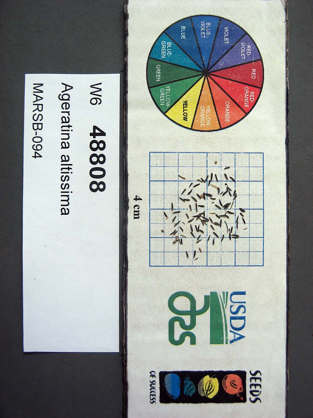 | | 2015 | | | | | | | Wild material | | 1922896 | W6 48808 |
| 357 | W6 48814 | MARSB-115 | Aristida purpurascens Poir. | New Jersey, United States | W6 |  | | 2015 | | | | | | | Wild material | | 1922907 | W6 48814 |
| 358 | W6 48854 | MARSB-106 | Eragrostis spectabilis (Pursh) Steud. | New Jersey, United States | W6 |  | | 2015 | | | | | | | Wild material | | 1922916 | W6 48854 |
| 359 | W6 48902 | MARSB-114 | Tridens flavus (L.) Hitchc. | New Jersey, United States | W6 |  | | 2015 | | | | | | | Wild material | | 1922931 | W6 48902 |
| 360 | Ames 32833 | GA14005001 | Fraxinus pennsylvanica Marshall | North Dakota, United States | NC7 |  | | 2014 | COLLECTED | 09/25/2014 | Billings County, Southern Badlands area. | 46.42000000, -103.40000000 | 753 | Growing in association with Arctium majus, Shepherdia argentea, Prunus virginiana, Rosa sp., and Symphoricarpos spp. | Wild material | | 1921826 | Ames 32833 |
| 361 | Ames 32834 | GA14006001 | Fraxinus pennsylvanica Marshall | North Dakota, United States | NC7 |  | | 2014 | COLLECTED | 09/26/2014 | Billings County, Central Badlands area. | 47.07000000, -103.41000000 | 747 | Growing in association with Arctium majus, Hordeum jubatum, Artemesia cana, Symphoricarpos spp., Prunus americana, Rhus trilobata, Rosa sp., Amelanchier sp., and Juniperus spp. | Wild material | | 1921827 | Ames 32834 |
| 362 | Ames 32835 | GA14014001 | Fraxinus pennsylvanica Marshall | North Dakota, United States | NC7 |  | | 2014 | COLLECTED | 10/30/2014 | Bottineau County, Turtle Mountains. | 48.97000000, -100.45000000 | 737 | Mixed oak-aspen forest | Wild material | | 1921828 | Ames 32835 |
| 363 | WLP 1746 | Ames 32838 | Viburnum opulus L. var. americanum Aiton | North Dakota, United States | NA | | | 2014 | COLLECTED | 10/31/2014 | Turtle Mountains - Bottineau County. | 48.95000000, -100.43000000 | 692 | Wet, aspen forest. Growing in association with Sanicula marilandica, Fragaria virginiana, Trifolium repens, Rubus sp., Typha latifolia, Prunus pensylvanica, Prunus virginiana, Corylus sp., Crataegus sp., Viburnum lentago, Rosa sp., Cornus sericea, Amelanchier sp., Symphoricarpos sp., Salix sp., Betula papyrifera, Populus tremuloides, Ulmus americana, Acer negundo, Quercus macrocarpa, and Fraxinus pennsylvanica. | Wild material | | 1921831 | WLP 1746 |
| 364 | WLP 1967 | HBC1401 | Viburnum opulus L. var. americanum Aiton | North Dakota, United States | NA | | | 2014 | COLLECTED | 09/29/2014 | Jay Wessels Wildlife Management Area located in Pembina County. | 48.80000000, -97.83000000 | 312 | Diverse habitats including edge of swamp and also upland sandy soils. Growing in association Fraxinus pennsylvanica, Fraxinus nigra, Quercus macrocarpa, Acer negundo, Ulmus americana, Populus tremuloides, Populus balsamifera, Toxicodendron radicans, Cornus sericea, Rosa sp., Corylus sp., Prunus virginiana, Ribes sp., Equisetum sp., Rubus sp., IMpatiens capensis, Thalictrum dasycarpum, Fragaria virginiana, Asarum canadense, Calamagrostis canadensis, Sium suave, Solidago gigantea, Poa pratensis, and Bromus inermis. | Wild material | | 1921830 | WLP 1967 |
| 365 | NA 82071 | JDC/QM/2014/103/605 | Quercus michauxii Nutt. | Mississippi, United States | NA | | | 2014 | COLLECTED | 09/25/2014 | Chinchahoma Creek watershed near Ennis Road. | 33.38574900, -88.92255600 | 98 | Wet, deciduous woods. | Wild material | Specimen sampled measured 26.75" d.b.h. and approximately 110' in height. Fruits still green. | 1922372 | NA 82071 |
| 366 | WLP 689 | BJP/AI/2014/001 | Amelanchier intermedia Spach | Maine, United States | NA | | | 2014 | COLLECTED | 07/17/2014 | Woods at the edge of a small cemetery on Pigeon Hill Road, just east of its intersection with Main Street (Hwy. 1), approximately .2.5 miles southwest of Milbridge. | 44.51051000, -67.91188000 | | Woods at the edge of a small cemetery. | Wild material | | 1922791 | WLP 689 |
| 367 | Ames 32763 | JDC/DL/2014/041/543 | Diervilla lonicera Mill. | Iowa, United States | NC7 |  | | 2014 | COLLECTED | 09/03/2014 | Bluffton Fir State Preserve near Bluffton, T99N R9W SW 1/4 SW 1/4 Sec. 10 | 43.40068700, -91.90760900 | 346 | High quality, native woods. Steep slope, northwest-facing. | Wild material | | 1921311 | Ames 32763 |
| 368 | Ames 32769 | JDC/SA/2014/033/535 | Spiraea alba Du Roi | Iowa, United States | NC7 |  | | 2014 | COLLECTED | 09/03/2014 | Crossman Prairie State Preserve, approximately 5 miles northeast of Riceville. | 43.40777300, -92.47500720 | 413 | Remnant tallgrass prairie. Clyde-Floyd complex (1-4 percent slopes) depth to water table: 12-42 inches, 0-17 inches silty clay loam, somewhat poorly drained | Wild material | | 1921317 | Ames 32769 |
| 369 | Ames 32096 | BA13009001 | Fraxinus nigra Marshall | Minnesota, United States | NC7 |  | | 2013 | COLLECTED | 09/23/2013 | T144N R38W, Clearwater County. | 47.25711000, -95.49000667 | 543 | Edges of lakes and forest edges. Growing in association with Fraxinus pennsylvanica, Quercus macrocarpa, Ulmus americana, Populus tremuloides, Populus balsamifera, Acer saccharum, Betula papyrifera, Salix sp., Larix laricina, Quercus rubra, Abies balsamea, Picea glauca, Sambucus canadensis, Cornus rugosa, Acer spicatum, Rosa sp., Viburnum opulus var. americanum, Viburnum dentatum, Alnus sp., Cornus canadensis, Corylus sp., Prunus virginiana, Ribes sp., Prunus pensylvanica, Rhamnus alnifolia, Equisetum sp., Carex sp., Rubus sp., Impatiens capensis, Bromus sp., and Thalictrum dasycarpum. | Wild material | D.B.H. ranged between 3 and 6 inches. | 1914713 | Ames 32096 |
| 370 | WLP 1079 | NA 81742 | Cornus florida L. | Missouri, United States | NA | | | 2013 | COLLECTED | 09/26/2013 | Springfield Township: NW 1/4 of Section 20. | 38.41792000, -93.60433000 | | Growing in and around sandstone ravines. | Wild material | Voucher specimen being processed at time of accessioning; will be forwarded to USNA once prepared. | 1922751 | WLP 1079 |
| 371 | NA 81520 | NA 81520 | Aesculus flava Sol. | North Carolina, United States | NA | | | 2013 | COLLECTED | 09/23/2012 | Bearpen Knob at Craggy Gardens in the picnic area on the north side of the Blue Ridge Parkway. | 35.69954000, -82.39258000 | 1591 | Growing in open woodlands and mown hillside areas from part shade to full sun. | | | 1950672 | NA 81520 |
| 372 | W6 45621 | NV030-589 | Eriocoma hymenoides (Roem. & Schult.) Rydb. | California, United States | W6 |  | | 2013 | | | | | | | Wild material | | 1907587 | W6 45621 |
| 373 | W6 45724 | NV030-595 | Hesperostipa comata (Trin. & Rupr.) Barkworth | Nevada, United States | W6 |  | | 2013 | | | | | | | Wild material | | 1907687 | W6 45724 |
| 374 | Ames 31676 | GA12010001 | Fraxinus pennsylvanica Marshall | Minnesota, United States | NC7 |  | | 2012 | COLLECTED | NEAR 09/24/2012 | Near Mashaug Creek just north of Twin Valley, Norman County. | 47.28851660, -96.26865000 | 327 | Upland forest, dominated by Populus deltoides. | Wild material | | 1906587 | Ames 31676 |
| 375 | Ames 31677 | GA12001001 | Fraxinus pennsylvanica Marshall | Minnesota, United States | NC7 |  | | 2012 | COLLECTED | 09/24/2012 | Southwest Becker County near Lake Cormorant and Lake Maud.. | 46.73903330, -95.97883330 | 415 | Edge of slough and forest. | Wild material | | 1906588 | Ames 31677 |
| 376 | Ames 31679 | GA12011001 | Fraxinus pennsylvanica Marshall | North Dakota, United States | NC7 |  | | 2012 | COLLECTED | NEAR 09/27/2012 | Sheyenne National Grassland along the Sheyenne River just east of Lisbon near Richland and Ransom County line. | 46.53246660, -97.26656660 | 302 | Riverbank and transition area of tallgrass prairie and riparian forest. Sandy-silt soil with good drainage and ph of ~7 | Wild material | Population located close to windbreak planted with Fraxinus. | 1906590 | Ames 31679 |
| 377 | Ames 31256 | APS/GD/2008/005/005 | Gymnocladus dioicus (L.) K. Koch | Iowa, United States | NC7 |  | | 2012 | COLLECTED | 01/10/2012 | Ledges State Park, SW 1/4 of SW 1/4 of Section 21, T83N, R26W, Madrid NW Quad, Boone County | 41.98110000, -93.89010000 | 328 | Upland woods. 30% slope with a western aspect. | Wild material | Largest specimen noted was 22" d.b.h. | 1897494 | Ames 31256 |
| 378 | Ames 31217 | GA15004001 | Fraxinus pennsylvanica Marshall | North Dakota, United States | NC7 |  | | 2011 | COLLECTED | 09/24/2011 | Along Forest Service Road 842, SW 1/4 of Section 2, T147N, R99W, Long X Divide Quad, Badlands, Little Missouri National Grasslands, McKenzie County. | 47.57730000, -103.26760000 | 674 | Clay substrate. | Wild material | Requests will be filled using inventory sample 11ncao02 (JDZ/2011/004/002) unless otherwise noted. | 1896696 | Ames 31217 |
| 379 | Ames 31218 | GA15005001 | Fraxinus pennsylvanica Marshall | North Dakota, United States | NC7 |  | | 2011 | COLLECTED | 09/24/2011 | Along East River and Tracy Mountain Roads, Burning Coal Vein Campground, T139N, R102W, Chimney Butte Quad, Badlands, Little Missouri National Grasslands, Billings and Slope County. Area following along Little Missouri River and including small tributaries from approximately 4.5 miles south of Medora, ND to approximately 2.5 miles south of Billings/Slope County line. Material sampled along an 18 mile stretch. | 46.81270000, -103.50900000 | 780 | Clay substrate. | Wild material | Requests will be filled using inventory sample 11ncao02 (JDZ/2011/005/002) unless otherwise noted. | 1896697 | Ames 31218 |
| 380 | W6 42880 | MSB286109 | Phyllanthus polygonoides Nutt. ex Spreng. | Texas, United States | W6 |  | | 2011 | | | | | | | Wild material | | 1895338 | W6 42880 |
| 381 | W6 42949 | MSB286143 | Xanthisma texanum DC. | Texas, United States | W6 |  | | 2011 | | | | | | | Wild material | | 1895398 | W6 42949 |
| 382 | W6 41374 | NV030-424 | Pseudoroegneria spicata (Pursh) Á. Löve | California, United States | W6 |  | | 2011 | | | | | | | Wild material | | 1868886 | W6 41374 |
| 383 | W6 40490 | NV030-426 | Leymus cinereus (Scribn. & Merr.) Á. Löve | Nevada, United States | W6 |  | | 2011 | | | | | | | Wild material | | 1861250 | W6 40490 |
| 384 | W6 39681 | CA650-19 | Poa secunda J. Presl | California, United States | W6 |  | | 2010 | | | | | | | Wild material | | 1849555 | W6 39681 |
| 385 | WLP 2148 | AMAL2-SOS-ID931-150-09 | Amelanchier alnifolia (Nutt.) Nutt. ex M. Roem. | Idaho, United States | NA |  | | 2010 | COLLECTED | 08/08/2009 | Sawtooth National Forest: Baumgartner campground. | 43.60127000, -115.06990000 | 1472 | Wilderness; land used for recreation. Mountain drainage, 15% slope; granitic sediments in fluvial deposits. Soil texture sand; color medium/dark brown. | Wild material | | 1842635 | WLP 2148 |
| 386 | W6 37448 | NV030-246 | Hesperostipa comata (Trin. & Rupr.) Barkworth | Nevada, United States | W6 |  | | 2010 | | | | | | | Wild material | | 1833581 | W6 37448 |
| 387 | W6 35377 | NV052-180-R | Coleogyne ramosissima Torr. | Nevada, United States | W6 |  | | 2009 | | | | | | | Wild material | Height: 2' | 1808205 | W6 35377 |
| 388 | WLP 2292 | ID930-B20 | Mahonia repens (Lindl.) G. Don | Idaho, United States | NA |  | | 2009 | COLLECTED | 08/09/2007 | U.S. Forest Service land; about 11 miles north of Boise on Bogus Basin Road, then east on unmarked dirt road about 1 mile. | 43.73605000, -116.10083000 | 1693 | Open Pinus ponderosa/Pseudotsuga menziesii forest on mountain slope. Land generally used for recreation. Soil is light brown/tan sandy loam. | Wild material | | 1802200 | WLP 2292 |
| 389 | WLP 1111 | LBJWC-PM-017 | Crataegus tracyi Ashe ex Eggl. | Texas, United States | NA | | | 2007 | COLLECTED | 10/22/2006 | Cherry Canyon Ranch, north end of Davis Mountains, ca Toyahvale. Approximately 8 miles south of FM 3078. In Cherry Canyon several miles south of ranch headquarters. | 30.87006000, -104.06260000 | 1453 | Broad canyon/riparian corridor of brush and hardwoods. | Wild material | | 1726976 | WLP 1111 |
| 390 | NA 70422 | MWPCC00-078 | Magnolia acuminata (L.) L. | North Carolina, United States | NA | | | 2000 | COLLECTED | 09/14/2000 | Blue Ridge Parkway pullover, N of marker 417. | 35.32333333, -82.82694444 | 1353 | Just in from mowed roadside. Slope: 15 degrees, Aspect: East, 3/4 day sun, Soil Type: gritty loam, well-drained, moist bottom of slope. | Wild material | | 1608250 | NA 70422 |
| 391 | GMAL 4404 .g | CH97 05-02 | Malus toringo (Siebold) de Vriese | Sichuan Sheng, China | GEN | | | 1997 | COLLECTED | 09/23/1997 | Town of Mao xian ping, 6km. northeast of Maoxian. | 31.72055556, 103.91611111 | 1800 | Loam, dark brown soil. Slope 15-20% incline. Aspect-South, partial canopy. Landform: mountain, higher in this area. Dominent tree sp: Oak; Assoc: Juglans, Prunus. Assoc shrub: Rosa, Corylus, Vitis, Actinidin, Viburnum. | Wild material | Additional Habitat Notes: Collection tree 6m. in height, 10cm. diameter; above undergrowth; located on south side of slope, 15% incline. Sampled 30-50 fruits each from 7 trees. | 1695654 | GMAL 4404 .g |
| 392 | GMAL 4404 .r | CH97 05-02 | Malus toringo (Siebold) de Vriese | Sichuan Sheng, China | GEN | | | 1997 | COLLECTED | 09/23/1997 | Town of Mao xian ping, 6km. northeast of Maoxian. | 31.72055556, 103.91611111 | 1800 | Loam, dark brown soil. Slope 15-20% incline. Aspect-South, partial canopy. Landform: mountain, higher in this area. Dominent tree sp: Oak; Assoc: Juglans, Prunus. Assoc shrub: Rosa, Corylus, Vitis, Actinidin, Viburnum. | Wild material | Additional Habitat Notes: Collection tree 6m. in height, 10cm. diameter; above undergrowth; located on south side of slope, 15% incline. Sampled 30-50 fruits each from 7 trees. | 1695655 | GMAL 4404 .r |
| 393 | GMAL 4404 .w | CH97 05-02 | Malus toringo (Siebold) de Vriese | Sichuan Sheng, China | GEN | | | 1997 | COLLECTED | 09/23/1997 | Town of Mao xian ping, 6km. northeast of Maoxian. | 31.72055556, 103.91611111 | 1800 | Loam, dark brown soil. Slope 15-20% incline. Aspect-South, partial canopy. Landform: mountain, higher in this area. Dominent tree sp: Oak; Assoc: Juglans, Prunus. Assoc shrub: Rosa, Corylus, Vitis, Actinidin, Viburnum. | Wild material | Additional Habitat Notes: Collection tree 6m. in height, 10cm. diameter; above undergrowth; located on south side of slope, 15% incline. Sampled 30-50 fruits each from 7 trees. | 1695657 | GMAL 4404 .w |
| 394 | GMAL 4404 .y | CH97 05-02 | Malus toringo (Siebold) de Vriese | Sichuan Sheng, China | GEN | | | 1997 | COLLECTED | 09/23/1997 | Town of Mao xian ping, 6km. northeast of Maoxian. | 31.72055556, 103.91611111 | 1800 | Loam, dark brown soil. Slope 15-20% incline. Aspect-South, partial canopy. Landform: mountain, higher in this area. Dominent tree sp: Oak; Assoc: Juglans, Prunus. Assoc shrub: Rosa, Corylus, Vitis, Actinidin, Viburnum. | Wild material | Additional Habitat Notes: Collection tree 6m. in height, 10cm. diameter; above undergrowth; located on south side of slope, 15% incline. Sampled 30-50 fruits each from 7 trees. | 1695652 | GMAL 4404 .y |
| 395 | GMAL 4405 | CH97 05-03 | Malus prattii (Hemsl.) C. K. Schneid. | Sichuan Sheng, China | GEN | | | 1997 | COLLECTED | 09/23/1997 | Town of Mao xian ping, 6km. northeast of Maoxian. | 31.72055556, 103.91611111 | 1800 | Loam, dark brown soil. Slope 15-20% incline. Aspect-South, partial canopy. Landform: mountain, higher in this area. Dominent tree sp: Oak; Assoc: Juglans, Prunus. Assoc shrub: Rosa, Corylus, Vitis, Actinidin, Viburnum. | Wild material | Additional Habitat Notes: Collection tree located on south side of slope, 10% incline. Sampled 30-50 fruits each from 7 trees. Some spotting on leaves, no leaf lobing. | 1552420 | GMAL 4405 |
| 396 | GMAL 4409 | CH97 05-10 | Malus toringo (Siebold) de Vriese | Sichuan Sheng, China | GEN | | | 1997 | COLLECTED | 09/23/1997 | Town of Mao xian ping, 6km. northeast of Maoxian. | 31.72055556, 103.91611111 | 1800 | Loam, dark brown soil. Slope 15-20% incline. Aspect-South, partial canopy. Landform: mountain, higher in this area. Dominent tree sp: Oak; Assoc: Juglans, Prunus. Assoc shrub: Rosa, Corylus, Vitis, Actinidin, Viburnum. | Wild material | Additional Habitat Notes: Collection tree located on southwest side of slope, 20% incline, in an open area. Sampled 30-50 fruits each from 7 trees. Partially lobed leaves. | 1552424 | GMAL 4409 |
| 397 | GMAL 4410 .as | CH97 05-11 | Malus prattii (Hemsl.) C. K. Schneid. | Sichuan Sheng, China | GEN | | | 1997 | COLLECTED | 09/23/1997 | Town of Mao xian ping, 6km. northeast of Maoxian. | 31.72055556, 103.91611111 | 1800 | Loam, dark brown soil. Slope 15-20% incline. Aspect-South, partial canopy. Landform: mountain, higher in this area. Dominent tree sp: Oak; Assoc: Juglans, Prunus. Assoc shrub: Rosa, Corylus, Vitis, Actinidin, Viburnum. | Wild material | Additional Habitat Notes: Collection tree located on southwest side of slope, 20% incline, in an open area. Sampled 30-50 fruits each from 7 trees. No leaf lobing. Some leaf spotting, some bronzing. | 1695758 | GMAL 4410 .as |
| 398 | NA 67777 | QLG147 | Viburnum betulifolium Batalin | Shaanxi Sheng, China | NA | | | 1996 | COLLECTED | 10/18/1996 | Liuba Forest Bureau, Miaotaizi Forest Station, Guang Hua Shan | 33.65000000, 106.75000000 | 1892 | Part shade above a dirt path; 35% N slope; growing w/ Populus sp., Prunus sp., Rosa sp., Celastrus sp., Boerhmeria sp., Aconitum sp. and herbaceous species. | Wild material | 2.5 meters; multi-stemmed, deciduous shrub with open and loose growth habit; glossy red fruit | 1579575 | NA 67777 |
| 399 | W6 17772 | VIR D114 | Lathyrus hirsutus L. | Russian Federation | W6 | | | 1996 | COLLECTED | 08/16/1995 | Province Krasnodar, southwest of Krasnodar, village Azovskaya. | 44.79361111, 38.55777778 | 210 | Past cultivated, now grazed. Slope 0-5%, aspect W. Light open. Soil loam/clay, pH 4.8-5.2. Seasonally dry, mid slope. Vegetation closed, seasonal broad-leafed herb vegetation. Surrounding veg. open deciduous forest with closed lower layers. | Wild material | Dominant tree species Fagus sp., Quercus sp. Dominant shrub species Ribes sp., Prunus sp., Carpinus sp., Crataegus sp. Population distribution patchy, abundance occasional. Growth habit viny. Dry, no flowers. Extensive regional climate data available in spreadsheet format or image maps in raster format suitable for GIS analysis. Contact Dr. Stephanie L. Greene (sgreene@ars-grin.gov). | 1518005 | W6 17772 |
| 400 | W6 17841 | VIR 222 | Lathyrus sp. | Russian Federation | W6 | | | 1996 | COLLECTED | 09/04/1995 | 1 km. east of Yeroslavskaya, 30+ km. east of Maykop. | 44.61861111, 40.49000000 | 350 | Area grazed. Slope 11-40%, aspect S. Light open. Soil clay, pH 6.3-7.2. Seasonally dry, lower slope. Vegetation closed, seasonal tall grass. Surrounding vegetation open deciduous forest with closed lower layers. | Wild material | Dominant tree species Crataegus sp., Quercus sp., Monogyna, Pentagyna. Dominant shrub species Rosa sp., Prunus sp. Dominant herb/grass species Achellea sp., Daucus c., thistle, bindweed, chicory, Bothriochloa i., Cynodon d. Population distribution patchy, abundance occasional. Growth habit viny. Extensive regional climate data available in spreadsheet format or image maps in raster format suitable for GIS analysis. Contact Dr. Stephanie L. Greene (sgreene@ars-grin.gov). | 1518093 | W6 17841 |
| 401 | NA 64585 | BJG075 | Euonymus hamiltonianus Wall. var. maackii (Rupr.) Kom. | Beijing Shi, China | NA | | | 1994 | COLLECTED | 09/18/1994 | Da Zhuang Ke (Old Village), Song Shan Forest Preserve, Yanqing County, PRC. | 40.51666667, 115.78333333 | 1090 | Growing in open sunny location, heavily disturbed along gravel road; in association with Prunus armeniaca, Caragana rosea, Ulmus sp., Berberis poiretii, Scabiosa sp., and numerous herbaceous plants. | Wild material | | 1511089 | NA 64585 |
| 402 | NA 64597 | BJG087 | Vitex negundo L. var. incisa (Lam.) C. B. Clarke | Beijing Shi, China | NA | | | 1994 | COLLECTED | 09/19/1994 | Tang Zhi Gou (Hot Spring Valley), Song Shan Forest Preserve, PRC. | 40.51666667, 115.81666667 | 940 | Growing on a dry, rocky east facing slope in full sun with Pinus tabulaeformis, Populus davidiana, Rhamnus sp., Prunus armeniaca, Securinega suffruticosa and grasses. | Wild material | | 1511125 | NA 64597 |
| 403 | NA 61679 | NEKG 76 | Lindera obtusiloba Blume | Gangwon-do, Korea, South | NA | | | 1989 | COLLECTED | 09/24/1989 | Pyeongchang-gun, Jinbu-myeon: Gariwangsan [mountain], about 2 km down mountain road from NEKG 70, above road cut. [Originally listed as Kang-won Do. Kariwang San. About 2km down mountain road from NEKG 70. Woodland above road cut.] | 37.48611000, 128.50972000 | 820 | Woodland above road cut. | Wild material | | 1776926 | NA 61679 |
| 404 | NA 61746 | NEKG 144 | Lindera obtusiloba Blume | Gyeongsangbuk-do, Korea, South | NA | | | 1989 | COLLECTED | 10/05/1989 | Yeongju-gun: Punggi-eup: Sobaeksan [mountain], Above Huibangsa [temple] on path to Birobong [peak]. [Originally listed as Chungchong Pukto, Sobaek San. Above Hui Bang temple on path to Piro bong.] | 36.08472000, 128.46111000 | 860 | Woodland, rocky slope, west facing with | Wild material | | 1776934 | NA 61746 |
| 405 | W6 1975 | 010689-0204 | Medicago rigiduloides E. Small | Elazığ, Turkey | W6 | | | 1989 | COLLECTED | 06/01/1989 | Soil clay red, rocky. NE facing slope, scattered oak scrub, grazed. Associated with Crateagus, Prunus sp. NW side of Hazar Lake, near cemetery, approximately 3km S of Firat Univ. Res. Sta. On road Elazig to Diyarbakir. | 38.50000000, 39.36666667 | 1270 | | Cultivated material | Annual becoming prostrate. Fruit spiny. Common | 1017349 | W6 1975 |
| 406 | W6 1977 | 010689-0206 | Medicago monantha (C. A. Mey.) Trautv. | Elazığ, Turkey | W6 | | | 1989 | COLLECTED | 06/01/1989 | Soil clay red, rocky. NE facing slope, scattered oak scrub, grazed. Associated with Crateagus, Prunus sp. NW side of Hazar Lake, near cemetery, approx. 3km S of Firat Univ. Res. Sta. On road Elazig to Diyarbakir. | 38.50000000, 39.36666667 | 1270 | | Cultivated material | Plants 6cm tall. Annual calyx and pod pubescent. Leaves pubescent legume to 6-7cm curved. Seeds yellowish. | 1017363 | W6 1977 |
| 407 | W6 131 | 010689-0210 | Lathyrus vinealis Boiss. & Noë | Turkey | W6 | | | 1989 | COLLECTED | 06/01/1989 | Northeast facing slope, scattered oak scrub, grazed. Soil clay red, rocky. Northwest side Hazar Lake, near cemetery, approx. 3km S of Firat University Res. Sta. On the road Elazig to Diyarbakir, Elazig Province. | 38.50000000, 39.36666667 | 1270 | | Wild material | Annual and perennial plants. Crateagus, Prunus sp. present. | 1003278 | W6 131 |
| 408 | DDIO 54 | 880406 | Diospyros lotus L. | North-West Frontier, Pakistan | DAV |  | | 1988 | COLLECTED | 10/12/1988 | Collected in Ganoor, Hazara, 3km southwest of Kwai on a small farm by the roadside. | 34.70000000, 73.46666667 | 1390 | River valley in the mountains. Associated vegatation: Juglans regia, Pistacia chinensis, Ficus palmata, Prunus armeniaca, Pyrus sp. | Wild material | | 1001716 | DDIO 54 |