| 0 | DPRU 2417 | 96119 | Prunus tomentosa Thunb. | China | DAV |  | | 1996 | COLLECTED | | Heilongjiang province, Dailing district. 26 km NW of Dailing | 47.18333333, 128.86666667 | 330 | Xiao Xingan Ling hills. Nature preserve. | Wild material | seedling DPRU 2417.11 was found to have low pollen viability | 1532669 | DPRU 2417 |
| 1 | DPRU 2316 | 96001 | Prunus tomentosa Thunb. | China | DAV |  | | 1996 | COLLECTED | | Heilongjiang Province, Dailing District, town of Dailing | | 160 | | Cultivated material | (Collectors notes:) Fruit < 1 cm., round, bright red, firmness(1 soft - 5): 1, palatability: tart-palatable. Local use fresh. Estimated maturity mid-July. Ripe now (July 17). Nanking Cherry. | 1530597 | DPRU 2316 |
| 2 | DPRU 2317 | 96009 | Prunus tomentosa Thunb. | China | DAV |  | | 1996 | COLLECTED | | Heilongjiang Province, Dailing District, town of Dailing | | 160 | | Cultivated material | (Collectors notes:) Fruit +- 1 cm., round, bright red, firmness(1 soft-5): 1, palatability tart-acceptable. Local use-harvested for local use. Stage of development: ripe now (July), estimated maturity: mid-July. Nanking Cherry. | 1530598 | DPRU 2317 |
| 3 | DPRU 506 | DPRU 506 | Prunus tomentosa Thunb. | China | DAV |  | | 1985 | COLLECTED | | | | | | Wild material | Type = Cherry | 1006782 | DPRU 506 |
| 4 | GPRU 164 | MARSB-290 | Prunus maritima Marshall | New Jersey, United States | GEN |  | | 2019 | | | | | | | Wild material | | 2097559 | GPRU 164 |
| 5 | GPRU 161 | NEWFS-294 | Prunus maritima Marshall | Massachusetts, United States | GEN |  | | 2019 | | | | | | | Wild material | | 1976209 | GPRU 161 |
| 6 | GPRU 162 | NEWFS-380 | Prunus maritima Marshall | Massachusetts, United States | GEN |  | | 2019 | | | | | | | Wild material | | 1976238 | GPRU 162 |
| 7 | W6 62517 | FWS0300-107 | Hudsonia tomentosa Nutt. | Michigan, United States | W6 |  | | 2025 | | | | | | | Wild material | | 2192215 | W6 62517 |
| 8 | W6 60079 | MARSB-133 | Hudsonia tomentosa Nutt. | Delaware, United States | W6 | | | 2021 | | | | | | | Wild material | Blue green gray tomentose leaves folded tightly to stem. Seed heads a light brown. | 2137164 | W6 60079 |
| 9 | W6 60082 | MARSB-144 | Hudsonia tomentosa Nutt. | New Jersey, United States | W6 | | | 2021 | | | | | | | Wild material | Scale like leaves, blueish tint, yellow flowers. | 2137167 | W6 60082 |
| 10 | W6 58701 | NEWFS-331 | Hudsonia tomentosa Nutt. | Massachusetts, United States | W6 | | | 2021 | | | | | | | Wild material | Yellow petals on flowers. | 2115640 | W6 58701 |
| 11 | W6 57057 | MARSB-140 | Hudsonia tomentosa Nutt. | New York, United States | W6 |  | | 2019 | | | | | | | Wild material | | 2097496 | W6 57057 |
| 12 | W6 62518 | FWS0300-108 | Anaphalis margaritacea (L.) Benth. & Hook. f. | Michigan, United States | W6 |  | | 2025 | | | | | | | Wild material | | 2192216 | W6 62518 |
| 13 | NA 89115 | TLM25-04a | Hamamelis ovalis S. W. Leonard | Texas, United States | NA | | | 2025 | COLLECTED | 07/10/2025 | State Highway 87 approximately 3.25 kilometers north of the crossroad junction with Texas Recreational Road 255 (RE 255); plants were growing in the narrow buffer woods along the east side of the highway. | 31.12051300, -93.72628100 | 138 | The habitat is an upland mixed coniferous and deciduous woodlands in part to full shade and dry conditions, often under drought stress. Plants seem to always occur on the top of dry ridges or well-drained slopes. Slope: 0 to 1 percent. Aspect: N/A. Soils: The soils of this collection area are classified as Tehran-Letney Association, hilly (TLE) soils. The Tehran Series (55%) consists of deep, somewhat excessively drained, moderately rapidly permeable soils on uplands. They formed in thick loamy and sandy sediments on the Western Coastal Plain. These soils are on gently sloping to moderately steep uplands with slopes ranging from 1 to 20 percent. The Letney Series (30%) consists of deep, well drained, moderately rapidly permeable, upland soils. They formed in thick sandy and loamy sediments of the coastal plains. These soils are on gently sloping to moderately steep uplands with slopes ranging from 1 to 20 percent. Soil pH ranges from 4.5 to 6.0. The minor soil components include Doucette Series (10%) and Boykin Series (5%) soils. (Source: California Soil Resource Lab/NRCS Official Soil Series Descriptions). Geology: The underlying geology of this area is of Oligocene origin and characterized as Catahoula Formation. This formation is extensive and deep in Texas, up to 185 meters thick. In the area of the collection the Catahoula Formation is primarily mudstone and sand. The upper 90-150 meters is mudstone that is tuffaceous, and sandy; also, occasionally, with some bentonitic clay. (Source: USGS Texas Geologic Map Data). | Wild material | | 2191654 | NA 89115 |
| 14 | W6 61890 | NV052-1020 | Gutierrezia microcephala (DC.) A. Gray | Nevada, United States | W6 |  | | 2024 | | | | | | | Wild material | Bright yellow flowers with 1-2 ray flowers | 2168296 | W6 61890 |
| 15 | NA 88689 | RJL2023NJ-002 | Kalmia latifolia L. | New Jersey, United States | NA | | | 2023 | COLLECTED | 11/10/2023 | Franklin Township: Piney Hollow Preservation Area (the site is owned by Franklin Township). Plants accessed by foot along trails throughout property. | 39.57400900, -74.93602400 | 32 | Plants growing in shade to part-shade of a mesic to mesic-dry woodland habitat that is mostly deciduous, but also includes pine overstory. Slope: N/A. Aspect: N/A. Soils: The underlying geology of this area is of Middle Miocene, Serravallian origin and characterized as an Cohansey Formation. It is comprised of sand, white to yellow with local gravel and clay. Locally stained red or orange brown by iron oxides and (or) cemented into large blocks of ironstone. Unweathered clay is typically dark gray, but commonly weathers white where interbedded with thin beds of ironstone. Unit is a complex of interfingering marine and nonmarine facies. Sand is typically medium grained and moderately sorted although it ranges from fine to very coarse grained and from poorly to well sorted. Sand consists of quartz and siliceous rock fragments. Some beds are locally micaceous. In general, the sand is crossbedded, although the style of crossbedding varies significantly with the paleoenvironment. Trough crossbedding predominates, especially in the nonmarine channel fill deposits, and the scale of the crossbeds varies from small to large. Maximum thickness in the map area is about 60 m; however, thickness is difficult to determine because of the irregular basal contact and extensive post-depositional erosion. There is as much as 18 m of relief along the basal contact. The basal contact is sharp, undulatory, and directly overlain by a thin gravel bed. The Cohansey Formation unconformably overlies the Kirkwood Formation and is found in channels cut down into the Kirkwood. Where the Kirkwood consists of sandy, light-colored sediments, the basal contact of the Cohansey is drawn below crossbedded sediments. Where the Kirkwood consists of dark-colored silty beds, the basal contact is drawn between light-colored Cohansey sediments and the underlying dark-colored sediments. The Cohansey was markedly thinned because of erosion prior to deposition of overlying units in the western and southern parts of the southern sheet. The unit has been extensively eroded and stripped from large areas of the New Jersey Coastal Plain, particularly in the central sheet where outliers are common. In spite of its widespread nature, the Cohansey is poorly exposed because of its loose sandy composition, which causes it to erode easily. (Source: USGS New Jersey Geologic Map Data.) The primary soil type in the location of this collection is classified as Downer loamy sand, 0 to 5 percent slopes, Northern Coastal Plain. Downer Series soils are very deep, well-drained soils that are coarse-loamy, siliceous, semiactive, mesic Typic Hapludults. The upper strata of Downer Series from 0 to 25 cm is dark grayish brown, brown loamy sand that is dry with weak fine granular structure. It is very friable and strongly acid. Lower strata from 25 to 76 cm are yellowish brown single grain, loose loamy sand with few extremely weakly cemented masses of oxidized iron in the lower part. This layer is very strongly acid. (Source: NRCS Web Soil Survey.) | Wild material | | 2159117 | NA 88689 |
| 16 | NA 88693 | RJL2023NJ-006 | Clethra alnifolia L. | New Jersey, United States | NA | | | 2023 | COLLECTED | 11/10/2023 | Franklin Township: Piney Hollow Preservation Area (the site is owned by Franklin Township). Plants accessed by foot along trails throughout property. | 39.57319800, -74.92908900 | 29 | Plants growing in shade to part-shade over a wide range of habitats from mesic to mesic-dry as well as moist to wetland habitats. The woodlands are mostly deciduous, but also include occasional pine overstory. Slope: N/A. Aspect: N/A. The underlying geology of this area is of Middle Miocene, Serravallian origin and characterized as an Cohansey Formation. It is comprised of sand, white to yellow with local gravel and clay. Locally stained red or orange brown by iron oxides and (or) cemented into large blocks of ironstone. Unweathered clay is typically dark gray, but commonly weathers white where interbedded with thin beds of ironstone. Unit is a complex of interfingering marine and nonmarine facies. Sand is typically medium grained and moderately sorted although it ranges from fine to very coarse grained and from poorly to well sorted. Sand consists of quartz and siliceous rock fragments. Some beds are locally micaceous. In general, the sand is crossbedded, although the style of crossbedding varies significantly with the paleoenvironment. Trough crossbedding predominates, especially in the nonmarine channel fill deposits, and the scale of the crossbeds varies from small to large. Maximum thickness in the map area is about 60 m; however, thickness is difficult to determine because of the irregular basal contact and extensive post-depositional erosion. There is as much as 18 m of relief along the basal contact. The basal contact is sharp, undulatory, and directly overlain by a thin gravel bed. The Cohansey Formation unconformably overlies the Kirkwood Formation and is found in channels cut down into the Kirkwood. Where the Kirkwood consists of sandy, light-colored sediments, the basal contact of the Cohansey is drawn below crossbedded sediments. Where the Kirkwood consists of dark-colored silty beds, the basal contact is drawn between light-colored Cohansey sediments and the underlying dark-colored sediments. The Cohansey was markedly thinned because of erosion prior to deposition of overlying units in the western and southern parts of the southern sheet. The unit has been extensively eroded and stripped from large areas of the New Jersey Coastal Plain, particularly in the central sheet where outliers are common. In spite of its widespread nature, the Cohansey is poorly exposed because of its loose sandy composition, which causes it to erode easily. (Source: USGS New Jersey Geologic Map Data.) The primary soil types in the area of this collection is classified as Atsion sand, 0 to 2 percent slopes, Northern Tidewater Area and Downer loamy sand, 0 to 5 percent slopes, Northern Coastal Plain. Atsion Series soils are very deep, poorly drained with moderate to rapid permeability above 70 cm and slower beneath. They are classified as sandy, siliceous, mesic Aeric Alaquods. The upper stratum from 0 to 25 cm is dark gray sand, dry, single grained and lose with many fine roots. It is extremely acid. Lower strata are light gray to dark brown with small percentages of rounded quartzose pebbles and are extremely acid. Downer Series soils are very deep, well-drained soils that are coarse-loamy, siliceous, semiactive, mesic Typic Hapludults. The upper stratum of Downer Series from 0 to 25 cm is dark grayish brown, brown loamy sand that is dry with weak fine granular structure. It is very friable and strongly acid. Lower strata from 25 to 76 cm are yellowish brown single grain, loose loamy sand with few extremely weakly cemented masses of oxidized iron in the lower part. This layer is very strongly acid. (Source: NRCS Web Soil Survey.) | Wild material | | 2159121 | NA 88693 |
| 17 | NA 88514 | RJL2022MD-019 | Kalmia latifolia L. | Maryland, United States | NA | | | 2022 | COLLECTED | 11/04/2022 | Plants are growing on both sides of a fire road on Maryland Heights along the edge with Harpers Ferry National Historic Park. This location was accessed from the east where Miller Avenue meets the fire road, approximately 2 kilometers away. There is no vehicular access to the collecting area. Becoming locally uncommon. This local population is likely to be extirpated in the next 20-30 years. This collector has hiked through this area for more than 35 years and seen dramatic changes in the population. When first observed, Kalmia latifolia was a dominant understory shrub on south- to west-facing slopes beneath a mature forest canopy. Over the years, at least one forest fire has significantly reduced the population, along with a continuing increase in deer populations, resulting in catastrophic browse damage. The absence of a mature forest canopy and periods of drought have almost certainly also resulted in decline of this population. While collecting seed from scattered mature plants well above deer browse levels, this collector also noted that there was virtually no recruitment taking place. | 39.32811200, -77.72242400 | 287 | Plants are growing in part-shade to shade of a deciduous upland, very rocky, and dry forest community. Plants are frequently found growing among boulders, rock outcrops, and steep-slope erosional areas, although, not exclusively.
Soils: The underlying geology of this area is of Late Cambrian to Cambrian origin and comprised of Chilhowee Group; Weverton Formation. This includes interbedded white to dark gray, thin-bedded, micaceous, ferruginous, and sericitic quartzites, phyllites, and white, thick-bedded, ledge-making quartzites; some gray to brown ferruginous quartz conglomerate and purple-banded phyllite.
Source: USGS Maryland Geologic Map Data https://mrdata.usgs.gov/geology/state/sgmc-unit.php?unit=MDKp%3B5
The primary soil types in the collection area are classified as Dekalb-Bagtown-Rock outcrop complex, 25 to 65 percent slopes. The Dekalb series consists of moderately deep, excessively drained soils formed in material weathered from gray and brown acid sandstone in places interbedded with shale and graywacke. Slope ranges from 0 to 80 percent. Permeability is rapid. Solum thickness and depth to bedrock range from 50 to 100 cm. Flat, subangular or angular, sandstone fragments, 2.5-25 cm across increase with depth and range from 10-60 percent in individual horizons of the solum and from 50-90 percent or more in the C horizon. The amount of rock fragments typically increases with depth. Cobbly, channery, and very stony phases are common. Reaction ranges from extremely through strongly acid.
Source: NRCS Web Soil Survey (https://websoilsurvey.sc.egov.usda.gov/App/WebSoilSurvey.aspx) | Wild material | | 2139821 | NA 88514 |
| 18 | Ames 35923 | AS/FN/2022/072/203 | Fraxinus nigra Marshall | Wisconsin, United States | NC7 |  | | 2022 | COLLECTED | 09/29/2022 | Chequamegon National Forest, approximately ten miles southeast of Park Falls. Collected along North Gates Lake Road, Sailor Lake Road and State Highway 70, T38N R2E and T39N R1E. | 45.81027500, -90.27504800 | 483 | Saturated soils in northern hardwood forest. | Wild material | Accession represents materials collected across a 15 x 15 square mile area sampled by Carstens, Sherwood, and Brandtner. Same area as where FSNS 5000 was collected. | 2139686 | Ames 35923 |
| 19 | Ames 35792 | APS/ID/2022/027/489 | Ilex decidua Walter | Arkansas, United States | NC7 |  | | 2022 | COLLECTED | 03/15/2022 | Located approximately 3.75 miles east of Allison just off Round Bottom Road. | 35.93670000, -92.04891000 | 133 | Dry west facing slope in a pine, oak, and hickory forest. | Wild material | Plants sampled in nature with bright red fruits measuring 7-9 mm in diameter. | 2137431 | Ames 35792 |
| 20 | NA 86885 | RJL2021PA-004 | Ilex verticillata (L.) A. Gray | Pennsylvania, United States | NA | | | 2021 | COLLECTED | 11/16/2021 | Plants growing in woodlands along a small unnamed creek corridor dumping into the Middle Branch White Clay Creek in Goddard Park, West Grove Pennsylvania, off of Wickerton Road, Chester County. | 39.81063861, -75.82750806 | 124 | Plants are growing in a range of habitats from mesic woodlands to saturated streamside settings of deciduous woodlands that drain toward the Middle Branch White Clay Creek. Plants grow in high understory shade with dappled to indirect sunlight. The only female (fruiting) plants were found in areas along the creek where soils are moist to saturated. Numerous male specimens were found in the areas described above. Soils: Soils found in the areas where this collection was made are comprised primarily of Baile silt loam (Ba), Hatboro silt loam (Ha), and Glenelg silt loam, 8 to 15 percent slopes (GgC). Baile silt loam consists of very deep, poorly drained, moderately low to moderately high saturated hydraulic conductivity, soils on upland depressions and footslopes that were formed in local alluvium over residuum from acid crystalline rocks, chiefly mica schist and granitized schist and gneiss; slope ranges from 0 to 8 percent. Hatboro silt loam consists of very deep and poorly drained soils formed in deposited alluvium derived from metamorphic and crystalline rock. They are on flood plains. Slopes range from 0 to 3 percent. Glenelg silt loam, 8 to 15 percent slopes consists of very deep, well drained soils formed in residuum weathered from micaceous schist on uplands of the Blue Ridge and the Northern Piedmont. This soil is undifferentiated, mostly poorly drained sandy bottomland soils intermingled with decomposing organic litter and eroded silts and clays due to erosion. Slope: 0 to 15% Aspect: Variable. | Wild material | | 2123125 | NA 86885 |
| 21 | WLP 1731 | RJL2021PA-001 | Viburnum acerifolium L. | Pennsylvania, United States | NA | | | 2021 | COLLECTED | 11/05/2021 | Plants growing in woodlands above a small unnamed creek that dumps into the Middle Branch White Clay Creek in Goddard Park, West Grove Pennsylvania, off of Wickerton Road, Chester County. | 39.80462083, -75.82888750 | 103 | Plants growing in a mesic, well-drained habitat of deciduous woodlands, for the most part, above the riparian zone that drains toward a small unnamed creek that feeds into the Middle Branch White Clay Creek. Plants are growing in high understory shade with very little direct sun during most of the day. The remnant woodlands exist mostly along the steep slopes, wetlands and seeps of seasonal and year-round creeks flowing into the Middle Branch White Clay Creek. The woodlands are bordered by numerous housing developments and land converted to meadows; hence there is significant first order edge that is heavily impacted by invasive plant intrusion. Soils: Soils are classified as Glenelg silt loam, 8 to 15% slopes (GgC); this series consists of very deep, well drained soils formed in residuum weathered from micaceous schist on uplands of the Blue Ridge and the Northern Piedmont. Saturated hydraulic conductivity is moderately high in the subsoil and moderately high to high in the substratum. This upper horizon of this soil is undifferentiated, mostly poorly drained sandy bottomland soils intermingled with decomposing organic litter and eroded silts and clays due to erosion. Slope: 8 to 15% Aspect: West. | Wild material | | 2123080 | WLP 1731 |
| 22 | WLP 1732 | RJL2021PA-002 | Viburnum prunifolium L. | Pennsylvania, United States | NA | | | 2021 | COLLECTED | 11/05/2021 | Plants growing in woodlands along a small unnamed creek corridor dumping into the Middle Branch White Clay Creek in Goddard Park, West Grove Pennsylvania, off of Wickerton Road, Chester County. | 39.80462083, -75.82888750 | 102 | Plants are growing in a range of habitats from drier upland woods to moist creekside settings of deciduous woodlands that drain toward the Middle Branch White Clay Creek. Plants grow in part shade to high understory shade with dappled to indirect direct sunlight. Plants achieve their largest size and fruiting potential in part sun of the riparian zone of the creek where woodland canopy is thinner. Soils: Soils found in the areas where this collection was made are comprised primarily of flood plain Hatboro silt loam (Ha) and well-drained, upland Glenelg silt loam, 8 to 15 percent slopes (GgC). Hatboro silt loam consists of very deep and poorly drained soils formed in deposited alluvium derived from metamorphic and crystalline rock. They are on flood plains. Slopes range from 0 to 3 percent. Glenelg silt loam, 8 to 15 percent slopes consists of very deep, well drained soils formed in residuum weathered from micaceous schist on uplands of the Blue Ridge and the Northern Piedmont. This soil is undifferentiated, mostly poorly drained sandy bottomland soils intermingled with decomposing organic litter and eroded silts and clays due to erosion. Slope: 0 to 15% Aspect: Variable. | Wild material | | 2123098 | WLP 1732 |
| 23 | WLP 1733 | RJL2021PA-003 | Viburnum dentatum L. | Pennsylvania, United States | NA | | | 2021 | COLLECTED | 11/05/2021 | Plants growing in woodlands along a small unnamed creek corridor dumping into the Middle Branch White Clay Creek in Goddard Park, West Grove Pennsylvania, off of Wickerton Road, Chester County. | 39.80522167, -75.82928139 | 107 | Plants are growing in a range of habitats from mesic woodland to moist creekside settings of deciduous woodlands that drain toward the Middle Branch White Clay Creek. Plants grow in high understory shade with dappled to indirect sunlight. Soils: Soils found in the areas where this collection was made are comprised primarily of flood plain Hatboro silt loam (Ha) and well-drained, upland Glenelg silt loam, 8 to 15 percent slopes (GgC). Hatboro silt loam consists of very deep and poorly drained soils formed in deposited alluvium derived from metamorphic and crystalline rock. They are on flood plains. Slopes range from 0 to 3 percent. Glenelg silt loam, 8 to 15 percent slopes consists of very deep, well drained soils formed in residuum weathered from micaceous schist on uplands of the Blue Ridge and the Northern Piedmont. This soil is undifferentiated, mostly poorly drained sandy bottomland soils intermingled with decomposing organic litter and eroded silts and clays due to erosion. Slope: 0 to 15% Aspect: Variable. | Wild material | | 2123124 | WLP 1733 |
| 24 | W6 59854 | NV052-917 | Bahiopsis parishii (Greene) E. E. Schill. & Panero | Nevada, United States | W6 | 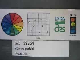 | | 2021 | | | | | | | Wild material | yellow flowers, wash species | 2132434 | W6 59854 |
| 25 | Ames 35667 | Kankakee Sands Preserve | Aronia ×prunifolia (Marshall) Rehder | Illinois, United States | NC7 |  | | 2021 | COLLECTED | 05/04/2021 | Kankakee Sands Preserve located approximately 2.3 miles southwest of Wilmington in Custer Township, T32N R9E NE 1/4 Sec. 11 | 41.27166000, -88.15701800 | 170 | Sand shrub prairie | Wild material | Genotypes noted in nature were averaging 5.0-6.0' in height, relatively upright in growth habit and extremely dense suckering. Numerous clones noted covering expansive areas (e.g. 30 yards by 20 yards, etc.). Variation in branching and glossiness of leaves noted across genotypes present in nature. | 2115976 | Ames 35667 |
| 26 | Ames 35668 | Iroquois County Conservation Area | Aronia ×prunifolia (Marshall) Rehder | Illinois, United States | NC7 |  | | 2021 | COLLECTED | 05/05/2021 | Iroquois County Conservation Area located approximately 4.5 miles northeast of Beaverville in Beaverville Township, T29N R11W NE1/4 Sec. 22 | 40.99154700, -87.58073200 | 198 | Woodland edge of wet sand prairie | Wild material | Wide variety of genotypes noted in nature averaging 3.5-7' in height. Some growing in shade of oak forest were sparse suckering and open branching compared to open grown specimens that were extremely dense with suckers. | 2115977 | Ames 35668 |
| 27 | W6 58574 | MARSB-176 | Cyperus grayi Torr. | Delaware, United States | W6 | | | 2021 | | | | | | | Wild material | Inflorescence looks like fireworks, bulbous root growths. Grows in clumps. | 2113504 | W6 58574 |
| 28 | W6 58577 | MARSB-275 | Schizachyrium scoparium (Michx.) Nash subsp. littorale (Nash) Gandhi & Smeins | New York, United States | W6 | | | 2021 | | | | | | | Wild material | | 2113507 | W6 58577 |
| 29 | WLP 2037 | MARSB-1004 | Viburnum dentatum L. | New York, United States | NA | | | 2019 | COLLECTED | 08/29/2019 | Sullivan County; ; Willowemoc; resdiential. [Willowemoc Rd.? Willowemoc Wild Forest? Locality not precisely specified. Appears likely to be Sullivan County, from maps. -SBL] | | 610 | Edge of pond, transition to red maple swamp, in full sun; growing in moist clay loam soil. | | Seeds collected from 20 individuals in a population of 20 plants occurring over an area 100 meters by 100 meters in size; rare. Seed maturation: late. | 2109186 | WLP 2037 |
| 30 | NA 88125 | MARSB-875 | Juniperus virginiana L. | New Jersey, United States | NA |  | | 2019 | | | | | | | Wild material | | 2097745 | NA 88125 |
| 31 | W6 57124 | MARSB-300 | Cyperus grayi Torr. | New Jersey, United States | W6 | 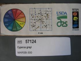 | | 2019 | | | | | | | Wild material | | 2097563 | W6 57124 |
| 32 | W6 57139 | MARSB-329 | Hexasepalum teres (Walter) J. H. Kirkbr. | New Jersey, United States | W6 |  | | 2019 | | | | | | | Wild material | | 2097578 | W6 57139 |
| 33 | W6 57141 | MARSB-331 | Parthenocissus quinquefolia (L.) Planch. | New Jersey, United States | W6 |  | | 2019 | | | | | | | Wild material | | 2097580 | W6 57141 |
| 34 | NA 87996 | MARSB-291 | Morella pensylvanica (Mirb.) Kartesz | New Jersey, United States | NA |  | | 2018 | | | | | | | Wild material | | 1964750 | NA 87996 |
| 35 | Ames 34023 | Ames 34023 | Viburnum prunifolium L. | Iowa, United States | NC7 |  | | 2017 | COLLECTED | 09/27/2017 | Shimek State Forest, Donnellson Unit, approximately 6.0 miles west of Donnellson. | 40.64796000, -91.67764000 | 219 | Oak-hickory upland forest. | Wild material | Plants at collection site ranging between 10-15' tall. Fruits dark purple, leaves on some stems were turning red fall color at time of collection (09/27/2017). | 1953995 | Ames 34023 |
| 36 | W6 51900 | NV052-567 | Eriocoma hymenoides (Roem. & Schult.) Rydb. | Nevada, United States | W6 | | | 2017 | | | | | | | Wild material | | 1947033 | W6 51900 |
| 37 | NA 82643 | NA 82643 | Lonicera sempervirens L. | Texas, United States | NA | | | 2015 | COLLECTED | 07/20/2014 | East side of Texas Route 87 approximately 0.52 miles south of Trout Creek, Texas. | 30.61156000, -93.80506000 | 21 | Southwest-facing edge of mature woodland in part to full sun; well-drained, seasonally moist soils that are sandy loam; surface has an excellent organic litter layer. | | | 1952603 | NA 82643 |
| 38 | Ames 32889 | APS/GD/2015/006/188 | Gymnocladus dioicus (L.) K. Koch | Missouri, United States | NC7 |  | | 2015 | COLLECTED | 03/05/2015 | St Charles County: T46N R2E Sec. 24. August Busch Conservation Area near Weldon Spring. | 38.72724100, -90.74923500 | 166 | Deciduous, mesic woods. | Wild material | | 1924367 | Ames 32889 |
| 39 | Ames 34289 | MARSB-090 | Rhus copallinum L. | New York, United States | NC7 |  | | 2015 | COLLECTED | 09/26/2013 | Great Kills Park near Oakwood Beach. | 40.55428000, -74.10738000 | 3 | | Wild material | | 1922928 | Ames 34289 |