| 0 | DPRU 2312 | Flowering Almond | Prunus triloba Lindl. | China | DAV | | | 1996 | COLLECTED | | Heilongjiang Province, Dailing District, town of Dailing, edge of Forest bureau nursery. | | 160 | | Cultivated material | Flowering Almond. (Collectors notes) Fruit 6-7 mm., round, green-immature. Fruit pubescent, should be red at maturity. | 1529084 | DPRU 2312 |
| 1 | NA 89081 | 2024RJLPA-009 | Rosa carolina L. | Pennsylvania, United States | NA | | | 2024 | COLLECTED | 09/22/2024 | Lancaster and York Counties: outcrops along the Susquehanna River, accessed from the Historic Lock 12 parking lot off of Pennsylvania Road 372. | 39.81483500, -76.32762200 | 34 | Plants are growing from part-sun to full sun in crevices of the outcrops and where organic debris has accumulated in between boulders along the Susquehanna River. The sites range from nearly xeric to dry mesic, at least on the surface. Plants are generally growing 4-10 m above the normal flow of the river; however, the Holtwood Dam is less than 1 kilometer upstream and debris found trapped in the boulders indicates that there is periodic flooding, at least, in the lower zone of 4+ meters or so above normal river flow. This habitat has a diverse assemblage of deciduous trees and shrubs as well as abundant herbaceous taxa. Slope: 0 to 60 percent. Aspect: Northeast (generally). Geology: The underlying geology of this area is probably of lower Paleozoic age and characterized as the Octoraro Formation. It includes albite-chlorite schist, phyllite, some hornblende gneiss, and granitized members. Soils: The area where this species occurs is right on the edge of two soil zones that transition from the river’s edge to mesic conditions upslope. The first is generally referred to as Rock Outcrop. This terrestrial matrix in which plants grow is largely exposed underlying rock geology with accumulated outwash, rock decomposition, and organic debris buildup. The second is Mt. Airy (80%) and Manor (20%) Series soils, 25 to 60 percent slopes, extremely stony (MRF). (Source: California Soil Resource Lab/NRCS Official Soil Series Descriptions). EPA Ecoregion (Level III): Northern Piedmont (64). EPA Ecoregion (Level IV): Piedmont Uplands (64c). | Wild material | | 2169045 | NA 89081 |
| 2 | NA 89082 | 2024RJLPA-010 | Amorpha fruticosa L. | Pennsylvania, United States | NA | | | 2024 | COLLECTED | 09/22/2024 | Outcrops along the Susquehanna River, accessed from the Historic Lock 12 parking lot off of Pennsylvania Road 372. | 39.81481500, -76.32757900 | 34 | Plants are growing from part-sun to full sun in crevices of the outcrops and where organic debris has accumulated in between boulders along the Susquehanna River. The sites range from nearly xeric to dry mesic, at least on the surface. Plants are generally growing 4-10 m above the normal flow of the river; however, the Holtwood Dam is less than 1 kilometer upstream and debris found trapped in the boulders indicates that there is periodic flooding, at least, in the lower zone of 4+ meters or so above normal river flow. This habitat has a diverse assemblage of deciduous trees and shrubs as well as abundant herbaceous taxa. Slope: 0 to 25 percent. Aspect: Northeast (generally). Geology: The underlying geology of this area is probably of lower Paleozoic age and characterized as the Octoraro Formation. It includes albite-chlorite schist, phyllite, some hornblende gneiss, and granitized members. Soils: The area where this species occurs is right on the edge of two soil zones that transition from the river’s edge to mesic conditions upslope. The first is generally referred to as Rock Outcrop. This terrestrial matrix in which plants grow is largely exposed underlying rock geology with accumulated outwash, rock decomposition, and organic debris buildup. The second is Mt. Airy (80%) and Manor (20%) Series soils, 25 to 60 percent slopes, extremely stony (MRF). (Source: California Soil Resource Lab/NRCS Official Soil Series Descriptions). EPA Ecoregion (Level III): Northern Piedmont (64). EPA Ecoregion (Level IV): Piedmont Uplands (64c). | Wild material | | 2169046 | NA 89082 |
| 3 | NA 89083 | 2024RJLPA-012 | Rhododendron periclymenoides (Michx.) Shinners | Pennsylvania, United States | NA | | | 2024 | COLLECTED | 09/22/2024 | Outcrops along the Susquehanna River, accessed from the Historic Lock 12 parking lot off of Pennsylvania Road 372. | 39.81477400, -76.32807300 | 35 | Plants are growing from shade to part-sun and occasionally full sun in crevices of the outcrops and where organic debris has accumulated in between boulders along the Susquehanna River. The sites range from nearly xeric to mesic, at least on the surface. Plants are generally growing 4-10 m above the normal flow of the river; however, the Holtwood Dam is less than 1 kilometer upstream and debris found trapped in the boulders indicates that there is periodic flooding, at least, in the lower zone of 4+ meters or so above normal river flow. This habitat has a diverse assemblage of deciduous trees and shrubs as well as abundant herbaceous taxa. Slope: 0 to 60 percent. Aspect: Northeast (generally). Geology: The underlying geology of this area is probably of lower Paleozoic age and characterized as the Octoraro Formation. It includes albite-chlorite schist, phyllite, some hornblende gneiss, and granitized members. Soils: The area where this species occurs is right on the edge of two soil zones that transition from the river’s edge to mesic conditions upslope. The first is generally referred to as Rock Outcrop. This terrestrial matrix in which plants grow is largely exposed underlying rock geology with accumulated outwash, rock decomposition, and organic debris buildup. The second is Mt. Airy (80%) and Manor (20%) Series soils, 25 to 60 percent slopes, extremely stony (MRF). (Source: California Soil Resource Lab/NRCS Official Soil Series Descriptions). EPA Ecoregion (Level III): Northern Piedmont (64). EPA Ecoregion (Level IV): Piedmont Uplands (64c). | Wild material | | 2169047 | NA 89083 |
| 4 | NA 89084 | 2024RJLPA-013 | Physocarpus opulifolius (L.) Maxim. | Pennsylvania, United States | NA | | | 2024 | COLLECTED | 09/22/2024 | Outcrops along the Susquehanna River, accessed from the Historic Lock 12 parking lot off of Pennsylvania Road 372. | 39.81466300, -76.32833900 | 36 | Plants are growing from shade to part-sun where organic debris has accumulated in between boulders as well as further upslope in deeper mesic soils along the Susquehanna River. This habitat has a diverse assemblage of deciduous trees and shrubs as well as abundant herbaceous taxa. Slope: 10 to 25 percent. Aspect: Northeast (generally). Geology: The underlying geology of this area is probably of lower Paleozoic age and characterized as the Octoraro Formation. It includes albite-chlorite schist, phyllite, some hornblende gneiss, and granitized members. Soils: The area where this species occurs is right on the edge of two soil zones that transition from the river’s edge to mesic conditions upslope. The first is generally referred to as Rock Outcrop. This terrestrial matrix in which plants grow is largely exposed underlying rock geology with accumulated outwash, rock decomposition, and organic debris buildup. The second is Mt. Airy (80%) and Manor (20%) Series soils, 25 to 60 percent slopes, extremely stony (MRF). (Source: California Soil Resource Lab/NRCS Official Soil Series Descriptions). EPA Ecoregion (Level III): Northern Piedmont (64). EPA Ecoregion (Level IV): Piedmont Uplands (64c). | Wild material | | 2169048 | NA 89084 |
| 5 | NA 89085 | 2024RJLPA-014 | Rhododendron arborescens (Pursh) Torr. | Pennsylvania, United States | NA | | | 2024 | COLLECTED | 09/22/2024 | Outcrops along the Susquehanna River, accessed from the Historic Lock 12 parking lot off of Pennsylvania Road 372. | 39.81618100, -76.33069800 | 38 | Plants are growing from shade to part-sun and occasionally full sun in crevices of the outcrops and where organic debris has accumulated in between boulders along the Susquehanna River. The sites range from nearly xeric to mesic, at least on the surface. Plants are generally growing 4-10 m above the normal flow of the river; however, the Holtwood Dam is less than 1 kilometer upstream and debris found trapped in the boulders indicates that there is periodic flooding, at least, in the lower zone of 4+ meters or so above normal river flow. This habitat has a diverse assemblage of deciduous trees and shrubs as well as abundant herbaceous taxa. Slope: 0 to 75 percent. Aspect: Northeast (generally). Geology: The underlying geology of this area is probably of lower Paleozoic age and characterized as the Octoraro Formation. It includes albite-chlorite schist, phyllite, some hornblende gneiss, and granitized members. Soils: The area where this species occurs is right on the edge of two soil zones that transition from the river’s edge to mesic conditions upslope. The first is generally referred to as Rock Outcrop. This terrestrial matrix in which plants grow is largely exposed underlying rock geology with accumulated outwash, rock decomposition, and organic debris buildup. The second is Mt. Airy (80%) and Manor (20%) Series soils, 25 to 60 percent slopes, extremely stony (MRF). (Source: California Soil Resource Lab/NRCS Official Soil Series Descriptions). EPA Ecoregion (Level III): Northern Piedmont (64). EPA Ecoregion (Level IV): Piedmont Uplands (64c). | Wild material | | 2169049 | NA 89085 |
| 6 | NA 89087 | 2024RJLPA-016 | Hydrangea arborescens L. | Pennsylvania, United States | NA | | | 2024 | COLLECTED | 09/22/2024 | Outcrops along the Susquehanna River, accessed from the Historic Lock 12 parking lot off of Pennsylvania Road 372. | 39.81489000, -76.32912200 | 43 | Plants are growing in deep shade of the deciduous woodlands on outcrops and the steep slopes where organic debris and detritus has accumulated. This habitat has a diverse assemblage of deciduous trees and shrubs as well as abundant herbaceous taxa. Slope: 30 to 90 percent. Aspect: Northeast (generally). Geology: The underlying geology of this area is probably of lower Paleozoic age and characterized as the Octoraro Formation. It includes albite-chlorite schist, phyllite, some hornblende gneiss, and granitized members. (Source: Source: USGS Pennsylvania Geologic Map Data). Soils: The area where this species occurs is right on the edge of two soil zones that transition from the river’s edge to mesic conditions upslope. The first is generally referred to as Rock Outcrop. This terrestrial matrix in which plants grow is largely exposed underlying rock geology with accumulated outwash, rock decomposition, and organic debris buildup. The second is Mt. Airy (80%) and Manor (20%) Series soils, 25 to 60 percent slopes, extremely stony (MRF). (Source: California Soil Resource Lab/NRCS Official Soil Series Descriptions). EPA Ecoregion (Level III): Northern Piedmont (64). EPA Ecoregion (Level IV): Piedmont Uplands (64c). | Wild material | | 2169051 | NA 89087 |
| 7 | NA 88559 | RJLSEUS2022-032 | Rhododendron colemanii R. F. Mill. | Alabama, United States | NA | | | 2023 | COLLECTED | 12/12/2022 | Plants growing in bottomland mostly deciduous woodlands on the south side of Lena Landegger Hwy (Monroe County Road 39) about 0.5 kilometers south of the entrance to the Alabama River Cellulose plant. Common at this site. | 31.56879700, -87.49589500 | 10 | Plants are growing in shade of a moist mesic (occasionally temporarily wet) deciduous woodland less than 1 meter above wetland habitats associated with the nearby Alabama River.
Soils: The underlying geology of this area is of Holocene origin and characterized as Alluvial, coastal and low terrace deposits. Varicolored fine to coarse quartz sand containing clay lenses and gravel in places.
Source: USGS Alabama Geologic Map Data (https://mrdata.usgs.gov/geology/state/sgmc-unit.php?unit=ALHalt%3B0)
The primary soil types in the collection area are classified as Chrysler Silt Loam soils (0 to 5 percent slopes, occasionally flooded). The Chrysler Series consists of deep, moderately well drained, slowly permeable soils that formed in clayey fluvial or alluvial sediments. These soils are on stream terraces of the Coastal Plain. They are strongly acid. The rate at which water runs off the surface is medium to rapid. Slopes range from 0 to 5 percent.
Source: NRCS Web Soil Survey (https://websoilsurvey.sc.egov.usda.gov/App/WebSoilSurvey.aspx) | Wild material | | 2140784 | NA 88559 |
| 8 | NA 88514 | RJL2022MD-019 | Kalmia latifolia L. | Maryland, United States | NA | | | 2022 | COLLECTED | 11/04/2022 | Plants are growing on both sides of a fire road on Maryland Heights along the edge with Harpers Ferry National Historic Park. This location was accessed from the east where Miller Avenue meets the fire road, approximately 2 kilometers away. There is no vehicular access to the collecting area. Becoming locally uncommon. This local population is likely to be extirpated in the next 20-30 years. This collector has hiked through this area for more than 35 years and seen dramatic changes in the population. When first observed, Kalmia latifolia was a dominant understory shrub on south- to west-facing slopes beneath a mature forest canopy. Over the years, at least one forest fire has significantly reduced the population, along with a continuing increase in deer populations, resulting in catastrophic browse damage. The absence of a mature forest canopy and periods of drought have almost certainly also resulted in decline of this population. While collecting seed from scattered mature plants well above deer browse levels, this collector also noted that there was virtually no recruitment taking place. | 39.32811200, -77.72242400 | 287 | Plants are growing in part-shade to shade of a deciduous upland, very rocky, and dry forest community. Plants are frequently found growing among boulders, rock outcrops, and steep-slope erosional areas, although, not exclusively.
Soils: The underlying geology of this area is of Late Cambrian to Cambrian origin and comprised of Chilhowee Group; Weverton Formation. This includes interbedded white to dark gray, thin-bedded, micaceous, ferruginous, and sericitic quartzites, phyllites, and white, thick-bedded, ledge-making quartzites; some gray to brown ferruginous quartz conglomerate and purple-banded phyllite.
Source: USGS Maryland Geologic Map Data https://mrdata.usgs.gov/geology/state/sgmc-unit.php?unit=MDKp%3B5
The primary soil types in the collection area are classified as Dekalb-Bagtown-Rock outcrop complex, 25 to 65 percent slopes. The Dekalb series consists of moderately deep, excessively drained soils formed in material weathered from gray and brown acid sandstone in places interbedded with shale and graywacke. Slope ranges from 0 to 80 percent. Permeability is rapid. Solum thickness and depth to bedrock range from 50 to 100 cm. Flat, subangular or angular, sandstone fragments, 2.5-25 cm across increase with depth and range from 10-60 percent in individual horizons of the solum and from 50-90 percent or more in the C horizon. The amount of rock fragments typically increases with depth. Cobbly, channery, and very stony phases are common. Reaction ranges from extremely through strongly acid.
Source: NRCS Web Soil Survey (https://websoilsurvey.sc.egov.usda.gov/App/WebSoilSurvey.aspx) | Wild material | | 2139821 | NA 88514 |
| 9 | W6 59002 | NCBG-451 | Carex vulpinoidea Michx. | Maryland, United States | W6 | | | 2021 | | | | | | | Wild material | long involucral bract (longer than inflorescence) | 2116320 | W6 59002 |
| 10 | NA 88158 | NCBG-331 | Callicarpa americana L. | North Carolina, United States | NA | 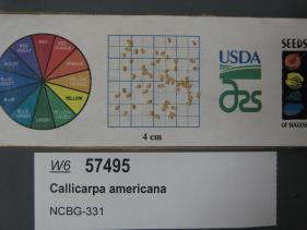 | | 2019 | | | | | | | Wild material | | 2098419 | NA 88158 |
| 11 | Ames 34086 | APS/HD/2017/038/297 | Helianthus divaricatus L. | Illinois, United States | NC7 |  | | 2017 | COLLECTED | 11/11/2017 | Trail of Tears State Forest approximately 6.11 miles northwest of Anna along North Forest Road (both sides), T12S R2W NW 1/4 NW 1/4 Sec. 4, Union County | 37.50864000, -89.33891000 | 218 | Ridgetop of dry-mesic oak forest | Wild material | Plants 2-5 feet tall, elongated leaves quite rough on both the upper and lower sides. Herbarium specimen is clearly Helianthus divaricatus, however, there is a large amount of variation in seed size, shape, and color. Seed sample may contain genetics of Helianthus hirsutus. | 1954437 | Ames 34086 |
| 12 | Ames 33979 | JDC/FQ/2017/031/785 | Fraxinus quadrangulata Michx. | Tennessee, United States | NC7 |  | | 2017 | COLLECTED | 07/08/2017 | Along highway 52 approximately 2.30 miles northwest of Celina, Clay County | 36.57174000, -85.53638800 | 190 | Dry, rocky soils. | Wild material | | 1950062 | Ames 33979 |
| 13 | Ames 33289 | APS/GD/2016/010/245 | Gymnocladus dioicus (L.) K. Koch | Michigan, United States | NC7 |  | | 2016 | COLLECTED | 04/05/2016 | Ionia County: T5N R5W SW 1/4 SW 1/4 SE 1/4 Sec. 21; T5N R5W NE 1/4 NW 1/4 NW 1/4 Sec. 20; and T5N R5W SW 1/4 SW 1/4 SE 1/4 Sec. 20 along Grand River approximately 4.80 miles south and slightly west of Portland. | 42.80296200, -84.91275400 | 231 | Floodplain. | Wild material | | 1940346 | Ames 33289 |
| 14 | Ames 32889 | APS/GD/2015/006/188 | Gymnocladus dioicus (L.) K. Koch | Missouri, United States | NC7 |  | | 2015 | COLLECTED | 03/05/2015 | St Charles County: T46N R2E Sec. 24. August Busch Conservation Area near Weldon Spring. | 38.72724100, -90.74923500 | 166 | Deciduous, mesic woods. | Wild material | | 1924367 | Ames 32889 |
| 15 | WLP 1079 | NA 81742 | Cornus florida L. | Missouri, United States | NA | | | 2013 | COLLECTED | 09/26/2013 | Springfield Township: NW 1/4 of Section 20. | 38.41792000, -93.60433000 | | Growing in and around sandstone ravines. | Wild material | Voucher specimen being processed at time of accessioning; will be forwarded to USNA once prepared. | 1922751 | WLP 1079 |
| 16 | Ames 31992 | APS/GD/2013/017/102 | Gymnocladus dioicus (L.) K. Koch | Kentucky, United States | NC7 |  | | 2013 | COLLECTED | 03/04/2013 | Dinsmore Woods, Boone County. | 38.99959500, -84.81492800 | 189 | Base of south-facing bluff. | Wild material | | 1908270 | Ames 31992 |
| 17 | Ames 31994 | APS/GD/2013/020/105 | Gymnocladus dioicus (L.) K. Koch | Kentucky, United States | NC7 |  | | 2013 | COLLECTED | 03/05/2013 | Fleming Wildlife Management Area, Fleming County. | 38.42060700, -83.61839800 | 368 | Upland site. Top of ridge, on both southeast and northwest-facing slopes. | Wild material | | 1908272 | Ames 31994 |
| 18 | Ames 31999 | APS/GD/2013/028/113 | Gymnocladus dioicus (L.) K. Koch | Illinois, United States | NC7 |  | | 2013 | COLLECTED | 03/07/2013 | Robeson Hills Nature Preserve, Southern Upland Section of the Wabash Border Natural Division, Lawrence County. | 38.71393400, -87.53430000 | 154 | Remnant, mesic upland beech-maple forest. Dissected, deep loess deposits adjacent to Wabash River. | Wild material | Largest specimen found at time of collection measured 37 inches d.b.h. Also noted a number of small saplings 2-3 feet in height. | 1908277 | Ames 31999 |
| 19 | Ames 30491 | APS/GD/2010/013/048 | Gymnocladus dioicus (L.) K. Koch | Illinois, United States | NC7 |  | | 2010 | COLLECTED | 02/23/2010 | Near Deans Hills State Nature Preserve, approximately 7 miles east of Ramsey, T8N R2E Sec. 10 and NE 1/4 of Sec. 16, Fayette County. | 39.13970000, -88.97490000 | 172 | Gentle rolling hills of deciduous woods. | Wild material | #157 measured 9.5" and 50', #158 measured 11.5" d.b.h. and 50', #159 measured 16" and 60', #160 measured 15" and 80', and #161 measured 16.5" and 90'. | 1831350 | Ames 30491 |
| 20 | Ames 30371 | APS/GD/2013/030/115 | Gymnocladus dioicus (L.) K. Koch | Illinois, United States | NC7 |  | | 2009 | COLLECTED | 10/14/2009 | Old Gillett Farm, Elkhart Hill, SE 1/4 of NW 1/4 of Section 18, T18N, R3W, near Elkhart, Broadwell Quad, Logan County. | 40.01497600, -89.47119800 | 231 | Mature woodland. | Wild material | | 1823923 | Ames 30371 |
| 21 | Ames 29530 | JDC/FQ/2008/007/077 | Fraxinus quadrangulata Michx. | Illinois, United States | NC7 |  | | 2008 | COLLECTED | 08/01/2008 | Old Gillett Farm, Elkhart Hill, SE 1/4 of NW 1/4 of Section 18, T18N, R3W, near Elkhart, Broadwell Quad, Logan County. | 40.01333333, -89.47472222 | 213 | Farmstead; hill in middle of nowhere. Approximately 100-150 feet higher than surrounding area. | Wild material | | 1782753 | Ames 29530 |