| 0 | Ames 36168 | Mount Magazine | Ptelea trifoliata L. | Arkansas, United States | NC7 |  | | 2023 | COLLECTED | 08/26/2023 | Mount Magazine State Park primarily localized to the northwest rim of the mountain along the trails heading west from Brown's Spring, T6N R25W Sec. 21. | 35.17130900, -93.65582200 | 786 | Top of sky-island mountain. Localized along the rims just above steep cliffs on north facing slopes. | Wild material | Plants in nature ranging from three to fifteen feet in height with peak bloom observed during the first week of May (2023). | 2158787 | Ames 36168 |
| 1 | Ames 36170 | Lake Catherine State Park | Ptelea trifoliata L. | Arkansas, United States | NC7 |  | | 2023 | COLLECTED | 08/27/2023 | Lake Catherine State Park approximately 10 miles southeast of Hot Springs. Localized to the ridge top of Dam Mountain on the south shore of the southeast arm of the reservior, starting approximately 0.25 miles southwest of the dam. T3S R18W Sec. 35. | 34.42452200, -92.90218400 | 199 | Dry ridge top. Predominantly on the north facing edge of ridge. | Wild material | A localized but very dense population. Ptelea is the dominant understory species in this location. | 2158789 | Ames 36170 |
| 2 | NA 87354 | TJK2022TX-002 | Ptelea trifoliata L. | Texas, United States | NA | | | 2023 | COLLECTED | 11/29/2022 | Blanco County: Little Blanco Road, upper slope off Little Blanco River; 330 feet west of Highway 281. | 30.00140000, -98.40650000 | 390 | Shaded streamside slope between road and Little Blanco River. | Wild material | | 2141645 | NA 87354 |
| 3 | NA 89039 | RJL2022IL-001 | Ptelea trifoliata L. | Illinois, United States | NA | | | 2022 | COLLECTED | 09/28/2022 | Site of plant habitat is located at 823 E Co Rd 1220, Hamilton, IL 62341 which is the property where Jacob's Geode Shop and Mine is located. This species is scattered and relatively common throughout the woodlands on this site. | 40.37848400, -91.35390200 | 175 | Plants growing in shade to part-shade of deciduous woodlands above a small creek.
Soils: The underlying geology of this area is of Mississippian origin and comprised of Warsaw Formation and Salem Limestone. Major lithological components include limestone that can be shaly, oolitic, bioclastic, or cherty. Minor lithological components include siltstone that can contain geodes or drusy quartz and can be calcareous.
Source: USGS Illinois Geologic Map Data (https://mrdata.usgs.gov/geology/state/sgmc-unit.php?unit=ILMws%3B0)
The surface soil profile of this area is Coffeen silt loam, 0 to 2 percent slopes, that are frequently flooded. The Coffeen series consists of very deep, somewhat poorly drained, moderately permeable soils on flood plains, low terraces or benches, toe slopes, and alluvial fans. They formed in silty alluvium. Much of the alluvium is of local origin derived from the nearby loess-covered uplands.
Source: NRCS Web Soil Survey (https://websoilsurvey.sc.egov.usda.gov/App/WebSoilSurvey.aspx) | Wild material | | 2139604 | NA 89039 |
| 4 | Ames 35738 | AS/PT/2021/016/116 | Ptelea trifoliata L. | Illinois, United States | NC7 |  | | 2021 | COLLECTED | 08/26/2021 | State Route 71 along Illinois River located approximately 1.30 miles southwest of Ottawa, T33N R3E NE1/4 Sec. 15 | 41.33370200, -88.86061200 | 148 | Roadside at top of limestone cliff above Illinois River. | Wild material | Trees measuring approximately 20-25' in height. Peak flowering and fruiting occurred 4 May and approximately 10 September 2021, respectively. | 2120342 | Ames 35738 |
| 5 | Ames 35660 | Kiamichi Mountains | Ptelea trifoliata L. | Oklahoma, United States | NC7 | | | 2021 | COLLECTED | 07/19/2018 | Kiamichi Mountains of Ouachita National Forest along Road 6025 just west of State Highway 259, T2N R25E SW 1/4 NE 1/4 SW 1/4 Sec. 27 | 34.61314900, -94.67035700 | 651 | Open, dry ridgetop, rocky roadside. | Wild material | Specimens sampled measuring approximately 20-25' in height. | 2114985 | Ames 35660 |
| 6 | Ames 35232 | Ames 35232 | Ptelea trifoliata L. | Illinois, United States | NC7 |  | | 2019 | COLLECTED | 10/01/2019 | Rock Creek watershed located approximately 4.5 miles southwest of Athens, T17N R6W SE1/4 SW1/4 Sec. 8 | 39.93164600, -89.80193000 | 159 | Creek banks, floodplain, and fence rows (north and west facing slopes) | Wild material | | 2097768 | Ames 35232 |
| 7 | Ames 33867 | JDC/PT/2016/034/749 | Ptelea trifoliata L. | Iowa, United States | NC7 |  | | 2016 | COLLECTED | 11/01/2016 | Shields Prairie located approximately 5.85 miles northwest of Muscatine, T77N R2W SW1/4 SE1/4 Sec. 7 | 41.48239000, -91.12428000 | 222 | Native prairie remnant | Wild material | | 1943209 | Ames 33867 |
| 8 | WLP 2406 | 201546 | Ptelea trifoliata L. | Texas, United States | NA |  | | 2011 | COLLECTED | 09/17/2003 | Scott Rd | 30.19917000, -97.58735000 | 130 | Blackland prairie. Soil brown. | Wild material | | 1895348 | WLP 2406 |
| 9 | Ames 30167 | JDC/PT/2009/061/211 | Ptelea trifoliata L. | Illinois, United States | NC7 |  | | 2009 | COLLECTED | 09/24/2009 | Rock Cut State Park along Hart Road; SE 1/4 of SE 1/4 of Section 21, T45N, R2E, Rockford North Quad. | 42.35500000, -89.00083333 | 254 | Roadside. | Wild material | | 1819748 | Ames 30167 |
| 10 | WLP 1490 | | Ptelea trifoliata L. | | NA | | | 2004 | | | | | | | Wild material | | 1897404 | WLP 1490 |
| 11 | Ames 27329 | 34 | Ptelea trifoliata L. | Iowa, United States | NC7 |  | | 2003 | COLLECTED | 09/24/2003 | Bluff Park, Keokuk, South of Park Street at G, T65N R5W, Section 35, Keokuk Quad. | 40.38861111, -91.40277778 | 194 | Bluff edge along Mississippi River. Sunny. 25% slope with a southern aspect. Soil well to good drainage. | Wild material | | 1649675 | Ames 27329 |
| 12 | PI 649685 | Ames 24550 | Monarda bradburiana L. C. Beck | Missouri, United States | NC7 | _thumbnail.jpg "Click for 2 image(s) for this accession.") | | 1998 | COLLECTED | 09/15/1997 | Roadside just off Highway OO and north of Interstate 44 approximatley .75 miles north of Pacific , T43N R2E SW 1/4 SE 1/4 Sec. 1, Franklin County. | 38.49296500, -90.74322100 | 194 | Limestone glade. | Wild material | | 1556792 | PI 649685 |
| 13 | NA 89195 | DLSP-EB | Hamamelis virginiana L. | Wisconsin, United States | NA | | | 2025 | COLLECTED | 08/21/2024 | Devil's Lake State Park: East Bluff. | 43.41836810, -89.72111900 | 456 | Shade in organic layer on old boulder field. Slope: 40 degrees. Aspect: East-northeast. Red oak-hickory-linden-pine vegetative community. | Wild material | | 2171016 | NA 89195 |
| 14 | Ames 36284 | Oak Creek Canyon | Alnus oblongifolia Torr. | Arizona, United States | NC7 |  | | 2024 | COLLECTED | 10/18/2024 | Oak Creek Canyon, approximately five miles north-northeast of Sedona in the Coconino National Forest, T18N R6E Sec. 8 and Sec. 21 and also T19N R6E Sec. 22 and Sec. 27. | 35.01694800, -111.73755900 | 1538 | Creek beds in canyon bottom. | Wild material | Plants sampled in nature had dark green, glossy leaves. Young bark is smooth and light grey, becoming dark and scaly with age. Approximately 50 feet in height. | 2169812 | Ames 36284 |
| 15 | Ames 36184 | Ames 36184 | Quercus durandii Buckley var. breviloba (Torr.) E. J. Palmer | Oklahoma, United States | NC7 |  | | 2023 | COLLECTED | 2022 | Private property located 11.0 miles west of Clinton just northeast of intersection of Highway 73 and N2140 Road, T12N R19W NE 1/4 SW 1/4 SW 1/4 Sec. 13 | 35.51213100, -99.16652700 | 518 | Rocky knolls consisting of red Permian sandstone scree and red shale outcroppings with a high pH (estimated 8.0-8.5 pH). | Wild material | Accession represents genetics of a disjunct population that is approximately 150 miles northwest of the nearest population of this taxon. Estimated to reach a mature height at 18-20’ and spread at 12-15’. Leaves are rather persistent (strong marcescence) throughout winter. Specimens are shrubby, multi-stemmed and low-branching. Often referred to as Bigelow oak and typically found throughout most of central Texas and parts of southern Oklahoma. According to Lance (2022), “Bigelow oak is mostly allopatric from typical Durand Oak in its range. East of this range, errors in herbarium annotations of juvenile Durand Oak material, where leaf shapes may mimic Bigelow oak, have caused confusion and inaccurate range extensions.” | 2159016 | Ames 36184 |
| 16 | OPGC 8853 | JDC/AA/2023/078/1110 | Arnoglossum atriplicifolium (L.) H. Rob. | Iowa, United States | OPGC | | | 2023 | COLLECTED | 09/21/2023 | Iowa Army Ammunition Plant located 5.09 miles southwest of Burlington along south side of road, Union Township T69N R3W SE 1/4 SE 1/4 SW 1/4 Sec. 7 | 40.78416600, -91.24800000 | 191 | Woodland edges/roadsides. | Wild material | | 2159005 | OPGC 8853 |
| 17 | NA 88652 | KY23-056 | Euonymus atropurpureus Jacq. | Kentucky, United States | NA | | | 2023 | COLLECTED | 09/14/2023 | Floracliff Nature Sanctuary. | 37.90131000, -84.36057000 | 262 | [Downslope from] KY-054 [WLP 3199, Symphoricarpos orbiculatus] and KY-055 [WLP 3200, Ptelea trifolia. ] Elevation: 858 feet. Aspect: West. | Wild material | | 2158745 | NA 88652 |
| 18 | NA 89234 | UK Arb. 2023-0060-A | Cladrastis kentukea (Dum. Cours.) Rudd | Kentucky, United States | NA | | | 2023 | COLLECTED | 08/22/2023 | Tom Dorman State Nature Preserve: cliff above White Oak Creek. | 37.77338000, -84.64500000 | | High quality calcareous cliff; trees growing on northeast slope below calcareous rock outcrop finger. Slope: 30%. Aspect: Northeast. | Wild material | | 2158477 | NA 89234 |
| 19 | Ames 35907 | Oak Creek Canyon | Fraxinus velutina Torr. | Arizona, United States | NC7 | 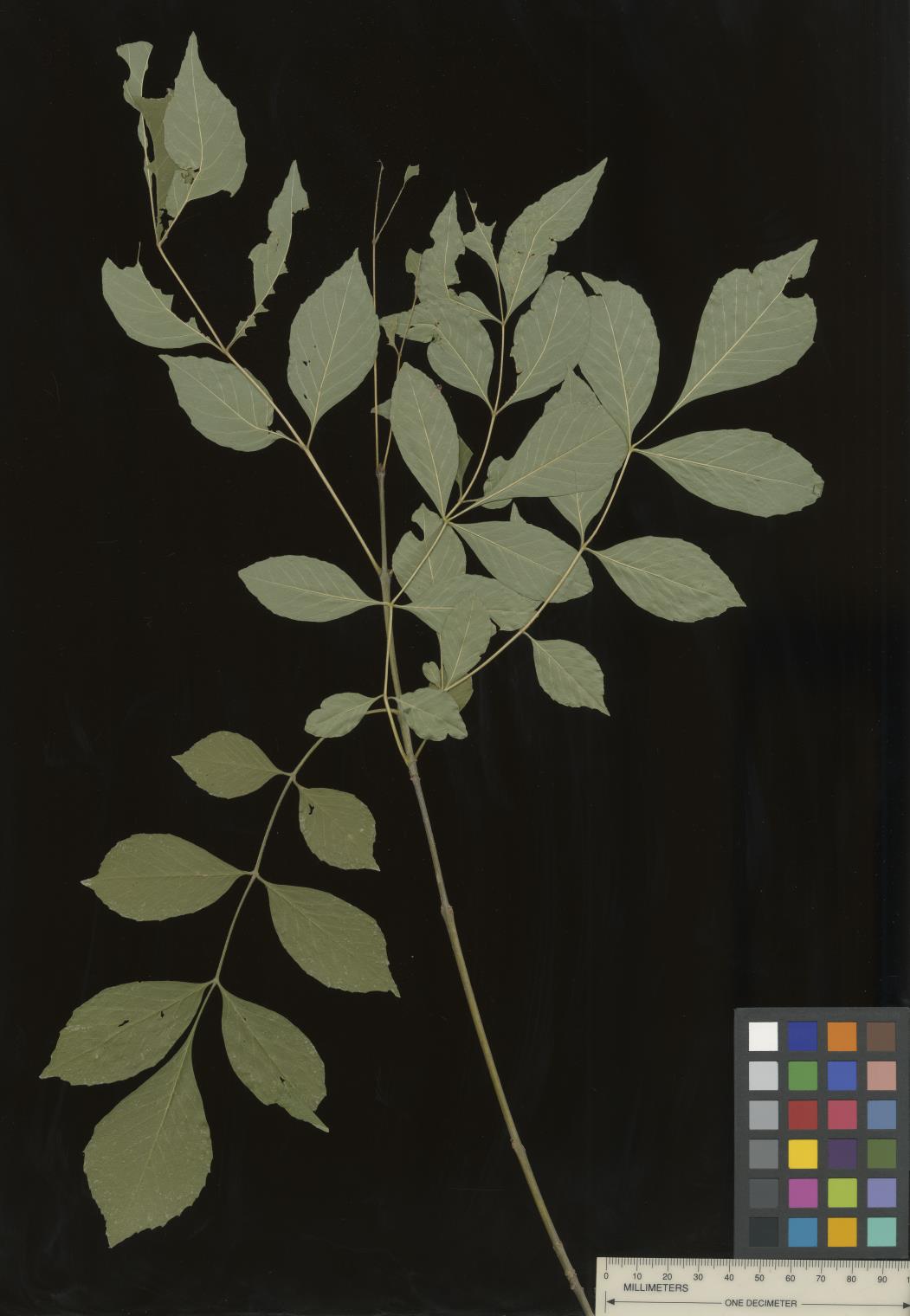 | | 2022 | COLLECTED | 09/02/2022 | Oak Creek Canyon, approximately five miles north-northeast of Sedona in the Coconino National Forest. T18N R6E NE 1/4 NW 1/4 Sec. 21 . | 34.93600300, -111.74436900 | 1464 | Floodplain and riverbanks, growing in gravely soil. | Wild material | Most of the velvet ash in this population are small trees (10-25 feet in height and approximately 5 inches DBH). Variation was noted for leaflet pubescence but with the petioles of all trees in the population being pubescent. | 2139669 | Ames 35907 |
| 20 | Ames 35915 | White Mountains | Fraxinus velutina Torr. | New Mexico, United States | NC7 |  | | 2022 | COLLECTED | 09/08/2022 | White Mountains northwest of Alto. Rare along Eagle Creek and increasing in abundance heading upslope on Ski Run Road. Saplings fairly common in Nogal Canyon and mature specimens frequent on slopes below Nogal Peak in the White Mountain Wilderness of the Lincoln National Forest. T10S R12E S 1/4 Sec. 35. Coordinates listed refer to the last plant sampled (191-5); coordinates for each sample may be provided upon request. | 33.49551600, -105.79515500 | 2743 | Mountainsides and rarely creeks at canyon bottoms. | Wild material | This accession represents a high elevation population of velvet ash which occurs primarily on mountainsides rather than riparian habitats as is typical for the species. Although the velvet ash do occur in the canyon bottoms along creeks in this area, they are quite rare compared to their fairly common distribution on the slopes at higher elevations. Specimens at higher elevations were more shrub-like (multi-trunked and maximum of 20 feet in height) than tree-like while specimens in the canyon bottoms were always trees. All specimens noted at the time of seed collection had glabrous leaves. | 2139677 | Ames 35915 |
| 21 | Ames 35666 | Starved Rock State Park | Aronia melanocarpa (Michx.) Elliott | Illinois, United States | NC7 |  | | 2021 | COLLECTED | 05/04/2021 | Two areas sampled between Ottawa and North Utica including Starved Rock State Park (Lover's Leap and also LaSalle/Tonti Canyon) in Deer Park Township (T33N R2E) and also along IL 71/Courtney Street on bluffs above Illinois River in South Ottawa Township (T33N R3E). | 41.33565600, -88.85903400 | 142 | Sandstone outcropping | Wild material | Genotypes in nature noted were averaging 3.0' in height with sparse suckering and relatively open branching. A small, widely scattered population localized to steep sandstone bluffs. | 2115975 | Ames 35666 |
| 22 | OPGC 7496 | CBG-9546 | Solidago ulmifolia Muhl. ex Willd. | Illinois, United States | OPGC |  | | 2019 | | | | | | | Wild material | | 2092814 | OPGC 7496 |
| 23 | Ames 34307 | JDC/EP/2018/051/864 | Echinacea paradoxa (Norton) Britton | Missouri, United States | NC7 |  | | 2018 | COLLECTED | 07/16/2018 | Auxvasse Natural Area located 8.44 miles southeast of Fulton, T46N R8W S 1/4 Sec. 9, Callaway County | 38.76733000, -91.82958500 | 205 | Dolomite glade. Large (110 acres) and exceptionally diverse (220 plant species identified). According to local MDC biologists, this is one of the best glades north of the Missouri River in Missouri. Northern most, native population of Echinacea paradoxa in Missouri. | Wild material | Plants reached peak flower on 30 May 2018. Specimens ranged from 2.0-4.0' in height. | 1964614 | Ames 34307 |
| 24 | Ames 34310 | JDC/MB/2018/050/863 | Monarda bradburiana L. C. Beck | Missouri, United States | NC7 |  | | 2018 | COLLECTED | 07/16/2018 | Auxvasse Natural Area located 8.44 miles southeast of Fulton, T46N R8W S 1/4 Sec. 9, Callaway County | 38.76733000, -91.82958500 | 205 | Dolomite glade. Large (110 acres) and exceptionally diverse (220 plant species identified). According to local MDC biologists, this is one of the best glades north of the Missouri River in Missouri. | Wild material | Plants measuring circa 1.0' in height. Peak flowering occurred around 18 May 2018. Seeds likely reached full maturity around first week in July (2018). | 1964617 | Ames 34310 |
| 25 | Ames 34206 | JDC/RA/2018/045/858 | Rhus aromatica Aiton | Missouri, United States | NC7 |  | | 2018 | COLLECTED | 05/24/2018 | Drury-Mincy Conservation Area along Bear Cave Trail just off Gunnison Road, T22N R20W NW 1/4 Sec. 21. | 36.54492100, -93.11595600 | 330 | Glade. Open woods. | Wild material | Plants ranging in size (variable due to recent prescribed burning) from 2-6' in height. Fruit maturity variable at time of collection (25 May 2018) from bright red and readily shattering to rather green. | 1963389 | Ames 34206 |
| 26 | Ames 33866 | JDC/MP/2016/033/748 | Monarda punctata L. | Iowa, United States | NC7 |  | | 2016 | COLLECTED | 11/01/2016 | Shields Prairie located appproximately 5.85 miles northwest of Muscatine, T77N R2W SW1/4 SE 1/4 Sec. 7 Muscatine County. | 41.48253000, -91.12427000 | 217 | Native prairie remnant. | Wild material | | 1943208 | Ames 33866 |
| 27 | WLP 1529 | NA 83963 | Philadelphus hirsutus Nutt. | Kentucky, United States | NA | | | 2016 | COLLECTED | 09/30/2016 | Limestone ridge/outcrop near Lake Cumberland. [GPS coordinates do not appear to be exact. -SBL] | 36.93100000, -84.58200000 | 238 | Limestone ridge/outcrop. | | | 1950300 | WLP 1529 |
| 28 | W6 49526 | CBG-2466 | Carex shortiana Dewey | Illinois, United States | W6 |  | | 2015 | | | | | | | Wild material | | 1926159 | W6 49526 |
| 29 | NA 83068 | NA 83068 | Philadelphus pubescens Loisel. | Arkansas, United States | NA | | | 2015 | COLLECTED | 10/06/2014 | Mount Magazine State Park; Brown's Spring Picnic Area trail. | 36.16768000, -93.66583000 | 796 | Moist bluff line community, growing in moist organic soil layer over rocks. | | | 1952927 | NA 83068 |
| 30 | Ames 31519 | JDC/FQ/2012/028/421 | Fraxinus quadrangulata Michx. | Iowa, United States | NC7 |  | | 2012 | COLLECTED | 07/20/2012 | Along Twin Rivers Drive, NE 1/4 of Section 34, T65N, R5W, Keokuk Quad, just southwest of Keokuk, Des Moines County. | 40.38649700, -91.42619300 | 182 | Dry woods. Steep south and southwest-facing slopes. | Wild material | | 1903746 | Ames 31519 |
| 31 | Ames 29754 | Ames 29754 | Fraxinus americana L. | Missouri, United States | NC7 |  | | 2008 | COLLECTED | 10/03/2008 | Section 1, T43N, R2E, Pacific, Franklin County. | 38.49305556, -90.74361111 | 188 | Glade. Western slope. | Wild material | | 1789914 | Ames 29754 |
| 32 | WLP 2304 | LBJWC-MM-755 | Zanthoxylum hirsutum Buckley | Texas, United States | NA | | | 2006 | COLLECTED | 07/19/2006 | Stevenson Nature Preserve. | 30.03711000, -97.82372000 | 245 | Arid; brown, sandy clay loam soil over Cretaceous limestone. | Wild material | | 1719704 | WLP 2304 |