| 0 | PI 702720 | MARSB-360 | Schizachyrium scoparium (Michx.) Nash | New Jersey, United States | S9 |  | | 2019 | | | | | | | Wild material | | 2097597 | PI 702720 |
| 1 | PI 704845 sos | V. parvifolium OR080-49 | Vaccinium parvifolium Sm. | Oregon, United States | COR |  | | 2018 | | | | | | | Wild material | | 1957632 | PI 704845 sos |
| 2 | PI 679629 | V. oxycoccos Red Run Bog FR 13 | Vaccinium oxycoccos L. | West Virginia, United States | COR | | | 2014 | COLLECTED | 04/23/2014 | Red Run Bog, Monongahela National Forest. Tucker County. The bog is bisected by Canaan Loop Road (Forest Road 13) | 39.07228000, -79.47363000 | 1110 | Bog with two main areas (east and west) separated by forest which is interspersed with smaller boggy areas. Road runs through forested area. Gentle slope from 1115 m in the east to 1105 m in the west. The total area is approximately 100 acres. | Wild material | Plants in bog include Spaghnum sp., Lycopodium sp., Rubus hispidus, Solidago uliginosa, Eriphorum virginicum, Pteridium aquilinum, Juncus sp., Carex spp., Aronia melanocarpa, and Vaccinium macrocarpon . Vegetation on surrounding slopes includes Picea rubens, Tsuga canadensis, Rhododendron maximum, Kalmia latifolia, Ilex montana, Gaultheria sp., and Viburnum prunifolium. Abies balsamea occurs on the edge of the bog.
Plant description: Abundant fruit. Fruit shape, size and color typical for species. Voucher collected Type of propagule collected: seed
Collectors: Williams, KA; Garvey, E; Polgar, R. CRANBERRY IGRR PROJECT | 1919347 | PI 679629 |
| 3 | PI 679630 | V. macrocarpon Red Run Bog FR 13 | Vaccinium macrocarpon Aiton | West Virginia, United States | COR | | | 2014 | COLLECTED | 04/23/2014 | Red Run Bog, Monongahela National Forest. Tucker County. The bog is bisected by Canaan Loop Road (Forest Road 13) | 39.07228000, -79.47363000 | 1110 | Bog with two main areas (east and west) separated by forest which is interspersed with smaller boggy areas. Road runs through forested area. Gentle slope from 1115 m in the east to 1105 m in the west. The total area is approximately 100 acres. | Wild material | Plants in bog include Spaghnum sp., Lycopodium sp., Rubus hispidus, Solidago uliginosa, Eriphorum virginicum, Pteridium aquilinum, Juncus sp., Carex spp., Aronia melanocarpa, and Vaccinium oxycoccos . Vegetation on surrounding slopes includes Picea rubens, Tsuga canadensis, Rhododendron maximum, Kalmia latifolia, Ilex montana, Gaultheria sp., and Viburnum prunifolium. Abies balsamea occurs on the edge of the bog.
Plant description: Abundant fruit. Fruit shape, size and color typical for species. Voucher collected Type of propagule collected: seed
Collectors: Williams, KA; Garvey, E; Polgar, R. CRANBERRY IGRR PROJECT | 1919348 | PI 679630 |
| 4 | PI 656860 | V. ovatum 178338 | Vaccinium ovatum Pursh | Oregon, United States | COR |  | | 2005 | COLLECTED | 09/30/2002 | | | 506 | Generally closed canopy, douglas fir forest with Lithocarpus densiflora/Acer macrophylum understory. Dense shrub cover of Gaultheria shallon & others. Associated with Pteridium aquilinum, Mahonia aquilfolium, Rosa gymnocarpa. | Wild material | Seeds of Success (SOS) program germplasm. | 1674047 | PI 656860 |
| 5 | PI 633672 | 010 | Echinacea sanguinea Nutt. | Louisiana, United States | NC7 |  | | 1997 | COLLECTED | 08/08/1997 | Near Lucky, Bienville Parish. Please contact curator for specific site location. | 32.28333333, -93.05000000 | 180 | Roadside at edge of pine woods. Full exposure with ~10 degrees of slope and a northern aspect. Sandy soil with low stoniness and fair drainage. | Wild material | Plants were up to ~2.5 feet tall in relative abundance with rose colored flowers and some branching. | 1547201 | PI 633672 |
| 6 | PI 649044 | 008 | Echinacea sanguinea Nutt. | Louisiana, United States | NC7 |  | | 1997 | COLLECTED | 08/07/1997 | Kisatchie National Forest, near Leesville, Vernon Parish. Please contact curator for specific site location. | 31.00000000, -93.16666667 | 160 | Upland long-leaf pine. ~70% exposure on level ground. Sandy soil with no stones and fair drainage. | Wild material | Plants were 2-2.5 feet tall in occasional abundance with light pink flowers and some branching. | 1547199 | PI 649044 |
| 7 | PI 604594 | Mapes 889 | Amaranthus hypochondriacus L. | Puebla, Mexico | NC7 |  | | 1995 | COLLECTED | 11/15/1993 | Jilotzingo, Municipal of Zacatlan. | 20.01666667, -97.90000000 | 1850 | Growing amoung stalks after Zea mays is harvested. Associated with Phaseolus, Sechim edule, Pteridium, Lopezia, Tagetes, Persea americana, Prunus domestica, Annona cherimola, Citrus aurantiifolia, Alnus, Yucca aloifolia, and Clethera. | Landrace | Inflorescense very red. | 1505563 | PI 604594 |
| 8 | PI 561479 | Graham 1007 | Cuphea hookeriana Walp. | Veracruz de Ignacio de la Llave, Mexico | NC7 |  | | 1988 | COLLECTED | 10/11/1988 | 4 km S of Tlilapan on Orizba-Zongolica road. | | 1450 | | Wild material | Common on open, disturbed banks with Pteridium aquilinum; floral tube color varying from partly red to dark red; dorsal petals dark maroon, ventral petals absent; anthers pale purple. | 1456451 | PI 561479 |
| 9 | NA 89173 | 2025RJLSEUS-14 | Chionanthus sp. | Florida, United States | NA | | | 2026 | COLLECTED | 10/03/2025 | Choctawhatchee National Forest: the collection site is reached by foot (~0.5 km) along a loose sand road/firebreak from Martin Luther King, Jr. Boulevard, just east of the boundary for Hurlburt Field in Hurlburt Field/Ft. Walton Beach, FL. Collected from 30 deg. 26.859', -86 deg. 39.577' to 30 deg. 27.137', -86 deg. 39.580'; latitude and longitude of record calculated at the midpoint of these coordinates. | 30.44996000, -86.65965000 | 10 | Dry to xeric conditions of well-drained, deep sandy soils on a relatively level area bordering a powerline in an open mixed mostly mixed evergreen and deciduous, somewhat disturbed habitat in sun to part shade. In areas “broadleaved scrub” vegetation is so dense, that it is almost impenetrable. Elevation: 9 to 11 meters. Slope: 0 to 3 percent. Aspect: Variable. Soil: The soils of this area are characterized as Foxworth Series (95 percent) sand, 0 to 5 percent slopes (8). Other soil series interbedded with the Foxworth Series, vary in percentages from 1-4 percent including Lakeland and Chipley. The Foxworth Series consists of very deep, moderately well to somewhat excessively drained, rapid to very rapid permeable soils on broad uplands and side slopes. They formed in sandy marine or eolian sediments in the Southern Coastal Plain (MLRA 133A), The Eastern Gulf Coast Flatwoods (MLRA 152A), The Atlantic Coast Flatwoods (153A) and the Tidewater Area (153B). Thickness of the grayish brown to light yellowish-brown sand exceeds 2 meters. Reaction ranges from very strongly acid to slightly acid throughout. (Source: California Soil Resource Lab/NRCS Official Soil Series Descriptions). Geology: The underlying geology of this area is characterized as undifferentiated Quaternary Sediments. Much of Florida's surface is covered by a varying thickness of undifferentiated sediments consisting of siliciclastics, organics and freshwater carbonates. Where these sediments exceed 6.1 meters thick, they were mapped as discrete units. To subdivide the undifferentiated sediments, those sediments occurring in flood plains were mapped as alluvial and flood plain deposits (Qal). Sediments showing surficial expression of beach ridges and dunes were mapped separately (Qbd) as were the sediments composing Trail Ridge (Qtr). Terrace sands were not mapped (refer to Healy [1975] for a discussion of the terraces in Florida). The subdivisions of the Undifferentiated Quaternary Sediments (Qu) are not lithostratigraphic units but are utilized to facilitate a better understanding of the State's geology. The siliciclastics are light gray, tan, brown to black, unconsolidated to poorly consolidated, clean to clayey, silty, unfossiliferous, variably organic-bearing sands to blue green to olive green, poorly to moderately consolidated, sandy, silty clays. Gravel is occasionally present in the panhandle. Organics occur as plant debris, roots, disseminated organic matrix and beds of peat. Freshwater carbonates, often referred to as marls in the literature, are scattered over much of the State. In southern Florida, freshwater carbonates are nearly ubiquitous in the Everglades. These sediments are buff colored to tan, unconsolidated to poorly consolidated, fossiliferous carbonate muds. Sand, silt and clay may be present in limited quantities. These carbonates often contain organics. The dominant fossils in the freshwater carbonates are mollusks. (Source: USGS Florida Geologic Map Data). | Wild material | Received as C. cf. henryae | 2193307 | NA 89173 |
| 10 | W6 62512 | FWS0300-100 | Sporobolus cryptandrus (Torr.) A. Gray | Michigan, United States | W6 |  | | 2025 | | | | | | | Wild material | | 2192210 | W6 62512 |
| 11 | W6 62513 | FWS0300-102 | Sorghastrum nutans (L.) Nash | Michigan, United States | W6 |  | | 2025 | | | | | | | Wild material | Near active artillery range | 2192211 | W6 62513 |
| 12 | W6 62521 | FWS0300-111 | Chamaenerion angustifolium (L.) Scop. subsp. angustifolium | Michigan, United States | W6 | 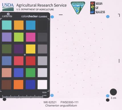 | | 2025 | | | | | | | Wild material | | 2192219 | W6 62521 |
| 13 | W6 62527 | FWS0300-130 | Solidago hispida Muhl. ex Willd. | Michigan, United States | W6 |  | | 2025 | | | | | | | Wild material | Received as: Solidago hispida | 2192225 | W6 62527 |
| 14 | W6 62528 | FWS0300-131 | Symphyotrichum urophyllum (Lindl.) G. L. Nesom | Michigan, United States | W6 | 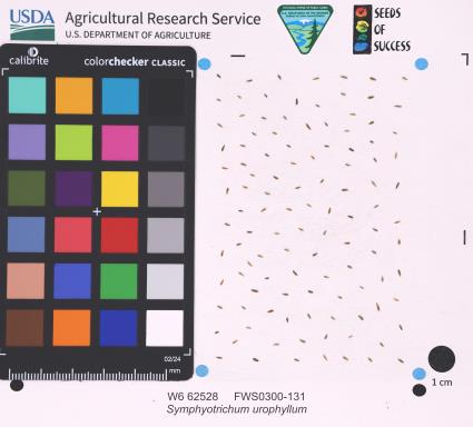 | | 2025 | | | | | | | Wild material | | 2192226 | W6 62528 |
| 15 | W6 62541 | FWS0300-65 | Coreopsis lanceolata L. | Michigan, United States | W6 |  | | 2025 | | | | | | | Wild material | Only scouted the part of the population on USFWS property | 2192239 | W6 62541 |
| 16 | W6 62542 | FWS0300-66 | Danthonia spicata (L.) P. Beauv. ex Roem. & Schult. | Michigan, United States | W6 |  | | 2025 | | | | | | | Wild material | | 2192240 | W6 62542 |
| 17 | W6 62543 | FWS0300-67 | Avenella flexuosa (L.) Parl. | Michigan, United States | W6 |  | | 2025 | | | | | | | Wild material | | 2192241 | W6 62543 |
| 18 | W6 62546 | FWS0300-97 | Schizachyrium scoparium (Michx.) Nash | Michigan, United States | W6 |  | | 2025 | | | | | | | Wild material | There is Solidago vossii in the area. | 2192244 | W6 62546 |
| 19 | W6 62547 | FWS0300-98 | Andropogon gerardi Vitman | Michigan, United States | W6 |  | | 2025 | | | | | | | Wild material | There is Solidago vossii in the area. | 2192245 | W6 62547 |
| 20 | W6 62548 | FWS0300-99 | Elymus canadensis L. | Michigan, United States | W6 |  | | 2025 | | | | | | | Wild material | | 2192246 | W6 62548 |
| 21 | W6 62555 | FWS0502-51 | Scirpus cyperinus (L.) Kunth | Pennsylvania, United States | W6 |  | | 2025 | | | | | | | Wild material | Clear cut forest | 2192253 | W6 62555 |
| 22 | W6 62556 | FWS0502-52 | Carex lupulina Muhl. ex Willd. | Pennsylvania, United States | W6 |  | | 2025 | | | | | | | Wild material | Logged forested wetland | 2192254 | W6 62556 |
| 23 | W6 62597 | TYT-3 | Achillea millefolium L. | California, United States | W6 |  | | 2025 | | | | | | | Wild material | Yarrow hidden amongst grasses and ferns. | 2192295 | W6 62597 |
| 24 | NA 89115 | TLM25-04a | Hamamelis ovalis S. W. Leonard | Texas, United States | NA | | | 2025 | COLLECTED | 07/10/2025 | State Highway 87 approximately 3.25 kilometers north of the crossroad junction with Texas Recreational Road 255 (RE 255); plants were growing in the narrow buffer woods along the east side of the highway. | 31.12051300, -93.72628100 | 138 | The habitat is an upland mixed coniferous and deciduous woodlands in part to full shade and dry conditions, often under drought stress. Plants seem to always occur on the top of dry ridges or well-drained slopes. Slope: 0 to 1 percent. Aspect: N/A. Soils: The soils of this collection area are classified as Tehran-Letney Association, hilly (TLE) soils. The Tehran Series (55%) consists of deep, somewhat excessively drained, moderately rapidly permeable soils on uplands. They formed in thick loamy and sandy sediments on the Western Coastal Plain. These soils are on gently sloping to moderately steep uplands with slopes ranging from 1 to 20 percent. The Letney Series (30%) consists of deep, well drained, moderately rapidly permeable, upland soils. They formed in thick sandy and loamy sediments of the coastal plains. These soils are on gently sloping to moderately steep uplands with slopes ranging from 1 to 20 percent. Soil pH ranges from 4.5 to 6.0. The minor soil components include Doucette Series (10%) and Boykin Series (5%) soils. (Source: California Soil Resource Lab/NRCS Official Soil Series Descriptions). Geology: The underlying geology of this area is of Oligocene origin and characterized as Catahoula Formation. This formation is extensive and deep in Texas, up to 185 meters thick. In the area of the collection the Catahoula Formation is primarily mudstone and sand. The upper 90-150 meters is mudstone that is tuffaceous, and sandy; also, occasionally, with some bentonitic clay. (Source: USGS Texas Geologic Map Data). | Wild material | | 2191654 | NA 89115 |
| 25 | NA 88582 | 2024RJLFL-013 | Cornus florida L. | Florida, United States | NA | | | 2024 | COLLECTED | 11/13/2024 | Woodland edge along the south side of Bud Bass Road (DOF B48), 0.30 kilometers east of the junction with Norman Riley Road. | 30.75753300, -86.80457600 | 39 | Mixed evergreen and deciduous forests in part shade in a mesic- to mesic-dry situation. Slope: 0 percent. Aspect: North. The underlying geology of this area is characterized as Citronelle Formation of the Pliocene period. The Citronelle Formation is widespread in the Gulf Coastal Plain. The type section for the Citronelle Formation, named by Matson (1916), is near Citronelle, Alabama. The Citronelle Formation grades laterally, through a broad facies transition, into the Miccosukee Formation of the eastern Florida panhandle. Coe (1979) investigated the Citronelle Formation in portions of the western Florida panhandle. The Citronelle Formation is a siliciclastic, deltaic deposit that is lithologically similar to, and time equivalent with, the Cypresshead Formation and, at least in part, the Long Key Formation (Cunningham et al., 1998) of the peninsula. In the western panhandle, some of the sediments mapped as Citronelle Formation may be reworked Citronelle. The lithologies are the same and there are few fossils present to document a possible younger age. The Citronelle Formation consists of gray to orange, often mottled, unconsolidated to poorly consolidated, very fine to very coarse, poorly sorted, clean to clayey sands. It contains significant amounts of clay, silt and gravel which may occur as beds and lenses and may vary considerably over short distances. Limonite nodules and limonite-cemented beds are common. Marine fossils are rare but fossil pollen, plant remains and occasional vertebrates are found. Much of the Citronelle Formation is highly permeable. It forms the Sand and Gravel Aquifer of the surficial aquifer system contain organics. The dominant fossils in the freshwater carbonates are mollusks. (Source: USGS Florida Geologic Map Data). The soils of this are characterized as Troup Series loamy sand, 0 to 5 percent slopes. The Troup series consists of very deep, somewhat excessively drained soils that formed in unconsolidated sandy and loamy marine sediments. Troup soils are on ridges and hillslopes. Slopes predominantly range from 0 to 15 percent but range to 45 percent. The soil pH is generally strongly acid. (Source: California Soil Resource Lab/NRCS Official Soil Series Descriptions). | Wild material | | 2169919 | NA 88582 |
| 26 | NA 88584 | 2024RJLFL-016 | Cornus florida L. | Florida, United States | NA | | | 2024 | COLLECTED | 11/14/2024 | Both sides of Kennedy Bridge Road approximately 0.27 kilometers west of the junction with Hurricane Lake South Entrance Road. | 30.93159700, -86.74928000 | 43 | Mesic to mesic-moist conditions in a mixed and deciduous evergreen forest in part shade. Slope: 5 to 10 percent. Aspect: Various. The underlying geology of this area is characterized as Citronelle Formation of the Pliocene period. The Citronelle Formation is widespread in the Gulf Coastal Plain. The type section for the Citronelle Formation, named by Matson (1916), is near Citronelle, Alabama. The Citronelle Formation grades laterally, through a broad facies transition, into the Miccosukee Formation of the eastern Florida panhandle. Coe (1979) investigated the Citronelle Formation in portions of the western Florida panhandle. The Citronelle Formation is a siliciclastic, deltaic deposit that is lithologically similar to, and time equivalent with, the Cypresshead Formation and, at least in part, the Long Key Formation (Cunningham et al., 1998) of the peninsula. In the western panhandle, some of the sediments mapped as Citronelle Formation may be reworked Citronelle. The lithologies are the same and there are few fossils present to document a possible younger age. The Citronelle Formation consists of gray to orange, often mottled, unconsolidated to poorly consolidated, very fine to very coarse, poorly sorted, clean to clayey sands. It contains significant amounts of clay, silt and gravel which may occur as beds and lenses and may vary considerably over short distances. Limonite nodules and limonite-cemented beds are common. Marine fossils are rare but fossil pollen, plant remains and occasional vertebrates are found. Much of the Citronelle Formation is highly permeable. It forms the Sand and Gravel Aquifer of the surficial aquifer system contain organics. The dominant fossils in the freshwater carbonates are mollusks. (Source: USGS Florida Geologic Map Data). The soils of this are characterized as Dothan Series loamy sand, 5 to 8 percent slopes. The Dothan Series consists of very deep, well drained soils that formed in thick beds of unconsolidated, medium to fine-textured marine sediments. Dothan soils are on interfluves. Slopes range from 0 to 15 percent. The surface 0-33 cm is characterized by sandy-loam, well-drained soils that are strongly acid. From 33-200 cm they are characterized by sandy clay loam soils that are more moisture retentive and strongly acid. (Source: California Soil Resource Lab/NRCS Official Soil Series Descriptions). | Wild material | | 2169921 | NA 88584 |
| 27 | NA 88586 | 2024RJLFL-020 | Vaccinium arboreum Marshall | Florida, United States | NA | | | 2024 | COLLECTED | 11/14/2024 | Woodland edge off of Ralf Laurant Road, above the wetland/headwaters of Danley Branch along the edge of a young longleaf pine plantation. | 30.90104300, -86.78878100 | 61 | Edge of a mixed evergreen and deciduous forest in part shade to full sun on a mesic to mesic-dry slope, adjacent to a young longleaf pine plantation. Slope: 3 to 8 percent. Aspect: West. The underlying geology of this area is characterized as Citronelle Formation of the Pliocene period. The Citronelle Formation is widespread in the Gulf Coastal Plain. The type section for the Citronelle Formation, named by Matson (1916), is near Citronelle, Alabama. The Citronelle Formation grades laterally, through a broad facies transition, into the Miccosukee Formation of the eastern Florida panhandle. Coe (1979) investigated the Citronelle Formation in portions of the western Florida panhandle. The Citronelle Formation is a siliciclastic, deltaic deposit that is lithologically similar to, and time equivalent with, the Cypresshead Formation and, at least in part, the Long Key Formation (Cunningham et al., 1998) of the peninsula. In the western panhandle, some of the sediments mapped as Citronelle Formation may be reworked Citronelle. The lithologies are the same and there are few fossils present to document a possible younger age. The Citronelle Formation consists of gray to orange, often mottled, unconsolidated to poorly consolidated, very fine to very coarse, poorly sorted, clean to clayey sands. It contains significant amounts of clay, silt and gravel which may occur as beds and lenses and may vary considerably over short distances. Limonite nodules and limonite-cemented beds are common. Marine fossils are rare but fossil pollen, plant remains and occasional vertebrates are found. Much of the Citronelle Formation is highly permeable. It forms the Sand and Gravel Aquifer of the surficial aquifer system. The dominant fossils in the freshwater carbonates are mollusks. (Source: USGS Florida Geologic Map Data). The surface soil profile is classified as Troup Series loamy sand, 5 to 8 percent slopes. The Troup series consists of very deep, somewhat excessively drained soils formed in unconsolidated sandy and loamy marine sediments. Troup soils are found on ridges and hillslopes. These soils are very strongly acid to strongly acid. (Source: California Soil Resource Lab/NRCS Official Soil Series Descriptions). | Wild material | | 2169923 | NA 88586 |
| 28 | NA 88593 | 2024RJLNJ-001 | Ilex glabra (L.) A. Gray | New Jersey, United States | NA | | | 2024 | COLLECTED | 11/24/2024 | Mullica Township: Both sides of Duerer Street, approximately 0.37 kilometers southeast of 4th Avenue. | 39.55885000, -74.66442500 | 21 | Shade to almost full sun on compacted seasonally moist to temporarily wet areas of a mixed evergreen and deciduous woodland dominated by Pinus rigida. Vegetation of this area is very much defined by small changes in elevation that go from wet to very dry. Ilex glabra remains abundant throughout, though. Slope: N/A. Aspect: N/A. The underlying geology of this area is the Cohansey Formation of middle Miocene origin and comprised of sand, white to yellow with local gravel and clay. It is sometimes locally stained red or orange brown by iron oxides and (or) cemented into large blocks of ironstone. Unweathered clay is typically dark gray, but commonly weathers white where it is interbedded with thin beds of ironstone. Sand is typically medium grained and moderately sorted although it ranges from fine to very coarse grained and from poorly to well sorted. Sand consists of quartz and siliceous rock fragments. Some beds are locally micaceous. Maximum thickness in the map area is about 60 meters; however, thickness is difficult to determine because of the irregular basal contact and extensive post-depositional erosion. (Source: USGS New Jersey Geologic Map Data). The primary soil type in the area of this collection is classified as Mullica Series sandy loam, 0 to 2 percent slopes. These soils are typically coarse-loamy, siliceous, semiactive, and mesic typic humaquepts that are strongly to extremely acidic throughout the profile. The typical solum thickness ranges from 50-150+ cm. These soils are generally considered to be poorly drained. (Source: NRCS Web Soil Survey). | Wild material | | 2169930 | NA 88593 |
| 29 | NA 88731 | RonMiller2022-Old Land Place | Gordonia lasianthus (L.) J. Ellis | Florida, United States | NA | | | 2024 | COLLECTED | 04/2022 | Yellow River Marsh State Aquatic Preserve, "Old Land Place" along Weaver River, 1.47 miles south of the confluence with the Yellow River. | 30.55318000, -87.93656000 | 3 | Moist to wet areas in wetland adjacent to the river in association with a range of evergreen and deciduous forest elements. | Wild material | From open-pollinated, but presumed isolated, seeds of NA 87342-H, -J, and -L (three young plants flowering in containers in production during 2024). Seed was harvested over a period roughly from October through December 2024 as fruits matured. From the record of the parent accession, NA 87342: Exact date of collection unknown. | 2170992 | NA 88731 |
| 30 | W6 61971 | OR930A-10 | Chamaenerion angustifolium (L.) Scop. subsp. angustifolium | Oregon, United States | W6 |  | | 2024 | | | | | | | Wild material | They are found in dry to moist disturbed areas Its leaves are lance shaped with rose to purple sepals and petals | 2168424 | W6 61971 |
| 31 | W6 61974 | OR930A-15 | Chamaenerion angustifolium (L.) Scop. subsp. angustifolium | Oregon, United States | W6 |  | | 2024 | | | | | | | Wild material | Flowers pink purple 4 lobed stigma 8 stamens | 2168375 | W6 61974 |
| 32 | W6 61975 | OR930A-16 | Prunella vulgaris L. | Oregon, United States | W6 |  | | 2024 | | | | | | | Wild material | Flowers in bracteate terminal spike corolla purple | 2168427 | W6 61975 |
| 33 | W6 61976 | OR930A-17 | Chamaenerion angustifolium (L.) Scop. subsp. angustifolium | Oregon, United States | W6 |  | | 2024 | | | | | | | Wild material | Flowers pink purple 4 lobed stigma 8 stamens | 2168428 | W6 61976 |
| 34 | W6 61977 | OR930A-19 | Chamaenerion angustifolium (L.) Scop. subsp. angustifolium | Oregon, United States | W6 |  | | 2024 | | | | | | | Wild material | Flowers pink purple 4 lobed stigma 8 stamens | 2168376 | W6 61977 |
| 35 | W6 61978 | OR930A-20 | Prunella vulgaris L. | Oregon, United States | W6 |  | | 2024 | | | | | | | Wild material | Flowers in bracteate terminal spikes corolla purple | 2168377 | W6 61978 |
| 36 | W6 61979 | OR930A-21 | Vaccinium parvifolium Sm. | Oregon, United States | W6 |  | | 2024 | | | | | | | Wild material | Multi stemmed shrub current season twigs green | 2168378 | W6 61979 |
| 37 | NA 88827 | RJL-RM2023FLAL-001 | Ilex ambigua Torr. | Florida, United States | NA | | | 2023 | COLLECTED | 12/05/2023 | Yellow River Wildlife Management Area, along DOF [Department of Forestry] Y9 dirt road 0.08 kilometers east of Miller Bluff Road. | 30.65289100, -86.87602800 | 44 | Growing in part shade to sun in very dry, highly competitive site still recovering from the logging of pines in the past decade. This young woodland is comprised of a combination of evergreen and deciduous species competing for available resources and light before the young sand pines begin to dominate the upper canopy. Slope: 0 percent. Aspect: N/A. The underlying geology of this area is the Citronelle Formation, of Pliocene origin, and consists of gray to orange, often mottled, unconsolidated to poorly consolidated, very fine to very coarse, poorly sorted, clean to clayey sands. It contains significant amounts of clay, silt and gravel which may occur as beds and lenses and may vary considerably over short distances. Limonite nodules and limonite-cemented beds are common. (Source: USGS Florida Geologic Map Data.) The primary soil type in the collection area is classified as Lakeland Sand soils (0 to 5 percent slopes). The surface soil profile of this area is primarily the Lakeland series which consists of very deep, excessively drained, rapid to very rapidly permeable soils on uplands. They formed in thick beds of eolian or marine and/or fluvio-marine sands. Thickness of the sand exceeds 2 meters. Silt plus clay in the upper meter ranges from 5-10 percent. Reaction ranges from very strongly acid to moderately acid throughout. (Source: NRCS Web Soil Survey.) | Wild material | | 2165657 | NA 88827 |
| 38 | NA 88828 | RJL-RM2023FLAL-002 | Vaccinium arboreum Marshall | Florida, United States | NA | | | 2023 | COLLECTED | 12/05/2023 | Yellow River Wildlife Management Area, along DOF [Department of Forestry] Y9 dirt road 0.08 kilometers east of Miller Bluff Road. | 30.65289100, -86.87608500 | 44 | Growing in part shade to sun in very dry, highly competitive site still recovering from the logging of pines in the past decade. This young woodland is comprised of a combination of evergreen and deciduous species competing for available resources and light before the young sand pines begin to dominate the upper canopy. Slope: 0 percent. Aspect: N/A. The underlying geology of this area is the Citronelle Formation, of Pliocene origin, and consists of gray to orange, often mottled, unconsolidated to poorly consolidated, very fine to very coarse, poorly sorted, clean to clayey sands. It contains significant amounts of clay, silt and gravel which may occur as beds and lenses and may vary considerably over short distances. Limonite nodules and limonite-cemented beds are common. (Source: USGS Florida Geologic Map Data.) The primary soil type in the collection area is classified as Lakeland Sand soils (0 to 5 percent slopes). The surface soil profile of this area is primarily the Lakeland series which consists of very deep, excessively drained, rapid to very rapidly permeable soils on uplands. They formed in thick beds of eolian or marine and/or fluvio-marine sands. Thickness of the sand exceeds 2 meters. Silt plus clay in the upper meter ranges from 5-10 percent. Reaction ranges from very strongly acid to moderately acid throughout. (Source: NRCS Web Soil Survey.) | Wild material | | 2165658 | NA 88828 |
| 39 | NA 88829 | RJL-RM2023FLAL-003 | Oxydendrum arboreum (L.) DC. | Florida, United States | NA | | | 2023 | COLLECTED | 12/05/2023 | Yellow River Wildlife Management Area, along DOF [Department of Forestry] Y15 dirt road 0.06 kilometers north of Fisher Old Mill Road. | 30.62728600, -86.83824600 | 7 | Growing in part shade to sun in moist to wet flat woods of the longleaf pine forest. The woodland is comprised mostly of open habitat of longleaf pine and an understory tree and shrub layer of evergreen and deciduous species. There is also a wealth of herbaceous species in moist to wet conditions of the habitat where there is rich organic matter in the surface layer. Slope: 0 percent. Aspect: N/A. The underlying geology of this area is classified as Alluvium, of Pleistocene/Holocene origin and consists of undifferentiated Quaternary sediments of varying thickness including siliciclastics, organics and freshwater carbonates. The siliciclastics are light gray, tan, brown to black, unconsolidated to poorly consolidated, clean to clayey, silty, unfossiliferous, variably organic-bearing sands to blue green to olive green, poorly to moderately consolidated, sandy, silty clays. Organics occur as plant debris, roots, disseminated organic matrix and beds of peat. Freshwater carbonates, often referred to as marls in the literature, are scattered. (Source: USGS Florida Geologic Map Data.) The primary soil types in the collection area are classified as Pactolus Loamy Sand soils (0 to 5 percent slopes). The Pactolus Series consists of very deep, moderately well to somewhat poorly drained soils. Permeability is rapid. These Coastal Plain soils, typically found with streams and marine terraces and were formed by loamy and sandy fluvial sediments and marine sediments. The strata is, generally, uniformly loamy sand that is very friable and strongly acid from the surface to a depth of 1.8 meters. (Source: NRCS Web Soil Survey.) | Wild material | | 2165659 | NA 88829 |
| 40 | NA 88834 | RJL-RM2023FLAL-008 | Rhododendron canescens (Michx.) Sweet | Florida, United States | NA | | | 2023 | COLLECTED | 12/06/2023 | Blackwater State Forest: plants are growing in wetlands accessed by foot from Buddy Hardy Road. The collection site is approximately 0.14 kilometers west and downhill from the road. | 30.80736700, -86.95784700 | 53 | Growing in shade to part-shade of the well-drained moist mesic habitat about 1 m above the wetland which appears to be formed by a nearby hillside seepage area. In this zone there are numerous facultative wetland species as well as high competition from facultative upland plants. Slope: 5 to 10 percent. Aspect: Variable. The underlying geology of this area is the Citronelle Formation of Pliocene origin and consists of gray to orange, often mottled, unconsolidated to poorly consolidated, very fine to very coarse, poorly sorted, clean to clayey sands. It contains significant amounts of clay, silt and gravel which may occur as beds and lenses and may vary considerably over short distances. Limonite nodules and limonite-cemented beds are common. (Source: USGS Florida Geologic Map Data.) The Troup Series (5 to 8% slopes) consists of very deep, somewhat excessively drained soil formed in unconsolidated sandy and loamy marine sediments. Troup soils are on ridges and hillslopes. The upper 0-13 cm is comprised primarily of decomposing sphagnum peat with a significant amount of fibrous root content. From 15-112 cm the soil is comprised primarily of fine-grained yellowish-brown sand with varying amounts of root content; this zone is strongly acid. From 112-203 cm the soil is comprised of light-red to red sandy clay loam that is discontinuous, generally friable, and strongly acid. (Source: NRCS Web Soil Survey.) | Wild material | | 2165664 | NA 88834 |
| 41 | NA 88835 | RJL-RM2023FLAL-009 | Rhododendron viscosum (L.) Torr. | Florida, United States | NA | | | 2023 | COLLECTED | 12/06/2023 | Blackwater State Forest: plants are growing in wetlands accessed by foot from Buddy Hardy Road. The collection site is approximately 0.14 kilometers west and downhill from the road. | 30.80841000, -86.96283300 | 43 | Growing in part-shade of the well-drained moist-dry mesic habitat about 2-3 m above the wetland. In this zone there are numerous facultative wetland species as well as high competition from facultative upland plants. Slope: 5 to 10 percent. Aspect: Variable. The underlying geology of this area is the Citronelle Formation of Pliocene origin and consists of gray to orange, often mottled, unconsolidated to poorly consolidated, very fine to very coarse, poorly sorted, clean to clayey sands. It contains significant amounts of clay, silt and gravel which may occur as beds and lenses and may vary considerably over short distances. Limonite nodules and limonite-cemented beds are common. (Source: USGS Florida Geologic Map Data.) The Troup Series (5 to 8% slopes) consists of very deep, somewhat excessively drained soil formed in unconsolidated sandy and loamy marine sediments. Troup soils are on ridges and hillslopes. The upper 0-13 cm is comprised primarily of decomposing sphagnum peat with a significant amount of fibrous root content. From 15-112 cm the soil is comprised primarily of fine-grained yellowish-brown sand with varying amounts of root content; this zone is strongly acid. From 112-203 cm the soil is comprised of light-red to red sandy clay loam that is discontinuous, generally friable, and strongly acid. (Source: NRCS Web Soil Survey.) | Wild material | | 2165665 | NA 88835 |
| 42 | NA 88840 | RJL-RM2023FLAL-014 | Rhododendron viscosum (L.) Torr. | Florida, United States | NA | | | 2023 | COLLECTED | 12/11/2023 | Property of Floyd Griffith off View Drive on the southwest side of McCormick Lake. | 30.63247000, -85.33718200 | 56 | Plants are growing primarily in part shade a few meters above the lake, generally in areas that appear dry, but clearly are associated with hillside seeps. While much of the area has been cultivated, the remnant native flora are largely broadleaved evergreen shrub and deciduous shrub and tree species. Slope: 10 to 15 percent. Aspect: Northeast. The underlying geology of this area is the Citronelle Formation of Pliocene origin and consists of gray to orange, often mottled, unconsolidated to poorly consolidated, very fine to very coarse, poorly sorted, clean to clayey sands. It contains significant amounts of clay, silt and gravel which may occur as beds and lenses and may vary considerably over short distances. Limonite nodules and limonite-cemented beds are common. (Source: USGS Florida Geologic Map Data.) The surface soil profile of this area is primarily Pamlico-Pantego-Rutlege Association. The Pamlico series consists of very poorly drained soils that formed in decomposed organic material underlain by dominantly sandy sediment. The soils are on nearly level flood plains, bays, and depressions of the Coastal Plain. Slopes are less than 1 percent. Pamlico soils have 0.4-1.3 meters of organic material over dominantly sandy sediments. Reaction is extremely in the organic layers and ranges from extremely acid to strongly acid in the underlying mineral layers. The Pantego series consists of very deep, very poorly drained, moderately permeable soils that formed in thick loamy sediments on the Southern Coastal Plain and Atlantic Coast Flatwoods. Slopes are less than 2 percent. This soil is strongly acid. The Rutlege series comprises very deep, very poorly drained persistently wet soils on flats, depressions and floodplains where shallow ponding is common. They are of marine or fluvial sediment origin. Thickness of these loamy sandy soils is greater than 1.5 meters and a reaction from extremely acid to strongly acid. (Source: NRCS Web Soil Survey.) | Wild material | | 2165670 | NA 88840 |
| 43 | NA 88844 | RJL-RM2023FLAL-018 | Clethra alnifolia L. | Florida, United States | NA | | | 2023 | COLLECTED | 12/13/2023 | Yellow River Water Management Area, accessed off of Old River Road by vehicle on an unmaintained sand road for approximately 1.68 kilometers. Upon reaching the destination, plants are accessed by foot along unmaintained trail to the east. | 30.83495500, -86.62005400 | 27 | Plants are growing primarily in part shade as understory shrubs in mixed evergreen and deciduous, moist to wet, acidic woodlands. Plants form large colonies and appear to have been subjected to prescribed fire in recent years. Slope: 10 to 15 percent. Aspect: Northeast. The underlying geology of this area is the Citronelle Formation of Pliocene origin and consists of gray to orange, often mottled, unconsolidated to poorly consolidated, very fine to very coarse, poorly sorted, clean to clayey sands. It contains significant amounts of clay, silt and gravel which may occur as beds and lenses and may vary considerably over short distances. Limonite nodules and limonite-cemented beds are common. (Source: USGS Florida Geologic Map Data.) The soil profile for this area is classified as the Bonifay Soil Series. Bonifay soil consists of very deep, well drained, moderately slowly permeable soils on ridges and side slopes in the Southern Coastal Plain. They formed in thick beds of sandy and loamy marine sediments. Solum thickness ranges from 1.5-2.0 m. Soil reaction ranges from very strongly acid to moderately acid throughout, except where the surface has been limed. Ironstone pebbles, 2 to 15 mm in size, range from 0 to 5 percent, by volume. Depth to the plinthic horizon ranges from 1.1-1.7 m. Some horizons contain up to 25 percent plinthite by volume. (Source: NRCS Web Soil Survey.) | Wild material | | 2165674 | NA 88844 |
| 44 | NA 88689 | RJL2023NJ-002 | Kalmia latifolia L. | New Jersey, United States | NA | | | 2023 | COLLECTED | 11/10/2023 | Franklin Township: Piney Hollow Preservation Area (the site is owned by Franklin Township). Plants accessed by foot along trails throughout property. | 39.57400900, -74.93602400 | 32 | Plants growing in shade to part-shade of a mesic to mesic-dry woodland habitat that is mostly deciduous, but also includes pine overstory. Slope: N/A. Aspect: N/A. Soils: The underlying geology of this area is of Middle Miocene, Serravallian origin and characterized as an Cohansey Formation. It is comprised of sand, white to yellow with local gravel and clay. Locally stained red or orange brown by iron oxides and (or) cemented into large blocks of ironstone. Unweathered clay is typically dark gray, but commonly weathers white where interbedded with thin beds of ironstone. Unit is a complex of interfingering marine and nonmarine facies. Sand is typically medium grained and moderately sorted although it ranges from fine to very coarse grained and from poorly to well sorted. Sand consists of quartz and siliceous rock fragments. Some beds are locally micaceous. In general, the sand is crossbedded, although the style of crossbedding varies significantly with the paleoenvironment. Trough crossbedding predominates, especially in the nonmarine channel fill deposits, and the scale of the crossbeds varies from small to large. Maximum thickness in the map area is about 60 m; however, thickness is difficult to determine because of the irregular basal contact and extensive post-depositional erosion. There is as much as 18 m of relief along the basal contact. The basal contact is sharp, undulatory, and directly overlain by a thin gravel bed. The Cohansey Formation unconformably overlies the Kirkwood Formation and is found in channels cut down into the Kirkwood. Where the Kirkwood consists of sandy, light-colored sediments, the basal contact of the Cohansey is drawn below crossbedded sediments. Where the Kirkwood consists of dark-colored silty beds, the basal contact is drawn between light-colored Cohansey sediments and the underlying dark-colored sediments. The Cohansey was markedly thinned because of erosion prior to deposition of overlying units in the western and southern parts of the southern sheet. The unit has been extensively eroded and stripped from large areas of the New Jersey Coastal Plain, particularly in the central sheet where outliers are common. In spite of its widespread nature, the Cohansey is poorly exposed because of its loose sandy composition, which causes it to erode easily. (Source: USGS New Jersey Geologic Map Data.) The primary soil type in the location of this collection is classified as Downer loamy sand, 0 to 5 percent slopes, Northern Coastal Plain. Downer Series soils are very deep, well-drained soils that are coarse-loamy, siliceous, semiactive, mesic Typic Hapludults. The upper strata of Downer Series from 0 to 25 cm is dark grayish brown, brown loamy sand that is dry with weak fine granular structure. It is very friable and strongly acid. Lower strata from 25 to 76 cm are yellowish brown single grain, loose loamy sand with few extremely weakly cemented masses of oxidized iron in the lower part. This layer is very strongly acid. (Source: NRCS Web Soil Survey.) | Wild material | | 2159117 | NA 88689 |
| 45 | NA 88693 | RJL2023NJ-006 | Clethra alnifolia L. | New Jersey, United States | NA | | | 2023 | COLLECTED | 11/10/2023 | Franklin Township: Piney Hollow Preservation Area (the site is owned by Franklin Township). Plants accessed by foot along trails throughout property. | 39.57319800, -74.92908900 | 29 | Plants growing in shade to part-shade over a wide range of habitats from mesic to mesic-dry as well as moist to wetland habitats. The woodlands are mostly deciduous, but also include occasional pine overstory. Slope: N/A. Aspect: N/A. The underlying geology of this area is of Middle Miocene, Serravallian origin and characterized as an Cohansey Formation. It is comprised of sand, white to yellow with local gravel and clay. Locally stained red or orange brown by iron oxides and (or) cemented into large blocks of ironstone. Unweathered clay is typically dark gray, but commonly weathers white where interbedded with thin beds of ironstone. Unit is a complex of interfingering marine and nonmarine facies. Sand is typically medium grained and moderately sorted although it ranges from fine to very coarse grained and from poorly to well sorted. Sand consists of quartz and siliceous rock fragments. Some beds are locally micaceous. In general, the sand is crossbedded, although the style of crossbedding varies significantly with the paleoenvironment. Trough crossbedding predominates, especially in the nonmarine channel fill deposits, and the scale of the crossbeds varies from small to large. Maximum thickness in the map area is about 60 m; however, thickness is difficult to determine because of the irregular basal contact and extensive post-depositional erosion. There is as much as 18 m of relief along the basal contact. The basal contact is sharp, undulatory, and directly overlain by a thin gravel bed. The Cohansey Formation unconformably overlies the Kirkwood Formation and is found in channels cut down into the Kirkwood. Where the Kirkwood consists of sandy, light-colored sediments, the basal contact of the Cohansey is drawn below crossbedded sediments. Where the Kirkwood consists of dark-colored silty beds, the basal contact is drawn between light-colored Cohansey sediments and the underlying dark-colored sediments. The Cohansey was markedly thinned because of erosion prior to deposition of overlying units in the western and southern parts of the southern sheet. The unit has been extensively eroded and stripped from large areas of the New Jersey Coastal Plain, particularly in the central sheet where outliers are common. In spite of its widespread nature, the Cohansey is poorly exposed because of its loose sandy composition, which causes it to erode easily. (Source: USGS New Jersey Geologic Map Data.) The primary soil types in the area of this collection is classified as Atsion sand, 0 to 2 percent slopes, Northern Tidewater Area and Downer loamy sand, 0 to 5 percent slopes, Northern Coastal Plain. Atsion Series soils are very deep, poorly drained with moderate to rapid permeability above 70 cm and slower beneath. They are classified as sandy, siliceous, mesic Aeric Alaquods. The upper stratum from 0 to 25 cm is dark gray sand, dry, single grained and lose with many fine roots. It is extremely acid. Lower strata are light gray to dark brown with small percentages of rounded quartzose pebbles and are extremely acid. Downer Series soils are very deep, well-drained soils that are coarse-loamy, siliceous, semiactive, mesic Typic Hapludults. The upper stratum of Downer Series from 0 to 25 cm is dark grayish brown, brown loamy sand that is dry with weak fine granular structure. It is very friable and strongly acid. Lower strata from 25 to 76 cm are yellowish brown single grain, loose loamy sand with few extremely weakly cemented masses of oxidized iron in the lower part. This layer is very strongly acid. (Source: NRCS Web Soil Survey.) | Wild material | | 2159121 | NA 88693 |
| 46 | NA 88698 | RJL2023NCSC-003 | Ilex laevigata (Pursh) A. Gray | North Carolina, United States | NA | | | 2023 | COLLECTED | 11/13/2023 | Sandhills Game Land: north side of Pulpwood Road approximately 0.11 km southwest of the junction with Tyner Road. | 34.95939500, -79.48676300 | 114 | Plants growing in shade to part-shade of a spring fed wetland that is a mixed evergreen and deciduous woodland habitat. Slope: 3 to 10 percent. Aspect: Northeast. The underlying geology of this area is of Tertiary origin and characterized as Pinehurst Formation. It is comprised of sand that is medium- to coarse-grained, cross-bedding and rhythmic bands of clayey sand common, unconsolidated. (Source: USGS North Carolina Geologic Map Data.) The primary soil type in the area of this collection is classified as Pelion loamy sand, 6 to 10 percent slopes. Pelion Series soils are very deep, moderately well-drained soils with moderately slow to slow permeability. The upper 30 cm of the strata is sandy loam to sandy clay loam ranging from grayish brown to reddish yellow. This stratum has a weak fine granular structure and is very friable. It contains many fine roots and is moderately acid. Deeper strata to 2 m range from yellow to yellowish red sandy clay, often with masses of oxidized iron and few fine prominent light gray iron depletions; they are strongly acid. (Source: NRCS Web Soil Survey.) | Wild material | | 2159126 | NA 88698 |
| 47 | NA 88699 | RJL2023NCSC-004 | Lyonia ligustrina (L.) DC. | North Carolina, United States | NA | | | 2023 | COLLECTED | 11/13/2023 | Sandhills Game Land: north side of Pulpwood Road approximately 0.11 km southwest of the junction with Tyner Road. | 34.95949000, -79.48665600 | 107 | Plants growing in part-shade to sun on the moist margins of a spring fed wetland that is a mixed evergreen and deciduous woodland habitat. The underlying soils are moist even during dry periods due to seepage from the wetland. Slope: 3 to 10 percent. Aspect: Northeast. The underlying geology of this area is of Tertiary origin and characterized as Pinehurst Formation. It is comprised of sand that is medium- to coarse-grained, cross-bedding and rhythmic bands of clayey sand common, unconsolidated. (Source: USGS North Carolina Geologic Map Data.) The primary soil type in the area of this collection is classified as Pelion loamy sand, 6 to 10 percent slopes. Pelion Series soils are very deep, moderately well-drained soils with moderately slow to slow permeability. The upper 30 cm of the strata is sandy loam to sandy clay loam ranging from grayish brown to reddish yellow. This stratum has a weak fine granular structure and is very friable. It contains many fine roots and is moderately acid. Deeper strata to 2 m range from yellow to yellowish red sandy clay, often with masses of oxidized iron and few fine prominent light gray iron depletions; they are strongly acid. (Source: NRCS Web Soil Survey.) | Wild material | | 2159127 | NA 88699 |
| 48 | NA 88700 | RJL2023NCSC-005 | Clethra alnifolia L. | North Carolina, United States | NA | | | 2023 | COLLECTED | 11/13/2023 | Sandhills Game Land: north side of Pulpwood Road approximately 0.11 km southwest of the junction with Tyner Road. | 34.96008500, -79.48751100 | 108 | Plants growing in shade to part-shade as well as sun (when moisture is abundant) of a spring fed wetland that is comprised of a mixed evergreen and deciduous woodland habitat. Slope: 3 to 10 percent. Aspect: Various. : The underlying geology of this area is of Cretaceous origin and characterized as Middendorf Formation. It is characterized by sand, sandstone, and mudstone, gray to pale gray with an orange cast, mottled; clay balls and iron-cemented concretions common, beds laterally discontinuous, cross-bedding common. (Source: USGS North Carolina Geologic Map Data.) The primary soil type in the area of this collection is classified as Pelion loamy sand, 6 to 10 percent slopes. Pelion Series soils are very deep, moderately well-drained soils with moderately slow to slow permeability. The upper 30 cm of the strata is sandy loam to sandy clay loam ranging from grayish brown to reddish yellow. This stratum has a weak fine granular structure and is very friable. It contains many fine roots and is moderately acid. Deeper strata to 2 m range from yellow to yellowish red sandy clay, often with masses of oxidized iron and few fine prominent light gray iron depletions; they are strongly acid. (Source: NRCS Web Soil Survey.) | Wild material | | 2159128 | NA 88700 |
| 49 | NA 88701 | RJL2023NCSC-006 | Zenobia pulverulenta (W. Bartram ex Willd.) Pollard | North Carolina, United States | NA | | | 2023 | COLLECTED | 11/13/2023 | Sandhills Game Land: north side of Pulpwood Road approximately 0.11 km southwest of the junction with Tyner Road. | 34.96066900, -79.48735300 | 111 | Plants growing in moist-mesic to seasonally saturated soils in part-shade of a spring fed wetland that is a mixed evergreen and deciduous woodland habitat. Slope: 0 to 5 percent. Aspect: Northeast. The underlying geology of this area is of Tertiary origin and characterized as Pinehurst Formation. It is comprised of sand that is medium- to coarse-grained, cross-bedding and rhythmic bands of clayey sand common, unconsolidated. (Source: USGS North Carolina Geologic Map Data.) The primary soil type in the area of this collection is classified as Pelion loamy sand, 6 to 10 percent slopes. Pelion Series soils are very deep, moderately well-drained soils with moderately slow to slow permeability. The upper 30 cm of the strata is sandy loam to sandy clay loam ranging from grayish brown to reddish yellow. This stratum has a weak fine granular structure and is very friable. It contains many fine roots and is moderately acid. Deeper strata to 2 m range from yellow to yellowish red sandy clay, often with masses of oxidized iron and few fine prominent light gray iron depletions; they are strongly acid. (Source: NRCS Web Soil Survey.) | Wild material | | 2159129 | NA 88701 |
| 50 | NA 88702 | RJL2023NCSC-007 | Rhododendron viscosum (L.) Torr. | North Carolina, United States | NA | | | 2023 | COLLECTED | 11/13/2023 | Sandhills Game Land: north side of Pulpwood Road approximately 0.11 km southwest of the junction with Tyner Road. | 34.96080300, -79.48730200 | 113 | Plants growing in moist-mesic to seasonally saturated soils in shade to part-shade of a spring fed wetland that is a mixed evergreen and deciduous woodland habitat. Prescribed fires have burned a portion of the wetland edge where plants are resprouting vigorously. Slope: 0 to 5 percent. Aspect: Norhteast. The underlying geology of this area is of Tertiary origin and characterized as Pinehurst Formation. It is comprised of sand that is medium- to coarse-grained, cross-bedding and rhythmic bands of clayey sand common, unconsolidated. (Source: USGS North Carolina Geologic Map Data.) The primary soil type in the area of this collection is classified as Pelion loamy sand, 6 to 10 percent slopes. Pelion Series soils are very deep, moderately well-drained soils with moderately slow to slow permeability. The upper 30 cm of the strata is sandy loam to sandy clay loam ranging from grayish brown to reddish yellow. This stratum has a weak fine granular structure and is very friable. It contains many fine roots and is moderately acid. Deeper strata to 2 m range from yellow to yellowish red sandy clay, often with masses of oxidized iron and few fine prominent light gray iron depletions; they are strongly acid. (Source: NRCS Web Soil Survey.) | Wild material | | 2159130 | NA 88702 |
| 51 | NA 88703 | RJL2023NCSC-008 | Lyonia lucida (Lam.) K. Koch | North Carolina, United States | NA | | | 2023 | COLLECTED | 11/13/2023 | Sandhills Game Land: north side of Pulpwood Road approximately 0.11 km southwest of the junction with Tyner Road. | 34.95848900, -79.48618700 | 101 | Plants growing in moist-mesic to seasonally saturated soils in shade to part-shade of a spring fed wetland that is a mixed evergreen and deciduous woodland habitat. Slope: 0 to 5 percent. Aspect: Various. The underlying geology of this area is of Tertiary origin and characterized as Pinehurst Formation. It is comprised of sand that is medium- to coarse-grained, cross-bedding and rhythmic bands of clayey sand common, unconsolidated. (Source: USGS North Carolina Geologic Map Data.) The primary soil type in the area of this collection is classified as Pelion loamy sand, 6 to 10 percent slopes. Pelion Series soils are very deep, moderately well-drained soils with moderately slow to slow permeability. The upper 30 cm of the strata is sandy loam to sandy clay loam ranging from grayish brown to reddish yellow. This stratum has a weak fine granular structure and is very friable. It contains many fine roots and is moderately acid. Deeper strata to 2 m range from yellow to yellowish red sandy clay, often with masses of oxidized iron and few fine prominent light gray iron depletions; they are strongly acid. (Source: NRCS Web Soil Survey.) | Wild material | | 2159131 | NA 88703 |
| 52 | NA 88704 | RJL2023NCSC-009 | Rhododendron viscosum (L.) Torr. | North Carolina, United States | NA | | | 2023 | COLLECTED | 11/13/2023 | Sandhills Game Land: wetlands and moist depressions along Hoffman Road, Scotland County Road 1328, | 34.95510000, -79.51769700 | 112 | Plants are growing in sun in an acidic wetland habitat rich in sphagnum and other wetland species. The habitat is moist to wet year-round and periodically has surface runoff occurring; even so, this habitat can become quite dry during seasonal periods without rainfall. Slope: 2 to 3 percent. Aspect: Northeast. The underlying geology of this area is of Tertiary origin and characterized as Pinehurst Formation. It is comprised of medium- to coarse-grained sand as well as cross-bedding and rhythmic bands of clayey sand that are unconsolidated. (Source: USGS North Carolina Geologic Map Data.) The primary soil type in the collection area is classified as Pelion Loamy Sand (2 to 6 percent slopes). The Pelion Loamy Sand series consists of very deep, moderately well-drained marine deposits, fluviomarine deposits, and sand sheets. Permeability is moderately slow or slow. Surface layers 0-25 cm deep are comprised of loamy sand with a weak fine granular structure and are very friable. Deeper horizons are comprised of sandy loam, sandy clay loam, or clay loam in the upper part and includes sandy clay or clay in the deepest part. Soils are extremely acid to strongly acid. (Source: NRCS Web Soil Survey.) | Wild material | | 2159132 | NA 88704 |
| 53 | NA 88705 | RJL2023NCSC-010 | Zenobia pulverulenta (W. Bartram ex Willd.) Pollard | North Carolina, United States | NA | | | 2023 | COLLECTED | 11/13/2023 | Sandhills Game Land: wetlands and moist depressions along Hoffman Road, Scotland County Road 1328, | 34.95510000, -79.51769700 | 112 | Plants are growing in part-shade to sun in an acidic wetland habitat rich in sphagnum and other obligate wetland species. The habitat is moist to wet year-round and periodically has surface runoff occurring; even so, this habitat can become quite dry during seasonal periods without rainfall. Slope: 2 to 3 percent. Aspect: Northeast. The underlying geology of this area is of Tertiary origin and characterized as Pinehurst Formation. It is comprised of medium- to coarse-grained sand as well as cross-bedding and rhythmic bands of clayey sand that are unconsolidated. (Source: USGS North Carolina Geologic Map Data.) The primary soil type in the collection area is classified as Pelion Loamy Sand (2 to 6 percent slopes). The Pelion Loamy Sand series consists of very deep, moderately well-drained marine deposits, fluviomarine deposits, and sand sheets. Permeability is moderately slow or slow. Surface layers 0-25 cm deep are comprised of loamy sand with a weak fine granular structure and are very friable. Deeper horizons are comprised of sandy loam, sandy clay loam, or clay loam in the upper part and includes sandy clay or clay in the deepest part. Soils are extremely acid to strongly acid. (Source: NRCS Web Soil Survey.) | Wild material | | 2159133 | NA 88705 |
| 54 | NA 88709 | RJL2023NCSC-014 | Rhododendron minus Michx. | South Carolina, United States | NA | | | 2023 | COLLECTED | 11/13/2023 | Northwest side of the junction of Wire Road and Prichard Horse Road. | 34.49925200, -80.27470600 | 146 | Plants growing in shade to part-shade of dry steep slope woodland habitat that is primarily composed of Pinus palustris. Slope: 2 to 20 percent. Aspect: North. The underlying geology of this area is of Cretaceous origin and characterized as Peedee Formation - Black Creek Group, undivided. The Peedee Formation is primarily unconsolidated, coarse-detrital, sand that is dark-green or gray, finely micaceous, more or less glauconitic and argillitic sand, many layers of which are calcareous (impure limestone). Irregular concretionary masses of impure calcium carbonate occur in places. Dark marine clays are interstratified with sand. The Black Creek Group consists of irregularly bedded, laminated, carbonaceous clays and thin laminae and lenses of sand; lignite and pyrite present; glauconitic in places; massive interbedded layers of glauconitic sand present toward top of unit. Light-colored clays and coarse arkosic sands also found. (Source: USGS South Carolina Geologic Map Data.) The primary soil type in the collection area is classified as Ailey Series sand, moderately wet, 2 to 6 percent slopes. The Ailey Series consists of moderately deep or deep to fragic soil properties and deep or very deep to densic materials. This soil is well drained or somewhat excessively drained. The upper layer (0-12.5 cm) of this soil is dark grayish brown loamy sand that is frequently dry. It has a weak fine granular structure, is very friable, non-sticky, non-plastic, and is strongly acid. The lower strata soils (12.5-90 cm) are yellowish brown loamy sand, with weak fine granular structure, very friable, non-sticky, non-plastic, and moderately acid. Deeper depths (below 90 cm) are characterized by slightly greater clay content that is slightly more plastic and strongly acid. (Source: NRCS Web Soil Survey.) | Wild material | | 2159137 | NA 88709 |
| 55 | NA 88715 | RJL2023NCSC-020 | Zenobia pulverulenta (W. Bartram ex Willd.) Pollard | South Carolina, United States | NA | | | 2023 | COLLECTED | 11/14/2023 | Francis Marion National Forest: plants growing in open wetlands/swamps on the south side of US Forest Service Road 5097 approximately 0.07 kilometers southwest of the junction with US Forest Service Road 223. | 33.06791000, -79.67213400 | 11 | Plants are growing in full sun to part-shade along the edges of an extensive acid wetland in seasonally inundated habitat. The vegetation, is a mix of evergreen and deciduous species; it is so dense that it is almost impenetrable. Slope: N/A. Aspect: N/A. The underlying geology of this area is of Pleistocene origin and characterized as a Socastee Formation. This is a low coastal formation in the Carolinas like Penholoway but younger and lower in altitude. It is comprised primarily of unconsolidated, fine-detrital clay. It is described as variegated quartzose sands, argillaceous sands, and clays, 5 m thick at the type section near Socastee Swamp. (Source: USGS South Carolina Geologic Map Data.) The primary soil type in this collection area is classified as Seewee Complex soils. The Seewee series consists of very deep, somewhat poorly drained, moderately rapidly permeable soils that formed in sandy marine sediments. Slopes range from 0 to 2 percent. The upper strata soil, 0-38 cm, is black, loamy fine sand, friable, and extremely acid. The lower strata soil, 38-75 cm, is fine sand, commonly mottled with shades of brown or yellow and very strongly acid to moderately acid. (Source: NRCS Web Soil Survey.) | Wild material | | 2159143 | NA 88715 |
| 56 | WLP 3136 | TJK2023FL-010 | Morella cerifera (L.) Small | Florida, United States | NA | | | 2023 | COLLECTED | 08/18/2023 | Blackwater State Forest: Wolfe Creek. | 30.80751000, -86.95774000 | 52 | Beautiful xeric pine-oak upland community. Transitions to mesic slopes and then to seepage bottom, stringer wetland community adjacent to the Wolfe Creek. Area is on a regular 2-4[-year] burn cycle. Slope: 10%. Aspect: South. Elevation recorded as 172 feet. | Wild material | Received as Morella pumila (Morella cerifera var. pumila). Treated tentatively as Morella cerifera Pumila Group. WLPGR contract collection. | 2158468 | WLP 3136 |
| 57 | OPGC 8793 | OR110-1114 | Anaphalis margaritacea (L.) Benth. & Hook. f. | Oregon, United States | OPGC | | | 2023 | | | | | | | Wild material | | 2142745 | OPGC 8793 |
| 58 | W6 61027 | CA360-198 | Elymus glaucus Buckley | California, United States | W6 |  | | 2023 | | | | | | | Wild material | Seeds Grow in Pairs, Spiraling up the head | 2142666 | W6 61027 |
| 59 | OPGC 8813 | CBG- 10781 | Hieracium scabrum Michx. | Illinois, United States | OPGC | | | 2023 | | | | | | | Wild material | | 2142247 | OPGC 8813 |
| 60 | NA 88598 | RJL2023FL-002a | Agarista populifolia (Lam.) Judd | Florida, United States | NA | | | 2023 | COLLECTED | 02/14/2023 | Plants growing in woodlands of Wekiwa Springs State Park along trails accessed from the Sand Lake parking lot at the end of Palmetto Avenue. From the parking lot, take the main trail south for about 18 meters and immediately take a cut-through trail on the left to the location of this population. | 28.72398600, -81.47205400 | 10 | Plants were growing in shade to part-shade of moist mesic hammocks of lowland transitional woodlands eventually becoming wetland habitats that are comprised primarily of evergreen plants with fewer deciduous plants. The underlying geology of this area is of Pliocene origin and characterized as the Cypresshead Formation. The Cypresshead Formation named by Huddlestun (1988), is composed of siliciclastics and occurs only in the peninsula and eastern Georgia. It is at or near the surface from northern Nassau County southward to Highlands County forming the peninsular highlands. It appears that the Cypresshead Formation occurs in the subsurface southward from the outcrop region and similar sediments, the Long Key Formation, underlie the Florida Keys. The Cypresshead Formation is a shallow marine, near shore deposit equivalent to the Citronelle Formation deltaic sediments and the Miccosukee Formation prodeltaic sediments. The Cypresshead Formation consists of reddish brown to reddish orange, unconsolidated to poorly consolidated, fine to very coarse grained, clean to clayey sands. Cross bedded sands are common within the formation. Discoid quartzite pebbles and mica are often present. Clay beds are scattered and not areally extensive. In general, the Cypresshead Formation in exposure occurs above 100 feet (30 meters) above mean sea level (msl). Original fossil material is not present in the sediments although poorly preserved molds and casts of mollusks and burrow structures are occasionally present. The presence of these fossil "ghosts" and trace fossils documents marine influence on deposition of the Cypresshead sediments. The permeable sands of the Cypresshead Formation form part of the surficial aquifer system. | Wild material | | 2141479 | NA 88598 |
| 61 | WLP 3084 | RM2023-002 | Rhododendron viscosum (L.) Torr. | Florida, United States | NA | | | 2023 | COLLECTED | 09/15/2022 | This species is growing in the Blackwater River State Forest approximately 0.24 kilometers north of Wof W20 and approximately 0.93 kilometers west of the junction of 3 Notch Trail/Road. | 30.84510000, -86.94940000 | 38 | The plants were growing in part shade of a moist mesic transition slope between a dry upland habitat and a bog.
Soils: The underlying geology of this area is the Citronelle Formation, of Pliocene origin, and consists of gray to orange, often mottled, unconsolidated to poorly consolidated, very fine to very coarse, poorly sorted, clean to clayey sands. It contains significant amounts of clay, silt and gravel which may occur as beds and lenses and may vary considerably over short distances. Limonite nodules and limonite-cemented beds are common. Source: USGS Florida Geologic Map Data (https://mrdata.usgs.gov/geology/state/state.php?state=fl)
The surface soil profile found in this area is primarily Troup Series. These soils are sandy and loamy marine deposits. They are well drained and typically on the tops and sides of broad and narrow ridges on uplands typically with 0-12% slopes. These soils are very strongly acid with a depth of 2-3 meters. Pactolus Series soils comprise a minor, but important percentage of the lower slopes that are nearly level to gently sloping and account for the somewhat poorly drained, yet, sandy conditions. These soils are also strongly acid with very dark gray loamy sands.
Source: Soil Survey of Santa Rosa County and NRCS Web Soil Survey (https://www.nrcs.usda.gov/Internet/FSE_MANUSCRIPTS/florida/FL113/0/SantaRosa.pdf and https://websoilsurvey.sc.egov.usda.gov/App/WebSoilSurvey.aspx) | Wild material | | 2141438 | WLP 3084 |
| 62 | WLP 3087 | RM2023-005 | Rhododendron minus Michx. var. minus | Alabama, United States | NA | | | 2023 | COLLECTED | 12/29/2022 | This plant is growing along the edges of Gantt Lake, accessed by boat. Occasional in shaded areas around Gantt Lake. | 31.40780000, -86.46770000 | 68 | The plants were growing in open conditions on a steep north-facing bluff above Gantt Lake.
Soils: The underlying geology of this area is Claiborne Group, Tallahatta Formation, of Eocene origin, with white to very light-greenish-gray thin-bedded to massive siliceous claystone; interbedded with thin layers of fossiliferous clay, sandy clay, and glauconitic sand and sandstone.
Source: USGS Alabama Geological Map Data (https://mrdata.usgs.gov/geology/state/state.php?state=AL)
The surface soil profile of this area is primarily Eunola Series Loamy Fine Sand (0 to 2 percent slopes, rarely flooded). The Eunola series consists of very deep, moderately well drained, moderately permeable loamy soils that formed in fluvial or marine sediments. They are on low stream or marine terraces of the Southern Coastal Plain. They are strongly acid. Slopes are dominantly 0 to 3 percent but range up to 6 percent.
Source: NRCS Web Soil Survey (https://websoilsurvey.sc.egov.usda.gov/App/WebSoilSurvey.aspx) | Wild material | | 2141441 | WLP 3087 |
| 63 | WLP 3088 | RM2023-006 | Kalmia latifolia L. | Alabama, United States | NA | | | 2023 | COLLECTED | 12/29/2022 | This plant is growing along the edges of Gantt Lake, accessed by boat. Occasional in shaded areas around Gantt Lake. | 31.40780000, -86.46770000 | 68 | The plants were growing in open conditions on a steep north-facing bluff above Gantt Lake.
Soils: The underlying geology of this area is Claiborne Group, Tallahatta Formation, of Eocene origin, with white to very light-greenish-gray thin-bedded to massive siliceous claystone; interbedded with thin layers of fossiliferous clay, sandy clay, and glauconitic sand and sandstone.
Source: USGS Alabama Geological Map Data (https://mrdata.usgs.gov/geology/state/state.php?state=AL)
The surface soil profile of this area is primarily Eunola Series Loamy Fine Sand (0 to 2 percent slopes, rarely flooded). The Eunola series consists of very deep, moderately well drained, moderately permeable loamy soils that formed in fluvial or marine sediments. They are on low stream or marine terraces of the Southern Coastal Plain. They are strongly acid. Slopes are dominantly 0 to 3 percent but range up to 6 percent.
Source: NRCS Web Soil Survey (https://websoilsurvey.sc.egov.usda.gov/App/WebSoilSurvey.aspx) | Wild material | | 2141442 | WLP 3088 |
| 64 | WLP 3089 | RM2023-007 | Oxydendrum arboreum (L.) DC. | Alabama, United States | NA | | | 2023 | COLLECTED | 12/29/2022 | This plant is growing along the edges of Gantt Lake, accessed by boat. Occasional around Gantt Lake. | 31.41156000, -86.46920000 | 70 | The plants were growing in open sunny conditions on a steep east-facing bluff above Gantt Lake.
Soils: The underlying geology of this area is Claiborne Group, Tallahatta Formation, of Eocene origin, with white to very light-greenish-gray thin-bedded to massive siliceous claystone; interbedded with thin layers of fossiliferous clay, sandy clay, and glauconitic sand and sandstone.
Source: USGS Alabama Geological Map Data (https://mrdata.usgs.gov/geology/state/state.php?state=AL)
The surface soil profile of this area is primarily Eunola Series Loamy Fine Sand (0 to 2 percent slopes, rarely flooded). The Eunola series consists of very deep, moderately well drained, moderately permeable loamy soils that formed in fluvial or marine sediments. They are on low stream or marine terraces of the Southern Coastal Plain. They are strongly acid. Slopes are dominantly 0 to 3 percent but range up to 6 percent.
Source: NRCS Web Soil Survey (https://websoilsurvey.sc.egov.usda.gov/App/WebSoilSurvey.aspx) | Wild material | | 2141443 | WLP 3089 |
| 65 | WLP 3090 | RM2023-008 | Lyonia lucida (Lam.) K. Koch | Alabama, United States | NA | | | 2023 | COLLECTED | 12/29/2022 | This plant is growing along the steep edges of Gantt Lake, accessed by boat. Occasional in shaded areas around Gantt Lake. | 31.40780000, -86.46770000 | 68 | The plants were growing in open conditions on a steep north-facing bluff above Gantt Lake.
Soils: The underlying geology of this area is Claiborne Group, Tallahatta Formation, of Eocene origin, with white to very light-greenish-gray thin-bedded to massive siliceous claystone; interbedded with thin layers of fossiliferous clay, sandy clay, and glauconitic sand and sandstone.
Source: USGS Alabama Geological Map Data (https://mrdata.usgs.gov/geology/state/state.php?state=AL)
The surface soil profile of this area is primarily Bibb-Kinston Series Association. Bibb Series soils are coarse-loamy, sandy, acid soils that are poorly drained. They are soils of flood plains and streams subject to frequent flooding. These are found in association with Kinston Series soils that are fine-loamy, sandy, acid soils of flood plains and stream subject to frequent flooding. The Bibb-Kinston association ranges from 1-1.5 meters thick and is strongly acid.
Source: Soil Survey of Santa Rosa County and NRCS Web Soil Survey (https://www.nrcs.usda.gov/Internet/FSE_MANUSCRIPTS/florida/FL113/0/SantaRosa.pdf and https://websoilsurvey.sc.egov.usda.gov/App/WebSoilSurvey.aspx) | Wild material | | 2141444 | WLP 3090 |
| 66 | WLP 3092 | RJLSEUS2022-021 | Rhododendron prunifolium (Small) Millais | Alabama, United States | NA | | | 2023 | COLLECTED | 12/10/2023 | Slopes along Poke Springs Branch inlet accessed by boat from Walter F. George Reservoir. Generally uncommon, but frequent at this site. | 31.72318400, -85.12907800 | 69 | Plants are growing in part-shade to shade on the well-drained mostly deciduous woodland slopes approximately 3-6 meters above the inlet.
Soils: The underlying geology of this area is of Cretaceous origin and characterized as Selma Group; Providence Sand. The upper part of the profile consists of cross-bedded fine to coarse sand and white, dark-gray and pale-red-purple mottled clay containing lignite, sand, and kaolin. The lower part consists of dark-gray laminated to thin-bedded silty clay and abundantly micaceous, carbonaceous, fossiliferous very fine to fine sand.
Source: USGS Alabama Geologic Map Data (https://mrdata.usgs.gov/geology/state/sgmc-unit.php?unit=ALKp%3B1)
The primary soil types in the collection area are classified as Nankin-Lucy Complex soil (20 to 60 percent slopes). The Nankin Series consists of very deep, well drained, moderately slowly permeable soils on uplands of the Coastal Plain. They formed in stratified loamy and clayey marine sediments. Slopes range from 0 to 60 percent. Soils are comprised of sandy loam in the upper 25 cm to sandy clay loam and sandy clay in lower strata to about 1.7 meters deep; these soils are strongly acid. The Lucy Series consists of very deep, well drained, moderately permeable soils on uplands. They formed in sandy and loamy marine and fluvial sediments of the Southern Coastal Plain. Slopes vary from 0 to 45 percent. These soils are generally loamy to sandy loam in the upper 25 cm and sandy clay loam in the lower strata to 2 meters; these are strongly acid soils.
Source: NRCS Web Soil Survey (https://websoilsurvey.sc.egov.usda.gov/App/WebSoilSurvey.aspx) | Wild material | | 2141446 | WLP 3092 |
| 67 | WLP 2795 | RJL2023NJ-001 | Rhododendron atlanticum (Ashe) Rehder | New Jersey, United States | NA | | | 2023 | COLLECTED | 01/16/2023 | Plants growing in woodlands on the south side of a powerline right-of-way approximately 0.72 kilometers southwest of Indian Trail Road. The site was accessed by foot. Plants are infrequent at this site and considered rare in New Jersey. | 39.05653200, -74.87482500 | 5 | Plants growing in shade to part-shade of a dry woodland habitat that is mostly deciduous. Nearby, as the elevation changes slightly, there is more abundant soil moisture, becoming a bit more mesic. Soils: The underlying geology of this area is of Upper Pliocene origin and characterized as an Unnamed Formation at Cape May. It is comprised of interbedded gravel, sand, and clay, massive to thickly-bedded. This is an informal unit described from a core hole at the Cape May Airport. The lower 18.3 meters consists of interbedded gravel; medium- to very coarse grained, poorly sorted sand; and thin to thick beds of medium- to dark-gray, very woody clay. Gravel clasts are typically less than 0.64 mm in diameter. The upper 12.2 meters consists of a thick-bedded, medium-gray, extensively bioturbated clay-silt, which is overlain by an extensively burrowed, fine- to medium-grained glauconitic (about 5 percent) quartz sand. Quartz and siliceous rock fragments compose most sand grains. Feldspar is present in most samples but usually constitutes less than 10 percent of the sand fraction. No calcareous macrofossils were found in the burrowed intervals. This unit is known only to occur on the Cape May peninsula where it lies within a large channel. The unit is about 60 m in maximum thickness. The contact with the underlying Belleplain Member of the Kirkwood Formation is sharp and unconformable; a basal gravel bed as much as 1 m thick is present along the contact. The pollen assemblage in the lower part of the unit is dominated by pine and oak with somewhat lesser amounts of hickory and basswood. Spruce, hemlock, beech, alder, and black gum are minor constituents. Traces of fir, willow, birch, and sweet gum are present, as is exotic Engelhardia. The non-arboreal pollen are a Multisia-type composite of the present-day Andean provenance which indicate an exotic cool climate. The lower assemblage suggests a cool-temperate climatic regimen. The pollen assemblage in the upper beds is dominated by oak and hickory with minor amounts of basswood, sweet gum, pine, and Multisia-type composite. Traces of cedar, willow, birch, alder, grass, and Sphagnum spores also are present. This assemblage probably represents a temperate climatic regimen (Les Sirkin, Adelphi University, written commun., 1991). The low percentage of exotic species is characteristic of the late Pliocene, and therefore, the unnamed unit at Cape May could be equivalent to the Beaverdam Formation of the Delmarva Peninsula of Delaware, Maryland, and Virginia. Source: USGS New Jersey Geologic Map Data (https://mrdata.usgs.gov/geology/state/sgmc-unit.php?unit=NJTc%3B1) The primary soil type in the area of this collection is classified as Berryland and Mullica soils (0 to 2 percent slopes, occasionally flooded). Berryland Series soils are very deep, very poorly drained soils of the Coastal Plains formed by sandy eolian deposits and/or fluviomarine sediments. Th upper 30 cm of the strata is sandy, dry, very friable and extremely acid. The lower strata to 1.8 meters contains loamy sand coated with organic matter, weakly cemented organ nodules and additional layers of sand occasionally containing rounded quartzose pebbles. The Mullica Series soils are typically coarse-loamy, siliceous, semiactive, and mesic typic humaquepts that are strongly to extremely acidic throughout the profile. The typical solum thickness ranges from 50-150+ cm. These soils are generally considered to be poorly drained. Source: NRCS Web Soil Survey (https://websoilsurvey.sc.egov.usda.gov/App/WebSoilSurvey.aspx) | Wild material | | 2141140 | WLP 2795 |
| 68 | NA 88523 | RM-TK2022-011 | Ilex ambigua Torr. | Florida, United States | NA | | | 2023 | COLLECTED | 10/16/2022 | Blackwater River State Park: growing along unnamed dirt road approximately 0.26 kilometers north of the intersection with Boundary Line Road. | 30.68790000, -86.86230000 | 56 | Plants are growing in hot, dry, full sun conditions. Soils: The underlying geology of this area is the Citronelle Formation of Pliocene origin and consists of gray to orange, often mottled, unconsolidated to poorly consolidated, very fine to very coarse, poorly sorted, clean to clayey sands. It contains significant amounts of clay, silt and gravel which may occur as beds and lenses and may vary considerably over short distances. Limonite nodules and limonite-cemented beds are common. (Source: USGS Florida Geologic Map Data). The primary soil type in the collection area is classified as Lakeland Sand soils (5 to 12 percent slopes). The surface soil profile of this area is primarily the Lakeland series which consists of very deep, excessively drained, rapid to very rapidly permeable soils on uplands. They formed in thick beds of eolian or marine and/or fluvio-marine sands. Thickness of the sand exceeds 2 meters. Silt plus clay in the upper meter ranges from 5-10 percent. Reaction ranges from very strongly acid to moderately acid throughout. (Source: NRCS Web Soil Survey). | Wild material | | 2140804 | NA 88523 |
| 69 | NA 88526 | RM-TK2022-014 | Oxydendrum arboreum (L.) DC. | Florida, United States | NA | | | 2023 | COLLECTED | 11/06/2022 | Growing along an unnamed dirt road leading to “Old Land Place” on the edge of Eglin AFB accessed from the Yellow River. | 30.55320000, -86.93730000 | 2 | The underlying geology of this area is classified as Alluvium of Pleistocene/Holocene origin and consists of undifferentiated Quaternary sediments of varying thickness including siliciclastics, organics and freshwater carbonates. The siliciclastics are light gray, tan, brown to black, unconsolidated to poorly consolidated, clean to clayey, silty, unfossiliferous, variably organic-bearing sands to blue green to olive green, poorly to moderately consolidated, sandy, silty clays. Organics occur as plant debris, roots, disseminated organic matrix and beds of peat. Freshwater carbonates, often referred to as marls in the literature, are scattered.
Source: USGS Florida Geologic Map Data (https://mrdata.usgs.gov/geology/state/state.php?state=fl)
The surface soil profile of this area is primarily Bibb-Kinston Series Association. Bibb Series soils are coarse-loamy, sandy, acid soils that are poorly drained. They are soils of flood plains and streams subject to frequent flooding. These are found in association with Kinston Series soils that are fine-loamy, sandy, acid soils of flood plains and stream subject to frequent flooding. The Bibb-Kinston association ranges from 1-1.5 meters thick and is strongly acid.
Source: Soil Survey of Santa Rosa County and NRCS Web Soil Survey (https://www.nrcs.usda.gov/Internet/FSE_MANUSCRIPTS/florida/FL113/0/SantaRosa.pdf and https://websoilsurvey.sc.egov.usda.gov/App/WebSoilSurvey.aspx) | Wild material | | 2140807 | NA 88526 |
| 70 | NA 88530 | RJLSEUS2022-001 | Oxydendrum arboreum (L.) DC. | North Carolina, United States | NA | | | 2023 | COLLECTED | 12/06/2022 | Plants growing around a wetland on both sides of Scotland Lake Road, approximately 1.1 kilometers southwest of the junction with Hoffman Road (Scotland Co. Road 1328) in the Sandhills Game Lands. This plant is a common component along the mesic/moist boundary on the upper edge of the understory shrub in the moist woodland habitat not far from the wetland. | 34.98402000, -79.54267200 | 116 | Plants are growing in full sun to part-shade in the moist, well-drained, mesic conditions just above a wetland area occupied by obligate wetland species. The underlying geology of this area is of Tertiary origin and characterized as Pinehurst Formation. It is composed of medium- to coarse-grained sand as well as cross-bedding and rhythmic bands of clayey sand that are unconsolidated.
Source: USGS North Carolina Geologic Map Data (https://mrdata.usgs.gov/geology/state/sgmc-unit.php?unit=NCTp%3B11)
The primary soil type in the collection area is Pelion Loamy Sand soil (6 to 10 percent slopes). The Pelion Loamy Sand series consists of very deep, moderately well-drained marine deposits, fluviomarine deposits, and sand sheets. Permeability is moderately slow or slow. Surface layers 0-25 cm deep are comprised of loamy sand with a weak fine granular structure and are very friable. Deeper horizons are comprised of sandy loam, sandy clay loam, or clay loam in the upper part and include sandy clay or clay in the deepest strata. Soils are extremely acid to strongly acid.
Source: NRCS Web Soil Survey (https://websoilsurvey.sc.egov.usda.gov/App/WebSoilSurvey.aspx) | Wild material | | 2140759 | NA 88530 |
| 71 | NA 88531 | RJLSEUS2022-002 | Cyrilla racemiflora L. | North Carolina, United States | NA | | | 2023 | COLLECTED | 12/06/2022 | Plants growing around a wetland on both sides of Scotland Lake Road, approximately 1.1 kilometers southwest of the junction with Hoffman Road (Scotland Co. Road 1328) in the Sandhills Game Lands. This plant is a common component of moist to wet areas of the wetland habitats in this area. | 34.98418000, -79.54079800 | 120 | Plants are growing in part-shade to sun in a wetland habitat as well as nearby seasonally drier mesic habitat.
Soils: The underlying geology of this area is of Tertiary origin and characterized as Pinehurst Formation. It is comprised of medium- to coarse-grained sand as well as cross-bedding and rhythmic bands of clayey sand that are unconsolidated.
Source: USGS North Carolina Geologic Map Data (https://mrdata.usgs.gov/geology/state/sgmc-unit.php?unit=NCTp%3B11)
The primary soil type in the collection area is classified as Johnston Series soils (0 to 2 percent slopes, frequently flooded). The Johnston series consists of very deep, very poorly drained soils that are occasionally to frequently flooded for short to extended periods. Permeability is moderate to rapid. These nearly level soils are alluvial in origin and typical of floodplains and swamp. Slopes range from 0 to 2 percent. Johnston Series soils are comprised of mucky loam that is friable with siliceous elements in the upper 0-75 cm. Lower strata range in percentages of mucky loam and loamy fine sand.
Source: NRCS Web Soil Survey (https://websoilsurvey.sc.egov.usda.gov/App/WebSoilSurvey.aspx) | Wild material | | 2140760 | NA 88531 |
| 72 | NA 88532 | RJLSEUS2022-003 | Alnus serrulata (Aiton) Willd. | North Carolina, United States | NA | | | 2023 | COLLECTED | 12/06/2022 | Plants growing around a wetland on both sides of Scotland Lake Road, approximately 1.1 kilometers southwest of the junction with Hoffman Road (Scotland Co. Road 1328) in the Sandhills Game Lands. This plant is a common component of the moist to wet areas of the wetland habitats in this area. | 34.98413200, -79.54196300 | 118 | Plants are growing in part-shade to sun in a wet to inundated habitat that contains standing water and/or significant moisture year-round.
Soils: The underlying geology of this area is of Tertiary origin and characterized as Pinehurst Formation. It is comprised of medium- to coarse-grained sand as well as cross-bedding and rhythmic bands of clayey sand that are unconsolidated.
Source: USGS North Carolina Geologic Map Data (https://mrdata.usgs.gov/geology/state/sgmc-unit.php?unit=NCTp%3B11)
The primary soil type in the collection area is classified as Johnston Series soils (0 to 2 percent slopes, frequently flooded). The Johnston series consists of very deep, very poorly drained soils that are occasionally to frequently flooded for short to extended periods. Permeability is moderate to rapid. These nearly level soils are alluvial in origin and typical of floodplains and swamp. Slopes range from 0 to 2 percent. Johnston Series soils are comprised of mucky loam that is friable with siliceous elements in the upper 0-75 cm. Lower strata range in percentages of mucky loam and loamy fine sand.
Source: NRCS Web Soil Survey (https://websoilsurvey.sc.egov.usda.gov/App/WebSoilSurvey.aspx) | Wild material | | 2140761 | NA 88532 |
| 73 | NA 88533 | RJLSEUS2022-004 | Zenobia pulverulenta (W. Bartram ex Willd.) Pollard | North Carolina, United States | NA | | | 2023 | COLLECTED | 12/06/2022 | Plants growing in the wetlands and moist depressions along Scotland Co. Road 1328 in the Sandhills Game Lands. This plant is somewhat infrequent and sporadic, but abundant in places with moist to wet habitats in this area. | 34.95510000, -79.51769700 | 112 | Plants are growing in part-shade to sun in an acidic wetland habitat rich in sphagnum and other obligate wetland species. The habitat is moist to wet year-round and periodically has surface runoff occurring; even so, this habitat can become quite dry during seasonal periods without rainfall.
Soils: The underlying geology of this area is of Tertiary origin and characterized as Pinehurst Formation. It is comprised of medium- to coarse-grained sand as well as cross-bedding and rhythmic bands of clayey sand that are unconsolidated.
Source: USGS North Carolina Geologic Map Data (https://mrdata.usgs.gov/geology/state/sgmc-unit.php?unit=NCTp%3B11)
The primary soil type in the collection area is classified as Pelion Loamy Sand (2 to 6 percent slopes). The Pelion Loamy Sand series consists of very deep, moderately well-drained marine deposits, fluviomarine deposits, and sand sheets. Permeability is moderately slow or slow. Surface layers 0-25 cm deep are comprised of loamy sand with a weak fine granular structure and are very friable. Deeper horizons are comprised of sandy loam, sandy clay loam, or clay loam in the upper part and includes sandy clay or clay in the deepest part. Soils are extremely acid to strongly acid.
Source: NRCS Web Soil Survey (https://websoilsurvey.sc.egov.usda.gov/App/WebSoilSurvey.aspx) | Wild material | | 2140762 | NA 88533 |
| 74 | NA 88539 | RJLSEUS2022-011 | Clethra tomentosa Lam. | Georgia, United States | NA | | | 2023 | COLLECTED | 12/08/2022 | Plants growing in the upper edges of a wetland in Longleaf pine forest on the north side of Old GA State Route 33, approximately 2.11 kilometers southwest of the junction with GA Hwy 33. Common at this site on the margins of the wetland community. | 31.42763000, -83.85190700 | 108 | Plants are growing in part-shade of a Longleaf pine forest along the upper edges of a wetland community. Soils range seasonally from moist to mucky with occasional standing water in depressions.
Soils: The underlying geology of this area is of Neogene origin and characterized as Neogene Undifferentiated. It includes poorly sorted clayey sand and gravel deposited in a fluvial environment in South Carolina but becoming more fluvio-marine in Georgia. Unit is characterized by in situ weathered feldspar and an abundance of quartzite gravel and cobbles.
Source: USGS Georgia Geologic Map Data (https://mrdata.usgs.gov/geology/state/sgmc-unit.php?unit=GANu%3B1)
The primary soil types in the collection area are classified as Pelham Loamy Sand soil (0 to 2 percent slopes). The Pelham Series consists of very deep, poorly drained, moderately permeable soils that formed in unconsolidated Coastal Plain sediments. These soils are on nearly level broad flats, toe slopes, depressions and drainageways. Slopes range from 0 to 5 percent. These soils are comprised of loamy sands that are friable to a depth of approximately 1 meter and sandy clay loam to a depth in the lower strata to about 2 meters. They are also strongly acid.
Source: NRCS Web Soil Survey (https://websoilsurvey.sc.egov.usda.gov/App/WebSoilSurvey.aspx) | Wild material | | 2140766 | NA 88539 |
| 75 | NA 88566 | RJLSEUS2022-039 | Rhododendron viscosum (L.) Torr. | Florida, United States | NA | | | 2023 | COLLECTED | 12/14/2022 | Plants growing in woodlands at Escribano Point Bayou Campground not far from the parking lot. Occasional. | 30.50990400, -87.00414900 | 1 | Plants are growing in shade to part-shade of dense mesic vegetation only a few meters from the edge of mixed evergreen and deciduous woodland associated with the Yellow River Marsh Aquatic Preserve. While this habitat is typical mesic and well-drained, it is clearly subject to periods of inundation from high tides or storms as it is a meter or less above the marsh habitat. Additionally, it seems likely that there is plentiful moisture further down in the soil profile based on some of the plant associates.
Soils: The underlying geology of this area is classified as Alluvium, of Pleistocene/Holocene origin and consists of undifferentiated Quaternary sediments of varying thickness including siliciclastics, organics and freshwater carbonates. The siliciclastics are light gray, tan, brown to black, unconsolidated to poorly consolidated, clean to clayey, silty, unfossiliferous, variably organic-bearing sands to blue green to olive green, poorly to moderately consolidated, sandy, silty clays. Organics occur as plant debris, roots, disseminated organic matrix and beds of peat. Freshwater carbonates, often referred to as marls in the literature, are scattered.
Source: USGS FL Map Data (https://mrdata.usgs.gov/geology/state/state.php?state=fl)
The primary soil types in the collection area are classified as Ortega Sand soils (0 to 5 percent slopes). The Ortega Series consists of very deep, moderately well drained soils that formed in a sandy deposit on marine terraces. These soils are on nearly level to strongly sloping upland landscapes. Slopes range from 0 to 12 percent. They are extremely acid to slightly acid throughout. They are fine sand or sand to depths of more than 2 meters. Silt plus clay totals less than 5 percent between 25 cm and 1 meter depth.
Source: NRCS Web Soil Survey (https://websoilsurvey.sc.egov.usda.gov/App/WebSoilSurvey.aspx) | Wild material | | 2140788 | NA 88566 |
| 76 | NA 88567 | RJLSEUS2022-040 | Chamaecyparis thyoides (L.) Britton et al. | Florida, United States | NA | | | 2023 | COLLECTED | 12/14/2022 | Plants growing in woodlands at Escribano Point Bayou Campground not far from the parking lot. Occasional. | 30.51018200, -87.00448800 | 1 | Plants are growing in part-shade of dense mesic vegetation only a few meters from the edge of mixed evergreen and deciduous woodland associated with the Yellow River Marsh Aquatic Preserve. While this habitat surface is typical mesic and well-drained, it is clearly subject to periods of inundation from high tides or storms as it is a meter or less above the marsh habitat. Additionally, it seems likely that there is plentiful moisture further down in the soil profile based on some of the plant associates.
Soils: The underlying geology of this area is classified as Alluvium, of Pleistocene/Holocene origin and consists of undifferentiated Quaternary sediments of varying thickness including siliciclastics, organics and freshwater carbonates. The siliciclastics are light gray, tan, brown to black, unconsolidated to poorly consolidated, clean to clayey, silty, unfossiliferous, variably organic-bearing sands to blue green to olive green, poorly to moderately consolidated, sandy, silty clays. Organics occur as plant debris, roots, disseminated organic matrix and beds of peat. Freshwater carbonates, often referred to as marls in the literature, are scattered.
Source: USGS FL Map Data (https://mrdata.usgs.gov/geology/state/state.php?state=fl)
The primary soil types in the collection area are classified as Ortega Sand soils (0 to 5 percent slopes). The Ortega Series consists of very deep, moderately well drained soils that formed in a sandy deposit on marine terraces. These soils are on nearly level to strongly sloping upland landscapes. Slopes range from 0 to 12 percent. They are extremely acid to slightly acid throughout. They are fine sand or sand to depths of more than 2 meters. Silt plus clay totals less than 5 percent between 25 cm and 1 meter depth.
Source: NRCS Web Soil Survey (https://websoilsurvey.sc.egov.usda.gov/App/WebSoilSurvey.aspx) | Wild material | | 2140789 | NA 88567 |
| 77 | NA 88568 | RJLSEUS2022-041 | Oxydendrum arboreum (L.) DC. | Florida, United States | NA | | | 2023 | COLLECTED | 12/14/2022 | Plants growing along the south side of Eglin AFB Choctaw Nolf Road northwest of Choctaw Navy Outlying Field. This road goes west and takes circuitous route to the north around the Field enroute to Escribano Point Wildlife Management Area. Common at the location; infrequent, otherwise. | 30.51525300, -87.00563800 | 2 | Trees are growing in full sun to part-shade in mesic habitat associate with a nearby wet depression, less than 0.2 meters above the high moisture zone. The trees also extend into slightly drier mesic to the marginally xeric zone.
Soils: The underlying geology of this area is classified as Alluvium, of Pleistocene/Holocene origin and consists of undifferentiated Quaternary sediments of varying thickness including siliciclastics, organics and freshwater carbonates. The siliciclastics are light gray, tan, brown to black, unconsolidated to poorly consolidated, clean to clayey, silty, unfossiliferous, variably organic-bearing sands to blue green to olive green, poorly to moderately consolidated, sandy, silty clays. Organics occur as plant debris, roots, disseminated organic matrix and beds of peat. Freshwater carbonates, often referred to as marls in the literature, are scattered.
The primary soil types in the collection area are classified as Leon Sand soils (0 to 2 percent slopes). The Leon Series consists of very deep, very poorly and poorly drained, moderately rapid to moderately slowly permeable soils on upland flats, depressions, stream terraces and tidal areas. They formed in sandy marine sediments of the Eastern Gulf Coast Flatwoods, the Atlantic Coast Flatwoods, and to a lesser extent in the Southern Coastal Plain, and the North-Central Florida Ridge. Slopes range from 0 to 5 percent. Leon series is comprised of 95%+ sand in the strata to 3+ meters deep.
Source: NRCS Web Soil Survey (https://websoilsurvey.sc.egov.usda.gov/App/WebSoilSurvey.aspx) | Wild material | | 2140790 | NA 88568 |
| 78 | WLP 2676 | RJL2022NJ-007 | Kalmia latifolia L. | New Jersey, United States | NA | | | 2022 | COLLECTED | 10/24/2022 | Plants growing along Hawkins Bridge Road in Wharton State Forest. Plants are common and frequent throughout the woodlands at this location. | 39.70292400, -74.56106800 | 16 | Plants growing in a mixed Conifer-Broadleaved Evergreen-Deciduous dry to xeric forest habitat in part shade to shade.
Soils: The underlying geology of this area is the Cohansey Formation of middle Miocene origin and comprised of sand, white to yellow with local gravel and clay. It is sometimes locally stained red or orange brown by iron oxides and (or) cemented into large blocks of ironstone. Unweathered clay is typically dark gray, but commonly weathers white where it is interbedded with thin beds of ironstone. Sand is typically medium grained and moderately sorted although it ranges from fine to very coarse grained and from poorly to well sorted. Sand consists of quartz and siliceous rock fragments. Some beds are locally micaceous. Maximum thickness in the map area is about 60 meters; however, thickness is difficult to determine because of the irregular basal contact and extensive post-depositional erosion.
Source: USGS New Jersey Geologic Map Data (https://mrdata.usgs.gov/geology/state/sgmc-unit.php?unit=NJTch%3B1)
The primary soil type in the area of this collection is classified as Lakehurst sand, 0 to 5 percent slopes. Other related soils are found along the collection area; even so, this is the dominant soil in the collecting area of this species. This soil is primarily sandy coastal plain deposition that is moderately well-drained with limited organic matter in the upper horizon. This soil ranges in depth from 0.1-1.5 meters. It is very strongly acidic throughout. It is subject to periods of extreme drought.
Source: NRCS Web Soil Survey (https://websoilsurvey.sc.egov.usda.gov/App/WebSoilSurvey.aspx) | Wild material | | 2139667 | WLP 2676 |
| 79 | WLP 2675 | RJL2022NJ-006 | Kalmia angustifolia L. | New Jersey, United States | NA | | | 2022 | COLLECTED | 10/24/2022 | Plants growing along Hawkins Bridge Road in Wharton State Forest. Plants are common and frequent throughout the woodlands at this location. | 39.70231900, -74.56084200 | 16 | Plants growing in a mixed Conifer-Broadleaved Evergreen-Deciduous dry to xeric forest habitat in part shade to part sun.
Soils: The underlying geology of this area is the Cohansey Formation of middle Miocene origin and comprised of sand, white to yellow with local gravel and clay. It is sometimes locally stained red or orange brown by iron oxides and (or) cemented into large blocks of ironstone. Unweathered clay is typically dark gray, but commonly weathers white where it is interbedded with thin beds of ironstone. Sand is typically medium grained and moderately sorted although it ranges from fine to very coarse grained and from poorly to well sorted. Sand consists of quartz and siliceous rock fragments. Some beds are locally micaceous. Maximum thickness in the map area is about 60 meters; however, thickness is difficult to determine because of the irregular basal contact and extensive post-depositional erosion.
Source: USGS New Jersey Geologic Map Data (https://mrdata.usgs.gov/geology/state/sgmc-unit.php?unit=NJTch%3B1)
The primary soil type in the area of this collection is classified as Lakehurst sand, 0 to 5 percent slopes. Other related soils are found along the collection area; even so, this is the dominant soil in the collecting area of this species. This soil is primarily sandy coastal plain deposition that is moderately well-drained with limited organic matter in the upper horizon. This soil ranges in depth from 0.1-1.5 meters. It is very strongly acidic throughout. It is subject to periods of extreme drought.
Source: NRCS Web Soil Survey (https://websoilsurvey.sc.egov.usda.gov/App/WebSoilSurvey.aspx) | Wild material | | 2139666 | WLP 2675 |
| 80 | NA 88500 | RJL2022NJ-002 | Ilex glabra (L.) A. Gray | New Jersey, United States | NA | | | 2022 | COLLECTED | 10/24/2022 | Mullica Township: both sides of Duerer Street, approximately 0.37 kilometers southeast of 4th Avenue. | 39.55885000, -74.66442500 | 21 | Plants growing in shade to almost full sun on compacted seasonally moist to temporarily wet areas of a mixed evergreen and deciduous woodland dominated by Pinus rigida. Vegetation of this area is very much defined by small changes in elevation that go from wet to very dry. Ilex glabra remains abundant throughout, though. Plants are abundant on the edge of the woodlands as well as the understory of the woodlands. Soils: The underlying geology of this area is the Cohansey Formation of middle Miocene origin and comprised of sand, white to yellow with local gravel and clay. It is sometimes locally stained red or orange brown by iron oxides and (or) cemented into large blocks of ironstone. Unweathered clay is typically dark gray, but commonly weathers white where it is interbedded with thin beds of ironstone. Sand is typically medium grained and moderately sorted although it ranges from fine to very coarse grained and from poorly to well sorted. Sand consists of quartz and siliceous rock fragments. Some beds are locally micaceous. Maximum thickness in the map area is about 60 meters; however, thickness is difficult to determine because of the irregular basal contact and extensive post-depositional erosion. (Source: USGS New Jersey Geologic Map Data). The primary soil type in the area of this collection is classified as Mullica sandy loam, 0 to 2 percent slopes. These soils are typically coarse-loamy, siliceous, semiactive, and mesic typic humaquepts that are strongly to extremely acidic throughout the profile. The typical solum thickness ranges from 50-150+ cm. These soils are generally considered to be poorly drained. (Source: NRCS Web Soil Survey). | Wild material | | 2139663 | NA 88500 |
| 81 | WLP 2669 | RJL2022NJ-001 | Rhododendron viscosum (L.) Torr. | New Jersey, United States | NA | | | 2022 | COLLECTED | 10/19/2022 | Plants growing near the confluence of Springers Brook and Mullica River in Wharton State Forest around wetlands and associated woodlands accessed off of an unnamed road from Stokes Road. Plants are common but scattered on the edges and in the understory of low-lying wet woodlands. | 39.72857100, -74.67798200 | 7 | Plants are growing in part-shade to shade of mixed deciduous and evergreen forests on moist slopes to occasionally wet low-lying areas fed by Springers Brook.
Soils: The underlying geology of this area is the Cohansey Formation of middle Miocene origin and comprised of sand, white to yellow with local gravel and clay. It is sometimes locally stained red or orange brown by iron oxides and (or) cemented into large blocks of ironstone. Unweathered clay is typically dark gray, but commonly weathers white, where interbedded with thin beds of ironstone. Sand is typically medium grained and moderately sorted although it ranges from fine to very coarse grained and from poorly to well sorted. Sand consists of quartz and siliceous rock fragments. Some beds are locally micaceous. Maximum thickness in the map area is about 60 meters; however, thickness is difficult to determine because of the irregular basal contact and extensive post-depositional erosion.
Source: USGS New Jersey Geologic Map Data (https://mrdata.usgs.gov/geology/state/sgmc-unit.php?unit=NJTch%3B1)
The primary soil type in the area of this collection is classified as Fluvaquents, sandy, 0 to 3 percent slopes, frequently flooded. This soil is primarily stratified, wet soils on flood plains and deltas of middle and low latitudes. The stratification reflects deposition of sediments under changing currents and in shifting channels. The depth of this soil is approximately 5 meters and are consider very poorly drained; they are considered wet to inundated year-round.
Source: NRCS Web Soil Survey (https://websoilsurvey.sc.egov.usda.gov/App/WebSoilSurvey.aspx) | Wild material | | 2139660 | WLP 2669 |
| 82 | NA 88481 | RJL2022MD-002 | Kalmia latifolia L. | Maryland, United States | NA | | | 2022 | COLLECTED | 09/04/2022 | Plants growing at Elkton State Forest along roads and woodlands over a distance of approximately 5 kilometers labelled as the address of 717 Irishtown Rd, North East, MD 21901. Kalmia is very common along the unnamed gravel road as well as the understory of the upland woodlands. | 39.58852900, -75.90452900 | 60 | Plants are growing in a mesic to dry, well-drained habitat of mixed deciduous and evergreen woodlands comprised primarily of acid-loving plants. Plants are growing in shade to part shade along the unnamed road as well as the woodlands. The soils in the collection area are generally described as a complex series of fluviomarine deposits. The soils range from a thin loam layer at the surface to varying levels of loam to sandy loam and/or extremely gravelly sandy clay loam strata, depending upon geographical location (ie. Hillslope summits, slopes, footslopes, swales, etc.). The primary soil types in the collection area are classified as Russett-Christiana-Hambrook Complex and/or Sassafras and Croom Soils; though, others may intersect and overlay in specific areas. | Wild material | | 2139360 | NA 88481 |
| 83 | NA 88484 | RJL2022MD-005 | Aronia melanocarpa (Michx.) Elliott | Maryland, United States | NA | | | 2022 | COLLECTED | 09/04/2022 | Plants growing at Elkton State Forest on Elk Neck Trail #3 (Starkey Lane) labelled as the address of 717 Irishtown Rd, North East, MD 21901. This was the only plant observed during several visits to Elk Neck State Forest during early and mid-summer | 39.58531200, -75.89566100 | 55 | Plants are growing in a mesic to dry, well-drained habitat of mixed deciduous and evergreen woodlands comprised primarily of acid-loving plants. Plants are growing in part shade to part-sun. The soils in the collection area are generally described as a complex series of fluviomarine deposits. The soils range from a thin loam layer at the surface to varying levels of loam to sandy loam and/or extremely gravelly sandy clay loam strata, depending upon geographical location (ie. Hillslope summits, slopes, footslopes, swales, etc.). The primary soil types in the collection area are classified as Russett-Christiana-Hambrook Complex and/or Sassafras and Croom Soils; though, others may intersect and overlay in specific areas.
Source: NRCS Web Soil Survey (https://websoilsurvey.sc.egov.usda.gov/App/WebSoilSurvey.aspx) | Wild material | received as A. prunifolia, on further examination by collector it was determined to be A. melanocarpa | 2139363 | NA 88484 |
| 84 | NA 88485 | RJL2022MD-006 | Hamamelis virginiana L. | Maryland, United States | NA | | | 2022 | COLLECTED | 09/04/2022 | Plants growing at Elkton State Forest on Elk Neck Trail #3 (Starkey Lane) labelled as the address of 717 Irishtown Rd, North East, MD 21901. This species was infrequent throughout most of Elk Neck State Park, but relatively common. | 39.58790000, -75.88853100 | 54 | Plants are growing in a mesic to dry, well-drained habitat of mixed deciduous and evergreen woodlands comprised primarily of acid-loving plants. Plants are growing in part shade to shade. The soils in the collection area are generally described as a complex series of fluviomarine deposits. The soils range from a thin loam layer at the surface to varying levels of loam to sandy loam and/or extremely gravelly sandy clay loam strata, depending upon geographical location (ie. Hillslope summits, slopes, footslopes, swales, etc.). The primary soil types in the collection area are classified as Russett-Christiana-Hambrook Complex and/or Sassafras and Croom Soils; though, others may intersect and overlay in specific areas.
Source: NRCS Web Soil Survey (https://websoilsurvey.sc.egov.usda.gov/App/WebSoilSurvey.aspx) | Wild material | | 2139364 | NA 88485 |
| 85 | WLP 2576 | RJL2022-001 | Amelanchier arborea (F. Michx.) Fernald | Maryland, United States | NA | | | 2022 | COLLECTED | 05/25/2022 | Plants growing in open woodlands and part shade along unnamed Elkton State Forest gravel road over a distance of approximately 5 kilometers labelled as the address of 717 Irishtown Rd, North East, MD 21901. | 39.58089500, -75.91505900 | 73 | Plants are found regularly but scattered along the unnamed gravel road as well as in open understory of the upland woodlands. Plants growing in a mesic to dry, well-drained habitat of mixed deciduous and evergreen woodlands comprised primarily of acid-loving plants. Plants are growing in part shade and open understory shade. The soils in the collection area are generally described as a complex series of fluviomarine deposits. The soils range from a thin loam layer at the surface to varying levels of loam to sandy loam and/or extremely gravelly sandy clay loam strata, depending upon geographical location (ie. Hillslope summits, slopes, footslopes, swales, etc.). The primary soil types in the collection area are classified as Russett-Christiana-Hambrook Complex and/or Sassafras and Croom Soils; though, others may intersect and overlay in specific areas. | Wild material | | 2138095 | WLP 2576 |
| 86 | W6 60625 | CA930E-17 | Camassia quamash (Pursh) Greene | California, United States | W6 |  | | 2022 | | | | | | | Wild material | Flowers purple. | 2138744 | W6 60625 |
| 87 | NA 88414 | MARSB-446 | Pinus rigida Mill. | New Jersey, United States | NA | | | 2021 | | | | | | | Wild material | | 2137177 | NA 88414 |
| 88 | W6 60080 | MARSB-134 | Hudsonia ericoides L. | New Jersey, United States | W6 | | | 2021 | | | | | | | Wild material | | 2137165 | W6 60080 |
| 89 | NA 88426 | OR080-78 | Rosa nutkana C. Presl | Oregon, United States | NA | | | 2021 | | | | | | | Wild material | Native Rose w/ large pink flower and smaller leaves made from 7 serrated leaflets. The stems range from green-red-gray and the branches are mostly red-green in color. The thorns are mostly gray with a wide 1 cm diameter. | 2120737 | NA 88426 |
| 90 | NA 88223 | CA190B-151 | Ceanothus cuneatus (Hook.) Nutt. var. rigidus (Nutt.) Hoover | California, United States | NA | | | 2020 | | | | | | | Wild material | Ceanothus rigidus is now recognized as species in new CA Jepson manual is simply Ceanothus rigidus. ûLeaves and branches are opposite; growing in the same vicinity as Ceanothus dentatus. | 2110333 | NA 88223 |
| 91 | NA 88240 | CA190B-159 | Ceanothus incanus Torr. & A. Gray | California, United States | NA | | | 2020 | | | | | | | Wild material | Leaves are larger than other Ft. Ord species and more supple. | 2110340 | NA 88240 |
| 92 | OPGC 7909 | MARSB-712 | Rhexia mariana L. | New Jersey, United States | OPGC |  | | 2019 | | | | | | | Wild material | | 2097687 | OPGC 7909 |
| 93 | W6 56432 | CA190B-124 | Festuca octoflora Walter | California, United States | W6 |  | | 2019 | | | | | | | Wild material | | 2091935 | W6 56432 |
| 94 | W6 56435 | CA190B-128 | Turritis glabra L. | California, United States | W6 |  | | 2019 | | | | | | | Wild material | | 2091938 | W6 56435 |
| 95 | NA 88412 | OR110-1058 | Philadelphus lewisii Pursh | Oregon, United States | NA |  | | 2018 | | | | | | | Wild material | Philadelphus lewisii | 1970529 | NA 88412 |
| 96 | W6 55800 | OR110-1037 | Drymocallis glandulosa (Lindl.) Rydb. var. glandulosa | Oregon, United States | W6 | | | 2018 | | | | | | | Wild material | Potentilla glandulosa | 1970511 | W6 55800 |
| 97 | W6 55802 | OR110-1039 | Boykinia occidentalis Torr. & A. Gray | Oregon, United States | W6 |  | | 2018 | | | | | | | Wild material | Boykinia occidentalis | 1970513 | W6 55802 |
| 98 | W6 55803 | OR110-1040 | Hosackia crassifolia Benth. | Oregon, United States | W6 |  | | 2018 | | | | | | | Wild material | Lotus crassifolius. SOS 7th transfer. | 1970514 | W6 55803 |
| 99 | W6 55819 | OR110-1059 | Physocarpus capitatus (Pursh) Kuntze | Oregon, United States | W6 |  | | 2018 | | | | | | | Wild material | Physocarpus capitatus | 1970530 | W6 55819 |
| 100 | W6 55850 | AZ040-291 | Hymenoxys hoopesii (A. Gray) Bierner | Arizona, United States | W6 |  | | 2018 | | | | | | | Wild material | Hymenoxys hoopesii | 1970561 | W6 55850 |
| 101 | NA 85524 | NACPEC18-071 | Pteroceltis tatarinowii Maxim. | Hubei Sheng, China | NA | | | 2018 | COLLECTED | 09/19/2018 | Shennongjia Forest District; Mawan; Mawan. | 31.82953000, 110.64051000 | 969 | Mixed mesophytic forest on moderate slope above small stream. Growing in leafy humus over clay/rocks. | | Seeds and four herbarium specimens collected from one plant. Photographed. | 2108983 | NA 85524 |
| 102 | W6 54050 | MARSB-352 | Juncus effusus L. | New York, United States | W6 |  | | 2018 | | | | | | | Wild material | Juncus effusus | 1964766 | W6 54050 |
| 103 | W6 53688 | OR110-1007 | Hosackia crassifolia Benth. | Oregon, United States | W6 |  | | 2018 | | | | | | | Wild material | SOS 7th transfer. | 1964266 | W6 53688 |
| 104 | W6 53693 | OR110-1013 | Chamaenerion angustifolium (L.) Scop. subsp. angustifolium | Oregon, United States | W6 |  | | 2018 | | | | | | | Wild material | | 1964271 | W6 53693 |
| 105 | W6 53466 | NM030-64 | Chamaenerion angustifolium (L.) Scop. subsp. angustifolium | New Mexico, United States | W6 | | | 2018 | | | | | | | Wild material | | 1958201 | W6 53466 |
| 106 | NA 87975 | OR080-54 | Rhododendron macrophyllum D. Don ex G. Don | Oregon, United States | NA |  | | 2018 | | | | | | | Wild material | | 1957637 | NA 87975 |
| 107 | NA 88204 | CBG-7297 | Ceanothus americanus L. | Wisconsin, United States | NA |  | | 2017 | | | | | | | Wild material | | 1954781 | NA 88204 |
| 108 | OPGC 6286 | OR130-100 | Eriophyllum lanatum (Pursh) J. Forbes | Washington, United States | OPGC | | | 2017 | | | | | | | Wild material | | 1947329 | OPGC 6286 |
| 109 | W6 51918 | OR130-106 | Lomatium nudicaule (Pursh) J. M. Coult. & Rose | Washington, United States | W6 | | | 2017 | | | | | | | Wild material | | 1947051 | W6 51918 |
| 110 | W6 51919 | OR130-107 | Allium cernuum Roth | Washington, United States | W6 | | | 2017 | | | | | | | Wild material | | 1947052 | W6 51919 |
| 111 | W6 51923 | OR130-94 | Lomatium utriculatum (Nutt.) J. M. Coult. & Rose | Washington, United States | W6 | | | 2017 | | | | | | | Wild material | | 1947056 | W6 51923 |
| 112 | W6 51925 | OR130-96 | Sisyrinchium idahoense E. P. Bicknell | Washington, United States | W6 | | | 2017 | | | | | | | Wild material | | 1947058 | W6 51925 |
| 113 | W6 51927 | OR130-98 | Anisocarpus madioides Nutt. | Washington, United States | W6 | | | 2017 | | | | | | | Wild material | | 1947060 | W6 51927 |
| 114 | OPGC 7157 | CBG-5314 | Geum aleppicum Jacq. | Wisconsin, United States | OPGC | | | 2016 | | | | | | | Wild material | | 1942769 | OPGC 7157 |
| 115 | W6 51638 | CBG-5283 | Carex gynandra Schwein. | Wisconsin, United States | W6 | | | 2016 | | | | | | | Wild material | | 1942768 | W6 51638 |
| 116 | W6 48844 | MARSB-64 | Danthonia compressa Austin | West Virginia, United States | W6 |  | | 2015 | | | | | | | Wild material | | 1922853 | W6 48844 |
| 117 | NA 81984 | Lactea Group | Callicarpa americana L. | Texas, United States | NA | | | 2014 | COLLECTED | 08/30/2013 | Woodlands above Boykin Spring Lake. | 31.06266000, -94.27565000 | 56 | Growing in partial shade of mixed deciduous and evergreen woodlands in well-drained to dry conditions. | | | 1951711 | NA 81984 |
| 118 | NA 81936 | NA 81936 | Magnolia virginiana L. | Texas, United States | NA | | | 2013 | COLLECTED | 04/11/2011 | On S side of County Road 59 ca. 1000 ft. W of it's juncture with Private Road 335 and ca. 0.25 miles N of Highway 255. | 31.05566000, -94.15485000 | | Growing in seepage areas of otherwise dry Pinus palustris forest. | | | 1951206 | NA 81936 |
| 119 | OPGC 4421 | 412823 | Ranunculus occidentalis Nutt. | Washington, United States | OPGC |  | | 2009 | COLLECTED | 06/02/2007 | | | 50 | Dry meadow, mounded prairie. Associated with Pteridium aquifolium, Hypochaeris radicata, Campanula rotundifolia, Festuca roemeri, Festuca rubra, Brodiaea coronaria, Chrysanthemum leucanthemum, Agrostis tenuis, Holcus lanatus etc. | Wild material | | 1826919 | OPGC 4421 |
| 120 | W6 35271 | RC32 | Microseris laciniata (Hook.) Sch. Bip. | Washington, United States | W6 | 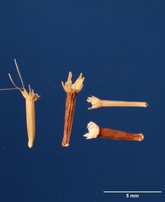 | | 2009 | | | | | | | Wild material | | 1802247 | W6 35271 |
| 121 | NA 78035 | AL #44 | Philadelphus inodorus L. | Alabama, United States | NA | | | 2008 | COLLECTED | 09/17/2008 | Just above the Cahaba River, near end of road and Caffee Creek. | | | | Wild material | | 1913895 | NA 78035 |
| 122 | Ames 29125 | JM200709111 | Hypericum androsaemum L. | Ajaria, Georgia | NC7 |  | | 2007 | COLLECTED | 09/10/2007 | Chakuistskali River Valley Gorge, Mtrila National Forest, Ajara Region. | 41.70333333, 41.80777778 | 40 | Colchic forest. Wet rock face beside road and above river. | Wild material | | 1744161 | Ames 29125 |
| 123 | Ames 29142 | JM200709112 | Hypericum perforatum L. | Ajaria, Georgia | NC7 |  | | 2007 | COLLECTED | 09/10/2007 | Chakuistskali River Valley Gorge, Mtrila National Forest, Ajara Region. | 41.70333333, 41.80777778 | 40 | Colchic forest. Wet rock face beside road and above river. | Wild material | | 1744178 | Ames 29142 |
| 124 | Ames 29149 | JM200709113 | Hypericum ×inodorum Mill. | Ajaria, Georgia | NC7 |  | | 2007 | COLLECTED | 09/10/2007 | Chakuistskali River Valley Gorge, Mtrila National Forest, Ajara Region. | 41.70333333, 41.80777778 | 40 | Colchic forest. Wet rock face beside road and above river. | Wild material | | 1744185 | Ames 29149 |
| 125 | Ames 31396 | 271767 | Monardella villosa Benth. subsp. villosa | California, United States | NC7 |  | | 2007 | COLLECTED | 08/02/2005 | Monterey County: At the junction of Pilarcitos Road and Jacks' Road and also on Engineer Canyon Road. | 36.61889000, -121.72250000 | 60 | Oak woodland. Aspect: N-NE-NW. Light brown/greyish brown soil. | Wild material | Forb, Height about: 0.3 m | 1728075 | Ames 31396 |
| 126 | W6 30208 | CA330-50 | Elymus multisetus (J. G. Sm.) Burtt Davy | California, United States | W6 |  | | 2007 | | | | | | | Wild material | | 1719004 | W6 30208 |
| 127 | W6 26858 | ROSE-9 | Danthonia californica Bol. | Oregon, United States | W6 |  | | 2005 | | | | | | | Wild material | Grasslike 0.07 meters tall. | 1673897 | W6 26858 |
| 128 | W6 27009 | ROSE-32 | Scirpus microcarpus J. Presl & C. Presl | Oregon, United States | W6 |  | | 2005 | | | | | | | Wild material | Grasslike 0.9-1.6 meters tall. | 1674046 | W6 27009 |
| 129 | NA 70425 | MWPCC00-081 | Nyssa sylvatica Marshall | North Carolina, United States | NA | | | 2000 | COLLECTED | 09/15/2000 | Buncombe Co. Asheville NC. North Carolina Arboretum | 35.49611111, -82.60972222 | 713 | near the top of a slope, native vegetation, adfacent to a service road and mowed roadside; associates; Oxydendrum, Rhus radicans, Kalmia latifolia, Acer rubrum, Quercus prinus, Quercus marilandica, Pteridium. | Wild material | Dry site for species, defoliation from stress? Ron Lance mentioned plants like this one from drier sites tend to have larger leaves. | 1608271 | NA 70425 |