| 0 | NA 84716 | TDAAR17-017 | Quercus acerifolia (E. J. Palmer) Stoynoff & W. J. Hess ex R. J. Jensen | Arkansas, United States | NA |  | | 2017 | COLLECTED | 09/13/2017 | Montgomery County: Ouachita National Forest: Pryor Mountain. | 34.36113000, -93.87164000 | 532 | | Wild material | See also NA 87260 for material of this same collection received in 2022 from Morris Arboretum. | 1953991 | NA 84716 |
| 1 | NA 82794 | JDC/QE/2014/132/635 | Quercus ellipsoidalis E. J. Hill | Iowa, United States | NA | | | 2015 | COLLECTED | 10/21/2014 | Pilot Knob State Park just east of Forest City. T97N R23W Ellington Township SW 1/4 SW 1/4 NE 1/4 Sec. 4 Hancock County. | 43.24931400, -93.56681800 | 399 | Near floating bog, transition area from edge of floating bog and incline to upland habitat. Growing in association with Cephalanthus occidentalis, Salix sp., Asclepias incarnata, Typha latifolia, Spiraea alba, Populus tremuloides, Quercus rubra, Rhamnus cathartica, Carex lacustris, Carex lupulina, and Carex spp. | Wild material | Acorns harvested from forest floor. Attractive, red fall color noted (peak - October 21, 2014). | 1928362 | NA 82794 |
| 2 | NA 82053 | JDC/QM/2014/079/581 | Quercus montana Willd. | Mississippi, United States | NA | | | 2014 | COLLECTED | 09/22/2014 | Mississippi: Tishomingo County; Near J.P. Coleman State Park off County Road 989. | 34.97300100, -88.21763300 | 166 | Pine-oak woods. Growing in association with Liriodendron tulipifera, Pinus sp., Quercus alba, Quercus stellata, Carya sp., Rhus copallinum, Cornus florida, and Cercis canadensis. | Wild material | Optimum timing for harvest. Acorns just starting to drop. Petioles yellow. | 1922354 | NA 82053 |
| 3 | Ames 4618 | Accession No. 1985-0642
Collection No. 1224 | Quercus muehlenbergii Engelm. | Ontario, Canada | NC7 | | | 1985 | COLLECTED | 09/21/1985 | Canada, Ontario, Lambton County, Bosanquet Township (Now Municipality of Lambton Shores), Port Franks. | 43.23195300, -81.89238900 | 190 | Growing in dry sand. 0.8km east of trailer park bridge, off Biddulph Street, property line beside road | Wild material | Large Tree, 2-trunked, 80cm DBH, 20m high, 30m crown spread, infrequent. Medium-sized, deciduous tree | 1028813 | Ames 4618 |
| 4 | Ames 36328 | JDC/MA/2025/006/1161 | Morus alba L. | Iowa, United States | NC7 |  | | 2025 | COLLECTED | 06/24/2025 | Story and Boone Counties near Ames and Fraser. | 42.01523400, -93.66476700 | 302 | Typically woodland edges, roadside edges or fencelines or powerline cuts. | Uncertain improvement status | Morus alba is an introduced species into the U.S. and is highly prolific and considered invasive in many parts of the U.S. This accession represents genetics sampled from central Iowa (Story and Boone Counties) that are available for research purposes. Samples acquired had BRIX readings (3 reps of 5 fruits each) ranging from 9.2-17.2 for mature (black/soft) fruits with fruits generally less than 1.0" in length with average lengths of 0.5". Specimens numbers #1 and #9 had the highest average BRIX ratings of 16.5 and 17.2, respectively. All specimens with rather shiny, glabrous leaves on the upper surfaces with lobing variable throughout the canopy but generally higher lobing found on vigorous sprouts/shoots. Majority of specimens sampled were less than 60' in height. The largest specimen sampled was approximately 18" DBH with the average specimen sampled measuring approximately 10" DBH. | 2191609 | Ames 36328 |
| 5 | Ames 35670 | NCTN05 | Spiraea alba Du Roi | North Carolina, United States | NC7 | | | 2020 | COLLECTED | 09/15/2019 | Nantahala National Forest along east side of Buck Creek Road near Buck Creek | 35.08315281, -83.61614842 | 1001 | Appalachian serpentine woodland; southwest facing | Wild material | | 2109408 | Ames 35670 |
| 6 | W6 57372 | NEWFS-234 | Spiraea alba Du Roi | Massachusetts, United States | W6 |  | | 2019 | | | | | | | Wild material | | 2098169 | W6 57372 |
| 7 | OPGC 7572 | JDC/HX/2019/028/907 | Heuchera alba Rydb. | West Virginia, United States | OPGC |  | | 2019 | COLLECTED | 08/10/2019 | Smoke Hole Region: Powers Hollow. Located approximately 5.2 miles west of Petersburg on the east side of Powers Hollow Road, Grant County | 39.00339500, -79.22036500 | 455 | Exposed rock cliff edges. | Wild material | Heuchera alba is a narrow Appalachian endemic and globally imperiled (G2) taxon recorded only from West Virginia and Virginia that occurs in sympatry with H. pubescens and H. americana. According to Scheutte et al. 2018, the range for H. alba is restricted to high elevation acidic sandstone ridges and outcrops in the Ridge-and-Valley province of West Virginia and Virginia. In cultivation (central Iowa) the leaves emerge with subtle variegation that is lost by early summer. Flowers are creamy white to pale green. | 2096627 | OPGC 7572 |
| 8 | Ames 30175 | JDC/SA/2009/044/194 | Spiraea alba Du Roi | Wisconsin, United States | NC7 |  | | 2009 | COLLECTED | 09/22/2009 | Pine Island State Wildlife Area along Levee Road, T12N R8E NW 1/4 of Sec.12, Portage Quad, Columbia County | 43.53697000, -89.49280800 | 241 | Sandy soil with a high water table | Wild material | | 1819756 | Ames 30175 |
| 9 | PI 704863 sos | V. angustifolium CBG-9706 | Vaccinium angustifolium Aiton | Illinois, United States | COR | | | 2021 | | | | | | | Wild material | | 2120019 | PI 704863 sos |
| 10 | PI 702725 | NCBG-428 | Schizachyrium scoparium (Michx.) Nash | Maryland, United States | S9 |  | | 2019 | | | | | | | Wild material | | 2098447 | PI 702725 |
| 11 | PI 702695 | MARSB-502 | Chasmanthium laxum (L.) H. O. Yates | New Jersey, United States | S9 |  | | 2019 | | | | | | | Wild material | | 2097639 | PI 702695 |
| 12 | PI 702701 | MARSB-249 | Dichanthelium clandestinum (L.) Gould | New York, United States | S9 |  | | 2019 | | | | | | | Wild material | | 2097541 | PI 702701 |
| 13 | PI 673986 | TX-03 | Rudbeckia grandiflora (Sweet) C. C. Gmel. ex DC. | Texas, United States | OPGC | 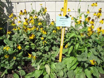 | | 2010 | COLLECTED | 05/26/2010 | Upper West Gulf Coastal Plain. Harrison County. South of Marshall Texas. East on 2625, cross 31, left onto CR 1111, Brad spann road veer right. | 32.47050000, -94.21594400 | 97 | Meadow(Maintained ROW under power lines). Land form: Rolling hills. Land Use: Roadside ROW. Geology: Sandstone. Soil Texture: Sandy. Soil Color: Brown. | Wild material | Erect, clumped, glabrous to 60 cm tall. Flowers numerous, yellow ray florets. | 1897287 | PI 673986 |
| 14 | PI 664898 | JDC/PV/2008/071/141 | Prunella vulgaris L. | Illinois, United States | NC7 |  | | 2008 | COLLECTED | 10/13/2008 | Along Opossum Creek on US Highway 51, SE 1/4 of SE 1/4 of Section 16, T10N, R1E, Oconee Quad, Shelby County. | 39.30527778, -89.08388889 | 200 | | Wild material | | 1788219 | PI 664898 |
| 15 | PI 654985 | C. americana Delaware | Corylus americana Marshall | Delaware, United States | COR | | | 2007 | COLLECTED | 10/25/2007 | New Castle County, Bellevue State Park (800 Carr Road, Wilmington), off the Northern Delaware Greenway Trail, growing in understory of beach-oak forest. | 39.78180000, -75.50080000 | 70 | Growing in woodland duff. Associated plants: Sasafras lbidum, Euonymous americana, Fagus grandifolia, Liquidambar styrasiflua, Quercus alba, Hamamelis virginiana. | Wild material | | 1743480 | PI 654985 |
| 16 | PI 664885 | JM20061020 | Prunella vulgaris L. | South Carolina, United States | NC7 | | | 2006 | COLLECTED | 09/28/2006 | East side of State Road 1149, north of Highway 11, Pickens, Pickens County. | 34.93500000, -82.88750000 | 262 | Cove hardwood forest, roadside. | Wild material | | 1715758 | PI 664885 |
| 17 | PI 649023 | NY2 | Actaea racemosa L. | New York, United States | NC7 |  | | 2005 | | | | | | | Wild material | | 1698893 | PI 649023 |
| 18 | PI 664811 | DE2 | Actaea racemosa L. | Delaware, United States | NC7 | | | 2005 | | | | | | | Wild material | | 1698885 | PI 664811 |
| 19 | PI 635230 | Carlton Canyon Female | Humulus lupulus L. var. neomexicanus A. Nelson & Cockerell | New Mexico, United States | COR | | Out of Season | 2003 | COLLECTED | | Lincoln County, Carlton Canyon, below mile marker 7 on State Hwy 532 | 33.39611000, -105.75667000 | 2644 | With dead Sambucus, pseudotsuga menziesii, Quercus alba | Wild material | virus testing needed | 1649005 | PI 635230 |
| 20 | PI 635232 | Bear Trap Canyon Female | Humulus lupulus L. var. neomexicanus A. Nelson & Cockerell | New Mexico, United States | COR | | Out of Season | 2003 | COLLECTED | | Socorro county, Bear Trap Canyon, 4.8 miles south west of Hughes campground on Forest service road 549 | 33.81000000, -107.58722000 | 2302 | With Pinus Ponderosa, Quercus alba, in base of talus | Wild material | | 1649007 | PI 635232 |
| 21 | PI 616939 | F. virginiana subsp. virginiana NC 98-2-2 | Fragaria virginiana Mill. subsp. virginiana | Tennessee, United States | COR | | Out of Season | 2000 | COLLECTED | 09/25/1998 | From I-40 take Strawberry Plains PIke north for 1.9 miles to McCubbins Cemetary Lane. Turn right and go 0.1 mile to Mcubbins Cemetary. Site is McCubbins Cemetary grounds. Knox county. | 36.01917000, -83.74694000 | 425 | Dry uplands, silty topsoil, shale underneath. Quercus alba, Pinus virginiana, Pespalum subsp., Potentilla canadensis, Andropogon sp., Plantogo sp., Ulmus sp., Acer rubra and Acer barbatum. Mosses, lichens and grasses. | Wild material | | 1603151 | PI 616939 |
| 22 | PI 616940 | F. virginiana subsp. virginiana NC 98-2-3 | Fragaria virginiana Mill. subsp. virginiana | Tennessee, United States | COR | | Out of Season | 2000 | COLLECTED | 09/25/1998 | From I-40 take Strawberry Plains PIke north for 1.9 miles to McCubbins Cemetary Lane. Turn right and go 0.1 mile to Mcubbins Cemetary. Site is McCubbins Cemetary grounds. Knox county. | 36.01917000, -83.74694000 | 425 | Dry uplands, silty topsoil, shale underneath. Quercus alba, Pinus virginiana, Pespalum subsp., Potentilla canadensis, Andropogon sp., Plantogo sp., Ulmus sp., Acer rubra and Acer barbatum. Mosses, lichens and grasses. | Wild material | | 1603152 | PI 616940 |
| 23 | PI 616941 | F. virginiana subsp. virginiana NC 98-2-3 | Fragaria virginiana Mill. subsp. virginiana | Tennessee, United States | COR | | Out of Season | 2000 | COLLECTED | 09/25/1998 | From I-40 take Strawberry Plains PIke north for 1.9 miles to McCubbins Cemetary Lane. Turn right and go 0.1 mile to Mcubbins Cemetary. Site is McCubbins Cemetary grounds. Knox county. | 36.01917000, -83.74694000 | 425 | Dry uplands, silty topsoil, shale underneath. Quercus alba, Pinus virginiana, Pespalum subsp., Potentilla canadensis, Andropogon sp., Plantogo sp., Ulmus sp., Acer rubra and Acer barbatum. Mosses, lichens and grasses. | Wild material | | 1603153 | PI 616941 |
| 24 | PI 658649 | Index Seminum 42 | Rhus copallinum L. | Pennsylvania, United States | NC7 | | | 1993 | COLLECTED | | Chester County | 39.73710800, -75.93960900 | 120 | Edge of clearing, Chrome Serpentine Barrens, Piedmont Province. | Wild material | | 1086005 | PI 658649 |
| 25 | PI 658653 | Index Seminum 43 | Rhus typhina L. | Pennsylvania, United States | NC7 | | | 1993 | COLLECTED | | Chester County | 39.73333333, -75.93333333 | 120 | Edge of clearing, Chrome Serpentine Barrens, Piedmont Province. | Wild material | | 1086006 | PI 658653 |
| 26 | PI 613194 | V. arboreum Missouri | Vaccinium arboreum Marshall | Missouri, United States | COR |  | | 1993 | COLLECTED | 10/1992 | T34N R3E, See. 15, NE 1/4 and Sec. 16, NW 1/4. Elephant Rocks State Park, Iron County, Missouri. | 37.65000000, -90.68333000 | 0 | Plants growing in exposed granite rocky area and extending into the understory of the surrounding forest at the base of the rocks. | Wild material | Elephant Rocks are an exposed 1.6-2.0 ha of granite rising 30 m above surrounding landscape. Large population of plants, predominant species in the rocky area and population extended into the understory of the surrounding forest at the base of the rocks. Fruit ripen at this site from late August until a hard freeze. Green fruit have been seen in late October at this site. The fruit was collected in early October 1992. Fruiting plants ranging from 1.2-4.6 m tall. Both shrub and small tree habit; trunks up to 10 cm in diameter. Leaves were glossy and dark green. Fruit ranging from dark blue to black. Fruit size from 0.4-1.0 cm in diameter. Location in crevices suggest drought tolerance; during an extreme drought in 1991, oaks (Quercus alba and Q. macrocarpa) in the area appeared to be dying from drought while the V. arboreum appeared unaffected. No visible winter injury or insect damage. Minimal disease problems; Ophiodothella spp. which doesn't appear to affect the plant and som fruit that appeared to have mummyberry (Monilinia spp.). Seed from this population were germinated and several seedlings submitted to the NCGR. | 1011294 | PI 613194 |
| 27 | Ames 38800 | Camp Mitigwa | Amelanchier arborea (F. Michx.) Fernald | Iowa, United States | NC7 |  | | 2026 | COLLECTED | 06/01/2026 | Mitigwa Scout Camp located on west side of Des Moines River watershed approximately 7.50 miles south, southwest of Boone, T82N R26W N 1/4 Sec. 5 and T83N R26W S 1/4 Sec. 32. | 41.94894500, -93.90537200 | 310 | High-quality white oak - ironwood, mature woods. | Wild material | The native range of Amelanchier arborea is concentrated in the eastern half of the U.S. (Little, 1977). This accession represents a collection of A. arborea germplasm from the western edge of the species native range, specifically central Iowa. Specimens sampled at the collection site in nature were small to medium understory or woodland edge single and/or multi-trunked trees with a few trees getting close to being deemed as canopy specimens. Bark smooth and light grey in color. Specimens sampled in nature ranging 15-50' in height. Peak flowering occurred on 8 April 2026 with white flowers appearing prior to leaf expansion. Fall colors ranging from orange to orange-red peaking typically at the end of September (central Iowa). Fruits, dark-pink to red, maturing in early June (peak in 2026 occurred on 2 June) averaging 8 mm in diameter, except for mother tree #6 that had rather large fruits at 11 mm in diameter. | 2197049 | Ames 38800 |
| 28 | NA 89171 | 2025RJLSEUS-04 | Rhododendron catawbiense Michx. | Alabama, United States | NA | | | 2026 | COLLECTED | 09/30/2025 | Scarham Creek: southeast of the Pea Ridge Road bridge, approximately 50-80 meters on the south side of the creek. | 34.32559600, -86.16054600 | 266 | Growing near the base of the slopes above the riparian zone, generally on the exposed geology under very well-drained conditions. The woodlands are primarily deciduous with a few evergreens infrequently mixed. Slope: 15 to 30 percent. Aspect: Northeast. Soil: The primary soil type in the area of this collection is classified as Rockland Series sandstone (Rc). The Rockland series consists of well drained soils formed in loamy colluvium from rotational landslides on slopes of stream valleys and dissections of ground moraines. Saturated hydraulic conductivity is moderate in the upper part of the profile and moderately slow in the lower part. Slopes range from 18 to 70 percent. Some pedons have buried leaves, twigs, and moss. Mass soil movement has left random remnants of soil structure from prior upslope soil development and has buried tree branches, leaves and moss. The upper 0-2 cm of soil contains slightly decomposed organic matter while lower soils layers to a depth of 58 cm are comprised of dark reddish-brown to brown silt loam and are moderately acidic. Below 58 cm the soils are generally dark reddish-brown silt loam and strongly to moderately alkaline. (Source:California Soil Resource Lab/NRCS Official Soil Series Descriptions). Geology: The underlying geology of this area is of Pennsylvanian origin and characterized as Pottsville Formation. It is characterized by light-gray thin to thick-bedded quartzose sandstone and conglomerate containing interbedded dark-gray shale, siltstone, and coal. Mapped on Lookout Mountain, Blount and Chandler Mountains, and Sand Mountain northeast of Blount County, and on the mountains of Jackson, Marshall, and Madison Counties north and west of the TN river. (Source: USGS Alabama Geologic Map Data). | Wild material | Received as R. catawbiense vsr. insularis | 2193305 | NA 89171 |
| 29 | NA 89155 | 2025RJLSEUS-02 | Ilex longipes Chapm. ex Trel. | Alabama, United States | NA | | | 2025 | COLLECTED | 09/30/2025 | Scarham Creek: southeast of the Pea Ridge Road bridge, approximately 50-80 meters on the south side of the creek. | 34.32520700, -86.15967000 | 261 | Plants are growing on relatively steep woodland slopes in shade. The woodlands are primarily deciduous with a few evergreens infrequently mixed. Slope: 15 to 30 percent. Aspect: Northeast. Soil: The primary soil type in the area of this collection is classified as Rockland Series sandstone (Rc). The Rockland series consists of well drained soils formed in loamy colluvium from rotational landslides on slopes of stream valleys and dissections of ground moraines. Saturated hydraulic conductivity is moderate in the upper part of the profile and moderately slow in the lower part. Slopes range from 18 to 70 percent. Some pedons have buried leaves, twigs, and moss. Mass soil movement has left random remnants of soil structure from prior upslope soil development and has buried tree branches, leaves and moss. The upper 0-2 cm of soil contains slightly decomposed organic matter while lower soils layers to a depth of 58 cm are comprised of dark reddish-brown to brown silt loam and are moderately acidic. Below 58 cm the soils are generally dark reddish-brown silt loam and strongly to moderately alkaline. (Source: California Soil Resource Lab/NRCS Official Soil Series Descriptions). Geology: The underlying geology of this area is of Pennsylvanian origin and characterized as Pottsville Formation. It is characterized by light-gray thin to thick-bedded quartzose sandstone and conglomerate containing interbedded dark-gray shale, siltstone, and coal. Mapped on Lookout Mountain, Blount and Chandler Mountains, and Sand Mountain northeast of Blount County, and on the mountains of Jackson, Marshall, and Madison Counties north and west of the TN river. (Source: USGS Alabama Geologic Map Data). | Wild material | | 2193001 | NA 89155 |
| 30 | NA 89156 | 2025RJLSEUS-03 | Euonymus americanus L. | Alabama, United States | NA | | | 2025 | COLLECTED | 09/30/2025 | Scarham Creek: southeast of the Pea Ridge Road bridge, approximately 50-80 meters on the south side of the creek. | 34.32577600, -86.16071000 | 260 | Plants are growing on relatively steep woodland slopes in shade. The woodlands are primarily deciduous with a few evergreens infrequently mixed. Slope: 15 to 30 percent. Aspect: Northeast. Soil: The primary soil type in the area of this collection is classified as Rockland Series sandstone (Rc). The Rockland series consists of well drained soils formed in loamy colluvium from rotational landslides on slopes of stream valleys and dissections of ground moraines. Saturated hydraulic conductivity is moderate in the upper part of the profile and moderately slow in the lower part. Slopes range from 18 to 70 percent. Some pedons have buried leaves, twigs, and moss. Mass soil movement has left random remnants of soil structure from prior upslope soil development and has buried tree branches, leaves and moss. The upper 0-2 cm of soil contains slightly decomposed organic matter while lower soils layers to a depth of 58 cm are comprised of dark reddish-brown to brown silt loam and are moderately acidic. Below 58 cm the soils are generally dark reddish-brown silt loam and strongly to moderately alkaline. (Source: California Soil Resource Lab/NRCS Official Soil Series Descriptions). Geology: The underlying geology of this area is of Pennsylvanian origin and characterized as Pottsville Formation. It is characterized by light-gray thin to thick-bedded quartzose sandstone and conglomerate containing interbedded dark-gray shale, siltstone, and coal. Mapped on Lookout Mountain, Blount and Chandler Mountains, and Sand Mountain northeast of Blount County, and on the mountains of Jackson, Marshall, and Madison Counties north and west of the TN river. (Source: USGS Alabama Geologic Map Data). | Wild material | | 2193002 | NA 89156 |
| 31 | NA 89158 | 2025RJLSEUS-06 | Cornus florida L. | Alabama, United States | NA | | | 2025 | COLLECTED | 10/01/2025 | Coosa Wildlife Management Area: along the edge of gated dirt road on the west side of Coosa County Road 29, 0.3 kilometers north of Hatchet Creek. | 32.86402200, -86.33871400 | 108 | Plants are growing in part sun to shade on dry-mesic slopes above the road cut on the gated dirt road; most likely a road for access for fire control/forest management. The forest is a combination of deciduous and evergreen with evergreens primarily comprised of Pinus taeda. The habitat was quite dry during this time of year. Slope: 5 to 20 percent. Aspect: North. Soils: The primary soil in the area of this collection is classified as Madison-Louisa Series complex, 15 to 30 percent slopes, moderately eroded (MdE2). The Madison Series soils are very deep, well drained soils with medium runoff found on Piedmont uplands in interstream divides, ridges and side slopes. They are comprised of residuum weathered from felsic or intermediate, high-grade metamorphic or igneous rocks high in content of mica. Slopes range from 2 to 60 percent and soil is typically strongly acidic. Louisa Series soils The Louisa Series soils consist of shallow, somewhat excessively drained soils which formed over mica gneiss and schist bedrock. They occur on Piedmont uplands. Slopes are 6 to 80 percent. This soil is moderately acid. (Source: California Soil Resource Lab/NRCS Official Soil Series Descriptions). Geology: The underlying geology of this area is of Precambrian to Paleozoic origin and characterized as Hatchet Creek Group; Pinchoulee Gneiss Formation. It is characterized by medium to fine-grained migmatitic, locally garnetiferous biotite-feldspar gneiss, commonly saturated with granitic pods. (Source: USGS Alabama Geologic Map Data). | Wild material | | 2193004 | NA 89158 |
| 32 | W6 62530 | FWS0300-133 | Crocanthemum canadense (L.) Britton | Michigan, United States | W6 |  | | 2025 | | | | | | | Wild material | Helianthemum bicknellii also present, but easily distinguishable | 2192228 | W6 62530 |
| 33 | NA 89115 | TLM25-04a | Hamamelis ovalis S. W. Leonard | Texas, United States | NA | | | 2025 | COLLECTED | 07/10/2025 | State Highway 87 approximately 3.25 kilometers north of the crossroad junction with Texas Recreational Road 255 (RE 255); plants were growing in the narrow buffer woods along the east side of the highway. | 31.12051300, -93.72628100 | 138 | The habitat is an upland mixed coniferous and deciduous woodlands in part to full shade and dry conditions, often under drought stress. Plants seem to always occur on the top of dry ridges or well-drained slopes. Slope: 0 to 1 percent. Aspect: N/A. Soils: The soils of this collection area are classified as Tehran-Letney Association, hilly (TLE) soils. The Tehran Series (55%) consists of deep, somewhat excessively drained, moderately rapidly permeable soils on uplands. They formed in thick loamy and sandy sediments on the Western Coastal Plain. These soils are on gently sloping to moderately steep uplands with slopes ranging from 1 to 20 percent. The Letney Series (30%) consists of deep, well drained, moderately rapidly permeable, upland soils. They formed in thick sandy and loamy sediments of the coastal plains. These soils are on gently sloping to moderately steep uplands with slopes ranging from 1 to 20 percent. Soil pH ranges from 4.5 to 6.0. The minor soil components include Doucette Series (10%) and Boykin Series (5%) soils. (Source: California Soil Resource Lab/NRCS Official Soil Series Descriptions). Geology: The underlying geology of this area is of Oligocene origin and characterized as Catahoula Formation. This formation is extensive and deep in Texas, up to 185 meters thick. In the area of the collection the Catahoula Formation is primarily mudstone and sand. The upper 90-150 meters is mudstone that is tuffaceous, and sandy; also, occasionally, with some bentonitic clay. (Source: USGS Texas Geologic Map Data). | Wild material | | 2191654 | NA 89115 |
| 34 | Ames 36327 | Lick Creek Unit | Amelanchier arborea (F. Michx.) Fernald | Iowa, United States | NC7 |  | | 2025 | COLLECTED | 06/10/2025 | Shimek State Forest Lick Creek Unit just east of Farmington, T67N R7W NE ¼ Sec. 8 and Sec. 7 and also T68N R8W Sec. 25. | 40.62024500, -91.70427700 | 214 | Woodland edges. | Wild material | The native range of Amelanchier arborea is concentrated in the eastern half of the U.S. (Little, 1977). This accession represents a collection of A. arborea germplasm from the western region of the species native range, specifically the extreme southeastern corner of Iowa. Specimens sampled in nature ranging 15-35' in height. Typically smoothish bark, light grey in color. Peak flowering (white flowers) occuring usually in early April with orange, orange-red fall colors peaking typically end of September (southeastern Iowa). | 2191464 | Ames 36327 |
| 35 | NA 88929 | 24Flam8 | Rhododendron hybr. | Georgia, United States | NA | | | 2025 | COLLECTED | 09/09/2024 | Smyrna, GA: private residence. | 33.84871000, -84.51773000 | 303 | Dry slope in backyard of residence, primarily open with some large oaks. Open conditions. Slope: 30 degrees. Aspect: Northwest. | Wild material | | 2172812 | NA 88929 |
| 36 | NA 88930 | 24Flam16 | Rhododendron canescens (Michx.) Sweet | Georgia, United States | NA | | | 2025 | COLLECTED | 09/10/2024 | DeKalb County: Stone Mountain: Stone Mountain Park: slope near Robert E. Lee Boulevard. | 33.80238000, -84.15508000 | 286 | Dry, shady slope. Growing in 3/4 shade. Slope: 30 to 45 degrees. Aspect: West-southwest. | Wild material | Note: Seeds from three different plants collected at the same spot were bulked together in this accession; the lowest field collection number (24Flam16) has been chosen as the primary for this record. It appears from the notes that the identity is slightly uncertain; possibly not pure R. canescens. | 2172813 | NA 88930 |
| 37 | NA 88931 | 24Flam27 | Rhododendron flammeum (Michx.) Sarg. | Georgia, United States | NA | | | 2025 | COLLECTED | 09/10/2024 | DeKalb County: Stone Mountain: Stone Mountain Park along Evergreen Trail by resort, growing within 40 feet of Venable Lake. GPS coordinates a general locality for population and each seed lot for 24Flam27-30 was collected progressively further west). | 33.79769000, -84.13420000 | 291 | Dry, somewhat shady forest adjacent to lake, some plants hanging over edge. Primarily close to the water on flat ground, though some on slope. Growing in half shade. Slope: Flat to 30 degrees. Aspect: North. | Wild material | Note: Seeds from three different lots collected at the same spot were bulked together in this accession; the lowest field collection number (24Flam27) has been chosen as the primary for this record. | 2172814 | NA 88931 |
| 38 | NA 88936 | 24Flam54 | Kalmia latifolia L. | Georgia, United States | NA | | | 2025 | COLLECTED | 09/12/2025 | Clyo, GA: Metzger Farm, on a shelf above Savannah River. GPS points are a general location for the population, not individual plants [note: collections were combined into this USNA accession.] | 32.49317000, -81.22832000 | 50 | Wet woods on a steep, steep shelf above Savannah River. Growing in 3/4 shade. Slope: 45 to 60 degrees. Aspect: Northeast. | Wild material | | 2172819 | NA 88936 |
| 39 | NA 88940 | 24Flam60 | Rhododendron flammeum (Michx.) Sarg. | South Carolina, United States | NA | | | 2025 | COLLECTED | 09/13/2025 | Savannah River Site, near Tinker Creek. GPS coordinates represent a general location for the population. | 33.36802000, -81.54971000 | 90 | Shady forest following Tinker Creek. Seed collected primarily on slopes and banks over the creek. Growing in half shade. Slope: Varying. | Wild material | Note: Two field collections, 24Flam60 and 24Flam65, were combined together in this USNA accession, with the former identifier being used as the primary one. The collectors note the possibility that this contains hybrids because the plants were not observed in flower. | 2172823 | NA 88940 |
| 40 | NA 88747 | TXWL2025-038 | Ilex opaca Aiton | Texas, United States | NA | | | 2025 | COLLECTED | 01/23/2025 | Milam, Texas: On flat road, private land. | 31.43288000, -93.88208000 | | Upland shortleaf pine stand with sandy loam; closed canopy. | Wild material | | 2171021 | NA 88747 |
| 41 | NA 88984 | TXWL2025-034 | Ilex opaca Aiton | Texas, United States | NA | | | 2025 | COLLECTED | 01/13/2025 | Fairmount Township: Sabine National Forest C-139: Foxhunters Hill. | 31.18153000, -93.72368000 | | Baygall below a longleaf pine stand. Same system as 035 [NA 88985]. | Wild material | | 2170968 | NA 88984 |
| 42 | NA 88987 | TXWL2025-037 | Ilex opaca Aiton | Texas, United States | NA | | | 2025 | COLLECTED | 01/13/2025 | Fairmount Township: Sabine National Forest C-139: Foxhunters Hill. | 31.18365000, -93.72211000 | | Baygall below a longleaf pine stand. | Wild material | | 2170971 | NA 88987 |
| 43 | NA 88593 | 2024RJLNJ-001 | Ilex glabra (L.) A. Gray | New Jersey, United States | NA | | | 2024 | COLLECTED | 11/24/2024 | Mullica Township: Both sides of Duerer Street, approximately 0.37 kilometers southeast of 4th Avenue. | 39.55885000, -74.66442500 | 21 | Shade to almost full sun on compacted seasonally moist to temporarily wet areas of a mixed evergreen and deciduous woodland dominated by Pinus rigida. Vegetation of this area is very much defined by small changes in elevation that go from wet to very dry. Ilex glabra remains abundant throughout, though. Slope: N/A. Aspect: N/A. The underlying geology of this area is the Cohansey Formation of middle Miocene origin and comprised of sand, white to yellow with local gravel and clay. It is sometimes locally stained red or orange brown by iron oxides and (or) cemented into large blocks of ironstone. Unweathered clay is typically dark gray, but commonly weathers white where it is interbedded with thin beds of ironstone. Sand is typically medium grained and moderately sorted although it ranges from fine to very coarse grained and from poorly to well sorted. Sand consists of quartz and siliceous rock fragments. Some beds are locally micaceous. Maximum thickness in the map area is about 60 meters; however, thickness is difficult to determine because of the irregular basal contact and extensive post-depositional erosion. (Source: USGS New Jersey Geologic Map Data). The primary soil type in the area of this collection is classified as Mullica Series sandy loam, 0 to 2 percent slopes. These soils are typically coarse-loamy, siliceous, semiactive, and mesic typic humaquepts that are strongly to extremely acidic throughout the profile. The typical solum thickness ranges from 50-150+ cm. These soils are generally considered to be poorly drained. (Source: NRCS Web Soil Survey). | Wild material | | 2169930 | NA 88593 |
| 44 | NA 88479 | TXWL2024-029 | Ilex longipes Chapm. ex Trel. | Texas, United States | NA | | | 2024 | COLLECTED | 11/20/2024 | Little Cow Creek. | 31.06221000, -93.79603000 | | Upland position above perennial creek. | Wild material | | 2169906 | NA 88479 |
| 45 | NA 89078 | 2024RJLPA-004 | Staphylea trifolia L. | Pennsylvania, United States | NA | | | 2024 | COLLECTED | 09/20/2024 | Along gated road about 0.33 kilometers southwest of the Lake Ontelaunee Trail parking lot. | 40.49850800, -75.89121300 | 94 | Plants are growing on well-drained steep slopes in shade to part shade of a deciduous forest. Slope: 35 to 50 percent. Aspect: East-southeast. Geology: The underlying geology of this area is of Ordovician origin and characterized as Shale and graywacke of Hamburg sequence. It is characterized by shale containing zones of conspicuous graywacke. (Source: USGS Pennsylvania Geologic Map Data). Soils: The primary soil type in the area of this collection is classified as Berks-Weikert Complex, 25 to 60% slopes (BkF). Dominantly sloping to very steep, moderately deep and shallow, well drained soils underlain by acid shale bedrock. (Source: UPenn State University Soil Info Website). EPA Ecoregion (Level III): Ridge and Valley (67). EPA Ecoregion (Level IV): Northern Shale Valleys (67b). | Wild material | | 2169042 | NA 89078 |
| 46 | NA 89088 | 2024RM-TK-001 | Viburnum acerifolium L. | Alabama, United States | NA | | | 2024 | COLLECTED | 09/19/2024 | Haines Island Park. Follow Ferry Road to the top of the hill entering the park where a picnic shelter is located. Plants are growing along trails to the north of the picnic shelter. | 31.72132026, -87.46408910 | 81 | Plants are growing from part-sun to full shade in the understory of a mixed deciduous and coniferous forest on very dry upland habitat. Slope: 10 to 20 percent. Aspect: North. Geology: The underlying geology of this area is probably of Eocene age and characterized as the Claiborne Group: Tallahatta Formation. It is comprised of white to very light-greenish-gray thin-bedded to massive siliceous claystone; interbedded with thin layers of fossiliferous clay, sandy clay, and glauconitic sand and sandstone. White to light-greenish-gray fine to coarse sand and fine gravel occur at the base of the formation in southwest Alabama (Meridian Sand Member). (Source: USGS Alabama Geologic Map Data). Soils: The area of this occurrence is characterized as Arundel Series Loam, 8 to 35 percent slopes (ArF). The Arundel series consists of moderately deep, well drained, very slowly permeable soils on dissected uplands of the Southern Coastal Plain Major Land Resource Area (MLRA 133A). They formed in marine deposits consisting of acid clays underlain by horizontally bedded sandstone, buhrstone and siltstone. Slopes range from 2 to 60 percent. (Source: California Soil Resource Lab/NRCS Official Soil Series Descriptions). EPA Ecoregion (Level III): Southeastern Plains (65). EPA Ecoregion (Level IV): Buhrstone/Lime Hills (65q). | Wild material | | 2169052 | NA 89088 |
| 47 | NA 89089 | 2024RM-TK-002 | Viburnum acerifolium L. | Alabama, United States | NA | | | 2024 | COLLECTED | 09/19/2024 | Woodland slopes around and below the hilltop parking area leading down to the Silver Creek Lake Campground off of Silver Creek Lake Road. | 31.66612294, -87.57569860 | 49 | Plants are growing in shade of upland dry mesic, mature mixed deciduous and evergreen woodland. Generally, the overstory is thinner and there is less leaf litter cover, making the surface soil conditions drier. Slope: 5 to 10 percent. Aspect: Southeast. Geology: The underlying geology of this area is Claiborne Group, Tallahatta Formation, of Eocene origin, with white to very light-greenish-gray thin-bedded to massive siliceous claystone; interbedded with thin layers of fossiliferous clay, sandy clay, and glauconitic sand and sandstone. (Source: USGS Alabama Geologic Map Data). Soils: The primary soil types in the collection area are classified as Arundel-Cantuche Complex soils (15 to 35 percent slopes). The Arundel Series consists of moderately deep, well drained, very slowly permeable soils on dissected uplands of the Southern Coastal Plain. They formed in marine deposits consisting of acid clays underlain by horizontally bedded sandstone, buhrstone and siltstone. These soils are strongly acid. Slopes range from 2 to 60 percent. The Cantuche Series consists of shallow, well drained, moderately permeable soils that formed over horizontally bedded claystone. These soils are on narrow ridgetops and narrow benches on steep side-slopes of dissected landscapes in the Coastal Plain. They are strongly acid. Slopes range from 2 to 35 percent. (Source: California Soil Resource Lab/NRCS Official Soil Series Descriptions). EPA Ecoregion (Level III): Southeastern Plains (65). EPA Ecoregion (Level IV): Buhrstone/Lime Hills (65q). | Wild material | | 2169053 | NA 89089 |
| 48 | NA 89090 | 2024RM-TK-003 | Ilex longipes Chapm. ex Trel. | Alabama, United States | NA | | | 2024 | COLLECTED | 09/19/2024 | Woodland slopes around and below the hilltop parking area leading down to the Silver Creek Lake Campground off of Silver Creek Lake Road. | 31.66612294, -87.57569860 | 39 | Plants are growing in part-shade to shade of a moist mesic deciduous and evergreen woodland on dry, well-drained soil to an area 1-2 meters above a small seasonally spring-fed creek at 31.664428°, -87.574614°. Slope: 5 to 10 percent. Aspect: Southeast. Geology: The underlying geology of this area is Claiborne Group, Tallahatta Formation, of Eocene origin, with white to very light-greenish-gray thin-bedded to massive siliceous claystone; interbedded with thin layers of fossiliferous clay, sandy clay, and glauconitic sand and sandstone. (Source: USGS Alabama Geologic Map Data). Soils: The primary soil types in the collection area are classified as Arundel-Cantuche Complex soils (15 to 35 percent slopes). The Arundel Series consists of moderately deep, well drained, very slowly permeable soils on dissected uplands of the Southern Coastal Plain. They formed in marine deposits consisting of acid clays underlain by horizontally bedded sandstone, buhrstone and siltstone. These soils are strongly acid. Slopes range from 2 to 60 percent. The Cantuche Series consists of shallow, well drained, moderately permeable soils that formed over horizontally bedded claystone. These soils are on narrow ridgetops and narrow benches on steep side-slopes of dissected landscapes in the Coastal Plain. They are strongly acid. Slopes range from 2 to 35 percent. (Source: California Soil Resource Lab/NRCS Official Soil Series Descriptions). EPA Ecoregion (Level III): Southeastern Plains (65). EPA Ecoregion (Level IV): Buhrstone/Lime Hills (65q). | Wild material | | 2169054 | NA 89090 |
| 49 | OPGC 8855 | JDC/RM/2024/019/1141 | Rudbeckia missouriensis Engelm. ex C. L. Boynton & Beadle | Missouri, United States | OPGC |  | | 2024 | COLLECTED | 09/28/2024 | Danville Glade Conservation Area located 3.60 miles south, southeast of Danville, T47N R5W SW 1/4 SW 1/4 Sec. 5. | 38.86583400, -91.50779400 | 222 | Remnant glade. | Wild material | | 2169019 | OPGC 8855 |
| 50 | Ames 36260 | Thomson Causeway Recreation Area | Cornus drummondii C. A. Mey. | Illinois, United States | NC7 |  | | 2024 | COLLECTED | 08/19/2024 | Thomson Causeway Recreation Area, approximately 1 mile southwest of Thomson. Scattered along Potter Road starting just east of the causeway heading west, and along the gravel service road to the south. T23N R3E SE 1/4 Sec. 26. | 41.94919700, -90.11822100 | 179 | Floodplain of wetland complex along east bank of Mississippi River. Soils are moist and seasonally inundated with high organic matter content. | Wild material | Shrubs in nature measuring approximately 10 feet in height (to 15 feet) with varying degrees of red pigmentation on the pedicles. Peak fruit ripening occurred in late August 2024. Minor foliar disease noted at the time of collection. Growing as individual shrubs in shadier locations and forming thickets in sunnier sites. | 2168984 | Ames 36260 |
| 51 | NA 88843 | RJL-RM2023FLAL-017 | Rhododendron austrinum (Small) Rehder | Florida, United States | NA | | | 2023 | COLLECTED | 12/11/2023 | Holmes Creek at Live Oak Landing: plants found on the low bluff along the south side of Holmes Creek accessed by foot from a parking lot on Live Oak Landing Road that dead ends into the creek. | 30.59043500, -85.83899800 | 7 | Plants are growing in part shade to shade on the top and slope of the low bluff overlooking Holmes Creek in a mixed deciduous and evergreen forest. The dry mesic habitat has relatively low competition and is quite acidic. Slope: 0 to 45 percent. Aspect: Northwest. The underlying geology of this area is classified as Alluvium, of Pleistocene/Holocene origin and consists of undifferentiated Quaternary sediments of varying thickness including siliciclastics, organics and freshwater carbonates. The siliciclastics are light gray, tan, brown to black, unconsolidated to poorly consolidated, clean to clayey, silty, unfossiliferous, variably organic-bearing sands to blue green to olive green, poorly to moderately consolidated, sandy, silty clays. Organics occur as plant debris, roots, disseminated organic matrix and beds of peat. Freshwater carbonates, often referred to as marls in the literature, are scattered. (Source: USGS Florida Geologic Map Data.) The surface soil profile of this area is primarily Nankin-Cowarts-Lakeland Complex. The Nankin Series consists of very deep, well drained, moderately slowly permeable soils on uplands of the Coastal Plain. They formed in stratified loamy and clayey marine sediments. Slopes range from 0 to 60 percent. Soils are comprised of sandy loam in the upper 25 cm to sandy clay loam and sandy clay in lower strata to about 1.7 meters deep; these soils are strongly acid. The Cowarts Series consists of very deep, moderately well and well drained soils on ridge tops and side slopes on uplands of the Coastal Plain Major Land Resource Area. They formed in loamy marine sediments. Slopes range from 1 to 60 percent. The Lakeland series consists of very deep, excessively drained, rapid to very rapidly permeable soils on uplands. They formed in thick beds of eolian or marine and/or fluvio-marine sands. Thickness of the sand exceeds 2 meters. Silt plus clay in the upper meter ranges from 5-10 percent. Reaction ranges from very strongly acid to moderately acid throughout. (Source: NRCS Web Soil Survey.) | Wild material | | 2165673 | NA 88843 |
| 52 | NA 88814 | TXWL2023-021 | Ilex ambigua Torr. | Texas, United States | NA | | | 2023 | COLLECTED | 12/09/2023 | Roadside between Big Cow Creek and Hardy Cemetery. | 31.03548900, -93.85086800 | | Roadside; mesic, mixed hardwood/pine forest. | Wild material | | 2165618 | NA 88814 |
| 53 | NA 88800 | TXWL2023-015 | Ilex longipes Chapm. ex Trel. | Texas, United States | NA | | | 2023 | COLLECTED | 11/15/2023 | Sabine National Forest: Compartment 65 along County Road 131 near White Rock, Texas. | 31.55793500, -94.01980900 | | Upland; mixed hardwood and pine; sandy soil; rocky outcrops. | Wild material | | 2159157 | NA 88800 |
| 54 | NA 88689 | RJL2023NJ-002 | Kalmia latifolia L. | New Jersey, United States | NA | | | 2023 | COLLECTED | 11/10/2023 | Franklin Township: Piney Hollow Preservation Area (the site is owned by Franklin Township). Plants accessed by foot along trails throughout property. | 39.57400900, -74.93602400 | 32 | Plants growing in shade to part-shade of a mesic to mesic-dry woodland habitat that is mostly deciduous, but also includes pine overstory. Slope: N/A. Aspect: N/A. Soils: The underlying geology of this area is of Middle Miocene, Serravallian origin and characterized as an Cohansey Formation. It is comprised of sand, white to yellow with local gravel and clay. Locally stained red or orange brown by iron oxides and (or) cemented into large blocks of ironstone. Unweathered clay is typically dark gray, but commonly weathers white where interbedded with thin beds of ironstone. Unit is a complex of interfingering marine and nonmarine facies. Sand is typically medium grained and moderately sorted although it ranges from fine to very coarse grained and from poorly to well sorted. Sand consists of quartz and siliceous rock fragments. Some beds are locally micaceous. In general, the sand is crossbedded, although the style of crossbedding varies significantly with the paleoenvironment. Trough crossbedding predominates, especially in the nonmarine channel fill deposits, and the scale of the crossbeds varies from small to large. Maximum thickness in the map area is about 60 m; however, thickness is difficult to determine because of the irregular basal contact and extensive post-depositional erosion. There is as much as 18 m of relief along the basal contact. The basal contact is sharp, undulatory, and directly overlain by a thin gravel bed. The Cohansey Formation unconformably overlies the Kirkwood Formation and is found in channels cut down into the Kirkwood. Where the Kirkwood consists of sandy, light-colored sediments, the basal contact of the Cohansey is drawn below crossbedded sediments. Where the Kirkwood consists of dark-colored silty beds, the basal contact is drawn between light-colored Cohansey sediments and the underlying dark-colored sediments. The Cohansey was markedly thinned because of erosion prior to deposition of overlying units in the western and southern parts of the southern sheet. The unit has been extensively eroded and stripped from large areas of the New Jersey Coastal Plain, particularly in the central sheet where outliers are common. In spite of its widespread nature, the Cohansey is poorly exposed because of its loose sandy composition, which causes it to erode easily. (Source: USGS New Jersey Geologic Map Data.) The primary soil type in the location of this collection is classified as Downer loamy sand, 0 to 5 percent slopes, Northern Coastal Plain. Downer Series soils are very deep, well-drained soils that are coarse-loamy, siliceous, semiactive, mesic Typic Hapludults. The upper strata of Downer Series from 0 to 25 cm is dark grayish brown, brown loamy sand that is dry with weak fine granular structure. It is very friable and strongly acid. Lower strata from 25 to 76 cm are yellowish brown single grain, loose loamy sand with few extremely weakly cemented masses of oxidized iron in the lower part. This layer is very strongly acid. (Source: NRCS Web Soil Survey.) | Wild material | | 2159117 | NA 88689 |
| 55 | NA 88692 | RJL2023NJ-005 | Ilex opaca Aiton | New Jersey, United States | NA | | | 2023 | COLLECTED | 11/10/2023 | Franklin Township: Piney Hollow Preservation Area (the site is owned by Franklin Township). This species was found on as well as below the dam at the far end of McCarthys Lakes. Plants accessed by foot along trails throughout property. | 39.57423200, -74.92525600 | 29 | Plants growing in part-shade to sun of the moist to saturated areas below the McCarthys Lakes dam in the wetlands associated with the New Squankum Branch. Plants were also found growing on the slopes of the dam in well-drained mesic to dry-mesic conditions. This species is clearly adaptable to a variety of conditions. Slope: 0 to 15 percent. Aspect: East. Elevation: 28 to 30 meters. NOTE: In addition to the soil type described below, this species was also growing on the slopes of a constructed earthen dam of unknown soil origin. The underlying geology of this area is of Middle Miocene, Serravallian origin and characterized as an Cohansey Formation. It is comprised of sand, white to yellow with local gravel and clay. Locally stained red or orange brown by iron oxides and (or) cemented into large blocks of ironstone. Unweathered clay is typically dark gray, but commonly weathers white where interbedded with thin beds of ironstone. Unit is a complex of interfingering marine and nonmarine facies. Sand is typically medium grained and moderately sorted although it ranges from fine to very coarse grained and from poorly to well sorted. Sand consists of quartz and siliceous rock fragments. Some beds are locally micaceous. In general, the sand is crossbedded, although the style of crossbedding varies significantly with the paleoenvironment. Trough crossbedding predominates, especially in the nonmarine channel fill deposits, and the scale of the crossbeds varies from small to large. Maximum thickness in the map area is about 60 m; however, thickness is difficult to determine because of the irregular basal contact and extensive post-depositional erosion. There is as much as 18 m of relief along the basal contact. The basal contact is sharp, undulatory, and directly overlain by a thin gravel bed. The Cohansey Formation unconformably overlies the Kirkwood Formation and is found in channels cut down into the Kirkwood. Where the Kirkwood consists of sandy, light-colored sediments, the basal contact of the Cohansey is drawn below crossbedded sediments. Where the Kirkwood consists of dark-colored silty beds, the basal contact is drawn between light-colored Cohansey sediments and the underlying dark-colored sediments. The Cohansey was markedly thinned because of erosion prior to deposition of overlying units in the western and southern parts of the southern sheet. The unit has been extensively eroded and stripped from large areas of the New Jersey Coastal Plain, particularly in the central sheet where outliers are common. In spite of its widespread nature, the Cohansey is poorly exposed because of its loose sandy composition, which causes it to erode easily. (Source: USGS New Jersey Geologic Map Data.) The primary soil type in the collection area is classified as Manahawkin Series muck, 0 to 2 percent slopes, frequently flooded, Northern Coastal Plain. Manahawkin Series soils are very deep, very poorly drained soils that are sandy or sandy-skeletal, siliceous, dysic, mesic Terric Haplosaprists high in organic deposits that are found in lake basins, back swamps, floodplains, and freshwater channels. The soils are classified in the dysic reaction class because pH in water dominantly ranges from 4.5 to 5.0. The zone from the soil surface to a depth of 200 cm is continuously saturated (endosaturation). The upper strata of Manahawkin Series from 0 to 76 cm is black broken face and rubbed muck; 10 percent fibers, less than 2 percent rubbed; moderate medium granular structure; mat of many fine roots; identifiable material is primarily herbaceous with a trace of woody fragments; 85-95 percent organic matter; extremely acid. Lower strata to 200 cm are gray sand, single grained and loose; strongly acid. (Source: NRCS Web Soil Survey.) | Wild material | | 2159120 | NA 88692 |
| 56 | NA 88693 | RJL2023NJ-006 | Clethra alnifolia L. | New Jersey, United States | NA | | | 2023 | COLLECTED | 11/10/2023 | Franklin Township: Piney Hollow Preservation Area (the site is owned by Franklin Township). Plants accessed by foot along trails throughout property. | 39.57319800, -74.92908900 | 29 | Plants growing in shade to part-shade over a wide range of habitats from mesic to mesic-dry as well as moist to wetland habitats. The woodlands are mostly deciduous, but also include occasional pine overstory. Slope: N/A. Aspect: N/A. The underlying geology of this area is of Middle Miocene, Serravallian origin and characterized as an Cohansey Formation. It is comprised of sand, white to yellow with local gravel and clay. Locally stained red or orange brown by iron oxides and (or) cemented into large blocks of ironstone. Unweathered clay is typically dark gray, but commonly weathers white where interbedded with thin beds of ironstone. Unit is a complex of interfingering marine and nonmarine facies. Sand is typically medium grained and moderately sorted although it ranges from fine to very coarse grained and from poorly to well sorted. Sand consists of quartz and siliceous rock fragments. Some beds are locally micaceous. In general, the sand is crossbedded, although the style of crossbedding varies significantly with the paleoenvironment. Trough crossbedding predominates, especially in the nonmarine channel fill deposits, and the scale of the crossbeds varies from small to large. Maximum thickness in the map area is about 60 m; however, thickness is difficult to determine because of the irregular basal contact and extensive post-depositional erosion. There is as much as 18 m of relief along the basal contact. The basal contact is sharp, undulatory, and directly overlain by a thin gravel bed. The Cohansey Formation unconformably overlies the Kirkwood Formation and is found in channels cut down into the Kirkwood. Where the Kirkwood consists of sandy, light-colored sediments, the basal contact of the Cohansey is drawn below crossbedded sediments. Where the Kirkwood consists of dark-colored silty beds, the basal contact is drawn between light-colored Cohansey sediments and the underlying dark-colored sediments. The Cohansey was markedly thinned because of erosion prior to deposition of overlying units in the western and southern parts of the southern sheet. The unit has been extensively eroded and stripped from large areas of the New Jersey Coastal Plain, particularly in the central sheet where outliers are common. In spite of its widespread nature, the Cohansey is poorly exposed because of its loose sandy composition, which causes it to erode easily. (Source: USGS New Jersey Geologic Map Data.) The primary soil types in the area of this collection is classified as Atsion sand, 0 to 2 percent slopes, Northern Tidewater Area and Downer loamy sand, 0 to 5 percent slopes, Northern Coastal Plain. Atsion Series soils are very deep, poorly drained with moderate to rapid permeability above 70 cm and slower beneath. They are classified as sandy, siliceous, mesic Aeric Alaquods. The upper stratum from 0 to 25 cm is dark gray sand, dry, single grained and lose with many fine roots. It is extremely acid. Lower strata are light gray to dark brown with small percentages of rounded quartzose pebbles and are extremely acid. Downer Series soils are very deep, well-drained soils that are coarse-loamy, siliceous, semiactive, mesic Typic Hapludults. The upper stratum of Downer Series from 0 to 25 cm is dark grayish brown, brown loamy sand that is dry with weak fine granular structure. It is very friable and strongly acid. Lower strata from 25 to 76 cm are yellowish brown single grain, loose loamy sand with few extremely weakly cemented masses of oxidized iron in the lower part. This layer is very strongly acid. (Source: NRCS Web Soil Survey.) | Wild material | | 2159121 | NA 88693 |
| 57 | NA 88694 | RJL2023NJ-007 | Spiraea tomentosa L. | New Jersey, United States | NA | | | 2023 | COLLECTED | 11/10/2023 | Franklin Township: Piney Hollow Preservation Area (the site is owned by Franklin Township). Plants accessed by foot along trails throughout property. | 39.57318200, -74.92673700 | 28 | Plants growing in part-shade to sun along the edges of McCarthys Lakes in moist-mesic to wet areas dominated by herbaceous plants. Slope: N/A. Aspect: N/A. | Wild material | | 2159122 | NA 88694 |
| 58 | NA 88695 | RJL2023NJ-008 | Aronia arbutifolia (L.) Pers. | New Jersey, United States | NA | | | 2023 | COLLECTED | 11/10/2023 | Franklin Township: Piney Hollow Preservation Area (the site is owned by Franklin Township). Plants accessed by foot along trails throughout property. | 39.57262400, -74.92606900 | 28 | Plants growing in part-shade to sun along the edges of McCarthys Lakes and in the understory of a mixed deciduous and evergreen forest in moist-mesic to wet conditions. Slope: N/A. Aspect: N/A. | Wild material | | 2159123 | NA 88695 |
| 59 | NA 88696 | RJL2023NCSC-001 | Rhododendron catawbiense Michx. | North Carolina, United States | NA | | | 2023 | COLLECTED | 11/12/2023 | Duke Forest property along New Hope Creek. The collection site is accesses by foot along trails. | 35.98317700, -79.01856200 | 103 | Plants growing in shade to part-shade of an upland very dry woodland habitat that is mostly deciduous. The site is steeply sloped underlain by rocky outcrop. Slope: 15 to 25 percent. Aspect: Northwest. The underlying geology of this area is of Cambrian/Late Proterozoic origin and characterized as a Metamorphosed Granitic Rock. It is megacrystic and well foliated; locally contains hornblende. Chapel Hill, Chatham, Farrington, Meadow Flats, Mt. Moriah, Parks Crossroads plutons, and Roxboro and Vance County suites. (Source: USGS North Carolina Geologic Map Data.) The primary soil type in the collection area is classified as Wedowee sandy loam, 15 to 25 percent slopes. Wedowee Series consists of very deep, well drained, moderately permeable soils that formed in residuum weathered from felsic igneous and metamorphic rocks of the Piedmont uplands. These soils are on narrow ridges and on side slopes of uplands. Slopes are dominantly 6 to 25 percent but ranges from 0 to 60 percent. The strata range from dark brown and brownish yellow to strong brown. They are mostly sandy loam; moderate fine granular structure; very friable; strongly acid. (Source: NRCS Web Soil Survey.) | Wild material | | 2159124 | NA 88696 |
| 60 | NA 88671 | RJL2023PA-005 | Rhododendron maximum L. | Pennsylvania, United States | NA | | | 2023 | COLLECTED | 10/16/2023 | Appalachian National Scenic Trail: Pulpit Rock and Pinnacle Loop. Rocky woodlands along Furnace Creek as well as steep rocky slopes above Pulpit Rock Reservoir associated with the Pulpit Rock and Pinnacle Loop Trail. | 40.59226100, -75.94588800 | 301 | Well-drained and very rocky dry deciduous woodlands in part shade to full shade. Slope: 0-30%. Aspect: variable. The underlying geology of this area is of Silurian origin and characterized as the Shawangunk Formation. It is characterized by light- to dark-gray, fine- to very coarse-grained sandstone and conglomerate containing thin shale interbeds. Includes four members, in descending order: Tammany--conglomerate and sandstone; Lizard Creek--sandstone and red or green shale; Minsi--sandstone and conglomerate; Weiders--conglomerate. Tammany and Lizard Creek Members together are approximately equivalent to Clinton Group to the west; Minsi and Weiders Members together are equivalent to Tuscarora Formation to the west. (Source: USGS Pennsylvania Geologic Map Data). The primary soil type in the collection area is classified as Hazleton Series. The Hazleton series consists of deep and very deep, well drained soils formed in residuum of acid gray, brown or red sandstone on uplands. Slope ranges from 0 to 80 percent. Permeability is moderately rapid to rapid. Solum thickness ranges from 60 to 120 centimeters. Depth to lithic contact ranges from 1 to 2 meters. Rock fragments of angular sandstone, dominantly less than 25 cm in size, range from 5 to 70 percent in individual horizons. Boulders, stones, flags and channers cover about 5 to 60 percent of the surface of some pedons. Reaction ranges from strongly acid through extremely acid throughout. (Source: NRCS Web Soil Survey). | Wild material | | 2159062 | NA 88671 |
| 61 | NA 88672 | RJL2023PA-006 | Rhododendron periclymenoides (Michx.) Shinners | Pennsylvania, United States | NA | | | 2023 | COLLECTED | 10/16/2023 | Appalachian National Scenic Trail: Pulpit Rock and Pinnacle Loop. Rocky woodland edges above Furnace Creek around Pulpit Rock and Pinnacle Loop Trail. | 40.58668200, -75.94269600 | 247 | Well-drained and very rocky dry deciduous woodlands in part shade to full shade. Slope: 10%. Aspect: East. The underlying geology of this area is of Silurian origin and characterized as the Shawangunk Formation. It is characterized by light- to dark-gray, fine- to very coarse-grained sandstone and conglomerate containing thin shale interbeds. Includes four members, in descending order: Tammany--conglomerate and sandstone; Lizard Creek--sandstone and red or green shale; Minsi--sandstone and conglomerate; Weiders--conglomerate. Tammany and Lizard Creek Members together are approximately equivalent to Clinton Group to the west; Minsi and Weiders Members together are equivalent to Tuscarora Formation to the west. (Source: USGS Pennsylvania Geologic Map Data). The primary soil type in the collection area is classified as Hazleton Series. The Hazleton series consists of deep and very deep, well drained soils formed in residuum of acid gray, brown or red sandstone on uplands. Slope ranges from 0 to 80 percent. Permeability is moderately rapid to rapid. Solum thickness ranges from 60 to 120 centimeters. Depth to lithic contact ranges from 1 to 2 meters. Rock fragments of angular sandstone, dominantly less than 25 cm in size, range from 5 to 70 percent in individual horizons. Boulders, stones, flags and channers cover about 5 to 60 percent of the surface of some pedons. Reaction ranges from strongly acid through extremely acid throughout. (Source: NRCS Web Soil Survey). | Wild material | | 2159063 | NA 88672 |
| 62 | NA 88673 | RJL2023PA-007 | Rhododendron pilosum (Michx.) Craven | Pennsylvania, United States | NA | | | 2023 | COLLECTED | 10/25/2023 | Ned Smith Center for Art and Nature. | 40.53367300, -76.92715700 | 147 | Well-drained and very rocky, dry slopes above 10-50 meters above Wiconisco Creek in mixed deciduous and evergreen woodlands in part shade to full shade. Slope: 10-40%. Aspect: North. The underlying geology of this area is of Mississippian origin and characterized as the Pocono Formation. It is comprised of light-gray to buff or light-olive-gray, medium-grained, crossbedded sandstone and minor siltstone; commonly conglomeratic at base and in middle; medial conglomerate, where present, is used to divide into Mount Carbon and Beckville Members; equivalent to Burgoon Sandstone of Allegheny Plateau. (Source: USGS Pennsylvania Geologic Map Data). The primary soil type in the collection area is classified as Laidig Series. The Laidig series consists of very deep, well drained soils formed in colluvium from sandstone, siltstone, and some shale. They are gently sloping to very steep soils on benches and foot slopes. Permeability is moderate or moderately rapid above the fragipan and moderately slow or slow in the fragipan. Slope ranges from 0 to 55 percent. Solum thickness ranges from 1.25 to 2.0 meters or more. Depth to the fragipan ranges from 0.75 to 1.25 meters. The particle-size control section averages less than 35 percent rock fragments. Rock fragments range from 5 to 50 percent in individual subhorizons of the A, E, BE, BA and Bt horizons; 15 to 70 percent in individual subhorizons of the Btx horizon; and 20 to 70 percent in the C horizon. Rock fragments are mostly sandstone but include siltstone and shale. Rock fragments include channers, cobbles, flagstones, and stones. Soils range from extremely acid through strongly acid throughout. (Source: NRCS Web Soil Survey). | Wild material | | 2159064 | NA 88673 |
| 63 | NA 88674 | RJL2023PA-008 | Kalmia latifolia L. | Pennsylvania, United States | NA | | | 2023 | COLLECTED | 10/25/2023 | Ned Smith Center for Art and Nature. | 40.53463500, -76.92616300 | 130 | Well-drained and very rocky, dry slopes above 10-50 meters above Wiconisco Creek in mixed deciduous and evergreen woodlands in part shade to full shade. Slope: 10-40%. Aspect: North. The underlying geology of this area is of Mississippian origin and characterized as the Pocono Formation. It is comprised of light-gray to buff or light-olive-gray, medium-grained, crossbedded sandstone and minor siltstone; commonly conglomeratic at base and in middle; medial conglomerate, where present, is used to divide into Mount Carbon and Beckville Members; equivalent to Burgoon Sandstone of Allegheny Plateau. (Source: USGS Pennsylvania Geologic Map Data). The primary soil type in the collection area is classified as Laidig Series. The Laidig series consists of very deep, well drained soils formed in colluvium from sandstone, siltstone, and some shale. They are gently sloping to very steep soils on benches and foot slopes. Permeability is moderate or moderately rapid above the fragipan and moderately slow or slow in the fragipan. Slope ranges from 0 to 55 percent. Solum thickness ranges from 1.25 to 2.0 meters or more. Depth to the fragipan ranges from 0.75 to 1.25 meters. The particle-size control section averages less than 35 percent rock fragments. Rock fragments range from 5 to 50 percent in individual subhorizons of the A, E, BE, BA and Bt horizons; 15 to 70 percent in individual subhorizons of the Btx horizon; and 20 to 70 percent in the C horizon. Rock fragments are mostly sandstone but include siltstone and shale. Rock fragments include channers, cobbles, flagstones, and stones. Soils range from extremely acid through strongly acid throughout. (Source: NRCS Web Soil Survey). | Wild material | | 2159065 | NA 88674 |
| 64 | NA 88675 | RJL2023PA-009 | Viburnum acerifolium L. | Pennsylvania, United States | NA | | | 2023 | COLLECTED | 10/25/2023 | Ned Smith Center for Art and Nature. | 40.53539200, -76.92313500 | 136 | Well-drained and very rocky dry deciduous woodlands in part shade to full shade. Slope: 10-30%. Aspect: North. The underlying geology of this area is of Mississippian origin and characterized as the Pocono Formation. It is comprised of light-gray to buff or light-olive-gray, medium-grained, crossbedded sandstone and minor siltstone; commonly conglomeratic at base and in middle; medial conglomerate, where present, is used to divide into Mount Carbon and Beckville Members; equivalent to Burgoon Sandstone of Allegheny Plateau. (Source: USGS Pennsylvania Geologic Map Data). The primary soil type in the collection area is classified as Laidig Series. The Laidig series consists of very deep, well drained soils formed in colluvium from sandstone, siltstone, and some shale. They are gently sloping to very steep soils on benches and foot slopes. Permeability is moderate or moderately rapid above the fragipan and moderately slow or slow in the fragipan. Slope ranges from 0 to 55 percent. Solum thickness ranges from 1.25 to 2.0 meters or more. Depth to the fragipan ranges from 0.75 to 1.25 meters. The particle-size control section averages less than 35 percent rock fragments. Rock fragments range from 5 to 50 percent in individual subhorizons of the A, E, BE, BA and Bt horizons; 15 to 70 percent in individual subhorizons of the Btx horizon; and 20 to 70 percent in the C horizon. Rock fragments are mostly sandstone but include siltstone and shale. Rock fragments include channers, cobbles, flagstones, and stones. Soils range from extremely acid through strongly acid throughout. (Source: NRCS Web Soil Survey). | Wild material | | 2159066 | NA 88675 |
| 65 | NA 88680 | RJL2023PA-014 | Kalmia latifolia L. | Pennsylvania, United States | NA | | | 2023 | COLLECTED | 10/30/2023 | West side of Pennsylvania Route 487 within the boundary of Ricketts Glen State Park. | 41.31733100, -76.30259500 | 699 | Growing in dense thickets in well-drained habitat in a mixed evergreen and deciduous woodland on shallow to moderate slopes. Slope: 3-8%. Aspect: various. The underlying geology of this area is of Mississippian and Devonian origin and characterized as the Huntley Mountain Formation. It is comprised of greenish-gray and light-olive-gray, flaggy, fine-grained sandstone, siltstone, and a few red shale interbeds; includes lower "Pocono" plus "Oswayo" of earlier workers. This formation forms a transition between Catskill Formation and Burgoon Sandstone. (Source: USGS Pennsylvania Geologic Map Data). The primary soil type in the collection area is classified as Oquaga and Lordstown Series. The Oquaga Series consists of moderately deep, somewhat excessively drained and well drained soils formed in a thin mantle of till over sandstone, siltstone, and shale bedrock on nearly level to very steep uplands. Slope ranges from 0 to 70 percent. Depth to bedrock ranges from 50 to 100 cm. Content of rock fragments ranges from 15 to 60 percent in surface horizons and from 25 to 70 percent in the subsoil, and 25 to 85 percent in the substratum. Soil reaction ranges from extremely acid to moderately acid. The Lordstown series consists of moderately deep, well drained soils formed in till and cryoturbated material derived from siltstone and sandstone on bedrock-controlled landforms of glaciated dissected plateaus. They are nearly level to very steep soils on hillsides and hilltops in glaciated bedrock-controlled uplands. Slope ranges from 0 to 90 percent. Thickness of solum and depth to bedrock ranges from 51 to 102 cm. Rock fragments are dominantly flat angular fragments and flagstones and occupy 10 to 35 percent of the volume in the Ap horizon and 20 to 60 percent in the B and C horizons. Reaction is very strongly acid through neutral in the surface layer, very strongly acid to moderately acid in the subsoil and strongly acid or moderately acid in the substratum. (Source: NRCS Web Soil Survey). | Wild material | | 2159071 | NA 88680 |
| 66 | NA 88681 | RJL2023PA-015 | Ilex verticillata (L.) A. Gray | Pennsylvania, United States | NA | | | 2023 | COLLECTED | 10/30/2023 | Wetlands near Phillips Creek: seed collected from plants on the north and south (further east) side of Pennsylvania Route 188 approximately 6.9 kilometers east of the junction with Pennsylvania Route 487. | 41.30353100, -76.22452800 | 381 | Boggy to moist habitats associated with wetlands of Phillips Creek in shade to full sun next to the road. Slope: 0%. Aspect: various. The underlying geology of this area is of Devonian origin and characterized as the Catskill Formation. It is comprised of grayish-red sandstone, siltstone, shale, and mudstone; units of gray sandstone occur in upper part; lithologies in upper part arranged in fining-upward cycles. In the Altoona area, the Catskill Formation is mapped as the Duncannon, Sherman Creek, and Irish Valley Members, which are described under "Central and Eastern Pennsylvania" provinces. (Source: USGS Pennsylvania Geologic Map Data). The primary soil type in the collection area is classified as Wellsboro Series. The Wellsboro Series consists of very deep, moderately well- and somewhat poorly-drained soils formed in till derived from red sandstone, siltstone, and shale. Slope ranges from 0 to 50 percent. Saturated hydraulic conductivity is moderately high or high in the mineral surface layer, subsurface layer, and upper part of the subsoil; and low or moderately low in the lower part of the subsoil (fragipan) and the substratum. Solum thickness is greater than 102 cm. Depth to the fragipan ranges from 36 to 76 cm. Depth to bedrock is 152 cm or more. Rock fragments of subangular and rounded sandstone, siltstone or shale range from 5 to 40 percent in the A and B horizons, and from 15 to 50 percent in the Bx and C horizons. Typically, rock fragments average about 5 to 25 percent by volume above the fragipan and 15 to 40 percent by volume in and below the fragipan. Reaction commonly ranges from very strongly acid through moderately acid. (Source: NRCS Web Soil Survey). | Wild material | | 2159072 | NA 88681 |
| 67 | NA 88668 | TXWL2023-011 | Amorpha paniculata Torr. & A. Gray | Texas, United States | NA | | | 2023 | COLLECTED | 10/02/2023 | Angelina National Forest: Forest Service Road 302A roadside [Note: GPS coordinates are west of FS Road 302A, closer to County Road 348B.] | 31.09190000, -94.29072400 | | Roadside. | Wild material | | 2159043 | NA 88668 |
| 68 | NA 88666 | RJL2023PA-003 | Hamamelis virginiana L. | Pennsylvania, United States | NA | | | 2023 | COLLECTED | 10/01/2023 | Collected primarily along the woodland edge along Northside Road on Pennsylvania State Gamelands No. 43 as well as a few on nearby roads. | 40.17974200, -75.76790700 | 176 | Plants were growing in mesic well-drained conditions on moderately sloping sites of a deciduous upland forest. This species grows well in shade to part-sun. Most abundant fruit development is found where plants are exposed to sunlight for a portion of the day. Slope: 15%. Aspect: North-northwest. The underlying geology of this area is of Precambrian origin and characterized as the Graphitic Felsic Gneiss. This includes Pickering Gneiss and small areas of marble; dominantly quartz and feldspar with varying amounts of graphite and various metamorphic minerals; medium grained, light to dark gray and greenish gray; sedimentary origin. (Source: USGS Pennsylvania Geologic Map Data.) The primary soil type in the area of this collection is classified as Gladstone Gravelly Loam Series (8 to 15 percent slopes). The Gladstone Series consists of very deep, well drained soils formed in residuum and colluvium from granitic gneiss. Saturated hydraulic conductivity is moderately high to high. Solum thickness ranges from 75 to 125 cm. Depth to granitic gneiss bedrock is 1.6 meters or more. The bedrock may be strongly weathered in the upper part. Gravel content ranges from 5 to 35 percent throughout the solum, and 10 to 40 percent in the C horizons. Fragments, larger than 3 inches in diameter, range from 0 to 20 percent by volume in the surface layer and 0 to 10 percent in the subsoil and substratum layers. Reaction is strongly or very strongly acid throughout the soil, unless limed. Areas that have been limed range to moderately acid in the upper part of the profile. (Source: NRCS Web Soil Survey.) | Wild material | | 2158815 | NA 88666 |
| 69 | NA 88664 | RJL2023PA-001 | Viburnum acerifolium L. | Pennsylvania, United States | NA | | | 2023 | COLLECTED | 10/01/2023 | Seed collected from plants growing along a two-mile stretch of Harmonyville Road on the woodland edge next to the road. [Note: latitude and longitude were collected at the location of the largest seed collection.] | 40.18482200, -75.78145100 | 158 | Plants were growing in well-drained and rocky mesic-dry woodlands from part shade along the road edge to full shade in the understory of the woodlands. Slope: 2-10%. Aspect: Variable. The underlying geology of this area is of Triassic origin and characterized as the Stockton Formation. It is characterized by light-gray to buff, coarse-grained, arkosic sandstone; includes reddish-brown to grayish-purple sandstone, siltstone, and mudstone. (Source: USGS Pennsylvania Geologic Map Data.) The primary soil type in the area of this collection is classified as Edgemont Channery Sandy Loam Series (8 to 25 percent slopes), extremely stony. The Edgemont Series consists of deep and very deep, well drained soils formed in the weathered residuum of quartzitic rocks. They have moderately high to high saturated hydraulic conductivity. Slopes range from 0 to 70 percent. Solum thickness ranges from 50 to 10 cm. Depth to bedrock ranges from about 1.5 to 2.2 meters. Kaolinite is the dominant mineral in the clay fraction with detectable amounts of illite, vermiculite, montmorillonite, chlorite and interstratified clays. Gravel, channers, and stone size fragments of quartzite and quartz are present throughout the profile. Rock fragments range from 5 to 40 percent in the horizons of the solum and from 10 to 90 percent in the C horizon. Reaction ranges from extremely acid to strongly acid throughout. (Source: NRCS Web Soil Survey.) | Wild material | | 2158813 | NA 88664 |
| 70 | WLP 3214 | TXWL2023-002 | Stewartia malacodendron L. | Texas, United States | NA | | | 2023 | COLLECTED | 08/27/2023 | Little Cow Creek. | 31.06090300, -93.79570300 | | Mesic mixed hardwood-pine forest adjacent to riparian area. Some blowdown evident. | Wild material | | 2158758 | WLP 3214 |
| 71 | WLP 3215 | TXWL2023-003 | Stewartia malacodendron L. | Texas, United States | NA | | | 2023 | COLLECTED | 08/27/2023 | Little Cow Creek. | 31.06228800, -93.79734300 | | Mesic mixed hardwood-pine forest adjacent to riparian area. Some blowdown evident. | Wild material | | 2158759 | WLP 3215 |
| 72 | WLP 3345 | AS/SG/2023/025/235 | Styrax grandifolius Aiton | Arkansas, United States | NA |  | | 2023 | COLLECTED | 08/27/2023 | Ouachita National Forest - Winona Wildlife Management Area/South Fourche Botanical Area. Approximately 20 miles southwest of Danville, along County Road 362, east of Scenic Highway 7. T3N R20W Sec. 23. | 34.89619000, -93.10769400 | 275 | Uplands and on bluffs; understory of pine-hardwood forest. | Wild material | Plants in nature are large, clonally spreading colonies to 20 feet in height and similar width. Peak bloom occurred the last week of April (2023). | 2158786 | WLP 3345 |
| 73 | WLP 3140 | TJK2023AL-004 | Viburnum acerifolium L. | Alabama, United States | NA | | | 2023 | COLLECTED | 08/15/2023 | Haines Island Park; overlooks the Alabama River. | 31.72057000, -87.46543000 | 86 | Beautiful Pine-Oak forest sits atop the Buhrstone Questa, an escarpment that rises over 350 feet. Southern Red Hills Region. Slope: 10%. Aspect: North. Elevation recorded as 281 feet. | Wild material | WLPGR contract collection. | 2158472 | WLP 3140 |
| 74 | WLP 3138 | TJK2023AL-002 | Hamamelis virginiana L. | Alabama, United States | NA | | | 2023 | COLLECTED | 08/15/2023 | Haines Island Park; overlooks the Alabama River. | 31.72074000, -87.46362000 | 94 | Beautiful Pine-Oak forest sits atop the Buhrstone Questa, an escarpment that rises over 350 feet. Southern Red Hills Region. Slope: 12%. Aspect: West. Elevation recorded as 308 feet. | Wild material | WLPGR contract collection. | 2158470 | WLP 3138 |
| 75 | Ames 36152 | JDC/MM/2023/048/1080 | Monarda maxmedleyi J. J. N. Campb. & Floden | Kentucky, United States | NC7 |  | | 2023 | COLLECTED | 08/10/2023 | Owsley Fork Road (roadsides) just 2.3 miles east, southeast of Big Hill, along the north edge of the reservior. | 37.54038300, -84.17209500 | 252 | Moist and dry slopes. Woodland edges; open woods; densely shaded woods; and wooded roadsides. | Wild material | Plants measuring 12-18" in height. Spreading vegetatively via rhizomes. Flower color on the majority of specimens is mostly white with some specimens having a hint of pink. Peak flowering at collection site occurred near 28th of May (2023). Some specimens flowering in heavy shade. | 2158357 | Ames 36152 |
| 76 | Ames 36157 | JDC/MM/2023/054/1086 | Monarda maxmedleyi J. J. N. Campb. & Floden | Kentucky, United States | NC7 |  | | 2023 | COLLECTED | 08/08/2023 | Located along Nichols Branch Road and Dry Creek Road, 2.0 miles east of Clearfield both north and south of Dry Creek Road intersection | 38.14977900, -83.38992200 | 259 | Localized to south and west-facing moist slopes with steep (65 degree) slopes. | Wild material | Plants measuring 12-18" in height. Spreading vegetatively via rhizomes. Near split of white and light pink flowered specimens. Peak flowering at collection site occurred near 25th of May (2023). | 2158362 | Ames 36157 |
| 77 | Ames 36159 | JDC/MM/2023/062/1094 | Monarda maxmedleyi J. J. N. Campb. & Floden | Kentucky, United States | NC7 |  | | 2023 | COLLECTED | 08/09/2023 | Daniel Boone National Forest on north and south sides along Zilpo Road with the highest abundance being across from intersection with Dogwood Lane. | 38.05551500, -83.53288600 | 354 | Edges of woods/roadsides. Localized to west and southeast facing slopes. | Wild material | Plants measuring 12-18" in height. Spreading vegetatively via rhizomes. Flower color varies within the population from white to pink. Peak flowering at collection site occurred near 27th of May (2023). | 2158364 | Ames 36159 |
| 78 | Ames 36139 | Berea College Forest | Morus rubra L. | Kentucky, United States | NA |  | | 2023 | COLLECTED | 05/31/2023 | Between West and East Pinnacles of Berea College Forest just 3.25 miles east, southeast of Berea | 37.55656100, -84.23777600 | 338 | Mid-lower slopes of moist, deciduous woods. | Wild material | Species rather abundant throughout site with little to no presence of Morus alba. Majority of specimens noted measuring 8" DBH or smaller. Largest specimen noted reaching approximately 60' in height. | 2158344 | Ames 36139 |
| 79 | OPGC 8803 | CBG- 10754 | Aquilegia canadensis L. | Illinois, United States | OPGC | | | 2023 | | | | | | | Wild material | | 2142225 | OPGC 8803 |
| 80 | OPGC 8811 | CBG- 10775 | Penstemon pallidus Small | Illinois, United States | OPGC | | | 2023 | | | | | | | Wild material | | 2142242 | OPGC 8811 |
| 81 | OPGC 8815 | CBG- 10787 | Maianthemum racemosum (L.) Link subsp. racemosum | Wisconsin, United States | OPGC | | | 2023 | | | | | | | Wild material | | 2142251 | OPGC 8815 |
| 82 | OPGC 8820 | CBG- 10801 | Apocynum androsaemifolium L. | Illinois, United States | OPGC | | | 2023 | | | | | | | Wild material | | 2142260 | OPGC 8820 |
| 83 | W6 61358 | CBG- 10772 | Carex cephalophora Muhl. ex Willd. | Wisconsin, United States | W6 |  | | 2023 | | | | | | | Wild material | | 2142240 | W6 61358 |
| 84 | NA 88599 | RJL2023NC-001 | Ilex decidua Walter | North Carolina, United States | NA | | | 2023 | COLLECTED | 02/18/2023 | Plants growing along a fenceline on a hillside about 10 meters from Interstate 85 (south bound) and approximately 0.65 kilometers south of the North Carolina-Virginia border. | 36.53904800, -78.18822500 | 86 | The plant was growing on the upper shoulder of a slope about 7 meters above the highway in part-shade to sun of an upland, well-drained, dry mesic somewhat disturbed site on the fenceline boundary of Interstate 85 (south bound). The area was originally cleared of all vegetation and now, many years later, native and non-native plant species have aggressively recolonized the area. This early successional habitat is dominated by Juniperus virginiana and Liquidambar styraciflua, as well as, non-native species such as Ligustrum sinense, Lonicera japonica, and Ailanthus altissima. The underlying geology of this area is of Permian/Pennsylvanian origin and characterized as the Granitic Rock Formation. It is characterized by megacrystic to equigranular components and includs Castalia and Wilton intrusives. | Wild material | | 2141480 | NA 88599 |
| 85 | WLP 3087 | RM2023-005 | Rhododendron minus Michx. var. minus | Alabama, United States | NA | | | 2023 | COLLECTED | 12/29/2022 | This plant is growing along the edges of Gantt Lake, accessed by boat. Occasional in shaded areas around Gantt Lake. | 31.40780000, -86.46770000 | 68 | The plants were growing in open conditions on a steep north-facing bluff above Gantt Lake.
Soils: The underlying geology of this area is Claiborne Group, Tallahatta Formation, of Eocene origin, with white to very light-greenish-gray thin-bedded to massive siliceous claystone; interbedded with thin layers of fossiliferous clay, sandy clay, and glauconitic sand and sandstone.
Source: USGS Alabama Geological Map Data (https://mrdata.usgs.gov/geology/state/state.php?state=AL)
The surface soil profile of this area is primarily Eunola Series Loamy Fine Sand (0 to 2 percent slopes, rarely flooded). The Eunola series consists of very deep, moderately well drained, moderately permeable loamy soils that formed in fluvial or marine sediments. They are on low stream or marine terraces of the Southern Coastal Plain. They are strongly acid. Slopes are dominantly 0 to 3 percent but range up to 6 percent.
Source: NRCS Web Soil Survey (https://websoilsurvey.sc.egov.usda.gov/App/WebSoilSurvey.aspx) | Wild material | | 2141441 | WLP 3087 |
| 86 | WLP 3088 | RM2023-006 | Kalmia latifolia L. | Alabama, United States | NA | | | 2023 | COLLECTED | 12/29/2022 | This plant is growing along the edges of Gantt Lake, accessed by boat. Occasional in shaded areas around Gantt Lake. | 31.40780000, -86.46770000 | 68 | The plants were growing in open conditions on a steep north-facing bluff above Gantt Lake.
Soils: The underlying geology of this area is Claiborne Group, Tallahatta Formation, of Eocene origin, with white to very light-greenish-gray thin-bedded to massive siliceous claystone; interbedded with thin layers of fossiliferous clay, sandy clay, and glauconitic sand and sandstone.
Source: USGS Alabama Geological Map Data (https://mrdata.usgs.gov/geology/state/state.php?state=AL)
The surface soil profile of this area is primarily Eunola Series Loamy Fine Sand (0 to 2 percent slopes, rarely flooded). The Eunola series consists of very deep, moderately well drained, moderately permeable loamy soils that formed in fluvial or marine sediments. They are on low stream or marine terraces of the Southern Coastal Plain. They are strongly acid. Slopes are dominantly 0 to 3 percent but range up to 6 percent.
Source: NRCS Web Soil Survey (https://websoilsurvey.sc.egov.usda.gov/App/WebSoilSurvey.aspx) | Wild material | | 2141442 | WLP 3088 |
| 87 | WLP 3089 | RM2023-007 | Oxydendrum arboreum (L.) DC. | Alabama, United States | NA | | | 2023 | COLLECTED | 12/29/2022 | This plant is growing along the edges of Gantt Lake, accessed by boat. Occasional around Gantt Lake. | 31.41156000, -86.46920000 | 70 | The plants were growing in open sunny conditions on a steep east-facing bluff above Gantt Lake.
Soils: The underlying geology of this area is Claiborne Group, Tallahatta Formation, of Eocene origin, with white to very light-greenish-gray thin-bedded to massive siliceous claystone; interbedded with thin layers of fossiliferous clay, sandy clay, and glauconitic sand and sandstone.
Source: USGS Alabama Geological Map Data (https://mrdata.usgs.gov/geology/state/state.php?state=AL)
The surface soil profile of this area is primarily Eunola Series Loamy Fine Sand (0 to 2 percent slopes, rarely flooded). The Eunola series consists of very deep, moderately well drained, moderately permeable loamy soils that formed in fluvial or marine sediments. They are on low stream or marine terraces of the Southern Coastal Plain. They are strongly acid. Slopes are dominantly 0 to 3 percent but range up to 6 percent.
Source: NRCS Web Soil Survey (https://websoilsurvey.sc.egov.usda.gov/App/WebSoilSurvey.aspx) | Wild material | | 2141443 | WLP 3089 |
| 88 | WLP 3090 | RM2023-008 | Lyonia lucida (Lam.) K. Koch | Alabama, United States | NA | | | 2023 | COLLECTED | 12/29/2022 | This plant is growing along the steep edges of Gantt Lake, accessed by boat. Occasional in shaded areas around Gantt Lake. | 31.40780000, -86.46770000 | 68 | The plants were growing in open conditions on a steep north-facing bluff above Gantt Lake.
Soils: The underlying geology of this area is Claiborne Group, Tallahatta Formation, of Eocene origin, with white to very light-greenish-gray thin-bedded to massive siliceous claystone; interbedded with thin layers of fossiliferous clay, sandy clay, and glauconitic sand and sandstone.
Source: USGS Alabama Geological Map Data (https://mrdata.usgs.gov/geology/state/state.php?state=AL)
The surface soil profile of this area is primarily Bibb-Kinston Series Association. Bibb Series soils are coarse-loamy, sandy, acid soils that are poorly drained. They are soils of flood plains and streams subject to frequent flooding. These are found in association with Kinston Series soils that are fine-loamy, sandy, acid soils of flood plains and stream subject to frequent flooding. The Bibb-Kinston association ranges from 1-1.5 meters thick and is strongly acid.
Source: Soil Survey of Santa Rosa County and NRCS Web Soil Survey (https://www.nrcs.usda.gov/Internet/FSE_MANUSCRIPTS/florida/FL113/0/SantaRosa.pdf and https://websoilsurvey.sc.egov.usda.gov/App/WebSoilSurvey.aspx) | Wild material | | 2141444 | WLP 3090 |
| 89 | WLP 3092 | RJLSEUS2022-021 | Rhododendron prunifolium (Small) Millais | Alabama, United States | NA | | | 2023 | COLLECTED | 12/10/2023 | Slopes along Poke Springs Branch inlet accessed by boat from Walter F. George Reservoir. Generally uncommon, but frequent at this site. | 31.72318400, -85.12907800 | 69 | Plants are growing in part-shade to shade on the well-drained mostly deciduous woodland slopes approximately 3-6 meters above the inlet.
Soils: The underlying geology of this area is of Cretaceous origin and characterized as Selma Group; Providence Sand. The upper part of the profile consists of cross-bedded fine to coarse sand and white, dark-gray and pale-red-purple mottled clay containing lignite, sand, and kaolin. The lower part consists of dark-gray laminated to thin-bedded silty clay and abundantly micaceous, carbonaceous, fossiliferous very fine to fine sand.
Source: USGS Alabama Geologic Map Data (https://mrdata.usgs.gov/geology/state/sgmc-unit.php?unit=ALKp%3B1)
The primary soil types in the collection area are classified as Nankin-Lucy Complex soil (20 to 60 percent slopes). The Nankin Series consists of very deep, well drained, moderately slowly permeable soils on uplands of the Coastal Plain. They formed in stratified loamy and clayey marine sediments. Slopes range from 0 to 60 percent. Soils are comprised of sandy loam in the upper 25 cm to sandy clay loam and sandy clay in lower strata to about 1.7 meters deep; these soils are strongly acid. The Lucy Series consists of very deep, well drained, moderately permeable soils on uplands. They formed in sandy and loamy marine and fluvial sediments of the Southern Coastal Plain. Slopes vary from 0 to 45 percent. These soils are generally loamy to sandy loam in the upper 25 cm and sandy clay loam in the lower strata to 2 meters; these are strongly acid soils.
Source: NRCS Web Soil Survey (https://websoilsurvey.sc.egov.usda.gov/App/WebSoilSurvey.aspx) | Wild material | | 2141446 | WLP 3092 |
| 90 | NA 88540 | RJLSEUS2022-012 | Rhododendron austrinum (Small) Rehder | Georgia, United States | NA | | | 2023 | COLLECTED | 12/09/2022 | Plants growing along the edge of a moist woodland habitat on the property at the end of the Lavender Lane cul-de-sac adjoining that of Monica Williams, in Albany, Georgia. Infrequent on the woodland edge at this site. | 31.63812300, -84.14066500 | 64 | Plants are growing in part-shade of a moist mesic, mostly deciduous, woodland along the upper fringes of seasonally moist to wet drainage area leading to a large pond and wetland habitat further downstream.
Soils: The underlying geology of this area is of Eocene origin and characterized as Ocala Limestone. The Ocala Limestone consists of almost pure limestones with occasional dolomites. It can be subdivided into both lower and upper facies with the lower facies composed of a whitish to cream-colored, fine to medium grained, poorly to moderately hard, fossil rich grainstone and packstone. The upper Ocala is white and somewhat weak and poorly sorted. It is extremely fossil rich grainstone, packstone and wackestone and some chert is common in the upper facies.
Source: USGS Georgia Geologic Map Data (https://mrdata.usgs.gov/geology/state/sgmc-unit.php?unit=GANu%3B1)
The primary soil types in the collection area are classified as Herod and Muckalee Series soils. The Herod Series consists of poorly drained moderately permeable soils formed in loamy alluvium. These soils are on flood plains of streams in the Coastal Plain. Slopes range from 0 to 2 percent. The Muckalee Series consists of poorly drained moderately permeable soils formed in loamy and sandy alluvium. These soils are on flood plains of streams in the Coastal Plain. Slopes range from 0 to 2 percent.
Source: NRCS Web Soil Survey (https://websoilsurvey.sc.egov.usda.gov/App/WebSoilSurvey.aspx) | Wild material | | 2140767 | NA 88540 |
| 91 | NA 88549 | RJLSEUS2022-022 | Rhododendron minus Michx. var. minus | Georgia, United States | NA | | | 2023 | COLLECTED | 12/10/2022 | East side of Georgia State Hwy. 39, on the south side of Kolomoki Creek approximately 11 kilometers south of Fort Gaines, Georgia. Common on this site, but otherwise infrequent. This species is near the southernmost end of its natural range. | 31.52053400, -85.02351600 | 53 | Plants are growing in part-shade to shade of deciduous upland, dry, deciduous woodlands on steep slopes 10-15 meters above Kolomoki Creek.
Soils: The underlying geology of this area is of Paleocene origin and characterized as Tuscahoma Sand. As mapped this formation includes lower Eocene Bashi Marl Member of the Hatchetigbee Formation. This formation consists of light-gray to light-olive-gray laminated and thin-bedded carbonaceous silt and clay interbedded with fine sand; thin lignite beds occur locally. Lower part of the formation includes beds of fossiliferous, glauconitic fine quartz sand containing spheroidal sandstone concretions, gravel and clay pebbles.
Source: USGS Georgia Geologic Map Data (https://mrdata.usgs.gov/geology/state/sgmc-unit.php?unit=GANu%3B1)
The primary soil types in the collection area are classified as Ailey-Cowarts Complex Series soils (8 to 25 percent slopes). The Ailey Series consists of well drained or somewhat excessively drained soils formed by fluviomarine and marine deposits. These soils are found marine terraces and low hills of the upper coastal plain and sandhills; they are strongly acidic. The Cowarts Series consists of very deep, moderately well and well drained soils on ridge tops and side slopes on uplands of the Coastal Plain Major Land Resource Area. They formed in loamy marine sediments. Slopes range from 1 to 60 percent.
Source: NRCS Web Soil Survey (https://websoilsurvey.sc.egov.usda.gov/App/WebSoilSurvey.aspx) | Wild material | | 2140776 | NA 88549 |
| 92 | NA 88550 | RJLSEUS2022-023 | Kalmia latifolia L. | Georgia, United States | NA | | | 2023 | COLLECTED | 12/10/2022 | East side of Georgia State Hwy. 39, on the south side of Kolomoki Creek approximately 11 kilometers south of Fort Gaines, Georgia. Common on this site, but otherwise infrequent. This species is near the southernmost end of its natural range. | 31.52053400, -85.02351600 | 53 | Plants are growing in part-shade to shade of deciduous upland, dry, deciduous woodlands on steep slopes 10-15 meters above Kolomoki Creek.
Soils: The underlying geology of this area is of Paleocene origin and characterized as Tuscahoma Sand. As mapped this formation includes lower Eocene Bashi Marl Member of the Hatchetigbee Formation. This formation consists of light-gray to light-olive-gray laminated and thin-bedded carbonaceous silt and clay interbedded with fine sand; thin lignite beds occur locally. Lower part of the formation includes beds of fossiliferous, glauconitic fine quartz sand containing spheroidal sandstone concretions, gravel and clay pebbles.
Source: USGS Georgia Geologic Map Data (https://mrdata.usgs.gov/geology/state/sgmc-unit.php?unit=GANu%3B1)
The primary soil types in the collection area are classified as Ailey-Cowarts Complex Series soils (8 to 25 percent slopes). The Ailey Series consists of well drained or somewhat excessively drained soils formed by fluviomarine and marine deposits. These soils are found marine terraces and low hills of the upper coastal plain and sandhills; they are strongly acidic. The Cowarts Series consists of very deep, moderately well and well drained soils on ridge tops and side slopes on uplands of the Coastal Plain Major Land Resource Area. They formed in loamy marine sediments. Slopes range from 1 to 60 percent.
Source: NRCS Web Soil Survey (https://websoilsurvey.sc.egov.usda.gov/App/WebSoilSurvey.aspx) | Wild material | | 2140777 | NA 88550 |
| 93 | NA 88551 | RJLSEUS2022-024 | Rhododendron minus Michx. var. minus | Alabama, United States | NA | | | 2023 | COLLECTED | 12/10/2022 | Plants growing on the west side of George H. Grimsley Highway (Alabama State Hwy. 95) on the bluffs above the south side of Abbie Creek. Common on this site, but otherwise infrequent. This species is near the southernmost end of its natural range. | 31.47254800, -85.16304800 | 67 | Plants are growing in part-shade to shade of a mixed evergreen and deciduous woodland on the dry well-drained bluffs 4-5 meters above Abbie Creek.
Soils: The underlying geology of this area is of Holocene origin and characterized as Alluvial, coastal and low terrace deposits. Varicolored fine to coarse quartz sand containing clay lenses and gravel in places.
Source: USGS Alabama Geologic Map Data (https://mrdata.usgs.gov/geology/state/sgmc-unit.php?unit=ALHalt%3B0)
The primary soil types in the collection area are classified as Bonneau Loamy Fine Sand soil (0 to 2 percent slopes). The Bonneau Series consists of very deep, well drained, moderately permeable soils on the middle and upper coastal plain. They were formed by marine and fluviomarine deposits. Slopes range from 0 to 12 percent. Soils are comprised of very friable loamy sand that is strongly acid in the upper 0.7 meters. The lower strata to 2 meters are comprised of sandy clay loam that is friable, sometimes with oxidized iron, and strongly acid.
Source: NRCS Web Soil Survey (https://websoilsurvey.sc.egov.usda.gov/App/WebSoilSurvey.aspx) | Wild material | | 2140778 | NA 88551 |
| 94 | NA 88554 | RJLSEUS2022-027 | Rhododendron alabamense Rehder | Alabama, United States | NA | | | 2023 | COLLECTED | 12/12/2022 | Plants growing on woodland slopes around and below the hilltop parking area leading down to the Silver Creek Lake Campground off of Silver Creek Lake Road. Occasional in the upland woodlands. | 31.66613100, -87.57625700 | 49 | Plants are growing in shade of upland dry mesic mature mixed deciduous and evergreen woodland. Generally, the overstory is thinner and there is less leaf litter cover, making the surface soil conditions drier.
Soils: The underlying geology of this area is Claiborne Group, Tallahatta Formation, of Eocene origin, with white to very light-greenish-gray thin-bedded to massive siliceous claystone; interbedded with thin layers of fossiliferous clay, sandy clay, and glauconitic sand and sandstone.
Source: USGS Alabama Geological Map Data (https://mrdata.usgs.gov/geology/state/state.php?state=AL)
The primary soil types in the collection area are classified as Smithdale-Boykin Complex soils (2 to 5 percent slopes). The Smithdale Series consists of very deep, well drained, moderately permeable soils on ridge tops and hill slopes in dissected uplands of the Southern Coastal Plain and in the Western Coastal Plain. They formed in thick beds of loamy marine sediments and are strongly acid. Slopes range from 1 to 60 percent. The Boykin Series consists of deep, well drained, moderately permeable soils that formed in sandy and loamy coastal plain sediments of Pleistocene age. These soils are on gently sloping to moderately steep uplands. Slopes range from 1 to 20 percent.
Source: NRCS Web Soil Survey (https://websoilsurvey.sc.egov.usda.gov/App/WebSoilSurvey.aspx) | Wild material | | 2140781 | NA 88554 |
| 95 | NA 88555 | RJLSEUS2022-028 | Rhododendron canescens (Michx.) Sweet | Alabama, United States | NA | | | 2023 | COLLECTED | 12/12/2022 | Plants growing on woodland slopes below the hilltop parking area leading down to the Silver Creek Lake Campground off of Silver Creek Lake Road. Occasional in the woodlands. | 31.66549700, -87.57624500 | 45 | Plants are growing in shade of moist mesic deciduous and evergreen woodland, mid-slope between the upland dry mesic zone and the creekside habitat below.
Soils: The underlying geology of this area is Claiborne Group, Tallahatta Formation, of Eocene origin, with white to very light-greenish-gray thin-bedded to massive siliceous claystone; interbedded with thin layers of fossiliferous clay, sandy clay, and glauconitic sand and sandstone.
Source: USGS Alabama Geological Map Data (https://mrdata.usgs.gov/geology/state/state.php?state=AL)
The primary soil types in the collection area are classified as Luverne Sandy Loam soils (15 to 35 percent slopes). The Luverne Series consists of very deep, well drained, moderately slowly permeable soils on dissected uplands of the Southern Coastal Plain. They formed in stratified marine sediments and are strongly acid. The lower strata of this series are clay and clay loam. Slopes range from 1 to 45 percent.
Source: NRCS Web Soil Survey (https://websoilsurvey.sc.egov.usda.gov/App/WebSoilSurvey.aspx) | Wild material | | 2140782 | NA 88555 |
| 96 | NA 88556 | RJLSEUS2022-029 | Rhododendron colemanii R. F. Mill. | Alabama, United States | NA | | | 2023 | COLLECTED | 12/12/2022 | Plants growing on woodland slopes below the hilltop parking area leading down to the Silver Creek Lake Campground off of Silver Creek Lake Road. Occasional in the woodlands. | 31.66503300, -87.57468000 | 43 | Plants are growing in shade of moist mesic deciduous and evergreen woodland on rich slopes 1-3 meters above a small spring-fed creek.
Soils: The underlying geology of this area is Claiborne Group, Tallahatta Formation, of Eocene origin, with white to very light-greenish-gray thin-bedded to massive siliceous claystone; interbedded with thin layers of fossiliferous clay, sandy clay, and glauconitic sand and sandstone.
Source: USGS Alabama Geological Map Data (https://mrdata.usgs.gov/geology/state/state.php?state=AL)
The primary soil types in the collection area are classified as Smithdale-Boykin Complex soils (2 to 5 percent slopes). The Smithdale Series consists of very deep, well drained, moderately permeable soils on ridge tops and hill slopes in dissected uplands of the Southern Coastal Plain and in the Western Coastal Plain. They formed in thick beds of loamy marine sediments and are strongly acid. Slopes range from 1 to 60 percent. The Boykin Series consists of deep, well drained, moderately permeable soils that formed in sandy and loamy coastal plain sediments of Pleistocene age. These soils are on gently sloping to moderately steep uplands. Slopes range from 1 to 20 percent.
Source: NRCS Web Soil Survey (https://websoilsurvey.sc.egov.usda.gov/App/WebSoilSurvey.aspx) | Wild material | | 2140783 | NA 88556 |
| 97 | NA 88557 | RJLSEUS2022-030 | Ilex longipes Chapm. ex Trel. | Alabama, United States | NA | | | 2023 | COLLECTED | 12/12/2022 | Silver Creek Lake Campground off of Silver Creek Lake Road: woodland slopes below the hilltop parking lot leading down to the campground. | 31.66442800, -87.57461400 | 39 | Part shade of moist-mesic, mixed deciduous and evergreen woodland on dry, well-drained bank, 1-2 meters above a small spring-fed creek. The underlying geology of this area is Claiborne Group, Tallahatta Formation, of Eocene origin, with white to very light-greenish-gray thin-bedded to massive siliceous claystone; interbedded with thin layers of fossiliferous clay, sandy clay, and glauconitic sand and sandstone. (Source: USGS Alabama Geological Map Data). The primary soil types in the collection area are classified as Arundel-Cantuche Complex soils (15 to 35 percent slopes). The Arundel Series consists of moderately deep, well drained, very slowly permeable soils on dissected uplands of the Southern Coastal Plain. They formed in marine deposits consisting of acid clays underlain by horizontally bedded sandstone, buhrstone and siltstone. These soils are strongly acid. Slopes range from 2 to 60 percent. The Cantuche Series consists of shallow, well drained, moderately permeable soils that formed over horizontally bedded claystone. These soils are on narrow ridgetops and narrow benches on steep side-slopes of dissected landscapes in the Coastal Plain. They are strongly acid. Slopes range from 2 to 35 percent. (Source: NRCS Web Soil Survey). | Wild material | | 2140818 | NA 88557 |
| 98 | NA 88558 | RJLSEUS2022-031 | Ilex decidua Walter | Alabama, United States | NA | | | 2023 | COLLECTED | 12/12/2022 | Silver Creek Lake Campground off of Silver Creek Lake Road: Silver Creek Lake, at the edge of the campground. | 31.66344600, -87.57108400 | 16 | Part shade to sun along the eroding banks of Silver Creek Lake in moist-mesic, mixed deciduous and evergreen woodland, 2-3 meters above the water. The underlying geology of this area is Claiborne Group, Tallahatta Formation, of Eocene origin, with white to very light-greenish-gray thin-bedded to massive siliceous claystone; interbedded with thin layers of fossiliferous clay, sandy clay, and glauconitic sand and sandstone. (Source: USGS Alabama Geological Map Data). The primary soil types in the collection area are classified as Riverview Fine Sandy Loam soils (0 to 2 percent slopes, occasionally flooded). The Riverview Series consists of very deep, well drained, moderately permeable soils that formed in loamy alluvium on flood plains. Slopes range from 0 to 5 percent. Riverview soils fare on high parts of flood plains of rivers and streams draining the Coastal Plain and Southern Piedmont. Runoff is slow. Permeability is moderate. These soils flood for short periods mostly in winter or early spring months. (Source: NRCS Web Soil Survey). | Wild material | | 2140819 | NA 88558 |
| 99 | NA 88559 | RJLSEUS2022-032 | Rhododendron colemanii R. F. Mill. | Alabama, United States | NA | | | 2023 | COLLECTED | 12/12/2022 | Plants growing in bottomland mostly deciduous woodlands on the south side of Lena Landegger Hwy (Monroe County Road 39) about 0.5 kilometers south of the entrance to the Alabama River Cellulose plant. Common at this site. | 31.56879700, -87.49589500 | 10 | Plants are growing in shade of a moist mesic (occasionally temporarily wet) deciduous woodland less than 1 meter above wetland habitats associated with the nearby Alabama River.
Soils: The underlying geology of this area is of Holocene origin and characterized as Alluvial, coastal and low terrace deposits. Varicolored fine to coarse quartz sand containing clay lenses and gravel in places.
Source: USGS Alabama Geologic Map Data (https://mrdata.usgs.gov/geology/state/sgmc-unit.php?unit=ALHalt%3B0)
The primary soil types in the collection area are classified as Chrysler Silt Loam soils (0 to 5 percent slopes, occasionally flooded). The Chrysler Series consists of deep, moderately well drained, slowly permeable soils that formed in clayey fluvial or alluvial sediments. These soils are on stream terraces of the Coastal Plain. They are strongly acid. The rate at which water runs off the surface is medium to rapid. Slopes range from 0 to 5 percent.
Source: NRCS Web Soil Survey (https://websoilsurvey.sc.egov.usda.gov/App/WebSoilSurvey.aspx) | Wild material | | 2140784 | NA 88559 |
| 100 | NA 88561 | RJLSEUS2022-034 | Hydrangea quercifolia W. Bartram | Alabama, United States | NA | | | 2023 | COLLECTED | 12/12/2022 | Plants growing in the woodlands at Haines Island Park at the foot of Tallahatta cuesta, accessed by foot via Ferry Road. Common at this site. | 31.72178200, -87.46589600 | 66 | Plants are growing in part-shade to shade of a moist mesic, well-drained conditions on rocks and in the eroding matrix of the Tallahatta Questa.
Soils: The underlying geology of this area is Claiborne Group, Tallahatta Formation, of Eocene origin, with white to very light-greenish-gray thin-bedded to massive siliceous claystone; interbedded with thin layers of fossiliferous clay, sandy clay, and glauconitic sand and sandstone.
Source: USGS Alabama Geological Map Data (https://mrdata.usgs.gov/geology/state/state.php?state=AL)
The primary soil type in the collection area is classified as Arundel Loam soil (8 to 35 percent slopes). The Arundel Series consists of moderately deep, well drained, very slowly permeable soils on dissected uplands of the Southern Coastal Plain. They formed in marine deposits consisting of acid clays underlain by horizontally bedded sandstone, buhrstone and siltstone. These soils are strongly acid. Slopes range from 2 to 60 percent.
Source: NRCS Web Soil Survey (https://websoilsurvey.sc.egov.usda.gov/App/WebSoilSurvey.aspx) | Wild material | | 2140786 | NA 88561 |
| 101 | NA 88576 | RJLSEUS2022-049 | Rhododendron atlanticum (Ashe) Rehder | South Carolina, United States | NA | | | 2023 | COLLECTED | 12/16/2022 | Plants growing in mixed evergreen and deciduous woods on the east side of Ip Canal Road approximately 0.33 kilometers south of Pleasant Hill Drive (Georgetown County Road 251). Frequent at this location. | 33.63226900, -79.25831700 | 8 | Plants are growing in part-shade to shade of a dry to periodically moist mesic woodland. Given some of the plant associates, there may be an impermeable subsurface soil layer to add moisture availability.
Soils: The underlying geology of this area is of Pleistocene origin and characterized as Socastee Formation. This is a low coastal formation in the Carolinas like Penholoway but younger and lower in altitude. The Socastee Formation lies seaward of the Penholoway and Canepatch Formations and is the next younger surficial unit. It is exposed in a belt approximately 25 km wide at elevations between 9 and 15 m above sea level. It is described as variegated quartzose sands, argillaceous sands, and clays, 5 m thick at the type section near Socastee Swamp. Unconformably overlies Canepatch Formation; unconformably underlies Waiter Island Formation and Ocean Forest Peat.
Source: USGS Texas Geologic Map Data (https://mrdata.usgs.gov/geology/state/sgmc-unit.php?unit=SCQso%3B1)
The primary soil type in the collection area is classified as Centenary Fine Sand. The Centenary Fine Sand Series consists of deep, well drained or somewhat excessively drained single-grained sand that is loose and moderately acid. The upper layer ranges from 7.5cm to 25cm thick. Deeper layers vary in percentage of single-grained sands and clay.
Source: NRCS Web Soil Survey (https://websoilsurvey.sc.egov.usda.gov/App/WebSoilSurvey.aspx) | Wild material | | 2140794 | NA 88576 |
| 102 | NA 88509 | RJL2022TX-004 | Ilex decidua Walter | Texas, United States | NA | | | 2022 | COLLECTED | 11/01/2022 | Low woodlands along the north side of Texas State Hwy 190 between the highway and an unnamed paved service road that leads down to the Sabine River; the turn for the service road is approximately 0.62 kilometers west of the Sabine River. Near the bridge over the Sabine River. | 30.74730000, -93.61568900 | 20 | Plants are growing in part-shade to shade of a moist mesic (occasionally temporarily wet) woodland. Ilex decidua can be in the low woods most of the way down to the river. Plant is a common understory shrub in the moist woodland habitat not far from the Sabine River. Soils: The underlying geology of this area is of Holocene origin and characterized as Alluvium. The alluvium and low terrace deposits along streams include sand, silt, clay, and gravel. Thickness is variable. In this case alluvium is from the Sabine River. (Source: USGS Texas Geologic Map Data). The primary soil types in the collection area are classified as Urbo and Mantachie soils. The Urbo series consists of deep, somewhat poorly drained soils. Permeability is very slow. These nearly level to gently sloping soils formed in clayey alluvium on flood plains of streams that drain uplands of the Southern Coastal Plain. Slopes range from 0 to 3 percent. In wet seasons late in winter and early in spring, the water table is at a depth of 1 to 2 feet and most areas of Urbo soils are subject to either occasional or frequent flooding of brief to long duration. The Mantachie series consists of very deep, somewhat poorly drained, moderately permeable soils on flood plains of the Southern Coastal Plain. They formed in loamy alluvium and considered acidic. Mantachie soils are subject to rare to frequent flooding in the winter and early spring for brief to long duration, unless protected. The seasonal high water table ranges from 1.0 to 1.5 feet of the surface during periods of high rainfall. (Source: NRCS Web Soil Survey). | Wild material | | 2139816 | NA 88509 |
| 103 | NA 88513 | RJL2022TX-008 | Cephalanthus occidentalis L. | Texas, United States | NA | | | 2022 | COLLECTED | 11/01/2022 | Plants growing in moist sites on the north and south side of Clarktown Road approximately 0.5 kilometers west of Texas State Hwy 87 in Sabine National Forest. Plant is relatively common in the moist-wet and seasonally wet locations; absent elsewhere. | 31.17294500, -93.74133900 | 92 | Plants are growing in part-shade to part-sun in moist-wet areas with low competition. The area generally retains moisture throughout the growing season.
Soils: The underlying geology of this area is of Oligocene origin and characterized as Catahoula Formation. This formation is extensive and deep in Texas, up to 185 meters thick. In the area of the collection the Catahoula Formation is primarily mudstone and sand. The upper 90-150 meters is mudstone that is tuffaceous, and sandy; also, occasionally, with some bentonitic clay.
Source: USGS Texas Geologic Map Data (https://mrdata.usgs.gov/geology/state/sgmc-unit.php?unit=TXQbs%3B0
The primary soil types in the collection area are classified as Mattex-Iulus complex soils. The Mattex series consists of very deep, somewhat poorly drained, slowly permeable, acidic loamy soils. They formed in loamy and clayey alluvium. These are nearly level soils on flood plains. Slopes range from 0 to 1 percent. The Iulus series consists of very deep, moderately well drained, moderately permeable, soils on flood plains. These soils formed in recent alluvium derived from coastal plain sediments, often containing fine sandy elements and are extremely acidic. The slope ranges from 0 to 1 percent.
Source: NRCS Web Soil Survey (https://websoilsurvey.sc.egov.usda.gov/App/WebSoilSurvey.aspx) | Wild material | | 2139820 | NA 88513 |
| 104 | NA 88514 | RJL2022MD-019 | Kalmia latifolia L. | Maryland, United States | NA | | | 2022 | COLLECTED | 11/04/2022 | Plants are growing on both sides of a fire road on Maryland Heights along the edge with Harpers Ferry National Historic Park. This location was accessed from the east where Miller Avenue meets the fire road, approximately 2 kilometers away. There is no vehicular access to the collecting area. Becoming locally uncommon. This local population is likely to be extirpated in the next 20-30 years. This collector has hiked through this area for more than 35 years and seen dramatic changes in the population. When first observed, Kalmia latifolia was a dominant understory shrub on south- to west-facing slopes beneath a mature forest canopy. Over the years, at least one forest fire has significantly reduced the population, along with a continuing increase in deer populations, resulting in catastrophic browse damage. The absence of a mature forest canopy and periods of drought have almost certainly also resulted in decline of this population. While collecting seed from scattered mature plants well above deer browse levels, this collector also noted that there was virtually no recruitment taking place. | 39.32811200, -77.72242400 | 287 | Plants are growing in part-shade to shade of a deciduous upland, very rocky, and dry forest community. Plants are frequently found growing among boulders, rock outcrops, and steep-slope erosional areas, although, not exclusively.
Soils: The underlying geology of this area is of Late Cambrian to Cambrian origin and comprised of Chilhowee Group; Weverton Formation. This includes interbedded white to dark gray, thin-bedded, micaceous, ferruginous, and sericitic quartzites, phyllites, and white, thick-bedded, ledge-making quartzites; some gray to brown ferruginous quartz conglomerate and purple-banded phyllite.
Source: USGS Maryland Geologic Map Data https://mrdata.usgs.gov/geology/state/sgmc-unit.php?unit=MDKp%3B5
The primary soil types in the collection area are classified as Dekalb-Bagtown-Rock outcrop complex, 25 to 65 percent slopes. The Dekalb series consists of moderately deep, excessively drained soils formed in material weathered from gray and brown acid sandstone in places interbedded with shale and graywacke. Slope ranges from 0 to 80 percent. Permeability is rapid. Solum thickness and depth to bedrock range from 50 to 100 cm. Flat, subangular or angular, sandstone fragments, 2.5-25 cm across increase with depth and range from 10-60 percent in individual horizons of the solum and from 50-90 percent or more in the C horizon. The amount of rock fragments typically increases with depth. Cobbly, channery, and very stony phases are common. Reaction ranges from extremely through strongly acid.
Source: NRCS Web Soil Survey (https://websoilsurvey.sc.egov.usda.gov/App/WebSoilSurvey.aspx) | Wild material | | 2139821 | NA 88514 |
| 105 | WLP 2673 | RJL2022NJ-004 | Lyonia mariana (L.) D. Don | New Jersey, United States | NA | | | 2022 | COLLECTED | 10/24/2022 | Plants growing on both sides of Duerer Street approximately 0.37 kilometers southeast of 4th Avenue, Mullica Township, New Jersey. Plants are common but scattered on both sides of the road at this site. | 39.55730700, -74.66376100 | 22 | Plants grow from part shade to full sun throughout the habit from the upper edges of the ditches through the herbaceous grass dominant buffer and all the way to the part shade of the woodland edge. Plants transition through moist/wet conditions in full sun to quite dry conditions in part shade and seem equally adapted.
Soils: The underlying geology of this area is the Cohansey Formation of middle Miocene origin and comprised of sand, white to yellow with local gravel and clay. It is sometimes locally stained red or orange brown by iron oxides and (or) cemented into large blocks of ironstone. Unweathered clay is typically dark gray, but commonly weathers white where it is interbedded with thin beds of ironstone. Sand is typically medium grained and moderately sorted although it ranges from fine to very coarse grained and from poorly to well sorted. Sand consists of quartz and siliceous rock fragments. Some beds are locally micaceous. Maximum thickness in the map area is about 60 meters; however, thickness is difficult to determine because of the irregular basal contact and extensive post-depositional erosion.
Source: USGS New Jersey Geologic Map Data (https://mrdata.usgs.gov/geology/state/sgmc-unit.php?unit=NJTch%3B1)
The primary soil type in the area of this collection is classified as Mullica sandy loam, 0 to 2 percent slopes. These soils are typically coarse-loamy, siliceous, semiactive, and mesic typic humaquepts that are strongly to extremely acidic throughout the profile. The typical solum thickness ranges from 50-150+ cm. These soils are generally considered to be poorly drained.
Source: NRCS Web Soil Survey (https://websoilsurvey.sc.egov.usda.gov/App/WebSoilSurvey.aspx) | Wild material | | 2139664 | WLP 2673 |
| 106 | NA 88500 | RJL2022NJ-002 | Ilex glabra (L.) A. Gray | New Jersey, United States | NA | | | 2022 | COLLECTED | 10/24/2022 | Mullica Township: both sides of Duerer Street, approximately 0.37 kilometers southeast of 4th Avenue. | 39.55885000, -74.66442500 | 21 | Plants growing in shade to almost full sun on compacted seasonally moist to temporarily wet areas of a mixed evergreen and deciduous woodland dominated by Pinus rigida. Vegetation of this area is very much defined by small changes in elevation that go from wet to very dry. Ilex glabra remains abundant throughout, though. Plants are abundant on the edge of the woodlands as well as the understory of the woodlands. Soils: The underlying geology of this area is the Cohansey Formation of middle Miocene origin and comprised of sand, white to yellow with local gravel and clay. It is sometimes locally stained red or orange brown by iron oxides and (or) cemented into large blocks of ironstone. Unweathered clay is typically dark gray, but commonly weathers white where it is interbedded with thin beds of ironstone. Sand is typically medium grained and moderately sorted although it ranges from fine to very coarse grained and from poorly to well sorted. Sand consists of quartz and siliceous rock fragments. Some beds are locally micaceous. Maximum thickness in the map area is about 60 meters; however, thickness is difficult to determine because of the irregular basal contact and extensive post-depositional erosion. (Source: USGS New Jersey Geologic Map Data). The primary soil type in the area of this collection is classified as Mullica sandy loam, 0 to 2 percent slopes. These soils are typically coarse-loamy, siliceous, semiactive, and mesic typic humaquepts that are strongly to extremely acidic throughout the profile. The typical solum thickness ranges from 50-150+ cm. These soils are generally considered to be poorly drained. (Source: NRCS Web Soil Survey). | Wild material | | 2139663 | NA 88500 |
| 107 | NA 88499 | RJL2022MD-018 | Ilex opaca Aiton | Maryland, United States | NA | | | 2022 | COLLECTED | 10/22/2022 | Elk Neck State Park: woodlands along Maryland Hwy 272, Turkey Point Road. | 39.47706500, -75.98720900 | 35 | Plants growing in shade to full sun on well-drained slopes of a mixed evergreen and deciduous woodland. Soils: The underlying geology of this area is the characterized as Upland Deposits (Eastern Shore) of Quaternary origin. This formation is characterized by gravel, sand, silt, and clay. Mostly cross-bedded, poorly sorted, medium- to coarse-grained white to red sand and gravel; boulders near base; minor pink and yellow silts and clays. The thickness of this formation ranges from 0 to 90 feet, locally thicker in paleochannels. (Source: USGS Maryland Geologic Map Data). The primary soil type in the area of this collection is classified as Sassafras and Croom soils, 15 to 25 percent slopes. These soils are typically fine-loamy, siliceous, semiactive, mesic typic hapludults that are strongly to extremely acid. The typical solum thickness ranges from 60-130 cm. These soils are generally well-drained. (Source: NRCS Web Soil Survey). | Wild material | | 2139662 | NA 88499 |
| 108 | WLP 2670 | RJL2022PA-016 | Acer negundo L. | Pennsylvania, United States | NA | | | 2022 | COLLECTED | 10/21/2022 | Plants growing in woodlands above a small unnamed creek that dumps into the Middle Branch White Clay Creek in Goddard Park, West Grove Pennsylvania, off of Wickerton Road, Chester County. Plants are found regularly but scattered in the understory of the woodlands. | 39.80426000, -75.82609300 | 105 | Plants growing in a mesic, well-drained habitat of deciduous woodlands along streams and above the riparian zone that drains toward a small unnamed creek that feeds into the Middle Branch White Clay Creek. Plants generally grow in part shade to full sun, but perform best and fruit more heavily in full sun where there is abundant access to moisture. The remnant woodlands exist mostly along the steep slopes, wetlands and seeps of seasonal and year-round creeks flowing into the Middle Branch White Clay Creek. The woodlands are bordered by numerous housing developments and land converted to meadows; hence there is significant first order edge that is heavily impacted by invasive plant intrusion. Despite this fact, Acer negundo is highly competitive and competes well.
Soils: The underlying geology of this area is the Glenarm Wissahickon Formation of lower Paleozoic origin and lithologically similar to oligoclase-mica schist of the Wissahickon Formation (PZw), but also includes lenticular amphibolite bodies having ocean-floor basalt chemistry.
Source: USGS Pennsylvania Geologic Map Data (https://mrdata.usgs.gov/geology/state/sgmc-unit.php?unit=PAPZgw%3B0)
The primary soil type in the area of this collection is classified as Glenelg silt loam, 3 to 8 percent slopes. This series consists of very deep, well drained soils formed in residuum weathered from micaceous schist on uplands of the Blue Ridge and the Northern Piedmont. Saturated hydraulic conductivity is moderately high in the subsoil and moderately high to high in the substratum. This upper horizon of this soil is undifferentiated, mostly poorly drained sandy bottomland soils intermingled with decomposing organic litter and eroded silts and clays due to erosion.
Source: NRCS Web Soil Survey (https://websoilsurvey.sc.egov.usda.gov/App/WebSoilSurvey.aspx) | Wild material | | 2139661 | WLP 2670 |
| 109 | WLP 2668 | RJL2022MD-014 | Aronia arbutifolia (L.) Pers. | Maryland, United States | NA | | | 2022 | COLLECTED | 10/05/2022 | Plant growing at Elkton State Forest along road in wet woodlands near the Elk Neck State Forest Shooting Range labelled as the address of 717 Irishtown Rd, North East, MD 21901. Plant is uncommon at this site. | 39.58716100, -75.91419000 | 55 | Plants are growing in part-shade to part sun of a deciduous forest on hummocks in a very moist to wet low-lying area along a seasonal or year-round flowing seep.
Soils: The underlying geology of this area is of Cretaceous origin and comprised of Potomac Group, including Raritan and Patapsco Formations, and Patuxent Formation. The Potomac Group includes: interbedded quartzose gravels; proto-quartzitic to orthoquartzitic argillaceous sands; and white, dark gray, and multicolored silts and clays. Included withing this zone are Raritan and Patapsco Formations comprised of gray, brown, and red variegated silts and clays; lenticular, cross-bedded, argillaceous, subrounded sands; minor gravels; thickness. The Patuxent Formation is also interbedded in this zone and comprised of white or light gray to orange-brown, moderately sorted, cross-bedded, argillaceous, angular sands and subrounded quartz gravels; silts and clays subordinate that are predominantly pale gray.
Source: USGS Maryland Geologic Map Data https://mrdata.usgs.gov/geology/state/sgmc-unit.php?unit=MDKp%3B5
The primary soil types in the collection area are classified as Russett-Christiana-Hambrook Complex and/or Sassafras and Croom Soils; though, others may intersect and overlay in specific areas. The soils in the collecting area are generally described as a complex series of fluviomarine deposits. The soils range from a thin loam layer at the surface to varying levels of loam to sandy loam and/or extremely gravelly sandy clay loam strata, depending upon geographical location (ie. Hillslope summits, slopes, footslopes, swales, etc.).
Source: NRCS Web Soil Survey (https://websoilsurvey.sc.egov.usda.gov/App/WebSoilSurvey.aspx) | Wild material | | 2139659 | WLP 2668 |
| 110 | NA 89045 | RJL2022PA-013 | Tsuga canadensis (L.) Carrière | Pennsylvania, United States | NA | | | 2022 | COLLECTED | 10/07/2022 | Plants growing on the steep banks along Octoraro Creek accessed by canoe. Plants are locally common but generally infrequent along the Octoraro Creek. | 39.74442700, -76.08856400 | 66 | Plants are growing in part-shade to sun of mixed deciduous and evergreen forests on steep rocky habitats overlain by relatively deep soil over occasionally exposed geology along the Octoraro Creek.
Soils: The underlying geology of this area is estimated to be of lower Paleozoic origin and comprised of Peters Creek Schist. This is comprised of chlorite-sericite schist containing interbedded quartzite.
Source: USGS Pennsylvania Geologic Map Data (https://mrdata.usgs.gov/geology/state/sgmc-unit.php?unit=PAPZpc%3B0)
The primary soil types in the collection area are classified as Manor loam, 25 to 35 percent slopes, very stony. The soils in the collecting area originated as residuum, weathered from the micaceous schist exposed geology and are generally considered coarse-loamy, micaceous, mesic typic dystrudepts that are very acidic and well-drained. There is a variable depth of soil depending upon the steepness of slopes. Some areas contain significant exposed Peters Creek Schist overlain by a highly decomposed organic mat intermingled with a dense root mat of woody and herbaceous plants.
Source: NRCS Web Soil Survey (https://websoilsurvey.sc.egov.usda.gov/App/WebSoilSurvey.aspx) | Wild material | | 2139610 | NA 89045 |
| 111 | NA 89043 | RJL2022MD-017 | Cephalanthus occidentalis L. | Maryland, United States | NA | | | 2022 | COLLECTED | 10/05/2022 | Plants growing at Elkton State Forest along road and in wet woodlands near the Elk Neck State Forest Shooting Range labelled as the address of 717 Irishtown Rd, North East, MD 21901. Plants are locally common but restricted to the low-lying wet woodlands. | 39.58727700, -75.91403900 | 55 | Plants are growing in part-shade to part-sun of deciduous forests on hummocks in very moist to wet low-lying areas along seasonal or year-round flowing seeps.
Soils: The underlying geology of this area is of Cretaceous origin and comprised of Potomac Group, including Raritan and Patapsco Formations, and Patuxent Formation. The Potomac Group includes: interbedded quartzose gravels; proto-quartzitic to orthoquartzitic argillaceous sands; and white, dark gray, and multicolored silts and clays. Included withing this zone are Raritan and Patapsco Formations comprised of gray, brown, and red variegated silts and clays; lenticular, cross-bedded, argillaceous, subrounded sands; minor gravels; thickness. The Patuxent Formation is also interbedded in this zone and comprised of white or light gray to orange-brown, moderately sorted, cross-bedded, argillaceous, angular sands and subrounded quartz gravels; silts and clays subordinate that are predominantly pale gray.
Source: USGS Maryland Geologic Map Data https://mrdata.usgs.gov/geology/state/sgmc-unit.php?unit=MDKp%3B5
The primary soil types in the collection area are classified as Russett-Christiana-Hambrook Complex and/or Sassafras and Croom Soils; though, others may intersect and overlay in specific areas. The soils in the collecting area are generally described as a complex series of fluviomarine deposits. The soils range from a thin loam layer at the surface to varying levels of loam to sandy loam and/or extremely gravelly sandy clay loam strata, depending upon geographical location (ie. Hillslope summits, slopes, footslopes, swales, etc.).
Source: NRCS Web Soil Survey (https://websoilsurvey.sc.egov.usda.gov/App/WebSoilSurvey.aspx) | Wild material | | 2139608 | NA 89043 |
| 112 | NA 89042 | RJL2022MD-016 | Aronia ×prunifolia (Marshall) Rehder | Maryland, United States | NA | | | 2022 | COLLECTED | 10/05/2022 | Plants growing at Elkton State Forest along road and in wet woodlands near the Elk Neck State Forest Shooting Range labelled as the address of 717 Irishtown Rd, North East, MD 21901. Plants are infrequent and were found in this one area of low-lying wet woodlands. Perhaps others would have been found upon investigation of other similar habitats. | 39.58730200, -75.91415800 | 55 | Plants are growing in part-sun to part-shade of deciduous forests on moist slopes and on hummocks in very moist to wet low-lying areas along seasonal or year-round flowing seeps.
Soils: The underlying geology of this area is of Cretaceous origin and comprised of Potomac Group, including Raritan and Patapsco Formations, and Patuxent Formation. The Potomac Group includes: interbedded quartzose gravels; proto-quartzitic to orthoquartzitic argillaceous sands; and white, dark gray, and multicolored silts and clays. Included withing this zone are Raritan and Patapsco Formations comprised of gray, brown, and red variegated silts and clays; lenticular, cross-bedded, argillaceous, subrounded sands; minor gravels; thickness. The Patuxent Formation is also interbedded in this zone and comprised of white or light gray to orange-brown, moderately sorted, cross-bedded, argillaceous, angular sands and subrounded quartz gravels; silts and clays subordinate that are predominantly pale gray.
Source: USGS Maryland Geologic Map Data https://mrdata.usgs.gov/geology/state/sgmc-unit.php?unit=MDKp%3B5
The primary soil types in the collection area are classified as Russett-Christiana-Hambrook Complex and/or Sassafras and Croom Soils; though, others may intersect and overlay in specific areas. The soils in the collecting area are generally described as a complex series of fluviomarine deposits. The soils range from a thin loam layer at the surface to varying levels of loam to sandy loam and/or extremely gravelly sandy clay loam strata, depending upon geographical location (ie. Hillslope summits, slopes, footslopes, swales, etc.).
Source: NRCS Web Soil Survey (https://websoilsurvey.sc.egov.usda.gov/App/WebSoilSurvey.aspx) | Wild material | | 2139607 | NA 89042 |
| 113 | NA 89041 | RJL2022MD-015 | Lyonia ligustrina (L.) DC. | Maryland, United States | NA | | | 2022 | COLLECTED | 10/05/2022 | Plants growing at Elkton State Forest along road and in wet woodlands near the Elk Neck State Forest Shooting Range labelled as the address of 717 Irishtown Rd, North East, MD 21901. Plants are common but scattered on the edges and in the understory of low-lying wet woodlands. | 39.58716100, -75.91419000 | 55 | Plants are growing in part-shade to shade of deciduous forests on moist slopes and on hummocks in very moist to wet low-lying areas along seasonal or year-round flowing seeps.
Soils: The underlying geology of this area is of Cretaceous origin and comprised of Potomac Group, including Raritan and Patapsco Formations, and Patuxent Formation. The Potomac Group includes: interbedded quartzose gravels; proto-quartzitic to orthoquartzitic argillaceous sands; and white, dark gray, and multicolored silts and clays. Included withing this zone are Raritan and Patapsco Formations comprised of gray, brown, and red variegated silts and clays; lenticular, cross-bedded, argillaceous, subrounded sands; minor gravels; thickness. The Patuxent Formation is also interbedded in this zone and comprised of white or light gray to orange-brown, moderately sorted, cross-bedded, argillaceous, angular sands and subrounded quartz gravels; silts and clays subordinate that are predominantly pale gray.
Source: USGS Maryland Geologic Map Data https://mrdata.usgs.gov/geology/state/sgmc-unit.php?unit=MDKp%3B5
The primary soil types in the collection area are classified as Russett-Christiana-Hambrook Complex and/or Sassafras and Croom Soils; though, others may intersect and overlay in specific areas. The soils in the collecting area are generally described as a complex series of fluviomarine deposits. The soils range from a thin loam layer at the surface to varying levels of loam to sandy loam and/or extremely gravelly sandy clay loam strata, depending upon geographical location (ie. Hillslope summits, slopes, footslopes, swales, etc.).
Source: NRCS Web Soil Survey (https://websoilsurvey.sc.egov.usda.gov/App/WebSoilSurvey.aspx) | Wild material | | 2139606 | NA 89041 |
| 114 | NA 89040 | RJL2022MD-013 | Eubotrys racemosus (L.) Nutt. | Maryland, United States | NA | | | 2022 | COLLECTED | 10/05/2022 | Plants growing at Elkton State Forest along road and in wet woodlands over a distance of about 0.55 kilometers near the Elk Neck State Forest Shooting Range labelled as the address of 717 Irishtown Rd, North East, MD 21901. Plants are common but scattered on the edges and in the understory of low-lying wet woodlands. | 39.58227200, -75.91328800 | 57 | Plants are growing in part-shade to shade of deciduous forests on moist slopes and on hummocks in very moist to wet low-lying areas along seasonal or year-round flowing seeps.
Soils: The underlying geology of this area is of Cretaceous origin and comprised of Potomac Group, including Raritan and Patapsco Formations, and Patuxent Formation. The Potomac Group includes: interbedded quartzose gravels; proto-quartzitic to orthoquartzitic argillaceous sands; and white, dark gray, and multicolored silts and clays. Included withing this zone are Raritan and Patapsco Formations comprised of gray, brown, and red variegated silts and clays; lenticular, cross-bedded, argillaceous, subrounded sands; minor gravels; thickness. The Patuxent Formation is also interbedded in this zone and comprised of white or light gray to orange-brown, moderately sorted, cross-bedded, argillaceous, angular sands and subrounded quartz gravels; silts and clays subordinate that are predominantly pale gray.
Source: USGS Maryland Geologic Map Data https://mrdata.usgs.gov/geology/state/sgmc-unit.php?unit=MDKp%3B5
The primary soil types in the collection area are classified as Russett-Christiana-Hambrook Complex and/or Sassafras and Croom Soils; though, others may intersect and overlay in specific areas. The soils in the collecting area are generally described as a complex series of fluviomarine deposits. The soils range from a thin loam layer at the surface to varying levels of loam to sandy loam and/or extremely gravelly sandy clay loam strata, depending upon geographical location (ie. Hillslope summits, slopes, footslopes, swales, etc.).
Source: NRCS Web Soil Survey (https://websoilsurvey.sc.egov.usda.gov/App/WebSoilSurvey.aspx) | Wild material | | 2139605 | NA 89040 |
| 115 | NA 88481 | RJL2022MD-002 | Kalmia latifolia L. | Maryland, United States | NA | | | 2022 | COLLECTED | 09/04/2022 | Plants growing at Elkton State Forest along roads and woodlands over a distance of approximately 5 kilometers labelled as the address of 717 Irishtown Rd, North East, MD 21901. Kalmia is very common along the unnamed gravel road as well as the understory of the upland woodlands. | 39.58852900, -75.90452900 | 60 | Plants are growing in a mesic to dry, well-drained habitat of mixed deciduous and evergreen woodlands comprised primarily of acid-loving plants. Plants are growing in shade to part shade along the unnamed road as well as the woodlands. The soils in the collection area are generally described as a complex series of fluviomarine deposits. The soils range from a thin loam layer at the surface to varying levels of loam to sandy loam and/or extremely gravelly sandy clay loam strata, depending upon geographical location (ie. Hillslope summits, slopes, footslopes, swales, etc.). The primary soil types in the collection area are classified as Russett-Christiana-Hambrook Complex and/or Sassafras and Croom Soils; though, others may intersect and overlay in specific areas. | Wild material | | 2139360 | NA 88481 |
| 116 | NA 88482 | RJL2022MD-003 | Rhododendron periclymenoides (Michx.) Shinners | Maryland, United States | NA | | | 2022 | COLLECTED | 09/04/2022 | Plants growing at Elkton State Forest along roads and woodlands over a distance of approximately 5 kilometers labelled as the address of 717 Irishtown Rd, North East, MD 21901. Plants are found infrequently and scattered along the unnamed gravel road | 39.58852900, -75.90452900 | 51 | Plants are growing in a mesic to dry, well-drained habitat of mixed deciduous and evergreen woodlands comprised primarily of acid-loving plants. Plants are growing in part shade. The soils in the collection area are generally described as a complex series of fluviomarine deposits. The soils range from a thin loam layer at the surface to varying levels of loam to sandy loam and/or extremely gravelly sandy clay loam strata, depending upon geographical location (ie. Hillslope summits, slopes, footslopes, swales, etc.). The primary soil types in the collection area are classified as Russett-Christiana-Hambrook Complex and/or Sassafras and Croom Soils; though, others may intersect and overlay in specific areas. | Wild material | | 2139361 | NA 88482 |
| 117 | NA 88483 | RJL2022MD-004 | Clethra alnifolia L. | Maryland, United States | NA | | | 2022 | COLLECTED | 09/04/2022 | Plants growing at Elkton State Forest along roads and woodlands over a distance of approximately 5 kilometers labelled as the address of 717 Irishtown Rd, North East, MD 21901. Plants are found regularly but scattered along the unnamed gravel road as well as in open understory of the upland woodlands. | 39.58531200, -75.89566100 | 47 | Plants are growing in a mesic to moist, well-drained habitat of mixed deciduous and evergreen woodlands comprised primarily of acid-loving plants. Plants are growing in part shade and open understory shade. The soils in the collection area are generally described as a complex series of fluviomarine deposits. The soils range from a thin loam layer at the surface to varying levels of loam to sandy loam and/or extremely gravelly sandy clay loam strata, depending upon geographical location (ie. Hillslope summits, slopes, footslopes, swales, etc.). The primary soil types in the collection area are classified as Russett-Christiana-Hambrook Complex and/or Sassafras and Croom Soils; though, others may intersect and overlay in specific areas. | Wild material | | 2139362 | NA 88483 |
| 118 | NA 88484 | RJL2022MD-005 | Aronia melanocarpa (Michx.) Elliott | Maryland, United States | NA | | | 2022 | COLLECTED | 09/04/2022 | Plants growing at Elkton State Forest on Elk Neck Trail #3 (Starkey Lane) labelled as the address of 717 Irishtown Rd, North East, MD 21901. This was the only plant observed during several visits to Elk Neck State Forest during early and mid-summer | 39.58531200, -75.89566100 | 55 | Plants are growing in a mesic to dry, well-drained habitat of mixed deciduous and evergreen woodlands comprised primarily of acid-loving plants. Plants are growing in part shade to part-sun. The soils in the collection area are generally described as a complex series of fluviomarine deposits. The soils range from a thin loam layer at the surface to varying levels of loam to sandy loam and/or extremely gravelly sandy clay loam strata, depending upon geographical location (ie. Hillslope summits, slopes, footslopes, swales, etc.). The primary soil types in the collection area are classified as Russett-Christiana-Hambrook Complex and/or Sassafras and Croom Soils; though, others may intersect and overlay in specific areas.
Source: NRCS Web Soil Survey (https://websoilsurvey.sc.egov.usda.gov/App/WebSoilSurvey.aspx) | Wild material | received as A. prunifolia, on further examination by collector it was determined to be A. melanocarpa | 2139363 | NA 88484 |
| 119 | NA 88485 | RJL2022MD-006 | Hamamelis virginiana L. | Maryland, United States | NA | | | 2022 | COLLECTED | 09/04/2022 | Plants growing at Elkton State Forest on Elk Neck Trail #3 (Starkey Lane) labelled as the address of 717 Irishtown Rd, North East, MD 21901. This species was infrequent throughout most of Elk Neck State Park, but relatively common. | 39.58790000, -75.88853100 | 54 | Plants are growing in a mesic to dry, well-drained habitat of mixed deciduous and evergreen woodlands comprised primarily of acid-loving plants. Plants are growing in part shade to shade. The soils in the collection area are generally described as a complex series of fluviomarine deposits. The soils range from a thin loam layer at the surface to varying levels of loam to sandy loam and/or extremely gravelly sandy clay loam strata, depending upon geographical location (ie. Hillslope summits, slopes, footslopes, swales, etc.). The primary soil types in the collection area are classified as Russett-Christiana-Hambrook Complex and/or Sassafras and Croom Soils; though, others may intersect and overlay in specific areas.
Source: NRCS Web Soil Survey (https://websoilsurvey.sc.egov.usda.gov/App/WebSoilSurvey.aspx) | Wild material | | 2139364 | NA 88485 |
| 120 | WLP 2610 | 2022VA-01 | Stewartia malacodendron L. | Virginia, United States | NA | | | 2022 | COLLECTED | 09/12/2022 | Woodlands adjacent to and bounded by the interchange of Business Route 168 (N. Battlefield Avenue) and Route 168, next to a detention basin and shopping plaza on the west side of Battlefield Avenue. Accessed by parking in the cul-de-sac at the south end of Kingsborough Square Street. This plant is a very common and abundant component of this woodland with significant recruitment continuing | 36.73888200, -76.24327700 | 9 | Plants growing in rich mesic, moist but well-drained conditions in the high understory shade of a mixed deciduous and evergreen woodland, primarily comprised of deciduous trees in the over-story and a mixture of deciduous and evergreen species in the sub-canopy.
Soils: The underlying geology of this area is the Tabb Formation of Quaternary origin which is comprised of undifferentiated sand, silt, and peat and subdivided into three members. Within the Tabb Formation lies the Sedgefield Member, a pebbly to bouldery, clayey sand and fine to medium, shell-rich sand that grades upward into sandy and clayey silt; locally, channel fill at the base of unit includes as much as 15 meters of fine to coarse, cross-bedded sand and clayey silt and peat containing in-situ tree stumps. Sandy bay facies commonly contain numerous mollusks as well as coral. Thickness is 0 to 15.8 meters.
Source: USGS Virginia Geologic Map Data (https://mrdata.usgs.gov/geology/state/sgmc-unit.php?unit=VAQts%3B0)
The surface soil profile of this area is Tetotum fine sandy loam, 0 to 2 percent slopes. Forming primarily terraces, these soils are moderately well-drained and highly acidic. They are generally 100-150 cm thick, the upper 20 inches of the horizon averages more than 30 percent silt or more than 40 percent silt plus very fine sand.
Source: NRCS Web Soil Survey (https://websoilsurvey.sc.egov.usda.gov/App/WebSoilSurvey.aspx) | Wild material | | 2139348 | WLP 2610 |
| 121 | WLP 2612 | 2022VA-03 | Styrax grandifolius Aiton | Virginia, United States | NA | | | 2022 | COLLECTED | 09/12/2022 | Northwest River Park on the south side of Indian Springs Road behind the Equestrian Center along a bridle trail. This plant is a common in the mesic woodlands at this location. | 36.58361100, -76.16277800 | 21 | Plants growing in shade to part-shade of the mixed deciduous and evergreen mesic woodland about 1 to 2 meters above a nearby wetland area.
The underlying geology of this area is the Tabb Formation of Quaternary origin which is comprised of undifferentiated sand, silt, and peat and subdivided into three members. Within the Tabb Formation lies the Lynnhaven Member with pebbly and cobbly, fine to coarse gray sand grades upward into clayey and silty fine sand and sandy silt. Extensive low lands bounded on the landward side by river-, bay-, and ocean-facing scarps having toe altitudes of 5-6 meters. Thickness is 0 to 6.5 meters.
Source: USGS Virginia Geologic Map Data (https://mrdata.usgs.gov/geology/state/sgmc-unit.php?unit=VAQtl%3B0)
The surface soil profile of this area is Chapanoke-Yeopim complex, 0 to 3 percent slopes. These soil as somewhat poorly to moderately drained, acidic, and found on marine terraces and summits of low elevation coastal plain areas. They are comprised of silt loam, silty clay loam, sandy clay loam and loam in varying quantities across the profile; the depth to parent geology is approximately 200 cm.
Source: NRCS Web Soil Survey (https://websoilsurvey.sc.egov.usda.gov/App/WebSoilSurvey.aspx | Wild material | | 2139350 | WLP 2612 |
| 122 | WLP 2614 | 2022VA-05 | Euonymus americanus L. | Virginia, United States | NA | | | 2022 | COLLECTED | 09/12/2022 | In Colonial Williamsburg, park in the Providence Hall Directors Wing parking lot and enter the Bassett Trace Nature Trail; this species is found in the woodlands on either side of the trail and over a bridge until the it turns right. This plant is infrequent, but occasionally found in the mesic woodlands throughout this location. | 37.26681600, -76.69252800 | 21 | Plants growing in shade to part-shade of the mixed deciduous and evergreen mesic woodland. This species is generally growing in areas with an abundant organic, mature woodland that is relatively undisturbed.
The underlying geology of this area is Windsor Formation of Tertiary-Quaternary origin (lower Pleistocene or upper Pliocene). It is comprised of gray and yellowish- to reddish-brown sand, gravel, silt, and clay. It constitutes surficial deposits of extensive plain and fluvial-estuarine terraces above elevations of 10 meters. The thickness of the Windsor Formation is 0 to 12.5 meters.
Source: USGS Virginia Geologic Map Data (https://mrdata.usgs.gov/geology/state/sgmc-unit.php?unit=VAQTw%3B0)
The surface soil profile of this area is Emporia Complex, 15 to 25 percent slopes. This soil as moderately well-drained, acidic, and found on sloping and elevated terraces. They are comprised of fine sandy loam, loam, and sandy clay loam in varying quantities across the profile; the depth to parent geology is approximately 200 cm.
Source: NRCS Web Soil Survey (https://websoilsurvey.sc.egov.usda.gov/App/WebSoilSurvey.aspx) | Wild material | | 2139352 | WLP 2614 |
| 123 | Ames 35906 | Turkey Mounds State Preserve | Heuchera richardsonii R. Br. | Iowa, United States | NC7 | | | 2022 | COLLECTED | 07/30/2022 | Turkey River Mounds State Preserve located 5.50 miles south, southeast of Guttenberg, T91N R2W SE ¼ NE ¼ Sec. 11. | 42.71399000, -91.03844000 | 228 | Narrow ridge with precipitous bluffs rising 250 feet above the Mississippi River floodplain | Wild material | | 2139635 | Ames 35906 |
| 124 | WLP 2704 | AS/CV/2022/028/159 | Chionanthus virginicus L. | Arkansas, United States | NA |  | | 2022 | COLLECTED | 08/08/2022 | Just south and southwest of Potter Junction by approximately 1.1 miles; along Highway 59 and Highway 78 | 34.53717900, -94.31379200 | 336 | Roadside, moist woods. | Wild material | Specimens in nature peaked flower on 29 April (2022). | 2140549 | WLP 2704 |
| 125 | Ames 35887 | JDC/MR/2022/034/1014 | Morus rubra L. | Iowa, United States | NC7 |  | | 2022 | COLLECTED | 07/12/2022 | Waubonsie State Park located north, northwest of Hamburg, T68N R42W Sec. 29 and Sec. 32. | 40.67552500, -95.68690400 | 355 | Mid slope (ranging from 10-30 degrees) to base of slopes and along all drainages and valleys of deciduous woods. | Wild material | The native range for Red Mulberry is reported from the eastern margin of the Great Plains, extending north to southern Ontario, Canada, and distributed as far south as southern Florida (Little, 1971). Conservation assessments in North America indicate current (2026) and future concern for the species including Michigan (threatened); Massachusetts (endangered); Ontario Canada (endangered); with NatureServe's 2025 global G5 rank due to genetic swamping and habitat pressure. Red Mulberry seems to be extremely localized to moist, floodplain areas that are high-quality bottomland forests. This accession represents genetics collected from the northwestern edge of the species native range. Specimens sampled in nature displayed the following morphological characters: acuminate leaf tips, impressed veins, pubescent upper and lower leaves, flaky bark (often with tiny pin holes (insect emergence holes)), cordate leaf base, and umbrella-shaped growth habit. M. rubra specimens noted ranged in size from 1"-23" inches DBH with some of the tallest specimens reaching 70' in height. The largest specimen sampled (#172-13) measuring 23.25" DBH. Estimated hundreds, perhaps a thousand specimens of M. rubra noted within the park with very little representation of hybrids or Morus alba. Representation of M. rubra outside of park boundaries is near completely absent and the presence of hybrids and M. alba is extremely evident. Soluble solids content from fruits collected in the wild ranged from 19.0-32.9 degrees Brix. This range of Brix values is likely a result of genetic diversity and also variation in maturity of fruits. Fruits selected for Brix measurements were black in color. The specimen sampled with the highest Brix value was #172-9. All M. rubra specimens noted at time of sampling (12 July 2022) were exhibiting determinate growth compared to local hybrids and M. alba, which were still actively growing with newly emerging leaves. The first study (Adhikari et al. 2026) on the mitogenome of M. rubra utilized sample #172-13 (Ames 35887 Tree #13) reporting 359,221 base pairs (bp) long with 45.8% GC content, comprising 57 genes: 32 protein-coding, 21 transfer, and four ribosomal RNAs. | 2138220 | Ames 35887 |
| 126 | Ames 35884 | AS/MR/2022/003/133 | Morus rubra L. | Iowa, United States | NC7 |  | | 2022 | COLLECTED | 07/06/2022 | Chichaqua Bottoms Greenbelt located northeast of Bondurant, T81N R22W Sec. 33 and also T80N R22W Sec. 10. | 41.78917100, -93.41777300 | 247 | Floodplain. | Wild material | Specimens sampled in nature displayed the following morphological characters: elongated acuminate leaf tips, impressed veins, pubescent upper and lower leaves, flaky bark (often with tiny pin holes (insect emergence holes)), cordate leaf base, and umbrella-shaped growth habit. Majority of specimens were approximately 30-50' in height with the largest diameter specimen (133-6) measuring 19.5" DBH. All M. rubra specimens noted were exhibiting determinate growth compared to local hybrids and M. alba, which were still actively growing with newly emerging leaves. Soluble solids content for fruit samples collected in nature ranged from 12.8-22.8 degrees Brix. This range of Brix values is likely a result of genetic diversity and also variation in maturity of fruits. The highest Brix value was from specimen 133-4. | 2138217 | Ames 35884 |
| 127 | WLP 2576 | RJL2022-001 | Amelanchier arborea (F. Michx.) Fernald | Maryland, United States | NA | | | 2022 | COLLECTED | 05/25/2022 | Plants growing in open woodlands and part shade along unnamed Elkton State Forest gravel road over a distance of approximately 5 kilometers labelled as the address of 717 Irishtown Rd, North East, MD 21901. | 39.58089500, -75.91505900 | 73 | Plants are found regularly but scattered along the unnamed gravel road as well as in open understory of the upland woodlands. Plants growing in a mesic to dry, well-drained habitat of mixed deciduous and evergreen woodlands comprised primarily of acid-loving plants. Plants are growing in part shade and open understory shade. The soils in the collection area are generally described as a complex series of fluviomarine deposits. The soils range from a thin loam layer at the surface to varying levels of loam to sandy loam and/or extremely gravelly sandy clay loam strata, depending upon geographical location (ie. Hillslope summits, slopes, footslopes, swales, etc.). The primary soil types in the collection area are classified as Russett-Christiana-Hambrook Complex and/or Sassafras and Croom Soils; though, others may intersect and overlay in specific areas. | Wild material | | 2138095 | WLP 2576 |
| 128 | OPGC 8619 | CP3-182 | Dieteria canescens (Pursh) Nutt. var. canescens | Utah, United States | OPGC |  | | 2022 | | | | | | | Wild material | purple flower, pleasant odor, somewhat sticky, resinous odor. | 2138398 | OPGC 8619 |
| 129 | Ames 35804 | Kuehn Prairie | Salix humilis Marshall var. tristis (Aiton) Griggs | Iowa, United States | NC7 |  | | 2022 | COLLECTED | 05/12/2022 | Kuehn Conservation Area located 4.90 miles north of Earlham on east side of Houston Trail Road, T78N R29W SE ¼ SE ¼ Sec. 12. | 41.56328500, -94.12929100 | 313 | Xeric prairie remnant. Hilltop/knoll. | Wild material | Plants in nature measuring approximately 2.0-2.5' in height. Specimens noted during peak flowering and seed dispersal on 9 April and 1 May (2021), respectively. Normally for central Iowa peak flowering and fruiting occurs in late April and mid-May, respectively. | 2137910 | Ames 35804 |
| 130 | Ames 35792 | APS/ID/2022/027/489 | Ilex decidua Walter | Arkansas, United States | NC7 |  | | 2022 | COLLECTED | 03/15/2022 | Located approximately 3.75 miles east of Allison just off Round Bottom Road. | 35.93670000, -92.04891000 | 133 | Dry west facing slope in a pine, oak, and hickory forest. | Wild material | Plants sampled in nature with bright red fruits measuring 7-9 mm in diameter. | 2137431 | Ames 35792 |
| 131 | OPGC 8518 | MARSB-405 | Euthamia caroliniana (L.) Greene ex Porter & Britton | New York, United States | OPGC | | | 2021 | | | | | | | Wild material | | 2137174 | OPGC 8518 |
| 132 | W6 60107 | NEWFS-336 | Scirpus atrovirens Willd. | Rhode Island, United States | W6 | | | 2021 | | | | | | | Wild material | | 2137192 | W6 60107 |
| 133 | W6 60139 | NEWFS-633 | Carex scoparia Schkuhr ex Willd. | New Hampshire, United States | W6 | | | 2021 | | | | | | | Wild material | Large subtending bract. Received as Carex scoparia var. scoparia | 2137224 | W6 60139 |
| 134 | NA 86885 | RJL2021PA-004 | Ilex verticillata (L.) A. Gray | Pennsylvania, United States | NA | | | 2021 | COLLECTED | 11/16/2021 | Plants growing in woodlands along a small unnamed creek corridor dumping into the Middle Branch White Clay Creek in Goddard Park, West Grove Pennsylvania, off of Wickerton Road, Chester County. | 39.81063861, -75.82750806 | 124 | Plants are growing in a range of habitats from mesic woodlands to saturated streamside settings of deciduous woodlands that drain toward the Middle Branch White Clay Creek. Plants grow in high understory shade with dappled to indirect sunlight. The only female (fruiting) plants were found in areas along the creek where soils are moist to saturated. Numerous male specimens were found in the areas described above. Soils: Soils found in the areas where this collection was made are comprised primarily of Baile silt loam (Ba), Hatboro silt loam (Ha), and Glenelg silt loam, 8 to 15 percent slopes (GgC). Baile silt loam consists of very deep, poorly drained, moderately low to moderately high saturated hydraulic conductivity, soils on upland depressions and footslopes that were formed in local alluvium over residuum from acid crystalline rocks, chiefly mica schist and granitized schist and gneiss; slope ranges from 0 to 8 percent. Hatboro silt loam consists of very deep and poorly drained soils formed in deposited alluvium derived from metamorphic and crystalline rock. They are on flood plains. Slopes range from 0 to 3 percent. Glenelg silt loam, 8 to 15 percent slopes consists of very deep, well drained soils formed in residuum weathered from micaceous schist on uplands of the Blue Ridge and the Northern Piedmont. This soil is undifferentiated, mostly poorly drained sandy bottomland soils intermingled with decomposing organic litter and eroded silts and clays due to erosion. Slope: 0 to 15% Aspect: Variable. | Wild material | | 2123125 | NA 86885 |
| 135 | WLP 1731 | RJL2021PA-001 | Viburnum acerifolium L. | Pennsylvania, United States | NA | | | 2021 | COLLECTED | 11/05/2021 | Plants growing in woodlands above a small unnamed creek that dumps into the Middle Branch White Clay Creek in Goddard Park, West Grove Pennsylvania, off of Wickerton Road, Chester County. | 39.80462083, -75.82888750 | 103 | Plants growing in a mesic, well-drained habitat of deciduous woodlands, for the most part, above the riparian zone that drains toward a small unnamed creek that feeds into the Middle Branch White Clay Creek. Plants are growing in high understory shade with very little direct sun during most of the day. The remnant woodlands exist mostly along the steep slopes, wetlands and seeps of seasonal and year-round creeks flowing into the Middle Branch White Clay Creek. The woodlands are bordered by numerous housing developments and land converted to meadows; hence there is significant first order edge that is heavily impacted by invasive plant intrusion. Soils: Soils are classified as Glenelg silt loam, 8 to 15% slopes (GgC); this series consists of very deep, well drained soils formed in residuum weathered from micaceous schist on uplands of the Blue Ridge and the Northern Piedmont. Saturated hydraulic conductivity is moderately high in the subsoil and moderately high to high in the substratum. This upper horizon of this soil is undifferentiated, mostly poorly drained sandy bottomland soils intermingled with decomposing organic litter and eroded silts and clays due to erosion. Slope: 8 to 15% Aspect: West. | Wild material | | 2123080 | WLP 1731 |
| 136 | WLP 1732 | RJL2021PA-002 | Viburnum prunifolium L. | Pennsylvania, United States | NA | | | 2021 | COLLECTED | 11/05/2021 | Plants growing in woodlands along a small unnamed creek corridor dumping into the Middle Branch White Clay Creek in Goddard Park, West Grove Pennsylvania, off of Wickerton Road, Chester County. | 39.80462083, -75.82888750 | 102 | Plants are growing in a range of habitats from drier upland woods to moist creekside settings of deciduous woodlands that drain toward the Middle Branch White Clay Creek. Plants grow in part shade to high understory shade with dappled to indirect direct sunlight. Plants achieve their largest size and fruiting potential in part sun of the riparian zone of the creek where woodland canopy is thinner. Soils: Soils found in the areas where this collection was made are comprised primarily of flood plain Hatboro silt loam (Ha) and well-drained, upland Glenelg silt loam, 8 to 15 percent slopes (GgC). Hatboro silt loam consists of very deep and poorly drained soils formed in deposited alluvium derived from metamorphic and crystalline rock. They are on flood plains. Slopes range from 0 to 3 percent. Glenelg silt loam, 8 to 15 percent slopes consists of very deep, well drained soils formed in residuum weathered from micaceous schist on uplands of the Blue Ridge and the Northern Piedmont. This soil is undifferentiated, mostly poorly drained sandy bottomland soils intermingled with decomposing organic litter and eroded silts and clays due to erosion. Slope: 0 to 15% Aspect: Variable. | Wild material | | 2123098 | WLP 1732 |
| 137 | WLP 1733 | RJL2021PA-003 | Viburnum dentatum L. | Pennsylvania, United States | NA | | | 2021 | COLLECTED | 11/05/2021 | Plants growing in woodlands along a small unnamed creek corridor dumping into the Middle Branch White Clay Creek in Goddard Park, West Grove Pennsylvania, off of Wickerton Road, Chester County. | 39.80522167, -75.82928139 | 107 | Plants are growing in a range of habitats from mesic woodland to moist creekside settings of deciduous woodlands that drain toward the Middle Branch White Clay Creek. Plants grow in high understory shade with dappled to indirect sunlight. Soils: Soils found in the areas where this collection was made are comprised primarily of flood plain Hatboro silt loam (Ha) and well-drained, upland Glenelg silt loam, 8 to 15 percent slopes (GgC). Hatboro silt loam consists of very deep and poorly drained soils formed in deposited alluvium derived from metamorphic and crystalline rock. They are on flood plains. Slopes range from 0 to 3 percent. Glenelg silt loam, 8 to 15 percent slopes consists of very deep, well drained soils formed in residuum weathered from micaceous schist on uplands of the Blue Ridge and the Northern Piedmont. This soil is undifferentiated, mostly poorly drained sandy bottomland soils intermingled with decomposing organic litter and eroded silts and clays due to erosion. Slope: 0 to 15% Aspect: Variable. | Wild material | | 2123124 | WLP 1733 |
| 138 | W6 59930 | CBG-10653 | Carex gracillima Schwein. | Illinois, United States | W6 | | | 2021 | | | | | | | Wild material | | 2132509 | W6 59930 |
| 139 | Ames 35752 | #476-477 | Rhus glabra L. | Iowa, United States | NC7 | 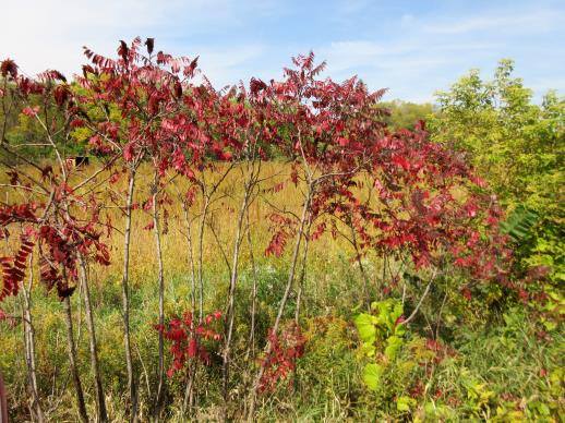 | | 2021 | COLLECTED | 09/29/2021 | Upper Iowa River area near Bluffton, T99N R9W NE1/4 Sec. 9 and S1/2 Sec. 10 | 43.40275000, -91.90494000 | 299 | High bluffs, roadside and stream banks | Wild material | Plants sampled in nature (29 September 2021) during peak fall color displaying bright reds to maroonish colors while measuring approximately 12-15 feet in height. One clonal patch noted was estimated to have 1,000+ ramets. | 2122093 | Ames 35752 |
| 140 | OPGC 7576 | McFarland Park | Solidago flexicaulis L. | Iowa, United States | OPGC |  | | 2021 | COLLECTED | 09/26/2021 | McFarland Park just north, northeast of Ames, T84N R23W Sec. 7 | 42.09667500, -93.57083500 | 288 | Moist areas near streambanks and bottomlands in hardwood forest understory. | Wild material | Plants in nature ranged in height from approximately one to three feet, growing as spreading clumps. Peak flowering in 2021 occurred near 18 September. | 2132830 | OPGC 7576 |
| 141 | NA 86933 | PCCKY16-024 | Viburnum deamii (Rehder) Bush | Ohio, United States | NA | | | 2021 | COLLECTED | 09/07/2019 | Lynx Township: Edge of Appalachia Preserve System: The E. Lucy Braun Lynx Prairie Preserve. | 38.76479000, -83.40996000 | 266 | Oak-hickory woodland over Devonian shale (Ohio shale). Slope: 0 degrees. Aspect: Northwest. | Wild material | Full name as recorded at U.S. National Arboretum: Viburnum dentatum var. deamii. See NA 86224 for original wild-collected seed received from the Arnold Arboretum in 2019. | 2155046 | NA 86933 |
| 142 | Ames 35746 | Guye Woods | Acer saccharum Marshall subsp. nigrum (F. Michx.) Desmarais | Iowa, United States | NC7 |  | | 2021 | COLLECTED | 09/08/2021 | Guye Woods County Park located 6.0 miles northeast of Winterset, T76N R27W NE1/4 Sec. 4 | 41.41235000, -93.96373000 | 278 | Moist deciduous maple, oak, hickory forest, northwest facing slope above the North River. | Wild material | Multiple specimens in this population were observed to be 24" diameter at breast height (DBH) or larger with the largest specimen encountered at the time of collection measuring 36.5" DBH.
Morphological traits of leaves suggests sampled specimens are true to type of Acer saccharum subsp. nigrum including leaves with three distinct points, leathery/thick, and drooping in appearance. On September 25, 2020 (Schmitz, A., personal communication, 31 January 2022), peak fall color on Acer saccharum subsp. nigrum at Guye Woods was observed with specimens having a clean yellow fall color, also indicative of Acer saccharum subsp. nigrum.
| 2122010 | Ames 35746 |
| 143 | Ames 35734 | Ledges State Park | Teucrium canadense L. | Iowa, United States | NC7 |  | | 2021 | COLLECTED | 08/23/2021 | Ledges State Park located approximately 4.75 miles south of Boone T83N R26W Sec. 16 & 21 | 41.99262400, -93.87724800 | 330 | Edges of woods | Wild material | | 2120338 | Ames 35734 |
| 144 | Ames 36047 | CBG-10076 | Helianthus divaricatus L. | Oklahoma, United States | NC7 | | | 2021 | | | | | | | Wild material | | 2120050 | Ames 36047 |
| 145 | Ames 36062 | CBG-10584 | Linum sulcatum Riddell | Illinois, United States | NC7 | | | 2021 | | | | | | | Wild material | Plant numbers sampled estimated. | 2120175 | Ames 36062 |
| 146 | NA 88199 | CBG-10062 | Callicarpa americana L. | Oklahoma, United States | NA | | | 2021 | | | | | | | Wild material | | 2120043 | NA 88199 |
| 147 | NA 88321 | CBG-10546 | Hydrangea arborescens L. | Illinois, United States | NA | | | 2021 | | | | | | | Wild material | Plant numbers estimated. | 2120147 | NA 88321 |
| 148 | NA 88332 | CBG-10580 | Hypericum prolificum L. | Illinois, United States | NA | | | 2021 | | | | | | | Wild material | Plant numbers sampled estimated. | 2120171 | NA 88332 |
| 149 | OPGC 8289 | CBG-10186 | Verbena hastata L. | Oklahoma, United States | OPGC | | | 2021 | | | | | | | Wild material | | 2120055 | OPGC 8289 |
| 150 | OPGC 8322 | CBG-10505 | Aureolaria flava (L.) Farw. | Illinois, United States | OPGC | | | 2021 | | | | | | | Wild material | | 2120125 | OPGC 8322 |
| 151 | OPGC 8339 | CBG-10556 | Anemone virginiana L. | Illinois, United States | OPGC | | | 2021 | | | | | | | Wild material | GPS coordinates incomplete. | 2120152 | OPGC 8339 |
| 152 | OPGC 8344 | CBG-10576 | Gillenia stipulata (Muhl. ex Willd.) Nutt. | Illinois, United States | OPGC | | | 2021 | | | | | | | Wild material | plant numbers sampled estimated. | 2120167 | OPGC 8344 |
| 153 | OPGC 8348 | CBG-10581 | Hieracium scabrum Michx. | Illinois, United States | OPGC | | | 2021 | | | | | | | Wild material | Plant numbers sampled estimated. | 2120172 | OPGC 8348 |
| 154 | OPGC 8355 | CBG-10605 | Solidago nemoralis Aiton | Illinois, United States | OPGC | | | 2021 | | | | | | | Wild material | Also collected elsewhere in SCCA. Plant numbers sampled estimated. | 2120226 | OPGC 8355 |
| 155 | OPGC 8356 | CBG-10606 | Solidago ulmifolia Muhl. ex Willd. | Illinois, United States | OPGC | | | 2021 | | | | | | | Wild material | Plant numbers sampled estimated. | 2120227 | OPGC 8356 |
| 156 | W6 59177 | CBG-10464 | Carex normalis Mack. | Illinois, United States | W6 | | | 2021 | | | | | | | Wild material | | 2120098 | W6 59177 |
| 157 | W6 59201 | CBG-10497 | Lespedeza hirta (L.) Hornem. | Illinois, United States | W6 | | | 2021 | | | | | | | Wild material | | 2120120 | W6 59201 |
| 158 | W6 59222 | CBG-10529 | Gratiola neglecta Torr. | Illinois, United States | W6 | | | 2021 | | | | | | | Wild material | Plant numbers estimated. | 2120137 | W6 59222 |
| 159 | W6 59243 | CBG-10560 | Cinna arundinacea L. | Illinois, United States | W6 | | | 2021 | | | | | | | Wild material | Plant numbers estimated. | 2120155 | W6 59243 |
| 160 | W6 59266 | CBG-10588 | Muhlenbergia sobolifera (Muhl. ex Willd.) Trin. | Illinois, United States | W6 | | | 2021 | | | | | | | Wild material | | 2120209 | W6 59266 |
| 161 | W6 59278 | CBG-10602 | Schizachyrium scoparium (Michx.) Nash | Illinois, United States | W6 | | | 2021 | | | | | | | Wild material | Plant numbers sampled estimated. | 2120187 | W6 59278 |
| 162 | Ames 35667 | Kankakee Sands Preserve | Aronia ×prunifolia (Marshall) Rehder | Illinois, United States | NC7 |  | | 2021 | COLLECTED | 05/04/2021 | Kankakee Sands Preserve located approximately 2.3 miles southwest of Wilmington in Custer Township, T32N R9E NE 1/4 Sec. 11 | 41.27166000, -88.15701800 | 170 | Sand shrub prairie | Wild material | Genotypes noted in nature were averaging 5.0-6.0' in height, relatively upright in growth habit and extremely dense suckering. Numerous clones noted covering expansive areas (e.g. 30 yards by 20 yards, etc.). Variation in branching and glossiness of leaves noted across genotypes present in nature. | 2115976 | Ames 35667 |
| 163 | Ames 35668 | Iroquois County Conservation Area | Aronia ×prunifolia (Marshall) Rehder | Illinois, United States | NC7 |  | | 2021 | COLLECTED | 05/05/2021 | Iroquois County Conservation Area located approximately 4.5 miles northeast of Beaverville in Beaverville Township, T29N R11W NE1/4 Sec. 22 | 40.99154700, -87.58073200 | 198 | Woodland edge of wet sand prairie | Wild material | Wide variety of genotypes noted in nature averaging 3.5-7' in height. Some growing in shade of oak forest were sparse suckering and open branching compared to open grown specimens that were extremely dense with suckers. | 2115977 | Ames 35668 |
| 164 | Ames 35660 | Kiamichi Mountains | Ptelea trifoliata L. | Oklahoma, United States | NC7 | | | 2021 | COLLECTED | 07/19/2018 | Kiamichi Mountains of Ouachita National Forest along Road 6025 just west of State Highway 259, T2N R25E SW 1/4 NE 1/4 SW 1/4 Sec. 27 | 34.61314900, -94.67035700 | 651 | Open, dry ridgetop, rocky roadside. | Wild material | Specimens sampled measuring approximately 20-25' in height. | 2114985 | Ames 35660 |
| 165 | NA 88299 | MARSB-768 | Clethra alnifolia L. | New Jersey, United States | NA | | | 2021 | | | | | | | Wild material | Growth formûthe plant is a shrub (i.e., a woody plant with several stems growing from the base)ûLeaf typeûthe leaf blade is simple (i.e., lobed or unlobed but not separated into leaflets)ûLeaves per nodeûthere is one leaf per node along the stemûLeaf blade edgesûthe edge of the leaf blade has teethûLeaf durationûthe leaves drop off in winter (or they wither but persist on the plant)ûarmature on plantûthe plant does not have spines, prickles, or thornsûLeaf blade lengthû35–100 mmûLeaf blade widthû20–55 mmûLeaf stalkûthe leaves have leaf stalksûFruit type (general)ûthe fruit is dry and splits open when ripeûBark textureûthe bark of an adult plant is thin and smoothûTwig winter colorûbrownûgrayûBud scale numberûthere are no scales on the winter buds | 2113613 | NA 88299 |
| 166 | NA 88397 | MARSB-550 | Kalmia latifolia L. | New Jersey, United States | NA | | | 2021 | | | | | | | Wild material | Growth formûthe plant is a shrub (i.e., a woody plant with several stems growing from the base)ûLeaf typeûthe leaf blade is simple (i.e., lobed or unlobed but not separated into leaflets)ûLeaves per nodeûthere is one leaf per node along the stemûLeaf blade edgesûthe edge of the leaf blade has no teeth or lobesûLeaf durationûthe leaves remain green all winterûarmature on plantûthe plant does not have spines, prickles, or thornsûLeaf blade lengthû50–100 mmûLeaf blade widthû15–50 mmûLeaf stalkûthe leaves have leaf stalksûFruit type (general)ûthe fruit is dry and splits open when ripeûBark textureûthe bark of an adult plant is ridged or platedûthe bark of an adult plant peels off easily or hangs offûTwig winter colorûbrownûgreenûredûBud scale numberûthere are two scales on the winter bud, and their edges meet | 2113557 | NA 88397 |
| 167 | W6 58575 | MARSB-215 | Juncus secundus P. Beauv. ex Poir. | New York, United States | W6 | | | 2021 | | | | | | | Wild material | Plants are in seed. The inflorescences are straw colored. The inflorescences are at the top of the stem, not spreading. It is taller than Juncus tenuis. | 2113505 | W6 58575 |
| 168 | W6 58576 | MARSB-240 | Pityopsis falcata (Pursh) Nutt. | New York, United States | W6 | | | 2021 | | | | | | | Wild material | Yellow flowers, thin sickle-shaped leaves | 2113506 | W6 58576 |
| 169 | W6 58587 | MARSB-407 | Anatherum glomeratum (Walter) Voronts. & E. A. Kellogg | New York, United States | W6 | | | 2021 | | | | | | | Wild material | | 2113517 | W6 58587 |
| 170 | W6 58592 | MARSB-450 | Danthonia spicata (L.) P. Beauv. ex Roem. & Schult. | New Jersey, United States | W6 | | | 2021 | | | | | | | Wild material | Dense tufts. Leaves born mostly near base, blades curly. lower sheaths often contain cleistogamous spikelets. inflorescence contracted, racemiform. | 2113522 | W6 58592 |
| 171 | Ames 35649 | Backbone | Pinus strobus L. | Iowa, United States | NC7 |  | | 2021 | COLLECTED | 03/04/2021 | Backbone State Park located approximately 5.15 miles south, southwest of Strawberry Point, T90N R6W NW1/4 Sec. 16 | 42.61131500, -91.56098900 | 316 | Cliff edges and steep slopes above the Maquoketa River, including the ridge known as the "Backbone". | Wild material | The native range of Pinus strobus is concentrated in the northeastern United States extending south into the northern edge of Georgia and west to central Minnesota. In Iowa, there are scattered populations in a few northeastern counties and also a very small disjunct population in central Iowa (Hardin County, Ames 32758) and also one in southeastern Iowa (Muscatine County, Ames 35635). This accession represents genetics from "legacy" specimens from northeastern Iowa in Backbone State Park (Delaware County). Although a significant number of P. strobus were planted at this park in the 1920's a significant number of native specimens still exist throughout the park typically found on extreme topographical features such as steep slopes and rock outcroppings. Genetics from this site likely represents the extreme southwestern edge of the species native range. Genetics may likely be adapted/tolerant to drought and also late winter/early spring extreme temperature fluctuations. Accession was collected as scions in winter to capture genetics that are of known origin. | 2113351 | Ames 35649 |
| 172 | Ames 35650 | Bixby | Pinus strobus L. | Iowa, United States | NC7 |  | | 2021 | COLLECTED | 03/04/2021 | Bixby State Preserve on slopes above Bear Creek, located approximately 6.25 miles east of Strawberry Point, T91N R5W SE1/4 Sec. 22 | 42.67534800, -91.41301000 | 324 | Cliff edges and steep slopes. | Wild material | The native range of Pinus strobus is concentrated in the northeastern United States extending south into the northern edge of Georgia and west to central Minnesota. In Iowa, there are scattered populations in a few northeastern counties and also a very small disjunct population in central Iowa (Hardin County, Ames 32758) and also one in southeastern Iowa (Muscatine County, Ames 35635). This accession represents genetics from "legacy" specimens from northeastern Iowa in Bixby State Preserve (Clayton County). Genetics from this site likely represents the extreme southwestern edge of the species native range. Genetics may likely be adapted/tolerant to drought and also late winter/early spring extreme temperature fluctuations. Accession was collected as scions in winter to capture genetics that are of known origin. | 2113352 | Ames 35650 |
| 173 | Ames 35635 | Wildcat Den | Pinus strobus L. | Iowa, United States | NC7 |  | | 2021 | COLLECTED | 03/02/2021 | Wildcat Den State Preserve near Muscatine, T77N R1E SW1/4 SW1/4 Sec. 17 | 41.46735000, -90.88171000 | 185 | Canyon edges and valleys. | Wild material | The native range of Pinus strobus is concentrated in the northeastern United States extending south into the northern edge of Georgia and west to central Minnesota. In Iowa, there are scattered populations in a few northeastern counties and also a very small disjunct population in central Iowa (Hardin County, Ames 32758) and one in southeastern Iowa (Muscatine County). This accession represents genetics from five mother "legacy" trees located in Wildcat Den State Park (Muscatine County). Although a significant number of P. strobus were planted at this park in the early 1900's a significant number of native specimens still exist as a localized grouping within the central portion of the park in the deep valleys and also one specimen on an extreme rock outcropping. P. strobus from this site represents the extreme southwestern edge of the species native range. Genetics may likely be adapted/tolerant to drought and also late winter/early spring extreme temperature fluctuations. Specimen #1 sampled at this site is currently ranked as the 6th largest Pinus strobus in the state (M. Rouw, pers. comm. 28 February 2021) measuring 11'6" circumference; 127.5' height; and 45' crown spread (Total Points: 276.75). Accession was collected as scions in winter to capture genetics that are of known origin. | 2113335 | Ames 35635 |
| 174 | Ames 35794 | NCTN04 | Physocarpus opulifolius (L.) Maxim. | North Carolina, United States | NC7 | | | 2020 | COLLECTED | 09/15/2019 | Nantahala National Forest along east side of Buck Creek Road near Buck Creek | 35.08316000, -83.61610000 | 1004 | Appalachian serpentine woodland; southwest facing | Wild material | | 2109407 | Ames 35794 |
| 175 | NA 87611 | ZARKS-030 | Rhododendron prinophyllum (Small) Millais | Arkansas, United States | NA | | | 2020 | COLLECTED | 10/05/2014 | King's River Falls Natural Area; King's River, downstream of junction of county roads 3415 and 3500 along trail leading from parking area and trail sign. | 35.90106000, -93.57456000 | 514 | Mesic, mixed deciduous forest; growing on ledge along river, in rocky soil. | Wild material | See NA 84645 for material received from the Arnold Arboretum in 2017. | 2115796 | NA 87611 |
| 176 | Ames 35614 | F017 | Physocarpus opulifolius (L.) Maxim. | Pennsylvania, United States | NC7 |  | | 2020 | COLLECTED | 09/29/2020 | Camp Shand located approximately 1.97 miles south, southeast of Cornwall, Lebanon County | 40.24719440, -76.39194440 | 231 | Powerline cut. Edge of woods | Wild material | | 2109481 | Ames 35614 |
| 177 | Ames 35547 | White Pine Hollow | Pinus strobus L. | Iowa, United States | NC7 |  | | 2020 | COLLECTED | 08/20/2020 | White Pine Hollow State Preserve located approximately 2.65 miles northwest of Luxemburg, T90N R2W SE 1/4 Sec. 7, Dubuque County | 42.61954600, -91.11933000 | 308 | High-quality remant mixed woods | Wild material | The native range of Pinus strobus is concentrated in the northeastern United States extending south into the northern edge of Georgia and west to central Minnesota. In Iowa, there are scattered populations in a few northeastern counties and also a very small disjunct population in central Iowa (Hardin County, Ames 32758) and also in southeastern Iowa (Muscatine County, Ames 35635). This accession represents genetics from northesastern Iowa in White Pine Hollow (WPH) in Dubuque County and is known to harbor the largest stand of white pine in Iowa dating back to the 1870's. WPH was the first woodland in Iowa to be dedicated (1967) as a state preserve and was previously known to contain Iowa's oldest white oak with a core date estimated back to the year 1580 (Duvick and Blasing 1983). WPH is home to the largest native specimen of Pinus strobus measuring 11’1.5” circumference, 142’ tall, and 44’ spread for a total of 286.3 points (Rouw, M., personal communication, 21 September 2020). “In an assessment of 92 of the largest white pines (native and cultivated) across Iowa, 68 occur in WPH. Out of 40 that exceed a height of 130', 38 are found in WPH with seven of those exceeding 140' and two surpassing 147' (Rouw, M., personal communication, 18 September 2020). The site is also the location of height records (Iowa) for several tree species including Ulmus americana 108', Tilia americana 105.5', Acer saccharum 109', Quercus alba 107', and Carya ovata 109’ (Rouw, M., personal communication, 18 September 2020). P. strobus in WPH is the dominant overstory species specifically in areas next to ravines/valleys and some immediately adjacent uplands. P. strobus from this site represents the extreme western edge of the species native range. Genetics may likely be adapted/tolerant to drought and also late winter/early spring extreme temperature fluctuations. Accession was collected both as seeds (2020) and as scions (2021). | 2106728 | Ames 35547 |
| 178 | NA 87036 | Site 3A/Live Oak Landing/Holmes Creek Site | Magnolia ashei Weath. | Florida, United States | NA | | | 2020 | COLLECTED | 07/15/2020 | Along Holmes Creek at Live Oak Landing. | 30.59208000, -85.83750000 | 11 | Shade to partial shade of bluffs above the creek in well-drained mesic to dry deciduous woodlands with a few broadleaved and coniferous evergreens. | Wild material | Although these were collected without any field collection number, seeds from individual trees were separated with letter identifiers that will be maintained with the qualifier (seedling) records. The relationships are as follows: 1. Maternal letter G, NA 87036-J, L, P, and T; maternal letter H, NA 87036-V; maternal letter K, NA 87036-X, Z, and H1; maternal letter N, NA 87036-H2. In addition, three seedlings' maternal letters were lost, and these will be NA 87036-H3, H4, and H5. See the following accessions for earlier collections from this same site/population, listed in our records as "Site 3A/Live Oak Landing/Holmes Creek Site": NA 81555 (2013), NA 82745 (2015), and NA 82745.01 (2019). | 2109403 | NA 87036 |
| 179 | WLP 2024 | MARSB-988 | Viburnum acerifolium L. | New York, United States | NA | | | 2019 | COLLECTED | 08/30/2019 | Onondaga County; Geddes; Long Branch County Park. | 43.11757000, -76.25210000 | | Growing in full shade in forest, in moist to dry, well-drained silt/sand soil. | | Seed harvested from 35+ individuals in a population of 100+. Common. Seed 100 percent healthy; seed maturation middle. | 2109173 | WLP 2024 |
| 180 | WLP 2031 | MARSB-998 | Viburnum acerifolium L. | New York, United States | NA | | | 2019 | COLLECTED | 09/20/2019 | Monroe County; Perinton; Horizon Hill Conservation Area [side of Interstate 490 west, alongside Bushnell's Basin exit (Exit 27).] | 43.04778000, -77.46235000 | 189 | Oak/hickory forest in partial shade; growing in moist, well-drained loam soil. | | Seeds collected from 40 individuals in a population of 100 plants spread across a 60 m by 60 m area; scattered distribution. 95 percent healthy seed. Seed maturation: middle. | 2109180 | WLP 2031 |
| 181 | WLP 2032 | MARSB-999 | Viburnum acerifolium L. | New York, United States | NA | | | 2019 | COLLECTED | 09/08/2019 | Dutchess County; Rhinebeck; Enterprise Drive, private residential property. | | 305 | Oak forest in partial shade; growing in dry loamy sand. | | Seeds collected from 100+ individuals in a population of 100+ plants spread across a 300 meter by 300 meter linear strip [?]; common. Seed maturation: late. | 2109181 | WLP 2032 |
| 182 | WLP 2034 | MARSB-1001 | Viburnum acerifolium L. | New York, United States | NA | | | 2019 | COLLECTED | 07/08/2019 | Dutchess County; Tivoli; Bard College campus. | | 122 | Oak woodland in partial shade; growing in dry loamy sand. | | Seeds collected from 75 individuals in a population of 100+ plants spread across a ca 1 square mile area; common. Seed maturation: late. | 2109183 | WLP 2034 |
| 183 | NA 88145 | NCBG-293 | Ilex verticillata (L.) A. Gray | Virginia, United States | NA |  | | 2019 | COLLECTED | 09/22/2015 | Powells Creek: from I-95 S take exit 156A E to state Rte. 784 and merge onto Dale Blvd. take a right on US.-1 S, turn left on Neabsco Rd., right onto Dale K. Ludwig Drive, from contact station park at Powell's Creek Trailhead, follow trail until Potomac Heritage Trial continue to southwestern point of trail. | 38.58886000, -77.27008000 | 6 | Tidal freshwater marsh. | Wild material | | 2098397 | NA 88145 |
| 184 | NA 88169 | NCBG-665 | Kalmia latifolia L. | Virginia, United States | NA |  | | 2019 | | | | | | | Wild material | | 2098504 | NA 88169 |
| 185 | NA 88171 | NCBG-667 | Kalmia latifolia L. | Maryland, United States | NA |  | | 2019 | | | | | | | Wild material | | 2098506 | NA 88171 |
| 186 | OPGC 7923 | NEWFS-81 | Maianthemum canadense Desf. | Massachusetts, United States | OPGC |  | | 2019 | | | | | | | Wild material | | 2098113 | OPGC 7923 |
| 187 | WLP 2522 | Oakmulgee Ranger District | Hydrangea quercifolia W. Bartram | Alabama, United States | NA |  | | 2019 | COLLECTED | 11/29/2018 | Talladega National Forest, Oakmulgee Ranger District, Bibb County. Approximately 14 miles west of Centreville, along FR738. | 32.95619300, -87.43060000 | | Shady roadside, wooded slopes. | Wild material | Measurements of sampled specimens taken in nature: Height 40 to 89 in.; width 24 to 192 in. Measurements for each specimen sampled may be provided upon request. | 2106232 | WLP 2522 |
| 188 | NA 88094 | MARSB-241 | Lyonia mariana (L.) D. Don | New York, United States | NA |  | | 2019 | | | | | | | Wild material | | 2097533 | NA 88094 |
| 189 | NA 88100 | MARSB-303 | Lyonia mariana (L.) D. Don | New Jersey, United States | NA |  | | 2019 | | | | | | | Wild material | | 2097564 | NA 88100 |
| 190 | NA 88105 | MARSB-406 | Clethra alnifolia L. | New York, United States | NA |  | | 2019 | | | | | | | Wild material | | 2097617 | NA 88105 |
| 191 | NA 88109 | MARSB-425 | Ilex opaca Aiton | New Jersey, United States | NA |  | | 2019 | COLLECTED | 11/03/2015 | Tuckahoe Wildlife Management Area: take exit 20 off Garden State Parkway, route 50 north. Turn right onto Tuckahoe Road, left on Woods Road, right onto Washington Ave, and follow to Tuckahoe Lake. | 39.27769000, -74.73111000 | 0 | Pitch pine lowland swamp forest. | Wild material | | 2097626 | NA 88109 |
| 192 | OPGC 7902 | MARSB-405 | Euthamia caroliniana (L.) Greene ex Porter & Britton | New York, United States | OPGC |  | | 2019 | | | | | | | Wild material | | 2097616 | OPGC 7902 |
| 193 | W6 57055 | MARSB-130 | Danthonia spicata (L.) P. Beauv. ex Roem. & Schult. | New Jersey, United States | W6 |  | | 2019 | | | | | | | Wild material | | 2097494 | W6 57055 |
| 194 | W6 57084 | MARSB-216 | Carex annectens (E. P. Bicknell) E. P. Bicknell | New York, United States | W6 |  | | 2019 | | | | | | | Wild material | | 2097523 | W6 57084 |
| 195 | W6 57085 | MARSB-218 | Scirpus atrovirens Willd. | New York, United States | W6 |  | | 2019 | | | | | | | Wild material | | 2097524 | W6 57085 |
| 196 | W6 57172 | MARSB-397 | Crocanthemum canadense (L.) Britton | New York, United States | W6 |  | | 2019 | | | | | | | Wild material | | 2097611 | W6 57172 |
| 197 | WLP 1685 | JDC/RS/2019/036/915 | Rosa setigera Michx. | Iowa, United States | NA |  | | 2019 | COLLECTED | 10/17/2019 | Ledges State Park located approximately 4.75 miles south of Boone, just south of the Oakwoods Shelter/Picnic area, T83N R26W NE1/4 NE1/4 and also NW1/4 NE1/4 Sec. 21, Boone County | 41.99262400, -93.87724800 | 330 | Edges of woods (adjacent to prairie) and also within 20-25 yards from woods in prairie. Noted in east, west, and south-facing edges of woods (no specimens noted on north-facing woodland edges) | Wild material | Woody shrub/vine stretching up to 12' in length. Alternate compound leaves usually consisting of five lealets. Leaf rachis and stipule margins glandular. Mature hypanthium and pedicel with stipitate glandular hairs. Mature hypanthium mostly bright to dark red in color with a few dark orange noted at time of harvest (17 October 2019). Leaves rather to somewhat glossy. This collection represents genetics from the northwestern edge of the species range, likely suggesting good cold-hardiness (USDA Zone 5a). | 2097769 | WLP 1685 |
| 198 | WLP 158 | NACPEC19-029 | Rhus glabra L. | Kentucky, United States | NA | | | 2019 | COLLECTED | 09/09/2019 | Madison County; Berea College Forest: Radio Tower Service Trail | 37.55289700, -84.28793400 | 379 | Xeric shade knob, limestone shale conglomerate material | Wild material | | 2110470 | WLP 158 |
| 199 | WLP 163 | NACPEC19-046B | Hydrangea cinerea Small | Georgia, United States | NA | | | 2019 | COLLECTED | 09/14/2019 | Walker County; Lula Lake Land Trust: Bridge from parking lot to South Creek Trail | 34.92114500, -85.38035700 | 373 | Limestone bluffs surrounding dry creek bed in mixed mesophytic forest | Wild material | | 2110475 | WLP 163 |
| 200 | WLP 164 | NACPEC19-047 | Kalmia latifolia L. | Georgia, United States | NA | | | 2019 | COLLECTED | 09/14/2019 | Walker County; Lula Lake Land Trust: Off of South Creek trail on North side of bridge from parking lot | 34.92134100, -85.38051100 | 373 | Riparian zone, wet slope of creek, moist, sandy banks | Wild material | | 2110476 | WLP 164 |
| 201 | WLP 167 | NACPEC19-053 | Mitchella repens L. | Georgia, United States | NA | | | 2019 | COLLECTED | 09/14/2019 | Walker County; Lula Lake Land Trust: Middle Trail near top, also collected along Connector Trail to Middle Trail from parking lot. | 34.93141800, -85.36991400 | 469 | Mesic, sandy, rocky Oak-Hickory woodland slope - likely acidic | Wild material | | 2110479 | WLP 167 |
| 202 | WLP 168 | NACPEC19-054 | Viburnum acerifolium L. | Georgia, United States | NA | | | 2019 | COLLECTED | 09/14/2019 | Walker County; Lula Lake Land Trust: Middle Trail near top. | 34.93146200, -85.37018800 | 449 | Mesic, sandy, rocky Oak-Hickory woodland slope - likely acidic | Wild material | | 2110480 | WLP 168 |
| 203 | WLP 175 | NACPEC19-084 | Crataegus sp. | North Carolina, United States | NA | | | 2019 | COLLECTED | 09/18/2019 | Clay County; Nantahala National Forest: Forest Road 6269: Buck Creek Serpentine Barrens: main trail | 35.08578100, -83.61498800 | 1036 | Pinus rigida-Quercus alba / Sporobulus heterolepis-Andropogon gerardii Woodland OR Southern Blue Ridge Ultramafic Outcrop Barren | Wild material | | 2110489 | WLP 175 |
| 204 | WLP 176 | NACPEC19-085 | Viburnum cassinoides L. | North Carolina, United States | NA | | | 2019 | COLLECTED | 09/18/2019 | Clay County; Nantahala National Forest: Forest Road 6269: Buck Creek Serpentine Barrens: main trail | 35.08593700, -83.61539800 | 1057 | Pinus rigida-Quercus alba / Sporobulus heterolepis-Andropogon gerardii Woodland OR Southern Blue Ridge Ultramafic Outcrop Barren | Wild material | | 2110490 | WLP 176 |
| 205 | Ames 35228 | JDC/AS/2019/031/910 | Agastache scrophulariifolia (Willd.) Kuntze | Iowa, United States | NC7 |  | | 2019 | COLLECTED | 09/30/2019 | Ledges State Park located approximately 4.75 miles south of Boone, just east and south of the Carl Fritz Henning Shelter, T83N R26W SW1/4 SE1/4 NW1/4 Sec. 21, Boone County | 41.98786200, -93.88824500 | 276 | Moist, semi-shaded, deciduous woods. Recently disturbed. | Wild material | Plants measuring approximately 6-8' in height with 4-5" spikes rather white or extremely pale pink in color. Peak flowering occurred circa 26 August 2019 in nature. | 2097764 | Ames 35228 |
| 206 | WLP 2015 | F006 | Viburnum dentatum L. | Pennsylvania, United States | NA | | | 2019 | COLLECTED | 09/12/2019 | Lebanon County; South Lebanon Township; | 40.25505000, -76.35025000 | | | | Large population; little seed set. Heavy viburnum leaf beetle damage. | 2109113 | WLP 2015 |
| 207 | Ames 35220 | Ames 35220 | Aronia ×prunifolia (Marshall) Rehder | Wisconsin, United States | NC7 |  | | 2019 | COLLECTED | 09/04/2019 | Watershed area of Brule River. Collection site located approximately 3.75 miles southwest of Winneboujou, 0.30 miles west of intersection of Francis Willard Road and Forestry Road, T46N R10W SW1/4 SW1/4 Sec. 8, Douglas County | 46.47574000, -91.65172000 | 359 | Ecotone of Tamarack Swamp, Northern Sedge Meadow and Upland Northern Hardwood Forest | Wild material | Plants in nature ranging from 1.0-2.5 meters in height. Fruits measuring approximately 7-9mm in diameter and dark reddish-purple at time of collection (4 September 2019). | 2097756 | Ames 35220 |
| 208 | WLP 155 | NACPEC19-014 | Platanus occidentalis L. | Kentucky, United States | NA | | | 2019 | COLLECTED | 09/08/2019 | Wolfe County; ; Daniel Boone National Forest: Red River Gorge Area: 1/2 mile west of where Sheltowee Trace crosses Red River, on south bank of Red River. | 37.82370000, -83.62590000 | 254 | Mixed mesophytic forest on south bank of river, edge of river bed; growing in alluvial, sandy soil. | | Seeds collected from one plant. Four herbarium specimens collected; photographed. DNA sample collection number: DENG8217. | 2109143 | WLP 155 |
| 209 | OPGC 7463 | CBG-8629 | Delphinium tricorne Michx. | Idaho, United States | OPGC |  | | 2019 | | | | | | | Wild material | | 2092684 | OPGC 7463 |
| 210 | OPGC 7496 | CBG-9546 | Solidago ulmifolia Muhl. ex Willd. | Illinois, United States | OPGC |  | | 2019 | | | | | | | Wild material | | 2092814 | OPGC 7496 |
| 211 | OPGC 7855 | CBG-9538 | Eutrochium purpureum (L.) E. E. Lamont | Illinois, United States | OPGC |  | | 2019 | | | | | | | Wild material | | 2092807 | OPGC 7855 |
| 212 | W6 56710 | CBG-9540 | Scrophularia marilandica L. | Illinois, United States | W6 |  | | 2019 | | | | | | | Wild material | | 2092809 | W6 56710 |
| 213 | NA 88058 | NEWFS-80 | Mitchella repens L. | Massachusetts, United States | NA | | | 2019 | | | | | | | Wild material | | 1976147 | NA 88058 |
| 214 | NA 88374 | NEWFS-395 | Iva frutescens L. | Connecticut, United States | NA |  | | 2019 | | | | | | | Wild material | | 1976245 | NA 88374 |
| 215 | W6 56117 | NEWFS-92 | Urtica dioica L. | Rhode Island, United States | W6 |  | | 2019 | | | | | | | Wild material | | 1976152 | W6 56117 |
| 216 | WLP 310 | AF2018-007 | Acer saccharum Marshall subsp. floridanum (Chapm.) Desmarais | Virginia, United States | NA | | | 2018 | COLLECTED | 09/11/2018 | Brunswick County; ; Tabacco Heritage Trail, Evans Creek Trailhead. 200 ft east of the parking lot, 50 ft from the creek, on the bank of the trail. | 36.73562000, -77.95825000 | 68 | | | A few medium sized trees near the creek with many seedlings along the trail. Herbarium voucher collected (see barcode NA0103776). | 2108856 | WLP 310 |
| 217 | W6 54021 | MARSB-217 | Scirpus cyperinus (L.) Kunth | New York, United States | W6 |  | | 2018 | | | | | | | Wild material | Scirpus cyperinus | 1964737 | W6 54021 |
| 218 | Ames 34320 | JDC/MR/2018/058/871 | Monarda russeliana Nutt. ex Sims | Oklahoma, United States | NC7 |  | | 2018 | COLLECTED | 07/19/2018 | Kiamichi Mountains of Ouachita National Forest along Road 6025 just west of highway 259, T2N R25E S 1/2 Sec. 27 and S 1/2 Sec. 28 Le Flore County. | 34.61320100, -94.66641200 | 651 | Open, dry, rocky woods. | Wild material | Petite plants with only 1-3 stems per plant ranging from 1.0-1.5' in height. At time of collection (19 July 2018) peduncle showing 1-2" of dead/brown tissue. Leaves twice as long (or more) as wide. Generally three pairs of opposite leaves per stem. Slight pubescence on leaves with 1-2 mm petiole. Leaves rather flat. Seeds likely reached peak maturity around first week in July. | 1964627 | Ames 34320 |
| 219 | Ames 34321 | JDC/MR/2018/061/874 | Monarda russeliana Nutt. ex Sims | Oklahoma, United States | NC7 |  | | 2018 | COLLECTED | 07/19/2018 | On the northwest side of Wister Lake along the north side of Wister Lake MGMT Road, T5N R24E NW 1/4 NW 1/4 and NE 1/4 NW 1/4 Sec. 6, Le Flore County. | 34.93915700, -94.81967400 | 160 | Open, dry, rocky woods. | Wild material | Petite plants with only 1-3 stems per plant ranging from 1.0-1.5' in height. At time of collection (19 July 2018) peduncle showing 1-2" of dead/brown tissue. Leaves twice as long (or more) as wide. Generally three pairs of opposite leaves per stem. Slight pubescence on leaves with 1-2 mm petiole. Leaves rather flat. Seeds likely reached peak maturity around first week in July. | 1964628 | Ames 34321 |
| 220 | Ames 34208 | NAO/UT/2018/23/48 | Ulmus thomasii Sarg. | Illinois, United States | NC7 |  | | 2018 | COLLECTED | 05/31/2018 | Private property located 2.0 miles northeast of Plano along Big Rock Creek just off Needham Road, T37N R6E SW 1/4 NE 1/4 Sec. 14 | 41.68543300, -88.51368600 | 188 | Flat open (mowed) areas and edge of woods. | Wild material | Ulmus thomasii (Rock elm) is an underutilized tree species both in conservation and in the urban landscape. Charles Sprague Sargent (first director of the Arnold Arboretum of Harvard University, Boston, MA) described the wood of Rock Elm as "heavy, hard, very strong and tough, closely grained, and susceptible of receiving a beautiful polish". Historically noted for a variety of uses in woodworking including furniture, heavy agricultural implements, timber frame buildings, pianos, hockey sticks, and hand tools. U. thomasii is extremely drought tolerant, adaptable to very calcareous soils, and compared to U. americana or U. rubra has a very conservative growth rate requiring minimal attention in regards to pruning. Rock elm naturally tends to develop into a nice structural specimen in the landscape, unlike other fast growing U. americana cultivars in the nursery trade needing frequent attention. Rock elm has very fissured bark and is well known for maintaining a strong central leader resulting in a very attractive, pyramidal form. Despite many literature sources stating that "wings" on the stems are a key identifiying characteristic, this trait is not reliable and many genotypes may completely lack "wings" on the stems. While growth habit and morphology of dormant buds (very pointy) are good traits to help aid in identification, fruits are the best way to confirm identity. Fruits are densly pubescent, often described as "inflated" and generally reach maturity a couple weeks after U. rubra and U. americana. U. thomasii inflorescences are rather distinguishable from other Ulmus in being pendulous. Fruits are extremely prized treats for many birds, where fruits are often "robbed" prior to full maturity. Fruits are also highly prized by many other animals such as mice, squirrels, chipmunks, turkeys, etc. and are generally consumed within hours after fruit abscission. The native range of U. thomasii is concentrated in the northeastern United States and into Canada with disjunct populations documented in northwestern Missouri and northwestern Arkansas (Little, E. L. Jr. 1971). In the 1895 Silva of North America (vol. 7) it was stated that, “The value of the wood of the Rock Elm threatens its extinction and most of the large trees have already been cut.” Today, since rock elm is rather rare, especially in areas near the edges of its range, many states list the species as endangered or threatened warranting preservation efforts. Genetics of this accession were collected on private property in north central Illinois (Kendall County) from a localized population in nature represented by 10-16" DBH specimens with little to no signs of decline. | 1963391 | Ames 34208 |
| 221 | WLP 1190 | NA 85118 | Dirca palustris L. | Iowa, United States | NA |  | | 2018 | COLLECTED | 05/31/2018 | Private property located 3.35 miles southwest of Luther near Des Moines River, T82N R26W SW 1/4 SW 1/4 Sec. 3, Boone County | 41.93795800, -93.87109500 | 317 | Dense shade of mature oak forest. Deep ravines. | Wild material | Specimens measuring approximately 2-5' in height. Noticeable new growth (5-8") at time of seed collection. Population was in peak bloom 24 April 2018 with peak fruit maturity occuring on 30 May 2018. Fruits readily dropping when distrubed. Very slight tinge of white color to fully mature fruits. Seeds measuring approximately 0.5-0.7 cm in length. | 1963390 | WLP 1190 |
| 222 | OPGC 6376 | CBG-8085 | Anemone virginiana L. | Illinois, United States | OPGC |  | | 2017 | | | | | | | Wild material | | 1954753 | OPGC 6376 |
| 223 | OPGC 7775 | CBG-7498 | Helenium autumnale L. | Wisconsin, United States | OPGC |  | | 2017 | | | | | | | Wild material | | 1954812 | OPGC 7775 |
| 224 | Ames 34160 | Ames 34160 | Fraxinus americana L. | Pennsylvania, United States | NC7 |  | | 2017 | COLLECTED | 11/01/2017 | Urban loaction near the intersection of Pennsylvania ave. and Fort Washington Ave. Fort Washington, Montgomery County. | 40.13730600, -75.21111800 | 66 | Specimens located along a possible eixisting naural hedge row along the rightway of two existing parking lots. | Uncertain improvement status | | 1957726 | Ames 34160 |
| 225 | Ames 34779 | MARSB-317 | Rhus copallinum L. | New Jersey, United States | NC7 |  | | 2017 | COLLECTED | 09/21/2015 | Edward G Bevan State Wildlife Management Area along powerline cut off Ackley Road. | 39.33627000, -75.07775000 | 19 | Pitch Pine Barrens | Wild material | | 1954641 | Ames 34779 |
| 226 | NA 88341 | NEWFS-91 | Iva frutescens L. | Rhode Island, United States | NA |  | | 2017 | | | | | | | Wild material | | 1954672 | NA 88341 |
| 227 | WLP 1980 | MARSB-795 | Viburnum acerifolium L. | New Jersey, United States | NA | | | 2017 | COLLECTED | 08/29/2017 | Morris County; ; Hacklebarney State Park; all trails in park. | 40.74913000, -74.72916000 | 153 | Upland hardwood forest; hills. Loam soil (Parker series). Land used for conservation and recreation. | | Seeds collected from 75 plants; 400+ plants found in an area of 40 acres. Population is present and spread out throughout park along all trails. One herbarium voucher collected on 29 Aug. 2017; held at Smithsonian. Material identified by Clara Holmes from pressed specimen on 16 Nov. 2017. Ecoregion: 58E -- Northeastern Highlands (Omernik). | 2108824 | WLP 1980 |
| 228 | WLP 1981 | MARSB-797 | Viburnum acerifolium L. | New Jersey, United States | NA | | | 2017 | COLLECTED | 09/07/2017 | Morris County; ; Berkshire Wildlife Management Area: Gordon Road. [From Roxbury fire Co. 3, drive west for 1,500 feet to the end of Gordon Road. Take trail that leads North on foot. Population is spread evenly throughout the WMA.] | 40.91772000, -74.62291000 | 247 | Upland hardwood forest; ground moraines. Coarse loam soil (Rockaway series). Land used for conservation and recreation. | | Seeds collected from 100 plants; 500 plants found in an area of 50 acres. Population is spread evenly throughout the wildlife management area. One herbarium voucher collected on 9 Sep. 2017; held at Smithsonian. Material identified by Clara Holmes from pressed specimen on 16 Nov. 2017. Ecoregion: 58E -- Northeastern Highlands (Omernik). | 2108825 | WLP 1981 |
| 229 | Ames 34086 | APS/HD/2017/038/297 | Helianthus divaricatus L. | Illinois, United States | NC7 |  | | 2017 | COLLECTED | 11/11/2017 | Trail of Tears State Forest approximately 6.11 miles northwest of Anna along North Forest Road (both sides), T12S R2W NW 1/4 NW 1/4 Sec. 4, Union County | 37.50864000, -89.33891000 | 218 | Ridgetop of dry-mesic oak forest | Wild material | Plants 2-5 feet tall, elongated leaves quite rough on both the upper and lower sides. Herbarium specimen is clearly Helianthus divaricatus, however, there is a large amount of variation in seed size, shape, and color. Seed sample may contain genetics of Helianthus hirsutus. | 1954437 | Ames 34086 |
| 230 | Ames 34033 | Ames 34033 | Monarda didyma L. | West Virginia, United States | NC7 |  | | 2017 | COLLECTED | 09/02/2017 | Monongahela National Forest along Road 1678 following Sutton Run Creek aproximately 4.3 miles east of Green Bank, Pocahontas County. | 38.40400000, -79.75550000 | 1001 | Wet/mesic forested, riparian area. | Wild material | | 1954322 | Ames 34033 |
| 231 | Ames 34023 | Ames 34023 | Viburnum prunifolium L. | Iowa, United States | NC7 |  | | 2017 | COLLECTED | 09/27/2017 | Shimek State Forest, Donnellson Unit, approximately 6.0 miles west of Donnellson. | 40.64796000, -91.67764000 | 219 | Oak-hickory upland forest. | Wild material | Plants at collection site ranging between 10-15' tall. Fruits dark purple, leaves on some stems were turning red fall color at time of collection (09/27/2017). | 1953995 | Ames 34023 |
| 232 | NA 84645 | ZARKS-030 | Rhododendron prinophyllum (Small) Millais | Arkansas, United States | NA | | | 2017 | COLLECTED | 10/05/2014 | King's River Falls Natural Area; King's River, downstream of junction of county roads 3415 and 3500 along trail leading from parking area and trail sign. | 35.90106000, -93.57456000 | 514 | Mesic, mixed deciduous forest; growing on ledge along river, in rocky soil. | Wild material | See NA 87611 for plants of the same collection received from Morris Arboretum in 2020. | 2108758 | NA 84645 |
| 233 | NA 84577 | RJL-RM001 | Halesia diptera J. Ellis | Texas, United States | NA | | | 2017 | COLLECTED | 07/22/2017 | Along either side of a clear creek on private property approximately 1.42 kilometers north of Texas Recreational Road 255 in northeastern Jasper County. | 31.07135000, -93.94985000 | 107 | Plants growing along the embankments of the clear creek just above normal flood stage in primarily deciduous woodlands with some broadleaved evergreens and conifers. Plants are growing in part shade; some direct sunlight occurs during mid-day hours for 1-2 hours. Soils sandy and topped with a generous undisturbed decomposed litter layer. Slope: 10 percent. Aspect: variable. | Wild material | | 1953812 | NA 84577 |
| 234 | NA 84578 | RJL-RM002 | Magnolia pyramidata W. Bartram | Texas, United States | NA | | | 2017 | COLLECTED | 07/22/2017 | Newton County Road 425, about 2.8 miles south of Texas Recreational Road 255. | 30.85996000, -93.89596000 | 105 | Along roadsides and among young loblolly pines in forestry plantation. Plants growing in part shade to full sun in heavily regenerating roadside woodlands associated with loblolly pine plantations. Plants are growing in well drained, highly sandy soils. | Wild material | | 1953814 | NA 84578 |
| 235 | Ames 33982 | JDC/FQ/2017/038/792 | Fraxinus quadrangulata Michx. | Kentucky, United States | NC7 | 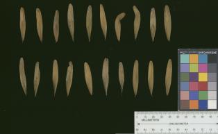 | | 2017 | COLLECTED | 07/10/2017 | Scattered hillside colllections throughout areas approximately 4.5 miles north, northwest of Frankfort, Franklin County | 38.21387700, -84.88886200 | 199 | Mixed wooded deciduous forest, generally steep (45 degree +) slopes and/or hillsides. | Wild material | | 1950065 | Ames 33982 |
| 236 | Ames 33988 | JDC/FQ/2017/044/798 | Fraxinus quadrangulata Michx. | Ohio, United States | NC7 |  | | 2017 | COLLECTED | 07/13/2017 | Baker Tract Preserve (Athens Conservancy) due east approximately 5.68 miles of Athens, T5N R13W SE 1/4 Sec. 16, Athens County | 39.32744200, -81.99581300 | 239 | Deciduous woods, rather steep (45 degree) slopes mostly southeast or southwest facing or found on ridge top. | Wild material | | 1950071 | Ames 33988 |
| 237 | Ames 33990 | JDC/FQ/2017/046/800 | Fraxinus quadrangulata Michx. | Ohio, United States | NC7 |  | | 2017 | COLLECTED | 07/15/2017 | Sharon Woods Metro Park within city limits of Columbus, T2N R18W, Franklin County | 40.12267100, -82.96668000 | 275 | Deciduous woods. | Wild material | | 1950073 | Ames 33990 |
| 238 | Ames 33909 | APS/DL/2017/002/261 | Diervilla lonicera Mill. | Iowa, United States | NC7 |  | | 2017 | COLLECTED | 02/07/2017 | Cedar Bluffs State Preserve approximately 3 miles east southeast of Tracy, T75N R17W SE 1/4 NW 1/4 Sec. 33 | 41.25648000, -92.82437000 | 235 | Deciduous woods, north facing (70-80 degrees) slope above a deep moist ravine, sandstone ledges along ravine. | Wild material | | 1946805 | Ames 33909 |
| 239 | W6 51793 | OR110-838 | Alnus rhombifolia Nutt. | Oregon, United States | W6 | | | 2017 | | | | | | | Wild material | | 1943640 | W6 51793 |
| 240 | WLP 1180 | NA 83893 | Euonymus americanus L. | Kentucky, United States | NA | | | 2016 | COLLECTED | 09/27/2016 | Cumberland Falls State Park, Trail #6 (Cumberland Falls Trail). Stairs above visitor center entrance at Trail #6 trailhead. | 36.83700000, -84.34300000 | 273 | | | | 1951485 | WLP 1180 |
| 241 | WLP 1432 | NA 83894 | Ostrya virginiana (Mill.) K. Koch | Kentucky, United States | NA | | | 2016 | COLLECTED | 09/27/2016 | Cumberland Falls State Park, Cumberland Falls Visitor Center. | 36.84000000, -84.34300000 | 258 | | | | 1952033 | WLP 1432 |
| 242 | WLP 1436 | NA 83951 | Oxydendrum arboreum (L.) DC. | Kentucky, United States | NA | | | 2016 | COLLECTED | 09/29/2016 | Kentenia State Forest, Pine Mountain, opening in canopy on Route 1679, south side. | 36.92000000, -83.24200000 | 795 | Roadside, opening in canopy. | | | 1951128 | WLP 1436 |
| 243 | WLP 1704 | NA 83942 | Rhus glabra L. | Kentucky, United States | NA | | | 2016 | COLLECTED | 09/29/2016 | Kentenia State Forest, Pine Mountain, on Route 1679, south side. | 36.90500000, -83.29100000 | 771 | Roadside. | | | 1953164 | WLP 1704 |
| 244 | WLP 1705 | NA 83948 | Rhododendron maximum L. | Kentucky, United States | NA | | | 2016 | COLLECTED | 09/29/2016 | Kentenia State Forest, Pine Mountain, on Route 1679, north side. | 36.91400000, -83.25900000 | 758 | Roadside. | | | 1950864 | WLP 1705 |
| 245 | WLP 1706 | NA 83955 | Rhododendron sp. | Kentucky, United States | NA | | | 2016 | COLLECTED | 09/30/2016 | Near powerline right-of-way. [Based on proximity to preceding and following collections. -SBL] | 36.84000000, -84.26300000 | 378 | | | | 1953017 | WLP 1706 |
| 246 | WLP 872 | NA 83949 | Clethra acuminata Michx. | Kentucky, United States | NA | | | 2016 | COLLECTED | 09/29/2016 | Kentenia State Forest, Pine Mountain, on Route 1679, south side. | 36.91500000, -83.25900000 | 760 | Roadside. | | | 1951703 | WLP 872 |
| 247 | Ames 33757 | Ames 33757 | Monarda bradburiana L. C. Beck | Illinois, United States | NC7 | _thumbnail.jpg "Click for 3 image(s) for this accession.") | | 2016 | COLLECTED | 10/03/2016 | Shoal Creek Conservation Area approximately 3.5 miles northeast of Litchfield, T9N R5W NW 1/4 SW 1/4 Sec. 25 Montgomery County. | 39.19444400, -89.59388900 | 194 | Barrens complex. Southern Illinois Tillplain. Clay and silt sandstone | Wild material | | 1943155 | Ames 33757 |
| 248 | WLP 1105 | NA 82792 | Cornus florida L. | Indiana, United States | NA | | | 2015 | COLLECTED | 10/07/2015 | Grindstone Creek watershed, T22N R6W NW 1/4 SE 1/4 Sec. 20, just northeast of Attica, Fountain County. | 40.33643000, -87.11758400 | 192 | Upland, gentle bluffs. Deciduous woods. Growing on west and southwest-facing slopes at approximately 0 to 45 degrees. Growing in association with Quercus alba, Quercus velutina, Quercus rubra, Acer saccharum, and Sassafras albidum. | Wild material | Bright red fruits approximately 10mm in length. One specimen close to 30' in height and 25' spread. Sampled three specimens all within a quarter mile. | 1927828 | WLP 1105 |
| 249 | W6 50148 | OR110-827 | Aristida oligantha Michx. | Oregon, United States | W6 | | | 2015 | | | | | | | Wild material | | 1927460 | W6 50148 |
| 250 | W6 50220 | OR110-800 | Festuca californica Vasey | Oregon, United States | W6 |  | | 2015 | | | | | | | Wild material | | 1927526 | W6 50220 |
| 251 | W6 50222 | OR110-801 | Unident-Poaceae sp. | Oregon, United States | W6 |  | | 2015 | | | | | | | Wild material | | 1927528 | W6 50222 |
| 252 | W6 50299 | OR110-808 | Drymocallis glandulosa (Lindl.) Rydb. var. glandulosa | Oregon, United States | W6 |  | | 2015 | | | | | | | Wild material | | 1927599 | W6 50299 |
| 253 | W6 50303 | OR110-806 | Prunella vulgaris L. | Oregon, United States | W6 |  | | 2015 | | | | | | | Wild material | | 1927603 | W6 50303 |
| 254 | WLP 699 | NA 82755 | Amelanchier spicata (Lam.) K. Koch | Maine, United States | NA | | | 2015 | COLLECTED | 07/07/2015 | Roadside near the parking area for Bluberry Barrens (also known as Kennebunk Plains), ca. 4.5 miles west of Kennebunk. | 43.40231000, -70.62462000 | | Roadside, along shoulder of road. | | | 1952492 | WLP 699 |
| 255 | WLP 1100 | JDC/CO/2015/034/690 | Cotinus obovatus Raf. | Arkansas, United States | NA | | | 2015 | COLLECTED | 05/21/2015 | T10N R20W SE 1/4 NW 1/4 Sec. 6 Pope County. Long Pool Recreation Area between Big Piney Creek and Newton Hill. | 35.54962900, -93.15052600 | 229 | Rocky, likely somewhat acidic substrate on north-facing slopes. Growing in association with Acer saccharum, Juniperus virginiana, Vaccinum sp., Quercus stellata, Rhododendron spp, Viburnum rufidulum, Castanea ozarkensis, Amelanchier sp., Ostrya virginiana, Nyssa sylvatica, Quercus alba, and Pinus sp.. | Wild material | | 1926262 | WLP 1100 |
| 256 | W6 49517 | CBG-2452 | Koeleria macrantha (Ledeb.) Schult. | Illinois, United States | W6 |  | | 2015 | | | | | | | Wild material | | 1925997 | W6 49517 |
| 257 | W6 49579 | CBG-2564 | Elymus villosus Muhl. ex Willd. | Illinois, United States | W6 |  | | 2015 | | | | | | | Wild material | | 1926050 | W6 49579 |
| 258 | W6 49580 | CBG-2565 | Elymus hystrix L. | Illinois, United States | W6 |  | | 2015 | | | | | | | Wild material | | 1926051 | W6 49580 |
| 259 | NA 82643 | NA 82643 | Lonicera sempervirens L. | Texas, United States | NA | | | 2015 | COLLECTED | 07/20/2014 | East side of Texas Route 87 approximately 0.52 miles south of Trout Creek, Texas. | 30.61156000, -93.80506000 | 21 | Southwest-facing edge of mature woodland in part to full sun; well-drained, seasonally moist soils that are sandy loam; surface has an excellent organic litter layer. | | | 1952603 | NA 82643 |
| 260 | Ames 32902 | APS/GD/2015/030/212 | Gymnocladus dioicus (L.) K. Koch | Oklahoma, United States | NC7 |  | | 2015 | COLLECTED | 03/18/2015 | Logan County: T18N R2W N 1/2 Sec. 36. Private property approximately 1.5 miles east of the confluence of Skeleton Creek and Cimarron River approximately 5.25 miles south southeast of Mulhall. | 35.99593500, -97.36486800 | 288 | Transition zone between higher elevations and bottomlands. | Wild material | | 1925368 | Ames 32902 |
| 261 | Ames 32889 | APS/GD/2015/006/188 | Gymnocladus dioicus (L.) K. Koch | Missouri, United States | NC7 |  | | 2015 | COLLECTED | 03/05/2015 | St Charles County: T46N R2E Sec. 24. August Busch Conservation Area near Weldon Spring. | 38.72724100, -90.74923500 | 166 | Deciduous, mesic woods. | Wild material | | 1924367 | Ames 32889 |
| 262 | NA 83066 | NA 83066 | Hamamelis vernalis Sarg. | Arkansas, United States | NA | | | 2015 | COLLECTED | 10/04/2014 | King's River Falls Natural Area; upstream of the junction of County Rds 3415 and 3500 and the bridge over Mink Creek branch of King's River; at the Dripping Springs Schoolhouse (1921). | 35.88946000, -93.58091000 | 528 | Mesic, mixed deciduous forest; north-northeast running stream valley; gravel bank along seasonal stream in sandy/gravelly soil. | Wild material | | 1953405 | NA 83066 |
| 263 | Ames 33732 | MARSB-078 | Rhus typhina L. | Pennsylvania, United States | NC7 |  | | 2015 | COLLECTED | 09/08/2013 | Allegheny National Forest between Warren and Bradford - Route 59, McKean County | 41.85943000, -78.91113000 | 2101 | | Wild material | | 1922877 | Ames 33732 |
| 264 | W6 48819 | MARSB-101 | Boehmeria cylindrica (L.) Sw. | Maryland, United States | W6 |  | | 2015 | | | | | | | Wild material | | 1922836 | W6 48819 |
| 265 | W6 48846 | MARSB-112 | Decodon verticillatus (L.) Elliott | New York, United States | W6 |  | | 2015 | | | | | | | Wild material | | 1922900 | W6 48846 |
| 266 | W6 48847 | MARSB-054 | Avenella flexuosa (L.) Parl. | New York, United States | W6 |  | | 2015 | | | | | | | Wild material | | 1922854 | W6 48847 |
| 267 | W6 48853 | MARSB-102 | Eragrostis spectabilis (Pursh) Steud. | Maryland, United States | W6 |  | | 2015 | | | | | | | Wild material | | 1922857 | W6 48853 |
| 268 | OPGC 6122 | MARSB-097 | Mimulus ringens L. | Virginia, United States | OPGC |  | | 2015 | | | | | | | Wild material | | 1922923 | OPGC 6122 |
| 269 | W6 48820 | MARSB-96 | Boehmeria cylindrica (L.) Sw. | Virginia, United States | W6 |  | | 2015 | | | | | | | Wild material | | 1922908 | W6 48820 |
| 270 | W6 48845 | MARSB-58 | Danthonia spicata (L.) P. Beauv. ex Roem. & Schult. | New York, United States | W6 |  | | 2015 | | | | | | | Wild material | | 1922913 | W6 48845 |
| 271 | W6 48848 | MARSB-057 | Avenella flexuosa (L.) Parl. | New York, United States | W6 |  | | 2015 | | | | | | | Wild material | | 1922914 | W6 48848 |
| 272 | W6 48867 | MARSB-59 | Juncus tenuis Willd. | New York, United States | W6 |  | | 2015 | | | | | | | Wild material | | 1922918 | W6 48867 |
| 273 | Ames 32847 | JDC/DL/2014/150/653 | Diervilla lonicera Mill. | Iowa, United States | NC7 |  | | 2014 | COLLECTED | 11/23/2014 | Wild Cat Den State Park located approximately 9.00 miles northeast of Muscatine, T77N R1E SW 1/4 SW 1/4 and also SE 1/4 SW 1/4Sec. 17 | 41.46820900, -90.87994300 | 215 | Mixed decidous woods. Northeast and east-facing, extremely steep slopes on loose soils. | Wild material | | 1921868 | Ames 32847 |
| 274 | Ames 32849 | JDC/DL/2014/151/654 | Diervilla lonicera Mill. | Iowa, United States | NC7 | | | 2014 | COLLECTED | 11/23/2014 | Fern Cliff County Park located approximatley 3.75 miles west, southwest of Crawfordsville, T74N R7W southern edge of N 1/2 Sec. 24 | 41.19958700, -91.60874700 | 208 | Steep north-facing slopes on loose soils. | Wild material | | 1921870 | Ames 32849 |
| 275 | Ames 32820 | APS/EA/2013/041/126 | Euonymus atropurpureus Jacq. | Iowa, United States | NC7 |  | | 2014 | COLLECTED | 10/10/2014 | Midland Trail Road near North Racoon River watershed. Dallas County T80N R27W SW 1/4 NW 1/4 Sec. 30 | 41.71142000, -94.04538000 | 299 | Wooded roadside. | Wild material | | 1921780 | Ames 32820 |
| 276 | NA 82043 | JDC/AP/2014/063/565 | Aesculus pavia L. | Arkansas, United States | NA |  | | 2014 | COLLECTED | 09/20/2014 | St. Francis National Forest. | 34.68710800, -90.67734100 | 108 | Deciduous woods. Valleys, slopes, and ridges. | Wild material | Collected as Aesculus parviflora and initially accessioned under that name. Renamed to A. pavia based on ID by Pablo Jourdan (Director, Ornamental Plant Germplasm Center at Ohio State University). | 1922344 | NA 82043 |
| 277 | WLP 1251 | JDC/HQ/2014/067/569 | Hydrangea quercifolia W. Bartram | Mississippi, United States | NA | 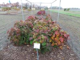 | | 2014 | COLLECTED | 09/21/2014 | Mississippi: Lafayette County; Holly Springs National Forest along County Road 244. | 34.51468900, -89.45669300 | 132 | Deciduous woods. Higher elevation than surrounding area. East, northeast-facing 45 degree slope. Growing in association with Cornus florida, Nyssa sylvatica, Quercus alba, Pinus sp., Liquidambar styraciflua, Juniperus virginiana, Carya tomentosa, and Rhus typhina. | Wild material | Numerous specimens. Attractive peeling bark and large (10" long) infructescences. | 1922345 | WLP 1251 |
| 278 | WLP 1252 | JDC/HQ/2014/084/586 | Hydrangea quercifolia W. Bartram | Mississippi, United States | NA | 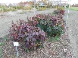 | | 2014 | COLLECTED | 09/22/2014 | Mississippi: Tishomingo County; Extreme northeast corner of Tishomingo County near J.P. Coleman State Park. | 34.98857300, -88.20347900 | 194 | Steep (60-70 degrees), north, northeast-facing slope. Growing in association with Quercus montana (abundant), Hamamelis sp., Quercus alba, Rhododendron arborescens, Amelanchier sp., Ostrya virginiana, Vaccinum sp., and Vitis sp. | Wild material | Numerous specimens. Some specimens approximately 6-7' in height. | 1922357 | WLP 1252 |
| 279 | WLP 1253 | JDC/HQ/2014/090/592 | Hydrangea quercifolia W. Bartram | Alabama, United States | NA | 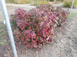 | | 2014 | COLLECTED | 09/23/2014 | Alabama: Lawrence County; Near Franklin and Lawrence County line off County Road 303. | 34.33701600, -87.52906200 | 332 | Growing in association with Quercus alba, Quercus montana, Cornus florida, Rhus glabra, Liriodendron tulipifera, Pinus virginiana, Pinus sp., Acer rubrum, and Frangula alnus. | Wild material | Some specimens with infructescences averaging 12" in length. | 1922364 | WLP 1253 |
| 280 | WLP 1966 | JDC/VA/2014/096/598 | Viburnum acerifolium L. | Alabama, United States | NA | | | 2014 | COLLECTED | 09/23/2014 | Alabama: Lawrence County; William B. Bankhead National Forest, small tributary to Sipsey Fork near Cranal Road. | 34.28161300, -87.40651600 | 199 | Growing in association with Tsuga canadensis, Cornus florida, Magnolia macrophylla, Castanea dentata, Carpinus caroliniana, Quercus alba, and Pinus sp. | Wild material | Limited fruit production. Very shaded. Fruits black. | 1922367 | WLP 1966 |
| 281 | WLP 218 | JDC/TC/2014/089/591A | Tsuga canadensis (L.) Carrière | Alabama, United States | NA | | | 2014 | COLLECTED | 09/23/2014 | Alabama: Franklin County; William B. Bankhead National Forest, north-facing banks of Bear Creek watershed. | 34.33924600, -87.54771500 | 285 | Growing in association with Quercus alba, Cornus florida, Pueraria montana var. lobata, Magnolia macrophylla, Platanus occidentalis, Liquidambar styraciflua, and Fagus grandifolia. | Wild material | Excellent cone production. Optimum timing for harvest. Species infrequent to locally abundant across a 12 mile linear stretch of the southeast corner of Franklin County to north-central Winston County. | 1922361 | WLP 218 |
| 282 | Ames 32783 | JDC/EA/2014/081/583 | Euonymus americanus L. | Mississippi, United States | NC7 | | | 2014 | COLLECTED | 09/22/2014 | Banks of Zippy Branch Creek, near J.P. Coleman State Park, NW 1/4 of NW 1/4 of NW 1/4 of Section 25, T1S, R10E, Tishomingo County. | 34.97017900, -88.20487000 | 191 | Mesic woods. | Wild material | | 1921794 | Ames 32783 |
| 283 | WLP 700 | BJP/AS/2014/002 | Amelanchier spicata (Lam.) K. Koch | New Hampshire, United States | NA | | | 2014 | COLLECTED | 07/03/2014 | Rye: West side of Ocean Boulevard in Rye, on shoulder of road. | 43.01886000, -70.73382000 | | Plants on shoulder of road adjacent to marshy field. | Wild material | Full name as recorded at the U.S. National Arboretum: Amelanchier spicata (''maritima''). Received as Amelanchier spicata ''maritima.'' | 1922824 | WLP 700 |
| 284 | Ames 32758 | Fallen Rock | Pinus strobus L. | Iowa, United States | NC7 |  | | 2014 | COLLECTED | 08/21/2014 | Fallen Rock State Preserve and adjacent private property just north of Eldora, T88N R19W SW ¼ Sec. 28 and N ¼ Sec. 32 and also T87N R19W N ½ Sec. 5. | 42.39548900, -93.09165200 | 311 | Cool moist woods. Slopes averaging 60 degrees. Northern and eastern aspects. Localized to bluffs above Iowa River. | Wild material | The native range of Pinus strobus is concentrated in the northeastern United States extending south into the northern edge of Georgia and west to central Minnesota. In Iowa, scattered native populations exist in a few northeastern counties as well as small disjunct populations in central and southeastern counties (Little, 1971). This accession includes genetics from legacy mother trees located in Fallen Rock State Preserve and nearby private property to the south. This area is near Pine Lake State Park, which in 2009 was devastated by a severe hailstorm of "supersized softballs" resulting in significant cambial damage to many species of trees. Damage to the majority of P. strobus specimens throughout the area was so severe that losses occurred immediately. Additional losses in subsequent years continued to occur likely due to additional stress by drought and destruction by bark beetles. The loss of approximately 75% of the P. strobus specimens at Pine Lake State Park was attributed to the 2009 hailstorm prompted efforts to preserve genetics of the white pines here. In 2014, specimens in parts of Pine Lake State Park and also one specimen at Fallen Rock State Preserve were sampled (Carstens, J.) as seeds from specimens ranging in size from 9.25 inches to 31.75 inches d.b.h. However, in 2021, it was determined (Place, A. pers. comm. 24 February 2021 and Carstens, J. & Sherwood, A., pers. observations 1 March 2021) that likely most if not all of the specimens in Pine Lake State Park are planted specimens of unknown origin because P. strobus specimens located at the far east end of Lower Lake (south side) were noted (Carstens and Sherwood, pers. observations 1 March 2021) growing with uncharacteristic associated taxa including Acer saccharinum and Gymnocladus dioicus. Two documents that support these observations includes: 1. Letter signed by Louis H. Pammel (March 25, 1925) to G.B. McDonald of the Iowa State University Forestry Department asking for 200 white pine to be planted at Pine Lake. 2. "Trees to Be Set Out by CCC Workers" in the Eldora Herald (May 9, 1935) referencing the CCC (Civilian Conservation Corps) to plant “1,000 white pines at Pine Lake State Park". Therefore, if obtained, increment borer measurements of specimens that are 94 years of age at present (2014) or older would suggest those as being true, native remnants. Documents that supports the position of remnant specimens at Fallen Rock State Preserve includes: 1. "Picturesque Drives About Eldora", in the Eldora Herald (December 8, 1910) by Clara Estabrook stating "Miss Stoddard of the Iowa Falls school says these (only 11 trees left) are the only native pines (those restricted to the sandstone cliffs) found in Hardin County" and suggested a movement to have them preserved. 2. Forest Flora of Hardin County (1899) by L. H. Pammel stating that the Iowa valley serves as the western limits for white pine and also refers to David D. Owen's geological report from 1839 indicating the occurrences of white pines on the summits of the hills along the Iowa River. In addition, a photo of white pines growing at Steamboat Rock taken by L. H. Pammel was featured on the front page of the 1919 report of the State Board of Conservation titled "Iowa Parks: Conservation of Iowa Historic, Scenic and Scientific Areas." Due to the significant presence of planted specimens of unknown origin in Pine Lake State Park and surrounding private properties, samples collected in 2014 as seeds may likely contain genetics (pollen donors) from specimens of unknown origin. This resulted in the resampling of specimens in 2021 (USFS - IAHA#'s) and 2023 as dormant scions that are from locations known to be untouched by the CCC and thus represent true, remnant specimens. To date (2021), there are only eight legacy specimens left in this population (four specimens at Fallen Rock State Preserve and four specimens at the nearby private property). The largest specimen of P. strobus (Ames 32758) is #IAHA-08 located at (42.395489, -93.091652) measuring (13 May 2018) 35.65" DBH with a height of 78.33' and a spread of 26' totalling 197 points (Rouw, M., personal communication, 8 February 2023). This germplasm represents the southwestern most population of native P. strobus in Iowa and one of the western most populations in North America. Germplasm likely is adapted to Midwestern climatic extremes and potentially very drought tolerant in comparison to other provenances from the eastern or northeastern U.S. | 1921270 | Ames 32758 |
| 285 | Ames 32387 | JDC/BN/2014/014/516 | Betula nigra L. | Iowa, United States | NC7 |  | | 2014 | COLLECTED | 06/05/2014 | Chia Fen, T81N R5W NW 1/4 of NW 1/4 Sec. 13. | 41.82947400, -91.38152400 | 226 | Sand prairie with likely high water table. | Wild material | | 1919308 | Ames 32387 |
| 286 | Ames 32388 | JDC/BN/2014/015/517 | Betula nigra L. | Iowa, United States | NC7 |  | | 2014 | COLLECTED | 06/05/2014 | Princeton Wildlife Management Area, T80N R5E NE 1/4 Sec. 35. | 41.69417800, -90.34158400 | 177 | Wet, heavy soil floodplain. | Wild material | | 1919309 | Ames 32388 |
| 287 | WLP 1079 | NA 81742 | Cornus florida L. | Missouri, United States | NA | | | 2013 | COLLECTED | 09/26/2013 | Springfield Township: NW 1/4 of Section 20. | 38.41792000, -93.60433000 | | Growing in and around sandstone ravines. | Wild material | Voucher specimen being processed at time of accessioning; will be forwarded to USNA once prepared. | 1922751 | WLP 1079 |
| 288 | Ames 32093 | JDC/CC/2013/048/492 | Carpinus caroliniana Walter | Iowa, United States | NC7 | | | 2013 | COLLECTED | 10/25/2013 | Ledges State Park mostly from specimens adjacent to Peas Creek, NE ¼ of SE ¼ of Sec. 16, T83N R26W, Des Moines Quad. | 41.99910000, -93.87880000 | 328 | North and northwest-facing slopes. | Wild material | The native range of Carpinus caroliniana is concentrated in the eastern half of the U.S. with a very small disjunct population in central Iowa (Little, 1971). This accession represents a collection of C. caroliniana germplasm from the extreme western edge of the species native range, specifically the central Iowa disjunct population at Ledges State Park. The next closest occurrence is in eastern Iowa (100-150 miles). As of 2025, one specimen at Ledges State Park (McCoy Wildlife Area) currently represents the state of Iowa's largest C. caroliniana specimen measuring 6.68" DBH, 41.67’ in height, and 23.75’ average crown spread for a total of 68.608 points (Rouw, M., personal communication, 4 May 2022). This accession does include genotypes that do tend to sucker/form clonal colonies. Fall color (red/orange) tends to peak in the last week of October (central Iowa) with peak fruiting occurring simultaneously. Bark smooth, grey. | 1914037 | Ames 32093 |
| 289 | Ames 32094 | Ames 32094 | Symphoricarpos orbiculatus Moench | Iowa, United States | NC7 |  | | 2013 | COLLECTED | PRE 10/25/2013 | Bluffs along Des Moines River, SE 1/4 of Section 9, T82N R26W, Madrid NW Quad, Boone County. | 41.92480000, -93.87550000 | 328 | Edge of dry woods. Western exposure. | Wild material | Plants donated were grown from original seed. | 1914038 | Ames 32094 |
| 290 | Ames 32082 | JDC/FQ/2013/041/485 | Fraxinus quadrangulata Michx. | Ohio, United States | NC7 |  | | 2013 | COLLECTED | 08/17/2013 | South Bass Island, Put-In-Bay Quad, Ottawa County. | 41.63639900, -82.83680200 | 197 | Shallow, rocky soils. | Wild material | | 1913268 | Ames 32082 |
| 291 | Ames 32083 | JDC/FQ/2013/042/486 | Fraxinus quadrangulata Michx. | Michigan, United States | NC7 |  | | 2013 | COLLECTED | 08/17/2013 | Bendor property, Section 21, T2S, R7E, Denton Quad, near Ypsilanti, Washtenaw County. | 42.29735200, -83.61355300 | 262 | Mesic forest. | Wild material | | 1913269 | Ames 32083 |
| 292 | WLP 1124 | MA-2012-015 | Crataegus sp. | Massachusetts, United States | NA | | | 2012 | COLLECTED | 08/26/2012 | Hampshire County; Pelham; Collection made on Shutesbury Road 0.5 miles northwest of the intersection with Route 202. | 42.40153000, -72.40946000 | 351 | Upland mixed forest. | | Seed and herbarium specimen collected. | 2108860 | WLP 1124 |
| 293 | Ames 31532 | JDC/FQ/2012/042/435 | Fraxinus quadrangulata Michx. | Illinois, United States | NC7 |  | | 2012 | COLLECTED | 07/26/2012 | Trout Park Nature Preserve, Section 1, T41N, R83, Elgin Quad, near Elgin, Kane County. | 42.06258500, -88.27131500 | 240 | Variable habitats: dry, rocky slopes and also near small creek in gravelly soils. | Wild material | | 1903759 | Ames 31532 |
| 294 | Ames 31256 | APS/GD/2008/005/005 | Gymnocladus dioicus (L.) K. Koch | Iowa, United States | NC7 |  | | 2012 | COLLECTED | 01/10/2012 | Ledges State Park, SW 1/4 of SW 1/4 of Section 21, T83N, R26W, Madrid NW Quad, Boone County | 41.98110000, -93.89010000 | 328 | Upland woods. 30% slope with a western aspect. | Wild material | Largest specimen noted was 22" d.b.h. | 1897494 | Ames 31256 |
| 295 | Ames 31082 | 712 | Fraxinus americana L. | New York, United States | NC7 |  | | 2011 | COLLECTED | 09/11/2011 | Federal Road, south of Marsh Road (Co. 4), Chemung County. | 42.15600000, -76.65500000 | 466 | Roadside and woodland edges. | Wild material | | 1891468 | Ames 31082 |
| 296 | WLP 1054 | 362 | Cornus florida L. | New York, United States | NA |  | | 2011 | COLLECTED | 09/11/2011 | Cameron-North Jasper Road, Steuben County. | 42.20100000, -77.43300000 | 384 | Mixed, upland, hardwood forest. Associated with Carpinus caroliniana, Pinus strobus, Populus tremuloides, Prunus serotina, Rhus typhina, Quercus alba, Quercus velutina, Tilia americana, and Ulmus. | Wild material | | 1891448 | WLP 1054 |
| 297 | WLP 1055 | 386 | Cornus florida L. | Pennsylvania, United States | NA |  | | 2011 | COLLECTED | 09/16/2011 | Along Highway 120, Cameron County. | 41.32400000, -78.12500000 | 251 | Mixed hardwood forest. Steep (60 degree) west-facing slope. Associated with Carya, Cornus alternifolia, Fraxinus americana, Quercus alba, Quercus prinus, Quercus rubra, Rhododendron maximum, and Sassafras albidum. | Wild material | | 1891449 | WLP 1055 |
| 298 | Ames 31028 | MPW/MSD 703 | Cornus alternifolia L. f. | Pennsylvania, United States | NC7 |  | | 2011 | COLLECTED | 07/27/2011 | Along Martin Road, Warren County. | 41.98090000, -79.13630000 | 385 | Rich woods. | Wild material | | 1886743 | Ames 31028 |
| 299 | Ames 30133 | JDC/CD/2009/063/213 | Cornus drummondii C. A. Mey. | Illinois, United States | NC7 |  | | 2009 | COLLECTED | 09/25/2009 | Four Corners Road, north from Illinois Highway 84, NW 1/4 of SW 1/4 of Section 36, T26N, R2E, Blackhawk (IL-IA) Quad, Jo Daviess County. | 42.20027778, -90.22944444 | 194 | Roadside in fence row. | Wild material | | 1819714 | Ames 30133 |
| 300 | Ames 30153 | JDC/FP/2009/062/212 | Fraxinus pennsylvanica Marshall | Illinois, United States | NC7 |  | | 2009 | COLLECTED | 09/25/2009 | Four Corners Road, north from Illinois Highway 84, NW 1/4 of SW 1/4 of Section 36, T26N, R2E, Blackhawk (IL-IA) Quad, Jo Daviess County. | 42.20027778, -90.22944444 | 194 | Roadside in fence row. | Wild material | | 1819734 | Ames 30153 |
| 301 | Ames 30061 | JDC/CA/2009/015/165 | Cornus alternifolia L. f. | Illinois, United States | NC7 |  | | 2009 | COLLECTED | 08/06/2009 | Southwest edge of Pierce Lake, Rock Cut State Park, SW 1/4 of SE 1/4 of Section 27, T45N, R2E, Caledonia Quad, Rockford, Winnebago County. | 42.34333333, -88.98638889 | 259 | Rich woods. | Wild material | Up to 20-30 feet in height. | 1812364 | Ames 30061 |
| 302 | Ames 30063 | JDC/CR/2009/014/164 | Cornus rugosa Lam. | Wisconsin, United States | NC7 |  | | 2009 | COLLECTED | 08/04/2009 | Along Fairfield Road east of Paschen Road, SW 1/4 of SW 1/4 of Section 16, T12N, R7E, Lewiston Quad, Baraboo, Sauk County. | 43.51083333, -89.67583333 | 259 | Rich woods. North facing slope | Wild material | | 1812366 | Ames 30063 |
| 303 | Ames 29981 | APS/GD/2009/019/028 | Gymnocladus dioicus (L.) K. Koch | Iowa, United States | NC7 |  | | 2009 | COLLECTED | 04/04/2009 | Near the confluence of the West Fork Cedar River and Shell Rock River, approximatley 2 miles east of Finchford, T90N R14W SE 1/4 SE 1/4 SE 1/4 and also SE 1/4 SW 1/4 Sec. 4 Shell Rock Quad., Black Hawk County. | 42.62888889, -92.49666667 | 272 | Gentle, east-facing slopes and also floodplain. | Wild material | Trees ranging from 13.5 to 18 inches DBH and 50 to 70 feet in height. | 1799101 | Ames 29981 |
| 304 | Ames 29863 | APS/GD/2009/006/015 | Gymnocladus dioicus (L.) K. Koch | Missouri, United States | NC7 |  | | 2009 | COLLECTED | 02/19/2009 | Along Highway 215 and road to beach, Stockton State Park, approximately 11 miles northwest of Dadeville, Cedar County. | 37.62388889, -93.75527778 | 287 | Tree 1: Upland. Top of west facing slope to lake; Trees 2-5: Open grassy area. 10% southwest slope. | Wild material | 4.5 to 14.5 inches d.b.h. and 70 feet in height. | 1796428 | Ames 29863 |
| 305 | Ames 29753 | Ames 29753 | Fraxinus americana L. | Missouri, United States | NC7 |  | | 2008 | COLLECTED | 10/01/2008 | 2 trees near corner of Trailhouse Loop Road and Pine Amphitheatre Road, and 5 trees near Labadie Trace Trail; Section 17, T43N, R2E, Shaw Nature Reserve, Villa Ridge, Franklin County. | 38.46722222, -90.82222222 | 200 | Open woodland/ridgetop, glade. Southern slope. | Wild material | | 1789913 | Ames 29753 |
| 306 | Ames 29655 | JDC/HP/2008/023/093 | Hypericum prolificum L. | Missouri, United States | NC7 |  | | 2008 | COLLECTED | 10/06/2008 | Thousand Hills State Park, T62N R16W NW 1/4 SW 1/4 Sec. 12, Novinger Quad, | 40.18805556, -92.64500000 | 280 | | Wild material | | 1788210 | Ames 29655 |
| 307 | Ames 29616 | JDC/FN/2008/019/089 | Fraxinus americana L. | Iowa, United States | NC7 |  | | 2008 | COLLECTED | 10/01/2008 | Perimeter and adjacent areas of Honey Creek Golf Course, Boone, N 1/2 of Section 8, Boone West Quad, Boone County. | 42.01777778, -93.90694444 | 328 | Majority collected from higher elevations, but also lower valleys. Course constructed by clearing existing trees; all collections from native specimens; no trees have been planted on course. | Wild material | At time of collection, ~1/5 of population had some orangish-red fall color; remaining population exhibited greenish-yellow fall colors; some specimens were completely defoliated. | 1786595 | Ames 29616 |
| 308 | WLP 2120 | 302025 | Juniperus virginiana L. | Virginia, United States | NA |  | | 2008 | COLLECTED | 12/28/2005 | | | 89 | Slope: 0 Aspect: NE Soil: Clay-loam, Land form: Upland meadow. Mowed. | Wild material | | 1780179 | WLP 2120 |
| 309 | Ames 29210 | JDC-0242007 | Fraxinus americana L. | Maine, United States | NC7 |  | | 2007 | COLLECTED | 09/26/2007 | Approximately 1.5 miles southwest from Rumford Center on Highway 2, adjacent to the Androscoggin River, Oxford County. | 44.50111111, -70.63472222 | 189 | | Wild material | Approximately 60 feet in height. | 1743314 | Ames 29210 |
| 310 | Ames 28427 | JM20061017 | Hypericum gentianoides (L.) Britton et al. | South Carolina, United States | NC7 |  | | 2006 | COLLECTED | 09/28/2006 | Intersection of Highway 11 and Highway 133, Poe Creek State Forest, Pickens, Pickens County. | 34.93166667, -82.87722222 | 248 | Pine-oak heath, roadside of dirt road. | Wild material | | 1715748 | Ames 28427 |
| 311 | Ames 28428 | JM20061016 | Hypericum hypericoides (L.) Crantz | South Carolina, United States | NC7 |  | | 2006 | COLLECTED | 09/28/2006 | Intersection of Highway 11 and Highway 133, Poe Creek State Forest, Pickens, Pickens County. | 34.93166667, -82.87722222 | 248 | Pine-oak heath. | Wild material | | 1715749 | Ames 28428 |
| 312 | Ames 28429 | JM20061018 | Hypericum hypericoides (L.) Crantz subsp. multicaule (Michx. ex Willd.) N. Robson | South Carolina, United States | NC7 |  | | 2006 | COLLECTED | 09/28/2006 | Intersection of Highway 11 and Highway 133, Poe Creek State Forest, Pickens, Pickens County. | 34.93166667, -82.87722222 | 248 | Pine-oak heath, roadside of dirt road. | Wild material | | 1715750 | Ames 28429 |
| 313 | Ames 28434 | JM20061019 | Hypericum crux-andreae (L.) Crantz | South Carolina, United States | NC7 |  | | 2006 | COLLECTED | 09/28/2006 | Intersection of Highway 11 and Highway 133, Poe Creek State Forest, Pickens, Pickens County. | 34.93166667, -82.87722222 | 248 | Pine-oak heath, roadside of dirt road. | Wild material | | 1715755 | Ames 28434 |
| 314 | Ames 27763 | 51 | Staphylea trifolia L. | Missouri, United States | NC7 |  | | 2005 | COLLECTED | 10/21/2004 | Top of steep concave sinkhole, Roaring River Hollow, Roaring River State Park, Barry County | 36.61111111, -93.82083333 | 367 | Oak/hickory sinkhole on a 45-55% slope with a western aspect on rocky soil | Wild material | 7-10 feet tall. | 1682259 | Ames 27763 |
| 315 | Ames 27330 | JDC/RA/2023/069/1101 | Rhus aromatica Aiton | Iowa, United States | NC7 |  | | 2003 | COLLECTED | 09/24/2003 | Chatfield Park near Mooar, T65N R5W SW 1/4 of SW 1/4 of Sec. 9, Keokuk Quad. | 40.43750000, -91.45055556 | 195 | Half shaded. ~10% slope with a southwestern aspect | Wild material | Suckering shrubs averaging 4 feet tall. Leaves pubescent. | 1649676 | Ames 27330 |
| 316 | Ames 27962 | Quercus Wilderness Area | Amelanchier arborea (F. Michx.) Fernald | Iowa, United States | NC7 |  | | 2003 | COLLECTED | 05/26/2003 | Quercus Wilderness Area located 6.75 miles south, southwest of Oskaloosa, T74N R16W SE ¼ NE ¼ of Sec. 23. | 41.19888889, -92.66111111 | 244 | Mature woods on very sandy soils. Typically restricted to east, west or south facing slopes at either summits or mid-slopes. | Wild material | The native range of Amelanchier arborea is concentrated in the eastern half of the U.S. (Little, 1977). This accession represents a collection of A. arborea germplasm from the western edge of the species native range, specifically the southern portion of Iowa. As of 2025, the top ten largest specimens in the state of Iowa are located at Quercus Wilderness where this accession was collected. Iowa’s largest specimen of A. arborea specimen at Quercus Wilderness was measured at 14.17" DBH, 51.83’ in height, and 27.00’ average crown spread for a total of 102.955 points (Rouw, M., personal communication, 12 December 2023). Fall color (orange-red) tends to peak in the middle of September (Iowa) with peak fruiting occurring in early May. Bark smooth, grey. | 1700483 | Ames 27962 |