| 0 | NA 71389 | VV-275 | Quercus dentata Thunb. | Russian Federation | NA | | | 2001 | COLLECTED | 09/01/2001 | Primorsky Krai, Khasansky District, Eastern end of the Krabbe Peninsula, near the shore of Lake Pos'yet, ca 12 km west of Zarubino. | 42.61500000, 130.93333000 | | Open oak savanna on slopes above the shore. | Wild material | Small tree 4 m tall; bark grey, deeply furrowed; most acorns green when collected. | 1636701 | NA 71389 |
| 1 | NA 61753 | NA 61753 | Quercus dentata Thunb. | Korea, South | NA | | | 1989 | COLLECTED | 10/06/1989 | Maepo, Chungchong Pukto, Tanyang Gun, Myon. Just off Route 5 | 37.00000000, 128.00000000 | | Open west facing limestone slope with Broussonetia, Quercus dentata, Juniperus rigida, Buxus sinica var. insularis. | Wild material | | 1498814 | NA 61753 |
| 2 | NA 72447 | NACPEC02062 | Quercus aliena Blume | Shanxi Sheng, China | NA | | | 2002 | COLLECTED | 09/24/2002 | Shanxi Province, Yang Cheng County, Yang Cheng Xian, Huang Sha Ling | 35.27016000, 112.46016000 | | Mixed deciduous forest, oak dominated; dry mesic., slope 15 degrees, aspect E, Growing in association with Viburnum schensianum, Quercus dentata, Quercus variabilis, Quercus baronii, Cotinus coggygria, Rhus chinensis, Forsythia suspensa, Carpinus turczaninovii, Sophora flavescens., Rocky, thin | Wild material | | 1777433 | NA 72447 |
| 3 | OPGC 5799 | 284806 | Brickellia dentata (DC.) Sch. Bip. | Texas, United States | OPGC |  | | 2021 | | | | | | | Wild material | | 1895216 | OPGC 5799 |
| 4 | Ames 32736 | 245522 | Viguiera dentata (Cav.) Spreng. | United States | NC7 |  | | 2011 | COLLECTED | 10/05/2004 | | | | Gently rolling terrain. Associated with Juniperus ashei, Mahonia trifoliolata, Malvaviscus arboreus var. drummondii, Nassella leucotricha, Panicum virgatum, Quercus fusiformis, Schizachyrium scoparium, and Sorghastrum nutans. | Wild material | | 1895396 | Ames 32736 |
| 5 | NA 89080 | 2024RJLPA-006 | Ilex montana Torr. & A. Gray | Pennsylvania, United States | NA | | | 2024 | COLLECTED | 09/20/2024 | Berks and Schuylkill Counties: Hawk Mountain Sanctuary. | 40.64162200, -75.99122600 | 418 | Plants are growing from shade to full sun on a dry-mesic to very dry, well-drained upland/montane habitat characterized by an upland mixed deciduous and evergreen forest that is very rocky. All the plants found in this habitat go through periods of drought during the growing season due to the limited litter/soil layer in which moisture can be held. Elevation: 405 to 430 meters. Slope: 5 to 25 percent. Aspect: various. Geology: The underlying geology of this area is of Silurian origin and comprised of Shawangunk Formation. This formation is primarily light- to dark-gray, fine- to very coarse-grained sandstone and conglomerate containing thin shale interbeds. (Source: USGS Pennsylvania Geologic Map Data). Soils: The surface soil profile of this area is characterized as the Hazleton Series which consists of deep and very deep, well drained soils formed in residuum of acid gray, brown or red sandstone on uplands. The matrix includes a considerable accumulation of thin, flat, coarse fragments of sandstone, limestone, or schist with diameters up to 15 cm. Slope ranges from 0-80%. Permeability is moderately rapid to rapid. (Source: USDA-NRCS Official Soil Series Descriptions). EPA Ecoregion (Level III): Ridge and Valley (67). EPA Ecoregion (Level IV): Northern Sandstone Ridges (67c). | Wild material | | 2169044 | NA 89080 |
| 6 | NA 88671 | RJL2023PA-005 | Rhododendron maximum L. | Pennsylvania, United States | NA | | | 2023 | COLLECTED | 10/16/2023 | Appalachian National Scenic Trail: Pulpit Rock and Pinnacle Loop. Rocky woodlands along Furnace Creek as well as steep rocky slopes above Pulpit Rock Reservoir associated with the Pulpit Rock and Pinnacle Loop Trail. | 40.59226100, -75.94588800 | 301 | Well-drained and very rocky dry deciduous woodlands in part shade to full shade. Slope: 0-30%. Aspect: variable. The underlying geology of this area is of Silurian origin and characterized as the Shawangunk Formation. It is characterized by light- to dark-gray, fine- to very coarse-grained sandstone and conglomerate containing thin shale interbeds. Includes four members, in descending order: Tammany--conglomerate and sandstone; Lizard Creek--sandstone and red or green shale; Minsi--sandstone and conglomerate; Weiders--conglomerate. Tammany and Lizard Creek Members together are approximately equivalent to Clinton Group to the west; Minsi and Weiders Members together are equivalent to Tuscarora Formation to the west. (Source: USGS Pennsylvania Geologic Map Data). The primary soil type in the collection area is classified as Hazleton Series. The Hazleton series consists of deep and very deep, well drained soils formed in residuum of acid gray, brown or red sandstone on uplands. Slope ranges from 0 to 80 percent. Permeability is moderately rapid to rapid. Solum thickness ranges from 60 to 120 centimeters. Depth to lithic contact ranges from 1 to 2 meters. Rock fragments of angular sandstone, dominantly less than 25 cm in size, range from 5 to 70 percent in individual horizons. Boulders, stones, flags and channers cover about 5 to 60 percent of the surface of some pedons. Reaction ranges from strongly acid through extremely acid throughout. (Source: NRCS Web Soil Survey). | Wild material | | 2159062 | NA 88671 |
| 7 | NA 88673 | RJL2023PA-007 | Rhododendron pilosum (Michx.) Craven | Pennsylvania, United States | NA | | | 2023 | COLLECTED | 10/25/2023 | Ned Smith Center for Art and Nature. | 40.53367300, -76.92715700 | 147 | Well-drained and very rocky, dry slopes above 10-50 meters above Wiconisco Creek in mixed deciduous and evergreen woodlands in part shade to full shade. Slope: 10-40%. Aspect: North. The underlying geology of this area is of Mississippian origin and characterized as the Pocono Formation. It is comprised of light-gray to buff or light-olive-gray, medium-grained, crossbedded sandstone and minor siltstone; commonly conglomeratic at base and in middle; medial conglomerate, where present, is used to divide into Mount Carbon and Beckville Members; equivalent to Burgoon Sandstone of Allegheny Plateau. (Source: USGS Pennsylvania Geologic Map Data). The primary soil type in the collection area is classified as Laidig Series. The Laidig series consists of very deep, well drained soils formed in colluvium from sandstone, siltstone, and some shale. They are gently sloping to very steep soils on benches and foot slopes. Permeability is moderate or moderately rapid above the fragipan and moderately slow or slow in the fragipan. Slope ranges from 0 to 55 percent. Solum thickness ranges from 1.25 to 2.0 meters or more. Depth to the fragipan ranges from 0.75 to 1.25 meters. The particle-size control section averages less than 35 percent rock fragments. Rock fragments range from 5 to 50 percent in individual subhorizons of the A, E, BE, BA and Bt horizons; 15 to 70 percent in individual subhorizons of the Btx horizon; and 20 to 70 percent in the C horizon. Rock fragments are mostly sandstone but include siltstone and shale. Rock fragments include channers, cobbles, flagstones, and stones. Soils range from extremely acid through strongly acid throughout. (Source: NRCS Web Soil Survey). | Wild material | | 2159064 | NA 88673 |
| 8 | NA 88674 | RJL2023PA-008 | Kalmia latifolia L. | Pennsylvania, United States | NA | | | 2023 | COLLECTED | 10/25/2023 | Ned Smith Center for Art and Nature. | 40.53463500, -76.92616300 | 130 | Well-drained and very rocky, dry slopes above 10-50 meters above Wiconisco Creek in mixed deciduous and evergreen woodlands in part shade to full shade. Slope: 10-40%. Aspect: North. The underlying geology of this area is of Mississippian origin and characterized as the Pocono Formation. It is comprised of light-gray to buff or light-olive-gray, medium-grained, crossbedded sandstone and minor siltstone; commonly conglomeratic at base and in middle; medial conglomerate, where present, is used to divide into Mount Carbon and Beckville Members; equivalent to Burgoon Sandstone of Allegheny Plateau. (Source: USGS Pennsylvania Geologic Map Data). The primary soil type in the collection area is classified as Laidig Series. The Laidig series consists of very deep, well drained soils formed in colluvium from sandstone, siltstone, and some shale. They are gently sloping to very steep soils on benches and foot slopes. Permeability is moderate or moderately rapid above the fragipan and moderately slow or slow in the fragipan. Slope ranges from 0 to 55 percent. Solum thickness ranges from 1.25 to 2.0 meters or more. Depth to the fragipan ranges from 0.75 to 1.25 meters. The particle-size control section averages less than 35 percent rock fragments. Rock fragments range from 5 to 50 percent in individual subhorizons of the A, E, BE, BA and Bt horizons; 15 to 70 percent in individual subhorizons of the Btx horizon; and 20 to 70 percent in the C horizon. Rock fragments are mostly sandstone but include siltstone and shale. Rock fragments include channers, cobbles, flagstones, and stones. Soils range from extremely acid through strongly acid throughout. (Source: NRCS Web Soil Survey). | Wild material | | 2159065 | NA 88674 |
| 9 | NA 88675 | RJL2023PA-009 | Viburnum acerifolium L. | Pennsylvania, United States | NA | | | 2023 | COLLECTED | 10/25/2023 | Ned Smith Center for Art and Nature. | 40.53539200, -76.92313500 | 136 | Well-drained and very rocky dry deciduous woodlands in part shade to full shade. Slope: 10-30%. Aspect: North. The underlying geology of this area is of Mississippian origin and characterized as the Pocono Formation. It is comprised of light-gray to buff or light-olive-gray, medium-grained, crossbedded sandstone and minor siltstone; commonly conglomeratic at base and in middle; medial conglomerate, where present, is used to divide into Mount Carbon and Beckville Members; equivalent to Burgoon Sandstone of Allegheny Plateau. (Source: USGS Pennsylvania Geologic Map Data). The primary soil type in the collection area is classified as Laidig Series. The Laidig series consists of very deep, well drained soils formed in colluvium from sandstone, siltstone, and some shale. They are gently sloping to very steep soils on benches and foot slopes. Permeability is moderate or moderately rapid above the fragipan and moderately slow or slow in the fragipan. Slope ranges from 0 to 55 percent. Solum thickness ranges from 1.25 to 2.0 meters or more. Depth to the fragipan ranges from 0.75 to 1.25 meters. The particle-size control section averages less than 35 percent rock fragments. Rock fragments range from 5 to 50 percent in individual subhorizons of the A, E, BE, BA and Bt horizons; 15 to 70 percent in individual subhorizons of the Btx horizon; and 20 to 70 percent in the C horizon. Rock fragments are mostly sandstone but include siltstone and shale. Rock fragments include channers, cobbles, flagstones, and stones. Soils range from extremely acid through strongly acid throughout. (Source: NRCS Web Soil Survey). | Wild material | | 2159066 | NA 88675 |
| 10 | NA 88678 | RJL2023PA-012 | Viburnum acerifolium L. | Pennsylvania, United States | NA | | | 2023 | COLLECTED | 10/27/2023 | Slopes on the east side of Creek Road above the North Branch of White Clay Creek. | 39.78552600, -75.80251900 | 90 | Well-drained mesic-dry to rocky dry deciduous woodlands in part shade to full shade. Slope: 15-35%. Aspect: West to northwest. The underlying geology of this area includes two formations. The first and primary formation is Lower Paleozoic Glenarm Wissahickon Formation, lithologically similar to oligoclase-mica schist of the Wissahickon Formation, but also includes lenticular amphibolite bodies having ocean-floor basalt chemistry. The second formation is Lower Paleozoic Mafic Gneiss Formation that is dark and medium grained. It includes rocks of probable sedimentary origin. (Sources: USGS Pennsylvania Geologic Map Data). The primary soil type in the collection area is classified as Manor Series. The Manor Series consists of well-drained residuum weathered from micaceous schist. Soils in the upper pedon (0-33 cm) are very dark grayish brown loam with strong fine granular structure; also, very friable with fine mica flakes and strongly acid. Lower pedon soils (34-56 cm) are strong brown, sandy loams. They have weak medium sub-angular blocky structure, are friable with many fine and a few medium mica flakes; this pedon is very strongly acid. (Source: NRCS Web Soil Survey). | Wild material | | 2159069 | NA 88678 |
| 11 | NA 88667 | RJL2023PA-004 | Viburnum acerifolium L. | Pennsylvania, United States | NA | | | 2023 | | | | | | | Wild material | | 2158816 | NA 88667 |
| 12 | W6 61179 | NM080-324 | Bouteloua hirsuta Lag. | New Mexico, United States | W6 | 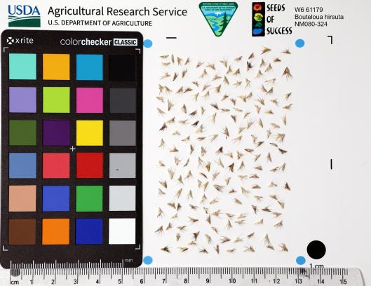 | | 2023 | | | | | | | Wild material | Moderately tufted perennial grass. Erect stems 15-75 cm. Internodes and sheaths glabrous. Panicles with 1-18 cm rachises with 1-6 branches, sometimes digitate; rachis curved or deflexed at stout, pubescent base. 20-50 pectinate spikelets; axes extending 5-10 mm beyond the base of the terminal spikelets; spikelets green to dark purple. | 2142134 | W6 61179 |
| 13 | NA 88481 | RJL2022MD-002 | Kalmia latifolia L. | Maryland, United States | NA | | | 2022 | COLLECTED | 09/04/2022 | Plants growing at Elkton State Forest along roads and woodlands over a distance of approximately 5 kilometers labelled as the address of 717 Irishtown Rd, North East, MD 21901. Kalmia is very common along the unnamed gravel road as well as the understory of the upland woodlands. | 39.58852900, -75.90452900 | 60 | Plants are growing in a mesic to dry, well-drained habitat of mixed deciduous and evergreen woodlands comprised primarily of acid-loving plants. Plants are growing in shade to part shade along the unnamed road as well as the woodlands. The soils in the collection area are generally described as a complex series of fluviomarine deposits. The soils range from a thin loam layer at the surface to varying levels of loam to sandy loam and/or extremely gravelly sandy clay loam strata, depending upon geographical location (ie. Hillslope summits, slopes, footslopes, swales, etc.). The primary soil types in the collection area are classified as Russett-Christiana-Hambrook Complex and/or Sassafras and Croom Soils; though, others may intersect and overlay in specific areas. | Wild material | | 2139360 | NA 88481 |
| 14 | NA 88488 | RJL2022PA-004 | Viburnum acerifolium L. | Pennsylvania, United States | NA | | | 2022 | COLLECTED | 09/03/2022 | Plants growing in woodlands on the east side of Shed Road in French Creek State Park. Plants are common and found scattered along the edges of the road and into the woodlands. | 40.21969200, -75.77373600 | 238 | Plants are growing in a mesic to dry, well-drained habitat of upland deciduous forest which is very rocky. The understory layer is generally not as rich due to the rock-laden ground layer. Plants are growing in part shade to shade. The underlying geology of this area is comprised of Hammer Creek Conglomerate, characterized by cobble and pebble quartz conglomerate interbedded with red sandstone.
Source: USGS Pennsylvania Geologic Map Data (https://mrdata.usgs.gov/geology/state/sgmc-unit.php?unit=PATRhc%3B2) The surface soil profile of this area is Joanna Loam (JpD), 8 to 25 percent slopes which is extremely stony. It is represented by residuum weathered from sandstone and/or residuum weathered from conglomerate. Joanna Loam is moderately to well-drained and 1.8 meters to 2.5 meters to the lithic bedrock described above.
Source: NRCS Web Soil Survey (https://websoilsurvey.sc.egov.usda.gov/App/WebSoilSurvey.aspx) | Wild material | | 2139367 | NA 88488 |
| 15 | NA 88489 | RJL2022PA-005 | Kalmia latifolia L. | Pennsylvania, United States | NA | | | 2022 | COLLECTED | 09/10/2022 | Plants are growing on the lands of Hawk Mountain Sanctuary. This species is very common and abundant. It is one of the most dominant understory plants in woodlands. This species is a common understory shrub throughout the entire region in upland dry woodland habitats. | 40.63862000, -75.99071200 | 430 | Plants are growing primarily in shade to part-shade on a dry-mesic to very dry, well-drained upland/montane habitat characterized by upland mixed deciduous and evergreen forest that is very rocky. All of the plants found in this habitat go through periods of drought during the growing season due to the limited litter/soil layer in which moisture can be held. The underlying geology of this area is of Silurian origin and comprised of Shawangunk Formation. This formation is primarily light- to dark-gray, fine- to very coarse-grained sandstone and conglomerate containing thin shale interbeds.
Source: USGS Pennsylvania Geologic Map Data (https://mrdata.usgs.gov/geology/state/sgmc-unit.php?unit=PASs%3B14)
The surface soil profile of this area is the Hazleton series consists of deep and very deep, well drained soils formed in residuum of acid gray, brown or red sandstone on uplands. The matrix includes a considerable accumulation of thin, flat, coarse fragments of sandstone, limestone, or schist with diameters up to 15 cm. Slope ranges from 0-80%. Permeability is moderately rapid to rapid.
Source: NRCS Web Soil Survey (https://websoilsurvey.sc.egov.usda.gov/App/WebSoilSurvey.aspx) | Wild material | | 2139368 | NA 88489 |
| 16 | NA 88490 | RJL2022PA-006 | Ilex montana Torr. & A. Gray | Pennsylvania, United States | NA | | | 2022 | COLLECTED | 09/10/2022 | Hawk Mountain Sanctuary. | 40.64162200, -75.99122600 | 420 | Plants are growing from shade to full sun on a dry-mesic to very dry, well-drained upland/montane habitat characterized by an upland mixed deciduous and evergreen forest that is very rocky. All of the plants found in this habitat go through periods of drought during the growing season due to the limited litter/soil layer in which moisture can be held. The underlying geology of this area is of Silurian origin and comprised of Shawangunk Formation. This formation is primarily light- to dark-gray, fine- to very coarse-grained sandstone and conglomerate containing thin shale interbeds. (Source: USGS Pennsylvania Geologic Map Data). The surface soil profile of this area is the Hazleton series consists of deep and very deep, well drained soils formed in residuum of acid gray, brown or red sandstone on uplands. The matrix includes a considerable accumulation of thin, flat, coarse fragments of sandstone, limestone, or schist with diameters up to 15 cm. Slope ranges from 0-80%. Permeability is moderately rapid to rapid. (Source: NRCS Web Soil Survey). | Wild material | | 2139369 | NA 88490 |
| 17 | NA 88491 | RJL2022PA-007 | Rhododendron maximum L. | Pennsylvania, United States | NA | | | 2022 | COLLECTED | 09/10/2022 | Plants are growing on the lands of Hawk Mountain Sanctuary. This species was common, but generally restricted to steep rocky outcrops. | 40.63813900, -75.98835200 | 420 | Plants are growing from shade to full sun on a dry-mesic to very dry, well-drained upland/montane habitat characterized by an upland mixed deciduous and evergreen forest that is very rocky. Even so, most heavily fruited plants were growing in part shade to almost full sun. All of the plants found in this habitat go through periods of drought during the growing season due to the limited litter/soil layer in which moisture can be held. The underlying geology of this area is of Silurian origin and comprised of Shawangunk Formation. This formation is primarily light- to dark-gray, fine- to very coarse-grained sandstone and conglomerate containing thin shale interbeds.
Source: USGS Pennsylvania Geologic Map Data (https://mrdata.usgs.gov/geology/state/sgmc-unit.php?unit=PASs%3B14)
The surface soil profile of this area is the Hazleton series consists of deep and very deep, well drained soils formed in residuum of acid gray, brown or red sandstone on uplands. The matrix includes a considerable accumulation of thin, flat, coarse fragments of sandstone, limestone, or schist with diameters up to 15 cm. Slope ranges from 0-80%. Permeability is moderately rapid to rapid.
Source: NRCS Web Soil Survey (https://websoilsurvey.sc.egov.usda.gov/App/WebSoilSurvey.aspx) | Wild material | | 2139370 | NA 88491 |
| 18 | WLP 2576 | RJL2022-001 | Amelanchier arborea (F. Michx.) Fernald | Maryland, United States | NA | | | 2022 | COLLECTED | 05/25/2022 | Plants growing in open woodlands and part shade along unnamed Elkton State Forest gravel road over a distance of approximately 5 kilometers labelled as the address of 717 Irishtown Rd, North East, MD 21901. | 39.58089500, -75.91505900 | 73 | Plants are found regularly but scattered along the unnamed gravel road as well as in open understory of the upland woodlands. Plants growing in a mesic to dry, well-drained habitat of mixed deciduous and evergreen woodlands comprised primarily of acid-loving plants. Plants are growing in part shade and open understory shade. The soils in the collection area are generally described as a complex series of fluviomarine deposits. The soils range from a thin loam layer at the surface to varying levels of loam to sandy loam and/or extremely gravelly sandy clay loam strata, depending upon geographical location (ie. Hillslope summits, slopes, footslopes, swales, etc.). The primary soil types in the collection area are classified as Russett-Christiana-Hambrook Complex and/or Sassafras and Croom Soils; though, others may intersect and overlay in specific areas. | Wild material | | 2138095 | WLP 2576 |
| 19 | WLP 1436 | NA 83951 | Oxydendrum arboreum (L.) DC. | Kentucky, United States | NA | | | 2016 | COLLECTED | 09/29/2016 | Kentenia State Forest, Pine Mountain, opening in canopy on Route 1679, south side. | 36.92000000, -83.24200000 | 795 | Roadside, opening in canopy. | | | 1951128 | WLP 1436 |
| 20 | WLP 1704 | NA 83942 | Rhus glabra L. | Kentucky, United States | NA | | | 2016 | COLLECTED | 09/29/2016 | Kentenia State Forest, Pine Mountain, on Route 1679, south side. | 36.90500000, -83.29100000 | 771 | Roadside. | | | 1953164 | WLP 1704 |
| 21 | WLP 1705 | NA 83948 | Rhododendron maximum L. | Kentucky, United States | NA | | | 2016 | COLLECTED | 09/29/2016 | Kentenia State Forest, Pine Mountain, on Route 1679, north side. | 36.91400000, -83.25900000 | 758 | Roadside. | | | 1950864 | WLP 1705 |
| 22 | WLP 872 | NA 83949 | Clethra acuminata Michx. | Kentucky, United States | NA | | | 2016 | COLLECTED | 09/29/2016 | Kentenia State Forest, Pine Mountain, on Route 1679, south side. | 36.91500000, -83.25900000 | 760 | Roadside. | | | 1951703 | WLP 872 |
| 23 | W6 48847 | MARSB-054 | Avenella flexuosa (L.) Parl. | New York, United States | W6 |  | | 2015 | | | | | | | Wild material | | 1922854 | W6 48847 |
| 24 | WLP 1966 | JDC/VA/2014/096/598 | Viburnum acerifolium L. | Alabama, United States | NA | | | 2014 | COLLECTED | 09/23/2014 | Alabama: Lawrence County; William B. Bankhead National Forest, small tributary to Sipsey Fork near Cranal Road. | 34.28161300, -87.40651600 | 199 | Growing in association with Tsuga canadensis, Cornus florida, Magnolia macrophylla, Castanea dentata, Carpinus caroliniana, Quercus alba, and Pinus sp. | Wild material | Limited fruit production. Very shaded. Fruits black. | 1922367 | WLP 1966 |
| 25 | NA 72434 | NACPEC02046 | Forsythia suspensa (Thunb.) Vahl | Shanxi Sheng, China | NA | | | 2002 | COLLECTED | 09/20/2002 | Changzhi City, Qinyuan County: Lingkongshanzhen. | 36.58883000, 112.12016000 | | Roadside; low, scrubby growth; mixed deciduous species. Growing in rocky, thin soil. Slope: 0 to 15 degrees. Aspect: East. | Wild material | | 1777428 | NA 72434 |
| 26 | NA 72450 | NACPEC02065 | Grewia biloba G. Don var. parviflora (Bunge) Hand.-Mazz. | Shanxi Sheng, China | NA | | | 2002 | COLLECTED | 09/24/2002 | Huangshaling. [Unable to verify this locality name from map. -SBL] | 35.27300000, 112.46800000 | 898 | Streambank (south face of east-running stream) in heavily grazed and cut agricultural area. Growing in rocky soil. | Wild material | | 1952772 | NA 72450 |
| 27 | NA 72451 | NACPEC02066 | Pistacia chinensis Bunge | Shanxi Sheng, China | NA | | | 2002 | COLLECTED | 09/24/2002 | Shanxi Province, Yang Cheng County, Yang Cheng Xian, Huang Sha Ling | 35.27300000, 112.46800000 | | Mixed deciduous re-growth forest; disturbed grazed and cut areas., slope 30 degrees, aspect W, Growing in association with Populus, Vitex, Cotinus coggygria, Forsythia suspensa, Quercus dentata, Quercus variabilis, Quercus baronii, Carpinus turczaninovii, Rhus chinensis, Thin, rocky | Wild material | | 1777437 | NA 72451 |