| 0 | NA 84644 | SAPPE-030 | Quercus imbricaria Michx. | North Carolina, United States | NA | | | 2017 | COLLECTED | 09/27/2016 | Macon County; Franklin; Along Rt. 28 north of Franklin, NC; tree growing in narrow strip between highway and Little Tennessee River. | 35.26733000, -83.41985000 | 605 | Open, mixed forest and scrubby roadside vegetation. Growing in open to 1/4 shade. | | Population distribution patchy, but frequent. | 2108757 | NA 84644 |
| 1 | NA 82077 | JDC/QI/2014/118/620 | Quercus imbricaria Michx. | Iowa, United States | NA | | | 2014 | COLLECTED | 09/28/2014 | Iowa: Davis County; Near Davis and Wapello County line along Highway 63. | 40.89305600, -92.40904200 | 234 | Dry woods. Growing in association with Fraxinus pennsylvanica, Ulmus sp., Quercus sp., and Juniperus virginiana. | Wild material | Optimum timing for harvest. Acorns just starting to drop. | 1922378 | NA 82077 |
| 2 | NA 77573 | NA 77573 | Quercus imbricaria Michx. | North Carolina, United States | NA | | | 2008 | COLLECTED | 09/01/2008 | Behind Cullowhee School. | 35.29460000, -83.18202000 | | | Uncertain improvement status | | 1899483 | NA 77573 |
| 3 | PI 664897 | JDC/PV/2008/061/131 | Prunella vulgaris L. | Illinois, United States | NC7 |  | | 2008 | COLLECTED | 10/12/2008 | Along 2150 North Road, east of Irvington, SW 1/4 of NE 1/4 of Section 15, T1S, R1E, Walnut Hill Quad, Jefferson County. | 38.43833333, -89.07833333 | 161 | Only on south side of road; northern exposure; mostly shaded due to woody vegetation. | Wild material | | 1788218 | PI 664897 |
| 4 | PI 664856 | 2 | Hypericum perforatum L. | Missouri, United States | NC7 |  | | 2004 | COLLECTED | 10/19/2004 | Roadside along Interstate 44/Historic Route 66, Franklin County. | 38.26538300, -91.11135000 | 281 | Overgrown prairie roadside. 5 degrees of slope with a northern aspect. | Wild material | Opposite leaves. 20-40 cm tall. | 1668195 | PI 664856 |
| 5 | Ames 36327 | Lick Creek Unit | Amelanchier arborea (F. Michx.) Fernald | Iowa, United States | NC7 |  | | 2025 | COLLECTED | 06/10/2025 | Shimek State Forest Lick Creek Unit just east of Farmington, T67N R7W NE ¼ Sec. 8 and Sec. 7 and also T68N R8W Sec. 25. | 40.62024500, -91.70427700 | 214 | Woodland edges. | Wild material | The native range of Amelanchier arborea is concentrated in the eastern half of the U.S. (Little, 1977). This accession represents a collection of A. arborea germplasm from the western region of the species native range, specifically the extreme southeastern corner of Iowa. Specimens sampled in nature ranging 15-35' in height. Typically smoothish bark, light grey in color. Peak flowering (white flowers) occuring usually in early April with orange, orange-red fall colors peaking typically end of September (southeastern Iowa). | 2191464 | Ames 36327 |
| 6 | NA 89039 | RJL2022IL-001 | Ptelea trifoliata L. | Illinois, United States | NA | | | 2022 | COLLECTED | 09/28/2022 | Site of plant habitat is located at 823 E Co Rd 1220, Hamilton, IL 62341 which is the property where Jacob's Geode Shop and Mine is located. This species is scattered and relatively common throughout the woodlands on this site. | 40.37848400, -91.35390200 | 175 | Plants growing in shade to part-shade of deciduous woodlands above a small creek.
Soils: The underlying geology of this area is of Mississippian origin and comprised of Warsaw Formation and Salem Limestone. Major lithological components include limestone that can be shaly, oolitic, bioclastic, or cherty. Minor lithological components include siltstone that can contain geodes or drusy quartz and can be calcareous.
Source: USGS Illinois Geologic Map Data (https://mrdata.usgs.gov/geology/state/sgmc-unit.php?unit=ILMws%3B0)
The surface soil profile of this area is Coffeen silt loam, 0 to 2 percent slopes, that are frequently flooded. The Coffeen series consists of very deep, somewhat poorly drained, moderately permeable soils on flood plains, low terraces or benches, toe slopes, and alluvial fans. They formed in silty alluvium. Much of the alluvium is of local origin derived from the nearby loess-covered uplands.
Source: NRCS Web Soil Survey (https://websoilsurvey.sc.egov.usda.gov/App/WebSoilSurvey.aspx) | Wild material | | 2139604 | NA 89039 |
| 7 | Ames 35750 | Ames 35750 | Blephilia ciliata (L.) Benth. | Iowa, United States | NC7 | 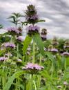 | | 2021 | COLLECTED | 09/27/2021 | Located approximately 3 miles south, southeast of Fairfield, T71N R9W SW1/4 Sec. 7 | 40.96338000, -91.94686900 | 223 | Woodland openings/edges, disturbed areas | Wild material | | 2122068 | Ames 35750 |
| 8 | OPGC 8359 | CBG-10615 | Symphyotrichum drummondii (Lindl.) G. L. Nesom | Illinois, United States | OPGC | | | 2021 | | | | | | | Wild material | Plant numbers sampled estimated. | 2120231 | OPGC 8359 |
| 9 | W6 59234 | CBG-10548 | Dasistoma macrophyllum (Nutt.) Raf. | Illinois, United States | W6 | | | 2021 | | | | | | | Wild material | Received as Dasistoma macrophylla. Plant numbers estimated. Few this year; abundant other years in numerous locations. | 2120206 | W6 59234 |
| 10 | W6 59238 | CBG-10552 | Agrostis perennans (Walter) Tuck. | Illinois, United States | W6 |  | | 2021 | | | | | | | Wild material | Collection date assumption. Plant numbers estimated. | 2120151 | W6 59238 |
| 11 | W6 59243 | CBG-10560 | Cinna arundinacea L. | Illinois, United States | W6 | | | 2021 | | | | | | | Wild material | Plant numbers estimated. | 2120155 | W6 59243 |
| 12 | W6 59267 | CBG-10590 | Muhlenbergia glabrifloris Scribn. | Illinois, United States | W6 | | | 2021 | | | | | | | Wild material | Received as: Muhlenbergia glabriflora. Plant numbers sampled estimated. | 2120210 | W6 59267 |
| 13 | W6 59274 | CBG-10598 | Scrophularia marilandica L. | Illinois, United States | W6 | | | 2021 | | | | | | | Wild material | Plant numbers sampled estimated. | 2120183 | W6 59274 |
| 14 | OPGC 6167 | CBG-2811 | Ruellia humilis Nutt. | Illinois, United States | OPGC |  | | 2015 | | | | | | | Wild material | | 1926146 | OPGC 6167 |
| 15 | Ames 32889 | APS/GD/2015/006/188 | Gymnocladus dioicus (L.) K. Koch | Missouri, United States | NC7 |  | | 2015 | COLLECTED | 03/05/2015 | St Charles County: T46N R2E Sec. 24. August Busch Conservation Area near Weldon Spring. | 38.72724100, -90.74923500 | 166 | Deciduous, mesic woods. | Wild material | | 1924367 | Ames 32889 |
| 16 | DPRU 3195 | DPRU 3195 | Prunus hortulana L. H. Bailey | Missouri, United States | DAV |  | | 2013 | COLLECTED | 08/13/2013 | Property of Prairie Garden Trust (Henry and Lorna Domke), New Bloomfield Quad, northeast of New Bloomfield, Callaway County. | 38.74118667, -92.03118433 | 235 | Numerous specimens scattered throughout property, but localized/common to small drainage ditches; associated with Diospyros virginiana, Juglans nigra, Juniperus virginiana, Prunus serotina, Quercus imbricaria, Toxicodendron radicans, Carya ovata, Cornus florida, and Robinia pseudoacacia. | Wild material | Specimen 1: fruit diameter ranged between 17 mm-20 mm; approximately 20 feet in height and 20 feet in spread; leaves papery thin to the touch and glabrous. Specimen 2: fruit diameter ranged between 15 mm and 17 mm; fruits mostly red. Specimen 3: fruit diameter ranged between 18 mm and 19 mm; fruits mostly red. Specimen 4: fruit diameter ranged between 18 mm and 19 mm; fruits mostly green (a few red). Specimen 5: fruit diameter ranged between 15 mm-17 mm, fruits slightly longer (1 mm) than wide; approximately 15 feet in height; leaves papery thin to the touch and glabrous. Specimen 6: fruit diameter ranged between 20 mm and 22 mm; fruits mostly red. | 1912772 | DPRU 3195 |
| 17 | Ames 31990 | APS/GD/2013/013/098 | Gymnocladus dioicus (L.) K. Koch | Missouri, United States | NC7 |  | | 2013 | COLLECTED | 02/22/2013 | Peavine Creek, south of Concordia, SW 1/4 of SE 1/4 of Section 20, SW 1/4 of NW 1/4 of Section 21, and NE 1/4 of NW 1/4 of Section 28, T48N R24W, Lafayette and Johnson Counties. | 38.93429000, -93.57204500 | 205 | Floodplain. | Wild material | | 1907543 | Ames 31990 |
| 18 | DPRU 3138 | DPRU 3138 | Prunus serotina Ehrh. | Iowa, United States | DAV | | | 2012 | COLLECTED | 07/15/2012 | Clemmons Creek Wildlife Management Area, NE 1/4 of SW 1/4 of Section 11, T75N, R8W, West Chester Quad, near Washington, Washington County. | 41.31474800, -91.75097600 | 236 | Mixed hardwood forest. Associated with Carya ovata, Cornus, Corylus americana, Populus tremuloides, Quercus imbricaria, and Q. macrocarpa. | Wild material | | 1903760 | DPRU 3138 |
| 19 | Ames 30481 | APS/GD/2010/001/036 | Gymnocladus dioicus (L.) K. Koch | Missouri, United States | NC7 |  | | 2010 | COLLECTED | 02/17/2010 | Mark Twain Lake Project (Army Corp of Engineers), Mark Twain Lake, T54N R8W SE 1/4 of NW 1/4 of Section 2 and west 1/2 of Sec. 11, Florida Quad, Monroe County. | 39.49270000, -91.76510000 | 199 | Northwest-facing bluff; woods. | Wild material | #106 measured 14.5" d.b.h and 70-80'; #107 measured 9.5" and 70-80'; #108 measured 11" d.b.h. and 60-70'; #109 measured 9.5" d.b.h. and 40-50'; #110 measured 11" d.b.h. at 30-40'; and #111 measured 6" d.b.h. and 30'. | 1831340 | Ames 30481 |
| 20 | Ames 29639 | JDC/FA/2008/060/130 | Fraxinus americana L. | Illinois, United States | NC7 |  | | 2008 | COLLECTED | 10/12/2008 | Along 2150 North Road, east of Irvington, NE 1/4 of SW 1/4 of Section 15, T1S, R1E, Walnut Hill Quad, Jefferson County. | 38.43833333, -89.07833333 | 161 | | Wild material | | 1788194 | Ames 29639 |
| 21 | Ames 29655 | JDC/HP/2008/023/093 | Hypericum prolificum L. | Missouri, United States | NC7 |  | | 2008 | COLLECTED | 10/06/2008 | Thousand Hills State Park, T62N R16W NW 1/4 SW 1/4 Sec. 12, Novinger Quad, | 40.18805556, -92.64500000 | 280 | | Wild material | | 1788210 | Ames 29655 |
| 22 | Ames 29526 | JDC/FQ/2008/003/073 | Fraxinus quadrangulata Michx. | Missouri, United States | NC7 |  | | 2008 | COLLECTED | 07/29/2008 | Campground area, 200 yards inside main entrance, Graham Cave State Park, SW 1/4 of SW 1/4 of Section 22, T48N, R6W, Danville, Montgomery City Quad, Montgomery County. | 38.90611111, -91.57805556 | 232 | Limestone. Full sun. 30% slope with an eastern and western aspect. | Wild material | 8-10 inches diameter breast height. | 1782749 | Ames 29526 |
| 23 | Ames 29529 | JDC/FQ/2008/006/076 | Fraxinus quadrangulata Michx. | Illinois, United States | NC7 |  | | 2008 | COLLECTED | 08/01/2008 | Cottonhill Park (West), NE 1/4 of SE 1/4 of Section 3 and NW 1/4 of SW 1/4 of Section 2, T14N, R5W, near Springfield, Chatham Quad. | 39.69055556, -89.63000000 | 175 | Mature kept in park near lake. 25% slope with northern and northwestern exposure. | Wild material | 4-5 feet diameter breast height. | 1782752 | Ames 29529 |