| 0 | NA 85961 | PCC15-SEUSA025 | Quercus boyntonii Beadle | Alabama, United States | NA | | | 2017 | COLLECTED | 10/28/2015 | Shelby County; Birmingham; Off parking lot of EBSCO Industries, Inc., located at 5724 US-280, Birmingham, Alabama. | 33.37888000, -86.67333000 | | Ridge of Appalachian forest. | Wild material | | 2109093 | NA 85961 |
| 1 | NA 84716 | TDAAR17-017 | Quercus acerifolia (E. J. Palmer) Stoynoff & W. J. Hess ex R. J. Jensen | Arkansas, United States | NA |  | | 2017 | COLLECTED | 09/13/2017 | Montgomery County: Ouachita National Forest: Pryor Mountain. | 34.36113000, -93.87164000 | 532 | | Wild material | See also NA 87260 for material of this same collection received in 2022 from Morris Arboretum. | 1953991 | NA 84716 |
| 2 | NA 86648 | SE-2017-001 | Quercus boyntonii Beadle | Alabama, United States | NA | | | 2017 | COLLECTED | 10/12/2017 | Birmingham: Off parking lot of EBSCO Industries, Inc.; along loop trail from back of parking lot. | 33.37797000, -86.67400000 | 352 | Ridge of Appalachian forest. | Wild material | Full name as recorded at U.S. National Arboretum: Quercus boyntonii. | 2154816 | NA 86648 |
| 3 | W6 59274 | CBG-10598 | Scrophularia marilandica L. | Illinois, United States | W6 | | | 2021 | | | | | | | Wild material | Plant numbers sampled estimated. | 2120183 | W6 59274 |
| 4 | W6 56710 | CBG-9540 | Scrophularia marilandica L. | Illinois, United States | W6 |  | | 2019 | | | | | | | Wild material | | 2092809 | W6 56710 |
| 5 | PI 649047 | 15 | Echinacea simulata McGregor | Missouri, United States | NC7 |  | | 2004 | COLLECTED | 10/19/2004 | Roadside along Highway 19, city limits of Cuba, Crawford County. | 38.04761600, -91.39658300 | 314 | Bank of degraded sandstone, along road. 10-20 degrees of slope with a western aspect. Sandy, dry, acidic, chirt and sandstone. | Wild material | | 1668185 | PI 649047 |
| 6 | PI 664856 | 2 | Hypericum perforatum L. | Missouri, United States | NC7 |  | | 2004 | COLLECTED | 10/19/2004 | Roadside along Interstate 44/Historic Route 66, Franklin County. | 38.26538300, -91.11135000 | 281 | Overgrown prairie roadside. 5 degrees of slope with a northern aspect. | Wild material | Opposite leaves. 20-40 cm tall. | 1668195 | PI 664856 |
| 7 | NA 89158 | 2025RJLSEUS-06 | Cornus florida L. | Alabama, United States | NA | | | 2025 | COLLECTED | 10/01/2025 | Coosa Wildlife Management Area: along the edge of gated dirt road on the west side of Coosa County Road 29, 0.3 kilometers north of Hatchet Creek. | 32.86402200, -86.33871400 | 108 | Plants are growing in part sun to shade on dry-mesic slopes above the road cut on the gated dirt road; most likely a road for access for fire control/forest management. The forest is a combination of deciduous and evergreen with evergreens primarily comprised of Pinus taeda. The habitat was quite dry during this time of year. Slope: 5 to 20 percent. Aspect: North. Soils: The primary soil in the area of this collection is classified as Madison-Louisa Series complex, 15 to 30 percent slopes, moderately eroded (MdE2). The Madison Series soils are very deep, well drained soils with medium runoff found on Piedmont uplands in interstream divides, ridges and side slopes. They are comprised of residuum weathered from felsic or intermediate, high-grade metamorphic or igneous rocks high in content of mica. Slopes range from 2 to 60 percent and soil is typically strongly acidic. Louisa Series soils The Louisa Series soils consist of shallow, somewhat excessively drained soils which formed over mica gneiss and schist bedrock. They occur on Piedmont uplands. Slopes are 6 to 80 percent. This soil is moderately acid. (Source: California Soil Resource Lab/NRCS Official Soil Series Descriptions). Geology: The underlying geology of this area is of Precambrian to Paleozoic origin and characterized as Hatchet Creek Group; Pinchoulee Gneiss Formation. It is characterized by medium to fine-grained migmatitic, locally garnetiferous biotite-feldspar gneiss, commonly saturated with granitic pods. (Source: USGS Alabama Geologic Map Data). | Wild material | | 2193004 | NA 89158 |
| 8 | NA 89160 | 2025RJLSEUS-08 | Ilex hybr. | Florida, United States | NA | | | 2025 | COLLECTED | 10/02/2025 | Eglin Air Force Base: coastal dune ridge on Eglin AFB behind businesses located along Florida State Highway 98. The site is accessed through a now gated and permanently closed Eglin AFB, East River Unit, A-21 Road (now open to pedestrian traffic only with a valid Eglin user permit). After walking through the gated road, the site is to the west along 4-wheeling trails. | 30.41191000, -86.77315800 | 8 | Part shade in a primarily evergreen extremely dry dune community with a mixed understory of deciduous and evergreen plants. Slope: 0 to 2 percent. Soils: The soils of this are characterized as Kureb Series sand, 0 to 8 percent slopes. The Kureb series consists of very deep, excessively drained, gently sloping to moderately steep soils on Coastal Plain uplands and on side slopes along streams and bays. They have formed in marine, aeolian, or fluvial sands. Slopes range from 0 to 20 percent. The thickness of the sandy horizon is more than 2 meters. Soil reaction is neutral to extremely acid throughout. All horizons are fine sand, sand, or coarse sand. Silt plus clay content is less than 5 percent. (Source: California Soil Resource Lab/NRCS Official Soil Series Descriptions). Geology: The underlying geology of this area is characterized as undifferentiated Quaternary Sediments. Much of Florida's surface is covered by a varying thickness of undifferentiated sediments consisting of siliciclastics, organics and freshwater carbonates. Where these sediments exceed 6.1 meters thick, they were mapped as discrete units. To subdivide the undifferentiated sediments, those sediments occurring in flood plains were mapped as alluvial and flood plain deposits (Qal). Sediments showing surficial expression of beach ridges and dunes were mapped separately (Qbd) as were the sediments composing Trail Ridge (Qtr). Terrace sands were not mapped (refer to Healy [1975] for a discussion of the terraces in Florida). The subdivisions of the Undifferentiated Quaternary Sediments (Qu) are not lithostratigraphic units but are utilized to facilitate a better understanding of the State's geology. The siliciclastics are light gray, tan, brown to black, unconsolidated to poorly consolidated, clean to clayey, silty, unfossiliferous, variably organic-bearing sands to blue green to olive green, poorly to moderately consolidated, sandy, silty clays. Gravel is occasionally present in the panhandle. Organics occur as plant debris, roots, disseminated organic matrix and beds of peat. Freshwater carbonates, often referred to as marls in the literature, are scattered over much of the State. In southern Florida, freshwater carbonates are nearly ubiquitous in the Everglades. These sediments are buff colored to tan, unconsolidated to poorly consolidated, fossiliferous carbonate muds. Sand, silt and clay may be present in limited quantities. These carbonates often contain organics. The dominant fossils in the freshwater carbonates are mollusks. (Source: USGS Florida Geologic Map Data). | Wild material | | 2193006 | NA 89160 |
| 9 | NA 89115 | TLM25-04a | Hamamelis ovalis S. W. Leonard | Texas, United States | NA | | | 2025 | COLLECTED | 07/10/2025 | State Highway 87 approximately 3.25 kilometers north of the crossroad junction with Texas Recreational Road 255 (RE 255); plants were growing in the narrow buffer woods along the east side of the highway. | 31.12051300, -93.72628100 | 138 | The habitat is an upland mixed coniferous and deciduous woodlands in part to full shade and dry conditions, often under drought stress. Plants seem to always occur on the top of dry ridges or well-drained slopes. Slope: 0 to 1 percent. Aspect: N/A. Soils: The soils of this collection area are classified as Tehran-Letney Association, hilly (TLE) soils. The Tehran Series (55%) consists of deep, somewhat excessively drained, moderately rapidly permeable soils on uplands. They formed in thick loamy and sandy sediments on the Western Coastal Plain. These soils are on gently sloping to moderately steep uplands with slopes ranging from 1 to 20 percent. The Letney Series (30%) consists of deep, well drained, moderately rapidly permeable, upland soils. They formed in thick sandy and loamy sediments of the coastal plains. These soils are on gently sloping to moderately steep uplands with slopes ranging from 1 to 20 percent. Soil pH ranges from 4.5 to 6.0. The minor soil components include Doucette Series (10%) and Boykin Series (5%) soils. (Source: California Soil Resource Lab/NRCS Official Soil Series Descriptions). Geology: The underlying geology of this area is of Oligocene origin and characterized as Catahoula Formation. This formation is extensive and deep in Texas, up to 185 meters thick. In the area of the collection the Catahoula Formation is primarily mudstone and sand. The upper 90-150 meters is mudstone that is tuffaceous, and sandy; also, occasionally, with some bentonitic clay. (Source: USGS Texas Geologic Map Data). | Wild material | | 2191654 | NA 89115 |
| 10 | NA 88757 | 2025 TKRM-001 | Cyrilla racemiflora L. | Florida, United States | NA | | | 2025 | COLLECTED | 01/03/2025 | Area on the south side of an unnamed sand road, about 0.54 kilometers south of Florida State Highway 98 and accessed from Walton County Highway 283 S. The collecting site is accessed by going east 0.54 kilometers on the unnamed sand road from the junction with Walton County Highway 283 S. | 30.35374700, -86.15172700 | 12 | Mostly found in moist to dry flatwoods in mixed evergreen and deciduous forest. Slope: N/A. Aspect: various. The underlying geology of this area is characterized as undifferentiated Quaternary Sediments. Much of Florida's surface is covered by a varying thickness of undifferentiated sediments consisting of siliciclastics, organics and freshwater carbonates. Where these sediments exceed 6.1 meters thick, they were mapped as discrete units. In an effort to subdivide the undifferentiated sediments, those sediments occurring in flood plains were mapped as alluvial and flood plain deposits (Qal). Sediments showing surficial expression of beach ridges and dunes were mapped separately (Qbd) as were the sediments composing Trail Ridge (Qtr). Terrace sands were not mapped (refer to Healy [1975] for a discussion of the terraces in Florida). The subdivisions of the Undifferentiated Quaternary Sediments (Qu) are not lithostratigraphic units but are utilized in order to facilitate a better understanding of the State's geology. The siliciclastics are light gray, tan, brown to black, unconsolidated to poorly consolidated, clean to clayey, silty, unfossiliferous, variably organic-bearing sands to blue green to olive green, poorly to moderately consolidated, sandy, silty clays. Gravel is occasionally present in the panhandle. Organics occur as plant debris, roots, disseminated organic matrix and beds of peat. Freshwater carbonates, often referred to as marls in the literature, are scattered over much of the State. In southern Florida, freshwater carbonates are nearly ubiquitous in the Everglades. These sediments are buff colored to tan, unconsolidated to poorly consolidated, fossiliferous carbonate muds. Sand, silt and clay may be present in limited quantities. These carbonates often contain organics. The dominant fossils in the freshwater carbonates are mollusks. (Source: USGS Florida Geologic Map Data). The Hurricane Series consists of very deep, somewhat poorly drained, moderately rapid permeable soils on broad areas that are slightly higher than the adjacent flats in the Southern Coastal Plain (MLRA 133A), the Gulf Coast Flatwoods (MLRA 152A) and the Atlantic Coast Flatwoods (MLRA 153A). They formed in sandy marine sediments. Slopes range from 0 to 5 percent. Solum thickness is 1.5 meters or more. Reaction ranges from extremely acid to moderately acid throughout. (Source: California Soil Resource Lab/NRCS Official Soil Series Descriptions). | Wild material | Received as Cyrilla parvifolia. | 2171019 | NA 88757 |
| 11 | NA 88584 | 2024RJLFL-016 | Cornus florida L. | Florida, United States | NA | | | 2024 | COLLECTED | 11/14/2024 | Both sides of Kennedy Bridge Road approximately 0.27 kilometers west of the junction with Hurricane Lake South Entrance Road. | 30.93159700, -86.74928000 | 43 | Mesic to mesic-moist conditions in a mixed and deciduous evergreen forest in part shade. Slope: 5 to 10 percent. Aspect: Various. The underlying geology of this area is characterized as Citronelle Formation of the Pliocene period. The Citronelle Formation is widespread in the Gulf Coastal Plain. The type section for the Citronelle Formation, named by Matson (1916), is near Citronelle, Alabama. The Citronelle Formation grades laterally, through a broad facies transition, into the Miccosukee Formation of the eastern Florida panhandle. Coe (1979) investigated the Citronelle Formation in portions of the western Florida panhandle. The Citronelle Formation is a siliciclastic, deltaic deposit that is lithologically similar to, and time equivalent with, the Cypresshead Formation and, at least in part, the Long Key Formation (Cunningham et al., 1998) of the peninsula. In the western panhandle, some of the sediments mapped as Citronelle Formation may be reworked Citronelle. The lithologies are the same and there are few fossils present to document a possible younger age. The Citronelle Formation consists of gray to orange, often mottled, unconsolidated to poorly consolidated, very fine to very coarse, poorly sorted, clean to clayey sands. It contains significant amounts of clay, silt and gravel which may occur as beds and lenses and may vary considerably over short distances. Limonite nodules and limonite-cemented beds are common. Marine fossils are rare but fossil pollen, plant remains and occasional vertebrates are found. Much of the Citronelle Formation is highly permeable. It forms the Sand and Gravel Aquifer of the surficial aquifer system contain organics. The dominant fossils in the freshwater carbonates are mollusks. (Source: USGS Florida Geologic Map Data). The soils of this are characterized as Dothan Series loamy sand, 5 to 8 percent slopes. The Dothan Series consists of very deep, well drained soils that formed in thick beds of unconsolidated, medium to fine-textured marine sediments. Dothan soils are on interfluves. Slopes range from 0 to 15 percent. The surface 0-33 cm is characterized by sandy-loam, well-drained soils that are strongly acid. From 33-200 cm they are characterized by sandy clay loam soils that are more moisture retentive and strongly acid. (Source: California Soil Resource Lab/NRCS Official Soil Series Descriptions). | Wild material | | 2169921 | NA 88584 |
| 12 | NA 89091 | 2024RM-TK-004 | Prunus sp. | Florida, United States | NA | | | 2024 | COLLECTED | 09/05/2024 | Blackwater River Wildlife Management Area: on the south side of Boundary Line Road about 0.32 kilometers west of Deaton Bridge Road along an area edged by a barbed wire fence. | 30.68579800, -86.87964300 | 45 | Plants are growing from part-sun to full sun. Plants are growing in an area that is frequently burned with a lot of [Prunus sp. (orig. listed as Prunus alabamensis)] scattered throughout. This habitat is a longleaf pine-wiregrass community with scattered turkey (Quercus laevis) and blackjack oaks (Quercus incana). There is a slight slope downward. The line of [Prunus sp.] goes along a semi-ditch on the side of a dirt road. The plants probably get a bit more water than the plants out in the open forest. The [Prunus sp.] are most often without any other close woody companions. Slope: 0 percent. Aspect: North. Geology: The underlying geology of this area is probably of lower Pliocene age and characterized as the Citronelle Formation. The Citronelle Formation is widespread in the Gulf Coastal Plain. The type section for the Citronelle Formation, named by Matson (1916), is near Citronelle, Alabama. The Citronelle Formation grades laterally, through a broad facies transition, into the Miccosukee Formation of the eastern Florida panhandle. Coe (1979) investigated the Citronelle Formation in portions of the western Florida panhandle. The Citronelle Formation is a siliciclastic, deltaic deposit that is lithologically similar to, and time equivalent with, the Cypresshead Formation and, at least in part, the Long Key Formation (Cunningham et al., 1998) of the peninsula. In the western panhandle, some of the sediments mapped as Citronelle Formation may be reworked Citronelle. The lithologies are the same and there are few fossils present to document a possible younger age. The Citronelle Formation consists of gray to orange, often mottled, unconsolidated to poorly consolidated, very fine to very coarse, poorly sorted, clean to clayey sands. It contains significant amounts of clay, silt and gravel which may occur as beds and lenses and may vary considerably over short distances. Limonite nodules and limonite-cemented beds are common. Marine fossils are rare but fossil pollen, plant remains and occasional vertebrates are found. Much of the Citronelle Formation is highly permeable. It forms the Sand and Gravel Aquifer of the surficial aquifer system. (Source: USGS Florida Geologic Map Data). Soils: The soil of this area is characterized as Lakeland Series Sand, 0 to 5 percent slopes (21). The Lakeland Series consists of very deep, excessively drained, rapid to very rapidly permeable soils on uplands. They formed in thick beds of eolian or marine and/or fluvio-marine sands in the Southern Coastal Plain MLRA (133A), the Carolina and Georgia Sandhills (MLRA 137), the Eastern Gulf Coast Flatwoods (MLRA 152A) and the Atlantic Coast Flatwoods (MLRA 153A). (Source: California Soil Resource Lab/NRCS Official Soil Series Descriptions). EPA Ecoregion (Level III): Southeastern Plains (65). EPA Ecoregion (Level IV): Southern Pine Plains and Hills (65f). | Wild material | Received as Prunus alabamensis; other collections of this material have proven not to be Prunus serotina var. alabamensis, but actually a species of plum; this will likewise be treated as unidentified material until its species can be ascertained. Collectors' notes refer to the plant by the name under which it was collected. | 2169055 | NA 89091 |
| 13 | NA 88834 | RJL-RM2023FLAL-008 | Rhododendron canescens (Michx.) Sweet | Florida, United States | NA | | | 2023 | COLLECTED | 12/06/2023 | Blackwater State Forest: plants are growing in wetlands accessed by foot from Buddy Hardy Road. The collection site is approximately 0.14 kilometers west and downhill from the road. | 30.80736700, -86.95784700 | 53 | Growing in shade to part-shade of the well-drained moist mesic habitat about 1 m above the wetland which appears to be formed by a nearby hillside seepage area. In this zone there are numerous facultative wetland species as well as high competition from facultative upland plants. Slope: 5 to 10 percent. Aspect: Variable. The underlying geology of this area is the Citronelle Formation of Pliocene origin and consists of gray to orange, often mottled, unconsolidated to poorly consolidated, very fine to very coarse, poorly sorted, clean to clayey sands. It contains significant amounts of clay, silt and gravel which may occur as beds and lenses and may vary considerably over short distances. Limonite nodules and limonite-cemented beds are common. (Source: USGS Florida Geologic Map Data.) The Troup Series (5 to 8% slopes) consists of very deep, somewhat excessively drained soil formed in unconsolidated sandy and loamy marine sediments. Troup soils are on ridges and hillslopes. The upper 0-13 cm is comprised primarily of decomposing sphagnum peat with a significant amount of fibrous root content. From 15-112 cm the soil is comprised primarily of fine-grained yellowish-brown sand with varying amounts of root content; this zone is strongly acid. From 112-203 cm the soil is comprised of light-red to red sandy clay loam that is discontinuous, generally friable, and strongly acid. (Source: NRCS Web Soil Survey.) | Wild material | | 2165664 | NA 88834 |
| 14 | NA 88835 | RJL-RM2023FLAL-009 | Rhododendron viscosum (L.) Torr. | Florida, United States | NA | | | 2023 | COLLECTED | 12/06/2023 | Blackwater State Forest: plants are growing in wetlands accessed by foot from Buddy Hardy Road. The collection site is approximately 0.14 kilometers west and downhill from the road. | 30.80841000, -86.96283300 | 43 | Growing in part-shade of the well-drained moist-dry mesic habitat about 2-3 m above the wetland. In this zone there are numerous facultative wetland species as well as high competition from facultative upland plants. Slope: 5 to 10 percent. Aspect: Variable. The underlying geology of this area is the Citronelle Formation of Pliocene origin and consists of gray to orange, often mottled, unconsolidated to poorly consolidated, very fine to very coarse, poorly sorted, clean to clayey sands. It contains significant amounts of clay, silt and gravel which may occur as beds and lenses and may vary considerably over short distances. Limonite nodules and limonite-cemented beds are common. (Source: USGS Florida Geologic Map Data.) The Troup Series (5 to 8% slopes) consists of very deep, somewhat excessively drained soil formed in unconsolidated sandy and loamy marine sediments. Troup soils are on ridges and hillslopes. The upper 0-13 cm is comprised primarily of decomposing sphagnum peat with a significant amount of fibrous root content. From 15-112 cm the soil is comprised primarily of fine-grained yellowish-brown sand with varying amounts of root content; this zone is strongly acid. From 112-203 cm the soil is comprised of light-red to red sandy clay loam that is discontinuous, generally friable, and strongly acid. (Source: NRCS Web Soil Survey.) | Wild material | | 2165665 | NA 88835 |
| 15 | NA 88845 | RJL-RM2023FLAL-019 | Ilex opaca Aiton | Florida, United States | NA | | | 2023 | COLLECTED | 12/13/2023 | Yellow River Water Management Area, found along an unnamed unpaved road leading down to the Yellow River. This unpaved road is accessed from Old River Road to the east near the junction with Shockley Springs Road. | 30.87382600, -86.60221300 | 35 | Plants are growing along the road on the woodland edge on a small bluff above a creek in well-drained to dry habitat in part shade. They are also found sporadically in areas along the Yellow River where occasional inundation occurs. Slope: N/A. Aspect: N/A. The underlying geology of this area is the Alum Bluff Group of Miocene origin. It includes the Chipola Formation, Oak Grove Sand, Shoal River Formation, Choctawhatchee Formation and the Jackson Bluff Formation. The formations included in this group are generally defined on the basis of their molluscan faunas and stratigraphic position. Puri (1953) described sediment facies as they relate to the formations of the Alum Bluff Group. These sediments are lithologically distinct as a group, not as individual units. The Alum Bluff Group crops out or is beneath a thin overburden in the western panhandle from river valleys in Okaloosa County eastward to western Jackson County. The Alum Bluff Group consists of clays, sands and shell beds which may vary from fossiliferous, sandy clays to unfossiliferous sands and clays and occasional carbonate beds. Mica is a common constituent and glauconite and phosphate occur sporadically. Induration varies from essentially nonindurated in sands to well indurated in carbonate lenses. Colors range from cream to olive gray with mottled reddish brown in weathered sections. Sand grain size varies from very fine to very coarse with sporadic occurrences of gravel. These sediments generally have low permeabilities and are part of the intermediate confining unit/aquifer system. (Source: USGS Florida Geologic Map Data.) The surface soil profile of this area is primarily Bonifay-Dothan-Angie complex (5 to 12 percent slopes). Bonifay soil consists of very deep, well drained, moderately slowly permeable soils on ridges and side slopes in the Southern Coastal Plain. They formed in thick beds of sandy and loamy marine sediments. Solum thickness ranges from 1.5-2.0 m. Soil reaction ranges from very strongly acid to moderately acid throughout, except where the surface has been limed. Ironstone pebbles, 2 to 15 mm in size, range from 0 to 5 percent, by volume. Depth to the plinthic horizon ranges from 1.1-1.7 m. Some horizons contain up to 25 percent plinthite by volume. The Dothan Series consists of very deep, well drained soils that formed in thick beds of unconsolidated, medium to fine-textured marine sediments. Dothan soils are on interfluves. The surface 0-33 cm is characterized by sandy-loam, well-drained soils that are strongly acid. From 33-200 cm they are characterized by sandy clay loam soils that are more moisture retentive and strongly acid. The Angie series consists of very deep, moderately well drained, slowly permeable soils that formed in loamy and clayey sediment on Tertiary-aged uplands. These soils are on broad, level to strongly sloping coastal plains. Slope is dominantly 1 to 5 percent, but the range is 0 to 12 percent. (Source: NRCS Web Soil Survey.) | Wild material | | 2165675 | NA 88845 |
| 16 | NA 88820 | TJK2023AL-005 | Hydrangea arborescens L. | Alabama, United States | NA | | | 2023 | COLLECTED | 12/07/2023 | Between Monroe County Route 1 and Tom Hayles Road. | 31.40575900, -87.54924000 | 22 | In woodlands on limestone outcrop. While the upper area of slopes is covered by a thin soil layer, the exposed limestone rock outcrop on the northwestern edge of this area is a low competition niche for plants like the Hydrangea to gain a foothold. Slope: 60% (plus). Aspect: Northwest. Elevation: 72 feet. | Wild material | | 2165649 | NA 88820 |
| 17 | NA 88821 | TJK2023AL-006 | Hydrangea quercifolia W. Bartram | Alabama, United States | NA | | | 2023 | COLLECTED | 12/07/2023 | Between Monroe County Route 1 and Tom Hayles Road. | 31.40580000, -87.54890000 | 22 | In woodlands on limestone outcrop. While the upper area of slopes is covered by a thin soil layer, the exposed limestone rock outcrop on the northwestern edge of this area is a low competition niche for plants like the Hydrangea to gain a foothold. Slope: 60% (plus). Aspect: Northwest. Elevation: 72 feet. | Wild material | | 2165650 | NA 88821 |
| 18 | NA 88806 | TJK2023LA/TX-006 | Vaccinium arboreum Marshall | Texas, United States | NA | | | 2023 | COLLECTED | 11/21/2023 | Interstate 20, westbound, approximately 2.2 miles west of FM (farm-to-market road) 2015 and 0.8 miles east of FM 14. | 32.45250000, -95.26960000 | 10 | Xeric shortleaf pine-post oak-blackjack oak uplands. Slope: flat. Aspect: West. Elevation: 32 feet. | Wild material | | 2159189 | NA 88806 |
| 19 | NA 88709 | RJL2023NCSC-014 | Rhododendron minus Michx. | South Carolina, United States | NA | | | 2023 | COLLECTED | 11/13/2023 | Northwest side of the junction of Wire Road and Prichard Horse Road. | 34.49925200, -80.27470600 | 146 | Plants growing in shade to part-shade of dry steep slope woodland habitat that is primarily composed of Pinus palustris. Slope: 2 to 20 percent. Aspect: North. The underlying geology of this area is of Cretaceous origin and characterized as Peedee Formation - Black Creek Group, undivided. The Peedee Formation is primarily unconsolidated, coarse-detrital, sand that is dark-green or gray, finely micaceous, more or less glauconitic and argillitic sand, many layers of which are calcareous (impure limestone). Irregular concretionary masses of impure calcium carbonate occur in places. Dark marine clays are interstratified with sand. The Black Creek Group consists of irregularly bedded, laminated, carbonaceous clays and thin laminae and lenses of sand; lignite and pyrite present; glauconitic in places; massive interbedded layers of glauconitic sand present toward top of unit. Light-colored clays and coarse arkosic sands also found. (Source: USGS South Carolina Geologic Map Data.) The primary soil type in the collection area is classified as Ailey Series sand, moderately wet, 2 to 6 percent slopes. The Ailey Series consists of moderately deep or deep to fragic soil properties and deep or very deep to densic materials. This soil is well drained or somewhat excessively drained. The upper layer (0-12.5 cm) of this soil is dark grayish brown loamy sand that is frequently dry. It has a weak fine granular structure, is very friable, non-sticky, non-plastic, and is strongly acid. The lower strata soils (12.5-90 cm) are yellowish brown loamy sand, with weak fine granular structure, very friable, non-sticky, non-plastic, and moderately acid. Deeper depths (below 90 cm) are characterized by slightly greater clay content that is slightly more plastic and strongly acid. (Source: NRCS Web Soil Survey.) | Wild material | | 2159137 | NA 88709 |
| 20 | NA 88669 | TXWL2023-012 | Ilex decidua Walter | Texas, United States | NA | | | 2023 | COLLECTED | 10/21/2023 | County Road 3218 en route to Camp Wohaleta, north of Caddo National Grasslands. | 33.75626700, -95.97888900 | | Roadside. | Wild material | | 2159044 | NA 88669 |
| 21 | NA 88670 | TXWL2023-013 | Maclura pomifera (Raf.) C. K. Schneid. | Texas, United States | NA | | | 2023 | COLLECTED | 2023 | Caddo National Grasslands: C-6 near Telephone, Texas [Note: C-6 may refer to Hunter Camp 6 along FM (Farm to Market Road) 409 north of Coffee Mill Lake.] | | | | Wild material | | 2159045 | NA 88670 |
| 22 | NA 88662 | TJK2023FL-016 | Sideroxylon sp. | Florida, United States | NA | | | 2023 | COLLECTED | 09/16/2023 | East River Unit, Eglin Air Force Base. Near A-21 Rd. | 30.41250000, -86.77110000 | 7 | Xeric shrub, xeric sandhills community. Elevation: 26 feet. Slope: 2%. Aspect: South. | Wild material | | 2158796 | NA 88662 |
| 23 | Ames 36170 | Lake Catherine State Park | Ptelea trifoliata L. | Arkansas, United States | NC7 |  | | 2023 | COLLECTED | 08/27/2023 | Lake Catherine State Park approximately 10 miles southeast of Hot Springs. Localized to the ridge top of Dam Mountain on the south shore of the southeast arm of the reservior, starting approximately 0.25 miles southwest of the dam. T3S R18W Sec. 35. | 34.42452200, -92.90218400 | 199 | Dry ridge top. Predominantly on the north facing edge of ridge. | Wild material | A localized but very dense population. Ptelea is the dominant understory species in this location. | 2158789 | Ames 36170 |
| 24 | Ames 36163 | AS/RA/2023/069/279 | Rhus aromatica Aiton | Illinois, United States | NC7 | 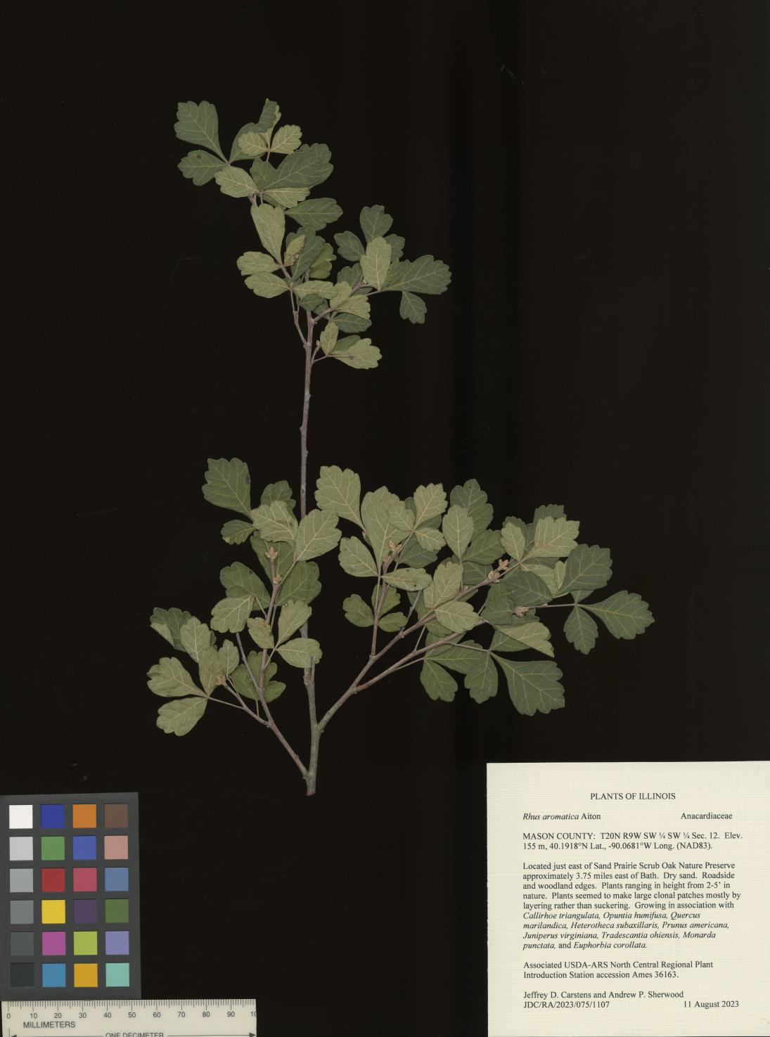 | | 2023 | COLLECTED | 08/11/2023 | Located just east of Sand Prairie Scrub Oak Nature Preserve approximately 3.75 miles east of Bath, T20N R9W SW 1/4 SW 1/4 Sec. 12. | 40.19175000, -90.06813000 | 155 | Dry sand. Roadside and woodland edges. | Wild material | Plants ranging in height from 2-5' in nature. Plants seemed to make large clonal patches mostly by layering rather than suckering. | 2158368 | Ames 36163 |
| 25 | W6 61366 | CBG- 10782 | Paronychia canadensis (L.) Alph. Wood | Illinois, United States | W6 |  | | 2023 | | | | | | | Wild material | | 2142248 | W6 61366 |
| 26 | WLP 3092 | RJLSEUS2022-021 | Rhododendron prunifolium (Small) Millais | Alabama, United States | NA | | | 2023 | COLLECTED | 12/10/2023 | Slopes along Poke Springs Branch inlet accessed by boat from Walter F. George Reservoir. Generally uncommon, but frequent at this site. | 31.72318400, -85.12907800 | 69 | Plants are growing in part-shade to shade on the well-drained mostly deciduous woodland slopes approximately 3-6 meters above the inlet.
Soils: The underlying geology of this area is of Cretaceous origin and characterized as Selma Group; Providence Sand. The upper part of the profile consists of cross-bedded fine to coarse sand and white, dark-gray and pale-red-purple mottled clay containing lignite, sand, and kaolin. The lower part consists of dark-gray laminated to thin-bedded silty clay and abundantly micaceous, carbonaceous, fossiliferous very fine to fine sand.
Source: USGS Alabama Geologic Map Data (https://mrdata.usgs.gov/geology/state/sgmc-unit.php?unit=ALKp%3B1)
The primary soil types in the collection area are classified as Nankin-Lucy Complex soil (20 to 60 percent slopes). The Nankin Series consists of very deep, well drained, moderately slowly permeable soils on uplands of the Coastal Plain. They formed in stratified loamy and clayey marine sediments. Slopes range from 0 to 60 percent. Soils are comprised of sandy loam in the upper 25 cm to sandy clay loam and sandy clay in lower strata to about 1.7 meters deep; these soils are strongly acid. The Lucy Series consists of very deep, well drained, moderately permeable soils on uplands. They formed in sandy and loamy marine and fluvial sediments of the Southern Coastal Plain. Slopes vary from 0 to 45 percent. These soils are generally loamy to sandy loam in the upper 25 cm and sandy clay loam in the lower strata to 2 meters; these are strongly acid soils.
Source: NRCS Web Soil Survey (https://websoilsurvey.sc.egov.usda.gov/App/WebSoilSurvey.aspx) | Wild material | | 2141446 | WLP 3092 |
| 27 | NA 87350 | TJK2022FL-005 | Ilex ambigua Torr. | Florida, United States | NA | | | 2023 | COLLECTED | 11/02/2022 | Okaloosa County: Eglin Air Force Base: East River Unit H-3, Range Road 259, north of Highway 98. | 30.41190000, -86.77320000 | 0 | Xeric Scrub/Upland Sandhill community. | Wild material | | 2141641 | NA 87350 |
| 28 | WLP 2676 | RJL2022NJ-007 | Kalmia latifolia L. | New Jersey, United States | NA | | | 2022 | COLLECTED | 10/24/2022 | Plants growing along Hawkins Bridge Road in Wharton State Forest. Plants are common and frequent throughout the woodlands at this location. | 39.70292400, -74.56106800 | 16 | Plants growing in a mixed Conifer-Broadleaved Evergreen-Deciduous dry to xeric forest habitat in part shade to shade.
Soils: The underlying geology of this area is the Cohansey Formation of middle Miocene origin and comprised of sand, white to yellow with local gravel and clay. It is sometimes locally stained red or orange brown by iron oxides and (or) cemented into large blocks of ironstone. Unweathered clay is typically dark gray, but commonly weathers white where it is interbedded with thin beds of ironstone. Sand is typically medium grained and moderately sorted although it ranges from fine to very coarse grained and from poorly to well sorted. Sand consists of quartz and siliceous rock fragments. Some beds are locally micaceous. Maximum thickness in the map area is about 60 meters; however, thickness is difficult to determine because of the irregular basal contact and extensive post-depositional erosion.
Source: USGS New Jersey Geologic Map Data (https://mrdata.usgs.gov/geology/state/sgmc-unit.php?unit=NJTch%3B1)
The primary soil type in the area of this collection is classified as Lakehurst sand, 0 to 5 percent slopes. Other related soils are found along the collection area; even so, this is the dominant soil in the collecting area of this species. This soil is primarily sandy coastal plain deposition that is moderately well-drained with limited organic matter in the upper horizon. This soil ranges in depth from 0.1-1.5 meters. It is very strongly acidic throughout. It is subject to periods of extreme drought.
Source: NRCS Web Soil Survey (https://websoilsurvey.sc.egov.usda.gov/App/WebSoilSurvey.aspx) | Wild material | | 2139667 | WLP 2676 |
| 29 | WLP 2675 | RJL2022NJ-006 | Kalmia angustifolia L. | New Jersey, United States | NA | | | 2022 | COLLECTED | 10/24/2022 | Plants growing along Hawkins Bridge Road in Wharton State Forest. Plants are common and frequent throughout the woodlands at this location. | 39.70231900, -74.56084200 | 16 | Plants growing in a mixed Conifer-Broadleaved Evergreen-Deciduous dry to xeric forest habitat in part shade to part sun.
Soils: The underlying geology of this area is the Cohansey Formation of middle Miocene origin and comprised of sand, white to yellow with local gravel and clay. It is sometimes locally stained red or orange brown by iron oxides and (or) cemented into large blocks of ironstone. Unweathered clay is typically dark gray, but commonly weathers white where it is interbedded with thin beds of ironstone. Sand is typically medium grained and moderately sorted although it ranges from fine to very coarse grained and from poorly to well sorted. Sand consists of quartz and siliceous rock fragments. Some beds are locally micaceous. Maximum thickness in the map area is about 60 meters; however, thickness is difficult to determine because of the irregular basal contact and extensive post-depositional erosion.
Source: USGS New Jersey Geologic Map Data (https://mrdata.usgs.gov/geology/state/sgmc-unit.php?unit=NJTch%3B1)
The primary soil type in the area of this collection is classified as Lakehurst sand, 0 to 5 percent slopes. Other related soils are found along the collection area; even so, this is the dominant soil in the collecting area of this species. This soil is primarily sandy coastal plain deposition that is moderately well-drained with limited organic matter in the upper horizon. This soil ranges in depth from 0.1-1.5 meters. It is very strongly acidic throughout. It is subject to periods of extreme drought.
Source: NRCS Web Soil Survey (https://websoilsurvey.sc.egov.usda.gov/App/WebSoilSurvey.aspx) | Wild material | | 2139666 | WLP 2675 |
| 30 | WLP 2669 | RJL2022NJ-001 | Rhododendron viscosum (L.) Torr. | New Jersey, United States | NA | | | 2022 | COLLECTED | 10/19/2022 | Plants growing near the confluence of Springers Brook and Mullica River in Wharton State Forest around wetlands and associated woodlands accessed off of an unnamed road from Stokes Road. Plants are common but scattered on the edges and in the understory of low-lying wet woodlands. | 39.72857100, -74.67798200 | 7 | Plants are growing in part-shade to shade of mixed deciduous and evergreen forests on moist slopes to occasionally wet low-lying areas fed by Springers Brook.
Soils: The underlying geology of this area is the Cohansey Formation of middle Miocene origin and comprised of sand, white to yellow with local gravel and clay. It is sometimes locally stained red or orange brown by iron oxides and (or) cemented into large blocks of ironstone. Unweathered clay is typically dark gray, but commonly weathers white, where interbedded with thin beds of ironstone. Sand is typically medium grained and moderately sorted although it ranges from fine to very coarse grained and from poorly to well sorted. Sand consists of quartz and siliceous rock fragments. Some beds are locally micaceous. Maximum thickness in the map area is about 60 meters; however, thickness is difficult to determine because of the irregular basal contact and extensive post-depositional erosion.
Source: USGS New Jersey Geologic Map Data (https://mrdata.usgs.gov/geology/state/sgmc-unit.php?unit=NJTch%3B1)
The primary soil type in the area of this collection is classified as Fluvaquents, sandy, 0 to 3 percent slopes, frequently flooded. This soil is primarily stratified, wet soils on flood plains and deltas of middle and low latitudes. The stratification reflects deposition of sediments under changing currents and in shifting channels. The depth of this soil is approximately 5 meters and are consider very poorly drained; they are considered wet to inundated year-round.
Source: NRCS Web Soil Survey (https://websoilsurvey.sc.egov.usda.gov/App/WebSoilSurvey.aspx) | Wild material | | 2139660 | WLP 2669 |
| 31 | NA 89033 | RJL2022MD-010 | Clethra alnifolia L. | Maryland, United States | NA | | | 2022 | COLLECTED | 09/15/2022 | Plants growing in low woodlands at the end of Greenway Avenue near a boat dock that leads to the Pocomoke River, adjacent to Winter Quarters Golf Course, Pocomoke City. Plants common throughout the wetland area as well as mesic edges of the woodlands. | 38.08305100, -75.56527800 | | Plants growing in the flood plain of the Pocomoke River in shade to part sun of a mixed deciduous and evergreen bottomland habitat about 10 meters from the edge of the golf course fairway. The habitat is a mucky swamp edge habitat next to the Pocomoke River, most of which seems wet year-round and grades slightly upslope to more mesic conditions.
The underlying geology of this area is comprised of Quaternary Deposits of Wisconsin to Holocene origin. The composition is primarily undifferentiated gray to buff sand and gravel, gray to brown lignitic silt and clay, occasional boulders, and rare shell beds. Surficial deposits occur as shell-bearing estuarine clays and silts.
Source: USGS Maryland Geologic Map Data https://mrdata.usgs.gov/geology/state/sgmc-unit.php?unit=MDQdu%3B5
The surface soil profile of this habitat is classified as Puckum Muck which is frequently flooded. These highly saturated soils are found in flats, depressions and swales. The soil reaction of Puckum Muck is extremely acid to strongly acid throughout the profile. The depth to bedrock is generally greater than 150 cm. Wood fragments comprise 0-25%, by volume of the Puckum Muck throughout the profile which includes mostly twigs, branches, logs, or stumps and are 1.5-30 cm in diameter. The composition of these highly saturated soils, are classified as muck (sapric soil material) or mucky peat (hemic soil material) throughout most of the upper 150 cm and may contain thin layers of mucky silt loam, silty clay loam, sandy loam and/or sand.
Source: NRCS Web Soil Survey (https://websoilsurvey.sc.egov.usda.gov/App/WebSoilSurvey.aspx) | Wild material | | 2139598 | NA 89033 |
| 32 | NA 89032 | RJL2022MD-009 | Rhododendron viscosum (L.) Torr. | Maryland, United States | NA | | | 2022 | COLLECTED | 09/15/2022 | Plants growing in low woodlands at the end of Greenway Avenue near a boat dock that leads to the Pocomoke River, adjacent to Winter Quarters Golf Course, Pocomoke City. Plants scattered throughout the wetland area. Infrequent, but regularly found. | 38.08235200, -75.56566500 | 1 | Plants growing in the flood plain of the Pocomoke River in part shade to shade of a mixed deciduous and evergreen bottomland habitat about 10 meters from the edge of the golf course fairway. The habitat is a mucky swamp edge habitat next to the Pocomoke River, most of which seems wet year-round.
The underlying geology of this area is comprised of Quaternary Deposits of Wisconsin to Holocene origin. The composition is primarily undifferentiated gray to buff sand and gravel, gray to brown lignitic silt and clay, occasional boulders, and rare shell beds. Surficial deposits occur as shell-bearing estuarine clays and silts.
Source: USGS Maryland Geologic Map Data https://mrdata.usgs.gov/geology/state/sgmc-unit.php?unit=MDQdu%3B5
The surface soil profile of this habitat is classified as Puckum Muck which is frequently flooded. These highly saturated soils are found in flats, depressions and swales. The soil reaction of Puckum Muck is extremely acid to strongly acid throughout the profile. The depth to bedrock is generally greater than 150 cm. Wood fragments comprise 0-25%, by volume of the Puckum Muck throughout the profile which includes mostly twigs, branches, logs, or stumps and are 1.5-30 cm in diameter. The composition of these highly saturated soils, are classified as muck (sapric soil material) or mucky peat (hemic soil material) throughout most of the upper 150 cm and may contain thin layers of mucky silt loam, silty clay loam, sandy loam and/or sand.
Source: NRCS Web Soil Survey (https://websoilsurvey.sc.egov.usda.gov/App/WebSoilSurvey.aspx) | Wild material | | 2139597 | NA 89032 |
| 33 | NA 88481 | RJL2022MD-002 | Kalmia latifolia L. | Maryland, United States | NA | | | 2022 | COLLECTED | 09/04/2022 | Plants growing at Elkton State Forest along roads and woodlands over a distance of approximately 5 kilometers labelled as the address of 717 Irishtown Rd, North East, MD 21901. Kalmia is very common along the unnamed gravel road as well as the understory of the upland woodlands. | 39.58852900, -75.90452900 | 60 | Plants are growing in a mesic to dry, well-drained habitat of mixed deciduous and evergreen woodlands comprised primarily of acid-loving plants. Plants are growing in shade to part shade along the unnamed road as well as the woodlands. The soils in the collection area are generally described as a complex series of fluviomarine deposits. The soils range from a thin loam layer at the surface to varying levels of loam to sandy loam and/or extremely gravelly sandy clay loam strata, depending upon geographical location (ie. Hillslope summits, slopes, footslopes, swales, etc.). The primary soil types in the collection area are classified as Russett-Christiana-Hambrook Complex and/or Sassafras and Croom Soils; though, others may intersect and overlay in specific areas. | Wild material | | 2139360 | NA 88481 |
| 34 | WLP 2614 | 2022VA-05 | Euonymus americanus L. | Virginia, United States | NA | | | 2022 | COLLECTED | 09/12/2022 | In Colonial Williamsburg, park in the Providence Hall Directors Wing parking lot and enter the Bassett Trace Nature Trail; this species is found in the woodlands on either side of the trail and over a bridge until the it turns right. This plant is infrequent, but occasionally found in the mesic woodlands throughout this location. | 37.26681600, -76.69252800 | 21 | Plants growing in shade to part-shade of the mixed deciduous and evergreen mesic woodland. This species is generally growing in areas with an abundant organic, mature woodland that is relatively undisturbed.
The underlying geology of this area is Windsor Formation of Tertiary-Quaternary origin (lower Pleistocene or upper Pliocene). It is comprised of gray and yellowish- to reddish-brown sand, gravel, silt, and clay. It constitutes surficial deposits of extensive plain and fluvial-estuarine terraces above elevations of 10 meters. The thickness of the Windsor Formation is 0 to 12.5 meters.
Source: USGS Virginia Geologic Map Data (https://mrdata.usgs.gov/geology/state/sgmc-unit.php?unit=VAQTw%3B0)
The surface soil profile of this area is Emporia Complex, 15 to 25 percent slopes. This soil as moderately well-drained, acidic, and found on sloping and elevated terraces. They are comprised of fine sandy loam, loam, and sandy clay loam in varying quantities across the profile; the depth to parent geology is approximately 200 cm.
Source: NRCS Web Soil Survey (https://websoilsurvey.sc.egov.usda.gov/App/WebSoilSurvey.aspx) | Wild material | | 2139352 | WLP 2614 |
| 35 | Ames 35953 | AS/ML/2022/022/153 | Monarda lindheimeri Engelm. & A. Gray | Texas, United States | NC7 |  | | 2022 | COLLECTED | 08/07/2022 | Located 4.98 miles west of Millican on the south side of FM 2154 Rd. | 30.50280100, -96.28483800 | 94 | Roadside, railroad right-of-way. | Wild material | Population extending just over 2.00 miles represented as very vigorous, rhizamatous specimens. In comparison to other M. lindheimeri noted in Texas in 2022, this population is one of the earliest flowering populations, nearly 2-3 weeks earlier typically peaking in mid-April. In 2022, population peaked flower on 18 April. | 2140543 | Ames 35953 |
| 36 | WLP 2576 | RJL2022-001 | Amelanchier arborea (F. Michx.) Fernald | Maryland, United States | NA | | | 2022 | COLLECTED | 05/25/2022 | Plants growing in open woodlands and part shade along unnamed Elkton State Forest gravel road over a distance of approximately 5 kilometers labelled as the address of 717 Irishtown Rd, North East, MD 21901. | 39.58089500, -75.91505900 | 73 | Plants are found regularly but scattered along the unnamed gravel road as well as in open understory of the upland woodlands. Plants growing in a mesic to dry, well-drained habitat of mixed deciduous and evergreen woodlands comprised primarily of acid-loving plants. Plants are growing in part shade and open understory shade. The soils in the collection area are generally described as a complex series of fluviomarine deposits. The soils range from a thin loam layer at the surface to varying levels of loam to sandy loam and/or extremely gravelly sandy clay loam strata, depending upon geographical location (ie. Hillslope summits, slopes, footslopes, swales, etc.). The primary soil types in the collection area are classified as Russett-Christiana-Hambrook Complex and/or Sassafras and Croom Soils; though, others may intersect and overlay in specific areas. | Wild material | | 2138095 | WLP 2576 |
| 37 | Ames 35792 | APS/ID/2022/027/489 | Ilex decidua Walter | Arkansas, United States | NC7 |  | | 2022 | COLLECTED | 03/15/2022 | Located approximately 3.75 miles east of Allison just off Round Bottom Road. | 35.93670000, -92.04891000 | 133 | Dry west facing slope in a pine, oak, and hickory forest. | Wild material | Plants sampled in nature with bright red fruits measuring 7-9 mm in diameter. | 2137431 | Ames 35792 |
| 38 | W6 60080 | MARSB-134 | Hudsonia ericoides L. | New Jersey, United States | W6 | | | 2021 | | | | | | | Wild material | | 2137165 | W6 60080 |
| 39 | OPGC 8339 | CBG-10556 | Anemone virginiana L. | Illinois, United States | OPGC | | | 2021 | | | | | | | Wild material | GPS coordinates incomplete. | 2120152 | OPGC 8339 |
| 40 | W6 59222 | CBG-10529 | Gratiola neglecta Torr. | Illinois, United States | W6 | | | 2021 | | | | | | | Wild material | Plant numbers estimated. | 2120137 | W6 59222 |
| 41 | W6 59238 | CBG-10552 | Agrostis perennans (Walter) Tuck. | Illinois, United States | W6 |  | | 2021 | | | | | | | Wild material | Collection date assumption. Plant numbers estimated. | 2120151 | W6 59238 |
| 42 | W6 59243 | CBG-10560 | Cinna arundinacea L. | Illinois, United States | W6 | | | 2021 | | | | | | | Wild material | Plant numbers estimated. | 2120155 | W6 59243 |
| 43 | W6 59267 | CBG-10590 | Muhlenbergia glabrifloris Scribn. | Illinois, United States | W6 | | | 2021 | | | | | | | Wild material | Received as: Muhlenbergia glabriflora. Plant numbers sampled estimated. | 2120210 | W6 59267 |
| 44 | Ames 35660 | Kiamichi Mountains | Ptelea trifoliata L. | Oklahoma, United States | NC7 | | | 2021 | COLLECTED | 07/19/2018 | Kiamichi Mountains of Ouachita National Forest along Road 6025 just west of State Highway 259, T2N R25E SW 1/4 NE 1/4 SW 1/4 Sec. 27 | 34.61314900, -94.67035700 | 651 | Open, dry ridgetop, rocky roadside. | Wild material | Specimens sampled measuring approximately 20-25' in height. | 2114985 | Ames 35660 |
| 45 | W6 58595 | MARSB-454 | Hudsonia ericoides L. | New Jersey, United States | W6 | | | 2021 | | | | | | | Wild material | Small, low, shrub. Forms dense mat. needle-like leaves only a few mm long. Pale orange- tan fruit. | 2113525 | W6 58595 |
| 46 | OPGC 7855 | CBG-9538 | Eutrochium purpureum (L.) E. E. Lamont | Illinois, United States | OPGC |  | | 2019 | | | | | | | Wild material | | 2092807 | OPGC 7855 |
| 47 | Ames 34319 | JDC/ML/2018/057/870 | Monarda luteola Singhurst & W. C. Holmes | Texas, United States | NC7 |  | | 2018 | COLLECTED | 07/18/2018 | Just west of Avinger on north side of highway 155 in powerline cut between CR 1650 and CR 1651 (just 1.0 mile west of intersection of higwhay 49 and highway 155), Cass County | 32.89669900, -94.56962800 | 112 | Infrequently mowed, clear cut area for powerline. | Wild material | Plants with lemon scent and pubescent stems and leaves measuring 1.0-3.0' in height. Noted extreme variation across population with some plants exhibiting both heavily pubescent and others with minimally pubescent stems. Plants not observed during flower, but all specimens sampled believed to be M. luteola. Seeds likely reached full maturity around first week in July (2018). | 1964626 | Ames 34319 |
| 48 | Ames 34320 | JDC/MR/2018/058/871 | Monarda russeliana Nutt. ex Sims | Oklahoma, United States | NC7 |  | | 2018 | COLLECTED | 07/19/2018 | Kiamichi Mountains of Ouachita National Forest along Road 6025 just west of highway 259, T2N R25E S 1/2 Sec. 27 and S 1/2 Sec. 28 Le Flore County. | 34.61320100, -94.66641200 | 651 | Open, dry, rocky woods. | Wild material | Petite plants with only 1-3 stems per plant ranging from 1.0-1.5' in height. At time of collection (19 July 2018) peduncle showing 1-2" of dead/brown tissue. Leaves twice as long (or more) as wide. Generally three pairs of opposite leaves per stem. Slight pubescence on leaves with 1-2 mm petiole. Leaves rather flat. Seeds likely reached peak maturity around first week in July. | 1964627 | Ames 34320 |
| 49 | NA 84578 | RJL-RM002 | Magnolia pyramidata W. Bartram | Texas, United States | NA | | | 2017 | COLLECTED | 07/22/2017 | Newton County Road 425, about 2.8 miles south of Texas Recreational Road 255. | 30.85996000, -93.89596000 | 105 | Along roadsides and among young loblolly pines in forestry plantation. Plants growing in part shade to full sun in heavily regenerating roadside woodlands associated with loblolly pine plantations. Plants are growing in well drained, highly sandy soils. | Wild material | | 1953814 | NA 84578 |
| 50 | W6 49517 | CBG-2452 | Koeleria macrantha (Ledeb.) Schult. | Illinois, United States | W6 |  | | 2015 | | | | | | | Wild material | | 1925997 | W6 49517 |
| 51 | W6 49535 | CBG-2476 | Carex muehlenbergii Schkuhr ex Willd. | Illinois, United States | W6 |  | | 2015 | | | | | | | Wild material | | 1926160 | W6 49535 |
| 52 | Ames 32894 | APS/GD/2015/017/199 | Gymnocladus dioicus (L.) K. Koch | Oklahoma, United States | NC7 |  | | 2015 | COLLECTED | 03/14/2015 | Cleveland County: T10N R5W SW 1/4 SW 1/4 Sec. 7. John Nichols Camp located on north side of Canadian River approxiamtely 4.25 miles south and southeast of Mustang. | 35.35029600, -97.66952200 | 395 | Higher elevations. Dry, relatively thin soils. | Wild material | | 1925360 | Ames 32894 |
| 53 | Ames 32902 | APS/GD/2015/030/212 | Gymnocladus dioicus (L.) K. Koch | Oklahoma, United States | NC7 |  | | 2015 | COLLECTED | 03/18/2015 | Logan County: T18N R2W N 1/2 Sec. 36. Private property approximately 1.5 miles east of the confluence of Skeleton Creek and Cimarron River approximately 5.25 miles south southeast of Mulhall. | 35.99593500, -97.36486800 | 288 | Transition zone between higher elevations and bottomlands. | Wild material | | 1925368 | Ames 32902 |
| 54 | Ames 32904 | APS/GD/2015/032/214 | Gymnocladus dioicus (L.) K. Koch | Oklahoma, United States | NC7 |  | | 2015 | COLLECTED | 03/19/2015 | Osage County: Sand Creek watershed area, T27N R8E SE 1/4 NW 1/4 Sec. 10. Tallgrass Prairie Preserve approximately 13 miles northwest of Pawhuska. | 36.83425300, -96.43091600 | 307 | Dry, rocky outcroppings and floodplain. | Wild material | | 1925370 | Ames 32904 |
| 55 | NA 83068 | NA 83068 | Philadelphus pubescens Loisel. | Arkansas, United States | NA | | | 2015 | COLLECTED | 10/06/2014 | Mount Magazine State Park; Brown's Spring Picnic Area trail. | 36.16768000, -93.66583000 | 796 | Moist bluff line community, growing in moist organic soil layer over rocks. | | | 1952927 | NA 83068 |
| 56 | Ames 32831 | RLD1401 | Cornus rugosa Lam. | Minnesota, United States | NC7 | | | 2014 | COLLECTED | 09/03/2014 | Becker County near Pine Island Lake. | 47.14710000, -95.43608330 | 503 | Upland roadside near steep dropoff with lake below. Mixed deciduous and conifer forest. Growing in association with Fraxinus pennsylvanica, Quercus macrocarpa, Populus tremuloides, Betula papyrifera, Picea glauca, Pinus strobus, Sambucus sp., Acer spicatum, Rosa sp., Rubus sp., and Sanicula marilandica. | Wild material | | 1921824 | Ames 32831 |
| 57 | Ames 32835 | GA14014001 | Fraxinus pennsylvanica Marshall | North Dakota, United States | NC7 |  | | 2014 | COLLECTED | 10/30/2014 | Bottineau County, Turtle Mountains. | 48.97000000, -100.45000000 | 737 | Mixed oak-aspen forest | Wild material | | 1921828 | Ames 32835 |
| 58 | WLP 1746 | Ames 32838 | Viburnum opulus L. var. americanum Aiton | North Dakota, United States | NA | | | 2014 | COLLECTED | 10/31/2014 | Turtle Mountains - Bottineau County. | 48.95000000, -100.43000000 | 692 | Wet, aspen forest. Growing in association with Sanicula marilandica, Fragaria virginiana, Trifolium repens, Rubus sp., Typha latifolia, Prunus pensylvanica, Prunus virginiana, Corylus sp., Crataegus sp., Viburnum lentago, Rosa sp., Cornus sericea, Amelanchier sp., Symphoricarpos sp., Salix sp., Betula papyrifera, Populus tremuloides, Ulmus americana, Acer negundo, Quercus macrocarpa, and Fraxinus pennsylvanica. | Wild material | | 1921831 | WLP 1746 |
| 59 | NA 81936 | NA 81936 | Magnolia virginiana L. | Texas, United States | NA | | | 2013 | COLLECTED | 04/11/2011 | On S side of County Road 59 ca. 1000 ft. W of it's juncture with Private Road 335 and ca. 0.25 miles N of Highway 255. | 31.05566000, -94.15485000 | | Growing in seepage areas of otherwise dry Pinus palustris forest. | | | 1951206 | NA 81936 |
| 60 | Ames 31213 | JDZ/2011/002/001 | Fraxinus nigra Marshall | North Dakota, United States | NC7 |  | | 2011 | COLLECTED | 09/09/2011 | Jay V. Wessels Wildlife Management Area, Pembina County. T162N R55W NW 1/4 Sec. 31, SE 1/4 SE 1/4 Sec. 25, and Sec. 20 Hallson Quad. | 48.82030000, -97.82040000 | 308 | Wetland. Sandy soils. | Wild material | Requests will be filled using inventory sample 11ncao05 (JDZ/2011/002/005) unless otherwise noted. | 1893359 | Ames 31213 |
| 61 | Ames 30541 | UC 105 | Aronia arbutifolia (L.) Pers. | North Carolina, United States | NC7 |  | | 2010 | COLLECTED | 10/21/2009 | Near West End, Moore County | 35.25260000, -79.49096700 | 149 | Powerline easement. Mixed hardwood woods. Sandy soil overlaying a moist seep. | Wild material | Received as plants grown from seed collected from native/wild population. Accession is extremely vigorous with an upright growth habit. Low fruit/seed production in cultivation in central Iowa. | 1843095 | Ames 30541 |
| 62 | Ames 32070 | UC 105 | Aronia arbutifolia (L.) Pers. | North Carolina, United States | NC7 |  | | 2010 | COLLECTED | 10/21/2009 | Near West End, Moore County | 35.25260000, -79.49096700 | 149 | Powerline easement. Mixed hardwood woods. Sandy soil overlaying a moist seep. | Wild material | Separated from Ames 30541 due to its extremely tight, upright growth habit. This new accession will be maintained as a uniform accession. | 1912823 | Ames 32070 |
| 63 | Ames 29861 | APS/GD/2009/002/011 | Gymnocladus dioicus (L.) K. Koch | Kansas, United States | NC7 |  | | 2009 | COLLECTED | 02/17/2009 | Trees 1-3: Woodson Cove Road, Holiday Hill area; Trees 4-5: Sandstone Campground; Tree 6: Campground 16, Toronto Point area; Tree 7: Lake Hills Road 400; Cross Timbers State Park, Toronto, extreme southwest corner of Woodson County. | 37.74277778, -95.91194444 | 290 | Trees 1-3: Wooded area. Flat; Trees 4-5: 20-30 yards from lake shore, east side of lake; Tree 6: Edge of wooded area, north side of Toronto Lake, Flat; Tree 7: Roadside ditch in a fence row. | Wild material | Trees 1-3: 5.5 to 7 inches d.b.h and 50 feet in height; Trees 4-5: 9 to 10.5 inches d.b.h. and 40 feet in height; Tree 6: 14 inches d.b.h. and 40 feet in height; Tree 7: 2 to 6 inches d.b.h. and 10 to 25 feet in height. | 1796426 | Ames 29861 |
| 64 | Ames 27750 | 11b | Symphoricarpos orbiculatus Moench | Missouri, United States | NC7 |  | | 2004 | COLLECTED | 10/19/2004 | Roadside along Highway 19, city limits of Cuba, Crawford County. | 38.04761700, -91.39658300 | 314 | Bank of degraded sandstone, along road. | Wild material | | 1668209 | Ames 27750 |
| 65 | Ames 27330 | JDC/RA/2023/069/1101 | Rhus aromatica Aiton | Iowa, United States | NC7 |  | | 2003 | COLLECTED | 09/24/2003 | Chatfield Park near Mooar, T65N R5W SW 1/4 of SW 1/4 of Sec. 9, Keokuk Quad. | 40.43750000, -91.45055556 | 195 | Half shaded. ~10% slope with a southwestern aspect | Wild material | Suckering shrubs averaging 4 feet tall. Leaves pubescent. | 1649676 | Ames 27330 |
| 66 | NA 70425 | MWPCC00-081 | Nyssa sylvatica Marshall | North Carolina, United States | NA | | | 2000 | COLLECTED | 09/15/2000 | Buncombe Co. Asheville NC. North Carolina Arboretum | 35.49611111, -82.60972222 | 713 | near the top of a slope, native vegetation, adfacent to a service road and mowed roadside; associates; Oxydendrum, Rhus radicans, Kalmia latifolia, Acer rubrum, Quercus prinus, Quercus marilandica, Pteridium. | Wild material | Dry site for species, defoliation from stress? Ron Lance mentioned plants like this one from drier sites tend to have larger leaves. | 1608271 | NA 70425 |