| 0 | NA 82053 | JDC/QM/2014/079/581 | Quercus montana Willd. | Mississippi, United States | NA | | | 2014 | COLLECTED | 09/22/2014 | Mississippi: Tishomingo County; Near J.P. Coleman State Park off County Road 989. | 34.97300100, -88.21763300 | 166 | Pine-oak woods. Growing in association with Liriodendron tulipifera, Pinus sp., Quercus alba, Quercus stellata, Carya sp., Rhus copallinum, Cornus florida, and Cercis canadensis. | Wild material | Optimum timing for harvest. Acorns just starting to drop. Petioles yellow. | 1922354 | NA 82053 |
| 1 | NA 89080 | 2024RJLPA-006 | Ilex montana Torr. & A. Gray | Pennsylvania, United States | NA | | | 2024 | COLLECTED | 09/20/2024 | Berks and Schuylkill Counties: Hawk Mountain Sanctuary. | 40.64162200, -75.99122600 | 418 | Plants are growing from shade to full sun on a dry-mesic to very dry, well-drained upland/montane habitat characterized by an upland mixed deciduous and evergreen forest that is very rocky. All the plants found in this habitat go through periods of drought during the growing season due to the limited litter/soil layer in which moisture can be held. Elevation: 405 to 430 meters. Slope: 5 to 25 percent. Aspect: various. Geology: The underlying geology of this area is of Silurian origin and comprised of Shawangunk Formation. This formation is primarily light- to dark-gray, fine- to very coarse-grained sandstone and conglomerate containing thin shale interbeds. (Source: USGS Pennsylvania Geologic Map Data). Soils: The surface soil profile of this area is characterized as the Hazleton Series which consists of deep and very deep, well drained soils formed in residuum of acid gray, brown or red sandstone on uplands. The matrix includes a considerable accumulation of thin, flat, coarse fragments of sandstone, limestone, or schist with diameters up to 15 cm. Slope ranges from 0-80%. Permeability is moderately rapid to rapid. (Source: USDA-NRCS Official Soil Series Descriptions). EPA Ecoregion (Level III): Ridge and Valley (67). EPA Ecoregion (Level IV): Northern Sandstone Ridges (67c). | Wild material | | 2169044 | NA 89080 |
| 2 | NA 88606 | KY23-008 | Ilex montana Torr. & A. Gray | Kentucky, United States | NA | | | 2023 | COLLECTED | 09/09/2023 | Black Mountain summit (second location, bulked with the first: Black Mountain; lat/long 36. 91614, -82. 89873) | 36.91434000, -82.89463000 | 1261 | Moist woods. Elevation: 4138 feet. Aspect: West. (Second location, bulked with first: Elevation: 4071 feet. Aspect: West.) | Wild material | | 2158698 | NA 88606 |
| 3 | NA 88490 | RJL2022PA-006 | Ilex montana Torr. & A. Gray | Pennsylvania, United States | NA | | | 2022 | COLLECTED | 09/10/2022 | Hawk Mountain Sanctuary. | 40.64162200, -75.99122600 | 420 | Plants are growing from shade to full sun on a dry-mesic to very dry, well-drained upland/montane habitat characterized by an upland mixed deciduous and evergreen forest that is very rocky. All of the plants found in this habitat go through periods of drought during the growing season due to the limited litter/soil layer in which moisture can be held. The underlying geology of this area is of Silurian origin and comprised of Shawangunk Formation. This formation is primarily light- to dark-gray, fine- to very coarse-grained sandstone and conglomerate containing thin shale interbeds. (Source: USGS Pennsylvania Geologic Map Data). The surface soil profile of this area is the Hazleton series consists of deep and very deep, well drained soils formed in residuum of acid gray, brown or red sandstone on uplands. The matrix includes a considerable accumulation of thin, flat, coarse fragments of sandstone, limestone, or schist with diameters up to 15 cm. Slope ranges from 0-80%. Permeability is moderately rapid to rapid. (Source: NRCS Web Soil Survey). | Wild material | | 2139369 | NA 88490 |
| 4 | NA 89171 | 2025RJLSEUS-04 | Rhododendron catawbiense Michx. | Alabama, United States | NA | | | 2026 | COLLECTED | 09/30/2025 | Scarham Creek: southeast of the Pea Ridge Road bridge, approximately 50-80 meters on the south side of the creek. | 34.32559600, -86.16054600 | 266 | Growing near the base of the slopes above the riparian zone, generally on the exposed geology under very well-drained conditions. The woodlands are primarily deciduous with a few evergreens infrequently mixed. Slope: 15 to 30 percent. Aspect: Northeast. Soil: The primary soil type in the area of this collection is classified as Rockland Series sandstone (Rc). The Rockland series consists of well drained soils formed in loamy colluvium from rotational landslides on slopes of stream valleys and dissections of ground moraines. Saturated hydraulic conductivity is moderate in the upper part of the profile and moderately slow in the lower part. Slopes range from 18 to 70 percent. Some pedons have buried leaves, twigs, and moss. Mass soil movement has left random remnants of soil structure from prior upslope soil development and has buried tree branches, leaves and moss. The upper 0-2 cm of soil contains slightly decomposed organic matter while lower soils layers to a depth of 58 cm are comprised of dark reddish-brown to brown silt loam and are moderately acidic. Below 58 cm the soils are generally dark reddish-brown silt loam and strongly to moderately alkaline. (Source:California Soil Resource Lab/NRCS Official Soil Series Descriptions). Geology: The underlying geology of this area is of Pennsylvanian origin and characterized as Pottsville Formation. It is characterized by light-gray thin to thick-bedded quartzose sandstone and conglomerate containing interbedded dark-gray shale, siltstone, and coal. Mapped on Lookout Mountain, Blount and Chandler Mountains, and Sand Mountain northeast of Blount County, and on the mountains of Jackson, Marshall, and Madison Counties north and west of the TN river. (Source: USGS Alabama Geologic Map Data). | Wild material | Received as R. catawbiense vsr. insularis | 2193305 | NA 89171 |
| 5 | NA 89155 | 2025RJLSEUS-02 | Ilex longipes Chapm. ex Trel. | Alabama, United States | NA | | | 2025 | COLLECTED | 09/30/2025 | Scarham Creek: southeast of the Pea Ridge Road bridge, approximately 50-80 meters on the south side of the creek. | 34.32520700, -86.15967000 | 261 | Plants are growing on relatively steep woodland slopes in shade. The woodlands are primarily deciduous with a few evergreens infrequently mixed. Slope: 15 to 30 percent. Aspect: Northeast. Soil: The primary soil type in the area of this collection is classified as Rockland Series sandstone (Rc). The Rockland series consists of well drained soils formed in loamy colluvium from rotational landslides on slopes of stream valleys and dissections of ground moraines. Saturated hydraulic conductivity is moderate in the upper part of the profile and moderately slow in the lower part. Slopes range from 18 to 70 percent. Some pedons have buried leaves, twigs, and moss. Mass soil movement has left random remnants of soil structure from prior upslope soil development and has buried tree branches, leaves and moss. The upper 0-2 cm of soil contains slightly decomposed organic matter while lower soils layers to a depth of 58 cm are comprised of dark reddish-brown to brown silt loam and are moderately acidic. Below 58 cm the soils are generally dark reddish-brown silt loam and strongly to moderately alkaline. (Source: California Soil Resource Lab/NRCS Official Soil Series Descriptions). Geology: The underlying geology of this area is of Pennsylvanian origin and characterized as Pottsville Formation. It is characterized by light-gray thin to thick-bedded quartzose sandstone and conglomerate containing interbedded dark-gray shale, siltstone, and coal. Mapped on Lookout Mountain, Blount and Chandler Mountains, and Sand Mountain northeast of Blount County, and on the mountains of Jackson, Marshall, and Madison Counties north and west of the TN river. (Source: USGS Alabama Geologic Map Data). | Wild material | | 2193001 | NA 89155 |
| 6 | NA 89156 | 2025RJLSEUS-03 | Euonymus americanus L. | Alabama, United States | NA | | | 2025 | COLLECTED | 09/30/2025 | Scarham Creek: southeast of the Pea Ridge Road bridge, approximately 50-80 meters on the south side of the creek. | 34.32577600, -86.16071000 | 260 | Plants are growing on relatively steep woodland slopes in shade. The woodlands are primarily deciduous with a few evergreens infrequently mixed. Slope: 15 to 30 percent. Aspect: Northeast. Soil: The primary soil type in the area of this collection is classified as Rockland Series sandstone (Rc). The Rockland series consists of well drained soils formed in loamy colluvium from rotational landslides on slopes of stream valleys and dissections of ground moraines. Saturated hydraulic conductivity is moderate in the upper part of the profile and moderately slow in the lower part. Slopes range from 18 to 70 percent. Some pedons have buried leaves, twigs, and moss. Mass soil movement has left random remnants of soil structure from prior upslope soil development and has buried tree branches, leaves and moss. The upper 0-2 cm of soil contains slightly decomposed organic matter while lower soils layers to a depth of 58 cm are comprised of dark reddish-brown to brown silt loam and are moderately acidic. Below 58 cm the soils are generally dark reddish-brown silt loam and strongly to moderately alkaline. (Source: California Soil Resource Lab/NRCS Official Soil Series Descriptions). Geology: The underlying geology of this area is of Pennsylvanian origin and characterized as Pottsville Formation. It is characterized by light-gray thin to thick-bedded quartzose sandstone and conglomerate containing interbedded dark-gray shale, siltstone, and coal. Mapped on Lookout Mountain, Blount and Chandler Mountains, and Sand Mountain northeast of Blount County, and on the mountains of Jackson, Marshall, and Madison Counties north and west of the TN river. (Source: USGS Alabama Geologic Map Data). | Wild material | | 2193002 | NA 89156 |
| 7 | W6 62689 | CA340-67 | Arctostaphylos viscida Parry | California, United States | W6 |  | | 2025 | | | | | | | Wild material | On either side of the road. Larger individuals produced seed, while most of the smaller ones (1-2 ft.) did not. | 2192907 | W6 62689 |
| 8 | NA 88928 | 24Flam6 | Rhododendron minus Michx. | Georgia, United States | NA | | | 2025 | COLLECTED | 09/09/2024 | Cumming, GA: Sawnee Mountain Preserve: primarily downslope of Mountainside Trail, with a fwe plants upslope of trail. | 34.23730000, -84.15298000 | 489 | Growing in half shade. Slope: 30 to 40 degrees. Aspect: East-northeast. | Wild material | | 2172811 | NA 88928 |
| 9 | NA 88588 | 2024RM-001 | Hydrangea radiata Walter | Georgia, United States | NA | | | 2024 | COLLECTED | 10/24/2024 | Chattahoochee National Forest: Warwoman Wildlife Management Area: north side of Overflow Creek Road just west of the bridge over the Chattooga River. | 34.94956600, -83.20652000 | 498 | Mixed evergreen and deciduous moist mesic forest in part shade. The underlying geology of this area is characterized as Metagraywacke/Mica Schist Formation of the Precambrian-Paleozoic period. (Source: USGS Georgia Geologic Map Data). The soils of this are characterized as Tusquitee Series Loam, 10 to 25 percent slopes. The Tusquitee Series consists of very deep, well drained soils on gently sloping to very steep benches, foot slopes, toe slopes, and fans in coves in the Southern Blue Ridge mountains, MLRA 130B. These soils formed in colluvium derived from materials weathered from igneous and high-grade metamorphic crystalline rocks such as granite, mica gneiss, hornblende gneiss, and schist. Slope ranges from 2 to 95 percent. Solum thickness ranges from 1 to 3+ meters. Reaction is very strongly acid to slightly acid, in the A horizon. The Bw and lower horizons are very strongly acid to moderately acid. In the upper 1 meter, content of rock fragments, dominantly of gravel to stone size, ranges up to 35 percent. Below 1 meter, rock fragment content may range up to 60 percent. Content of mica flakes ranges from few to common. (Source: California Soil Resource Lab/NRCS Official Soil Series Descriptions). | Wild material | | 2169925 | NA 88588 |
| 10 | NA 89075 | 2024RJLPA-001 | Rhododendron maximum L. | Pennsylvania, United States | NA | | | 2024 | COLLECTED | 09/18/2024 | Fieldstone Farm Tank Creek Nature Preserve (a property of the Pocono Heritage Land Trust): Collected along Tank Creek. The property is accessed from a parking area located on Devil's Hole Road. | 41.13862300, -75.34562700 | 493 | Mostly found in mixed deciduous forest with occasional conifers and evergreen shrubs generally on steep slopes above Tank Creek in rocky well-drained soils in shade to part-shade. The slopes are abundant in decomposed organic matter and runoff soils. Slope: 5 to 30 percent. Aspect: various. Geology: The underlying geology of this area is of Devonian origin and characterized as the Long Run Member of Catskill Formation. It is comprised of gray and grayish-red sandstone and grayish-red siltstone and mudstone in fining-upward cycles. (Source: USGS Pennsylvania Geologic Map Data). Soils: The primary soil type found here is classified as Alluvial Land. In geology, alluvial land refers to areas of land that are formed by the deposition of sediments carried by rivers, or other surface water. EPA Ecoregion (Level III): North Central Appalachians (62). EPA Ecoregion (Level IV): Low Poconos (62b). | Wild material | | 2169039 | NA 89075 |
| 11 | NA 89076 | 2024RJLPA-002 | Kalmia latifolia L. | Pennsylvania, United States | NA | | | 2024 | COLLECTED | 09/18/2024 | Fieldstone Farm Tank Creek Nature Preserve (a property of the Pocono Heritage Land Trust): Collected along Tank Creek. The property is accessed from a parking area located on Devil's Hole Road. | 41.13862300, -75.34562700 | 493 | Mostly found in mixed deciduous forest with occasional conifers and evergreen shrubs generally on sloping sites as an understory shrub in rocky well-drained soils in shade to part-shade. Slope: 5 to 15 percent. Aspect: various. Geology: The underlying geology of this area is of Devonian origin and characterized as the Long Run Member of Catskill Formation. It is comprised of gray and grayish-red sandstone and grayish-red siltstone and mudstone in fining-upward cycles. (Source: USGS Pennsylvania Geologic Map Data). Soils: The primary soil type found here is classified as Alluvial Land. In geology, alluvial land refers to areas of land that are formed by the deposition of sediments carried by rivers, or other surface water. EPA Ecoregion (Level III): North Central Appalachians (62). EPA Ecoregion (Level IV): Low Poconos (62b). | Wild material | | 2169040 | NA 89076 |
| 12 | NA 89078 | 2024RJLPA-004 | Staphylea trifolia L. | Pennsylvania, United States | NA | | | 2024 | COLLECTED | 09/20/2024 | Along gated road about 0.33 kilometers southwest of the Lake Ontelaunee Trail parking lot. | 40.49850800, -75.89121300 | 94 | Plants are growing on well-drained steep slopes in shade to part shade of a deciduous forest. Slope: 35 to 50 percent. Aspect: East-southeast. Geology: The underlying geology of this area is of Ordovician origin and characterized as Shale and graywacke of Hamburg sequence. It is characterized by shale containing zones of conspicuous graywacke. (Source: USGS Pennsylvania Geologic Map Data). Soils: The primary soil type in the area of this collection is classified as Berks-Weikert Complex, 25 to 60% slopes (BkF). Dominantly sloping to very steep, moderately deep and shallow, well drained soils underlain by acid shale bedrock. (Source: UPenn State University Soil Info Website). EPA Ecoregion (Level III): Ridge and Valley (67). EPA Ecoregion (Level IV): Northern Shale Valleys (67b). | Wild material | | 2169042 | NA 89078 |
| 13 | NA 89081 | 2024RJLPA-009 | Rosa carolina L. | Pennsylvania, United States | NA | | | 2024 | COLLECTED | 09/22/2024 | Lancaster and York Counties: outcrops along the Susquehanna River, accessed from the Historic Lock 12 parking lot off of Pennsylvania Road 372. | 39.81483500, -76.32762200 | 34 | Plants are growing from part-sun to full sun in crevices of the outcrops and where organic debris has accumulated in between boulders along the Susquehanna River. The sites range from nearly xeric to dry mesic, at least on the surface. Plants are generally growing 4-10 m above the normal flow of the river; however, the Holtwood Dam is less than 1 kilometer upstream and debris found trapped in the boulders indicates that there is periodic flooding, at least, in the lower zone of 4+ meters or so above normal river flow. This habitat has a diverse assemblage of deciduous trees and shrubs as well as abundant herbaceous taxa. Slope: 0 to 60 percent. Aspect: Northeast (generally). Geology: The underlying geology of this area is probably of lower Paleozoic age and characterized as the Octoraro Formation. It includes albite-chlorite schist, phyllite, some hornblende gneiss, and granitized members. Soils: The area where this species occurs is right on the edge of two soil zones that transition from the river’s edge to mesic conditions upslope. The first is generally referred to as Rock Outcrop. This terrestrial matrix in which plants grow is largely exposed underlying rock geology with accumulated outwash, rock decomposition, and organic debris buildup. The second is Mt. Airy (80%) and Manor (20%) Series soils, 25 to 60 percent slopes, extremely stony (MRF). (Source: California Soil Resource Lab/NRCS Official Soil Series Descriptions). EPA Ecoregion (Level III): Northern Piedmont (64). EPA Ecoregion (Level IV): Piedmont Uplands (64c). | Wild material | | 2169045 | NA 89081 |
| 14 | NA 89082 | 2024RJLPA-010 | Amorpha fruticosa L. | Pennsylvania, United States | NA | | | 2024 | COLLECTED | 09/22/2024 | Outcrops along the Susquehanna River, accessed from the Historic Lock 12 parking lot off of Pennsylvania Road 372. | 39.81481500, -76.32757900 | 34 | Plants are growing from part-sun to full sun in crevices of the outcrops and where organic debris has accumulated in between boulders along the Susquehanna River. The sites range from nearly xeric to dry mesic, at least on the surface. Plants are generally growing 4-10 m above the normal flow of the river; however, the Holtwood Dam is less than 1 kilometer upstream and debris found trapped in the boulders indicates that there is periodic flooding, at least, in the lower zone of 4+ meters or so above normal river flow. This habitat has a diverse assemblage of deciduous trees and shrubs as well as abundant herbaceous taxa. Slope: 0 to 25 percent. Aspect: Northeast (generally). Geology: The underlying geology of this area is probably of lower Paleozoic age and characterized as the Octoraro Formation. It includes albite-chlorite schist, phyllite, some hornblende gneiss, and granitized members. Soils: The area where this species occurs is right on the edge of two soil zones that transition from the river’s edge to mesic conditions upslope. The first is generally referred to as Rock Outcrop. This terrestrial matrix in which plants grow is largely exposed underlying rock geology with accumulated outwash, rock decomposition, and organic debris buildup. The second is Mt. Airy (80%) and Manor (20%) Series soils, 25 to 60 percent slopes, extremely stony (MRF). (Source: California Soil Resource Lab/NRCS Official Soil Series Descriptions). EPA Ecoregion (Level III): Northern Piedmont (64). EPA Ecoregion (Level IV): Piedmont Uplands (64c). | Wild material | | 2169046 | NA 89082 |
| 15 | NA 89083 | 2024RJLPA-012 | Rhododendron periclymenoides (Michx.) Shinners | Pennsylvania, United States | NA | | | 2024 | COLLECTED | 09/22/2024 | Outcrops along the Susquehanna River, accessed from the Historic Lock 12 parking lot off of Pennsylvania Road 372. | 39.81477400, -76.32807300 | 35 | Plants are growing from shade to part-sun and occasionally full sun in crevices of the outcrops and where organic debris has accumulated in between boulders along the Susquehanna River. The sites range from nearly xeric to mesic, at least on the surface. Plants are generally growing 4-10 m above the normal flow of the river; however, the Holtwood Dam is less than 1 kilometer upstream and debris found trapped in the boulders indicates that there is periodic flooding, at least, in the lower zone of 4+ meters or so above normal river flow. This habitat has a diverse assemblage of deciduous trees and shrubs as well as abundant herbaceous taxa. Slope: 0 to 60 percent. Aspect: Northeast (generally). Geology: The underlying geology of this area is probably of lower Paleozoic age and characterized as the Octoraro Formation. It includes albite-chlorite schist, phyllite, some hornblende gneiss, and granitized members. Soils: The area where this species occurs is right on the edge of two soil zones that transition from the river’s edge to mesic conditions upslope. The first is generally referred to as Rock Outcrop. This terrestrial matrix in which plants grow is largely exposed underlying rock geology with accumulated outwash, rock decomposition, and organic debris buildup. The second is Mt. Airy (80%) and Manor (20%) Series soils, 25 to 60 percent slopes, extremely stony (MRF). (Source: California Soil Resource Lab/NRCS Official Soil Series Descriptions). EPA Ecoregion (Level III): Northern Piedmont (64). EPA Ecoregion (Level IV): Piedmont Uplands (64c). | Wild material | | 2169047 | NA 89083 |
| 16 | NA 89084 | 2024RJLPA-013 | Physocarpus opulifolius (L.) Maxim. | Pennsylvania, United States | NA | | | 2024 | COLLECTED | 09/22/2024 | Outcrops along the Susquehanna River, accessed from the Historic Lock 12 parking lot off of Pennsylvania Road 372. | 39.81466300, -76.32833900 | 36 | Plants are growing from shade to part-sun where organic debris has accumulated in between boulders as well as further upslope in deeper mesic soils along the Susquehanna River. This habitat has a diverse assemblage of deciduous trees and shrubs as well as abundant herbaceous taxa. Slope: 10 to 25 percent. Aspect: Northeast (generally). Geology: The underlying geology of this area is probably of lower Paleozoic age and characterized as the Octoraro Formation. It includes albite-chlorite schist, phyllite, some hornblende gneiss, and granitized members. Soils: The area where this species occurs is right on the edge of two soil zones that transition from the river’s edge to mesic conditions upslope. The first is generally referred to as Rock Outcrop. This terrestrial matrix in which plants grow is largely exposed underlying rock geology with accumulated outwash, rock decomposition, and organic debris buildup. The second is Mt. Airy (80%) and Manor (20%) Series soils, 25 to 60 percent slopes, extremely stony (MRF). (Source: California Soil Resource Lab/NRCS Official Soil Series Descriptions). EPA Ecoregion (Level III): Northern Piedmont (64). EPA Ecoregion (Level IV): Piedmont Uplands (64c). | Wild material | | 2169048 | NA 89084 |
| 17 | NA 89085 | 2024RJLPA-014 | Rhododendron arborescens (Pursh) Torr. | Pennsylvania, United States | NA | | | 2024 | COLLECTED | 09/22/2024 | Outcrops along the Susquehanna River, accessed from the Historic Lock 12 parking lot off of Pennsylvania Road 372. | 39.81618100, -76.33069800 | 38 | Plants are growing from shade to part-sun and occasionally full sun in crevices of the outcrops and where organic debris has accumulated in between boulders along the Susquehanna River. The sites range from nearly xeric to mesic, at least on the surface. Plants are generally growing 4-10 m above the normal flow of the river; however, the Holtwood Dam is less than 1 kilometer upstream and debris found trapped in the boulders indicates that there is periodic flooding, at least, in the lower zone of 4+ meters or so above normal river flow. This habitat has a diverse assemblage of deciduous trees and shrubs as well as abundant herbaceous taxa. Slope: 0 to 75 percent. Aspect: Northeast (generally). Geology: The underlying geology of this area is probably of lower Paleozoic age and characterized as the Octoraro Formation. It includes albite-chlorite schist, phyllite, some hornblende gneiss, and granitized members. Soils: The area where this species occurs is right on the edge of two soil zones that transition from the river’s edge to mesic conditions upslope. The first is generally referred to as Rock Outcrop. This terrestrial matrix in which plants grow is largely exposed underlying rock geology with accumulated outwash, rock decomposition, and organic debris buildup. The second is Mt. Airy (80%) and Manor (20%) Series soils, 25 to 60 percent slopes, extremely stony (MRF). (Source: California Soil Resource Lab/NRCS Official Soil Series Descriptions). EPA Ecoregion (Level III): Northern Piedmont (64). EPA Ecoregion (Level IV): Piedmont Uplands (64c). | Wild material | | 2169049 | NA 89085 |
| 18 | NA 89086 | 2024RJLPA-015 | Ilex verticillata (L.) A. Gray | Pennsylvania, United States | NA | | | 2024 | COLLECTED | 09/22/2024 | Outcrops along the Susquehanna River, accessed from the Historic Lock 12 parking lot off of Pennsylvania Road 372. | 39.81656600, -76.33136600 | 38 | Plants are growing from part-sun to full sun in crevices of the outcrops and where organic debris has accumulated in between boulders along the Susquehanna River. The sites range from nearly xeric to dry mesic, at least on the surface. Plants are generally growing 4-10 m above the normal flow of the river; however, the Holtwood Dam is less than 1 kilometer upstream and debris found trapped in the boulders indicates that there is periodic flooding, at least, in the lower zone of 4+ meters or so above normal river flow. This habitat has a diverse assemblage of deciduous trees and shrubs as well as abundant herbaceous taxa. Slope: 0 to 10 percent. Aspect: Northeast (generally). Geology: The underlying geology of this area is probably of lower Paleozoic age and characterized as the Octoraro Formation. It includes albite-chlorite schist, phyllite, some hornblende gneiss, and granitized members. Soils: The area where this species occurs is right on the edge of two soil zones that transition from the river’s edge to mesic conditions upslope. The first is generally referred to as Rock Outcrop. This terrestrial matrix in which plants grow is largely exposed underlying rock geology with accumulated outwash, rock decomposition, and organic debris buildup. The second is Mt. Airy (80%) and Manor (20%) Series soils, 25 to 60 percent slopes, extremely stony (MRF). (Source: California Soil Resource Lab/NRCS Official Soil Series Descriptions). EPA Ecoregion (Level III): Northern Piedmont (64). EPA Ecoregion (Level IV): Piedmont Uplands (64c). | Wild material | | 2169050 | NA 89086 |
| 19 | NA 89087 | 2024RJLPA-016 | Hydrangea arborescens L. | Pennsylvania, United States | NA | | | 2024 | COLLECTED | 09/22/2024 | Outcrops along the Susquehanna River, accessed from the Historic Lock 12 parking lot off of Pennsylvania Road 372. | 39.81489000, -76.32912200 | 43 | Plants are growing in deep shade of the deciduous woodlands on outcrops and the steep slopes where organic debris and detritus has accumulated. This habitat has a diverse assemblage of deciduous trees and shrubs as well as abundant herbaceous taxa. Slope: 30 to 90 percent. Aspect: Northeast (generally). Geology: The underlying geology of this area is probably of lower Paleozoic age and characterized as the Octoraro Formation. It includes albite-chlorite schist, phyllite, some hornblende gneiss, and granitized members. (Source: Source: USGS Pennsylvania Geologic Map Data). Soils: The area where this species occurs is right on the edge of two soil zones that transition from the river’s edge to mesic conditions upslope. The first is generally referred to as Rock Outcrop. This terrestrial matrix in which plants grow is largely exposed underlying rock geology with accumulated outwash, rock decomposition, and organic debris buildup. The second is Mt. Airy (80%) and Manor (20%) Series soils, 25 to 60 percent slopes, extremely stony (MRF). (Source: California Soil Resource Lab/NRCS Official Soil Series Descriptions). EPA Ecoregion (Level III): Northern Piedmont (64). EPA Ecoregion (Level IV): Piedmont Uplands (64c). | Wild material | | 2169051 | NA 89087 |
| 20 | WLP 3432 | RM2023-001 | Rhododendron minus Michx. | Georgia, United States | NA | | | 2024 | COLLECTED | 10/21/2023 | Plants growing along Patterson Gap Road. | 34.96995500, -83.47722800 | 1005 | Plants growing in part shade to sun in an upland, very dry and rocky, mostly deciduous habitat. The site is steeply sloped, underlain by rock, with rocky outcrops. Slope: 15 to 65 percent. Aspect: Variable. The underlying geology of this area is Quartzite/Mica Schist, primarily of Precambrian-Paleozoic origin. (Source: USGS North Carolina Geologic Map Data.) The primary soil type in the collection area is classified as Ashe Series that is stony and very steep. The Ashe series consists of moderately deep, somewhat excessively drained soils on gently sloping to very steep ridges and side slopes of the Blue Ridge. They formed in residuum that is affected by soil creep in the upper part, and weathered from felsic or mafic igneous and high-grade metamorphic rocks such as granite, hornblende gneiss, granodiorite, biotite gneiss, and high-grade metagraywacke. Slope ranges from 2 to 95 percent. The surface layer to 5cm deep is comprised of moderately decomposed organic matter and leaves, twigs, and roots. Layers to 70cm deep range from very dark grayish brown to brown sandy loam with weak medium and coarse granular structure that is friable. A few fine flakes of mica can be found and these soils are very strongly acid. (Source: NRCS Web Soil Survey.) | Wild material | | 2166141 | WLP 3432 |
| 21 | NA 88671 | RJL2023PA-005 | Rhododendron maximum L. | Pennsylvania, United States | NA | | | 2023 | COLLECTED | 10/16/2023 | Appalachian National Scenic Trail: Pulpit Rock and Pinnacle Loop. Rocky woodlands along Furnace Creek as well as steep rocky slopes above Pulpit Rock Reservoir associated with the Pulpit Rock and Pinnacle Loop Trail. | 40.59226100, -75.94588800 | 301 | Well-drained and very rocky dry deciduous woodlands in part shade to full shade. Slope: 0-30%. Aspect: variable. The underlying geology of this area is of Silurian origin and characterized as the Shawangunk Formation. It is characterized by light- to dark-gray, fine- to very coarse-grained sandstone and conglomerate containing thin shale interbeds. Includes four members, in descending order: Tammany--conglomerate and sandstone; Lizard Creek--sandstone and red or green shale; Minsi--sandstone and conglomerate; Weiders--conglomerate. Tammany and Lizard Creek Members together are approximately equivalent to Clinton Group to the west; Minsi and Weiders Members together are equivalent to Tuscarora Formation to the west. (Source: USGS Pennsylvania Geologic Map Data). The primary soil type in the collection area is classified as Hazleton Series. The Hazleton series consists of deep and very deep, well drained soils formed in residuum of acid gray, brown or red sandstone on uplands. Slope ranges from 0 to 80 percent. Permeability is moderately rapid to rapid. Solum thickness ranges from 60 to 120 centimeters. Depth to lithic contact ranges from 1 to 2 meters. Rock fragments of angular sandstone, dominantly less than 25 cm in size, range from 5 to 70 percent in individual horizons. Boulders, stones, flags and channers cover about 5 to 60 percent of the surface of some pedons. Reaction ranges from strongly acid through extremely acid throughout. (Source: NRCS Web Soil Survey). | Wild material | | 2159062 | NA 88671 |
| 22 | NA 88672 | RJL2023PA-006 | Rhododendron periclymenoides (Michx.) Shinners | Pennsylvania, United States | NA | | | 2023 | COLLECTED | 10/16/2023 | Appalachian National Scenic Trail: Pulpit Rock and Pinnacle Loop. Rocky woodland edges above Furnace Creek around Pulpit Rock and Pinnacle Loop Trail. | 40.58668200, -75.94269600 | 247 | Well-drained and very rocky dry deciduous woodlands in part shade to full shade. Slope: 10%. Aspect: East. The underlying geology of this area is of Silurian origin and characterized as the Shawangunk Formation. It is characterized by light- to dark-gray, fine- to very coarse-grained sandstone and conglomerate containing thin shale interbeds. Includes four members, in descending order: Tammany--conglomerate and sandstone; Lizard Creek--sandstone and red or green shale; Minsi--sandstone and conglomerate; Weiders--conglomerate. Tammany and Lizard Creek Members together are approximately equivalent to Clinton Group to the west; Minsi and Weiders Members together are equivalent to Tuscarora Formation to the west. (Source: USGS Pennsylvania Geologic Map Data). The primary soil type in the collection area is classified as Hazleton Series. The Hazleton series consists of deep and very deep, well drained soils formed in residuum of acid gray, brown or red sandstone on uplands. Slope ranges from 0 to 80 percent. Permeability is moderately rapid to rapid. Solum thickness ranges from 60 to 120 centimeters. Depth to lithic contact ranges from 1 to 2 meters. Rock fragments of angular sandstone, dominantly less than 25 cm in size, range from 5 to 70 percent in individual horizons. Boulders, stones, flags and channers cover about 5 to 60 percent of the surface of some pedons. Reaction ranges from strongly acid through extremely acid throughout. (Source: NRCS Web Soil Survey). | Wild material | | 2159063 | NA 88672 |
| 23 | NA 88673 | RJL2023PA-007 | Rhododendron pilosum (Michx.) Craven | Pennsylvania, United States | NA | | | 2023 | COLLECTED | 10/25/2023 | Ned Smith Center for Art and Nature. | 40.53367300, -76.92715700 | 147 | Well-drained and very rocky, dry slopes above 10-50 meters above Wiconisco Creek in mixed deciduous and evergreen woodlands in part shade to full shade. Slope: 10-40%. Aspect: North. The underlying geology of this area is of Mississippian origin and characterized as the Pocono Formation. It is comprised of light-gray to buff or light-olive-gray, medium-grained, crossbedded sandstone and minor siltstone; commonly conglomeratic at base and in middle; medial conglomerate, where present, is used to divide into Mount Carbon and Beckville Members; equivalent to Burgoon Sandstone of Allegheny Plateau. (Source: USGS Pennsylvania Geologic Map Data). The primary soil type in the collection area is classified as Laidig Series. The Laidig series consists of very deep, well drained soils formed in colluvium from sandstone, siltstone, and some shale. They are gently sloping to very steep soils on benches and foot slopes. Permeability is moderate or moderately rapid above the fragipan and moderately slow or slow in the fragipan. Slope ranges from 0 to 55 percent. Solum thickness ranges from 1.25 to 2.0 meters or more. Depth to the fragipan ranges from 0.75 to 1.25 meters. The particle-size control section averages less than 35 percent rock fragments. Rock fragments range from 5 to 50 percent in individual subhorizons of the A, E, BE, BA and Bt horizons; 15 to 70 percent in individual subhorizons of the Btx horizon; and 20 to 70 percent in the C horizon. Rock fragments are mostly sandstone but include siltstone and shale. Rock fragments include channers, cobbles, flagstones, and stones. Soils range from extremely acid through strongly acid throughout. (Source: NRCS Web Soil Survey). | Wild material | | 2159064 | NA 88673 |
| 24 | NA 88674 | RJL2023PA-008 | Kalmia latifolia L. | Pennsylvania, United States | NA | | | 2023 | COLLECTED | 10/25/2023 | Ned Smith Center for Art and Nature. | 40.53463500, -76.92616300 | 130 | Well-drained and very rocky, dry slopes above 10-50 meters above Wiconisco Creek in mixed deciduous and evergreen woodlands in part shade to full shade. Slope: 10-40%. Aspect: North. The underlying geology of this area is of Mississippian origin and characterized as the Pocono Formation. It is comprised of light-gray to buff or light-olive-gray, medium-grained, crossbedded sandstone and minor siltstone; commonly conglomeratic at base and in middle; medial conglomerate, where present, is used to divide into Mount Carbon and Beckville Members; equivalent to Burgoon Sandstone of Allegheny Plateau. (Source: USGS Pennsylvania Geologic Map Data). The primary soil type in the collection area is classified as Laidig Series. The Laidig series consists of very deep, well drained soils formed in colluvium from sandstone, siltstone, and some shale. They are gently sloping to very steep soils on benches and foot slopes. Permeability is moderate or moderately rapid above the fragipan and moderately slow or slow in the fragipan. Slope ranges from 0 to 55 percent. Solum thickness ranges from 1.25 to 2.0 meters or more. Depth to the fragipan ranges from 0.75 to 1.25 meters. The particle-size control section averages less than 35 percent rock fragments. Rock fragments range from 5 to 50 percent in individual subhorizons of the A, E, BE, BA and Bt horizons; 15 to 70 percent in individual subhorizons of the Btx horizon; and 20 to 70 percent in the C horizon. Rock fragments are mostly sandstone but include siltstone and shale. Rock fragments include channers, cobbles, flagstones, and stones. Soils range from extremely acid through strongly acid throughout. (Source: NRCS Web Soil Survey). | Wild material | | 2159065 | NA 88674 |
| 25 | NA 88675 | RJL2023PA-009 | Viburnum acerifolium L. | Pennsylvania, United States | NA | | | 2023 | COLLECTED | 10/25/2023 | Ned Smith Center for Art and Nature. | 40.53539200, -76.92313500 | 136 | Well-drained and very rocky dry deciduous woodlands in part shade to full shade. Slope: 10-30%. Aspect: North. The underlying geology of this area is of Mississippian origin and characterized as the Pocono Formation. It is comprised of light-gray to buff or light-olive-gray, medium-grained, crossbedded sandstone and minor siltstone; commonly conglomeratic at base and in middle; medial conglomerate, where present, is used to divide into Mount Carbon and Beckville Members; equivalent to Burgoon Sandstone of Allegheny Plateau. (Source: USGS Pennsylvania Geologic Map Data). The primary soil type in the collection area is classified as Laidig Series. The Laidig series consists of very deep, well drained soils formed in colluvium from sandstone, siltstone, and some shale. They are gently sloping to very steep soils on benches and foot slopes. Permeability is moderate or moderately rapid above the fragipan and moderately slow or slow in the fragipan. Slope ranges from 0 to 55 percent. Solum thickness ranges from 1.25 to 2.0 meters or more. Depth to the fragipan ranges from 0.75 to 1.25 meters. The particle-size control section averages less than 35 percent rock fragments. Rock fragments range from 5 to 50 percent in individual subhorizons of the A, E, BE, BA and Bt horizons; 15 to 70 percent in individual subhorizons of the Btx horizon; and 20 to 70 percent in the C horizon. Rock fragments are mostly sandstone but include siltstone and shale. Rock fragments include channers, cobbles, flagstones, and stones. Soils range from extremely acid through strongly acid throughout. (Source: NRCS Web Soil Survey). | Wild material | | 2159066 | NA 88675 |
| 26 | NA 88677 | RJL2023PA-011 | Hydrangea arborescens L. | Pennsylvania, United States | NA | | | 2023 | COLLECTED | 10/25/2023 | Seed collected along the Appalachian National Scenic Trail, accessed from the Duncannon Entrance. | 40.37735300, -77.03997300 | 239 | Well-drained and very rocky dry deciduous woodlands in part shade to full shade. Slope: 20-50%. Aspect: Northwest. The underlying geology of this area is of Devonian origin and characterized as the Duncannon Member of Catskill Formation. It is characterized by grayish-red sandstone, siltstone, and mudstone in fining-upward cycles; conglomerate occurs at base of some cycles. The sandstones which comprise the Duncannon Member are fine to very coarse grained and grayish red to grayish red-purple in color. The Duncannon Member is known to be crossbedded to planar bedded in beds anywhere from 3 to 9 meters thick. Conglomerates have been spotted at the base of the Duncannon Member. The Duncannon Member is poorly exposed in most areas except along the Lehigh River. The conglomerate portion of this member has been known to form ridges and ledges with thicknesses approaching 228 meters. (Source: USGS Pennsylvania Geologic Map Data). The primary soil type in the collection area is classified as Dystrochrepts, boulder soils. These soils are characterized by coarse-silty loess over residuum weathered from sedimentary rock and located on steep ridges along the upper third of the mountainflank. These soils are comprised of cobbles, stones or boulders (9%), well-drained, and approximately 1 meter or less to lithic bedrock. (Source: NRCS Web Soil Survey). | Wild material | | 2159068 | NA 88677 |
| 27 | NA 88680 | RJL2023PA-014 | Kalmia latifolia L. | Pennsylvania, United States | NA | | | 2023 | COLLECTED | 10/30/2023 | West side of Pennsylvania Route 487 within the boundary of Ricketts Glen State Park. | 41.31733100, -76.30259500 | 699 | Growing in dense thickets in well-drained habitat in a mixed evergreen and deciduous woodland on shallow to moderate slopes. Slope: 3-8%. Aspect: various. The underlying geology of this area is of Mississippian and Devonian origin and characterized as the Huntley Mountain Formation. It is comprised of greenish-gray and light-olive-gray, flaggy, fine-grained sandstone, siltstone, and a few red shale interbeds; includes lower "Pocono" plus "Oswayo" of earlier workers. This formation forms a transition between Catskill Formation and Burgoon Sandstone. (Source: USGS Pennsylvania Geologic Map Data). The primary soil type in the collection area is classified as Oquaga and Lordstown Series. The Oquaga Series consists of moderately deep, somewhat excessively drained and well drained soils formed in a thin mantle of till over sandstone, siltstone, and shale bedrock on nearly level to very steep uplands. Slope ranges from 0 to 70 percent. Depth to bedrock ranges from 50 to 100 cm. Content of rock fragments ranges from 15 to 60 percent in surface horizons and from 25 to 70 percent in the subsoil, and 25 to 85 percent in the substratum. Soil reaction ranges from extremely acid to moderately acid. The Lordstown series consists of moderately deep, well drained soils formed in till and cryoturbated material derived from siltstone and sandstone on bedrock-controlled landforms of glaciated dissected plateaus. They are nearly level to very steep soils on hillsides and hilltops in glaciated bedrock-controlled uplands. Slope ranges from 0 to 90 percent. Thickness of solum and depth to bedrock ranges from 51 to 102 cm. Rock fragments are dominantly flat angular fragments and flagstones and occupy 10 to 35 percent of the volume in the Ap horizon and 20 to 60 percent in the B and C horizons. Reaction is very strongly acid through neutral in the surface layer, very strongly acid to moderately acid in the subsoil and strongly acid or moderately acid in the substratum. (Source: NRCS Web Soil Survey). | Wild material | | 2159071 | NA 88680 |
| 28 | NA 88667 | RJL2023PA-004 | Viburnum acerifolium L. | Pennsylvania, United States | NA | | | 2023 | | | | | | | Wild material | | 2158816 | NA 88667 |
| 29 | NA 88666 | RJL2023PA-003 | Hamamelis virginiana L. | Pennsylvania, United States | NA | | | 2023 | COLLECTED | 10/01/2023 | Collected primarily along the woodland edge along Northside Road on Pennsylvania State Gamelands No. 43 as well as a few on nearby roads. | 40.17974200, -75.76790700 | 176 | Plants were growing in mesic well-drained conditions on moderately sloping sites of a deciduous upland forest. This species grows well in shade to part-sun. Most abundant fruit development is found where plants are exposed to sunlight for a portion of the day. Slope: 15%. Aspect: North-northwest. The underlying geology of this area is of Precambrian origin and characterized as the Graphitic Felsic Gneiss. This includes Pickering Gneiss and small areas of marble; dominantly quartz and feldspar with varying amounts of graphite and various metamorphic minerals; medium grained, light to dark gray and greenish gray; sedimentary origin. (Source: USGS Pennsylvania Geologic Map Data.) The primary soil type in the area of this collection is classified as Gladstone Gravelly Loam Series (8 to 15 percent slopes). The Gladstone Series consists of very deep, well drained soils formed in residuum and colluvium from granitic gneiss. Saturated hydraulic conductivity is moderately high to high. Solum thickness ranges from 75 to 125 cm. Depth to granitic gneiss bedrock is 1.6 meters or more. The bedrock may be strongly weathered in the upper part. Gravel content ranges from 5 to 35 percent throughout the solum, and 10 to 40 percent in the C horizons. Fragments, larger than 3 inches in diameter, range from 0 to 20 percent by volume in the surface layer and 0 to 10 percent in the subsoil and substratum layers. Reaction is strongly or very strongly acid throughout the soil, unless limed. Areas that have been limed range to moderately acid in the upper part of the profile. (Source: NRCS Web Soil Survey.) | Wild material | | 2158815 | NA 88666 |
| 30 | NA 88664 | RJL2023PA-001 | Viburnum acerifolium L. | Pennsylvania, United States | NA | | | 2023 | COLLECTED | 10/01/2023 | Seed collected from plants growing along a two-mile stretch of Harmonyville Road on the woodland edge next to the road. [Note: latitude and longitude were collected at the location of the largest seed collection.] | 40.18482200, -75.78145100 | 158 | Plants were growing in well-drained and rocky mesic-dry woodlands from part shade along the road edge to full shade in the understory of the woodlands. Slope: 2-10%. Aspect: Variable. The underlying geology of this area is of Triassic origin and characterized as the Stockton Formation. It is characterized by light-gray to buff, coarse-grained, arkosic sandstone; includes reddish-brown to grayish-purple sandstone, siltstone, and mudstone. (Source: USGS Pennsylvania Geologic Map Data.) The primary soil type in the area of this collection is classified as Edgemont Channery Sandy Loam Series (8 to 25 percent slopes), extremely stony. The Edgemont Series consists of deep and very deep, well drained soils formed in the weathered residuum of quartzitic rocks. They have moderately high to high saturated hydraulic conductivity. Slopes range from 0 to 70 percent. Solum thickness ranges from 50 to 10 cm. Depth to bedrock ranges from about 1.5 to 2.2 meters. Kaolinite is the dominant mineral in the clay fraction with detectable amounts of illite, vermiculite, montmorillonite, chlorite and interstratified clays. Gravel, channers, and stone size fragments of quartzite and quartz are present throughout the profile. Rock fragments range from 5 to 40 percent in the horizons of the solum and from 10 to 90 percent in the C horizon. Reaction ranges from extremely acid to strongly acid throughout. (Source: NRCS Web Soil Survey.) | Wild material | | 2158813 | NA 88664 |
| 31 | NA 88602 | KY23-003 | Oxydendrum arboreum (L.) DC. | Kentucky, United States | NA | | | 2023 | COLLECTED | 09/08/2023 | Warbler Ridge Preserve, Pine Mountain | 36.96943000, -83.08047000 | 791 | Rock outcrop on Pine Mountain (oak/pine barren). Elevation: 2594 feet. Aspect: Southeast. | Wild material | | 2158693 | NA 88602 |
| 32 | NA 88603 | KY23-005 | Aronia melanocarpa (Michx.) Elliott | Kentucky, United States | NA | | | 2023 | COLLECTED | 09/08/2023 | Warbler Ridge Preserve, Pine Mountain | 36.96937000, -83.08034000 | 787 | Rock outcrop on Pine Mountain. Elevation: 2581 feet. Aspect: Southeast. | Wild material | Initial identification: Aronia arbutifolia | 2158695 | NA 88603 |
| 33 | NA 88605 | KY23-007 | Viburnum acerifolium L. | Kentucky, United States | NA | | | 2023 | COLLECTED | 09/08/2023 | Little Shepherd Trail roadside (second location, collected on 9/10/2023 and bulked with the first: Kingdom Come State Park, Pine Mountain; lat/long 36.99024, -82.98409). | 36.98470000, -83.02026000 | 637 | Little Shepard's Trail, along roadside. Elevation: 2090 feet. Aspect: Northwest. (Second location, collected on 9/10/2023 and bulked with first: Elevation: 2293 feet. Aspect: West.) | Wild material | | 2158697 | NA 88605 |
| 34 | WLP 3142 | WLP 3142 | Amelanchier arborea (F. Michx.) Fernald | Kentucky, United States | NA | | | 2023 | COLLECTED | 05/31/2023 | Berea College Forest on Indian Fort Lookout. | 37.56437000, -84.23348000 | | On sandstone cliffs. | Wild material | WLPGR contract collection. | 2158474 | WLP 3142 |
| 35 | Ames 36154 | JDC/MM/2023/051/1083 | Monarda maxmedleyi J. J. N. Campb. & Floden | Kentucky, United States | NC7 |  | | 2023 | COLLECTED | 08/08/2023 | Located just east of highway 213 (Morris Creek Road) near Powell and Montgomery County line. Population in both counties. | 37.90554800, -83.86808700 | 359 | Dry, steep hillside (roadside). Localized to south-facing slopes. | Wild material | Plants measuring 12-18" in height. Peak flowering at collection site occurred near 24th of May (2023). Some specimens extremely vigorous forming dense clonal patches covering a 5' x 5' area. Majority of specimens with mostly white flowers. | 2158359 | Ames 36154 |
| 36 | Ames 36158 | JDC/MM/2023/058/1090 | Monarda maxmedleyi J. J. N. Campb. & Floden | Kentucky, United States | NC7 |  | | 2023 | COLLECTED | 08/09/2023 | South of Morehead approximately 5.8 miles on Pretty Ridge Road (highway 1274) just north of intersection with Road 801 | 38.10409000, -83.42610600 | 353 | Roadside. High-quality remnant prairie/open woods in immediate area. | Wild material | Plants measuring 12-18" in height. Spreading vegetatively via rhizomes. Majority of specimens with light pink flowers but a few have white flowers. Peak flowering at collection site occurred near 25th of May (2023). | 2158363 | Ames 36158 |
| 37 | Ames 36139 | Berea College Forest | Morus rubra L. | Kentucky, United States | NA |  | | 2023 | COLLECTED | 05/31/2023 | Between West and East Pinnacles of Berea College Forest just 3.25 miles east, southeast of Berea | 37.55656100, -84.23777600 | 338 | Mid-lower slopes of moist, deciduous woods. | Wild material | Species rather abundant throughout site with little to no presence of Morus alba. Majority of specimens noted measuring 8" DBH or smaller. Largest specimen noted reaching approximately 60' in height. | 2158344 | Ames 36139 |
| 38 | W6 60871 | AZ010-45 | Lepidium lasiocarpum Nutt. | Arizona, United States | W6 |  | | 2023 | | | | | | | Wild material | Small annual, flat pediceled notched fruits, flowers absent, oblancealate lobed basal leaves with toothed margins. | 2142509 | W6 60871 |
| 39 | W6 60874 | AZ010-49 | Descurainia pinnata (Walter) Britton | Arizona, United States | W6 |  | | 2023 | | | | | | | Wild material | Annual forb with erect inflorescence terminating in a raceme of fruits. | 2142512 | W6 60874 |
| 40 | W6 61222 | NV052-973 | Ericameria linearifolia (DC.) Urbatsch & Wussow | Nevada, United States | W6 |  | | 2023 | | | | | | | Wild material | Yellow ray and disk flowers; resinous leaves; strongly scented | 2142177 | W6 61222 |
| 41 | NA 88514 | RJL2022MD-019 | Kalmia latifolia L. | Maryland, United States | NA | | | 2022 | COLLECTED | 11/04/2022 | Plants are growing on both sides of a fire road on Maryland Heights along the edge with Harpers Ferry National Historic Park. This location was accessed from the east where Miller Avenue meets the fire road, approximately 2 kilometers away. There is no vehicular access to the collecting area. Becoming locally uncommon. This local population is likely to be extirpated in the next 20-30 years. This collector has hiked through this area for more than 35 years and seen dramatic changes in the population. When first observed, Kalmia latifolia was a dominant understory shrub on south- to west-facing slopes beneath a mature forest canopy. Over the years, at least one forest fire has significantly reduced the population, along with a continuing increase in deer populations, resulting in catastrophic browse damage. The absence of a mature forest canopy and periods of drought have almost certainly also resulted in decline of this population. While collecting seed from scattered mature plants well above deer browse levels, this collector also noted that there was virtually no recruitment taking place. | 39.32811200, -77.72242400 | 287 | Plants are growing in part-shade to shade of a deciduous upland, very rocky, and dry forest community. Plants are frequently found growing among boulders, rock outcrops, and steep-slope erosional areas, although, not exclusively.
Soils: The underlying geology of this area is of Late Cambrian to Cambrian origin and comprised of Chilhowee Group; Weverton Formation. This includes interbedded white to dark gray, thin-bedded, micaceous, ferruginous, and sericitic quartzites, phyllites, and white, thick-bedded, ledge-making quartzites; some gray to brown ferruginous quartz conglomerate and purple-banded phyllite.
Source: USGS Maryland Geologic Map Data https://mrdata.usgs.gov/geology/state/sgmc-unit.php?unit=MDKp%3B5
The primary soil types in the collection area are classified as Dekalb-Bagtown-Rock outcrop complex, 25 to 65 percent slopes. The Dekalb series consists of moderately deep, excessively drained soils formed in material weathered from gray and brown acid sandstone in places interbedded with shale and graywacke. Slope ranges from 0 to 80 percent. Permeability is rapid. Solum thickness and depth to bedrock range from 50 to 100 cm. Flat, subangular or angular, sandstone fragments, 2.5-25 cm across increase with depth and range from 10-60 percent in individual horizons of the solum and from 50-90 percent or more in the C horizon. The amount of rock fragments typically increases with depth. Cobbly, channery, and very stony phases are common. Reaction ranges from extremely through strongly acid.
Source: NRCS Web Soil Survey (https://websoilsurvey.sc.egov.usda.gov/App/WebSoilSurvey.aspx) | Wild material | | 2139821 | NA 88514 |
| 42 | NA 88499 | RJL2022MD-018 | Ilex opaca Aiton | Maryland, United States | NA | | | 2022 | COLLECTED | 10/22/2022 | Elk Neck State Park: woodlands along Maryland Hwy 272, Turkey Point Road. | 39.47706500, -75.98720900 | 35 | Plants growing in shade to full sun on well-drained slopes of a mixed evergreen and deciduous woodland. Soils: The underlying geology of this area is the characterized as Upland Deposits (Eastern Shore) of Quaternary origin. This formation is characterized by gravel, sand, silt, and clay. Mostly cross-bedded, poorly sorted, medium- to coarse-grained white to red sand and gravel; boulders near base; minor pink and yellow silts and clays. The thickness of this formation ranges from 0 to 90 feet, locally thicker in paleochannels. (Source: USGS Maryland Geologic Map Data). The primary soil type in the area of this collection is classified as Sassafras and Croom soils, 15 to 25 percent slopes. These soils are typically fine-loamy, siliceous, semiactive, mesic typic hapludults that are strongly to extremely acid. The typical solum thickness ranges from 60-130 cm. These soils are generally well-drained. (Source: NRCS Web Soil Survey). | Wild material | | 2139662 | NA 88499 |
| 43 | NA 89045 | RJL2022PA-013 | Tsuga canadensis (L.) Carrière | Pennsylvania, United States | NA | | | 2022 | COLLECTED | 10/07/2022 | Plants growing on the steep banks along Octoraro Creek accessed by canoe. Plants are locally common but generally infrequent along the Octoraro Creek. | 39.74442700, -76.08856400 | 66 | Plants are growing in part-shade to sun of mixed deciduous and evergreen forests on steep rocky habitats overlain by relatively deep soil over occasionally exposed geology along the Octoraro Creek.
Soils: The underlying geology of this area is estimated to be of lower Paleozoic origin and comprised of Peters Creek Schist. This is comprised of chlorite-sericite schist containing interbedded quartzite.
Source: USGS Pennsylvania Geologic Map Data (https://mrdata.usgs.gov/geology/state/sgmc-unit.php?unit=PAPZpc%3B0)
The primary soil types in the collection area are classified as Manor loam, 25 to 35 percent slopes, very stony. The soils in the collecting area originated as residuum, weathered from the micaceous schist exposed geology and are generally considered coarse-loamy, micaceous, mesic typic dystrudepts that are very acidic and well-drained. There is a variable depth of soil depending upon the steepness of slopes. Some areas contain significant exposed Peters Creek Schist overlain by a highly decomposed organic mat intermingled with a dense root mat of woody and herbaceous plants.
Source: NRCS Web Soil Survey (https://websoilsurvey.sc.egov.usda.gov/App/WebSoilSurvey.aspx) | Wild material | | 2139610 | NA 89045 |
| 44 | NA 88481 | RJL2022MD-002 | Kalmia latifolia L. | Maryland, United States | NA | | | 2022 | COLLECTED | 09/04/2022 | Plants growing at Elkton State Forest along roads and woodlands over a distance of approximately 5 kilometers labelled as the address of 717 Irishtown Rd, North East, MD 21901. Kalmia is very common along the unnamed gravel road as well as the understory of the upland woodlands. | 39.58852900, -75.90452900 | 60 | Plants are growing in a mesic to dry, well-drained habitat of mixed deciduous and evergreen woodlands comprised primarily of acid-loving plants. Plants are growing in shade to part shade along the unnamed road as well as the woodlands. The soils in the collection area are generally described as a complex series of fluviomarine deposits. The soils range from a thin loam layer at the surface to varying levels of loam to sandy loam and/or extremely gravelly sandy clay loam strata, depending upon geographical location (ie. Hillslope summits, slopes, footslopes, swales, etc.). The primary soil types in the collection area are classified as Russett-Christiana-Hambrook Complex and/or Sassafras and Croom Soils; though, others may intersect and overlay in specific areas. | Wild material | | 2139360 | NA 88481 |
| 45 | NA 88482 | RJL2022MD-003 | Rhododendron periclymenoides (Michx.) Shinners | Maryland, United States | NA | | | 2022 | COLLECTED | 09/04/2022 | Plants growing at Elkton State Forest along roads and woodlands over a distance of approximately 5 kilometers labelled as the address of 717 Irishtown Rd, North East, MD 21901. Plants are found infrequently and scattered along the unnamed gravel road | 39.58852900, -75.90452900 | 51 | Plants are growing in a mesic to dry, well-drained habitat of mixed deciduous and evergreen woodlands comprised primarily of acid-loving plants. Plants are growing in part shade. The soils in the collection area are generally described as a complex series of fluviomarine deposits. The soils range from a thin loam layer at the surface to varying levels of loam to sandy loam and/or extremely gravelly sandy clay loam strata, depending upon geographical location (ie. Hillslope summits, slopes, footslopes, swales, etc.). The primary soil types in the collection area are classified as Russett-Christiana-Hambrook Complex and/or Sassafras and Croom Soils; though, others may intersect and overlay in specific areas. | Wild material | | 2139361 | NA 88482 |
| 46 | NA 88488 | RJL2022PA-004 | Viburnum acerifolium L. | Pennsylvania, United States | NA | | | 2022 | COLLECTED | 09/03/2022 | Plants growing in woodlands on the east side of Shed Road in French Creek State Park. Plants are common and found scattered along the edges of the road and into the woodlands. | 40.21969200, -75.77373600 | 238 | Plants are growing in a mesic to dry, well-drained habitat of upland deciduous forest which is very rocky. The understory layer is generally not as rich due to the rock-laden ground layer. Plants are growing in part shade to shade. The underlying geology of this area is comprised of Hammer Creek Conglomerate, characterized by cobble and pebble quartz conglomerate interbedded with red sandstone.
Source: USGS Pennsylvania Geologic Map Data (https://mrdata.usgs.gov/geology/state/sgmc-unit.php?unit=PATRhc%3B2) The surface soil profile of this area is Joanna Loam (JpD), 8 to 25 percent slopes which is extremely stony. It is represented by residuum weathered from sandstone and/or residuum weathered from conglomerate. Joanna Loam is moderately to well-drained and 1.8 meters to 2.5 meters to the lithic bedrock described above.
Source: NRCS Web Soil Survey (https://websoilsurvey.sc.egov.usda.gov/App/WebSoilSurvey.aspx) | Wild material | | 2139367 | NA 88488 |
| 47 | NA 88489 | RJL2022PA-005 | Kalmia latifolia L. | Pennsylvania, United States | NA | | | 2022 | COLLECTED | 09/10/2022 | Plants are growing on the lands of Hawk Mountain Sanctuary. This species is very common and abundant. It is one of the most dominant understory plants in woodlands. This species is a common understory shrub throughout the entire region in upland dry woodland habitats. | 40.63862000, -75.99071200 | 430 | Plants are growing primarily in shade to part-shade on a dry-mesic to very dry, well-drained upland/montane habitat characterized by upland mixed deciduous and evergreen forest that is very rocky. All of the plants found in this habitat go through periods of drought during the growing season due to the limited litter/soil layer in which moisture can be held. The underlying geology of this area is of Silurian origin and comprised of Shawangunk Formation. This formation is primarily light- to dark-gray, fine- to very coarse-grained sandstone and conglomerate containing thin shale interbeds.
Source: USGS Pennsylvania Geologic Map Data (https://mrdata.usgs.gov/geology/state/sgmc-unit.php?unit=PASs%3B14)
The surface soil profile of this area is the Hazleton series consists of deep and very deep, well drained soils formed in residuum of acid gray, brown or red sandstone on uplands. The matrix includes a considerable accumulation of thin, flat, coarse fragments of sandstone, limestone, or schist with diameters up to 15 cm. Slope ranges from 0-80%. Permeability is moderately rapid to rapid.
Source: NRCS Web Soil Survey (https://websoilsurvey.sc.egov.usda.gov/App/WebSoilSurvey.aspx) | Wild material | | 2139368 | NA 88489 |
| 48 | NA 88491 | RJL2022PA-007 | Rhododendron maximum L. | Pennsylvania, United States | NA | | | 2022 | COLLECTED | 09/10/2022 | Plants are growing on the lands of Hawk Mountain Sanctuary. This species was common, but generally restricted to steep rocky outcrops. | 40.63813900, -75.98835200 | 420 | Plants are growing from shade to full sun on a dry-mesic to very dry, well-drained upland/montane habitat characterized by an upland mixed deciduous and evergreen forest that is very rocky. Even so, most heavily fruited plants were growing in part shade to almost full sun. All of the plants found in this habitat go through periods of drought during the growing season due to the limited litter/soil layer in which moisture can be held. The underlying geology of this area is of Silurian origin and comprised of Shawangunk Formation. This formation is primarily light- to dark-gray, fine- to very coarse-grained sandstone and conglomerate containing thin shale interbeds.
Source: USGS Pennsylvania Geologic Map Data (https://mrdata.usgs.gov/geology/state/sgmc-unit.php?unit=PASs%3B14)
The surface soil profile of this area is the Hazleton series consists of deep and very deep, well drained soils formed in residuum of acid gray, brown or red sandstone on uplands. The matrix includes a considerable accumulation of thin, flat, coarse fragments of sandstone, limestone, or schist with diameters up to 15 cm. Slope ranges from 0-80%. Permeability is moderately rapid to rapid.
Source: NRCS Web Soil Survey (https://websoilsurvey.sc.egov.usda.gov/App/WebSoilSurvey.aspx) | Wild material | | 2139370 | NA 88491 |
| 49 | NA 88495 | RJL2022PA-011 | Sorbus americana Marshall | Pennsylvania, United States | NA | | | 2022 | COLLECTED | 09/10/2022 | Plants are growing on the lands of Hawk Mountain Sanctuary. This plant is frequent but scattered on the exposed north, northeast, and east-facing steep slopes and ridge areas. | 40.63793500, -75.98778000 | 430 | part sun to full sun on a dry-mesic to very dry, well-drained upland/montane habitat characterized by an upland mixed deciduous and evergreen forest that is very rocky. All of the plants found in this habitat go through periods of drought during the growing season due to the limited litter/soil layer in which moisture can be held.
The underlying geology of this area is of Silurian origin and comprised of Shawangunk Formation. This formation is primarily light- to dark-gray, fine- to very coarse-grained sandstone and conglomerate containing thin shale interbeds.
Source: USGS Pennsylvania Geologic Map Data (https://mrdata.usgs.gov/geology/state/sgmc-unit.php?unit=PASs%3B14)
The surface soil profile of this area is the Hazleton series consists of deep and very deep, well drained soils formed in residuum of acid gray, brown or red sandstone on uplands. The matrix includes a considerable accumulation of thin, flat, coarse fragments of sandstone, limestone, or schist with diameters up to 15 cm. Slope ranges from 0-80%. Permeability is moderately rapid to rapid.
Source: NRCS Web Soil Survey (https://websoilsurvey.sc.egov.usda.gov/App/WebSoilSurvey.aspx) | Wild material | | 2139374 | NA 88495 |
| 50 | WLP 2576 | RJL2022-001 | Amelanchier arborea (F. Michx.) Fernald | Maryland, United States | NA | | | 2022 | COLLECTED | 05/25/2022 | Plants growing in open woodlands and part shade along unnamed Elkton State Forest gravel road over a distance of approximately 5 kilometers labelled as the address of 717 Irishtown Rd, North East, MD 21901. | 39.58089500, -75.91505900 | 73 | Plants are found regularly but scattered along the unnamed gravel road as well as in open understory of the upland woodlands. Plants growing in a mesic to dry, well-drained habitat of mixed deciduous and evergreen woodlands comprised primarily of acid-loving plants. Plants are growing in part shade and open understory shade. The soils in the collection area are generally described as a complex series of fluviomarine deposits. The soils range from a thin loam layer at the surface to varying levels of loam to sandy loam and/or extremely gravelly sandy clay loam strata, depending upon geographical location (ie. Hillslope summits, slopes, footslopes, swales, etc.). The primary soil types in the collection area are classified as Russett-Christiana-Hambrook Complex and/or Sassafras and Croom Soils; though, others may intersect and overlay in specific areas. | Wild material | | 2138095 | WLP 2576 |
| 51 | WLP 2029 | MARSB-996 | Viburnum acerifolium L. | New York, United States | NA | | | 2019 | COLLECTED | 09/16/2019 | Ulster County; High Falls; Mohonk Preserve, Spring Farm, Cedar Drive (trail) Extension Loop. (Address: 50 Upper 27 Knolls Rd.) | 41.79818000, -74.11799000 | | Chestnut oak forest in partial and full shade in dry, well-drained soil | | Seeds collected from several hundred shrubs [over an area 2400 square meters in size] lining trail extension; most shrubs had already dropped at least half of their fruit. Common. Seed maturation: late. [Note: seed quantity in record estimated based on this information; the actual number could be higher. -SBL] | 2109178 | WLP 2029 |
| 52 | WLP 2522 | Oakmulgee Ranger District | Hydrangea quercifolia W. Bartram | Alabama, United States | NA |  | | 2019 | COLLECTED | 11/29/2018 | Talladega National Forest, Oakmulgee Ranger District, Bibb County. Approximately 14 miles west of Centreville, along FR738. | 32.95619300, -87.43060000 | | Shady roadside, wooded slopes. | Wild material | Measurements of sampled specimens taken in nature: Height 40 to 89 in.; width 24 to 192 in. Measurements for each specimen sampled may be provided upon request. | 2106232 | WLP 2522 |
| 53 | WLP 167 | NACPEC19-053 | Mitchella repens L. | Georgia, United States | NA | | | 2019 | COLLECTED | 09/14/2019 | Walker County; Lula Lake Land Trust: Middle Trail near top, also collected along Connector Trail to Middle Trail from parking lot. | 34.93141800, -85.36991400 | 469 | Mesic, sandy, rocky Oak-Hickory woodland slope - likely acidic | Wild material | | 2110479 | WLP 167 |
| 54 | WLP 168 | NACPEC19-054 | Viburnum acerifolium L. | Georgia, United States | NA | | | 2019 | COLLECTED | 09/14/2019 | Walker County; Lula Lake Land Trust: Middle Trail near top. | 34.93146200, -85.37018800 | 449 | Mesic, sandy, rocky Oak-Hickory woodland slope - likely acidic | Wild material | | 2110480 | WLP 168 |
| 55 | WLP 686 | NA 85862 | Amelanchier arborea (F. Michx.) Fernald | Kentucky, United States | NA | | | 2019 | COLLECTED | 06/15/2019 | Madison County; ; South of Berea. | 37.55708000, -84.29542000 | | Growing on the side of a steep Devonian black shale embankment, partly shaded by the canopy above. | | There were other Amelanchier arborea trees in the immediate vicinity, however, these trees did not have any significant amount of viable berries. These berries were harvested from approximately 8 m high in the tree. | 2109078 | WLP 686 |
| 56 | WLP 1718 | GF2018-01 | Rhododendron catawbiense Michx. | North Carolina, United States | NA | | | 2018 | COLLECTED | 11/05/2018 | Johnston County; ; Flower Hill Nature Preserve, 0.1 miles south of NC 231, trail starts behind sign, ca 750 feet east. | 35.72785000, -78.20587000 | 59 | Rich mesic forest along 100' of very steep north-facing slope. | | Lowest elevation and furthest disjunct population. One individual blooming most likely from recent warm weather. | 2108883 | WLP 1718 |
| 57 | W6 54438 | NV052-625 | Salvia columbariae Benth. var. columbariae | Nevada, United States | W6 | | | 2018 | | | | | | | Wild material | | 1965155 | W6 54438 |
| 58 | W6 54440 | NV052-627 | Acmispon rigidus (Benth.) Brouillet | Nevada, United States | W6 | | | 2018 | | | | | | | Wild material | Lotus rigidus. SOS 7th transfer. | 1965157 | W6 54440 |
| 59 | NA 83897 | PCCKY16-024 | Xanthorhiza simplicissima Marshall | Kentucky, United States | NA | | | 2016 | COLLECTED | 09/27/2016 | Cumberland Falls State Park, Cumberland Falls Visitor Center. Beach north of visitor center outlook trail, boulders north of large sycamore with exposed root flare and hole in trunk base. | 36.84200000, -84.34200000 | 252 | Beach, with boulders. | Wild material | | 1952452 | NA 83897 |
| 60 | NA 83904 | NA 83904 | Clethra acuminata Michx. | Kentucky, United States | NA | | | 2016 | COLLECTED | 09/27/2016 | Daniel Boone National Forest, Forest Service Road 828/Route 927, Panoramic View Trail #528. | 36.84200000, -84.52900000 | 390 | Ridgetop trail. | Wild material | | 1952034 | NA 83904 |
| 61 | WLP 1180 | NA 83893 | Euonymus americanus L. | Kentucky, United States | NA | | | 2016 | COLLECTED | 09/27/2016 | Cumberland Falls State Park, Trail #6 (Cumberland Falls Trail). Stairs above visitor center entrance at Trail #6 trailhead. | 36.83700000, -84.34300000 | 273 | | | | 1951485 | WLP 1180 |
| 62 | WLP 1375 | NA 83887 | Kalmia latifolia L. | Kentucky, United States | NA | | | 2016 | COLLECTED | 09/27/2016 | Cumberland Falls State Park, Trail #6 (Cumberland Falls Trail). | 36.83700000, -84.34000000 | 302 | Break in canopy along trail near telephone pole. | | | 1953494 | WLP 1375 |
| 63 | WLP 1433 | NA 83908 | Oxydendrum arboreum (L.) DC. | Kentucky, United States | NA | | | 2016 | COLLECTED | 09/27/2016 | Daniel Boone National Forest, Forest Service Road 828/Route 927, Panoramic View Trail #528. | 36.84400000, -84.52700000 | 400 | Ridgetop trail. | | | 1951131 | WLP 1433 |
| 64 | WLP 1434 | NA 83915 | Nyssa sylvatica Marshall | Kentucky, United States | NA | | | 2016 | COLLECTED | 09/28/2016 | Cumberland Falls State Park; Cumberland Falls Visitor Center parking lot en route to Trail #2 trailhead. Overhanging road beyond water treatment plant and beyond shelter with fireplace, before circle of picnic tables. | 36.83800000, -84.33700000 | 276 | | | | 1952017 | WLP 1434 |
| 65 | WLP 1701 | NA 83909 | Rhododendron maximum L. | Kentucky, United States | NA | | | 2016 | COLLECTED | 09/27/2016 | Daniel Boone National Forest, Forest Service Road 828/Route 927, Panoramic View Trail #528. | 36.84400000, -84.52800000 | 401 | Ridgetop trail. | | | 1953294 | WLP 1701 |
| 66 | WLP 1702 | NA 83914 | Rhus copallinum L. | Kentucky, United States | NA | | | 2016 | COLLECTED | 09/28/2016 | Cumberland Falls State Park; Cumberland Falls Visitor Center parking lot en route to Trail #2 trailhead. Left of roadside beyond water treatment plant and beyond shelter with fireplace, before circle of picnic tables. | 36.83700000, -84.33800000 | | | | | 1951563 | WLP 1702 |
| 67 | WLP 1703 | NA 83921 | Rhododendron maximum L. | Kentucky, United States | NA | | | 2016 | COLLECTED | 09/28/2016 | Cumberland Falls State Park; Cumberland Falls Trail #2 (Cumberland River Trail) at river's edge. | 36.83800000, -84.33200000 | 302 | River's edge on uphill side. | | | 1952964 | WLP 1703 |
| 68 | WLP 1969 | NA 83888 | Vaccinium sp. | Kentucky, United States | NA | | | 2016 | COLLECTED | 09/27/2016 | Cumberland Falls State Park, Trail #6 (Cumberland Falls Trail). Open cliff edge across from bench. | 36.83700000, -84.34000000 | 308 | Open cliff edge. Sandy slope. | Wild material | | 1951081 | WLP 1969 |
| 69 | WLP 704 | NA 83896 | Amorpha fruticosa L. | Kentucky, United States | NA | | | 2016 | COLLECTED | 09/27/2016 | Cumberland Falls State Park, Cumberland Falls Visitor Center. Beach north of visitor center outlook trail, boulders north of large sycamore with exposed root flare and hole in trunk base. | 36.84200000, -84.34200000 | 245 | Beach, with boulders. | | | 1950955 | WLP 704 |
| 70 | NA 82059 | JDC/MM/2014/088/590 | Magnolia macrophylla Michx. | Alabama, United States | NA | | | 2014 | COLLECTED | 09/23/2014 | Franklin County and Lawrence County; Small tributary to Little Bear Creek (Frankllin County) and also William B. Bankhead National Forest (Lawrence County). | 34.43544700, -87.58959100 | 293 | | Wild material | | 1922360 | NA 82059 |
| 71 | WLP 1252 | JDC/HQ/2014/084/586 | Hydrangea quercifolia W. Bartram | Mississippi, United States | NA | 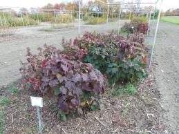 | | 2014 | COLLECTED | 09/22/2014 | Mississippi: Tishomingo County; Extreme northeast corner of Tishomingo County near J.P. Coleman State Park. | 34.98857300, -88.20347900 | 194 | Steep (60-70 degrees), north, northeast-facing slope. Growing in association with Quercus montana (abundant), Hamamelis sp., Quercus alba, Rhododendron arborescens, Amelanchier sp., Ostrya virginiana, Vaccinum sp., and Vitis sp. | Wild material | Numerous specimens. Some specimens approximately 6-7' in height. | 1922357 | WLP 1252 |
| 72 | WLP 1253 | JDC/HQ/2014/090/592 | Hydrangea quercifolia W. Bartram | Alabama, United States | NA | 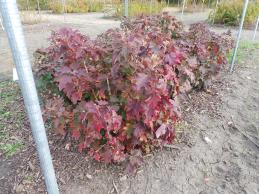 | | 2014 | COLLECTED | 09/23/2014 | Alabama: Lawrence County; Near Franklin and Lawrence County line off County Road 303. | 34.33701600, -87.52906200 | 332 | Growing in association with Quercus alba, Quercus montana, Cornus florida, Rhus glabra, Liriodendron tulipifera, Pinus virginiana, Pinus sp., Acer rubrum, and Frangula alnus. | Wild material | Some specimens with infructescences averaging 12" in length. | 1922364 | WLP 1253 |
| 73 | WLP 218 | JDC/TC/2014/089/591A | Tsuga canadensis (L.) Carrière | Alabama, United States | NA | | | 2014 | COLLECTED | 09/23/2014 | Alabama: Franklin County; William B. Bankhead National Forest, north-facing banks of Bear Creek watershed. | 34.33924600, -87.54771500 | 285 | Growing in association with Quercus alba, Cornus florida, Pueraria montana var. lobata, Magnolia macrophylla, Platanus occidentalis, Liquidambar styraciflua, and Fagus grandifolia. | Wild material | Excellent cone production. Optimum timing for harvest. Species infrequent to locally abundant across a 12 mile linear stretch of the southeast corner of Franklin County to north-central Winston County. | 1922361 | WLP 218 |
| 74 | W6 40685 | CP1-79 | Muhlenbergia tricholepis (Torr.) Columbus | Arizona, United States | W6 |  | | 2011 | | | | | | | Wild material | | 1865147 | W6 40685 |
| 75 | NA 70422 | MWPCC00-078 | Magnolia acuminata (L.) L. | North Carolina, United States | NA | | | 2000 | COLLECTED | 09/14/2000 | Blue Ridge Parkway pullover, N of marker 417. | 35.32333333, -82.82694444 | 1353 | Just in from mowed roadside. Slope: 15 degrees, Aspect: East, 3/4 day sun, Soil Type: gritty loam, well-drained, moist bottom of slope. | Wild material | | 1608250 | NA 70422 |
| 76 | NA 64951 | WD184 | Cephalotaxus sinensis (Rehder & E. H. Wilson) H. L. Li | Hubei Sheng, China | NA | | | 1994 | COLLECTED | 10/01/1994 | Associated Taxa – Lindera glauca:Actinidia chinensis:Acer henryi:Cornus controversa:Pueraria montana var. lobata:Quercus serrata | 32.40750000, 110.99833000 | 1200 | In moist woodland on rocky ledge w/ Lindera glauca, Actinidia chinensis, Acer henryi, Cornus controversa, Pueraria lobata & Quercus serrata. Growing on rocky ravine slopes. | Wild material | | 1951138 | NA 64951 |