| 0 | PI 495615 | 18 | Quercus muehlenbergii Engelm. | Nebraska, United States | NC7 |  | | 1984 | COLLECTED | 09/23/1984 | Indian Cave State Park, T4N R16E Sec. 36 and T3N R17E NW 1/4 Sec. 6, Nemaha County. | 40.25376700, -95.55209100 | 326 | Growing in association with an understory of Cornus, Asimina triloba, and Fraxinus. | Wild material | Plants wide to 10 meters tall. Large trees approximately 2 feet in diameter and 40-45 feet in height. | 1390551 | PI 495615 |
| 1 | NA 84674 | PCC17-TNKY-026 | Quercus muehlenbergii Engelm. | Kentucky, United States | NA | | | 2017 | COLLECTED | 10/01/2017 | Barren County; ; Brigadoon State Nature Preserve. | 36.90346000, -85.99914000 | 219 | Growing on the edge of a small forested patch in the middle of a non-agricultural field within the nature preserve. | Wild material | One individual sampled. | 2108774 | NA 84674 |
| 2 | NA 82040 | JDC/QM/2014/057/559 | Quercus muehlenbergii Engelm. | Arkansas, United States | NA | | | 2014 | COLLECTED | 09/20/2014 | Arkansas: Lee County; St. Francis National Forest along Lee County Road 230. | 34.73003400, -90.72795500 | 87 | Roadside. Dry, higher elevation than surrounding area. Growing in association with Callicarpa americana, Celtis sp., and Juniperus virginiana. | Wild material | Acorns approximately 4-7 days from peak maturity. | 1922341 | NA 82040 |
| 3 | NA 77496 | NA 77496 | Quercus muehlenbergii Engelm. | Texas, United States | NA | | | 2008 | COLLECTED | PRE 07/15/2008 | | | | | Uncertain improvement status | | 1899480 | NA 77496 |
| 4 | NA 76685 | NA 76685 | Quercus muehlenbergii Engelm. | Georgia, United States | NA | | | 2006 | COLLECTED | 09/2004 | Crockford-Pigeon Mountain Wildlife Management Area, Pocket Branch, above branch. | | | Woodland above branch, over limestone. | Wild material | | 1895870 | NA 76685 |
| 5 | Ames 4617 | 86 | Quercus muehlenbergii Engelm. | Ontario, Canada | NC7 |  | | 1985 | COLLECTED | | Niagara Region, Fenwick. | | | Growing in clay. | Wild material | Medium-sized, deciduous tree. | 1028812 | Ames 4617 |
| 6 | Ames 4618 | Accession No. 1985-0642
Collection No. 1224 | Quercus muehlenbergii Engelm. | Ontario, Canada | NC7 | | | 1985 | COLLECTED | 09/21/1985 | Canada, Ontario, Lambton County, Bosanquet Township (Now Municipality of Lambton Shores), Port Franks. | 43.23195300, -81.89238900 | 190 | Growing in dry sand. 0.8km east of trailer park bridge, off Biddulph Street, property line beside road | Wild material | Large Tree, 2-trunked, 80cm DBH, 20m high, 30m crown spread, infrequent. Medium-sized, deciduous tree | 1028813 | Ames 4618 |
| 7 | NA 84716 | TDAAR17-017 | Quercus acerifolia (E. J. Palmer) Stoynoff & W. J. Hess ex R. J. Jensen | Arkansas, United States | NA |  | | 2017 | COLLECTED | 09/13/2017 | Montgomery County: Ouachita National Forest: Pryor Mountain. | 34.36113000, -93.87164000 | 532 | | Wild material | See also NA 87260 for material of this same collection received in 2022 from Morris Arboretum. | 1953991 | NA 84716 |
| 8 | Ames 23752 | NSA 960194 | Quercus hybr. | Nebraska, United States | NC7 |  | | 1997 | COLLECTED | PRE 1997 | Southwest of Salem approximately 2.6 miles, T1N R15E NW 1/4 NW 1/4 Sec. 21, Richardson County. | 40.04268000, -95.74558000 | 330 | Prairie knoll/ridge, very dry and rocky substrate. Growing in association with Rhus sp., Liatris aspera (white and purple), Juniperus virginiana, Quercus rubra, Quercus macrocarpa, and Schizachyrium scoparium. | Wild material | Specimens at the collection site in nature are represented as very large/old plants, approximately 5.0 meters in height with trunk diameters to 25.0 cm. After 15 years of growth in cultivation in central Iowa, specimens average approximately 3.5 x 3.5 meters. This species is reported to sucker, but all specimens of this accession have shown no signs of suckering while grown in cultivation. Peak fall color tends to occur during the second week in October in central Iowa ranging from reddish-orange; brownish-red, brownish-orange, etc. Acorn production tends to be consistently heavy every year and can initiate production after three years in age. Peak fruiting tends to occur between 5-15 of September in central Iowa, which is approximately 1 week prior to Q. muehlenbergii. Acorns are extremely favored by deer, rabbits, raccoons, turkeys and bluejays. Quercus prinoides in Nebraska is extremely rare. To date (2022), only two counties totalling four localities have recorded this taxa including Richardson County: two areas near Salem; one in Indian Caves State Park and one in Nemaha County described as near Nemaha. Species tends to be restricted to dry rocky upland hills and bluffs. Recent research (Hipp et al., 2019), noted that using the unweighted pair group method with arithmetic mean and non-metric multidimensional scaling ordination did not separate individuals of Q. muehlenbergii and Q. prinoides as distinct species. However, W. M. Keith Jr. (1957) states that "Q. muehlenbergii never spreads vegetatively and acorns are rarely borne until it has attained small tree size whereas Q. prinoides bears at extremely small sizes, usually a foot or so high and spreads vegetatively via rhizomes". Therefore, genetics of this accession most likely represents the hybrid of Q. prinoides x Q. muehlenbergii under the assumption that the true Q. prinoides is represented only by those that clonally spread via rhizomes. Further research is needed to clarify the identity of Q. prinoides. This accession is therefore being listed as Q. hybr. Specimens are clearly "dwarf" or shrubby in growth habit and produce acorns at extremely early ages, but do not spread via rhizomes. | 1543547 | Ames 23752 |
| 9 | OPGC 7337 | OR110-1063 | Zeltnera muehlenbergii (Griseb.) G. Mans. | Oregon, United States | OPGC |  | | 2018 | | | | | | | Wild material | | 1970533 | OPGC 7337 |
| 10 | W6 49535 | CBG-2476 | Carex muehlenbergii Schkuhr ex Willd. | Illinois, United States | W6 |  | | 2015 | | | | | | | Wild material | | 1926160 | W6 49535 |
| 11 | PI 662022 | Ames 27628 | Euonymus atropurpureus Jacq. | Iowa, United States | NC7 | | | 2004 | COLLECTED | 10/09/2004 | Point on southwest side at the top of Rattlesnake Bluff, Van Buren County. | 40.76361111, -91.90361111 | 195 | | Wild material | | 1665916 | PI 662022 |
| 12 | PI 664828 | 38 | Echinacea pallida (Nutt.) Nutt. | Iowa, United States | NC7 | | | 2003 | COLLECTED | 09/24/2003 | Starr's Cave State Preserve located just northwest of Burlington, T70N R2W E edge of NW 1/4 of NW 1/4 of Sec. 19, West Burlington Quad, Des Moines County | 40.85222222, -91.13666667 | 186 | Small, thin soil hill prairie. Sunny. 20% slope with a southern aspect. Stony soil | Wild material | Perennial herb to 2.5 feet tall. | 1649670 | PI 664828 |
| 13 | PI 662016 | Ames 27280 | Cornus drummondii C. A. Mey. | Iowa, United States | NC7 | | | 2003 | COLLECTED | 09/02/2003 | South side of Skunk River, Oakland Mills County Park, SW 1/4 of SE 1/4 of Section 24, T71N, R7W, Mount Pleasant Quad, Henry County. | 40.93222222, -91.61055556 | 184 | Limestone ridge along ravine. | Wild material | Large shrubs to small trees to 3.5 meters tall. | 1648648 | PI 662016 |
| 14 | PI 495620 | 10 | Symphoricarpos orbiculatus Moench | Missouri, United States | NC7 | | | 1984 | COLLECTED | 09/22/1984 | Monkey Mountain Wildlife Area, Section 24, T59N, R37W, Holt County. | 39.91625400, -95.00735500 | 318 | Old field. Growing in association with Solidago, Gleditsia, and Quercus muehlenbergii. | Wild material | Plants low. Perennial woody. | 1390556 | PI 495620 |
| 15 | WLP 3492 | St. Francois State Park | Hydrangea arborescens L. | Missouri, United States | NA |  | | 2024 | COLLECTED | 01/19/2024 | St. Francois State Park, 8920 US Highway 67 North, approximately 3.2 miles north-northeast of Bonne Terre. | 37.96381000, -90.53403000 | 202 | Rocky outcrops above Big River and rocky areas on bank of Big River. | Wild material | | 2166135 | WLP 3492 |
| 16 | OPGC 8853 | JDC/AA/2023/078/1110 | Arnoglossum atriplicifolium (L.) H. Rob. | Iowa, United States | OPGC | | | 2023 | COLLECTED | 09/21/2023 | Iowa Army Ammunition Plant located 5.09 miles southwest of Burlington along south side of road, Union Township T69N R3W SE 1/4 SE 1/4 SW 1/4 Sec. 7 | 40.78416600, -91.24800000 | 191 | Woodland edges/roadsides. | Wild material | | 2159005 | OPGC 8853 |
| 17 | NA 89233 | UK Arb. 2023-0059-A | Cladrastis kentukea (Dum. Cours.) Rudd | Kentucky, United States | NA | | | 2023 | COLLECTED | 08/22/2023 | Blue Sportsmen's League (land owner): trees growing on both sides of eroded dirt road from campground to Kentucky River. | 37.78777000, -84.65356000 | | Calcareous rocky woods, mid-slope. Slope: 20-30%. Aspect: Southwest. | Wild material | | 2158476 | NA 89233 |
| 18 | Ames 36152 | JDC/MM/2023/048/1080 | Monarda maxmedleyi J. J. N. Campb. & Floden | Kentucky, United States | NC7 |  | | 2023 | COLLECTED | 08/10/2023 | Owsley Fork Road (roadsides) just 2.3 miles east, southeast of Big Hill, along the north edge of the reservior. | 37.54038300, -84.17209500 | 252 | Moist and dry slopes. Woodland edges; open woods; densely shaded woods; and wooded roadsides. | Wild material | Plants measuring 12-18" in height. Spreading vegetatively via rhizomes. Flower color on the majority of specimens is mostly white with some specimens having a hint of pink. Peak flowering at collection site occurred near 28th of May (2023). Some specimens flowering in heavy shade. | 2158357 | Ames 36152 |
| 19 | NA 89039 | RJL2022IL-001 | Ptelea trifoliata L. | Illinois, United States | NA | | | 2022 | COLLECTED | 09/28/2022 | Site of plant habitat is located at 823 E Co Rd 1220, Hamilton, IL 62341 which is the property where Jacob's Geode Shop and Mine is located. This species is scattered and relatively common throughout the woodlands on this site. | 40.37848400, -91.35390200 | 175 | Plants growing in shade to part-shade of deciduous woodlands above a small creek.
Soils: The underlying geology of this area is of Mississippian origin and comprised of Warsaw Formation and Salem Limestone. Major lithological components include limestone that can be shaly, oolitic, bioclastic, or cherty. Minor lithological components include siltstone that can contain geodes or drusy quartz and can be calcareous.
Source: USGS Illinois Geologic Map Data (https://mrdata.usgs.gov/geology/state/sgmc-unit.php?unit=ILMws%3B0)
The surface soil profile of this area is Coffeen silt loam, 0 to 2 percent slopes, that are frequently flooded. The Coffeen series consists of very deep, somewhat poorly drained, moderately permeable soils on flood plains, low terraces or benches, toe slopes, and alluvial fans. They formed in silty alluvium. Much of the alluvium is of local origin derived from the nearby loess-covered uplands.
Source: NRCS Web Soil Survey (https://websoilsurvey.sc.egov.usda.gov/App/WebSoilSurvey.aspx) | Wild material | | 2139604 | NA 89039 |
| 20 | Ames 35887 | JDC/MR/2022/034/1014 | Morus rubra L. | Iowa, United States | NC7 |  | | 2022 | COLLECTED | 07/12/2022 | Waubonsie State Park located north, northwest of Hamburg, T68N R42W Sec. 29 and Sec. 32. | 40.67552500, -95.68690400 | 355 | Mid slope (ranging from 10-30 degrees) to base of slopes and along all drainages and valleys of deciduous woods. | Wild material | The native range for Red Mulberry is reported from the eastern margin of the Great Plains, extending north to southern Ontario, Canada, and distributed as far south as southern Florida (Little, 1971). Conservation assessments in North America indicate current (2026) and future concern for the species including Michigan (threatened); Massachusetts (endangered); Ontario Canada (endangered); with NatureServe's 2025 global G5 rank due to genetic swamping and habitat pressure. Red Mulberry seems to be extremely localized to moist, floodplain areas that are high-quality bottomland forests. This accession represents genetics collected from the northwestern edge of the species native range. Specimens sampled in nature displayed the following morphological characters: acuminate leaf tips, impressed veins, pubescent upper and lower leaves, flaky bark (often with tiny pin holes (insect emergence holes)), cordate leaf base, and umbrella-shaped growth habit. M. rubra specimens noted ranged in size from 1"-23" inches DBH with some of the tallest specimens reaching 70' in height. The largest specimen sampled (#172-13) measuring 23.25" DBH. Estimated hundreds, perhaps a thousand specimens of M. rubra noted within the park with very little representation of hybrids or Morus alba. Representation of M. rubra outside of park boundaries is near completely absent and the presence of hybrids and M. alba is extremely evident. Soluble solids content from fruits collected in the wild ranged from 19.0-32.9 degrees Brix. This range of Brix values is likely a result of genetic diversity and also variation in maturity of fruits. Fruits selected for Brix measurements were black in color. The specimen sampled with the highest Brix value was #172-9. All M. rubra specimens noted at time of sampling (12 July 2022) were exhibiting determinate growth compared to local hybrids and M. alba, which were still actively growing with newly emerging leaves. The first study (Adhikari et al. 2026) on the mitogenome of M. rubra utilized sample #172-13 (Ames 35887 Tree #13) reporting 359,221 base pairs (bp) long with 45.8% GC content, comprising 57 genes: 32 protein-coding, 21 transfer, and four ribosomal RNAs. | 2138220 | Ames 35887 |
| 21 | OPGC 8344 | CBG-10576 | Gillenia stipulata (Muhl. ex Willd.) Nutt. | Illinois, United States | OPGC | | | 2021 | | | | | | | Wild material | plant numbers sampled estimated. | 2120167 | OPGC 8344 |
| 22 | NA 86848 | ZARKS-025 | Acer saccharum Marshall subsp. leucoderme (Small) Desmarais | Arkansas, United States | NA | | | 2020 | COLLECTED | 10/09/2014 | Cedar Fourche Creek; Harper Grocery Rd. at Rock Springs Rd. | 34.66470800, -93.26778900 | 209 | Mesic, mixed deciduous forest; growing on the bank just above a small stream | Wild material | | 2115797 | NA 86848 |
| 23 | NA 87370 | NCTN59 | Hydrangea barbara (L.) Bernd Schulz | Tennessee, United States | NA | | | 2020 | COLLECTED | 22/09/2019 | | 35.10423000, -84.61030000 | 256 | Mesic oak-pine forest edge, growing up trunks of trees on a steep, rocky slope. | Wild material | Three seedlings received along with NA 87106-87112, but not requested for accessioning at the same time. | 2141752 | NA 87370 |
| 24 | Ames 34943 | JDC/BC/2019/025/904 | Blephilia ciliata (L.) Benth. | West Virginia, United States | NC7 |  | | 2019 | COLLECTED | 08/10/2019 | Smoke Hole Region: Powers Hollow. Located approximately 5.2 miles west of Petersburg on the east side of Powers Hollow Road, Grant County | 39.00611600, -79.22179200 | 482 | Open woodland. Dry, rock with sparse vegetation. | Wild material | Plants approximately 12" in height. Specimens at time of sampling (10 August 2019) were completely dried to soil line with no leaves remaining. | 2096625 | Ames 34943 |
| 25 | Ames 34944 | JDC/HD/2019/023/902 | Helianthus divaricatus L. | West Virginia, United States | NC7 |  | | 2019 | COLLECTED | 08/10/2019 | Smoke Hole Region: Eagle Rock. Located on east side of South Branch Potomac River approximately 2.85 miles north of Upper Tract and 0.5 miles northeast of Eagle Rock formation, Pendleton County | 38.82840700, -79.28397500 | 702 | Open woodland. Dry, rock with sparse vegetation. | Wild material | Majority of specimens noted were close to peak fruit maturity with a few specimens just past peak flowering. Specimens approximately 3' in height. | 2096626 | Ames 34944 |
| 26 | Ames 34946 | JDC/LL/2019/024/903 | Linum lewisii Pursh | West Virginia, United States | NC7 | 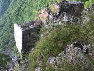 | | 2019 | COLLECTED | 08/10/2019 | Smoke Hole Region: Eagle Rock. Located on east side of South Branch Potomac River approximately 2.85 miles north of Upper Tract and 0.5 miles northeast of Eagle Rock formation, Pendleton County | 38.82840700, -79.28397500 | 702 | Exposed rock cliff edges. | Wild material | Plants approximately 20-24" in height. Fruits persisting and fully mature at time of sampling (10 August 2019). Noted a few plants actively blooming. | 2096628 | Ames 34946 |
| 27 | Ames 34948 | JDC/PO/2019/026/905 | Physocarpus opulifolius (L.) Maxim. | West Virginia, United States | NC7 |  | | 2019 | COLLECTED | 08/10/2019 | Smoke Hole Region: Powers Hollow. Located approximately 5.2 miles west of Petersburg on the east side of Powers Hollow Road, Grant County | 39.00339500, -79.22036500 | 455 | Exposed rock cliff edges. | Wild material | Fruits close to peak maturity. Small plants approximately 3-4' in height and spread likely due to extremely harsh habitat. In cultivation (NCRPIS), plants grow greater than 5' in height. | 2096630 | Ames 34948 |
| 28 | OPGC 7572 | JDC/HX/2019/028/907 | Heuchera alba Rydb. | West Virginia, United States | OPGC |  | | 2019 | COLLECTED | 08/10/2019 | Smoke Hole Region: Powers Hollow. Located approximately 5.2 miles west of Petersburg on the east side of Powers Hollow Road, Grant County | 39.00339500, -79.22036500 | 455 | Exposed rock cliff edges. | Wild material | Heuchera alba is a narrow Appalachian endemic and globally imperiled (G2) taxon recorded only from West Virginia and Virginia that occurs in sympatry with H. pubescens and H. americana. According to Scheutte et al. 2018, the range for H. alba is restricted to high elevation acidic sandstone ridges and outcrops in the Ridge-and-Valley province of West Virginia and Virginia. In cultivation (central Iowa) the leaves emerge with subtle variegation that is lost by early summer. Flowers are creamy white to pale green. | 2096627 | OPGC 7572 |
| 29 | Ames 34606 | JDC/MB/2019/011/890 | Monarda brevis (Fosberg & Artz) Floden | West Virginia, United States | NC7 |  | | 2019 | | | | | | | Wild material | Variation in flower color present from near white, faint pink to faint "smoky" purple. Majority of specimens noted at collection site in nature were approximately 3-5 days past peak flower on 10 June 2019 with seeds reaching maturity approximately 55 days later. Majority of specimens observed were approximately 10" in height. Very healthy, dark-green leaves that maintained quality throughout the season (observed mid-August 2019). Some specimens consisting of 25-30 flowering stems encompassing a 1.5 sq. ft. area. | 2092642 | Ames 34606 |
| 30 | Ames 34607 | JDC/MB/2019/012/891 | Monarda brevis (Fosberg & Artz) Floden | West Virginia, United States | NC7 |  | | 2019 | | | | | | | Wild material | This accession likely represents the holotype for Monarda brevis that was vouchered by Lena Artz in 1953 (Catalog No. 2097485). Variation in flower color present from near white, faint pink to faint "smoky" purple. Majority of specimens noted at collection site in nature were approximately 3-5 days past peak flower on 10 June 2019 with seeds reaching maturity approximately 55 days later. Majority of specimens observed were apprxoimately 10" in height. Very healthy, dark-green leaves that maintained quality throughout the season (observed mid-August 2019). | 2092643 | Ames 34607 |
| 31 | Ames 34608 | JDC/MB/2019/013/892 | Monarda brevis (Fosberg & Artz) Floden | West Virginia, United States | NC7 |  | | 2019 | | | | | | | Wild material | Majority of specimens noted at collection site in nature were approximately 5-7 days past peak flower on 11 June 2019 with seeds reaching maturity approximately 55 days later. Very healthy, dark-green leaves near peak flowering with some minor decline in leaf quality later in the season (observed mid-August 2019). Majority of specimens less than 10" in height. A few specimens with noteable hairs on stems, specifically near soil line. | 2092644 | Ames 34608 |
| 32 | Ames 34609 | JDC/MB/2019/014/893 | Monarda brevis (Fosberg & Artz) Floden | West Virginia, United States | NC7 |  | | 2019 | | | | | | | Wild material | Variation in flower color present from near white, faint pink to faint "smoky" purple. Majority of specimens noted at collection site in nature were approximately 3-5 days past peak flower on 10 June 2019 with seeds reaching maturity approximately 55 days later. Majority of specimens observed were approximately 10" in height. Very healthy, dark-green leaves that maintained quality throughout the season (observed mid-August 2019). | 2092645 | Ames 34609 |
| 33 | Ames 34610 | JDC/MB/2019/015/894 | Monarda brevis (Fosberg & Artz) Floden | West Virginia, United States | NC7 |  | | 2019 | | | | | | | Wild material | Many genets noted at collection site in nature consisted of 25-30 stems, but individual stems are widely spaced (e.g. 1-5") apart compared to other populations (four) noted (2019 reconnaisance) where stem spacing was typically observed at 0.25-0.5" apart. Very healthy, dark-green leaves noted in early/mid June, but leaf quality greatly declined when observed in mid-August in contrast to other populations observed in nature that seemed to maintain leaf quality throughout the season. Many plants at this site were defoliated likely due to disease (leaf spot) or tattered likely due to possible insect feeding. Specimens noted were circa 10-12 days from initiation of flowering on 12 June 2019 and during mid-August a few specimens were still observed flowering with about 10-20% of infructescences were still green. The overall phenology of this M. brevis population at this site is quite different in comparison to other populations (four) observed in 2019, with flowering being much later (e.g. 10-25 days); leaf quality lower; and synchronization of flowering extremely variable within genets of this population. | 2092646 | Ames 34610 |
| 34 | OPGC 7805 | CA180-154 | Erythranthe guttata (DC.) G. L. Nesom | California, United States | OPGC |  | | 2018 | | | | | | | Wild material | Mimulus guttatus. SOS 7th transfer. | 1966294 | OPGC 7805 |
| 35 | Ames 34307 | JDC/EP/2018/051/864 | Echinacea paradoxa (Norton) Britton | Missouri, United States | NC7 |  | | 2018 | COLLECTED | 07/16/2018 | Auxvasse Natural Area located 8.44 miles southeast of Fulton, T46N R8W S 1/4 Sec. 9, Callaway County | 38.76733000, -91.82958500 | 205 | Dolomite glade. Large (110 acres) and exceptionally diverse (220 plant species identified). According to local MDC biologists, this is one of the best glades north of the Missouri River in Missouri. Northern most, native population of Echinacea paradoxa in Missouri. | Wild material | Plants reached peak flower on 30 May 2018. Specimens ranged from 2.0-4.0' in height. | 1964614 | Ames 34307 |
| 36 | Ames 34310 | JDC/MB/2018/050/863 | Monarda bradburiana L. C. Beck | Missouri, United States | NC7 |  | | 2018 | COLLECTED | 07/16/2018 | Auxvasse Natural Area located 8.44 miles southeast of Fulton, T46N R8W S 1/4 Sec. 9, Callaway County | 38.76733000, -91.82958500 | 205 | Dolomite glade. Large (110 acres) and exceptionally diverse (220 plant species identified). According to local MDC biologists, this is one of the best glades north of the Missouri River in Missouri. | Wild material | Plants measuring circa 1.0' in height. Peak flowering occurred around 18 May 2018. Seeds likely reached full maturity around first week in July (2018). | 1964617 | Ames 34310 |
| 37 | Ames 34302 | JDC/EP/2018/044/857 | Echinacea paradoxa (Norton) Britton | Missouri, United States | NC7 |  | | 2018 | COLLECTED | 07/03/2018 | Drury-Mincy Conservation Area just off Gunnison Road (west side) located approximately 8.5 miles southeast of Branson, T22N R20W W 1/4 SE 1/4 Sec. 16, Taney County | 36.55268100, -93.10969300 | 302 | Open, dry glade. | Wild material | | 1964609 | Ames 34302 |
| 38 | Ames 34303 | JDC/MB/2018/047/860 | Monarda bradburiana L. C. Beck | Missouri, United States | NC7 |  | | 2018 | COLLECTED | 07/03/2018 | Drury-Mincy Conservation Area just off Gunnison Road (west side) located approximately 8.5 miles southeast of Branson, T22N R20W W 1/4 SE 1/4 Sec. 16, Taney County | 36.55268100, -93.10969300 | 302 | Open, dry glade. | Wild material | | 1964610 | Ames 34303 |
| 39 | Ames 34208 | NAO/UT/2018/23/48 | Ulmus thomasii Sarg. | Illinois, United States | NC7 |  | | 2018 | COLLECTED | 05/31/2018 | Private property located 2.0 miles northeast of Plano along Big Rock Creek just off Needham Road, T37N R6E SW 1/4 NE 1/4 Sec. 14 | 41.68543300, -88.51368600 | 188 | Flat open (mowed) areas and edge of woods. | Wild material | Ulmus thomasii (Rock elm) is an underutilized tree species both in conservation and in the urban landscape. Charles Sprague Sargent (first director of the Arnold Arboretum of Harvard University, Boston, MA) described the wood of Rock Elm as "heavy, hard, very strong and tough, closely grained, and susceptible of receiving a beautiful polish". Historically noted for a variety of uses in woodworking including furniture, heavy agricultural implements, timber frame buildings, pianos, hockey sticks, and hand tools. U. thomasii is extremely drought tolerant, adaptable to very calcareous soils, and compared to U. americana or U. rubra has a very conservative growth rate requiring minimal attention in regards to pruning. Rock elm naturally tends to develop into a nice structural specimen in the landscape, unlike other fast growing U. americana cultivars in the nursery trade needing frequent attention. Rock elm has very fissured bark and is well known for maintaining a strong central leader resulting in a very attractive, pyramidal form. Despite many literature sources stating that "wings" on the stems are a key identifiying characteristic, this trait is not reliable and many genotypes may completely lack "wings" on the stems. While growth habit and morphology of dormant buds (very pointy) are good traits to help aid in identification, fruits are the best way to confirm identity. Fruits are densly pubescent, often described as "inflated" and generally reach maturity a couple weeks after U. rubra and U. americana. U. thomasii inflorescences are rather distinguishable from other Ulmus in being pendulous. Fruits are extremely prized treats for many birds, where fruits are often "robbed" prior to full maturity. Fruits are also highly prized by many other animals such as mice, squirrels, chipmunks, turkeys, etc. and are generally consumed within hours after fruit abscission. The native range of U. thomasii is concentrated in the northeastern United States and into Canada with disjunct populations documented in northwestern Missouri and northwestern Arkansas (Little, E. L. Jr. 1971). In the 1895 Silva of North America (vol. 7) it was stated that, “The value of the wood of the Rock Elm threatens its extinction and most of the large trees have already been cut.” Today, since rock elm is rather rare, especially in areas near the edges of its range, many states list the species as endangered or threatened warranting preservation efforts. Genetics of this accession were collected on private property in north central Illinois (Kendall County) from a localized population in nature represented by 10-16" DBH specimens with little to no signs of decline. | 1963391 | Ames 34208 |
| 40 | WLP 1190 | NA 85118 | Dirca palustris L. | Iowa, United States | NA |  | | 2018 | COLLECTED | 05/31/2018 | Private property located 3.35 miles southwest of Luther near Des Moines River, T82N R26W SW 1/4 SW 1/4 Sec. 3, Boone County | 41.93795800, -93.87109500 | 317 | Dense shade of mature oak forest. Deep ravines. | Wild material | Specimens measuring approximately 2-5' in height. Noticeable new growth (5-8") at time of seed collection. Population was in peak bloom 24 April 2018 with peak fruit maturity occuring on 30 May 2018. Fruits readily dropping when distrubed. Very slight tinge of white color to fully mature fruits. Seeds measuring approximately 0.5-0.7 cm in length. | 1963390 | WLP 1190 |
| 41 | Ames 34206 | JDC/RA/2018/045/858 | Rhus aromatica Aiton | Missouri, United States | NC7 |  | | 2018 | COLLECTED | 05/24/2018 | Drury-Mincy Conservation Area along Bear Cave Trail just off Gunnison Road, T22N R20W NW 1/4 Sec. 21. | 36.54492100, -93.11595600 | 330 | Glade. Open woods. | Wild material | Plants ranging in size (variable due to recent prescribed burning) from 2-6' in height. Fruit maturity variable at time of collection (25 May 2018) from bright red and readily shattering to rather green. | 1963389 | Ames 34206 |
| 42 | WLP 1231 | APS/HA/2017/032/291 | Hydrangea arborescens L. | Tennessee, United States | NA | | | 2017 | COLLECTED | 11/05/2017 | South side of Cumberland River and the east end of Bluff Rd, South Carthage, Smith County | 36.24106000, -85.94595000 | 174 | Deciduous forest. Talus slope below limestone bluffs. | Wild material | | 1954438 | WLP 1231 |
| 43 | Ames 33976 | JDC/BX/2017/029/783 | Baptisia aberrans (Larisey) Weakley | Tennessee, United States | NC7 |  | | 2017 | COLLECTED | 07/07/2017 | Just east of Murfreesboro off Factory Road, Rutherford County. | 35.85458800, -86.29682300 | 207 | Remnant cedar glade recently cleared of woody vegetation resulting in flowering of numerous native plants. | Wild material | Plants in cultivation (central Iowa) measuring 0.16 m tall x 0.42 m wide with leaflets oriented in a vertical plane; petioles 2.0-3.0 mm long; leaflets 2.2-2.3 cm long and 1.1-1.2 cm wide; fertile stems 0.42 m tall with leafy branches spreading horizontally. Flowers dark purple peaking in late May (central Iowa) when grown in cultivation. | 1950059 | Ames 33976 |
| 44 | Ames 33979 | JDC/FQ/2017/031/785 | Fraxinus quadrangulata Michx. | Tennessee, United States | NC7 |  | | 2017 | COLLECTED | 07/08/2017 | Along highway 52 approximately 2.30 miles northwest of Celina, Clay County | 36.57174000, -85.53638800 | 190 | Dry, rocky soils. | Wild material | | 1950062 | Ames 33979 |
| 45 | Ames 33980 | JDC/FQ/2017/035/789 | Fraxinus quadrangulata Michx. | Kentucky, United States | NC7 |  | | 2017 | COLLECTED | 07/09/2017 | North Rolling Rock watershed and nearby tributaries approximately 3.3 miles south of Mitchellsburg, Boyle County | 37.55385900, -84.96328900 | 267 | Mixed wooded deciduous forests, including dry, rocky areas with shallow substrate, steep (65 degree +) slopes, and base of slopes, generally with underground seeps. | Wild material | | 1950063 | Ames 33980 |
| 46 | Ames 33982 | JDC/FQ/2017/038/792 | Fraxinus quadrangulata Michx. | Kentucky, United States | NC7 | 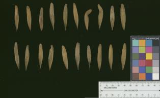 | | 2017 | COLLECTED | 07/10/2017 | Scattered hillside colllections throughout areas approximately 4.5 miles north, northwest of Frankfort, Franklin County | 38.21387700, -84.88886200 | 199 | Mixed wooded deciduous forest, generally steep (45 degree +) slopes and/or hillsides. | Wild material | | 1950065 | Ames 33982 |
| 47 | Ames 33984 | JDC/FQ/2017/040/794 | Fraxinus quadrangulata Michx. | Kentucky, United States | NC7 |  | | 2017 | COLLECTED | 07/11/2017 | Near county line approximately 6.3 miles northwest of Carlisle, Nicholas County | 38.35854300, -83.94605900 | 188 | Scattered hillside, deciduous woods. | Wild material | | 1950067 | Ames 33984 |
| 48 | Ames 33987 | JDC/FQ/2017/043/797 | Fraxinus quadrangulata Michx. | Ohio, United States | NC7 |  | | 2017 | COLLECTED | 07/12/2017 | Strait Creek Prairie Bluffs Preserve between Peebles and Sinking Spring along highway 41 (Crooked Creek, Strait Creek and Scioto Brush Creek watersheds), Adams and Highland County | 39.00561100, -83.37365400 | 235 | Mixed deciduous woods, generally on top of moist seep, but also on rocky gentle (30-45 degree) slopes. | Wild material | | 1950070 | Ames 33987 |
| 49 | Ames 33988 | JDC/FQ/2017/044/798 | Fraxinus quadrangulata Michx. | Ohio, United States | NC7 |  | | 2017 | COLLECTED | 07/13/2017 | Baker Tract Preserve (Athens Conservancy) due east approximately 5.68 miles of Athens, T5N R13W SE 1/4 Sec. 16, Athens County | 39.32744200, -81.99581300 | 239 | Deciduous woods, rather steep (45 degree) slopes mostly southeast or southwest facing or found on ridge top. | Wild material | | 1950071 | Ames 33988 |
| 50 | Ames 33757 | Ames 33757 | Monarda bradburiana L. C. Beck | Illinois, United States | NC7 | _thumbnail.jpg "Click for 3 image(s) for this accession.") | | 2016 | COLLECTED | 10/03/2016 | Shoal Creek Conservation Area approximately 3.5 miles northeast of Litchfield, T9N R5W NW 1/4 SW 1/4 Sec. 25 Montgomery County. | 39.19444400, -89.59388900 | 194 | Barrens complex. Southern Illinois Tillplain. Clay and silt sandstone | Wild material | | 1943155 | Ames 33757 |
| 51 | Ames 33363 | JDC/MB/2016/022/737 | Monarda bradburiana L. C. Beck | Missouri, United States | NC7 | | | 2016 | COLLECTED | 06/28/2016 | Spring Creek Gap Conservation Area approximately 3.54 miles northwest of Vichy, T39N R8W Sec. 4, Maries County. | 38.14201800, -91.81278200 | 209 | Cedar glade remnant. | Wild material | | 1940865 | Ames 33363 |
| 52 | DDIO 266 | JDC/DV/2014/050/552 | Diospyros virginiana L. | Missouri, United States | DAV | | | 2015 | COLLECTED | 09/19/2014 | PIKE COUNTY: Buffalo Knob along MO highway WW. | 39.27421400, -91.04618000 | 270 | Dry woods, rocky south-facing steep slope. Growing in association with Quercus muehlenbergii, Fraxinus americana, Fraxinus quadrangulata, Juniperus virginiana, Ulmus sp., Cercis canadensis, and Lonicera maackia. | Wild material | | 1927163 | DDIO 266 |
| 53 | Ames 32923 | JDC/FQ/2015/038/694 | Fraxinus quadrangulata Michx. | Oklahoma, United States | NC7 |  | | 2015 | COLLECTED | 05/22/2015 | T19 R12E N 1/4 Sec. 18 and extreme SE 1/4 Sec. 7 Tulsa County. Chandler Park. | 36.13235400, -96.07376000 | 264 | Rocky, very shallow soils on north and northwest-facing slopes. Growing in association with Fraxinus americana, Cotinus obovatus, Celtis sp., Cornus sp., Ulmus sp., Cercis canadensis, Juniperus virginiana, Quercus muehlenbergii, Smilax sp., Toxicodendron radicans, Quercus texana, and Quercus stellata (chlorotic). | Wild material | | 1926265 | Ames 32923 |
| 54 | WLP 1096 | JDC/CO/2015/025/681 | Cotinus obovatus Raf. | Missouri, United States | NA |  | | 2015 | COLLECTED | 05/19/2015 | T24N R16W NW 1/4 Sec. 4, SW 1/4 SW 1/4 Sec. 17, and SW 1/4 Sec. 9 Ozark County. Mark Twain National Forest Caney Picnic Area (County Road 935) | 36.79873000, -92.71575700 | 407 | Rocky, very shallow soils. Growing in association with Quercus muehlenbergii, Diospyros virginiana, Cercis canadensis, Viburnum rufidulum, Delphinium carolinianum, Penstemon cobea, Rudbeckia sp., Fraxinus americana, Fraxinus quadrangulata (few), Cornus florida, Oenothera macrocarpa, Juniperus virginiana, Tradescantia sp., and Silphium terebinthinaceum. | Wild material | | 1926254 | WLP 1096 |
| 55 | WLP 1097 | JDC/CO/2015/026/682 | Cotinus obovatus Raf. | Missouri, United States | NA | | | 2015 | COLLECTED | 05/19/2015 | T22N R20W N1/2 Sec. 33 and SW 1/4 Sec. 27 Taney County. Gunnison Road, adjacent to Bee Creek, a tributary to Fox Creek and also surrounding area. | 36.52401500, -93.09755700 | 350 | Steep, west-facing slope on rocky, loose substrate. Growing in association with Fraxinus quadrangulata, Quercus muehlenbergii, Hydrangea arborescens, Physocarpus opulifolius, Viburnum rufidulum, Cornus florida, Carpinus caroliniana (abundant), Rhus aromatica, Lonicera sp. (vine), Cornus sp., Salix sp., Juniperus virginiana, Tilia americana, Hamamelis sp. (abundant) and Staphylea trifolia. | Wild material | | 1926259 | WLP 1097 |
| 56 | WLP 1098 | JDC/CO/2015/030/686 | Cotinus obovatus Raf. | Arkansas, United States | NA |  | | 2015 | COLLECTED | 05/20/2015 | T18N R15W NW 1/4 Sec. 15 and SE 1/4 Sec. 10 Marion County. Hall Mountain area along County Road 6074. | 36.20574400, -92.56150900 | 239 | Rocky, very shallow soils. Growing in association with Quercus muehlenbergii, Juniperus virginiana, Acer saccharum, Cercis canadensis, Lindera benzoin, Diospyros virginiana, Silphium terebinthinaceum, Baptisia sp., Rudbeckia sp., and Rhus glabra. | Wild material | | 1926260 | WLP 1098 |
| 57 | WLP 1099 | JDC/CO/2015/031/687 | Cotinus obovatus Raf. | Arkansas, United States | NA |  | | 2015 | COLLECTED | 05/20/2015 | T16N R10W SW 1/4 Sec. 35 and SE 1/4 Sec. 34 and also T15N R10W S 1/2 Sec. 3 Izard County. Brandenburg Mountain area, along highway 9 between Allison and Melbourne. | 35.99358500, -92.02874700 | 170 | Rocky, very shallow soils. Growing on both north, southeast, and west-facing slopes in association with Quercus muehlenbergii, Quercus stellata, Juniperus virginiana, Cercis canadensis, Delphinium carolinianum, Echinacea sp., Fraxinus americana, and Yucca sp. | Wild material | | 1926261 | WLP 1099 |
| 58 | WLP 1101 | JDC/CO/2015/036/692 | Cotinus obovatus Raf. | Oklahoma, United States | NA |  | | 2015 | COLLECTED | 05/21/2015 | T16N R20E W 1/2 Sec. 18 Wagoner and Cherokee Counties. Fort Gibson Lake Dam. | 35.86228100, -95.22575600 | 170 | Growing on shallow, rocky soils in association with Carya illinoinensis, Quercus muehlenbergii, Cornus sp., Cercis canadensis, Fraxinus americana, Platanus occidentalis, Ulmus sp., Diospyros virginiana, Sapindus saponaria var. drummondii, Lonicera sempervirens, Smilax sp., Toxicodendron radicans, and Robinia pseudoacacia. | Wild material | | 1926263 | WLP 1101 |
| 59 | WLP 1102 | JDC/CO/2015/037/693 | Cotinus obovatus Raf. | Oklahoma, United States | NA |  | | 2015 | COLLECTED | 05/22/2015 | T19 R12E N 1/4 Sec. 18 and extreme SE 1/4 Sec. 7 Tulsa County. Chandler Park. | 36.13366000, -96.06623100 | 264 | Rocky, very shallow soils on north and northwest-facing slopes. Growing in association with Fraxinus americana, Fraxinus quadrangulata, Celtis sp., Cornus sp., Ulmus sp., Cercis canadensis, Juniperus virginiana, Quercus muehlenbergii, Smilax sp., Toxicodendron radicans, Quercus texana, and Quercus stellata (chlorotic). | Wild material | | 1926264 | WLP 1102 |
| 60 | Ames 32894 | APS/GD/2015/017/199 | Gymnocladus dioicus (L.) K. Koch | Oklahoma, United States | NC7 |  | | 2015 | COLLECTED | 03/14/2015 | Cleveland County: T10N R5W SW 1/4 SW 1/4 Sec. 7. John Nichols Camp located on north side of Canadian River approxiamtely 4.25 miles south and southeast of Mustang. | 35.35029600, -97.66952200 | 395 | Higher elevations. Dry, relatively thin soils. | Wild material | | 1925360 | Ames 32894 |
| 61 | Ames 32895 | APS/GD/2015/018/200 | Gymnocladus dioicus (L.) K. Koch | Oklahoma, United States | NC7 |  | | 2015 | COLLECTED | 03/15/2015 | Canadian County: Near/adjacent to unnamed creek that empties into the Canadian River, T12N R10W SW 1/4 Sec. 20. Private property approximately 4 miles northeast of Hinton. | 35.49409300, -98.28655400 | 434 | Bottomland. | Wild material | | 1925361 | Ames 32895 |
| 62 | Ames 32903 | APS/GD/2015/031/213 | Gymnocladus dioicus (L.) K. Koch | Oklahoma, United States | NC7 |  | | 2015 | COLLECTED | 03/19/2015 | Osage County: Arkansas River watershed area known as Souters Bend, T21N R7E. Keystone Wildlife Management Area (John Lowery Unit) approximatley 3 miles west of Cleveland. | 36.30185300, -96.53051000 | 222 | Floodplain, but one specimen sampled was located on dry, rocky (large boulders) bluff. | Wild material | | 1925369 | Ames 32903 |
| 63 | Ames 32904 | APS/GD/2015/032/214 | Gymnocladus dioicus (L.) K. Koch | Oklahoma, United States | NC7 |  | | 2015 | COLLECTED | 03/19/2015 | Osage County: Sand Creek watershed area, T27N R8E SE 1/4 NW 1/4 Sec. 10. Tallgrass Prairie Preserve approximately 13 miles northwest of Pawhuska. | 36.83425300, -96.43091600 | 307 | Dry, rocky outcroppings and floodplain. | Wild material | | 1925370 | Ames 32904 |
| 64 | Ames 32889 | APS/GD/2015/006/188 | Gymnocladus dioicus (L.) K. Koch | Missouri, United States | NC7 |  | | 2015 | COLLECTED | 03/05/2015 | St Charles County: T46N R2E Sec. 24. August Busch Conservation Area near Weldon Spring. | 38.72724100, -90.74923500 | 166 | Deciduous, mesic woods. | Wild material | | 1924367 | Ames 32889 |
| 65 | Ames 32082 | JDC/FQ/2013/041/485 | Fraxinus quadrangulata Michx. | Ohio, United States | NC7 |  | | 2013 | COLLECTED | 08/17/2013 | South Bass Island, Put-In-Bay Quad, Ottawa County. | 41.63639900, -82.83680200 | 197 | Shallow, rocky soils. | Wild material | | 1913268 | Ames 32082 |
| 66 | Ames 32083 | JDC/FQ/2013/042/486 | Fraxinus quadrangulata Michx. | Michigan, United States | NC7 |  | | 2013 | COLLECTED | 08/17/2013 | Bendor property, Section 21, T2S, R7E, Denton Quad, near Ypsilanti, Washtenaw County. | 42.29735200, -83.61355300 | 262 | Mesic forest. | Wild material | | 1913269 | Ames 32083 |
| 67 | Ames 32084 | JDC/FQ/2013/043/487 | Fraxinus quadrangulata Michx. | Illinois, United States | NC7 |  | | 2013 | COLLECTED | 08/18/2013 | Silver Springs State Park, Section 34, T37N, R6E, Plano Quad, near Plano, Kendall County. | 41.63202700, -88.52791100 | 186 | Mesic forest. | Wild material | | 1913270 | Ames 32084 |
| 68 | Ames 31520 | JDC/FQ/2012/029/422 | Fraxinus quadrangulata Michx. | Illinois, United States | NC7 |  | | 2012 | COLLECTED | 07/21/2012 | Funks Grove Nature Preserve, Section 17, T22N, R1E, McLean Quad, just southwest of Bloomington | 40.35954400, -89.12965500 | 229 | Mature, moist woods. Very flat terrain. | Wild material | Quite large, averaging 3-4 feet d.b.h. and 100-130 feet in height. | 1903747 | Ames 31520 |
| 69 | NA 80067 | NA 80067 | Cladrastis kentukea (Dum. Cours.) Rudd | Kentucky, United States | NA | | | 2011 | COLLECTED | 10/02/2001 | Palisades (a locally used term to describe the sheer cliffs along the Kentucky River); along the west side of Kentucky Route 27 just north of Hall, Kentucky. | 37.79288000, -84.60705000 | 300 | Growing on the thin soils of the sheer limestone cliffs just below the top of the cliffs. | | | 1953441 | NA 80067 |
| 70 | WLP 1411 | JDC/OV/2010/049/319 | Ostrya virginiana (Mill.) K. Koch | Arkansas, United States | NA |  | | 2010 | COLLECTED | 09/16/2010 | Gamaliel Recreation Area, along Norfork Lake, Baxter County. | 36.42831000, -92.21806000 | 216 | Rock outcrop with underground seep. East facing slope (65%). Associated with Cotinus obovatus, Acer saccharum, Juniperus virginiana, Viburnum sp., Quercus muehlenbergii, Frangula caroliniana, Hydrangea arborescens, Cornus florida, Smilax sp., and Ulmus sp. (likely U. alata). | Wild material | | 1848910 | WLP 1411 |
| 71 | NA 78025 | AL #34 | Hydrangea arborescens L. | Alabama, United States | NA | | | 2008 | COLLECTED | 09/17/2008 | Kathy Stiles Freeland Preserve. Nature Conservancy property. | | | Right along edge of creek, in part in creek. | Wild material | | 1913891 | NA 78025 |
| 72 | Ames 29526 | JDC/FQ/2008/003/073 | Fraxinus quadrangulata Michx. | Missouri, United States | NC7 |  | | 2008 | COLLECTED | 07/29/2008 | Campground area, 200 yards inside main entrance, Graham Cave State Park, SW 1/4 of SW 1/4 of Section 22, T48N, R6W, Danville, Montgomery City Quad, Montgomery County. | 38.90611111, -91.57805556 | 232 | Limestone. Full sun. 30% slope with an eastern and western aspect. | Wild material | 8-10 inches diameter breast height. | 1782749 | Ames 29526 |
| 73 | Ames 29529 | JDC/FQ/2008/006/076 | Fraxinus quadrangulata Michx. | Illinois, United States | NC7 |  | | 2008 | COLLECTED | 08/01/2008 | Cottonhill Park (West), NE 1/4 of SE 1/4 of Section 3 and NW 1/4 of SW 1/4 of Section 2, T14N, R5W, near Springfield, Chatham Quad. | 39.69055556, -89.63000000 | 175 | Mature kept in park near lake. 25% slope with northern and northwestern exposure. | Wild material | 4-5 feet diameter breast height. | 1782752 | Ames 29529 |
| 74 | WLP 1111 | LBJWC-PM-017 | Crataegus tracyi Ashe ex Eggl. | Texas, United States | NA | | | 2007 | COLLECTED | 10/22/2006 | Cherry Canyon Ranch, north end of Davis Mountains, ca Toyahvale. Approximately 8 miles south of FM 3078. In Cherry Canyon several miles south of ranch headquarters. | 30.87006000, -104.06260000 | 1453 | Broad canyon/riparian corridor of brush and hardwoods. | Wild material | | 1726976 | WLP 1111 |
| 75 | Ames 27325 | 32 | Euonymus atropurpureus Jacq. | Iowa, United States | NC7 |  | | 2003 | COLLECTED | 09/23/2003 | Lindsay Wilderness Area, Bonaparte, SE corner of NE 1/4, Section 9, T68N, R8W, Bonaparte Quad, Van Buren County. | 40.70416667, -91.77611111 | 189 | Ditch near powerline cut. Sunny. ~25% slope with a mostly western aspect | Wild material | Medium sized shrub or small tree. | 1649671 | Ames 27325 |
| 76 | Ames 27330 | JDC/RA/2023/069/1101 | Rhus aromatica Aiton | Iowa, United States | NC7 |  | | 2003 | COLLECTED | 09/24/2003 | Chatfield Park near Mooar, T65N R5W SW 1/4 of SW 1/4 of Sec. 9, Keokuk Quad. | 40.43750000, -91.45055556 | 195 | Half shaded. ~10% slope with a southwestern aspect | Wild material | Suckering shrubs averaging 4 feet tall. Leaves pubescent. | 1649676 | Ames 27330 |
| 77 | WLP 920 | 35 | Cercis canadensis L. | Iowa, United States | NA |  | | 2003 | COLLECTED | 09/24/2003 | Bluff Park, Keokuk, South of Park Street at G, T65N R5W, Section 35, Keokuk Quad, Lee County. | 40.38861111, -91.40277778 | 194 | Bluff edge along Mississippi River. Sunny. 0-25% slope w/ S aspect. Soil well to good drainage. Assoc w/ Campsis radicans, Quercus muehlenbergii, Eupatorium (white snakeroot and tall boneset), Solidago, Lonicera maackii, and Catalpa. | Wild material | Small trees. Possibly wild, possibly originally cultivated, but Cercis very common in area, growing in city park. | 1649668 | WLP 920 |